Deprecated: Creation of dynamic property Zend_View::$sMode is deprecated in /var/www/stall-frei/htdocs/staging.stall-frei.de/library/vendor/shardj/zf1-future/library/Zend/View/Abstract.php on line 308
Heu, Stroh oder Futter in Steinkirchen
Gesucht wird in "Steinkirchen, Niedersachsen, Deutschland"
94 Einträge
Deprecated: Creation of dynamic property Zend_View::$listObjects is deprecated in /var/www/stall-frei/htdocs/staging.stall-frei.de/library/vendor/shardj/zf1-future/library/Zend/View/Abstract.php on line 308
Deprecated: Creation of dynamic property Zend_View::$listMode is deprecated in /var/www/stall-frei/htdocs/staging.stall-frei.de/library/vendor/shardj/zf1-future/library/Zend/View/Abstract.php on line 308
Deprecated: Creation of dynamic property Zend_View::$renderedObjects is deprecated in /var/www/stall-frei/htdocs/staging.stall-frei.de/library/vendor/shardj/zf1-future/library/Zend/View/Abstract.php on line 308
Deprecated: Creation of dynamic property Zend_View::$index is deprecated in /var/www/stall-frei/htdocs/staging.stall-frei.de/library/vendor/shardj/zf1-future/library/Zend/View/Abstract.php on line 308
Deprecated: Creation of dynamic property Zend_View::$displayMode is deprecated in /var/www/stall-frei/htdocs/staging.stall-frei.de/library/vendor/shardj/zf1-future/library/Zend/View/Abstract.php on line 308
Deprecated: Creation of dynamic property Zend_View::$remarketingIds is deprecated in /var/www/stall-frei/htdocs/staging.stall-frei.de/library/vendor/shardj/zf1-future/library/Zend/View/Abstract.php on line 308
Deprecated: Creation of dynamic property Zend_View::$listItem is deprecated in /var/www/stall-frei/htdocs/staging.stall-frei.de/library/vendor/shardj/zf1-future/library/Zend/View/Abstract.php on line 308
Deprecated: Creation of dynamic property Zend_View::$object is deprecated in /var/www/stall-frei/htdocs/staging.stall-frei.de/library/vendor/shardj/zf1-future/library/Zend/View/Abstract.php on line 308
Deprecated: Creation of dynamic property Zend_View::$attributes is deprecated in /var/www/stall-frei/htdocs/staging.stall-frei.de/library/vendor/shardj/zf1-future/library/Zend/View/Abstract.php on line 308

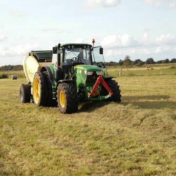
Heu HD-Ballen 2. Schnitt extensiv Heugräser
Drochtersen
M-Kluth
@M-Kluth
Heu
Empfänger lädt ab
Kleinballen/HD-Ballen
Regenfrei
3 weitere...
B+
Deprecated: Creation of dynamic property Zend_View_Helper_Ads::$adLink is deprecated in /var/www/stall-frei/htdocs/staging.stall-frei.de/library/Psf/View/Helper/Ads.php on line 108

Persönlichkeitsentwicklung mit Pferden
Bad Salzuflen
Katja Dors
@Pferdezeiten
Begleite andere auf ihrem Entwicklungsweg und entdecke die transformative Kraft der pferdegestützten Persönlichkeitsentwicklung !
neu
R

Heu, Heulage, ökologisch, artenreich top Qualitä...
Hamburg
Frederic Wübbe
@Stall_Am_Burgberg
Heu
Lieferant entlädt
Rundballen
Bio
3 weitere...
B+

Heu und Stroh zu verkaufen
21527 Kollow
Hof -Linautal
@Hof-Linautal
Heu
Lieferant entlädt
Rundballen
Regenfrei
3 weitere...
ganz aktuell
B+

Heulage in Top-Bioqualität
Bothel
LB Sarah Lühring
@Bonito
Heulage
Rundballen
Regenfrei
Wird verladen
1 weitere...
B+

Heu in Rundballen (ca.130cm) super Qualität
Pronstorf
Caros Pferdeparadies
@KaOb
Heu
Rundballen
Regenfrei
Wird verladen
2 weitere...
B+

Erstklassiges PferdeHeu in HD-Ballen
Jevenstedt
Tim Rohwer
@EIDERHEU
Heu
Kleinballen/HD-Ballen
Regenfrei
B+

Heu/trockene Heulage für Pferde Zucker,Fruktanarm
Sophienhamm
Herr-Kolb
@Herr-Kolb
Heulage
Lieferant entlädt
Regenfrei
Wird verladen
2 weitere...
B+

Futtersack HeuToy, Fressbremse in pink
Mechtersen
STALL-FREIde Marketing
@STALL-FREI-Marketing
Stundenlange Beschäftigung die
Koliken vorbeugt, geringe Staubinhalation mit
steuerbarer Futterentnahme
Eiweisarmes Heu oder Heulage
Sophienhamm
Herr-Kolb
@Herr-Kolb
Heu
Rundballen
Regenfrei
Wird verladen
B+

Heu in Quaderballen zu verkaufen
Bergen
Bianca Hinrichs-Schröder
@BHS1976
Futter
Empfänger lädt ab
Kleinballen/HD-Ballen
Bio
Regenfrei
2 weitere...
B+
Deprecated: Creation of dynamic property Zend_View::$pageCount is deprecated in /var/www/stall-frei/htdocs/staging.stall-frei.de/library/vendor/shardj/zf1-future/library/Zend/View/Abstract.php on line 308
Deprecated: Creation of dynamic property Zend_View::$itemCountPerPage is deprecated in /var/www/stall-frei/htdocs/staging.stall-frei.de/library/vendor/shardj/zf1-future/library/Zend/View/Abstract.php on line 308
Deprecated: Creation of dynamic property Zend_View::$first is deprecated in /var/www/stall-frei/htdocs/staging.stall-frei.de/library/vendor/shardj/zf1-future/library/Zend/View/Abstract.php on line 308
Deprecated: Creation of dynamic property Zend_View::$current is deprecated in /var/www/stall-frei/htdocs/staging.stall-frei.de/library/vendor/shardj/zf1-future/library/Zend/View/Abstract.php on line 308
Deprecated: Creation of dynamic property Zend_View::$last is deprecated in /var/www/stall-frei/htdocs/staging.stall-frei.de/library/vendor/shardj/zf1-future/library/Zend/View/Abstract.php on line 308
Deprecated: Creation of dynamic property Zend_View::$next is deprecated in /var/www/stall-frei/htdocs/staging.stall-frei.de/library/vendor/shardj/zf1-future/library/Zend/View/Abstract.php on line 308
Deprecated: Creation of dynamic property Zend_View::$pagesInRange is deprecated in /var/www/stall-frei/htdocs/staging.stall-frei.de/library/vendor/shardj/zf1-future/library/Zend/View/Abstract.php on line 308
Deprecated: Creation of dynamic property Zend_View::$firstPageInRange is deprecated in /var/www/stall-frei/htdocs/staging.stall-frei.de/library/vendor/shardj/zf1-future/library/Zend/View/Abstract.php on line 308
Deprecated: Creation of dynamic property Zend_View::$lastPageInRange is deprecated in /var/www/stall-frei/htdocs/staging.stall-frei.de/library/vendor/shardj/zf1-future/library/Zend/View/Abstract.php on line 308
Deprecated: Creation of dynamic property Zend_View::$currentItemCount is deprecated in /var/www/stall-frei/htdocs/staging.stall-frei.de/library/vendor/shardj/zf1-future/library/Zend/View/Abstract.php on line 308
Deprecated: Creation of dynamic property Zend_View::$totalItemCount is deprecated in /var/www/stall-frei/htdocs/staging.stall-frei.de/library/vendor/shardj/zf1-future/library/Zend/View/Abstract.php on line 308
Deprecated: Creation of dynamic property Zend_View::$firstItemNumber is deprecated in /var/www/stall-frei/htdocs/staging.stall-frei.de/library/vendor/shardj/zf1-future/library/Zend/View/Abstract.php on line 308
Deprecated: Creation of dynamic property Zend_View::$lastItemNumber is deprecated in /var/www/stall-frei/htdocs/staging.stall-frei.de/library/vendor/shardj/zf1-future/library/Zend/View/Abstract.php on line 308
Deprecated: Creation of dynamic property Zend_View::$router is deprecated in /var/www/stall-frei/htdocs/staging.stall-frei.de/library/vendor/shardj/zf1-future/library/Zend/View/Abstract.php on line 308
Deprecated: Creation of dynamic property Zend_View::$urlParams is deprecated in /var/www/stall-frei/htdocs/staging.stall-frei.de/library/vendor/shardj/zf1-future/library/Zend/View/Abstract.php on line 308
Deprecated: Creation of dynamic property Zend_View::$showAds is deprecated in /var/www/stall-frei/htdocs/staging.stall-frei.de/library/vendor/shardj/zf1-future/library/Zend/View/Abstract.php on line 308
Deprecated: Creation of dynamic property Zend_View::$objectIds is deprecated in /var/www/stall-frei/htdocs/staging.stall-frei.de/library/vendor/shardj/zf1-future/library/Zend/View/Abstract.php on line 308
Deprecated: Creation of dynamic property Zend_View::$showNavbar is deprecated in /var/www/stall-frei/htdocs/staging.stall-frei.de/library/vendor/shardj/zf1-future/library/Zend/View/Abstract.php on line 308
Deprecated: Creation of dynamic property Zend_View::$showBreadcrumb is deprecated in /var/www/stall-frei/htdocs/staging.stall-frei.de/library/vendor/shardj/zf1-future/library/Zend/View/Abstract.php on line 308
Deprecated: Creation of dynamic property Zend_View::$showFooter is deprecated in /var/www/stall-frei/htdocs/staging.stall-frei.de/library/vendor/shardj/zf1-future/library/Zend/View/Abstract.php on line 308
Deprecated: Creation of dynamic property Zend_View::$showInternalAds is deprecated in /var/www/stall-frei/htdocs/staging.stall-frei.de/library/vendor/shardj/zf1-future/library/Zend/View/Abstract.php on line 308
Deprecated: Creation of dynamic property Zend_View::$blNoContent is deprecated in /var/www/stall-frei/htdocs/staging.stall-frei.de/library/vendor/shardj/zf1-future/library/Zend/View/Abstract.php on line 308
Deprecated: Creation of dynamic property Zend_View::$sMetaDesc is deprecated in /var/www/stall-frei/htdocs/staging.stall-frei.de/library/vendor/shardj/zf1-future/library/Zend/View/Abstract.php on line 308
Deprecated: Creation of dynamic property Zend_View::$useGmaps is deprecated in /var/www/stall-frei/htdocs/staging.stall-frei.de/library/vendor/shardj/zf1-future/library/Zend/View/Abstract.php on line 308
Deprecated: Creation of dynamic property Zend_View::$touches is deprecated in /var/www/stall-frei/htdocs/staging.stall-frei.de/library/vendor/shardj/zf1-future/library/Zend/View/Abstract.php on line 308
Deprecated: Creation of dynamic property Zend_View::$oProject is deprecated in /var/www/stall-frei/htdocs/staging.stall-frei.de/library/vendor/shardj/zf1-future/library/Zend/View/Abstract.php on line 308
Deprecated: Creation of dynamic property Zend_View::$pageHeadline is deprecated in /var/www/stall-frei/htdocs/staging.stall-frei.de/library/vendor/shardj/zf1-future/library/Zend/View/Abstract.php on line 308
Deprecated: Creation of dynamic property Zend_View::$disableLocationField is deprecated in /var/www/stall-frei/htdocs/staging.stall-frei.de/library/vendor/shardj/zf1-future/library/Zend/View/Abstract.php on line 308
Deprecated: Creation of dynamic property Zend_View::$isSearch is deprecated in /var/www/stall-frei/htdocs/staging.stall-frei.de/library/vendor/shardj/zf1-future/library/Zend/View/Abstract.php on line 308
Deprecated: Creation of dynamic property Zend_View::$pageTitle is deprecated in /var/www/stall-frei/htdocs/staging.stall-frei.de/library/vendor/shardj/zf1-future/library/Zend/View/Abstract.php on line 308
Deprecated: Creation of dynamic property Psf_Form_Element_Text::$class is deprecated in /var/www/stall-frei/htdocs/staging.stall-frei.de/library/vendor/shardj/zf1-future/library/Zend/Form/Element.php on line 874
Deprecated: Creation of dynamic property Psf_Form_Element_Text::$size is deprecated in /var/www/stall-frei/htdocs/staging.stall-frei.de/library/vendor/shardj/zf1-future/library/Zend/Form/Element.php on line 874
Deprecated: Creation of dynamic property Psf_Form_Element_Text::$placeholder is deprecated in /var/www/stall-frei/htdocs/staging.stall-frei.de/library/vendor/shardj/zf1-future/library/Zend/Form/Element.php on line 874
Deprecated: Creation of dynamic property Psf_Form_Element_Hidden::$class is deprecated in /var/www/stall-frei/htdocs/staging.stall-frei.de/library/vendor/shardj/zf1-future/library/Zend/Form/Element.php on line 874
Deprecated: Creation of dynamic property Psf_Form_Element_Hidden::$class is deprecated in /var/www/stall-frei/htdocs/staging.stall-frei.de/library/vendor/shardj/zf1-future/library/Zend/Form/Element.php on line 874
Deprecated: Creation of dynamic property Psf_Form_Element_Hidden::$class is deprecated in /var/www/stall-frei/htdocs/staging.stall-frei.de/library/vendor/shardj/zf1-future/library/Zend/Form/Element.php on line 874
Deprecated: Creation of dynamic property Psf_Form_Element_Hidden::$class is deprecated in /var/www/stall-frei/htdocs/staging.stall-frei.de/library/vendor/shardj/zf1-future/library/Zend/Form/Element.php on line 874
Deprecated: Creation of dynamic property Psf_Form_Element_Select::$class is deprecated in /var/www/stall-frei/htdocs/staging.stall-frei.de/library/vendor/shardj/zf1-future/library/Zend/Form/Element.php on line 874
Deprecated: Creation of dynamic property Psf_Form_Element_Select::$class is deprecated in /var/www/stall-frei/htdocs/staging.stall-frei.de/library/vendor/shardj/zf1-future/library/Zend/Form/Element.php on line 874
Deprecated: Creation of dynamic property Psf_Form_Element_Select::$class is deprecated in /var/www/stall-frei/htdocs/staging.stall-frei.de/library/vendor/shardj/zf1-future/library/Zend/Form/Element.php on line 874
Deprecated: Creation of dynamic property Psf_Form_Element_Select::$class is deprecated in /var/www/stall-frei/htdocs/staging.stall-frei.de/library/vendor/shardj/zf1-future/library/Zend/Form/Element.php on line 874
Deprecated: Creation of dynamic property Zend_View::$sort is deprecated in /var/www/stall-frei/htdocs/staging.stall-frei.de/library/vendor/shardj/zf1-future/library/Zend/View/Abstract.php on line 308
Deprecated: Creation of dynamic property Zend_View::$searchLocation is deprecated in /var/www/stall-frei/htdocs/staging.stall-frei.de/library/vendor/shardj/zf1-future/library/Zend/View/Abstract.php on line 308
Deprecated: Creation of dynamic property Zend_View::$locationHint is deprecated in /var/www/stall-frei/htdocs/staging.stall-frei.de/library/vendor/shardj/zf1-future/library/Zend/View/Abstract.php on line 308
Psf_GeoCoder_Abstract::getLocation: Steinkirchen Get Location CachedOrLive
Psf_GeoCoder_Abstract::getCachedOrLive: Steinkirchen
Psf_GeoCoder_OpenCageData::makeApiRequest: response:
Array
(
[documentation] => https://opencagedata.com/api
[licenses] => Array
(
[0] => Array
(
[name] => see attribution guide
[url] => https://opencagedata.com/credits
)
)
[results] => Array
(
[0] => Array
(
[bounds] => Array
(
[northeast] => Array
(
[lat] => 53.5971597
[lng] => 9.6151616
)
[southwest] => Array
(
[lat] => 53.5548799
[lng] => 9.5689385
)
)
[components] => Array
(
[ISO_3166-1_alpha-2] => DE
[ISO_3166-1_alpha-3] => DEU
[ISO_3166-2] => Array
(
[0] => DE-NI
)
[_category] => place
[_normalized_city] => Steinkirchen
[_type] => village
[continent] => Europe
[country] => Deutschland
[country_code] => de
[county] => Landkreis Stade
[municipality] => Samtgemeinde Lühe
[political_union] => European Union
[state] => Niedersachsen
[state_code] => NI
[village] => Steinkirchen
)
[confidence] => 7
[formatted] => Steinkirchen, Niedersachsen, Deutschland
[geometry] => Array
(
[lat] => 53.5642985
[lng] => 9.6006119
)
)
[1] => Array
(
[bounds] => Array
(
[northeast] => Array
(
[lat] => 48.4016306
[lng] => 12.1206148
)
[southwest] => Array
(
[lat] => 48.349417
[lng] => 12.0443491
)
)
[components] => Array
(
[ISO_3166-1_alpha-2] => DE
[ISO_3166-1_alpha-3] => DEU
[ISO_3166-2] => Array
(
[0] => DE-BY
)
[_category] => place
[_normalized_city] => Steinkirchen
[_type] => village
[continent] => Europe
[country] => Deutschland
[country_code] => de
[county] => Landkreis Erding
[municipality] => Steinkirchen (VGem)
[political_union] => European Union
[postcode] => 84439
[state] => Bayern
[state_code] => BY
[village] => Steinkirchen
)
[confidence] => 7
[formatted] => 84439 Steinkirchen, Deutschland
[geometry] => Array
(
[lat] => 48.3746184
[lng] => 12.077902
)
)
[2] => Array
(
[bounds] => Array
(
[northeast] => Array
(
[lat] => 48.4287353
[lng] => 12.1715966
)
[southwest] => Array
(
[lat] => 48.3224218
[lng] => 12.0185881
)
)
[components] => Array
(
[ISO_3166-1_alpha-2] => DE
[ISO_3166-1_alpha-3] => DEU
[ISO_3166-2] => Array
(
[0] => DE-BY
)
[_category] => place
[_normalized_city] => Steinkirchen (VGem)
[_type] => municipality
[continent] => Europe
[country] => Deutschland
[country_code] => de
[county] => Landkreis Erding
[municipality] => Steinkirchen (VGem)
[political_union] => European Union
[state] => Bayern
[state_code] => BY
)
[confidence] => 6
[formatted] => Steinkirchen (VGem), Bayern, Deutschland
[geometry] => Array
(
[lat] => 48.3756506
[lng] => 12.1020268
)
)
[3] => Array
(
[bounds] => Array
(
[northeast] => Array
(
[lat] => 48.2569704
[lng] => 12.2871892
)
[southwest] => Array
(
[lat] => 48.2169704
[lng] => 12.2471892
)
)
[components] => Array
(
[ISO_3166-1_alpha-2] => DE
[ISO_3166-1_alpha-3] => DEU
[ISO_3166-2] => Array
(
[0] => DE-BY
)
[_category] => place
[_normalized_city] => Obertaufkirchen
[_type] => village
[city] => Obertaufkirchen
[continent] => Europe
[country] => Deutschland
[country_code] => de
[county] => Landkreis Mühldorf am Inn
[political_union] => European Union
[postcode] => 84419
[state] => Bayern
[state_code] => BY
[village] => Steinkirchen
)
[confidence] => 7
[formatted] => 84419 Steinkirchen, Deutschland
[geometry] => Array
(
[lat] => 48.2369704
[lng] => 12.2671892
)
)
[4] => Array
(
[bounds] => Array
(
[northeast] => Array
(
[lat] => 51.1336431
[lng] => 6.118803
)
[southwest] => Array
(
[lat] => 51.0936431
[lng] => 6.078803
)
)
[components] => Array
(
[ISO_3166-1_alpha-2] => DE
[ISO_3166-1_alpha-3] => DEU
[ISO_3166-2] => Array
(
[0] => DE-NW
)
[_category] => place
[_normalized_city] => Wassenberg
[_type] => village
[continent] => Europe
[country] => Deutschland
[country_code] => de
[county] => Kreis Heinsberg
[political_union] => European Union
[postcode] => 41849
[state] => Nordrhein-Westfalen
[state_code] => NW
[town] => Wassenberg
[village] => Steinkirchen
)
[confidence] => 7
[formatted] => 41849 Steinkirchen, Deutschland
[geometry] => Array
(
[lat] => 51.1136431
[lng] => 6.098803
)
)
[5] => Array
(
[bounds] => Array
(
[northeast] => Array
(
[lat] => 51.936855
[lng] => 13.9320952
)
[southwest] => Array
(
[lat] => 51.8921392
[lng] => 13.8580137
)
)
[components] => Array
(
[ISO_3166-1_alpha-2] => DE
[ISO_3166-1_alpha-3] => DEU
[ISO_3166-2] => Array
(
[0] => DE-BB
)
[_category] => place
[_normalized_city] => Lübben (Spreewald)
[_type] => village
[continent] => Europe
[country] => Deutschland
[country_code] => de
[county] => Dahme-Spreewald
[political_union] => European Union
[state] => Brandenburg
[state_code] => BB
[town] => Lübben (Spreewald)
[village] => Steinkirchen
)
[confidence] => 7
[formatted] => Steinkirchen, Brandenburg, Deutschland
[geometry] => Array
(
[lat] => 51.9296957
[lng] => 13.8960198
)
)
[6] => Array
(
[bounds] => Array
(
[northeast] => Array
(
[lat] => 48.5535978
[lng] => 13.2437451
)
[southwest] => Array
(
[lat] => 48.5135978
[lng] => 13.2037451
)
)
[components] => Array
(
[ISO_3166-1_alpha-2] => DE
[ISO_3166-1_alpha-3] => DEU
[ISO_3166-2] => Array
(
[0] => DE-BY
)
[_category] => place
[_normalized_city] => Ortenburg
[_type] => hamlet
[continent] => Europe
[country] => Deutschland
[country_code] => de
[county] => Landkreis Passau
[hamlet] => Steinkirchen
[political_union] => European Union
[postcode] => 94496
[state] => Bayern
[state_code] => BY
[town] => Ortenburg
)
[confidence] => 7
[formatted] => Steinkirchen, 94496 Ortenburg, Deutschland
[geometry] => Array
(
[lat] => 48.5335978
[lng] => 13.2237451
)
)
[7] => Array
(
[bounds] => Array
(
[northeast] => Array
(
[lat] => 48.847746
[lng] => 12.8563978
)
[southwest] => Array
(
[lat] => 48.807746
[lng] => 12.8163978
)
)
[components] => Array
(
[ISO_3166-1_alpha-2] => DE
[ISO_3166-1_alpha-3] => DEU
[ISO_3166-2] => Array
(
[0] => DE-BY
)
[_category] => place
[_normalized_city] => Stephansposching
[_type] => village
[city] => Stephansposching
[continent] => Europe
[country] => Deutschland
[country_code] => de
[county] => Landkreis Deggendorf
[political_union] => European Union
[postcode] => 94569
[state] => Bayern
[state_code] => BY
[village] => Steinkirchen
)
[confidence] => 7
[formatted] => 94569 Steinkirchen, Deutschland
[geometry] => Array
(
[lat] => 48.827746
[lng] => 12.8363978
)
)
[8] => Array
(
[bounds] => Array
(
[northeast] => Array
(
[lat] => 49.2582425
[lng] => 9.8214523
)
[southwest] => Array
(
[lat] => 49.2271515
[lng] => 9.7579946
)
)
[components] => Array
(
[ISO_3166-1_alpha-2] => DE
[ISO_3166-1_alpha-3] => DEU
[ISO_3166-2] => Array
(
[0] => DE-BW
)
[_category] => place
[_normalized_city] => Braunsbach
[_type] => village
[city] => Braunsbach
[continent] => Europe
[country] => Deutschland
[country_code] => de
[county] => Landkreis Schwäbisch Hall
[municipality] => GVV Braunsbach-Untermünkheim
[political_union] => European Union
[state] => Baden-Württemberg
[state_code] => BW
[village] => Steinkirchen
)
[confidence] => 7
[formatted] => Steinkirchen, Baden-Württemberg, Deutschland
[geometry] => Array
(
[lat] => 49.2339862
[lng] => 9.7723875
)
)
[9] => Array
(
[bounds] => Array
(
[northeast] => Array
(
[lat] => 47.7953537
[lng] => 12.21248
)
[southwest] => Array
(
[lat] => 47.7553537
[lng] => 12.17248
)
)
[components] => Array
(
[ISO_3166-1_alpha-2] => DE
[ISO_3166-1_alpha-3] => DEU
[ISO_3166-2] => Array
(
[0] => DE-BY
)
[_category] => place
[_normalized_city] => Samerberg
[_type] => hamlet
[continent] => Europe
[country] => Deutschland
[country_code] => de
[county] => Landkreis Rosenheim
[hamlet] => Steinkirchen
[political_union] => European Union
[postcode] => 83122
[state] => Bayern
[state_code] => BY
[village] => Samerberg
)
[confidence] => 7
[formatted] => Steinkirchen, 83122 Samerberg, Deutschland
[geometry] => Array
(
[lat] => 47.7753537
[lng] => 12.19248
)
)
)
[status] => Array
(
[code] => 200
[message] => OK
)
[stay_informed] => Array
(
[blog] => https://blog.opencagedata.com
[mastodon] => https://en.osm.town/@opencage
)
[thanks] => For using an OpenCage API
[timestamp] => Array
(
[created_http] => Fri, 06 Feb 2026 18:35:12 GMT
[created_unix] => 1770402912
)
[total_results] => 10
)
Psf_GeoCoder_Abstract::convertLocationResult
{"documentation":"https:\/\/opencagedata.com\/api","licenses":[{"name":"see attribution guide","url":"https:\/\/opencagedata.com\/credits"}],"results":[{"bounds":{"northeast":{"lat":53.5971597,"lng":9.6151616},"southwest":{"lat":53.5548799,"lng":9.5689385}},"components":{"ISO_3166-1_alpha-2":"DE","ISO_3166-1_alpha-3":"DEU","ISO_3166-2":["DE-NI"],"_category":"place","_normalized_city":"Steinkirchen","_type":"village","continent":"Europe","country":"Deutschland","country_code":"de","county":"Landkreis Stade","municipality":"Samtgemeinde L\u00fche","political_union":"European Union","state":"Niedersachsen","state_code":"NI","village":"Steinkirchen"},"confidence":7,"formatted":"Steinkirchen, Niedersachsen, Deutschland","geometry":{"lat":53.5642985,"lng":9.6006119}},{"bounds":{"northeast":{"lat":48.4016306,"lng":12.1206148},"southwest":{"lat":48.349417,"lng":12.0443491}},"components":{"ISO_3166-1_alpha-2":"DE","ISO_3166-1_alpha-3":"DEU","ISO_3166-2":["DE-BY"],"_category":"place","_normalized_city":"Steinkirchen","_type":"village","continent":"Europe","country":"Deutschland","country_code":"de","county":"Landkreis Erding","municipality":"Steinkirchen (VGem)","political_union":"European Union","postcode":"84439","state":"Bayern","state_code":"BY","village":"Steinkirchen"},"confidence":7,"formatted":"84439 Steinkirchen, Deutschland","geometry":{"lat":48.3746184,"lng":12.077902}},{"bounds":{"northeast":{"lat":48.4287353,"lng":12.1715966},"southwest":{"lat":48.3224218,"lng":12.0185881}},"components":{"ISO_3166-1_alpha-2":"DE","ISO_3166-1_alpha-3":"DEU","ISO_3166-2":["DE-BY"],"_category":"place","_normalized_city":"Steinkirchen (VGem)","_type":"municipality","continent":"Europe","country":"Deutschland","country_code":"de","county":"Landkreis Erding","municipality":"Steinkirchen (VGem)","political_union":"European Union","state":"Bayern","state_code":"BY"},"confidence":6,"formatted":"Steinkirchen (VGem), Bayern, Deutschland","geometry":{"lat":48.3756506,"lng":12.1020268}},{"bounds":{"northeast":{"lat":48.2569704,"lng":12.2871892},"southwest":{"lat":48.2169704,"lng":12.2471892}},"components":{"ISO_3166-1_alpha-2":"DE","ISO_3166-1_alpha-3":"DEU","ISO_3166-2":["DE-BY"],"_category":"place","_normalized_city":"Obertaufkirchen","_type":"village","city":"Obertaufkirchen","continent":"Europe","country":"Deutschland","country_code":"de","county":"Landkreis M\u00fchldorf am Inn","political_union":"European Union","postcode":"84419","state":"Bayern","state_code":"BY","village":"Steinkirchen"},"confidence":7,"formatted":"84419 Steinkirchen, Deutschland","geometry":{"lat":48.2369704,"lng":12.2671892}},{"bounds":{"northeast":{"lat":51.1336431,"lng":6.118803},"southwest":{"lat":51.0936431,"lng":6.078803}},"components":{"ISO_3166-1_alpha-2":"DE","ISO_3166-1_alpha-3":"DEU","ISO_3166-2":["DE-NW"],"_category":"place","_normalized_city":"Wassenberg","_type":"village","continent":"Europe","country":"Deutschland","country_code":"de","county":"Kreis Heinsberg","political_union":"European Union","postcode":"41849","state":"Nordrhein-Westfalen","state_code":"NW","town":"Wassenberg","village":"Steinkirchen"},"confidence":7,"formatted":"41849 Steinkirchen, Deutschland","geometry":{"lat":51.1136431,"lng":6.098803}},{"bounds":{"northeast":{"lat":51.936855,"lng":13.9320952},"southwest":{"lat":51.8921392,"lng":13.8580137}},"components":{"ISO_3166-1_alpha-2":"DE","ISO_3166-1_alpha-3":"DEU","ISO_3166-2":["DE-BB"],"_category":"place","_normalized_city":"L\u00fcbben (Spreewald)","_type":"village","continent":"Europe","country":"Deutschland","country_code":"de","county":"Dahme-Spreewald","political_union":"European Union","state":"Brandenburg","state_code":"BB","town":"L\u00fcbben (Spreewald)","village":"Steinkirchen"},"confidence":7,"formatted":"Steinkirchen, Brandenburg, Deutschland","geometry":{"lat":51.9296957,"lng":13.8960198}},{"bounds":{"northeast":{"lat":48.5535978,"lng":13.2437451},"southwest":{"lat":48.5135978,"lng":13.2037451}},"components":{"ISO_3166-1_alpha-2":"DE","ISO_3166-1_alpha-3":"DEU","ISO_3166-2":["DE-BY"],"_category":"place","_normalized_city":"Ortenburg","_type":"hamlet","continent":"Europe","country":"Deutschland","country_code":"de","county":"Landkreis Passau","hamlet":"Steinkirchen","political_union":"European Union","postcode":"94496","state":"Bayern","state_code":"BY","town":"Ortenburg"},"confidence":7,"formatted":"Steinkirchen, 94496 Ortenburg, Deutschland","geometry":{"lat":48.5335978,"lng":13.2237451}},{"bounds":{"northeast":{"lat":48.847746,"lng":12.8563978},"southwest":{"lat":48.807746,"lng":12.8163978}},"components":{"ISO_3166-1_alpha-2":"DE","ISO_3166-1_alpha-3":"DEU","ISO_3166-2":["DE-BY"],"_category":"place","_normalized_city":"Stephansposching","_type":"village","city":"Stephansposching","continent":"Europe","country":"Deutschland","country_code":"de","county":"Landkreis Deggendorf","political_union":"European Union","postcode":"94569","state":"Bayern","state_code":"BY","village":"Steinkirchen"},"confidence":7,"formatted":"94569 Steinkirchen, Deutschland","geometry":{"lat":48.827746,"lng":12.8363978}},{"bounds":{"northeast":{"lat":49.2582425,"lng":9.8214523},"southwest":{"lat":49.2271515,"lng":9.7579946}},"components":{"ISO_3166-1_alpha-2":"DE","ISO_3166-1_alpha-3":"DEU","ISO_3166-2":["DE-BW"],"_category":"place","_normalized_city":"Braunsbach","_type":"village","city":"Braunsbach","continent":"Europe","country":"Deutschland","country_code":"de","county":"Landkreis Schw\u00e4bisch Hall","municipality":"GVV Braunsbach-Unterm\u00fcnkheim","political_union":"European Union","state":"Baden-W\u00fcrttemberg","state_code":"BW","village":"Steinkirchen"},"confidence":7,"formatted":"Steinkirchen, Baden-W\u00fcrttemberg, Deutschland","geometry":{"lat":49.2339862,"lng":9.7723875}},{"bounds":{"northeast":{"lat":47.7953537,"lng":12.21248},"southwest":{"lat":47.7553537,"lng":12.17248}},"components":{"ISO_3166-1_alpha-2":"DE","ISO_3166-1_alpha-3":"DEU","ISO_3166-2":["DE-BY"],"_category":"place","_normalized_city":"Samerberg","_type":"hamlet","continent":"Europe","country":"Deutschland","country_code":"de","county":"Landkreis Rosenheim","hamlet":"Steinkirchen","political_union":"European Union","postcode":"83122","state":"Bayern","state_code":"BY","village":"Samerberg"},"confidence":7,"formatted":"Steinkirchen, 83122 Samerberg, Deutschland","geometry":{"lat":47.7753537,"lng":12.19248}}],"status":{"code":200,"message":"OK"},"stay_informed":{"blog":"https:\/\/blog.opencagedata.com","mastodon":"https:\/\/en.osm.town\/@opencage"},"thanks":"For using an OpenCage API","timestamp":{"created_http":"Fri, 06 Feb 2026 18:35:12 GMT","created_unix":1770402912},"total_results":10}Array
(
[0] => stdClass Object
(
[bounds] => stdClass Object
(
[northeast] => stdClass Object
(
[lat] => 53.5971597
[lng] => 9.6151616
)
[southwest] => stdClass Object
(
[lat] => 53.5548799
[lng] => 9.5689385
)
)
[components] => stdClass Object
(
[ISO_3166-1_alpha-2] => DE
[ISO_3166-1_alpha-3] => DEU
[ISO_3166-2] => Array
(
[0] => DE-NI
)
[_category] => place
[_normalized_city] => Steinkirchen
[_type] => village
[continent] => Europe
[country] => Deutschland
[country_code] => de
[county] => Landkreis Stade
[municipality] => Samtgemeinde Lühe
[political_union] => European Union
[state] => Niedersachsen
[state_code] => NI
[village] => Steinkirchen
)
[confidence] => 7
[formatted] => Steinkirchen, Niedersachsen, Deutschland
[geometry] => stdClass Object
(
[lat] => 53.5642985
[lng] => 9.6006119
)
)
[1] => stdClass Object
(
[bounds] => stdClass Object
(
[northeast] => stdClass Object
(
[lat] => 48.4016306
[lng] => 12.1206148
)
[southwest] => stdClass Object
(
[lat] => 48.349417
[lng] => 12.0443491
)
)
[components] => stdClass Object
(
[ISO_3166-1_alpha-2] => DE
[ISO_3166-1_alpha-3] => DEU
[ISO_3166-2] => Array
(
[0] => DE-BY
)
[_category] => place
[_normalized_city] => Steinkirchen
[_type] => village
[continent] => Europe
[country] => Deutschland
[country_code] => de
[county] => Landkreis Erding
[municipality] => Steinkirchen (VGem)
[political_union] => European Union
[postcode] => 84439
[state] => Bayern
[state_code] => BY
[village] => Steinkirchen
)
[confidence] => 7
[formatted] => 84439 Steinkirchen, Deutschland
[geometry] => stdClass Object
(
[lat] => 48.3746184
[lng] => 12.077902
)
)
[2] => stdClass Object
(
[bounds] => stdClass Object
(
[northeast] => stdClass Object
(
[lat] => 48.4287353
[lng] => 12.1715966
)
[southwest] => stdClass Object
(
[lat] => 48.3224218
[lng] => 12.0185881
)
)
[components] => stdClass Object
(
[ISO_3166-1_alpha-2] => DE
[ISO_3166-1_alpha-3] => DEU
[ISO_3166-2] => Array
(
[0] => DE-BY
)
[_category] => place
[_normalized_city] => Steinkirchen (VGem)
[_type] => municipality
[continent] => Europe
[country] => Deutschland
[country_code] => de
[county] => Landkreis Erding
[municipality] => Steinkirchen (VGem)
[political_union] => European Union
[state] => Bayern
[state_code] => BY
)
[confidence] => 6
[formatted] => Steinkirchen (VGem), Bayern, Deutschland
[geometry] => stdClass Object
(
[lat] => 48.3756506
[lng] => 12.1020268
)
)
[3] => stdClass Object
(
[bounds] => stdClass Object
(
[northeast] => stdClass Object
(
[lat] => 48.2569704
[lng] => 12.2871892
)
[southwest] => stdClass Object
(
[lat] => 48.2169704
[lng] => 12.2471892
)
)
[components] => stdClass Object
(
[ISO_3166-1_alpha-2] => DE
[ISO_3166-1_alpha-3] => DEU
[ISO_3166-2] => Array
(
[0] => DE-BY
)
[_category] => place
[_normalized_city] => Obertaufkirchen
[_type] => village
[city] => Obertaufkirchen
[continent] => Europe
[country] => Deutschland
[country_code] => de
[county] => Landkreis Mühldorf am Inn
[political_union] => European Union
[postcode] => 84419
[state] => Bayern
[state_code] => BY
[village] => Steinkirchen
)
[confidence] => 7
[formatted] => 84419 Steinkirchen, Deutschland
[geometry] => stdClass Object
(
[lat] => 48.2369704
[lng] => 12.2671892
)
)
[4] => stdClass Object
(
[bounds] => stdClass Object
(
[northeast] => stdClass Object
(
[lat] => 51.1336431
[lng] => 6.118803
)
[southwest] => stdClass Object
(
[lat] => 51.0936431
[lng] => 6.078803
)
)
[components] => stdClass Object
(
[ISO_3166-1_alpha-2] => DE
[ISO_3166-1_alpha-3] => DEU
[ISO_3166-2] => Array
(
[0] => DE-NW
)
[_category] => place
[_normalized_city] => Wassenberg
[_type] => village
[continent] => Europe
[country] => Deutschland
[country_code] => de
[county] => Kreis Heinsberg
[political_union] => European Union
[postcode] => 41849
[state] => Nordrhein-Westfalen
[state_code] => NW
[town] => Wassenberg
[village] => Steinkirchen
)
[confidence] => 7
[formatted] => 41849 Steinkirchen, Deutschland
[geometry] => stdClass Object
(
[lat] => 51.1136431
[lng] => 6.098803
)
)
[5] => stdClass Object
(
[bounds] => stdClass Object
(
[northeast] => stdClass Object
(
[lat] => 51.936855
[lng] => 13.9320952
)
[southwest] => stdClass Object
(
[lat] => 51.8921392
[lng] => 13.8580137
)
)
[components] => stdClass Object
(
[ISO_3166-1_alpha-2] => DE
[ISO_3166-1_alpha-3] => DEU
[ISO_3166-2] => Array
(
[0] => DE-BB
)
[_category] => place
[_normalized_city] => Lübben (Spreewald)
[_type] => village
[continent] => Europe
[country] => Deutschland
[country_code] => de
[county] => Dahme-Spreewald
[political_union] => European Union
[state] => Brandenburg
[state_code] => BB
[town] => Lübben (Spreewald)
[village] => Steinkirchen
)
[confidence] => 7
[formatted] => Steinkirchen, Brandenburg, Deutschland
[geometry] => stdClass Object
(
[lat] => 51.9296957
[lng] => 13.8960198
)
)
[6] => stdClass Object
(
[bounds] => stdClass Object
(
[northeast] => stdClass Object
(
[lat] => 48.5535978
[lng] => 13.2437451
)
[southwest] => stdClass Object
(
[lat] => 48.5135978
[lng] => 13.2037451
)
)
[components] => stdClass Object
(
[ISO_3166-1_alpha-2] => DE
[ISO_3166-1_alpha-3] => DEU
[ISO_3166-2] => Array
(
[0] => DE-BY
)
[_category] => place
[_normalized_city] => Ortenburg
[_type] => hamlet
[continent] => Europe
[country] => Deutschland
[country_code] => de
[county] => Landkreis Passau
[hamlet] => Steinkirchen
[political_union] => European Union
[postcode] => 94496
[state] => Bayern
[state_code] => BY
[town] => Ortenburg
)
[confidence] => 7
[formatted] => Steinkirchen, 94496 Ortenburg, Deutschland
[geometry] => stdClass Object
(
[lat] => 48.5335978
[lng] => 13.2237451
)
)
[7] => stdClass Object
(
[bounds] => stdClass Object
(
[northeast] => stdClass Object
(
[lat] => 48.847746
[lng] => 12.8563978
)
[southwest] => stdClass Object
(
[lat] => 48.807746
[lng] => 12.8163978
)
)
[components] => stdClass Object
(
[ISO_3166-1_alpha-2] => DE
[ISO_3166-1_alpha-3] => DEU
[ISO_3166-2] => Array
(
[0] => DE-BY
)
[_category] => place
[_normalized_city] => Stephansposching
[_type] => village
[city] => Stephansposching
[continent] => Europe
[country] => Deutschland
[country_code] => de
[county] => Landkreis Deggendorf
[political_union] => European Union
[postcode] => 94569
[state] => Bayern
[state_code] => BY
[village] => Steinkirchen
)
[confidence] => 7
[formatted] => 94569 Steinkirchen, Deutschland
[geometry] => stdClass Object
(
[lat] => 48.827746
[lng] => 12.8363978
)
)
[8] => stdClass Object
(
[bounds] => stdClass Object
(
[northeast] => stdClass Object
(
[lat] => 49.2582425
[lng] => 9.8214523
)
[southwest] => stdClass Object
(
[lat] => 49.2271515
[lng] => 9.7579946
)
)
[components] => stdClass Object
(
[ISO_3166-1_alpha-2] => DE
[ISO_3166-1_alpha-3] => DEU
[ISO_3166-2] => Array
(
[0] => DE-BW
)
[_category] => place
[_normalized_city] => Braunsbach
[_type] => village
[city] => Braunsbach
[continent] => Europe
[country] => Deutschland
[country_code] => de
[county] => Landkreis Schwäbisch Hall
[municipality] => GVV Braunsbach-Untermünkheim
[political_union] => European Union
[state] => Baden-Württemberg
[state_code] => BW
[village] => Steinkirchen
)
[confidence] => 7
[formatted] => Steinkirchen, Baden-Württemberg, Deutschland
[geometry] => stdClass Object
(
[lat] => 49.2339862
[lng] => 9.7723875
)
)
[9] => stdClass Object
(
[bounds] => stdClass Object
(
[northeast] => stdClass Object
(
[lat] => 47.7953537
[lng] => 12.21248
)
[southwest] => stdClass Object
(
[lat] => 47.7553537
[lng] => 12.17248
)
)
[components] => stdClass Object
(
[ISO_3166-1_alpha-2] => DE
[ISO_3166-1_alpha-3] => DEU
[ISO_3166-2] => Array
(
[0] => DE-BY
)
[_category] => place
[_normalized_city] => Samerberg
[_type] => hamlet
[continent] => Europe
[country] => Deutschland
[country_code] => de
[county] => Landkreis Rosenheim
[hamlet] => Steinkirchen
[political_union] => European Union
[postcode] => 83122
[state] => Bayern
[state_code] => BY
[village] => Samerberg
)
[confidence] => 7
[formatted] => Steinkirchen, 83122 Samerberg, Deutschland
[geometry] => stdClass Object
(
[lat] => 47.7753537
[lng] => 12.19248
)
)
)
Psf_GeoCoder_OpenCageData::getKeyMap: 0
stdClass Object
(
    [bounds] => stdClass Object
        (
            [northeast] => stdClass Object
                (
                    [lat] => 53.5971597
                    [lng] => 9.6151616
                )

            [southwest] => stdClass Object
                (
                    [lat] => 53.5548799
                    [lng] => 9.5689385
                )

        )

    [components] => stdClass Object
        (
            [ISO_3166-1_alpha-2] => DE
            [ISO_3166-1_alpha-3] => DEU
            [ISO_3166-2] => Array
                (
                    [0] => DE-NI
                )

            [_category] => place
            [_normalized_city] => Steinkirchen
            [_type] => village
            [continent] => Europe
            [country] => Deutschland
            [country_code] => de
            [county] => Landkreis Stade
            [municipality] => Samtgemeinde Lühe
            [political_union] => European Union
            [state] => Niedersachsen
            [state_code] => NI
            [village] => Steinkirchen
        )

    [confidence] => 7
    [formatted] => Steinkirchen, Niedersachsen, Deutschland
    [geometry] => stdClass Object
        (
            [lat] => 53.5642985
            [lng] => 9.6006119
        )

)
Psf_GeoCoder_OpenCageData::getCounty: Stade
Psf_GeoCoder_OpenCageData::addMissingData REFETCH!
Array
(
    [address] => Steinkirchen, Niedersachsen, Deutschland
    [type] => village
    [street] =>
    [city] => Steinkirchen
    [county] => Stade
    [state] => Niedersachsen
    [zip] =>
    [country] => Deutschland
    [suburb] =>
    [countrycode] => de
    [latitude] => 53.5642985
    [longitude] => 9.6006119
    [accuracy] => 1
    [confidence] => 7
    [bounds] => stdClass Object
        (
            [northeast] => stdClass Object
                (
                    [lat] => 53.5971597
                    [lng] => 9.6151616
                )

            [southwest] => stdClass Object
                (
                    [lat] => 53.5548799
                    [lng] => 9.5689385
                )

        )

)
reformat!
Array
(
    [address] => Steinkirchen, Niedersachsen, Deutschland
    [type] => village
    [street] =>
    [city] => Steinkirchen
    [county] => Stade
    [state] => Niedersachsen
    [zip] =>
    [country] => Deutschland
    [suburb] =>
    [countrycode] => de
    [latitude] => 53.5642985
    [longitude] => 9.6006119
    [accuracy] => 1
    [confidence] => 7
    [bounds] => stdClass Object
        (
            [northeast] => stdClass Object
                (
                    [lat] => 53.5971597
                    [lng] => 9.6151616
                )

            [southwest] => stdClass Object
                (
                    [lat] => 53.5548799
                    [lng] => 9.5689385
                )

        )

    [place] => Steinkirchen, Niedersachsen
    [hash] => 5beae345a16f204a68ee84848bce872f
)
Psf_GeoCoder_OpenCageData::getKeyMap: 1
stdClass Object
(
    [bounds] => stdClass Object
        (
            [northeast] => stdClass Object
                (
                    [lat] => 48.4016306
                    [lng] => 12.1206148
                )

            [southwest] => stdClass Object
                (
                    [lat] => 48.349417
                    [lng] => 12.0443491
                )

        )

    [components] => stdClass Object
        (
            [ISO_3166-1_alpha-2] => DE
            [ISO_3166-1_alpha-3] => DEU
            [ISO_3166-2] => Array
                (
                    [0] => DE-BY
                )

            [_category] => place
            [_normalized_city] => Steinkirchen
            [_type] => village
            [continent] => Europe
            [country] => Deutschland
            [country_code] => de
            [county] => Landkreis Erding
            [municipality] => Steinkirchen (VGem)
            [political_union] => European Union
            [postcode] => 84439
            [state] => Bayern
            [state_code] => BY
            [village] => Steinkirchen
        )

    [confidence] => 7
    [formatted] => 84439 Steinkirchen, Deutschland
    [geometry] => stdClass Object
        (
            [lat] => 48.3746184
            [lng] => 12.077902
        )

)
Psf_GeoCoder_OpenCageData::getCounty: Erding
Psf_GeoCoder_OpenCageData::addMissingData REFETCH!
Array
(
    [address] => 84439 Steinkirchen, Deutschland
    [type] => village
    [street] =>
    [city] => Steinkirchen
    [county] => Erding
    [state] => Bayern
    [zip] => 84439
    [country] => Deutschland
    [suburb] =>
    [countrycode] => de
    [latitude] => 48.3746184
    [longitude] => 12.077902
    [accuracy] => 1
    [confidence] => 7
    [bounds] => stdClass Object
        (
            [northeast] => stdClass Object
                (
                    [lat] => 48.4016306
                    [lng] => 12.1206148
                )

            [southwest] => stdClass Object
                (
                    [lat] => 48.349417
                    [lng] => 12.0443491
                )

        )

)
reformat!
Array
(
    [address] => 84439 Steinkirchen, Deutschland
    [type] => village
    [street] =>
    [city] => Steinkirchen
    [county] => Erding
    [state] => Bayern
    [zip] => 84439
    [country] => Deutschland
    [suburb] =>
    [countrycode] => de
    [latitude] => 48.3746184
    [longitude] => 12.077902
    [accuracy] => 1
    [confidence] => 7
    [bounds] => stdClass Object
        (
            [northeast] => stdClass Object
                (
                    [lat] => 48.4016306
                    [lng] => 12.1206148
                )

            [southwest] => stdClass Object
                (
                    [lat] => 48.349417
                    [lng] => 12.0443491
                )

        )

    [place] => 84439 Steinkirchen, Bayern
    [hash] => c664068039d2dd9aa58436c7a94d1597
)
Psf_GeoCoder_OpenCageData::getKeyMap: 2
stdClass Object
(
    [bounds] => stdClass Object
        (
            [northeast] => stdClass Object
                (
                    [lat] => 48.4287353
                    [lng] => 12.1715966
                )

            [southwest] => stdClass Object
                (
                    [lat] => 48.3224218
                    [lng] => 12.0185881
                )

        )

    [components] => stdClass Object
        (
            [ISO_3166-1_alpha-2] => DE
            [ISO_3166-1_alpha-3] => DEU
            [ISO_3166-2] => Array
                (
                    [0] => DE-BY
                )

            [_category] => place
            [_normalized_city] => Steinkirchen (VGem)
            [_type] => municipality
            [continent] => Europe
            [country] => Deutschland
            [country_code] => de
            [county] => Landkreis Erding
            [municipality] => Steinkirchen (VGem)
            [political_union] => European Union
            [state] => Bayern
            [state_code] => BY
        )

    [confidence] => 6
    [formatted] => Steinkirchen (VGem), Bayern, Deutschland
    [geometry] => stdClass Object
        (
            [lat] => 48.3756506
            [lng] => 12.1020268
        )

)
Psf_GeoCoder_OpenCageData::getCounty: Erding
Psf_GeoCoder_OpenCageData::addMissingData REFETCH!
Array
(
    [address] => Steinkirchen (VGem), Bayern, Deutschland
    [type] => municipality
    [street] =>
    [city] =>
    [county] => Erding
    [state] => Bayern
    [zip] =>
    [country] => Deutschland
    [suburb] =>
    [countrycode] => de
    [latitude] => 48.3756506
    [longitude] => 12.1020268
    [accuracy] => 1
    [confidence] => 6
    [bounds] => stdClass Object
        (
            [northeast] => stdClass Object
                (
                    [lat] => 48.4287353
                    [lng] => 12.1715966
                )

            [southwest] => stdClass Object
                (
                    [lat] => 48.3224218
                    [lng] => 12.0185881
                )

        )

)
reformat!
Array
(
    [address] => Steinkirchen (VGem), Bayern, Deutschland
    [type] => municipality
    [street] =>
    [city] =>
    [county] => Erding
    [state] => Bayern
    [zip] =>
    [country] => Deutschland
    [suburb] =>
    [countrycode] => de
    [latitude] => 48.3756506
    [longitude] => 12.1020268
    [accuracy] => 1
    [confidence] => 6
    [bounds] => stdClass Object
        (
            [northeast] => stdClass Object
                (
                    [lat] => 48.4287353
                    [lng] => 12.1715966
                )

            [southwest] => stdClass Object
                (
                    [lat] => 48.3224218
                    [lng] => 12.0185881
                )

        )

    [place] => , Bayern
    [hash] => 665b3ba80c07f525effa36eea15d58d9
)
Psf_GeoCoder_OpenCageData::getKeyMap: 3
stdClass Object
(
    [bounds] => stdClass Object
        (
            [northeast] => stdClass Object
                (
                    [lat] => 48.2569704
                    [lng] => 12.2871892
                )

            [southwest] => stdClass Object
                (
                    [lat] => 48.2169704
                    [lng] => 12.2471892
                )

        )

    [components] => stdClass Object
        (
            [ISO_3166-1_alpha-2] => DE
            [ISO_3166-1_alpha-3] => DEU
            [ISO_3166-2] => Array
                (
                    [0] => DE-BY
                )

            [_category] => place
            [_normalized_city] => Obertaufkirchen
            [_type] => village
            [city] => Obertaufkirchen
            [continent] => Europe
            [country] => Deutschland
            [country_code] => de
            [county] => Landkreis Mühldorf am Inn
            [political_union] => European Union
            [postcode] => 84419
            [state] => Bayern
            [state_code] => BY
            [village] => Steinkirchen
        )

    [confidence] => 7
    [formatted] => 84419 Steinkirchen, Deutschland
    [geometry] => stdClass Object
        (
            [lat] => 48.2369704
            [lng] => 12.2671892
        )

)
Psf_GeoCoder_OpenCageData::getCounty: Mühldorf am Inn
Psf_GeoCoder_OpenCageData::addMissingData REFETCH!
Array
(
    [address] => 84419 Steinkirchen, Deutschland
    [type] => village
    [street] =>
    [city] => Steinkirchen
    [county] => Mühldorf am Inn
    [state] => Bayern
    [zip] => 84419
    [country] => Deutschland
    [suburb] =>
    [countrycode] => de
    [latitude] => 48.2369704
    [longitude] => 12.2671892
    [accuracy] => 1
    [confidence] => 7
    [bounds] => stdClass Object
        (
            [northeast] => stdClass Object
                (
                    [lat] => 48.2569704
                    [lng] => 12.2871892
                )

            [southwest] => stdClass Object
                (
                    [lat] => 48.2169704
                    [lng] => 12.2471892
                )

        )

)
reformat!
Array
(
    [address] => 84419 Steinkirchen, Deutschland
    [type] => village
    [street] =>
    [city] => Steinkirchen
    [county] => Mühldorf am Inn
    [state] => Bayern
    [zip] => 84419
    [country] => Deutschland
    [suburb] =>
    [countrycode] => de
    [latitude] => 48.2369704
    [longitude] => 12.2671892
    [accuracy] => 1
    [confidence] => 7
    [bounds] => stdClass Object
        (
            [northeast] => stdClass Object
                (
                    [lat] => 48.2569704
                    [lng] => 12.2871892
                )

            [southwest] => stdClass Object
                (
                    [lat] => 48.2169704
                    [lng] => 12.2471892
                )

        )

    [place] => 84419 Steinkirchen, Bayern
    [hash] => 75f750becc80fa17b1c57398d6da585a
)
Psf_GeoCoder_OpenCageData::getKeyMap: 4
stdClass Object
(
    [bounds] => stdClass Object
        (
            [northeast] => stdClass Object
                (
                    [lat] => 51.1336431
                    [lng] => 6.118803
                )

            [southwest] => stdClass Object
                (
                    [lat] => 51.0936431
                    [lng] => 6.078803
                )

        )

    [components] => stdClass Object
        (
            [ISO_3166-1_alpha-2] => DE
            [ISO_3166-1_alpha-3] => DEU
            [ISO_3166-2] => Array
                (
                    [0] => DE-NW
                )

            [_category] => place
            [_normalized_city] => Wassenberg
            [_type] => village
            [continent] => Europe
            [country] => Deutschland
            [country_code] => de
            [county] => Kreis Heinsberg
            [political_union] => European Union
            [postcode] => 41849
            [state] => Nordrhein-Westfalen
            [state_code] => NW
            [town] => Wassenberg
            [village] => Steinkirchen
        )

    [confidence] => 7
    [formatted] => 41849 Steinkirchen, Deutschland
    [geometry] => stdClass Object
        (
            [lat] => 51.1136431
            [lng] => 6.098803
        )

)
Psf_GeoCoder_OpenCageData::getCounty: Heinsberg
Psf_GeoCoder_OpenCageData::addMissingData REFETCH!
Array
(
    [address] => 41849 Steinkirchen, Deutschland
    [type] => village
    [street] =>
    [city] => Wassenberg
    [county] => Heinsberg
    [state] => Nordrhein-Westfalen
    [zip] => 41849
    [country] => Deutschland
    [suburb] =>
    [countrycode] => de
    [latitude] => 51.1136431
    [longitude] => 6.098803
    [accuracy] => 1
    [confidence] => 7
    [bounds] => stdClass Object
        (
            [northeast] => stdClass Object
                (
                    [lat] => 51.1336431
                    [lng] => 6.118803
                )

            [southwest] => stdClass Object
                (
                    [lat] => 51.0936431
                    [lng] => 6.078803
                )

        )

)
reformat!
Array
(
    [address] => 41849 Wassenberg
    [type] => village
    [street] =>
    [city] => Wassenberg
    [county] => Heinsberg
    [state] => Nordrhein-Westfalen
    [zip] => 41849
    [country] => Deutschland
    [suburb] =>
    [countrycode] => de
    [latitude] => 51.1136431
    [longitude] => 6.098803
    [accuracy] => 1
    [confidence] => 7
    [bounds] => stdClass Object
        (
            [northeast] => stdClass Object
                (
                    [lat] => 51.1336431
                    [lng] => 6.118803
                )

            [southwest] => stdClass Object
                (
                    [lat] => 51.0936431
                    [lng] => 6.078803
                )

        )

    [place] => 41849 Wassenberg, Nordrhein-Westfalen
    [hash] => 4ffabc4162b943404a60937b0f6f009c
)
Psf_GeoCoder_OpenCageData::getKeyMap: 5
stdClass Object
(
    [bounds] => stdClass Object
        (
            [northeast] => stdClass Object
                (
                    [lat] => 51.936855
                    [lng] => 13.9320952
                )

            [southwest] => stdClass Object
                (
                    [lat] => 51.8921392
                    [lng] => 13.8580137
                )

        )

    [components] => stdClass Object
        (
            [ISO_3166-1_alpha-2] => DE
            [ISO_3166-1_alpha-3] => DEU
            [ISO_3166-2] => Array
                (
                    [0] => DE-BB
                )

            [_category] => place
            [_normalized_city] => Lübben (Spreewald)
            [_type] => village
            [continent] => Europe
            [country] => Deutschland
            [country_code] => de
            [county] => Dahme-Spreewald
            [political_union] => European Union
            [state] => Brandenburg
            [state_code] => BB
            [town] => Lübben (Spreewald)
            [village] => Steinkirchen
        )

    [confidence] => 7
    [formatted] => Steinkirchen, Brandenburg, Deutschland
    [geometry] => stdClass Object
        (
            [lat] => 51.9296957
            [lng] => 13.8960198
        )

)
Psf_GeoCoder_OpenCageData::getCounty: Dahme-Spreewald
Psf_GeoCoder_OpenCageData::addMissingData REFETCH!
Array
(
    [address] => Steinkirchen, Brandenburg, Deutschland
    [type] => village
    [street] =>
    [city] => Lübben (Spreewald)
    [county] => Dahme-Spreewald
    [state] => Brandenburg
    [zip] =>
    [country] => Deutschland
    [suburb] =>
    [countrycode] => de
    [latitude] => 51.9296957
    [longitude] => 13.8960198
    [accuracy] => 1
    [confidence] => 7
    [bounds] => stdClass Object
        (
            [northeast] => stdClass Object
                (
                    [lat] => 51.936855
                    [lng] => 13.9320952
                )

            [southwest] => stdClass Object
                (
                    [lat] => 51.8921392
                    [lng] => 13.8580137
                )

        )

)
reformat!
Array
(
    [address] => Lübben (Spreewald)
    [type] => village
    [street] =>
    [city] => Lübben (Spreewald)
    [county] => Dahme-Spreewald
    [state] => Brandenburg
    [zip] =>
    [country] => Deutschland
    [suburb] =>
    [countrycode] => de
    [latitude] => 51.9296957
    [longitude] => 13.8960198
    [accuracy] => 1
    [confidence] => 7
    [bounds] => stdClass Object
        (
            [northeast] => stdClass Object
                (
                    [lat] => 51.936855
                    [lng] => 13.9320952
                )

            [southwest] => stdClass Object
                (
                    [lat] => 51.8921392
                    [lng] => 13.8580137
                )

        )

    [place] => Lübben (Spreewald), Brandenburg
    [hash] => 27b7e075831df5c13590571b1a90111d
)
Psf_GeoCoder_OpenCageData::getKeyMap: 6
stdClass Object
(
    [bounds] => stdClass Object
        (
            [northeast] => stdClass Object
                (
                    [lat] => 48.5535978
                    [lng] => 13.2437451
                )

            [southwest] => stdClass Object
                (
                    [lat] => 48.5135978
                    [lng] => 13.2037451
                )

        )

    [components] => stdClass Object
        (
            [ISO_3166-1_alpha-2] => DE
            [ISO_3166-1_alpha-3] => DEU
            [ISO_3166-2] => Array
                (
                    [0] => DE-BY
                )

            [_category] => place
            [_normalized_city] => Ortenburg
            [_type] => hamlet
            [continent] => Europe
            [country] => Deutschland
            [country_code] => de
            [county] => Landkreis Passau
            [hamlet] => Steinkirchen
            [political_union] => European Union
            [postcode] => 94496
            [state] => Bayern
            [state_code] => BY
            [town] => Ortenburg
        )

    [confidence] => 7
    [formatted] => Steinkirchen, 94496 Ortenburg, Deutschland
    [geometry] => stdClass Object
        (
            [lat] => 48.5335978
            [lng] => 13.2237451
        )

)
Psf_GeoCoder_OpenCageData::getCounty: Passau
Psf_GeoCoder_OpenCageData::addMissingData REFETCH!
Array
(
    [address] => Steinkirchen, 94496 Ortenburg, Deutschland
    [type] => hamlet
    [street] => Steinkirchen
    [city] => Ortenburg
    [county] => Passau
    [state] => Bayern
    [zip] => 94496
    [country] => Deutschland
    [suburb] =>
    [countrycode] => de
    [latitude] => 48.5335978
    [longitude] => 13.2237451
    [accuracy] => 1
    [confidence] => 7
    [bounds] => stdClass Object
        (
            [northeast] => stdClass Object
                (
                    [lat] => 48.5535978
                    [lng] => 13.2437451
                )

            [southwest] => stdClass Object
                (
                    [lat] => 48.5135978
                    [lng] => 13.2037451
                )

        )

)
reformat!
Array
(
    [address] => Steinkirchen, 94496 Ortenburg, Deutschland
    [type] => hamlet
    [street] => Steinkirchen
    [city] => Ortenburg
    [county] => Passau
    [state] => Bayern
    [zip] => 94496
    [country] => Deutschland
    [suburb] =>
    [countrycode] => de
    [latitude] => 48.5335978
    [longitude] => 13.2237451
    [accuracy] => 1
    [confidence] => 7
    [bounds] => stdClass Object
        (
            [northeast] => stdClass Object
                (
                    [lat] => 48.5535978
                    [lng] => 13.2437451
                )

            [southwest] => stdClass Object
                (
                    [lat] => 48.5135978
                    [lng] => 13.2037451
                )

        )

    [place] => Steinkirchen, 94496 Ortenburg, Bayern
    [hash] => 65cff6066954baef1d624f258202d833
)
Psf_GeoCoder_OpenCageData::getKeyMap: 7
stdClass Object
(
    [bounds] => stdClass Object
        (
            [northeast] => stdClass Object
                (
                    [lat] => 48.847746
                    [lng] => 12.8563978
                )

            [southwest] => stdClass Object
                (
                    [lat] => 48.807746
                    [lng] => 12.8163978
                )

        )

    [components] => stdClass Object
        (
            [ISO_3166-1_alpha-2] => DE
            [ISO_3166-1_alpha-3] => DEU
            [ISO_3166-2] => Array
                (
                    [0] => DE-BY
                )

            [_category] => place
            [_normalized_city] => Stephansposching
            [_type] => village
            [city] => Stephansposching
            [continent] => Europe
            [country] => Deutschland
            [country_code] => de
            [county] => Landkreis Deggendorf
            [political_union] => European Union
            [postcode] => 94569
            [state] => Bayern
            [state_code] => BY
            [village] => Steinkirchen
        )

    [confidence] => 7
    [formatted] => 94569 Steinkirchen, Deutschland
    [geometry] => stdClass Object
        (
            [lat] => 48.827746
            [lng] => 12.8363978
        )

)
Psf_GeoCoder_OpenCageData::getCounty: Deggendorf
Psf_GeoCoder_OpenCageData::addMissingData REFETCH!
Array
(
    [address] => 94569 Steinkirchen, Deutschland
    [type] => village
    [street] =>
    [city] => Steinkirchen
    [county] => Deggendorf
    [state] => Bayern
    [zip] => 94569
    [country] => Deutschland
    [suburb] =>
    [countrycode] => de
    [latitude] => 48.827746
    [longitude] => 12.8363978
    [accuracy] => 1
    [confidence] => 7
    [bounds] => stdClass Object
        (
            [northeast] => stdClass Object
                (
                    [lat] => 48.847746
                    [lng] => 12.8563978
                )

            [southwest] => stdClass Object
                (
                    [lat] => 48.807746
                    [lng] => 12.8163978
                )

        )

)
reformat!
Array
(
    [address] => 94569 Steinkirchen, Deutschland
    [type] => village
    [street] =>
    [city] => Steinkirchen
    [county] => Deggendorf
    [state] => Bayern
    [zip] => 94569
    [country] => Deutschland
    [suburb] =>
    [countrycode] => de
    [latitude] => 48.827746
    [longitude] => 12.8363978
    [accuracy] => 1
    [confidence] => 7
    [bounds] => stdClass Object
        (
            [northeast] => stdClass Object
                (
                    [lat] => 48.847746
                    [lng] => 12.8563978
                )

            [southwest] => stdClass Object
                (
                    [lat] => 48.807746
                    [lng] => 12.8163978
                )

        )

    [place] => 94569 Steinkirchen, Bayern
    [hash] => b128cbf521528587ca29e8e304aa5cf7
)
Psf_GeoCoder_OpenCageData::getKeyMap: 8
stdClass Object
(
    [bounds] => stdClass Object
        (
            [northeast] => stdClass Object
                (
                    [lat] => 49.2582425
                    [lng] => 9.8214523
                )

            [southwest] => stdClass Object
                (
                    [lat] => 49.2271515
                    [lng] => 9.7579946
                )

        )

    [components] => stdClass Object
        (
            [ISO_3166-1_alpha-2] => DE
            [ISO_3166-1_alpha-3] => DEU
            [ISO_3166-2] => Array
                (
                    [0] => DE-BW
                )

            [_category] => place
            [_normalized_city] => Braunsbach
            [_type] => village
            [city] => Braunsbach
            [continent] => Europe
            [country] => Deutschland
            [country_code] => de
            [county] => Landkreis Schwäbisch Hall
            [municipality] => GVV Braunsbach-Untermünkheim
            [political_union] => European Union
            [state] => Baden-Württemberg
            [state_code] => BW
            [village] => Steinkirchen
        )

    [confidence] => 7
    [formatted] => Steinkirchen, Baden-Württemberg, Deutschland
    [geometry] => stdClass Object
        (
            [lat] => 49.2339862
            [lng] => 9.7723875
        )

)
Psf_GeoCoder_OpenCageData::getCounty: Schwäbisch Hall
Psf_GeoCoder_OpenCageData::addMissingData REFETCH!
Array
(
    [address] => Steinkirchen, Baden-Württemberg, Deutschland
    [type] => village
    [street] =>
    [city] => Steinkirchen
    [county] => Schwäbisch Hall
    [state] => Baden-Württemberg
    [zip] =>
    [country] => Deutschland
    [suburb] =>
    [countrycode] => de
    [latitude] => 49.2339862
    [longitude] => 9.7723875
    [accuracy] => 1
    [confidence] => 7
    [bounds] => stdClass Object
        (
            [northeast] => stdClass Object
                (
                    [lat] => 49.2582425
                    [lng] => 9.8214523
                )

            [southwest] => stdClass Object
                (
                    [lat] => 49.2271515
                    [lng] => 9.7579946
                )

        )

)
reformat!
Array
(
    [address] => Steinkirchen, Baden-Württemberg, Deutschland
    [type] => village
    [street] =>
    [city] => Steinkirchen
    [county] => Schwäbisch Hall
    [state] => Baden-Württemberg
    [zip] =>
    [country] => Deutschland
    [suburb] =>
    [countrycode] => de
    [latitude] => 49.2339862
    [longitude] => 9.7723875
    [accuracy] => 1
    [confidence] => 7
    [bounds] => stdClass Object
        (
            [northeast] => stdClass Object
                (
                    [lat] => 49.2582425
                    [lng] => 9.8214523
                )

            [southwest] => stdClass Object
                (
                    [lat] => 49.2271515
                    [lng] => 9.7579946
                )

        )

    [place] => Steinkirchen, Baden-Württemberg
    [hash] => 4a54af70dda220ee1cc4ea1d6343fbb9
)
Psf_GeoCoder_OpenCageData::getKeyMap: 9
stdClass Object
(
    [bounds] => stdClass Object
        (
            [northeast] => stdClass Object
                (
                    [lat] => 47.7953537
                    [lng] => 12.21248
                )

            [southwest] => stdClass Object
                (
                    [lat] => 47.7553537
                    [lng] => 12.17248
                )

        )

    [components] => stdClass Object
        (
            [ISO_3166-1_alpha-2] => DE
            [ISO_3166-1_alpha-3] => DEU
            [ISO_3166-2] => Array
                (
                    [0] => DE-BY
                )

            [_category] => place
            [_normalized_city] => Samerberg
            [_type] => hamlet
            [continent] => Europe
            [country] => Deutschland
            [country_code] => de
            [county] => Landkreis Rosenheim
            [hamlet] => Steinkirchen
            [political_union] => European Union
            [postcode] => 83122
            [state] => Bayern
            [state_code] => BY
            [village] => Samerberg
        )

    [confidence] => 7
    [formatted] => Steinkirchen, 83122 Samerberg, Deutschland
    [geometry] => stdClass Object
        (
            [lat] => 47.7753537
            [lng] => 12.19248
        )

)
Psf_GeoCoder_OpenCageData::getCounty: Rosenheim
Psf_GeoCoder_OpenCageData::addMissingData REFETCH!
Array
(
    [address] => Steinkirchen, 83122 Samerberg, Deutschland
    [type] => hamlet
    [street] => Steinkirchen
    [city] => Samerberg
    [county] => Rosenheim
    [state] => Bayern
    [zip] => 83122
    [country] => Deutschland
    [suburb] =>
    [countrycode] => de
    [latitude] => 47.7753537
    [longitude] => 12.19248
    [accuracy] => 1
    [confidence] => 7
    [bounds] => stdClass Object
        (
            [northeast] => stdClass Object
                (
                    [lat] => 47.7953537
                    [lng] => 12.21248
                )

            [southwest] => stdClass Object
                (
                    [lat] => 47.7553537
                    [lng] => 12.17248
                )

        )

)
reformat!
Array
(
    [address] => Steinkirchen, 83122 Samerberg, Deutschland
    [type] => hamlet
    [street] => Steinkirchen
    [city] => Samerberg
    [county] => Rosenheim
    [state] => Bayern
    [zip] => 83122
    [country] => Deutschland
    [suburb] =>
    [countrycode] => de
    [latitude] => 47.7753537
    [longitude] => 12.19248
    [accuracy] => 1
    [confidence] => 7
    [bounds] => stdClass Object
        (
            [northeast] => stdClass Object
                (
                    [lat] => 47.7953537
                    [lng] => 12.21248
                )

            [southwest] => stdClass Object
                (
                    [lat] => 47.7553537
                    [lng] => 12.17248
                )

        )

    [place] => Steinkirchen, 83122 Samerberg, Bayern
    [hash] => 0d5afa95acf73b8649420a9961f21b9b
)
Deprecated: Creation of dynamic property Zend_View::$locationHintStyle is deprecated in /var/www/stall-frei/htdocs/staging.stall-frei.de/library/vendor/shardj/zf1-future/library/Zend/View/Abstract.php on line 308
Deprecated: Creation of dynamic property Zend_View::$adGeoLocation is deprecated in /var/www/stall-frei/htdocs/staging.stall-frei.de/library/vendor/shardj/zf1-future/library/Zend/View/Abstract.php on line 308
Deprecated: Creation of dynamic property Zend_View::$recordCount is deprecated in /var/www/stall-frei/htdocs/staging.stall-frei.de/library/vendor/shardj/zf1-future/library/Zend/View/Abstract.php on line 308
Deprecated: explode(): Passing null to parameter #2 ($string) of type string is deprecated in /var/www/stall-frei/htdocs/staging.stall-frei.de/application/models/SearchAgent.php on line 100
Deprecated: explode(): Passing null to parameter #2 ($string) of type string is deprecated in /var/www/stall-frei/htdocs/staging.stall-frei.de/application/models/SearchAgent.php on line 100
Deprecated: explode(): Passing null to parameter #2 ($string) of type string is deprecated in /var/www/stall-frei/htdocs/staging.stall-frei.de/application/models/SearchAgent.php on line 100
Deprecated: explode(): Passing null to parameter #2 ($string) of type string is deprecated in /var/www/stall-frei/htdocs/staging.stall-frei.de/application/models/SearchAgent.php on line 100
Deprecated: explode(): Passing null to parameter #2 ($string) of type string is deprecated in /var/www/stall-frei/htdocs/staging.stall-frei.de/application/models/SearchAgent.php on line 100
Deprecated: explode(): Passing null to parameter #2 ($string) of type string is deprecated in /var/www/stall-frei/htdocs/staging.stall-frei.de/application/models/SearchAgent.php on line 100
Deprecated: trim(): Passing null to parameter #1 ($string) of type string is deprecated in /var/www/stall-frei/htdocs/staging.stall-frei.de/application/models/Account/Search.php on line 82
Warning: Cannot modify header information - headers already sent by (output started at /var/www/stall-frei/htdocs/staging.stall-frei.de/library/vendor/shardj/zf1-future/library/Zend/View/Abstract.php:308) in /var/www/stall-frei/htdocs/staging.stall-frei.de/application/models/Account/Search.php on line 71
Deprecated: Creation of dynamic property Zend_View::$paginationParams is deprecated in /var/www/stall-frei/htdocs/staging.stall-frei.de/library/vendor/shardj/zf1-future/library/Zend/View/Abstract.php on line 308
Deprecated: Creation of dynamic property Zend_View::$objectPaginator is deprecated in /var/www/stall-frei/htdocs/staging.stall-frei.de/library/vendor/shardj/zf1-future/library/Zend/View/Abstract.php on line 308
Deprecated: Creation of dynamic property Zend_View::$featuredObjects is deprecated in /var/www/stall-frei/htdocs/staging.stall-frei.de/library/vendor/shardj/zf1-future/library/Zend/View/Abstract.php on line 308
Deprecated: Creation of dynamic property Zend_View::$hints is deprecated in /var/www/stall-frei/htdocs/staging.stall-frei.de/library/vendor/shardj/zf1-future/library/Zend/View/Abstract.php on line 308
Deprecated: Creation of dynamic property Zend_View::$attributeHints is deprecated in /var/www/stall-frei/htdocs/staging.stall-frei.de/library/vendor/shardj/zf1-future/library/Zend/View/Abstract.php on line 308
Deprecated: Creation of dynamic property Zend_View::$oSearchForm is deprecated in /var/www/stall-frei/htdocs/staging.stall-frei.de/library/vendor/shardj/zf1-future/library/Zend/View/Abstract.php on line 308