Deprecated: Creation of dynamic property Zend_View::$sMode is deprecated in /var/www/stall-frei/htdocs/staging.stall-frei.de/library/vendor/shardj/zf1-future/library/Zend/View/Abstract.php on line 308
Heu, Stroh oder Futter in Kollow
Gesucht wird in "21527 Kollow, Deutschland"
96 Einträge
Deprecated: Creation of dynamic property Zend_View::$listObjects is deprecated in /var/www/stall-frei/htdocs/staging.stall-frei.de/library/vendor/shardj/zf1-future/library/Zend/View/Abstract.php on line 308
Deprecated: Creation of dynamic property Zend_View::$listMode is deprecated in /var/www/stall-frei/htdocs/staging.stall-frei.de/library/vendor/shardj/zf1-future/library/Zend/View/Abstract.php on line 308
Deprecated: Creation of dynamic property Zend_View::$renderedObjects is deprecated in /var/www/stall-frei/htdocs/staging.stall-frei.de/library/vendor/shardj/zf1-future/library/Zend/View/Abstract.php on line 308
Deprecated: Creation of dynamic property Zend_View::$index is deprecated in /var/www/stall-frei/htdocs/staging.stall-frei.de/library/vendor/shardj/zf1-future/library/Zend/View/Abstract.php on line 308
Deprecated: Creation of dynamic property Zend_View::$displayMode is deprecated in /var/www/stall-frei/htdocs/staging.stall-frei.de/library/vendor/shardj/zf1-future/library/Zend/View/Abstract.php on line 308
Deprecated: Creation of dynamic property Zend_View::$remarketingIds is deprecated in /var/www/stall-frei/htdocs/staging.stall-frei.de/library/vendor/shardj/zf1-future/library/Zend/View/Abstract.php on line 308
Deprecated: Creation of dynamic property Zend_View::$listItem is deprecated in /var/www/stall-frei/htdocs/staging.stall-frei.de/library/vendor/shardj/zf1-future/library/Zend/View/Abstract.php on line 308
Deprecated: Creation of dynamic property Zend_View::$object is deprecated in /var/www/stall-frei/htdocs/staging.stall-frei.de/library/vendor/shardj/zf1-future/library/Zend/View/Abstract.php on line 308
Deprecated: Creation of dynamic property Zend_View::$attributes is deprecated in /var/www/stall-frei/htdocs/staging.stall-frei.de/library/vendor/shardj/zf1-future/library/Zend/View/Abstract.php on line 308

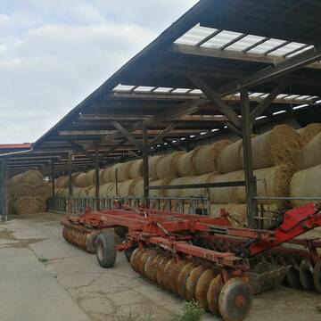
Heu und Stroh zu verkaufen
21527 Kollow
Hof -Linautal
@Hof-Linautal
Heu
Lieferant entlädt
Rundballen
Regenfrei
3 weitere...
B+
Deprecated: Creation of dynamic property Zend_View_Helper_Ads::$adLink is deprecated in /var/www/stall-frei/htdocs/staging.stall-frei.de/library/Psf/View/Helper/Ads.php on line 108

gr.Stalltrakt frei auf Reitanlage
21527 Kollow
Hof -Linautal
@Hof-Linautal
Reitanlage hat gr.Boxen und Offenstallplätze frei

Heu, Heulage, ökologisch, artenreich top Qualitä...
Hamburg
Frederic Wübbe
@Stall_Am_Burgberg
Heu
Lieferant entlädt
Rundballen
Bio
3 weitere...
B+
Heu 1.Schnitt 2021
Upahl
hermannmeyerzuborgsen
@hermannmeyerzuborgsen
Heu
Empfänger lädt ab
Rundballen
Regenfrei
3 weitere...
P+

Strohstrukturpellets
Warsow
Luca Grabeleu, Marquardt
@LucaGrabeleu
Einstreu
Empfänger lädt ab
Bigbag
Regenfrei
3 weitere...
B+

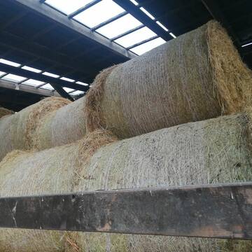
Heu in Rundballen (ca.130cm) super Qualität
Pronstorf
Caros Pferdeparadies
@KaOb
Heu
Rundballen
Regenfrei
Wird verladen
2 weitere...
neu
B+

Heu HD-Ballen 2. Schnitt extensiv Heugräser
Drochtersen
M-Kluth
@M-Kluth
Heu
Empfänger lädt ab
Kleinballen/HD-Ballen
Regenfrei
3 weitere...
B+

Heu in Quaderballen zu verkaufen
Bergen
Bianca Hinrichs-Schröder
@BHS1976
Futter
Empfänger lädt ab
Kleinballen/HD-Ballen
Bio
Regenfrei
2 weitere...
B+

Mitarbeiter gesucht?
Mechtersen
STALL-FREIde Marketing
@STALL-FREI-Marketing
Stellenangebote kostenlos veröffentlichen!

Heulage in Top-Bioqualität
Bothel
LB Sarah Lühring
@Bonito
Heulage
Rundballen
Regenfrei
Wird verladen
1 weitere...
B+

Erstklassiges PferdeHeu in HD-Ballen
Jevenstedt
Tim Rohwer
@EIDERHEU
Heu
Kleinballen/HD-Ballen
Regenfrei
B+
Deprecated: Creation of dynamic property Zend_View::$pageCount is deprecated in /var/www/stall-frei/htdocs/staging.stall-frei.de/library/vendor/shardj/zf1-future/library/Zend/View/Abstract.php on line 308
Deprecated: Creation of dynamic property Zend_View::$itemCountPerPage is deprecated in /var/www/stall-frei/htdocs/staging.stall-frei.de/library/vendor/shardj/zf1-future/library/Zend/View/Abstract.php on line 308
Deprecated: Creation of dynamic property Zend_View::$first is deprecated in /var/www/stall-frei/htdocs/staging.stall-frei.de/library/vendor/shardj/zf1-future/library/Zend/View/Abstract.php on line 308
Deprecated: Creation of dynamic property Zend_View::$current is deprecated in /var/www/stall-frei/htdocs/staging.stall-frei.de/library/vendor/shardj/zf1-future/library/Zend/View/Abstract.php on line 308
Deprecated: Creation of dynamic property Zend_View::$last is deprecated in /var/www/stall-frei/htdocs/staging.stall-frei.de/library/vendor/shardj/zf1-future/library/Zend/View/Abstract.php on line 308
Deprecated: Creation of dynamic property Zend_View::$next is deprecated in /var/www/stall-frei/htdocs/staging.stall-frei.de/library/vendor/shardj/zf1-future/library/Zend/View/Abstract.php on line 308
Deprecated: Creation of dynamic property Zend_View::$pagesInRange is deprecated in /var/www/stall-frei/htdocs/staging.stall-frei.de/library/vendor/shardj/zf1-future/library/Zend/View/Abstract.php on line 308
Deprecated: Creation of dynamic property Zend_View::$firstPageInRange is deprecated in /var/www/stall-frei/htdocs/staging.stall-frei.de/library/vendor/shardj/zf1-future/library/Zend/View/Abstract.php on line 308
Deprecated: Creation of dynamic property Zend_View::$lastPageInRange is deprecated in /var/www/stall-frei/htdocs/staging.stall-frei.de/library/vendor/shardj/zf1-future/library/Zend/View/Abstract.php on line 308
Deprecated: Creation of dynamic property Zend_View::$currentItemCount is deprecated in /var/www/stall-frei/htdocs/staging.stall-frei.de/library/vendor/shardj/zf1-future/library/Zend/View/Abstract.php on line 308
Deprecated: Creation of dynamic property Zend_View::$totalItemCount is deprecated in /var/www/stall-frei/htdocs/staging.stall-frei.de/library/vendor/shardj/zf1-future/library/Zend/View/Abstract.php on line 308
Deprecated: Creation of dynamic property Zend_View::$firstItemNumber is deprecated in /var/www/stall-frei/htdocs/staging.stall-frei.de/library/vendor/shardj/zf1-future/library/Zend/View/Abstract.php on line 308
Deprecated: Creation of dynamic property Zend_View::$lastItemNumber is deprecated in /var/www/stall-frei/htdocs/staging.stall-frei.de/library/vendor/shardj/zf1-future/library/Zend/View/Abstract.php on line 308
Deprecated: Creation of dynamic property Zend_View::$router is deprecated in /var/www/stall-frei/htdocs/staging.stall-frei.de/library/vendor/shardj/zf1-future/library/Zend/View/Abstract.php on line 308
Deprecated: Creation of dynamic property Zend_View::$urlParams is deprecated in /var/www/stall-frei/htdocs/staging.stall-frei.de/library/vendor/shardj/zf1-future/library/Zend/View/Abstract.php on line 308
Deprecated: Creation of dynamic property Zend_View::$showAds is deprecated in /var/www/stall-frei/htdocs/staging.stall-frei.de/library/vendor/shardj/zf1-future/library/Zend/View/Abstract.php on line 308
Deprecated: Creation of dynamic property Zend_View::$objectIds is deprecated in /var/www/stall-frei/htdocs/staging.stall-frei.de/library/vendor/shardj/zf1-future/library/Zend/View/Abstract.php on line 308
Deprecated: Creation of dynamic property Zend_View::$showNavbar is deprecated in /var/www/stall-frei/htdocs/staging.stall-frei.de/library/vendor/shardj/zf1-future/library/Zend/View/Abstract.php on line 308
Deprecated: Creation of dynamic property Zend_View::$showBreadcrumb is deprecated in /var/www/stall-frei/htdocs/staging.stall-frei.de/library/vendor/shardj/zf1-future/library/Zend/View/Abstract.php on line 308
Deprecated: Creation of dynamic property Zend_View::$showFooter is deprecated in /var/www/stall-frei/htdocs/staging.stall-frei.de/library/vendor/shardj/zf1-future/library/Zend/View/Abstract.php on line 308
Deprecated: Creation of dynamic property Zend_View::$showInternalAds is deprecated in /var/www/stall-frei/htdocs/staging.stall-frei.de/library/vendor/shardj/zf1-future/library/Zend/View/Abstract.php on line 308
Deprecated: Creation of dynamic property Zend_View::$blNoContent is deprecated in /var/www/stall-frei/htdocs/staging.stall-frei.de/library/vendor/shardj/zf1-future/library/Zend/View/Abstract.php on line 308
Deprecated: Creation of dynamic property Zend_View::$sMetaDesc is deprecated in /var/www/stall-frei/htdocs/staging.stall-frei.de/library/vendor/shardj/zf1-future/library/Zend/View/Abstract.php on line 308
Deprecated: Creation of dynamic property Zend_View::$useGmaps is deprecated in /var/www/stall-frei/htdocs/staging.stall-frei.de/library/vendor/shardj/zf1-future/library/Zend/View/Abstract.php on line 308
Deprecated: Creation of dynamic property Zend_View::$touches is deprecated in /var/www/stall-frei/htdocs/staging.stall-frei.de/library/vendor/shardj/zf1-future/library/Zend/View/Abstract.php on line 308
Deprecated: Creation of dynamic property Zend_View::$oProject is deprecated in /var/www/stall-frei/htdocs/staging.stall-frei.de/library/vendor/shardj/zf1-future/library/Zend/View/Abstract.php on line 308
Deprecated: Creation of dynamic property Zend_View::$pageHeadline is deprecated in /var/www/stall-frei/htdocs/staging.stall-frei.de/library/vendor/shardj/zf1-future/library/Zend/View/Abstract.php on line 308
Deprecated: Creation of dynamic property Zend_View::$disableLocationField is deprecated in /var/www/stall-frei/htdocs/staging.stall-frei.de/library/vendor/shardj/zf1-future/library/Zend/View/Abstract.php on line 308
Deprecated: Creation of dynamic property Zend_View::$isSearch is deprecated in /var/www/stall-frei/htdocs/staging.stall-frei.de/library/vendor/shardj/zf1-future/library/Zend/View/Abstract.php on line 308
Deprecated: Creation of dynamic property Zend_View::$pageTitle is deprecated in /var/www/stall-frei/htdocs/staging.stall-frei.de/library/vendor/shardj/zf1-future/library/Zend/View/Abstract.php on line 308
Deprecated: Creation of dynamic property Psf_Form_Element_Text::$class is deprecated in /var/www/stall-frei/htdocs/staging.stall-frei.de/library/vendor/shardj/zf1-future/library/Zend/Form/Element.php on line 874
Deprecated: Creation of dynamic property Psf_Form_Element_Text::$size is deprecated in /var/www/stall-frei/htdocs/staging.stall-frei.de/library/vendor/shardj/zf1-future/library/Zend/Form/Element.php on line 874
Deprecated: Creation of dynamic property Psf_Form_Element_Text::$placeholder is deprecated in /var/www/stall-frei/htdocs/staging.stall-frei.de/library/vendor/shardj/zf1-future/library/Zend/Form/Element.php on line 874
Deprecated: Creation of dynamic property Psf_Form_Element_Hidden::$class is deprecated in /var/www/stall-frei/htdocs/staging.stall-frei.de/library/vendor/shardj/zf1-future/library/Zend/Form/Element.php on line 874
Deprecated: Creation of dynamic property Psf_Form_Element_Hidden::$class is deprecated in /var/www/stall-frei/htdocs/staging.stall-frei.de/library/vendor/shardj/zf1-future/library/Zend/Form/Element.php on line 874
Deprecated: Creation of dynamic property Psf_Form_Element_Hidden::$class is deprecated in /var/www/stall-frei/htdocs/staging.stall-frei.de/library/vendor/shardj/zf1-future/library/Zend/Form/Element.php on line 874
Deprecated: Creation of dynamic property Psf_Form_Element_Hidden::$class is deprecated in /var/www/stall-frei/htdocs/staging.stall-frei.de/library/vendor/shardj/zf1-future/library/Zend/Form/Element.php on line 874
Deprecated: Creation of dynamic property Psf_Form_Element_Select::$class is deprecated in /var/www/stall-frei/htdocs/staging.stall-frei.de/library/vendor/shardj/zf1-future/library/Zend/Form/Element.php on line 874
Deprecated: Creation of dynamic property Psf_Form_Element_Select::$class is deprecated in /var/www/stall-frei/htdocs/staging.stall-frei.de/library/vendor/shardj/zf1-future/library/Zend/Form/Element.php on line 874
Deprecated: Creation of dynamic property Psf_Form_Element_Select::$class is deprecated in /var/www/stall-frei/htdocs/staging.stall-frei.de/library/vendor/shardj/zf1-future/library/Zend/Form/Element.php on line 874
Deprecated: Creation of dynamic property Psf_Form_Element_Select::$class is deprecated in /var/www/stall-frei/htdocs/staging.stall-frei.de/library/vendor/shardj/zf1-future/library/Zend/Form/Element.php on line 874
Deprecated: Creation of dynamic property Zend_View::$sort is deprecated in /var/www/stall-frei/htdocs/staging.stall-frei.de/library/vendor/shardj/zf1-future/library/Zend/View/Abstract.php on line 308
Deprecated: Creation of dynamic property Zend_View::$searchLocation is deprecated in /var/www/stall-frei/htdocs/staging.stall-frei.de/library/vendor/shardj/zf1-future/library/Zend/View/Abstract.php on line 308
Deprecated: Creation of dynamic property Zend_View::$locationHint is deprecated in /var/www/stall-frei/htdocs/staging.stall-frei.de/library/vendor/shardj/zf1-future/library/Zend/View/Abstract.php on line 308
Psf_GeoCoder_Abstract::getLocation: Kollow Get Location CachedOrLive
Psf_GeoCoder_Abstract::getCachedOrLive: Kollow
Psf_GeoCoder_OpenCageData::makeApiRequest: response:
Array
(
[documentation] => https://opencagedata.com/api
[licenses] => Array
(
[0] => Array
(
[name] => see attribution guide
[url] => https://opencagedata.com/credits
)
)
[results] => Array
(
[0] => Array
(
[bounds] => Array
(
[northeast] => Array
(
[lat] => 53.4862597
[lng] => 10.4868337
)
[southwest] => Array
(
[lat] => 53.4467757
[lng] => 10.440135
)
)
[components] => Array
(
[ISO_3166-1_alpha-2] => DE
[ISO_3166-1_alpha-3] => DEU
[ISO_3166-2] => Array
(
[0] => DE-SH
)
[_category] => place
[_normalized_city] => Kollow
[_type] => village
[continent] => Europe
[country] => Deutschland
[country_code] => de
[county] => Kreis Herzogtum Lauenburg
[municipality] => Schwarzenbek-Land
[political_union] => European Union
[postcode] => 21527
[state] => Schleswig-Holstein
[state_code] => SH
[village] => Kollow
)
[confidence] => 7
[formatted] => 21527 Kollow, Deutschland
[geometry] => Array
(
[lat] => 53.4635666
[lng] => 10.4590996
)
)
[1] => Array
(
[components] => Array
(
[ISO_3166-1_alpha-2] => FR
[ISO_3166-1_alpha-3] => FRA
[ISO_3166-2] => Array
(
[0] => FR-IDF
[1] => FR-92
)
[_category] => road
[_normalized_city] => Levallois-Perret
[_type] => road
[city] => Levallois-Perret
[continent] => Europe
[country] => France
[country_code] => fr
[county] => Hauts-de-Seine
[local_authority] => Métropole du Grand Paris
[political_union] => European Union
[postcode] => 92300
[road] => Rue Charles Deutschmann
[state] => Île-de-France
[state_code] => IDF
)
[confidence] => 2
[formatted] => Rue Charles Deutschmann, 92300 Levallois-Perret, France
[geometry] => Array
(
[lat] => 48.900049
[lng] => 2.2842
)
)
[2] => Array
(
[components] => Array
(
[ISO_3166-1_alpha-2] => FR
[ISO_3166-1_alpha-3] => FRA
[ISO_3166-2] => Array
(
[0] => FR-ARA
[1] => FR-74
)
[_category] => road
[_normalized_city] => Magland
[_type] => road
[city] => Magland
[continent] => Europe
[country] => France
[country_code] => fr
[county] => Haute-Savoie
[local_authority] => Communauté de communes Cluses-Arve et Montagnes
[political_union] => European Union
[postcode] => 74300
[road] => Route des Cologes
[state] => Auvergne-Rhône-Alpes
[state_code] => ARA
)
[confidence] => 2
[formatted] => Route des Cologes, 74300 Magland, France
[geometry] => Array
(
[lat] => 45.990086
[lng] => 6.631918
)
)
[3] => Array
(
[components] => Array
(
[ISO_3166-1_alpha-2] => FR
[ISO_3166-1_alpha-3] => FRA
[ISO_3166-2] => Array
(
[0] => FR-OCC
[1] => FR-65
)
[_category] => road
[_normalized_city] => Tarbes
[_type] => road
[city] => Tarbes
[continent] => Europe
[country] => France
[country_code] => fr
[county] => Hautes-Pyrénées
[local_authority] => Communauté d'agglomération Tarbes-Lourdes-Pyrénées
[political_union] => European Union
[postcode] => 65000
[road] => Rue Colomès de Juillan
[state] => Occitanie
[state_code] => OCC
)
[confidence] => 2
[formatted] => Rue Colomès de Juillan, 65000 Tarbes, France
[geometry] => Array
(
[lat] => 43.234664
[lng] => 0.073306
)
)
[4] => Array
(
[components] => Array
(
[ISO_3166-1_alpha-2] => FR
[ISO_3166-1_alpha-3] => FRA
[ISO_3166-2] => Array
(
[0] => FR-ARA
[1] => FR-38
)
[_category] => road
[_normalized_city] => Saint-Martin-d'Hères
[_type] => road
[city] => Saint-Martin-d'Hères
[continent] => Europe
[country] => France
[country_code] => fr
[county] => Isère
[local_authority] => Grenoble-Alpes Métropole
[political_union] => European Union
[postcode] => 38400
[road] => Chemin des Collodes
[state] => Auvergne-Rhône-Alpes
[state_code] => ARA
)
[confidence] => 2
[formatted] => Chemin des Collodes, 38400 Saint-Martin-d'Hères, France
[geometry] => Array
(
[lat] => 45.167897
[lng] => 5.777978
)
)
[5] => Array
(
[components] => Array
(
[ISO_3166-1_alpha-2] => FR
[ISO_3166-1_alpha-3] => FRA
[ISO_3166-2] => Array
(
[0] => FR-OCC
[1] => FR-82
)
[_category] => road
[_normalized_city] => Saint-Nicolas-de-la-Grave
[_type] => road
[city] => Saint-Nicolas-de-la-Grave
[continent] => Europe
[country] => France
[country_code] => fr
[county] => Tarn-et-Garonne
[local_authority] => Communauté de communes Terres des Confluences
[political_union] => European Union
[postcode] => 82210
[road] => Chemin de Colomé
[state] => Occitanie
[state_code] => OCC
)
[confidence] => 2
[formatted] => Chemin de Colomé, 82210 Saint-Nicolas-de-la-Grave, France
[geometry] => Array
(
[lat] => 44.081247
[lng] => 1.019899
)
)
[6] => Array
(
[components] => Array
(
[ISO_3166-1_alpha-2] => FR
[ISO_3166-1_alpha-3] => FRA
[ISO_3166-2] => Array
(
[0] => FR-OCC
[1] => FR-82
)
[_category] => road
[_normalized_city] => Dunes
[_type] => road
[city] => Dunes
[continent] => Europe
[country] => France
[country_code] => fr
[county] => Tarn-et-Garonne
[local_authority] => Communauté de communes des Deux Rives
[political_union] => European Union
[postcode] => 82340
[road] => Rue de Colomé
[state] => Occitanie
[state_code] => OCC
)
[confidence] => 10
[formatted] => Rue de Colomé, 82340 Dunes, France
[geometry] => Array
(
[lat] => 44.092088
[lng] => 0.769902
)
)
[7] => Array
(
[components] => Array
(
[ISO_3166-1_alpha-2] => FR
[ISO_3166-1_alpha-3] => FRA
[ISO_3166-2] => Array
(
[0] => FR-PDL
[1] => FR-44
)
[_category] => road
[_normalized_city] => Pornichet
[_type] => road
[city] => Pornichet
[continent] => Europe
[country] => France
[country_code] => fr
[county] => Loire-Atlantique
[local_authority] => Communauté d'agglomération de la Région Nazairienne et de l'Estuaire
[political_union] => European Union
[postcode] => 44380
[road] => Chemin du Colobé
[state] => Pays de la Loire
[state_code] => PDL
)
[confidence] => 10
[formatted] => Chemin du Colobé, 44380 Pornichet, France
[geometry] => Array
(
[lat] => 47.257777
[lng] => -2.315287
)
)
[8] => Array
(
[components] => Array
(
[ISO_3166-1_alpha-2] => FR
[ISO_3166-1_alpha-3] => FRA
[ISO_3166-2] => Array
(
[0] => FR-NAQ
[1] => FR-33
)
[_category] => road
[_normalized_city] => Bordeaux
[_type] => road
[city] => Bordeaux
[continent] => Europe
[country] => France
[country_code] => fr
[county] => Gironde
[local_authority] => Bordeaux Métropole
[political_union] => European Union
[postcode] => 33000
[road] => Place Raymond Colom
[state] => Nouvelle-Aquitaine
[state_code] => NAQ
)
[confidence] => 10
[formatted] => Place Raymond Colom, 33000 Bordeaux, France
[geometry] => Array
(
[lat] => 44.836965
[lng] => -0.568257
)
)
[9] => Array
(
[components] => Array
(
[ISO_3166-1_alpha-2] => FR
[ISO_3166-1_alpha-3] => FRA
[ISO_3166-2] => Array
(
[0] => FR-NAQ
[1] => FR-64
)
[_category] => road
[_normalized_city] => Bosdarros
[_type] => road
[city] => Bosdarros
[continent] => Europe
[country] => France
[country_code] => fr
[county] => Pyrénées-Atlantiques
[local_authority] => Communauté d'agglomération Pau Béarn Pyrénées
[political_union] => European Union
[postcode] => 64290
[road] => Chemin de Sainte-Colome
[state] => Nouvelle-Aquitaine
[state_code] => NAQ
)
[confidence] => 10
[formatted] => Chemin de Sainte-Colome, 64290 Bosdarros, France
[geometry] => Array
(
[lat] => 43.199102
[lng] => -0.35745
)
)
)
[status] => Array
(
[code] => 200
[message] => OK
)
[stay_informed] => Array
(
[blog] => https://blog.opencagedata.com
[mastodon] => https://en.osm.town/@opencage
)
[thanks] => For using an OpenCage API
[timestamp] => Array
(
[created_http] => Fri, 16 Jan 2026 20:45:23 GMT
[created_unix] => 1768596323
)
[total_results] => 10
)
Psf_GeoCoder_Abstract::convertLocationResult
{"documentation":"https:\/\/opencagedata.com\/api","licenses":[{"name":"see attribution guide","url":"https:\/\/opencagedata.com\/credits"}],"results":[{"bounds":{"northeast":{"lat":53.4862597,"lng":10.4868337},"southwest":{"lat":53.4467757,"lng":10.440135}},"components":{"ISO_3166-1_alpha-2":"DE","ISO_3166-1_alpha-3":"DEU","ISO_3166-2":["DE-SH"],"_category":"place","_normalized_city":"Kollow","_type":"village","continent":"Europe","country":"Deutschland","country_code":"de","county":"Kreis Herzogtum Lauenburg","municipality":"Schwarzenbek-Land","political_union":"European Union","postcode":"21527","state":"Schleswig-Holstein","state_code":"SH","village":"Kollow"},"confidence":7,"formatted":"21527 Kollow, Deutschland","geometry":{"lat":53.4635666,"lng":10.4590996}},{"components":{"ISO_3166-1_alpha-2":"FR","ISO_3166-1_alpha-3":"FRA","ISO_3166-2":["FR-IDF","FR-92"],"_category":"road","_normalized_city":"Levallois-Perret","_type":"road","city":"Levallois-Perret","continent":"Europe","country":"France","country_code":"fr","county":"Hauts-de-Seine","local_authority":"M\u00e9tropole du Grand Paris","political_union":"European Union","postcode":"92300","road":"Rue Charles Deutschmann","state":"\u00cele-de-France","state_code":"IDF"},"confidence":2,"formatted":"Rue Charles Deutschmann, 92300 Levallois-Perret, France","geometry":{"lat":48.900049,"lng":2.2842}},{"components":{"ISO_3166-1_alpha-2":"FR","ISO_3166-1_alpha-3":"FRA","ISO_3166-2":["FR-ARA","FR-74"],"_category":"road","_normalized_city":"Magland","_type":"road","city":"Magland","continent":"Europe","country":"France","country_code":"fr","county":"Haute-Savoie","local_authority":"Communaut\u00e9 de communes Cluses-Arve et Montagnes","political_union":"European Union","postcode":"74300","road":"Route des Cologes","state":"Auvergne-Rh\u00f4ne-Alpes","state_code":"ARA"},"confidence":2,"formatted":"Route des Cologes, 74300 Magland, France","geometry":{"lat":45.990086,"lng":6.631918}},{"components":{"ISO_3166-1_alpha-2":"FR","ISO_3166-1_alpha-3":"FRA","ISO_3166-2":["FR-OCC","FR-65"],"_category":"road","_normalized_city":"Tarbes","_type":"road","city":"Tarbes","continent":"Europe","country":"France","country_code":"fr","county":"Hautes-Pyr\u00e9n\u00e9es","local_authority":"Communaut\u00e9 d'agglom\u00e9ration Tarbes-Lourdes-Pyr\u00e9n\u00e9es","political_union":"European Union","postcode":"65000","road":"Rue Colom\u00e8s de Juillan","state":"Occitanie","state_code":"OCC"},"confidence":2,"formatted":"Rue Colom\u00e8s de Juillan, 65000 Tarbes, France","geometry":{"lat":43.234664,"lng":0.073306}},{"components":{"ISO_3166-1_alpha-2":"FR","ISO_3166-1_alpha-3":"FRA","ISO_3166-2":["FR-ARA","FR-38"],"_category":"road","_normalized_city":"Saint-Martin-d'H\u00e8res","_type":"road","city":"Saint-Martin-d'H\u00e8res","continent":"Europe","country":"France","country_code":"fr","county":"Is\u00e8re","local_authority":"Grenoble-Alpes M\u00e9tropole","political_union":"European Union","postcode":"38400","road":"Chemin des Collodes","state":"Auvergne-Rh\u00f4ne-Alpes","state_code":"ARA"},"confidence":2,"formatted":"Chemin des Collodes, 38400 Saint-Martin-d'H\u00e8res, France","geometry":{"lat":45.167897,"lng":5.777978}},{"components":{"ISO_3166-1_alpha-2":"FR","ISO_3166-1_alpha-3":"FRA","ISO_3166-2":["FR-OCC","FR-82"],"_category":"road","_normalized_city":"Saint-Nicolas-de-la-Grave","_type":"road","city":"Saint-Nicolas-de-la-Grave","continent":"Europe","country":"France","country_code":"fr","county":"Tarn-et-Garonne","local_authority":"Communaut\u00e9 de communes Terres des Confluences","political_union":"European Union","postcode":"82210","road":"Chemin de Colom\u00e9","state":"Occitanie","state_code":"OCC"},"confidence":2,"formatted":"Chemin de Colom\u00e9, 82210 Saint-Nicolas-de-la-Grave, France","geometry":{"lat":44.081247,"lng":1.019899}},{"components":{"ISO_3166-1_alpha-2":"FR","ISO_3166-1_alpha-3":"FRA","ISO_3166-2":["FR-OCC","FR-82"],"_category":"road","_normalized_city":"Dunes","_type":"road","city":"Dunes","continent":"Europe","country":"France","country_code":"fr","county":"Tarn-et-Garonne","local_authority":"Communaut\u00e9 de communes des Deux Rives","political_union":"European Union","postcode":"82340","road":"Rue de Colom\u00e9","state":"Occitanie","state_code":"OCC"},"confidence":10,"formatted":"Rue de Colom\u00e9, 82340 Dunes, France","geometry":{"lat":44.092088,"lng":0.769902}},{"components":{"ISO_3166-1_alpha-2":"FR","ISO_3166-1_alpha-3":"FRA","ISO_3166-2":["FR-PDL","FR-44"],"_category":"road","_normalized_city":"Pornichet","_type":"road","city":"Pornichet","continent":"Europe","country":"France","country_code":"fr","county":"Loire-Atlantique","local_authority":"Communaut\u00e9 d'agglom\u00e9ration de la R\u00e9gion Nazairienne et de l'Estuaire","political_union":"European Union","postcode":"44380","road":"Chemin du Colob\u00e9","state":"Pays de la Loire","state_code":"PDL"},"confidence":10,"formatted":"Chemin du Colob\u00e9, 44380 Pornichet, France","geometry":{"lat":47.257777,"lng":-2.315287}},{"components":{"ISO_3166-1_alpha-2":"FR","ISO_3166-1_alpha-3":"FRA","ISO_3166-2":["FR-NAQ","FR-33"],"_category":"road","_normalized_city":"Bordeaux","_type":"road","city":"Bordeaux","continent":"Europe","country":"France","country_code":"fr","county":"Gironde","local_authority":"Bordeaux M\u00e9tropole","political_union":"European Union","postcode":"33000","road":"Place Raymond Colom","state":"Nouvelle-Aquitaine","state_code":"NAQ"},"confidence":10,"formatted":"Place Raymond Colom, 33000 Bordeaux, France","geometry":{"lat":44.836965,"lng":-0.568257}},{"components":{"ISO_3166-1_alpha-2":"FR","ISO_3166-1_alpha-3":"FRA","ISO_3166-2":["FR-NAQ","FR-64"],"_category":"road","_normalized_city":"Bosdarros","_type":"road","city":"Bosdarros","continent":"Europe","country":"France","country_code":"fr","county":"Pyr\u00e9n\u00e9es-Atlantiques","local_authority":"Communaut\u00e9 d'agglom\u00e9ration Pau B\u00e9arn Pyr\u00e9n\u00e9es","political_union":"European Union","postcode":"64290","road":"Chemin de Sainte-Colome","state":"Nouvelle-Aquitaine","state_code":"NAQ"},"confidence":10,"formatted":"Chemin de Sainte-Colome, 64290 Bosdarros, France","geometry":{"lat":43.199102,"lng":-0.35745}}],"status":{"code":200,"message":"OK"},"stay_informed":{"blog":"https:\/\/blog.opencagedata.com","mastodon":"https:\/\/en.osm.town\/@opencage"},"thanks":"For using an OpenCage API","timestamp":{"created_http":"Fri, 16 Jan 2026 20:45:23 GMT","created_unix":1768596323},"total_results":10}Array
(
[0] => stdClass Object
(
[bounds] => stdClass Object
(
[northeast] => stdClass Object
(
[lat] => 53.4862597
[lng] => 10.4868337
)
[southwest] => stdClass Object
(
[lat] => 53.4467757
[lng] => 10.440135
)
)
[components] => stdClass Object
(
[ISO_3166-1_alpha-2] => DE
[ISO_3166-1_alpha-3] => DEU
[ISO_3166-2] => Array
(
[0] => DE-SH
)
[_category] => place
[_normalized_city] => Kollow
[_type] => village
[continent] => Europe
[country] => Deutschland
[country_code] => de
[county] => Kreis Herzogtum Lauenburg
[municipality] => Schwarzenbek-Land
[political_union] => European Union
[postcode] => 21527
[state] => Schleswig-Holstein
[state_code] => SH
[village] => Kollow
)
[confidence] => 7
[formatted] => 21527 Kollow, Deutschland
[geometry] => stdClass Object
(
[lat] => 53.4635666
[lng] => 10.4590996
)
)
[1] => stdClass Object
(
[components] => stdClass Object
(
[ISO_3166-1_alpha-2] => FR
[ISO_3166-1_alpha-3] => FRA
[ISO_3166-2] => Array
(
[0] => FR-IDF
[1] => FR-92
)
[_category] => road
[_normalized_city] => Levallois-Perret
[_type] => road
[city] => Levallois-Perret
[continent] => Europe
[country] => France
[country_code] => fr
[county] => Hauts-de-Seine
[local_authority] => Métropole du Grand Paris
[political_union] => European Union
[postcode] => 92300
[road] => Rue Charles Deutschmann
[state] => Île-de-France
[state_code] => IDF
)
[confidence] => 2
[formatted] => Rue Charles Deutschmann, 92300 Levallois-Perret, France
[geometry] => stdClass Object
(
[lat] => 48.900049
[lng] => 2.2842
)
)
[2] => stdClass Object
(
[components] => stdClass Object
(
[ISO_3166-1_alpha-2] => FR
[ISO_3166-1_alpha-3] => FRA
[ISO_3166-2] => Array
(
[0] => FR-ARA
[1] => FR-74
)
[_category] => road
[_normalized_city] => Magland
[_type] => road
[city] => Magland
[continent] => Europe
[country] => France
[country_code] => fr
[county] => Haute-Savoie
[local_authority] => Communauté de communes Cluses-Arve et Montagnes
[political_union] => European Union
[postcode] => 74300
[road] => Route des Cologes
[state] => Auvergne-Rhône-Alpes
[state_code] => ARA
)
[confidence] => 2
[formatted] => Route des Cologes, 74300 Magland, France
[geometry] => stdClass Object
(
[lat] => 45.990086
[lng] => 6.631918
)
)
[3] => stdClass Object
(
[components] => stdClass Object
(
[ISO_3166-1_alpha-2] => FR
[ISO_3166-1_alpha-3] => FRA
[ISO_3166-2] => Array
(
[0] => FR-OCC
[1] => FR-65
)
[_category] => road
[_normalized_city] => Tarbes
[_type] => road
[city] => Tarbes
[continent] => Europe
[country] => France
[country_code] => fr
[county] => Hautes-Pyrénées
[local_authority] => Communauté d'agglomération Tarbes-Lourdes-Pyrénées
[political_union] => European Union
[postcode] => 65000
[road] => Rue Colomès de Juillan
[state] => Occitanie
[state_code] => OCC
)
[confidence] => 2
[formatted] => Rue Colomès de Juillan, 65000 Tarbes, France
[geometry] => stdClass Object
(
[lat] => 43.234664
[lng] => 0.073306
)
)
[4] => stdClass Object
(
[components] => stdClass Object
(
[ISO_3166-1_alpha-2] => FR
[ISO_3166-1_alpha-3] => FRA
[ISO_3166-2] => Array
(
[0] => FR-ARA
[1] => FR-38
)
[_category] => road
[_normalized_city] => Saint-Martin-d'Hères
[_type] => road
[city] => Saint-Martin-d'Hères
[continent] => Europe
[country] => France
[country_code] => fr
[county] => Isère
[local_authority] => Grenoble-Alpes Métropole
[political_union] => European Union
[postcode] => 38400
[road] => Chemin des Collodes
[state] => Auvergne-Rhône-Alpes
[state_code] => ARA
)
[confidence] => 2
[formatted] => Chemin des Collodes, 38400 Saint-Martin-d'Hères, France
[geometry] => stdClass Object
(
[lat] => 45.167897
[lng] => 5.777978
)
)
[5] => stdClass Object
(
[components] => stdClass Object
(
[ISO_3166-1_alpha-2] => FR
[ISO_3166-1_alpha-3] => FRA
[ISO_3166-2] => Array
(
[0] => FR-OCC
[1] => FR-82
)
[_category] => road
[_normalized_city] => Saint-Nicolas-de-la-Grave
[_type] => road
[city] => Saint-Nicolas-de-la-Grave
[continent] => Europe
[country] => France
[country_code] => fr
[county] => Tarn-et-Garonne
[local_authority] => Communauté de communes Terres des Confluences
[political_union] => European Union
[postcode] => 82210
[road] => Chemin de Colomé
[state] => Occitanie
[state_code] => OCC
)
[confidence] => 2
[formatted] => Chemin de Colomé, 82210 Saint-Nicolas-de-la-Grave, France
[geometry] => stdClass Object
(
[lat] => 44.081247
[lng] => 1.019899
)
)
[6] => stdClass Object
(
[components] => stdClass Object
(
[ISO_3166-1_alpha-2] => FR
[ISO_3166-1_alpha-3] => FRA
[ISO_3166-2] => Array
(
[0] => FR-OCC
[1] => FR-82
)
[_category] => road
[_normalized_city] => Dunes
[_type] => road
[city] => Dunes
[continent] => Europe
[country] => France
[country_code] => fr
[county] => Tarn-et-Garonne
[local_authority] => Communauté de communes des Deux Rives
[political_union] => European Union
[postcode] => 82340
[road] => Rue de Colomé
[state] => Occitanie
[state_code] => OCC
)
[confidence] => 10
[formatted] => Rue de Colomé, 82340 Dunes, France
[geometry] => stdClass Object
(
[lat] => 44.092088
[lng] => 0.769902
)
)
[7] => stdClass Object
(
[components] => stdClass Object
(
[ISO_3166-1_alpha-2] => FR
[ISO_3166-1_alpha-3] => FRA
[ISO_3166-2] => Array
(
[0] => FR-PDL
[1] => FR-44
)
[_category] => road
[_normalized_city] => Pornichet
[_type] => road
[city] => Pornichet
[continent] => Europe
[country] => France
[country_code] => fr
[county] => Loire-Atlantique
[local_authority] => Communauté d'agglomération de la Région Nazairienne et de l'Estuaire
[political_union] => European Union
[postcode] => 44380
[road] => Chemin du Colobé
[state] => Pays de la Loire
[state_code] => PDL
)
[confidence] => 10
[formatted] => Chemin du Colobé, 44380 Pornichet, France
[geometry] => stdClass Object
(
[lat] => 47.257777
[lng] => -2.315287
)
)
[8] => stdClass Object
(
[components] => stdClass Object
(
[ISO_3166-1_alpha-2] => FR
[ISO_3166-1_alpha-3] => FRA
[ISO_3166-2] => Array
(
[0] => FR-NAQ
[1] => FR-33
)
[_category] => road
[_normalized_city] => Bordeaux
[_type] => road
[city] => Bordeaux
[continent] => Europe
[country] => France
[country_code] => fr
[county] => Gironde
[local_authority] => Bordeaux Métropole
[political_union] => European Union
[postcode] => 33000
[road] => Place Raymond Colom
[state] => Nouvelle-Aquitaine
[state_code] => NAQ
)
[confidence] => 10
[formatted] => Place Raymond Colom, 33000 Bordeaux, France
[geometry] => stdClass Object
(
[lat] => 44.836965
[lng] => -0.568257
)
)
[9] => stdClass Object
(
[components] => stdClass Object
(
[ISO_3166-1_alpha-2] => FR
[ISO_3166-1_alpha-3] => FRA
[ISO_3166-2] => Array
(
[0] => FR-NAQ
[1] => FR-64
)
[_category] => road
[_normalized_city] => Bosdarros
[_type] => road
[city] => Bosdarros
[continent] => Europe
[country] => France
[country_code] => fr
[county] => Pyrénées-Atlantiques
[local_authority] => Communauté d'agglomération Pau Béarn Pyrénées
[political_union] => European Union
[postcode] => 64290
[road] => Chemin de Sainte-Colome
[state] => Nouvelle-Aquitaine
[state_code] => NAQ
)
[confidence] => 10
[formatted] => Chemin de Sainte-Colome, 64290 Bosdarros, France
[geometry] => stdClass Object
(
[lat] => 43.199102
[lng] => -0.35745
)
)
)
Psf_GeoCoder_OpenCageData::getKeyMap: 0
stdClass Object
(
    [bounds] => stdClass Object
        (
            [northeast] => stdClass Object
                (
                    [lat] => 53.4862597
                    [lng] => 10.4868337
                )

            [southwest] => stdClass Object
                (
                    [lat] => 53.4467757
                    [lng] => 10.440135
                )

        )

    [components] => stdClass Object
        (
            [ISO_3166-1_alpha-2] => DE
            [ISO_3166-1_alpha-3] => DEU
            [ISO_3166-2] => Array
                (
                    [0] => DE-SH
                )

            [_category] => place
            [_normalized_city] => Kollow
            [_type] => village
            [continent] => Europe
            [country] => Deutschland
            [country_code] => de
            [county] => Kreis Herzogtum Lauenburg
            [municipality] => Schwarzenbek-Land
            [political_union] => European Union
            [postcode] => 21527
            [state] => Schleswig-Holstein
            [state_code] => SH
            [village] => Kollow
        )

    [confidence] => 7
    [formatted] => 21527 Kollow, Deutschland
    [geometry] => stdClass Object
        (
            [lat] => 53.4635666
            [lng] => 10.4590996
        )

)
Psf_GeoCoder_OpenCageData::getCounty: Herzogtum Lauenburg
Psf_GeoCoder_OpenCageData::addMissingData REFETCH!
Array
(
    [address] => 21527 Kollow, Deutschland
    [type] => village
    [street] =>
    [city] => Kollow
    [county] => Herzogtum Lauenburg
    [state] => Schleswig-Holstein
    [zip] => 21527
    [country] => Deutschland
    [suburb] =>
    [countrycode] => de
    [latitude] => 53.4635666
    [longitude] => 10.4590996
    [accuracy] => 1
    [confidence] => 7
    [bounds] => stdClass Object
        (
            [northeast] => stdClass Object
                (
                    [lat] => 53.4862597
                    [lng] => 10.4868337
                )

            [southwest] => stdClass Object
                (
                    [lat] => 53.4467757
                    [lng] => 10.440135
                )

        )

)
reformat!
Array
(
    [address] => 21527 Kollow, Deutschland
    [type] => village
    [street] =>
    [city] => Kollow
    [county] => Herzogtum Lauenburg
    [state] => Schleswig-Holstein
    [zip] => 21527
    [country] => Deutschland
    [suburb] =>
    [countrycode] => de
    [latitude] => 53.4635666
    [longitude] => 10.4590996
    [accuracy] => 1
    [confidence] => 7
    [bounds] => stdClass Object
        (
            [northeast] => stdClass Object
                (
                    [lat] => 53.4862597
                    [lng] => 10.4868337
                )

            [southwest] => stdClass Object
                (
                    [lat] => 53.4467757
                    [lng] => 10.440135
                )

        )

    [place] => 21527 Kollow, Schleswig-Holstein
    [hash] => 6c376c4c4eb35d0016ff291668bb2159
)
Psf_GeoCoder_OpenCageData::getKeyMap: 1
stdClass Object
(
    [components] => stdClass Object
        (
            [ISO_3166-1_alpha-2] => FR
            [ISO_3166-1_alpha-3] => FRA
            [ISO_3166-2] => Array
                (
                    [0] => FR-IDF
                    [1] => FR-92
                )

            [_category] => road
            [_normalized_city] => Levallois-Perret
            [_type] => road
            [city] => Levallois-Perret
            [continent] => Europe
            [country] => France
            [country_code] => fr
            [county] => Hauts-de-Seine
            [local_authority] => Métropole du Grand Paris
            [political_union] => European Union
            [postcode] => 92300
            [road] => Rue Charles Deutschmann
            [state] => Île-de-France
            [state_code] => IDF
        )

    [confidence] => 2
    [formatted] => Rue Charles Deutschmann, 92300 Levallois-Perret, France
    [geometry] => stdClass Object
        (
            [lat] => 48.900049
            [lng] => 2.2842
        )

)
Psf_GeoCoder_OpenCageData::getCounty: Hauts-de-Seine
Psf_GeoCoder_OpenCageData::addMissingData REFETCH!
Array
(
    [address] => Rue Charles Deutschmann, 92300 Levallois-Perret, France
    [type] => road
    [street] => Rue Charles Deutschmann
    [city] => Levallois-Perret
    [county] => Hauts-de-Seine
    [state] => Île-de-France
    [zip] => 92300
    [country] => France
    [suburb] =>
    [countrycode] => fr
    [latitude] => 48.900049
    [longitude] => 2.2842
    [accuracy] => 1
    [confidence] => 2
    [bounds] =>
)
reformat!
Array
(
    [address] => Rue Charles Deutschmann, 92300 Levallois-Perret, France
    [type] => road
    [street] => Rue Charles Deutschmann
    [city] => Levallois-Perret
    [county] => Hauts-de-Seine
    [state] => Île-de-France
    [zip] => 92300
    [country] => France
    [suburb] =>
    [countrycode] => fr
    [latitude] => 48.900049
    [longitude] => 2.2842
    [accuracy] => 1
    [confidence] => 2
    [bounds] =>
    [place] => Rue Charles Deutschmann, 92300 Levallois-Perret, Île-de-France
    [hash] => b7dc44def3990e8a7eaf18e019eca466
)
Psf_GeoCoder_OpenCageData::getKeyMap: 2
stdClass Object
(
    [components] => stdClass Object
        (
            [ISO_3166-1_alpha-2] => FR
            [ISO_3166-1_alpha-3] => FRA
            [ISO_3166-2] => Array
                (
                    [0] => FR-ARA
                    [1] => FR-74
                )

            [_category] => road
            [_normalized_city] => Magland
            [_type] => road
            [city] => Magland
            [continent] => Europe
            [country] => France
            [country_code] => fr
            [county] => Haute-Savoie
            [local_authority] => Communauté de communes Cluses-Arve et Montagnes
            [political_union] => European Union
            [postcode] => 74300
            [road] => Route des Cologes
            [state] => Auvergne-Rhône-Alpes
            [state_code] => ARA
        )

    [confidence] => 2
    [formatted] => Route des Cologes, 74300 Magland, France
    [geometry] => stdClass Object
        (
            [lat] => 45.990086
            [lng] => 6.631918
        )

)
Psf_GeoCoder_OpenCageData::getCounty: Haute-Savoie
Psf_GeoCoder_OpenCageData::addMissingData REFETCH!
Array
(
    [address] => Route des Cologes, 74300 Magland, France
    [type] => road
    [street] => Route des Cologes
    [city] => Magland
    [county] => Haute-Savoie
    [state] => Auvergne-Rhône-Alpes
    [zip] => 74300
    [country] => France
    [suburb] =>
    [countrycode] => fr
    [latitude] => 45.990086
    [longitude] => 6.631918
    [accuracy] => 1
    [confidence] => 2
    [bounds] =>
)
reformat!
Array
(
    [address] => Route des Cologes, 74300 Magland, France
    [type] => road
    [street] => Route des Cologes
    [city] => Magland
    [county] => Haute-Savoie
    [state] => Auvergne-Rhône-Alpes
    [zip] => 74300
    [country] => France
    [suburb] =>
    [countrycode] => fr
    [latitude] => 45.990086
    [longitude] => 6.631918
    [accuracy] => 1
    [confidence] => 2
    [bounds] =>
    [place] => Route des Cologes, 74300 Magland, Auvergne-Rhône-Alpes
    [hash] => 91742ecaf84f21224b141119534dce9f
)
Psf_GeoCoder_OpenCageData::getKeyMap: 3
stdClass Object
(
    [components] => stdClass Object
        (
            [ISO_3166-1_alpha-2] => FR
            [ISO_3166-1_alpha-3] => FRA
            [ISO_3166-2] => Array
                (
                    [0] => FR-OCC
                    [1] => FR-65
                )

            [_category] => road
            [_normalized_city] => Tarbes
            [_type] => road
            [city] => Tarbes
            [continent] => Europe
            [country] => France
            [country_code] => fr
            [county] => Hautes-Pyrénées
            [local_authority] => Communauté d'agglomération Tarbes-Lourdes-Pyrénées
            [political_union] => European Union
            [postcode] => 65000
            [road] => Rue Colomès de Juillan
            [state] => Occitanie
            [state_code] => OCC
        )

    [confidence] => 2
    [formatted] => Rue Colomès de Juillan, 65000 Tarbes, France
    [geometry] => stdClass Object
        (
            [lat] => 43.234664
            [lng] => 0.073306
        )

)
Psf_GeoCoder_OpenCageData::getCounty: Hautes-Pyrénées
Psf_GeoCoder_OpenCageData::addMissingData REFETCH!
Array
(
    [address] => Rue Colomès de Juillan, 65000 Tarbes, France
    [type] => road
    [street] => Rue Colomès de Juillan
    [city] => Tarbes
    [county] => Hautes-Pyrénées
    [state] => Occitanie
    [zip] => 65000
    [country] => France
    [suburb] =>
    [countrycode] => fr
    [latitude] => 43.234664
    [longitude] => 0.073306
    [accuracy] => 1
    [confidence] => 2
    [bounds] =>
)
reformat!
Array
(
    [address] => Rue Colomès de Juillan, 65000 Tarbes, France
    [type] => road
    [street] => Rue Colomès de Juillan
    [city] => Tarbes
    [county] => Hautes-Pyrénées
    [state] => Occitanie
    [zip] => 65000
    [country] => France
    [suburb] =>
    [countrycode] => fr
    [latitude] => 43.234664
    [longitude] => 0.073306
    [accuracy] => 1
    [confidence] => 2
    [bounds] =>
    [place] => Rue Colomès de Juillan, 65000 Tarbes, Occitanie
    [hash] => 5b17d1dc4dd97f6589a2fb77fd7692e8
)
Psf_GeoCoder_OpenCageData::getKeyMap: 4
stdClass Object
(
    [components] => stdClass Object
        (
            [ISO_3166-1_alpha-2] => FR
            [ISO_3166-1_alpha-3] => FRA
            [ISO_3166-2] => Array
                (
                    [0] => FR-ARA
                    [1] => FR-38
                )

            [_category] => road
            [_normalized_city] => Saint-Martin-d'Hères
            [_type] => road
            [city] => Saint-Martin-d'Hères
            [continent] => Europe
            [country] => France
            [country_code] => fr
            [county] => Isère
            [local_authority] => Grenoble-Alpes Métropole
            [political_union] => European Union
            [postcode] => 38400
            [road] => Chemin des Collodes
            [state] => Auvergne-Rhône-Alpes
            [state_code] => ARA
        )

    [confidence] => 2
    [formatted] => Chemin des Collodes, 38400 Saint-Martin-d'Hères, France
    [geometry] => stdClass Object
        (
            [lat] => 45.167897
            [lng] => 5.777978
        )

)
Psf_GeoCoder_OpenCageData::getCounty: Isère
Psf_GeoCoder_OpenCageData::addMissingData REFETCH!
Array
(
    [address] => Chemin des Collodes, 38400 Saint-Martin-d'Hères, France
    [type] => road
    [street] => Chemin des Collodes
    [city] => Saint-Martin-d'Hères
    [county] => Isère
    [state] => Auvergne-Rhône-Alpes
    [zip] => 38400
    [country] => France
    [suburb] =>
    [countrycode] => fr
    [latitude] => 45.167897
    [longitude] => 5.777978
    [accuracy] => 1
    [confidence] => 2
    [bounds] =>
)
reformat!
Array
(
    [address] => Chemin des Collodes, 38400 Saint-Martin-d'Hères, France
    [type] => road
    [street] => Chemin des Collodes
    [city] => Saint-Martin-d'Hères
    [county] => Isère
    [state] => Auvergne-Rhône-Alpes
    [zip] => 38400
    [country] => France
    [suburb] =>
    [countrycode] => fr
    [latitude] => 45.167897
    [longitude] => 5.777978
    [accuracy] => 1
    [confidence] => 2
    [bounds] =>
    [place] => Chemin des Collodes, 38400 Saint-Martin-d'Hères, Auvergne-Rhône-Alpes
    [hash] => 8db9519a3cf1aacd5625be77329f79c3
)
Psf_GeoCoder_OpenCageData::getKeyMap: 5
stdClass Object
(
    [components] => stdClass Object
        (
            [ISO_3166-1_alpha-2] => FR
            [ISO_3166-1_alpha-3] => FRA
            [ISO_3166-2] => Array
                (
                    [0] => FR-OCC
                    [1] => FR-82
                )

            [_category] => road
            [_normalized_city] => Saint-Nicolas-de-la-Grave
            [_type] => road
            [city] => Saint-Nicolas-de-la-Grave
            [continent] => Europe
            [country] => France
            [country_code] => fr
            [county] => Tarn-et-Garonne
            [local_authority] => Communauté de communes Terres des Confluences
            [political_union] => European Union
            [postcode] => 82210
            [road] => Chemin de Colomé
            [state] => Occitanie
            [state_code] => OCC
        )

    [confidence] => 2
    [formatted] => Chemin de Colomé, 82210 Saint-Nicolas-de-la-Grave, France
    [geometry] => stdClass Object
        (
            [lat] => 44.081247
            [lng] => 1.019899
        )

)
Psf_GeoCoder_OpenCageData::getCounty: Tarn-et-Garonne
Psf_GeoCoder_OpenCageData::addMissingData REFETCH!
Array
(
    [address] => Chemin de Colomé, 82210 Saint-Nicolas-de-la-Grave, France
    [type] => road
    [street] => Chemin de Colomé
    [city] => Saint-Nicolas-de-la-Grave
    [county] => Tarn-et-Garonne
    [state] => Occitanie
    [zip] => 82210
    [country] => France
    [suburb] =>
    [countrycode] => fr
    [latitude] => 44.081247
    [longitude] => 1.019899
    [accuracy] => 1
    [confidence] => 2
    [bounds] =>
)
reformat!
Array
(
    [address] => Chemin de Colomé, 82210 Saint-Nicolas-de-la-Grave, France
    [type] => road
    [street] => Chemin de Colomé
    [city] => Saint-Nicolas-de-la-Grave
    [county] => Tarn-et-Garonne
    [state] => Occitanie
    [zip] => 82210
    [country] => France
    [suburb] =>
    [countrycode] => fr
    [latitude] => 44.081247
    [longitude] => 1.019899
    [accuracy] => 1
    [confidence] => 2
    [bounds] =>
    [place] => Chemin de Colomé, 82210 Saint-Nicolas-de-la-Grave, Occitanie
    [hash] => 1fbef63ed3c16edc638a1d4f0ee4e80c
)
Psf_GeoCoder_OpenCageData::getKeyMap: 6
stdClass Object
(
    [components] => stdClass Object
        (
            [ISO_3166-1_alpha-2] => FR
            [ISO_3166-1_alpha-3] => FRA
            [ISO_3166-2] => Array
                (
                    [0] => FR-OCC
                    [1] => FR-82
                )

            [_category] => road
            [_normalized_city] => Dunes
            [_type] => road
            [city] => Dunes
            [continent] => Europe
            [country] => France
            [country_code] => fr
            [county] => Tarn-et-Garonne
            [local_authority] => Communauté de communes des Deux Rives
            [political_union] => European Union
            [postcode] => 82340
            [road] => Rue de Colomé
            [state] => Occitanie
            [state_code] => OCC
        )

    [confidence] => 10
    [formatted] => Rue de Colomé, 82340 Dunes, France
    [geometry] => stdClass Object
        (
            [lat] => 44.092088
            [lng] => 0.769902
        )

)
Psf_GeoCoder_OpenCageData::getCounty: Tarn-et-Garonne
Psf_GeoCoder_OpenCageData::addMissingData REFETCH!
Array
(
    [address] => Rue de Colomé, 82340 Dunes, France
    [type] => road
    [street] => Rue de Colomé
    [city] => Dunes
    [county] => Tarn-et-Garonne
    [state] => Occitanie
    [zip] => 82340
    [country] => France
    [suburb] =>
    [countrycode] => fr
    [latitude] => 44.092088
    [longitude] => 0.769902
    [accuracy] => 1
    [confidence] => 10
    [bounds] =>
)
reformat!
Array
(
    [address] => Rue de Colomé, 82340 Dunes, France
    [type] => road
    [street] => Rue de Colomé
    [city] => Dunes
    [county] => Tarn-et-Garonne
    [state] => Occitanie
    [zip] => 82340
    [country] => France
    [suburb] =>
    [countrycode] => fr
    [latitude] => 44.092088
    [longitude] => 0.769902
    [accuracy] => 1
    [confidence] => 10
    [bounds] =>
    [place] => Rue de Colomé, 82340 Dunes, Occitanie
    [hash] => 3b6013dda86d03cad7b235728872891a
)
Psf_GeoCoder_OpenCageData::getKeyMap: 7
stdClass Object
(
    [components] => stdClass Object
        (
            [ISO_3166-1_alpha-2] => FR
            [ISO_3166-1_alpha-3] => FRA
            [ISO_3166-2] => Array
                (
                    [0] => FR-PDL
                    [1] => FR-44
                )

            [_category] => road
            [_normalized_city] => Pornichet
            [_type] => road
            [city] => Pornichet
            [continent] => Europe
            [country] => France
            [country_code] => fr
            [county] => Loire-Atlantique
            [local_authority] => Communauté d'agglomération de la Région Nazairienne et de l'Estuaire
            [political_union] => European Union
            [postcode] => 44380
            [road] => Chemin du Colobé
            [state] => Pays de la Loire
            [state_code] => PDL
        )

    [confidence] => 10
    [formatted] => Chemin du Colobé, 44380 Pornichet, France
    [geometry] => stdClass Object
        (
            [lat] => 47.257777
            [lng] => -2.315287
        )

)
Psf_GeoCoder_OpenCageData::getCounty: Loire-Atlantique
Psf_GeoCoder_OpenCageData::addMissingData REFETCH!
Array
(
    [address] => Chemin du Colobé, 44380 Pornichet, France
    [type] => road
    [street] => Chemin du Colobé
    [city] => Pornichet
    [county] => Loire-Atlantique
    [state] => Pays de la Loire
    [zip] => 44380
    [country] => France
    [suburb] =>
    [countrycode] => fr
    [latitude] => 47.257777
    [longitude] => -2.315287
    [accuracy] => 1
    [confidence] => 10
    [bounds] =>
)
reformat!
Array
(
    [address] => Chemin du Colobé, 44380 Pornichet, France
    [type] => road
    [street] => Chemin du Colobé
    [city] => Pornichet
    [county] => Loire-Atlantique
    [state] => Pays de la Loire
    [zip] => 44380
    [country] => France
    [suburb] =>
    [countrycode] => fr
    [latitude] => 47.257777
    [longitude] => -2.315287
    [accuracy] => 1
    [confidence] => 10
    [bounds] =>
    [place] => Chemin du Colobé, 44380 Pornichet, Pays de la Loire
    [hash] => f2d45f7de1cde50182fad4ed5b0cdef8
)
Psf_GeoCoder_OpenCageData::getKeyMap: 8
stdClass Object
(
    [components] => stdClass Object
        (
            [ISO_3166-1_alpha-2] => FR
            [ISO_3166-1_alpha-3] => FRA
            [ISO_3166-2] => Array
                (
                    [0] => FR-NAQ
                    [1] => FR-33
                )

            [_category] => road
            [_normalized_city] => Bordeaux
            [_type] => road
            [city] => Bordeaux
            [continent] => Europe
            [country] => France
            [country_code] => fr
            [county] => Gironde
            [local_authority] => Bordeaux Métropole
            [political_union] => European Union
            [postcode] => 33000
            [road] => Place Raymond Colom
            [state] => Nouvelle-Aquitaine
            [state_code] => NAQ
        )

    [confidence] => 10
    [formatted] => Place Raymond Colom, 33000 Bordeaux, France
    [geometry] => stdClass Object
        (
            [lat] => 44.836965
            [lng] => -0.568257
        )

)
Psf_GeoCoder_OpenCageData::getCounty: Gironde
Psf_GeoCoder_OpenCageData::addMissingData REFETCH!
Array
(
    [address] => Place Raymond Colom, 33000 Bordeaux, France
    [type] => road
    [street] => Place Raymond Colom
    [city] => Bordeaux
    [county] => Gironde
    [state] => Nouvelle-Aquitaine
    [zip] => 33000
    [country] => France
    [suburb] =>
    [countrycode] => fr
    [latitude] => 44.836965
    [longitude] => -0.568257
    [accuracy] => 1
    [confidence] => 10
    [bounds] =>
)
reformat!
Array
(
    [address] => Place Raymond Colom, 33000 Bordeaux, France
    [type] => road
    [street] => Place Raymond Colom
    [city] => Bordeaux
    [county] => Gironde
    [state] => Nouvelle-Aquitaine
    [zip] => 33000
    [country] => France
    [suburb] =>
    [countrycode] => fr
    [latitude] => 44.836965
    [longitude] => -0.568257
    [accuracy] => 1
    [confidence] => 10
    [bounds] =>
    [place] => Place Raymond Colom, 33000 Bordeaux, Nouvelle-Aquitaine
    [hash] => 9a88b3998105bcce756658f3c51c608b
)
Psf_GeoCoder_OpenCageData::getKeyMap: 9
stdClass Object
(
    [components] => stdClass Object
        (
            [ISO_3166-1_alpha-2] => FR
            [ISO_3166-1_alpha-3] => FRA
            [ISO_3166-2] => Array
                (
                    [0] => FR-NAQ
                    [1] => FR-64
                )

            [_category] => road
            [_normalized_city] => Bosdarros
            [_type] => road
            [city] => Bosdarros
            [continent] => Europe
            [country] => France
            [country_code] => fr
            [county] => Pyrénées-Atlantiques
            [local_authority] => Communauté d'agglomération Pau Béarn Pyrénées
            [political_union] => European Union
            [postcode] => 64290
            [road] => Chemin de Sainte-Colome
            [state] => Nouvelle-Aquitaine
            [state_code] => NAQ
        )

    [confidence] => 10
    [formatted] => Chemin de Sainte-Colome, 64290 Bosdarros, France
    [geometry] => stdClass Object
        (
            [lat] => 43.199102
            [lng] => -0.35745
        )

)
Psf_GeoCoder_OpenCageData::getCounty: Pyrénées-Atlantiques
Psf_GeoCoder_OpenCageData::addMissingData REFETCH!
Array
(
    [address] => Chemin de Sainte-Colome, 64290 Bosdarros, France
    [type] => road
    [street] => Chemin de Sainte-Colome
    [city] => Bosdarros
    [county] => Pyrénées-Atlantiques
    [state] => Nouvelle-Aquitaine
    [zip] => 64290
    [country] => France
    [suburb] =>
    [countrycode] => fr
    [latitude] => 43.199102
    [longitude] => -0.35745
    [accuracy] => 1
    [confidence] => 10
    [bounds] =>
)
reformat!
Array
(
    [address] => Chemin de Sainte-Colome, 64290 Bosdarros, France
    [type] => road
    [street] => Chemin de Sainte-Colome
    [city] => Bosdarros
    [county] => Pyrénées-Atlantiques
    [state] => Nouvelle-Aquitaine
    [zip] => 64290
    [country] => France
    [suburb] =>
    [countrycode] => fr
    [latitude] => 43.199102
    [longitude] => -0.35745
    [accuracy] => 1
    [confidence] => 10
    [bounds] =>
    [place] => Chemin de Sainte-Colome, 64290 Bosdarros, Nouvelle-Aquitaine
    [hash] => f12eea765619c2269f20377c38850a88
)
Deprecated: Creation of dynamic property Zend_View::$locationHintStyle is deprecated in /var/www/stall-frei/htdocs/staging.stall-frei.de/library/vendor/shardj/zf1-future/library/Zend/View/Abstract.php on line 308
Deprecated: Creation of dynamic property Zend_View::$adGeoLocation is deprecated in /var/www/stall-frei/htdocs/staging.stall-frei.de/library/vendor/shardj/zf1-future/library/Zend/View/Abstract.php on line 308
Deprecated: Creation of dynamic property Zend_View::$recordCount is deprecated in /var/www/stall-frei/htdocs/staging.stall-frei.de/library/vendor/shardj/zf1-future/library/Zend/View/Abstract.php on line 308
Deprecated: explode(): Passing null to parameter #2 ($string) of type string is deprecated in /var/www/stall-frei/htdocs/staging.stall-frei.de/application/models/SearchAgent.php on line 100
Deprecated: explode(): Passing null to parameter #2 ($string) of type string is deprecated in /var/www/stall-frei/htdocs/staging.stall-frei.de/application/models/SearchAgent.php on line 100
Deprecated: explode(): Passing null to parameter #2 ($string) of type string is deprecated in /var/www/stall-frei/htdocs/staging.stall-frei.de/application/models/SearchAgent.php on line 100
Deprecated: explode(): Passing null to parameter #2 ($string) of type string is deprecated in /var/www/stall-frei/htdocs/staging.stall-frei.de/application/models/SearchAgent.php on line 100
Deprecated: explode(): Passing null to parameter #2 ($string) of type string is deprecated in /var/www/stall-frei/htdocs/staging.stall-frei.de/application/models/SearchAgent.php on line 100
Deprecated: explode(): Passing null to parameter #2 ($string) of type string is deprecated in /var/www/stall-frei/htdocs/staging.stall-frei.de/application/models/SearchAgent.php on line 100
Deprecated: trim(): Passing null to parameter #1 ($string) of type string is deprecated in /var/www/stall-frei/htdocs/staging.stall-frei.de/application/models/Account/Search.php on line 82
Warning: Cannot modify header information - headers already sent by (output started at /var/www/stall-frei/htdocs/staging.stall-frei.de/library/vendor/shardj/zf1-future/library/Zend/View/Abstract.php:308) in /var/www/stall-frei/htdocs/staging.stall-frei.de/application/models/Account/Search.php on line 71
Deprecated: Creation of dynamic property Zend_View::$paginationParams is deprecated in /var/www/stall-frei/htdocs/staging.stall-frei.de/library/vendor/shardj/zf1-future/library/Zend/View/Abstract.php on line 308
Deprecated: Creation of dynamic property Zend_View::$objectPaginator is deprecated in /var/www/stall-frei/htdocs/staging.stall-frei.de/library/vendor/shardj/zf1-future/library/Zend/View/Abstract.php on line 308
Deprecated: Creation of dynamic property Zend_View::$featuredObjects is deprecated in /var/www/stall-frei/htdocs/staging.stall-frei.de/library/vendor/shardj/zf1-future/library/Zend/View/Abstract.php on line 308
Deprecated: Creation of dynamic property Zend_View::$hints is deprecated in /var/www/stall-frei/htdocs/staging.stall-frei.de/library/vendor/shardj/zf1-future/library/Zend/View/Abstract.php on line 308
Deprecated: Creation of dynamic property Zend_View::$attributeHints is deprecated in /var/www/stall-frei/htdocs/staging.stall-frei.de/library/vendor/shardj/zf1-future/library/Zend/View/Abstract.php on line 308
Deprecated: Creation of dynamic property Zend_View::$oSearchForm is deprecated in /var/www/stall-frei/htdocs/staging.stall-frei.de/library/vendor/shardj/zf1-future/library/Zend/View/Abstract.php on line 308