Deprecated: Creation of dynamic property Zend_View::$sMode is deprecated in /var/www/stall-frei/htdocs/staging.stall-frei.de/library/vendor/shardj/zf1-future/library/Zend/View/Abstract.php on line 308
Heu, Stroh oder Futter in Warsow
Gesucht wird in "Warsow, Mecklenburg-Vorpommern, Deutschland"
94 Einträge
Deprecated: Creation of dynamic property Zend_View::$listObjects is deprecated in /var/www/stall-frei/htdocs/staging.stall-frei.de/library/vendor/shardj/zf1-future/library/Zend/View/Abstract.php on line 308
Deprecated: Creation of dynamic property Zend_View::$listMode is deprecated in /var/www/stall-frei/htdocs/staging.stall-frei.de/library/vendor/shardj/zf1-future/library/Zend/View/Abstract.php on line 308
Deprecated: Creation of dynamic property Zend_View::$renderedObjects is deprecated in /var/www/stall-frei/htdocs/staging.stall-frei.de/library/vendor/shardj/zf1-future/library/Zend/View/Abstract.php on line 308
Deprecated: Creation of dynamic property Zend_View::$index is deprecated in /var/www/stall-frei/htdocs/staging.stall-frei.de/library/vendor/shardj/zf1-future/library/Zend/View/Abstract.php on line 308
Deprecated: Creation of dynamic property Zend_View::$displayMode is deprecated in /var/www/stall-frei/htdocs/staging.stall-frei.de/library/vendor/shardj/zf1-future/library/Zend/View/Abstract.php on line 308
Deprecated: Creation of dynamic property Zend_View::$remarketingIds is deprecated in /var/www/stall-frei/htdocs/staging.stall-frei.de/library/vendor/shardj/zf1-future/library/Zend/View/Abstract.php on line 308
Deprecated: Creation of dynamic property Zend_View::$listItem is deprecated in /var/www/stall-frei/htdocs/staging.stall-frei.de/library/vendor/shardj/zf1-future/library/Zend/View/Abstract.php on line 308
Deprecated: Creation of dynamic property Zend_View::$object is deprecated in /var/www/stall-frei/htdocs/staging.stall-frei.de/library/vendor/shardj/zf1-future/library/Zend/View/Abstract.php on line 308
Deprecated: Creation of dynamic property Zend_View::$attributes is deprecated in /var/www/stall-frei/htdocs/staging.stall-frei.de/library/vendor/shardj/zf1-future/library/Zend/View/Abstract.php on line 308

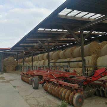
Strohstrukturpellets
Warsow
Luca Grabeleu, Marquardt
@LucaGrabeleu
Einstreu
Empfänger lädt ab
Bigbag
Regenfrei
3 weitere...
B+
Deprecated: Creation of dynamic property Zend_View_Helper_Ads::$adLink is deprecated in /var/www/stall-frei/htdocs/staging.stall-frei.de/library/Psf/View/Helper/Ads.php on line 108

Das Beste für die Hufe
Mechtersen
STALL-FREIde Marketing
@STALL-FREI-Marketing
Hufschmiede und Hufpfleger in Ihrer Nähe
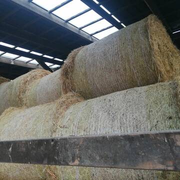
Heu 1.Schnitt 2021
Upahl
hermannmeyerzuborgsen
@hermannmeyerzuborgsen
Heu
Empfänger lädt ab
Rundballen
Regenfrei
3 weitere...
P+

Heu und Stroh zu verkaufen
21527 Kollow
Hof -Linautal
@Hof-Linautal
Heu
Lieferant entlädt
Rundballen
Regenfrei
3 weitere...
ganz aktuell
B+

Heu in Rundballen (ca.130cm) super Qualität
Pronstorf
Caros Pferdeparadies
@KaOb
Heu
Rundballen
Regenfrei
Wird verladen
2 weitere...
B+
Leider kein Vorschaubild
Leider kein Vorschaubild
Biohafer zu verkaufen
Altmärkische Höhe OT Losse
Landwirtschaft H.Stoltenberg
@ReiterhofLosse
Futter
Empfänger lädt ab
Lose
Bio
Regenfrei
2 weitere...
B+
Leider kein Vorschaubild
Leider kein Vorschaubild
Bio-Luzerneheu aus qualifiziertem Biobetrieb
Altmärkische Höhe OT Losse
Landwirtschaft H.Stoltenberg
@ReiterhofLosse
Heu
Empfänger lädt ab
Großballen
Bio
2 weitere...
B+

Frisches Stroh zu verkaufen!
Mechtersen
STALL-FREIde Marketing
@STALL-FREI-Marketing
Kaufe frisches Stroh für dein Pferd!

Heu, Heulage, ökologisch, artenreich top Qualitä...
Hamburg
Frederic Wübbe
@Stall_Am_Burgberg
Heu
Lieferant entlädt
Rundballen
Bio
3 weitere...
B+

Fruktan- und zuckerarmes Premium Wiesenheu !
Schollene
Guthof Mühlenfels
@Gutshof-Muehlenfels
Heu
Empfänger lädt ab
Rundballen
Regenfrei
3 weitere...
B+

Haferstroh in Futterqualität für gesunde Pferde ...
Schollene
Guthof Mühlenfels
@Gutshof-Muehlenfels
Einstreu
Lieferant entlädt
Großballen
Regenfrei
3 weitere...
B+
Deprecated: Creation of dynamic property Zend_View::$pageCount is deprecated in /var/www/stall-frei/htdocs/staging.stall-frei.de/library/vendor/shardj/zf1-future/library/Zend/View/Abstract.php on line 308
Deprecated: Creation of dynamic property Zend_View::$itemCountPerPage is deprecated in /var/www/stall-frei/htdocs/staging.stall-frei.de/library/vendor/shardj/zf1-future/library/Zend/View/Abstract.php on line 308
Deprecated: Creation of dynamic property Zend_View::$first is deprecated in /var/www/stall-frei/htdocs/staging.stall-frei.de/library/vendor/shardj/zf1-future/library/Zend/View/Abstract.php on line 308
Deprecated: Creation of dynamic property Zend_View::$current is deprecated in /var/www/stall-frei/htdocs/staging.stall-frei.de/library/vendor/shardj/zf1-future/library/Zend/View/Abstract.php on line 308
Deprecated: Creation of dynamic property Zend_View::$last is deprecated in /var/www/stall-frei/htdocs/staging.stall-frei.de/library/vendor/shardj/zf1-future/library/Zend/View/Abstract.php on line 308
Deprecated: Creation of dynamic property Zend_View::$next is deprecated in /var/www/stall-frei/htdocs/staging.stall-frei.de/library/vendor/shardj/zf1-future/library/Zend/View/Abstract.php on line 308
Deprecated: Creation of dynamic property Zend_View::$pagesInRange is deprecated in /var/www/stall-frei/htdocs/staging.stall-frei.de/library/vendor/shardj/zf1-future/library/Zend/View/Abstract.php on line 308
Deprecated: Creation of dynamic property Zend_View::$firstPageInRange is deprecated in /var/www/stall-frei/htdocs/staging.stall-frei.de/library/vendor/shardj/zf1-future/library/Zend/View/Abstract.php on line 308
Deprecated: Creation of dynamic property Zend_View::$lastPageInRange is deprecated in /var/www/stall-frei/htdocs/staging.stall-frei.de/library/vendor/shardj/zf1-future/library/Zend/View/Abstract.php on line 308
Deprecated: Creation of dynamic property Zend_View::$currentItemCount is deprecated in /var/www/stall-frei/htdocs/staging.stall-frei.de/library/vendor/shardj/zf1-future/library/Zend/View/Abstract.php on line 308
Deprecated: Creation of dynamic property Zend_View::$totalItemCount is deprecated in /var/www/stall-frei/htdocs/staging.stall-frei.de/library/vendor/shardj/zf1-future/library/Zend/View/Abstract.php on line 308
Deprecated: Creation of dynamic property Zend_View::$firstItemNumber is deprecated in /var/www/stall-frei/htdocs/staging.stall-frei.de/library/vendor/shardj/zf1-future/library/Zend/View/Abstract.php on line 308
Deprecated: Creation of dynamic property Zend_View::$lastItemNumber is deprecated in /var/www/stall-frei/htdocs/staging.stall-frei.de/library/vendor/shardj/zf1-future/library/Zend/View/Abstract.php on line 308
Deprecated: Creation of dynamic property Zend_View::$router is deprecated in /var/www/stall-frei/htdocs/staging.stall-frei.de/library/vendor/shardj/zf1-future/library/Zend/View/Abstract.php on line 308
Deprecated: Creation of dynamic property Zend_View::$urlParams is deprecated in /var/www/stall-frei/htdocs/staging.stall-frei.de/library/vendor/shardj/zf1-future/library/Zend/View/Abstract.php on line 308
Deprecated: Creation of dynamic property Zend_View::$showAds is deprecated in /var/www/stall-frei/htdocs/staging.stall-frei.de/library/vendor/shardj/zf1-future/library/Zend/View/Abstract.php on line 308
Deprecated: Creation of dynamic property Zend_View::$objectIds is deprecated in /var/www/stall-frei/htdocs/staging.stall-frei.de/library/vendor/shardj/zf1-future/library/Zend/View/Abstract.php on line 308
Deprecated: Creation of dynamic property Zend_View::$showNavbar is deprecated in /var/www/stall-frei/htdocs/staging.stall-frei.de/library/vendor/shardj/zf1-future/library/Zend/View/Abstract.php on line 308
Deprecated: Creation of dynamic property Zend_View::$showBreadcrumb is deprecated in /var/www/stall-frei/htdocs/staging.stall-frei.de/library/vendor/shardj/zf1-future/library/Zend/View/Abstract.php on line 308
Deprecated: Creation of dynamic property Zend_View::$showFooter is deprecated in /var/www/stall-frei/htdocs/staging.stall-frei.de/library/vendor/shardj/zf1-future/library/Zend/View/Abstract.php on line 308
Deprecated: Creation of dynamic property Zend_View::$showInternalAds is deprecated in /var/www/stall-frei/htdocs/staging.stall-frei.de/library/vendor/shardj/zf1-future/library/Zend/View/Abstract.php on line 308
Deprecated: Creation of dynamic property Zend_View::$blNoContent is deprecated in /var/www/stall-frei/htdocs/staging.stall-frei.de/library/vendor/shardj/zf1-future/library/Zend/View/Abstract.php on line 308
Deprecated: Creation of dynamic property Zend_View::$sMetaDesc is deprecated in /var/www/stall-frei/htdocs/staging.stall-frei.de/library/vendor/shardj/zf1-future/library/Zend/View/Abstract.php on line 308
Deprecated: Creation of dynamic property Zend_View::$useGmaps is deprecated in /var/www/stall-frei/htdocs/staging.stall-frei.de/library/vendor/shardj/zf1-future/library/Zend/View/Abstract.php on line 308
Deprecated: Creation of dynamic property Zend_View::$touches is deprecated in /var/www/stall-frei/htdocs/staging.stall-frei.de/library/vendor/shardj/zf1-future/library/Zend/View/Abstract.php on line 308
Deprecated: Creation of dynamic property Zend_View::$oProject is deprecated in /var/www/stall-frei/htdocs/staging.stall-frei.de/library/vendor/shardj/zf1-future/library/Zend/View/Abstract.php on line 308
Deprecated: Creation of dynamic property Zend_View::$pageHeadline is deprecated in /var/www/stall-frei/htdocs/staging.stall-frei.de/library/vendor/shardj/zf1-future/library/Zend/View/Abstract.php on line 308
Deprecated: Creation of dynamic property Zend_View::$disableLocationField is deprecated in /var/www/stall-frei/htdocs/staging.stall-frei.de/library/vendor/shardj/zf1-future/library/Zend/View/Abstract.php on line 308
Deprecated: Creation of dynamic property Zend_View::$isSearch is deprecated in /var/www/stall-frei/htdocs/staging.stall-frei.de/library/vendor/shardj/zf1-future/library/Zend/View/Abstract.php on line 308
Deprecated: Creation of dynamic property Zend_View::$pageTitle is deprecated in /var/www/stall-frei/htdocs/staging.stall-frei.de/library/vendor/shardj/zf1-future/library/Zend/View/Abstract.php on line 308
Deprecated: Creation of dynamic property Psf_Form_Element_Text::$class is deprecated in /var/www/stall-frei/htdocs/staging.stall-frei.de/library/vendor/shardj/zf1-future/library/Zend/Form/Element.php on line 874
Deprecated: Creation of dynamic property Psf_Form_Element_Text::$size is deprecated in /var/www/stall-frei/htdocs/staging.stall-frei.de/library/vendor/shardj/zf1-future/library/Zend/Form/Element.php on line 874
Deprecated: Creation of dynamic property Psf_Form_Element_Text::$placeholder is deprecated in /var/www/stall-frei/htdocs/staging.stall-frei.de/library/vendor/shardj/zf1-future/library/Zend/Form/Element.php on line 874
Deprecated: Creation of dynamic property Psf_Form_Element_Hidden::$class is deprecated in /var/www/stall-frei/htdocs/staging.stall-frei.de/library/vendor/shardj/zf1-future/library/Zend/Form/Element.php on line 874
Deprecated: Creation of dynamic property Psf_Form_Element_Hidden::$class is deprecated in /var/www/stall-frei/htdocs/staging.stall-frei.de/library/vendor/shardj/zf1-future/library/Zend/Form/Element.php on line 874
Deprecated: Creation of dynamic property Psf_Form_Element_Hidden::$class is deprecated in /var/www/stall-frei/htdocs/staging.stall-frei.de/library/vendor/shardj/zf1-future/library/Zend/Form/Element.php on line 874
Deprecated: Creation of dynamic property Psf_Form_Element_Hidden::$class is deprecated in /var/www/stall-frei/htdocs/staging.stall-frei.de/library/vendor/shardj/zf1-future/library/Zend/Form/Element.php on line 874
Deprecated: Creation of dynamic property Psf_Form_Element_Select::$class is deprecated in /var/www/stall-frei/htdocs/staging.stall-frei.de/library/vendor/shardj/zf1-future/library/Zend/Form/Element.php on line 874
Deprecated: Creation of dynamic property Psf_Form_Element_Select::$class is deprecated in /var/www/stall-frei/htdocs/staging.stall-frei.de/library/vendor/shardj/zf1-future/library/Zend/Form/Element.php on line 874
Deprecated: Creation of dynamic property Psf_Form_Element_Select::$class is deprecated in /var/www/stall-frei/htdocs/staging.stall-frei.de/library/vendor/shardj/zf1-future/library/Zend/Form/Element.php on line 874
Deprecated: Creation of dynamic property Psf_Form_Element_Select::$class is deprecated in /var/www/stall-frei/htdocs/staging.stall-frei.de/library/vendor/shardj/zf1-future/library/Zend/Form/Element.php on line 874
Deprecated: Creation of dynamic property Zend_View::$sort is deprecated in /var/www/stall-frei/htdocs/staging.stall-frei.de/library/vendor/shardj/zf1-future/library/Zend/View/Abstract.php on line 308
Deprecated: Creation of dynamic property Zend_View::$searchLocation is deprecated in /var/www/stall-frei/htdocs/staging.stall-frei.de/library/vendor/shardj/zf1-future/library/Zend/View/Abstract.php on line 308
Deprecated: Creation of dynamic property Zend_View::$locationHint is deprecated in /var/www/stall-frei/htdocs/staging.stall-frei.de/library/vendor/shardj/zf1-future/library/Zend/View/Abstract.php on line 308
Psf_GeoCoder_Abstract::getLocation: Warsow Get Location CachedOrLive
Psf_GeoCoder_Abstract::getCachedOrLive: Warsow
Psf_GeoCoder_OpenCageData::makeApiRequest: response:
Array
(
[documentation] => https://opencagedata.com/api
[licenses] => Array
(
[0] => Array
(
[name] => see attribution guide
[url] => https://opencagedata.com/credits
)
)
[results] => Array
(
[0] => Array
(
[bounds] => Array
(
[northeast] => Array
(
[lat] => 53.5604618
[lng] => 11.3262232
)
[southwest] => Array
(
[lat] => 53.5179896
[lng] => 11.2460079
)
)
[components] => Array
(
[ISO_3166-1_alpha-2] => DE
[ISO_3166-1_alpha-3] => DEU
[ISO_3166-2] => Array
(
[0] => DE-MV
)
[_category] => place
[_normalized_city] => Warsow
[_type] => village
[continent] => Europe
[country] => Deutschland
[country_code] => de
[county] => Ludwigslust-Parchim
[municipality] => Stralendorf
[political_union] => European Union
[state] => Mecklenburg-Vorpommern
[state_code] => MV
[village] => Warsow
)
[confidence] => 7
[formatted] => Warsow, Mecklenburg-Vorpommern, Deutschland
[geometry] => Array
(
[lat] => 53.5309036
[lng] => 11.3028869
)
)
[1] => Array
(
[bounds] => Array
(
[northeast] => Array
(
[lat] => 52.731848
[lng] => 12.7099817
)
[southwest] => Array
(
[lat] => 52.7028025
[lng] => 12.605803
)
)
[components] => Array
(
[ISO_3166-1_alpha-2] => DE
[ISO_3166-1_alpha-3] => DEU
[ISO_3166-2] => Array
(
[0] => DE-BB
)
[_category] => place
[_normalized_city] => Friesack
[_type] => neighbourhood
[city_district] => Wiesenaue
[continent] => Europe
[country] => Deutschland
[country_code] => de
[county] => Havelland
[political_union] => European Union
[state] => Brandenburg
[state_code] => BB
[suburb] => Warsow
[town] => Friesack
)
[confidence] => 7
[formatted] => Warsow, Friesack, Brandenburg, Deutschland
[geometry] => Array
(
[lat] => 52.7172293
[lng] => 12.6737008
)
)
[2] => Array
(
[bounds] => Array
(
[northeast] => Array
(
[lat] => 53.8659112
[lng] => 12.832678
)
[southwest] => Array
(
[lat] => 53.8259112
[lng] => 12.792678
)
)
[components] => Array
(
[ISO_3166-1_alpha-2] => DE
[ISO_3166-1_alpha-3] => DEU
[ISO_3166-2] => Array
(
[0] => DE-MV
)
[_category] => place
[_normalized_city] => Neukalen
[_type] => village
[continent] => Europe
[country] => Deutschland
[country_code] => de
[county] => Mecklenburgische Seenplatte
[municipality] => Malchin am Kummerower See
[political_union] => European Union
[postcode] => 17154
[state] => Mecklenburg-Vorpommern
[state_code] => MV
[town] => Neukalen
[village] => Warsow
)
[confidence] => 7
[formatted] => 17154 Warsow, Deutschland
[geometry] => Array
(
[lat] => 53.8459112
[lng] => 12.812678
)
)
[3] => Array
(
[bounds] => Array
(
[northeast] => Array
(
[lat] => 52.7311679
[lng] => 12.6626446
)
[southwest] => Array
(
[lat] => 52.6911679
[lng] => 12.6226446
)
)
[components] => Array
(
[ISO_3166-1_alpha-2] => DE
[ISO_3166-1_alpha-3] => DEU
[ISO_3166-2] => Array
(
[0] => DE-BB
)
[_category] => place
[_normalized_city] => Friesack
[_type] => hamlet
[city_district] => Wiesenaue
[continent] => Europe
[country] => Deutschland
[country_code] => de
[county] => Havelland
[hamlet] => Warsow
[political_union] => European Union
[postcode] => 14662
[state] => Brandenburg
[state_code] => BB
[suburb] => Warsow
[town] => Friesack
)
[confidence] => 7
[formatted] => Warsow, 14662 Friesack, Deutschland
[geometry] => Array
(
[lat] => 52.7111679
[lng] => 12.6426446
)
)
[4] => Array
(
[components] => Array
(
[ISO_3166-1_alpha-2] => FR
[ISO_3166-1_alpha-3] => FRA
[ISO_3166-2] => Array
(
[0] => FR-IDF
[1] => FR-92
)
[_category] => road
[_normalized_city] => Levallois-Perret
[_type] => road
[city] => Levallois-Perret
[continent] => Europe
[country] => France
[country_code] => fr
[county] => Hauts-de-Seine
[local_authority] => Métropole du Grand Paris
[political_union] => European Union
[postcode] => 92300
[road] => Rue Charles Deutschmann
[state] => Île-de-France
[state_code] => IDF
)
[confidence] => 3
[formatted] => Rue Charles Deutschmann, 92300 Levallois-Perret, France
[geometry] => Array
(
[lat] => 48.900049
[lng] => 2.2842
)
)
[5] => Array
(
[components] => Array
(
[ISO_3166-1_alpha-2] => FR
[ISO_3166-1_alpha-3] => FRA
[ISO_3166-2] => Array
(
[0] => FR-IDF
[1] => FR-75C
)
[_category] => road
[_normalized_city] => Paris
[_type] => road
[city] => Paris
[continent] => Europe
[country] => France
[country_code] => fr
[county] => Paris
[local_authority] => Métropole du Grand Paris
[political_union] => European Union
[postcode] => 75016
[road] => Place de Varsovie
[state] => Île-de-France
[state_code] => IDF
)
[confidence] => 2
[formatted] => Place de Varsovie, 75016 Paris, France
[geometry] => Array
(
[lat] => 48.859955
[lng] => 2.290031
)
)
[6] => Array
(
[components] => Array
(
[ISO_3166-1_alpha-2] => FR
[ISO_3166-1_alpha-3] => FRA
[ISO_3166-2] => Array
(
[0] => FR-ARA
[1] => FR-43
)
[_category] => road
[_normalized_city] => Saint-Christophe-sur-Dolaizon
[_type] => road
[city] => Saint-Christophe-sur-Dolaizon
[continent] => Europe
[country] => France
[country_code] => fr
[county] => Haute-Loire
[local_authority] => Communauté d'agglomération du Puy-en-Velay
[political_union] => European Union
[postcode] => 43370
[road] => Chemin de la Varsonne
[state] => Auvergne-Rhône-Alpes
[state_code] => ARA
)
[confidence] => 2
[formatted] => Chemin de la Varsonne, 43370 Saint-Christophe-sur-Dolaizon, France
[geometry] => Array
(
[lat] => 44.972916
[lng] => 3.83093
)
)
[7] => Array
(
[components] => Array
(
[ISO_3166-1_alpha-2] => FR
[ISO_3166-1_alpha-3] => FRA
[ISO_3166-2] => Array
(
[0] => FR-IDF
[1] => FR-78
)
[_category] => road
[_normalized_city] => Élancourt
[_type] => road
[city] => Élancourt
[continent] => Europe
[country] => France
[country_code] => fr
[county] => Yvelines
[local_authority] => Communauté d'agglomération de Saint-Quentin-en-Yvelines
[political_union] => European Union
[postcode] => 78990
[road] => Rue de Varsovie
[state] => Île-de-France
[state_code] => IDF
)
[confidence] => 2
[formatted] => Rue de Varsovie, 78990 Élancourt, France
[geometry] => Array
(
[lat] => 48.793305
[lng] => 1.966757
)
)
[8] => Array
(
[components] => Array
(
[ISO_3166-1_alpha-2] => FR
[ISO_3166-1_alpha-3] => FRA
[ISO_3166-2] => Array
(
[0] => FR-HDF
[1] => FR-62
)
[_category] => road
[_normalized_city] => Liévin
[_type] => road
[city] => Liévin
[continent] => Europe
[country] => France
[country_code] => fr
[county] => Pas-de-Calais
[local_authority] => Communauté d'agglomération de Lens-Liévin
[political_union] => European Union
[postcode] => 62800
[road] => Chemin de Varsovie
[state] => Hauts-de-France
[state_code] => HDF
)
[confidence] => 2
[formatted] => Chemin de Varsovie, 62800 Liévin, France
[geometry] => Array
(
[lat] => 50.409178
[lng] => 2.776037
)
)
[9] => Array
(
[components] => Array
(
[ISO_3166-1_alpha-2] => FR
[ISO_3166-1_alpha-3] => FRA
[ISO_3166-2] => Array
(
[0] => FR-PAC
[1] => FR-84
)
[_category] => road
[_normalized_city] => Entraigues-sur-la-Sorgue
[_type] => road
[city] => Entraigues-sur-la-Sorgue
[continent] => Europe
[country] => France
[country_code] => fr
[county] => Vaucluse
[local_authority] => Grand Avignon
[political_union] => European Union
[postcode] => 84320
[road] => Chemin de Varsovie
[state] => Provence-Alpes-Côte d'Azur
[state_code] => PAC
)
[confidence] => 2
[formatted] => Chemin de Varsovie, 84320 Entraigues-sur-la-Sorgue, France
[geometry] => Array
(
[lat] => 43.999759
[lng] => 4.947555
)
)
)
[status] => Array
(
[code] => 200
[message] => OK
)
[stay_informed] => Array
(
[blog] => https://blog.opencagedata.com
[mastodon] => https://en.osm.town/@opencage
)
[thanks] => For using an OpenCage API
[timestamp] => Array
(
[created_http] => Fri, 06 Feb 2026 12:56:59 GMT
[created_unix] => 1770382619
)
[total_results] => 10
)
Psf_GeoCoder_Abstract::convertLocationResult
{"documentation":"https:\/\/opencagedata.com\/api","licenses":[{"name":"see attribution guide","url":"https:\/\/opencagedata.com\/credits"}],"results":[{"bounds":{"northeast":{"lat":53.5604618,"lng":11.3262232},"southwest":{"lat":53.5179896,"lng":11.2460079}},"components":{"ISO_3166-1_alpha-2":"DE","ISO_3166-1_alpha-3":"DEU","ISO_3166-2":["DE-MV"],"_category":"place","_normalized_city":"Warsow","_type":"village","continent":"Europe","country":"Deutschland","country_code":"de","county":"Ludwigslust-Parchim","municipality":"Stralendorf","political_union":"European Union","state":"Mecklenburg-Vorpommern","state_code":"MV","village":"Warsow"},"confidence":7,"formatted":"Warsow, Mecklenburg-Vorpommern, Deutschland","geometry":{"lat":53.5309036,"lng":11.3028869}},{"bounds":{"northeast":{"lat":52.731848,"lng":12.7099817},"southwest":{"lat":52.7028025,"lng":12.605803}},"components":{"ISO_3166-1_alpha-2":"DE","ISO_3166-1_alpha-3":"DEU","ISO_3166-2":["DE-BB"],"_category":"place","_normalized_city":"Friesack","_type":"neighbourhood","city_district":"Wiesenaue","continent":"Europe","country":"Deutschland","country_code":"de","county":"Havelland","political_union":"European Union","state":"Brandenburg","state_code":"BB","suburb":"Warsow","town":"Friesack"},"confidence":7,"formatted":"Warsow, Friesack, Brandenburg, Deutschland","geometry":{"lat":52.7172293,"lng":12.6737008}},{"bounds":{"northeast":{"lat":53.8659112,"lng":12.832678},"southwest":{"lat":53.8259112,"lng":12.792678}},"components":{"ISO_3166-1_alpha-2":"DE","ISO_3166-1_alpha-3":"DEU","ISO_3166-2":["DE-MV"],"_category":"place","_normalized_city":"Neukalen","_type":"village","continent":"Europe","country":"Deutschland","country_code":"de","county":"Mecklenburgische Seenplatte","municipality":"Malchin am Kummerower See","political_union":"European Union","postcode":"17154","state":"Mecklenburg-Vorpommern","state_code":"MV","town":"Neukalen","village":"Warsow"},"confidence":7,"formatted":"17154 Warsow, Deutschland","geometry":{"lat":53.8459112,"lng":12.812678}},{"bounds":{"northeast":{"lat":52.7311679,"lng":12.6626446},"southwest":{"lat":52.6911679,"lng":12.6226446}},"components":{"ISO_3166-1_alpha-2":"DE","ISO_3166-1_alpha-3":"DEU","ISO_3166-2":["DE-BB"],"_category":"place","_normalized_city":"Friesack","_type":"hamlet","city_district":"Wiesenaue","continent":"Europe","country":"Deutschland","country_code":"de","county":"Havelland","hamlet":"Warsow","political_union":"European Union","postcode":"14662","state":"Brandenburg","state_code":"BB","suburb":"Warsow","town":"Friesack"},"confidence":7,"formatted":"Warsow, 14662 Friesack, Deutschland","geometry":{"lat":52.7111679,"lng":12.6426446}},{"components":{"ISO_3166-1_alpha-2":"FR","ISO_3166-1_alpha-3":"FRA","ISO_3166-2":["FR-IDF","FR-92"],"_category":"road","_normalized_city":"Levallois-Perret","_type":"road","city":"Levallois-Perret","continent":"Europe","country":"France","country_code":"fr","county":"Hauts-de-Seine","local_authority":"M\u00e9tropole du Grand Paris","political_union":"European Union","postcode":"92300","road":"Rue Charles Deutschmann","state":"\u00cele-de-France","state_code":"IDF"},"confidence":3,"formatted":"Rue Charles Deutschmann, 92300 Levallois-Perret, France","geometry":{"lat":48.900049,"lng":2.2842}},{"components":{"ISO_3166-1_alpha-2":"FR","ISO_3166-1_alpha-3":"FRA","ISO_3166-2":["FR-IDF","FR-75C"],"_category":"road","_normalized_city":"Paris","_type":"road","city":"Paris","continent":"Europe","country":"France","country_code":"fr","county":"Paris","local_authority":"M\u00e9tropole du Grand Paris","political_union":"European Union","postcode":"75016","road":"Place de Varsovie","state":"\u00cele-de-France","state_code":"IDF"},"confidence":2,"formatted":"Place de Varsovie, 75016 Paris, France","geometry":{"lat":48.859955,"lng":2.290031}},{"components":{"ISO_3166-1_alpha-2":"FR","ISO_3166-1_alpha-3":"FRA","ISO_3166-2":["FR-ARA","FR-43"],"_category":"road","_normalized_city":"Saint-Christophe-sur-Dolaizon","_type":"road","city":"Saint-Christophe-sur-Dolaizon","continent":"Europe","country":"France","country_code":"fr","county":"Haute-Loire","local_authority":"Communaut\u00e9 d'agglom\u00e9ration du Puy-en-Velay","political_union":"European Union","postcode":"43370","road":"Chemin de la Varsonne","state":"Auvergne-Rh\u00f4ne-Alpes","state_code":"ARA"},"confidence":2,"formatted":"Chemin de la Varsonne, 43370 Saint-Christophe-sur-Dolaizon, France","geometry":{"lat":44.972916,"lng":3.83093}},{"components":{"ISO_3166-1_alpha-2":"FR","ISO_3166-1_alpha-3":"FRA","ISO_3166-2":["FR-IDF","FR-78"],"_category":"road","_normalized_city":"\u00c9lancourt","_type":"road","city":"\u00c9lancourt","continent":"Europe","country":"France","country_code":"fr","county":"Yvelines","local_authority":"Communaut\u00e9 d'agglom\u00e9ration de Saint-Quentin-en-Yvelines","political_union":"European Union","postcode":"78990","road":"Rue de Varsovie","state":"\u00cele-de-France","state_code":"IDF"},"confidence":2,"formatted":"Rue de Varsovie, 78990 \u00c9lancourt, France","geometry":{"lat":48.793305,"lng":1.966757}},{"components":{"ISO_3166-1_alpha-2":"FR","ISO_3166-1_alpha-3":"FRA","ISO_3166-2":["FR-HDF","FR-62"],"_category":"road","_normalized_city":"Li\u00e9vin","_type":"road","city":"Li\u00e9vin","continent":"Europe","country":"France","country_code":"fr","county":"Pas-de-Calais","local_authority":"Communaut\u00e9 d'agglom\u00e9ration de Lens-Li\u00e9vin","political_union":"European Union","postcode":"62800","road":"Chemin de Varsovie","state":"Hauts-de-France","state_code":"HDF"},"confidence":2,"formatted":"Chemin de Varsovie, 62800 Li\u00e9vin, France","geometry":{"lat":50.409178,"lng":2.776037}},{"components":{"ISO_3166-1_alpha-2":"FR","ISO_3166-1_alpha-3":"FRA","ISO_3166-2":["FR-PAC","FR-84"],"_category":"road","_normalized_city":"Entraigues-sur-la-Sorgue","_type":"road","city":"Entraigues-sur-la-Sorgue","continent":"Europe","country":"France","country_code":"fr","county":"Vaucluse","local_authority":"Grand Avignon","political_union":"European Union","postcode":"84320","road":"Chemin de Varsovie","state":"Provence-Alpes-C\u00f4te d'Azur","state_code":"PAC"},"confidence":2,"formatted":"Chemin de Varsovie, 84320 Entraigues-sur-la-Sorgue, France","geometry":{"lat":43.999759,"lng":4.947555}}],"status":{"code":200,"message":"OK"},"stay_informed":{"blog":"https:\/\/blog.opencagedata.com","mastodon":"https:\/\/en.osm.town\/@opencage"},"thanks":"For using an OpenCage API","timestamp":{"created_http":"Fri, 06 Feb 2026 12:56:59 GMT","created_unix":1770382619},"total_results":10}Array
(
[0] => stdClass Object
(
[bounds] => stdClass Object
(
[northeast] => stdClass Object
(
[lat] => 53.5604618
[lng] => 11.3262232
)
[southwest] => stdClass Object
(
[lat] => 53.5179896
[lng] => 11.2460079
)
)
[components] => stdClass Object
(
[ISO_3166-1_alpha-2] => DE
[ISO_3166-1_alpha-3] => DEU
[ISO_3166-2] => Array
(
[0] => DE-MV
)
[_category] => place
[_normalized_city] => Warsow
[_type] => village
[continent] => Europe
[country] => Deutschland
[country_code] => de
[county] => Ludwigslust-Parchim
[municipality] => Stralendorf
[political_union] => European Union
[state] => Mecklenburg-Vorpommern
[state_code] => MV
[village] => Warsow
)
[confidence] => 7
[formatted] => Warsow, Mecklenburg-Vorpommern, Deutschland
[geometry] => stdClass Object
(
[lat] => 53.5309036
[lng] => 11.3028869
)
)
[1] => stdClass Object
(
[bounds] => stdClass Object
(
[northeast] => stdClass Object
(
[lat] => 52.731848
[lng] => 12.7099817
)
[southwest] => stdClass Object
(
[lat] => 52.7028025
[lng] => 12.605803
)
)
[components] => stdClass Object
(
[ISO_3166-1_alpha-2] => DE
[ISO_3166-1_alpha-3] => DEU
[ISO_3166-2] => Array
(
[0] => DE-BB
)
[_category] => place
[_normalized_city] => Friesack
[_type] => neighbourhood
[city_district] => Wiesenaue
[continent] => Europe
[country] => Deutschland
[country_code] => de
[county] => Havelland
[political_union] => European Union
[state] => Brandenburg
[state_code] => BB
[suburb] => Warsow
[town] => Friesack
)
[confidence] => 7
[formatted] => Warsow, Friesack, Brandenburg, Deutschland
[geometry] => stdClass Object
(
[lat] => 52.7172293
[lng] => 12.6737008
)
)
[2] => stdClass Object
(
[bounds] => stdClass Object
(
[northeast] => stdClass Object
(
[lat] => 53.8659112
[lng] => 12.832678
)
[southwest] => stdClass Object
(
[lat] => 53.8259112
[lng] => 12.792678
)
)
[components] => stdClass Object
(
[ISO_3166-1_alpha-2] => DE
[ISO_3166-1_alpha-3] => DEU
[ISO_3166-2] => Array
(
[0] => DE-MV
)
[_category] => place
[_normalized_city] => Neukalen
[_type] => village
[continent] => Europe
[country] => Deutschland
[country_code] => de
[county] => Mecklenburgische Seenplatte
[municipality] => Malchin am Kummerower See
[political_union] => European Union
[postcode] => 17154
[state] => Mecklenburg-Vorpommern
[state_code] => MV
[town] => Neukalen
[village] => Warsow
)
[confidence] => 7
[formatted] => 17154 Warsow, Deutschland
[geometry] => stdClass Object
(
[lat] => 53.8459112
[lng] => 12.812678
)
)
[3] => stdClass Object
(
[bounds] => stdClass Object
(
[northeast] => stdClass Object
(
[lat] => 52.7311679
[lng] => 12.6626446
)
[southwest] => stdClass Object
(
[lat] => 52.6911679
[lng] => 12.6226446
)
)
[components] => stdClass Object
(
[ISO_3166-1_alpha-2] => DE
[ISO_3166-1_alpha-3] => DEU
[ISO_3166-2] => Array
(
[0] => DE-BB
)
[_category] => place
[_normalized_city] => Friesack
[_type] => hamlet
[city_district] => Wiesenaue
[continent] => Europe
[country] => Deutschland
[country_code] => de
[county] => Havelland
[hamlet] => Warsow
[political_union] => European Union
[postcode] => 14662
[state] => Brandenburg
[state_code] => BB
[suburb] => Warsow
[town] => Friesack
)
[confidence] => 7
[formatted] => Warsow, 14662 Friesack, Deutschland
[geometry] => stdClass Object
(
[lat] => 52.7111679
[lng] => 12.6426446
)
)
[4] => stdClass Object
(
[components] => stdClass Object
(
[ISO_3166-1_alpha-2] => FR
[ISO_3166-1_alpha-3] => FRA
[ISO_3166-2] => Array
(
[0] => FR-IDF
[1] => FR-92
)
[_category] => road
[_normalized_city] => Levallois-Perret
[_type] => road
[city] => Levallois-Perret
[continent] => Europe
[country] => France
[country_code] => fr
[county] => Hauts-de-Seine
[local_authority] => Métropole du Grand Paris
[political_union] => European Union
[postcode] => 92300
[road] => Rue Charles Deutschmann
[state] => Île-de-France
[state_code] => IDF
)
[confidence] => 3
[formatted] => Rue Charles Deutschmann, 92300 Levallois-Perret, France
[geometry] => stdClass Object
(
[lat] => 48.900049
[lng] => 2.2842
)
)
[5] => stdClass Object
(
[components] => stdClass Object
(
[ISO_3166-1_alpha-2] => FR
[ISO_3166-1_alpha-3] => FRA
[ISO_3166-2] => Array
(
[0] => FR-IDF
[1] => FR-75C
)
[_category] => road
[_normalized_city] => Paris
[_type] => road
[city] => Paris
[continent] => Europe
[country] => France
[country_code] => fr
[county] => Paris
[local_authority] => Métropole du Grand Paris
[political_union] => European Union
[postcode] => 75016
[road] => Place de Varsovie
[state] => Île-de-France
[state_code] => IDF
)
[confidence] => 2
[formatted] => Place de Varsovie, 75016 Paris, France
[geometry] => stdClass Object
(
[lat] => 48.859955
[lng] => 2.290031
)
)
[6] => stdClass Object
(
[components] => stdClass Object
(
[ISO_3166-1_alpha-2] => FR
[ISO_3166-1_alpha-3] => FRA
[ISO_3166-2] => Array
(
[0] => FR-ARA
[1] => FR-43
)
[_category] => road
[_normalized_city] => Saint-Christophe-sur-Dolaizon
[_type] => road
[city] => Saint-Christophe-sur-Dolaizon
[continent] => Europe
[country] => France
[country_code] => fr
[county] => Haute-Loire
[local_authority] => Communauté d'agglomération du Puy-en-Velay
[political_union] => European Union
[postcode] => 43370
[road] => Chemin de la Varsonne
[state] => Auvergne-Rhône-Alpes
[state_code] => ARA
)
[confidence] => 2
[formatted] => Chemin de la Varsonne, 43370 Saint-Christophe-sur-Dolaizon, France
[geometry] => stdClass Object
(
[lat] => 44.972916
[lng] => 3.83093
)
)
[7] => stdClass Object
(
[components] => stdClass Object
(
[ISO_3166-1_alpha-2] => FR
[ISO_3166-1_alpha-3] => FRA
[ISO_3166-2] => Array
(
[0] => FR-IDF
[1] => FR-78
)
[_category] => road
[_normalized_city] => Élancourt
[_type] => road
[city] => Élancourt
[continent] => Europe
[country] => France
[country_code] => fr
[county] => Yvelines
[local_authority] => Communauté d'agglomération de Saint-Quentin-en-Yvelines
[political_union] => European Union
[postcode] => 78990
[road] => Rue de Varsovie
[state] => Île-de-France
[state_code] => IDF
)
[confidence] => 2
[formatted] => Rue de Varsovie, 78990 Élancourt, France
[geometry] => stdClass Object
(
[lat] => 48.793305
[lng] => 1.966757
)
)
[8] => stdClass Object
(
[components] => stdClass Object
(
[ISO_3166-1_alpha-2] => FR
[ISO_3166-1_alpha-3] => FRA
[ISO_3166-2] => Array
(
[0] => FR-HDF
[1] => FR-62
)
[_category] => road
[_normalized_city] => Liévin
[_type] => road
[city] => Liévin
[continent] => Europe
[country] => France
[country_code] => fr
[county] => Pas-de-Calais
[local_authority] => Communauté d'agglomération de Lens-Liévin
[political_union] => European Union
[postcode] => 62800
[road] => Chemin de Varsovie
[state] => Hauts-de-France
[state_code] => HDF
)
[confidence] => 2
[formatted] => Chemin de Varsovie, 62800 Liévin, France
[geometry] => stdClass Object
(
[lat] => 50.409178
[lng] => 2.776037
)
)
[9] => stdClass Object
(
[components] => stdClass Object
(
[ISO_3166-1_alpha-2] => FR
[ISO_3166-1_alpha-3] => FRA
[ISO_3166-2] => Array
(
[0] => FR-PAC
[1] => FR-84
)
[_category] => road
[_normalized_city] => Entraigues-sur-la-Sorgue
[_type] => road
[city] => Entraigues-sur-la-Sorgue
[continent] => Europe
[country] => France
[country_code] => fr
[county] => Vaucluse
[local_authority] => Grand Avignon
[political_union] => European Union
[postcode] => 84320
[road] => Chemin de Varsovie
[state] => Provence-Alpes-Côte d'Azur
[state_code] => PAC
)
[confidence] => 2
[formatted] => Chemin de Varsovie, 84320 Entraigues-sur-la-Sorgue, France
[geometry] => stdClass Object
(
[lat] => 43.999759
[lng] => 4.947555
)
)
)
Psf_GeoCoder_OpenCageData::getKeyMap: 0
stdClass Object
(
    [bounds] => stdClass Object
        (
            [northeast] => stdClass Object
                (
                    [lat] => 53.5604618
                    [lng] => 11.3262232
                )

            [southwest] => stdClass Object
                (
                    [lat] => 53.5179896
                    [lng] => 11.2460079
                )

        )

    [components] => stdClass Object
        (
            [ISO_3166-1_alpha-2] => DE
            [ISO_3166-1_alpha-3] => DEU
            [ISO_3166-2] => Array
                (
                    [0] => DE-MV
                )

            [_category] => place
            [_normalized_city] => Warsow
            [_type] => village
            [continent] => Europe
            [country] => Deutschland
            [country_code] => de
            [county] => Ludwigslust-Parchim
            [municipality] => Stralendorf
            [political_union] => European Union
            [state] => Mecklenburg-Vorpommern
            [state_code] => MV
            [village] => Warsow
        )

    [confidence] => 7
    [formatted] => Warsow, Mecklenburg-Vorpommern, Deutschland
    [geometry] => stdClass Object
        (
            [lat] => 53.5309036
            [lng] => 11.3028869
        )

)
Psf_GeoCoder_OpenCageData::getCounty: Ludwigslust-Parchim
Psf_GeoCoder_OpenCageData::addMissingData REFETCH!
Array
(
    [address] => Warsow, Mecklenburg-Vorpommern, Deutschland
    [type] => village
    [street] =>
    [city] => Warsow
    [county] => Ludwigslust-Parchim
    [state] => Mecklenburg-Vorpommern
    [zip] =>
    [country] => Deutschland
    [suburb] =>
    [countrycode] => de
    [latitude] => 53.5309036
    [longitude] => 11.3028869
    [accuracy] => 1
    [confidence] => 7
    [bounds] => stdClass Object
        (
            [northeast] => stdClass Object
                (
                    [lat] => 53.5604618
                    [lng] => 11.3262232
                )

            [southwest] => stdClass Object
                (
                    [lat] => 53.5179896
                    [lng] => 11.2460079
                )

        )

)
reformat!
Array
(
    [address] => Warsow, Mecklenburg-Vorpommern, Deutschland
    [type] => village
    [street] =>
    [city] => Warsow
    [county] => Ludwigslust-Parchim
    [state] => Mecklenburg-Vorpommern
    [zip] =>
    [country] => Deutschland
    [suburb] =>
    [countrycode] => de
    [latitude] => 53.5309036
    [longitude] => 11.3028869
    [accuracy] => 1
    [confidence] => 7
    [bounds] => stdClass Object
        (
            [northeast] => stdClass Object
                (
                    [lat] => 53.5604618
                    [lng] => 11.3262232
                )

            [southwest] => stdClass Object
                (
                    [lat] => 53.5179896
                    [lng] => 11.2460079
                )

        )

    [place] => Warsow, Mecklenburg-Vorpommern
    [hash] => 7dee5058cae8885997845ae4c801528d
)
Psf_GeoCoder_OpenCageData::getKeyMap: 1
stdClass Object
(
    [bounds] => stdClass Object
        (
            [northeast] => stdClass Object
                (
                    [lat] => 52.731848
                    [lng] => 12.7099817
                )

            [southwest] => stdClass Object
                (
                    [lat] => 52.7028025
                    [lng] => 12.605803
                )

        )

    [components] => stdClass Object
        (
            [ISO_3166-1_alpha-2] => DE
            [ISO_3166-1_alpha-3] => DEU
            [ISO_3166-2] => Array
                (
                    [0] => DE-BB
                )

            [_category] => place
            [_normalized_city] => Friesack
            [_type] => neighbourhood
            [city_district] => Wiesenaue
            [continent] => Europe
            [country] => Deutschland
            [country_code] => de
            [county] => Havelland
            [political_union] => European Union
            [state] => Brandenburg
            [state_code] => BB
            [suburb] => Warsow
            [town] => Friesack
        )

    [confidence] => 7
    [formatted] => Warsow, Friesack, Brandenburg, Deutschland
    [geometry] => stdClass Object
        (
            [lat] => 52.7172293
            [lng] => 12.6737008
        )

)
Psf_GeoCoder_OpenCageData::getCounty: Havelland
Psf_GeoCoder_OpenCageData::addMissingData REFETCH!
Array
(
    [address] => Warsow, Friesack, Brandenburg, Deutschland
    [type] => neighbourhood
    [street] =>
    [city] => Friesack
    [county] => Havelland
    [state] => Brandenburg
    [zip] =>
    [country] => Deutschland
    [suburb] => Warsow
    [countrycode] => de
    [latitude] => 52.7172293
    [longitude] => 12.6737008
    [accuracy] => 1
    [confidence] => 7
    [bounds] => stdClass Object
        (
            [northeast] => stdClass Object
                (
                    [lat] => 52.731848
                    [lng] => 12.7099817
                )

            [southwest] => stdClass Object
                (
                    [lat] => 52.7028025
                    [lng] => 12.605803
                )

        )

)
reformat!
Array
(
    [address] => Warsow, Friesack, Brandenburg, Deutschland
    [type] => neighbourhood
    [street] =>
    [city] => Friesack
    [county] => Havelland
    [state] => Brandenburg
    [zip] =>
    [country] => Deutschland
    [suburb] => Warsow
    [countrycode] => de
    [latitude] => 52.7172293
    [longitude] => 12.6737008
    [accuracy] => 1
    [confidence] => 7
    [bounds] => stdClass Object
        (
            [northeast] => stdClass Object
                (
                    [lat] => 52.731848
                    [lng] => 12.7099817
                )

            [southwest] => stdClass Object
                (
                    [lat] => 52.7028025
                    [lng] => 12.605803
                )

        )

    [place] => Friesack, Brandenburg
    [hash] => 81c55ff7472491195eb4966fbecd9211
)
Psf_GeoCoder_OpenCageData::getKeyMap: 2
stdClass Object
(
    [bounds] => stdClass Object
        (
            [northeast] => stdClass Object
                (
                    [lat] => 53.8659112
                    [lng] => 12.832678
                )

            [southwest] => stdClass Object
                (
                    [lat] => 53.8259112
                    [lng] => 12.792678
                )

        )

    [components] => stdClass Object
        (
            [ISO_3166-1_alpha-2] => DE
            [ISO_3166-1_alpha-3] => DEU
            [ISO_3166-2] => Array
                (
                    [0] => DE-MV
                )

            [_category] => place
            [_normalized_city] => Neukalen
            [_type] => village
            [continent] => Europe
            [country] => Deutschland
            [country_code] => de
            [county] => Mecklenburgische Seenplatte
            [municipality] => Malchin am Kummerower See
            [political_union] => European Union
            [postcode] => 17154
            [state] => Mecklenburg-Vorpommern
            [state_code] => MV
            [town] => Neukalen
            [village] => Warsow
        )

    [confidence] => 7
    [formatted] => 17154 Warsow, Deutschland
    [geometry] => stdClass Object
        (
            [lat] => 53.8459112
            [lng] => 12.812678
        )

)
Psf_GeoCoder_OpenCageData::getCounty: Mecklenburgische Seenplatte
Psf_GeoCoder_OpenCageData::addMissingData REFETCH!
Array
(
    [address] => 17154 Warsow, Deutschland
    [type] => village
    [street] =>
    [city] => Neukalen
    [county] => Mecklenburgische Seenplatte
    [state] => Mecklenburg-Vorpommern
    [zip] => 17154
    [country] => Deutschland
    [suburb] =>
    [countrycode] => de
    [latitude] => 53.8459112
    [longitude] => 12.812678
    [accuracy] => 1
    [confidence] => 7
    [bounds] => stdClass Object
        (
            [northeast] => stdClass Object
                (
                    [lat] => 53.8659112
                    [lng] => 12.832678
                )

            [southwest] => stdClass Object
                (
                    [lat] => 53.8259112
                    [lng] => 12.792678
                )

        )

)
reformat!
Array
(
    [address] => 17154 Neukalen
    [type] => village
    [street] =>
    [city] => Neukalen
    [county] => Mecklenburgische Seenplatte
    [state] => Mecklenburg-Vorpommern
    [zip] => 17154
    [country] => Deutschland
    [suburb] =>
    [countrycode] => de
    [latitude] => 53.8459112
    [longitude] => 12.812678
    [accuracy] => 1
    [confidence] => 7
    [bounds] => stdClass Object
        (
            [northeast] => stdClass Object
                (
                    [lat] => 53.8659112
                    [lng] => 12.832678
                )

            [southwest] => stdClass Object
                (
                    [lat] => 53.8259112
                    [lng] => 12.792678
                )

        )

    [place] => 17154 Neukalen, Mecklenburg-Vorpommern
    [hash] => 54c6d0a880a09ab4210f6cf237752bc3
)
Psf_GeoCoder_OpenCageData::getKeyMap: 3
stdClass Object
(
    [bounds] => stdClass Object
        (
            [northeast] => stdClass Object
                (
                    [lat] => 52.7311679
                    [lng] => 12.6626446
                )

            [southwest] => stdClass Object
                (
                    [lat] => 52.6911679
                    [lng] => 12.6226446
                )

        )

    [components] => stdClass Object
        (
            [ISO_3166-1_alpha-2] => DE
            [ISO_3166-1_alpha-3] => DEU
            [ISO_3166-2] => Array
                (
                    [0] => DE-BB
                )

            [_category] => place
            [_normalized_city] => Friesack
            [_type] => hamlet
            [city_district] => Wiesenaue
            [continent] => Europe
            [country] => Deutschland
            [country_code] => de
            [county] => Havelland
            [hamlet] => Warsow
            [political_union] => European Union
            [postcode] => 14662
            [state] => Brandenburg
            [state_code] => BB
            [suburb] => Warsow
            [town] => Friesack
        )

    [confidence] => 7
    [formatted] => Warsow, 14662 Friesack, Deutschland
    [geometry] => stdClass Object
        (
            [lat] => 52.7111679
            [lng] => 12.6426446
        )

)
Psf_GeoCoder_OpenCageData::getCounty: Havelland
Psf_GeoCoder_OpenCageData::addMissingData REFETCH!
Array
(
    [address] => Warsow, 14662 Friesack, Deutschland
    [type] => hamlet
    [street] => Warsow
    [city] => Friesack
    [county] => Havelland
    [state] => Brandenburg
    [zip] => 14662
    [country] => Deutschland
    [suburb] => Warsow
    [countrycode] => de
    [latitude] => 52.7111679
    [longitude] => 12.6426446
    [accuracy] => 1
    [confidence] => 7
    [bounds] => stdClass Object
        (
            [northeast] => stdClass Object
                (
                    [lat] => 52.7311679
                    [lng] => 12.6626446
                )

            [southwest] => stdClass Object
                (
                    [lat] => 52.6911679
                    [lng] => 12.6226446
                )

        )

)
reformat!
Array
(
    [address] => Warsow, 14662 Friesack, Deutschland
    [type] => hamlet
    [street] => Warsow
    [city] => Friesack
    [county] => Havelland
    [state] => Brandenburg
    [zip] => 14662
    [country] => Deutschland
    [suburb] => Warsow
    [countrycode] => de
    [latitude] => 52.7111679
    [longitude] => 12.6426446
    [accuracy] => 1
    [confidence] => 7
    [bounds] => stdClass Object
        (
            [northeast] => stdClass Object
                (
                    [lat] => 52.7311679
                    [lng] => 12.6626446
                )

            [southwest] => stdClass Object
                (
                    [lat] => 52.6911679
                    [lng] => 12.6226446
                )

        )

    [place] => Warsow, 14662 Friesack, Brandenburg
    [hash] => 7fafe0929a8411774df8c60228bb4c07
)
Psf_GeoCoder_OpenCageData::getKeyMap: 4
stdClass Object
(
    [components] => stdClass Object
        (
            [ISO_3166-1_alpha-2] => FR
            [ISO_3166-1_alpha-3] => FRA
            [ISO_3166-2] => Array
                (
                    [0] => FR-IDF
                    [1] => FR-92
                )

            [_category] => road
            [_normalized_city] => Levallois-Perret
            [_type] => road
            [city] => Levallois-Perret
            [continent] => Europe
            [country] => France
            [country_code] => fr
            [county] => Hauts-de-Seine
            [local_authority] => Métropole du Grand Paris
            [political_union] => European Union
            [postcode] => 92300
            [road] => Rue Charles Deutschmann
            [state] => Île-de-France
            [state_code] => IDF
        )

    [confidence] => 3
    [formatted] => Rue Charles Deutschmann, 92300 Levallois-Perret, France
    [geometry] => stdClass Object
        (
            [lat] => 48.900049
            [lng] => 2.2842
        )

)
Psf_GeoCoder_OpenCageData::getCounty: Hauts-de-Seine
Psf_GeoCoder_OpenCageData::addMissingData REFETCH!
Array
(
    [address] => Rue Charles Deutschmann, 92300 Levallois-Perret, France
    [type] => road
    [street] => Rue Charles Deutschmann
    [city] => Levallois-Perret
    [county] => Hauts-de-Seine
    [state] => Île-de-France
    [zip] => 92300
    [country] => France
    [suburb] =>
    [countrycode] => fr
    [latitude] => 48.900049
    [longitude] => 2.2842
    [accuracy] => 1
    [confidence] => 3
    [bounds] =>
)
reformat!
Array
(
    [address] => Rue Charles Deutschmann, 92300 Levallois-Perret, France
    [type] => road
    [street] => Rue Charles Deutschmann
    [city] => Levallois-Perret
    [county] => Hauts-de-Seine
    [state] => Île-de-France
    [zip] => 92300
    [country] => France
    [suburb] =>
    [countrycode] => fr
    [latitude] => 48.900049
    [longitude] => 2.2842
    [accuracy] => 1
    [confidence] => 3
    [bounds] =>
    [place] => Rue Charles Deutschmann, 92300 Levallois-Perret, Île-de-France
    [hash] => b7dc44def3990e8a7eaf18e019eca466
)
Psf_GeoCoder_OpenCageData::getKeyMap: 5
stdClass Object
(
    [components] => stdClass Object
        (
            [ISO_3166-1_alpha-2] => FR
            [ISO_3166-1_alpha-3] => FRA
            [ISO_3166-2] => Array
                (
                    [0] => FR-IDF
                    [1] => FR-75C
                )

            [_category] => road
            [_normalized_city] => Paris
            [_type] => road
            [city] => Paris
            [continent] => Europe
            [country] => France
            [country_code] => fr
            [county] => Paris
            [local_authority] => Métropole du Grand Paris
            [political_union] => European Union
            [postcode] => 75016
            [road] => Place de Varsovie
            [state] => Île-de-France
            [state_code] => IDF
        )

    [confidence] => 2
    [formatted] => Place de Varsovie, 75016 Paris, France
    [geometry] => stdClass Object
        (
            [lat] => 48.859955
            [lng] => 2.290031
        )

)
Psf_GeoCoder_OpenCageData::getCounty: Paris
Psf_GeoCoder_OpenCageData::addMissingData REFETCH!
Array
(
    [address] => Place de Varsovie, 75016 Paris, France
    [type] => road
    [street] => Place de Varsovie
    [city] => Paris
    [county] => Paris
    [state] => Île-de-France
    [zip] => 75016
    [country] => France
    [suburb] =>
    [countrycode] => fr
    [latitude] => 48.859955
    [longitude] => 2.290031
    [accuracy] => 1
    [confidence] => 2
    [bounds] =>
)
reformat!
Array
(
    [address] => Place de Varsovie, 75016 Paris, France
    [type] => road
    [street] => Place de Varsovie
    [city] => Paris
    [county] => Paris
    [state] => Île-de-France
    [zip] => 75016
    [country] => France
    [suburb] =>
    [countrycode] => fr
    [latitude] => 48.859955
    [longitude] => 2.290031
    [accuracy] => 1
    [confidence] => 2
    [bounds] =>
    [place] => Place de Varsovie, 75016 Paris, Île-de-France
    [hash] => 83be1ef7afaabb275276b9617ae687f8
)
Psf_GeoCoder_OpenCageData::getKeyMap: 6
stdClass Object
(
    [components] => stdClass Object
        (
            [ISO_3166-1_alpha-2] => FR
            [ISO_3166-1_alpha-3] => FRA
            [ISO_3166-2] => Array
                (
                    [0] => FR-ARA
                    [1] => FR-43
                )

            [_category] => road
            [_normalized_city] => Saint-Christophe-sur-Dolaizon
            [_type] => road
            [city] => Saint-Christophe-sur-Dolaizon
            [continent] => Europe
            [country] => France
            [country_code] => fr
            [county] => Haute-Loire
            [local_authority] => Communauté d'agglomération du Puy-en-Velay
            [political_union] => European Union
            [postcode] => 43370
            [road] => Chemin de la Varsonne
            [state] => Auvergne-Rhône-Alpes
            [state_code] => ARA
        )

    [confidence] => 2
    [formatted] => Chemin de la Varsonne, 43370 Saint-Christophe-sur-Dolaizon, France
    [geometry] => stdClass Object
        (
            [lat] => 44.972916
            [lng] => 3.83093
        )

)
Psf_GeoCoder_OpenCageData::getCounty: Haute-Loire
Psf_GeoCoder_OpenCageData::addMissingData REFETCH!
Array
(
    [address] => Chemin de la Varsonne, 43370 Saint-Christophe-sur-Dolaizon, France
    [type] => road
    [street] => Chemin de la Varsonne
    [city] => Saint-Christophe-sur-Dolaizon
    [county] => Haute-Loire
    [state] => Auvergne-Rhône-Alpes
    [zip] => 43370
    [country] => France
    [suburb] =>
    [countrycode] => fr
    [latitude] => 44.972916
    [longitude] => 3.83093
    [accuracy] => 1
    [confidence] => 2
    [bounds] =>
)
reformat!
Array
(
    [address] => Chemin de la Varsonne, 43370 Saint-Christophe-sur-Dolaizon, France
    [type] => road
    [street] => Chemin de la Varsonne
    [city] => Saint-Christophe-sur-Dolaizon
    [county] => Haute-Loire
    [state] => Auvergne-Rhône-Alpes
    [zip] => 43370
    [country] => France
    [suburb] =>
    [countrycode] => fr
    [latitude] => 44.972916
    [longitude] => 3.83093
    [accuracy] => 1
    [confidence] => 2
    [bounds] =>
    [place] => Chemin de la Varsonne, 43370 Saint-Christophe-sur-Dolaizon, Auvergne-Rhône-Alpes
    [hash] => 04ee5f7838517293840b3e6aefa7a163
)
Psf_GeoCoder_OpenCageData::getKeyMap: 7
stdClass Object
(
    [components] => stdClass Object
        (
            [ISO_3166-1_alpha-2] => FR
            [ISO_3166-1_alpha-3] => FRA
            [ISO_3166-2] => Array
                (
                    [0] => FR-IDF
                    [1] => FR-78
                )

            [_category] => road
            [_normalized_city] => Élancourt
            [_type] => road
            [city] => Élancourt
            [continent] => Europe
            [country] => France
            [country_code] => fr
            [county] => Yvelines
            [local_authority] => Communauté d'agglomération de Saint-Quentin-en-Yvelines
            [political_union] => European Union
            [postcode] => 78990
            [road] => Rue de Varsovie
            [state] => Île-de-France
            [state_code] => IDF
        )

    [confidence] => 2
    [formatted] => Rue de Varsovie, 78990 Élancourt, France
    [geometry] => stdClass Object
        (
            [lat] => 48.793305
            [lng] => 1.966757
        )

)
Psf_GeoCoder_OpenCageData::getCounty: Yvelines
Psf_GeoCoder_OpenCageData::addMissingData REFETCH!
Array
(
    [address] => Rue de Varsovie, 78990 Élancourt, France
    [type] => road
    [street] => Rue de Varsovie
    [city] => Élancourt
    [county] => Yvelines
    [state] => Île-de-France
    [zip] => 78990
    [country] => France
    [suburb] =>
    [countrycode] => fr
    [latitude] => 48.793305
    [longitude] => 1.966757
    [accuracy] => 1
    [confidence] => 2
    [bounds] =>
)
reformat!
Array
(
    [address] => Rue de Varsovie, 78990 Élancourt, France
    [type] => road
    [street] => Rue de Varsovie
    [city] => Élancourt
    [county] => Yvelines
    [state] => Île-de-France
    [zip] => 78990
    [country] => France
    [suburb] =>
    [countrycode] => fr
    [latitude] => 48.793305
    [longitude] => 1.966757
    [accuracy] => 1
    [confidence] => 2
    [bounds] =>
    [place] => Rue de Varsovie, 78990 Élancourt, Île-de-France
    [hash] => b2b7902285da8de98f5e141490229134
)
Psf_GeoCoder_OpenCageData::getKeyMap: 8
stdClass Object
(
    [components] => stdClass Object
        (
            [ISO_3166-1_alpha-2] => FR
            [ISO_3166-1_alpha-3] => FRA
            [ISO_3166-2] => Array
                (
                    [0] => FR-HDF
                    [1] => FR-62
                )

            [_category] => road
            [_normalized_city] => Liévin
            [_type] => road
            [city] => Liévin
            [continent] => Europe
            [country] => France
            [country_code] => fr
            [county] => Pas-de-Calais
            [local_authority] => Communauté d'agglomération de Lens-Liévin
            [political_union] => European Union
            [postcode] => 62800
            [road] => Chemin de Varsovie
            [state] => Hauts-de-France
            [state_code] => HDF
        )

    [confidence] => 2
    [formatted] => Chemin de Varsovie, 62800 Liévin, France
    [geometry] => stdClass Object
        (
            [lat] => 50.409178
            [lng] => 2.776037
        )

)
Psf_GeoCoder_OpenCageData::getCounty: Pas-de-Calais
Psf_GeoCoder_OpenCageData::addMissingData REFETCH!
Array
(
    [address] => Chemin de Varsovie, 62800 Liévin, France
    [type] => road
    [street] => Chemin de Varsovie
    [city] => Liévin
    [county] => Pas-de-Calais
    [state] => Hauts-de-France
    [zip] => 62800
    [country] => France
    [suburb] =>
    [countrycode] => fr
    [latitude] => 50.409178
    [longitude] => 2.776037
    [accuracy] => 1
    [confidence] => 2
    [bounds] =>
)
reformat!
Array
(
    [address] => Chemin de Varsovie, 62800 Liévin, France
    [type] => road
    [street] => Chemin de Varsovie
    [city] => Liévin
    [county] => Pas-de-Calais
    [state] => Hauts-de-France
    [zip] => 62800
    [country] => France
    [suburb] =>
    [countrycode] => fr
    [latitude] => 50.409178
    [longitude] => 2.776037
    [accuracy] => 1
    [confidence] => 2
    [bounds] =>
    [place] => Chemin de Varsovie, 62800 Liévin, Hauts-de-France
    [hash] => ca9c655f0734b4d2cbec942e29cd8341
)
Psf_GeoCoder_OpenCageData::getKeyMap: 9
stdClass Object
(
    [components] => stdClass Object
        (
            [ISO_3166-1_alpha-2] => FR
            [ISO_3166-1_alpha-3] => FRA
            [ISO_3166-2] => Array
                (
                    [0] => FR-PAC
                    [1] => FR-84
                )

            [_category] => road
            [_normalized_city] => Entraigues-sur-la-Sorgue
            [_type] => road
            [city] => Entraigues-sur-la-Sorgue
            [continent] => Europe
            [country] => France
            [country_code] => fr
            [county] => Vaucluse
            [local_authority] => Grand Avignon
            [political_union] => European Union
            [postcode] => 84320
            [road] => Chemin de Varsovie
            [state] => Provence-Alpes-Côte d'Azur
            [state_code] => PAC
        )

    [confidence] => 2
    [formatted] => Chemin de Varsovie, 84320 Entraigues-sur-la-Sorgue, France
    [geometry] => stdClass Object
        (
            [lat] => 43.999759
            [lng] => 4.947555
        )

)
Psf_GeoCoder_OpenCageData::getCounty: Vaucluse
Psf_GeoCoder_OpenCageData::addMissingData REFETCH!
Array
(
    [address] => Chemin de Varsovie, 84320 Entraigues-sur-la-Sorgue, France
    [type] => road
    [street] => Chemin de Varsovie
    [city] => Entraigues-sur-la-Sorgue
    [county] => Vaucluse
    [state] => Provence-Alpes-Côte d'Azur
    [zip] => 84320
    [country] => France
    [suburb] =>
    [countrycode] => fr
    [latitude] => 43.999759
    [longitude] => 4.947555
    [accuracy] => 1
    [confidence] => 2
    [bounds] =>
)
reformat!
Array
(
    [address] => Chemin de Varsovie, 84320 Entraigues-sur-la-Sorgue, France
    [type] => road
    [street] => Chemin de Varsovie
    [city] => Entraigues-sur-la-Sorgue
    [county] => Vaucluse
    [state] => Provence-Alpes-Côte d'Azur
    [zip] => 84320
    [country] => France
    [suburb] =>
    [countrycode] => fr
    [latitude] => 43.999759
    [longitude] => 4.947555
    [accuracy] => 1
    [confidence] => 2
    [bounds] =>
    [place] => Chemin de Varsovie, 84320 Entraigues-sur-la-Sorgue, Provence-Alpes-Côte d'Azur
    [hash] => f51a1c3b4c05dcb4b6c3ede41a2b2a8f
)
Deprecated: Creation of dynamic property Zend_View::$locationHintStyle is deprecated in /var/www/stall-frei/htdocs/staging.stall-frei.de/library/vendor/shardj/zf1-future/library/Zend/View/Abstract.php on line 308
Deprecated: Creation of dynamic property Zend_View::$adGeoLocation is deprecated in /var/www/stall-frei/htdocs/staging.stall-frei.de/library/vendor/shardj/zf1-future/library/Zend/View/Abstract.php on line 308
Deprecated: Creation of dynamic property Zend_View::$recordCount is deprecated in /var/www/stall-frei/htdocs/staging.stall-frei.de/library/vendor/shardj/zf1-future/library/Zend/View/Abstract.php on line 308
Deprecated: explode(): Passing null to parameter #2 ($string) of type string is deprecated in /var/www/stall-frei/htdocs/staging.stall-frei.de/application/models/SearchAgent.php on line 100
Deprecated: explode(): Passing null to parameter #2 ($string) of type string is deprecated in /var/www/stall-frei/htdocs/staging.stall-frei.de/application/models/SearchAgent.php on line 100
Deprecated: explode(): Passing null to parameter #2 ($string) of type string is deprecated in /var/www/stall-frei/htdocs/staging.stall-frei.de/application/models/SearchAgent.php on line 100
Deprecated: explode(): Passing null to parameter #2 ($string) of type string is deprecated in /var/www/stall-frei/htdocs/staging.stall-frei.de/application/models/SearchAgent.php on line 100
Deprecated: explode(): Passing null to parameter #2 ($string) of type string is deprecated in /var/www/stall-frei/htdocs/staging.stall-frei.de/application/models/SearchAgent.php on line 100
Deprecated: explode(): Passing null to parameter #2 ($string) of type string is deprecated in /var/www/stall-frei/htdocs/staging.stall-frei.de/application/models/SearchAgent.php on line 100
Deprecated: trim(): Passing null to parameter #1 ($string) of type string is deprecated in /var/www/stall-frei/htdocs/staging.stall-frei.de/application/models/Account/Search.php on line 82
Warning: Cannot modify header information - headers already sent by (output started at /var/www/stall-frei/htdocs/staging.stall-frei.de/library/vendor/shardj/zf1-future/library/Zend/View/Abstract.php:308) in /var/www/stall-frei/htdocs/staging.stall-frei.de/application/models/Account/Search.php on line 71
Deprecated: Creation of dynamic property Zend_View::$paginationParams is deprecated in /var/www/stall-frei/htdocs/staging.stall-frei.de/library/vendor/shardj/zf1-future/library/Zend/View/Abstract.php on line 308
Deprecated: Creation of dynamic property Zend_View::$objectPaginator is deprecated in /var/www/stall-frei/htdocs/staging.stall-frei.de/library/vendor/shardj/zf1-future/library/Zend/View/Abstract.php on line 308
Deprecated: Creation of dynamic property Zend_View::$featuredObjects is deprecated in /var/www/stall-frei/htdocs/staging.stall-frei.de/library/vendor/shardj/zf1-future/library/Zend/View/Abstract.php on line 308
Deprecated: Creation of dynamic property Zend_View::$hints is deprecated in /var/www/stall-frei/htdocs/staging.stall-frei.de/library/vendor/shardj/zf1-future/library/Zend/View/Abstract.php on line 308
Deprecated: Creation of dynamic property Zend_View::$attributeHints is deprecated in /var/www/stall-frei/htdocs/staging.stall-frei.de/library/vendor/shardj/zf1-future/library/Zend/View/Abstract.php on line 308
Deprecated: Creation of dynamic property Zend_View::$oSearchForm is deprecated in /var/www/stall-frei/htdocs/staging.stall-frei.de/library/vendor/shardj/zf1-future/library/Zend/View/Abstract.php on line 308