Deprecated: Creation of dynamic property Zend_View::$sMode is deprecated in /var/www/stall-frei/htdocs/staging.stall-frei.de/library/vendor/shardj/zf1-future/library/Zend/View/Abstract.php on line 308
Reitbeteiligung
Gesucht wird in "35088 Battenberg (Eder), Deutschland"
266 Einträge
Deprecated: Creation of dynamic property Zend_View::$listObjects is deprecated in /var/www/stall-frei/htdocs/staging.stall-frei.de/library/vendor/shardj/zf1-future/library/Zend/View/Abstract.php on line 308
Deprecated: Creation of dynamic property Zend_View::$listMode is deprecated in /var/www/stall-frei/htdocs/staging.stall-frei.de/library/vendor/shardj/zf1-future/library/Zend/View/Abstract.php on line 308
Deprecated: Creation of dynamic property Zend_View::$renderedObjects is deprecated in /var/www/stall-frei/htdocs/staging.stall-frei.de/library/vendor/shardj/zf1-future/library/Zend/View/Abstract.php on line 308
Deprecated: Creation of dynamic property Zend_View::$index is deprecated in /var/www/stall-frei/htdocs/staging.stall-frei.de/library/vendor/shardj/zf1-future/library/Zend/View/Abstract.php on line 308
Deprecated: Creation of dynamic property Zend_View::$displayMode is deprecated in /var/www/stall-frei/htdocs/staging.stall-frei.de/library/vendor/shardj/zf1-future/library/Zend/View/Abstract.php on line 308
Deprecated: Creation of dynamic property Zend_View::$remarketingIds is deprecated in /var/www/stall-frei/htdocs/staging.stall-frei.de/library/vendor/shardj/zf1-future/library/Zend/View/Abstract.php on line 308
Deprecated: Creation of dynamic property Zend_View::$listItem is deprecated in /var/www/stall-frei/htdocs/staging.stall-frei.de/library/vendor/shardj/zf1-future/library/Zend/View/Abstract.php on line 308
Deprecated: Creation of dynamic property Zend_View::$object is deprecated in /var/www/stall-frei/htdocs/staging.stall-frei.de/library/vendor/shardj/zf1-future/library/Zend/View/Abstract.php on line 308
Deprecated: Creation of dynamic property Zend_View::$attributes is deprecated in /var/www/stall-frei/htdocs/staging.stall-frei.de/library/vendor/shardj/zf1-future/library/Zend/View/Abstract.php on line 308
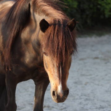
Biete Pflegepferde in Rosenthal
Rosenthal
Valerie-von-Rohden
@Valerie-von-Rohden
älter als 20 Jahre
Pflegepferd
Freizeit
Geländereiten
Stute
3 weitere...
B+
Deprecated: Creation of dynamic property Zend_View_Helper_Ads::$adLink is deprecated in /var/www/stall-frei/htdocs/staging.stall-frei.de/library/Psf/View/Helper/Ads.php on line 108

Futtersack HeuToy, Fressbremse in pink
Mechtersen
STALL-FREIde Marketing
@STALL-FREI-Marketing
Stundenlange Beschäftigung die
Koliken vorbeugt, geringe Staubinhalation mit
steuerbarer Futterentnahme

Lusitano
Gladenbach
Frohnhäuser Mühle
@Frohnhaeusermuehle
8-9 Jahre
Pflegepferd
Reitbeteiligung
Dressur: E
Freizeit
Stute
7 weitere...
B+

Biete Reitbeteiligung an braver Islandstute
Ebsdorfergrund
Lola
@Helga-Julia
15-17 Jahre
Pflegepferd
Reitbeteiligung
Freizeit
Stute
2 weitere...
B+

Reitbeteiligung für Rheinländerstute
Olpe
I.C.
@I._C.
15-17 Jahre
Pflegepferd
Reitbeteiligung
Freizeit
Stute
2 weitere...
B+

Reitbeteiligung an zwei Wallachen zu vergeben
51598 Friesenhagen
Hof Gösingen
@HofGoesingen
12-14 Jahre
Reitbeteiligung
Dressur: E
Freizeit
Wallach
3 weitere...
B+

Suche Pflebeteiligung für meine beiden Warmblüte...
Höckersdorf
B-Shaw
@B-Shaw
15-17 Jahre
Pflegepferd
Dressur: M
Stute
2 weitere...
B+
Für Warmblutpferde&Ponys Preis auf Anfrage
Luckenbach
Carmen Kohlhaas
@Carmen Kohlhaas
Reitbeteiligung
Dressur: A
Dressur: L
Warmblut
3 weitere...
B+

Islandpferd für tölterfahrene Reiterin
Westerburg
Anja Lanzendoerfer
@Pall
10-12 Jahre
Reitbeteiligung
andere
Freizeit
Wallach
2 weitere...
B+

Das Beste für die Hufe
Mechtersen
STALL-FREIde Marketing
@STALL-FREI-Marketing
Hufschmiede und Hufpfleger in Ihrer Nähe

Reit-/Pflegebeteiligung an Pferden bis S*-Springen
wölfersheim
Jasmin Klee
@JasminKlee
6-7 Jahre
Pflegepferd
Reitbeteiligung
Dressur: A
Dressur: L
Stute
7 weitere...
aktuell
B+

schickes feinfühliges sehr gut ausgebildetes pfe...
Morschen
Hof Wilhelmsborn
@hof-wilhelmsborn
18-20 Jahre
Pflegepferd
Reitbeteiligung
Freizeit
Geländereiten
Stute
8 weitere...
B+
Deprecated: Creation of dynamic property Zend_View::$pageCount is deprecated in /var/www/stall-frei/htdocs/staging.stall-frei.de/library/vendor/shardj/zf1-future/library/Zend/View/Abstract.php on line 308
Deprecated: Creation of dynamic property Zend_View::$itemCountPerPage is deprecated in /var/www/stall-frei/htdocs/staging.stall-frei.de/library/vendor/shardj/zf1-future/library/Zend/View/Abstract.php on line 308
Deprecated: Creation of dynamic property Zend_View::$first is deprecated in /var/www/stall-frei/htdocs/staging.stall-frei.de/library/vendor/shardj/zf1-future/library/Zend/View/Abstract.php on line 308
Deprecated: Creation of dynamic property Zend_View::$current is deprecated in /var/www/stall-frei/htdocs/staging.stall-frei.de/library/vendor/shardj/zf1-future/library/Zend/View/Abstract.php on line 308
Deprecated: Creation of dynamic property Zend_View::$last is deprecated in /var/www/stall-frei/htdocs/staging.stall-frei.de/library/vendor/shardj/zf1-future/library/Zend/View/Abstract.php on line 308
Deprecated: Creation of dynamic property Zend_View::$next is deprecated in /var/www/stall-frei/htdocs/staging.stall-frei.de/library/vendor/shardj/zf1-future/library/Zend/View/Abstract.php on line 308
Deprecated: Creation of dynamic property Zend_View::$pagesInRange is deprecated in /var/www/stall-frei/htdocs/staging.stall-frei.de/library/vendor/shardj/zf1-future/library/Zend/View/Abstract.php on line 308
Deprecated: Creation of dynamic property Zend_View::$firstPageInRange is deprecated in /var/www/stall-frei/htdocs/staging.stall-frei.de/library/vendor/shardj/zf1-future/library/Zend/View/Abstract.php on line 308
Deprecated: Creation of dynamic property Zend_View::$lastPageInRange is deprecated in /var/www/stall-frei/htdocs/staging.stall-frei.de/library/vendor/shardj/zf1-future/library/Zend/View/Abstract.php on line 308
Deprecated: Creation of dynamic property Zend_View::$currentItemCount is deprecated in /var/www/stall-frei/htdocs/staging.stall-frei.de/library/vendor/shardj/zf1-future/library/Zend/View/Abstract.php on line 308
Deprecated: Creation of dynamic property Zend_View::$totalItemCount is deprecated in /var/www/stall-frei/htdocs/staging.stall-frei.de/library/vendor/shardj/zf1-future/library/Zend/View/Abstract.php on line 308
Deprecated: Creation of dynamic property Zend_View::$firstItemNumber is deprecated in /var/www/stall-frei/htdocs/staging.stall-frei.de/library/vendor/shardj/zf1-future/library/Zend/View/Abstract.php on line 308
Deprecated: Creation of dynamic property Zend_View::$lastItemNumber is deprecated in /var/www/stall-frei/htdocs/staging.stall-frei.de/library/vendor/shardj/zf1-future/library/Zend/View/Abstract.php on line 308
Deprecated: Creation of dynamic property Zend_View::$router is deprecated in /var/www/stall-frei/htdocs/staging.stall-frei.de/library/vendor/shardj/zf1-future/library/Zend/View/Abstract.php on line 308
Deprecated: Creation of dynamic property Zend_View::$urlParams is deprecated in /var/www/stall-frei/htdocs/staging.stall-frei.de/library/vendor/shardj/zf1-future/library/Zend/View/Abstract.php on line 308
Deprecated: Creation of dynamic property Zend_View::$showAds is deprecated in /var/www/stall-frei/htdocs/staging.stall-frei.de/library/vendor/shardj/zf1-future/library/Zend/View/Abstract.php on line 308
Deprecated: Creation of dynamic property Zend_View::$objectIds is deprecated in /var/www/stall-frei/htdocs/staging.stall-frei.de/library/vendor/shardj/zf1-future/library/Zend/View/Abstract.php on line 308
Deprecated: Creation of dynamic property Zend_View::$showNavbar is deprecated in /var/www/stall-frei/htdocs/staging.stall-frei.de/library/vendor/shardj/zf1-future/library/Zend/View/Abstract.php on line 308
Deprecated: Creation of dynamic property Zend_View::$showBreadcrumb is deprecated in /var/www/stall-frei/htdocs/staging.stall-frei.de/library/vendor/shardj/zf1-future/library/Zend/View/Abstract.php on line 308
Deprecated: Creation of dynamic property Zend_View::$showFooter is deprecated in /var/www/stall-frei/htdocs/staging.stall-frei.de/library/vendor/shardj/zf1-future/library/Zend/View/Abstract.php on line 308
Deprecated: Creation of dynamic property Zend_View::$showInternalAds is deprecated in /var/www/stall-frei/htdocs/staging.stall-frei.de/library/vendor/shardj/zf1-future/library/Zend/View/Abstract.php on line 308
Deprecated: Creation of dynamic property Zend_View::$blNoContent is deprecated in /var/www/stall-frei/htdocs/staging.stall-frei.de/library/vendor/shardj/zf1-future/library/Zend/View/Abstract.php on line 308
Deprecated: Creation of dynamic property Zend_View::$sMetaDesc is deprecated in /var/www/stall-frei/htdocs/staging.stall-frei.de/library/vendor/shardj/zf1-future/library/Zend/View/Abstract.php on line 308
Deprecated: Creation of dynamic property Zend_View::$useGmaps is deprecated in /var/www/stall-frei/htdocs/staging.stall-frei.de/library/vendor/shardj/zf1-future/library/Zend/View/Abstract.php on line 308
Deprecated: Creation of dynamic property Zend_View::$touches is deprecated in /var/www/stall-frei/htdocs/staging.stall-frei.de/library/vendor/shardj/zf1-future/library/Zend/View/Abstract.php on line 308
Deprecated: Creation of dynamic property Zend_View::$oProject is deprecated in /var/www/stall-frei/htdocs/staging.stall-frei.de/library/vendor/shardj/zf1-future/library/Zend/View/Abstract.php on line 308
Deprecated: Creation of dynamic property Zend_View::$pageHeadline is deprecated in /var/www/stall-frei/htdocs/staging.stall-frei.de/library/vendor/shardj/zf1-future/library/Zend/View/Abstract.php on line 308
Deprecated: Creation of dynamic property Zend_View::$disableLocationField is deprecated in /var/www/stall-frei/htdocs/staging.stall-frei.de/library/vendor/shardj/zf1-future/library/Zend/View/Abstract.php on line 308
Deprecated: Creation of dynamic property Zend_View::$isSearch is deprecated in /var/www/stall-frei/htdocs/staging.stall-frei.de/library/vendor/shardj/zf1-future/library/Zend/View/Abstract.php on line 308
Deprecated: Creation of dynamic property Zend_View::$pageTitle is deprecated in /var/www/stall-frei/htdocs/staging.stall-frei.de/library/vendor/shardj/zf1-future/library/Zend/View/Abstract.php on line 308
Deprecated: Creation of dynamic property Psf_Form_Element_Text::$class is deprecated in /var/www/stall-frei/htdocs/staging.stall-frei.de/library/vendor/shardj/zf1-future/library/Zend/Form/Element.php on line 874
Deprecated: Creation of dynamic property Psf_Form_Element_Text::$size is deprecated in /var/www/stall-frei/htdocs/staging.stall-frei.de/library/vendor/shardj/zf1-future/library/Zend/Form/Element.php on line 874
Deprecated: Creation of dynamic property Psf_Form_Element_Text::$placeholder is deprecated in /var/www/stall-frei/htdocs/staging.stall-frei.de/library/vendor/shardj/zf1-future/library/Zend/Form/Element.php on line 874
Deprecated: Creation of dynamic property Psf_Form_Element_Hidden::$class is deprecated in /var/www/stall-frei/htdocs/staging.stall-frei.de/library/vendor/shardj/zf1-future/library/Zend/Form/Element.php on line 874
Deprecated: Creation of dynamic property Psf_Form_Element_Hidden::$class is deprecated in /var/www/stall-frei/htdocs/staging.stall-frei.de/library/vendor/shardj/zf1-future/library/Zend/Form/Element.php on line 874
Deprecated: Creation of dynamic property Psf_Form_Element_Hidden::$class is deprecated in /var/www/stall-frei/htdocs/staging.stall-frei.de/library/vendor/shardj/zf1-future/library/Zend/Form/Element.php on line 874
Deprecated: Creation of dynamic property Psf_Form_Element_Hidden::$class is deprecated in /var/www/stall-frei/htdocs/staging.stall-frei.de/library/vendor/shardj/zf1-future/library/Zend/Form/Element.php on line 874
Deprecated: Creation of dynamic property Psf_Form_Element_Select::$class is deprecated in /var/www/stall-frei/htdocs/staging.stall-frei.de/library/vendor/shardj/zf1-future/library/Zend/Form/Element.php on line 874
Deprecated: Creation of dynamic property Psf_Form_Element_Select::$class is deprecated in /var/www/stall-frei/htdocs/staging.stall-frei.de/library/vendor/shardj/zf1-future/library/Zend/Form/Element.php on line 874
Deprecated: Creation of dynamic property Psf_Form_Element_Text::$class is deprecated in /var/www/stall-frei/htdocs/staging.stall-frei.de/library/vendor/shardj/zf1-future/library/Zend/Form/Element.php on line 874
Deprecated: Creation of dynamic property Psf_Form_Element_Checkbox::$label is deprecated in /var/www/stall-frei/htdocs/staging.stall-frei.de/library/vendor/shardj/zf1-future/library/Zend/Form/Element.php on line 874
Deprecated: Creation of dynamic property Zend_View::$sort is deprecated in /var/www/stall-frei/htdocs/staging.stall-frei.de/library/vendor/shardj/zf1-future/library/Zend/View/Abstract.php on line 308
Deprecated: Creation of dynamic property Zend_View::$searchLocation is deprecated in /var/www/stall-frei/htdocs/staging.stall-frei.de/library/vendor/shardj/zf1-future/library/Zend/View/Abstract.php on line 308
Deprecated: Creation of dynamic property Zend_View::$locationHint is deprecated in /var/www/stall-frei/htdocs/staging.stall-frei.de/library/vendor/shardj/zf1-future/library/Zend/View/Abstract.php on line 308
Psf_GeoCoder_Abstract::getLocation: Battenberg Get Location CachedOrLive
Psf_GeoCoder_Abstract::getCachedOrLive: Battenberg
Psf_GeoCoder_OpenCageData::makeApiRequest: response:
Array
(
[documentation] => https://opencagedata.com/api
[licenses] => Array
(
[0] => Array
(
[name] => see attribution guide
[url] => https://opencagedata.com/credits
)
)
[results] => Array
(
[0] => Array
(
[bounds] => Array
(
[northeast] => Array
(
[lat] => 51.077276
[lng] => 8.7132809
)
[southwest] => Array
(
[lat] => 50.9520773
[lng] => 8.5038718
)
)
[components] => Array
(
[ISO_3166-1_alpha-2] => DE
[ISO_3166-1_alpha-3] => DEU
[ISO_3166-2] => Array
(
[0] => DE-HE
)
[_category] => place
[_normalized_city] => Battenberg (Eder)
[_type] => municipality
[continent] => Europe
[country] => Deutschland
[country_code] => de
[county] => Landkreis Waldeck-Frankenberg
[municipality] => Battenberg (Eder)
[political_union] => European Union
[postcode] => 35088
[state] => Hessen
[state_code] => HE
)
[confidence] => 6
[formatted] => 35088 Battenberg (Eder), Deutschland
[geometry] => Array
(
[lat] => 51.0323524
[lng] => 8.6112782
)
)
[1] => Array
(
[bounds] => Array
(
[northeast] => Array
(
[lat] => 49.5387491
[lng] => 8.1482433
)
[southwest] => Array
(
[lat] => 49.5068627
[lng] => 8.0956589
)
)
[components] => Array
(
[ISO_3166-1_alpha-2] => DE
[ISO_3166-1_alpha-3] => DEU
[ISO_3166-2] => Array
(
[0] => DE-RP
)
[_category] => place
[_normalized_city] => Battenberg (Pfalz)
[_type] => village
[continent] => Europe
[country] => Deutschland
[country_code] => de
[county] => Landkreis Bad Dürkheim
[municipality] => Leiningerland
[political_union] => European Union
[state] => Rheinland-Pfalz
[state_code] => RP
[village] => Battenberg (Pfalz)
)
[confidence] => 7
[formatted] => Battenberg (Pfalz), Rheinland-Pfalz, Deutschland
[geometry] => Array
(
[lat] => 49.5329203
[lng] => 8.1399689
)
)
[2] => Array
(
[bounds] => Array
(
[northeast] => Array
(
[lat] => 51.0487503
[lng] => 8.6827927
)
[southwest] => Array
(
[lat] => 50.9889215
[lng] => 8.5926868
)
)
[components] => Array
(
[ISO_3166-1_alpha-2] => DE
[ISO_3166-1_alpha-3] => DEU
[ISO_3166-2] => Array
(
[0] => DE-HE
)
[_category] => place
[_normalized_city] => Battenberg
[_type] => city
[continent] => Europe
[country] => Deutschland
[country_code] => de
[county] => Landkreis Waldeck-Frankenberg
[municipality] => Battenberg (Eder)
[political_union] => European Union
[postcode] => 35088
[state] => Hessen
[state_code] => HE
[town] => Battenberg
)
[confidence] => 7
[formatted] => 35088 Battenberg, Deutschland
[geometry] => Array
(
[lat] => 51.0135309
[lng] => 8.6442197
)
)
[3] => Array
(
[bounds] => Array
(
[northeast] => Array
(
[lat] => 51.3495495
[lng] => 8.3417503
)
[southwest] => Array
(
[lat] => 51.3494495
[lng] => 8.3416503
)
)
[components] => Array
(
[ISO_3166-1_alpha-2] => DE
[ISO_3166-1_alpha-3] => DEU
[ISO_3166-2] => Array
(
[0] => DE-NW
)
[_category] => natural/water
[_normalized_city] => Meschede
[_type] => peak
[continent] => Europe
[country] => Deutschland
[country_code] => de
[county] => Hochsauerlandkreis
[peak] => Battenberg
[political_union] => European Union
[state] => Nordrhein-Westfalen
[state_code] => NW
[town] => Meschede
)
[confidence] => 9
[formatted] => Battenberg, Meschede, Nordrhein-Westfalen, Deutschland
[geometry] => Array
(
[lat] => 51.3494995
[lng] => 8.3417003
)
)
[4] => Array
(
[bounds] => Array
(
[northeast] => Array
(
[lat] => 51.425678
[lng] => 8.2240563
)
[southwest] => Array
(
[lat] => 51.425578
[lng] => 8.2239563
)
)
[components] => Array
(
[ISO_3166-1_alpha-2] => DE
[ISO_3166-1_alpha-3] => DEU
[ISO_3166-2] => Array
(
[0] => DE-NW
)
[_category] => natural/water
[_normalized_city] => Warstein
[_type] => peak
[continent] => Europe
[country] => Deutschland
[country_code] => de
[county] => Kreis Soest
[peak] => Battenberg
[political_union] => European Union
[state] => Nordrhein-Westfalen
[state_code] => NW
[town] => Warstein
)
[confidence] => 9
[formatted] => Battenberg, Warstein, Nordrhein-Westfalen, Deutschland
[geometry] => Array
(
[lat] => 51.425628
[lng] => 8.2240063
)
)
[5] => Array
(
[bounds] => Array
(
[northeast] => Array
(
[lat] => 51.2133221
[lng] => 8.1827953
)
[southwest] => Array
(
[lat] => 51.2132221
[lng] => 8.1826953
)
)
[components] => Array
(
[ISO_3166-1_alpha-2] => DE
[ISO_3166-1_alpha-3] => DEU
[ISO_3166-2] => Array
(
[0] => DE-NW
)
[_category] => natural/water
[_normalized_city] => Eslohe
[_type] => peak
[continent] => Europe
[country] => Deutschland
[country_code] => de
[county] => Hochsauerlandkreis
[peak] => Battenberg
[political_union] => European Union
[postcode] => 59889
[state] => Nordrhein-Westfalen
[state_code] => NW
[town] => Eslohe
)
[confidence] => 9
[formatted] => Battenberg, 59889 Eslohe, Deutschland
[geometry] => Array
(
[lat] => 51.2132721
[lng] => 8.1827453
)
)
[6] => Array
(
[bounds] => Array
(
[northeast] => Array
(
[lat] => 51.41631
[lng] => 8.680424
)
[southwest] => Array
(
[lat] => 51.41621
[lng] => 8.680324
)
)
[components] => Array
(
[ISO_3166-1_alpha-2] => DE
[ISO_3166-1_alpha-3] => DEU
[ISO_3166-2] => Array
(
[0] => DE-NW
)
[_category] => natural/water
[_normalized_city] => Brilon
[_type] => peak
[continent] => Europe
[country] => Deutschland
[country_code] => de
[county] => Hochsauerlandkreis
[peak] => Battenberg
[political_union] => European Union
[state] => Nordrhein-Westfalen
[state_code] => NW
[town] => Brilon
)
[confidence] => 9
[formatted] => Battenberg, Brilon, Nordrhein-Westfalen, Deutschland
[geometry] => Array
(
[lat] => 51.41626
[lng] => 8.680374
)
)
[7] => Array
(
[components] => Array
(
[ISO_3166-1_alpha-2] => FR
[ISO_3166-1_alpha-3] => FRA
[ISO_3166-2] => Array
(
[0] => FR-GES
[1] => FR-6AE
[2] => FR-67
)
[_category] => road
[_normalized_city] => Zinswiller
[_type] => road
[city] => Zinswiller
[continent] => Europe
[country] => France
[country_code] => fr
[county] => Bas-Rhin
[local_authority] => Communauté de communes du Pays de Niederbronn-les-Bains
[political_union] => European Union
[postcode] => 67110
[road] => Rue Mattenberg
[state] => Grand Est
[state_code] => GES
)
[confidence] => 3
[formatted] => Rue Mattenberg, 67110 Zinswiller, France
[geometry] => Array
(
[lat] => 48.91499
[lng] => 7.596622
)
)
[8] => Array
(
[components] => Array
(
[ISO_3166-1_alpha-2] => FR
[ISO_3166-1_alpha-3] => FRA
[ISO_3166-2] => Array
(
[0] => FR-HDF
[1] => FR-59
)
[_category] => road
[_normalized_city] => Rubrouck
[_type] => road
[city] => Rubrouck
[continent] => Europe
[country] => France
[country_code] => fr
[county] => Nord
[local_authority] => Cœur de Flandre Agglo
[political_union] => European Union
[postcode] => 59285
[road] => Balenberg Straete
[state] => Hauts-de-France
[state_code] => HDF
)
[confidence] => 2
[formatted] => Balenberg Straete, 59285 Rubrouck, France
[geometry] => Array
(
[lat] => 50.817072
[lng] => 2.365126
)
)
[9] => Array
(
[components] => Array
(
[ISO_3166-1_alpha-2] => FR
[ISO_3166-1_alpha-3] => FRA
[ISO_3166-2] => Array
(
[0] => FR-GES
[1] => FR-6AE
[2] => FR-67
)
[_category] => road
[_normalized_city] => Bassemberg
[_type] => road
[city] => Bassemberg
[continent] => Europe
[country] => France
[country_code] => fr
[county] => Bas-Rhin
[local_authority] => Communauté de communes de la Vallée de Villé
[political_union] => European Union
[postcode] => 67220
[road] => Rue du Scheibenberg
[state] => Grand Est
[state_code] => GES
)
[confidence] => 2
[formatted] => Rue du Scheibenberg, 67220 Bassemberg, France
[geometry] => Array
(
[lat] => 48.336149
[lng] => 7.285295
)
)
)
[status] => Array
(
[code] => 200
[message] => OK
)
[stay_informed] => Array
(
[blog] => https://blog.opencagedata.com
[mastodon] => https://en.osm.town/@opencage
)
[thanks] => For using an OpenCage API
[timestamp] => Array
(
[created_http] => Fri, 16 Jan 2026 20:55:14 GMT
[created_unix] => 1768596914
)
[total_results] => 10
)
Psf_GeoCoder_Abstract::convertLocationResult
{"documentation":"https:\/\/opencagedata.com\/api","licenses":[{"name":"see attribution guide","url":"https:\/\/opencagedata.com\/credits"}],"results":[{"bounds":{"northeast":{"lat":51.077276,"lng":8.7132809},"southwest":{"lat":50.9520773,"lng":8.5038718}},"components":{"ISO_3166-1_alpha-2":"DE","ISO_3166-1_alpha-3":"DEU","ISO_3166-2":["DE-HE"],"_category":"place","_normalized_city":"Battenberg (Eder)","_type":"municipality","continent":"Europe","country":"Deutschland","country_code":"de","county":"Landkreis Waldeck-Frankenberg","municipality":"Battenberg (Eder)","political_union":"European Union","postcode":"35088","state":"Hessen","state_code":"HE"},"confidence":6,"formatted":"35088 Battenberg (Eder), Deutschland","geometry":{"lat":51.0323524,"lng":8.6112782}},{"bounds":{"northeast":{"lat":49.5387491,"lng":8.1482433},"southwest":{"lat":49.5068627,"lng":8.0956589}},"components":{"ISO_3166-1_alpha-2":"DE","ISO_3166-1_alpha-3":"DEU","ISO_3166-2":["DE-RP"],"_category":"place","_normalized_city":"Battenberg (Pfalz)","_type":"village","continent":"Europe","country":"Deutschland","country_code":"de","county":"Landkreis Bad D\u00fcrkheim","municipality":"Leiningerland","political_union":"European Union","state":"Rheinland-Pfalz","state_code":"RP","village":"Battenberg (Pfalz)"},"confidence":7,"formatted":"Battenberg (Pfalz), Rheinland-Pfalz, Deutschland","geometry":{"lat":49.5329203,"lng":8.1399689}},{"bounds":{"northeast":{"lat":51.0487503,"lng":8.6827927},"southwest":{"lat":50.9889215,"lng":8.5926868}},"components":{"ISO_3166-1_alpha-2":"DE","ISO_3166-1_alpha-3":"DEU","ISO_3166-2":["DE-HE"],"_category":"place","_normalized_city":"Battenberg","_type":"city","continent":"Europe","country":"Deutschland","country_code":"de","county":"Landkreis Waldeck-Frankenberg","municipality":"Battenberg (Eder)","political_union":"European Union","postcode":"35088","state":"Hessen","state_code":"HE","town":"Battenberg"},"confidence":7,"formatted":"35088 Battenberg, Deutschland","geometry":{"lat":51.0135309,"lng":8.6442197}},{"bounds":{"northeast":{"lat":51.3495495,"lng":8.3417503},"southwest":{"lat":51.3494495,"lng":8.3416503}},"components":{"ISO_3166-1_alpha-2":"DE","ISO_3166-1_alpha-3":"DEU","ISO_3166-2":["DE-NW"],"_category":"natural\/water","_normalized_city":"Meschede","_type":"peak","continent":"Europe","country":"Deutschland","country_code":"de","county":"Hochsauerlandkreis","peak":"Battenberg","political_union":"European Union","state":"Nordrhein-Westfalen","state_code":"NW","town":"Meschede"},"confidence":9,"formatted":"Battenberg, Meschede, Nordrhein-Westfalen, Deutschland","geometry":{"lat":51.3494995,"lng":8.3417003}},{"bounds":{"northeast":{"lat":51.425678,"lng":8.2240563},"southwest":{"lat":51.425578,"lng":8.2239563}},"components":{"ISO_3166-1_alpha-2":"DE","ISO_3166-1_alpha-3":"DEU","ISO_3166-2":["DE-NW"],"_category":"natural\/water","_normalized_city":"Warstein","_type":"peak","continent":"Europe","country":"Deutschland","country_code":"de","county":"Kreis Soest","peak":"Battenberg","political_union":"European Union","state":"Nordrhein-Westfalen","state_code":"NW","town":"Warstein"},"confidence":9,"formatted":"Battenberg, Warstein, Nordrhein-Westfalen, Deutschland","geometry":{"lat":51.425628,"lng":8.2240063}},{"bounds":{"northeast":{"lat":51.2133221,"lng":8.1827953},"southwest":{"lat":51.2132221,"lng":8.1826953}},"components":{"ISO_3166-1_alpha-2":"DE","ISO_3166-1_alpha-3":"DEU","ISO_3166-2":["DE-NW"],"_category":"natural\/water","_normalized_city":"Eslohe","_type":"peak","continent":"Europe","country":"Deutschland","country_code":"de","county":"Hochsauerlandkreis","peak":"Battenberg","political_union":"European Union","postcode":"59889","state":"Nordrhein-Westfalen","state_code":"NW","town":"Eslohe"},"confidence":9,"formatted":"Battenberg, 59889 Eslohe, Deutschland","geometry":{"lat":51.2132721,"lng":8.1827453}},{"bounds":{"northeast":{"lat":51.41631,"lng":8.680424},"southwest":{"lat":51.41621,"lng":8.680324}},"components":{"ISO_3166-1_alpha-2":"DE","ISO_3166-1_alpha-3":"DEU","ISO_3166-2":["DE-NW"],"_category":"natural\/water","_normalized_city":"Brilon","_type":"peak","continent":"Europe","country":"Deutschland","country_code":"de","county":"Hochsauerlandkreis","peak":"Battenberg","political_union":"European Union","state":"Nordrhein-Westfalen","state_code":"NW","town":"Brilon"},"confidence":9,"formatted":"Battenberg, Brilon, Nordrhein-Westfalen, Deutschland","geometry":{"lat":51.41626,"lng":8.680374}},{"components":{"ISO_3166-1_alpha-2":"FR","ISO_3166-1_alpha-3":"FRA","ISO_3166-2":["FR-GES","FR-6AE","FR-67"],"_category":"road","_normalized_city":"Zinswiller","_type":"road","city":"Zinswiller","continent":"Europe","country":"France","country_code":"fr","county":"Bas-Rhin","local_authority":"Communaut\u00e9 de communes du Pays de Niederbronn-les-Bains","political_union":"European Union","postcode":"67110","road":"Rue Mattenberg","state":"Grand Est","state_code":"GES"},"confidence":3,"formatted":"Rue Mattenberg, 67110 Zinswiller, France","geometry":{"lat":48.91499,"lng":7.596622}},{"components":{"ISO_3166-1_alpha-2":"FR","ISO_3166-1_alpha-3":"FRA","ISO_3166-2":["FR-HDF","FR-59"],"_category":"road","_normalized_city":"Rubrouck","_type":"road","city":"Rubrouck","continent":"Europe","country":"France","country_code":"fr","county":"Nord","local_authority":"C\u0153ur de Flandre Agglo","political_union":"European Union","postcode":"59285","road":"Balenberg Straete","state":"Hauts-de-France","state_code":"HDF"},"confidence":2,"formatted":"Balenberg Straete, 59285 Rubrouck, France","geometry":{"lat":50.817072,"lng":2.365126}},{"components":{"ISO_3166-1_alpha-2":"FR","ISO_3166-1_alpha-3":"FRA","ISO_3166-2":["FR-GES","FR-6AE","FR-67"],"_category":"road","_normalized_city":"Bassemberg","_type":"road","city":"Bassemberg","continent":"Europe","country":"France","country_code":"fr","county":"Bas-Rhin","local_authority":"Communaut\u00e9 de communes de la Vall\u00e9e de Vill\u00e9","political_union":"European Union","postcode":"67220","road":"Rue du Scheibenberg","state":"Grand Est","state_code":"GES"},"confidence":2,"formatted":"Rue du Scheibenberg, 67220 Bassemberg, France","geometry":{"lat":48.336149,"lng":7.285295}}],"status":{"code":200,"message":"OK"},"stay_informed":{"blog":"https:\/\/blog.opencagedata.com","mastodon":"https:\/\/en.osm.town\/@opencage"},"thanks":"For using an OpenCage API","timestamp":{"created_http":"Fri, 16 Jan 2026 20:55:14 GMT","created_unix":1768596914},"total_results":10}Array
(
[0] => stdClass Object
(
[bounds] => stdClass Object
(
[northeast] => stdClass Object
(
[lat] => 51.077276
[lng] => 8.7132809
)
[southwest] => stdClass Object
(
[lat] => 50.9520773
[lng] => 8.5038718
)
)
[components] => stdClass Object
(
[ISO_3166-1_alpha-2] => DE
[ISO_3166-1_alpha-3] => DEU
[ISO_3166-2] => Array
(
[0] => DE-HE
)
[_category] => place
[_normalized_city] => Battenberg (Eder)
[_type] => municipality
[continent] => Europe
[country] => Deutschland
[country_code] => de
[county] => Landkreis Waldeck-Frankenberg
[municipality] => Battenberg (Eder)
[political_union] => European Union
[postcode] => 35088
[state] => Hessen
[state_code] => HE
)
[confidence] => 6
[formatted] => 35088 Battenberg (Eder), Deutschland
[geometry] => stdClass Object
(
[lat] => 51.0323524
[lng] => 8.6112782
)
)
[1] => stdClass Object
(
[bounds] => stdClass Object
(
[northeast] => stdClass Object
(
[lat] => 49.5387491
[lng] => 8.1482433
)
[southwest] => stdClass Object
(
[lat] => 49.5068627
[lng] => 8.0956589
)
)
[components] => stdClass Object
(
[ISO_3166-1_alpha-2] => DE
[ISO_3166-1_alpha-3] => DEU
[ISO_3166-2] => Array
(
[0] => DE-RP
)
[_category] => place
[_normalized_city] => Battenberg (Pfalz)
[_type] => village
[continent] => Europe
[country] => Deutschland
[country_code] => de
[county] => Landkreis Bad Dürkheim
[municipality] => Leiningerland
[political_union] => European Union
[state] => Rheinland-Pfalz
[state_code] => RP
[village] => Battenberg (Pfalz)
)
[confidence] => 7
[formatted] => Battenberg (Pfalz), Rheinland-Pfalz, Deutschland
[geometry] => stdClass Object
(
[lat] => 49.5329203
[lng] => 8.1399689
)
)
[2] => stdClass Object
(
[bounds] => stdClass Object
(
[northeast] => stdClass Object
(
[lat] => 51.0487503
[lng] => 8.6827927
)
[southwest] => stdClass Object
(
[lat] => 50.9889215
[lng] => 8.5926868
)
)
[components] => stdClass Object
(
[ISO_3166-1_alpha-2] => DE
[ISO_3166-1_alpha-3] => DEU
[ISO_3166-2] => Array
(
[0] => DE-HE
)
[_category] => place
[_normalized_city] => Battenberg
[_type] => city
[continent] => Europe
[country] => Deutschland
[country_code] => de
[county] => Landkreis Waldeck-Frankenberg
[municipality] => Battenberg (Eder)
[political_union] => European Union
[postcode] => 35088
[state] => Hessen
[state_code] => HE
[town] => Battenberg
)
[confidence] => 7
[formatted] => 35088 Battenberg, Deutschland
[geometry] => stdClass Object
(
[lat] => 51.0135309
[lng] => 8.6442197
)
)
[3] => stdClass Object
(
[bounds] => stdClass Object
(
[northeast] => stdClass Object
(
[lat] => 51.3495495
[lng] => 8.3417503
)
[southwest] => stdClass Object
(
[lat] => 51.3494495
[lng] => 8.3416503
)
)
[components] => stdClass Object
(
[ISO_3166-1_alpha-2] => DE
[ISO_3166-1_alpha-3] => DEU
[ISO_3166-2] => Array
(
[0] => DE-NW
)
[_category] => natural/water
[_normalized_city] => Meschede
[_type] => peak
[continent] => Europe
[country] => Deutschland
[country_code] => de
[county] => Hochsauerlandkreis
[peak] => Battenberg
[political_union] => European Union
[state] => Nordrhein-Westfalen
[state_code] => NW
[town] => Meschede
)
[confidence] => 9
[formatted] => Battenberg, Meschede, Nordrhein-Westfalen, Deutschland
[geometry] => stdClass Object
(
[lat] => 51.3494995
[lng] => 8.3417003
)
)
[4] => stdClass Object
(
[bounds] => stdClass Object
(
[northeast] => stdClass Object
(
[lat] => 51.425678
[lng] => 8.2240563
)
[southwest] => stdClass Object
(
[lat] => 51.425578
[lng] => 8.2239563
)
)
[components] => stdClass Object
(
[ISO_3166-1_alpha-2] => DE
[ISO_3166-1_alpha-3] => DEU
[ISO_3166-2] => Array
(
[0] => DE-NW
)
[_category] => natural/water
[_normalized_city] => Warstein
[_type] => peak
[continent] => Europe
[country] => Deutschland
[country_code] => de
[county] => Kreis Soest
[peak] => Battenberg
[political_union] => European Union
[state] => Nordrhein-Westfalen
[state_code] => NW
[town] => Warstein
)
[confidence] => 9
[formatted] => Battenberg, Warstein, Nordrhein-Westfalen, Deutschland
[geometry] => stdClass Object
(
[lat] => 51.425628
[lng] => 8.2240063
)
)
[5] => stdClass Object
(
[bounds] => stdClass Object
(
[northeast] => stdClass Object
(
[lat] => 51.2133221
[lng] => 8.1827953
)
[southwest] => stdClass Object
(
[lat] => 51.2132221
[lng] => 8.1826953
)
)
[components] => stdClass Object
(
[ISO_3166-1_alpha-2] => DE
[ISO_3166-1_alpha-3] => DEU
[ISO_3166-2] => Array
(
[0] => DE-NW
)
[_category] => natural/water
[_normalized_city] => Eslohe
[_type] => peak
[continent] => Europe
[country] => Deutschland
[country_code] => de
[county] => Hochsauerlandkreis
[peak] => Battenberg
[political_union] => European Union
[postcode] => 59889
[state] => Nordrhein-Westfalen
[state_code] => NW
[town] => Eslohe
)
[confidence] => 9
[formatted] => Battenberg, 59889 Eslohe, Deutschland
[geometry] => stdClass Object
(
[lat] => 51.2132721
[lng] => 8.1827453
)
)
[6] => stdClass Object
(
[bounds] => stdClass Object
(
[northeast] => stdClass Object
(
[lat] => 51.41631
[lng] => 8.680424
)
[southwest] => stdClass Object
(
[lat] => 51.41621
[lng] => 8.680324
)
)
[components] => stdClass Object
(
[ISO_3166-1_alpha-2] => DE
[ISO_3166-1_alpha-3] => DEU
[ISO_3166-2] => Array
(
[0] => DE-NW
)
[_category] => natural/water
[_normalized_city] => Brilon
[_type] => peak
[continent] => Europe
[country] => Deutschland
[country_code] => de
[county] => Hochsauerlandkreis
[peak] => Battenberg
[political_union] => European Union
[state] => Nordrhein-Westfalen
[state_code] => NW
[town] => Brilon
)
[confidence] => 9
[formatted] => Battenberg, Brilon, Nordrhein-Westfalen, Deutschland
[geometry] => stdClass Object
(
[lat] => 51.41626
[lng] => 8.680374
)
)
[7] => stdClass Object
(
[components] => stdClass Object
(
[ISO_3166-1_alpha-2] => FR
[ISO_3166-1_alpha-3] => FRA
[ISO_3166-2] => Array
(
[0] => FR-GES
[1] => FR-6AE
[2] => FR-67
)
[_category] => road
[_normalized_city] => Zinswiller
[_type] => road
[city] => Zinswiller
[continent] => Europe
[country] => France
[country_code] => fr
[county] => Bas-Rhin
[local_authority] => Communauté de communes du Pays de Niederbronn-les-Bains
[political_union] => European Union
[postcode] => 67110
[road] => Rue Mattenberg
[state] => Grand Est
[state_code] => GES
)
[confidence] => 3
[formatted] => Rue Mattenberg, 67110 Zinswiller, France
[geometry] => stdClass Object
(
[lat] => 48.91499
[lng] => 7.596622
)
)
[8] => stdClass Object
(
[components] => stdClass Object
(
[ISO_3166-1_alpha-2] => FR
[ISO_3166-1_alpha-3] => FRA
[ISO_3166-2] => Array
(
[0] => FR-HDF
[1] => FR-59
)
[_category] => road
[_normalized_city] => Rubrouck
[_type] => road
[city] => Rubrouck
[continent] => Europe
[country] => France
[country_code] => fr
[county] => Nord
[local_authority] => Cœur de Flandre Agglo
[political_union] => European Union
[postcode] => 59285
[road] => Balenberg Straete
[state] => Hauts-de-France
[state_code] => HDF
)
[confidence] => 2
[formatted] => Balenberg Straete, 59285 Rubrouck, France
[geometry] => stdClass Object
(
[lat] => 50.817072
[lng] => 2.365126
)
)
[9] => stdClass Object
(
[components] => stdClass Object
(
[ISO_3166-1_alpha-2] => FR
[ISO_3166-1_alpha-3] => FRA
[ISO_3166-2] => Array
(
[0] => FR-GES
[1] => FR-6AE
[2] => FR-67
)
[_category] => road
[_normalized_city] => Bassemberg
[_type] => road
[city] => Bassemberg
[continent] => Europe
[country] => France
[country_code] => fr
[county] => Bas-Rhin
[local_authority] => Communauté de communes de la Vallée de Villé
[political_union] => European Union
[postcode] => 67220
[road] => Rue du Scheibenberg
[state] => Grand Est
[state_code] => GES
)
[confidence] => 2
[formatted] => Rue du Scheibenberg, 67220 Bassemberg, France
[geometry] => stdClass Object
(
[lat] => 48.336149
[lng] => 7.285295
)
)
)
Psf_GeoCoder_OpenCageData::getKeyMap: 0
stdClass Object
(
    [bounds] => stdClass Object
        (
            [northeast] => stdClass Object
                (
                    [lat] => 51.077276
                    [lng] => 8.7132809
                )

            [southwest] => stdClass Object
                (
                    [lat] => 50.9520773
                    [lng] => 8.5038718
                )

        )

    [components] => stdClass Object
        (
            [ISO_3166-1_alpha-2] => DE
            [ISO_3166-1_alpha-3] => DEU
            [ISO_3166-2] => Array
                (
                    [0] => DE-HE
                )

            [_category] => place
            [_normalized_city] => Battenberg (Eder)
            [_type] => municipality
            [continent] => Europe
            [country] => Deutschland
            [country_code] => de
            [county] => Landkreis Waldeck-Frankenberg
            [municipality] => Battenberg (Eder)
            [political_union] => European Union
            [postcode] => 35088
            [state] => Hessen
            [state_code] => HE
        )

    [confidence] => 6
    [formatted] => 35088 Battenberg (Eder), Deutschland
    [geometry] => stdClass Object
        (
            [lat] => 51.0323524
            [lng] => 8.6112782
        )

)
Psf_GeoCoder_OpenCageData::getCounty: Waldeck-Frankenberg
Psf_GeoCoder_OpenCageData::addMissingData REFETCH!
Array
(
    [address] => 35088 Battenberg (Eder), Deutschland
    [type] => municipality
    [street] =>
    [city] =>
    [county] => Waldeck-Frankenberg
    [state] => Hessen
    [zip] => 35088
    [country] => Deutschland
    [suburb] =>
    [countrycode] => de
    [latitude] => 51.0323524
    [longitude] => 8.6112782
    [accuracy] => 1
    [confidence] => 6
    [bounds] => stdClass Object
        (
            [northeast] => stdClass Object
                (
                    [lat] => 51.077276
                    [lng] => 8.7132809
                )

            [southwest] => stdClass Object
                (
                    [lat] => 50.9520773
                    [lng] => 8.5038718
                )

        )

)
reformat!
Array
(
    [address] => 35088 Battenberg (Eder), Deutschland
    [type] => municipality
    [street] =>
    [city] =>
    [county] => Waldeck-Frankenberg
    [state] => Hessen
    [zip] => 35088
    [country] => Deutschland
    [suburb] =>
    [countrycode] => de
    [latitude] => 51.0323524
    [longitude] => 8.6112782
    [accuracy] => 1
    [confidence] => 6
    [bounds] => stdClass Object
        (
            [northeast] => stdClass Object
                (
                    [lat] => 51.077276
                    [lng] => 8.7132809
                )

            [southwest] => stdClass Object
                (
                    [lat] => 50.9520773
                    [lng] => 8.5038718
                )

        )

    [place] => 35088 , Hessen
    [hash] => 050b39ca20b304bb6139ea262d4935e6
)
Psf_GeoCoder_OpenCageData::getKeyMap: 1
stdClass Object
(
    [bounds] => stdClass Object
        (
            [northeast] => stdClass Object
                (
                    [lat] => 49.5387491
                    [lng] => 8.1482433
                )

            [southwest] => stdClass Object
                (
                    [lat] => 49.5068627
                    [lng] => 8.0956589
                )

        )

    [components] => stdClass Object
        (
            [ISO_3166-1_alpha-2] => DE
            [ISO_3166-1_alpha-3] => DEU
            [ISO_3166-2] => Array
                (
                    [0] => DE-RP
                )

            [_category] => place
            [_normalized_city] => Battenberg (Pfalz)
            [_type] => village
            [continent] => Europe
            [country] => Deutschland
            [country_code] => de
            [county] => Landkreis Bad Dürkheim
            [municipality] => Leiningerland
            [political_union] => European Union
            [state] => Rheinland-Pfalz
            [state_code] => RP
            [village] => Battenberg (Pfalz)
        )

    [confidence] => 7
    [formatted] => Battenberg (Pfalz), Rheinland-Pfalz, Deutschland
    [geometry] => stdClass Object
        (
            [lat] => 49.5329203
            [lng] => 8.1399689
        )

)
Psf_GeoCoder_OpenCageData::getCounty: Bad Dürkheim
Psf_GeoCoder_OpenCageData::addMissingData REFETCH!
Array
(
    [address] => Battenberg (Pfalz), Rheinland-Pfalz, Deutschland
    [type] => village
    [street] =>
    [city] => Battenberg (Pfalz)
    [county] => Bad Dürkheim
    [state] => Rheinland-Pfalz
    [zip] =>
    [country] => Deutschland
    [suburb] =>
    [countrycode] => de
    [latitude] => 49.5329203
    [longitude] => 8.1399689
    [accuracy] => 1
    [confidence] => 7
    [bounds] => stdClass Object
        (
            [northeast] => stdClass Object
                (
                    [lat] => 49.5387491
                    [lng] => 8.1482433
                )

            [southwest] => stdClass Object
                (
                    [lat] => 49.5068627
                    [lng] => 8.0956589
                )

        )

)
reformat!
Array
(
    [address] => Battenberg (Pfalz), Rheinland-Pfalz, Deutschland
    [type] => village
    [street] =>
    [city] => Battenberg (Pfalz)
    [county] => Bad Dürkheim
    [state] => Rheinland-Pfalz
    [zip] =>
    [country] => Deutschland
    [suburb] =>
    [countrycode] => de
    [latitude] => 49.5329203
    [longitude] => 8.1399689
    [accuracy] => 1
    [confidence] => 7
    [bounds] => stdClass Object
        (
            [northeast] => stdClass Object
                (
                    [lat] => 49.5387491
                    [lng] => 8.1482433
                )

            [southwest] => stdClass Object
                (
                    [lat] => 49.5068627
                    [lng] => 8.0956589
                )

        )

    [place] => Battenberg (Pfalz), Rheinland-Pfalz
    [hash] => 286b12c744f8e7b613ee4d9336e27528
)
Psf_GeoCoder_OpenCageData::getKeyMap: 2
stdClass Object
(
    [bounds] => stdClass Object
        (
            [northeast] => stdClass Object
                (
                    [lat] => 51.0487503
                    [lng] => 8.6827927
                )

            [southwest] => stdClass Object
                (
                    [lat] => 50.9889215
                    [lng] => 8.5926868
                )

        )

    [components] => stdClass Object
        (
            [ISO_3166-1_alpha-2] => DE
            [ISO_3166-1_alpha-3] => DEU
            [ISO_3166-2] => Array
                (
                    [0] => DE-HE
                )

            [_category] => place
            [_normalized_city] => Battenberg
            [_type] => city
            [continent] => Europe
            [country] => Deutschland
            [country_code] => de
            [county] => Landkreis Waldeck-Frankenberg
            [municipality] => Battenberg (Eder)
            [political_union] => European Union
            [postcode] => 35088
            [state] => Hessen
            [state_code] => HE
            [town] => Battenberg
        )

    [confidence] => 7
    [formatted] => 35088 Battenberg, Deutschland
    [geometry] => stdClass Object
        (
            [lat] => 51.0135309
            [lng] => 8.6442197
        )

)
Psf_GeoCoder_OpenCageData::getCounty: Waldeck-Frankenberg
Psf_GeoCoder_OpenCageData::addMissingData REFETCH!
Array
(
    [address] => 35088 Battenberg, Deutschland
    [type] => city
    [street] =>
    [city] => Battenberg
    [county] => Waldeck-Frankenberg
    [state] => Hessen
    [zip] => 35088
    [country] => Deutschland
    [suburb] =>
    [countrycode] => de
    [latitude] => 51.0135309
    [longitude] => 8.6442197
    [accuracy] => 1
    [confidence] => 7
    [bounds] => stdClass Object
        (
            [northeast] => stdClass Object
                (
                    [lat] => 51.0487503
                    [lng] => 8.6827927
                )

            [southwest] => stdClass Object
                (
                    [lat] => 50.9889215
                    [lng] => 8.5926868
                )

        )

)
reformat!
Array
(
    [address] => 35088 Battenberg, Deutschland
    [type] => city
    [street] =>
    [city] => Battenberg
    [county] => Waldeck-Frankenberg
    [state] => Hessen
    [zip] => 35088
    [country] => Deutschland
    [suburb] =>
    [countrycode] => de
    [latitude] => 51.0135309
    [longitude] => 8.6442197
    [accuracy] => 1
    [confidence] => 7
    [bounds] => stdClass Object
        (
            [northeast] => stdClass Object
                (
                    [lat] => 51.0487503
                    [lng] => 8.6827927
                )

            [southwest] => stdClass Object
                (
                    [lat] => 50.9889215
                    [lng] => 8.5926868
                )

        )

    [place] => 35088 Battenberg, Hessen
    [hash] => c8228bfb3a88bb22ba100430bc618dab
)
Psf_GeoCoder_OpenCageData::getKeyMap: 3
stdClass Object
(
    [bounds] => stdClass Object
        (
            [northeast] => stdClass Object
                (
                    [lat] => 51.3495495
                    [lng] => 8.3417503
                )

            [southwest] => stdClass Object
                (
                    [lat] => 51.3494495
                    [lng] => 8.3416503
                )

        )

    [components] => stdClass Object
        (
            [ISO_3166-1_alpha-2] => DE
            [ISO_3166-1_alpha-3] => DEU
            [ISO_3166-2] => Array
                (
                    [0] => DE-NW
                )

            [_category] => natural/water
            [_normalized_city] => Meschede
            [_type] => peak
            [continent] => Europe
            [country] => Deutschland
            [country_code] => de
            [county] => Hochsauerlandkreis
            [peak] => Battenberg
            [political_union] => European Union
            [state] => Nordrhein-Westfalen
            [state_code] => NW
            [town] => Meschede
        )

    [confidence] => 9
    [formatted] => Battenberg, Meschede, Nordrhein-Westfalen, Deutschland
    [geometry] => stdClass Object
        (
            [lat] => 51.3494995
            [lng] => 8.3417003
        )

)
Psf_GeoCoder_OpenCageData::getCounty: Hochsauerlandkreis
Psf_GeoCoder_OpenCageData::addMissingData REFETCH!
Array
(
    [address] => Battenberg, Meschede, Nordrhein-Westfalen, Deutschland
    [type] => peak
    [street] =>
    [city] => Meschede
    [county] => Hochsauerlandkreis
    [state] => Nordrhein-Westfalen
    [zip] =>
    [country] => Deutschland
    [suburb] =>
    [countrycode] => de
    [latitude] => 51.3494995
    [longitude] => 8.3417003
    [accuracy] => 1
    [confidence] => 9
    [bounds] => stdClass Object
        (
            [northeast] => stdClass Object
                (
                    [lat] => 51.3495495
                    [lng] => 8.3417503
                )

            [southwest] => stdClass Object
                (
                    [lat] => 51.3494495
                    [lng] => 8.3416503
                )

        )

)
reformat!
Array
(
    [address] => Battenberg, Meschede, Nordrhein-Westfalen, Deutschland
    [type] => peak
    [street] =>
    [city] => Meschede
    [county] => Hochsauerlandkreis
    [state] => Nordrhein-Westfalen
    [zip] =>
    [country] => Deutschland
    [suburb] =>
    [countrycode] => de
    [latitude] => 51.3494995
    [longitude] => 8.3417003
    [accuracy] => 1
    [confidence] => 9
    [bounds] => stdClass Object
        (
            [northeast] => stdClass Object
                (
                    [lat] => 51.3495495
                    [lng] => 8.3417503
                )

            [southwest] => stdClass Object
                (
                    [lat] => 51.3494495
                    [lng] => 8.3416503
                )

        )

    [place] => Meschede, Nordrhein-Westfalen
    [hash] => a00c0a07a53acecc0e10ce98850a6265
)
Psf_GeoCoder_OpenCageData::getKeyMap: 4
stdClass Object
(
    [bounds] => stdClass Object
        (
            [northeast] => stdClass Object
                (
                    [lat] => 51.425678
                    [lng] => 8.2240563
                )

            [southwest] => stdClass Object
                (
                    [lat] => 51.425578
                    [lng] => 8.2239563
                )

        )

    [components] => stdClass Object
        (
            [ISO_3166-1_alpha-2] => DE
            [ISO_3166-1_alpha-3] => DEU
            [ISO_3166-2] => Array
                (
                    [0] => DE-NW
                )

            [_category] => natural/water
            [_normalized_city] => Warstein
            [_type] => peak
            [continent] => Europe
            [country] => Deutschland
            [country_code] => de
            [county] => Kreis Soest
            [peak] => Battenberg
            [political_union] => European Union
            [state] => Nordrhein-Westfalen
            [state_code] => NW
            [town] => Warstein
        )

    [confidence] => 9
    [formatted] => Battenberg, Warstein, Nordrhein-Westfalen, Deutschland
    [geometry] => stdClass Object
        (
            [lat] => 51.425628
            [lng] => 8.2240063
        )

)
Psf_GeoCoder_OpenCageData::getCounty: Soest
Psf_GeoCoder_OpenCageData::addMissingData REFETCH!
Array
(
    [address] => Battenberg, Warstein, Nordrhein-Westfalen, Deutschland
    [type] => peak
    [street] =>
    [city] => Warstein
    [county] => Soest
    [state] => Nordrhein-Westfalen
    [zip] =>
    [country] => Deutschland
    [suburb] =>
    [countrycode] => de
    [latitude] => 51.425628
    [longitude] => 8.2240063
    [accuracy] => 1
    [confidence] => 9
    [bounds] => stdClass Object
        (
            [northeast] => stdClass Object
                (
                    [lat] => 51.425678
                    [lng] => 8.2240563
                )

            [southwest] => stdClass Object
                (
                    [lat] => 51.425578
                    [lng] => 8.2239563
                )

        )

)
reformat!
Array
(
    [address] => Battenberg, Warstein, Nordrhein-Westfalen, Deutschland
    [type] => peak
    [street] =>
    [city] => Warstein
    [county] => Soest
    [state] => Nordrhein-Westfalen
    [zip] =>
    [country] => Deutschland
    [suburb] =>
    [countrycode] => de
    [latitude] => 51.425628
    [longitude] => 8.2240063
    [accuracy] => 1
    [confidence] => 9
    [bounds] => stdClass Object
        (
            [northeast] => stdClass Object
                (
                    [lat] => 51.425678
                    [lng] => 8.2240563
                )

            [southwest] => stdClass Object
                (
                    [lat] => 51.425578
                    [lng] => 8.2239563
                )

        )

    [place] => Warstein, Nordrhein-Westfalen
    [hash] => 8f6fb6d13029cbafa14d73e38bb978f7
)
Psf_GeoCoder_OpenCageData::getKeyMap: 5
stdClass Object
(
    [bounds] => stdClass Object
        (
            [northeast] => stdClass Object
                (
                    [lat] => 51.2133221
                    [lng] => 8.1827953
                )

            [southwest] => stdClass Object
                (
                    [lat] => 51.2132221
                    [lng] => 8.1826953
                )

        )

    [components] => stdClass Object
        (
            [ISO_3166-1_alpha-2] => DE
            [ISO_3166-1_alpha-3] => DEU
            [ISO_3166-2] => Array
                (
                    [0] => DE-NW
                )

            [_category] => natural/water
            [_normalized_city] => Eslohe
            [_type] => peak
            [continent] => Europe
            [country] => Deutschland
            [country_code] => de
            [county] => Hochsauerlandkreis
            [peak] => Battenberg
            [political_union] => European Union
            [postcode] => 59889
            [state] => Nordrhein-Westfalen
            [state_code] => NW
            [town] => Eslohe
        )

    [confidence] => 9
    [formatted] => Battenberg, 59889 Eslohe, Deutschland
    [geometry] => stdClass Object
        (
            [lat] => 51.2132721
            [lng] => 8.1827453
        )

)
Psf_GeoCoder_OpenCageData::getCounty: Hochsauerlandkreis
Psf_GeoCoder_OpenCageData::addMissingData REFETCH!
Array
(
    [address] => Battenberg, 59889 Eslohe, Deutschland
    [type] => peak
    [street] =>
    [city] => Eslohe
    [county] => Hochsauerlandkreis
    [state] => Nordrhein-Westfalen
    [zip] => 59889
    [country] => Deutschland
    [suburb] =>
    [countrycode] => de
    [latitude] => 51.2132721
    [longitude] => 8.1827453
    [accuracy] => 1
    [confidence] => 9
    [bounds] => stdClass Object
        (
            [northeast] => stdClass Object
                (
                    [lat] => 51.2133221
                    [lng] => 8.1827953
                )

            [southwest] => stdClass Object
                (
                    [lat] => 51.2132221
                    [lng] => 8.1826953
                )

        )

)
reformat!
Array
(
    [address] => Battenberg, 59889 Eslohe, Deutschland
    [type] => peak
    [street] =>
    [city] => Eslohe
    [county] => Hochsauerlandkreis
    [state] => Nordrhein-Westfalen
    [zip] => 59889
    [country] => Deutschland
    [suburb] =>
    [countrycode] => de
    [latitude] => 51.2132721
    [longitude] => 8.1827453
    [accuracy] => 1
    [confidence] => 9
    [bounds] => stdClass Object
        (
            [northeast] => stdClass Object
                (
                    [lat] => 51.2133221
                    [lng] => 8.1827953
                )

            [southwest] => stdClass Object
                (
                    [lat] => 51.2132221
                    [lng] => 8.1826953
                )

        )

    [place] => 59889 Eslohe, Nordrhein-Westfalen
    [hash] => 68bf7bdfa2669d7c902fc81e92f37257
)
Psf_GeoCoder_OpenCageData::getKeyMap: 6
stdClass Object
(
    [bounds] => stdClass Object
        (
            [northeast] => stdClass Object
                (
                    [lat] => 51.41631
                    [lng] => 8.680424
                )

            [southwest] => stdClass Object
                (
                    [lat] => 51.41621
                    [lng] => 8.680324
                )

        )

    [components] => stdClass Object
        (
            [ISO_3166-1_alpha-2] => DE
            [ISO_3166-1_alpha-3] => DEU
            [ISO_3166-2] => Array
                (
                    [0] => DE-NW
                )

            [_category] => natural/water
            [_normalized_city] => Brilon
            [_type] => peak
            [continent] => Europe
            [country] => Deutschland
            [country_code] => de
            [county] => Hochsauerlandkreis
            [peak] => Battenberg
            [political_union] => European Union
            [state] => Nordrhein-Westfalen
            [state_code] => NW
            [town] => Brilon
        )

    [confidence] => 9
    [formatted] => Battenberg, Brilon, Nordrhein-Westfalen, Deutschland
    [geometry] => stdClass Object
        (
            [lat] => 51.41626
            [lng] => 8.680374
        )

)
Psf_GeoCoder_OpenCageData::getCounty: Hochsauerlandkreis
Psf_GeoCoder_OpenCageData::addMissingData REFETCH!
Array
(
    [address] => Battenberg, Brilon, Nordrhein-Westfalen, Deutschland
    [type] => peak
    [street] =>
    [city] => Brilon
    [county] => Hochsauerlandkreis
    [state] => Nordrhein-Westfalen
    [zip] =>
    [country] => Deutschland
    [suburb] =>
    [countrycode] => de
    [latitude] => 51.41626
    [longitude] => 8.680374
    [accuracy] => 1
    [confidence] => 9
    [bounds] => stdClass Object
        (
            [northeast] => stdClass Object
                (
                    [lat] => 51.41631
                    [lng] => 8.680424
                )

            [southwest] => stdClass Object
                (
                    [lat] => 51.41621
                    [lng] => 8.680324
                )

        )

)
reformat!
Array
(
    [address] => Battenberg, Brilon, Nordrhein-Westfalen, Deutschland
    [type] => peak
    [street] =>
    [city] => Brilon
    [county] => Hochsauerlandkreis
    [state] => Nordrhein-Westfalen
    [zip] =>
    [country] => Deutschland
    [suburb] =>
    [countrycode] => de
    [latitude] => 51.41626
    [longitude] => 8.680374
    [accuracy] => 1
    [confidence] => 9
    [bounds] => stdClass Object
        (
            [northeast] => stdClass Object
                (
                    [lat] => 51.41631
                    [lng] => 8.680424
                )

            [southwest] => stdClass Object
                (
                    [lat] => 51.41621
                    [lng] => 8.680324
                )

        )

    [place] => Brilon, Nordrhein-Westfalen
    [hash] => b4bbeb408b40afd8b40b5d7477f68040
)
Psf_GeoCoder_OpenCageData::getKeyMap: 7
stdClass Object
(
    [components] => stdClass Object
        (
            [ISO_3166-1_alpha-2] => FR
            [ISO_3166-1_alpha-3] => FRA
            [ISO_3166-2] => Array
                (
                    [0] => FR-GES
                    [1] => FR-6AE
                    [2] => FR-67
                )

            [_category] => road
            [_normalized_city] => Zinswiller
            [_type] => road
            [city] => Zinswiller
            [continent] => Europe
            [country] => France
            [country_code] => fr
            [county] => Bas-Rhin
            [local_authority] => Communauté de communes du Pays de Niederbronn-les-Bains
            [political_union] => European Union
            [postcode] => 67110
            [road] => Rue Mattenberg
            [state] => Grand Est
            [state_code] => GES
        )

    [confidence] => 3
    [formatted] => Rue Mattenberg, 67110 Zinswiller, France
    [geometry] => stdClass Object
        (
            [lat] => 48.91499
            [lng] => 7.596622
        )

)
Psf_GeoCoder_OpenCageData::getCounty: Bas-Rhin
Psf_GeoCoder_OpenCageData::addMissingData REFETCH!
Array
(
    [address] => Rue Mattenberg, 67110 Zinswiller, France
    [type] => road
    [street] => Rue Mattenberg
    [city] => Zinswiller
    [county] => Bas-Rhin
    [state] => Grand Est
    [zip] => 67110
    [country] => France
    [suburb] =>
    [countrycode] => fr
    [latitude] => 48.91499
    [longitude] => 7.596622
    [accuracy] => 1
    [confidence] => 3
    [bounds] =>
)
reformat!
Array
(
    [address] => Rue Mattenberg, 67110 Zinswiller, France
    [type] => road
    [street] => Rue Mattenberg
    [city] => Zinswiller
    [county] => Bas-Rhin
    [state] => Grand Est
    [zip] => 67110
    [country] => France
    [suburb] =>
    [countrycode] => fr
    [latitude] => 48.91499
    [longitude] => 7.596622
    [accuracy] => 1
    [confidence] => 3
    [bounds] =>
    [place] => Rue Mattenberg, 67110 Zinswiller, Grand Est
    [hash] => 2e83d37a56b88b739e05daa088d081fb
)
Psf_GeoCoder_OpenCageData::getKeyMap: 8
stdClass Object
(
    [components] => stdClass Object
        (
            [ISO_3166-1_alpha-2] => FR
            [ISO_3166-1_alpha-3] => FRA
            [ISO_3166-2] => Array
                (
                    [0] => FR-HDF
                    [1] => FR-59
                )

            [_category] => road
            [_normalized_city] => Rubrouck
            [_type] => road
            [city] => Rubrouck
            [continent] => Europe
            [country] => France
            [country_code] => fr
            [county] => Nord
            [local_authority] => Cœur de Flandre Agglo
            [political_union] => European Union
            [postcode] => 59285
            [road] => Balenberg Straete
            [state] => Hauts-de-France
            [state_code] => HDF
        )

    [confidence] => 2
    [formatted] => Balenberg Straete, 59285 Rubrouck, France
    [geometry] => stdClass Object
        (
            [lat] => 50.817072
            [lng] => 2.365126
        )

)
Psf_GeoCoder_OpenCageData::getCounty: Nord
Psf_GeoCoder_OpenCageData::addMissingData REFETCH!
Array
(
    [address] => Balenberg Straete, 59285 Rubrouck, France
    [type] => road
    [street] => Balenberg Straete
    [city] => Rubrouck
    [county] => Nord
    [state] => Hauts-de-France
    [zip] => 59285
    [country] => France
    [suburb] =>
    [countrycode] => fr
    [latitude] => 50.817072
    [longitude] => 2.365126
    [accuracy] => 1
    [confidence] => 2
    [bounds] =>
)
reformat!
Array
(
    [address] => Balenberg Straete, 59285 Rubrouck, France
    [type] => road
    [street] => Balenberg Straete
    [city] => Rubrouck
    [county] => Nord
    [state] => Hauts-de-France
    [zip] => 59285
    [country] => France
    [suburb] =>
    [countrycode] => fr
    [latitude] => 50.817072
    [longitude] => 2.365126
    [accuracy] => 1
    [confidence] => 2
    [bounds] =>
    [place] => Balenberg Straete, 59285 Rubrouck, Hauts-de-France
    [hash] => dd6490109a845d49c4ac0de879ab619f
)
Psf_GeoCoder_OpenCageData::getKeyMap: 9
stdClass Object
(
    [components] => stdClass Object
        (
            [ISO_3166-1_alpha-2] => FR
            [ISO_3166-1_alpha-3] => FRA
            [ISO_3166-2] => Array
                (
                    [0] => FR-GES
                    [1] => FR-6AE
                    [2] => FR-67
                )

            [_category] => road
            [_normalized_city] => Bassemberg
            [_type] => road
            [city] => Bassemberg
            [continent] => Europe
            [country] => France
            [country_code] => fr
            [county] => Bas-Rhin
            [local_authority] => Communauté de communes de la Vallée de Villé
            [political_union] => European Union
            [postcode] => 67220
            [road] => Rue du Scheibenberg
            [state] => Grand Est
            [state_code] => GES
        )

    [confidence] => 2
    [formatted] => Rue du Scheibenberg, 67220 Bassemberg, France
    [geometry] => stdClass Object
        (
            [lat] => 48.336149
            [lng] => 7.285295
        )

)
Psf_GeoCoder_OpenCageData::getCounty: Bas-Rhin
Psf_GeoCoder_OpenCageData::addMissingData REFETCH!
Array
(
    [address] => Rue du Scheibenberg, 67220 Bassemberg, France
    [type] => road
    [street] => Rue du Scheibenberg
    [city] => Bassemberg
    [county] => Bas-Rhin
    [state] => Grand Est
    [zip] => 67220
    [country] => France
    [suburb] =>
    [countrycode] => fr
    [latitude] => 48.336149
    [longitude] => 7.285295
    [accuracy] => 1
    [confidence] => 2
    [bounds] =>
)
reformat!
Array
(
    [address] => Rue du Scheibenberg, 67220 Bassemberg, France
    [type] => road
    [street] => Rue du Scheibenberg
    [city] => Bassemberg
    [county] => Bas-Rhin
    [state] => Grand Est
    [zip] => 67220
    [country] => France
    [suburb] =>
    [countrycode] => fr
    [latitude] => 48.336149
    [longitude] => 7.285295
    [accuracy] => 1
    [confidence] => 2
    [bounds] =>
    [place] => Rue du Scheibenberg, 67220 Bassemberg, Grand Est
    [hash] => 18f92ba9a5728b868c8fc0039b208a4a
)
Deprecated: Creation of dynamic property Zend_View::$locationHintStyle is deprecated in /var/www/stall-frei/htdocs/staging.stall-frei.de/library/vendor/shardj/zf1-future/library/Zend/View/Abstract.php on line 308
Deprecated: Creation of dynamic property Zend_View::$adGeoLocation is deprecated in /var/www/stall-frei/htdocs/staging.stall-frei.de/library/vendor/shardj/zf1-future/library/Zend/View/Abstract.php on line 308
Deprecated: Creation of dynamic property Zend_View::$recordCount is deprecated in /var/www/stall-frei/htdocs/staging.stall-frei.de/library/vendor/shardj/zf1-future/library/Zend/View/Abstract.php on line 308
Deprecated: explode(): Passing null to parameter #2 ($string) of type string is deprecated in /var/www/stall-frei/htdocs/staging.stall-frei.de/application/models/SearchAgent.php on line 100
Deprecated: explode(): Passing null to parameter #2 ($string) of type string is deprecated in /var/www/stall-frei/htdocs/staging.stall-frei.de/application/models/SearchAgent.php on line 100
Deprecated: explode(): Passing null to parameter #2 ($string) of type string is deprecated in /var/www/stall-frei/htdocs/staging.stall-frei.de/application/models/SearchAgent.php on line 100
Deprecated: explode(): Passing null to parameter #2 ($string) of type string is deprecated in /var/www/stall-frei/htdocs/staging.stall-frei.de/application/models/SearchAgent.php on line 100
Deprecated: explode(): Passing null to parameter #2 ($string) of type string is deprecated in /var/www/stall-frei/htdocs/staging.stall-frei.de/application/models/SearchAgent.php on line 100
Deprecated: explode(): Passing null to parameter #2 ($string) of type string is deprecated in /var/www/stall-frei/htdocs/staging.stall-frei.de/application/models/SearchAgent.php on line 100
Deprecated: trim(): Passing null to parameter #1 ($string) of type string is deprecated in /var/www/stall-frei/htdocs/staging.stall-frei.de/application/models/Account/Search.php on line 82
Warning: Cannot modify header information - headers already sent by (output started at /var/www/stall-frei/htdocs/staging.stall-frei.de/library/vendor/shardj/zf1-future/library/Zend/View/Abstract.php:308) in /var/www/stall-frei/htdocs/staging.stall-frei.de/application/models/Account/Search.php on line 71
Deprecated: Creation of dynamic property Zend_View::$paginationParams is deprecated in /var/www/stall-frei/htdocs/staging.stall-frei.de/library/vendor/shardj/zf1-future/library/Zend/View/Abstract.php on line 308
Deprecated: Creation of dynamic property Zend_View::$objectPaginator is deprecated in /var/www/stall-frei/htdocs/staging.stall-frei.de/library/vendor/shardj/zf1-future/library/Zend/View/Abstract.php on line 308
Deprecated: Creation of dynamic property Zend_View::$featuredObjects is deprecated in /var/www/stall-frei/htdocs/staging.stall-frei.de/library/vendor/shardj/zf1-future/library/Zend/View/Abstract.php on line 308
Deprecated: Creation of dynamic property Zend_View::$hints is deprecated in /var/www/stall-frei/htdocs/staging.stall-frei.de/library/vendor/shardj/zf1-future/library/Zend/View/Abstract.php on line 308
Deprecated: Creation of dynamic property Zend_View::$attributeHints is deprecated in /var/www/stall-frei/htdocs/staging.stall-frei.de/library/vendor/shardj/zf1-future/library/Zend/View/Abstract.php on line 308
Deprecated: Creation of dynamic property Zend_View::$oSearchForm is deprecated in /var/www/stall-frei/htdocs/staging.stall-frei.de/library/vendor/shardj/zf1-future/library/Zend/View/Abstract.php on line 308