Deprecated: Creation of dynamic property Zend_View::$sMode is deprecated in /var/www/stall-frei/htdocs/staging.stall-frei.de/library/vendor/shardj/zf1-future/library/Zend/View/Abstract.php on line 308
Dienstleistung in Grafenwald
Gesucht wird in "Grafenwald, Nordrhein-Westfalen, Deutschland"
488 Einträge
Deprecated: Creation of dynamic property Zend_View::$listObjects is deprecated in /var/www/stall-frei/htdocs/staging.stall-frei.de/library/vendor/shardj/zf1-future/library/Zend/View/Abstract.php on line 308
Deprecated: Creation of dynamic property Zend_View::$listMode is deprecated in /var/www/stall-frei/htdocs/staging.stall-frei.de/library/vendor/shardj/zf1-future/library/Zend/View/Abstract.php on line 308
Deprecated: Creation of dynamic property Zend_View::$renderedObjects is deprecated in /var/www/stall-frei/htdocs/staging.stall-frei.de/library/vendor/shardj/zf1-future/library/Zend/View/Abstract.php on line 308
Deprecated: Creation of dynamic property Zend_View::$index is deprecated in /var/www/stall-frei/htdocs/staging.stall-frei.de/library/vendor/shardj/zf1-future/library/Zend/View/Abstract.php on line 308
Deprecated: Creation of dynamic property Zend_View::$displayMode is deprecated in /var/www/stall-frei/htdocs/staging.stall-frei.de/library/vendor/shardj/zf1-future/library/Zend/View/Abstract.php on line 308
Deprecated: Creation of dynamic property Zend_View::$remarketingIds is deprecated in /var/www/stall-frei/htdocs/staging.stall-frei.de/library/vendor/shardj/zf1-future/library/Zend/View/Abstract.php on line 308
Deprecated: Creation of dynamic property Zend_View::$listItem is deprecated in /var/www/stall-frei/htdocs/staging.stall-frei.de/library/vendor/shardj/zf1-future/library/Zend/View/Abstract.php on line 308
Deprecated: Creation of dynamic property Zend_View::$object is deprecated in /var/www/stall-frei/htdocs/staging.stall-frei.de/library/vendor/shardj/zf1-future/library/Zend/View/Abstract.php on line 308
Deprecated: Creation of dynamic property Zend_View::$attributes is deprecated in /var/www/stall-frei/htdocs/staging.stall-frei.de/library/vendor/shardj/zf1-future/library/Zend/View/Abstract.php on line 308

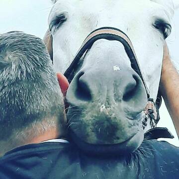
Sanfte Osteopathie und Training
Bottrop
cn-horsetraining
@Christine-Neumann
Bodenarbeit
Coaching
Beratung rund ums Pferd
Kinesiologie
Magnetfeldtherapie
10 weitere...
B+
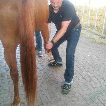
Oliver Thiel - Tierosteopathie
Dinslaken
Oliver
@Olwie
Beratung rund ums Pferd
Akupunktur
Bachblütentherapie
14 weitere...
P+
Deprecated: Creation of dynamic property Zend_View_Helper_Ads::$adLink is deprecated in /var/www/stall-frei/htdocs/staging.stall-frei.de/library/Psf/View/Helper/Ads.php on line 108

Persönlichkeitsentwicklung mit Pferden
Bad Salzuflen
Katja Dors
@Pferdezeiten
Begleite andere auf ihrem Entwicklungsweg und entdecke die transformative Kraft der pferdegestützten Persönlichkeitsentwicklung !
neu
R
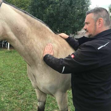
Bodenarbeit Reittraining Horsemanship TGT® in NRW
Bottrop
cn-horsetraining
@Christine-Neumann
Bodenarbeit
Coaching
Beratung rund ums Pferd
7 weitere...
B+
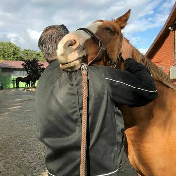
Reitschule Reithof Lohmann
Dinslaken
Dirk Lohmann
@Familie-Lohmann
Kinderreitkurse
Longenarbeit
Beratung rund ums Pferd
6 weitere...
B+
Leider kein Vorschaubild
Leider kein Vorschaubild
B+

Heu und Heulage verkaufen
Mechtersen
STALL-FREIde Marketing
@STALL-FREI-Marketing
Verkaufen Sie Ihr Heu und Ihre Heulage direkt an Reiter, Pferdeställe und Reitanlagen


Körper lesen, Verhalten verstehen…
Essen
Iris Kraft
@FreehorseCom
Bodenarbeit
Coaching
Beratung rund ums Pferd
Sonstiges
Akupressur
Andere Heilverfahren
13 weitere...
P+

Pferdephysiotherapie-Pferdeosteopathie in Essen
Essen
Andrea Küster
@InTakt-Tierphysiotherapie
gymnastizierende Arbeit an der Hand
Longenarbeit
Beratung rund ums Pferd
Akupressur
Akupunktur
16 weitere...
B+

Wulfenhof #Islandpferde #Reitschule #Reitferien
Dorsten
Wulfenhof
@Wulfenhof
Bodenarbeit
Kinderreitkurse
Pferdeverkauf
Pferdevermittlung
4 weitere...
B+


HufpflegeTeam Thüner und Sperrhake
Oer Erkenschwick
Huftechnik-Sperrhake
@Huftechnik-Sperrhake
Hufpfleger
Huftechniker
Hufschuhberatung/Hufschuhverleih
Beratung rund ums Pferd
Osteopathie
P+


Hufschuhberatung NRW
Oer-Erkenschwick
Hufschuhberatung - NRW
@hufschuhberatung-nrw
Coaching
Hufpfleger
Huftechniker
Beratung rund ums Pferd
P+
Deprecated: Creation of dynamic property Zend_View::$pageCount is deprecated in /var/www/stall-frei/htdocs/staging.stall-frei.de/library/vendor/shardj/zf1-future/library/Zend/View/Abstract.php on line 308
Deprecated: Creation of dynamic property Zend_View::$itemCountPerPage is deprecated in /var/www/stall-frei/htdocs/staging.stall-frei.de/library/vendor/shardj/zf1-future/library/Zend/View/Abstract.php on line 308
Deprecated: Creation of dynamic property Zend_View::$first is deprecated in /var/www/stall-frei/htdocs/staging.stall-frei.de/library/vendor/shardj/zf1-future/library/Zend/View/Abstract.php on line 308
Deprecated: Creation of dynamic property Zend_View::$current is deprecated in /var/www/stall-frei/htdocs/staging.stall-frei.de/library/vendor/shardj/zf1-future/library/Zend/View/Abstract.php on line 308
Deprecated: Creation of dynamic property Zend_View::$last is deprecated in /var/www/stall-frei/htdocs/staging.stall-frei.de/library/vendor/shardj/zf1-future/library/Zend/View/Abstract.php on line 308
Deprecated: Creation of dynamic property Zend_View::$next is deprecated in /var/www/stall-frei/htdocs/staging.stall-frei.de/library/vendor/shardj/zf1-future/library/Zend/View/Abstract.php on line 308
Deprecated: Creation of dynamic property Zend_View::$pagesInRange is deprecated in /var/www/stall-frei/htdocs/staging.stall-frei.de/library/vendor/shardj/zf1-future/library/Zend/View/Abstract.php on line 308
Deprecated: Creation of dynamic property Zend_View::$firstPageInRange is deprecated in /var/www/stall-frei/htdocs/staging.stall-frei.de/library/vendor/shardj/zf1-future/library/Zend/View/Abstract.php on line 308
Deprecated: Creation of dynamic property Zend_View::$lastPageInRange is deprecated in /var/www/stall-frei/htdocs/staging.stall-frei.de/library/vendor/shardj/zf1-future/library/Zend/View/Abstract.php on line 308
Deprecated: Creation of dynamic property Zend_View::$currentItemCount is deprecated in /var/www/stall-frei/htdocs/staging.stall-frei.de/library/vendor/shardj/zf1-future/library/Zend/View/Abstract.php on line 308
Deprecated: Creation of dynamic property Zend_View::$totalItemCount is deprecated in /var/www/stall-frei/htdocs/staging.stall-frei.de/library/vendor/shardj/zf1-future/library/Zend/View/Abstract.php on line 308
Deprecated: Creation of dynamic property Zend_View::$firstItemNumber is deprecated in /var/www/stall-frei/htdocs/staging.stall-frei.de/library/vendor/shardj/zf1-future/library/Zend/View/Abstract.php on line 308
Deprecated: Creation of dynamic property Zend_View::$lastItemNumber is deprecated in /var/www/stall-frei/htdocs/staging.stall-frei.de/library/vendor/shardj/zf1-future/library/Zend/View/Abstract.php on line 308
Deprecated: Creation of dynamic property Zend_View::$router is deprecated in /var/www/stall-frei/htdocs/staging.stall-frei.de/library/vendor/shardj/zf1-future/library/Zend/View/Abstract.php on line 308
Deprecated: Creation of dynamic property Zend_View::$urlParams is deprecated in /var/www/stall-frei/htdocs/staging.stall-frei.de/library/vendor/shardj/zf1-future/library/Zend/View/Abstract.php on line 308
Deprecated: Creation of dynamic property Zend_View::$showAds is deprecated in /var/www/stall-frei/htdocs/staging.stall-frei.de/library/vendor/shardj/zf1-future/library/Zend/View/Abstract.php on line 308
Deprecated: Creation of dynamic property Zend_View::$objectIds is deprecated in /var/www/stall-frei/htdocs/staging.stall-frei.de/library/vendor/shardj/zf1-future/library/Zend/View/Abstract.php on line 308
Deprecated: Creation of dynamic property Zend_View::$showNavbar is deprecated in /var/www/stall-frei/htdocs/staging.stall-frei.de/library/vendor/shardj/zf1-future/library/Zend/View/Abstract.php on line 308
Deprecated: Creation of dynamic property Zend_View::$showBreadcrumb is deprecated in /var/www/stall-frei/htdocs/staging.stall-frei.de/library/vendor/shardj/zf1-future/library/Zend/View/Abstract.php on line 308
Deprecated: Creation of dynamic property Zend_View::$showFooter is deprecated in /var/www/stall-frei/htdocs/staging.stall-frei.de/library/vendor/shardj/zf1-future/library/Zend/View/Abstract.php on line 308
Deprecated: Creation of dynamic property Zend_View::$showInternalAds is deprecated in /var/www/stall-frei/htdocs/staging.stall-frei.de/library/vendor/shardj/zf1-future/library/Zend/View/Abstract.php on line 308
Deprecated: Creation of dynamic property Zend_View::$blNoContent is deprecated in /var/www/stall-frei/htdocs/staging.stall-frei.de/library/vendor/shardj/zf1-future/library/Zend/View/Abstract.php on line 308
Deprecated: Creation of dynamic property Zend_View::$sMetaDesc is deprecated in /var/www/stall-frei/htdocs/staging.stall-frei.de/library/vendor/shardj/zf1-future/library/Zend/View/Abstract.php on line 308
Deprecated: Creation of dynamic property Zend_View::$useGmaps is deprecated in /var/www/stall-frei/htdocs/staging.stall-frei.de/library/vendor/shardj/zf1-future/library/Zend/View/Abstract.php on line 308
Deprecated: Creation of dynamic property Zend_View::$touches is deprecated in /var/www/stall-frei/htdocs/staging.stall-frei.de/library/vendor/shardj/zf1-future/library/Zend/View/Abstract.php on line 308
Deprecated: Creation of dynamic property Zend_View::$oProject is deprecated in /var/www/stall-frei/htdocs/staging.stall-frei.de/library/vendor/shardj/zf1-future/library/Zend/View/Abstract.php on line 308
Deprecated: Creation of dynamic property Zend_View::$pageHeadline is deprecated in /var/www/stall-frei/htdocs/staging.stall-frei.de/library/vendor/shardj/zf1-future/library/Zend/View/Abstract.php on line 308
Deprecated: Creation of dynamic property Zend_View::$disableLocationField is deprecated in /var/www/stall-frei/htdocs/staging.stall-frei.de/library/vendor/shardj/zf1-future/library/Zend/View/Abstract.php on line 308
Deprecated: Creation of dynamic property Zend_View::$isSearch is deprecated in /var/www/stall-frei/htdocs/staging.stall-frei.de/library/vendor/shardj/zf1-future/library/Zend/View/Abstract.php on line 308
Deprecated: Creation of dynamic property Zend_View::$pageTitle is deprecated in /var/www/stall-frei/htdocs/staging.stall-frei.de/library/vendor/shardj/zf1-future/library/Zend/View/Abstract.php on line 308
Deprecated: Creation of dynamic property Psf_Form_Element_Text::$class is deprecated in /var/www/stall-frei/htdocs/staging.stall-frei.de/library/vendor/shardj/zf1-future/library/Zend/Form/Element.php on line 874
Deprecated: Creation of dynamic property Psf_Form_Element_Text::$size is deprecated in /var/www/stall-frei/htdocs/staging.stall-frei.de/library/vendor/shardj/zf1-future/library/Zend/Form/Element.php on line 874
Deprecated: Creation of dynamic property Psf_Form_Element_Text::$placeholder is deprecated in /var/www/stall-frei/htdocs/staging.stall-frei.de/library/vendor/shardj/zf1-future/library/Zend/Form/Element.php on line 874
Deprecated: Creation of dynamic property Psf_Form_Element_Hidden::$class is deprecated in /var/www/stall-frei/htdocs/staging.stall-frei.de/library/vendor/shardj/zf1-future/library/Zend/Form/Element.php on line 874
Deprecated: Creation of dynamic property Psf_Form_Element_Hidden::$class is deprecated in /var/www/stall-frei/htdocs/staging.stall-frei.de/library/vendor/shardj/zf1-future/library/Zend/Form/Element.php on line 874
Deprecated: Creation of dynamic property Psf_Form_Element_Hidden::$class is deprecated in /var/www/stall-frei/htdocs/staging.stall-frei.de/library/vendor/shardj/zf1-future/library/Zend/Form/Element.php on line 874
Deprecated: Creation of dynamic property Psf_Form_Element_Hidden::$class is deprecated in /var/www/stall-frei/htdocs/staging.stall-frei.de/library/vendor/shardj/zf1-future/library/Zend/Form/Element.php on line 874
Deprecated: Creation of dynamic property Psf_Form_Element_Select::$class is deprecated in /var/www/stall-frei/htdocs/staging.stall-frei.de/library/vendor/shardj/zf1-future/library/Zend/Form/Element.php on line 874
Deprecated: Creation of dynamic property Psf_Form_Element_Text::$class is deprecated in /var/www/stall-frei/htdocs/staging.stall-frei.de/library/vendor/shardj/zf1-future/library/Zend/Form/Element.php on line 874
Deprecated: Creation of dynamic property Psf_Form_Element_Checkbox::$label is deprecated in /var/www/stall-frei/htdocs/staging.stall-frei.de/library/vendor/shardj/zf1-future/library/Zend/Form/Element.php on line 874
Deprecated: Creation of dynamic property Zend_View::$sort is deprecated in /var/www/stall-frei/htdocs/staging.stall-frei.de/library/vendor/shardj/zf1-future/library/Zend/View/Abstract.php on line 308
Deprecated: Creation of dynamic property Zend_View::$searchLocation is deprecated in /var/www/stall-frei/htdocs/staging.stall-frei.de/library/vendor/shardj/zf1-future/library/Zend/View/Abstract.php on line 308
Deprecated: Creation of dynamic property Zend_View::$locationHint is deprecated in /var/www/stall-frei/htdocs/staging.stall-frei.de/library/vendor/shardj/zf1-future/library/Zend/View/Abstract.php on line 308
Psf_GeoCoder_Abstract::getLocation: Grafenwald Get Location CachedOrLive
Psf_GeoCoder_Abstract::getCachedOrLive: Grafenwald
Psf_GeoCoder_OpenCageData::makeApiRequest: response:
Array
(
[documentation] => https://opencagedata.com/api
[licenses] => Array
(
[0] => Array
(
[name] => see attribution guide
[url] => https://opencagedata.com/credits
)
)
[results] => Array
(
[0] => Array
(
[bounds] => Array
(
[northeast] => Array
(
[lat] => 51.5887394
[lng] => 6.9313823
)
[southwest] => Array
(
[lat] => 51.5522181
[lng] => 6.8372649
)
)
[components] => Array
(
[ISO_3166-1_alpha-2] => DE
[ISO_3166-1_alpha-3] => DEU
[ISO_3166-2] => Array
(
[0] => DE-NW
)
[_category] => place
[_normalized_city] => Bottrop
[_type] => village
[city] => Bottrop
[continent] => Europe
[country] => Deutschland
[country_code] => de
[political_union] => European Union
[state] => Nordrhein-Westfalen
[state_code] => NW
[village] => Grafenwald
)
[confidence] => 7
[formatted] => Grafenwald, Nordrhein-Westfalen, Deutschland
[geometry] => Array
(
[lat] => 51.5755431
[lng] => 6.9019229
)
)
[1] => Array
(
[bounds] => Array
(
[northeast] => Array
(
[lat] => 48.5860189
[lng] => 12.4433954
)
[southwest] => Array
(
[lat] => 48.5460189
[lng] => 12.4033954
)
)
[components] => Array
(
[ISO_3166-1_alpha-2] => DE
[ISO_3166-1_alpha-3] => DEU
[ISO_3166-2] => Array
(
[0] => DE-BY
)
[_category] => place
[_normalized_city] => Loiching
[_type] => hamlet
[city] => Loiching
[continent] => Europe
[country] => Deutschland
[country_code] => de
[county] => Landkreis Dingolfing-Landau
[hamlet] => Grafenwald
[political_union] => European Union
[postcode] => 84180
[state] => Bayern
[state_code] => BY
)
[confidence] => 7
[formatted] => Grafenwald, 84180 Loiching, Deutschland
[geometry] => Array
(
[lat] => 48.5660189
[lng] => 12.4233954
)
)
[2] => Array
(
[bounds] => Array
(
[northeast] => Array
(
[lat] => 48.1931943
[lng] => 9.7715455
)
[southwest] => Array
(
[lat] => 48.1531943
[lng] => 9.7315455
)
)
[components] => Array
(
[ISO_3166-1_alpha-2] => DE
[ISO_3166-1_alpha-3] => DEU
[ISO_3166-2] => Array
(
[0] => DE-BW
)
[_category] => place
[_normalized_city] => Schemmerhofen
[_type] => hamlet
[city] => Schemmerhofen
[continent] => Europe
[country] => Deutschland
[country_code] => de
[county] => Landkreis Biberach
[hamlet] => Grafenwald
[political_union] => European Union
[postcode] => 88433
[state] => Baden-Württemberg
[state_code] => BW
[village] => Alberweiler
)
[confidence] => 7
[formatted] => Grafenwald, 88433 Alberweiler, Deutschland
[geometry] => Array
(
[lat] => 48.1731943
[lng] => 9.7515455
)
)
[3] => Array
(
[bounds] => Array
(
[northeast] => Array
(
[lat] => 49.1231426
[lng] => 9.3807617
)
[southwest] => Array
(
[lat] => 49.0844794
[lng] => 9.2920837
)
)
[components] => Array
(
[ISO_3166-1_alpha-2] => DE
[ISO_3166-1_alpha-3] => DEU
[ISO_3166-2] => Array
(
[0] => DE-BW
)
[_category] => natural/water
[_normalized_city] => Löwenstein
[_type] => forest
[continent] => Europe
[country] => Deutschland
[country_code] => de
[county] => Landkreis Heilbronn
[forest] => Grafenwald
[municipality] => VVG der Gemeinde Obersulm
[political_union] => European Union
[state] => Baden-Württemberg
[state_code] => BW
[town] => Löwenstein
)
[confidence] => 7
[formatted] => Grafenwald, Löwenstein, Baden-Württemberg, Deutschland
[geometry] => Array
(
[lat] => 49.1038121
[lng] => 9.3551714
)
)
[4] => Array
(
[bounds] => Array
(
[northeast] => Array
(
[lat] => 48.3646772
[lng] => 13.1182573
)
[southwest] => Array
(
[lat] => 48.3446772
[lng] => 13.0982573
)
)
[components] => Array
(
[ISO_3166-1_alpha-2] => DE
[ISO_3166-1_alpha-3] => DEU
[ISO_3166-2] => Array
(
[0] => DE-BY
)
[_category] => place
[_normalized_city] => Kößlarn
[_type] => hamlet
[continent] => Europe
[country] => Deutschland
[country_code] => de
[county] => Landkreis Passau
[locality] => Grafenwald
[political_union] => European Union
[postcode] => 94149
[state] => Bayern
[state_code] => BY
[village] => Kößlarn
)
[confidence] => 8
[formatted] => Grafenwald, 94149 Kößlarn, Deutschland
[geometry] => Array
(
[lat] => 48.3546772
[lng] => 13.1082573
)
)
[5] => Array
(
[bounds] => Array
(
[northeast] => Array
(
[lat] => 49.3804763
[lng] => 9.4122284
)
[southwest] => Array
(
[lat] => 49.3604763
[lng] => 9.3922284
)
)
[components] => Array
(
[ISO_3166-1_alpha-2] => DE
[ISO_3166-1_alpha-3] => DEU
[ISO_3166-2] => Array
(
[0] => DE-BW
)
[_category] => place
[_normalized_city] => Adelsheim
[_type] => hamlet
[continent] => Europe
[country] => Deutschland
[country_code] => de
[county] => Neckar-Odenwald-Kreis
[locality] => Grafenwald
[municipality] => GVV Seckachtal
[political_union] => European Union
[postcode] => 74740
[state] => Baden-Württemberg
[state_code] => BW
[town] => Adelsheim
)
[confidence] => 8
[formatted] => Grafenwald, 74740 Adelsheim, Deutschland
[geometry] => Array
(
[lat] => 49.3704763
[lng] => 9.4022284
)
)
[6] => Array
(
[bounds] => Array
(
[northeast] => Array
(
[lat] => 48.1734584
[lng] => 9.7539241
)
[southwest] => Array
(
[lat] => 48.1720159
[lng] => 9.7491322
)
)
[components] => Array
(
[ISO_3166-1_alpha-2] => DE
[ISO_3166-1_alpha-3] => DEU
[ISO_3166-2] => Array
(
[0] => DE-BW
)
[_category] => road
[_normalized_city] => Schemmerhofen
[_type] => road
[city] => Schemmerhofen
[continent] => Europe
[country] => Deutschland
[country_code] => de
[county] => Landkreis Biberach
[hamlet] => Grafenwald
[political_union] => European Union
[postcode] => 88433
[road] => Grafenwald
[state] => Baden-Württemberg
[state_code] => BW
[village] => Alberweiler
)
[confidence] => 9
[formatted] => Grafenwald, 88433 Alberweiler, Deutschland
[geometry] => Array
(
[lat] => 48.1728336
[lng] => 9.751499
)
)
[7] => Array
(
[bounds] => Array
(
[northeast] => Array
(
[lat] => 48.566262
[lng] => 12.422745
)
[southwest] => Array
(
[lat] => 48.5621155
[lng] => 12.4218543
)
)
[components] => Array
(
[ISO_3166-1_alpha-2] => DE
[ISO_3166-1_alpha-3] => DEU
[ISO_3166-2] => Array
(
[0] => DE-BY
)
[_category] => road
[_normalized_city] => Loiching
[_type] => road
[city] => Loiching
[commercial] => Sano
[continent] => Europe
[country] => Deutschland
[country_code] => de
[county] => Landkreis Dingolfing-Landau
[hamlet] => Anzenbrunn
[political_union] => European Union
[postcode] => 84180
[road] => Grafenwald
[road_type] => residential
[state] => Bayern
[state_code] => BY
)
[confidence] => 9
[formatted] => Grafenwald, 84180 Loiching, Deutschland
[geometry] => Array
(
[lat] => 48.5646336
[lng] => 12.4222618
)
)
[8] => Array
(
[bounds] => Array
(
[northeast] => Array
(
[lat] => 51.5749543
[lng] => 7.7031136
)
[southwest] => Array
(
[lat] => 51.5743096
[lng] => 7.7017037
)
)
[components] => Array
(
[ISO_3166-1_alpha-2] => DE
[ISO_3166-1_alpha-3] => DEU
[ISO_3166-2] => Array
(
[0] => DE-NW
)
[_category] => road
[_normalized_city] => Kamen
[_type] => road
[continent] => Europe
[country] => Deutschland
[country_code] => de
[county] => Kreis Unna
[political_union] => European Union
[postcode] => 59174
[road] => Grafenwald
[road_type] => residential
[state] => Nordrhein-Westfalen
[state_code] => NW
[suburb] => Heeren
[town] => Kamen
)
[confidence] => 9
[formatted] => Grafenwald, 59174 Kamen, Deutschland
[geometry] => Array
(
[lat] => 51.5745802
[lng] => 7.7024282
)
)
[9] => Array
(
[components] => Array
(
[ISO_3166-1_alpha-2] => FR
[ISO_3166-1_alpha-3] => FRA
[ISO_3166-2] => Array
(
[0] => FR-GES
[1] => FR-6AE
[2] => FR-68
)
[_category] => road
[_normalized_city] => Cernay
[_type] => road
[city] => Cernay
[continent] => Europe
[country] => France
[country_code] => fr
[county] => Haut-Rhin
[local_authority] => Communauté de communes Thann-Cernay
[political_union] => European Union
[postcode] => 68700
[road] => Rue de Graffenwald
[state] => Grand Est
[state_code] => GES
)
[confidence] => 4
[formatted] => Rue de Graffenwald, 68700 Cernay, France
[geometry] => Array
(
[lat] => 47.801546
[lng] => 7.186625
)
)
)
[status] => Array
(
[code] => 200
[message] => OK
)
[stay_informed] => Array
(
[blog] => https://blog.opencagedata.com
[mastodon] => https://en.osm.town/@opencage
)
[thanks] => For using an OpenCage API
[timestamp] => Array
(
[created_http] => Sat, 07 Feb 2026 11:42:50 GMT
[created_unix] => 1770464570
)
[total_results] => 10
)
Psf_GeoCoder_Abstract::convertLocationResult
{"documentation":"https:\/\/opencagedata.com\/api","licenses":[{"name":"see attribution guide","url":"https:\/\/opencagedata.com\/credits"}],"results":[{"bounds":{"northeast":{"lat":51.5887394,"lng":6.9313823},"southwest":{"lat":51.5522181,"lng":6.8372649}},"components":{"ISO_3166-1_alpha-2":"DE","ISO_3166-1_alpha-3":"DEU","ISO_3166-2":["DE-NW"],"_category":"place","_normalized_city":"Bottrop","_type":"village","city":"Bottrop","continent":"Europe","country":"Deutschland","country_code":"de","political_union":"European Union","state":"Nordrhein-Westfalen","state_code":"NW","village":"Grafenwald"},"confidence":7,"formatted":"Grafenwald, Nordrhein-Westfalen, Deutschland","geometry":{"lat":51.5755431,"lng":6.9019229}},{"bounds":{"northeast":{"lat":48.5860189,"lng":12.4433954},"southwest":{"lat":48.5460189,"lng":12.4033954}},"components":{"ISO_3166-1_alpha-2":"DE","ISO_3166-1_alpha-3":"DEU","ISO_3166-2":["DE-BY"],"_category":"place","_normalized_city":"Loiching","_type":"hamlet","city":"Loiching","continent":"Europe","country":"Deutschland","country_code":"de","county":"Landkreis Dingolfing-Landau","hamlet":"Grafenwald","political_union":"European Union","postcode":"84180","state":"Bayern","state_code":"BY"},"confidence":7,"formatted":"Grafenwald, 84180 Loiching, Deutschland","geometry":{"lat":48.5660189,"lng":12.4233954}},{"bounds":{"northeast":{"lat":48.1931943,"lng":9.7715455},"southwest":{"lat":48.1531943,"lng":9.7315455}},"components":{"ISO_3166-1_alpha-2":"DE","ISO_3166-1_alpha-3":"DEU","ISO_3166-2":["DE-BW"],"_category":"place","_normalized_city":"Schemmerhofen","_type":"hamlet","city":"Schemmerhofen","continent":"Europe","country":"Deutschland","country_code":"de","county":"Landkreis Biberach","hamlet":"Grafenwald","political_union":"European Union","postcode":"88433","state":"Baden-W\u00fcrttemberg","state_code":"BW","village":"Alberweiler"},"confidence":7,"formatted":"Grafenwald, 88433 Alberweiler, Deutschland","geometry":{"lat":48.1731943,"lng":9.7515455}},{"bounds":{"northeast":{"lat":49.1231426,"lng":9.3807617},"southwest":{"lat":49.0844794,"lng":9.2920837}},"components":{"ISO_3166-1_alpha-2":"DE","ISO_3166-1_alpha-3":"DEU","ISO_3166-2":["DE-BW"],"_category":"natural\/water","_normalized_city":"L\u00f6wenstein","_type":"forest","continent":"Europe","country":"Deutschland","country_code":"de","county":"Landkreis Heilbronn","forest":"Grafenwald","municipality":"VVG der Gemeinde Obersulm","political_union":"European Union","state":"Baden-W\u00fcrttemberg","state_code":"BW","town":"L\u00f6wenstein"},"confidence":7,"formatted":"Grafenwald, L\u00f6wenstein, Baden-W\u00fcrttemberg, Deutschland","geometry":{"lat":49.1038121,"lng":9.3551714}},{"bounds":{"northeast":{"lat":48.3646772,"lng":13.1182573},"southwest":{"lat":48.3446772,"lng":13.0982573}},"components":{"ISO_3166-1_alpha-2":"DE","ISO_3166-1_alpha-3":"DEU","ISO_3166-2":["DE-BY"],"_category":"place","_normalized_city":"K\u00f6\u00dflarn","_type":"hamlet","continent":"Europe","country":"Deutschland","country_code":"de","county":"Landkreis Passau","locality":"Grafenwald","political_union":"European Union","postcode":"94149","state":"Bayern","state_code":"BY","village":"K\u00f6\u00dflarn"},"confidence":8,"formatted":"Grafenwald, 94149 K\u00f6\u00dflarn, Deutschland","geometry":{"lat":48.3546772,"lng":13.1082573}},{"bounds":{"northeast":{"lat":49.3804763,"lng":9.4122284},"southwest":{"lat":49.3604763,"lng":9.3922284}},"components":{"ISO_3166-1_alpha-2":"DE","ISO_3166-1_alpha-3":"DEU","ISO_3166-2":["DE-BW"],"_category":"place","_normalized_city":"Adelsheim","_type":"hamlet","continent":"Europe","country":"Deutschland","country_code":"de","county":"Neckar-Odenwald-Kreis","locality":"Grafenwald","municipality":"GVV Seckachtal","political_union":"European Union","postcode":"74740","state":"Baden-W\u00fcrttemberg","state_code":"BW","town":"Adelsheim"},"confidence":8,"formatted":"Grafenwald, 74740 Adelsheim, Deutschland","geometry":{"lat":49.3704763,"lng":9.4022284}},{"bounds":{"northeast":{"lat":48.1734584,"lng":9.7539241},"southwest":{"lat":48.1720159,"lng":9.7491322}},"components":{"ISO_3166-1_alpha-2":"DE","ISO_3166-1_alpha-3":"DEU","ISO_3166-2":["DE-BW"],"_category":"road","_normalized_city":"Schemmerhofen","_type":"road","city":"Schemmerhofen","continent":"Europe","country":"Deutschland","country_code":"de","county":"Landkreis Biberach","hamlet":"Grafenwald","political_union":"European Union","postcode":"88433","road":"Grafenwald","state":"Baden-W\u00fcrttemberg","state_code":"BW","village":"Alberweiler"},"confidence":9,"formatted":"Grafenwald, 88433 Alberweiler, Deutschland","geometry":{"lat":48.1728336,"lng":9.751499}},{"bounds":{"northeast":{"lat":48.566262,"lng":12.422745},"southwest":{"lat":48.5621155,"lng":12.4218543}},"components":{"ISO_3166-1_alpha-2":"DE","ISO_3166-1_alpha-3":"DEU","ISO_3166-2":["DE-BY"],"_category":"road","_normalized_city":"Loiching","_type":"road","city":"Loiching","commercial":"Sano","continent":"Europe","country":"Deutschland","country_code":"de","county":"Landkreis Dingolfing-Landau","hamlet":"Anzenbrunn","political_union":"European Union","postcode":"84180","road":"Grafenwald","road_type":"residential","state":"Bayern","state_code":"BY"},"confidence":9,"formatted":"Grafenwald, 84180 Loiching, Deutschland","geometry":{"lat":48.5646336,"lng":12.4222618}},{"bounds":{"northeast":{"lat":51.5749543,"lng":7.7031136},"southwest":{"lat":51.5743096,"lng":7.7017037}},"components":{"ISO_3166-1_alpha-2":"DE","ISO_3166-1_alpha-3":"DEU","ISO_3166-2":["DE-NW"],"_category":"road","_normalized_city":"Kamen","_type":"road","continent":"Europe","country":"Deutschland","country_code":"de","county":"Kreis Unna","political_union":"European Union","postcode":"59174","road":"Grafenwald","road_type":"residential","state":"Nordrhein-Westfalen","state_code":"NW","suburb":"Heeren","town":"Kamen"},"confidence":9,"formatted":"Grafenwald, 59174 Kamen, Deutschland","geometry":{"lat":51.5745802,"lng":7.7024282}},{"components":{"ISO_3166-1_alpha-2":"FR","ISO_3166-1_alpha-3":"FRA","ISO_3166-2":["FR-GES","FR-6AE","FR-68"],"_category":"road","_normalized_city":"Cernay","_type":"road","city":"Cernay","continent":"Europe","country":"France","country_code":"fr","county":"Haut-Rhin","local_authority":"Communaut\u00e9 de communes Thann-Cernay","political_union":"European Union","postcode":"68700","road":"Rue de Graffenwald","state":"Grand Est","state_code":"GES"},"confidence":4,"formatted":"Rue de Graffenwald, 68700 Cernay, France","geometry":{"lat":47.801546,"lng":7.186625}}],"status":{"code":200,"message":"OK"},"stay_informed":{"blog":"https:\/\/blog.opencagedata.com","mastodon":"https:\/\/en.osm.town\/@opencage"},"thanks":"For using an OpenCage API","timestamp":{"created_http":"Sat, 07 Feb 2026 11:42:50 GMT","created_unix":1770464570},"total_results":10}Array
(
[0] => stdClass Object
(
[bounds] => stdClass Object
(
[northeast] => stdClass Object
(
[lat] => 51.5887394
[lng] => 6.9313823
)
[southwest] => stdClass Object
(
[lat] => 51.5522181
[lng] => 6.8372649
)
)
[components] => stdClass Object
(
[ISO_3166-1_alpha-2] => DE
[ISO_3166-1_alpha-3] => DEU
[ISO_3166-2] => Array
(
[0] => DE-NW
)
[_category] => place
[_normalized_city] => Bottrop
[_type] => village
[city] => Bottrop
[continent] => Europe
[country] => Deutschland
[country_code] => de
[political_union] => European Union
[state] => Nordrhein-Westfalen
[state_code] => NW
[village] => Grafenwald
)
[confidence] => 7
[formatted] => Grafenwald, Nordrhein-Westfalen, Deutschland
[geometry] => stdClass Object
(
[lat] => 51.5755431
[lng] => 6.9019229
)
)
[1] => stdClass Object
(
[bounds] => stdClass Object
(
[northeast] => stdClass Object
(
[lat] => 48.5860189
[lng] => 12.4433954
)
[southwest] => stdClass Object
(
[lat] => 48.5460189
[lng] => 12.4033954
)
)
[components] => stdClass Object
(
[ISO_3166-1_alpha-2] => DE
[ISO_3166-1_alpha-3] => DEU
[ISO_3166-2] => Array
(
[0] => DE-BY
)
[_category] => place
[_normalized_city] => Loiching
[_type] => hamlet
[city] => Loiching
[continent] => Europe
[country] => Deutschland
[country_code] => de
[county] => Landkreis Dingolfing-Landau
[hamlet] => Grafenwald
[political_union] => European Union
[postcode] => 84180
[state] => Bayern
[state_code] => BY
)
[confidence] => 7
[formatted] => Grafenwald, 84180 Loiching, Deutschland
[geometry] => stdClass Object
(
[lat] => 48.5660189
[lng] => 12.4233954
)
)
[2] => stdClass Object
(
[bounds] => stdClass Object
(
[northeast] => stdClass Object
(
[lat] => 48.1931943
[lng] => 9.7715455
)
[southwest] => stdClass Object
(
[lat] => 48.1531943
[lng] => 9.7315455
)
)
[components] => stdClass Object
(
[ISO_3166-1_alpha-2] => DE
[ISO_3166-1_alpha-3] => DEU
[ISO_3166-2] => Array
(
[0] => DE-BW
)
[_category] => place
[_normalized_city] => Schemmerhofen
[_type] => hamlet
[city] => Schemmerhofen
[continent] => Europe
[country] => Deutschland
[country_code] => de
[county] => Landkreis Biberach
[hamlet] => Grafenwald
[political_union] => European Union
[postcode] => 88433
[state] => Baden-Württemberg
[state_code] => BW
[village] => Alberweiler
)
[confidence] => 7
[formatted] => Grafenwald, 88433 Alberweiler, Deutschland
[geometry] => stdClass Object
(
[lat] => 48.1731943
[lng] => 9.7515455
)
)
[3] => stdClass Object
(
[bounds] => stdClass Object
(
[northeast] => stdClass Object
(
[lat] => 49.1231426
[lng] => 9.3807617
)
[southwest] => stdClass Object
(
[lat] => 49.0844794
[lng] => 9.2920837
)
)
[components] => stdClass Object
(
[ISO_3166-1_alpha-2] => DE
[ISO_3166-1_alpha-3] => DEU
[ISO_3166-2] => Array
(
[0] => DE-BW
)
[_category] => natural/water
[_normalized_city] => Löwenstein
[_type] => forest
[continent] => Europe
[country] => Deutschland
[country_code] => de
[county] => Landkreis Heilbronn
[forest] => Grafenwald
[municipality] => VVG der Gemeinde Obersulm
[political_union] => European Union
[state] => Baden-Württemberg
[state_code] => BW
[town] => Löwenstein
)
[confidence] => 7
[formatted] => Grafenwald, Löwenstein, Baden-Württemberg, Deutschland
[geometry] => stdClass Object
(
[lat] => 49.1038121
[lng] => 9.3551714
)
)
[4] => stdClass Object
(
[bounds] => stdClass Object
(
[northeast] => stdClass Object
(
[lat] => 48.3646772
[lng] => 13.1182573
)
[southwest] => stdClass Object
(
[lat] => 48.3446772
[lng] => 13.0982573
)
)
[components] => stdClass Object
(
[ISO_3166-1_alpha-2] => DE
[ISO_3166-1_alpha-3] => DEU
[ISO_3166-2] => Array
(
[0] => DE-BY
)
[_category] => place
[_normalized_city] => Kößlarn
[_type] => hamlet
[continent] => Europe
[country] => Deutschland
[country_code] => de
[county] => Landkreis Passau
[locality] => Grafenwald
[political_union] => European Union
[postcode] => 94149
[state] => Bayern
[state_code] => BY
[village] => Kößlarn
)
[confidence] => 8
[formatted] => Grafenwald, 94149 Kößlarn, Deutschland
[geometry] => stdClass Object
(
[lat] => 48.3546772
[lng] => 13.1082573
)
)
[5] => stdClass Object
(
[bounds] => stdClass Object
(
[northeast] => stdClass Object
(
[lat] => 49.3804763
[lng] => 9.4122284
)
[southwest] => stdClass Object
(
[lat] => 49.3604763
[lng] => 9.3922284
)
)
[components] => stdClass Object
(
[ISO_3166-1_alpha-2] => DE
[ISO_3166-1_alpha-3] => DEU
[ISO_3166-2] => Array
(
[0] => DE-BW
)
[_category] => place
[_normalized_city] => Adelsheim
[_type] => hamlet
[continent] => Europe
[country] => Deutschland
[country_code] => de
[county] => Neckar-Odenwald-Kreis
[locality] => Grafenwald
[municipality] => GVV Seckachtal
[political_union] => European Union
[postcode] => 74740
[state] => Baden-Württemberg
[state_code] => BW
[town] => Adelsheim
)
[confidence] => 8
[formatted] => Grafenwald, 74740 Adelsheim, Deutschland
[geometry] => stdClass Object
(
[lat] => 49.3704763
[lng] => 9.4022284
)
)
[6] => stdClass Object
(
[bounds] => stdClass Object
(
[northeast] => stdClass Object
(
[lat] => 48.1734584
[lng] => 9.7539241
)
[southwest] => stdClass Object
(
[lat] => 48.1720159
[lng] => 9.7491322
)
)
[components] => stdClass Object
(
[ISO_3166-1_alpha-2] => DE
[ISO_3166-1_alpha-3] => DEU
[ISO_3166-2] => Array
(
[0] => DE-BW
)
[_category] => road
[_normalized_city] => Schemmerhofen
[_type] => road
[city] => Schemmerhofen
[continent] => Europe
[country] => Deutschland
[country_code] => de
[county] => Landkreis Biberach
[hamlet] => Grafenwald
[political_union] => European Union
[postcode] => 88433
[road] => Grafenwald
[state] => Baden-Württemberg
[state_code] => BW
[village] => Alberweiler
)
[confidence] => 9
[formatted] => Grafenwald, 88433 Alberweiler, Deutschland
[geometry] => stdClass Object
(
[lat] => 48.1728336
[lng] => 9.751499
)
)
[7] => stdClass Object
(
[bounds] => stdClass Object
(
[northeast] => stdClass Object
(
[lat] => 48.566262
[lng] => 12.422745
)
[southwest] => stdClass Object
(
[lat] => 48.5621155
[lng] => 12.4218543
)
)
[components] => stdClass Object
(
[ISO_3166-1_alpha-2] => DE
[ISO_3166-1_alpha-3] => DEU
[ISO_3166-2] => Array
(
[0] => DE-BY
)
[_category] => road
[_normalized_city] => Loiching
[_type] => road
[city] => Loiching
[commercial] => Sano
[continent] => Europe
[country] => Deutschland
[country_code] => de
[county] => Landkreis Dingolfing-Landau
[hamlet] => Anzenbrunn
[political_union] => European Union
[postcode] => 84180
[road] => Grafenwald
[road_type] => residential
[state] => Bayern
[state_code] => BY
)
[confidence] => 9
[formatted] => Grafenwald, 84180 Loiching, Deutschland
[geometry] => stdClass Object
(
[lat] => 48.5646336
[lng] => 12.4222618
)
)
[8] => stdClass Object
(
[bounds] => stdClass Object
(
[northeast] => stdClass Object
(
[lat] => 51.5749543
[lng] => 7.7031136
)
[southwest] => stdClass Object
(
[lat] => 51.5743096
[lng] => 7.7017037
)
)
[components] => stdClass Object
(
[ISO_3166-1_alpha-2] => DE
[ISO_3166-1_alpha-3] => DEU
[ISO_3166-2] => Array
(
[0] => DE-NW
)
[_category] => road
[_normalized_city] => Kamen
[_type] => road
[continent] => Europe
[country] => Deutschland
[country_code] => de
[county] => Kreis Unna
[political_union] => European Union
[postcode] => 59174
[road] => Grafenwald
[road_type] => residential
[state] => Nordrhein-Westfalen
[state_code] => NW
[suburb] => Heeren
[town] => Kamen
)
[confidence] => 9
[formatted] => Grafenwald, 59174 Kamen, Deutschland
[geometry] => stdClass Object
(
[lat] => 51.5745802
[lng] => 7.7024282
)
)
[9] => stdClass Object
(
[components] => stdClass Object
(
[ISO_3166-1_alpha-2] => FR
[ISO_3166-1_alpha-3] => FRA
[ISO_3166-2] => Array
(
[0] => FR-GES
[1] => FR-6AE
[2] => FR-68
)
[_category] => road
[_normalized_city] => Cernay
[_type] => road
[city] => Cernay
[continent] => Europe
[country] => France
[country_code] => fr
[county] => Haut-Rhin
[local_authority] => Communauté de communes Thann-Cernay
[political_union] => European Union
[postcode] => 68700
[road] => Rue de Graffenwald
[state] => Grand Est
[state_code] => GES
)
[confidence] => 4
[formatted] => Rue de Graffenwald, 68700 Cernay, France
[geometry] => stdClass Object
(
[lat] => 47.801546
[lng] => 7.186625
)
)
)
Psf_GeoCoder_OpenCageData::getKeyMap: 0
stdClass Object
(
    [bounds] => stdClass Object
        (
            [northeast] => stdClass Object
                (
                    [lat] => 51.5887394
                    [lng] => 6.9313823
                )

            [southwest] => stdClass Object
                (
                    [lat] => 51.5522181
                    [lng] => 6.8372649
                )

        )

    [components] => stdClass Object
        (
            [ISO_3166-1_alpha-2] => DE
            [ISO_3166-1_alpha-3] => DEU
            [ISO_3166-2] => Array
                (
                    [0] => DE-NW
                )

            [_category] => place
            [_normalized_city] => Bottrop
            [_type] => village
            [city] => Bottrop
            [continent] => Europe
            [country] => Deutschland
            [country_code] => de
            [political_union] => European Union
            [state] => Nordrhein-Westfalen
            [state_code] => NW
            [village] => Grafenwald
        )

    [confidence] => 7
    [formatted] => Grafenwald, Nordrhein-Westfalen, Deutschland
    [geometry] => stdClass Object
        (
            [lat] => 51.5755431
            [lng] => 6.9019229
        )

)
Psf_GeoCoder_OpenCageData::getCounty: Bottrop
Psf_GeoCoder_OpenCageData::addMissingData REFETCH!
Array
(
    [address] => Grafenwald, Nordrhein-Westfalen, Deutschland
    [type] => village
    [street] =>
    [city] => Grafenwald
    [county] => Bottrop
    [state] => Nordrhein-Westfalen
    [zip] =>
    [country] => Deutschland
    [suburb] =>
    [countrycode] => de
    [latitude] => 51.5755431
    [longitude] => 6.9019229
    [accuracy] => 1
    [confidence] => 7
    [bounds] => stdClass Object
        (
            [northeast] => stdClass Object
                (
                    [lat] => 51.5887394
                    [lng] => 6.9313823
                )

            [southwest] => stdClass Object
                (
                    [lat] => 51.5522181
                    [lng] => 6.8372649
                )

        )

)
reformat!
Array
(
    [address] => Grafenwald, Nordrhein-Westfalen, Deutschland
    [type] => village
    [street] =>
    [city] => Grafenwald
    [county] => Bottrop
    [state] => Nordrhein-Westfalen
    [zip] =>
    [country] => Deutschland
    [suburb] =>
    [countrycode] => de
    [latitude] => 51.5755431
    [longitude] => 6.9019229
    [accuracy] => 1
    [confidence] => 7
    [bounds] => stdClass Object
        (
            [northeast] => stdClass Object
                (
                    [lat] => 51.5887394
                    [lng] => 6.9313823
                )

            [southwest] => stdClass Object
                (
                    [lat] => 51.5522181
                    [lng] => 6.8372649
                )

        )

    [place] => Grafenwald, Nordrhein-Westfalen
    [hash] => bedc9f458ae2269e3e77629c3e42ceaa
)
Psf_GeoCoder_OpenCageData::getKeyMap: 1
stdClass Object
(
    [bounds] => stdClass Object
        (
            [northeast] => stdClass Object
                (
                    [lat] => 48.5860189
                    [lng] => 12.4433954
                )

            [southwest] => stdClass Object
                (
                    [lat] => 48.5460189
                    [lng] => 12.4033954
                )

        )

    [components] => stdClass Object
        (
            [ISO_3166-1_alpha-2] => DE
            [ISO_3166-1_alpha-3] => DEU
            [ISO_3166-2] => Array
                (
                    [0] => DE-BY
                )

            [_category] => place
            [_normalized_city] => Loiching
            [_type] => hamlet
            [city] => Loiching
            [continent] => Europe
            [country] => Deutschland
            [country_code] => de
            [county] => Landkreis Dingolfing-Landau
            [hamlet] => Grafenwald
            [political_union] => European Union
            [postcode] => 84180
            [state] => Bayern
            [state_code] => BY
        )

    [confidence] => 7
    [formatted] => Grafenwald, 84180 Loiching, Deutschland
    [geometry] => stdClass Object
        (
            [lat] => 48.5660189
            [lng] => 12.4233954
        )

)
Psf_GeoCoder_OpenCageData::getCounty: Dingolfing-Landau
Psf_GeoCoder_OpenCageData::addMissingData REFETCH!
Array
(
    [address] => Grafenwald, 84180 Loiching, Deutschland
    [type] => hamlet
    [street] => Grafenwald
    [city] => Loiching
    [county] => Dingolfing-Landau
    [state] => Bayern
    [zip] => 84180
    [country] => Deutschland
    [suburb] =>
    [countrycode] => de
    [latitude] => 48.5660189
    [longitude] => 12.4233954
    [accuracy] => 1
    [confidence] => 7
    [bounds] => stdClass Object
        (
            [northeast] => stdClass Object
                (
                    [lat] => 48.5860189
                    [lng] => 12.4433954
                )

            [southwest] => stdClass Object
                (
                    [lat] => 48.5460189
                    [lng] => 12.4033954
                )

        )

)
reformat!
Array
(
    [address] => Grafenwald, 84180 Loiching, Deutschland
    [type] => hamlet
    [street] => Grafenwald
    [city] => Loiching
    [county] => Dingolfing-Landau
    [state] => Bayern
    [zip] => 84180
    [country] => Deutschland
    [suburb] =>
    [countrycode] => de
    [latitude] => 48.5660189
    [longitude] => 12.4233954
    [accuracy] => 1
    [confidence] => 7
    [bounds] => stdClass Object
        (
            [northeast] => stdClass Object
                (
                    [lat] => 48.5860189
                    [lng] => 12.4433954
                )

            [southwest] => stdClass Object
                (
                    [lat] => 48.5460189
                    [lng] => 12.4033954
                )

        )

    [place] => Grafenwald, 84180 Loiching, Bayern
    [hash] => 205903ee00b10579da67d7d059af4bb4
)
Psf_GeoCoder_OpenCageData::getKeyMap: 2
stdClass Object
(
    [bounds] => stdClass Object
        (
            [northeast] => stdClass Object
                (
                    [lat] => 48.1931943
                    [lng] => 9.7715455
                )

            [southwest] => stdClass Object
                (
                    [lat] => 48.1531943
                    [lng] => 9.7315455
                )

        )

    [components] => stdClass Object
        (
            [ISO_3166-1_alpha-2] => DE
            [ISO_3166-1_alpha-3] => DEU
            [ISO_3166-2] => Array
                (
                    [0] => DE-BW
                )

            [_category] => place
            [_normalized_city] => Schemmerhofen
            [_type] => hamlet
            [city] => Schemmerhofen
            [continent] => Europe
            [country] => Deutschland
            [country_code] => de
            [county] => Landkreis Biberach
            [hamlet] => Grafenwald
            [political_union] => European Union
            [postcode] => 88433
            [state] => Baden-Württemberg
            [state_code] => BW
            [village] => Alberweiler
        )

    [confidence] => 7
    [formatted] => Grafenwald, 88433 Alberweiler, Deutschland
    [geometry] => stdClass Object
        (
            [lat] => 48.1731943
            [lng] => 9.7515455
        )

)
Psf_GeoCoder_OpenCageData::getCounty: Biberach
Psf_GeoCoder_OpenCageData::addMissingData REFETCH!
Array
(
    [address] => Grafenwald, 88433 Alberweiler, Deutschland
    [type] => hamlet
    [street] => Grafenwald
    [city] => Alberweiler
    [county] => Biberach
    [state] => Baden-Württemberg
    [zip] => 88433
    [country] => Deutschland
    [suburb] =>
    [countrycode] => de
    [latitude] => 48.1731943
    [longitude] => 9.7515455
    [accuracy] => 1
    [confidence] => 7
    [bounds] => stdClass Object
        (
            [northeast] => stdClass Object
                (
                    [lat] => 48.1931943
                    [lng] => 9.7715455
                )

            [southwest] => stdClass Object
                (
                    [lat] => 48.1531943
                    [lng] => 9.7315455
                )

        )

)
reformat!
Array
(
    [address] => Grafenwald, 88433 Alberweiler, Deutschland
    [type] => hamlet
    [street] => Grafenwald
    [city] => Alberweiler
    [county] => Biberach
    [state] => Baden-Württemberg
    [zip] => 88433
    [country] => Deutschland
    [suburb] =>
    [countrycode] => de
    [latitude] => 48.1731943
    [longitude] => 9.7515455
    [accuracy] => 1
    [confidence] => 7
    [bounds] => stdClass Object
        (
            [northeast] => stdClass Object
                (
                    [lat] => 48.1931943
                    [lng] => 9.7715455
                )

            [southwest] => stdClass Object
                (
                    [lat] => 48.1531943
                    [lng] => 9.7315455
                )

        )

    [place] => Grafenwald, 88433 Alberweiler, Baden-Württemberg
    [hash] => b97baf98b1e9fa9effd2a1addcde9dbb
)
Psf_GeoCoder_OpenCageData::getKeyMap: 3
stdClass Object
(
    [bounds] => stdClass Object
        (
            [northeast] => stdClass Object
                (
                    [lat] => 49.1231426
                    [lng] => 9.3807617
                )

            [southwest] => stdClass Object
                (
                    [lat] => 49.0844794
                    [lng] => 9.2920837
                )

        )

    [components] => stdClass Object
        (
            [ISO_3166-1_alpha-2] => DE
            [ISO_3166-1_alpha-3] => DEU
            [ISO_3166-2] => Array
                (
                    [0] => DE-BW
                )

            [_category] => natural/water
            [_normalized_city] => Löwenstein
            [_type] => forest
            [continent] => Europe
            [country] => Deutschland
            [country_code] => de
            [county] => Landkreis Heilbronn
            [forest] => Grafenwald
            [municipality] => VVG der Gemeinde Obersulm
            [political_union] => European Union
            [state] => Baden-Württemberg
            [state_code] => BW
            [town] => Löwenstein
        )

    [confidence] => 7
    [formatted] => Grafenwald, Löwenstein, Baden-Württemberg, Deutschland
    [geometry] => stdClass Object
        (
            [lat] => 49.1038121
            [lng] => 9.3551714
        )

)
Psf_GeoCoder_OpenCageData::getCounty: Heilbronn
Psf_GeoCoder_OpenCageData::addMissingData REFETCH!
Array
(
    [address] => Grafenwald, Löwenstein, Baden-Württemberg, Deutschland
    [type] => forest
    [street] =>
    [city] => Löwenstein
    [county] => Heilbronn
    [state] => Baden-Württemberg
    [zip] =>
    [country] => Deutschland
    [suburb] =>
    [countrycode] => de
    [latitude] => 49.1038121
    [longitude] => 9.3551714
    [accuracy] => 1
    [confidence] => 7
    [bounds] => stdClass Object
        (
            [northeast] => stdClass Object
                (
                    [lat] => 49.1231426
                    [lng] => 9.3807617
                )

            [southwest] => stdClass Object
                (
                    [lat] => 49.0844794
                    [lng] => 9.2920837
                )

        )

)
reformat!
Array
(
    [address] => Grafenwald, Löwenstein, Baden-Württemberg, Deutschland
    [type] => forest
    [street] =>
    [city] => Löwenstein
    [county] => Heilbronn
    [state] => Baden-Württemberg
    [zip] =>
    [country] => Deutschland
    [suburb] =>
    [countrycode] => de
    [latitude] => 49.1038121
    [longitude] => 9.3551714
    [accuracy] => 1
    [confidence] => 7
    [bounds] => stdClass Object
        (
            [northeast] => stdClass Object
                (
                    [lat] => 49.1231426
                    [lng] => 9.3807617
                )

            [southwest] => stdClass Object
                (
                    [lat] => 49.0844794
                    [lng] => 9.2920837
                )

        )

    [place] => Löwenstein, Baden-Württemberg
    [hash] => d818c4f26f4ec41b64c00ea14d9a254c
)
Psf_GeoCoder_OpenCageData::getKeyMap: 4
stdClass Object
(
    [bounds] => stdClass Object
        (
            [northeast] => stdClass Object
                (
                    [lat] => 48.3646772
                    [lng] => 13.1182573
                )

            [southwest] => stdClass Object
                (
                    [lat] => 48.3446772
                    [lng] => 13.0982573
                )

        )

    [components] => stdClass Object
        (
            [ISO_3166-1_alpha-2] => DE
            [ISO_3166-1_alpha-3] => DEU
            [ISO_3166-2] => Array
                (
                    [0] => DE-BY
                )

            [_category] => place
            [_normalized_city] => Kößlarn
            [_type] => hamlet
            [continent] => Europe
            [country] => Deutschland
            [country_code] => de
            [county] => Landkreis Passau
            [locality] => Grafenwald
            [political_union] => European Union
            [postcode] => 94149
            [state] => Bayern
            [state_code] => BY
            [village] => Kößlarn
        )

    [confidence] => 8
    [formatted] => Grafenwald, 94149 Kößlarn, Deutschland
    [geometry] => stdClass Object
        (
            [lat] => 48.3546772
            [lng] => 13.1082573
        )

)
Psf_GeoCoder_OpenCageData::getCounty: Passau
Psf_GeoCoder_OpenCageData::addMissingData REFETCH!
Array
(
    [address] => Grafenwald, 94149 Kößlarn, Deutschland
    [type] => hamlet
    [street] =>
    [city] => Kößlarn
    [county] => Passau
    [state] => Bayern
    [zip] => 94149
    [country] => Deutschland
    [suburb] =>
    [countrycode] => de
    [latitude] => 48.3546772
    [longitude] => 13.1082573
    [accuracy] => 1
    [confidence] => 8
    [bounds] => stdClass Object
        (
            [northeast] => stdClass Object
                (
                    [lat] => 48.3646772
                    [lng] => 13.1182573
                )

            [southwest] => stdClass Object
                (
                    [lat] => 48.3446772
                    [lng] => 13.0982573
                )

        )

)
reformat!
Array
(
    [address] => Grafenwald, 94149 Kößlarn, Deutschland
    [type] => hamlet
    [street] =>
    [city] => Kößlarn
    [county] => Passau
    [state] => Bayern
    [zip] => 94149
    [country] => Deutschland
    [suburb] =>
    [countrycode] => de
    [latitude] => 48.3546772
    [longitude] => 13.1082573
    [accuracy] => 1
    [confidence] => 8
    [bounds] => stdClass Object
        (
            [northeast] => stdClass Object
                (
                    [lat] => 48.3646772
                    [lng] => 13.1182573
                )

            [southwest] => stdClass Object
                (
                    [lat] => 48.3446772
                    [lng] => 13.0982573
                )

        )

    [place] => 94149 Kößlarn, Bayern
    [hash] => 0c9951fb260961b51d06f61b416d4023
)
Psf_GeoCoder_OpenCageData::getKeyMap: 5
stdClass Object
(
    [bounds] => stdClass Object
        (
            [northeast] => stdClass Object
                (
                    [lat] => 49.3804763
                    [lng] => 9.4122284
                )

            [southwest] => stdClass Object
                (
                    [lat] => 49.3604763
                    [lng] => 9.3922284
                )

        )

    [components] => stdClass Object
        (
            [ISO_3166-1_alpha-2] => DE
            [ISO_3166-1_alpha-3] => DEU
            [ISO_3166-2] => Array
                (
                    [0] => DE-BW
                )

            [_category] => place
            [_normalized_city] => Adelsheim
            [_type] => hamlet
            [continent] => Europe
            [country] => Deutschland
            [country_code] => de
            [county] => Neckar-Odenwald-Kreis
            [locality] => Grafenwald
            [municipality] => GVV Seckachtal
            [political_union] => European Union
            [postcode] => 74740
            [state] => Baden-Württemberg
            [state_code] => BW
            [town] => Adelsheim
        )

    [confidence] => 8
    [formatted] => Grafenwald, 74740 Adelsheim, Deutschland
    [geometry] => stdClass Object
        (
            [lat] => 49.3704763
            [lng] => 9.4022284
        )

)
Psf_GeoCoder_OpenCageData::getCounty: Neckar-Odenwald-Kreis
Psf_GeoCoder_OpenCageData::addMissingData REFETCH!
Array
(
    [address] => Grafenwald, 74740 Adelsheim, Deutschland
    [type] => hamlet
    [street] =>
    [city] => Adelsheim
    [county] => Neckar-Odenwald-Kreis
    [state] => Baden-Württemberg
    [zip] => 74740
    [country] => Deutschland
    [suburb] =>
    [countrycode] => de
    [latitude] => 49.3704763
    [longitude] => 9.4022284
    [accuracy] => 1
    [confidence] => 8
    [bounds] => stdClass Object
        (
            [northeast] => stdClass Object
                (
                    [lat] => 49.3804763
                    [lng] => 9.4122284
                )

            [southwest] => stdClass Object
                (
                    [lat] => 49.3604763
                    [lng] => 9.3922284
                )

        )

)
reformat!
Array
(
    [address] => Grafenwald, 74740 Adelsheim, Deutschland
    [type] => hamlet
    [street] =>
    [city] => Adelsheim
    [county] => Neckar-Odenwald-Kreis
    [state] => Baden-Württemberg
    [zip] => 74740
    [country] => Deutschland
    [suburb] =>
    [countrycode] => de
    [latitude] => 49.3704763
    [longitude] => 9.4022284
    [accuracy] => 1
    [confidence] => 8
    [bounds] => stdClass Object
        (
            [northeast] => stdClass Object
                (
                    [lat] => 49.3804763
                    [lng] => 9.4122284
                )

            [southwest] => stdClass Object
                (
                    [lat] => 49.3604763
                    [lng] => 9.3922284
                )

        )

    [place] => 74740 Adelsheim, Baden-Württemberg
    [hash] => 99c7f93a8910b6836eef6669ac10b9f4
)
Psf_GeoCoder_OpenCageData::getKeyMap: 6
stdClass Object
(
    [bounds] => stdClass Object
        (
            [northeast] => stdClass Object
                (
                    [lat] => 48.1734584
                    [lng] => 9.7539241
                )

            [southwest] => stdClass Object
                (
                    [lat] => 48.1720159
                    [lng] => 9.7491322
                )

        )

    [components] => stdClass Object
        (
            [ISO_3166-1_alpha-2] => DE
            [ISO_3166-1_alpha-3] => DEU
            [ISO_3166-2] => Array
                (
                    [0] => DE-BW
                )

            [_category] => road
            [_normalized_city] => Schemmerhofen
            [_type] => road
            [city] => Schemmerhofen
            [continent] => Europe
            [country] => Deutschland
            [country_code] => de
            [county] => Landkreis Biberach
            [hamlet] => Grafenwald
            [political_union] => European Union
            [postcode] => 88433
            [road] => Grafenwald
            [state] => Baden-Württemberg
            [state_code] => BW
            [village] => Alberweiler
        )

    [confidence] => 9
    [formatted] => Grafenwald, 88433 Alberweiler, Deutschland
    [geometry] => stdClass Object
        (
            [lat] => 48.1728336
            [lng] => 9.751499
        )

)
Psf_GeoCoder_OpenCageData::getCounty: Biberach
Psf_GeoCoder_OpenCageData::addMissingData REFETCH!
Array
(
    [address] => Grafenwald, 88433 Alberweiler, Deutschland
    [type] => road
    [street] => Grafenwald
    [city] => Alberweiler
    [county] => Biberach
    [state] => Baden-Württemberg
    [zip] => 88433
    [country] => Deutschland
    [suburb] =>
    [countrycode] => de
    [latitude] => 48.1728336
    [longitude] => 9.751499
    [accuracy] => 1
    [confidence] => 9
    [bounds] => stdClass Object
        (
            [northeast] => stdClass Object
                (
                    [lat] => 48.1734584
                    [lng] => 9.7539241
                )

            [southwest] => stdClass Object
                (
                    [lat] => 48.1720159
                    [lng] => 9.7491322
                )

        )

)
reformat!
Array
(
    [address] => Grafenwald, 88433 Alberweiler, Deutschland
    [type] => road
    [street] => Grafenwald
    [city] => Alberweiler
    [county] => Biberach
    [state] => Baden-Württemberg
    [zip] => 88433
    [country] => Deutschland
    [suburb] =>
    [countrycode] => de
    [latitude] => 48.1728336
    [longitude] => 9.751499
    [accuracy] => 1
    [confidence] => 9
    [bounds] => stdClass Object
        (
            [northeast] => stdClass Object
                (
                    [lat] => 48.1734584
                    [lng] => 9.7539241
                )

            [southwest] => stdClass Object
                (
                    [lat] => 48.1720159
                    [lng] => 9.7491322
                )

        )

    [place] => Grafenwald, 88433 Alberweiler, Baden-Württemberg
    [hash] => b97baf98b1e9fa9effd2a1addcde9dbb
)
Psf_GeoCoder_OpenCageData::getKeyMap: 7
stdClass Object
(
    [bounds] => stdClass Object
        (
            [northeast] => stdClass Object
                (
                    [lat] => 48.566262
                    [lng] => 12.422745
                )

            [southwest] => stdClass Object
                (
                    [lat] => 48.5621155
                    [lng] => 12.4218543
                )

        )

    [components] => stdClass Object
        (
            [ISO_3166-1_alpha-2] => DE
            [ISO_3166-1_alpha-3] => DEU
            [ISO_3166-2] => Array
                (
                    [0] => DE-BY
                )

            [_category] => road
            [_normalized_city] => Loiching
            [_type] => road
            [city] => Loiching
            [commercial] => Sano
            [continent] => Europe
            [country] => Deutschland
            [country_code] => de
            [county] => Landkreis Dingolfing-Landau
            [hamlet] => Anzenbrunn
            [political_union] => European Union
            [postcode] => 84180
            [road] => Grafenwald
            [road_type] => residential
            [state] => Bayern
            [state_code] => BY
        )

    [confidence] => 9
    [formatted] => Grafenwald, 84180 Loiching, Deutschland
    [geometry] => stdClass Object
        (
            [lat] => 48.5646336
            [lng] => 12.4222618
        )

)
Psf_GeoCoder_OpenCageData::getCounty: Dingolfing-Landau
Psf_GeoCoder_OpenCageData::addMissingData REFETCH!
Array
(
    [address] => Grafenwald, 84180 Loiching, Deutschland
    [type] => road
    [street] => Grafenwald
    [city] => Loiching
    [county] => Dingolfing-Landau
    [state] => Bayern
    [zip] => 84180
    [country] => Deutschland
    [suburb] =>
    [countrycode] => de
    [latitude] => 48.5646336
    [longitude] => 12.4222618
    [accuracy] => 1
    [confidence] => 9
    [bounds] => stdClass Object
        (
            [northeast] => stdClass Object
                (
                    [lat] => 48.566262
                    [lng] => 12.422745
                )

            [southwest] => stdClass Object
                (
                    [lat] => 48.5621155
                    [lng] => 12.4218543
                )

        )

)
reformat!
Array
(
    [address] => Grafenwald, 84180 Loiching, Deutschland
    [type] => road
    [street] => Grafenwald
    [city] => Loiching
    [county] => Dingolfing-Landau
    [state] => Bayern
    [zip] => 84180
    [country] => Deutschland
    [suburb] =>
    [countrycode] => de
    [latitude] => 48.5646336
    [longitude] => 12.4222618
    [accuracy] => 1
    [confidence] => 9
    [bounds] => stdClass Object
        (
            [northeast] => stdClass Object
                (
                    [lat] => 48.566262
                    [lng] => 12.422745
                )

            [southwest] => stdClass Object
                (
                    [lat] => 48.5621155
                    [lng] => 12.4218543
                )

        )

    [place] => Grafenwald, 84180 Loiching, Bayern
    [hash] => 205903ee00b10579da67d7d059af4bb4
)
Psf_GeoCoder_OpenCageData::getKeyMap: 8
stdClass Object
(
    [bounds] => stdClass Object
        (
            [northeast] => stdClass Object
                (
                    [lat] => 51.5749543
                    [lng] => 7.7031136
                )

            [southwest] => stdClass Object
                (
                    [lat] => 51.5743096
                    [lng] => 7.7017037
                )

        )

    [components] => stdClass Object
        (
            [ISO_3166-1_alpha-2] => DE
            [ISO_3166-1_alpha-3] => DEU
            [ISO_3166-2] => Array
                (
                    [0] => DE-NW
                )

            [_category] => road
            [_normalized_city] => Kamen
            [_type] => road
            [continent] => Europe
            [country] => Deutschland
            [country_code] => de
            [county] => Kreis Unna
            [political_union] => European Union
            [postcode] => 59174
            [road] => Grafenwald
            [road_type] => residential
            [state] => Nordrhein-Westfalen
            [state_code] => NW
            [suburb] => Heeren
            [town] => Kamen
        )

    [confidence] => 9
    [formatted] => Grafenwald, 59174 Kamen, Deutschland
    [geometry] => stdClass Object
        (
            [lat] => 51.5745802
            [lng] => 7.7024282
        )

)
Psf_GeoCoder_OpenCageData::getCounty: Unna
Psf_GeoCoder_OpenCageData::addMissingData REFETCH!
Array
(
    [address] => Grafenwald, 59174 Kamen, Deutschland
    [type] => road
    [street] => Grafenwald
    [city] => Kamen
    [county] => Unna
    [state] => Nordrhein-Westfalen
    [zip] => 59174
    [country] => Deutschland
    [suburb] => Heeren
    [countrycode] => de
    [latitude] => 51.5745802
    [longitude] => 7.7024282
    [accuracy] => 1
    [confidence] => 9
    [bounds] => stdClass Object
        (
            [northeast] => stdClass Object
                (
                    [lat] => 51.5749543
                    [lng] => 7.7031136
                )

            [southwest] => stdClass Object
                (
                    [lat] => 51.5743096
                    [lng] => 7.7017037
                )

        )

)
reformat!
Array
(
    [address] => Grafenwald, 59174 Kamen, Deutschland
    [type] => road
    [street] => Grafenwald
    [city] => Kamen
    [county] => Unna
    [state] => Nordrhein-Westfalen
    [zip] => 59174
    [country] => Deutschland
    [suburb] => Heeren
    [countrycode] => de
    [latitude] => 51.5745802
    [longitude] => 7.7024282
    [accuracy] => 1
    [confidence] => 9
    [bounds] => stdClass Object
        (
            [northeast] => stdClass Object
                (
                    [lat] => 51.5749543
                    [lng] => 7.7031136
                )

            [southwest] => stdClass Object
                (
                    [lat] => 51.5743096
                    [lng] => 7.7017037
                )

        )

    [place] => Grafenwald, 59174 Kamen, Nordrhein-Westfalen
    [hash] => 215a516782e1102690bc585514adf178
)
Psf_GeoCoder_OpenCageData::getKeyMap: 9
stdClass Object
(
    [components] => stdClass Object
        (
            [ISO_3166-1_alpha-2] => FR
            [ISO_3166-1_alpha-3] => FRA
            [ISO_3166-2] => Array
                (
                    [0] => FR-GES
                    [1] => FR-6AE
                    [2] => FR-68
                )

            [_category] => road
            [_normalized_city] => Cernay
            [_type] => road
            [city] => Cernay
            [continent] => Europe
            [country] => France
            [country_code] => fr
            [county] => Haut-Rhin
            [local_authority] => Communauté de communes Thann-Cernay
            [political_union] => European Union
            [postcode] => 68700
            [road] => Rue de Graffenwald
            [state] => Grand Est
            [state_code] => GES
        )

    [confidence] => 4
    [formatted] => Rue de Graffenwald, 68700 Cernay, France
    [geometry] => stdClass Object
        (
            [lat] => 47.801546
            [lng] => 7.186625
        )

)
Psf_GeoCoder_OpenCageData::getCounty: Haut-Rhin
Psf_GeoCoder_OpenCageData::addMissingData REFETCH!
Array
(
    [address] => Rue de Graffenwald, 68700 Cernay, France
    [type] => road
    [street] => Rue de Graffenwald
    [city] => Cernay
    [county] => Haut-Rhin
    [state] => Grand Est
    [zip] => 68700
    [country] => France
    [suburb] =>
    [countrycode] => fr
    [latitude] => 47.801546
    [longitude] => 7.186625
    [accuracy] => 1
    [confidence] => 4
    [bounds] =>
)
reformat!
Array
(
    [address] => Rue de Graffenwald, 68700 Cernay, France
    [type] => road
    [street] => Rue de Graffenwald
    [city] => Cernay
    [county] => Haut-Rhin
    [state] => Grand Est
    [zip] => 68700
    [country] => France
    [suburb] =>
    [countrycode] => fr
    [latitude] => 47.801546
    [longitude] => 7.186625
    [accuracy] => 1
    [confidence] => 4
    [bounds] =>
    [place] => Rue de Graffenwald, 68700 Cernay, Grand Est
    [hash] => 662bd557284202034368e431d2fa82a8
)
Deprecated: Creation of dynamic property Zend_View::$locationHintStyle is deprecated in /var/www/stall-frei/htdocs/staging.stall-frei.de/library/vendor/shardj/zf1-future/library/Zend/View/Abstract.php on line 308
Deprecated: Creation of dynamic property Zend_View::$adGeoLocation is deprecated in /var/www/stall-frei/htdocs/staging.stall-frei.de/library/vendor/shardj/zf1-future/library/Zend/View/Abstract.php on line 308
Deprecated: Creation of dynamic property Zend_View::$recordCount is deprecated in /var/www/stall-frei/htdocs/staging.stall-frei.de/library/vendor/shardj/zf1-future/library/Zend/View/Abstract.php on line 308
Deprecated: explode(): Passing null to parameter #2 ($string) of type string is deprecated in /var/www/stall-frei/htdocs/staging.stall-frei.de/application/models/SearchAgent.php on line 100
Deprecated: explode(): Passing null to parameter #2 ($string) of type string is deprecated in /var/www/stall-frei/htdocs/staging.stall-frei.de/application/models/SearchAgent.php on line 100
Deprecated: explode(): Passing null to parameter #2 ($string) of type string is deprecated in /var/www/stall-frei/htdocs/staging.stall-frei.de/application/models/SearchAgent.php on line 100
Deprecated: explode(): Passing null to parameter #2 ($string) of type string is deprecated in /var/www/stall-frei/htdocs/staging.stall-frei.de/application/models/SearchAgent.php on line 100
Deprecated: explode(): Passing null to parameter #2 ($string) of type string is deprecated in /var/www/stall-frei/htdocs/staging.stall-frei.de/application/models/SearchAgent.php on line 100
Deprecated: explode(): Passing null to parameter #2 ($string) of type string is deprecated in /var/www/stall-frei/htdocs/staging.stall-frei.de/application/models/SearchAgent.php on line 100
Deprecated: explode(): Passing null to parameter #2 ($string) of type string is deprecated in /var/www/stall-frei/htdocs/staging.stall-frei.de/application/models/SearchAgent.php on line 100
Deprecated: explode(): Passing null to parameter #2 ($string) of type string is deprecated in /var/www/stall-frei/htdocs/staging.stall-frei.de/application/models/SearchAgent.php on line 100
Deprecated: trim(): Passing null to parameter #1 ($string) of type string is deprecated in /var/www/stall-frei/htdocs/staging.stall-frei.de/application/models/Account/Search.php on line 82
Warning: Cannot modify header information - headers already sent by (output started at /var/www/stall-frei/htdocs/staging.stall-frei.de/library/vendor/shardj/zf1-future/library/Zend/View/Abstract.php:308) in /var/www/stall-frei/htdocs/staging.stall-frei.de/application/models/Account/Search.php on line 71
Deprecated: Creation of dynamic property Zend_View::$paginationParams is deprecated in /var/www/stall-frei/htdocs/staging.stall-frei.de/library/vendor/shardj/zf1-future/library/Zend/View/Abstract.php on line 308
Deprecated: Creation of dynamic property Zend_View::$objectPaginator is deprecated in /var/www/stall-frei/htdocs/staging.stall-frei.de/library/vendor/shardj/zf1-future/library/Zend/View/Abstract.php on line 308
Deprecated: Creation of dynamic property Zend_View::$featuredObjects is deprecated in /var/www/stall-frei/htdocs/staging.stall-frei.de/library/vendor/shardj/zf1-future/library/Zend/View/Abstract.php on line 308
Deprecated: Creation of dynamic property Zend_View::$hints is deprecated in /var/www/stall-frei/htdocs/staging.stall-frei.de/library/vendor/shardj/zf1-future/library/Zend/View/Abstract.php on line 308
Deprecated: Creation of dynamic property Zend_View::$attributeHints is deprecated in /var/www/stall-frei/htdocs/staging.stall-frei.de/library/vendor/shardj/zf1-future/library/Zend/View/Abstract.php on line 308
Deprecated: Creation of dynamic property Zend_View::$oSearchForm is deprecated in /var/www/stall-frei/htdocs/staging.stall-frei.de/library/vendor/shardj/zf1-future/library/Zend/View/Abstract.php on line 308