Deprecated: Creation of dynamic property Zend_View::$sMode is deprecated in /var/www/stall-frei/htdocs/staging.stall-frei.de/library/vendor/shardj/zf1-future/library/Zend/View/Abstract.php on line 308
Stallplatz oder Offenstall in Lenggries
Gesucht wird in "83661 Lenggries, Deutschland"
6.351 Einträge
Deprecated: Creation of dynamic property Zend_View::$listObjects is deprecated in /var/www/stall-frei/htdocs/staging.stall-frei.de/library/vendor/shardj/zf1-future/library/Zend/View/Abstract.php on line 308
Gesponsort


Deprecated: Creation of dynamic property Zend_View::$listMode is deprecated in /var/www/stall-frei/htdocs/staging.stall-frei.de/library/vendor/shardj/zf1-future/library/Zend/View/Abstract.php on line 308
Deprecated: Creation of dynamic property Zend_View::$renderedObjects is deprecated in /var/www/stall-frei/htdocs/staging.stall-frei.de/library/vendor/shardj/zf1-future/library/Zend/View/Abstract.php on line 308
Deprecated: Creation of dynamic property Zend_View::$index is deprecated in /var/www/stall-frei/htdocs/staging.stall-frei.de/library/vendor/shardj/zf1-future/library/Zend/View/Abstract.php on line 308
Deprecated: Creation of dynamic property Zend_View::$displayMode is deprecated in /var/www/stall-frei/htdocs/staging.stall-frei.de/library/vendor/shardj/zf1-future/library/Zend/View/Abstract.php on line 308
Deprecated: Creation of dynamic property Zend_View::$remarketingIds is deprecated in /var/www/stall-frei/htdocs/staging.stall-frei.de/library/vendor/shardj/zf1-future/library/Zend/View/Abstract.php on line 308
Deprecated: Creation of dynamic property Zend_View::$listItem is deprecated in /var/www/stall-frei/htdocs/staging.stall-frei.de/library/vendor/shardj/zf1-future/library/Zend/View/Abstract.php on line 308
Deprecated: Creation of dynamic property Zend_View::$object is deprecated in /var/www/stall-frei/htdocs/staging.stall-frei.de/library/vendor/shardj/zf1-future/library/Zend/View/Abstract.php on line 308
Deprecated: Creation of dynamic property Zend_View::$attributes is deprecated in /var/www/stall-frei/htdocs/staging.stall-frei.de/library/vendor/shardj/zf1-future/library/Zend/View/Abstract.php on line 308
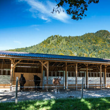

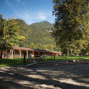
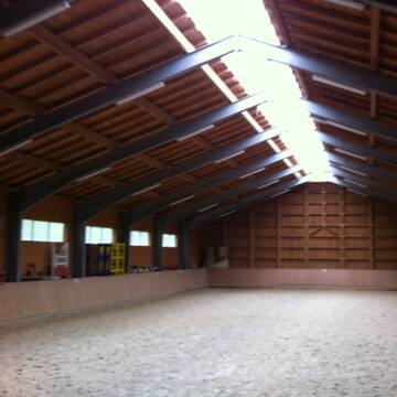
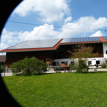
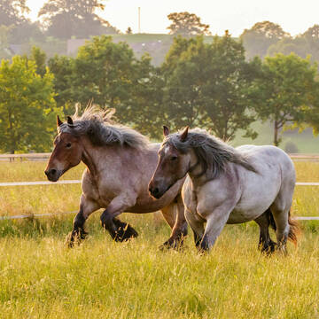
Bewegungsstall Gut Hohenburg
Lenggries
Gut-Hohenburg
@Gut-Hohenburg
Freizeitstall
Geländestrecke
Vermieten
Paddock
Parkplatz für Pferdeanhänger
Allergikerstall
16 weitere...
P+


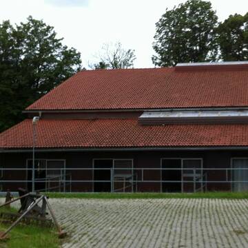

Paddockboxen und Innenboxen Vollpension/Selbstvers
Wackersberg
Grauburgerhof
@Grauburgerhof
Reitlehrer und -unterricht
Reitschule
Vermieten
Laufband
Longierzirkel/Roundpen
Gnadenbrothof
Hufrehe geeignet
18 weitere...
P+
Deprecated: Creation of dynamic property Zend_View_Helper_Ads::$adLink is deprecated in /var/www/stall-frei/htdocs/staging.stall-frei.de/library/Psf/View/Helper/Ads.php on line 108

Job gesucht?
Mechtersen
STALL-FREIde Marketing
@STALL-FREI-Marketing
Sie suchen einen Job und arbeiten gerne mit Pferden oder auf Reitanlagen?
Besuchen Sie jetzt unseren Stellenmarkt!
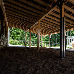
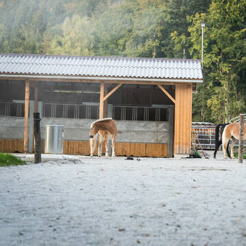
Offenstall für Wallache
Lenggries
Gut-Hohenburg
@Gut-Hohenburg
Vermieten
Paddock
Parkplatz für Pferdeanhänger
Offenstall
Einzelne Boxen oder Stallplätze
3 weitere...
P


Schilcherhof Eurasburg
Eurasburg
Kathi Meindl
@Schilcherhof_Eurasburg
Freizeitstall
Gangpferdereiten
Hunde willkommen
Krankenbox
bedampftes/gewaschenes Heu
Hengsthaltung möglich
Außenbox mit Paddock
Außenboxen
24 weitere...
S


HIT-Aktivstall Kastenmüller Reine Wallachgruppe
Ascholding
Matthias Kastenmüller
@Houcht
Freizeitstall
Krankenbox
Longierzirkel/Roundpen
bedampftes/gewaschenes Heu
Bewegungsstall
Laufstall
14 weitere...
S

Pferdepension Hit Aktivstall Kürmerhof
Hohenkammer
Kuermerhof
@Kuermerhof
*******JETZT NEU MIT ENTSTAUBTEM BIOHEU*********
*******Demnächst mit einem Abenteuerspielplatz für Pferde ( Extrem Trail/Pa
Leider kein Vorschaubild
Leider kein Vorschaubild
kleiner Privatstall
Reichersbeuern
Barbara Eichner
@BarbaraEichner
Pferdeausbildung
Reitlehrer und -unterricht
Vermieten
Paddock
Parkplatz für Pferdeanhänger
Innenbox
8 weitere...
P
Reitanlage "Zum Bei"
Greiling
Josef Sappl
@Josef Sappl
Freizeitstall
Gastronomie
Vermieten
Führanlage
Paddock
Innenbox
Offenstall
13 weitere...
P

Islandpferdehof Ramsau
Bad Heilbrunn
Christine Mertens
@Islandpferdehof-Ramsau
Freizeitstall
Gangpferdereiten
Vermieten
Krankenbox
Ovalbahn
Offenstall
13 weitere...
aktuell
P
Kammerloher Hof
Waakirchen
Kammerloher Hof
@Kammerloher_Hof
Fahrstall, Kutschwagen
Freizeitstall
Vermieten
Hunde willkommen
Krankenbox
Gnadenbrothof
Notfallboxen
24 weitere...
P
Traumhafte Offenstallanlage mit 6500m² Paddock
Sindelsdorf
Urthalerhof
@Urthalerhof_Sindelsdorf
Freizeitstall
Gastronomie
Vermieten
Krankenbox
Paddock
Bewegungsstall
Offenstall
16 weitere...
P+
Deprecated: Creation of dynamic property Zend_View::$pageCount is deprecated in /var/www/stall-frei/htdocs/staging.stall-frei.de/library/vendor/shardj/zf1-future/library/Zend/View/Abstract.php on line 308
Deprecated: Creation of dynamic property Zend_View::$itemCountPerPage is deprecated in /var/www/stall-frei/htdocs/staging.stall-frei.de/library/vendor/shardj/zf1-future/library/Zend/View/Abstract.php on line 308
Deprecated: Creation of dynamic property Zend_View::$first is deprecated in /var/www/stall-frei/htdocs/staging.stall-frei.de/library/vendor/shardj/zf1-future/library/Zend/View/Abstract.php on line 308
Deprecated: Creation of dynamic property Zend_View::$current is deprecated in /var/www/stall-frei/htdocs/staging.stall-frei.de/library/vendor/shardj/zf1-future/library/Zend/View/Abstract.php on line 308
Deprecated: Creation of dynamic property Zend_View::$last is deprecated in /var/www/stall-frei/htdocs/staging.stall-frei.de/library/vendor/shardj/zf1-future/library/Zend/View/Abstract.php on line 308
Deprecated: Creation of dynamic property Zend_View::$next is deprecated in /var/www/stall-frei/htdocs/staging.stall-frei.de/library/vendor/shardj/zf1-future/library/Zend/View/Abstract.php on line 308
Deprecated: Creation of dynamic property Zend_View::$pagesInRange is deprecated in /var/www/stall-frei/htdocs/staging.stall-frei.de/library/vendor/shardj/zf1-future/library/Zend/View/Abstract.php on line 308
Deprecated: Creation of dynamic property Zend_View::$firstPageInRange is deprecated in /var/www/stall-frei/htdocs/staging.stall-frei.de/library/vendor/shardj/zf1-future/library/Zend/View/Abstract.php on line 308
Deprecated: Creation of dynamic property Zend_View::$lastPageInRange is deprecated in /var/www/stall-frei/htdocs/staging.stall-frei.de/library/vendor/shardj/zf1-future/library/Zend/View/Abstract.php on line 308
Deprecated: Creation of dynamic property Zend_View::$currentItemCount is deprecated in /var/www/stall-frei/htdocs/staging.stall-frei.de/library/vendor/shardj/zf1-future/library/Zend/View/Abstract.php on line 308
Deprecated: Creation of dynamic property Zend_View::$totalItemCount is deprecated in /var/www/stall-frei/htdocs/staging.stall-frei.de/library/vendor/shardj/zf1-future/library/Zend/View/Abstract.php on line 308
Deprecated: Creation of dynamic property Zend_View::$firstItemNumber is deprecated in /var/www/stall-frei/htdocs/staging.stall-frei.de/library/vendor/shardj/zf1-future/library/Zend/View/Abstract.php on line 308
Deprecated: Creation of dynamic property Zend_View::$lastItemNumber is deprecated in /var/www/stall-frei/htdocs/staging.stall-frei.de/library/vendor/shardj/zf1-future/library/Zend/View/Abstract.php on line 308
Deprecated: Creation of dynamic property Zend_View::$router is deprecated in /var/www/stall-frei/htdocs/staging.stall-frei.de/library/vendor/shardj/zf1-future/library/Zend/View/Abstract.php on line 308
Deprecated: Creation of dynamic property Zend_View::$urlParams is deprecated in /var/www/stall-frei/htdocs/staging.stall-frei.de/library/vendor/shardj/zf1-future/library/Zend/View/Abstract.php on line 308
Deprecated: Creation of dynamic property Zend_View::$showAds is deprecated in /var/www/stall-frei/htdocs/staging.stall-frei.de/library/vendor/shardj/zf1-future/library/Zend/View/Abstract.php on line 308
Deprecated: Creation of dynamic property Zend_View::$objectIds is deprecated in /var/www/stall-frei/htdocs/staging.stall-frei.de/library/vendor/shardj/zf1-future/library/Zend/View/Abstract.php on line 308
Deprecated: Creation of dynamic property Zend_View::$showNavbar is deprecated in /var/www/stall-frei/htdocs/staging.stall-frei.de/library/vendor/shardj/zf1-future/library/Zend/View/Abstract.php on line 308
Deprecated: Creation of dynamic property Zend_View::$showBreadcrumb is deprecated in /var/www/stall-frei/htdocs/staging.stall-frei.de/library/vendor/shardj/zf1-future/library/Zend/View/Abstract.php on line 308
Deprecated: Creation of dynamic property Zend_View::$showFooter is deprecated in /var/www/stall-frei/htdocs/staging.stall-frei.de/library/vendor/shardj/zf1-future/library/Zend/View/Abstract.php on line 308
Deprecated: Creation of dynamic property Zend_View::$showInternalAds is deprecated in /var/www/stall-frei/htdocs/staging.stall-frei.de/library/vendor/shardj/zf1-future/library/Zend/View/Abstract.php on line 308
Deprecated: Creation of dynamic property Zend_View::$blNoContent is deprecated in /var/www/stall-frei/htdocs/staging.stall-frei.de/library/vendor/shardj/zf1-future/library/Zend/View/Abstract.php on line 308
Deprecated: Creation of dynamic property Zend_View::$sMetaDesc is deprecated in /var/www/stall-frei/htdocs/staging.stall-frei.de/library/vendor/shardj/zf1-future/library/Zend/View/Abstract.php on line 308
Deprecated: Creation of dynamic property Zend_View::$useGmaps is deprecated in /var/www/stall-frei/htdocs/staging.stall-frei.de/library/vendor/shardj/zf1-future/library/Zend/View/Abstract.php on line 308
Deprecated: Creation of dynamic property Zend_View::$touches is deprecated in /var/www/stall-frei/htdocs/staging.stall-frei.de/library/vendor/shardj/zf1-future/library/Zend/View/Abstract.php on line 308
Deprecated: Creation of dynamic property Zend_View::$oProject is deprecated in /var/www/stall-frei/htdocs/staging.stall-frei.de/library/vendor/shardj/zf1-future/library/Zend/View/Abstract.php on line 308
Deprecated: Creation of dynamic property Zend_View::$pageHeadline is deprecated in /var/www/stall-frei/htdocs/staging.stall-frei.de/library/vendor/shardj/zf1-future/library/Zend/View/Abstract.php on line 308
Deprecated: Creation of dynamic property Zend_View::$disableLocationField is deprecated in /var/www/stall-frei/htdocs/staging.stall-frei.de/library/vendor/shardj/zf1-future/library/Zend/View/Abstract.php on line 308
Deprecated: Creation of dynamic property Zend_View::$isSearch is deprecated in /var/www/stall-frei/htdocs/staging.stall-frei.de/library/vendor/shardj/zf1-future/library/Zend/View/Abstract.php on line 308
Deprecated: Creation of dynamic property Zend_View::$pageTitle is deprecated in /var/www/stall-frei/htdocs/staging.stall-frei.de/library/vendor/shardj/zf1-future/library/Zend/View/Abstract.php on line 308
Deprecated: Creation of dynamic property Psf_Form_Element_Text::$class is deprecated in /var/www/stall-frei/htdocs/staging.stall-frei.de/library/vendor/shardj/zf1-future/library/Zend/Form/Element.php on line 874
Deprecated: Creation of dynamic property Psf_Form_Element_Text::$size is deprecated in /var/www/stall-frei/htdocs/staging.stall-frei.de/library/vendor/shardj/zf1-future/library/Zend/Form/Element.php on line 874
Deprecated: Creation of dynamic property Psf_Form_Element_Text::$placeholder is deprecated in /var/www/stall-frei/htdocs/staging.stall-frei.de/library/vendor/shardj/zf1-future/library/Zend/Form/Element.php on line 874
Deprecated: Creation of dynamic property Psf_Form_Element_Hidden::$class is deprecated in /var/www/stall-frei/htdocs/staging.stall-frei.de/library/vendor/shardj/zf1-future/library/Zend/Form/Element.php on line 874
Deprecated: Creation of dynamic property Psf_Form_Element_Hidden::$class is deprecated in /var/www/stall-frei/htdocs/staging.stall-frei.de/library/vendor/shardj/zf1-future/library/Zend/Form/Element.php on line 874
Deprecated: Creation of dynamic property Psf_Form_Element_Hidden::$class is deprecated in /var/www/stall-frei/htdocs/staging.stall-frei.de/library/vendor/shardj/zf1-future/library/Zend/Form/Element.php on line 874
Deprecated: Creation of dynamic property Psf_Form_Element_Hidden::$class is deprecated in /var/www/stall-frei/htdocs/staging.stall-frei.de/library/vendor/shardj/zf1-future/library/Zend/Form/Element.php on line 874
Deprecated: Creation of dynamic property Psf_Form_Element_Select::$class is deprecated in /var/www/stall-frei/htdocs/staging.stall-frei.de/library/vendor/shardj/zf1-future/library/Zend/Form/Element.php on line 874
Deprecated: Creation of dynamic property Psf_Form_Element_Select::$class is deprecated in /var/www/stall-frei/htdocs/staging.stall-frei.de/library/vendor/shardj/zf1-future/library/Zend/Form/Element.php on line 874
Deprecated: Creation of dynamic property Psf_Form_Element_Select::$class is deprecated in /var/www/stall-frei/htdocs/staging.stall-frei.de/library/vendor/shardj/zf1-future/library/Zend/Form/Element.php on line 874
Deprecated: Creation of dynamic property Psf_Form_Element_Select::$class is deprecated in /var/www/stall-frei/htdocs/staging.stall-frei.de/library/vendor/shardj/zf1-future/library/Zend/Form/Element.php on line 874
Deprecated: Creation of dynamic property Psf_Form_Element_Text::$class is deprecated in /var/www/stall-frei/htdocs/staging.stall-frei.de/library/vendor/shardj/zf1-future/library/Zend/Form/Element.php on line 874
Deprecated: Creation of dynamic property Psf_Form_Element_Checkbox::$label is deprecated in /var/www/stall-frei/htdocs/staging.stall-frei.de/library/vendor/shardj/zf1-future/library/Zend/Form/Element.php on line 874
Deprecated: Creation of dynamic property Zend_View::$sort is deprecated in /var/www/stall-frei/htdocs/staging.stall-frei.de/library/vendor/shardj/zf1-future/library/Zend/View/Abstract.php on line 308
Deprecated: Creation of dynamic property Zend_View::$searchLocation is deprecated in /var/www/stall-frei/htdocs/staging.stall-frei.de/library/vendor/shardj/zf1-future/library/Zend/View/Abstract.php on line 308
Deprecated: Creation of dynamic property Zend_View::$locationHint is deprecated in /var/www/stall-frei/htdocs/staging.stall-frei.de/library/vendor/shardj/zf1-future/library/Zend/View/Abstract.php on line 308
Psf_GeoCoder_Abstract::getLocation: Lenggries Get Location CachedOrLive
Psf_GeoCoder_Abstract::getCachedOrLive: Lenggries
Psf_GeoCoder_OpenCageData::makeApiRequest: response:
Array
(
[documentation] => https://opencagedata.com/api
[licenses] => Array
(
[0] => Array
(
[name] => see attribution guide
[url] => https://opencagedata.com/credits
)
)
[results] => Array
(
[0] => Array
(
[bounds] => Array
(
[northeast] => Array
(
[lat] => 47.7093303
[lng] => 11.6801787
)
[southwest] => Array
(
[lat] => 47.4951069
[lng] => 11.3320865
)
)
[components] => Array
(
[ISO_3166-1_alpha-2] => DE
[ISO_3166-1_alpha-3] => DEU
[ISO_3166-2] => Array
(
[0] => DE-BY
)
[_category] => place
[_normalized_city] => Lenggries
[_type] => city
[continent] => Europe
[country] => Deutschland
[country_code] => de
[county] => Landkreis Bad Tölz-Wolfratshausen
[political_union] => European Union
[postcode] => 83661
[state] => Bayern
[state_code] => BY
[town] => Lenggries
)
[confidence] => 4
[formatted] => 83661 Lenggries, Deutschland
[geometry] => Array
(
[lat] => 47.6831625
[lng] => 11.5763967
)
)
[1] => Array
(
[components] => Array
(
[ISO_3166-1_alpha-2] => FR
[ISO_3166-1_alpha-3] => FRA
[ISO_3166-2] => Array
(
[0] => FR-BRE
[1] => FR-22
)
[_category] => road
[_normalized_city] => Plélo
[_type] => road
[city] => Plélo
[continent] => Europe
[country] => France
[country_code] => fr
[county] => Côtes-d'Armor
[local_authority] => Leff Armor Communauté
[political_union] => European Union
[postcode] => 22170
[road] => Rue de Lenggries
[state] => Bretagne
[state_code] => BRE
)
[confidence] => 4
[formatted] => Rue de Lenggries, 22170 Plélo, France
[geometry] => Array
(
[lat] => 48.55391
[lng] => -2.95114
)
)
[2] => Array
(
[components] => Array
(
[ISO_3166-1_alpha-2] => FR
[ISO_3166-1_alpha-3] => FRA
[ISO_3166-2] => Array
(
[0] => FR-BRE
[1] => FR-22
)
[_category] => road
[_normalized_city] => Plouvara
[_type] => road
[city] => Plouvara
[continent] => Europe
[country] => France
[country_code] => fr
[county] => Côtes-d'Armor
[local_authority] => Leff Armor Communauté
[political_union] => European Union
[postcode] => 22170
[road] => Rue de Lenggries
[state] => Bretagne
[state_code] => BRE
)
[confidence] => 4
[formatted] => Rue de Lenggries, 22170 Plouvara, France
[geometry] => Array
(
[lat] => 48.509742
[lng] => -2.916496
)
)
[3] => Array
(
[components] => Array
(
[ISO_3166-1_alpha-2] => FR
[ISO_3166-1_alpha-3] => FRA
[ISO_3166-2] => Array
(
[0] => FR-BRE
[1] => FR-22
)
[_category] => road
[_normalized_city] => Châtelaudren-Plouagat
[_type] => road
[city] => Châtelaudren-Plouagat
[continent] => Europe
[country] => France
[country_code] => fr
[county] => Côtes-d'Armor
[local_authority] => Leff Armor Communauté
[political_union] => European Union
[postcode] => 22170
[road] => Rond-Point de Lenggries
[state] => Bretagne
[state_code] => BRE
)
[confidence] => 3
[formatted] => Rond-Point de Lenggries, 22170 Châtelaudren-Plouagat, France
[geometry] => Array
(
[lat] => 48.538999
[lng] => -2.988983
)
)
[4] => Array
(
[components] => Array
(
[ISO_3166-1_alpha-2] => FR
[ISO_3166-1_alpha-3] => FRA
[ISO_3166-2] => Array
(
[0] => FR-PDL
[1] => FR-44
)
[_category] => road
[_normalized_city] => Loireauxence
[_type] => road
[city] => Loireauxence
[continent] => Europe
[country] => France
[country_code] => fr
[county] => Loire-Atlantique
[local_authority] => Communauté de communes du Pays d'Ancenis
[political_union] => European Union
[postcode] => 44370
[road] => Chemin de la Langrie
[state] => Pays de la Loire
[state_code] => PDL
)
[confidence] => 3
[formatted] => Chemin de la Langrie, 44370 Loireauxence, France
[geometry] => Array
(
[lat] => 47.43572
[lng] => -1.065841
)
)
[5] => Array
(
[components] => Array
(
[ISO_3166-1_alpha-2] => FR
[ISO_3166-1_alpha-3] => FRA
[ISO_3166-2] => Array
(
[0] => FR-PDL
[1] => FR-72
)
[_category] => road
[_normalized_city] => Écommoy
[_type] => road
[city] => Écommoy
[continent] => Europe
[country] => France
[country_code] => fr
[county] => Sarthe
[local_authority] => Communauté de communes de l'Orée de Bercé Bélinois
[political_union] => European Union
[postcode] => 72220
[road] => Chemin de la Langrie
[state] => Pays de la Loire
[state_code] => PDL
)
[confidence] => 3
[formatted] => Chemin de la Langrie, 72220 Écommoy, France
[geometry] => Array
(
[lat] => 47.853905
[lng] => 0.2608
)
)
[6] => Array
(
[components] => Array
(
[ISO_3166-1_alpha-2] => FR
[ISO_3166-1_alpha-3] => FRA
[ISO_3166-2] => Array
(
[0] => FR-NOR
[1] => FR-61
)
[_category] => road
[_normalized_city] => Montsecret-Clairefougère
[_type] => road
[city] => Montsecret-Clairefougère
[continent] => Europe
[country] => France
[country_code] => fr
[county] => Orne
[local_authority] => Domfront Tinchebray Interco
[political_union] => European Union
[postcode] => 61800
[road] => Langrie
[state] => Normandie
[state_code] => NOR
)
[confidence] => 3
[formatted] => Langrie, 61800 Montsecret-Clairefougère, France
[geometry] => Array
(
[lat] => 48.81246
[lng] => -0.668278
)
)
[7] => Array
(
[components] => Array
(
[ISO_3166-1_alpha-2] => FR
[ISO_3166-1_alpha-3] => FRA
[ISO_3166-2] => Array
(
[0] => FR-NOR
[1] => FR-50
)
[_category] => road
[_normalized_city] => Saint-Germain-sur-Sèves
[_type] => road
[city] => Saint-Germain-sur-Sèves
[continent] => Europe
[country] => France
[country_code] => fr
[county] => Manche
[local_authority] => Communauté de communes Côte Ouest Centre Manche
[political_union] => European Union
[postcode] => 50190
[road] => Langrie
[state] => Normandie
[state_code] => NOR
)
[confidence] => 2
[formatted] => Langrie, 50190 Saint-Germain-sur-Sèves, France
[geometry] => Array
(
[lat] => 49.214067
[lng] => -1.369841
)
)
[8] => Array
(
[components] => Array
(
[ISO_3166-1_alpha-2] => FR
[ISO_3166-1_alpha-3] => FRA
[ISO_3166-2] => Array
(
[0] => FR-BFC
[1] => FR-70
)
[_category] => road
[_normalized_city] => Autet
[_type] => road
[city] => Autet
[continent] => Europe
[country] => France
[country_code] => fr
[county] => Haute-Saône
[local_authority] => Communauté de communes des Quatre Rivières
[political_union] => European Union
[postcode] => 70180
[road] => Chemin des Lennery
[state] => Bourgogne-Franche-Comté
[state_code] => BFC
)
[confidence] => 2
[formatted] => Chemin des Lennery, 70180 Autet, France
[geometry] => Array
(
[lat] => 47.546764
[lng] => 5.694499
)
)
[9] => Array
(
[components] => Array
(
[ISO_3166-1_alpha-2] => FR
[ISO_3166-1_alpha-3] => FRA
[ISO_3166-2] => Array
(
[0] => FR-BFC
[1] => FR-70
)
[_category] => road
[_normalized_city] => Autet
[_type] => road
[city] => Autet
[continent] => Europe
[country] => France
[country_code] => fr
[county] => Haute-Saône
[local_authority] => Communauté de communes des Quatre Rivières
[political_union] => European Union
[postcode] => 70180
[road] => Rue des Lennery
[state] => Bourgogne-Franche-Comté
[state_code] => BFC
)
[confidence] => 2
[formatted] => Rue des Lennery, 70180 Autet, France
[geometry] => Array
(
[lat] => 47.5468
[lng] => 5.694394
)
)
)
[status] => Array
(
[code] => 200
[message] => OK
)
[stay_informed] => Array
(
[blog] => https://blog.opencagedata.com
[mastodon] => https://en.osm.town/@opencage
)
[thanks] => For using an OpenCage API
[timestamp] => Array
(
[created_http] => Fri, 06 Feb 2026 18:48:30 GMT
[created_unix] => 1770403710
)
[total_results] => 10
)
Psf_GeoCoder_Abstract::convertLocationResult
{"documentation":"https:\/\/opencagedata.com\/api","licenses":[{"name":"see attribution guide","url":"https:\/\/opencagedata.com\/credits"}],"results":[{"bounds":{"northeast":{"lat":47.7093303,"lng":11.6801787},"southwest":{"lat":47.4951069,"lng":11.3320865}},"components":{"ISO_3166-1_alpha-2":"DE","ISO_3166-1_alpha-3":"DEU","ISO_3166-2":["DE-BY"],"_category":"place","_normalized_city":"Lenggries","_type":"city","continent":"Europe","country":"Deutschland","country_code":"de","county":"Landkreis Bad T\u00f6lz-Wolfratshausen","political_union":"European Union","postcode":"83661","state":"Bayern","state_code":"BY","town":"Lenggries"},"confidence":4,"formatted":"83661 Lenggries, Deutschland","geometry":{"lat":47.6831625,"lng":11.5763967}},{"components":{"ISO_3166-1_alpha-2":"FR","ISO_3166-1_alpha-3":"FRA","ISO_3166-2":["FR-BRE","FR-22"],"_category":"road","_normalized_city":"Pl\u00e9lo","_type":"road","city":"Pl\u00e9lo","continent":"Europe","country":"France","country_code":"fr","county":"C\u00f4tes-d'Armor","local_authority":"Leff Armor Communaut\u00e9","political_union":"European Union","postcode":"22170","road":"Rue de Lenggries","state":"Bretagne","state_code":"BRE"},"confidence":4,"formatted":"Rue de Lenggries, 22170 Pl\u00e9lo, France","geometry":{"lat":48.55391,"lng":-2.95114}},{"components":{"ISO_3166-1_alpha-2":"FR","ISO_3166-1_alpha-3":"FRA","ISO_3166-2":["FR-BRE","FR-22"],"_category":"road","_normalized_city":"Plouvara","_type":"road","city":"Plouvara","continent":"Europe","country":"France","country_code":"fr","county":"C\u00f4tes-d'Armor","local_authority":"Leff Armor Communaut\u00e9","political_union":"European Union","postcode":"22170","road":"Rue de Lenggries","state":"Bretagne","state_code":"BRE"},"confidence":4,"formatted":"Rue de Lenggries, 22170 Plouvara, France","geometry":{"lat":48.509742,"lng":-2.916496}},{"components":{"ISO_3166-1_alpha-2":"FR","ISO_3166-1_alpha-3":"FRA","ISO_3166-2":["FR-BRE","FR-22"],"_category":"road","_normalized_city":"Ch\u00e2telaudren-Plouagat","_type":"road","city":"Ch\u00e2telaudren-Plouagat","continent":"Europe","country":"France","country_code":"fr","county":"C\u00f4tes-d'Armor","local_authority":"Leff Armor Communaut\u00e9","political_union":"European Union","postcode":"22170","road":"Rond-Point de Lenggries","state":"Bretagne","state_code":"BRE"},"confidence":3,"formatted":"Rond-Point de Lenggries, 22170 Ch\u00e2telaudren-Plouagat, France","geometry":{"lat":48.538999,"lng":-2.988983}},{"components":{"ISO_3166-1_alpha-2":"FR","ISO_3166-1_alpha-3":"FRA","ISO_3166-2":["FR-PDL","FR-44"],"_category":"road","_normalized_city":"Loireauxence","_type":"road","city":"Loireauxence","continent":"Europe","country":"France","country_code":"fr","county":"Loire-Atlantique","local_authority":"Communaut\u00e9 de communes du Pays d'Ancenis","political_union":"European Union","postcode":"44370","road":"Chemin de la Langrie","state":"Pays de la Loire","state_code":"PDL"},"confidence":3,"formatted":"Chemin de la Langrie, 44370 Loireauxence, France","geometry":{"lat":47.43572,"lng":-1.065841}},{"components":{"ISO_3166-1_alpha-2":"FR","ISO_3166-1_alpha-3":"FRA","ISO_3166-2":["FR-PDL","FR-72"],"_category":"road","_normalized_city":"\u00c9commoy","_type":"road","city":"\u00c9commoy","continent":"Europe","country":"France","country_code":"fr","county":"Sarthe","local_authority":"Communaut\u00e9 de communes de l'Or\u00e9e de Berc\u00e9 B\u00e9linois","political_union":"European Union","postcode":"72220","road":"Chemin de la Langrie","state":"Pays de la Loire","state_code":"PDL"},"confidence":3,"formatted":"Chemin de la Langrie, 72220 \u00c9commoy, France","geometry":{"lat":47.853905,"lng":0.2608}},{"components":{"ISO_3166-1_alpha-2":"FR","ISO_3166-1_alpha-3":"FRA","ISO_3166-2":["FR-NOR","FR-61"],"_category":"road","_normalized_city":"Montsecret-Clairefoug\u00e8re","_type":"road","city":"Montsecret-Clairefoug\u00e8re","continent":"Europe","country":"France","country_code":"fr","county":"Orne","local_authority":"Domfront Tinchebray Interco","political_union":"European Union","postcode":"61800","road":"Langrie","state":"Normandie","state_code":"NOR"},"confidence":3,"formatted":"Langrie, 61800 Montsecret-Clairefoug\u00e8re, France","geometry":{"lat":48.81246,"lng":-0.668278}},{"components":{"ISO_3166-1_alpha-2":"FR","ISO_3166-1_alpha-3":"FRA","ISO_3166-2":["FR-NOR","FR-50"],"_category":"road","_normalized_city":"Saint-Germain-sur-S\u00e8ves","_type":"road","city":"Saint-Germain-sur-S\u00e8ves","continent":"Europe","country":"France","country_code":"fr","county":"Manche","local_authority":"Communaut\u00e9 de communes C\u00f4te Ouest Centre Manche","political_union":"European Union","postcode":"50190","road":"Langrie","state":"Normandie","state_code":"NOR"},"confidence":2,"formatted":"Langrie, 50190 Saint-Germain-sur-S\u00e8ves, France","geometry":{"lat":49.214067,"lng":-1.369841}},{"components":{"ISO_3166-1_alpha-2":"FR","ISO_3166-1_alpha-3":"FRA","ISO_3166-2":["FR-BFC","FR-70"],"_category":"road","_normalized_city":"Autet","_type":"road","city":"Autet","continent":"Europe","country":"France","country_code":"fr","county":"Haute-Sa\u00f4ne","local_authority":"Communaut\u00e9 de communes des Quatre Rivi\u00e8res","political_union":"European Union","postcode":"70180","road":"Chemin des Lennery","state":"Bourgogne-Franche-Comt\u00e9","state_code":"BFC"},"confidence":2,"formatted":"Chemin des Lennery, 70180 Autet, France","geometry":{"lat":47.546764,"lng":5.694499}},{"components":{"ISO_3166-1_alpha-2":"FR","ISO_3166-1_alpha-3":"FRA","ISO_3166-2":["FR-BFC","FR-70"],"_category":"road","_normalized_city":"Autet","_type":"road","city":"Autet","continent":"Europe","country":"France","country_code":"fr","county":"Haute-Sa\u00f4ne","local_authority":"Communaut\u00e9 de communes des Quatre Rivi\u00e8res","political_union":"European Union","postcode":"70180","road":"Rue des Lennery","state":"Bourgogne-Franche-Comt\u00e9","state_code":"BFC"},"confidence":2,"formatted":"Rue des Lennery, 70180 Autet, France","geometry":{"lat":47.5468,"lng":5.694394}}],"status":{"code":200,"message":"OK"},"stay_informed":{"blog":"https:\/\/blog.opencagedata.com","mastodon":"https:\/\/en.osm.town\/@opencage"},"thanks":"For using an OpenCage API","timestamp":{"created_http":"Fri, 06 Feb 2026 18:48:30 GMT","created_unix":1770403710},"total_results":10}Array
(
[0] => stdClass Object
(
[bounds] => stdClass Object
(
[northeast] => stdClass Object
(
[lat] => 47.7093303
[lng] => 11.6801787
)
[southwest] => stdClass Object
(
[lat] => 47.4951069
[lng] => 11.3320865
)
)
[components] => stdClass Object
(
[ISO_3166-1_alpha-2] => DE
[ISO_3166-1_alpha-3] => DEU
[ISO_3166-2] => Array
(
[0] => DE-BY
)
[_category] => place
[_normalized_city] => Lenggries
[_type] => city
[continent] => Europe
[country] => Deutschland
[country_code] => de
[county] => Landkreis Bad Tölz-Wolfratshausen
[political_union] => European Union
[postcode] => 83661
[state] => Bayern
[state_code] => BY
[town] => Lenggries
)
[confidence] => 4
[formatted] => 83661 Lenggries, Deutschland
[geometry] => stdClass Object
(
[lat] => 47.6831625
[lng] => 11.5763967
)
)
[1] => stdClass Object
(
[components] => stdClass Object
(
[ISO_3166-1_alpha-2] => FR
[ISO_3166-1_alpha-3] => FRA
[ISO_3166-2] => Array
(
[0] => FR-BRE
[1] => FR-22
)
[_category] => road
[_normalized_city] => Plélo
[_type] => road
[city] => Plélo
[continent] => Europe
[country] => France
[country_code] => fr
[county] => Côtes-d'Armor
[local_authority] => Leff Armor Communauté
[political_union] => European Union
[postcode] => 22170
[road] => Rue de Lenggries
[state] => Bretagne
[state_code] => BRE
)
[confidence] => 4
[formatted] => Rue de Lenggries, 22170 Plélo, France
[geometry] => stdClass Object
(
[lat] => 48.55391
[lng] => -2.95114
)
)
[2] => stdClass Object
(
[components] => stdClass Object
(
[ISO_3166-1_alpha-2] => FR
[ISO_3166-1_alpha-3] => FRA
[ISO_3166-2] => Array
(
[0] => FR-BRE
[1] => FR-22
)
[_category] => road
[_normalized_city] => Plouvara
[_type] => road
[city] => Plouvara
[continent] => Europe
[country] => France
[country_code] => fr
[county] => Côtes-d'Armor
[local_authority] => Leff Armor Communauté
[political_union] => European Union
[postcode] => 22170
[road] => Rue de Lenggries
[state] => Bretagne
[state_code] => BRE
)
[confidence] => 4
[formatted] => Rue de Lenggries, 22170 Plouvara, France
[geometry] => stdClass Object
(
[lat] => 48.509742
[lng] => -2.916496
)
)
[3] => stdClass Object
(
[components] => stdClass Object
(
[ISO_3166-1_alpha-2] => FR
[ISO_3166-1_alpha-3] => FRA
[ISO_3166-2] => Array
(
[0] => FR-BRE
[1] => FR-22
)
[_category] => road
[_normalized_city] => Châtelaudren-Plouagat
[_type] => road
[city] => Châtelaudren-Plouagat
[continent] => Europe
[country] => France
[country_code] => fr
[county] => Côtes-d'Armor
[local_authority] => Leff Armor Communauté
[political_union] => European Union
[postcode] => 22170
[road] => Rond-Point de Lenggries
[state] => Bretagne
[state_code] => BRE
)
[confidence] => 3
[formatted] => Rond-Point de Lenggries, 22170 Châtelaudren-Plouagat, France
[geometry] => stdClass Object
(
[lat] => 48.538999
[lng] => -2.988983
)
)
[4] => stdClass Object
(
[components] => stdClass Object
(
[ISO_3166-1_alpha-2] => FR
[ISO_3166-1_alpha-3] => FRA
[ISO_3166-2] => Array
(
[0] => FR-PDL
[1] => FR-44
)
[_category] => road
[_normalized_city] => Loireauxence
[_type] => road
[city] => Loireauxence
[continent] => Europe
[country] => France
[country_code] => fr
[county] => Loire-Atlantique
[local_authority] => Communauté de communes du Pays d'Ancenis
[political_union] => European Union
[postcode] => 44370
[road] => Chemin de la Langrie
[state] => Pays de la Loire
[state_code] => PDL
)
[confidence] => 3
[formatted] => Chemin de la Langrie, 44370 Loireauxence, France
[geometry] => stdClass Object
(
[lat] => 47.43572
[lng] => -1.065841
)
)
[5] => stdClass Object
(
[components] => stdClass Object
(
[ISO_3166-1_alpha-2] => FR
[ISO_3166-1_alpha-3] => FRA
[ISO_3166-2] => Array
(
[0] => FR-PDL
[1] => FR-72
)
[_category] => road
[_normalized_city] => Écommoy
[_type] => road
[city] => Écommoy
[continent] => Europe
[country] => France
[country_code] => fr
[county] => Sarthe
[local_authority] => Communauté de communes de l'Orée de Bercé Bélinois
[political_union] => European Union
[postcode] => 72220
[road] => Chemin de la Langrie
[state] => Pays de la Loire
[state_code] => PDL
)
[confidence] => 3
[formatted] => Chemin de la Langrie, 72220 Écommoy, France
[geometry] => stdClass Object
(
[lat] => 47.853905
[lng] => 0.2608
)
)
[6] => stdClass Object
(
[components] => stdClass Object
(
[ISO_3166-1_alpha-2] => FR
[ISO_3166-1_alpha-3] => FRA
[ISO_3166-2] => Array
(
[0] => FR-NOR
[1] => FR-61
)
[_category] => road
[_normalized_city] => Montsecret-Clairefougère
[_type] => road
[city] => Montsecret-Clairefougère
[continent] => Europe
[country] => France
[country_code] => fr
[county] => Orne
[local_authority] => Domfront Tinchebray Interco
[political_union] => European Union
[postcode] => 61800
[road] => Langrie
[state] => Normandie
[state_code] => NOR
)
[confidence] => 3
[formatted] => Langrie, 61800 Montsecret-Clairefougère, France
[geometry] => stdClass Object
(
[lat] => 48.81246
[lng] => -0.668278
)
)
[7] => stdClass Object
(
[components] => stdClass Object
(
[ISO_3166-1_alpha-2] => FR
[ISO_3166-1_alpha-3] => FRA
[ISO_3166-2] => Array
(
[0] => FR-NOR
[1] => FR-50
)
[_category] => road
[_normalized_city] => Saint-Germain-sur-Sèves
[_type] => road
[city] => Saint-Germain-sur-Sèves
[continent] => Europe
[country] => France
[country_code] => fr
[county] => Manche
[local_authority] => Communauté de communes Côte Ouest Centre Manche
[political_union] => European Union
[postcode] => 50190
[road] => Langrie
[state] => Normandie
[state_code] => NOR
)
[confidence] => 2
[formatted] => Langrie, 50190 Saint-Germain-sur-Sèves, France
[geometry] => stdClass Object
(
[lat] => 49.214067
[lng] => -1.369841
)
)
[8] => stdClass Object
(
[components] => stdClass Object
(
[ISO_3166-1_alpha-2] => FR
[ISO_3166-1_alpha-3] => FRA
[ISO_3166-2] => Array
(
[0] => FR-BFC
[1] => FR-70
)
[_category] => road
[_normalized_city] => Autet
[_type] => road
[city] => Autet
[continent] => Europe
[country] => France
[country_code] => fr
[county] => Haute-Saône
[local_authority] => Communauté de communes des Quatre Rivières
[political_union] => European Union
[postcode] => 70180
[road] => Chemin des Lennery
[state] => Bourgogne-Franche-Comté
[state_code] => BFC
)
[confidence] => 2
[formatted] => Chemin des Lennery, 70180 Autet, France
[geometry] => stdClass Object
(
[lat] => 47.546764
[lng] => 5.694499
)
)
[9] => stdClass Object
(
[components] => stdClass Object
(
[ISO_3166-1_alpha-2] => FR
[ISO_3166-1_alpha-3] => FRA
[ISO_3166-2] => Array
(
[0] => FR-BFC
[1] => FR-70
)
[_category] => road
[_normalized_city] => Autet
[_type] => road
[city] => Autet
[continent] => Europe
[country] => France
[country_code] => fr
[county] => Haute-Saône
[local_authority] => Communauté de communes des Quatre Rivières
[political_union] => European Union
[postcode] => 70180
[road] => Rue des Lennery
[state] => Bourgogne-Franche-Comté
[state_code] => BFC
)
[confidence] => 2
[formatted] => Rue des Lennery, 70180 Autet, France
[geometry] => stdClass Object
(
[lat] => 47.5468
[lng] => 5.694394
)
)
)
Psf_GeoCoder_OpenCageData::getKeyMap: 0
stdClass Object
(
    [bounds] => stdClass Object
        (
            [northeast] => stdClass Object
                (
                    [lat] => 47.7093303
                    [lng] => 11.6801787
                )

            [southwest] => stdClass Object
                (
                    [lat] => 47.4951069
                    [lng] => 11.3320865
                )

        )

    [components] => stdClass Object
        (
            [ISO_3166-1_alpha-2] => DE
            [ISO_3166-1_alpha-3] => DEU
            [ISO_3166-2] => Array
                (
                    [0] => DE-BY
                )

            [_category] => place
            [_normalized_city] => Lenggries
            [_type] => city
            [continent] => Europe
            [country] => Deutschland
            [country_code] => de
            [county] => Landkreis Bad Tölz-Wolfratshausen
            [political_union] => European Union
            [postcode] => 83661
            [state] => Bayern
            [state_code] => BY
            [town] => Lenggries
        )

    [confidence] => 4
    [formatted] => 83661 Lenggries, Deutschland
    [geometry] => stdClass Object
        (
            [lat] => 47.6831625
            [lng] => 11.5763967
        )

)
Psf_GeoCoder_OpenCageData::getCounty: Bad Tölz-Wolfratshausen
Psf_GeoCoder_OpenCageData::addMissingData REFETCH!
Array
(
    [address] => 83661 Lenggries, Deutschland
    [type] => city
    [street] =>
    [city] => Lenggries
    [county] => Bad Tölz-Wolfratshausen
    [state] => Bayern
    [zip] => 83661
    [country] => Deutschland
    [suburb] =>
    [countrycode] => de
    [latitude] => 47.6831625
    [longitude] => 11.5763967
    [accuracy] => 1
    [confidence] => 4
    [bounds] => stdClass Object
        (
            [northeast] => stdClass Object
                (
                    [lat] => 47.7093303
                    [lng] => 11.6801787
                )

            [southwest] => stdClass Object
                (
                    [lat] => 47.4951069
                    [lng] => 11.3320865
                )

        )

)
reformat!
Array
(
    [address] => 83661 Lenggries, Deutschland
    [type] => city
    [street] =>
    [city] => Lenggries
    [county] => Bad Tölz-Wolfratshausen
    [state] => Bayern
    [zip] => 83661
    [country] => Deutschland
    [suburb] =>
    [countrycode] => de
    [latitude] => 47.6831625
    [longitude] => 11.5763967
    [accuracy] => 1
    [confidence] => 4
    [bounds] => stdClass Object
        (
            [northeast] => stdClass Object
                (
                    [lat] => 47.7093303
                    [lng] => 11.6801787
                )

            [southwest] => stdClass Object
                (
                    [lat] => 47.4951069
                    [lng] => 11.3320865
                )

        )

    [place] => 83661 Lenggries, Bayern
    [hash] => 12cc01347248183d60a1f568ecf73788
)
Psf_GeoCoder_OpenCageData::getKeyMap: 1
stdClass Object
(
    [components] => stdClass Object
        (
            [ISO_3166-1_alpha-2] => FR
            [ISO_3166-1_alpha-3] => FRA
            [ISO_3166-2] => Array
                (
                    [0] => FR-BRE
                    [1] => FR-22
                )

            [_category] => road
            [_normalized_city] => Plélo
            [_type] => road
            [city] => Plélo
            [continent] => Europe
            [country] => France
            [country_code] => fr
            [county] => Côtes-d'Armor
            [local_authority] => Leff Armor Communauté
            [political_union] => European Union
            [postcode] => 22170
            [road] => Rue de Lenggries
            [state] => Bretagne
            [state_code] => BRE
        )

    [confidence] => 4
    [formatted] => Rue de Lenggries, 22170 Plélo, France
    [geometry] => stdClass Object
        (
            [lat] => 48.55391
            [lng] => -2.95114
        )

)
Psf_GeoCoder_OpenCageData::getCounty: Côtes-d'Armor
Psf_GeoCoder_OpenCageData::addMissingData REFETCH!
Array
(
    [address] => Rue de Lenggries, 22170 Plélo, France
    [type] => road
    [street] => Rue de Lenggries
    [city] => Plélo
    [county] => Côtes-d'Armor
    [state] => Bretagne
    [zip] => 22170
    [country] => France
    [suburb] =>
    [countrycode] => fr
    [latitude] => 48.55391
    [longitude] => -2.95114
    [accuracy] => 1
    [confidence] => 4
    [bounds] =>
)
reformat!
Array
(
    [address] => Rue de Lenggries, 22170 Plélo, France
    [type] => road
    [street] => Rue de Lenggries
    [city] => Plélo
    [county] => Côtes-d'Armor
    [state] => Bretagne
    [zip] => 22170
    [country] => France
    [suburb] =>
    [countrycode] => fr
    [latitude] => 48.55391
    [longitude] => -2.95114
    [accuracy] => 1
    [confidence] => 4
    [bounds] =>
    [place] => Rue de Lenggries, 22170 Plélo, Bretagne
    [hash] => 8eba19a840b933e00a6fe72b570695fb
)
Psf_GeoCoder_OpenCageData::getKeyMap: 2
stdClass Object
(
    [components] => stdClass Object
        (
            [ISO_3166-1_alpha-2] => FR
            [ISO_3166-1_alpha-3] => FRA
            [ISO_3166-2] => Array
                (
                    [0] => FR-BRE
                    [1] => FR-22
                )

            [_category] => road
            [_normalized_city] => Plouvara
            [_type] => road
            [city] => Plouvara
            [continent] => Europe
            [country] => France
            [country_code] => fr
            [county] => Côtes-d'Armor
            [local_authority] => Leff Armor Communauté
            [political_union] => European Union
            [postcode] => 22170
            [road] => Rue de Lenggries
            [state] => Bretagne
            [state_code] => BRE
        )

    [confidence] => 4
    [formatted] => Rue de Lenggries, 22170 Plouvara, France
    [geometry] => stdClass Object
        (
            [lat] => 48.509742
            [lng] => -2.916496
        )

)
Psf_GeoCoder_OpenCageData::getCounty: Côtes-d'Armor
Psf_GeoCoder_OpenCageData::addMissingData REFETCH!
Array
(
    [address] => Rue de Lenggries, 22170 Plouvara, France
    [type] => road
    [street] => Rue de Lenggries
    [city] => Plouvara
    [county] => Côtes-d'Armor
    [state] => Bretagne
    [zip] => 22170
    [country] => France
    [suburb] =>
    [countrycode] => fr
    [latitude] => 48.509742
    [longitude] => -2.916496
    [accuracy] => 1
    [confidence] => 4
    [bounds] =>
)
reformat!
Array
(
    [address] => Rue de Lenggries, 22170 Plouvara, France
    [type] => road
    [street] => Rue de Lenggries
    [city] => Plouvara
    [county] => Côtes-d'Armor
    [state] => Bretagne
    [zip] => 22170
    [country] => France
    [suburb] =>
    [countrycode] => fr
    [latitude] => 48.509742
    [longitude] => -2.916496
    [accuracy] => 1
    [confidence] => 4
    [bounds] =>
    [place] => Rue de Lenggries, 22170 Plouvara, Bretagne
    [hash] => 88486bbe35296e02de0a76a0b594eee3
)
Psf_GeoCoder_OpenCageData::getKeyMap: 3
stdClass Object
(
    [components] => stdClass Object
        (
            [ISO_3166-1_alpha-2] => FR
            [ISO_3166-1_alpha-3] => FRA
            [ISO_3166-2] => Array
                (
                    [0] => FR-BRE
                    [1] => FR-22
                )

            [_category] => road
            [_normalized_city] => Châtelaudren-Plouagat
            [_type] => road
            [city] => Châtelaudren-Plouagat
            [continent] => Europe
            [country] => France
            [country_code] => fr
            [county] => Côtes-d'Armor
            [local_authority] => Leff Armor Communauté
            [political_union] => European Union
            [postcode] => 22170
            [road] => Rond-Point de Lenggries
            [state] => Bretagne
            [state_code] => BRE
        )

    [confidence] => 3
    [formatted] => Rond-Point de Lenggries, 22170 Châtelaudren-Plouagat, France
    [geometry] => stdClass Object
        (
            [lat] => 48.538999
            [lng] => -2.988983
        )

)
Psf_GeoCoder_OpenCageData::getCounty: Côtes-d'Armor
Psf_GeoCoder_OpenCageData::addMissingData REFETCH!
Array
(
    [address] => Rond-Point de Lenggries, 22170 Châtelaudren-Plouagat, France
    [type] => road
    [street] => Rond-Point de Lenggries
    [city] => Châtelaudren-Plouagat
    [county] => Côtes-d'Armor
    [state] => Bretagne
    [zip] => 22170
    [country] => France
    [suburb] =>
    [countrycode] => fr
    [latitude] => 48.538999
    [longitude] => -2.988983
    [accuracy] => 1
    [confidence] => 3
    [bounds] =>
)
reformat!
Array
(
    [address] => Rond-Point de Lenggries, 22170 Châtelaudren-Plouagat, France
    [type] => road
    [street] => Rond-Point de Lenggries
    [city] => Châtelaudren-Plouagat
    [county] => Côtes-d'Armor
    [state] => Bretagne
    [zip] => 22170
    [country] => France
    [suburb] =>
    [countrycode] => fr
    [latitude] => 48.538999
    [longitude] => -2.988983
    [accuracy] => 1
    [confidence] => 3
    [bounds] =>
    [place] => Rond-Point de Lenggries, 22170 Châtelaudren-Plouagat, Bretagne
    [hash] => 3772073c903c4f92aa9355a1adde3620
)
Psf_GeoCoder_OpenCageData::getKeyMap: 4
stdClass Object
(
    [components] => stdClass Object
        (
            [ISO_3166-1_alpha-2] => FR
            [ISO_3166-1_alpha-3] => FRA
            [ISO_3166-2] => Array
                (
                    [0] => FR-PDL
                    [1] => FR-44
                )

            [_category] => road
            [_normalized_city] => Loireauxence
            [_type] => road
            [city] => Loireauxence
            [continent] => Europe
            [country] => France
            [country_code] => fr
            [county] => Loire-Atlantique
            [local_authority] => Communauté de communes du Pays d'Ancenis
            [political_union] => European Union
            [postcode] => 44370
            [road] => Chemin de la Langrie
            [state] => Pays de la Loire
            [state_code] => PDL
        )

    [confidence] => 3
    [formatted] => Chemin de la Langrie, 44370 Loireauxence, France
    [geometry] => stdClass Object
        (
            [lat] => 47.43572
            [lng] => -1.065841
        )

)
Psf_GeoCoder_OpenCageData::getCounty: Loire-Atlantique
Psf_GeoCoder_OpenCageData::addMissingData REFETCH!
Array
(
    [address] => Chemin de la Langrie, 44370 Loireauxence, France
    [type] => road
    [street] => Chemin de la Langrie
    [city] => Loireauxence
    [county] => Loire-Atlantique
    [state] => Pays de la Loire
    [zip] => 44370
    [country] => France
    [suburb] =>
    [countrycode] => fr
    [latitude] => 47.43572
    [longitude] => -1.065841
    [accuracy] => 1
    [confidence] => 3
    [bounds] =>
)
reformat!
Array
(
    [address] => Chemin de la Langrie, 44370 Loireauxence, France
    [type] => road
    [street] => Chemin de la Langrie
    [city] => Loireauxence
    [county] => Loire-Atlantique
    [state] => Pays de la Loire
    [zip] => 44370
    [country] => France
    [suburb] =>
    [countrycode] => fr
    [latitude] => 47.43572
    [longitude] => -1.065841
    [accuracy] => 1
    [confidence] => 3
    [bounds] =>
    [place] => Chemin de la Langrie, 44370 Loireauxence, Pays de la Loire
    [hash] => e05d6d8b7d61a69e95689b5e6ca94d96
)
Psf_GeoCoder_OpenCageData::getKeyMap: 5
stdClass Object
(
    [components] => stdClass Object
        (
            [ISO_3166-1_alpha-2] => FR
            [ISO_3166-1_alpha-3] => FRA
            [ISO_3166-2] => Array
                (
                    [0] => FR-PDL
                    [1] => FR-72
                )

            [_category] => road
            [_normalized_city] => Écommoy
            [_type] => road
            [city] => Écommoy
            [continent] => Europe
            [country] => France
            [country_code] => fr
            [county] => Sarthe
            [local_authority] => Communauté de communes de l'Orée de Bercé Bélinois
            [political_union] => European Union
            [postcode] => 72220
            [road] => Chemin de la Langrie
            [state] => Pays de la Loire
            [state_code] => PDL
        )

    [confidence] => 3
    [formatted] => Chemin de la Langrie, 72220 Écommoy, France
    [geometry] => stdClass Object
        (
            [lat] => 47.853905
            [lng] => 0.2608
        )

)
Psf_GeoCoder_OpenCageData::getCounty: Sarthe
Psf_GeoCoder_OpenCageData::addMissingData REFETCH!
Array
(
    [address] => Chemin de la Langrie, 72220 Écommoy, France
    [type] => road
    [street] => Chemin de la Langrie
    [city] => Écommoy
    [county] => Sarthe
    [state] => Pays de la Loire
    [zip] => 72220
    [country] => France
    [suburb] =>
    [countrycode] => fr
    [latitude] => 47.853905
    [longitude] => 0.2608
    [accuracy] => 1
    [confidence] => 3
    [bounds] =>
)
reformat!
Array
(
    [address] => Chemin de la Langrie, 72220 Écommoy, France
    [type] => road
    [street] => Chemin de la Langrie
    [city] => Écommoy
    [county] => Sarthe
    [state] => Pays de la Loire
    [zip] => 72220
    [country] => France
    [suburb] =>
    [countrycode] => fr
    [latitude] => 47.853905
    [longitude] => 0.2608
    [accuracy] => 1
    [confidence] => 3
    [bounds] =>
    [place] => Chemin de la Langrie, 72220 Écommoy, Pays de la Loire
    [hash] => 20548c7eb8b75640824e1da6860965af
)
Psf_GeoCoder_OpenCageData::getKeyMap: 6
stdClass Object
(
    [components] => stdClass Object
        (
            [ISO_3166-1_alpha-2] => FR
            [ISO_3166-1_alpha-3] => FRA
            [ISO_3166-2] => Array
                (
                    [0] => FR-NOR
                    [1] => FR-61
                )

            [_category] => road
            [_normalized_city] => Montsecret-Clairefougère
            [_type] => road
            [city] => Montsecret-Clairefougère
            [continent] => Europe
            [country] => France
            [country_code] => fr
            [county] => Orne
            [local_authority] => Domfront Tinchebray Interco
            [political_union] => European Union
            [postcode] => 61800
            [road] => Langrie
            [state] => Normandie
            [state_code] => NOR
        )

    [confidence] => 3
    [formatted] => Langrie, 61800 Montsecret-Clairefougère, France
    [geometry] => stdClass Object
        (
            [lat] => 48.81246
            [lng] => -0.668278
        )

)
Psf_GeoCoder_OpenCageData::getCounty: Orne
Psf_GeoCoder_OpenCageData::addMissingData REFETCH!
Array
(
    [address] => Langrie, 61800 Montsecret-Clairefougère, France
    [type] => road
    [street] => Langrie
    [city] => Montsecret-Clairefougère
    [county] => Orne
    [state] => Normandie
    [zip] => 61800
    [country] => France
    [suburb] =>
    [countrycode] => fr
    [latitude] => 48.81246
    [longitude] => -0.668278
    [accuracy] => 1
    [confidence] => 3
    [bounds] =>
)
reformat!
Array
(
    [address] => Langrie, 61800 Montsecret-Clairefougère, France
    [type] => road
    [street] => Langrie
    [city] => Montsecret-Clairefougère
    [county] => Orne
    [state] => Normandie
    [zip] => 61800
    [country] => France
    [suburb] =>
    [countrycode] => fr
    [latitude] => 48.81246
    [longitude] => -0.668278
    [accuracy] => 1
    [confidence] => 3
    [bounds] =>
    [place] => Langrie, 61800 Montsecret-Clairefougère, Normandie
    [hash] => 628cdef1c0b4d36ab78f54aa486aa55b
)
Psf_GeoCoder_OpenCageData::getKeyMap: 7
stdClass Object
(
    [components] => stdClass Object
        (
            [ISO_3166-1_alpha-2] => FR
            [ISO_3166-1_alpha-3] => FRA
            [ISO_3166-2] => Array
                (
                    [0] => FR-NOR
                    [1] => FR-50
                )

            [_category] => road
            [_normalized_city] => Saint-Germain-sur-Sèves
            [_type] => road
            [city] => Saint-Germain-sur-Sèves
            [continent] => Europe
            [country] => France
            [country_code] => fr
            [county] => Manche
            [local_authority] => Communauté de communes Côte Ouest Centre Manche
            [political_union] => European Union
            [postcode] => 50190
            [road] => Langrie
            [state] => Normandie
            [state_code] => NOR
        )

    [confidence] => 2
    [formatted] => Langrie, 50190 Saint-Germain-sur-Sèves, France
    [geometry] => stdClass Object
        (
            [lat] => 49.214067
            [lng] => -1.369841
        )

)
Psf_GeoCoder_OpenCageData::getCounty: Manche
Psf_GeoCoder_OpenCageData::addMissingData REFETCH!
Array
(
    [address] => Langrie, 50190 Saint-Germain-sur-Sèves, France
    [type] => road
    [street] => Langrie
    [city] => Saint-Germain-sur-Sèves
    [county] => Manche
    [state] => Normandie
    [zip] => 50190
    [country] => France
    [suburb] =>
    [countrycode] => fr
    [latitude] => 49.214067
    [longitude] => -1.369841
    [accuracy] => 1
    [confidence] => 2
    [bounds] =>
)
reformat!
Array
(
    [address] => Langrie, 50190 Saint-Germain-sur-Sèves, France
    [type] => road
    [street] => Langrie
    [city] => Saint-Germain-sur-Sèves
    [county] => Manche
    [state] => Normandie
    [zip] => 50190
    [country] => France
    [suburb] =>
    [countrycode] => fr
    [latitude] => 49.214067
    [longitude] => -1.369841
    [accuracy] => 1
    [confidence] => 2
    [bounds] =>
    [place] => Langrie, 50190 Saint-Germain-sur-Sèves, Normandie
    [hash] => 23dd2d1feb148f73e477c2e39668303f
)
Psf_GeoCoder_OpenCageData::getKeyMap: 8
stdClass Object
(
    [components] => stdClass Object
        (
            [ISO_3166-1_alpha-2] => FR
            [ISO_3166-1_alpha-3] => FRA
            [ISO_3166-2] => Array
                (
                    [0] => FR-BFC
                    [1] => FR-70
                )

            [_category] => road
            [_normalized_city] => Autet
            [_type] => road
            [city] => Autet
            [continent] => Europe
            [country] => France
            [country_code] => fr
            [county] => Haute-Saône
            [local_authority] => Communauté de communes des Quatre Rivières
            [political_union] => European Union
            [postcode] => 70180
            [road] => Chemin des Lennery
            [state] => Bourgogne-Franche-Comté
            [state_code] => BFC
        )

    [confidence] => 2
    [formatted] => Chemin des Lennery, 70180 Autet, France
    [geometry] => stdClass Object
        (
            [lat] => 47.546764
            [lng] => 5.694499
        )

)
Psf_GeoCoder_OpenCageData::getCounty: Haute-Saône
Psf_GeoCoder_OpenCageData::addMissingData REFETCH!
Array
(
    [address] => Chemin des Lennery, 70180 Autet, France
    [type] => road
    [street] => Chemin des Lennery
    [city] => Autet
    [county] => Haute-Saône
    [state] => Bourgogne-Franche-Comté
    [zip] => 70180
    [country] => France
    [suburb] =>
    [countrycode] => fr
    [latitude] => 47.546764
    [longitude] => 5.694499
    [accuracy] => 1
    [confidence] => 2
    [bounds] =>
)
reformat!
Array
(
    [address] => Chemin des Lennery, 70180 Autet, France
    [type] => road
    [street] => Chemin des Lennery
    [city] => Autet
    [county] => Haute-Saône
    [state] => Bourgogne-Franche-Comté
    [zip] => 70180
    [country] => France
    [suburb] =>
    [countrycode] => fr
    [latitude] => 47.546764
    [longitude] => 5.694499
    [accuracy] => 1
    [confidence] => 2
    [bounds] =>
    [place] => Chemin des Lennery, 70180 Autet, Bourgogne-Franche-Comté
    [hash] => 6da57fa3872b0214813b6ddc78568bfc
)
Psf_GeoCoder_OpenCageData::getKeyMap: 9
stdClass Object
(
    [components] => stdClass Object
        (
            [ISO_3166-1_alpha-2] => FR
            [ISO_3166-1_alpha-3] => FRA
            [ISO_3166-2] => Array
                (
                    [0] => FR-BFC
                    [1] => FR-70
                )

            [_category] => road
            [_normalized_city] => Autet
            [_type] => road
            [city] => Autet
            [continent] => Europe
            [country] => France
            [country_code] => fr
            [county] => Haute-Saône
            [local_authority] => Communauté de communes des Quatre Rivières
            [political_union] => European Union
            [postcode] => 70180
            [road] => Rue des Lennery
            [state] => Bourgogne-Franche-Comté
            [state_code] => BFC
        )

    [confidence] => 2
    [formatted] => Rue des Lennery, 70180 Autet, France
    [geometry] => stdClass Object
        (
            [lat] => 47.5468
            [lng] => 5.694394
        )

)
Psf_GeoCoder_OpenCageData::getCounty: Haute-Saône
Psf_GeoCoder_OpenCageData::addMissingData REFETCH!
Array
(
    [address] => Rue des Lennery, 70180 Autet, France
    [type] => road
    [street] => Rue des Lennery
    [city] => Autet
    [county] => Haute-Saône
    [state] => Bourgogne-Franche-Comté
    [zip] => 70180
    [country] => France
    [suburb] =>
    [countrycode] => fr
    [latitude] => 47.5468
    [longitude] => 5.694394
    [accuracy] => 1
    [confidence] => 2
    [bounds] =>
)
reformat!
Array
(
    [address] => Rue des Lennery, 70180 Autet, France
    [type] => road
    [street] => Rue des Lennery
    [city] => Autet
    [county] => Haute-Saône
    [state] => Bourgogne-Franche-Comté
    [zip] => 70180
    [country] => France
    [suburb] =>
    [countrycode] => fr
    [latitude] => 47.5468
    [longitude] => 5.694394
    [accuracy] => 1
    [confidence] => 2
    [bounds] =>
    [place] => Rue des Lennery, 70180 Autet, Bourgogne-Franche-Comté
    [hash] => 6fc6324ab2f351753c1415fba91ebc70
)
Deprecated: Creation of dynamic property Zend_View::$locationHintStyle is deprecated in /var/www/stall-frei/htdocs/staging.stall-frei.de/library/vendor/shardj/zf1-future/library/Zend/View/Abstract.php on line 308
Deprecated: Creation of dynamic property Zend_View::$adGeoLocation is deprecated in /var/www/stall-frei/htdocs/staging.stall-frei.de/library/vendor/shardj/zf1-future/library/Zend/View/Abstract.php on line 308
Deprecated: Creation of dynamic property Zend_View::$recordCount is deprecated in /var/www/stall-frei/htdocs/staging.stall-frei.de/library/vendor/shardj/zf1-future/library/Zend/View/Abstract.php on line 308
Deprecated: explode(): Passing null to parameter #2 ($string) of type string is deprecated in /var/www/stall-frei/htdocs/staging.stall-frei.de/application/models/SearchAgent.php on line 100
Deprecated: explode(): Passing null to parameter #2 ($string) of type string is deprecated in /var/www/stall-frei/htdocs/staging.stall-frei.de/application/models/SearchAgent.php on line 100
Deprecated: explode(): Passing null to parameter #2 ($string) of type string is deprecated in /var/www/stall-frei/htdocs/staging.stall-frei.de/application/models/SearchAgent.php on line 100
Deprecated: explode(): Passing null to parameter #2 ($string) of type string is deprecated in /var/www/stall-frei/htdocs/staging.stall-frei.de/application/models/SearchAgent.php on line 100
Deprecated: explode(): Passing null to parameter #2 ($string) of type string is deprecated in /var/www/stall-frei/htdocs/staging.stall-frei.de/application/models/SearchAgent.php on line 100
Deprecated: explode(): Passing null to parameter #2 ($string) of type string is deprecated in /var/www/stall-frei/htdocs/staging.stall-frei.de/application/models/SearchAgent.php on line 100
Deprecated: explode(): Passing null to parameter #2 ($string) of type string is deprecated in /var/www/stall-frei/htdocs/staging.stall-frei.de/application/models/SearchAgent.php on line 100
Deprecated: explode(): Passing null to parameter #2 ($string) of type string is deprecated in /var/www/stall-frei/htdocs/staging.stall-frei.de/application/models/SearchAgent.php on line 100
Deprecated: explode(): Passing null to parameter #2 ($string) of type string is deprecated in /var/www/stall-frei/htdocs/staging.stall-frei.de/application/models/SearchAgent.php on line 100
Deprecated: trim(): Passing null to parameter #1 ($string) of type string is deprecated in /var/www/stall-frei/htdocs/staging.stall-frei.de/application/models/Account/Search.php on line 82
Warning: Cannot modify header information - headers already sent by (output started at /var/www/stall-frei/htdocs/staging.stall-frei.de/library/vendor/shardj/zf1-future/library/Zend/View/Abstract.php:308) in /var/www/stall-frei/htdocs/staging.stall-frei.de/application/models/Account/Search.php on line 71
Deprecated: Creation of dynamic property Zend_View::$paginationParams is deprecated in /var/www/stall-frei/htdocs/staging.stall-frei.de/library/vendor/shardj/zf1-future/library/Zend/View/Abstract.php on line 308
Deprecated: Creation of dynamic property Zend_View::$objectPaginator is deprecated in /var/www/stall-frei/htdocs/staging.stall-frei.de/library/vendor/shardj/zf1-future/library/Zend/View/Abstract.php on line 308
Deprecated: Creation of dynamic property Zend_View::$featuredObjects is deprecated in /var/www/stall-frei/htdocs/staging.stall-frei.de/library/vendor/shardj/zf1-future/library/Zend/View/Abstract.php on line 308
Deprecated: Creation of dynamic property Zend_View::$hints is deprecated in /var/www/stall-frei/htdocs/staging.stall-frei.de/library/vendor/shardj/zf1-future/library/Zend/View/Abstract.php on line 308
Deprecated: Creation of dynamic property Zend_View::$attributeHints is deprecated in /var/www/stall-frei/htdocs/staging.stall-frei.de/library/vendor/shardj/zf1-future/library/Zend/View/Abstract.php on line 308
Deprecated: Creation of dynamic property Zend_View::$oSearchForm is deprecated in /var/www/stall-frei/htdocs/staging.stall-frei.de/library/vendor/shardj/zf1-future/library/Zend/View/Abstract.php on line 308