Deprecated: Creation of dynamic property Zend_View::$sMode is deprecated in /var/www/stall-frei/htdocs/staging.stall-frei.de/library/vendor/shardj/zf1-future/library/Zend/View/Abstract.php on line 308
Stallplatz oder Offenstall in Seeon-Seebruck
Gesucht wird in "Point, 83376 Seeon-Seebruck, Deutschland"
6.347 Einträge
Deprecated: Creation of dynamic property Zend_View::$listObjects is deprecated in /var/www/stall-frei/htdocs/staging.stall-frei.de/library/vendor/shardj/zf1-future/library/Zend/View/Abstract.php on line 308
Gesponsort


Deprecated: Creation of dynamic property Zend_View::$listMode is deprecated in /var/www/stall-frei/htdocs/staging.stall-frei.de/library/vendor/shardj/zf1-future/library/Zend/View/Abstract.php on line 308
Deprecated: Creation of dynamic property Zend_View::$renderedObjects is deprecated in /var/www/stall-frei/htdocs/staging.stall-frei.de/library/vendor/shardj/zf1-future/library/Zend/View/Abstract.php on line 308
Deprecated: Creation of dynamic property Zend_View::$index is deprecated in /var/www/stall-frei/htdocs/staging.stall-frei.de/library/vendor/shardj/zf1-future/library/Zend/View/Abstract.php on line 308
Deprecated: Creation of dynamic property Zend_View::$displayMode is deprecated in /var/www/stall-frei/htdocs/staging.stall-frei.de/library/vendor/shardj/zf1-future/library/Zend/View/Abstract.php on line 308
Deprecated: Creation of dynamic property Zend_View::$remarketingIds is deprecated in /var/www/stall-frei/htdocs/staging.stall-frei.de/library/vendor/shardj/zf1-future/library/Zend/View/Abstract.php on line 308
Deprecated: Creation of dynamic property Zend_View::$listItem is deprecated in /var/www/stall-frei/htdocs/staging.stall-frei.de/library/vendor/shardj/zf1-future/library/Zend/View/Abstract.php on line 308
Deprecated: Creation of dynamic property Zend_View::$object is deprecated in /var/www/stall-frei/htdocs/staging.stall-frei.de/library/vendor/shardj/zf1-future/library/Zend/View/Abstract.php on line 308
Deprecated: Creation of dynamic property Zend_View::$attributes is deprecated in /var/www/stall-frei/htdocs/staging.stall-frei.de/library/vendor/shardj/zf1-future/library/Zend/View/Abstract.php on line 308


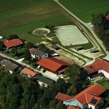
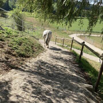
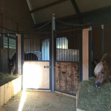
Reitanlage Dankl - Breitbrunn am Chiemsee
Breitbrunn
REITANLAGE DANKL
@REITANLAGE_DANKL
Pferdeausbildung
Reitlehrer und -unterricht
Vermieten
Führanlage
Hunde willkommen
Allergikerstall
bedampftes/gewaschenes Heu
21 weitere...
S
Deprecated: Creation of dynamic property Zend_View_Helper_Ads::$adLink is deprecated in /var/www/stall-frei/htdocs/staging.stall-frei.de/library/Psf/View/Helper/Ads.php on line 108

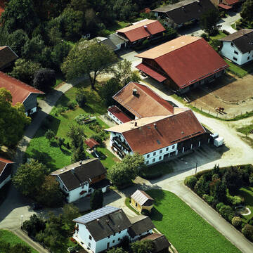
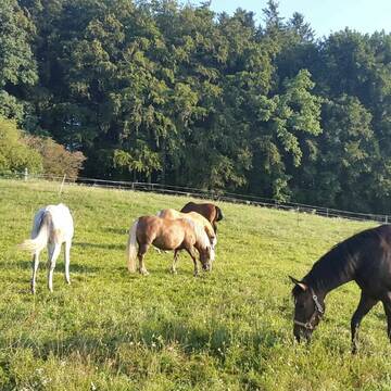
Reitanlage Dankl - Breitbrunn am Chiemsee
Breitbrunn
REITANLAGE DANKL
@REITANLAGE_DANKL
#Unsere Reitanlage vereint professionelle Ausbildung mit liebevoller Pferdehaltung in einer familiären Atmosphäre#


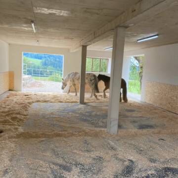
Bewegumgsstall Artegerechte Pferdehaltung
Traunwalchen
Kiefersbeck
@Kiefersbeck
FN-Mitglied
Freizeitstall
Vermieten
Krankenbox
Longierzirkel/Roundpen
Gnadenbrothof
18 weitere...
P+

Große Pferdebox - ganztägig Koppelgang frei
Traunreut
Gerhard-Maier
@Gerhard-Maier1
Wanderreiten
Vermieten
Hunde willkommen
Reitplatz (z.B. Dressur, Springen, Reining)
Innenbox
8 weitere...
P
Leider kein Vorschaubild
Leider kein Vorschaubild
Offenstall frei
Truchtlaching
Tabea Hopf
@Tabea9
Geländestrecke
Hunde willkommen
Krankenbox
Notfallboxen
Innenbox
Offenstall
5 weitere...
B

Neubau HIT-Aktivstall
Amerang
mail6
@mail6
Freizeitstall
Krankenbox
Parkplatz für Pferdeanhänger
Notfallboxen
Bewegungsstall
Offenstall
9 weitere...
P+
Leider kein Vorschaubild
Leider kein Vorschaubild
Boxen in Vollpension zu vermieten
Seeon
Reitanlage-Gruenweg
@Reitanlage-Gruenweg
FN-Mitglied
Freizeitstall
Vermieten
Hunde willkommen
Paddock
Hengsthaltung möglich
Hufrehe geeignet
19 weitere...
B


Offenstall Bichler Sepeckerhof
Amerang
Alois-und-Petra-Bichler
@Alois-und-Petra-Bichler
Freizeitstall
Krankenbox
Longierzirkel/Roundpen
Außenbox mit Paddock
Bewegungsstall
Vollpension
7 weitere...
P+


Offenstall mit großer Weide,Stallboxen und Paddo...
Fridolfing
Gramsamer Andreas
@Gramsi
Geländestrecke
Reitlehrer und -unterricht
Vermieten
Verpachten
Hunde willkommen
Krankenbox
Hufrehe geeignet
Notfallboxen
21 weitere...
aktuell
S

Pferdeparadies im Inntal - Neu mit Heubedampfung
Ramerberg
Robert-Prassmaier
@Robert-Prassmaier
Freizeitstall
Reitlehrer und -unterricht
Longierzirkel/Roundpen
Paddock
Allergikerstall
Bewegungsstall
Paddock Trail
12 weitere...
S

1 Paddockbox auf Reitanlage frei
Tacherting
Reitanlage-Kurzlechner-GbR
@Reitanlage-Kurzlechner-GbR
FN-Mitglied
Freizeitstall
Laufband
Longierzirkel/Roundpen
Außenbox mit Paddock
Innenbox
Vollpension
16 weitere...
P
Deprecated: Creation of dynamic property Zend_View::$pageCount is deprecated in /var/www/stall-frei/htdocs/staging.stall-frei.de/library/vendor/shardj/zf1-future/library/Zend/View/Abstract.php on line 308
Deprecated: Creation of dynamic property Zend_View::$itemCountPerPage is deprecated in /var/www/stall-frei/htdocs/staging.stall-frei.de/library/vendor/shardj/zf1-future/library/Zend/View/Abstract.php on line 308
Deprecated: Creation of dynamic property Zend_View::$first is deprecated in /var/www/stall-frei/htdocs/staging.stall-frei.de/library/vendor/shardj/zf1-future/library/Zend/View/Abstract.php on line 308
Deprecated: Creation of dynamic property Zend_View::$current is deprecated in /var/www/stall-frei/htdocs/staging.stall-frei.de/library/vendor/shardj/zf1-future/library/Zend/View/Abstract.php on line 308
Deprecated: Creation of dynamic property Zend_View::$last is deprecated in /var/www/stall-frei/htdocs/staging.stall-frei.de/library/vendor/shardj/zf1-future/library/Zend/View/Abstract.php on line 308
Deprecated: Creation of dynamic property Zend_View::$next is deprecated in /var/www/stall-frei/htdocs/staging.stall-frei.de/library/vendor/shardj/zf1-future/library/Zend/View/Abstract.php on line 308
Deprecated: Creation of dynamic property Zend_View::$pagesInRange is deprecated in /var/www/stall-frei/htdocs/staging.stall-frei.de/library/vendor/shardj/zf1-future/library/Zend/View/Abstract.php on line 308
Deprecated: Creation of dynamic property Zend_View::$firstPageInRange is deprecated in /var/www/stall-frei/htdocs/staging.stall-frei.de/library/vendor/shardj/zf1-future/library/Zend/View/Abstract.php on line 308
Deprecated: Creation of dynamic property Zend_View::$lastPageInRange is deprecated in /var/www/stall-frei/htdocs/staging.stall-frei.de/library/vendor/shardj/zf1-future/library/Zend/View/Abstract.php on line 308
Deprecated: Creation of dynamic property Zend_View::$currentItemCount is deprecated in /var/www/stall-frei/htdocs/staging.stall-frei.de/library/vendor/shardj/zf1-future/library/Zend/View/Abstract.php on line 308
Deprecated: Creation of dynamic property Zend_View::$totalItemCount is deprecated in /var/www/stall-frei/htdocs/staging.stall-frei.de/library/vendor/shardj/zf1-future/library/Zend/View/Abstract.php on line 308
Deprecated: Creation of dynamic property Zend_View::$firstItemNumber is deprecated in /var/www/stall-frei/htdocs/staging.stall-frei.de/library/vendor/shardj/zf1-future/library/Zend/View/Abstract.php on line 308
Deprecated: Creation of dynamic property Zend_View::$lastItemNumber is deprecated in /var/www/stall-frei/htdocs/staging.stall-frei.de/library/vendor/shardj/zf1-future/library/Zend/View/Abstract.php on line 308
Deprecated: Creation of dynamic property Zend_View::$router is deprecated in /var/www/stall-frei/htdocs/staging.stall-frei.de/library/vendor/shardj/zf1-future/library/Zend/View/Abstract.php on line 308
Deprecated: Creation of dynamic property Zend_View::$urlParams is deprecated in /var/www/stall-frei/htdocs/staging.stall-frei.de/library/vendor/shardj/zf1-future/library/Zend/View/Abstract.php on line 308
Deprecated: Creation of dynamic property Zend_View::$showAds is deprecated in /var/www/stall-frei/htdocs/staging.stall-frei.de/library/vendor/shardj/zf1-future/library/Zend/View/Abstract.php on line 308
Deprecated: Creation of dynamic property Zend_View::$objectIds is deprecated in /var/www/stall-frei/htdocs/staging.stall-frei.de/library/vendor/shardj/zf1-future/library/Zend/View/Abstract.php on line 308
Deprecated: Creation of dynamic property Zend_View::$showNavbar is deprecated in /var/www/stall-frei/htdocs/staging.stall-frei.de/library/vendor/shardj/zf1-future/library/Zend/View/Abstract.php on line 308
Deprecated: Creation of dynamic property Zend_View::$showBreadcrumb is deprecated in /var/www/stall-frei/htdocs/staging.stall-frei.de/library/vendor/shardj/zf1-future/library/Zend/View/Abstract.php on line 308
Deprecated: Creation of dynamic property Zend_View::$showFooter is deprecated in /var/www/stall-frei/htdocs/staging.stall-frei.de/library/vendor/shardj/zf1-future/library/Zend/View/Abstract.php on line 308
Deprecated: Creation of dynamic property Zend_View::$showInternalAds is deprecated in /var/www/stall-frei/htdocs/staging.stall-frei.de/library/vendor/shardj/zf1-future/library/Zend/View/Abstract.php on line 308
Deprecated: Creation of dynamic property Zend_View::$blNoContent is deprecated in /var/www/stall-frei/htdocs/staging.stall-frei.de/library/vendor/shardj/zf1-future/library/Zend/View/Abstract.php on line 308
Deprecated: Creation of dynamic property Zend_View::$sMetaDesc is deprecated in /var/www/stall-frei/htdocs/staging.stall-frei.de/library/vendor/shardj/zf1-future/library/Zend/View/Abstract.php on line 308
Deprecated: Creation of dynamic property Zend_View::$useGmaps is deprecated in /var/www/stall-frei/htdocs/staging.stall-frei.de/library/vendor/shardj/zf1-future/library/Zend/View/Abstract.php on line 308
Deprecated: Creation of dynamic property Zend_View::$touches is deprecated in /var/www/stall-frei/htdocs/staging.stall-frei.de/library/vendor/shardj/zf1-future/library/Zend/View/Abstract.php on line 308
Deprecated: Creation of dynamic property Zend_View::$oProject is deprecated in /var/www/stall-frei/htdocs/staging.stall-frei.de/library/vendor/shardj/zf1-future/library/Zend/View/Abstract.php on line 308
Deprecated: Creation of dynamic property Zend_View::$pageHeadline is deprecated in /var/www/stall-frei/htdocs/staging.stall-frei.de/library/vendor/shardj/zf1-future/library/Zend/View/Abstract.php on line 308
Deprecated: Creation of dynamic property Zend_View::$disableLocationField is deprecated in /var/www/stall-frei/htdocs/staging.stall-frei.de/library/vendor/shardj/zf1-future/library/Zend/View/Abstract.php on line 308
Deprecated: Creation of dynamic property Zend_View::$isSearch is deprecated in /var/www/stall-frei/htdocs/staging.stall-frei.de/library/vendor/shardj/zf1-future/library/Zend/View/Abstract.php on line 308
Deprecated: Creation of dynamic property Zend_View::$pageTitle is deprecated in /var/www/stall-frei/htdocs/staging.stall-frei.de/library/vendor/shardj/zf1-future/library/Zend/View/Abstract.php on line 308
Deprecated: Creation of dynamic property Psf_Form_Element_Text::$class is deprecated in /var/www/stall-frei/htdocs/staging.stall-frei.de/library/vendor/shardj/zf1-future/library/Zend/Form/Element.php on line 874
Deprecated: Creation of dynamic property Psf_Form_Element_Text::$size is deprecated in /var/www/stall-frei/htdocs/staging.stall-frei.de/library/vendor/shardj/zf1-future/library/Zend/Form/Element.php on line 874
Deprecated: Creation of dynamic property Psf_Form_Element_Text::$placeholder is deprecated in /var/www/stall-frei/htdocs/staging.stall-frei.de/library/vendor/shardj/zf1-future/library/Zend/Form/Element.php on line 874
Deprecated: Creation of dynamic property Psf_Form_Element_Hidden::$class is deprecated in /var/www/stall-frei/htdocs/staging.stall-frei.de/library/vendor/shardj/zf1-future/library/Zend/Form/Element.php on line 874
Deprecated: Creation of dynamic property Psf_Form_Element_Hidden::$class is deprecated in /var/www/stall-frei/htdocs/staging.stall-frei.de/library/vendor/shardj/zf1-future/library/Zend/Form/Element.php on line 874
Deprecated: Creation of dynamic property Psf_Form_Element_Hidden::$class is deprecated in /var/www/stall-frei/htdocs/staging.stall-frei.de/library/vendor/shardj/zf1-future/library/Zend/Form/Element.php on line 874
Deprecated: Creation of dynamic property Psf_Form_Element_Hidden::$class is deprecated in /var/www/stall-frei/htdocs/staging.stall-frei.de/library/vendor/shardj/zf1-future/library/Zend/Form/Element.php on line 874
Deprecated: Creation of dynamic property Psf_Form_Element_Select::$class is deprecated in /var/www/stall-frei/htdocs/staging.stall-frei.de/library/vendor/shardj/zf1-future/library/Zend/Form/Element.php on line 874
Deprecated: Creation of dynamic property Psf_Form_Element_Select::$class is deprecated in /var/www/stall-frei/htdocs/staging.stall-frei.de/library/vendor/shardj/zf1-future/library/Zend/Form/Element.php on line 874
Deprecated: Creation of dynamic property Psf_Form_Element_Select::$class is deprecated in /var/www/stall-frei/htdocs/staging.stall-frei.de/library/vendor/shardj/zf1-future/library/Zend/Form/Element.php on line 874
Deprecated: Creation of dynamic property Psf_Form_Element_Select::$class is deprecated in /var/www/stall-frei/htdocs/staging.stall-frei.de/library/vendor/shardj/zf1-future/library/Zend/Form/Element.php on line 874
Deprecated: Creation of dynamic property Psf_Form_Element_Text::$class is deprecated in /var/www/stall-frei/htdocs/staging.stall-frei.de/library/vendor/shardj/zf1-future/library/Zend/Form/Element.php on line 874
Deprecated: Creation of dynamic property Psf_Form_Element_Checkbox::$label is deprecated in /var/www/stall-frei/htdocs/staging.stall-frei.de/library/vendor/shardj/zf1-future/library/Zend/Form/Element.php on line 874
Deprecated: Creation of dynamic property Zend_View::$sort is deprecated in /var/www/stall-frei/htdocs/staging.stall-frei.de/library/vendor/shardj/zf1-future/library/Zend/View/Abstract.php on line 308
Deprecated: Creation of dynamic property Zend_View::$searchLocation is deprecated in /var/www/stall-frei/htdocs/staging.stall-frei.de/library/vendor/shardj/zf1-future/library/Zend/View/Abstract.php on line 308
Deprecated: Creation of dynamic property Zend_View::$locationHint is deprecated in /var/www/stall-frei/htdocs/staging.stall-frei.de/library/vendor/shardj/zf1-future/library/Zend/View/Abstract.php on line 308
Psf_GeoCoder_Abstract::getLocation: Point Get Location CachedOrLive
Psf_GeoCoder_Abstract::getCachedOrLive: Point
Psf_GeoCoder_OpenCageData::makeApiRequest: response:
Array
(
[documentation] => https://opencagedata.com/api
[licenses] => Array
(
[0] => Array
(
[name] => see attribution guide
[url] => https://opencagedata.com/credits
)
)
[results] => Array
(
[0] => Array
(
[bounds] => Array
(
[northeast] => Array
(
[lat] => 47.9697706
[lng] => 12.4903762
)
[southwest] => Array
(
[lat] => 47.968436
[lng] => 12.4859365
)
)
[components] => Array
(
[ISO_3166-1_alpha-2] => DE
[ISO_3166-1_alpha-3] => DEU
[ISO_3166-2] => Array
(
[0] => DE-BY
)
[_category] => place
[_normalized_city] => Seeon-Seebruck
[_type] => hamlet
[city] => Seeon-Seebruck
[continent] => Europe
[country] => Deutschland
[country_code] => de
[county] => Landkreis Traunstein
[hamlet] => Point
[political_union] => European Union
[postcode] => 83376
[state] => Bayern
[state_code] => BY
)
[confidence] => 9
[formatted] => Point, 83376 Seeon-Seebruck, Deutschland
[geometry] => Array
(
[lat] => 47.9693024
[lng] => 12.4876325
)
)
[1] => Array
(
[bounds] => Array
(
[northeast] => Array
(
[lat] => 48.2754508
[lng] => 12.8521747
)
[southwest] => Array
(
[lat] => 48.2740716
[lng] => 12.8508833
)
)
[components] => Array
(
[ISO_3166-1_alpha-2] => DE
[ISO_3166-1_alpha-3] => DEU
[ISO_3166-2] => Array
(
[0] => DE-BY
)
[_category] => place
[_normalized_city] => Marktl
[_type] => hamlet
[continent] => Europe
[country] => Deutschland
[country_code] => de
[county] => Landkreis Altötting
[hamlet] => Point
[municipality] => Marktl (VGem)
[political_union] => European Union
[state] => Bayern
[state_code] => BY
[village] => Marktl
)
[confidence] => 9
[formatted] => Point, Marktl, Bayern, Deutschland
[geometry] => Array
(
[lat] => 48.2746256
[lng] => 12.8514157
)
)
[2] => Array
(
[bounds] => Array
(
[northeast] => Array
(
[lat] => 47.798579
[lng] => 11.700953
)
[southwest] => Array
(
[lat] => 47.758579
[lng] => 11.660953
)
)
[components] => Array
(
[ISO_3166-1_alpha-2] => DE
[ISO_3166-1_alpha-3] => DEU
[ISO_3166-2] => Array
(
[0] => DE-BY
)
[_category] => place
[_normalized_city] => Waakirchen
[_type] => hamlet
[city] => Waakirchen
[continent] => Europe
[country] => Deutschland
[country_code] => de
[county] => Landkreis Miesbach
[hamlet] => Point
[political_union] => European Union
[postcode] => 83666
[state] => Bayern
[state_code] => BY
)
[confidence] => 7
[formatted] => Point, 83666 Waakirchen, Deutschland
[geometry] => Array
(
[lat] => 47.778579
[lng] => 11.680953
)
)
[3] => Array
(
[bounds] => Array
(
[northeast] => Array
(
[lat] => 47.7785956
[lng] => 12.7287552
)
[southwest] => Array
(
[lat] => 47.7385956
[lng] => 12.6887552
)
)
[components] => Array
(
[ISO_3166-1_alpha-2] => DE
[ISO_3166-1_alpha-3] => DEU
[ISO_3166-2] => Array
(
[0] => DE-BY
)
[_category] => place
[_normalized_city] => Ruhpolding
[_type] => hamlet
[continent] => Europe
[country] => Deutschland
[country_code] => de
[county] => Landkreis Traunstein
[hamlet] => Point
[political_union] => European Union
[postcode] => 83334
[state] => Bayern
[state_code] => BY
[village] => Ruhpolding
)
[confidence] => 7
[formatted] => Point, 83334 Ruhpolding, Deutschland
[geometry] => Array
(
[lat] => 47.7585956
[lng] => 12.7087552
)
)
[4] => Array
(
[bounds] => Array
(
[northeast] => Array
(
[lat] => 47.6196125
[lng] => 11.4665699
)
[southwest] => Array
(
[lat] => 47.5796125
[lng] => 11.4265699
)
)
[components] => Array
(
[ISO_3166-1_alpha-2] => DE
[ISO_3166-1_alpha-3] => DEU
[ISO_3166-2] => Array
(
[0] => DE-BY
)
[_category] => place
[_normalized_city] => Jachenau
[_type] => hamlet
[continent] => Europe
[country] => Deutschland
[country_code] => de
[county] => Landkreis Bad Tölz-Wolfratshausen
[hamlet] => Point
[political_union] => European Union
[postcode] => 83676
[state] => Bayern
[state_code] => BY
[village] => Jachenau
)
[confidence] => 7
[formatted] => Point, 83676 Jachenau, Deutschland
[geometry] => Array
(
[lat] => 47.5996125
[lng] => 11.4465699
)
)
[5] => Array
(
[bounds] => Array
(
[northeast] => Array
(
[lat] => 47.6801705
[lng] => 11.7650715
)
[southwest] => Array
(
[lat] => 47.6401705
[lng] => 11.7250715
)
)
[components] => Array
(
[ISO_3166-1_alpha-2] => DE
[ISO_3166-1_alpha-3] => DEU
[ISO_3166-2] => Array
(
[0] => DE-BY
)
[_category] => place
[_normalized_city] => Kreuth
[_type] => hamlet
[continent] => Europe
[country] => Deutschland
[country_code] => de
[county] => Landkreis Miesbach
[hamlet] => Point
[political_union] => European Union
[postcode] => 83708
[state] => Bayern
[state_code] => BY
[village] => Kreuth
)
[confidence] => 7
[formatted] => Point, 83708 Kreuth, Deutschland
[geometry] => Array
(
[lat] => 47.6601705
[lng] => 11.7450715
)
)
[6] => Array
(
[bounds] => Array
(
[northeast] => Array
(
[lat] => 48.5789195
[lng] => 12.2805184
)
[southwest] => Array
(
[lat] => 48.5389195
[lng] => 12.2405184
)
)
[components] => Array
(
[ISO_3166-1_alpha-2] => DE
[ISO_3166-1_alpha-3] => DEU
[ISO_3166-2] => Array
(
[0] => DE-BY
)
[_category] => place
[_normalized_city] => Adlkofen
[_type] => hamlet
[city] => Adlkofen
[continent] => Europe
[country] => Deutschland
[country_code] => de
[county] => Landkreis Landshut
[hamlet] => Point
[political_union] => European Union
[postcode] => 84166
[state] => Bayern
[state_code] => BY
)
[confidence] => 7
[formatted] => Point, 84166 Adlkofen, Deutschland
[geometry] => Array
(
[lat] => 48.5589195
[lng] => 12.2605184
)
)
[7] => Array
(
[bounds] => Array
(
[northeast] => Array
(
[lat] => 47.8528928
[lng] => 12.766597
)
[southwest] => Array
(
[lat] => 47.8128928
[lng] => 12.726597
)
)
[components] => Array
(
[ISO_3166-1_alpha-2] => DE
[ISO_3166-1_alpha-3] => DEU
[ISO_3166-2] => Array
(
[0] => DE-BY
)
[_category] => place
[_normalized_city] => Teisendorf
[_type] => hamlet
[continent] => Europe
[country] => Deutschland
[country_code] => de
[county] => Landkreis Berchtesgadener Land
[hamlet] => Point
[political_union] => European Union
[postcode] => 83364
[state] => Bayern
[state_code] => BY
[town] => Teisendorf
)
[confidence] => 7
[formatted] => Point, 83364 Teisendorf, Deutschland
[geometry] => Array
(
[lat] => 47.8328928
[lng] => 12.746597
)
)
[8] => Array
(
[bounds] => Array
(
[northeast] => Array
(
[lat] => 48.1334267
[lng] => 12.6372484
)
[southwest] => Array
(
[lat] => 48.0934267
[lng] => 12.5972484
)
)
[components] => Array
(
[ISO_3166-1_alpha-2] => DE
[ISO_3166-1_alpha-3] => DEU
[ISO_3166-2] => Array
(
[0] => DE-BY
)
[_category] => place
[_normalized_city] => Garching an der Alz
[_type] => hamlet
[continent] => Europe
[country] => Deutschland
[country_code] => de
[county] => Landkreis Altötting
[hamlet] => Point
[political_union] => European Union
[postcode] => 84518
[state] => Bayern
[state_code] => BY
[town] => Garching an der Alz
)
[confidence] => 7
[formatted] => Point, 84518 Garching an der Alz, Deutschland
[geometry] => Array
(
[lat] => 48.1134267
[lng] => 12.6172484
)
)
[9] => Array
(
[bounds] => Array
(
[northeast] => Array
(
[lat] => 47.8773889
[lng] => 12.3100677
)
[southwest] => Array
(
[lat] => 47.8772889
[lng] => 12.3099677
)
)
[components] => Array
(
[ISO_3166-1_alpha-2] => DE
[ISO_3166-1_alpha-3] => DEU
[ISO_3166-2] => Array
(
[0] => DE-BY
)
[_category] => building
[_normalized_city] => Rimsting
[_type] => building
[continent] => Europe
[country] => Deutschland
[country_code] => de
[county] => Landkreis Rosenheim
[hamlet] => Hötzelsberg
[isolated_dwelling] => Point
[political_union] => European Union
[postcode] => 83253
[state] => Bayern
[state_code] => BY
[village] => Rimsting
)
[confidence] => 10
[formatted] => Point, Hötzelsberg, 83253 Rimsting, Deutschland
[geometry] => Array
(
[lat] => 47.8773389
[lng] => 12.3100177
)
)
)
[status] => Array
(
[code] => 200
[message] => OK
)
[stay_informed] => Array
(
[blog] => https://blog.opencagedata.com
[mastodon] => https://en.osm.town/@opencage
)
[thanks] => For using an OpenCage API
[timestamp] => Array
(
[created_http] => Fri, 06 Feb 2026 16:23:16 GMT
[created_unix] => 1770394996
)
[total_results] => 10
)
Psf_GeoCoder_Abstract::convertLocationResult
{"documentation":"https:\/\/opencagedata.com\/api","licenses":[{"name":"see attribution guide","url":"https:\/\/opencagedata.com\/credits"}],"results":[{"bounds":{"northeast":{"lat":47.9697706,"lng":12.4903762},"southwest":{"lat":47.968436,"lng":12.4859365}},"components":{"ISO_3166-1_alpha-2":"DE","ISO_3166-1_alpha-3":"DEU","ISO_3166-2":["DE-BY"],"_category":"place","_normalized_city":"Seeon-Seebruck","_type":"hamlet","city":"Seeon-Seebruck","continent":"Europe","country":"Deutschland","country_code":"de","county":"Landkreis Traunstein","hamlet":"Point","political_union":"European Union","postcode":"83376","state":"Bayern","state_code":"BY"},"confidence":9,"formatted":"Point, 83376 Seeon-Seebruck, Deutschland","geometry":{"lat":47.9693024,"lng":12.4876325}},{"bounds":{"northeast":{"lat":48.2754508,"lng":12.8521747},"southwest":{"lat":48.2740716,"lng":12.8508833}},"components":{"ISO_3166-1_alpha-2":"DE","ISO_3166-1_alpha-3":"DEU","ISO_3166-2":["DE-BY"],"_category":"place","_normalized_city":"Marktl","_type":"hamlet","continent":"Europe","country":"Deutschland","country_code":"de","county":"Landkreis Alt\u00f6tting","hamlet":"Point","municipality":"Marktl (VGem)","political_union":"European Union","state":"Bayern","state_code":"BY","village":"Marktl"},"confidence":9,"formatted":"Point, Marktl, Bayern, Deutschland","geometry":{"lat":48.2746256,"lng":12.8514157}},{"bounds":{"northeast":{"lat":47.798579,"lng":11.700953},"southwest":{"lat":47.758579,"lng":11.660953}},"components":{"ISO_3166-1_alpha-2":"DE","ISO_3166-1_alpha-3":"DEU","ISO_3166-2":["DE-BY"],"_category":"place","_normalized_city":"Waakirchen","_type":"hamlet","city":"Waakirchen","continent":"Europe","country":"Deutschland","country_code":"de","county":"Landkreis Miesbach","hamlet":"Point","political_union":"European Union","postcode":"83666","state":"Bayern","state_code":"BY"},"confidence":7,"formatted":"Point, 83666 Waakirchen, Deutschland","geometry":{"lat":47.778579,"lng":11.680953}},{"bounds":{"northeast":{"lat":47.7785956,"lng":12.7287552},"southwest":{"lat":47.7385956,"lng":12.6887552}},"components":{"ISO_3166-1_alpha-2":"DE","ISO_3166-1_alpha-3":"DEU","ISO_3166-2":["DE-BY"],"_category":"place","_normalized_city":"Ruhpolding","_type":"hamlet","continent":"Europe","country":"Deutschland","country_code":"de","county":"Landkreis Traunstein","hamlet":"Point","political_union":"European Union","postcode":"83334","state":"Bayern","state_code":"BY","village":"Ruhpolding"},"confidence":7,"formatted":"Point, 83334 Ruhpolding, Deutschland","geometry":{"lat":47.7585956,"lng":12.7087552}},{"bounds":{"northeast":{"lat":47.6196125,"lng":11.4665699},"southwest":{"lat":47.5796125,"lng":11.4265699}},"components":{"ISO_3166-1_alpha-2":"DE","ISO_3166-1_alpha-3":"DEU","ISO_3166-2":["DE-BY"],"_category":"place","_normalized_city":"Jachenau","_type":"hamlet","continent":"Europe","country":"Deutschland","country_code":"de","county":"Landkreis Bad T\u00f6lz-Wolfratshausen","hamlet":"Point","political_union":"European Union","postcode":"83676","state":"Bayern","state_code":"BY","village":"Jachenau"},"confidence":7,"formatted":"Point, 83676 Jachenau, Deutschland","geometry":{"lat":47.5996125,"lng":11.4465699}},{"bounds":{"northeast":{"lat":47.6801705,"lng":11.7650715},"southwest":{"lat":47.6401705,"lng":11.7250715}},"components":{"ISO_3166-1_alpha-2":"DE","ISO_3166-1_alpha-3":"DEU","ISO_3166-2":["DE-BY"],"_category":"place","_normalized_city":"Kreuth","_type":"hamlet","continent":"Europe","country":"Deutschland","country_code":"de","county":"Landkreis Miesbach","hamlet":"Point","political_union":"European Union","postcode":"83708","state":"Bayern","state_code":"BY","village":"Kreuth"},"confidence":7,"formatted":"Point, 83708 Kreuth, Deutschland","geometry":{"lat":47.6601705,"lng":11.7450715}},{"bounds":{"northeast":{"lat":48.5789195,"lng":12.2805184},"southwest":{"lat":48.5389195,"lng":12.2405184}},"components":{"ISO_3166-1_alpha-2":"DE","ISO_3166-1_alpha-3":"DEU","ISO_3166-2":["DE-BY"],"_category":"place","_normalized_city":"Adlkofen","_type":"hamlet","city":"Adlkofen","continent":"Europe","country":"Deutschland","country_code":"de","county":"Landkreis Landshut","hamlet":"Point","political_union":"European Union","postcode":"84166","state":"Bayern","state_code":"BY"},"confidence":7,"formatted":"Point, 84166 Adlkofen, Deutschland","geometry":{"lat":48.5589195,"lng":12.2605184}},{"bounds":{"northeast":{"lat":47.8528928,"lng":12.766597},"southwest":{"lat":47.8128928,"lng":12.726597}},"components":{"ISO_3166-1_alpha-2":"DE","ISO_3166-1_alpha-3":"DEU","ISO_3166-2":["DE-BY"],"_category":"place","_normalized_city":"Teisendorf","_type":"hamlet","continent":"Europe","country":"Deutschland","country_code":"de","county":"Landkreis Berchtesgadener Land","hamlet":"Point","political_union":"European Union","postcode":"83364","state":"Bayern","state_code":"BY","town":"Teisendorf"},"confidence":7,"formatted":"Point, 83364 Teisendorf, Deutschland","geometry":{"lat":47.8328928,"lng":12.746597}},{"bounds":{"northeast":{"lat":48.1334267,"lng":12.6372484},"southwest":{"lat":48.0934267,"lng":12.5972484}},"components":{"ISO_3166-1_alpha-2":"DE","ISO_3166-1_alpha-3":"DEU","ISO_3166-2":["DE-BY"],"_category":"place","_normalized_city":"Garching an der Alz","_type":"hamlet","continent":"Europe","country":"Deutschland","country_code":"de","county":"Landkreis Alt\u00f6tting","hamlet":"Point","political_union":"European Union","postcode":"84518","state":"Bayern","state_code":"BY","town":"Garching an der Alz"},"confidence":7,"formatted":"Point, 84518 Garching an der Alz, Deutschland","geometry":{"lat":48.1134267,"lng":12.6172484}},{"bounds":{"northeast":{"lat":47.8773889,"lng":12.3100677},"southwest":{"lat":47.8772889,"lng":12.3099677}},"components":{"ISO_3166-1_alpha-2":"DE","ISO_3166-1_alpha-3":"DEU","ISO_3166-2":["DE-BY"],"_category":"building","_normalized_city":"Rimsting","_type":"building","continent":"Europe","country":"Deutschland","country_code":"de","county":"Landkreis Rosenheim","hamlet":"H\u00f6tzelsberg","isolated_dwelling":"Point","political_union":"European Union","postcode":"83253","state":"Bayern","state_code":"BY","village":"Rimsting"},"confidence":10,"formatted":"Point, H\u00f6tzelsberg, 83253 Rimsting, Deutschland","geometry":{"lat":47.8773389,"lng":12.3100177}}],"status":{"code":200,"message":"OK"},"stay_informed":{"blog":"https:\/\/blog.opencagedata.com","mastodon":"https:\/\/en.osm.town\/@opencage"},"thanks":"For using an OpenCage API","timestamp":{"created_http":"Fri, 06 Feb 2026 16:23:16 GMT","created_unix":1770394996},"total_results":10}Array
(
[0] => stdClass Object
(
[bounds] => stdClass Object
(
[northeast] => stdClass Object
(
[lat] => 47.9697706
[lng] => 12.4903762
)
[southwest] => stdClass Object
(
[lat] => 47.968436
[lng] => 12.4859365
)
)
[components] => stdClass Object
(
[ISO_3166-1_alpha-2] => DE
[ISO_3166-1_alpha-3] => DEU
[ISO_3166-2] => Array
(
[0] => DE-BY
)
[_category] => place
[_normalized_city] => Seeon-Seebruck
[_type] => hamlet
[city] => Seeon-Seebruck
[continent] => Europe
[country] => Deutschland
[country_code] => de
[county] => Landkreis Traunstein
[hamlet] => Point
[political_union] => European Union
[postcode] => 83376
[state] => Bayern
[state_code] => BY
)
[confidence] => 9
[formatted] => Point, 83376 Seeon-Seebruck, Deutschland
[geometry] => stdClass Object
(
[lat] => 47.9693024
[lng] => 12.4876325
)
)
[1] => stdClass Object
(
[bounds] => stdClass Object
(
[northeast] => stdClass Object
(
[lat] => 48.2754508
[lng] => 12.8521747
)
[southwest] => stdClass Object
(
[lat] => 48.2740716
[lng] => 12.8508833
)
)
[components] => stdClass Object
(
[ISO_3166-1_alpha-2] => DE
[ISO_3166-1_alpha-3] => DEU
[ISO_3166-2] => Array
(
[0] => DE-BY
)
[_category] => place
[_normalized_city] => Marktl
[_type] => hamlet
[continent] => Europe
[country] => Deutschland
[country_code] => de
[county] => Landkreis Altötting
[hamlet] => Point
[municipality] => Marktl (VGem)
[political_union] => European Union
[state] => Bayern
[state_code] => BY
[village] => Marktl
)
[confidence] => 9
[formatted] => Point, Marktl, Bayern, Deutschland
[geometry] => stdClass Object
(
[lat] => 48.2746256
[lng] => 12.8514157
)
)
[2] => stdClass Object
(
[bounds] => stdClass Object
(
[northeast] => stdClass Object
(
[lat] => 47.798579
[lng] => 11.700953
)
[southwest] => stdClass Object
(
[lat] => 47.758579
[lng] => 11.660953
)
)
[components] => stdClass Object
(
[ISO_3166-1_alpha-2] => DE
[ISO_3166-1_alpha-3] => DEU
[ISO_3166-2] => Array
(
[0] => DE-BY
)
[_category] => place
[_normalized_city] => Waakirchen
[_type] => hamlet
[city] => Waakirchen
[continent] => Europe
[country] => Deutschland
[country_code] => de
[county] => Landkreis Miesbach
[hamlet] => Point
[political_union] => European Union
[postcode] => 83666
[state] => Bayern
[state_code] => BY
)
[confidence] => 7
[formatted] => Point, 83666 Waakirchen, Deutschland
[geometry] => stdClass Object
(
[lat] => 47.778579
[lng] => 11.680953
)
)
[3] => stdClass Object
(
[bounds] => stdClass Object
(
[northeast] => stdClass Object
(
[lat] => 47.7785956
[lng] => 12.7287552
)
[southwest] => stdClass Object
(
[lat] => 47.7385956
[lng] => 12.6887552
)
)
[components] => stdClass Object
(
[ISO_3166-1_alpha-2] => DE
[ISO_3166-1_alpha-3] => DEU
[ISO_3166-2] => Array
(
[0] => DE-BY
)
[_category] => place
[_normalized_city] => Ruhpolding
[_type] => hamlet
[continent] => Europe
[country] => Deutschland
[country_code] => de
[county] => Landkreis Traunstein
[hamlet] => Point
[political_union] => European Union
[postcode] => 83334
[state] => Bayern
[state_code] => BY
[village] => Ruhpolding
)
[confidence] => 7
[formatted] => Point, 83334 Ruhpolding, Deutschland
[geometry] => stdClass Object
(
[lat] => 47.7585956
[lng] => 12.7087552
)
)
[4] => stdClass Object
(
[bounds] => stdClass Object
(
[northeast] => stdClass Object
(
[lat] => 47.6196125
[lng] => 11.4665699
)
[southwest] => stdClass Object
(
[lat] => 47.5796125
[lng] => 11.4265699
)
)
[components] => stdClass Object
(
[ISO_3166-1_alpha-2] => DE
[ISO_3166-1_alpha-3] => DEU
[ISO_3166-2] => Array
(
[0] => DE-BY
)
[_category] => place
[_normalized_city] => Jachenau
[_type] => hamlet
[continent] => Europe
[country] => Deutschland
[country_code] => de
[county] => Landkreis Bad Tölz-Wolfratshausen
[hamlet] => Point
[political_union] => European Union
[postcode] => 83676
[state] => Bayern
[state_code] => BY
[village] => Jachenau
)
[confidence] => 7
[formatted] => Point, 83676 Jachenau, Deutschland
[geometry] => stdClass Object
(
[lat] => 47.5996125
[lng] => 11.4465699
)
)
[5] => stdClass Object
(
[bounds] => stdClass Object
(
[northeast] => stdClass Object
(
[lat] => 47.6801705
[lng] => 11.7650715
)
[southwest] => stdClass Object
(
[lat] => 47.6401705
[lng] => 11.7250715
)
)
[components] => stdClass Object
(
[ISO_3166-1_alpha-2] => DE
[ISO_3166-1_alpha-3] => DEU
[ISO_3166-2] => Array
(
[0] => DE-BY
)
[_category] => place
[_normalized_city] => Kreuth
[_type] => hamlet
[continent] => Europe
[country] => Deutschland
[country_code] => de
[county] => Landkreis Miesbach
[hamlet] => Point
[political_union] => European Union
[postcode] => 83708
[state] => Bayern
[state_code] => BY
[village] => Kreuth
)
[confidence] => 7
[formatted] => Point, 83708 Kreuth, Deutschland
[geometry] => stdClass Object
(
[lat] => 47.6601705
[lng] => 11.7450715
)
)
[6] => stdClass Object
(
[bounds] => stdClass Object
(
[northeast] => stdClass Object
(
[lat] => 48.5789195
[lng] => 12.2805184
)
[southwest] => stdClass Object
(
[lat] => 48.5389195
[lng] => 12.2405184
)
)
[components] => stdClass Object
(
[ISO_3166-1_alpha-2] => DE
[ISO_3166-1_alpha-3] => DEU
[ISO_3166-2] => Array
(
[0] => DE-BY
)
[_category] => place
[_normalized_city] => Adlkofen
[_type] => hamlet
[city] => Adlkofen
[continent] => Europe
[country] => Deutschland
[country_code] => de
[county] => Landkreis Landshut
[hamlet] => Point
[political_union] => European Union
[postcode] => 84166
[state] => Bayern
[state_code] => BY
)
[confidence] => 7
[formatted] => Point, 84166 Adlkofen, Deutschland
[geometry] => stdClass Object
(
[lat] => 48.5589195
[lng] => 12.2605184
)
)
[7] => stdClass Object
(
[bounds] => stdClass Object
(
[northeast] => stdClass Object
(
[lat] => 47.8528928
[lng] => 12.766597
)
[southwest] => stdClass Object
(
[lat] => 47.8128928
[lng] => 12.726597
)
)
[components] => stdClass Object
(
[ISO_3166-1_alpha-2] => DE
[ISO_3166-1_alpha-3] => DEU
[ISO_3166-2] => Array
(
[0] => DE-BY
)
[_category] => place
[_normalized_city] => Teisendorf
[_type] => hamlet
[continent] => Europe
[country] => Deutschland
[country_code] => de
[county] => Landkreis Berchtesgadener Land
[hamlet] => Point
[political_union] => European Union
[postcode] => 83364
[state] => Bayern
[state_code] => BY
[town] => Teisendorf
)
[confidence] => 7
[formatted] => Point, 83364 Teisendorf, Deutschland
[geometry] => stdClass Object
(
[lat] => 47.8328928
[lng] => 12.746597
)
)
[8] => stdClass Object
(
[bounds] => stdClass Object
(
[northeast] => stdClass Object
(
[lat] => 48.1334267
[lng] => 12.6372484
)
[southwest] => stdClass Object
(
[lat] => 48.0934267
[lng] => 12.5972484
)
)
[components] => stdClass Object
(
[ISO_3166-1_alpha-2] => DE
[ISO_3166-1_alpha-3] => DEU
[ISO_3166-2] => Array
(
[0] => DE-BY
)
[_category] => place
[_normalized_city] => Garching an der Alz
[_type] => hamlet
[continent] => Europe
[country] => Deutschland
[country_code] => de
[county] => Landkreis Altötting
[hamlet] => Point
[political_union] => European Union
[postcode] => 84518
[state] => Bayern
[state_code] => BY
[town] => Garching an der Alz
)
[confidence] => 7
[formatted] => Point, 84518 Garching an der Alz, Deutschland
[geometry] => stdClass Object
(
[lat] => 48.1134267
[lng] => 12.6172484
)
)
[9] => stdClass Object
(
[bounds] => stdClass Object
(
[northeast] => stdClass Object
(
[lat] => 47.8773889
[lng] => 12.3100677
)
[southwest] => stdClass Object
(
[lat] => 47.8772889
[lng] => 12.3099677
)
)
[components] => stdClass Object
(
[ISO_3166-1_alpha-2] => DE
[ISO_3166-1_alpha-3] => DEU
[ISO_3166-2] => Array
(
[0] => DE-BY
)
[_category] => building
[_normalized_city] => Rimsting
[_type] => building
[continent] => Europe
[country] => Deutschland
[country_code] => de
[county] => Landkreis Rosenheim
[hamlet] => Hötzelsberg
[isolated_dwelling] => Point
[political_union] => European Union
[postcode] => 83253
[state] => Bayern
[state_code] => BY
[village] => Rimsting
)
[confidence] => 10
[formatted] => Point, Hötzelsberg, 83253 Rimsting, Deutschland
[geometry] => stdClass Object
(
[lat] => 47.8773389
[lng] => 12.3100177
)
)
)
Psf_GeoCoder_OpenCageData::getKeyMap: 0
stdClass Object
(
    [bounds] => stdClass Object
        (
            [northeast] => stdClass Object
                (
                    [lat] => 47.9697706
                    [lng] => 12.4903762
                )

            [southwest] => stdClass Object
                (
                    [lat] => 47.968436
                    [lng] => 12.4859365
                )

        )

    [components] => stdClass Object
        (
            [ISO_3166-1_alpha-2] => DE
            [ISO_3166-1_alpha-3] => DEU
            [ISO_3166-2] => Array
                (
                    [0] => DE-BY
                )

            [_category] => place
            [_normalized_city] => Seeon-Seebruck
            [_type] => hamlet
            [city] => Seeon-Seebruck
            [continent] => Europe
            [country] => Deutschland
            [country_code] => de
            [county] => Landkreis Traunstein
            [hamlet] => Point
            [political_union] => European Union
            [postcode] => 83376
            [state] => Bayern
            [state_code] => BY
        )

    [confidence] => 9
    [formatted] => Point, 83376 Seeon-Seebruck, Deutschland
    [geometry] => stdClass Object
        (
            [lat] => 47.9693024
            [lng] => 12.4876325
        )

)
Psf_GeoCoder_OpenCageData::getCounty: Traunstein
Psf_GeoCoder_OpenCageData::addMissingData REFETCH!
Array
(
    [address] => Point, 83376 Seeon-Seebruck, Deutschland
    [type] => hamlet
    [street] => Point
    [city] => Seeon-Seebruck
    [county] => Traunstein
    [state] => Bayern
    [zip] => 83376
    [country] => Deutschland
    [suburb] =>
    [countrycode] => de
    [latitude] => 47.9693024
    [longitude] => 12.4876325
    [accuracy] => 1
    [confidence] => 9
    [bounds] => stdClass Object
        (
            [northeast] => stdClass Object
                (
                    [lat] => 47.9697706
                    [lng] => 12.4903762
                )

            [southwest] => stdClass Object
                (
                    [lat] => 47.968436
                    [lng] => 12.4859365
                )

        )

)
reformat!
Array
(
    [address] => Point, 83376 Seeon-Seebruck, Deutschland
    [type] => hamlet
    [street] => Point
    [city] => Seeon-Seebruck
    [county] => Traunstein
    [state] => Bayern
    [zip] => 83376
    [country] => Deutschland
    [suburb] =>
    [countrycode] => de
    [latitude] => 47.9693024
    [longitude] => 12.4876325
    [accuracy] => 1
    [confidence] => 9
    [bounds] => stdClass Object
        (
            [northeast] => stdClass Object
                (
                    [lat] => 47.9697706
                    [lng] => 12.4903762
                )

            [southwest] => stdClass Object
                (
                    [lat] => 47.968436
                    [lng] => 12.4859365
                )

        )

    [place] => Point, 83376 Seeon-Seebruck, Bayern
    [hash] => e03a13dfb7c2e321745597382a3540af
)
Psf_GeoCoder_OpenCageData::getKeyMap: 1
stdClass Object
(
    [bounds] => stdClass Object
        (
            [northeast] => stdClass Object
                (
                    [lat] => 48.2754508
                    [lng] => 12.8521747
                )

            [southwest] => stdClass Object
                (
                    [lat] => 48.2740716
                    [lng] => 12.8508833
                )

        )

    [components] => stdClass Object
        (
            [ISO_3166-1_alpha-2] => DE
            [ISO_3166-1_alpha-3] => DEU
            [ISO_3166-2] => Array
                (
                    [0] => DE-BY
                )

            [_category] => place
            [_normalized_city] => Marktl
            [_type] => hamlet
            [continent] => Europe
            [country] => Deutschland
            [country_code] => de
            [county] => Landkreis Altötting
            [hamlet] => Point
            [municipality] => Marktl (VGem)
            [political_union] => European Union
            [state] => Bayern
            [state_code] => BY
            [village] => Marktl
        )

    [confidence] => 9
    [formatted] => Point, Marktl, Bayern, Deutschland
    [geometry] => stdClass Object
        (
            [lat] => 48.2746256
            [lng] => 12.8514157
        )

)
Psf_GeoCoder_OpenCageData::getCounty: Altötting
Psf_GeoCoder_OpenCageData::addMissingData REFETCH!
Array
(
    [address] => Point, Marktl, Bayern, Deutschland
    [type] => hamlet
    [street] => Point
    [city] => Marktl
    [county] => Altötting
    [state] => Bayern
    [zip] =>
    [country] => Deutschland
    [suburb] =>
    [countrycode] => de
    [latitude] => 48.2746256
    [longitude] => 12.8514157
    [accuracy] => 1
    [confidence] => 9
    [bounds] => stdClass Object
        (
            [northeast] => stdClass Object
                (
                    [lat] => 48.2754508
                    [lng] => 12.8521747
                )

            [southwest] => stdClass Object
                (
                    [lat] => 48.2740716
                    [lng] => 12.8508833
                )

        )

)
reformat!
Array
(
    [address] => Point, Marktl, Bayern, Deutschland
    [type] => hamlet
    [street] => Point
    [city] => Marktl
    [county] => Altötting
    [state] => Bayern
    [zip] =>
    [country] => Deutschland
    [suburb] =>
    [countrycode] => de
    [latitude] => 48.2746256
    [longitude] => 12.8514157
    [accuracy] => 1
    [confidence] => 9
    [bounds] => stdClass Object
        (
            [northeast] => stdClass Object
                (
                    [lat] => 48.2754508
                    [lng] => 12.8521747
                )

            [southwest] => stdClass Object
                (
                    [lat] => 48.2740716
                    [lng] => 12.8508833
                )

        )

    [place] => Point, Marktl, Bayern
    [hash] => cf7422cbad791cade584b3344470f4a9
)
Psf_GeoCoder_OpenCageData::getKeyMap: 2
stdClass Object
(
    [bounds] => stdClass Object
        (
            [northeast] => stdClass Object
                (
                    [lat] => 47.798579
                    [lng] => 11.700953
                )

            [southwest] => stdClass Object
                (
                    [lat] => 47.758579
                    [lng] => 11.660953
                )

        )

    [components] => stdClass Object
        (
            [ISO_3166-1_alpha-2] => DE
            [ISO_3166-1_alpha-3] => DEU
            [ISO_3166-2] => Array
                (
                    [0] => DE-BY
                )

            [_category] => place
            [_normalized_city] => Waakirchen
            [_type] => hamlet
            [city] => Waakirchen
            [continent] => Europe
            [country] => Deutschland
            [country_code] => de
            [county] => Landkreis Miesbach
            [hamlet] => Point
            [political_union] => European Union
            [postcode] => 83666
            [state] => Bayern
            [state_code] => BY
        )

    [confidence] => 7
    [formatted] => Point, 83666 Waakirchen, Deutschland
    [geometry] => stdClass Object
        (
            [lat] => 47.778579
            [lng] => 11.680953
        )

)
Psf_GeoCoder_OpenCageData::getCounty: Miesbach
Psf_GeoCoder_OpenCageData::addMissingData REFETCH!
Array
(
    [address] => Point, 83666 Waakirchen, Deutschland
    [type] => hamlet
    [street] => Point
    [city] => Waakirchen
    [county] => Miesbach
    [state] => Bayern
    [zip] => 83666
    [country] => Deutschland
    [suburb] =>
    [countrycode] => de
    [latitude] => 47.778579
    [longitude] => 11.680953
    [accuracy] => 1
    [confidence] => 7
    [bounds] => stdClass Object
        (
            [northeast] => stdClass Object
                (
                    [lat] => 47.798579
                    [lng] => 11.700953
                )

            [southwest] => stdClass Object
                (
                    [lat] => 47.758579
                    [lng] => 11.660953
                )

        )

)
reformat!
Array
(
    [address] => Point, 83666 Waakirchen, Deutschland
    [type] => hamlet
    [street] => Point
    [city] => Waakirchen
    [county] => Miesbach
    [state] => Bayern
    [zip] => 83666
    [country] => Deutschland
    [suburb] =>
    [countrycode] => de
    [latitude] => 47.778579
    [longitude] => 11.680953
    [accuracy] => 1
    [confidence] => 7
    [bounds] => stdClass Object
        (
            [northeast] => stdClass Object
                (
                    [lat] => 47.798579
                    [lng] => 11.700953
                )

            [southwest] => stdClass Object
                (
                    [lat] => 47.758579
                    [lng] => 11.660953
                )

        )

    [place] => Point, 83666 Waakirchen, Bayern
    [hash] => 5d1cf7a5b2727e85c8ef970c7777325a
)
Psf_GeoCoder_OpenCageData::getKeyMap: 3
stdClass Object
(
    [bounds] => stdClass Object
        (
            [northeast] => stdClass Object
                (
                    [lat] => 47.7785956
                    [lng] => 12.7287552
                )

            [southwest] => stdClass Object
                (
                    [lat] => 47.7385956
                    [lng] => 12.6887552
                )

        )

    [components] => stdClass Object
        (
            [ISO_3166-1_alpha-2] => DE
            [ISO_3166-1_alpha-3] => DEU
            [ISO_3166-2] => Array
                (
                    [0] => DE-BY
                )

            [_category] => place
            [_normalized_city] => Ruhpolding
            [_type] => hamlet
            [continent] => Europe
            [country] => Deutschland
            [country_code] => de
            [county] => Landkreis Traunstein
            [hamlet] => Point
            [political_union] => European Union
            [postcode] => 83334
            [state] => Bayern
            [state_code] => BY
            [village] => Ruhpolding
        )

    [confidence] => 7
    [formatted] => Point, 83334 Ruhpolding, Deutschland
    [geometry] => stdClass Object
        (
            [lat] => 47.7585956
            [lng] => 12.7087552
        )

)
Psf_GeoCoder_OpenCageData::getCounty: Traunstein
Psf_GeoCoder_OpenCageData::addMissingData REFETCH!
Array
(
    [address] => Point, 83334 Ruhpolding, Deutschland
    [type] => hamlet
    [street] => Point
    [city] => Ruhpolding
    [county] => Traunstein
    [state] => Bayern
    [zip] => 83334
    [country] => Deutschland
    [suburb] =>
    [countrycode] => de
    [latitude] => 47.7585956
    [longitude] => 12.7087552
    [accuracy] => 1
    [confidence] => 7
    [bounds] => stdClass Object
        (
            [northeast] => stdClass Object
                (
                    [lat] => 47.7785956
                    [lng] => 12.7287552
                )

            [southwest] => stdClass Object
                (
                    [lat] => 47.7385956
                    [lng] => 12.6887552
                )

        )

)
reformat!
Array
(
    [address] => Point, 83334 Ruhpolding, Deutschland
    [type] => hamlet
    [street] => Point
    [city] => Ruhpolding
    [county] => Traunstein
    [state] => Bayern
    [zip] => 83334
    [country] => Deutschland
    [suburb] =>
    [countrycode] => de
    [latitude] => 47.7585956
    [longitude] => 12.7087552
    [accuracy] => 1
    [confidence] => 7
    [bounds] => stdClass Object
        (
            [northeast] => stdClass Object
                (
                    [lat] => 47.7785956
                    [lng] => 12.7287552
                )

            [southwest] => stdClass Object
                (
                    [lat] => 47.7385956
                    [lng] => 12.6887552
                )

        )

    [place] => Point, 83334 Ruhpolding, Bayern
    [hash] => 8d15c3be61ba672fd9807e8bec3273fe
)
Psf_GeoCoder_OpenCageData::getKeyMap: 4
stdClass Object
(
    [bounds] => stdClass Object
        (
            [northeast] => stdClass Object
                (
                    [lat] => 47.6196125
                    [lng] => 11.4665699
                )

            [southwest] => stdClass Object
                (
                    [lat] => 47.5796125
                    [lng] => 11.4265699
                )

        )

    [components] => stdClass Object
        (
            [ISO_3166-1_alpha-2] => DE
            [ISO_3166-1_alpha-3] => DEU
            [ISO_3166-2] => Array
                (
                    [0] => DE-BY
                )

            [_category] => place
            [_normalized_city] => Jachenau
            [_type] => hamlet
            [continent] => Europe
            [country] => Deutschland
            [country_code] => de
            [county] => Landkreis Bad Tölz-Wolfratshausen
            [hamlet] => Point
            [political_union] => European Union
            [postcode] => 83676
            [state] => Bayern
            [state_code] => BY
            [village] => Jachenau
        )

    [confidence] => 7
    [formatted] => Point, 83676 Jachenau, Deutschland
    [geometry] => stdClass Object
        (
            [lat] => 47.5996125
            [lng] => 11.4465699
        )

)
Psf_GeoCoder_OpenCageData::getCounty: Bad Tölz-Wolfratshausen
Psf_GeoCoder_OpenCageData::addMissingData REFETCH!
Array
(
    [address] => Point, 83676 Jachenau, Deutschland
    [type] => hamlet
    [street] => Point
    [city] => Jachenau
    [county] => Bad Tölz-Wolfratshausen
    [state] => Bayern
    [zip] => 83676
    [country] => Deutschland
    [suburb] =>
    [countrycode] => de
    [latitude] => 47.5996125
    [longitude] => 11.4465699
    [accuracy] => 1
    [confidence] => 7
    [bounds] => stdClass Object
        (
            [northeast] => stdClass Object
                (
                    [lat] => 47.6196125
                    [lng] => 11.4665699
                )

            [southwest] => stdClass Object
                (
                    [lat] => 47.5796125
                    [lng] => 11.4265699
                )

        )

)
reformat!
Array
(
    [address] => Point, 83676 Jachenau, Deutschland
    [type] => hamlet
    [street] => Point
    [city] => Jachenau
    [county] => Bad Tölz-Wolfratshausen
    [state] => Bayern
    [zip] => 83676
    [country] => Deutschland
    [suburb] =>
    [countrycode] => de
    [latitude] => 47.5996125
    [longitude] => 11.4465699
    [accuracy] => 1
    [confidence] => 7
    [bounds] => stdClass Object
        (
            [northeast] => stdClass Object
                (
                    [lat] => 47.6196125
                    [lng] => 11.4665699
                )

            [southwest] => stdClass Object
                (
                    [lat] => 47.5796125
                    [lng] => 11.4265699
                )

        )

    [place] => Point, 83676 Jachenau, Bayern
    [hash] => 21c733360dfa252169e6fa08fe7ea7bf
)
Psf_GeoCoder_OpenCageData::getKeyMap: 5
stdClass Object
(
    [bounds] => stdClass Object
        (
            [northeast] => stdClass Object
                (
                    [lat] => 47.6801705
                    [lng] => 11.7650715
                )

            [southwest] => stdClass Object
                (
                    [lat] => 47.6401705
                    [lng] => 11.7250715
                )

        )

    [components] => stdClass Object
        (
            [ISO_3166-1_alpha-2] => DE
            [ISO_3166-1_alpha-3] => DEU
            [ISO_3166-2] => Array
                (
                    [0] => DE-BY
                )

            [_category] => place
            [_normalized_city] => Kreuth
            [_type] => hamlet
            [continent] => Europe
            [country] => Deutschland
            [country_code] => de
            [county] => Landkreis Miesbach
            [hamlet] => Point
            [political_union] => European Union
            [postcode] => 83708
            [state] => Bayern
            [state_code] => BY
            [village] => Kreuth
        )

    [confidence] => 7
    [formatted] => Point, 83708 Kreuth, Deutschland
    [geometry] => stdClass Object
        (
            [lat] => 47.6601705
            [lng] => 11.7450715
        )

)
Psf_GeoCoder_OpenCageData::getCounty: Miesbach
Psf_GeoCoder_OpenCageData::addMissingData REFETCH!
Array
(
    [address] => Point, 83708 Kreuth, Deutschland
    [type] => hamlet
    [street] => Point
    [city] => Kreuth
    [county] => Miesbach
    [state] => Bayern
    [zip] => 83708
    [country] => Deutschland
    [suburb] =>
    [countrycode] => de
    [latitude] => 47.6601705
    [longitude] => 11.7450715
    [accuracy] => 1
    [confidence] => 7
    [bounds] => stdClass Object
        (
            [northeast] => stdClass Object
                (
                    [lat] => 47.6801705
                    [lng] => 11.7650715
                )

            [southwest] => stdClass Object
                (
                    [lat] => 47.6401705
                    [lng] => 11.7250715
                )

        )

)
reformat!
Array
(
    [address] => Point, 83708 Kreuth, Deutschland
    [type] => hamlet
    [street] => Point
    [city] => Kreuth
    [county] => Miesbach
    [state] => Bayern
    [zip] => 83708
    [country] => Deutschland
    [suburb] =>
    [countrycode] => de
    [latitude] => 47.6601705
    [longitude] => 11.7450715
    [accuracy] => 1
    [confidence] => 7
    [bounds] => stdClass Object
        (
            [northeast] => stdClass Object
                (
                    [lat] => 47.6801705
                    [lng] => 11.7650715
                )

            [southwest] => stdClass Object
                (
                    [lat] => 47.6401705
                    [lng] => 11.7250715
                )

        )

    [place] => Point, 83708 Kreuth, Bayern
    [hash] => 30c54415d5f708bd1546810cd7d403c2
)
Psf_GeoCoder_OpenCageData::getKeyMap: 6
stdClass Object
(
    [bounds] => stdClass Object
        (
            [northeast] => stdClass Object
                (
                    [lat] => 48.5789195
                    [lng] => 12.2805184
                )

            [southwest] => stdClass Object
                (
                    [lat] => 48.5389195
                    [lng] => 12.2405184
                )

        )

    [components] => stdClass Object
        (
            [ISO_3166-1_alpha-2] => DE
            [ISO_3166-1_alpha-3] => DEU
            [ISO_3166-2] => Array
                (
                    [0] => DE-BY
                )

            [_category] => place
            [_normalized_city] => Adlkofen
            [_type] => hamlet
            [city] => Adlkofen
            [continent] => Europe
            [country] => Deutschland
            [country_code] => de
            [county] => Landkreis Landshut
            [hamlet] => Point
            [political_union] => European Union
            [postcode] => 84166
            [state] => Bayern
            [state_code] => BY
        )

    [confidence] => 7
    [formatted] => Point, 84166 Adlkofen, Deutschland
    [geometry] => stdClass Object
        (
            [lat] => 48.5589195
            [lng] => 12.2605184
        )

)
Psf_GeoCoder_OpenCageData::getCounty: Landshut
Psf_GeoCoder_OpenCageData::addMissingData REFETCH!
Array
(
    [address] => Point, 84166 Adlkofen, Deutschland
    [type] => hamlet
    [street] => Point
    [city] => Adlkofen
    [county] => Landshut
    [state] => Bayern
    [zip] => 84166
    [country] => Deutschland
    [suburb] =>
    [countrycode] => de
    [latitude] => 48.5589195
    [longitude] => 12.2605184
    [accuracy] => 1
    [confidence] => 7
    [bounds] => stdClass Object
        (
            [northeast] => stdClass Object
                (
                    [lat] => 48.5789195
                    [lng] => 12.2805184
                )

            [southwest] => stdClass Object
                (
                    [lat] => 48.5389195
                    [lng] => 12.2405184
                )

        )

)
reformat!
Array
(
    [address] => Point, 84166 Adlkofen, Deutschland
    [type] => hamlet
    [street] => Point
    [city] => Adlkofen
    [county] => Landshut
    [state] => Bayern
    [zip] => 84166
    [country] => Deutschland
    [suburb] =>
    [countrycode] => de
    [latitude] => 48.5589195
    [longitude] => 12.2605184
    [accuracy] => 1
    [confidence] => 7
    [bounds] => stdClass Object
        (
            [northeast] => stdClass Object
                (
                    [lat] => 48.5789195
                    [lng] => 12.2805184
                )

            [southwest] => stdClass Object
                (
                    [lat] => 48.5389195
                    [lng] => 12.2405184
                )

        )

    [place] => Point, 84166 Adlkofen, Bayern
    [hash] => 9bddd770f22285b76815f7bc5c386ab4
)
Psf_GeoCoder_OpenCageData::getKeyMap: 7
stdClass Object
(
    [bounds] => stdClass Object
        (
            [northeast] => stdClass Object
                (
                    [lat] => 47.8528928
                    [lng] => 12.766597
                )

            [southwest] => stdClass Object
                (
                    [lat] => 47.8128928
                    [lng] => 12.726597
                )

        )

    [components] => stdClass Object
        (
            [ISO_3166-1_alpha-2] => DE
            [ISO_3166-1_alpha-3] => DEU
            [ISO_3166-2] => Array
                (
                    [0] => DE-BY
                )

            [_category] => place
            [_normalized_city] => Teisendorf
            [_type] => hamlet
            [continent] => Europe
            [country] => Deutschland
            [country_code] => de
            [county] => Landkreis Berchtesgadener Land
            [hamlet] => Point
            [political_union] => European Union
            [postcode] => 83364
            [state] => Bayern
            [state_code] => BY
            [town] => Teisendorf
        )

    [confidence] => 7
    [formatted] => Point, 83364 Teisendorf, Deutschland
    [geometry] => stdClass Object
        (
            [lat] => 47.8328928
            [lng] => 12.746597
        )

)
Psf_GeoCoder_OpenCageData::getCounty: Berchtesgadener Land
Psf_GeoCoder_OpenCageData::addMissingData REFETCH!
Array
(
    [address] => Point, 83364 Teisendorf, Deutschland
    [type] => hamlet
    [street] => Point
    [city] => Teisendorf
    [county] => Berchtesgadener Land
    [state] => Bayern
    [zip] => 83364
    [country] => Deutschland
    [suburb] =>
    [countrycode] => de
    [latitude] => 47.8328928
    [longitude] => 12.746597
    [accuracy] => 1
    [confidence] => 7
    [bounds] => stdClass Object
        (
            [northeast] => stdClass Object
                (
                    [lat] => 47.8528928
                    [lng] => 12.766597
                )

            [southwest] => stdClass Object
                (
                    [lat] => 47.8128928
                    [lng] => 12.726597
                )

        )

)
reformat!
Array
(
    [address] => Point, 83364 Teisendorf, Deutschland
    [type] => hamlet
    [street] => Point
    [city] => Teisendorf
    [county] => Berchtesgadener Land
    [state] => Bayern
    [zip] => 83364
    [country] => Deutschland
    [suburb] =>
    [countrycode] => de
    [latitude] => 47.8328928
    [longitude] => 12.746597
    [accuracy] => 1
    [confidence] => 7
    [bounds] => stdClass Object
        (
            [northeast] => stdClass Object
                (
                    [lat] => 47.8528928
                    [lng] => 12.766597
                )

            [southwest] => stdClass Object
                (
                    [lat] => 47.8128928
                    [lng] => 12.726597
                )

        )

    [place] => Point, 83364 Teisendorf, Bayern
    [hash] => 6a56ca5b588b498ef596a4cda093873f
)
Psf_GeoCoder_OpenCageData::getKeyMap: 8
stdClass Object
(
    [bounds] => stdClass Object
        (
            [northeast] => stdClass Object
                (
                    [lat] => 48.1334267
                    [lng] => 12.6372484
                )

            [southwest] => stdClass Object
                (
                    [lat] => 48.0934267
                    [lng] => 12.5972484
                )

        )

    [components] => stdClass Object
        (
            [ISO_3166-1_alpha-2] => DE
            [ISO_3166-1_alpha-3] => DEU
            [ISO_3166-2] => Array
                (
                    [0] => DE-BY
                )

            [_category] => place
            [_normalized_city] => Garching an der Alz
            [_type] => hamlet
            [continent] => Europe
            [country] => Deutschland
            [country_code] => de
            [county] => Landkreis Altötting
            [hamlet] => Point
            [political_union] => European Union
            [postcode] => 84518
            [state] => Bayern
            [state_code] => BY
            [town] => Garching an der Alz
        )

    [confidence] => 7
    [formatted] => Point, 84518 Garching an der Alz, Deutschland
    [geometry] => stdClass Object
        (
            [lat] => 48.1134267
            [lng] => 12.6172484
        )

)
Psf_GeoCoder_OpenCageData::getCounty: Altötting
Psf_GeoCoder_OpenCageData::addMissingData REFETCH!
Array
(
    [address] => Point, 84518 Garching an der Alz, Deutschland
    [type] => hamlet
    [street] => Point
    [city] => Garching an der Alz
    [county] => Altötting
    [state] => Bayern
    [zip] => 84518
    [country] => Deutschland
    [suburb] =>
    [countrycode] => de
    [latitude] => 48.1134267
    [longitude] => 12.6172484
    [accuracy] => 1
    [confidence] => 7
    [bounds] => stdClass Object
        (
            [northeast] => stdClass Object
                (
                    [lat] => 48.1334267
                    [lng] => 12.6372484
                )

            [southwest] => stdClass Object
                (
                    [lat] => 48.0934267
                    [lng] => 12.5972484
                )

        )

)
reformat!
Array
(
    [address] => Point, 84518 Garching an der Alz, Deutschland
    [type] => hamlet
    [street] => Point
    [city] => Garching an der Alz
    [county] => Altötting
    [state] => Bayern
    [zip] => 84518
    [country] => Deutschland
    [suburb] =>
    [countrycode] => de
    [latitude] => 48.1134267
    [longitude] => 12.6172484
    [accuracy] => 1
    [confidence] => 7
    [bounds] => stdClass Object
        (
            [northeast] => stdClass Object
                (
                    [lat] => 48.1334267
                    [lng] => 12.6372484
                )

            [southwest] => stdClass Object
                (
                    [lat] => 48.0934267
                    [lng] => 12.5972484
                )

        )

    [place] => Point, 84518 Garching an der Alz, Bayern
    [hash] => d6ca41fe0f3562045ee10c94d2ed1266
)
Psf_GeoCoder_OpenCageData::getKeyMap: 9
stdClass Object
(
    [bounds] => stdClass Object
        (
            [northeast] => stdClass Object
                (
                    [lat] => 47.8773889
                    [lng] => 12.3100677
                )

            [southwest] => stdClass Object
                (
                    [lat] => 47.8772889
                    [lng] => 12.3099677
                )

        )

    [components] => stdClass Object
        (
            [ISO_3166-1_alpha-2] => DE
            [ISO_3166-1_alpha-3] => DEU
            [ISO_3166-2] => Array
                (
                    [0] => DE-BY
                )

            [_category] => building
            [_normalized_city] => Rimsting
            [_type] => building
            [continent] => Europe
            [country] => Deutschland
            [country_code] => de
            [county] => Landkreis Rosenheim
            [hamlet] => Hötzelsberg
            [isolated_dwelling] => Point
            [political_union] => European Union
            [postcode] => 83253
            [state] => Bayern
            [state_code] => BY
            [village] => Rimsting
        )

    [confidence] => 10
    [formatted] => Point, Hötzelsberg, 83253 Rimsting, Deutschland
    [geometry] => stdClass Object
        (
            [lat] => 47.8773389
            [lng] => 12.3100177
        )

)
Psf_GeoCoder_OpenCageData::getCounty: Rosenheim
Psf_GeoCoder_OpenCageData::addMissingData REFETCH!
Array
(
    [address] => Point, Hötzelsberg, 83253 Rimsting, Deutschland
    [type] => building
    [street] => Hötzelsberg
    [city] => Rimsting
    [county] => Rosenheim
    [state] => Bayern
    [zip] => 83253
    [country] => Deutschland
    [suburb] =>
    [countrycode] => de
    [latitude] => 47.8773389
    [longitude] => 12.3100177
    [accuracy] => 1
    [confidence] => 10
    [bounds] => stdClass Object
        (
            [northeast] => stdClass Object
                (
                    [lat] => 47.8773889
                    [lng] => 12.3100677
                )

            [southwest] => stdClass Object
                (
                    [lat] => 47.8772889
                    [lng] => 12.3099677
                )

        )

)
reformat!
Array
(
    [address] => Point, Hötzelsberg, 83253 Rimsting, Deutschland
    [type] => building
    [street] => Hötzelsberg
    [city] => Rimsting
    [county] => Rosenheim
    [state] => Bayern
    [zip] => 83253
    [country] => Deutschland
    [suburb] =>
    [countrycode] => de
    [latitude] => 47.8773389
    [longitude] => 12.3100177
    [accuracy] => 1
    [confidence] => 10
    [bounds] => stdClass Object
        (
            [northeast] => stdClass Object
                (
                    [lat] => 47.8773889
                    [lng] => 12.3100677
                )

            [southwest] => stdClass Object
                (
                    [lat] => 47.8772889
                    [lng] => 12.3099677
                )

        )

    [place] => Hötzelsberg, 83253 Rimsting, Bayern
    [hash] => 448677568d5c66554a06ad1c756f2302
)
Deprecated: Creation of dynamic property Zend_View::$locationHintStyle is deprecated in /var/www/stall-frei/htdocs/staging.stall-frei.de/library/vendor/shardj/zf1-future/library/Zend/View/Abstract.php on line 308
Deprecated: Creation of dynamic property Zend_View::$adGeoLocation is deprecated in /var/www/stall-frei/htdocs/staging.stall-frei.de/library/vendor/shardj/zf1-future/library/Zend/View/Abstract.php on line 308
Deprecated: Creation of dynamic property Zend_View::$recordCount is deprecated in /var/www/stall-frei/htdocs/staging.stall-frei.de/library/vendor/shardj/zf1-future/library/Zend/View/Abstract.php on line 308
Deprecated: explode(): Passing null to parameter #2 ($string) of type string is deprecated in /var/www/stall-frei/htdocs/staging.stall-frei.de/application/models/SearchAgent.php on line 100
Deprecated: explode(): Passing null to parameter #2 ($string) of type string is deprecated in /var/www/stall-frei/htdocs/staging.stall-frei.de/application/models/SearchAgent.php on line 100
Deprecated: explode(): Passing null to parameter #2 ($string) of type string is deprecated in /var/www/stall-frei/htdocs/staging.stall-frei.de/application/models/SearchAgent.php on line 100
Deprecated: explode(): Passing null to parameter #2 ($string) of type string is deprecated in /var/www/stall-frei/htdocs/staging.stall-frei.de/application/models/SearchAgent.php on line 100
Deprecated: explode(): Passing null to parameter #2 ($string) of type string is deprecated in /var/www/stall-frei/htdocs/staging.stall-frei.de/application/models/SearchAgent.php on line 100
Deprecated: explode(): Passing null to parameter #2 ($string) of type string is deprecated in /var/www/stall-frei/htdocs/staging.stall-frei.de/application/models/SearchAgent.php on line 100
Deprecated: explode(): Passing null to parameter #2 ($string) of type string is deprecated in /var/www/stall-frei/htdocs/staging.stall-frei.de/application/models/SearchAgent.php on line 100
Deprecated: explode(): Passing null to parameter #2 ($string) of type string is deprecated in /var/www/stall-frei/htdocs/staging.stall-frei.de/application/models/SearchAgent.php on line 100
Deprecated: explode(): Passing null to parameter #2 ($string) of type string is deprecated in /var/www/stall-frei/htdocs/staging.stall-frei.de/application/models/SearchAgent.php on line 100
Deprecated: trim(): Passing null to parameter #1 ($string) of type string is deprecated in /var/www/stall-frei/htdocs/staging.stall-frei.de/application/models/Account/Search.php on line 82
Warning: Cannot modify header information - headers already sent by (output started at /var/www/stall-frei/htdocs/staging.stall-frei.de/library/vendor/shardj/zf1-future/library/Zend/View/Abstract.php:308) in /var/www/stall-frei/htdocs/staging.stall-frei.de/application/models/Account/Search.php on line 71
Deprecated: Creation of dynamic property Zend_View::$paginationParams is deprecated in /var/www/stall-frei/htdocs/staging.stall-frei.de/library/vendor/shardj/zf1-future/library/Zend/View/Abstract.php on line 308
Deprecated: Creation of dynamic property Zend_View::$objectPaginator is deprecated in /var/www/stall-frei/htdocs/staging.stall-frei.de/library/vendor/shardj/zf1-future/library/Zend/View/Abstract.php on line 308
Deprecated: Creation of dynamic property Zend_View::$featuredObjects is deprecated in /var/www/stall-frei/htdocs/staging.stall-frei.de/library/vendor/shardj/zf1-future/library/Zend/View/Abstract.php on line 308
Deprecated: Creation of dynamic property Zend_View::$hints is deprecated in /var/www/stall-frei/htdocs/staging.stall-frei.de/library/vendor/shardj/zf1-future/library/Zend/View/Abstract.php on line 308
Deprecated: Creation of dynamic property Zend_View::$attributeHints is deprecated in /var/www/stall-frei/htdocs/staging.stall-frei.de/library/vendor/shardj/zf1-future/library/Zend/View/Abstract.php on line 308
Deprecated: Creation of dynamic property Zend_View::$oSearchForm is deprecated in /var/www/stall-frei/htdocs/staging.stall-frei.de/library/vendor/shardj/zf1-future/library/Zend/View/Abstract.php on line 308