Deprecated: Creation of dynamic property Zend_View::$sMode is deprecated in /var/www/stall-frei/htdocs/staging.stall-frei.de/library/vendor/shardj/zf1-future/library/Zend/View/Abstract.php on line 308
Stallplatz oder Offenstall in Heiligenberg
Gesucht wird in "88633 Heiligenberg, Deutschland"
6.341 Einträge
Deprecated: Creation of dynamic property Zend_View::$listObjects is deprecated in /var/www/stall-frei/htdocs/staging.stall-frei.de/library/vendor/shardj/zf1-future/library/Zend/View/Abstract.php on line 308
Gesponsort


Deprecated: Creation of dynamic property Zend_View::$listMode is deprecated in /var/www/stall-frei/htdocs/staging.stall-frei.de/library/vendor/shardj/zf1-future/library/Zend/View/Abstract.php on line 308
Deprecated: Creation of dynamic property Zend_View::$renderedObjects is deprecated in /var/www/stall-frei/htdocs/staging.stall-frei.de/library/vendor/shardj/zf1-future/library/Zend/View/Abstract.php on line 308
Deprecated: Creation of dynamic property Zend_View::$index is deprecated in /var/www/stall-frei/htdocs/staging.stall-frei.de/library/vendor/shardj/zf1-future/library/Zend/View/Abstract.php on line 308
Deprecated: Creation of dynamic property Zend_View::$displayMode is deprecated in /var/www/stall-frei/htdocs/staging.stall-frei.de/library/vendor/shardj/zf1-future/library/Zend/View/Abstract.php on line 308
Deprecated: Creation of dynamic property Zend_View::$remarketingIds is deprecated in /var/www/stall-frei/htdocs/staging.stall-frei.de/library/vendor/shardj/zf1-future/library/Zend/View/Abstract.php on line 308
Deprecated: Creation of dynamic property Zend_View::$listItem is deprecated in /var/www/stall-frei/htdocs/staging.stall-frei.de/library/vendor/shardj/zf1-future/library/Zend/View/Abstract.php on line 308
Deprecated: Creation of dynamic property Zend_View::$object is deprecated in /var/www/stall-frei/htdocs/staging.stall-frei.de/library/vendor/shardj/zf1-future/library/Zend/View/Abstract.php on line 308
Deprecated: Creation of dynamic property Zend_View::$attributes is deprecated in /var/www/stall-frei/htdocs/staging.stall-frei.de/library/vendor/shardj/zf1-future/library/Zend/View/Abstract.php on line 308

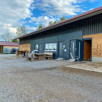
Pferdetrail Marquart - mit kleiner Wallachherde
Markdorf-Ittendorf
Pferdetrail-Marquart
@Pferdetrail-Marquart
Freizeitstall
Hunde willkommen
Krankenbox
Gnadenbrothof
Hufrehe geeignet
Bewegungsstall
Laufstall
13 weitere...
S
Deprecated: Creation of dynamic property Zend_View_Helper_Ads::$adLink is deprecated in /var/www/stall-frei/htdocs/staging.stall-frei.de/library/Psf/View/Helper/Ads.php on line 108

Futtersack HeuToy, Fressbremse in pink
Mechtersen
STALL-FREIde Marketing
@STALL-FREI-Marketing
Stundenlange Beschäftigung die
Koliken vorbeugt, geringe Staubinhalation mit
steuerbarer Futterentnahme
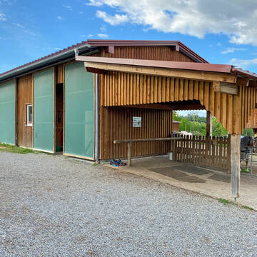
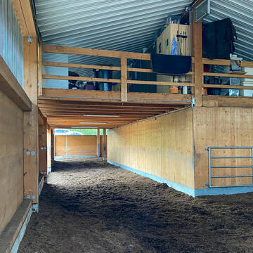
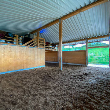
Idyllischer Pferdehof im schönen Deggenhausertal
Heiligenberg
Viertlerhof
@Viertlerhof
Geländestrecke
Pferdeausbildung
Vermieten
Paddock
Parkplatz für Pferdeanhänger
Gnadenbrothof
Hengsthaltung möglich
21 weitere...
P
Steinhöfe
Überlingen / Lippertsreute
clemens-Maier
@clemens-Maier
Freizeitstall
Geländestrecke
Vermieten
Paddock
Reitplatz (z.B. Dressur, Springen, Reining)
Innenbox
10 weitere...
P
Ponde Rosa Ranch
Illmensee- Neubrunn
Frau-Briemle
@Frau-Briemle
Freizeitstall
Vermieten
Longierzirkel/Roundpen
Paddock
Außenbox mit Paddock
9 weitere...
P

Ausbildungsstall und equines Fachzentrum
Überlingen am Bodensee
Gestuet-Evelino
@Gestuet-Evelino
Pferdeausbildung
Reitlehrer und -unterricht
Vermieten
Longierzirkel/Roundpen
Paddock
Hengsthaltung möglich
15 weitere...
P
Leider kein Vorschaubild
Leider kein Vorschaubild
1 OFFENSTALLPLATZ FÜR STUTE -1,55m TRAIL&REI...
Salem
BOSS-HORSE-PONYWORLD
@BOSS-HORSE-PONYWORLD
Freizeitstall
Vermieten
Krankenbox
Paddock
Allergikerstall
10 weitere...
ganz aktuell
B

Stall für Ponys zu Vermieten
Ostrach Waldbeuren
Petra Krautt
@Eshana
Vermieten
Paddock
Sattelkammer/Sattelschränke
Offenstall
Selbstversorgung
4 weitere...
P

Offenstall
Bermatingen-Ahausen
Gabi0312
@Gabi0312
Freizeitstall
Vermieten
Verpachten
Hunde willkommen
Krankenbox
Notfallboxen
13 weitere...
P

Heu und Heulage verkaufen
Mechtersen
STALL-FREIde Marketing
@STALL-FREI-Marketing
Verkaufen Sie Ihr Heu und Ihre Heulage direkt an Reiter, Pferdeställe und Reitanlagen
Leider kein Vorschaubild
Leider kein Vorschaubild
Stallplatz für Isländer und Freizeitpferde
Deggenhausertal
Hubertushof
@hubertushof
FN-Mitglied
Freizeitstall
Vermieten
Führanlage
Hunde willkommen
Fohlenaufzucht möglich
Hufrehe geeignet
28 weitere...
B
Leider kein Vorschaubild
Leider kein Vorschaubild
Offenstallplatz frei
Owingen
Reitschule Säntisblick
@PatCysHeimet
Gangpferdereiten
Pferdeausbildung
Hunde willkommen
Krankenbox
Offenstall
Vollpension
11 weitere...
neu
B
Deprecated: Creation of dynamic property Zend_View::$pageCount is deprecated in /var/www/stall-frei/htdocs/staging.stall-frei.de/library/vendor/shardj/zf1-future/library/Zend/View/Abstract.php on line 308
Deprecated: Creation of dynamic property Zend_View::$itemCountPerPage is deprecated in /var/www/stall-frei/htdocs/staging.stall-frei.de/library/vendor/shardj/zf1-future/library/Zend/View/Abstract.php on line 308
Deprecated: Creation of dynamic property Zend_View::$first is deprecated in /var/www/stall-frei/htdocs/staging.stall-frei.de/library/vendor/shardj/zf1-future/library/Zend/View/Abstract.php on line 308
Deprecated: Creation of dynamic property Zend_View::$current is deprecated in /var/www/stall-frei/htdocs/staging.stall-frei.de/library/vendor/shardj/zf1-future/library/Zend/View/Abstract.php on line 308
Deprecated: Creation of dynamic property Zend_View::$last is deprecated in /var/www/stall-frei/htdocs/staging.stall-frei.de/library/vendor/shardj/zf1-future/library/Zend/View/Abstract.php on line 308
Deprecated: Creation of dynamic property Zend_View::$next is deprecated in /var/www/stall-frei/htdocs/staging.stall-frei.de/library/vendor/shardj/zf1-future/library/Zend/View/Abstract.php on line 308
Deprecated: Creation of dynamic property Zend_View::$pagesInRange is deprecated in /var/www/stall-frei/htdocs/staging.stall-frei.de/library/vendor/shardj/zf1-future/library/Zend/View/Abstract.php on line 308
Deprecated: Creation of dynamic property Zend_View::$firstPageInRange is deprecated in /var/www/stall-frei/htdocs/staging.stall-frei.de/library/vendor/shardj/zf1-future/library/Zend/View/Abstract.php on line 308
Deprecated: Creation of dynamic property Zend_View::$lastPageInRange is deprecated in /var/www/stall-frei/htdocs/staging.stall-frei.de/library/vendor/shardj/zf1-future/library/Zend/View/Abstract.php on line 308
Deprecated: Creation of dynamic property Zend_View::$currentItemCount is deprecated in /var/www/stall-frei/htdocs/staging.stall-frei.de/library/vendor/shardj/zf1-future/library/Zend/View/Abstract.php on line 308
Deprecated: Creation of dynamic property Zend_View::$totalItemCount is deprecated in /var/www/stall-frei/htdocs/staging.stall-frei.de/library/vendor/shardj/zf1-future/library/Zend/View/Abstract.php on line 308
Deprecated: Creation of dynamic property Zend_View::$firstItemNumber is deprecated in /var/www/stall-frei/htdocs/staging.stall-frei.de/library/vendor/shardj/zf1-future/library/Zend/View/Abstract.php on line 308
Deprecated: Creation of dynamic property Zend_View::$lastItemNumber is deprecated in /var/www/stall-frei/htdocs/staging.stall-frei.de/library/vendor/shardj/zf1-future/library/Zend/View/Abstract.php on line 308
Deprecated: Creation of dynamic property Zend_View::$router is deprecated in /var/www/stall-frei/htdocs/staging.stall-frei.de/library/vendor/shardj/zf1-future/library/Zend/View/Abstract.php on line 308
Deprecated: Creation of dynamic property Zend_View::$urlParams is deprecated in /var/www/stall-frei/htdocs/staging.stall-frei.de/library/vendor/shardj/zf1-future/library/Zend/View/Abstract.php on line 308
Deprecated: Creation of dynamic property Zend_View::$showAds is deprecated in /var/www/stall-frei/htdocs/staging.stall-frei.de/library/vendor/shardj/zf1-future/library/Zend/View/Abstract.php on line 308
Deprecated: Creation of dynamic property Zend_View::$objectIds is deprecated in /var/www/stall-frei/htdocs/staging.stall-frei.de/library/vendor/shardj/zf1-future/library/Zend/View/Abstract.php on line 308
Deprecated: Creation of dynamic property Zend_View::$showNavbar is deprecated in /var/www/stall-frei/htdocs/staging.stall-frei.de/library/vendor/shardj/zf1-future/library/Zend/View/Abstract.php on line 308
Deprecated: Creation of dynamic property Zend_View::$showBreadcrumb is deprecated in /var/www/stall-frei/htdocs/staging.stall-frei.de/library/vendor/shardj/zf1-future/library/Zend/View/Abstract.php on line 308
Deprecated: Creation of dynamic property Zend_View::$showFooter is deprecated in /var/www/stall-frei/htdocs/staging.stall-frei.de/library/vendor/shardj/zf1-future/library/Zend/View/Abstract.php on line 308
Deprecated: Creation of dynamic property Zend_View::$showInternalAds is deprecated in /var/www/stall-frei/htdocs/staging.stall-frei.de/library/vendor/shardj/zf1-future/library/Zend/View/Abstract.php on line 308
Deprecated: Creation of dynamic property Zend_View::$blNoContent is deprecated in /var/www/stall-frei/htdocs/staging.stall-frei.de/library/vendor/shardj/zf1-future/library/Zend/View/Abstract.php on line 308
Deprecated: Creation of dynamic property Zend_View::$sMetaDesc is deprecated in /var/www/stall-frei/htdocs/staging.stall-frei.de/library/vendor/shardj/zf1-future/library/Zend/View/Abstract.php on line 308
Deprecated: Creation of dynamic property Zend_View::$useGmaps is deprecated in /var/www/stall-frei/htdocs/staging.stall-frei.de/library/vendor/shardj/zf1-future/library/Zend/View/Abstract.php on line 308
Deprecated: Creation of dynamic property Zend_View::$touches is deprecated in /var/www/stall-frei/htdocs/staging.stall-frei.de/library/vendor/shardj/zf1-future/library/Zend/View/Abstract.php on line 308
Deprecated: Creation of dynamic property Zend_View::$oProject is deprecated in /var/www/stall-frei/htdocs/staging.stall-frei.de/library/vendor/shardj/zf1-future/library/Zend/View/Abstract.php on line 308
Deprecated: Creation of dynamic property Zend_View::$pageHeadline is deprecated in /var/www/stall-frei/htdocs/staging.stall-frei.de/library/vendor/shardj/zf1-future/library/Zend/View/Abstract.php on line 308
Deprecated: Creation of dynamic property Zend_View::$disableLocationField is deprecated in /var/www/stall-frei/htdocs/staging.stall-frei.de/library/vendor/shardj/zf1-future/library/Zend/View/Abstract.php on line 308
Deprecated: Creation of dynamic property Zend_View::$isSearch is deprecated in /var/www/stall-frei/htdocs/staging.stall-frei.de/library/vendor/shardj/zf1-future/library/Zend/View/Abstract.php on line 308
Deprecated: Creation of dynamic property Zend_View::$pageTitle is deprecated in /var/www/stall-frei/htdocs/staging.stall-frei.de/library/vendor/shardj/zf1-future/library/Zend/View/Abstract.php on line 308
Deprecated: Creation of dynamic property Psf_Form_Element_Text::$class is deprecated in /var/www/stall-frei/htdocs/staging.stall-frei.de/library/vendor/shardj/zf1-future/library/Zend/Form/Element.php on line 874
Deprecated: Creation of dynamic property Psf_Form_Element_Text::$size is deprecated in /var/www/stall-frei/htdocs/staging.stall-frei.de/library/vendor/shardj/zf1-future/library/Zend/Form/Element.php on line 874
Deprecated: Creation of dynamic property Psf_Form_Element_Text::$placeholder is deprecated in /var/www/stall-frei/htdocs/staging.stall-frei.de/library/vendor/shardj/zf1-future/library/Zend/Form/Element.php on line 874
Deprecated: Creation of dynamic property Psf_Form_Element_Hidden::$class is deprecated in /var/www/stall-frei/htdocs/staging.stall-frei.de/library/vendor/shardj/zf1-future/library/Zend/Form/Element.php on line 874
Deprecated: Creation of dynamic property Psf_Form_Element_Hidden::$class is deprecated in /var/www/stall-frei/htdocs/staging.stall-frei.de/library/vendor/shardj/zf1-future/library/Zend/Form/Element.php on line 874
Deprecated: Creation of dynamic property Psf_Form_Element_Hidden::$class is deprecated in /var/www/stall-frei/htdocs/staging.stall-frei.de/library/vendor/shardj/zf1-future/library/Zend/Form/Element.php on line 874
Deprecated: Creation of dynamic property Psf_Form_Element_Hidden::$class is deprecated in /var/www/stall-frei/htdocs/staging.stall-frei.de/library/vendor/shardj/zf1-future/library/Zend/Form/Element.php on line 874
Deprecated: Creation of dynamic property Psf_Form_Element_Select::$class is deprecated in /var/www/stall-frei/htdocs/staging.stall-frei.de/library/vendor/shardj/zf1-future/library/Zend/Form/Element.php on line 874
Deprecated: Creation of dynamic property Psf_Form_Element_Select::$class is deprecated in /var/www/stall-frei/htdocs/staging.stall-frei.de/library/vendor/shardj/zf1-future/library/Zend/Form/Element.php on line 874
Deprecated: Creation of dynamic property Psf_Form_Element_Select::$class is deprecated in /var/www/stall-frei/htdocs/staging.stall-frei.de/library/vendor/shardj/zf1-future/library/Zend/Form/Element.php on line 874
Deprecated: Creation of dynamic property Psf_Form_Element_Select::$class is deprecated in /var/www/stall-frei/htdocs/staging.stall-frei.de/library/vendor/shardj/zf1-future/library/Zend/Form/Element.php on line 874
Deprecated: Creation of dynamic property Psf_Form_Element_Text::$class is deprecated in /var/www/stall-frei/htdocs/staging.stall-frei.de/library/vendor/shardj/zf1-future/library/Zend/Form/Element.php on line 874
Deprecated: Creation of dynamic property Psf_Form_Element_Checkbox::$label is deprecated in /var/www/stall-frei/htdocs/staging.stall-frei.de/library/vendor/shardj/zf1-future/library/Zend/Form/Element.php on line 874
Deprecated: Creation of dynamic property Zend_View::$sort is deprecated in /var/www/stall-frei/htdocs/staging.stall-frei.de/library/vendor/shardj/zf1-future/library/Zend/View/Abstract.php on line 308
Deprecated: Creation of dynamic property Zend_View::$searchLocation is deprecated in /var/www/stall-frei/htdocs/staging.stall-frei.de/library/vendor/shardj/zf1-future/library/Zend/View/Abstract.php on line 308
Deprecated: Creation of dynamic property Zend_View::$locationHint is deprecated in /var/www/stall-frei/htdocs/staging.stall-frei.de/library/vendor/shardj/zf1-future/library/Zend/View/Abstract.php on line 308
Psf_GeoCoder_Abstract::getLocation: Heiligenberg Get Location CachedOrLive
Psf_GeoCoder_Abstract::getCachedOrLive: Heiligenberg
Psf_GeoCoder_OpenCageData::makeApiRequest: response:
Array
(
[documentation] => https://opencagedata.com/api
[licenses] => Array
(
[0] => Array
(
[name] => see attribution guide
[url] => https://opencagedata.com/credits
)
)
[results] => Array
(
[0] => Array
(
[bounds] => Array
(
[northeast] => Array
(
[lat] => 47.8821808
[lng] => 9.3744984
)
[southwest] => Array
(
[lat] => 47.8004254
[lng] => 9.2369543
)
)
[components] => Array
(
[ISO_3166-1_alpha-2] => DE
[ISO_3166-1_alpha-3] => DEU
[ISO_3166-2] => Array
(
[0] => DE-BW
)
[_category] => place
[_normalized_city] => Heiligenberg
[_type] => village
[continent] => Europe
[country] => Deutschland
[country_code] => de
[county] => Bodenseekreis
[municipality] => GVV Salem
[political_union] => European Union
[postcode] => 88633
[state] => Baden-Württemberg
[state_code] => BW
[village] => Heiligenberg
)
[confidence] => 7
[formatted] => 88633 Heiligenberg, Deutschland
[geometry] => Array
(
[lat] => 47.8212875
[lng] => 9.3111489
)
)
[1] => Array
(
[bounds] => Array
(
[northeast] => Array
(
[lat] => 49.4261995
[lng] => 8.706313
)
[southwest] => Array
(
[lat] => 49.4260995
[lng] => 8.706213
)
)
[components] => Array
(
[ISO_3166-1_alpha-2] => DE
[ISO_3166-1_alpha-3] => DEU
[ISO_3166-2] => Array
(
[0] => DE-BW
)
[_category] => natural/water
[_normalized_city] => Heidelberg
[_type] => peak
[city] => Heidelberg
[continent] => Europe
[country] => Deutschland
[country_code] => de
[peak] => Heiligenberg
[political_union] => European Union
[postcode] => 69001
[state] => Baden-Württemberg
[state_code] => BW
)
[confidence] => 9
[formatted] => Heiligenberg, 69001 Heidelberg, Deutschland
[geometry] => Array
(
[lat] => 49.4261495
[lng] => 8.706263
)
)
[2] => Array
(
[bounds] => Array
(
[northeast] => Array
(
[lat] => 51.2390769
[lng] => 9.8464398
)
[southwest] => Array
(
[lat] => 51.2389769
[lng] => 9.8463398
)
)
[components] => Array
(
[ISO_3166-1_alpha-2] => DE
[ISO_3166-1_alpha-3] => DEU
[ISO_3166-2] => Array
(
[0] => DE-HE
)
[_category] => natural/water
[_normalized_city] => Großalmerode
[_type] => peak
[continent] => Europe
[country] => Deutschland
[country_code] => de
[county] => Werra-Meißner-Kreis
[municipality] => Großalmerode
[peak] => Heiligenberg
[political_union] => European Union
[state] => Hessen
[state_code] => HE
)
[confidence] => 9
[formatted] => Heiligenberg, Großalmerode, Hessen, Deutschland
[geometry] => Array
(
[lat] => 51.2390269
[lng] => 9.8463898
)
)
[3] => Array
(
[bounds] => Array
(
[northeast] => Array
(
[lat] => 51.6037677
[lng] => 11.1783873
)
[southwest] => Array
(
[lat] => 51.6036677
[lng] => 11.1782873
)
)
[components] => Array
(
[ISO_3166-1_alpha-2] => DE
[ISO_3166-1_alpha-3] => DEU
[ISO_3166-2] => Array
(
[0] => DE-ST
)
[_category] => natural/water
[_normalized_city] => Harzgerode
[_type] => peak
[continent] => Europe
[country] => Deutschland
[country_code] => de
[county] => Landkreis Harz
[peak] => Heiligenberg
[political_union] => European Union
[state] => Sachsen-Anhalt
[state_code] => ST
[town] => Harzgerode
)
[confidence] => 9
[formatted] => Heiligenberg, Harzgerode, Sachsen-Anhalt, Deutschland
[geometry] => Array
(
[lat] => 51.6037177
[lng] => 11.1783373
)
)
[4] => Array
(
[bounds] => Array
(
[northeast] => Array
(
[lat] => 51.6762992
[lng] => 9.7143596
)
[southwest] => Array
(
[lat] => 51.6761992
[lng] => 9.7142596
)
)
[components] => Array
(
[ISO_3166-1_alpha-2] => DE
[ISO_3166-1_alpha-3] => DEU
[ISO_3166-2] => Array
(
[0] => DE-NI
)
[_category] => natural/water
[_normalized_city] => Uslar
[_type] => peak
[continent] => Europe
[country] => Deutschland
[country_code] => de
[county] => Landkreis Northeim
[peak] => Heiligenberg
[political_union] => European Union
[state] => Niedersachsen
[state_code] => NI
[town] => Uslar
)
[confidence] => 9
[formatted] => Heiligenberg, Uslar, Niedersachsen, Deutschland
[geometry] => Array
(
[lat] => 51.6762492
[lng] => 9.7143096
)
)
[5] => Array
(
[bounds] => Array
(
[northeast] => Array
(
[lat] => 51.3848417
[lng] => 10.7792303
)
[southwest] => Array
(
[lat] => 51.3847417
[lng] => 10.7791303
)
)
[components] => Array
(
[ISO_3166-1_alpha-2] => DE
[ISO_3166-1_alpha-3] => DEU
[ISO_3166-2] => Array
(
[0] => DE-TH
)
[_category] => natural/water
[_normalized_city] => Sondershausen
[_type] => peak
[continent] => Europe
[country] => Deutschland
[country_code] => de
[county] => Kyffhäuserkreis
[peak] => Heiligenberg
[political_union] => European Union
[state] => Thüringen
[state_code] => TH
[town] => Sondershausen
)
[confidence] => 9
[formatted] => Heiligenberg, Sondershausen, Thüringen, Deutschland
[geometry] => Array
(
[lat] => 51.3847917
[lng] => 10.7791803
)
)
[6] => Array
(
[bounds] => Array
(
[northeast] => Array
(
[lat] => 51.9756207
[lng] => 10.4953138
)
[southwest] => Array
(
[lat] => 51.9755207
[lng] => 10.4952138
)
)
[components] => Array
(
[ISO_3166-1_alpha-2] => DE
[ISO_3166-1_alpha-3] => DEU
[ISO_3166-2] => Array
(
[0] => DE-NI
)
[_category] => natural/water
[_normalized_city] => Goslar
[_type] => peak
[continent] => Europe
[country] => Deutschland
[country_code] => de
[county] => Landkreis Goslar
[peak] => Heiligenberg
[political_union] => European Union
[postcode] => 38690
[state] => Niedersachsen
[state_code] => NI
[town] => Goslar
)
[confidence] => 9
[formatted] => Heiligenberg, 38690 Goslar, Deutschland
[geometry] => Array
(
[lat] => 51.9755707
[lng] => 10.4952638
)
)
[7] => Array
(
[bounds] => Array
(
[northeast] => Array
(
[lat] => 51.3474431
[lng] => 10.0074402
)
[southwest] => Array
(
[lat] => 51.3473431
[lng] => 10.0073402
)
)
[components] => Array
(
[ISO_3166-1_alpha-2] => DE
[ISO_3166-1_alpha-3] => DEU
[ISO_3166-2] => Array
(
[0] => DE-TH
)
[_category] => natural/water
[_normalized_city] => Uder
[_type] => peak
[continent] => Europe
[country] => Deutschland
[country_code] => de
[county] => Landkreis Eichsfeld
[municipality] => Uder
[peak] => Heiligenberg
[political_union] => European Union
[postcode] => 37318
[state] => Thüringen
[state_code] => TH
[village] => Uder
)
[confidence] => 9
[formatted] => Heiligenberg, 37318 Uder, Deutschland
[geometry] => Array
(
[lat] => 51.3473931
[lng] => 10.0073902
)
)
[8] => Array
(
[bounds] => Array
(
[northeast] => Array
(
[lat] => 51.3122898
[lng] => 10.5395853
)
[southwest] => Array
(
[lat] => 51.3121898
[lng] => 10.5394853
)
)
[components] => Array
(
[ISO_3166-1_alpha-2] => DE
[ISO_3166-1_alpha-3] => DEU
[ISO_3166-2] => Array
(
[0] => DE-TH
)
[_category] => natural/water
[_normalized_city] => Unstruttal
[_type] => peak
[continent] => Europe
[country] => Deutschland
[country_code] => de
[county] => Unstrut-Hainich-Kreis
[municipality] => Unstruttal
[peak] => Heiligenberg
[political_union] => European Union
[state] => Thüringen
[state_code] => TH
)
[confidence] => 9
[formatted] => Heiligenberg, Unstruttal, Thüringen, Deutschland
[geometry] => Array
(
[lat] => 51.3122398
[lng] => 10.5395353
)
)
[9] => Array
(
[components] => Array
(
[ISO_3166-1_alpha-2] => FR
[ISO_3166-1_alpha-3] => FRA
[ISO_3166-2] => Array
(
[0] => FR-GES
[1] => FR-6AE
[2] => FR-67
)
[_category] => place
[_normalized_city] => Heiligenberg
[_type] => city
[city] => Heiligenberg
[continent] => Europe
[country] => France
[country_code] => fr
[county] => Bas-Rhin
[local_authority] => Communauté de communes de la Région de Molsheim-Mutzig
[political_union] => European Union
[postcode] => 67190
[state] => Grand Est
[state_code] => GES
)
[confidence] => 4
[formatted] => Heiligenberg, Bas-Rhin, France
[geometry] => Array
(
[lat] => 48.535447
[lng] => 7.387216
)
)
)
[status] => Array
(
[code] => 200
[message] => OK
)
[stay_informed] => Array
(
[blog] => https://blog.opencagedata.com
[mastodon] => https://en.osm.town/@opencage
)
[thanks] => For using an OpenCage API
[timestamp] => Array
(
[created_http] => Sat, 07 Feb 2026 10:21:14 GMT
[created_unix] => 1770459674
)
[total_results] => 10
)
Psf_GeoCoder_Abstract::convertLocationResult
{"documentation":"https:\/\/opencagedata.com\/api","licenses":[{"name":"see attribution guide","url":"https:\/\/opencagedata.com\/credits"}],"results":[{"bounds":{"northeast":{"lat":47.8821808,"lng":9.3744984},"southwest":{"lat":47.8004254,"lng":9.2369543}},"components":{"ISO_3166-1_alpha-2":"DE","ISO_3166-1_alpha-3":"DEU","ISO_3166-2":["DE-BW"],"_category":"place","_normalized_city":"Heiligenberg","_type":"village","continent":"Europe","country":"Deutschland","country_code":"de","county":"Bodenseekreis","municipality":"GVV Salem","political_union":"European Union","postcode":"88633","state":"Baden-W\u00fcrttemberg","state_code":"BW","village":"Heiligenberg"},"confidence":7,"formatted":"88633 Heiligenberg, Deutschland","geometry":{"lat":47.8212875,"lng":9.3111489}},{"bounds":{"northeast":{"lat":49.4261995,"lng":8.706313},"southwest":{"lat":49.4260995,"lng":8.706213}},"components":{"ISO_3166-1_alpha-2":"DE","ISO_3166-1_alpha-3":"DEU","ISO_3166-2":["DE-BW"],"_category":"natural\/water","_normalized_city":"Heidelberg","_type":"peak","city":"Heidelberg","continent":"Europe","country":"Deutschland","country_code":"de","peak":"Heiligenberg","political_union":"European Union","postcode":"69001","state":"Baden-W\u00fcrttemberg","state_code":"BW"},"confidence":9,"formatted":"Heiligenberg, 69001 Heidelberg, Deutschland","geometry":{"lat":49.4261495,"lng":8.706263}},{"bounds":{"northeast":{"lat":51.2390769,"lng":9.8464398},"southwest":{"lat":51.2389769,"lng":9.8463398}},"components":{"ISO_3166-1_alpha-2":"DE","ISO_3166-1_alpha-3":"DEU","ISO_3166-2":["DE-HE"],"_category":"natural\/water","_normalized_city":"Gro\u00dfalmerode","_type":"peak","continent":"Europe","country":"Deutschland","country_code":"de","county":"Werra-Mei\u00dfner-Kreis","municipality":"Gro\u00dfalmerode","peak":"Heiligenberg","political_union":"European Union","state":"Hessen","state_code":"HE"},"confidence":9,"formatted":"Heiligenberg, Gro\u00dfalmerode, Hessen, Deutschland","geometry":{"lat":51.2390269,"lng":9.8463898}},{"bounds":{"northeast":{"lat":51.6037677,"lng":11.1783873},"southwest":{"lat":51.6036677,"lng":11.1782873}},"components":{"ISO_3166-1_alpha-2":"DE","ISO_3166-1_alpha-3":"DEU","ISO_3166-2":["DE-ST"],"_category":"natural\/water","_normalized_city":"Harzgerode","_type":"peak","continent":"Europe","country":"Deutschland","country_code":"de","county":"Landkreis Harz","peak":"Heiligenberg","political_union":"European Union","state":"Sachsen-Anhalt","state_code":"ST","town":"Harzgerode"},"confidence":9,"formatted":"Heiligenberg, Harzgerode, Sachsen-Anhalt, Deutschland","geometry":{"lat":51.6037177,"lng":11.1783373}},{"bounds":{"northeast":{"lat":51.6762992,"lng":9.7143596},"southwest":{"lat":51.6761992,"lng":9.7142596}},"components":{"ISO_3166-1_alpha-2":"DE","ISO_3166-1_alpha-3":"DEU","ISO_3166-2":["DE-NI"],"_category":"natural\/water","_normalized_city":"Uslar","_type":"peak","continent":"Europe","country":"Deutschland","country_code":"de","county":"Landkreis Northeim","peak":"Heiligenberg","political_union":"European Union","state":"Niedersachsen","state_code":"NI","town":"Uslar"},"confidence":9,"formatted":"Heiligenberg, Uslar, Niedersachsen, Deutschland","geometry":{"lat":51.6762492,"lng":9.7143096}},{"bounds":{"northeast":{"lat":51.3848417,"lng":10.7792303},"southwest":{"lat":51.3847417,"lng":10.7791303}},"components":{"ISO_3166-1_alpha-2":"DE","ISO_3166-1_alpha-3":"DEU","ISO_3166-2":["DE-TH"],"_category":"natural\/water","_normalized_city":"Sondershausen","_type":"peak","continent":"Europe","country":"Deutschland","country_code":"de","county":"Kyffh\u00e4userkreis","peak":"Heiligenberg","political_union":"European Union","state":"Th\u00fcringen","state_code":"TH","town":"Sondershausen"},"confidence":9,"formatted":"Heiligenberg, Sondershausen, Th\u00fcringen, Deutschland","geometry":{"lat":51.3847917,"lng":10.7791803}},{"bounds":{"northeast":{"lat":51.9756207,"lng":10.4953138},"southwest":{"lat":51.9755207,"lng":10.4952138}},"components":{"ISO_3166-1_alpha-2":"DE","ISO_3166-1_alpha-3":"DEU","ISO_3166-2":["DE-NI"],"_category":"natural\/water","_normalized_city":"Goslar","_type":"peak","continent":"Europe","country":"Deutschland","country_code":"de","county":"Landkreis Goslar","peak":"Heiligenberg","political_union":"European Union","postcode":"38690","state":"Niedersachsen","state_code":"NI","town":"Goslar"},"confidence":9,"formatted":"Heiligenberg, 38690 Goslar, Deutschland","geometry":{"lat":51.9755707,"lng":10.4952638}},{"bounds":{"northeast":{"lat":51.3474431,"lng":10.0074402},"southwest":{"lat":51.3473431,"lng":10.0073402}},"components":{"ISO_3166-1_alpha-2":"DE","ISO_3166-1_alpha-3":"DEU","ISO_3166-2":["DE-TH"],"_category":"natural\/water","_normalized_city":"Uder","_type":"peak","continent":"Europe","country":"Deutschland","country_code":"de","county":"Landkreis Eichsfeld","municipality":"Uder","peak":"Heiligenberg","political_union":"European Union","postcode":"37318","state":"Th\u00fcringen","state_code":"TH","village":"Uder"},"confidence":9,"formatted":"Heiligenberg, 37318 Uder, Deutschland","geometry":{"lat":51.3473931,"lng":10.0073902}},{"bounds":{"northeast":{"lat":51.3122898,"lng":10.5395853},"southwest":{"lat":51.3121898,"lng":10.5394853}},"components":{"ISO_3166-1_alpha-2":"DE","ISO_3166-1_alpha-3":"DEU","ISO_3166-2":["DE-TH"],"_category":"natural\/water","_normalized_city":"Unstruttal","_type":"peak","continent":"Europe","country":"Deutschland","country_code":"de","county":"Unstrut-Hainich-Kreis","municipality":"Unstruttal","peak":"Heiligenberg","political_union":"European Union","state":"Th\u00fcringen","state_code":"TH"},"confidence":9,"formatted":"Heiligenberg, Unstruttal, Th\u00fcringen, Deutschland","geometry":{"lat":51.3122398,"lng":10.5395353}},{"components":{"ISO_3166-1_alpha-2":"FR","ISO_3166-1_alpha-3":"FRA","ISO_3166-2":["FR-GES","FR-6AE","FR-67"],"_category":"place","_normalized_city":"Heiligenberg","_type":"city","city":"Heiligenberg","continent":"Europe","country":"France","country_code":"fr","county":"Bas-Rhin","local_authority":"Communaut\u00e9 de communes de la R\u00e9gion de Molsheim-Mutzig","political_union":"European Union","postcode":"67190","state":"Grand Est","state_code":"GES"},"confidence":4,"formatted":"Heiligenberg, Bas-Rhin, France","geometry":{"lat":48.535447,"lng":7.387216}}],"status":{"code":200,"message":"OK"},"stay_informed":{"blog":"https:\/\/blog.opencagedata.com","mastodon":"https:\/\/en.osm.town\/@opencage"},"thanks":"For using an OpenCage API","timestamp":{"created_http":"Sat, 07 Feb 2026 10:21:14 GMT","created_unix":1770459674},"total_results":10}Array
(
[0] => stdClass Object
(
[bounds] => stdClass Object
(
[northeast] => stdClass Object
(
[lat] => 47.8821808
[lng] => 9.3744984
)
[southwest] => stdClass Object
(
[lat] => 47.8004254
[lng] => 9.2369543
)
)
[components] => stdClass Object
(
[ISO_3166-1_alpha-2] => DE
[ISO_3166-1_alpha-3] => DEU
[ISO_3166-2] => Array
(
[0] => DE-BW
)
[_category] => place
[_normalized_city] => Heiligenberg
[_type] => village
[continent] => Europe
[country] => Deutschland
[country_code] => de
[county] => Bodenseekreis
[municipality] => GVV Salem
[political_union] => European Union
[postcode] => 88633
[state] => Baden-Württemberg
[state_code] => BW
[village] => Heiligenberg
)
[confidence] => 7
[formatted] => 88633 Heiligenberg, Deutschland
[geometry] => stdClass Object
(
[lat] => 47.8212875
[lng] => 9.3111489
)
)
[1] => stdClass Object
(
[bounds] => stdClass Object
(
[northeast] => stdClass Object
(
[lat] => 49.4261995
[lng] => 8.706313
)
[southwest] => stdClass Object
(
[lat] => 49.4260995
[lng] => 8.706213
)
)
[components] => stdClass Object
(
[ISO_3166-1_alpha-2] => DE
[ISO_3166-1_alpha-3] => DEU
[ISO_3166-2] => Array
(
[0] => DE-BW
)
[_category] => natural/water
[_normalized_city] => Heidelberg
[_type] => peak
[city] => Heidelberg
[continent] => Europe
[country] => Deutschland
[country_code] => de
[peak] => Heiligenberg
[political_union] => European Union
[postcode] => 69001
[state] => Baden-Württemberg
[state_code] => BW
)
[confidence] => 9
[formatted] => Heiligenberg, 69001 Heidelberg, Deutschland
[geometry] => stdClass Object
(
[lat] => 49.4261495
[lng] => 8.706263
)
)
[2] => stdClass Object
(
[bounds] => stdClass Object
(
[northeast] => stdClass Object
(
[lat] => 51.2390769
[lng] => 9.8464398
)
[southwest] => stdClass Object
(
[lat] => 51.2389769
[lng] => 9.8463398
)
)
[components] => stdClass Object
(
[ISO_3166-1_alpha-2] => DE
[ISO_3166-1_alpha-3] => DEU
[ISO_3166-2] => Array
(
[0] => DE-HE
)
[_category] => natural/water
[_normalized_city] => Großalmerode
[_type] => peak
[continent] => Europe
[country] => Deutschland
[country_code] => de
[county] => Werra-Meißner-Kreis
[municipality] => Großalmerode
[peak] => Heiligenberg
[political_union] => European Union
[state] => Hessen
[state_code] => HE
)
[confidence] => 9
[formatted] => Heiligenberg, Großalmerode, Hessen, Deutschland
[geometry] => stdClass Object
(
[lat] => 51.2390269
[lng] => 9.8463898
)
)
[3] => stdClass Object
(
[bounds] => stdClass Object
(
[northeast] => stdClass Object
(
[lat] => 51.6037677
[lng] => 11.1783873
)
[southwest] => stdClass Object
(
[lat] => 51.6036677
[lng] => 11.1782873
)
)
[components] => stdClass Object
(
[ISO_3166-1_alpha-2] => DE
[ISO_3166-1_alpha-3] => DEU
[ISO_3166-2] => Array
(
[0] => DE-ST
)
[_category] => natural/water
[_normalized_city] => Harzgerode
[_type] => peak
[continent] => Europe
[country] => Deutschland
[country_code] => de
[county] => Landkreis Harz
[peak] => Heiligenberg
[political_union] => European Union
[state] => Sachsen-Anhalt
[state_code] => ST
[town] => Harzgerode
)
[confidence] => 9
[formatted] => Heiligenberg, Harzgerode, Sachsen-Anhalt, Deutschland
[geometry] => stdClass Object
(
[lat] => 51.6037177
[lng] => 11.1783373
)
)
[4] => stdClass Object
(
[bounds] => stdClass Object
(
[northeast] => stdClass Object
(
[lat] => 51.6762992
[lng] => 9.7143596
)
[southwest] => stdClass Object
(
[lat] => 51.6761992
[lng] => 9.7142596
)
)
[components] => stdClass Object
(
[ISO_3166-1_alpha-2] => DE
[ISO_3166-1_alpha-3] => DEU
[ISO_3166-2] => Array
(
[0] => DE-NI
)
[_category] => natural/water
[_normalized_city] => Uslar
[_type] => peak
[continent] => Europe
[country] => Deutschland
[country_code] => de
[county] => Landkreis Northeim
[peak] => Heiligenberg
[political_union] => European Union
[state] => Niedersachsen
[state_code] => NI
[town] => Uslar
)
[confidence] => 9
[formatted] => Heiligenberg, Uslar, Niedersachsen, Deutschland
[geometry] => stdClass Object
(
[lat] => 51.6762492
[lng] => 9.7143096
)
)
[5] => stdClass Object
(
[bounds] => stdClass Object
(
[northeast] => stdClass Object
(
[lat] => 51.3848417
[lng] => 10.7792303
)
[southwest] => stdClass Object
(
[lat] => 51.3847417
[lng] => 10.7791303
)
)
[components] => stdClass Object
(
[ISO_3166-1_alpha-2] => DE
[ISO_3166-1_alpha-3] => DEU
[ISO_3166-2] => Array
(
[0] => DE-TH
)
[_category] => natural/water
[_normalized_city] => Sondershausen
[_type] => peak
[continent] => Europe
[country] => Deutschland
[country_code] => de
[county] => Kyffhäuserkreis
[peak] => Heiligenberg
[political_union] => European Union
[state] => Thüringen
[state_code] => TH
[town] => Sondershausen
)
[confidence] => 9
[formatted] => Heiligenberg, Sondershausen, Thüringen, Deutschland
[geometry] => stdClass Object
(
[lat] => 51.3847917
[lng] => 10.7791803
)
)
[6] => stdClass Object
(
[bounds] => stdClass Object
(
[northeast] => stdClass Object
(
[lat] => 51.9756207
[lng] => 10.4953138
)
[southwest] => stdClass Object
(
[lat] => 51.9755207
[lng] => 10.4952138
)
)
[components] => stdClass Object
(
[ISO_3166-1_alpha-2] => DE
[ISO_3166-1_alpha-3] => DEU
[ISO_3166-2] => Array
(
[0] => DE-NI
)
[_category] => natural/water
[_normalized_city] => Goslar
[_type] => peak
[continent] => Europe
[country] => Deutschland
[country_code] => de
[county] => Landkreis Goslar
[peak] => Heiligenberg
[political_union] => European Union
[postcode] => 38690
[state] => Niedersachsen
[state_code] => NI
[town] => Goslar
)
[confidence] => 9
[formatted] => Heiligenberg, 38690 Goslar, Deutschland
[geometry] => stdClass Object
(
[lat] => 51.9755707
[lng] => 10.4952638
)
)
[7] => stdClass Object
(
[bounds] => stdClass Object
(
[northeast] => stdClass Object
(
[lat] => 51.3474431
[lng] => 10.0074402
)
[southwest] => stdClass Object
(
[lat] => 51.3473431
[lng] => 10.0073402
)
)
[components] => stdClass Object
(
[ISO_3166-1_alpha-2] => DE
[ISO_3166-1_alpha-3] => DEU
[ISO_3166-2] => Array
(
[0] => DE-TH
)
[_category] => natural/water
[_normalized_city] => Uder
[_type] => peak
[continent] => Europe
[country] => Deutschland
[country_code] => de
[county] => Landkreis Eichsfeld
[municipality] => Uder
[peak] => Heiligenberg
[political_union] => European Union
[postcode] => 37318
[state] => Thüringen
[state_code] => TH
[village] => Uder
)
[confidence] => 9
[formatted] => Heiligenberg, 37318 Uder, Deutschland
[geometry] => stdClass Object
(
[lat] => 51.3473931
[lng] => 10.0073902
)
)
[8] => stdClass Object
(
[bounds] => stdClass Object
(
[northeast] => stdClass Object
(
[lat] => 51.3122898
[lng] => 10.5395853
)
[southwest] => stdClass Object
(
[lat] => 51.3121898
[lng] => 10.5394853
)
)
[components] => stdClass Object
(
[ISO_3166-1_alpha-2] => DE
[ISO_3166-1_alpha-3] => DEU
[ISO_3166-2] => Array
(
[0] => DE-TH
)
[_category] => natural/water
[_normalized_city] => Unstruttal
[_type] => peak
[continent] => Europe
[country] => Deutschland
[country_code] => de
[county] => Unstrut-Hainich-Kreis
[municipality] => Unstruttal
[peak] => Heiligenberg
[political_union] => European Union
[state] => Thüringen
[state_code] => TH
)
[confidence] => 9
[formatted] => Heiligenberg, Unstruttal, Thüringen, Deutschland
[geometry] => stdClass Object
(
[lat] => 51.3122398
[lng] => 10.5395353
)
)
[9] => stdClass Object
(
[components] => stdClass Object
(
[ISO_3166-1_alpha-2] => FR
[ISO_3166-1_alpha-3] => FRA
[ISO_3166-2] => Array
(
[0] => FR-GES
[1] => FR-6AE
[2] => FR-67
)
[_category] => place
[_normalized_city] => Heiligenberg
[_type] => city
[city] => Heiligenberg
[continent] => Europe
[country] => France
[country_code] => fr
[county] => Bas-Rhin
[local_authority] => Communauté de communes de la Région de Molsheim-Mutzig
[political_union] => European Union
[postcode] => 67190
[state] => Grand Est
[state_code] => GES
)
[confidence] => 4
[formatted] => Heiligenberg, Bas-Rhin, France
[geometry] => stdClass Object
(
[lat] => 48.535447
[lng] => 7.387216
)
)
)
Psf_GeoCoder_OpenCageData::getKeyMap: 0
stdClass Object
(
    [bounds] => stdClass Object
        (
            [northeast] => stdClass Object
                (
                    [lat] => 47.8821808
                    [lng] => 9.3744984
                )

            [southwest] => stdClass Object
                (
                    [lat] => 47.8004254
                    [lng] => 9.2369543
                )

        )

    [components] => stdClass Object
        (
            [ISO_3166-1_alpha-2] => DE
            [ISO_3166-1_alpha-3] => DEU
            [ISO_3166-2] => Array
                (
                    [0] => DE-BW
                )

            [_category] => place
            [_normalized_city] => Heiligenberg
            [_type] => village
            [continent] => Europe
            [country] => Deutschland
            [country_code] => de
            [county] => Bodenseekreis
            [municipality] => GVV Salem
            [political_union] => European Union
            [postcode] => 88633
            [state] => Baden-Württemberg
            [state_code] => BW
            [village] => Heiligenberg
        )

    [confidence] => 7
    [formatted] => 88633 Heiligenberg, Deutschland
    [geometry] => stdClass Object
        (
            [lat] => 47.8212875
            [lng] => 9.3111489
        )

)
Psf_GeoCoder_OpenCageData::getCounty: Bodenseekreis
Psf_GeoCoder_OpenCageData::addMissingData REFETCH!
Array
(
    [address] => 88633 Heiligenberg, Deutschland
    [type] => village
    [street] =>
    [city] => Heiligenberg
    [county] => Bodenseekreis
    [state] => Baden-Württemberg
    [zip] => 88633
    [country] => Deutschland
    [suburb] =>
    [countrycode] => de
    [latitude] => 47.8212875
    [longitude] => 9.3111489
    [accuracy] => 1
    [confidence] => 7
    [bounds] => stdClass Object
        (
            [northeast] => stdClass Object
                (
                    [lat] => 47.8821808
                    [lng] => 9.3744984
                )

            [southwest] => stdClass Object
                (
                    [lat] => 47.8004254
                    [lng] => 9.2369543
                )

        )

)
reformat!
Array
(
    [address] => 88633 Heiligenberg, Deutschland
    [type] => village
    [street] =>
    [city] => Heiligenberg
    [county] => Bodenseekreis
    [state] => Baden-Württemberg
    [zip] => 88633
    [country] => Deutschland
    [suburb] =>
    [countrycode] => de
    [latitude] => 47.8212875
    [longitude] => 9.3111489
    [accuracy] => 1
    [confidence] => 7
    [bounds] => stdClass Object
        (
            [northeast] => stdClass Object
                (
                    [lat] => 47.8821808
                    [lng] => 9.3744984
                )

            [southwest] => stdClass Object
                (
                    [lat] => 47.8004254
                    [lng] => 9.2369543
                )

        )

    [place] => 88633 Heiligenberg, Baden-Württemberg
    [hash] => b6139003e2489bea0b9455d0910f58aa
)
Psf_GeoCoder_OpenCageData::getKeyMap: 1
stdClass Object
(
    [bounds] => stdClass Object
        (
            [northeast] => stdClass Object
                (
                    [lat] => 49.4261995
                    [lng] => 8.706313
                )

            [southwest] => stdClass Object
                (
                    [lat] => 49.4260995
                    [lng] => 8.706213
                )

        )

    [components] => stdClass Object
        (
            [ISO_3166-1_alpha-2] => DE
            [ISO_3166-1_alpha-3] => DEU
            [ISO_3166-2] => Array
                (
                    [0] => DE-BW
                )

            [_category] => natural/water
            [_normalized_city] => Heidelberg
            [_type] => peak
            [city] => Heidelberg
            [continent] => Europe
            [country] => Deutschland
            [country_code] => de
            [peak] => Heiligenberg
            [political_union] => European Union
            [postcode] => 69001
            [state] => Baden-Württemberg
            [state_code] => BW
        )

    [confidence] => 9
    [formatted] => Heiligenberg, 69001 Heidelberg, Deutschland
    [geometry] => stdClass Object
        (
            [lat] => 49.4261495
            [lng] => 8.706263
        )

)
Psf_GeoCoder_OpenCageData::getCounty: Heidelberg
Psf_GeoCoder_OpenCageData::addMissingData REFETCH!
Array
(
    [address] => Heiligenberg, 69001 Heidelberg, Deutschland
    [type] => peak
    [street] =>
    [city] => Heidelberg
    [county] => Heidelberg
    [state] => Baden-Württemberg
    [zip] => 69001
    [country] => Deutschland
    [suburb] =>
    [countrycode] => de
    [latitude] => 49.4261495
    [longitude] => 8.706263
    [accuracy] => 1
    [confidence] => 9
    [bounds] => stdClass Object
        (
            [northeast] => stdClass Object
                (
                    [lat] => 49.4261995
                    [lng] => 8.706313
                )

            [southwest] => stdClass Object
                (
                    [lat] => 49.4260995
                    [lng] => 8.706213
                )

        )

)
reformat!
Array
(
    [address] => Heiligenberg, 69001 Heidelberg, Deutschland
    [type] => peak
    [street] =>
    [city] => Heidelberg
    [county] => Heidelberg
    [state] => Baden-Württemberg
    [zip] => 69001
    [country] => Deutschland
    [suburb] =>
    [countrycode] => de
    [latitude] => 49.4261495
    [longitude] => 8.706263
    [accuracy] => 1
    [confidence] => 9
    [bounds] => stdClass Object
        (
            [northeast] => stdClass Object
                (
                    [lat] => 49.4261995
                    [lng] => 8.706313
                )

            [southwest] => stdClass Object
                (
                    [lat] => 49.4260995
                    [lng] => 8.706213
                )

        )

    [place] => 69001 Heidelberg, Baden-Württemberg
    [hash] => 88e1266cc53e4a1df8a6263e015195bf
)
Psf_GeoCoder_OpenCageData::getKeyMap: 2
stdClass Object
(
    [bounds] => stdClass Object
        (
            [northeast] => stdClass Object
                (
                    [lat] => 51.2390769
                    [lng] => 9.8464398
                )

            [southwest] => stdClass Object
                (
                    [lat] => 51.2389769
                    [lng] => 9.8463398
                )

        )

    [components] => stdClass Object
        (
            [ISO_3166-1_alpha-2] => DE
            [ISO_3166-1_alpha-3] => DEU
            [ISO_3166-2] => Array
                (
                    [0] => DE-HE
                )

            [_category] => natural/water
            [_normalized_city] => Großalmerode
            [_type] => peak
            [continent] => Europe
            [country] => Deutschland
            [country_code] => de
            [county] => Werra-Meißner-Kreis
            [municipality] => Großalmerode
            [peak] => Heiligenberg
            [political_union] => European Union
            [state] => Hessen
            [state_code] => HE
        )

    [confidence] => 9
    [formatted] => Heiligenberg, Großalmerode, Hessen, Deutschland
    [geometry] => stdClass Object
        (
            [lat] => 51.2390269
            [lng] => 9.8463898
        )

)
Psf_GeoCoder_OpenCageData::getCounty: Werra-Meißner-Kreis
Psf_GeoCoder_OpenCageData::addMissingData REFETCH!
Array
(
    [address] => Heiligenberg, Großalmerode, Hessen, Deutschland
    [type] => peak
    [street] =>
    [city] =>
    [county] => Werra-Meißner-Kreis
    [state] => Hessen
    [zip] =>
    [country] => Deutschland
    [suburb] =>
    [countrycode] => de
    [latitude] => 51.2390269
    [longitude] => 9.8463898
    [accuracy] => 1
    [confidence] => 9
    [bounds] => stdClass Object
        (
            [northeast] => stdClass Object
                (
                    [lat] => 51.2390769
                    [lng] => 9.8464398
                )

            [southwest] => stdClass Object
                (
                    [lat] => 51.2389769
                    [lng] => 9.8463398
                )

        )

)
reformat!
Array
(
    [address] => Heiligenberg, Großalmerode, Hessen, Deutschland
    [type] => peak
    [street] =>
    [city] =>
    [county] => Werra-Meißner-Kreis
    [state] => Hessen
    [zip] =>
    [country] => Deutschland
    [suburb] =>
    [countrycode] => de
    [latitude] => 51.2390269
    [longitude] => 9.8463898
    [accuracy] => 1
    [confidence] => 9
    [bounds] => stdClass Object
        (
            [northeast] => stdClass Object
                (
                    [lat] => 51.2390769
                    [lng] => 9.8464398
                )

            [southwest] => stdClass Object
                (
                    [lat] => 51.2389769
                    [lng] => 9.8463398
                )

        )

    [place] => , Hessen
    [hash] => 61e28d1e986546c74d36de69ad5618a0
)
Psf_GeoCoder_OpenCageData::getKeyMap: 3
stdClass Object
(
    [bounds] => stdClass Object
        (
            [northeast] => stdClass Object
                (
                    [lat] => 51.6037677
                    [lng] => 11.1783873
                )

            [southwest] => stdClass Object
                (
                    [lat] => 51.6036677
                    [lng] => 11.1782873
                )

        )

    [components] => stdClass Object
        (
            [ISO_3166-1_alpha-2] => DE
            [ISO_3166-1_alpha-3] => DEU
            [ISO_3166-2] => Array
                (
                    [0] => DE-ST
                )

            [_category] => natural/water
            [_normalized_city] => Harzgerode
            [_type] => peak
            [continent] => Europe
            [country] => Deutschland
            [country_code] => de
            [county] => Landkreis Harz
            [peak] => Heiligenberg
            [political_union] => European Union
            [state] => Sachsen-Anhalt
            [state_code] => ST
            [town] => Harzgerode
        )

    [confidence] => 9
    [formatted] => Heiligenberg, Harzgerode, Sachsen-Anhalt, Deutschland
    [geometry] => stdClass Object
        (
            [lat] => 51.6037177
            [lng] => 11.1783373
        )

)
Psf_GeoCoder_OpenCageData::getCounty: Harz
Psf_GeoCoder_OpenCageData::addMissingData REFETCH!
Array
(
    [address] => Heiligenberg, Harzgerode, Sachsen-Anhalt, Deutschland
    [type] => peak
    [street] =>
    [city] => Harzgerode
    [county] => Harz
    [state] => Sachsen-Anhalt
    [zip] =>
    [country] => Deutschland
    [suburb] =>
    [countrycode] => de
    [latitude] => 51.6037177
    [longitude] => 11.1783373
    [accuracy] => 1
    [confidence] => 9
    [bounds] => stdClass Object
        (
            [northeast] => stdClass Object
                (
                    [lat] => 51.6037677
                    [lng] => 11.1783873
                )

            [southwest] => stdClass Object
                (
                    [lat] => 51.6036677
                    [lng] => 11.1782873
                )

        )

)
reformat!
Array
(
    [address] => Heiligenberg, Harzgerode, Sachsen-Anhalt, Deutschland
    [type] => peak
    [street] =>
    [city] => Harzgerode
    [county] => Harz
    [state] => Sachsen-Anhalt
    [zip] =>
    [country] => Deutschland
    [suburb] =>
    [countrycode] => de
    [latitude] => 51.6037177
    [longitude] => 11.1783373
    [accuracy] => 1
    [confidence] => 9
    [bounds] => stdClass Object
        (
            [northeast] => stdClass Object
                (
                    [lat] => 51.6037677
                    [lng] => 11.1783873
                )

            [southwest] => stdClass Object
                (
                    [lat] => 51.6036677
                    [lng] => 11.1782873
                )

        )

    [place] => Harzgerode, Sachsen-Anhalt
    [hash] => 03ab6185757bff93ba281adca15e6d74
)
Psf_GeoCoder_OpenCageData::getKeyMap: 4
stdClass Object
(
    [bounds] => stdClass Object
        (
            [northeast] => stdClass Object
                (
                    [lat] => 51.6762992
                    [lng] => 9.7143596
                )

            [southwest] => stdClass Object
                (
                    [lat] => 51.6761992
                    [lng] => 9.7142596
                )

        )

    [components] => stdClass Object
        (
            [ISO_3166-1_alpha-2] => DE
            [ISO_3166-1_alpha-3] => DEU
            [ISO_3166-2] => Array
                (
                    [0] => DE-NI
                )

            [_category] => natural/water
            [_normalized_city] => Uslar
            [_type] => peak
            [continent] => Europe
            [country] => Deutschland
            [country_code] => de
            [county] => Landkreis Northeim
            [peak] => Heiligenberg
            [political_union] => European Union
            [state] => Niedersachsen
            [state_code] => NI
            [town] => Uslar
        )

    [confidence] => 9
    [formatted] => Heiligenberg, Uslar, Niedersachsen, Deutschland
    [geometry] => stdClass Object
        (
            [lat] => 51.6762492
            [lng] => 9.7143096
        )

)
Psf_GeoCoder_OpenCageData::getCounty: Northeim
Psf_GeoCoder_OpenCageData::addMissingData REFETCH!
Array
(
    [address] => Heiligenberg, Uslar, Niedersachsen, Deutschland
    [type] => peak
    [street] =>
    [city] => Uslar
    [county] => Northeim
    [state] => Niedersachsen
    [zip] =>
    [country] => Deutschland
    [suburb] =>
    [countrycode] => de
    [latitude] => 51.6762492
    [longitude] => 9.7143096
    [accuracy] => 1
    [confidence] => 9
    [bounds] => stdClass Object
        (
            [northeast] => stdClass Object
                (
                    [lat] => 51.6762992
                    [lng] => 9.7143596
                )

            [southwest] => stdClass Object
                (
                    [lat] => 51.6761992
                    [lng] => 9.7142596
                )

        )

)
reformat!
Array
(
    [address] => Heiligenberg, Uslar, Niedersachsen, Deutschland
    [type] => peak
    [street] =>
    [city] => Uslar
    [county] => Northeim
    [state] => Niedersachsen
    [zip] =>
    [country] => Deutschland
    [suburb] =>
    [countrycode] => de
    [latitude] => 51.6762492
    [longitude] => 9.7143096
    [accuracy] => 1
    [confidence] => 9
    [bounds] => stdClass Object
        (
            [northeast] => stdClass Object
                (
                    [lat] => 51.6762992
                    [lng] => 9.7143596
                )

            [southwest] => stdClass Object
                (
                    [lat] => 51.6761992
                    [lng] => 9.7142596
                )

        )

    [place] => Uslar, Niedersachsen
    [hash] => 7cb5c98d9fb4ab9661efe3ee75e9c608
)
Psf_GeoCoder_OpenCageData::getKeyMap: 5
stdClass Object
(
    [bounds] => stdClass Object
        (
            [northeast] => stdClass Object
                (
                    [lat] => 51.3848417
                    [lng] => 10.7792303
                )

            [southwest] => stdClass Object
                (
                    [lat] => 51.3847417
                    [lng] => 10.7791303
                )

        )

    [components] => stdClass Object
        (
            [ISO_3166-1_alpha-2] => DE
            [ISO_3166-1_alpha-3] => DEU
            [ISO_3166-2] => Array
                (
                    [0] => DE-TH
                )

            [_category] => natural/water
            [_normalized_city] => Sondershausen
            [_type] => peak
            [continent] => Europe
            [country] => Deutschland
            [country_code] => de
            [county] => Kyffhäuserkreis
            [peak] => Heiligenberg
            [political_union] => European Union
            [state] => Thüringen
            [state_code] => TH
            [town] => Sondershausen
        )

    [confidence] => 9
    [formatted] => Heiligenberg, Sondershausen, Thüringen, Deutschland
    [geometry] => stdClass Object
        (
            [lat] => 51.3847917
            [lng] => 10.7791803
        )

)
Psf_GeoCoder_OpenCageData::getCounty: Kyffhäuserkreis
Psf_GeoCoder_OpenCageData::addMissingData REFETCH!
Array
(
    [address] => Heiligenberg, Sondershausen, Thüringen, Deutschland
    [type] => peak
    [street] =>
    [city] => Sondershausen
    [county] => Kyffhäuserkreis
    [state] => Thüringen
    [zip] =>
    [country] => Deutschland
    [suburb] =>
    [countrycode] => de
    [latitude] => 51.3847917
    [longitude] => 10.7791803
    [accuracy] => 1
    [confidence] => 9
    [bounds] => stdClass Object
        (
            [northeast] => stdClass Object
                (
                    [lat] => 51.3848417
                    [lng] => 10.7792303
                )

            [southwest] => stdClass Object
                (
                    [lat] => 51.3847417
                    [lng] => 10.7791303
                )

        )

)
reformat!
Array
(
    [address] => Heiligenberg, Sondershausen, Thüringen, Deutschland
    [type] => peak
    [street] =>
    [city] => Sondershausen
    [county] => Kyffhäuserkreis
    [state] => Thüringen
    [zip] =>
    [country] => Deutschland
    [suburb] =>
    [countrycode] => de
    [latitude] => 51.3847917
    [longitude] => 10.7791803
    [accuracy] => 1
    [confidence] => 9
    [bounds] => stdClass Object
        (
            [northeast] => stdClass Object
                (
                    [lat] => 51.3848417
                    [lng] => 10.7792303
                )

            [southwest] => stdClass Object
                (
                    [lat] => 51.3847417
                    [lng] => 10.7791303
                )

        )

    [place] => Sondershausen, Thüringen
    [hash] => f104ad40627b0468989bc3ddb4192727
)
Psf_GeoCoder_OpenCageData::getKeyMap: 6
stdClass Object
(
    [bounds] => stdClass Object
        (
            [northeast] => stdClass Object
                (
                    [lat] => 51.9756207
                    [lng] => 10.4953138
                )

            [southwest] => stdClass Object
                (
                    [lat] => 51.9755207
                    [lng] => 10.4952138
                )

        )

    [components] => stdClass Object
        (
            [ISO_3166-1_alpha-2] => DE
            [ISO_3166-1_alpha-3] => DEU
            [ISO_3166-2] => Array
                (
                    [0] => DE-NI
                )

            [_category] => natural/water
            [_normalized_city] => Goslar
            [_type] => peak
            [continent] => Europe
            [country] => Deutschland
            [country_code] => de
            [county] => Landkreis Goslar
            [peak] => Heiligenberg
            [political_union] => European Union
            [postcode] => 38690
            [state] => Niedersachsen
            [state_code] => NI
            [town] => Goslar
        )

    [confidence] => 9
    [formatted] => Heiligenberg, 38690 Goslar, Deutschland
    [geometry] => stdClass Object
        (
            [lat] => 51.9755707
            [lng] => 10.4952638
        )

)
Psf_GeoCoder_OpenCageData::getCounty: Goslar
Psf_GeoCoder_OpenCageData::addMissingData REFETCH!
Array
(
    [address] => Heiligenberg, 38690 Goslar, Deutschland
    [type] => peak
    [street] =>
    [city] => Goslar
    [county] => Goslar
    [state] => Niedersachsen
    [zip] => 38690
    [country] => Deutschland
    [suburb] =>
    [countrycode] => de
    [latitude] => 51.9755707
    [longitude] => 10.4952638
    [accuracy] => 1
    [confidence] => 9
    [bounds] => stdClass Object
        (
            [northeast] => stdClass Object
                (
                    [lat] => 51.9756207
                    [lng] => 10.4953138
                )

            [southwest] => stdClass Object
                (
                    [lat] => 51.9755207
                    [lng] => 10.4952138
                )

        )

)
reformat!
Array
(
    [address] => Heiligenberg, 38690 Goslar, Deutschland
    [type] => peak
    [street] =>
    [city] => Goslar
    [county] => Goslar
    [state] => Niedersachsen
    [zip] => 38690
    [country] => Deutschland
    [suburb] =>
    [countrycode] => de
    [latitude] => 51.9755707
    [longitude] => 10.4952638
    [accuracy] => 1
    [confidence] => 9
    [bounds] => stdClass Object
        (
            [northeast] => stdClass Object
                (
                    [lat] => 51.9756207
                    [lng] => 10.4953138
                )

            [southwest] => stdClass Object
                (
                    [lat] => 51.9755207
                    [lng] => 10.4952138
                )

        )

    [place] => 38690 Goslar, Niedersachsen
    [hash] => 4f2810e9e45bf669bd1a85a58c2151d1
)
Psf_GeoCoder_OpenCageData::getKeyMap: 7
stdClass Object
(
    [bounds] => stdClass Object
        (
            [northeast] => stdClass Object
                (
                    [lat] => 51.3474431
                    [lng] => 10.0074402
                )

            [southwest] => stdClass Object
                (
                    [lat] => 51.3473431
                    [lng] => 10.0073402
                )

        )

    [components] => stdClass Object
        (
            [ISO_3166-1_alpha-2] => DE
            [ISO_3166-1_alpha-3] => DEU
            [ISO_3166-2] => Array
                (
                    [0] => DE-TH
                )

            [_category] => natural/water
            [_normalized_city] => Uder
            [_type] => peak
            [continent] => Europe
            [country] => Deutschland
            [country_code] => de
            [county] => Landkreis Eichsfeld
            [municipality] => Uder
            [peak] => Heiligenberg
            [political_union] => European Union
            [postcode] => 37318
            [state] => Thüringen
            [state_code] => TH
            [village] => Uder
        )

    [confidence] => 9
    [formatted] => Heiligenberg, 37318 Uder, Deutschland
    [geometry] => stdClass Object
        (
            [lat] => 51.3473931
            [lng] => 10.0073902
        )

)
Psf_GeoCoder_OpenCageData::getCounty: Eichsfeld
Psf_GeoCoder_OpenCageData::addMissingData REFETCH!
Array
(
    [address] => Heiligenberg, 37318 Uder, Deutschland
    [type] => peak
    [street] =>
    [city] => Uder
    [county] => Eichsfeld
    [state] => Thüringen
    [zip] => 37318
    [country] => Deutschland
    [suburb] =>
    [countrycode] => de
    [latitude] => 51.3473931
    [longitude] => 10.0073902
    [accuracy] => 1
    [confidence] => 9
    [bounds] => stdClass Object
        (
            [northeast] => stdClass Object
                (
                    [lat] => 51.3474431
                    [lng] => 10.0074402
                )

            [southwest] => stdClass Object
                (
                    [lat] => 51.3473431
                    [lng] => 10.0073402
                )

        )

)
reformat!
Array
(
    [address] => Heiligenberg, 37318 Uder, Deutschland
    [type] => peak
    [street] =>
    [city] => Uder
    [county] => Eichsfeld
    [state] => Thüringen
    [zip] => 37318
    [country] => Deutschland
    [suburb] =>
    [countrycode] => de
    [latitude] => 51.3473931
    [longitude] => 10.0073902
    [accuracy] => 1
    [confidence] => 9
    [bounds] => stdClass Object
        (
            [northeast] => stdClass Object
                (
                    [lat] => 51.3474431
                    [lng] => 10.0074402
                )

            [southwest] => stdClass Object
                (
                    [lat] => 51.3473431
                    [lng] => 10.0073402
                )

        )

    [place] => 37318 Uder, Thüringen
    [hash] => 046afaed49778407c847c265d065f3cb
)
Psf_GeoCoder_OpenCageData::getKeyMap: 8
stdClass Object
(
    [bounds] => stdClass Object
        (
            [northeast] => stdClass Object
                (
                    [lat] => 51.3122898
                    [lng] => 10.5395853
                )

            [southwest] => stdClass Object
                (
                    [lat] => 51.3121898
                    [lng] => 10.5394853
                )

        )

    [components] => stdClass Object
        (
            [ISO_3166-1_alpha-2] => DE
            [ISO_3166-1_alpha-3] => DEU
            [ISO_3166-2] => Array
                (
                    [0] => DE-TH
                )

            [_category] => natural/water
            [_normalized_city] => Unstruttal
            [_type] => peak
            [continent] => Europe
            [country] => Deutschland
            [country_code] => de
            [county] => Unstrut-Hainich-Kreis
            [municipality] => Unstruttal
            [peak] => Heiligenberg
            [political_union] => European Union
            [state] => Thüringen
            [state_code] => TH
        )

    [confidence] => 9
    [formatted] => Heiligenberg, Unstruttal, Thüringen, Deutschland
    [geometry] => stdClass Object
        (
            [lat] => 51.3122398
            [lng] => 10.5395353
        )

)
Psf_GeoCoder_OpenCageData::getCounty: Unstrut-Hainich-Kreis
Psf_GeoCoder_OpenCageData::addMissingData REFETCH!
Array
(
    [address] => Heiligenberg, Unstruttal, Thüringen, Deutschland
    [type] => peak
    [street] =>
    [city] =>
    [county] => Unstrut-Hainich-Kreis
    [state] => Thüringen
    [zip] =>
    [country] => Deutschland
    [suburb] =>
    [countrycode] => de
    [latitude] => 51.3122398
    [longitude] => 10.5395353
    [accuracy] => 1
    [confidence] => 9
    [bounds] => stdClass Object
        (
            [northeast] => stdClass Object
                (
                    [lat] => 51.3122898
                    [lng] => 10.5395853
                )

            [southwest] => stdClass Object
                (
                    [lat] => 51.3121898
                    [lng] => 10.5394853
                )

        )

)
reformat!
Array
(
    [address] => Heiligenberg, Unstruttal, Thüringen, Deutschland
    [type] => peak
    [street] =>
    [city] =>
    [county] => Unstrut-Hainich-Kreis
    [state] => Thüringen
    [zip] =>
    [country] => Deutschland
    [suburb] =>
    [countrycode] => de
    [latitude] => 51.3122398
    [longitude] => 10.5395353
    [accuracy] => 1
    [confidence] => 9
    [bounds] => stdClass Object
        (
            [northeast] => stdClass Object
                (
                    [lat] => 51.3122898
                    [lng] => 10.5395853
                )

            [southwest] => stdClass Object
                (
                    [lat] => 51.3121898
                    [lng] => 10.5394853
                )

        )

    [place] => , Thüringen
    [hash] => be411ba72f63ba851c285b19a0ee33b0
)
Psf_GeoCoder_OpenCageData::getKeyMap: 9
stdClass Object
(
    [components] => stdClass Object
        (
            [ISO_3166-1_alpha-2] => FR
            [ISO_3166-1_alpha-3] => FRA
            [ISO_3166-2] => Array
                (
                    [0] => FR-GES
                    [1] => FR-6AE
                    [2] => FR-67
                )

            [_category] => place
            [_normalized_city] => Heiligenberg
            [_type] => city
            [city] => Heiligenberg
            [continent] => Europe
            [country] => France
            [country_code] => fr
            [county] => Bas-Rhin
            [local_authority] => Communauté de communes de la Région de Molsheim-Mutzig
            [political_union] => European Union
            [postcode] => 67190
            [state] => Grand Est
            [state_code] => GES
        )

    [confidence] => 4
    [formatted] => Heiligenberg, Bas-Rhin, France
    [geometry] => stdClass Object
        (
            [lat] => 48.535447
            [lng] => 7.387216
        )

)
Psf_GeoCoder_OpenCageData::getCounty: Bas-Rhin
Psf_GeoCoder_OpenCageData::addMissingData REFETCH!
Array
(
    [address] => Heiligenberg, Bas-Rhin, France
    [type] => city
    [street] =>
    [city] => Heiligenberg
    [county] => Bas-Rhin
    [state] => Grand Est
    [zip] => 67190
    [country] => France
    [suburb] =>
    [countrycode] => fr
    [latitude] => 48.535447
    [longitude] => 7.387216
    [accuracy] => 1
    [confidence] => 4
    [bounds] =>
)
reformat!
Array
(
    [address] => Heiligenberg, Bas-Rhin, France
    [type] => city
    [street] =>
    [city] => Heiligenberg
    [county] => Bas-Rhin
    [state] => Grand Est
    [zip] => 67190
    [country] => France
    [suburb] =>
    [countrycode] => fr
    [latitude] => 48.535447
    [longitude] => 7.387216
    [accuracy] => 1
    [confidence] => 4
    [bounds] =>
    [place] => 67190 Heiligenberg, Grand Est
    [hash] => f9d0ddc9a2a877159df48f062fdd451c
)
Deprecated: Creation of dynamic property Zend_View::$locationHintStyle is deprecated in /var/www/stall-frei/htdocs/staging.stall-frei.de/library/vendor/shardj/zf1-future/library/Zend/View/Abstract.php on line 308
Deprecated: Creation of dynamic property Zend_View::$adGeoLocation is deprecated in /var/www/stall-frei/htdocs/staging.stall-frei.de/library/vendor/shardj/zf1-future/library/Zend/View/Abstract.php on line 308
Deprecated: Creation of dynamic property Zend_View::$recordCount is deprecated in /var/www/stall-frei/htdocs/staging.stall-frei.de/library/vendor/shardj/zf1-future/library/Zend/View/Abstract.php on line 308
Deprecated: explode(): Passing null to parameter #2 ($string) of type string is deprecated in /var/www/stall-frei/htdocs/staging.stall-frei.de/application/models/SearchAgent.php on line 100
Deprecated: explode(): Passing null to parameter #2 ($string) of type string is deprecated in /var/www/stall-frei/htdocs/staging.stall-frei.de/application/models/SearchAgent.php on line 100
Deprecated: explode(): Passing null to parameter #2 ($string) of type string is deprecated in /var/www/stall-frei/htdocs/staging.stall-frei.de/application/models/SearchAgent.php on line 100
Deprecated: explode(): Passing null to parameter #2 ($string) of type string is deprecated in /var/www/stall-frei/htdocs/staging.stall-frei.de/application/models/SearchAgent.php on line 100
Deprecated: explode(): Passing null to parameter #2 ($string) of type string is deprecated in /var/www/stall-frei/htdocs/staging.stall-frei.de/application/models/SearchAgent.php on line 100
Deprecated: explode(): Passing null to parameter #2 ($string) of type string is deprecated in /var/www/stall-frei/htdocs/staging.stall-frei.de/application/models/SearchAgent.php on line 100
Deprecated: explode(): Passing null to parameter #2 ($string) of type string is deprecated in /var/www/stall-frei/htdocs/staging.stall-frei.de/application/models/SearchAgent.php on line 100
Deprecated: explode(): Passing null to parameter #2 ($string) of type string is deprecated in /var/www/stall-frei/htdocs/staging.stall-frei.de/application/models/SearchAgent.php on line 100
Deprecated: explode(): Passing null to parameter #2 ($string) of type string is deprecated in /var/www/stall-frei/htdocs/staging.stall-frei.de/application/models/SearchAgent.php on line 100
Deprecated: trim(): Passing null to parameter #1 ($string) of type string is deprecated in /var/www/stall-frei/htdocs/staging.stall-frei.de/application/models/Account/Search.php on line 82
Warning: Cannot modify header information - headers already sent by (output started at /var/www/stall-frei/htdocs/staging.stall-frei.de/library/vendor/shardj/zf1-future/library/Zend/View/Abstract.php:308) in /var/www/stall-frei/htdocs/staging.stall-frei.de/application/models/Account/Search.php on line 71
Deprecated: Creation of dynamic property Zend_View::$paginationParams is deprecated in /var/www/stall-frei/htdocs/staging.stall-frei.de/library/vendor/shardj/zf1-future/library/Zend/View/Abstract.php on line 308
Deprecated: Creation of dynamic property Zend_View::$objectPaginator is deprecated in /var/www/stall-frei/htdocs/staging.stall-frei.de/library/vendor/shardj/zf1-future/library/Zend/View/Abstract.php on line 308
Deprecated: Creation of dynamic property Zend_View::$featuredObjects is deprecated in /var/www/stall-frei/htdocs/staging.stall-frei.de/library/vendor/shardj/zf1-future/library/Zend/View/Abstract.php on line 308
Deprecated: Creation of dynamic property Zend_View::$hints is deprecated in /var/www/stall-frei/htdocs/staging.stall-frei.de/library/vendor/shardj/zf1-future/library/Zend/View/Abstract.php on line 308
Deprecated: Creation of dynamic property Zend_View::$attributeHints is deprecated in /var/www/stall-frei/htdocs/staging.stall-frei.de/library/vendor/shardj/zf1-future/library/Zend/View/Abstract.php on line 308
Deprecated: Creation of dynamic property Zend_View::$oSearchForm is deprecated in /var/www/stall-frei/htdocs/staging.stall-frei.de/library/vendor/shardj/zf1-future/library/Zend/View/Abstract.php on line 308