Deprecated: Creation of dynamic property Zend_View::$sMode is deprecated in /var/www/stall-frei/htdocs/staging.stall-frei.de/library/vendor/shardj/zf1-future/library/Zend/View/Abstract.php on line 308
Stallplatz oder Offenstall in Hohenroth
Gesucht wird in "Höllberg, 35759 Hohenroth, Deutschland"
6.252 Einträge
Deprecated: Creation of dynamic property Zend_View::$listObjects is deprecated in /var/www/stall-frei/htdocs/staging.stall-frei.de/library/vendor/shardj/zf1-future/library/Zend/View/Abstract.php on line 308
Gesponsort


Deprecated: Creation of dynamic property Zend_View::$listMode is deprecated in /var/www/stall-frei/htdocs/staging.stall-frei.de/library/vendor/shardj/zf1-future/library/Zend/View/Abstract.php on line 308
Deprecated: Creation of dynamic property Zend_View::$renderedObjects is deprecated in /var/www/stall-frei/htdocs/staging.stall-frei.de/library/vendor/shardj/zf1-future/library/Zend/View/Abstract.php on line 308
Deprecated: Creation of dynamic property Zend_View::$index is deprecated in /var/www/stall-frei/htdocs/staging.stall-frei.de/library/vendor/shardj/zf1-future/library/Zend/View/Abstract.php on line 308
Deprecated: Creation of dynamic property Zend_View::$displayMode is deprecated in /var/www/stall-frei/htdocs/staging.stall-frei.de/library/vendor/shardj/zf1-future/library/Zend/View/Abstract.php on line 308
Deprecated: Creation of dynamic property Zend_View::$remarketingIds is deprecated in /var/www/stall-frei/htdocs/staging.stall-frei.de/library/vendor/shardj/zf1-future/library/Zend/View/Abstract.php on line 308
Deprecated: Creation of dynamic property Zend_View::$listItem is deprecated in /var/www/stall-frei/htdocs/staging.stall-frei.de/library/vendor/shardj/zf1-future/library/Zend/View/Abstract.php on line 308
Deprecated: Creation of dynamic property Zend_View::$object is deprecated in /var/www/stall-frei/htdocs/staging.stall-frei.de/library/vendor/shardj/zf1-future/library/Zend/View/Abstract.php on line 308
Deprecated: Creation of dynamic property Zend_View::$attributes is deprecated in /var/www/stall-frei/htdocs/staging.stall-frei.de/library/vendor/shardj/zf1-future/library/Zend/View/Abstract.php on line 308

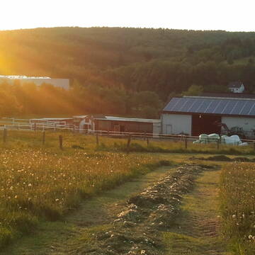
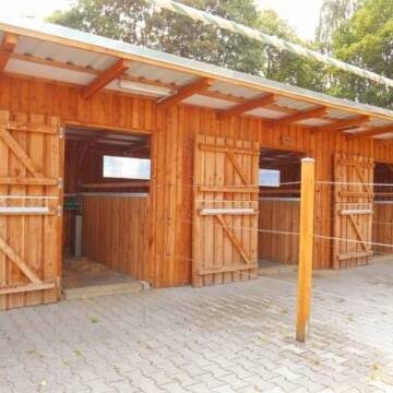
Offenstallplatz
Breitscheid
Aktivstallfreunde
@Aktivstallfreunde
Freizeitstall
Hunde willkommen
Reitplatz (z.B. Dressur, Springen, Reining)
Bewegungsstall
Offenstall
Halbpension
Vollpension
6 weitere...
P


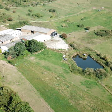
Box mit Vollpension und Weidegang
Elsoff
Familie Mücke
@Familie.Muecke
Freizeitstall
Pferdeausbildung
Vermieten
Krankenbox
Longierzirkel/Roundpen
Fohlenaufzucht möglich
Hufrehe geeignet
20 weitere...
P+
Deprecated: Creation of dynamic property Zend_View_Helper_Ads::$adLink is deprecated in /var/www/stall-frei/htdocs/staging.stall-frei.de/library/Psf/View/Helper/Ads.php on line 108

Frisches Stroh zu verkaufen!
Mechtersen
STALL-FREIde Marketing
@STALL-FREI-Marketing
Kaufe frisches Stroh für dein Pferd!
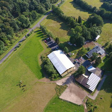
NEUWIESENHOF Pferdepension - Bio-Öko-Betrieb
Burbach
NEUWIESENHOF-Pferdepension
@NEUWIESENHOF-Pferdepension
Freizeitstall
Gangpferdereiten
Vermieten
Hunde willkommen
Krankenbox
Gnadenbrothof
Notfallboxen
24 weitere...
P+
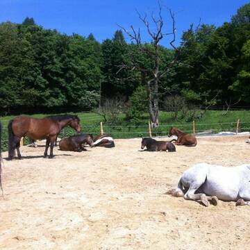
Gæðingaholt
Elsoff
Gaedingaholt
@Gaedingaholt
Freizeitstall
Gangpferdereiten
Vermieten
Hunde willkommen
Krankenbox
Allergikerstall
Hengsthaltung möglich
24 weitere...
P


Reitstall Jung
Wilnsdorf
Reitstall-Burkhard-Jung
@Reitstall-Burkhard-Jung
FN-Mitglied
Freizeitstall
Vermieten
Führanlage
Hunde willkommen
Hengsthaltung möglich
Hufrehe geeignet
23 weitere...
S

Das Beste für die Hufe
Mechtersen
STALL-FREIde Marketing
@STALL-FREI-Marketing
Hufschmiede und Hufpfleger in Ihrer Nähe
Schweizerhof 3/4* LAG - Barhufstall - PaddockTrail
Westerburg
Sarah Lech
@Schweizerhof_Westerburg
Freizeitstall
Pferdeausbildung
Vermieten
Krankenbox
Paddock
Notfallboxen
13 weitere...
P+
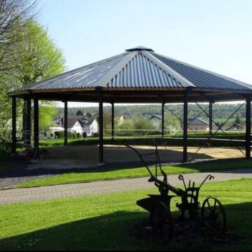
Bewegungsstall
Elsoff
B-Schuster
@B-Schuster
Freizeitstall
VFD-Mitglied
Vermieten
Krankenbox
Longierzirkel/Roundpen
Notfallboxen
16 weitere...
ganz aktuell
P


Reha/-Rentnerplätze Hufrehe - Offenstallanlage
Waldbrunn
Christopher-Heun
@Christopher-Heun
FN-Mitglied
Freizeitstall
Vermieten
Hunde willkommen
Krankenbox
Allergikerstall
Gnadenbrothof
32 weitere...
P+
Leider kein Vorschaubild
Leider kein Vorschaubild
Zucht- und Reitsportanlage Schultzenhof
Greifenstein Odersberg
Schultzenhof
@Schultzenhof
Freizeitstall
Geländestrecke
Vermieten
Hunde willkommen
Krankenbox
Fohlenaufzucht möglich
Hengsthaltung möglich
30 weitere...
B

Hof Gonsenborn - Offenstallplätze
Westerburg
Lisa Buhs
@LisaBuhs
Freizeitstall
VFD-Mitglied
Vermieten
Krankenbox
Longierzirkel/Roundpen
Gnadenbrothof
Hufrehe geeignet
20 weitere...
P
Deprecated: Creation of dynamic property Zend_View::$pageCount is deprecated in /var/www/stall-frei/htdocs/staging.stall-frei.de/library/vendor/shardj/zf1-future/library/Zend/View/Abstract.php on line 308
Deprecated: Creation of dynamic property Zend_View::$itemCountPerPage is deprecated in /var/www/stall-frei/htdocs/staging.stall-frei.de/library/vendor/shardj/zf1-future/library/Zend/View/Abstract.php on line 308
Deprecated: Creation of dynamic property Zend_View::$first is deprecated in /var/www/stall-frei/htdocs/staging.stall-frei.de/library/vendor/shardj/zf1-future/library/Zend/View/Abstract.php on line 308
Deprecated: Creation of dynamic property Zend_View::$current is deprecated in /var/www/stall-frei/htdocs/staging.stall-frei.de/library/vendor/shardj/zf1-future/library/Zend/View/Abstract.php on line 308
Deprecated: Creation of dynamic property Zend_View::$last is deprecated in /var/www/stall-frei/htdocs/staging.stall-frei.de/library/vendor/shardj/zf1-future/library/Zend/View/Abstract.php on line 308
Deprecated: Creation of dynamic property Zend_View::$next is deprecated in /var/www/stall-frei/htdocs/staging.stall-frei.de/library/vendor/shardj/zf1-future/library/Zend/View/Abstract.php on line 308
Deprecated: Creation of dynamic property Zend_View::$pagesInRange is deprecated in /var/www/stall-frei/htdocs/staging.stall-frei.de/library/vendor/shardj/zf1-future/library/Zend/View/Abstract.php on line 308
Deprecated: Creation of dynamic property Zend_View::$firstPageInRange is deprecated in /var/www/stall-frei/htdocs/staging.stall-frei.de/library/vendor/shardj/zf1-future/library/Zend/View/Abstract.php on line 308
Deprecated: Creation of dynamic property Zend_View::$lastPageInRange is deprecated in /var/www/stall-frei/htdocs/staging.stall-frei.de/library/vendor/shardj/zf1-future/library/Zend/View/Abstract.php on line 308
Deprecated: Creation of dynamic property Zend_View::$currentItemCount is deprecated in /var/www/stall-frei/htdocs/staging.stall-frei.de/library/vendor/shardj/zf1-future/library/Zend/View/Abstract.php on line 308
Deprecated: Creation of dynamic property Zend_View::$totalItemCount is deprecated in /var/www/stall-frei/htdocs/staging.stall-frei.de/library/vendor/shardj/zf1-future/library/Zend/View/Abstract.php on line 308
Deprecated: Creation of dynamic property Zend_View::$firstItemNumber is deprecated in /var/www/stall-frei/htdocs/staging.stall-frei.de/library/vendor/shardj/zf1-future/library/Zend/View/Abstract.php on line 308
Deprecated: Creation of dynamic property Zend_View::$lastItemNumber is deprecated in /var/www/stall-frei/htdocs/staging.stall-frei.de/library/vendor/shardj/zf1-future/library/Zend/View/Abstract.php on line 308
Deprecated: Creation of dynamic property Zend_View::$router is deprecated in /var/www/stall-frei/htdocs/staging.stall-frei.de/library/vendor/shardj/zf1-future/library/Zend/View/Abstract.php on line 308
Deprecated: Creation of dynamic property Zend_View::$urlParams is deprecated in /var/www/stall-frei/htdocs/staging.stall-frei.de/library/vendor/shardj/zf1-future/library/Zend/View/Abstract.php on line 308
Deprecated: Creation of dynamic property Zend_View::$showAds is deprecated in /var/www/stall-frei/htdocs/staging.stall-frei.de/library/vendor/shardj/zf1-future/library/Zend/View/Abstract.php on line 308
Deprecated: Creation of dynamic property Zend_View::$objectIds is deprecated in /var/www/stall-frei/htdocs/staging.stall-frei.de/library/vendor/shardj/zf1-future/library/Zend/View/Abstract.php on line 308
Deprecated: Creation of dynamic property Zend_View::$showNavbar is deprecated in /var/www/stall-frei/htdocs/staging.stall-frei.de/library/vendor/shardj/zf1-future/library/Zend/View/Abstract.php on line 308
Deprecated: Creation of dynamic property Zend_View::$showBreadcrumb is deprecated in /var/www/stall-frei/htdocs/staging.stall-frei.de/library/vendor/shardj/zf1-future/library/Zend/View/Abstract.php on line 308
Deprecated: Creation of dynamic property Zend_View::$showFooter is deprecated in /var/www/stall-frei/htdocs/staging.stall-frei.de/library/vendor/shardj/zf1-future/library/Zend/View/Abstract.php on line 308
Deprecated: Creation of dynamic property Zend_View::$showInternalAds is deprecated in /var/www/stall-frei/htdocs/staging.stall-frei.de/library/vendor/shardj/zf1-future/library/Zend/View/Abstract.php on line 308
Deprecated: Creation of dynamic property Zend_View::$blNoContent is deprecated in /var/www/stall-frei/htdocs/staging.stall-frei.de/library/vendor/shardj/zf1-future/library/Zend/View/Abstract.php on line 308
Deprecated: Creation of dynamic property Zend_View::$sMetaDesc is deprecated in /var/www/stall-frei/htdocs/staging.stall-frei.de/library/vendor/shardj/zf1-future/library/Zend/View/Abstract.php on line 308
Deprecated: Creation of dynamic property Zend_View::$useGmaps is deprecated in /var/www/stall-frei/htdocs/staging.stall-frei.de/library/vendor/shardj/zf1-future/library/Zend/View/Abstract.php on line 308
Deprecated: Creation of dynamic property Zend_View::$touches is deprecated in /var/www/stall-frei/htdocs/staging.stall-frei.de/library/vendor/shardj/zf1-future/library/Zend/View/Abstract.php on line 308
Deprecated: Creation of dynamic property Zend_View::$oProject is deprecated in /var/www/stall-frei/htdocs/staging.stall-frei.de/library/vendor/shardj/zf1-future/library/Zend/View/Abstract.php on line 308
Deprecated: Creation of dynamic property Zend_View::$pageHeadline is deprecated in /var/www/stall-frei/htdocs/staging.stall-frei.de/library/vendor/shardj/zf1-future/library/Zend/View/Abstract.php on line 308
Deprecated: Creation of dynamic property Zend_View::$disableLocationField is deprecated in /var/www/stall-frei/htdocs/staging.stall-frei.de/library/vendor/shardj/zf1-future/library/Zend/View/Abstract.php on line 308
Deprecated: Creation of dynamic property Zend_View::$isSearch is deprecated in /var/www/stall-frei/htdocs/staging.stall-frei.de/library/vendor/shardj/zf1-future/library/Zend/View/Abstract.php on line 308
Deprecated: Creation of dynamic property Zend_View::$pageTitle is deprecated in /var/www/stall-frei/htdocs/staging.stall-frei.de/library/vendor/shardj/zf1-future/library/Zend/View/Abstract.php on line 308
Deprecated: Creation of dynamic property Psf_Form_Element_Text::$class is deprecated in /var/www/stall-frei/htdocs/staging.stall-frei.de/library/vendor/shardj/zf1-future/library/Zend/Form/Element.php on line 874
Deprecated: Creation of dynamic property Psf_Form_Element_Text::$size is deprecated in /var/www/stall-frei/htdocs/staging.stall-frei.de/library/vendor/shardj/zf1-future/library/Zend/Form/Element.php on line 874
Deprecated: Creation of dynamic property Psf_Form_Element_Text::$placeholder is deprecated in /var/www/stall-frei/htdocs/staging.stall-frei.de/library/vendor/shardj/zf1-future/library/Zend/Form/Element.php on line 874
Deprecated: Creation of dynamic property Psf_Form_Element_Hidden::$class is deprecated in /var/www/stall-frei/htdocs/staging.stall-frei.de/library/vendor/shardj/zf1-future/library/Zend/Form/Element.php on line 874
Deprecated: Creation of dynamic property Psf_Form_Element_Hidden::$class is deprecated in /var/www/stall-frei/htdocs/staging.stall-frei.de/library/vendor/shardj/zf1-future/library/Zend/Form/Element.php on line 874
Deprecated: Creation of dynamic property Psf_Form_Element_Hidden::$class is deprecated in /var/www/stall-frei/htdocs/staging.stall-frei.de/library/vendor/shardj/zf1-future/library/Zend/Form/Element.php on line 874
Deprecated: Creation of dynamic property Psf_Form_Element_Hidden::$class is deprecated in /var/www/stall-frei/htdocs/staging.stall-frei.de/library/vendor/shardj/zf1-future/library/Zend/Form/Element.php on line 874
Deprecated: Creation of dynamic property Psf_Form_Element_Select::$class is deprecated in /var/www/stall-frei/htdocs/staging.stall-frei.de/library/vendor/shardj/zf1-future/library/Zend/Form/Element.php on line 874
Deprecated: Creation of dynamic property Psf_Form_Element_Select::$class is deprecated in /var/www/stall-frei/htdocs/staging.stall-frei.de/library/vendor/shardj/zf1-future/library/Zend/Form/Element.php on line 874
Deprecated: Creation of dynamic property Psf_Form_Element_Select::$class is deprecated in /var/www/stall-frei/htdocs/staging.stall-frei.de/library/vendor/shardj/zf1-future/library/Zend/Form/Element.php on line 874
Deprecated: Creation of dynamic property Psf_Form_Element_Select::$class is deprecated in /var/www/stall-frei/htdocs/staging.stall-frei.de/library/vendor/shardj/zf1-future/library/Zend/Form/Element.php on line 874
Deprecated: Creation of dynamic property Psf_Form_Element_Text::$class is deprecated in /var/www/stall-frei/htdocs/staging.stall-frei.de/library/vendor/shardj/zf1-future/library/Zend/Form/Element.php on line 874
Deprecated: Creation of dynamic property Psf_Form_Element_Checkbox::$label is deprecated in /var/www/stall-frei/htdocs/staging.stall-frei.de/library/vendor/shardj/zf1-future/library/Zend/Form/Element.php on line 874
Deprecated: Creation of dynamic property Zend_View::$sort is deprecated in /var/www/stall-frei/htdocs/staging.stall-frei.de/library/vendor/shardj/zf1-future/library/Zend/View/Abstract.php on line 308
Deprecated: Creation of dynamic property Zend_View::$searchLocation is deprecated in /var/www/stall-frei/htdocs/staging.stall-frei.de/library/vendor/shardj/zf1-future/library/Zend/View/Abstract.php on line 308
Deprecated: Creation of dynamic property Zend_View::$locationHint is deprecated in /var/www/stall-frei/htdocs/staging.stall-frei.de/library/vendor/shardj/zf1-future/library/Zend/View/Abstract.php on line 308
Psf_GeoCoder_Abstract::getLocation: Höllberg Get Location CachedOrLive
Psf_GeoCoder_Abstract::getCachedOrLive: Höllberg
Psf_GeoCoder_OpenCageData::makeApiRequest: response:
Array
(
[documentation] => https://opencagedata.com/api
[licenses] => Array
(
[0] => Array
(
[name] => see attribution guide
[url] => https://opencagedata.com/credits
)
)
[results] => Array
(
[0] => Array
(
[bounds] => Array
(
[northeast] => Array
(
[lat] => 50.6449652
[lng] => 8.1500429
)
[southwest] => Array
(
[lat] => 50.6448652
[lng] => 8.1499429
)
)
[components] => Array
(
[ISO_3166-1_alpha-2] => DE
[ISO_3166-1_alpha-3] => DEU
[ISO_3166-2] => Array
(
[0] => DE-HE
)
[_category] => natural/water
[_normalized_city] => Hohenroth
[_type] => peak
[continent] => Europe
[country] => Deutschland
[country_code] => de
[county] => Lahn-Dill-Kreis
[municipality] => Driedorf
[peak] => Höllberg
[political_union] => European Union
[postcode] => 35759
[state] => Hessen
[state_code] => HE
[village] => Hohenroth
)
[confidence] => 9
[formatted] => Höllberg, 35759 Hohenroth, Deutschland
[geometry] => Array
(
[lat] => 50.6449152
[lng] => 8.1499929
)
)
[1] => Array
(
[bounds] => Array
(
[northeast] => Array
(
[lat] => 49.019463
[lng] => 12.7429702
)
[southwest] => Array
(
[lat] => 48.979463
[lng] => 12.7029702
)
)
[components] => Array
(
[ISO_3166-1_alpha-2] => DE
[ISO_3166-1_alpha-3] => DEU
[ISO_3166-2] => Array
(
[0] => DE-BY
)
[_category] => place
[_normalized_city] => Haselbach
[_type] => hamlet
[continent] => Europe
[country] => Deutschland
[country_code] => de
[county] => Landkreis Straubing-Bogen
[hamlet] => Höllberg
[municipality] => Mitterfels (VGem)
[political_union] => European Union
[postcode] => 94353
[state] => Bayern
[state_code] => BY
[village] => Haselbach
)
[confidence] => 7
[formatted] => Höllberg, 94353 Haselbach, Deutschland
[geometry] => Array
(
[lat] => 48.999463
[lng] => 12.7229702
)
)
[2] => Array
(
[bounds] => Array
(
[northeast] => Array
(
[lat] => 50.0113218
[lng] => 11.5318841
)
[southwest] => Array
(
[lat] => 50.0112218
[lng] => 11.5317841
)
)
[components] => Array
(
[ISO_3166-1_alpha-2] => DE
[ISO_3166-1_alpha-3] => DEU
[ISO_3166-2] => Array
(
[0] => DE-BY
)
[_category] => natural/water
[_normalized_city] => Neudrossenfeld
[_type] => peak
[continent] => Europe
[country] => Deutschland
[country_code] => de
[county] => Landkreis Kulmbach
[peak] => Höllberg
[political_union] => European Union
[postcode] => 95512
[state] => Bayern
[state_code] => BY
[village] => Neudrossenfeld
)
[confidence] => 9
[formatted] => Höllberg, 95512 Neudrossenfeld, Deutschland
[geometry] => Array
(
[lat] => 50.0112718
[lng] => 11.5318341
)
)
[3] => Array
(
[bounds] => Array
(
[northeast] => Array
(
[lat] => 50.8077697
[lng] => 13.6495025
)
[southwest] => Array
(
[lat] => 50.8076697
[lng] => 13.6494025
)
)
[components] => Array
(
[ISO_3166-1_alpha-2] => DE
[ISO_3166-1_alpha-3] => DEU
[ISO_3166-2] => Array
(
[0] => DE-SN
)
[_category] => natural/water
[_normalized_city] => Dippoldiswalde
[_type] => peak
[continent] => Europe
[country] => Deutschland
[country_code] => de
[county] => Sächsische Schweiz-Osterzgebirge
[peak] => Höllberg
[political_union] => European Union
[state] => Sachsen
[state_code] => SN
[town] => Dippoldiswalde
)
[confidence] => 9
[formatted] => Höllberg, Dippoldiswalde, Sachsen, Deutschland
[geometry] => Array
(
[lat] => 50.8077197
[lng] => 13.6494525
)
)
[4] => Array
(
[bounds] => Array
(
[northeast] => Array
(
[lat] => 49.8026227
[lng] => 7.9447225
)
[southwest] => Array
(
[lat] => 49.8025227
[lng] => 7.9446225
)
)
[components] => Array
(
[ISO_3166-1_alpha-2] => DE
[ISO_3166-1_alpha-3] => DEU
[ISO_3166-2] => Array
(
[0] => DE-RP
)
[_category] => natural/water
[_normalized_city] => Wöllstein
[_type] => peak
[continent] => Europe
[country] => Deutschland
[country_code] => de
[county] => Landkreis Alzey-Worms
[municipality] => Wöllstein
[peak] => Höllberg
[political_union] => European Union
[postcode] => 55597
[state] => Rheinland-Pfalz
[state_code] => RP
[village] => Wöllstein
)
[confidence] => 9
[formatted] => Höllberg, 55597 Wöllstein, Deutschland
[geometry] => Array
(
[lat] => 49.8025727
[lng] => 7.9446725
)
)
[5] => Array
(
[bounds] => Array
(
[northeast] => Array
(
[lat] => 51.6330547
[lng] => 12.7742484
)
[southwest] => Array
(
[lat] => 51.6329547
[lng] => 12.7741484
)
)
[components] => Array
(
[ISO_3166-1_alpha-2] => DE
[ISO_3166-1_alpha-3] => DEU
[ISO_3166-2] => Array
(
[0] => DE-SN
)
[_category] => natural/water
[_normalized_city] => Trossin
[_type] => peak
[continent] => Europe
[country] => Deutschland
[country_code] => de
[county] => Nordsachsen
[municipality] => Dommitzsch
[peak] => Höllberg
[political_union] => European Union
[state] => Sachsen
[state_code] => SN
[village] => Trossin
)
[confidence] => 9
[formatted] => Höllberg, Trossin, Sachsen, Deutschland
[geometry] => Array
(
[lat] => 51.6330047
[lng] => 12.7741984
)
)
[6] => Array
(
[bounds] => Array
(
[northeast] => Array
(
[lat] => 50.39232
[lng] => 9.1219181
)
[southwest] => Array
(
[lat] => 50.39222
[lng] => 9.1218181
)
)
[components] => Array
(
[ISO_3166-1_alpha-2] => DE
[ISO_3166-1_alpha-3] => DEU
[ISO_3166-2] => Array
(
[0] => DE-HE
)
[_category] => natural/water
[_normalized_city] => Hirzenhain
[_type] => peak
[continent] => Europe
[country] => Deutschland
[country_code] => de
[county] => Wetteraukreis
[municipality] => Hirzenhain
[peak] => Höllberg
[political_union] => European Union
[postcode] => 63697
[state] => Hessen
[state_code] => HE
[village] => Hirzenhain
)
[confidence] => 9
[formatted] => Höllberg, 63697 Hirzenhain, Deutschland
[geometry] => Array
(
[lat] => 50.39227
[lng] => 9.1218681
)
)
[7] => Array
(
[bounds] => Array
(
[northeast] => Array
(
[lat] => 50.08601
[lng] => 12.00269
)
[southwest] => Array
(
[lat] => 50.08591
[lng] => 12.00259
)
)
[components] => Array
(
[ISO_3166-1_alpha-2] => DE
[ISO_3166-1_alpha-3] => DEU
[ISO_3166-2] => Array
(
[0] => DE-BY
)
[_category] => natural/water
[_normalized_city] => Röslau
[_type] => peak
[continent] => Europe
[country] => Deutschland
[country_code] => de
[county] => Landkreis Wunsiedel im Fichtelgebirge
[peak] => Höllberg
[political_union] => European Union
[postcode] => 95195
[state] => Bayern
[state_code] => BY
[village] => Röslau
)
[confidence] => 9
[formatted] => Höllberg, 95195 Röslau, Deutschland
[geometry] => Array
(
[lat] => 50.08596
[lng] => 12.00264
)
)
[8] => Array
(
[bounds] => Array
(
[northeast] => Array
(
[lat] => 51.4141827
[lng] => 10.4774241
)
[southwest] => Array
(
[lat] => 51.4140827
[lng] => 10.4773241
)
)
[components] => Array
(
[ISO_3166-1_alpha-2] => DE
[ISO_3166-1_alpha-3] => DEU
[ISO_3166-2] => Array
(
[0] => DE-TH
)
[_category] => natural/water
[_normalized_city] => Breitenworbis
[_type] => peak
[continent] => Europe
[country] => Deutschland
[country_code] => de
[county] => Landkreis Eichsfeld
[municipality] => Eichsfeld-Wipperaue
[peak] => Höllberg
[political_union] => European Union
[state] => Thüringen
[state_code] => TH
[village] => Breitenworbis
)
[confidence] => 9
[formatted] => Höllberg, Breitenworbis, Thüringen, Deutschland
[geometry] => Array
(
[lat] => 51.4141327
[lng] => 10.4773741
)
)
[9] => Array
(
[bounds] => Array
(
[northeast] => Array
(
[lat] => 51.6926279
[lng] => 11.3875615
)
[southwest] => Array
(
[lat] => 51.6925279
[lng] => 11.3874615
)
)
[components] => Array
(
[ISO_3166-1_alpha-2] => DE
[ISO_3166-1_alpha-3] => DEU
[ISO_3166-2] => Array
(
[0] => DE-ST
)
[_category] => natural/water
[_normalized_city] => Arnstein
[_type] => peak
[continent] => Europe
[country] => Deutschland
[country_code] => de
[county] => Mansfeld-Südharz
[peak] => Höllberg
[political_union] => European Union
[state] => Sachsen-Anhalt
[state_code] => ST
[town] => Arnstein
)
[confidence] => 9
[formatted] => Höllberg, Arnstein, Sachsen-Anhalt, Deutschland
[geometry] => Array
(
[lat] => 51.6925779
[lng] => 11.3875115
)
)
)
[status] => Array
(
[code] => 200
[message] => OK
)
[stay_informed] => Array
(
[blog] => https://blog.opencagedata.com
[mastodon] => https://en.osm.town/@opencage
)
[thanks] => For using an OpenCage API
[timestamp] => Array
(
[created_http] => Fri, 16 Jan 2026 20:48:36 GMT
[created_unix] => 1768596516
)
[total_results] => 10
)
Psf_GeoCoder_Abstract::convertLocationResult
{"documentation":"https:\/\/opencagedata.com\/api","licenses":[{"name":"see attribution guide","url":"https:\/\/opencagedata.com\/credits"}],"results":[{"bounds":{"northeast":{"lat":50.6449652,"lng":8.1500429},"southwest":{"lat":50.6448652,"lng":8.1499429}},"components":{"ISO_3166-1_alpha-2":"DE","ISO_3166-1_alpha-3":"DEU","ISO_3166-2":["DE-HE"],"_category":"natural\/water","_normalized_city":"Hohenroth","_type":"peak","continent":"Europe","country":"Deutschland","country_code":"de","county":"Lahn-Dill-Kreis","municipality":"Driedorf","peak":"H\u00f6llberg","political_union":"European Union","postcode":"35759","state":"Hessen","state_code":"HE","village":"Hohenroth"},"confidence":9,"formatted":"H\u00f6llberg, 35759 Hohenroth, Deutschland","geometry":{"lat":50.6449152,"lng":8.1499929}},{"bounds":{"northeast":{"lat":49.019463,"lng":12.7429702},"southwest":{"lat":48.979463,"lng":12.7029702}},"components":{"ISO_3166-1_alpha-2":"DE","ISO_3166-1_alpha-3":"DEU","ISO_3166-2":["DE-BY"],"_category":"place","_normalized_city":"Haselbach","_type":"hamlet","continent":"Europe","country":"Deutschland","country_code":"de","county":"Landkreis Straubing-Bogen","hamlet":"H\u00f6llberg","municipality":"Mitterfels (VGem)","political_union":"European Union","postcode":"94353","state":"Bayern","state_code":"BY","village":"Haselbach"},"confidence":7,"formatted":"H\u00f6llberg, 94353 Haselbach, Deutschland","geometry":{"lat":48.999463,"lng":12.7229702}},{"bounds":{"northeast":{"lat":50.0113218,"lng":11.5318841},"southwest":{"lat":50.0112218,"lng":11.5317841}},"components":{"ISO_3166-1_alpha-2":"DE","ISO_3166-1_alpha-3":"DEU","ISO_3166-2":["DE-BY"],"_category":"natural\/water","_normalized_city":"Neudrossenfeld","_type":"peak","continent":"Europe","country":"Deutschland","country_code":"de","county":"Landkreis Kulmbach","peak":"H\u00f6llberg","political_union":"European Union","postcode":"95512","state":"Bayern","state_code":"BY","village":"Neudrossenfeld"},"confidence":9,"formatted":"H\u00f6llberg, 95512 Neudrossenfeld, Deutschland","geometry":{"lat":50.0112718,"lng":11.5318341}},{"bounds":{"northeast":{"lat":50.8077697,"lng":13.6495025},"southwest":{"lat":50.8076697,"lng":13.6494025}},"components":{"ISO_3166-1_alpha-2":"DE","ISO_3166-1_alpha-3":"DEU","ISO_3166-2":["DE-SN"],"_category":"natural\/water","_normalized_city":"Dippoldiswalde","_type":"peak","continent":"Europe","country":"Deutschland","country_code":"de","county":"S\u00e4chsische Schweiz-Osterzgebirge","peak":"H\u00f6llberg","political_union":"European Union","state":"Sachsen","state_code":"SN","town":"Dippoldiswalde"},"confidence":9,"formatted":"H\u00f6llberg, Dippoldiswalde, Sachsen, Deutschland","geometry":{"lat":50.8077197,"lng":13.6494525}},{"bounds":{"northeast":{"lat":49.8026227,"lng":7.9447225},"southwest":{"lat":49.8025227,"lng":7.9446225}},"components":{"ISO_3166-1_alpha-2":"DE","ISO_3166-1_alpha-3":"DEU","ISO_3166-2":["DE-RP"],"_category":"natural\/water","_normalized_city":"W\u00f6llstein","_type":"peak","continent":"Europe","country":"Deutschland","country_code":"de","county":"Landkreis Alzey-Worms","municipality":"W\u00f6llstein","peak":"H\u00f6llberg","political_union":"European Union","postcode":"55597","state":"Rheinland-Pfalz","state_code":"RP","village":"W\u00f6llstein"},"confidence":9,"formatted":"H\u00f6llberg, 55597 W\u00f6llstein, Deutschland","geometry":{"lat":49.8025727,"lng":7.9446725}},{"bounds":{"northeast":{"lat":51.6330547,"lng":12.7742484},"southwest":{"lat":51.6329547,"lng":12.7741484}},"components":{"ISO_3166-1_alpha-2":"DE","ISO_3166-1_alpha-3":"DEU","ISO_3166-2":["DE-SN"],"_category":"natural\/water","_normalized_city":"Trossin","_type":"peak","continent":"Europe","country":"Deutschland","country_code":"de","county":"Nordsachsen","municipality":"Dommitzsch","peak":"H\u00f6llberg","political_union":"European Union","state":"Sachsen","state_code":"SN","village":"Trossin"},"confidence":9,"formatted":"H\u00f6llberg, Trossin, Sachsen, Deutschland","geometry":{"lat":51.6330047,"lng":12.7741984}},{"bounds":{"northeast":{"lat":50.39232,"lng":9.1219181},"southwest":{"lat":50.39222,"lng":9.1218181}},"components":{"ISO_3166-1_alpha-2":"DE","ISO_3166-1_alpha-3":"DEU","ISO_3166-2":["DE-HE"],"_category":"natural\/water","_normalized_city":"Hirzenhain","_type":"peak","continent":"Europe","country":"Deutschland","country_code":"de","county":"Wetteraukreis","municipality":"Hirzenhain","peak":"H\u00f6llberg","political_union":"European Union","postcode":"63697","state":"Hessen","state_code":"HE","village":"Hirzenhain"},"confidence":9,"formatted":"H\u00f6llberg, 63697 Hirzenhain, Deutschland","geometry":{"lat":50.39227,"lng":9.1218681}},{"bounds":{"northeast":{"lat":50.08601,"lng":12.00269},"southwest":{"lat":50.08591,"lng":12.00259}},"components":{"ISO_3166-1_alpha-2":"DE","ISO_3166-1_alpha-3":"DEU","ISO_3166-2":["DE-BY"],"_category":"natural\/water","_normalized_city":"R\u00f6slau","_type":"peak","continent":"Europe","country":"Deutschland","country_code":"de","county":"Landkreis Wunsiedel im Fichtelgebirge","peak":"H\u00f6llberg","political_union":"European Union","postcode":"95195","state":"Bayern","state_code":"BY","village":"R\u00f6slau"},"confidence":9,"formatted":"H\u00f6llberg, 95195 R\u00f6slau, Deutschland","geometry":{"lat":50.08596,"lng":12.00264}},{"bounds":{"northeast":{"lat":51.4141827,"lng":10.4774241},"southwest":{"lat":51.4140827,"lng":10.4773241}},"components":{"ISO_3166-1_alpha-2":"DE","ISO_3166-1_alpha-3":"DEU","ISO_3166-2":["DE-TH"],"_category":"natural\/water","_normalized_city":"Breitenworbis","_type":"peak","continent":"Europe","country":"Deutschland","country_code":"de","county":"Landkreis Eichsfeld","municipality":"Eichsfeld-Wipperaue","peak":"H\u00f6llberg","political_union":"European Union","state":"Th\u00fcringen","state_code":"TH","village":"Breitenworbis"},"confidence":9,"formatted":"H\u00f6llberg, Breitenworbis, Th\u00fcringen, Deutschland","geometry":{"lat":51.4141327,"lng":10.4773741}},{"bounds":{"northeast":{"lat":51.6926279,"lng":11.3875615},"southwest":{"lat":51.6925279,"lng":11.3874615}},"components":{"ISO_3166-1_alpha-2":"DE","ISO_3166-1_alpha-3":"DEU","ISO_3166-2":["DE-ST"],"_category":"natural\/water","_normalized_city":"Arnstein","_type":"peak","continent":"Europe","country":"Deutschland","country_code":"de","county":"Mansfeld-S\u00fcdharz","peak":"H\u00f6llberg","political_union":"European Union","state":"Sachsen-Anhalt","state_code":"ST","town":"Arnstein"},"confidence":9,"formatted":"H\u00f6llberg, Arnstein, Sachsen-Anhalt, Deutschland","geometry":{"lat":51.6925779,"lng":11.3875115}}],"status":{"code":200,"message":"OK"},"stay_informed":{"blog":"https:\/\/blog.opencagedata.com","mastodon":"https:\/\/en.osm.town\/@opencage"},"thanks":"For using an OpenCage API","timestamp":{"created_http":"Fri, 16 Jan 2026 20:48:36 GMT","created_unix":1768596516},"total_results":10}Array
(
[0] => stdClass Object
(
[bounds] => stdClass Object
(
[northeast] => stdClass Object
(
[lat] => 50.6449652
[lng] => 8.1500429
)
[southwest] => stdClass Object
(
[lat] => 50.6448652
[lng] => 8.1499429
)
)
[components] => stdClass Object
(
[ISO_3166-1_alpha-2] => DE
[ISO_3166-1_alpha-3] => DEU
[ISO_3166-2] => Array
(
[0] => DE-HE
)
[_category] => natural/water
[_normalized_city] => Hohenroth
[_type] => peak
[continent] => Europe
[country] => Deutschland
[country_code] => de
[county] => Lahn-Dill-Kreis
[municipality] => Driedorf
[peak] => Höllberg
[political_union] => European Union
[postcode] => 35759
[state] => Hessen
[state_code] => HE
[village] => Hohenroth
)
[confidence] => 9
[formatted] => Höllberg, 35759 Hohenroth, Deutschland
[geometry] => stdClass Object
(
[lat] => 50.6449152
[lng] => 8.1499929
)
)
[1] => stdClass Object
(
[bounds] => stdClass Object
(
[northeast] => stdClass Object
(
[lat] => 49.019463
[lng] => 12.7429702
)
[southwest] => stdClass Object
(
[lat] => 48.979463
[lng] => 12.7029702
)
)
[components] => stdClass Object
(
[ISO_3166-1_alpha-2] => DE
[ISO_3166-1_alpha-3] => DEU
[ISO_3166-2] => Array
(
[0] => DE-BY
)
[_category] => place
[_normalized_city] => Haselbach
[_type] => hamlet
[continent] => Europe
[country] => Deutschland
[country_code] => de
[county] => Landkreis Straubing-Bogen
[hamlet] => Höllberg
[municipality] => Mitterfels (VGem)
[political_union] => European Union
[postcode] => 94353
[state] => Bayern
[state_code] => BY
[village] => Haselbach
)
[confidence] => 7
[formatted] => Höllberg, 94353 Haselbach, Deutschland
[geometry] => stdClass Object
(
[lat] => 48.999463
[lng] => 12.7229702
)
)
[2] => stdClass Object
(
[bounds] => stdClass Object
(
[northeast] => stdClass Object
(
[lat] => 50.0113218
[lng] => 11.5318841
)
[southwest] => stdClass Object
(
[lat] => 50.0112218
[lng] => 11.5317841
)
)
[components] => stdClass Object
(
[ISO_3166-1_alpha-2] => DE
[ISO_3166-1_alpha-3] => DEU
[ISO_3166-2] => Array
(
[0] => DE-BY
)
[_category] => natural/water
[_normalized_city] => Neudrossenfeld
[_type] => peak
[continent] => Europe
[country] => Deutschland
[country_code] => de
[county] => Landkreis Kulmbach
[peak] => Höllberg
[political_union] => European Union
[postcode] => 95512
[state] => Bayern
[state_code] => BY
[village] => Neudrossenfeld
)
[confidence] => 9
[formatted] => Höllberg, 95512 Neudrossenfeld, Deutschland
[geometry] => stdClass Object
(
[lat] => 50.0112718
[lng] => 11.5318341
)
)
[3] => stdClass Object
(
[bounds] => stdClass Object
(
[northeast] => stdClass Object
(
[lat] => 50.8077697
[lng] => 13.6495025
)
[southwest] => stdClass Object
(
[lat] => 50.8076697
[lng] => 13.6494025
)
)
[components] => stdClass Object
(
[ISO_3166-1_alpha-2] => DE
[ISO_3166-1_alpha-3] => DEU
[ISO_3166-2] => Array
(
[0] => DE-SN
)
[_category] => natural/water
[_normalized_city] => Dippoldiswalde
[_type] => peak
[continent] => Europe
[country] => Deutschland
[country_code] => de
[county] => Sächsische Schweiz-Osterzgebirge
[peak] => Höllberg
[political_union] => European Union
[state] => Sachsen
[state_code] => SN
[town] => Dippoldiswalde
)
[confidence] => 9
[formatted] => Höllberg, Dippoldiswalde, Sachsen, Deutschland
[geometry] => stdClass Object
(
[lat] => 50.8077197
[lng] => 13.6494525
)
)
[4] => stdClass Object
(
[bounds] => stdClass Object
(
[northeast] => stdClass Object
(
[lat] => 49.8026227
[lng] => 7.9447225
)
[southwest] => stdClass Object
(
[lat] => 49.8025227
[lng] => 7.9446225
)
)
[components] => stdClass Object
(
[ISO_3166-1_alpha-2] => DE
[ISO_3166-1_alpha-3] => DEU
[ISO_3166-2] => Array
(
[0] => DE-RP
)
[_category] => natural/water
[_normalized_city] => Wöllstein
[_type] => peak
[continent] => Europe
[country] => Deutschland
[country_code] => de
[county] => Landkreis Alzey-Worms
[municipality] => Wöllstein
[peak] => Höllberg
[political_union] => European Union
[postcode] => 55597
[state] => Rheinland-Pfalz
[state_code] => RP
[village] => Wöllstein
)
[confidence] => 9
[formatted] => Höllberg, 55597 Wöllstein, Deutschland
[geometry] => stdClass Object
(
[lat] => 49.8025727
[lng] => 7.9446725
)
)
[5] => stdClass Object
(
[bounds] => stdClass Object
(
[northeast] => stdClass Object
(
[lat] => 51.6330547
[lng] => 12.7742484
)
[southwest] => stdClass Object
(
[lat] => 51.6329547
[lng] => 12.7741484
)
)
[components] => stdClass Object
(
[ISO_3166-1_alpha-2] => DE
[ISO_3166-1_alpha-3] => DEU
[ISO_3166-2] => Array
(
[0] => DE-SN
)
[_category] => natural/water
[_normalized_city] => Trossin
[_type] => peak
[continent] => Europe
[country] => Deutschland
[country_code] => de
[county] => Nordsachsen
[municipality] => Dommitzsch
[peak] => Höllberg
[political_union] => European Union
[state] => Sachsen
[state_code] => SN
[village] => Trossin
)
[confidence] => 9
[formatted] => Höllberg, Trossin, Sachsen, Deutschland
[geometry] => stdClass Object
(
[lat] => 51.6330047
[lng] => 12.7741984
)
)
[6] => stdClass Object
(
[bounds] => stdClass Object
(
[northeast] => stdClass Object
(
[lat] => 50.39232
[lng] => 9.1219181
)
[southwest] => stdClass Object
(
[lat] => 50.39222
[lng] => 9.1218181
)
)
[components] => stdClass Object
(
[ISO_3166-1_alpha-2] => DE
[ISO_3166-1_alpha-3] => DEU
[ISO_3166-2] => Array
(
[0] => DE-HE
)
[_category] => natural/water
[_normalized_city] => Hirzenhain
[_type] => peak
[continent] => Europe
[country] => Deutschland
[country_code] => de
[county] => Wetteraukreis
[municipality] => Hirzenhain
[peak] => Höllberg
[political_union] => European Union
[postcode] => 63697
[state] => Hessen
[state_code] => HE
[village] => Hirzenhain
)
[confidence] => 9
[formatted] => Höllberg, 63697 Hirzenhain, Deutschland
[geometry] => stdClass Object
(
[lat] => 50.39227
[lng] => 9.1218681
)
)
[7] => stdClass Object
(
[bounds] => stdClass Object
(
[northeast] => stdClass Object
(
[lat] => 50.08601
[lng] => 12.00269
)
[southwest] => stdClass Object
(
[lat] => 50.08591
[lng] => 12.00259
)
)
[components] => stdClass Object
(
[ISO_3166-1_alpha-2] => DE
[ISO_3166-1_alpha-3] => DEU
[ISO_3166-2] => Array
(
[0] => DE-BY
)
[_category] => natural/water
[_normalized_city] => Röslau
[_type] => peak
[continent] => Europe
[country] => Deutschland
[country_code] => de
[county] => Landkreis Wunsiedel im Fichtelgebirge
[peak] => Höllberg
[political_union] => European Union
[postcode] => 95195
[state] => Bayern
[state_code] => BY
[village] => Röslau
)
[confidence] => 9
[formatted] => Höllberg, 95195 Röslau, Deutschland
[geometry] => stdClass Object
(
[lat] => 50.08596
[lng] => 12.00264
)
)
[8] => stdClass Object
(
[bounds] => stdClass Object
(
[northeast] => stdClass Object
(
[lat] => 51.4141827
[lng] => 10.4774241
)
[southwest] => stdClass Object
(
[lat] => 51.4140827
[lng] => 10.4773241
)
)
[components] => stdClass Object
(
[ISO_3166-1_alpha-2] => DE
[ISO_3166-1_alpha-3] => DEU
[ISO_3166-2] => Array
(
[0] => DE-TH
)
[_category] => natural/water
[_normalized_city] => Breitenworbis
[_type] => peak
[continent] => Europe
[country] => Deutschland
[country_code] => de
[county] => Landkreis Eichsfeld
[municipality] => Eichsfeld-Wipperaue
[peak] => Höllberg
[political_union] => European Union
[state] => Thüringen
[state_code] => TH
[village] => Breitenworbis
)
[confidence] => 9
[formatted] => Höllberg, Breitenworbis, Thüringen, Deutschland
[geometry] => stdClass Object
(
[lat] => 51.4141327
[lng] => 10.4773741
)
)
[9] => stdClass Object
(
[bounds] => stdClass Object
(
[northeast] => stdClass Object
(
[lat] => 51.6926279
[lng] => 11.3875615
)
[southwest] => stdClass Object
(
[lat] => 51.6925279
[lng] => 11.3874615
)
)
[components] => stdClass Object
(
[ISO_3166-1_alpha-2] => DE
[ISO_3166-1_alpha-3] => DEU
[ISO_3166-2] => Array
(
[0] => DE-ST
)
[_category] => natural/water
[_normalized_city] => Arnstein
[_type] => peak
[continent] => Europe
[country] => Deutschland
[country_code] => de
[county] => Mansfeld-Südharz
[peak] => Höllberg
[political_union] => European Union
[state] => Sachsen-Anhalt
[state_code] => ST
[town] => Arnstein
)
[confidence] => 9
[formatted] => Höllberg, Arnstein, Sachsen-Anhalt, Deutschland
[geometry] => stdClass Object
(
[lat] => 51.6925779
[lng] => 11.3875115
)
)
)
Psf_GeoCoder_OpenCageData::getKeyMap: 0
stdClass Object
(
    [bounds] => stdClass Object
        (
            [northeast] => stdClass Object
                (
                    [lat] => 50.6449652
                    [lng] => 8.1500429
                )

            [southwest] => stdClass Object
                (
                    [lat] => 50.6448652
                    [lng] => 8.1499429
                )

        )

    [components] => stdClass Object
        (
            [ISO_3166-1_alpha-2] => DE
            [ISO_3166-1_alpha-3] => DEU
            [ISO_3166-2] => Array
                (
                    [0] => DE-HE
                )

            [_category] => natural/water
            [_normalized_city] => Hohenroth
            [_type] => peak
            [continent] => Europe
            [country] => Deutschland
            [country_code] => de
            [county] => Lahn-Dill-Kreis
            [municipality] => Driedorf
            [peak] => Höllberg
            [political_union] => European Union
            [postcode] => 35759
            [state] => Hessen
            [state_code] => HE
            [village] => Hohenroth
        )

    [confidence] => 9
    [formatted] => Höllberg, 35759 Hohenroth, Deutschland
    [geometry] => stdClass Object
        (
            [lat] => 50.6449152
            [lng] => 8.1499929
        )

)
Psf_GeoCoder_OpenCageData::getCounty: Lahn-Dill-Kreis
Psf_GeoCoder_OpenCageData::addMissingData REFETCH!
Array
(
    [address] => Höllberg, 35759 Hohenroth, Deutschland
    [type] => peak
    [street] =>
    [city] => Hohenroth
    [county] => Lahn-Dill-Kreis
    [state] => Hessen
    [zip] => 35759
    [country] => Deutschland
    [suburb] =>
    [countrycode] => de
    [latitude] => 50.6449152
    [longitude] => 8.1499929
    [accuracy] => 1
    [confidence] => 9
    [bounds] => stdClass Object
        (
            [northeast] => stdClass Object
                (
                    [lat] => 50.6449652
                    [lng] => 8.1500429
                )

            [southwest] => stdClass Object
                (
                    [lat] => 50.6448652
                    [lng] => 8.1499429
                )

        )

)
reformat!
Array
(
    [address] => Höllberg, 35759 Hohenroth, Deutschland
    [type] => peak
    [street] =>
    [city] => Hohenroth
    [county] => Lahn-Dill-Kreis
    [state] => Hessen
    [zip] => 35759
    [country] => Deutschland
    [suburb] =>
    [countrycode] => de
    [latitude] => 50.6449152
    [longitude] => 8.1499929
    [accuracy] => 1
    [confidence] => 9
    [bounds] => stdClass Object
        (
            [northeast] => stdClass Object
                (
                    [lat] => 50.6449652
                    [lng] => 8.1500429
                )

            [southwest] => stdClass Object
                (
                    [lat] => 50.6448652
                    [lng] => 8.1499429
                )

        )

    [place] => 35759 Hohenroth, Hessen
    [hash] => e8c1cea0f75d9ab287f3999fcdf7a9f6
)
Psf_GeoCoder_OpenCageData::getKeyMap: 1
stdClass Object
(
    [bounds] => stdClass Object
        (
            [northeast] => stdClass Object
                (
                    [lat] => 49.019463
                    [lng] => 12.7429702
                )

            [southwest] => stdClass Object
                (
                    [lat] => 48.979463
                    [lng] => 12.7029702
                )

        )

    [components] => stdClass Object
        (
            [ISO_3166-1_alpha-2] => DE
            [ISO_3166-1_alpha-3] => DEU
            [ISO_3166-2] => Array
                (
                    [0] => DE-BY
                )

            [_category] => place
            [_normalized_city] => Haselbach
            [_type] => hamlet
            [continent] => Europe
            [country] => Deutschland
            [country_code] => de
            [county] => Landkreis Straubing-Bogen
            [hamlet] => Höllberg
            [municipality] => Mitterfels (VGem)
            [political_union] => European Union
            [postcode] => 94353
            [state] => Bayern
            [state_code] => BY
            [village] => Haselbach
        )

    [confidence] => 7
    [formatted] => Höllberg, 94353 Haselbach, Deutschland
    [geometry] => stdClass Object
        (
            [lat] => 48.999463
            [lng] => 12.7229702
        )

)
Psf_GeoCoder_OpenCageData::getCounty: Straubing-Bogen
Psf_GeoCoder_OpenCageData::addMissingData REFETCH!
Array
(
    [address] => Höllberg, 94353 Haselbach, Deutschland
    [type] => hamlet
    [street] => Höllberg
    [city] => Haselbach
    [county] => Straubing-Bogen
    [state] => Bayern
    [zip] => 94353
    [country] => Deutschland
    [suburb] =>
    [countrycode] => de
    [latitude] => 48.999463
    [longitude] => 12.7229702
    [accuracy] => 1
    [confidence] => 7
    [bounds] => stdClass Object
        (
            [northeast] => stdClass Object
                (
                    [lat] => 49.019463
                    [lng] => 12.7429702
                )

            [southwest] => stdClass Object
                (
                    [lat] => 48.979463
                    [lng] => 12.7029702
                )

        )

)
reformat!
Array
(
    [address] => Höllberg, 94353 Haselbach, Deutschland
    [type] => hamlet
    [street] => Höllberg
    [city] => Haselbach
    [county] => Straubing-Bogen
    [state] => Bayern
    [zip] => 94353
    [country] => Deutschland
    [suburb] =>
    [countrycode] => de
    [latitude] => 48.999463
    [longitude] => 12.7229702
    [accuracy] => 1
    [confidence] => 7
    [bounds] => stdClass Object
        (
            [northeast] => stdClass Object
                (
                    [lat] => 49.019463
                    [lng] => 12.7429702
                )

            [southwest] => stdClass Object
                (
                    [lat] => 48.979463
                    [lng] => 12.7029702
                )

        )

    [place] => Höllberg, 94353 Haselbach, Bayern
    [hash] => e77f4ff608183f5a3bf922371929259d
)
Psf_GeoCoder_OpenCageData::getKeyMap: 2
stdClass Object
(
    [bounds] => stdClass Object
        (
            [northeast] => stdClass Object
                (
                    [lat] => 50.0113218
                    [lng] => 11.5318841
                )

            [southwest] => stdClass Object
                (
                    [lat] => 50.0112218
                    [lng] => 11.5317841
                )

        )

    [components] => stdClass Object
        (
            [ISO_3166-1_alpha-2] => DE
            [ISO_3166-1_alpha-3] => DEU
            [ISO_3166-2] => Array
                (
                    [0] => DE-BY
                )

            [_category] => natural/water
            [_normalized_city] => Neudrossenfeld
            [_type] => peak
            [continent] => Europe
            [country] => Deutschland
            [country_code] => de
            [county] => Landkreis Kulmbach
            [peak] => Höllberg
            [political_union] => European Union
            [postcode] => 95512
            [state] => Bayern
            [state_code] => BY
            [village] => Neudrossenfeld
        )

    [confidence] => 9
    [formatted] => Höllberg, 95512 Neudrossenfeld, Deutschland
    [geometry] => stdClass Object
        (
            [lat] => 50.0112718
            [lng] => 11.5318341
        )

)
Psf_GeoCoder_OpenCageData::getCounty: Kulmbach
Psf_GeoCoder_OpenCageData::addMissingData REFETCH!
Array
(
    [address] => Höllberg, 95512 Neudrossenfeld, Deutschland
    [type] => peak
    [street] =>
    [city] => Neudrossenfeld
    [county] => Kulmbach
    [state] => Bayern
    [zip] => 95512
    [country] => Deutschland
    [suburb] =>
    [countrycode] => de
    [latitude] => 50.0112718
    [longitude] => 11.5318341
    [accuracy] => 1
    [confidence] => 9
    [bounds] => stdClass Object
        (
            [northeast] => stdClass Object
                (
                    [lat] => 50.0113218
                    [lng] => 11.5318841
                )

            [southwest] => stdClass Object
                (
                    [lat] => 50.0112218
                    [lng] => 11.5317841
                )

        )

)
reformat!
Array
(
    [address] => Höllberg, 95512 Neudrossenfeld, Deutschland
    [type] => peak
    [street] =>
    [city] => Neudrossenfeld
    [county] => Kulmbach
    [state] => Bayern
    [zip] => 95512
    [country] => Deutschland
    [suburb] =>
    [countrycode] => de
    [latitude] => 50.0112718
    [longitude] => 11.5318341
    [accuracy] => 1
    [confidence] => 9
    [bounds] => stdClass Object
        (
            [northeast] => stdClass Object
                (
                    [lat] => 50.0113218
                    [lng] => 11.5318841
                )

            [southwest] => stdClass Object
                (
                    [lat] => 50.0112218
                    [lng] => 11.5317841
                )

        )

    [place] => 95512 Neudrossenfeld, Bayern
    [hash] => 41653097cc3f450032fa00e9e6049f39
)
Psf_GeoCoder_OpenCageData::getKeyMap: 3
stdClass Object
(
    [bounds] => stdClass Object
        (
            [northeast] => stdClass Object
                (
                    [lat] => 50.8077697
                    [lng] => 13.6495025
                )

            [southwest] => stdClass Object
                (
                    [lat] => 50.8076697
                    [lng] => 13.6494025
                )

        )

    [components] => stdClass Object
        (
            [ISO_3166-1_alpha-2] => DE
            [ISO_3166-1_alpha-3] => DEU
            [ISO_3166-2] => Array
                (
                    [0] => DE-SN
                )

            [_category] => natural/water
            [_normalized_city] => Dippoldiswalde
            [_type] => peak
            [continent] => Europe
            [country] => Deutschland
            [country_code] => de
            [county] => Sächsische Schweiz-Osterzgebirge
            [peak] => Höllberg
            [political_union] => European Union
            [state] => Sachsen
            [state_code] => SN
            [town] => Dippoldiswalde
        )

    [confidence] => 9
    [formatted] => Höllberg, Dippoldiswalde, Sachsen, Deutschland
    [geometry] => stdClass Object
        (
            [lat] => 50.8077197
            [lng] => 13.6494525
        )

)
Psf_GeoCoder_OpenCageData::getCounty: Sächsische Schweiz-Osterzgebirge
Psf_GeoCoder_OpenCageData::addMissingData REFETCH!
Array
(
    [address] => Höllberg, Dippoldiswalde, Sachsen, Deutschland
    [type] => peak
    [street] =>
    [city] => Dippoldiswalde
    [county] => Sächsische Schweiz-Osterzgebirge
    [state] => Sachsen
    [zip] =>
    [country] => Deutschland
    [suburb] =>
    [countrycode] => de
    [latitude] => 50.8077197
    [longitude] => 13.6494525
    [accuracy] => 1
    [confidence] => 9
    [bounds] => stdClass Object
        (
            [northeast] => stdClass Object
                (
                    [lat] => 50.8077697
                    [lng] => 13.6495025
                )

            [southwest] => stdClass Object
                (
                    [lat] => 50.8076697
                    [lng] => 13.6494025
                )

        )

)
reformat!
Array
(
    [address] => Höllberg, Dippoldiswalde, Sachsen, Deutschland
    [type] => peak
    [street] =>
    [city] => Dippoldiswalde
    [county] => Sächsische Schweiz-Osterzgebirge
    [state] => Sachsen
    [zip] =>
    [country] => Deutschland
    [suburb] =>
    [countrycode] => de
    [latitude] => 50.8077197
    [longitude] => 13.6494525
    [accuracy] => 1
    [confidence] => 9
    [bounds] => stdClass Object
        (
            [northeast] => stdClass Object
                (
                    [lat] => 50.8077697
                    [lng] => 13.6495025
                )

            [southwest] => stdClass Object
                (
                    [lat] => 50.8076697
                    [lng] => 13.6494025
                )

        )

    [place] => Dippoldiswalde, Sachsen
    [hash] => 781b4f48899a0bf632f26d070015c311
)
Psf_GeoCoder_OpenCageData::getKeyMap: 4
stdClass Object
(
    [bounds] => stdClass Object
        (
            [northeast] => stdClass Object
                (
                    [lat] => 49.8026227
                    [lng] => 7.9447225
                )

            [southwest] => stdClass Object
                (
                    [lat] => 49.8025227
                    [lng] => 7.9446225
                )

        )

    [components] => stdClass Object
        (
            [ISO_3166-1_alpha-2] => DE
            [ISO_3166-1_alpha-3] => DEU
            [ISO_3166-2] => Array
                (
                    [0] => DE-RP
                )

            [_category] => natural/water
            [_normalized_city] => Wöllstein
            [_type] => peak
            [continent] => Europe
            [country] => Deutschland
            [country_code] => de
            [county] => Landkreis Alzey-Worms
            [municipality] => Wöllstein
            [peak] => Höllberg
            [political_union] => European Union
            [postcode] => 55597
            [state] => Rheinland-Pfalz
            [state_code] => RP
            [village] => Wöllstein
        )

    [confidence] => 9
    [formatted] => Höllberg, 55597 Wöllstein, Deutschland
    [geometry] => stdClass Object
        (
            [lat] => 49.8025727
            [lng] => 7.9446725
        )

)
Psf_GeoCoder_OpenCageData::getCounty: Alzey-Worms
Psf_GeoCoder_OpenCageData::addMissingData REFETCH!
Array
(
    [address] => Höllberg, 55597 Wöllstein, Deutschland
    [type] => peak
    [street] =>
    [city] => Wöllstein
    [county] => Alzey-Worms
    [state] => Rheinland-Pfalz
    [zip] => 55597
    [country] => Deutschland
    [suburb] =>
    [countrycode] => de
    [latitude] => 49.8025727
    [longitude] => 7.9446725
    [accuracy] => 1
    [confidence] => 9
    [bounds] => stdClass Object
        (
            [northeast] => stdClass Object
                (
                    [lat] => 49.8026227
                    [lng] => 7.9447225
                )

            [southwest] => stdClass Object
                (
                    [lat] => 49.8025227
                    [lng] => 7.9446225
                )

        )

)
reformat!
Array
(
    [address] => Höllberg, 55597 Wöllstein, Deutschland
    [type] => peak
    [street] =>
    [city] => Wöllstein
    [county] => Alzey-Worms
    [state] => Rheinland-Pfalz
    [zip] => 55597
    [country] => Deutschland
    [suburb] =>
    [countrycode] => de
    [latitude] => 49.8025727
    [longitude] => 7.9446725
    [accuracy] => 1
    [confidence] => 9
    [bounds] => stdClass Object
        (
            [northeast] => stdClass Object
                (
                    [lat] => 49.8026227
                    [lng] => 7.9447225
                )

            [southwest] => stdClass Object
                (
                    [lat] => 49.8025227
                    [lng] => 7.9446225
                )

        )

    [place] => 55597 Wöllstein, Rheinland-Pfalz
    [hash] => 79c4e7b6d49d74cdc61efb8bd646f35b
)
Psf_GeoCoder_OpenCageData::getKeyMap: 5
stdClass Object
(
    [bounds] => stdClass Object
        (
            [northeast] => stdClass Object
                (
                    [lat] => 51.6330547
                    [lng] => 12.7742484
                )

            [southwest] => stdClass Object
                (
                    [lat] => 51.6329547
                    [lng] => 12.7741484
                )

        )

    [components] => stdClass Object
        (
            [ISO_3166-1_alpha-2] => DE
            [ISO_3166-1_alpha-3] => DEU
            [ISO_3166-2] => Array
                (
                    [0] => DE-SN
                )

            [_category] => natural/water
            [_normalized_city] => Trossin
            [_type] => peak
            [continent] => Europe
            [country] => Deutschland
            [country_code] => de
            [county] => Nordsachsen
            [municipality] => Dommitzsch
            [peak] => Höllberg
            [political_union] => European Union
            [state] => Sachsen
            [state_code] => SN
            [village] => Trossin
        )

    [confidence] => 9
    [formatted] => Höllberg, Trossin, Sachsen, Deutschland
    [geometry] => stdClass Object
        (
            [lat] => 51.6330047
            [lng] => 12.7741984
        )

)
Psf_GeoCoder_OpenCageData::getCounty: Nordsachsen
Psf_GeoCoder_OpenCageData::addMissingData REFETCH!
Array
(
    [address] => Höllberg, Trossin, Sachsen, Deutschland
    [type] => peak
    [street] =>
    [city] => Trossin
    [county] => Nordsachsen
    [state] => Sachsen
    [zip] =>
    [country] => Deutschland
    [suburb] =>
    [countrycode] => de
    [latitude] => 51.6330047
    [longitude] => 12.7741984
    [accuracy] => 1
    [confidence] => 9
    [bounds] => stdClass Object
        (
            [northeast] => stdClass Object
                (
                    [lat] => 51.6330547
                    [lng] => 12.7742484
                )

            [southwest] => stdClass Object
                (
                    [lat] => 51.6329547
                    [lng] => 12.7741484
                )

        )

)
reformat!
Array
(
    [address] => Höllberg, Trossin, Sachsen, Deutschland
    [type] => peak
    [street] =>
    [city] => Trossin
    [county] => Nordsachsen
    [state] => Sachsen
    [zip] =>
    [country] => Deutschland
    [suburb] =>
    [countrycode] => de
    [latitude] => 51.6330047
    [longitude] => 12.7741984
    [accuracy] => 1
    [confidence] => 9
    [bounds] => stdClass Object
        (
            [northeast] => stdClass Object
                (
                    [lat] => 51.6330547
                    [lng] => 12.7742484
                )

            [southwest] => stdClass Object
                (
                    [lat] => 51.6329547
                    [lng] => 12.7741484
                )

        )

    [place] => Trossin, Sachsen
    [hash] => bd137555c8afdd251076d01e4354a5a8
)
Psf_GeoCoder_OpenCageData::getKeyMap: 6
stdClass Object
(
    [bounds] => stdClass Object
        (
            [northeast] => stdClass Object
                (
                    [lat] => 50.39232
                    [lng] => 9.1219181
                )

            [southwest] => stdClass Object
                (
                    [lat] => 50.39222
                    [lng] => 9.1218181
                )

        )

    [components] => stdClass Object
        (
            [ISO_3166-1_alpha-2] => DE
            [ISO_3166-1_alpha-3] => DEU
            [ISO_3166-2] => Array
                (
                    [0] => DE-HE
                )

            [_category] => natural/water
            [_normalized_city] => Hirzenhain
            [_type] => peak
            [continent] => Europe
            [country] => Deutschland
            [country_code] => de
            [county] => Wetteraukreis
            [municipality] => Hirzenhain
            [peak] => Höllberg
            [political_union] => European Union
            [postcode] => 63697
            [state] => Hessen
            [state_code] => HE
            [village] => Hirzenhain
        )

    [confidence] => 9
    [formatted] => Höllberg, 63697 Hirzenhain, Deutschland
    [geometry] => stdClass Object
        (
            [lat] => 50.39227
            [lng] => 9.1218681
        )

)
Psf_GeoCoder_OpenCageData::getCounty: Wetteraukreis
Psf_GeoCoder_OpenCageData::addMissingData REFETCH!
Array
(
    [address] => Höllberg, 63697 Hirzenhain, Deutschland
    [type] => peak
    [street] =>
    [city] => Hirzenhain
    [county] => Wetteraukreis
    [state] => Hessen
    [zip] => 63697
    [country] => Deutschland
    [suburb] =>
    [countrycode] => de
    [latitude] => 50.39227
    [longitude] => 9.1218681
    [accuracy] => 1
    [confidence] => 9
    [bounds] => stdClass Object
        (
            [northeast] => stdClass Object
                (
                    [lat] => 50.39232
                    [lng] => 9.1219181
                )

            [southwest] => stdClass Object
                (
                    [lat] => 50.39222
                    [lng] => 9.1218181
                )

        )

)
reformat!
Array
(
    [address] => Höllberg, 63697 Hirzenhain, Deutschland
    [type] => peak
    [street] =>
    [city] => Hirzenhain
    [county] => Wetteraukreis
    [state] => Hessen
    [zip] => 63697
    [country] => Deutschland
    [suburb] =>
    [countrycode] => de
    [latitude] => 50.39227
    [longitude] => 9.1218681
    [accuracy] => 1
    [confidence] => 9
    [bounds] => stdClass Object
        (
            [northeast] => stdClass Object
                (
                    [lat] => 50.39232
                    [lng] => 9.1219181
                )

            [southwest] => stdClass Object
                (
                    [lat] => 50.39222
                    [lng] => 9.1218181
                )

        )

    [place] => 63697 Hirzenhain, Hessen
    [hash] => 730eb67f1fffc5b1300823a3a8dd918c
)
Psf_GeoCoder_OpenCageData::getKeyMap: 7
stdClass Object
(
    [bounds] => stdClass Object
        (
            [northeast] => stdClass Object
                (
                    [lat] => 50.08601
                    [lng] => 12.00269
                )

            [southwest] => stdClass Object
                (
                    [lat] => 50.08591
                    [lng] => 12.00259
                )

        )

    [components] => stdClass Object
        (
            [ISO_3166-1_alpha-2] => DE
            [ISO_3166-1_alpha-3] => DEU
            [ISO_3166-2] => Array
                (
                    [0] => DE-BY
                )

            [_category] => natural/water
            [_normalized_city] => Röslau
            [_type] => peak
            [continent] => Europe
            [country] => Deutschland
            [country_code] => de
            [county] => Landkreis Wunsiedel im Fichtelgebirge
            [peak] => Höllberg
            [political_union] => European Union
            [postcode] => 95195
            [state] => Bayern
            [state_code] => BY
            [village] => Röslau
        )

    [confidence] => 9
    [formatted] => Höllberg, 95195 Röslau, Deutschland
    [geometry] => stdClass Object
        (
            [lat] => 50.08596
            [lng] => 12.00264
        )

)
Psf_GeoCoder_OpenCageData::getCounty: Wunsiedel im Fichtelgebirge
Psf_GeoCoder_OpenCageData::addMissingData REFETCH!
Array
(
    [address] => Höllberg, 95195 Röslau, Deutschland
    [type] => peak
    [street] =>
    [city] => Röslau
    [county] => Wunsiedel im Fichtelgebirge
    [state] => Bayern
    [zip] => 95195
    [country] => Deutschland
    [suburb] =>
    [countrycode] => de
    [latitude] => 50.08596
    [longitude] => 12.00264
    [accuracy] => 1
    [confidence] => 9
    [bounds] => stdClass Object
        (
            [northeast] => stdClass Object
                (
                    [lat] => 50.08601
                    [lng] => 12.00269
                )

            [southwest] => stdClass Object
                (
                    [lat] => 50.08591
                    [lng] => 12.00259
                )

        )

)
reformat!
Array
(
    [address] => Höllberg, 95195 Röslau, Deutschland
    [type] => peak
    [street] =>
    [city] => Röslau
    [county] => Wunsiedel im Fichtelgebirge
    [state] => Bayern
    [zip] => 95195
    [country] => Deutschland
    [suburb] =>
    [countrycode] => de
    [latitude] => 50.08596
    [longitude] => 12.00264
    [accuracy] => 1
    [confidence] => 9
    [bounds] => stdClass Object
        (
            [northeast] => stdClass Object
                (
                    [lat] => 50.08601
                    [lng] => 12.00269
                )

            [southwest] => stdClass Object
                (
                    [lat] => 50.08591
                    [lng] => 12.00259
                )

        )

    [place] => 95195 Röslau, Bayern
    [hash] => f427ebcd017f8ad4adc877f19e96ca19
)
Psf_GeoCoder_OpenCageData::getKeyMap: 8
stdClass Object
(
    [bounds] => stdClass Object
        (
            [northeast] => stdClass Object
                (
                    [lat] => 51.4141827
                    [lng] => 10.4774241
                )

            [southwest] => stdClass Object
                (
                    [lat] => 51.4140827
                    [lng] => 10.4773241
                )

        )

    [components] => stdClass Object
        (
            [ISO_3166-1_alpha-2] => DE
            [ISO_3166-1_alpha-3] => DEU
            [ISO_3166-2] => Array
                (
                    [0] => DE-TH
                )

            [_category] => natural/water
            [_normalized_city] => Breitenworbis
            [_type] => peak
            [continent] => Europe
            [country] => Deutschland
            [country_code] => de
            [county] => Landkreis Eichsfeld
            [municipality] => Eichsfeld-Wipperaue
            [peak] => Höllberg
            [political_union] => European Union
            [state] => Thüringen
            [state_code] => TH
            [village] => Breitenworbis
        )

    [confidence] => 9
    [formatted] => Höllberg, Breitenworbis, Thüringen, Deutschland
    [geometry] => stdClass Object
        (
            [lat] => 51.4141327
            [lng] => 10.4773741
        )

)
Psf_GeoCoder_OpenCageData::getCounty: Eichsfeld
Psf_GeoCoder_OpenCageData::addMissingData REFETCH!
Array
(
    [address] => Höllberg, Breitenworbis, Thüringen, Deutschland
    [type] => peak
    [street] =>
    [city] => Breitenworbis
    [county] => Eichsfeld
    [state] => Thüringen
    [zip] =>
    [country] => Deutschland
    [suburb] =>
    [countrycode] => de
    [latitude] => 51.4141327
    [longitude] => 10.4773741
    [accuracy] => 1
    [confidence] => 9
    [bounds] => stdClass Object
        (
            [northeast] => stdClass Object
                (
                    [lat] => 51.4141827
                    [lng] => 10.4774241
                )

            [southwest] => stdClass Object
                (
                    [lat] => 51.4140827
                    [lng] => 10.4773241
                )

        )

)
reformat!
Array
(
    [address] => Höllberg, Breitenworbis, Thüringen, Deutschland
    [type] => peak
    [street] =>
    [city] => Breitenworbis
    [county] => Eichsfeld
    [state] => Thüringen
    [zip] =>
    [country] => Deutschland
    [suburb] =>
    [countrycode] => de
    [latitude] => 51.4141327
    [longitude] => 10.4773741
    [accuracy] => 1
    [confidence] => 9
    [bounds] => stdClass Object
        (
            [northeast] => stdClass Object
                (
                    [lat] => 51.4141827
                    [lng] => 10.4774241
                )

            [southwest] => stdClass Object
                (
                    [lat] => 51.4140827
                    [lng] => 10.4773241
                )

        )

    [place] => Breitenworbis, Thüringen
    [hash] => 4c39c2d946d6901c64073705ae885318
)
Psf_GeoCoder_OpenCageData::getKeyMap: 9
stdClass Object
(
    [bounds] => stdClass Object
        (
            [northeast] => stdClass Object
                (
                    [lat] => 51.6926279
                    [lng] => 11.3875615
                )

            [southwest] => stdClass Object
                (
                    [lat] => 51.6925279
                    [lng] => 11.3874615
                )

        )

    [components] => stdClass Object
        (
            [ISO_3166-1_alpha-2] => DE
            [ISO_3166-1_alpha-3] => DEU
            [ISO_3166-2] => Array
                (
                    [0] => DE-ST
                )

            [_category] => natural/water
            [_normalized_city] => Arnstein
            [_type] => peak
            [continent] => Europe
            [country] => Deutschland
            [country_code] => de
            [county] => Mansfeld-Südharz
            [peak] => Höllberg
            [political_union] => European Union
            [state] => Sachsen-Anhalt
            [state_code] => ST
            [town] => Arnstein
        )

    [confidence] => 9
    [formatted] => Höllberg, Arnstein, Sachsen-Anhalt, Deutschland
    [geometry] => stdClass Object
        (
            [lat] => 51.6925779
            [lng] => 11.3875115
        )

)
Psf_GeoCoder_OpenCageData::getCounty: Mansfeld-Südharz
Psf_GeoCoder_OpenCageData::addMissingData REFETCH!
Array
(
    [address] => Höllberg, Arnstein, Sachsen-Anhalt, Deutschland
    [type] => peak
    [street] =>
    [city] => Arnstein
    [county] => Mansfeld-Südharz
    [state] => Sachsen-Anhalt
    [zip] =>
    [country] => Deutschland
    [suburb] =>
    [countrycode] => de
    [latitude] => 51.6925779
    [longitude] => 11.3875115
    [accuracy] => 1
    [confidence] => 9
    [bounds] => stdClass Object
        (
            [northeast] => stdClass Object
                (
                    [lat] => 51.6926279
                    [lng] => 11.3875615
                )

            [southwest] => stdClass Object
                (
                    [lat] => 51.6925279
                    [lng] => 11.3874615
                )

        )

)
reformat!
Array
(
    [address] => Höllberg, Arnstein, Sachsen-Anhalt, Deutschland
    [type] => peak
    [street] =>
    [city] => Arnstein
    [county] => Mansfeld-Südharz
    [state] => Sachsen-Anhalt
    [zip] =>
    [country] => Deutschland
    [suburb] =>
    [countrycode] => de
    [latitude] => 51.6925779
    [longitude] => 11.3875115
    [accuracy] => 1
    [confidence] => 9
    [bounds] => stdClass Object
        (
            [northeast] => stdClass Object
                (
                    [lat] => 51.6926279
                    [lng] => 11.3875615
                )

            [southwest] => stdClass Object
                (
                    [lat] => 51.6925279
                    [lng] => 11.3874615
                )

        )

    [place] => Arnstein, Sachsen-Anhalt
    [hash] => 88ccd08420d0d25bfee0c66680efe218
)
Deprecated: Creation of dynamic property Zend_View::$locationHintStyle is deprecated in /var/www/stall-frei/htdocs/staging.stall-frei.de/library/vendor/shardj/zf1-future/library/Zend/View/Abstract.php on line 308
Deprecated: Creation of dynamic property Zend_View::$adGeoLocation is deprecated in /var/www/stall-frei/htdocs/staging.stall-frei.de/library/vendor/shardj/zf1-future/library/Zend/View/Abstract.php on line 308
Deprecated: Creation of dynamic property Zend_View::$recordCount is deprecated in /var/www/stall-frei/htdocs/staging.stall-frei.de/library/vendor/shardj/zf1-future/library/Zend/View/Abstract.php on line 308
Deprecated: explode(): Passing null to parameter #2 ($string) of type string is deprecated in /var/www/stall-frei/htdocs/staging.stall-frei.de/application/models/SearchAgent.php on line 100
Deprecated: explode(): Passing null to parameter #2 ($string) of type string is deprecated in /var/www/stall-frei/htdocs/staging.stall-frei.de/application/models/SearchAgent.php on line 100
Deprecated: explode(): Passing null to parameter #2 ($string) of type string is deprecated in /var/www/stall-frei/htdocs/staging.stall-frei.de/application/models/SearchAgent.php on line 100
Deprecated: explode(): Passing null to parameter #2 ($string) of type string is deprecated in /var/www/stall-frei/htdocs/staging.stall-frei.de/application/models/SearchAgent.php on line 100
Deprecated: explode(): Passing null to parameter #2 ($string) of type string is deprecated in /var/www/stall-frei/htdocs/staging.stall-frei.de/application/models/SearchAgent.php on line 100
Deprecated: explode(): Passing null to parameter #2 ($string) of type string is deprecated in /var/www/stall-frei/htdocs/staging.stall-frei.de/application/models/SearchAgent.php on line 100
Deprecated: explode(): Passing null to parameter #2 ($string) of type string is deprecated in /var/www/stall-frei/htdocs/staging.stall-frei.de/application/models/SearchAgent.php on line 100
Deprecated: explode(): Passing null to parameter #2 ($string) of type string is deprecated in /var/www/stall-frei/htdocs/staging.stall-frei.de/application/models/SearchAgent.php on line 100
Deprecated: explode(): Passing null to parameter #2 ($string) of type string is deprecated in /var/www/stall-frei/htdocs/staging.stall-frei.de/application/models/SearchAgent.php on line 100
Deprecated: trim(): Passing null to parameter #1 ($string) of type string is deprecated in /var/www/stall-frei/htdocs/staging.stall-frei.de/application/models/Account/Search.php on line 82
Warning: Cannot modify header information - headers already sent by (output started at /var/www/stall-frei/htdocs/staging.stall-frei.de/library/vendor/shardj/zf1-future/library/Zend/View/Abstract.php:308) in /var/www/stall-frei/htdocs/staging.stall-frei.de/application/models/Account/Search.php on line 71
Deprecated: Creation of dynamic property Zend_View::$paginationParams is deprecated in /var/www/stall-frei/htdocs/staging.stall-frei.de/library/vendor/shardj/zf1-future/library/Zend/View/Abstract.php on line 308
Deprecated: Creation of dynamic property Zend_View::$objectPaginator is deprecated in /var/www/stall-frei/htdocs/staging.stall-frei.de/library/vendor/shardj/zf1-future/library/Zend/View/Abstract.php on line 308
Deprecated: Creation of dynamic property Zend_View::$featuredObjects is deprecated in /var/www/stall-frei/htdocs/staging.stall-frei.de/library/vendor/shardj/zf1-future/library/Zend/View/Abstract.php on line 308
Deprecated: Creation of dynamic property Zend_View::$hints is deprecated in /var/www/stall-frei/htdocs/staging.stall-frei.de/library/vendor/shardj/zf1-future/library/Zend/View/Abstract.php on line 308
Deprecated: Creation of dynamic property Zend_View::$attributeHints is deprecated in /var/www/stall-frei/htdocs/staging.stall-frei.de/library/vendor/shardj/zf1-future/library/Zend/View/Abstract.php on line 308
Deprecated: Creation of dynamic property Zend_View::$oSearchForm is deprecated in /var/www/stall-frei/htdocs/staging.stall-frei.de/library/vendor/shardj/zf1-future/library/Zend/View/Abstract.php on line 308