Deprecated: Creation of dynamic property Zend_View::$sMode is deprecated in /var/www/stall-frei/htdocs/staging.stall-frei.de/library/vendor/shardj/zf1-future/library/Zend/View/Abstract.php on line 308
Stallplatz oder Offenstall in Schramberg
Gesucht wird in "Schramberg, Baden-Württemberg, Deutschland"
6.346 Einträge
Deprecated: Creation of dynamic property Zend_View::$listObjects is deprecated in /var/www/stall-frei/htdocs/staging.stall-frei.de/library/vendor/shardj/zf1-future/library/Zend/View/Abstract.php on line 308
Gesponsort


Deprecated: Creation of dynamic property Zend_View::$listMode is deprecated in /var/www/stall-frei/htdocs/staging.stall-frei.de/library/vendor/shardj/zf1-future/library/Zend/View/Abstract.php on line 308
Deprecated: Creation of dynamic property Zend_View::$renderedObjects is deprecated in /var/www/stall-frei/htdocs/staging.stall-frei.de/library/vendor/shardj/zf1-future/library/Zend/View/Abstract.php on line 308
Deprecated: Creation of dynamic property Zend_View::$index is deprecated in /var/www/stall-frei/htdocs/staging.stall-frei.de/library/vendor/shardj/zf1-future/library/Zend/View/Abstract.php on line 308
Deprecated: Creation of dynamic property Zend_View::$displayMode is deprecated in /var/www/stall-frei/htdocs/staging.stall-frei.de/library/vendor/shardj/zf1-future/library/Zend/View/Abstract.php on line 308
Deprecated: Creation of dynamic property Zend_View::$remarketingIds is deprecated in /var/www/stall-frei/htdocs/staging.stall-frei.de/library/vendor/shardj/zf1-future/library/Zend/View/Abstract.php on line 308
Deprecated: Creation of dynamic property Zend_View::$listItem is deprecated in /var/www/stall-frei/htdocs/staging.stall-frei.de/library/vendor/shardj/zf1-future/library/Zend/View/Abstract.php on line 308
Deprecated: Creation of dynamic property Zend_View::$object is deprecated in /var/www/stall-frei/htdocs/staging.stall-frei.de/library/vendor/shardj/zf1-future/library/Zend/View/Abstract.php on line 308
Deprecated: Creation of dynamic property Zend_View::$attributes is deprecated in /var/www/stall-frei/htdocs/staging.stall-frei.de/library/vendor/shardj/zf1-future/library/Zend/View/Abstract.php on line 308

Offenstall Pferdestall,Stellplatz
Tennenbronn
Martin Kopp
@M.Kopp
Hunde willkommen
Paddock
Offenstall
Selbstversorgung
5 weitere...
P
Deprecated: Creation of dynamic property Zend_View_Helper_Ads::$adLink is deprecated in /var/www/stall-frei/htdocs/staging.stall-frei.de/library/Psf/View/Helper/Ads.php on line 108

Persönlichkeitsentwicklung mit Pferden
Bad Salzuflen
Katja Dors
@Pferdezeiten
Begleite andere auf ihrem Entwicklungsweg und entdecke die transformative Kraft der pferdegestützten Persönlichkeitsentwicklung !
neu
R

Offenstallplatz für 1Kleinpferd und Seniorenplatz
Eschbronn
augustenhof
@augustenhof
Freizeitstall
VFD-Mitglied
Krankenbox
Paddock
Gnadenbrothof
Notfallboxen
Offenstall
9 weitere...
P
Leider kein Vorschaubild
Leider kein Vorschaubild
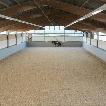
schöne gepflegte Reitanlage mit netten Menschen
Schramberg-Sulgen
Reitanlage Beschenhof
@Beschenhof
FN-Mitglied
Freizeitstall
Vermieten
Hunde willkommen
Longierzirkel/Roundpen
Außenbox mit Paddock
16 weitere...
B
Pferde - Oase - Schwarzwald
Aichhalden
Junginger-Michaela1
@Junginger-Michaela1
Freizeitstall
Pferdeausbildung
Verpachten
Paddock
Parkplatz für Pferdeanhänger
Außenbox mit Paddock
Innenbox
10 weitere...
P

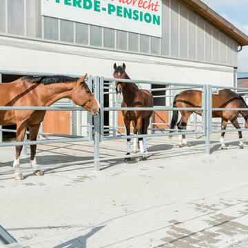
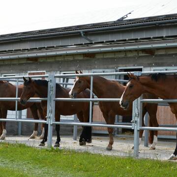
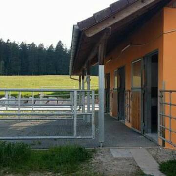
Pferdepension Fam. H. Albrecht
Zimmern ob Rottweil
Hermann Albrecht
@Hermann-Albrecht
Reitlehrer und -unterricht
Vermieten
Paddock
Parkplatz für Pferdeanhänger
Außenbox mit Paddock
Innenbox
12 weitere...
P+

Heu aus neuer Ernte
Mechtersen
STALL-FREIde Marketing
@STALL-FREI-Marketing
Heulage und Pferdeheu aus der neuen Ernte findest du in unserem Futtermarkt

Offenstall,Pferde
St.Georgen im Schwarzwald
Regina
@Regina23
Reitplatz (z.B. Dressur, Springen, Reining)
Weide
Offenstall
Vollpension
P
Leider kein Vorschaubild
Leider kein Vorschaubild
Offenstallplatz frei
Dunningen
Familie-Mauch1
@Familie-Mauch1
Freizeitstall
Vermieten
Hunde willkommen
Krankenbox
Hufrehe geeignet
Notfallboxen
12 weitere...
B
Leider kein Vorschaubild
Leider kein Vorschaubild
Biete Platz in artgerechtem Offenstall
Winzeln
Ann-katrin
@Lucky2006
FN-Mitglied
Freizeitstall
Vermieten
Hunde willkommen
Krankenbox
Gnadenbrothof
Hengsthaltung möglich
14 weitere...
aktuell
P


Offenstallparadies Isingen
Rosenfeld
Herr-Gall
@Herr-Gall
Reithalle
Reitplatz (z.B. Dressur, Springen, Reining)
Fohlenaufzucht möglich
Bewegungsstall
Laufstall
HIT-Aktivstall
HIT-Offenstall
7 weitere...
S
Leider kein Vorschaubild
Leider kein Vorschaubild
Offenstall
Eschbronn
stallplatz-frei1
@stallplatz-frei1
Freizeitstall
Reitlehrer und -unterricht
Vermieten
Paddock
Reitplatz (z.B. Dressur, Springen, Reining)
Gnadenbrothof
9 weitere...
B
Deprecated: Creation of dynamic property Zend_View::$pageCount is deprecated in /var/www/stall-frei/htdocs/staging.stall-frei.de/library/vendor/shardj/zf1-future/library/Zend/View/Abstract.php on line 308
Deprecated: Creation of dynamic property Zend_View::$itemCountPerPage is deprecated in /var/www/stall-frei/htdocs/staging.stall-frei.de/library/vendor/shardj/zf1-future/library/Zend/View/Abstract.php on line 308
Deprecated: Creation of dynamic property Zend_View::$first is deprecated in /var/www/stall-frei/htdocs/staging.stall-frei.de/library/vendor/shardj/zf1-future/library/Zend/View/Abstract.php on line 308
Deprecated: Creation of dynamic property Zend_View::$current is deprecated in /var/www/stall-frei/htdocs/staging.stall-frei.de/library/vendor/shardj/zf1-future/library/Zend/View/Abstract.php on line 308
Deprecated: Creation of dynamic property Zend_View::$last is deprecated in /var/www/stall-frei/htdocs/staging.stall-frei.de/library/vendor/shardj/zf1-future/library/Zend/View/Abstract.php on line 308
Deprecated: Creation of dynamic property Zend_View::$next is deprecated in /var/www/stall-frei/htdocs/staging.stall-frei.de/library/vendor/shardj/zf1-future/library/Zend/View/Abstract.php on line 308
Deprecated: Creation of dynamic property Zend_View::$pagesInRange is deprecated in /var/www/stall-frei/htdocs/staging.stall-frei.de/library/vendor/shardj/zf1-future/library/Zend/View/Abstract.php on line 308
Deprecated: Creation of dynamic property Zend_View::$firstPageInRange is deprecated in /var/www/stall-frei/htdocs/staging.stall-frei.de/library/vendor/shardj/zf1-future/library/Zend/View/Abstract.php on line 308
Deprecated: Creation of dynamic property Zend_View::$lastPageInRange is deprecated in /var/www/stall-frei/htdocs/staging.stall-frei.de/library/vendor/shardj/zf1-future/library/Zend/View/Abstract.php on line 308
Deprecated: Creation of dynamic property Zend_View::$currentItemCount is deprecated in /var/www/stall-frei/htdocs/staging.stall-frei.de/library/vendor/shardj/zf1-future/library/Zend/View/Abstract.php on line 308
Deprecated: Creation of dynamic property Zend_View::$totalItemCount is deprecated in /var/www/stall-frei/htdocs/staging.stall-frei.de/library/vendor/shardj/zf1-future/library/Zend/View/Abstract.php on line 308
Deprecated: Creation of dynamic property Zend_View::$firstItemNumber is deprecated in /var/www/stall-frei/htdocs/staging.stall-frei.de/library/vendor/shardj/zf1-future/library/Zend/View/Abstract.php on line 308
Deprecated: Creation of dynamic property Zend_View::$lastItemNumber is deprecated in /var/www/stall-frei/htdocs/staging.stall-frei.de/library/vendor/shardj/zf1-future/library/Zend/View/Abstract.php on line 308
Deprecated: Creation of dynamic property Zend_View::$router is deprecated in /var/www/stall-frei/htdocs/staging.stall-frei.de/library/vendor/shardj/zf1-future/library/Zend/View/Abstract.php on line 308
Deprecated: Creation of dynamic property Zend_View::$urlParams is deprecated in /var/www/stall-frei/htdocs/staging.stall-frei.de/library/vendor/shardj/zf1-future/library/Zend/View/Abstract.php on line 308
Deprecated: Creation of dynamic property Zend_View::$showAds is deprecated in /var/www/stall-frei/htdocs/staging.stall-frei.de/library/vendor/shardj/zf1-future/library/Zend/View/Abstract.php on line 308
Deprecated: Creation of dynamic property Zend_View::$objectIds is deprecated in /var/www/stall-frei/htdocs/staging.stall-frei.de/library/vendor/shardj/zf1-future/library/Zend/View/Abstract.php on line 308
Deprecated: Creation of dynamic property Zend_View::$showNavbar is deprecated in /var/www/stall-frei/htdocs/staging.stall-frei.de/library/vendor/shardj/zf1-future/library/Zend/View/Abstract.php on line 308
Deprecated: Creation of dynamic property Zend_View::$showBreadcrumb is deprecated in /var/www/stall-frei/htdocs/staging.stall-frei.de/library/vendor/shardj/zf1-future/library/Zend/View/Abstract.php on line 308
Deprecated: Creation of dynamic property Zend_View::$showFooter is deprecated in /var/www/stall-frei/htdocs/staging.stall-frei.de/library/vendor/shardj/zf1-future/library/Zend/View/Abstract.php on line 308
Deprecated: Creation of dynamic property Zend_View::$showInternalAds is deprecated in /var/www/stall-frei/htdocs/staging.stall-frei.de/library/vendor/shardj/zf1-future/library/Zend/View/Abstract.php on line 308
Deprecated: Creation of dynamic property Zend_View::$blNoContent is deprecated in /var/www/stall-frei/htdocs/staging.stall-frei.de/library/vendor/shardj/zf1-future/library/Zend/View/Abstract.php on line 308
Deprecated: Creation of dynamic property Zend_View::$sMetaDesc is deprecated in /var/www/stall-frei/htdocs/staging.stall-frei.de/library/vendor/shardj/zf1-future/library/Zend/View/Abstract.php on line 308
Deprecated: Creation of dynamic property Zend_View::$useGmaps is deprecated in /var/www/stall-frei/htdocs/staging.stall-frei.de/library/vendor/shardj/zf1-future/library/Zend/View/Abstract.php on line 308
Deprecated: Creation of dynamic property Zend_View::$touches is deprecated in /var/www/stall-frei/htdocs/staging.stall-frei.de/library/vendor/shardj/zf1-future/library/Zend/View/Abstract.php on line 308
Deprecated: Creation of dynamic property Zend_View::$oProject is deprecated in /var/www/stall-frei/htdocs/staging.stall-frei.de/library/vendor/shardj/zf1-future/library/Zend/View/Abstract.php on line 308
Deprecated: Creation of dynamic property Zend_View::$pageHeadline is deprecated in /var/www/stall-frei/htdocs/staging.stall-frei.de/library/vendor/shardj/zf1-future/library/Zend/View/Abstract.php on line 308
Deprecated: Creation of dynamic property Zend_View::$disableLocationField is deprecated in /var/www/stall-frei/htdocs/staging.stall-frei.de/library/vendor/shardj/zf1-future/library/Zend/View/Abstract.php on line 308
Deprecated: Creation of dynamic property Zend_View::$isSearch is deprecated in /var/www/stall-frei/htdocs/staging.stall-frei.de/library/vendor/shardj/zf1-future/library/Zend/View/Abstract.php on line 308
Deprecated: Creation of dynamic property Zend_View::$pageTitle is deprecated in /var/www/stall-frei/htdocs/staging.stall-frei.de/library/vendor/shardj/zf1-future/library/Zend/View/Abstract.php on line 308
Deprecated: Creation of dynamic property Psf_Form_Element_Text::$class is deprecated in /var/www/stall-frei/htdocs/staging.stall-frei.de/library/vendor/shardj/zf1-future/library/Zend/Form/Element.php on line 874
Deprecated: Creation of dynamic property Psf_Form_Element_Text::$size is deprecated in /var/www/stall-frei/htdocs/staging.stall-frei.de/library/vendor/shardj/zf1-future/library/Zend/Form/Element.php on line 874
Deprecated: Creation of dynamic property Psf_Form_Element_Text::$placeholder is deprecated in /var/www/stall-frei/htdocs/staging.stall-frei.de/library/vendor/shardj/zf1-future/library/Zend/Form/Element.php on line 874
Deprecated: Creation of dynamic property Psf_Form_Element_Hidden::$class is deprecated in /var/www/stall-frei/htdocs/staging.stall-frei.de/library/vendor/shardj/zf1-future/library/Zend/Form/Element.php on line 874
Deprecated: Creation of dynamic property Psf_Form_Element_Hidden::$class is deprecated in /var/www/stall-frei/htdocs/staging.stall-frei.de/library/vendor/shardj/zf1-future/library/Zend/Form/Element.php on line 874
Deprecated: Creation of dynamic property Psf_Form_Element_Hidden::$class is deprecated in /var/www/stall-frei/htdocs/staging.stall-frei.de/library/vendor/shardj/zf1-future/library/Zend/Form/Element.php on line 874
Deprecated: Creation of dynamic property Psf_Form_Element_Hidden::$class is deprecated in /var/www/stall-frei/htdocs/staging.stall-frei.de/library/vendor/shardj/zf1-future/library/Zend/Form/Element.php on line 874
Deprecated: Creation of dynamic property Psf_Form_Element_Select::$class is deprecated in /var/www/stall-frei/htdocs/staging.stall-frei.de/library/vendor/shardj/zf1-future/library/Zend/Form/Element.php on line 874
Deprecated: Creation of dynamic property Psf_Form_Element_Select::$class is deprecated in /var/www/stall-frei/htdocs/staging.stall-frei.de/library/vendor/shardj/zf1-future/library/Zend/Form/Element.php on line 874
Deprecated: Creation of dynamic property Psf_Form_Element_Select::$class is deprecated in /var/www/stall-frei/htdocs/staging.stall-frei.de/library/vendor/shardj/zf1-future/library/Zend/Form/Element.php on line 874
Deprecated: Creation of dynamic property Psf_Form_Element_Select::$class is deprecated in /var/www/stall-frei/htdocs/staging.stall-frei.de/library/vendor/shardj/zf1-future/library/Zend/Form/Element.php on line 874
Deprecated: Creation of dynamic property Psf_Form_Element_Text::$class is deprecated in /var/www/stall-frei/htdocs/staging.stall-frei.de/library/vendor/shardj/zf1-future/library/Zend/Form/Element.php on line 874
Deprecated: Creation of dynamic property Psf_Form_Element_Checkbox::$label is deprecated in /var/www/stall-frei/htdocs/staging.stall-frei.de/library/vendor/shardj/zf1-future/library/Zend/Form/Element.php on line 874
Deprecated: Creation of dynamic property Zend_View::$sort is deprecated in /var/www/stall-frei/htdocs/staging.stall-frei.de/library/vendor/shardj/zf1-future/library/Zend/View/Abstract.php on line 308
Deprecated: Creation of dynamic property Zend_View::$searchLocation is deprecated in /var/www/stall-frei/htdocs/staging.stall-frei.de/library/vendor/shardj/zf1-future/library/Zend/View/Abstract.php on line 308
Deprecated: Creation of dynamic property Zend_View::$locationHint is deprecated in /var/www/stall-frei/htdocs/staging.stall-frei.de/library/vendor/shardj/zf1-future/library/Zend/View/Abstract.php on line 308
Psf_GeoCoder_Abstract::getLocation: Schramberg Get Location CachedOrLive
Psf_GeoCoder_Abstract::getCachedOrLive: Schramberg
Psf_GeoCoder_OpenCageData::makeApiRequest: response:
Array
(
[documentation] => https://opencagedata.com/api
[licenses] => Array
(
[0] => Array
(
[name] => see attribution guide
[url] => https://opencagedata.com/credits
)
)
[results] => Array
(
[0] => Array
(
[bounds] => Array
(
[northeast] => Array
(
[lat] => 48.278987
[lng] => 8.5350186
)
[southwest] => Array
(
[lat] => 48.1587021
[lng] => 8.28199
)
)
[components] => Array
(
[ISO_3166-1_alpha-2] => DE
[ISO_3166-1_alpha-3] => DEU
[ISO_3166-2] => Array
(
[0] => DE-BW
)
[_category] => place
[_normalized_city] => Schramberg
[_type] => city
[continent] => Europe
[country] => Deutschland
[country_code] => de
[county] => Landkreis Rottweil
[municipality] => VVG der Stadt Schramberg
[political_union] => European Union
[state] => Baden-Württemberg
[state_code] => BW
[town] => Schramberg
)
[confidence] => 5
[formatted] => Schramberg, Baden-Württemberg, Deutschland
[geometry] => Array
(
[lat] => 48.225478
[lng] => 8.3852168
)
)
[1] => Array
(
[bounds] => Array
(
[northeast] => Array
(
[lat] => 48.517024
[lng] => 8.3060711
)
[southwest] => Array
(
[lat] => 48.516924
[lng] => 8.3059711
)
)
[components] => Array
(
[ISO_3166-1_alpha-2] => DE
[ISO_3166-1_alpha-3] => DEU
[ISO_3166-2] => Array
(
[0] => DE-BW
)
[_category] => natural/water
[_normalized_city] => Baiersbronn
[_type] => peak
[continent] => Europe
[country] => Deutschland
[country_code] => de
[county] => Landkreis Freudenstadt
[peak] => Schramberg
[political_union] => European Union
[postcode] => 72270
[state] => Baden-Württemberg
[state_code] => BW
[town] => Baiersbronn
)
[confidence] => 9
[formatted] => Schramberg, 72270 Baiersbronn, Deutschland
[geometry] => Array
(
[lat] => 48.516974
[lng] => 8.3060211
)
)
[2] => Array
(
[bounds] => Array
(
[northeast] => Array
(
[lat] => 49.5540895
[lng] => 10.4857945
)
[southwest] => Array
(
[lat] => 49.5539895
[lng] => 10.4856945
)
)
[components] => Array
(
[ISO_3166-1_alpha-2] => DE
[ISO_3166-1_alpha-3] => DEU
[ISO_3166-2] => Array
(
[0] => DE-BY
)
[_category] => natural/water
[_normalized_city] => Dietersheim
[_type] => peak
[continent] => Europe
[country] => Deutschland
[country_code] => de
[county] => Landkreis Neustadt an der Aisch-Bad Windsheim
[peak] => Schramberg
[political_union] => European Union
[postcode] => 91472
[state] => Bayern
[state_code] => BY
[village] => Dietersheim
)
[confidence] => 9
[formatted] => Schramberg, 91472 Dietersheim, Deutschland
[geometry] => Array
(
[lat] => 49.5540395
[lng] => 10.4857445
)
)
[3] => Array
(
[bounds] => Array
(
[northeast] => Array
(
[lat] => 49.8910627
[lng] => 12.0111214
)
[southwest] => Array
(
[lat] => 49.8909627
[lng] => 12.0110214
)
)
[components] => Array
(
[ISO_3166-1_alpha-2] => DE
[ISO_3166-1_alpha-3] => DEU
[ISO_3166-2] => Array
(
[0] => DE-BY
)
[_category] => natural/water
[_normalized_city] => Pullenreuth
[_type] => peak
[continent] => Europe
[country] => Deutschland
[country_code] => de
[county] => Landkreis Tirschenreuth
[municipality] => Neusorg (VGem)
[peak] => Schramberg
[political_union] => European Union
[postcode] => 95704
[state] => Bayern
[state_code] => BY
[village] => Pullenreuth
)
[confidence] => 9
[formatted] => Schramberg, 95704 Pullenreuth, Deutschland
[geometry] => Array
(
[lat] => 49.8910127
[lng] => 12.0110714
)
)
[4] => Array
(
[bounds] => Array
(
[northeast] => Array
(
[lat] => 48.6530574
[lng] => 8.3961071
)
[southwest] => Array
(
[lat] => 48.6529574
[lng] => 8.3960071
)
)
[components] => Array
(
[ISO_3166-1_alpha-2] => DE
[ISO_3166-1_alpha-3] => DEU
[ISO_3166-2] => Array
(
[0] => DE-BW
)
[_category] => natural/water
[_normalized_city] => Forbach
[_type] => peak
[continent] => Europe
[country] => Deutschland
[country_code] => de
[county] => Landkreis Rastatt
[peak] => Schramberg
[political_union] => European Union
[state] => Baden-Württemberg
[state_code] => BW
[village] => Forbach
)
[confidence] => 9
[formatted] => Schramberg, Forbach, Baden-Württemberg, Deutschland
[geometry] => Array
(
[lat] => 48.6530074
[lng] => 8.3960571
)
)
[5] => Array
(
[bounds] => Array
(
[northeast] => Array
(
[lat] => 48.5372504
[lng] => 8.3422892
)
[southwest] => Array
(
[lat] => 48.4972504
[lng] => 8.3022892
)
)
[components] => Array
(
[ISO_3166-1_alpha-2] => DE
[ISO_3166-1_alpha-3] => DEU
[ISO_3166-2] => Array
(
[0] => DE-BW
)
[_category] => place
[_normalized_city] => Baiersbronn
[_type] => hamlet
[continent] => Europe
[country] => Deutschland
[country_code] => de
[county] => Landkreis Freudenstadt
[hamlet] => Schramberg
[political_union] => European Union
[postcode] => 72270
[state] => Baden-Württemberg
[state_code] => BW
[town] => Baiersbronn
)
[confidence] => 7
[formatted] => Schramberg, 72270 Baiersbronn, Deutschland
[geometry] => Array
(
[lat] => 48.5172504
[lng] => 8.3222892
)
)
[6] => Array
(
[components] => Array
(
[ISO_3166-1_alpha-2] => FR
[ISO_3166-1_alpha-3] => FRA
[ISO_3166-2] => Array
(
[0] => FR-OCC
[1] => FR-82
)
[_category] => road
[_normalized_city] => Montech
[_type] => road
[city] => Montech
[continent] => Europe
[country] => France
[country_code] => fr
[county] => Tarn-et-Garonne
[local_authority] => Communauté de communes Grand Sud Tarn et Garonne
[political_union] => European Union
[postcode] => 82700
[road] => Route des Chamberts
[state] => Occitanie
[state_code] => OCC
)
[confidence] => 3
[formatted] => Route des Chamberts, 82700 Montech, France
[geometry] => Array
(
[lat] => 43.966427
[lng] => 1.207012
)
)
[7] => Array
(
[components] => Array
(
[ISO_3166-1_alpha-2] => FR
[ISO_3166-1_alpha-3] => FRA
[ISO_3166-2] => Array
(
[0] => FR-GES
[1] => FR-88
)
[_category] => road
[_normalized_city] => Remoncourt
[_type] => road
[city] => Remoncourt
[continent] => Europe
[country] => France
[country_code] => fr
[county] => Vosges
[local_authority] => Communauté de communes Terre d’Eau
[political_union] => European Union
[postcode] => 88800
[road] => Schamberg
[state] => Grand Est
[state_code] => GES
)
[confidence] => 3
[formatted] => Schamberg, 88800 Remoncourt, France
[geometry] => Array
(
[lat] => 48.222232
[lng] => 6.071909
)
)
[8] => Array
(
[components] => Array
(
[ISO_3166-1_alpha-2] => FR
[ISO_3166-1_alpha-3] => FRA
[ISO_3166-2] => Array
(
[0] => FR-ARA
[1] => FR-26
)
[_category] => road
[_normalized_city] => Piégros-la-Clastre
[_type] => road
[city] => Piégros-la-Clastre
[continent] => Europe
[country] => France
[country_code] => fr
[county] => Drôme
[local_authority] => Communauté de communes du Crestois et du Pays de Saillans Cœur de Drôme
[political_union] => European Union
[postcode] => 26400
[road] => Chemin des Chamberts
[state] => Auvergne-Rhône-Alpes
[state_code] => ARA
)
[confidence] => 2
[formatted] => Chemin des Chamberts, 26400 Piégros-la-Clastre, France
[geometry] => Array
(
[lat] => 44.699576
[lng] => 5.11485
)
)
[9] => Array
(
[components] => Array
(
[ISO_3166-1_alpha-2] => FR
[ISO_3166-1_alpha-3] => FRA
[ISO_3166-2] => Array
(
[0] => FR-OCC
[1] => FR-82
)
[_category] => road
[_normalized_city] => Moissac
[_type] => road
[city] => Moissac
[continent] => Europe
[country] => France
[country_code] => fr
[county] => Tarn-et-Garonne
[local_authority] => Communauté de communes Terres des Confluences
[political_union] => European Union
[postcode] => 82200
[road] => Chemin de Chambert
[state] => Occitanie
[state_code] => OCC
)
[confidence] => 2
[formatted] => Chemin de Chambert, 82200 Moissac, France
[geometry] => Array
(
[lat] => 44.092979
[lng] => 1.0735
)
)
)
[status] => Array
(
[code] => 200
[message] => OK
)
[stay_informed] => Array
(
[blog] => https://blog.opencagedata.com
[mastodon] => https://en.osm.town/@opencage
)
[thanks] => For using an OpenCage API
[timestamp] => Array
(
[created_http] => Sat, 07 Feb 2026 08:05:27 GMT
[created_unix] => 1770451527
)
[total_results] => 10
)
Psf_GeoCoder_Abstract::convertLocationResult
{"documentation":"https:\/\/opencagedata.com\/api","licenses":[{"name":"see attribution guide","url":"https:\/\/opencagedata.com\/credits"}],"results":[{"bounds":{"northeast":{"lat":48.278987,"lng":8.5350186},"southwest":{"lat":48.1587021,"lng":8.28199}},"components":{"ISO_3166-1_alpha-2":"DE","ISO_3166-1_alpha-3":"DEU","ISO_3166-2":["DE-BW"],"_category":"place","_normalized_city":"Schramberg","_type":"city","continent":"Europe","country":"Deutschland","country_code":"de","county":"Landkreis Rottweil","municipality":"VVG der Stadt Schramberg","political_union":"European Union","state":"Baden-W\u00fcrttemberg","state_code":"BW","town":"Schramberg"},"confidence":5,"formatted":"Schramberg, Baden-W\u00fcrttemberg, Deutschland","geometry":{"lat":48.225478,"lng":8.3852168}},{"bounds":{"northeast":{"lat":48.517024,"lng":8.3060711},"southwest":{"lat":48.516924,"lng":8.3059711}},"components":{"ISO_3166-1_alpha-2":"DE","ISO_3166-1_alpha-3":"DEU","ISO_3166-2":["DE-BW"],"_category":"natural\/water","_normalized_city":"Baiersbronn","_type":"peak","continent":"Europe","country":"Deutschland","country_code":"de","county":"Landkreis Freudenstadt","peak":"Schramberg","political_union":"European Union","postcode":"72270","state":"Baden-W\u00fcrttemberg","state_code":"BW","town":"Baiersbronn"},"confidence":9,"formatted":"Schramberg, 72270 Baiersbronn, Deutschland","geometry":{"lat":48.516974,"lng":8.3060211}},{"bounds":{"northeast":{"lat":49.5540895,"lng":10.4857945},"southwest":{"lat":49.5539895,"lng":10.4856945}},"components":{"ISO_3166-1_alpha-2":"DE","ISO_3166-1_alpha-3":"DEU","ISO_3166-2":["DE-BY"],"_category":"natural\/water","_normalized_city":"Dietersheim","_type":"peak","continent":"Europe","country":"Deutschland","country_code":"de","county":"Landkreis Neustadt an der Aisch-Bad Windsheim","peak":"Schramberg","political_union":"European Union","postcode":"91472","state":"Bayern","state_code":"BY","village":"Dietersheim"},"confidence":9,"formatted":"Schramberg, 91472 Dietersheim, Deutschland","geometry":{"lat":49.5540395,"lng":10.4857445}},{"bounds":{"northeast":{"lat":49.8910627,"lng":12.0111214},"southwest":{"lat":49.8909627,"lng":12.0110214}},"components":{"ISO_3166-1_alpha-2":"DE","ISO_3166-1_alpha-3":"DEU","ISO_3166-2":["DE-BY"],"_category":"natural\/water","_normalized_city":"Pullenreuth","_type":"peak","continent":"Europe","country":"Deutschland","country_code":"de","county":"Landkreis Tirschenreuth","municipality":"Neusorg (VGem)","peak":"Schramberg","political_union":"European Union","postcode":"95704","state":"Bayern","state_code":"BY","village":"Pullenreuth"},"confidence":9,"formatted":"Schramberg, 95704 Pullenreuth, Deutschland","geometry":{"lat":49.8910127,"lng":12.0110714}},{"bounds":{"northeast":{"lat":48.6530574,"lng":8.3961071},"southwest":{"lat":48.6529574,"lng":8.3960071}},"components":{"ISO_3166-1_alpha-2":"DE","ISO_3166-1_alpha-3":"DEU","ISO_3166-2":["DE-BW"],"_category":"natural\/water","_normalized_city":"Forbach","_type":"peak","continent":"Europe","country":"Deutschland","country_code":"de","county":"Landkreis Rastatt","peak":"Schramberg","political_union":"European Union","state":"Baden-W\u00fcrttemberg","state_code":"BW","village":"Forbach"},"confidence":9,"formatted":"Schramberg, Forbach, Baden-W\u00fcrttemberg, Deutschland","geometry":{"lat":48.6530074,"lng":8.3960571}},{"bounds":{"northeast":{"lat":48.5372504,"lng":8.3422892},"southwest":{"lat":48.4972504,"lng":8.3022892}},"components":{"ISO_3166-1_alpha-2":"DE","ISO_3166-1_alpha-3":"DEU","ISO_3166-2":["DE-BW"],"_category":"place","_normalized_city":"Baiersbronn","_type":"hamlet","continent":"Europe","country":"Deutschland","country_code":"de","county":"Landkreis Freudenstadt","hamlet":"Schramberg","political_union":"European Union","postcode":"72270","state":"Baden-W\u00fcrttemberg","state_code":"BW","town":"Baiersbronn"},"confidence":7,"formatted":"Schramberg, 72270 Baiersbronn, Deutschland","geometry":{"lat":48.5172504,"lng":8.3222892}},{"components":{"ISO_3166-1_alpha-2":"FR","ISO_3166-1_alpha-3":"FRA","ISO_3166-2":["FR-OCC","FR-82"],"_category":"road","_normalized_city":"Montech","_type":"road","city":"Montech","continent":"Europe","country":"France","country_code":"fr","county":"Tarn-et-Garonne","local_authority":"Communaut\u00e9 de communes Grand Sud Tarn et Garonne","political_union":"European Union","postcode":"82700","road":"Route des Chamberts","state":"Occitanie","state_code":"OCC"},"confidence":3,"formatted":"Route des Chamberts, 82700 Montech, France","geometry":{"lat":43.966427,"lng":1.207012}},{"components":{"ISO_3166-1_alpha-2":"FR","ISO_3166-1_alpha-3":"FRA","ISO_3166-2":["FR-GES","FR-88"],"_category":"road","_normalized_city":"Remoncourt","_type":"road","city":"Remoncourt","continent":"Europe","country":"France","country_code":"fr","county":"Vosges","local_authority":"Communaut\u00e9 de communes Terre d\u2019Eau","political_union":"European Union","postcode":"88800","road":"Schamberg","state":"Grand Est","state_code":"GES"},"confidence":3,"formatted":"Schamberg, 88800 Remoncourt, France","geometry":{"lat":48.222232,"lng":6.071909}},{"components":{"ISO_3166-1_alpha-2":"FR","ISO_3166-1_alpha-3":"FRA","ISO_3166-2":["FR-ARA","FR-26"],"_category":"road","_normalized_city":"Pi\u00e9gros-la-Clastre","_type":"road","city":"Pi\u00e9gros-la-Clastre","continent":"Europe","country":"France","country_code":"fr","county":"Dr\u00f4me","local_authority":"Communaut\u00e9 de communes du Crestois et du Pays de Saillans C\u0153ur de Dr\u00f4me","political_union":"European Union","postcode":"26400","road":"Chemin des Chamberts","state":"Auvergne-Rh\u00f4ne-Alpes","state_code":"ARA"},"confidence":2,"formatted":"Chemin des Chamberts, 26400 Pi\u00e9gros-la-Clastre, France","geometry":{"lat":44.699576,"lng":5.11485}},{"components":{"ISO_3166-1_alpha-2":"FR","ISO_3166-1_alpha-3":"FRA","ISO_3166-2":["FR-OCC","FR-82"],"_category":"road","_normalized_city":"Moissac","_type":"road","city":"Moissac","continent":"Europe","country":"France","country_code":"fr","county":"Tarn-et-Garonne","local_authority":"Communaut\u00e9 de communes Terres des Confluences","political_union":"European Union","postcode":"82200","road":"Chemin de Chambert","state":"Occitanie","state_code":"OCC"},"confidence":2,"formatted":"Chemin de Chambert, 82200 Moissac, France","geometry":{"lat":44.092979,"lng":1.0735}}],"status":{"code":200,"message":"OK"},"stay_informed":{"blog":"https:\/\/blog.opencagedata.com","mastodon":"https:\/\/en.osm.town\/@opencage"},"thanks":"For using an OpenCage API","timestamp":{"created_http":"Sat, 07 Feb 2026 08:05:27 GMT","created_unix":1770451527},"total_results":10}Array
(
[0] => stdClass Object
(
[bounds] => stdClass Object
(
[northeast] => stdClass Object
(
[lat] => 48.278987
[lng] => 8.5350186
)
[southwest] => stdClass Object
(
[lat] => 48.1587021
[lng] => 8.28199
)
)
[components] => stdClass Object
(
[ISO_3166-1_alpha-2] => DE
[ISO_3166-1_alpha-3] => DEU
[ISO_3166-2] => Array
(
[0] => DE-BW
)
[_category] => place
[_normalized_city] => Schramberg
[_type] => city
[continent] => Europe
[country] => Deutschland
[country_code] => de
[county] => Landkreis Rottweil
[municipality] => VVG der Stadt Schramberg
[political_union] => European Union
[state] => Baden-Württemberg
[state_code] => BW
[town] => Schramberg
)
[confidence] => 5
[formatted] => Schramberg, Baden-Württemberg, Deutschland
[geometry] => stdClass Object
(
[lat] => 48.225478
[lng] => 8.3852168
)
)
[1] => stdClass Object
(
[bounds] => stdClass Object
(
[northeast] => stdClass Object
(
[lat] => 48.517024
[lng] => 8.3060711
)
[southwest] => stdClass Object
(
[lat] => 48.516924
[lng] => 8.3059711
)
)
[components] => stdClass Object
(
[ISO_3166-1_alpha-2] => DE
[ISO_3166-1_alpha-3] => DEU
[ISO_3166-2] => Array
(
[0] => DE-BW
)
[_category] => natural/water
[_normalized_city] => Baiersbronn
[_type] => peak
[continent] => Europe
[country] => Deutschland
[country_code] => de
[county] => Landkreis Freudenstadt
[peak] => Schramberg
[political_union] => European Union
[postcode] => 72270
[state] => Baden-Württemberg
[state_code] => BW
[town] => Baiersbronn
)
[confidence] => 9
[formatted] => Schramberg, 72270 Baiersbronn, Deutschland
[geometry] => stdClass Object
(
[lat] => 48.516974
[lng] => 8.3060211
)
)
[2] => stdClass Object
(
[bounds] => stdClass Object
(
[northeast] => stdClass Object
(
[lat] => 49.5540895
[lng] => 10.4857945
)
[southwest] => stdClass Object
(
[lat] => 49.5539895
[lng] => 10.4856945
)
)
[components] => stdClass Object
(
[ISO_3166-1_alpha-2] => DE
[ISO_3166-1_alpha-3] => DEU
[ISO_3166-2] => Array
(
[0] => DE-BY
)
[_category] => natural/water
[_normalized_city] => Dietersheim
[_type] => peak
[continent] => Europe
[country] => Deutschland
[country_code] => de
[county] => Landkreis Neustadt an der Aisch-Bad Windsheim
[peak] => Schramberg
[political_union] => European Union
[postcode] => 91472
[state] => Bayern
[state_code] => BY
[village] => Dietersheim
)
[confidence] => 9
[formatted] => Schramberg, 91472 Dietersheim, Deutschland
[geometry] => stdClass Object
(
[lat] => 49.5540395
[lng] => 10.4857445
)
)
[3] => stdClass Object
(
[bounds] => stdClass Object
(
[northeast] => stdClass Object
(
[lat] => 49.8910627
[lng] => 12.0111214
)
[southwest] => stdClass Object
(
[lat] => 49.8909627
[lng] => 12.0110214
)
)
[components] => stdClass Object
(
[ISO_3166-1_alpha-2] => DE
[ISO_3166-1_alpha-3] => DEU
[ISO_3166-2] => Array
(
[0] => DE-BY
)
[_category] => natural/water
[_normalized_city] => Pullenreuth
[_type] => peak
[continent] => Europe
[country] => Deutschland
[country_code] => de
[county] => Landkreis Tirschenreuth
[municipality] => Neusorg (VGem)
[peak] => Schramberg
[political_union] => European Union
[postcode] => 95704
[state] => Bayern
[state_code] => BY
[village] => Pullenreuth
)
[confidence] => 9
[formatted] => Schramberg, 95704 Pullenreuth, Deutschland
[geometry] => stdClass Object
(
[lat] => 49.8910127
[lng] => 12.0110714
)
)
[4] => stdClass Object
(
[bounds] => stdClass Object
(
[northeast] => stdClass Object
(
[lat] => 48.6530574
[lng] => 8.3961071
)
[southwest] => stdClass Object
(
[lat] => 48.6529574
[lng] => 8.3960071
)
)
[components] => stdClass Object
(
[ISO_3166-1_alpha-2] => DE
[ISO_3166-1_alpha-3] => DEU
[ISO_3166-2] => Array
(
[0] => DE-BW
)
[_category] => natural/water
[_normalized_city] => Forbach
[_type] => peak
[continent] => Europe
[country] => Deutschland
[country_code] => de
[county] => Landkreis Rastatt
[peak] => Schramberg
[political_union] => European Union
[state] => Baden-Württemberg
[state_code] => BW
[village] => Forbach
)
[confidence] => 9
[formatted] => Schramberg, Forbach, Baden-Württemberg, Deutschland
[geometry] => stdClass Object
(
[lat] => 48.6530074
[lng] => 8.3960571
)
)
[5] => stdClass Object
(
[bounds] => stdClass Object
(
[northeast] => stdClass Object
(
[lat] => 48.5372504
[lng] => 8.3422892
)
[southwest] => stdClass Object
(
[lat] => 48.4972504
[lng] => 8.3022892
)
)
[components] => stdClass Object
(
[ISO_3166-1_alpha-2] => DE
[ISO_3166-1_alpha-3] => DEU
[ISO_3166-2] => Array
(
[0] => DE-BW
)
[_category] => place
[_normalized_city] => Baiersbronn
[_type] => hamlet
[continent] => Europe
[country] => Deutschland
[country_code] => de
[county] => Landkreis Freudenstadt
[hamlet] => Schramberg
[political_union] => European Union
[postcode] => 72270
[state] => Baden-Württemberg
[state_code] => BW
[town] => Baiersbronn
)
[confidence] => 7
[formatted] => Schramberg, 72270 Baiersbronn, Deutschland
[geometry] => stdClass Object
(
[lat] => 48.5172504
[lng] => 8.3222892
)
)
[6] => stdClass Object
(
[components] => stdClass Object
(
[ISO_3166-1_alpha-2] => FR
[ISO_3166-1_alpha-3] => FRA
[ISO_3166-2] => Array
(
[0] => FR-OCC
[1] => FR-82
)
[_category] => road
[_normalized_city] => Montech
[_type] => road
[city] => Montech
[continent] => Europe
[country] => France
[country_code] => fr
[county] => Tarn-et-Garonne
[local_authority] => Communauté de communes Grand Sud Tarn et Garonne
[political_union] => European Union
[postcode] => 82700
[road] => Route des Chamberts
[state] => Occitanie
[state_code] => OCC
)
[confidence] => 3
[formatted] => Route des Chamberts, 82700 Montech, France
[geometry] => stdClass Object
(
[lat] => 43.966427
[lng] => 1.207012
)
)
[7] => stdClass Object
(
[components] => stdClass Object
(
[ISO_3166-1_alpha-2] => FR
[ISO_3166-1_alpha-3] => FRA
[ISO_3166-2] => Array
(
[0] => FR-GES
[1] => FR-88
)
[_category] => road
[_normalized_city] => Remoncourt
[_type] => road
[city] => Remoncourt
[continent] => Europe
[country] => France
[country_code] => fr
[county] => Vosges
[local_authority] => Communauté de communes Terre d’Eau
[political_union] => European Union
[postcode] => 88800
[road] => Schamberg
[state] => Grand Est
[state_code] => GES
)
[confidence] => 3
[formatted] => Schamberg, 88800 Remoncourt, France
[geometry] => stdClass Object
(
[lat] => 48.222232
[lng] => 6.071909
)
)
[8] => stdClass Object
(
[components] => stdClass Object
(
[ISO_3166-1_alpha-2] => FR
[ISO_3166-1_alpha-3] => FRA
[ISO_3166-2] => Array
(
[0] => FR-ARA
[1] => FR-26
)
[_category] => road
[_normalized_city] => Piégros-la-Clastre
[_type] => road
[city] => Piégros-la-Clastre
[continent] => Europe
[country] => France
[country_code] => fr
[county] => Drôme
[local_authority] => Communauté de communes du Crestois et du Pays de Saillans Cœur de Drôme
[political_union] => European Union
[postcode] => 26400
[road] => Chemin des Chamberts
[state] => Auvergne-Rhône-Alpes
[state_code] => ARA
)
[confidence] => 2
[formatted] => Chemin des Chamberts, 26400 Piégros-la-Clastre, France
[geometry] => stdClass Object
(
[lat] => 44.699576
[lng] => 5.11485
)
)
[9] => stdClass Object
(
[components] => stdClass Object
(
[ISO_3166-1_alpha-2] => FR
[ISO_3166-1_alpha-3] => FRA
[ISO_3166-2] => Array
(
[0] => FR-OCC
[1] => FR-82
)
[_category] => road
[_normalized_city] => Moissac
[_type] => road
[city] => Moissac
[continent] => Europe
[country] => France
[country_code] => fr
[county] => Tarn-et-Garonne
[local_authority] => Communauté de communes Terres des Confluences
[political_union] => European Union
[postcode] => 82200
[road] => Chemin de Chambert
[state] => Occitanie
[state_code] => OCC
)
[confidence] => 2
[formatted] => Chemin de Chambert, 82200 Moissac, France
[geometry] => stdClass Object
(
[lat] => 44.092979
[lng] => 1.0735
)
)
)
Psf_GeoCoder_OpenCageData::getKeyMap: 0
stdClass Object
(
    [bounds] => stdClass Object
        (
            [northeast] => stdClass Object
                (
                    [lat] => 48.278987
                    [lng] => 8.5350186
                )

            [southwest] => stdClass Object
                (
                    [lat] => 48.1587021
                    [lng] => 8.28199
                )

        )

    [components] => stdClass Object
        (
            [ISO_3166-1_alpha-2] => DE
            [ISO_3166-1_alpha-3] => DEU
            [ISO_3166-2] => Array
                (
                    [0] => DE-BW
                )

            [_category] => place
            [_normalized_city] => Schramberg
            [_type] => city
            [continent] => Europe
            [country] => Deutschland
            [country_code] => de
            [county] => Landkreis Rottweil
            [municipality] => VVG der Stadt Schramberg
            [political_union] => European Union
            [state] => Baden-Württemberg
            [state_code] => BW
            [town] => Schramberg
        )

    [confidence] => 5
    [formatted] => Schramberg, Baden-Württemberg, Deutschland
    [geometry] => stdClass Object
        (
            [lat] => 48.225478
            [lng] => 8.3852168
        )

)
Psf_GeoCoder_OpenCageData::getCounty: Rottweil
Psf_GeoCoder_OpenCageData::addMissingData REFETCH!
Array
(
    [address] => Schramberg, Baden-Württemberg, Deutschland
    [type] => city
    [street] =>
    [city] => Schramberg
    [county] => Rottweil
    [state] => Baden-Württemberg
    [zip] =>
    [country] => Deutschland
    [suburb] =>
    [countrycode] => de
    [latitude] => 48.225478
    [longitude] => 8.3852168
    [accuracy] => 1
    [confidence] => 5
    [bounds] => stdClass Object
        (
            [northeast] => stdClass Object
                (
                    [lat] => 48.278987
                    [lng] => 8.5350186
                )

            [southwest] => stdClass Object
                (
                    [lat] => 48.1587021
                    [lng] => 8.28199
                )

        )

)
reformat!
Array
(
    [address] => Schramberg, Baden-Württemberg, Deutschland
    [type] => city
    [street] =>
    [city] => Schramberg
    [county] => Rottweil
    [state] => Baden-Württemberg
    [zip] =>
    [country] => Deutschland
    [suburb] =>
    [countrycode] => de
    [latitude] => 48.225478
    [longitude] => 8.3852168
    [accuracy] => 1
    [confidence] => 5
    [bounds] => stdClass Object
        (
            [northeast] => stdClass Object
                (
                    [lat] => 48.278987
                    [lng] => 8.5350186
                )

            [southwest] => stdClass Object
                (
                    [lat] => 48.1587021
                    [lng] => 8.28199
                )

        )

    [place] => Schramberg, Baden-Württemberg
    [hash] => 3fc5c611fb41aa916fb764aa65f28f95
)
Psf_GeoCoder_OpenCageData::getKeyMap: 1
stdClass Object
(
    [bounds] => stdClass Object
        (
            [northeast] => stdClass Object
                (
                    [lat] => 48.517024
                    [lng] => 8.3060711
                )

            [southwest] => stdClass Object
                (
                    [lat] => 48.516924
                    [lng] => 8.3059711
                )

        )

    [components] => stdClass Object
        (
            [ISO_3166-1_alpha-2] => DE
            [ISO_3166-1_alpha-3] => DEU
            [ISO_3166-2] => Array
                (
                    [0] => DE-BW
                )

            [_category] => natural/water
            [_normalized_city] => Baiersbronn
            [_type] => peak
            [continent] => Europe
            [country] => Deutschland
            [country_code] => de
            [county] => Landkreis Freudenstadt
            [peak] => Schramberg
            [political_union] => European Union
            [postcode] => 72270
            [state] => Baden-Württemberg
            [state_code] => BW
            [town] => Baiersbronn
        )

    [confidence] => 9
    [formatted] => Schramberg, 72270 Baiersbronn, Deutschland
    [geometry] => stdClass Object
        (
            [lat] => 48.516974
            [lng] => 8.3060211
        )

)
Psf_GeoCoder_OpenCageData::getCounty: Freudenstadt
Psf_GeoCoder_OpenCageData::addMissingData REFETCH!
Array
(
    [address] => Schramberg, 72270 Baiersbronn, Deutschland
    [type] => peak
    [street] =>
    [city] => Baiersbronn
    [county] => Freudenstadt
    [state] => Baden-Württemberg
    [zip] => 72270
    [country] => Deutschland
    [suburb] =>
    [countrycode] => de
    [latitude] => 48.516974
    [longitude] => 8.3060211
    [accuracy] => 1
    [confidence] => 9
    [bounds] => stdClass Object
        (
            [northeast] => stdClass Object
                (
                    [lat] => 48.517024
                    [lng] => 8.3060711
                )

            [southwest] => stdClass Object
                (
                    [lat] => 48.516924
                    [lng] => 8.3059711
                )

        )

)
reformat!
Array
(
    [address] => Schramberg, 72270 Baiersbronn, Deutschland
    [type] => peak
    [street] =>
    [city] => Baiersbronn
    [county] => Freudenstadt
    [state] => Baden-Württemberg
    [zip] => 72270
    [country] => Deutschland
    [suburb] =>
    [countrycode] => de
    [latitude] => 48.516974
    [longitude] => 8.3060211
    [accuracy] => 1
    [confidence] => 9
    [bounds] => stdClass Object
        (
            [northeast] => stdClass Object
                (
                    [lat] => 48.517024
                    [lng] => 8.3060711
                )

            [southwest] => stdClass Object
                (
                    [lat] => 48.516924
                    [lng] => 8.3059711
                )

        )

    [place] => 72270 Baiersbronn, Baden-Württemberg
    [hash] => 1ea3b77f13f91501f223603e8eb11fec
)
Psf_GeoCoder_OpenCageData::getKeyMap: 2
stdClass Object
(
    [bounds] => stdClass Object
        (
            [northeast] => stdClass Object
                (
                    [lat] => 49.5540895
                    [lng] => 10.4857945
                )

            [southwest] => stdClass Object
                (
                    [lat] => 49.5539895
                    [lng] => 10.4856945
                )

        )

    [components] => stdClass Object
        (
            [ISO_3166-1_alpha-2] => DE
            [ISO_3166-1_alpha-3] => DEU
            [ISO_3166-2] => Array
                (
                    [0] => DE-BY
                )

            [_category] => natural/water
            [_normalized_city] => Dietersheim
            [_type] => peak
            [continent] => Europe
            [country] => Deutschland
            [country_code] => de
            [county] => Landkreis Neustadt an der Aisch-Bad Windsheim
            [peak] => Schramberg
            [political_union] => European Union
            [postcode] => 91472
            [state] => Bayern
            [state_code] => BY
            [village] => Dietersheim
        )

    [confidence] => 9
    [formatted] => Schramberg, 91472 Dietersheim, Deutschland
    [geometry] => stdClass Object
        (
            [lat] => 49.5540395
            [lng] => 10.4857445
        )

)
Psf_GeoCoder_OpenCageData::getCounty: Neustadt an der Aisch-Bad Windsheim
Psf_GeoCoder_OpenCageData::addMissingData REFETCH!
Array
(
    [address] => Schramberg, 91472 Dietersheim, Deutschland
    [type] => peak
    [street] =>
    [city] => Dietersheim
    [county] => Neustadt an der Aisch-Bad Windsheim
    [state] => Bayern
    [zip] => 91472
    [country] => Deutschland
    [suburb] =>
    [countrycode] => de
    [latitude] => 49.5540395
    [longitude] => 10.4857445
    [accuracy] => 1
    [confidence] => 9
    [bounds] => stdClass Object
        (
            [northeast] => stdClass Object
                (
                    [lat] => 49.5540895
                    [lng] => 10.4857945
                )

            [southwest] => stdClass Object
                (
                    [lat] => 49.5539895
                    [lng] => 10.4856945
                )

        )

)
reformat!
Array
(
    [address] => Schramberg, 91472 Dietersheim, Deutschland
    [type] => peak
    [street] =>
    [city] => Dietersheim
    [county] => Neustadt an der Aisch-Bad Windsheim
    [state] => Bayern
    [zip] => 91472
    [country] => Deutschland
    [suburb] =>
    [countrycode] => de
    [latitude] => 49.5540395
    [longitude] => 10.4857445
    [accuracy] => 1
    [confidence] => 9
    [bounds] => stdClass Object
        (
            [northeast] => stdClass Object
                (
                    [lat] => 49.5540895
                    [lng] => 10.4857945
                )

            [southwest] => stdClass Object
                (
                    [lat] => 49.5539895
                    [lng] => 10.4856945
                )

        )

    [place] => 91472 Dietersheim, Bayern
    [hash] => 8da443c329c288f6b7277615b6816a00
)
Psf_GeoCoder_OpenCageData::getKeyMap: 3
stdClass Object
(
    [bounds] => stdClass Object
        (
            [northeast] => stdClass Object
                (
                    [lat] => 49.8910627
                    [lng] => 12.0111214
                )

            [southwest] => stdClass Object
                (
                    [lat] => 49.8909627
                    [lng] => 12.0110214
                )

        )

    [components] => stdClass Object
        (
            [ISO_3166-1_alpha-2] => DE
            [ISO_3166-1_alpha-3] => DEU
            [ISO_3166-2] => Array
                (
                    [0] => DE-BY
                )

            [_category] => natural/water
            [_normalized_city] => Pullenreuth
            [_type] => peak
            [continent] => Europe
            [country] => Deutschland
            [country_code] => de
            [county] => Landkreis Tirschenreuth
            [municipality] => Neusorg (VGem)
            [peak] => Schramberg
            [political_union] => European Union
            [postcode] => 95704
            [state] => Bayern
            [state_code] => BY
            [village] => Pullenreuth
        )

    [confidence] => 9
    [formatted] => Schramberg, 95704 Pullenreuth, Deutschland
    [geometry] => stdClass Object
        (
            [lat] => 49.8910127
            [lng] => 12.0110714
        )

)
Psf_GeoCoder_OpenCageData::getCounty: Tirschenreuth
Psf_GeoCoder_OpenCageData::addMissingData REFETCH!
Array
(
    [address] => Schramberg, 95704 Pullenreuth, Deutschland
    [type] => peak
    [street] =>
    [city] => Pullenreuth
    [county] => Tirschenreuth
    [state] => Bayern
    [zip] => 95704
    [country] => Deutschland
    [suburb] =>
    [countrycode] => de
    [latitude] => 49.8910127
    [longitude] => 12.0110714
    [accuracy] => 1
    [confidence] => 9
    [bounds] => stdClass Object
        (
            [northeast] => stdClass Object
                (
                    [lat] => 49.8910627
                    [lng] => 12.0111214
                )

            [southwest] => stdClass Object
                (
                    [lat] => 49.8909627
                    [lng] => 12.0110214
                )

        )

)
reformat!
Array
(
    [address] => Schramberg, 95704 Pullenreuth, Deutschland
    [type] => peak
    [street] =>
    [city] => Pullenreuth
    [county] => Tirschenreuth
    [state] => Bayern
    [zip] => 95704
    [country] => Deutschland
    [suburb] =>
    [countrycode] => de
    [latitude] => 49.8910127
    [longitude] => 12.0110714
    [accuracy] => 1
    [confidence] => 9
    [bounds] => stdClass Object
        (
            [northeast] => stdClass Object
                (
                    [lat] => 49.8910627
                    [lng] => 12.0111214
                )

            [southwest] => stdClass Object
                (
                    [lat] => 49.8909627
                    [lng] => 12.0110214
                )

        )

    [place] => 95704 Pullenreuth, Bayern
    [hash] => 17827dbfa488842de16778f4a9b83463
)
Psf_GeoCoder_OpenCageData::getKeyMap: 4
stdClass Object
(
    [bounds] => stdClass Object
        (
            [northeast] => stdClass Object
                (
                    [lat] => 48.6530574
                    [lng] => 8.3961071
                )

            [southwest] => stdClass Object
                (
                    [lat] => 48.6529574
                    [lng] => 8.3960071
                )

        )

    [components] => stdClass Object
        (
            [ISO_3166-1_alpha-2] => DE
            [ISO_3166-1_alpha-3] => DEU
            [ISO_3166-2] => Array
                (
                    [0] => DE-BW
                )

            [_category] => natural/water
            [_normalized_city] => Forbach
            [_type] => peak
            [continent] => Europe
            [country] => Deutschland
            [country_code] => de
            [county] => Landkreis Rastatt
            [peak] => Schramberg
            [political_union] => European Union
            [state] => Baden-Württemberg
            [state_code] => BW
            [village] => Forbach
        )

    [confidence] => 9
    [formatted] => Schramberg, Forbach, Baden-Württemberg, Deutschland
    [geometry] => stdClass Object
        (
            [lat] => 48.6530074
            [lng] => 8.3960571
        )

)
Psf_GeoCoder_OpenCageData::getCounty: Rastatt
Psf_GeoCoder_OpenCageData::addMissingData REFETCH!
Array
(
    [address] => Schramberg, Forbach, Baden-Württemberg, Deutschland
    [type] => peak
    [street] =>
    [city] => Forbach
    [county] => Rastatt
    [state] => Baden-Württemberg
    [zip] =>
    [country] => Deutschland
    [suburb] =>
    [countrycode] => de
    [latitude] => 48.6530074
    [longitude] => 8.3960571
    [accuracy] => 1
    [confidence] => 9
    [bounds] => stdClass Object
        (
            [northeast] => stdClass Object
                (
                    [lat] => 48.6530574
                    [lng] => 8.3961071
                )

            [southwest] => stdClass Object
                (
                    [lat] => 48.6529574
                    [lng] => 8.3960071
                )

        )

)
reformat!
Array
(
    [address] => Schramberg, Forbach, Baden-Württemberg, Deutschland
    [type] => peak
    [street] =>
    [city] => Forbach
    [county] => Rastatt
    [state] => Baden-Württemberg
    [zip] =>
    [country] => Deutschland
    [suburb] =>
    [countrycode] => de
    [latitude] => 48.6530074
    [longitude] => 8.3960571
    [accuracy] => 1
    [confidence] => 9
    [bounds] => stdClass Object
        (
            [northeast] => stdClass Object
                (
                    [lat] => 48.6530574
                    [lng] => 8.3961071
                )

            [southwest] => stdClass Object
                (
                    [lat] => 48.6529574
                    [lng] => 8.3960071
                )

        )

    [place] => Forbach, Baden-Württemberg
    [hash] => 960a363b9b7b3e8237c032090602739f
)
Psf_GeoCoder_OpenCageData::getKeyMap: 5
stdClass Object
(
    [bounds] => stdClass Object
        (
            [northeast] => stdClass Object
                (
                    [lat] => 48.5372504
                    [lng] => 8.3422892
                )

            [southwest] => stdClass Object
                (
                    [lat] => 48.4972504
                    [lng] => 8.3022892
                )

        )

    [components] => stdClass Object
        (
            [ISO_3166-1_alpha-2] => DE
            [ISO_3166-1_alpha-3] => DEU
            [ISO_3166-2] => Array
                (
                    [0] => DE-BW
                )

            [_category] => place
            [_normalized_city] => Baiersbronn
            [_type] => hamlet
            [continent] => Europe
            [country] => Deutschland
            [country_code] => de
            [county] => Landkreis Freudenstadt
            [hamlet] => Schramberg
            [political_union] => European Union
            [postcode] => 72270
            [state] => Baden-Württemberg
            [state_code] => BW
            [town] => Baiersbronn
        )

    [confidence] => 7
    [formatted] => Schramberg, 72270 Baiersbronn, Deutschland
    [geometry] => stdClass Object
        (
            [lat] => 48.5172504
            [lng] => 8.3222892
        )

)
Psf_GeoCoder_OpenCageData::getCounty: Freudenstadt
Psf_GeoCoder_OpenCageData::addMissingData REFETCH!
Array
(
    [address] => Schramberg, 72270 Baiersbronn, Deutschland
    [type] => hamlet
    [street] => Schramberg
    [city] => Baiersbronn
    [county] => Freudenstadt
    [state] => Baden-Württemberg
    [zip] => 72270
    [country] => Deutschland
    [suburb] =>
    [countrycode] => de
    [latitude] => 48.5172504
    [longitude] => 8.3222892
    [accuracy] => 1
    [confidence] => 7
    [bounds] => stdClass Object
        (
            [northeast] => stdClass Object
                (
                    [lat] => 48.5372504
                    [lng] => 8.3422892
                )

            [southwest] => stdClass Object
                (
                    [lat] => 48.4972504
                    [lng] => 8.3022892
                )

        )

)
reformat!
Array
(
    [address] => Schramberg, 72270 Baiersbronn, Deutschland
    [type] => hamlet
    [street] => Schramberg
    [city] => Baiersbronn
    [county] => Freudenstadt
    [state] => Baden-Württemberg
    [zip] => 72270
    [country] => Deutschland
    [suburb] =>
    [countrycode] => de
    [latitude] => 48.5172504
    [longitude] => 8.3222892
    [accuracy] => 1
    [confidence] => 7
    [bounds] => stdClass Object
        (
            [northeast] => stdClass Object
                (
                    [lat] => 48.5372504
                    [lng] => 8.3422892
                )

            [southwest] => stdClass Object
                (
                    [lat] => 48.4972504
                    [lng] => 8.3022892
                )

        )

    [place] => Schramberg, 72270 Baiersbronn, Baden-Württemberg
    [hash] => d37151d5c384720d34bbb2d2b5f45a2e
)
Psf_GeoCoder_OpenCageData::getKeyMap: 6
stdClass Object
(
    [components] => stdClass Object
        (
            [ISO_3166-1_alpha-2] => FR
            [ISO_3166-1_alpha-3] => FRA
            [ISO_3166-2] => Array
                (
                    [0] => FR-OCC
                    [1] => FR-82
                )

            [_category] => road
            [_normalized_city] => Montech
            [_type] => road
            [city] => Montech
            [continent] => Europe
            [country] => France
            [country_code] => fr
            [county] => Tarn-et-Garonne
            [local_authority] => Communauté de communes Grand Sud Tarn et Garonne
            [political_union] => European Union
            [postcode] => 82700
            [road] => Route des Chamberts
            [state] => Occitanie
            [state_code] => OCC
        )

    [confidence] => 3
    [formatted] => Route des Chamberts, 82700 Montech, France
    [geometry] => stdClass Object
        (
            [lat] => 43.966427
            [lng] => 1.207012
        )

)
Psf_GeoCoder_OpenCageData::getCounty: Tarn-et-Garonne
Psf_GeoCoder_OpenCageData::addMissingData REFETCH!
Array
(
    [address] => Route des Chamberts, 82700 Montech, France
    [type] => road
    [street] => Route des Chamberts
    [city] => Montech
    [county] => Tarn-et-Garonne
    [state] => Occitanie
    [zip] => 82700
    [country] => France
    [suburb] =>
    [countrycode] => fr
    [latitude] => 43.966427
    [longitude] => 1.207012
    [accuracy] => 1
    [confidence] => 3
    [bounds] =>
)
reformat!
Array
(
    [address] => Route des Chamberts, 82700 Montech, France
    [type] => road
    [street] => Route des Chamberts
    [city] => Montech
    [county] => Tarn-et-Garonne
    [state] => Occitanie
    [zip] => 82700
    [country] => France
    [suburb] =>
    [countrycode] => fr
    [latitude] => 43.966427
    [longitude] => 1.207012
    [accuracy] => 1
    [confidence] => 3
    [bounds] =>
    [place] => Route des Chamberts, 82700 Montech, Occitanie
    [hash] => 756fd9efd71b8ed01e751a88370ea663
)
Psf_GeoCoder_OpenCageData::getKeyMap: 7
stdClass Object
(
    [components] => stdClass Object
        (
            [ISO_3166-1_alpha-2] => FR
            [ISO_3166-1_alpha-3] => FRA
            [ISO_3166-2] => Array
                (
                    [0] => FR-GES
                    [1] => FR-88
                )

            [_category] => road
            [_normalized_city] => Remoncourt
            [_type] => road
            [city] => Remoncourt
            [continent] => Europe
            [country] => France
            [country_code] => fr
            [county] => Vosges
            [local_authority] => Communauté de communes Terre d’Eau
            [political_union] => European Union
            [postcode] => 88800
            [road] => Schamberg
            [state] => Grand Est
            [state_code] => GES
        )

    [confidence] => 3
    [formatted] => Schamberg, 88800 Remoncourt, France
    [geometry] => stdClass Object
        (
            [lat] => 48.222232
            [lng] => 6.071909
        )

)
Psf_GeoCoder_OpenCageData::getCounty: Vosges
Psf_GeoCoder_OpenCageData::addMissingData REFETCH!
Array
(
    [address] => Schamberg, 88800 Remoncourt, France
    [type] => road
    [street] => Schamberg
    [city] => Remoncourt
    [county] => Vosges
    [state] => Grand Est
    [zip] => 88800
    [country] => France
    [suburb] =>
    [countrycode] => fr
    [latitude] => 48.222232
    [longitude] => 6.071909
    [accuracy] => 1
    [confidence] => 3
    [bounds] =>
)
reformat!
Array
(
    [address] => Schamberg, 88800 Remoncourt, France
    [type] => road
    [street] => Schamberg
    [city] => Remoncourt
    [county] => Vosges
    [state] => Grand Est
    [zip] => 88800
    [country] => France
    [suburb] =>
    [countrycode] => fr
    [latitude] => 48.222232
    [longitude] => 6.071909
    [accuracy] => 1
    [confidence] => 3
    [bounds] =>
    [place] => Schamberg, 88800 Remoncourt, Grand Est
    [hash] => e728da26425cfe83b7edd1b3fdfa9547
)
Psf_GeoCoder_OpenCageData::getKeyMap: 8
stdClass Object
(
    [components] => stdClass Object
        (
            [ISO_3166-1_alpha-2] => FR
            [ISO_3166-1_alpha-3] => FRA
            [ISO_3166-2] => Array
                (
                    [0] => FR-ARA
                    [1] => FR-26
                )

            [_category] => road
            [_normalized_city] => Piégros-la-Clastre
            [_type] => road
            [city] => Piégros-la-Clastre
            [continent] => Europe
            [country] => France
            [country_code] => fr
            [county] => Drôme
            [local_authority] => Communauté de communes du Crestois et du Pays de Saillans Cœur de Drôme
            [political_union] => European Union
            [postcode] => 26400
            [road] => Chemin des Chamberts
            [state] => Auvergne-Rhône-Alpes
            [state_code] => ARA
        )

    [confidence] => 2
    [formatted] => Chemin des Chamberts, 26400 Piégros-la-Clastre, France
    [geometry] => stdClass Object
        (
            [lat] => 44.699576
            [lng] => 5.11485
        )

)
Psf_GeoCoder_OpenCageData::getCounty: Drôme
Psf_GeoCoder_OpenCageData::addMissingData REFETCH!
Array
(
    [address] => Chemin des Chamberts, 26400 Piégros-la-Clastre, France
    [type] => road
    [street] => Chemin des Chamberts
    [city] => Piégros-la-Clastre
    [county] => Drôme
    [state] => Auvergne-Rhône-Alpes
    [zip] => 26400
    [country] => France
    [suburb] =>
    [countrycode] => fr
    [latitude] => 44.699576
    [longitude] => 5.11485
    [accuracy] => 1
    [confidence] => 2
    [bounds] =>
)
reformat!
Array
(
    [address] => Chemin des Chamberts, 26400 Piégros-la-Clastre, France
    [type] => road
    [street] => Chemin des Chamberts
    [city] => Piégros-la-Clastre
    [county] => Drôme
    [state] => Auvergne-Rhône-Alpes
    [zip] => 26400
    [country] => France
    [suburb] =>
    [countrycode] => fr
    [latitude] => 44.699576
    [longitude] => 5.11485
    [accuracy] => 1
    [confidence] => 2
    [bounds] =>
    [place] => Chemin des Chamberts, 26400 Piégros-la-Clastre, Auvergne-Rhône-Alpes
    [hash] => bdf46771fe06590766cac168eb611886
)
Psf_GeoCoder_OpenCageData::getKeyMap: 9
stdClass Object
(
    [components] => stdClass Object
        (
            [ISO_3166-1_alpha-2] => FR
            [ISO_3166-1_alpha-3] => FRA
            [ISO_3166-2] => Array
                (
                    [0] => FR-OCC
                    [1] => FR-82
                )

            [_category] => road
            [_normalized_city] => Moissac
            [_type] => road
            [city] => Moissac
            [continent] => Europe
            [country] => France
            [country_code] => fr
            [county] => Tarn-et-Garonne
            [local_authority] => Communauté de communes Terres des Confluences
            [political_union] => European Union
            [postcode] => 82200
            [road] => Chemin de Chambert
            [state] => Occitanie
            [state_code] => OCC
        )

    [confidence] => 2
    [formatted] => Chemin de Chambert, 82200 Moissac, France
    [geometry] => stdClass Object
        (
            [lat] => 44.092979
            [lng] => 1.0735
        )

)
Psf_GeoCoder_OpenCageData::getCounty: Tarn-et-Garonne
Psf_GeoCoder_OpenCageData::addMissingData REFETCH!
Array
(
    [address] => Chemin de Chambert, 82200 Moissac, France
    [type] => road
    [street] => Chemin de Chambert
    [city] => Moissac
    [county] => Tarn-et-Garonne
    [state] => Occitanie
    [zip] => 82200
    [country] => France
    [suburb] =>
    [countrycode] => fr
    [latitude] => 44.092979
    [longitude] => 1.0735
    [accuracy] => 1
    [confidence] => 2
    [bounds] =>
)
reformat!
Array
(
    [address] => Chemin de Chambert, 82200 Moissac, France
    [type] => road
    [street] => Chemin de Chambert
    [city] => Moissac
    [county] => Tarn-et-Garonne
    [state] => Occitanie
    [zip] => 82200
    [country] => France
    [suburb] =>
    [countrycode] => fr
    [latitude] => 44.092979
    [longitude] => 1.0735
    [accuracy] => 1
    [confidence] => 2
    [bounds] =>
    [place] => Chemin de Chambert, 82200 Moissac, Occitanie
    [hash] => ab52fb943bcc38c855d3a7a04bd4e133
)
Deprecated: Creation of dynamic property Zend_View::$locationHintStyle is deprecated in /var/www/stall-frei/htdocs/staging.stall-frei.de/library/vendor/shardj/zf1-future/library/Zend/View/Abstract.php on line 308
Deprecated: Creation of dynamic property Zend_View::$adGeoLocation is deprecated in /var/www/stall-frei/htdocs/staging.stall-frei.de/library/vendor/shardj/zf1-future/library/Zend/View/Abstract.php on line 308
Deprecated: Creation of dynamic property Zend_View::$recordCount is deprecated in /var/www/stall-frei/htdocs/staging.stall-frei.de/library/vendor/shardj/zf1-future/library/Zend/View/Abstract.php on line 308
Deprecated: explode(): Passing null to parameter #2 ($string) of type string is deprecated in /var/www/stall-frei/htdocs/staging.stall-frei.de/application/models/SearchAgent.php on line 100
Deprecated: explode(): Passing null to parameter #2 ($string) of type string is deprecated in /var/www/stall-frei/htdocs/staging.stall-frei.de/application/models/SearchAgent.php on line 100
Deprecated: explode(): Passing null to parameter #2 ($string) of type string is deprecated in /var/www/stall-frei/htdocs/staging.stall-frei.de/application/models/SearchAgent.php on line 100
Deprecated: explode(): Passing null to parameter #2 ($string) of type string is deprecated in /var/www/stall-frei/htdocs/staging.stall-frei.de/application/models/SearchAgent.php on line 100
Deprecated: explode(): Passing null to parameter #2 ($string) of type string is deprecated in /var/www/stall-frei/htdocs/staging.stall-frei.de/application/models/SearchAgent.php on line 100
Deprecated: explode(): Passing null to parameter #2 ($string) of type string is deprecated in /var/www/stall-frei/htdocs/staging.stall-frei.de/application/models/SearchAgent.php on line 100
Deprecated: explode(): Passing null to parameter #2 ($string) of type string is deprecated in /var/www/stall-frei/htdocs/staging.stall-frei.de/application/models/SearchAgent.php on line 100
Deprecated: explode(): Passing null to parameter #2 ($string) of type string is deprecated in /var/www/stall-frei/htdocs/staging.stall-frei.de/application/models/SearchAgent.php on line 100
Deprecated: explode(): Passing null to parameter #2 ($string) of type string is deprecated in /var/www/stall-frei/htdocs/staging.stall-frei.de/application/models/SearchAgent.php on line 100
Deprecated: trim(): Passing null to parameter #1 ($string) of type string is deprecated in /var/www/stall-frei/htdocs/staging.stall-frei.de/application/models/Account/Search.php on line 82
Warning: Cannot modify header information - headers already sent by (output started at /var/www/stall-frei/htdocs/staging.stall-frei.de/library/vendor/shardj/zf1-future/library/Zend/View/Abstract.php:308) in /var/www/stall-frei/htdocs/staging.stall-frei.de/application/models/Account/Search.php on line 71
Deprecated: Creation of dynamic property Zend_View::$paginationParams is deprecated in /var/www/stall-frei/htdocs/staging.stall-frei.de/library/vendor/shardj/zf1-future/library/Zend/View/Abstract.php on line 308
Deprecated: Creation of dynamic property Zend_View::$objectPaginator is deprecated in /var/www/stall-frei/htdocs/staging.stall-frei.de/library/vendor/shardj/zf1-future/library/Zend/View/Abstract.php on line 308
Deprecated: Creation of dynamic property Zend_View::$featuredObjects is deprecated in /var/www/stall-frei/htdocs/staging.stall-frei.de/library/vendor/shardj/zf1-future/library/Zend/View/Abstract.php on line 308
Deprecated: Creation of dynamic property Zend_View::$hints is deprecated in /var/www/stall-frei/htdocs/staging.stall-frei.de/library/vendor/shardj/zf1-future/library/Zend/View/Abstract.php on line 308
Deprecated: Creation of dynamic property Zend_View::$attributeHints is deprecated in /var/www/stall-frei/htdocs/staging.stall-frei.de/library/vendor/shardj/zf1-future/library/Zend/View/Abstract.php on line 308
Deprecated: Creation of dynamic property Zend_View::$oSearchForm is deprecated in /var/www/stall-frei/htdocs/staging.stall-frei.de/library/vendor/shardj/zf1-future/library/Zend/View/Abstract.php on line 308