Deprecated: Creation of dynamic property Zend_View::$sMode is deprecated in /var/www/stall-frei/htdocs/staging.stall-frei.de/library/vendor/shardj/zf1-future/library/Zend/View/Abstract.php on line 308
Stallplatz oder Offenstall in Fraunberg
Gesucht wird in "85447 Fraunberg, Deutschland"
6.350 Einträge
Deprecated: Creation of dynamic property Zend_View::$listObjects is deprecated in /var/www/stall-frei/htdocs/staging.stall-frei.de/library/vendor/shardj/zf1-future/library/Zend/View/Abstract.php on line 308
Gesponsort


Deprecated: Creation of dynamic property Zend_View::$listMode is deprecated in /var/www/stall-frei/htdocs/staging.stall-frei.de/library/vendor/shardj/zf1-future/library/Zend/View/Abstract.php on line 308
Deprecated: Creation of dynamic property Zend_View::$renderedObjects is deprecated in /var/www/stall-frei/htdocs/staging.stall-frei.de/library/vendor/shardj/zf1-future/library/Zend/View/Abstract.php on line 308
Deprecated: Creation of dynamic property Zend_View::$index is deprecated in /var/www/stall-frei/htdocs/staging.stall-frei.de/library/vendor/shardj/zf1-future/library/Zend/View/Abstract.php on line 308
Deprecated: Creation of dynamic property Zend_View::$displayMode is deprecated in /var/www/stall-frei/htdocs/staging.stall-frei.de/library/vendor/shardj/zf1-future/library/Zend/View/Abstract.php on line 308
Deprecated: Creation of dynamic property Zend_View::$remarketingIds is deprecated in /var/www/stall-frei/htdocs/staging.stall-frei.de/library/vendor/shardj/zf1-future/library/Zend/View/Abstract.php on line 308
Deprecated: Creation of dynamic property Zend_View::$listItem is deprecated in /var/www/stall-frei/htdocs/staging.stall-frei.de/library/vendor/shardj/zf1-future/library/Zend/View/Abstract.php on line 308
Deprecated: Creation of dynamic property Zend_View::$object is deprecated in /var/www/stall-frei/htdocs/staging.stall-frei.de/library/vendor/shardj/zf1-future/library/Zend/View/Abstract.php on line 308
Deprecated: Creation of dynamic property Zend_View::$attributes is deprecated in /var/www/stall-frei/htdocs/staging.stall-frei.de/library/vendor/shardj/zf1-future/library/Zend/View/Abstract.php on line 308


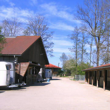
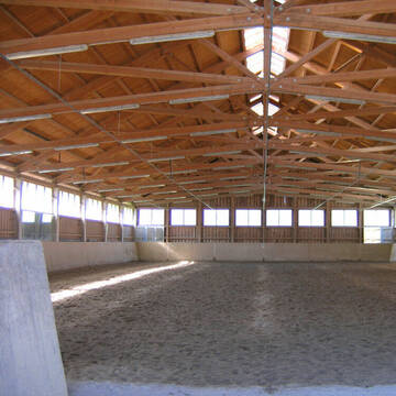
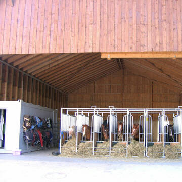
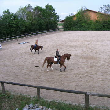
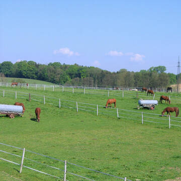
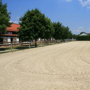
Gestüt Birkenhof
Fraunberg
Gestüt Birkenhof
@Gestuet-Birkenhof1
FN-Mitglied
Freizeitstall
Vermieten
Führanlage
Hunde willkommen
bedampftes/gewaschenes Heu
Hengsthaltung möglich
26 weitere...
P+
Deprecated: Creation of dynamic property Zend_View_Helper_Ads::$adLink is deprecated in /var/www/stall-frei/htdocs/staging.stall-frei.de/library/Psf/View/Helper/Ads.php on line 108


NEU: HIT-Aktiv mit Paddocktrail & Heubedampfer
Moosinning
Kaiser&Kaiser Das Pferderesort
@DasPferderesort
Freizeitstall
Reitlehrer und -unterricht
Vermieten
Krankenbox
Parkplatz für Pferdeanhänger
Allergikerstall
bedampftes/gewaschenes Heu
16 weitere...
aktuell
S

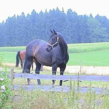
Reitstall Furthmühle
Fraunberg
caroline-Rieber
@caroline-Rieber
FN-Mitglied
Freizeitstall
Krankenbox
Laufband
Allergikerstall
Hengsthaltung möglich
Außenboxen
Innenbox
22 weitere...
P


Boxen frei
Neuching
Anna Raatz & Mara Ott
@Equilibrium-Reitsport
Freizeitstall
Pferdeausbildung
Vermieten
Hunde willkommen
Longierzirkel/Roundpen
bedampftes/gewaschenes Heu
19 weitere...
S
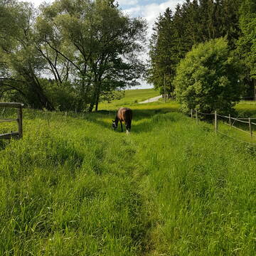
Reitstall Riexinger
Oberneuching
Reitstall-Riexinger
@Reitstall-Riexinger
FN-Mitglied
Reitlehrer und -unterricht
Vermieten
Verpachten
Hunde willkommen
Krankenbox
Notfallboxen
20 weitere...
S

Futtersack HeuToy, Fressbremse in pink
Mechtersen
STALL-FREIde Marketing
@STALL-FREI-Marketing
Stundenlange Beschäftigung die
Koliken vorbeugt, geringe Staubinhalation mit
steuerbarer Futterentnahme


Neuer Aktivstall Fertigstellung April/Mai 2026
Ottenhofen
New Aktivstable Munich East
@Box-mit-Reithalle
Freizeitstall
Gangpferdereiten
Hunde willkommen
Krankenbox
Allergikerstall
Hufrehe geeignet
Außenbox mit Paddock
Bewegungsstall
32 weitere...
S


SonnenalmB3 - jetzt auch Teilpension möglich
Lengdorf
Bettina Reiser
@Klaus-Jachmann
Freizeitstall
Geländestrecke
Verpachten
Krankenbox
Paddock
Gnadenbrothof
Hengsthaltung möglich
25 weitere...
P+


Pferdeparadies Siciliano Senior/Reha/diver. Pferde
Velden
Finesbest
@Finesbest
Freizeitstall
Rehabilitationsstall
Hunde willkommen
Paddock
bedampftes/gewaschenes Heu
Gnadenbrothof
Außenbox mit Paddock
Außenboxen
10 weitere...
S

Reitsportanlage Notzing, Pensionspferdebetrieb
Oberding
Franz Döllel
@Franz-Doellel
Pferdeausbildung
Reitlehrer und -unterricht
Vermieten
Führanlage
Longierzirkel/Roundpen
Außenbox mit Paddock
13 weitere...
aktuell
P+
Deprecated: Creation of dynamic property Zend_View::$pageCount is deprecated in /var/www/stall-frei/htdocs/staging.stall-frei.de/library/vendor/shardj/zf1-future/library/Zend/View/Abstract.php on line 308
Deprecated: Creation of dynamic property Zend_View::$itemCountPerPage is deprecated in /var/www/stall-frei/htdocs/staging.stall-frei.de/library/vendor/shardj/zf1-future/library/Zend/View/Abstract.php on line 308
Deprecated: Creation of dynamic property Zend_View::$first is deprecated in /var/www/stall-frei/htdocs/staging.stall-frei.de/library/vendor/shardj/zf1-future/library/Zend/View/Abstract.php on line 308
Deprecated: Creation of dynamic property Zend_View::$current is deprecated in /var/www/stall-frei/htdocs/staging.stall-frei.de/library/vendor/shardj/zf1-future/library/Zend/View/Abstract.php on line 308
Deprecated: Creation of dynamic property Zend_View::$last is deprecated in /var/www/stall-frei/htdocs/staging.stall-frei.de/library/vendor/shardj/zf1-future/library/Zend/View/Abstract.php on line 308
Deprecated: Creation of dynamic property Zend_View::$next is deprecated in /var/www/stall-frei/htdocs/staging.stall-frei.de/library/vendor/shardj/zf1-future/library/Zend/View/Abstract.php on line 308
Deprecated: Creation of dynamic property Zend_View::$pagesInRange is deprecated in /var/www/stall-frei/htdocs/staging.stall-frei.de/library/vendor/shardj/zf1-future/library/Zend/View/Abstract.php on line 308
Deprecated: Creation of dynamic property Zend_View::$firstPageInRange is deprecated in /var/www/stall-frei/htdocs/staging.stall-frei.de/library/vendor/shardj/zf1-future/library/Zend/View/Abstract.php on line 308
Deprecated: Creation of dynamic property Zend_View::$lastPageInRange is deprecated in /var/www/stall-frei/htdocs/staging.stall-frei.de/library/vendor/shardj/zf1-future/library/Zend/View/Abstract.php on line 308
Deprecated: Creation of dynamic property Zend_View::$currentItemCount is deprecated in /var/www/stall-frei/htdocs/staging.stall-frei.de/library/vendor/shardj/zf1-future/library/Zend/View/Abstract.php on line 308
Deprecated: Creation of dynamic property Zend_View::$totalItemCount is deprecated in /var/www/stall-frei/htdocs/staging.stall-frei.de/library/vendor/shardj/zf1-future/library/Zend/View/Abstract.php on line 308
Deprecated: Creation of dynamic property Zend_View::$firstItemNumber is deprecated in /var/www/stall-frei/htdocs/staging.stall-frei.de/library/vendor/shardj/zf1-future/library/Zend/View/Abstract.php on line 308
Deprecated: Creation of dynamic property Zend_View::$lastItemNumber is deprecated in /var/www/stall-frei/htdocs/staging.stall-frei.de/library/vendor/shardj/zf1-future/library/Zend/View/Abstract.php on line 308
Deprecated: Creation of dynamic property Zend_View::$router is deprecated in /var/www/stall-frei/htdocs/staging.stall-frei.de/library/vendor/shardj/zf1-future/library/Zend/View/Abstract.php on line 308
Deprecated: Creation of dynamic property Zend_View::$urlParams is deprecated in /var/www/stall-frei/htdocs/staging.stall-frei.de/library/vendor/shardj/zf1-future/library/Zend/View/Abstract.php on line 308
Deprecated: Creation of dynamic property Zend_View::$showAds is deprecated in /var/www/stall-frei/htdocs/staging.stall-frei.de/library/vendor/shardj/zf1-future/library/Zend/View/Abstract.php on line 308
Deprecated: Creation of dynamic property Zend_View::$objectIds is deprecated in /var/www/stall-frei/htdocs/staging.stall-frei.de/library/vendor/shardj/zf1-future/library/Zend/View/Abstract.php on line 308
Deprecated: Creation of dynamic property Zend_View::$showNavbar is deprecated in /var/www/stall-frei/htdocs/staging.stall-frei.de/library/vendor/shardj/zf1-future/library/Zend/View/Abstract.php on line 308
Deprecated: Creation of dynamic property Zend_View::$showBreadcrumb is deprecated in /var/www/stall-frei/htdocs/staging.stall-frei.de/library/vendor/shardj/zf1-future/library/Zend/View/Abstract.php on line 308
Deprecated: Creation of dynamic property Zend_View::$showFooter is deprecated in /var/www/stall-frei/htdocs/staging.stall-frei.de/library/vendor/shardj/zf1-future/library/Zend/View/Abstract.php on line 308
Deprecated: Creation of dynamic property Zend_View::$showInternalAds is deprecated in /var/www/stall-frei/htdocs/staging.stall-frei.de/library/vendor/shardj/zf1-future/library/Zend/View/Abstract.php on line 308
Deprecated: Creation of dynamic property Zend_View::$blNoContent is deprecated in /var/www/stall-frei/htdocs/staging.stall-frei.de/library/vendor/shardj/zf1-future/library/Zend/View/Abstract.php on line 308
Deprecated: Creation of dynamic property Zend_View::$sMetaDesc is deprecated in /var/www/stall-frei/htdocs/staging.stall-frei.de/library/vendor/shardj/zf1-future/library/Zend/View/Abstract.php on line 308
Deprecated: Creation of dynamic property Zend_View::$useGmaps is deprecated in /var/www/stall-frei/htdocs/staging.stall-frei.de/library/vendor/shardj/zf1-future/library/Zend/View/Abstract.php on line 308
Deprecated: Creation of dynamic property Zend_View::$touches is deprecated in /var/www/stall-frei/htdocs/staging.stall-frei.de/library/vendor/shardj/zf1-future/library/Zend/View/Abstract.php on line 308
Deprecated: Creation of dynamic property Zend_View::$oProject is deprecated in /var/www/stall-frei/htdocs/staging.stall-frei.de/library/vendor/shardj/zf1-future/library/Zend/View/Abstract.php on line 308
Deprecated: Creation of dynamic property Zend_View::$pageHeadline is deprecated in /var/www/stall-frei/htdocs/staging.stall-frei.de/library/vendor/shardj/zf1-future/library/Zend/View/Abstract.php on line 308
Deprecated: Creation of dynamic property Zend_View::$disableLocationField is deprecated in /var/www/stall-frei/htdocs/staging.stall-frei.de/library/vendor/shardj/zf1-future/library/Zend/View/Abstract.php on line 308
Deprecated: Creation of dynamic property Zend_View::$isSearch is deprecated in /var/www/stall-frei/htdocs/staging.stall-frei.de/library/vendor/shardj/zf1-future/library/Zend/View/Abstract.php on line 308
Deprecated: Creation of dynamic property Zend_View::$pageTitle is deprecated in /var/www/stall-frei/htdocs/staging.stall-frei.de/library/vendor/shardj/zf1-future/library/Zend/View/Abstract.php on line 308
Deprecated: Creation of dynamic property Psf_Form_Element_Text::$class is deprecated in /var/www/stall-frei/htdocs/staging.stall-frei.de/library/vendor/shardj/zf1-future/library/Zend/Form/Element.php on line 874
Deprecated: Creation of dynamic property Psf_Form_Element_Text::$size is deprecated in /var/www/stall-frei/htdocs/staging.stall-frei.de/library/vendor/shardj/zf1-future/library/Zend/Form/Element.php on line 874
Deprecated: Creation of dynamic property Psf_Form_Element_Text::$placeholder is deprecated in /var/www/stall-frei/htdocs/staging.stall-frei.de/library/vendor/shardj/zf1-future/library/Zend/Form/Element.php on line 874
Deprecated: Creation of dynamic property Psf_Form_Element_Hidden::$class is deprecated in /var/www/stall-frei/htdocs/staging.stall-frei.de/library/vendor/shardj/zf1-future/library/Zend/Form/Element.php on line 874
Deprecated: Creation of dynamic property Psf_Form_Element_Hidden::$class is deprecated in /var/www/stall-frei/htdocs/staging.stall-frei.de/library/vendor/shardj/zf1-future/library/Zend/Form/Element.php on line 874
Deprecated: Creation of dynamic property Psf_Form_Element_Hidden::$class is deprecated in /var/www/stall-frei/htdocs/staging.stall-frei.de/library/vendor/shardj/zf1-future/library/Zend/Form/Element.php on line 874
Deprecated: Creation of dynamic property Psf_Form_Element_Hidden::$class is deprecated in /var/www/stall-frei/htdocs/staging.stall-frei.de/library/vendor/shardj/zf1-future/library/Zend/Form/Element.php on line 874
Deprecated: Creation of dynamic property Psf_Form_Element_Select::$class is deprecated in /var/www/stall-frei/htdocs/staging.stall-frei.de/library/vendor/shardj/zf1-future/library/Zend/Form/Element.php on line 874
Deprecated: Creation of dynamic property Psf_Form_Element_Select::$class is deprecated in /var/www/stall-frei/htdocs/staging.stall-frei.de/library/vendor/shardj/zf1-future/library/Zend/Form/Element.php on line 874
Deprecated: Creation of dynamic property Psf_Form_Element_Select::$class is deprecated in /var/www/stall-frei/htdocs/staging.stall-frei.de/library/vendor/shardj/zf1-future/library/Zend/Form/Element.php on line 874
Deprecated: Creation of dynamic property Psf_Form_Element_Select::$class is deprecated in /var/www/stall-frei/htdocs/staging.stall-frei.de/library/vendor/shardj/zf1-future/library/Zend/Form/Element.php on line 874
Deprecated: Creation of dynamic property Psf_Form_Element_Text::$class is deprecated in /var/www/stall-frei/htdocs/staging.stall-frei.de/library/vendor/shardj/zf1-future/library/Zend/Form/Element.php on line 874
Deprecated: Creation of dynamic property Psf_Form_Element_Checkbox::$label is deprecated in /var/www/stall-frei/htdocs/staging.stall-frei.de/library/vendor/shardj/zf1-future/library/Zend/Form/Element.php on line 874
Deprecated: Creation of dynamic property Zend_View::$sort is deprecated in /var/www/stall-frei/htdocs/staging.stall-frei.de/library/vendor/shardj/zf1-future/library/Zend/View/Abstract.php on line 308
Deprecated: Creation of dynamic property Zend_View::$searchLocation is deprecated in /var/www/stall-frei/htdocs/staging.stall-frei.de/library/vendor/shardj/zf1-future/library/Zend/View/Abstract.php on line 308
Deprecated: Creation of dynamic property Zend_View::$locationHint is deprecated in /var/www/stall-frei/htdocs/staging.stall-frei.de/library/vendor/shardj/zf1-future/library/Zend/View/Abstract.php on line 308
Psf_GeoCoder_Abstract::getLocation: Fraunberg Get Location CachedOrLive
Psf_GeoCoder_Abstract::getCachedOrLive: Fraunberg
Psf_GeoCoder_OpenCageData::makeApiRequest: response:
Array
(
[documentation] => https://opencagedata.com/api
[licenses] => Array
(
[0] => Array
(
[name] => see attribution guide
[url] => https://opencagedata.com/credits
)
)
[results] => Array
(
[0] => Array
(
[bounds] => Array
(
[northeast] => Array
(
[lat] => 48.3919074
[lng] => 12.0648268
)
[southwest] => Array
(
[lat] => 48.3319181
[lng] => 11.9330512
)
)
[components] => Array
(
[ISO_3166-1_alpha-2] => DE
[ISO_3166-1_alpha-3] => DEU
[ISO_3166-2] => Array
(
[0] => DE-BY
)
[_category] => place
[_normalized_city] => Fraunberg
[_type] => village
[continent] => Europe
[country] => Deutschland
[country_code] => de
[county] => Landkreis Erding
[political_union] => European Union
[postcode] => 85447
[state] => Bayern
[state_code] => BY
[village] => Fraunberg
)
[confidence] => 7
[formatted] => 85447 Fraunberg, Deutschland
[geometry] => Array
(
[lat] => 48.368795
[lng] => 11.9925691
)
)
[1] => Array
(
[bounds] => Array
(
[northeast] => Array
(
[lat] => 48.2938147
[lng] => 11.6632697
)
[southwest] => Array
(
[lat] => 48.2937147
[lng] => 11.6631697
)
)
[components] => Array
(
[ISO_3166-1_alpha-2] => DE
[ISO_3166-1_alpha-3] => DEU
[ISO_3166-2] => Array
(
[0] => DE-BY
)
[_category] => natural/water
[_normalized_city] => Neufahrn bei Freising
[_type] => peak
[continent] => Europe
[country] => Deutschland
[country_code] => de
[county] => Landkreis Freising
[peak] => Fraunberg
[political_union] => European Union
[postcode] => 85375
[state] => Bayern
[state_code] => BY
[village] => Neufahrn bei Freising
)
[confidence] => 9
[formatted] => Fraunberg, 85375 Neufahrn bei Freising, Deutschland
[geometry] => Array
(
[lat] => 48.2937647
[lng] => 11.6632197
)
)
[2] => Array
(
[bounds] => Array
(
[northeast] => Array
(
[lat] => 49.4907059
[lng] => 12.1638967
)
[southwest] => Array
(
[lat] => 49.4507059
[lng] => 12.1238967
)
)
[components] => Array
(
[ISO_3166-1_alpha-2] => DE
[ISO_3166-1_alpha-3] => DEU
[ISO_3166-2] => Array
(
[0] => DE-BY
)
[_category] => place
[_normalized_city] => Nabburg
[_type] => hamlet
[continent] => Europe
[country] => Deutschland
[country_code] => de
[county] => Landkreis Schwandorf
[hamlet] => Fraunberg
[municipality] => Nabburg (VGem)
[political_union] => European Union
[postcode] => 92507
[state] => Bayern
[state_code] => BY
[town] => Nabburg
)
[confidence] => 7
[formatted] => Fraunberg, 92507 Nabburg, Deutschland
[geometry] => Array
(
[lat] => 49.4707059
[lng] => 12.1438967
)
)
[3] => Array
(
[bounds] => Array
(
[northeast] => Array
(
[lat] => 48.3323135
[lng] => 12.2147592
)
[southwest] => Array
(
[lat] => 48.3123135
[lng] => 12.1947592
)
)
[components] => Array
(
[ISO_3166-1_alpha-2] => DE
[ISO_3166-1_alpha-3] => DEU
[ISO_3166-2] => Array
(
[0] => DE-BY
)
[_category] => agriculture
[_normalized_city] => Taufkirchen
[_type] => farm
[continent] => Europe
[country] => Deutschland
[country_code] => de
[county] => Landkreis Erding
[farm] => Fraunberg
[hamlet] => Kalmhuber
[political_union] => European Union
[postcode] => 84416
[state] => Bayern
[state_code] => BY
[town] => Taufkirchen
)
[confidence] => 8
[formatted] => Fraunberg, Kalmhuber, 84416 Taufkirchen, Deutschland
[geometry] => Array
(
[lat] => 48.3223135
[lng] => 12.2047592
)
)
[4] => Array
(
[components] => Array
(
[ISO_3166-1_alpha-2] => FR
[ISO_3166-1_alpha-3] => FRA
[ISO_3166-2] => Array
(
[0] => FR-GES
[1] => FR-57
)
[_category] => place
[_normalized_city] => Frauenberg
[_type] => city
[city] => Frauenberg
[continent] => Europe
[country] => France
[country_code] => fr
[county] => Moselle
[local_authority] => Communauté d'agglomération Sarreguemines Confluences
[political_union] => European Union
[postcode] => 57200
[state] => Grand Est
[state_code] => GES
)
[confidence] => 3
[formatted] => Frauenberg, Moselle, France
[geometry] => Array
(
[lat] => 49.135244
[lng] => 7.123413
)
)
[5] => Array
(
[components] => Array
(
[ISO_3166-1_alpha-2] => FR
[ISO_3166-1_alpha-3] => FRA
[ISO_3166-2] => Array
(
[0] => FR-GES
[1] => FR-57
)
[_category] => place
[_normalized_city] => Frauenberg
[_type] => place
[city] => Frauenberg
[continent] => Europe
[country] => France
[country_code] => fr
[county] => Moselle
[local_authority] => Communauté d'agglomération Sarreguemines Confluences
[place] => Rue de Deux Ponts
[political_union] => European Union
[postcode] => 57200
[state] => Grand Est
[state_code] => GES
)
[confidence] => 3
[formatted] => Rue de Deux Ponts, 57200 Frauenberg, France
[geometry] => Array
(
[lat] => 49.131039
[lng] => 7.111551
)
)
[6] => Array
(
[components] => Array
(
[ISO_3166-1_alpha-2] => FR
[ISO_3166-1_alpha-3] => FRA
[ISO_3166-2] => Array
(
[0] => FR-GES
[1] => FR-57
)
[_category] => road
[_normalized_city] => Frauenberg
[_type] => road
[city] => Frauenberg
[continent] => Europe
[country] => France
[country_code] => fr
[county] => Moselle
[local_authority] => Communauté d'agglomération Sarreguemines Confluences
[political_union] => European Union
[postcode] => 57200
[road] => Rue des Mésanges
[state] => Grand Est
[state_code] => GES
)
[confidence] => 2
[formatted] => Rue des Mésanges, 57200 Frauenberg, France
[geometry] => Array
(
[lat] => 49.134067
[lng] => 7.124849
)
)
[7] => Array
(
[components] => Array
(
[ISO_3166-1_alpha-2] => FR
[ISO_3166-1_alpha-3] => FRA
[ISO_3166-2] => Array
(
[0] => FR-GES
[1] => FR-57
)
[_category] => road
[_normalized_city] => Frauenberg
[_type] => road
[city] => Frauenberg
[continent] => Europe
[country] => France
[country_code] => fr
[county] => Moselle
[local_authority] => Communauté d'agglomération Sarreguemines Confluences
[political_union] => European Union
[postcode] => 57200
[road] => Rue des Bosquets
[state] => Grand Est
[state_code] => GES
)
[confidence] => 2
[formatted] => Rue des Bosquets, 57200 Frauenberg, France
[geometry] => Array
(
[lat] => 49.135573
[lng] => 7.125062
)
)
[8] => Array
(
[components] => Array
(
[ISO_3166-1_alpha-2] => FR
[ISO_3166-1_alpha-3] => FRA
[ISO_3166-2] => Array
(
[0] => FR-GES
[1] => FR-57
)
[_category] => road
[_normalized_city] => Frauenberg
[_type] => road
[city] => Frauenberg
[continent] => Europe
[country] => France
[country_code] => fr
[county] => Moselle
[local_authority] => Communauté d'agglomération Sarreguemines Confluences
[political_union] => European Union
[postcode] => 57200
[road] => Rue des Ecoles
[state] => Grand Est
[state_code] => GES
)
[confidence] => 2
[formatted] => Rue des Ecoles, 57200 Frauenberg, France
[geometry] => Array
(
[lat] => 49.138551
[lng] => 7.121383
)
)
[9] => Array
(
[components] => Array
(
[ISO_3166-1_alpha-2] => FR
[ISO_3166-1_alpha-3] => FRA
[ISO_3166-2] => Array
(
[0] => FR-GES
[1] => FR-57
)
[_category] => road
[_normalized_city] => Frauenberg
[_type] => road
[city] => Frauenberg
[continent] => Europe
[country] => France
[country_code] => fr
[county] => Moselle
[local_authority] => Communauté d'agglomération Sarreguemines Confluences
[political_union] => European Union
[postcode] => 57200
[road] => Rue des Hirondelles
[state] => Grand Est
[state_code] => GES
)
[confidence] => 2
[formatted] => Rue des Hirondelles, 57200 Frauenberg, France
[geometry] => Array
(
[lat] => 49.132947
[lng] => 7.123611
)
)
)
[status] => Array
(
[code] => 200
[message] => OK
)
[stay_informed] => Array
(
[blog] => https://blog.opencagedata.com
[mastodon] => https://en.osm.town/@opencage
)
[thanks] => For using an OpenCage API
[timestamp] => Array
(
[created_http] => Fri, 06 Feb 2026 07:35:46 GMT
[created_unix] => 1770363346
)
[total_results] => 10
)
Psf_GeoCoder_Abstract::convertLocationResult
{"documentation":"https:\/\/opencagedata.com\/api","licenses":[{"name":"see attribution guide","url":"https:\/\/opencagedata.com\/credits"}],"results":[{"bounds":{"northeast":{"lat":48.3919074,"lng":12.0648268},"southwest":{"lat":48.3319181,"lng":11.9330512}},"components":{"ISO_3166-1_alpha-2":"DE","ISO_3166-1_alpha-3":"DEU","ISO_3166-2":["DE-BY"],"_category":"place","_normalized_city":"Fraunberg","_type":"village","continent":"Europe","country":"Deutschland","country_code":"de","county":"Landkreis Erding","political_union":"European Union","postcode":"85447","state":"Bayern","state_code":"BY","village":"Fraunberg"},"confidence":7,"formatted":"85447 Fraunberg, Deutschland","geometry":{"lat":48.368795,"lng":11.9925691}},{"bounds":{"northeast":{"lat":48.2938147,"lng":11.6632697},"southwest":{"lat":48.2937147,"lng":11.6631697}},"components":{"ISO_3166-1_alpha-2":"DE","ISO_3166-1_alpha-3":"DEU","ISO_3166-2":["DE-BY"],"_category":"natural\/water","_normalized_city":"Neufahrn bei Freising","_type":"peak","continent":"Europe","country":"Deutschland","country_code":"de","county":"Landkreis Freising","peak":"Fraunberg","political_union":"European Union","postcode":"85375","state":"Bayern","state_code":"BY","village":"Neufahrn bei Freising"},"confidence":9,"formatted":"Fraunberg, 85375 Neufahrn bei Freising, Deutschland","geometry":{"lat":48.2937647,"lng":11.6632197}},{"bounds":{"northeast":{"lat":49.4907059,"lng":12.1638967},"southwest":{"lat":49.4507059,"lng":12.1238967}},"components":{"ISO_3166-1_alpha-2":"DE","ISO_3166-1_alpha-3":"DEU","ISO_3166-2":["DE-BY"],"_category":"place","_normalized_city":"Nabburg","_type":"hamlet","continent":"Europe","country":"Deutschland","country_code":"de","county":"Landkreis Schwandorf","hamlet":"Fraunberg","municipality":"Nabburg (VGem)","political_union":"European Union","postcode":"92507","state":"Bayern","state_code":"BY","town":"Nabburg"},"confidence":7,"formatted":"Fraunberg, 92507 Nabburg, Deutschland","geometry":{"lat":49.4707059,"lng":12.1438967}},{"bounds":{"northeast":{"lat":48.3323135,"lng":12.2147592},"southwest":{"lat":48.3123135,"lng":12.1947592}},"components":{"ISO_3166-1_alpha-2":"DE","ISO_3166-1_alpha-3":"DEU","ISO_3166-2":["DE-BY"],"_category":"agriculture","_normalized_city":"Taufkirchen","_type":"farm","continent":"Europe","country":"Deutschland","country_code":"de","county":"Landkreis Erding","farm":"Fraunberg","hamlet":"Kalmhuber","political_union":"European Union","postcode":"84416","state":"Bayern","state_code":"BY","town":"Taufkirchen"},"confidence":8,"formatted":"Fraunberg, Kalmhuber, 84416 Taufkirchen, Deutschland","geometry":{"lat":48.3223135,"lng":12.2047592}},{"components":{"ISO_3166-1_alpha-2":"FR","ISO_3166-1_alpha-3":"FRA","ISO_3166-2":["FR-GES","FR-57"],"_category":"place","_normalized_city":"Frauenberg","_type":"city","city":"Frauenberg","continent":"Europe","country":"France","country_code":"fr","county":"Moselle","local_authority":"Communaut\u00e9 d'agglom\u00e9ration Sarreguemines Confluences","political_union":"European Union","postcode":"57200","state":"Grand Est","state_code":"GES"},"confidence":3,"formatted":"Frauenberg, Moselle, France","geometry":{"lat":49.135244,"lng":7.123413}},{"components":{"ISO_3166-1_alpha-2":"FR","ISO_3166-1_alpha-3":"FRA","ISO_3166-2":["FR-GES","FR-57"],"_category":"place","_normalized_city":"Frauenberg","_type":"place","city":"Frauenberg","continent":"Europe","country":"France","country_code":"fr","county":"Moselle","local_authority":"Communaut\u00e9 d'agglom\u00e9ration Sarreguemines Confluences","place":"Rue de Deux Ponts","political_union":"European Union","postcode":"57200","state":"Grand Est","state_code":"GES"},"confidence":3,"formatted":"Rue de Deux Ponts, 57200 Frauenberg, France","geometry":{"lat":49.131039,"lng":7.111551}},{"components":{"ISO_3166-1_alpha-2":"FR","ISO_3166-1_alpha-3":"FRA","ISO_3166-2":["FR-GES","FR-57"],"_category":"road","_normalized_city":"Frauenberg","_type":"road","city":"Frauenberg","continent":"Europe","country":"France","country_code":"fr","county":"Moselle","local_authority":"Communaut\u00e9 d'agglom\u00e9ration Sarreguemines Confluences","political_union":"European Union","postcode":"57200","road":"Rue des M\u00e9sanges","state":"Grand Est","state_code":"GES"},"confidence":2,"formatted":"Rue des M\u00e9sanges, 57200 Frauenberg, France","geometry":{"lat":49.134067,"lng":7.124849}},{"components":{"ISO_3166-1_alpha-2":"FR","ISO_3166-1_alpha-3":"FRA","ISO_3166-2":["FR-GES","FR-57"],"_category":"road","_normalized_city":"Frauenberg","_type":"road","city":"Frauenberg","continent":"Europe","country":"France","country_code":"fr","county":"Moselle","local_authority":"Communaut\u00e9 d'agglom\u00e9ration Sarreguemines Confluences","political_union":"European Union","postcode":"57200","road":"Rue des Bosquets","state":"Grand Est","state_code":"GES"},"confidence":2,"formatted":"Rue des Bosquets, 57200 Frauenberg, France","geometry":{"lat":49.135573,"lng":7.125062}},{"components":{"ISO_3166-1_alpha-2":"FR","ISO_3166-1_alpha-3":"FRA","ISO_3166-2":["FR-GES","FR-57"],"_category":"road","_normalized_city":"Frauenberg","_type":"road","city":"Frauenberg","continent":"Europe","country":"France","country_code":"fr","county":"Moselle","local_authority":"Communaut\u00e9 d'agglom\u00e9ration Sarreguemines Confluences","political_union":"European Union","postcode":"57200","road":"Rue des Ecoles","state":"Grand Est","state_code":"GES"},"confidence":2,"formatted":"Rue des Ecoles, 57200 Frauenberg, France","geometry":{"lat":49.138551,"lng":7.121383}},{"components":{"ISO_3166-1_alpha-2":"FR","ISO_3166-1_alpha-3":"FRA","ISO_3166-2":["FR-GES","FR-57"],"_category":"road","_normalized_city":"Frauenberg","_type":"road","city":"Frauenberg","continent":"Europe","country":"France","country_code":"fr","county":"Moselle","local_authority":"Communaut\u00e9 d'agglom\u00e9ration Sarreguemines Confluences","political_union":"European Union","postcode":"57200","road":"Rue des Hirondelles","state":"Grand Est","state_code":"GES"},"confidence":2,"formatted":"Rue des Hirondelles, 57200 Frauenberg, France","geometry":{"lat":49.132947,"lng":7.123611}}],"status":{"code":200,"message":"OK"},"stay_informed":{"blog":"https:\/\/blog.opencagedata.com","mastodon":"https:\/\/en.osm.town\/@opencage"},"thanks":"For using an OpenCage API","timestamp":{"created_http":"Fri, 06 Feb 2026 07:35:46 GMT","created_unix":1770363346},"total_results":10}Array
(
[0] => stdClass Object
(
[bounds] => stdClass Object
(
[northeast] => stdClass Object
(
[lat] => 48.3919074
[lng] => 12.0648268
)
[southwest] => stdClass Object
(
[lat] => 48.3319181
[lng] => 11.9330512
)
)
[components] => stdClass Object
(
[ISO_3166-1_alpha-2] => DE
[ISO_3166-1_alpha-3] => DEU
[ISO_3166-2] => Array
(
[0] => DE-BY
)
[_category] => place
[_normalized_city] => Fraunberg
[_type] => village
[continent] => Europe
[country] => Deutschland
[country_code] => de
[county] => Landkreis Erding
[political_union] => European Union
[postcode] => 85447
[state] => Bayern
[state_code] => BY
[village] => Fraunberg
)
[confidence] => 7
[formatted] => 85447 Fraunberg, Deutschland
[geometry] => stdClass Object
(
[lat] => 48.368795
[lng] => 11.9925691
)
)
[1] => stdClass Object
(
[bounds] => stdClass Object
(
[northeast] => stdClass Object
(
[lat] => 48.2938147
[lng] => 11.6632697
)
[southwest] => stdClass Object
(
[lat] => 48.2937147
[lng] => 11.6631697
)
)
[components] => stdClass Object
(
[ISO_3166-1_alpha-2] => DE
[ISO_3166-1_alpha-3] => DEU
[ISO_3166-2] => Array
(
[0] => DE-BY
)
[_category] => natural/water
[_normalized_city] => Neufahrn bei Freising
[_type] => peak
[continent] => Europe
[country] => Deutschland
[country_code] => de
[county] => Landkreis Freising
[peak] => Fraunberg
[political_union] => European Union
[postcode] => 85375
[state] => Bayern
[state_code] => BY
[village] => Neufahrn bei Freising
)
[confidence] => 9
[formatted] => Fraunberg, 85375 Neufahrn bei Freising, Deutschland
[geometry] => stdClass Object
(
[lat] => 48.2937647
[lng] => 11.6632197
)
)
[2] => stdClass Object
(
[bounds] => stdClass Object
(
[northeast] => stdClass Object
(
[lat] => 49.4907059
[lng] => 12.1638967
)
[southwest] => stdClass Object
(
[lat] => 49.4507059
[lng] => 12.1238967
)
)
[components] => stdClass Object
(
[ISO_3166-1_alpha-2] => DE
[ISO_3166-1_alpha-3] => DEU
[ISO_3166-2] => Array
(
[0] => DE-BY
)
[_category] => place
[_normalized_city] => Nabburg
[_type] => hamlet
[continent] => Europe
[country] => Deutschland
[country_code] => de
[county] => Landkreis Schwandorf
[hamlet] => Fraunberg
[municipality] => Nabburg (VGem)
[political_union] => European Union
[postcode] => 92507
[state] => Bayern
[state_code] => BY
[town] => Nabburg
)
[confidence] => 7
[formatted] => Fraunberg, 92507 Nabburg, Deutschland
[geometry] => stdClass Object
(
[lat] => 49.4707059
[lng] => 12.1438967
)
)
[3] => stdClass Object
(
[bounds] => stdClass Object
(
[northeast] => stdClass Object
(
[lat] => 48.3323135
[lng] => 12.2147592
)
[southwest] => stdClass Object
(
[lat] => 48.3123135
[lng] => 12.1947592
)
)
[components] => stdClass Object
(
[ISO_3166-1_alpha-2] => DE
[ISO_3166-1_alpha-3] => DEU
[ISO_3166-2] => Array
(
[0] => DE-BY
)
[_category] => agriculture
[_normalized_city] => Taufkirchen
[_type] => farm
[continent] => Europe
[country] => Deutschland
[country_code] => de
[county] => Landkreis Erding
[farm] => Fraunberg
[hamlet] => Kalmhuber
[political_union] => European Union
[postcode] => 84416
[state] => Bayern
[state_code] => BY
[town] => Taufkirchen
)
[confidence] => 8
[formatted] => Fraunberg, Kalmhuber, 84416 Taufkirchen, Deutschland
[geometry] => stdClass Object
(
[lat] => 48.3223135
[lng] => 12.2047592
)
)
[4] => stdClass Object
(
[components] => stdClass Object
(
[ISO_3166-1_alpha-2] => FR
[ISO_3166-1_alpha-3] => FRA
[ISO_3166-2] => Array
(
[0] => FR-GES
[1] => FR-57
)
[_category] => place
[_normalized_city] => Frauenberg
[_type] => city
[city] => Frauenberg
[continent] => Europe
[country] => France
[country_code] => fr
[county] => Moselle
[local_authority] => Communauté d'agglomération Sarreguemines Confluences
[political_union] => European Union
[postcode] => 57200
[state] => Grand Est
[state_code] => GES
)
[confidence] => 3
[formatted] => Frauenberg, Moselle, France
[geometry] => stdClass Object
(
[lat] => 49.135244
[lng] => 7.123413
)
)
[5] => stdClass Object
(
[components] => stdClass Object
(
[ISO_3166-1_alpha-2] => FR
[ISO_3166-1_alpha-3] => FRA
[ISO_3166-2] => Array
(
[0] => FR-GES
[1] => FR-57
)
[_category] => place
[_normalized_city] => Frauenberg
[_type] => place
[city] => Frauenberg
[continent] => Europe
[country] => France
[country_code] => fr
[county] => Moselle
[local_authority] => Communauté d'agglomération Sarreguemines Confluences
[place] => Rue de Deux Ponts
[political_union] => European Union
[postcode] => 57200
[state] => Grand Est
[state_code] => GES
)
[confidence] => 3
[formatted] => Rue de Deux Ponts, 57200 Frauenberg, France
[geometry] => stdClass Object
(
[lat] => 49.131039
[lng] => 7.111551
)
)
[6] => stdClass Object
(
[components] => stdClass Object
(
[ISO_3166-1_alpha-2] => FR
[ISO_3166-1_alpha-3] => FRA
[ISO_3166-2] => Array
(
[0] => FR-GES
[1] => FR-57
)
[_category] => road
[_normalized_city] => Frauenberg
[_type] => road
[city] => Frauenberg
[continent] => Europe
[country] => France
[country_code] => fr
[county] => Moselle
[local_authority] => Communauté d'agglomération Sarreguemines Confluences
[political_union] => European Union
[postcode] => 57200
[road] => Rue des Mésanges
[state] => Grand Est
[state_code] => GES
)
[confidence] => 2
[formatted] => Rue des Mésanges, 57200 Frauenberg, France
[geometry] => stdClass Object
(
[lat] => 49.134067
[lng] => 7.124849
)
)
[7] => stdClass Object
(
[components] => stdClass Object
(
[ISO_3166-1_alpha-2] => FR
[ISO_3166-1_alpha-3] => FRA
[ISO_3166-2] => Array
(
[0] => FR-GES
[1] => FR-57
)
[_category] => road
[_normalized_city] => Frauenberg
[_type] => road
[city] => Frauenberg
[continent] => Europe
[country] => France
[country_code] => fr
[county] => Moselle
[local_authority] => Communauté d'agglomération Sarreguemines Confluences
[political_union] => European Union
[postcode] => 57200
[road] => Rue des Bosquets
[state] => Grand Est
[state_code] => GES
)
[confidence] => 2
[formatted] => Rue des Bosquets, 57200 Frauenberg, France
[geometry] => stdClass Object
(
[lat] => 49.135573
[lng] => 7.125062
)
)
[8] => stdClass Object
(
[components] => stdClass Object
(
[ISO_3166-1_alpha-2] => FR
[ISO_3166-1_alpha-3] => FRA
[ISO_3166-2] => Array
(
[0] => FR-GES
[1] => FR-57
)
[_category] => road
[_normalized_city] => Frauenberg
[_type] => road
[city] => Frauenberg
[continent] => Europe
[country] => France
[country_code] => fr
[county] => Moselle
[local_authority] => Communauté d'agglomération Sarreguemines Confluences
[political_union] => European Union
[postcode] => 57200
[road] => Rue des Ecoles
[state] => Grand Est
[state_code] => GES
)
[confidence] => 2
[formatted] => Rue des Ecoles, 57200 Frauenberg, France
[geometry] => stdClass Object
(
[lat] => 49.138551
[lng] => 7.121383
)
)
[9] => stdClass Object
(
[components] => stdClass Object
(
[ISO_3166-1_alpha-2] => FR
[ISO_3166-1_alpha-3] => FRA
[ISO_3166-2] => Array
(
[0] => FR-GES
[1] => FR-57
)
[_category] => road
[_normalized_city] => Frauenberg
[_type] => road
[city] => Frauenberg
[continent] => Europe
[country] => France
[country_code] => fr
[county] => Moselle
[local_authority] => Communauté d'agglomération Sarreguemines Confluences
[political_union] => European Union
[postcode] => 57200
[road] => Rue des Hirondelles
[state] => Grand Est
[state_code] => GES
)
[confidence] => 2
[formatted] => Rue des Hirondelles, 57200 Frauenberg, France
[geometry] => stdClass Object
(
[lat] => 49.132947
[lng] => 7.123611
)
)
)
Psf_GeoCoder_OpenCageData::getKeyMap: 0
stdClass Object
(
    [bounds] => stdClass Object
        (
            [northeast] => stdClass Object
                (
                    [lat] => 48.3919074
                    [lng] => 12.0648268
                )

            [southwest] => stdClass Object
                (
                    [lat] => 48.3319181
                    [lng] => 11.9330512
                )

        )

    [components] => stdClass Object
        (
            [ISO_3166-1_alpha-2] => DE
            [ISO_3166-1_alpha-3] => DEU
            [ISO_3166-2] => Array
                (
                    [0] => DE-BY
                )

            [_category] => place
            [_normalized_city] => Fraunberg
            [_type] => village
            [continent] => Europe
            [country] => Deutschland
            [country_code] => de
            [county] => Landkreis Erding
            [political_union] => European Union
            [postcode] => 85447
            [state] => Bayern
            [state_code] => BY
            [village] => Fraunberg
        )

    [confidence] => 7
    [formatted] => 85447 Fraunberg, Deutschland
    [geometry] => stdClass Object
        (
            [lat] => 48.368795
            [lng] => 11.9925691
        )

)
Psf_GeoCoder_OpenCageData::getCounty: Erding
Psf_GeoCoder_OpenCageData::addMissingData REFETCH!
Array
(
    [address] => 85447 Fraunberg, Deutschland
    [type] => village
    [street] =>
    [city] => Fraunberg
    [county] => Erding
    [state] => Bayern
    [zip] => 85447
    [country] => Deutschland
    [suburb] =>
    [countrycode] => de
    [latitude] => 48.368795
    [longitude] => 11.9925691
    [accuracy] => 1
    [confidence] => 7
    [bounds] => stdClass Object
        (
            [northeast] => stdClass Object
                (
                    [lat] => 48.3919074
                    [lng] => 12.0648268
                )

            [southwest] => stdClass Object
                (
                    [lat] => 48.3319181
                    [lng] => 11.9330512
                )

        )

)
reformat!
Array
(
    [address] => 85447 Fraunberg, Deutschland
    [type] => village
    [street] =>
    [city] => Fraunberg
    [county] => Erding
    [state] => Bayern
    [zip] => 85447
    [country] => Deutschland
    [suburb] =>
    [countrycode] => de
    [latitude] => 48.368795
    [longitude] => 11.9925691
    [accuracy] => 1
    [confidence] => 7
    [bounds] => stdClass Object
        (
            [northeast] => stdClass Object
                (
                    [lat] => 48.3919074
                    [lng] => 12.0648268
                )

            [southwest] => stdClass Object
                (
                    [lat] => 48.3319181
                    [lng] => 11.9330512
                )

        )

    [place] => 85447 Fraunberg, Bayern
    [hash] => b3d11a42d1c802f532c8d3b46b0cfa9f
)
Psf_GeoCoder_OpenCageData::getKeyMap: 1
stdClass Object
(
    [bounds] => stdClass Object
        (
            [northeast] => stdClass Object
                (
                    [lat] => 48.2938147
                    [lng] => 11.6632697
                )

            [southwest] => stdClass Object
                (
                    [lat] => 48.2937147
                    [lng] => 11.6631697
                )

        )

    [components] => stdClass Object
        (
            [ISO_3166-1_alpha-2] => DE
            [ISO_3166-1_alpha-3] => DEU
            [ISO_3166-2] => Array
                (
                    [0] => DE-BY
                )

            [_category] => natural/water
            [_normalized_city] => Neufahrn bei Freising
            [_type] => peak
            [continent] => Europe
            [country] => Deutschland
            [country_code] => de
            [county] => Landkreis Freising
            [peak] => Fraunberg
            [political_union] => European Union
            [postcode] => 85375
            [state] => Bayern
            [state_code] => BY
            [village] => Neufahrn bei Freising
        )

    [confidence] => 9
    [formatted] => Fraunberg, 85375 Neufahrn bei Freising, Deutschland
    [geometry] => stdClass Object
        (
            [lat] => 48.2937647
            [lng] => 11.6632197
        )

)
Psf_GeoCoder_OpenCageData::getCounty: Freising
Psf_GeoCoder_OpenCageData::addMissingData REFETCH!
Array
(
    [address] => Fraunberg, 85375 Neufahrn bei Freising, Deutschland
    [type] => peak
    [street] =>
    [city] => Neufahrn bei Freising
    [county] => Freising
    [state] => Bayern
    [zip] => 85375
    [country] => Deutschland
    [suburb] =>
    [countrycode] => de
    [latitude] => 48.2937647
    [longitude] => 11.6632197
    [accuracy] => 1
    [confidence] => 9
    [bounds] => stdClass Object
        (
            [northeast] => stdClass Object
                (
                    [lat] => 48.2938147
                    [lng] => 11.6632697
                )

            [southwest] => stdClass Object
                (
                    [lat] => 48.2937147
                    [lng] => 11.6631697
                )

        )

)
reformat!
Array
(
    [address] => Fraunberg, 85375 Neufahrn bei Freising, Deutschland
    [type] => peak
    [street] =>
    [city] => Neufahrn bei Freising
    [county] => Freising
    [state] => Bayern
    [zip] => 85375
    [country] => Deutschland
    [suburb] =>
    [countrycode] => de
    [latitude] => 48.2937647
    [longitude] => 11.6632197
    [accuracy] => 1
    [confidence] => 9
    [bounds] => stdClass Object
        (
            [northeast] => stdClass Object
                (
                    [lat] => 48.2938147
                    [lng] => 11.6632697
                )

            [southwest] => stdClass Object
                (
                    [lat] => 48.2937147
                    [lng] => 11.6631697
                )

        )

    [place] => 85375 Neufahrn bei Freising, Bayern
    [hash] => 736b106edd67ad0a58d2bd4e5b3ccc60
)
Psf_GeoCoder_OpenCageData::getKeyMap: 2
stdClass Object
(
    [bounds] => stdClass Object
        (
            [northeast] => stdClass Object
                (
                    [lat] => 49.4907059
                    [lng] => 12.1638967
                )

            [southwest] => stdClass Object
                (
                    [lat] => 49.4507059
                    [lng] => 12.1238967
                )

        )

    [components] => stdClass Object
        (
            [ISO_3166-1_alpha-2] => DE
            [ISO_3166-1_alpha-3] => DEU
            [ISO_3166-2] => Array
                (
                    [0] => DE-BY
                )

            [_category] => place
            [_normalized_city] => Nabburg
            [_type] => hamlet
            [continent] => Europe
            [country] => Deutschland
            [country_code] => de
            [county] => Landkreis Schwandorf
            [hamlet] => Fraunberg
            [municipality] => Nabburg (VGem)
            [political_union] => European Union
            [postcode] => 92507
            [state] => Bayern
            [state_code] => BY
            [town] => Nabburg
        )

    [confidence] => 7
    [formatted] => Fraunberg, 92507 Nabburg, Deutschland
    [geometry] => stdClass Object
        (
            [lat] => 49.4707059
            [lng] => 12.1438967
        )

)
Psf_GeoCoder_OpenCageData::getCounty: Schwandorf
Psf_GeoCoder_OpenCageData::addMissingData REFETCH!
Array
(
    [address] => Fraunberg, 92507 Nabburg, Deutschland
    [type] => hamlet
    [street] => Fraunberg
    [city] => Nabburg
    [county] => Schwandorf
    [state] => Bayern
    [zip] => 92507
    [country] => Deutschland
    [suburb] =>
    [countrycode] => de
    [latitude] => 49.4707059
    [longitude] => 12.1438967
    [accuracy] => 1
    [confidence] => 7
    [bounds] => stdClass Object
        (
            [northeast] => stdClass Object
                (
                    [lat] => 49.4907059
                    [lng] => 12.1638967
                )

            [southwest] => stdClass Object
                (
                    [lat] => 49.4507059
                    [lng] => 12.1238967
                )

        )

)
reformat!
Array
(
    [address] => Fraunberg, 92507 Nabburg, Deutschland
    [type] => hamlet
    [street] => Fraunberg
    [city] => Nabburg
    [county] => Schwandorf
    [state] => Bayern
    [zip] => 92507
    [country] => Deutschland
    [suburb] =>
    [countrycode] => de
    [latitude] => 49.4707059
    [longitude] => 12.1438967
    [accuracy] => 1
    [confidence] => 7
    [bounds] => stdClass Object
        (
            [northeast] => stdClass Object
                (
                    [lat] => 49.4907059
                    [lng] => 12.1638967
                )

            [southwest] => stdClass Object
                (
                    [lat] => 49.4507059
                    [lng] => 12.1238967
                )

        )

    [place] => Fraunberg, 92507 Nabburg, Bayern
    [hash] => 2574d7526a54764ef83eb7d64b67162d
)
Psf_GeoCoder_OpenCageData::getKeyMap: 3
stdClass Object
(
    [bounds] => stdClass Object
        (
            [northeast] => stdClass Object
                (
                    [lat] => 48.3323135
                    [lng] => 12.2147592
                )

            [southwest] => stdClass Object
                (
                    [lat] => 48.3123135
                    [lng] => 12.1947592
                )

        )

    [components] => stdClass Object
        (
            [ISO_3166-1_alpha-2] => DE
            [ISO_3166-1_alpha-3] => DEU
            [ISO_3166-2] => Array
                (
                    [0] => DE-BY
                )

            [_category] => agriculture
            [_normalized_city] => Taufkirchen
            [_type] => farm
            [continent] => Europe
            [country] => Deutschland
            [country_code] => de
            [county] => Landkreis Erding
            [farm] => Fraunberg
            [hamlet] => Kalmhuber
            [political_union] => European Union
            [postcode] => 84416
            [state] => Bayern
            [state_code] => BY
            [town] => Taufkirchen
        )

    [confidence] => 8
    [formatted] => Fraunberg, Kalmhuber, 84416 Taufkirchen, Deutschland
    [geometry] => stdClass Object
        (
            [lat] => 48.3223135
            [lng] => 12.2047592
        )

)
Psf_GeoCoder_OpenCageData::getCounty: Erding
Psf_GeoCoder_OpenCageData::addMissingData REFETCH!
Array
(
    [address] => Fraunberg, Kalmhuber, 84416 Taufkirchen, Deutschland
    [type] => farm
    [street] => Kalmhuber
    [city] => Taufkirchen
    [county] => Erding
    [state] => Bayern
    [zip] => 84416
    [country] => Deutschland
    [suburb] =>
    [countrycode] => de
    [latitude] => 48.3223135
    [longitude] => 12.2047592
    [accuracy] => 1
    [confidence] => 8
    [bounds] => stdClass Object
        (
            [northeast] => stdClass Object
                (
                    [lat] => 48.3323135
                    [lng] => 12.2147592
                )

            [southwest] => stdClass Object
                (
                    [lat] => 48.3123135
                    [lng] => 12.1947592
                )

        )

)
reformat!
Array
(
    [address] => Fraunberg, Kalmhuber, 84416 Taufkirchen, Deutschland
    [type] => farm
    [street] => Kalmhuber
    [city] => Taufkirchen
    [county] => Erding
    [state] => Bayern
    [zip] => 84416
    [country] => Deutschland
    [suburb] =>
    [countrycode] => de
    [latitude] => 48.3223135
    [longitude] => 12.2047592
    [accuracy] => 1
    [confidence] => 8
    [bounds] => stdClass Object
        (
            [northeast] => stdClass Object
                (
                    [lat] => 48.3323135
                    [lng] => 12.2147592
                )

            [southwest] => stdClass Object
                (
                    [lat] => 48.3123135
                    [lng] => 12.1947592
                )

        )

    [place] => Kalmhuber, 84416 Taufkirchen, Bayern
    [hash] => be990967dadb0b9a093a8b7b977fd0eb
)
Psf_GeoCoder_OpenCageData::getKeyMap: 4
stdClass Object
(
    [components] => stdClass Object
        (
            [ISO_3166-1_alpha-2] => FR
            [ISO_3166-1_alpha-3] => FRA
            [ISO_3166-2] => Array
                (
                    [0] => FR-GES
                    [1] => FR-57
                )

            [_category] => place
            [_normalized_city] => Frauenberg
            [_type] => city
            [city] => Frauenberg
            [continent] => Europe
            [country] => France
            [country_code] => fr
            [county] => Moselle
            [local_authority] => Communauté d'agglomération Sarreguemines Confluences
            [political_union] => European Union
            [postcode] => 57200
            [state] => Grand Est
            [state_code] => GES
        )

    [confidence] => 3
    [formatted] => Frauenberg, Moselle, France
    [geometry] => stdClass Object
        (
            [lat] => 49.135244
            [lng] => 7.123413
        )

)
Psf_GeoCoder_OpenCageData::getCounty: Moselle
Psf_GeoCoder_OpenCageData::addMissingData REFETCH!
Array
(
    [address] => Frauenberg, Moselle, France
    [type] => city
    [street] =>
    [city] => Frauenberg
    [county] => Moselle
    [state] => Grand Est
    [zip] => 57200
    [country] => France
    [suburb] =>
    [countrycode] => fr
    [latitude] => 49.135244
    [longitude] => 7.123413
    [accuracy] => 1
    [confidence] => 3
    [bounds] =>
)
reformat!
Array
(
    [address] => Frauenberg, Moselle, France
    [type] => city
    [street] =>
    [city] => Frauenberg
    [county] => Moselle
    [state] => Grand Est
    [zip] => 57200
    [country] => France
    [suburb] =>
    [countrycode] => fr
    [latitude] => 49.135244
    [longitude] => 7.123413
    [accuracy] => 1
    [confidence] => 3
    [bounds] =>
    [place] => 57200 Frauenberg, Grand Est
    [hash] => dd83709eef8cba9f3a7961057d826983
)
Psf_GeoCoder_OpenCageData::getKeyMap: 5
stdClass Object
(
    [components] => stdClass Object
        (
            [ISO_3166-1_alpha-2] => FR
            [ISO_3166-1_alpha-3] => FRA
            [ISO_3166-2] => Array
                (
                    [0] => FR-GES
                    [1] => FR-57
                )

            [_category] => place
            [_normalized_city] => Frauenberg
            [_type] => place
            [city] => Frauenberg
            [continent] => Europe
            [country] => France
            [country_code] => fr
            [county] => Moselle
            [local_authority] => Communauté d'agglomération Sarreguemines Confluences
            [place] => Rue de Deux Ponts
            [political_union] => European Union
            [postcode] => 57200
            [state] => Grand Est
            [state_code] => GES
        )

    [confidence] => 3
    [formatted] => Rue de Deux Ponts, 57200 Frauenberg, France
    [geometry] => stdClass Object
        (
            [lat] => 49.131039
            [lng] => 7.111551
        )

)
Psf_GeoCoder_OpenCageData::getCounty: Moselle
Psf_GeoCoder_OpenCageData::addMissingData REFETCH!
Array
(
    [address] => Rue de Deux Ponts, 57200 Frauenberg, France
    [type] => place
    [street] =>
    [city] => Frauenberg
    [county] => Moselle
    [state] => Grand Est
    [zip] => 57200
    [country] => France
    [suburb] =>
    [countrycode] => fr
    [latitude] => 49.131039
    [longitude] => 7.111551
    [accuracy] => 1
    [confidence] => 3
    [bounds] =>
)
reformat!
Array
(
    [address] => Rue de Deux Ponts, 57200 Frauenberg, France
    [type] => place
    [street] =>
    [city] => Frauenberg
    [county] => Moselle
    [state] => Grand Est
    [zip] => 57200
    [country] => France
    [suburb] =>
    [countrycode] => fr
    [latitude] => 49.131039
    [longitude] => 7.111551
    [accuracy] => 1
    [confidence] => 3
    [bounds] =>
    [place] => 57200 Frauenberg, Grand Est
    [hash] => dd83709eef8cba9f3a7961057d826983
)
Psf_GeoCoder_OpenCageData::getKeyMap: 6
stdClass Object
(
    [components] => stdClass Object
        (
            [ISO_3166-1_alpha-2] => FR
            [ISO_3166-1_alpha-3] => FRA
            [ISO_3166-2] => Array
                (
                    [0] => FR-GES
                    [1] => FR-57
                )

            [_category] => road
            [_normalized_city] => Frauenberg
            [_type] => road
            [city] => Frauenberg
            [continent] => Europe
            [country] => France
            [country_code] => fr
            [county] => Moselle
            [local_authority] => Communauté d'agglomération Sarreguemines Confluences
            [political_union] => European Union
            [postcode] => 57200
            [road] => Rue des Mésanges
            [state] => Grand Est
            [state_code] => GES
        )

    [confidence] => 2
    [formatted] => Rue des Mésanges, 57200 Frauenberg, France
    [geometry] => stdClass Object
        (
            [lat] => 49.134067
            [lng] => 7.124849
        )

)
Psf_GeoCoder_OpenCageData::getCounty: Moselle
Psf_GeoCoder_OpenCageData::addMissingData REFETCH!
Array
(
    [address] => Rue des Mésanges, 57200 Frauenberg, France
    [type] => road
    [street] => Rue des Mésanges
    [city] => Frauenberg
    [county] => Moselle
    [state] => Grand Est
    [zip] => 57200
    [country] => France
    [suburb] =>
    [countrycode] => fr
    [latitude] => 49.134067
    [longitude] => 7.124849
    [accuracy] => 1
    [confidence] => 2
    [bounds] =>
)
reformat!
Array
(
    [address] => Rue des Mésanges, 57200 Frauenberg, France
    [type] => road
    [street] => Rue des Mésanges
    [city] => Frauenberg
    [county] => Moselle
    [state] => Grand Est
    [zip] => 57200
    [country] => France
    [suburb] =>
    [countrycode] => fr
    [latitude] => 49.134067
    [longitude] => 7.124849
    [accuracy] => 1
    [confidence] => 2
    [bounds] =>
    [place] => Rue des Mésanges, 57200 Frauenberg, Grand Est
    [hash] => 9ddb8ae6ed3c0ab51b968f210087b955
)
Psf_GeoCoder_OpenCageData::getKeyMap: 7
stdClass Object
(
    [components] => stdClass Object
        (
            [ISO_3166-1_alpha-2] => FR
            [ISO_3166-1_alpha-3] => FRA
            [ISO_3166-2] => Array
                (
                    [0] => FR-GES
                    [1] => FR-57
                )

            [_category] => road
            [_normalized_city] => Frauenberg
            [_type] => road
            [city] => Frauenberg
            [continent] => Europe
            [country] => France
            [country_code] => fr
            [county] => Moselle
            [local_authority] => Communauté d'agglomération Sarreguemines Confluences
            [political_union] => European Union
            [postcode] => 57200
            [road] => Rue des Bosquets
            [state] => Grand Est
            [state_code] => GES
        )

    [confidence] => 2
    [formatted] => Rue des Bosquets, 57200 Frauenberg, France
    [geometry] => stdClass Object
        (
            [lat] => 49.135573
            [lng] => 7.125062
        )

)
Psf_GeoCoder_OpenCageData::getCounty: Moselle
Psf_GeoCoder_OpenCageData::addMissingData REFETCH!
Array
(
    [address] => Rue des Bosquets, 57200 Frauenberg, France
    [type] => road
    [street] => Rue des Bosquets
    [city] => Frauenberg
    [county] => Moselle
    [state] => Grand Est
    [zip] => 57200
    [country] => France
    [suburb] =>
    [countrycode] => fr
    [latitude] => 49.135573
    [longitude] => 7.125062
    [accuracy] => 1
    [confidence] => 2
    [bounds] =>
)
reformat!
Array
(
    [address] => Rue des Bosquets, 57200 Frauenberg, France
    [type] => road
    [street] => Rue des Bosquets
    [city] => Frauenberg
    [county] => Moselle
    [state] => Grand Est
    [zip] => 57200
    [country] => France
    [suburb] =>
    [countrycode] => fr
    [latitude] => 49.135573
    [longitude] => 7.125062
    [accuracy] => 1
    [confidence] => 2
    [bounds] =>
    [place] => Rue des Bosquets, 57200 Frauenberg, Grand Est
    [hash] => 18e20adae4937fa2108e6394cb752da0
)
Psf_GeoCoder_OpenCageData::getKeyMap: 8
stdClass Object
(
    [components] => stdClass Object
        (
            [ISO_3166-1_alpha-2] => FR
            [ISO_3166-1_alpha-3] => FRA
            [ISO_3166-2] => Array
                (
                    [0] => FR-GES
                    [1] => FR-57
                )

            [_category] => road
            [_normalized_city] => Frauenberg
            [_type] => road
            [city] => Frauenberg
            [continent] => Europe
            [country] => France
            [country_code] => fr
            [county] => Moselle
            [local_authority] => Communauté d'agglomération Sarreguemines Confluences
            [political_union] => European Union
            [postcode] => 57200
            [road] => Rue des Ecoles
            [state] => Grand Est
            [state_code] => GES
        )

    [confidence] => 2
    [formatted] => Rue des Ecoles, 57200 Frauenberg, France
    [geometry] => stdClass Object
        (
            [lat] => 49.138551
            [lng] => 7.121383
        )

)
Psf_GeoCoder_OpenCageData::getCounty: Moselle
Psf_GeoCoder_OpenCageData::addMissingData REFETCH!
Array
(
    [address] => Rue des Ecoles, 57200 Frauenberg, France
    [type] => road
    [street] => Rue des Ecoles
    [city] => Frauenberg
    [county] => Moselle
    [state] => Grand Est
    [zip] => 57200
    [country] => France
    [suburb] =>
    [countrycode] => fr
    [latitude] => 49.138551
    [longitude] => 7.121383
    [accuracy] => 1
    [confidence] => 2
    [bounds] =>
)
reformat!
Array
(
    [address] => Rue des Ecoles, 57200 Frauenberg, France
    [type] => road
    [street] => Rue des Ecoles
    [city] => Frauenberg
    [county] => Moselle
    [state] => Grand Est
    [zip] => 57200
    [country] => France
    [suburb] =>
    [countrycode] => fr
    [latitude] => 49.138551
    [longitude] => 7.121383
    [accuracy] => 1
    [confidence] => 2
    [bounds] =>
    [place] => Rue des Ecoles, 57200 Frauenberg, Grand Est
    [hash] => 769f6532b0c7a88d03bdb3c02518759a
)
Psf_GeoCoder_OpenCageData::getKeyMap: 9
stdClass Object
(
    [components] => stdClass Object
        (
            [ISO_3166-1_alpha-2] => FR
            [ISO_3166-1_alpha-3] => FRA
            [ISO_3166-2] => Array
                (
                    [0] => FR-GES
                    [1] => FR-57
                )

            [_category] => road
            [_normalized_city] => Frauenberg
            [_type] => road
            [city] => Frauenberg
            [continent] => Europe
            [country] => France
            [country_code] => fr
            [county] => Moselle
            [local_authority] => Communauté d'agglomération Sarreguemines Confluences
            [political_union] => European Union
            [postcode] => 57200
            [road] => Rue des Hirondelles
            [state] => Grand Est
            [state_code] => GES
        )

    [confidence] => 2
    [formatted] => Rue des Hirondelles, 57200 Frauenberg, France
    [geometry] => stdClass Object
        (
            [lat] => 49.132947
            [lng] => 7.123611
        )

)
Psf_GeoCoder_OpenCageData::getCounty: Moselle
Psf_GeoCoder_OpenCageData::addMissingData REFETCH!
Array
(
    [address] => Rue des Hirondelles, 57200 Frauenberg, France
    [type] => road
    [street] => Rue des Hirondelles
    [city] => Frauenberg
    [county] => Moselle
    [state] => Grand Est
    [zip] => 57200
    [country] => France
    [suburb] =>
    [countrycode] => fr
    [latitude] => 49.132947
    [longitude] => 7.123611
    [accuracy] => 1
    [confidence] => 2
    [bounds] =>
)
reformat!
Array
(
    [address] => Rue des Hirondelles, 57200 Frauenberg, France
    [type] => road
    [street] => Rue des Hirondelles
    [city] => Frauenberg
    [county] => Moselle
    [state] => Grand Est
    [zip] => 57200
    [country] => France
    [suburb] =>
    [countrycode] => fr
    [latitude] => 49.132947
    [longitude] => 7.123611
    [accuracy] => 1
    [confidence] => 2
    [bounds] =>
    [place] => Rue des Hirondelles, 57200 Frauenberg, Grand Est
    [hash] => 4293946cbd6a2a09301f5ecc39cbb165
)
Deprecated: Creation of dynamic property Zend_View::$locationHintStyle is deprecated in /var/www/stall-frei/htdocs/staging.stall-frei.de/library/vendor/shardj/zf1-future/library/Zend/View/Abstract.php on line 308
Deprecated: Creation of dynamic property Zend_View::$adGeoLocation is deprecated in /var/www/stall-frei/htdocs/staging.stall-frei.de/library/vendor/shardj/zf1-future/library/Zend/View/Abstract.php on line 308
Deprecated: Creation of dynamic property Zend_View::$recordCount is deprecated in /var/www/stall-frei/htdocs/staging.stall-frei.de/library/vendor/shardj/zf1-future/library/Zend/View/Abstract.php on line 308
Deprecated: explode(): Passing null to parameter #2 ($string) of type string is deprecated in /var/www/stall-frei/htdocs/staging.stall-frei.de/application/models/SearchAgent.php on line 100
Deprecated: explode(): Passing null to parameter #2 ($string) of type string is deprecated in /var/www/stall-frei/htdocs/staging.stall-frei.de/application/models/SearchAgent.php on line 100
Deprecated: explode(): Passing null to parameter #2 ($string) of type string is deprecated in /var/www/stall-frei/htdocs/staging.stall-frei.de/application/models/SearchAgent.php on line 100
Deprecated: explode(): Passing null to parameter #2 ($string) of type string is deprecated in /var/www/stall-frei/htdocs/staging.stall-frei.de/application/models/SearchAgent.php on line 100
Deprecated: explode(): Passing null to parameter #2 ($string) of type string is deprecated in /var/www/stall-frei/htdocs/staging.stall-frei.de/application/models/SearchAgent.php on line 100
Deprecated: explode(): Passing null to parameter #2 ($string) of type string is deprecated in /var/www/stall-frei/htdocs/staging.stall-frei.de/application/models/SearchAgent.php on line 100
Deprecated: explode(): Passing null to parameter #2 ($string) of type string is deprecated in /var/www/stall-frei/htdocs/staging.stall-frei.de/application/models/SearchAgent.php on line 100
Deprecated: explode(): Passing null to parameter #2 ($string) of type string is deprecated in /var/www/stall-frei/htdocs/staging.stall-frei.de/application/models/SearchAgent.php on line 100
Deprecated: explode(): Passing null to parameter #2 ($string) of type string is deprecated in /var/www/stall-frei/htdocs/staging.stall-frei.de/application/models/SearchAgent.php on line 100
Deprecated: trim(): Passing null to parameter #1 ($string) of type string is deprecated in /var/www/stall-frei/htdocs/staging.stall-frei.de/application/models/Account/Search.php on line 82
Warning: Cannot modify header information - headers already sent by (output started at /var/www/stall-frei/htdocs/staging.stall-frei.de/library/vendor/shardj/zf1-future/library/Zend/View/Abstract.php:308) in /var/www/stall-frei/htdocs/staging.stall-frei.de/application/models/Account/Search.php on line 71
Deprecated: Creation of dynamic property Zend_View::$paginationParams is deprecated in /var/www/stall-frei/htdocs/staging.stall-frei.de/library/vendor/shardj/zf1-future/library/Zend/View/Abstract.php on line 308
Deprecated: Creation of dynamic property Zend_View::$objectPaginator is deprecated in /var/www/stall-frei/htdocs/staging.stall-frei.de/library/vendor/shardj/zf1-future/library/Zend/View/Abstract.php on line 308
Deprecated: Creation of dynamic property Zend_View::$featuredObjects is deprecated in /var/www/stall-frei/htdocs/staging.stall-frei.de/library/vendor/shardj/zf1-future/library/Zend/View/Abstract.php on line 308
Deprecated: Creation of dynamic property Zend_View::$hints is deprecated in /var/www/stall-frei/htdocs/staging.stall-frei.de/library/vendor/shardj/zf1-future/library/Zend/View/Abstract.php on line 308
Deprecated: Creation of dynamic property Zend_View::$attributeHints is deprecated in /var/www/stall-frei/htdocs/staging.stall-frei.de/library/vendor/shardj/zf1-future/library/Zend/View/Abstract.php on line 308
Deprecated: Creation of dynamic property Zend_View::$oSearchForm is deprecated in /var/www/stall-frei/htdocs/staging.stall-frei.de/library/vendor/shardj/zf1-future/library/Zend/View/Abstract.php on line 308