Deprecated: Creation of dynamic property Zend_View::$sMode is deprecated in /var/www/stall-frei/htdocs/staging.stall-frei.de/library/vendor/shardj/zf1-future/library/Zend/View/Abstract.php on line 308
Stallplatz oder Offenstall
Gesucht wird in "77749 Hohberg, Deutschland"
6.342 Einträge
Deprecated: Creation of dynamic property Zend_View::$listObjects is deprecated in /var/www/stall-frei/htdocs/staging.stall-frei.de/library/vendor/shardj/zf1-future/library/Zend/View/Abstract.php on line 308
Gesponsort


Deprecated: Creation of dynamic property Zend_View::$listMode is deprecated in /var/www/stall-frei/htdocs/staging.stall-frei.de/library/vendor/shardj/zf1-future/library/Zend/View/Abstract.php on line 308
Deprecated: Creation of dynamic property Zend_View::$renderedObjects is deprecated in /var/www/stall-frei/htdocs/staging.stall-frei.de/library/vendor/shardj/zf1-future/library/Zend/View/Abstract.php on line 308
Deprecated: Creation of dynamic property Zend_View::$index is deprecated in /var/www/stall-frei/htdocs/staging.stall-frei.de/library/vendor/shardj/zf1-future/library/Zend/View/Abstract.php on line 308
Deprecated: Creation of dynamic property Zend_View::$displayMode is deprecated in /var/www/stall-frei/htdocs/staging.stall-frei.de/library/vendor/shardj/zf1-future/library/Zend/View/Abstract.php on line 308
Deprecated: Creation of dynamic property Zend_View::$remarketingIds is deprecated in /var/www/stall-frei/htdocs/staging.stall-frei.de/library/vendor/shardj/zf1-future/library/Zend/View/Abstract.php on line 308
Deprecated: Creation of dynamic property Zend_View::$listItem is deprecated in /var/www/stall-frei/htdocs/staging.stall-frei.de/library/vendor/shardj/zf1-future/library/Zend/View/Abstract.php on line 308
Deprecated: Creation of dynamic property Zend_View::$object is deprecated in /var/www/stall-frei/htdocs/staging.stall-frei.de/library/vendor/shardj/zf1-future/library/Zend/View/Abstract.php on line 308
Deprecated: Creation of dynamic property Zend_View::$attributes is deprecated in /var/www/stall-frei/htdocs/staging.stall-frei.de/library/vendor/shardj/zf1-future/library/Zend/View/Abstract.php on line 308

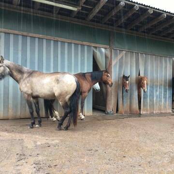
Pferdepension Offenstall Paddockstall Laufstall
Hofweier
Günter Seigel
@Günter Seigel
Freizeitstall
Paddock
Parkplatz für Pferdeanhänger
Außenbox mit Paddock
Außenboxen
Halbpension
Vollpension
8 weitere...
P+


Box mit Tagespaddock
Gengenbach
Reiterhof-Schwarz
@Reiterhof-Schwarz
FN-Mitglied
Freizeitstall
Vermieten
Hunde willkommen
Longierzirkel/Roundpen
Notfallboxen
19 weitere...
P+
Deprecated: Creation of dynamic property Zend_View_Helper_Ads::$adLink is deprecated in /var/www/stall-frei/htdocs/staging.stall-frei.de/library/Psf/View/Helper/Ads.php on line 108

★ Walter - Ranch ★
Berghaupten
Astrid-Walter
@Astird-Walter
FN-Mitglied
Freizeitstall
Vermieten
Hunde willkommen
Krankenbox
Notfallboxen
18 weitere...
P

Offenstallplatz ab sofort frei
Gengenbach
Selina
@Selina10
Freizeitstall
Vermieten
Hunde willkommen
Paddock
Offenstall
8 weitere...
P

Freizeit/Springstall hat freie Box
Offenburg
Dielenschneider
@Dielenschneider
Freizeitstall
Geländestrecke
Vermieten
Parkplatz für Pferdeanhänger
Pensions- und Gastboxen
Fohlenaufzucht möglich
Zuchtstutenhaltung möglich
11 weitere...
P

Matschfreier Offenstall in Wallachherde
Gengenbach
Reiterhof-Schwarz
@Reiterhof-Schwarz
FN-Mitglied
Pferdeausbildung
Vermieten
Hunde willkommen
Krankenbox
Notfallboxen
17 weitere...
P

Exklusive Reitanlage mit kleiner Stallgemeinschaft
Neuried
Private Reitanlage
@PrivateReitanlage
Fahrstall, Kutschwagen
FN-Mitglied
Vermieten
Führanlage
Krankenbox
Notfallboxen
22 weitere...
P

2 Offenstallplätze in 6er Wallachherde frei
Waldkirch-Buchholz
Reithof-Blattmann
@Reithof-Blattmann
Kleine aber feine Pferdepension in fam. Atmosphäre nahe Waldkirch, Denzlingen u. Emmendingen, ca. 10 km bis Freiburg. Freizeitstall.
neu
R
Leider kein Vorschaubild
Leider kein Vorschaubild
Privater Sport und Freizeitstall mit Vereinsntzg.
Schutterwald
Charlotte Resnick
@ResnickRidersRanch
FN-Mitglied
Freizeitstall
Führanlage
Hunde willkommen
Allergikerstall
Gnadenbrothof
Außenbox mit Paddock
Außenboxen
27 weitere...
B
Leider kein Vorschaubild
Leider kein Vorschaubild
Binzenhof Meißenheim Paddock Boxen frei
Meißenheim
Binzenhof
@Binzenhof
Führanlage
Paddock
Außenbox mit Paddock
Innenbox
Vollpension
Einzelne Boxen oder Stallplätze
Ganze Anlage
9 weitere...
P


Wallach Platz frei im Offenstall
Haslach im Kinzigtal
Müllerleile Hof
@Muellerleile-hof
Freizeitstall
Geländestrecke
Vermieten
Hunde willkommen
Krankenbox
Allergikerstall
bedampftes/gewaschenes Heu
27 weitere...
P+
Deprecated: Creation of dynamic property Zend_View::$pageCount is deprecated in /var/www/stall-frei/htdocs/staging.stall-frei.de/library/vendor/shardj/zf1-future/library/Zend/View/Abstract.php on line 308
Deprecated: Creation of dynamic property Zend_View::$itemCountPerPage is deprecated in /var/www/stall-frei/htdocs/staging.stall-frei.de/library/vendor/shardj/zf1-future/library/Zend/View/Abstract.php on line 308
Deprecated: Creation of dynamic property Zend_View::$first is deprecated in /var/www/stall-frei/htdocs/staging.stall-frei.de/library/vendor/shardj/zf1-future/library/Zend/View/Abstract.php on line 308
Deprecated: Creation of dynamic property Zend_View::$current is deprecated in /var/www/stall-frei/htdocs/staging.stall-frei.de/library/vendor/shardj/zf1-future/library/Zend/View/Abstract.php on line 308
Deprecated: Creation of dynamic property Zend_View::$last is deprecated in /var/www/stall-frei/htdocs/staging.stall-frei.de/library/vendor/shardj/zf1-future/library/Zend/View/Abstract.php on line 308
Deprecated: Creation of dynamic property Zend_View::$next is deprecated in /var/www/stall-frei/htdocs/staging.stall-frei.de/library/vendor/shardj/zf1-future/library/Zend/View/Abstract.php on line 308
Deprecated: Creation of dynamic property Zend_View::$pagesInRange is deprecated in /var/www/stall-frei/htdocs/staging.stall-frei.de/library/vendor/shardj/zf1-future/library/Zend/View/Abstract.php on line 308
Deprecated: Creation of dynamic property Zend_View::$firstPageInRange is deprecated in /var/www/stall-frei/htdocs/staging.stall-frei.de/library/vendor/shardj/zf1-future/library/Zend/View/Abstract.php on line 308
Deprecated: Creation of dynamic property Zend_View::$lastPageInRange is deprecated in /var/www/stall-frei/htdocs/staging.stall-frei.de/library/vendor/shardj/zf1-future/library/Zend/View/Abstract.php on line 308
Deprecated: Creation of dynamic property Zend_View::$currentItemCount is deprecated in /var/www/stall-frei/htdocs/staging.stall-frei.de/library/vendor/shardj/zf1-future/library/Zend/View/Abstract.php on line 308
Deprecated: Creation of dynamic property Zend_View::$totalItemCount is deprecated in /var/www/stall-frei/htdocs/staging.stall-frei.de/library/vendor/shardj/zf1-future/library/Zend/View/Abstract.php on line 308
Deprecated: Creation of dynamic property Zend_View::$firstItemNumber is deprecated in /var/www/stall-frei/htdocs/staging.stall-frei.de/library/vendor/shardj/zf1-future/library/Zend/View/Abstract.php on line 308
Deprecated: Creation of dynamic property Zend_View::$lastItemNumber is deprecated in /var/www/stall-frei/htdocs/staging.stall-frei.de/library/vendor/shardj/zf1-future/library/Zend/View/Abstract.php on line 308
Deprecated: Creation of dynamic property Zend_View::$router is deprecated in /var/www/stall-frei/htdocs/staging.stall-frei.de/library/vendor/shardj/zf1-future/library/Zend/View/Abstract.php on line 308
Deprecated: Creation of dynamic property Zend_View::$urlParams is deprecated in /var/www/stall-frei/htdocs/staging.stall-frei.de/library/vendor/shardj/zf1-future/library/Zend/View/Abstract.php on line 308
Deprecated: Creation of dynamic property Zend_View::$showAds is deprecated in /var/www/stall-frei/htdocs/staging.stall-frei.de/library/vendor/shardj/zf1-future/library/Zend/View/Abstract.php on line 308
Deprecated: Creation of dynamic property Zend_View::$objectIds is deprecated in /var/www/stall-frei/htdocs/staging.stall-frei.de/library/vendor/shardj/zf1-future/library/Zend/View/Abstract.php on line 308
Deprecated: Creation of dynamic property Zend_View::$showNavbar is deprecated in /var/www/stall-frei/htdocs/staging.stall-frei.de/library/vendor/shardj/zf1-future/library/Zend/View/Abstract.php on line 308
Deprecated: Creation of dynamic property Zend_View::$showBreadcrumb is deprecated in /var/www/stall-frei/htdocs/staging.stall-frei.de/library/vendor/shardj/zf1-future/library/Zend/View/Abstract.php on line 308
Deprecated: Creation of dynamic property Zend_View::$showFooter is deprecated in /var/www/stall-frei/htdocs/staging.stall-frei.de/library/vendor/shardj/zf1-future/library/Zend/View/Abstract.php on line 308
Deprecated: Creation of dynamic property Zend_View::$showInternalAds is deprecated in /var/www/stall-frei/htdocs/staging.stall-frei.de/library/vendor/shardj/zf1-future/library/Zend/View/Abstract.php on line 308
Deprecated: Creation of dynamic property Zend_View::$blNoContent is deprecated in /var/www/stall-frei/htdocs/staging.stall-frei.de/library/vendor/shardj/zf1-future/library/Zend/View/Abstract.php on line 308
Deprecated: Creation of dynamic property Zend_View::$sMetaDesc is deprecated in /var/www/stall-frei/htdocs/staging.stall-frei.de/library/vendor/shardj/zf1-future/library/Zend/View/Abstract.php on line 308
Deprecated: Creation of dynamic property Zend_View::$useGmaps is deprecated in /var/www/stall-frei/htdocs/staging.stall-frei.de/library/vendor/shardj/zf1-future/library/Zend/View/Abstract.php on line 308
Deprecated: Creation of dynamic property Zend_View::$touches is deprecated in /var/www/stall-frei/htdocs/staging.stall-frei.de/library/vendor/shardj/zf1-future/library/Zend/View/Abstract.php on line 308
Deprecated: Creation of dynamic property Zend_View::$oProject is deprecated in /var/www/stall-frei/htdocs/staging.stall-frei.de/library/vendor/shardj/zf1-future/library/Zend/View/Abstract.php on line 308
Deprecated: Creation of dynamic property Zend_View::$pageHeadline is deprecated in /var/www/stall-frei/htdocs/staging.stall-frei.de/library/vendor/shardj/zf1-future/library/Zend/View/Abstract.php on line 308
Deprecated: Creation of dynamic property Zend_View::$disableLocationField is deprecated in /var/www/stall-frei/htdocs/staging.stall-frei.de/library/vendor/shardj/zf1-future/library/Zend/View/Abstract.php on line 308
Deprecated: Creation of dynamic property Zend_View::$isSearch is deprecated in /var/www/stall-frei/htdocs/staging.stall-frei.de/library/vendor/shardj/zf1-future/library/Zend/View/Abstract.php on line 308
Deprecated: Creation of dynamic property Zend_View::$pageTitle is deprecated in /var/www/stall-frei/htdocs/staging.stall-frei.de/library/vendor/shardj/zf1-future/library/Zend/View/Abstract.php on line 308
Deprecated: Creation of dynamic property Psf_Form_Element_Text::$class is deprecated in /var/www/stall-frei/htdocs/staging.stall-frei.de/library/vendor/shardj/zf1-future/library/Zend/Form/Element.php on line 874
Deprecated: Creation of dynamic property Psf_Form_Element_Text::$size is deprecated in /var/www/stall-frei/htdocs/staging.stall-frei.de/library/vendor/shardj/zf1-future/library/Zend/Form/Element.php on line 874
Deprecated: Creation of dynamic property Psf_Form_Element_Text::$placeholder is deprecated in /var/www/stall-frei/htdocs/staging.stall-frei.de/library/vendor/shardj/zf1-future/library/Zend/Form/Element.php on line 874
Deprecated: Creation of dynamic property Psf_Form_Element_Hidden::$class is deprecated in /var/www/stall-frei/htdocs/staging.stall-frei.de/library/vendor/shardj/zf1-future/library/Zend/Form/Element.php on line 874
Deprecated: Creation of dynamic property Psf_Form_Element_Hidden::$class is deprecated in /var/www/stall-frei/htdocs/staging.stall-frei.de/library/vendor/shardj/zf1-future/library/Zend/Form/Element.php on line 874
Deprecated: Creation of dynamic property Psf_Form_Element_Hidden::$class is deprecated in /var/www/stall-frei/htdocs/staging.stall-frei.de/library/vendor/shardj/zf1-future/library/Zend/Form/Element.php on line 874
Deprecated: Creation of dynamic property Psf_Form_Element_Hidden::$class is deprecated in /var/www/stall-frei/htdocs/staging.stall-frei.de/library/vendor/shardj/zf1-future/library/Zend/Form/Element.php on line 874
Deprecated: Creation of dynamic property Psf_Form_Element_Select::$class is deprecated in /var/www/stall-frei/htdocs/staging.stall-frei.de/library/vendor/shardj/zf1-future/library/Zend/Form/Element.php on line 874
Deprecated: Creation of dynamic property Psf_Form_Element_Select::$class is deprecated in /var/www/stall-frei/htdocs/staging.stall-frei.de/library/vendor/shardj/zf1-future/library/Zend/Form/Element.php on line 874
Deprecated: Creation of dynamic property Psf_Form_Element_Select::$class is deprecated in /var/www/stall-frei/htdocs/staging.stall-frei.de/library/vendor/shardj/zf1-future/library/Zend/Form/Element.php on line 874
Deprecated: Creation of dynamic property Psf_Form_Element_Select::$class is deprecated in /var/www/stall-frei/htdocs/staging.stall-frei.de/library/vendor/shardj/zf1-future/library/Zend/Form/Element.php on line 874
Deprecated: Creation of dynamic property Psf_Form_Element_Text::$class is deprecated in /var/www/stall-frei/htdocs/staging.stall-frei.de/library/vendor/shardj/zf1-future/library/Zend/Form/Element.php on line 874
Deprecated: Creation of dynamic property Psf_Form_Element_Checkbox::$label is deprecated in /var/www/stall-frei/htdocs/staging.stall-frei.de/library/vendor/shardj/zf1-future/library/Zend/Form/Element.php on line 874
Deprecated: Creation of dynamic property Zend_View::$sort is deprecated in /var/www/stall-frei/htdocs/staging.stall-frei.de/library/vendor/shardj/zf1-future/library/Zend/View/Abstract.php on line 308
Deprecated: Creation of dynamic property Zend_View::$searchLocation is deprecated in /var/www/stall-frei/htdocs/staging.stall-frei.de/library/vendor/shardj/zf1-future/library/Zend/View/Abstract.php on line 308
Deprecated: Creation of dynamic property Zend_View::$locationHint is deprecated in /var/www/stall-frei/htdocs/staging.stall-frei.de/library/vendor/shardj/zf1-future/library/Zend/View/Abstract.php on line 308
Psf_GeoCoder_Abstract::getLocation: Hohberg Get Location CachedOrLive
Psf_GeoCoder_Abstract::getCachedOrLive: Hohberg
Psf_GeoCoder_OpenCageData::makeApiRequest: response:
Array
(
[documentation] => https://opencagedata.com/api
[licenses] => Array
(
[0] => Array
(
[name] => see attribution guide
[url] => https://opencagedata.com/credits
)
)
[results] => Array
(
[0] => Array
(
[bounds] => Array
(
[northeast] => Array
(
[lat] => 48.453084
[lng] => 7.9785695
)
[southwest] => Array
(
[lat] => 48.3679384
[lng] => 7.8501654
)
)
[components] => Array
(
[ISO_3166-1_alpha-2] => DE
[ISO_3166-1_alpha-3] => DEU
[ISO_3166-2] => Array
(
[0] => DE-BW
)
[_category] => place
[_normalized_city] => Hohberg
[_type] => municipality
[continent] => Europe
[country] => Deutschland
[country_code] => de
[county] => Ortenaukreis
[municipality] => Hohberg
[political_union] => European Union
[postcode] => 77749
[state] => Baden-Württemberg
[state_code] => BW
)
[confidence] => 7
[formatted] => 77749 Hohberg, Deutschland
[geometry] => Array
(
[lat] => 48.4113713
[lng] => 7.9214215
)
)
[1] => Array
(
[bounds] => Array
(
[northeast] => Array
(
[lat] => 50.2254935
[lng] => 11.6829128
)
[southwest] => Array
(
[lat] => 50.1854935
[lng] => 11.6429128
)
)
[components] => Array
(
[ISO_3166-1_alpha-2] => DE
[ISO_3166-1_alpha-3] => DEU
[ISO_3166-2] => Array
(
[0] => DE-BY
)
[_category] => place
[_normalized_city] => Helmbrechts
[_type] => hamlet
[continent] => Europe
[country] => Deutschland
[country_code] => de
[county] => Landkreis Hof
[hamlet] => Hohberg
[political_union] => European Union
[postcode] => 95352
[state] => Bayern
[state_code] => BY
[town] => Helmbrechts
)
[confidence] => 7
[formatted] => Hohberg, 95352 Helmbrechts, Deutschland
[geometry] => Array
(
[lat] => 50.2054935
[lng] => 11.6629128
)
)
[2] => Array
(
[bounds] => Array
(
[northeast] => Array
(
[lat] => 51.0695165
[lng] => 14.4108847
)
[southwest] => Array
(
[lat] => 51.0694165
[lng] => 14.4107847
)
)
[components] => Array
(
[ISO_3166-1_alpha-2] => DE
[ISO_3166-1_alpha-3] => DEU
[ISO_3166-2] => Array
(
[0] => DE-SN
)
[_category] => natural/water
[_normalized_city] => Schirgiswalde-Kirschau
[_type] => peak
[continent] => Europe
[country] => Deutschland
[country_code] => de
[county] => Bautzen
[peak] => Hohberg
[political_union] => European Union
[postcode] => 02681
[state] => Sachsen
[state_code] => SN
[town] => Schirgiswalde-Kirschau
)
[confidence] => 9
[formatted] => Hohberg, 02681 Schirgiswalde-Kirschau, Deutschland
[geometry] => Array
(
[lat] => 51.0694665
[lng] => 14.4108347
)
)
[3] => Array
(
[bounds] => Array
(
[northeast] => Array
(
[lat] => 51.0403633
[lng] => 14.4364583
)
[southwest] => Array
(
[lat] => 51.0402633
[lng] => 14.4363583
)
)
[components] => Array
(
[ISO_3166-1_alpha-2] => DE
[ISO_3166-1_alpha-3] => DEU
[ISO_3166-2] => Array
(
[0] => DE-SN
)
[_category] => natural/water
[_normalized_city] => Sohland an der Spree
[_type] => peak
[continent] => Europe
[country] => Deutschland
[country_code] => de
[county] => Bautzen
[peak] => Hohberg
[political_union] => European Union
[postcode] => 02689
[state] => Sachsen
[state_code] => SN
[village] => Sohland an der Spree
)
[confidence] => 9
[formatted] => Hohberg, 02689 Sohland an der Spree, Deutschland
[geometry] => Array
(
[lat] => 51.0403133
[lng] => 14.4364083
)
)
[4] => Array
(
[bounds] => Array
(
[northeast] => Array
(
[lat] => 49.5354755
[lng] => 8.8542088
)
[southwest] => Array
(
[lat] => 49.5353755
[lng] => 8.8541088
)
)
[components] => Array
(
[ISO_3166-1_alpha-2] => DE
[ISO_3166-1_alpha-3] => DEU
[ISO_3166-2] => Array
(
[0] => DE-HE
)
[_category] => natural/water
[_normalized_city] => Ober-Schönmattenwag
[_type] => peak
[continent] => Europe
[country] => Deutschland
[country_code] => de
[county] => Kreis Bergstraße
[municipality] => Wald-Michelbach
[peak] => Hohberg
[political_union] => European Union
[postcode] => 69483
[state] => Hessen
[state_code] => HE
[village] => Ober-Schönmattenwag
)
[confidence] => 9
[formatted] => Hohberg, 69483 Ober-Schönmattenwag, Deutschland
[geometry] => Array
(
[lat] => 49.5354255
[lng] => 8.8541588
)
)
[5] => Array
(
[bounds] => Array
(
[northeast] => Array
(
[lat] => 51.1441943
[lng] => 14.0813343
)
[southwest] => Array
(
[lat] => 51.1440943
[lng] => 14.0812343
)
)
[components] => Array
(
[ISO_3166-1_alpha-2] => DE
[ISO_3166-1_alpha-3] => DEU
[ISO_3166-2] => Array
(
[0] => DE-SN
)
[_category] => natural/water
[_normalized_city] => Frankenthal
[_type] => peak
[continent] => Europe
[country] => Deutschland
[country_code] => de
[county] => Bautzen
[municipality] => Großharthau
[peak] => Hohberg
[political_union] => European Union
[postcode] => 01909
[state] => Sachsen
[state_code] => SN
[village] => Frankenthal
)
[confidence] => 9
[formatted] => Hohberg, 01909 Frankenthal, Deutschland
[geometry] => Array
(
[lat] => 51.1441443
[lng] => 14.0812843
)
)
[6] => Array
(
[bounds] => Array
(
[northeast] => Array
(
[lat] => 51.2041068
[lng] => 13.6777637
)
[southwest] => Array
(
[lat] => 51.2040068
[lng] => 13.6776637
)
)
[components] => Array
(
[ISO_3166-1_alpha-2] => DE
[ISO_3166-1_alpha-3] => DEU
[ISO_3166-2] => Array
(
[0] => DE-SN
)
[_category] => natural/water
[_normalized_city] => Radeburg
[_type] => peak
[continent] => Europe
[country] => Deutschland
[country_code] => de
[county] => Meißen
[peak] => Hohberg
[political_union] => European Union
[postcode] => 01471
[state] => Sachsen
[state_code] => SN
[town] => Radeburg
)
[confidence] => 9
[formatted] => Hohberg, 01471 Radeburg, Deutschland
[geometry] => Array
(
[lat] => 51.2040568
[lng] => 13.6777137
)
)
[7] => Array
(
[bounds] => Array
(
[northeast] => Array
(
[lat] => 47.6680393
[lng] => 9.350142
)
[southwest] => Array
(
[lat] => 47.6679393
[lng] => 9.350042
)
)
[components] => Array
(
[ISO_3166-1_alpha-2] => DE
[ISO_3166-1_alpha-3] => DEU
[ISO_3166-2] => Array
(
[0] => DE-BW
)
[_category] => natural/water
[_normalized_city] => Immenstaad am Bodensee
[_type] => peak
[continent] => Europe
[country] => Deutschland
[country_code] => de
[county] => Bodenseekreis
[municipality] => VVG der Stadt Friedrichshafen
[peak] => Hohberg
[political_union] => European Union
[postcode] => 88090
[state] => Baden-Württemberg
[state_code] => BW
[village] => Immenstaad am Bodensee
)
[confidence] => 9
[formatted] => Hohberg, 88090 Immenstaad am Bodensee, Deutschland
[geometry] => Array
(
[lat] => 47.6679893
[lng] => 9.350092
)
)
[8] => Array
(
[bounds] => Array
(
[northeast] => Array
(
[lat] => 48.6414867
[lng] => 10.0133367
)
[southwest] => Array
(
[lat] => 48.6413867
[lng] => 10.0132367
)
)
[components] => Array
(
[ISO_3166-1_alpha-2] => DE
[ISO_3166-1_alpha-3] => DEU
[ISO_3166-2] => Array
(
[0] => DE-BW
)
[_category] => natural/water
[_normalized_city] => Gerstetten
[_type] => peak
[continent] => Europe
[country] => Deutschland
[country_code] => de
[county] => Landkreis Heidenheim
[peak] => Hohberg
[political_union] => European Union
[postcode] => 89547
[state] => Baden-Württemberg
[state_code] => BW
[village] => Gerstetten
)
[confidence] => 9
[formatted] => Hohberg, 89547 Gerstetten, Deutschland
[geometry] => Array
(
[lat] => 48.6414367
[lng] => 10.0132867
)
)
[9] => Array
(
[bounds] => Array
(
[northeast] => Array
(
[lat] => 51.9739884
[lng] => 9.2089337
)
[southwest] => Array
(
[lat] => 51.9738884
[lng] => 9.2088337
)
)
[components] => Array
(
[ISO_3166-1_alpha-2] => DE
[ISO_3166-1_alpha-3] => DEU
[ISO_3166-2] => Array
(
[0] => DE-NI
)
[_category] => natural/water
[_normalized_city] => Bad Pyrmont
[_type] => peak
[continent] => Europe
[country] => Deutschland
[country_code] => de
[county] => Landkreis Hameln-Pyrmont
[peak] => Hohberg
[political_union] => European Union
[postcode] => 31812
[state] => Niedersachsen
[state_code] => NI
[town] => Bad Pyrmont
)
[confidence] => 9
[formatted] => Hohberg, 31812 Bad Pyrmont, Deutschland
[geometry] => Array
(
[lat] => 51.9739384
[lng] => 9.2088837
)
)
)
[status] => Array
(
[code] => 200
[message] => OK
)
[stay_informed] => Array
(
[blog] => https://blog.opencagedata.com
[mastodon] => https://en.osm.town/@opencage
)
[thanks] => For using an OpenCage API
[timestamp] => Array
(
[created_http] => Wed, 04 Feb 2026 12:57:28 GMT
[created_unix] => 1770209848
)
[total_results] => 10
)
Psf_GeoCoder_Abstract::convertLocationResult
{"documentation":"https:\/\/opencagedata.com\/api","licenses":[{"name":"see attribution guide","url":"https:\/\/opencagedata.com\/credits"}],"results":[{"bounds":{"northeast":{"lat":48.453084,"lng":7.9785695},"southwest":{"lat":48.3679384,"lng":7.8501654}},"components":{"ISO_3166-1_alpha-2":"DE","ISO_3166-1_alpha-3":"DEU","ISO_3166-2":["DE-BW"],"_category":"place","_normalized_city":"Hohberg","_type":"municipality","continent":"Europe","country":"Deutschland","country_code":"de","county":"Ortenaukreis","municipality":"Hohberg","political_union":"European Union","postcode":"77749","state":"Baden-W\u00fcrttemberg","state_code":"BW"},"confidence":7,"formatted":"77749 Hohberg, Deutschland","geometry":{"lat":48.4113713,"lng":7.9214215}},{"bounds":{"northeast":{"lat":50.2254935,"lng":11.6829128},"southwest":{"lat":50.1854935,"lng":11.6429128}},"components":{"ISO_3166-1_alpha-2":"DE","ISO_3166-1_alpha-3":"DEU","ISO_3166-2":["DE-BY"],"_category":"place","_normalized_city":"Helmbrechts","_type":"hamlet","continent":"Europe","country":"Deutschland","country_code":"de","county":"Landkreis Hof","hamlet":"Hohberg","political_union":"European Union","postcode":"95352","state":"Bayern","state_code":"BY","town":"Helmbrechts"},"confidence":7,"formatted":"Hohberg, 95352 Helmbrechts, Deutschland","geometry":{"lat":50.2054935,"lng":11.6629128}},{"bounds":{"northeast":{"lat":51.0695165,"lng":14.4108847},"southwest":{"lat":51.0694165,"lng":14.4107847}},"components":{"ISO_3166-1_alpha-2":"DE","ISO_3166-1_alpha-3":"DEU","ISO_3166-2":["DE-SN"],"_category":"natural\/water","_normalized_city":"Schirgiswalde-Kirschau","_type":"peak","continent":"Europe","country":"Deutschland","country_code":"de","county":"Bautzen","peak":"Hohberg","political_union":"European Union","postcode":"02681","state":"Sachsen","state_code":"SN","town":"Schirgiswalde-Kirschau"},"confidence":9,"formatted":"Hohberg, 02681 Schirgiswalde-Kirschau, Deutschland","geometry":{"lat":51.0694665,"lng":14.4108347}},{"bounds":{"northeast":{"lat":51.0403633,"lng":14.4364583},"southwest":{"lat":51.0402633,"lng":14.4363583}},"components":{"ISO_3166-1_alpha-2":"DE","ISO_3166-1_alpha-3":"DEU","ISO_3166-2":["DE-SN"],"_category":"natural\/water","_normalized_city":"Sohland an der Spree","_type":"peak","continent":"Europe","country":"Deutschland","country_code":"de","county":"Bautzen","peak":"Hohberg","political_union":"European Union","postcode":"02689","state":"Sachsen","state_code":"SN","village":"Sohland an der Spree"},"confidence":9,"formatted":"Hohberg, 02689 Sohland an der Spree, Deutschland","geometry":{"lat":51.0403133,"lng":14.4364083}},{"bounds":{"northeast":{"lat":49.5354755,"lng":8.8542088},"southwest":{"lat":49.5353755,"lng":8.8541088}},"components":{"ISO_3166-1_alpha-2":"DE","ISO_3166-1_alpha-3":"DEU","ISO_3166-2":["DE-HE"],"_category":"natural\/water","_normalized_city":"Ober-Sch\u00f6nmattenwag","_type":"peak","continent":"Europe","country":"Deutschland","country_code":"de","county":"Kreis Bergstra\u00dfe","municipality":"Wald-Michelbach","peak":"Hohberg","political_union":"European Union","postcode":"69483","state":"Hessen","state_code":"HE","village":"Ober-Sch\u00f6nmattenwag"},"confidence":9,"formatted":"Hohberg, 69483 Ober-Sch\u00f6nmattenwag, Deutschland","geometry":{"lat":49.5354255,"lng":8.8541588}},{"bounds":{"northeast":{"lat":51.1441943,"lng":14.0813343},"southwest":{"lat":51.1440943,"lng":14.0812343}},"components":{"ISO_3166-1_alpha-2":"DE","ISO_3166-1_alpha-3":"DEU","ISO_3166-2":["DE-SN"],"_category":"natural\/water","_normalized_city":"Frankenthal","_type":"peak","continent":"Europe","country":"Deutschland","country_code":"de","county":"Bautzen","municipality":"Gro\u00dfharthau","peak":"Hohberg","political_union":"European Union","postcode":"01909","state":"Sachsen","state_code":"SN","village":"Frankenthal"},"confidence":9,"formatted":"Hohberg, 01909 Frankenthal, Deutschland","geometry":{"lat":51.1441443,"lng":14.0812843}},{"bounds":{"northeast":{"lat":51.2041068,"lng":13.6777637},"southwest":{"lat":51.2040068,"lng":13.6776637}},"components":{"ISO_3166-1_alpha-2":"DE","ISO_3166-1_alpha-3":"DEU","ISO_3166-2":["DE-SN"],"_category":"natural\/water","_normalized_city":"Radeburg","_type":"peak","continent":"Europe","country":"Deutschland","country_code":"de","county":"Mei\u00dfen","peak":"Hohberg","political_union":"European Union","postcode":"01471","state":"Sachsen","state_code":"SN","town":"Radeburg"},"confidence":9,"formatted":"Hohberg, 01471 Radeburg, Deutschland","geometry":{"lat":51.2040568,"lng":13.6777137}},{"bounds":{"northeast":{"lat":47.6680393,"lng":9.350142},"southwest":{"lat":47.6679393,"lng":9.350042}},"components":{"ISO_3166-1_alpha-2":"DE","ISO_3166-1_alpha-3":"DEU","ISO_3166-2":["DE-BW"],"_category":"natural\/water","_normalized_city":"Immenstaad am Bodensee","_type":"peak","continent":"Europe","country":"Deutschland","country_code":"de","county":"Bodenseekreis","municipality":"VVG der Stadt Friedrichshafen","peak":"Hohberg","political_union":"European Union","postcode":"88090","state":"Baden-W\u00fcrttemberg","state_code":"BW","village":"Immenstaad am Bodensee"},"confidence":9,"formatted":"Hohberg, 88090 Immenstaad am Bodensee, Deutschland","geometry":{"lat":47.6679893,"lng":9.350092}},{"bounds":{"northeast":{"lat":48.6414867,"lng":10.0133367},"southwest":{"lat":48.6413867,"lng":10.0132367}},"components":{"ISO_3166-1_alpha-2":"DE","ISO_3166-1_alpha-3":"DEU","ISO_3166-2":["DE-BW"],"_category":"natural\/water","_normalized_city":"Gerstetten","_type":"peak","continent":"Europe","country":"Deutschland","country_code":"de","county":"Landkreis Heidenheim","peak":"Hohberg","political_union":"European Union","postcode":"89547","state":"Baden-W\u00fcrttemberg","state_code":"BW","village":"Gerstetten"},"confidence":9,"formatted":"Hohberg, 89547 Gerstetten, Deutschland","geometry":{"lat":48.6414367,"lng":10.0132867}},{"bounds":{"northeast":{"lat":51.9739884,"lng":9.2089337},"southwest":{"lat":51.9738884,"lng":9.2088337}},"components":{"ISO_3166-1_alpha-2":"DE","ISO_3166-1_alpha-3":"DEU","ISO_3166-2":["DE-NI"],"_category":"natural\/water","_normalized_city":"Bad Pyrmont","_type":"peak","continent":"Europe","country":"Deutschland","country_code":"de","county":"Landkreis Hameln-Pyrmont","peak":"Hohberg","political_union":"European Union","postcode":"31812","state":"Niedersachsen","state_code":"NI","town":"Bad Pyrmont"},"confidence":9,"formatted":"Hohberg, 31812 Bad Pyrmont, Deutschland","geometry":{"lat":51.9739384,"lng":9.2088837}}],"status":{"code":200,"message":"OK"},"stay_informed":{"blog":"https:\/\/blog.opencagedata.com","mastodon":"https:\/\/en.osm.town\/@opencage"},"thanks":"For using an OpenCage API","timestamp":{"created_http":"Wed, 04 Feb 2026 12:57:28 GMT","created_unix":1770209848},"total_results":10}Array
(
[0] => stdClass Object
(
[bounds] => stdClass Object
(
[northeast] => stdClass Object
(
[lat] => 48.453084
[lng] => 7.9785695
)
[southwest] => stdClass Object
(
[lat] => 48.3679384
[lng] => 7.8501654
)
)
[components] => stdClass Object
(
[ISO_3166-1_alpha-2] => DE
[ISO_3166-1_alpha-3] => DEU
[ISO_3166-2] => Array
(
[0] => DE-BW
)
[_category] => place
[_normalized_city] => Hohberg
[_type] => municipality
[continent] => Europe
[country] => Deutschland
[country_code] => de
[county] => Ortenaukreis
[municipality] => Hohberg
[political_union] => European Union
[postcode] => 77749
[state] => Baden-Württemberg
[state_code] => BW
)
[confidence] => 7
[formatted] => 77749 Hohberg, Deutschland
[geometry] => stdClass Object
(
[lat] => 48.4113713
[lng] => 7.9214215
)
)
[1] => stdClass Object
(
[bounds] => stdClass Object
(
[northeast] => stdClass Object
(
[lat] => 50.2254935
[lng] => 11.6829128
)
[southwest] => stdClass Object
(
[lat] => 50.1854935
[lng] => 11.6429128
)
)
[components] => stdClass Object
(
[ISO_3166-1_alpha-2] => DE
[ISO_3166-1_alpha-3] => DEU
[ISO_3166-2] => Array
(
[0] => DE-BY
)
[_category] => place
[_normalized_city] => Helmbrechts
[_type] => hamlet
[continent] => Europe
[country] => Deutschland
[country_code] => de
[county] => Landkreis Hof
[hamlet] => Hohberg
[political_union] => European Union
[postcode] => 95352
[state] => Bayern
[state_code] => BY
[town] => Helmbrechts
)
[confidence] => 7
[formatted] => Hohberg, 95352 Helmbrechts, Deutschland
[geometry] => stdClass Object
(
[lat] => 50.2054935
[lng] => 11.6629128
)
)
[2] => stdClass Object
(
[bounds] => stdClass Object
(
[northeast] => stdClass Object
(
[lat] => 51.0695165
[lng] => 14.4108847
)
[southwest] => stdClass Object
(
[lat] => 51.0694165
[lng] => 14.4107847
)
)
[components] => stdClass Object
(
[ISO_3166-1_alpha-2] => DE
[ISO_3166-1_alpha-3] => DEU
[ISO_3166-2] => Array
(
[0] => DE-SN
)
[_category] => natural/water
[_normalized_city] => Schirgiswalde-Kirschau
[_type] => peak
[continent] => Europe
[country] => Deutschland
[country_code] => de
[county] => Bautzen
[peak] => Hohberg
[political_union] => European Union
[postcode] => 02681
[state] => Sachsen
[state_code] => SN
[town] => Schirgiswalde-Kirschau
)
[confidence] => 9
[formatted] => Hohberg, 02681 Schirgiswalde-Kirschau, Deutschland
[geometry] => stdClass Object
(
[lat] => 51.0694665
[lng] => 14.4108347
)
)
[3] => stdClass Object
(
[bounds] => stdClass Object
(
[northeast] => stdClass Object
(
[lat] => 51.0403633
[lng] => 14.4364583
)
[southwest] => stdClass Object
(
[lat] => 51.0402633
[lng] => 14.4363583
)
)
[components] => stdClass Object
(
[ISO_3166-1_alpha-2] => DE
[ISO_3166-1_alpha-3] => DEU
[ISO_3166-2] => Array
(
[0] => DE-SN
)
[_category] => natural/water
[_normalized_city] => Sohland an der Spree
[_type] => peak
[continent] => Europe
[country] => Deutschland
[country_code] => de
[county] => Bautzen
[peak] => Hohberg
[political_union] => European Union
[postcode] => 02689
[state] => Sachsen
[state_code] => SN
[village] => Sohland an der Spree
)
[confidence] => 9
[formatted] => Hohberg, 02689 Sohland an der Spree, Deutschland
[geometry] => stdClass Object
(
[lat] => 51.0403133
[lng] => 14.4364083
)
)
[4] => stdClass Object
(
[bounds] => stdClass Object
(
[northeast] => stdClass Object
(
[lat] => 49.5354755
[lng] => 8.8542088
)
[southwest] => stdClass Object
(
[lat] => 49.5353755
[lng] => 8.8541088
)
)
[components] => stdClass Object
(
[ISO_3166-1_alpha-2] => DE
[ISO_3166-1_alpha-3] => DEU
[ISO_3166-2] => Array
(
[0] => DE-HE
)
[_category] => natural/water
[_normalized_city] => Ober-Schönmattenwag
[_type] => peak
[continent] => Europe
[country] => Deutschland
[country_code] => de
[county] => Kreis Bergstraße
[municipality] => Wald-Michelbach
[peak] => Hohberg
[political_union] => European Union
[postcode] => 69483
[state] => Hessen
[state_code] => HE
[village] => Ober-Schönmattenwag
)
[confidence] => 9
[formatted] => Hohberg, 69483 Ober-Schönmattenwag, Deutschland
[geometry] => stdClass Object
(
[lat] => 49.5354255
[lng] => 8.8541588
)
)
[5] => stdClass Object
(
[bounds] => stdClass Object
(
[northeast] => stdClass Object
(
[lat] => 51.1441943
[lng] => 14.0813343
)
[southwest] => stdClass Object
(
[lat] => 51.1440943
[lng] => 14.0812343
)
)
[components] => stdClass Object
(
[ISO_3166-1_alpha-2] => DE
[ISO_3166-1_alpha-3] => DEU
[ISO_3166-2] => Array
(
[0] => DE-SN
)
[_category] => natural/water
[_normalized_city] => Frankenthal
[_type] => peak
[continent] => Europe
[country] => Deutschland
[country_code] => de
[county] => Bautzen
[municipality] => Großharthau
[peak] => Hohberg
[political_union] => European Union
[postcode] => 01909
[state] => Sachsen
[state_code] => SN
[village] => Frankenthal
)
[confidence] => 9
[formatted] => Hohberg, 01909 Frankenthal, Deutschland
[geometry] => stdClass Object
(
[lat] => 51.1441443
[lng] => 14.0812843
)
)
[6] => stdClass Object
(
[bounds] => stdClass Object
(
[northeast] => stdClass Object
(
[lat] => 51.2041068
[lng] => 13.6777637
)
[southwest] => stdClass Object
(
[lat] => 51.2040068
[lng] => 13.6776637
)
)
[components] => stdClass Object
(
[ISO_3166-1_alpha-2] => DE
[ISO_3166-1_alpha-3] => DEU
[ISO_3166-2] => Array
(
[0] => DE-SN
)
[_category] => natural/water
[_normalized_city] => Radeburg
[_type] => peak
[continent] => Europe
[country] => Deutschland
[country_code] => de
[county] => Meißen
[peak] => Hohberg
[political_union] => European Union
[postcode] => 01471
[state] => Sachsen
[state_code] => SN
[town] => Radeburg
)
[confidence] => 9
[formatted] => Hohberg, 01471 Radeburg, Deutschland
[geometry] => stdClass Object
(
[lat] => 51.2040568
[lng] => 13.6777137
)
)
[7] => stdClass Object
(
[bounds] => stdClass Object
(
[northeast] => stdClass Object
(
[lat] => 47.6680393
[lng] => 9.350142
)
[southwest] => stdClass Object
(
[lat] => 47.6679393
[lng] => 9.350042
)
)
[components] => stdClass Object
(
[ISO_3166-1_alpha-2] => DE
[ISO_3166-1_alpha-3] => DEU
[ISO_3166-2] => Array
(
[0] => DE-BW
)
[_category] => natural/water
[_normalized_city] => Immenstaad am Bodensee
[_type] => peak
[continent] => Europe
[country] => Deutschland
[country_code] => de
[county] => Bodenseekreis
[municipality] => VVG der Stadt Friedrichshafen
[peak] => Hohberg
[political_union] => European Union
[postcode] => 88090
[state] => Baden-Württemberg
[state_code] => BW
[village] => Immenstaad am Bodensee
)
[confidence] => 9
[formatted] => Hohberg, 88090 Immenstaad am Bodensee, Deutschland
[geometry] => stdClass Object
(
[lat] => 47.6679893
[lng] => 9.350092
)
)
[8] => stdClass Object
(
[bounds] => stdClass Object
(
[northeast] => stdClass Object
(
[lat] => 48.6414867
[lng] => 10.0133367
)
[southwest] => stdClass Object
(
[lat] => 48.6413867
[lng] => 10.0132367
)
)
[components] => stdClass Object
(
[ISO_3166-1_alpha-2] => DE
[ISO_3166-1_alpha-3] => DEU
[ISO_3166-2] => Array
(
[0] => DE-BW
)
[_category] => natural/water
[_normalized_city] => Gerstetten
[_type] => peak
[continent] => Europe
[country] => Deutschland
[country_code] => de
[county] => Landkreis Heidenheim
[peak] => Hohberg
[political_union] => European Union
[postcode] => 89547
[state] => Baden-Württemberg
[state_code] => BW
[village] => Gerstetten
)
[confidence] => 9
[formatted] => Hohberg, 89547 Gerstetten, Deutschland
[geometry] => stdClass Object
(
[lat] => 48.6414367
[lng] => 10.0132867
)
)
[9] => stdClass Object
(
[bounds] => stdClass Object
(
[northeast] => stdClass Object
(
[lat] => 51.9739884
[lng] => 9.2089337
)
[southwest] => stdClass Object
(
[lat] => 51.9738884
[lng] => 9.2088337
)
)
[components] => stdClass Object
(
[ISO_3166-1_alpha-2] => DE
[ISO_3166-1_alpha-3] => DEU
[ISO_3166-2] => Array
(
[0] => DE-NI
)
[_category] => natural/water
[_normalized_city] => Bad Pyrmont
[_type] => peak
[continent] => Europe
[country] => Deutschland
[country_code] => de
[county] => Landkreis Hameln-Pyrmont
[peak] => Hohberg
[political_union] => European Union
[postcode] => 31812
[state] => Niedersachsen
[state_code] => NI
[town] => Bad Pyrmont
)
[confidence] => 9
[formatted] => Hohberg, 31812 Bad Pyrmont, Deutschland
[geometry] => stdClass Object
(
[lat] => 51.9739384
[lng] => 9.2088837
)
)
)
Psf_GeoCoder_OpenCageData::getKeyMap: 0
stdClass Object
(
    [bounds] => stdClass Object
        (
            [northeast] => stdClass Object
                (
                    [lat] => 48.453084
                    [lng] => 7.9785695
                )

            [southwest] => stdClass Object
                (
                    [lat] => 48.3679384
                    [lng] => 7.8501654
                )

        )

    [components] => stdClass Object
        (
            [ISO_3166-1_alpha-2] => DE
            [ISO_3166-1_alpha-3] => DEU
            [ISO_3166-2] => Array
                (
                    [0] => DE-BW
                )

            [_category] => place
            [_normalized_city] => Hohberg
            [_type] => municipality
            [continent] => Europe
            [country] => Deutschland
            [country_code] => de
            [county] => Ortenaukreis
            [municipality] => Hohberg
            [political_union] => European Union
            [postcode] => 77749
            [state] => Baden-Württemberg
            [state_code] => BW
        )

    [confidence] => 7
    [formatted] => 77749 Hohberg, Deutschland
    [geometry] => stdClass Object
        (
            [lat] => 48.4113713
            [lng] => 7.9214215
        )

)
Psf_GeoCoder_OpenCageData::getCounty: Ortenaukreis
Psf_GeoCoder_OpenCageData::addMissingData REFETCH!
Array
(
    [address] => 77749 Hohberg, Deutschland
    [type] => municipality
    [street] =>
    [city] =>
    [county] => Ortenaukreis
    [state] => Baden-Württemberg
    [zip] => 77749
    [country] => Deutschland
    [suburb] =>
    [countrycode] => de
    [latitude] => 48.4113713
    [longitude] => 7.9214215
    [accuracy] => 1
    [confidence] => 7
    [bounds] => stdClass Object
        (
            [northeast] => stdClass Object
                (
                    [lat] => 48.453084
                    [lng] => 7.9785695
                )

            [southwest] => stdClass Object
                (
                    [lat] => 48.3679384
                    [lng] => 7.8501654
                )

        )

)
reformat!
Array
(
    [address] => 77749 Hohberg, Deutschland
    [type] => municipality
    [street] =>
    [city] =>
    [county] => Ortenaukreis
    [state] => Baden-Württemberg
    [zip] => 77749
    [country] => Deutschland
    [suburb] =>
    [countrycode] => de
    [latitude] => 48.4113713
    [longitude] => 7.9214215
    [accuracy] => 1
    [confidence] => 7
    [bounds] => stdClass Object
        (
            [northeast] => stdClass Object
                (
                    [lat] => 48.453084
                    [lng] => 7.9785695
                )

            [southwest] => stdClass Object
                (
                    [lat] => 48.3679384
                    [lng] => 7.8501654
                )

        )

    [place] => 77749 , Baden-Württemberg
    [hash] => 28cc05f535e857e6f710fa3080bb7a8c
)
Psf_GeoCoder_OpenCageData::getKeyMap: 1
stdClass Object
(
    [bounds] => stdClass Object
        (
            [northeast] => stdClass Object
                (
                    [lat] => 50.2254935
                    [lng] => 11.6829128
                )

            [southwest] => stdClass Object
                (
                    [lat] => 50.1854935
                    [lng] => 11.6429128
                )

        )

    [components] => stdClass Object
        (
            [ISO_3166-1_alpha-2] => DE
            [ISO_3166-1_alpha-3] => DEU
            [ISO_3166-2] => Array
                (
                    [0] => DE-BY
                )

            [_category] => place
            [_normalized_city] => Helmbrechts
            [_type] => hamlet
            [continent] => Europe
            [country] => Deutschland
            [country_code] => de
            [county] => Landkreis Hof
            [hamlet] => Hohberg
            [political_union] => European Union
            [postcode] => 95352
            [state] => Bayern
            [state_code] => BY
            [town] => Helmbrechts
        )

    [confidence] => 7
    [formatted] => Hohberg, 95352 Helmbrechts, Deutschland
    [geometry] => stdClass Object
        (
            [lat] => 50.2054935
            [lng] => 11.6629128
        )

)
Psf_GeoCoder_OpenCageData::getCounty: Hof
Psf_GeoCoder_OpenCageData::addMissingData REFETCH!
Array
(
    [address] => Hohberg, 95352 Helmbrechts, Deutschland
    [type] => hamlet
    [street] => Hohberg
    [city] => Helmbrechts
    [county] => Hof
    [state] => Bayern
    [zip] => 95352
    [country] => Deutschland
    [suburb] =>
    [countrycode] => de
    [latitude] => 50.2054935
    [longitude] => 11.6629128
    [accuracy] => 1
    [confidence] => 7
    [bounds] => stdClass Object
        (
            [northeast] => stdClass Object
                (
                    [lat] => 50.2254935
                    [lng] => 11.6829128
                )

            [southwest] => stdClass Object
                (
                    [lat] => 50.1854935
                    [lng] => 11.6429128
                )

        )

)
reformat!
Array
(
    [address] => Hohberg, 95352 Helmbrechts, Deutschland
    [type] => hamlet
    [street] => Hohberg
    [city] => Helmbrechts
    [county] => Hof
    [state] => Bayern
    [zip] => 95352
    [country] => Deutschland
    [suburb] =>
    [countrycode] => de
    [latitude] => 50.2054935
    [longitude] => 11.6629128
    [accuracy] => 1
    [confidence] => 7
    [bounds] => stdClass Object
        (
            [northeast] => stdClass Object
                (
                    [lat] => 50.2254935
                    [lng] => 11.6829128
                )

            [southwest] => stdClass Object
                (
                    [lat] => 50.1854935
                    [lng] => 11.6429128
                )

        )

    [place] => Hohberg, 95352 Helmbrechts, Bayern
    [hash] => 796873dede6b2f1e68857231fdafc82e
)
Psf_GeoCoder_OpenCageData::getKeyMap: 2
stdClass Object
(
    [bounds] => stdClass Object
        (
            [northeast] => stdClass Object
                (
                    [lat] => 51.0695165
                    [lng] => 14.4108847
                )

            [southwest] => stdClass Object
                (
                    [lat] => 51.0694165
                    [lng] => 14.4107847
                )

        )

    [components] => stdClass Object
        (
            [ISO_3166-1_alpha-2] => DE
            [ISO_3166-1_alpha-3] => DEU
            [ISO_3166-2] => Array
                (
                    [0] => DE-SN
                )

            [_category] => natural/water
            [_normalized_city] => Schirgiswalde-Kirschau
            [_type] => peak
            [continent] => Europe
            [country] => Deutschland
            [country_code] => de
            [county] => Bautzen
            [peak] => Hohberg
            [political_union] => European Union
            [postcode] => 02681
            [state] => Sachsen
            [state_code] => SN
            [town] => Schirgiswalde-Kirschau
        )

    [confidence] => 9
    [formatted] => Hohberg, 02681 Schirgiswalde-Kirschau, Deutschland
    [geometry] => stdClass Object
        (
            [lat] => 51.0694665
            [lng] => 14.4108347
        )

)
Psf_GeoCoder_OpenCageData::getCounty: Bautzen
Psf_GeoCoder_OpenCageData::addMissingData REFETCH!
Array
(
    [address] => Hohberg, 02681 Schirgiswalde-Kirschau, Deutschland
    [type] => peak
    [street] =>
    [city] => Schirgiswalde-Kirschau
    [county] => Bautzen
    [state] => Sachsen
    [zip] => 02681
    [country] => Deutschland
    [suburb] =>
    [countrycode] => de
    [latitude] => 51.0694665
    [longitude] => 14.4108347
    [accuracy] => 1
    [confidence] => 9
    [bounds] => stdClass Object
        (
            [northeast] => stdClass Object
                (
                    [lat] => 51.0695165
                    [lng] => 14.4108847
                )

            [southwest] => stdClass Object
                (
                    [lat] => 51.0694165
                    [lng] => 14.4107847
                )

        )

)
reformat!
Array
(
    [address] => Hohberg, 02681 Schirgiswalde-Kirschau, Deutschland
    [type] => peak
    [street] =>
    [city] => Schirgiswalde-Kirschau
    [county] => Bautzen
    [state] => Sachsen
    [zip] => 02681
    [country] => Deutschland
    [suburb] =>
    [countrycode] => de
    [latitude] => 51.0694665
    [longitude] => 14.4108347
    [accuracy] => 1
    [confidence] => 9
    [bounds] => stdClass Object
        (
            [northeast] => stdClass Object
                (
                    [lat] => 51.0695165
                    [lng] => 14.4108847
                )

            [southwest] => stdClass Object
                (
                    [lat] => 51.0694165
                    [lng] => 14.4107847
                )

        )

    [place] => 02681 Schirgiswalde-Kirschau, Sachsen
    [hash] => 2f52020b308cc58c66062b2c3493b765
)
Psf_GeoCoder_OpenCageData::getKeyMap: 3
stdClass Object
(
    [bounds] => stdClass Object
        (
            [northeast] => stdClass Object
                (
                    [lat] => 51.0403633
                    [lng] => 14.4364583
                )

            [southwest] => stdClass Object
                (
                    [lat] => 51.0402633
                    [lng] => 14.4363583
                )

        )

    [components] => stdClass Object
        (
            [ISO_3166-1_alpha-2] => DE
            [ISO_3166-1_alpha-3] => DEU
            [ISO_3166-2] => Array
                (
                    [0] => DE-SN
                )

            [_category] => natural/water
            [_normalized_city] => Sohland an der Spree
            [_type] => peak
            [continent] => Europe
            [country] => Deutschland
            [country_code] => de
            [county] => Bautzen
            [peak] => Hohberg
            [political_union] => European Union
            [postcode] => 02689
            [state] => Sachsen
            [state_code] => SN
            [village] => Sohland an der Spree
        )

    [confidence] => 9
    [formatted] => Hohberg, 02689 Sohland an der Spree, Deutschland
    [geometry] => stdClass Object
        (
            [lat] => 51.0403133
            [lng] => 14.4364083
        )

)
Psf_GeoCoder_OpenCageData::getCounty: Bautzen
Psf_GeoCoder_OpenCageData::addMissingData REFETCH!
Array
(
    [address] => Hohberg, 02689 Sohland an der Spree, Deutschland
    [type] => peak
    [street] =>
    [city] => Sohland an der Spree
    [county] => Bautzen
    [state] => Sachsen
    [zip] => 02689
    [country] => Deutschland
    [suburb] =>
    [countrycode] => de
    [latitude] => 51.0403133
    [longitude] => 14.4364083
    [accuracy] => 1
    [confidence] => 9
    [bounds] => stdClass Object
        (
            [northeast] => stdClass Object
                (
                    [lat] => 51.0403633
                    [lng] => 14.4364583
                )

            [southwest] => stdClass Object
                (
                    [lat] => 51.0402633
                    [lng] => 14.4363583
                )

        )

)
reformat!
Array
(
    [address] => Hohberg, 02689 Sohland an der Spree, Deutschland
    [type] => peak
    [street] =>
    [city] => Sohland an der Spree
    [county] => Bautzen
    [state] => Sachsen
    [zip] => 02689
    [country] => Deutschland
    [suburb] =>
    [countrycode] => de
    [latitude] => 51.0403133
    [longitude] => 14.4364083
    [accuracy] => 1
    [confidence] => 9
    [bounds] => stdClass Object
        (
            [northeast] => stdClass Object
                (
                    [lat] => 51.0403633
                    [lng] => 14.4364583
                )

            [southwest] => stdClass Object
                (
                    [lat] => 51.0402633
                    [lng] => 14.4363583
                )

        )

    [place] => 02689 Sohland an der Spree, Sachsen
    [hash] => fd96849804de3a7b7973b447111d3dee
)
Psf_GeoCoder_OpenCageData::getKeyMap: 4
stdClass Object
(
    [bounds] => stdClass Object
        (
            [northeast] => stdClass Object
                (
                    [lat] => 49.5354755
                    [lng] => 8.8542088
                )

            [southwest] => stdClass Object
                (
                    [lat] => 49.5353755
                    [lng] => 8.8541088
                )

        )

    [components] => stdClass Object
        (
            [ISO_3166-1_alpha-2] => DE
            [ISO_3166-1_alpha-3] => DEU
            [ISO_3166-2] => Array
                (
                    [0] => DE-HE
                )

            [_category] => natural/water
            [_normalized_city] => Ober-Schönmattenwag
            [_type] => peak
            [continent] => Europe
            [country] => Deutschland
            [country_code] => de
            [county] => Kreis Bergstraße
            [municipality] => Wald-Michelbach
            [peak] => Hohberg
            [political_union] => European Union
            [postcode] => 69483
            [state] => Hessen
            [state_code] => HE
            [village] => Ober-Schönmattenwag
        )

    [confidence] => 9
    [formatted] => Hohberg, 69483 Ober-Schönmattenwag, Deutschland
    [geometry] => stdClass Object
        (
            [lat] => 49.5354255
            [lng] => 8.8541588
        )

)
Psf_GeoCoder_OpenCageData::getCounty: Bergstraße
Psf_GeoCoder_OpenCageData::addMissingData REFETCH!
Array
(
    [address] => Hohberg, 69483 Ober-Schönmattenwag, Deutschland
    [type] => peak
    [street] =>
    [city] => Ober-Schönmattenwag
    [county] => Bergstraße
    [state] => Hessen
    [zip] => 69483
    [country] => Deutschland
    [suburb] =>
    [countrycode] => de
    [latitude] => 49.5354255
    [longitude] => 8.8541588
    [accuracy] => 1
    [confidence] => 9
    [bounds] => stdClass Object
        (
            [northeast] => stdClass Object
                (
                    [lat] => 49.5354755
                    [lng] => 8.8542088
                )

            [southwest] => stdClass Object
                (
                    [lat] => 49.5353755
                    [lng] => 8.8541088
                )

        )

)
reformat!
Array
(
    [address] => Hohberg, 69483 Ober-Schönmattenwag, Deutschland
    [type] => peak
    [street] =>
    [city] => Ober-Schönmattenwag
    [county] => Bergstraße
    [state] => Hessen
    [zip] => 69483
    [country] => Deutschland
    [suburb] =>
    [countrycode] => de
    [latitude] => 49.5354255
    [longitude] => 8.8541588
    [accuracy] => 1
    [confidence] => 9
    [bounds] => stdClass Object
        (
            [northeast] => stdClass Object
                (
                    [lat] => 49.5354755
                    [lng] => 8.8542088
                )

            [southwest] => stdClass Object
                (
                    [lat] => 49.5353755
                    [lng] => 8.8541088
                )

        )

    [place] => 69483 Ober-Schönmattenwag, Hessen
    [hash] => 1bf700104c751444df48a9a2b0b8ffdd
)
Psf_GeoCoder_OpenCageData::getKeyMap: 5
stdClass Object
(
    [bounds] => stdClass Object
        (
            [northeast] => stdClass Object
                (
                    [lat] => 51.1441943
                    [lng] => 14.0813343
                )

            [southwest] => stdClass Object
                (
                    [lat] => 51.1440943
                    [lng] => 14.0812343
                )

        )

    [components] => stdClass Object
        (
            [ISO_3166-1_alpha-2] => DE
            [ISO_3166-1_alpha-3] => DEU
            [ISO_3166-2] => Array
                (
                    [0] => DE-SN
                )

            [_category] => natural/water
            [_normalized_city] => Frankenthal
            [_type] => peak
            [continent] => Europe
            [country] => Deutschland
            [country_code] => de
            [county] => Bautzen
            [municipality] => Großharthau
            [peak] => Hohberg
            [political_union] => European Union
            [postcode] => 01909
            [state] => Sachsen
            [state_code] => SN
            [village] => Frankenthal
        )

    [confidence] => 9
    [formatted] => Hohberg, 01909 Frankenthal, Deutschland
    [geometry] => stdClass Object
        (
            [lat] => 51.1441443
            [lng] => 14.0812843
        )

)
Psf_GeoCoder_OpenCageData::getCounty: Bautzen
Psf_GeoCoder_OpenCageData::addMissingData REFETCH!
Array
(
    [address] => Hohberg, 01909 Frankenthal, Deutschland
    [type] => peak
    [street] =>
    [city] => Frankenthal
    [county] => Bautzen
    [state] => Sachsen
    [zip] => 01909
    [country] => Deutschland
    [suburb] =>
    [countrycode] => de
    [latitude] => 51.1441443
    [longitude] => 14.0812843
    [accuracy] => 1
    [confidence] => 9
    [bounds] => stdClass Object
        (
            [northeast] => stdClass Object
                (
                    [lat] => 51.1441943
                    [lng] => 14.0813343
                )

            [southwest] => stdClass Object
                (
                    [lat] => 51.1440943
                    [lng] => 14.0812343
                )

        )

)
reformat!
Array
(
    [address] => Hohberg, 01909 Frankenthal, Deutschland
    [type] => peak
    [street] =>
    [city] => Frankenthal
    [county] => Bautzen
    [state] => Sachsen
    [zip] => 01909
    [country] => Deutschland
    [suburb] =>
    [countrycode] => de
    [latitude] => 51.1441443
    [longitude] => 14.0812843
    [accuracy] => 1
    [confidence] => 9
    [bounds] => stdClass Object
        (
            [northeast] => stdClass Object
                (
                    [lat] => 51.1441943
                    [lng] => 14.0813343
                )

            [southwest] => stdClass Object
                (
                    [lat] => 51.1440943
                    [lng] => 14.0812343
                )

        )

    [place] => 01909 Frankenthal, Sachsen
    [hash] => 2cbde075989c4dc4d3e2c499bc43333b
)
Psf_GeoCoder_OpenCageData::getKeyMap: 6
stdClass Object
(
    [bounds] => stdClass Object
        (
            [northeast] => stdClass Object
                (
                    [lat] => 51.2041068
                    [lng] => 13.6777637
                )

            [southwest] => stdClass Object
                (
                    [lat] => 51.2040068
                    [lng] => 13.6776637
                )

        )

    [components] => stdClass Object
        (
            [ISO_3166-1_alpha-2] => DE
            [ISO_3166-1_alpha-3] => DEU
            [ISO_3166-2] => Array
                (
                    [0] => DE-SN
                )

            [_category] => natural/water
            [_normalized_city] => Radeburg
            [_type] => peak
            [continent] => Europe
            [country] => Deutschland
            [country_code] => de
            [county] => Meißen
            [peak] => Hohberg
            [political_union] => European Union
            [postcode] => 01471
            [state] => Sachsen
            [state_code] => SN
            [town] => Radeburg
        )

    [confidence] => 9
    [formatted] => Hohberg, 01471 Radeburg, Deutschland
    [geometry] => stdClass Object
        (
            [lat] => 51.2040568
            [lng] => 13.6777137
        )

)
Psf_GeoCoder_OpenCageData::getCounty: Meißen
Psf_GeoCoder_OpenCageData::addMissingData REFETCH!
Array
(
    [address] => Hohberg, 01471 Radeburg, Deutschland
    [type] => peak
    [street] =>
    [city] => Radeburg
    [county] => Meißen
    [state] => Sachsen
    [zip] => 01471
    [country] => Deutschland
    [suburb] =>
    [countrycode] => de
    [latitude] => 51.2040568
    [longitude] => 13.6777137
    [accuracy] => 1
    [confidence] => 9
    [bounds] => stdClass Object
        (
            [northeast] => stdClass Object
                (
                    [lat] => 51.2041068
                    [lng] => 13.6777637
                )

            [southwest] => stdClass Object
                (
                    [lat] => 51.2040068
                    [lng] => 13.6776637
                )

        )

)
reformat!
Array
(
    [address] => Hohberg, 01471 Radeburg, Deutschland
    [type] => peak
    [street] =>
    [city] => Radeburg
    [county] => Meißen
    [state] => Sachsen
    [zip] => 01471
    [country] => Deutschland
    [suburb] =>
    [countrycode] => de
    [latitude] => 51.2040568
    [longitude] => 13.6777137
    [accuracy] => 1
    [confidence] => 9
    [bounds] => stdClass Object
        (
            [northeast] => stdClass Object
                (
                    [lat] => 51.2041068
                    [lng] => 13.6777637
                )

            [southwest] => stdClass Object
                (
                    [lat] => 51.2040068
                    [lng] => 13.6776637
                )

        )

    [place] => 01471 Radeburg, Sachsen
    [hash] => 70ef7ef38b9b12a6629bfcea517f83ca
)
Psf_GeoCoder_OpenCageData::getKeyMap: 7
stdClass Object
(
    [bounds] => stdClass Object
        (
            [northeast] => stdClass Object
                (
                    [lat] => 47.6680393
                    [lng] => 9.350142
                )

            [southwest] => stdClass Object
                (
                    [lat] => 47.6679393
                    [lng] => 9.350042
                )

        )

    [components] => stdClass Object
        (
            [ISO_3166-1_alpha-2] => DE
            [ISO_3166-1_alpha-3] => DEU
            [ISO_3166-2] => Array
                (
                    [0] => DE-BW
                )

            [_category] => natural/water
            [_normalized_city] => Immenstaad am Bodensee
            [_type] => peak
            [continent] => Europe
            [country] => Deutschland
            [country_code] => de
            [county] => Bodenseekreis
            [municipality] => VVG der Stadt Friedrichshafen
            [peak] => Hohberg
            [political_union] => European Union
            [postcode] => 88090
            [state] => Baden-Württemberg
            [state_code] => BW
            [village] => Immenstaad am Bodensee
        )

    [confidence] => 9
    [formatted] => Hohberg, 88090 Immenstaad am Bodensee, Deutschland
    [geometry] => stdClass Object
        (
            [lat] => 47.6679893
            [lng] => 9.350092
        )

)
Psf_GeoCoder_OpenCageData::getCounty: Bodenseekreis
Psf_GeoCoder_OpenCageData::addMissingData REFETCH!
Array
(
    [address] => Hohberg, 88090 Immenstaad am Bodensee, Deutschland
    [type] => peak
    [street] =>
    [city] => Immenstaad am Bodensee
    [county] => Bodenseekreis
    [state] => Baden-Württemberg
    [zip] => 88090
    [country] => Deutschland
    [suburb] =>
    [countrycode] => de
    [latitude] => 47.6679893
    [longitude] => 9.350092
    [accuracy] => 1
    [confidence] => 9
    [bounds] => stdClass Object
        (
            [northeast] => stdClass Object
                (
                    [lat] => 47.6680393
                    [lng] => 9.350142
                )

            [southwest] => stdClass Object
                (
                    [lat] => 47.6679393
                    [lng] => 9.350042
                )

        )

)
reformat!
Array
(
    [address] => Hohberg, 88090 Immenstaad am Bodensee, Deutschland
    [type] => peak
    [street] =>
    [city] => Immenstaad am Bodensee
    [county] => Bodenseekreis
    [state] => Baden-Württemberg
    [zip] => 88090
    [country] => Deutschland
    [suburb] =>
    [countrycode] => de
    [latitude] => 47.6679893
    [longitude] => 9.350092
    [accuracy] => 1
    [confidence] => 9
    [bounds] => stdClass Object
        (
            [northeast] => stdClass Object
                (
                    [lat] => 47.6680393
                    [lng] => 9.350142
                )

            [southwest] => stdClass Object
                (
                    [lat] => 47.6679393
                    [lng] => 9.350042
                )

        )

    [place] => 88090 Immenstaad am Bodensee, Baden-Württemberg
    [hash] => 42d7e0370a08bb783a1e84022707802b
)
Psf_GeoCoder_OpenCageData::getKeyMap: 8
stdClass Object
(
    [bounds] => stdClass Object
        (
            [northeast] => stdClass Object
                (
                    [lat] => 48.6414867
                    [lng] => 10.0133367
                )

            [southwest] => stdClass Object
                (
                    [lat] => 48.6413867
                    [lng] => 10.0132367
                )

        )

    [components] => stdClass Object
        (
            [ISO_3166-1_alpha-2] => DE
            [ISO_3166-1_alpha-3] => DEU
            [ISO_3166-2] => Array
                (
                    [0] => DE-BW
                )

            [_category] => natural/water
            [_normalized_city] => Gerstetten
            [_type] => peak
            [continent] => Europe
            [country] => Deutschland
            [country_code] => de
            [county] => Landkreis Heidenheim
            [peak] => Hohberg
            [political_union] => European Union
            [postcode] => 89547
            [state] => Baden-Württemberg
            [state_code] => BW
            [village] => Gerstetten
        )

    [confidence] => 9
    [formatted] => Hohberg, 89547 Gerstetten, Deutschland
    [geometry] => stdClass Object
        (
            [lat] => 48.6414367
            [lng] => 10.0132867
        )

)
Psf_GeoCoder_OpenCageData::getCounty: Heidenheim
Psf_GeoCoder_OpenCageData::addMissingData REFETCH!
Array
(
    [address] => Hohberg, 89547 Gerstetten, Deutschland
    [type] => peak
    [street] =>
    [city] => Gerstetten
    [county] => Heidenheim
    [state] => Baden-Württemberg
    [zip] => 89547
    [country] => Deutschland
    [suburb] =>
    [countrycode] => de
    [latitude] => 48.6414367
    [longitude] => 10.0132867
    [accuracy] => 1
    [confidence] => 9
    [bounds] => stdClass Object
        (
            [northeast] => stdClass Object
                (
                    [lat] => 48.6414867
                    [lng] => 10.0133367
                )

            [southwest] => stdClass Object
                (
                    [lat] => 48.6413867
                    [lng] => 10.0132367
                )

        )

)
reformat!
Array
(
    [address] => Hohberg, 89547 Gerstetten, Deutschland
    [type] => peak
    [street] =>
    [city] => Gerstetten
    [county] => Heidenheim
    [state] => Baden-Württemberg
    [zip] => 89547
    [country] => Deutschland
    [suburb] =>
    [countrycode] => de
    [latitude] => 48.6414367
    [longitude] => 10.0132867
    [accuracy] => 1
    [confidence] => 9
    [bounds] => stdClass Object
        (
            [northeast] => stdClass Object
                (
                    [lat] => 48.6414867
                    [lng] => 10.0133367
                )

            [southwest] => stdClass Object
                (
                    [lat] => 48.6413867
                    [lng] => 10.0132367
                )

        )

    [place] => 89547 Gerstetten, Baden-Württemberg
    [hash] => de3fd43b9a0faec0c8bb79eb7ff3277e
)
Psf_GeoCoder_OpenCageData::getKeyMap: 9
stdClass Object
(
    [bounds] => stdClass Object
        (
            [northeast] => stdClass Object
                (
                    [lat] => 51.9739884
                    [lng] => 9.2089337
                )

            [southwest] => stdClass Object
                (
                    [lat] => 51.9738884
                    [lng] => 9.2088337
                )

        )

    [components] => stdClass Object
        (
            [ISO_3166-1_alpha-2] => DE
            [ISO_3166-1_alpha-3] => DEU
            [ISO_3166-2] => Array
                (
                    [0] => DE-NI
                )

            [_category] => natural/water
            [_normalized_city] => Bad Pyrmont
            [_type] => peak
            [continent] => Europe
            [country] => Deutschland
            [country_code] => de
            [county] => Landkreis Hameln-Pyrmont
            [peak] => Hohberg
            [political_union] => European Union
            [postcode] => 31812
            [state] => Niedersachsen
            [state_code] => NI
            [town] => Bad Pyrmont
        )

    [confidence] => 9
    [formatted] => Hohberg, 31812 Bad Pyrmont, Deutschland
    [geometry] => stdClass Object
        (
            [lat] => 51.9739384
            [lng] => 9.2088837
        )

)
Psf_GeoCoder_OpenCageData::getCounty: Hameln-Pyrmont
Psf_GeoCoder_OpenCageData::addMissingData REFETCH!
Array
(
    [address] => Hohberg, 31812 Bad Pyrmont, Deutschland
    [type] => peak
    [street] =>
    [city] => Bad Pyrmont
    [county] => Hameln-Pyrmont
    [state] => Niedersachsen
    [zip] => 31812
    [country] => Deutschland
    [suburb] =>
    [countrycode] => de
    [latitude] => 51.9739384
    [longitude] => 9.2088837
    [accuracy] => 1
    [confidence] => 9
    [bounds] => stdClass Object
        (
            [northeast] => stdClass Object
                (
                    [lat] => 51.9739884
                    [lng] => 9.2089337
                )

            [southwest] => stdClass Object
                (
                    [lat] => 51.9738884
                    [lng] => 9.2088337
                )

        )

)
reformat!
Array
(
    [address] => Hohberg, 31812 Bad Pyrmont, Deutschland
    [type] => peak
    [street] =>
    [city] => Bad Pyrmont
    [county] => Hameln-Pyrmont
    [state] => Niedersachsen
    [zip] => 31812
    [country] => Deutschland
    [suburb] =>
    [countrycode] => de
    [latitude] => 51.9739384
    [longitude] => 9.2088837
    [accuracy] => 1
    [confidence] => 9
    [bounds] => stdClass Object
        (
            [northeast] => stdClass Object
                (
                    [lat] => 51.9739884
                    [lng] => 9.2089337
                )

            [southwest] => stdClass Object
                (
                    [lat] => 51.9738884
                    [lng] => 9.2088337
                )

        )

    [place] => 31812 Bad Pyrmont, Niedersachsen
    [hash] => 56c8372ac5157da47f14c47384cabbaa
)
Deprecated: Creation of dynamic property Zend_View::$locationHintStyle is deprecated in /var/www/stall-frei/htdocs/staging.stall-frei.de/library/vendor/shardj/zf1-future/library/Zend/View/Abstract.php on line 308
Deprecated: Creation of dynamic property Zend_View::$adGeoLocation is deprecated in /var/www/stall-frei/htdocs/staging.stall-frei.de/library/vendor/shardj/zf1-future/library/Zend/View/Abstract.php on line 308
Deprecated: Creation of dynamic property Zend_View::$recordCount is deprecated in /var/www/stall-frei/htdocs/staging.stall-frei.de/library/vendor/shardj/zf1-future/library/Zend/View/Abstract.php on line 308
Deprecated: explode(): Passing null to parameter #2 ($string) of type string is deprecated in /var/www/stall-frei/htdocs/staging.stall-frei.de/application/models/SearchAgent.php on line 100
Deprecated: explode(): Passing null to parameter #2 ($string) of type string is deprecated in /var/www/stall-frei/htdocs/staging.stall-frei.de/application/models/SearchAgent.php on line 100
Deprecated: explode(): Passing null to parameter #2 ($string) of type string is deprecated in /var/www/stall-frei/htdocs/staging.stall-frei.de/application/models/SearchAgent.php on line 100
Deprecated: explode(): Passing null to parameter #2 ($string) of type string is deprecated in /var/www/stall-frei/htdocs/staging.stall-frei.de/application/models/SearchAgent.php on line 100
Deprecated: explode(): Passing null to parameter #2 ($string) of type string is deprecated in /var/www/stall-frei/htdocs/staging.stall-frei.de/application/models/SearchAgent.php on line 100
Deprecated: explode(): Passing null to parameter #2 ($string) of type string is deprecated in /var/www/stall-frei/htdocs/staging.stall-frei.de/application/models/SearchAgent.php on line 100
Deprecated: explode(): Passing null to parameter #2 ($string) of type string is deprecated in /var/www/stall-frei/htdocs/staging.stall-frei.de/application/models/SearchAgent.php on line 100
Deprecated: explode(): Passing null to parameter #2 ($string) of type string is deprecated in /var/www/stall-frei/htdocs/staging.stall-frei.de/application/models/SearchAgent.php on line 100
Deprecated: explode(): Passing null to parameter #2 ($string) of type string is deprecated in /var/www/stall-frei/htdocs/staging.stall-frei.de/application/models/SearchAgent.php on line 100
Deprecated: trim(): Passing null to parameter #1 ($string) of type string is deprecated in /var/www/stall-frei/htdocs/staging.stall-frei.de/application/models/Account/Search.php on line 82
Warning: Cannot modify header information - headers already sent by (output started at /var/www/stall-frei/htdocs/staging.stall-frei.de/library/vendor/shardj/zf1-future/library/Zend/View/Abstract.php:308) in /var/www/stall-frei/htdocs/staging.stall-frei.de/application/models/Account/Search.php on line 71
Deprecated: Creation of dynamic property Zend_View::$paginationParams is deprecated in /var/www/stall-frei/htdocs/staging.stall-frei.de/library/vendor/shardj/zf1-future/library/Zend/View/Abstract.php on line 308
Deprecated: Creation of dynamic property Zend_View::$objectPaginator is deprecated in /var/www/stall-frei/htdocs/staging.stall-frei.de/library/vendor/shardj/zf1-future/library/Zend/View/Abstract.php on line 308
Deprecated: Creation of dynamic property Zend_View::$featuredObjects is deprecated in /var/www/stall-frei/htdocs/staging.stall-frei.de/library/vendor/shardj/zf1-future/library/Zend/View/Abstract.php on line 308
Deprecated: Creation of dynamic property Zend_View::$hints is deprecated in /var/www/stall-frei/htdocs/staging.stall-frei.de/library/vendor/shardj/zf1-future/library/Zend/View/Abstract.php on line 308
Deprecated: Creation of dynamic property Zend_View::$attributeHints is deprecated in /var/www/stall-frei/htdocs/staging.stall-frei.de/library/vendor/shardj/zf1-future/library/Zend/View/Abstract.php on line 308
Deprecated: Creation of dynamic property Zend_View::$oSearchForm is deprecated in /var/www/stall-frei/htdocs/staging.stall-frei.de/library/vendor/shardj/zf1-future/library/Zend/View/Abstract.php on line 308