Deprecated: Creation of dynamic property Zend_View::$sMode is deprecated in /var/www/stall-frei/htdocs/staging.stall-frei.de/library/vendor/shardj/zf1-future/library/Zend/View/Abstract.php on line 308
Stallplatz oder Offenstall in Leonberg
Gesucht wird in "71229 Leonberg, Deutschland"
6.346 Einträge
Deprecated: Creation of dynamic property Zend_View::$listObjects is deprecated in /var/www/stall-frei/htdocs/staging.stall-frei.de/library/vendor/shardj/zf1-future/library/Zend/View/Abstract.php on line 308
Gesponsort


Deprecated: Creation of dynamic property Zend_View::$listMode is deprecated in /var/www/stall-frei/htdocs/staging.stall-frei.de/library/vendor/shardj/zf1-future/library/Zend/View/Abstract.php on line 308
Deprecated: Creation of dynamic property Zend_View::$renderedObjects is deprecated in /var/www/stall-frei/htdocs/staging.stall-frei.de/library/vendor/shardj/zf1-future/library/Zend/View/Abstract.php on line 308
Deprecated: Creation of dynamic property Zend_View::$index is deprecated in /var/www/stall-frei/htdocs/staging.stall-frei.de/library/vendor/shardj/zf1-future/library/Zend/View/Abstract.php on line 308
Deprecated: Creation of dynamic property Zend_View::$displayMode is deprecated in /var/www/stall-frei/htdocs/staging.stall-frei.de/library/vendor/shardj/zf1-future/library/Zend/View/Abstract.php on line 308
Deprecated: Creation of dynamic property Zend_View::$remarketingIds is deprecated in /var/www/stall-frei/htdocs/staging.stall-frei.de/library/vendor/shardj/zf1-future/library/Zend/View/Abstract.php on line 308
Deprecated: Creation of dynamic property Zend_View::$listItem is deprecated in /var/www/stall-frei/htdocs/staging.stall-frei.de/library/vendor/shardj/zf1-future/library/Zend/View/Abstract.php on line 308
Deprecated: Creation of dynamic property Zend_View::$object is deprecated in /var/www/stall-frei/htdocs/staging.stall-frei.de/library/vendor/shardj/zf1-future/library/Zend/View/Abstract.php on line 308
Deprecated: Creation of dynamic property Zend_View::$attributes is deprecated in /var/www/stall-frei/htdocs/staging.stall-frei.de/library/vendor/shardj/zf1-future/library/Zend/View/Abstract.php on line 308
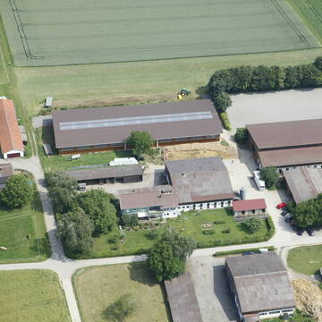
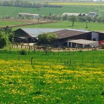
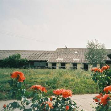
Reitstall Schuler
K-Münchingen
Rainer-Schuler
@Rainer-Schuler
Pferdeausbildung
Reitlehrer und -unterricht
Laufband
Paddock
Pferdezucht
Zuchtstutenhaltung möglich
Außenbox mit Paddock
Außenboxen
14 weitere...
S
Deprecated: Creation of dynamic property Zend_View_Helper_Ads::$adLink is deprecated in /var/www/stall-frei/htdocs/staging.stall-frei.de/library/Psf/View/Helper/Ads.php on line 108

***Reitstall Birkenhof*** Pferdegerechte Haltung
Köln
Daniele-Fazzi
@Daniele-Fazzi
Herzlich Willkommen
auf dem Reitstall Birkenhof
Jetzt neu ‼️ auf dem Birkenhof:
Private Geländestrecke rund um unser
Großzügige Reitanlage für Sport und Freizeitreit...
Wiernsheim
Reitanlage-Hohes-Kreuz
@ReitanlageHohesKreuz
Freizeitstall
Pferdeausbildung
Vermieten
Führanlage
Paddock
Hufrehe geeignet
18 weitere...
S


Boxen in Vollpension
Korntal-Münchingen
Strohberghof
@DietmarSchmalzridt
Freizeitstall
Pferdeausbildung
Vermieten
Führanlage
Hunde willkommen
Außenbox mit Paddock
Außenboxen
16 weitere...
P+


Freie Boxen auf Hof Georgenau
Bad Liebenzell Möttlingen
Ulrich von Reden-Lütcken
@UlrichvonRedenLuetcken
Freizeitstall
Geländestrecke
Vermieten
Führanlage
Parkplatz für Pferdeanhänger
Außenboxen
Innenbox
13 weitere...
ganz aktuell
S

Offenstallplatz mit Paddock Trail für Stute frei
Gebersheim
Gebersheim Falkenhof
@Kristina-Kogel
Freizeitstall
Vermieten
Hunde willkommen
Sattelkammer/Sattelschränke
Gnadenbrothof
Hufrehe geeignet
12 weitere...
P


Stallplatz Reitanlage Grötzinger
Renningen
Eberhard-Groetzinger
@Eberhard-Groetzinger
Freizeitstall
Geländestrecke
Vermieten
Hunde willkommen
Krankenbox
Außenbox mit Paddock
Außenboxen
20 weitere...
P+

Paddockbox in kleiner Stallgemeinschaft frei
Rutesheim
Carolin-Hoerning
@Carolin-Hoerning
Wir sind ein kleiner Stall mit nur 13 Boxen in Rutesheim.
Aktuell haben wir eine Paddockbox frei.
neu
R
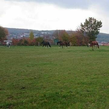
Sonnenhof-Gebersheim
Leonberg
Sonnenhof eGbR
@W.-u-.A-.Gieck-Sonnenhof-GbR
FN-Mitglied
Pferdeausbildung
Vermieten
Laufband
Paddock
Außenbox mit Paddock
Außenboxen
16 weitere...
P
Reitstall Rappenhof - Bewegungsstall Rappenhof
Leonberg
Reitstall-Rappenhof-Knauer-GbR
@Reitstall-Rappenhof-Knauer-GbR
FN-Mitglied
Freizeitstall
Führanlage
Krankenbox
Bewegungsstall
Schauer-Bewegungsstall
15 weitere...
P
Greuthof
Ditzingen-Schöckingen
Ulrike und Rainer Mauch
@Ulrike und Rainer Mauch
Vermieten
Longierzirkel/Roundpen
Paddock
Außenbox mit Paddock
Außenboxen
Halbpension
Vollpension
7 weitere...
P
drei Paddockboxen evtl auch für Selbstversorger
Ditzingen
Reitverein Ditzingen
@Reitverein-Ditzingen
Pferdeausbildung
Reitlehrer und -unterricht
Vermieten
Laufband
Paddock
Außenbox mit Paddock
Außenboxen
11 weitere...
P
Deprecated: Creation of dynamic property Zend_View::$pageCount is deprecated in /var/www/stall-frei/htdocs/staging.stall-frei.de/library/vendor/shardj/zf1-future/library/Zend/View/Abstract.php on line 308
Deprecated: Creation of dynamic property Zend_View::$itemCountPerPage is deprecated in /var/www/stall-frei/htdocs/staging.stall-frei.de/library/vendor/shardj/zf1-future/library/Zend/View/Abstract.php on line 308
Deprecated: Creation of dynamic property Zend_View::$first is deprecated in /var/www/stall-frei/htdocs/staging.stall-frei.de/library/vendor/shardj/zf1-future/library/Zend/View/Abstract.php on line 308
Deprecated: Creation of dynamic property Zend_View::$current is deprecated in /var/www/stall-frei/htdocs/staging.stall-frei.de/library/vendor/shardj/zf1-future/library/Zend/View/Abstract.php on line 308
Deprecated: Creation of dynamic property Zend_View::$last is deprecated in /var/www/stall-frei/htdocs/staging.stall-frei.de/library/vendor/shardj/zf1-future/library/Zend/View/Abstract.php on line 308
Deprecated: Creation of dynamic property Zend_View::$next is deprecated in /var/www/stall-frei/htdocs/staging.stall-frei.de/library/vendor/shardj/zf1-future/library/Zend/View/Abstract.php on line 308
Deprecated: Creation of dynamic property Zend_View::$pagesInRange is deprecated in /var/www/stall-frei/htdocs/staging.stall-frei.de/library/vendor/shardj/zf1-future/library/Zend/View/Abstract.php on line 308
Deprecated: Creation of dynamic property Zend_View::$firstPageInRange is deprecated in /var/www/stall-frei/htdocs/staging.stall-frei.de/library/vendor/shardj/zf1-future/library/Zend/View/Abstract.php on line 308
Deprecated: Creation of dynamic property Zend_View::$lastPageInRange is deprecated in /var/www/stall-frei/htdocs/staging.stall-frei.de/library/vendor/shardj/zf1-future/library/Zend/View/Abstract.php on line 308
Deprecated: Creation of dynamic property Zend_View::$currentItemCount is deprecated in /var/www/stall-frei/htdocs/staging.stall-frei.de/library/vendor/shardj/zf1-future/library/Zend/View/Abstract.php on line 308
Deprecated: Creation of dynamic property Zend_View::$totalItemCount is deprecated in /var/www/stall-frei/htdocs/staging.stall-frei.de/library/vendor/shardj/zf1-future/library/Zend/View/Abstract.php on line 308
Deprecated: Creation of dynamic property Zend_View::$firstItemNumber is deprecated in /var/www/stall-frei/htdocs/staging.stall-frei.de/library/vendor/shardj/zf1-future/library/Zend/View/Abstract.php on line 308
Deprecated: Creation of dynamic property Zend_View::$lastItemNumber is deprecated in /var/www/stall-frei/htdocs/staging.stall-frei.de/library/vendor/shardj/zf1-future/library/Zend/View/Abstract.php on line 308
Deprecated: Creation of dynamic property Zend_View::$router is deprecated in /var/www/stall-frei/htdocs/staging.stall-frei.de/library/vendor/shardj/zf1-future/library/Zend/View/Abstract.php on line 308
Deprecated: Creation of dynamic property Zend_View::$urlParams is deprecated in /var/www/stall-frei/htdocs/staging.stall-frei.de/library/vendor/shardj/zf1-future/library/Zend/View/Abstract.php on line 308
Deprecated: Creation of dynamic property Zend_View::$showAds is deprecated in /var/www/stall-frei/htdocs/staging.stall-frei.de/library/vendor/shardj/zf1-future/library/Zend/View/Abstract.php on line 308
Deprecated: Creation of dynamic property Zend_View::$objectIds is deprecated in /var/www/stall-frei/htdocs/staging.stall-frei.de/library/vendor/shardj/zf1-future/library/Zend/View/Abstract.php on line 308
Deprecated: Creation of dynamic property Zend_View::$showNavbar is deprecated in /var/www/stall-frei/htdocs/staging.stall-frei.de/library/vendor/shardj/zf1-future/library/Zend/View/Abstract.php on line 308
Deprecated: Creation of dynamic property Zend_View::$showBreadcrumb is deprecated in /var/www/stall-frei/htdocs/staging.stall-frei.de/library/vendor/shardj/zf1-future/library/Zend/View/Abstract.php on line 308
Deprecated: Creation of dynamic property Zend_View::$showFooter is deprecated in /var/www/stall-frei/htdocs/staging.stall-frei.de/library/vendor/shardj/zf1-future/library/Zend/View/Abstract.php on line 308
Deprecated: Creation of dynamic property Zend_View::$showInternalAds is deprecated in /var/www/stall-frei/htdocs/staging.stall-frei.de/library/vendor/shardj/zf1-future/library/Zend/View/Abstract.php on line 308
Deprecated: Creation of dynamic property Zend_View::$blNoContent is deprecated in /var/www/stall-frei/htdocs/staging.stall-frei.de/library/vendor/shardj/zf1-future/library/Zend/View/Abstract.php on line 308
Deprecated: Creation of dynamic property Zend_View::$sMetaDesc is deprecated in /var/www/stall-frei/htdocs/staging.stall-frei.de/library/vendor/shardj/zf1-future/library/Zend/View/Abstract.php on line 308
Deprecated: Creation of dynamic property Zend_View::$useGmaps is deprecated in /var/www/stall-frei/htdocs/staging.stall-frei.de/library/vendor/shardj/zf1-future/library/Zend/View/Abstract.php on line 308
Deprecated: Creation of dynamic property Zend_View::$touches is deprecated in /var/www/stall-frei/htdocs/staging.stall-frei.de/library/vendor/shardj/zf1-future/library/Zend/View/Abstract.php on line 308
Deprecated: Creation of dynamic property Zend_View::$oProject is deprecated in /var/www/stall-frei/htdocs/staging.stall-frei.de/library/vendor/shardj/zf1-future/library/Zend/View/Abstract.php on line 308
Deprecated: Creation of dynamic property Zend_View::$pageHeadline is deprecated in /var/www/stall-frei/htdocs/staging.stall-frei.de/library/vendor/shardj/zf1-future/library/Zend/View/Abstract.php on line 308
Deprecated: Creation of dynamic property Zend_View::$disableLocationField is deprecated in /var/www/stall-frei/htdocs/staging.stall-frei.de/library/vendor/shardj/zf1-future/library/Zend/View/Abstract.php on line 308
Deprecated: Creation of dynamic property Zend_View::$isSearch is deprecated in /var/www/stall-frei/htdocs/staging.stall-frei.de/library/vendor/shardj/zf1-future/library/Zend/View/Abstract.php on line 308
Deprecated: Creation of dynamic property Zend_View::$pageTitle is deprecated in /var/www/stall-frei/htdocs/staging.stall-frei.de/library/vendor/shardj/zf1-future/library/Zend/View/Abstract.php on line 308
Deprecated: Creation of dynamic property Psf_Form_Element_Text::$class is deprecated in /var/www/stall-frei/htdocs/staging.stall-frei.de/library/vendor/shardj/zf1-future/library/Zend/Form/Element.php on line 874
Deprecated: Creation of dynamic property Psf_Form_Element_Text::$size is deprecated in /var/www/stall-frei/htdocs/staging.stall-frei.de/library/vendor/shardj/zf1-future/library/Zend/Form/Element.php on line 874
Deprecated: Creation of dynamic property Psf_Form_Element_Text::$placeholder is deprecated in /var/www/stall-frei/htdocs/staging.stall-frei.de/library/vendor/shardj/zf1-future/library/Zend/Form/Element.php on line 874
Deprecated: Creation of dynamic property Psf_Form_Element_Hidden::$class is deprecated in /var/www/stall-frei/htdocs/staging.stall-frei.de/library/vendor/shardj/zf1-future/library/Zend/Form/Element.php on line 874
Deprecated: Creation of dynamic property Psf_Form_Element_Hidden::$class is deprecated in /var/www/stall-frei/htdocs/staging.stall-frei.de/library/vendor/shardj/zf1-future/library/Zend/Form/Element.php on line 874
Deprecated: Creation of dynamic property Psf_Form_Element_Hidden::$class is deprecated in /var/www/stall-frei/htdocs/staging.stall-frei.de/library/vendor/shardj/zf1-future/library/Zend/Form/Element.php on line 874
Deprecated: Creation of dynamic property Psf_Form_Element_Hidden::$class is deprecated in /var/www/stall-frei/htdocs/staging.stall-frei.de/library/vendor/shardj/zf1-future/library/Zend/Form/Element.php on line 874
Deprecated: Creation of dynamic property Psf_Form_Element_Select::$class is deprecated in /var/www/stall-frei/htdocs/staging.stall-frei.de/library/vendor/shardj/zf1-future/library/Zend/Form/Element.php on line 874
Deprecated: Creation of dynamic property Psf_Form_Element_Select::$class is deprecated in /var/www/stall-frei/htdocs/staging.stall-frei.de/library/vendor/shardj/zf1-future/library/Zend/Form/Element.php on line 874
Deprecated: Creation of dynamic property Psf_Form_Element_Select::$class is deprecated in /var/www/stall-frei/htdocs/staging.stall-frei.de/library/vendor/shardj/zf1-future/library/Zend/Form/Element.php on line 874
Deprecated: Creation of dynamic property Psf_Form_Element_Select::$class is deprecated in /var/www/stall-frei/htdocs/staging.stall-frei.de/library/vendor/shardj/zf1-future/library/Zend/Form/Element.php on line 874
Deprecated: Creation of dynamic property Psf_Form_Element_Text::$class is deprecated in /var/www/stall-frei/htdocs/staging.stall-frei.de/library/vendor/shardj/zf1-future/library/Zend/Form/Element.php on line 874
Deprecated: Creation of dynamic property Psf_Form_Element_Checkbox::$label is deprecated in /var/www/stall-frei/htdocs/staging.stall-frei.de/library/vendor/shardj/zf1-future/library/Zend/Form/Element.php on line 874
Deprecated: Creation of dynamic property Zend_View::$sort is deprecated in /var/www/stall-frei/htdocs/staging.stall-frei.de/library/vendor/shardj/zf1-future/library/Zend/View/Abstract.php on line 308
Deprecated: Creation of dynamic property Zend_View::$searchLocation is deprecated in /var/www/stall-frei/htdocs/staging.stall-frei.de/library/vendor/shardj/zf1-future/library/Zend/View/Abstract.php on line 308
Deprecated: Creation of dynamic property Zend_View::$locationHint is deprecated in /var/www/stall-frei/htdocs/staging.stall-frei.de/library/vendor/shardj/zf1-future/library/Zend/View/Abstract.php on line 308
Psf_GeoCoder_Abstract::getLocation: Leonberg Get Location CachedOrLive
Psf_GeoCoder_Abstract::getCachedOrLive: Leonberg
Psf_GeoCoder_OpenCageData::makeApiRequest: response:
Array
(
[documentation] => https://opencagedata.com/api
[licenses] => Array
(
[0] => Array
(
[name] => see attribution guide
[url] => https://opencagedata.com/credits
)
)
[results] => Array
(
[0] => Array
(
[bounds] => Array
(
[northeast] => Array
(
[lat] => 48.8335538
[lng] => 9.0688878
)
[southwest] => Array
(
[lat] => 48.7458633
[lng] => 8.9572579
)
)
[components] => Array
(
[ISO_3166-1_alpha-2] => DE
[ISO_3166-1_alpha-3] => DEU
[ISO_3166-2] => Array
(
[0] => DE-BW
)
[_category] => place
[_normalized_city] => Leonberg
[_type] => city
[continent] => Europe
[country] => Deutschland
[country_code] => de
[county] => Landkreis Böblingen
[political_union] => European Union
[postcode] => 71229
[state] => Baden-Württemberg
[state_code] => BW
[town] => Leonberg
)
[confidence] => 7
[formatted] => 71229 Leonberg, Deutschland
[geometry] => Array
(
[lat] => 48.8012983
[lng] => 9.0150026
)
)
[1] => Array
(
[bounds] => Array
(
[northeast] => Array
(
[lat] => 49.9909133
[lng] => 12.363645
)
[southwest] => Array
(
[lat] => 49.8929511
[lng] => 12.2514707
)
)
[components] => Array
(
[ISO_3166-1_alpha-2] => DE
[ISO_3166-1_alpha-3] => DEU
[ISO_3166-2] => Array
(
[0] => DE-BY
)
[_category] => place
[_normalized_city] => Leonberg
[_type] => village
[continent] => Europe
[country] => Deutschland
[country_code] => de
[county] => Landkreis Tirschenreuth
[municipality] => Mitterteich (VGem)
[political_union] => European Union
[state] => Bayern
[state_code] => BY
[village] => Leonberg
)
[confidence] => 7
[formatted] => Leonberg, Bayern, Deutschland
[geometry] => Array
(
[lat] => 49.9471333
[lng] => 12.2856431
)
)
[2] => Array
(
[bounds] => Array
(
[northeast] => Array
(
[lat] => 49.203362
[lng] => 12.137592
)
[southwest] => Array
(
[lat] => 49.163362
[lng] => 12.097592
)
)
[components] => Array
(
[ISO_3166-1_alpha-2] => DE
[ISO_3166-1_alpha-3] => DEU
[ISO_3166-2] => Array
(
[0] => DE-BY
)
[_category] => place
[_normalized_city] => Maxhütte-Haidhof
[_type] => neighbourhood
[continent] => Europe
[country] => Deutschland
[country_code] => de
[county] => Landkreis Schwandorf
[political_union] => European Union
[postcode] => 93142
[state] => Bayern
[state_code] => BY
[suburb] => Leonberg
[town] => Maxhütte-Haidhof
)
[confidence] => 7
[formatted] => 93142 Maxhütte-Haidhof, Deutschland
[geometry] => Array
(
[lat] => 49.183362
[lng] => 12.117592
)
)
[3] => Array
(
[bounds] => Array
(
[northeast] => Array
(
[lat] => 48.3005833
[lng] => 12.8265444
)
[southwest] => Array
(
[lat] => 48.2605833
[lng] => 12.7865444
)
)
[components] => Array
(
[ISO_3166-1_alpha-2] => DE
[ISO_3166-1_alpha-3] => DEU
[ISO_3166-2] => Array
(
[0] => DE-BY
)
[_category] => place
[_normalized_city] => Marktl
[_type] => hamlet
[continent] => Europe
[country] => Deutschland
[country_code] => de
[county] => Landkreis Altötting
[hamlet] => Leonberg
[municipality] => Marktl (VGem)
[political_union] => European Union
[postcode] => 84567
[state] => Bayern
[state_code] => BY
[village] => Marktl
)
[confidence] => 7
[formatted] => Leonberg, 84567 Marktl, Deutschland
[geometry] => Array
(
[lat] => 48.2805833
[lng] => 12.8065444
)
)
[4] => Array
(
[bounds] => Array
(
[northeast] => Array
(
[lat] => 48.3777595
[lng] => 12.5650764
)
[southwest] => Array
(
[lat] => 48.3377595
[lng] => 12.5250764
)
)
[components] => Array
(
[ISO_3166-1_alpha-2] => DE
[ISO_3166-1_alpha-3] => DEU
[ISO_3166-2] => Array
(
[0] => DE-BY
)
[_category] => place
[_normalized_city] => Neumarkt-Sankt Veit
[_type] => hamlet
[continent] => Europe
[country] => Deutschland
[country_code] => de
[county] => Landkreis Mühldorf am Inn
[hamlet] => Leonberg
[municipality] => Neumarkt-Sankt Veit (VGem)
[political_union] => European Union
[postcode] => 84494
[state] => Bayern
[state_code] => BY
[town] => Neumarkt-Sankt Veit
)
[confidence] => 7
[formatted] => Leonberg, 84494 Neumarkt-Sankt Veit, Deutschland
[geometry] => Array
(
[lat] => 48.3577595
[lng] => 12.5450764
)
)
[5] => Array
(
[components] => Array
(
[ISO_3166-1_alpha-2] => FR
[ISO_3166-1_alpha-3] => FRA
[ISO_3166-2] => Array
(
[0] => FR-ARA
[1] => FR-74
)
[_category] => road
[_normalized_city] => Megève
[_type] => road
[city] => Megève
[continent] => Europe
[country] => France
[country_code] => fr
[county] => Haute-Savoie
[local_authority] => Pays du Mont-Blanc
[political_union] => European Union
[postcode] => 74120
[road] => Chemin du Léonberg
[state] => Auvergne-Rhône-Alpes
[state_code] => ARA
)
[confidence] => 3
[formatted] => Chemin du Léonberg, 74120 Megève, France
[geometry] => Array
(
[lat] => 45.84842
[lng] => 6.60911
)
)
[6] => Array
(
[components] => Array
(
[ISO_3166-1_alpha-2] => FR
[ISO_3166-1_alpha-3] => FRA
[ISO_3166-2] => Array
(
[0] => FR-PDL
[1] => FR-85
)
[_category] => road
[_normalized_city] => Commequiers
[_type] => road
[city] => Commequiers
[continent] => Europe
[country] => France
[country_code] => fr
[county] => Vendée
[local_authority] => Pays de Saint-Gilles-Croix-de-Vie Agglomération
[political_union] => European Union
[postcode] => 85220
[road] => Route de la LEONIERE
[state] => Pays de la Loire
[state_code] => PDL
)
[confidence] => 2
[formatted] => Route de la LEONIERE, 85220 Commequiers, France
[geometry] => Array
(
[lat] => 46.751384
[lng] => -1.785959
)
)
[7] => Array
(
[components] => Array
(
[ISO_3166-1_alpha-2] => FR
[ISO_3166-1_alpha-3] => FRA
[ISO_3166-2] => Array
(
[0] => FR-PDL
[1] => FR-85
)
[_category] => road
[_normalized_city] => Les Sables-d'Olonne
[_type] => road
[city] => Les Sables-d'Olonne
[continent] => Europe
[country] => France
[country_code] => fr
[county] => Vendée
[local_authority] => Les Sables d'Olonne Agglomération
[political_union] => European Union
[postcode] => 85340
[road] => Rue de la Léonière
[state] => Pays de la Loire
[state_code] => PDL
)
[confidence] => 2
[formatted] => Rue de la Léonière, 85340 Les Sables-d'Olonne, France
[geometry] => Array
(
[lat] => 46.545997
[lng] => -1.770154
)
)
[8] => Array
(
[components] => Array
(
[ISO_3166-1_alpha-2] => FR
[ISO_3166-1_alpha-3] => FRA
[ISO_3166-2] => Array
(
[0] => FR-NAQ
[1] => FR-79
)
[_category] => road
[_normalized_city] => Bressuire
[_type] => road
[city] => Bressuire
[continent] => Europe
[country] => France
[country_code] => fr
[county] => Deux-Sèvres
[local_authority] => Communauté d'agglomération du Bocage Bressuirais
[political_union] => European Union
[postcode] => 79300
[road] => Lieu Dit la Leoniere
[state] => Nouvelle-Aquitaine
[state_code] => NAQ
)
[confidence] => 2
[formatted] => Lieu Dit la Leoniere, 79300 Bressuire, France
[geometry] => Array
(
[lat] => 46.821828
[lng] => -0.492397
)
)
[9] => Array
(
[components] => Array
(
[ISO_3166-1_alpha-2] => FR
[ISO_3166-1_alpha-3] => FRA
[ISO_3166-2] => Array
(
[0] => FR-PDL
[1] => FR-85
)
[_category] => road
[_normalized_city] => Saint-Mathurin
[_type] => road
[city] => Saint-Mathurin
[continent] => Europe
[country] => France
[country_code] => fr
[county] => Vendée
[local_authority] => Les Sables d'Olonne Agglomération
[political_union] => European Union
[postcode] => 85150
[road] => la leonière
[state] => Pays de la Loire
[state_code] => PDL
)
[confidence] => 2
[formatted] => la leonière, 85150 Saint-Mathurin, France
[geometry] => Array
(
[lat] => 46.57068
[lng] => -1.707863
)
)
)
[status] => Array
(
[code] => 200
[message] => OK
)
[stay_informed] => Array
(
[blog] => https://blog.opencagedata.com
[mastodon] => https://en.osm.town/@opencage
)
[thanks] => For using an OpenCage API
[timestamp] => Array
(
[created_http] => Wed, 04 Feb 2026 05:26:20 GMT
[created_unix] => 1770182780
)
[total_results] => 10
)
Psf_GeoCoder_Abstract::convertLocationResult
{"documentation":"https:\/\/opencagedata.com\/api","licenses":[{"name":"see attribution guide","url":"https:\/\/opencagedata.com\/credits"}],"results":[{"bounds":{"northeast":{"lat":48.8335538,"lng":9.0688878},"southwest":{"lat":48.7458633,"lng":8.9572579}},"components":{"ISO_3166-1_alpha-2":"DE","ISO_3166-1_alpha-3":"DEU","ISO_3166-2":["DE-BW"],"_category":"place","_normalized_city":"Leonberg","_type":"city","continent":"Europe","country":"Deutschland","country_code":"de","county":"Landkreis B\u00f6blingen","political_union":"European Union","postcode":"71229","state":"Baden-W\u00fcrttemberg","state_code":"BW","town":"Leonberg"},"confidence":7,"formatted":"71229 Leonberg, Deutschland","geometry":{"lat":48.8012983,"lng":9.0150026}},{"bounds":{"northeast":{"lat":49.9909133,"lng":12.363645},"southwest":{"lat":49.8929511,"lng":12.2514707}},"components":{"ISO_3166-1_alpha-2":"DE","ISO_3166-1_alpha-3":"DEU","ISO_3166-2":["DE-BY"],"_category":"place","_normalized_city":"Leonberg","_type":"village","continent":"Europe","country":"Deutschland","country_code":"de","county":"Landkreis Tirschenreuth","municipality":"Mitterteich (VGem)","political_union":"European Union","state":"Bayern","state_code":"BY","village":"Leonberg"},"confidence":7,"formatted":"Leonberg, Bayern, Deutschland","geometry":{"lat":49.9471333,"lng":12.2856431}},{"bounds":{"northeast":{"lat":49.203362,"lng":12.137592},"southwest":{"lat":49.163362,"lng":12.097592}},"components":{"ISO_3166-1_alpha-2":"DE","ISO_3166-1_alpha-3":"DEU","ISO_3166-2":["DE-BY"],"_category":"place","_normalized_city":"Maxh\u00fctte-Haidhof","_type":"neighbourhood","continent":"Europe","country":"Deutschland","country_code":"de","county":"Landkreis Schwandorf","political_union":"European Union","postcode":"93142","state":"Bayern","state_code":"BY","suburb":"Leonberg","town":"Maxh\u00fctte-Haidhof"},"confidence":7,"formatted":"93142 Maxh\u00fctte-Haidhof, Deutschland","geometry":{"lat":49.183362,"lng":12.117592}},{"bounds":{"northeast":{"lat":48.3005833,"lng":12.8265444},"southwest":{"lat":48.2605833,"lng":12.7865444}},"components":{"ISO_3166-1_alpha-2":"DE","ISO_3166-1_alpha-3":"DEU","ISO_3166-2":["DE-BY"],"_category":"place","_normalized_city":"Marktl","_type":"hamlet","continent":"Europe","country":"Deutschland","country_code":"de","county":"Landkreis Alt\u00f6tting","hamlet":"Leonberg","municipality":"Marktl (VGem)","political_union":"European Union","postcode":"84567","state":"Bayern","state_code":"BY","village":"Marktl"},"confidence":7,"formatted":"Leonberg, 84567 Marktl, Deutschland","geometry":{"lat":48.2805833,"lng":12.8065444}},{"bounds":{"northeast":{"lat":48.3777595,"lng":12.5650764},"southwest":{"lat":48.3377595,"lng":12.5250764}},"components":{"ISO_3166-1_alpha-2":"DE","ISO_3166-1_alpha-3":"DEU","ISO_3166-2":["DE-BY"],"_category":"place","_normalized_city":"Neumarkt-Sankt Veit","_type":"hamlet","continent":"Europe","country":"Deutschland","country_code":"de","county":"Landkreis M\u00fchldorf am Inn","hamlet":"Leonberg","municipality":"Neumarkt-Sankt Veit (VGem)","political_union":"European Union","postcode":"84494","state":"Bayern","state_code":"BY","town":"Neumarkt-Sankt Veit"},"confidence":7,"formatted":"Leonberg, 84494 Neumarkt-Sankt Veit, Deutschland","geometry":{"lat":48.3577595,"lng":12.5450764}},{"components":{"ISO_3166-1_alpha-2":"FR","ISO_3166-1_alpha-3":"FRA","ISO_3166-2":["FR-ARA","FR-74"],"_category":"road","_normalized_city":"Meg\u00e8ve","_type":"road","city":"Meg\u00e8ve","continent":"Europe","country":"France","country_code":"fr","county":"Haute-Savoie","local_authority":"Pays du Mont-Blanc","political_union":"European Union","postcode":"74120","road":"Chemin du L\u00e9onberg","state":"Auvergne-Rh\u00f4ne-Alpes","state_code":"ARA"},"confidence":3,"formatted":"Chemin du L\u00e9onberg, 74120 Meg\u00e8ve, France","geometry":{"lat":45.84842,"lng":6.60911}},{"components":{"ISO_3166-1_alpha-2":"FR","ISO_3166-1_alpha-3":"FRA","ISO_3166-2":["FR-PDL","FR-85"],"_category":"road","_normalized_city":"Commequiers","_type":"road","city":"Commequiers","continent":"Europe","country":"France","country_code":"fr","county":"Vend\u00e9e","local_authority":"Pays de Saint-Gilles-Croix-de-Vie Agglom\u00e9ration","political_union":"European Union","postcode":"85220","road":"Route de la LEONIERE","state":"Pays de la Loire","state_code":"PDL"},"confidence":2,"formatted":"Route de la LEONIERE, 85220 Commequiers, France","geometry":{"lat":46.751384,"lng":-1.785959}},{"components":{"ISO_3166-1_alpha-2":"FR","ISO_3166-1_alpha-3":"FRA","ISO_3166-2":["FR-PDL","FR-85"],"_category":"road","_normalized_city":"Les Sables-d'Olonne","_type":"road","city":"Les Sables-d'Olonne","continent":"Europe","country":"France","country_code":"fr","county":"Vend\u00e9e","local_authority":"Les Sables d'Olonne Agglom\u00e9ration","political_union":"European Union","postcode":"85340","road":"Rue de la L\u00e9oni\u00e8re","state":"Pays de la Loire","state_code":"PDL"},"confidence":2,"formatted":"Rue de la L\u00e9oni\u00e8re, 85340 Les Sables-d'Olonne, France","geometry":{"lat":46.545997,"lng":-1.770154}},{"components":{"ISO_3166-1_alpha-2":"FR","ISO_3166-1_alpha-3":"FRA","ISO_3166-2":["FR-NAQ","FR-79"],"_category":"road","_normalized_city":"Bressuire","_type":"road","city":"Bressuire","continent":"Europe","country":"France","country_code":"fr","county":"Deux-S\u00e8vres","local_authority":"Communaut\u00e9 d'agglom\u00e9ration du Bocage Bressuirais","political_union":"European Union","postcode":"79300","road":"Lieu Dit la Leoniere","state":"Nouvelle-Aquitaine","state_code":"NAQ"},"confidence":2,"formatted":"Lieu Dit la Leoniere, 79300 Bressuire, France","geometry":{"lat":46.821828,"lng":-0.492397}},{"components":{"ISO_3166-1_alpha-2":"FR","ISO_3166-1_alpha-3":"FRA","ISO_3166-2":["FR-PDL","FR-85"],"_category":"road","_normalized_city":"Saint-Mathurin","_type":"road","city":"Saint-Mathurin","continent":"Europe","country":"France","country_code":"fr","county":"Vend\u00e9e","local_authority":"Les Sables d'Olonne Agglom\u00e9ration","political_union":"European Union","postcode":"85150","road":"la leoni\u00e8re","state":"Pays de la Loire","state_code":"PDL"},"confidence":2,"formatted":"la leoni\u00e8re, 85150 Saint-Mathurin, France","geometry":{"lat":46.57068,"lng":-1.707863}}],"status":{"code":200,"message":"OK"},"stay_informed":{"blog":"https:\/\/blog.opencagedata.com","mastodon":"https:\/\/en.osm.town\/@opencage"},"thanks":"For using an OpenCage API","timestamp":{"created_http":"Wed, 04 Feb 2026 05:26:20 GMT","created_unix":1770182780},"total_results":10}Array
(
[0] => stdClass Object
(
[bounds] => stdClass Object
(
[northeast] => stdClass Object
(
[lat] => 48.8335538
[lng] => 9.0688878
)
[southwest] => stdClass Object
(
[lat] => 48.7458633
[lng] => 8.9572579
)
)
[components] => stdClass Object
(
[ISO_3166-1_alpha-2] => DE
[ISO_3166-1_alpha-3] => DEU
[ISO_3166-2] => Array
(
[0] => DE-BW
)
[_category] => place
[_normalized_city] => Leonberg
[_type] => city
[continent] => Europe
[country] => Deutschland
[country_code] => de
[county] => Landkreis Böblingen
[political_union] => European Union
[postcode] => 71229
[state] => Baden-Württemberg
[state_code] => BW
[town] => Leonberg
)
[confidence] => 7
[formatted] => 71229 Leonberg, Deutschland
[geometry] => stdClass Object
(
[lat] => 48.8012983
[lng] => 9.0150026
)
)
[1] => stdClass Object
(
[bounds] => stdClass Object
(
[northeast] => stdClass Object
(
[lat] => 49.9909133
[lng] => 12.363645
)
[southwest] => stdClass Object
(
[lat] => 49.8929511
[lng] => 12.2514707
)
)
[components] => stdClass Object
(
[ISO_3166-1_alpha-2] => DE
[ISO_3166-1_alpha-3] => DEU
[ISO_3166-2] => Array
(
[0] => DE-BY
)
[_category] => place
[_normalized_city] => Leonberg
[_type] => village
[continent] => Europe
[country] => Deutschland
[country_code] => de
[county] => Landkreis Tirschenreuth
[municipality] => Mitterteich (VGem)
[political_union] => European Union
[state] => Bayern
[state_code] => BY
[village] => Leonberg
)
[confidence] => 7
[formatted] => Leonberg, Bayern, Deutschland
[geometry] => stdClass Object
(
[lat] => 49.9471333
[lng] => 12.2856431
)
)
[2] => stdClass Object
(
[bounds] => stdClass Object
(
[northeast] => stdClass Object
(
[lat] => 49.203362
[lng] => 12.137592
)
[southwest] => stdClass Object
(
[lat] => 49.163362
[lng] => 12.097592
)
)
[components] => stdClass Object
(
[ISO_3166-1_alpha-2] => DE
[ISO_3166-1_alpha-3] => DEU
[ISO_3166-2] => Array
(
[0] => DE-BY
)
[_category] => place
[_normalized_city] => Maxhütte-Haidhof
[_type] => neighbourhood
[continent] => Europe
[country] => Deutschland
[country_code] => de
[county] => Landkreis Schwandorf
[political_union] => European Union
[postcode] => 93142
[state] => Bayern
[state_code] => BY
[suburb] => Leonberg
[town] => Maxhütte-Haidhof
)
[confidence] => 7
[formatted] => 93142 Maxhütte-Haidhof, Deutschland
[geometry] => stdClass Object
(
[lat] => 49.183362
[lng] => 12.117592
)
)
[3] => stdClass Object
(
[bounds] => stdClass Object
(
[northeast] => stdClass Object
(
[lat] => 48.3005833
[lng] => 12.8265444
)
[southwest] => stdClass Object
(
[lat] => 48.2605833
[lng] => 12.7865444
)
)
[components] => stdClass Object
(
[ISO_3166-1_alpha-2] => DE
[ISO_3166-1_alpha-3] => DEU
[ISO_3166-2] => Array
(
[0] => DE-BY
)
[_category] => place
[_normalized_city] => Marktl
[_type] => hamlet
[continent] => Europe
[country] => Deutschland
[country_code] => de
[county] => Landkreis Altötting
[hamlet] => Leonberg
[municipality] => Marktl (VGem)
[political_union] => European Union
[postcode] => 84567
[state] => Bayern
[state_code] => BY
[village] => Marktl
)
[confidence] => 7
[formatted] => Leonberg, 84567 Marktl, Deutschland
[geometry] => stdClass Object
(
[lat] => 48.2805833
[lng] => 12.8065444
)
)
[4] => stdClass Object
(
[bounds] => stdClass Object
(
[northeast] => stdClass Object
(
[lat] => 48.3777595
[lng] => 12.5650764
)
[southwest] => stdClass Object
(
[lat] => 48.3377595
[lng] => 12.5250764
)
)
[components] => stdClass Object
(
[ISO_3166-1_alpha-2] => DE
[ISO_3166-1_alpha-3] => DEU
[ISO_3166-2] => Array
(
[0] => DE-BY
)
[_category] => place
[_normalized_city] => Neumarkt-Sankt Veit
[_type] => hamlet
[continent] => Europe
[country] => Deutschland
[country_code] => de
[county] => Landkreis Mühldorf am Inn
[hamlet] => Leonberg
[municipality] => Neumarkt-Sankt Veit (VGem)
[political_union] => European Union
[postcode] => 84494
[state] => Bayern
[state_code] => BY
[town] => Neumarkt-Sankt Veit
)
[confidence] => 7
[formatted] => Leonberg, 84494 Neumarkt-Sankt Veit, Deutschland
[geometry] => stdClass Object
(
[lat] => 48.3577595
[lng] => 12.5450764
)
)
[5] => stdClass Object
(
[components] => stdClass Object
(
[ISO_3166-1_alpha-2] => FR
[ISO_3166-1_alpha-3] => FRA
[ISO_3166-2] => Array
(
[0] => FR-ARA
[1] => FR-74
)
[_category] => road
[_normalized_city] => Megève
[_type] => road
[city] => Megève
[continent] => Europe
[country] => France
[country_code] => fr
[county] => Haute-Savoie
[local_authority] => Pays du Mont-Blanc
[political_union] => European Union
[postcode] => 74120
[road] => Chemin du Léonberg
[state] => Auvergne-Rhône-Alpes
[state_code] => ARA
)
[confidence] => 3
[formatted] => Chemin du Léonberg, 74120 Megève, France
[geometry] => stdClass Object
(
[lat] => 45.84842
[lng] => 6.60911
)
)
[6] => stdClass Object
(
[components] => stdClass Object
(
[ISO_3166-1_alpha-2] => FR
[ISO_3166-1_alpha-3] => FRA
[ISO_3166-2] => Array
(
[0] => FR-PDL
[1] => FR-85
)
[_category] => road
[_normalized_city] => Commequiers
[_type] => road
[city] => Commequiers
[continent] => Europe
[country] => France
[country_code] => fr
[county] => Vendée
[local_authority] => Pays de Saint-Gilles-Croix-de-Vie Agglomération
[political_union] => European Union
[postcode] => 85220
[road] => Route de la LEONIERE
[state] => Pays de la Loire
[state_code] => PDL
)
[confidence] => 2
[formatted] => Route de la LEONIERE, 85220 Commequiers, France
[geometry] => stdClass Object
(
[lat] => 46.751384
[lng] => -1.785959
)
)
[7] => stdClass Object
(
[components] => stdClass Object
(
[ISO_3166-1_alpha-2] => FR
[ISO_3166-1_alpha-3] => FRA
[ISO_3166-2] => Array
(
[0] => FR-PDL
[1] => FR-85
)
[_category] => road
[_normalized_city] => Les Sables-d'Olonne
[_type] => road
[city] => Les Sables-d'Olonne
[continent] => Europe
[country] => France
[country_code] => fr
[county] => Vendée
[local_authority] => Les Sables d'Olonne Agglomération
[political_union] => European Union
[postcode] => 85340
[road] => Rue de la Léonière
[state] => Pays de la Loire
[state_code] => PDL
)
[confidence] => 2
[formatted] => Rue de la Léonière, 85340 Les Sables-d'Olonne, France
[geometry] => stdClass Object
(
[lat] => 46.545997
[lng] => -1.770154
)
)
[8] => stdClass Object
(
[components] => stdClass Object
(
[ISO_3166-1_alpha-2] => FR
[ISO_3166-1_alpha-3] => FRA
[ISO_3166-2] => Array
(
[0] => FR-NAQ
[1] => FR-79
)
[_category] => road
[_normalized_city] => Bressuire
[_type] => road
[city] => Bressuire
[continent] => Europe
[country] => France
[country_code] => fr
[county] => Deux-Sèvres
[local_authority] => Communauté d'agglomération du Bocage Bressuirais
[political_union] => European Union
[postcode] => 79300
[road] => Lieu Dit la Leoniere
[state] => Nouvelle-Aquitaine
[state_code] => NAQ
)
[confidence] => 2
[formatted] => Lieu Dit la Leoniere, 79300 Bressuire, France
[geometry] => stdClass Object
(
[lat] => 46.821828
[lng] => -0.492397
)
)
[9] => stdClass Object
(
[components] => stdClass Object
(
[ISO_3166-1_alpha-2] => FR
[ISO_3166-1_alpha-3] => FRA
[ISO_3166-2] => Array
(
[0] => FR-PDL
[1] => FR-85
)
[_category] => road
[_normalized_city] => Saint-Mathurin
[_type] => road
[city] => Saint-Mathurin
[continent] => Europe
[country] => France
[country_code] => fr
[county] => Vendée
[local_authority] => Les Sables d'Olonne Agglomération
[political_union] => European Union
[postcode] => 85150
[road] => la leonière
[state] => Pays de la Loire
[state_code] => PDL
)
[confidence] => 2
[formatted] => la leonière, 85150 Saint-Mathurin, France
[geometry] => stdClass Object
(
[lat] => 46.57068
[lng] => -1.707863
)
)
)
Psf_GeoCoder_OpenCageData::getKeyMap: 0
stdClass Object
(
    [bounds] => stdClass Object
        (
            [northeast] => stdClass Object
                (
                    [lat] => 48.8335538
                    [lng] => 9.0688878
                )

            [southwest] => stdClass Object
                (
                    [lat] => 48.7458633
                    [lng] => 8.9572579
                )

        )

    [components] => stdClass Object
        (
            [ISO_3166-1_alpha-2] => DE
            [ISO_3166-1_alpha-3] => DEU
            [ISO_3166-2] => Array
                (
                    [0] => DE-BW
                )

            [_category] => place
            [_normalized_city] => Leonberg
            [_type] => city
            [continent] => Europe
            [country] => Deutschland
            [country_code] => de
            [county] => Landkreis Böblingen
            [political_union] => European Union
            [postcode] => 71229
            [state] => Baden-Württemberg
            [state_code] => BW
            [town] => Leonberg
        )

    [confidence] => 7
    [formatted] => 71229 Leonberg, Deutschland
    [geometry] => stdClass Object
        (
            [lat] => 48.8012983
            [lng] => 9.0150026
        )

)
Psf_GeoCoder_OpenCageData::getCounty: Böblingen
Psf_GeoCoder_OpenCageData::addMissingData REFETCH!
Array
(
    [address] => 71229 Leonberg, Deutschland
    [type] => city
    [street] =>
    [city] => Leonberg
    [county] => Böblingen
    [state] => Baden-Württemberg
    [zip] => 71229
    [country] => Deutschland
    [suburb] =>
    [countrycode] => de
    [latitude] => 48.8012983
    [longitude] => 9.0150026
    [accuracy] => 1
    [confidence] => 7
    [bounds] => stdClass Object
        (
            [northeast] => stdClass Object
                (
                    [lat] => 48.8335538
                    [lng] => 9.0688878
                )

            [southwest] => stdClass Object
                (
                    [lat] => 48.7458633
                    [lng] => 8.9572579
                )

        )

)
reformat!
Array
(
    [address] => 71229 Leonberg, Deutschland
    [type] => city
    [street] =>
    [city] => Leonberg
    [county] => Böblingen
    [state] => Baden-Württemberg
    [zip] => 71229
    [country] => Deutschland
    [suburb] =>
    [countrycode] => de
    [latitude] => 48.8012983
    [longitude] => 9.0150026
    [accuracy] => 1
    [confidence] => 7
    [bounds] => stdClass Object
        (
            [northeast] => stdClass Object
                (
                    [lat] => 48.8335538
                    [lng] => 9.0688878
                )

            [southwest] => stdClass Object
                (
                    [lat] => 48.7458633
                    [lng] => 8.9572579
                )

        )

    [place] => 71229 Leonberg, Baden-Württemberg
    [hash] => 17c7debc013c46b79a509bf14cd84958
)
Psf_GeoCoder_OpenCageData::getKeyMap: 1
stdClass Object
(
    [bounds] => stdClass Object
        (
            [northeast] => stdClass Object
                (
                    [lat] => 49.9909133
                    [lng] => 12.363645
                )

            [southwest] => stdClass Object
                (
                    [lat] => 49.8929511
                    [lng] => 12.2514707
                )

        )

    [components] => stdClass Object
        (
            [ISO_3166-1_alpha-2] => DE
            [ISO_3166-1_alpha-3] => DEU
            [ISO_3166-2] => Array
                (
                    [0] => DE-BY
                )

            [_category] => place
            [_normalized_city] => Leonberg
            [_type] => village
            [continent] => Europe
            [country] => Deutschland
            [country_code] => de
            [county] => Landkreis Tirschenreuth
            [municipality] => Mitterteich (VGem)
            [political_union] => European Union
            [state] => Bayern
            [state_code] => BY
            [village] => Leonberg
        )

    [confidence] => 7
    [formatted] => Leonberg, Bayern, Deutschland
    [geometry] => stdClass Object
        (
            [lat] => 49.9471333
            [lng] => 12.2856431
        )

)
Psf_GeoCoder_OpenCageData::getCounty: Tirschenreuth
Psf_GeoCoder_OpenCageData::addMissingData REFETCH!
Array
(
    [address] => Leonberg, Bayern, Deutschland
    [type] => village
    [street] =>
    [city] => Leonberg
    [county] => Tirschenreuth
    [state] => Bayern
    [zip] =>
    [country] => Deutschland
    [suburb] =>
    [countrycode] => de
    [latitude] => 49.9471333
    [longitude] => 12.2856431
    [accuracy] => 1
    [confidence] => 7
    [bounds] => stdClass Object
        (
            [northeast] => stdClass Object
                (
                    [lat] => 49.9909133
                    [lng] => 12.363645
                )

            [southwest] => stdClass Object
                (
                    [lat] => 49.8929511
                    [lng] => 12.2514707
                )

        )

)
reformat!
Array
(
    [address] => Leonberg, Bayern, Deutschland
    [type] => village
    [street] =>
    [city] => Leonberg
    [county] => Tirschenreuth
    [state] => Bayern
    [zip] =>
    [country] => Deutschland
    [suburb] =>
    [countrycode] => de
    [latitude] => 49.9471333
    [longitude] => 12.2856431
    [accuracy] => 1
    [confidence] => 7
    [bounds] => stdClass Object
        (
            [northeast] => stdClass Object
                (
                    [lat] => 49.9909133
                    [lng] => 12.363645
                )

            [southwest] => stdClass Object
                (
                    [lat] => 49.8929511
                    [lng] => 12.2514707
                )

        )

    [place] => Leonberg, Bayern
    [hash] => 1659ea1ebd189aa5536c7d6c141b423e
)
Psf_GeoCoder_OpenCageData::getKeyMap: 2
stdClass Object
(
    [bounds] => stdClass Object
        (
            [northeast] => stdClass Object
                (
                    [lat] => 49.203362
                    [lng] => 12.137592
                )

            [southwest] => stdClass Object
                (
                    [lat] => 49.163362
                    [lng] => 12.097592
                )

        )

    [components] => stdClass Object
        (
            [ISO_3166-1_alpha-2] => DE
            [ISO_3166-1_alpha-3] => DEU
            [ISO_3166-2] => Array
                (
                    [0] => DE-BY
                )

            [_category] => place
            [_normalized_city] => Maxhütte-Haidhof
            [_type] => neighbourhood
            [continent] => Europe
            [country] => Deutschland
            [country_code] => de
            [county] => Landkreis Schwandorf
            [political_union] => European Union
            [postcode] => 93142
            [state] => Bayern
            [state_code] => BY
            [suburb] => Leonberg
            [town] => Maxhütte-Haidhof
        )

    [confidence] => 7
    [formatted] => 93142 Maxhütte-Haidhof, Deutschland
    [geometry] => stdClass Object
        (
            [lat] => 49.183362
            [lng] => 12.117592
        )

)
Psf_GeoCoder_OpenCageData::getCounty: Schwandorf
Psf_GeoCoder_OpenCageData::addMissingData REFETCH!
Array
(
    [address] => 93142 Maxhütte-Haidhof, Deutschland
    [type] => neighbourhood
    [street] =>
    [city] => Maxhütte-Haidhof
    [county] => Schwandorf
    [state] => Bayern
    [zip] => 93142
    [country] => Deutschland
    [suburb] => Leonberg
    [countrycode] => de
    [latitude] => 49.183362
    [longitude] => 12.117592
    [accuracy] => 1
    [confidence] => 7
    [bounds] => stdClass Object
        (
            [northeast] => stdClass Object
                (
                    [lat] => 49.203362
                    [lng] => 12.137592
                )

            [southwest] => stdClass Object
                (
                    [lat] => 49.163362
                    [lng] => 12.097592
                )

        )

)
reformat!
Array
(
    [address] => 93142 Maxhütte-Haidhof, Deutschland
    [type] => neighbourhood
    [street] =>
    [city] => Maxhütte-Haidhof
    [county] => Schwandorf
    [state] => Bayern
    [zip] => 93142
    [country] => Deutschland
    [suburb] => Leonberg
    [countrycode] => de
    [latitude] => 49.183362
    [longitude] => 12.117592
    [accuracy] => 1
    [confidence] => 7
    [bounds] => stdClass Object
        (
            [northeast] => stdClass Object
                (
                    [lat] => 49.203362
                    [lng] => 12.137592
                )

            [southwest] => stdClass Object
                (
                    [lat] => 49.163362
                    [lng] => 12.097592
                )

        )

    [place] => 93142 Maxhütte-Haidhof, Bayern
    [hash] => e61cdd6ac1a3f7b9aef875aae40ef68b
)
Psf_GeoCoder_OpenCageData::getKeyMap: 3
stdClass Object
(
    [bounds] => stdClass Object
        (
            [northeast] => stdClass Object
                (
                    [lat] => 48.3005833
                    [lng] => 12.8265444
                )

            [southwest] => stdClass Object
                (
                    [lat] => 48.2605833
                    [lng] => 12.7865444
                )

        )

    [components] => stdClass Object
        (
            [ISO_3166-1_alpha-2] => DE
            [ISO_3166-1_alpha-3] => DEU
            [ISO_3166-2] => Array
                (
                    [0] => DE-BY
                )

            [_category] => place
            [_normalized_city] => Marktl
            [_type] => hamlet
            [continent] => Europe
            [country] => Deutschland
            [country_code] => de
            [county] => Landkreis Altötting
            [hamlet] => Leonberg
            [municipality] => Marktl (VGem)
            [political_union] => European Union
            [postcode] => 84567
            [state] => Bayern
            [state_code] => BY
            [village] => Marktl
        )

    [confidence] => 7
    [formatted] => Leonberg, 84567 Marktl, Deutschland
    [geometry] => stdClass Object
        (
            [lat] => 48.2805833
            [lng] => 12.8065444
        )

)
Psf_GeoCoder_OpenCageData::getCounty: Altötting
Psf_GeoCoder_OpenCageData::addMissingData REFETCH!
Array
(
    [address] => Leonberg, 84567 Marktl, Deutschland
    [type] => hamlet
    [street] => Leonberg
    [city] => Marktl
    [county] => Altötting
    [state] => Bayern
    [zip] => 84567
    [country] => Deutschland
    [suburb] =>
    [countrycode] => de
    [latitude] => 48.2805833
    [longitude] => 12.8065444
    [accuracy] => 1
    [confidence] => 7
    [bounds] => stdClass Object
        (
            [northeast] => stdClass Object
                (
                    [lat] => 48.3005833
                    [lng] => 12.8265444
                )

            [southwest] => stdClass Object
                (
                    [lat] => 48.2605833
                    [lng] => 12.7865444
                )

        )

)
reformat!
Array
(
    [address] => Leonberg, 84567 Marktl, Deutschland
    [type] => hamlet
    [street] => Leonberg
    [city] => Marktl
    [county] => Altötting
    [state] => Bayern
    [zip] => 84567
    [country] => Deutschland
    [suburb] =>
    [countrycode] => de
    [latitude] => 48.2805833
    [longitude] => 12.8065444
    [accuracy] => 1
    [confidence] => 7
    [bounds] => stdClass Object
        (
            [northeast] => stdClass Object
                (
                    [lat] => 48.3005833
                    [lng] => 12.8265444
                )

            [southwest] => stdClass Object
                (
                    [lat] => 48.2605833
                    [lng] => 12.7865444
                )

        )

    [place] => Leonberg, 84567 Marktl, Bayern
    [hash] => d039bbafb626bab77c5b893c266ceda5
)
Psf_GeoCoder_OpenCageData::getKeyMap: 4
stdClass Object
(
    [bounds] => stdClass Object
        (
            [northeast] => stdClass Object
                (
                    [lat] => 48.3777595
                    [lng] => 12.5650764
                )

            [southwest] => stdClass Object
                (
                    [lat] => 48.3377595
                    [lng] => 12.5250764
                )

        )

    [components] => stdClass Object
        (
            [ISO_3166-1_alpha-2] => DE
            [ISO_3166-1_alpha-3] => DEU
            [ISO_3166-2] => Array
                (
                    [0] => DE-BY
                )

            [_category] => place
            [_normalized_city] => Neumarkt-Sankt Veit
            [_type] => hamlet
            [continent] => Europe
            [country] => Deutschland
            [country_code] => de
            [county] => Landkreis Mühldorf am Inn
            [hamlet] => Leonberg
            [municipality] => Neumarkt-Sankt Veit (VGem)
            [political_union] => European Union
            [postcode] => 84494
            [state] => Bayern
            [state_code] => BY
            [town] => Neumarkt-Sankt Veit
        )

    [confidence] => 7
    [formatted] => Leonberg, 84494 Neumarkt-Sankt Veit, Deutschland
    [geometry] => stdClass Object
        (
            [lat] => 48.3577595
            [lng] => 12.5450764
        )

)
Psf_GeoCoder_OpenCageData::getCounty: Mühldorf am Inn
Psf_GeoCoder_OpenCageData::addMissingData REFETCH!
Array
(
    [address] => Leonberg, 84494 Neumarkt-Sankt Veit, Deutschland
    [type] => hamlet
    [street] => Leonberg
    [city] => Neumarkt-Sankt Veit
    [county] => Mühldorf am Inn
    [state] => Bayern
    [zip] => 84494
    [country] => Deutschland
    [suburb] =>
    [countrycode] => de
    [latitude] => 48.3577595
    [longitude] => 12.5450764
    [accuracy] => 1
    [confidence] => 7
    [bounds] => stdClass Object
        (
            [northeast] => stdClass Object
                (
                    [lat] => 48.3777595
                    [lng] => 12.5650764
                )

            [southwest] => stdClass Object
                (
                    [lat] => 48.3377595
                    [lng] => 12.5250764
                )

        )

)
reformat!
Array
(
    [address] => Leonberg, 84494 Neumarkt-Sankt Veit, Deutschland
    [type] => hamlet
    [street] => Leonberg
    [city] => Neumarkt-Sankt Veit
    [county] => Mühldorf am Inn
    [state] => Bayern
    [zip] => 84494
    [country] => Deutschland
    [suburb] =>
    [countrycode] => de
    [latitude] => 48.3577595
    [longitude] => 12.5450764
    [accuracy] => 1
    [confidence] => 7
    [bounds] => stdClass Object
        (
            [northeast] => stdClass Object
                (
                    [lat] => 48.3777595
                    [lng] => 12.5650764
                )

            [southwest] => stdClass Object
                (
                    [lat] => 48.3377595
                    [lng] => 12.5250764
                )

        )

    [place] => Leonberg, 84494 Neumarkt-Sankt Veit, Bayern
    [hash] => 8b9f2e6723f001721ad1f93433fe4d67
)
Psf_GeoCoder_OpenCageData::getKeyMap: 5
stdClass Object
(
    [components] => stdClass Object
        (
            [ISO_3166-1_alpha-2] => FR
            [ISO_3166-1_alpha-3] => FRA
            [ISO_3166-2] => Array
                (
                    [0] => FR-ARA
                    [1] => FR-74
                )

            [_category] => road
            [_normalized_city] => Megève
            [_type] => road
            [city] => Megève
            [continent] => Europe
            [country] => France
            [country_code] => fr
            [county] => Haute-Savoie
            [local_authority] => Pays du Mont-Blanc
            [political_union] => European Union
            [postcode] => 74120
            [road] => Chemin du Léonberg
            [state] => Auvergne-Rhône-Alpes
            [state_code] => ARA
        )

    [confidence] => 3
    [formatted] => Chemin du Léonberg, 74120 Megève, France
    [geometry] => stdClass Object
        (
            [lat] => 45.84842
            [lng] => 6.60911
        )

)
Psf_GeoCoder_OpenCageData::getCounty: Haute-Savoie
Psf_GeoCoder_OpenCageData::addMissingData REFETCH!
Array
(
    [address] => Chemin du Léonberg, 74120 Megève, France
    [type] => road
    [street] => Chemin du Léonberg
    [city] => Megève
    [county] => Haute-Savoie
    [state] => Auvergne-Rhône-Alpes
    [zip] => 74120
    [country] => France
    [suburb] =>
    [countrycode] => fr
    [latitude] => 45.84842
    [longitude] => 6.60911
    [accuracy] => 1
    [confidence] => 3
    [bounds] =>
)
reformat!
Array
(
    [address] => Chemin du Léonberg, 74120 Megève, France
    [type] => road
    [street] => Chemin du Léonberg
    [city] => Megève
    [county] => Haute-Savoie
    [state] => Auvergne-Rhône-Alpes
    [zip] => 74120
    [country] => France
    [suburb] =>
    [countrycode] => fr
    [latitude] => 45.84842
    [longitude] => 6.60911
    [accuracy] => 1
    [confidence] => 3
    [bounds] =>
    [place] => Chemin du Léonberg, 74120 Megève, Auvergne-Rhône-Alpes
    [hash] => 2e234883609e23c1fc408ff9c2e18109
)
Psf_GeoCoder_OpenCageData::getKeyMap: 6
stdClass Object
(
    [components] => stdClass Object
        (
            [ISO_3166-1_alpha-2] => FR
            [ISO_3166-1_alpha-3] => FRA
            [ISO_3166-2] => Array
                (
                    [0] => FR-PDL
                    [1] => FR-85
                )

            [_category] => road
            [_normalized_city] => Commequiers
            [_type] => road
            [city] => Commequiers
            [continent] => Europe
            [country] => France
            [country_code] => fr
            [county] => Vendée
            [local_authority] => Pays de Saint-Gilles-Croix-de-Vie Agglomération
            [political_union] => European Union
            [postcode] => 85220
            [road] => Route de la LEONIERE
            [state] => Pays de la Loire
            [state_code] => PDL
        )

    [confidence] => 2
    [formatted] => Route de la LEONIERE, 85220 Commequiers, France
    [geometry] => stdClass Object
        (
            [lat] => 46.751384
            [lng] => -1.785959
        )

)
Psf_GeoCoder_OpenCageData::getCounty: Vendée
Psf_GeoCoder_OpenCageData::addMissingData REFETCH!
Array
(
    [address] => Route de la LEONIERE, 85220 Commequiers, France
    [type] => road
    [street] => Route de la LEONIERE
    [city] => Commequiers
    [county] => Vendée
    [state] => Pays de la Loire
    [zip] => 85220
    [country] => France
    [suburb] =>
    [countrycode] => fr
    [latitude] => 46.751384
    [longitude] => -1.785959
    [accuracy] => 1
    [confidence] => 2
    [bounds] =>
)
reformat!
Array
(
    [address] => Route de la LEONIERE, 85220 Commequiers, France
    [type] => road
    [street] => Route de la LEONIERE
    [city] => Commequiers
    [county] => Vendée
    [state] => Pays de la Loire
    [zip] => 85220
    [country] => France
    [suburb] =>
    [countrycode] => fr
    [latitude] => 46.751384
    [longitude] => -1.785959
    [accuracy] => 1
    [confidence] => 2
    [bounds] =>
    [place] => Route de la LEONIERE, 85220 Commequiers, Pays de la Loire
    [hash] => 8835d2b2791b046fb1cf159d04c179b3
)
Psf_GeoCoder_OpenCageData::getKeyMap: 7
stdClass Object
(
    [components] => stdClass Object
        (
            [ISO_3166-1_alpha-2] => FR
            [ISO_3166-1_alpha-3] => FRA
            [ISO_3166-2] => Array
                (
                    [0] => FR-PDL
                    [1] => FR-85
                )

            [_category] => road
            [_normalized_city] => Les Sables-d'Olonne
            [_type] => road
            [city] => Les Sables-d'Olonne
            [continent] => Europe
            [country] => France
            [country_code] => fr
            [county] => Vendée
            [local_authority] => Les Sables d'Olonne Agglomération
            [political_union] => European Union
            [postcode] => 85340
            [road] => Rue de la Léonière
            [state] => Pays de la Loire
            [state_code] => PDL
        )

    [confidence] => 2
    [formatted] => Rue de la Léonière, 85340 Les Sables-d'Olonne, France
    [geometry] => stdClass Object
        (
            [lat] => 46.545997
            [lng] => -1.770154
        )

)
Psf_GeoCoder_OpenCageData::getCounty: Vendée
Psf_GeoCoder_OpenCageData::addMissingData REFETCH!
Array
(
    [address] => Rue de la Léonière, 85340 Les Sables-d'Olonne, France
    [type] => road
    [street] => Rue de la Léonière
    [city] => Les Sables-d'Olonne
    [county] => Vendée
    [state] => Pays de la Loire
    [zip] => 85340
    [country] => France
    [suburb] =>
    [countrycode] => fr
    [latitude] => 46.545997
    [longitude] => -1.770154
    [accuracy] => 1
    [confidence] => 2
    [bounds] =>
)
reformat!
Array
(
    [address] => Rue de la Léonière, 85340 Les Sables-d'Olonne, France
    [type] => road
    [street] => Rue de la Léonière
    [city] => Les Sables-d'Olonne
    [county] => Vendée
    [state] => Pays de la Loire
    [zip] => 85340
    [country] => France
    [suburb] =>
    [countrycode] => fr
    [latitude] => 46.545997
    [longitude] => -1.770154
    [accuracy] => 1
    [confidence] => 2
    [bounds] =>
    [place] => Rue de la Léonière, 85340 Les Sables-d'Olonne, Pays de la Loire
    [hash] => d5a0a299814bd1001ff03f94b3b917da
)
Psf_GeoCoder_OpenCageData::getKeyMap: 8
stdClass Object
(
    [components] => stdClass Object
        (
            [ISO_3166-1_alpha-2] => FR
            [ISO_3166-1_alpha-3] => FRA
            [ISO_3166-2] => Array
                (
                    [0] => FR-NAQ
                    [1] => FR-79
                )

            [_category] => road
            [_normalized_city] => Bressuire
            [_type] => road
            [city] => Bressuire
            [continent] => Europe
            [country] => France
            [country_code] => fr
            [county] => Deux-Sèvres
            [local_authority] => Communauté d'agglomération du Bocage Bressuirais
            [political_union] => European Union
            [postcode] => 79300
            [road] => Lieu Dit la Leoniere
            [state] => Nouvelle-Aquitaine
            [state_code] => NAQ
        )

    [confidence] => 2
    [formatted] => Lieu Dit la Leoniere, 79300 Bressuire, France
    [geometry] => stdClass Object
        (
            [lat] => 46.821828
            [lng] => -0.492397
        )

)
Psf_GeoCoder_OpenCageData::getCounty: Deux-Sèvres
Psf_GeoCoder_OpenCageData::addMissingData REFETCH!
Array
(
    [address] => Lieu Dit la Leoniere, 79300 Bressuire, France
    [type] => road
    [street] => Lieu Dit la Leoniere
    [city] => Bressuire
    [county] => Deux-Sèvres
    [state] => Nouvelle-Aquitaine
    [zip] => 79300
    [country] => France
    [suburb] =>
    [countrycode] => fr
    [latitude] => 46.821828
    [longitude] => -0.492397
    [accuracy] => 1
    [confidence] => 2
    [bounds] =>
)
reformat!
Array
(
    [address] => Lieu Dit la Leoniere, 79300 Bressuire, France
    [type] => road
    [street] => Lieu Dit la Leoniere
    [city] => Bressuire
    [county] => Deux-Sèvres
    [state] => Nouvelle-Aquitaine
    [zip] => 79300
    [country] => France
    [suburb] =>
    [countrycode] => fr
    [latitude] => 46.821828
    [longitude] => -0.492397
    [accuracy] => 1
    [confidence] => 2
    [bounds] =>
    [place] => Lieu Dit la Leoniere, 79300 Bressuire, Nouvelle-Aquitaine
    [hash] => bcedd4315000703b34567f2552f31d2a
)
Psf_GeoCoder_OpenCageData::getKeyMap: 9
stdClass Object
(
    [components] => stdClass Object
        (
            [ISO_3166-1_alpha-2] => FR
            [ISO_3166-1_alpha-3] => FRA
            [ISO_3166-2] => Array
                (
                    [0] => FR-PDL
                    [1] => FR-85
                )

            [_category] => road
            [_normalized_city] => Saint-Mathurin
            [_type] => road
            [city] => Saint-Mathurin
            [continent] => Europe
            [country] => France
            [country_code] => fr
            [county] => Vendée
            [local_authority] => Les Sables d'Olonne Agglomération
            [political_union] => European Union
            [postcode] => 85150
            [road] => la leonière
            [state] => Pays de la Loire
            [state_code] => PDL
        )

    [confidence] => 2
    [formatted] => la leonière, 85150 Saint-Mathurin, France
    [geometry] => stdClass Object
        (
            [lat] => 46.57068
            [lng] => -1.707863
        )

)
Psf_GeoCoder_OpenCageData::getCounty: Vendée
Psf_GeoCoder_OpenCageData::addMissingData REFETCH!
Array
(
    [address] => la leonière, 85150 Saint-Mathurin, France
    [type] => road
    [street] => la leonière
    [city] => Saint-Mathurin
    [county] => Vendée
    [state] => Pays de la Loire
    [zip] => 85150
    [country] => France
    [suburb] =>
    [countrycode] => fr
    [latitude] => 46.57068
    [longitude] => -1.707863
    [accuracy] => 1
    [confidence] => 2
    [bounds] =>
)
reformat!
Array
(
    [address] => la leonière, 85150 Saint-Mathurin, France
    [type] => road
    [street] => la leonière
    [city] => Saint-Mathurin
    [county] => Vendée
    [state] => Pays de la Loire
    [zip] => 85150
    [country] => France
    [suburb] =>
    [countrycode] => fr
    [latitude] => 46.57068
    [longitude] => -1.707863
    [accuracy] => 1
    [confidence] => 2
    [bounds] =>
    [place] => la leonière, 85150 Saint-Mathurin, Pays de la Loire
    [hash] => 99545b952cbf8a6b37140552a4a90a50
)
Deprecated: Creation of dynamic property Zend_View::$locationHintStyle is deprecated in /var/www/stall-frei/htdocs/staging.stall-frei.de/library/vendor/shardj/zf1-future/library/Zend/View/Abstract.php on line 308
Deprecated: Creation of dynamic property Zend_View::$adGeoLocation is deprecated in /var/www/stall-frei/htdocs/staging.stall-frei.de/library/vendor/shardj/zf1-future/library/Zend/View/Abstract.php on line 308
Deprecated: Creation of dynamic property Zend_View::$recordCount is deprecated in /var/www/stall-frei/htdocs/staging.stall-frei.de/library/vendor/shardj/zf1-future/library/Zend/View/Abstract.php on line 308
Deprecated: explode(): Passing null to parameter #2 ($string) of type string is deprecated in /var/www/stall-frei/htdocs/staging.stall-frei.de/application/models/SearchAgent.php on line 100
Deprecated: explode(): Passing null to parameter #2 ($string) of type string is deprecated in /var/www/stall-frei/htdocs/staging.stall-frei.de/application/models/SearchAgent.php on line 100
Deprecated: explode(): Passing null to parameter #2 ($string) of type string is deprecated in /var/www/stall-frei/htdocs/staging.stall-frei.de/application/models/SearchAgent.php on line 100
Deprecated: explode(): Passing null to parameter #2 ($string) of type string is deprecated in /var/www/stall-frei/htdocs/staging.stall-frei.de/application/models/SearchAgent.php on line 100
Deprecated: explode(): Passing null to parameter #2 ($string) of type string is deprecated in /var/www/stall-frei/htdocs/staging.stall-frei.de/application/models/SearchAgent.php on line 100
Deprecated: explode(): Passing null to parameter #2 ($string) of type string is deprecated in /var/www/stall-frei/htdocs/staging.stall-frei.de/application/models/SearchAgent.php on line 100
Deprecated: explode(): Passing null to parameter #2 ($string) of type string is deprecated in /var/www/stall-frei/htdocs/staging.stall-frei.de/application/models/SearchAgent.php on line 100
Deprecated: explode(): Passing null to parameter #2 ($string) of type string is deprecated in /var/www/stall-frei/htdocs/staging.stall-frei.de/application/models/SearchAgent.php on line 100
Deprecated: explode(): Passing null to parameter #2 ($string) of type string is deprecated in /var/www/stall-frei/htdocs/staging.stall-frei.de/application/models/SearchAgent.php on line 100
Deprecated: trim(): Passing null to parameter #1 ($string) of type string is deprecated in /var/www/stall-frei/htdocs/staging.stall-frei.de/application/models/Account/Search.php on line 82
Warning: Cannot modify header information - headers already sent by (output started at /var/www/stall-frei/htdocs/staging.stall-frei.de/library/vendor/shardj/zf1-future/library/Zend/View/Abstract.php:308) in /var/www/stall-frei/htdocs/staging.stall-frei.de/application/models/Account/Search.php on line 71
Deprecated: Creation of dynamic property Zend_View::$paginationParams is deprecated in /var/www/stall-frei/htdocs/staging.stall-frei.de/library/vendor/shardj/zf1-future/library/Zend/View/Abstract.php on line 308
Deprecated: Creation of dynamic property Zend_View::$objectPaginator is deprecated in /var/www/stall-frei/htdocs/staging.stall-frei.de/library/vendor/shardj/zf1-future/library/Zend/View/Abstract.php on line 308
Deprecated: Creation of dynamic property Zend_View::$featuredObjects is deprecated in /var/www/stall-frei/htdocs/staging.stall-frei.de/library/vendor/shardj/zf1-future/library/Zend/View/Abstract.php on line 308
Deprecated: Creation of dynamic property Zend_View::$hints is deprecated in /var/www/stall-frei/htdocs/staging.stall-frei.de/library/vendor/shardj/zf1-future/library/Zend/View/Abstract.php on line 308
Deprecated: Creation of dynamic property Zend_View::$attributeHints is deprecated in /var/www/stall-frei/htdocs/staging.stall-frei.de/library/vendor/shardj/zf1-future/library/Zend/View/Abstract.php on line 308
Deprecated: Creation of dynamic property Zend_View::$oSearchForm is deprecated in /var/www/stall-frei/htdocs/staging.stall-frei.de/library/vendor/shardj/zf1-future/library/Zend/View/Abstract.php on line 308