Deprecated: Creation of dynamic property Zend_View::$sMode is deprecated in /var/www/stall-frei/htdocs/staging.stall-frei.de/library/vendor/shardj/zf1-future/library/Zend/View/Abstract.php on line 308
Stallplatz oder Offenstall in Ellenberg
Gesucht wird in "Ellenberg, Rheinland-Pfalz, Deutschland"
6.347 Einträge
Deprecated: Creation of dynamic property Zend_View::$listObjects is deprecated in /var/www/stall-frei/htdocs/staging.stall-frei.de/library/vendor/shardj/zf1-future/library/Zend/View/Abstract.php on line 308
Gesponsort


Deprecated: Creation of dynamic property Zend_View::$listMode is deprecated in /var/www/stall-frei/htdocs/staging.stall-frei.de/library/vendor/shardj/zf1-future/library/Zend/View/Abstract.php on line 308
Deprecated: Creation of dynamic property Zend_View::$renderedObjects is deprecated in /var/www/stall-frei/htdocs/staging.stall-frei.de/library/vendor/shardj/zf1-future/library/Zend/View/Abstract.php on line 308
Deprecated: Creation of dynamic property Zend_View::$index is deprecated in /var/www/stall-frei/htdocs/staging.stall-frei.de/library/vendor/shardj/zf1-future/library/Zend/View/Abstract.php on line 308
Deprecated: Creation of dynamic property Zend_View::$displayMode is deprecated in /var/www/stall-frei/htdocs/staging.stall-frei.de/library/vendor/shardj/zf1-future/library/Zend/View/Abstract.php on line 308
Deprecated: Creation of dynamic property Zend_View::$remarketingIds is deprecated in /var/www/stall-frei/htdocs/staging.stall-frei.de/library/vendor/shardj/zf1-future/library/Zend/View/Abstract.php on line 308
Deprecated: Creation of dynamic property Zend_View::$listItem is deprecated in /var/www/stall-frei/htdocs/staging.stall-frei.de/library/vendor/shardj/zf1-future/library/Zend/View/Abstract.php on line 308
Deprecated: Creation of dynamic property Zend_View::$object is deprecated in /var/www/stall-frei/htdocs/staging.stall-frei.de/library/vendor/shardj/zf1-future/library/Zend/View/Abstract.php on line 308
Deprecated: Creation of dynamic property Zend_View::$attributes is deprecated in /var/www/stall-frei/htdocs/staging.stall-frei.de/library/vendor/shardj/zf1-future/library/Zend/View/Abstract.php on line 308

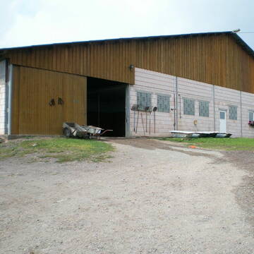
Sichere Jungpferdeaufzucht im Paddocktrail
Rimsberg
Kleewiesenhof
@Kleewiesenhof
Pferdeausbildung
Reitlehrer und -unterricht
Vermieten
Hunde willkommen
Longierzirkel/Roundpen
Fohlenaufzucht möglich
Zuchtstutenhaltung möglich
9 weitere...
P

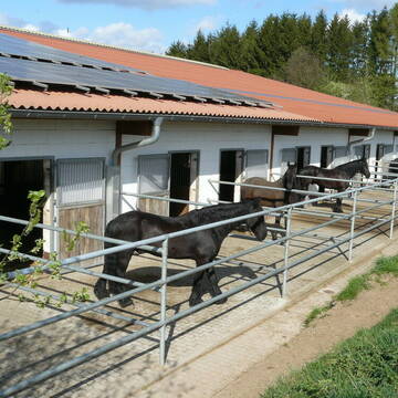
Allergikerplätze im naturnahen Paddocktrail
Rimsberg
Kleewiesenhof
@Kleewiesenhof
Freizeitstall
Pferdeausbildung
Vermieten
Hunde willkommen
Longierzirkel/Roundpen
Allergikerstall
bedampftes/gewaschenes Heu
9 weitere...
P
Deprecated: Creation of dynamic property Zend_View_Helper_Ads::$adLink is deprecated in /var/www/stall-frei/htdocs/staging.stall-frei.de/library/Psf/View/Helper/Ads.php on line 108

Futtersack HeuToy, Fressbremse in pink
Mechtersen
STALL-FREIde Marketing
@STALL-FREI-Marketing
Stundenlange Beschäftigung die
Koliken vorbeugt, geringe Staubinhalation mit
steuerbarer Futterentnahme

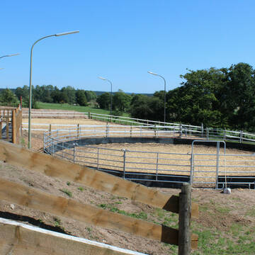
Dein Pferd im naturahen Paddocktrail
Rimsberg
Kleewiesenhof
@Kleewiesenhof
Freizeitstall
Pferdeausbildung
Krankenbox
Reithalle
Bewegungsstall
Paddock Trail
Vollpension
7 weitere...
P
Reitanlage Grafen
Rimsberg
Simone-Grafen
@Simone-Grafen
FN-Mitglied
Geländestrecke
Vermieten
Verpachten
Paddock
Parkplatz für Pferdeanhänger
Gnadenbrothof
Hengsthaltung möglich
21 weitere...
aktuell
P
Mühlberghof Reitanlage Ferienpension
Nohfelden Gonnesweiler
Mühlberghof Reitanlage
@Muhlberghof-Reitanlage
FN-Mitglied
Gastronomie
Paddock
Pensions- und Gastboxen
Außenbox mit Paddock
Innenbox
Vollpension
9 weitere...
P

Boxen / Offenstall mit Paddock und Weiden
Reichenbach
Tamara Bergrath
@TamaraB
Freizeitstall
Reitlehrer und -unterricht
Vermieten
Hunde willkommen
Krankenbox
Hufrehe geeignet
Notfallboxen
17 weitere...
P

Willkommen auf der Silver Moonlight Ranch
Malborn
Silver Moonlight Ranch
@silvermoonlightranch
Freizeitstall
Gangpferdereiten
Vermieten
Hunde willkommen
Krankenbox
Notfallboxen
Pferdezucht
13 weitere...
P


Großzügige Boxen und Weiden mit Rundumservice
Schönberg
Rosenhof-Ranch
@Rosenhof-Ranch
Freizeitstall
Geländestrecke
Vermieten
Führanlage
Hunde willkommen
Allergikerstall
bedampftes/gewaschenes Heu
28 weitere...
P+

Mitarbeiter gesucht?
Mechtersen
STALL-FREIde Marketing
@STALL-FREI-Marketing
Stellenangebote kostenlos veröffentlichen!
Pferdepension Römerhof
Hermeskeil
Roemerhof-Hermeskeil
@Roemerhof-Hermeskeil
Freizeitstall
Reitlehrer und -unterricht
Longierzirkel/Roundpen
Parkplatz für Pferdeanhänger
bedampftes/gewaschenes Heu
Gnadenbrothof
Innenbox
12 weitere...
P
Allergikerstall, 2 Plätze frei
Bescheid
Manuela-Lohse
@Manuela-Lohse
Freizeitstall
Pflegepferd
Krankenbox
Longierzirkel/Roundpen
Allergikerstall
Notfallboxen
Bewegungsstall
9 weitere...
P+
Deprecated: Creation of dynamic property Zend_View::$pageCount is deprecated in /var/www/stall-frei/htdocs/staging.stall-frei.de/library/vendor/shardj/zf1-future/library/Zend/View/Abstract.php on line 308
Deprecated: Creation of dynamic property Zend_View::$itemCountPerPage is deprecated in /var/www/stall-frei/htdocs/staging.stall-frei.de/library/vendor/shardj/zf1-future/library/Zend/View/Abstract.php on line 308
Deprecated: Creation of dynamic property Zend_View::$first is deprecated in /var/www/stall-frei/htdocs/staging.stall-frei.de/library/vendor/shardj/zf1-future/library/Zend/View/Abstract.php on line 308
Deprecated: Creation of dynamic property Zend_View::$current is deprecated in /var/www/stall-frei/htdocs/staging.stall-frei.de/library/vendor/shardj/zf1-future/library/Zend/View/Abstract.php on line 308
Deprecated: Creation of dynamic property Zend_View::$last is deprecated in /var/www/stall-frei/htdocs/staging.stall-frei.de/library/vendor/shardj/zf1-future/library/Zend/View/Abstract.php on line 308
Deprecated: Creation of dynamic property Zend_View::$next is deprecated in /var/www/stall-frei/htdocs/staging.stall-frei.de/library/vendor/shardj/zf1-future/library/Zend/View/Abstract.php on line 308
Deprecated: Creation of dynamic property Zend_View::$pagesInRange is deprecated in /var/www/stall-frei/htdocs/staging.stall-frei.de/library/vendor/shardj/zf1-future/library/Zend/View/Abstract.php on line 308
Deprecated: Creation of dynamic property Zend_View::$firstPageInRange is deprecated in /var/www/stall-frei/htdocs/staging.stall-frei.de/library/vendor/shardj/zf1-future/library/Zend/View/Abstract.php on line 308
Deprecated: Creation of dynamic property Zend_View::$lastPageInRange is deprecated in /var/www/stall-frei/htdocs/staging.stall-frei.de/library/vendor/shardj/zf1-future/library/Zend/View/Abstract.php on line 308
Deprecated: Creation of dynamic property Zend_View::$currentItemCount is deprecated in /var/www/stall-frei/htdocs/staging.stall-frei.de/library/vendor/shardj/zf1-future/library/Zend/View/Abstract.php on line 308
Deprecated: Creation of dynamic property Zend_View::$totalItemCount is deprecated in /var/www/stall-frei/htdocs/staging.stall-frei.de/library/vendor/shardj/zf1-future/library/Zend/View/Abstract.php on line 308
Deprecated: Creation of dynamic property Zend_View::$firstItemNumber is deprecated in /var/www/stall-frei/htdocs/staging.stall-frei.de/library/vendor/shardj/zf1-future/library/Zend/View/Abstract.php on line 308
Deprecated: Creation of dynamic property Zend_View::$lastItemNumber is deprecated in /var/www/stall-frei/htdocs/staging.stall-frei.de/library/vendor/shardj/zf1-future/library/Zend/View/Abstract.php on line 308
Deprecated: Creation of dynamic property Zend_View::$router is deprecated in /var/www/stall-frei/htdocs/staging.stall-frei.de/library/vendor/shardj/zf1-future/library/Zend/View/Abstract.php on line 308
Deprecated: Creation of dynamic property Zend_View::$urlParams is deprecated in /var/www/stall-frei/htdocs/staging.stall-frei.de/library/vendor/shardj/zf1-future/library/Zend/View/Abstract.php on line 308
Deprecated: Creation of dynamic property Zend_View::$showAds is deprecated in /var/www/stall-frei/htdocs/staging.stall-frei.de/library/vendor/shardj/zf1-future/library/Zend/View/Abstract.php on line 308
Deprecated: Creation of dynamic property Zend_View::$objectIds is deprecated in /var/www/stall-frei/htdocs/staging.stall-frei.de/library/vendor/shardj/zf1-future/library/Zend/View/Abstract.php on line 308
Deprecated: Creation of dynamic property Zend_View::$showNavbar is deprecated in /var/www/stall-frei/htdocs/staging.stall-frei.de/library/vendor/shardj/zf1-future/library/Zend/View/Abstract.php on line 308
Deprecated: Creation of dynamic property Zend_View::$showBreadcrumb is deprecated in /var/www/stall-frei/htdocs/staging.stall-frei.de/library/vendor/shardj/zf1-future/library/Zend/View/Abstract.php on line 308
Deprecated: Creation of dynamic property Zend_View::$showFooter is deprecated in /var/www/stall-frei/htdocs/staging.stall-frei.de/library/vendor/shardj/zf1-future/library/Zend/View/Abstract.php on line 308
Deprecated: Creation of dynamic property Zend_View::$showInternalAds is deprecated in /var/www/stall-frei/htdocs/staging.stall-frei.de/library/vendor/shardj/zf1-future/library/Zend/View/Abstract.php on line 308
Deprecated: Creation of dynamic property Zend_View::$blNoContent is deprecated in /var/www/stall-frei/htdocs/staging.stall-frei.de/library/vendor/shardj/zf1-future/library/Zend/View/Abstract.php on line 308
Deprecated: Creation of dynamic property Zend_View::$sMetaDesc is deprecated in /var/www/stall-frei/htdocs/staging.stall-frei.de/library/vendor/shardj/zf1-future/library/Zend/View/Abstract.php on line 308
Deprecated: Creation of dynamic property Zend_View::$useGmaps is deprecated in /var/www/stall-frei/htdocs/staging.stall-frei.de/library/vendor/shardj/zf1-future/library/Zend/View/Abstract.php on line 308
Deprecated: Creation of dynamic property Zend_View::$touches is deprecated in /var/www/stall-frei/htdocs/staging.stall-frei.de/library/vendor/shardj/zf1-future/library/Zend/View/Abstract.php on line 308
Deprecated: Creation of dynamic property Zend_View::$oProject is deprecated in /var/www/stall-frei/htdocs/staging.stall-frei.de/library/vendor/shardj/zf1-future/library/Zend/View/Abstract.php on line 308
Deprecated: Creation of dynamic property Zend_View::$pageHeadline is deprecated in /var/www/stall-frei/htdocs/staging.stall-frei.de/library/vendor/shardj/zf1-future/library/Zend/View/Abstract.php on line 308
Deprecated: Creation of dynamic property Zend_View::$disableLocationField is deprecated in /var/www/stall-frei/htdocs/staging.stall-frei.de/library/vendor/shardj/zf1-future/library/Zend/View/Abstract.php on line 308
Deprecated: Creation of dynamic property Zend_View::$isSearch is deprecated in /var/www/stall-frei/htdocs/staging.stall-frei.de/library/vendor/shardj/zf1-future/library/Zend/View/Abstract.php on line 308
Deprecated: Creation of dynamic property Zend_View::$pageTitle is deprecated in /var/www/stall-frei/htdocs/staging.stall-frei.de/library/vendor/shardj/zf1-future/library/Zend/View/Abstract.php on line 308
Deprecated: Creation of dynamic property Psf_Form_Element_Text::$class is deprecated in /var/www/stall-frei/htdocs/staging.stall-frei.de/library/vendor/shardj/zf1-future/library/Zend/Form/Element.php on line 874
Deprecated: Creation of dynamic property Psf_Form_Element_Text::$size is deprecated in /var/www/stall-frei/htdocs/staging.stall-frei.de/library/vendor/shardj/zf1-future/library/Zend/Form/Element.php on line 874
Deprecated: Creation of dynamic property Psf_Form_Element_Text::$placeholder is deprecated in /var/www/stall-frei/htdocs/staging.stall-frei.de/library/vendor/shardj/zf1-future/library/Zend/Form/Element.php on line 874
Deprecated: Creation of dynamic property Psf_Form_Element_Hidden::$class is deprecated in /var/www/stall-frei/htdocs/staging.stall-frei.de/library/vendor/shardj/zf1-future/library/Zend/Form/Element.php on line 874
Deprecated: Creation of dynamic property Psf_Form_Element_Hidden::$class is deprecated in /var/www/stall-frei/htdocs/staging.stall-frei.de/library/vendor/shardj/zf1-future/library/Zend/Form/Element.php on line 874
Deprecated: Creation of dynamic property Psf_Form_Element_Hidden::$class is deprecated in /var/www/stall-frei/htdocs/staging.stall-frei.de/library/vendor/shardj/zf1-future/library/Zend/Form/Element.php on line 874
Deprecated: Creation of dynamic property Psf_Form_Element_Hidden::$class is deprecated in /var/www/stall-frei/htdocs/staging.stall-frei.de/library/vendor/shardj/zf1-future/library/Zend/Form/Element.php on line 874
Deprecated: Creation of dynamic property Psf_Form_Element_Select::$class is deprecated in /var/www/stall-frei/htdocs/staging.stall-frei.de/library/vendor/shardj/zf1-future/library/Zend/Form/Element.php on line 874
Deprecated: Creation of dynamic property Psf_Form_Element_Select::$class is deprecated in /var/www/stall-frei/htdocs/staging.stall-frei.de/library/vendor/shardj/zf1-future/library/Zend/Form/Element.php on line 874
Deprecated: Creation of dynamic property Psf_Form_Element_Select::$class is deprecated in /var/www/stall-frei/htdocs/staging.stall-frei.de/library/vendor/shardj/zf1-future/library/Zend/Form/Element.php on line 874
Deprecated: Creation of dynamic property Psf_Form_Element_Select::$class is deprecated in /var/www/stall-frei/htdocs/staging.stall-frei.de/library/vendor/shardj/zf1-future/library/Zend/Form/Element.php on line 874
Deprecated: Creation of dynamic property Psf_Form_Element_Text::$class is deprecated in /var/www/stall-frei/htdocs/staging.stall-frei.de/library/vendor/shardj/zf1-future/library/Zend/Form/Element.php on line 874
Deprecated: Creation of dynamic property Psf_Form_Element_Checkbox::$label is deprecated in /var/www/stall-frei/htdocs/staging.stall-frei.de/library/vendor/shardj/zf1-future/library/Zend/Form/Element.php on line 874
Deprecated: Creation of dynamic property Zend_View::$sort is deprecated in /var/www/stall-frei/htdocs/staging.stall-frei.de/library/vendor/shardj/zf1-future/library/Zend/View/Abstract.php on line 308
Deprecated: Creation of dynamic property Zend_View::$searchLocation is deprecated in /var/www/stall-frei/htdocs/staging.stall-frei.de/library/vendor/shardj/zf1-future/library/Zend/View/Abstract.php on line 308
Deprecated: Creation of dynamic property Zend_View::$locationHint is deprecated in /var/www/stall-frei/htdocs/staging.stall-frei.de/library/vendor/shardj/zf1-future/library/Zend/View/Abstract.php on line 308
Psf_GeoCoder_Abstract::getLocation: Ellenberg Get Location CachedOrLive
Psf_GeoCoder_Abstract::getCachedOrLive: Ellenberg
Psf_GeoCoder_OpenCageData::makeApiRequest: response:
Array
(
[documentation] => https://opencagedata.com/api
[licenses] => Array
(
[0] => Array
(
[name] => see attribution guide
[url] => https://opencagedata.com/credits
)
)
[results] => Array
(
[0] => Array
(
[bounds] => Array
(
[northeast] => Array
(
[lat] => 49.6707577
[lng] => 7.1572583
)
[southwest] => Array
(
[lat] => 49.6549243
[lng] => 7.1257708
)
)
[components] => Array
(
[ISO_3166-1_alpha-2] => DE
[ISO_3166-1_alpha-3] => DEU
[ISO_3166-2] => Array
(
[0] => DE-RP
)
[_category] => place
[_normalized_city] => Ellenberg
[_type] => city
[city] => Ellenberg
[continent] => Europe
[country] => Deutschland
[country_code] => de
[county] => Landkreis Birkenfeld
[municipality] => Birkenfeld
[political_union] => European Union
[state] => Rheinland-Pfalz
[state_code] => RP
)
[confidence] => 7
[formatted] => Ellenberg, Rheinland-Pfalz, Deutschland
[geometry] => Array
(
[lat] => 49.6627831
[lng] => 7.1421771
)
)
[1] => Array
(
[bounds] => Array
(
[northeast] => Array
(
[lat] => 49.0481356
[lng] => 10.2720238
)
[southwest] => Array
(
[lat] => 48.9809159
[lng] => 10.1665661
)
)
[components] => Array
(
[ISO_3166-1_alpha-2] => DE
[ISO_3166-1_alpha-3] => DEU
[ISO_3166-2] => Array
(
[0] => DE-BW
)
[_category] => place
[_normalized_city] => Ellenberg
[_type] => village
[continent] => Europe
[country] => Deutschland
[country_code] => de
[county] => Ostalbkreis
[municipality] => VVG der Stadt Ellwangen (Jagst)
[political_union] => European Union
[postcode] => 73488
[state] => Baden-Württemberg
[state_code] => BW
[village] => Ellenberg
)
[confidence] => 7
[formatted] => 73488 Ellenberg, Deutschland
[geometry] => Array
(
[lat] => 49.0141724
[lng] => 10.2159659
)
)
[2] => Array
(
[bounds] => Array
(
[northeast] => Array
(
[lat] => 51.1993363
[lng] => 9.4781635
)
[southwest] => Array
(
[lat] => 51.1749693
[lng] => 9.4504313
)
)
[components] => Array
(
[ISO_3166-1_alpha-2] => DE
[ISO_3166-1_alpha-3] => DEU
[ISO_3166-2] => Array
(
[0] => DE-HE
)
[_category] => place
[_normalized_city] => Ellenberg
[_type] => village
[continent] => Europe
[country] => Deutschland
[country_code] => de
[county] => Schwalm-Eder-Kreis
[municipality] => Guxhagen
[political_union] => European Union
[state] => Hessen
[state_code] => HE
[village] => Ellenberg
)
[confidence] => 7
[formatted] => Ellenberg, Hessen, Deutschland
[geometry] => Array
(
[lat] => 51.1853777
[lng] => 9.4670983
)
)
[3] => Array
(
[bounds] => Array
(
[northeast] => Array
(
[lat] => 52.8109085
[lng] => 11.0109788
)
[southwest] => Array
(
[lat] => 52.7800481
[lng] => 10.9500557
)
)
[components] => Array
(
[ISO_3166-1_alpha-2] => DE
[ISO_3166-1_alpha-3] => DEU
[ISO_3166-2] => Array
(
[0] => DE-ST
)
[_category] => place
[_normalized_city] => Ellenberg
[_type] => village
[continent] => Europe
[country] => Deutschland
[country_code] => de
[county] => Altmarkkreis Salzwedel
[municipality] => Beetzendorf-Diesdorf
[political_union] => European Union
[state] => Sachsen-Anhalt
[state_code] => ST
[village] => Ellenberg
)
[confidence] => 7
[formatted] => Ellenberg, Sachsen-Anhalt, Deutschland
[geometry] => Array
(
[lat] => 52.7954768
[lng] => 10.9718225
)
)
[4] => Array
(
[bounds] => Array
(
[northeast] => Array
(
[lat] => 50.886489
[lng] => 8.5929662
)
[southwest] => Array
(
[lat] => 50.886389
[lng] => 8.5928662
)
)
[components] => Array
(
[ISO_3166-1_alpha-2] => DE
[ISO_3166-1_alpha-3] => DEU
[ISO_3166-2] => Array
(
[0] => DE-HE
)
[_category] => natural/water
[_normalized_city] => Buchenau
[_type] => peak
[continent] => Europe
[country] => Deutschland
[country_code] => de
[county] => Landkreis Marburg-Biedenkopf
[municipality] => Dautphetal
[peak] => Ellenberg
[political_union] => European Union
[state] => Hessen
[state_code] => HE
[village] => Buchenau
)
[confidence] => 9
[formatted] => Ellenberg, Buchenau, Hessen, Deutschland
[geometry] => Array
(
[lat] => 50.886439
[lng] => 8.5929162
)
)
[5] => Array
(
[bounds] => Array
(
[northeast] => Array
(
[lat] => 47.8898852
[lng] => 8.2821335
)
[southwest] => Array
(
[lat] => 47.8897852
[lng] => 8.2820335
)
)
[components] => Array
(
[ISO_3166-1_alpha-2] => DE
[ISO_3166-1_alpha-3] => DEU
[ISO_3166-2] => Array
(
[0] => DE-BW
)
[_category] => natural/water
[_normalized_city] => Friedenweiler
[_type] => peak
[continent] => Europe
[country] => Deutschland
[country_code] => de
[county] => Landkreis Breisgau-Hochschwarzwald
[municipality] => VVG der Stadt Löffingen
[peak] => Ellenberg
[political_union] => European Union
[postcode] => 79877
[state] => Baden-Württemberg
[state_code] => BW
[village] => Friedenweiler
)
[confidence] => 9
[formatted] => Ellenberg, 79877 Friedenweiler, Deutschland
[geometry] => Array
(
[lat] => 47.8898352
[lng] => 8.2820835
)
)
[6] => Array
(
[bounds] => Array
(
[northeast] => Array
(
[lat] => 51.1807002
[lng] => 8.2654227
)
[southwest] => Array
(
[lat] => 51.1806002
[lng] => 8.2653227
)
)
[components] => Array
(
[ISO_3166-1_alpha-2] => DE
[ISO_3166-1_alpha-3] => DEU
[ISO_3166-2] => Array
(
[0] => DE-NW
)
[_category] => natural/water
[_normalized_city] => Schmallenberg
[_type] => peak
[continent] => Europe
[country] => Deutschland
[country_code] => de
[county] => Hochsauerlandkreis
[peak] => Ellenberg
[political_union] => European Union
[postcode] => 57392
[state] => Nordrhein-Westfalen
[state_code] => NW
[town] => Schmallenberg
)
[confidence] => 9
[formatted] => Ellenberg, 57392 Schmallenberg, Deutschland
[geometry] => Array
(
[lat] => 51.1806502
[lng] => 8.2653727
)
)
[7] => Array
(
[bounds] => Array
(
[northeast] => Array
(
[lat] => 51.3146952
[lng] => 8.6759904
)
[southwest] => Array
(
[lat] => 51.3145952
[lng] => 8.6758904
)
)
[components] => Array
(
[ISO_3166-1_alpha-2] => DE
[ISO_3166-1_alpha-3] => DEU
[ISO_3166-2] => Array
(
[0] => DE-HE
)
[_category] => natural/water
[_normalized_city] => Willingen (Upland)
[_type] => peak
[continent] => Europe
[country] => Deutschland
[country_code] => de
[county] => Landkreis Waldeck-Frankenberg
[municipality] => Willingen (Upland)
[peak] => Ellenberg
[political_union] => European Union
[postcode] => 34508
[state] => Hessen
[state_code] => HE
)
[confidence] => 9
[formatted] => Ellenberg, 34508 Willingen (Upland), Deutschland
[geometry] => Array
(
[lat] => 51.3146452
[lng] => 8.6759404
)
)
[8] => Array
(
[bounds] => Array
(
[northeast] => Array
(
[lat] => 52.1977344
[lng] => 7.9992218
)
[southwest] => Array
(
[lat] => 52.1976344
[lng] => 7.9991218
)
)
[components] => Array
(
[ISO_3166-1_alpha-2] => DE
[ISO_3166-1_alpha-3] => DEU
[ISO_3166-2] => Array
(
[0] => DE-NI
)
[_category] => natural/water
[_normalized_city] => Hagen am Teutoburger Wald
[_type] => peak
[continent] => Europe
[country] => Deutschland
[country_code] => de
[county] => Landkreis Osnabrück
[peak] => Ellenberg
[political_union] => European Union
[postcode] => 47170
[state] => Niedersachsen
[state_code] => NI
[town] => Hagen am Teutoburger Wald
)
[confidence] => 9
[formatted] => Ellenberg, 47170 Hagen am Teutoburger Wald, Deutschland
[geometry] => Array
(
[lat] => 52.1976844
[lng] => 7.9991718
)
)
[9] => Array
(
[bounds] => Array
(
[northeast] => Array
(
[lat] => 49.7779287
[lng] => 9.6370427
)
[southwest] => Array
(
[lat] => 49.7778287
[lng] => 9.6369427
)
)
[components] => Array
(
[ISO_3166-1_alpha-2] => DE
[ISO_3166-1_alpha-3] => DEU
[ISO_3166-2] => Array
(
[0] => DE-BW
)
[_category] => natural/water
[_normalized_city] => Wertheim
[_type] => peak
[continent] => Europe
[country] => Deutschland
[country_code] => de
[county] => Main-Tauber-Kreis
[peak] => Ellenberg
[political_union] => European Union
[postcode] => 97855
[state] => Baden-Württemberg
[state_code] => BW
[town] => Wertheim
)
[confidence] => 9
[formatted] => Ellenberg, 97855 Wertheim, Deutschland
[geometry] => Array
(
[lat] => 49.7778787
[lng] => 9.6369927
)
)
)
[status] => Array
(
[code] => 200
[message] => OK
)
[stay_informed] => Array
(
[blog] => https://blog.opencagedata.com
[mastodon] => https://en.osm.town/@opencage
)
[thanks] => For using an OpenCage API
[timestamp] => Array
(
[created_http] => Fri, 06 Feb 2026 18:13:41 GMT
[created_unix] => 1770401621
)
[total_results] => 10
)
Psf_GeoCoder_Abstract::convertLocationResult
{"documentation":"https:\/\/opencagedata.com\/api","licenses":[{"name":"see attribution guide","url":"https:\/\/opencagedata.com\/credits"}],"results":[{"bounds":{"northeast":{"lat":49.6707577,"lng":7.1572583},"southwest":{"lat":49.6549243,"lng":7.1257708}},"components":{"ISO_3166-1_alpha-2":"DE","ISO_3166-1_alpha-3":"DEU","ISO_3166-2":["DE-RP"],"_category":"place","_normalized_city":"Ellenberg","_type":"city","city":"Ellenberg","continent":"Europe","country":"Deutschland","country_code":"de","county":"Landkreis Birkenfeld","municipality":"Birkenfeld","political_union":"European Union","state":"Rheinland-Pfalz","state_code":"RP"},"confidence":7,"formatted":"Ellenberg, Rheinland-Pfalz, Deutschland","geometry":{"lat":49.6627831,"lng":7.1421771}},{"bounds":{"northeast":{"lat":49.0481356,"lng":10.2720238},"southwest":{"lat":48.9809159,"lng":10.1665661}},"components":{"ISO_3166-1_alpha-2":"DE","ISO_3166-1_alpha-3":"DEU","ISO_3166-2":["DE-BW"],"_category":"place","_normalized_city":"Ellenberg","_type":"village","continent":"Europe","country":"Deutschland","country_code":"de","county":"Ostalbkreis","municipality":"VVG der Stadt Ellwangen (Jagst)","political_union":"European Union","postcode":"73488","state":"Baden-W\u00fcrttemberg","state_code":"BW","village":"Ellenberg"},"confidence":7,"formatted":"73488 Ellenberg, Deutschland","geometry":{"lat":49.0141724,"lng":10.2159659}},{"bounds":{"northeast":{"lat":51.1993363,"lng":9.4781635},"southwest":{"lat":51.1749693,"lng":9.4504313}},"components":{"ISO_3166-1_alpha-2":"DE","ISO_3166-1_alpha-3":"DEU","ISO_3166-2":["DE-HE"],"_category":"place","_normalized_city":"Ellenberg","_type":"village","continent":"Europe","country":"Deutschland","country_code":"de","county":"Schwalm-Eder-Kreis","municipality":"Guxhagen","political_union":"European Union","state":"Hessen","state_code":"HE","village":"Ellenberg"},"confidence":7,"formatted":"Ellenberg, Hessen, Deutschland","geometry":{"lat":51.1853777,"lng":9.4670983}},{"bounds":{"northeast":{"lat":52.8109085,"lng":11.0109788},"southwest":{"lat":52.7800481,"lng":10.9500557}},"components":{"ISO_3166-1_alpha-2":"DE","ISO_3166-1_alpha-3":"DEU","ISO_3166-2":["DE-ST"],"_category":"place","_normalized_city":"Ellenberg","_type":"village","continent":"Europe","country":"Deutschland","country_code":"de","county":"Altmarkkreis Salzwedel","municipality":"Beetzendorf-Diesdorf","political_union":"European Union","state":"Sachsen-Anhalt","state_code":"ST","village":"Ellenberg"},"confidence":7,"formatted":"Ellenberg, Sachsen-Anhalt, Deutschland","geometry":{"lat":52.7954768,"lng":10.9718225}},{"bounds":{"northeast":{"lat":50.886489,"lng":8.5929662},"southwest":{"lat":50.886389,"lng":8.5928662}},"components":{"ISO_3166-1_alpha-2":"DE","ISO_3166-1_alpha-3":"DEU","ISO_3166-2":["DE-HE"],"_category":"natural\/water","_normalized_city":"Buchenau","_type":"peak","continent":"Europe","country":"Deutschland","country_code":"de","county":"Landkreis Marburg-Biedenkopf","municipality":"Dautphetal","peak":"Ellenberg","political_union":"European Union","state":"Hessen","state_code":"HE","village":"Buchenau"},"confidence":9,"formatted":"Ellenberg, Buchenau, Hessen, Deutschland","geometry":{"lat":50.886439,"lng":8.5929162}},{"bounds":{"northeast":{"lat":47.8898852,"lng":8.2821335},"southwest":{"lat":47.8897852,"lng":8.2820335}},"components":{"ISO_3166-1_alpha-2":"DE","ISO_3166-1_alpha-3":"DEU","ISO_3166-2":["DE-BW"],"_category":"natural\/water","_normalized_city":"Friedenweiler","_type":"peak","continent":"Europe","country":"Deutschland","country_code":"de","county":"Landkreis Breisgau-Hochschwarzwald","municipality":"VVG der Stadt L\u00f6ffingen","peak":"Ellenberg","political_union":"European Union","postcode":"79877","state":"Baden-W\u00fcrttemberg","state_code":"BW","village":"Friedenweiler"},"confidence":9,"formatted":"Ellenberg, 79877 Friedenweiler, Deutschland","geometry":{"lat":47.8898352,"lng":8.2820835}},{"bounds":{"northeast":{"lat":51.1807002,"lng":8.2654227},"southwest":{"lat":51.1806002,"lng":8.2653227}},"components":{"ISO_3166-1_alpha-2":"DE","ISO_3166-1_alpha-3":"DEU","ISO_3166-2":["DE-NW"],"_category":"natural\/water","_normalized_city":"Schmallenberg","_type":"peak","continent":"Europe","country":"Deutschland","country_code":"de","county":"Hochsauerlandkreis","peak":"Ellenberg","political_union":"European Union","postcode":"57392","state":"Nordrhein-Westfalen","state_code":"NW","town":"Schmallenberg"},"confidence":9,"formatted":"Ellenberg, 57392 Schmallenberg, Deutschland","geometry":{"lat":51.1806502,"lng":8.2653727}},{"bounds":{"northeast":{"lat":51.3146952,"lng":8.6759904},"southwest":{"lat":51.3145952,"lng":8.6758904}},"components":{"ISO_3166-1_alpha-2":"DE","ISO_3166-1_alpha-3":"DEU","ISO_3166-2":["DE-HE"],"_category":"natural\/water","_normalized_city":"Willingen (Upland)","_type":"peak","continent":"Europe","country":"Deutschland","country_code":"de","county":"Landkreis Waldeck-Frankenberg","municipality":"Willingen (Upland)","peak":"Ellenberg","political_union":"European Union","postcode":"34508","state":"Hessen","state_code":"HE"},"confidence":9,"formatted":"Ellenberg, 34508 Willingen (Upland), Deutschland","geometry":{"lat":51.3146452,"lng":8.6759404}},{"bounds":{"northeast":{"lat":52.1977344,"lng":7.9992218},"southwest":{"lat":52.1976344,"lng":7.9991218}},"components":{"ISO_3166-1_alpha-2":"DE","ISO_3166-1_alpha-3":"DEU","ISO_3166-2":["DE-NI"],"_category":"natural\/water","_normalized_city":"Hagen am Teutoburger Wald","_type":"peak","continent":"Europe","country":"Deutschland","country_code":"de","county":"Landkreis Osnabr\u00fcck","peak":"Ellenberg","political_union":"European Union","postcode":"47170","state":"Niedersachsen","state_code":"NI","town":"Hagen am Teutoburger Wald"},"confidence":9,"formatted":"Ellenberg, 47170 Hagen am Teutoburger Wald, Deutschland","geometry":{"lat":52.1976844,"lng":7.9991718}},{"bounds":{"northeast":{"lat":49.7779287,"lng":9.6370427},"southwest":{"lat":49.7778287,"lng":9.6369427}},"components":{"ISO_3166-1_alpha-2":"DE","ISO_3166-1_alpha-3":"DEU","ISO_3166-2":["DE-BW"],"_category":"natural\/water","_normalized_city":"Wertheim","_type":"peak","continent":"Europe","country":"Deutschland","country_code":"de","county":"Main-Tauber-Kreis","peak":"Ellenberg","political_union":"European Union","postcode":"97855","state":"Baden-W\u00fcrttemberg","state_code":"BW","town":"Wertheim"},"confidence":9,"formatted":"Ellenberg, 97855 Wertheim, Deutschland","geometry":{"lat":49.7778787,"lng":9.6369927}}],"status":{"code":200,"message":"OK"},"stay_informed":{"blog":"https:\/\/blog.opencagedata.com","mastodon":"https:\/\/en.osm.town\/@opencage"},"thanks":"For using an OpenCage API","timestamp":{"created_http":"Fri, 06 Feb 2026 18:13:41 GMT","created_unix":1770401621},"total_results":10}Array
(
[0] => stdClass Object
(
[bounds] => stdClass Object
(
[northeast] => stdClass Object
(
[lat] => 49.6707577
[lng] => 7.1572583
)
[southwest] => stdClass Object
(
[lat] => 49.6549243
[lng] => 7.1257708
)
)
[components] => stdClass Object
(
[ISO_3166-1_alpha-2] => DE
[ISO_3166-1_alpha-3] => DEU
[ISO_3166-2] => Array
(
[0] => DE-RP
)
[_category] => place
[_normalized_city] => Ellenberg
[_type] => city
[city] => Ellenberg
[continent] => Europe
[country] => Deutschland
[country_code] => de
[county] => Landkreis Birkenfeld
[municipality] => Birkenfeld
[political_union] => European Union
[state] => Rheinland-Pfalz
[state_code] => RP
)
[confidence] => 7
[formatted] => Ellenberg, Rheinland-Pfalz, Deutschland
[geometry] => stdClass Object
(
[lat] => 49.6627831
[lng] => 7.1421771
)
)
[1] => stdClass Object
(
[bounds] => stdClass Object
(
[northeast] => stdClass Object
(
[lat] => 49.0481356
[lng] => 10.2720238
)
[southwest] => stdClass Object
(
[lat] => 48.9809159
[lng] => 10.1665661
)
)
[components] => stdClass Object
(
[ISO_3166-1_alpha-2] => DE
[ISO_3166-1_alpha-3] => DEU
[ISO_3166-2] => Array
(
[0] => DE-BW
)
[_category] => place
[_normalized_city] => Ellenberg
[_type] => village
[continent] => Europe
[country] => Deutschland
[country_code] => de
[county] => Ostalbkreis
[municipality] => VVG der Stadt Ellwangen (Jagst)
[political_union] => European Union
[postcode] => 73488
[state] => Baden-Württemberg
[state_code] => BW
[village] => Ellenberg
)
[confidence] => 7
[formatted] => 73488 Ellenberg, Deutschland
[geometry] => stdClass Object
(
[lat] => 49.0141724
[lng] => 10.2159659
)
)
[2] => stdClass Object
(
[bounds] => stdClass Object
(
[northeast] => stdClass Object
(
[lat] => 51.1993363
[lng] => 9.4781635
)
[southwest] => stdClass Object
(
[lat] => 51.1749693
[lng] => 9.4504313
)
)
[components] => stdClass Object
(
[ISO_3166-1_alpha-2] => DE
[ISO_3166-1_alpha-3] => DEU
[ISO_3166-2] => Array
(
[0] => DE-HE
)
[_category] => place
[_normalized_city] => Ellenberg
[_type] => village
[continent] => Europe
[country] => Deutschland
[country_code] => de
[county] => Schwalm-Eder-Kreis
[municipality] => Guxhagen
[political_union] => European Union
[state] => Hessen
[state_code] => HE
[village] => Ellenberg
)
[confidence] => 7
[formatted] => Ellenberg, Hessen, Deutschland
[geometry] => stdClass Object
(
[lat] => 51.1853777
[lng] => 9.4670983
)
)
[3] => stdClass Object
(
[bounds] => stdClass Object
(
[northeast] => stdClass Object
(
[lat] => 52.8109085
[lng] => 11.0109788
)
[southwest] => stdClass Object
(
[lat] => 52.7800481
[lng] => 10.9500557
)
)
[components] => stdClass Object
(
[ISO_3166-1_alpha-2] => DE
[ISO_3166-1_alpha-3] => DEU
[ISO_3166-2] => Array
(
[0] => DE-ST
)
[_category] => place
[_normalized_city] => Ellenberg
[_type] => village
[continent] => Europe
[country] => Deutschland
[country_code] => de
[county] => Altmarkkreis Salzwedel
[municipality] => Beetzendorf-Diesdorf
[political_union] => European Union
[state] => Sachsen-Anhalt
[state_code] => ST
[village] => Ellenberg
)
[confidence] => 7
[formatted] => Ellenberg, Sachsen-Anhalt, Deutschland
[geometry] => stdClass Object
(
[lat] => 52.7954768
[lng] => 10.9718225
)
)
[4] => stdClass Object
(
[bounds] => stdClass Object
(
[northeast] => stdClass Object
(
[lat] => 50.886489
[lng] => 8.5929662
)
[southwest] => stdClass Object
(
[lat] => 50.886389
[lng] => 8.5928662
)
)
[components] => stdClass Object
(
[ISO_3166-1_alpha-2] => DE
[ISO_3166-1_alpha-3] => DEU
[ISO_3166-2] => Array
(
[0] => DE-HE
)
[_category] => natural/water
[_normalized_city] => Buchenau
[_type] => peak
[continent] => Europe
[country] => Deutschland
[country_code] => de
[county] => Landkreis Marburg-Biedenkopf
[municipality] => Dautphetal
[peak] => Ellenberg
[political_union] => European Union
[state] => Hessen
[state_code] => HE
[village] => Buchenau
)
[confidence] => 9
[formatted] => Ellenberg, Buchenau, Hessen, Deutschland
[geometry] => stdClass Object
(
[lat] => 50.886439
[lng] => 8.5929162
)
)
[5] => stdClass Object
(
[bounds] => stdClass Object
(
[northeast] => stdClass Object
(
[lat] => 47.8898852
[lng] => 8.2821335
)
[southwest] => stdClass Object
(
[lat] => 47.8897852
[lng] => 8.2820335
)
)
[components] => stdClass Object
(
[ISO_3166-1_alpha-2] => DE
[ISO_3166-1_alpha-3] => DEU
[ISO_3166-2] => Array
(
[0] => DE-BW
)
[_category] => natural/water
[_normalized_city] => Friedenweiler
[_type] => peak
[continent] => Europe
[country] => Deutschland
[country_code] => de
[county] => Landkreis Breisgau-Hochschwarzwald
[municipality] => VVG der Stadt Löffingen
[peak] => Ellenberg
[political_union] => European Union
[postcode] => 79877
[state] => Baden-Württemberg
[state_code] => BW
[village] => Friedenweiler
)
[confidence] => 9
[formatted] => Ellenberg, 79877 Friedenweiler, Deutschland
[geometry] => stdClass Object
(
[lat] => 47.8898352
[lng] => 8.2820835
)
)
[6] => stdClass Object
(
[bounds] => stdClass Object
(
[northeast] => stdClass Object
(
[lat] => 51.1807002
[lng] => 8.2654227
)
[southwest] => stdClass Object
(
[lat] => 51.1806002
[lng] => 8.2653227
)
)
[components] => stdClass Object
(
[ISO_3166-1_alpha-2] => DE
[ISO_3166-1_alpha-3] => DEU
[ISO_3166-2] => Array
(
[0] => DE-NW
)
[_category] => natural/water
[_normalized_city] => Schmallenberg
[_type] => peak
[continent] => Europe
[country] => Deutschland
[country_code] => de
[county] => Hochsauerlandkreis
[peak] => Ellenberg
[political_union] => European Union
[postcode] => 57392
[state] => Nordrhein-Westfalen
[state_code] => NW
[town] => Schmallenberg
)
[confidence] => 9
[formatted] => Ellenberg, 57392 Schmallenberg, Deutschland
[geometry] => stdClass Object
(
[lat] => 51.1806502
[lng] => 8.2653727
)
)
[7] => stdClass Object
(
[bounds] => stdClass Object
(
[northeast] => stdClass Object
(
[lat] => 51.3146952
[lng] => 8.6759904
)
[southwest] => stdClass Object
(
[lat] => 51.3145952
[lng] => 8.6758904
)
)
[components] => stdClass Object
(
[ISO_3166-1_alpha-2] => DE
[ISO_3166-1_alpha-3] => DEU
[ISO_3166-2] => Array
(
[0] => DE-HE
)
[_category] => natural/water
[_normalized_city] => Willingen (Upland)
[_type] => peak
[continent] => Europe
[country] => Deutschland
[country_code] => de
[county] => Landkreis Waldeck-Frankenberg
[municipality] => Willingen (Upland)
[peak] => Ellenberg
[political_union] => European Union
[postcode] => 34508
[state] => Hessen
[state_code] => HE
)
[confidence] => 9
[formatted] => Ellenberg, 34508 Willingen (Upland), Deutschland
[geometry] => stdClass Object
(
[lat] => 51.3146452
[lng] => 8.6759404
)
)
[8] => stdClass Object
(
[bounds] => stdClass Object
(
[northeast] => stdClass Object
(
[lat] => 52.1977344
[lng] => 7.9992218
)
[southwest] => stdClass Object
(
[lat] => 52.1976344
[lng] => 7.9991218
)
)
[components] => stdClass Object
(
[ISO_3166-1_alpha-2] => DE
[ISO_3166-1_alpha-3] => DEU
[ISO_3166-2] => Array
(
[0] => DE-NI
)
[_category] => natural/water
[_normalized_city] => Hagen am Teutoburger Wald
[_type] => peak
[continent] => Europe
[country] => Deutschland
[country_code] => de
[county] => Landkreis Osnabrück
[peak] => Ellenberg
[political_union] => European Union
[postcode] => 47170
[state] => Niedersachsen
[state_code] => NI
[town] => Hagen am Teutoburger Wald
)
[confidence] => 9
[formatted] => Ellenberg, 47170 Hagen am Teutoburger Wald, Deutschland
[geometry] => stdClass Object
(
[lat] => 52.1976844
[lng] => 7.9991718
)
)
[9] => stdClass Object
(
[bounds] => stdClass Object
(
[northeast] => stdClass Object
(
[lat] => 49.7779287
[lng] => 9.6370427
)
[southwest] => stdClass Object
(
[lat] => 49.7778287
[lng] => 9.6369427
)
)
[components] => stdClass Object
(
[ISO_3166-1_alpha-2] => DE
[ISO_3166-1_alpha-3] => DEU
[ISO_3166-2] => Array
(
[0] => DE-BW
)
[_category] => natural/water
[_normalized_city] => Wertheim
[_type] => peak
[continent] => Europe
[country] => Deutschland
[country_code] => de
[county] => Main-Tauber-Kreis
[peak] => Ellenberg
[political_union] => European Union
[postcode] => 97855
[state] => Baden-Württemberg
[state_code] => BW
[town] => Wertheim
)
[confidence] => 9
[formatted] => Ellenberg, 97855 Wertheim, Deutschland
[geometry] => stdClass Object
(
[lat] => 49.7778787
[lng] => 9.6369927
)
)
)
Psf_GeoCoder_OpenCageData::getKeyMap: 0
stdClass Object
(
    [bounds] => stdClass Object
        (
            [northeast] => stdClass Object
                (
                    [lat] => 49.6707577
                    [lng] => 7.1572583
                )

            [southwest] => stdClass Object
                (
                    [lat] => 49.6549243
                    [lng] => 7.1257708
                )

        )

    [components] => stdClass Object
        (
            [ISO_3166-1_alpha-2] => DE
            [ISO_3166-1_alpha-3] => DEU
            [ISO_3166-2] => Array
                (
                    [0] => DE-RP
                )

            [_category] => place
            [_normalized_city] => Ellenberg
            [_type] => city
            [city] => Ellenberg
            [continent] => Europe
            [country] => Deutschland
            [country_code] => de
            [county] => Landkreis Birkenfeld
            [municipality] => Birkenfeld
            [political_union] => European Union
            [state] => Rheinland-Pfalz
            [state_code] => RP
        )

    [confidence] => 7
    [formatted] => Ellenberg, Rheinland-Pfalz, Deutschland
    [geometry] => stdClass Object
        (
            [lat] => 49.6627831
            [lng] => 7.1421771
        )

)
Psf_GeoCoder_OpenCageData::getCounty: Birkenfeld
Psf_GeoCoder_OpenCageData::addMissingData REFETCH!
Array
(
    [address] => Ellenberg, Rheinland-Pfalz, Deutschland
    [type] => city
    [street] =>
    [city] => Ellenberg
    [county] => Birkenfeld
    [state] => Rheinland-Pfalz
    [zip] =>
    [country] => Deutschland
    [suburb] =>
    [countrycode] => de
    [latitude] => 49.6627831
    [longitude] => 7.1421771
    [accuracy] => 1
    [confidence] => 7
    [bounds] => stdClass Object
        (
            [northeast] => stdClass Object
                (
                    [lat] => 49.6707577
                    [lng] => 7.1572583
                )

            [southwest] => stdClass Object
                (
                    [lat] => 49.6549243
                    [lng] => 7.1257708
                )

        )

)
reformat!
Array
(
    [address] => Ellenberg, Rheinland-Pfalz, Deutschland
    [type] => city
    [street] =>
    [city] => Ellenberg
    [county] => Birkenfeld
    [state] => Rheinland-Pfalz
    [zip] =>
    [country] => Deutschland
    [suburb] =>
    [countrycode] => de
    [latitude] => 49.6627831
    [longitude] => 7.1421771
    [accuracy] => 1
    [confidence] => 7
    [bounds] => stdClass Object
        (
            [northeast] => stdClass Object
                (
                    [lat] => 49.6707577
                    [lng] => 7.1572583
                )

            [southwest] => stdClass Object
                (
                    [lat] => 49.6549243
                    [lng] => 7.1257708
                )

        )

    [place] => Ellenberg, Rheinland-Pfalz
    [hash] => 0618436c6bd9967ed12b09e8724325b9
)
Psf_GeoCoder_OpenCageData::getKeyMap: 1
stdClass Object
(
    [bounds] => stdClass Object
        (
            [northeast] => stdClass Object
                (
                    [lat] => 49.0481356
                    [lng] => 10.2720238
                )

            [southwest] => stdClass Object
                (
                    [lat] => 48.9809159
                    [lng] => 10.1665661
                )

        )

    [components] => stdClass Object
        (
            [ISO_3166-1_alpha-2] => DE
            [ISO_3166-1_alpha-3] => DEU
            [ISO_3166-2] => Array
                (
                    [0] => DE-BW
                )

            [_category] => place
            [_normalized_city] => Ellenberg
            [_type] => village
            [continent] => Europe
            [country] => Deutschland
            [country_code] => de
            [county] => Ostalbkreis
            [municipality] => VVG der Stadt Ellwangen (Jagst)
            [political_union] => European Union
            [postcode] => 73488
            [state] => Baden-Württemberg
            [state_code] => BW
            [village] => Ellenberg
        )

    [confidence] => 7
    [formatted] => 73488 Ellenberg, Deutschland
    [geometry] => stdClass Object
        (
            [lat] => 49.0141724
            [lng] => 10.2159659
        )

)
Psf_GeoCoder_OpenCageData::getCounty: Ostalbkreis
Psf_GeoCoder_OpenCageData::addMissingData REFETCH!
Array
(
    [address] => 73488 Ellenberg, Deutschland
    [type] => village
    [street] =>
    [city] => Ellenberg
    [county] => Ostalbkreis
    [state] => Baden-Württemberg
    [zip] => 73488
    [country] => Deutschland
    [suburb] =>
    [countrycode] => de
    [latitude] => 49.0141724
    [longitude] => 10.2159659
    [accuracy] => 1
    [confidence] => 7
    [bounds] => stdClass Object
        (
            [northeast] => stdClass Object
                (
                    [lat] => 49.0481356
                    [lng] => 10.2720238
                )

            [southwest] => stdClass Object
                (
                    [lat] => 48.9809159
                    [lng] => 10.1665661
                )

        )

)
reformat!
Array
(
    [address] => 73488 Ellenberg, Deutschland
    [type] => village
    [street] =>
    [city] => Ellenberg
    [county] => Ostalbkreis
    [state] => Baden-Württemberg
    [zip] => 73488
    [country] => Deutschland
    [suburb] =>
    [countrycode] => de
    [latitude] => 49.0141724
    [longitude] => 10.2159659
    [accuracy] => 1
    [confidence] => 7
    [bounds] => stdClass Object
        (
            [northeast] => stdClass Object
                (
                    [lat] => 49.0481356
                    [lng] => 10.2720238
                )

            [southwest] => stdClass Object
                (
                    [lat] => 48.9809159
                    [lng] => 10.1665661
                )

        )

    [place] => 73488 Ellenberg, Baden-Württemberg
    [hash] => 4d1b5c2d22c5fa53a861ccc6ee32e438
)
Psf_GeoCoder_OpenCageData::getKeyMap: 2
stdClass Object
(
    [bounds] => stdClass Object
        (
            [northeast] => stdClass Object
                (
                    [lat] => 51.1993363
                    [lng] => 9.4781635
                )

            [southwest] => stdClass Object
                (
                    [lat] => 51.1749693
                    [lng] => 9.4504313
                )

        )

    [components] => stdClass Object
        (
            [ISO_3166-1_alpha-2] => DE
            [ISO_3166-1_alpha-3] => DEU
            [ISO_3166-2] => Array
                (
                    [0] => DE-HE
                )

            [_category] => place
            [_normalized_city] => Ellenberg
            [_type] => village
            [continent] => Europe
            [country] => Deutschland
            [country_code] => de
            [county] => Schwalm-Eder-Kreis
            [municipality] => Guxhagen
            [political_union] => European Union
            [state] => Hessen
            [state_code] => HE
            [village] => Ellenberg
        )

    [confidence] => 7
    [formatted] => Ellenberg, Hessen, Deutschland
    [geometry] => stdClass Object
        (
            [lat] => 51.1853777
            [lng] => 9.4670983
        )

)
Psf_GeoCoder_OpenCageData::getCounty: Schwalm-Eder-Kreis
Psf_GeoCoder_OpenCageData::addMissingData REFETCH!
Array
(
    [address] => Ellenberg, Hessen, Deutschland
    [type] => village
    [street] =>
    [city] => Ellenberg
    [county] => Schwalm-Eder-Kreis
    [state] => Hessen
    [zip] =>
    [country] => Deutschland
    [suburb] =>
    [countrycode] => de
    [latitude] => 51.1853777
    [longitude] => 9.4670983
    [accuracy] => 1
    [confidence] => 7
    [bounds] => stdClass Object
        (
            [northeast] => stdClass Object
                (
                    [lat] => 51.1993363
                    [lng] => 9.4781635
                )

            [southwest] => stdClass Object
                (
                    [lat] => 51.1749693
                    [lng] => 9.4504313
                )

        )

)
reformat!
Array
(
    [address] => Ellenberg, Hessen, Deutschland
    [type] => village
    [street] =>
    [city] => Ellenberg
    [county] => Schwalm-Eder-Kreis
    [state] => Hessen
    [zip] =>
    [country] => Deutschland
    [suburb] =>
    [countrycode] => de
    [latitude] => 51.1853777
    [longitude] => 9.4670983
    [accuracy] => 1
    [confidence] => 7
    [bounds] => stdClass Object
        (
            [northeast] => stdClass Object
                (
                    [lat] => 51.1993363
                    [lng] => 9.4781635
                )

            [southwest] => stdClass Object
                (
                    [lat] => 51.1749693
                    [lng] => 9.4504313
                )

        )

    [place] => Ellenberg, Hessen
    [hash] => 1ddbb556be2102aaf1503e40fe91068e
)
Psf_GeoCoder_OpenCageData::getKeyMap: 3
stdClass Object
(
    [bounds] => stdClass Object
        (
            [northeast] => stdClass Object
                (
                    [lat] => 52.8109085
                    [lng] => 11.0109788
                )

            [southwest] => stdClass Object
                (
                    [lat] => 52.7800481
                    [lng] => 10.9500557
                )

        )

    [components] => stdClass Object
        (
            [ISO_3166-1_alpha-2] => DE
            [ISO_3166-1_alpha-3] => DEU
            [ISO_3166-2] => Array
                (
                    [0] => DE-ST
                )

            [_category] => place
            [_normalized_city] => Ellenberg
            [_type] => village
            [continent] => Europe
            [country] => Deutschland
            [country_code] => de
            [county] => Altmarkkreis Salzwedel
            [municipality] => Beetzendorf-Diesdorf
            [political_union] => European Union
            [state] => Sachsen-Anhalt
            [state_code] => ST
            [village] => Ellenberg
        )

    [confidence] => 7
    [formatted] => Ellenberg, Sachsen-Anhalt, Deutschland
    [geometry] => stdClass Object
        (
            [lat] => 52.7954768
            [lng] => 10.9718225
        )

)
Psf_GeoCoder_OpenCageData::getCounty: Altmarkkreis Salzwedel
Psf_GeoCoder_OpenCageData::addMissingData REFETCH!
Array
(
    [address] => Ellenberg, Sachsen-Anhalt, Deutschland
    [type] => village
    [street] =>
    [city] => Ellenberg
    [county] => Altmarkkreis Salzwedel
    [state] => Sachsen-Anhalt
    [zip] =>
    [country] => Deutschland
    [suburb] =>
    [countrycode] => de
    [latitude] => 52.7954768
    [longitude] => 10.9718225
    [accuracy] => 1
    [confidence] => 7
    [bounds] => stdClass Object
        (
            [northeast] => stdClass Object
                (
                    [lat] => 52.8109085
                    [lng] => 11.0109788
                )

            [southwest] => stdClass Object
                (
                    [lat] => 52.7800481
                    [lng] => 10.9500557
                )

        )

)
reformat!
Array
(
    [address] => Ellenberg, Sachsen-Anhalt, Deutschland
    [type] => village
    [street] =>
    [city] => Ellenberg
    [county] => Altmarkkreis Salzwedel
    [state] => Sachsen-Anhalt
    [zip] =>
    [country] => Deutschland
    [suburb] =>
    [countrycode] => de
    [latitude] => 52.7954768
    [longitude] => 10.9718225
    [accuracy] => 1
    [confidence] => 7
    [bounds] => stdClass Object
        (
            [northeast] => stdClass Object
                (
                    [lat] => 52.8109085
                    [lng] => 11.0109788
                )

            [southwest] => stdClass Object
                (
                    [lat] => 52.7800481
                    [lng] => 10.9500557
                )

        )

    [place] => Ellenberg, Sachsen-Anhalt
    [hash] => 35f02628a58f9f84776217bf9ec43c15
)
Psf_GeoCoder_OpenCageData::getKeyMap: 4
stdClass Object
(
    [bounds] => stdClass Object
        (
            [northeast] => stdClass Object
                (
                    [lat] => 50.886489
                    [lng] => 8.5929662
                )

            [southwest] => stdClass Object
                (
                    [lat] => 50.886389
                    [lng] => 8.5928662
                )

        )

    [components] => stdClass Object
        (
            [ISO_3166-1_alpha-2] => DE
            [ISO_3166-1_alpha-3] => DEU
            [ISO_3166-2] => Array
                (
                    [0] => DE-HE
                )

            [_category] => natural/water
            [_normalized_city] => Buchenau
            [_type] => peak
            [continent] => Europe
            [country] => Deutschland
            [country_code] => de
            [county] => Landkreis Marburg-Biedenkopf
            [municipality] => Dautphetal
            [peak] => Ellenberg
            [political_union] => European Union
            [state] => Hessen
            [state_code] => HE
            [village] => Buchenau
        )

    [confidence] => 9
    [formatted] => Ellenberg, Buchenau, Hessen, Deutschland
    [geometry] => stdClass Object
        (
            [lat] => 50.886439
            [lng] => 8.5929162
        )

)
Psf_GeoCoder_OpenCageData::getCounty: Marburg-Biedenkopf
Psf_GeoCoder_OpenCageData::addMissingData REFETCH!
Array
(
    [address] => Ellenberg, Buchenau, Hessen, Deutschland
    [type] => peak
    [street] =>
    [city] => Buchenau
    [county] => Marburg-Biedenkopf
    [state] => Hessen
    [zip] =>
    [country] => Deutschland
    [suburb] =>
    [countrycode] => de
    [latitude] => 50.886439
    [longitude] => 8.5929162
    [accuracy] => 1
    [confidence] => 9
    [bounds] => stdClass Object
        (
            [northeast] => stdClass Object
                (
                    [lat] => 50.886489
                    [lng] => 8.5929662
                )

            [southwest] => stdClass Object
                (
                    [lat] => 50.886389
                    [lng] => 8.5928662
                )

        )

)
reformat!
Array
(
    [address] => Ellenberg, Buchenau, Hessen, Deutschland
    [type] => peak
    [street] =>
    [city] => Buchenau
    [county] => Marburg-Biedenkopf
    [state] => Hessen
    [zip] =>
    [country] => Deutschland
    [suburb] =>
    [countrycode] => de
    [latitude] => 50.886439
    [longitude] => 8.5929162
    [accuracy] => 1
    [confidence] => 9
    [bounds] => stdClass Object
        (
            [northeast] => stdClass Object
                (
                    [lat] => 50.886489
                    [lng] => 8.5929662
                )

            [southwest] => stdClass Object
                (
                    [lat] => 50.886389
                    [lng] => 8.5928662
                )

        )

    [place] => Buchenau, Hessen
    [hash] => 637a4e3f78ba5cf7e90634b90ecbb7d9
)
Psf_GeoCoder_OpenCageData::getKeyMap: 5
stdClass Object
(
    [bounds] => stdClass Object
        (
            [northeast] => stdClass Object
                (
                    [lat] => 47.8898852
                    [lng] => 8.2821335
                )

            [southwest] => stdClass Object
                (
                    [lat] => 47.8897852
                    [lng] => 8.2820335
                )

        )

    [components] => stdClass Object
        (
            [ISO_3166-1_alpha-2] => DE
            [ISO_3166-1_alpha-3] => DEU
            [ISO_3166-2] => Array
                (
                    [0] => DE-BW
                )

            [_category] => natural/water
            [_normalized_city] => Friedenweiler
            [_type] => peak
            [continent] => Europe
            [country] => Deutschland
            [country_code] => de
            [county] => Landkreis Breisgau-Hochschwarzwald
            [municipality] => VVG der Stadt Löffingen
            [peak] => Ellenberg
            [political_union] => European Union
            [postcode] => 79877
            [state] => Baden-Württemberg
            [state_code] => BW
            [village] => Friedenweiler
        )

    [confidence] => 9
    [formatted] => Ellenberg, 79877 Friedenweiler, Deutschland
    [geometry] => stdClass Object
        (
            [lat] => 47.8898352
            [lng] => 8.2820835
        )

)
Psf_GeoCoder_OpenCageData::getCounty: Breisgau-Hochschwarzwald
Psf_GeoCoder_OpenCageData::addMissingData REFETCH!
Array
(
    [address] => Ellenberg, 79877 Friedenweiler, Deutschland
    [type] => peak
    [street] =>
    [city] => Friedenweiler
    [county] => Breisgau-Hochschwarzwald
    [state] => Baden-Württemberg
    [zip] => 79877
    [country] => Deutschland
    [suburb] =>
    [countrycode] => de
    [latitude] => 47.8898352
    [longitude] => 8.2820835
    [accuracy] => 1
    [confidence] => 9
    [bounds] => stdClass Object
        (
            [northeast] => stdClass Object
                (
                    [lat] => 47.8898852
                    [lng] => 8.2821335
                )

            [southwest] => stdClass Object
                (
                    [lat] => 47.8897852
                    [lng] => 8.2820335
                )

        )

)
reformat!
Array
(
    [address] => Ellenberg, 79877 Friedenweiler, Deutschland
    [type] => peak
    [street] =>
    [city] => Friedenweiler
    [county] => Breisgau-Hochschwarzwald
    [state] => Baden-Württemberg
    [zip] => 79877
    [country] => Deutschland
    [suburb] =>
    [countrycode] => de
    [latitude] => 47.8898352
    [longitude] => 8.2820835
    [accuracy] => 1
    [confidence] => 9
    [bounds] => stdClass Object
        (
            [northeast] => stdClass Object
                (
                    [lat] => 47.8898852
                    [lng] => 8.2821335
                )

            [southwest] => stdClass Object
                (
                    [lat] => 47.8897852
                    [lng] => 8.2820335
                )

        )

    [place] => 79877 Friedenweiler, Baden-Württemberg
    [hash] => 62f7fd4fd46323e923c3fac044ae87d4
)
Psf_GeoCoder_OpenCageData::getKeyMap: 6
stdClass Object
(
    [bounds] => stdClass Object
        (
            [northeast] => stdClass Object
                (
                    [lat] => 51.1807002
                    [lng] => 8.2654227
                )

            [southwest] => stdClass Object
                (
                    [lat] => 51.1806002
                    [lng] => 8.2653227
                )

        )

    [components] => stdClass Object
        (
            [ISO_3166-1_alpha-2] => DE
            [ISO_3166-1_alpha-3] => DEU
            [ISO_3166-2] => Array
                (
                    [0] => DE-NW
                )

            [_category] => natural/water
            [_normalized_city] => Schmallenberg
            [_type] => peak
            [continent] => Europe
            [country] => Deutschland
            [country_code] => de
            [county] => Hochsauerlandkreis
            [peak] => Ellenberg
            [political_union] => European Union
            [postcode] => 57392
            [state] => Nordrhein-Westfalen
            [state_code] => NW
            [town] => Schmallenberg
        )

    [confidence] => 9
    [formatted] => Ellenberg, 57392 Schmallenberg, Deutschland
    [geometry] => stdClass Object
        (
            [lat] => 51.1806502
            [lng] => 8.2653727
        )

)
Psf_GeoCoder_OpenCageData::getCounty: Hochsauerlandkreis
Psf_GeoCoder_OpenCageData::addMissingData REFETCH!
Array
(
    [address] => Ellenberg, 57392 Schmallenberg, Deutschland
    [type] => peak
    [street] =>
    [city] => Schmallenberg
    [county] => Hochsauerlandkreis
    [state] => Nordrhein-Westfalen
    [zip] => 57392
    [country] => Deutschland
    [suburb] =>
    [countrycode] => de
    [latitude] => 51.1806502
    [longitude] => 8.2653727
    [accuracy] => 1
    [confidence] => 9
    [bounds] => stdClass Object
        (
            [northeast] => stdClass Object
                (
                    [lat] => 51.1807002
                    [lng] => 8.2654227
                )

            [southwest] => stdClass Object
                (
                    [lat] => 51.1806002
                    [lng] => 8.2653227
                )

        )

)
reformat!
Array
(
    [address] => Ellenberg, 57392 Schmallenberg, Deutschland
    [type] => peak
    [street] =>
    [city] => Schmallenberg
    [county] => Hochsauerlandkreis
    [state] => Nordrhein-Westfalen
    [zip] => 57392
    [country] => Deutschland
    [suburb] =>
    [countrycode] => de
    [latitude] => 51.1806502
    [longitude] => 8.2653727
    [accuracy] => 1
    [confidence] => 9
    [bounds] => stdClass Object
        (
            [northeast] => stdClass Object
                (
                    [lat] => 51.1807002
                    [lng] => 8.2654227
                )

            [southwest] => stdClass Object
                (
                    [lat] => 51.1806002
                    [lng] => 8.2653227
                )

        )

    [place] => 57392 Schmallenberg, Nordrhein-Westfalen
    [hash] => 7af614b523c2f91ba42c32a6a4fe6f6f
)
Psf_GeoCoder_OpenCageData::getKeyMap: 7
stdClass Object
(
    [bounds] => stdClass Object
        (
            [northeast] => stdClass Object
                (
                    [lat] => 51.3146952
                    [lng] => 8.6759904
                )

            [southwest] => stdClass Object
                (
                    [lat] => 51.3145952
                    [lng] => 8.6758904
                )

        )

    [components] => stdClass Object
        (
            [ISO_3166-1_alpha-2] => DE
            [ISO_3166-1_alpha-3] => DEU
            [ISO_3166-2] => Array
                (
                    [0] => DE-HE
                )

            [_category] => natural/water
            [_normalized_city] => Willingen (Upland)
            [_type] => peak
            [continent] => Europe
            [country] => Deutschland
            [country_code] => de
            [county] => Landkreis Waldeck-Frankenberg
            [municipality] => Willingen (Upland)
            [peak] => Ellenberg
            [political_union] => European Union
            [postcode] => 34508
            [state] => Hessen
            [state_code] => HE
        )

    [confidence] => 9
    [formatted] => Ellenberg, 34508 Willingen (Upland), Deutschland
    [geometry] => stdClass Object
        (
            [lat] => 51.3146452
            [lng] => 8.6759404
        )

)
Psf_GeoCoder_OpenCageData::getCounty: Waldeck-Frankenberg
Psf_GeoCoder_OpenCageData::addMissingData REFETCH!
Array
(
    [address] => Ellenberg, 34508 Willingen (Upland), Deutschland
    [type] => peak
    [street] =>
    [city] =>
    [county] => Waldeck-Frankenberg
    [state] => Hessen
    [zip] => 34508
    [country] => Deutschland
    [suburb] =>
    [countrycode] => de
    [latitude] => 51.3146452
    [longitude] => 8.6759404
    [accuracy] => 1
    [confidence] => 9
    [bounds] => stdClass Object
        (
            [northeast] => stdClass Object
                (
                    [lat] => 51.3146952
                    [lng] => 8.6759904
                )

            [southwest] => stdClass Object
                (
                    [lat] => 51.3145952
                    [lng] => 8.6758904
                )

        )

)
reformat!
Array
(
    [address] => Ellenberg, 34508 Willingen (Upland), Deutschland
    [type] => peak
    [street] =>
    [city] =>
    [county] => Waldeck-Frankenberg
    [state] => Hessen
    [zip] => 34508
    [country] => Deutschland
    [suburb] =>
    [countrycode] => de
    [latitude] => 51.3146452
    [longitude] => 8.6759404
    [accuracy] => 1
    [confidence] => 9
    [bounds] => stdClass Object
        (
            [northeast] => stdClass Object
                (
                    [lat] => 51.3146952
                    [lng] => 8.6759904
                )

            [southwest] => stdClass Object
                (
                    [lat] => 51.3145952
                    [lng] => 8.6758904
                )

        )

    [place] => 34508 , Hessen
    [hash] => 17fd9a35ed56322f909bef623e383a8b
)
Psf_GeoCoder_OpenCageData::getKeyMap: 8
stdClass Object
(
    [bounds] => stdClass Object
        (
            [northeast] => stdClass Object
                (
                    [lat] => 52.1977344
                    [lng] => 7.9992218
                )

            [southwest] => stdClass Object
                (
                    [lat] => 52.1976344
                    [lng] => 7.9991218
                )

        )

    [components] => stdClass Object
        (
            [ISO_3166-1_alpha-2] => DE
            [ISO_3166-1_alpha-3] => DEU
            [ISO_3166-2] => Array
                (
                    [0] => DE-NI
                )

            [_category] => natural/water
            [_normalized_city] => Hagen am Teutoburger Wald
            [_type] => peak
            [continent] => Europe
            [country] => Deutschland
            [country_code] => de
            [county] => Landkreis Osnabrück
            [peak] => Ellenberg
            [political_union] => European Union
            [postcode] => 47170
            [state] => Niedersachsen
            [state_code] => NI
            [town] => Hagen am Teutoburger Wald
        )

    [confidence] => 9
    [formatted] => Ellenberg, 47170 Hagen am Teutoburger Wald, Deutschland
    [geometry] => stdClass Object
        (
            [lat] => 52.1976844
            [lng] => 7.9991718
        )

)
Psf_GeoCoder_OpenCageData::getCounty: Osnabrück
Psf_GeoCoder_OpenCageData::addMissingData REFETCH!
Array
(
    [address] => Ellenberg, 47170 Hagen am Teutoburger Wald, Deutschland
    [type] => peak
    [street] =>
    [city] => Hagen am Teutoburger Wald
    [county] => Osnabrück
    [state] => Niedersachsen
    [zip] => 47170
    [country] => Deutschland
    [suburb] =>
    [countrycode] => de
    [latitude] => 52.1976844
    [longitude] => 7.9991718
    [accuracy] => 1
    [confidence] => 9
    [bounds] => stdClass Object
        (
            [northeast] => stdClass Object
                (
                    [lat] => 52.1977344
                    [lng] => 7.9992218
                )

            [southwest] => stdClass Object
                (
                    [lat] => 52.1976344
                    [lng] => 7.9991218
                )

        )

)
reformat!
Array
(
    [address] => Ellenberg, 47170 Hagen am Teutoburger Wald, Deutschland
    [type] => peak
    [street] =>
    [city] => Hagen am Teutoburger Wald
    [county] => Osnabrück
    [state] => Niedersachsen
    [zip] => 47170
    [country] => Deutschland
    [suburb] =>
    [countrycode] => de
    [latitude] => 52.1976844
    [longitude] => 7.9991718
    [accuracy] => 1
    [confidence] => 9
    [bounds] => stdClass Object
        (
            [northeast] => stdClass Object
                (
                    [lat] => 52.1977344
                    [lng] => 7.9992218
                )

            [southwest] => stdClass Object
                (
                    [lat] => 52.1976344
                    [lng] => 7.9991218
                )

        )

    [place] => 47170 Hagen am Teutoburger Wald, Niedersachsen
    [hash] => 483311b7de50f710ea29d6edbd9b8922
)
Psf_GeoCoder_OpenCageData::getKeyMap: 9
stdClass Object
(
    [bounds] => stdClass Object
        (
            [northeast] => stdClass Object
                (
                    [lat] => 49.7779287
                    [lng] => 9.6370427
                )

            [southwest] => stdClass Object
                (
                    [lat] => 49.7778287
                    [lng] => 9.6369427
                )

        )

    [components] => stdClass Object
        (
            [ISO_3166-1_alpha-2] => DE
            [ISO_3166-1_alpha-3] => DEU
            [ISO_3166-2] => Array
                (
                    [0] => DE-BW
                )

            [_category] => natural/water
            [_normalized_city] => Wertheim
            [_type] => peak
            [continent] => Europe
            [country] => Deutschland
            [country_code] => de
            [county] => Main-Tauber-Kreis
            [peak] => Ellenberg
            [political_union] => European Union
            [postcode] => 97855
            [state] => Baden-Württemberg
            [state_code] => BW
            [town] => Wertheim
        )

    [confidence] => 9
    [formatted] => Ellenberg, 97855 Wertheim, Deutschland
    [geometry] => stdClass Object
        (
            [lat] => 49.7778787
            [lng] => 9.6369927
        )

)
Psf_GeoCoder_OpenCageData::getCounty: Main-Tauber-Kreis
Psf_GeoCoder_OpenCageData::addMissingData REFETCH!
Array
(
    [address] => Ellenberg, 97855 Wertheim, Deutschland
    [type] => peak
    [street] =>
    [city] => Wertheim
    [county] => Main-Tauber-Kreis
    [state] => Baden-Württemberg
    [zip] => 97855
    [country] => Deutschland
    [suburb] =>
    [countrycode] => de
    [latitude] => 49.7778787
    [longitude] => 9.6369927
    [accuracy] => 1
    [confidence] => 9
    [bounds] => stdClass Object
        (
            [northeast] => stdClass Object
                (
                    [lat] => 49.7779287
                    [lng] => 9.6370427
                )

            [southwest] => stdClass Object
                (
                    [lat] => 49.7778287
                    [lng] => 9.6369427
                )

        )

)
reformat!
Array
(
    [address] => Ellenberg, 97855 Wertheim, Deutschland
    [type] => peak
    [street] =>
    [city] => Wertheim
    [county] => Main-Tauber-Kreis
    [state] => Baden-Württemberg
    [zip] => 97855
    [country] => Deutschland
    [suburb] =>
    [countrycode] => de
    [latitude] => 49.7778787
    [longitude] => 9.6369927
    [accuracy] => 1
    [confidence] => 9
    [bounds] => stdClass Object
        (
            [northeast] => stdClass Object
                (
                    [lat] => 49.7779287
                    [lng] => 9.6370427
                )

            [southwest] => stdClass Object
                (
                    [lat] => 49.7778287
                    [lng] => 9.6369427
                )

        )

    [place] => 97855 Wertheim, Baden-Württemberg
    [hash] => 4b9e166bf395c41c335d7f6158bf2ce3
)
Deprecated: Creation of dynamic property Zend_View::$locationHintStyle is deprecated in /var/www/stall-frei/htdocs/staging.stall-frei.de/library/vendor/shardj/zf1-future/library/Zend/View/Abstract.php on line 308
Deprecated: Creation of dynamic property Zend_View::$adGeoLocation is deprecated in /var/www/stall-frei/htdocs/staging.stall-frei.de/library/vendor/shardj/zf1-future/library/Zend/View/Abstract.php on line 308
Deprecated: Creation of dynamic property Zend_View::$recordCount is deprecated in /var/www/stall-frei/htdocs/staging.stall-frei.de/library/vendor/shardj/zf1-future/library/Zend/View/Abstract.php on line 308
Deprecated: explode(): Passing null to parameter #2 ($string) of type string is deprecated in /var/www/stall-frei/htdocs/staging.stall-frei.de/application/models/SearchAgent.php on line 100
Deprecated: explode(): Passing null to parameter #2 ($string) of type string is deprecated in /var/www/stall-frei/htdocs/staging.stall-frei.de/application/models/SearchAgent.php on line 100
Deprecated: explode(): Passing null to parameter #2 ($string) of type string is deprecated in /var/www/stall-frei/htdocs/staging.stall-frei.de/application/models/SearchAgent.php on line 100
Deprecated: explode(): Passing null to parameter #2 ($string) of type string is deprecated in /var/www/stall-frei/htdocs/staging.stall-frei.de/application/models/SearchAgent.php on line 100
Deprecated: explode(): Passing null to parameter #2 ($string) of type string is deprecated in /var/www/stall-frei/htdocs/staging.stall-frei.de/application/models/SearchAgent.php on line 100
Deprecated: explode(): Passing null to parameter #2 ($string) of type string is deprecated in /var/www/stall-frei/htdocs/staging.stall-frei.de/application/models/SearchAgent.php on line 100
Deprecated: explode(): Passing null to parameter #2 ($string) of type string is deprecated in /var/www/stall-frei/htdocs/staging.stall-frei.de/application/models/SearchAgent.php on line 100
Deprecated: explode(): Passing null to parameter #2 ($string) of type string is deprecated in /var/www/stall-frei/htdocs/staging.stall-frei.de/application/models/SearchAgent.php on line 100
Deprecated: explode(): Passing null to parameter #2 ($string) of type string is deprecated in /var/www/stall-frei/htdocs/staging.stall-frei.de/application/models/SearchAgent.php on line 100
Deprecated: trim(): Passing null to parameter #1 ($string) of type string is deprecated in /var/www/stall-frei/htdocs/staging.stall-frei.de/application/models/Account/Search.php on line 82
Warning: Cannot modify header information - headers already sent by (output started at /var/www/stall-frei/htdocs/staging.stall-frei.de/library/vendor/shardj/zf1-future/library/Zend/View/Abstract.php:308) in /var/www/stall-frei/htdocs/staging.stall-frei.de/application/models/Account/Search.php on line 71
Deprecated: Creation of dynamic property Zend_View::$paginationParams is deprecated in /var/www/stall-frei/htdocs/staging.stall-frei.de/library/vendor/shardj/zf1-future/library/Zend/View/Abstract.php on line 308
Deprecated: Creation of dynamic property Zend_View::$objectPaginator is deprecated in /var/www/stall-frei/htdocs/staging.stall-frei.de/library/vendor/shardj/zf1-future/library/Zend/View/Abstract.php on line 308
Deprecated: Creation of dynamic property Zend_View::$featuredObjects is deprecated in /var/www/stall-frei/htdocs/staging.stall-frei.de/library/vendor/shardj/zf1-future/library/Zend/View/Abstract.php on line 308
Deprecated: Creation of dynamic property Zend_View::$hints is deprecated in /var/www/stall-frei/htdocs/staging.stall-frei.de/library/vendor/shardj/zf1-future/library/Zend/View/Abstract.php on line 308
Deprecated: Creation of dynamic property Zend_View::$attributeHints is deprecated in /var/www/stall-frei/htdocs/staging.stall-frei.de/library/vendor/shardj/zf1-future/library/Zend/View/Abstract.php on line 308
Deprecated: Creation of dynamic property Zend_View::$oSearchForm is deprecated in /var/www/stall-frei/htdocs/staging.stall-frei.de/library/vendor/shardj/zf1-future/library/Zend/View/Abstract.php on line 308