Deprecated: Creation of dynamic property Zend_View::$sMode is deprecated in /var/www/stall-frei/htdocs/staging.stall-frei.de/library/vendor/shardj/zf1-future/library/Zend/View/Abstract.php on line 308
Stallplatz oder Offenstall in Leonbronn
Gesucht wird in "Leonbronn, Baden-Württemberg, Deutschland"
6.346 Einträge
Deprecated: Creation of dynamic property Zend_View::$listObjects is deprecated in /var/www/stall-frei/htdocs/staging.stall-frei.de/library/vendor/shardj/zf1-future/library/Zend/View/Abstract.php on line 308
Gesponsort


Deprecated: Creation of dynamic property Zend_View::$listMode is deprecated in /var/www/stall-frei/htdocs/staging.stall-frei.de/library/vendor/shardj/zf1-future/library/Zend/View/Abstract.php on line 308
Deprecated: Creation of dynamic property Zend_View::$renderedObjects is deprecated in /var/www/stall-frei/htdocs/staging.stall-frei.de/library/vendor/shardj/zf1-future/library/Zend/View/Abstract.php on line 308
Deprecated: Creation of dynamic property Zend_View::$index is deprecated in /var/www/stall-frei/htdocs/staging.stall-frei.de/library/vendor/shardj/zf1-future/library/Zend/View/Abstract.php on line 308
Deprecated: Creation of dynamic property Zend_View::$displayMode is deprecated in /var/www/stall-frei/htdocs/staging.stall-frei.de/library/vendor/shardj/zf1-future/library/Zend/View/Abstract.php on line 308
Deprecated: Creation of dynamic property Zend_View::$remarketingIds is deprecated in /var/www/stall-frei/htdocs/staging.stall-frei.de/library/vendor/shardj/zf1-future/library/Zend/View/Abstract.php on line 308
Deprecated: Creation of dynamic property Zend_View::$listItem is deprecated in /var/www/stall-frei/htdocs/staging.stall-frei.de/library/vendor/shardj/zf1-future/library/Zend/View/Abstract.php on line 308
Deprecated: Creation of dynamic property Zend_View::$object is deprecated in /var/www/stall-frei/htdocs/staging.stall-frei.de/library/vendor/shardj/zf1-future/library/Zend/View/Abstract.php on line 308
Deprecated: Creation of dynamic property Zend_View::$attributes is deprecated in /var/www/stall-frei/htdocs/staging.stall-frei.de/library/vendor/shardj/zf1-future/library/Zend/View/Abstract.php on line 308


Longhorn Ranch
Gemmingen - Stebbach
Longhorn Ranch
@Kai-Koelle
Freizeitstall
Westernreiten
Hunde willkommen
Longierzirkel/Roundpen
Vollpension
Einzelne Boxen oder Stallplätze
9 weitere...
S
Deprecated: Creation of dynamic property Zend_View_Helper_Ads::$adLink is deprecated in /var/www/stall-frei/htdocs/staging.stall-frei.de/library/Psf/View/Helper/Ads.php on line 108

Persönlichkeitsentwicklung mit Pferden
Bad Salzuflen
Katja Dors
@Pferdezeiten
Begleite andere auf ihrem Entwicklungsweg und entdecke die transformative Kraft der pferdegestützten Persönlichkeitsentwicklung !
neu
R


Reitstall Seehof Familie Feinauer
Pfaffenhofen
Simon Feinauer
@Simon-Feinauer
Fahrstall, Kutschwagen
Freizeitstall
Vermieten
Hunde willkommen
Longierzirkel/Roundpen
Allergikerstall
Gnadenbrothof
20 weitere...
P+

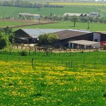
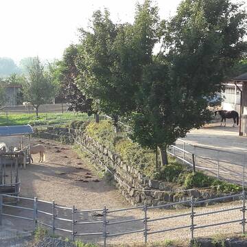
Bausch Ranch
Zaberfeld
Bausch Ranch
@BauschRanch
Freizeitstall
Pferdeausbildung
Vermieten
Hunde willkommen
Paddock
Innenbox
Offenstall
13 weitere...
P


Aktiv und Offenstall mit direktem Weidezugang
Illingen / Schützingen
Familie Weigel
@Pferdehof-Weigel
Fahrstall, Kutschwagen
Freizeitstall
Vermieten
Verpachten
Hunde willkommen
Krankenbox
Allergikerstall
Fohlenaufzucht möglich
35 weitere...
P+

Großzügige Reitanlage für Sport und Freizeitreit...
Wiernsheim
Reitanlage-Hohes-Kreuz
@ReitanlageHohesKreuz
Freizeitstall
Pferdeausbildung
Vermieten
Führanlage
Paddock
Hufrehe geeignet
18 weitere...
ganz aktuell
S


Bonartshäuserhof, artgerechte Offenstallhaltung
Gondelsheim
Gut Bonartshäuserhof
@Bonartshaeuserhof
FN-Mitglied
Freizeitstall
Vermieten
Krankenbox
Longierzirkel/Roundpen
Gnadenbrothof
Hengsthaltung möglich
27 weitere...
S


Martinushof
Zeutern
Georg Staudt
@Martinushof-Zeutern
FN-Mitglied
Freizeitstall
Vermieten
Führanlage
Hunde willkommen
Hengsthaltung möglich
Pferdezucht
19 weitere...
S

Große Box mit Paddock und direktem Koppelzugang
Sternenfels
Kleiner Privatstall
@gina-naranjo124
Freizeitstall
Vermieten
Hunde willkommen
Sattelkammer/Sattelschränke
Außenbox mit Paddock
5 weitere...
P

Frisches Stroh zu verkaufen!
Mechtersen
STALL-FREIde Marketing
@STALL-FREI-Marketing
Kaufe frisches Stroh für dein Pferd!
Hanneshof
Oberderdingen
HannesBioHof
@HannesBioHof
FN-Mitglied
Freizeitstall
Vermieten
Führanlage
Longierzirkel/Roundpen
Hufrehe geeignet
21 weitere...
P


Pferdepension Bühlhof
Ötisheim
Pferdepension-Buehlhof
@Pferdepension-Buehlhof
Freizeitstall
Reitlehrer und -unterricht
Parkplatz für Pferdeanhänger
Reithalle
Bewegungsstall
Schauer-Bewegungsstall
5 weitere...
P+
Deprecated: Creation of dynamic property Zend_View::$pageCount is deprecated in /var/www/stall-frei/htdocs/staging.stall-frei.de/library/vendor/shardj/zf1-future/library/Zend/View/Abstract.php on line 308
Deprecated: Creation of dynamic property Zend_View::$itemCountPerPage is deprecated in /var/www/stall-frei/htdocs/staging.stall-frei.de/library/vendor/shardj/zf1-future/library/Zend/View/Abstract.php on line 308
Deprecated: Creation of dynamic property Zend_View::$first is deprecated in /var/www/stall-frei/htdocs/staging.stall-frei.de/library/vendor/shardj/zf1-future/library/Zend/View/Abstract.php on line 308
Deprecated: Creation of dynamic property Zend_View::$current is deprecated in /var/www/stall-frei/htdocs/staging.stall-frei.de/library/vendor/shardj/zf1-future/library/Zend/View/Abstract.php on line 308
Deprecated: Creation of dynamic property Zend_View::$last is deprecated in /var/www/stall-frei/htdocs/staging.stall-frei.de/library/vendor/shardj/zf1-future/library/Zend/View/Abstract.php on line 308
Deprecated: Creation of dynamic property Zend_View::$next is deprecated in /var/www/stall-frei/htdocs/staging.stall-frei.de/library/vendor/shardj/zf1-future/library/Zend/View/Abstract.php on line 308
Deprecated: Creation of dynamic property Zend_View::$pagesInRange is deprecated in /var/www/stall-frei/htdocs/staging.stall-frei.de/library/vendor/shardj/zf1-future/library/Zend/View/Abstract.php on line 308
Deprecated: Creation of dynamic property Zend_View::$firstPageInRange is deprecated in /var/www/stall-frei/htdocs/staging.stall-frei.de/library/vendor/shardj/zf1-future/library/Zend/View/Abstract.php on line 308
Deprecated: Creation of dynamic property Zend_View::$lastPageInRange is deprecated in /var/www/stall-frei/htdocs/staging.stall-frei.de/library/vendor/shardj/zf1-future/library/Zend/View/Abstract.php on line 308
Deprecated: Creation of dynamic property Zend_View::$currentItemCount is deprecated in /var/www/stall-frei/htdocs/staging.stall-frei.de/library/vendor/shardj/zf1-future/library/Zend/View/Abstract.php on line 308
Deprecated: Creation of dynamic property Zend_View::$totalItemCount is deprecated in /var/www/stall-frei/htdocs/staging.stall-frei.de/library/vendor/shardj/zf1-future/library/Zend/View/Abstract.php on line 308
Deprecated: Creation of dynamic property Zend_View::$firstItemNumber is deprecated in /var/www/stall-frei/htdocs/staging.stall-frei.de/library/vendor/shardj/zf1-future/library/Zend/View/Abstract.php on line 308
Deprecated: Creation of dynamic property Zend_View::$lastItemNumber is deprecated in /var/www/stall-frei/htdocs/staging.stall-frei.de/library/vendor/shardj/zf1-future/library/Zend/View/Abstract.php on line 308
Deprecated: Creation of dynamic property Zend_View::$router is deprecated in /var/www/stall-frei/htdocs/staging.stall-frei.de/library/vendor/shardj/zf1-future/library/Zend/View/Abstract.php on line 308
Deprecated: Creation of dynamic property Zend_View::$urlParams is deprecated in /var/www/stall-frei/htdocs/staging.stall-frei.de/library/vendor/shardj/zf1-future/library/Zend/View/Abstract.php on line 308
Deprecated: Creation of dynamic property Zend_View::$showAds is deprecated in /var/www/stall-frei/htdocs/staging.stall-frei.de/library/vendor/shardj/zf1-future/library/Zend/View/Abstract.php on line 308
Deprecated: Creation of dynamic property Zend_View::$objectIds is deprecated in /var/www/stall-frei/htdocs/staging.stall-frei.de/library/vendor/shardj/zf1-future/library/Zend/View/Abstract.php on line 308
Deprecated: Creation of dynamic property Zend_View::$showNavbar is deprecated in /var/www/stall-frei/htdocs/staging.stall-frei.de/library/vendor/shardj/zf1-future/library/Zend/View/Abstract.php on line 308
Deprecated: Creation of dynamic property Zend_View::$showBreadcrumb is deprecated in /var/www/stall-frei/htdocs/staging.stall-frei.de/library/vendor/shardj/zf1-future/library/Zend/View/Abstract.php on line 308
Deprecated: Creation of dynamic property Zend_View::$showFooter is deprecated in /var/www/stall-frei/htdocs/staging.stall-frei.de/library/vendor/shardj/zf1-future/library/Zend/View/Abstract.php on line 308
Deprecated: Creation of dynamic property Zend_View::$showInternalAds is deprecated in /var/www/stall-frei/htdocs/staging.stall-frei.de/library/vendor/shardj/zf1-future/library/Zend/View/Abstract.php on line 308
Deprecated: Creation of dynamic property Zend_View::$blNoContent is deprecated in /var/www/stall-frei/htdocs/staging.stall-frei.de/library/vendor/shardj/zf1-future/library/Zend/View/Abstract.php on line 308
Deprecated: Creation of dynamic property Zend_View::$sMetaDesc is deprecated in /var/www/stall-frei/htdocs/staging.stall-frei.de/library/vendor/shardj/zf1-future/library/Zend/View/Abstract.php on line 308
Deprecated: Creation of dynamic property Zend_View::$useGmaps is deprecated in /var/www/stall-frei/htdocs/staging.stall-frei.de/library/vendor/shardj/zf1-future/library/Zend/View/Abstract.php on line 308
Deprecated: Creation of dynamic property Zend_View::$touches is deprecated in /var/www/stall-frei/htdocs/staging.stall-frei.de/library/vendor/shardj/zf1-future/library/Zend/View/Abstract.php on line 308
Deprecated: Creation of dynamic property Zend_View::$oProject is deprecated in /var/www/stall-frei/htdocs/staging.stall-frei.de/library/vendor/shardj/zf1-future/library/Zend/View/Abstract.php on line 308
Deprecated: Creation of dynamic property Zend_View::$pageHeadline is deprecated in /var/www/stall-frei/htdocs/staging.stall-frei.de/library/vendor/shardj/zf1-future/library/Zend/View/Abstract.php on line 308
Deprecated: Creation of dynamic property Zend_View::$disableLocationField is deprecated in /var/www/stall-frei/htdocs/staging.stall-frei.de/library/vendor/shardj/zf1-future/library/Zend/View/Abstract.php on line 308
Deprecated: Creation of dynamic property Zend_View::$isSearch is deprecated in /var/www/stall-frei/htdocs/staging.stall-frei.de/library/vendor/shardj/zf1-future/library/Zend/View/Abstract.php on line 308
Deprecated: Creation of dynamic property Zend_View::$pageTitle is deprecated in /var/www/stall-frei/htdocs/staging.stall-frei.de/library/vendor/shardj/zf1-future/library/Zend/View/Abstract.php on line 308
Deprecated: Creation of dynamic property Psf_Form_Element_Text::$class is deprecated in /var/www/stall-frei/htdocs/staging.stall-frei.de/library/vendor/shardj/zf1-future/library/Zend/Form/Element.php on line 874
Deprecated: Creation of dynamic property Psf_Form_Element_Text::$size is deprecated in /var/www/stall-frei/htdocs/staging.stall-frei.de/library/vendor/shardj/zf1-future/library/Zend/Form/Element.php on line 874
Deprecated: Creation of dynamic property Psf_Form_Element_Text::$placeholder is deprecated in /var/www/stall-frei/htdocs/staging.stall-frei.de/library/vendor/shardj/zf1-future/library/Zend/Form/Element.php on line 874
Deprecated: Creation of dynamic property Psf_Form_Element_Hidden::$class is deprecated in /var/www/stall-frei/htdocs/staging.stall-frei.de/library/vendor/shardj/zf1-future/library/Zend/Form/Element.php on line 874
Deprecated: Creation of dynamic property Psf_Form_Element_Hidden::$class is deprecated in /var/www/stall-frei/htdocs/staging.stall-frei.de/library/vendor/shardj/zf1-future/library/Zend/Form/Element.php on line 874
Deprecated: Creation of dynamic property Psf_Form_Element_Hidden::$class is deprecated in /var/www/stall-frei/htdocs/staging.stall-frei.de/library/vendor/shardj/zf1-future/library/Zend/Form/Element.php on line 874
Deprecated: Creation of dynamic property Psf_Form_Element_Hidden::$class is deprecated in /var/www/stall-frei/htdocs/staging.stall-frei.de/library/vendor/shardj/zf1-future/library/Zend/Form/Element.php on line 874
Deprecated: Creation of dynamic property Psf_Form_Element_Select::$class is deprecated in /var/www/stall-frei/htdocs/staging.stall-frei.de/library/vendor/shardj/zf1-future/library/Zend/Form/Element.php on line 874
Deprecated: Creation of dynamic property Psf_Form_Element_Select::$class is deprecated in /var/www/stall-frei/htdocs/staging.stall-frei.de/library/vendor/shardj/zf1-future/library/Zend/Form/Element.php on line 874
Deprecated: Creation of dynamic property Psf_Form_Element_Select::$class is deprecated in /var/www/stall-frei/htdocs/staging.stall-frei.de/library/vendor/shardj/zf1-future/library/Zend/Form/Element.php on line 874
Deprecated: Creation of dynamic property Psf_Form_Element_Select::$class is deprecated in /var/www/stall-frei/htdocs/staging.stall-frei.de/library/vendor/shardj/zf1-future/library/Zend/Form/Element.php on line 874
Deprecated: Creation of dynamic property Psf_Form_Element_Text::$class is deprecated in /var/www/stall-frei/htdocs/staging.stall-frei.de/library/vendor/shardj/zf1-future/library/Zend/Form/Element.php on line 874
Deprecated: Creation of dynamic property Psf_Form_Element_Checkbox::$label is deprecated in /var/www/stall-frei/htdocs/staging.stall-frei.de/library/vendor/shardj/zf1-future/library/Zend/Form/Element.php on line 874
Deprecated: Creation of dynamic property Zend_View::$sort is deprecated in /var/www/stall-frei/htdocs/staging.stall-frei.de/library/vendor/shardj/zf1-future/library/Zend/View/Abstract.php on line 308
Deprecated: Creation of dynamic property Zend_View::$searchLocation is deprecated in /var/www/stall-frei/htdocs/staging.stall-frei.de/library/vendor/shardj/zf1-future/library/Zend/View/Abstract.php on line 308
Deprecated: Creation of dynamic property Zend_View::$locationHint is deprecated in /var/www/stall-frei/htdocs/staging.stall-frei.de/library/vendor/shardj/zf1-future/library/Zend/View/Abstract.php on line 308
Psf_GeoCoder_Abstract::getLocation: Leonbronn Get Location CachedOrLive
Psf_GeoCoder_Abstract::getCachedOrLive: Leonbronn
Psf_GeoCoder_OpenCageData::makeApiRequest: response:
Array
(
[documentation] => https://opencagedata.com/api
[licenses] => Array
(
[0] => Array
(
[name] => see attribution guide
[url] => https://opencagedata.com/credits
)
)
[results] => Array
(
[0] => Array
(
[bounds] => Array
(
[northeast] => Array
(
[lat] => 49.0698969
[lng] => 8.9126948
)
[southwest] => Array
(
[lat] => 49.03565
[lng] => 8.8713177
)
)
[components] => Array
(
[ISO_3166-1_alpha-2] => DE
[ISO_3166-1_alpha-3] => DEU
[ISO_3166-2] => Array
(
[0] => DE-BW
)
[_category] => place
[_normalized_city] => Zaberfeld
[_type] => village
[city] => Zaberfeld
[continent] => Europe
[country] => Deutschland
[country_code] => de
[county] => Landkreis Heilbronn
[municipality] => GVV Oberes Zabergäu
[political_union] => European Union
[state] => Baden-Württemberg
[state_code] => BW
[village] => Leonbronn
)
[confidence] => 7
[formatted] => Leonbronn, Baden-Württemberg, Deutschland
[geometry] => Array
(
[lat] => 49.0646157
[lng] => 8.8951448
)
)
[1] => Array
(
[components] => Array
(
[ISO_3166-1_alpha-2] => FR
[ISO_3166-1_alpha-3] => FRA
[ISO_3166-2] => Array
(
[0] => FR-IDF
[1] => FR-92
)
[_category] => road
[_normalized_city] => Levallois-Perret
[_type] => road
[city] => Levallois-Perret
[continent] => Europe
[country] => France
[country_code] => fr
[county] => Hauts-de-Seine
[local_authority] => Métropole du Grand Paris
[political_union] => European Union
[postcode] => 92300
[road] => Rue Charles Deutschmann
[state] => Île-de-France
[state_code] => IDF
)
[confidence] => 3
[formatted] => Rue Charles Deutschmann, 92300 Levallois-Perret, France
[geometry] => Array
(
[lat] => 48.900049
[lng] => 2.2842
)
)
[2] => Array
(
[components] => Array
(
[ISO_3166-1_alpha-2] => FR
[ISO_3166-1_alpha-3] => FRA
[ISO_3166-2] => Array
(
[0] => FR-PDL
[1] => FR-72
)
[_category] => road
[_normalized_city] => Lombron
[_type] => road
[city] => Lombron
[continent] => Europe
[country] => France
[country_code] => fr
[county] => Sarthe
[local_authority] => Communauté de communes Le Gesnois Bilurien
[political_union] => European Union
[postcode] => 72450
[road] => Chemin de la Lande
[state] => Pays de la Loire
[state_code] => PDL
)
[confidence] => 2
[formatted] => Chemin de la Lande, 72450 Lombron, France
[geometry] => Array
(
[lat] => 48.094171
[lng] => 0.415744
)
)
[3] => Array
(
[components] => Array
(
[ISO_3166-1_alpha-2] => FR
[ISO_3166-1_alpha-3] => FRA
[ISO_3166-2] => Array
(
[0] => FR-PDL
[1] => FR-72
)
[_category] => road
[_normalized_city] => Lombron
[_type] => road
[city] => Lombron
[continent] => Europe
[country] => France
[country_code] => fr
[county] => Sarthe
[local_authority] => Communauté de communes Le Gesnois Bilurien
[political_union] => European Union
[postcode] => 72450
[road] => Chemin de Gaslandes
[state] => Pays de la Loire
[state_code] => PDL
)
[confidence] => 2
[formatted] => Chemin de Gaslandes, 72450 Lombron, France
[geometry] => Array
(
[lat] => 48.062383
[lng] => 0.450896
)
)
[4] => Array
(
[components] => Array
(
[ISO_3166-1_alpha-2] => FR
[ISO_3166-1_alpha-3] => FRA
[ISO_3166-2] => Array
(
[0] => FR-PDL
[1] => FR-72
)
[_category] => road
[_normalized_city] => Connerré
[_type] => road
[city] => Connerré
[continent] => Europe
[country] => France
[country_code] => fr
[county] => Sarthe
[local_authority] => Communauté de communes Le Gesnois Bilurien
[political_union] => European Union
[postcode] => 72160
[road] => Route de Lombron
[state] => Pays de la Loire
[state_code] => PDL
)
[confidence] => 2
[formatted] => Route de Lombron, 72160 Connerré, France
[geometry] => Array
(
[lat] => 48.067074
[lng] => 0.460902
)
)
[5] => Array
(
[components] => Array
(
[ISO_3166-1_alpha-2] => FR
[ISO_3166-1_alpha-3] => FRA
[ISO_3166-2] => Array
(
[0] => FR-PDL
[1] => FR-72
)
[_category] => road
[_normalized_city] => Lombron
[_type] => road
[city] => Lombron
[continent] => Europe
[country] => France
[country_code] => fr
[county] => Sarthe
[local_authority] => Communauté de communes Le Gesnois Bilurien
[political_union] => European Union
[postcode] => 72450
[road] => la Lande
[state] => Pays de la Loire
[state_code] => PDL
)
[confidence] => 2
[formatted] => la Lande, 72450 Lombron, France
[geometry] => Array
(
[lat] => 48.096822
[lng] => 0.417934
)
)
[6] => Array
(
[components] => Array
(
[ISO_3166-1_alpha-2] => FR
[ISO_3166-1_alpha-3] => FRA
[ISO_3166-2] => Array
(
[0] => FR-PDL
[1] => FR-72
)
[_category] => road
[_normalized_city] => Lombron
[_type] => road
[city] => Lombron
[continent] => Europe
[country] => France
[country_code] => fr
[county] => Sarthe
[local_authority] => Communauté de communes Le Gesnois Bilurien
[political_union] => European Union
[postcode] => 72450
[road] => Chemin de la Gouaslonnière
[state] => Pays de la Loire
[state_code] => PDL
)
[confidence] => 2
[formatted] => Chemin de la Gouaslonnière, 72450 Lombron, France
[geometry] => Array
(
[lat] => 48.101361
[lng] => 0.408853
)
)
[7] => Array
(
[components] => Array
(
[ISO_3166-1_alpha-2] => FR
[ISO_3166-1_alpha-3] => FRA
[ISO_3166-2] => Array
(
[0] => FR-PDL
[1] => FR-72
)
[_category] => road
[_normalized_city] => Lombron
[_type] => road
[city] => Lombron
[continent] => Europe
[country] => France
[country_code] => fr
[county] => Sarthe
[local_authority] => Communauté de communes Le Gesnois Bilurien
[political_union] => European Union
[postcode] => 72450
[road] => Chemin de Sainte Anne
[state] => Pays de la Loire
[state_code] => PDL
)
[confidence] => 2
[formatted] => Chemin de Sainte Anne, 72450 Lombron, France
[geometry] => Array
(
[lat] => 48.086692
[lng] => 0.371505
)
)
[8] => Array
(
[components] => Array
(
[ISO_3166-1_alpha-2] => FR
[ISO_3166-1_alpha-3] => FRA
[ISO_3166-2] => Array
(
[0] => FR-PDL
[1] => FR-72
)
[_category] => road
[_normalized_city] => Lombron
[_type] => road
[city] => Lombron
[continent] => Europe
[country] => France
[country_code] => fr
[county] => Sarthe
[local_authority] => Communauté de communes Le Gesnois Bilurien
[political_union] => European Union
[postcode] => 72450
[road] => Route de Connerré
[state] => Pays de la Loire
[state_code] => PDL
)
[confidence] => 2
[formatted] => Route de Connerré, 72450 Lombron, France
[geometry] => Array
(
[lat] => 48.071486
[lng] => 0.435011
)
)
[9] => Array
(
[components] => Array
(
[ISO_3166-1_alpha-2] => FR
[ISO_3166-1_alpha-3] => FRA
[ISO_3166-2] => Array
(
[0] => FR-PDL
[1] => FR-72
)
[_category] => road
[_normalized_city] => Montfort-le-Gesnois
[_type] => road
[city] => Montfort-le-Gesnois
[continent] => Europe
[country] => France
[country_code] => fr
[county] => Sarthe
[local_authority] => Communauté de communes Le Gesnois Bilurien
[political_union] => European Union
[postcode] => 72450
[road] => Route de Lombron
[state] => Pays de la Loire
[state_code] => PDL
)
[confidence] => 2
[formatted] => Route de Lombron, 72450 Montfort-le-Gesnois, France
[geometry] => Array
(
[lat] => 48.054293
[lng] => 0.416622
)
)
)
[status] => Array
(
[code] => 200
[message] => OK
)
[stay_informed] => Array
(
[blog] => https://blog.opencagedata.com
[mastodon] => https://en.osm.town/@opencage
)
[thanks] => For using an OpenCage API
[timestamp] => Array
(
[created_http] => Sat, 07 Feb 2026 08:23:19 GMT
[created_unix] => 1770452599
)
[total_results] => 10
)
Psf_GeoCoder_Abstract::convertLocationResult
{"documentation":"https:\/\/opencagedata.com\/api","licenses":[{"name":"see attribution guide","url":"https:\/\/opencagedata.com\/credits"}],"results":[{"bounds":{"northeast":{"lat":49.0698969,"lng":8.9126948},"southwest":{"lat":49.03565,"lng":8.8713177}},"components":{"ISO_3166-1_alpha-2":"DE","ISO_3166-1_alpha-3":"DEU","ISO_3166-2":["DE-BW"],"_category":"place","_normalized_city":"Zaberfeld","_type":"village","city":"Zaberfeld","continent":"Europe","country":"Deutschland","country_code":"de","county":"Landkreis Heilbronn","municipality":"GVV Oberes Zaberg\u00e4u","political_union":"European Union","state":"Baden-W\u00fcrttemberg","state_code":"BW","village":"Leonbronn"},"confidence":7,"formatted":"Leonbronn, Baden-W\u00fcrttemberg, Deutschland","geometry":{"lat":49.0646157,"lng":8.8951448}},{"components":{"ISO_3166-1_alpha-2":"FR","ISO_3166-1_alpha-3":"FRA","ISO_3166-2":["FR-IDF","FR-92"],"_category":"road","_normalized_city":"Levallois-Perret","_type":"road","city":"Levallois-Perret","continent":"Europe","country":"France","country_code":"fr","county":"Hauts-de-Seine","local_authority":"M\u00e9tropole du Grand Paris","political_union":"European Union","postcode":"92300","road":"Rue Charles Deutschmann","state":"\u00cele-de-France","state_code":"IDF"},"confidence":3,"formatted":"Rue Charles Deutschmann, 92300 Levallois-Perret, France","geometry":{"lat":48.900049,"lng":2.2842}},{"components":{"ISO_3166-1_alpha-2":"FR","ISO_3166-1_alpha-3":"FRA","ISO_3166-2":["FR-PDL","FR-72"],"_category":"road","_normalized_city":"Lombron","_type":"road","city":"Lombron","continent":"Europe","country":"France","country_code":"fr","county":"Sarthe","local_authority":"Communaut\u00e9 de communes Le Gesnois Bilurien","political_union":"European Union","postcode":"72450","road":"Chemin de la Lande","state":"Pays de la Loire","state_code":"PDL"},"confidence":2,"formatted":"Chemin de la Lande, 72450 Lombron, France","geometry":{"lat":48.094171,"lng":0.415744}},{"components":{"ISO_3166-1_alpha-2":"FR","ISO_3166-1_alpha-3":"FRA","ISO_3166-2":["FR-PDL","FR-72"],"_category":"road","_normalized_city":"Lombron","_type":"road","city":"Lombron","continent":"Europe","country":"France","country_code":"fr","county":"Sarthe","local_authority":"Communaut\u00e9 de communes Le Gesnois Bilurien","political_union":"European Union","postcode":"72450","road":"Chemin de Gaslandes","state":"Pays de la Loire","state_code":"PDL"},"confidence":2,"formatted":"Chemin de Gaslandes, 72450 Lombron, France","geometry":{"lat":48.062383,"lng":0.450896}},{"components":{"ISO_3166-1_alpha-2":"FR","ISO_3166-1_alpha-3":"FRA","ISO_3166-2":["FR-PDL","FR-72"],"_category":"road","_normalized_city":"Connerr\u00e9","_type":"road","city":"Connerr\u00e9","continent":"Europe","country":"France","country_code":"fr","county":"Sarthe","local_authority":"Communaut\u00e9 de communes Le Gesnois Bilurien","political_union":"European Union","postcode":"72160","road":"Route de Lombron","state":"Pays de la Loire","state_code":"PDL"},"confidence":2,"formatted":"Route de Lombron, 72160 Connerr\u00e9, France","geometry":{"lat":48.067074,"lng":0.460902}},{"components":{"ISO_3166-1_alpha-2":"FR","ISO_3166-1_alpha-3":"FRA","ISO_3166-2":["FR-PDL","FR-72"],"_category":"road","_normalized_city":"Lombron","_type":"road","city":"Lombron","continent":"Europe","country":"France","country_code":"fr","county":"Sarthe","local_authority":"Communaut\u00e9 de communes Le Gesnois Bilurien","political_union":"European Union","postcode":"72450","road":"la Lande","state":"Pays de la Loire","state_code":"PDL"},"confidence":2,"formatted":"la Lande, 72450 Lombron, France","geometry":{"lat":48.096822,"lng":0.417934}},{"components":{"ISO_3166-1_alpha-2":"FR","ISO_3166-1_alpha-3":"FRA","ISO_3166-2":["FR-PDL","FR-72"],"_category":"road","_normalized_city":"Lombron","_type":"road","city":"Lombron","continent":"Europe","country":"France","country_code":"fr","county":"Sarthe","local_authority":"Communaut\u00e9 de communes Le Gesnois Bilurien","political_union":"European Union","postcode":"72450","road":"Chemin de la Gouaslonni\u00e8re","state":"Pays de la Loire","state_code":"PDL"},"confidence":2,"formatted":"Chemin de la Gouaslonni\u00e8re, 72450 Lombron, France","geometry":{"lat":48.101361,"lng":0.408853}},{"components":{"ISO_3166-1_alpha-2":"FR","ISO_3166-1_alpha-3":"FRA","ISO_3166-2":["FR-PDL","FR-72"],"_category":"road","_normalized_city":"Lombron","_type":"road","city":"Lombron","continent":"Europe","country":"France","country_code":"fr","county":"Sarthe","local_authority":"Communaut\u00e9 de communes Le Gesnois Bilurien","political_union":"European Union","postcode":"72450","road":"Chemin de Sainte Anne","state":"Pays de la Loire","state_code":"PDL"},"confidence":2,"formatted":"Chemin de Sainte Anne, 72450 Lombron, France","geometry":{"lat":48.086692,"lng":0.371505}},{"components":{"ISO_3166-1_alpha-2":"FR","ISO_3166-1_alpha-3":"FRA","ISO_3166-2":["FR-PDL","FR-72"],"_category":"road","_normalized_city":"Lombron","_type":"road","city":"Lombron","continent":"Europe","country":"France","country_code":"fr","county":"Sarthe","local_authority":"Communaut\u00e9 de communes Le Gesnois Bilurien","political_union":"European Union","postcode":"72450","road":"Route de Connerr\u00e9","state":"Pays de la Loire","state_code":"PDL"},"confidence":2,"formatted":"Route de Connerr\u00e9, 72450 Lombron, France","geometry":{"lat":48.071486,"lng":0.435011}},{"components":{"ISO_3166-1_alpha-2":"FR","ISO_3166-1_alpha-3":"FRA","ISO_3166-2":["FR-PDL","FR-72"],"_category":"road","_normalized_city":"Montfort-le-Gesnois","_type":"road","city":"Montfort-le-Gesnois","continent":"Europe","country":"France","country_code":"fr","county":"Sarthe","local_authority":"Communaut\u00e9 de communes Le Gesnois Bilurien","political_union":"European Union","postcode":"72450","road":"Route de Lombron","state":"Pays de la Loire","state_code":"PDL"},"confidence":2,"formatted":"Route de Lombron, 72450 Montfort-le-Gesnois, France","geometry":{"lat":48.054293,"lng":0.416622}}],"status":{"code":200,"message":"OK"},"stay_informed":{"blog":"https:\/\/blog.opencagedata.com","mastodon":"https:\/\/en.osm.town\/@opencage"},"thanks":"For using an OpenCage API","timestamp":{"created_http":"Sat, 07 Feb 2026 08:23:19 GMT","created_unix":1770452599},"total_results":10}Array
(
[0] => stdClass Object
(
[bounds] => stdClass Object
(
[northeast] => stdClass Object
(
[lat] => 49.0698969
[lng] => 8.9126948
)
[southwest] => stdClass Object
(
[lat] => 49.03565
[lng] => 8.8713177
)
)
[components] => stdClass Object
(
[ISO_3166-1_alpha-2] => DE
[ISO_3166-1_alpha-3] => DEU
[ISO_3166-2] => Array
(
[0] => DE-BW
)
[_category] => place
[_normalized_city] => Zaberfeld
[_type] => village
[city] => Zaberfeld
[continent] => Europe
[country] => Deutschland
[country_code] => de
[county] => Landkreis Heilbronn
[municipality] => GVV Oberes Zabergäu
[political_union] => European Union
[state] => Baden-Württemberg
[state_code] => BW
[village] => Leonbronn
)
[confidence] => 7
[formatted] => Leonbronn, Baden-Württemberg, Deutschland
[geometry] => stdClass Object
(
[lat] => 49.0646157
[lng] => 8.8951448
)
)
[1] => stdClass Object
(
[components] => stdClass Object
(
[ISO_3166-1_alpha-2] => FR
[ISO_3166-1_alpha-3] => FRA
[ISO_3166-2] => Array
(
[0] => FR-IDF
[1] => FR-92
)
[_category] => road
[_normalized_city] => Levallois-Perret
[_type] => road
[city] => Levallois-Perret
[continent] => Europe
[country] => France
[country_code] => fr
[county] => Hauts-de-Seine
[local_authority] => Métropole du Grand Paris
[political_union] => European Union
[postcode] => 92300
[road] => Rue Charles Deutschmann
[state] => Île-de-France
[state_code] => IDF
)
[confidence] => 3
[formatted] => Rue Charles Deutschmann, 92300 Levallois-Perret, France
[geometry] => stdClass Object
(
[lat] => 48.900049
[lng] => 2.2842
)
)
[2] => stdClass Object
(
[components] => stdClass Object
(
[ISO_3166-1_alpha-2] => FR
[ISO_3166-1_alpha-3] => FRA
[ISO_3166-2] => Array
(
[0] => FR-PDL
[1] => FR-72
)
[_category] => road
[_normalized_city] => Lombron
[_type] => road
[city] => Lombron
[continent] => Europe
[country] => France
[country_code] => fr
[county] => Sarthe
[local_authority] => Communauté de communes Le Gesnois Bilurien
[political_union] => European Union
[postcode] => 72450
[road] => Chemin de la Lande
[state] => Pays de la Loire
[state_code] => PDL
)
[confidence] => 2
[formatted] => Chemin de la Lande, 72450 Lombron, France
[geometry] => stdClass Object
(
[lat] => 48.094171
[lng] => 0.415744
)
)
[3] => stdClass Object
(
[components] => stdClass Object
(
[ISO_3166-1_alpha-2] => FR
[ISO_3166-1_alpha-3] => FRA
[ISO_3166-2] => Array
(
[0] => FR-PDL
[1] => FR-72
)
[_category] => road
[_normalized_city] => Lombron
[_type] => road
[city] => Lombron
[continent] => Europe
[country] => France
[country_code] => fr
[county] => Sarthe
[local_authority] => Communauté de communes Le Gesnois Bilurien
[political_union] => European Union
[postcode] => 72450
[road] => Chemin de Gaslandes
[state] => Pays de la Loire
[state_code] => PDL
)
[confidence] => 2
[formatted] => Chemin de Gaslandes, 72450 Lombron, France
[geometry] => stdClass Object
(
[lat] => 48.062383
[lng] => 0.450896
)
)
[4] => stdClass Object
(
[components] => stdClass Object
(
[ISO_3166-1_alpha-2] => FR
[ISO_3166-1_alpha-3] => FRA
[ISO_3166-2] => Array
(
[0] => FR-PDL
[1] => FR-72
)
[_category] => road
[_normalized_city] => Connerré
[_type] => road
[city] => Connerré
[continent] => Europe
[country] => France
[country_code] => fr
[county] => Sarthe
[local_authority] => Communauté de communes Le Gesnois Bilurien
[political_union] => European Union
[postcode] => 72160
[road] => Route de Lombron
[state] => Pays de la Loire
[state_code] => PDL
)
[confidence] => 2
[formatted] => Route de Lombron, 72160 Connerré, France
[geometry] => stdClass Object
(
[lat] => 48.067074
[lng] => 0.460902
)
)
[5] => stdClass Object
(
[components] => stdClass Object
(
[ISO_3166-1_alpha-2] => FR
[ISO_3166-1_alpha-3] => FRA
[ISO_3166-2] => Array
(
[0] => FR-PDL
[1] => FR-72
)
[_category] => road
[_normalized_city] => Lombron
[_type] => road
[city] => Lombron
[continent] => Europe
[country] => France
[country_code] => fr
[county] => Sarthe
[local_authority] => Communauté de communes Le Gesnois Bilurien
[political_union] => European Union
[postcode] => 72450
[road] => la Lande
[state] => Pays de la Loire
[state_code] => PDL
)
[confidence] => 2
[formatted] => la Lande, 72450 Lombron, France
[geometry] => stdClass Object
(
[lat] => 48.096822
[lng] => 0.417934
)
)
[6] => stdClass Object
(
[components] => stdClass Object
(
[ISO_3166-1_alpha-2] => FR
[ISO_3166-1_alpha-3] => FRA
[ISO_3166-2] => Array
(
[0] => FR-PDL
[1] => FR-72
)
[_category] => road
[_normalized_city] => Lombron
[_type] => road
[city] => Lombron
[continent] => Europe
[country] => France
[country_code] => fr
[county] => Sarthe
[local_authority] => Communauté de communes Le Gesnois Bilurien
[political_union] => European Union
[postcode] => 72450
[road] => Chemin de la Gouaslonnière
[state] => Pays de la Loire
[state_code] => PDL
)
[confidence] => 2
[formatted] => Chemin de la Gouaslonnière, 72450 Lombron, France
[geometry] => stdClass Object
(
[lat] => 48.101361
[lng] => 0.408853
)
)
[7] => stdClass Object
(
[components] => stdClass Object
(
[ISO_3166-1_alpha-2] => FR
[ISO_3166-1_alpha-3] => FRA
[ISO_3166-2] => Array
(
[0] => FR-PDL
[1] => FR-72
)
[_category] => road
[_normalized_city] => Lombron
[_type] => road
[city] => Lombron
[continent] => Europe
[country] => France
[country_code] => fr
[county] => Sarthe
[local_authority] => Communauté de communes Le Gesnois Bilurien
[political_union] => European Union
[postcode] => 72450
[road] => Chemin de Sainte Anne
[state] => Pays de la Loire
[state_code] => PDL
)
[confidence] => 2
[formatted] => Chemin de Sainte Anne, 72450 Lombron, France
[geometry] => stdClass Object
(
[lat] => 48.086692
[lng] => 0.371505
)
)
[8] => stdClass Object
(
[components] => stdClass Object
(
[ISO_3166-1_alpha-2] => FR
[ISO_3166-1_alpha-3] => FRA
[ISO_3166-2] => Array
(
[0] => FR-PDL
[1] => FR-72
)
[_category] => road
[_normalized_city] => Lombron
[_type] => road
[city] => Lombron
[continent] => Europe
[country] => France
[country_code] => fr
[county] => Sarthe
[local_authority] => Communauté de communes Le Gesnois Bilurien
[political_union] => European Union
[postcode] => 72450
[road] => Route de Connerré
[state] => Pays de la Loire
[state_code] => PDL
)
[confidence] => 2
[formatted] => Route de Connerré, 72450 Lombron, France
[geometry] => stdClass Object
(
[lat] => 48.071486
[lng] => 0.435011
)
)
[9] => stdClass Object
(
[components] => stdClass Object
(
[ISO_3166-1_alpha-2] => FR
[ISO_3166-1_alpha-3] => FRA
[ISO_3166-2] => Array
(
[0] => FR-PDL
[1] => FR-72
)
[_category] => road
[_normalized_city] => Montfort-le-Gesnois
[_type] => road
[city] => Montfort-le-Gesnois
[continent] => Europe
[country] => France
[country_code] => fr
[county] => Sarthe
[local_authority] => Communauté de communes Le Gesnois Bilurien
[political_union] => European Union
[postcode] => 72450
[road] => Route de Lombron
[state] => Pays de la Loire
[state_code] => PDL
)
[confidence] => 2
[formatted] => Route de Lombron, 72450 Montfort-le-Gesnois, France
[geometry] => stdClass Object
(
[lat] => 48.054293
[lng] => 0.416622
)
)
)
Psf_GeoCoder_OpenCageData::getKeyMap: 0
stdClass Object
(
    [bounds] => stdClass Object
        (
            [northeast] => stdClass Object
                (
                    [lat] => 49.0698969
                    [lng] => 8.9126948
                )

            [southwest] => stdClass Object
                (
                    [lat] => 49.03565
                    [lng] => 8.8713177
                )

        )

    [components] => stdClass Object
        (
            [ISO_3166-1_alpha-2] => DE
            [ISO_3166-1_alpha-3] => DEU
            [ISO_3166-2] => Array
                (
                    [0] => DE-BW
                )

            [_category] => place
            [_normalized_city] => Zaberfeld
            [_type] => village
            [city] => Zaberfeld
            [continent] => Europe
            [country] => Deutschland
            [country_code] => de
            [county] => Landkreis Heilbronn
            [municipality] => GVV Oberes Zabergäu
            [political_union] => European Union
            [state] => Baden-Württemberg
            [state_code] => BW
            [village] => Leonbronn
        )

    [confidence] => 7
    [formatted] => Leonbronn, Baden-Württemberg, Deutschland
    [geometry] => stdClass Object
        (
            [lat] => 49.0646157
            [lng] => 8.8951448
        )

)
Psf_GeoCoder_OpenCageData::getCounty: Heilbronn
Psf_GeoCoder_OpenCageData::addMissingData REFETCH!
Array
(
    [address] => Leonbronn, Baden-Württemberg, Deutschland
    [type] => village
    [street] =>
    [city] => Leonbronn
    [county] => Heilbronn
    [state] => Baden-Württemberg
    [zip] =>
    [country] => Deutschland
    [suburb] =>
    [countrycode] => de
    [latitude] => 49.0646157
    [longitude] => 8.8951448
    [accuracy] => 1
    [confidence] => 7
    [bounds] => stdClass Object
        (
            [northeast] => stdClass Object
                (
                    [lat] => 49.0698969
                    [lng] => 8.9126948
                )

            [southwest] => stdClass Object
                (
                    [lat] => 49.03565
                    [lng] => 8.8713177
                )

        )

)
reformat!
Array
(
    [address] => Leonbronn, Baden-Württemberg, Deutschland
    [type] => village
    [street] =>
    [city] => Leonbronn
    [county] => Heilbronn
    [state] => Baden-Württemberg
    [zip] =>
    [country] => Deutschland
    [suburb] =>
    [countrycode] => de
    [latitude] => 49.0646157
    [longitude] => 8.8951448
    [accuracy] => 1
    [confidence] => 7
    [bounds] => stdClass Object
        (
            [northeast] => stdClass Object
                (
                    [lat] => 49.0698969
                    [lng] => 8.9126948
                )

            [southwest] => stdClass Object
                (
                    [lat] => 49.03565
                    [lng] => 8.8713177
                )

        )

    [place] => Leonbronn, Baden-Württemberg
    [hash] => 5c58c0f0146e1314e66be0f83dd6da23
)
Psf_GeoCoder_OpenCageData::getKeyMap: 1
stdClass Object
(
    [components] => stdClass Object
        (
            [ISO_3166-1_alpha-2] => FR
            [ISO_3166-1_alpha-3] => FRA
            [ISO_3166-2] => Array
                (
                    [0] => FR-IDF
                    [1] => FR-92
                )

            [_category] => road
            [_normalized_city] => Levallois-Perret
            [_type] => road
            [city] => Levallois-Perret
            [continent] => Europe
            [country] => France
            [country_code] => fr
            [county] => Hauts-de-Seine
            [local_authority] => Métropole du Grand Paris
            [political_union] => European Union
            [postcode] => 92300
            [road] => Rue Charles Deutschmann
            [state] => Île-de-France
            [state_code] => IDF
        )

    [confidence] => 3
    [formatted] => Rue Charles Deutschmann, 92300 Levallois-Perret, France
    [geometry] => stdClass Object
        (
            [lat] => 48.900049
            [lng] => 2.2842
        )

)
Psf_GeoCoder_OpenCageData::getCounty: Hauts-de-Seine
Psf_GeoCoder_OpenCageData::addMissingData REFETCH!
Array
(
    [address] => Rue Charles Deutschmann, 92300 Levallois-Perret, France
    [type] => road
    [street] => Rue Charles Deutschmann
    [city] => Levallois-Perret
    [county] => Hauts-de-Seine
    [state] => Île-de-France
    [zip] => 92300
    [country] => France
    [suburb] =>
    [countrycode] => fr
    [latitude] => 48.900049
    [longitude] => 2.2842
    [accuracy] => 1
    [confidence] => 3
    [bounds] =>
)
reformat!
Array
(
    [address] => Rue Charles Deutschmann, 92300 Levallois-Perret, France
    [type] => road
    [street] => Rue Charles Deutschmann
    [city] => Levallois-Perret
    [county] => Hauts-de-Seine
    [state] => Île-de-France
    [zip] => 92300
    [country] => France
    [suburb] =>
    [countrycode] => fr
    [latitude] => 48.900049
    [longitude] => 2.2842
    [accuracy] => 1
    [confidence] => 3
    [bounds] =>
    [place] => Rue Charles Deutschmann, 92300 Levallois-Perret, Île-de-France
    [hash] => b7dc44def3990e8a7eaf18e019eca466
)
Psf_GeoCoder_OpenCageData::getKeyMap: 2
stdClass Object
(
    [components] => stdClass Object
        (
            [ISO_3166-1_alpha-2] => FR
            [ISO_3166-1_alpha-3] => FRA
            [ISO_3166-2] => Array
                (
                    [0] => FR-PDL
                    [1] => FR-72
                )

            [_category] => road
            [_normalized_city] => Lombron
            [_type] => road
            [city] => Lombron
            [continent] => Europe
            [country] => France
            [country_code] => fr
            [county] => Sarthe
            [local_authority] => Communauté de communes Le Gesnois Bilurien
            [political_union] => European Union
            [postcode] => 72450
            [road] => Chemin de la Lande
            [state] => Pays de la Loire
            [state_code] => PDL
        )

    [confidence] => 2
    [formatted] => Chemin de la Lande, 72450 Lombron, France
    [geometry] => stdClass Object
        (
            [lat] => 48.094171
            [lng] => 0.415744
        )

)
Psf_GeoCoder_OpenCageData::getCounty: Sarthe
Psf_GeoCoder_OpenCageData::addMissingData REFETCH!
Array
(
    [address] => Chemin de la Lande, 72450 Lombron, France
    [type] => road
    [street] => Chemin de la Lande
    [city] => Lombron
    [county] => Sarthe
    [state] => Pays de la Loire
    [zip] => 72450
    [country] => France
    [suburb] =>
    [countrycode] => fr
    [latitude] => 48.094171
    [longitude] => 0.415744
    [accuracy] => 1
    [confidence] => 2
    [bounds] =>
)
reformat!
Array
(
    [address] => Chemin de la Lande, 72450 Lombron, France
    [type] => road
    [street] => Chemin de la Lande
    [city] => Lombron
    [county] => Sarthe
    [state] => Pays de la Loire
    [zip] => 72450
    [country] => France
    [suburb] =>
    [countrycode] => fr
    [latitude] => 48.094171
    [longitude] => 0.415744
    [accuracy] => 1
    [confidence] => 2
    [bounds] =>
    [place] => Chemin de la Lande, 72450 Lombron, Pays de la Loire
    [hash] => fce6524eae8890882aedb5b8a8d6111b
)
Psf_GeoCoder_OpenCageData::getKeyMap: 3
stdClass Object
(
    [components] => stdClass Object
        (
            [ISO_3166-1_alpha-2] => FR
            [ISO_3166-1_alpha-3] => FRA
            [ISO_3166-2] => Array
                (
                    [0] => FR-PDL
                    [1] => FR-72
                )

            [_category] => road
            [_normalized_city] => Lombron
            [_type] => road
            [city] => Lombron
            [continent] => Europe
            [country] => France
            [country_code] => fr
            [county] => Sarthe
            [local_authority] => Communauté de communes Le Gesnois Bilurien
            [political_union] => European Union
            [postcode] => 72450
            [road] => Chemin de Gaslandes
            [state] => Pays de la Loire
            [state_code] => PDL
        )

    [confidence] => 2
    [formatted] => Chemin de Gaslandes, 72450 Lombron, France
    [geometry] => stdClass Object
        (
            [lat] => 48.062383
            [lng] => 0.450896
        )

)
Psf_GeoCoder_OpenCageData::getCounty: Sarthe
Psf_GeoCoder_OpenCageData::addMissingData REFETCH!
Array
(
    [address] => Chemin de Gaslandes, 72450 Lombron, France
    [type] => road
    [street] => Chemin de Gaslandes
    [city] => Lombron
    [county] => Sarthe
    [state] => Pays de la Loire
    [zip] => 72450
    [country] => France
    [suburb] =>
    [countrycode] => fr
    [latitude] => 48.062383
    [longitude] => 0.450896
    [accuracy] => 1
    [confidence] => 2
    [bounds] =>
)
reformat!
Array
(
    [address] => Chemin de Gaslandes, 72450 Lombron, France
    [type] => road
    [street] => Chemin de Gaslandes
    [city] => Lombron
    [county] => Sarthe
    [state] => Pays de la Loire
    [zip] => 72450
    [country] => France
    [suburb] =>
    [countrycode] => fr
    [latitude] => 48.062383
    [longitude] => 0.450896
    [accuracy] => 1
    [confidence] => 2
    [bounds] =>
    [place] => Chemin de Gaslandes, 72450 Lombron, Pays de la Loire
    [hash] => 38b533d084e6149806cfd7bb8d90d50f
)
Psf_GeoCoder_OpenCageData::getKeyMap: 4
stdClass Object
(
    [components] => stdClass Object
        (
            [ISO_3166-1_alpha-2] => FR
            [ISO_3166-1_alpha-3] => FRA
            [ISO_3166-2] => Array
                (
                    [0] => FR-PDL
                    [1] => FR-72
                )

            [_category] => road
            [_normalized_city] => Connerré
            [_type] => road
            [city] => Connerré
            [continent] => Europe
            [country] => France
            [country_code] => fr
            [county] => Sarthe
            [local_authority] => Communauté de communes Le Gesnois Bilurien
            [political_union] => European Union
            [postcode] => 72160
            [road] => Route de Lombron
            [state] => Pays de la Loire
            [state_code] => PDL
        )

    [confidence] => 2
    [formatted] => Route de Lombron, 72160 Connerré, France
    [geometry] => stdClass Object
        (
            [lat] => 48.067074
            [lng] => 0.460902
        )

)
Psf_GeoCoder_OpenCageData::getCounty: Sarthe
Psf_GeoCoder_OpenCageData::addMissingData REFETCH!
Array
(
    [address] => Route de Lombron, 72160 Connerré, France
    [type] => road
    [street] => Route de Lombron
    [city] => Connerré
    [county] => Sarthe
    [state] => Pays de la Loire
    [zip] => 72160
    [country] => France
    [suburb] =>
    [countrycode] => fr
    [latitude] => 48.067074
    [longitude] => 0.460902
    [accuracy] => 1
    [confidence] => 2
    [bounds] =>
)
reformat!
Array
(
    [address] => Route de Lombron, 72160 Connerré, France
    [type] => road
    [street] => Route de Lombron
    [city] => Connerré
    [county] => Sarthe
    [state] => Pays de la Loire
    [zip] => 72160
    [country] => France
    [suburb] =>
    [countrycode] => fr
    [latitude] => 48.067074
    [longitude] => 0.460902
    [accuracy] => 1
    [confidence] => 2
    [bounds] =>
    [place] => Route de Lombron, 72160 Connerré, Pays de la Loire
    [hash] => 1fc088acda9f1642ad7a689f8b85b7fc
)
Psf_GeoCoder_OpenCageData::getKeyMap: 5
stdClass Object
(
    [components] => stdClass Object
        (
            [ISO_3166-1_alpha-2] => FR
            [ISO_3166-1_alpha-3] => FRA
            [ISO_3166-2] => Array
                (
                    [0] => FR-PDL
                    [1] => FR-72
                )

            [_category] => road
            [_normalized_city] => Lombron
            [_type] => road
            [city] => Lombron
            [continent] => Europe
            [country] => France
            [country_code] => fr
            [county] => Sarthe
            [local_authority] => Communauté de communes Le Gesnois Bilurien
            [political_union] => European Union
            [postcode] => 72450
            [road] => la Lande
            [state] => Pays de la Loire
            [state_code] => PDL
        )

    [confidence] => 2
    [formatted] => la Lande, 72450 Lombron, France
    [geometry] => stdClass Object
        (
            [lat] => 48.096822
            [lng] => 0.417934
        )

)
Psf_GeoCoder_OpenCageData::getCounty: Sarthe
Psf_GeoCoder_OpenCageData::addMissingData REFETCH!
Array
(
    [address] => la Lande, 72450 Lombron, France
    [type] => road
    [street] => la Lande
    [city] => Lombron
    [county] => Sarthe
    [state] => Pays de la Loire
    [zip] => 72450
    [country] => France
    [suburb] =>
    [countrycode] => fr
    [latitude] => 48.096822
    [longitude] => 0.417934
    [accuracy] => 1
    [confidence] => 2
    [bounds] =>
)
reformat!
Array
(
    [address] => la Lande, 72450 Lombron, France
    [type] => road
    [street] => la Lande
    [city] => Lombron
    [county] => Sarthe
    [state] => Pays de la Loire
    [zip] => 72450
    [country] => France
    [suburb] =>
    [countrycode] => fr
    [latitude] => 48.096822
    [longitude] => 0.417934
    [accuracy] => 1
    [confidence] => 2
    [bounds] =>
    [place] => la Lande, 72450 Lombron, Pays de la Loire
    [hash] => d8b7a5ec67a239c3bc415d8bc3eaf464
)
Psf_GeoCoder_OpenCageData::getKeyMap: 6
stdClass Object
(
    [components] => stdClass Object
        (
            [ISO_3166-1_alpha-2] => FR
            [ISO_3166-1_alpha-3] => FRA
            [ISO_3166-2] => Array
                (
                    [0] => FR-PDL
                    [1] => FR-72
                )

            [_category] => road
            [_normalized_city] => Lombron
            [_type] => road
            [city] => Lombron
            [continent] => Europe
            [country] => France
            [country_code] => fr
            [county] => Sarthe
            [local_authority] => Communauté de communes Le Gesnois Bilurien
            [political_union] => European Union
            [postcode] => 72450
            [road] => Chemin de la Gouaslonnière
            [state] => Pays de la Loire
            [state_code] => PDL
        )

    [confidence] => 2
    [formatted] => Chemin de la Gouaslonnière, 72450 Lombron, France
    [geometry] => stdClass Object
        (
            [lat] => 48.101361
            [lng] => 0.408853
        )

)
Psf_GeoCoder_OpenCageData::getCounty: Sarthe
Psf_GeoCoder_OpenCageData::addMissingData REFETCH!
Array
(
    [address] => Chemin de la Gouaslonnière, 72450 Lombron, France
    [type] => road
    [street] => Chemin de la Gouaslonnière
    [city] => Lombron
    [county] => Sarthe
    [state] => Pays de la Loire
    [zip] => 72450
    [country] => France
    [suburb] =>
    [countrycode] => fr
    [latitude] => 48.101361
    [longitude] => 0.408853
    [accuracy] => 1
    [confidence] => 2
    [bounds] =>
)
reformat!
Array
(
    [address] => Chemin de la Gouaslonnière, 72450 Lombron, France
    [type] => road
    [street] => Chemin de la Gouaslonnière
    [city] => Lombron
    [county] => Sarthe
    [state] => Pays de la Loire
    [zip] => 72450
    [country] => France
    [suburb] =>
    [countrycode] => fr
    [latitude] => 48.101361
    [longitude] => 0.408853
    [accuracy] => 1
    [confidence] => 2
    [bounds] =>
    [place] => Chemin de la Gouaslonnière, 72450 Lombron, Pays de la Loire
    [hash] => 5b9da5eb91e60837bfa3264f74c1c737
)
Psf_GeoCoder_OpenCageData::getKeyMap: 7
stdClass Object
(
    [components] => stdClass Object
        (
            [ISO_3166-1_alpha-2] => FR
            [ISO_3166-1_alpha-3] => FRA
            [ISO_3166-2] => Array
                (
                    [0] => FR-PDL
                    [1] => FR-72
                )

            [_category] => road
            [_normalized_city] => Lombron
            [_type] => road
            [city] => Lombron
            [continent] => Europe
            [country] => France
            [country_code] => fr
            [county] => Sarthe
            [local_authority] => Communauté de communes Le Gesnois Bilurien
            [political_union] => European Union
            [postcode] => 72450
            [road] => Chemin de Sainte Anne
            [state] => Pays de la Loire
            [state_code] => PDL
        )

    [confidence] => 2
    [formatted] => Chemin de Sainte Anne, 72450 Lombron, France
    [geometry] => stdClass Object
        (
            [lat] => 48.086692
            [lng] => 0.371505
        )

)
Psf_GeoCoder_OpenCageData::getCounty: Sarthe
Psf_GeoCoder_OpenCageData::addMissingData REFETCH!
Array
(
    [address] => Chemin de Sainte Anne, 72450 Lombron, France
    [type] => road
    [street] => Chemin de Sainte Anne
    [city] => Lombron
    [county] => Sarthe
    [state] => Pays de la Loire
    [zip] => 72450
    [country] => France
    [suburb] =>
    [countrycode] => fr
    [latitude] => 48.086692
    [longitude] => 0.371505
    [accuracy] => 1
    [confidence] => 2
    [bounds] =>
)
reformat!
Array
(
    [address] => Chemin de Sainte Anne, 72450 Lombron, France
    [type] => road
    [street] => Chemin de Sainte Anne
    [city] => Lombron
    [county] => Sarthe
    [state] => Pays de la Loire
    [zip] => 72450
    [country] => France
    [suburb] =>
    [countrycode] => fr
    [latitude] => 48.086692
    [longitude] => 0.371505
    [accuracy] => 1
    [confidence] => 2
    [bounds] =>
    [place] => Chemin de Sainte Anne, 72450 Lombron, Pays de la Loire
    [hash] => 7c645605cdd3673de53bd4dc4c05126d
)
Psf_GeoCoder_OpenCageData::getKeyMap: 8
stdClass Object
(
    [components] => stdClass Object
        (
            [ISO_3166-1_alpha-2] => FR
            [ISO_3166-1_alpha-3] => FRA
            [ISO_3166-2] => Array
                (
                    [0] => FR-PDL
                    [1] => FR-72
                )

            [_category] => road
            [_normalized_city] => Lombron
            [_type] => road
            [city] => Lombron
            [continent] => Europe
            [country] => France
            [country_code] => fr
            [county] => Sarthe
            [local_authority] => Communauté de communes Le Gesnois Bilurien
            [political_union] => European Union
            [postcode] => 72450
            [road] => Route de Connerré
            [state] => Pays de la Loire
            [state_code] => PDL
        )

    [confidence] => 2
    [formatted] => Route de Connerré, 72450 Lombron, France
    [geometry] => stdClass Object
        (
            [lat] => 48.071486
            [lng] => 0.435011
        )

)
Psf_GeoCoder_OpenCageData::getCounty: Sarthe
Psf_GeoCoder_OpenCageData::addMissingData REFETCH!
Array
(
    [address] => Route de Connerré, 72450 Lombron, France
    [type] => road
    [street] => Route de Connerré
    [city] => Lombron
    [county] => Sarthe
    [state] => Pays de la Loire
    [zip] => 72450
    [country] => France
    [suburb] =>
    [countrycode] => fr
    [latitude] => 48.071486
    [longitude] => 0.435011
    [accuracy] => 1
    [confidence] => 2
    [bounds] =>
)
reformat!
Array
(
    [address] => Route de Connerré, 72450 Lombron, France
    [type] => road
    [street] => Route de Connerré
    [city] => Lombron
    [county] => Sarthe
    [state] => Pays de la Loire
    [zip] => 72450
    [country] => France
    [suburb] =>
    [countrycode] => fr
    [latitude] => 48.071486
    [longitude] => 0.435011
    [accuracy] => 1
    [confidence] => 2
    [bounds] =>
    [place] => Route de Connerré, 72450 Lombron, Pays de la Loire
    [hash] => 96af1074600626e430ec38735417d932
)
Psf_GeoCoder_OpenCageData::getKeyMap: 9
stdClass Object
(
    [components] => stdClass Object
        (
            [ISO_3166-1_alpha-2] => FR
            [ISO_3166-1_alpha-3] => FRA
            [ISO_3166-2] => Array
                (
                    [0] => FR-PDL
                    [1] => FR-72
                )

            [_category] => road
            [_normalized_city] => Montfort-le-Gesnois
            [_type] => road
            [city] => Montfort-le-Gesnois
            [continent] => Europe
            [country] => France
            [country_code] => fr
            [county] => Sarthe
            [local_authority] => Communauté de communes Le Gesnois Bilurien
            [political_union] => European Union
            [postcode] => 72450
            [road] => Route de Lombron
            [state] => Pays de la Loire
            [state_code] => PDL
        )

    [confidence] => 2
    [formatted] => Route de Lombron, 72450 Montfort-le-Gesnois, France
    [geometry] => stdClass Object
        (
            [lat] => 48.054293
            [lng] => 0.416622
        )

)
Psf_GeoCoder_OpenCageData::getCounty: Sarthe
Psf_GeoCoder_OpenCageData::addMissingData REFETCH!
Array
(
    [address] => Route de Lombron, 72450 Montfort-le-Gesnois, France
    [type] => road
    [street] => Route de Lombron
    [city] => Montfort-le-Gesnois
    [county] => Sarthe
    [state] => Pays de la Loire
    [zip] => 72450
    [country] => France
    [suburb] =>
    [countrycode] => fr
    [latitude] => 48.054293
    [longitude] => 0.416622
    [accuracy] => 1
    [confidence] => 2
    [bounds] =>
)
reformat!
Array
(
    [address] => Route de Lombron, 72450 Montfort-le-Gesnois, France
    [type] => road
    [street] => Route de Lombron
    [city] => Montfort-le-Gesnois
    [county] => Sarthe
    [state] => Pays de la Loire
    [zip] => 72450
    [country] => France
    [suburb] =>
    [countrycode] => fr
    [latitude] => 48.054293
    [longitude] => 0.416622
    [accuracy] => 1
    [confidence] => 2
    [bounds] =>
    [place] => Route de Lombron, 72450 Montfort-le-Gesnois, Pays de la Loire
    [hash] => bfe36271bab5f130bd41e877ae171402
)
Deprecated: Creation of dynamic property Zend_View::$locationHintStyle is deprecated in /var/www/stall-frei/htdocs/staging.stall-frei.de/library/vendor/shardj/zf1-future/library/Zend/View/Abstract.php on line 308
Deprecated: Creation of dynamic property Zend_View::$adGeoLocation is deprecated in /var/www/stall-frei/htdocs/staging.stall-frei.de/library/vendor/shardj/zf1-future/library/Zend/View/Abstract.php on line 308
Deprecated: Creation of dynamic property Zend_View::$recordCount is deprecated in /var/www/stall-frei/htdocs/staging.stall-frei.de/library/vendor/shardj/zf1-future/library/Zend/View/Abstract.php on line 308
Deprecated: explode(): Passing null to parameter #2 ($string) of type string is deprecated in /var/www/stall-frei/htdocs/staging.stall-frei.de/application/models/SearchAgent.php on line 100
Deprecated: explode(): Passing null to parameter #2 ($string) of type string is deprecated in /var/www/stall-frei/htdocs/staging.stall-frei.de/application/models/SearchAgent.php on line 100
Deprecated: explode(): Passing null to parameter #2 ($string) of type string is deprecated in /var/www/stall-frei/htdocs/staging.stall-frei.de/application/models/SearchAgent.php on line 100
Deprecated: explode(): Passing null to parameter #2 ($string) of type string is deprecated in /var/www/stall-frei/htdocs/staging.stall-frei.de/application/models/SearchAgent.php on line 100
Deprecated: explode(): Passing null to parameter #2 ($string) of type string is deprecated in /var/www/stall-frei/htdocs/staging.stall-frei.de/application/models/SearchAgent.php on line 100
Deprecated: explode(): Passing null to parameter #2 ($string) of type string is deprecated in /var/www/stall-frei/htdocs/staging.stall-frei.de/application/models/SearchAgent.php on line 100
Deprecated: explode(): Passing null to parameter #2 ($string) of type string is deprecated in /var/www/stall-frei/htdocs/staging.stall-frei.de/application/models/SearchAgent.php on line 100
Deprecated: explode(): Passing null to parameter #2 ($string) of type string is deprecated in /var/www/stall-frei/htdocs/staging.stall-frei.de/application/models/SearchAgent.php on line 100
Deprecated: explode(): Passing null to parameter #2 ($string) of type string is deprecated in /var/www/stall-frei/htdocs/staging.stall-frei.de/application/models/SearchAgent.php on line 100
Deprecated: trim(): Passing null to parameter #1 ($string) of type string is deprecated in /var/www/stall-frei/htdocs/staging.stall-frei.de/application/models/Account/Search.php on line 82
Warning: Cannot modify header information - headers already sent by (output started at /var/www/stall-frei/htdocs/staging.stall-frei.de/library/vendor/shardj/zf1-future/library/Zend/View/Abstract.php:308) in /var/www/stall-frei/htdocs/staging.stall-frei.de/application/models/Account/Search.php on line 71
Deprecated: Creation of dynamic property Zend_View::$paginationParams is deprecated in /var/www/stall-frei/htdocs/staging.stall-frei.de/library/vendor/shardj/zf1-future/library/Zend/View/Abstract.php on line 308
Deprecated: Creation of dynamic property Zend_View::$objectPaginator is deprecated in /var/www/stall-frei/htdocs/staging.stall-frei.de/library/vendor/shardj/zf1-future/library/Zend/View/Abstract.php on line 308
Deprecated: Creation of dynamic property Zend_View::$featuredObjects is deprecated in /var/www/stall-frei/htdocs/staging.stall-frei.de/library/vendor/shardj/zf1-future/library/Zend/View/Abstract.php on line 308
Deprecated: Creation of dynamic property Zend_View::$hints is deprecated in /var/www/stall-frei/htdocs/staging.stall-frei.de/library/vendor/shardj/zf1-future/library/Zend/View/Abstract.php on line 308
Deprecated: Creation of dynamic property Zend_View::$attributeHints is deprecated in /var/www/stall-frei/htdocs/staging.stall-frei.de/library/vendor/shardj/zf1-future/library/Zend/View/Abstract.php on line 308
Deprecated: Creation of dynamic property Zend_View::$oSearchForm is deprecated in /var/www/stall-frei/htdocs/staging.stall-frei.de/library/vendor/shardj/zf1-future/library/Zend/View/Abstract.php on line 308