Deprecated: Creation of dynamic property Zend_View::$sMode is deprecated in /var/www/stall-frei/htdocs/staging.stall-frei.de/library/vendor/shardj/zf1-future/library/Zend/View/Abstract.php on line 308
Stallplatz oder Offenstall in Illingen
Gesucht wird in "75428 Illingen, Deutschland"
6.349 Einträge
Deprecated: Creation of dynamic property Zend_View::$listObjects is deprecated in /var/www/stall-frei/htdocs/staging.stall-frei.de/library/vendor/shardj/zf1-future/library/Zend/View/Abstract.php on line 308
Gesponsort


Deprecated: Creation of dynamic property Zend_View::$listMode is deprecated in /var/www/stall-frei/htdocs/staging.stall-frei.de/library/vendor/shardj/zf1-future/library/Zend/View/Abstract.php on line 308
Deprecated: Creation of dynamic property Zend_View::$renderedObjects is deprecated in /var/www/stall-frei/htdocs/staging.stall-frei.de/library/vendor/shardj/zf1-future/library/Zend/View/Abstract.php on line 308
Deprecated: Creation of dynamic property Zend_View::$index is deprecated in /var/www/stall-frei/htdocs/staging.stall-frei.de/library/vendor/shardj/zf1-future/library/Zend/View/Abstract.php on line 308
Deprecated: Creation of dynamic property Zend_View::$displayMode is deprecated in /var/www/stall-frei/htdocs/staging.stall-frei.de/library/vendor/shardj/zf1-future/library/Zend/View/Abstract.php on line 308
Deprecated: Creation of dynamic property Zend_View::$remarketingIds is deprecated in /var/www/stall-frei/htdocs/staging.stall-frei.de/library/vendor/shardj/zf1-future/library/Zend/View/Abstract.php on line 308
Deprecated: Creation of dynamic property Zend_View::$listItem is deprecated in /var/www/stall-frei/htdocs/staging.stall-frei.de/library/vendor/shardj/zf1-future/library/Zend/View/Abstract.php on line 308
Deprecated: Creation of dynamic property Zend_View::$object is deprecated in /var/www/stall-frei/htdocs/staging.stall-frei.de/library/vendor/shardj/zf1-future/library/Zend/View/Abstract.php on line 308
Deprecated: Creation of dynamic property Zend_View::$attributes is deprecated in /var/www/stall-frei/htdocs/staging.stall-frei.de/library/vendor/shardj/zf1-future/library/Zend/View/Abstract.php on line 308

Großzügige Reitanlage für Sport und Freizeitreit...
Wiernsheim
Reitanlage-Hohes-Kreuz
@ReitanlageHohesKreuz
Freizeitstall
Pferdeausbildung
Vermieten
Führanlage
Paddock
Hufrehe geeignet
18 weitere...
ganz aktuell
S
Pferdepension in der Aue
Mühlacker
Pferdepension-in-der-Aue
@Pferdepension-in-der-Aue
Freizeitstall
Geländestrecke
Vermieten
Krankenbox
Paddock
Notfallboxen
16 weitere...
P+
Deprecated: Creation of dynamic property Zend_View_Helper_Ads::$adLink is deprecated in /var/www/stall-frei/htdocs/staging.stall-frei.de/library/Psf/View/Helper/Ads.php on line 108

Persönlichkeitsentwicklung mit Pferden
Bad Salzuflen
Katja Dors
@Pferdezeiten
Begleite andere auf ihrem Entwicklungsweg und entdecke die transformative Kraft der pferdegestützten Persönlichkeitsentwicklung !
neu
R


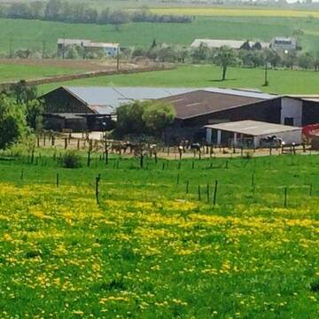
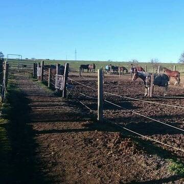
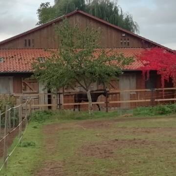
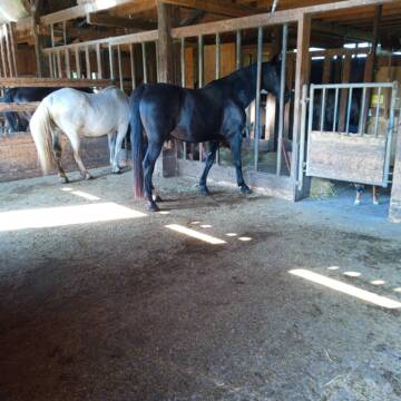
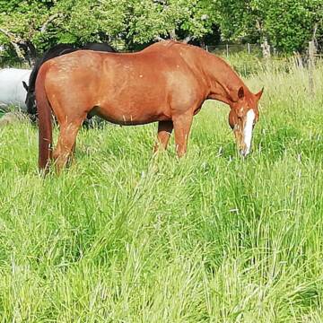
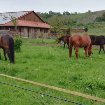
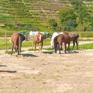
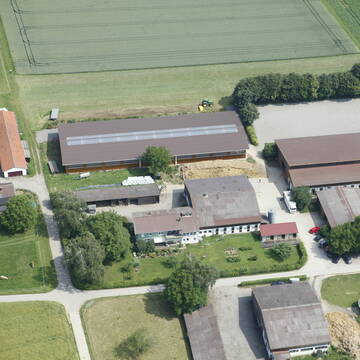
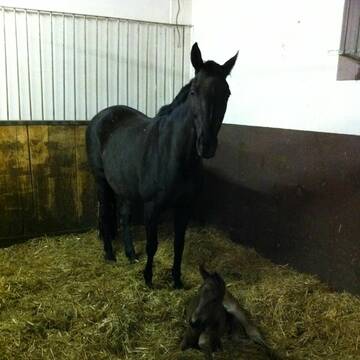
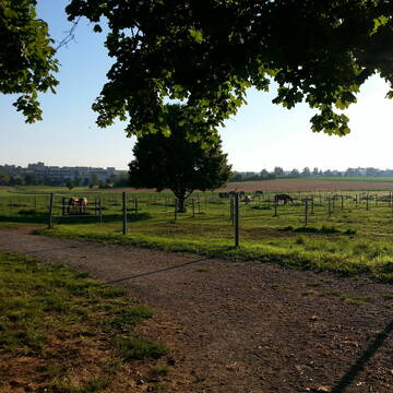
Aktiv und Offenstall mit direktem Weidezugang
Illingen / Schützingen
Familie Weigel
@Pferdehof-Weigel
Fahrstall, Kutschwagen
Freizeitstall
Vermieten
Verpachten
Hunde willkommen
Krankenbox
Allergikerstall
Fohlenaufzucht möglich
35 weitere...
P+


Paddocktrail, 24/7 bed. Heu, Wallach-&Stuten...
Sersheim
Vitalzentrum Authenrieb
@Vitalzentrum.Authenrieb
Freizeitstall
Vermieten
Hunde willkommen
Krankenbox
Allergikerstall
bedampftes/gewaschenes Heu
13 weitere...
aktuell
P+
Reitstall Schuler
K-Münchingen
Rainer-Schuler
@Rainer-Schuler
Pferdeausbildung
Reitlehrer und -unterricht
Laufband
Paddock
Pferdezucht
Zuchtstutenhaltung möglich
Außenbox mit Paddock
Außenboxen
14 weitere...
S

Futtersack HeuToy, Fressbremse in pink
Mechtersen
STALL-FREIde Marketing
@STALL-FREI-Marketing
Stundenlange Beschäftigung die
Koliken vorbeugt, geringe Staubinhalation mit
steuerbarer Futterentnahme


Pferdepension Bühlhof
Ötisheim
Pferdepension-Buehlhof
@Pferdepension-Buehlhof
Freizeitstall
Reitlehrer und -unterricht
Parkplatz für Pferdeanhänger
Reithalle
Bewegungsstall
Schauer-Bewegungsstall
5 weitere...
P+

Hof Metterblick
Vaihingen (Enz)-Horrheim
Hof-Metterblick
@Hof-Metterblick
Reitlehrer und -unterricht
Westernreiten
Führanlage
Longierzirkel/Roundpen
Außenboxen
Vollpension
10 weitere...
P


Longhorn Ranch
Gemmingen - Stebbach
Longhorn Ranch
@Kai-Koelle
Freizeitstall
Westernreiten
Hunde willkommen
Longierzirkel/Roundpen
Vollpension
Einzelne Boxen oder Stallplätze
9 weitere...
S


Reitstall Seehof Familie Feinauer
Pfaffenhofen
Simon Feinauer
@Simon-Feinauer
Fahrstall, Kutschwagen
Freizeitstall
Vermieten
Hunde willkommen
Longierzirkel/Roundpen
Allergikerstall
Gnadenbrothof
20 weitere...
P+
Reitanlage Römerhof
Oberriexingen
Reitanlage-Römerhof
@Reitanlage-Roemerhof
FN-Mitglied
Pferdeausbildung
Führanlage
Longierzirkel/Roundpen
Außenbox mit Paddock
Vollpension
12 weitere...
P
Deprecated: Creation of dynamic property Zend_View::$pageCount is deprecated in /var/www/stall-frei/htdocs/staging.stall-frei.de/library/vendor/shardj/zf1-future/library/Zend/View/Abstract.php on line 308
Deprecated: Creation of dynamic property Zend_View::$itemCountPerPage is deprecated in /var/www/stall-frei/htdocs/staging.stall-frei.de/library/vendor/shardj/zf1-future/library/Zend/View/Abstract.php on line 308
Deprecated: Creation of dynamic property Zend_View::$first is deprecated in /var/www/stall-frei/htdocs/staging.stall-frei.de/library/vendor/shardj/zf1-future/library/Zend/View/Abstract.php on line 308
Deprecated: Creation of dynamic property Zend_View::$current is deprecated in /var/www/stall-frei/htdocs/staging.stall-frei.de/library/vendor/shardj/zf1-future/library/Zend/View/Abstract.php on line 308
Deprecated: Creation of dynamic property Zend_View::$last is deprecated in /var/www/stall-frei/htdocs/staging.stall-frei.de/library/vendor/shardj/zf1-future/library/Zend/View/Abstract.php on line 308
Deprecated: Creation of dynamic property Zend_View::$next is deprecated in /var/www/stall-frei/htdocs/staging.stall-frei.de/library/vendor/shardj/zf1-future/library/Zend/View/Abstract.php on line 308
Deprecated: Creation of dynamic property Zend_View::$pagesInRange is deprecated in /var/www/stall-frei/htdocs/staging.stall-frei.de/library/vendor/shardj/zf1-future/library/Zend/View/Abstract.php on line 308
Deprecated: Creation of dynamic property Zend_View::$firstPageInRange is deprecated in /var/www/stall-frei/htdocs/staging.stall-frei.de/library/vendor/shardj/zf1-future/library/Zend/View/Abstract.php on line 308
Deprecated: Creation of dynamic property Zend_View::$lastPageInRange is deprecated in /var/www/stall-frei/htdocs/staging.stall-frei.de/library/vendor/shardj/zf1-future/library/Zend/View/Abstract.php on line 308
Deprecated: Creation of dynamic property Zend_View::$currentItemCount is deprecated in /var/www/stall-frei/htdocs/staging.stall-frei.de/library/vendor/shardj/zf1-future/library/Zend/View/Abstract.php on line 308
Deprecated: Creation of dynamic property Zend_View::$totalItemCount is deprecated in /var/www/stall-frei/htdocs/staging.stall-frei.de/library/vendor/shardj/zf1-future/library/Zend/View/Abstract.php on line 308
Deprecated: Creation of dynamic property Zend_View::$firstItemNumber is deprecated in /var/www/stall-frei/htdocs/staging.stall-frei.de/library/vendor/shardj/zf1-future/library/Zend/View/Abstract.php on line 308
Deprecated: Creation of dynamic property Zend_View::$lastItemNumber is deprecated in /var/www/stall-frei/htdocs/staging.stall-frei.de/library/vendor/shardj/zf1-future/library/Zend/View/Abstract.php on line 308
Deprecated: Creation of dynamic property Zend_View::$router is deprecated in /var/www/stall-frei/htdocs/staging.stall-frei.de/library/vendor/shardj/zf1-future/library/Zend/View/Abstract.php on line 308
Deprecated: Creation of dynamic property Zend_View::$urlParams is deprecated in /var/www/stall-frei/htdocs/staging.stall-frei.de/library/vendor/shardj/zf1-future/library/Zend/View/Abstract.php on line 308
Deprecated: Creation of dynamic property Zend_View::$showAds is deprecated in /var/www/stall-frei/htdocs/staging.stall-frei.de/library/vendor/shardj/zf1-future/library/Zend/View/Abstract.php on line 308
Deprecated: Creation of dynamic property Zend_View::$objectIds is deprecated in /var/www/stall-frei/htdocs/staging.stall-frei.de/library/vendor/shardj/zf1-future/library/Zend/View/Abstract.php on line 308
Deprecated: Creation of dynamic property Zend_View::$showNavbar is deprecated in /var/www/stall-frei/htdocs/staging.stall-frei.de/library/vendor/shardj/zf1-future/library/Zend/View/Abstract.php on line 308
Deprecated: Creation of dynamic property Zend_View::$showBreadcrumb is deprecated in /var/www/stall-frei/htdocs/staging.stall-frei.de/library/vendor/shardj/zf1-future/library/Zend/View/Abstract.php on line 308
Deprecated: Creation of dynamic property Zend_View::$showFooter is deprecated in /var/www/stall-frei/htdocs/staging.stall-frei.de/library/vendor/shardj/zf1-future/library/Zend/View/Abstract.php on line 308
Deprecated: Creation of dynamic property Zend_View::$showInternalAds is deprecated in /var/www/stall-frei/htdocs/staging.stall-frei.de/library/vendor/shardj/zf1-future/library/Zend/View/Abstract.php on line 308
Deprecated: Creation of dynamic property Zend_View::$blNoContent is deprecated in /var/www/stall-frei/htdocs/staging.stall-frei.de/library/vendor/shardj/zf1-future/library/Zend/View/Abstract.php on line 308
Deprecated: Creation of dynamic property Zend_View::$sMetaDesc is deprecated in /var/www/stall-frei/htdocs/staging.stall-frei.de/library/vendor/shardj/zf1-future/library/Zend/View/Abstract.php on line 308
Deprecated: Creation of dynamic property Zend_View::$useGmaps is deprecated in /var/www/stall-frei/htdocs/staging.stall-frei.de/library/vendor/shardj/zf1-future/library/Zend/View/Abstract.php on line 308
Deprecated: Creation of dynamic property Zend_View::$touches is deprecated in /var/www/stall-frei/htdocs/staging.stall-frei.de/library/vendor/shardj/zf1-future/library/Zend/View/Abstract.php on line 308
Deprecated: Creation of dynamic property Zend_View::$oProject is deprecated in /var/www/stall-frei/htdocs/staging.stall-frei.de/library/vendor/shardj/zf1-future/library/Zend/View/Abstract.php on line 308
Deprecated: Creation of dynamic property Zend_View::$pageHeadline is deprecated in /var/www/stall-frei/htdocs/staging.stall-frei.de/library/vendor/shardj/zf1-future/library/Zend/View/Abstract.php on line 308
Deprecated: Creation of dynamic property Zend_View::$disableLocationField is deprecated in /var/www/stall-frei/htdocs/staging.stall-frei.de/library/vendor/shardj/zf1-future/library/Zend/View/Abstract.php on line 308
Deprecated: Creation of dynamic property Zend_View::$isSearch is deprecated in /var/www/stall-frei/htdocs/staging.stall-frei.de/library/vendor/shardj/zf1-future/library/Zend/View/Abstract.php on line 308
Deprecated: Creation of dynamic property Zend_View::$pageTitle is deprecated in /var/www/stall-frei/htdocs/staging.stall-frei.de/library/vendor/shardj/zf1-future/library/Zend/View/Abstract.php on line 308
Deprecated: Creation of dynamic property Psf_Form_Element_Text::$class is deprecated in /var/www/stall-frei/htdocs/staging.stall-frei.de/library/vendor/shardj/zf1-future/library/Zend/Form/Element.php on line 874
Deprecated: Creation of dynamic property Psf_Form_Element_Text::$size is deprecated in /var/www/stall-frei/htdocs/staging.stall-frei.de/library/vendor/shardj/zf1-future/library/Zend/Form/Element.php on line 874
Deprecated: Creation of dynamic property Psf_Form_Element_Text::$placeholder is deprecated in /var/www/stall-frei/htdocs/staging.stall-frei.de/library/vendor/shardj/zf1-future/library/Zend/Form/Element.php on line 874
Deprecated: Creation of dynamic property Psf_Form_Element_Hidden::$class is deprecated in /var/www/stall-frei/htdocs/staging.stall-frei.de/library/vendor/shardj/zf1-future/library/Zend/Form/Element.php on line 874
Deprecated: Creation of dynamic property Psf_Form_Element_Hidden::$class is deprecated in /var/www/stall-frei/htdocs/staging.stall-frei.de/library/vendor/shardj/zf1-future/library/Zend/Form/Element.php on line 874
Deprecated: Creation of dynamic property Psf_Form_Element_Hidden::$class is deprecated in /var/www/stall-frei/htdocs/staging.stall-frei.de/library/vendor/shardj/zf1-future/library/Zend/Form/Element.php on line 874
Deprecated: Creation of dynamic property Psf_Form_Element_Hidden::$class is deprecated in /var/www/stall-frei/htdocs/staging.stall-frei.de/library/vendor/shardj/zf1-future/library/Zend/Form/Element.php on line 874
Deprecated: Creation of dynamic property Psf_Form_Element_Select::$class is deprecated in /var/www/stall-frei/htdocs/staging.stall-frei.de/library/vendor/shardj/zf1-future/library/Zend/Form/Element.php on line 874
Deprecated: Creation of dynamic property Psf_Form_Element_Select::$class is deprecated in /var/www/stall-frei/htdocs/staging.stall-frei.de/library/vendor/shardj/zf1-future/library/Zend/Form/Element.php on line 874
Deprecated: Creation of dynamic property Psf_Form_Element_Select::$class is deprecated in /var/www/stall-frei/htdocs/staging.stall-frei.de/library/vendor/shardj/zf1-future/library/Zend/Form/Element.php on line 874
Deprecated: Creation of dynamic property Psf_Form_Element_Select::$class is deprecated in /var/www/stall-frei/htdocs/staging.stall-frei.de/library/vendor/shardj/zf1-future/library/Zend/Form/Element.php on line 874
Deprecated: Creation of dynamic property Psf_Form_Element_Text::$class is deprecated in /var/www/stall-frei/htdocs/staging.stall-frei.de/library/vendor/shardj/zf1-future/library/Zend/Form/Element.php on line 874
Deprecated: Creation of dynamic property Psf_Form_Element_Checkbox::$label is deprecated in /var/www/stall-frei/htdocs/staging.stall-frei.de/library/vendor/shardj/zf1-future/library/Zend/Form/Element.php on line 874
Deprecated: Creation of dynamic property Zend_View::$sort is deprecated in /var/www/stall-frei/htdocs/staging.stall-frei.de/library/vendor/shardj/zf1-future/library/Zend/View/Abstract.php on line 308
Deprecated: Creation of dynamic property Zend_View::$searchLocation is deprecated in /var/www/stall-frei/htdocs/staging.stall-frei.de/library/vendor/shardj/zf1-future/library/Zend/View/Abstract.php on line 308
Deprecated: Creation of dynamic property Zend_View::$locationHint is deprecated in /var/www/stall-frei/htdocs/staging.stall-frei.de/library/vendor/shardj/zf1-future/library/Zend/View/Abstract.php on line 308
Psf_GeoCoder_Abstract::getLocation: Illingen Get Location CachedOrLive
Psf_GeoCoder_Abstract::getCachedOrLive: Illingen
Psf_GeoCoder_OpenCageData::makeApiRequest: response:
Array
(
[documentation] => https://opencagedata.com/api
[licenses] => Array
(
[0] => Array
(
[name] => see attribution guide
[url] => https://opencagedata.com/credits
)
)
[results] => Array
(
[0] => Array
(
[bounds] => Array
(
[northeast] => Array
(
[lat] => 49.021318
[lng] => 8.949218
)
[southwest] => Array
(
[lat] => 48.936375
[lng] => 8.869257
)
)
[components] => Array
(
[ISO_3166-1_alpha-2] => DE
[ISO_3166-1_alpha-3] => DEU
[ISO_3166-2] => Array
(
[0] => DE-BW
)
[_category] => place
[_normalized_city] => Illingen
[_type] => village
[continent] => Europe
[country] => Deutschland
[country_code] => de
[county] => Enzkreis
[political_union] => European Union
[postcode] => 75428
[state] => Baden-Württemberg
[state_code] => BW
[village] => Illingen
)
[confidence] => 7
[formatted] => 75428 Illingen, Deutschland
[geometry] => Array
(
[lat] => 48.9557335
[lng] => 8.9200047
)
)
[1] => Array
(
[bounds] => Array
(
[northeast] => Array
(
[lat] => 49.416484
[lng] => 7.1241885
)
[southwest] => Array
(
[lat] => 49.3494766
[lng] => 6.9939748
)
)
[components] => Array
(
[ISO_3166-1_alpha-2] => DE
[ISO_3166-1_alpha-3] => DEU
[ISO_3166-2] => Array
(
[0] => DE-SL
)
[_category] => place
[_normalized_city] => Illingen
[_type] => village
[continent] => Europe
[country] => Deutschland
[country_code] => de
[county] => Landkreis Neunkirchen
[political_union] => European Union
[postcode] => 66557
[state] => Saarland
[state_code] => SL
[village] => Illingen
)
[confidence] => 7
[formatted] => 66557 Illingen, Deutschland
[geometry] => Array
(
[lat] => 49.3777244
[lng] => 7.0525145
)
)
[2] => Array
(
[bounds] => Array
(
[northeast] => Array
(
[lat] => 51.6297534
[lng] => 7.9373085
)
[southwest] => Array
(
[lat] => 51.6092559
[lng] => 7.9112237
)
)
[components] => Array
(
[ISO_3166-1_alpha-2] => DE
[ISO_3166-1_alpha-3] => DEU
[ISO_3166-2] => Array
(
[0] => DE-NW
)
[_category] => place
[_normalized_city] => Welver
[_type] => village
[city] => Welver
[continent] => Europe
[country] => Deutschland
[country_code] => de
[county] => Kreis Soest
[political_union] => European Union
[state] => Nordrhein-Westfalen
[state_code] => NW
[village] => Illingen
)
[confidence] => 7
[formatted] => Illingen, Nordrhein-Westfalen, Deutschland
[geometry] => Array
(
[lat] => 51.6161199
[lng] => 7.9273335
)
)
[3] => Array
(
[bounds] => Array
(
[northeast] => Array
(
[lat] => 48.9470434
[lng] => 8.2156652
)
[southwest] => Array
(
[lat] => 48.9180703
[lng] => 8.1699304
)
)
[components] => Array
(
[ISO_3166-1_alpha-2] => DE
[ISO_3166-1_alpha-3] => DEU
[ISO_3166-2] => Array
(
[0] => DE-BW
)
[_category] => place
[_normalized_city] => Elchesheim-Illingen
[_type] => village
[continent] => Europe
[country] => Deutschland
[country_code] => de
[county] => Landkreis Rastatt
[municipality] => GVV Durmersheim
[political_union] => European Union
[postcode] => 76477
[quarter] => Illingen
[state] => Baden-Württemberg
[state_code] => BW
[village] => Elchesheim-Illingen
)
[confidence] => 7
[formatted] => 76477 Elchesheim-Illingen, Deutschland
[geometry] => Array
(
[lat] => 48.9328401
[lng] => 8.2079512
)
)
[4] => Array
(
[components] => Array
(
[ISO_3166-1_alpha-2] => FR
[ISO_3166-1_alpha-3] => FRA
[ISO_3166-2] => Array
(
[0] => FR-GES
[1] => FR-57
)
[_category] => road
[_normalized_city] => Creutzwald
[_type] => road
[city] => Creutzwald
[continent] => Europe
[country] => France
[country_code] => fr
[county] => Moselle
[local_authority] => Communauté de communes du Warndt
[political_union] => European Union
[postcode] => 57150
[road] => Rue de Dillingen
[state] => Grand Est
[state_code] => GES
)
[confidence] => 3
[formatted] => Rue de Dillingen, 57150 Creutzwald, France
[geometry] => Array
(
[lat] => 49.208475
[lng] => 6.696106
)
)
[5] => Array
(
[components] => Array
(
[ISO_3166-1_alpha-2] => FR
[ISO_3166-1_alpha-3] => FRA
[ISO_3166-2] => Array
(
[0] => FR-BFC
[1] => FR-25
)
[_category] => road
[_normalized_city] => Pontarlier
[_type] => road
[city] => Pontarlier
[continent] => Europe
[country] => France
[country_code] => fr
[county] => Doubs
[local_authority] => Communauté de communes du Grand Pontarlier
[political_union] => European Union
[postcode] => 25300
[road] => Place Villingen Schweningen
[state] => Bourgogne-Franche-Comté
[state_code] => BFC
)
[confidence] => 3
[formatted] => Place Villingen Schweningen, 25300 Pontarlier, France
[geometry] => Array
(
[lat] => 46.901153
[lng] => 6.353711
)
)
[6] => Array
(
[components] => Array
(
[ISO_3166-1_alpha-2] => FR
[ISO_3166-1_alpha-3] => FRA
[ISO_3166-2] => Array
(
[0] => FR-ARA
[1] => FR-01
)
[_category] => road
[_normalized_city] => Saint-Jean-sur-Veyle
[_type] => road
[city] => Saint-Jean-sur-Veyle
[continent] => Europe
[country] => France
[country_code] => fr
[county] => Ain
[local_authority] => Communauté de communes de la Veyle
[political_union] => European Union
[postcode] => 01290
[road] => Route de Lingent
[state] => Auvergne-Rhône-Alpes
[state_code] => ARA
)
[confidence] => 3
[formatted] => Route de Lingent, 01290 Saint-Jean-sur-Veyle, France
[geometry] => Array
(
[lat] => 46.27492
[lng] => 4.938601
)
)
[7] => Array
(
[components] => Array
(
[ISO_3166-1_alpha-2] => FR
[ISO_3166-1_alpha-3] => FRA
[ISO_3166-2] => Array
(
[0] => FR-ARA
[1] => FR-01
)
[_category] => road
[_normalized_city] => Saint-Cyr-sur-Menthon
[_type] => road
[city] => Saint-Cyr-sur-Menthon
[continent] => Europe
[country] => France
[country_code] => fr
[county] => Ain
[local_authority] => Communauté de communes de la Veyle
[political_union] => European Union
[postcode] => 01380
[road] => Route de Lingent
[state] => Auvergne-Rhône-Alpes
[state_code] => ARA
)
[confidence] => 3
[formatted] => Route de Lingent, 01380 Saint-Cyr-sur-Menthon, France
[geometry] => Array
(
[lat] => 46.273125
[lng] => 4.953627
)
)
[8] => Array
(
[components] => Array
(
[ISO_3166-1_alpha-2] => FR
[ISO_3166-1_alpha-3] => FRA
[ISO_3166-2] => Array
(
[0] => FR-GES
[1] => FR-6AE
[2] => FR-68
)
[_category] => road
[_normalized_city] => Burnhaupt-le-Bas
[_type] => road
[city] => Burnhaupt-le-Bas
[continent] => Europe
[country] => France
[country_code] => fr
[county] => Haut-Rhin
[local_authority] => Communauté de communes de la Vallée de la Doller et du Soultzbach
[political_union] => European Union
[postcode] => 68520
[road] => Chemin du Blingen
[state] => Grand Est
[state_code] => GES
)
[confidence] => 3
[formatted] => Chemin du Blingen, 68520 Burnhaupt-le-Bas, France
[geometry] => Array
(
[lat] => 47.714611
[lng] => 7.158231
)
)
[9] => Array
(
[components] => Array
(
[ISO_3166-1_alpha-2] => FR
[ISO_3166-1_alpha-3] => FRA
[ISO_3166-2] => Array
(
[0] => FR-BRE
[1] => FR-22
)
[_category] => road
[_normalized_city] => Penvénan
[_type] => road
[city] => Penvénan
[continent] => Europe
[country] => France
[country_code] => fr
[county] => Côtes-d'Armor
[local_authority] => Lannion-Trégor Communauté
[political_union] => European Union
[postcode] => 22710
[road] => Rue de Saint-Illigent
[state] => Bretagne
[state_code] => BRE
)
[confidence] => 2
[formatted] => Rue de Saint-Illigent, 22710 Penvénan, France
[geometry] => Array
(
[lat] => 48.807451
[lng] => -3.307657
)
)
)
[status] => Array
(
[code] => 200
[message] => OK
)
[stay_informed] => Array
(
[blog] => https://blog.opencagedata.com
[mastodon] => https://en.osm.town/@opencage
)
[thanks] => For using an OpenCage API
[timestamp] => Array
(
[created_http] => Sat, 07 Feb 2026 05:52:21 GMT
[created_unix] => 1770443541
)
[total_results] => 10
)
Psf_GeoCoder_Abstract::convertLocationResult
{"documentation":"https:\/\/opencagedata.com\/api","licenses":[{"name":"see attribution guide","url":"https:\/\/opencagedata.com\/credits"}],"results":[{"bounds":{"northeast":{"lat":49.021318,"lng":8.949218},"southwest":{"lat":48.936375,"lng":8.869257}},"components":{"ISO_3166-1_alpha-2":"DE","ISO_3166-1_alpha-3":"DEU","ISO_3166-2":["DE-BW"],"_category":"place","_normalized_city":"Illingen","_type":"village","continent":"Europe","country":"Deutschland","country_code":"de","county":"Enzkreis","political_union":"European Union","postcode":"75428","state":"Baden-W\u00fcrttemberg","state_code":"BW","village":"Illingen"},"confidence":7,"formatted":"75428 Illingen, Deutschland","geometry":{"lat":48.9557335,"lng":8.9200047}},{"bounds":{"northeast":{"lat":49.416484,"lng":7.1241885},"southwest":{"lat":49.3494766,"lng":6.9939748}},"components":{"ISO_3166-1_alpha-2":"DE","ISO_3166-1_alpha-3":"DEU","ISO_3166-2":["DE-SL"],"_category":"place","_normalized_city":"Illingen","_type":"village","continent":"Europe","country":"Deutschland","country_code":"de","county":"Landkreis Neunkirchen","political_union":"European Union","postcode":"66557","state":"Saarland","state_code":"SL","village":"Illingen"},"confidence":7,"formatted":"66557 Illingen, Deutschland","geometry":{"lat":49.3777244,"lng":7.0525145}},{"bounds":{"northeast":{"lat":51.6297534,"lng":7.9373085},"southwest":{"lat":51.6092559,"lng":7.9112237}},"components":{"ISO_3166-1_alpha-2":"DE","ISO_3166-1_alpha-3":"DEU","ISO_3166-2":["DE-NW"],"_category":"place","_normalized_city":"Welver","_type":"village","city":"Welver","continent":"Europe","country":"Deutschland","country_code":"de","county":"Kreis Soest","political_union":"European Union","state":"Nordrhein-Westfalen","state_code":"NW","village":"Illingen"},"confidence":7,"formatted":"Illingen, Nordrhein-Westfalen, Deutschland","geometry":{"lat":51.6161199,"lng":7.9273335}},{"bounds":{"northeast":{"lat":48.9470434,"lng":8.2156652},"southwest":{"lat":48.9180703,"lng":8.1699304}},"components":{"ISO_3166-1_alpha-2":"DE","ISO_3166-1_alpha-3":"DEU","ISO_3166-2":["DE-BW"],"_category":"place","_normalized_city":"Elchesheim-Illingen","_type":"village","continent":"Europe","country":"Deutschland","country_code":"de","county":"Landkreis Rastatt","municipality":"GVV Durmersheim","political_union":"European Union","postcode":"76477","quarter":"Illingen","state":"Baden-W\u00fcrttemberg","state_code":"BW","village":"Elchesheim-Illingen"},"confidence":7,"formatted":"76477 Elchesheim-Illingen, Deutschland","geometry":{"lat":48.9328401,"lng":8.2079512}},{"components":{"ISO_3166-1_alpha-2":"FR","ISO_3166-1_alpha-3":"FRA","ISO_3166-2":["FR-GES","FR-57"],"_category":"road","_normalized_city":"Creutzwald","_type":"road","city":"Creutzwald","continent":"Europe","country":"France","country_code":"fr","county":"Moselle","local_authority":"Communaut\u00e9 de communes du Warndt","political_union":"European Union","postcode":"57150","road":"Rue de Dillingen","state":"Grand Est","state_code":"GES"},"confidence":3,"formatted":"Rue de Dillingen, 57150 Creutzwald, France","geometry":{"lat":49.208475,"lng":6.696106}},{"components":{"ISO_3166-1_alpha-2":"FR","ISO_3166-1_alpha-3":"FRA","ISO_3166-2":["FR-BFC","FR-25"],"_category":"road","_normalized_city":"Pontarlier","_type":"road","city":"Pontarlier","continent":"Europe","country":"France","country_code":"fr","county":"Doubs","local_authority":"Communaut\u00e9 de communes du Grand Pontarlier","political_union":"European Union","postcode":"25300","road":"Place Villingen Schweningen","state":"Bourgogne-Franche-Comt\u00e9","state_code":"BFC"},"confidence":3,"formatted":"Place Villingen Schweningen, 25300 Pontarlier, France","geometry":{"lat":46.901153,"lng":6.353711}},{"components":{"ISO_3166-1_alpha-2":"FR","ISO_3166-1_alpha-3":"FRA","ISO_3166-2":["FR-ARA","FR-01"],"_category":"road","_normalized_city":"Saint-Jean-sur-Veyle","_type":"road","city":"Saint-Jean-sur-Veyle","continent":"Europe","country":"France","country_code":"fr","county":"Ain","local_authority":"Communaut\u00e9 de communes de la Veyle","political_union":"European Union","postcode":"01290","road":"Route de Lingent","state":"Auvergne-Rh\u00f4ne-Alpes","state_code":"ARA"},"confidence":3,"formatted":"Route de Lingent, 01290 Saint-Jean-sur-Veyle, France","geometry":{"lat":46.27492,"lng":4.938601}},{"components":{"ISO_3166-1_alpha-2":"FR","ISO_3166-1_alpha-3":"FRA","ISO_3166-2":["FR-ARA","FR-01"],"_category":"road","_normalized_city":"Saint-Cyr-sur-Menthon","_type":"road","city":"Saint-Cyr-sur-Menthon","continent":"Europe","country":"France","country_code":"fr","county":"Ain","local_authority":"Communaut\u00e9 de communes de la Veyle","political_union":"European Union","postcode":"01380","road":"Route de Lingent","state":"Auvergne-Rh\u00f4ne-Alpes","state_code":"ARA"},"confidence":3,"formatted":"Route de Lingent, 01380 Saint-Cyr-sur-Menthon, France","geometry":{"lat":46.273125,"lng":4.953627}},{"components":{"ISO_3166-1_alpha-2":"FR","ISO_3166-1_alpha-3":"FRA","ISO_3166-2":["FR-GES","FR-6AE","FR-68"],"_category":"road","_normalized_city":"Burnhaupt-le-Bas","_type":"road","city":"Burnhaupt-le-Bas","continent":"Europe","country":"France","country_code":"fr","county":"Haut-Rhin","local_authority":"Communaut\u00e9 de communes de la Vall\u00e9e de la Doller et du Soultzbach","political_union":"European Union","postcode":"68520","road":"Chemin du Blingen","state":"Grand Est","state_code":"GES"},"confidence":3,"formatted":"Chemin du Blingen, 68520 Burnhaupt-le-Bas, France","geometry":{"lat":47.714611,"lng":7.158231}},{"components":{"ISO_3166-1_alpha-2":"FR","ISO_3166-1_alpha-3":"FRA","ISO_3166-2":["FR-BRE","FR-22"],"_category":"road","_normalized_city":"Penv\u00e9nan","_type":"road","city":"Penv\u00e9nan","continent":"Europe","country":"France","country_code":"fr","county":"C\u00f4tes-d'Armor","local_authority":"Lannion-Tr\u00e9gor Communaut\u00e9","political_union":"European Union","postcode":"22710","road":"Rue de Saint-Illigent","state":"Bretagne","state_code":"BRE"},"confidence":2,"formatted":"Rue de Saint-Illigent, 22710 Penv\u00e9nan, France","geometry":{"lat":48.807451,"lng":-3.307657}}],"status":{"code":200,"message":"OK"},"stay_informed":{"blog":"https:\/\/blog.opencagedata.com","mastodon":"https:\/\/en.osm.town\/@opencage"},"thanks":"For using an OpenCage API","timestamp":{"created_http":"Sat, 07 Feb 2026 05:52:21 GMT","created_unix":1770443541},"total_results":10}Array
(
[0] => stdClass Object
(
[bounds] => stdClass Object
(
[northeast] => stdClass Object
(
[lat] => 49.021318
[lng] => 8.949218
)
[southwest] => stdClass Object
(
[lat] => 48.936375
[lng] => 8.869257
)
)
[components] => stdClass Object
(
[ISO_3166-1_alpha-2] => DE
[ISO_3166-1_alpha-3] => DEU
[ISO_3166-2] => Array
(
[0] => DE-BW
)
[_category] => place
[_normalized_city] => Illingen
[_type] => village
[continent] => Europe
[country] => Deutschland
[country_code] => de
[county] => Enzkreis
[political_union] => European Union
[postcode] => 75428
[state] => Baden-Württemberg
[state_code] => BW
[village] => Illingen
)
[confidence] => 7
[formatted] => 75428 Illingen, Deutschland
[geometry] => stdClass Object
(
[lat] => 48.9557335
[lng] => 8.9200047
)
)
[1] => stdClass Object
(
[bounds] => stdClass Object
(
[northeast] => stdClass Object
(
[lat] => 49.416484
[lng] => 7.1241885
)
[southwest] => stdClass Object
(
[lat] => 49.3494766
[lng] => 6.9939748
)
)
[components] => stdClass Object
(
[ISO_3166-1_alpha-2] => DE
[ISO_3166-1_alpha-3] => DEU
[ISO_3166-2] => Array
(
[0] => DE-SL
)
[_category] => place
[_normalized_city] => Illingen
[_type] => village
[continent] => Europe
[country] => Deutschland
[country_code] => de
[county] => Landkreis Neunkirchen
[political_union] => European Union
[postcode] => 66557
[state] => Saarland
[state_code] => SL
[village] => Illingen
)
[confidence] => 7
[formatted] => 66557 Illingen, Deutschland
[geometry] => stdClass Object
(
[lat] => 49.3777244
[lng] => 7.0525145
)
)
[2] => stdClass Object
(
[bounds] => stdClass Object
(
[northeast] => stdClass Object
(
[lat] => 51.6297534
[lng] => 7.9373085
)
[southwest] => stdClass Object
(
[lat] => 51.6092559
[lng] => 7.9112237
)
)
[components] => stdClass Object
(
[ISO_3166-1_alpha-2] => DE
[ISO_3166-1_alpha-3] => DEU
[ISO_3166-2] => Array
(
[0] => DE-NW
)
[_category] => place
[_normalized_city] => Welver
[_type] => village
[city] => Welver
[continent] => Europe
[country] => Deutschland
[country_code] => de
[county] => Kreis Soest
[political_union] => European Union
[state] => Nordrhein-Westfalen
[state_code] => NW
[village] => Illingen
)
[confidence] => 7
[formatted] => Illingen, Nordrhein-Westfalen, Deutschland
[geometry] => stdClass Object
(
[lat] => 51.6161199
[lng] => 7.9273335
)
)
[3] => stdClass Object
(
[bounds] => stdClass Object
(
[northeast] => stdClass Object
(
[lat] => 48.9470434
[lng] => 8.2156652
)
[southwest] => stdClass Object
(
[lat] => 48.9180703
[lng] => 8.1699304
)
)
[components] => stdClass Object
(
[ISO_3166-1_alpha-2] => DE
[ISO_3166-1_alpha-3] => DEU
[ISO_3166-2] => Array
(
[0] => DE-BW
)
[_category] => place
[_normalized_city] => Elchesheim-Illingen
[_type] => village
[continent] => Europe
[country] => Deutschland
[country_code] => de
[county] => Landkreis Rastatt
[municipality] => GVV Durmersheim
[political_union] => European Union
[postcode] => 76477
[quarter] => Illingen
[state] => Baden-Württemberg
[state_code] => BW
[village] => Elchesheim-Illingen
)
[confidence] => 7
[formatted] => 76477 Elchesheim-Illingen, Deutschland
[geometry] => stdClass Object
(
[lat] => 48.9328401
[lng] => 8.2079512
)
)
[4] => stdClass Object
(
[components] => stdClass Object
(
[ISO_3166-1_alpha-2] => FR
[ISO_3166-1_alpha-3] => FRA
[ISO_3166-2] => Array
(
[0] => FR-GES
[1] => FR-57
)
[_category] => road
[_normalized_city] => Creutzwald
[_type] => road
[city] => Creutzwald
[continent] => Europe
[country] => France
[country_code] => fr
[county] => Moselle
[local_authority] => Communauté de communes du Warndt
[political_union] => European Union
[postcode] => 57150
[road] => Rue de Dillingen
[state] => Grand Est
[state_code] => GES
)
[confidence] => 3
[formatted] => Rue de Dillingen, 57150 Creutzwald, France
[geometry] => stdClass Object
(
[lat] => 49.208475
[lng] => 6.696106
)
)
[5] => stdClass Object
(
[components] => stdClass Object
(
[ISO_3166-1_alpha-2] => FR
[ISO_3166-1_alpha-3] => FRA
[ISO_3166-2] => Array
(
[0] => FR-BFC
[1] => FR-25
)
[_category] => road
[_normalized_city] => Pontarlier
[_type] => road
[city] => Pontarlier
[continent] => Europe
[country] => France
[country_code] => fr
[county] => Doubs
[local_authority] => Communauté de communes du Grand Pontarlier
[political_union] => European Union
[postcode] => 25300
[road] => Place Villingen Schweningen
[state] => Bourgogne-Franche-Comté
[state_code] => BFC
)
[confidence] => 3
[formatted] => Place Villingen Schweningen, 25300 Pontarlier, France
[geometry] => stdClass Object
(
[lat] => 46.901153
[lng] => 6.353711
)
)
[6] => stdClass Object
(
[components] => stdClass Object
(
[ISO_3166-1_alpha-2] => FR
[ISO_3166-1_alpha-3] => FRA
[ISO_3166-2] => Array
(
[0] => FR-ARA
[1] => FR-01
)
[_category] => road
[_normalized_city] => Saint-Jean-sur-Veyle
[_type] => road
[city] => Saint-Jean-sur-Veyle
[continent] => Europe
[country] => France
[country_code] => fr
[county] => Ain
[local_authority] => Communauté de communes de la Veyle
[political_union] => European Union
[postcode] => 01290
[road] => Route de Lingent
[state] => Auvergne-Rhône-Alpes
[state_code] => ARA
)
[confidence] => 3
[formatted] => Route de Lingent, 01290 Saint-Jean-sur-Veyle, France
[geometry] => stdClass Object
(
[lat] => 46.27492
[lng] => 4.938601
)
)
[7] => stdClass Object
(
[components] => stdClass Object
(
[ISO_3166-1_alpha-2] => FR
[ISO_3166-1_alpha-3] => FRA
[ISO_3166-2] => Array
(
[0] => FR-ARA
[1] => FR-01
)
[_category] => road
[_normalized_city] => Saint-Cyr-sur-Menthon
[_type] => road
[city] => Saint-Cyr-sur-Menthon
[continent] => Europe
[country] => France
[country_code] => fr
[county] => Ain
[local_authority] => Communauté de communes de la Veyle
[political_union] => European Union
[postcode] => 01380
[road] => Route de Lingent
[state] => Auvergne-Rhône-Alpes
[state_code] => ARA
)
[confidence] => 3
[formatted] => Route de Lingent, 01380 Saint-Cyr-sur-Menthon, France
[geometry] => stdClass Object
(
[lat] => 46.273125
[lng] => 4.953627
)
)
[8] => stdClass Object
(
[components] => stdClass Object
(
[ISO_3166-1_alpha-2] => FR
[ISO_3166-1_alpha-3] => FRA
[ISO_3166-2] => Array
(
[0] => FR-GES
[1] => FR-6AE
[2] => FR-68
)
[_category] => road
[_normalized_city] => Burnhaupt-le-Bas
[_type] => road
[city] => Burnhaupt-le-Bas
[continent] => Europe
[country] => France
[country_code] => fr
[county] => Haut-Rhin
[local_authority] => Communauté de communes de la Vallée de la Doller et du Soultzbach
[political_union] => European Union
[postcode] => 68520
[road] => Chemin du Blingen
[state] => Grand Est
[state_code] => GES
)
[confidence] => 3
[formatted] => Chemin du Blingen, 68520 Burnhaupt-le-Bas, France
[geometry] => stdClass Object
(
[lat] => 47.714611
[lng] => 7.158231
)
)
[9] => stdClass Object
(
[components] => stdClass Object
(
[ISO_3166-1_alpha-2] => FR
[ISO_3166-1_alpha-3] => FRA
[ISO_3166-2] => Array
(
[0] => FR-BRE
[1] => FR-22
)
[_category] => road
[_normalized_city] => Penvénan
[_type] => road
[city] => Penvénan
[continent] => Europe
[country] => France
[country_code] => fr
[county] => Côtes-d'Armor
[local_authority] => Lannion-Trégor Communauté
[political_union] => European Union
[postcode] => 22710
[road] => Rue de Saint-Illigent
[state] => Bretagne
[state_code] => BRE
)
[confidence] => 2
[formatted] => Rue de Saint-Illigent, 22710 Penvénan, France
[geometry] => stdClass Object
(
[lat] => 48.807451
[lng] => -3.307657
)
)
)
Psf_GeoCoder_OpenCageData::getKeyMap: 0
stdClass Object
(
    [bounds] => stdClass Object
        (
            [northeast] => stdClass Object
                (
                    [lat] => 49.021318
                    [lng] => 8.949218
                )

            [southwest] => stdClass Object
                (
                    [lat] => 48.936375
                    [lng] => 8.869257
                )

        )

    [components] => stdClass Object
        (
            [ISO_3166-1_alpha-2] => DE
            [ISO_3166-1_alpha-3] => DEU
            [ISO_3166-2] => Array
                (
                    [0] => DE-BW
                )

            [_category] => place
            [_normalized_city] => Illingen
            [_type] => village
            [continent] => Europe
            [country] => Deutschland
            [country_code] => de
            [county] => Enzkreis
            [political_union] => European Union
            [postcode] => 75428
            [state] => Baden-Württemberg
            [state_code] => BW
            [village] => Illingen
        )

    [confidence] => 7
    [formatted] => 75428 Illingen, Deutschland
    [geometry] => stdClass Object
        (
            [lat] => 48.9557335
            [lng] => 8.9200047
        )

)
Psf_GeoCoder_OpenCageData::getCounty: Enzkreis
Psf_GeoCoder_OpenCageData::addMissingData REFETCH!
Array
(
    [address] => 75428 Illingen, Deutschland
    [type] => village
    [street] =>
    [city] => Illingen
    [county] => Enzkreis
    [state] => Baden-Württemberg
    [zip] => 75428
    [country] => Deutschland
    [suburb] =>
    [countrycode] => de
    [latitude] => 48.9557335
    [longitude] => 8.9200047
    [accuracy] => 1
    [confidence] => 7
    [bounds] => stdClass Object
        (
            [northeast] => stdClass Object
                (
                    [lat] => 49.021318
                    [lng] => 8.949218
                )

            [southwest] => stdClass Object
                (
                    [lat] => 48.936375
                    [lng] => 8.869257
                )

        )

)
reformat!
Array
(
    [address] => 75428 Illingen, Deutschland
    [type] => village
    [street] =>
    [city] => Illingen
    [county] => Enzkreis
    [state] => Baden-Württemberg
    [zip] => 75428
    [country] => Deutschland
    [suburb] =>
    [countrycode] => de
    [latitude] => 48.9557335
    [longitude] => 8.9200047
    [accuracy] => 1
    [confidence] => 7
    [bounds] => stdClass Object
        (
            [northeast] => stdClass Object
                (
                    [lat] => 49.021318
                    [lng] => 8.949218
                )

            [southwest] => stdClass Object
                (
                    [lat] => 48.936375
                    [lng] => 8.869257
                )

        )

    [place] => 75428 Illingen, Baden-Württemberg
    [hash] => a6656fd5694a2e2c74dda856affe149b
)
Psf_GeoCoder_OpenCageData::getKeyMap: 1
stdClass Object
(
    [bounds] => stdClass Object
        (
            [northeast] => stdClass Object
                (
                    [lat] => 49.416484
                    [lng] => 7.1241885
                )

            [southwest] => stdClass Object
                (
                    [lat] => 49.3494766
                    [lng] => 6.9939748
                )

        )

    [components] => stdClass Object
        (
            [ISO_3166-1_alpha-2] => DE
            [ISO_3166-1_alpha-3] => DEU
            [ISO_3166-2] => Array
                (
                    [0] => DE-SL
                )

            [_category] => place
            [_normalized_city] => Illingen
            [_type] => village
            [continent] => Europe
            [country] => Deutschland
            [country_code] => de
            [county] => Landkreis Neunkirchen
            [political_union] => European Union
            [postcode] => 66557
            [state] => Saarland
            [state_code] => SL
            [village] => Illingen
        )

    [confidence] => 7
    [formatted] => 66557 Illingen, Deutschland
    [geometry] => stdClass Object
        (
            [lat] => 49.3777244
            [lng] => 7.0525145
        )

)
Psf_GeoCoder_OpenCageData::getCounty: Neunkirchen
Psf_GeoCoder_OpenCageData::addMissingData REFETCH!
Array
(
    [address] => 66557 Illingen, Deutschland
    [type] => village
    [street] =>
    [city] => Illingen
    [county] => Neunkirchen
    [state] => Saarland
    [zip] => 66557
    [country] => Deutschland
    [suburb] =>
    [countrycode] => de
    [latitude] => 49.3777244
    [longitude] => 7.0525145
    [accuracy] => 1
    [confidence] => 7
    [bounds] => stdClass Object
        (
            [northeast] => stdClass Object
                (
                    [lat] => 49.416484
                    [lng] => 7.1241885
                )

            [southwest] => stdClass Object
                (
                    [lat] => 49.3494766
                    [lng] => 6.9939748
                )

        )

)
reformat!
Array
(
    [address] => 66557 Illingen, Deutschland
    [type] => village
    [street] =>
    [city] => Illingen
    [county] => Neunkirchen
    [state] => Saarland
    [zip] => 66557
    [country] => Deutschland
    [suburb] =>
    [countrycode] => de
    [latitude] => 49.3777244
    [longitude] => 7.0525145
    [accuracy] => 1
    [confidence] => 7
    [bounds] => stdClass Object
        (
            [northeast] => stdClass Object
                (
                    [lat] => 49.416484
                    [lng] => 7.1241885
                )

            [southwest] => stdClass Object
                (
                    [lat] => 49.3494766
                    [lng] => 6.9939748
                )

        )

    [place] => 66557 Illingen, Saarland
    [hash] => c47d4188c1f70fa8e4a5bf46df0193b1
)
Psf_GeoCoder_OpenCageData::getKeyMap: 2
stdClass Object
(
    [bounds] => stdClass Object
        (
            [northeast] => stdClass Object
                (
                    [lat] => 51.6297534
                    [lng] => 7.9373085
                )

            [southwest] => stdClass Object
                (
                    [lat] => 51.6092559
                    [lng] => 7.9112237
                )

        )

    [components] => stdClass Object
        (
            [ISO_3166-1_alpha-2] => DE
            [ISO_3166-1_alpha-3] => DEU
            [ISO_3166-2] => Array
                (
                    [0] => DE-NW
                )

            [_category] => place
            [_normalized_city] => Welver
            [_type] => village
            [city] => Welver
            [continent] => Europe
            [country] => Deutschland
            [country_code] => de
            [county] => Kreis Soest
            [political_union] => European Union
            [state] => Nordrhein-Westfalen
            [state_code] => NW
            [village] => Illingen
        )

    [confidence] => 7
    [formatted] => Illingen, Nordrhein-Westfalen, Deutschland
    [geometry] => stdClass Object
        (
            [lat] => 51.6161199
            [lng] => 7.9273335
        )

)
Psf_GeoCoder_OpenCageData::getCounty: Soest
Psf_GeoCoder_OpenCageData::addMissingData REFETCH!
Array
(
    [address] => Illingen, Nordrhein-Westfalen, Deutschland
    [type] => village
    [street] =>
    [city] => Illingen
    [county] => Soest
    [state] => Nordrhein-Westfalen
    [zip] =>
    [country] => Deutschland
    [suburb] =>
    [countrycode] => de
    [latitude] => 51.6161199
    [longitude] => 7.9273335
    [accuracy] => 1
    [confidence] => 7
    [bounds] => stdClass Object
        (
            [northeast] => stdClass Object
                (
                    [lat] => 51.6297534
                    [lng] => 7.9373085
                )

            [southwest] => stdClass Object
                (
                    [lat] => 51.6092559
                    [lng] => 7.9112237
                )

        )

)
reformat!
Array
(
    [address] => Illingen, Nordrhein-Westfalen, Deutschland
    [type] => village
    [street] =>
    [city] => Illingen
    [county] => Soest
    [state] => Nordrhein-Westfalen
    [zip] =>
    [country] => Deutschland
    [suburb] =>
    [countrycode] => de
    [latitude] => 51.6161199
    [longitude] => 7.9273335
    [accuracy] => 1
    [confidence] => 7
    [bounds] => stdClass Object
        (
            [northeast] => stdClass Object
                (
                    [lat] => 51.6297534
                    [lng] => 7.9373085
                )

            [southwest] => stdClass Object
                (
                    [lat] => 51.6092559
                    [lng] => 7.9112237
                )

        )

    [place] => Illingen, Nordrhein-Westfalen
    [hash] => 31105487b77b668004c8801567d6eb7c
)
Psf_GeoCoder_OpenCageData::getKeyMap: 3
stdClass Object
(
    [bounds] => stdClass Object
        (
            [northeast] => stdClass Object
                (
                    [lat] => 48.9470434
                    [lng] => 8.2156652
                )

            [southwest] => stdClass Object
                (
                    [lat] => 48.9180703
                    [lng] => 8.1699304
                )

        )

    [components] => stdClass Object
        (
            [ISO_3166-1_alpha-2] => DE
            [ISO_3166-1_alpha-3] => DEU
            [ISO_3166-2] => Array
                (
                    [0] => DE-BW
                )

            [_category] => place
            [_normalized_city] => Elchesheim-Illingen
            [_type] => village
            [continent] => Europe
            [country] => Deutschland
            [country_code] => de
            [county] => Landkreis Rastatt
            [municipality] => GVV Durmersheim
            [political_union] => European Union
            [postcode] => 76477
            [quarter] => Illingen
            [state] => Baden-Württemberg
            [state_code] => BW
            [village] => Elchesheim-Illingen
        )

    [confidence] => 7
    [formatted] => 76477 Elchesheim-Illingen, Deutschland
    [geometry] => stdClass Object
        (
            [lat] => 48.9328401
            [lng] => 8.2079512
        )

)
Psf_GeoCoder_OpenCageData::getCounty: Rastatt
Psf_GeoCoder_OpenCageData::addMissingData REFETCH!
Array
(
    [address] => 76477 Elchesheim-Illingen, Deutschland
    [type] => village
    [street] =>
    [city] => Elchesheim-Illingen
    [county] => Rastatt
    [state] => Baden-Württemberg
    [zip] => 76477
    [country] => Deutschland
    [suburb] =>
    [countrycode] => de
    [latitude] => 48.9328401
    [longitude] => 8.2079512
    [accuracy] => 1
    [confidence] => 7
    [bounds] => stdClass Object
        (
            [northeast] => stdClass Object
                (
                    [lat] => 48.9470434
                    [lng] => 8.2156652
                )

            [southwest] => stdClass Object
                (
                    [lat] => 48.9180703
                    [lng] => 8.1699304
                )

        )

)
reformat!
Array
(
    [address] => 76477 Elchesheim-Illingen, Deutschland
    [type] => village
    [street] =>
    [city] => Elchesheim-Illingen
    [county] => Rastatt
    [state] => Baden-Württemberg
    [zip] => 76477
    [country] => Deutschland
    [suburb] =>
    [countrycode] => de
    [latitude] => 48.9328401
    [longitude] => 8.2079512
    [accuracy] => 1
    [confidence] => 7
    [bounds] => stdClass Object
        (
            [northeast] => stdClass Object
                (
                    [lat] => 48.9470434
                    [lng] => 8.2156652
                )

            [southwest] => stdClass Object
                (
                    [lat] => 48.9180703
                    [lng] => 8.1699304
                )

        )

    [place] => 76477 Elchesheim-Illingen, Baden-Württemberg
    [hash] => bd583eab21d0ed67eab507208da2a7b1
)
Psf_GeoCoder_OpenCageData::getKeyMap: 4
stdClass Object
(
    [components] => stdClass Object
        (
            [ISO_3166-1_alpha-2] => FR
            [ISO_3166-1_alpha-3] => FRA
            [ISO_3166-2] => Array
                (
                    [0] => FR-GES
                    [1] => FR-57
                )

            [_category] => road
            [_normalized_city] => Creutzwald
            [_type] => road
            [city] => Creutzwald
            [continent] => Europe
            [country] => France
            [country_code] => fr
            [county] => Moselle
            [local_authority] => Communauté de communes du Warndt
            [political_union] => European Union
            [postcode] => 57150
            [road] => Rue de Dillingen
            [state] => Grand Est
            [state_code] => GES
        )

    [confidence] => 3
    [formatted] => Rue de Dillingen, 57150 Creutzwald, France
    [geometry] => stdClass Object
        (
            [lat] => 49.208475
            [lng] => 6.696106
        )

)
Psf_GeoCoder_OpenCageData::getCounty: Moselle
Psf_GeoCoder_OpenCageData::addMissingData REFETCH!
Array
(
    [address] => Rue de Dillingen, 57150 Creutzwald, France
    [type] => road
    [street] => Rue de Dillingen
    [city] => Creutzwald
    [county] => Moselle
    [state] => Grand Est
    [zip] => 57150
    [country] => France
    [suburb] =>
    [countrycode] => fr
    [latitude] => 49.208475
    [longitude] => 6.696106
    [accuracy] => 1
    [confidence] => 3
    [bounds] =>
)
reformat!
Array
(
    [address] => Rue de Dillingen, 57150 Creutzwald, France
    [type] => road
    [street] => Rue de Dillingen
    [city] => Creutzwald
    [county] => Moselle
    [state] => Grand Est
    [zip] => 57150
    [country] => France
    [suburb] =>
    [countrycode] => fr
    [latitude] => 49.208475
    [longitude] => 6.696106
    [accuracy] => 1
    [confidence] => 3
    [bounds] =>
    [place] => Rue de Dillingen, 57150 Creutzwald, Grand Est
    [hash] => 728bfec00c991b918bad7137605908c8
)
Psf_GeoCoder_OpenCageData::getKeyMap: 5
stdClass Object
(
    [components] => stdClass Object
        (
            [ISO_3166-1_alpha-2] => FR
            [ISO_3166-1_alpha-3] => FRA
            [ISO_3166-2] => Array
                (
                    [0] => FR-BFC
                    [1] => FR-25
                )

            [_category] => road
            [_normalized_city] => Pontarlier
            [_type] => road
            [city] => Pontarlier
            [continent] => Europe
            [country] => France
            [country_code] => fr
            [county] => Doubs
            [local_authority] => Communauté de communes du Grand Pontarlier
            [political_union] => European Union
            [postcode] => 25300
            [road] => Place Villingen Schweningen
            [state] => Bourgogne-Franche-Comté
            [state_code] => BFC
        )

    [confidence] => 3
    [formatted] => Place Villingen Schweningen, 25300 Pontarlier, France
    [geometry] => stdClass Object
        (
            [lat] => 46.901153
            [lng] => 6.353711
        )

)
Psf_GeoCoder_OpenCageData::getCounty: Doubs
Psf_GeoCoder_OpenCageData::addMissingData REFETCH!
Array
(
    [address] => Place Villingen Schweningen, 25300 Pontarlier, France
    [type] => road
    [street] => Place Villingen Schweningen
    [city] => Pontarlier
    [county] => Doubs
    [state] => Bourgogne-Franche-Comté
    [zip] => 25300
    [country] => France
    [suburb] =>
    [countrycode] => fr
    [latitude] => 46.901153
    [longitude] => 6.353711
    [accuracy] => 1
    [confidence] => 3
    [bounds] =>
)
reformat!
Array
(
    [address] => Place Villingen Schweningen, 25300 Pontarlier, France
    [type] => road
    [street] => Place Villingen Schweningen
    [city] => Pontarlier
    [county] => Doubs
    [state] => Bourgogne-Franche-Comté
    [zip] => 25300
    [country] => France
    [suburb] =>
    [countrycode] => fr
    [latitude] => 46.901153
    [longitude] => 6.353711
    [accuracy] => 1
    [confidence] => 3
    [bounds] =>
    [place] => Place Villingen Schweningen, 25300 Pontarlier, Bourgogne-Franche-Comté
    [hash] => 824ef8ed10f72168a910a8090ad1837a
)
Psf_GeoCoder_OpenCageData::getKeyMap: 6
stdClass Object
(
    [components] => stdClass Object
        (
            [ISO_3166-1_alpha-2] => FR
            [ISO_3166-1_alpha-3] => FRA
            [ISO_3166-2] => Array
                (
                    [0] => FR-ARA
                    [1] => FR-01
                )

            [_category] => road
            [_normalized_city] => Saint-Jean-sur-Veyle
            [_type] => road
            [city] => Saint-Jean-sur-Veyle
            [continent] => Europe
            [country] => France
            [country_code] => fr
            [county] => Ain
            [local_authority] => Communauté de communes de la Veyle
            [political_union] => European Union
            [postcode] => 01290
            [road] => Route de Lingent
            [state] => Auvergne-Rhône-Alpes
            [state_code] => ARA
        )

    [confidence] => 3
    [formatted] => Route de Lingent, 01290 Saint-Jean-sur-Veyle, France
    [geometry] => stdClass Object
        (
            [lat] => 46.27492
            [lng] => 4.938601
        )

)
Psf_GeoCoder_OpenCageData::getCounty: Ain
Psf_GeoCoder_OpenCageData::addMissingData REFETCH!
Array
(
    [address] => Route de Lingent, 01290 Saint-Jean-sur-Veyle, France
    [type] => road
    [street] => Route de Lingent
    [city] => Saint-Jean-sur-Veyle
    [county] => Ain
    [state] => Auvergne-Rhône-Alpes
    [zip] => 01290
    [country] => France
    [suburb] =>
    [countrycode] => fr
    [latitude] => 46.27492
    [longitude] => 4.938601
    [accuracy] => 1
    [confidence] => 3
    [bounds] =>
)
reformat!
Array
(
    [address] => Route de Lingent, 01290 Saint-Jean-sur-Veyle, France
    [type] => road
    [street] => Route de Lingent
    [city] => Saint-Jean-sur-Veyle
    [county] => Ain
    [state] => Auvergne-Rhône-Alpes
    [zip] => 01290
    [country] => France
    [suburb] =>
    [countrycode] => fr
    [latitude] => 46.27492
    [longitude] => 4.938601
    [accuracy] => 1
    [confidence] => 3
    [bounds] =>
    [place] => Route de Lingent, 01290 Saint-Jean-sur-Veyle, Auvergne-Rhône-Alpes
    [hash] => e0a000905235b7877cd08f8fec396b88
)
Psf_GeoCoder_OpenCageData::getKeyMap: 7
stdClass Object
(
    [components] => stdClass Object
        (
            [ISO_3166-1_alpha-2] => FR
            [ISO_3166-1_alpha-3] => FRA
            [ISO_3166-2] => Array
                (
                    [0] => FR-ARA
                    [1] => FR-01
                )

            [_category] => road
            [_normalized_city] => Saint-Cyr-sur-Menthon
            [_type] => road
            [city] => Saint-Cyr-sur-Menthon
            [continent] => Europe
            [country] => France
            [country_code] => fr
            [county] => Ain
            [local_authority] => Communauté de communes de la Veyle
            [political_union] => European Union
            [postcode] => 01380
            [road] => Route de Lingent
            [state] => Auvergne-Rhône-Alpes
            [state_code] => ARA
        )

    [confidence] => 3
    [formatted] => Route de Lingent, 01380 Saint-Cyr-sur-Menthon, France
    [geometry] => stdClass Object
        (
            [lat] => 46.273125
            [lng] => 4.953627
        )

)
Psf_GeoCoder_OpenCageData::getCounty: Ain
Psf_GeoCoder_OpenCageData::addMissingData REFETCH!
Array
(
    [address] => Route de Lingent, 01380 Saint-Cyr-sur-Menthon, France
    [type] => road
    [street] => Route de Lingent
    [city] => Saint-Cyr-sur-Menthon
    [county] => Ain
    [state] => Auvergne-Rhône-Alpes
    [zip] => 01380
    [country] => France
    [suburb] =>
    [countrycode] => fr
    [latitude] => 46.273125
    [longitude] => 4.953627
    [accuracy] => 1
    [confidence] => 3
    [bounds] =>
)
reformat!
Array
(
    [address] => Route de Lingent, 01380 Saint-Cyr-sur-Menthon, France
    [type] => road
    [street] => Route de Lingent
    [city] => Saint-Cyr-sur-Menthon
    [county] => Ain
    [state] => Auvergne-Rhône-Alpes
    [zip] => 01380
    [country] => France
    [suburb] =>
    [countrycode] => fr
    [latitude] => 46.273125
    [longitude] => 4.953627
    [accuracy] => 1
    [confidence] => 3
    [bounds] =>
    [place] => Route de Lingent, 01380 Saint-Cyr-sur-Menthon, Auvergne-Rhône-Alpes
    [hash] => 62280055fc60606622116c6c3c6eece7
)
Psf_GeoCoder_OpenCageData::getKeyMap: 8
stdClass Object
(
    [components] => stdClass Object
        (
            [ISO_3166-1_alpha-2] => FR
            [ISO_3166-1_alpha-3] => FRA
            [ISO_3166-2] => Array
                (
                    [0] => FR-GES
                    [1] => FR-6AE
                    [2] => FR-68
                )

            [_category] => road
            [_normalized_city] => Burnhaupt-le-Bas
            [_type] => road
            [city] => Burnhaupt-le-Bas
            [continent] => Europe
            [country] => France
            [country_code] => fr
            [county] => Haut-Rhin
            [local_authority] => Communauté de communes de la Vallée de la Doller et du Soultzbach
            [political_union] => European Union
            [postcode] => 68520
            [road] => Chemin du Blingen
            [state] => Grand Est
            [state_code] => GES
        )

    [confidence] => 3
    [formatted] => Chemin du Blingen, 68520 Burnhaupt-le-Bas, France
    [geometry] => stdClass Object
        (
            [lat] => 47.714611
            [lng] => 7.158231
        )

)
Psf_GeoCoder_OpenCageData::getCounty: Haut-Rhin
Psf_GeoCoder_OpenCageData::addMissingData REFETCH!
Array
(
    [address] => Chemin du Blingen, 68520 Burnhaupt-le-Bas, France
    [type] => road
    [street] => Chemin du Blingen
    [city] => Burnhaupt-le-Bas
    [county] => Haut-Rhin
    [state] => Grand Est
    [zip] => 68520
    [country] => France
    [suburb] =>
    [countrycode] => fr
    [latitude] => 47.714611
    [longitude] => 7.158231
    [accuracy] => 1
    [confidence] => 3
    [bounds] =>
)
reformat!
Array
(
    [address] => Chemin du Blingen, 68520 Burnhaupt-le-Bas, France
    [type] => road
    [street] => Chemin du Blingen
    [city] => Burnhaupt-le-Bas
    [county] => Haut-Rhin
    [state] => Grand Est
    [zip] => 68520
    [country] => France
    [suburb] =>
    [countrycode] => fr
    [latitude] => 47.714611
    [longitude] => 7.158231
    [accuracy] => 1
    [confidence] => 3
    [bounds] =>
    [place] => Chemin du Blingen, 68520 Burnhaupt-le-Bas, Grand Est
    [hash] => a950d21a67b04c5785f26bd8d9dfed2d
)
Psf_GeoCoder_OpenCageData::getKeyMap: 9
stdClass Object
(
    [components] => stdClass Object
        (
            [ISO_3166-1_alpha-2] => FR
            [ISO_3166-1_alpha-3] => FRA
            [ISO_3166-2] => Array
                (
                    [0] => FR-BRE
                    [1] => FR-22
                )

            [_category] => road
            [_normalized_city] => Penvénan
            [_type] => road
            [city] => Penvénan
            [continent] => Europe
            [country] => France
            [country_code] => fr
            [county] => Côtes-d'Armor
            [local_authority] => Lannion-Trégor Communauté
            [political_union] => European Union
            [postcode] => 22710
            [road] => Rue de Saint-Illigent
            [state] => Bretagne
            [state_code] => BRE
        )

    [confidence] => 2
    [formatted] => Rue de Saint-Illigent, 22710 Penvénan, France
    [geometry] => stdClass Object
        (
            [lat] => 48.807451
            [lng] => -3.307657
        )

)
Psf_GeoCoder_OpenCageData::getCounty: Côtes-d'Armor
Psf_GeoCoder_OpenCageData::addMissingData REFETCH!
Array
(
    [address] => Rue de Saint-Illigent, 22710 Penvénan, France
    [type] => road
    [street] => Rue de Saint-Illigent
    [city] => Penvénan
    [county] => Côtes-d'Armor
    [state] => Bretagne
    [zip] => 22710
    [country] => France
    [suburb] =>
    [countrycode] => fr
    [latitude] => 48.807451
    [longitude] => -3.307657
    [accuracy] => 1
    [confidence] => 2
    [bounds] =>
)
reformat!
Array
(
    [address] => Rue de Saint-Illigent, 22710 Penvénan, France
    [type] => road
    [street] => Rue de Saint-Illigent
    [city] => Penvénan
    [county] => Côtes-d'Armor
    [state] => Bretagne
    [zip] => 22710
    [country] => France
    [suburb] =>
    [countrycode] => fr
    [latitude] => 48.807451
    [longitude] => -3.307657
    [accuracy] => 1
    [confidence] => 2
    [bounds] =>
    [place] => Rue de Saint-Illigent, 22710 Penvénan, Bretagne
    [hash] => c5e51a446165f73f7c1de6d8545f9b16
)
Deprecated: Creation of dynamic property Zend_View::$locationHintStyle is deprecated in /var/www/stall-frei/htdocs/staging.stall-frei.de/library/vendor/shardj/zf1-future/library/Zend/View/Abstract.php on line 308
Deprecated: Creation of dynamic property Zend_View::$adGeoLocation is deprecated in /var/www/stall-frei/htdocs/staging.stall-frei.de/library/vendor/shardj/zf1-future/library/Zend/View/Abstract.php on line 308
Deprecated: Creation of dynamic property Zend_View::$recordCount is deprecated in /var/www/stall-frei/htdocs/staging.stall-frei.de/library/vendor/shardj/zf1-future/library/Zend/View/Abstract.php on line 308
Deprecated: explode(): Passing null to parameter #2 ($string) of type string is deprecated in /var/www/stall-frei/htdocs/staging.stall-frei.de/application/models/SearchAgent.php on line 100
Deprecated: explode(): Passing null to parameter #2 ($string) of type string is deprecated in /var/www/stall-frei/htdocs/staging.stall-frei.de/application/models/SearchAgent.php on line 100
Deprecated: explode(): Passing null to parameter #2 ($string) of type string is deprecated in /var/www/stall-frei/htdocs/staging.stall-frei.de/application/models/SearchAgent.php on line 100
Deprecated: explode(): Passing null to parameter #2 ($string) of type string is deprecated in /var/www/stall-frei/htdocs/staging.stall-frei.de/application/models/SearchAgent.php on line 100
Deprecated: explode(): Passing null to parameter #2 ($string) of type string is deprecated in /var/www/stall-frei/htdocs/staging.stall-frei.de/application/models/SearchAgent.php on line 100
Deprecated: explode(): Passing null to parameter #2 ($string) of type string is deprecated in /var/www/stall-frei/htdocs/staging.stall-frei.de/application/models/SearchAgent.php on line 100
Deprecated: explode(): Passing null to parameter #2 ($string) of type string is deprecated in /var/www/stall-frei/htdocs/staging.stall-frei.de/application/models/SearchAgent.php on line 100
Deprecated: explode(): Passing null to parameter #2 ($string) of type string is deprecated in /var/www/stall-frei/htdocs/staging.stall-frei.de/application/models/SearchAgent.php on line 100
Deprecated: explode(): Passing null to parameter #2 ($string) of type string is deprecated in /var/www/stall-frei/htdocs/staging.stall-frei.de/application/models/SearchAgent.php on line 100
Deprecated: trim(): Passing null to parameter #1 ($string) of type string is deprecated in /var/www/stall-frei/htdocs/staging.stall-frei.de/application/models/Account/Search.php on line 82
Warning: Cannot modify header information - headers already sent by (output started at /var/www/stall-frei/htdocs/staging.stall-frei.de/library/vendor/shardj/zf1-future/library/Zend/View/Abstract.php:308) in /var/www/stall-frei/htdocs/staging.stall-frei.de/application/models/Account/Search.php on line 71
Deprecated: Creation of dynamic property Zend_View::$paginationParams is deprecated in /var/www/stall-frei/htdocs/staging.stall-frei.de/library/vendor/shardj/zf1-future/library/Zend/View/Abstract.php on line 308
Deprecated: Creation of dynamic property Zend_View::$objectPaginator is deprecated in /var/www/stall-frei/htdocs/staging.stall-frei.de/library/vendor/shardj/zf1-future/library/Zend/View/Abstract.php on line 308
Deprecated: Creation of dynamic property Zend_View::$featuredObjects is deprecated in /var/www/stall-frei/htdocs/staging.stall-frei.de/library/vendor/shardj/zf1-future/library/Zend/View/Abstract.php on line 308
Deprecated: Creation of dynamic property Zend_View::$hints is deprecated in /var/www/stall-frei/htdocs/staging.stall-frei.de/library/vendor/shardj/zf1-future/library/Zend/View/Abstract.php on line 308
Deprecated: Creation of dynamic property Zend_View::$attributeHints is deprecated in /var/www/stall-frei/htdocs/staging.stall-frei.de/library/vendor/shardj/zf1-future/library/Zend/View/Abstract.php on line 308
Deprecated: Creation of dynamic property Zend_View::$oSearchForm is deprecated in /var/www/stall-frei/htdocs/staging.stall-frei.de/library/vendor/shardj/zf1-future/library/Zend/View/Abstract.php on line 308