Deprecated: Creation of dynamic property Zend_View::$sMode is deprecated in /var/www/stall-frei/htdocs/staging.stall-frei.de/library/vendor/shardj/zf1-future/library/Zend/View/Abstract.php on line 308
Stallplatz oder Offenstall in Friedrichsfeld
Gesucht wird in "68229 Friedrichsfeld"
6.328 Einträge
Deprecated: Creation of dynamic property Zend_View::$listObjects is deprecated in /var/www/stall-frei/htdocs/staging.stall-frei.de/library/vendor/shardj/zf1-future/library/Zend/View/Abstract.php on line 308
Gesponsort


Deprecated: Creation of dynamic property Zend_View::$listMode is deprecated in /var/www/stall-frei/htdocs/staging.stall-frei.de/library/vendor/shardj/zf1-future/library/Zend/View/Abstract.php on line 308
Deprecated: Creation of dynamic property Zend_View::$renderedObjects is deprecated in /var/www/stall-frei/htdocs/staging.stall-frei.de/library/vendor/shardj/zf1-future/library/Zend/View/Abstract.php on line 308
Deprecated: Creation of dynamic property Zend_View::$index is deprecated in /var/www/stall-frei/htdocs/staging.stall-frei.de/library/vendor/shardj/zf1-future/library/Zend/View/Abstract.php on line 308
Deprecated: Creation of dynamic property Zend_View::$displayMode is deprecated in /var/www/stall-frei/htdocs/staging.stall-frei.de/library/vendor/shardj/zf1-future/library/Zend/View/Abstract.php on line 308
Deprecated: Creation of dynamic property Zend_View::$remarketingIds is deprecated in /var/www/stall-frei/htdocs/staging.stall-frei.de/library/vendor/shardj/zf1-future/library/Zend/View/Abstract.php on line 308
Deprecated: Creation of dynamic property Zend_View::$listItem is deprecated in /var/www/stall-frei/htdocs/staging.stall-frei.de/library/vendor/shardj/zf1-future/library/Zend/View/Abstract.php on line 308
Deprecated: Creation of dynamic property Zend_View::$object is deprecated in /var/www/stall-frei/htdocs/staging.stall-frei.de/library/vendor/shardj/zf1-future/library/Zend/View/Abstract.php on line 308
Deprecated: Creation of dynamic property Zend_View::$attributes is deprecated in /var/www/stall-frei/htdocs/staging.stall-frei.de/library/vendor/shardj/zf1-future/library/Zend/View/Abstract.php on line 308


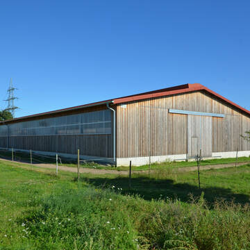
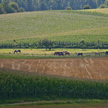
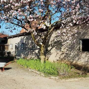
KRONENHOF KETSCH | Wagner
Ketsch
Kronenhof Ketsch | Wagner
@Kronenhof-Ketsch
FN-Mitglied
Freizeitstall
Vermieten
Führanlage
Paddock
Allergikerstall
Hengsthaltung möglich
16 weitere...
aktuell
S


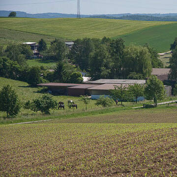
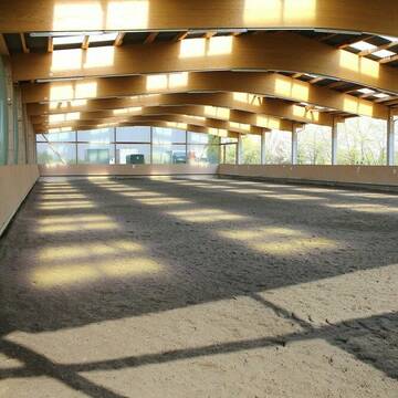
Reitanlage die keine Wünsche offen lässt
Mannheim
juergen-dehoust
@juergen-dehoust
Freizeitstall
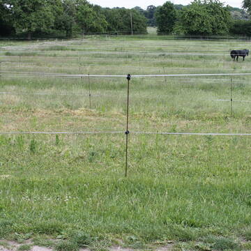
Geländestrecke
Führanlage
Hunde willkommen
Gnadenbrothof
Hengsthaltung möglich
Außenbox mit Paddock
Außenboxen
19 weitere...
P+
Deprecated: Creation of dynamic property Zend_View_Helper_Ads::$adLink is deprecated in /var/www/stall-frei/htdocs/staging.stall-frei.de/library/Psf/View/Helper/Ads.php on line 108

***Reitstall Birkenhof*** Pferdegerechte Haltung
Köln
Daniele-Fazzi
@Daniele-Fazzi
Herzlich Willkommen
auf dem Reitstall Birkenhof
Jetzt neu ‼️ auf dem Birkenhof:
Private Geländestrecke rund um unser

Familiäre Reitanlage
Edingen-Neckarhausen
Laura-Buehler
@Laura-Buehler
Pferdeausbildung
Reitlehrer und -unterricht
Vermieten
Führanlage
Longierzirkel/Roundpen
Außenbox mit Paddock
Außenboxen
13 weitere...
P+


FREIE PADDOCKBOXEN🐴🏠
Mannheim
Reit- und Fahrverein
@RFV_Mannheim-Sandhofen_eV
FN-Mitglied
Freizeitstall
Vermieten
Hunde willkommen
Krankenbox
Hengsthaltung möglich
Hufrehe geeignet
23 weitere...
S
Birkenhof Gauangelloch
Leimen-Gauangelloch
Friedwalt-Treiber
@Friedwalt-Treiber
FN-Mitglied
Freizeitstall
Longierzirkel/Roundpen
Pensions- und Gastboxen
Außenboxen
Innenbox
Vollpension
11 weitere...
S

Aktivstall Bauer Karl
Mannheim
Jochen Karl
@Jochen-Karl
FN-Mitglied
Freizeitstall
Vermieten
Krankenbox
Longierzirkel/Roundpen
Allergikerstall
Hufrehe geeignet
16 weitere...
P
2 Fensterboxen ohne Paddock frei
Heidelberg
Grenzhof
@Grenzhof1
Freizeitstall
Vermieten
Reithalle
Reitplatz (z.B. Dressur, Springen, Reining)
Außenboxen
7 weitere...
P

Reiterhof Abel
Ketsch
Tobias Abel -Reiterhof Abel
@Tobias-Abel
Fahrstall, Kutschwagen
FN-Mitglied
Vermieten
Führanlage
Hunde willkommen
Außenbox mit Paddock
Außenboxen
17 weitere...
aktuell
P+

Mitarbeiter gesucht?
Mechtersen
STALL-FREIde Marketing
@STALL-FREI-Marketing
Stellenangebote kostenlos veröffentlichen!


Paddockboxen und Offenstall frei
Mannheim
Antje Henkelmann
@GoldenFieldRanch1
Freizeitstall
Pferdeausbildung
Vermieten
Hunde willkommen
Krankenbox
Allergikerstall
Hufrehe geeignet
17 weitere...
P+


Paddockboxen ab Januar 2026 - Aktivstall ab 04/26
Hirschberg an der Bergstr
Isabell Bachhuber
@Isabell_Bachhuber
Freizeitstall
Reitlehrer und -unterricht
Vermieten
Hunde willkommen
Longierzirkel/Roundpen
Außenbox mit Paddock
Außenboxen
21 weitere...
P+
Deprecated: Creation of dynamic property Zend_View::$pageCount is deprecated in /var/www/stall-frei/htdocs/staging.stall-frei.de/library/vendor/shardj/zf1-future/library/Zend/View/Abstract.php on line 308
Deprecated: Creation of dynamic property Zend_View::$itemCountPerPage is deprecated in /var/www/stall-frei/htdocs/staging.stall-frei.de/library/vendor/shardj/zf1-future/library/Zend/View/Abstract.php on line 308
Deprecated: Creation of dynamic property Zend_View::$first is deprecated in /var/www/stall-frei/htdocs/staging.stall-frei.de/library/vendor/shardj/zf1-future/library/Zend/View/Abstract.php on line 308
Deprecated: Creation of dynamic property Zend_View::$current is deprecated in /var/www/stall-frei/htdocs/staging.stall-frei.de/library/vendor/shardj/zf1-future/library/Zend/View/Abstract.php on line 308
Deprecated: Creation of dynamic property Zend_View::$last is deprecated in /var/www/stall-frei/htdocs/staging.stall-frei.de/library/vendor/shardj/zf1-future/library/Zend/View/Abstract.php on line 308
Deprecated: Creation of dynamic property Zend_View::$next is deprecated in /var/www/stall-frei/htdocs/staging.stall-frei.de/library/vendor/shardj/zf1-future/library/Zend/View/Abstract.php on line 308
Deprecated: Creation of dynamic property Zend_View::$pagesInRange is deprecated in /var/www/stall-frei/htdocs/staging.stall-frei.de/library/vendor/shardj/zf1-future/library/Zend/View/Abstract.php on line 308
Deprecated: Creation of dynamic property Zend_View::$firstPageInRange is deprecated in /var/www/stall-frei/htdocs/staging.stall-frei.de/library/vendor/shardj/zf1-future/library/Zend/View/Abstract.php on line 308
Deprecated: Creation of dynamic property Zend_View::$lastPageInRange is deprecated in /var/www/stall-frei/htdocs/staging.stall-frei.de/library/vendor/shardj/zf1-future/library/Zend/View/Abstract.php on line 308
Deprecated: Creation of dynamic property Zend_View::$currentItemCount is deprecated in /var/www/stall-frei/htdocs/staging.stall-frei.de/library/vendor/shardj/zf1-future/library/Zend/View/Abstract.php on line 308
Deprecated: Creation of dynamic property Zend_View::$totalItemCount is deprecated in /var/www/stall-frei/htdocs/staging.stall-frei.de/library/vendor/shardj/zf1-future/library/Zend/View/Abstract.php on line 308
Deprecated: Creation of dynamic property Zend_View::$firstItemNumber is deprecated in /var/www/stall-frei/htdocs/staging.stall-frei.de/library/vendor/shardj/zf1-future/library/Zend/View/Abstract.php on line 308
Deprecated: Creation of dynamic property Zend_View::$lastItemNumber is deprecated in /var/www/stall-frei/htdocs/staging.stall-frei.de/library/vendor/shardj/zf1-future/library/Zend/View/Abstract.php on line 308
Deprecated: Creation of dynamic property Zend_View::$router is deprecated in /var/www/stall-frei/htdocs/staging.stall-frei.de/library/vendor/shardj/zf1-future/library/Zend/View/Abstract.php on line 308
Deprecated: Creation of dynamic property Zend_View::$urlParams is deprecated in /var/www/stall-frei/htdocs/staging.stall-frei.de/library/vendor/shardj/zf1-future/library/Zend/View/Abstract.php on line 308
Deprecated: Creation of dynamic property Zend_View::$showAds is deprecated in /var/www/stall-frei/htdocs/staging.stall-frei.de/library/vendor/shardj/zf1-future/library/Zend/View/Abstract.php on line 308
Deprecated: Creation of dynamic property Zend_View::$objectIds is deprecated in /var/www/stall-frei/htdocs/staging.stall-frei.de/library/vendor/shardj/zf1-future/library/Zend/View/Abstract.php on line 308
Deprecated: Creation of dynamic property Zend_View::$showNavbar is deprecated in /var/www/stall-frei/htdocs/staging.stall-frei.de/library/vendor/shardj/zf1-future/library/Zend/View/Abstract.php on line 308
Deprecated: Creation of dynamic property Zend_View::$showBreadcrumb is deprecated in /var/www/stall-frei/htdocs/staging.stall-frei.de/library/vendor/shardj/zf1-future/library/Zend/View/Abstract.php on line 308
Deprecated: Creation of dynamic property Zend_View::$showFooter is deprecated in /var/www/stall-frei/htdocs/staging.stall-frei.de/library/vendor/shardj/zf1-future/library/Zend/View/Abstract.php on line 308
Deprecated: Creation of dynamic property Zend_View::$showInternalAds is deprecated in /var/www/stall-frei/htdocs/staging.stall-frei.de/library/vendor/shardj/zf1-future/library/Zend/View/Abstract.php on line 308
Deprecated: Creation of dynamic property Zend_View::$blNoContent is deprecated in /var/www/stall-frei/htdocs/staging.stall-frei.de/library/vendor/shardj/zf1-future/library/Zend/View/Abstract.php on line 308
Deprecated: Creation of dynamic property Zend_View::$sMetaDesc is deprecated in /var/www/stall-frei/htdocs/staging.stall-frei.de/library/vendor/shardj/zf1-future/library/Zend/View/Abstract.php on line 308
Deprecated: Creation of dynamic property Zend_View::$useGmaps is deprecated in /var/www/stall-frei/htdocs/staging.stall-frei.de/library/vendor/shardj/zf1-future/library/Zend/View/Abstract.php on line 308
Deprecated: Creation of dynamic property Zend_View::$touches is deprecated in /var/www/stall-frei/htdocs/staging.stall-frei.de/library/vendor/shardj/zf1-future/library/Zend/View/Abstract.php on line 308
Deprecated: Creation of dynamic property Zend_View::$oProject is deprecated in /var/www/stall-frei/htdocs/staging.stall-frei.de/library/vendor/shardj/zf1-future/library/Zend/View/Abstract.php on line 308
Deprecated: Creation of dynamic property Zend_View::$pageHeadline is deprecated in /var/www/stall-frei/htdocs/staging.stall-frei.de/library/vendor/shardj/zf1-future/library/Zend/View/Abstract.php on line 308
Deprecated: Creation of dynamic property Zend_View::$disableLocationField is deprecated in /var/www/stall-frei/htdocs/staging.stall-frei.de/library/vendor/shardj/zf1-future/library/Zend/View/Abstract.php on line 308
Deprecated: Creation of dynamic property Zend_View::$isSearch is deprecated in /var/www/stall-frei/htdocs/staging.stall-frei.de/library/vendor/shardj/zf1-future/library/Zend/View/Abstract.php on line 308
Deprecated: Creation of dynamic property Zend_View::$pageTitle is deprecated in /var/www/stall-frei/htdocs/staging.stall-frei.de/library/vendor/shardj/zf1-future/library/Zend/View/Abstract.php on line 308
Deprecated: Creation of dynamic property Psf_Form_Element_Text::$class is deprecated in /var/www/stall-frei/htdocs/staging.stall-frei.de/library/vendor/shardj/zf1-future/library/Zend/Form/Element.php on line 874
Deprecated: Creation of dynamic property Psf_Form_Element_Text::$size is deprecated in /var/www/stall-frei/htdocs/staging.stall-frei.de/library/vendor/shardj/zf1-future/library/Zend/Form/Element.php on line 874
Deprecated: Creation of dynamic property Psf_Form_Element_Text::$placeholder is deprecated in /var/www/stall-frei/htdocs/staging.stall-frei.de/library/vendor/shardj/zf1-future/library/Zend/Form/Element.php on line 874
Deprecated: Creation of dynamic property Psf_Form_Element_Hidden::$class is deprecated in /var/www/stall-frei/htdocs/staging.stall-frei.de/library/vendor/shardj/zf1-future/library/Zend/Form/Element.php on line 874
Deprecated: Creation of dynamic property Psf_Form_Element_Hidden::$class is deprecated in /var/www/stall-frei/htdocs/staging.stall-frei.de/library/vendor/shardj/zf1-future/library/Zend/Form/Element.php on line 874
Deprecated: Creation of dynamic property Psf_Form_Element_Hidden::$class is deprecated in /var/www/stall-frei/htdocs/staging.stall-frei.de/library/vendor/shardj/zf1-future/library/Zend/Form/Element.php on line 874
Deprecated: Creation of dynamic property Psf_Form_Element_Hidden::$class is deprecated in /var/www/stall-frei/htdocs/staging.stall-frei.de/library/vendor/shardj/zf1-future/library/Zend/Form/Element.php on line 874
Deprecated: Creation of dynamic property Psf_Form_Element_Select::$class is deprecated in /var/www/stall-frei/htdocs/staging.stall-frei.de/library/vendor/shardj/zf1-future/library/Zend/Form/Element.php on line 874
Deprecated: Creation of dynamic property Psf_Form_Element_Select::$class is deprecated in /var/www/stall-frei/htdocs/staging.stall-frei.de/library/vendor/shardj/zf1-future/library/Zend/Form/Element.php on line 874
Deprecated: Creation of dynamic property Psf_Form_Element_Select::$class is deprecated in /var/www/stall-frei/htdocs/staging.stall-frei.de/library/vendor/shardj/zf1-future/library/Zend/Form/Element.php on line 874
Deprecated: Creation of dynamic property Psf_Form_Element_Select::$class is deprecated in /var/www/stall-frei/htdocs/staging.stall-frei.de/library/vendor/shardj/zf1-future/library/Zend/Form/Element.php on line 874
Deprecated: Creation of dynamic property Psf_Form_Element_Text::$class is deprecated in /var/www/stall-frei/htdocs/staging.stall-frei.de/library/vendor/shardj/zf1-future/library/Zend/Form/Element.php on line 874
Deprecated: Creation of dynamic property Psf_Form_Element_Checkbox::$label is deprecated in /var/www/stall-frei/htdocs/staging.stall-frei.de/library/vendor/shardj/zf1-future/library/Zend/Form/Element.php on line 874
Deprecated: Creation of dynamic property Zend_View::$sort is deprecated in /var/www/stall-frei/htdocs/staging.stall-frei.de/library/vendor/shardj/zf1-future/library/Zend/View/Abstract.php on line 308
Deprecated: Creation of dynamic property Zend_View::$searchLocation is deprecated in /var/www/stall-frei/htdocs/staging.stall-frei.de/library/vendor/shardj/zf1-future/library/Zend/View/Abstract.php on line 308
Deprecated: Creation of dynamic property Zend_View::$locationHint is deprecated in /var/www/stall-frei/htdocs/staging.stall-frei.de/library/vendor/shardj/zf1-future/library/Zend/View/Abstract.php on line 308
Psf_GeoCoder_Abstract::getLocation: Friedrichsfeld Get Location CachedOrLive
Psf_GeoCoder_Abstract::getCachedOrLive: Friedrichsfeld
Psf_GeoCoder_OpenCageData::makeApiRequest: response:
Array
(
[documentation] => https://opencagedata.com/api
[licenses] => Array
(
[0] => Array
(
[name] => see attribution guide
[url] => https://opencagedata.com/credits
)
)
[results] => Array
(
[0] => Array
(
[bounds] => Array
(
[northeast] => Array
(
[lat] => 49.4569906
[lng] => 8.5876228
)
[southwest] => Array
(
[lat] => 49.4157628
[lng] => 8.5469834
)
)
[components] => Array
(
[ISO_3166-1_alpha-2] => DE
[ISO_3166-1_alpha-3] => DEU
[ISO_3166-2] => Array
(
[0] => DE-BW
)
[_category] => place
[_normalized_city] => Mannheim
[_type] => neighbourhood
[city] => Mannheim
[city_district] => Friedrichsfeld
[continent] => Europe
[country] => Deutschland
[country_code] => de
[political_union] => European Union
[postcode] => 68229
[state] => Baden-Württemberg
[state_code] => BW
[suburb] => Friedrichsfeld
)
[confidence] => 7
[formatted] => 68229 Mannheim, Deutschland
[geometry] => Array
(
[lat] => 49.4394048
[lng] => 8.5750181
)
)
[1] => Array
(
[bounds] => Array
(
[northeast] => Array
(
[lat] => 51.621348
[lng] => 6.6515988
)
[southwest] => Array
(
[lat] => 51.621248
[lng] => 6.6514988
)
)
[components] => Array
(
[ISO_3166-1_alpha-2] => DE
[ISO_3166-1_alpha-3] => DEU
[ISO_3166-2] => Array
(
[0] => DE-NW
)
[_category] => transportation
[_normalized_city] => Voerde (Niederrhein)
[_type] => railway
[continent] => Europe
[country] => Deutschland
[country_code] => de
[county] => Kreis Wesel
[political_union] => European Union
[postcode] => 46562
[railway] => Friedrichsfeld (Niederrhein)
[road] => Alte Mittelstraße
[state] => Nordrhein-Westfalen
[state_code] => NW
[suburb] => Friedrichsfeld
[town] => Voerde (Niederrhein)
)
[confidence] => 9
[formatted] => Friedrichsfeld (Niederrhein), Alte Mittelstraße, 46562 Voerde (Niederrhein), Deutschland
[geometry] => Array
(
[lat] => 51.621298
[lng] => 6.6515488
)
)
[2] => Array
(
[bounds] => Array
(
[northeast] => Array
(
[lat] => 51.6362577
[lng] => 6.6881395
)
[southwest] => Array
(
[lat] => 51.6077781
[lng] => 6.6345344
)
)
[components] => Array
(
[ISO_3166-1_alpha-2] => DE
[ISO_3166-1_alpha-3] => DEU
[ISO_3166-2] => Array
(
[0] => DE-NW
)
[_category] => place
[_normalized_city] => Voerde (Niederrhein)
[_type] => neighbourhood
[continent] => Europe
[country] => Deutschland
[country_code] => de
[county] => Kreis Wesel
[political_union] => European Union
[state] => Nordrhein-Westfalen
[state_code] => NW
[suburb] => Friedrichsfeld
[town] => Voerde (Niederrhein)
)
[confidence] => 7
[formatted] => Friedrichsfeld, Voerde (Niederrhein), Nordrhein-Westfalen, Deutschland
[geometry] => Array
(
[lat] => 51.6280513
[lng] => 6.6508262
)
)
[3] => Array
(
[bounds] => Array
(
[northeast] => Array
(
[lat] => 51.584575
[lng] => 9.4753807
)
[southwest] => Array
(
[lat] => 51.5583761
[lng] => 9.4524696
)
)
[components] => Array
(
[ISO_3166-1_alpha-2] => DE
[ISO_3166-1_alpha-3] => DEU
[ISO_3166-2] => Array
(
[0] => DE-HE
)
[_category] => place
[_normalized_city] => Trendelburg
[_type] => hamlet
[continent] => Europe
[country] => Deutschland
[country_code] => de
[county] => Landkreis Kassel
[hamlet] => Friedrichsfeld
[municipality] => Trendelburg
[political_union] => European Union
[state] => Hessen
[state_code] => HE
)
[confidence] => 7
[formatted] => Friedrichsfeld, Hessen, Deutschland
[geometry] => Array
(
[lat] => 51.573449
[lng] => 9.4608273
)
)
[4] => Array
(
[bounds] => Array
(
[northeast] => Array
(
[lat] => 54.5068324
[lng] => 9.3793473
)
[southwest] => Array
(
[lat] => 54.4668324
[lng] => 9.3393473
)
)
[components] => Array
(
[ISO_3166-1_alpha-2] => DE
[ISO_3166-1_alpha-3] => DEU
[ISO_3166-2] => Array
(
[0] => DE-SH
)
[_category] => place
[_normalized_city] => Hollingstedt
[_type] => hamlet
[continent] => Europe
[country] => Deutschland
[country_code] => de
[county] => Kreis Schleswig-Flensburg
[hamlet] => Friedrichsfeld
[municipality] => Arensharde
[political_union] => European Union
[postcode] => 24887
[state] => Schleswig-Holstein
[state_code] => SH
[village] => Hollingstedt
)
[confidence] => 7
[formatted] => Friedrichsfeld, 24887 Hollingstedt, Deutschland
[geometry] => Array
(
[lat] => 54.4868324
[lng] => 9.3593473
)
)
[5] => Array
(
[bounds] => Array
(
[northeast] => Array
(
[lat] => 53.6577174
[lng] => 7.3713996
)
[southwest] => Array
(
[lat] => 53.6576174
[lng] => 7.3712996
)
)
[components] => Array
(
[ISO_3166-1_alpha-2] => DE
[ISO_3166-1_alpha-3] => DEU
[ISO_3166-2] => Array
(
[0] => DE-NI
)
[_category] => building
[_normalized_city] => Dornum
[_type] => building
[city_district] => Nesse
[continent] => Europe
[country] => Deutschland
[country_code] => de
[county] => Landkreis Aurich
[isolated_dwelling] => Friedrichsfeld
[political_union] => European Union
[postcode] => 26553
[state] => Niedersachsen
[state_code] => NI
[village] => Dornum
)
[confidence] => 10
[formatted] => Friedrichsfeld, 26553 Dornum, Deutschland
[geometry] => Array
(
[lat] => 53.6576674
[lng] => 7.3713496
)
)
[6] => Array
(
[bounds] => Array
(
[northeast] => Array
(
[lat] => 54.504556
[lng] => 9.422084
)
[southwest] => Array
(
[lat] => 54.4965047
[lng] => 9.4109277
)
)
[components] => Array
(
[ISO_3166-1_alpha-2] => DE
[ISO_3166-1_alpha-3] => DEU
[ISO_3166-2] => Array
(
[0] => DE-SH
)
[_category] => road
[_normalized_city] => Schuby
[_type] => road
[continent] => Europe
[country] => Deutschland
[country_code] => de
[county] => Kreis Schleswig-Flensburg
[municipality] => Arensharde
[political_union] => European Union
[postcode] => 24850
[road] => Friedrichsfeld
[road_type] => tertiary
[state] => Schleswig-Holstein
[state_code] => SH
[village] => Schuby
)
[confidence] => 9
[formatted] => Friedrichsfeld, 24850 Schuby, Deutschland
[geometry] => Array
(
[lat] => 54.4970383
[lng] => 9.4192349
)
)
[7] => Array
(
[bounds] => Array
(
[northeast] => Array
(
[lat] => 52.0248241
[lng] => 8.9947368
)
[southwest] => Array
(
[lat] => 52.0227354
[lng] => 8.9887826
)
)
[components] => Array
(
[ISO_3166-1_alpha-2] => DE
[ISO_3166-1_alpha-3] => DEU
[ISO_3166-2] => Array
(
[0] => DE-NW
)
[_category] => road
[_normalized_city] => Dörentrup
[_type] => road
[continent] => Europe
[country] => Deutschland
[country_code] => de
[county] => Kreis Lippe
[political_union] => European Union
[postcode] => 32694
[road] => Friedrichsfeld
[road_type] => residential
[state] => Nordrhein-Westfalen
[state_code] => NW
[town] => Dörentrup
)
[confidence] => 9
[formatted] => Friedrichsfeld, 32694 Dörentrup, Deutschland
[geometry] => Array
(
[lat] => 52.0237758
[lng] => 8.9917583
)
)
[8] => Array
(
[components] => Array
(
[ISO_3166-1_alpha-2] => FR
[ISO_3166-1_alpha-3] => FRA
[ISO_3166-2] => Array
(
[0] => FR-IDF
[1] => FR-92
)
[_category] => road
[_normalized_city] => Levallois-Perret
[_type] => road
[city] => Levallois-Perret
[continent] => Europe
[country] => France
[country_code] => fr
[county] => Hauts-de-Seine
[local_authority] => Métropole du Grand Paris
[political_union] => European Union
[postcode] => 92300
[road] => Rue Charles Deutschmann
[state] => Île-de-France
[state_code] => IDF
)
[confidence] => 2
[formatted] => Rue Charles Deutschmann, 92300 Levallois-Perret, France
[geometry] => Array
(
[lat] => 48.900049
[lng] => 2.2842
)
)
)
[status] => Array
(
[code] => 200
[message] => OK
)
[stay_informed] => Array
(
[blog] => https://blog.opencagedata.com
[mastodon] => https://en.osm.town/@opencage
)
[thanks] => For using an OpenCage API
[timestamp] => Array
(
[created_http] => Sun, 08 Feb 2026 04:54:58 GMT
[created_unix] => 1770526498
)
[total_results] => 9
)
Psf_GeoCoder_Abstract::convertLocationResult
{"documentation":"https:\/\/opencagedata.com\/api","licenses":[{"name":"see attribution guide","url":"https:\/\/opencagedata.com\/credits"}],"results":[{"bounds":{"northeast":{"lat":49.4569906,"lng":8.5876228},"southwest":{"lat":49.4157628,"lng":8.5469834}},"components":{"ISO_3166-1_alpha-2":"DE","ISO_3166-1_alpha-3":"DEU","ISO_3166-2":["DE-BW"],"_category":"place","_normalized_city":"Mannheim","_type":"neighbourhood","city":"Mannheim","city_district":"Friedrichsfeld","continent":"Europe","country":"Deutschland","country_code":"de","political_union":"European Union","postcode":"68229","state":"Baden-W\u00fcrttemberg","state_code":"BW","suburb":"Friedrichsfeld"},"confidence":7,"formatted":"68229 Mannheim, Deutschland","geometry":{"lat":49.4394048,"lng":8.5750181}},{"bounds":{"northeast":{"lat":51.621348,"lng":6.6515988},"southwest":{"lat":51.621248,"lng":6.6514988}},"components":{"ISO_3166-1_alpha-2":"DE","ISO_3166-1_alpha-3":"DEU","ISO_3166-2":["DE-NW"],"_category":"transportation","_normalized_city":"Voerde (Niederrhein)","_type":"railway","continent":"Europe","country":"Deutschland","country_code":"de","county":"Kreis Wesel","political_union":"European Union","postcode":"46562","railway":"Friedrichsfeld (Niederrhein)","road":"Alte Mittelstra\u00dfe","state":"Nordrhein-Westfalen","state_code":"NW","suburb":"Friedrichsfeld","town":"Voerde (Niederrhein)"},"confidence":9,"formatted":"Friedrichsfeld (Niederrhein), Alte Mittelstra\u00dfe, 46562 Voerde (Niederrhein), Deutschland","geometry":{"lat":51.621298,"lng":6.6515488}},{"bounds":{"northeast":{"lat":51.6362577,"lng":6.6881395},"southwest":{"lat":51.6077781,"lng":6.6345344}},"components":{"ISO_3166-1_alpha-2":"DE","ISO_3166-1_alpha-3":"DEU","ISO_3166-2":["DE-NW"],"_category":"place","_normalized_city":"Voerde (Niederrhein)","_type":"neighbourhood","continent":"Europe","country":"Deutschland","country_code":"de","county":"Kreis Wesel","political_union":"European Union","state":"Nordrhein-Westfalen","state_code":"NW","suburb":"Friedrichsfeld","town":"Voerde (Niederrhein)"},"confidence":7,"formatted":"Friedrichsfeld, Voerde (Niederrhein), Nordrhein-Westfalen, Deutschland","geometry":{"lat":51.6280513,"lng":6.6508262}},{"bounds":{"northeast":{"lat":51.584575,"lng":9.4753807},"southwest":{"lat":51.5583761,"lng":9.4524696}},"components":{"ISO_3166-1_alpha-2":"DE","ISO_3166-1_alpha-3":"DEU","ISO_3166-2":["DE-HE"],"_category":"place","_normalized_city":"Trendelburg","_type":"hamlet","continent":"Europe","country":"Deutschland","country_code":"de","county":"Landkreis Kassel","hamlet":"Friedrichsfeld","municipality":"Trendelburg","political_union":"European Union","state":"Hessen","state_code":"HE"},"confidence":7,"formatted":"Friedrichsfeld, Hessen, Deutschland","geometry":{"lat":51.573449,"lng":9.4608273}},{"bounds":{"northeast":{"lat":54.5068324,"lng":9.3793473},"southwest":{"lat":54.4668324,"lng":9.3393473}},"components":{"ISO_3166-1_alpha-2":"DE","ISO_3166-1_alpha-3":"DEU","ISO_3166-2":["DE-SH"],"_category":"place","_normalized_city":"Hollingstedt","_type":"hamlet","continent":"Europe","country":"Deutschland","country_code":"de","county":"Kreis Schleswig-Flensburg","hamlet":"Friedrichsfeld","municipality":"Arensharde","political_union":"European Union","postcode":"24887","state":"Schleswig-Holstein","state_code":"SH","village":"Hollingstedt"},"confidence":7,"formatted":"Friedrichsfeld, 24887 Hollingstedt, Deutschland","geometry":{"lat":54.4868324,"lng":9.3593473}},{"bounds":{"northeast":{"lat":53.6577174,"lng":7.3713996},"southwest":{"lat":53.6576174,"lng":7.3712996}},"components":{"ISO_3166-1_alpha-2":"DE","ISO_3166-1_alpha-3":"DEU","ISO_3166-2":["DE-NI"],"_category":"building","_normalized_city":"Dornum","_type":"building","city_district":"Nesse","continent":"Europe","country":"Deutschland","country_code":"de","county":"Landkreis Aurich","isolated_dwelling":"Friedrichsfeld","political_union":"European Union","postcode":"26553","state":"Niedersachsen","state_code":"NI","village":"Dornum"},"confidence":10,"formatted":"Friedrichsfeld, 26553 Dornum, Deutschland","geometry":{"lat":53.6576674,"lng":7.3713496}},{"bounds":{"northeast":{"lat":54.504556,"lng":9.422084},"southwest":{"lat":54.4965047,"lng":9.4109277}},"components":{"ISO_3166-1_alpha-2":"DE","ISO_3166-1_alpha-3":"DEU","ISO_3166-2":["DE-SH"],"_category":"road","_normalized_city":"Schuby","_type":"road","continent":"Europe","country":"Deutschland","country_code":"de","county":"Kreis Schleswig-Flensburg","municipality":"Arensharde","political_union":"European Union","postcode":"24850","road":"Friedrichsfeld","road_type":"tertiary","state":"Schleswig-Holstein","state_code":"SH","village":"Schuby"},"confidence":9,"formatted":"Friedrichsfeld, 24850 Schuby, Deutschland","geometry":{"lat":54.4970383,"lng":9.4192349}},{"bounds":{"northeast":{"lat":52.0248241,"lng":8.9947368},"southwest":{"lat":52.0227354,"lng":8.9887826}},"components":{"ISO_3166-1_alpha-2":"DE","ISO_3166-1_alpha-3":"DEU","ISO_3166-2":["DE-NW"],"_category":"road","_normalized_city":"D\u00f6rentrup","_type":"road","continent":"Europe","country":"Deutschland","country_code":"de","county":"Kreis Lippe","political_union":"European Union","postcode":"32694","road":"Friedrichsfeld","road_type":"residential","state":"Nordrhein-Westfalen","state_code":"NW","town":"D\u00f6rentrup"},"confidence":9,"formatted":"Friedrichsfeld, 32694 D\u00f6rentrup, Deutschland","geometry":{"lat":52.0237758,"lng":8.9917583}},{"components":{"ISO_3166-1_alpha-2":"FR","ISO_3166-1_alpha-3":"FRA","ISO_3166-2":["FR-IDF","FR-92"],"_category":"road","_normalized_city":"Levallois-Perret","_type":"road","city":"Levallois-Perret","continent":"Europe","country":"France","country_code":"fr","county":"Hauts-de-Seine","local_authority":"M\u00e9tropole du Grand Paris","political_union":"European Union","postcode":"92300","road":"Rue Charles Deutschmann","state":"\u00cele-de-France","state_code":"IDF"},"confidence":2,"formatted":"Rue Charles Deutschmann, 92300 Levallois-Perret, France","geometry":{"lat":48.900049,"lng":2.2842}}],"status":{"code":200,"message":"OK"},"stay_informed":{"blog":"https:\/\/blog.opencagedata.com","mastodon":"https:\/\/en.osm.town\/@opencage"},"thanks":"For using an OpenCage API","timestamp":{"created_http":"Sun, 08 Feb 2026 04:54:58 GMT","created_unix":1770526498},"total_results":9}Array
(
[0] => stdClass Object
(
[bounds] => stdClass Object
(
[northeast] => stdClass Object
(
[lat] => 49.4569906
[lng] => 8.5876228
)
[southwest] => stdClass Object
(
[lat] => 49.4157628
[lng] => 8.5469834
)
)
[components] => stdClass Object
(
[ISO_3166-1_alpha-2] => DE
[ISO_3166-1_alpha-3] => DEU
[ISO_3166-2] => Array
(
[0] => DE-BW
)
[_category] => place
[_normalized_city] => Mannheim
[_type] => neighbourhood
[city] => Mannheim
[city_district] => Friedrichsfeld
[continent] => Europe
[country] => Deutschland
[country_code] => de
[political_union] => European Union
[postcode] => 68229
[state] => Baden-Württemberg
[state_code] => BW
[suburb] => Friedrichsfeld
)
[confidence] => 7
[formatted] => 68229 Mannheim, Deutschland
[geometry] => stdClass Object
(
[lat] => 49.4394048
[lng] => 8.5750181
)
)
[1] => stdClass Object
(
[bounds] => stdClass Object
(
[northeast] => stdClass Object
(
[lat] => 51.621348
[lng] => 6.6515988
)
[southwest] => stdClass Object
(
[lat] => 51.621248
[lng] => 6.6514988
)
)
[components] => stdClass Object
(
[ISO_3166-1_alpha-2] => DE
[ISO_3166-1_alpha-3] => DEU
[ISO_3166-2] => Array
(
[0] => DE-NW
)
[_category] => transportation
[_normalized_city] => Voerde (Niederrhein)
[_type] => railway
[continent] => Europe
[country] => Deutschland
[country_code] => de
[county] => Kreis Wesel
[political_union] => European Union
[postcode] => 46562
[railway] => Friedrichsfeld (Niederrhein)
[road] => Alte Mittelstraße
[state] => Nordrhein-Westfalen
[state_code] => NW
[suburb] => Friedrichsfeld
[town] => Voerde (Niederrhein)
)
[confidence] => 9
[formatted] => Friedrichsfeld (Niederrhein), Alte Mittelstraße, 46562 Voerde (Niederrhein), Deutschland
[geometry] => stdClass Object
(
[lat] => 51.621298
[lng] => 6.6515488
)
)
[2] => stdClass Object
(
[bounds] => stdClass Object
(
[northeast] => stdClass Object
(
[lat] => 51.6362577
[lng] => 6.6881395
)
[southwest] => stdClass Object
(
[lat] => 51.6077781
[lng] => 6.6345344
)
)
[components] => stdClass Object
(
[ISO_3166-1_alpha-2] => DE
[ISO_3166-1_alpha-3] => DEU
[ISO_3166-2] => Array
(
[0] => DE-NW
)
[_category] => place
[_normalized_city] => Voerde (Niederrhein)
[_type] => neighbourhood
[continent] => Europe
[country] => Deutschland
[country_code] => de
[county] => Kreis Wesel
[political_union] => European Union
[state] => Nordrhein-Westfalen
[state_code] => NW
[suburb] => Friedrichsfeld
[town] => Voerde (Niederrhein)
)
[confidence] => 7
[formatted] => Friedrichsfeld, Voerde (Niederrhein), Nordrhein-Westfalen, Deutschland
[geometry] => stdClass Object
(
[lat] => 51.6280513
[lng] => 6.6508262
)
)
[3] => stdClass Object
(
[bounds] => stdClass Object
(
[northeast] => stdClass Object
(
[lat] => 51.584575
[lng] => 9.4753807
)
[southwest] => stdClass Object
(
[lat] => 51.5583761
[lng] => 9.4524696
)
)
[components] => stdClass Object
(
[ISO_3166-1_alpha-2] => DE
[ISO_3166-1_alpha-3] => DEU
[ISO_3166-2] => Array
(
[0] => DE-HE
)
[_category] => place
[_normalized_city] => Trendelburg
[_type] => hamlet
[continent] => Europe
[country] => Deutschland
[country_code] => de
[county] => Landkreis Kassel
[hamlet] => Friedrichsfeld
[municipality] => Trendelburg
[political_union] => European Union
[state] => Hessen
[state_code] => HE
)
[confidence] => 7
[formatted] => Friedrichsfeld, Hessen, Deutschland
[geometry] => stdClass Object
(
[lat] => 51.573449
[lng] => 9.4608273
)
)
[4] => stdClass Object
(
[bounds] => stdClass Object
(
[northeast] => stdClass Object
(
[lat] => 54.5068324
[lng] => 9.3793473
)
[southwest] => stdClass Object
(
[lat] => 54.4668324
[lng] => 9.3393473
)
)
[components] => stdClass Object
(
[ISO_3166-1_alpha-2] => DE
[ISO_3166-1_alpha-3] => DEU
[ISO_3166-2] => Array
(
[0] => DE-SH
)
[_category] => place
[_normalized_city] => Hollingstedt
[_type] => hamlet
[continent] => Europe
[country] => Deutschland
[country_code] => de
[county] => Kreis Schleswig-Flensburg
[hamlet] => Friedrichsfeld
[municipality] => Arensharde
[political_union] => European Union
[postcode] => 24887
[state] => Schleswig-Holstein
[state_code] => SH
[village] => Hollingstedt
)
[confidence] => 7
[formatted] => Friedrichsfeld, 24887 Hollingstedt, Deutschland
[geometry] => stdClass Object
(
[lat] => 54.4868324
[lng] => 9.3593473
)
)
[5] => stdClass Object
(
[bounds] => stdClass Object
(
[northeast] => stdClass Object
(
[lat] => 53.6577174
[lng] => 7.3713996
)
[southwest] => stdClass Object
(
[lat] => 53.6576174
[lng] => 7.3712996
)
)
[components] => stdClass Object
(
[ISO_3166-1_alpha-2] => DE
[ISO_3166-1_alpha-3] => DEU
[ISO_3166-2] => Array
(
[0] => DE-NI
)
[_category] => building
[_normalized_city] => Dornum
[_type] => building
[city_district] => Nesse
[continent] => Europe
[country] => Deutschland
[country_code] => de
[county] => Landkreis Aurich
[isolated_dwelling] => Friedrichsfeld
[political_union] => European Union
[postcode] => 26553
[state] => Niedersachsen
[state_code] => NI
[village] => Dornum
)
[confidence] => 10
[formatted] => Friedrichsfeld, 26553 Dornum, Deutschland
[geometry] => stdClass Object
(
[lat] => 53.6576674
[lng] => 7.3713496
)
)
[6] => stdClass Object
(
[bounds] => stdClass Object
(
[northeast] => stdClass Object
(
[lat] => 54.504556
[lng] => 9.422084
)
[southwest] => stdClass Object
(
[lat] => 54.4965047
[lng] => 9.4109277
)
)
[components] => stdClass Object
(
[ISO_3166-1_alpha-2] => DE
[ISO_3166-1_alpha-3] => DEU
[ISO_3166-2] => Array
(
[0] => DE-SH
)
[_category] => road
[_normalized_city] => Schuby
[_type] => road
[continent] => Europe
[country] => Deutschland
[country_code] => de
[county] => Kreis Schleswig-Flensburg
[municipality] => Arensharde
[political_union] => European Union
[postcode] => 24850
[road] => Friedrichsfeld
[road_type] => tertiary
[state] => Schleswig-Holstein
[state_code] => SH
[village] => Schuby
)
[confidence] => 9
[formatted] => Friedrichsfeld, 24850 Schuby, Deutschland
[geometry] => stdClass Object
(
[lat] => 54.4970383
[lng] => 9.4192349
)
)
[7] => stdClass Object
(
[bounds] => stdClass Object
(
[northeast] => stdClass Object
(
[lat] => 52.0248241
[lng] => 8.9947368
)
[southwest] => stdClass Object
(
[lat] => 52.0227354
[lng] => 8.9887826
)
)
[components] => stdClass Object
(
[ISO_3166-1_alpha-2] => DE
[ISO_3166-1_alpha-3] => DEU
[ISO_3166-2] => Array
(
[0] => DE-NW
)
[_category] => road
[_normalized_city] => Dörentrup
[_type] => road
[continent] => Europe
[country] => Deutschland
[country_code] => de
[county] => Kreis Lippe
[political_union] => European Union
[postcode] => 32694
[road] => Friedrichsfeld
[road_type] => residential
[state] => Nordrhein-Westfalen
[state_code] => NW
[town] => Dörentrup
)
[confidence] => 9
[formatted] => Friedrichsfeld, 32694 Dörentrup, Deutschland
[geometry] => stdClass Object
(
[lat] => 52.0237758
[lng] => 8.9917583
)
)
[8] => stdClass Object
(
[components] => stdClass Object
(
[ISO_3166-1_alpha-2] => FR
[ISO_3166-1_alpha-3] => FRA
[ISO_3166-2] => Array
(
[0] => FR-IDF
[1] => FR-92
)
[_category] => road
[_normalized_city] => Levallois-Perret
[_type] => road
[city] => Levallois-Perret
[continent] => Europe
[country] => France
[country_code] => fr
[county] => Hauts-de-Seine
[local_authority] => Métropole du Grand Paris
[political_union] => European Union
[postcode] => 92300
[road] => Rue Charles Deutschmann
[state] => Île-de-France
[state_code] => IDF
)
[confidence] => 2
[formatted] => Rue Charles Deutschmann, 92300 Levallois-Perret, France
[geometry] => stdClass Object
(
[lat] => 48.900049
[lng] => 2.2842
)
)
)
Psf_GeoCoder_OpenCageData::getKeyMap: 0
stdClass Object
(
    [bounds] => stdClass Object
        (
            [northeast] => stdClass Object
                (
                    [lat] => 49.4569906
                    [lng] => 8.5876228
                )

            [southwest] => stdClass Object
                (
                    [lat] => 49.4157628
                    [lng] => 8.5469834
                )

        )

    [components] => stdClass Object
        (
            [ISO_3166-1_alpha-2] => DE
            [ISO_3166-1_alpha-3] => DEU
            [ISO_3166-2] => Array
                (
                    [0] => DE-BW
                )

            [_category] => place
            [_normalized_city] => Mannheim
            [_type] => neighbourhood
            [city] => Mannheim
            [city_district] => Friedrichsfeld
            [continent] => Europe
            [country] => Deutschland
            [country_code] => de
            [political_union] => European Union
            [postcode] => 68229
            [state] => Baden-Württemberg
            [state_code] => BW
            [suburb] => Friedrichsfeld
        )

    [confidence] => 7
    [formatted] => 68229 Mannheim, Deutschland
    [geometry] => stdClass Object
        (
            [lat] => 49.4394048
            [lng] => 8.5750181
        )

)
Psf_GeoCoder_OpenCageData::getCounty: Mannheim
Psf_GeoCoder_OpenCageData::addMissingData REFETCH!
Array
(
    [address] => 68229 Mannheim, Deutschland
    [type] => neighbourhood
    [street] =>
    [city] => Friedrichsfeld
    [county] => Mannheim
    [state] => Baden-Württemberg
    [zip] => 68229
    [country] => Deutschland
    [suburb] => Friedrichsfeld
    [countrycode] => de
    [latitude] => 49.4394048
    [longitude] => 8.5750181
    [accuracy] => 1
    [confidence] => 7
    [bounds] => stdClass Object
        (
            [northeast] => stdClass Object
                (
                    [lat] => 49.4569906
                    [lng] => 8.5876228
                )

            [southwest] => stdClass Object
                (
                    [lat] => 49.4157628
                    [lng] => 8.5469834
                )

        )

)
reformat!
Array
(
    [address] => 68229 Friedrichsfeld
    [type] => neighbourhood
    [street] =>
    [city] => Friedrichsfeld
    [county] => Mannheim
    [state] => Baden-Württemberg
    [zip] => 68229
    [country] => Deutschland
    [suburb] => Friedrichsfeld
    [countrycode] => de
    [latitude] => 49.4394048
    [longitude] => 8.5750181
    [accuracy] => 1
    [confidence] => 7
    [bounds] => stdClass Object
        (
            [northeast] => stdClass Object
                (
                    [lat] => 49.4569906
                    [lng] => 8.5876228
                )

            [southwest] => stdClass Object
                (
                    [lat] => 49.4157628
                    [lng] => 8.5469834
                )

        )

    [place] => 68229 Friedrichsfeld, Baden-Württemberg
    [hash] => 0fe3027dac25b4191fec5a4267965d3d
)
Psf_GeoCoder_OpenCageData::getKeyMap: 1
stdClass Object
(
    [bounds] => stdClass Object
        (
            [northeast] => stdClass Object
                (
                    [lat] => 51.621348
                    [lng] => 6.6515988
                )

            [southwest] => stdClass Object
                (
                    [lat] => 51.621248
                    [lng] => 6.6514988
                )

        )

    [components] => stdClass Object
        (
            [ISO_3166-1_alpha-2] => DE
            [ISO_3166-1_alpha-3] => DEU
            [ISO_3166-2] => Array
                (
                    [0] => DE-NW
                )

            [_category] => transportation
            [_normalized_city] => Voerde (Niederrhein)
            [_type] => railway
            [continent] => Europe
            [country] => Deutschland
            [country_code] => de
            [county] => Kreis Wesel
            [political_union] => European Union
            [postcode] => 46562
            [railway] => Friedrichsfeld (Niederrhein)
            [road] => Alte Mittelstraße
            [state] => Nordrhein-Westfalen
            [state_code] => NW
            [suburb] => Friedrichsfeld
            [town] => Voerde (Niederrhein)
        )

    [confidence] => 9
    [formatted] => Friedrichsfeld (Niederrhein), Alte Mittelstraße, 46562 Voerde (Niederrhein), Deutschland
    [geometry] => stdClass Object
        (
            [lat] => 51.621298
            [lng] => 6.6515488
        )

)
Psf_GeoCoder_OpenCageData::getCounty: Wesel
Psf_GeoCoder_OpenCageData::addMissingData REFETCH!
Array
(
    [address] => Friedrichsfeld (Niederrhein), Alte Mittelstraße, 46562 Voerde (Niederrhein), Deutschland
    [type] => railway
    [street] => Alte Mittelstraße
    [city] => Voerde (Niederrhein)
    [county] => Wesel
    [state] => Nordrhein-Westfalen
    [zip] => 46562
    [country] => Deutschland
    [suburb] => Friedrichsfeld
    [countrycode] => de
    [latitude] => 51.621298
    [longitude] => 6.6515488
    [accuracy] => 1
    [confidence] => 9
    [bounds] => stdClass Object
        (
            [northeast] => stdClass Object
                (
                    [lat] => 51.621348
                    [lng] => 6.6515988
                )

            [southwest] => stdClass Object
                (
                    [lat] => 51.621248
                    [lng] => 6.6514988
                )

        )

)
reformat!
Array
(
    [address] => Friedrichsfeld (Niederrhein), Alte Mittelstraße, 46562 Voerde (Niederrhein), Deutschland
    [type] => railway
    [street] => Alte Mittelstraße
    [city] => Voerde (Niederrhein)
    [county] => Wesel
    [state] => Nordrhein-Westfalen
    [zip] => 46562
    [country] => Deutschland
    [suburb] => Friedrichsfeld
    [countrycode] => de
    [latitude] => 51.621298
    [longitude] => 6.6515488
    [accuracy] => 1
    [confidence] => 9
    [bounds] => stdClass Object
        (
            [northeast] => stdClass Object
                (
                    [lat] => 51.621348
                    [lng] => 6.6515988
                )

            [southwest] => stdClass Object
                (
                    [lat] => 51.621248
                    [lng] => 6.6514988
                )

        )

    [place] => Alte Mittelstraße, 46562 Voerde (Niederrhein), Nordrhein-Westfalen
    [hash] => 3044454b30c7a6fcd5a74e6808083151
)
Psf_GeoCoder_OpenCageData::getKeyMap: 2
stdClass Object
(
    [bounds] => stdClass Object
        (
            [northeast] => stdClass Object
                (
                    [lat] => 51.6362577
                    [lng] => 6.6881395
                )

            [southwest] => stdClass Object
                (
                    [lat] => 51.6077781
                    [lng] => 6.6345344
                )

        )

    [components] => stdClass Object
        (
            [ISO_3166-1_alpha-2] => DE
            [ISO_3166-1_alpha-3] => DEU
            [ISO_3166-2] => Array
                (
                    [0] => DE-NW
                )

            [_category] => place
            [_normalized_city] => Voerde (Niederrhein)
            [_type] => neighbourhood
            [continent] => Europe
            [country] => Deutschland
            [country_code] => de
            [county] => Kreis Wesel
            [political_union] => European Union
            [state] => Nordrhein-Westfalen
            [state_code] => NW
            [suburb] => Friedrichsfeld
            [town] => Voerde (Niederrhein)
        )

    [confidence] => 7
    [formatted] => Friedrichsfeld, Voerde (Niederrhein), Nordrhein-Westfalen, Deutschland
    [geometry] => stdClass Object
        (
            [lat] => 51.6280513
            [lng] => 6.6508262
        )

)
Psf_GeoCoder_OpenCageData::getCounty: Wesel
Psf_GeoCoder_OpenCageData::addMissingData REFETCH!
Array
(
    [address] => Friedrichsfeld, Voerde (Niederrhein), Nordrhein-Westfalen, Deutschland
    [type] => neighbourhood
    [street] =>
    [city] => Voerde (Niederrhein)
    [county] => Wesel
    [state] => Nordrhein-Westfalen
    [zip] =>
    [country] => Deutschland
    [suburb] => Friedrichsfeld
    [countrycode] => de
    [latitude] => 51.6280513
    [longitude] => 6.6508262
    [accuracy] => 1
    [confidence] => 7
    [bounds] => stdClass Object
        (
            [northeast] => stdClass Object
                (
                    [lat] => 51.6362577
                    [lng] => 6.6881395
                )

            [southwest] => stdClass Object
                (
                    [lat] => 51.6077781
                    [lng] => 6.6345344
                )

        )

)
reformat!
Array
(
    [address] => Friedrichsfeld, Voerde (Niederrhein), Nordrhein-Westfalen, Deutschland
    [type] => neighbourhood
    [street] =>
    [city] => Voerde (Niederrhein)
    [county] => Wesel
    [state] => Nordrhein-Westfalen
    [zip] =>
    [country] => Deutschland
    [suburb] => Friedrichsfeld
    [countrycode] => de
    [latitude] => 51.6280513
    [longitude] => 6.6508262
    [accuracy] => 1
    [confidence] => 7
    [bounds] => stdClass Object
        (
            [northeast] => stdClass Object
                (
                    [lat] => 51.6362577
                    [lng] => 6.6881395
                )

            [southwest] => stdClass Object
                (
                    [lat] => 51.6077781
                    [lng] => 6.6345344
                )

        )

    [place] => Voerde (Niederrhein), Nordrhein-Westfalen
    [hash] => 95071faf3a88a38da7e6bde0f15eaec1
)
Psf_GeoCoder_OpenCageData::getKeyMap: 3
stdClass Object
(
    [bounds] => stdClass Object
        (
            [northeast] => stdClass Object
                (
                    [lat] => 51.584575
                    [lng] => 9.4753807
                )

            [southwest] => stdClass Object
                (
                    [lat] => 51.5583761
                    [lng] => 9.4524696
                )

        )

    [components] => stdClass Object
        (
            [ISO_3166-1_alpha-2] => DE
            [ISO_3166-1_alpha-3] => DEU
            [ISO_3166-2] => Array
                (
                    [0] => DE-HE
                )

            [_category] => place
            [_normalized_city] => Trendelburg
            [_type] => hamlet
            [continent] => Europe
            [country] => Deutschland
            [country_code] => de
            [county] => Landkreis Kassel
            [hamlet] => Friedrichsfeld
            [municipality] => Trendelburg
            [political_union] => European Union
            [state] => Hessen
            [state_code] => HE
        )

    [confidence] => 7
    [formatted] => Friedrichsfeld, Hessen, Deutschland
    [geometry] => stdClass Object
        (
            [lat] => 51.573449
            [lng] => 9.4608273
        )

)
Psf_GeoCoder_OpenCageData::getCounty: Kassel
Psf_GeoCoder_OpenCageData::addMissingData REFETCH!
Array
(
    [address] => Friedrichsfeld, Hessen, Deutschland
    [type] => hamlet
    [street] => Friedrichsfeld
    [city] =>
    [county] => Kassel
    [state] => Hessen
    [zip] =>
    [country] => Deutschland
    [suburb] =>
    [countrycode] => de
    [latitude] => 51.573449
    [longitude] => 9.4608273
    [accuracy] => 1
    [confidence] => 7
    [bounds] => stdClass Object
        (
            [northeast] => stdClass Object
                (
                    [lat] => 51.584575
                    [lng] => 9.4753807
                )

            [southwest] => stdClass Object
                (
                    [lat] => 51.5583761
                    [lng] => 9.4524696
                )

        )

)
reformat!
Array
(
    [address] => Friedrichsfeld, Hessen, Deutschland
    [type] => hamlet
    [street] => Friedrichsfeld
    [city] =>
    [county] => Kassel
    [state] => Hessen
    [zip] =>
    [country] => Deutschland
    [suburb] =>
    [countrycode] => de
    [latitude] => 51.573449
    [longitude] => 9.4608273
    [accuracy] => 1
    [confidence] => 7
    [bounds] => stdClass Object
        (
            [northeast] => stdClass Object
                (
                    [lat] => 51.584575
                    [lng] => 9.4753807
                )

            [southwest] => stdClass Object
                (
                    [lat] => 51.5583761
                    [lng] => 9.4524696
                )

        )

    [place] => Friedrichsfeld, , Hessen
    [hash] => d4b0287844a7507f6925b42292937176
)
Psf_GeoCoder_OpenCageData::getKeyMap: 4
stdClass Object
(
    [bounds] => stdClass Object
        (
            [northeast] => stdClass Object
                (
                    [lat] => 54.5068324
                    [lng] => 9.3793473
                )

            [southwest] => stdClass Object
                (
                    [lat] => 54.4668324
                    [lng] => 9.3393473
                )

        )

    [components] => stdClass Object
        (
            [ISO_3166-1_alpha-2] => DE
            [ISO_3166-1_alpha-3] => DEU
            [ISO_3166-2] => Array
                (
                    [0] => DE-SH
                )

            [_category] => place
            [_normalized_city] => Hollingstedt
            [_type] => hamlet
            [continent] => Europe
            [country] => Deutschland
            [country_code] => de
            [county] => Kreis Schleswig-Flensburg
            [hamlet] => Friedrichsfeld
            [municipality] => Arensharde
            [political_union] => European Union
            [postcode] => 24887
            [state] => Schleswig-Holstein
            [state_code] => SH
            [village] => Hollingstedt
        )

    [confidence] => 7
    [formatted] => Friedrichsfeld, 24887 Hollingstedt, Deutschland
    [geometry] => stdClass Object
        (
            [lat] => 54.4868324
            [lng] => 9.3593473
        )

)
Psf_GeoCoder_OpenCageData::getCounty: Schleswig-Flensburg
Psf_GeoCoder_OpenCageData::addMissingData REFETCH!
Array
(
    [address] => Friedrichsfeld, 24887 Hollingstedt, Deutschland
    [type] => hamlet
    [street] => Friedrichsfeld
    [city] => Hollingstedt
    [county] => Schleswig-Flensburg
    [state] => Schleswig-Holstein
    [zip] => 24887
    [country] => Deutschland
    [suburb] =>
    [countrycode] => de
    [latitude] => 54.4868324
    [longitude] => 9.3593473
    [accuracy] => 1
    [confidence] => 7
    [bounds] => stdClass Object
        (
            [northeast] => stdClass Object
                (
                    [lat] => 54.5068324
                    [lng] => 9.3793473
                )

            [southwest] => stdClass Object
                (
                    [lat] => 54.4668324
                    [lng] => 9.3393473
                )

        )

)
reformat!
Array
(
    [address] => Friedrichsfeld, 24887 Hollingstedt, Deutschland
    [type] => hamlet
    [street] => Friedrichsfeld
    [city] => Hollingstedt
    [county] => Schleswig-Flensburg
    [state] => Schleswig-Holstein
    [zip] => 24887
    [country] => Deutschland
    [suburb] =>
    [countrycode] => de
    [latitude] => 54.4868324
    [longitude] => 9.3593473
    [accuracy] => 1
    [confidence] => 7
    [bounds] => stdClass Object
        (
            [northeast] => stdClass Object
                (
                    [lat] => 54.5068324
                    [lng] => 9.3793473
                )

            [southwest] => stdClass Object
                (
                    [lat] => 54.4668324
                    [lng] => 9.3393473
                )

        )

    [place] => Friedrichsfeld, 24887 Hollingstedt, Schleswig-Holstein
    [hash] => 07fc826ffc7c06a763882a6bffcc867b
)
Psf_GeoCoder_OpenCageData::getKeyMap: 5
stdClass Object
(
    [bounds] => stdClass Object
        (
            [northeast] => stdClass Object
                (
                    [lat] => 53.6577174
                    [lng] => 7.3713996
                )

            [southwest] => stdClass Object
                (
                    [lat] => 53.6576174
                    [lng] => 7.3712996
                )

        )

    [components] => stdClass Object
        (
            [ISO_3166-1_alpha-2] => DE
            [ISO_3166-1_alpha-3] => DEU
            [ISO_3166-2] => Array
                (
                    [0] => DE-NI
                )

            [_category] => building
            [_normalized_city] => Dornum
            [_type] => building
            [city_district] => Nesse
            [continent] => Europe
            [country] => Deutschland
            [country_code] => de
            [county] => Landkreis Aurich
            [isolated_dwelling] => Friedrichsfeld
            [political_union] => European Union
            [postcode] => 26553
            [state] => Niedersachsen
            [state_code] => NI
            [village] => Dornum
        )

    [confidence] => 10
    [formatted] => Friedrichsfeld, 26553 Dornum, Deutschland
    [geometry] => stdClass Object
        (
            [lat] => 53.6576674
            [lng] => 7.3713496
        )

)
Psf_GeoCoder_OpenCageData::getCounty: Aurich
Psf_GeoCoder_OpenCageData::addMissingData REFETCH!
Array
(
    [address] => Friedrichsfeld, 26553 Dornum, Deutschland
    [type] => building
    [street] =>
    [city] => Dornum
    [county] => Aurich
    [state] => Niedersachsen
    [zip] => 26553
    [country] => Deutschland
    [suburb] =>
    [countrycode] => de
    [latitude] => 53.6576674
    [longitude] => 7.3713496
    [accuracy] => 1
    [confidence] => 10
    [bounds] => stdClass Object
        (
            [northeast] => stdClass Object
                (
                    [lat] => 53.6577174
                    [lng] => 7.3713996
                )

            [southwest] => stdClass Object
                (
                    [lat] => 53.6576174
                    [lng] => 7.3712996
                )

        )

)
reformat!
Array
(
    [address] => Friedrichsfeld, 26553 Dornum, Deutschland
    [type] => building
    [street] =>
    [city] => Dornum
    [county] => Aurich
    [state] => Niedersachsen
    [zip] => 26553
    [country] => Deutschland
    [suburb] =>
    [countrycode] => de
    [latitude] => 53.6576674
    [longitude] => 7.3713496
    [accuracy] => 1
    [confidence] => 10
    [bounds] => stdClass Object
        (
            [northeast] => stdClass Object
                (
                    [lat] => 53.6577174
                    [lng] => 7.3713996
                )

            [southwest] => stdClass Object
                (
                    [lat] => 53.6576174
                    [lng] => 7.3712996
                )

        )

    [place] => 26553 Dornum, Niedersachsen
    [hash] => 89cc27ac14bdad0b3dee5058fe0fc6a3
)
Psf_GeoCoder_OpenCageData::getKeyMap: 6
stdClass Object
(
    [bounds] => stdClass Object
        (
            [northeast] => stdClass Object
                (
                    [lat] => 54.504556
                    [lng] => 9.422084
                )

            [southwest] => stdClass Object
                (
                    [lat] => 54.4965047
                    [lng] => 9.4109277
                )

        )

    [components] => stdClass Object
        (
            [ISO_3166-1_alpha-2] => DE
            [ISO_3166-1_alpha-3] => DEU
            [ISO_3166-2] => Array
                (
                    [0] => DE-SH
                )

            [_category] => road
            [_normalized_city] => Schuby
            [_type] => road
            [continent] => Europe
            [country] => Deutschland
            [country_code] => de
            [county] => Kreis Schleswig-Flensburg
            [municipality] => Arensharde
            [political_union] => European Union
            [postcode] => 24850
            [road] => Friedrichsfeld
            [road_type] => tertiary
            [state] => Schleswig-Holstein
            [state_code] => SH
            [village] => Schuby
        )

    [confidence] => 9
    [formatted] => Friedrichsfeld, 24850 Schuby, Deutschland
    [geometry] => stdClass Object
        (
            [lat] => 54.4970383
            [lng] => 9.4192349
        )

)
Psf_GeoCoder_OpenCageData::getCounty: Schleswig-Flensburg
Psf_GeoCoder_OpenCageData::addMissingData REFETCH!
Array
(
    [address] => Friedrichsfeld, 24850 Schuby, Deutschland
    [type] => road
    [street] => Friedrichsfeld
    [city] => Schuby
    [county] => Schleswig-Flensburg
    [state] => Schleswig-Holstein
    [zip] => 24850
    [country] => Deutschland
    [suburb] =>
    [countrycode] => de
    [latitude] => 54.4970383
    [longitude] => 9.4192349
    [accuracy] => 1
    [confidence] => 9
    [bounds] => stdClass Object
        (
            [northeast] => stdClass Object
                (
                    [lat] => 54.504556
                    [lng] => 9.422084
                )

            [southwest] => stdClass Object
                (
                    [lat] => 54.4965047
                    [lng] => 9.4109277
                )

        )

)
reformat!
Array
(
    [address] => Friedrichsfeld, 24850 Schuby, Deutschland
    [type] => road
    [street] => Friedrichsfeld
    [city] => Schuby
    [county] => Schleswig-Flensburg
    [state] => Schleswig-Holstein
    [zip] => 24850
    [country] => Deutschland
    [suburb] =>
    [countrycode] => de
    [latitude] => 54.4970383
    [longitude] => 9.4192349
    [accuracy] => 1
    [confidence] => 9
    [bounds] => stdClass Object
        (
            [northeast] => stdClass Object
                (
                    [lat] => 54.504556
                    [lng] => 9.422084
                )

            [southwest] => stdClass Object
                (
                    [lat] => 54.4965047
                    [lng] => 9.4109277
                )

        )

    [place] => Friedrichsfeld, 24850 Schuby, Schleswig-Holstein
    [hash] => c141489916db397a99a2ae28a1d447ec
)
Psf_GeoCoder_OpenCageData::getKeyMap: 7
stdClass Object
(
    [bounds] => stdClass Object
        (
            [northeast] => stdClass Object
                (
                    [lat] => 52.0248241
                    [lng] => 8.9947368
                )

            [southwest] => stdClass Object
                (
                    [lat] => 52.0227354
                    [lng] => 8.9887826
                )

        )

    [components] => stdClass Object
        (
            [ISO_3166-1_alpha-2] => DE
            [ISO_3166-1_alpha-3] => DEU
            [ISO_3166-2] => Array
                (
                    [0] => DE-NW
                )

            [_category] => road
            [_normalized_city] => Dörentrup
            [_type] => road
            [continent] => Europe
            [country] => Deutschland
            [country_code] => de
            [county] => Kreis Lippe
            [political_union] => European Union
            [postcode] => 32694
            [road] => Friedrichsfeld
            [road_type] => residential
            [state] => Nordrhein-Westfalen
            [state_code] => NW
            [town] => Dörentrup
        )

    [confidence] => 9
    [formatted] => Friedrichsfeld, 32694 Dörentrup, Deutschland
    [geometry] => stdClass Object
        (
            [lat] => 52.0237758
            [lng] => 8.9917583
        )

)
Psf_GeoCoder_OpenCageData::getCounty: Lippe
Psf_GeoCoder_OpenCageData::addMissingData REFETCH!
Array
(
    [address] => Friedrichsfeld, 32694 Dörentrup, Deutschland
    [type] => road
    [street] => Friedrichsfeld
    [city] => Dörentrup
    [county] => Lippe
    [state] => Nordrhein-Westfalen
    [zip] => 32694
    [country] => Deutschland
    [suburb] =>
    [countrycode] => de
    [latitude] => 52.0237758
    [longitude] => 8.9917583
    [accuracy] => 1
    [confidence] => 9
    [bounds] => stdClass Object
        (
            [northeast] => stdClass Object
                (
                    [lat] => 52.0248241
                    [lng] => 8.9947368
                )

            [southwest] => stdClass Object
                (
                    [lat] => 52.0227354
                    [lng] => 8.9887826
                )

        )

)
reformat!
Array
(
    [address] => Friedrichsfeld, 32694 Dörentrup, Deutschland
    [type] => road
    [street] => Friedrichsfeld
    [city] => Dörentrup
    [county] => Lippe
    [state] => Nordrhein-Westfalen
    [zip] => 32694
    [country] => Deutschland
    [suburb] =>
    [countrycode] => de
    [latitude] => 52.0237758
    [longitude] => 8.9917583
    [accuracy] => 1
    [confidence] => 9
    [bounds] => stdClass Object
        (
            [northeast] => stdClass Object
                (
                    [lat] => 52.0248241
                    [lng] => 8.9947368
                )

            [southwest] => stdClass Object
                (
                    [lat] => 52.0227354
                    [lng] => 8.9887826
                )

        )

    [place] => Friedrichsfeld, 32694 Dörentrup, Nordrhein-Westfalen
    [hash] => 48bb0d391b4c6179459c72a1f008e6de
)
Psf_GeoCoder_OpenCageData::getKeyMap: 8
stdClass Object
(
    [components] => stdClass Object
        (
            [ISO_3166-1_alpha-2] => FR
            [ISO_3166-1_alpha-3] => FRA
            [ISO_3166-2] => Array
                (
                    [0] => FR-IDF
                    [1] => FR-92
                )

            [_category] => road
            [_normalized_city] => Levallois-Perret
            [_type] => road
            [city] => Levallois-Perret
            [continent] => Europe
            [country] => France
            [country_code] => fr
            [county] => Hauts-de-Seine
            [local_authority] => Métropole du Grand Paris
            [political_union] => European Union
            [postcode] => 92300
            [road] => Rue Charles Deutschmann
            [state] => Île-de-France
            [state_code] => IDF
        )

    [confidence] => 2
    [formatted] => Rue Charles Deutschmann, 92300 Levallois-Perret, France
    [geometry] => stdClass Object
        (
            [lat] => 48.900049
            [lng] => 2.2842
        )

)
Psf_GeoCoder_OpenCageData::getCounty: Hauts-de-Seine
Psf_GeoCoder_OpenCageData::addMissingData REFETCH!
Array
(
    [address] => Rue Charles Deutschmann, 92300 Levallois-Perret, France
    [type] => road
    [street] => Rue Charles Deutschmann
    [city] => Levallois-Perret
    [county] => Hauts-de-Seine
    [state] => Île-de-France
    [zip] => 92300
    [country] => France
    [suburb] =>
    [countrycode] => fr
    [latitude] => 48.900049
    [longitude] => 2.2842
    [accuracy] => 1
    [confidence] => 2
    [bounds] =>
)
reformat!
Array
(
    [address] => Rue Charles Deutschmann, 92300 Levallois-Perret, France
    [type] => road
    [street] => Rue Charles Deutschmann
    [city] => Levallois-Perret
    [county] => Hauts-de-Seine
    [state] => Île-de-France
    [zip] => 92300
    [country] => France
    [suburb] =>
    [countrycode] => fr
    [latitude] => 48.900049
    [longitude] => 2.2842
    [accuracy] => 1
    [confidence] => 2
    [bounds] =>
    [place] => Rue Charles Deutschmann, 92300 Levallois-Perret, Île-de-France
    [hash] => b7dc44def3990e8a7eaf18e019eca466
)
Deprecated: Creation of dynamic property Zend_View::$locationHintStyle is deprecated in /var/www/stall-frei/htdocs/staging.stall-frei.de/library/vendor/shardj/zf1-future/library/Zend/View/Abstract.php on line 308
Deprecated: Creation of dynamic property Zend_View::$adGeoLocation is deprecated in /var/www/stall-frei/htdocs/staging.stall-frei.de/library/vendor/shardj/zf1-future/library/Zend/View/Abstract.php on line 308
Deprecated: Creation of dynamic property Zend_View::$recordCount is deprecated in /var/www/stall-frei/htdocs/staging.stall-frei.de/library/vendor/shardj/zf1-future/library/Zend/View/Abstract.php on line 308
Deprecated: explode(): Passing null to parameter #2 ($string) of type string is deprecated in /var/www/stall-frei/htdocs/staging.stall-frei.de/application/models/SearchAgent.php on line 100
Deprecated: explode(): Passing null to parameter #2 ($string) of type string is deprecated in /var/www/stall-frei/htdocs/staging.stall-frei.de/application/models/SearchAgent.php on line 100
Deprecated: explode(): Passing null to parameter #2 ($string) of type string is deprecated in /var/www/stall-frei/htdocs/staging.stall-frei.de/application/models/SearchAgent.php on line 100
Deprecated: explode(): Passing null to parameter #2 ($string) of type string is deprecated in /var/www/stall-frei/htdocs/staging.stall-frei.de/application/models/SearchAgent.php on line 100
Deprecated: explode(): Passing null to parameter #2 ($string) of type string is deprecated in /var/www/stall-frei/htdocs/staging.stall-frei.de/application/models/SearchAgent.php on line 100
Deprecated: explode(): Passing null to parameter #2 ($string) of type string is deprecated in /var/www/stall-frei/htdocs/staging.stall-frei.de/application/models/SearchAgent.php on line 100
Deprecated: explode(): Passing null to parameter #2 ($string) of type string is deprecated in /var/www/stall-frei/htdocs/staging.stall-frei.de/application/models/SearchAgent.php on line 100
Deprecated: explode(): Passing null to parameter #2 ($string) of type string is deprecated in /var/www/stall-frei/htdocs/staging.stall-frei.de/application/models/SearchAgent.php on line 100
Deprecated: explode(): Passing null to parameter #2 ($string) of type string is deprecated in /var/www/stall-frei/htdocs/staging.stall-frei.de/application/models/SearchAgent.php on line 100
Deprecated: trim(): Passing null to parameter #1 ($string) of type string is deprecated in /var/www/stall-frei/htdocs/staging.stall-frei.de/application/models/Account/Search.php on line 82
Warning: Cannot modify header information - headers already sent by (output started at /var/www/stall-frei/htdocs/staging.stall-frei.de/library/vendor/shardj/zf1-future/library/Zend/View/Abstract.php:308) in /var/www/stall-frei/htdocs/staging.stall-frei.de/application/models/Account/Search.php on line 71
Deprecated: Creation of dynamic property Zend_View::$paginationParams is deprecated in /var/www/stall-frei/htdocs/staging.stall-frei.de/library/vendor/shardj/zf1-future/library/Zend/View/Abstract.php on line 308
Deprecated: Creation of dynamic property Zend_View::$objectPaginator is deprecated in /var/www/stall-frei/htdocs/staging.stall-frei.de/library/vendor/shardj/zf1-future/library/Zend/View/Abstract.php on line 308
Deprecated: Creation of dynamic property Zend_View::$featuredObjects is deprecated in /var/www/stall-frei/htdocs/staging.stall-frei.de/library/vendor/shardj/zf1-future/library/Zend/View/Abstract.php on line 308
Deprecated: Creation of dynamic property Zend_View::$hints is deprecated in /var/www/stall-frei/htdocs/staging.stall-frei.de/library/vendor/shardj/zf1-future/library/Zend/View/Abstract.php on line 308
Deprecated: Creation of dynamic property Zend_View::$attributeHints is deprecated in /var/www/stall-frei/htdocs/staging.stall-frei.de/library/vendor/shardj/zf1-future/library/Zend/View/Abstract.php on line 308
Deprecated: Creation of dynamic property Zend_View::$oSearchForm is deprecated in /var/www/stall-frei/htdocs/staging.stall-frei.de/library/vendor/shardj/zf1-future/library/Zend/View/Abstract.php on line 308