Deprecated: Creation of dynamic property Zend_View::$sMode is deprecated in /var/www/stall-frei/htdocs/staging.stall-frei.de/library/vendor/shardj/zf1-future/library/Zend/View/Abstract.php on line 308
Stallplatz oder Offenstall in Ingersberg
Gesucht wird in "53937 Ingersberg, Deutschland"
6.335 Einträge
Deprecated: Creation of dynamic property Zend_View::$listObjects is deprecated in /var/www/stall-frei/htdocs/staging.stall-frei.de/library/vendor/shardj/zf1-future/library/Zend/View/Abstract.php on line 308
Gesponsort


Deprecated: Creation of dynamic property Zend_View::$listMode is deprecated in /var/www/stall-frei/htdocs/staging.stall-frei.de/library/vendor/shardj/zf1-future/library/Zend/View/Abstract.php on line 308
Deprecated: Creation of dynamic property Zend_View::$renderedObjects is deprecated in /var/www/stall-frei/htdocs/staging.stall-frei.de/library/vendor/shardj/zf1-future/library/Zend/View/Abstract.php on line 308
Deprecated: Creation of dynamic property Zend_View::$index is deprecated in /var/www/stall-frei/htdocs/staging.stall-frei.de/library/vendor/shardj/zf1-future/library/Zend/View/Abstract.php on line 308
Deprecated: Creation of dynamic property Zend_View::$displayMode is deprecated in /var/www/stall-frei/htdocs/staging.stall-frei.de/library/vendor/shardj/zf1-future/library/Zend/View/Abstract.php on line 308
Deprecated: Creation of dynamic property Zend_View::$remarketingIds is deprecated in /var/www/stall-frei/htdocs/staging.stall-frei.de/library/vendor/shardj/zf1-future/library/Zend/View/Abstract.php on line 308
Deprecated: Creation of dynamic property Zend_View::$listItem is deprecated in /var/www/stall-frei/htdocs/staging.stall-frei.de/library/vendor/shardj/zf1-future/library/Zend/View/Abstract.php on line 308
Deprecated: Creation of dynamic property Zend_View::$object is deprecated in /var/www/stall-frei/htdocs/staging.stall-frei.de/library/vendor/shardj/zf1-future/library/Zend/View/Abstract.php on line 308
Deprecated: Creation of dynamic property Zend_View::$attributes is deprecated in /var/www/stall-frei/htdocs/staging.stall-frei.de/library/vendor/shardj/zf1-future/library/Zend/View/Abstract.php on line 308

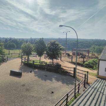
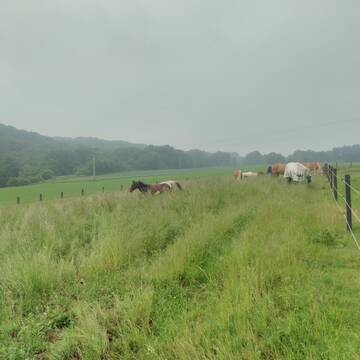
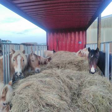
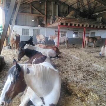
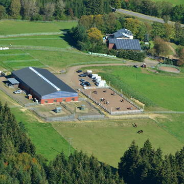
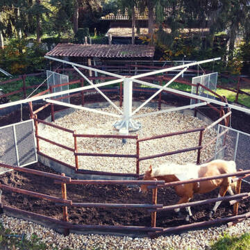
HIT Aktivstall Rosenhof
Mechernich
Aktivstall-Rosenhof
@Aktivstall-Rosenhof
Fahrstall, Kutschwagen
Freizeitstall
Vermieten
Hunde willkommen
Krankenbox
Allergikerstall
bedampftes/gewaschenes Heu
30 weitere...
S
Deprecated: Creation of dynamic property Zend_View_Helper_Ads::$adLink is deprecated in /var/www/stall-frei/htdocs/staging.stall-frei.de/library/Psf/View/Helper/Ads.php on line 108

Das Beste für die Hufe
Mechtersen
STALL-FREIde Marketing
@STALL-FREI-Marketing
Hufschmiede und Hufpfleger in Ihrer Nähe
Leider kein Vorschaubild
Leider kein Vorschaubild
Rentnerplatz für Ponywallach mit Familienans.160...
hellenthal
Leonards
@Leonards
Pflegepferd
Wanderreiten
Paddock
Pensions- und Gastboxen
Allergikerstall
Gnadenbrothof
Außenboxen
Paddock Trail
11 weitere...
B
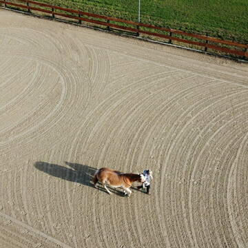
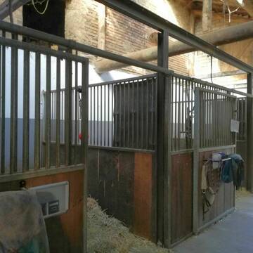
Reitanlage Hubertushof
Kall-Keldenich
Reitanlage-Hubertushof
@Reitanlage-Hubertushof
FN-Mitglied
Freizeitstall
Hunde willkommen
Longierzirkel/Roundpen
Hengsthaltung möglich
Außenbox mit Paddock
Innenbox
22 weitere...
P

Offenstall für Pferde
Hellenthal, Ramscheid
Beate-Roemer
@Beate-Roemer
VFD-Mitglied
Wanderreiten
Vermieten
Longierzirkel/Roundpen
Paddock
Außenbox mit Paddock
Außenboxen
14 weitere...
P


Hof Klein
Dahlem
Hof-Klein
@Hof-Klein
FN-Mitglied
Freizeitstall
Vermieten
Hunde willkommen
Krankenbox
Allergikerstall
Hufrehe geeignet
29 weitere...
P+


Pferdepension, Rentnerpferde willkommen
Blankenheim/Waldorf
Itzbacher-Hof
@Itzbacher-Hof
FN-Mitglied
Freizeitstall
Vermieten
Krankenbox
Paddock
Allergikerstall
Gnadenbrothof
24 weitere...
P+
Gestüt Quarter-B51 / Offenstallreitanlage
Dahlem
Christina-Schneider
@Christina-Schneider
Freizeitstall
Pferdeausbildung
Vermieten
Krankenbox
Longierzirkel/Roundpen
Gnadenbrothof
Zuchtstutenhaltung möglich
18 weitere...
P

Heu und Heulage verkaufen
Mechtersen
STALL-FREIde Marketing
@STALL-FREI-Marketing
Verkaufen Sie Ihr Heu und Ihre Heulage direkt an Reiter, Pferdeställe und Reitanlagen
Leider kein Vorschaubild
Leider kein Vorschaubild
Suche einen Beisteller im privaten Offenstall
Hellenthal
Brigitte Dockhorn - Hellenthal
@Brigitte-Oberschoembach
Hunde willkommen
Paddock
Gnadenbrothof
Offenstall
1 weitere...
B
Reitstall Schlaeger - Tomberger Mühle
Euskirchen
Reitstall-Schlaeger
@Reitstall-Schlaeger
FN-Mitglied
Freizeitstall
Vermieten
Führanlage
Hunde willkommen
Außenboxen
Innenbox
20 weitere...
S

Boxen frei
Blankenheim
Heinrichshof Blankenheim
@HeinrichshofBlankenheim
FN-Mitglied
Freizeitstall
Vermieten
Hunde willkommen
Krankenbox
bedampftes/gewaschenes Heu
28 weitere...
P
Deprecated: Creation of dynamic property Zend_View::$pageCount is deprecated in /var/www/stall-frei/htdocs/staging.stall-frei.de/library/vendor/shardj/zf1-future/library/Zend/View/Abstract.php on line 308
Deprecated: Creation of dynamic property Zend_View::$itemCountPerPage is deprecated in /var/www/stall-frei/htdocs/staging.stall-frei.de/library/vendor/shardj/zf1-future/library/Zend/View/Abstract.php on line 308
Deprecated: Creation of dynamic property Zend_View::$first is deprecated in /var/www/stall-frei/htdocs/staging.stall-frei.de/library/vendor/shardj/zf1-future/library/Zend/View/Abstract.php on line 308
Deprecated: Creation of dynamic property Zend_View::$current is deprecated in /var/www/stall-frei/htdocs/staging.stall-frei.de/library/vendor/shardj/zf1-future/library/Zend/View/Abstract.php on line 308
Deprecated: Creation of dynamic property Zend_View::$last is deprecated in /var/www/stall-frei/htdocs/staging.stall-frei.de/library/vendor/shardj/zf1-future/library/Zend/View/Abstract.php on line 308
Deprecated: Creation of dynamic property Zend_View::$next is deprecated in /var/www/stall-frei/htdocs/staging.stall-frei.de/library/vendor/shardj/zf1-future/library/Zend/View/Abstract.php on line 308
Deprecated: Creation of dynamic property Zend_View::$pagesInRange is deprecated in /var/www/stall-frei/htdocs/staging.stall-frei.de/library/vendor/shardj/zf1-future/library/Zend/View/Abstract.php on line 308
Deprecated: Creation of dynamic property Zend_View::$firstPageInRange is deprecated in /var/www/stall-frei/htdocs/staging.stall-frei.de/library/vendor/shardj/zf1-future/library/Zend/View/Abstract.php on line 308
Deprecated: Creation of dynamic property Zend_View::$lastPageInRange is deprecated in /var/www/stall-frei/htdocs/staging.stall-frei.de/library/vendor/shardj/zf1-future/library/Zend/View/Abstract.php on line 308
Deprecated: Creation of dynamic property Zend_View::$currentItemCount is deprecated in /var/www/stall-frei/htdocs/staging.stall-frei.de/library/vendor/shardj/zf1-future/library/Zend/View/Abstract.php on line 308
Deprecated: Creation of dynamic property Zend_View::$totalItemCount is deprecated in /var/www/stall-frei/htdocs/staging.stall-frei.de/library/vendor/shardj/zf1-future/library/Zend/View/Abstract.php on line 308
Deprecated: Creation of dynamic property Zend_View::$firstItemNumber is deprecated in /var/www/stall-frei/htdocs/staging.stall-frei.de/library/vendor/shardj/zf1-future/library/Zend/View/Abstract.php on line 308
Deprecated: Creation of dynamic property Zend_View::$lastItemNumber is deprecated in /var/www/stall-frei/htdocs/staging.stall-frei.de/library/vendor/shardj/zf1-future/library/Zend/View/Abstract.php on line 308
Deprecated: Creation of dynamic property Zend_View::$router is deprecated in /var/www/stall-frei/htdocs/staging.stall-frei.de/library/vendor/shardj/zf1-future/library/Zend/View/Abstract.php on line 308
Deprecated: Creation of dynamic property Zend_View::$urlParams is deprecated in /var/www/stall-frei/htdocs/staging.stall-frei.de/library/vendor/shardj/zf1-future/library/Zend/View/Abstract.php on line 308
Deprecated: Creation of dynamic property Zend_View::$showAds is deprecated in /var/www/stall-frei/htdocs/staging.stall-frei.de/library/vendor/shardj/zf1-future/library/Zend/View/Abstract.php on line 308
Deprecated: Creation of dynamic property Zend_View::$objectIds is deprecated in /var/www/stall-frei/htdocs/staging.stall-frei.de/library/vendor/shardj/zf1-future/library/Zend/View/Abstract.php on line 308
Deprecated: Creation of dynamic property Zend_View::$showNavbar is deprecated in /var/www/stall-frei/htdocs/staging.stall-frei.de/library/vendor/shardj/zf1-future/library/Zend/View/Abstract.php on line 308
Deprecated: Creation of dynamic property Zend_View::$showBreadcrumb is deprecated in /var/www/stall-frei/htdocs/staging.stall-frei.de/library/vendor/shardj/zf1-future/library/Zend/View/Abstract.php on line 308
Deprecated: Creation of dynamic property Zend_View::$showFooter is deprecated in /var/www/stall-frei/htdocs/staging.stall-frei.de/library/vendor/shardj/zf1-future/library/Zend/View/Abstract.php on line 308
Deprecated: Creation of dynamic property Zend_View::$showInternalAds is deprecated in /var/www/stall-frei/htdocs/staging.stall-frei.de/library/vendor/shardj/zf1-future/library/Zend/View/Abstract.php on line 308
Deprecated: Creation of dynamic property Zend_View::$blNoContent is deprecated in /var/www/stall-frei/htdocs/staging.stall-frei.de/library/vendor/shardj/zf1-future/library/Zend/View/Abstract.php on line 308
Deprecated: Creation of dynamic property Zend_View::$sMetaDesc is deprecated in /var/www/stall-frei/htdocs/staging.stall-frei.de/library/vendor/shardj/zf1-future/library/Zend/View/Abstract.php on line 308
Deprecated: Creation of dynamic property Zend_View::$useGmaps is deprecated in /var/www/stall-frei/htdocs/staging.stall-frei.de/library/vendor/shardj/zf1-future/library/Zend/View/Abstract.php on line 308
Deprecated: Creation of dynamic property Zend_View::$touches is deprecated in /var/www/stall-frei/htdocs/staging.stall-frei.de/library/vendor/shardj/zf1-future/library/Zend/View/Abstract.php on line 308
Deprecated: Creation of dynamic property Zend_View::$oProject is deprecated in /var/www/stall-frei/htdocs/staging.stall-frei.de/library/vendor/shardj/zf1-future/library/Zend/View/Abstract.php on line 308
Deprecated: Creation of dynamic property Zend_View::$pageHeadline is deprecated in /var/www/stall-frei/htdocs/staging.stall-frei.de/library/vendor/shardj/zf1-future/library/Zend/View/Abstract.php on line 308
Deprecated: Creation of dynamic property Zend_View::$disableLocationField is deprecated in /var/www/stall-frei/htdocs/staging.stall-frei.de/library/vendor/shardj/zf1-future/library/Zend/View/Abstract.php on line 308
Deprecated: Creation of dynamic property Zend_View::$isSearch is deprecated in /var/www/stall-frei/htdocs/staging.stall-frei.de/library/vendor/shardj/zf1-future/library/Zend/View/Abstract.php on line 308
Deprecated: Creation of dynamic property Zend_View::$pageTitle is deprecated in /var/www/stall-frei/htdocs/staging.stall-frei.de/library/vendor/shardj/zf1-future/library/Zend/View/Abstract.php on line 308
Deprecated: Creation of dynamic property Psf_Form_Element_Text::$class is deprecated in /var/www/stall-frei/htdocs/staging.stall-frei.de/library/vendor/shardj/zf1-future/library/Zend/Form/Element.php on line 874
Deprecated: Creation of dynamic property Psf_Form_Element_Text::$size is deprecated in /var/www/stall-frei/htdocs/staging.stall-frei.de/library/vendor/shardj/zf1-future/library/Zend/Form/Element.php on line 874
Deprecated: Creation of dynamic property Psf_Form_Element_Text::$placeholder is deprecated in /var/www/stall-frei/htdocs/staging.stall-frei.de/library/vendor/shardj/zf1-future/library/Zend/Form/Element.php on line 874
Deprecated: Creation of dynamic property Psf_Form_Element_Hidden::$class is deprecated in /var/www/stall-frei/htdocs/staging.stall-frei.de/library/vendor/shardj/zf1-future/library/Zend/Form/Element.php on line 874
Deprecated: Creation of dynamic property Psf_Form_Element_Hidden::$class is deprecated in /var/www/stall-frei/htdocs/staging.stall-frei.de/library/vendor/shardj/zf1-future/library/Zend/Form/Element.php on line 874
Deprecated: Creation of dynamic property Psf_Form_Element_Hidden::$class is deprecated in /var/www/stall-frei/htdocs/staging.stall-frei.de/library/vendor/shardj/zf1-future/library/Zend/Form/Element.php on line 874
Deprecated: Creation of dynamic property Psf_Form_Element_Hidden::$class is deprecated in /var/www/stall-frei/htdocs/staging.stall-frei.de/library/vendor/shardj/zf1-future/library/Zend/Form/Element.php on line 874
Deprecated: Creation of dynamic property Psf_Form_Element_Select::$class is deprecated in /var/www/stall-frei/htdocs/staging.stall-frei.de/library/vendor/shardj/zf1-future/library/Zend/Form/Element.php on line 874
Deprecated: Creation of dynamic property Psf_Form_Element_Select::$class is deprecated in /var/www/stall-frei/htdocs/staging.stall-frei.de/library/vendor/shardj/zf1-future/library/Zend/Form/Element.php on line 874
Deprecated: Creation of dynamic property Psf_Form_Element_Select::$class is deprecated in /var/www/stall-frei/htdocs/staging.stall-frei.de/library/vendor/shardj/zf1-future/library/Zend/Form/Element.php on line 874
Deprecated: Creation of dynamic property Psf_Form_Element_Select::$class is deprecated in /var/www/stall-frei/htdocs/staging.stall-frei.de/library/vendor/shardj/zf1-future/library/Zend/Form/Element.php on line 874
Deprecated: Creation of dynamic property Psf_Form_Element_Text::$class is deprecated in /var/www/stall-frei/htdocs/staging.stall-frei.de/library/vendor/shardj/zf1-future/library/Zend/Form/Element.php on line 874
Deprecated: Creation of dynamic property Psf_Form_Element_Checkbox::$label is deprecated in /var/www/stall-frei/htdocs/staging.stall-frei.de/library/vendor/shardj/zf1-future/library/Zend/Form/Element.php on line 874
Deprecated: Creation of dynamic property Zend_View::$sort is deprecated in /var/www/stall-frei/htdocs/staging.stall-frei.de/library/vendor/shardj/zf1-future/library/Zend/View/Abstract.php on line 308
Deprecated: Creation of dynamic property Zend_View::$searchLocation is deprecated in /var/www/stall-frei/htdocs/staging.stall-frei.de/library/vendor/shardj/zf1-future/library/Zend/View/Abstract.php on line 308
Deprecated: Creation of dynamic property Zend_View::$locationHint is deprecated in /var/www/stall-frei/htdocs/staging.stall-frei.de/library/vendor/shardj/zf1-future/library/Zend/View/Abstract.php on line 308
Psf_GeoCoder_Abstract::getLocation: Ingersberg Get Location CachedOrLive
Psf_GeoCoder_Abstract::getCachedOrLive: Ingersberg
Psf_GeoCoder_OpenCageData::makeApiRequest: response:
Array
(
[documentation] => https://opencagedata.com/api
[licenses] => Array
(
[0] => Array
(
[name] => see attribution guide
[url] => https://opencagedata.com/credits
)
)
[results] => Array
(
[0] => Array
(
[bounds] => Array
(
[northeast] => Array
(
[lat] => 50.5210944
[lng] => 6.5083521
)
[southwest] => Array
(
[lat] => 50.4810944
[lng] => 6.4683521
)
)
[components] => Array
(
[ISO_3166-1_alpha-2] => DE
[ISO_3166-1_alpha-3] => DEU
[ISO_3166-2] => Array
(
[0] => DE-NW
)
[_category] => place
[_normalized_city] => Hellenthal
[_type] => village
[city] => Hellenthal
[continent] => Europe
[country] => Deutschland
[country_code] => de
[county] => Kreis Euskirchen
[political_union] => European Union
[postcode] => 53937
[state] => Nordrhein-Westfalen
[state_code] => NW
[village] => Ingersberg
)
[confidence] => 7
[formatted] => 53937 Ingersberg, Deutschland
[geometry] => Array
(
[lat] => 50.5010944
[lng] => 6.4883521
)
)
[1] => Array
(
[bounds] => Array
(
[northeast] => Array
(
[lat] => 50.5012928
[lng] => 6.48879
)
[southwest] => Array
(
[lat] => 50.500881
[lng] => 6.4863861
)
)
[components] => Array
(
[ISO_3166-1_alpha-2] => DE
[ISO_3166-1_alpha-3] => DEU
[ISO_3166-2] => Array
(
[0] => DE-NW
)
[_category] => road
[_normalized_city] => Hellenthal
[_type] => road
[city] => Hellenthal
[continent] => Europe
[country] => Deutschland
[country_code] => de
[county] => Kreis Euskirchen
[hamlet] => Eichen
[political_union] => European Union
[postcode] => 53940
[road] => Ingersberg
[road_type] => tertiary
[state] => Nordrhein-Westfalen
[state_code] => NW
[village] => Ingersberg
)
[confidence] => 9
[formatted] => Ingersberg, 53940 Ingersberg, Deutschland
[geometry] => Array
(
[lat] => 50.5010034
[lng] => 6.4876032
)
)
[2] => Array
(
[components] => Array
(
[ISO_3166-1_alpha-2] => FR
[ISO_3166-1_alpha-3] => FRA
[ISO_3166-2] => Array
(
[0] => FR-GES
[1] => FR-6AE
[2] => FR-67
)
[_category] => road
[_normalized_city] => Andlau
[_type] => road
[city] => Andlau
[continent] => Europe
[country] => France
[country_code] => fr
[county] => Bas-Rhin
[local_authority] => Communauté de communes du Pays de Barr
[political_union] => European Union
[postcode] => 67140
[road] => Rue de l’Ungersberg
[state] => Grand Est
[state_code] => GES
)
[confidence] => 4
[formatted] => Rue de l’Ungersberg, 67140 Andlau, France
[geometry] => Array
(
[lat] => 48.39141
[lng] => 7.407355
)
)
[3] => Array
(
[components] => Array
(
[ISO_3166-1_alpha-2] => FR
[ISO_3166-1_alpha-3] => FRA
[ISO_3166-2] => Array
(
[0] => FR-GES
[1] => FR-6AE
[2] => FR-67
)
[_category] => road
[_normalized_city] => Dauendorf
[_type] => road
[city] => Dauendorf
[continent] => Europe
[country] => France
[country_code] => fr
[county] => Bas-Rhin
[local_authority] => Communauté d'agglomération de Haguenau
[political_union] => European Union
[postcode] => 67350
[road] => Chemin du Hungersberg
[state] => Grand Est
[state_code] => GES
)
[confidence] => 3
[formatted] => Chemin du Hungersberg, 67350 Dauendorf, France
[geometry] => Array
(
[lat] => 48.827844
[lng] => 7.647418
)
)
[4] => Array
(
[components] => Array
(
[ISO_3166-1_alpha-2] => FR
[ISO_3166-1_alpha-3] => FRA
[ISO_3166-2] => Array
(
[0] => FR-GES
[1] => FR-6AE
[2] => FR-67
)
[_category] => road
[_normalized_city] => Sélestat
[_type] => road
[city] => Sélestat
[continent] => Europe
[country] => France
[country_code] => fr
[county] => Bas-Rhin
[local_authority] => Communauté de communes de Sélestat
[political_union] => European Union
[postcode] => 67600
[road] => Rue de l’Ungersberg
[state] => Grand Est
[state_code] => GES
)
[confidence] => 3
[formatted] => Rue de l’Ungersberg, 67600 Sélestat, France
[geometry] => Array
(
[lat] => 48.268472
[lng] => 7.43679
)
)
[5] => Array
(
[components] => Array
(
[ISO_3166-1_alpha-2] => FR
[ISO_3166-1_alpha-3] => FRA
[ISO_3166-2] => Array
(
[0] => FR-GES
[1] => FR-6AE
[2] => FR-67
)
[_category] => road
[_normalized_city] => Albé
[_type] => road
[city] => Albé
[continent] => Europe
[country] => France
[country_code] => fr
[county] => Bas-Rhin
[local_authority] => Communauté de communes de la Vallée de Villé
[political_union] => European Union
[postcode] => 67220
[road] => Route de l’Ungersberg
[state] => Grand Est
[state_code] => GES
)
[confidence] => 3
[formatted] => Route de l’Ungersberg, 67220 Albé, France
[geometry] => Array
(
[lat] => 48.35472
[lng] => 7.351404
)
)
[6] => Array
(
[components] => Array
(
[ISO_3166-1_alpha-2] => FR
[ISO_3166-1_alpha-3] => FRA
[ISO_3166-2] => Array
(
[0] => FR-GES
[1] => FR-6AE
[2] => FR-67
)
[_category] => road
[_normalized_city] => Huttenheim
[_type] => road
[city] => Huttenheim
[continent] => Europe
[country] => France
[country_code] => fr
[county] => Bas-Rhin
[local_authority] => Communauté de communes du Canton d'Erstein
[political_union] => European Union
[postcode] => 67230
[road] => Rue de l’Ungersberg
[state] => Grand Est
[state_code] => GES
)
[confidence] => 3
[formatted] => Rue de l’Ungersberg, 67230 Huttenheim, France
[geometry] => Array
(
[lat] => 48.359394
[lng] => 7.574711
)
)
[7] => Array
(
[components] => Array
(
[ISO_3166-1_alpha-2] => FR
[ISO_3166-1_alpha-3] => FRA
[ISO_3166-2] => Array
(
[0] => FR-GES
[1] => FR-6AE
[2] => FR-67
)
[_category] => road
[_normalized_city] => Thanvillé
[_type] => road
[city] => Thanvillé
[continent] => Europe
[country] => France
[country_code] => fr
[county] => Bas-Rhin
[local_authority] => Communauté de communes de la Vallée de Villé
[political_union] => European Union
[postcode] => 67220
[road] => Rue de l'Ungersberg
[state] => Grand Est
[state_code] => GES
)
[confidence] => 3
[formatted] => Rue de l'Ungersberg, 67220 Thanvillé, France
[geometry] => Array
(
[lat] => 48.323942
[lng] => 7.350404
)
)
[8] => Array
(
[components] => Array
(
[ISO_3166-1_alpha-2] => FR
[ISO_3166-1_alpha-3] => FRA
[ISO_3166-2] => Array
(
[0] => FR-GES
[1] => FR-6AE
[2] => FR-67
)
[_category] => road
[_normalized_city] => Blienschwiller
[_type] => road
[city] => Blienschwiller
[continent] => Europe
[country] => France
[country_code] => fr
[county] => Bas-Rhin
[local_authority] => Communauté de communes du Pays de Barr
[political_union] => European Union
[postcode] => 67650
[road] => Rue de l'Ungersberg
[state] => Grand Est
[state_code] => GES
)
[confidence] => 3
[formatted] => Rue de l'Ungersberg, 67650 Blienschwiller, France
[geometry] => Array
(
[lat] => 48.342244
[lng] => 7.416453
)
)
[9] => Array
(
[components] => Array
(
[ISO_3166-1_alpha-2] => FR
[ISO_3166-1_alpha-3] => FRA
[ISO_3166-2] => Array
(
[0] => FR-GES
[1] => FR-6AE
[2] => FR-67
)
[_category] => road
[_normalized_city] => Neuve-Église
[_type] => road
[city] => Neuve-Église
[continent] => Europe
[country] => France
[country_code] => fr
[county] => Bas-Rhin
[local_authority] => Communauté de communes de la Vallée de Villé
[political_union] => European Union
[postcode] => 67220
[road] => Rue de l’Ungersberg
[state] => Grand Est
[state_code] => GES
)
[confidence] => 3
[formatted] => Rue de l’Ungersberg, 67220 Neuve-Église, France
[geometry] => Array
(
[lat] => 48.338483
[lng] => 7.315789
)
)
)
[status] => Array
(
[code] => 200
[message] => OK
)
[stay_informed] => Array
(
[blog] => https://blog.opencagedata.com
[mastodon] => https://en.osm.town/@opencage
)
[thanks] => For using an OpenCage API
[timestamp] => Array
(
[created_http] => Sat, 07 Feb 2026 12:16:56 GMT
[created_unix] => 1770466616
)
[total_results] => 10
)
Psf_GeoCoder_Abstract::convertLocationResult
{"documentation":"https:\/\/opencagedata.com\/api","licenses":[{"name":"see attribution guide","url":"https:\/\/opencagedata.com\/credits"}],"results":[{"bounds":{"northeast":{"lat":50.5210944,"lng":6.5083521},"southwest":{"lat":50.4810944,"lng":6.4683521}},"components":{"ISO_3166-1_alpha-2":"DE","ISO_3166-1_alpha-3":"DEU","ISO_3166-2":["DE-NW"],"_category":"place","_normalized_city":"Hellenthal","_type":"village","city":"Hellenthal","continent":"Europe","country":"Deutschland","country_code":"de","county":"Kreis Euskirchen","political_union":"European Union","postcode":"53937","state":"Nordrhein-Westfalen","state_code":"NW","village":"Ingersberg"},"confidence":7,"formatted":"53937 Ingersberg, Deutschland","geometry":{"lat":50.5010944,"lng":6.4883521}},{"bounds":{"northeast":{"lat":50.5012928,"lng":6.48879},"southwest":{"lat":50.500881,"lng":6.4863861}},"components":{"ISO_3166-1_alpha-2":"DE","ISO_3166-1_alpha-3":"DEU","ISO_3166-2":["DE-NW"],"_category":"road","_normalized_city":"Hellenthal","_type":"road","city":"Hellenthal","continent":"Europe","country":"Deutschland","country_code":"de","county":"Kreis Euskirchen","hamlet":"Eichen","political_union":"European Union","postcode":"53940","road":"Ingersberg","road_type":"tertiary","state":"Nordrhein-Westfalen","state_code":"NW","village":"Ingersberg"},"confidence":9,"formatted":"Ingersberg, 53940 Ingersberg, Deutschland","geometry":{"lat":50.5010034,"lng":6.4876032}},{"components":{"ISO_3166-1_alpha-2":"FR","ISO_3166-1_alpha-3":"FRA","ISO_3166-2":["FR-GES","FR-6AE","FR-67"],"_category":"road","_normalized_city":"Andlau","_type":"road","city":"Andlau","continent":"Europe","country":"France","country_code":"fr","county":"Bas-Rhin","local_authority":"Communaut\u00e9 de communes du Pays de Barr","political_union":"European Union","postcode":"67140","road":"Rue de l\u2019Ungersberg","state":"Grand Est","state_code":"GES"},"confidence":4,"formatted":"Rue de l\u2019Ungersberg, 67140 Andlau, France","geometry":{"lat":48.39141,"lng":7.407355}},{"components":{"ISO_3166-1_alpha-2":"FR","ISO_3166-1_alpha-3":"FRA","ISO_3166-2":["FR-GES","FR-6AE","FR-67"],"_category":"road","_normalized_city":"Dauendorf","_type":"road","city":"Dauendorf","continent":"Europe","country":"France","country_code":"fr","county":"Bas-Rhin","local_authority":"Communaut\u00e9 d'agglom\u00e9ration de Haguenau","political_union":"European Union","postcode":"67350","road":"Chemin du Hungersberg","state":"Grand Est","state_code":"GES"},"confidence":3,"formatted":"Chemin du Hungersberg, 67350 Dauendorf, France","geometry":{"lat":48.827844,"lng":7.647418}},{"components":{"ISO_3166-1_alpha-2":"FR","ISO_3166-1_alpha-3":"FRA","ISO_3166-2":["FR-GES","FR-6AE","FR-67"],"_category":"road","_normalized_city":"S\u00e9lestat","_type":"road","city":"S\u00e9lestat","continent":"Europe","country":"France","country_code":"fr","county":"Bas-Rhin","local_authority":"Communaut\u00e9 de communes de S\u00e9lestat","political_union":"European Union","postcode":"67600","road":"Rue de l\u2019Ungersberg","state":"Grand Est","state_code":"GES"},"confidence":3,"formatted":"Rue de l\u2019Ungersberg, 67600 S\u00e9lestat, France","geometry":{"lat":48.268472,"lng":7.43679}},{"components":{"ISO_3166-1_alpha-2":"FR","ISO_3166-1_alpha-3":"FRA","ISO_3166-2":["FR-GES","FR-6AE","FR-67"],"_category":"road","_normalized_city":"Alb\u00e9","_type":"road","city":"Alb\u00e9","continent":"Europe","country":"France","country_code":"fr","county":"Bas-Rhin","local_authority":"Communaut\u00e9 de communes de la Vall\u00e9e de Vill\u00e9","political_union":"European Union","postcode":"67220","road":"Route de l\u2019Ungersberg","state":"Grand Est","state_code":"GES"},"confidence":3,"formatted":"Route de l\u2019Ungersberg, 67220 Alb\u00e9, France","geometry":{"lat":48.35472,"lng":7.351404}},{"components":{"ISO_3166-1_alpha-2":"FR","ISO_3166-1_alpha-3":"FRA","ISO_3166-2":["FR-GES","FR-6AE","FR-67"],"_category":"road","_normalized_city":"Huttenheim","_type":"road","city":"Huttenheim","continent":"Europe","country":"France","country_code":"fr","county":"Bas-Rhin","local_authority":"Communaut\u00e9 de communes du Canton d'Erstein","political_union":"European Union","postcode":"67230","road":"Rue de l\u2019Ungersberg","state":"Grand Est","state_code":"GES"},"confidence":3,"formatted":"Rue de l\u2019Ungersberg, 67230 Huttenheim, France","geometry":{"lat":48.359394,"lng":7.574711}},{"components":{"ISO_3166-1_alpha-2":"FR","ISO_3166-1_alpha-3":"FRA","ISO_3166-2":["FR-GES","FR-6AE","FR-67"],"_category":"road","_normalized_city":"Thanvill\u00e9","_type":"road","city":"Thanvill\u00e9","continent":"Europe","country":"France","country_code":"fr","county":"Bas-Rhin","local_authority":"Communaut\u00e9 de communes de la Vall\u00e9e de Vill\u00e9","political_union":"European Union","postcode":"67220","road":"Rue de l'Ungersberg","state":"Grand Est","state_code":"GES"},"confidence":3,"formatted":"Rue de l'Ungersberg, 67220 Thanvill\u00e9, France","geometry":{"lat":48.323942,"lng":7.350404}},{"components":{"ISO_3166-1_alpha-2":"FR","ISO_3166-1_alpha-3":"FRA","ISO_3166-2":["FR-GES","FR-6AE","FR-67"],"_category":"road","_normalized_city":"Blienschwiller","_type":"road","city":"Blienschwiller","continent":"Europe","country":"France","country_code":"fr","county":"Bas-Rhin","local_authority":"Communaut\u00e9 de communes du Pays de Barr","political_union":"European Union","postcode":"67650","road":"Rue de l'Ungersberg","state":"Grand Est","state_code":"GES"},"confidence":3,"formatted":"Rue de l'Ungersberg, 67650 Blienschwiller, France","geometry":{"lat":48.342244,"lng":7.416453}},{"components":{"ISO_3166-1_alpha-2":"FR","ISO_3166-1_alpha-3":"FRA","ISO_3166-2":["FR-GES","FR-6AE","FR-67"],"_category":"road","_normalized_city":"Neuve-\u00c9glise","_type":"road","city":"Neuve-\u00c9glise","continent":"Europe","country":"France","country_code":"fr","county":"Bas-Rhin","local_authority":"Communaut\u00e9 de communes de la Vall\u00e9e de Vill\u00e9","political_union":"European Union","postcode":"67220","road":"Rue de l\u2019Ungersberg","state":"Grand Est","state_code":"GES"},"confidence":3,"formatted":"Rue de l\u2019Ungersberg, 67220 Neuve-\u00c9glise, France","geometry":{"lat":48.338483,"lng":7.315789}}],"status":{"code":200,"message":"OK"},"stay_informed":{"blog":"https:\/\/blog.opencagedata.com","mastodon":"https:\/\/en.osm.town\/@opencage"},"thanks":"For using an OpenCage API","timestamp":{"created_http":"Sat, 07 Feb 2026 12:16:56 GMT","created_unix":1770466616},"total_results":10}Array
(
[0] => stdClass Object
(
[bounds] => stdClass Object
(
[northeast] => stdClass Object
(
[lat] => 50.5210944
[lng] => 6.5083521
)
[southwest] => stdClass Object
(
[lat] => 50.4810944
[lng] => 6.4683521
)
)
[components] => stdClass Object
(
[ISO_3166-1_alpha-2] => DE
[ISO_3166-1_alpha-3] => DEU
[ISO_3166-2] => Array
(
[0] => DE-NW
)
[_category] => place
[_normalized_city] => Hellenthal
[_type] => village
[city] => Hellenthal
[continent] => Europe
[country] => Deutschland
[country_code] => de
[county] => Kreis Euskirchen
[political_union] => European Union
[postcode] => 53937
[state] => Nordrhein-Westfalen
[state_code] => NW
[village] => Ingersberg
)
[confidence] => 7
[formatted] => 53937 Ingersberg, Deutschland
[geometry] => stdClass Object
(
[lat] => 50.5010944
[lng] => 6.4883521
)
)
[1] => stdClass Object
(
[bounds] => stdClass Object
(
[northeast] => stdClass Object
(
[lat] => 50.5012928
[lng] => 6.48879
)
[southwest] => stdClass Object
(
[lat] => 50.500881
[lng] => 6.4863861
)
)
[components] => stdClass Object
(
[ISO_3166-1_alpha-2] => DE
[ISO_3166-1_alpha-3] => DEU
[ISO_3166-2] => Array
(
[0] => DE-NW
)
[_category] => road
[_normalized_city] => Hellenthal
[_type] => road
[city] => Hellenthal
[continent] => Europe
[country] => Deutschland
[country_code] => de
[county] => Kreis Euskirchen
[hamlet] => Eichen
[political_union] => European Union
[postcode] => 53940
[road] => Ingersberg
[road_type] => tertiary
[state] => Nordrhein-Westfalen
[state_code] => NW
[village] => Ingersberg
)
[confidence] => 9
[formatted] => Ingersberg, 53940 Ingersberg, Deutschland
[geometry] => stdClass Object
(
[lat] => 50.5010034
[lng] => 6.4876032
)
)
[2] => stdClass Object
(
[components] => stdClass Object
(
[ISO_3166-1_alpha-2] => FR
[ISO_3166-1_alpha-3] => FRA
[ISO_3166-2] => Array
(
[0] => FR-GES
[1] => FR-6AE
[2] => FR-67
)
[_category] => road
[_normalized_city] => Andlau
[_type] => road
[city] => Andlau
[continent] => Europe
[country] => France
[country_code] => fr
[county] => Bas-Rhin
[local_authority] => Communauté de communes du Pays de Barr
[political_union] => European Union
[postcode] => 67140
[road] => Rue de l’Ungersberg
[state] => Grand Est
[state_code] => GES
)
[confidence] => 4
[formatted] => Rue de l’Ungersberg, 67140 Andlau, France
[geometry] => stdClass Object
(
[lat] => 48.39141
[lng] => 7.407355
)
)
[3] => stdClass Object
(
[components] => stdClass Object
(
[ISO_3166-1_alpha-2] => FR
[ISO_3166-1_alpha-3] => FRA
[ISO_3166-2] => Array
(
[0] => FR-GES
[1] => FR-6AE
[2] => FR-67
)
[_category] => road
[_normalized_city] => Dauendorf
[_type] => road
[city] => Dauendorf
[continent] => Europe
[country] => France
[country_code] => fr
[county] => Bas-Rhin
[local_authority] => Communauté d'agglomération de Haguenau
[political_union] => European Union
[postcode] => 67350
[road] => Chemin du Hungersberg
[state] => Grand Est
[state_code] => GES
)
[confidence] => 3
[formatted] => Chemin du Hungersberg, 67350 Dauendorf, France
[geometry] => stdClass Object
(
[lat] => 48.827844
[lng] => 7.647418
)
)
[4] => stdClass Object
(
[components] => stdClass Object
(
[ISO_3166-1_alpha-2] => FR
[ISO_3166-1_alpha-3] => FRA
[ISO_3166-2] => Array
(
[0] => FR-GES
[1] => FR-6AE
[2] => FR-67
)
[_category] => road
[_normalized_city] => Sélestat
[_type] => road
[city] => Sélestat
[continent] => Europe
[country] => France
[country_code] => fr
[county] => Bas-Rhin
[local_authority] => Communauté de communes de Sélestat
[political_union] => European Union
[postcode] => 67600
[road] => Rue de l’Ungersberg
[state] => Grand Est
[state_code] => GES
)
[confidence] => 3
[formatted] => Rue de l’Ungersberg, 67600 Sélestat, France
[geometry] => stdClass Object
(
[lat] => 48.268472
[lng] => 7.43679
)
)
[5] => stdClass Object
(
[components] => stdClass Object
(
[ISO_3166-1_alpha-2] => FR
[ISO_3166-1_alpha-3] => FRA
[ISO_3166-2] => Array
(
[0] => FR-GES
[1] => FR-6AE
[2] => FR-67
)
[_category] => road
[_normalized_city] => Albé
[_type] => road
[city] => Albé
[continent] => Europe
[country] => France
[country_code] => fr
[county] => Bas-Rhin
[local_authority] => Communauté de communes de la Vallée de Villé
[political_union] => European Union
[postcode] => 67220
[road] => Route de l’Ungersberg
[state] => Grand Est
[state_code] => GES
)
[confidence] => 3
[formatted] => Route de l’Ungersberg, 67220 Albé, France
[geometry] => stdClass Object
(
[lat] => 48.35472
[lng] => 7.351404
)
)
[6] => stdClass Object
(
[components] => stdClass Object
(
[ISO_3166-1_alpha-2] => FR
[ISO_3166-1_alpha-3] => FRA
[ISO_3166-2] => Array
(
[0] => FR-GES
[1] => FR-6AE
[2] => FR-67
)
[_category] => road
[_normalized_city] => Huttenheim
[_type] => road
[city] => Huttenheim
[continent] => Europe
[country] => France
[country_code] => fr
[county] => Bas-Rhin
[local_authority] => Communauté de communes du Canton d'Erstein
[political_union] => European Union
[postcode] => 67230
[road] => Rue de l’Ungersberg
[state] => Grand Est
[state_code] => GES
)
[confidence] => 3
[formatted] => Rue de l’Ungersberg, 67230 Huttenheim, France
[geometry] => stdClass Object
(
[lat] => 48.359394
[lng] => 7.574711
)
)
[7] => stdClass Object
(
[components] => stdClass Object
(
[ISO_3166-1_alpha-2] => FR
[ISO_3166-1_alpha-3] => FRA
[ISO_3166-2] => Array
(
[0] => FR-GES
[1] => FR-6AE
[2] => FR-67
)
[_category] => road
[_normalized_city] => Thanvillé
[_type] => road
[city] => Thanvillé
[continent] => Europe
[country] => France
[country_code] => fr
[county] => Bas-Rhin
[local_authority] => Communauté de communes de la Vallée de Villé
[political_union] => European Union
[postcode] => 67220
[road] => Rue de l'Ungersberg
[state] => Grand Est
[state_code] => GES
)
[confidence] => 3
[formatted] => Rue de l'Ungersberg, 67220 Thanvillé, France
[geometry] => stdClass Object
(
[lat] => 48.323942
[lng] => 7.350404
)
)
[8] => stdClass Object
(
[components] => stdClass Object
(
[ISO_3166-1_alpha-2] => FR
[ISO_3166-1_alpha-3] => FRA
[ISO_3166-2] => Array
(
[0] => FR-GES
[1] => FR-6AE
[2] => FR-67
)
[_category] => road
[_normalized_city] => Blienschwiller
[_type] => road
[city] => Blienschwiller
[continent] => Europe
[country] => France
[country_code] => fr
[county] => Bas-Rhin
[local_authority] => Communauté de communes du Pays de Barr
[political_union] => European Union
[postcode] => 67650
[road] => Rue de l'Ungersberg
[state] => Grand Est
[state_code] => GES
)
[confidence] => 3
[formatted] => Rue de l'Ungersberg, 67650 Blienschwiller, France
[geometry] => stdClass Object
(
[lat] => 48.342244
[lng] => 7.416453
)
)
[9] => stdClass Object
(
[components] => stdClass Object
(
[ISO_3166-1_alpha-2] => FR
[ISO_3166-1_alpha-3] => FRA
[ISO_3166-2] => Array
(
[0] => FR-GES
[1] => FR-6AE
[2] => FR-67
)
[_category] => road
[_normalized_city] => Neuve-Église
[_type] => road
[city] => Neuve-Église
[continent] => Europe
[country] => France
[country_code] => fr
[county] => Bas-Rhin
[local_authority] => Communauté de communes de la Vallée de Villé
[political_union] => European Union
[postcode] => 67220
[road] => Rue de l’Ungersberg
[state] => Grand Est
[state_code] => GES
)
[confidence] => 3
[formatted] => Rue de l’Ungersberg, 67220 Neuve-Église, France
[geometry] => stdClass Object
(
[lat] => 48.338483
[lng] => 7.315789
)
)
)
Psf_GeoCoder_OpenCageData::getKeyMap: 0
stdClass Object
(
    [bounds] => stdClass Object
        (
            [northeast] => stdClass Object
                (
                    [lat] => 50.5210944
                    [lng] => 6.5083521
                )

            [southwest] => stdClass Object
                (
                    [lat] => 50.4810944
                    [lng] => 6.4683521
                )

        )

    [components] => stdClass Object
        (
            [ISO_3166-1_alpha-2] => DE
            [ISO_3166-1_alpha-3] => DEU
            [ISO_3166-2] => Array
                (
                    [0] => DE-NW
                )

            [_category] => place
            [_normalized_city] => Hellenthal
            [_type] => village
            [city] => Hellenthal
            [continent] => Europe
            [country] => Deutschland
            [country_code] => de
            [county] => Kreis Euskirchen
            [political_union] => European Union
            [postcode] => 53937
            [state] => Nordrhein-Westfalen
            [state_code] => NW
            [village] => Ingersberg
        )

    [confidence] => 7
    [formatted] => 53937 Ingersberg, Deutschland
    [geometry] => stdClass Object
        (
            [lat] => 50.5010944
            [lng] => 6.4883521
        )

)
Psf_GeoCoder_OpenCageData::getCounty: Euskirchen
Psf_GeoCoder_OpenCageData::addMissingData REFETCH!
Array
(
    [address] => 53937 Ingersberg, Deutschland
    [type] => village
    [street] =>
    [city] => Ingersberg
    [county] => Euskirchen
    [state] => Nordrhein-Westfalen
    [zip] => 53937
    [country] => Deutschland
    [suburb] =>
    [countrycode] => de
    [latitude] => 50.5010944
    [longitude] => 6.4883521
    [accuracy] => 1
    [confidence] => 7
    [bounds] => stdClass Object
        (
            [northeast] => stdClass Object
                (
                    [lat] => 50.5210944
                    [lng] => 6.5083521
                )

            [southwest] => stdClass Object
                (
                    [lat] => 50.4810944
                    [lng] => 6.4683521
                )

        )

)
reformat!
Array
(
    [address] => 53937 Ingersberg, Deutschland
    [type] => village
    [street] =>
    [city] => Ingersberg
    [county] => Euskirchen
    [state] => Nordrhein-Westfalen
    [zip] => 53937
    [country] => Deutschland
    [suburb] =>
    [countrycode] => de
    [latitude] => 50.5010944
    [longitude] => 6.4883521
    [accuracy] => 1
    [confidence] => 7
    [bounds] => stdClass Object
        (
            [northeast] => stdClass Object
                (
                    [lat] => 50.5210944
                    [lng] => 6.5083521
                )

            [southwest] => stdClass Object
                (
                    [lat] => 50.4810944
                    [lng] => 6.4683521
                )

        )

    [place] => 53937 Ingersberg, Nordrhein-Westfalen
    [hash] => a2fff04ead4aae54e9878d276b89f498
)
Psf_GeoCoder_OpenCageData::getKeyMap: 1
stdClass Object
(
    [bounds] => stdClass Object
        (
            [northeast] => stdClass Object
                (
                    [lat] => 50.5012928
                    [lng] => 6.48879
                )

            [southwest] => stdClass Object
                (
                    [lat] => 50.500881
                    [lng] => 6.4863861
                )

        )

    [components] => stdClass Object
        (
            [ISO_3166-1_alpha-2] => DE
            [ISO_3166-1_alpha-3] => DEU
            [ISO_3166-2] => Array
                (
                    [0] => DE-NW
                )

            [_category] => road
            [_normalized_city] => Hellenthal
            [_type] => road
            [city] => Hellenthal
            [continent] => Europe
            [country] => Deutschland
            [country_code] => de
            [county] => Kreis Euskirchen
            [hamlet] => Eichen
            [political_union] => European Union
            [postcode] => 53940
            [road] => Ingersberg
            [road_type] => tertiary
            [state] => Nordrhein-Westfalen
            [state_code] => NW
            [village] => Ingersberg
        )

    [confidence] => 9
    [formatted] => Ingersberg, 53940 Ingersberg, Deutschland
    [geometry] => stdClass Object
        (
            [lat] => 50.5010034
            [lng] => 6.4876032
        )

)
Psf_GeoCoder_OpenCageData::getCounty: Euskirchen
Psf_GeoCoder_OpenCageData::addMissingData REFETCH!
Array
(
    [address] => Ingersberg, 53940 Ingersberg, Deutschland
    [type] => road
    [street] => Ingersberg
    [city] => Ingersberg
    [county] => Euskirchen
    [state] => Nordrhein-Westfalen
    [zip] => 53940
    [country] => Deutschland
    [suburb] =>
    [countrycode] => de
    [latitude] => 50.5010034
    [longitude] => 6.4876032
    [accuracy] => 1
    [confidence] => 9
    [bounds] => stdClass Object
        (
            [northeast] => stdClass Object
                (
                    [lat] => 50.5012928
                    [lng] => 6.48879
                )

            [southwest] => stdClass Object
                (
                    [lat] => 50.500881
                    [lng] => 6.4863861
                )

        )

)
reformat!
Array
(
    [address] => Ingersberg, 53940 Ingersberg, Deutschland
    [type] => road
    [street] => Ingersberg
    [city] => Ingersberg
    [county] => Euskirchen
    [state] => Nordrhein-Westfalen
    [zip] => 53940
    [country] => Deutschland
    [suburb] =>
    [countrycode] => de
    [latitude] => 50.5010034
    [longitude] => 6.4876032
    [accuracy] => 1
    [confidence] => 9
    [bounds] => stdClass Object
        (
            [northeast] => stdClass Object
                (
                    [lat] => 50.5012928
                    [lng] => 6.48879
                )

            [southwest] => stdClass Object
                (
                    [lat] => 50.500881
                    [lng] => 6.4863861
                )

        )

    [place] => Ingersberg, 53940 Ingersberg, Nordrhein-Westfalen
    [hash] => 27ce7935bdbc77f9194fbf5fb27b4801
)
Psf_GeoCoder_OpenCageData::getKeyMap: 2
stdClass Object
(
    [components] => stdClass Object
        (
            [ISO_3166-1_alpha-2] => FR
            [ISO_3166-1_alpha-3] => FRA
            [ISO_3166-2] => Array
                (
                    [0] => FR-GES
                    [1] => FR-6AE
                    [2] => FR-67
                )

            [_category] => road
            [_normalized_city] => Andlau
            [_type] => road
            [city] => Andlau
            [continent] => Europe
            [country] => France
            [country_code] => fr
            [county] => Bas-Rhin
            [local_authority] => Communauté de communes du Pays de Barr
            [political_union] => European Union
            [postcode] => 67140
            [road] => Rue de l’Ungersberg
            [state] => Grand Est
            [state_code] => GES
        )

    [confidence] => 4
    [formatted] => Rue de l’Ungersberg, 67140 Andlau, France
    [geometry] => stdClass Object
        (
            [lat] => 48.39141
            [lng] => 7.407355
        )

)
Psf_GeoCoder_OpenCageData::getCounty: Bas-Rhin
Psf_GeoCoder_OpenCageData::addMissingData REFETCH!
Array
(
    [address] => Rue de l’Ungersberg, 67140 Andlau, France
    [type] => road
    [street] => Rue de l’Ungersberg
    [city] => Andlau
    [county] => Bas-Rhin
    [state] => Grand Est
    [zip] => 67140
    [country] => France
    [suburb] =>
    [countrycode] => fr
    [latitude] => 48.39141
    [longitude] => 7.407355
    [accuracy] => 1
    [confidence] => 4
    [bounds] =>
)
reformat!
Array
(
    [address] => Rue de l’Ungersberg, 67140 Andlau, France
    [type] => road
    [street] => Rue de l’Ungersberg
    [city] => Andlau
    [county] => Bas-Rhin
    [state] => Grand Est
    [zip] => 67140
    [country] => France
    [suburb] =>
    [countrycode] => fr
    [latitude] => 48.39141
    [longitude] => 7.407355
    [accuracy] => 1
    [confidence] => 4
    [bounds] =>
    [place] => Rue de l’Ungersberg, 67140 Andlau, Grand Est
    [hash] => ecdb80326a92f6cb88cec2e662c13724
)
Psf_GeoCoder_OpenCageData::getKeyMap: 3
stdClass Object
(
    [components] => stdClass Object
        (
            [ISO_3166-1_alpha-2] => FR
            [ISO_3166-1_alpha-3] => FRA
            [ISO_3166-2] => Array
                (
                    [0] => FR-GES
                    [1] => FR-6AE
                    [2] => FR-67
                )

            [_category] => road
            [_normalized_city] => Dauendorf
            [_type] => road
            [city] => Dauendorf
            [continent] => Europe
            [country] => France
            [country_code] => fr
            [county] => Bas-Rhin
            [local_authority] => Communauté d'agglomération de Haguenau
            [political_union] => European Union
            [postcode] => 67350
            [road] => Chemin du Hungersberg
            [state] => Grand Est
            [state_code] => GES
        )

    [confidence] => 3
    [formatted] => Chemin du Hungersberg, 67350 Dauendorf, France
    [geometry] => stdClass Object
        (
            [lat] => 48.827844
            [lng] => 7.647418
        )

)
Psf_GeoCoder_OpenCageData::getCounty: Bas-Rhin
Psf_GeoCoder_OpenCageData::addMissingData REFETCH!
Array
(
    [address] => Chemin du Hungersberg, 67350 Dauendorf, France
    [type] => road
    [street] => Chemin du Hungersberg
    [city] => Dauendorf
    [county] => Bas-Rhin
    [state] => Grand Est
    [zip] => 67350
    [country] => France
    [suburb] =>
    [countrycode] => fr
    [latitude] => 48.827844
    [longitude] => 7.647418
    [accuracy] => 1
    [confidence] => 3
    [bounds] =>
)
reformat!
Array
(
    [address] => Chemin du Hungersberg, 67350 Dauendorf, France
    [type] => road
    [street] => Chemin du Hungersberg
    [city] => Dauendorf
    [county] => Bas-Rhin
    [state] => Grand Est
    [zip] => 67350
    [country] => France
    [suburb] =>
    [countrycode] => fr
    [latitude] => 48.827844
    [longitude] => 7.647418
    [accuracy] => 1
    [confidence] => 3
    [bounds] =>
    [place] => Chemin du Hungersberg, 67350 Dauendorf, Grand Est
    [hash] => 3c46d9f2d70e2089cf2ca1584c2af582
)
Psf_GeoCoder_OpenCageData::getKeyMap: 4
stdClass Object
(
    [components] => stdClass Object
        (
            [ISO_3166-1_alpha-2] => FR
            [ISO_3166-1_alpha-3] => FRA
            [ISO_3166-2] => Array
                (
                    [0] => FR-GES
                    [1] => FR-6AE
                    [2] => FR-67
                )

            [_category] => road
            [_normalized_city] => Sélestat
            [_type] => road
            [city] => Sélestat
            [continent] => Europe
            [country] => France
            [country_code] => fr
            [county] => Bas-Rhin
            [local_authority] => Communauté de communes de Sélestat
            [political_union] => European Union
            [postcode] => 67600
            [road] => Rue de l’Ungersberg
            [state] => Grand Est
            [state_code] => GES
        )

    [confidence] => 3
    [formatted] => Rue de l’Ungersberg, 67600 Sélestat, France
    [geometry] => stdClass Object
        (
            [lat] => 48.268472
            [lng] => 7.43679
        )

)
Psf_GeoCoder_OpenCageData::getCounty: Bas-Rhin
Psf_GeoCoder_OpenCageData::addMissingData REFETCH!
Array
(
    [address] => Rue de l’Ungersberg, 67600 Sélestat, France
    [type] => road
    [street] => Rue de l’Ungersberg
    [city] => Sélestat
    [county] => Bas-Rhin
    [state] => Grand Est
    [zip] => 67600
    [country] => France
    [suburb] =>
    [countrycode] => fr
    [latitude] => 48.268472
    [longitude] => 7.43679
    [accuracy] => 1
    [confidence] => 3
    [bounds] =>
)
reformat!
Array
(
    [address] => Rue de l’Ungersberg, 67600 Sélestat, France
    [type] => road
    [street] => Rue de l’Ungersberg
    [city] => Sélestat
    [county] => Bas-Rhin
    [state] => Grand Est
    [zip] => 67600
    [country] => France
    [suburb] =>
    [countrycode] => fr
    [latitude] => 48.268472
    [longitude] => 7.43679
    [accuracy] => 1
    [confidence] => 3
    [bounds] =>
    [place] => Rue de l’Ungersberg, 67600 Sélestat, Grand Est
    [hash] => 048461b1c14b2b59d7cc792d773f0ad7
)
Psf_GeoCoder_OpenCageData::getKeyMap: 5
stdClass Object
(
    [components] => stdClass Object
        (
            [ISO_3166-1_alpha-2] => FR
            [ISO_3166-1_alpha-3] => FRA
            [ISO_3166-2] => Array
                (
                    [0] => FR-GES
                    [1] => FR-6AE
                    [2] => FR-67
                )

            [_category] => road
            [_normalized_city] => Albé
            [_type] => road
            [city] => Albé
            [continent] => Europe
            [country] => France
            [country_code] => fr
            [county] => Bas-Rhin
            [local_authority] => Communauté de communes de la Vallée de Villé
            [political_union] => European Union
            [postcode] => 67220
            [road] => Route de l’Ungersberg
            [state] => Grand Est
            [state_code] => GES
        )

    [confidence] => 3
    [formatted] => Route de l’Ungersberg, 67220 Albé, France
    [geometry] => stdClass Object
        (
            [lat] => 48.35472
            [lng] => 7.351404
        )

)
Psf_GeoCoder_OpenCageData::getCounty: Bas-Rhin
Psf_GeoCoder_OpenCageData::addMissingData REFETCH!
Array
(
    [address] => Route de l’Ungersberg, 67220 Albé, France
    [type] => road
    [street] => Route de l’Ungersberg
    [city] => Albé
    [county] => Bas-Rhin
    [state] => Grand Est
    [zip] => 67220
    [country] => France
    [suburb] =>
    [countrycode] => fr
    [latitude] => 48.35472
    [longitude] => 7.351404
    [accuracy] => 1
    [confidence] => 3
    [bounds] =>
)
reformat!
Array
(
    [address] => Route de l’Ungersberg, 67220 Albé, France
    [type] => road
    [street] => Route de l’Ungersberg
    [city] => Albé
    [county] => Bas-Rhin
    [state] => Grand Est
    [zip] => 67220
    [country] => France
    [suburb] =>
    [countrycode] => fr
    [latitude] => 48.35472
    [longitude] => 7.351404
    [accuracy] => 1
    [confidence] => 3
    [bounds] =>
    [place] => Route de l’Ungersberg, 67220 Albé, Grand Est
    [hash] => 9b5177aab2245fb8e673860fe9e5cb1b
)
Psf_GeoCoder_OpenCageData::getKeyMap: 6
stdClass Object
(
    [components] => stdClass Object
        (
            [ISO_3166-1_alpha-2] => FR
            [ISO_3166-1_alpha-3] => FRA
            [ISO_3166-2] => Array
                (
                    [0] => FR-GES
                    [1] => FR-6AE
                    [2] => FR-67
                )

            [_category] => road
            [_normalized_city] => Huttenheim
            [_type] => road
            [city] => Huttenheim
            [continent] => Europe
            [country] => France
            [country_code] => fr
            [county] => Bas-Rhin
            [local_authority] => Communauté de communes du Canton d'Erstein
            [political_union] => European Union
            [postcode] => 67230
            [road] => Rue de l’Ungersberg
            [state] => Grand Est
            [state_code] => GES
        )

    [confidence] => 3
    [formatted] => Rue de l’Ungersberg, 67230 Huttenheim, France
    [geometry] => stdClass Object
        (
            [lat] => 48.359394
            [lng] => 7.574711
        )

)
Psf_GeoCoder_OpenCageData::getCounty: Bas-Rhin
Psf_GeoCoder_OpenCageData::addMissingData REFETCH!
Array
(
    [address] => Rue de l’Ungersberg, 67230 Huttenheim, France
    [type] => road
    [street] => Rue de l’Ungersberg
    [city] => Huttenheim
    [county] => Bas-Rhin
    [state] => Grand Est
    [zip] => 67230
    [country] => France
    [suburb] =>
    [countrycode] => fr
    [latitude] => 48.359394
    [longitude] => 7.574711
    [accuracy] => 1
    [confidence] => 3
    [bounds] =>
)
reformat!
Array
(
    [address] => Rue de l’Ungersberg, 67230 Huttenheim, France
    [type] => road
    [street] => Rue de l’Ungersberg
    [city] => Huttenheim
    [county] => Bas-Rhin
    [state] => Grand Est
    [zip] => 67230
    [country] => France
    [suburb] =>
    [countrycode] => fr
    [latitude] => 48.359394
    [longitude] => 7.574711
    [accuracy] => 1
    [confidence] => 3
    [bounds] =>
    [place] => Rue de l’Ungersberg, 67230 Huttenheim, Grand Est
    [hash] => 6c85d1f64ddcb1d9858483014330ded5
)
Psf_GeoCoder_OpenCageData::getKeyMap: 7
stdClass Object
(
    [components] => stdClass Object
        (
            [ISO_3166-1_alpha-2] => FR
            [ISO_3166-1_alpha-3] => FRA
            [ISO_3166-2] => Array
                (
                    [0] => FR-GES
                    [1] => FR-6AE
                    [2] => FR-67
                )

            [_category] => road
            [_normalized_city] => Thanvillé
            [_type] => road
            [city] => Thanvillé
            [continent] => Europe
            [country] => France
            [country_code] => fr
            [county] => Bas-Rhin
            [local_authority] => Communauté de communes de la Vallée de Villé
            [political_union] => European Union
            [postcode] => 67220
            [road] => Rue de l'Ungersberg
            [state] => Grand Est
            [state_code] => GES
        )

    [confidence] => 3
    [formatted] => Rue de l'Ungersberg, 67220 Thanvillé, France
    [geometry] => stdClass Object
        (
            [lat] => 48.323942
            [lng] => 7.350404
        )

)
Psf_GeoCoder_OpenCageData::getCounty: Bas-Rhin
Psf_GeoCoder_OpenCageData::addMissingData REFETCH!
Array
(
    [address] => Rue de l'Ungersberg, 67220 Thanvillé, France
    [type] => road
    [street] => Rue de l'Ungersberg
    [city] => Thanvillé
    [county] => Bas-Rhin
    [state] => Grand Est
    [zip] => 67220
    [country] => France
    [suburb] =>
    [countrycode] => fr
    [latitude] => 48.323942
    [longitude] => 7.350404
    [accuracy] => 1
    [confidence] => 3
    [bounds] =>
)
reformat!
Array
(
    [address] => Rue de l'Ungersberg, 67220 Thanvillé, France
    [type] => road
    [street] => Rue de l'Ungersberg
    [city] => Thanvillé
    [county] => Bas-Rhin
    [state] => Grand Est
    [zip] => 67220
    [country] => France
    [suburb] =>
    [countrycode] => fr
    [latitude] => 48.323942
    [longitude] => 7.350404
    [accuracy] => 1
    [confidence] => 3
    [bounds] =>
    [place] => Rue de l'Ungersberg, 67220 Thanvillé, Grand Est
    [hash] => 5a9161d547a19b02094d112f240d15a0
)
Psf_GeoCoder_OpenCageData::getKeyMap: 8
stdClass Object
(
    [components] => stdClass Object
        (
            [ISO_3166-1_alpha-2] => FR
            [ISO_3166-1_alpha-3] => FRA
            [ISO_3166-2] => Array
                (
                    [0] => FR-GES
                    [1] => FR-6AE
                    [2] => FR-67
                )

            [_category] => road
            [_normalized_city] => Blienschwiller
            [_type] => road
            [city] => Blienschwiller
            [continent] => Europe
            [country] => France
            [country_code] => fr
            [county] => Bas-Rhin
            [local_authority] => Communauté de communes du Pays de Barr
            [political_union] => European Union
            [postcode] => 67650
            [road] => Rue de l'Ungersberg
            [state] => Grand Est
            [state_code] => GES
        )

    [confidence] => 3
    [formatted] => Rue de l'Ungersberg, 67650 Blienschwiller, France
    [geometry] => stdClass Object
        (
            [lat] => 48.342244
            [lng] => 7.416453
        )

)
Psf_GeoCoder_OpenCageData::getCounty: Bas-Rhin
Psf_GeoCoder_OpenCageData::addMissingData REFETCH!
Array
(
    [address] => Rue de l'Ungersberg, 67650 Blienschwiller, France
    [type] => road
    [street] => Rue de l'Ungersberg
    [city] => Blienschwiller
    [county] => Bas-Rhin
    [state] => Grand Est
    [zip] => 67650
    [country] => France
    [suburb] =>
    [countrycode] => fr
    [latitude] => 48.342244
    [longitude] => 7.416453
    [accuracy] => 1
    [confidence] => 3
    [bounds] =>
)
reformat!
Array
(
    [address] => Rue de l'Ungersberg, 67650 Blienschwiller, France
    [type] => road
    [street] => Rue de l'Ungersberg
    [city] => Blienschwiller
    [county] => Bas-Rhin
    [state] => Grand Est
    [zip] => 67650
    [country] => France
    [suburb] =>
    [countrycode] => fr
    [latitude] => 48.342244
    [longitude] => 7.416453
    [accuracy] => 1
    [confidence] => 3
    [bounds] =>
    [place] => Rue de l'Ungersberg, 67650 Blienschwiller, Grand Est
    [hash] => 7999c020967c6e43980c04d7cf6450d1
)
Psf_GeoCoder_OpenCageData::getKeyMap: 9
stdClass Object
(
    [components] => stdClass Object
        (
            [ISO_3166-1_alpha-2] => FR
            [ISO_3166-1_alpha-3] => FRA
            [ISO_3166-2] => Array
                (
                    [0] => FR-GES
                    [1] => FR-6AE
                    [2] => FR-67
                )

            [_category] => road
            [_normalized_city] => Neuve-Église
            [_type] => road
            [city] => Neuve-Église
            [continent] => Europe
            [country] => France
            [country_code] => fr
            [county] => Bas-Rhin
            [local_authority] => Communauté de communes de la Vallée de Villé
            [political_union] => European Union
            [postcode] => 67220
            [road] => Rue de l’Ungersberg
            [state] => Grand Est
            [state_code] => GES
        )

    [confidence] => 3
    [formatted] => Rue de l’Ungersberg, 67220 Neuve-Église, France
    [geometry] => stdClass Object
        (
            [lat] => 48.338483
            [lng] => 7.315789
        )

)
Psf_GeoCoder_OpenCageData::getCounty: Bas-Rhin
Psf_GeoCoder_OpenCageData::addMissingData REFETCH!
Array
(
    [address] => Rue de l’Ungersberg, 67220 Neuve-Église, France
    [type] => road
    [street] => Rue de l’Ungersberg
    [city] => Neuve-Église
    [county] => Bas-Rhin
    [state] => Grand Est
    [zip] => 67220
    [country] => France
    [suburb] =>
    [countrycode] => fr
    [latitude] => 48.338483
    [longitude] => 7.315789
    [accuracy] => 1
    [confidence] => 3
    [bounds] =>
)
reformat!
Array
(
    [address] => Rue de l’Ungersberg, 67220 Neuve-Église, France
    [type] => road
    [street] => Rue de l’Ungersberg
    [city] => Neuve-Église
    [county] => Bas-Rhin
    [state] => Grand Est
    [zip] => 67220
    [country] => France
    [suburb] =>
    [countrycode] => fr
    [latitude] => 48.338483
    [longitude] => 7.315789
    [accuracy] => 1
    [confidence] => 3
    [bounds] =>
    [place] => Rue de l’Ungersberg, 67220 Neuve-Église, Grand Est
    [hash] => 77d41fda8b9f8e1fe82c53ae1b761229
)
Deprecated: Creation of dynamic property Zend_View::$locationHintStyle is deprecated in /var/www/stall-frei/htdocs/staging.stall-frei.de/library/vendor/shardj/zf1-future/library/Zend/View/Abstract.php on line 308
Deprecated: Creation of dynamic property Zend_View::$adGeoLocation is deprecated in /var/www/stall-frei/htdocs/staging.stall-frei.de/library/vendor/shardj/zf1-future/library/Zend/View/Abstract.php on line 308
Deprecated: Creation of dynamic property Zend_View::$recordCount is deprecated in /var/www/stall-frei/htdocs/staging.stall-frei.de/library/vendor/shardj/zf1-future/library/Zend/View/Abstract.php on line 308
Deprecated: explode(): Passing null to parameter #2 ($string) of type string is deprecated in /var/www/stall-frei/htdocs/staging.stall-frei.de/application/models/SearchAgent.php on line 100
Deprecated: explode(): Passing null to parameter #2 ($string) of type string is deprecated in /var/www/stall-frei/htdocs/staging.stall-frei.de/application/models/SearchAgent.php on line 100
Deprecated: explode(): Passing null to parameter #2 ($string) of type string is deprecated in /var/www/stall-frei/htdocs/staging.stall-frei.de/application/models/SearchAgent.php on line 100
Deprecated: explode(): Passing null to parameter #2 ($string) of type string is deprecated in /var/www/stall-frei/htdocs/staging.stall-frei.de/application/models/SearchAgent.php on line 100
Deprecated: explode(): Passing null to parameter #2 ($string) of type string is deprecated in /var/www/stall-frei/htdocs/staging.stall-frei.de/application/models/SearchAgent.php on line 100
Deprecated: explode(): Passing null to parameter #2 ($string) of type string is deprecated in /var/www/stall-frei/htdocs/staging.stall-frei.de/application/models/SearchAgent.php on line 100
Deprecated: explode(): Passing null to parameter #2 ($string) of type string is deprecated in /var/www/stall-frei/htdocs/staging.stall-frei.de/application/models/SearchAgent.php on line 100
Deprecated: explode(): Passing null to parameter #2 ($string) of type string is deprecated in /var/www/stall-frei/htdocs/staging.stall-frei.de/application/models/SearchAgent.php on line 100
Deprecated: explode(): Passing null to parameter #2 ($string) of type string is deprecated in /var/www/stall-frei/htdocs/staging.stall-frei.de/application/models/SearchAgent.php on line 100
Deprecated: trim(): Passing null to parameter #1 ($string) of type string is deprecated in /var/www/stall-frei/htdocs/staging.stall-frei.de/application/models/Account/Search.php on line 82
Warning: Cannot modify header information - headers already sent by (output started at /var/www/stall-frei/htdocs/staging.stall-frei.de/library/vendor/shardj/zf1-future/library/Zend/View/Abstract.php:308) in /var/www/stall-frei/htdocs/staging.stall-frei.de/application/models/Account/Search.php on line 71
Deprecated: Creation of dynamic property Zend_View::$paginationParams is deprecated in /var/www/stall-frei/htdocs/staging.stall-frei.de/library/vendor/shardj/zf1-future/library/Zend/View/Abstract.php on line 308
Deprecated: Creation of dynamic property Zend_View::$objectPaginator is deprecated in /var/www/stall-frei/htdocs/staging.stall-frei.de/library/vendor/shardj/zf1-future/library/Zend/View/Abstract.php on line 308
Deprecated: Creation of dynamic property Zend_View::$featuredObjects is deprecated in /var/www/stall-frei/htdocs/staging.stall-frei.de/library/vendor/shardj/zf1-future/library/Zend/View/Abstract.php on line 308
Deprecated: Creation of dynamic property Zend_View::$hints is deprecated in /var/www/stall-frei/htdocs/staging.stall-frei.de/library/vendor/shardj/zf1-future/library/Zend/View/Abstract.php on line 308
Deprecated: Creation of dynamic property Zend_View::$attributeHints is deprecated in /var/www/stall-frei/htdocs/staging.stall-frei.de/library/vendor/shardj/zf1-future/library/Zend/View/Abstract.php on line 308
Deprecated: Creation of dynamic property Zend_View::$oSearchForm is deprecated in /var/www/stall-frei/htdocs/staging.stall-frei.de/library/vendor/shardj/zf1-future/library/Zend/View/Abstract.php on line 308