Deprecated: Creation of dynamic property Zend_View::$sMode is deprecated in /var/www/stall-frei/htdocs/staging.stall-frei.de/library/vendor/shardj/zf1-future/library/Zend/View/Abstract.php on line 308
Stallplatz oder Offenstall in Ohligs/Aufderhöhe/Merscheid
Gesucht wird in "Limminghofen, 42699 Ohligs/Aufderhöhe/Merscheid"
6.349 Einträge
Deprecated: Creation of dynamic property Zend_View::$listObjects is deprecated in /var/www/stall-frei/htdocs/staging.stall-frei.de/library/vendor/shardj/zf1-future/library/Zend/View/Abstract.php on line 308
Gesponsort


Deprecated: Creation of dynamic property Zend_View::$listMode is deprecated in /var/www/stall-frei/htdocs/staging.stall-frei.de/library/vendor/shardj/zf1-future/library/Zend/View/Abstract.php on line 308
Deprecated: Creation of dynamic property Zend_View::$renderedObjects is deprecated in /var/www/stall-frei/htdocs/staging.stall-frei.de/library/vendor/shardj/zf1-future/library/Zend/View/Abstract.php on line 308
Deprecated: Creation of dynamic property Zend_View::$index is deprecated in /var/www/stall-frei/htdocs/staging.stall-frei.de/library/vendor/shardj/zf1-future/library/Zend/View/Abstract.php on line 308
Deprecated: Creation of dynamic property Zend_View::$displayMode is deprecated in /var/www/stall-frei/htdocs/staging.stall-frei.de/library/vendor/shardj/zf1-future/library/Zend/View/Abstract.php on line 308
Deprecated: Creation of dynamic property Zend_View::$remarketingIds is deprecated in /var/www/stall-frei/htdocs/staging.stall-frei.de/library/vendor/shardj/zf1-future/library/Zend/View/Abstract.php on line 308
Deprecated: Creation of dynamic property Zend_View::$listItem is deprecated in /var/www/stall-frei/htdocs/staging.stall-frei.de/library/vendor/shardj/zf1-future/library/Zend/View/Abstract.php on line 308
Deprecated: Creation of dynamic property Zend_View::$object is deprecated in /var/www/stall-frei/htdocs/staging.stall-frei.de/library/vendor/shardj/zf1-future/library/Zend/View/Abstract.php on line 308
Deprecated: Creation of dynamic property Zend_View::$attributes is deprecated in /var/www/stall-frei/htdocs/staging.stall-frei.de/library/vendor/shardj/zf1-future/library/Zend/View/Abstract.php on line 308


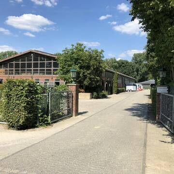
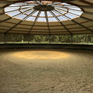
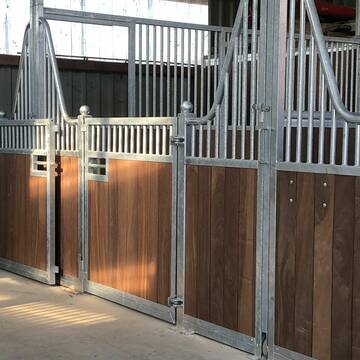
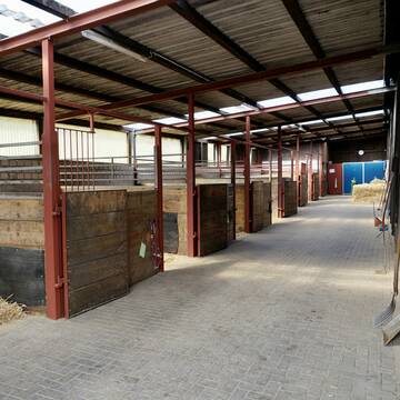
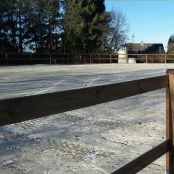
Pferdeland Leide Aktivstallhaltung
Leichlingen
Pferdeland Leide
@info2
FN-Mitglied
Freizeitstall
Hunde willkommen
Krankenbox
Allergikerstall
Hufrehe geeignet
Bewegungsstall
Laufstall
22 weitere...
S


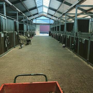
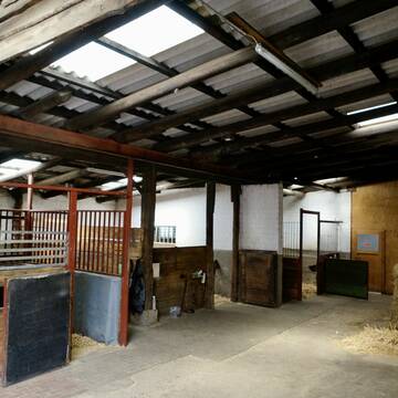
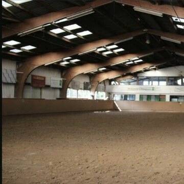
Reitstall Conrad in Haan Gruiten
Haan, Rheinland
Reitstall Conrad
@MirkoConrad
FN-Mitglied
Freizeitstall
Vermieten
Führanlage
Hunde willkommen
Allergikerstall
Fohlenaufzucht möglich
29 weitere...
S
Deprecated: Creation of dynamic property Zend_View_Helper_Ads::$adLink is deprecated in /var/www/stall-frei/htdocs/staging.stall-frei.de/library/Psf/View/Helper/Ads.php on line 108

Mitarbeiter gesucht?
Mechtersen
STALL-FREIde Marketing
@STALL-FREI-Marketing
Stellenangebote kostenlos veröffentlichen!


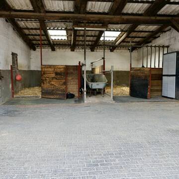
Bergische Weidegründe
Burscheid
Bergische Weidegründe
@HufRehastation-Allergiker
Freizeitstall
Geländestrecke
Hunde willkommen
Krankenbox
Allergikerstall
Gnadenbrothof
Bewegungsstall
Laufstall
28 weitere...
ganz aktuell
S
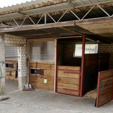
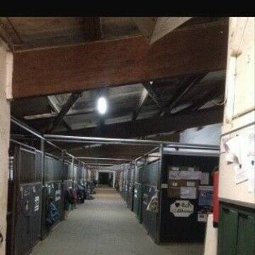
Reitanlage Wirtz - Sport und Freizeit
Düsseldorf
Christian-Wirtz
@Christian-Wirtz
Führanlage
Hunde willkommen
Außenbox mit Paddock
Außenboxen
Vollpension
Einzelne Boxen oder Stallplätze
Stallgasse oder Stalltrakt
16 weitere...
S
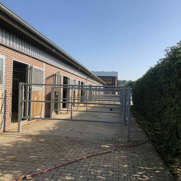
Große moderne Boxen mit und ohne Paddock am Rhein
Dormagen
Grenzhof
@Grenzhof
FN-Mitglied
Geländestrecke
Vermieten
Longierzirkel/Roundpen
Paddock
Außenbox mit Paddock
Außenboxen
16 weitere...
S


Reitanlage Pferdehof Teitscheid Boxen + Offenstall
Düsseldorf
Fam-Teitscheid
@Fam-Teitscheid
Geländestrecke
Pferdeausbildung
Vermieten
Führanlage
Hunde willkommen
Außenbox mit Paddock
Außenboxen
16 weitere...
S
Buntenbacher Hof
Leichlingen
H-Kloke
@H-Kloke
Freizeitstall
Geländestrecke
Longierzirkel/Roundpen
Pensions- und Gastboxen
Außenboxen
Innenbox
Vollpension
10 weitere...
P+


Aktivstall-Andreashof
Dormagen
Aktivstall-Andreashof
@Aktivstall-Andreashof
FN-Mitglied
Freizeitstall
Vermieten
Hunde willkommen
Krankenbox
Allergikerstall
Hufrehe geeignet
21 weitere...
S

Pferdeboxen in ruhigem Freizeitstall frei 🐴
Solingen
Christina
@Christina_Wei
FN-Mitglied
Freizeitstall
Vermieten
Hunde willkommen
Longierzirkel/Roundpen
Gnadenbrothof
Hufrehe geeignet
13 weitere...
P
Reitanlage Jöferhof in Wuppertal Cronenberg
Wuppertal
Joeferhof
@Joeferhof
Freizeitstall
Geländestrecke
Vermieten
Paddock
Parkplatz für Pferdeanhänger
Allergikerstall
bedampftes/gewaschenes Heu
18 weitere...
P+
Deprecated: Creation of dynamic property Zend_View::$pageCount is deprecated in /var/www/stall-frei/htdocs/staging.stall-frei.de/library/vendor/shardj/zf1-future/library/Zend/View/Abstract.php on line 308
Deprecated: Creation of dynamic property Zend_View::$itemCountPerPage is deprecated in /var/www/stall-frei/htdocs/staging.stall-frei.de/library/vendor/shardj/zf1-future/library/Zend/View/Abstract.php on line 308
Deprecated: Creation of dynamic property Zend_View::$first is deprecated in /var/www/stall-frei/htdocs/staging.stall-frei.de/library/vendor/shardj/zf1-future/library/Zend/View/Abstract.php on line 308
Deprecated: Creation of dynamic property Zend_View::$current is deprecated in /var/www/stall-frei/htdocs/staging.stall-frei.de/library/vendor/shardj/zf1-future/library/Zend/View/Abstract.php on line 308
Deprecated: Creation of dynamic property Zend_View::$last is deprecated in /var/www/stall-frei/htdocs/staging.stall-frei.de/library/vendor/shardj/zf1-future/library/Zend/View/Abstract.php on line 308
Deprecated: Creation of dynamic property Zend_View::$next is deprecated in /var/www/stall-frei/htdocs/staging.stall-frei.de/library/vendor/shardj/zf1-future/library/Zend/View/Abstract.php on line 308
Deprecated: Creation of dynamic property Zend_View::$pagesInRange is deprecated in /var/www/stall-frei/htdocs/staging.stall-frei.de/library/vendor/shardj/zf1-future/library/Zend/View/Abstract.php on line 308
Deprecated: Creation of dynamic property Zend_View::$firstPageInRange is deprecated in /var/www/stall-frei/htdocs/staging.stall-frei.de/library/vendor/shardj/zf1-future/library/Zend/View/Abstract.php on line 308
Deprecated: Creation of dynamic property Zend_View::$lastPageInRange is deprecated in /var/www/stall-frei/htdocs/staging.stall-frei.de/library/vendor/shardj/zf1-future/library/Zend/View/Abstract.php on line 308
Deprecated: Creation of dynamic property Zend_View::$currentItemCount is deprecated in /var/www/stall-frei/htdocs/staging.stall-frei.de/library/vendor/shardj/zf1-future/library/Zend/View/Abstract.php on line 308
Deprecated: Creation of dynamic property Zend_View::$totalItemCount is deprecated in /var/www/stall-frei/htdocs/staging.stall-frei.de/library/vendor/shardj/zf1-future/library/Zend/View/Abstract.php on line 308
Deprecated: Creation of dynamic property Zend_View::$firstItemNumber is deprecated in /var/www/stall-frei/htdocs/staging.stall-frei.de/library/vendor/shardj/zf1-future/library/Zend/View/Abstract.php on line 308
Deprecated: Creation of dynamic property Zend_View::$lastItemNumber is deprecated in /var/www/stall-frei/htdocs/staging.stall-frei.de/library/vendor/shardj/zf1-future/library/Zend/View/Abstract.php on line 308
Deprecated: Creation of dynamic property Zend_View::$router is deprecated in /var/www/stall-frei/htdocs/staging.stall-frei.de/library/vendor/shardj/zf1-future/library/Zend/View/Abstract.php on line 308
Deprecated: Creation of dynamic property Zend_View::$urlParams is deprecated in /var/www/stall-frei/htdocs/staging.stall-frei.de/library/vendor/shardj/zf1-future/library/Zend/View/Abstract.php on line 308
Deprecated: Creation of dynamic property Zend_View::$showAds is deprecated in /var/www/stall-frei/htdocs/staging.stall-frei.de/library/vendor/shardj/zf1-future/library/Zend/View/Abstract.php on line 308
Deprecated: Creation of dynamic property Zend_View::$objectIds is deprecated in /var/www/stall-frei/htdocs/staging.stall-frei.de/library/vendor/shardj/zf1-future/library/Zend/View/Abstract.php on line 308
Deprecated: Creation of dynamic property Zend_View::$showNavbar is deprecated in /var/www/stall-frei/htdocs/staging.stall-frei.de/library/vendor/shardj/zf1-future/library/Zend/View/Abstract.php on line 308
Deprecated: Creation of dynamic property Zend_View::$showBreadcrumb is deprecated in /var/www/stall-frei/htdocs/staging.stall-frei.de/library/vendor/shardj/zf1-future/library/Zend/View/Abstract.php on line 308
Deprecated: Creation of dynamic property Zend_View::$showFooter is deprecated in /var/www/stall-frei/htdocs/staging.stall-frei.de/library/vendor/shardj/zf1-future/library/Zend/View/Abstract.php on line 308
Deprecated: Creation of dynamic property Zend_View::$showInternalAds is deprecated in /var/www/stall-frei/htdocs/staging.stall-frei.de/library/vendor/shardj/zf1-future/library/Zend/View/Abstract.php on line 308
Deprecated: Creation of dynamic property Zend_View::$blNoContent is deprecated in /var/www/stall-frei/htdocs/staging.stall-frei.de/library/vendor/shardj/zf1-future/library/Zend/View/Abstract.php on line 308
Deprecated: Creation of dynamic property Zend_View::$sMetaDesc is deprecated in /var/www/stall-frei/htdocs/staging.stall-frei.de/library/vendor/shardj/zf1-future/library/Zend/View/Abstract.php on line 308
Deprecated: Creation of dynamic property Zend_View::$useGmaps is deprecated in /var/www/stall-frei/htdocs/staging.stall-frei.de/library/vendor/shardj/zf1-future/library/Zend/View/Abstract.php on line 308
Deprecated: Creation of dynamic property Zend_View::$touches is deprecated in /var/www/stall-frei/htdocs/staging.stall-frei.de/library/vendor/shardj/zf1-future/library/Zend/View/Abstract.php on line 308
Deprecated: Creation of dynamic property Zend_View::$oProject is deprecated in /var/www/stall-frei/htdocs/staging.stall-frei.de/library/vendor/shardj/zf1-future/library/Zend/View/Abstract.php on line 308
Deprecated: Creation of dynamic property Zend_View::$pageHeadline is deprecated in /var/www/stall-frei/htdocs/staging.stall-frei.de/library/vendor/shardj/zf1-future/library/Zend/View/Abstract.php on line 308
Deprecated: Creation of dynamic property Zend_View::$disableLocationField is deprecated in /var/www/stall-frei/htdocs/staging.stall-frei.de/library/vendor/shardj/zf1-future/library/Zend/View/Abstract.php on line 308
Deprecated: Creation of dynamic property Zend_View::$isSearch is deprecated in /var/www/stall-frei/htdocs/staging.stall-frei.de/library/vendor/shardj/zf1-future/library/Zend/View/Abstract.php on line 308
Deprecated: Creation of dynamic property Zend_View::$pageTitle is deprecated in /var/www/stall-frei/htdocs/staging.stall-frei.de/library/vendor/shardj/zf1-future/library/Zend/View/Abstract.php on line 308
Deprecated: Creation of dynamic property Psf_Form_Element_Text::$class is deprecated in /var/www/stall-frei/htdocs/staging.stall-frei.de/library/vendor/shardj/zf1-future/library/Zend/Form/Element.php on line 874
Deprecated: Creation of dynamic property Psf_Form_Element_Text::$size is deprecated in /var/www/stall-frei/htdocs/staging.stall-frei.de/library/vendor/shardj/zf1-future/library/Zend/Form/Element.php on line 874
Deprecated: Creation of dynamic property Psf_Form_Element_Text::$placeholder is deprecated in /var/www/stall-frei/htdocs/staging.stall-frei.de/library/vendor/shardj/zf1-future/library/Zend/Form/Element.php on line 874
Deprecated: Creation of dynamic property Psf_Form_Element_Hidden::$class is deprecated in /var/www/stall-frei/htdocs/staging.stall-frei.de/library/vendor/shardj/zf1-future/library/Zend/Form/Element.php on line 874
Deprecated: Creation of dynamic property Psf_Form_Element_Hidden::$class is deprecated in /var/www/stall-frei/htdocs/staging.stall-frei.de/library/vendor/shardj/zf1-future/library/Zend/Form/Element.php on line 874
Deprecated: Creation of dynamic property Psf_Form_Element_Hidden::$class is deprecated in /var/www/stall-frei/htdocs/staging.stall-frei.de/library/vendor/shardj/zf1-future/library/Zend/Form/Element.php on line 874
Deprecated: Creation of dynamic property Psf_Form_Element_Hidden::$class is deprecated in /var/www/stall-frei/htdocs/staging.stall-frei.de/library/vendor/shardj/zf1-future/library/Zend/Form/Element.php on line 874
Deprecated: Creation of dynamic property Psf_Form_Element_Select::$class is deprecated in /var/www/stall-frei/htdocs/staging.stall-frei.de/library/vendor/shardj/zf1-future/library/Zend/Form/Element.php on line 874
Deprecated: Creation of dynamic property Psf_Form_Element_Select::$class is deprecated in /var/www/stall-frei/htdocs/staging.stall-frei.de/library/vendor/shardj/zf1-future/library/Zend/Form/Element.php on line 874
Deprecated: Creation of dynamic property Psf_Form_Element_Select::$class is deprecated in /var/www/stall-frei/htdocs/staging.stall-frei.de/library/vendor/shardj/zf1-future/library/Zend/Form/Element.php on line 874
Deprecated: Creation of dynamic property Psf_Form_Element_Select::$class is deprecated in /var/www/stall-frei/htdocs/staging.stall-frei.de/library/vendor/shardj/zf1-future/library/Zend/Form/Element.php on line 874
Deprecated: Creation of dynamic property Psf_Form_Element_Text::$class is deprecated in /var/www/stall-frei/htdocs/staging.stall-frei.de/library/vendor/shardj/zf1-future/library/Zend/Form/Element.php on line 874
Deprecated: Creation of dynamic property Psf_Form_Element_Checkbox::$label is deprecated in /var/www/stall-frei/htdocs/staging.stall-frei.de/library/vendor/shardj/zf1-future/library/Zend/Form/Element.php on line 874
Deprecated: Creation of dynamic property Zend_View::$sort is deprecated in /var/www/stall-frei/htdocs/staging.stall-frei.de/library/vendor/shardj/zf1-future/library/Zend/View/Abstract.php on line 308
Deprecated: Creation of dynamic property Zend_View::$searchLocation is deprecated in /var/www/stall-frei/htdocs/staging.stall-frei.de/library/vendor/shardj/zf1-future/library/Zend/View/Abstract.php on line 308
Deprecated: Creation of dynamic property Zend_View::$locationHint is deprecated in /var/www/stall-frei/htdocs/staging.stall-frei.de/library/vendor/shardj/zf1-future/library/Zend/View/Abstract.php on line 308
Psf_GeoCoder_Abstract::getLocation: Scheuren Get Location CachedOrLive
Psf_GeoCoder_Abstract::getCachedOrLive: Scheuren
Psf_GeoCoder_OpenCageData::makeApiRequest: response:
Array
(
[documentation] => https://opencagedata.com/api
[licenses] => Array
(
[0] => Array
(
[name] => see attribution guide
[url] => https://opencagedata.com/credits
)
)
[results] => Array
(
[0] => Array
(
[bounds] => Array
(
[northeast] => Array
(
[lat] => 51.179562
[lng] => 7.053977
)
[southwest] => Array
(
[lat] => 51.159562
[lng] => 7.033977
)
)
[components] => Array
(
[ISO_3166-1_alpha-2] => DE
[ISO_3166-1_alpha-3] => DEU
[ISO_3166-2] => Array
(
[0] => DE-NW
)
[_category] => place
[_normalized_city] => Solingen
[_type] => hamlet
[city] => Solingen
[continent] => Europe
[country] => Deutschland
[country_code] => de
[hamlet] => Limminghofen
[neighbourhood] => Scheuren
[political_union] => European Union
[postcode] => 42699
[state] => Nordrhein-Westfalen
[state_code] => NW
[suburb] => Ohligs/Aufderhöhe/Merscheid
)
[confidence] => 8
[formatted] => Limminghofen, 42699 Solingen, Deutschland
[geometry] => Array
(
[lat] => 51.169562
[lng] => 7.043977
)
)
[1] => Array
(
[bounds] => Array
(
[northeast] => Array
(
[lat] => 50.5790108
[lng] => 6.922849
)
[southwest] => Array
(
[lat] => 50.5390108
[lng] => 6.882849
)
)
[components] => Array
(
[ISO_3166-1_alpha-2] => DE
[ISO_3166-1_alpha-3] => DEU
[ISO_3166-2] => Array
(
[0] => DE-NW
)
[_category] => place
[_normalized_city] => Bad Münstereifel
[_type] => village
[continent] => Europe
[country] => Deutschland
[country_code] => de
[county] => Kreis Euskirchen
[political_union] => European Union
[state] => Nordrhein-Westfalen
[state_code] => NW
[town] => Bad Münstereifel
[village] => Scheuren
)
[confidence] => 7
[formatted] => Scheuren, Nordrhein-Westfalen, Deutschland
[geometry] => Array
(
[lat] => 50.5590108
[lng] => 6.902849
)
)
[2] => Array
(
[bounds] => Array
(
[northeast] => Array
(
[lat] => 50.5555803
[lng] => 6.4864662
)
[southwest] => Array
(
[lat] => 50.5155803
[lng] => 6.4464662
)
)
[components] => Array
(
[ISO_3166-1_alpha-2] => DE
[ISO_3166-1_alpha-3] => DEU
[ISO_3166-2] => Array
(
[0] => DE-NW
)
[_category] => place
[_normalized_city] => Schleiden
[_type] => village
[continent] => Europe
[country] => Deutschland
[country_code] => de
[county] => Kreis Euskirchen
[political_union] => European Union
[postcode] => 53937
[state] => Nordrhein-Westfalen
[state_code] => NW
[town] => Schleiden
[village] => Scheuren
)
[confidence] => 7
[formatted] => 53937 Scheuren, Deutschland
[geometry] => Array
(
[lat] => 50.5355803
[lng] => 6.4664662
)
)
[3] => Array
(
[bounds] => Array
(
[northeast] => Array
(
[lat] => 50.6255315
[lng] => 7.2427731
)
[southwest] => Array
(
[lat] => 50.5855315
[lng] => 7.2027731
)
)
[components] => Array
(
[ISO_3166-1_alpha-2] => DE
[ISO_3166-1_alpha-3] => DEU
[ISO_3166-2] => Array
(
[0] => DE-RP
)
[_category] => place
[_normalized_city] => Scheuren
[_type] => village
[continent] => Europe
[country] => Deutschland
[country_code] => de
[county] => Landkreis Neuwied
[municipality] => Unkel
[political_union] => European Union
[postcode] => 53572
[state] => Rheinland-Pfalz
[state_code] => RP
[town] => Scheuren
[village] => Unkel
)
[confidence] => 7
[formatted] => 53572 Unkel, Deutschland
[geometry] => Array
(
[lat] => 50.6055315
[lng] => 7.2227731
)
)
[4] => Array
(
[bounds] => Array
(
[northeast] => Array
(
[lat] => 50.7558525
[lng] => 6.7498698
)
[southwest] => Array
(
[lat] => 50.7158525
[lng] => 6.7098698
)
)
[components] => Array
(
[ISO_3166-1_alpha-2] => DE
[ISO_3166-1_alpha-3] => DEU
[ISO_3166-2] => Array
(
[0] => DE-NW
)
[_category] => place
[_normalized_city] => Scheuren
[_type] => village
[continent] => Europe
[country] => Deutschland
[country_code] => de
[county] => Rhein-Erft-Kreis
[municipality] => Erftstadt
[political_union] => European Union
[postcode] => 50374
[state] => Nordrhein-Westfalen
[state_code] => NW
[village] => Scheuren
)
[confidence] => 7
[formatted] => 50374 Scheuren, Deutschland
[geometry] => Array
(
[lat] => 50.7358525
[lng] => 6.7298698
)
)
[5] => Array
(
[bounds] => Array
(
[northeast] => Array
(
[lat] => 51.0635928
[lng] => 7.1885576
)
[southwest] => Array
(
[lat] => 51.0235928
[lng] => 7.1485576
)
)
[components] => Array
(
[ISO_3166-1_alpha-2] => DE
[ISO_3166-1_alpha-3] => DEU
[ISO_3166-2] => Array
(
[0] => DE-NW
)
[_category] => place
[_normalized_city] => Odenthal
[_type] => village
[continent] => Europe
[country] => Deutschland
[country_code] => de
[county] => Rheinisch-Bergischer Kreis
[political_union] => European Union
[postcode] => 51519
[state] => Nordrhein-Westfalen
[state_code] => NW
[town] => Odenthal
[village] => Scheuren
)
[confidence] => 7
[formatted] => 51519 Scheuren, Deutschland
[geometry] => Array
(
[lat] => 51.0435928
[lng] => 7.1685576
)
)
[6] => Array
(
[bounds] => Array
(
[northeast] => Array
(
[lat] => 50.7393286
[lng] => 7.3887801
)
[southwest] => Array
(
[lat] => 50.6993286
[lng] => 7.3487801
)
)
[components] => Array
(
[ISO_3166-1_alpha-2] => DE
[ISO_3166-1_alpha-3] => DEU
[ISO_3166-2] => Array
(
[0] => DE-NW
)
[_category] => place
[_normalized_city] => Hennef (Sieg)
[_type] => hamlet
[continent] => Europe
[country] => Deutschland
[country_code] => de
[county] => Rhein-Sieg-Kreis
[hamlet] => Scheuren
[political_union] => European Union
[state] => Nordrhein-Westfalen
[state_code] => NW
[town] => Hennef (Sieg)
)
[confidence] => 7
[formatted] => Scheuren, Hennef (Sieg), Nordrhein-Westfalen, Deutschland
[geometry] => Array
(
[lat] => 50.7193286
[lng] => 7.3687801
)
)
[7] => Array
(
[bounds] => Array
(
[northeast] => Array
(
[lat] => 47.6963497
[lng] => 8.3450631
)
[southwest] => Array
(
[lat] => 47.6962497
[lng] => 8.3449631
)
)
[components] => Array
(
[ISO_3166-1_alpha-2] => DE
[ISO_3166-1_alpha-3] => DEU
[ISO_3166-2] => Array
(
[0] => DE-BW
)
[_category] => building
[_normalized_city] => Untermettingen
[_type] => building
[continent] => Europe
[country] => Deutschland
[country_code] => de
[county] => Landkreis Waldshut
[isolated_dwelling] => Scheuren(hof)
[municipality] => Ühlingen-Birkendorf
[political_union] => European Union
[postcode] => 79777
[state] => Baden-Württemberg
[state_code] => BW
[village] => Untermettingen
)
[confidence] => 10
[formatted] => Scheuren(hof), 79777 Untermettingen, Deutschland
[geometry] => Array
(
[lat] => 47.6962997
[lng] => 8.3450131
)
)
[8] => Array
(
[bounds] => Array
(
[northeast] => Array
(
[lat] => 50.7199884
[lng] => 7.3708119
)
[southwest] => Array
(
[lat] => 50.7186623
[lng] => 7.3681864
)
)
[components] => Array
(
[ISO_3166-1_alpha-2] => DE
[ISO_3166-1_alpha-3] => DEU
[ISO_3166-2] => Array
(
[0] => DE-NW
)
[_category] => place
[_normalized_city] => Hennef (Sieg)
[_type] => hamlet
[continent] => Europe
[country] => Deutschland
[country_code] => de
[county] => Rhein-Sieg-Kreis
[hamlet] => Scheuren
[neighbourhood] => Wellesberg
[political_union] => European Union
[postcode] => 53773
[residential] => Scheuren
[state] => Nordrhein-Westfalen
[state_code] => NW
[town] => Hennef (Sieg)
)
[confidence] => 9
[formatted] => Scheuren, 53773 Hennef (Sieg), Deutschland
[geometry] => Array
(
[lat] => 50.7193707
[lng] => 7.3688473
)
)
[9] => Array
(
[bounds] => Array
(
[northeast] => Array
(
[lat] => 51.1417791
[lng] => 6.3697889
)
[southwest] => Array
(
[lat] => 51.1217791
[lng] => 6.3497889
)
)
[components] => Array
(
[ISO_3166-1_alpha-2] => DE
[ISO_3166-1_alpha-3] => DEU
[ISO_3166-2] => Array
(
[0] => DE-NW
)
[_category] => place
[_normalized_city] => Mönchengladbach
[_type] => hamlet
[city] => Mönchengladbach
[city_district] => West
[continent] => Europe
[country] => Deutschland
[country_code] => de
[hamlet] => Baum
[locality] => Scheuren
[political_union] => European Union
[postcode] => 41179
[state] => Nordrhein-Westfalen
[state_code] => NW
[suburb] => Rheindahlen-Land
)
[confidence] => 8
[formatted] => Baum, 41179 Mönchengladbach, Deutschland
[geometry] => Array
(
[lat] => 51.1317791
[lng] => 6.3597889
)
)
)
[status] => Array
(
[code] => 200
[message] => OK
)
[stay_informed] => Array
(
[blog] => https://blog.opencagedata.com
[mastodon] => https://en.osm.town/@opencage
)
[thanks] => For using an OpenCage API
[timestamp] => Array
(
[created_http] => Sat, 07 Feb 2026 00:46:19 GMT
[created_unix] => 1770425179
)
[total_results] => 10
)
Psf_GeoCoder_Abstract::convertLocationResult
{"documentation":"https:\/\/opencagedata.com\/api","licenses":[{"name":"see attribution guide","url":"https:\/\/opencagedata.com\/credits"}],"results":[{"bounds":{"northeast":{"lat":51.179562,"lng":7.053977},"southwest":{"lat":51.159562,"lng":7.033977}},"components":{"ISO_3166-1_alpha-2":"DE","ISO_3166-1_alpha-3":"DEU","ISO_3166-2":["DE-NW"],"_category":"place","_normalized_city":"Solingen","_type":"hamlet","city":"Solingen","continent":"Europe","country":"Deutschland","country_code":"de","hamlet":"Limminghofen","neighbourhood":"Scheuren","political_union":"European Union","postcode":"42699","state":"Nordrhein-Westfalen","state_code":"NW","suburb":"Ohligs\/Aufderh\u00f6he\/Merscheid"},"confidence":8,"formatted":"Limminghofen, 42699 Solingen, Deutschland","geometry":{"lat":51.169562,"lng":7.043977}},{"bounds":{"northeast":{"lat":50.5790108,"lng":6.922849},"southwest":{"lat":50.5390108,"lng":6.882849}},"components":{"ISO_3166-1_alpha-2":"DE","ISO_3166-1_alpha-3":"DEU","ISO_3166-2":["DE-NW"],"_category":"place","_normalized_city":"Bad M\u00fcnstereifel","_type":"village","continent":"Europe","country":"Deutschland","country_code":"de","county":"Kreis Euskirchen","political_union":"European Union","state":"Nordrhein-Westfalen","state_code":"NW","town":"Bad M\u00fcnstereifel","village":"Scheuren"},"confidence":7,"formatted":"Scheuren, Nordrhein-Westfalen, Deutschland","geometry":{"lat":50.5590108,"lng":6.902849}},{"bounds":{"northeast":{"lat":50.5555803,"lng":6.4864662},"southwest":{"lat":50.5155803,"lng":6.4464662}},"components":{"ISO_3166-1_alpha-2":"DE","ISO_3166-1_alpha-3":"DEU","ISO_3166-2":["DE-NW"],"_category":"place","_normalized_city":"Schleiden","_type":"village","continent":"Europe","country":"Deutschland","country_code":"de","county":"Kreis Euskirchen","political_union":"European Union","postcode":"53937","state":"Nordrhein-Westfalen","state_code":"NW","town":"Schleiden","village":"Scheuren"},"confidence":7,"formatted":"53937 Scheuren, Deutschland","geometry":{"lat":50.5355803,"lng":6.4664662}},{"bounds":{"northeast":{"lat":50.6255315,"lng":7.2427731},"southwest":{"lat":50.5855315,"lng":7.2027731}},"components":{"ISO_3166-1_alpha-2":"DE","ISO_3166-1_alpha-3":"DEU","ISO_3166-2":["DE-RP"],"_category":"place","_normalized_city":"Scheuren","_type":"village","continent":"Europe","country":"Deutschland","country_code":"de","county":"Landkreis Neuwied","municipality":"Unkel","political_union":"European Union","postcode":"53572","state":"Rheinland-Pfalz","state_code":"RP","town":"Scheuren","village":"Unkel"},"confidence":7,"formatted":"53572 Unkel, Deutschland","geometry":{"lat":50.6055315,"lng":7.2227731}},{"bounds":{"northeast":{"lat":50.7558525,"lng":6.7498698},"southwest":{"lat":50.7158525,"lng":6.7098698}},"components":{"ISO_3166-1_alpha-2":"DE","ISO_3166-1_alpha-3":"DEU","ISO_3166-2":["DE-NW"],"_category":"place","_normalized_city":"Scheuren","_type":"village","continent":"Europe","country":"Deutschland","country_code":"de","county":"Rhein-Erft-Kreis","municipality":"Erftstadt","political_union":"European Union","postcode":"50374","state":"Nordrhein-Westfalen","state_code":"NW","village":"Scheuren"},"confidence":7,"formatted":"50374 Scheuren, Deutschland","geometry":{"lat":50.7358525,"lng":6.7298698}},{"bounds":{"northeast":{"lat":51.0635928,"lng":7.1885576},"southwest":{"lat":51.0235928,"lng":7.1485576}},"components":{"ISO_3166-1_alpha-2":"DE","ISO_3166-1_alpha-3":"DEU","ISO_3166-2":["DE-NW"],"_category":"place","_normalized_city":"Odenthal","_type":"village","continent":"Europe","country":"Deutschland","country_code":"de","county":"Rheinisch-Bergischer Kreis","political_union":"European Union","postcode":"51519","state":"Nordrhein-Westfalen","state_code":"NW","town":"Odenthal","village":"Scheuren"},"confidence":7,"formatted":"51519 Scheuren, Deutschland","geometry":{"lat":51.0435928,"lng":7.1685576}},{"bounds":{"northeast":{"lat":50.7393286,"lng":7.3887801},"southwest":{"lat":50.6993286,"lng":7.3487801}},"components":{"ISO_3166-1_alpha-2":"DE","ISO_3166-1_alpha-3":"DEU","ISO_3166-2":["DE-NW"],"_category":"place","_normalized_city":"Hennef (Sieg)","_type":"hamlet","continent":"Europe","country":"Deutschland","country_code":"de","county":"Rhein-Sieg-Kreis","hamlet":"Scheuren","political_union":"European Union","state":"Nordrhein-Westfalen","state_code":"NW","town":"Hennef (Sieg)"},"confidence":7,"formatted":"Scheuren, Hennef (Sieg), Nordrhein-Westfalen, Deutschland","geometry":{"lat":50.7193286,"lng":7.3687801}},{"bounds":{"northeast":{"lat":47.6963497,"lng":8.3450631},"southwest":{"lat":47.6962497,"lng":8.3449631}},"components":{"ISO_3166-1_alpha-2":"DE","ISO_3166-1_alpha-3":"DEU","ISO_3166-2":["DE-BW"],"_category":"building","_normalized_city":"Untermettingen","_type":"building","continent":"Europe","country":"Deutschland","country_code":"de","county":"Landkreis Waldshut","isolated_dwelling":"Scheuren(hof)","municipality":"\u00dchlingen-Birkendorf","political_union":"European Union","postcode":"79777","state":"Baden-W\u00fcrttemberg","state_code":"BW","village":"Untermettingen"},"confidence":10,"formatted":"Scheuren(hof), 79777 Untermettingen, Deutschland","geometry":{"lat":47.6962997,"lng":8.3450131}},{"bounds":{"northeast":{"lat":50.7199884,"lng":7.3708119},"southwest":{"lat":50.7186623,"lng":7.3681864}},"components":{"ISO_3166-1_alpha-2":"DE","ISO_3166-1_alpha-3":"DEU","ISO_3166-2":["DE-NW"],"_category":"place","_normalized_city":"Hennef (Sieg)","_type":"hamlet","continent":"Europe","country":"Deutschland","country_code":"de","county":"Rhein-Sieg-Kreis","hamlet":"Scheuren","neighbourhood":"Wellesberg","political_union":"European Union","postcode":"53773","residential":"Scheuren","state":"Nordrhein-Westfalen","state_code":"NW","town":"Hennef (Sieg)"},"confidence":9,"formatted":"Scheuren, 53773 Hennef (Sieg), Deutschland","geometry":{"lat":50.7193707,"lng":7.3688473}},{"bounds":{"northeast":{"lat":51.1417791,"lng":6.3697889},"southwest":{"lat":51.1217791,"lng":6.3497889}},"components":{"ISO_3166-1_alpha-2":"DE","ISO_3166-1_alpha-3":"DEU","ISO_3166-2":["DE-NW"],"_category":"place","_normalized_city":"M\u00f6nchengladbach","_type":"hamlet","city":"M\u00f6nchengladbach","city_district":"West","continent":"Europe","country":"Deutschland","country_code":"de","hamlet":"Baum","locality":"Scheuren","political_union":"European Union","postcode":"41179","state":"Nordrhein-Westfalen","state_code":"NW","suburb":"Rheindahlen-Land"},"confidence":8,"formatted":"Baum, 41179 M\u00f6nchengladbach, Deutschland","geometry":{"lat":51.1317791,"lng":6.3597889}}],"status":{"code":200,"message":"OK"},"stay_informed":{"blog":"https:\/\/blog.opencagedata.com","mastodon":"https:\/\/en.osm.town\/@opencage"},"thanks":"For using an OpenCage API","timestamp":{"created_http":"Sat, 07 Feb 2026 00:46:19 GMT","created_unix":1770425179},"total_results":10}Array
(
[0] => stdClass Object
(
[bounds] => stdClass Object
(
[northeast] => stdClass Object
(
[lat] => 51.179562
[lng] => 7.053977
)
[southwest] => stdClass Object
(
[lat] => 51.159562
[lng] => 7.033977
)
)
[components] => stdClass Object
(
[ISO_3166-1_alpha-2] => DE
[ISO_3166-1_alpha-3] => DEU
[ISO_3166-2] => Array
(
[0] => DE-NW
)
[_category] => place
[_normalized_city] => Solingen
[_type] => hamlet
[city] => Solingen
[continent] => Europe
[country] => Deutschland
[country_code] => de
[hamlet] => Limminghofen
[neighbourhood] => Scheuren
[political_union] => European Union
[postcode] => 42699
[state] => Nordrhein-Westfalen
[state_code] => NW
[suburb] => Ohligs/Aufderhöhe/Merscheid
)
[confidence] => 8
[formatted] => Limminghofen, 42699 Solingen, Deutschland
[geometry] => stdClass Object
(
[lat] => 51.169562
[lng] => 7.043977
)
)
[1] => stdClass Object
(
[bounds] => stdClass Object
(
[northeast] => stdClass Object
(
[lat] => 50.5790108
[lng] => 6.922849
)
[southwest] => stdClass Object
(
[lat] => 50.5390108
[lng] => 6.882849
)
)
[components] => stdClass Object
(
[ISO_3166-1_alpha-2] => DE
[ISO_3166-1_alpha-3] => DEU
[ISO_3166-2] => Array
(
[0] => DE-NW
)
[_category] => place
[_normalized_city] => Bad Münstereifel
[_type] => village
[continent] => Europe
[country] => Deutschland
[country_code] => de
[county] => Kreis Euskirchen
[political_union] => European Union
[state] => Nordrhein-Westfalen
[state_code] => NW
[town] => Bad Münstereifel
[village] => Scheuren
)
[confidence] => 7
[formatted] => Scheuren, Nordrhein-Westfalen, Deutschland
[geometry] => stdClass Object
(
[lat] => 50.5590108
[lng] => 6.902849
)
)
[2] => stdClass Object
(
[bounds] => stdClass Object
(
[northeast] => stdClass Object
(
[lat] => 50.5555803
[lng] => 6.4864662
)
[southwest] => stdClass Object
(
[lat] => 50.5155803
[lng] => 6.4464662
)
)
[components] => stdClass Object
(
[ISO_3166-1_alpha-2] => DE
[ISO_3166-1_alpha-3] => DEU
[ISO_3166-2] => Array
(
[0] => DE-NW
)
[_category] => place
[_normalized_city] => Schleiden
[_type] => village
[continent] => Europe
[country] => Deutschland
[country_code] => de
[county] => Kreis Euskirchen
[political_union] => European Union
[postcode] => 53937
[state] => Nordrhein-Westfalen
[state_code] => NW
[town] => Schleiden
[village] => Scheuren
)
[confidence] => 7
[formatted] => 53937 Scheuren, Deutschland
[geometry] => stdClass Object
(
[lat] => 50.5355803
[lng] => 6.4664662
)
)
[3] => stdClass Object
(
[bounds] => stdClass Object
(
[northeast] => stdClass Object
(
[lat] => 50.6255315
[lng] => 7.2427731
)
[southwest] => stdClass Object
(
[lat] => 50.5855315
[lng] => 7.2027731
)
)
[components] => stdClass Object
(
[ISO_3166-1_alpha-2] => DE
[ISO_3166-1_alpha-3] => DEU
[ISO_3166-2] => Array
(
[0] => DE-RP
)
[_category] => place
[_normalized_city] => Scheuren
[_type] => village
[continent] => Europe
[country] => Deutschland
[country_code] => de
[county] => Landkreis Neuwied
[municipality] => Unkel
[political_union] => European Union
[postcode] => 53572
[state] => Rheinland-Pfalz
[state_code] => RP
[town] => Scheuren
[village] => Unkel
)
[confidence] => 7
[formatted] => 53572 Unkel, Deutschland
[geometry] => stdClass Object
(
[lat] => 50.6055315
[lng] => 7.2227731
)
)
[4] => stdClass Object
(
[bounds] => stdClass Object
(
[northeast] => stdClass Object
(
[lat] => 50.7558525
[lng] => 6.7498698
)
[southwest] => stdClass Object
(
[lat] => 50.7158525
[lng] => 6.7098698
)
)
[components] => stdClass Object
(
[ISO_3166-1_alpha-2] => DE
[ISO_3166-1_alpha-3] => DEU
[ISO_3166-2] => Array
(
[0] => DE-NW
)
[_category] => place
[_normalized_city] => Scheuren
[_type] => village
[continent] => Europe
[country] => Deutschland
[country_code] => de
[county] => Rhein-Erft-Kreis
[municipality] => Erftstadt
[political_union] => European Union
[postcode] => 50374
[state] => Nordrhein-Westfalen
[state_code] => NW
[village] => Scheuren
)
[confidence] => 7
[formatted] => 50374 Scheuren, Deutschland
[geometry] => stdClass Object
(
[lat] => 50.7358525
[lng] => 6.7298698
)
)
[5] => stdClass Object
(
[bounds] => stdClass Object
(
[northeast] => stdClass Object
(
[lat] => 51.0635928
[lng] => 7.1885576
)
[southwest] => stdClass Object
(
[lat] => 51.0235928
[lng] => 7.1485576
)
)
[components] => stdClass Object
(
[ISO_3166-1_alpha-2] => DE
[ISO_3166-1_alpha-3] => DEU
[ISO_3166-2] => Array
(
[0] => DE-NW
)
[_category] => place
[_normalized_city] => Odenthal
[_type] => village
[continent] => Europe
[country] => Deutschland
[country_code] => de
[county] => Rheinisch-Bergischer Kreis
[political_union] => European Union
[postcode] => 51519
[state] => Nordrhein-Westfalen
[state_code] => NW
[town] => Odenthal
[village] => Scheuren
)
[confidence] => 7
[formatted] => 51519 Scheuren, Deutschland
[geometry] => stdClass Object
(
[lat] => 51.0435928
[lng] => 7.1685576
)
)
[6] => stdClass Object
(
[bounds] => stdClass Object
(
[northeast] => stdClass Object
(
[lat] => 50.7393286
[lng] => 7.3887801
)
[southwest] => stdClass Object
(
[lat] => 50.6993286
[lng] => 7.3487801
)
)
[components] => stdClass Object
(
[ISO_3166-1_alpha-2] => DE
[ISO_3166-1_alpha-3] => DEU
[ISO_3166-2] => Array
(
[0] => DE-NW
)
[_category] => place
[_normalized_city] => Hennef (Sieg)
[_type] => hamlet
[continent] => Europe
[country] => Deutschland
[country_code] => de
[county] => Rhein-Sieg-Kreis
[hamlet] => Scheuren
[political_union] => European Union
[state] => Nordrhein-Westfalen
[state_code] => NW
[town] => Hennef (Sieg)
)
[confidence] => 7
[formatted] => Scheuren, Hennef (Sieg), Nordrhein-Westfalen, Deutschland
[geometry] => stdClass Object
(
[lat] => 50.7193286
[lng] => 7.3687801
)
)
[7] => stdClass Object
(
[bounds] => stdClass Object
(
[northeast] => stdClass Object
(
[lat] => 47.6963497
[lng] => 8.3450631
)
[southwest] => stdClass Object
(
[lat] => 47.6962497
[lng] => 8.3449631
)
)
[components] => stdClass Object
(
[ISO_3166-1_alpha-2] => DE
[ISO_3166-1_alpha-3] => DEU
[ISO_3166-2] => Array
(
[0] => DE-BW
)
[_category] => building
[_normalized_city] => Untermettingen
[_type] => building
[continent] => Europe
[country] => Deutschland
[country_code] => de
[county] => Landkreis Waldshut
[isolated_dwelling] => Scheuren(hof)
[municipality] => Ühlingen-Birkendorf
[political_union] => European Union
[postcode] => 79777
[state] => Baden-Württemberg
[state_code] => BW
[village] => Untermettingen
)
[confidence] => 10
[formatted] => Scheuren(hof), 79777 Untermettingen, Deutschland
[geometry] => stdClass Object
(
[lat] => 47.6962997
[lng] => 8.3450131
)
)
[8] => stdClass Object
(
[bounds] => stdClass Object
(
[northeast] => stdClass Object
(
[lat] => 50.7199884
[lng] => 7.3708119
)
[southwest] => stdClass Object
(
[lat] => 50.7186623
[lng] => 7.3681864
)
)
[components] => stdClass Object
(
[ISO_3166-1_alpha-2] => DE
[ISO_3166-1_alpha-3] => DEU
[ISO_3166-2] => Array
(
[0] => DE-NW
)
[_category] => place
[_normalized_city] => Hennef (Sieg)
[_type] => hamlet
[continent] => Europe
[country] => Deutschland
[country_code] => de
[county] => Rhein-Sieg-Kreis
[hamlet] => Scheuren
[neighbourhood] => Wellesberg
[political_union] => European Union
[postcode] => 53773
[residential] => Scheuren
[state] => Nordrhein-Westfalen
[state_code] => NW
[town] => Hennef (Sieg)
)
[confidence] => 9
[formatted] => Scheuren, 53773 Hennef (Sieg), Deutschland
[geometry] => stdClass Object
(
[lat] => 50.7193707
[lng] => 7.3688473
)
)
[9] => stdClass Object
(
[bounds] => stdClass Object
(
[northeast] => stdClass Object
(
[lat] => 51.1417791
[lng] => 6.3697889
)
[southwest] => stdClass Object
(
[lat] => 51.1217791
[lng] => 6.3497889
)
)
[components] => stdClass Object
(
[ISO_3166-1_alpha-2] => DE
[ISO_3166-1_alpha-3] => DEU
[ISO_3166-2] => Array
(
[0] => DE-NW
)
[_category] => place
[_normalized_city] => Mönchengladbach
[_type] => hamlet
[city] => Mönchengladbach
[city_district] => West
[continent] => Europe
[country] => Deutschland
[country_code] => de
[hamlet] => Baum
[locality] => Scheuren
[political_union] => European Union
[postcode] => 41179
[state] => Nordrhein-Westfalen
[state_code] => NW
[suburb] => Rheindahlen-Land
)
[confidence] => 8
[formatted] => Baum, 41179 Mönchengladbach, Deutschland
[geometry] => stdClass Object
(
[lat] => 51.1317791
[lng] => 6.3597889
)
)
)
Psf_GeoCoder_OpenCageData::getKeyMap: 0
stdClass Object
(
    [bounds] => stdClass Object
        (
            [northeast] => stdClass Object
                (
                    [lat] => 51.179562
                    [lng] => 7.053977
                )

            [southwest] => stdClass Object
                (
                    [lat] => 51.159562
                    [lng] => 7.033977
                )

        )

    [components] => stdClass Object
        (
            [ISO_3166-1_alpha-2] => DE
            [ISO_3166-1_alpha-3] => DEU
            [ISO_3166-2] => Array
                (
                    [0] => DE-NW
                )

            [_category] => place
            [_normalized_city] => Solingen
            [_type] => hamlet
            [city] => Solingen
            [continent] => Europe
            [country] => Deutschland
            [country_code] => de
            [hamlet] => Limminghofen
            [neighbourhood] => Scheuren
            [political_union] => European Union
            [postcode] => 42699
            [state] => Nordrhein-Westfalen
            [state_code] => NW
            [suburb] => Ohligs/Aufderhöhe/Merscheid
        )

    [confidence] => 8
    [formatted] => Limminghofen, 42699 Solingen, Deutschland
    [geometry] => stdClass Object
        (
            [lat] => 51.169562
            [lng] => 7.043977
        )

)
Psf_GeoCoder_OpenCageData::getCounty: Solingen
Psf_GeoCoder_OpenCageData::addMissingData REFETCH!
Array
(
    [address] => Limminghofen, 42699 Solingen, Deutschland
    [type] => hamlet
    [street] => Limminghofen
    [city] => Ohligs/Aufderhöhe/Merscheid
    [county] => Solingen
    [state] => Nordrhein-Westfalen
    [zip] => 42699
    [country] => Deutschland
    [suburb] => Ohligs/Aufderhöhe/Merscheid
    [countrycode] => de
    [latitude] => 51.169562
    [longitude] => 7.043977
    [accuracy] => 1
    [confidence] => 8
    [bounds] => stdClass Object
        (
            [northeast] => stdClass Object
                (
                    [lat] => 51.179562
                    [lng] => 7.053977
                )

            [southwest] => stdClass Object
                (
                    [lat] => 51.159562
                    [lng] => 7.033977
                )

        )

)
reformat!
Array
(
    [address] => Limminghofen, 42699 Ohligs/Aufderhöhe/Merscheid
    [type] => hamlet
    [street] => Limminghofen
    [city] => Ohligs/Aufderhöhe/Merscheid
    [county] => Solingen
    [state] => Nordrhein-Westfalen
    [zip] => 42699
    [country] => Deutschland
    [suburb] => Ohligs/Aufderhöhe/Merscheid
    [countrycode] => de
    [latitude] => 51.169562
    [longitude] => 7.043977
    [accuracy] => 1
    [confidence] => 8
    [bounds] => stdClass Object
        (
            [northeast] => stdClass Object
                (
                    [lat] => 51.179562
                    [lng] => 7.053977
                )

            [southwest] => stdClass Object
                (
                    [lat] => 51.159562
                    [lng] => 7.033977
                )

        )

    [place] => Limminghofen, 42699 Ohligs/Aufderhöhe/Merscheid, Nordrhein-Westfalen
    [hash] => ecd5cb27518e11feedbf3b13df1336c8
)
Psf_GeoCoder_OpenCageData::getKeyMap: 1
stdClass Object
(
    [bounds] => stdClass Object
        (
            [northeast] => stdClass Object
                (
                    [lat] => 50.5790108
                    [lng] => 6.922849
                )

            [southwest] => stdClass Object
                (
                    [lat] => 50.5390108
                    [lng] => 6.882849
                )

        )

    [components] => stdClass Object
        (
            [ISO_3166-1_alpha-2] => DE
            [ISO_3166-1_alpha-3] => DEU
            [ISO_3166-2] => Array
                (
                    [0] => DE-NW
                )

            [_category] => place
            [_normalized_city] => Bad Münstereifel
            [_type] => village
            [continent] => Europe
            [country] => Deutschland
            [country_code] => de
            [county] => Kreis Euskirchen
            [political_union] => European Union
            [state] => Nordrhein-Westfalen
            [state_code] => NW
            [town] => Bad Münstereifel
            [village] => Scheuren
        )

    [confidence] => 7
    [formatted] => Scheuren, Nordrhein-Westfalen, Deutschland
    [geometry] => stdClass Object
        (
            [lat] => 50.5590108
            [lng] => 6.902849
        )

)
Psf_GeoCoder_OpenCageData::getCounty: Euskirchen
Psf_GeoCoder_OpenCageData::addMissingData REFETCH!
Array
(
    [address] => Scheuren, Nordrhein-Westfalen, Deutschland
    [type] => village
    [street] =>
    [city] => Bad Münstereifel
    [county] => Euskirchen
    [state] => Nordrhein-Westfalen
    [zip] =>
    [country] => Deutschland
    [suburb] =>
    [countrycode] => de
    [latitude] => 50.5590108
    [longitude] => 6.902849
    [accuracy] => 1
    [confidence] => 7
    [bounds] => stdClass Object
        (
            [northeast] => stdClass Object
                (
                    [lat] => 50.5790108
                    [lng] => 6.922849
                )

            [southwest] => stdClass Object
                (
                    [lat] => 50.5390108
                    [lng] => 6.882849
                )

        )

)
reformat!
Array
(
    [address] => Bad Münstereifel
    [type] => village
    [street] =>
    [city] => Bad Münstereifel
    [county] => Euskirchen
    [state] => Nordrhein-Westfalen
    [zip] =>
    [country] => Deutschland
    [suburb] =>
    [countrycode] => de
    [latitude] => 50.5590108
    [longitude] => 6.902849
    [accuracy] => 1
    [confidence] => 7
    [bounds] => stdClass Object
        (
            [northeast] => stdClass Object
                (
                    [lat] => 50.5790108
                    [lng] => 6.922849
                )

            [southwest] => stdClass Object
                (
                    [lat] => 50.5390108
                    [lng] => 6.882849
                )

        )

    [place] => Bad Münstereifel, Nordrhein-Westfalen
    [hash] => 27acbc26d9d405931ec68f29e745109b
)
Psf_GeoCoder_OpenCageData::getKeyMap: 2
stdClass Object
(
    [bounds] => stdClass Object
        (
            [northeast] => stdClass Object
                (
                    [lat] => 50.5555803
                    [lng] => 6.4864662
                )

            [southwest] => stdClass Object
                (
                    [lat] => 50.5155803
                    [lng] => 6.4464662
                )

        )

    [components] => stdClass Object
        (
            [ISO_3166-1_alpha-2] => DE
            [ISO_3166-1_alpha-3] => DEU
            [ISO_3166-2] => Array
                (
                    [0] => DE-NW
                )

            [_category] => place
            [_normalized_city] => Schleiden
            [_type] => village
            [continent] => Europe
            [country] => Deutschland
            [country_code] => de
            [county] => Kreis Euskirchen
            [political_union] => European Union
            [postcode] => 53937
            [state] => Nordrhein-Westfalen
            [state_code] => NW
            [town] => Schleiden
            [village] => Scheuren
        )

    [confidence] => 7
    [formatted] => 53937 Scheuren, Deutschland
    [geometry] => stdClass Object
        (
            [lat] => 50.5355803
            [lng] => 6.4664662
        )

)
Psf_GeoCoder_OpenCageData::getCounty: Euskirchen
Psf_GeoCoder_OpenCageData::addMissingData REFETCH!
Array
(
    [address] => 53937 Scheuren, Deutschland
    [type] => village
    [street] =>
    [city] => Schleiden
    [county] => Euskirchen
    [state] => Nordrhein-Westfalen
    [zip] => 53937
    [country] => Deutschland
    [suburb] =>
    [countrycode] => de
    [latitude] => 50.5355803
    [longitude] => 6.4664662
    [accuracy] => 1
    [confidence] => 7
    [bounds] => stdClass Object
        (
            [northeast] => stdClass Object
                (
                    [lat] => 50.5555803
                    [lng] => 6.4864662
                )

            [southwest] => stdClass Object
                (
                    [lat] => 50.5155803
                    [lng] => 6.4464662
                )

        )

)
reformat!
Array
(
    [address] => 53937 Schleiden
    [type] => village
    [street] =>
    [city] => Schleiden
    [county] => Euskirchen
    [state] => Nordrhein-Westfalen
    [zip] => 53937
    [country] => Deutschland
    [suburb] =>
    [countrycode] => de
    [latitude] => 50.5355803
    [longitude] => 6.4664662
    [accuracy] => 1
    [confidence] => 7
    [bounds] => stdClass Object
        (
            [northeast] => stdClass Object
                (
                    [lat] => 50.5555803
                    [lng] => 6.4864662
                )

            [southwest] => stdClass Object
                (
                    [lat] => 50.5155803
                    [lng] => 6.4464662
                )

        )

    [place] => 53937 Schleiden, Nordrhein-Westfalen
    [hash] => 2a93d047c95fc9d7ebb861166e62c100
)
Psf_GeoCoder_OpenCageData::getKeyMap: 3
stdClass Object
(
    [bounds] => stdClass Object
        (
            [northeast] => stdClass Object
                (
                    [lat] => 50.6255315
                    [lng] => 7.2427731
                )

            [southwest] => stdClass Object
                (
                    [lat] => 50.5855315
                    [lng] => 7.2027731
                )

        )

    [components] => stdClass Object
        (
            [ISO_3166-1_alpha-2] => DE
            [ISO_3166-1_alpha-3] => DEU
            [ISO_3166-2] => Array
                (
                    [0] => DE-RP
                )

            [_category] => place
            [_normalized_city] => Scheuren
            [_type] => village
            [continent] => Europe
            [country] => Deutschland
            [country_code] => de
            [county] => Landkreis Neuwied
            [municipality] => Unkel
            [political_union] => European Union
            [postcode] => 53572
            [state] => Rheinland-Pfalz
            [state_code] => RP
            [town] => Scheuren
            [village] => Unkel
        )

    [confidence] => 7
    [formatted] => 53572 Unkel, Deutschland
    [geometry] => stdClass Object
        (
            [lat] => 50.6055315
            [lng] => 7.2227731
        )

)
Psf_GeoCoder_OpenCageData::getCounty: Neuwied
Psf_GeoCoder_OpenCageData::addMissingData REFETCH!
Array
(
    [address] => 53572 Unkel, Deutschland
    [type] => village
    [street] =>
    [city] => Scheuren
    [county] => Neuwied
    [state] => Rheinland-Pfalz
    [zip] => 53572
    [country] => Deutschland
    [suburb] =>
    [countrycode] => de
    [latitude] => 50.6055315
    [longitude] => 7.2227731
    [accuracy] => 1
    [confidence] => 7
    [bounds] => stdClass Object
        (
            [northeast] => stdClass Object
                (
                    [lat] => 50.6255315
                    [lng] => 7.2427731
                )

            [southwest] => stdClass Object
                (
                    [lat] => 50.5855315
                    [lng] => 7.2027731
                )

        )

)
reformat!
Array
(
    [address] => 53572 Scheuren
    [type] => village
    [street] =>
    [city] => Scheuren
    [county] => Neuwied
    [state] => Rheinland-Pfalz
    [zip] => 53572
    [country] => Deutschland
    [suburb] =>
    [countrycode] => de
    [latitude] => 50.6055315
    [longitude] => 7.2227731
    [accuracy] => 1
    [confidence] => 7
    [bounds] => stdClass Object
        (
            [northeast] => stdClass Object
                (
                    [lat] => 50.6255315
                    [lng] => 7.2427731
                )

            [southwest] => stdClass Object
                (
                    [lat] => 50.5855315
                    [lng] => 7.2027731
                )

        )

    [place] => 53572 Scheuren, Rheinland-Pfalz
    [hash] => f7f4117f4d86c8a60a0c6ff67b7de316
)
Psf_GeoCoder_OpenCageData::getKeyMap: 4
stdClass Object
(
    [bounds] => stdClass Object
        (
            [northeast] => stdClass Object
                (
                    [lat] => 50.7558525
                    [lng] => 6.7498698
                )

            [southwest] => stdClass Object
                (
                    [lat] => 50.7158525
                    [lng] => 6.7098698
                )

        )

    [components] => stdClass Object
        (
            [ISO_3166-1_alpha-2] => DE
            [ISO_3166-1_alpha-3] => DEU
            [ISO_3166-2] => Array
                (
                    [0] => DE-NW
                )

            [_category] => place
            [_normalized_city] => Scheuren
            [_type] => village
            [continent] => Europe
            [country] => Deutschland
            [country_code] => de
            [county] => Rhein-Erft-Kreis
            [municipality] => Erftstadt
            [political_union] => European Union
            [postcode] => 50374
            [state] => Nordrhein-Westfalen
            [state_code] => NW
            [village] => Scheuren
        )

    [confidence] => 7
    [formatted] => 50374 Scheuren, Deutschland
    [geometry] => stdClass Object
        (
            [lat] => 50.7358525
            [lng] => 6.7298698
        )

)
Psf_GeoCoder_OpenCageData::getCounty: Rhein-Erft-Kreis
Psf_GeoCoder_OpenCageData::addMissingData REFETCH!
Array
(
    [address] => 50374 Scheuren, Deutschland
    [type] => village
    [street] =>
    [city] => Scheuren
    [county] => Rhein-Erft-Kreis
    [state] => Nordrhein-Westfalen
    [zip] => 50374
    [country] => Deutschland
    [suburb] =>
    [countrycode] => de
    [latitude] => 50.7358525
    [longitude] => 6.7298698
    [accuracy] => 1
    [confidence] => 7
    [bounds] => stdClass Object
        (
            [northeast] => stdClass Object
                (
                    [lat] => 50.7558525
                    [lng] => 6.7498698
                )

            [southwest] => stdClass Object
                (
                    [lat] => 50.7158525
                    [lng] => 6.7098698
                )

        )

)
reformat!
Array
(
    [address] => 50374 Scheuren, Deutschland
    [type] => village
    [street] =>
    [city] => Scheuren
    [county] => Rhein-Erft-Kreis
    [state] => Nordrhein-Westfalen
    [zip] => 50374
    [country] => Deutschland
    [suburb] =>
    [countrycode] => de
    [latitude] => 50.7358525
    [longitude] => 6.7298698
    [accuracy] => 1
    [confidence] => 7
    [bounds] => stdClass Object
        (
            [northeast] => stdClass Object
                (
                    [lat] => 50.7558525
                    [lng] => 6.7498698
                )

            [southwest] => stdClass Object
                (
                    [lat] => 50.7158525
                    [lng] => 6.7098698
                )

        )

    [place] => 50374 Scheuren, Nordrhein-Westfalen
    [hash] => dc9bb6d14a44cd53d360d4a98cbd62b7
)
Psf_GeoCoder_OpenCageData::getKeyMap: 5
stdClass Object
(
    [bounds] => stdClass Object
        (
            [northeast] => stdClass Object
                (
                    [lat] => 51.0635928
                    [lng] => 7.1885576
                )

            [southwest] => stdClass Object
                (
                    [lat] => 51.0235928
                    [lng] => 7.1485576
                )

        )

    [components] => stdClass Object
        (
            [ISO_3166-1_alpha-2] => DE
            [ISO_3166-1_alpha-3] => DEU
            [ISO_3166-2] => Array
                (
                    [0] => DE-NW
                )

            [_category] => place
            [_normalized_city] => Odenthal
            [_type] => village
            [continent] => Europe
            [country] => Deutschland
            [country_code] => de
            [county] => Rheinisch-Bergischer Kreis
            [political_union] => European Union
            [postcode] => 51519
            [state] => Nordrhein-Westfalen
            [state_code] => NW
            [town] => Odenthal
            [village] => Scheuren
        )

    [confidence] => 7
    [formatted] => 51519 Scheuren, Deutschland
    [geometry] => stdClass Object
        (
            [lat] => 51.0435928
            [lng] => 7.1685576
        )

)
Psf_GeoCoder_OpenCageData::getCounty: Rheinisch-Bergischer Kreis
Psf_GeoCoder_OpenCageData::addMissingData REFETCH!
Array
(
    [address] => 51519 Scheuren, Deutschland
    [type] => village
    [street] =>
    [city] => Odenthal
    [county] => Rheinisch-Bergischer Kreis
    [state] => Nordrhein-Westfalen
    [zip] => 51519
    [country] => Deutschland
    [suburb] =>
    [countrycode] => de
    [latitude] => 51.0435928
    [longitude] => 7.1685576
    [accuracy] => 1
    [confidence] => 7
    [bounds] => stdClass Object
        (
            [northeast] => stdClass Object
                (
                    [lat] => 51.0635928
                    [lng] => 7.1885576
                )

            [southwest] => stdClass Object
                (
                    [lat] => 51.0235928
                    [lng] => 7.1485576
                )

        )

)
reformat!
Array
(
    [address] => 51519 Odenthal
    [type] => village
    [street] =>
    [city] => Odenthal
    [county] => Rheinisch-Bergischer Kreis
    [state] => Nordrhein-Westfalen
    [zip] => 51519
    [country] => Deutschland
    [suburb] =>
    [countrycode] => de
    [latitude] => 51.0435928
    [longitude] => 7.1685576
    [accuracy] => 1
    [confidence] => 7
    [bounds] => stdClass Object
        (
            [northeast] => stdClass Object
                (
                    [lat] => 51.0635928
                    [lng] => 7.1885576
                )

            [southwest] => stdClass Object
                (
                    [lat] => 51.0235928
                    [lng] => 7.1485576
                )

        )

    [place] => 51519 Odenthal, Nordrhein-Westfalen
    [hash] => b7601bf8eca4c64ad3795947af75266d
)
Psf_GeoCoder_OpenCageData::getKeyMap: 6
stdClass Object
(
    [bounds] => stdClass Object
        (
            [northeast] => stdClass Object
                (
                    [lat] => 50.7393286
                    [lng] => 7.3887801
                )

            [southwest] => stdClass Object
                (
                    [lat] => 50.6993286
                    [lng] => 7.3487801
                )

        )

    [components] => stdClass Object
        (
            [ISO_3166-1_alpha-2] => DE
            [ISO_3166-1_alpha-3] => DEU
            [ISO_3166-2] => Array
                (
                    [0] => DE-NW
                )

            [_category] => place
            [_normalized_city] => Hennef (Sieg)
            [_type] => hamlet
            [continent] => Europe
            [country] => Deutschland
            [country_code] => de
            [county] => Rhein-Sieg-Kreis
            [hamlet] => Scheuren
            [political_union] => European Union
            [state] => Nordrhein-Westfalen
            [state_code] => NW
            [town] => Hennef (Sieg)
        )

    [confidence] => 7
    [formatted] => Scheuren, Hennef (Sieg), Nordrhein-Westfalen, Deutschland
    [geometry] => stdClass Object
        (
            [lat] => 50.7193286
            [lng] => 7.3687801
        )

)
Psf_GeoCoder_OpenCageData::getCounty: Rhein-Sieg-Kreis
Psf_GeoCoder_OpenCageData::addMissingData REFETCH!
Array
(
    [address] => Scheuren, Hennef (Sieg), Nordrhein-Westfalen, Deutschland
    [type] => hamlet
    [street] => Scheuren
    [city] => Hennef (Sieg)
    [county] => Rhein-Sieg-Kreis
    [state] => Nordrhein-Westfalen
    [zip] =>
    [country] => Deutschland
    [suburb] =>
    [countrycode] => de
    [latitude] => 50.7193286
    [longitude] => 7.3687801
    [accuracy] => 1
    [confidence] => 7
    [bounds] => stdClass Object
        (
            [northeast] => stdClass Object
                (
                    [lat] => 50.7393286
                    [lng] => 7.3887801
                )

            [southwest] => stdClass Object
                (
                    [lat] => 50.6993286
                    [lng] => 7.3487801
                )

        )

)
reformat!
Array
(
    [address] => Scheuren, Hennef (Sieg), Nordrhein-Westfalen, Deutschland
    [type] => hamlet
    [street] => Scheuren
    [city] => Hennef (Sieg)
    [county] => Rhein-Sieg-Kreis
    [state] => Nordrhein-Westfalen
    [zip] =>
    [country] => Deutschland
    [suburb] =>
    [countrycode] => de
    [latitude] => 50.7193286
    [longitude] => 7.3687801
    [accuracy] => 1
    [confidence] => 7
    [bounds] => stdClass Object
        (
            [northeast] => stdClass Object
                (
                    [lat] => 50.7393286
                    [lng] => 7.3887801
                )

            [southwest] => stdClass Object
                (
                    [lat] => 50.6993286
                    [lng] => 7.3487801
                )

        )

    [place] => Scheuren, Hennef (Sieg), Nordrhein-Westfalen
    [hash] => 9b160587a01c17bcd005e81417f1d568
)
Psf_GeoCoder_OpenCageData::getKeyMap: 7
stdClass Object
(
    [bounds] => stdClass Object
        (
            [northeast] => stdClass Object
                (
                    [lat] => 47.6963497
                    [lng] => 8.3450631
                )

            [southwest] => stdClass Object
                (
                    [lat] => 47.6962497
                    [lng] => 8.3449631
                )

        )

    [components] => stdClass Object
        (
            [ISO_3166-1_alpha-2] => DE
            [ISO_3166-1_alpha-3] => DEU
            [ISO_3166-2] => Array
                (
                    [0] => DE-BW
                )

            [_category] => building
            [_normalized_city] => Untermettingen
            [_type] => building
            [continent] => Europe
            [country] => Deutschland
            [country_code] => de
            [county] => Landkreis Waldshut
            [isolated_dwelling] => Scheuren(hof)
            [municipality] => Ühlingen-Birkendorf
            [political_union] => European Union
            [postcode] => 79777
            [state] => Baden-Württemberg
            [state_code] => BW
            [village] => Untermettingen
        )

    [confidence] => 10
    [formatted] => Scheuren(hof), 79777 Untermettingen, Deutschland
    [geometry] => stdClass Object
        (
            [lat] => 47.6962997
            [lng] => 8.3450131
        )

)
Psf_GeoCoder_OpenCageData::getCounty: Waldshut
Psf_GeoCoder_OpenCageData::addMissingData REFETCH!
Array
(
    [address] => Scheuren(hof), 79777 Untermettingen, Deutschland
    [type] => building
    [street] =>
    [city] => Untermettingen
    [county] => Waldshut
    [state] => Baden-Württemberg
    [zip] => 79777
    [country] => Deutschland
    [suburb] =>
    [countrycode] => de
    [latitude] => 47.6962997
    [longitude] => 8.3450131
    [accuracy] => 1
    [confidence] => 10
    [bounds] => stdClass Object
        (
            [northeast] => stdClass Object
                (
                    [lat] => 47.6963497
                    [lng] => 8.3450631
                )

            [southwest] => stdClass Object
                (
                    [lat] => 47.6962497
                    [lng] => 8.3449631
                )

        )

)
reformat!
Array
(
    [address] => Scheuren(hof), 79777 Untermettingen, Deutschland
    [type] => building
    [street] =>
    [city] => Untermettingen
    [county] => Waldshut
    [state] => Baden-Württemberg
    [zip] => 79777
    [country] => Deutschland
    [suburb] =>
    [countrycode] => de
    [latitude] => 47.6962997
    [longitude] => 8.3450131
    [accuracy] => 1
    [confidence] => 10
    [bounds] => stdClass Object
        (
            [northeast] => stdClass Object
                (
                    [lat] => 47.6963497
                    [lng] => 8.3450631
                )

            [southwest] => stdClass Object
                (
                    [lat] => 47.6962497
                    [lng] => 8.3449631
                )

        )

    [place] => 79777 Untermettingen, Baden-Württemberg
    [hash] => 7332ea0239021c0047329a3b54cb77c1
)
Psf_GeoCoder_OpenCageData::getKeyMap: 8
stdClass Object
(
    [bounds] => stdClass Object
        (
            [northeast] => stdClass Object
                (
                    [lat] => 50.7199884
                    [lng] => 7.3708119
                )

            [southwest] => stdClass Object
                (
                    [lat] => 50.7186623
                    [lng] => 7.3681864
                )

        )

    [components] => stdClass Object
        (
            [ISO_3166-1_alpha-2] => DE
            [ISO_3166-1_alpha-3] => DEU
            [ISO_3166-2] => Array
                (
                    [0] => DE-NW
                )

            [_category] => place
            [_normalized_city] => Hennef (Sieg)
            [_type] => hamlet
            [continent] => Europe
            [country] => Deutschland
            [country_code] => de
            [county] => Rhein-Sieg-Kreis
            [hamlet] => Scheuren
            [neighbourhood] => Wellesberg
            [political_union] => European Union
            [postcode] => 53773
            [residential] => Scheuren
            [state] => Nordrhein-Westfalen
            [state_code] => NW
            [town] => Hennef (Sieg)
        )

    [confidence] => 9
    [formatted] => Scheuren, 53773 Hennef (Sieg), Deutschland
    [geometry] => stdClass Object
        (
            [lat] => 50.7193707
            [lng] => 7.3688473
        )

)
Psf_GeoCoder_OpenCageData::getCounty: Rhein-Sieg-Kreis
Psf_GeoCoder_OpenCageData::addMissingData REFETCH!
Array
(
    [address] => Scheuren, 53773 Hennef (Sieg), Deutschland
    [type] => hamlet
    [street] => Scheuren
    [city] => Hennef (Sieg)
    [county] => Rhein-Sieg-Kreis
    [state] => Nordrhein-Westfalen
    [zip] => 53773
    [country] => Deutschland
    [suburb] =>
    [countrycode] => de
    [latitude] => 50.7193707
    [longitude] => 7.3688473
    [accuracy] => 1
    [confidence] => 9
    [bounds] => stdClass Object
        (
            [northeast] => stdClass Object
                (
                    [lat] => 50.7199884
                    [lng] => 7.3708119
                )

            [southwest] => stdClass Object
                (
                    [lat] => 50.7186623
                    [lng] => 7.3681864
                )

        )

)
reformat!
Array
(
    [address] => Scheuren, 53773 Hennef (Sieg), Deutschland
    [type] => hamlet
    [street] => Scheuren
    [city] => Hennef (Sieg)
    [county] => Rhein-Sieg-Kreis
    [state] => Nordrhein-Westfalen
    [zip] => 53773
    [country] => Deutschland
    [suburb] =>
    [countrycode] => de
    [latitude] => 50.7193707
    [longitude] => 7.3688473
    [accuracy] => 1
    [confidence] => 9
    [bounds] => stdClass Object
        (
            [northeast] => stdClass Object
                (
                    [lat] => 50.7199884
                    [lng] => 7.3708119
                )

            [southwest] => stdClass Object
                (
                    [lat] => 50.7186623
                    [lng] => 7.3681864
                )

        )

    [place] => Scheuren, 53773 Hennef (Sieg), Nordrhein-Westfalen
    [hash] => d00ef251940a8c13cee7e9d232c4fcbf
)
Psf_GeoCoder_OpenCageData::getKeyMap: 9
stdClass Object
(
    [bounds] => stdClass Object
        (
            [northeast] => stdClass Object
                (
                    [lat] => 51.1417791
                    [lng] => 6.3697889
                )

            [southwest] => stdClass Object
                (
                    [lat] => 51.1217791
                    [lng] => 6.3497889
                )

        )

    [components] => stdClass Object
        (
            [ISO_3166-1_alpha-2] => DE
            [ISO_3166-1_alpha-3] => DEU
            [ISO_3166-2] => Array
                (
                    [0] => DE-NW
                )

            [_category] => place
            [_normalized_city] => Mönchengladbach
            [_type] => hamlet
            [city] => Mönchengladbach
            [city_district] => West
            [continent] => Europe
            [country] => Deutschland
            [country_code] => de
            [hamlet] => Baum
            [locality] => Scheuren
            [political_union] => European Union
            [postcode] => 41179
            [state] => Nordrhein-Westfalen
            [state_code] => NW
            [suburb] => Rheindahlen-Land
        )

    [confidence] => 8
    [formatted] => Baum, 41179 Mönchengladbach, Deutschland
    [geometry] => stdClass Object
        (
            [lat] => 51.1317791
            [lng] => 6.3597889
        )

)
Psf_GeoCoder_OpenCageData::getCounty: Mönchengladbach
Psf_GeoCoder_OpenCageData::addMissingData REFETCH!
Array
(
    [address] => Baum, 41179 Mönchengladbach, Deutschland
    [type] => hamlet
    [street] => Baum
    [city] => Rheindahlen-Land
    [county] => Mönchengladbach
    [state] => Nordrhein-Westfalen
    [zip] => 41179
    [country] => Deutschland
    [suburb] => Rheindahlen-Land
    [countrycode] => de
    [latitude] => 51.1317791
    [longitude] => 6.3597889
    [accuracy] => 1
    [confidence] => 8
    [bounds] => stdClass Object
        (
            [northeast] => stdClass Object
                (
                    [lat] => 51.1417791
                    [lng] => 6.3697889
                )

            [southwest] => stdClass Object
                (
                    [lat] => 51.1217791
                    [lng] => 6.3497889
                )

        )

)
reformat!
Array
(
    [address] => Baum, 41179 Rheindahlen-Land
    [type] => hamlet
    [street] => Baum
    [city] => Rheindahlen-Land
    [county] => Mönchengladbach
    [state] => Nordrhein-Westfalen
    [zip] => 41179
    [country] => Deutschland
    [suburb] => Rheindahlen-Land
    [countrycode] => de
    [latitude] => 51.1317791
    [longitude] => 6.3597889
    [accuracy] => 1
    [confidence] => 8
    [bounds] => stdClass Object
        (
            [northeast] => stdClass Object
                (
                    [lat] => 51.1417791
                    [lng] => 6.3697889
                )

            [southwest] => stdClass Object
                (
                    [lat] => 51.1217791
                    [lng] => 6.3497889
                )

        )

    [place] => Baum, 41179 Rheindahlen-Land, Nordrhein-Westfalen
    [hash] => be73a1e4c1fb13547eb1055109076ac4
)
Deprecated: Creation of dynamic property Zend_View::$locationHintStyle is deprecated in /var/www/stall-frei/htdocs/staging.stall-frei.de/library/vendor/shardj/zf1-future/library/Zend/View/Abstract.php on line 308
Deprecated: Creation of dynamic property Zend_View::$adGeoLocation is deprecated in /var/www/stall-frei/htdocs/staging.stall-frei.de/library/vendor/shardj/zf1-future/library/Zend/View/Abstract.php on line 308
Deprecated: Creation of dynamic property Zend_View::$recordCount is deprecated in /var/www/stall-frei/htdocs/staging.stall-frei.de/library/vendor/shardj/zf1-future/library/Zend/View/Abstract.php on line 308
Deprecated: explode(): Passing null to parameter #2 ($string) of type string is deprecated in /var/www/stall-frei/htdocs/staging.stall-frei.de/application/models/SearchAgent.php on line 100
Deprecated: explode(): Passing null to parameter #2 ($string) of type string is deprecated in /var/www/stall-frei/htdocs/staging.stall-frei.de/application/models/SearchAgent.php on line 100
Deprecated: explode(): Passing null to parameter #2 ($string) of type string is deprecated in /var/www/stall-frei/htdocs/staging.stall-frei.de/application/models/SearchAgent.php on line 100
Deprecated: explode(): Passing null to parameter #2 ($string) of type string is deprecated in /var/www/stall-frei/htdocs/staging.stall-frei.de/application/models/SearchAgent.php on line 100
Deprecated: explode(): Passing null to parameter #2 ($string) of type string is deprecated in /var/www/stall-frei/htdocs/staging.stall-frei.de/application/models/SearchAgent.php on line 100
Deprecated: explode(): Passing null to parameter #2 ($string) of type string is deprecated in /var/www/stall-frei/htdocs/staging.stall-frei.de/application/models/SearchAgent.php on line 100
Deprecated: explode(): Passing null to parameter #2 ($string) of type string is deprecated in /var/www/stall-frei/htdocs/staging.stall-frei.de/application/models/SearchAgent.php on line 100
Deprecated: explode(): Passing null to parameter #2 ($string) of type string is deprecated in /var/www/stall-frei/htdocs/staging.stall-frei.de/application/models/SearchAgent.php on line 100
Deprecated: explode(): Passing null to parameter #2 ($string) of type string is deprecated in /var/www/stall-frei/htdocs/staging.stall-frei.de/application/models/SearchAgent.php on line 100
Deprecated: trim(): Passing null to parameter #1 ($string) of type string is deprecated in /var/www/stall-frei/htdocs/staging.stall-frei.de/application/models/Account/Search.php on line 82
Warning: Cannot modify header information - headers already sent by (output started at /var/www/stall-frei/htdocs/staging.stall-frei.de/library/vendor/shardj/zf1-future/library/Zend/View/Abstract.php:308) in /var/www/stall-frei/htdocs/staging.stall-frei.de/application/models/Account/Search.php on line 71
Deprecated: Creation of dynamic property Zend_View::$paginationParams is deprecated in /var/www/stall-frei/htdocs/staging.stall-frei.de/library/vendor/shardj/zf1-future/library/Zend/View/Abstract.php on line 308
Deprecated: Creation of dynamic property Zend_View::$objectPaginator is deprecated in /var/www/stall-frei/htdocs/staging.stall-frei.de/library/vendor/shardj/zf1-future/library/Zend/View/Abstract.php on line 308
Deprecated: Creation of dynamic property Zend_View::$featuredObjects is deprecated in /var/www/stall-frei/htdocs/staging.stall-frei.de/library/vendor/shardj/zf1-future/library/Zend/View/Abstract.php on line 308
Deprecated: Creation of dynamic property Zend_View::$hints is deprecated in /var/www/stall-frei/htdocs/staging.stall-frei.de/library/vendor/shardj/zf1-future/library/Zend/View/Abstract.php on line 308
Deprecated: Creation of dynamic property Zend_View::$attributeHints is deprecated in /var/www/stall-frei/htdocs/staging.stall-frei.de/library/vendor/shardj/zf1-future/library/Zend/View/Abstract.php on line 308
Deprecated: Creation of dynamic property Zend_View::$oSearchForm is deprecated in /var/www/stall-frei/htdocs/staging.stall-frei.de/library/vendor/shardj/zf1-future/library/Zend/View/Abstract.php on line 308