Deprecated: Creation of dynamic property Zend_View::$sMode is deprecated in /var/www/stall-frei/htdocs/staging.stall-frei.de/library/vendor/shardj/zf1-future/library/Zend/View/Abstract.php on line 308
Stallplatz oder Offenstall in Wahnheide
Gesucht wird in "Wahnheide, Köln, Nordrhein-Westfalen, Deutschland"
6.341 Einträge
Deprecated: Creation of dynamic property Zend_View::$listObjects is deprecated in /var/www/stall-frei/htdocs/staging.stall-frei.de/library/vendor/shardj/zf1-future/library/Zend/View/Abstract.php on line 308
Gesponsort


Deprecated: Creation of dynamic property Zend_View::$listMode is deprecated in /var/www/stall-frei/htdocs/staging.stall-frei.de/library/vendor/shardj/zf1-future/library/Zend/View/Abstract.php on line 308
Deprecated: Creation of dynamic property Zend_View::$renderedObjects is deprecated in /var/www/stall-frei/htdocs/staging.stall-frei.de/library/vendor/shardj/zf1-future/library/Zend/View/Abstract.php on line 308
Deprecated: Creation of dynamic property Zend_View::$index is deprecated in /var/www/stall-frei/htdocs/staging.stall-frei.de/library/vendor/shardj/zf1-future/library/Zend/View/Abstract.php on line 308
Deprecated: Creation of dynamic property Zend_View::$displayMode is deprecated in /var/www/stall-frei/htdocs/staging.stall-frei.de/library/vendor/shardj/zf1-future/library/Zend/View/Abstract.php on line 308
Deprecated: Creation of dynamic property Zend_View::$remarketingIds is deprecated in /var/www/stall-frei/htdocs/staging.stall-frei.de/library/vendor/shardj/zf1-future/library/Zend/View/Abstract.php on line 308
Deprecated: Creation of dynamic property Zend_View::$listItem is deprecated in /var/www/stall-frei/htdocs/staging.stall-frei.de/library/vendor/shardj/zf1-future/library/Zend/View/Abstract.php on line 308
Deprecated: Creation of dynamic property Zend_View::$object is deprecated in /var/www/stall-frei/htdocs/staging.stall-frei.de/library/vendor/shardj/zf1-future/library/Zend/View/Abstract.php on line 308
Deprecated: Creation of dynamic property Zend_View::$attributes is deprecated in /var/www/stall-frei/htdocs/staging.stall-frei.de/library/vendor/shardj/zf1-future/library/Zend/View/Abstract.php on line 308


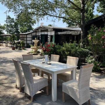
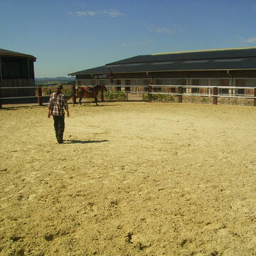
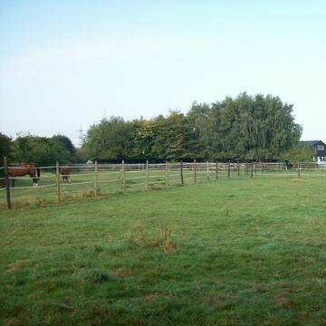
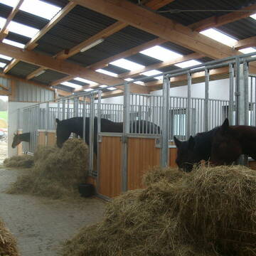
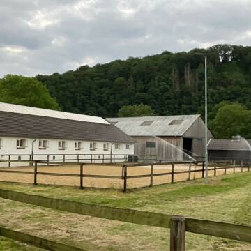
Historische Reitanlage in Köln-Dellbrück
Köln
RGS Kornspringer Köln e. V.
@Kornspringer
FN-Mitglied
Freizeitstall
Vermieten
Führanlage
Hunde willkommen
bedampftes/gewaschenes Heu
Notfallboxen
21 weitere...
S


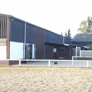
***Reitstall Birkenhof*** Pferdegerechte Haltung
Köln
Daniele-Fazzi
@Daniele-Fazzi
Freizeitstall
Geländestrecke
Vermieten
Verpachten
Hunde willkommen
Longierzirkel/Roundpen
Allergikerstall
Hufrehe geeignet
23 weitere...
ganz aktuell
S
Deprecated: Creation of dynamic property Zend_View_Helper_Ads::$adLink is deprecated in /var/www/stall-frei/htdocs/staging.stall-frei.de/library/Psf/View/Helper/Ads.php on line 108

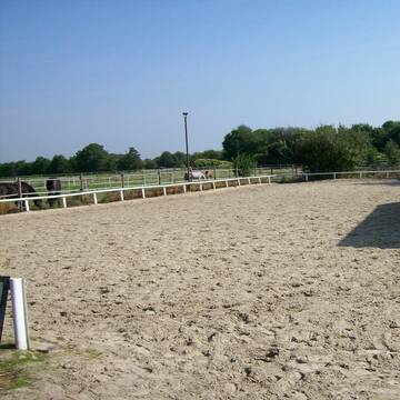
***Reitstall Birkenhof*** Pferdegerechte Haltung
Köln
Daniele-Fazzi
@Daniele-Fazzi
Herzlich Willkommen
auf dem Reitstall Birkenhof
Jetzt neu ‼️ auf dem Birkenhof:
Private Geländestrecke rund um unser
Hof Bongartz • Paddockboxen + HIT-Aktivställe
Hennef-Heisterschoß
Hof-Bongartz
@Hof-Bongartz
Freizeitstall
Reitlehrer und -unterricht
Vermieten
Führanlage
Hunde willkommen
Allergikerstall
22 weitere...
ganz aktuell
S
Reitstall Mühlenbeck
Hürth
Reitstall-Muehlenbeck
@Reitstall-Muehlenbeck
FN-Mitglied
Freizeitstall
Vermieten
Hunde willkommen
Longierzirkel/Roundpen
Außenbox mit Paddock
Außenboxen
19 weitere...
aktuell
S
Leider kein Vorschaubild
Leider kein Vorschaubild
Reitercorps St. Sebastianus Porz-Wahn 1957 e.V.
Köln
Reitercorps-St-Seb.-Porz-Wahn
@Reitercorps-St-Sebastianus
FN-Mitglied
Freizeitstall
Hunde willkommen
Longierzirkel/Roundpen
Außenbox mit Paddock
Außenboxen
Vollpension
17 weitere...
B


Mayerhof in Hennef Lichtenberg
Hennef Lichtenberg
Ursula Mayer
@Markus-Ursula-und-Marius-Mayer
FN-Mitglied
Freizeitstall
Führanlage
Krankenbox
Notfallboxen
Außenbox mit Paddock
Außenboxen
23 weitere...
S

Offenstall Platz
Köln
Offenstall
@Offenstall-KoelnRodenkirchen
Freizeitstall
Hunde willkommen
Paddock
Hufrehe geeignet
Notfallboxen
Offenstall
6 weitere...
P

Offenstallplatz
Rösrath
Lemmerhof
@Lemmerhof
Freizeitstall
Krankenbox
Paddock
Allergikerstall
bedampftes/gewaschenes Heu
Laufstall
Offenstall
10 weitere...
P

Persönlichkeitsentwicklung mit Pferden
Bad Salzuflen
Katja Dors
@Pferdezeiten
Begleite andere auf ihrem Entwicklungsweg und entdecke die transformative Kraft der pferdegestützten Persönlichkeitsentwicklung !
neu
R


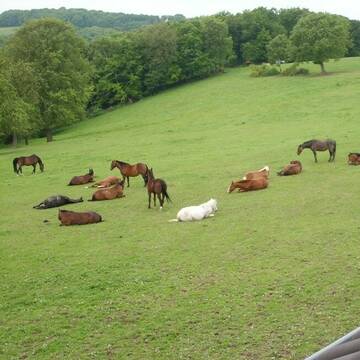
Union-Gestüt, Artgerechte Pferdehaltung im Siegt...
Eitorf
Union Gestüt
@Union-Gestuet
Freizeitstall
Vermieten
Führanlage
Hunde willkommen
Gnadenbrothof
Notfallboxen
23 weitere...
S


nur 30 Pferde privat und pferdegerecht
Weilerswist
Beate Horn-Moll&Mike Horn
@SchwalbenhofGBR
Freizeitstall
Geländestrecke
Vermieten
Hunde willkommen
Longierzirkel/Roundpen
Fohlenaufzucht möglich
Notfallboxen
23 weitere...
S
Deprecated: Creation of dynamic property Zend_View::$pageCount is deprecated in /var/www/stall-frei/htdocs/staging.stall-frei.de/library/vendor/shardj/zf1-future/library/Zend/View/Abstract.php on line 308
Deprecated: Creation of dynamic property Zend_View::$itemCountPerPage is deprecated in /var/www/stall-frei/htdocs/staging.stall-frei.de/library/vendor/shardj/zf1-future/library/Zend/View/Abstract.php on line 308
Deprecated: Creation of dynamic property Zend_View::$first is deprecated in /var/www/stall-frei/htdocs/staging.stall-frei.de/library/vendor/shardj/zf1-future/library/Zend/View/Abstract.php on line 308
Deprecated: Creation of dynamic property Zend_View::$current is deprecated in /var/www/stall-frei/htdocs/staging.stall-frei.de/library/vendor/shardj/zf1-future/library/Zend/View/Abstract.php on line 308
Deprecated: Creation of dynamic property Zend_View::$last is deprecated in /var/www/stall-frei/htdocs/staging.stall-frei.de/library/vendor/shardj/zf1-future/library/Zend/View/Abstract.php on line 308
Deprecated: Creation of dynamic property Zend_View::$next is deprecated in /var/www/stall-frei/htdocs/staging.stall-frei.de/library/vendor/shardj/zf1-future/library/Zend/View/Abstract.php on line 308
Deprecated: Creation of dynamic property Zend_View::$pagesInRange is deprecated in /var/www/stall-frei/htdocs/staging.stall-frei.de/library/vendor/shardj/zf1-future/library/Zend/View/Abstract.php on line 308
Deprecated: Creation of dynamic property Zend_View::$firstPageInRange is deprecated in /var/www/stall-frei/htdocs/staging.stall-frei.de/library/vendor/shardj/zf1-future/library/Zend/View/Abstract.php on line 308
Deprecated: Creation of dynamic property Zend_View::$lastPageInRange is deprecated in /var/www/stall-frei/htdocs/staging.stall-frei.de/library/vendor/shardj/zf1-future/library/Zend/View/Abstract.php on line 308
Deprecated: Creation of dynamic property Zend_View::$currentItemCount is deprecated in /var/www/stall-frei/htdocs/staging.stall-frei.de/library/vendor/shardj/zf1-future/library/Zend/View/Abstract.php on line 308
Deprecated: Creation of dynamic property Zend_View::$totalItemCount is deprecated in /var/www/stall-frei/htdocs/staging.stall-frei.de/library/vendor/shardj/zf1-future/library/Zend/View/Abstract.php on line 308
Deprecated: Creation of dynamic property Zend_View::$firstItemNumber is deprecated in /var/www/stall-frei/htdocs/staging.stall-frei.de/library/vendor/shardj/zf1-future/library/Zend/View/Abstract.php on line 308
Deprecated: Creation of dynamic property Zend_View::$lastItemNumber is deprecated in /var/www/stall-frei/htdocs/staging.stall-frei.de/library/vendor/shardj/zf1-future/library/Zend/View/Abstract.php on line 308
Deprecated: Creation of dynamic property Zend_View::$router is deprecated in /var/www/stall-frei/htdocs/staging.stall-frei.de/library/vendor/shardj/zf1-future/library/Zend/View/Abstract.php on line 308
Deprecated: Creation of dynamic property Zend_View::$urlParams is deprecated in /var/www/stall-frei/htdocs/staging.stall-frei.de/library/vendor/shardj/zf1-future/library/Zend/View/Abstract.php on line 308
Deprecated: Creation of dynamic property Zend_View::$showAds is deprecated in /var/www/stall-frei/htdocs/staging.stall-frei.de/library/vendor/shardj/zf1-future/library/Zend/View/Abstract.php on line 308
Deprecated: Creation of dynamic property Zend_View::$objectIds is deprecated in /var/www/stall-frei/htdocs/staging.stall-frei.de/library/vendor/shardj/zf1-future/library/Zend/View/Abstract.php on line 308
Deprecated: Creation of dynamic property Zend_View::$showNavbar is deprecated in /var/www/stall-frei/htdocs/staging.stall-frei.de/library/vendor/shardj/zf1-future/library/Zend/View/Abstract.php on line 308
Deprecated: Creation of dynamic property Zend_View::$showBreadcrumb is deprecated in /var/www/stall-frei/htdocs/staging.stall-frei.de/library/vendor/shardj/zf1-future/library/Zend/View/Abstract.php on line 308
Deprecated: Creation of dynamic property Zend_View::$showFooter is deprecated in /var/www/stall-frei/htdocs/staging.stall-frei.de/library/vendor/shardj/zf1-future/library/Zend/View/Abstract.php on line 308
Deprecated: Creation of dynamic property Zend_View::$showInternalAds is deprecated in /var/www/stall-frei/htdocs/staging.stall-frei.de/library/vendor/shardj/zf1-future/library/Zend/View/Abstract.php on line 308
Deprecated: Creation of dynamic property Zend_View::$blNoContent is deprecated in /var/www/stall-frei/htdocs/staging.stall-frei.de/library/vendor/shardj/zf1-future/library/Zend/View/Abstract.php on line 308
Deprecated: Creation of dynamic property Zend_View::$sMetaDesc is deprecated in /var/www/stall-frei/htdocs/staging.stall-frei.de/library/vendor/shardj/zf1-future/library/Zend/View/Abstract.php on line 308
Deprecated: Creation of dynamic property Zend_View::$useGmaps is deprecated in /var/www/stall-frei/htdocs/staging.stall-frei.de/library/vendor/shardj/zf1-future/library/Zend/View/Abstract.php on line 308
Deprecated: Creation of dynamic property Zend_View::$touches is deprecated in /var/www/stall-frei/htdocs/staging.stall-frei.de/library/vendor/shardj/zf1-future/library/Zend/View/Abstract.php on line 308
Deprecated: Creation of dynamic property Zend_View::$oProject is deprecated in /var/www/stall-frei/htdocs/staging.stall-frei.de/library/vendor/shardj/zf1-future/library/Zend/View/Abstract.php on line 308
Deprecated: Creation of dynamic property Zend_View::$pageHeadline is deprecated in /var/www/stall-frei/htdocs/staging.stall-frei.de/library/vendor/shardj/zf1-future/library/Zend/View/Abstract.php on line 308
Deprecated: Creation of dynamic property Zend_View::$disableLocationField is deprecated in /var/www/stall-frei/htdocs/staging.stall-frei.de/library/vendor/shardj/zf1-future/library/Zend/View/Abstract.php on line 308
Deprecated: Creation of dynamic property Zend_View::$isSearch is deprecated in /var/www/stall-frei/htdocs/staging.stall-frei.de/library/vendor/shardj/zf1-future/library/Zend/View/Abstract.php on line 308
Deprecated: Creation of dynamic property Zend_View::$pageTitle is deprecated in /var/www/stall-frei/htdocs/staging.stall-frei.de/library/vendor/shardj/zf1-future/library/Zend/View/Abstract.php on line 308
Deprecated: Creation of dynamic property Psf_Form_Element_Text::$class is deprecated in /var/www/stall-frei/htdocs/staging.stall-frei.de/library/vendor/shardj/zf1-future/library/Zend/Form/Element.php on line 874
Deprecated: Creation of dynamic property Psf_Form_Element_Text::$size is deprecated in /var/www/stall-frei/htdocs/staging.stall-frei.de/library/vendor/shardj/zf1-future/library/Zend/Form/Element.php on line 874
Deprecated: Creation of dynamic property Psf_Form_Element_Text::$placeholder is deprecated in /var/www/stall-frei/htdocs/staging.stall-frei.de/library/vendor/shardj/zf1-future/library/Zend/Form/Element.php on line 874
Deprecated: Creation of dynamic property Psf_Form_Element_Hidden::$class is deprecated in /var/www/stall-frei/htdocs/staging.stall-frei.de/library/vendor/shardj/zf1-future/library/Zend/Form/Element.php on line 874
Deprecated: Creation of dynamic property Psf_Form_Element_Hidden::$class is deprecated in /var/www/stall-frei/htdocs/staging.stall-frei.de/library/vendor/shardj/zf1-future/library/Zend/Form/Element.php on line 874
Deprecated: Creation of dynamic property Psf_Form_Element_Hidden::$class is deprecated in /var/www/stall-frei/htdocs/staging.stall-frei.de/library/vendor/shardj/zf1-future/library/Zend/Form/Element.php on line 874
Deprecated: Creation of dynamic property Psf_Form_Element_Hidden::$class is deprecated in /var/www/stall-frei/htdocs/staging.stall-frei.de/library/vendor/shardj/zf1-future/library/Zend/Form/Element.php on line 874
Deprecated: Creation of dynamic property Psf_Form_Element_Select::$class is deprecated in /var/www/stall-frei/htdocs/staging.stall-frei.de/library/vendor/shardj/zf1-future/library/Zend/Form/Element.php on line 874
Deprecated: Creation of dynamic property Psf_Form_Element_Select::$class is deprecated in /var/www/stall-frei/htdocs/staging.stall-frei.de/library/vendor/shardj/zf1-future/library/Zend/Form/Element.php on line 874
Deprecated: Creation of dynamic property Psf_Form_Element_Select::$class is deprecated in /var/www/stall-frei/htdocs/staging.stall-frei.de/library/vendor/shardj/zf1-future/library/Zend/Form/Element.php on line 874
Deprecated: Creation of dynamic property Psf_Form_Element_Select::$class is deprecated in /var/www/stall-frei/htdocs/staging.stall-frei.de/library/vendor/shardj/zf1-future/library/Zend/Form/Element.php on line 874
Deprecated: Creation of dynamic property Psf_Form_Element_Text::$class is deprecated in /var/www/stall-frei/htdocs/staging.stall-frei.de/library/vendor/shardj/zf1-future/library/Zend/Form/Element.php on line 874
Deprecated: Creation of dynamic property Psf_Form_Element_Checkbox::$label is deprecated in /var/www/stall-frei/htdocs/staging.stall-frei.de/library/vendor/shardj/zf1-future/library/Zend/Form/Element.php on line 874
Deprecated: Creation of dynamic property Zend_View::$sort is deprecated in /var/www/stall-frei/htdocs/staging.stall-frei.de/library/vendor/shardj/zf1-future/library/Zend/View/Abstract.php on line 308
Deprecated: Creation of dynamic property Zend_View::$searchLocation is deprecated in /var/www/stall-frei/htdocs/staging.stall-frei.de/library/vendor/shardj/zf1-future/library/Zend/View/Abstract.php on line 308
Deprecated: Creation of dynamic property Zend_View::$locationHint is deprecated in /var/www/stall-frei/htdocs/staging.stall-frei.de/library/vendor/shardj/zf1-future/library/Zend/View/Abstract.php on line 308
Psf_GeoCoder_Abstract::getLocation: Wahnheide Get Location CachedOrLive
Psf_GeoCoder_Abstract::getCachedOrLive: Wahnheide
Psf_GeoCoder_OpenCageData::makeApiRequest: response:
Array
(
[documentation] => https://opencagedata.com/api
[licenses] => Array
(
[0] => Array
(
[name] => see attribution guide
[url] => https://opencagedata.com/credits
)
)
[results] => Array
(
[0] => Array
(
[bounds] => Array
(
[northeast] => Array
(
[lat] => 50.8725951
[lng] => 7.1192732
)
[southwest] => Array
(
[lat] => 50.8516829
[lng] => 7.0955042
)
)
[components] => Array
(
[ISO_3166-1_alpha-2] => DE
[ISO_3166-1_alpha-3] => DEU
[ISO_3166-2] => Array
(
[0] => DE-NW
)
[_category] => place
[_normalized_city] => Köln
[_type] => neighbourhood
[city] => Köln
[city_district] => Porz
[continent] => Europe
[country] => Deutschland
[country_code] => de
[political_union] => European Union
[state] => Nordrhein-Westfalen
[state_code] => NW
[suburb] => Wahnheide
)
[confidence] => 7
[formatted] => Wahnheide, Köln, Nordrhein-Westfalen, Deutschland
[geometry] => Array
(
[lat] => 50.8599107
[lng] => 7.1035217
)
)
[1] => Array
(
[bounds] => Array
(
[northeast] => Array
(
[lat] => 50.8640131
[lng] => 6.2551794
)
[southwest] => Array
(
[lat] => 50.8440131
[lng] => 6.2351794
)
)
[components] => Array
(
[ISO_3166-1_alpha-2] => DE
[ISO_3166-1_alpha-3] => DEU
[ISO_3166-2] => Array
(
[0] => DE-NW
)
[_category] => place
[_normalized_city] => Eschweiler
[_type] => hamlet
[continent] => Europe
[country] => Deutschland
[country_code] => de
[county] => Städteregion Aachen
[locality] => Wahnheide
[political_union] => European Union
[postcode] => 52249
[state] => Nordrhein-Westfalen
[state_code] => NW
[suburb] => Kinzweiler
[town] => Eschweiler
)
[confidence] => 8
[formatted] => Wahnheide, 52249 Eschweiler, Deutschland
[geometry] => Array
(
[lat] => 50.8540131
[lng] => 6.2451794
)
)
[2] => Array
(
[components] => Array
(
[ISO_3166-1_alpha-2] => FR
[ISO_3166-1_alpha-3] => FRA
[ISO_3166-2] => Array
(
[0] => FR-IDF
[1] => FR-92
)
[_category] => road
[_normalized_city] => Levallois-Perret
[_type] => road
[city] => Levallois-Perret
[continent] => Europe
[country] => France
[country_code] => fr
[county] => Hauts-de-Seine
[local_authority] => Métropole du Grand Paris
[political_union] => European Union
[postcode] => 92300
[road] => Rue Charles Deutschmann
[state] => Île-de-France
[state_code] => IDF
)
[confidence] => 2
[formatted] => Rue Charles Deutschmann, 92300 Levallois-Perret, France
[geometry] => Array
(
[lat] => 48.900049
[lng] => 2.2842
)
)
[3] => Array
(
[components] => Array
(
[ISO_3166-1_alpha-2] => FR
[ISO_3166-1_alpha-3] => FRA
[ISO_3166-2] => Array
(
[0] => FR-ARA
[1] => FR-63
)
[_category] => road
[_normalized_city] => Vertaizon
[_type] => road
[city] => Vertaizon
[continent] => Europe
[country] => France
[country_code] => fr
[county] => Puy-de-Dôme
[local_authority] => Billom Communauté
[political_union] => European Union
[postcode] => 63910
[road] => Allée de la Vaneille
[state] => Auvergne-Rhône-Alpes
[state_code] => ARA
)
[confidence] => 2
[formatted] => Allée de la Vaneille, 63910 Vertaizon, France
[geometry] => Array
(
[lat] => 45.786786
[lng] => 3.283852
)
)
[4] => Array
(
[components] => Array
(
[ISO_3166-1_alpha-2] => FR
[ISO_3166-1_alpha-3] => FRA
[ISO_3166-2] => Array
(
[0] => FR-ARA
[1] => FR-07
)
[_category] => road
[_normalized_city] => Beaumont
[_type] => road
[city] => Beaumont
[continent] => Europe
[country] => France
[country_code] => fr
[county] => Ardèche
[local_authority] => Communauté de communes du Pays Beaume-Drobie
[political_union] => European Union
[postcode] => 07110
[road] => Chemin de Vaneyre
[state] => Auvergne-Rhône-Alpes
[state_code] => ARA
)
[confidence] => 2
[formatted] => Chemin de Vaneyre, 07110 Beaumont, France
[geometry] => Array
(
[lat] => 44.549194
[lng] => 4.187226
)
)
[5] => Array
(
[components] => Array
(
[ISO_3166-1_alpha-2] => FR
[ISO_3166-1_alpha-3] => FRA
[ISO_3166-2] => Array
(
[0] => FR-BFC
[1] => FR-70
)
[_category] => road
[_normalized_city] => Héricourt
[_type] => road
[city] => Héricourt
[continent] => Europe
[country] => France
[country_code] => fr
[county] => Haute-Saône
[local_authority] => Communauté de communes du pays d'Héricourt
[political_union] => European Union
[postcode] => 70400
[road] => Rue des Vanney
[state] => Bourgogne-Franche-Comté
[state_code] => BFC
)
[confidence] => 10
[formatted] => Rue des Vanney, 70400 Héricourt, France
[geometry] => Array
(
[lat] => 47.554988
[lng] => 6.776051
)
)
[6] => Array
(
[components] => Array
(
[ISO_3166-1_alpha-2] => FR
[ISO_3166-1_alpha-3] => FRA
[ISO_3166-2] => Array
(
[0] => FR-BFC
[1] => FR-70
)
[_category] => road
[_normalized_city] => Couthenans
[_type] => road
[city] => Couthenans
[continent] => Europe
[country] => France
[country_code] => fr
[county] => Haute-Saône
[local_authority] => Communauté de communes du pays d'Héricourt
[political_union] => European Union
[postcode] => 70400
[road] => Chemin du Vanney
[state] => Bourgogne-Franche-Comté
[state_code] => BFC
)
[confidence] => 10
[formatted] => Chemin du Vanney, 70400 Couthenans, France
[geometry] => Array
(
[lat] => 47.592385
[lng] => 6.722275
)
)
[7] => Array
(
[components] => Array
(
[ISO_3166-1_alpha-2] => FR
[ISO_3166-1_alpha-3] => FRA
[ISO_3166-2] => Array
(
[0] => FR-GES
[1] => FR-88
)
[_category] => road
[_normalized_city] => Hennezel
[_type] => road
[city] => Hennezel
[continent] => Europe
[country] => France
[country_code] => fr
[county] => Vosges
[local_authority] => Communauté de communes des Vosges Côté Sud Ouest
[political_union] => European Union
[postcode] => 88260
[road] => Rue du Champ Vanney
[state] => Grand Est
[state_code] => GES
)
[confidence] => 10
[formatted] => Rue du Champ Vanney, 88260 Hennezel, France
[geometry] => Array
(
[lat] => 48.054473
[lng] => 6.122026
)
)
[8] => Array
(
[components] => Array
(
[ISO_3166-1_alpha-2] => FR
[ISO_3166-1_alpha-3] => FRA
[ISO_3166-2] => Array
(
[0] => FR-BFC
[1] => FR-21
)
[_category] => road
[_normalized_city] => Perrigny-sur-l'Ognon
[_type] => road
[city] => Perrigny-sur-l'Ognon
[continent] => Europe
[country] => France
[country_code] => fr
[county] => Côte-d'Or
[local_authority] => Communauté de communes Auxonne Pontailler Val de Saône
[political_union] => European Union
[postcode] => 21270
[road] => Rue du Vanney
[state] => Bourgogne-Franche-Comté
[state_code] => BFC
)
[confidence] => 10
[formatted] => Rue du Vanney, 21270 Perrigny-sur-l'Ognon, France
[geometry] => Array
(
[lat] => 47.309425
[lng] => 5.45094
)
)
[9] => Array
(
[components] => Array
(
[ISO_3166-1_alpha-2] => FR
[ISO_3166-1_alpha-3] => FRA
[ISO_3166-2] => Array
(
[0] => FR-BFC
[1] => FR-70
)
[_category] => place
[_normalized_city] => Plancher-Bas
[_type] => place
[city] => Plancher-Bas
[continent] => Europe
[country] => France
[country_code] => fr
[county] => Haute-Saône
[local_authority] => Communauté de communes Rahin et Chérimont
[place] => Prés Vanney
[political_union] => European Union
[postcode] => 70290
[state] => Bourgogne-Franche-Comté
[state_code] => BFC
)
[confidence] => 10
[formatted] => Prés Vanney, 70290 Plancher-Bas, France
[geometry] => Array
(
[lat] => 47.735306
[lng] => 6.71693
)
)
)
[status] => Array
(
[code] => 200
[message] => OK
)
[stay_informed] => Array
(
[blog] => https://blog.opencagedata.com
[mastodon] => https://en.osm.town/@opencage
)
[thanks] => For using an OpenCage API
[timestamp] => Array
(
[created_http] => Sat, 07 Feb 2026 09:41:40 GMT
[created_unix] => 1770457300
)
[total_results] => 10
)
Psf_GeoCoder_Abstract::convertLocationResult
{"documentation":"https:\/\/opencagedata.com\/api","licenses":[{"name":"see attribution guide","url":"https:\/\/opencagedata.com\/credits"}],"results":[{"bounds":{"northeast":{"lat":50.8725951,"lng":7.1192732},"southwest":{"lat":50.8516829,"lng":7.0955042}},"components":{"ISO_3166-1_alpha-2":"DE","ISO_3166-1_alpha-3":"DEU","ISO_3166-2":["DE-NW"],"_category":"place","_normalized_city":"K\u00f6ln","_type":"neighbourhood","city":"K\u00f6ln","city_district":"Porz","continent":"Europe","country":"Deutschland","country_code":"de","political_union":"European Union","state":"Nordrhein-Westfalen","state_code":"NW","suburb":"Wahnheide"},"confidence":7,"formatted":"Wahnheide, K\u00f6ln, Nordrhein-Westfalen, Deutschland","geometry":{"lat":50.8599107,"lng":7.1035217}},{"bounds":{"northeast":{"lat":50.8640131,"lng":6.2551794},"southwest":{"lat":50.8440131,"lng":6.2351794}},"components":{"ISO_3166-1_alpha-2":"DE","ISO_3166-1_alpha-3":"DEU","ISO_3166-2":["DE-NW"],"_category":"place","_normalized_city":"Eschweiler","_type":"hamlet","continent":"Europe","country":"Deutschland","country_code":"de","county":"St\u00e4dteregion Aachen","locality":"Wahnheide","political_union":"European Union","postcode":"52249","state":"Nordrhein-Westfalen","state_code":"NW","suburb":"Kinzweiler","town":"Eschweiler"},"confidence":8,"formatted":"Wahnheide, 52249 Eschweiler, Deutschland","geometry":{"lat":50.8540131,"lng":6.2451794}},{"components":{"ISO_3166-1_alpha-2":"FR","ISO_3166-1_alpha-3":"FRA","ISO_3166-2":["FR-IDF","FR-92"],"_category":"road","_normalized_city":"Levallois-Perret","_type":"road","city":"Levallois-Perret","continent":"Europe","country":"France","country_code":"fr","county":"Hauts-de-Seine","local_authority":"M\u00e9tropole du Grand Paris","political_union":"European Union","postcode":"92300","road":"Rue Charles Deutschmann","state":"\u00cele-de-France","state_code":"IDF"},"confidence":2,"formatted":"Rue Charles Deutschmann, 92300 Levallois-Perret, France","geometry":{"lat":48.900049,"lng":2.2842}},{"components":{"ISO_3166-1_alpha-2":"FR","ISO_3166-1_alpha-3":"FRA","ISO_3166-2":["FR-ARA","FR-63"],"_category":"road","_normalized_city":"Vertaizon","_type":"road","city":"Vertaizon","continent":"Europe","country":"France","country_code":"fr","county":"Puy-de-D\u00f4me","local_authority":"Billom Communaut\u00e9","political_union":"European Union","postcode":"63910","road":"All\u00e9e de la Vaneille","state":"Auvergne-Rh\u00f4ne-Alpes","state_code":"ARA"},"confidence":2,"formatted":"All\u00e9e de la Vaneille, 63910 Vertaizon, France","geometry":{"lat":45.786786,"lng":3.283852}},{"components":{"ISO_3166-1_alpha-2":"FR","ISO_3166-1_alpha-3":"FRA","ISO_3166-2":["FR-ARA","FR-07"],"_category":"road","_normalized_city":"Beaumont","_type":"road","city":"Beaumont","continent":"Europe","country":"France","country_code":"fr","county":"Ard\u00e8che","local_authority":"Communaut\u00e9 de communes du Pays Beaume-Drobie","political_union":"European Union","postcode":"07110","road":"Chemin de Vaneyre","state":"Auvergne-Rh\u00f4ne-Alpes","state_code":"ARA"},"confidence":2,"formatted":"Chemin de Vaneyre, 07110 Beaumont, France","geometry":{"lat":44.549194,"lng":4.187226}},{"components":{"ISO_3166-1_alpha-2":"FR","ISO_3166-1_alpha-3":"FRA","ISO_3166-2":["FR-BFC","FR-70"],"_category":"road","_normalized_city":"H\u00e9ricourt","_type":"road","city":"H\u00e9ricourt","continent":"Europe","country":"France","country_code":"fr","county":"Haute-Sa\u00f4ne","local_authority":"Communaut\u00e9 de communes du pays d'H\u00e9ricourt","political_union":"European Union","postcode":"70400","road":"Rue des Vanney","state":"Bourgogne-Franche-Comt\u00e9","state_code":"BFC"},"confidence":10,"formatted":"Rue des Vanney, 70400 H\u00e9ricourt, France","geometry":{"lat":47.554988,"lng":6.776051}},{"components":{"ISO_3166-1_alpha-2":"FR","ISO_3166-1_alpha-3":"FRA","ISO_3166-2":["FR-BFC","FR-70"],"_category":"road","_normalized_city":"Couthenans","_type":"road","city":"Couthenans","continent":"Europe","country":"France","country_code":"fr","county":"Haute-Sa\u00f4ne","local_authority":"Communaut\u00e9 de communes du pays d'H\u00e9ricourt","political_union":"European Union","postcode":"70400","road":"Chemin du Vanney","state":"Bourgogne-Franche-Comt\u00e9","state_code":"BFC"},"confidence":10,"formatted":"Chemin du Vanney, 70400 Couthenans, France","geometry":{"lat":47.592385,"lng":6.722275}},{"components":{"ISO_3166-1_alpha-2":"FR","ISO_3166-1_alpha-3":"FRA","ISO_3166-2":["FR-GES","FR-88"],"_category":"road","_normalized_city":"Hennezel","_type":"road","city":"Hennezel","continent":"Europe","country":"France","country_code":"fr","county":"Vosges","local_authority":"Communaut\u00e9 de communes des Vosges C\u00f4t\u00e9 Sud Ouest","political_union":"European Union","postcode":"88260","road":"Rue du Champ Vanney","state":"Grand Est","state_code":"GES"},"confidence":10,"formatted":"Rue du Champ Vanney, 88260 Hennezel, France","geometry":{"lat":48.054473,"lng":6.122026}},{"components":{"ISO_3166-1_alpha-2":"FR","ISO_3166-1_alpha-3":"FRA","ISO_3166-2":["FR-BFC","FR-21"],"_category":"road","_normalized_city":"Perrigny-sur-l'Ognon","_type":"road","city":"Perrigny-sur-l'Ognon","continent":"Europe","country":"France","country_code":"fr","county":"C\u00f4te-d'Or","local_authority":"Communaut\u00e9 de communes Auxonne Pontailler Val de Sa\u00f4ne","political_union":"European Union","postcode":"21270","road":"Rue du Vanney","state":"Bourgogne-Franche-Comt\u00e9","state_code":"BFC"},"confidence":10,"formatted":"Rue du Vanney, 21270 Perrigny-sur-l'Ognon, France","geometry":{"lat":47.309425,"lng":5.45094}},{"components":{"ISO_3166-1_alpha-2":"FR","ISO_3166-1_alpha-3":"FRA","ISO_3166-2":["FR-BFC","FR-70"],"_category":"place","_normalized_city":"Plancher-Bas","_type":"place","city":"Plancher-Bas","continent":"Europe","country":"France","country_code":"fr","county":"Haute-Sa\u00f4ne","local_authority":"Communaut\u00e9 de communes Rahin et Ch\u00e9rimont","place":"Pr\u00e9s Vanney","political_union":"European Union","postcode":"70290","state":"Bourgogne-Franche-Comt\u00e9","state_code":"BFC"},"confidence":10,"formatted":"Pr\u00e9s Vanney, 70290 Plancher-Bas, France","geometry":{"lat":47.735306,"lng":6.71693}}],"status":{"code":200,"message":"OK"},"stay_informed":{"blog":"https:\/\/blog.opencagedata.com","mastodon":"https:\/\/en.osm.town\/@opencage"},"thanks":"For using an OpenCage API","timestamp":{"created_http":"Sat, 07 Feb 2026 09:41:40 GMT","created_unix":1770457300},"total_results":10}Array
(
[0] => stdClass Object
(
[bounds] => stdClass Object
(
[northeast] => stdClass Object
(
[lat] => 50.8725951
[lng] => 7.1192732
)
[southwest] => stdClass Object
(
[lat] => 50.8516829
[lng] => 7.0955042
)
)
[components] => stdClass Object
(
[ISO_3166-1_alpha-2] => DE
[ISO_3166-1_alpha-3] => DEU
[ISO_3166-2] => Array
(
[0] => DE-NW
)
[_category] => place
[_normalized_city] => Köln
[_type] => neighbourhood
[city] => Köln
[city_district] => Porz
[continent] => Europe
[country] => Deutschland
[country_code] => de
[political_union] => European Union
[state] => Nordrhein-Westfalen
[state_code] => NW
[suburb] => Wahnheide
)
[confidence] => 7
[formatted] => Wahnheide, Köln, Nordrhein-Westfalen, Deutschland
[geometry] => stdClass Object
(
[lat] => 50.8599107
[lng] => 7.1035217
)
)
[1] => stdClass Object
(
[bounds] => stdClass Object
(
[northeast] => stdClass Object
(
[lat] => 50.8640131
[lng] => 6.2551794
)
[southwest] => stdClass Object
(
[lat] => 50.8440131
[lng] => 6.2351794
)
)
[components] => stdClass Object
(
[ISO_3166-1_alpha-2] => DE
[ISO_3166-1_alpha-3] => DEU
[ISO_3166-2] => Array
(
[0] => DE-NW
)
[_category] => place
[_normalized_city] => Eschweiler
[_type] => hamlet
[continent] => Europe
[country] => Deutschland
[country_code] => de
[county] => Städteregion Aachen
[locality] => Wahnheide
[political_union] => European Union
[postcode] => 52249
[state] => Nordrhein-Westfalen
[state_code] => NW
[suburb] => Kinzweiler
[town] => Eschweiler
)
[confidence] => 8
[formatted] => Wahnheide, 52249 Eschweiler, Deutschland
[geometry] => stdClass Object
(
[lat] => 50.8540131
[lng] => 6.2451794
)
)
[2] => stdClass Object
(
[components] => stdClass Object
(
[ISO_3166-1_alpha-2] => FR
[ISO_3166-1_alpha-3] => FRA
[ISO_3166-2] => Array
(
[0] => FR-IDF
[1] => FR-92
)
[_category] => road
[_normalized_city] => Levallois-Perret
[_type] => road
[city] => Levallois-Perret
[continent] => Europe
[country] => France
[country_code] => fr
[county] => Hauts-de-Seine
[local_authority] => Métropole du Grand Paris
[political_union] => European Union
[postcode] => 92300
[road] => Rue Charles Deutschmann
[state] => Île-de-France
[state_code] => IDF
)
[confidence] => 2
[formatted] => Rue Charles Deutschmann, 92300 Levallois-Perret, France
[geometry] => stdClass Object
(
[lat] => 48.900049
[lng] => 2.2842
)
)
[3] => stdClass Object
(
[components] => stdClass Object
(
[ISO_3166-1_alpha-2] => FR
[ISO_3166-1_alpha-3] => FRA
[ISO_3166-2] => Array
(
[0] => FR-ARA
[1] => FR-63
)
[_category] => road
[_normalized_city] => Vertaizon
[_type] => road
[city] => Vertaizon
[continent] => Europe
[country] => France
[country_code] => fr
[county] => Puy-de-Dôme
[local_authority] => Billom Communauté
[political_union] => European Union
[postcode] => 63910
[road] => Allée de la Vaneille
[state] => Auvergne-Rhône-Alpes
[state_code] => ARA
)
[confidence] => 2
[formatted] => Allée de la Vaneille, 63910 Vertaizon, France
[geometry] => stdClass Object
(
[lat] => 45.786786
[lng] => 3.283852
)
)
[4] => stdClass Object
(
[components] => stdClass Object
(
[ISO_3166-1_alpha-2] => FR
[ISO_3166-1_alpha-3] => FRA
[ISO_3166-2] => Array
(
[0] => FR-ARA
[1] => FR-07
)
[_category] => road
[_normalized_city] => Beaumont
[_type] => road
[city] => Beaumont
[continent] => Europe
[country] => France
[country_code] => fr
[county] => Ardèche
[local_authority] => Communauté de communes du Pays Beaume-Drobie
[political_union] => European Union
[postcode] => 07110
[road] => Chemin de Vaneyre
[state] => Auvergne-Rhône-Alpes
[state_code] => ARA
)
[confidence] => 2
[formatted] => Chemin de Vaneyre, 07110 Beaumont, France
[geometry] => stdClass Object
(
[lat] => 44.549194
[lng] => 4.187226
)
)
[5] => stdClass Object
(
[components] => stdClass Object
(
[ISO_3166-1_alpha-2] => FR
[ISO_3166-1_alpha-3] => FRA
[ISO_3166-2] => Array
(
[0] => FR-BFC
[1] => FR-70
)
[_category] => road
[_normalized_city] => Héricourt
[_type] => road
[city] => Héricourt
[continent] => Europe
[country] => France
[country_code] => fr
[county] => Haute-Saône
[local_authority] => Communauté de communes du pays d'Héricourt
[political_union] => European Union
[postcode] => 70400
[road] => Rue des Vanney
[state] => Bourgogne-Franche-Comté
[state_code] => BFC
)
[confidence] => 10
[formatted] => Rue des Vanney, 70400 Héricourt, France
[geometry] => stdClass Object
(
[lat] => 47.554988
[lng] => 6.776051
)
)
[6] => stdClass Object
(
[components] => stdClass Object
(
[ISO_3166-1_alpha-2] => FR
[ISO_3166-1_alpha-3] => FRA
[ISO_3166-2] => Array
(
[0] => FR-BFC
[1] => FR-70
)
[_category] => road
[_normalized_city] => Couthenans
[_type] => road
[city] => Couthenans
[continent] => Europe
[country] => France
[country_code] => fr
[county] => Haute-Saône
[local_authority] => Communauté de communes du pays d'Héricourt
[political_union] => European Union
[postcode] => 70400
[road] => Chemin du Vanney
[state] => Bourgogne-Franche-Comté
[state_code] => BFC
)
[confidence] => 10
[formatted] => Chemin du Vanney, 70400 Couthenans, France
[geometry] => stdClass Object
(
[lat] => 47.592385
[lng] => 6.722275
)
)
[7] => stdClass Object
(
[components] => stdClass Object
(
[ISO_3166-1_alpha-2] => FR
[ISO_3166-1_alpha-3] => FRA
[ISO_3166-2] => Array
(
[0] => FR-GES
[1] => FR-88
)
[_category] => road
[_normalized_city] => Hennezel
[_type] => road
[city] => Hennezel
[continent] => Europe
[country] => France
[country_code] => fr
[county] => Vosges
[local_authority] => Communauté de communes des Vosges Côté Sud Ouest
[political_union] => European Union
[postcode] => 88260
[road] => Rue du Champ Vanney
[state] => Grand Est
[state_code] => GES
)
[confidence] => 10
[formatted] => Rue du Champ Vanney, 88260 Hennezel, France
[geometry] => stdClass Object
(
[lat] => 48.054473
[lng] => 6.122026
)
)
[8] => stdClass Object
(
[components] => stdClass Object
(
[ISO_3166-1_alpha-2] => FR
[ISO_3166-1_alpha-3] => FRA
[ISO_3166-2] => Array
(
[0] => FR-BFC
[1] => FR-21
)
[_category] => road
[_normalized_city] => Perrigny-sur-l'Ognon
[_type] => road
[city] => Perrigny-sur-l'Ognon
[continent] => Europe
[country] => France
[country_code] => fr
[county] => Côte-d'Or
[local_authority] => Communauté de communes Auxonne Pontailler Val de Saône
[political_union] => European Union
[postcode] => 21270
[road] => Rue du Vanney
[state] => Bourgogne-Franche-Comté
[state_code] => BFC
)
[confidence] => 10
[formatted] => Rue du Vanney, 21270 Perrigny-sur-l'Ognon, France
[geometry] => stdClass Object
(
[lat] => 47.309425
[lng] => 5.45094
)
)
[9] => stdClass Object
(
[components] => stdClass Object
(
[ISO_3166-1_alpha-2] => FR
[ISO_3166-1_alpha-3] => FRA
[ISO_3166-2] => Array
(
[0] => FR-BFC
[1] => FR-70
)
[_category] => place
[_normalized_city] => Plancher-Bas
[_type] => place
[city] => Plancher-Bas
[continent] => Europe
[country] => France
[country_code] => fr
[county] => Haute-Saône
[local_authority] => Communauté de communes Rahin et Chérimont
[place] => Prés Vanney
[political_union] => European Union
[postcode] => 70290
[state] => Bourgogne-Franche-Comté
[state_code] => BFC
)
[confidence] => 10
[formatted] => Prés Vanney, 70290 Plancher-Bas, France
[geometry] => stdClass Object
(
[lat] => 47.735306
[lng] => 6.71693
)
)
)
Psf_GeoCoder_OpenCageData::getKeyMap: 0
stdClass Object
(
    [bounds] => stdClass Object
        (
            [northeast] => stdClass Object
                (
                    [lat] => 50.8725951
                    [lng] => 7.1192732
                )

            [southwest] => stdClass Object
                (
                    [lat] => 50.8516829
                    [lng] => 7.0955042
                )

        )

    [components] => stdClass Object
        (
            [ISO_3166-1_alpha-2] => DE
            [ISO_3166-1_alpha-3] => DEU
            [ISO_3166-2] => Array
                (
                    [0] => DE-NW
                )

            [_category] => place
            [_normalized_city] => Köln
            [_type] => neighbourhood
            [city] => Köln
            [city_district] => Porz
            [continent] => Europe
            [country] => Deutschland
            [country_code] => de
            [political_union] => European Union
            [state] => Nordrhein-Westfalen
            [state_code] => NW
            [suburb] => Wahnheide
        )

    [confidence] => 7
    [formatted] => Wahnheide, Köln, Nordrhein-Westfalen, Deutschland
    [geometry] => stdClass Object
        (
            [lat] => 50.8599107
            [lng] => 7.1035217
        )

)
Psf_GeoCoder_OpenCageData::getCounty: Köln
Psf_GeoCoder_OpenCageData::addMissingData REFETCH!
Array
(
    [address] => Wahnheide, Köln, Nordrhein-Westfalen, Deutschland
    [type] => neighbourhood
    [street] =>
    [city] => Wahnheide
    [county] => Köln
    [state] => Nordrhein-Westfalen
    [zip] =>
    [country] => Deutschland
    [suburb] => Wahnheide
    [countrycode] => de
    [latitude] => 50.8599107
    [longitude] => 7.1035217
    [accuracy] => 1
    [confidence] => 7
    [bounds] => stdClass Object
        (
            [northeast] => stdClass Object
                (
                    [lat] => 50.8725951
                    [lng] => 7.1192732
                )

            [southwest] => stdClass Object
                (
                    [lat] => 50.8516829
                    [lng] => 7.0955042
                )

        )

)
reformat!
Array
(
    [address] => Wahnheide, Köln, Nordrhein-Westfalen, Deutschland
    [type] => neighbourhood
    [street] =>
    [city] => Wahnheide
    [county] => Köln
    [state] => Nordrhein-Westfalen
    [zip] =>
    [country] => Deutschland
    [suburb] => Wahnheide
    [countrycode] => de
    [latitude] => 50.8599107
    [longitude] => 7.1035217
    [accuracy] => 1
    [confidence] => 7
    [bounds] => stdClass Object
        (
            [northeast] => stdClass Object
                (
                    [lat] => 50.8725951
                    [lng] => 7.1192732
                )

            [southwest] => stdClass Object
                (
                    [lat] => 50.8516829
                    [lng] => 7.0955042
                )

        )

    [place] => Wahnheide, Nordrhein-Westfalen
    [hash] => 533f46f3863a837d299565a91c6c1ad0
)
Psf_GeoCoder_OpenCageData::getKeyMap: 1
stdClass Object
(
    [bounds] => stdClass Object
        (
            [northeast] => stdClass Object
                (
                    [lat] => 50.8640131
                    [lng] => 6.2551794
                )

            [southwest] => stdClass Object
                (
                    [lat] => 50.8440131
                    [lng] => 6.2351794
                )

        )

    [components] => stdClass Object
        (
            [ISO_3166-1_alpha-2] => DE
            [ISO_3166-1_alpha-3] => DEU
            [ISO_3166-2] => Array
                (
                    [0] => DE-NW
                )

            [_category] => place
            [_normalized_city] => Eschweiler
            [_type] => hamlet
            [continent] => Europe
            [country] => Deutschland
            [country_code] => de
            [county] => Städteregion Aachen
            [locality] => Wahnheide
            [political_union] => European Union
            [postcode] => 52249
            [state] => Nordrhein-Westfalen
            [state_code] => NW
            [suburb] => Kinzweiler
            [town] => Eschweiler
        )

    [confidence] => 8
    [formatted] => Wahnheide, 52249 Eschweiler, Deutschland
    [geometry] => stdClass Object
        (
            [lat] => 50.8540131
            [lng] => 6.2451794
        )

)
Psf_GeoCoder_OpenCageData::getCounty: Städteregion Aachen
Psf_GeoCoder_OpenCageData::addMissingData REFETCH!
Array
(
    [address] => Wahnheide, 52249 Eschweiler, Deutschland
    [type] => hamlet
    [street] =>
    [city] => Eschweiler
    [county] => Städteregion Aachen
    [state] => Nordrhein-Westfalen
    [zip] => 52249
    [country] => Deutschland
    [suburb] => Kinzweiler
    [countrycode] => de
    [latitude] => 50.8540131
    [longitude] => 6.2451794
    [accuracy] => 1
    [confidence] => 8
    [bounds] => stdClass Object
        (
            [northeast] => stdClass Object
                (
                    [lat] => 50.8640131
                    [lng] => 6.2551794
                )

            [southwest] => stdClass Object
                (
                    [lat] => 50.8440131
                    [lng] => 6.2351794
                )

        )

)
reformat!
Array
(
    [address] => Wahnheide, 52249 Eschweiler, Deutschland
    [type] => hamlet
    [street] =>
    [city] => Eschweiler
    [county] => Städteregion Aachen
    [state] => Nordrhein-Westfalen
    [zip] => 52249
    [country] => Deutschland
    [suburb] => Kinzweiler
    [countrycode] => de
    [latitude] => 50.8540131
    [longitude] => 6.2451794
    [accuracy] => 1
    [confidence] => 8
    [bounds] => stdClass Object
        (
            [northeast] => stdClass Object
                (
                    [lat] => 50.8640131
                    [lng] => 6.2551794
                )

            [southwest] => stdClass Object
                (
                    [lat] => 50.8440131
                    [lng] => 6.2351794
                )

        )

    [place] => 52249 Eschweiler, Nordrhein-Westfalen
    [hash] => 08d42835b5e1416865c45f82cff31254
)
Psf_GeoCoder_OpenCageData::getKeyMap: 2
stdClass Object
(
    [components] => stdClass Object
        (
            [ISO_3166-1_alpha-2] => FR
            [ISO_3166-1_alpha-3] => FRA
            [ISO_3166-2] => Array
                (
                    [0] => FR-IDF
                    [1] => FR-92
                )

            [_category] => road
            [_normalized_city] => Levallois-Perret
            [_type] => road
            [city] => Levallois-Perret
            [continent] => Europe
            [country] => France
            [country_code] => fr
            [county] => Hauts-de-Seine
            [local_authority] => Métropole du Grand Paris
            [political_union] => European Union
            [postcode] => 92300
            [road] => Rue Charles Deutschmann
            [state] => Île-de-France
            [state_code] => IDF
        )

    [confidence] => 2
    [formatted] => Rue Charles Deutschmann, 92300 Levallois-Perret, France
    [geometry] => stdClass Object
        (
            [lat] => 48.900049
            [lng] => 2.2842
        )

)
Psf_GeoCoder_OpenCageData::getCounty: Hauts-de-Seine
Psf_GeoCoder_OpenCageData::addMissingData REFETCH!
Array
(
    [address] => Rue Charles Deutschmann, 92300 Levallois-Perret, France
    [type] => road
    [street] => Rue Charles Deutschmann
    [city] => Levallois-Perret
    [county] => Hauts-de-Seine
    [state] => Île-de-France
    [zip] => 92300
    [country] => France
    [suburb] =>
    [countrycode] => fr
    [latitude] => 48.900049
    [longitude] => 2.2842
    [accuracy] => 1
    [confidence] => 2
    [bounds] =>
)
reformat!
Array
(
    [address] => Rue Charles Deutschmann, 92300 Levallois-Perret, France
    [type] => road
    [street] => Rue Charles Deutschmann
    [city] => Levallois-Perret
    [county] => Hauts-de-Seine
    [state] => Île-de-France
    [zip] => 92300
    [country] => France
    [suburb] =>
    [countrycode] => fr
    [latitude] => 48.900049
    [longitude] => 2.2842
    [accuracy] => 1
    [confidence] => 2
    [bounds] =>
    [place] => Rue Charles Deutschmann, 92300 Levallois-Perret, Île-de-France
    [hash] => b7dc44def3990e8a7eaf18e019eca466
)
Psf_GeoCoder_OpenCageData::getKeyMap: 3
stdClass Object
(
    [components] => stdClass Object
        (
            [ISO_3166-1_alpha-2] => FR
            [ISO_3166-1_alpha-3] => FRA
            [ISO_3166-2] => Array
                (
                    [0] => FR-ARA
                    [1] => FR-63
                )

            [_category] => road
            [_normalized_city] => Vertaizon
            [_type] => road
            [city] => Vertaizon
            [continent] => Europe
            [country] => France
            [country_code] => fr
            [county] => Puy-de-Dôme
            [local_authority] => Billom Communauté
            [political_union] => European Union
            [postcode] => 63910
            [road] => Allée de la Vaneille
            [state] => Auvergne-Rhône-Alpes
            [state_code] => ARA
        )

    [confidence] => 2
    [formatted] => Allée de la Vaneille, 63910 Vertaizon, France
    [geometry] => stdClass Object
        (
            [lat] => 45.786786
            [lng] => 3.283852
        )

)
Psf_GeoCoder_OpenCageData::getCounty: Puy-de-Dôme
Psf_GeoCoder_OpenCageData::addMissingData REFETCH!
Array
(
    [address] => Allée de la Vaneille, 63910 Vertaizon, France
    [type] => road
    [street] => Allée de la Vaneille
    [city] => Vertaizon
    [county] => Puy-de-Dôme
    [state] => Auvergne-Rhône-Alpes
    [zip] => 63910
    [country] => France
    [suburb] =>
    [countrycode] => fr
    [latitude] => 45.786786
    [longitude] => 3.283852
    [accuracy] => 1
    [confidence] => 2
    [bounds] =>
)
reformat!
Array
(
    [address] => Allée de la Vaneille, 63910 Vertaizon, France
    [type] => road
    [street] => Allée de la Vaneille
    [city] => Vertaizon
    [county] => Puy-de-Dôme
    [state] => Auvergne-Rhône-Alpes
    [zip] => 63910
    [country] => France
    [suburb] =>
    [countrycode] => fr
    [latitude] => 45.786786
    [longitude] => 3.283852
    [accuracy] => 1
    [confidence] => 2
    [bounds] =>
    [place] => Allée de la Vaneille, 63910 Vertaizon, Auvergne-Rhône-Alpes
    [hash] => 03703bd0aaecae6067412f9517e23469
)
Psf_GeoCoder_OpenCageData::getKeyMap: 4
stdClass Object
(
    [components] => stdClass Object
        (
            [ISO_3166-1_alpha-2] => FR
            [ISO_3166-1_alpha-3] => FRA
            [ISO_3166-2] => Array
                (
                    [0] => FR-ARA
                    [1] => FR-07
                )

            [_category] => road
            [_normalized_city] => Beaumont
            [_type] => road
            [city] => Beaumont
            [continent] => Europe
            [country] => France
            [country_code] => fr
            [county] => Ardèche
            [local_authority] => Communauté de communes du Pays Beaume-Drobie
            [political_union] => European Union
            [postcode] => 07110
            [road] => Chemin de Vaneyre
            [state] => Auvergne-Rhône-Alpes
            [state_code] => ARA
        )

    [confidence] => 2
    [formatted] => Chemin de Vaneyre, 07110 Beaumont, France
    [geometry] => stdClass Object
        (
            [lat] => 44.549194
            [lng] => 4.187226
        )

)
Psf_GeoCoder_OpenCageData::getCounty: Ardèche
Psf_GeoCoder_OpenCageData::addMissingData REFETCH!
Array
(
    [address] => Chemin de Vaneyre, 07110 Beaumont, France
    [type] => road
    [street] => Chemin de Vaneyre
    [city] => Beaumont
    [county] => Ardèche
    [state] => Auvergne-Rhône-Alpes
    [zip] => 07110
    [country] => France
    [suburb] =>
    [countrycode] => fr
    [latitude] => 44.549194
    [longitude] => 4.187226
    [accuracy] => 1
    [confidence] => 2
    [bounds] =>
)
reformat!
Array
(
    [address] => Chemin de Vaneyre, 07110 Beaumont, France
    [type] => road
    [street] => Chemin de Vaneyre
    [city] => Beaumont
    [county] => Ardèche
    [state] => Auvergne-Rhône-Alpes
    [zip] => 07110
    [country] => France
    [suburb] =>
    [countrycode] => fr
    [latitude] => 44.549194
    [longitude] => 4.187226
    [accuracy] => 1
    [confidence] => 2
    [bounds] =>
    [place] => Chemin de Vaneyre, 07110 Beaumont, Auvergne-Rhône-Alpes
    [hash] => 1e838fe503651869fa51b3d26e776995
)
Psf_GeoCoder_OpenCageData::getKeyMap: 5
stdClass Object
(
    [components] => stdClass Object
        (
            [ISO_3166-1_alpha-2] => FR
            [ISO_3166-1_alpha-3] => FRA
            [ISO_3166-2] => Array
                (
                    [0] => FR-BFC
                    [1] => FR-70
                )

            [_category] => road
            [_normalized_city] => Héricourt
            [_type] => road
            [city] => Héricourt
            [continent] => Europe
            [country] => France
            [country_code] => fr
            [county] => Haute-Saône
            [local_authority] => Communauté de communes du pays d'Héricourt
            [political_union] => European Union
            [postcode] => 70400
            [road] => Rue des Vanney
            [state] => Bourgogne-Franche-Comté
            [state_code] => BFC
        )

    [confidence] => 10
    [formatted] => Rue des Vanney, 70400 Héricourt, France
    [geometry] => stdClass Object
        (
            [lat] => 47.554988
            [lng] => 6.776051
        )

)
Psf_GeoCoder_OpenCageData::getCounty: Haute-Saône
Psf_GeoCoder_OpenCageData::addMissingData REFETCH!
Array
(
    [address] => Rue des Vanney, 70400 Héricourt, France
    [type] => road
    [street] => Rue des Vanney
    [city] => Héricourt
    [county] => Haute-Saône
    [state] => Bourgogne-Franche-Comté
    [zip] => 70400
    [country] => France
    [suburb] =>
    [countrycode] => fr
    [latitude] => 47.554988
    [longitude] => 6.776051
    [accuracy] => 1
    [confidence] => 10
    [bounds] =>
)
reformat!
Array
(
    [address] => Rue des Vanney, 70400 Héricourt, France
    [type] => road
    [street] => Rue des Vanney
    [city] => Héricourt
    [county] => Haute-Saône
    [state] => Bourgogne-Franche-Comté
    [zip] => 70400
    [country] => France
    [suburb] =>
    [countrycode] => fr
    [latitude] => 47.554988
    [longitude] => 6.776051
    [accuracy] => 1
    [confidence] => 10
    [bounds] =>
    [place] => Rue des Vanney, 70400 Héricourt, Bourgogne-Franche-Comté
    [hash] => d23315ab68fc9ea6be4ed693a4ad0823
)
Psf_GeoCoder_OpenCageData::getKeyMap: 6
stdClass Object
(
    [components] => stdClass Object
        (
            [ISO_3166-1_alpha-2] => FR
            [ISO_3166-1_alpha-3] => FRA
            [ISO_3166-2] => Array
                (
                    [0] => FR-BFC
                    [1] => FR-70
                )

            [_category] => road
            [_normalized_city] => Couthenans
            [_type] => road
            [city] => Couthenans
            [continent] => Europe
            [country] => France
            [country_code] => fr
            [county] => Haute-Saône
            [local_authority] => Communauté de communes du pays d'Héricourt
            [political_union] => European Union
            [postcode] => 70400
            [road] => Chemin du Vanney
            [state] => Bourgogne-Franche-Comté
            [state_code] => BFC
        )

    [confidence] => 10
    [formatted] => Chemin du Vanney, 70400 Couthenans, France
    [geometry] => stdClass Object
        (
            [lat] => 47.592385
            [lng] => 6.722275
        )

)
Psf_GeoCoder_OpenCageData::getCounty: Haute-Saône
Psf_GeoCoder_OpenCageData::addMissingData REFETCH!
Array
(
    [address] => Chemin du Vanney, 70400 Couthenans, France
    [type] => road
    [street] => Chemin du Vanney
    [city] => Couthenans
    [county] => Haute-Saône
    [state] => Bourgogne-Franche-Comté
    [zip] => 70400
    [country] => France
    [suburb] =>
    [countrycode] => fr
    [latitude] => 47.592385
    [longitude] => 6.722275
    [accuracy] => 1
    [confidence] => 10
    [bounds] =>
)
reformat!
Array
(
    [address] => Chemin du Vanney, 70400 Couthenans, France
    [type] => road
    [street] => Chemin du Vanney
    [city] => Couthenans
    [county] => Haute-Saône
    [state] => Bourgogne-Franche-Comté
    [zip] => 70400
    [country] => France
    [suburb] =>
    [countrycode] => fr
    [latitude] => 47.592385
    [longitude] => 6.722275
    [accuracy] => 1
    [confidence] => 10
    [bounds] =>
    [place] => Chemin du Vanney, 70400 Couthenans, Bourgogne-Franche-Comté
    [hash] => 608eb20de7ae73defe8b0ea81ef94454
)
Psf_GeoCoder_OpenCageData::getKeyMap: 7
stdClass Object
(
    [components] => stdClass Object
        (
            [ISO_3166-1_alpha-2] => FR
            [ISO_3166-1_alpha-3] => FRA
            [ISO_3166-2] => Array
                (
                    [0] => FR-GES
                    [1] => FR-88
                )

            [_category] => road
            [_normalized_city] => Hennezel
            [_type] => road
            [city] => Hennezel
            [continent] => Europe
            [country] => France
            [country_code] => fr
            [county] => Vosges
            [local_authority] => Communauté de communes des Vosges Côté Sud Ouest
            [political_union] => European Union
            [postcode] => 88260
            [road] => Rue du Champ Vanney
            [state] => Grand Est
            [state_code] => GES
        )

    [confidence] => 10
    [formatted] => Rue du Champ Vanney, 88260 Hennezel, France
    [geometry] => stdClass Object
        (
            [lat] => 48.054473
            [lng] => 6.122026
        )

)
Psf_GeoCoder_OpenCageData::getCounty: Vosges
Psf_GeoCoder_OpenCageData::addMissingData REFETCH!
Array
(
    [address] => Rue du Champ Vanney, 88260 Hennezel, France
    [type] => road
    [street] => Rue du Champ Vanney
    [city] => Hennezel
    [county] => Vosges
    [state] => Grand Est
    [zip] => 88260
    [country] => France
    [suburb] =>
    [countrycode] => fr
    [latitude] => 48.054473
    [longitude] => 6.122026
    [accuracy] => 1
    [confidence] => 10
    [bounds] =>
)
reformat!
Array
(
    [address] => Rue du Champ Vanney, 88260 Hennezel, France
    [type] => road
    [street] => Rue du Champ Vanney
    [city] => Hennezel
    [county] => Vosges
    [state] => Grand Est
    [zip] => 88260
    [country] => France
    [suburb] =>
    [countrycode] => fr
    [latitude] => 48.054473
    [longitude] => 6.122026
    [accuracy] => 1
    [confidence] => 10
    [bounds] =>
    [place] => Rue du Champ Vanney, 88260 Hennezel, Grand Est
    [hash] => 0161f32cf8314e4312725d0185897eea
)
Psf_GeoCoder_OpenCageData::getKeyMap: 8
stdClass Object
(
    [components] => stdClass Object
        (
            [ISO_3166-1_alpha-2] => FR
            [ISO_3166-1_alpha-3] => FRA
            [ISO_3166-2] => Array
                (
                    [0] => FR-BFC
                    [1] => FR-21
                )

            [_category] => road
            [_normalized_city] => Perrigny-sur-l'Ognon
            [_type] => road
            [city] => Perrigny-sur-l'Ognon
            [continent] => Europe
            [country] => France
            [country_code] => fr
            [county] => Côte-d'Or
            [local_authority] => Communauté de communes Auxonne Pontailler Val de Saône
            [political_union] => European Union
            [postcode] => 21270
            [road] => Rue du Vanney
            [state] => Bourgogne-Franche-Comté
            [state_code] => BFC
        )

    [confidence] => 10
    [formatted] => Rue du Vanney, 21270 Perrigny-sur-l'Ognon, France
    [geometry] => stdClass Object
        (
            [lat] => 47.309425
            [lng] => 5.45094
        )

)
Psf_GeoCoder_OpenCageData::getCounty: Côte-d'Or
Psf_GeoCoder_OpenCageData::addMissingData REFETCH!
Array
(
    [address] => Rue du Vanney, 21270 Perrigny-sur-l'Ognon, France
    [type] => road
    [street] => Rue du Vanney
    [city] => Perrigny-sur-l'Ognon
    [county] => Côte-d'Or
    [state] => Bourgogne-Franche-Comté
    [zip] => 21270
    [country] => France
    [suburb] =>
    [countrycode] => fr
    [latitude] => 47.309425
    [longitude] => 5.45094
    [accuracy] => 1
    [confidence] => 10
    [bounds] =>
)
reformat!
Array
(
    [address] => Rue du Vanney, 21270 Perrigny-sur-l'Ognon, France
    [type] => road
    [street] => Rue du Vanney
    [city] => Perrigny-sur-l'Ognon
    [county] => Côte-d'Or
    [state] => Bourgogne-Franche-Comté
    [zip] => 21270
    [country] => France
    [suburb] =>
    [countrycode] => fr
    [latitude] => 47.309425
    [longitude] => 5.45094
    [accuracy] => 1
    [confidence] => 10
    [bounds] =>
    [place] => Rue du Vanney, 21270 Perrigny-sur-l'Ognon, Bourgogne-Franche-Comté
    [hash] => 4a09159545f6de4987dbf5fa352d93f2
)
Psf_GeoCoder_OpenCageData::getKeyMap: 9
stdClass Object
(
    [components] => stdClass Object
        (
            [ISO_3166-1_alpha-2] => FR
            [ISO_3166-1_alpha-3] => FRA
            [ISO_3166-2] => Array
                (
                    [0] => FR-BFC
                    [1] => FR-70
                )

            [_category] => place
            [_normalized_city] => Plancher-Bas
            [_type] => place
            [city] => Plancher-Bas
            [continent] => Europe
            [country] => France
            [country_code] => fr
            [county] => Haute-Saône
            [local_authority] => Communauté de communes Rahin et Chérimont
            [place] => Prés Vanney
            [political_union] => European Union
            [postcode] => 70290
            [state] => Bourgogne-Franche-Comté
            [state_code] => BFC
        )

    [confidence] => 10
    [formatted] => Prés Vanney, 70290 Plancher-Bas, France
    [geometry] => stdClass Object
        (
            [lat] => 47.735306
            [lng] => 6.71693
        )

)
Psf_GeoCoder_OpenCageData::getCounty: Haute-Saône
Psf_GeoCoder_OpenCageData::addMissingData REFETCH!
Array
(
    [address] => Prés Vanney, 70290 Plancher-Bas, France
    [type] => place
    [street] =>
    [city] => Plancher-Bas
    [county] => Haute-Saône
    [state] => Bourgogne-Franche-Comté
    [zip] => 70290
    [country] => France
    [suburb] =>
    [countrycode] => fr
    [latitude] => 47.735306
    [longitude] => 6.71693
    [accuracy] => 1
    [confidence] => 10
    [bounds] =>
)
reformat!
Array
(
    [address] => Prés Vanney, 70290 Plancher-Bas, France
    [type] => place
    [street] =>
    [city] => Plancher-Bas
    [county] => Haute-Saône
    [state] => Bourgogne-Franche-Comté
    [zip] => 70290
    [country] => France
    [suburb] =>
    [countrycode] => fr
    [latitude] => 47.735306
    [longitude] => 6.71693
    [accuracy] => 1
    [confidence] => 10
    [bounds] =>
    [place] => 70290 Plancher-Bas, Bourgogne-Franche-Comté
    [hash] => 657d69c0104f8cb94df999d43a7f0f81
)
Deprecated: Creation of dynamic property Zend_View::$locationHintStyle is deprecated in /var/www/stall-frei/htdocs/staging.stall-frei.de/library/vendor/shardj/zf1-future/library/Zend/View/Abstract.php on line 308
Deprecated: Creation of dynamic property Zend_View::$adGeoLocation is deprecated in /var/www/stall-frei/htdocs/staging.stall-frei.de/library/vendor/shardj/zf1-future/library/Zend/View/Abstract.php on line 308
Deprecated: Creation of dynamic property Zend_View::$recordCount is deprecated in /var/www/stall-frei/htdocs/staging.stall-frei.de/library/vendor/shardj/zf1-future/library/Zend/View/Abstract.php on line 308
Deprecated: explode(): Passing null to parameter #2 ($string) of type string is deprecated in /var/www/stall-frei/htdocs/staging.stall-frei.de/application/models/SearchAgent.php on line 100
Deprecated: explode(): Passing null to parameter #2 ($string) of type string is deprecated in /var/www/stall-frei/htdocs/staging.stall-frei.de/application/models/SearchAgent.php on line 100
Deprecated: explode(): Passing null to parameter #2 ($string) of type string is deprecated in /var/www/stall-frei/htdocs/staging.stall-frei.de/application/models/SearchAgent.php on line 100
Deprecated: explode(): Passing null to parameter #2 ($string) of type string is deprecated in /var/www/stall-frei/htdocs/staging.stall-frei.de/application/models/SearchAgent.php on line 100
Deprecated: explode(): Passing null to parameter #2 ($string) of type string is deprecated in /var/www/stall-frei/htdocs/staging.stall-frei.de/application/models/SearchAgent.php on line 100
Deprecated: explode(): Passing null to parameter #2 ($string) of type string is deprecated in /var/www/stall-frei/htdocs/staging.stall-frei.de/application/models/SearchAgent.php on line 100
Deprecated: explode(): Passing null to parameter #2 ($string) of type string is deprecated in /var/www/stall-frei/htdocs/staging.stall-frei.de/application/models/SearchAgent.php on line 100
Deprecated: explode(): Passing null to parameter #2 ($string) of type string is deprecated in /var/www/stall-frei/htdocs/staging.stall-frei.de/application/models/SearchAgent.php on line 100
Deprecated: explode(): Passing null to parameter #2 ($string) of type string is deprecated in /var/www/stall-frei/htdocs/staging.stall-frei.de/application/models/SearchAgent.php on line 100
Deprecated: trim(): Passing null to parameter #1 ($string) of type string is deprecated in /var/www/stall-frei/htdocs/staging.stall-frei.de/application/models/Account/Search.php on line 82
Warning: Cannot modify header information - headers already sent by (output started at /var/www/stall-frei/htdocs/staging.stall-frei.de/library/vendor/shardj/zf1-future/library/Zend/View/Abstract.php:308) in /var/www/stall-frei/htdocs/staging.stall-frei.de/application/models/Account/Search.php on line 71
Deprecated: Creation of dynamic property Zend_View::$paginationParams is deprecated in /var/www/stall-frei/htdocs/staging.stall-frei.de/library/vendor/shardj/zf1-future/library/Zend/View/Abstract.php on line 308
Deprecated: Creation of dynamic property Zend_View::$objectPaginator is deprecated in /var/www/stall-frei/htdocs/staging.stall-frei.de/library/vendor/shardj/zf1-future/library/Zend/View/Abstract.php on line 308
Deprecated: Creation of dynamic property Zend_View::$featuredObjects is deprecated in /var/www/stall-frei/htdocs/staging.stall-frei.de/library/vendor/shardj/zf1-future/library/Zend/View/Abstract.php on line 308
Deprecated: Creation of dynamic property Zend_View::$hints is deprecated in /var/www/stall-frei/htdocs/staging.stall-frei.de/library/vendor/shardj/zf1-future/library/Zend/View/Abstract.php on line 308
Deprecated: Creation of dynamic property Zend_View::$attributeHints is deprecated in /var/www/stall-frei/htdocs/staging.stall-frei.de/library/vendor/shardj/zf1-future/library/Zend/View/Abstract.php on line 308
Deprecated: Creation of dynamic property Zend_View::$oSearchForm is deprecated in /var/www/stall-frei/htdocs/staging.stall-frei.de/library/vendor/shardj/zf1-future/library/Zend/View/Abstract.php on line 308