Deprecated: Creation of dynamic property Zend_View::$sMode is deprecated in /var/www/stall-frei/htdocs/staging.stall-frei.de/library/vendor/shardj/zf1-future/library/Zend/View/Abstract.php on line 308
Stallplatz oder Offenstall in Eller
Gesucht wird in "40229 Eller"
6.346 Einträge
Deprecated: Creation of dynamic property Zend_View::$listObjects is deprecated in /var/www/stall-frei/htdocs/staging.stall-frei.de/library/vendor/shardj/zf1-future/library/Zend/View/Abstract.php on line 308
Gesponsort


Deprecated: Creation of dynamic property Zend_View::$listMode is deprecated in /var/www/stall-frei/htdocs/staging.stall-frei.de/library/vendor/shardj/zf1-future/library/Zend/View/Abstract.php on line 308
Deprecated: Creation of dynamic property Zend_View::$renderedObjects is deprecated in /var/www/stall-frei/htdocs/staging.stall-frei.de/library/vendor/shardj/zf1-future/library/Zend/View/Abstract.php on line 308
Deprecated: Creation of dynamic property Zend_View::$index is deprecated in /var/www/stall-frei/htdocs/staging.stall-frei.de/library/vendor/shardj/zf1-future/library/Zend/View/Abstract.php on line 308
Deprecated: Creation of dynamic property Zend_View::$displayMode is deprecated in /var/www/stall-frei/htdocs/staging.stall-frei.de/library/vendor/shardj/zf1-future/library/Zend/View/Abstract.php on line 308
Deprecated: Creation of dynamic property Zend_View::$remarketingIds is deprecated in /var/www/stall-frei/htdocs/staging.stall-frei.de/library/vendor/shardj/zf1-future/library/Zend/View/Abstract.php on line 308
Deprecated: Creation of dynamic property Zend_View::$listItem is deprecated in /var/www/stall-frei/htdocs/staging.stall-frei.de/library/vendor/shardj/zf1-future/library/Zend/View/Abstract.php on line 308
Deprecated: Creation of dynamic property Zend_View::$object is deprecated in /var/www/stall-frei/htdocs/staging.stall-frei.de/library/vendor/shardj/zf1-future/library/Zend/View/Abstract.php on line 308
Deprecated: Creation of dynamic property Zend_View::$attributes is deprecated in /var/www/stall-frei/htdocs/staging.stall-frei.de/library/vendor/shardj/zf1-future/library/Zend/View/Abstract.php on line 308
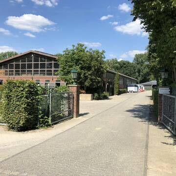
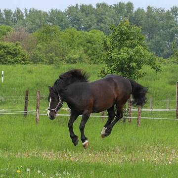
Reitanlage Wirtz - Sport und Freizeit
Düsseldorf
Christian-Wirtz
@Christian-Wirtz
Führanlage
Hunde willkommen
Außenbox mit Paddock
Außenboxen
Vollpension
Einzelne Boxen oder Stallplätze
Stallgasse oder Stalltrakt
16 weitere...
S
Deprecated: Creation of dynamic property Zend_View_Helper_Ads::$adLink is deprecated in /var/www/stall-frei/htdocs/staging.stall-frei.de/library/Psf/View/Helper/Ads.php on line 108

***Reitstall Birkenhof*** Pferdegerechte Haltung
Köln
Daniele-Fazzi
@Daniele-Fazzi
Herzlich Willkommen
auf dem Reitstall Birkenhof
Jetzt neu ‼️ auf dem Birkenhof:
Private Geländestrecke rund um unser


Reitanlage Pferdehof Teitscheid Boxen + Offenstall
Düsseldorf
Fam-Teitscheid
@Fam-Teitscheid
Geländestrecke
Pferdeausbildung
Vermieten
Führanlage
Hunde willkommen
Außenbox mit Paddock
Außenboxen
16 weitere...
S
Große moderne Boxen mit und ohne Paddock am Rhein
Dormagen
Grenzhof
@Grenzhof
FN-Mitglied
Geländestrecke
Vermieten
Longierzirkel/Roundpen
Paddock
Außenbox mit Paddock
Außenboxen
16 weitere...
S


box in 40474 Düsseldorf frei
Düsseldorf
S-Baumgaertner
@S-Baumgaertner
Freizeitstall
Pflegepferd
Hunde willkommen
Longierzirkel/Roundpen
Gnadenbrothof
Hufrehe geeignet
Innenbox
8 weitere...
aktuell
S


Aktivstall-Andreashof
Dormagen
Aktivstall-Andreashof
@Aktivstall-Andreashof
FN-Mitglied
Freizeitstall
Vermieten
Hunde willkommen
Krankenbox
Allergikerstall
Hufrehe geeignet
21 weitere...
S


Reitstall Conrad in Haan Gruiten
Haan, Rheinland
Reitstall Conrad
@MirkoConrad
FN-Mitglied
Freizeitstall
Vermieten
Führanlage
Hunde willkommen
Allergikerstall
Fohlenaufzucht möglich
29 weitere...
S


Hof Kemper, Aktivstall für Pferde
Neuss
Hof Kemper Aktivstall
@Kemper
FN-Mitglied
Freizeitstall
Vermieten
Krankenbox
Longierzirkel/Roundpen
Allergikerstall
Hufrehe geeignet
17 weitere...
P+

Das Beste für die Hufe
Mechtersen
STALL-FREIde Marketing
@STALL-FREI-Marketing
Hufschmiede und Hufpfleger in Ihrer Nähe


Freier Platz im Offenstall und freie Box (Wallach)
Erkrath
Martin-Boeker
@Martin-Boeker
Freizeitstall
Geländestrecke
Vermieten
Krankenbox
Paddock
Allergikerstall
Hufrehe geeignet
16 weitere...
P+


Reitstall Hanten
Erkrath
Bernd-Hanten
@Bernd-Hanten
FN-Mitglied
Freizeitstall
Führanlage
Hunde willkommen
Außenbox mit Paddock
Außenboxen
Vollpension
18 weitere...
P+

Kleiner Freizeitstall, Rentner, Offenstall
Düsseldorf
Christian-Wirtz
@Christian-Wirtz
Sattelkammer/Sattelschränke
Sommerweide
Fohlenaufzucht möglich
Außenbox mit Paddock
Außenboxen
Vollpension
4 weitere...
P
Deprecated: Creation of dynamic property Zend_View::$pageCount is deprecated in /var/www/stall-frei/htdocs/staging.stall-frei.de/library/vendor/shardj/zf1-future/library/Zend/View/Abstract.php on line 308
Deprecated: Creation of dynamic property Zend_View::$itemCountPerPage is deprecated in /var/www/stall-frei/htdocs/staging.stall-frei.de/library/vendor/shardj/zf1-future/library/Zend/View/Abstract.php on line 308
Deprecated: Creation of dynamic property Zend_View::$first is deprecated in /var/www/stall-frei/htdocs/staging.stall-frei.de/library/vendor/shardj/zf1-future/library/Zend/View/Abstract.php on line 308
Deprecated: Creation of dynamic property Zend_View::$current is deprecated in /var/www/stall-frei/htdocs/staging.stall-frei.de/library/vendor/shardj/zf1-future/library/Zend/View/Abstract.php on line 308
Deprecated: Creation of dynamic property Zend_View::$last is deprecated in /var/www/stall-frei/htdocs/staging.stall-frei.de/library/vendor/shardj/zf1-future/library/Zend/View/Abstract.php on line 308
Deprecated: Creation of dynamic property Zend_View::$next is deprecated in /var/www/stall-frei/htdocs/staging.stall-frei.de/library/vendor/shardj/zf1-future/library/Zend/View/Abstract.php on line 308
Deprecated: Creation of dynamic property Zend_View::$pagesInRange is deprecated in /var/www/stall-frei/htdocs/staging.stall-frei.de/library/vendor/shardj/zf1-future/library/Zend/View/Abstract.php on line 308
Deprecated: Creation of dynamic property Zend_View::$firstPageInRange is deprecated in /var/www/stall-frei/htdocs/staging.stall-frei.de/library/vendor/shardj/zf1-future/library/Zend/View/Abstract.php on line 308
Deprecated: Creation of dynamic property Zend_View::$lastPageInRange is deprecated in /var/www/stall-frei/htdocs/staging.stall-frei.de/library/vendor/shardj/zf1-future/library/Zend/View/Abstract.php on line 308
Deprecated: Creation of dynamic property Zend_View::$currentItemCount is deprecated in /var/www/stall-frei/htdocs/staging.stall-frei.de/library/vendor/shardj/zf1-future/library/Zend/View/Abstract.php on line 308
Deprecated: Creation of dynamic property Zend_View::$totalItemCount is deprecated in /var/www/stall-frei/htdocs/staging.stall-frei.de/library/vendor/shardj/zf1-future/library/Zend/View/Abstract.php on line 308
Deprecated: Creation of dynamic property Zend_View::$firstItemNumber is deprecated in /var/www/stall-frei/htdocs/staging.stall-frei.de/library/vendor/shardj/zf1-future/library/Zend/View/Abstract.php on line 308
Deprecated: Creation of dynamic property Zend_View::$lastItemNumber is deprecated in /var/www/stall-frei/htdocs/staging.stall-frei.de/library/vendor/shardj/zf1-future/library/Zend/View/Abstract.php on line 308
Deprecated: Creation of dynamic property Zend_View::$router is deprecated in /var/www/stall-frei/htdocs/staging.stall-frei.de/library/vendor/shardj/zf1-future/library/Zend/View/Abstract.php on line 308
Deprecated: Creation of dynamic property Zend_View::$urlParams is deprecated in /var/www/stall-frei/htdocs/staging.stall-frei.de/library/vendor/shardj/zf1-future/library/Zend/View/Abstract.php on line 308
Deprecated: Creation of dynamic property Zend_View::$showAds is deprecated in /var/www/stall-frei/htdocs/staging.stall-frei.de/library/vendor/shardj/zf1-future/library/Zend/View/Abstract.php on line 308
Deprecated: Creation of dynamic property Zend_View::$objectIds is deprecated in /var/www/stall-frei/htdocs/staging.stall-frei.de/library/vendor/shardj/zf1-future/library/Zend/View/Abstract.php on line 308
Deprecated: Creation of dynamic property Zend_View::$showNavbar is deprecated in /var/www/stall-frei/htdocs/staging.stall-frei.de/library/vendor/shardj/zf1-future/library/Zend/View/Abstract.php on line 308
Deprecated: Creation of dynamic property Zend_View::$showBreadcrumb is deprecated in /var/www/stall-frei/htdocs/staging.stall-frei.de/library/vendor/shardj/zf1-future/library/Zend/View/Abstract.php on line 308
Deprecated: Creation of dynamic property Zend_View::$showFooter is deprecated in /var/www/stall-frei/htdocs/staging.stall-frei.de/library/vendor/shardj/zf1-future/library/Zend/View/Abstract.php on line 308
Deprecated: Creation of dynamic property Zend_View::$showInternalAds is deprecated in /var/www/stall-frei/htdocs/staging.stall-frei.de/library/vendor/shardj/zf1-future/library/Zend/View/Abstract.php on line 308
Deprecated: Creation of dynamic property Zend_View::$blNoContent is deprecated in /var/www/stall-frei/htdocs/staging.stall-frei.de/library/vendor/shardj/zf1-future/library/Zend/View/Abstract.php on line 308
Deprecated: Creation of dynamic property Zend_View::$sMetaDesc is deprecated in /var/www/stall-frei/htdocs/staging.stall-frei.de/library/vendor/shardj/zf1-future/library/Zend/View/Abstract.php on line 308
Deprecated: Creation of dynamic property Zend_View::$useGmaps is deprecated in /var/www/stall-frei/htdocs/staging.stall-frei.de/library/vendor/shardj/zf1-future/library/Zend/View/Abstract.php on line 308
Deprecated: Creation of dynamic property Zend_View::$touches is deprecated in /var/www/stall-frei/htdocs/staging.stall-frei.de/library/vendor/shardj/zf1-future/library/Zend/View/Abstract.php on line 308
Deprecated: Creation of dynamic property Zend_View::$oProject is deprecated in /var/www/stall-frei/htdocs/staging.stall-frei.de/library/vendor/shardj/zf1-future/library/Zend/View/Abstract.php on line 308
Deprecated: Creation of dynamic property Zend_View::$pageHeadline is deprecated in /var/www/stall-frei/htdocs/staging.stall-frei.de/library/vendor/shardj/zf1-future/library/Zend/View/Abstract.php on line 308
Deprecated: Creation of dynamic property Zend_View::$disableLocationField is deprecated in /var/www/stall-frei/htdocs/staging.stall-frei.de/library/vendor/shardj/zf1-future/library/Zend/View/Abstract.php on line 308
Deprecated: Creation of dynamic property Zend_View::$isSearch is deprecated in /var/www/stall-frei/htdocs/staging.stall-frei.de/library/vendor/shardj/zf1-future/library/Zend/View/Abstract.php on line 308
Deprecated: Creation of dynamic property Zend_View::$pageTitle is deprecated in /var/www/stall-frei/htdocs/staging.stall-frei.de/library/vendor/shardj/zf1-future/library/Zend/View/Abstract.php on line 308
Deprecated: Creation of dynamic property Psf_Form_Element_Text::$class is deprecated in /var/www/stall-frei/htdocs/staging.stall-frei.de/library/vendor/shardj/zf1-future/library/Zend/Form/Element.php on line 874
Deprecated: Creation of dynamic property Psf_Form_Element_Text::$size is deprecated in /var/www/stall-frei/htdocs/staging.stall-frei.de/library/vendor/shardj/zf1-future/library/Zend/Form/Element.php on line 874
Deprecated: Creation of dynamic property Psf_Form_Element_Text::$placeholder is deprecated in /var/www/stall-frei/htdocs/staging.stall-frei.de/library/vendor/shardj/zf1-future/library/Zend/Form/Element.php on line 874
Deprecated: Creation of dynamic property Psf_Form_Element_Hidden::$class is deprecated in /var/www/stall-frei/htdocs/staging.stall-frei.de/library/vendor/shardj/zf1-future/library/Zend/Form/Element.php on line 874
Deprecated: Creation of dynamic property Psf_Form_Element_Hidden::$class is deprecated in /var/www/stall-frei/htdocs/staging.stall-frei.de/library/vendor/shardj/zf1-future/library/Zend/Form/Element.php on line 874
Deprecated: Creation of dynamic property Psf_Form_Element_Hidden::$class is deprecated in /var/www/stall-frei/htdocs/staging.stall-frei.de/library/vendor/shardj/zf1-future/library/Zend/Form/Element.php on line 874
Deprecated: Creation of dynamic property Psf_Form_Element_Hidden::$class is deprecated in /var/www/stall-frei/htdocs/staging.stall-frei.de/library/vendor/shardj/zf1-future/library/Zend/Form/Element.php on line 874
Deprecated: Creation of dynamic property Psf_Form_Element_Select::$class is deprecated in /var/www/stall-frei/htdocs/staging.stall-frei.de/library/vendor/shardj/zf1-future/library/Zend/Form/Element.php on line 874
Deprecated: Creation of dynamic property Psf_Form_Element_Select::$class is deprecated in /var/www/stall-frei/htdocs/staging.stall-frei.de/library/vendor/shardj/zf1-future/library/Zend/Form/Element.php on line 874
Deprecated: Creation of dynamic property Psf_Form_Element_Select::$class is deprecated in /var/www/stall-frei/htdocs/staging.stall-frei.de/library/vendor/shardj/zf1-future/library/Zend/Form/Element.php on line 874
Deprecated: Creation of dynamic property Psf_Form_Element_Select::$class is deprecated in /var/www/stall-frei/htdocs/staging.stall-frei.de/library/vendor/shardj/zf1-future/library/Zend/Form/Element.php on line 874
Deprecated: Creation of dynamic property Psf_Form_Element_Text::$class is deprecated in /var/www/stall-frei/htdocs/staging.stall-frei.de/library/vendor/shardj/zf1-future/library/Zend/Form/Element.php on line 874
Deprecated: Creation of dynamic property Psf_Form_Element_Checkbox::$label is deprecated in /var/www/stall-frei/htdocs/staging.stall-frei.de/library/vendor/shardj/zf1-future/library/Zend/Form/Element.php on line 874
Deprecated: Creation of dynamic property Zend_View::$sort is deprecated in /var/www/stall-frei/htdocs/staging.stall-frei.de/library/vendor/shardj/zf1-future/library/Zend/View/Abstract.php on line 308
Deprecated: Creation of dynamic property Zend_View::$searchLocation is deprecated in /var/www/stall-frei/htdocs/staging.stall-frei.de/library/vendor/shardj/zf1-future/library/Zend/View/Abstract.php on line 308
Deprecated: Creation of dynamic property Zend_View::$locationHint is deprecated in /var/www/stall-frei/htdocs/staging.stall-frei.de/library/vendor/shardj/zf1-future/library/Zend/View/Abstract.php on line 308
Psf_GeoCoder_Abstract::getLocation: Eller Get Location CachedOrLive
Psf_GeoCoder_Abstract::getCachedOrLive: Eller
Psf_GeoCoder_OpenCageData::makeApiRequest: response:
Array
(
[documentation] => https://opencagedata.com/api
[licenses] => Array
(
[0] => Array
(
[name] => see attribution guide
[url] => https://opencagedata.com/credits
)
)
[results] => Array
(
[0] => Array
(
[bounds] => Array
(
[northeast] => Array
(
[lat] => 51.2200027
[lng] => 6.8793233
)
[southwest] => Array
(
[lat] => 51.1898614
[lng] => 6.814334
)
)
[components] => Array
(
[ISO_3166-1_alpha-2] => DE
[ISO_3166-1_alpha-3] => DEU
[ISO_3166-2] => Array
(
[0] => DE-NW
)
[_category] => place
[_normalized_city] => Düsseldorf
[_type] => neighbourhood
[city] => Düsseldorf
[city_district] => Stadtbezirk 8
[continent] => Europe
[country] => Deutschland
[country_code] => de
[political_union] => European Union
[postcode] => 40229
[state] => Nordrhein-Westfalen
[state_code] => NW
[suburb] => Eller
)
[confidence] => 7
[formatted] => 40229 Düsseldorf, Deutschland
[geometry] => Array
(
[lat] => 51.2012532
[lng] => 6.8375905
)
)
[1] => Array
(
[bounds] => Array
(
[northeast] => Array
(
[lat] => 51.5690613
[lng] => 10.3459503
)
[southwest] => Array
(
[lat] => 51.5579727
[lng] => 10.3012277
)
)
[components] => Array
(
[ISO_3166-1_alpha-2] => DE
[ISO_3166-1_alpha-3] => DEU
[ISO_3166-2] => Array
(
[0] => DE-NI
)
[_category] => natural/water
[_normalized_city] => Herzberg am Harz
[_type] => river
[city] => Herzberg am Harz
[continent] => Europe
[country] => Deutschland
[country_code] => de
[county] => Landkreis Göttingen
[municipality] => Samtgemeinde Gieboldehausen
[political_union] => European Union
[river] => Eller
[state] => Niedersachsen
[state_code] => NI
[village] => Hilkerode
)
[confidence] => 7
[formatted] => Eller, Hilkerode, Niedersachsen, Deutschland
[geometry] => Array
(
[lat] => 51.5612813
[lng] => 10.3222535
)
)
[2] => Array
(
[bounds] => Array
(
[northeast] => Array
(
[lat] => 51.5810281
[lng] => 10.3008938
)
[southwest] => Array
(
[lat] => 51.5686452
[lng] => 10.2741031
)
)
[components] => Array
(
[ISO_3166-1_alpha-2] => DE
[ISO_3166-1_alpha-3] => DEU
[ISO_3166-2] => Array
(
[0] => DE-NI
)
[_category] => natural/water
[_normalized_city] => Rüdershausen
[_type] => river
[continent] => Europe
[country] => Deutschland
[country_code] => de
[county] => Landkreis Göttingen
[municipality] => Samtgemeinde Gieboldehausen
[political_union] => European Union
[river] => Eller
[state] => Niedersachsen
[state_code] => NI
[village] => Rüdershausen
)
[confidence] => 8
[formatted] => Eller, Rüdershausen, Niedersachsen, Deutschland
[geometry] => Array
(
[lat] => 51.576138
[lng] => 10.2887334
)
)
[3] => Array
(
[bounds] => Array
(
[northeast] => Array
(
[lat] => 51.5600257
[lng] => 10.3726527
)
[southwest] => Array
(
[lat] => 51.5547578
[lng] => 10.3459304
)
)
[components] => Array
(
[ISO_3166-1_alpha-2] => DE
[ISO_3166-1_alpha-3] => DEU
[ISO_3166-2] => Array
(
[0] => DE-NI
)
[_category] => natural/water
[_normalized_city] => Herzberg am Harz
[_type] => river
[city] => Herzberg am Harz
[city_district] => Brochthausen
[continent] => Europe
[country] => Deutschland
[country_code] => de
[county] => Landkreis Göttingen
[political_union] => European Union
[postcode] => 37115
[river] => Eller
[state] => Niedersachsen
[state_code] => NI
)
[confidence] => 8
[formatted] => Eller, 37115 Herzberg am Harz, Deutschland
[geometry] => Array
(
[lat] => 51.557019
[lng] => 10.3583678
)
)
[4] => Array
(
[bounds] => Array
(
[northeast] => Array
(
[lat] => 51.5690613
[lng] => 10.3012277
)
[southwest] => Array
(
[lat] => 51.5687317
[lng] => 10.3008938
)
)
[components] => Array
(
[ISO_3166-1_alpha-2] => DE
[ISO_3166-1_alpha-3] => DEU
[ISO_3166-2] => Array
(
[0] => DE-NI
)
[_category] => natural/water
[_normalized_city] => Duderstadt
[_type] => river
[continent] => Europe
[country] => Deutschland
[country_code] => de
[county] => Landkreis Göttingen
[municipality] => Samtgemeinde Gieboldehausen
[political_union] => European Union
[postcode] => 37115
[river] => Eller
[state] => Niedersachsen
[state_code] => NI
[town] => Duderstadt
[village] => Hilkerode
)
[confidence] => 9
[formatted] => Eller, 37115 Hilkerode, Deutschland
[geometry] => Array
(
[lat] => 51.5688573
[lng] => 10.3011116
)
)
[5] => Array
(
[bounds] => Array
(
[northeast] => Array
(
[lat] => 53.7119281
[lng] => 9.0606543
)
[southwest] => Array
(
[lat] => 53.7036524
[lng] => 9.0541801
)
)
[components] => Array
(
[ISO_3166-1_alpha-2] => DE
[ISO_3166-1_alpha-3] => DEU
[ISO_3166-2] => Array
(
[0] => DE-NI
)
[_category] => unknown
[_normalized_city] => Ellerbruch
[_type] => ditch
[continent] => Europe
[country] => Deutschland
[country_code] => de
[county] => Landkreis Cuxhaven
[ditch] => Eller
[municipality] => Wingst
[political_union] => European Union
[postcode] => 21789
[state] => Niedersachsen
[state_code] => NI
[town] => Ellerbruch
)
[confidence] => 9
[formatted] => Eller, 21789 Ellerbruch, Deutschland
[geometry] => Array
(
[lat] => 53.7077839
[lng] => 9.0582181
)
)
[6] => Array
(
[bounds] => Array
(
[northeast] => Array
(
[lat] => 51.6568793
[lng] => 10.3442752
)
[southwest] => Array
(
[lat] => 51.655111
[lng] => 10.3412725
)
)
[components] => Array
(
[ISO_3166-1_alpha-2] => DE
[ISO_3166-1_alpha-3] => DEU
[ISO_3166-2] => Array
(
[0] => DE-NI
)
[_category] => natural/water
[_normalized_city] => Herzberg am Harz
[_type] => stream
[city] => Herzberg am Harz
[continent] => Europe
[country] => Deutschland
[country_code] => de
[county] => Landkreis Göttingen
[political_union] => European Union
[postcode] => 37412
[state] => Niedersachsen
[state_code] => NI
[stream] => Mühlengraben
[suburb] => Innenstadt
)
[confidence] => 9
[formatted] => Mühlengraben, 37412 Herzberg am Harz, Deutschland
[geometry] => Array
(
[lat] => 51.6555765
[lng] => 10.343145
)
)
[7] => Array
(
[components] => Array
(
[ISO_3166-1_alpha-2] => FR
[ISO_3166-1_alpha-3] => FRA
[ISO_3166-2] => Array
(
[0] => FR-GES
[1] => FR-57
)
[_category] => road
[_normalized_city] => Haselbourg
[_type] => road
[city] => Haselbourg
[continent] => Europe
[country] => France
[country_code] => fr
[county] => Moselle
[local_authority] => Communauté de communes du Pays de Phalsbourg
[political_union] => European Union
[postcode] => 57850
[road] => Route de Hellert
[state] => Grand Est
[state_code] => GES
)
[confidence] => 3
[formatted] => Route de Hellert, 57850 Haselbourg, France
[geometry] => Array
(
[lat] => 48.687264
[lng] => 7.212106
)
)
[8] => Array
(
[components] => Array
(
[ISO_3166-1_alpha-2] => FR
[ISO_3166-1_alpha-3] => FRA
[ISO_3166-2] => Array
(
[0] => FR-NAQ
[1] => FR-64
)
[_category] => road
[_normalized_city] => Saint-Faust
[_type] => road
[city] => Saint-Faust
[continent] => Europe
[country] => France
[country_code] => fr
[county] => Pyrénées-Atlantiques
[local_authority] => Communauté d'agglomération Pau Béarn Pyrénées
[political_union] => European Union
[postcode] => 64110
[road] => Chemin de la Héllère
[state] => Nouvelle-Aquitaine
[state_code] => NAQ
)
[confidence] => 2
[formatted] => Chemin de la Héllère, 64110 Saint-Faust, France
[geometry] => Array
(
[lat] => 43.260213
[lng] => -0.459281
)
)
[9] => Array
(
[components] => Array
(
[ISO_3166-1_alpha-2] => FR
[ISO_3166-1_alpha-3] => FRA
[ISO_3166-2] => Array
(
[0] => FR-GES
[1] => FR-57
)
[_category] => road
[_normalized_city] => Bouzonville
[_type] => road
[city] => Bouzonville
[continent] => Europe
[country] => France
[country_code] => fr
[county] => Moselle
[local_authority] => Communauté de communes Bouzonvillois-Trois Frontières
[political_union] => European Union
[postcode] => 57320
[road] => Rue d'Eller
[state] => Grand Est
[state_code] => GES
)
[confidence] => 2
[formatted] => Rue d'Eller, 57320 Bouzonville, France
[geometry] => Array
(
[lat] => 49.292949
[lng] => 6.537294
)
)
)
[status] => Array
(
[code] => 200
[message] => OK
)
[stay_informed] => Array
(
[blog] => https://blog.opencagedata.com
[mastodon] => https://en.osm.town/@opencage
)
[thanks] => For using an OpenCage API
[timestamp] => Array
(
[created_http] => Thu, 05 Feb 2026 19:00:26 GMT
[created_unix] => 1770318026
)
[total_results] => 10
)
Psf_GeoCoder_Abstract::convertLocationResult
{"documentation":"https:\/\/opencagedata.com\/api","licenses":[{"name":"see attribution guide","url":"https:\/\/opencagedata.com\/credits"}],"results":[{"bounds":{"northeast":{"lat":51.2200027,"lng":6.8793233},"southwest":{"lat":51.1898614,"lng":6.814334}},"components":{"ISO_3166-1_alpha-2":"DE","ISO_3166-1_alpha-3":"DEU","ISO_3166-2":["DE-NW"],"_category":"place","_normalized_city":"D\u00fcsseldorf","_type":"neighbourhood","city":"D\u00fcsseldorf","city_district":"Stadtbezirk 8","continent":"Europe","country":"Deutschland","country_code":"de","political_union":"European Union","postcode":"40229","state":"Nordrhein-Westfalen","state_code":"NW","suburb":"Eller"},"confidence":7,"formatted":"40229 D\u00fcsseldorf, Deutschland","geometry":{"lat":51.2012532,"lng":6.8375905}},{"bounds":{"northeast":{"lat":51.5690613,"lng":10.3459503},"southwest":{"lat":51.5579727,"lng":10.3012277}},"components":{"ISO_3166-1_alpha-2":"DE","ISO_3166-1_alpha-3":"DEU","ISO_3166-2":["DE-NI"],"_category":"natural\/water","_normalized_city":"Herzberg am Harz","_type":"river","city":"Herzberg am Harz","continent":"Europe","country":"Deutschland","country_code":"de","county":"Landkreis G\u00f6ttingen","municipality":"Samtgemeinde Gieboldehausen","political_union":"European Union","river":"Eller","state":"Niedersachsen","state_code":"NI","village":"Hilkerode"},"confidence":7,"formatted":"Eller, Hilkerode, Niedersachsen, Deutschland","geometry":{"lat":51.5612813,"lng":10.3222535}},{"bounds":{"northeast":{"lat":51.5810281,"lng":10.3008938},"southwest":{"lat":51.5686452,"lng":10.2741031}},"components":{"ISO_3166-1_alpha-2":"DE","ISO_3166-1_alpha-3":"DEU","ISO_3166-2":["DE-NI"],"_category":"natural\/water","_normalized_city":"R\u00fcdershausen","_type":"river","continent":"Europe","country":"Deutschland","country_code":"de","county":"Landkreis G\u00f6ttingen","municipality":"Samtgemeinde Gieboldehausen","political_union":"European Union","river":"Eller","state":"Niedersachsen","state_code":"NI","village":"R\u00fcdershausen"},"confidence":8,"formatted":"Eller, R\u00fcdershausen, Niedersachsen, Deutschland","geometry":{"lat":51.576138,"lng":10.2887334}},{"bounds":{"northeast":{"lat":51.5600257,"lng":10.3726527},"southwest":{"lat":51.5547578,"lng":10.3459304}},"components":{"ISO_3166-1_alpha-2":"DE","ISO_3166-1_alpha-3":"DEU","ISO_3166-2":["DE-NI"],"_category":"natural\/water","_normalized_city":"Herzberg am Harz","_type":"river","city":"Herzberg am Harz","city_district":"Brochthausen","continent":"Europe","country":"Deutschland","country_code":"de","county":"Landkreis G\u00f6ttingen","political_union":"European Union","postcode":"37115","river":"Eller","state":"Niedersachsen","state_code":"NI"},"confidence":8,"formatted":"Eller, 37115 Herzberg am Harz, Deutschland","geometry":{"lat":51.557019,"lng":10.3583678}},{"bounds":{"northeast":{"lat":51.5690613,"lng":10.3012277},"southwest":{"lat":51.5687317,"lng":10.3008938}},"components":{"ISO_3166-1_alpha-2":"DE","ISO_3166-1_alpha-3":"DEU","ISO_3166-2":["DE-NI"],"_category":"natural\/water","_normalized_city":"Duderstadt","_type":"river","continent":"Europe","country":"Deutschland","country_code":"de","county":"Landkreis G\u00f6ttingen","municipality":"Samtgemeinde Gieboldehausen","political_union":"European Union","postcode":"37115","river":"Eller","state":"Niedersachsen","state_code":"NI","town":"Duderstadt","village":"Hilkerode"},"confidence":9,"formatted":"Eller, 37115 Hilkerode, Deutschland","geometry":{"lat":51.5688573,"lng":10.3011116}},{"bounds":{"northeast":{"lat":53.7119281,"lng":9.0606543},"southwest":{"lat":53.7036524,"lng":9.0541801}},"components":{"ISO_3166-1_alpha-2":"DE","ISO_3166-1_alpha-3":"DEU","ISO_3166-2":["DE-NI"],"_category":"unknown","_normalized_city":"Ellerbruch","_type":"ditch","continent":"Europe","country":"Deutschland","country_code":"de","county":"Landkreis Cuxhaven","ditch":"Eller","municipality":"Wingst","political_union":"European Union","postcode":"21789","state":"Niedersachsen","state_code":"NI","town":"Ellerbruch"},"confidence":9,"formatted":"Eller, 21789 Ellerbruch, Deutschland","geometry":{"lat":53.7077839,"lng":9.0582181}},{"bounds":{"northeast":{"lat":51.6568793,"lng":10.3442752},"southwest":{"lat":51.655111,"lng":10.3412725}},"components":{"ISO_3166-1_alpha-2":"DE","ISO_3166-1_alpha-3":"DEU","ISO_3166-2":["DE-NI"],"_category":"natural\/water","_normalized_city":"Herzberg am Harz","_type":"stream","city":"Herzberg am Harz","continent":"Europe","country":"Deutschland","country_code":"de","county":"Landkreis G\u00f6ttingen","political_union":"European Union","postcode":"37412","state":"Niedersachsen","state_code":"NI","stream":"M\u00fchlengraben","suburb":"Innenstadt"},"confidence":9,"formatted":"M\u00fchlengraben, 37412 Herzberg am Harz, Deutschland","geometry":{"lat":51.6555765,"lng":10.343145}},{"components":{"ISO_3166-1_alpha-2":"FR","ISO_3166-1_alpha-3":"FRA","ISO_3166-2":["FR-GES","FR-57"],"_category":"road","_normalized_city":"Haselbourg","_type":"road","city":"Haselbourg","continent":"Europe","country":"France","country_code":"fr","county":"Moselle","local_authority":"Communaut\u00e9 de communes du Pays de Phalsbourg","political_union":"European Union","postcode":"57850","road":"Route de Hellert","state":"Grand Est","state_code":"GES"},"confidence":3,"formatted":"Route de Hellert, 57850 Haselbourg, France","geometry":{"lat":48.687264,"lng":7.212106}},{"components":{"ISO_3166-1_alpha-2":"FR","ISO_3166-1_alpha-3":"FRA","ISO_3166-2":["FR-NAQ","FR-64"],"_category":"road","_normalized_city":"Saint-Faust","_type":"road","city":"Saint-Faust","continent":"Europe","country":"France","country_code":"fr","county":"Pyr\u00e9n\u00e9es-Atlantiques","local_authority":"Communaut\u00e9 d'agglom\u00e9ration Pau B\u00e9arn Pyr\u00e9n\u00e9es","political_union":"European Union","postcode":"64110","road":"Chemin de la H\u00e9ll\u00e8re","state":"Nouvelle-Aquitaine","state_code":"NAQ"},"confidence":2,"formatted":"Chemin de la H\u00e9ll\u00e8re, 64110 Saint-Faust, France","geometry":{"lat":43.260213,"lng":-0.459281}},{"components":{"ISO_3166-1_alpha-2":"FR","ISO_3166-1_alpha-3":"FRA","ISO_3166-2":["FR-GES","FR-57"],"_category":"road","_normalized_city":"Bouzonville","_type":"road","city":"Bouzonville","continent":"Europe","country":"France","country_code":"fr","county":"Moselle","local_authority":"Communaut\u00e9 de communes Bouzonvillois-Trois Fronti\u00e8res","political_union":"European Union","postcode":"57320","road":"Rue d'Eller","state":"Grand Est","state_code":"GES"},"confidence":2,"formatted":"Rue d'Eller, 57320 Bouzonville, France","geometry":{"lat":49.292949,"lng":6.537294}}],"status":{"code":200,"message":"OK"},"stay_informed":{"blog":"https:\/\/blog.opencagedata.com","mastodon":"https:\/\/en.osm.town\/@opencage"},"thanks":"For using an OpenCage API","timestamp":{"created_http":"Thu, 05 Feb 2026 19:00:26 GMT","created_unix":1770318026},"total_results":10}Array
(
[0] => stdClass Object
(
[bounds] => stdClass Object
(
[northeast] => stdClass Object
(
[lat] => 51.2200027
[lng] => 6.8793233
)
[southwest] => stdClass Object
(
[lat] => 51.1898614
[lng] => 6.814334
)
)
[components] => stdClass Object
(
[ISO_3166-1_alpha-2] => DE
[ISO_3166-1_alpha-3] => DEU
[ISO_3166-2] => Array
(
[0] => DE-NW
)
[_category] => place
[_normalized_city] => Düsseldorf
[_type] => neighbourhood
[city] => Düsseldorf
[city_district] => Stadtbezirk 8
[continent] => Europe
[country] => Deutschland
[country_code] => de
[political_union] => European Union
[postcode] => 40229
[state] => Nordrhein-Westfalen
[state_code] => NW
[suburb] => Eller
)
[confidence] => 7
[formatted] => 40229 Düsseldorf, Deutschland
[geometry] => stdClass Object
(
[lat] => 51.2012532
[lng] => 6.8375905
)
)
[1] => stdClass Object
(
[bounds] => stdClass Object
(
[northeast] => stdClass Object
(
[lat] => 51.5690613
[lng] => 10.3459503
)
[southwest] => stdClass Object
(
[lat] => 51.5579727
[lng] => 10.3012277
)
)
[components] => stdClass Object
(
[ISO_3166-1_alpha-2] => DE
[ISO_3166-1_alpha-3] => DEU
[ISO_3166-2] => Array
(
[0] => DE-NI
)
[_category] => natural/water
[_normalized_city] => Herzberg am Harz
[_type] => river
[city] => Herzberg am Harz
[continent] => Europe
[country] => Deutschland
[country_code] => de
[county] => Landkreis Göttingen
[municipality] => Samtgemeinde Gieboldehausen
[political_union] => European Union
[river] => Eller
[state] => Niedersachsen
[state_code] => NI
[village] => Hilkerode
)
[confidence] => 7
[formatted] => Eller, Hilkerode, Niedersachsen, Deutschland
[geometry] => stdClass Object
(
[lat] => 51.5612813
[lng] => 10.3222535
)
)
[2] => stdClass Object
(
[bounds] => stdClass Object
(
[northeast] => stdClass Object
(
[lat] => 51.5810281
[lng] => 10.3008938
)
[southwest] => stdClass Object
(
[lat] => 51.5686452
[lng] => 10.2741031
)
)
[components] => stdClass Object
(
[ISO_3166-1_alpha-2] => DE
[ISO_3166-1_alpha-3] => DEU
[ISO_3166-2] => Array
(
[0] => DE-NI
)
[_category] => natural/water
[_normalized_city] => Rüdershausen
[_type] => river
[continent] => Europe
[country] => Deutschland
[country_code] => de
[county] => Landkreis Göttingen
[municipality] => Samtgemeinde Gieboldehausen
[political_union] => European Union
[river] => Eller
[state] => Niedersachsen
[state_code] => NI
[village] => Rüdershausen
)
[confidence] => 8
[formatted] => Eller, Rüdershausen, Niedersachsen, Deutschland
[geometry] => stdClass Object
(
[lat] => 51.576138
[lng] => 10.2887334
)
)
[3] => stdClass Object
(
[bounds] => stdClass Object
(
[northeast] => stdClass Object
(
[lat] => 51.5600257
[lng] => 10.3726527
)
[southwest] => stdClass Object
(
[lat] => 51.5547578
[lng] => 10.3459304
)
)
[components] => stdClass Object
(
[ISO_3166-1_alpha-2] => DE
[ISO_3166-1_alpha-3] => DEU
[ISO_3166-2] => Array
(
[0] => DE-NI
)
[_category] => natural/water
[_normalized_city] => Herzberg am Harz
[_type] => river
[city] => Herzberg am Harz
[city_district] => Brochthausen
[continent] => Europe
[country] => Deutschland
[country_code] => de
[county] => Landkreis Göttingen
[political_union] => European Union
[postcode] => 37115
[river] => Eller
[state] => Niedersachsen
[state_code] => NI
)
[confidence] => 8
[formatted] => Eller, 37115 Herzberg am Harz, Deutschland
[geometry] => stdClass Object
(
[lat] => 51.557019
[lng] => 10.3583678
)
)
[4] => stdClass Object
(
[bounds] => stdClass Object
(
[northeast] => stdClass Object
(
[lat] => 51.5690613
[lng] => 10.3012277
)
[southwest] => stdClass Object
(
[lat] => 51.5687317
[lng] => 10.3008938
)
)
[components] => stdClass Object
(
[ISO_3166-1_alpha-2] => DE
[ISO_3166-1_alpha-3] => DEU
[ISO_3166-2] => Array
(
[0] => DE-NI
)
[_category] => natural/water
[_normalized_city] => Duderstadt
[_type] => river
[continent] => Europe
[country] => Deutschland
[country_code] => de
[county] => Landkreis Göttingen
[municipality] => Samtgemeinde Gieboldehausen
[political_union] => European Union
[postcode] => 37115
[river] => Eller
[state] => Niedersachsen
[state_code] => NI
[town] => Duderstadt
[village] => Hilkerode
)
[confidence] => 9
[formatted] => Eller, 37115 Hilkerode, Deutschland
[geometry] => stdClass Object
(
[lat] => 51.5688573
[lng] => 10.3011116
)
)
[5] => stdClass Object
(
[bounds] => stdClass Object
(
[northeast] => stdClass Object
(
[lat] => 53.7119281
[lng] => 9.0606543
)
[southwest] => stdClass Object
(
[lat] => 53.7036524
[lng] => 9.0541801
)
)
[components] => stdClass Object
(
[ISO_3166-1_alpha-2] => DE
[ISO_3166-1_alpha-3] => DEU
[ISO_3166-2] => Array
(
[0] => DE-NI
)
[_category] => unknown
[_normalized_city] => Ellerbruch
[_type] => ditch
[continent] => Europe
[country] => Deutschland
[country_code] => de
[county] => Landkreis Cuxhaven
[ditch] => Eller
[municipality] => Wingst
[political_union] => European Union
[postcode] => 21789
[state] => Niedersachsen
[state_code] => NI
[town] => Ellerbruch
)
[confidence] => 9
[formatted] => Eller, 21789 Ellerbruch, Deutschland
[geometry] => stdClass Object
(
[lat] => 53.7077839
[lng] => 9.0582181
)
)
[6] => stdClass Object
(
[bounds] => stdClass Object
(
[northeast] => stdClass Object
(
[lat] => 51.6568793
[lng] => 10.3442752
)
[southwest] => stdClass Object
(
[lat] => 51.655111
[lng] => 10.3412725
)
)
[components] => stdClass Object
(
[ISO_3166-1_alpha-2] => DE
[ISO_3166-1_alpha-3] => DEU
[ISO_3166-2] => Array
(
[0] => DE-NI
)
[_category] => natural/water
[_normalized_city] => Herzberg am Harz
[_type] => stream
[city] => Herzberg am Harz
[continent] => Europe
[country] => Deutschland
[country_code] => de
[county] => Landkreis Göttingen
[political_union] => European Union
[postcode] => 37412
[state] => Niedersachsen
[state_code] => NI
[stream] => Mühlengraben
[suburb] => Innenstadt
)
[confidence] => 9
[formatted] => Mühlengraben, 37412 Herzberg am Harz, Deutschland
[geometry] => stdClass Object
(
[lat] => 51.6555765
[lng] => 10.343145
)
)
[7] => stdClass Object
(
[components] => stdClass Object
(
[ISO_3166-1_alpha-2] => FR
[ISO_3166-1_alpha-3] => FRA
[ISO_3166-2] => Array
(
[0] => FR-GES
[1] => FR-57
)
[_category] => road
[_normalized_city] => Haselbourg
[_type] => road
[city] => Haselbourg
[continent] => Europe
[country] => France
[country_code] => fr
[county] => Moselle
[local_authority] => Communauté de communes du Pays de Phalsbourg
[political_union] => European Union
[postcode] => 57850
[road] => Route de Hellert
[state] => Grand Est
[state_code] => GES
)
[confidence] => 3
[formatted] => Route de Hellert, 57850 Haselbourg, France
[geometry] => stdClass Object
(
[lat] => 48.687264
[lng] => 7.212106
)
)
[8] => stdClass Object
(
[components] => stdClass Object
(
[ISO_3166-1_alpha-2] => FR
[ISO_3166-1_alpha-3] => FRA
[ISO_3166-2] => Array
(
[0] => FR-NAQ
[1] => FR-64
)
[_category] => road
[_normalized_city] => Saint-Faust
[_type] => road
[city] => Saint-Faust
[continent] => Europe
[country] => France
[country_code] => fr
[county] => Pyrénées-Atlantiques
[local_authority] => Communauté d'agglomération Pau Béarn Pyrénées
[political_union] => European Union
[postcode] => 64110
[road] => Chemin de la Héllère
[state] => Nouvelle-Aquitaine
[state_code] => NAQ
)
[confidence] => 2
[formatted] => Chemin de la Héllère, 64110 Saint-Faust, France
[geometry] => stdClass Object
(
[lat] => 43.260213
[lng] => -0.459281
)
)
[9] => stdClass Object
(
[components] => stdClass Object
(
[ISO_3166-1_alpha-2] => FR
[ISO_3166-1_alpha-3] => FRA
[ISO_3166-2] => Array
(
[0] => FR-GES
[1] => FR-57
)
[_category] => road
[_normalized_city] => Bouzonville
[_type] => road
[city] => Bouzonville
[continent] => Europe
[country] => France
[country_code] => fr
[county] => Moselle
[local_authority] => Communauté de communes Bouzonvillois-Trois Frontières
[political_union] => European Union
[postcode] => 57320
[road] => Rue d'Eller
[state] => Grand Est
[state_code] => GES
)
[confidence] => 2
[formatted] => Rue d'Eller, 57320 Bouzonville, France
[geometry] => stdClass Object
(
[lat] => 49.292949
[lng] => 6.537294
)
)
)
Psf_GeoCoder_OpenCageData::getKeyMap: 0
stdClass Object
(
    [bounds] => stdClass Object
        (
            [northeast] => stdClass Object
                (
                    [lat] => 51.2200027
                    [lng] => 6.8793233
                )

            [southwest] => stdClass Object
                (
                    [lat] => 51.1898614
                    [lng] => 6.814334
                )

        )

    [components] => stdClass Object
        (
            [ISO_3166-1_alpha-2] => DE
            [ISO_3166-1_alpha-3] => DEU
            [ISO_3166-2] => Array
                (
                    [0] => DE-NW
                )

            [_category] => place
            [_normalized_city] => Düsseldorf
            [_type] => neighbourhood
            [city] => Düsseldorf
            [city_district] => Stadtbezirk 8
            [continent] => Europe
            [country] => Deutschland
            [country_code] => de
            [political_union] => European Union
            [postcode] => 40229
            [state] => Nordrhein-Westfalen
            [state_code] => NW
            [suburb] => Eller
        )

    [confidence] => 7
    [formatted] => 40229 Düsseldorf, Deutschland
    [geometry] => stdClass Object
        (
            [lat] => 51.2012532
            [lng] => 6.8375905
        )

)
Psf_GeoCoder_OpenCageData::getCounty: Düsseldorf
Psf_GeoCoder_OpenCageData::addMissingData REFETCH!
Array
(
    [address] => 40229 Düsseldorf, Deutschland
    [type] => neighbourhood
    [street] =>
    [city] => Eller
    [county] => Düsseldorf
    [state] => Nordrhein-Westfalen
    [zip] => 40229
    [country] => Deutschland
    [suburb] => Eller
    [countrycode] => de
    [latitude] => 51.2012532
    [longitude] => 6.8375905
    [accuracy] => 1
    [confidence] => 7
    [bounds] => stdClass Object
        (
            [northeast] => stdClass Object
                (
                    [lat] => 51.2200027
                    [lng] => 6.8793233
                )

            [southwest] => stdClass Object
                (
                    [lat] => 51.1898614
                    [lng] => 6.814334
                )

        )

)
reformat!
Array
(
    [address] => 40229 Eller
    [type] => neighbourhood
    [street] =>
    [city] => Eller
    [county] => Düsseldorf
    [state] => Nordrhein-Westfalen
    [zip] => 40229
    [country] => Deutschland
    [suburb] => Eller
    [countrycode] => de
    [latitude] => 51.2012532
    [longitude] => 6.8375905
    [accuracy] => 1
    [confidence] => 7
    [bounds] => stdClass Object
        (
            [northeast] => stdClass Object
                (
                    [lat] => 51.2200027
                    [lng] => 6.8793233
                )

            [southwest] => stdClass Object
                (
                    [lat] => 51.1898614
                    [lng] => 6.814334
                )

        )

    [place] => 40229 Eller, Nordrhein-Westfalen
    [hash] => 4d5583fb146a999529e2582e2509d584
)
Psf_GeoCoder_OpenCageData::getKeyMap: 1
stdClass Object
(
    [bounds] => stdClass Object
        (
            [northeast] => stdClass Object
                (
                    [lat] => 51.5690613
                    [lng] => 10.3459503
                )

            [southwest] => stdClass Object
                (
                    [lat] => 51.5579727
                    [lng] => 10.3012277
                )

        )

    [components] => stdClass Object
        (
            [ISO_3166-1_alpha-2] => DE
            [ISO_3166-1_alpha-3] => DEU
            [ISO_3166-2] => Array
                (
                    [0] => DE-NI
                )

            [_category] => natural/water
            [_normalized_city] => Herzberg am Harz
            [_type] => river
            [city] => Herzberg am Harz
            [continent] => Europe
            [country] => Deutschland
            [country_code] => de
            [county] => Landkreis Göttingen
            [municipality] => Samtgemeinde Gieboldehausen
            [political_union] => European Union
            [river] => Eller
            [state] => Niedersachsen
            [state_code] => NI
            [village] => Hilkerode
        )

    [confidence] => 7
    [formatted] => Eller, Hilkerode, Niedersachsen, Deutschland
    [geometry] => stdClass Object
        (
            [lat] => 51.5612813
            [lng] => 10.3222535
        )

)
Psf_GeoCoder_OpenCageData::getCounty: Göttingen
Psf_GeoCoder_OpenCageData::addMissingData REFETCH!
Array
(
    [address] => Eller, Hilkerode, Niedersachsen, Deutschland
    [type] => river
    [street] =>
    [city] => Hilkerode
    [county] => Göttingen
    [state] => Niedersachsen
    [zip] =>
    [country] => Deutschland
    [suburb] =>
    [countrycode] => de
    [latitude] => 51.5612813
    [longitude] => 10.3222535
    [accuracy] => 1
    [confidence] => 7
    [bounds] => stdClass Object
        (
            [northeast] => stdClass Object
                (
                    [lat] => 51.5690613
                    [lng] => 10.3459503
                )

            [southwest] => stdClass Object
                (
                    [lat] => 51.5579727
                    [lng] => 10.3012277
                )

        )

)
reformat!
Array
(
    [address] => Eller, Hilkerode, Niedersachsen, Deutschland
    [type] => river
    [street] =>
    [city] => Hilkerode
    [county] => Göttingen
    [state] => Niedersachsen
    [zip] =>
    [country] => Deutschland
    [suburb] =>
    [countrycode] => de
    [latitude] => 51.5612813
    [longitude] => 10.3222535
    [accuracy] => 1
    [confidence] => 7
    [bounds] => stdClass Object
        (
            [northeast] => stdClass Object
                (
                    [lat] => 51.5690613
                    [lng] => 10.3459503
                )

            [southwest] => stdClass Object
                (
                    [lat] => 51.5579727
                    [lng] => 10.3012277
                )

        )

    [place] => Hilkerode, Niedersachsen
    [hash] => 693825a5e6994c50b1278b4a0f693748
)
Psf_GeoCoder_OpenCageData::getKeyMap: 2
stdClass Object
(
    [bounds] => stdClass Object
        (
            [northeast] => stdClass Object
                (
                    [lat] => 51.5810281
                    [lng] => 10.3008938
                )

            [southwest] => stdClass Object
                (
                    [lat] => 51.5686452
                    [lng] => 10.2741031
                )

        )

    [components] => stdClass Object
        (
            [ISO_3166-1_alpha-2] => DE
            [ISO_3166-1_alpha-3] => DEU
            [ISO_3166-2] => Array
                (
                    [0] => DE-NI
                )

            [_category] => natural/water
            [_normalized_city] => Rüdershausen
            [_type] => river
            [continent] => Europe
            [country] => Deutschland
            [country_code] => de
            [county] => Landkreis Göttingen
            [municipality] => Samtgemeinde Gieboldehausen
            [political_union] => European Union
            [river] => Eller
            [state] => Niedersachsen
            [state_code] => NI
            [village] => Rüdershausen
        )

    [confidence] => 8
    [formatted] => Eller, Rüdershausen, Niedersachsen, Deutschland
    [geometry] => stdClass Object
        (
            [lat] => 51.576138
            [lng] => 10.2887334
        )

)
Psf_GeoCoder_OpenCageData::getCounty: Göttingen
Psf_GeoCoder_OpenCageData::addMissingData REFETCH!
Array
(
    [address] => Eller, Rüdershausen, Niedersachsen, Deutschland
    [type] => river
    [street] =>
    [city] => Rüdershausen
    [county] => Göttingen
    [state] => Niedersachsen
    [zip] =>
    [country] => Deutschland
    [suburb] =>
    [countrycode] => de
    [latitude] => 51.576138
    [longitude] => 10.2887334
    [accuracy] => 1
    [confidence] => 8
    [bounds] => stdClass Object
        (
            [northeast] => stdClass Object
                (
                    [lat] => 51.5810281
                    [lng] => 10.3008938
                )

            [southwest] => stdClass Object
                (
                    [lat] => 51.5686452
                    [lng] => 10.2741031
                )

        )

)
reformat!
Array
(
    [address] => Eller, Rüdershausen, Niedersachsen, Deutschland
    [type] => river
    [street] =>
    [city] => Rüdershausen
    [county] => Göttingen
    [state] => Niedersachsen
    [zip] =>
    [country] => Deutschland
    [suburb] =>
    [countrycode] => de
    [latitude] => 51.576138
    [longitude] => 10.2887334
    [accuracy] => 1
    [confidence] => 8
    [bounds] => stdClass Object
        (
            [northeast] => stdClass Object
                (
                    [lat] => 51.5810281
                    [lng] => 10.3008938
                )

            [southwest] => stdClass Object
                (
                    [lat] => 51.5686452
                    [lng] => 10.2741031
                )

        )

    [place] => Rüdershausen, Niedersachsen
    [hash] => e00349802b5ac8c13068d19a57193560
)
Psf_GeoCoder_OpenCageData::getKeyMap: 3
stdClass Object
(
    [bounds] => stdClass Object
        (
            [northeast] => stdClass Object
                (
                    [lat] => 51.5600257
                    [lng] => 10.3726527
                )

            [southwest] => stdClass Object
                (
                    [lat] => 51.5547578
                    [lng] => 10.3459304
                )

        )

    [components] => stdClass Object
        (
            [ISO_3166-1_alpha-2] => DE
            [ISO_3166-1_alpha-3] => DEU
            [ISO_3166-2] => Array
                (
                    [0] => DE-NI
                )

            [_category] => natural/water
            [_normalized_city] => Herzberg am Harz
            [_type] => river
            [city] => Herzberg am Harz
            [city_district] => Brochthausen
            [continent] => Europe
            [country] => Deutschland
            [country_code] => de
            [county] => Landkreis Göttingen
            [political_union] => European Union
            [postcode] => 37115
            [river] => Eller
            [state] => Niedersachsen
            [state_code] => NI
        )

    [confidence] => 8
    [formatted] => Eller, 37115 Herzberg am Harz, Deutschland
    [geometry] => stdClass Object
        (
            [lat] => 51.557019
            [lng] => 10.3583678
        )

)
Psf_GeoCoder_OpenCageData::getCounty: Göttingen
Psf_GeoCoder_OpenCageData::addMissingData REFETCH!
Array
(
    [address] => Eller, 37115 Herzberg am Harz, Deutschland
    [type] => river
    [street] =>
    [city] => Herzberg am Harz
    [county] => Göttingen
    [state] => Niedersachsen
    [zip] => 37115
    [country] => Deutschland
    [suburb] =>
    [countrycode] => de
    [latitude] => 51.557019
    [longitude] => 10.3583678
    [accuracy] => 1
    [confidence] => 8
    [bounds] => stdClass Object
        (
            [northeast] => stdClass Object
                (
                    [lat] => 51.5600257
                    [lng] => 10.3726527
                )

            [southwest] => stdClass Object
                (
                    [lat] => 51.5547578
                    [lng] => 10.3459304
                )

        )

)
reformat!
Array
(
    [address] => Eller, 37115 Herzberg am Harz, Deutschland
    [type] => river
    [street] =>
    [city] => Herzberg am Harz
    [county] => Göttingen
    [state] => Niedersachsen
    [zip] => 37115
    [country] => Deutschland
    [suburb] =>
    [countrycode] => de
    [latitude] => 51.557019
    [longitude] => 10.3583678
    [accuracy] => 1
    [confidence] => 8
    [bounds] => stdClass Object
        (
            [northeast] => stdClass Object
                (
                    [lat] => 51.5600257
                    [lng] => 10.3726527
                )

            [southwest] => stdClass Object
                (
                    [lat] => 51.5547578
                    [lng] => 10.3459304
                )

        )

    [place] => 37115 Herzberg am Harz, Niedersachsen
    [hash] => babdda18d8e532966403b39305bfdc3b
)
Psf_GeoCoder_OpenCageData::getKeyMap: 4
stdClass Object
(
    [bounds] => stdClass Object
        (
            [northeast] => stdClass Object
                (
                    [lat] => 51.5690613
                    [lng] => 10.3012277
                )

            [southwest] => stdClass Object
                (
                    [lat] => 51.5687317
                    [lng] => 10.3008938
                )

        )

    [components] => stdClass Object
        (
            [ISO_3166-1_alpha-2] => DE
            [ISO_3166-1_alpha-3] => DEU
            [ISO_3166-2] => Array
                (
                    [0] => DE-NI
                )

            [_category] => natural/water
            [_normalized_city] => Duderstadt
            [_type] => river
            [continent] => Europe
            [country] => Deutschland
            [country_code] => de
            [county] => Landkreis Göttingen
            [municipality] => Samtgemeinde Gieboldehausen
            [political_union] => European Union
            [postcode] => 37115
            [river] => Eller
            [state] => Niedersachsen
            [state_code] => NI
            [town] => Duderstadt
            [village] => Hilkerode
        )

    [confidence] => 9
    [formatted] => Eller, 37115 Hilkerode, Deutschland
    [geometry] => stdClass Object
        (
            [lat] => 51.5688573
            [lng] => 10.3011116
        )

)
Psf_GeoCoder_OpenCageData::getCounty: Göttingen
Psf_GeoCoder_OpenCageData::addMissingData REFETCH!
Array
(
    [address] => Eller, 37115 Hilkerode, Deutschland
    [type] => river
    [street] =>
    [city] => Duderstadt
    [county] => Göttingen
    [state] => Niedersachsen
    [zip] => 37115
    [country] => Deutschland
    [suburb] =>
    [countrycode] => de
    [latitude] => 51.5688573
    [longitude] => 10.3011116
    [accuracy] => 1
    [confidence] => 9
    [bounds] => stdClass Object
        (
            [northeast] => stdClass Object
                (
                    [lat] => 51.5690613
                    [lng] => 10.3012277
                )

            [southwest] => stdClass Object
                (
                    [lat] => 51.5687317
                    [lng] => 10.3008938
                )

        )

)
reformat!
Array
(
    [address] => 37115 Duderstadt
    [type] => river
    [street] =>
    [city] => Duderstadt
    [county] => Göttingen
    [state] => Niedersachsen
    [zip] => 37115
    [country] => Deutschland
    [suburb] =>
    [countrycode] => de
    [latitude] => 51.5688573
    [longitude] => 10.3011116
    [accuracy] => 1
    [confidence] => 9
    [bounds] => stdClass Object
        (
            [northeast] => stdClass Object
                (
                    [lat] => 51.5690613
                    [lng] => 10.3012277
                )

            [southwest] => stdClass Object
                (
                    [lat] => 51.5687317
                    [lng] => 10.3008938
                )

        )

    [place] => 37115 Duderstadt, Niedersachsen
    [hash] => 6b42487444222d7cdb42f6f016311f71
)
Psf_GeoCoder_OpenCageData::getKeyMap: 5
stdClass Object
(
    [bounds] => stdClass Object
        (
            [northeast] => stdClass Object
                (
                    [lat] => 53.7119281
                    [lng] => 9.0606543
                )

            [southwest] => stdClass Object
                (
                    [lat] => 53.7036524
                    [lng] => 9.0541801
                )

        )

    [components] => stdClass Object
        (
            [ISO_3166-1_alpha-2] => DE
            [ISO_3166-1_alpha-3] => DEU
            [ISO_3166-2] => Array
                (
                    [0] => DE-NI
                )

            [_category] => unknown
            [_normalized_city] => Ellerbruch
            [_type] => ditch
            [continent] => Europe
            [country] => Deutschland
            [country_code] => de
            [county] => Landkreis Cuxhaven
            [ditch] => Eller
            [municipality] => Wingst
            [political_union] => European Union
            [postcode] => 21789
            [state] => Niedersachsen
            [state_code] => NI
            [town] => Ellerbruch
        )

    [confidence] => 9
    [formatted] => Eller, 21789 Ellerbruch, Deutschland
    [geometry] => stdClass Object
        (
            [lat] => 53.7077839
            [lng] => 9.0582181
        )

)
Psf_GeoCoder_OpenCageData::getCounty: Cuxhaven
Psf_GeoCoder_OpenCageData::addMissingData REFETCH!
Array
(
    [address] => Eller, 21789 Ellerbruch, Deutschland
    [type] => ditch
    [street] =>
    [city] => Ellerbruch
    [county] => Cuxhaven
    [state] => Niedersachsen
    [zip] => 21789
    [country] => Deutschland
    [suburb] =>
    [countrycode] => de
    [latitude] => 53.7077839
    [longitude] => 9.0582181
    [accuracy] => 1
    [confidence] => 9
    [bounds] => stdClass Object
        (
            [northeast] => stdClass Object
                (
                    [lat] => 53.7119281
                    [lng] => 9.0606543
                )

            [southwest] => stdClass Object
                (
                    [lat] => 53.7036524
                    [lng] => 9.0541801
                )

        )

)
reformat!
Array
(
    [address] => Eller, 21789 Ellerbruch, Deutschland
    [type] => ditch
    [street] =>
    [city] => Ellerbruch
    [county] => Cuxhaven
    [state] => Niedersachsen
    [zip] => 21789
    [country] => Deutschland
    [suburb] =>
    [countrycode] => de
    [latitude] => 53.7077839
    [longitude] => 9.0582181
    [accuracy] => 1
    [confidence] => 9
    [bounds] => stdClass Object
        (
            [northeast] => stdClass Object
                (
                    [lat] => 53.7119281
                    [lng] => 9.0606543
                )

            [southwest] => stdClass Object
                (
                    [lat] => 53.7036524
                    [lng] => 9.0541801
                )

        )

    [place] => 21789 Ellerbruch, Niedersachsen
    [hash] => 4f7626b0015416c4f5a5c64974677c6e
)
Psf_GeoCoder_OpenCageData::getKeyMap: 6
stdClass Object
(
    [bounds] => stdClass Object
        (
            [northeast] => stdClass Object
                (
                    [lat] => 51.6568793
                    [lng] => 10.3442752
                )

            [southwest] => stdClass Object
                (
                    [lat] => 51.655111
                    [lng] => 10.3412725
                )

        )

    [components] => stdClass Object
        (
            [ISO_3166-1_alpha-2] => DE
            [ISO_3166-1_alpha-3] => DEU
            [ISO_3166-2] => Array
                (
                    [0] => DE-NI
                )

            [_category] => natural/water
            [_normalized_city] => Herzberg am Harz
            [_type] => stream
            [city] => Herzberg am Harz
            [continent] => Europe
            [country] => Deutschland
            [country_code] => de
            [county] => Landkreis Göttingen
            [political_union] => European Union
            [postcode] => 37412
            [state] => Niedersachsen
            [state_code] => NI
            [stream] => Mühlengraben
            [suburb] => Innenstadt
        )

    [confidence] => 9
    [formatted] => Mühlengraben, 37412 Herzberg am Harz, Deutschland
    [geometry] => stdClass Object
        (
            [lat] => 51.6555765
            [lng] => 10.343145
        )

)
Psf_GeoCoder_OpenCageData::getCounty: Göttingen
Psf_GeoCoder_OpenCageData::addMissingData REFETCH!
Array
(
    [address] => Mühlengraben, 37412 Herzberg am Harz, Deutschland
    [type] => stream
    [street] =>
    [city] => Innenstadt
    [county] => Göttingen
    [state] => Niedersachsen
    [zip] => 37412
    [country] => Deutschland
    [suburb] => Innenstadt
    [countrycode] => de
    [latitude] => 51.6555765
    [longitude] => 10.343145
    [accuracy] => 1
    [confidence] => 9
    [bounds] => stdClass Object
        (
            [northeast] => stdClass Object
                (
                    [lat] => 51.6568793
                    [lng] => 10.3442752
                )

            [southwest] => stdClass Object
                (
                    [lat] => 51.655111
                    [lng] => 10.3412725
                )

        )

)
reformat!
Array
(
    [address] => 37412 Innenstadt
    [type] => stream
    [street] =>
    [city] => Innenstadt
    [county] => Göttingen
    [state] => Niedersachsen
    [zip] => 37412
    [country] => Deutschland
    [suburb] => Innenstadt
    [countrycode] => de
    [latitude] => 51.6555765
    [longitude] => 10.343145
    [accuracy] => 1
    [confidence] => 9
    [bounds] => stdClass Object
        (
            [northeast] => stdClass Object
                (
                    [lat] => 51.6568793
                    [lng] => 10.3442752
                )

            [southwest] => stdClass Object
                (
                    [lat] => 51.655111
                    [lng] => 10.3412725
                )

        )

    [place] => 37412 Innenstadt, Niedersachsen
    [hash] => f902c5aa1e4ff9195e6ae08cb35def85
)
Psf_GeoCoder_OpenCageData::getKeyMap: 7
stdClass Object
(
    [components] => stdClass Object
        (
            [ISO_3166-1_alpha-2] => FR
            [ISO_3166-1_alpha-3] => FRA
            [ISO_3166-2] => Array
                (
                    [0] => FR-GES
                    [1] => FR-57
                )

            [_category] => road
            [_normalized_city] => Haselbourg
            [_type] => road
            [city] => Haselbourg
            [continent] => Europe
            [country] => France
            [country_code] => fr
            [county] => Moselle
            [local_authority] => Communauté de communes du Pays de Phalsbourg
            [political_union] => European Union
            [postcode] => 57850
            [road] => Route de Hellert
            [state] => Grand Est
            [state_code] => GES
        )

    [confidence] => 3
    [formatted] => Route de Hellert, 57850 Haselbourg, France
    [geometry] => stdClass Object
        (
            [lat] => 48.687264
            [lng] => 7.212106
        )

)
Psf_GeoCoder_OpenCageData::getCounty: Moselle
Psf_GeoCoder_OpenCageData::addMissingData REFETCH!
Array
(
    [address] => Route de Hellert, 57850 Haselbourg, France
    [type] => road
    [street] => Route de Hellert
    [city] => Haselbourg
    [county] => Moselle
    [state] => Grand Est
    [zip] => 57850
    [country] => France
    [suburb] =>
    [countrycode] => fr
    [latitude] => 48.687264
    [longitude] => 7.212106
    [accuracy] => 1
    [confidence] => 3
    [bounds] =>
)
reformat!
Array
(
    [address] => Route de Hellert, 57850 Haselbourg, France
    [type] => road
    [street] => Route de Hellert
    [city] => Haselbourg
    [county] => Moselle
    [state] => Grand Est
    [zip] => 57850
    [country] => France
    [suburb] =>
    [countrycode] => fr
    [latitude] => 48.687264
    [longitude] => 7.212106
    [accuracy] => 1
    [confidence] => 3
    [bounds] =>
    [place] => Route de Hellert, 57850 Haselbourg, Grand Est
    [hash] => 749abe64f95eba1835115bd5e9f72b6b
)
Psf_GeoCoder_OpenCageData::getKeyMap: 8
stdClass Object
(
    [components] => stdClass Object
        (
            [ISO_3166-1_alpha-2] => FR
            [ISO_3166-1_alpha-3] => FRA
            [ISO_3166-2] => Array
                (
                    [0] => FR-NAQ
                    [1] => FR-64
                )

            [_category] => road
            [_normalized_city] => Saint-Faust
            [_type] => road
            [city] => Saint-Faust
            [continent] => Europe
            [country] => France
            [country_code] => fr
            [county] => Pyrénées-Atlantiques
            [local_authority] => Communauté d'agglomération Pau Béarn Pyrénées
            [political_union] => European Union
            [postcode] => 64110
            [road] => Chemin de la Héllère
            [state] => Nouvelle-Aquitaine
            [state_code] => NAQ
        )

    [confidence] => 2
    [formatted] => Chemin de la Héllère, 64110 Saint-Faust, France
    [geometry] => stdClass Object
        (
            [lat] => 43.260213
            [lng] => -0.459281
        )

)
Psf_GeoCoder_OpenCageData::getCounty: Pyrénées-Atlantiques
Psf_GeoCoder_OpenCageData::addMissingData REFETCH!
Array
(
    [address] => Chemin de la Héllère, 64110 Saint-Faust, France
    [type] => road
    [street] => Chemin de la Héllère
    [city] => Saint-Faust
    [county] => Pyrénées-Atlantiques
    [state] => Nouvelle-Aquitaine
    [zip] => 64110
    [country] => France
    [suburb] =>
    [countrycode] => fr
    [latitude] => 43.260213
    [longitude] => -0.459281
    [accuracy] => 1
    [confidence] => 2
    [bounds] =>
)
reformat!
Array
(
    [address] => Chemin de la Héllère, 64110 Saint-Faust, France
    [type] => road
    [street] => Chemin de la Héllère
    [city] => Saint-Faust
    [county] => Pyrénées-Atlantiques
    [state] => Nouvelle-Aquitaine
    [zip] => 64110
    [country] => France
    [suburb] =>
    [countrycode] => fr
    [latitude] => 43.260213
    [longitude] => -0.459281
    [accuracy] => 1
    [confidence] => 2
    [bounds] =>
    [place] => Chemin de la Héllère, 64110 Saint-Faust, Nouvelle-Aquitaine
    [hash] => 546de4ed547c9ed4138ef704a2c16931
)
Psf_GeoCoder_OpenCageData::getKeyMap: 9
stdClass Object
(
    [components] => stdClass Object
        (
            [ISO_3166-1_alpha-2] => FR
            [ISO_3166-1_alpha-3] => FRA
            [ISO_3166-2] => Array
                (
                    [0] => FR-GES
                    [1] => FR-57
                )

            [_category] => road
            [_normalized_city] => Bouzonville
            [_type] => road
            [city] => Bouzonville
            [continent] => Europe
            [country] => France
            [country_code] => fr
            [county] => Moselle
            [local_authority] => Communauté de communes Bouzonvillois-Trois Frontières
            [political_union] => European Union
            [postcode] => 57320
            [road] => Rue d'Eller
            [state] => Grand Est
            [state_code] => GES
        )

    [confidence] => 2
    [formatted] => Rue d'Eller, 57320 Bouzonville, France
    [geometry] => stdClass Object
        (
            [lat] => 49.292949
            [lng] => 6.537294
        )

)
Psf_GeoCoder_OpenCageData::getCounty: Moselle
Psf_GeoCoder_OpenCageData::addMissingData REFETCH!
Array
(
    [address] => Rue d'Eller, 57320 Bouzonville, France
    [type] => road
    [street] => Rue d'Eller
    [city] => Bouzonville
    [county] => Moselle
    [state] => Grand Est
    [zip] => 57320
    [country] => France
    [suburb] =>
    [countrycode] => fr
    [latitude] => 49.292949
    [longitude] => 6.537294
    [accuracy] => 1
    [confidence] => 2
    [bounds] =>
)
reformat!
Array
(
    [address] => Rue d'Eller, 57320 Bouzonville, France
    [type] => road
    [street] => Rue d'Eller
    [city] => Bouzonville
    [county] => Moselle
    [state] => Grand Est
    [zip] => 57320
    [country] => France
    [suburb] =>
    [countrycode] => fr
    [latitude] => 49.292949
    [longitude] => 6.537294
    [accuracy] => 1
    [confidence] => 2
    [bounds] =>
    [place] => Rue d'Eller, 57320 Bouzonville, Grand Est
    [hash] => 27613675d8b3128784c303dacb816c87
)
Deprecated: Creation of dynamic property Zend_View::$locationHintStyle is deprecated in /var/www/stall-frei/htdocs/staging.stall-frei.de/library/vendor/shardj/zf1-future/library/Zend/View/Abstract.php on line 308
Deprecated: Creation of dynamic property Zend_View::$adGeoLocation is deprecated in /var/www/stall-frei/htdocs/staging.stall-frei.de/library/vendor/shardj/zf1-future/library/Zend/View/Abstract.php on line 308
Deprecated: Creation of dynamic property Zend_View::$recordCount is deprecated in /var/www/stall-frei/htdocs/staging.stall-frei.de/library/vendor/shardj/zf1-future/library/Zend/View/Abstract.php on line 308
Deprecated: explode(): Passing null to parameter #2 ($string) of type string is deprecated in /var/www/stall-frei/htdocs/staging.stall-frei.de/application/models/SearchAgent.php on line 100
Deprecated: explode(): Passing null to parameter #2 ($string) of type string is deprecated in /var/www/stall-frei/htdocs/staging.stall-frei.de/application/models/SearchAgent.php on line 100
Deprecated: explode(): Passing null to parameter #2 ($string) of type string is deprecated in /var/www/stall-frei/htdocs/staging.stall-frei.de/application/models/SearchAgent.php on line 100
Deprecated: explode(): Passing null to parameter #2 ($string) of type string is deprecated in /var/www/stall-frei/htdocs/staging.stall-frei.de/application/models/SearchAgent.php on line 100
Deprecated: explode(): Passing null to parameter #2 ($string) of type string is deprecated in /var/www/stall-frei/htdocs/staging.stall-frei.de/application/models/SearchAgent.php on line 100
Deprecated: explode(): Passing null to parameter #2 ($string) of type string is deprecated in /var/www/stall-frei/htdocs/staging.stall-frei.de/application/models/SearchAgent.php on line 100
Deprecated: explode(): Passing null to parameter #2 ($string) of type string is deprecated in /var/www/stall-frei/htdocs/staging.stall-frei.de/application/models/SearchAgent.php on line 100
Deprecated: explode(): Passing null to parameter #2 ($string) of type string is deprecated in /var/www/stall-frei/htdocs/staging.stall-frei.de/application/models/SearchAgent.php on line 100
Deprecated: explode(): Passing null to parameter #2 ($string) of type string is deprecated in /var/www/stall-frei/htdocs/staging.stall-frei.de/application/models/SearchAgent.php on line 100
Deprecated: trim(): Passing null to parameter #1 ($string) of type string is deprecated in /var/www/stall-frei/htdocs/staging.stall-frei.de/application/models/Account/Search.php on line 82
Warning: Cannot modify header information - headers already sent by (output started at /var/www/stall-frei/htdocs/staging.stall-frei.de/library/vendor/shardj/zf1-future/library/Zend/View/Abstract.php:308) in /var/www/stall-frei/htdocs/staging.stall-frei.de/application/models/Account/Search.php on line 71
Deprecated: Creation of dynamic property Zend_View::$paginationParams is deprecated in /var/www/stall-frei/htdocs/staging.stall-frei.de/library/vendor/shardj/zf1-future/library/Zend/View/Abstract.php on line 308
Deprecated: Creation of dynamic property Zend_View::$objectPaginator is deprecated in /var/www/stall-frei/htdocs/staging.stall-frei.de/library/vendor/shardj/zf1-future/library/Zend/View/Abstract.php on line 308
Deprecated: Creation of dynamic property Zend_View::$featuredObjects is deprecated in /var/www/stall-frei/htdocs/staging.stall-frei.de/library/vendor/shardj/zf1-future/library/Zend/View/Abstract.php on line 308
Deprecated: Creation of dynamic property Zend_View::$hints is deprecated in /var/www/stall-frei/htdocs/staging.stall-frei.de/library/vendor/shardj/zf1-future/library/Zend/View/Abstract.php on line 308
Deprecated: Creation of dynamic property Zend_View::$attributeHints is deprecated in /var/www/stall-frei/htdocs/staging.stall-frei.de/library/vendor/shardj/zf1-future/library/Zend/View/Abstract.php on line 308
Deprecated: Creation of dynamic property Zend_View::$oSearchForm is deprecated in /var/www/stall-frei/htdocs/staging.stall-frei.de/library/vendor/shardj/zf1-future/library/Zend/View/Abstract.php on line 308