Deprecated: Creation of dynamic property Zend_View::$sMode is deprecated in /var/www/stall-frei/htdocs/staging.stall-frei.de/library/vendor/shardj/zf1-future/library/Zend/View/Abstract.php on line 308
Stallplatz oder Offenstall in Sundern
Gesucht wird in "59846 Sundern, Deutschland"
6.345 Einträge
Deprecated: Creation of dynamic property Zend_View::$listObjects is deprecated in /var/www/stall-frei/htdocs/staging.stall-frei.de/library/vendor/shardj/zf1-future/library/Zend/View/Abstract.php on line 308
Gesponsort


Deprecated: Creation of dynamic property Zend_View::$listMode is deprecated in /var/www/stall-frei/htdocs/staging.stall-frei.de/library/vendor/shardj/zf1-future/library/Zend/View/Abstract.php on line 308
Deprecated: Creation of dynamic property Zend_View::$renderedObjects is deprecated in /var/www/stall-frei/htdocs/staging.stall-frei.de/library/vendor/shardj/zf1-future/library/Zend/View/Abstract.php on line 308
Deprecated: Creation of dynamic property Zend_View::$index is deprecated in /var/www/stall-frei/htdocs/staging.stall-frei.de/library/vendor/shardj/zf1-future/library/Zend/View/Abstract.php on line 308
Deprecated: Creation of dynamic property Zend_View::$displayMode is deprecated in /var/www/stall-frei/htdocs/staging.stall-frei.de/library/vendor/shardj/zf1-future/library/Zend/View/Abstract.php on line 308
Deprecated: Creation of dynamic property Zend_View::$remarketingIds is deprecated in /var/www/stall-frei/htdocs/staging.stall-frei.de/library/vendor/shardj/zf1-future/library/Zend/View/Abstract.php on line 308
Deprecated: Creation of dynamic property Zend_View::$listItem is deprecated in /var/www/stall-frei/htdocs/staging.stall-frei.de/library/vendor/shardj/zf1-future/library/Zend/View/Abstract.php on line 308
Deprecated: Creation of dynamic property Zend_View::$object is deprecated in /var/www/stall-frei/htdocs/staging.stall-frei.de/library/vendor/shardj/zf1-future/library/Zend/View/Abstract.php on line 308
Deprecated: Creation of dynamic property Zend_View::$attributes is deprecated in /var/www/stall-frei/htdocs/staging.stall-frei.de/library/vendor/shardj/zf1-future/library/Zend/View/Abstract.php on line 308

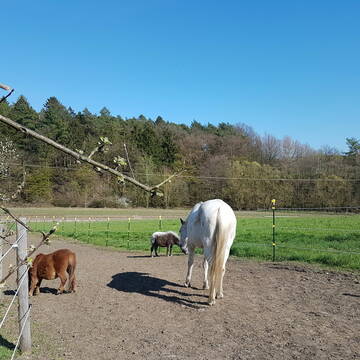
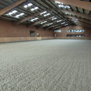
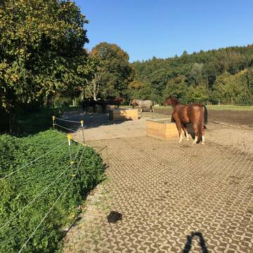
Bewegungsstall für Wallache, Stuten getrennt mög...
Menden
Nicole-Hoevelmann
@Nicole-Hoevelmann
Vermieten
Krankenbox
Paddock
Bewegungsstall
Innenbox
Einzelne Boxen oder Stallplätze
7 weitere...
S

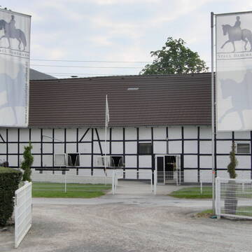
Hof Japes-Schulte
Sundern
Hof Japes-Schulte
@Hof_Japes-Schulte
Freizeitstall
Geländestrecke
Vermieten
Hunde willkommen
Krankenbox
Allergikerstall
Hufrehe geeignet
18 weitere...
aktuell
P
Deprecated: Creation of dynamic property Zend_View_Helper_Ads::$adLink is deprecated in /var/www/stall-frei/htdocs/staging.stall-frei.de/library/Psf/View/Helper/Ads.php on line 108

Futtersack HeuToy, Fressbremse in pink
Mechtersen
STALL-FREIde Marketing
@STALL-FREI-Marketing
Stundenlange Beschäftigung die
Koliken vorbeugt, geringe Staubinhalation mit
steuerbarer Futterentnahme
Hof Schulte-Hobein
Sundern
Hof-Schulte-Hobein
@Hof-Schulte-Hobein
Freizeitstall
Geländestrecke
Vermieten
Führanlage
Hunde willkommen
Notfallboxen
23 weitere...
P
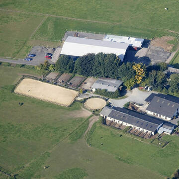
Reitsportanlage Neimen / Gut Dahlmann
Fröndenberg
Juliane-Dahlmann-Weber
@Juliane-Dahlmann-Weber
FN-Mitglied
Pferdeausbildung
Führanlage
Hunde willkommen
Außenboxen
Innenbox
Halbpension
Vollpension
19 weitere...
S

HIT-Aktivstall KW Pferd-Aktiv
Arnsberg Holzen
KW Pferd-Aktiv
@KWPferdAktiv
Freizeitstall
Vermieten
Krankenbox
Parkplatz für Pferdeanhänger
Notfallboxen
11 weitere...
aktuell
P

Pferdepension Blome
Arnsberg-Holzen
Markus Blome
@M.Blome
Freizeitstall
Geländestrecke
Vermieten
Hunde willkommen
Paddock
Innenbox
8 weitere...
P

Frisches Stroh zu verkaufen!
Mechtersen
STALL-FREIde Marketing
@STALL-FREI-Marketing
Kaufe frisches Stroh für dein Pferd!


4 Sterne Aktivstall Gut Lieselühr
Schwerte
Gut Lieselühr
@Gut-Lieseluehr
FN-Mitglied
Freizeitstall
Hunde willkommen
Krankenbox
Notfallboxen
Zuchtstutenhaltung möglich
Außenbox mit Paddock
Bewegungsstall
24 weitere...
S
Leider kein Vorschaubild
Leider kein Vorschaubild
Günstige Ponybox zu vermieten
Meschede
Kirsten Neitemeier
@Franz Neitemeier
FN-Mitglied
Freizeitstall
Vermieten
Führanlage
Paddock
Gnadenbrothof
Pferdezucht
20 weitere...
P
Leider kein Vorschaubild
Leider kein Vorschaubild
2 Boxen zu vermieten
Meschede
Kirsten Neitemeier
@Franz Neitemeier
FN-Mitglied
Freizeitstall
Vermieten
Führanlage
Paddock
Gnadenbrothof
Pferdezucht
20 weitere...
P

Dressurstall, Jungpferde und Rentnerbetreuung
Ense
Emily Küppers
@emilykueppers
Pferdeausbildung
Führanlage
Paddock
bedampftes/gewaschenes Heu
Hengsthaltung möglich
Außenboxen
Innenbox
15 weitere...
P+
Deprecated: Creation of dynamic property Zend_View::$pageCount is deprecated in /var/www/stall-frei/htdocs/staging.stall-frei.de/library/vendor/shardj/zf1-future/library/Zend/View/Abstract.php on line 308
Deprecated: Creation of dynamic property Zend_View::$itemCountPerPage is deprecated in /var/www/stall-frei/htdocs/staging.stall-frei.de/library/vendor/shardj/zf1-future/library/Zend/View/Abstract.php on line 308
Deprecated: Creation of dynamic property Zend_View::$first is deprecated in /var/www/stall-frei/htdocs/staging.stall-frei.de/library/vendor/shardj/zf1-future/library/Zend/View/Abstract.php on line 308
Deprecated: Creation of dynamic property Zend_View::$current is deprecated in /var/www/stall-frei/htdocs/staging.stall-frei.de/library/vendor/shardj/zf1-future/library/Zend/View/Abstract.php on line 308
Deprecated: Creation of dynamic property Zend_View::$last is deprecated in /var/www/stall-frei/htdocs/staging.stall-frei.de/library/vendor/shardj/zf1-future/library/Zend/View/Abstract.php on line 308
Deprecated: Creation of dynamic property Zend_View::$next is deprecated in /var/www/stall-frei/htdocs/staging.stall-frei.de/library/vendor/shardj/zf1-future/library/Zend/View/Abstract.php on line 308
Deprecated: Creation of dynamic property Zend_View::$pagesInRange is deprecated in /var/www/stall-frei/htdocs/staging.stall-frei.de/library/vendor/shardj/zf1-future/library/Zend/View/Abstract.php on line 308
Deprecated: Creation of dynamic property Zend_View::$firstPageInRange is deprecated in /var/www/stall-frei/htdocs/staging.stall-frei.de/library/vendor/shardj/zf1-future/library/Zend/View/Abstract.php on line 308
Deprecated: Creation of dynamic property Zend_View::$lastPageInRange is deprecated in /var/www/stall-frei/htdocs/staging.stall-frei.de/library/vendor/shardj/zf1-future/library/Zend/View/Abstract.php on line 308
Deprecated: Creation of dynamic property Zend_View::$currentItemCount is deprecated in /var/www/stall-frei/htdocs/staging.stall-frei.de/library/vendor/shardj/zf1-future/library/Zend/View/Abstract.php on line 308
Deprecated: Creation of dynamic property Zend_View::$totalItemCount is deprecated in /var/www/stall-frei/htdocs/staging.stall-frei.de/library/vendor/shardj/zf1-future/library/Zend/View/Abstract.php on line 308
Deprecated: Creation of dynamic property Zend_View::$firstItemNumber is deprecated in /var/www/stall-frei/htdocs/staging.stall-frei.de/library/vendor/shardj/zf1-future/library/Zend/View/Abstract.php on line 308
Deprecated: Creation of dynamic property Zend_View::$lastItemNumber is deprecated in /var/www/stall-frei/htdocs/staging.stall-frei.de/library/vendor/shardj/zf1-future/library/Zend/View/Abstract.php on line 308
Deprecated: Creation of dynamic property Zend_View::$router is deprecated in /var/www/stall-frei/htdocs/staging.stall-frei.de/library/vendor/shardj/zf1-future/library/Zend/View/Abstract.php on line 308
Deprecated: Creation of dynamic property Zend_View::$urlParams is deprecated in /var/www/stall-frei/htdocs/staging.stall-frei.de/library/vendor/shardj/zf1-future/library/Zend/View/Abstract.php on line 308
Deprecated: Creation of dynamic property Zend_View::$showAds is deprecated in /var/www/stall-frei/htdocs/staging.stall-frei.de/library/vendor/shardj/zf1-future/library/Zend/View/Abstract.php on line 308
Deprecated: Creation of dynamic property Zend_View::$objectIds is deprecated in /var/www/stall-frei/htdocs/staging.stall-frei.de/library/vendor/shardj/zf1-future/library/Zend/View/Abstract.php on line 308
Deprecated: Creation of dynamic property Zend_View::$showNavbar is deprecated in /var/www/stall-frei/htdocs/staging.stall-frei.de/library/vendor/shardj/zf1-future/library/Zend/View/Abstract.php on line 308
Deprecated: Creation of dynamic property Zend_View::$showBreadcrumb is deprecated in /var/www/stall-frei/htdocs/staging.stall-frei.de/library/vendor/shardj/zf1-future/library/Zend/View/Abstract.php on line 308
Deprecated: Creation of dynamic property Zend_View::$showFooter is deprecated in /var/www/stall-frei/htdocs/staging.stall-frei.de/library/vendor/shardj/zf1-future/library/Zend/View/Abstract.php on line 308
Deprecated: Creation of dynamic property Zend_View::$showInternalAds is deprecated in /var/www/stall-frei/htdocs/staging.stall-frei.de/library/vendor/shardj/zf1-future/library/Zend/View/Abstract.php on line 308
Deprecated: Creation of dynamic property Zend_View::$blNoContent is deprecated in /var/www/stall-frei/htdocs/staging.stall-frei.de/library/vendor/shardj/zf1-future/library/Zend/View/Abstract.php on line 308
Deprecated: Creation of dynamic property Zend_View::$sMetaDesc is deprecated in /var/www/stall-frei/htdocs/staging.stall-frei.de/library/vendor/shardj/zf1-future/library/Zend/View/Abstract.php on line 308
Deprecated: Creation of dynamic property Zend_View::$useGmaps is deprecated in /var/www/stall-frei/htdocs/staging.stall-frei.de/library/vendor/shardj/zf1-future/library/Zend/View/Abstract.php on line 308
Deprecated: Creation of dynamic property Zend_View::$touches is deprecated in /var/www/stall-frei/htdocs/staging.stall-frei.de/library/vendor/shardj/zf1-future/library/Zend/View/Abstract.php on line 308
Deprecated: Creation of dynamic property Zend_View::$oProject is deprecated in /var/www/stall-frei/htdocs/staging.stall-frei.de/library/vendor/shardj/zf1-future/library/Zend/View/Abstract.php on line 308
Deprecated: Creation of dynamic property Zend_View::$pageHeadline is deprecated in /var/www/stall-frei/htdocs/staging.stall-frei.de/library/vendor/shardj/zf1-future/library/Zend/View/Abstract.php on line 308
Deprecated: Creation of dynamic property Zend_View::$disableLocationField is deprecated in /var/www/stall-frei/htdocs/staging.stall-frei.de/library/vendor/shardj/zf1-future/library/Zend/View/Abstract.php on line 308
Deprecated: Creation of dynamic property Zend_View::$isSearch is deprecated in /var/www/stall-frei/htdocs/staging.stall-frei.de/library/vendor/shardj/zf1-future/library/Zend/View/Abstract.php on line 308
Deprecated: Creation of dynamic property Zend_View::$pageTitle is deprecated in /var/www/stall-frei/htdocs/staging.stall-frei.de/library/vendor/shardj/zf1-future/library/Zend/View/Abstract.php on line 308
Deprecated: Creation of dynamic property Psf_Form_Element_Text::$class is deprecated in /var/www/stall-frei/htdocs/staging.stall-frei.de/library/vendor/shardj/zf1-future/library/Zend/Form/Element.php on line 874
Deprecated: Creation of dynamic property Psf_Form_Element_Text::$size is deprecated in /var/www/stall-frei/htdocs/staging.stall-frei.de/library/vendor/shardj/zf1-future/library/Zend/Form/Element.php on line 874
Deprecated: Creation of dynamic property Psf_Form_Element_Text::$placeholder is deprecated in /var/www/stall-frei/htdocs/staging.stall-frei.de/library/vendor/shardj/zf1-future/library/Zend/Form/Element.php on line 874
Deprecated: Creation of dynamic property Psf_Form_Element_Hidden::$class is deprecated in /var/www/stall-frei/htdocs/staging.stall-frei.de/library/vendor/shardj/zf1-future/library/Zend/Form/Element.php on line 874
Deprecated: Creation of dynamic property Psf_Form_Element_Hidden::$class is deprecated in /var/www/stall-frei/htdocs/staging.stall-frei.de/library/vendor/shardj/zf1-future/library/Zend/Form/Element.php on line 874
Deprecated: Creation of dynamic property Psf_Form_Element_Hidden::$class is deprecated in /var/www/stall-frei/htdocs/staging.stall-frei.de/library/vendor/shardj/zf1-future/library/Zend/Form/Element.php on line 874
Deprecated: Creation of dynamic property Psf_Form_Element_Hidden::$class is deprecated in /var/www/stall-frei/htdocs/staging.stall-frei.de/library/vendor/shardj/zf1-future/library/Zend/Form/Element.php on line 874
Deprecated: Creation of dynamic property Psf_Form_Element_Select::$class is deprecated in /var/www/stall-frei/htdocs/staging.stall-frei.de/library/vendor/shardj/zf1-future/library/Zend/Form/Element.php on line 874
Deprecated: Creation of dynamic property Psf_Form_Element_Select::$class is deprecated in /var/www/stall-frei/htdocs/staging.stall-frei.de/library/vendor/shardj/zf1-future/library/Zend/Form/Element.php on line 874
Deprecated: Creation of dynamic property Psf_Form_Element_Select::$class is deprecated in /var/www/stall-frei/htdocs/staging.stall-frei.de/library/vendor/shardj/zf1-future/library/Zend/Form/Element.php on line 874
Deprecated: Creation of dynamic property Psf_Form_Element_Select::$class is deprecated in /var/www/stall-frei/htdocs/staging.stall-frei.de/library/vendor/shardj/zf1-future/library/Zend/Form/Element.php on line 874
Deprecated: Creation of dynamic property Psf_Form_Element_Text::$class is deprecated in /var/www/stall-frei/htdocs/staging.stall-frei.de/library/vendor/shardj/zf1-future/library/Zend/Form/Element.php on line 874
Deprecated: Creation of dynamic property Psf_Form_Element_Checkbox::$label is deprecated in /var/www/stall-frei/htdocs/staging.stall-frei.de/library/vendor/shardj/zf1-future/library/Zend/Form/Element.php on line 874
Deprecated: Creation of dynamic property Zend_View::$sort is deprecated in /var/www/stall-frei/htdocs/staging.stall-frei.de/library/vendor/shardj/zf1-future/library/Zend/View/Abstract.php on line 308
Deprecated: Creation of dynamic property Zend_View::$searchLocation is deprecated in /var/www/stall-frei/htdocs/staging.stall-frei.de/library/vendor/shardj/zf1-future/library/Zend/View/Abstract.php on line 308
Deprecated: Creation of dynamic property Zend_View::$locationHint is deprecated in /var/www/stall-frei/htdocs/staging.stall-frei.de/library/vendor/shardj/zf1-future/library/Zend/View/Abstract.php on line 308
Psf_GeoCoder_Abstract::getLocation: Sundern Get Location CachedOrLive
Psf_GeoCoder_Abstract::getCachedOrLive: Sundern
Psf_GeoCoder_OpenCageData::makeApiRequest: response:
Array
(
[documentation] => https://opencagedata.com/api
[licenses] => Array
(
[0] => Array
(
[name] => see attribution guide
[url] => https://opencagedata.com/credits
)
)
[results] => Array
(
[0] => Array
(
[bounds] => Array
(
[northeast] => Array
(
[lat] => 51.3943681
[lng] => 8.1320134
)
[southwest] => Array
(
[lat] => 51.2331063
[lng] => 7.9014317
)
)
[components] => Array
(
[ISO_3166-1_alpha-2] => DE
[ISO_3166-1_alpha-3] => DEU
[ISO_3166-2] => Array
(
[0] => DE-NW
)
[_category] => place
[_normalized_city] => Sundern
[_type] => city
[continent] => Europe
[country] => Deutschland
[country_code] => de
[county] => Hochsauerlandkreis
[political_union] => European Union
[postcode] => 59846
[state] => Nordrhein-Westfalen
[state_code] => NW
[town] => Sundern
)
[confidence] => 5
[formatted] => 59846 Sundern, Deutschland
[geometry] => Array
(
[lat] => 51.329832
[lng] => 8.0072645
)
)
[1] => Array
(
[bounds] => Array
(
[northeast] => Array
(
[lat] => 52.2361413
[lng] => 7.8235014
)
[southwest] => Array
(
[lat] => 52.223517
[lng] => 7.7935714
)
)
[components] => Array
(
[ISO_3166-1_alpha-2] => DE
[ISO_3166-1_alpha-3] => DEU
[ISO_3166-2] => Array
(
[0] => DE-NW
)
[_category] => natural/water
[_normalized_city] => Tecklenburg
[_type] => nature_reserve
[continent] => Europe
[country] => Deutschland
[country_code] => de
[county] => Kreis Steinfurt
[nature_reserve] => Sundern
[political_union] => European Union
[state] => Nordrhein-Westfalen
[state_code] => NW
[town] => Tecklenburg
)
[confidence] => 8
[formatted] => Sundern, Tecklenburg, Nordrhein-Westfalen, Deutschland
[geometry] => Array
(
[lat] => 52.2298177
[lng] => 7.807521
)
)
[2] => Array
(
[bounds] => Array
(
[northeast] => Array
(
[lat] => 51.4375989
[lng] => 7.2076807
)
[southwest] => Array
(
[lat] => 51.4175989
[lng] => 7.1876807
)
)
[components] => Array
(
[ISO_3166-1_alpha-2] => DE
[ISO_3166-1_alpha-3] => DEU
[ISO_3166-2] => Array
(
[0] => DE-NW
)
[_category] => place
[_normalized_city] => Bochum
[_type] => neighbourhood
[borough] => Bochum-Südwest
[city] => Bochum
[continent] => Europe
[country] => Deutschland
[country_code] => de
[neighbourhood] => Sundern
[political_union] => European Union
[postcode] => 44797
[state] => Nordrhein-Westfalen
[state_code] => NW
[suburb] => Weitmar
)
[confidence] => 8
[formatted] => 44797 Bochum, Deutschland
[geometry] => Array
(
[lat] => 51.4275989
[lng] => 7.1976807
)
)
[3] => Array
(
[bounds] => Array
(
[northeast] => Array
(
[lat] => 52.1473311
[lng] => 8.6615268
)
[southwest] => Array
(
[lat] => 52.1333355
[lng] => 8.6400844
)
)
[components] => Array
(
[ISO_3166-1_alpha-2] => DE
[ISO_3166-1_alpha-3] => DEU
[ISO_3166-2] => Array
(
[0] => DE-NW
)
[_category] => place
[_normalized_city] => Hiddenhausen
[_type] => neighbourhood
[continent] => Europe
[country] => Deutschland
[country_code] => de
[county] => Kreis Herford
[political_union] => European Union
[state] => Nordrhein-Westfalen
[state_code] => NW
[suburb] => Sundern
[town] => Hiddenhausen
)
[confidence] => 8
[formatted] => Sundern, Hiddenhausen, Nordrhein-Westfalen, Deutschland
[geometry] => Array
(
[lat] => 52.1386928
[lng] => 8.652035
)
)
[4] => Array
(
[bounds] => Array
(
[northeast] => Array
(
[lat] => 51.9138339
[lng] => 8.4250752
)
[southwest] => Array
(
[lat] => 51.8738339
[lng] => 8.3850752
)
)
[components] => Array
(
[ISO_3166-1_alpha-2] => DE
[ISO_3166-1_alpha-3] => DEU
[ISO_3166-2] => Array
(
[0] => DE-NW
)
[_category] => place
[_normalized_city] => Gütersloh
[_type] => neighbourhood
[city] => Gütersloh
[continent] => Europe
[country] => Deutschland
[country_code] => de
[county] => Kreis Gütersloh
[political_union] => European Union
[postcode] => 33332
[state] => Nordrhein-Westfalen
[state_code] => NW
[suburb] => Sundern
)
[confidence] => 7
[formatted] => 33332 Gütersloh, Deutschland
[geometry] => Array
(
[lat] => 51.8938339
[lng] => 8.4050752
)
)
[5] => Array
(
[bounds] => Array
(
[northeast] => Array
(
[lat] => 52.4055758
[lng] => 8.439758
)
[southwest] => Array
(
[lat] => 52.3746295
[lng] => 8.3764513
)
)
[components] => Array
(
[ISO_3166-1_alpha-2] => DE
[ISO_3166-1_alpha-3] => DEU
[ISO_3166-2] => Array
(
[0] => DE-NW
)
[_category] => place
[_normalized_city] => Stemwede
[_type] => hamlet
[continent] => Europe
[country] => Deutschland
[country_code] => de
[county] => Kreis Minden-Lübbecke
[hamlet] => Sundern
[municipality] => Stemwede
[political_union] => European Union
[state] => Nordrhein-Westfalen
[state_code] => NW
)
[confidence] => 7
[formatted] => Sundern, Nordrhein-Westfalen, Deutschland
[geometry] => Array
(
[lat] => 52.3866661
[lng] => 8.4198436
)
)
[6] => Array
(
[bounds] => Array
(
[northeast] => Array
(
[lat] => 51.2868926
[lng] => 7.8523382
)
[southwest] => Array
(
[lat] => 51.2867926
[lng] => 7.8522382
)
)
[components] => Array
(
[ISO_3166-1_alpha-2] => DE
[ISO_3166-1_alpha-3] => DEU
[ISO_3166-2] => Array
(
[0] => DE-NW
)
[_category] => natural/water
[_normalized_city] => Neuenrade
[_type] => peak
[continent] => Europe
[country] => Deutschland
[country_code] => de
[county] => Märkischer Kreis
[peak] => Sundern
[political_union] => European Union
[postcode] => 58802
[state] => Nordrhein-Westfalen
[state_code] => NW
[town] => Neuenrade
)
[confidence] => 9
[formatted] => Sundern, 58802 Neuenrade, Deutschland
[geometry] => Array
(
[lat] => 51.2868426
[lng] => 7.8522882
)
)
[7] => Array
(
[bounds] => Array
(
[northeast] => Array
(
[lat] => 51.2356777
[lng] => 7.8219453
)
[southwest] => Array
(
[lat] => 51.2355777
[lng] => 7.8218453
)
)
[components] => Array
(
[ISO_3166-1_alpha-2] => DE
[ISO_3166-1_alpha-3] => DEU
[ISO_3166-2] => Array
(
[0] => DE-NW
)
[_category] => natural/water
[_normalized_city] => Plettenberg
[_type] => peak
[continent] => Europe
[country] => Deutschland
[country_code] => de
[county] => Märkischer Kreis
[peak] => Sundern
[political_union] => European Union
[postcode] => 58840
[state] => Nordrhein-Westfalen
[state_code] => NW
[town] => Plettenberg
)
[confidence] => 9
[formatted] => Sundern, 58840 Plettenberg, Deutschland
[geometry] => Array
(
[lat] => 51.2356277
[lng] => 7.8218953
)
)
[8] => Array
(
[bounds] => Array
(
[northeast] => Array
(
[lat] => 52.2938702
[lng] => 9.2960275
)
[southwest] => Array
(
[lat] => 52.2538702
[lng] => 9.2560275
)
)
[components] => Array
(
[ISO_3166-1_alpha-2] => DE
[ISO_3166-1_alpha-3] => DEU
[ISO_3166-2] => Array
(
[0] => DE-NI
)
[_category] => place
[_normalized_city] => Auetal
[_type] => hamlet
[continent] => Europe
[country] => Deutschland
[country_code] => de
[county] => Landkreis Schaumburg
[hamlet] => Sundern
[municipality] => Auetal
[political_union] => European Union
[state] => Niedersachsen
[state_code] => NI
)
[confidence] => 7
[formatted] => Sundern, Niedersachsen, Deutschland
[geometry] => Array
(
[lat] => 52.2738702
[lng] => 9.2760275
)
)
[9] => Array
(
[bounds] => Array
(
[northeast] => Array
(
[lat] => 51.3155538
[lng] => 7.4742222
)
[southwest] => Array
(
[lat] => 51.2755538
[lng] => 7.4342222
)
)
[components] => Array
(
[ISO_3166-1_alpha-2] => DE
[ISO_3166-1_alpha-3] => DEU
[ISO_3166-2] => Array
(
[0] => DE-NW
)
[_category] => place
[_normalized_city] => Breckerfeld
[_type] => hamlet
[continent] => Europe
[country] => Deutschland
[country_code] => de
[county] => Ennepe-Ruhr-Kreis
[hamlet] => Sundern
[political_union] => European Union
[postcode] => 58339
[state] => Nordrhein-Westfalen
[state_code] => NW
[town] => Breckerfeld
)
[confidence] => 7
[formatted] => Sundern, 58339 Breckerfeld, Deutschland
[geometry] => Array
(
[lat] => 51.2955538
[lng] => 7.4542222
)
)
)
[status] => Array
(
[code] => 200
[message] => OK
)
[stay_informed] => Array
(
[blog] => https://blog.opencagedata.com
[mastodon] => https://en.osm.town/@opencage
)
[thanks] => For using an OpenCage API
[timestamp] => Array
(
[created_http] => Sat, 07 Feb 2026 09:05:41 GMT
[created_unix] => 1770455141
)
[total_results] => 10
)
Psf_GeoCoder_Abstract::convertLocationResult
{"documentation":"https:\/\/opencagedata.com\/api","licenses":[{"name":"see attribution guide","url":"https:\/\/opencagedata.com\/credits"}],"results":[{"bounds":{"northeast":{"lat":51.3943681,"lng":8.1320134},"southwest":{"lat":51.2331063,"lng":7.9014317}},"components":{"ISO_3166-1_alpha-2":"DE","ISO_3166-1_alpha-3":"DEU","ISO_3166-2":["DE-NW"],"_category":"place","_normalized_city":"Sundern","_type":"city","continent":"Europe","country":"Deutschland","country_code":"de","county":"Hochsauerlandkreis","political_union":"European Union","postcode":"59846","state":"Nordrhein-Westfalen","state_code":"NW","town":"Sundern"},"confidence":5,"formatted":"59846 Sundern, Deutschland","geometry":{"lat":51.329832,"lng":8.0072645}},{"bounds":{"northeast":{"lat":52.2361413,"lng":7.8235014},"southwest":{"lat":52.223517,"lng":7.7935714}},"components":{"ISO_3166-1_alpha-2":"DE","ISO_3166-1_alpha-3":"DEU","ISO_3166-2":["DE-NW"],"_category":"natural\/water","_normalized_city":"Tecklenburg","_type":"nature_reserve","continent":"Europe","country":"Deutschland","country_code":"de","county":"Kreis Steinfurt","nature_reserve":"Sundern","political_union":"European Union","state":"Nordrhein-Westfalen","state_code":"NW","town":"Tecklenburg"},"confidence":8,"formatted":"Sundern, Tecklenburg, Nordrhein-Westfalen, Deutschland","geometry":{"lat":52.2298177,"lng":7.807521}},{"bounds":{"northeast":{"lat":51.4375989,"lng":7.2076807},"southwest":{"lat":51.4175989,"lng":7.1876807}},"components":{"ISO_3166-1_alpha-2":"DE","ISO_3166-1_alpha-3":"DEU","ISO_3166-2":["DE-NW"],"_category":"place","_normalized_city":"Bochum","_type":"neighbourhood","borough":"Bochum-S\u00fcdwest","city":"Bochum","continent":"Europe","country":"Deutschland","country_code":"de","neighbourhood":"Sundern","political_union":"European Union","postcode":"44797","state":"Nordrhein-Westfalen","state_code":"NW","suburb":"Weitmar"},"confidence":8,"formatted":"44797 Bochum, Deutschland","geometry":{"lat":51.4275989,"lng":7.1976807}},{"bounds":{"northeast":{"lat":52.1473311,"lng":8.6615268},"southwest":{"lat":52.1333355,"lng":8.6400844}},"components":{"ISO_3166-1_alpha-2":"DE","ISO_3166-1_alpha-3":"DEU","ISO_3166-2":["DE-NW"],"_category":"place","_normalized_city":"Hiddenhausen","_type":"neighbourhood","continent":"Europe","country":"Deutschland","country_code":"de","county":"Kreis Herford","political_union":"European Union","state":"Nordrhein-Westfalen","state_code":"NW","suburb":"Sundern","town":"Hiddenhausen"},"confidence":8,"formatted":"Sundern, Hiddenhausen, Nordrhein-Westfalen, Deutschland","geometry":{"lat":52.1386928,"lng":8.652035}},{"bounds":{"northeast":{"lat":51.9138339,"lng":8.4250752},"southwest":{"lat":51.8738339,"lng":8.3850752}},"components":{"ISO_3166-1_alpha-2":"DE","ISO_3166-1_alpha-3":"DEU","ISO_3166-2":["DE-NW"],"_category":"place","_normalized_city":"G\u00fctersloh","_type":"neighbourhood","city":"G\u00fctersloh","continent":"Europe","country":"Deutschland","country_code":"de","county":"Kreis G\u00fctersloh","political_union":"European Union","postcode":"33332","state":"Nordrhein-Westfalen","state_code":"NW","suburb":"Sundern"},"confidence":7,"formatted":"33332 G\u00fctersloh, Deutschland","geometry":{"lat":51.8938339,"lng":8.4050752}},{"bounds":{"northeast":{"lat":52.4055758,"lng":8.439758},"southwest":{"lat":52.3746295,"lng":8.3764513}},"components":{"ISO_3166-1_alpha-2":"DE","ISO_3166-1_alpha-3":"DEU","ISO_3166-2":["DE-NW"],"_category":"place","_normalized_city":"Stemwede","_type":"hamlet","continent":"Europe","country":"Deutschland","country_code":"de","county":"Kreis Minden-L\u00fcbbecke","hamlet":"Sundern","municipality":"Stemwede","political_union":"European Union","state":"Nordrhein-Westfalen","state_code":"NW"},"confidence":7,"formatted":"Sundern, Nordrhein-Westfalen, Deutschland","geometry":{"lat":52.3866661,"lng":8.4198436}},{"bounds":{"northeast":{"lat":51.2868926,"lng":7.8523382},"southwest":{"lat":51.2867926,"lng":7.8522382}},"components":{"ISO_3166-1_alpha-2":"DE","ISO_3166-1_alpha-3":"DEU","ISO_3166-2":["DE-NW"],"_category":"natural\/water","_normalized_city":"Neuenrade","_type":"peak","continent":"Europe","country":"Deutschland","country_code":"de","county":"M\u00e4rkischer Kreis","peak":"Sundern","political_union":"European Union","postcode":"58802","state":"Nordrhein-Westfalen","state_code":"NW","town":"Neuenrade"},"confidence":9,"formatted":"Sundern, 58802 Neuenrade, Deutschland","geometry":{"lat":51.2868426,"lng":7.8522882}},{"bounds":{"northeast":{"lat":51.2356777,"lng":7.8219453},"southwest":{"lat":51.2355777,"lng":7.8218453}},"components":{"ISO_3166-1_alpha-2":"DE","ISO_3166-1_alpha-3":"DEU","ISO_3166-2":["DE-NW"],"_category":"natural\/water","_normalized_city":"Plettenberg","_type":"peak","continent":"Europe","country":"Deutschland","country_code":"de","county":"M\u00e4rkischer Kreis","peak":"Sundern","political_union":"European Union","postcode":"58840","state":"Nordrhein-Westfalen","state_code":"NW","town":"Plettenberg"},"confidence":9,"formatted":"Sundern, 58840 Plettenberg, Deutschland","geometry":{"lat":51.2356277,"lng":7.8218953}},{"bounds":{"northeast":{"lat":52.2938702,"lng":9.2960275},"southwest":{"lat":52.2538702,"lng":9.2560275}},"components":{"ISO_3166-1_alpha-2":"DE","ISO_3166-1_alpha-3":"DEU","ISO_3166-2":["DE-NI"],"_category":"place","_normalized_city":"Auetal","_type":"hamlet","continent":"Europe","country":"Deutschland","country_code":"de","county":"Landkreis Schaumburg","hamlet":"Sundern","municipality":"Auetal","political_union":"European Union","state":"Niedersachsen","state_code":"NI"},"confidence":7,"formatted":"Sundern, Niedersachsen, Deutschland","geometry":{"lat":52.2738702,"lng":9.2760275}},{"bounds":{"northeast":{"lat":51.3155538,"lng":7.4742222},"southwest":{"lat":51.2755538,"lng":7.4342222}},"components":{"ISO_3166-1_alpha-2":"DE","ISO_3166-1_alpha-3":"DEU","ISO_3166-2":["DE-NW"],"_category":"place","_normalized_city":"Breckerfeld","_type":"hamlet","continent":"Europe","country":"Deutschland","country_code":"de","county":"Ennepe-Ruhr-Kreis","hamlet":"Sundern","political_union":"European Union","postcode":"58339","state":"Nordrhein-Westfalen","state_code":"NW","town":"Breckerfeld"},"confidence":7,"formatted":"Sundern, 58339 Breckerfeld, Deutschland","geometry":{"lat":51.2955538,"lng":7.4542222}}],"status":{"code":200,"message":"OK"},"stay_informed":{"blog":"https:\/\/blog.opencagedata.com","mastodon":"https:\/\/en.osm.town\/@opencage"},"thanks":"For using an OpenCage API","timestamp":{"created_http":"Sat, 07 Feb 2026 09:05:41 GMT","created_unix":1770455141},"total_results":10}Array
(
[0] => stdClass Object
(
[bounds] => stdClass Object
(
[northeast] => stdClass Object
(
[lat] => 51.3943681
[lng] => 8.1320134
)
[southwest] => stdClass Object
(
[lat] => 51.2331063
[lng] => 7.9014317
)
)
[components] => stdClass Object
(
[ISO_3166-1_alpha-2] => DE
[ISO_3166-1_alpha-3] => DEU
[ISO_3166-2] => Array
(
[0] => DE-NW
)
[_category] => place
[_normalized_city] => Sundern
[_type] => city
[continent] => Europe
[country] => Deutschland
[country_code] => de
[county] => Hochsauerlandkreis
[political_union] => European Union
[postcode] => 59846
[state] => Nordrhein-Westfalen
[state_code] => NW
[town] => Sundern
)
[confidence] => 5
[formatted] => 59846 Sundern, Deutschland
[geometry] => stdClass Object
(
[lat] => 51.329832
[lng] => 8.0072645
)
)
[1] => stdClass Object
(
[bounds] => stdClass Object
(
[northeast] => stdClass Object
(
[lat] => 52.2361413
[lng] => 7.8235014
)
[southwest] => stdClass Object
(
[lat] => 52.223517
[lng] => 7.7935714
)
)
[components] => stdClass Object
(
[ISO_3166-1_alpha-2] => DE
[ISO_3166-1_alpha-3] => DEU
[ISO_3166-2] => Array
(
[0] => DE-NW
)
[_category] => natural/water
[_normalized_city] => Tecklenburg
[_type] => nature_reserve
[continent] => Europe
[country] => Deutschland
[country_code] => de
[county] => Kreis Steinfurt
[nature_reserve] => Sundern
[political_union] => European Union
[state] => Nordrhein-Westfalen
[state_code] => NW
[town] => Tecklenburg
)
[confidence] => 8
[formatted] => Sundern, Tecklenburg, Nordrhein-Westfalen, Deutschland
[geometry] => stdClass Object
(
[lat] => 52.2298177
[lng] => 7.807521
)
)
[2] => stdClass Object
(
[bounds] => stdClass Object
(
[northeast] => stdClass Object
(
[lat] => 51.4375989
[lng] => 7.2076807
)
[southwest] => stdClass Object
(
[lat] => 51.4175989
[lng] => 7.1876807
)
)
[components] => stdClass Object
(
[ISO_3166-1_alpha-2] => DE
[ISO_3166-1_alpha-3] => DEU
[ISO_3166-2] => Array
(
[0] => DE-NW
)
[_category] => place
[_normalized_city] => Bochum
[_type] => neighbourhood
[borough] => Bochum-Südwest
[city] => Bochum
[continent] => Europe
[country] => Deutschland
[country_code] => de
[neighbourhood] => Sundern
[political_union] => European Union
[postcode] => 44797
[state] => Nordrhein-Westfalen
[state_code] => NW
[suburb] => Weitmar
)
[confidence] => 8
[formatted] => 44797 Bochum, Deutschland
[geometry] => stdClass Object
(
[lat] => 51.4275989
[lng] => 7.1976807
)
)
[3] => stdClass Object
(
[bounds] => stdClass Object
(
[northeast] => stdClass Object
(
[lat] => 52.1473311
[lng] => 8.6615268
)
[southwest] => stdClass Object
(
[lat] => 52.1333355
[lng] => 8.6400844
)
)
[components] => stdClass Object
(
[ISO_3166-1_alpha-2] => DE
[ISO_3166-1_alpha-3] => DEU
[ISO_3166-2] => Array
(
[0] => DE-NW
)
[_category] => place
[_normalized_city] => Hiddenhausen
[_type] => neighbourhood
[continent] => Europe
[country] => Deutschland
[country_code] => de
[county] => Kreis Herford
[political_union] => European Union
[state] => Nordrhein-Westfalen
[state_code] => NW
[suburb] => Sundern
[town] => Hiddenhausen
)
[confidence] => 8
[formatted] => Sundern, Hiddenhausen, Nordrhein-Westfalen, Deutschland
[geometry] => stdClass Object
(
[lat] => 52.1386928
[lng] => 8.652035
)
)
[4] => stdClass Object
(
[bounds] => stdClass Object
(
[northeast] => stdClass Object
(
[lat] => 51.9138339
[lng] => 8.4250752
)
[southwest] => stdClass Object
(
[lat] => 51.8738339
[lng] => 8.3850752
)
)
[components] => stdClass Object
(
[ISO_3166-1_alpha-2] => DE
[ISO_3166-1_alpha-3] => DEU
[ISO_3166-2] => Array
(
[0] => DE-NW
)
[_category] => place
[_normalized_city] => Gütersloh
[_type] => neighbourhood
[city] => Gütersloh
[continent] => Europe
[country] => Deutschland
[country_code] => de
[county] => Kreis Gütersloh
[political_union] => European Union
[postcode] => 33332
[state] => Nordrhein-Westfalen
[state_code] => NW
[suburb] => Sundern
)
[confidence] => 7
[formatted] => 33332 Gütersloh, Deutschland
[geometry] => stdClass Object
(
[lat] => 51.8938339
[lng] => 8.4050752
)
)
[5] => stdClass Object
(
[bounds] => stdClass Object
(
[northeast] => stdClass Object
(
[lat] => 52.4055758
[lng] => 8.439758
)
[southwest] => stdClass Object
(
[lat] => 52.3746295
[lng] => 8.3764513
)
)
[components] => stdClass Object
(
[ISO_3166-1_alpha-2] => DE
[ISO_3166-1_alpha-3] => DEU
[ISO_3166-2] => Array
(
[0] => DE-NW
)
[_category] => place
[_normalized_city] => Stemwede
[_type] => hamlet
[continent] => Europe
[country] => Deutschland
[country_code] => de
[county] => Kreis Minden-Lübbecke
[hamlet] => Sundern
[municipality] => Stemwede
[political_union] => European Union
[state] => Nordrhein-Westfalen
[state_code] => NW
)
[confidence] => 7
[formatted] => Sundern, Nordrhein-Westfalen, Deutschland
[geometry] => stdClass Object
(
[lat] => 52.3866661
[lng] => 8.4198436
)
)
[6] => stdClass Object
(
[bounds] => stdClass Object
(
[northeast] => stdClass Object
(
[lat] => 51.2868926
[lng] => 7.8523382
)
[southwest] => stdClass Object
(
[lat] => 51.2867926
[lng] => 7.8522382
)
)
[components] => stdClass Object
(
[ISO_3166-1_alpha-2] => DE
[ISO_3166-1_alpha-3] => DEU
[ISO_3166-2] => Array
(
[0] => DE-NW
)
[_category] => natural/water
[_normalized_city] => Neuenrade
[_type] => peak
[continent] => Europe
[country] => Deutschland
[country_code] => de
[county] => Märkischer Kreis
[peak] => Sundern
[political_union] => European Union
[postcode] => 58802
[state] => Nordrhein-Westfalen
[state_code] => NW
[town] => Neuenrade
)
[confidence] => 9
[formatted] => Sundern, 58802 Neuenrade, Deutschland
[geometry] => stdClass Object
(
[lat] => 51.2868426
[lng] => 7.8522882
)
)
[7] => stdClass Object
(
[bounds] => stdClass Object
(
[northeast] => stdClass Object
(
[lat] => 51.2356777
[lng] => 7.8219453
)
[southwest] => stdClass Object
(
[lat] => 51.2355777
[lng] => 7.8218453
)
)
[components] => stdClass Object
(
[ISO_3166-1_alpha-2] => DE
[ISO_3166-1_alpha-3] => DEU
[ISO_3166-2] => Array
(
[0] => DE-NW
)
[_category] => natural/water
[_normalized_city] => Plettenberg
[_type] => peak
[continent] => Europe
[country] => Deutschland
[country_code] => de
[county] => Märkischer Kreis
[peak] => Sundern
[political_union] => European Union
[postcode] => 58840
[state] => Nordrhein-Westfalen
[state_code] => NW
[town] => Plettenberg
)
[confidence] => 9
[formatted] => Sundern, 58840 Plettenberg, Deutschland
[geometry] => stdClass Object
(
[lat] => 51.2356277
[lng] => 7.8218953
)
)
[8] => stdClass Object
(
[bounds] => stdClass Object
(
[northeast] => stdClass Object
(
[lat] => 52.2938702
[lng] => 9.2960275
)
[southwest] => stdClass Object
(
[lat] => 52.2538702
[lng] => 9.2560275
)
)
[components] => stdClass Object
(
[ISO_3166-1_alpha-2] => DE
[ISO_3166-1_alpha-3] => DEU
[ISO_3166-2] => Array
(
[0] => DE-NI
)
[_category] => place
[_normalized_city] => Auetal
[_type] => hamlet
[continent] => Europe
[country] => Deutschland
[country_code] => de
[county] => Landkreis Schaumburg
[hamlet] => Sundern
[municipality] => Auetal
[political_union] => European Union
[state] => Niedersachsen
[state_code] => NI
)
[confidence] => 7
[formatted] => Sundern, Niedersachsen, Deutschland
[geometry] => stdClass Object
(
[lat] => 52.2738702
[lng] => 9.2760275
)
)
[9] => stdClass Object
(
[bounds] => stdClass Object
(
[northeast] => stdClass Object
(
[lat] => 51.3155538
[lng] => 7.4742222
)
[southwest] => stdClass Object
(
[lat] => 51.2755538
[lng] => 7.4342222
)
)
[components] => stdClass Object
(
[ISO_3166-1_alpha-2] => DE
[ISO_3166-1_alpha-3] => DEU
[ISO_3166-2] => Array
(
[0] => DE-NW
)
[_category] => place
[_normalized_city] => Breckerfeld
[_type] => hamlet
[continent] => Europe
[country] => Deutschland
[country_code] => de
[county] => Ennepe-Ruhr-Kreis
[hamlet] => Sundern
[political_union] => European Union
[postcode] => 58339
[state] => Nordrhein-Westfalen
[state_code] => NW
[town] => Breckerfeld
)
[confidence] => 7
[formatted] => Sundern, 58339 Breckerfeld, Deutschland
[geometry] => stdClass Object
(
[lat] => 51.2955538
[lng] => 7.4542222
)
)
)
Psf_GeoCoder_OpenCageData::getKeyMap: 0
stdClass Object
(
    [bounds] => stdClass Object
        (
            [northeast] => stdClass Object
                (
                    [lat] => 51.3943681
                    [lng] => 8.1320134
                )

            [southwest] => stdClass Object
                (
                    [lat] => 51.2331063
                    [lng] => 7.9014317
                )

        )

    [components] => stdClass Object
        (
            [ISO_3166-1_alpha-2] => DE
            [ISO_3166-1_alpha-3] => DEU
            [ISO_3166-2] => Array
                (
                    [0] => DE-NW
                )

            [_category] => place
            [_normalized_city] => Sundern
            [_type] => city
            [continent] => Europe
            [country] => Deutschland
            [country_code] => de
            [county] => Hochsauerlandkreis
            [political_union] => European Union
            [postcode] => 59846
            [state] => Nordrhein-Westfalen
            [state_code] => NW
            [town] => Sundern
        )

    [confidence] => 5
    [formatted] => 59846 Sundern, Deutschland
    [geometry] => stdClass Object
        (
            [lat] => 51.329832
            [lng] => 8.0072645
        )

)
Psf_GeoCoder_OpenCageData::getCounty: Hochsauerlandkreis
Psf_GeoCoder_OpenCageData::addMissingData REFETCH!
Array
(
    [address] => 59846 Sundern, Deutschland
    [type] => city
    [street] =>
    [city] => Sundern
    [county] => Hochsauerlandkreis
    [state] => Nordrhein-Westfalen
    [zip] => 59846
    [country] => Deutschland
    [suburb] =>
    [countrycode] => de
    [latitude] => 51.329832
    [longitude] => 8.0072645
    [accuracy] => 1
    [confidence] => 5
    [bounds] => stdClass Object
        (
            [northeast] => stdClass Object
                (
                    [lat] => 51.3943681
                    [lng] => 8.1320134
                )

            [southwest] => stdClass Object
                (
                    [lat] => 51.2331063
                    [lng] => 7.9014317
                )

        )

)
reformat!
Array
(
    [address] => 59846 Sundern, Deutschland
    [type] => city
    [street] =>
    [city] => Sundern
    [county] => Hochsauerlandkreis
    [state] => Nordrhein-Westfalen
    [zip] => 59846
    [country] => Deutschland
    [suburb] =>
    [countrycode] => de
    [latitude] => 51.329832
    [longitude] => 8.0072645
    [accuracy] => 1
    [confidence] => 5
    [bounds] => stdClass Object
        (
            [northeast] => stdClass Object
                (
                    [lat] => 51.3943681
                    [lng] => 8.1320134
                )

            [southwest] => stdClass Object
                (
                    [lat] => 51.2331063
                    [lng] => 7.9014317
                )

        )

    [place] => 59846 Sundern, Nordrhein-Westfalen
    [hash] => 84570fcf7278b7f88ba349157f937bd0
)
Psf_GeoCoder_OpenCageData::getKeyMap: 1
stdClass Object
(
    [bounds] => stdClass Object
        (
            [northeast] => stdClass Object
                (
                    [lat] => 52.2361413
                    [lng] => 7.8235014
                )

            [southwest] => stdClass Object
                (
                    [lat] => 52.223517
                    [lng] => 7.7935714
                )

        )

    [components] => stdClass Object
        (
            [ISO_3166-1_alpha-2] => DE
            [ISO_3166-1_alpha-3] => DEU
            [ISO_3166-2] => Array
                (
                    [0] => DE-NW
                )

            [_category] => natural/water
            [_normalized_city] => Tecklenburg
            [_type] => nature_reserve
            [continent] => Europe
            [country] => Deutschland
            [country_code] => de
            [county] => Kreis Steinfurt
            [nature_reserve] => Sundern
            [political_union] => European Union
            [state] => Nordrhein-Westfalen
            [state_code] => NW
            [town] => Tecklenburg
        )

    [confidence] => 8
    [formatted] => Sundern, Tecklenburg, Nordrhein-Westfalen, Deutschland
    [geometry] => stdClass Object
        (
            [lat] => 52.2298177
            [lng] => 7.807521
        )

)
Psf_GeoCoder_OpenCageData::getCounty: Steinfurt
Psf_GeoCoder_OpenCageData::addMissingData REFETCH!
Array
(
    [address] => Sundern, Tecklenburg, Nordrhein-Westfalen, Deutschland
    [type] => nature_reserve
    [street] =>
    [city] => Tecklenburg
    [county] => Steinfurt
    [state] => Nordrhein-Westfalen
    [zip] =>
    [country] => Deutschland
    [suburb] =>
    [countrycode] => de
    [latitude] => 52.2298177
    [longitude] => 7.807521
    [accuracy] => 1
    [confidence] => 8
    [bounds] => stdClass Object
        (
            [northeast] => stdClass Object
                (
                    [lat] => 52.2361413
                    [lng] => 7.8235014
                )

            [southwest] => stdClass Object
                (
                    [lat] => 52.223517
                    [lng] => 7.7935714
                )

        )

)
reformat!
Array
(
    [address] => Sundern, Tecklenburg, Nordrhein-Westfalen, Deutschland
    [type] => nature_reserve
    [street] =>
    [city] => Tecklenburg
    [county] => Steinfurt
    [state] => Nordrhein-Westfalen
    [zip] =>
    [country] => Deutschland
    [suburb] =>
    [countrycode] => de
    [latitude] => 52.2298177
    [longitude] => 7.807521
    [accuracy] => 1
    [confidence] => 8
    [bounds] => stdClass Object
        (
            [northeast] => stdClass Object
                (
                    [lat] => 52.2361413
                    [lng] => 7.8235014
                )

            [southwest] => stdClass Object
                (
                    [lat] => 52.223517
                    [lng] => 7.7935714
                )

        )

    [place] => Tecklenburg, Nordrhein-Westfalen
    [hash] => 115bfebac5d757d45a89ee3f5d6b7423
)
Psf_GeoCoder_OpenCageData::getKeyMap: 2
stdClass Object
(
    [bounds] => stdClass Object
        (
            [northeast] => stdClass Object
                (
                    [lat] => 51.4375989
                    [lng] => 7.2076807
                )

            [southwest] => stdClass Object
                (
                    [lat] => 51.4175989
                    [lng] => 7.1876807
                )

        )

    [components] => stdClass Object
        (
            [ISO_3166-1_alpha-2] => DE
            [ISO_3166-1_alpha-3] => DEU
            [ISO_3166-2] => Array
                (
                    [0] => DE-NW
                )

            [_category] => place
            [_normalized_city] => Bochum
            [_type] => neighbourhood
            [borough] => Bochum-Südwest
            [city] => Bochum
            [continent] => Europe
            [country] => Deutschland
            [country_code] => de
            [neighbourhood] => Sundern
            [political_union] => European Union
            [postcode] => 44797
            [state] => Nordrhein-Westfalen
            [state_code] => NW
            [suburb] => Weitmar
        )

    [confidence] => 8
    [formatted] => 44797 Bochum, Deutschland
    [geometry] => stdClass Object
        (
            [lat] => 51.4275989
            [lng] => 7.1976807
        )

)
Psf_GeoCoder_OpenCageData::getCounty: Bochum
Psf_GeoCoder_OpenCageData::addMissingData REFETCH!
Array
(
    [address] => 44797 Bochum, Deutschland
    [type] => neighbourhood
    [street] =>
    [city] => Weitmar
    [county] => Bochum
    [state] => Nordrhein-Westfalen
    [zip] => 44797
    [country] => Deutschland
    [suburb] => Weitmar
    [countrycode] => de
    [latitude] => 51.4275989
    [longitude] => 7.1976807
    [accuracy] => 1
    [confidence] => 8
    [bounds] => stdClass Object
        (
            [northeast] => stdClass Object
                (
                    [lat] => 51.4375989
                    [lng] => 7.2076807
                )

            [southwest] => stdClass Object
                (
                    [lat] => 51.4175989
                    [lng] => 7.1876807
                )

        )

)
reformat!
Array
(
    [address] => 44797 Weitmar
    [type] => neighbourhood
    [street] =>
    [city] => Weitmar
    [county] => Bochum
    [state] => Nordrhein-Westfalen
    [zip] => 44797
    [country] => Deutschland
    [suburb] => Weitmar
    [countrycode] => de
    [latitude] => 51.4275989
    [longitude] => 7.1976807
    [accuracy] => 1
    [confidence] => 8
    [bounds] => stdClass Object
        (
            [northeast] => stdClass Object
                (
                    [lat] => 51.4375989
                    [lng] => 7.2076807
                )

            [southwest] => stdClass Object
                (
                    [lat] => 51.4175989
                    [lng] => 7.1876807
                )

        )

    [place] => 44797 Weitmar, Nordrhein-Westfalen
    [hash] => 4a03ee49c6d59bc6b3f09b4ae9233d00
)
Psf_GeoCoder_OpenCageData::getKeyMap: 3
stdClass Object
(
    [bounds] => stdClass Object
        (
            [northeast] => stdClass Object
                (
                    [lat] => 52.1473311
                    [lng] => 8.6615268
                )

            [southwest] => stdClass Object
                (
                    [lat] => 52.1333355
                    [lng] => 8.6400844
                )

        )

    [components] => stdClass Object
        (
            [ISO_3166-1_alpha-2] => DE
            [ISO_3166-1_alpha-3] => DEU
            [ISO_3166-2] => Array
                (
                    [0] => DE-NW
                )

            [_category] => place
            [_normalized_city] => Hiddenhausen
            [_type] => neighbourhood
            [continent] => Europe
            [country] => Deutschland
            [country_code] => de
            [county] => Kreis Herford
            [political_union] => European Union
            [state] => Nordrhein-Westfalen
            [state_code] => NW
            [suburb] => Sundern
            [town] => Hiddenhausen
        )

    [confidence] => 8
    [formatted] => Sundern, Hiddenhausen, Nordrhein-Westfalen, Deutschland
    [geometry] => stdClass Object
        (
            [lat] => 52.1386928
            [lng] => 8.652035
        )

)
Psf_GeoCoder_OpenCageData::getCounty: Herford
Psf_GeoCoder_OpenCageData::addMissingData REFETCH!
Array
(
    [address] => Sundern, Hiddenhausen, Nordrhein-Westfalen, Deutschland
    [type] => neighbourhood
    [street] =>
    [city] => Hiddenhausen
    [county] => Herford
    [state] => Nordrhein-Westfalen
    [zip] =>
    [country] => Deutschland
    [suburb] => Sundern
    [countrycode] => de
    [latitude] => 52.1386928
    [longitude] => 8.652035
    [accuracy] => 1
    [confidence] => 8
    [bounds] => stdClass Object
        (
            [northeast] => stdClass Object
                (
                    [lat] => 52.1473311
                    [lng] => 8.6615268
                )

            [southwest] => stdClass Object
                (
                    [lat] => 52.1333355
                    [lng] => 8.6400844
                )

        )

)
reformat!
Array
(
    [address] => Sundern, Hiddenhausen, Nordrhein-Westfalen, Deutschland
    [type] => neighbourhood
    [street] =>
    [city] => Hiddenhausen
    [county] => Herford
    [state] => Nordrhein-Westfalen
    [zip] =>
    [country] => Deutschland
    [suburb] => Sundern
    [countrycode] => de
    [latitude] => 52.1386928
    [longitude] => 8.652035
    [accuracy] => 1
    [confidence] => 8
    [bounds] => stdClass Object
        (
            [northeast] => stdClass Object
                (
                    [lat] => 52.1473311
                    [lng] => 8.6615268
                )

            [southwest] => stdClass Object
                (
                    [lat] => 52.1333355
                    [lng] => 8.6400844
                )

        )

    [place] => Hiddenhausen, Nordrhein-Westfalen
    [hash] => 2c17c240677059078c0a8b6891215c51
)
Psf_GeoCoder_OpenCageData::getKeyMap: 4
stdClass Object
(
    [bounds] => stdClass Object
        (
            [northeast] => stdClass Object
                (
                    [lat] => 51.9138339
                    [lng] => 8.4250752
                )

            [southwest] => stdClass Object
                (
                    [lat] => 51.8738339
                    [lng] => 8.3850752
                )

        )

    [components] => stdClass Object
        (
            [ISO_3166-1_alpha-2] => DE
            [ISO_3166-1_alpha-3] => DEU
            [ISO_3166-2] => Array
                (
                    [0] => DE-NW
                )

            [_category] => place
            [_normalized_city] => Gütersloh
            [_type] => neighbourhood
            [city] => Gütersloh
            [continent] => Europe
            [country] => Deutschland
            [country_code] => de
            [county] => Kreis Gütersloh
            [political_union] => European Union
            [postcode] => 33332
            [state] => Nordrhein-Westfalen
            [state_code] => NW
            [suburb] => Sundern
        )

    [confidence] => 7
    [formatted] => 33332 Gütersloh, Deutschland
    [geometry] => stdClass Object
        (
            [lat] => 51.8938339
            [lng] => 8.4050752
        )

)
Psf_GeoCoder_OpenCageData::getCounty: Gütersloh
Psf_GeoCoder_OpenCageData::addMissingData REFETCH!
Array
(
    [address] => 33332 Gütersloh, Deutschland
    [type] => neighbourhood
    [street] =>
    [city] => Sundern
    [county] => Gütersloh
    [state] => Nordrhein-Westfalen
    [zip] => 33332
    [country] => Deutschland
    [suburb] => Sundern
    [countrycode] => de
    [latitude] => 51.8938339
    [longitude] => 8.4050752
    [accuracy] => 1
    [confidence] => 7
    [bounds] => stdClass Object
        (
            [northeast] => stdClass Object
                (
                    [lat] => 51.9138339
                    [lng] => 8.4250752
                )

            [southwest] => stdClass Object
                (
                    [lat] => 51.8738339
                    [lng] => 8.3850752
                )

        )

)
reformat!
Array
(
    [address] => 33332 Sundern
    [type] => neighbourhood
    [street] =>
    [city] => Sundern
    [county] => Gütersloh
    [state] => Nordrhein-Westfalen
    [zip] => 33332
    [country] => Deutschland
    [suburb] => Sundern
    [countrycode] => de
    [latitude] => 51.8938339
    [longitude] => 8.4050752
    [accuracy] => 1
    [confidence] => 7
    [bounds] => stdClass Object
        (
            [northeast] => stdClass Object
                (
                    [lat] => 51.9138339
                    [lng] => 8.4250752
                )

            [southwest] => stdClass Object
                (
                    [lat] => 51.8738339
                    [lng] => 8.3850752
                )

        )

    [place] => 33332 Sundern, Nordrhein-Westfalen
    [hash] => 2064598390ae870fb7a0987deccc5a48
)
Psf_GeoCoder_OpenCageData::getKeyMap: 5
stdClass Object
(
    [bounds] => stdClass Object
        (
            [northeast] => stdClass Object
                (
                    [lat] => 52.4055758
                    [lng] => 8.439758
                )

            [southwest] => stdClass Object
                (
                    [lat] => 52.3746295
                    [lng] => 8.3764513
                )

        )

    [components] => stdClass Object
        (
            [ISO_3166-1_alpha-2] => DE
            [ISO_3166-1_alpha-3] => DEU
            [ISO_3166-2] => Array
                (
                    [0] => DE-NW
                )

            [_category] => place
            [_normalized_city] => Stemwede
            [_type] => hamlet
            [continent] => Europe
            [country] => Deutschland
            [country_code] => de
            [county] => Kreis Minden-Lübbecke
            [hamlet] => Sundern
            [municipality] => Stemwede
            [political_union] => European Union
            [state] => Nordrhein-Westfalen
            [state_code] => NW
        )

    [confidence] => 7
    [formatted] => Sundern, Nordrhein-Westfalen, Deutschland
    [geometry] => stdClass Object
        (
            [lat] => 52.3866661
            [lng] => 8.4198436
        )

)
Psf_GeoCoder_OpenCageData::getCounty: Minden-Lübbecke
Psf_GeoCoder_OpenCageData::addMissingData REFETCH!
Array
(
    [address] => Sundern, Nordrhein-Westfalen, Deutschland
    [type] => hamlet
    [street] => Sundern
    [city] =>
    [county] => Minden-Lübbecke
    [state] => Nordrhein-Westfalen
    [zip] =>
    [country] => Deutschland
    [suburb] =>
    [countrycode] => de
    [latitude] => 52.3866661
    [longitude] => 8.4198436
    [accuracy] => 1
    [confidence] => 7
    [bounds] => stdClass Object
        (
            [northeast] => stdClass Object
                (
                    [lat] => 52.4055758
                    [lng] => 8.439758
                )

            [southwest] => stdClass Object
                (
                    [lat] => 52.3746295
                    [lng] => 8.3764513
                )

        )

)
reformat!
Array
(
    [address] => Sundern, Nordrhein-Westfalen, Deutschland
    [type] => hamlet
    [street] => Sundern
    [city] =>
    [county] => Minden-Lübbecke
    [state] => Nordrhein-Westfalen
    [zip] =>
    [country] => Deutschland
    [suburb] =>
    [countrycode] => de
    [latitude] => 52.3866661
    [longitude] => 8.4198436
    [accuracy] => 1
    [confidence] => 7
    [bounds] => stdClass Object
        (
            [northeast] => stdClass Object
                (
                    [lat] => 52.4055758
                    [lng] => 8.439758
                )

            [southwest] => stdClass Object
                (
                    [lat] => 52.3746295
                    [lng] => 8.3764513
                )

        )

    [place] => Sundern, , Nordrhein-Westfalen
    [hash] => 0ee4b020d29dadbc96cbd7331093d614
)
Psf_GeoCoder_OpenCageData::getKeyMap: 6
stdClass Object
(
    [bounds] => stdClass Object
        (
            [northeast] => stdClass Object
                (
                    [lat] => 51.2868926
                    [lng] => 7.8523382
                )

            [southwest] => stdClass Object
                (
                    [lat] => 51.2867926
                    [lng] => 7.8522382
                )

        )

    [components] => stdClass Object
        (
            [ISO_3166-1_alpha-2] => DE
            [ISO_3166-1_alpha-3] => DEU
            [ISO_3166-2] => Array
                (
                    [0] => DE-NW
                )

            [_category] => natural/water
            [_normalized_city] => Neuenrade
            [_type] => peak
            [continent] => Europe
            [country] => Deutschland
            [country_code] => de
            [county] => Märkischer Kreis
            [peak] => Sundern
            [political_union] => European Union
            [postcode] => 58802
            [state] => Nordrhein-Westfalen
            [state_code] => NW
            [town] => Neuenrade
        )

    [confidence] => 9
    [formatted] => Sundern, 58802 Neuenrade, Deutschland
    [geometry] => stdClass Object
        (
            [lat] => 51.2868426
            [lng] => 7.8522882
        )

)
Psf_GeoCoder_OpenCageData::getCounty: Märkischer Kreis
Psf_GeoCoder_OpenCageData::addMissingData REFETCH!
Array
(
    [address] => Sundern, 58802 Neuenrade, Deutschland
    [type] => peak
    [street] =>
    [city] => Neuenrade
    [county] => Märkischer Kreis
    [state] => Nordrhein-Westfalen
    [zip] => 58802
    [country] => Deutschland
    [suburb] =>
    [countrycode] => de
    [latitude] => 51.2868426
    [longitude] => 7.8522882
    [accuracy] => 1
    [confidence] => 9
    [bounds] => stdClass Object
        (
            [northeast] => stdClass Object
                (
                    [lat] => 51.2868926
                    [lng] => 7.8523382
                )

            [southwest] => stdClass Object
                (
                    [lat] => 51.2867926
                    [lng] => 7.8522382
                )

        )

)
reformat!
Array
(
    [address] => Sundern, 58802 Neuenrade, Deutschland
    [type] => peak
    [street] =>
    [city] => Neuenrade
    [county] => Märkischer Kreis
    [state] => Nordrhein-Westfalen
    [zip] => 58802
    [country] => Deutschland
    [suburb] =>
    [countrycode] => de
    [latitude] => 51.2868426
    [longitude] => 7.8522882
    [accuracy] => 1
    [confidence] => 9
    [bounds] => stdClass Object
        (
            [northeast] => stdClass Object
                (
                    [lat] => 51.2868926
                    [lng] => 7.8523382
                )

            [southwest] => stdClass Object
                (
                    [lat] => 51.2867926
                    [lng] => 7.8522382
                )

        )

    [place] => 58802 Neuenrade, Nordrhein-Westfalen
    [hash] => fdcd6cfafd1891dbfba6ccc22d9170b0
)
Psf_GeoCoder_OpenCageData::getKeyMap: 7
stdClass Object
(
    [bounds] => stdClass Object
        (
            [northeast] => stdClass Object
                (
                    [lat] => 51.2356777
                    [lng] => 7.8219453
                )

            [southwest] => stdClass Object
                (
                    [lat] => 51.2355777
                    [lng] => 7.8218453
                )

        )

    [components] => stdClass Object
        (
            [ISO_3166-1_alpha-2] => DE
            [ISO_3166-1_alpha-3] => DEU
            [ISO_3166-2] => Array
                (
                    [0] => DE-NW
                )

            [_category] => natural/water
            [_normalized_city] => Plettenberg
            [_type] => peak
            [continent] => Europe
            [country] => Deutschland
            [country_code] => de
            [county] => Märkischer Kreis
            [peak] => Sundern
            [political_union] => European Union
            [postcode] => 58840
            [state] => Nordrhein-Westfalen
            [state_code] => NW
            [town] => Plettenberg
        )

    [confidence] => 9
    [formatted] => Sundern, 58840 Plettenberg, Deutschland
    [geometry] => stdClass Object
        (
            [lat] => 51.2356277
            [lng] => 7.8218953
        )

)
Psf_GeoCoder_OpenCageData::getCounty: Märkischer Kreis
Psf_GeoCoder_OpenCageData::addMissingData REFETCH!
Array
(
    [address] => Sundern, 58840 Plettenberg, Deutschland
    [type] => peak
    [street] =>
    [city] => Plettenberg
    [county] => Märkischer Kreis
    [state] => Nordrhein-Westfalen
    [zip] => 58840
    [country] => Deutschland
    [suburb] =>
    [countrycode] => de
    [latitude] => 51.2356277
    [longitude] => 7.8218953
    [accuracy] => 1
    [confidence] => 9
    [bounds] => stdClass Object
        (
            [northeast] => stdClass Object
                (
                    [lat] => 51.2356777
                    [lng] => 7.8219453
                )

            [southwest] => stdClass Object
                (
                    [lat] => 51.2355777
                    [lng] => 7.8218453
                )

        )

)
reformat!
Array
(
    [address] => Sundern, 58840 Plettenberg, Deutschland
    [type] => peak
    [street] =>
    [city] => Plettenberg
    [county] => Märkischer Kreis
    [state] => Nordrhein-Westfalen
    [zip] => 58840
    [country] => Deutschland
    [suburb] =>
    [countrycode] => de
    [latitude] => 51.2356277
    [longitude] => 7.8218953
    [accuracy] => 1
    [confidence] => 9
    [bounds] => stdClass Object
        (
            [northeast] => stdClass Object
                (
                    [lat] => 51.2356777
                    [lng] => 7.8219453
                )

            [southwest] => stdClass Object
                (
                    [lat] => 51.2355777
                    [lng] => 7.8218453
                )

        )

    [place] => 58840 Plettenberg, Nordrhein-Westfalen
    [hash] => 945af4b0c94f383ea1c3ce660abc258a
)
Psf_GeoCoder_OpenCageData::getKeyMap: 8
stdClass Object
(
    [bounds] => stdClass Object
        (
            [northeast] => stdClass Object
                (
                    [lat] => 52.2938702
                    [lng] => 9.2960275
                )

            [southwest] => stdClass Object
                (
                    [lat] => 52.2538702
                    [lng] => 9.2560275
                )

        )

    [components] => stdClass Object
        (
            [ISO_3166-1_alpha-2] => DE
            [ISO_3166-1_alpha-3] => DEU
            [ISO_3166-2] => Array
                (
                    [0] => DE-NI
                )

            [_category] => place
            [_normalized_city] => Auetal
            [_type] => hamlet
            [continent] => Europe
            [country] => Deutschland
            [country_code] => de
            [county] => Landkreis Schaumburg
            [hamlet] => Sundern
            [municipality] => Auetal
            [political_union] => European Union
            [state] => Niedersachsen
            [state_code] => NI
        )

    [confidence] => 7
    [formatted] => Sundern, Niedersachsen, Deutschland
    [geometry] => stdClass Object
        (
            [lat] => 52.2738702
            [lng] => 9.2760275
        )

)
Psf_GeoCoder_OpenCageData::getCounty: Schaumburg
Psf_GeoCoder_OpenCageData::addMissingData REFETCH!
Array
(
    [address] => Sundern, Niedersachsen, Deutschland
    [type] => hamlet
    [street] => Sundern
    [city] =>
    [county] => Schaumburg
    [state] => Niedersachsen
    [zip] =>
    [country] => Deutschland
    [suburb] =>
    [countrycode] => de
    [latitude] => 52.2738702
    [longitude] => 9.2760275
    [accuracy] => 1
    [confidence] => 7
    [bounds] => stdClass Object
        (
            [northeast] => stdClass Object
                (
                    [lat] => 52.2938702
                    [lng] => 9.2960275
                )

            [southwest] => stdClass Object
                (
                    [lat] => 52.2538702
                    [lng] => 9.2560275
                )

        )

)
reformat!
Array
(
    [address] => Sundern, Niedersachsen, Deutschland
    [type] => hamlet
    [street] => Sundern
    [city] =>
    [county] => Schaumburg
    [state] => Niedersachsen
    [zip] =>
    [country] => Deutschland
    [suburb] =>
    [countrycode] => de
    [latitude] => 52.2738702
    [longitude] => 9.2760275
    [accuracy] => 1
    [confidence] => 7
    [bounds] => stdClass Object
        (
            [northeast] => stdClass Object
                (
                    [lat] => 52.2938702
                    [lng] => 9.2960275
                )

            [southwest] => stdClass Object
                (
                    [lat] => 52.2538702
                    [lng] => 9.2560275
                )

        )

    [place] => Sundern, , Niedersachsen
    [hash] => f4cec88d13714de373246fb6d5c7efc0
)
Psf_GeoCoder_OpenCageData::getKeyMap: 9
stdClass Object
(
    [bounds] => stdClass Object
        (
            [northeast] => stdClass Object
                (
                    [lat] => 51.3155538
                    [lng] => 7.4742222
                )

            [southwest] => stdClass Object
                (
                    [lat] => 51.2755538
                    [lng] => 7.4342222
                )

        )

    [components] => stdClass Object
        (
            [ISO_3166-1_alpha-2] => DE
            [ISO_3166-1_alpha-3] => DEU
            [ISO_3166-2] => Array
                (
                    [0] => DE-NW
                )

            [_category] => place
            [_normalized_city] => Breckerfeld
            [_type] => hamlet
            [continent] => Europe
            [country] => Deutschland
            [country_code] => de
            [county] => Ennepe-Ruhr-Kreis
            [hamlet] => Sundern
            [political_union] => European Union
            [postcode] => 58339
            [state] => Nordrhein-Westfalen
            [state_code] => NW
            [town] => Breckerfeld
        )

    [confidence] => 7
    [formatted] => Sundern, 58339 Breckerfeld, Deutschland
    [geometry] => stdClass Object
        (
            [lat] => 51.2955538
            [lng] => 7.4542222
        )

)
Psf_GeoCoder_OpenCageData::getCounty: Ennepe-Ruhr-Kreis
Psf_GeoCoder_OpenCageData::addMissingData REFETCH!
Array
(
    [address] => Sundern, 58339 Breckerfeld, Deutschland
    [type] => hamlet
    [street] => Sundern
    [city] => Breckerfeld
    [county] => Ennepe-Ruhr-Kreis
    [state] => Nordrhein-Westfalen
    [zip] => 58339
    [country] => Deutschland
    [suburb] =>
    [countrycode] => de
    [latitude] => 51.2955538
    [longitude] => 7.4542222
    [accuracy] => 1
    [confidence] => 7
    [bounds] => stdClass Object
        (
            [northeast] => stdClass Object
                (
                    [lat] => 51.3155538
                    [lng] => 7.4742222
                )

            [southwest] => stdClass Object
                (
                    [lat] => 51.2755538
                    [lng] => 7.4342222
                )

        )

)
reformat!
Array
(
    [address] => Sundern, 58339 Breckerfeld, Deutschland
    [type] => hamlet
    [street] => Sundern
    [city] => Breckerfeld
    [county] => Ennepe-Ruhr-Kreis
    [state] => Nordrhein-Westfalen
    [zip] => 58339
    [country] => Deutschland
    [suburb] =>
    [countrycode] => de
    [latitude] => 51.2955538
    [longitude] => 7.4542222
    [accuracy] => 1
    [confidence] => 7
    [bounds] => stdClass Object
        (
            [northeast] => stdClass Object
                (
                    [lat] => 51.3155538
                    [lng] => 7.4742222
                )

            [southwest] => stdClass Object
                (
                    [lat] => 51.2755538
                    [lng] => 7.4342222
                )

        )

    [place] => Sundern, 58339 Breckerfeld, Nordrhein-Westfalen
    [hash] => 1cadbd788bfc7231a2e1304d2a443f68
)
Deprecated: Creation of dynamic property Zend_View::$locationHintStyle is deprecated in /var/www/stall-frei/htdocs/staging.stall-frei.de/library/vendor/shardj/zf1-future/library/Zend/View/Abstract.php on line 308
Deprecated: Creation of dynamic property Zend_View::$adGeoLocation is deprecated in /var/www/stall-frei/htdocs/staging.stall-frei.de/library/vendor/shardj/zf1-future/library/Zend/View/Abstract.php on line 308
Deprecated: Creation of dynamic property Zend_View::$recordCount is deprecated in /var/www/stall-frei/htdocs/staging.stall-frei.de/library/vendor/shardj/zf1-future/library/Zend/View/Abstract.php on line 308
Deprecated: explode(): Passing null to parameter #2 ($string) of type string is deprecated in /var/www/stall-frei/htdocs/staging.stall-frei.de/application/models/SearchAgent.php on line 100
Deprecated: explode(): Passing null to parameter #2 ($string) of type string is deprecated in /var/www/stall-frei/htdocs/staging.stall-frei.de/application/models/SearchAgent.php on line 100
Deprecated: explode(): Passing null to parameter #2 ($string) of type string is deprecated in /var/www/stall-frei/htdocs/staging.stall-frei.de/application/models/SearchAgent.php on line 100
Deprecated: explode(): Passing null to parameter #2 ($string) of type string is deprecated in /var/www/stall-frei/htdocs/staging.stall-frei.de/application/models/SearchAgent.php on line 100
Deprecated: explode(): Passing null to parameter #2 ($string) of type string is deprecated in /var/www/stall-frei/htdocs/staging.stall-frei.de/application/models/SearchAgent.php on line 100
Deprecated: explode(): Passing null to parameter #2 ($string) of type string is deprecated in /var/www/stall-frei/htdocs/staging.stall-frei.de/application/models/SearchAgent.php on line 100
Deprecated: explode(): Passing null to parameter #2 ($string) of type string is deprecated in /var/www/stall-frei/htdocs/staging.stall-frei.de/application/models/SearchAgent.php on line 100
Deprecated: explode(): Passing null to parameter #2 ($string) of type string is deprecated in /var/www/stall-frei/htdocs/staging.stall-frei.de/application/models/SearchAgent.php on line 100
Deprecated: explode(): Passing null to parameter #2 ($string) of type string is deprecated in /var/www/stall-frei/htdocs/staging.stall-frei.de/application/models/SearchAgent.php on line 100
Deprecated: trim(): Passing null to parameter #1 ($string) of type string is deprecated in /var/www/stall-frei/htdocs/staging.stall-frei.de/application/models/Account/Search.php on line 82
Warning: Cannot modify header information - headers already sent by (output started at /var/www/stall-frei/htdocs/staging.stall-frei.de/library/vendor/shardj/zf1-future/library/Zend/View/Abstract.php:308) in /var/www/stall-frei/htdocs/staging.stall-frei.de/application/models/Account/Search.php on line 71
Deprecated: Creation of dynamic property Zend_View::$paginationParams is deprecated in /var/www/stall-frei/htdocs/staging.stall-frei.de/library/vendor/shardj/zf1-future/library/Zend/View/Abstract.php on line 308
Deprecated: Creation of dynamic property Zend_View::$objectPaginator is deprecated in /var/www/stall-frei/htdocs/staging.stall-frei.de/library/vendor/shardj/zf1-future/library/Zend/View/Abstract.php on line 308
Deprecated: Creation of dynamic property Zend_View::$featuredObjects is deprecated in /var/www/stall-frei/htdocs/staging.stall-frei.de/library/vendor/shardj/zf1-future/library/Zend/View/Abstract.php on line 308
Deprecated: Creation of dynamic property Zend_View::$hints is deprecated in /var/www/stall-frei/htdocs/staging.stall-frei.de/library/vendor/shardj/zf1-future/library/Zend/View/Abstract.php on line 308
Deprecated: Creation of dynamic property Zend_View::$attributeHints is deprecated in /var/www/stall-frei/htdocs/staging.stall-frei.de/library/vendor/shardj/zf1-future/library/Zend/View/Abstract.php on line 308
Deprecated: Creation of dynamic property Zend_View::$oSearchForm is deprecated in /var/www/stall-frei/htdocs/staging.stall-frei.de/library/vendor/shardj/zf1-future/library/Zend/View/Abstract.php on line 308