Deprecated: Creation of dynamic property Zend_View::$sMode is deprecated in /var/www/stall-frei/htdocs/staging.stall-frei.de/library/vendor/shardj/zf1-future/library/Zend/View/Abstract.php on line 308
Stallplatz oder Offenstall in Arnsberg
Gesucht wird in "Arnsberg, Nordrhein-Westfalen, Deutschland"
6.347 Einträge
Deprecated: Creation of dynamic property Zend_View::$listObjects is deprecated in /var/www/stall-frei/htdocs/staging.stall-frei.de/library/vendor/shardj/zf1-future/library/Zend/View/Abstract.php on line 308
Gesponsort


Deprecated: Creation of dynamic property Zend_View::$listMode is deprecated in /var/www/stall-frei/htdocs/staging.stall-frei.de/library/vendor/shardj/zf1-future/library/Zend/View/Abstract.php on line 308
Deprecated: Creation of dynamic property Zend_View::$renderedObjects is deprecated in /var/www/stall-frei/htdocs/staging.stall-frei.de/library/vendor/shardj/zf1-future/library/Zend/View/Abstract.php on line 308
Deprecated: Creation of dynamic property Zend_View::$index is deprecated in /var/www/stall-frei/htdocs/staging.stall-frei.de/library/vendor/shardj/zf1-future/library/Zend/View/Abstract.php on line 308
Deprecated: Creation of dynamic property Zend_View::$displayMode is deprecated in /var/www/stall-frei/htdocs/staging.stall-frei.de/library/vendor/shardj/zf1-future/library/Zend/View/Abstract.php on line 308
Deprecated: Creation of dynamic property Zend_View::$remarketingIds is deprecated in /var/www/stall-frei/htdocs/staging.stall-frei.de/library/vendor/shardj/zf1-future/library/Zend/View/Abstract.php on line 308
Deprecated: Creation of dynamic property Zend_View::$listItem is deprecated in /var/www/stall-frei/htdocs/staging.stall-frei.de/library/vendor/shardj/zf1-future/library/Zend/View/Abstract.php on line 308
Deprecated: Creation of dynamic property Zend_View::$object is deprecated in /var/www/stall-frei/htdocs/staging.stall-frei.de/library/vendor/shardj/zf1-future/library/Zend/View/Abstract.php on line 308
Deprecated: Creation of dynamic property Zend_View::$attributes is deprecated in /var/www/stall-frei/htdocs/staging.stall-frei.de/library/vendor/shardj/zf1-future/library/Zend/View/Abstract.php on line 308

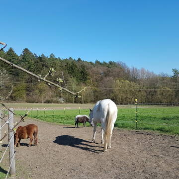
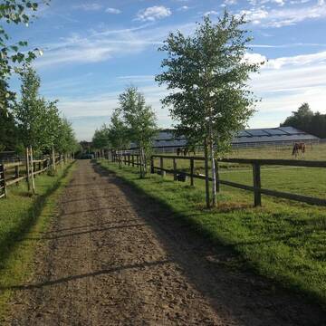
Bewegungsstall für Wallache, Stuten getrennt mög...
Menden
Nicole-Hoevelmann
@Nicole-Hoevelmann
Vermieten
Krankenbox
Paddock
Bewegungsstall
Innenbox
Einzelne Boxen oder Stallplätze
7 weitere...
S
Reitsportanlage Neimen / Gut Dahlmann
Fröndenberg
Juliane-Dahlmann-Weber
@Juliane-Dahlmann-Weber
FN-Mitglied
Pferdeausbildung
Führanlage
Hunde willkommen
Außenboxen
Innenbox
Halbpension
Vollpension
19 weitere...
S
Deprecated: Creation of dynamic property Zend_View_Helper_Ads::$adLink is deprecated in /var/www/stall-frei/htdocs/staging.stall-frei.de/library/Psf/View/Helper/Ads.php on line 108


Dressurstall, Jungpferde und Rentnerbetreuung
Ense
Emily Küppers
@emilykueppers
Pferdeausbildung
Führanlage
Paddock
bedampftes/gewaschenes Heu
Hengsthaltung möglich
Außenboxen
Innenbox
15 weitere...
P+

Hof Japes-Schulte
Sundern
Hof Japes-Schulte
@Hof_Japes-Schulte
Freizeitstall
Geländestrecke
Vermieten
Hunde willkommen
Krankenbox
Allergikerstall
Hufrehe geeignet
18 weitere...
aktuell
P

HIT-Aktivstall KW Pferd-Aktiv
Arnsberg Holzen
KW Pferd-Aktiv
@KWPferdAktiv
Freizeitstall
Vermieten
Krankenbox
Parkplatz für Pferdeanhänger
Notfallboxen
11 weitere...
ganz aktuell
P

Futtersack HeuToy, Fressbremse in pink
Mechtersen
STALL-FREIde Marketing
@STALL-FREI-Marketing
Stundenlange Beschäftigung die
Koliken vorbeugt, geringe Staubinhalation mit
steuerbarer Futterentnahme
Zuchtstall Schäfers
Ense
Zuchtstall-Schaefers
@Zuchtstall-Schaefers
FN-Mitglied
Freizeitstall
Führanlage
Hunde willkommen
Pferdezucht
Zuchtstutenhaltung möglich
Außenbox mit Paddock
Außenboxen
17 weitere...
P+

Pferdepension Blome
Arnsberg-Holzen
Markus Blome
@M.Blome
Freizeitstall
Geländestrecke
Vermieten
Hunde willkommen
Paddock
Innenbox
8 weitere...
P

Hof Ebel - Pferdewirtschaftsmeisterbetrieb
Arnsberg
Bio - Hof Ebel
@Hof-Ebel
Freizeitstall
Geländestrecke
Vermieten
Führanlage
Hunde willkommen
Hufrehe geeignet
zuckerreduziertes Heu
17 weitere...
P

Box, Weide/Paddock
Arnsberg
A.S.
@ReitanlagezurHohenFuhr
Freizeitstall
Hunde willkommen
Paddock
Allergikerstall
bedampftes/gewaschenes Heu
Vollpension
8 weitere...
aktuell
P
Leider kein Vorschaubild
Leider kein Vorschaubild
Günstige Ponybox zu vermieten
Meschede
Kirsten Neitemeier
@Franz Neitemeier
FN-Mitglied
Freizeitstall
Vermieten
Führanlage
Paddock
Gnadenbrothof
Pferdezucht
20 weitere...
P
Deprecated: Creation of dynamic property Zend_View::$pageCount is deprecated in /var/www/stall-frei/htdocs/staging.stall-frei.de/library/vendor/shardj/zf1-future/library/Zend/View/Abstract.php on line 308
Deprecated: Creation of dynamic property Zend_View::$itemCountPerPage is deprecated in /var/www/stall-frei/htdocs/staging.stall-frei.de/library/vendor/shardj/zf1-future/library/Zend/View/Abstract.php on line 308
Deprecated: Creation of dynamic property Zend_View::$first is deprecated in /var/www/stall-frei/htdocs/staging.stall-frei.de/library/vendor/shardj/zf1-future/library/Zend/View/Abstract.php on line 308
Deprecated: Creation of dynamic property Zend_View::$current is deprecated in /var/www/stall-frei/htdocs/staging.stall-frei.de/library/vendor/shardj/zf1-future/library/Zend/View/Abstract.php on line 308
Deprecated: Creation of dynamic property Zend_View::$last is deprecated in /var/www/stall-frei/htdocs/staging.stall-frei.de/library/vendor/shardj/zf1-future/library/Zend/View/Abstract.php on line 308
Deprecated: Creation of dynamic property Zend_View::$next is deprecated in /var/www/stall-frei/htdocs/staging.stall-frei.de/library/vendor/shardj/zf1-future/library/Zend/View/Abstract.php on line 308
Deprecated: Creation of dynamic property Zend_View::$pagesInRange is deprecated in /var/www/stall-frei/htdocs/staging.stall-frei.de/library/vendor/shardj/zf1-future/library/Zend/View/Abstract.php on line 308
Deprecated: Creation of dynamic property Zend_View::$firstPageInRange is deprecated in /var/www/stall-frei/htdocs/staging.stall-frei.de/library/vendor/shardj/zf1-future/library/Zend/View/Abstract.php on line 308
Deprecated: Creation of dynamic property Zend_View::$lastPageInRange is deprecated in /var/www/stall-frei/htdocs/staging.stall-frei.de/library/vendor/shardj/zf1-future/library/Zend/View/Abstract.php on line 308
Deprecated: Creation of dynamic property Zend_View::$currentItemCount is deprecated in /var/www/stall-frei/htdocs/staging.stall-frei.de/library/vendor/shardj/zf1-future/library/Zend/View/Abstract.php on line 308
Deprecated: Creation of dynamic property Zend_View::$totalItemCount is deprecated in /var/www/stall-frei/htdocs/staging.stall-frei.de/library/vendor/shardj/zf1-future/library/Zend/View/Abstract.php on line 308
Deprecated: Creation of dynamic property Zend_View::$firstItemNumber is deprecated in /var/www/stall-frei/htdocs/staging.stall-frei.de/library/vendor/shardj/zf1-future/library/Zend/View/Abstract.php on line 308
Deprecated: Creation of dynamic property Zend_View::$lastItemNumber is deprecated in /var/www/stall-frei/htdocs/staging.stall-frei.de/library/vendor/shardj/zf1-future/library/Zend/View/Abstract.php on line 308
Deprecated: Creation of dynamic property Zend_View::$router is deprecated in /var/www/stall-frei/htdocs/staging.stall-frei.de/library/vendor/shardj/zf1-future/library/Zend/View/Abstract.php on line 308
Deprecated: Creation of dynamic property Zend_View::$urlParams is deprecated in /var/www/stall-frei/htdocs/staging.stall-frei.de/library/vendor/shardj/zf1-future/library/Zend/View/Abstract.php on line 308
Deprecated: Creation of dynamic property Zend_View::$showAds is deprecated in /var/www/stall-frei/htdocs/staging.stall-frei.de/library/vendor/shardj/zf1-future/library/Zend/View/Abstract.php on line 308
Deprecated: Creation of dynamic property Zend_View::$objectIds is deprecated in /var/www/stall-frei/htdocs/staging.stall-frei.de/library/vendor/shardj/zf1-future/library/Zend/View/Abstract.php on line 308
Deprecated: Creation of dynamic property Zend_View::$showNavbar is deprecated in /var/www/stall-frei/htdocs/staging.stall-frei.de/library/vendor/shardj/zf1-future/library/Zend/View/Abstract.php on line 308
Deprecated: Creation of dynamic property Zend_View::$showBreadcrumb is deprecated in /var/www/stall-frei/htdocs/staging.stall-frei.de/library/vendor/shardj/zf1-future/library/Zend/View/Abstract.php on line 308
Deprecated: Creation of dynamic property Zend_View::$showFooter is deprecated in /var/www/stall-frei/htdocs/staging.stall-frei.de/library/vendor/shardj/zf1-future/library/Zend/View/Abstract.php on line 308
Deprecated: Creation of dynamic property Zend_View::$showInternalAds is deprecated in /var/www/stall-frei/htdocs/staging.stall-frei.de/library/vendor/shardj/zf1-future/library/Zend/View/Abstract.php on line 308
Deprecated: Creation of dynamic property Zend_View::$blNoContent is deprecated in /var/www/stall-frei/htdocs/staging.stall-frei.de/library/vendor/shardj/zf1-future/library/Zend/View/Abstract.php on line 308
Deprecated: Creation of dynamic property Zend_View::$sMetaDesc is deprecated in /var/www/stall-frei/htdocs/staging.stall-frei.de/library/vendor/shardj/zf1-future/library/Zend/View/Abstract.php on line 308
Deprecated: Creation of dynamic property Zend_View::$useGmaps is deprecated in /var/www/stall-frei/htdocs/staging.stall-frei.de/library/vendor/shardj/zf1-future/library/Zend/View/Abstract.php on line 308
Deprecated: Creation of dynamic property Zend_View::$touches is deprecated in /var/www/stall-frei/htdocs/staging.stall-frei.de/library/vendor/shardj/zf1-future/library/Zend/View/Abstract.php on line 308
Deprecated: Creation of dynamic property Zend_View::$oProject is deprecated in /var/www/stall-frei/htdocs/staging.stall-frei.de/library/vendor/shardj/zf1-future/library/Zend/View/Abstract.php on line 308
Deprecated: Creation of dynamic property Zend_View::$pageHeadline is deprecated in /var/www/stall-frei/htdocs/staging.stall-frei.de/library/vendor/shardj/zf1-future/library/Zend/View/Abstract.php on line 308
Deprecated: Creation of dynamic property Zend_View::$disableLocationField is deprecated in /var/www/stall-frei/htdocs/staging.stall-frei.de/library/vendor/shardj/zf1-future/library/Zend/View/Abstract.php on line 308
Deprecated: Creation of dynamic property Zend_View::$isSearch is deprecated in /var/www/stall-frei/htdocs/staging.stall-frei.de/library/vendor/shardj/zf1-future/library/Zend/View/Abstract.php on line 308
Deprecated: Creation of dynamic property Zend_View::$pageTitle is deprecated in /var/www/stall-frei/htdocs/staging.stall-frei.de/library/vendor/shardj/zf1-future/library/Zend/View/Abstract.php on line 308
Deprecated: Creation of dynamic property Psf_Form_Element_Text::$class is deprecated in /var/www/stall-frei/htdocs/staging.stall-frei.de/library/vendor/shardj/zf1-future/library/Zend/Form/Element.php on line 874
Deprecated: Creation of dynamic property Psf_Form_Element_Text::$size is deprecated in /var/www/stall-frei/htdocs/staging.stall-frei.de/library/vendor/shardj/zf1-future/library/Zend/Form/Element.php on line 874
Deprecated: Creation of dynamic property Psf_Form_Element_Text::$placeholder is deprecated in /var/www/stall-frei/htdocs/staging.stall-frei.de/library/vendor/shardj/zf1-future/library/Zend/Form/Element.php on line 874
Deprecated: Creation of dynamic property Psf_Form_Element_Hidden::$class is deprecated in /var/www/stall-frei/htdocs/staging.stall-frei.de/library/vendor/shardj/zf1-future/library/Zend/Form/Element.php on line 874
Deprecated: Creation of dynamic property Psf_Form_Element_Hidden::$class is deprecated in /var/www/stall-frei/htdocs/staging.stall-frei.de/library/vendor/shardj/zf1-future/library/Zend/Form/Element.php on line 874
Deprecated: Creation of dynamic property Psf_Form_Element_Hidden::$class is deprecated in /var/www/stall-frei/htdocs/staging.stall-frei.de/library/vendor/shardj/zf1-future/library/Zend/Form/Element.php on line 874
Deprecated: Creation of dynamic property Psf_Form_Element_Hidden::$class is deprecated in /var/www/stall-frei/htdocs/staging.stall-frei.de/library/vendor/shardj/zf1-future/library/Zend/Form/Element.php on line 874
Deprecated: Creation of dynamic property Psf_Form_Element_Select::$class is deprecated in /var/www/stall-frei/htdocs/staging.stall-frei.de/library/vendor/shardj/zf1-future/library/Zend/Form/Element.php on line 874
Deprecated: Creation of dynamic property Psf_Form_Element_Select::$class is deprecated in /var/www/stall-frei/htdocs/staging.stall-frei.de/library/vendor/shardj/zf1-future/library/Zend/Form/Element.php on line 874
Deprecated: Creation of dynamic property Psf_Form_Element_Select::$class is deprecated in /var/www/stall-frei/htdocs/staging.stall-frei.de/library/vendor/shardj/zf1-future/library/Zend/Form/Element.php on line 874
Deprecated: Creation of dynamic property Psf_Form_Element_Select::$class is deprecated in /var/www/stall-frei/htdocs/staging.stall-frei.de/library/vendor/shardj/zf1-future/library/Zend/Form/Element.php on line 874
Deprecated: Creation of dynamic property Psf_Form_Element_Text::$class is deprecated in /var/www/stall-frei/htdocs/staging.stall-frei.de/library/vendor/shardj/zf1-future/library/Zend/Form/Element.php on line 874
Deprecated: Creation of dynamic property Psf_Form_Element_Checkbox::$label is deprecated in /var/www/stall-frei/htdocs/staging.stall-frei.de/library/vendor/shardj/zf1-future/library/Zend/Form/Element.php on line 874
Deprecated: Creation of dynamic property Zend_View::$sort is deprecated in /var/www/stall-frei/htdocs/staging.stall-frei.de/library/vendor/shardj/zf1-future/library/Zend/View/Abstract.php on line 308
Deprecated: Creation of dynamic property Zend_View::$searchLocation is deprecated in /var/www/stall-frei/htdocs/staging.stall-frei.de/library/vendor/shardj/zf1-future/library/Zend/View/Abstract.php on line 308
Deprecated: Creation of dynamic property Zend_View::$locationHint is deprecated in /var/www/stall-frei/htdocs/staging.stall-frei.de/library/vendor/shardj/zf1-future/library/Zend/View/Abstract.php on line 308
Psf_GeoCoder_Abstract::getLocation: Arnsberg Get Location CachedOrLive
Psf_GeoCoder_Abstract::getCachedOrLive: Arnsberg
Psf_GeoCoder_OpenCageData::makeApiRequest: response:
Array
(
[documentation] => https://opencagedata.com/api
[licenses] => Array
(
[0] => Array
(
[name] => see attribution guide
[url] => https://opencagedata.com/credits
)
)
[results] => Array
(
[0] => Array
(
[bounds] => Array
(
[northeast] => Array
(
[lat] => 51.4913301
[lng] => 8.2102722
)
[southwest] => Array
(
[lat] => 51.3547479
[lng] => 7.8640218
)
)
[components] => Array
(
[ISO_3166-1_alpha-2] => DE
[ISO_3166-1_alpha-3] => DEU
[ISO_3166-2] => Array
(
[0] => DE-NW
)
[_category] => place
[_normalized_city] => Arnsberg
[_type] => city
[continent] => Europe
[country] => Deutschland
[country_code] => de
[county] => Hochsauerlandkreis
[political_union] => European Union
[state] => Nordrhein-Westfalen
[state_code] => NW
[town] => Arnsberg
)
[confidence] => 4
[formatted] => Arnsberg, Nordrhein-Westfalen, Deutschland
[geometry] => Array
(
[lat] => 51.4002384
[lng] => 8.0605908
)
)
[1] => Array
(
[bounds] => Array
(
[northeast] => Array
(
[lat] => 51.1433982
[lng] => 7.3517
)
[southwest] => Array
(
[lat] => 51.1033982
[lng] => 7.3117
)
)
[components] => Array
(
[ISO_3166-1_alpha-2] => DE
[ISO_3166-1_alpha-3] => DEU
[ISO_3166-2] => Array
(
[0] => DE-NW
)
[_category] => place
[_normalized_city] => Wipperfürth
[_type] => hamlet
[continent] => Europe
[country] => Deutschland
[country_code] => de
[county] => Oberbergischer Kreis
[hamlet] => Arnsberg
[political_union] => European Union
[postcode] => 51688
[state] => Nordrhein-Westfalen
[state_code] => NW
[town] => Wipperfürth
)
[confidence] => 7
[formatted] => Arnsberg, 51688 Wipperfürth, Deutschland
[geometry] => Array
(
[lat] => 51.1233982
[lng] => 7.3317
)
)
[2] => Array
(
[bounds] => Array
(
[northeast] => Array
(
[lat] => 48.9471748
[lng] => 11.396711
)
[southwest] => Array
(
[lat] => 48.9071748
[lng] => 11.356711
)
)
[components] => Array
(
[ISO_3166-1_alpha-2] => DE
[ISO_3166-1_alpha-3] => DEU
[ISO_3166-2] => Array
(
[0] => DE-BY
)
[_category] => place
[_normalized_city] => Kipfenberg
[_type] => village
[city] => Kipfenberg
[continent] => Europe
[country] => Deutschland
[country_code] => de
[county] => Landkreis Eichstätt
[political_union] => European Union
[postcode] => 85110
[state] => Bayern
[state_code] => BY
[village] => Arnsberg
)
[confidence] => 7
[formatted] => 85110 Arnsberg, Deutschland
[geometry] => Array
(
[lat] => 48.9271748
[lng] => 11.376711
)
)
[3] => Array
(
[bounds] => Array
(
[northeast] => Array
(
[lat] => 50.3945544
[lng] => 9.9614973
)
[southwest] => Array
(
[lat] => 50.3944544
[lng] => 9.9613973
)
)
[components] => Array
(
[ISO_3166-1_alpha-2] => DE
[ISO_3166-1_alpha-3] => DEU
[ISO_3166-2] => Array
(
[0] => DE-BY
)
[_category] => natural/water
[_normalized_city] => Bischofsheim in der Rhön
[_type] => peak
[continent] => Europe
[country] => Deutschland
[country_code] => de
[county] => Landkreis Rhön-Grabfeld
[peak] => Arnsberg
[political_union] => European Union
[postcode] => 97653
[state] => Bayern
[state_code] => BY
[town] => Bischofsheim in der Rhön
)
[confidence] => 9
[formatted] => Arnsberg, 97653 Bischofsheim in der Rhön, Deutschland
[geometry] => Array
(
[lat] => 50.3945044
[lng] => 9.9614473
)
)
[4] => Array
(
[bounds] => Array
(
[northeast] => Array
(
[lat] => 50.5979536
[lng] => 9.8800727
)
[southwest] => Array
(
[lat] => 50.5978536
[lng] => 9.8799727
)
)
[components] => Array
(
[ISO_3166-1_alpha-2] => DE
[ISO_3166-1_alpha-3] => DEU
[ISO_3166-2] => Array
(
[0] => DE-HE
)
[_category] => natural/water
[_normalized_city] => Schwarzbach
[_type] => peak
[continent] => Europe
[country] => Deutschland
[country_code] => de
[county] => Landkreis Fulda
[municipality] => Hofbieber
[peak] => Arnsberg
[political_union] => European Union
[postcode] => 36145
[state] => Hessen
[state_code] => HE
[village] => Schwarzbach
)
[confidence] => 9
[formatted] => Arnsberg, 36145 Schwarzbach, Deutschland
[geometry] => Array
(
[lat] => 50.5979036
[lng] => 9.8800227
)
)
[5] => Array
(
[bounds] => Array
(
[northeast] => Array
(
[lat] => 51.3190299
[lng] => 11.0262228
)
[southwest] => Array
(
[lat] => 51.3189299
[lng] => 11.0261228
)
)
[components] => Array
(
[ISO_3166-1_alpha-2] => DE
[ISO_3166-1_alpha-3] => DEU
[ISO_3166-2] => Array
(
[0] => DE-TH
)
[_category] => natural/water
[_normalized_city] => Kyffhäuserland
[_type] => peak
[city] => Kyffhäuserland
[continent] => Europe
[country] => Deutschland
[country_code] => de
[county] => Kyffhäuserkreis
[municipality] => Kyffhäuserland
[peak] => Arnsberg
[political_union] => European Union
[postcode] => 99707
[state] => Thüringen
[state_code] => TH
)
[confidence] => 9
[formatted] => Arnsberg, 99707 Kyffhäuserland, Deutschland
[geometry] => Array
(
[lat] => 51.3189799
[lng] => 11.0261728
)
)
[6] => Array
(
[bounds] => Array
(
[northeast] => Array
(
[lat] => 50.8645338
[lng] => 10.328487
)
[southwest] => Array
(
[lat] => 50.8644338
[lng] => 10.328387
)
)
[components] => Array
(
[ISO_3166-1_alpha-2] => DE
[ISO_3166-1_alpha-3] => DEU
[ISO_3166-2] => Array
(
[0] => DE-TH
)
[_category] => natural/water
[_normalized_city] => Bad Liebenstein
[_type] => peak
[continent] => Europe
[country] => Deutschland
[country_code] => de
[county] => Wartburgkreis
[peak] => Arnsberg
[political_union] => European Union
[postcode] => 36448
[state] => Thüringen
[state_code] => TH
[town] => Bad Liebenstein
)
[confidence] => 9
[formatted] => Arnsberg, 36448 Bad Liebenstein, Deutschland
[geometry] => Array
(
[lat] => 50.8644838
[lng] => 10.328437
)
)
[7] => Array
(
[bounds] => Array
(
[northeast] => Array
(
[lat] => 52.0428058
[lng] => 8.4579681
)
[southwest] => Array
(
[lat] => 52.0427058
[lng] => 8.4578681
)
)
[components] => Array
(
[ISO_3166-1_alpha-2] => DE
[ISO_3166-1_alpha-3] => DEU
[ISO_3166-2] => Array
(
[0] => DE-NW
)
[_category] => natural/water
[_normalized_city] => Bielefeld
[_type] => peak
[city] => Bielefeld
[continent] => Europe
[country] => Deutschland
[country_code] => de
[peak] => Arnsberg
[political_union] => European Union
[postcode] => 33619
[state] => Nordrhein-Westfalen
[state_code] => NW
)
[confidence] => 9
[formatted] => Arnsberg, 33619 Bielefeld, Deutschland
[geometry] => Array
(
[lat] => 52.0427558
[lng] => 8.4579181
)
)
[8] => Array
(
[components] => Array
(
[ISO_3166-1_alpha-2] => FR
[ISO_3166-1_alpha-3] => FRA
[ISO_3166-2] => Array
(
[0] => FR-IDF
[1] => FR-92
)
[_category] => road
[_normalized_city] => Levallois-Perret
[_type] => road
[city] => Levallois-Perret
[continent] => Europe
[country] => France
[country_code] => fr
[county] => Hauts-de-Seine
[local_authority] => Métropole du Grand Paris
[political_union] => European Union
[postcode] => 92300
[road] => Rue Charles Deutschmann
[state] => Île-de-France
[state_code] => IDF
)
[confidence] => 3
[formatted] => Rue Charles Deutschmann, 92300 Levallois-Perret, France
[geometry] => Array
(
[lat] => 48.900049
[lng] => 2.2842
)
)
[9] => Array
(
[components] => Array
(
[ISO_3166-1_alpha-2] => FR
[ISO_3166-1_alpha-3] => FRA
[ISO_3166-2] => Array
(
[0] => FR-HDF
[1] => FR-59
)
[_category] => road
[_normalized_city] => Hautmont
[_type] => road
[city] => Hautmont
[continent] => Europe
[country] => France
[country_code] => fr
[county] => Nord
[local_authority] => Communauté d'agglomération Maubeuge Val de Sambre
[political_union] => European Union
[postcode] => 59330
[road] => Rue Saint Ansbert
[state] => Hauts-de-France
[state_code] => HDF
)
[confidence] => 2
[formatted] => Rue Saint Ansbert, 59330 Hautmont, France
[geometry] => Array
(
[lat] => 50.252962
[lng] => 3.912637
)
)
)
[status] => Array
(
[code] => 200
[message] => OK
)
[stay_informed] => Array
(
[blog] => https://blog.opencagedata.com
[mastodon] => https://en.osm.town/@opencage
)
[thanks] => For using an OpenCage API
[timestamp] => Array
(
[created_http] => Fri, 06 Feb 2026 16:36:26 GMT
[created_unix] => 1770395786
)
[total_results] => 10
)
Psf_GeoCoder_Abstract::convertLocationResult
{"documentation":"https:\/\/opencagedata.com\/api","licenses":[{"name":"see attribution guide","url":"https:\/\/opencagedata.com\/credits"}],"results":[{"bounds":{"northeast":{"lat":51.4913301,"lng":8.2102722},"southwest":{"lat":51.3547479,"lng":7.8640218}},"components":{"ISO_3166-1_alpha-2":"DE","ISO_3166-1_alpha-3":"DEU","ISO_3166-2":["DE-NW"],"_category":"place","_normalized_city":"Arnsberg","_type":"city","continent":"Europe","country":"Deutschland","country_code":"de","county":"Hochsauerlandkreis","political_union":"European Union","state":"Nordrhein-Westfalen","state_code":"NW","town":"Arnsberg"},"confidence":4,"formatted":"Arnsberg, Nordrhein-Westfalen, Deutschland","geometry":{"lat":51.4002384,"lng":8.0605908}},{"bounds":{"northeast":{"lat":51.1433982,"lng":7.3517},"southwest":{"lat":51.1033982,"lng":7.3117}},"components":{"ISO_3166-1_alpha-2":"DE","ISO_3166-1_alpha-3":"DEU","ISO_3166-2":["DE-NW"],"_category":"place","_normalized_city":"Wipperf\u00fcrth","_type":"hamlet","continent":"Europe","country":"Deutschland","country_code":"de","county":"Oberbergischer Kreis","hamlet":"Arnsberg","political_union":"European Union","postcode":"51688","state":"Nordrhein-Westfalen","state_code":"NW","town":"Wipperf\u00fcrth"},"confidence":7,"formatted":"Arnsberg, 51688 Wipperf\u00fcrth, Deutschland","geometry":{"lat":51.1233982,"lng":7.3317}},{"bounds":{"northeast":{"lat":48.9471748,"lng":11.396711},"southwest":{"lat":48.9071748,"lng":11.356711}},"components":{"ISO_3166-1_alpha-2":"DE","ISO_3166-1_alpha-3":"DEU","ISO_3166-2":["DE-BY"],"_category":"place","_normalized_city":"Kipfenberg","_type":"village","city":"Kipfenberg","continent":"Europe","country":"Deutschland","country_code":"de","county":"Landkreis Eichst\u00e4tt","political_union":"European Union","postcode":"85110","state":"Bayern","state_code":"BY","village":"Arnsberg"},"confidence":7,"formatted":"85110 Arnsberg, Deutschland","geometry":{"lat":48.9271748,"lng":11.376711}},{"bounds":{"northeast":{"lat":50.3945544,"lng":9.9614973},"southwest":{"lat":50.3944544,"lng":9.9613973}},"components":{"ISO_3166-1_alpha-2":"DE","ISO_3166-1_alpha-3":"DEU","ISO_3166-2":["DE-BY"],"_category":"natural\/water","_normalized_city":"Bischofsheim in der Rh\u00f6n","_type":"peak","continent":"Europe","country":"Deutschland","country_code":"de","county":"Landkreis Rh\u00f6n-Grabfeld","peak":"Arnsberg","political_union":"European Union","postcode":"97653","state":"Bayern","state_code":"BY","town":"Bischofsheim in der Rh\u00f6n"},"confidence":9,"formatted":"Arnsberg, 97653 Bischofsheim in der Rh\u00f6n, Deutschland","geometry":{"lat":50.3945044,"lng":9.9614473}},{"bounds":{"northeast":{"lat":50.5979536,"lng":9.8800727},"southwest":{"lat":50.5978536,"lng":9.8799727}},"components":{"ISO_3166-1_alpha-2":"DE","ISO_3166-1_alpha-3":"DEU","ISO_3166-2":["DE-HE"],"_category":"natural\/water","_normalized_city":"Schwarzbach","_type":"peak","continent":"Europe","country":"Deutschland","country_code":"de","county":"Landkreis Fulda","municipality":"Hofbieber","peak":"Arnsberg","political_union":"European Union","postcode":"36145","state":"Hessen","state_code":"HE","village":"Schwarzbach"},"confidence":9,"formatted":"Arnsberg, 36145 Schwarzbach, Deutschland","geometry":{"lat":50.5979036,"lng":9.8800227}},{"bounds":{"northeast":{"lat":51.3190299,"lng":11.0262228},"southwest":{"lat":51.3189299,"lng":11.0261228}},"components":{"ISO_3166-1_alpha-2":"DE","ISO_3166-1_alpha-3":"DEU","ISO_3166-2":["DE-TH"],"_category":"natural\/water","_normalized_city":"Kyffh\u00e4userland","_type":"peak","city":"Kyffh\u00e4userland","continent":"Europe","country":"Deutschland","country_code":"de","county":"Kyffh\u00e4userkreis","municipality":"Kyffh\u00e4userland","peak":"Arnsberg","political_union":"European Union","postcode":"99707","state":"Th\u00fcringen","state_code":"TH"},"confidence":9,"formatted":"Arnsberg, 99707 Kyffh\u00e4userland, Deutschland","geometry":{"lat":51.3189799,"lng":11.0261728}},{"bounds":{"northeast":{"lat":50.8645338,"lng":10.328487},"southwest":{"lat":50.8644338,"lng":10.328387}},"components":{"ISO_3166-1_alpha-2":"DE","ISO_3166-1_alpha-3":"DEU","ISO_3166-2":["DE-TH"],"_category":"natural\/water","_normalized_city":"Bad Liebenstein","_type":"peak","continent":"Europe","country":"Deutschland","country_code":"de","county":"Wartburgkreis","peak":"Arnsberg","political_union":"European Union","postcode":"36448","state":"Th\u00fcringen","state_code":"TH","town":"Bad Liebenstein"},"confidence":9,"formatted":"Arnsberg, 36448 Bad Liebenstein, Deutschland","geometry":{"lat":50.8644838,"lng":10.328437}},{"bounds":{"northeast":{"lat":52.0428058,"lng":8.4579681},"southwest":{"lat":52.0427058,"lng":8.4578681}},"components":{"ISO_3166-1_alpha-2":"DE","ISO_3166-1_alpha-3":"DEU","ISO_3166-2":["DE-NW"],"_category":"natural\/water","_normalized_city":"Bielefeld","_type":"peak","city":"Bielefeld","continent":"Europe","country":"Deutschland","country_code":"de","peak":"Arnsberg","political_union":"European Union","postcode":"33619","state":"Nordrhein-Westfalen","state_code":"NW"},"confidence":9,"formatted":"Arnsberg, 33619 Bielefeld, Deutschland","geometry":{"lat":52.0427558,"lng":8.4579181}},{"components":{"ISO_3166-1_alpha-2":"FR","ISO_3166-1_alpha-3":"FRA","ISO_3166-2":["FR-IDF","FR-92"],"_category":"road","_normalized_city":"Levallois-Perret","_type":"road","city":"Levallois-Perret","continent":"Europe","country":"France","country_code":"fr","county":"Hauts-de-Seine","local_authority":"M\u00e9tropole du Grand Paris","political_union":"European Union","postcode":"92300","road":"Rue Charles Deutschmann","state":"\u00cele-de-France","state_code":"IDF"},"confidence":3,"formatted":"Rue Charles Deutschmann, 92300 Levallois-Perret, France","geometry":{"lat":48.900049,"lng":2.2842}},{"components":{"ISO_3166-1_alpha-2":"FR","ISO_3166-1_alpha-3":"FRA","ISO_3166-2":["FR-HDF","FR-59"],"_category":"road","_normalized_city":"Hautmont","_type":"road","city":"Hautmont","continent":"Europe","country":"France","country_code":"fr","county":"Nord","local_authority":"Communaut\u00e9 d'agglom\u00e9ration Maubeuge Val de Sambre","political_union":"European Union","postcode":"59330","road":"Rue Saint Ansbert","state":"Hauts-de-France","state_code":"HDF"},"confidence":2,"formatted":"Rue Saint Ansbert, 59330 Hautmont, France","geometry":{"lat":50.252962,"lng":3.912637}}],"status":{"code":200,"message":"OK"},"stay_informed":{"blog":"https:\/\/blog.opencagedata.com","mastodon":"https:\/\/en.osm.town\/@opencage"},"thanks":"For using an OpenCage API","timestamp":{"created_http":"Fri, 06 Feb 2026 16:36:26 GMT","created_unix":1770395786},"total_results":10}Array
(
[0] => stdClass Object
(
[bounds] => stdClass Object
(
[northeast] => stdClass Object
(
[lat] => 51.4913301
[lng] => 8.2102722
)
[southwest] => stdClass Object
(
[lat] => 51.3547479
[lng] => 7.8640218
)
)
[components] => stdClass Object
(
[ISO_3166-1_alpha-2] => DE
[ISO_3166-1_alpha-3] => DEU
[ISO_3166-2] => Array
(
[0] => DE-NW
)
[_category] => place
[_normalized_city] => Arnsberg
[_type] => city
[continent] => Europe
[country] => Deutschland
[country_code] => de
[county] => Hochsauerlandkreis
[political_union] => European Union
[state] => Nordrhein-Westfalen
[state_code] => NW
[town] => Arnsberg
)
[confidence] => 4
[formatted] => Arnsberg, Nordrhein-Westfalen, Deutschland
[geometry] => stdClass Object
(
[lat] => 51.4002384
[lng] => 8.0605908
)
)
[1] => stdClass Object
(
[bounds] => stdClass Object
(
[northeast] => stdClass Object
(
[lat] => 51.1433982
[lng] => 7.3517
)
[southwest] => stdClass Object
(
[lat] => 51.1033982
[lng] => 7.3117
)
)
[components] => stdClass Object
(
[ISO_3166-1_alpha-2] => DE
[ISO_3166-1_alpha-3] => DEU
[ISO_3166-2] => Array
(
[0] => DE-NW
)
[_category] => place
[_normalized_city] => Wipperfürth
[_type] => hamlet
[continent] => Europe
[country] => Deutschland
[country_code] => de
[county] => Oberbergischer Kreis
[hamlet] => Arnsberg
[political_union] => European Union
[postcode] => 51688
[state] => Nordrhein-Westfalen
[state_code] => NW
[town] => Wipperfürth
)
[confidence] => 7
[formatted] => Arnsberg, 51688 Wipperfürth, Deutschland
[geometry] => stdClass Object
(
[lat] => 51.1233982
[lng] => 7.3317
)
)
[2] => stdClass Object
(
[bounds] => stdClass Object
(
[northeast] => stdClass Object
(
[lat] => 48.9471748
[lng] => 11.396711
)
[southwest] => stdClass Object
(
[lat] => 48.9071748
[lng] => 11.356711
)
)
[components] => stdClass Object
(
[ISO_3166-1_alpha-2] => DE
[ISO_3166-1_alpha-3] => DEU
[ISO_3166-2] => Array
(
[0] => DE-BY
)
[_category] => place
[_normalized_city] => Kipfenberg
[_type] => village
[city] => Kipfenberg
[continent] => Europe
[country] => Deutschland
[country_code] => de
[county] => Landkreis Eichstätt
[political_union] => European Union
[postcode] => 85110
[state] => Bayern
[state_code] => BY
[village] => Arnsberg
)
[confidence] => 7
[formatted] => 85110 Arnsberg, Deutschland
[geometry] => stdClass Object
(
[lat] => 48.9271748
[lng] => 11.376711
)
)
[3] => stdClass Object
(
[bounds] => stdClass Object
(
[northeast] => stdClass Object
(
[lat] => 50.3945544
[lng] => 9.9614973
)
[southwest] => stdClass Object
(
[lat] => 50.3944544
[lng] => 9.9613973
)
)
[components] => stdClass Object
(
[ISO_3166-1_alpha-2] => DE
[ISO_3166-1_alpha-3] => DEU
[ISO_3166-2] => Array
(
[0] => DE-BY
)
[_category] => natural/water
[_normalized_city] => Bischofsheim in der Rhön
[_type] => peak
[continent] => Europe
[country] => Deutschland
[country_code] => de
[county] => Landkreis Rhön-Grabfeld
[peak] => Arnsberg
[political_union] => European Union
[postcode] => 97653
[state] => Bayern
[state_code] => BY
[town] => Bischofsheim in der Rhön
)
[confidence] => 9
[formatted] => Arnsberg, 97653 Bischofsheim in der Rhön, Deutschland
[geometry] => stdClass Object
(
[lat] => 50.3945044
[lng] => 9.9614473
)
)
[4] => stdClass Object
(
[bounds] => stdClass Object
(
[northeast] => stdClass Object
(
[lat] => 50.5979536
[lng] => 9.8800727
)
[southwest] => stdClass Object
(
[lat] => 50.5978536
[lng] => 9.8799727
)
)
[components] => stdClass Object
(
[ISO_3166-1_alpha-2] => DE
[ISO_3166-1_alpha-3] => DEU
[ISO_3166-2] => Array
(
[0] => DE-HE
)
[_category] => natural/water
[_normalized_city] => Schwarzbach
[_type] => peak
[continent] => Europe
[country] => Deutschland
[country_code] => de
[county] => Landkreis Fulda
[municipality] => Hofbieber
[peak] => Arnsberg
[political_union] => European Union
[postcode] => 36145
[state] => Hessen
[state_code] => HE
[village] => Schwarzbach
)
[confidence] => 9
[formatted] => Arnsberg, 36145 Schwarzbach, Deutschland
[geometry] => stdClass Object
(
[lat] => 50.5979036
[lng] => 9.8800227
)
)
[5] => stdClass Object
(
[bounds] => stdClass Object
(
[northeast] => stdClass Object
(
[lat] => 51.3190299
[lng] => 11.0262228
)
[southwest] => stdClass Object
(
[lat] => 51.3189299
[lng] => 11.0261228
)
)
[components] => stdClass Object
(
[ISO_3166-1_alpha-2] => DE
[ISO_3166-1_alpha-3] => DEU
[ISO_3166-2] => Array
(
[0] => DE-TH
)
[_category] => natural/water
[_normalized_city] => Kyffhäuserland
[_type] => peak
[city] => Kyffhäuserland
[continent] => Europe
[country] => Deutschland
[country_code] => de
[county] => Kyffhäuserkreis
[municipality] => Kyffhäuserland
[peak] => Arnsberg
[political_union] => European Union
[postcode] => 99707
[state] => Thüringen
[state_code] => TH
)
[confidence] => 9
[formatted] => Arnsberg, 99707 Kyffhäuserland, Deutschland
[geometry] => stdClass Object
(
[lat] => 51.3189799
[lng] => 11.0261728
)
)
[6] => stdClass Object
(
[bounds] => stdClass Object
(
[northeast] => stdClass Object
(
[lat] => 50.8645338
[lng] => 10.328487
)
[southwest] => stdClass Object
(
[lat] => 50.8644338
[lng] => 10.328387
)
)
[components] => stdClass Object
(
[ISO_3166-1_alpha-2] => DE
[ISO_3166-1_alpha-3] => DEU
[ISO_3166-2] => Array
(
[0] => DE-TH
)
[_category] => natural/water
[_normalized_city] => Bad Liebenstein
[_type] => peak
[continent] => Europe
[country] => Deutschland
[country_code] => de
[county] => Wartburgkreis
[peak] => Arnsberg
[political_union] => European Union
[postcode] => 36448
[state] => Thüringen
[state_code] => TH
[town] => Bad Liebenstein
)
[confidence] => 9
[formatted] => Arnsberg, 36448 Bad Liebenstein, Deutschland
[geometry] => stdClass Object
(
[lat] => 50.8644838
[lng] => 10.328437
)
)
[7] => stdClass Object
(
[bounds] => stdClass Object
(
[northeast] => stdClass Object
(
[lat] => 52.0428058
[lng] => 8.4579681
)
[southwest] => stdClass Object
(
[lat] => 52.0427058
[lng] => 8.4578681
)
)
[components] => stdClass Object
(
[ISO_3166-1_alpha-2] => DE
[ISO_3166-1_alpha-3] => DEU
[ISO_3166-2] => Array
(
[0] => DE-NW
)
[_category] => natural/water
[_normalized_city] => Bielefeld
[_type] => peak
[city] => Bielefeld
[continent] => Europe
[country] => Deutschland
[country_code] => de
[peak] => Arnsberg
[political_union] => European Union
[postcode] => 33619
[state] => Nordrhein-Westfalen
[state_code] => NW
)
[confidence] => 9
[formatted] => Arnsberg, 33619 Bielefeld, Deutschland
[geometry] => stdClass Object
(
[lat] => 52.0427558
[lng] => 8.4579181
)
)
[8] => stdClass Object
(
[components] => stdClass Object
(
[ISO_3166-1_alpha-2] => FR
[ISO_3166-1_alpha-3] => FRA
[ISO_3166-2] => Array
(
[0] => FR-IDF
[1] => FR-92
)
[_category] => road
[_normalized_city] => Levallois-Perret
[_type] => road
[city] => Levallois-Perret
[continent] => Europe
[country] => France
[country_code] => fr
[county] => Hauts-de-Seine
[local_authority] => Métropole du Grand Paris
[political_union] => European Union
[postcode] => 92300
[road] => Rue Charles Deutschmann
[state] => Île-de-France
[state_code] => IDF
)
[confidence] => 3
[formatted] => Rue Charles Deutschmann, 92300 Levallois-Perret, France
[geometry] => stdClass Object
(
[lat] => 48.900049
[lng] => 2.2842
)
)
[9] => stdClass Object
(
[components] => stdClass Object
(
[ISO_3166-1_alpha-2] => FR
[ISO_3166-1_alpha-3] => FRA
[ISO_3166-2] => Array
(
[0] => FR-HDF
[1] => FR-59
)
[_category] => road
[_normalized_city] => Hautmont
[_type] => road
[city] => Hautmont
[continent] => Europe
[country] => France
[country_code] => fr
[county] => Nord
[local_authority] => Communauté d'agglomération Maubeuge Val de Sambre
[political_union] => European Union
[postcode] => 59330
[road] => Rue Saint Ansbert
[state] => Hauts-de-France
[state_code] => HDF
)
[confidence] => 2
[formatted] => Rue Saint Ansbert, 59330 Hautmont, France
[geometry] => stdClass Object
(
[lat] => 50.252962
[lng] => 3.912637
)
)
)
Psf_GeoCoder_OpenCageData::getKeyMap: 0
stdClass Object
(
    [bounds] => stdClass Object
        (
            [northeast] => stdClass Object
                (
                    [lat] => 51.4913301
                    [lng] => 8.2102722
                )

            [southwest] => stdClass Object
                (
                    [lat] => 51.3547479
                    [lng] => 7.8640218
                )

        )

    [components] => stdClass Object
        (
            [ISO_3166-1_alpha-2] => DE
            [ISO_3166-1_alpha-3] => DEU
            [ISO_3166-2] => Array
                (
                    [0] => DE-NW
                )

            [_category] => place
            [_normalized_city] => Arnsberg
            [_type] => city
            [continent] => Europe
            [country] => Deutschland
            [country_code] => de
            [county] => Hochsauerlandkreis
            [political_union] => European Union
            [state] => Nordrhein-Westfalen
            [state_code] => NW
            [town] => Arnsberg
        )

    [confidence] => 4
    [formatted] => Arnsberg, Nordrhein-Westfalen, Deutschland
    [geometry] => stdClass Object
        (
            [lat] => 51.4002384
            [lng] => 8.0605908
        )

)
Psf_GeoCoder_OpenCageData::getCounty: Hochsauerlandkreis
Psf_GeoCoder_OpenCageData::addMissingData REFETCH!
Array
(
    [address] => Arnsberg, Nordrhein-Westfalen, Deutschland
    [type] => city
    [street] =>
    [city] => Arnsberg
    [county] => Hochsauerlandkreis
    [state] => Nordrhein-Westfalen
    [zip] =>
    [country] => Deutschland
    [suburb] =>
    [countrycode] => de
    [latitude] => 51.4002384
    [longitude] => 8.0605908
    [accuracy] => 1
    [confidence] => 4
    [bounds] => stdClass Object
        (
            [northeast] => stdClass Object
                (
                    [lat] => 51.4913301
                    [lng] => 8.2102722
                )

            [southwest] => stdClass Object
                (
                    [lat] => 51.3547479
                    [lng] => 7.8640218
                )

        )

)
reformat!
Array
(
    [address] => Arnsberg, Nordrhein-Westfalen, Deutschland
    [type] => city
    [street] =>
    [city] => Arnsberg
    [county] => Hochsauerlandkreis
    [state] => Nordrhein-Westfalen
    [zip] =>
    [country] => Deutschland
    [suburb] =>
    [countrycode] => de
    [latitude] => 51.4002384
    [longitude] => 8.0605908
    [accuracy] => 1
    [confidence] => 4
    [bounds] => stdClass Object
        (
            [northeast] => stdClass Object
                (
                    [lat] => 51.4913301
                    [lng] => 8.2102722
                )

            [southwest] => stdClass Object
                (
                    [lat] => 51.3547479
                    [lng] => 7.8640218
                )

        )

    [place] => Arnsberg, Nordrhein-Westfalen
    [hash] => ce9cb709951acb5f15ac44c32fe65216
)
Psf_GeoCoder_OpenCageData::getKeyMap: 1
stdClass Object
(
    [bounds] => stdClass Object
        (
            [northeast] => stdClass Object
                (
                    [lat] => 51.1433982
                    [lng] => 7.3517
                )

            [southwest] => stdClass Object
                (
                    [lat] => 51.1033982
                    [lng] => 7.3117
                )

        )

    [components] => stdClass Object
        (
            [ISO_3166-1_alpha-2] => DE
            [ISO_3166-1_alpha-3] => DEU
            [ISO_3166-2] => Array
                (
                    [0] => DE-NW
                )

            [_category] => place
            [_normalized_city] => Wipperfürth
            [_type] => hamlet
            [continent] => Europe
            [country] => Deutschland
            [country_code] => de
            [county] => Oberbergischer Kreis
            [hamlet] => Arnsberg
            [political_union] => European Union
            [postcode] => 51688
            [state] => Nordrhein-Westfalen
            [state_code] => NW
            [town] => Wipperfürth
        )

    [confidence] => 7
    [formatted] => Arnsberg, 51688 Wipperfürth, Deutschland
    [geometry] => stdClass Object
        (
            [lat] => 51.1233982
            [lng] => 7.3317
        )

)
Psf_GeoCoder_OpenCageData::getCounty: Oberbergischer Kreis
Psf_GeoCoder_OpenCageData::addMissingData REFETCH!
Array
(
    [address] => Arnsberg, 51688 Wipperfürth, Deutschland
    [type] => hamlet
    [street] => Arnsberg
    [city] => Wipperfürth
    [county] => Oberbergischer Kreis
    [state] => Nordrhein-Westfalen
    [zip] => 51688
    [country] => Deutschland
    [suburb] =>
    [countrycode] => de
    [latitude] => 51.1233982
    [longitude] => 7.3317
    [accuracy] => 1
    [confidence] => 7
    [bounds] => stdClass Object
        (
            [northeast] => stdClass Object
                (
                    [lat] => 51.1433982
                    [lng] => 7.3517
                )

            [southwest] => stdClass Object
                (
                    [lat] => 51.1033982
                    [lng] => 7.3117
                )

        )

)
reformat!
Array
(
    [address] => Arnsberg, 51688 Wipperfürth, Deutschland
    [type] => hamlet
    [street] => Arnsberg
    [city] => Wipperfürth
    [county] => Oberbergischer Kreis
    [state] => Nordrhein-Westfalen
    [zip] => 51688
    [country] => Deutschland
    [suburb] =>
    [countrycode] => de
    [latitude] => 51.1233982
    [longitude] => 7.3317
    [accuracy] => 1
    [confidence] => 7
    [bounds] => stdClass Object
        (
            [northeast] => stdClass Object
                (
                    [lat] => 51.1433982
                    [lng] => 7.3517
                )

            [southwest] => stdClass Object
                (
                    [lat] => 51.1033982
                    [lng] => 7.3117
                )

        )

    [place] => Arnsberg, 51688 Wipperfürth, Nordrhein-Westfalen
    [hash] => dc1e5311797ced5d7d16999dd196bea5
)
Psf_GeoCoder_OpenCageData::getKeyMap: 2
stdClass Object
(
    [bounds] => stdClass Object
        (
            [northeast] => stdClass Object
                (
                    [lat] => 48.9471748
                    [lng] => 11.396711
                )

            [southwest] => stdClass Object
                (
                    [lat] => 48.9071748
                    [lng] => 11.356711
                )

        )

    [components] => stdClass Object
        (
            [ISO_3166-1_alpha-2] => DE
            [ISO_3166-1_alpha-3] => DEU
            [ISO_3166-2] => Array
                (
                    [0] => DE-BY
                )

            [_category] => place
            [_normalized_city] => Kipfenberg
            [_type] => village
            [city] => Kipfenberg
            [continent] => Europe
            [country] => Deutschland
            [country_code] => de
            [county] => Landkreis Eichstätt
            [political_union] => European Union
            [postcode] => 85110
            [state] => Bayern
            [state_code] => BY
            [village] => Arnsberg
        )

    [confidence] => 7
    [formatted] => 85110 Arnsberg, Deutschland
    [geometry] => stdClass Object
        (
            [lat] => 48.9271748
            [lng] => 11.376711
        )

)
Psf_GeoCoder_OpenCageData::getCounty: Eichstätt
Psf_GeoCoder_OpenCageData::addMissingData REFETCH!
Array
(
    [address] => 85110 Arnsberg, Deutschland
    [type] => village
    [street] =>
    [city] => Arnsberg
    [county] => Eichstätt
    [state] => Bayern
    [zip] => 85110
    [country] => Deutschland
    [suburb] =>
    [countrycode] => de
    [latitude] => 48.9271748
    [longitude] => 11.376711
    [accuracy] => 1
    [confidence] => 7
    [bounds] => stdClass Object
        (
            [northeast] => stdClass Object
                (
                    [lat] => 48.9471748
                    [lng] => 11.396711
                )

            [southwest] => stdClass Object
                (
                    [lat] => 48.9071748
                    [lng] => 11.356711
                )

        )

)
reformat!
Array
(
    [address] => 85110 Arnsberg, Deutschland
    [type] => village
    [street] =>
    [city] => Arnsberg
    [county] => Eichstätt
    [state] => Bayern
    [zip] => 85110
    [country] => Deutschland
    [suburb] =>
    [countrycode] => de
    [latitude] => 48.9271748
    [longitude] => 11.376711
    [accuracy] => 1
    [confidence] => 7
    [bounds] => stdClass Object
        (
            [northeast] => stdClass Object
                (
                    [lat] => 48.9471748
                    [lng] => 11.396711
                )

            [southwest] => stdClass Object
                (
                    [lat] => 48.9071748
                    [lng] => 11.356711
                )

        )

    [place] => 85110 Arnsberg, Bayern
    [hash] => c8d97a781566b0ee78077486040a543a
)
Psf_GeoCoder_OpenCageData::getKeyMap: 3
stdClass Object
(
    [bounds] => stdClass Object
        (
            [northeast] => stdClass Object
                (
                    [lat] => 50.3945544
                    [lng] => 9.9614973
                )

            [southwest] => stdClass Object
                (
                    [lat] => 50.3944544
                    [lng] => 9.9613973
                )

        )

    [components] => stdClass Object
        (
            [ISO_3166-1_alpha-2] => DE
            [ISO_3166-1_alpha-3] => DEU
            [ISO_3166-2] => Array
                (
                    [0] => DE-BY
                )

            [_category] => natural/water
            [_normalized_city] => Bischofsheim in der Rhön
            [_type] => peak
            [continent] => Europe
            [country] => Deutschland
            [country_code] => de
            [county] => Landkreis Rhön-Grabfeld
            [peak] => Arnsberg
            [political_union] => European Union
            [postcode] => 97653
            [state] => Bayern
            [state_code] => BY
            [town] => Bischofsheim in der Rhön
        )

    [confidence] => 9
    [formatted] => Arnsberg, 97653 Bischofsheim in der Rhön, Deutschland
    [geometry] => stdClass Object
        (
            [lat] => 50.3945044
            [lng] => 9.9614473
        )

)
Psf_GeoCoder_OpenCageData::getCounty: Rhön-Grabfeld
Psf_GeoCoder_OpenCageData::addMissingData REFETCH!
Array
(
    [address] => Arnsberg, 97653 Bischofsheim in der Rhön, Deutschland
    [type] => peak
    [street] =>
    [city] => Bischofsheim in der Rhön
    [county] => Rhön-Grabfeld
    [state] => Bayern
    [zip] => 97653
    [country] => Deutschland
    [suburb] =>
    [countrycode] => de
    [latitude] => 50.3945044
    [longitude] => 9.9614473
    [accuracy] => 1
    [confidence] => 9
    [bounds] => stdClass Object
        (
            [northeast] => stdClass Object
                (
                    [lat] => 50.3945544
                    [lng] => 9.9614973
                )

            [southwest] => stdClass Object
                (
                    [lat] => 50.3944544
                    [lng] => 9.9613973
                )

        )

)
reformat!
Array
(
    [address] => Arnsberg, 97653 Bischofsheim in der Rhön, Deutschland
    [type] => peak
    [street] =>
    [city] => Bischofsheim in der Rhön
    [county] => Rhön-Grabfeld
    [state] => Bayern
    [zip] => 97653
    [country] => Deutschland
    [suburb] =>
    [countrycode] => de
    [latitude] => 50.3945044
    [longitude] => 9.9614473
    [accuracy] => 1
    [confidence] => 9
    [bounds] => stdClass Object
        (
            [northeast] => stdClass Object
                (
                    [lat] => 50.3945544
                    [lng] => 9.9614973
                )

            [southwest] => stdClass Object
                (
                    [lat] => 50.3944544
                    [lng] => 9.9613973
                )

        )

    [place] => 97653 Bischofsheim in der Rhön, Bayern
    [hash] => 0e4d2a95eacb4f439243400e81372fcd
)
Psf_GeoCoder_OpenCageData::getKeyMap: 4
stdClass Object
(
    [bounds] => stdClass Object
        (
            [northeast] => stdClass Object
                (
                    [lat] => 50.5979536
                    [lng] => 9.8800727
                )

            [southwest] => stdClass Object
                (
                    [lat] => 50.5978536
                    [lng] => 9.8799727
                )

        )

    [components] => stdClass Object
        (
            [ISO_3166-1_alpha-2] => DE
            [ISO_3166-1_alpha-3] => DEU
            [ISO_3166-2] => Array
                (
                    [0] => DE-HE
                )

            [_category] => natural/water
            [_normalized_city] => Schwarzbach
            [_type] => peak
            [continent] => Europe
            [country] => Deutschland
            [country_code] => de
            [county] => Landkreis Fulda
            [municipality] => Hofbieber
            [peak] => Arnsberg
            [political_union] => European Union
            [postcode] => 36145
            [state] => Hessen
            [state_code] => HE
            [village] => Schwarzbach
        )

    [confidence] => 9
    [formatted] => Arnsberg, 36145 Schwarzbach, Deutschland
    [geometry] => stdClass Object
        (
            [lat] => 50.5979036
            [lng] => 9.8800227
        )

)
Psf_GeoCoder_OpenCageData::getCounty: Fulda
Psf_GeoCoder_OpenCageData::addMissingData REFETCH!
Array
(
    [address] => Arnsberg, 36145 Schwarzbach, Deutschland
    [type] => peak
    [street] =>
    [city] => Schwarzbach
    [county] => Fulda
    [state] => Hessen
    [zip] => 36145
    [country] => Deutschland
    [suburb] =>
    [countrycode] => de
    [latitude] => 50.5979036
    [longitude] => 9.8800227
    [accuracy] => 1
    [confidence] => 9
    [bounds] => stdClass Object
        (
            [northeast] => stdClass Object
                (
                    [lat] => 50.5979536
                    [lng] => 9.8800727
                )

            [southwest] => stdClass Object
                (
                    [lat] => 50.5978536
                    [lng] => 9.8799727
                )

        )

)
reformat!
Array
(
    [address] => Arnsberg, 36145 Schwarzbach, Deutschland
    [type] => peak
    [street] =>
    [city] => Schwarzbach
    [county] => Fulda
    [state] => Hessen
    [zip] => 36145
    [country] => Deutschland
    [suburb] =>
    [countrycode] => de
    [latitude] => 50.5979036
    [longitude] => 9.8800227
    [accuracy] => 1
    [confidence] => 9
    [bounds] => stdClass Object
        (
            [northeast] => stdClass Object
                (
                    [lat] => 50.5979536
                    [lng] => 9.8800727
                )

            [southwest] => stdClass Object
                (
                    [lat] => 50.5978536
                    [lng] => 9.8799727
                )

        )

    [place] => 36145 Schwarzbach, Hessen
    [hash] => 3debb359bfb2eb6775bc57734ecbdd5f
)
Psf_GeoCoder_OpenCageData::getKeyMap: 5
stdClass Object
(
    [bounds] => stdClass Object
        (
            [northeast] => stdClass Object
                (
                    [lat] => 51.3190299
                    [lng] => 11.0262228
                )

            [southwest] => stdClass Object
                (
                    [lat] => 51.3189299
                    [lng] => 11.0261228
                )

        )

    [components] => stdClass Object
        (
            [ISO_3166-1_alpha-2] => DE
            [ISO_3166-1_alpha-3] => DEU
            [ISO_3166-2] => Array
                (
                    [0] => DE-TH
                )

            [_category] => natural/water
            [_normalized_city] => Kyffhäuserland
            [_type] => peak
            [city] => Kyffhäuserland
            [continent] => Europe
            [country] => Deutschland
            [country_code] => de
            [county] => Kyffhäuserkreis
            [municipality] => Kyffhäuserland
            [peak] => Arnsberg
            [political_union] => European Union
            [postcode] => 99707
            [state] => Thüringen
            [state_code] => TH
        )

    [confidence] => 9
    [formatted] => Arnsberg, 99707 Kyffhäuserland, Deutschland
    [geometry] => stdClass Object
        (
            [lat] => 51.3189799
            [lng] => 11.0261728
        )

)
Psf_GeoCoder_OpenCageData::getCounty: Kyffhäuserkreis
Psf_GeoCoder_OpenCageData::addMissingData REFETCH!
Array
(
    [address] => Arnsberg, 99707 Kyffhäuserland, Deutschland
    [type] => peak
    [street] =>
    [city] => Kyffhäuserland
    [county] => Kyffhäuserkreis
    [state] => Thüringen
    [zip] => 99707
    [country] => Deutschland
    [suburb] =>
    [countrycode] => de
    [latitude] => 51.3189799
    [longitude] => 11.0261728
    [accuracy] => 1
    [confidence] => 9
    [bounds] => stdClass Object
        (
            [northeast] => stdClass Object
                (
                    [lat] => 51.3190299
                    [lng] => 11.0262228
                )

            [southwest] => stdClass Object
                (
                    [lat] => 51.3189299
                    [lng] => 11.0261228
                )

        )

)
reformat!
Array
(
    [address] => Arnsberg, 99707 Kyffhäuserland, Deutschland
    [type] => peak
    [street] =>
    [city] => Kyffhäuserland
    [county] => Kyffhäuserkreis
    [state] => Thüringen
    [zip] => 99707
    [country] => Deutschland
    [suburb] =>
    [countrycode] => de
    [latitude] => 51.3189799
    [longitude] => 11.0261728
    [accuracy] => 1
    [confidence] => 9
    [bounds] => stdClass Object
        (
            [northeast] => stdClass Object
                (
                    [lat] => 51.3190299
                    [lng] => 11.0262228
                )

            [southwest] => stdClass Object
                (
                    [lat] => 51.3189299
                    [lng] => 11.0261228
                )

        )

    [place] => 99707 Kyffhäuserland, Thüringen
    [hash] => fd20b54aab86fc71451f44ccfbc7cfcf
)
Psf_GeoCoder_OpenCageData::getKeyMap: 6
stdClass Object
(
    [bounds] => stdClass Object
        (
            [northeast] => stdClass Object
                (
                    [lat] => 50.8645338
                    [lng] => 10.328487
                )

            [southwest] => stdClass Object
                (
                    [lat] => 50.8644338
                    [lng] => 10.328387
                )

        )

    [components] => stdClass Object
        (
            [ISO_3166-1_alpha-2] => DE
            [ISO_3166-1_alpha-3] => DEU
            [ISO_3166-2] => Array
                (
                    [0] => DE-TH
                )

            [_category] => natural/water
            [_normalized_city] => Bad Liebenstein
            [_type] => peak
            [continent] => Europe
            [country] => Deutschland
            [country_code] => de
            [county] => Wartburgkreis
            [peak] => Arnsberg
            [political_union] => European Union
            [postcode] => 36448
            [state] => Thüringen
            [state_code] => TH
            [town] => Bad Liebenstein
        )

    [confidence] => 9
    [formatted] => Arnsberg, 36448 Bad Liebenstein, Deutschland
    [geometry] => stdClass Object
        (
            [lat] => 50.8644838
            [lng] => 10.328437
        )

)
Psf_GeoCoder_OpenCageData::getCounty: Wartburgkreis
Psf_GeoCoder_OpenCageData::addMissingData REFETCH!
Array
(
    [address] => Arnsberg, 36448 Bad Liebenstein, Deutschland
    [type] => peak
    [street] =>
    [city] => Bad Liebenstein
    [county] => Wartburgkreis
    [state] => Thüringen
    [zip] => 36448
    [country] => Deutschland
    [suburb] =>
    [countrycode] => de
    [latitude] => 50.8644838
    [longitude] => 10.328437
    [accuracy] => 1
    [confidence] => 9
    [bounds] => stdClass Object
        (
            [northeast] => stdClass Object
                (
                    [lat] => 50.8645338
                    [lng] => 10.328487
                )

            [southwest] => stdClass Object
                (
                    [lat] => 50.8644338
                    [lng] => 10.328387
                )

        )

)
reformat!
Array
(
    [address] => Arnsberg, 36448 Bad Liebenstein, Deutschland
    [type] => peak
    [street] =>
    [city] => Bad Liebenstein
    [county] => Wartburgkreis
    [state] => Thüringen
    [zip] => 36448
    [country] => Deutschland
    [suburb] =>
    [countrycode] => de
    [latitude] => 50.8644838
    [longitude] => 10.328437
    [accuracy] => 1
    [confidence] => 9
    [bounds] => stdClass Object
        (
            [northeast] => stdClass Object
                (
                    [lat] => 50.8645338
                    [lng] => 10.328487
                )

            [southwest] => stdClass Object
                (
                    [lat] => 50.8644338
                    [lng] => 10.328387
                )

        )

    [place] => 36448 Bad Liebenstein, Thüringen
    [hash] => cb0df2045958d5ea8c256fd71fd7a222
)
Psf_GeoCoder_OpenCageData::getKeyMap: 7
stdClass Object
(
    [bounds] => stdClass Object
        (
            [northeast] => stdClass Object
                (
                    [lat] => 52.0428058
                    [lng] => 8.4579681
                )

            [southwest] => stdClass Object
                (
                    [lat] => 52.0427058
                    [lng] => 8.4578681
                )

        )

    [components] => stdClass Object
        (
            [ISO_3166-1_alpha-2] => DE
            [ISO_3166-1_alpha-3] => DEU
            [ISO_3166-2] => Array
                (
                    [0] => DE-NW
                )

            [_category] => natural/water
            [_normalized_city] => Bielefeld
            [_type] => peak
            [city] => Bielefeld
            [continent] => Europe
            [country] => Deutschland
            [country_code] => de
            [peak] => Arnsberg
            [political_union] => European Union
            [postcode] => 33619
            [state] => Nordrhein-Westfalen
            [state_code] => NW
        )

    [confidence] => 9
    [formatted] => Arnsberg, 33619 Bielefeld, Deutschland
    [geometry] => stdClass Object
        (
            [lat] => 52.0427558
            [lng] => 8.4579181
        )

)
Psf_GeoCoder_OpenCageData::getCounty: Bielefeld
Psf_GeoCoder_OpenCageData::addMissingData REFETCH!
Array
(
    [address] => Arnsberg, 33619 Bielefeld, Deutschland
    [type] => peak
    [street] =>
    [city] => Bielefeld
    [county] => Bielefeld
    [state] => Nordrhein-Westfalen
    [zip] => 33619
    [country] => Deutschland
    [suburb] =>
    [countrycode] => de
    [latitude] => 52.0427558
    [longitude] => 8.4579181
    [accuracy] => 1
    [confidence] => 9
    [bounds] => stdClass Object
        (
            [northeast] => stdClass Object
                (
                    [lat] => 52.0428058
                    [lng] => 8.4579681
                )

            [southwest] => stdClass Object
                (
                    [lat] => 52.0427058
                    [lng] => 8.4578681
                )

        )

)
reformat!
Array
(
    [address] => Arnsberg, 33619 Bielefeld, Deutschland
    [type] => peak
    [street] =>
    [city] => Bielefeld
    [county] => Bielefeld
    [state] => Nordrhein-Westfalen
    [zip] => 33619
    [country] => Deutschland
    [suburb] =>
    [countrycode] => de
    [latitude] => 52.0427558
    [longitude] => 8.4579181
    [accuracy] => 1
    [confidence] => 9
    [bounds] => stdClass Object
        (
            [northeast] => stdClass Object
                (
                    [lat] => 52.0428058
                    [lng] => 8.4579681
                )

            [southwest] => stdClass Object
                (
                    [lat] => 52.0427058
                    [lng] => 8.4578681
                )

        )

    [place] => 33619 Bielefeld, Nordrhein-Westfalen
    [hash] => a9c5c4f93e35dc08c7873dc64d058a23
)
Psf_GeoCoder_OpenCageData::getKeyMap: 8
stdClass Object
(
    [components] => stdClass Object
        (
            [ISO_3166-1_alpha-2] => FR
            [ISO_3166-1_alpha-3] => FRA
            [ISO_3166-2] => Array
                (
                    [0] => FR-IDF
                    [1] => FR-92
                )

            [_category] => road
            [_normalized_city] => Levallois-Perret
            [_type] => road
            [city] => Levallois-Perret
            [continent] => Europe
            [country] => France
            [country_code] => fr
            [county] => Hauts-de-Seine
            [local_authority] => Métropole du Grand Paris
            [political_union] => European Union
            [postcode] => 92300
            [road] => Rue Charles Deutschmann
            [state] => Île-de-France
            [state_code] => IDF
        )

    [confidence] => 3
    [formatted] => Rue Charles Deutschmann, 92300 Levallois-Perret, France
    [geometry] => stdClass Object
        (
            [lat] => 48.900049
            [lng] => 2.2842
        )

)
Psf_GeoCoder_OpenCageData::getCounty: Hauts-de-Seine
Psf_GeoCoder_OpenCageData::addMissingData REFETCH!
Array
(
    [address] => Rue Charles Deutschmann, 92300 Levallois-Perret, France
    [type] => road
    [street] => Rue Charles Deutschmann
    [city] => Levallois-Perret
    [county] => Hauts-de-Seine
    [state] => Île-de-France
    [zip] => 92300
    [country] => France
    [suburb] =>
    [countrycode] => fr
    [latitude] => 48.900049
    [longitude] => 2.2842
    [accuracy] => 1
    [confidence] => 3
    [bounds] =>
)
reformat!
Array
(
    [address] => Rue Charles Deutschmann, 92300 Levallois-Perret, France
    [type] => road
    [street] => Rue Charles Deutschmann
    [city] => Levallois-Perret
    [county] => Hauts-de-Seine
    [state] => Île-de-France
    [zip] => 92300
    [country] => France
    [suburb] =>
    [countrycode] => fr
    [latitude] => 48.900049
    [longitude] => 2.2842
    [accuracy] => 1
    [confidence] => 3
    [bounds] =>
    [place] => Rue Charles Deutschmann, 92300 Levallois-Perret, Île-de-France
    [hash] => b7dc44def3990e8a7eaf18e019eca466
)
Psf_GeoCoder_OpenCageData::getKeyMap: 9
stdClass Object
(
    [components] => stdClass Object
        (
            [ISO_3166-1_alpha-2] => FR
            [ISO_3166-1_alpha-3] => FRA
            [ISO_3166-2] => Array
                (
                    [0] => FR-HDF
                    [1] => FR-59
                )

            [_category] => road
            [_normalized_city] => Hautmont
            [_type] => road
            [city] => Hautmont
            [continent] => Europe
            [country] => France
            [country_code] => fr
            [county] => Nord
            [local_authority] => Communauté d'agglomération Maubeuge Val de Sambre
            [political_union] => European Union
            [postcode] => 59330
            [road] => Rue Saint Ansbert
            [state] => Hauts-de-France
            [state_code] => HDF
        )

    [confidence] => 2
    [formatted] => Rue Saint Ansbert, 59330 Hautmont, France
    [geometry] => stdClass Object
        (
            [lat] => 50.252962
            [lng] => 3.912637
        )

)
Psf_GeoCoder_OpenCageData::getCounty: Nord
Psf_GeoCoder_OpenCageData::addMissingData REFETCH!
Array
(
    [address] => Rue Saint Ansbert, 59330 Hautmont, France
    [type] => road
    [street] => Rue Saint Ansbert
    [city] => Hautmont
    [county] => Nord
    [state] => Hauts-de-France
    [zip] => 59330
    [country] => France
    [suburb] =>
    [countrycode] => fr
    [latitude] => 50.252962
    [longitude] => 3.912637
    [accuracy] => 1
    [confidence] => 2
    [bounds] =>
)
reformat!
Array
(
    [address] => Rue Saint Ansbert, 59330 Hautmont, France
    [type] => road
    [street] => Rue Saint Ansbert
    [city] => Hautmont
    [county] => Nord
    [state] => Hauts-de-France
    [zip] => 59330
    [country] => France
    [suburb] =>
    [countrycode] => fr
    [latitude] => 50.252962
    [longitude] => 3.912637
    [accuracy] => 1
    [confidence] => 2
    [bounds] =>
    [place] => Rue Saint Ansbert, 59330 Hautmont, Hauts-de-France
    [hash] => 79e2645ebd56ae581456ea9604a98866
)
Deprecated: Creation of dynamic property Zend_View::$locationHintStyle is deprecated in /var/www/stall-frei/htdocs/staging.stall-frei.de/library/vendor/shardj/zf1-future/library/Zend/View/Abstract.php on line 308
Deprecated: Creation of dynamic property Zend_View::$adGeoLocation is deprecated in /var/www/stall-frei/htdocs/staging.stall-frei.de/library/vendor/shardj/zf1-future/library/Zend/View/Abstract.php on line 308
Deprecated: Creation of dynamic property Zend_View::$recordCount is deprecated in /var/www/stall-frei/htdocs/staging.stall-frei.de/library/vendor/shardj/zf1-future/library/Zend/View/Abstract.php on line 308
Deprecated: explode(): Passing null to parameter #2 ($string) of type string is deprecated in /var/www/stall-frei/htdocs/staging.stall-frei.de/application/models/SearchAgent.php on line 100
Deprecated: explode(): Passing null to parameter #2 ($string) of type string is deprecated in /var/www/stall-frei/htdocs/staging.stall-frei.de/application/models/SearchAgent.php on line 100
Deprecated: explode(): Passing null to parameter #2 ($string) of type string is deprecated in /var/www/stall-frei/htdocs/staging.stall-frei.de/application/models/SearchAgent.php on line 100
Deprecated: explode(): Passing null to parameter #2 ($string) of type string is deprecated in /var/www/stall-frei/htdocs/staging.stall-frei.de/application/models/SearchAgent.php on line 100
Deprecated: explode(): Passing null to parameter #2 ($string) of type string is deprecated in /var/www/stall-frei/htdocs/staging.stall-frei.de/application/models/SearchAgent.php on line 100
Deprecated: explode(): Passing null to parameter #2 ($string) of type string is deprecated in /var/www/stall-frei/htdocs/staging.stall-frei.de/application/models/SearchAgent.php on line 100
Deprecated: explode(): Passing null to parameter #2 ($string) of type string is deprecated in /var/www/stall-frei/htdocs/staging.stall-frei.de/application/models/SearchAgent.php on line 100
Deprecated: explode(): Passing null to parameter #2 ($string) of type string is deprecated in /var/www/stall-frei/htdocs/staging.stall-frei.de/application/models/SearchAgent.php on line 100
Deprecated: explode(): Passing null to parameter #2 ($string) of type string is deprecated in /var/www/stall-frei/htdocs/staging.stall-frei.de/application/models/SearchAgent.php on line 100
Deprecated: trim(): Passing null to parameter #1 ($string) of type string is deprecated in /var/www/stall-frei/htdocs/staging.stall-frei.de/application/models/Account/Search.php on line 82
Warning: Cannot modify header information - headers already sent by (output started at /var/www/stall-frei/htdocs/staging.stall-frei.de/library/vendor/shardj/zf1-future/library/Zend/View/Abstract.php:308) in /var/www/stall-frei/htdocs/staging.stall-frei.de/application/models/Account/Search.php on line 71
Deprecated: Creation of dynamic property Zend_View::$paginationParams is deprecated in /var/www/stall-frei/htdocs/staging.stall-frei.de/library/vendor/shardj/zf1-future/library/Zend/View/Abstract.php on line 308
Deprecated: Creation of dynamic property Zend_View::$objectPaginator is deprecated in /var/www/stall-frei/htdocs/staging.stall-frei.de/library/vendor/shardj/zf1-future/library/Zend/View/Abstract.php on line 308
Deprecated: Creation of dynamic property Zend_View::$featuredObjects is deprecated in /var/www/stall-frei/htdocs/staging.stall-frei.de/library/vendor/shardj/zf1-future/library/Zend/View/Abstract.php on line 308
Deprecated: Creation of dynamic property Zend_View::$hints is deprecated in /var/www/stall-frei/htdocs/staging.stall-frei.de/library/vendor/shardj/zf1-future/library/Zend/View/Abstract.php on line 308
Deprecated: Creation of dynamic property Zend_View::$attributeHints is deprecated in /var/www/stall-frei/htdocs/staging.stall-frei.de/library/vendor/shardj/zf1-future/library/Zend/View/Abstract.php on line 308
Deprecated: Creation of dynamic property Zend_View::$oSearchForm is deprecated in /var/www/stall-frei/htdocs/staging.stall-frei.de/library/vendor/shardj/zf1-future/library/Zend/View/Abstract.php on line 308