Deprecated: Creation of dynamic property Zend_View::$sMode is deprecated in /var/www/stall-frei/htdocs/staging.stall-frei.de/library/vendor/shardj/zf1-future/library/Zend/View/Abstract.php on line 308
Stallplatz oder Offenstall in Kürten
Gesucht wird in "Höchsten, 51515 Kürten, Deutschland"
6.252 Einträge
Deprecated: Creation of dynamic property Zend_View::$listObjects is deprecated in /var/www/stall-frei/htdocs/staging.stall-frei.de/library/vendor/shardj/zf1-future/library/Zend/View/Abstract.php on line 308
Gesponsort


Deprecated: Creation of dynamic property Zend_View::$listMode is deprecated in /var/www/stall-frei/htdocs/staging.stall-frei.de/library/vendor/shardj/zf1-future/library/Zend/View/Abstract.php on line 308
Deprecated: Creation of dynamic property Zend_View::$renderedObjects is deprecated in /var/www/stall-frei/htdocs/staging.stall-frei.de/library/vendor/shardj/zf1-future/library/Zend/View/Abstract.php on line 308
Deprecated: Creation of dynamic property Zend_View::$index is deprecated in /var/www/stall-frei/htdocs/staging.stall-frei.de/library/vendor/shardj/zf1-future/library/Zend/View/Abstract.php on line 308
Deprecated: Creation of dynamic property Zend_View::$displayMode is deprecated in /var/www/stall-frei/htdocs/staging.stall-frei.de/library/vendor/shardj/zf1-future/library/Zend/View/Abstract.php on line 308
Deprecated: Creation of dynamic property Zend_View::$remarketingIds is deprecated in /var/www/stall-frei/htdocs/staging.stall-frei.de/library/vendor/shardj/zf1-future/library/Zend/View/Abstract.php on line 308
Deprecated: Creation of dynamic property Zend_View::$listItem is deprecated in /var/www/stall-frei/htdocs/staging.stall-frei.de/library/vendor/shardj/zf1-future/library/Zend/View/Abstract.php on line 308
Deprecated: Creation of dynamic property Zend_View::$object is deprecated in /var/www/stall-frei/htdocs/staging.stall-frei.de/library/vendor/shardj/zf1-future/library/Zend/View/Abstract.php on line 308
Deprecated: Creation of dynamic property Zend_View::$attributes is deprecated in /var/www/stall-frei/htdocs/staging.stall-frei.de/library/vendor/shardj/zf1-future/library/Zend/View/Abstract.php on line 308


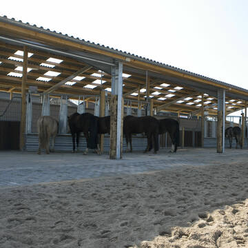
Bergische Weidegründe
Burscheid
Bergische Weidegründe
@HufRehastation-Allergiker
Freizeitstall
Geländestrecke
Hunde willkommen
Krankenbox
Allergikerstall
Gnadenbrothof
Bewegungsstall
Laufstall
28 weitere...
ganz aktuell
S


Offenstall Pferdefreunde Enkeln
Kürten
Pferdefreunde Enkeln
@Pferdefreunde-Enkeln
Freizeitstall
Vermieten
Hunde willkommen
Krankenbox
Notfallboxen
12 weitere...
P+
Deprecated: Creation of dynamic property Zend_View_Helper_Ads::$adLink is deprecated in /var/www/stall-frei/htdocs/staging.stall-frei.de/library/Psf/View/Helper/Ads.php on line 108

Mitarbeiter gesucht?
Mechtersen
STALL-FREIde Marketing
@STALL-FREI-Marketing
Stellenangebote kostenlos veröffentlichen!


Pferdeland Leide Aktivstallhaltung
Leichlingen
Pferdeland Leide
@info2
FN-Mitglied
Freizeitstall
Hunde willkommen
Krankenbox
Allergikerstall
Hufrehe geeignet
Bewegungsstall
Laufstall
22 weitere...
S


Historische Reitanlage in Köln-Dellbrück
Köln
RGS Kornspringer Köln e. V.
@Kornspringer
FN-Mitglied
Freizeitstall
Vermieten
Führanlage
Hunde willkommen
bedampftes/gewaschenes Heu
Notfallboxen
21 weitere...
S


Reitanlage G. und H.-P. Werheid
Bergisch Gladbach
Reitanlage-Werheid
@Reitanlage-Werheid
FN-Mitglied
Freizeitstall
Vermieten
Führanlage
Krankenbox
Fohlenaufzucht möglich
Hufrehe geeignet
29 weitere...
P+


***Reitstall Birkenhof*** Pferdegerechte Haltung
Köln
Daniele-Fazzi
@Daniele-Fazzi
Freizeitstall
Geländestrecke
Vermieten
Verpachten
Hunde willkommen
Longierzirkel/Roundpen
Allergikerstall
Hufrehe geeignet
23 weitere...
aktuell
S

Kleiner Privatstall Ein Zuhause für Dein Pferd
Willich
Fam-Schmitz
@Fam-Schmitz
Wir bieten Ihnen auf unserem Hof einen Stellplatz mit „rundum sorglos Paket“ für Ihr nicht mehr reitbares Pferd an.
Tägli
Reitstall Hauserhof
Kürten
Reitstall-Hauserhof
@Reitstall-Hauserhof
Freizeitstall
Geländestrecke
Führanlage
Hunde willkommen
Außenbox mit Paddock
Außenboxen
Halbpension
Vollpension
24 weitere...
P

Pferdeparadies im Odenthal -NEU ab 1.1.2026
Odenthal Landwehr
Reitstall Odenthal
@Pegasus1
Freizeitstall
Geländestrecke
Vermieten
Hunde willkommen
Paddock
Allergikerstall
Fohlenaufzucht möglich
15 weitere...
P

Gestüt Hausgrund
Lindlar
Kim-Wasser-Rochner
@Kim-Wasser-Rochner
Freizeitstall
Pferdeausbildung
Führanlage
Hunde willkommen
Allergikerstall
Hufrehe geeignet
Außenbox mit Paddock
Außenboxen
26 weitere...
P

LAG *******Offenstallanlage mit Winterweiden
Overath
Tina Frensch
@TinaFrensch
Freizeitstall
Geländestrecke
Hunde willkommen
Krankenbox
Gnadenbrothof
Notfallboxen
Außenbox mit Paddock
Bewegungsstall
27 weitere...
P+
Deprecated: Creation of dynamic property Zend_View::$pageCount is deprecated in /var/www/stall-frei/htdocs/staging.stall-frei.de/library/vendor/shardj/zf1-future/library/Zend/View/Abstract.php on line 308
Deprecated: Creation of dynamic property Zend_View::$itemCountPerPage is deprecated in /var/www/stall-frei/htdocs/staging.stall-frei.de/library/vendor/shardj/zf1-future/library/Zend/View/Abstract.php on line 308
Deprecated: Creation of dynamic property Zend_View::$first is deprecated in /var/www/stall-frei/htdocs/staging.stall-frei.de/library/vendor/shardj/zf1-future/library/Zend/View/Abstract.php on line 308
Deprecated: Creation of dynamic property Zend_View::$current is deprecated in /var/www/stall-frei/htdocs/staging.stall-frei.de/library/vendor/shardj/zf1-future/library/Zend/View/Abstract.php on line 308
Deprecated: Creation of dynamic property Zend_View::$last is deprecated in /var/www/stall-frei/htdocs/staging.stall-frei.de/library/vendor/shardj/zf1-future/library/Zend/View/Abstract.php on line 308
Deprecated: Creation of dynamic property Zend_View::$next is deprecated in /var/www/stall-frei/htdocs/staging.stall-frei.de/library/vendor/shardj/zf1-future/library/Zend/View/Abstract.php on line 308
Deprecated: Creation of dynamic property Zend_View::$pagesInRange is deprecated in /var/www/stall-frei/htdocs/staging.stall-frei.de/library/vendor/shardj/zf1-future/library/Zend/View/Abstract.php on line 308
Deprecated: Creation of dynamic property Zend_View::$firstPageInRange is deprecated in /var/www/stall-frei/htdocs/staging.stall-frei.de/library/vendor/shardj/zf1-future/library/Zend/View/Abstract.php on line 308
Deprecated: Creation of dynamic property Zend_View::$lastPageInRange is deprecated in /var/www/stall-frei/htdocs/staging.stall-frei.de/library/vendor/shardj/zf1-future/library/Zend/View/Abstract.php on line 308
Deprecated: Creation of dynamic property Zend_View::$currentItemCount is deprecated in /var/www/stall-frei/htdocs/staging.stall-frei.de/library/vendor/shardj/zf1-future/library/Zend/View/Abstract.php on line 308
Deprecated: Creation of dynamic property Zend_View::$totalItemCount is deprecated in /var/www/stall-frei/htdocs/staging.stall-frei.de/library/vendor/shardj/zf1-future/library/Zend/View/Abstract.php on line 308
Deprecated: Creation of dynamic property Zend_View::$firstItemNumber is deprecated in /var/www/stall-frei/htdocs/staging.stall-frei.de/library/vendor/shardj/zf1-future/library/Zend/View/Abstract.php on line 308
Deprecated: Creation of dynamic property Zend_View::$lastItemNumber is deprecated in /var/www/stall-frei/htdocs/staging.stall-frei.de/library/vendor/shardj/zf1-future/library/Zend/View/Abstract.php on line 308
Deprecated: Creation of dynamic property Zend_View::$router is deprecated in /var/www/stall-frei/htdocs/staging.stall-frei.de/library/vendor/shardj/zf1-future/library/Zend/View/Abstract.php on line 308
Deprecated: Creation of dynamic property Zend_View::$urlParams is deprecated in /var/www/stall-frei/htdocs/staging.stall-frei.de/library/vendor/shardj/zf1-future/library/Zend/View/Abstract.php on line 308
Deprecated: Creation of dynamic property Zend_View::$showAds is deprecated in /var/www/stall-frei/htdocs/staging.stall-frei.de/library/vendor/shardj/zf1-future/library/Zend/View/Abstract.php on line 308
Deprecated: Creation of dynamic property Zend_View::$objectIds is deprecated in /var/www/stall-frei/htdocs/staging.stall-frei.de/library/vendor/shardj/zf1-future/library/Zend/View/Abstract.php on line 308
Deprecated: Creation of dynamic property Zend_View::$showNavbar is deprecated in /var/www/stall-frei/htdocs/staging.stall-frei.de/library/vendor/shardj/zf1-future/library/Zend/View/Abstract.php on line 308
Deprecated: Creation of dynamic property Zend_View::$showBreadcrumb is deprecated in /var/www/stall-frei/htdocs/staging.stall-frei.de/library/vendor/shardj/zf1-future/library/Zend/View/Abstract.php on line 308
Deprecated: Creation of dynamic property Zend_View::$showFooter is deprecated in /var/www/stall-frei/htdocs/staging.stall-frei.de/library/vendor/shardj/zf1-future/library/Zend/View/Abstract.php on line 308
Deprecated: Creation of dynamic property Zend_View::$showInternalAds is deprecated in /var/www/stall-frei/htdocs/staging.stall-frei.de/library/vendor/shardj/zf1-future/library/Zend/View/Abstract.php on line 308
Deprecated: Creation of dynamic property Zend_View::$blNoContent is deprecated in /var/www/stall-frei/htdocs/staging.stall-frei.de/library/vendor/shardj/zf1-future/library/Zend/View/Abstract.php on line 308
Deprecated: Creation of dynamic property Zend_View::$sMetaDesc is deprecated in /var/www/stall-frei/htdocs/staging.stall-frei.de/library/vendor/shardj/zf1-future/library/Zend/View/Abstract.php on line 308
Deprecated: Creation of dynamic property Zend_View::$useGmaps is deprecated in /var/www/stall-frei/htdocs/staging.stall-frei.de/library/vendor/shardj/zf1-future/library/Zend/View/Abstract.php on line 308
Deprecated: Creation of dynamic property Zend_View::$touches is deprecated in /var/www/stall-frei/htdocs/staging.stall-frei.de/library/vendor/shardj/zf1-future/library/Zend/View/Abstract.php on line 308
Deprecated: Creation of dynamic property Zend_View::$oProject is deprecated in /var/www/stall-frei/htdocs/staging.stall-frei.de/library/vendor/shardj/zf1-future/library/Zend/View/Abstract.php on line 308
Deprecated: Creation of dynamic property Zend_View::$pageHeadline is deprecated in /var/www/stall-frei/htdocs/staging.stall-frei.de/library/vendor/shardj/zf1-future/library/Zend/View/Abstract.php on line 308
Deprecated: Creation of dynamic property Zend_View::$disableLocationField is deprecated in /var/www/stall-frei/htdocs/staging.stall-frei.de/library/vendor/shardj/zf1-future/library/Zend/View/Abstract.php on line 308
Deprecated: Creation of dynamic property Zend_View::$isSearch is deprecated in /var/www/stall-frei/htdocs/staging.stall-frei.de/library/vendor/shardj/zf1-future/library/Zend/View/Abstract.php on line 308
Deprecated: Creation of dynamic property Zend_View::$pageTitle is deprecated in /var/www/stall-frei/htdocs/staging.stall-frei.de/library/vendor/shardj/zf1-future/library/Zend/View/Abstract.php on line 308
Deprecated: Creation of dynamic property Psf_Form_Element_Text::$class is deprecated in /var/www/stall-frei/htdocs/staging.stall-frei.de/library/vendor/shardj/zf1-future/library/Zend/Form/Element.php on line 874
Deprecated: Creation of dynamic property Psf_Form_Element_Text::$size is deprecated in /var/www/stall-frei/htdocs/staging.stall-frei.de/library/vendor/shardj/zf1-future/library/Zend/Form/Element.php on line 874
Deprecated: Creation of dynamic property Psf_Form_Element_Text::$placeholder is deprecated in /var/www/stall-frei/htdocs/staging.stall-frei.de/library/vendor/shardj/zf1-future/library/Zend/Form/Element.php on line 874
Deprecated: Creation of dynamic property Psf_Form_Element_Hidden::$class is deprecated in /var/www/stall-frei/htdocs/staging.stall-frei.de/library/vendor/shardj/zf1-future/library/Zend/Form/Element.php on line 874
Deprecated: Creation of dynamic property Psf_Form_Element_Hidden::$class is deprecated in /var/www/stall-frei/htdocs/staging.stall-frei.de/library/vendor/shardj/zf1-future/library/Zend/Form/Element.php on line 874
Deprecated: Creation of dynamic property Psf_Form_Element_Hidden::$class is deprecated in /var/www/stall-frei/htdocs/staging.stall-frei.de/library/vendor/shardj/zf1-future/library/Zend/Form/Element.php on line 874
Deprecated: Creation of dynamic property Psf_Form_Element_Hidden::$class is deprecated in /var/www/stall-frei/htdocs/staging.stall-frei.de/library/vendor/shardj/zf1-future/library/Zend/Form/Element.php on line 874
Deprecated: Creation of dynamic property Psf_Form_Element_Select::$class is deprecated in /var/www/stall-frei/htdocs/staging.stall-frei.de/library/vendor/shardj/zf1-future/library/Zend/Form/Element.php on line 874
Deprecated: Creation of dynamic property Psf_Form_Element_Select::$class is deprecated in /var/www/stall-frei/htdocs/staging.stall-frei.de/library/vendor/shardj/zf1-future/library/Zend/Form/Element.php on line 874
Deprecated: Creation of dynamic property Psf_Form_Element_Select::$class is deprecated in /var/www/stall-frei/htdocs/staging.stall-frei.de/library/vendor/shardj/zf1-future/library/Zend/Form/Element.php on line 874
Deprecated: Creation of dynamic property Psf_Form_Element_Select::$class is deprecated in /var/www/stall-frei/htdocs/staging.stall-frei.de/library/vendor/shardj/zf1-future/library/Zend/Form/Element.php on line 874
Deprecated: Creation of dynamic property Psf_Form_Element_Text::$class is deprecated in /var/www/stall-frei/htdocs/staging.stall-frei.de/library/vendor/shardj/zf1-future/library/Zend/Form/Element.php on line 874
Deprecated: Creation of dynamic property Psf_Form_Element_Checkbox::$label is deprecated in /var/www/stall-frei/htdocs/staging.stall-frei.de/library/vendor/shardj/zf1-future/library/Zend/Form/Element.php on line 874
Deprecated: Creation of dynamic property Zend_View::$sort is deprecated in /var/www/stall-frei/htdocs/staging.stall-frei.de/library/vendor/shardj/zf1-future/library/Zend/View/Abstract.php on line 308
Deprecated: Creation of dynamic property Zend_View::$searchLocation is deprecated in /var/www/stall-frei/htdocs/staging.stall-frei.de/library/vendor/shardj/zf1-future/library/Zend/View/Abstract.php on line 308
Deprecated: Creation of dynamic property Zend_View::$locationHint is deprecated in /var/www/stall-frei/htdocs/staging.stall-frei.de/library/vendor/shardj/zf1-future/library/Zend/View/Abstract.php on line 308
Psf_GeoCoder_Abstract::getLocation: Höchsten Get Location CachedOrLive
Psf_GeoCoder_Abstract::getCachedOrLive: Höchsten
Psf_GeoCoder_OpenCageData::makeApiRequest: response:
Array
(
[documentation] => https://opencagedata.com/api
[licenses] => Array
(
[0] => Array
(
[name] => see attribution guide
[url] => https://opencagedata.com/credits
)
)
[results] => Array
(
[0] => Array
(
[bounds] => Array
(
[northeast] => Array
(
[lat] => 51.0671818
[lng] => 7.2639807
)
[southwest] => Array
(
[lat] => 51.0271818
[lng] => 7.2239807
)
)
[components] => Array
(
[ISO_3166-1_alpha-2] => DE
[ISO_3166-1_alpha-3] => DEU
[ISO_3166-2] => Array
(
[0] => DE-NW
)
[_category] => place
[_normalized_city] => Kürten
[_type] => hamlet
[continent] => Europe
[country] => Deutschland
[country_code] => de
[county] => Rheinisch-Bergischer Kreis
[hamlet] => Höchsten
[political_union] => European Union
[postcode] => 51515
[state] => Nordrhein-Westfalen
[state_code] => NW
[town] => Kürten
)
[confidence] => 7
[formatted] => Höchsten, 51515 Kürten, Deutschland
[geometry] => Array
(
[lat] => 51.0471818
[lng] => 7.2439807
)
)
[1] => Array
(
[bounds] => Array
(
[northeast] => Array
(
[lat] => 51.4830984
[lng] => 7.5446047
)
[southwest] => Array
(
[lat] => 51.4430984
[lng] => 7.5046047
)
)
[components] => Array
(
[ISO_3166-1_alpha-2] => DE
[ISO_3166-1_alpha-3] => DEU
[ISO_3166-2] => Array
(
[0] => DE-NW
)
[_category] => place
[_normalized_city] => Dortmund
[_type] => neighbourhood
[city] => Dortmund
[city_district] => Hörde
[continent] => Europe
[country] => Deutschland
[country_code] => de
[political_union] => European Union
[postcode] => 44267
[state] => Nordrhein-Westfalen
[state_code] => NW
[suburb] => Höchsten
)
[confidence] => 7
[formatted] => 44267 Dortmund, Deutschland
[geometry] => Array
(
[lat] => 51.4630984
[lng] => 7.5246047
)
)
[2] => Array
(
[bounds] => Array
(
[northeast] => Array
(
[lat] => 47.8228359
[lng] => 9.4011686
)
[southwest] => Array
(
[lat] => 47.8227359
[lng] => 9.4010686
)
)
[components] => Array
(
[ISO_3166-1_alpha-2] => DE
[ISO_3166-1_alpha-3] => DEU
[ISO_3166-2] => Array
(
[0] => DE-BW
)
[_category] => natural/water
[_normalized_city] => Illmensee
[_type] => peak
[continent] => Europe
[country] => Deutschland
[country_code] => de
[county] => Landkreis Sigmaringen
[municipality] => VVG der Stadt Pfullendorf
[peak] => Höchsten
[political_union] => European Union
[postcode] => 88693
[state] => Baden-Württemberg
[state_code] => BW
[village] => Illmensee
)
[confidence] => 9
[formatted] => Höchsten, 88693 Illmensee, Deutschland
[geometry] => Array
(
[lat] => 47.8227859
[lng] => 9.4011186
)
)
[3] => Array
(
[bounds] => Array
(
[northeast] => Array
(
[lat] => 51.0110405
[lng] => 7.8907961
)
[southwest] => Array
(
[lat] => 51.0109405
[lng] => 7.8906961
)
)
[components] => Array
(
[ISO_3166-1_alpha-2] => DE
[ISO_3166-1_alpha-3] => DEU
[ISO_3166-2] => Array
(
[0] => DE-NW
)
[_category] => natural/water
[_normalized_city] => Olpe
[_type] => peak
[continent] => Europe
[country] => Deutschland
[country_code] => de
[county] => Kreis Olpe
[peak] => Höchsten
[political_union] => European Union
[postcode] => 57462
[state] => Nordrhein-Westfalen
[state_code] => NW
[town] => Olpe
)
[confidence] => 9
[formatted] => Höchsten, 57462 Olpe, Deutschland
[geometry] => Array
(
[lat] => 51.0109905
[lng] => 7.8907461
)
)
[4] => Array
(
[bounds] => Array
(
[northeast] => Array
(
[lat] => 51.1892535
[lng] => 7.3039138
)
[southwest] => Array
(
[lat] => 51.1891535
[lng] => 7.3038138
)
)
[components] => Array
(
[ISO_3166-1_alpha-2] => DE
[ISO_3166-1_alpha-3] => DEU
[ISO_3166-2] => Array
(
[0] => DE-NW
)
[_category] => natural/water
[_normalized_city] => Radevormwald
[_type] => peak
[continent] => Europe
[country] => Deutschland
[country_code] => de
[county] => Oberbergischer Kreis
[peak] => Höchsten
[political_union] => European Union
[postcode] => 42897
[state] => Nordrhein-Westfalen
[state_code] => NW
[town] => Radevormwald
)
[confidence] => 9
[formatted] => Höchsten, 42897 Radevormwald, Deutschland
[geometry] => Array
(
[lat] => 51.1892035
[lng] => 7.3038638
)
)
[5] => Array
(
[bounds] => Array
(
[northeast] => Array
(
[lat] => 47.8384783
[lng] => 9.4250876
)
[southwest] => Array
(
[lat] => 47.7984783
[lng] => 9.3850876
)
)
[components] => Array
(
[ISO_3166-1_alpha-2] => DE
[ISO_3166-1_alpha-3] => DEU
[ISO_3166-2] => Array
(
[0] => DE-BW
)
[_category] => place
[_normalized_city] => Deggenhausertal
[_type] => hamlet
[continent] => Europe
[country] => Deutschland
[country_code] => de
[county] => Bodenseekreis
[hamlet] => Höchsten
[municipality] => Deggenhausertal
[political_union] => European Union
[postcode] => 88693
[state] => Baden-Württemberg
[state_code] => BW
)
[confidence] => 7
[formatted] => Höchsten, 88693 Deggenhausertal, Deutschland
[geometry] => Array
(
[lat] => 47.8184783
[lng] => 9.4050876
)
)
[6] => Array
(
[bounds] => Array
(
[northeast] => Array
(
[lat] => 51.3184761
[lng] => 7.6253246
)
[southwest] => Array
(
[lat] => 51.3159307
[lng] => 7.6228224
)
)
[components] => Array
(
[ISO_3166-1_alpha-2] => DE
[ISO_3166-1_alpha-3] => DEU
[ISO_3166-2] => Array
(
[0] => DE-NW
)
[_category] => agriculture
[_normalized_city] => Nachrodt-Wiblingwerde
[_type] => farm
[city] => Nachrodt-Wiblingwerde
[continent] => Europe
[country] => Deutschland
[country_code] => de
[county] => Märkischer Kreis
[farm] => Höchsten
[political_union] => European Union
[postcode] => 58769
[state] => Nordrhein-Westfalen
[state_code] => NW
)
[confidence] => 9
[formatted] => Höchsten, 58769 Nachrodt-Wiblingwerde, Deutschland
[geometry] => Array
(
[lat] => 51.3172026
[lng] => 7.6244465
)
)
[7] => Array
(
[bounds] => Array
(
[northeast] => Array
(
[lat] => 51.2269028
[lng] => 6.9850904
)
[southwest] => Array
(
[lat] => 51.2253688
[lng] => 6.9831856
)
)
[components] => Array
(
[ISO_3166-1_alpha-2] => DE
[ISO_3166-1_alpha-3] => DEU
[ISO_3166-2] => Array
(
[0] => DE-NW
)
[_category] => agriculture
[_normalized_city] => Mettmann
[_type] => farmyard
[continent] => Europe
[country] => Deutschland
[country_code] => de
[county] => Kreis Mettmann
[farmyard] => Höchsten
[political_union] => European Union
[postcode] => 40822
[state] => Nordrhein-Westfalen
[state_code] => NW
[town] => Mettmann
)
[confidence] => 9
[formatted] => Höchsten, 40822 Mettmann, Deutschland
[geometry] => Array
(
[lat] => 51.2261573
[lng] => 6.9842442
)
)
[8] => Array
(
[bounds] => Array
(
[northeast] => Array
(
[lat] => 51.1335348
[lng] => 7.6643259
)
[southwest] => Array
(
[lat] => 51.1135348
[lng] => 7.6443259
)
)
[components] => Array
(
[ISO_3166-1_alpha-2] => DE
[ISO_3166-1_alpha-3] => DEU
[ISO_3166-2] => Array
(
[0] => DE-NW
)
[_category] => place
[_normalized_city] => Meinerzhagen
[_type] => hamlet
[continent] => Europe
[country] => Deutschland
[country_code] => de
[county] => Märkischer Kreis
[hamlet] => Sulenbecke
[locality] => Höchsten
[political_union] => European Union
[postcode] => 58540
[state] => Nordrhein-Westfalen
[state_code] => NW
[town] => Meinerzhagen
)
[confidence] => 8
[formatted] => Sulenbecke, 58540 Meinerzhagen, Deutschland
[geometry] => Array
(
[lat] => 51.1235348
[lng] => 7.6543259
)
)
[9] => Array
(
[components] => Array
(
[ISO_3166-1_alpha-2] => FR
[ISO_3166-1_alpha-3] => FRA
[ISO_3166-2] => Array
(
[0] => FR-GES
[1] => FR-6AE
[2] => FR-67
)
[_category] => road
[_normalized_city] => Haguenau
[_type] => road
[city] => Haguenau
[continent] => Europe
[country] => France
[country_code] => fr
[county] => Bas-Rhin
[local_authority] => Communauté d'agglomération de Haguenau
[political_union] => European Union
[postcode] => 67500
[road] => Rue de Hochstett
[state] => Grand Est
[state_code] => GES
)
[confidence] => 3
[formatted] => Rue de Hochstett, 67500 Haguenau, France
[geometry] => Array
(
[lat] => 48.813787
[lng] => 7.774214
)
)
)
[status] => Array
(
[code] => 200
[message] => OK
)
[stay_informed] => Array
(
[blog] => https://blog.opencagedata.com
[mastodon] => https://en.osm.town/@opencage
)
[thanks] => For using an OpenCage API
[timestamp] => Array
(
[created_http] => Fri, 16 Jan 2026 20:48:48 GMT
[created_unix] => 1768596528
)
[total_results] => 10
)
Psf_GeoCoder_Abstract::convertLocationResult
{"documentation":"https:\/\/opencagedata.com\/api","licenses":[{"name":"see attribution guide","url":"https:\/\/opencagedata.com\/credits"}],"results":[{"bounds":{"northeast":{"lat":51.0671818,"lng":7.2639807},"southwest":{"lat":51.0271818,"lng":7.2239807}},"components":{"ISO_3166-1_alpha-2":"DE","ISO_3166-1_alpha-3":"DEU","ISO_3166-2":["DE-NW"],"_category":"place","_normalized_city":"K\u00fcrten","_type":"hamlet","continent":"Europe","country":"Deutschland","country_code":"de","county":"Rheinisch-Bergischer Kreis","hamlet":"H\u00f6chsten","political_union":"European Union","postcode":"51515","state":"Nordrhein-Westfalen","state_code":"NW","town":"K\u00fcrten"},"confidence":7,"formatted":"H\u00f6chsten, 51515 K\u00fcrten, Deutschland","geometry":{"lat":51.0471818,"lng":7.2439807}},{"bounds":{"northeast":{"lat":51.4830984,"lng":7.5446047},"southwest":{"lat":51.4430984,"lng":7.5046047}},"components":{"ISO_3166-1_alpha-2":"DE","ISO_3166-1_alpha-3":"DEU","ISO_3166-2":["DE-NW"],"_category":"place","_normalized_city":"Dortmund","_type":"neighbourhood","city":"Dortmund","city_district":"H\u00f6rde","continent":"Europe","country":"Deutschland","country_code":"de","political_union":"European Union","postcode":"44267","state":"Nordrhein-Westfalen","state_code":"NW","suburb":"H\u00f6chsten"},"confidence":7,"formatted":"44267 Dortmund, Deutschland","geometry":{"lat":51.4630984,"lng":7.5246047}},{"bounds":{"northeast":{"lat":47.8228359,"lng":9.4011686},"southwest":{"lat":47.8227359,"lng":9.4010686}},"components":{"ISO_3166-1_alpha-2":"DE","ISO_3166-1_alpha-3":"DEU","ISO_3166-2":["DE-BW"],"_category":"natural\/water","_normalized_city":"Illmensee","_type":"peak","continent":"Europe","country":"Deutschland","country_code":"de","county":"Landkreis Sigmaringen","municipality":"VVG der Stadt Pfullendorf","peak":"H\u00f6chsten","political_union":"European Union","postcode":"88693","state":"Baden-W\u00fcrttemberg","state_code":"BW","village":"Illmensee"},"confidence":9,"formatted":"H\u00f6chsten, 88693 Illmensee, Deutschland","geometry":{"lat":47.8227859,"lng":9.4011186}},{"bounds":{"northeast":{"lat":51.0110405,"lng":7.8907961},"southwest":{"lat":51.0109405,"lng":7.8906961}},"components":{"ISO_3166-1_alpha-2":"DE","ISO_3166-1_alpha-3":"DEU","ISO_3166-2":["DE-NW"],"_category":"natural\/water","_normalized_city":"Olpe","_type":"peak","continent":"Europe","country":"Deutschland","country_code":"de","county":"Kreis Olpe","peak":"H\u00f6chsten","political_union":"European Union","postcode":"57462","state":"Nordrhein-Westfalen","state_code":"NW","town":"Olpe"},"confidence":9,"formatted":"H\u00f6chsten, 57462 Olpe, Deutschland","geometry":{"lat":51.0109905,"lng":7.8907461}},{"bounds":{"northeast":{"lat":51.1892535,"lng":7.3039138},"southwest":{"lat":51.1891535,"lng":7.3038138}},"components":{"ISO_3166-1_alpha-2":"DE","ISO_3166-1_alpha-3":"DEU","ISO_3166-2":["DE-NW"],"_category":"natural\/water","_normalized_city":"Radevormwald","_type":"peak","continent":"Europe","country":"Deutschland","country_code":"de","county":"Oberbergischer Kreis","peak":"H\u00f6chsten","political_union":"European Union","postcode":"42897","state":"Nordrhein-Westfalen","state_code":"NW","town":"Radevormwald"},"confidence":9,"formatted":"H\u00f6chsten, 42897 Radevormwald, Deutschland","geometry":{"lat":51.1892035,"lng":7.3038638}},{"bounds":{"northeast":{"lat":47.8384783,"lng":9.4250876},"southwest":{"lat":47.7984783,"lng":9.3850876}},"components":{"ISO_3166-1_alpha-2":"DE","ISO_3166-1_alpha-3":"DEU","ISO_3166-2":["DE-BW"],"_category":"place","_normalized_city":"Deggenhausertal","_type":"hamlet","continent":"Europe","country":"Deutschland","country_code":"de","county":"Bodenseekreis","hamlet":"H\u00f6chsten","municipality":"Deggenhausertal","political_union":"European Union","postcode":"88693","state":"Baden-W\u00fcrttemberg","state_code":"BW"},"confidence":7,"formatted":"H\u00f6chsten, 88693 Deggenhausertal, Deutschland","geometry":{"lat":47.8184783,"lng":9.4050876}},{"bounds":{"northeast":{"lat":51.3184761,"lng":7.6253246},"southwest":{"lat":51.3159307,"lng":7.6228224}},"components":{"ISO_3166-1_alpha-2":"DE","ISO_3166-1_alpha-3":"DEU","ISO_3166-2":["DE-NW"],"_category":"agriculture","_normalized_city":"Nachrodt-Wiblingwerde","_type":"farm","city":"Nachrodt-Wiblingwerde","continent":"Europe","country":"Deutschland","country_code":"de","county":"M\u00e4rkischer Kreis","farm":"H\u00f6chsten","political_union":"European Union","postcode":"58769","state":"Nordrhein-Westfalen","state_code":"NW"},"confidence":9,"formatted":"H\u00f6chsten, 58769 Nachrodt-Wiblingwerde, Deutschland","geometry":{"lat":51.3172026,"lng":7.6244465}},{"bounds":{"northeast":{"lat":51.2269028,"lng":6.9850904},"southwest":{"lat":51.2253688,"lng":6.9831856}},"components":{"ISO_3166-1_alpha-2":"DE","ISO_3166-1_alpha-3":"DEU","ISO_3166-2":["DE-NW"],"_category":"agriculture","_normalized_city":"Mettmann","_type":"farmyard","continent":"Europe","country":"Deutschland","country_code":"de","county":"Kreis Mettmann","farmyard":"H\u00f6chsten","political_union":"European Union","postcode":"40822","state":"Nordrhein-Westfalen","state_code":"NW","town":"Mettmann"},"confidence":9,"formatted":"H\u00f6chsten, 40822 Mettmann, Deutschland","geometry":{"lat":51.2261573,"lng":6.9842442}},{"bounds":{"northeast":{"lat":51.1335348,"lng":7.6643259},"southwest":{"lat":51.1135348,"lng":7.6443259}},"components":{"ISO_3166-1_alpha-2":"DE","ISO_3166-1_alpha-3":"DEU","ISO_3166-2":["DE-NW"],"_category":"place","_normalized_city":"Meinerzhagen","_type":"hamlet","continent":"Europe","country":"Deutschland","country_code":"de","county":"M\u00e4rkischer Kreis","hamlet":"Sulenbecke","locality":"H\u00f6chsten","political_union":"European Union","postcode":"58540","state":"Nordrhein-Westfalen","state_code":"NW","town":"Meinerzhagen"},"confidence":8,"formatted":"Sulenbecke, 58540 Meinerzhagen, Deutschland","geometry":{"lat":51.1235348,"lng":7.6543259}},{"components":{"ISO_3166-1_alpha-2":"FR","ISO_3166-1_alpha-3":"FRA","ISO_3166-2":["FR-GES","FR-6AE","FR-67"],"_category":"road","_normalized_city":"Haguenau","_type":"road","city":"Haguenau","continent":"Europe","country":"France","country_code":"fr","county":"Bas-Rhin","local_authority":"Communaut\u00e9 d'agglom\u00e9ration de Haguenau","political_union":"European Union","postcode":"67500","road":"Rue de Hochstett","state":"Grand Est","state_code":"GES"},"confidence":3,"formatted":"Rue de Hochstett, 67500 Haguenau, France","geometry":{"lat":48.813787,"lng":7.774214}}],"status":{"code":200,"message":"OK"},"stay_informed":{"blog":"https:\/\/blog.opencagedata.com","mastodon":"https:\/\/en.osm.town\/@opencage"},"thanks":"For using an OpenCage API","timestamp":{"created_http":"Fri, 16 Jan 2026 20:48:48 GMT","created_unix":1768596528},"total_results":10}Array
(
[0] => stdClass Object
(
[bounds] => stdClass Object
(
[northeast] => stdClass Object
(
[lat] => 51.0671818
[lng] => 7.2639807
)
[southwest] => stdClass Object
(
[lat] => 51.0271818
[lng] => 7.2239807
)
)
[components] => stdClass Object
(
[ISO_3166-1_alpha-2] => DE
[ISO_3166-1_alpha-3] => DEU
[ISO_3166-2] => Array
(
[0] => DE-NW
)
[_category] => place
[_normalized_city] => Kürten
[_type] => hamlet
[continent] => Europe
[country] => Deutschland
[country_code] => de
[county] => Rheinisch-Bergischer Kreis
[hamlet] => Höchsten
[political_union] => European Union
[postcode] => 51515
[state] => Nordrhein-Westfalen
[state_code] => NW
[town] => Kürten
)
[confidence] => 7
[formatted] => Höchsten, 51515 Kürten, Deutschland
[geometry] => stdClass Object
(
[lat] => 51.0471818
[lng] => 7.2439807
)
)
[1] => stdClass Object
(
[bounds] => stdClass Object
(
[northeast] => stdClass Object
(
[lat] => 51.4830984
[lng] => 7.5446047
)
[southwest] => stdClass Object
(
[lat] => 51.4430984
[lng] => 7.5046047
)
)
[components] => stdClass Object
(
[ISO_3166-1_alpha-2] => DE
[ISO_3166-1_alpha-3] => DEU
[ISO_3166-2] => Array
(
[0] => DE-NW
)
[_category] => place
[_normalized_city] => Dortmund
[_type] => neighbourhood
[city] => Dortmund
[city_district] => Hörde
[continent] => Europe
[country] => Deutschland
[country_code] => de
[political_union] => European Union
[postcode] => 44267
[state] => Nordrhein-Westfalen
[state_code] => NW
[suburb] => Höchsten
)
[confidence] => 7
[formatted] => 44267 Dortmund, Deutschland
[geometry] => stdClass Object
(
[lat] => 51.4630984
[lng] => 7.5246047
)
)
[2] => stdClass Object
(
[bounds] => stdClass Object
(
[northeast] => stdClass Object
(
[lat] => 47.8228359
[lng] => 9.4011686
)
[southwest] => stdClass Object
(
[lat] => 47.8227359
[lng] => 9.4010686
)
)
[components] => stdClass Object
(
[ISO_3166-1_alpha-2] => DE
[ISO_3166-1_alpha-3] => DEU
[ISO_3166-2] => Array
(
[0] => DE-BW
)
[_category] => natural/water
[_normalized_city] => Illmensee
[_type] => peak
[continent] => Europe
[country] => Deutschland
[country_code] => de
[county] => Landkreis Sigmaringen
[municipality] => VVG der Stadt Pfullendorf
[peak] => Höchsten
[political_union] => European Union
[postcode] => 88693
[state] => Baden-Württemberg
[state_code] => BW
[village] => Illmensee
)
[confidence] => 9
[formatted] => Höchsten, 88693 Illmensee, Deutschland
[geometry] => stdClass Object
(
[lat] => 47.8227859
[lng] => 9.4011186
)
)
[3] => stdClass Object
(
[bounds] => stdClass Object
(
[northeast] => stdClass Object
(
[lat] => 51.0110405
[lng] => 7.8907961
)
[southwest] => stdClass Object
(
[lat] => 51.0109405
[lng] => 7.8906961
)
)
[components] => stdClass Object
(
[ISO_3166-1_alpha-2] => DE
[ISO_3166-1_alpha-3] => DEU
[ISO_3166-2] => Array
(
[0] => DE-NW
)
[_category] => natural/water
[_normalized_city] => Olpe
[_type] => peak
[continent] => Europe
[country] => Deutschland
[country_code] => de
[county] => Kreis Olpe
[peak] => Höchsten
[political_union] => European Union
[postcode] => 57462
[state] => Nordrhein-Westfalen
[state_code] => NW
[town] => Olpe
)
[confidence] => 9
[formatted] => Höchsten, 57462 Olpe, Deutschland
[geometry] => stdClass Object
(
[lat] => 51.0109905
[lng] => 7.8907461
)
)
[4] => stdClass Object
(
[bounds] => stdClass Object
(
[northeast] => stdClass Object
(
[lat] => 51.1892535
[lng] => 7.3039138
)
[southwest] => stdClass Object
(
[lat] => 51.1891535
[lng] => 7.3038138
)
)
[components] => stdClass Object
(
[ISO_3166-1_alpha-2] => DE
[ISO_3166-1_alpha-3] => DEU
[ISO_3166-2] => Array
(
[0] => DE-NW
)
[_category] => natural/water
[_normalized_city] => Radevormwald
[_type] => peak
[continent] => Europe
[country] => Deutschland
[country_code] => de
[county] => Oberbergischer Kreis
[peak] => Höchsten
[political_union] => European Union
[postcode] => 42897
[state] => Nordrhein-Westfalen
[state_code] => NW
[town] => Radevormwald
)
[confidence] => 9
[formatted] => Höchsten, 42897 Radevormwald, Deutschland
[geometry] => stdClass Object
(
[lat] => 51.1892035
[lng] => 7.3038638
)
)
[5] => stdClass Object
(
[bounds] => stdClass Object
(
[northeast] => stdClass Object
(
[lat] => 47.8384783
[lng] => 9.4250876
)
[southwest] => stdClass Object
(
[lat] => 47.7984783
[lng] => 9.3850876
)
)
[components] => stdClass Object
(
[ISO_3166-1_alpha-2] => DE
[ISO_3166-1_alpha-3] => DEU
[ISO_3166-2] => Array
(
[0] => DE-BW
)
[_category] => place
[_normalized_city] => Deggenhausertal
[_type] => hamlet
[continent] => Europe
[country] => Deutschland
[country_code] => de
[county] => Bodenseekreis
[hamlet] => Höchsten
[municipality] => Deggenhausertal
[political_union] => European Union
[postcode] => 88693
[state] => Baden-Württemberg
[state_code] => BW
)
[confidence] => 7
[formatted] => Höchsten, 88693 Deggenhausertal, Deutschland
[geometry] => stdClass Object
(
[lat] => 47.8184783
[lng] => 9.4050876
)
)
[6] => stdClass Object
(
[bounds] => stdClass Object
(
[northeast] => stdClass Object
(
[lat] => 51.3184761
[lng] => 7.6253246
)
[southwest] => stdClass Object
(
[lat] => 51.3159307
[lng] => 7.6228224
)
)
[components] => stdClass Object
(
[ISO_3166-1_alpha-2] => DE
[ISO_3166-1_alpha-3] => DEU
[ISO_3166-2] => Array
(
[0] => DE-NW
)
[_category] => agriculture
[_normalized_city] => Nachrodt-Wiblingwerde
[_type] => farm
[city] => Nachrodt-Wiblingwerde
[continent] => Europe
[country] => Deutschland
[country_code] => de
[county] => Märkischer Kreis
[farm] => Höchsten
[political_union] => European Union
[postcode] => 58769
[state] => Nordrhein-Westfalen
[state_code] => NW
)
[confidence] => 9
[formatted] => Höchsten, 58769 Nachrodt-Wiblingwerde, Deutschland
[geometry] => stdClass Object
(
[lat] => 51.3172026
[lng] => 7.6244465
)
)
[7] => stdClass Object
(
[bounds] => stdClass Object
(
[northeast] => stdClass Object
(
[lat] => 51.2269028
[lng] => 6.9850904
)
[southwest] => stdClass Object
(
[lat] => 51.2253688
[lng] => 6.9831856
)
)
[components] => stdClass Object
(
[ISO_3166-1_alpha-2] => DE
[ISO_3166-1_alpha-3] => DEU
[ISO_3166-2] => Array
(
[0] => DE-NW
)
[_category] => agriculture
[_normalized_city] => Mettmann
[_type] => farmyard
[continent] => Europe
[country] => Deutschland
[country_code] => de
[county] => Kreis Mettmann
[farmyard] => Höchsten
[political_union] => European Union
[postcode] => 40822
[state] => Nordrhein-Westfalen
[state_code] => NW
[town] => Mettmann
)
[confidence] => 9
[formatted] => Höchsten, 40822 Mettmann, Deutschland
[geometry] => stdClass Object
(
[lat] => 51.2261573
[lng] => 6.9842442
)
)
[8] => stdClass Object
(
[bounds] => stdClass Object
(
[northeast] => stdClass Object
(
[lat] => 51.1335348
[lng] => 7.6643259
)
[southwest] => stdClass Object
(
[lat] => 51.1135348
[lng] => 7.6443259
)
)
[components] => stdClass Object
(
[ISO_3166-1_alpha-2] => DE
[ISO_3166-1_alpha-3] => DEU
[ISO_3166-2] => Array
(
[0] => DE-NW
)
[_category] => place
[_normalized_city] => Meinerzhagen
[_type] => hamlet
[continent] => Europe
[country] => Deutschland
[country_code] => de
[county] => Märkischer Kreis
[hamlet] => Sulenbecke
[locality] => Höchsten
[political_union] => European Union
[postcode] => 58540
[state] => Nordrhein-Westfalen
[state_code] => NW
[town] => Meinerzhagen
)
[confidence] => 8
[formatted] => Sulenbecke, 58540 Meinerzhagen, Deutschland
[geometry] => stdClass Object
(
[lat] => 51.1235348
[lng] => 7.6543259
)
)
[9] => stdClass Object
(
[components] => stdClass Object
(
[ISO_3166-1_alpha-2] => FR
[ISO_3166-1_alpha-3] => FRA
[ISO_3166-2] => Array
(
[0] => FR-GES
[1] => FR-6AE
[2] => FR-67
)
[_category] => road
[_normalized_city] => Haguenau
[_type] => road
[city] => Haguenau
[continent] => Europe
[country] => France
[country_code] => fr
[county] => Bas-Rhin
[local_authority] => Communauté d'agglomération de Haguenau
[political_union] => European Union
[postcode] => 67500
[road] => Rue de Hochstett
[state] => Grand Est
[state_code] => GES
)
[confidence] => 3
[formatted] => Rue de Hochstett, 67500 Haguenau, France
[geometry] => stdClass Object
(
[lat] => 48.813787
[lng] => 7.774214
)
)
)
Psf_GeoCoder_OpenCageData::getKeyMap: 0
stdClass Object
(
    [bounds] => stdClass Object
        (
            [northeast] => stdClass Object
                (
                    [lat] => 51.0671818
                    [lng] => 7.2639807
                )

            [southwest] => stdClass Object
                (
                    [lat] => 51.0271818
                    [lng] => 7.2239807
                )

        )

    [components] => stdClass Object
        (
            [ISO_3166-1_alpha-2] => DE
            [ISO_3166-1_alpha-3] => DEU
            [ISO_3166-2] => Array
                (
                    [0] => DE-NW
                )

            [_category] => place
            [_normalized_city] => Kürten
            [_type] => hamlet
            [continent] => Europe
            [country] => Deutschland
            [country_code] => de
            [county] => Rheinisch-Bergischer Kreis
            [hamlet] => Höchsten
            [political_union] => European Union
            [postcode] => 51515
            [state] => Nordrhein-Westfalen
            [state_code] => NW
            [town] => Kürten
        )

    [confidence] => 7
    [formatted] => Höchsten, 51515 Kürten, Deutschland
    [geometry] => stdClass Object
        (
            [lat] => 51.0471818
            [lng] => 7.2439807
        )

)
Psf_GeoCoder_OpenCageData::getCounty: Rheinisch-Bergischer Kreis
Psf_GeoCoder_OpenCageData::addMissingData REFETCH!
Array
(
    [address] => Höchsten, 51515 Kürten, Deutschland
    [type] => hamlet
    [street] => Höchsten
    [city] => Kürten
    [county] => Rheinisch-Bergischer Kreis
    [state] => Nordrhein-Westfalen
    [zip] => 51515
    [country] => Deutschland
    [suburb] =>
    [countrycode] => de
    [latitude] => 51.0471818
    [longitude] => 7.2439807
    [accuracy] => 1
    [confidence] => 7
    [bounds] => stdClass Object
        (
            [northeast] => stdClass Object
                (
                    [lat] => 51.0671818
                    [lng] => 7.2639807
                )

            [southwest] => stdClass Object
                (
                    [lat] => 51.0271818
                    [lng] => 7.2239807
                )

        )

)
reformat!
Array
(
    [address] => Höchsten, 51515 Kürten, Deutschland
    [type] => hamlet
    [street] => Höchsten
    [city] => Kürten
    [county] => Rheinisch-Bergischer Kreis
    [state] => Nordrhein-Westfalen
    [zip] => 51515
    [country] => Deutschland
    [suburb] =>
    [countrycode] => de
    [latitude] => 51.0471818
    [longitude] => 7.2439807
    [accuracy] => 1
    [confidence] => 7
    [bounds] => stdClass Object
        (
            [northeast] => stdClass Object
                (
                    [lat] => 51.0671818
                    [lng] => 7.2639807
                )

            [southwest] => stdClass Object
                (
                    [lat] => 51.0271818
                    [lng] => 7.2239807
                )

        )

    [place] => Höchsten, 51515 Kürten, Nordrhein-Westfalen
    [hash] => db2255bcfe42e36b71d383affa41cbbc
)
Psf_GeoCoder_OpenCageData::getKeyMap: 1
stdClass Object
(
    [bounds] => stdClass Object
        (
            [northeast] => stdClass Object
                (
                    [lat] => 51.4830984
                    [lng] => 7.5446047
                )

            [southwest] => stdClass Object
                (
                    [lat] => 51.4430984
                    [lng] => 7.5046047
                )

        )

    [components] => stdClass Object
        (
            [ISO_3166-1_alpha-2] => DE
            [ISO_3166-1_alpha-3] => DEU
            [ISO_3166-2] => Array
                (
                    [0] => DE-NW
                )

            [_category] => place
            [_normalized_city] => Dortmund
            [_type] => neighbourhood
            [city] => Dortmund
            [city_district] => Hörde
            [continent] => Europe
            [country] => Deutschland
            [country_code] => de
            [political_union] => European Union
            [postcode] => 44267
            [state] => Nordrhein-Westfalen
            [state_code] => NW
            [suburb] => Höchsten
        )

    [confidence] => 7
    [formatted] => 44267 Dortmund, Deutschland
    [geometry] => stdClass Object
        (
            [lat] => 51.4630984
            [lng] => 7.5246047
        )

)
Psf_GeoCoder_OpenCageData::getCounty: Dortmund
Psf_GeoCoder_OpenCageData::addMissingData REFETCH!
Array
(
    [address] => 44267 Dortmund, Deutschland
    [type] => neighbourhood
    [street] =>
    [city] => Höchsten
    [county] => Dortmund
    [state] => Nordrhein-Westfalen
    [zip] => 44267
    [country] => Deutschland
    [suburb] => Höchsten
    [countrycode] => de
    [latitude] => 51.4630984
    [longitude] => 7.5246047
    [accuracy] => 1
    [confidence] => 7
    [bounds] => stdClass Object
        (
            [northeast] => stdClass Object
                (
                    [lat] => 51.4830984
                    [lng] => 7.5446047
                )

            [southwest] => stdClass Object
                (
                    [lat] => 51.4430984
                    [lng] => 7.5046047
                )

        )

)
reformat!
Array
(
    [address] => 44267 Höchsten
    [type] => neighbourhood
    [street] =>
    [city] => Höchsten
    [county] => Dortmund
    [state] => Nordrhein-Westfalen
    [zip] => 44267
    [country] => Deutschland
    [suburb] => Höchsten
    [countrycode] => de
    [latitude] => 51.4630984
    [longitude] => 7.5246047
    [accuracy] => 1
    [confidence] => 7
    [bounds] => stdClass Object
        (
            [northeast] => stdClass Object
                (
                    [lat] => 51.4830984
                    [lng] => 7.5446047
                )

            [southwest] => stdClass Object
                (
                    [lat] => 51.4430984
                    [lng] => 7.5046047
                )

        )

    [place] => 44267 Höchsten, Nordrhein-Westfalen
    [hash] => dd79d503b826afb80be87d815570d960
)
Psf_GeoCoder_OpenCageData::getKeyMap: 2
stdClass Object
(
    [bounds] => stdClass Object
        (
            [northeast] => stdClass Object
                (
                    [lat] => 47.8228359
                    [lng] => 9.4011686
                )

            [southwest] => stdClass Object
                (
                    [lat] => 47.8227359
                    [lng] => 9.4010686
                )

        )

    [components] => stdClass Object
        (
            [ISO_3166-1_alpha-2] => DE
            [ISO_3166-1_alpha-3] => DEU
            [ISO_3166-2] => Array
                (
                    [0] => DE-BW
                )

            [_category] => natural/water
            [_normalized_city] => Illmensee
            [_type] => peak
            [continent] => Europe
            [country] => Deutschland
            [country_code] => de
            [county] => Landkreis Sigmaringen
            [municipality] => VVG der Stadt Pfullendorf
            [peak] => Höchsten
            [political_union] => European Union
            [postcode] => 88693
            [state] => Baden-Württemberg
            [state_code] => BW
            [village] => Illmensee
        )

    [confidence] => 9
    [formatted] => Höchsten, 88693 Illmensee, Deutschland
    [geometry] => stdClass Object
        (
            [lat] => 47.8227859
            [lng] => 9.4011186
        )

)
Psf_GeoCoder_OpenCageData::getCounty: Sigmaringen
Psf_GeoCoder_OpenCageData::addMissingData REFETCH!
Array
(
    [address] => Höchsten, 88693 Illmensee, Deutschland
    [type] => peak
    [street] =>
    [city] => Illmensee
    [county] => Sigmaringen
    [state] => Baden-Württemberg
    [zip] => 88693
    [country] => Deutschland
    [suburb] =>
    [countrycode] => de
    [latitude] => 47.8227859
    [longitude] => 9.4011186
    [accuracy] => 1
    [confidence] => 9
    [bounds] => stdClass Object
        (
            [northeast] => stdClass Object
                (
                    [lat] => 47.8228359
                    [lng] => 9.4011686
                )

            [southwest] => stdClass Object
                (
                    [lat] => 47.8227359
                    [lng] => 9.4010686
                )

        )

)
reformat!
Array
(
    [address] => Höchsten, 88693 Illmensee, Deutschland
    [type] => peak
    [street] =>
    [city] => Illmensee
    [county] => Sigmaringen
    [state] => Baden-Württemberg
    [zip] => 88693
    [country] => Deutschland
    [suburb] =>
    [countrycode] => de
    [latitude] => 47.8227859
    [longitude] => 9.4011186
    [accuracy] => 1
    [confidence] => 9
    [bounds] => stdClass Object
        (
            [northeast] => stdClass Object
                (
                    [lat] => 47.8228359
                    [lng] => 9.4011686
                )

            [southwest] => stdClass Object
                (
                    [lat] => 47.8227359
                    [lng] => 9.4010686
                )

        )

    [place] => 88693 Illmensee, Baden-Württemberg
    [hash] => 44c2d2c15bff5c602807c67a266eb128
)
Psf_GeoCoder_OpenCageData::getKeyMap: 3
stdClass Object
(
    [bounds] => stdClass Object
        (
            [northeast] => stdClass Object
                (
                    [lat] => 51.0110405
                    [lng] => 7.8907961
                )

            [southwest] => stdClass Object
                (
                    [lat] => 51.0109405
                    [lng] => 7.8906961
                )

        )

    [components] => stdClass Object
        (
            [ISO_3166-1_alpha-2] => DE
            [ISO_3166-1_alpha-3] => DEU
            [ISO_3166-2] => Array
                (
                    [0] => DE-NW
                )

            [_category] => natural/water
            [_normalized_city] => Olpe
            [_type] => peak
            [continent] => Europe
            [country] => Deutschland
            [country_code] => de
            [county] => Kreis Olpe
            [peak] => Höchsten
            [political_union] => European Union
            [postcode] => 57462
            [state] => Nordrhein-Westfalen
            [state_code] => NW
            [town] => Olpe
        )

    [confidence] => 9
    [formatted] => Höchsten, 57462 Olpe, Deutschland
    [geometry] => stdClass Object
        (
            [lat] => 51.0109905
            [lng] => 7.8907461
        )

)
Psf_GeoCoder_OpenCageData::getCounty: Olpe
Psf_GeoCoder_OpenCageData::addMissingData REFETCH!
Array
(
    [address] => Höchsten, 57462 Olpe, Deutschland
    [type] => peak
    [street] =>
    [city] => Olpe
    [county] => Olpe
    [state] => Nordrhein-Westfalen
    [zip] => 57462
    [country] => Deutschland
    [suburb] =>
    [countrycode] => de
    [latitude] => 51.0109905
    [longitude] => 7.8907461
    [accuracy] => 1
    [confidence] => 9
    [bounds] => stdClass Object
        (
            [northeast] => stdClass Object
                (
                    [lat] => 51.0110405
                    [lng] => 7.8907961
                )

            [southwest] => stdClass Object
                (
                    [lat] => 51.0109405
                    [lng] => 7.8906961
                )

        )

)
reformat!
Array
(
    [address] => Höchsten, 57462 Olpe, Deutschland
    [type] => peak
    [street] =>
    [city] => Olpe
    [county] => Olpe
    [state] => Nordrhein-Westfalen
    [zip] => 57462
    [country] => Deutschland
    [suburb] =>
    [countrycode] => de
    [latitude] => 51.0109905
    [longitude] => 7.8907461
    [accuracy] => 1
    [confidence] => 9
    [bounds] => stdClass Object
        (
            [northeast] => stdClass Object
                (
                    [lat] => 51.0110405
                    [lng] => 7.8907961
                )

            [southwest] => stdClass Object
                (
                    [lat] => 51.0109405
                    [lng] => 7.8906961
                )

        )

    [place] => 57462 Olpe, Nordrhein-Westfalen
    [hash] => e808aab9645896bddf00f6ac04732278
)
Psf_GeoCoder_OpenCageData::getKeyMap: 4
stdClass Object
(
    [bounds] => stdClass Object
        (
            [northeast] => stdClass Object
                (
                    [lat] => 51.1892535
                    [lng] => 7.3039138
                )

            [southwest] => stdClass Object
                (
                    [lat] => 51.1891535
                    [lng] => 7.3038138
                )

        )

    [components] => stdClass Object
        (
            [ISO_3166-1_alpha-2] => DE
            [ISO_3166-1_alpha-3] => DEU
            [ISO_3166-2] => Array
                (
                    [0] => DE-NW
                )

            [_category] => natural/water
            [_normalized_city] => Radevormwald
            [_type] => peak
            [continent] => Europe
            [country] => Deutschland
            [country_code] => de
            [county] => Oberbergischer Kreis
            [peak] => Höchsten
            [political_union] => European Union
            [postcode] => 42897
            [state] => Nordrhein-Westfalen
            [state_code] => NW
            [town] => Radevormwald
        )

    [confidence] => 9
    [formatted] => Höchsten, 42897 Radevormwald, Deutschland
    [geometry] => stdClass Object
        (
            [lat] => 51.1892035
            [lng] => 7.3038638
        )

)
Psf_GeoCoder_OpenCageData::getCounty: Oberbergischer Kreis
Psf_GeoCoder_OpenCageData::addMissingData REFETCH!
Array
(
    [address] => Höchsten, 42897 Radevormwald, Deutschland
    [type] => peak
    [street] =>
    [city] => Radevormwald
    [county] => Oberbergischer Kreis
    [state] => Nordrhein-Westfalen
    [zip] => 42897
    [country] => Deutschland
    [suburb] =>
    [countrycode] => de
    [latitude] => 51.1892035
    [longitude] => 7.3038638
    [accuracy] => 1
    [confidence] => 9
    [bounds] => stdClass Object
        (
            [northeast] => stdClass Object
                (
                    [lat] => 51.1892535
                    [lng] => 7.3039138
                )

            [southwest] => stdClass Object
                (
                    [lat] => 51.1891535
                    [lng] => 7.3038138
                )

        )

)
reformat!
Array
(
    [address] => Höchsten, 42897 Radevormwald, Deutschland
    [type] => peak
    [street] =>
    [city] => Radevormwald
    [county] => Oberbergischer Kreis
    [state] => Nordrhein-Westfalen
    [zip] => 42897
    [country] => Deutschland
    [suburb] =>
    [countrycode] => de
    [latitude] => 51.1892035
    [longitude] => 7.3038638
    [accuracy] => 1
    [confidence] => 9
    [bounds] => stdClass Object
        (
            [northeast] => stdClass Object
                (
                    [lat] => 51.1892535
                    [lng] => 7.3039138
                )

            [southwest] => stdClass Object
                (
                    [lat] => 51.1891535
                    [lng] => 7.3038138
                )

        )

    [place] => 42897 Radevormwald, Nordrhein-Westfalen
    [hash] => 51928cb55a1afa543188d2dc0b2c4485
)
Psf_GeoCoder_OpenCageData::getKeyMap: 5
stdClass Object
(
    [bounds] => stdClass Object
        (
            [northeast] => stdClass Object
                (
                    [lat] => 47.8384783
                    [lng] => 9.4250876
                )

            [southwest] => stdClass Object
                (
                    [lat] => 47.7984783
                    [lng] => 9.3850876
                )

        )

    [components] => stdClass Object
        (
            [ISO_3166-1_alpha-2] => DE
            [ISO_3166-1_alpha-3] => DEU
            [ISO_3166-2] => Array
                (
                    [0] => DE-BW
                )

            [_category] => place
            [_normalized_city] => Deggenhausertal
            [_type] => hamlet
            [continent] => Europe
            [country] => Deutschland
            [country_code] => de
            [county] => Bodenseekreis
            [hamlet] => Höchsten
            [municipality] => Deggenhausertal
            [political_union] => European Union
            [postcode] => 88693
            [state] => Baden-Württemberg
            [state_code] => BW
        )

    [confidence] => 7
    [formatted] => Höchsten, 88693 Deggenhausertal, Deutschland
    [geometry] => stdClass Object
        (
            [lat] => 47.8184783
            [lng] => 9.4050876
        )

)
Psf_GeoCoder_OpenCageData::getCounty: Bodenseekreis
Psf_GeoCoder_OpenCageData::addMissingData REFETCH!
Array
(
    [address] => Höchsten, 88693 Deggenhausertal, Deutschland
    [type] => hamlet
    [street] => Höchsten
    [city] =>
    [county] => Bodenseekreis
    [state] => Baden-Württemberg
    [zip] => 88693
    [country] => Deutschland
    [suburb] =>
    [countrycode] => de
    [latitude] => 47.8184783
    [longitude] => 9.4050876
    [accuracy] => 1
    [confidence] => 7
    [bounds] => stdClass Object
        (
            [northeast] => stdClass Object
                (
                    [lat] => 47.8384783
                    [lng] => 9.4250876
                )

            [southwest] => stdClass Object
                (
                    [lat] => 47.7984783
                    [lng] => 9.3850876
                )

        )

)
reformat!
Array
(
    [address] => Höchsten, 88693 Deggenhausertal, Deutschland
    [type] => hamlet
    [street] => Höchsten
    [city] =>
    [county] => Bodenseekreis
    [state] => Baden-Württemberg
    [zip] => 88693
    [country] => Deutschland
    [suburb] =>
    [countrycode] => de
    [latitude] => 47.8184783
    [longitude] => 9.4050876
    [accuracy] => 1
    [confidence] => 7
    [bounds] => stdClass Object
        (
            [northeast] => stdClass Object
                (
                    [lat] => 47.8384783
                    [lng] => 9.4250876
                )

            [southwest] => stdClass Object
                (
                    [lat] => 47.7984783
                    [lng] => 9.3850876
                )

        )

    [place] => Höchsten, 88693 , Baden-Württemberg
    [hash] => b313a2d61263e5e85b628c3731d034cd
)
Psf_GeoCoder_OpenCageData::getKeyMap: 6
stdClass Object
(
    [bounds] => stdClass Object
        (
            [northeast] => stdClass Object
                (
                    [lat] => 51.3184761
                    [lng] => 7.6253246
                )

            [southwest] => stdClass Object
                (
                    [lat] => 51.3159307
                    [lng] => 7.6228224
                )

        )

    [components] => stdClass Object
        (
            [ISO_3166-1_alpha-2] => DE
            [ISO_3166-1_alpha-3] => DEU
            [ISO_3166-2] => Array
                (
                    [0] => DE-NW
                )

            [_category] => agriculture
            [_normalized_city] => Nachrodt-Wiblingwerde
            [_type] => farm
            [city] => Nachrodt-Wiblingwerde
            [continent] => Europe
            [country] => Deutschland
            [country_code] => de
            [county] => Märkischer Kreis
            [farm] => Höchsten
            [political_union] => European Union
            [postcode] => 58769
            [state] => Nordrhein-Westfalen
            [state_code] => NW
        )

    [confidence] => 9
    [formatted] => Höchsten, 58769 Nachrodt-Wiblingwerde, Deutschland
    [geometry] => stdClass Object
        (
            [lat] => 51.3172026
            [lng] => 7.6244465
        )

)
Psf_GeoCoder_OpenCageData::getCounty: Märkischer Kreis
Psf_GeoCoder_OpenCageData::addMissingData REFETCH!
Array
(
    [address] => Höchsten, 58769 Nachrodt-Wiblingwerde, Deutschland
    [type] => farm
    [street] =>
    [city] => Nachrodt-Wiblingwerde
    [county] => Märkischer Kreis
    [state] => Nordrhein-Westfalen
    [zip] => 58769
    [country] => Deutschland
    [suburb] =>
    [countrycode] => de
    [latitude] => 51.3172026
    [longitude] => 7.6244465
    [accuracy] => 1
    [confidence] => 9
    [bounds] => stdClass Object
        (
            [northeast] => stdClass Object
                (
                    [lat] => 51.3184761
                    [lng] => 7.6253246
                )

            [southwest] => stdClass Object
                (
                    [lat] => 51.3159307
                    [lng] => 7.6228224
                )

        )

)
reformat!
Array
(
    [address] => Höchsten, 58769 Nachrodt-Wiblingwerde, Deutschland
    [type] => farm
    [street] =>
    [city] => Nachrodt-Wiblingwerde
    [county] => Märkischer Kreis
    [state] => Nordrhein-Westfalen
    [zip] => 58769
    [country] => Deutschland
    [suburb] =>
    [countrycode] => de
    [latitude] => 51.3172026
    [longitude] => 7.6244465
    [accuracy] => 1
    [confidence] => 9
    [bounds] => stdClass Object
        (
            [northeast] => stdClass Object
                (
                    [lat] => 51.3184761
                    [lng] => 7.6253246
                )

            [southwest] => stdClass Object
                (
                    [lat] => 51.3159307
                    [lng] => 7.6228224
                )

        )

    [place] => 58769 Nachrodt-Wiblingwerde, Nordrhein-Westfalen
    [hash] => 3bc00f170979187b0eaf77e8008ba740
)
Psf_GeoCoder_OpenCageData::getKeyMap: 7
stdClass Object
(
    [bounds] => stdClass Object
        (
            [northeast] => stdClass Object
                (
                    [lat] => 51.2269028
                    [lng] => 6.9850904
                )

            [southwest] => stdClass Object
                (
                    [lat] => 51.2253688
                    [lng] => 6.9831856
                )

        )

    [components] => stdClass Object
        (
            [ISO_3166-1_alpha-2] => DE
            [ISO_3166-1_alpha-3] => DEU
            [ISO_3166-2] => Array
                (
                    [0] => DE-NW
                )

            [_category] => agriculture
            [_normalized_city] => Mettmann
            [_type] => farmyard
            [continent] => Europe
            [country] => Deutschland
            [country_code] => de
            [county] => Kreis Mettmann
            [farmyard] => Höchsten
            [political_union] => European Union
            [postcode] => 40822
            [state] => Nordrhein-Westfalen
            [state_code] => NW
            [town] => Mettmann
        )

    [confidence] => 9
    [formatted] => Höchsten, 40822 Mettmann, Deutschland
    [geometry] => stdClass Object
        (
            [lat] => 51.2261573
            [lng] => 6.9842442
        )

)
Psf_GeoCoder_OpenCageData::getCounty: Mettmann
Psf_GeoCoder_OpenCageData::addMissingData REFETCH!
Array
(
    [address] => Höchsten, 40822 Mettmann, Deutschland
    [type] => farmyard
    [street] =>
    [city] => Mettmann
    [county] => Mettmann
    [state] => Nordrhein-Westfalen
    [zip] => 40822
    [country] => Deutschland
    [suburb] =>
    [countrycode] => de
    [latitude] => 51.2261573
    [longitude] => 6.9842442
    [accuracy] => 1
    [confidence] => 9
    [bounds] => stdClass Object
        (
            [northeast] => stdClass Object
                (
                    [lat] => 51.2269028
                    [lng] => 6.9850904
                )

            [southwest] => stdClass Object
                (
                    [lat] => 51.2253688
                    [lng] => 6.9831856
                )

        )

)
reformat!
Array
(
    [address] => Höchsten, 40822 Mettmann, Deutschland
    [type] => farmyard
    [street] =>
    [city] => Mettmann
    [county] => Mettmann
    [state] => Nordrhein-Westfalen
    [zip] => 40822
    [country] => Deutschland
    [suburb] =>
    [countrycode] => de
    [latitude] => 51.2261573
    [longitude] => 6.9842442
    [accuracy] => 1
    [confidence] => 9
    [bounds] => stdClass Object
        (
            [northeast] => stdClass Object
                (
                    [lat] => 51.2269028
                    [lng] => 6.9850904
                )

            [southwest] => stdClass Object
                (
                    [lat] => 51.2253688
                    [lng] => 6.9831856
                )

        )

    [place] => 40822 Mettmann, Nordrhein-Westfalen
    [hash] => 6cb90773d9285cf9335ad82c5a8a04bb
)
Psf_GeoCoder_OpenCageData::getKeyMap: 8
stdClass Object
(
    [bounds] => stdClass Object
        (
            [northeast] => stdClass Object
                (
                    [lat] => 51.1335348
                    [lng] => 7.6643259
                )

            [southwest] => stdClass Object
                (
                    [lat] => 51.1135348
                    [lng] => 7.6443259
                )

        )

    [components] => stdClass Object
        (
            [ISO_3166-1_alpha-2] => DE
            [ISO_3166-1_alpha-3] => DEU
            [ISO_3166-2] => Array
                (
                    [0] => DE-NW
                )

            [_category] => place
            [_normalized_city] => Meinerzhagen
            [_type] => hamlet
            [continent] => Europe
            [country] => Deutschland
            [country_code] => de
            [county] => Märkischer Kreis
            [hamlet] => Sulenbecke
            [locality] => Höchsten
            [political_union] => European Union
            [postcode] => 58540
            [state] => Nordrhein-Westfalen
            [state_code] => NW
            [town] => Meinerzhagen
        )

    [confidence] => 8
    [formatted] => Sulenbecke, 58540 Meinerzhagen, Deutschland
    [geometry] => stdClass Object
        (
            [lat] => 51.1235348
            [lng] => 7.6543259
        )

)
Psf_GeoCoder_OpenCageData::getCounty: Märkischer Kreis
Psf_GeoCoder_OpenCageData::addMissingData REFETCH!
Array
(
    [address] => Sulenbecke, 58540 Meinerzhagen, Deutschland
    [type] => hamlet
    [street] => Sulenbecke
    [city] => Meinerzhagen
    [county] => Märkischer Kreis
    [state] => Nordrhein-Westfalen
    [zip] => 58540
    [country] => Deutschland
    [suburb] =>
    [countrycode] => de
    [latitude] => 51.1235348
    [longitude] => 7.6543259
    [accuracy] => 1
    [confidence] => 8
    [bounds] => stdClass Object
        (
            [northeast] => stdClass Object
                (
                    [lat] => 51.1335348
                    [lng] => 7.6643259
                )

            [southwest] => stdClass Object
                (
                    [lat] => 51.1135348
                    [lng] => 7.6443259
                )

        )

)
reformat!
Array
(
    [address] => Sulenbecke, 58540 Meinerzhagen, Deutschland
    [type] => hamlet
    [street] => Sulenbecke
    [city] => Meinerzhagen
    [county] => Märkischer Kreis
    [state] => Nordrhein-Westfalen
    [zip] => 58540
    [country] => Deutschland
    [suburb] =>
    [countrycode] => de
    [latitude] => 51.1235348
    [longitude] => 7.6543259
    [accuracy] => 1
    [confidence] => 8
    [bounds] => stdClass Object
        (
            [northeast] => stdClass Object
                (
                    [lat] => 51.1335348
                    [lng] => 7.6643259
                )

            [southwest] => stdClass Object
                (
                    [lat] => 51.1135348
                    [lng] => 7.6443259
                )

        )

    [place] => Sulenbecke, 58540 Meinerzhagen, Nordrhein-Westfalen
    [hash] => d640a7903edee36a7cac486921e014b8
)
Psf_GeoCoder_OpenCageData::getKeyMap: 9
stdClass Object
(
    [components] => stdClass Object
        (
            [ISO_3166-1_alpha-2] => FR
            [ISO_3166-1_alpha-3] => FRA
            [ISO_3166-2] => Array
                (
                    [0] => FR-GES
                    [1] => FR-6AE
                    [2] => FR-67
                )

            [_category] => road
            [_normalized_city] => Haguenau
            [_type] => road
            [city] => Haguenau
            [continent] => Europe
            [country] => France
            [country_code] => fr
            [county] => Bas-Rhin
            [local_authority] => Communauté d'agglomération de Haguenau
            [political_union] => European Union
            [postcode] => 67500
            [road] => Rue de Hochstett
            [state] => Grand Est
            [state_code] => GES
        )

    [confidence] => 3
    [formatted] => Rue de Hochstett, 67500 Haguenau, France
    [geometry] => stdClass Object
        (
            [lat] => 48.813787
            [lng] => 7.774214
        )

)
Psf_GeoCoder_OpenCageData::getCounty: Bas-Rhin
Psf_GeoCoder_OpenCageData::addMissingData REFETCH!
Array
(
    [address] => Rue de Hochstett, 67500 Haguenau, France
    [type] => road
    [street] => Rue de Hochstett
    [city] => Haguenau
    [county] => Bas-Rhin
    [state] => Grand Est
    [zip] => 67500
    [country] => France
    [suburb] =>
    [countrycode] => fr
    [latitude] => 48.813787
    [longitude] => 7.774214
    [accuracy] => 1
    [confidence] => 3
    [bounds] =>
)
reformat!
Array
(
    [address] => Rue de Hochstett, 67500 Haguenau, France
    [type] => road
    [street] => Rue de Hochstett
    [city] => Haguenau
    [county] => Bas-Rhin
    [state] => Grand Est
    [zip] => 67500
    [country] => France
    [suburb] =>
    [countrycode] => fr
    [latitude] => 48.813787
    [longitude] => 7.774214
    [accuracy] => 1
    [confidence] => 3
    [bounds] =>
    [place] => Rue de Hochstett, 67500 Haguenau, Grand Est
    [hash] => 32ca32288e0c715942066f64502345f7
)
Deprecated: Creation of dynamic property Zend_View::$locationHintStyle is deprecated in /var/www/stall-frei/htdocs/staging.stall-frei.de/library/vendor/shardj/zf1-future/library/Zend/View/Abstract.php on line 308
Deprecated: Creation of dynamic property Zend_View::$adGeoLocation is deprecated in /var/www/stall-frei/htdocs/staging.stall-frei.de/library/vendor/shardj/zf1-future/library/Zend/View/Abstract.php on line 308
Deprecated: Creation of dynamic property Zend_View::$recordCount is deprecated in /var/www/stall-frei/htdocs/staging.stall-frei.de/library/vendor/shardj/zf1-future/library/Zend/View/Abstract.php on line 308
Deprecated: explode(): Passing null to parameter #2 ($string) of type string is deprecated in /var/www/stall-frei/htdocs/staging.stall-frei.de/application/models/SearchAgent.php on line 100
Deprecated: explode(): Passing null to parameter #2 ($string) of type string is deprecated in /var/www/stall-frei/htdocs/staging.stall-frei.de/application/models/SearchAgent.php on line 100
Deprecated: explode(): Passing null to parameter #2 ($string) of type string is deprecated in /var/www/stall-frei/htdocs/staging.stall-frei.de/application/models/SearchAgent.php on line 100
Deprecated: explode(): Passing null to parameter #2 ($string) of type string is deprecated in /var/www/stall-frei/htdocs/staging.stall-frei.de/application/models/SearchAgent.php on line 100
Deprecated: explode(): Passing null to parameter #2 ($string) of type string is deprecated in /var/www/stall-frei/htdocs/staging.stall-frei.de/application/models/SearchAgent.php on line 100
Deprecated: explode(): Passing null to parameter #2 ($string) of type string is deprecated in /var/www/stall-frei/htdocs/staging.stall-frei.de/application/models/SearchAgent.php on line 100
Deprecated: explode(): Passing null to parameter #2 ($string) of type string is deprecated in /var/www/stall-frei/htdocs/staging.stall-frei.de/application/models/SearchAgent.php on line 100
Deprecated: explode(): Passing null to parameter #2 ($string) of type string is deprecated in /var/www/stall-frei/htdocs/staging.stall-frei.de/application/models/SearchAgent.php on line 100
Deprecated: explode(): Passing null to parameter #2 ($string) of type string is deprecated in /var/www/stall-frei/htdocs/staging.stall-frei.de/application/models/SearchAgent.php on line 100
Deprecated: trim(): Passing null to parameter #1 ($string) of type string is deprecated in /var/www/stall-frei/htdocs/staging.stall-frei.de/application/models/Account/Search.php on line 82
Warning: Cannot modify header information - headers already sent by (output started at /var/www/stall-frei/htdocs/staging.stall-frei.de/library/vendor/shardj/zf1-future/library/Zend/View/Abstract.php:308) in /var/www/stall-frei/htdocs/staging.stall-frei.de/application/models/Account/Search.php on line 71
Deprecated: Creation of dynamic property Zend_View::$paginationParams is deprecated in /var/www/stall-frei/htdocs/staging.stall-frei.de/library/vendor/shardj/zf1-future/library/Zend/View/Abstract.php on line 308
Deprecated: Creation of dynamic property Zend_View::$objectPaginator is deprecated in /var/www/stall-frei/htdocs/staging.stall-frei.de/library/vendor/shardj/zf1-future/library/Zend/View/Abstract.php on line 308
Deprecated: Creation of dynamic property Zend_View::$featuredObjects is deprecated in /var/www/stall-frei/htdocs/staging.stall-frei.de/library/vendor/shardj/zf1-future/library/Zend/View/Abstract.php on line 308
Deprecated: Creation of dynamic property Zend_View::$hints is deprecated in /var/www/stall-frei/htdocs/staging.stall-frei.de/library/vendor/shardj/zf1-future/library/Zend/View/Abstract.php on line 308
Deprecated: Creation of dynamic property Zend_View::$attributeHints is deprecated in /var/www/stall-frei/htdocs/staging.stall-frei.de/library/vendor/shardj/zf1-future/library/Zend/View/Abstract.php on line 308
Deprecated: Creation of dynamic property Zend_View::$oSearchForm is deprecated in /var/www/stall-frei/htdocs/staging.stall-frei.de/library/vendor/shardj/zf1-future/library/Zend/View/Abstract.php on line 308