Deprecated: Creation of dynamic property Zend_View::$sMode is deprecated in /var/www/stall-frei/htdocs/staging.stall-frei.de/library/vendor/shardj/zf1-future/library/Zend/View/Abstract.php on line 308
Stallplatz oder Offenstall in Ronnenberg
Gesucht wird in "30952 Ronnenberg, Deutschland"
6.351 Einträge
Deprecated: Creation of dynamic property Zend_View::$listObjects is deprecated in /var/www/stall-frei/htdocs/staging.stall-frei.de/library/vendor/shardj/zf1-future/library/Zend/View/Abstract.php on line 308
Gesponsort


Deprecated: Creation of dynamic property Zend_View::$listMode is deprecated in /var/www/stall-frei/htdocs/staging.stall-frei.de/library/vendor/shardj/zf1-future/library/Zend/View/Abstract.php on line 308
Deprecated: Creation of dynamic property Zend_View::$renderedObjects is deprecated in /var/www/stall-frei/htdocs/staging.stall-frei.de/library/vendor/shardj/zf1-future/library/Zend/View/Abstract.php on line 308
Deprecated: Creation of dynamic property Zend_View::$index is deprecated in /var/www/stall-frei/htdocs/staging.stall-frei.de/library/vendor/shardj/zf1-future/library/Zend/View/Abstract.php on line 308
Deprecated: Creation of dynamic property Zend_View::$displayMode is deprecated in /var/www/stall-frei/htdocs/staging.stall-frei.de/library/vendor/shardj/zf1-future/library/Zend/View/Abstract.php on line 308
Deprecated: Creation of dynamic property Zend_View::$remarketingIds is deprecated in /var/www/stall-frei/htdocs/staging.stall-frei.de/library/vendor/shardj/zf1-future/library/Zend/View/Abstract.php on line 308
Deprecated: Creation of dynamic property Zend_View::$listItem is deprecated in /var/www/stall-frei/htdocs/staging.stall-frei.de/library/vendor/shardj/zf1-future/library/Zend/View/Abstract.php on line 308
Deprecated: Creation of dynamic property Zend_View::$object is deprecated in /var/www/stall-frei/htdocs/staging.stall-frei.de/library/vendor/shardj/zf1-future/library/Zend/View/Abstract.php on line 308
Deprecated: Creation of dynamic property Zend_View::$attributes is deprecated in /var/www/stall-frei/htdocs/staging.stall-frei.de/library/vendor/shardj/zf1-future/library/Zend/View/Abstract.php on line 308
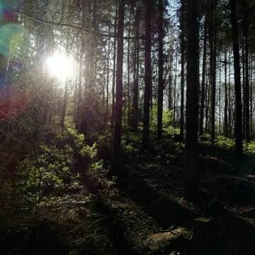
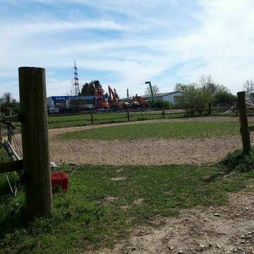
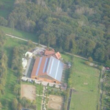
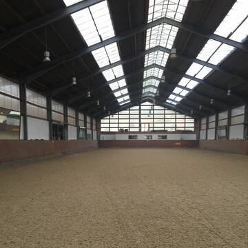
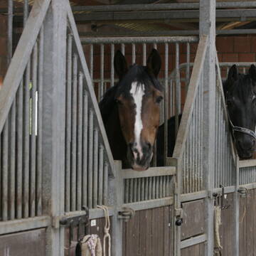
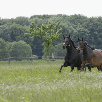
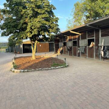
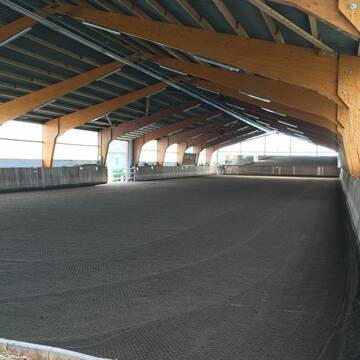
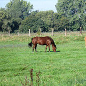
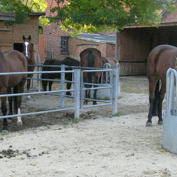
Freizeitstall zentral gelegen und dennoch Naturnah
Ronnenberg
Nicole-Hueper1
@Nicole-Hueper1
Freizeitstall
Reitlehrer und -unterricht
Vermieten
Longierzirkel/Roundpen
Paddock
Allergikerstall
13 weitere...
P+
Deprecated: Creation of dynamic property Zend_View_Helper_Ads::$adLink is deprecated in /var/www/stall-frei/htdocs/staging.stall-frei.de/library/Psf/View/Helper/Ads.php on line 108

Persönlichkeitsentwicklung mit Pferden
Bad Salzuflen
Katja Dors
@Pferdezeiten
Begleite andere auf ihrem Entwicklungsweg und entdecke die transformative Kraft der pferdegestützten Persönlichkeitsentwicklung !
neu
R


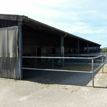
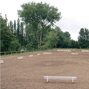
Reitstall Bremer - Ein Besuch lohnt sich!
Barsinghausen
Familie Wiedemann
@Familie_Wiedemann
Pferdeausbildung
Reitlehrer und -unterricht
Vermieten
Hunde willkommen
Krankenbox
Fohlenaufzucht möglich
Hengsthaltung möglich
20 weitere...
S
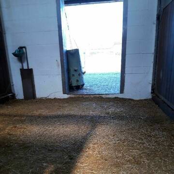
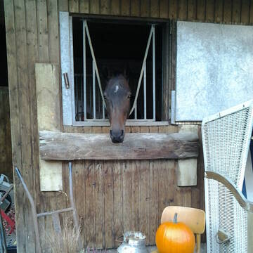
Reitanlage Brennecke zum 01.01.2026 eine Box frei
Hannover
Matthias-Brennecke
@Matthias-Brennecke
FN-Mitglied
Freizeitstall
Vermieten
Führanlage
Longierzirkel/Roundpen
Außenbox mit Paddock
16 weitere...
P+


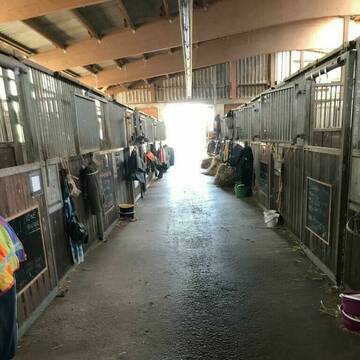
Offenstallplatz für Islandpferd, Pony, Shetty fr...
Ronnenberg OT Benthe
Nico
@Nico-K
Freizeitstall
Gangpferdereiten
Vermieten
Paddock
Reitplatz (z.B. Dressur, Springen, Reining)
Hufrehe geeignet
7 weitere...
P+


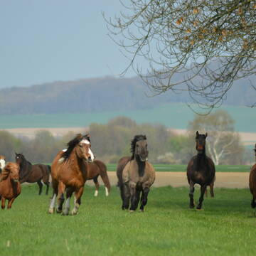
Mountain Trail, großer Paddocktrail für Wallache
Hannover
Nina_Mountaintrail-Hannover
@Nina_Paddocktrail-Hannover
VFD-Mitglied
Paddock
Videoüberwachung
Hufrehe geeignet
Notfallboxen
Paddock Trail
3 weitere...
P+


Freizeitstall Hemmingen
Hemmingen
juliareimann5
@juliareimann5
Freizeitstall
Vermieten
Hunde willkommen
Laufband
Allergikerstall
Hufrehe geeignet
14 weitere...
P+

Reitanlage Dammackerhof
Sarstedt
Dammackerhof
@Dammackerhof
Freizeitstall
Vermieten
Führanlage
Longierzirkel/Roundpen
Außenboxen
Innenbox
13 weitere...
S

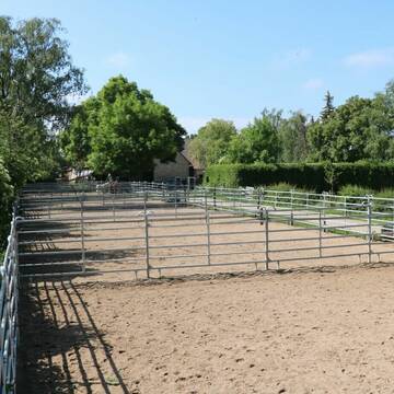
Reitverein Kronsberg e.V.
Laatzen
Reiterverein_Kronsberg
@Reiterverein_Kronsberg
FN-Mitglied
Reitlehrer und -unterricht
Vermieten
Hunde willkommen
Krankenbox
Außenboxen
Innenbox
14 weitere...
P+

Futtersack HeuToy, Fressbremse in pink
Mechtersen
STALL-FREIde Marketing
@STALL-FREI-Marketing
Stundenlange Beschäftigung die
Koliken vorbeugt, geringe Staubinhalation mit
steuerbarer Futterentnahme
Pferdeboxen zu vermieten
Gehrden
Pferdehof Rehren
@Pferdehof-Rehren
Freizeitstall
Pferdeausbildung
Führanlage
Hunde willkommen
Außenboxen
Innenbox
Vollpension
15 weitere...
P
Biohof Benne Bewegungsstall Plätze frei
Barsinghausen
Irmin-Benne
@Irmin-Benne
Freizeitstall
Reitlehrer und -unterricht
Vermieten
Krankenbox
Longierzirkel/Roundpen
Notfallboxen
12 weitere...
aktuell
P+
Deprecated: Creation of dynamic property Zend_View::$pageCount is deprecated in /var/www/stall-frei/htdocs/staging.stall-frei.de/library/vendor/shardj/zf1-future/library/Zend/View/Abstract.php on line 308
Deprecated: Creation of dynamic property Zend_View::$itemCountPerPage is deprecated in /var/www/stall-frei/htdocs/staging.stall-frei.de/library/vendor/shardj/zf1-future/library/Zend/View/Abstract.php on line 308
Deprecated: Creation of dynamic property Zend_View::$first is deprecated in /var/www/stall-frei/htdocs/staging.stall-frei.de/library/vendor/shardj/zf1-future/library/Zend/View/Abstract.php on line 308
Deprecated: Creation of dynamic property Zend_View::$current is deprecated in /var/www/stall-frei/htdocs/staging.stall-frei.de/library/vendor/shardj/zf1-future/library/Zend/View/Abstract.php on line 308
Deprecated: Creation of dynamic property Zend_View::$last is deprecated in /var/www/stall-frei/htdocs/staging.stall-frei.de/library/vendor/shardj/zf1-future/library/Zend/View/Abstract.php on line 308
Deprecated: Creation of dynamic property Zend_View::$next is deprecated in /var/www/stall-frei/htdocs/staging.stall-frei.de/library/vendor/shardj/zf1-future/library/Zend/View/Abstract.php on line 308
Deprecated: Creation of dynamic property Zend_View::$pagesInRange is deprecated in /var/www/stall-frei/htdocs/staging.stall-frei.de/library/vendor/shardj/zf1-future/library/Zend/View/Abstract.php on line 308
Deprecated: Creation of dynamic property Zend_View::$firstPageInRange is deprecated in /var/www/stall-frei/htdocs/staging.stall-frei.de/library/vendor/shardj/zf1-future/library/Zend/View/Abstract.php on line 308
Deprecated: Creation of dynamic property Zend_View::$lastPageInRange is deprecated in /var/www/stall-frei/htdocs/staging.stall-frei.de/library/vendor/shardj/zf1-future/library/Zend/View/Abstract.php on line 308
Deprecated: Creation of dynamic property Zend_View::$currentItemCount is deprecated in /var/www/stall-frei/htdocs/staging.stall-frei.de/library/vendor/shardj/zf1-future/library/Zend/View/Abstract.php on line 308
Deprecated: Creation of dynamic property Zend_View::$totalItemCount is deprecated in /var/www/stall-frei/htdocs/staging.stall-frei.de/library/vendor/shardj/zf1-future/library/Zend/View/Abstract.php on line 308
Deprecated: Creation of dynamic property Zend_View::$firstItemNumber is deprecated in /var/www/stall-frei/htdocs/staging.stall-frei.de/library/vendor/shardj/zf1-future/library/Zend/View/Abstract.php on line 308
Deprecated: Creation of dynamic property Zend_View::$lastItemNumber is deprecated in /var/www/stall-frei/htdocs/staging.stall-frei.de/library/vendor/shardj/zf1-future/library/Zend/View/Abstract.php on line 308
Deprecated: Creation of dynamic property Zend_View::$router is deprecated in /var/www/stall-frei/htdocs/staging.stall-frei.de/library/vendor/shardj/zf1-future/library/Zend/View/Abstract.php on line 308
Deprecated: Creation of dynamic property Zend_View::$urlParams is deprecated in /var/www/stall-frei/htdocs/staging.stall-frei.de/library/vendor/shardj/zf1-future/library/Zend/View/Abstract.php on line 308
Deprecated: Creation of dynamic property Zend_View::$showAds is deprecated in /var/www/stall-frei/htdocs/staging.stall-frei.de/library/vendor/shardj/zf1-future/library/Zend/View/Abstract.php on line 308
Deprecated: Creation of dynamic property Zend_View::$objectIds is deprecated in /var/www/stall-frei/htdocs/staging.stall-frei.de/library/vendor/shardj/zf1-future/library/Zend/View/Abstract.php on line 308
Deprecated: Creation of dynamic property Zend_View::$showNavbar is deprecated in /var/www/stall-frei/htdocs/staging.stall-frei.de/library/vendor/shardj/zf1-future/library/Zend/View/Abstract.php on line 308
Deprecated: Creation of dynamic property Zend_View::$showBreadcrumb is deprecated in /var/www/stall-frei/htdocs/staging.stall-frei.de/library/vendor/shardj/zf1-future/library/Zend/View/Abstract.php on line 308
Deprecated: Creation of dynamic property Zend_View::$showFooter is deprecated in /var/www/stall-frei/htdocs/staging.stall-frei.de/library/vendor/shardj/zf1-future/library/Zend/View/Abstract.php on line 308
Deprecated: Creation of dynamic property Zend_View::$showInternalAds is deprecated in /var/www/stall-frei/htdocs/staging.stall-frei.de/library/vendor/shardj/zf1-future/library/Zend/View/Abstract.php on line 308
Deprecated: Creation of dynamic property Zend_View::$blNoContent is deprecated in /var/www/stall-frei/htdocs/staging.stall-frei.de/library/vendor/shardj/zf1-future/library/Zend/View/Abstract.php on line 308
Deprecated: Creation of dynamic property Zend_View::$sMetaDesc is deprecated in /var/www/stall-frei/htdocs/staging.stall-frei.de/library/vendor/shardj/zf1-future/library/Zend/View/Abstract.php on line 308
Deprecated: Creation of dynamic property Zend_View::$useGmaps is deprecated in /var/www/stall-frei/htdocs/staging.stall-frei.de/library/vendor/shardj/zf1-future/library/Zend/View/Abstract.php on line 308
Deprecated: Creation of dynamic property Zend_View::$touches is deprecated in /var/www/stall-frei/htdocs/staging.stall-frei.de/library/vendor/shardj/zf1-future/library/Zend/View/Abstract.php on line 308
Deprecated: Creation of dynamic property Zend_View::$oProject is deprecated in /var/www/stall-frei/htdocs/staging.stall-frei.de/library/vendor/shardj/zf1-future/library/Zend/View/Abstract.php on line 308
Deprecated: Creation of dynamic property Zend_View::$pageHeadline is deprecated in /var/www/stall-frei/htdocs/staging.stall-frei.de/library/vendor/shardj/zf1-future/library/Zend/View/Abstract.php on line 308
Deprecated: Creation of dynamic property Zend_View::$disableLocationField is deprecated in /var/www/stall-frei/htdocs/staging.stall-frei.de/library/vendor/shardj/zf1-future/library/Zend/View/Abstract.php on line 308
Deprecated: Creation of dynamic property Zend_View::$isSearch is deprecated in /var/www/stall-frei/htdocs/staging.stall-frei.de/library/vendor/shardj/zf1-future/library/Zend/View/Abstract.php on line 308
Deprecated: Creation of dynamic property Zend_View::$pageTitle is deprecated in /var/www/stall-frei/htdocs/staging.stall-frei.de/library/vendor/shardj/zf1-future/library/Zend/View/Abstract.php on line 308
Deprecated: Creation of dynamic property Psf_Form_Element_Text::$class is deprecated in /var/www/stall-frei/htdocs/staging.stall-frei.de/library/vendor/shardj/zf1-future/library/Zend/Form/Element.php on line 874
Deprecated: Creation of dynamic property Psf_Form_Element_Text::$size is deprecated in /var/www/stall-frei/htdocs/staging.stall-frei.de/library/vendor/shardj/zf1-future/library/Zend/Form/Element.php on line 874
Deprecated: Creation of dynamic property Psf_Form_Element_Text::$placeholder is deprecated in /var/www/stall-frei/htdocs/staging.stall-frei.de/library/vendor/shardj/zf1-future/library/Zend/Form/Element.php on line 874
Deprecated: Creation of dynamic property Psf_Form_Element_Hidden::$class is deprecated in /var/www/stall-frei/htdocs/staging.stall-frei.de/library/vendor/shardj/zf1-future/library/Zend/Form/Element.php on line 874
Deprecated: Creation of dynamic property Psf_Form_Element_Hidden::$class is deprecated in /var/www/stall-frei/htdocs/staging.stall-frei.de/library/vendor/shardj/zf1-future/library/Zend/Form/Element.php on line 874
Deprecated: Creation of dynamic property Psf_Form_Element_Hidden::$class is deprecated in /var/www/stall-frei/htdocs/staging.stall-frei.de/library/vendor/shardj/zf1-future/library/Zend/Form/Element.php on line 874
Deprecated: Creation of dynamic property Psf_Form_Element_Hidden::$class is deprecated in /var/www/stall-frei/htdocs/staging.stall-frei.de/library/vendor/shardj/zf1-future/library/Zend/Form/Element.php on line 874
Deprecated: Creation of dynamic property Psf_Form_Element_Select::$class is deprecated in /var/www/stall-frei/htdocs/staging.stall-frei.de/library/vendor/shardj/zf1-future/library/Zend/Form/Element.php on line 874
Deprecated: Creation of dynamic property Psf_Form_Element_Select::$class is deprecated in /var/www/stall-frei/htdocs/staging.stall-frei.de/library/vendor/shardj/zf1-future/library/Zend/Form/Element.php on line 874
Deprecated: Creation of dynamic property Psf_Form_Element_Select::$class is deprecated in /var/www/stall-frei/htdocs/staging.stall-frei.de/library/vendor/shardj/zf1-future/library/Zend/Form/Element.php on line 874
Deprecated: Creation of dynamic property Psf_Form_Element_Select::$class is deprecated in /var/www/stall-frei/htdocs/staging.stall-frei.de/library/vendor/shardj/zf1-future/library/Zend/Form/Element.php on line 874
Deprecated: Creation of dynamic property Psf_Form_Element_Text::$class is deprecated in /var/www/stall-frei/htdocs/staging.stall-frei.de/library/vendor/shardj/zf1-future/library/Zend/Form/Element.php on line 874
Deprecated: Creation of dynamic property Psf_Form_Element_Checkbox::$label is deprecated in /var/www/stall-frei/htdocs/staging.stall-frei.de/library/vendor/shardj/zf1-future/library/Zend/Form/Element.php on line 874
Deprecated: Creation of dynamic property Zend_View::$sort is deprecated in /var/www/stall-frei/htdocs/staging.stall-frei.de/library/vendor/shardj/zf1-future/library/Zend/View/Abstract.php on line 308
Deprecated: Creation of dynamic property Zend_View::$searchLocation is deprecated in /var/www/stall-frei/htdocs/staging.stall-frei.de/library/vendor/shardj/zf1-future/library/Zend/View/Abstract.php on line 308
Deprecated: Creation of dynamic property Zend_View::$locationHint is deprecated in /var/www/stall-frei/htdocs/staging.stall-frei.de/library/vendor/shardj/zf1-future/library/Zend/View/Abstract.php on line 308
Psf_GeoCoder_Abstract::getLocation: Ronnenberg Get Location CachedOrLive
Psf_GeoCoder_Abstract::getCachedOrLive: Ronnenberg
Psf_GeoCoder_OpenCageData::makeApiRequest: response:
Array
(
[documentation] => https://opencagedata.com/api
[licenses] => Array
(
[0] => Array
(
[name] => see attribution guide
[url] => https://opencagedata.com/credits
)
)
[results] => Array
(
[0] => Array
(
[bounds] => Array
(
[northeast] => Array
(
[lat] => 52.3562012
[lng] => 9.7024088
)
[southwest] => Array
(
[lat] => 52.2609232
[lng] => 9.6144104
)
)
[components] => Array
(
[ISO_3166-1_alpha-2] => DE
[ISO_3166-1_alpha-3] => DEU
[ISO_3166-2] => Array
(
[0] => DE-NI
)
[_category] => place
[_normalized_city] => Ronnenberg
[_type] => city
[continent] => Europe
[country] => Deutschland
[country_code] => de
[county] => Region Hannover
[political_union] => European Union
[postcode] => 30952
[state] => Niedersachsen
[state_code] => NI
[town] => Ronnenberg
)
[confidence] => 7
[formatted] => 30952 Ronnenberg, Deutschland
[geometry] => Array
(
[lat] => 52.3166623
[lng] => 9.6532075
)
)
[1] => Array
(
[bounds] => Array
(
[northeast] => Array
(
[lat] => 52.3303167
[lng] => 9.6829024
)
[southwest] => Array
(
[lat] => 52.3016421
[lng] => 9.621662
)
)
[components] => Array
(
[ISO_3166-1_alpha-2] => DE
[ISO_3166-1_alpha-3] => DEU
[ISO_3166-2] => Array
(
[0] => DE-NI
)
[_category] => place
[_normalized_city] => Ronnenberg
[_type] => neighbourhood
[city_district] => Ronnenberg
[continent] => Europe
[country] => Deutschland
[country_code] => de
[county] => Region Hannover
[political_union] => European Union
[postcode] => 30952
[state] => Niedersachsen
[state_code] => NI
[town] => Ronnenberg
)
[confidence] => 7
[formatted] => 30952 Ronnenberg, Deutschland
[geometry] => Array
(
[lat] => 52.3156858
[lng] => 9.6513509
)
)
[2] => Array
(
[components] => Array
(
[ISO_3166-1_alpha-2] => FR
[ISO_3166-1_alpha-3] => FRA
[ISO_3166-2] => Array
(
[0] => FR-NOR
[1] => FR-76
)
[_category] => road
[_normalized_city] => Duclair
[_type] => road
[city] => Duclair
[continent] => Europe
[country] => France
[country_code] => fr
[county] => Seine-Maritime
[local_authority] => Métropole Rouen Normandie
[political_union] => European Union
[postcode] => 76480
[road] => Rue de Ronnenberg
[state] => Normandie
[state_code] => NOR
)
[confidence] => 4
[formatted] => Rue de Ronnenberg, 76480 Duclair, France
[geometry] => Array
(
[lat] => 49.48088
[lng] => 0.87278
)
)
[3] => Array
(
[components] => Array
(
[ISO_3166-1_alpha-2] => FR
[ISO_3166-1_alpha-3] => FRA
[ISO_3166-2] => Array
(
[0] => FR-GES
[1] => FR-6AE
[2] => FR-67
)
[_category] => road
[_normalized_city] => Rohr
[_type] => road
[city] => Rohr
[continent] => Europe
[country] => France
[country_code] => fr
[county] => Bas-Rhin
[local_authority] => Communauté de communes du Kochersberg
[political_union] => European Union
[postcode] => 67270
[road] => Rue du Nonnenberg
[state] => Grand Est
[state_code] => GES
)
[confidence] => 3
[formatted] => Rue du Nonnenberg, 67270 Rohr, France
[geometry] => Array
(
[lat] => 48.697013
[lng] => 7.545043
)
)
[4] => Array
(
[components] => Array
(
[ISO_3166-1_alpha-2] => FR
[ISO_3166-1_alpha-3] => FRA
[ISO_3166-2] => Array
(
[0] => FR-GES
[1] => FR-6AE
[2] => FR-67
)
[_category] => road
[_normalized_city] => Truchtersheim
[_type] => road
[city] => Truchtersheim
[continent] => Europe
[country] => France
[country_code] => fr
[county] => Bas-Rhin
[local_authority] => Communauté de communes du Kochersberg
[political_union] => European Union
[postcode] => 67370
[road] => Rue du Sonnenberg
[state] => Grand Est
[state_code] => GES
)
[confidence] => 3
[formatted] => Rue du Sonnenberg, 67370 Truchtersheim, France
[geometry] => Array
(
[lat] => 48.666577
[lng] => 7.602796
)
)
[5] => Array
(
[components] => Array
(
[ISO_3166-1_alpha-2] => FR
[ISO_3166-1_alpha-3] => FRA
[ISO_3166-2] => Array
(
[0] => FR-GES
[1] => FR-6AE
[2] => FR-68
)
[_category] => road
[_normalized_city] => Sierentz
[_type] => road
[city] => Sierentz
[continent] => Europe
[country] => France
[country_code] => fr
[county] => Haut-Rhin
[local_authority] => Saint-Louis Agglomération
[political_union] => European Union
[postcode] => 68510
[road] => Rue du Monenberg
[state] => Grand Est
[state_code] => GES
)
[confidence] => 3
[formatted] => Rue du Monenberg, 68510 Sierentz, France
[geometry] => Array
(
[lat] => 47.650618
[lng] => 7.454508
)
)
[6] => Array
(
[components] => Array
(
[ISO_3166-1_alpha-2] => FR
[ISO_3166-1_alpha-3] => FRA
[ISO_3166-2] => Array
(
[0] => FR-GES
[1] => FR-6AE
[2] => FR-67
)
[_category] => road
[_normalized_city] => Rangen
[_type] => road
[city] => Rangen
[continent] => Europe
[country] => France
[country_code] => fr
[county] => Bas-Rhin
[local_authority] => Communauté de communes de la Mossig et du Vignoble
[political_union] => European Union
[postcode] => 67310
[road] => Impasse du Sonnenberg
[state] => Grand Est
[state_code] => GES
)
[confidence] => 2
[formatted] => Impasse du Sonnenberg, 67310 Rangen, France
[geometry] => Array
(
[lat] => 48.667462
[lng] => 7.477018
)
)
[7] => Array
(
[components] => Array
(
[ISO_3166-1_alpha-2] => FR
[ISO_3166-1_alpha-3] => FRA
[ISO_3166-2] => Array
(
[0] => FR-GES
[1] => FR-6AE
[2] => FR-68
)
[_category] => road
[_normalized_city] => Ribeauvillé
[_type] => road
[city] => Ribeauvillé
[continent] => Europe
[country] => France
[country_code] => fr
[county] => Haut-Rhin
[local_authority] => Communauté de communes du Pays de Ribeauvillé
[political_union] => European Union
[postcode] => 68150
[road] => Chemin du Rotenberg
[state] => Grand Est
[state_code] => GES
)
[confidence] => 2
[formatted] => Chemin du Rotenberg, 68150 Ribeauvillé, France
[geometry] => Array
(
[lat] => 48.19534
[lng] => 7.345753
)
)
[8] => Array
(
[components] => Array
(
[ISO_3166-1_alpha-2] => FR
[ISO_3166-1_alpha-3] => FRA
[ISO_3166-2] => Array
(
[0] => FR-GES
[1] => FR-6AE
[2] => FR-68
)
[_category] => road
[_normalized_city] => Altkirch
[_type] => road
[city] => Altkirch
[continent] => Europe
[country] => France
[country_code] => fr
[county] => Haut-Rhin
[local_authority] => Communauté de communes Sundgau
[political_union] => European Union
[postcode] => 68130
[road] => Rue du Roggenberg
[state] => Grand Est
[state_code] => GES
)
[confidence] => 2
[formatted] => Rue du Roggenberg, 68130 Altkirch, France
[geometry] => Array
(
[lat] => 47.617364
[lng] => 7.240136
)
)
[9] => Array
(
[components] => Array
(
[ISO_3166-1_alpha-2] => FR
[ISO_3166-1_alpha-3] => FRA
[ISO_3166-2] => Array
(
[0] => FR-GES
[1] => FR-57
)
[_category] => road
[_normalized_city] => Macheren
[_type] => road
[city] => Macheren
[continent] => Europe
[country] => France
[country_code] => fr
[county] => Moselle
[local_authority] => Communauté d’agglomération Saint-Avold Synergie
[political_union] => European Union
[postcode] => 57730
[road] => Chemin du Rotenberg
[state] => Grand Est
[state_code] => GES
)
[confidence] => 2
[formatted] => Chemin du Rotenberg, 57730 Macheren, France
[geometry] => Array
(
[lat] => 49.094468
[lng] => 6.744351
)
)
)
[status] => Array
(
[code] => 200
[message] => OK
)
[stay_informed] => Array
(
[blog] => https://blog.opencagedata.com
[mastodon] => https://en.osm.town/@opencage
)
[thanks] => For using an OpenCage API
[timestamp] => Array
(
[created_http] => Thu, 05 Feb 2026 06:45:00 GMT
[created_unix] => 1770273900
)
[total_results] => 10
)
Psf_GeoCoder_Abstract::convertLocationResult
{"documentation":"https:\/\/opencagedata.com\/api","licenses":[{"name":"see attribution guide","url":"https:\/\/opencagedata.com\/credits"}],"results":[{"bounds":{"northeast":{"lat":52.3562012,"lng":9.7024088},"southwest":{"lat":52.2609232,"lng":9.6144104}},"components":{"ISO_3166-1_alpha-2":"DE","ISO_3166-1_alpha-3":"DEU","ISO_3166-2":["DE-NI"],"_category":"place","_normalized_city":"Ronnenberg","_type":"city","continent":"Europe","country":"Deutschland","country_code":"de","county":"Region Hannover","political_union":"European Union","postcode":"30952","state":"Niedersachsen","state_code":"NI","town":"Ronnenberg"},"confidence":7,"formatted":"30952 Ronnenberg, Deutschland","geometry":{"lat":52.3166623,"lng":9.6532075}},{"bounds":{"northeast":{"lat":52.3303167,"lng":9.6829024},"southwest":{"lat":52.3016421,"lng":9.621662}},"components":{"ISO_3166-1_alpha-2":"DE","ISO_3166-1_alpha-3":"DEU","ISO_3166-2":["DE-NI"],"_category":"place","_normalized_city":"Ronnenberg","_type":"neighbourhood","city_district":"Ronnenberg","continent":"Europe","country":"Deutschland","country_code":"de","county":"Region Hannover","political_union":"European Union","postcode":"30952","state":"Niedersachsen","state_code":"NI","town":"Ronnenberg"},"confidence":7,"formatted":"30952 Ronnenberg, Deutschland","geometry":{"lat":52.3156858,"lng":9.6513509}},{"components":{"ISO_3166-1_alpha-2":"FR","ISO_3166-1_alpha-3":"FRA","ISO_3166-2":["FR-NOR","FR-76"],"_category":"road","_normalized_city":"Duclair","_type":"road","city":"Duclair","continent":"Europe","country":"France","country_code":"fr","county":"Seine-Maritime","local_authority":"M\u00e9tropole Rouen Normandie","political_union":"European Union","postcode":"76480","road":"Rue de Ronnenberg","state":"Normandie","state_code":"NOR"},"confidence":4,"formatted":"Rue de Ronnenberg, 76480 Duclair, France","geometry":{"lat":49.48088,"lng":0.87278}},{"components":{"ISO_3166-1_alpha-2":"FR","ISO_3166-1_alpha-3":"FRA","ISO_3166-2":["FR-GES","FR-6AE","FR-67"],"_category":"road","_normalized_city":"Rohr","_type":"road","city":"Rohr","continent":"Europe","country":"France","country_code":"fr","county":"Bas-Rhin","local_authority":"Communaut\u00e9 de communes du Kochersberg","political_union":"European Union","postcode":"67270","road":"Rue du Nonnenberg","state":"Grand Est","state_code":"GES"},"confidence":3,"formatted":"Rue du Nonnenberg, 67270 Rohr, France","geometry":{"lat":48.697013,"lng":7.545043}},{"components":{"ISO_3166-1_alpha-2":"FR","ISO_3166-1_alpha-3":"FRA","ISO_3166-2":["FR-GES","FR-6AE","FR-67"],"_category":"road","_normalized_city":"Truchtersheim","_type":"road","city":"Truchtersheim","continent":"Europe","country":"France","country_code":"fr","county":"Bas-Rhin","local_authority":"Communaut\u00e9 de communes du Kochersberg","political_union":"European Union","postcode":"67370","road":"Rue du Sonnenberg","state":"Grand Est","state_code":"GES"},"confidence":3,"formatted":"Rue du Sonnenberg, 67370 Truchtersheim, France","geometry":{"lat":48.666577,"lng":7.602796}},{"components":{"ISO_3166-1_alpha-2":"FR","ISO_3166-1_alpha-3":"FRA","ISO_3166-2":["FR-GES","FR-6AE","FR-68"],"_category":"road","_normalized_city":"Sierentz","_type":"road","city":"Sierentz","continent":"Europe","country":"France","country_code":"fr","county":"Haut-Rhin","local_authority":"Saint-Louis Agglom\u00e9ration","political_union":"European Union","postcode":"68510","road":"Rue du Monenberg","state":"Grand Est","state_code":"GES"},"confidence":3,"formatted":"Rue du Monenberg, 68510 Sierentz, France","geometry":{"lat":47.650618,"lng":7.454508}},{"components":{"ISO_3166-1_alpha-2":"FR","ISO_3166-1_alpha-3":"FRA","ISO_3166-2":["FR-GES","FR-6AE","FR-67"],"_category":"road","_normalized_city":"Rangen","_type":"road","city":"Rangen","continent":"Europe","country":"France","country_code":"fr","county":"Bas-Rhin","local_authority":"Communaut\u00e9 de communes de la Mossig et du Vignoble","political_union":"European Union","postcode":"67310","road":"Impasse du Sonnenberg","state":"Grand Est","state_code":"GES"},"confidence":2,"formatted":"Impasse du Sonnenberg, 67310 Rangen, France","geometry":{"lat":48.667462,"lng":7.477018}},{"components":{"ISO_3166-1_alpha-2":"FR","ISO_3166-1_alpha-3":"FRA","ISO_3166-2":["FR-GES","FR-6AE","FR-68"],"_category":"road","_normalized_city":"Ribeauvill\u00e9","_type":"road","city":"Ribeauvill\u00e9","continent":"Europe","country":"France","country_code":"fr","county":"Haut-Rhin","local_authority":"Communaut\u00e9 de communes du Pays de Ribeauvill\u00e9","political_union":"European Union","postcode":"68150","road":"Chemin du Rotenberg","state":"Grand Est","state_code":"GES"},"confidence":2,"formatted":"Chemin du Rotenberg, 68150 Ribeauvill\u00e9, France","geometry":{"lat":48.19534,"lng":7.345753}},{"components":{"ISO_3166-1_alpha-2":"FR","ISO_3166-1_alpha-3":"FRA","ISO_3166-2":["FR-GES","FR-6AE","FR-68"],"_category":"road","_normalized_city":"Altkirch","_type":"road","city":"Altkirch","continent":"Europe","country":"France","country_code":"fr","county":"Haut-Rhin","local_authority":"Communaut\u00e9 de communes Sundgau","political_union":"European Union","postcode":"68130","road":"Rue du Roggenberg","state":"Grand Est","state_code":"GES"},"confidence":2,"formatted":"Rue du Roggenberg, 68130 Altkirch, France","geometry":{"lat":47.617364,"lng":7.240136}},{"components":{"ISO_3166-1_alpha-2":"FR","ISO_3166-1_alpha-3":"FRA","ISO_3166-2":["FR-GES","FR-57"],"_category":"road","_normalized_city":"Macheren","_type":"road","city":"Macheren","continent":"Europe","country":"France","country_code":"fr","county":"Moselle","local_authority":"Communaut\u00e9 d\u2019agglom\u00e9ration Saint-Avold Synergie","political_union":"European Union","postcode":"57730","road":"Chemin du Rotenberg","state":"Grand Est","state_code":"GES"},"confidence":2,"formatted":"Chemin du Rotenberg, 57730 Macheren, France","geometry":{"lat":49.094468,"lng":6.744351}}],"status":{"code":200,"message":"OK"},"stay_informed":{"blog":"https:\/\/blog.opencagedata.com","mastodon":"https:\/\/en.osm.town\/@opencage"},"thanks":"For using an OpenCage API","timestamp":{"created_http":"Thu, 05 Feb 2026 06:45:00 GMT","created_unix":1770273900},"total_results":10}Array
(
[0] => stdClass Object
(
[bounds] => stdClass Object
(
[northeast] => stdClass Object
(
[lat] => 52.3562012
[lng] => 9.7024088
)
[southwest] => stdClass Object
(
[lat] => 52.2609232
[lng] => 9.6144104
)
)
[components] => stdClass Object
(
[ISO_3166-1_alpha-2] => DE
[ISO_3166-1_alpha-3] => DEU
[ISO_3166-2] => Array
(
[0] => DE-NI
)
[_category] => place
[_normalized_city] => Ronnenberg
[_type] => city
[continent] => Europe
[country] => Deutschland
[country_code] => de
[county] => Region Hannover
[political_union] => European Union
[postcode] => 30952
[state] => Niedersachsen
[state_code] => NI
[town] => Ronnenberg
)
[confidence] => 7
[formatted] => 30952 Ronnenberg, Deutschland
[geometry] => stdClass Object
(
[lat] => 52.3166623
[lng] => 9.6532075
)
)
[1] => stdClass Object
(
[bounds] => stdClass Object
(
[northeast] => stdClass Object
(
[lat] => 52.3303167
[lng] => 9.6829024
)
[southwest] => stdClass Object
(
[lat] => 52.3016421
[lng] => 9.621662
)
)
[components] => stdClass Object
(
[ISO_3166-1_alpha-2] => DE
[ISO_3166-1_alpha-3] => DEU
[ISO_3166-2] => Array
(
[0] => DE-NI
)
[_category] => place
[_normalized_city] => Ronnenberg
[_type] => neighbourhood
[city_district] => Ronnenberg
[continent] => Europe
[country] => Deutschland
[country_code] => de
[county] => Region Hannover
[political_union] => European Union
[postcode] => 30952
[state] => Niedersachsen
[state_code] => NI
[town] => Ronnenberg
)
[confidence] => 7
[formatted] => 30952 Ronnenberg, Deutschland
[geometry] => stdClass Object
(
[lat] => 52.3156858
[lng] => 9.6513509
)
)
[2] => stdClass Object
(
[components] => stdClass Object
(
[ISO_3166-1_alpha-2] => FR
[ISO_3166-1_alpha-3] => FRA
[ISO_3166-2] => Array
(
[0] => FR-NOR
[1] => FR-76
)
[_category] => road
[_normalized_city] => Duclair
[_type] => road
[city] => Duclair
[continent] => Europe
[country] => France
[country_code] => fr
[county] => Seine-Maritime
[local_authority] => Métropole Rouen Normandie
[political_union] => European Union
[postcode] => 76480
[road] => Rue de Ronnenberg
[state] => Normandie
[state_code] => NOR
)
[confidence] => 4
[formatted] => Rue de Ronnenberg, 76480 Duclair, France
[geometry] => stdClass Object
(
[lat] => 49.48088
[lng] => 0.87278
)
)
[3] => stdClass Object
(
[components] => stdClass Object
(
[ISO_3166-1_alpha-2] => FR
[ISO_3166-1_alpha-3] => FRA
[ISO_3166-2] => Array
(
[0] => FR-GES
[1] => FR-6AE
[2] => FR-67
)
[_category] => road
[_normalized_city] => Rohr
[_type] => road
[city] => Rohr
[continent] => Europe
[country] => France
[country_code] => fr
[county] => Bas-Rhin
[local_authority] => Communauté de communes du Kochersberg
[political_union] => European Union
[postcode] => 67270
[road] => Rue du Nonnenberg
[state] => Grand Est
[state_code] => GES
)
[confidence] => 3
[formatted] => Rue du Nonnenberg, 67270 Rohr, France
[geometry] => stdClass Object
(
[lat] => 48.697013
[lng] => 7.545043
)
)
[4] => stdClass Object
(
[components] => stdClass Object
(
[ISO_3166-1_alpha-2] => FR
[ISO_3166-1_alpha-3] => FRA
[ISO_3166-2] => Array
(
[0] => FR-GES
[1] => FR-6AE
[2] => FR-67
)
[_category] => road
[_normalized_city] => Truchtersheim
[_type] => road
[city] => Truchtersheim
[continent] => Europe
[country] => France
[country_code] => fr
[county] => Bas-Rhin
[local_authority] => Communauté de communes du Kochersberg
[political_union] => European Union
[postcode] => 67370
[road] => Rue du Sonnenberg
[state] => Grand Est
[state_code] => GES
)
[confidence] => 3
[formatted] => Rue du Sonnenberg, 67370 Truchtersheim, France
[geometry] => stdClass Object
(
[lat] => 48.666577
[lng] => 7.602796
)
)
[5] => stdClass Object
(
[components] => stdClass Object
(
[ISO_3166-1_alpha-2] => FR
[ISO_3166-1_alpha-3] => FRA
[ISO_3166-2] => Array
(
[0] => FR-GES
[1] => FR-6AE
[2] => FR-68
)
[_category] => road
[_normalized_city] => Sierentz
[_type] => road
[city] => Sierentz
[continent] => Europe
[country] => France
[country_code] => fr
[county] => Haut-Rhin
[local_authority] => Saint-Louis Agglomération
[political_union] => European Union
[postcode] => 68510
[road] => Rue du Monenberg
[state] => Grand Est
[state_code] => GES
)
[confidence] => 3
[formatted] => Rue du Monenberg, 68510 Sierentz, France
[geometry] => stdClass Object
(
[lat] => 47.650618
[lng] => 7.454508
)
)
[6] => stdClass Object
(
[components] => stdClass Object
(
[ISO_3166-1_alpha-2] => FR
[ISO_3166-1_alpha-3] => FRA
[ISO_3166-2] => Array
(
[0] => FR-GES
[1] => FR-6AE
[2] => FR-67
)
[_category] => road
[_normalized_city] => Rangen
[_type] => road
[city] => Rangen
[continent] => Europe
[country] => France
[country_code] => fr
[county] => Bas-Rhin
[local_authority] => Communauté de communes de la Mossig et du Vignoble
[political_union] => European Union
[postcode] => 67310
[road] => Impasse du Sonnenberg
[state] => Grand Est
[state_code] => GES
)
[confidence] => 2
[formatted] => Impasse du Sonnenberg, 67310 Rangen, France
[geometry] => stdClass Object
(
[lat] => 48.667462
[lng] => 7.477018
)
)
[7] => stdClass Object
(
[components] => stdClass Object
(
[ISO_3166-1_alpha-2] => FR
[ISO_3166-1_alpha-3] => FRA
[ISO_3166-2] => Array
(
[0] => FR-GES
[1] => FR-6AE
[2] => FR-68
)
[_category] => road
[_normalized_city] => Ribeauvillé
[_type] => road
[city] => Ribeauvillé
[continent] => Europe
[country] => France
[country_code] => fr
[county] => Haut-Rhin
[local_authority] => Communauté de communes du Pays de Ribeauvillé
[political_union] => European Union
[postcode] => 68150
[road] => Chemin du Rotenberg
[state] => Grand Est
[state_code] => GES
)
[confidence] => 2
[formatted] => Chemin du Rotenberg, 68150 Ribeauvillé, France
[geometry] => stdClass Object
(
[lat] => 48.19534
[lng] => 7.345753
)
)
[8] => stdClass Object
(
[components] => stdClass Object
(
[ISO_3166-1_alpha-2] => FR
[ISO_3166-1_alpha-3] => FRA
[ISO_3166-2] => Array
(
[0] => FR-GES
[1] => FR-6AE
[2] => FR-68
)
[_category] => road
[_normalized_city] => Altkirch
[_type] => road
[city] => Altkirch
[continent] => Europe
[country] => France
[country_code] => fr
[county] => Haut-Rhin
[local_authority] => Communauté de communes Sundgau
[political_union] => European Union
[postcode] => 68130
[road] => Rue du Roggenberg
[state] => Grand Est
[state_code] => GES
)
[confidence] => 2
[formatted] => Rue du Roggenberg, 68130 Altkirch, France
[geometry] => stdClass Object
(
[lat] => 47.617364
[lng] => 7.240136
)
)
[9] => stdClass Object
(
[components] => stdClass Object
(
[ISO_3166-1_alpha-2] => FR
[ISO_3166-1_alpha-3] => FRA
[ISO_3166-2] => Array
(
[0] => FR-GES
[1] => FR-57
)
[_category] => road
[_normalized_city] => Macheren
[_type] => road
[city] => Macheren
[continent] => Europe
[country] => France
[country_code] => fr
[county] => Moselle
[local_authority] => Communauté d’agglomération Saint-Avold Synergie
[political_union] => European Union
[postcode] => 57730
[road] => Chemin du Rotenberg
[state] => Grand Est
[state_code] => GES
)
[confidence] => 2
[formatted] => Chemin du Rotenberg, 57730 Macheren, France
[geometry] => stdClass Object
(
[lat] => 49.094468
[lng] => 6.744351
)
)
)
Psf_GeoCoder_OpenCageData::getKeyMap: 0
stdClass Object
(
    [bounds] => stdClass Object
        (
            [northeast] => stdClass Object
                (
                    [lat] => 52.3562012
                    [lng] => 9.7024088
                )

            [southwest] => stdClass Object
                (
                    [lat] => 52.2609232
                    [lng] => 9.6144104
                )

        )

    [components] => stdClass Object
        (
            [ISO_3166-1_alpha-2] => DE
            [ISO_3166-1_alpha-3] => DEU
            [ISO_3166-2] => Array
                (
                    [0] => DE-NI
                )

            [_category] => place
            [_normalized_city] => Ronnenberg
            [_type] => city
            [continent] => Europe
            [country] => Deutschland
            [country_code] => de
            [county] => Region Hannover
            [political_union] => European Union
            [postcode] => 30952
            [state] => Niedersachsen
            [state_code] => NI
            [town] => Ronnenberg
        )

    [confidence] => 7
    [formatted] => 30952 Ronnenberg, Deutschland
    [geometry] => stdClass Object
        (
            [lat] => 52.3166623
            [lng] => 9.6532075
        )

)
Psf_GeoCoder_OpenCageData::getCounty: Hannover
Psf_GeoCoder_OpenCageData::addMissingData REFETCH!
Array
(
    [address] => 30952 Ronnenberg, Deutschland
    [type] => city
    [street] =>
    [city] => Ronnenberg
    [county] => Hannover
    [state] => Niedersachsen
    [zip] => 30952
    [country] => Deutschland
    [suburb] =>
    [countrycode] => de
    [latitude] => 52.3166623
    [longitude] => 9.6532075
    [accuracy] => 1
    [confidence] => 7
    [bounds] => stdClass Object
        (
            [northeast] => stdClass Object
                (
                    [lat] => 52.3562012
                    [lng] => 9.7024088
                )

            [southwest] => stdClass Object
                (
                    [lat] => 52.2609232
                    [lng] => 9.6144104
                )

        )

)
reformat!
Array
(
    [address] => 30952 Ronnenberg, Deutschland
    [type] => city
    [street] =>
    [city] => Ronnenberg
    [county] => Hannover
    [state] => Niedersachsen
    [zip] => 30952
    [country] => Deutschland
    [suburb] =>
    [countrycode] => de
    [latitude] => 52.3166623
    [longitude] => 9.6532075
    [accuracy] => 1
    [confidence] => 7
    [bounds] => stdClass Object
        (
            [northeast] => stdClass Object
                (
                    [lat] => 52.3562012
                    [lng] => 9.7024088
                )

            [southwest] => stdClass Object
                (
                    [lat] => 52.2609232
                    [lng] => 9.6144104
                )

        )

    [place] => 30952 Ronnenberg, Niedersachsen
    [hash] => 9ed589fe09e2590584ca3c5f1b9eb8c7
)
Psf_GeoCoder_OpenCageData::getKeyMap: 1
stdClass Object
(
    [bounds] => stdClass Object
        (
            [northeast] => stdClass Object
                (
                    [lat] => 52.3303167
                    [lng] => 9.6829024
                )

            [southwest] => stdClass Object
                (
                    [lat] => 52.3016421
                    [lng] => 9.621662
                )

        )

    [components] => stdClass Object
        (
            [ISO_3166-1_alpha-2] => DE
            [ISO_3166-1_alpha-3] => DEU
            [ISO_3166-2] => Array
                (
                    [0] => DE-NI
                )

            [_category] => place
            [_normalized_city] => Ronnenberg
            [_type] => neighbourhood
            [city_district] => Ronnenberg
            [continent] => Europe
            [country] => Deutschland
            [country_code] => de
            [county] => Region Hannover
            [political_union] => European Union
            [postcode] => 30952
            [state] => Niedersachsen
            [state_code] => NI
            [town] => Ronnenberg
        )

    [confidence] => 7
    [formatted] => 30952 Ronnenberg, Deutschland
    [geometry] => stdClass Object
        (
            [lat] => 52.3156858
            [lng] => 9.6513509
        )

)
Psf_GeoCoder_OpenCageData::getCounty: Hannover
Psf_GeoCoder_OpenCageData::addMissingData REFETCH!
Array
(
    [address] => 30952 Ronnenberg, Deutschland
    [type] => neighbourhood
    [street] =>
    [city] => Ronnenberg
    [county] => Hannover
    [state] => Niedersachsen
    [zip] => 30952
    [country] => Deutschland
    [suburb] =>
    [countrycode] => de
    [latitude] => 52.3156858
    [longitude] => 9.6513509
    [accuracy] => 1
    [confidence] => 7
    [bounds] => stdClass Object
        (
            [northeast] => stdClass Object
                (
                    [lat] => 52.3303167
                    [lng] => 9.6829024
                )

            [southwest] => stdClass Object
                (
                    [lat] => 52.3016421
                    [lng] => 9.621662
                )

        )

)
reformat!
Array
(
    [address] => 30952 Ronnenberg, Deutschland
    [type] => neighbourhood
    [street] =>
    [city] => Ronnenberg
    [county] => Hannover
    [state] => Niedersachsen
    [zip] => 30952
    [country] => Deutschland
    [suburb] =>
    [countrycode] => de
    [latitude] => 52.3156858
    [longitude] => 9.6513509
    [accuracy] => 1
    [confidence] => 7
    [bounds] => stdClass Object
        (
            [northeast] => stdClass Object
                (
                    [lat] => 52.3303167
                    [lng] => 9.6829024
                )

            [southwest] => stdClass Object
                (
                    [lat] => 52.3016421
                    [lng] => 9.621662
                )

        )

    [place] => 30952 Ronnenberg, Niedersachsen
    [hash] => 9ed589fe09e2590584ca3c5f1b9eb8c7
)
Psf_GeoCoder_OpenCageData::getKeyMap: 2
stdClass Object
(
    [components] => stdClass Object
        (
            [ISO_3166-1_alpha-2] => FR
            [ISO_3166-1_alpha-3] => FRA
            [ISO_3166-2] => Array
                (
                    [0] => FR-NOR
                    [1] => FR-76
                )

            [_category] => road
            [_normalized_city] => Duclair
            [_type] => road
            [city] => Duclair
            [continent] => Europe
            [country] => France
            [country_code] => fr
            [county] => Seine-Maritime
            [local_authority] => Métropole Rouen Normandie
            [political_union] => European Union
            [postcode] => 76480
            [road] => Rue de Ronnenberg
            [state] => Normandie
            [state_code] => NOR
        )

    [confidence] => 4
    [formatted] => Rue de Ronnenberg, 76480 Duclair, France
    [geometry] => stdClass Object
        (
            [lat] => 49.48088
            [lng] => 0.87278
        )

)
Psf_GeoCoder_OpenCageData::getCounty: Seine-Maritime
Psf_GeoCoder_OpenCageData::addMissingData REFETCH!
Array
(
    [address] => Rue de Ronnenberg, 76480 Duclair, France
    [type] => road
    [street] => Rue de Ronnenberg
    [city] => Duclair
    [county] => Seine-Maritime
    [state] => Normandie
    [zip] => 76480
    [country] => France
    [suburb] =>
    [countrycode] => fr
    [latitude] => 49.48088
    [longitude] => 0.87278
    [accuracy] => 1
    [confidence] => 4
    [bounds] =>
)
reformat!
Array
(
    [address] => Rue de Ronnenberg, 76480 Duclair, France
    [type] => road
    [street] => Rue de Ronnenberg
    [city] => Duclair
    [county] => Seine-Maritime
    [state] => Normandie
    [zip] => 76480
    [country] => France
    [suburb] =>
    [countrycode] => fr
    [latitude] => 49.48088
    [longitude] => 0.87278
    [accuracy] => 1
    [confidence] => 4
    [bounds] =>
    [place] => Rue de Ronnenberg, 76480 Duclair, Normandie
    [hash] => cf11c216ea3f1350531f934d246f682c
)
Psf_GeoCoder_OpenCageData::getKeyMap: 3
stdClass Object
(
    [components] => stdClass Object
        (
            [ISO_3166-1_alpha-2] => FR
            [ISO_3166-1_alpha-3] => FRA
            [ISO_3166-2] => Array
                (
                    [0] => FR-GES
                    [1] => FR-6AE
                    [2] => FR-67
                )

            [_category] => road
            [_normalized_city] => Rohr
            [_type] => road
            [city] => Rohr
            [continent] => Europe
            [country] => France
            [country_code] => fr
            [county] => Bas-Rhin
            [local_authority] => Communauté de communes du Kochersberg
            [political_union] => European Union
            [postcode] => 67270
            [road] => Rue du Nonnenberg
            [state] => Grand Est
            [state_code] => GES
        )

    [confidence] => 3
    [formatted] => Rue du Nonnenberg, 67270 Rohr, France
    [geometry] => stdClass Object
        (
            [lat] => 48.697013
            [lng] => 7.545043
        )

)
Psf_GeoCoder_OpenCageData::getCounty: Bas-Rhin
Psf_GeoCoder_OpenCageData::addMissingData REFETCH!
Array
(
    [address] => Rue du Nonnenberg, 67270 Rohr, France
    [type] => road
    [street] => Rue du Nonnenberg
    [city] => Rohr
    [county] => Bas-Rhin
    [state] => Grand Est
    [zip] => 67270
    [country] => France
    [suburb] =>
    [countrycode] => fr
    [latitude] => 48.697013
    [longitude] => 7.545043
    [accuracy] => 1
    [confidence] => 3
    [bounds] =>
)
reformat!
Array
(
    [address] => Rue du Nonnenberg, 67270 Rohr, France
    [type] => road
    [street] => Rue du Nonnenberg
    [city] => Rohr
    [county] => Bas-Rhin
    [state] => Grand Est
    [zip] => 67270
    [country] => France
    [suburb] =>
    [countrycode] => fr
    [latitude] => 48.697013
    [longitude] => 7.545043
    [accuracy] => 1
    [confidence] => 3
    [bounds] =>
    [place] => Rue du Nonnenberg, 67270 Rohr, Grand Est
    [hash] => 13f5878c940b49fcde298a696ec97dae
)
Psf_GeoCoder_OpenCageData::getKeyMap: 4
stdClass Object
(
    [components] => stdClass Object
        (
            [ISO_3166-1_alpha-2] => FR
            [ISO_3166-1_alpha-3] => FRA
            [ISO_3166-2] => Array
                (
                    [0] => FR-GES
                    [1] => FR-6AE
                    [2] => FR-67
                )

            [_category] => road
            [_normalized_city] => Truchtersheim
            [_type] => road
            [city] => Truchtersheim
            [continent] => Europe
            [country] => France
            [country_code] => fr
            [county] => Bas-Rhin
            [local_authority] => Communauté de communes du Kochersberg
            [political_union] => European Union
            [postcode] => 67370
            [road] => Rue du Sonnenberg
            [state] => Grand Est
            [state_code] => GES
        )

    [confidence] => 3
    [formatted] => Rue du Sonnenberg, 67370 Truchtersheim, France
    [geometry] => stdClass Object
        (
            [lat] => 48.666577
            [lng] => 7.602796
        )

)
Psf_GeoCoder_OpenCageData::getCounty: Bas-Rhin
Psf_GeoCoder_OpenCageData::addMissingData REFETCH!
Array
(
    [address] => Rue du Sonnenberg, 67370 Truchtersheim, France
    [type] => road
    [street] => Rue du Sonnenberg
    [city] => Truchtersheim
    [county] => Bas-Rhin
    [state] => Grand Est
    [zip] => 67370
    [country] => France
    [suburb] =>
    [countrycode] => fr
    [latitude] => 48.666577
    [longitude] => 7.602796
    [accuracy] => 1
    [confidence] => 3
    [bounds] =>
)
reformat!
Array
(
    [address] => Rue du Sonnenberg, 67370 Truchtersheim, France
    [type] => road
    [street] => Rue du Sonnenberg
    [city] => Truchtersheim
    [county] => Bas-Rhin
    [state] => Grand Est
    [zip] => 67370
    [country] => France
    [suburb] =>
    [countrycode] => fr
    [latitude] => 48.666577
    [longitude] => 7.602796
    [accuracy] => 1
    [confidence] => 3
    [bounds] =>
    [place] => Rue du Sonnenberg, 67370 Truchtersheim, Grand Est
    [hash] => 0a5d5a8f365a1f864523070810a2ee1b
)
Psf_GeoCoder_OpenCageData::getKeyMap: 5
stdClass Object
(
    [components] => stdClass Object
        (
            [ISO_3166-1_alpha-2] => FR
            [ISO_3166-1_alpha-3] => FRA
            [ISO_3166-2] => Array
                (
                    [0] => FR-GES
                    [1] => FR-6AE
                    [2] => FR-68
                )

            [_category] => road
            [_normalized_city] => Sierentz
            [_type] => road
            [city] => Sierentz
            [continent] => Europe
            [country] => France
            [country_code] => fr
            [county] => Haut-Rhin
            [local_authority] => Saint-Louis Agglomération
            [political_union] => European Union
            [postcode] => 68510
            [road] => Rue du Monenberg
            [state] => Grand Est
            [state_code] => GES
        )

    [confidence] => 3
    [formatted] => Rue du Monenberg, 68510 Sierentz, France
    [geometry] => stdClass Object
        (
            [lat] => 47.650618
            [lng] => 7.454508
        )

)
Psf_GeoCoder_OpenCageData::getCounty: Haut-Rhin
Psf_GeoCoder_OpenCageData::addMissingData REFETCH!
Array
(
    [address] => Rue du Monenberg, 68510 Sierentz, France
    [type] => road
    [street] => Rue du Monenberg
    [city] => Sierentz
    [county] => Haut-Rhin
    [state] => Grand Est
    [zip] => 68510
    [country] => France
    [suburb] =>
    [countrycode] => fr
    [latitude] => 47.650618
    [longitude] => 7.454508
    [accuracy] => 1
    [confidence] => 3
    [bounds] =>
)
reformat!
Array
(
    [address] => Rue du Monenberg, 68510 Sierentz, France
    [type] => road
    [street] => Rue du Monenberg
    [city] => Sierentz
    [county] => Haut-Rhin
    [state] => Grand Est
    [zip] => 68510
    [country] => France
    [suburb] =>
    [countrycode] => fr
    [latitude] => 47.650618
    [longitude] => 7.454508
    [accuracy] => 1
    [confidence] => 3
    [bounds] =>
    [place] => Rue du Monenberg, 68510 Sierentz, Grand Est
    [hash] => 1930305bfb16a6297fea046b25b9da96
)
Psf_GeoCoder_OpenCageData::getKeyMap: 6
stdClass Object
(
    [components] => stdClass Object
        (
            [ISO_3166-1_alpha-2] => FR
            [ISO_3166-1_alpha-3] => FRA
            [ISO_3166-2] => Array
                (
                    [0] => FR-GES
                    [1] => FR-6AE
                    [2] => FR-67
                )

            [_category] => road
            [_normalized_city] => Rangen
            [_type] => road
            [city] => Rangen
            [continent] => Europe
            [country] => France
            [country_code] => fr
            [county] => Bas-Rhin
            [local_authority] => Communauté de communes de la Mossig et du Vignoble
            [political_union] => European Union
            [postcode] => 67310
            [road] => Impasse du Sonnenberg
            [state] => Grand Est
            [state_code] => GES
        )

    [confidence] => 2
    [formatted] => Impasse du Sonnenberg, 67310 Rangen, France
    [geometry] => stdClass Object
        (
            [lat] => 48.667462
            [lng] => 7.477018
        )

)
Psf_GeoCoder_OpenCageData::getCounty: Bas-Rhin
Psf_GeoCoder_OpenCageData::addMissingData REFETCH!
Array
(
    [address] => Impasse du Sonnenberg, 67310 Rangen, France
    [type] => road
    [street] => Impasse du Sonnenberg
    [city] => Rangen
    [county] => Bas-Rhin
    [state] => Grand Est
    [zip] => 67310
    [country] => France
    [suburb] =>
    [countrycode] => fr
    [latitude] => 48.667462
    [longitude] => 7.477018
    [accuracy] => 1
    [confidence] => 2
    [bounds] =>
)
reformat!
Array
(
    [address] => Impasse du Sonnenberg, 67310 Rangen, France
    [type] => road
    [street] => Impasse du Sonnenberg
    [city] => Rangen
    [county] => Bas-Rhin
    [state] => Grand Est
    [zip] => 67310
    [country] => France
    [suburb] =>
    [countrycode] => fr
    [latitude] => 48.667462
    [longitude] => 7.477018
    [accuracy] => 1
    [confidence] => 2
    [bounds] =>
    [place] => Impasse du Sonnenberg, 67310 Rangen, Grand Est
    [hash] => 19c65605d0f461ca43af14d741bfb717
)
Psf_GeoCoder_OpenCageData::getKeyMap: 7
stdClass Object
(
    [components] => stdClass Object
        (
            [ISO_3166-1_alpha-2] => FR
            [ISO_3166-1_alpha-3] => FRA
            [ISO_3166-2] => Array
                (
                    [0] => FR-GES
                    [1] => FR-6AE
                    [2] => FR-68
                )

            [_category] => road
            [_normalized_city] => Ribeauvillé
            [_type] => road
            [city] => Ribeauvillé
            [continent] => Europe
            [country] => France
            [country_code] => fr
            [county] => Haut-Rhin
            [local_authority] => Communauté de communes du Pays de Ribeauvillé
            [political_union] => European Union
            [postcode] => 68150
            [road] => Chemin du Rotenberg
            [state] => Grand Est
            [state_code] => GES
        )

    [confidence] => 2
    [formatted] => Chemin du Rotenberg, 68150 Ribeauvillé, France
    [geometry] => stdClass Object
        (
            [lat] => 48.19534
            [lng] => 7.345753
        )

)
Psf_GeoCoder_OpenCageData::getCounty: Haut-Rhin
Psf_GeoCoder_OpenCageData::addMissingData REFETCH!
Array
(
    [address] => Chemin du Rotenberg, 68150 Ribeauvillé, France
    [type] => road
    [street] => Chemin du Rotenberg
    [city] => Ribeauvillé
    [county] => Haut-Rhin
    [state] => Grand Est
    [zip] => 68150
    [country] => France
    [suburb] =>
    [countrycode] => fr
    [latitude] => 48.19534
    [longitude] => 7.345753
    [accuracy] => 1
    [confidence] => 2
    [bounds] =>
)
reformat!
Array
(
    [address] => Chemin du Rotenberg, 68150 Ribeauvillé, France
    [type] => road
    [street] => Chemin du Rotenberg
    [city] => Ribeauvillé
    [county] => Haut-Rhin
    [state] => Grand Est
    [zip] => 68150
    [country] => France
    [suburb] =>
    [countrycode] => fr
    [latitude] => 48.19534
    [longitude] => 7.345753
    [accuracy] => 1
    [confidence] => 2
    [bounds] =>
    [place] => Chemin du Rotenberg, 68150 Ribeauvillé, Grand Est
    [hash] => ed40ae46923c9e49d17a6f80f9ec4872
)
Psf_GeoCoder_OpenCageData::getKeyMap: 8
stdClass Object
(
    [components] => stdClass Object
        (
            [ISO_3166-1_alpha-2] => FR
            [ISO_3166-1_alpha-3] => FRA
            [ISO_3166-2] => Array
                (
                    [0] => FR-GES
                    [1] => FR-6AE
                    [2] => FR-68
                )

            [_category] => road
            [_normalized_city] => Altkirch
            [_type] => road
            [city] => Altkirch
            [continent] => Europe
            [country] => France
            [country_code] => fr
            [county] => Haut-Rhin
            [local_authority] => Communauté de communes Sundgau
            [political_union] => European Union
            [postcode] => 68130
            [road] => Rue du Roggenberg
            [state] => Grand Est
            [state_code] => GES
        )

    [confidence] => 2
    [formatted] => Rue du Roggenberg, 68130 Altkirch, France
    [geometry] => stdClass Object
        (
            [lat] => 47.617364
            [lng] => 7.240136
        )

)
Psf_GeoCoder_OpenCageData::getCounty: Haut-Rhin
Psf_GeoCoder_OpenCageData::addMissingData REFETCH!
Array
(
    [address] => Rue du Roggenberg, 68130 Altkirch, France
    [type] => road
    [street] => Rue du Roggenberg
    [city] => Altkirch
    [county] => Haut-Rhin
    [state] => Grand Est
    [zip] => 68130
    [country] => France
    [suburb] =>
    [countrycode] => fr
    [latitude] => 47.617364
    [longitude] => 7.240136
    [accuracy] => 1
    [confidence] => 2
    [bounds] =>
)
reformat!
Array
(
    [address] => Rue du Roggenberg, 68130 Altkirch, France
    [type] => road
    [street] => Rue du Roggenberg
    [city] => Altkirch
    [county] => Haut-Rhin
    [state] => Grand Est
    [zip] => 68130
    [country] => France
    [suburb] =>
    [countrycode] => fr
    [latitude] => 47.617364
    [longitude] => 7.240136
    [accuracy] => 1
    [confidence] => 2
    [bounds] =>
    [place] => Rue du Roggenberg, 68130 Altkirch, Grand Est
    [hash] => efb226695f7bfb1bc4d9a5f588da2d84
)
Psf_GeoCoder_OpenCageData::getKeyMap: 9
stdClass Object
(
    [components] => stdClass Object
        (
            [ISO_3166-1_alpha-2] => FR
            [ISO_3166-1_alpha-3] => FRA
            [ISO_3166-2] => Array
                (
                    [0] => FR-GES
                    [1] => FR-57
                )

            [_category] => road
            [_normalized_city] => Macheren
            [_type] => road
            [city] => Macheren
            [continent] => Europe
            [country] => France
            [country_code] => fr
            [county] => Moselle
            [local_authority] => Communauté d’agglomération Saint-Avold Synergie
            [political_union] => European Union
            [postcode] => 57730
            [road] => Chemin du Rotenberg
            [state] => Grand Est
            [state_code] => GES
        )

    [confidence] => 2
    [formatted] => Chemin du Rotenberg, 57730 Macheren, France
    [geometry] => stdClass Object
        (
            [lat] => 49.094468
            [lng] => 6.744351
        )

)
Psf_GeoCoder_OpenCageData::getCounty: Moselle
Psf_GeoCoder_OpenCageData::addMissingData REFETCH!
Array
(
    [address] => Chemin du Rotenberg, 57730 Macheren, France
    [type] => road
    [street] => Chemin du Rotenberg
    [city] => Macheren
    [county] => Moselle
    [state] => Grand Est
    [zip] => 57730
    [country] => France
    [suburb] =>
    [countrycode] => fr
    [latitude] => 49.094468
    [longitude] => 6.744351
    [accuracy] => 1
    [confidence] => 2
    [bounds] =>
)
reformat!
Array
(
    [address] => Chemin du Rotenberg, 57730 Macheren, France
    [type] => road
    [street] => Chemin du Rotenberg
    [city] => Macheren
    [county] => Moselle
    [state] => Grand Est
    [zip] => 57730
    [country] => France
    [suburb] =>
    [countrycode] => fr
    [latitude] => 49.094468
    [longitude] => 6.744351
    [accuracy] => 1
    [confidence] => 2
    [bounds] =>
    [place] => Chemin du Rotenberg, 57730 Macheren, Grand Est
    [hash] => 8db8b61cc31d287de34cb55dea3ad83f
)
Deprecated: Creation of dynamic property Zend_View::$locationHintStyle is deprecated in /var/www/stall-frei/htdocs/staging.stall-frei.de/library/vendor/shardj/zf1-future/library/Zend/View/Abstract.php on line 308
Deprecated: Creation of dynamic property Zend_View::$adGeoLocation is deprecated in /var/www/stall-frei/htdocs/staging.stall-frei.de/library/vendor/shardj/zf1-future/library/Zend/View/Abstract.php on line 308
Deprecated: Creation of dynamic property Zend_View::$recordCount is deprecated in /var/www/stall-frei/htdocs/staging.stall-frei.de/library/vendor/shardj/zf1-future/library/Zend/View/Abstract.php on line 308
Deprecated: explode(): Passing null to parameter #2 ($string) of type string is deprecated in /var/www/stall-frei/htdocs/staging.stall-frei.de/application/models/SearchAgent.php on line 100
Deprecated: explode(): Passing null to parameter #2 ($string) of type string is deprecated in /var/www/stall-frei/htdocs/staging.stall-frei.de/application/models/SearchAgent.php on line 100
Deprecated: explode(): Passing null to parameter #2 ($string) of type string is deprecated in /var/www/stall-frei/htdocs/staging.stall-frei.de/application/models/SearchAgent.php on line 100
Deprecated: explode(): Passing null to parameter #2 ($string) of type string is deprecated in /var/www/stall-frei/htdocs/staging.stall-frei.de/application/models/SearchAgent.php on line 100
Deprecated: explode(): Passing null to parameter #2 ($string) of type string is deprecated in /var/www/stall-frei/htdocs/staging.stall-frei.de/application/models/SearchAgent.php on line 100
Deprecated: explode(): Passing null to parameter #2 ($string) of type string is deprecated in /var/www/stall-frei/htdocs/staging.stall-frei.de/application/models/SearchAgent.php on line 100
Deprecated: explode(): Passing null to parameter #2 ($string) of type string is deprecated in /var/www/stall-frei/htdocs/staging.stall-frei.de/application/models/SearchAgent.php on line 100
Deprecated: explode(): Passing null to parameter #2 ($string) of type string is deprecated in /var/www/stall-frei/htdocs/staging.stall-frei.de/application/models/SearchAgent.php on line 100
Deprecated: explode(): Passing null to parameter #2 ($string) of type string is deprecated in /var/www/stall-frei/htdocs/staging.stall-frei.de/application/models/SearchAgent.php on line 100
Deprecated: trim(): Passing null to parameter #1 ($string) of type string is deprecated in /var/www/stall-frei/htdocs/staging.stall-frei.de/application/models/Account/Search.php on line 82
Warning: Cannot modify header information - headers already sent by (output started at /var/www/stall-frei/htdocs/staging.stall-frei.de/library/vendor/shardj/zf1-future/library/Zend/View/Abstract.php:308) in /var/www/stall-frei/htdocs/staging.stall-frei.de/application/models/Account/Search.php on line 71
Deprecated: Creation of dynamic property Zend_View::$paginationParams is deprecated in /var/www/stall-frei/htdocs/staging.stall-frei.de/library/vendor/shardj/zf1-future/library/Zend/View/Abstract.php on line 308
Deprecated: Creation of dynamic property Zend_View::$objectPaginator is deprecated in /var/www/stall-frei/htdocs/staging.stall-frei.de/library/vendor/shardj/zf1-future/library/Zend/View/Abstract.php on line 308
Deprecated: Creation of dynamic property Zend_View::$featuredObjects is deprecated in /var/www/stall-frei/htdocs/staging.stall-frei.de/library/vendor/shardj/zf1-future/library/Zend/View/Abstract.php on line 308
Deprecated: Creation of dynamic property Zend_View::$hints is deprecated in /var/www/stall-frei/htdocs/staging.stall-frei.de/library/vendor/shardj/zf1-future/library/Zend/View/Abstract.php on line 308
Deprecated: Creation of dynamic property Zend_View::$attributeHints is deprecated in /var/www/stall-frei/htdocs/staging.stall-frei.de/library/vendor/shardj/zf1-future/library/Zend/View/Abstract.php on line 308
Deprecated: Creation of dynamic property Zend_View::$oSearchForm is deprecated in /var/www/stall-frei/htdocs/staging.stall-frei.de/library/vendor/shardj/zf1-future/library/Zend/View/Abstract.php on line 308