Deprecated: Creation of dynamic property Zend_View::$sMode is deprecated in /var/www/stall-frei/htdocs/staging.stall-frei.de/library/vendor/shardj/zf1-future/library/Zend/View/Abstract.php on line 308
Stallplatz oder Offenstall in Bramsche
Gesucht wird in "49565 Bramsche, Deutschland"
6.347 Einträge
Deprecated: Creation of dynamic property Zend_View::$listObjects is deprecated in /var/www/stall-frei/htdocs/staging.stall-frei.de/library/vendor/shardj/zf1-future/library/Zend/View/Abstract.php on line 308
Gesponsort


Deprecated: Creation of dynamic property Zend_View::$listMode is deprecated in /var/www/stall-frei/htdocs/staging.stall-frei.de/library/vendor/shardj/zf1-future/library/Zend/View/Abstract.php on line 308
Deprecated: Creation of dynamic property Zend_View::$renderedObjects is deprecated in /var/www/stall-frei/htdocs/staging.stall-frei.de/library/vendor/shardj/zf1-future/library/Zend/View/Abstract.php on line 308
Deprecated: Creation of dynamic property Zend_View::$index is deprecated in /var/www/stall-frei/htdocs/staging.stall-frei.de/library/vendor/shardj/zf1-future/library/Zend/View/Abstract.php on line 308
Deprecated: Creation of dynamic property Zend_View::$displayMode is deprecated in /var/www/stall-frei/htdocs/staging.stall-frei.de/library/vendor/shardj/zf1-future/library/Zend/View/Abstract.php on line 308
Deprecated: Creation of dynamic property Zend_View::$remarketingIds is deprecated in /var/www/stall-frei/htdocs/staging.stall-frei.de/library/vendor/shardj/zf1-future/library/Zend/View/Abstract.php on line 308
Deprecated: Creation of dynamic property Zend_View::$listItem is deprecated in /var/www/stall-frei/htdocs/staging.stall-frei.de/library/vendor/shardj/zf1-future/library/Zend/View/Abstract.php on line 308
Deprecated: Creation of dynamic property Zend_View::$object is deprecated in /var/www/stall-frei/htdocs/staging.stall-frei.de/library/vendor/shardj/zf1-future/library/Zend/View/Abstract.php on line 308
Deprecated: Creation of dynamic property Zend_View::$attributes is deprecated in /var/www/stall-frei/htdocs/staging.stall-frei.de/library/vendor/shardj/zf1-future/library/Zend/View/Abstract.php on line 308

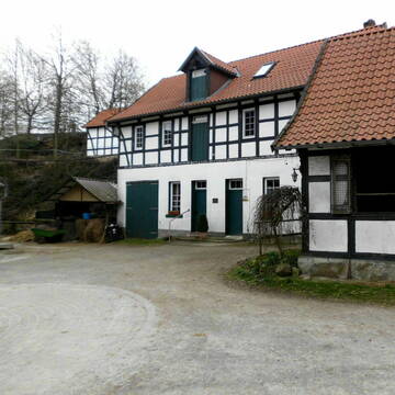
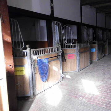
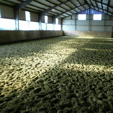
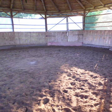
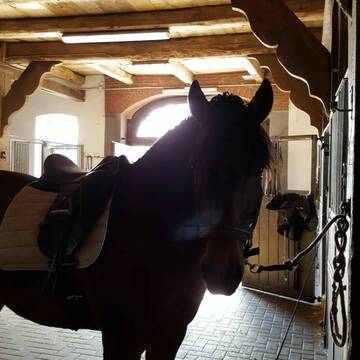
Offenstallplätze mit Paddocktrail
Bramsche
Pferdepension Eggemann
@pferdepension-eggemann
Vermieten
Hunde willkommen
Krankenbox
Allergikerstall
bedampftes/gewaschenes Heu
Offenstall
Paddock Trail
11 weitere...
P
schöne Boxen und jeden Tag Weidegang satt!!!!
Bissendorf
Pferdepension Ellinghaus
@Pferdepension-Ellinghaus1
FN-Mitglied
Freizeitstall
Vermieten
Hunde willkommen
Longierzirkel/Roundpen
Außenbox mit Paddock
Außenboxen
20 weitere...
S
Deprecated: Creation of dynamic property Zend_View_Helper_Ads::$adLink is deprecated in /var/www/stall-frei/htdocs/staging.stall-frei.de/library/Psf/View/Helper/Ads.php on line 108

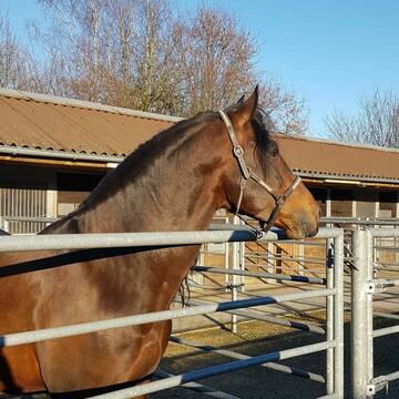
Große, helle Paddockbox Fensterbox Pferdebox frei
Wallenhorst
Stall-Sudowe
@Stall-Sudowe
Du suchst ein neues Zuhause für dein Pferd mit einer großen hellen Pferdebox - am besten mit großzügigem Paddock - und dem ru
neu
R
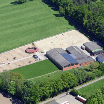


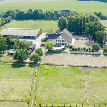
Idyllische Reitanlage in Ostercappeln
Ostercappeln
Melissa Glaap
@MelissaGlaap
Vermieten
Führanlage
Hunde willkommen
Außenbox mit Paddock
Innenbox
Vollpension
10 weitere...
P+

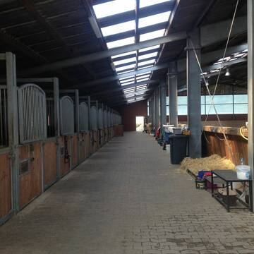
Siemeshof- Zentrum für klassische Reitkunst NRW
Lotte
Siemeshof
@Siemeshof
Freizeitstall
Pferdeausbildung
Vermieten
Führanlage
Hunde willkommen
Allergikerstall
Gnadenbrothof
28 weitere...
P+

Große, helle Paddockbox Fensterbox Pferdebox fr...
Wallenhorst
Stall-Sudowe
@Stall-Sudowe
FN-Mitglied
Freizeitstall
Vermieten
Verpachten
Führanlage
Longierzirkel/Roundpen
Allergikerstall
Fohlenaufzucht möglich
31 weitere...
aktuell
P

Pferdehof Rottmann in Venne
Ostercappeln
Pferdehof Rottmann
@Pferdehof-Rottmann
Pferdeausbildung
Reitlehrer und -unterricht
Vermieten
Longierzirkel/Roundpen
Paddock
Allergikerstall
Hufrehe geeignet
16 weitere...
P
Leider kein Vorschaubild
Leider kein Vorschaubild
1 große Kleinpferde/Ponybox in Vollpension frei
Wallenhorst
Nicole Dahlitz
@Dahlitz
Pferdeausbildung
Reitlehrer und -unterricht
Vermieten
Hunde willkommen
Longierzirkel/Roundpen
Außenbox mit Paddock
Außenboxen
14 weitere...
B
Leider kein Vorschaubild
Leider kein Vorschaubild
Offenstallplätze und Ponnybox
Wallenhorst
Pferdepension Hof Kollenberg
@Ph.K.
Geländestrecke
Longierzirkel/Roundpen
Paddock
Innenbox
Offenstall
Vollpension
9 weitere...
B
Leider kein Vorschaubild
Leider kein Vorschaubild
Aktivstall/Bewegungsstall
Wallenhorst
Pferdepension Hof Kollenberg
@Ph.K.
Freizeitstall
Geländestrecke
Vermieten
Hunde willkommen
Longierzirkel/Roundpen
Bewegungsstall
Paddock Trail
14 weitere...
B
Leider kein Vorschaubild
Leider kein Vorschaubild
Pferdebox Frei
Bramsche
Ubbing
@Ubbing
Freizeitstall
Pferdeausbildung
Vermieten
Hunde willkommen
Paddock
Hengsthaltung möglich
Hufrehe geeignet
14 weitere...
B
Deprecated: Creation of dynamic property Zend_View::$pageCount is deprecated in /var/www/stall-frei/htdocs/staging.stall-frei.de/library/vendor/shardj/zf1-future/library/Zend/View/Abstract.php on line 308
Deprecated: Creation of dynamic property Zend_View::$itemCountPerPage is deprecated in /var/www/stall-frei/htdocs/staging.stall-frei.de/library/vendor/shardj/zf1-future/library/Zend/View/Abstract.php on line 308
Deprecated: Creation of dynamic property Zend_View::$first is deprecated in /var/www/stall-frei/htdocs/staging.stall-frei.de/library/vendor/shardj/zf1-future/library/Zend/View/Abstract.php on line 308
Deprecated: Creation of dynamic property Zend_View::$current is deprecated in /var/www/stall-frei/htdocs/staging.stall-frei.de/library/vendor/shardj/zf1-future/library/Zend/View/Abstract.php on line 308
Deprecated: Creation of dynamic property Zend_View::$last is deprecated in /var/www/stall-frei/htdocs/staging.stall-frei.de/library/vendor/shardj/zf1-future/library/Zend/View/Abstract.php on line 308
Deprecated: Creation of dynamic property Zend_View::$next is deprecated in /var/www/stall-frei/htdocs/staging.stall-frei.de/library/vendor/shardj/zf1-future/library/Zend/View/Abstract.php on line 308
Deprecated: Creation of dynamic property Zend_View::$pagesInRange is deprecated in /var/www/stall-frei/htdocs/staging.stall-frei.de/library/vendor/shardj/zf1-future/library/Zend/View/Abstract.php on line 308
Deprecated: Creation of dynamic property Zend_View::$firstPageInRange is deprecated in /var/www/stall-frei/htdocs/staging.stall-frei.de/library/vendor/shardj/zf1-future/library/Zend/View/Abstract.php on line 308
Deprecated: Creation of dynamic property Zend_View::$lastPageInRange is deprecated in /var/www/stall-frei/htdocs/staging.stall-frei.de/library/vendor/shardj/zf1-future/library/Zend/View/Abstract.php on line 308
Deprecated: Creation of dynamic property Zend_View::$currentItemCount is deprecated in /var/www/stall-frei/htdocs/staging.stall-frei.de/library/vendor/shardj/zf1-future/library/Zend/View/Abstract.php on line 308
Deprecated: Creation of dynamic property Zend_View::$totalItemCount is deprecated in /var/www/stall-frei/htdocs/staging.stall-frei.de/library/vendor/shardj/zf1-future/library/Zend/View/Abstract.php on line 308
Deprecated: Creation of dynamic property Zend_View::$firstItemNumber is deprecated in /var/www/stall-frei/htdocs/staging.stall-frei.de/library/vendor/shardj/zf1-future/library/Zend/View/Abstract.php on line 308
Deprecated: Creation of dynamic property Zend_View::$lastItemNumber is deprecated in /var/www/stall-frei/htdocs/staging.stall-frei.de/library/vendor/shardj/zf1-future/library/Zend/View/Abstract.php on line 308
Deprecated: Creation of dynamic property Zend_View::$router is deprecated in /var/www/stall-frei/htdocs/staging.stall-frei.de/library/vendor/shardj/zf1-future/library/Zend/View/Abstract.php on line 308
Deprecated: Creation of dynamic property Zend_View::$urlParams is deprecated in /var/www/stall-frei/htdocs/staging.stall-frei.de/library/vendor/shardj/zf1-future/library/Zend/View/Abstract.php on line 308
Deprecated: Creation of dynamic property Zend_View::$showAds is deprecated in /var/www/stall-frei/htdocs/staging.stall-frei.de/library/vendor/shardj/zf1-future/library/Zend/View/Abstract.php on line 308
Deprecated: Creation of dynamic property Zend_View::$objectIds is deprecated in /var/www/stall-frei/htdocs/staging.stall-frei.de/library/vendor/shardj/zf1-future/library/Zend/View/Abstract.php on line 308
Deprecated: Creation of dynamic property Zend_View::$showNavbar is deprecated in /var/www/stall-frei/htdocs/staging.stall-frei.de/library/vendor/shardj/zf1-future/library/Zend/View/Abstract.php on line 308
Deprecated: Creation of dynamic property Zend_View::$showBreadcrumb is deprecated in /var/www/stall-frei/htdocs/staging.stall-frei.de/library/vendor/shardj/zf1-future/library/Zend/View/Abstract.php on line 308
Deprecated: Creation of dynamic property Zend_View::$showFooter is deprecated in /var/www/stall-frei/htdocs/staging.stall-frei.de/library/vendor/shardj/zf1-future/library/Zend/View/Abstract.php on line 308
Deprecated: Creation of dynamic property Zend_View::$showInternalAds is deprecated in /var/www/stall-frei/htdocs/staging.stall-frei.de/library/vendor/shardj/zf1-future/library/Zend/View/Abstract.php on line 308
Deprecated: Creation of dynamic property Zend_View::$blNoContent is deprecated in /var/www/stall-frei/htdocs/staging.stall-frei.de/library/vendor/shardj/zf1-future/library/Zend/View/Abstract.php on line 308
Deprecated: Creation of dynamic property Zend_View::$sMetaDesc is deprecated in /var/www/stall-frei/htdocs/staging.stall-frei.de/library/vendor/shardj/zf1-future/library/Zend/View/Abstract.php on line 308
Deprecated: Creation of dynamic property Zend_View::$useGmaps is deprecated in /var/www/stall-frei/htdocs/staging.stall-frei.de/library/vendor/shardj/zf1-future/library/Zend/View/Abstract.php on line 308
Deprecated: Creation of dynamic property Zend_View::$touches is deprecated in /var/www/stall-frei/htdocs/staging.stall-frei.de/library/vendor/shardj/zf1-future/library/Zend/View/Abstract.php on line 308
Deprecated: Creation of dynamic property Zend_View::$oProject is deprecated in /var/www/stall-frei/htdocs/staging.stall-frei.de/library/vendor/shardj/zf1-future/library/Zend/View/Abstract.php on line 308
Deprecated: Creation of dynamic property Zend_View::$pageHeadline is deprecated in /var/www/stall-frei/htdocs/staging.stall-frei.de/library/vendor/shardj/zf1-future/library/Zend/View/Abstract.php on line 308
Deprecated: Creation of dynamic property Zend_View::$disableLocationField is deprecated in /var/www/stall-frei/htdocs/staging.stall-frei.de/library/vendor/shardj/zf1-future/library/Zend/View/Abstract.php on line 308
Deprecated: Creation of dynamic property Zend_View::$isSearch is deprecated in /var/www/stall-frei/htdocs/staging.stall-frei.de/library/vendor/shardj/zf1-future/library/Zend/View/Abstract.php on line 308
Deprecated: Creation of dynamic property Zend_View::$pageTitle is deprecated in /var/www/stall-frei/htdocs/staging.stall-frei.de/library/vendor/shardj/zf1-future/library/Zend/View/Abstract.php on line 308
Deprecated: Creation of dynamic property Psf_Form_Element_Text::$class is deprecated in /var/www/stall-frei/htdocs/staging.stall-frei.de/library/vendor/shardj/zf1-future/library/Zend/Form/Element.php on line 874
Deprecated: Creation of dynamic property Psf_Form_Element_Text::$size is deprecated in /var/www/stall-frei/htdocs/staging.stall-frei.de/library/vendor/shardj/zf1-future/library/Zend/Form/Element.php on line 874
Deprecated: Creation of dynamic property Psf_Form_Element_Text::$placeholder is deprecated in /var/www/stall-frei/htdocs/staging.stall-frei.de/library/vendor/shardj/zf1-future/library/Zend/Form/Element.php on line 874
Deprecated: Creation of dynamic property Psf_Form_Element_Hidden::$class is deprecated in /var/www/stall-frei/htdocs/staging.stall-frei.de/library/vendor/shardj/zf1-future/library/Zend/Form/Element.php on line 874
Deprecated: Creation of dynamic property Psf_Form_Element_Hidden::$class is deprecated in /var/www/stall-frei/htdocs/staging.stall-frei.de/library/vendor/shardj/zf1-future/library/Zend/Form/Element.php on line 874
Deprecated: Creation of dynamic property Psf_Form_Element_Hidden::$class is deprecated in /var/www/stall-frei/htdocs/staging.stall-frei.de/library/vendor/shardj/zf1-future/library/Zend/Form/Element.php on line 874
Deprecated: Creation of dynamic property Psf_Form_Element_Hidden::$class is deprecated in /var/www/stall-frei/htdocs/staging.stall-frei.de/library/vendor/shardj/zf1-future/library/Zend/Form/Element.php on line 874
Deprecated: Creation of dynamic property Psf_Form_Element_Select::$class is deprecated in /var/www/stall-frei/htdocs/staging.stall-frei.de/library/vendor/shardj/zf1-future/library/Zend/Form/Element.php on line 874
Deprecated: Creation of dynamic property Psf_Form_Element_Select::$class is deprecated in /var/www/stall-frei/htdocs/staging.stall-frei.de/library/vendor/shardj/zf1-future/library/Zend/Form/Element.php on line 874
Deprecated: Creation of dynamic property Psf_Form_Element_Select::$class is deprecated in /var/www/stall-frei/htdocs/staging.stall-frei.de/library/vendor/shardj/zf1-future/library/Zend/Form/Element.php on line 874
Deprecated: Creation of dynamic property Psf_Form_Element_Select::$class is deprecated in /var/www/stall-frei/htdocs/staging.stall-frei.de/library/vendor/shardj/zf1-future/library/Zend/Form/Element.php on line 874
Deprecated: Creation of dynamic property Psf_Form_Element_Text::$class is deprecated in /var/www/stall-frei/htdocs/staging.stall-frei.de/library/vendor/shardj/zf1-future/library/Zend/Form/Element.php on line 874
Deprecated: Creation of dynamic property Psf_Form_Element_Checkbox::$label is deprecated in /var/www/stall-frei/htdocs/staging.stall-frei.de/library/vendor/shardj/zf1-future/library/Zend/Form/Element.php on line 874
Deprecated: Creation of dynamic property Zend_View::$sort is deprecated in /var/www/stall-frei/htdocs/staging.stall-frei.de/library/vendor/shardj/zf1-future/library/Zend/View/Abstract.php on line 308
Deprecated: Creation of dynamic property Zend_View::$searchLocation is deprecated in /var/www/stall-frei/htdocs/staging.stall-frei.de/library/vendor/shardj/zf1-future/library/Zend/View/Abstract.php on line 308
Deprecated: Creation of dynamic property Zend_View::$locationHint is deprecated in /var/www/stall-frei/htdocs/staging.stall-frei.de/library/vendor/shardj/zf1-future/library/Zend/View/Abstract.php on line 308
Psf_GeoCoder_Abstract::getLocation: Bramsche Get Location CachedOrLive
Psf_GeoCoder_Abstract::getCachedOrLive: Bramsche
Psf_GeoCoder_OpenCageData::makeApiRequest: response:
Array
(
[documentation] => https://opencagedata.com/api
[licenses] => Array
(
[0] => Array
(
[name] => see attribution guide
[url] => https://opencagedata.com/credits
)
)
[results] => Array
(
[0] => Array
(
[bounds] => Array
(
[northeast] => Array
(
[lat] => 52.481047
[lng] => 8.1587888
)
[southwest] => Array
(
[lat] => 52.3591395
[lng] => 7.8421762
)
)
[components] => Array
(
[ISO_3166-1_alpha-2] => DE
[ISO_3166-1_alpha-3] => DEU
[ISO_3166-2] => Array
(
[0] => DE-NI
)
[_category] => place
[_normalized_city] => Bramsche
[_type] => city
[continent] => Europe
[country] => Deutschland
[country_code] => de
[county] => Landkreis Osnabrück
[political_union] => European Union
[postcode] => 49565
[state] => Niedersachsen
[state_code] => NI
[town] => Bramsche
)
[confidence] => 5
[formatted] => 49565 Bramsche, Deutschland
[geometry] => Array
(
[lat] => 52.4075184
[lng] => 7.9791742
)
)
[1] => Array
(
[bounds] => Array
(
[northeast] => Array
(
[lat] => 52.4780307
[lng] => 7.3866056
)
[southwest] => Array
(
[lat] => 52.4380307
[lng] => 7.3466056
)
)
[components] => Array
(
[ISO_3166-1_alpha-2] => DE
[ISO_3166-1_alpha-3] => DEU
[ISO_3166-2] => Array
(
[0] => DE-NI
)
[_category] => place
[_normalized_city] => Lingen (Ems)
[_type] => village
[continent] => Europe
[country] => Deutschland
[country_code] => de
[county] => Landkreis Emsland
[political_union] => European Union
[postcode] => 49811
[state] => Niedersachsen
[state_code] => NI
[town] => Lingen (Ems)
[village] => Bramsche
)
[confidence] => 7
[formatted] => 49811 Bramsche, Deutschland
[geometry] => Array
(
[lat] => 52.4580307
[lng] => 7.3666056
)
)
[2] => Array
(
[components] => Array
(
[ISO_3166-1_alpha-2] => FR
[ISO_3166-1_alpha-3] => FRA
[ISO_3166-2] => Array
(
[0] => FR-HDF
[1] => FR-59
)
[_category] => road
[_normalized_city] => Téteghem-Coudekerque-Village
[_type] => road
[city] => Téteghem-Coudekerque-Village
[continent] => Europe
[country] => France
[country_code] => fr
[county] => Nord
[local_authority] => Communauté urbaine de Dunkerque
[political_union] => European Union
[postcode] => 59229
[road] => Route de la Branche
[state] => Hauts-de-France
[state_code] => HDF
)
[confidence] => 3
[formatted] => Route de la Branche, 59229 Téteghem-Coudekerque-Village, France
[geometry] => Array
(
[lat] => 51.021748
[lng] => 2.4268
)
)
[3] => Array
(
[components] => Array
(
[ISO_3166-1_alpha-2] => FR
[ISO_3166-1_alpha-3] => FRA
[ISO_3166-2] => Array
(
[0] => FR-HDF
[1] => FR-59
)
[_category] => road
[_normalized_city] => Coudekerque-Branche
[_type] => road
[city] => Coudekerque-Branche
[continent] => Europe
[country] => France
[country_code] => fr
[county] => Nord
[local_authority] => Communauté urbaine de Dunkerque
[political_union] => European Union
[postcode] => 59210
[road] => Route de la Branche
[state] => Hauts-de-France
[state_code] => HDF
)
[confidence] => 3
[formatted] => Route de la Branche, 59210 Coudekerque-Branche, France
[geometry] => Array
(
[lat] => 51.023848
[lng] => 2.416069
)
)
[4] => Array
(
[components] => Array
(
[ISO_3166-1_alpha-2] => FR
[ISO_3166-1_alpha-3] => FRA
[ISO_3166-2] => Array
(
[0] => FR-NAQ
[1] => FR-33
)
[_category] => road
[_normalized_city] => Mérignac
[_type] => road
[city] => Mérignac
[continent] => Europe
[country] => France
[country_code] => fr
[county] => Gironde
[local_authority] => Bordeaux Métropole
[political_union] => European Union
[postcode] => 33700
[road] => Rue de la Branche
[state] => Nouvelle-Aquitaine
[state_code] => NAQ
)
[confidence] => 3
[formatted] => Rue de la Branche, 33700 Mérignac, France
[geometry] => Array
(
[lat] => 44.850569
[lng] => -0.632953
)
)
[5] => Array
(
[components] => Array
(
[ISO_3166-1_alpha-2] => FR
[ISO_3166-1_alpha-3] => FRA
[ISO_3166-2] => Array
(
[0] => FR-ARA
[1] => FR-42
)
[_category] => road
[_normalized_city] => Saint-Appolinard
[_type] => road
[city] => Saint-Appolinard
[continent] => Europe
[country] => France
[country_code] => fr
[county] => Loire
[local_authority] => Communauté de communes du Pilat Rhodanien
[political_union] => European Union
[postcode] => 42520
[road] => Route de la Branche
[state] => Auvergne-Rhône-Alpes
[state_code] => ARA
)
[confidence] => 3
[formatted] => Route de la Branche, 42520 Saint-Appolinard, France
[geometry] => Array
(
[lat] => 45.345092
[lng] => 4.645945
)
)
[6] => Array
(
[components] => Array
(
[ISO_3166-1_alpha-2] => FR
[ISO_3166-1_alpha-3] => FRA
[ISO_3166-2] => Array
(
[0] => FR-GES
[1] => FR-6AE
[2] => FR-68
)
[_category] => road
[_normalized_city] => Mulhouse
[_type] => road
[city] => Mulhouse
[continent] => Europe
[country] => France
[country_code] => fr
[county] => Haut-Rhin
[local_authority] => Mulhouse Alsace Agglomération
[political_union] => European Union
[postcode] => 68100
[road] => Rue de la Branche
[state] => Grand Est
[state_code] => GES
)
[confidence] => 3
[formatted] => Rue de la Branche, 68100 Mulhouse, France
[geometry] => Array
(
[lat] => 47.756116
[lng] => 7.338268
)
)
[7] => Array
(
[components] => Array
(
[ISO_3166-1_alpha-2] => FR
[ISO_3166-1_alpha-3] => FRA
[ISO_3166-2] => Array
(
[0] => FR-ARA
[1] => FR-43
)
[_category] => road
[_normalized_city] => Araules
[_type] => road
[city] => Araules
[continent] => Europe
[country] => France
[country_code] => fr
[county] => Haute-Loire
[local_authority] => Communauté de communes des Sucs
[political_union] => European Union
[postcode] => 43200
[road] => Route de la Branche
[state] => Auvergne-Rhône-Alpes
[state_code] => ARA
)
[confidence] => 3
[formatted] => Route de la Branche, 43200 Araules, France
[geometry] => Array
(
[lat] => 45.042867
[lng] => 4.164247
)
)
[8] => Array
(
[components] => Array
(
[ISO_3166-1_alpha-2] => FR
[ISO_3166-1_alpha-3] => FRA
[ISO_3166-2] => Array
(
[0] => FR-BFC
[1] => FR-71
)
[_category] => road
[_normalized_city] => Saint-Vallier
[_type] => road
[city] => Saint-Vallier
[continent] => Europe
[country] => France
[country_code] => fr
[county] => Saône-et-Loire
[local_authority] => Communauté urbaine Creusot-Montceau
[political_union] => European Union
[postcode] => 71230
[road] => Rue de la Branche
[state] => Bourgogne-Franche-Comté
[state_code] => BFC
)
[confidence] => 3
[formatted] => Rue de la Branche, 71230 Saint-Vallier, France
[geometry] => Array
(
[lat] => 46.646711
[lng] => 4.340887
)
)
[9] => Array
(
[components] => Array
(
[ISO_3166-1_alpha-2] => FR
[ISO_3166-1_alpha-3] => FRA
[ISO_3166-2] => Array
(
[0] => FR-ARA
[1] => FR-74
)
[_category] => road
[_normalized_city] => Vulbens
[_type] => road
[city] => Vulbens
[continent] => Europe
[country] => France
[country_code] => fr
[county] => Haute-Savoie
[local_authority] => Communauté de communes du Genevois
[political_union] => European Union
[postcode] => 74520
[road] => Chemin de la branche
[state] => Auvergne-Rhône-Alpes
[state_code] => ARA
)
[confidence] => 3
[formatted] => Chemin de la branche, 74520 Vulbens, France
[geometry] => Array
(
[lat] => 46.099493
[lng] => 5.929459
)
)
)
[status] => Array
(
[code] => 200
[message] => OK
)
[stay_informed] => Array
(
[blog] => https://blog.opencagedata.com
[mastodon] => https://en.osm.town/@opencage
)
[thanks] => For using an OpenCage API
[timestamp] => Array
(
[created_http] => Fri, 06 Feb 2026 17:59:50 GMT
[created_unix] => 1770400790
)
[total_results] => 10
)
Psf_GeoCoder_Abstract::convertLocationResult
{"documentation":"https:\/\/opencagedata.com\/api","licenses":[{"name":"see attribution guide","url":"https:\/\/opencagedata.com\/credits"}],"results":[{"bounds":{"northeast":{"lat":52.481047,"lng":8.1587888},"southwest":{"lat":52.3591395,"lng":7.8421762}},"components":{"ISO_3166-1_alpha-2":"DE","ISO_3166-1_alpha-3":"DEU","ISO_3166-2":["DE-NI"],"_category":"place","_normalized_city":"Bramsche","_type":"city","continent":"Europe","country":"Deutschland","country_code":"de","county":"Landkreis Osnabr\u00fcck","political_union":"European Union","postcode":"49565","state":"Niedersachsen","state_code":"NI","town":"Bramsche"},"confidence":5,"formatted":"49565 Bramsche, Deutschland","geometry":{"lat":52.4075184,"lng":7.9791742}},{"bounds":{"northeast":{"lat":52.4780307,"lng":7.3866056},"southwest":{"lat":52.4380307,"lng":7.3466056}},"components":{"ISO_3166-1_alpha-2":"DE","ISO_3166-1_alpha-3":"DEU","ISO_3166-2":["DE-NI"],"_category":"place","_normalized_city":"Lingen (Ems)","_type":"village","continent":"Europe","country":"Deutschland","country_code":"de","county":"Landkreis Emsland","political_union":"European Union","postcode":"49811","state":"Niedersachsen","state_code":"NI","town":"Lingen (Ems)","village":"Bramsche"},"confidence":7,"formatted":"49811 Bramsche, Deutschland","geometry":{"lat":52.4580307,"lng":7.3666056}},{"components":{"ISO_3166-1_alpha-2":"FR","ISO_3166-1_alpha-3":"FRA","ISO_3166-2":["FR-HDF","FR-59"],"_category":"road","_normalized_city":"T\u00e9teghem-Coudekerque-Village","_type":"road","city":"T\u00e9teghem-Coudekerque-Village","continent":"Europe","country":"France","country_code":"fr","county":"Nord","local_authority":"Communaut\u00e9 urbaine de Dunkerque","political_union":"European Union","postcode":"59229","road":"Route de la Branche","state":"Hauts-de-France","state_code":"HDF"},"confidence":3,"formatted":"Route de la Branche, 59229 T\u00e9teghem-Coudekerque-Village, France","geometry":{"lat":51.021748,"lng":2.4268}},{"components":{"ISO_3166-1_alpha-2":"FR","ISO_3166-1_alpha-3":"FRA","ISO_3166-2":["FR-HDF","FR-59"],"_category":"road","_normalized_city":"Coudekerque-Branche","_type":"road","city":"Coudekerque-Branche","continent":"Europe","country":"France","country_code":"fr","county":"Nord","local_authority":"Communaut\u00e9 urbaine de Dunkerque","political_union":"European Union","postcode":"59210","road":"Route de la Branche","state":"Hauts-de-France","state_code":"HDF"},"confidence":3,"formatted":"Route de la Branche, 59210 Coudekerque-Branche, France","geometry":{"lat":51.023848,"lng":2.416069}},{"components":{"ISO_3166-1_alpha-2":"FR","ISO_3166-1_alpha-3":"FRA","ISO_3166-2":["FR-NAQ","FR-33"],"_category":"road","_normalized_city":"M\u00e9rignac","_type":"road","city":"M\u00e9rignac","continent":"Europe","country":"France","country_code":"fr","county":"Gironde","local_authority":"Bordeaux M\u00e9tropole","political_union":"European Union","postcode":"33700","road":"Rue de la Branche","state":"Nouvelle-Aquitaine","state_code":"NAQ"},"confidence":3,"formatted":"Rue de la Branche, 33700 M\u00e9rignac, France","geometry":{"lat":44.850569,"lng":-0.632953}},{"components":{"ISO_3166-1_alpha-2":"FR","ISO_3166-1_alpha-3":"FRA","ISO_3166-2":["FR-ARA","FR-42"],"_category":"road","_normalized_city":"Saint-Appolinard","_type":"road","city":"Saint-Appolinard","continent":"Europe","country":"France","country_code":"fr","county":"Loire","local_authority":"Communaut\u00e9 de communes du Pilat Rhodanien","political_union":"European Union","postcode":"42520","road":"Route de la Branche","state":"Auvergne-Rh\u00f4ne-Alpes","state_code":"ARA"},"confidence":3,"formatted":"Route de la Branche, 42520 Saint-Appolinard, France","geometry":{"lat":45.345092,"lng":4.645945}},{"components":{"ISO_3166-1_alpha-2":"FR","ISO_3166-1_alpha-3":"FRA","ISO_3166-2":["FR-GES","FR-6AE","FR-68"],"_category":"road","_normalized_city":"Mulhouse","_type":"road","city":"Mulhouse","continent":"Europe","country":"France","country_code":"fr","county":"Haut-Rhin","local_authority":"Mulhouse Alsace Agglom\u00e9ration","political_union":"European Union","postcode":"68100","road":"Rue de la Branche","state":"Grand Est","state_code":"GES"},"confidence":3,"formatted":"Rue de la Branche, 68100 Mulhouse, France","geometry":{"lat":47.756116,"lng":7.338268}},{"components":{"ISO_3166-1_alpha-2":"FR","ISO_3166-1_alpha-3":"FRA","ISO_3166-2":["FR-ARA","FR-43"],"_category":"road","_normalized_city":"Araules","_type":"road","city":"Araules","continent":"Europe","country":"France","country_code":"fr","county":"Haute-Loire","local_authority":"Communaut\u00e9 de communes des Sucs","political_union":"European Union","postcode":"43200","road":"Route de la Branche","state":"Auvergne-Rh\u00f4ne-Alpes","state_code":"ARA"},"confidence":3,"formatted":"Route de la Branche, 43200 Araules, France","geometry":{"lat":45.042867,"lng":4.164247}},{"components":{"ISO_3166-1_alpha-2":"FR","ISO_3166-1_alpha-3":"FRA","ISO_3166-2":["FR-BFC","FR-71"],"_category":"road","_normalized_city":"Saint-Vallier","_type":"road","city":"Saint-Vallier","continent":"Europe","country":"France","country_code":"fr","county":"Sa\u00f4ne-et-Loire","local_authority":"Communaut\u00e9 urbaine Creusot-Montceau","political_union":"European Union","postcode":"71230","road":"Rue de la Branche","state":"Bourgogne-Franche-Comt\u00e9","state_code":"BFC"},"confidence":3,"formatted":"Rue de la Branche, 71230 Saint-Vallier, France","geometry":{"lat":46.646711,"lng":4.340887}},{"components":{"ISO_3166-1_alpha-2":"FR","ISO_3166-1_alpha-3":"FRA","ISO_3166-2":["FR-ARA","FR-74"],"_category":"road","_normalized_city":"Vulbens","_type":"road","city":"Vulbens","continent":"Europe","country":"France","country_code":"fr","county":"Haute-Savoie","local_authority":"Communaut\u00e9 de communes du Genevois","political_union":"European Union","postcode":"74520","road":"Chemin de la branche","state":"Auvergne-Rh\u00f4ne-Alpes","state_code":"ARA"},"confidence":3,"formatted":"Chemin de la branche, 74520 Vulbens, France","geometry":{"lat":46.099493,"lng":5.929459}}],"status":{"code":200,"message":"OK"},"stay_informed":{"blog":"https:\/\/blog.opencagedata.com","mastodon":"https:\/\/en.osm.town\/@opencage"},"thanks":"For using an OpenCage API","timestamp":{"created_http":"Fri, 06 Feb 2026 17:59:50 GMT","created_unix":1770400790},"total_results":10}Array
(
[0] => stdClass Object
(
[bounds] => stdClass Object
(
[northeast] => stdClass Object
(
[lat] => 52.481047
[lng] => 8.1587888
)
[southwest] => stdClass Object
(
[lat] => 52.3591395
[lng] => 7.8421762
)
)
[components] => stdClass Object
(
[ISO_3166-1_alpha-2] => DE
[ISO_3166-1_alpha-3] => DEU
[ISO_3166-2] => Array
(
[0] => DE-NI
)
[_category] => place
[_normalized_city] => Bramsche
[_type] => city
[continent] => Europe
[country] => Deutschland
[country_code] => de
[county] => Landkreis Osnabrück
[political_union] => European Union
[postcode] => 49565
[state] => Niedersachsen
[state_code] => NI
[town] => Bramsche
)
[confidence] => 5
[formatted] => 49565 Bramsche, Deutschland
[geometry] => stdClass Object
(
[lat] => 52.4075184
[lng] => 7.9791742
)
)
[1] => stdClass Object
(
[bounds] => stdClass Object
(
[northeast] => stdClass Object
(
[lat] => 52.4780307
[lng] => 7.3866056
)
[southwest] => stdClass Object
(
[lat] => 52.4380307
[lng] => 7.3466056
)
)
[components] => stdClass Object
(
[ISO_3166-1_alpha-2] => DE
[ISO_3166-1_alpha-3] => DEU
[ISO_3166-2] => Array
(
[0] => DE-NI
)
[_category] => place
[_normalized_city] => Lingen (Ems)
[_type] => village
[continent] => Europe
[country] => Deutschland
[country_code] => de
[county] => Landkreis Emsland
[political_union] => European Union
[postcode] => 49811
[state] => Niedersachsen
[state_code] => NI
[town] => Lingen (Ems)
[village] => Bramsche
)
[confidence] => 7
[formatted] => 49811 Bramsche, Deutschland
[geometry] => stdClass Object
(
[lat] => 52.4580307
[lng] => 7.3666056
)
)
[2] => stdClass Object
(
[components] => stdClass Object
(
[ISO_3166-1_alpha-2] => FR
[ISO_3166-1_alpha-3] => FRA
[ISO_3166-2] => Array
(
[0] => FR-HDF
[1] => FR-59
)
[_category] => road
[_normalized_city] => Téteghem-Coudekerque-Village
[_type] => road
[city] => Téteghem-Coudekerque-Village
[continent] => Europe
[country] => France
[country_code] => fr
[county] => Nord
[local_authority] => Communauté urbaine de Dunkerque
[political_union] => European Union
[postcode] => 59229
[road] => Route de la Branche
[state] => Hauts-de-France
[state_code] => HDF
)
[confidence] => 3
[formatted] => Route de la Branche, 59229 Téteghem-Coudekerque-Village, France
[geometry] => stdClass Object
(
[lat] => 51.021748
[lng] => 2.4268
)
)
[3] => stdClass Object
(
[components] => stdClass Object
(
[ISO_3166-1_alpha-2] => FR
[ISO_3166-1_alpha-3] => FRA
[ISO_3166-2] => Array
(
[0] => FR-HDF
[1] => FR-59
)
[_category] => road
[_normalized_city] => Coudekerque-Branche
[_type] => road
[city] => Coudekerque-Branche
[continent] => Europe
[country] => France
[country_code] => fr
[county] => Nord
[local_authority] => Communauté urbaine de Dunkerque
[political_union] => European Union
[postcode] => 59210
[road] => Route de la Branche
[state] => Hauts-de-France
[state_code] => HDF
)
[confidence] => 3
[formatted] => Route de la Branche, 59210 Coudekerque-Branche, France
[geometry] => stdClass Object
(
[lat] => 51.023848
[lng] => 2.416069
)
)
[4] => stdClass Object
(
[components] => stdClass Object
(
[ISO_3166-1_alpha-2] => FR
[ISO_3166-1_alpha-3] => FRA
[ISO_3166-2] => Array
(
[0] => FR-NAQ
[1] => FR-33
)
[_category] => road
[_normalized_city] => Mérignac
[_type] => road
[city] => Mérignac
[continent] => Europe
[country] => France
[country_code] => fr
[county] => Gironde
[local_authority] => Bordeaux Métropole
[political_union] => European Union
[postcode] => 33700
[road] => Rue de la Branche
[state] => Nouvelle-Aquitaine
[state_code] => NAQ
)
[confidence] => 3
[formatted] => Rue de la Branche, 33700 Mérignac, France
[geometry] => stdClass Object
(
[lat] => 44.850569
[lng] => -0.632953
)
)
[5] => stdClass Object
(
[components] => stdClass Object
(
[ISO_3166-1_alpha-2] => FR
[ISO_3166-1_alpha-3] => FRA
[ISO_3166-2] => Array
(
[0] => FR-ARA
[1] => FR-42
)
[_category] => road
[_normalized_city] => Saint-Appolinard
[_type] => road
[city] => Saint-Appolinard
[continent] => Europe
[country] => France
[country_code] => fr
[county] => Loire
[local_authority] => Communauté de communes du Pilat Rhodanien
[political_union] => European Union
[postcode] => 42520
[road] => Route de la Branche
[state] => Auvergne-Rhône-Alpes
[state_code] => ARA
)
[confidence] => 3
[formatted] => Route de la Branche, 42520 Saint-Appolinard, France
[geometry] => stdClass Object
(
[lat] => 45.345092
[lng] => 4.645945
)
)
[6] => stdClass Object
(
[components] => stdClass Object
(
[ISO_3166-1_alpha-2] => FR
[ISO_3166-1_alpha-3] => FRA
[ISO_3166-2] => Array
(
[0] => FR-GES
[1] => FR-6AE
[2] => FR-68
)
[_category] => road
[_normalized_city] => Mulhouse
[_type] => road
[city] => Mulhouse
[continent] => Europe
[country] => France
[country_code] => fr
[county] => Haut-Rhin
[local_authority] => Mulhouse Alsace Agglomération
[political_union] => European Union
[postcode] => 68100
[road] => Rue de la Branche
[state] => Grand Est
[state_code] => GES
)
[confidence] => 3
[formatted] => Rue de la Branche, 68100 Mulhouse, France
[geometry] => stdClass Object
(
[lat] => 47.756116
[lng] => 7.338268
)
)
[7] => stdClass Object
(
[components] => stdClass Object
(
[ISO_3166-1_alpha-2] => FR
[ISO_3166-1_alpha-3] => FRA
[ISO_3166-2] => Array
(
[0] => FR-ARA
[1] => FR-43
)
[_category] => road
[_normalized_city] => Araules
[_type] => road
[city] => Araules
[continent] => Europe
[country] => France
[country_code] => fr
[county] => Haute-Loire
[local_authority] => Communauté de communes des Sucs
[political_union] => European Union
[postcode] => 43200
[road] => Route de la Branche
[state] => Auvergne-Rhône-Alpes
[state_code] => ARA
)
[confidence] => 3
[formatted] => Route de la Branche, 43200 Araules, France
[geometry] => stdClass Object
(
[lat] => 45.042867
[lng] => 4.164247
)
)
[8] => stdClass Object
(
[components] => stdClass Object
(
[ISO_3166-1_alpha-2] => FR
[ISO_3166-1_alpha-3] => FRA
[ISO_3166-2] => Array
(
[0] => FR-BFC
[1] => FR-71
)
[_category] => road
[_normalized_city] => Saint-Vallier
[_type] => road
[city] => Saint-Vallier
[continent] => Europe
[country] => France
[country_code] => fr
[county] => Saône-et-Loire
[local_authority] => Communauté urbaine Creusot-Montceau
[political_union] => European Union
[postcode] => 71230
[road] => Rue de la Branche
[state] => Bourgogne-Franche-Comté
[state_code] => BFC
)
[confidence] => 3
[formatted] => Rue de la Branche, 71230 Saint-Vallier, France
[geometry] => stdClass Object
(
[lat] => 46.646711
[lng] => 4.340887
)
)
[9] => stdClass Object
(
[components] => stdClass Object
(
[ISO_3166-1_alpha-2] => FR
[ISO_3166-1_alpha-3] => FRA
[ISO_3166-2] => Array
(
[0] => FR-ARA
[1] => FR-74
)
[_category] => road
[_normalized_city] => Vulbens
[_type] => road
[city] => Vulbens
[continent] => Europe
[country] => France
[country_code] => fr
[county] => Haute-Savoie
[local_authority] => Communauté de communes du Genevois
[political_union] => European Union
[postcode] => 74520
[road] => Chemin de la branche
[state] => Auvergne-Rhône-Alpes
[state_code] => ARA
)
[confidence] => 3
[formatted] => Chemin de la branche, 74520 Vulbens, France
[geometry] => stdClass Object
(
[lat] => 46.099493
[lng] => 5.929459
)
)
)
Psf_GeoCoder_OpenCageData::getKeyMap: 0
stdClass Object
(
    [bounds] => stdClass Object
        (
            [northeast] => stdClass Object
                (
                    [lat] => 52.481047
                    [lng] => 8.1587888
                )

            [southwest] => stdClass Object
                (
                    [lat] => 52.3591395
                    [lng] => 7.8421762
                )

        )

    [components] => stdClass Object
        (
            [ISO_3166-1_alpha-2] => DE
            [ISO_3166-1_alpha-3] => DEU
            [ISO_3166-2] => Array
                (
                    [0] => DE-NI
                )

            [_category] => place
            [_normalized_city] => Bramsche
            [_type] => city
            [continent] => Europe
            [country] => Deutschland
            [country_code] => de
            [county] => Landkreis Osnabrück
            [political_union] => European Union
            [postcode] => 49565
            [state] => Niedersachsen
            [state_code] => NI
            [town] => Bramsche
        )

    [confidence] => 5
    [formatted] => 49565 Bramsche, Deutschland
    [geometry] => stdClass Object
        (
            [lat] => 52.4075184
            [lng] => 7.9791742
        )

)
Psf_GeoCoder_OpenCageData::getCounty: Osnabrück
Psf_GeoCoder_OpenCageData::addMissingData REFETCH!
Array
(
    [address] => 49565 Bramsche, Deutschland
    [type] => city
    [street] =>
    [city] => Bramsche
    [county] => Osnabrück
    [state] => Niedersachsen
    [zip] => 49565
    [country] => Deutschland
    [suburb] =>
    [countrycode] => de
    [latitude] => 52.4075184
    [longitude] => 7.9791742
    [accuracy] => 1
    [confidence] => 5
    [bounds] => stdClass Object
        (
            [northeast] => stdClass Object
                (
                    [lat] => 52.481047
                    [lng] => 8.1587888
                )

            [southwest] => stdClass Object
                (
                    [lat] => 52.3591395
                    [lng] => 7.8421762
                )

        )

)
reformat!
Array
(
    [address] => 49565 Bramsche, Deutschland
    [type] => city
    [street] =>
    [city] => Bramsche
    [county] => Osnabrück
    [state] => Niedersachsen
    [zip] => 49565
    [country] => Deutschland
    [suburb] =>
    [countrycode] => de
    [latitude] => 52.4075184
    [longitude] => 7.9791742
    [accuracy] => 1
    [confidence] => 5
    [bounds] => stdClass Object
        (
            [northeast] => stdClass Object
                (
                    [lat] => 52.481047
                    [lng] => 8.1587888
                )

            [southwest] => stdClass Object
                (
                    [lat] => 52.3591395
                    [lng] => 7.8421762
                )

        )

    [place] => 49565 Bramsche, Niedersachsen
    [hash] => 52fd54fc2f6e5a6cfa880701efea18b6
)
Psf_GeoCoder_OpenCageData::getKeyMap: 1
stdClass Object
(
    [bounds] => stdClass Object
        (
            [northeast] => stdClass Object
                (
                    [lat] => 52.4780307
                    [lng] => 7.3866056
                )

            [southwest] => stdClass Object
                (
                    [lat] => 52.4380307
                    [lng] => 7.3466056
                )

        )

    [components] => stdClass Object
        (
            [ISO_3166-1_alpha-2] => DE
            [ISO_3166-1_alpha-3] => DEU
            [ISO_3166-2] => Array
                (
                    [0] => DE-NI
                )

            [_category] => place
            [_normalized_city] => Lingen (Ems)
            [_type] => village
            [continent] => Europe
            [country] => Deutschland
            [country_code] => de
            [county] => Landkreis Emsland
            [political_union] => European Union
            [postcode] => 49811
            [state] => Niedersachsen
            [state_code] => NI
            [town] => Lingen (Ems)
            [village] => Bramsche
        )

    [confidence] => 7
    [formatted] => 49811 Bramsche, Deutschland
    [geometry] => stdClass Object
        (
            [lat] => 52.4580307
            [lng] => 7.3666056
        )

)
Psf_GeoCoder_OpenCageData::getCounty: Emsland
Psf_GeoCoder_OpenCageData::addMissingData REFETCH!
Array
(
    [address] => 49811 Bramsche, Deutschland
    [type] => village
    [street] =>
    [city] => Lingen (Ems)
    [county] => Emsland
    [state] => Niedersachsen
    [zip] => 49811
    [country] => Deutschland
    [suburb] =>
    [countrycode] => de
    [latitude] => 52.4580307
    [longitude] => 7.3666056
    [accuracy] => 1
    [confidence] => 7
    [bounds] => stdClass Object
        (
            [northeast] => stdClass Object
                (
                    [lat] => 52.4780307
                    [lng] => 7.3866056
                )

            [southwest] => stdClass Object
                (
                    [lat] => 52.4380307
                    [lng] => 7.3466056
                )

        )

)
reformat!
Array
(
    [address] => 49811 Lingen (Ems)
    [type] => village
    [street] =>
    [city] => Lingen (Ems)
    [county] => Emsland
    [state] => Niedersachsen
    [zip] => 49811
    [country] => Deutschland
    [suburb] =>
    [countrycode] => de
    [latitude] => 52.4580307
    [longitude] => 7.3666056
    [accuracy] => 1
    [confidence] => 7
    [bounds] => stdClass Object
        (
            [northeast] => stdClass Object
                (
                    [lat] => 52.4780307
                    [lng] => 7.3866056
                )

            [southwest] => stdClass Object
                (
                    [lat] => 52.4380307
                    [lng] => 7.3466056
                )

        )

    [place] => 49811 Lingen (Ems), Niedersachsen
    [hash] => 53112458f179960c65a445c3f1b3e9b7
)
Psf_GeoCoder_OpenCageData::getKeyMap: 2
stdClass Object
(
    [components] => stdClass Object
        (
            [ISO_3166-1_alpha-2] => FR
            [ISO_3166-1_alpha-3] => FRA
            [ISO_3166-2] => Array
                (
                    [0] => FR-HDF
                    [1] => FR-59
                )

            [_category] => road
            [_normalized_city] => Téteghem-Coudekerque-Village
            [_type] => road
            [city] => Téteghem-Coudekerque-Village
            [continent] => Europe
            [country] => France
            [country_code] => fr
            [county] => Nord
            [local_authority] => Communauté urbaine de Dunkerque
            [political_union] => European Union
            [postcode] => 59229
            [road] => Route de la Branche
            [state] => Hauts-de-France
            [state_code] => HDF
        )

    [confidence] => 3
    [formatted] => Route de la Branche, 59229 Téteghem-Coudekerque-Village, France
    [geometry] => stdClass Object
        (
            [lat] => 51.021748
            [lng] => 2.4268
        )

)
Psf_GeoCoder_OpenCageData::getCounty: Nord
Psf_GeoCoder_OpenCageData::addMissingData REFETCH!
Array
(
    [address] => Route de la Branche, 59229 Téteghem-Coudekerque-Village, France
    [type] => road
    [street] => Route de la Branche
    [city] => Téteghem-Coudekerque-Village
    [county] => Nord
    [state] => Hauts-de-France
    [zip] => 59229
    [country] => France
    [suburb] =>
    [countrycode] => fr
    [latitude] => 51.021748
    [longitude] => 2.4268
    [accuracy] => 1
    [confidence] => 3
    [bounds] =>
)
reformat!
Array
(
    [address] => Route de la Branche, 59229 Téteghem-Coudekerque-Village, France
    [type] => road
    [street] => Route de la Branche
    [city] => Téteghem-Coudekerque-Village
    [county] => Nord
    [state] => Hauts-de-France
    [zip] => 59229
    [country] => France
    [suburb] =>
    [countrycode] => fr
    [latitude] => 51.021748
    [longitude] => 2.4268
    [accuracy] => 1
    [confidence] => 3
    [bounds] =>
    [place] => Route de la Branche, 59229 Téteghem-Coudekerque-Village, Hauts-de-France
    [hash] => 93509064acd55ba7ead03816c6476b4b
)
Psf_GeoCoder_OpenCageData::getKeyMap: 3
stdClass Object
(
    [components] => stdClass Object
        (
            [ISO_3166-1_alpha-2] => FR
            [ISO_3166-1_alpha-3] => FRA
            [ISO_3166-2] => Array
                (
                    [0] => FR-HDF
                    [1] => FR-59
                )

            [_category] => road
            [_normalized_city] => Coudekerque-Branche
            [_type] => road
            [city] => Coudekerque-Branche
            [continent] => Europe
            [country] => France
            [country_code] => fr
            [county] => Nord
            [local_authority] => Communauté urbaine de Dunkerque
            [political_union] => European Union
            [postcode] => 59210
            [road] => Route de la Branche
            [state] => Hauts-de-France
            [state_code] => HDF
        )

    [confidence] => 3
    [formatted] => Route de la Branche, 59210 Coudekerque-Branche, France
    [geometry] => stdClass Object
        (
            [lat] => 51.023848
            [lng] => 2.416069
        )

)
Psf_GeoCoder_OpenCageData::getCounty: Nord
Psf_GeoCoder_OpenCageData::addMissingData REFETCH!
Array
(
    [address] => Route de la Branche, 59210 Coudekerque-Branche, France
    [type] => road
    [street] => Route de la Branche
    [city] => Coudekerque-Branche
    [county] => Nord
    [state] => Hauts-de-France
    [zip] => 59210
    [country] => France
    [suburb] =>
    [countrycode] => fr
    [latitude] => 51.023848
    [longitude] => 2.416069
    [accuracy] => 1
    [confidence] => 3
    [bounds] =>
)
reformat!
Array
(
    [address] => Route de la Branche, 59210 Coudekerque-Branche, France
    [type] => road
    [street] => Route de la Branche
    [city] => Coudekerque-Branche
    [county] => Nord
    [state] => Hauts-de-France
    [zip] => 59210
    [country] => France
    [suburb] =>
    [countrycode] => fr
    [latitude] => 51.023848
    [longitude] => 2.416069
    [accuracy] => 1
    [confidence] => 3
    [bounds] =>
    [place] => Route de la Branche, 59210 Coudekerque-Branche, Hauts-de-France
    [hash] => ee7c92719042f3d94cd1a75f438b5492
)
Psf_GeoCoder_OpenCageData::getKeyMap: 4
stdClass Object
(
    [components] => stdClass Object
        (
            [ISO_3166-1_alpha-2] => FR
            [ISO_3166-1_alpha-3] => FRA
            [ISO_3166-2] => Array
                (
                    [0] => FR-NAQ
                    [1] => FR-33
                )

            [_category] => road
            [_normalized_city] => Mérignac
            [_type] => road
            [city] => Mérignac
            [continent] => Europe
            [country] => France
            [country_code] => fr
            [county] => Gironde
            [local_authority] => Bordeaux Métropole
            [political_union] => European Union
            [postcode] => 33700
            [road] => Rue de la Branche
            [state] => Nouvelle-Aquitaine
            [state_code] => NAQ
        )

    [confidence] => 3
    [formatted] => Rue de la Branche, 33700 Mérignac, France
    [geometry] => stdClass Object
        (
            [lat] => 44.850569
            [lng] => -0.632953
        )

)
Psf_GeoCoder_OpenCageData::getCounty: Gironde
Psf_GeoCoder_OpenCageData::addMissingData REFETCH!
Array
(
    [address] => Rue de la Branche, 33700 Mérignac, France
    [type] => road
    [street] => Rue de la Branche
    [city] => Mérignac
    [county] => Gironde
    [state] => Nouvelle-Aquitaine
    [zip] => 33700
    [country] => France
    [suburb] =>
    [countrycode] => fr
    [latitude] => 44.850569
    [longitude] => -0.632953
    [accuracy] => 1
    [confidence] => 3
    [bounds] =>
)
reformat!
Array
(
    [address] => Rue de la Branche, 33700 Mérignac, France
    [type] => road
    [street] => Rue de la Branche
    [city] => Mérignac
    [county] => Gironde
    [state] => Nouvelle-Aquitaine
    [zip] => 33700
    [country] => France
    [suburb] =>
    [countrycode] => fr
    [latitude] => 44.850569
    [longitude] => -0.632953
    [accuracy] => 1
    [confidence] => 3
    [bounds] =>
    [place] => Rue de la Branche, 33700 Mérignac, Nouvelle-Aquitaine
    [hash] => d1b903e75d9094e851d7bd734130b8c3
)
Psf_GeoCoder_OpenCageData::getKeyMap: 5
stdClass Object
(
    [components] => stdClass Object
        (
            [ISO_3166-1_alpha-2] => FR
            [ISO_3166-1_alpha-3] => FRA
            [ISO_3166-2] => Array
                (
                    [0] => FR-ARA
                    [1] => FR-42
                )

            [_category] => road
            [_normalized_city] => Saint-Appolinard
            [_type] => road
            [city] => Saint-Appolinard
            [continent] => Europe
            [country] => France
            [country_code] => fr
            [county] => Loire
            [local_authority] => Communauté de communes du Pilat Rhodanien
            [political_union] => European Union
            [postcode] => 42520
            [road] => Route de la Branche
            [state] => Auvergne-Rhône-Alpes
            [state_code] => ARA
        )

    [confidence] => 3
    [formatted] => Route de la Branche, 42520 Saint-Appolinard, France
    [geometry] => stdClass Object
        (
            [lat] => 45.345092
            [lng] => 4.645945
        )

)
Psf_GeoCoder_OpenCageData::getCounty: Loire
Psf_GeoCoder_OpenCageData::addMissingData REFETCH!
Array
(
    [address] => Route de la Branche, 42520 Saint-Appolinard, France
    [type] => road
    [street] => Route de la Branche
    [city] => Saint-Appolinard
    [county] => Loire
    [state] => Auvergne-Rhône-Alpes
    [zip] => 42520
    [country] => France
    [suburb] =>
    [countrycode] => fr
    [latitude] => 45.345092
    [longitude] => 4.645945
    [accuracy] => 1
    [confidence] => 3
    [bounds] =>
)
reformat!
Array
(
    [address] => Route de la Branche, 42520 Saint-Appolinard, France
    [type] => road
    [street] => Route de la Branche
    [city] => Saint-Appolinard
    [county] => Loire
    [state] => Auvergne-Rhône-Alpes
    [zip] => 42520
    [country] => France
    [suburb] =>
    [countrycode] => fr
    [latitude] => 45.345092
    [longitude] => 4.645945
    [accuracy] => 1
    [confidence] => 3
    [bounds] =>
    [place] => Route de la Branche, 42520 Saint-Appolinard, Auvergne-Rhône-Alpes
    [hash] => 9cecca0313cc56ec6665ec747fb70c51
)
Psf_GeoCoder_OpenCageData::getKeyMap: 6
stdClass Object
(
    [components] => stdClass Object
        (
            [ISO_3166-1_alpha-2] => FR
            [ISO_3166-1_alpha-3] => FRA
            [ISO_3166-2] => Array
                (
                    [0] => FR-GES
                    [1] => FR-6AE
                    [2] => FR-68
                )

            [_category] => road
            [_normalized_city] => Mulhouse
            [_type] => road
            [city] => Mulhouse
            [continent] => Europe
            [country] => France
            [country_code] => fr
            [county] => Haut-Rhin
            [local_authority] => Mulhouse Alsace Agglomération
            [political_union] => European Union
            [postcode] => 68100
            [road] => Rue de la Branche
            [state] => Grand Est
            [state_code] => GES
        )

    [confidence] => 3
    [formatted] => Rue de la Branche, 68100 Mulhouse, France
    [geometry] => stdClass Object
        (
            [lat] => 47.756116
            [lng] => 7.338268
        )

)
Psf_GeoCoder_OpenCageData::getCounty: Haut-Rhin
Psf_GeoCoder_OpenCageData::addMissingData REFETCH!
Array
(
    [address] => Rue de la Branche, 68100 Mulhouse, France
    [type] => road
    [street] => Rue de la Branche
    [city] => Mulhouse
    [county] => Haut-Rhin
    [state] => Grand Est
    [zip] => 68100
    [country] => France
    [suburb] =>
    [countrycode] => fr
    [latitude] => 47.756116
    [longitude] => 7.338268
    [accuracy] => 1
    [confidence] => 3
    [bounds] =>
)
reformat!
Array
(
    [address] => Rue de la Branche, 68100 Mulhouse, France
    [type] => road
    [street] => Rue de la Branche
    [city] => Mulhouse
    [county] => Haut-Rhin
    [state] => Grand Est
    [zip] => 68100
    [country] => France
    [suburb] =>
    [countrycode] => fr
    [latitude] => 47.756116
    [longitude] => 7.338268
    [accuracy] => 1
    [confidence] => 3
    [bounds] =>
    [place] => Rue de la Branche, 68100 Mulhouse, Grand Est
    [hash] => c1bbb885357155bf6e607aa5950c18dd
)
Psf_GeoCoder_OpenCageData::getKeyMap: 7
stdClass Object
(
    [components] => stdClass Object
        (
            [ISO_3166-1_alpha-2] => FR
            [ISO_3166-1_alpha-3] => FRA
            [ISO_3166-2] => Array
                (
                    [0] => FR-ARA
                    [1] => FR-43
                )

            [_category] => road
            [_normalized_city] => Araules
            [_type] => road
            [city] => Araules
            [continent] => Europe
            [country] => France
            [country_code] => fr
            [county] => Haute-Loire
            [local_authority] => Communauté de communes des Sucs
            [political_union] => European Union
            [postcode] => 43200
            [road] => Route de la Branche
            [state] => Auvergne-Rhône-Alpes
            [state_code] => ARA
        )

    [confidence] => 3
    [formatted] => Route de la Branche, 43200 Araules, France
    [geometry] => stdClass Object
        (
            [lat] => 45.042867
            [lng] => 4.164247
        )

)
Psf_GeoCoder_OpenCageData::getCounty: Haute-Loire
Psf_GeoCoder_OpenCageData::addMissingData REFETCH!
Array
(
    [address] => Route de la Branche, 43200 Araules, France
    [type] => road
    [street] => Route de la Branche
    [city] => Araules
    [county] => Haute-Loire
    [state] => Auvergne-Rhône-Alpes
    [zip] => 43200
    [country] => France
    [suburb] =>
    [countrycode] => fr
    [latitude] => 45.042867
    [longitude] => 4.164247
    [accuracy] => 1
    [confidence] => 3
    [bounds] =>
)
reformat!
Array
(
    [address] => Route de la Branche, 43200 Araules, France
    [type] => road
    [street] => Route de la Branche
    [city] => Araules
    [county] => Haute-Loire
    [state] => Auvergne-Rhône-Alpes
    [zip] => 43200
    [country] => France
    [suburb] =>
    [countrycode] => fr
    [latitude] => 45.042867
    [longitude] => 4.164247
    [accuracy] => 1
    [confidence] => 3
    [bounds] =>
    [place] => Route de la Branche, 43200 Araules, Auvergne-Rhône-Alpes
    [hash] => 87a2df17fa831c3ffa2a461caab3e62f
)
Psf_GeoCoder_OpenCageData::getKeyMap: 8
stdClass Object
(
    [components] => stdClass Object
        (
            [ISO_3166-1_alpha-2] => FR
            [ISO_3166-1_alpha-3] => FRA
            [ISO_3166-2] => Array
                (
                    [0] => FR-BFC
                    [1] => FR-71
                )

            [_category] => road
            [_normalized_city] => Saint-Vallier
            [_type] => road
            [city] => Saint-Vallier
            [continent] => Europe
            [country] => France
            [country_code] => fr
            [county] => Saône-et-Loire
            [local_authority] => Communauté urbaine Creusot-Montceau
            [political_union] => European Union
            [postcode] => 71230
            [road] => Rue de la Branche
            [state] => Bourgogne-Franche-Comté
            [state_code] => BFC
        )

    [confidence] => 3
    [formatted] => Rue de la Branche, 71230 Saint-Vallier, France
    [geometry] => stdClass Object
        (
            [lat] => 46.646711
            [lng] => 4.340887
        )

)
Psf_GeoCoder_OpenCageData::getCounty: Saône-et-Loire
Psf_GeoCoder_OpenCageData::addMissingData REFETCH!
Array
(
    [address] => Rue de la Branche, 71230 Saint-Vallier, France
    [type] => road
    [street] => Rue de la Branche
    [city] => Saint-Vallier
    [county] => Saône-et-Loire
    [state] => Bourgogne-Franche-Comté
    [zip] => 71230
    [country] => France
    [suburb] =>
    [countrycode] => fr
    [latitude] => 46.646711
    [longitude] => 4.340887
    [accuracy] => 1
    [confidence] => 3
    [bounds] =>
)
reformat!
Array
(
    [address] => Rue de la Branche, 71230 Saint-Vallier, France
    [type] => road
    [street] => Rue de la Branche
    [city] => Saint-Vallier
    [county] => Saône-et-Loire
    [state] => Bourgogne-Franche-Comté
    [zip] => 71230
    [country] => France
    [suburb] =>
    [countrycode] => fr
    [latitude] => 46.646711
    [longitude] => 4.340887
    [accuracy] => 1
    [confidence] => 3
    [bounds] =>
    [place] => Rue de la Branche, 71230 Saint-Vallier, Bourgogne-Franche-Comté
    [hash] => 39469d28069379c9044f39f1906bf78f
)
Psf_GeoCoder_OpenCageData::getKeyMap: 9
stdClass Object
(
    [components] => stdClass Object
        (
            [ISO_3166-1_alpha-2] => FR
            [ISO_3166-1_alpha-3] => FRA
            [ISO_3166-2] => Array
                (
                    [0] => FR-ARA
                    [1] => FR-74
                )

            [_category] => road
            [_normalized_city] => Vulbens
            [_type] => road
            [city] => Vulbens
            [continent] => Europe
            [country] => France
            [country_code] => fr
            [county] => Haute-Savoie
            [local_authority] => Communauté de communes du Genevois
            [political_union] => European Union
            [postcode] => 74520
            [road] => Chemin de la branche
            [state] => Auvergne-Rhône-Alpes
            [state_code] => ARA
        )

    [confidence] => 3
    [formatted] => Chemin de la branche, 74520 Vulbens, France
    [geometry] => stdClass Object
        (
            [lat] => 46.099493
            [lng] => 5.929459
        )

)
Psf_GeoCoder_OpenCageData::getCounty: Haute-Savoie
Psf_GeoCoder_OpenCageData::addMissingData REFETCH!
Array
(
    [address] => Chemin de la branche, 74520 Vulbens, France
    [type] => road
    [street] => Chemin de la branche
    [city] => Vulbens
    [county] => Haute-Savoie
    [state] => Auvergne-Rhône-Alpes
    [zip] => 74520
    [country] => France
    [suburb] =>
    [countrycode] => fr
    [latitude] => 46.099493
    [longitude] => 5.929459
    [accuracy] => 1
    [confidence] => 3
    [bounds] =>
)
reformat!
Array
(
    [address] => Chemin de la branche, 74520 Vulbens, France
    [type] => road
    [street] => Chemin de la branche
    [city] => Vulbens
    [county] => Haute-Savoie
    [state] => Auvergne-Rhône-Alpes
    [zip] => 74520
    [country] => France
    [suburb] =>
    [countrycode] => fr
    [latitude] => 46.099493
    [longitude] => 5.929459
    [accuracy] => 1
    [confidence] => 3
    [bounds] =>
    [place] => Chemin de la branche, 74520 Vulbens, Auvergne-Rhône-Alpes
    [hash] => 4e0f96ae0793485cf6a78a609925255c
)
Deprecated: Creation of dynamic property Zend_View::$locationHintStyle is deprecated in /var/www/stall-frei/htdocs/staging.stall-frei.de/library/vendor/shardj/zf1-future/library/Zend/View/Abstract.php on line 308
Deprecated: Creation of dynamic property Zend_View::$adGeoLocation is deprecated in /var/www/stall-frei/htdocs/staging.stall-frei.de/library/vendor/shardj/zf1-future/library/Zend/View/Abstract.php on line 308
Deprecated: Creation of dynamic property Zend_View::$recordCount is deprecated in /var/www/stall-frei/htdocs/staging.stall-frei.de/library/vendor/shardj/zf1-future/library/Zend/View/Abstract.php on line 308
Deprecated: explode(): Passing null to parameter #2 ($string) of type string is deprecated in /var/www/stall-frei/htdocs/staging.stall-frei.de/application/models/SearchAgent.php on line 100
Deprecated: explode(): Passing null to parameter #2 ($string) of type string is deprecated in /var/www/stall-frei/htdocs/staging.stall-frei.de/application/models/SearchAgent.php on line 100
Deprecated: explode(): Passing null to parameter #2 ($string) of type string is deprecated in /var/www/stall-frei/htdocs/staging.stall-frei.de/application/models/SearchAgent.php on line 100
Deprecated: explode(): Passing null to parameter #2 ($string) of type string is deprecated in /var/www/stall-frei/htdocs/staging.stall-frei.de/application/models/SearchAgent.php on line 100
Deprecated: explode(): Passing null to parameter #2 ($string) of type string is deprecated in /var/www/stall-frei/htdocs/staging.stall-frei.de/application/models/SearchAgent.php on line 100
Deprecated: explode(): Passing null to parameter #2 ($string) of type string is deprecated in /var/www/stall-frei/htdocs/staging.stall-frei.de/application/models/SearchAgent.php on line 100
Deprecated: explode(): Passing null to parameter #2 ($string) of type string is deprecated in /var/www/stall-frei/htdocs/staging.stall-frei.de/application/models/SearchAgent.php on line 100
Deprecated: explode(): Passing null to parameter #2 ($string) of type string is deprecated in /var/www/stall-frei/htdocs/staging.stall-frei.de/application/models/SearchAgent.php on line 100
Deprecated: explode(): Passing null to parameter #2 ($string) of type string is deprecated in /var/www/stall-frei/htdocs/staging.stall-frei.de/application/models/SearchAgent.php on line 100
Deprecated: trim(): Passing null to parameter #1 ($string) of type string is deprecated in /var/www/stall-frei/htdocs/staging.stall-frei.de/application/models/Account/Search.php on line 82
Warning: Cannot modify header information - headers already sent by (output started at /var/www/stall-frei/htdocs/staging.stall-frei.de/library/vendor/shardj/zf1-future/library/Zend/View/Abstract.php:308) in /var/www/stall-frei/htdocs/staging.stall-frei.de/application/models/Account/Search.php on line 71
Deprecated: Creation of dynamic property Zend_View::$paginationParams is deprecated in /var/www/stall-frei/htdocs/staging.stall-frei.de/library/vendor/shardj/zf1-future/library/Zend/View/Abstract.php on line 308
Deprecated: Creation of dynamic property Zend_View::$objectPaginator is deprecated in /var/www/stall-frei/htdocs/staging.stall-frei.de/library/vendor/shardj/zf1-future/library/Zend/View/Abstract.php on line 308
Deprecated: Creation of dynamic property Zend_View::$featuredObjects is deprecated in /var/www/stall-frei/htdocs/staging.stall-frei.de/library/vendor/shardj/zf1-future/library/Zend/View/Abstract.php on line 308
Deprecated: Creation of dynamic property Zend_View::$hints is deprecated in /var/www/stall-frei/htdocs/staging.stall-frei.de/library/vendor/shardj/zf1-future/library/Zend/View/Abstract.php on line 308
Deprecated: Creation of dynamic property Zend_View::$attributeHints is deprecated in /var/www/stall-frei/htdocs/staging.stall-frei.de/library/vendor/shardj/zf1-future/library/Zend/View/Abstract.php on line 308
Deprecated: Creation of dynamic property Zend_View::$oSearchForm is deprecated in /var/www/stall-frei/htdocs/staging.stall-frei.de/library/vendor/shardj/zf1-future/library/Zend/View/Abstract.php on line 308