Deprecated: Creation of dynamic property Zend_View::$sMode is deprecated in /var/www/stall-frei/htdocs/staging.stall-frei.de/library/vendor/shardj/zf1-future/library/Zend/View/Abstract.php on line 308
Stallplatz oder Offenstall in Steinbrink
Gesucht wird in "Steinbrink, Niedersachsen, Deutschland"
6.334 Einträge
Deprecated: Creation of dynamic property Zend_View::$listObjects is deprecated in /var/www/stall-frei/htdocs/staging.stall-frei.de/library/vendor/shardj/zf1-future/library/Zend/View/Abstract.php on line 308
Gesponsort


Deprecated: Creation of dynamic property Zend_View::$listMode is deprecated in /var/www/stall-frei/htdocs/staging.stall-frei.de/library/vendor/shardj/zf1-future/library/Zend/View/Abstract.php on line 308
Deprecated: Creation of dynamic property Zend_View::$renderedObjects is deprecated in /var/www/stall-frei/htdocs/staging.stall-frei.de/library/vendor/shardj/zf1-future/library/Zend/View/Abstract.php on line 308
Deprecated: Creation of dynamic property Zend_View::$index is deprecated in /var/www/stall-frei/htdocs/staging.stall-frei.de/library/vendor/shardj/zf1-future/library/Zend/View/Abstract.php on line 308
Deprecated: Creation of dynamic property Zend_View::$displayMode is deprecated in /var/www/stall-frei/htdocs/staging.stall-frei.de/library/vendor/shardj/zf1-future/library/Zend/View/Abstract.php on line 308
Deprecated: Creation of dynamic property Zend_View::$remarketingIds is deprecated in /var/www/stall-frei/htdocs/staging.stall-frei.de/library/vendor/shardj/zf1-future/library/Zend/View/Abstract.php on line 308
Deprecated: Creation of dynamic property Zend_View::$listItem is deprecated in /var/www/stall-frei/htdocs/staging.stall-frei.de/library/vendor/shardj/zf1-future/library/Zend/View/Abstract.php on line 308
Deprecated: Creation of dynamic property Zend_View::$object is deprecated in /var/www/stall-frei/htdocs/staging.stall-frei.de/library/vendor/shardj/zf1-future/library/Zend/View/Abstract.php on line 308
Deprecated: Creation of dynamic property Zend_View::$attributes is deprecated in /var/www/stall-frei/htdocs/staging.stall-frei.de/library/vendor/shardj/zf1-future/library/Zend/View/Abstract.php on line 308


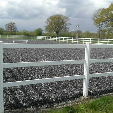
Schöner Offenstall in ruhiger Lage
Warmsen
Janine Bredemeier
@Janine83
Freizeitstall
Krankenbox
Longierzirkel/Roundpen
Allergikerstall
Hufrehe geeignet
Außenbox mit Paddock
Innenbox
12 weitere...
neu
P+


Pferdebox frei – Platz in artgerechter Haltung
Rahden
Pferdehof Weddingfeld
@PferdehofWeddingfeld
Geländestrecke
Reitlehrer und -unterricht
Vermieten
Hunde willkommen
Paddock
Allergikerstall
bedampftes/gewaschenes Heu
19 weitere...
P+
Deprecated: Creation of dynamic property Zend_View_Helper_Ads::$adLink is deprecated in /var/www/stall-frei/htdocs/staging.stall-frei.de/library/Psf/View/Helper/Ads.php on line 108

Heu und Heulage verkaufen
Mechtersen
STALL-FREIde Marketing
@STALL-FREI-Marketing
Verkaufen Sie Ihr Heu und Ihre Heulage direkt an Reiter, Pferdeställe und Reitanlagen

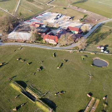
Westernreitstall in Steinbrink
Diepenau
Frank-Hesse
@Frank-Hesse
Pferdeausbildung
Reitlehrer und -unterricht
Hunde willkommen
Longierzirkel/Roundpen
Zuchtstutenhaltung möglich
Außenbox mit Paddock
11 weitere...
P


Pferdebox Premium Wohlfühlbox in Vollpension
Uchte
Gestüt Lohhof GbR
@Gestuet_Lohhof
Freizeitstall
Geländestrecke
Hunde willkommen
Longierzirkel/Roundpen
Allergikerstall
Hufrehe geeignet
Bewegungsstall
Innenbox
18 weitere...
P+


Premium Offenstallplätze Gesunderhaltung des Pfe...
Uchte
Gestüt Lohhof GbR
@Gestuet_Lohhof
Freizeitstall
Reitlehrer und -unterricht
Hunde willkommen
Krankenbox
Allergikerstall
Hufrehe geeignet
Bewegungsstall
Laufstall
15 weitere...
P+

Persönlichkeitsentwicklung mit Pferden
Bad Salzuflen
Katja Dors
@Pferdezeiten
Begleite andere auf ihrem Entwicklungsweg und entdecke die transformative Kraft der pferdegestützten Persönlichkeitsentwicklung !
neu
R

🐎 Pferdeboxen frei
Rahden
Reitstall Hilker
@Reitstall-Hilker
Freizeitstall
Vermieten
Longierzirkel/Roundpen
Paddock
Allergikerstall
Hufrehe geeignet
14 weitere...
P
Aktiv- und Bewegungsstall, Boxen *Warteliste*
Warmsen
Pferderesort_Wesling
@Pferderesort_Wesling
Freizeitstall
Geländestrecke
Vermieten
Krankenbox
Longierzirkel/Roundpen
Gnadenbrothof
Hufrehe geeignet
24 weitere...
P


Netter Freizeitstall sucht wieder Verstärkung…
Stolzenau
Sarah
@Sarah38
Freizeitstall
Pferdeausbildung
Vermieten
Hunde willkommen
Paddock
Allergikerstall
bedampftes/gewaschenes Heu
26 weitere...
P+

Großzügige Paddock- und Innenboxen
Kirchdorf
E_Ziegler
@E_Ziegler
Vermieten
Hunde willkommen
Paddock
Allergikerstall
Hufrehe geeignet
Außenbox mit Paddock
Außenboxen
14 weitere...
aktuell
P
Stall Hegemeister
Espelkamp
Stall-Hegemeister
@Stall-Hegemeister
Freizeitstall
Reitlehrer und -unterricht
Vermieten
Paddock
Parkplatz für Pferdeanhänger
Außenboxen
Innenbox
10 weitere...
P
Deprecated: Creation of dynamic property Zend_View::$pageCount is deprecated in /var/www/stall-frei/htdocs/staging.stall-frei.de/library/vendor/shardj/zf1-future/library/Zend/View/Abstract.php on line 308
Deprecated: Creation of dynamic property Zend_View::$itemCountPerPage is deprecated in /var/www/stall-frei/htdocs/staging.stall-frei.de/library/vendor/shardj/zf1-future/library/Zend/View/Abstract.php on line 308
Deprecated: Creation of dynamic property Zend_View::$first is deprecated in /var/www/stall-frei/htdocs/staging.stall-frei.de/library/vendor/shardj/zf1-future/library/Zend/View/Abstract.php on line 308
Deprecated: Creation of dynamic property Zend_View::$current is deprecated in /var/www/stall-frei/htdocs/staging.stall-frei.de/library/vendor/shardj/zf1-future/library/Zend/View/Abstract.php on line 308
Deprecated: Creation of dynamic property Zend_View::$last is deprecated in /var/www/stall-frei/htdocs/staging.stall-frei.de/library/vendor/shardj/zf1-future/library/Zend/View/Abstract.php on line 308
Deprecated: Creation of dynamic property Zend_View::$next is deprecated in /var/www/stall-frei/htdocs/staging.stall-frei.de/library/vendor/shardj/zf1-future/library/Zend/View/Abstract.php on line 308
Deprecated: Creation of dynamic property Zend_View::$pagesInRange is deprecated in /var/www/stall-frei/htdocs/staging.stall-frei.de/library/vendor/shardj/zf1-future/library/Zend/View/Abstract.php on line 308
Deprecated: Creation of dynamic property Zend_View::$firstPageInRange is deprecated in /var/www/stall-frei/htdocs/staging.stall-frei.de/library/vendor/shardj/zf1-future/library/Zend/View/Abstract.php on line 308
Deprecated: Creation of dynamic property Zend_View::$lastPageInRange is deprecated in /var/www/stall-frei/htdocs/staging.stall-frei.de/library/vendor/shardj/zf1-future/library/Zend/View/Abstract.php on line 308
Deprecated: Creation of dynamic property Zend_View::$currentItemCount is deprecated in /var/www/stall-frei/htdocs/staging.stall-frei.de/library/vendor/shardj/zf1-future/library/Zend/View/Abstract.php on line 308
Deprecated: Creation of dynamic property Zend_View::$totalItemCount is deprecated in /var/www/stall-frei/htdocs/staging.stall-frei.de/library/vendor/shardj/zf1-future/library/Zend/View/Abstract.php on line 308
Deprecated: Creation of dynamic property Zend_View::$firstItemNumber is deprecated in /var/www/stall-frei/htdocs/staging.stall-frei.de/library/vendor/shardj/zf1-future/library/Zend/View/Abstract.php on line 308
Deprecated: Creation of dynamic property Zend_View::$lastItemNumber is deprecated in /var/www/stall-frei/htdocs/staging.stall-frei.de/library/vendor/shardj/zf1-future/library/Zend/View/Abstract.php on line 308
Deprecated: Creation of dynamic property Zend_View::$router is deprecated in /var/www/stall-frei/htdocs/staging.stall-frei.de/library/vendor/shardj/zf1-future/library/Zend/View/Abstract.php on line 308
Deprecated: Creation of dynamic property Zend_View::$urlParams is deprecated in /var/www/stall-frei/htdocs/staging.stall-frei.de/library/vendor/shardj/zf1-future/library/Zend/View/Abstract.php on line 308
Deprecated: Creation of dynamic property Zend_View::$showAds is deprecated in /var/www/stall-frei/htdocs/staging.stall-frei.de/library/vendor/shardj/zf1-future/library/Zend/View/Abstract.php on line 308
Deprecated: Creation of dynamic property Zend_View::$objectIds is deprecated in /var/www/stall-frei/htdocs/staging.stall-frei.de/library/vendor/shardj/zf1-future/library/Zend/View/Abstract.php on line 308
Deprecated: Creation of dynamic property Zend_View::$showNavbar is deprecated in /var/www/stall-frei/htdocs/staging.stall-frei.de/library/vendor/shardj/zf1-future/library/Zend/View/Abstract.php on line 308
Deprecated: Creation of dynamic property Zend_View::$showBreadcrumb is deprecated in /var/www/stall-frei/htdocs/staging.stall-frei.de/library/vendor/shardj/zf1-future/library/Zend/View/Abstract.php on line 308
Deprecated: Creation of dynamic property Zend_View::$showFooter is deprecated in /var/www/stall-frei/htdocs/staging.stall-frei.de/library/vendor/shardj/zf1-future/library/Zend/View/Abstract.php on line 308
Deprecated: Creation of dynamic property Zend_View::$showInternalAds is deprecated in /var/www/stall-frei/htdocs/staging.stall-frei.de/library/vendor/shardj/zf1-future/library/Zend/View/Abstract.php on line 308
Deprecated: Creation of dynamic property Zend_View::$blNoContent is deprecated in /var/www/stall-frei/htdocs/staging.stall-frei.de/library/vendor/shardj/zf1-future/library/Zend/View/Abstract.php on line 308
Deprecated: Creation of dynamic property Zend_View::$sMetaDesc is deprecated in /var/www/stall-frei/htdocs/staging.stall-frei.de/library/vendor/shardj/zf1-future/library/Zend/View/Abstract.php on line 308
Deprecated: Creation of dynamic property Zend_View::$useGmaps is deprecated in /var/www/stall-frei/htdocs/staging.stall-frei.de/library/vendor/shardj/zf1-future/library/Zend/View/Abstract.php on line 308
Deprecated: Creation of dynamic property Zend_View::$touches is deprecated in /var/www/stall-frei/htdocs/staging.stall-frei.de/library/vendor/shardj/zf1-future/library/Zend/View/Abstract.php on line 308
Deprecated: Creation of dynamic property Zend_View::$oProject is deprecated in /var/www/stall-frei/htdocs/staging.stall-frei.de/library/vendor/shardj/zf1-future/library/Zend/View/Abstract.php on line 308
Deprecated: Creation of dynamic property Zend_View::$pageHeadline is deprecated in /var/www/stall-frei/htdocs/staging.stall-frei.de/library/vendor/shardj/zf1-future/library/Zend/View/Abstract.php on line 308
Deprecated: Creation of dynamic property Zend_View::$disableLocationField is deprecated in /var/www/stall-frei/htdocs/staging.stall-frei.de/library/vendor/shardj/zf1-future/library/Zend/View/Abstract.php on line 308
Deprecated: Creation of dynamic property Zend_View::$isSearch is deprecated in /var/www/stall-frei/htdocs/staging.stall-frei.de/library/vendor/shardj/zf1-future/library/Zend/View/Abstract.php on line 308
Deprecated: Creation of dynamic property Zend_View::$pageTitle is deprecated in /var/www/stall-frei/htdocs/staging.stall-frei.de/library/vendor/shardj/zf1-future/library/Zend/View/Abstract.php on line 308
Deprecated: Creation of dynamic property Psf_Form_Element_Text::$class is deprecated in /var/www/stall-frei/htdocs/staging.stall-frei.de/library/vendor/shardj/zf1-future/library/Zend/Form/Element.php on line 874
Deprecated: Creation of dynamic property Psf_Form_Element_Text::$size is deprecated in /var/www/stall-frei/htdocs/staging.stall-frei.de/library/vendor/shardj/zf1-future/library/Zend/Form/Element.php on line 874
Deprecated: Creation of dynamic property Psf_Form_Element_Text::$placeholder is deprecated in /var/www/stall-frei/htdocs/staging.stall-frei.de/library/vendor/shardj/zf1-future/library/Zend/Form/Element.php on line 874
Deprecated: Creation of dynamic property Psf_Form_Element_Hidden::$class is deprecated in /var/www/stall-frei/htdocs/staging.stall-frei.de/library/vendor/shardj/zf1-future/library/Zend/Form/Element.php on line 874
Deprecated: Creation of dynamic property Psf_Form_Element_Hidden::$class is deprecated in /var/www/stall-frei/htdocs/staging.stall-frei.de/library/vendor/shardj/zf1-future/library/Zend/Form/Element.php on line 874
Deprecated: Creation of dynamic property Psf_Form_Element_Hidden::$class is deprecated in /var/www/stall-frei/htdocs/staging.stall-frei.de/library/vendor/shardj/zf1-future/library/Zend/Form/Element.php on line 874
Deprecated: Creation of dynamic property Psf_Form_Element_Hidden::$class is deprecated in /var/www/stall-frei/htdocs/staging.stall-frei.de/library/vendor/shardj/zf1-future/library/Zend/Form/Element.php on line 874
Deprecated: Creation of dynamic property Psf_Form_Element_Select::$class is deprecated in /var/www/stall-frei/htdocs/staging.stall-frei.de/library/vendor/shardj/zf1-future/library/Zend/Form/Element.php on line 874
Deprecated: Creation of dynamic property Psf_Form_Element_Select::$class is deprecated in /var/www/stall-frei/htdocs/staging.stall-frei.de/library/vendor/shardj/zf1-future/library/Zend/Form/Element.php on line 874
Deprecated: Creation of dynamic property Psf_Form_Element_Select::$class is deprecated in /var/www/stall-frei/htdocs/staging.stall-frei.de/library/vendor/shardj/zf1-future/library/Zend/Form/Element.php on line 874
Deprecated: Creation of dynamic property Psf_Form_Element_Select::$class is deprecated in /var/www/stall-frei/htdocs/staging.stall-frei.de/library/vendor/shardj/zf1-future/library/Zend/Form/Element.php on line 874
Deprecated: Creation of dynamic property Psf_Form_Element_Text::$class is deprecated in /var/www/stall-frei/htdocs/staging.stall-frei.de/library/vendor/shardj/zf1-future/library/Zend/Form/Element.php on line 874
Deprecated: Creation of dynamic property Psf_Form_Element_Checkbox::$label is deprecated in /var/www/stall-frei/htdocs/staging.stall-frei.de/library/vendor/shardj/zf1-future/library/Zend/Form/Element.php on line 874
Deprecated: Creation of dynamic property Zend_View::$sort is deprecated in /var/www/stall-frei/htdocs/staging.stall-frei.de/library/vendor/shardj/zf1-future/library/Zend/View/Abstract.php on line 308
Deprecated: Creation of dynamic property Zend_View::$searchLocation is deprecated in /var/www/stall-frei/htdocs/staging.stall-frei.de/library/vendor/shardj/zf1-future/library/Zend/View/Abstract.php on line 308
Deprecated: Creation of dynamic property Zend_View::$locationHint is deprecated in /var/www/stall-frei/htdocs/staging.stall-frei.de/library/vendor/shardj/zf1-future/library/Zend/View/Abstract.php on line 308
Psf_GeoCoder_Abstract::getLocation: Steinbrink Get Location CachedOrLive
Psf_GeoCoder_Abstract::getCachedOrLive: Steinbrink
Psf_GeoCoder_OpenCageData::makeApiRequest: response:
Array
(
[documentation] => https://opencagedata.com/api
[licenses] => Array
(
[0] => Array
(
[name] => see attribution guide
[url] => https://opencagedata.com/credits
)
)
[results] => Array
(
[0] => Array
(
[bounds] => Array
(
[northeast] => Array
(
[lat] => 52.5275174
[lng] => 8.77865
)
[southwest] => Array
(
[lat] => 52.4685321
[lng] => 8.7112295
)
)
[components] => Array
(
[ISO_3166-1_alpha-2] => DE
[ISO_3166-1_alpha-3] => DEU
[ISO_3166-2] => Array
(
[0] => DE-NI
)
[_category] => place
[_normalized_city] => Diepenau
[_type] => village
[city] => Diepenau
[continent] => Europe
[country] => Deutschland
[country_code] => de
[county] => Landkreis Nienburg/Weser
[municipality] => Samtgemeinde Uchte
[political_union] => European Union
[state] => Niedersachsen
[state_code] => NI
[village] => Steinbrink
)
[confidence] => 7
[formatted] => Steinbrink, Niedersachsen, Deutschland
[geometry] => Array
(
[lat] => 52.4787516
[lng] => 8.7386695
)
)
[1] => Array
(
[bounds] => Array
(
[northeast] => Array
(
[lat] => 52.1458864
[lng] => 8.2017322
)
[southwest] => Array
(
[lat] => 52.1457864
[lng] => 8.2016322
)
)
[components] => Array
(
[ISO_3166-1_alpha-2] => DE
[ISO_3166-1_alpha-3] => DEU
[ISO_3166-2] => Array
(
[0] => DE-NI
)
[_category] => natural/water
[_normalized_city] => Dissen am Teutoburger Wald
[_type] => peak
[continent] => Europe
[country] => Deutschland
[country_code] => de
[county] => Landkreis Osnabrück
[peak] => Steinbrink
[political_union] => European Union
[postcode] => 49201
[state] => Niedersachsen
[state_code] => NI
[town] => Dissen am Teutoburger Wald
)
[confidence] => 9
[formatted] => Steinbrink, 49201 Dissen am Teutoburger Wald, Deutschland
[geometry] => Array
(
[lat] => 52.1458364
[lng] => 8.2016822
)
)
[2] => Array
(
[bounds] => Array
(
[northeast] => Array
(
[lat] => 51.9886499
[lng] => 8.5368704
)
[southwest] => Array
(
[lat] => 51.9885499
[lng] => 8.5367704
)
)
[components] => Array
(
[ISO_3166-1_alpha-2] => DE
[ISO_3166-1_alpha-3] => DEU
[ISO_3166-2] => Array
(
[0] => DE-NW
)
[_category] => natural/water
[_normalized_city] => Bielefeld
[_type] => peak
[city] => Bielefeld
[continent] => Europe
[country] => Deutschland
[country_code] => de
[peak] => Steinbrink
[political_union] => European Union
[postcode] => 33604
[state] => Nordrhein-Westfalen
[state_code] => NW
)
[confidence] => 9
[formatted] => Steinbrink, 33604 Bielefeld, Deutschland
[geometry] => Array
(
[lat] => 51.9885999
[lng] => 8.5368204
)
)
[3] => Array
(
[bounds] => Array
(
[northeast] => Array
(
[lat] => 52.0256528
[lng] => 8.4592609
)
[southwest] => Array
(
[lat] => 52.0255528
[lng] => 8.4591609
)
)
[components] => Array
(
[ISO_3166-1_alpha-2] => DE
[ISO_3166-1_alpha-3] => DEU
[ISO_3166-2] => Array
(
[0] => DE-NW
)
[_category] => natural/water
[_normalized_city] => Bielefeld
[_type] => peak
[city] => Bielefeld
[continent] => Europe
[country] => Deutschland
[country_code] => de
[peak] => Steinbrink
[political_union] => European Union
[postcode] => 33619
[state] => Nordrhein-Westfalen
[state_code] => NW
)
[confidence] => 9
[formatted] => Steinbrink, 33619 Bielefeld, Deutschland
[geometry] => Array
(
[lat] => 52.0256028
[lng] => 8.4592109
)
)
[4] => Array
(
[bounds] => Array
(
[northeast] => Array
(
[lat] => 51.0539476
[lng] => 7.9532878
)
[southwest] => Array
(
[lat] => 51.0538476
[lng] => 7.9531878
)
)
[components] => Array
(
[ISO_3166-1_alpha-2] => DE
[ISO_3166-1_alpha-3] => DEU
[ISO_3166-2] => Array
(
[0] => DE-NW
)
[_category] => natural/water
[_normalized_city] => Kirchhundem
[_type] => peak
[continent] => Europe
[country] => Deutschland
[country_code] => de
[county] => Kreis Olpe
[peak] => Steinbrink
[political_union] => European Union
[state] => Nordrhein-Westfalen
[state_code] => NW
[town] => Kirchhundem
)
[confidence] => 9
[formatted] => Steinbrink, Kirchhundem, Nordrhein-Westfalen, Deutschland
[geometry] => Array
(
[lat] => 51.0538976
[lng] => 7.9532378
)
)
[5] => Array
(
[bounds] => Array
(
[northeast] => Array
(
[lat] => 51.8724276
[lng] => 10.0724851
)
[southwest] => Array
(
[lat] => 51.8723276
[lng] => 10.0723851
)
)
[components] => Array
(
[ISO_3166-1_alpha-2] => DE
[ISO_3166-1_alpha-3] => DEU
[ISO_3166-2] => Array
(
[0] => DE-NI
)
[_category] => natural/water
[_normalized_city] => Bad Gandersheim
[_type] => peak
[city] => Bad Gandersheim
[continent] => Europe
[country] => Deutschland
[country_code] => de
[county] => Landkreis Northeim
[peak] => Steinbrink
[political_union] => European Union
[postcode] => 37581
[state] => Niedersachsen
[state_code] => NI
)
[confidence] => 9
[formatted] => Steinbrink, 37581 Bad Gandersheim, Deutschland
[geometry] => Array
(
[lat] => 51.8723776
[lng] => 10.0724351
)
)
[6] => Array
(
[bounds] => Array
(
[northeast] => Array
(
[lat] => 52.1275534
[lng] => 8.2528587
)
[southwest] => Array
(
[lat] => 52.1274534
[lng] => 8.2527587
)
)
[components] => Array
(
[ISO_3166-1_alpha-2] => DE
[ISO_3166-1_alpha-3] => DEU
[ISO_3166-2] => Array
(
[0] => DE-NI
)
[_category] => natural/water
[_normalized_city] => Dissen am Teutoburger Wald
[_type] => peak
[continent] => Europe
[country] => Deutschland
[country_code] => de
[county] => Landkreis Osnabrück
[peak] => Steinbrink
[political_union] => European Union
[postcode] => 33829
[state] => Niedersachsen
[state_code] => NI
[town] => Dissen am Teutoburger Wald
)
[confidence] => 9
[formatted] => Steinbrink, 33829 Dissen am Teutoburger Wald, Deutschland
[geometry] => Array
(
[lat] => 52.1275034
[lng] => 8.2528087
)
)
[7] => Array
(
[bounds] => Array
(
[northeast] => Array
(
[lat] => 52.2298888
[lng] => 7.9698962
)
[southwest] => Array
(
[lat] => 52.2297888
[lng] => 7.9697962
)
)
[components] => Array
(
[ISO_3166-1_alpha-2] => DE
[ISO_3166-1_alpha-3] => DEU
[ISO_3166-2] => Array
(
[0] => DE-NI
)
[_category] => natural/water
[_normalized_city] => Hasbergen
[_type] => peak
[continent] => Europe
[country] => Deutschland
[country_code] => de
[county] => Landkreis Osnabrück
[peak] => Steinbrink
[political_union] => European Union
[postcode] => 49205
[state] => Niedersachsen
[state_code] => NI
[village] => Hasbergen
)
[confidence] => 9
[formatted] => Steinbrink, 49205 Hasbergen, Deutschland
[geometry] => Array
(
[lat] => 52.2298388
[lng] => 7.9698462
)
)
[8] => Array
(
[bounds] => Array
(
[northeast] => Array
(
[lat] => 51.9338979
[lng] => 10.203667
)
[southwest] => Array
(
[lat] => 51.9180737
[lng] => 10.1692376
)
)
[components] => Array
(
[ISO_3166-1_alpha-2] => DE
[ISO_3166-1_alpha-3] => DEU
[ISO_3166-2] => Array
(
[0] => DE-NI
)
[_category] => place
[_normalized_city] => Seesen
[_type] => hamlet
[continent] => Europe
[country] => Deutschland
[country_code] => de
[county] => Landkreis Goslar
[hamlet] => Steinbrink
[political_union] => European Union
[state] => Niedersachsen
[state_code] => NI
[town] => Seesen
[village] => Bornhausen
)
[confidence] => 7
[formatted] => Steinbrink, Bornhausen, Niedersachsen, Deutschland
[geometry] => Array
(
[lat] => 51.9233512
[lng] => 10.1828969
)
)
[9] => Array
(
[bounds] => Array
(
[northeast] => Array
(
[lat] => 54.0729795
[lng] => 11.6542522
)
[southwest] => Array
(
[lat] => 54.0329795
[lng] => 11.6142522
)
)
[components] => Array
(
[ISO_3166-1_alpha-2] => DE
[ISO_3166-1_alpha-3] => DEU
[ISO_3166-2] => Array
(
[0] => DE-MV
)
[_category] => place
[_normalized_city] => Neubukow
[_type] => hamlet
[continent] => Europe
[country] => Deutschland
[country_code] => de
[county] => Landkreis Rostock
[hamlet] => Steinbrink
[political_union] => European Union
[postcode] => 18233
[state] => Mecklenburg-Vorpommern
[state_code] => MV
[town] => Neubukow
)
[confidence] => 7
[formatted] => Steinbrink, 18233 Neubukow, Deutschland
[geometry] => Array
(
[lat] => 54.0529795
[lng] => 11.6342522
)
)
)
[status] => Array
(
[code] => 200
[message] => OK
)
[stay_informed] => Array
(
[blog] => https://blog.opencagedata.com
[mastodon] => https://en.osm.town/@opencage
)
[thanks] => For using an OpenCage API
[timestamp] => Array
(
[created_http] => Sat, 07 Feb 2026 14:13:06 GMT
[created_unix] => 1770473586
)
[total_results] => 10
)
Psf_GeoCoder_Abstract::convertLocationResult
{"documentation":"https:\/\/opencagedata.com\/api","licenses":[{"name":"see attribution guide","url":"https:\/\/opencagedata.com\/credits"}],"results":[{"bounds":{"northeast":{"lat":52.5275174,"lng":8.77865},"southwest":{"lat":52.4685321,"lng":8.7112295}},"components":{"ISO_3166-1_alpha-2":"DE","ISO_3166-1_alpha-3":"DEU","ISO_3166-2":["DE-NI"],"_category":"place","_normalized_city":"Diepenau","_type":"village","city":"Diepenau","continent":"Europe","country":"Deutschland","country_code":"de","county":"Landkreis Nienburg\/Weser","municipality":"Samtgemeinde Uchte","political_union":"European Union","state":"Niedersachsen","state_code":"NI","village":"Steinbrink"},"confidence":7,"formatted":"Steinbrink, Niedersachsen, Deutschland","geometry":{"lat":52.4787516,"lng":8.7386695}},{"bounds":{"northeast":{"lat":52.1458864,"lng":8.2017322},"southwest":{"lat":52.1457864,"lng":8.2016322}},"components":{"ISO_3166-1_alpha-2":"DE","ISO_3166-1_alpha-3":"DEU","ISO_3166-2":["DE-NI"],"_category":"natural\/water","_normalized_city":"Dissen am Teutoburger Wald","_type":"peak","continent":"Europe","country":"Deutschland","country_code":"de","county":"Landkreis Osnabr\u00fcck","peak":"Steinbrink","political_union":"European Union","postcode":"49201","state":"Niedersachsen","state_code":"NI","town":"Dissen am Teutoburger Wald"},"confidence":9,"formatted":"Steinbrink, 49201 Dissen am Teutoburger Wald, Deutschland","geometry":{"lat":52.1458364,"lng":8.2016822}},{"bounds":{"northeast":{"lat":51.9886499,"lng":8.5368704},"southwest":{"lat":51.9885499,"lng":8.5367704}},"components":{"ISO_3166-1_alpha-2":"DE","ISO_3166-1_alpha-3":"DEU","ISO_3166-2":["DE-NW"],"_category":"natural\/water","_normalized_city":"Bielefeld","_type":"peak","city":"Bielefeld","continent":"Europe","country":"Deutschland","country_code":"de","peak":"Steinbrink","political_union":"European Union","postcode":"33604","state":"Nordrhein-Westfalen","state_code":"NW"},"confidence":9,"formatted":"Steinbrink, 33604 Bielefeld, Deutschland","geometry":{"lat":51.9885999,"lng":8.5368204}},{"bounds":{"northeast":{"lat":52.0256528,"lng":8.4592609},"southwest":{"lat":52.0255528,"lng":8.4591609}},"components":{"ISO_3166-1_alpha-2":"DE","ISO_3166-1_alpha-3":"DEU","ISO_3166-2":["DE-NW"],"_category":"natural\/water","_normalized_city":"Bielefeld","_type":"peak","city":"Bielefeld","continent":"Europe","country":"Deutschland","country_code":"de","peak":"Steinbrink","political_union":"European Union","postcode":"33619","state":"Nordrhein-Westfalen","state_code":"NW"},"confidence":9,"formatted":"Steinbrink, 33619 Bielefeld, Deutschland","geometry":{"lat":52.0256028,"lng":8.4592109}},{"bounds":{"northeast":{"lat":51.0539476,"lng":7.9532878},"southwest":{"lat":51.0538476,"lng":7.9531878}},"components":{"ISO_3166-1_alpha-2":"DE","ISO_3166-1_alpha-3":"DEU","ISO_3166-2":["DE-NW"],"_category":"natural\/water","_normalized_city":"Kirchhundem","_type":"peak","continent":"Europe","country":"Deutschland","country_code":"de","county":"Kreis Olpe","peak":"Steinbrink","political_union":"European Union","state":"Nordrhein-Westfalen","state_code":"NW","town":"Kirchhundem"},"confidence":9,"formatted":"Steinbrink, Kirchhundem, Nordrhein-Westfalen, Deutschland","geometry":{"lat":51.0538976,"lng":7.9532378}},{"bounds":{"northeast":{"lat":51.8724276,"lng":10.0724851},"southwest":{"lat":51.8723276,"lng":10.0723851}},"components":{"ISO_3166-1_alpha-2":"DE","ISO_3166-1_alpha-3":"DEU","ISO_3166-2":["DE-NI"],"_category":"natural\/water","_normalized_city":"Bad Gandersheim","_type":"peak","city":"Bad Gandersheim","continent":"Europe","country":"Deutschland","country_code":"de","county":"Landkreis Northeim","peak":"Steinbrink","political_union":"European Union","postcode":"37581","state":"Niedersachsen","state_code":"NI"},"confidence":9,"formatted":"Steinbrink, 37581 Bad Gandersheim, Deutschland","geometry":{"lat":51.8723776,"lng":10.0724351}},{"bounds":{"northeast":{"lat":52.1275534,"lng":8.2528587},"southwest":{"lat":52.1274534,"lng":8.2527587}},"components":{"ISO_3166-1_alpha-2":"DE","ISO_3166-1_alpha-3":"DEU","ISO_3166-2":["DE-NI"],"_category":"natural\/water","_normalized_city":"Dissen am Teutoburger Wald","_type":"peak","continent":"Europe","country":"Deutschland","country_code":"de","county":"Landkreis Osnabr\u00fcck","peak":"Steinbrink","political_union":"European Union","postcode":"33829","state":"Niedersachsen","state_code":"NI","town":"Dissen am Teutoburger Wald"},"confidence":9,"formatted":"Steinbrink, 33829 Dissen am Teutoburger Wald, Deutschland","geometry":{"lat":52.1275034,"lng":8.2528087}},{"bounds":{"northeast":{"lat":52.2298888,"lng":7.9698962},"southwest":{"lat":52.2297888,"lng":7.9697962}},"components":{"ISO_3166-1_alpha-2":"DE","ISO_3166-1_alpha-3":"DEU","ISO_3166-2":["DE-NI"],"_category":"natural\/water","_normalized_city":"Hasbergen","_type":"peak","continent":"Europe","country":"Deutschland","country_code":"de","county":"Landkreis Osnabr\u00fcck","peak":"Steinbrink","political_union":"European Union","postcode":"49205","state":"Niedersachsen","state_code":"NI","village":"Hasbergen"},"confidence":9,"formatted":"Steinbrink, 49205 Hasbergen, Deutschland","geometry":{"lat":52.2298388,"lng":7.9698462}},{"bounds":{"northeast":{"lat":51.9338979,"lng":10.203667},"southwest":{"lat":51.9180737,"lng":10.1692376}},"components":{"ISO_3166-1_alpha-2":"DE","ISO_3166-1_alpha-3":"DEU","ISO_3166-2":["DE-NI"],"_category":"place","_normalized_city":"Seesen","_type":"hamlet","continent":"Europe","country":"Deutschland","country_code":"de","county":"Landkreis Goslar","hamlet":"Steinbrink","political_union":"European Union","state":"Niedersachsen","state_code":"NI","town":"Seesen","village":"Bornhausen"},"confidence":7,"formatted":"Steinbrink, Bornhausen, Niedersachsen, Deutschland","geometry":{"lat":51.9233512,"lng":10.1828969}},{"bounds":{"northeast":{"lat":54.0729795,"lng":11.6542522},"southwest":{"lat":54.0329795,"lng":11.6142522}},"components":{"ISO_3166-1_alpha-2":"DE","ISO_3166-1_alpha-3":"DEU","ISO_3166-2":["DE-MV"],"_category":"place","_normalized_city":"Neubukow","_type":"hamlet","continent":"Europe","country":"Deutschland","country_code":"de","county":"Landkreis Rostock","hamlet":"Steinbrink","political_union":"European Union","postcode":"18233","state":"Mecklenburg-Vorpommern","state_code":"MV","town":"Neubukow"},"confidence":7,"formatted":"Steinbrink, 18233 Neubukow, Deutschland","geometry":{"lat":54.0529795,"lng":11.6342522}}],"status":{"code":200,"message":"OK"},"stay_informed":{"blog":"https:\/\/blog.opencagedata.com","mastodon":"https:\/\/en.osm.town\/@opencage"},"thanks":"For using an OpenCage API","timestamp":{"created_http":"Sat, 07 Feb 2026 14:13:06 GMT","created_unix":1770473586},"total_results":10}Array
(
[0] => stdClass Object
(
[bounds] => stdClass Object
(
[northeast] => stdClass Object
(
[lat] => 52.5275174
[lng] => 8.77865
)
[southwest] => stdClass Object
(
[lat] => 52.4685321
[lng] => 8.7112295
)
)
[components] => stdClass Object
(
[ISO_3166-1_alpha-2] => DE
[ISO_3166-1_alpha-3] => DEU
[ISO_3166-2] => Array
(
[0] => DE-NI
)
[_category] => place
[_normalized_city] => Diepenau
[_type] => village
[city] => Diepenau
[continent] => Europe
[country] => Deutschland
[country_code] => de
[county] => Landkreis Nienburg/Weser
[municipality] => Samtgemeinde Uchte
[political_union] => European Union
[state] => Niedersachsen
[state_code] => NI
[village] => Steinbrink
)
[confidence] => 7
[formatted] => Steinbrink, Niedersachsen, Deutschland
[geometry] => stdClass Object
(
[lat] => 52.4787516
[lng] => 8.7386695
)
)
[1] => stdClass Object
(
[bounds] => stdClass Object
(
[northeast] => stdClass Object
(
[lat] => 52.1458864
[lng] => 8.2017322
)
[southwest] => stdClass Object
(
[lat] => 52.1457864
[lng] => 8.2016322
)
)
[components] => stdClass Object
(
[ISO_3166-1_alpha-2] => DE
[ISO_3166-1_alpha-3] => DEU
[ISO_3166-2] => Array
(
[0] => DE-NI
)
[_category] => natural/water
[_normalized_city] => Dissen am Teutoburger Wald
[_type] => peak
[continent] => Europe
[country] => Deutschland
[country_code] => de
[county] => Landkreis Osnabrück
[peak] => Steinbrink
[political_union] => European Union
[postcode] => 49201
[state] => Niedersachsen
[state_code] => NI
[town] => Dissen am Teutoburger Wald
)
[confidence] => 9
[formatted] => Steinbrink, 49201 Dissen am Teutoburger Wald, Deutschland
[geometry] => stdClass Object
(
[lat] => 52.1458364
[lng] => 8.2016822
)
)
[2] => stdClass Object
(
[bounds] => stdClass Object
(
[northeast] => stdClass Object
(
[lat] => 51.9886499
[lng] => 8.5368704
)
[southwest] => stdClass Object
(
[lat] => 51.9885499
[lng] => 8.5367704
)
)
[components] => stdClass Object
(
[ISO_3166-1_alpha-2] => DE
[ISO_3166-1_alpha-3] => DEU
[ISO_3166-2] => Array
(
[0] => DE-NW
)
[_category] => natural/water
[_normalized_city] => Bielefeld
[_type] => peak
[city] => Bielefeld
[continent] => Europe
[country] => Deutschland
[country_code] => de
[peak] => Steinbrink
[political_union] => European Union
[postcode] => 33604
[state] => Nordrhein-Westfalen
[state_code] => NW
)
[confidence] => 9
[formatted] => Steinbrink, 33604 Bielefeld, Deutschland
[geometry] => stdClass Object
(
[lat] => 51.9885999
[lng] => 8.5368204
)
)
[3] => stdClass Object
(
[bounds] => stdClass Object
(
[northeast] => stdClass Object
(
[lat] => 52.0256528
[lng] => 8.4592609
)
[southwest] => stdClass Object
(
[lat] => 52.0255528
[lng] => 8.4591609
)
)
[components] => stdClass Object
(
[ISO_3166-1_alpha-2] => DE
[ISO_3166-1_alpha-3] => DEU
[ISO_3166-2] => Array
(
[0] => DE-NW
)
[_category] => natural/water
[_normalized_city] => Bielefeld
[_type] => peak
[city] => Bielefeld
[continent] => Europe
[country] => Deutschland
[country_code] => de
[peak] => Steinbrink
[political_union] => European Union
[postcode] => 33619
[state] => Nordrhein-Westfalen
[state_code] => NW
)
[confidence] => 9
[formatted] => Steinbrink, 33619 Bielefeld, Deutschland
[geometry] => stdClass Object
(
[lat] => 52.0256028
[lng] => 8.4592109
)
)
[4] => stdClass Object
(
[bounds] => stdClass Object
(
[northeast] => stdClass Object
(
[lat] => 51.0539476
[lng] => 7.9532878
)
[southwest] => stdClass Object
(
[lat] => 51.0538476
[lng] => 7.9531878
)
)
[components] => stdClass Object
(
[ISO_3166-1_alpha-2] => DE
[ISO_3166-1_alpha-3] => DEU
[ISO_3166-2] => Array
(
[0] => DE-NW
)
[_category] => natural/water
[_normalized_city] => Kirchhundem
[_type] => peak
[continent] => Europe
[country] => Deutschland
[country_code] => de
[county] => Kreis Olpe
[peak] => Steinbrink
[political_union] => European Union
[state] => Nordrhein-Westfalen
[state_code] => NW
[town] => Kirchhundem
)
[confidence] => 9
[formatted] => Steinbrink, Kirchhundem, Nordrhein-Westfalen, Deutschland
[geometry] => stdClass Object
(
[lat] => 51.0538976
[lng] => 7.9532378
)
)
[5] => stdClass Object
(
[bounds] => stdClass Object
(
[northeast] => stdClass Object
(
[lat] => 51.8724276
[lng] => 10.0724851
)
[southwest] => stdClass Object
(
[lat] => 51.8723276
[lng] => 10.0723851
)
)
[components] => stdClass Object
(
[ISO_3166-1_alpha-2] => DE
[ISO_3166-1_alpha-3] => DEU
[ISO_3166-2] => Array
(
[0] => DE-NI
)
[_category] => natural/water
[_normalized_city] => Bad Gandersheim
[_type] => peak
[city] => Bad Gandersheim
[continent] => Europe
[country] => Deutschland
[country_code] => de
[county] => Landkreis Northeim
[peak] => Steinbrink
[political_union] => European Union
[postcode] => 37581
[state] => Niedersachsen
[state_code] => NI
)
[confidence] => 9
[formatted] => Steinbrink, 37581 Bad Gandersheim, Deutschland
[geometry] => stdClass Object
(
[lat] => 51.8723776
[lng] => 10.0724351
)
)
[6] => stdClass Object
(
[bounds] => stdClass Object
(
[northeast] => stdClass Object
(
[lat] => 52.1275534
[lng] => 8.2528587
)
[southwest] => stdClass Object
(
[lat] => 52.1274534
[lng] => 8.2527587
)
)
[components] => stdClass Object
(
[ISO_3166-1_alpha-2] => DE
[ISO_3166-1_alpha-3] => DEU
[ISO_3166-2] => Array
(
[0] => DE-NI
)
[_category] => natural/water
[_normalized_city] => Dissen am Teutoburger Wald
[_type] => peak
[continent] => Europe
[country] => Deutschland
[country_code] => de
[county] => Landkreis Osnabrück
[peak] => Steinbrink
[political_union] => European Union
[postcode] => 33829
[state] => Niedersachsen
[state_code] => NI
[town] => Dissen am Teutoburger Wald
)
[confidence] => 9
[formatted] => Steinbrink, 33829 Dissen am Teutoburger Wald, Deutschland
[geometry] => stdClass Object
(
[lat] => 52.1275034
[lng] => 8.2528087
)
)
[7] => stdClass Object
(
[bounds] => stdClass Object
(
[northeast] => stdClass Object
(
[lat] => 52.2298888
[lng] => 7.9698962
)
[southwest] => stdClass Object
(
[lat] => 52.2297888
[lng] => 7.9697962
)
)
[components] => stdClass Object
(
[ISO_3166-1_alpha-2] => DE
[ISO_3166-1_alpha-3] => DEU
[ISO_3166-2] => Array
(
[0] => DE-NI
)
[_category] => natural/water
[_normalized_city] => Hasbergen
[_type] => peak
[continent] => Europe
[country] => Deutschland
[country_code] => de
[county] => Landkreis Osnabrück
[peak] => Steinbrink
[political_union] => European Union
[postcode] => 49205
[state] => Niedersachsen
[state_code] => NI
[village] => Hasbergen
)
[confidence] => 9
[formatted] => Steinbrink, 49205 Hasbergen, Deutschland
[geometry] => stdClass Object
(
[lat] => 52.2298388
[lng] => 7.9698462
)
)
[8] => stdClass Object
(
[bounds] => stdClass Object
(
[northeast] => stdClass Object
(
[lat] => 51.9338979
[lng] => 10.203667
)
[southwest] => stdClass Object
(
[lat] => 51.9180737
[lng] => 10.1692376
)
)
[components] => stdClass Object
(
[ISO_3166-1_alpha-2] => DE
[ISO_3166-1_alpha-3] => DEU
[ISO_3166-2] => Array
(
[0] => DE-NI
)
[_category] => place
[_normalized_city] => Seesen
[_type] => hamlet
[continent] => Europe
[country] => Deutschland
[country_code] => de
[county] => Landkreis Goslar
[hamlet] => Steinbrink
[political_union] => European Union
[state] => Niedersachsen
[state_code] => NI
[town] => Seesen
[village] => Bornhausen
)
[confidence] => 7
[formatted] => Steinbrink, Bornhausen, Niedersachsen, Deutschland
[geometry] => stdClass Object
(
[lat] => 51.9233512
[lng] => 10.1828969
)
)
[9] => stdClass Object
(
[bounds] => stdClass Object
(
[northeast] => stdClass Object
(
[lat] => 54.0729795
[lng] => 11.6542522
)
[southwest] => stdClass Object
(
[lat] => 54.0329795
[lng] => 11.6142522
)
)
[components] => stdClass Object
(
[ISO_3166-1_alpha-2] => DE
[ISO_3166-1_alpha-3] => DEU
[ISO_3166-2] => Array
(
[0] => DE-MV
)
[_category] => place
[_normalized_city] => Neubukow
[_type] => hamlet
[continent] => Europe
[country] => Deutschland
[country_code] => de
[county] => Landkreis Rostock
[hamlet] => Steinbrink
[political_union] => European Union
[postcode] => 18233
[state] => Mecklenburg-Vorpommern
[state_code] => MV
[town] => Neubukow
)
[confidence] => 7
[formatted] => Steinbrink, 18233 Neubukow, Deutschland
[geometry] => stdClass Object
(
[lat] => 54.0529795
[lng] => 11.6342522
)
)
)
Psf_GeoCoder_OpenCageData::getKeyMap: 0
stdClass Object
(
    [bounds] => stdClass Object
        (
            [northeast] => stdClass Object
                (
                    [lat] => 52.5275174
                    [lng] => 8.77865
                )

            [southwest] => stdClass Object
                (
                    [lat] => 52.4685321
                    [lng] => 8.7112295
                )

        )

    [components] => stdClass Object
        (
            [ISO_3166-1_alpha-2] => DE
            [ISO_3166-1_alpha-3] => DEU
            [ISO_3166-2] => Array
                (
                    [0] => DE-NI
                )

            [_category] => place
            [_normalized_city] => Diepenau
            [_type] => village
            [city] => Diepenau
            [continent] => Europe
            [country] => Deutschland
            [country_code] => de
            [county] => Landkreis Nienburg/Weser
            [municipality] => Samtgemeinde Uchte
            [political_union] => European Union
            [state] => Niedersachsen
            [state_code] => NI
            [village] => Steinbrink
        )

    [confidence] => 7
    [formatted] => Steinbrink, Niedersachsen, Deutschland
    [geometry] => stdClass Object
        (
            [lat] => 52.4787516
            [lng] => 8.7386695
        )

)
Psf_GeoCoder_OpenCageData::getCounty: Nienburg/Weser
Psf_GeoCoder_OpenCageData::addMissingData REFETCH!
Array
(
    [address] => Steinbrink, Niedersachsen, Deutschland
    [type] => village
    [street] =>
    [city] => Steinbrink
    [county] => Nienburg/Weser
    [state] => Niedersachsen
    [zip] =>
    [country] => Deutschland
    [suburb] =>
    [countrycode] => de
    [latitude] => 52.4787516
    [longitude] => 8.7386695
    [accuracy] => 1
    [confidence] => 7
    [bounds] => stdClass Object
        (
            [northeast] => stdClass Object
                (
                    [lat] => 52.5275174
                    [lng] => 8.77865
                )

            [southwest] => stdClass Object
                (
                    [lat] => 52.4685321
                    [lng] => 8.7112295
                )

        )

)
reformat!
Array
(
    [address] => Steinbrink, Niedersachsen, Deutschland
    [type] => village
    [street] =>
    [city] => Steinbrink
    [county] => Nienburg/Weser
    [state] => Niedersachsen
    [zip] =>
    [country] => Deutschland
    [suburb] =>
    [countrycode] => de
    [latitude] => 52.4787516
    [longitude] => 8.7386695
    [accuracy] => 1
    [confidence] => 7
    [bounds] => stdClass Object
        (
            [northeast] => stdClass Object
                (
                    [lat] => 52.5275174
                    [lng] => 8.77865
                )

            [southwest] => stdClass Object
                (
                    [lat] => 52.4685321
                    [lng] => 8.7112295
                )

        )

    [place] => Steinbrink, Niedersachsen
    [hash] => 13cbf52a6cc5c8a97aac3e5469c8602b
)
Psf_GeoCoder_OpenCageData::getKeyMap: 1
stdClass Object
(
    [bounds] => stdClass Object
        (
            [northeast] => stdClass Object
                (
                    [lat] => 52.1458864
                    [lng] => 8.2017322
                )

            [southwest] => stdClass Object
                (
                    [lat] => 52.1457864
                    [lng] => 8.2016322
                )

        )

    [components] => stdClass Object
        (
            [ISO_3166-1_alpha-2] => DE
            [ISO_3166-1_alpha-3] => DEU
            [ISO_3166-2] => Array
                (
                    [0] => DE-NI
                )

            [_category] => natural/water
            [_normalized_city] => Dissen am Teutoburger Wald
            [_type] => peak
            [continent] => Europe
            [country] => Deutschland
            [country_code] => de
            [county] => Landkreis Osnabrück
            [peak] => Steinbrink
            [political_union] => European Union
            [postcode] => 49201
            [state] => Niedersachsen
            [state_code] => NI
            [town] => Dissen am Teutoburger Wald
        )

    [confidence] => 9
    [formatted] => Steinbrink, 49201 Dissen am Teutoburger Wald, Deutschland
    [geometry] => stdClass Object
        (
            [lat] => 52.1458364
            [lng] => 8.2016822
        )

)
Psf_GeoCoder_OpenCageData::getCounty: Osnabrück
Psf_GeoCoder_OpenCageData::addMissingData REFETCH!
Array
(
    [address] => Steinbrink, 49201 Dissen am Teutoburger Wald, Deutschland
    [type] => peak
    [street] =>
    [city] => Dissen am Teutoburger Wald
    [county] => Osnabrück
    [state] => Niedersachsen
    [zip] => 49201
    [country] => Deutschland
    [suburb] =>
    [countrycode] => de
    [latitude] => 52.1458364
    [longitude] => 8.2016822
    [accuracy] => 1
    [confidence] => 9
    [bounds] => stdClass Object
        (
            [northeast] => stdClass Object
                (
                    [lat] => 52.1458864
                    [lng] => 8.2017322
                )

            [southwest] => stdClass Object
                (
                    [lat] => 52.1457864
                    [lng] => 8.2016322
                )

        )

)
reformat!
Array
(
    [address] => Steinbrink, 49201 Dissen am Teutoburger Wald, Deutschland
    [type] => peak
    [street] =>
    [city] => Dissen am Teutoburger Wald
    [county] => Osnabrück
    [state] => Niedersachsen
    [zip] => 49201
    [country] => Deutschland
    [suburb] =>
    [countrycode] => de
    [latitude] => 52.1458364
    [longitude] => 8.2016822
    [accuracy] => 1
    [confidence] => 9
    [bounds] => stdClass Object
        (
            [northeast] => stdClass Object
                (
                    [lat] => 52.1458864
                    [lng] => 8.2017322
                )

            [southwest] => stdClass Object
                (
                    [lat] => 52.1457864
                    [lng] => 8.2016322
                )

        )

    [place] => 49201 Dissen am Teutoburger Wald, Niedersachsen
    [hash] => 3d5e5c715985614d11a8823e852f9223
)
Psf_GeoCoder_OpenCageData::getKeyMap: 2
stdClass Object
(
    [bounds] => stdClass Object
        (
            [northeast] => stdClass Object
                (
                    [lat] => 51.9886499
                    [lng] => 8.5368704
                )

            [southwest] => stdClass Object
                (
                    [lat] => 51.9885499
                    [lng] => 8.5367704
                )

        )

    [components] => stdClass Object
        (
            [ISO_3166-1_alpha-2] => DE
            [ISO_3166-1_alpha-3] => DEU
            [ISO_3166-2] => Array
                (
                    [0] => DE-NW
                )

            [_category] => natural/water
            [_normalized_city] => Bielefeld
            [_type] => peak
            [city] => Bielefeld
            [continent] => Europe
            [country] => Deutschland
            [country_code] => de
            [peak] => Steinbrink
            [political_union] => European Union
            [postcode] => 33604
            [state] => Nordrhein-Westfalen
            [state_code] => NW
        )

    [confidence] => 9
    [formatted] => Steinbrink, 33604 Bielefeld, Deutschland
    [geometry] => stdClass Object
        (
            [lat] => 51.9885999
            [lng] => 8.5368204
        )

)
Psf_GeoCoder_OpenCageData::getCounty: Bielefeld
Psf_GeoCoder_OpenCageData::addMissingData REFETCH!
Array
(
    [address] => Steinbrink, 33604 Bielefeld, Deutschland
    [type] => peak
    [street] =>
    [city] => Bielefeld
    [county] => Bielefeld
    [state] => Nordrhein-Westfalen
    [zip] => 33604
    [country] => Deutschland
    [suburb] =>
    [countrycode] => de
    [latitude] => 51.9885999
    [longitude] => 8.5368204
    [accuracy] => 1
    [confidence] => 9
    [bounds] => stdClass Object
        (
            [northeast] => stdClass Object
                (
                    [lat] => 51.9886499
                    [lng] => 8.5368704
                )

            [southwest] => stdClass Object
                (
                    [lat] => 51.9885499
                    [lng] => 8.5367704
                )

        )

)
reformat!
Array
(
    [address] => Steinbrink, 33604 Bielefeld, Deutschland
    [type] => peak
    [street] =>
    [city] => Bielefeld
    [county] => Bielefeld
    [state] => Nordrhein-Westfalen
    [zip] => 33604
    [country] => Deutschland
    [suburb] =>
    [countrycode] => de
    [latitude] => 51.9885999
    [longitude] => 8.5368204
    [accuracy] => 1
    [confidence] => 9
    [bounds] => stdClass Object
        (
            [northeast] => stdClass Object
                (
                    [lat] => 51.9886499
                    [lng] => 8.5368704
                )

            [southwest] => stdClass Object
                (
                    [lat] => 51.9885499
                    [lng] => 8.5367704
                )

        )

    [place] => 33604 Bielefeld, Nordrhein-Westfalen
    [hash] => cae1445c625611481f31d1dad9938e4a
)
Psf_GeoCoder_OpenCageData::getKeyMap: 3
stdClass Object
(
    [bounds] => stdClass Object
        (
            [northeast] => stdClass Object
                (
                    [lat] => 52.0256528
                    [lng] => 8.4592609
                )

            [southwest] => stdClass Object
                (
                    [lat] => 52.0255528
                    [lng] => 8.4591609
                )

        )

    [components] => stdClass Object
        (
            [ISO_3166-1_alpha-2] => DE
            [ISO_3166-1_alpha-3] => DEU
            [ISO_3166-2] => Array
                (
                    [0] => DE-NW
                )

            [_category] => natural/water
            [_normalized_city] => Bielefeld
            [_type] => peak
            [city] => Bielefeld
            [continent] => Europe
            [country] => Deutschland
            [country_code] => de
            [peak] => Steinbrink
            [political_union] => European Union
            [postcode] => 33619
            [state] => Nordrhein-Westfalen
            [state_code] => NW
        )

    [confidence] => 9
    [formatted] => Steinbrink, 33619 Bielefeld, Deutschland
    [geometry] => stdClass Object
        (
            [lat] => 52.0256028
            [lng] => 8.4592109
        )

)
Psf_GeoCoder_OpenCageData::getCounty: Bielefeld
Psf_GeoCoder_OpenCageData::addMissingData REFETCH!
Array
(
    [address] => Steinbrink, 33619 Bielefeld, Deutschland
    [type] => peak
    [street] =>
    [city] => Bielefeld
    [county] => Bielefeld
    [state] => Nordrhein-Westfalen
    [zip] => 33619
    [country] => Deutschland
    [suburb] =>
    [countrycode] => de
    [latitude] => 52.0256028
    [longitude] => 8.4592109
    [accuracy] => 1
    [confidence] => 9
    [bounds] => stdClass Object
        (
            [northeast] => stdClass Object
                (
                    [lat] => 52.0256528
                    [lng] => 8.4592609
                )

            [southwest] => stdClass Object
                (
                    [lat] => 52.0255528
                    [lng] => 8.4591609
                )

        )

)
reformat!
Array
(
    [address] => Steinbrink, 33619 Bielefeld, Deutschland
    [type] => peak
    [street] =>
    [city] => Bielefeld
    [county] => Bielefeld
    [state] => Nordrhein-Westfalen
    [zip] => 33619
    [country] => Deutschland
    [suburb] =>
    [countrycode] => de
    [latitude] => 52.0256028
    [longitude] => 8.4592109
    [accuracy] => 1
    [confidence] => 9
    [bounds] => stdClass Object
        (
            [northeast] => stdClass Object
                (
                    [lat] => 52.0256528
                    [lng] => 8.4592609
                )

            [southwest] => stdClass Object
                (
                    [lat] => 52.0255528
                    [lng] => 8.4591609
                )

        )

    [place] => 33619 Bielefeld, Nordrhein-Westfalen
    [hash] => a9c5c4f93e35dc08c7873dc64d058a23
)
Psf_GeoCoder_OpenCageData::getKeyMap: 4
stdClass Object
(
    [bounds] => stdClass Object
        (
            [northeast] => stdClass Object
                (
                    [lat] => 51.0539476
                    [lng] => 7.9532878
                )

            [southwest] => stdClass Object
                (
                    [lat] => 51.0538476
                    [lng] => 7.9531878
                )

        )

    [components] => stdClass Object
        (
            [ISO_3166-1_alpha-2] => DE
            [ISO_3166-1_alpha-3] => DEU
            [ISO_3166-2] => Array
                (
                    [0] => DE-NW
                )

            [_category] => natural/water
            [_normalized_city] => Kirchhundem
            [_type] => peak
            [continent] => Europe
            [country] => Deutschland
            [country_code] => de
            [county] => Kreis Olpe
            [peak] => Steinbrink
            [political_union] => European Union
            [state] => Nordrhein-Westfalen
            [state_code] => NW
            [town] => Kirchhundem
        )

    [confidence] => 9
    [formatted] => Steinbrink, Kirchhundem, Nordrhein-Westfalen, Deutschland
    [geometry] => stdClass Object
        (
            [lat] => 51.0538976
            [lng] => 7.9532378
        )

)
Psf_GeoCoder_OpenCageData::getCounty: Olpe
Psf_GeoCoder_OpenCageData::addMissingData REFETCH!
Array
(
    [address] => Steinbrink, Kirchhundem, Nordrhein-Westfalen, Deutschland
    [type] => peak
    [street] =>
    [city] => Kirchhundem
    [county] => Olpe
    [state] => Nordrhein-Westfalen
    [zip] =>
    [country] => Deutschland
    [suburb] =>
    [countrycode] => de
    [latitude] => 51.0538976
    [longitude] => 7.9532378
    [accuracy] => 1
    [confidence] => 9
    [bounds] => stdClass Object
        (
            [northeast] => stdClass Object
                (
                    [lat] => 51.0539476
                    [lng] => 7.9532878
                )

            [southwest] => stdClass Object
                (
                    [lat] => 51.0538476
                    [lng] => 7.9531878
                )

        )

)
reformat!
Array
(
    [address] => Steinbrink, Kirchhundem, Nordrhein-Westfalen, Deutschland
    [type] => peak
    [street] =>
    [city] => Kirchhundem
    [county] => Olpe
    [state] => Nordrhein-Westfalen
    [zip] =>
    [country] => Deutschland
    [suburb] =>
    [countrycode] => de
    [latitude] => 51.0538976
    [longitude] => 7.9532378
    [accuracy] => 1
    [confidence] => 9
    [bounds] => stdClass Object
        (
            [northeast] => stdClass Object
                (
                    [lat] => 51.0539476
                    [lng] => 7.9532878
                )

            [southwest] => stdClass Object
                (
                    [lat] => 51.0538476
                    [lng] => 7.9531878
                )

        )

    [place] => Kirchhundem, Nordrhein-Westfalen
    [hash] => e623361a90e0decacaa268242854ffba
)
Psf_GeoCoder_OpenCageData::getKeyMap: 5
stdClass Object
(
    [bounds] => stdClass Object
        (
            [northeast] => stdClass Object
                (
                    [lat] => 51.8724276
                    [lng] => 10.0724851
                )

            [southwest] => stdClass Object
                (
                    [lat] => 51.8723276
                    [lng] => 10.0723851
                )

        )

    [components] => stdClass Object
        (
            [ISO_3166-1_alpha-2] => DE
            [ISO_3166-1_alpha-3] => DEU
            [ISO_3166-2] => Array
                (
                    [0] => DE-NI
                )

            [_category] => natural/water
            [_normalized_city] => Bad Gandersheim
            [_type] => peak
            [city] => Bad Gandersheim
            [continent] => Europe
            [country] => Deutschland
            [country_code] => de
            [county] => Landkreis Northeim
            [peak] => Steinbrink
            [political_union] => European Union
            [postcode] => 37581
            [state] => Niedersachsen
            [state_code] => NI
        )

    [confidence] => 9
    [formatted] => Steinbrink, 37581 Bad Gandersheim, Deutschland
    [geometry] => stdClass Object
        (
            [lat] => 51.8723776
            [lng] => 10.0724351
        )

)
Psf_GeoCoder_OpenCageData::getCounty: Northeim
Psf_GeoCoder_OpenCageData::addMissingData REFETCH!
Array
(
    [address] => Steinbrink, 37581 Bad Gandersheim, Deutschland
    [type] => peak
    [street] =>
    [city] => Bad Gandersheim
    [county] => Northeim
    [state] => Niedersachsen
    [zip] => 37581
    [country] => Deutschland
    [suburb] =>
    [countrycode] => de
    [latitude] => 51.8723776
    [longitude] => 10.0724351
    [accuracy] => 1
    [confidence] => 9
    [bounds] => stdClass Object
        (
            [northeast] => stdClass Object
                (
                    [lat] => 51.8724276
                    [lng] => 10.0724851
                )

            [southwest] => stdClass Object
                (
                    [lat] => 51.8723276
                    [lng] => 10.0723851
                )

        )

)
reformat!
Array
(
    [address] => Steinbrink, 37581 Bad Gandersheim, Deutschland
    [type] => peak
    [street] =>
    [city] => Bad Gandersheim
    [county] => Northeim
    [state] => Niedersachsen
    [zip] => 37581
    [country] => Deutschland
    [suburb] =>
    [countrycode] => de
    [latitude] => 51.8723776
    [longitude] => 10.0724351
    [accuracy] => 1
    [confidence] => 9
    [bounds] => stdClass Object
        (
            [northeast] => stdClass Object
                (
                    [lat] => 51.8724276
                    [lng] => 10.0724851
                )

            [southwest] => stdClass Object
                (
                    [lat] => 51.8723276
                    [lng] => 10.0723851
                )

        )

    [place] => 37581 Bad Gandersheim, Niedersachsen
    [hash] => aee1da42b91dfdd380cc64caddb568ad
)
Psf_GeoCoder_OpenCageData::getKeyMap: 6
stdClass Object
(
    [bounds] => stdClass Object
        (
            [northeast] => stdClass Object
                (
                    [lat] => 52.1275534
                    [lng] => 8.2528587
                )

            [southwest] => stdClass Object
                (
                    [lat] => 52.1274534
                    [lng] => 8.2527587
                )

        )

    [components] => stdClass Object
        (
            [ISO_3166-1_alpha-2] => DE
            [ISO_3166-1_alpha-3] => DEU
            [ISO_3166-2] => Array
                (
                    [0] => DE-NI
                )

            [_category] => natural/water
            [_normalized_city] => Dissen am Teutoburger Wald
            [_type] => peak
            [continent] => Europe
            [country] => Deutschland
            [country_code] => de
            [county] => Landkreis Osnabrück
            [peak] => Steinbrink
            [political_union] => European Union
            [postcode] => 33829
            [state] => Niedersachsen
            [state_code] => NI
            [town] => Dissen am Teutoburger Wald
        )

    [confidence] => 9
    [formatted] => Steinbrink, 33829 Dissen am Teutoburger Wald, Deutschland
    [geometry] => stdClass Object
        (
            [lat] => 52.1275034
            [lng] => 8.2528087
        )

)
Psf_GeoCoder_OpenCageData::getCounty: Osnabrück
Psf_GeoCoder_OpenCageData::addMissingData REFETCH!
Array
(
    [address] => Steinbrink, 33829 Dissen am Teutoburger Wald, Deutschland
    [type] => peak
    [street] =>
    [city] => Dissen am Teutoburger Wald
    [county] => Osnabrück
    [state] => Niedersachsen
    [zip] => 33829
    [country] => Deutschland
    [suburb] =>
    [countrycode] => de
    [latitude] => 52.1275034
    [longitude] => 8.2528087
    [accuracy] => 1
    [confidence] => 9
    [bounds] => stdClass Object
        (
            [northeast] => stdClass Object
                (
                    [lat] => 52.1275534
                    [lng] => 8.2528587
                )

            [southwest] => stdClass Object
                (
                    [lat] => 52.1274534
                    [lng] => 8.2527587
                )

        )

)
reformat!
Array
(
    [address] => Steinbrink, 33829 Dissen am Teutoburger Wald, Deutschland
    [type] => peak
    [street] =>
    [city] => Dissen am Teutoburger Wald
    [county] => Osnabrück
    [state] => Niedersachsen
    [zip] => 33829
    [country] => Deutschland
    [suburb] =>
    [countrycode] => de
    [latitude] => 52.1275034
    [longitude] => 8.2528087
    [accuracy] => 1
    [confidence] => 9
    [bounds] => stdClass Object
        (
            [northeast] => stdClass Object
                (
                    [lat] => 52.1275534
                    [lng] => 8.2528587
                )

            [southwest] => stdClass Object
                (
                    [lat] => 52.1274534
                    [lng] => 8.2527587
                )

        )

    [place] => 33829 Dissen am Teutoburger Wald, Niedersachsen
    [hash] => cb461f312949f4c214dff8fa37d5edb9
)
Psf_GeoCoder_OpenCageData::getKeyMap: 7
stdClass Object
(
    [bounds] => stdClass Object
        (
            [northeast] => stdClass Object
                (
                    [lat] => 52.2298888
                    [lng] => 7.9698962
                )

            [southwest] => stdClass Object
                (
                    [lat] => 52.2297888
                    [lng] => 7.9697962
                )

        )

    [components] => stdClass Object
        (
            [ISO_3166-1_alpha-2] => DE
            [ISO_3166-1_alpha-3] => DEU
            [ISO_3166-2] => Array
                (
                    [0] => DE-NI
                )

            [_category] => natural/water
            [_normalized_city] => Hasbergen
            [_type] => peak
            [continent] => Europe
            [country] => Deutschland
            [country_code] => de
            [county] => Landkreis Osnabrück
            [peak] => Steinbrink
            [political_union] => European Union
            [postcode] => 49205
            [state] => Niedersachsen
            [state_code] => NI
            [village] => Hasbergen
        )

    [confidence] => 9
    [formatted] => Steinbrink, 49205 Hasbergen, Deutschland
    [geometry] => stdClass Object
        (
            [lat] => 52.2298388
            [lng] => 7.9698462
        )

)
Psf_GeoCoder_OpenCageData::getCounty: Osnabrück
Psf_GeoCoder_OpenCageData::addMissingData REFETCH!
Array
(
    [address] => Steinbrink, 49205 Hasbergen, Deutschland
    [type] => peak
    [street] =>
    [city] => Hasbergen
    [county] => Osnabrück
    [state] => Niedersachsen
    [zip] => 49205
    [country] => Deutschland
    [suburb] =>
    [countrycode] => de
    [latitude] => 52.2298388
    [longitude] => 7.9698462
    [accuracy] => 1
    [confidence] => 9
    [bounds] => stdClass Object
        (
            [northeast] => stdClass Object
                (
                    [lat] => 52.2298888
                    [lng] => 7.9698962
                )

            [southwest] => stdClass Object
                (
                    [lat] => 52.2297888
                    [lng] => 7.9697962
                )

        )

)
reformat!
Array
(
    [address] => Steinbrink, 49205 Hasbergen, Deutschland
    [type] => peak
    [street] =>
    [city] => Hasbergen
    [county] => Osnabrück
    [state] => Niedersachsen
    [zip] => 49205
    [country] => Deutschland
    [suburb] =>
    [countrycode] => de
    [latitude] => 52.2298388
    [longitude] => 7.9698462
    [accuracy] => 1
    [confidence] => 9
    [bounds] => stdClass Object
        (
            [northeast] => stdClass Object
                (
                    [lat] => 52.2298888
                    [lng] => 7.9698962
                )

            [southwest] => stdClass Object
                (
                    [lat] => 52.2297888
                    [lng] => 7.9697962
                )

        )

    [place] => 49205 Hasbergen, Niedersachsen
    [hash] => 0b668395433e618e0261116c81aeb966
)
Psf_GeoCoder_OpenCageData::getKeyMap: 8
stdClass Object
(
    [bounds] => stdClass Object
        (
            [northeast] => stdClass Object
                (
                    [lat] => 51.9338979
                    [lng] => 10.203667
                )

            [southwest] => stdClass Object
                (
                    [lat] => 51.9180737
                    [lng] => 10.1692376
                )

        )

    [components] => stdClass Object
        (
            [ISO_3166-1_alpha-2] => DE
            [ISO_3166-1_alpha-3] => DEU
            [ISO_3166-2] => Array
                (
                    [0] => DE-NI
                )

            [_category] => place
            [_normalized_city] => Seesen
            [_type] => hamlet
            [continent] => Europe
            [country] => Deutschland
            [country_code] => de
            [county] => Landkreis Goslar
            [hamlet] => Steinbrink
            [political_union] => European Union
            [state] => Niedersachsen
            [state_code] => NI
            [town] => Seesen
            [village] => Bornhausen
        )

    [confidence] => 7
    [formatted] => Steinbrink, Bornhausen, Niedersachsen, Deutschland
    [geometry] => stdClass Object
        (
            [lat] => 51.9233512
            [lng] => 10.1828969
        )

)
Psf_GeoCoder_OpenCageData::getCounty: Goslar
Psf_GeoCoder_OpenCageData::addMissingData REFETCH!
Array
(
    [address] => Steinbrink, Bornhausen, Niedersachsen, Deutschland
    [type] => hamlet
    [street] => Steinbrink
    [city] => Seesen
    [county] => Goslar
    [state] => Niedersachsen
    [zip] =>
    [country] => Deutschland
    [suburb] =>
    [countrycode] => de
    [latitude] => 51.9233512
    [longitude] => 10.1828969
    [accuracy] => 1
    [confidence] => 7
    [bounds] => stdClass Object
        (
            [northeast] => stdClass Object
                (
                    [lat] => 51.9338979
                    [lng] => 10.203667
                )

            [southwest] => stdClass Object
                (
                    [lat] => 51.9180737
                    [lng] => 10.1692376
                )

        )

)
reformat!
Array
(
    [address] => Steinbrink, Seesen
    [type] => hamlet
    [street] => Steinbrink
    [city] => Seesen
    [county] => Goslar
    [state] => Niedersachsen
    [zip] =>
    [country] => Deutschland
    [suburb] =>
    [countrycode] => de
    [latitude] => 51.9233512
    [longitude] => 10.1828969
    [accuracy] => 1
    [confidence] => 7
    [bounds] => stdClass Object
        (
            [northeast] => stdClass Object
                (
                    [lat] => 51.9338979
                    [lng] => 10.203667
                )

            [southwest] => stdClass Object
                (
                    [lat] => 51.9180737
                    [lng] => 10.1692376
                )

        )

    [place] => Steinbrink, Seesen, Niedersachsen
    [hash] => f6d52b4947ab2b79d4d6731bdbd854ed
)
Psf_GeoCoder_OpenCageData::getKeyMap: 9
stdClass Object
(
    [bounds] => stdClass Object
        (
            [northeast] => stdClass Object
                (
                    [lat] => 54.0729795
                    [lng] => 11.6542522
                )

            [southwest] => stdClass Object
                (
                    [lat] => 54.0329795
                    [lng] => 11.6142522
                )

        )

    [components] => stdClass Object
        (
            [ISO_3166-1_alpha-2] => DE
            [ISO_3166-1_alpha-3] => DEU
            [ISO_3166-2] => Array
                (
                    [0] => DE-MV
                )

            [_category] => place
            [_normalized_city] => Neubukow
            [_type] => hamlet
            [continent] => Europe
            [country] => Deutschland
            [country_code] => de
            [county] => Landkreis Rostock
            [hamlet] => Steinbrink
            [political_union] => European Union
            [postcode] => 18233
            [state] => Mecklenburg-Vorpommern
            [state_code] => MV
            [town] => Neubukow
        )

    [confidence] => 7
    [formatted] => Steinbrink, 18233 Neubukow, Deutschland
    [geometry] => stdClass Object
        (
            [lat] => 54.0529795
            [lng] => 11.6342522
        )

)
Psf_GeoCoder_OpenCageData::getCounty: Rostock
Psf_GeoCoder_OpenCageData::addMissingData REFETCH!
Array
(
    [address] => Steinbrink, 18233 Neubukow, Deutschland
    [type] => hamlet
    [street] => Steinbrink
    [city] => Neubukow
    [county] => Rostock
    [state] => Mecklenburg-Vorpommern
    [zip] => 18233
    [country] => Deutschland
    [suburb] =>
    [countrycode] => de
    [latitude] => 54.0529795
    [longitude] => 11.6342522
    [accuracy] => 1
    [confidence] => 7
    [bounds] => stdClass Object
        (
            [northeast] => stdClass Object
                (
                    [lat] => 54.0729795
                    [lng] => 11.6542522
                )

            [southwest] => stdClass Object
                (
                    [lat] => 54.0329795
                    [lng] => 11.6142522
                )

        )

)
reformat!
Array
(
    [address] => Steinbrink, 18233 Neubukow, Deutschland
    [type] => hamlet
    [street] => Steinbrink
    [city] => Neubukow
    [county] => Rostock
    [state] => Mecklenburg-Vorpommern
    [zip] => 18233
    [country] => Deutschland
    [suburb] =>
    [countrycode] => de
    [latitude] => 54.0529795
    [longitude] => 11.6342522
    [accuracy] => 1
    [confidence] => 7
    [bounds] => stdClass Object
        (
            [northeast] => stdClass Object
                (
                    [lat] => 54.0729795
                    [lng] => 11.6542522
                )

            [southwest] => stdClass Object
                (
                    [lat] => 54.0329795
                    [lng] => 11.6142522
                )

        )

    [place] => Steinbrink, 18233 Neubukow, Mecklenburg-Vorpommern
    [hash] => 1cd766ce89bbaba85fd23ce405913b36
)
Deprecated: Creation of dynamic property Zend_View::$locationHintStyle is deprecated in /var/www/stall-frei/htdocs/staging.stall-frei.de/library/vendor/shardj/zf1-future/library/Zend/View/Abstract.php on line 308
Deprecated: Creation of dynamic property Zend_View::$adGeoLocation is deprecated in /var/www/stall-frei/htdocs/staging.stall-frei.de/library/vendor/shardj/zf1-future/library/Zend/View/Abstract.php on line 308
Deprecated: Creation of dynamic property Zend_View::$recordCount is deprecated in /var/www/stall-frei/htdocs/staging.stall-frei.de/library/vendor/shardj/zf1-future/library/Zend/View/Abstract.php on line 308
Deprecated: explode(): Passing null to parameter #2 ($string) of type string is deprecated in /var/www/stall-frei/htdocs/staging.stall-frei.de/application/models/SearchAgent.php on line 100
Deprecated: explode(): Passing null to parameter #2 ($string) of type string is deprecated in /var/www/stall-frei/htdocs/staging.stall-frei.de/application/models/SearchAgent.php on line 100
Deprecated: explode(): Passing null to parameter #2 ($string) of type string is deprecated in /var/www/stall-frei/htdocs/staging.stall-frei.de/application/models/SearchAgent.php on line 100
Deprecated: explode(): Passing null to parameter #2 ($string) of type string is deprecated in /var/www/stall-frei/htdocs/staging.stall-frei.de/application/models/SearchAgent.php on line 100
Deprecated: explode(): Passing null to parameter #2 ($string) of type string is deprecated in /var/www/stall-frei/htdocs/staging.stall-frei.de/application/models/SearchAgent.php on line 100
Deprecated: explode(): Passing null to parameter #2 ($string) of type string is deprecated in /var/www/stall-frei/htdocs/staging.stall-frei.de/application/models/SearchAgent.php on line 100
Deprecated: explode(): Passing null to parameter #2 ($string) of type string is deprecated in /var/www/stall-frei/htdocs/staging.stall-frei.de/application/models/SearchAgent.php on line 100
Deprecated: explode(): Passing null to parameter #2 ($string) of type string is deprecated in /var/www/stall-frei/htdocs/staging.stall-frei.de/application/models/SearchAgent.php on line 100
Deprecated: explode(): Passing null to parameter #2 ($string) of type string is deprecated in /var/www/stall-frei/htdocs/staging.stall-frei.de/application/models/SearchAgent.php on line 100
Deprecated: trim(): Passing null to parameter #1 ($string) of type string is deprecated in /var/www/stall-frei/htdocs/staging.stall-frei.de/application/models/Account/Search.php on line 82
Warning: Cannot modify header information - headers already sent by (output started at /var/www/stall-frei/htdocs/staging.stall-frei.de/library/vendor/shardj/zf1-future/library/Zend/View/Abstract.php:308) in /var/www/stall-frei/htdocs/staging.stall-frei.de/application/models/Account/Search.php on line 71
Deprecated: Creation of dynamic property Zend_View::$paginationParams is deprecated in /var/www/stall-frei/htdocs/staging.stall-frei.de/library/vendor/shardj/zf1-future/library/Zend/View/Abstract.php on line 308
Deprecated: Creation of dynamic property Zend_View::$objectPaginator is deprecated in /var/www/stall-frei/htdocs/staging.stall-frei.de/library/vendor/shardj/zf1-future/library/Zend/View/Abstract.php on line 308
Deprecated: Creation of dynamic property Zend_View::$featuredObjects is deprecated in /var/www/stall-frei/htdocs/staging.stall-frei.de/library/vendor/shardj/zf1-future/library/Zend/View/Abstract.php on line 308
Deprecated: Creation of dynamic property Zend_View::$hints is deprecated in /var/www/stall-frei/htdocs/staging.stall-frei.de/library/vendor/shardj/zf1-future/library/Zend/View/Abstract.php on line 308
Deprecated: Creation of dynamic property Zend_View::$attributeHints is deprecated in /var/www/stall-frei/htdocs/staging.stall-frei.de/library/vendor/shardj/zf1-future/library/Zend/View/Abstract.php on line 308
Deprecated: Creation of dynamic property Zend_View::$oSearchForm is deprecated in /var/www/stall-frei/htdocs/staging.stall-frei.de/library/vendor/shardj/zf1-future/library/Zend/View/Abstract.php on line 308