Deprecated: Creation of dynamic property Zend_View::$sMode is deprecated in /var/www/stall-frei/htdocs/staging.stall-frei.de/library/vendor/shardj/zf1-future/library/Zend/View/Abstract.php on line 308
Stallplatz oder Offenstall in Kogel
Gesucht wird in "Kogel, Mecklenburg-Vorpommern, Deutschland"
6.334 Einträge
Deprecated: Creation of dynamic property Zend_View::$listObjects is deprecated in /var/www/stall-frei/htdocs/staging.stall-frei.de/library/vendor/shardj/zf1-future/library/Zend/View/Abstract.php on line 308
Gesponsort


Deprecated: Creation of dynamic property Zend_View::$listMode is deprecated in /var/www/stall-frei/htdocs/staging.stall-frei.de/library/vendor/shardj/zf1-future/library/Zend/View/Abstract.php on line 308
Deprecated: Creation of dynamic property Zend_View::$renderedObjects is deprecated in /var/www/stall-frei/htdocs/staging.stall-frei.de/library/vendor/shardj/zf1-future/library/Zend/View/Abstract.php on line 308
Deprecated: Creation of dynamic property Zend_View::$index is deprecated in /var/www/stall-frei/htdocs/staging.stall-frei.de/library/vendor/shardj/zf1-future/library/Zend/View/Abstract.php on line 308
Deprecated: Creation of dynamic property Zend_View::$displayMode is deprecated in /var/www/stall-frei/htdocs/staging.stall-frei.de/library/vendor/shardj/zf1-future/library/Zend/View/Abstract.php on line 308
Deprecated: Creation of dynamic property Zend_View::$remarketingIds is deprecated in /var/www/stall-frei/htdocs/staging.stall-frei.de/library/vendor/shardj/zf1-future/library/Zend/View/Abstract.php on line 308
Deprecated: Creation of dynamic property Zend_View::$listItem is deprecated in /var/www/stall-frei/htdocs/staging.stall-frei.de/library/vendor/shardj/zf1-future/library/Zend/View/Abstract.php on line 308
Deprecated: Creation of dynamic property Zend_View::$object is deprecated in /var/www/stall-frei/htdocs/staging.stall-frei.de/library/vendor/shardj/zf1-future/library/Zend/View/Abstract.php on line 308
Deprecated: Creation of dynamic property Zend_View::$attributes is deprecated in /var/www/stall-frei/htdocs/staging.stall-frei.de/library/vendor/shardj/zf1-future/library/Zend/View/Abstract.php on line 308
Leider kein Vorschaubild
Leider kein Vorschaubild
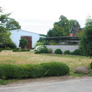
Reit- und Fahrstall 360,-€
Kölzin
Nicole Dabbert
@F-Rothacker
Fahrstall, Kutschwagen
Freizeitstall
Vermieten
Krankenbox
Paddock
Gnadenbrothof
Hufrehe geeignet
27 weitere...
B
Deprecated: Creation of dynamic property Zend_View_Helper_Ads::$adLink is deprecated in /var/www/stall-frei/htdocs/staging.stall-frei.de/library/Psf/View/Helper/Ads.php on line 108

Futtersack HeuToy, Fressbremse in pink
Mechtersen
STALL-FREIde Marketing
@STALL-FREI-Marketing
Stundenlange Beschäftigung die
Koliken vorbeugt, geringe Staubinhalation mit
steuerbarer Futterentnahme
Leider kein Vorschaubild
Leider kein Vorschaubild
B
Trakehnerhof Heidekrug
Gresse OT Heidekrug
Trakehnerhof Heidekrug
@Trakehnerhof_Heidekrug
FN-Mitglied
Geländestrecke
Führanlage
Longierzirkel/Roundpen
Allergikerstall
Hengsthaltung möglich
Außenbox mit Paddock
Innenbox
17 weitere...
ganz aktuell
P


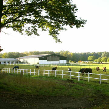
Ganzjahres-Stallplatz in 19258 Nostorf
Nostorf
Hof-Lindemann
@Hof-Lindemann1
Fahrstall, Kutschwagen
Freizeitstall
Vermieten
Krankenbox
Longierzirkel/Roundpen
Gnadenbrothof
Notfallboxen
11 weitere...
P+
Leider kein Vorschaubild
Leider kein Vorschaubild
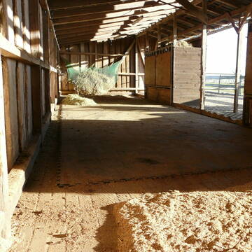
1 Pferdebox für freundlichen Wallach frei
Gudow
Förster
@NettePferde
Parkplatz für Pferdeanhänger
Außenboxen
Vollpension
Einzelne Boxen oder Stallplätze
aktuell
B


Zur Zeit sind alle Plätze belegt.
Bleckede
Daniela-B
@Daniela-B
Freizeitstall
Hunde willkommen
Krankenbox
Notfallboxen
Offenstall
Paddock Trail
11 weitere...
P+
Leider kein Vorschaubild
Leider kein Vorschaubild
Paddocktrail Offenstall für Freizeitreiter
Besenthal
Schubert
@Hof-Trailblick
Freizeitstall
Gangpferdereiten
Vermieten
Hunde willkommen
Longierzirkel/Roundpen
Fohlenaufzucht möglich
16 weitere...
B

Heu aus neuer Ernte
Mechtersen
STALL-FREIde Marketing
@STALL-FREI-Marketing
Heulage und Pferdeheu aus der neuen Ernte findest du in unserem Futtermarkt

Boxen frei: Sport- und Zuchtanlage Weiß
Schmilau
Petra Weiß
@Weiss.Pferde
FN-Mitglied
Geländestrecke
Vermieten
Hunde willkommen
Krankenbox
Notfallboxen
Pferdezucht
20 weitere...
P
Reitsportanlage Schmilau bei Lübeck
Schmilau
Marissa Behrens
@Marissa Behrens
Freizeitstall
Pferdeausbildung
Longierzirkel/Roundpen
Paddock
Außenbox mit Paddock
Außenboxen
Vollpension
9 weitere...
P
Leider kein Vorschaubild
Leider kein Vorschaubild
Kleiner Stall hat 1-2 Plätze für Reheponys frei
Horst
A. Plewe
@Amrei
Freizeitstall
Geländestrecke
Vermieten
Paddock
Pensions- und Gastboxen
Allergikerstall
Hufrehe geeignet
9 weitere...
B
Deprecated: Creation of dynamic property Zend_View::$pageCount is deprecated in /var/www/stall-frei/htdocs/staging.stall-frei.de/library/vendor/shardj/zf1-future/library/Zend/View/Abstract.php on line 308
Deprecated: Creation of dynamic property Zend_View::$itemCountPerPage is deprecated in /var/www/stall-frei/htdocs/staging.stall-frei.de/library/vendor/shardj/zf1-future/library/Zend/View/Abstract.php on line 308
Deprecated: Creation of dynamic property Zend_View::$first is deprecated in /var/www/stall-frei/htdocs/staging.stall-frei.de/library/vendor/shardj/zf1-future/library/Zend/View/Abstract.php on line 308
Deprecated: Creation of dynamic property Zend_View::$current is deprecated in /var/www/stall-frei/htdocs/staging.stall-frei.de/library/vendor/shardj/zf1-future/library/Zend/View/Abstract.php on line 308
Deprecated: Creation of dynamic property Zend_View::$last is deprecated in /var/www/stall-frei/htdocs/staging.stall-frei.de/library/vendor/shardj/zf1-future/library/Zend/View/Abstract.php on line 308
Deprecated: Creation of dynamic property Zend_View::$next is deprecated in /var/www/stall-frei/htdocs/staging.stall-frei.de/library/vendor/shardj/zf1-future/library/Zend/View/Abstract.php on line 308
Deprecated: Creation of dynamic property Zend_View::$pagesInRange is deprecated in /var/www/stall-frei/htdocs/staging.stall-frei.de/library/vendor/shardj/zf1-future/library/Zend/View/Abstract.php on line 308
Deprecated: Creation of dynamic property Zend_View::$firstPageInRange is deprecated in /var/www/stall-frei/htdocs/staging.stall-frei.de/library/vendor/shardj/zf1-future/library/Zend/View/Abstract.php on line 308
Deprecated: Creation of dynamic property Zend_View::$lastPageInRange is deprecated in /var/www/stall-frei/htdocs/staging.stall-frei.de/library/vendor/shardj/zf1-future/library/Zend/View/Abstract.php on line 308
Deprecated: Creation of dynamic property Zend_View::$currentItemCount is deprecated in /var/www/stall-frei/htdocs/staging.stall-frei.de/library/vendor/shardj/zf1-future/library/Zend/View/Abstract.php on line 308
Deprecated: Creation of dynamic property Zend_View::$totalItemCount is deprecated in /var/www/stall-frei/htdocs/staging.stall-frei.de/library/vendor/shardj/zf1-future/library/Zend/View/Abstract.php on line 308
Deprecated: Creation of dynamic property Zend_View::$firstItemNumber is deprecated in /var/www/stall-frei/htdocs/staging.stall-frei.de/library/vendor/shardj/zf1-future/library/Zend/View/Abstract.php on line 308
Deprecated: Creation of dynamic property Zend_View::$lastItemNumber is deprecated in /var/www/stall-frei/htdocs/staging.stall-frei.de/library/vendor/shardj/zf1-future/library/Zend/View/Abstract.php on line 308
Deprecated: Creation of dynamic property Zend_View::$router is deprecated in /var/www/stall-frei/htdocs/staging.stall-frei.de/library/vendor/shardj/zf1-future/library/Zend/View/Abstract.php on line 308
Deprecated: Creation of dynamic property Zend_View::$urlParams is deprecated in /var/www/stall-frei/htdocs/staging.stall-frei.de/library/vendor/shardj/zf1-future/library/Zend/View/Abstract.php on line 308
Deprecated: Creation of dynamic property Zend_View::$showAds is deprecated in /var/www/stall-frei/htdocs/staging.stall-frei.de/library/vendor/shardj/zf1-future/library/Zend/View/Abstract.php on line 308
Deprecated: Creation of dynamic property Zend_View::$objectIds is deprecated in /var/www/stall-frei/htdocs/staging.stall-frei.de/library/vendor/shardj/zf1-future/library/Zend/View/Abstract.php on line 308
Deprecated: Creation of dynamic property Zend_View::$showNavbar is deprecated in /var/www/stall-frei/htdocs/staging.stall-frei.de/library/vendor/shardj/zf1-future/library/Zend/View/Abstract.php on line 308
Deprecated: Creation of dynamic property Zend_View::$showBreadcrumb is deprecated in /var/www/stall-frei/htdocs/staging.stall-frei.de/library/vendor/shardj/zf1-future/library/Zend/View/Abstract.php on line 308
Deprecated: Creation of dynamic property Zend_View::$showFooter is deprecated in /var/www/stall-frei/htdocs/staging.stall-frei.de/library/vendor/shardj/zf1-future/library/Zend/View/Abstract.php on line 308
Deprecated: Creation of dynamic property Zend_View::$showInternalAds is deprecated in /var/www/stall-frei/htdocs/staging.stall-frei.de/library/vendor/shardj/zf1-future/library/Zend/View/Abstract.php on line 308
Deprecated: Creation of dynamic property Zend_View::$blNoContent is deprecated in /var/www/stall-frei/htdocs/staging.stall-frei.de/library/vendor/shardj/zf1-future/library/Zend/View/Abstract.php on line 308
Deprecated: Creation of dynamic property Zend_View::$sMetaDesc is deprecated in /var/www/stall-frei/htdocs/staging.stall-frei.de/library/vendor/shardj/zf1-future/library/Zend/View/Abstract.php on line 308
Deprecated: Creation of dynamic property Zend_View::$useGmaps is deprecated in /var/www/stall-frei/htdocs/staging.stall-frei.de/library/vendor/shardj/zf1-future/library/Zend/View/Abstract.php on line 308
Deprecated: Creation of dynamic property Zend_View::$touches is deprecated in /var/www/stall-frei/htdocs/staging.stall-frei.de/library/vendor/shardj/zf1-future/library/Zend/View/Abstract.php on line 308
Deprecated: Creation of dynamic property Zend_View::$oProject is deprecated in /var/www/stall-frei/htdocs/staging.stall-frei.de/library/vendor/shardj/zf1-future/library/Zend/View/Abstract.php on line 308
Deprecated: Creation of dynamic property Zend_View::$pageHeadline is deprecated in /var/www/stall-frei/htdocs/staging.stall-frei.de/library/vendor/shardj/zf1-future/library/Zend/View/Abstract.php on line 308
Deprecated: Creation of dynamic property Zend_View::$disableLocationField is deprecated in /var/www/stall-frei/htdocs/staging.stall-frei.de/library/vendor/shardj/zf1-future/library/Zend/View/Abstract.php on line 308
Deprecated: Creation of dynamic property Zend_View::$isSearch is deprecated in /var/www/stall-frei/htdocs/staging.stall-frei.de/library/vendor/shardj/zf1-future/library/Zend/View/Abstract.php on line 308
Deprecated: Creation of dynamic property Zend_View::$pageTitle is deprecated in /var/www/stall-frei/htdocs/staging.stall-frei.de/library/vendor/shardj/zf1-future/library/Zend/View/Abstract.php on line 308
Deprecated: Creation of dynamic property Psf_Form_Element_Text::$class is deprecated in /var/www/stall-frei/htdocs/staging.stall-frei.de/library/vendor/shardj/zf1-future/library/Zend/Form/Element.php on line 874
Deprecated: Creation of dynamic property Psf_Form_Element_Text::$size is deprecated in /var/www/stall-frei/htdocs/staging.stall-frei.de/library/vendor/shardj/zf1-future/library/Zend/Form/Element.php on line 874
Deprecated: Creation of dynamic property Psf_Form_Element_Text::$placeholder is deprecated in /var/www/stall-frei/htdocs/staging.stall-frei.de/library/vendor/shardj/zf1-future/library/Zend/Form/Element.php on line 874
Deprecated: Creation of dynamic property Psf_Form_Element_Hidden::$class is deprecated in /var/www/stall-frei/htdocs/staging.stall-frei.de/library/vendor/shardj/zf1-future/library/Zend/Form/Element.php on line 874
Deprecated: Creation of dynamic property Psf_Form_Element_Hidden::$class is deprecated in /var/www/stall-frei/htdocs/staging.stall-frei.de/library/vendor/shardj/zf1-future/library/Zend/Form/Element.php on line 874
Deprecated: Creation of dynamic property Psf_Form_Element_Hidden::$class is deprecated in /var/www/stall-frei/htdocs/staging.stall-frei.de/library/vendor/shardj/zf1-future/library/Zend/Form/Element.php on line 874
Deprecated: Creation of dynamic property Psf_Form_Element_Hidden::$class is deprecated in /var/www/stall-frei/htdocs/staging.stall-frei.de/library/vendor/shardj/zf1-future/library/Zend/Form/Element.php on line 874
Deprecated: Creation of dynamic property Psf_Form_Element_Select::$class is deprecated in /var/www/stall-frei/htdocs/staging.stall-frei.de/library/vendor/shardj/zf1-future/library/Zend/Form/Element.php on line 874
Deprecated: Creation of dynamic property Psf_Form_Element_Select::$class is deprecated in /var/www/stall-frei/htdocs/staging.stall-frei.de/library/vendor/shardj/zf1-future/library/Zend/Form/Element.php on line 874
Deprecated: Creation of dynamic property Psf_Form_Element_Select::$class is deprecated in /var/www/stall-frei/htdocs/staging.stall-frei.de/library/vendor/shardj/zf1-future/library/Zend/Form/Element.php on line 874
Deprecated: Creation of dynamic property Psf_Form_Element_Select::$class is deprecated in /var/www/stall-frei/htdocs/staging.stall-frei.de/library/vendor/shardj/zf1-future/library/Zend/Form/Element.php on line 874
Deprecated: Creation of dynamic property Psf_Form_Element_Text::$class is deprecated in /var/www/stall-frei/htdocs/staging.stall-frei.de/library/vendor/shardj/zf1-future/library/Zend/Form/Element.php on line 874
Deprecated: Creation of dynamic property Psf_Form_Element_Checkbox::$label is deprecated in /var/www/stall-frei/htdocs/staging.stall-frei.de/library/vendor/shardj/zf1-future/library/Zend/Form/Element.php on line 874
Deprecated: Creation of dynamic property Zend_View::$sort is deprecated in /var/www/stall-frei/htdocs/staging.stall-frei.de/library/vendor/shardj/zf1-future/library/Zend/View/Abstract.php on line 308
Deprecated: Creation of dynamic property Zend_View::$searchLocation is deprecated in /var/www/stall-frei/htdocs/staging.stall-frei.de/library/vendor/shardj/zf1-future/library/Zend/View/Abstract.php on line 308
Deprecated: Creation of dynamic property Zend_View::$locationHint is deprecated in /var/www/stall-frei/htdocs/staging.stall-frei.de/library/vendor/shardj/zf1-future/library/Zend/View/Abstract.php on line 308
Psf_GeoCoder_Abstract::getLocation: Kogel Get Location CachedOrLive
Psf_GeoCoder_Abstract::getCachedOrLive: Kogel
Psf_GeoCoder_OpenCageData::makeApiRequest: response:
Array
(
[documentation] => https://opencagedata.com/api
[licenses] => Array
(
[0] => Array
(
[name] => see attribution guide
[url] => https://opencagedata.com/credits
)
)
[results] => Array
(
[0] => Array
(
[bounds] => Array
(
[northeast] => Array
(
[lat] => 53.5358389
[lng] => 10.9813287
)
[southwest] => Array
(
[lat] => 53.4550287
[lng] => 10.8868644
)
)
[components] => Array
(
[ISO_3166-1_alpha-2] => DE
[ISO_3166-1_alpha-3] => DEU
[ISO_3166-2] => Array
(
[0] => DE-MV
)
[_category] => place
[_normalized_city] => Kogel
[_type] => village
[continent] => Europe
[country] => Deutschland
[country_code] => de
[county] => Ludwigslust-Parchim
[municipality] => Zarrentin
[political_union] => European Union
[state] => Mecklenburg-Vorpommern
[state_code] => MV
[village] => Kogel
)
[confidence] => 7
[formatted] => Kogel, Mecklenburg-Vorpommern, Deutschland
[geometry] => Array
(
[lat] => 53.4999771
[lng] => 10.9462657
)
)
[1] => Array
(
[bounds] => Array
(
[northeast] => Array
(
[lat] => 53.4276813
[lng] => 12.4376
)
[southwest] => Array
(
[lat] => 53.3876813
[lng] => 12.3976
)
)
[components] => Array
(
[ISO_3166-1_alpha-2] => DE
[ISO_3166-1_alpha-3] => DEU
[ISO_3166-2] => Array
(
[0] => DE-MV
)
[_category] => place
[_normalized_city] => Fünfseen
[_type] => hamlet
[city] => Fünfseen
[continent] => Europe
[country] => Deutschland
[country_code] => de
[county] => Mecklenburgische Seenplatte
[hamlet] => Kogel
[municipality] => Malchow
[political_union] => European Union
[state] => Mecklenburg-Vorpommern
[state_code] => MV
)
[confidence] => 7
[formatted] => Kogel, Fünfseen, Mecklenburg-Vorpommern, Deutschland
[geometry] => Array
(
[lat] => 53.4076813
[lng] => 12.4176
)
)
[2] => Array
(
[bounds] => Array
(
[northeast] => Array
(
[lat] => 47.67002
[lng] => 11.5308684
)
[southwest] => Array
(
[lat] => 47.66992
[lng] => 11.5307684
)
)
[components] => Array
(
[ISO_3166-1_alpha-2] => DE
[ISO_3166-1_alpha-3] => DEU
[ISO_3166-2] => Array
(
[0] => DE-BY
)
[_category] => natural/water
[_normalized_city] => Lenggries
[_type] => peak
[continent] => Europe
[country] => Deutschland
[country_code] => de
[county] => Landkreis Bad Tölz-Wolfratshausen
[peak] => Kogel
[political_union] => European Union
[postcode] => 83661
[state] => Bayern
[state_code] => BY
[town] => Lenggries
)
[confidence] => 9
[formatted] => Kogel, 83661 Lenggries, Deutschland
[geometry] => Array
(
[lat] => 47.66997
[lng] => 11.5308184
)
)
[3] => Array
(
[bounds] => Array
(
[northeast] => Array
(
[lat] => 47.6093135
[lng] => 12.8892453
)
[southwest] => Array
(
[lat] => 47.6092135
[lng] => 12.8891453
)
)
[components] => Array
(
[ISO_3166-1_alpha-2] => DE
[ISO_3166-1_alpha-3] => DEU
[ISO_3166-2] => Array
(
[0] => DE-BY
)
[_category] => natural/water
[_normalized_city] => Ramsau bei Berchtesgaden
[_type] => peak
[continent] => Europe
[country] => Deutschland
[country_code] => de
[county] => Landkreis Berchtesgadener Land
[peak] => Kogel
[political_union] => European Union
[postcode] => 83486
[state] => Bayern
[state_code] => BY
[village] => Ramsau bei Berchtesgaden
)
[confidence] => 9
[formatted] => Kogel, 83486 Ramsau bei Berchtesgaden, Deutschland
[geometry] => Array
(
[lat] => 47.6092635
[lng] => 12.8891953
)
)
[4] => Array
(
[bounds] => Array
(
[northeast] => Array
(
[lat] => 53.6581892
[lng] => 10.8348229
)
[southwest] => Array
(
[lat] => 53.6181892
[lng] => 10.7948229
)
)
[components] => Array
(
[ISO_3166-1_alpha-2] => DE
[ISO_3166-1_alpha-3] => DEU
[ISO_3166-2] => Array
(
[0] => DE-SH
)
[_category] => place
[_normalized_city] => Sterley
[_type] => hamlet
[continent] => Europe
[country] => Deutschland
[country_code] => de
[county] => Kreis Herzogtum Lauenburg
[hamlet] => Kogel
[municipality] => Lauenburgische Seen
[political_union] => European Union
[postcode] => 23883
[state] => Schleswig-Holstein
[state_code] => SH
[village] => Sterley
)
[confidence] => 7
[formatted] => Kogel, 23883 Sterley, Deutschland
[geometry] => Array
(
[lat] => 53.6381892
[lng] => 10.8148229
)
)
[5] => Array
(
[components] => Array
(
[ISO_3166-1_alpha-2] => FR
[ISO_3166-1_alpha-3] => FRA
[ISO_3166-2] => Array
(
[0] => FR-BRE
[1] => FR-29
)
[_category] => road
[_normalized_city] => Plomeur
[_type] => road
[city] => Plomeur
[continent] => Europe
[country] => France
[country_code] => fr
[county] => Finistère
[local_authority] => Communauté de communes du Pays Bigouden Sud
[political_union] => European Union
[postcode] => 29120
[road] => Kogell Reunaour
[state] => Bretagne
[state_code] => BRE
)
[confidence] => 2
[formatted] => Kogell Reunaour, 29120 Plomeur, France
[geometry] => Array
(
[lat] => 47.836716
[lng] => -4.339429
)
)
[6] => Array
(
[components] => Array
(
[ISO_3166-1_alpha-2] => FR
[ISO_3166-1_alpha-3] => FRA
[ISO_3166-2] => Array
(
[0] => FR-PDL
[1] => FR-44
)
[_category] => road
[_normalized_city] => Guérande
[_type] => road
[city] => Guérande
[continent] => Europe
[country] => France
[country_code] => fr
[county] => Loire-Atlantique
[local_authority] => Communauté d'agglomération de la Presqu'île de Guérande - Atlantique
[political_union] => European Union
[postcode] => 44350
[road] => Route de Cogea
[state] => Pays de la Loire
[state_code] => PDL
)
[confidence] => 2
[formatted] => Route de Cogea, 44350 Guérande, France
[geometry] => Array
(
[lat] => 47.344027
[lng] => -2.352034
)
)
[7] => Array
(
[components] => Array
(
[ISO_3166-1_alpha-2] => FR
[ISO_3166-1_alpha-3] => FRA
[ISO_3166-2] => Array
(
[0] => FR-BRE
[1] => FR-29
)
[_category] => road
[_normalized_city] => Crozon
[_type] => road
[city] => Crozon
[continent] => Europe
[country] => France
[country_code] => fr
[county] => Finistère
[local_authority] => Communauté de communes Presqu’île de Crozon-Aulne Maritime
[political_union] => European Union
[postcode] => 29160
[road] => An Aogell
[state] => Bretagne
[state_code] => BRE
)
[confidence] => 2
[formatted] => An Aogell, 29160 Crozon, France
[geometry] => Array
(
[lat] => 48.252039
[lng] => -4.524803
)
)
[8] => Array
(
[components] => Array
(
[ISO_3166-1_alpha-2] => FR
[ISO_3166-1_alpha-3] => FRA
[ISO_3166-2] => Array
(
[0] => FR-HDF
[1] => FR-62
)
[_category] => road
[_normalized_city] => Coquelles
[_type] => road
[city] => Coquelles
[continent] => Europe
[country] => France
[country_code] => fr
[county] => Pas-de-Calais
[local_authority] => Grand Calais Terres et Mers
[political_union] => European Union
[postcode] => 62231
[road] => Rue des Flandres
[state] => Hauts-de-France
[state_code] => HDF
)
[confidence] => 2
[formatted] => Rue des Flandres, 62231 Coquelles, France
[geometry] => Array
(
[lat] => 50.934192
[lng] => 1.795427
)
)
[9] => Array
(
[components] => Array
(
[ISO_3166-1_alpha-2] => FR
[ISO_3166-1_alpha-3] => FRA
[ISO_3166-2] => Array
(
[0] => FR-PDL
[1] => FR-44
)
[_category] => road
[_normalized_city] => Saint-Nazaire
[_type] => road
[city] => Saint-Nazaire
[continent] => Europe
[country] => France
[country_code] => fr
[county] => Loire-Atlantique
[local_authority] => Communauté d'agglomération de la Région Nazairienne et de l'Estuaire
[political_union] => European Union
[postcode] => 44600
[road] => Place Henri Fogel
[state] => Pays de la Loire
[state_code] => PDL
)
[confidence] => 10
[formatted] => Place Henri Fogel, 44600 Saint-Nazaire, France
[geometry] => Array
(
[lat] => 47.26365
[lng] => -2.24338
)
)
)
[status] => Array
(
[code] => 200
[message] => OK
)
[stay_informed] => Array
(
[blog] => https://blog.opencagedata.com
[mastodon] => https://en.osm.town/@opencage
)
[thanks] => For using an OpenCage API
[timestamp] => Array
(
[created_http] => Sat, 07 Feb 2026 14:18:24 GMT
[created_unix] => 1770473904
)
[total_results] => 10
)
Psf_GeoCoder_Abstract::convertLocationResult
{"documentation":"https:\/\/opencagedata.com\/api","licenses":[{"name":"see attribution guide","url":"https:\/\/opencagedata.com\/credits"}],"results":[{"bounds":{"northeast":{"lat":53.5358389,"lng":10.9813287},"southwest":{"lat":53.4550287,"lng":10.8868644}},"components":{"ISO_3166-1_alpha-2":"DE","ISO_3166-1_alpha-3":"DEU","ISO_3166-2":["DE-MV"],"_category":"place","_normalized_city":"Kogel","_type":"village","continent":"Europe","country":"Deutschland","country_code":"de","county":"Ludwigslust-Parchim","municipality":"Zarrentin","political_union":"European Union","state":"Mecklenburg-Vorpommern","state_code":"MV","village":"Kogel"},"confidence":7,"formatted":"Kogel, Mecklenburg-Vorpommern, Deutschland","geometry":{"lat":53.4999771,"lng":10.9462657}},{"bounds":{"northeast":{"lat":53.4276813,"lng":12.4376},"southwest":{"lat":53.3876813,"lng":12.3976}},"components":{"ISO_3166-1_alpha-2":"DE","ISO_3166-1_alpha-3":"DEU","ISO_3166-2":["DE-MV"],"_category":"place","_normalized_city":"F\u00fcnfseen","_type":"hamlet","city":"F\u00fcnfseen","continent":"Europe","country":"Deutschland","country_code":"de","county":"Mecklenburgische Seenplatte","hamlet":"Kogel","municipality":"Malchow","political_union":"European Union","state":"Mecklenburg-Vorpommern","state_code":"MV"},"confidence":7,"formatted":"Kogel, F\u00fcnfseen, Mecklenburg-Vorpommern, Deutschland","geometry":{"lat":53.4076813,"lng":12.4176}},{"bounds":{"northeast":{"lat":47.67002,"lng":11.5308684},"southwest":{"lat":47.66992,"lng":11.5307684}},"components":{"ISO_3166-1_alpha-2":"DE","ISO_3166-1_alpha-3":"DEU","ISO_3166-2":["DE-BY"],"_category":"natural\/water","_normalized_city":"Lenggries","_type":"peak","continent":"Europe","country":"Deutschland","country_code":"de","county":"Landkreis Bad T\u00f6lz-Wolfratshausen","peak":"Kogel","political_union":"European Union","postcode":"83661","state":"Bayern","state_code":"BY","town":"Lenggries"},"confidence":9,"formatted":"Kogel, 83661 Lenggries, Deutschland","geometry":{"lat":47.66997,"lng":11.5308184}},{"bounds":{"northeast":{"lat":47.6093135,"lng":12.8892453},"southwest":{"lat":47.6092135,"lng":12.8891453}},"components":{"ISO_3166-1_alpha-2":"DE","ISO_3166-1_alpha-3":"DEU","ISO_3166-2":["DE-BY"],"_category":"natural\/water","_normalized_city":"Ramsau bei Berchtesgaden","_type":"peak","continent":"Europe","country":"Deutschland","country_code":"de","county":"Landkreis Berchtesgadener Land","peak":"Kogel","political_union":"European Union","postcode":"83486","state":"Bayern","state_code":"BY","village":"Ramsau bei Berchtesgaden"},"confidence":9,"formatted":"Kogel, 83486 Ramsau bei Berchtesgaden, Deutschland","geometry":{"lat":47.6092635,"lng":12.8891953}},{"bounds":{"northeast":{"lat":53.6581892,"lng":10.8348229},"southwest":{"lat":53.6181892,"lng":10.7948229}},"components":{"ISO_3166-1_alpha-2":"DE","ISO_3166-1_alpha-3":"DEU","ISO_3166-2":["DE-SH"],"_category":"place","_normalized_city":"Sterley","_type":"hamlet","continent":"Europe","country":"Deutschland","country_code":"de","county":"Kreis Herzogtum Lauenburg","hamlet":"Kogel","municipality":"Lauenburgische Seen","political_union":"European Union","postcode":"23883","state":"Schleswig-Holstein","state_code":"SH","village":"Sterley"},"confidence":7,"formatted":"Kogel, 23883 Sterley, Deutschland","geometry":{"lat":53.6381892,"lng":10.8148229}},{"components":{"ISO_3166-1_alpha-2":"FR","ISO_3166-1_alpha-3":"FRA","ISO_3166-2":["FR-BRE","FR-29"],"_category":"road","_normalized_city":"Plomeur","_type":"road","city":"Plomeur","continent":"Europe","country":"France","country_code":"fr","county":"Finist\u00e8re","local_authority":"Communaut\u00e9 de communes du Pays Bigouden Sud","political_union":"European Union","postcode":"29120","road":"Kogell Reunaour","state":"Bretagne","state_code":"BRE"},"confidence":2,"formatted":"Kogell Reunaour, 29120 Plomeur, France","geometry":{"lat":47.836716,"lng":-4.339429}},{"components":{"ISO_3166-1_alpha-2":"FR","ISO_3166-1_alpha-3":"FRA","ISO_3166-2":["FR-PDL","FR-44"],"_category":"road","_normalized_city":"Gu\u00e9rande","_type":"road","city":"Gu\u00e9rande","continent":"Europe","country":"France","country_code":"fr","county":"Loire-Atlantique","local_authority":"Communaut\u00e9 d'agglom\u00e9ration de la Presqu'\u00eele de Gu\u00e9rande - Atlantique","political_union":"European Union","postcode":"44350","road":"Route de Cogea","state":"Pays de la Loire","state_code":"PDL"},"confidence":2,"formatted":"Route de Cogea, 44350 Gu\u00e9rande, France","geometry":{"lat":47.344027,"lng":-2.352034}},{"components":{"ISO_3166-1_alpha-2":"FR","ISO_3166-1_alpha-3":"FRA","ISO_3166-2":["FR-BRE","FR-29"],"_category":"road","_normalized_city":"Crozon","_type":"road","city":"Crozon","continent":"Europe","country":"France","country_code":"fr","county":"Finist\u00e8re","local_authority":"Communaut\u00e9 de communes Presqu\u2019\u00eele de Crozon-Aulne Maritime","political_union":"European Union","postcode":"29160","road":"An Aogell","state":"Bretagne","state_code":"BRE"},"confidence":2,"formatted":"An Aogell, 29160 Crozon, France","geometry":{"lat":48.252039,"lng":-4.524803}},{"components":{"ISO_3166-1_alpha-2":"FR","ISO_3166-1_alpha-3":"FRA","ISO_3166-2":["FR-HDF","FR-62"],"_category":"road","_normalized_city":"Coquelles","_type":"road","city":"Coquelles","continent":"Europe","country":"France","country_code":"fr","county":"Pas-de-Calais","local_authority":"Grand Calais Terres et Mers","political_union":"European Union","postcode":"62231","road":"Rue des Flandres","state":"Hauts-de-France","state_code":"HDF"},"confidence":2,"formatted":"Rue des Flandres, 62231 Coquelles, France","geometry":{"lat":50.934192,"lng":1.795427}},{"components":{"ISO_3166-1_alpha-2":"FR","ISO_3166-1_alpha-3":"FRA","ISO_3166-2":["FR-PDL","FR-44"],"_category":"road","_normalized_city":"Saint-Nazaire","_type":"road","city":"Saint-Nazaire","continent":"Europe","country":"France","country_code":"fr","county":"Loire-Atlantique","local_authority":"Communaut\u00e9 d'agglom\u00e9ration de la R\u00e9gion Nazairienne et de l'Estuaire","political_union":"European Union","postcode":"44600","road":"Place Henri Fogel","state":"Pays de la Loire","state_code":"PDL"},"confidence":10,"formatted":"Place Henri Fogel, 44600 Saint-Nazaire, France","geometry":{"lat":47.26365,"lng":-2.24338}}],"status":{"code":200,"message":"OK"},"stay_informed":{"blog":"https:\/\/blog.opencagedata.com","mastodon":"https:\/\/en.osm.town\/@opencage"},"thanks":"For using an OpenCage API","timestamp":{"created_http":"Sat, 07 Feb 2026 14:18:24 GMT","created_unix":1770473904},"total_results":10}Array
(
[0] => stdClass Object
(
[bounds] => stdClass Object
(
[northeast] => stdClass Object
(
[lat] => 53.5358389
[lng] => 10.9813287
)
[southwest] => stdClass Object
(
[lat] => 53.4550287
[lng] => 10.8868644
)
)
[components] => stdClass Object
(
[ISO_3166-1_alpha-2] => DE
[ISO_3166-1_alpha-3] => DEU
[ISO_3166-2] => Array
(
[0] => DE-MV
)
[_category] => place
[_normalized_city] => Kogel
[_type] => village
[continent] => Europe
[country] => Deutschland
[country_code] => de
[county] => Ludwigslust-Parchim
[municipality] => Zarrentin
[political_union] => European Union
[state] => Mecklenburg-Vorpommern
[state_code] => MV
[village] => Kogel
)
[confidence] => 7
[formatted] => Kogel, Mecklenburg-Vorpommern, Deutschland
[geometry] => stdClass Object
(
[lat] => 53.4999771
[lng] => 10.9462657
)
)
[1] => stdClass Object
(
[bounds] => stdClass Object
(
[northeast] => stdClass Object
(
[lat] => 53.4276813
[lng] => 12.4376
)
[southwest] => stdClass Object
(
[lat] => 53.3876813
[lng] => 12.3976
)
)
[components] => stdClass Object
(
[ISO_3166-1_alpha-2] => DE
[ISO_3166-1_alpha-3] => DEU
[ISO_3166-2] => Array
(
[0] => DE-MV
)
[_category] => place
[_normalized_city] => Fünfseen
[_type] => hamlet
[city] => Fünfseen
[continent] => Europe
[country] => Deutschland
[country_code] => de
[county] => Mecklenburgische Seenplatte
[hamlet] => Kogel
[municipality] => Malchow
[political_union] => European Union
[state] => Mecklenburg-Vorpommern
[state_code] => MV
)
[confidence] => 7
[formatted] => Kogel, Fünfseen, Mecklenburg-Vorpommern, Deutschland
[geometry] => stdClass Object
(
[lat] => 53.4076813
[lng] => 12.4176
)
)
[2] => stdClass Object
(
[bounds] => stdClass Object
(
[northeast] => stdClass Object
(
[lat] => 47.67002
[lng] => 11.5308684
)
[southwest] => stdClass Object
(
[lat] => 47.66992
[lng] => 11.5307684
)
)
[components] => stdClass Object
(
[ISO_3166-1_alpha-2] => DE
[ISO_3166-1_alpha-3] => DEU
[ISO_3166-2] => Array
(
[0] => DE-BY
)
[_category] => natural/water
[_normalized_city] => Lenggries
[_type] => peak
[continent] => Europe
[country] => Deutschland
[country_code] => de
[county] => Landkreis Bad Tölz-Wolfratshausen
[peak] => Kogel
[political_union] => European Union
[postcode] => 83661
[state] => Bayern
[state_code] => BY
[town] => Lenggries
)
[confidence] => 9
[formatted] => Kogel, 83661 Lenggries, Deutschland
[geometry] => stdClass Object
(
[lat] => 47.66997
[lng] => 11.5308184
)
)
[3] => stdClass Object
(
[bounds] => stdClass Object
(
[northeast] => stdClass Object
(
[lat] => 47.6093135
[lng] => 12.8892453
)
[southwest] => stdClass Object
(
[lat] => 47.6092135
[lng] => 12.8891453
)
)
[components] => stdClass Object
(
[ISO_3166-1_alpha-2] => DE
[ISO_3166-1_alpha-3] => DEU
[ISO_3166-2] => Array
(
[0] => DE-BY
)
[_category] => natural/water
[_normalized_city] => Ramsau bei Berchtesgaden
[_type] => peak
[continent] => Europe
[country] => Deutschland
[country_code] => de
[county] => Landkreis Berchtesgadener Land
[peak] => Kogel
[political_union] => European Union
[postcode] => 83486
[state] => Bayern
[state_code] => BY
[village] => Ramsau bei Berchtesgaden
)
[confidence] => 9
[formatted] => Kogel, 83486 Ramsau bei Berchtesgaden, Deutschland
[geometry] => stdClass Object
(
[lat] => 47.6092635
[lng] => 12.8891953
)
)
[4] => stdClass Object
(
[bounds] => stdClass Object
(
[northeast] => stdClass Object
(
[lat] => 53.6581892
[lng] => 10.8348229
)
[southwest] => stdClass Object
(
[lat] => 53.6181892
[lng] => 10.7948229
)
)
[components] => stdClass Object
(
[ISO_3166-1_alpha-2] => DE
[ISO_3166-1_alpha-3] => DEU
[ISO_3166-2] => Array
(
[0] => DE-SH
)
[_category] => place
[_normalized_city] => Sterley
[_type] => hamlet
[continent] => Europe
[country] => Deutschland
[country_code] => de
[county] => Kreis Herzogtum Lauenburg
[hamlet] => Kogel
[municipality] => Lauenburgische Seen
[political_union] => European Union
[postcode] => 23883
[state] => Schleswig-Holstein
[state_code] => SH
[village] => Sterley
)
[confidence] => 7
[formatted] => Kogel, 23883 Sterley, Deutschland
[geometry] => stdClass Object
(
[lat] => 53.6381892
[lng] => 10.8148229
)
)
[5] => stdClass Object
(
[components] => stdClass Object
(
[ISO_3166-1_alpha-2] => FR
[ISO_3166-1_alpha-3] => FRA
[ISO_3166-2] => Array
(
[0] => FR-BRE
[1] => FR-29
)
[_category] => road
[_normalized_city] => Plomeur
[_type] => road
[city] => Plomeur
[continent] => Europe
[country] => France
[country_code] => fr
[county] => Finistère
[local_authority] => Communauté de communes du Pays Bigouden Sud
[political_union] => European Union
[postcode] => 29120
[road] => Kogell Reunaour
[state] => Bretagne
[state_code] => BRE
)
[confidence] => 2
[formatted] => Kogell Reunaour, 29120 Plomeur, France
[geometry] => stdClass Object
(
[lat] => 47.836716
[lng] => -4.339429
)
)
[6] => stdClass Object
(
[components] => stdClass Object
(
[ISO_3166-1_alpha-2] => FR
[ISO_3166-1_alpha-3] => FRA
[ISO_3166-2] => Array
(
[0] => FR-PDL
[1] => FR-44
)
[_category] => road
[_normalized_city] => Guérande
[_type] => road
[city] => Guérande
[continent] => Europe
[country] => France
[country_code] => fr
[county] => Loire-Atlantique
[local_authority] => Communauté d'agglomération de la Presqu'île de Guérande - Atlantique
[political_union] => European Union
[postcode] => 44350
[road] => Route de Cogea
[state] => Pays de la Loire
[state_code] => PDL
)
[confidence] => 2
[formatted] => Route de Cogea, 44350 Guérande, France
[geometry] => stdClass Object
(
[lat] => 47.344027
[lng] => -2.352034
)
)
[7] => stdClass Object
(
[components] => stdClass Object
(
[ISO_3166-1_alpha-2] => FR
[ISO_3166-1_alpha-3] => FRA
[ISO_3166-2] => Array
(
[0] => FR-BRE
[1] => FR-29
)
[_category] => road
[_normalized_city] => Crozon
[_type] => road
[city] => Crozon
[continent] => Europe
[country] => France
[country_code] => fr
[county] => Finistère
[local_authority] => Communauté de communes Presqu’île de Crozon-Aulne Maritime
[political_union] => European Union
[postcode] => 29160
[road] => An Aogell
[state] => Bretagne
[state_code] => BRE
)
[confidence] => 2
[formatted] => An Aogell, 29160 Crozon, France
[geometry] => stdClass Object
(
[lat] => 48.252039
[lng] => -4.524803
)
)
[8] => stdClass Object
(
[components] => stdClass Object
(
[ISO_3166-1_alpha-2] => FR
[ISO_3166-1_alpha-3] => FRA
[ISO_3166-2] => Array
(
[0] => FR-HDF
[1] => FR-62
)
[_category] => road
[_normalized_city] => Coquelles
[_type] => road
[city] => Coquelles
[continent] => Europe
[country] => France
[country_code] => fr
[county] => Pas-de-Calais
[local_authority] => Grand Calais Terres et Mers
[political_union] => European Union
[postcode] => 62231
[road] => Rue des Flandres
[state] => Hauts-de-France
[state_code] => HDF
)
[confidence] => 2
[formatted] => Rue des Flandres, 62231 Coquelles, France
[geometry] => stdClass Object
(
[lat] => 50.934192
[lng] => 1.795427
)
)
[9] => stdClass Object
(
[components] => stdClass Object
(
[ISO_3166-1_alpha-2] => FR
[ISO_3166-1_alpha-3] => FRA
[ISO_3166-2] => Array
(
[0] => FR-PDL
[1] => FR-44
)
[_category] => road
[_normalized_city] => Saint-Nazaire
[_type] => road
[city] => Saint-Nazaire
[continent] => Europe
[country] => France
[country_code] => fr
[county] => Loire-Atlantique
[local_authority] => Communauté d'agglomération de la Région Nazairienne et de l'Estuaire
[political_union] => European Union
[postcode] => 44600
[road] => Place Henri Fogel
[state] => Pays de la Loire
[state_code] => PDL
)
[confidence] => 10
[formatted] => Place Henri Fogel, 44600 Saint-Nazaire, France
[geometry] => stdClass Object
(
[lat] => 47.26365
[lng] => -2.24338
)
)
)
Psf_GeoCoder_OpenCageData::getKeyMap: 0
stdClass Object
(
    [bounds] => stdClass Object
        (
            [northeast] => stdClass Object
                (
                    [lat] => 53.5358389
                    [lng] => 10.9813287
                )

            [southwest] => stdClass Object
                (
                    [lat] => 53.4550287
                    [lng] => 10.8868644
                )

        )

    [components] => stdClass Object
        (
            [ISO_3166-1_alpha-2] => DE
            [ISO_3166-1_alpha-3] => DEU
            [ISO_3166-2] => Array
                (
                    [0] => DE-MV
                )

            [_category] => place
            [_normalized_city] => Kogel
            [_type] => village
            [continent] => Europe
            [country] => Deutschland
            [country_code] => de
            [county] => Ludwigslust-Parchim
            [municipality] => Zarrentin
            [political_union] => European Union
            [state] => Mecklenburg-Vorpommern
            [state_code] => MV
            [village] => Kogel
        )

    [confidence] => 7
    [formatted] => Kogel, Mecklenburg-Vorpommern, Deutschland
    [geometry] => stdClass Object
        (
            [lat] => 53.4999771
            [lng] => 10.9462657
        )

)
Psf_GeoCoder_OpenCageData::getCounty: Ludwigslust-Parchim
Psf_GeoCoder_OpenCageData::addMissingData REFETCH!
Array
(
    [address] => Kogel, Mecklenburg-Vorpommern, Deutschland
    [type] => village
    [street] =>
    [city] => Kogel
    [county] => Ludwigslust-Parchim
    [state] => Mecklenburg-Vorpommern
    [zip] =>
    [country] => Deutschland
    [suburb] =>
    [countrycode] => de
    [latitude] => 53.4999771
    [longitude] => 10.9462657
    [accuracy] => 1
    [confidence] => 7
    [bounds] => stdClass Object
        (
            [northeast] => stdClass Object
                (
                    [lat] => 53.5358389
                    [lng] => 10.9813287
                )

            [southwest] => stdClass Object
                (
                    [lat] => 53.4550287
                    [lng] => 10.8868644
                )

        )

)
reformat!
Array
(
    [address] => Kogel, Mecklenburg-Vorpommern, Deutschland
    [type] => village
    [street] =>
    [city] => Kogel
    [county] => Ludwigslust-Parchim
    [state] => Mecklenburg-Vorpommern
    [zip] =>
    [country] => Deutschland
    [suburb] =>
    [countrycode] => de
    [latitude] => 53.4999771
    [longitude] => 10.9462657
    [accuracy] => 1
    [confidence] => 7
    [bounds] => stdClass Object
        (
            [northeast] => stdClass Object
                (
                    [lat] => 53.5358389
                    [lng] => 10.9813287
                )

            [southwest] => stdClass Object
                (
                    [lat] => 53.4550287
                    [lng] => 10.8868644
                )

        )

    [place] => Kogel, Mecklenburg-Vorpommern
    [hash] => f882e8a0839850720a7af4503303e566
)
Psf_GeoCoder_OpenCageData::getKeyMap: 1
stdClass Object
(
    [bounds] => stdClass Object
        (
            [northeast] => stdClass Object
                (
                    [lat] => 53.4276813
                    [lng] => 12.4376
                )

            [southwest] => stdClass Object
                (
                    [lat] => 53.3876813
                    [lng] => 12.3976
                )

        )

    [components] => stdClass Object
        (
            [ISO_3166-1_alpha-2] => DE
            [ISO_3166-1_alpha-3] => DEU
            [ISO_3166-2] => Array
                (
                    [0] => DE-MV
                )

            [_category] => place
            [_normalized_city] => Fünfseen
            [_type] => hamlet
            [city] => Fünfseen
            [continent] => Europe
            [country] => Deutschland
            [country_code] => de
            [county] => Mecklenburgische Seenplatte
            [hamlet] => Kogel
            [municipality] => Malchow
            [political_union] => European Union
            [state] => Mecklenburg-Vorpommern
            [state_code] => MV
        )

    [confidence] => 7
    [formatted] => Kogel, Fünfseen, Mecklenburg-Vorpommern, Deutschland
    [geometry] => stdClass Object
        (
            [lat] => 53.4076813
            [lng] => 12.4176
        )

)
Psf_GeoCoder_OpenCageData::getCounty: Mecklenburgische Seenplatte
Psf_GeoCoder_OpenCageData::addMissingData REFETCH!
Array
(
    [address] => Kogel, Fünfseen, Mecklenburg-Vorpommern, Deutschland
    [type] => hamlet
    [street] => Kogel
    [city] => Fünfseen
    [county] => Mecklenburgische Seenplatte
    [state] => Mecklenburg-Vorpommern
    [zip] =>
    [country] => Deutschland
    [suburb] =>
    [countrycode] => de
    [latitude] => 53.4076813
    [longitude] => 12.4176
    [accuracy] => 1
    [confidence] => 7
    [bounds] => stdClass Object
        (
            [northeast] => stdClass Object
                (
                    [lat] => 53.4276813
                    [lng] => 12.4376
                )

            [southwest] => stdClass Object
                (
                    [lat] => 53.3876813
                    [lng] => 12.3976
                )

        )

)
reformat!
Array
(
    [address] => Kogel, Fünfseen, Mecklenburg-Vorpommern, Deutschland
    [type] => hamlet
    [street] => Kogel
    [city] => Fünfseen
    [county] => Mecklenburgische Seenplatte
    [state] => Mecklenburg-Vorpommern
    [zip] =>
    [country] => Deutschland
    [suburb] =>
    [countrycode] => de
    [latitude] => 53.4076813
    [longitude] => 12.4176
    [accuracy] => 1
    [confidence] => 7
    [bounds] => stdClass Object
        (
            [northeast] => stdClass Object
                (
                    [lat] => 53.4276813
                    [lng] => 12.4376
                )

            [southwest] => stdClass Object
                (
                    [lat] => 53.3876813
                    [lng] => 12.3976
                )

        )

    [place] => Kogel, Fünfseen, Mecklenburg-Vorpommern
    [hash] => 0b4233b676a452c9b9e5e4e416074e6b
)
Psf_GeoCoder_OpenCageData::getKeyMap: 2
stdClass Object
(
    [bounds] => stdClass Object
        (
            [northeast] => stdClass Object
                (
                    [lat] => 47.67002
                    [lng] => 11.5308684
                )

            [southwest] => stdClass Object
                (
                    [lat] => 47.66992
                    [lng] => 11.5307684
                )

        )

    [components] => stdClass Object
        (
            [ISO_3166-1_alpha-2] => DE
            [ISO_3166-1_alpha-3] => DEU
            [ISO_3166-2] => Array
                (
                    [0] => DE-BY
                )

            [_category] => natural/water
            [_normalized_city] => Lenggries
            [_type] => peak
            [continent] => Europe
            [country] => Deutschland
            [country_code] => de
            [county] => Landkreis Bad Tölz-Wolfratshausen
            [peak] => Kogel
            [political_union] => European Union
            [postcode] => 83661
            [state] => Bayern
            [state_code] => BY
            [town] => Lenggries
        )

    [confidence] => 9
    [formatted] => Kogel, 83661 Lenggries, Deutschland
    [geometry] => stdClass Object
        (
            [lat] => 47.66997
            [lng] => 11.5308184
        )

)
Psf_GeoCoder_OpenCageData::getCounty: Bad Tölz-Wolfratshausen
Psf_GeoCoder_OpenCageData::addMissingData REFETCH!
Array
(
    [address] => Kogel, 83661 Lenggries, Deutschland
    [type] => peak
    [street] =>
    [city] => Lenggries
    [county] => Bad Tölz-Wolfratshausen
    [state] => Bayern
    [zip] => 83661
    [country] => Deutschland
    [suburb] =>
    [countrycode] => de
    [latitude] => 47.66997
    [longitude] => 11.5308184
    [accuracy] => 1
    [confidence] => 9
    [bounds] => stdClass Object
        (
            [northeast] => stdClass Object
                (
                    [lat] => 47.67002
                    [lng] => 11.5308684
                )

            [southwest] => stdClass Object
                (
                    [lat] => 47.66992
                    [lng] => 11.5307684
                )

        )

)
reformat!
Array
(
    [address] => Kogel, 83661 Lenggries, Deutschland
    [type] => peak
    [street] =>
    [city] => Lenggries
    [county] => Bad Tölz-Wolfratshausen
    [state] => Bayern
    [zip] => 83661
    [country] => Deutschland
    [suburb] =>
    [countrycode] => de
    [latitude] => 47.66997
    [longitude] => 11.5308184
    [accuracy] => 1
    [confidence] => 9
    [bounds] => stdClass Object
        (
            [northeast] => stdClass Object
                (
                    [lat] => 47.67002
                    [lng] => 11.5308684
                )

            [southwest] => stdClass Object
                (
                    [lat] => 47.66992
                    [lng] => 11.5307684
                )

        )

    [place] => 83661 Lenggries, Bayern
    [hash] => 12cc01347248183d60a1f568ecf73788
)
Psf_GeoCoder_OpenCageData::getKeyMap: 3
stdClass Object
(
    [bounds] => stdClass Object
        (
            [northeast] => stdClass Object
                (
                    [lat] => 47.6093135
                    [lng] => 12.8892453
                )

            [southwest] => stdClass Object
                (
                    [lat] => 47.6092135
                    [lng] => 12.8891453
                )

        )

    [components] => stdClass Object
        (
            [ISO_3166-1_alpha-2] => DE
            [ISO_3166-1_alpha-3] => DEU
            [ISO_3166-2] => Array
                (
                    [0] => DE-BY
                )

            [_category] => natural/water
            [_normalized_city] => Ramsau bei Berchtesgaden
            [_type] => peak
            [continent] => Europe
            [country] => Deutschland
            [country_code] => de
            [county] => Landkreis Berchtesgadener Land
            [peak] => Kogel
            [political_union] => European Union
            [postcode] => 83486
            [state] => Bayern
            [state_code] => BY
            [village] => Ramsau bei Berchtesgaden
        )

    [confidence] => 9
    [formatted] => Kogel, 83486 Ramsau bei Berchtesgaden, Deutschland
    [geometry] => stdClass Object
        (
            [lat] => 47.6092635
            [lng] => 12.8891953
        )

)
Psf_GeoCoder_OpenCageData::getCounty: Berchtesgadener Land
Psf_GeoCoder_OpenCageData::addMissingData REFETCH!
Array
(
    [address] => Kogel, 83486 Ramsau bei Berchtesgaden, Deutschland
    [type] => peak
    [street] =>
    [city] => Ramsau bei Berchtesgaden
    [county] => Berchtesgadener Land
    [state] => Bayern
    [zip] => 83486
    [country] => Deutschland
    [suburb] =>
    [countrycode] => de
    [latitude] => 47.6092635
    [longitude] => 12.8891953
    [accuracy] => 1
    [confidence] => 9
    [bounds] => stdClass Object
        (
            [northeast] => stdClass Object
                (
                    [lat] => 47.6093135
                    [lng] => 12.8892453
                )

            [southwest] => stdClass Object
                (
                    [lat] => 47.6092135
                    [lng] => 12.8891453
                )

        )

)
reformat!
Array
(
    [address] => Kogel, 83486 Ramsau bei Berchtesgaden, Deutschland
    [type] => peak
    [street] =>
    [city] => Ramsau bei Berchtesgaden
    [county] => Berchtesgadener Land
    [state] => Bayern
    [zip] => 83486
    [country] => Deutschland
    [suburb] =>
    [countrycode] => de
    [latitude] => 47.6092635
    [longitude] => 12.8891953
    [accuracy] => 1
    [confidence] => 9
    [bounds] => stdClass Object
        (
            [northeast] => stdClass Object
                (
                    [lat] => 47.6093135
                    [lng] => 12.8892453
                )

            [southwest] => stdClass Object
                (
                    [lat] => 47.6092135
                    [lng] => 12.8891453
                )

        )

    [place] => 83486 Ramsau bei Berchtesgaden, Bayern
    [hash] => 5052459742bbcf783c9c0fbd4c4c1c37
)
Psf_GeoCoder_OpenCageData::getKeyMap: 4
stdClass Object
(
    [bounds] => stdClass Object
        (
            [northeast] => stdClass Object
                (
                    [lat] => 53.6581892
                    [lng] => 10.8348229
                )

            [southwest] => stdClass Object
                (
                    [lat] => 53.6181892
                    [lng] => 10.7948229
                )

        )

    [components] => stdClass Object
        (
            [ISO_3166-1_alpha-2] => DE
            [ISO_3166-1_alpha-3] => DEU
            [ISO_3166-2] => Array
                (
                    [0] => DE-SH
                )

            [_category] => place
            [_normalized_city] => Sterley
            [_type] => hamlet
            [continent] => Europe
            [country] => Deutschland
            [country_code] => de
            [county] => Kreis Herzogtum Lauenburg
            [hamlet] => Kogel
            [municipality] => Lauenburgische Seen
            [political_union] => European Union
            [postcode] => 23883
            [state] => Schleswig-Holstein
            [state_code] => SH
            [village] => Sterley
        )

    [confidence] => 7
    [formatted] => Kogel, 23883 Sterley, Deutschland
    [geometry] => stdClass Object
        (
            [lat] => 53.6381892
            [lng] => 10.8148229
        )

)
Psf_GeoCoder_OpenCageData::getCounty: Herzogtum Lauenburg
Psf_GeoCoder_OpenCageData::addMissingData REFETCH!
Array
(
    [address] => Kogel, 23883 Sterley, Deutschland
    [type] => hamlet
    [street] => Kogel
    [city] => Sterley
    [county] => Herzogtum Lauenburg
    [state] => Schleswig-Holstein
    [zip] => 23883
    [country] => Deutschland
    [suburb] =>
    [countrycode] => de
    [latitude] => 53.6381892
    [longitude] => 10.8148229
    [accuracy] => 1
    [confidence] => 7
    [bounds] => stdClass Object
        (
            [northeast] => stdClass Object
                (
                    [lat] => 53.6581892
                    [lng] => 10.8348229
                )

            [southwest] => stdClass Object
                (
                    [lat] => 53.6181892
                    [lng] => 10.7948229
                )

        )

)
reformat!
Array
(
    [address] => Kogel, 23883 Sterley, Deutschland
    [type] => hamlet
    [street] => Kogel
    [city] => Sterley
    [county] => Herzogtum Lauenburg
    [state] => Schleswig-Holstein
    [zip] => 23883
    [country] => Deutschland
    [suburb] =>
    [countrycode] => de
    [latitude] => 53.6381892
    [longitude] => 10.8148229
    [accuracy] => 1
    [confidence] => 7
    [bounds] => stdClass Object
        (
            [northeast] => stdClass Object
                (
                    [lat] => 53.6581892
                    [lng] => 10.8348229
                )

            [southwest] => stdClass Object
                (
                    [lat] => 53.6181892
                    [lng] => 10.7948229
                )

        )

    [place] => Kogel, 23883 Sterley, Schleswig-Holstein
    [hash] => 580d316a4d3ff64b4b0fddc5fbdad8d1
)
Psf_GeoCoder_OpenCageData::getKeyMap: 5
stdClass Object
(
    [components] => stdClass Object
        (
            [ISO_3166-1_alpha-2] => FR
            [ISO_3166-1_alpha-3] => FRA
            [ISO_3166-2] => Array
                (
                    [0] => FR-BRE
                    [1] => FR-29
                )

            [_category] => road
            [_normalized_city] => Plomeur
            [_type] => road
            [city] => Plomeur
            [continent] => Europe
            [country] => France
            [country_code] => fr
            [county] => Finistère
            [local_authority] => Communauté de communes du Pays Bigouden Sud
            [political_union] => European Union
            [postcode] => 29120
            [road] => Kogell Reunaour
            [state] => Bretagne
            [state_code] => BRE
        )

    [confidence] => 2
    [formatted] => Kogell Reunaour, 29120 Plomeur, France
    [geometry] => stdClass Object
        (
            [lat] => 47.836716
            [lng] => -4.339429
        )

)
Psf_GeoCoder_OpenCageData::getCounty: Finistère
Psf_GeoCoder_OpenCageData::addMissingData REFETCH!
Array
(
    [address] => Kogell Reunaour, 29120 Plomeur, France
    [type] => road
    [street] => Kogell Reunaour
    [city] => Plomeur
    [county] => Finistère
    [state] => Bretagne
    [zip] => 29120
    [country] => France
    [suburb] =>
    [countrycode] => fr
    [latitude] => 47.836716
    [longitude] => -4.339429
    [accuracy] => 1
    [confidence] => 2
    [bounds] =>
)
reformat!
Array
(
    [address] => Kogell Reunaour, 29120 Plomeur, France
    [type] => road
    [street] => Kogell Reunaour
    [city] => Plomeur
    [county] => Finistère
    [state] => Bretagne
    [zip] => 29120
    [country] => France
    [suburb] =>
    [countrycode] => fr
    [latitude] => 47.836716
    [longitude] => -4.339429
    [accuracy] => 1
    [confidence] => 2
    [bounds] =>
    [place] => Kogell Reunaour, 29120 Plomeur, Bretagne
    [hash] => c3be384f1f04fc7c64d375747bc10d35
)
Psf_GeoCoder_OpenCageData::getKeyMap: 6
stdClass Object
(
    [components] => stdClass Object
        (
            [ISO_3166-1_alpha-2] => FR
            [ISO_3166-1_alpha-3] => FRA
            [ISO_3166-2] => Array
                (
                    [0] => FR-PDL
                    [1] => FR-44
                )

            [_category] => road
            [_normalized_city] => Guérande
            [_type] => road
            [city] => Guérande
            [continent] => Europe
            [country] => France
            [country_code] => fr
            [county] => Loire-Atlantique
            [local_authority] => Communauté d'agglomération de la Presqu'île de Guérande - Atlantique
            [political_union] => European Union
            [postcode] => 44350
            [road] => Route de Cogea
            [state] => Pays de la Loire
            [state_code] => PDL
        )

    [confidence] => 2
    [formatted] => Route de Cogea, 44350 Guérande, France
    [geometry] => stdClass Object
        (
            [lat] => 47.344027
            [lng] => -2.352034
        )

)
Psf_GeoCoder_OpenCageData::getCounty: Loire-Atlantique
Psf_GeoCoder_OpenCageData::addMissingData REFETCH!
Array
(
    [address] => Route de Cogea, 44350 Guérande, France
    [type] => road
    [street] => Route de Cogea
    [city] => Guérande
    [county] => Loire-Atlantique
    [state] => Pays de la Loire
    [zip] => 44350
    [country] => France
    [suburb] =>
    [countrycode] => fr
    [latitude] => 47.344027
    [longitude] => -2.352034
    [accuracy] => 1
    [confidence] => 2
    [bounds] =>
)
reformat!
Array
(
    [address] => Route de Cogea, 44350 Guérande, France
    [type] => road
    [street] => Route de Cogea
    [city] => Guérande
    [county] => Loire-Atlantique
    [state] => Pays de la Loire
    [zip] => 44350
    [country] => France
    [suburb] =>
    [countrycode] => fr
    [latitude] => 47.344027
    [longitude] => -2.352034
    [accuracy] => 1
    [confidence] => 2
    [bounds] =>
    [place] => Route de Cogea, 44350 Guérande, Pays de la Loire
    [hash] => a441ba34dbe5554cb2ae66123d3ec306
)
Psf_GeoCoder_OpenCageData::getKeyMap: 7
stdClass Object
(
    [components] => stdClass Object
        (
            [ISO_3166-1_alpha-2] => FR
            [ISO_3166-1_alpha-3] => FRA
            [ISO_3166-2] => Array
                (
                    [0] => FR-BRE
                    [1] => FR-29
                )

            [_category] => road
            [_normalized_city] => Crozon
            [_type] => road
            [city] => Crozon
            [continent] => Europe
            [country] => France
            [country_code] => fr
            [county] => Finistère
            [local_authority] => Communauté de communes Presqu’île de Crozon-Aulne Maritime
            [political_union] => European Union
            [postcode] => 29160
            [road] => An Aogell
            [state] => Bretagne
            [state_code] => BRE
        )

    [confidence] => 2
    [formatted] => An Aogell, 29160 Crozon, France
    [geometry] => stdClass Object
        (
            [lat] => 48.252039
            [lng] => -4.524803
        )

)
Psf_GeoCoder_OpenCageData::getCounty: Finistère
Psf_GeoCoder_OpenCageData::addMissingData REFETCH!
Array
(
    [address] => An Aogell, 29160 Crozon, France
    [type] => road
    [street] => An Aogell
    [city] => Crozon
    [county] => Finistère
    [state] => Bretagne
    [zip] => 29160
    [country] => France
    [suburb] =>
    [countrycode] => fr
    [latitude] => 48.252039
    [longitude] => -4.524803
    [accuracy] => 1
    [confidence] => 2
    [bounds] =>
)
reformat!
Array
(
    [address] => An Aogell, 29160 Crozon, France
    [type] => road
    [street] => An Aogell
    [city] => Crozon
    [county] => Finistère
    [state] => Bretagne
    [zip] => 29160
    [country] => France
    [suburb] =>
    [countrycode] => fr
    [latitude] => 48.252039
    [longitude] => -4.524803
    [accuracy] => 1
    [confidence] => 2
    [bounds] =>
    [place] => An Aogell, 29160 Crozon, Bretagne
    [hash] => daae772b8d7b1d381b14ba36aa2e2dbf
)
Psf_GeoCoder_OpenCageData::getKeyMap: 8
stdClass Object
(
    [components] => stdClass Object
        (
            [ISO_3166-1_alpha-2] => FR
            [ISO_3166-1_alpha-3] => FRA
            [ISO_3166-2] => Array
                (
                    [0] => FR-HDF
                    [1] => FR-62
                )

            [_category] => road
            [_normalized_city] => Coquelles
            [_type] => road
            [city] => Coquelles
            [continent] => Europe
            [country] => France
            [country_code] => fr
            [county] => Pas-de-Calais
            [local_authority] => Grand Calais Terres et Mers
            [political_union] => European Union
            [postcode] => 62231
            [road] => Rue des Flandres
            [state] => Hauts-de-France
            [state_code] => HDF
        )

    [confidence] => 2
    [formatted] => Rue des Flandres, 62231 Coquelles, France
    [geometry] => stdClass Object
        (
            [lat] => 50.934192
            [lng] => 1.795427
        )

)
Psf_GeoCoder_OpenCageData::getCounty: Pas-de-Calais
Psf_GeoCoder_OpenCageData::addMissingData REFETCH!
Array
(
    [address] => Rue des Flandres, 62231 Coquelles, France
    [type] => road
    [street] => Rue des Flandres
    [city] => Coquelles
    [county] => Pas-de-Calais
    [state] => Hauts-de-France
    [zip] => 62231
    [country] => France
    [suburb] =>
    [countrycode] => fr
    [latitude] => 50.934192
    [longitude] => 1.795427
    [accuracy] => 1
    [confidence] => 2
    [bounds] =>
)
reformat!
Array
(
    [address] => Rue des Flandres, 62231 Coquelles, France
    [type] => road
    [street] => Rue des Flandres
    [city] => Coquelles
    [county] => Pas-de-Calais
    [state] => Hauts-de-France
    [zip] => 62231
    [country] => France
    [suburb] =>
    [countrycode] => fr
    [latitude] => 50.934192
    [longitude] => 1.795427
    [accuracy] => 1
    [confidence] => 2
    [bounds] =>
    [place] => Rue des Flandres, 62231 Coquelles, Hauts-de-France
    [hash] => 4aeb07066bd6f9a6ba832b95a3cec068
)
Psf_GeoCoder_OpenCageData::getKeyMap: 9
stdClass Object
(
    [components] => stdClass Object
        (
            [ISO_3166-1_alpha-2] => FR
            [ISO_3166-1_alpha-3] => FRA
            [ISO_3166-2] => Array
                (
                    [0] => FR-PDL
                    [1] => FR-44
                )

            [_category] => road
            [_normalized_city] => Saint-Nazaire
            [_type] => road
            [city] => Saint-Nazaire
            [continent] => Europe
            [country] => France
            [country_code] => fr
            [county] => Loire-Atlantique
            [local_authority] => Communauté d'agglomération de la Région Nazairienne et de l'Estuaire
            [political_union] => European Union
            [postcode] => 44600
            [road] => Place Henri Fogel
            [state] => Pays de la Loire
            [state_code] => PDL
        )

    [confidence] => 10
    [formatted] => Place Henri Fogel, 44600 Saint-Nazaire, France
    [geometry] => stdClass Object
        (
            [lat] => 47.26365
            [lng] => -2.24338
        )

)
Psf_GeoCoder_OpenCageData::getCounty: Loire-Atlantique
Psf_GeoCoder_OpenCageData::addMissingData REFETCH!
Array
(
    [address] => Place Henri Fogel, 44600 Saint-Nazaire, France
    [type] => road
    [street] => Place Henri Fogel
    [city] => Saint-Nazaire
    [county] => Loire-Atlantique
    [state] => Pays de la Loire
    [zip] => 44600
    [country] => France
    [suburb] =>
    [countrycode] => fr
    [latitude] => 47.26365
    [longitude] => -2.24338
    [accuracy] => 1
    [confidence] => 10
    [bounds] =>
)
reformat!
Array
(
    [address] => Place Henri Fogel, 44600 Saint-Nazaire, France
    [type] => road
    [street] => Place Henri Fogel
    [city] => Saint-Nazaire
    [county] => Loire-Atlantique
    [state] => Pays de la Loire
    [zip] => 44600
    [country] => France
    [suburb] =>
    [countrycode] => fr
    [latitude] => 47.26365
    [longitude] => -2.24338
    [accuracy] => 1
    [confidence] => 10
    [bounds] =>
    [place] => Place Henri Fogel, 44600 Saint-Nazaire, Pays de la Loire
    [hash] => 115439e4a0e641961fd2c41018450d02
)
Deprecated: Creation of dynamic property Zend_View::$locationHintStyle is deprecated in /var/www/stall-frei/htdocs/staging.stall-frei.de/library/vendor/shardj/zf1-future/library/Zend/View/Abstract.php on line 308
Deprecated: Creation of dynamic property Zend_View::$adGeoLocation is deprecated in /var/www/stall-frei/htdocs/staging.stall-frei.de/library/vendor/shardj/zf1-future/library/Zend/View/Abstract.php on line 308
Deprecated: Creation of dynamic property Zend_View::$recordCount is deprecated in /var/www/stall-frei/htdocs/staging.stall-frei.de/library/vendor/shardj/zf1-future/library/Zend/View/Abstract.php on line 308
Deprecated: explode(): Passing null to parameter #2 ($string) of type string is deprecated in /var/www/stall-frei/htdocs/staging.stall-frei.de/application/models/SearchAgent.php on line 100
Deprecated: explode(): Passing null to parameter #2 ($string) of type string is deprecated in /var/www/stall-frei/htdocs/staging.stall-frei.de/application/models/SearchAgent.php on line 100
Deprecated: explode(): Passing null to parameter #2 ($string) of type string is deprecated in /var/www/stall-frei/htdocs/staging.stall-frei.de/application/models/SearchAgent.php on line 100
Deprecated: explode(): Passing null to parameter #2 ($string) of type string is deprecated in /var/www/stall-frei/htdocs/staging.stall-frei.de/application/models/SearchAgent.php on line 100
Deprecated: explode(): Passing null to parameter #2 ($string) of type string is deprecated in /var/www/stall-frei/htdocs/staging.stall-frei.de/application/models/SearchAgent.php on line 100
Deprecated: explode(): Passing null to parameter #2 ($string) of type string is deprecated in /var/www/stall-frei/htdocs/staging.stall-frei.de/application/models/SearchAgent.php on line 100
Deprecated: explode(): Passing null to parameter #2 ($string) of type string is deprecated in /var/www/stall-frei/htdocs/staging.stall-frei.de/application/models/SearchAgent.php on line 100
Deprecated: explode(): Passing null to parameter #2 ($string) of type string is deprecated in /var/www/stall-frei/htdocs/staging.stall-frei.de/application/models/SearchAgent.php on line 100
Deprecated: explode(): Passing null to parameter #2 ($string) of type string is deprecated in /var/www/stall-frei/htdocs/staging.stall-frei.de/application/models/SearchAgent.php on line 100
Deprecated: trim(): Passing null to parameter #1 ($string) of type string is deprecated in /var/www/stall-frei/htdocs/staging.stall-frei.de/application/models/Account/Search.php on line 82
Warning: Cannot modify header information - headers already sent by (output started at /var/www/stall-frei/htdocs/staging.stall-frei.de/library/vendor/shardj/zf1-future/library/Zend/View/Abstract.php:308) in /var/www/stall-frei/htdocs/staging.stall-frei.de/application/models/Account/Search.php on line 71
Deprecated: Creation of dynamic property Zend_View::$paginationParams is deprecated in /var/www/stall-frei/htdocs/staging.stall-frei.de/library/vendor/shardj/zf1-future/library/Zend/View/Abstract.php on line 308
Deprecated: Creation of dynamic property Zend_View::$objectPaginator is deprecated in /var/www/stall-frei/htdocs/staging.stall-frei.de/library/vendor/shardj/zf1-future/library/Zend/View/Abstract.php on line 308
Deprecated: Creation of dynamic property Zend_View::$featuredObjects is deprecated in /var/www/stall-frei/htdocs/staging.stall-frei.de/library/vendor/shardj/zf1-future/library/Zend/View/Abstract.php on line 308
Deprecated: Creation of dynamic property Zend_View::$hints is deprecated in /var/www/stall-frei/htdocs/staging.stall-frei.de/library/vendor/shardj/zf1-future/library/Zend/View/Abstract.php on line 308
Deprecated: Creation of dynamic property Zend_View::$attributeHints is deprecated in /var/www/stall-frei/htdocs/staging.stall-frei.de/library/vendor/shardj/zf1-future/library/Zend/View/Abstract.php on line 308
Deprecated: Creation of dynamic property Zend_View::$oSearchForm is deprecated in /var/www/stall-frei/htdocs/staging.stall-frei.de/library/vendor/shardj/zf1-future/library/Zend/View/Abstract.php on line 308