Deprecated: Creation of dynamic property Zend_View::$sMode is deprecated in /var/www/stall-frei/htdocs/staging.stall-frei.de/library/vendor/shardj/zf1-future/library/Zend/View/Abstract.php on line 308
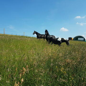
Weide
Gesucht wird in "74744 Ahorn, Deutschland"
113 Einträge
Deprecated: Creation of dynamic property Zend_View::$listObjects is deprecated in /var/www/stall-frei/htdocs/staging.stall-frei.de/library/vendor/shardj/zf1-future/library/Zend/View/Abstract.php on line 308
Deprecated: Creation of dynamic property Zend_View::$listMode is deprecated in /var/www/stall-frei/htdocs/staging.stall-frei.de/library/vendor/shardj/zf1-future/library/Zend/View/Abstract.php on line 308
Deprecated: Creation of dynamic property Zend_View::$renderedObjects is deprecated in /var/www/stall-frei/htdocs/staging.stall-frei.de/library/vendor/shardj/zf1-future/library/Zend/View/Abstract.php on line 308
Deprecated: Creation of dynamic property Zend_View::$index is deprecated in /var/www/stall-frei/htdocs/staging.stall-frei.de/library/vendor/shardj/zf1-future/library/Zend/View/Abstract.php on line 308
Deprecated: Creation of dynamic property Zend_View::$displayMode is deprecated in /var/www/stall-frei/htdocs/staging.stall-frei.de/library/vendor/shardj/zf1-future/library/Zend/View/Abstract.php on line 308
Deprecated: Creation of dynamic property Zend_View::$remarketingIds is deprecated in /var/www/stall-frei/htdocs/staging.stall-frei.de/library/vendor/shardj/zf1-future/library/Zend/View/Abstract.php on line 308
Deprecated: Creation of dynamic property Zend_View::$listItem is deprecated in /var/www/stall-frei/htdocs/staging.stall-frei.de/library/vendor/shardj/zf1-future/library/Zend/View/Abstract.php on line 308
Deprecated: Creation of dynamic property Zend_View::$object is deprecated in /var/www/stall-frei/htdocs/staging.stall-frei.de/library/vendor/shardj/zf1-future/library/Zend/View/Abstract.php on line 308
Deprecated: Creation of dynamic property Zend_View::$attributes is deprecated in /var/www/stall-frei/htdocs/staging.stall-frei.de/library/vendor/shardj/zf1-future/library/Zend/View/Abstract.php on line 308

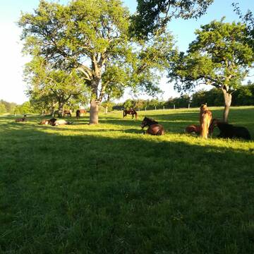

Fohlenweide/Rentnerweide
Ahorn
Karlheinz Wetterich
@Karlheinz-Wetterich
Hengstweide
Stutenweide
Elektrozaun
Mit Auto und Anhänger erreichbar
Ganzjahresweide
Besuch der Weide: täglich
Zufütterung von Heu oder Silage
4 weitere...
aktuell
P+
Leider kein Vorschaubild
Leider kein Vorschaubild
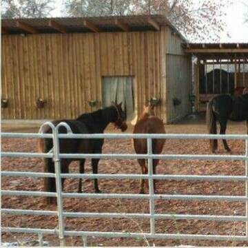
Fohlenaufzucht/Stutfohlen
Adelsheim
Assenheimer-Pfeiffer GbR
@Assenheimer-Pfeiffer
Gemischte Herde
Jungtierweide
Elektrozaun
Mit Auto und Anhänger erreichbar
Ganzjahresweide
Besuch der Weide: täglich
Zufütterung von Heu oder Silage
5 weitere...
aktuell
B
Deprecated: Creation of dynamic property Zend_View_Helper_Ads::$adLink is deprecated in /var/www/stall-frei/htdocs/staging.stall-frei.de/library/Psf/View/Helper/Ads.php on line 108

Job gesucht?
Mechtersen
STALL-FREIde Marketing
@STALL-FREI-Marketing
Sie suchen einen Job und arbeiten gerne mit Pferden oder auf Reitanlagen?
Besuchen Sie jetzt unseren Stellenmarkt!
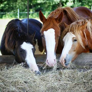
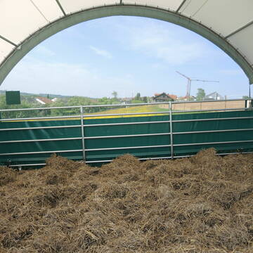
Weideplatz mit Offenstall und Komplettversorgung
Ober-ostern
Ralph-Lang
@Ralph-Lang
Gemischte Herde
Rentnerweide
Elektrozaun
Mit Auto und Anhänger erreichbar
Ganzjahresweide
Sommerweide
Besuch der Weide: täglich
Zufütterung von Heu oder Silage
3 weitere...
P+
Leider kein Vorschaubild
Leider kein Vorschaubild
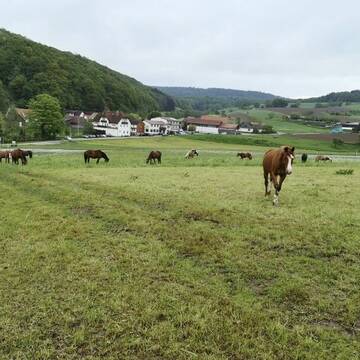
Weideplätze zu vergeben
Neckarsteinach
Privatstall Darsberg
@Ferienweide
Jungtierweide
Rentnerweide
Elektrozaun
Mit Auto und Anhänger erreichbar
Sommerweide
Besuch der Weide: täglich
4 weitere...
B


SOMMERWEIDE für Jungpferde
Lautertal
Schneiders_Ranch
@Schneiders_Ranch
Gemischte Herde
Jungtierweide
Elektrozaun
Schatten durch Bäume
Sommerweide
Besuch der Weide: täglich
3 weitere...
P+
Leider kein Vorschaubild
Leider kein Vorschaubild
B
Leider kein Vorschaubild
Leider kein Vorschaubild
Selbstversorger-Weideplätze in DA-Eberstadt frei
Darmstadt
Mirabel
@Mirabel
Gemischte Herde
Elektrozaun
Mit Auto und Anhänger erreichbar
Ganzjahresweide
Besuch der Weide: täglich
Zufütterung von Heu oder Silage
3 weitere...
B

Weide- / Rentnergruppe / Gnadenbrot
Lichtenwald
Reitstall Berger
@Gunthard-Berger
Gemischte Herde
Rentnerweide
Bremsenfalle
Elektrozaun
Frühjahrsweide
Ganzjahresweide
Besuch der Weide: täglich
Zufütterung von Heu oder Silage
9 weitere...
P+

MOBILE PFERDEWAAGE
Walddorfhäslach
ReitFein
@ReitFein
Kennst du das genaue Gewicht deines Pferdes? Mit uns erfährst du es - ohne viel Aufwand.
Umso mehr ihr seit, desto günstiger wird es.
Leider kein Vorschaubild
Leider kein Vorschaubild
eigene große Sommerweide mit Wasserfass und Heu
Schorndorf
Hay Day Ranch
@HayDayRanch
Gemischte Herde
Jungtierweide
Elektrozaun
Mit Auto und Anhänger erreichbar
Frühjahrsweide
Ganzjahresweide
Zufütterung von Heu oder Silage
Zufütterung von Kraftfutter
6 weitere...
B

Weideflächen zu verpachten
Pfinztal
Ellen Herrmann
@Reitanlage-Berghausen
Frühjahrsweide
Ganzjahresweide
3 weitere...
P+
Deprecated: Creation of dynamic property Zend_View::$pageCount is deprecated in /var/www/stall-frei/htdocs/staging.stall-frei.de/library/vendor/shardj/zf1-future/library/Zend/View/Abstract.php on line 308
Deprecated: Creation of dynamic property Zend_View::$itemCountPerPage is deprecated in /var/www/stall-frei/htdocs/staging.stall-frei.de/library/vendor/shardj/zf1-future/library/Zend/View/Abstract.php on line 308
Deprecated: Creation of dynamic property Zend_View::$first is deprecated in /var/www/stall-frei/htdocs/staging.stall-frei.de/library/vendor/shardj/zf1-future/library/Zend/View/Abstract.php on line 308
Deprecated: Creation of dynamic property Zend_View::$current is deprecated in /var/www/stall-frei/htdocs/staging.stall-frei.de/library/vendor/shardj/zf1-future/library/Zend/View/Abstract.php on line 308
Deprecated: Creation of dynamic property Zend_View::$last is deprecated in /var/www/stall-frei/htdocs/staging.stall-frei.de/library/vendor/shardj/zf1-future/library/Zend/View/Abstract.php on line 308
Deprecated: Creation of dynamic property Zend_View::$next is deprecated in /var/www/stall-frei/htdocs/staging.stall-frei.de/library/vendor/shardj/zf1-future/library/Zend/View/Abstract.php on line 308
Deprecated: Creation of dynamic property Zend_View::$pagesInRange is deprecated in /var/www/stall-frei/htdocs/staging.stall-frei.de/library/vendor/shardj/zf1-future/library/Zend/View/Abstract.php on line 308
Deprecated: Creation of dynamic property Zend_View::$firstPageInRange is deprecated in /var/www/stall-frei/htdocs/staging.stall-frei.de/library/vendor/shardj/zf1-future/library/Zend/View/Abstract.php on line 308
Deprecated: Creation of dynamic property Zend_View::$lastPageInRange is deprecated in /var/www/stall-frei/htdocs/staging.stall-frei.de/library/vendor/shardj/zf1-future/library/Zend/View/Abstract.php on line 308
Deprecated: Creation of dynamic property Zend_View::$currentItemCount is deprecated in /var/www/stall-frei/htdocs/staging.stall-frei.de/library/vendor/shardj/zf1-future/library/Zend/View/Abstract.php on line 308
Deprecated: Creation of dynamic property Zend_View::$totalItemCount is deprecated in /var/www/stall-frei/htdocs/staging.stall-frei.de/library/vendor/shardj/zf1-future/library/Zend/View/Abstract.php on line 308
Deprecated: Creation of dynamic property Zend_View::$firstItemNumber is deprecated in /var/www/stall-frei/htdocs/staging.stall-frei.de/library/vendor/shardj/zf1-future/library/Zend/View/Abstract.php on line 308
Deprecated: Creation of dynamic property Zend_View::$lastItemNumber is deprecated in /var/www/stall-frei/htdocs/staging.stall-frei.de/library/vendor/shardj/zf1-future/library/Zend/View/Abstract.php on line 308
Deprecated: Creation of dynamic property Zend_View::$router is deprecated in /var/www/stall-frei/htdocs/staging.stall-frei.de/library/vendor/shardj/zf1-future/library/Zend/View/Abstract.php on line 308
Deprecated: Creation of dynamic property Zend_View::$urlParams is deprecated in /var/www/stall-frei/htdocs/staging.stall-frei.de/library/vendor/shardj/zf1-future/library/Zend/View/Abstract.php on line 308
Deprecated: Creation of dynamic property Zend_View::$showAds is deprecated in /var/www/stall-frei/htdocs/staging.stall-frei.de/library/vendor/shardj/zf1-future/library/Zend/View/Abstract.php on line 308
Deprecated: Creation of dynamic property Zend_View::$objectIds is deprecated in /var/www/stall-frei/htdocs/staging.stall-frei.de/library/vendor/shardj/zf1-future/library/Zend/View/Abstract.php on line 308
Deprecated: Creation of dynamic property Zend_View::$showNavbar is deprecated in /var/www/stall-frei/htdocs/staging.stall-frei.de/library/vendor/shardj/zf1-future/library/Zend/View/Abstract.php on line 308
Deprecated: Creation of dynamic property Zend_View::$showBreadcrumb is deprecated in /var/www/stall-frei/htdocs/staging.stall-frei.de/library/vendor/shardj/zf1-future/library/Zend/View/Abstract.php on line 308
Deprecated: Creation of dynamic property Zend_View::$showFooter is deprecated in /var/www/stall-frei/htdocs/staging.stall-frei.de/library/vendor/shardj/zf1-future/library/Zend/View/Abstract.php on line 308
Deprecated: Creation of dynamic property Zend_View::$showInternalAds is deprecated in /var/www/stall-frei/htdocs/staging.stall-frei.de/library/vendor/shardj/zf1-future/library/Zend/View/Abstract.php on line 308
Deprecated: Creation of dynamic property Zend_View::$blNoContent is deprecated in /var/www/stall-frei/htdocs/staging.stall-frei.de/library/vendor/shardj/zf1-future/library/Zend/View/Abstract.php on line 308
Deprecated: Creation of dynamic property Zend_View::$sMetaDesc is deprecated in /var/www/stall-frei/htdocs/staging.stall-frei.de/library/vendor/shardj/zf1-future/library/Zend/View/Abstract.php on line 308
Deprecated: Creation of dynamic property Zend_View::$useGmaps is deprecated in /var/www/stall-frei/htdocs/staging.stall-frei.de/library/vendor/shardj/zf1-future/library/Zend/View/Abstract.php on line 308
Deprecated: Creation of dynamic property Zend_View::$touches is deprecated in /var/www/stall-frei/htdocs/staging.stall-frei.de/library/vendor/shardj/zf1-future/library/Zend/View/Abstract.php on line 308
Deprecated: Creation of dynamic property Zend_View::$oProject is deprecated in /var/www/stall-frei/htdocs/staging.stall-frei.de/library/vendor/shardj/zf1-future/library/Zend/View/Abstract.php on line 308
Deprecated: Creation of dynamic property Zend_View::$pageHeadline is deprecated in /var/www/stall-frei/htdocs/staging.stall-frei.de/library/vendor/shardj/zf1-future/library/Zend/View/Abstract.php on line 308
Deprecated: Creation of dynamic property Zend_View::$disableLocationField is deprecated in /var/www/stall-frei/htdocs/staging.stall-frei.de/library/vendor/shardj/zf1-future/library/Zend/View/Abstract.php on line 308
Deprecated: Creation of dynamic property Zend_View::$isSearch is deprecated in /var/www/stall-frei/htdocs/staging.stall-frei.de/library/vendor/shardj/zf1-future/library/Zend/View/Abstract.php on line 308
Deprecated: Creation of dynamic property Zend_View::$pageTitle is deprecated in /var/www/stall-frei/htdocs/staging.stall-frei.de/library/vendor/shardj/zf1-future/library/Zend/View/Abstract.php on line 308
Deprecated: Creation of dynamic property Psf_Form_Element_Text::$class is deprecated in /var/www/stall-frei/htdocs/staging.stall-frei.de/library/vendor/shardj/zf1-future/library/Zend/Form/Element.php on line 874
Deprecated: Creation of dynamic property Psf_Form_Element_Text::$size is deprecated in /var/www/stall-frei/htdocs/staging.stall-frei.de/library/vendor/shardj/zf1-future/library/Zend/Form/Element.php on line 874
Deprecated: Creation of dynamic property Psf_Form_Element_Text::$placeholder is deprecated in /var/www/stall-frei/htdocs/staging.stall-frei.de/library/vendor/shardj/zf1-future/library/Zend/Form/Element.php on line 874
Deprecated: Creation of dynamic property Psf_Form_Element_Hidden::$class is deprecated in /var/www/stall-frei/htdocs/staging.stall-frei.de/library/vendor/shardj/zf1-future/library/Zend/Form/Element.php on line 874
Deprecated: Creation of dynamic property Psf_Form_Element_Hidden::$class is deprecated in /var/www/stall-frei/htdocs/staging.stall-frei.de/library/vendor/shardj/zf1-future/library/Zend/Form/Element.php on line 874
Deprecated: Creation of dynamic property Psf_Form_Element_Hidden::$class is deprecated in /var/www/stall-frei/htdocs/staging.stall-frei.de/library/vendor/shardj/zf1-future/library/Zend/Form/Element.php on line 874
Deprecated: Creation of dynamic property Psf_Form_Element_Hidden::$class is deprecated in /var/www/stall-frei/htdocs/staging.stall-frei.de/library/vendor/shardj/zf1-future/library/Zend/Form/Element.php on line 874
Deprecated: Creation of dynamic property Psf_Form_Element_Select::$class is deprecated in /var/www/stall-frei/htdocs/staging.stall-frei.de/library/vendor/shardj/zf1-future/library/Zend/Form/Element.php on line 874
Deprecated: Creation of dynamic property Psf_Form_Element_Select::$class is deprecated in /var/www/stall-frei/htdocs/staging.stall-frei.de/library/vendor/shardj/zf1-future/library/Zend/Form/Element.php on line 874
Deprecated: Creation of dynamic property Psf_Form_Element_Select::$class is deprecated in /var/www/stall-frei/htdocs/staging.stall-frei.de/library/vendor/shardj/zf1-future/library/Zend/Form/Element.php on line 874
Deprecated: Creation of dynamic property Psf_Form_Element_Text::$class is deprecated in /var/www/stall-frei/htdocs/staging.stall-frei.de/library/vendor/shardj/zf1-future/library/Zend/Form/Element.php on line 874
Deprecated: Creation of dynamic property Psf_Form_Element_Checkbox::$label is deprecated in /var/www/stall-frei/htdocs/staging.stall-frei.de/library/vendor/shardj/zf1-future/library/Zend/Form/Element.php on line 874
Deprecated: Creation of dynamic property Zend_View::$sort is deprecated in /var/www/stall-frei/htdocs/staging.stall-frei.de/library/vendor/shardj/zf1-future/library/Zend/View/Abstract.php on line 308
Deprecated: Creation of dynamic property Zend_View::$searchLocation is deprecated in /var/www/stall-frei/htdocs/staging.stall-frei.de/library/vendor/shardj/zf1-future/library/Zend/View/Abstract.php on line 308
Deprecated: Creation of dynamic property Zend_View::$locationHint is deprecated in /var/www/stall-frei/htdocs/staging.stall-frei.de/library/vendor/shardj/zf1-future/library/Zend/View/Abstract.php on line 308
Psf_GeoCoder_Abstract::getLocation: Ahorn Get Location CachedOrLive
Psf_GeoCoder_Abstract::getCachedOrLive: Ahorn
Psf_GeoCoder_OpenCageData::makeApiRequest: response:
Array
(
[documentation] => https://opencagedata.com/api
[licenses] => Array
(
[0] => Array
(
[name] => see attribution guide
[url] => https://opencagedata.com/credits
)
)
[results] => Array
(
[0] => Array
(
[bounds] => Array
(
[northeast] => Array
(
[lat] => 49.5563094
[lng] => 9.5966993
)
[southwest] => Array
(
[lat] => 49.4384491
[lng] => 9.4906939
)
)
[components] => Array
(
[ISO_3166-1_alpha-2] => DE
[ISO_3166-1_alpha-3] => DEU
[ISO_3166-2] => Array
(
[0] => DE-BW
)
[_category] => place
[_normalized_city] => Ahorn
[_type] => municipality
[continent] => Europe
[country] => Deutschland
[country_code] => de
[county] => Main-Tauber-Kreis
[municipality] => Ahorn
[political_union] => European Union
[postcode] => 74744
[state] => Baden-Württemberg
[state_code] => BW
)
[confidence] => 6
[formatted] => 74744 Ahorn, Deutschland
[geometry] => Array
(
[lat] => 49.4878031
[lng] => 9.534577
)
)
[1] => Array
(
[bounds] => Array
(
[northeast] => Array
(
[lat] => 50.2450809
[lng] => 10.9796678
)
[southwest] => Array
(
[lat] => 50.19858
[lng] => 10.854948
)
)
[components] => Array
(
[ISO_3166-1_alpha-2] => DE
[ISO_3166-1_alpha-3] => DEU
[ISO_3166-2] => Array
(
[0] => DE-BY
)
[_category] => place
[_normalized_city] => Ahorn
[_type] => village
[continent] => Europe
[country] => Deutschland
[country_code] => de
[county] => Landkreis Coburg
[political_union] => European Union
[postcode] => 96482
[state] => Bayern
[state_code] => BY
[village] => Ahorn
)
[confidence] => 7
[formatted] => 96482 Ahorn, Deutschland
[geometry] => Array
(
[lat] => 50.2380372
[lng] => 10.9549021
)
)
[2] => Array
(
[bounds] => Array
(
[northeast] => Array
(
[lat] => 52.0714939
[lng] => 9.2402553
)
[southwest] => Array
(
[lat] => 52.0314939
[lng] => 9.2002553
)
)
[components] => Array
(
[ISO_3166-1_alpha-2] => DE
[ISO_3166-1_alpha-3] => DEU
[ISO_3166-2] => Array
(
[0] => DE-NI
)
[_category] => place
[_normalized_city] => Aerzen
[_type] => hamlet
[continent] => Europe
[country] => Deutschland
[country_code] => de
[county] => Landkreis Hameln-Pyrmont
[hamlet] => Ahorn
[political_union] => European Union
[postcode] => 31855
[state] => Niedersachsen
[state_code] => NI
[town] => Aerzen
)
[confidence] => 7
[formatted] => Ahorn, 31855 Aerzen, Deutschland
[geometry] => Array
(
[lat] => 52.0514939
[lng] => 9.2202553
)
)
[3] => Array
(
[bounds] => Array
(
[northeast] => Array
(
[lat] => 51.3120888
[lng] => 7.5890224
)
[southwest] => Array
(
[lat] => 51.3119888
[lng] => 7.5889224
)
)
[components] => Array
(
[ISO_3166-1_alpha-2] => DE
[ISO_3166-1_alpha-3] => DEU
[ISO_3166-2] => Array
(
[0] => DE-NW
)
[_category] => building
[_normalized_city] => Nachrodt-Wiblingwerde
[_type] => building
[city] => Nachrodt-Wiblingwerde
[continent] => Europe
[country] => Deutschland
[country_code] => de
[county] => Märkischer Kreis
[isolated_dwelling] => Ahorn
[political_union] => European Union
[postcode] => 58769
[state] => Nordrhein-Westfalen
[state_code] => NW
)
[confidence] => 10
[formatted] => Ahorn, 58769 Nachrodt-Wiblingwerde, Deutschland
[geometry] => Array
(
[lat] => 51.3120388
[lng] => 7.5889724
)
)
[4] => Array
(
[components] => Array
(
[ISO_3166-1_alpha-2] => FR
[ISO_3166-1_alpha-3] => FRA
[ISO_3166-2] => Array
(
[0] => FR-BRE
[1] => FR-35
)
[_category] => road
[_normalized_city] => Plesder
[_type] => road
[city] => Plesder
[continent] => Europe
[country] => France
[country_code] => fr
[county] => Ille-et-Vilaine
[local_authority] => Communauté de communes Bretagne romantique
[political_union] => European Union
[postcode] => 35720
[road] => Rue d’Ahorn
[state] => Bretagne
[state_code] => BRE
)
[confidence] => 2
[formatted] => Rue d’Ahorn, 35720 Plesder, France
[geometry] => Array
(
[lat] => 48.413125
[lng] => -1.923003
)
)
[5] => Array
(
[components] => Array
(
[ISO_3166-1_alpha-2] => FR
[ISO_3166-1_alpha-3] => FRA
[ISO_3166-2] => Array
(
[0] => FR-PDL
[1] => FR-53
)
[_category] => road
[_normalized_city] => Aron
[_type] => road
[city] => Aron
[continent] => Europe
[country] => France
[country_code] => fr
[county] => Mayenne
[local_authority] => Communauté de communes Mayenne Communauté
[political_union] => European Union
[postcode] => 53440
[road] => Rue de Normandie
[state] => Pays de la Loire
[state_code] => PDL
)
[confidence] => 2
[formatted] => Rue de Normandie, 53440 Aron, France
[geometry] => Array
(
[lat] => 48.298626
[lng] => -0.55913
)
)
[6] => Array
(
[components] => Array
(
[ISO_3166-1_alpha-2] => FR
[ISO_3166-1_alpha-3] => FRA
[ISO_3166-2] => Array
(
[0] => FR-PDL
[1] => FR-53
)
[_category] => road
[_normalized_city] => Aron
[_type] => road
[city] => Aron
[continent] => Europe
[country] => France
[country_code] => fr
[county] => Mayenne
[local_authority] => Communauté de communes Mayenne Communauté
[political_union] => European Union
[postcode] => 53440
[road] => la Demi Lieue
[state] => Pays de la Loire
[state_code] => PDL
)
[confidence] => 10
[formatted] => la Demi Lieue, 53440 Aron, France
[geometry] => Array
(
[lat] => 48.29917
[lng] => -0.584599
)
)
[7] => Array
(
[components] => Array
(
[ISO_3166-1_alpha-2] => FR
[ISO_3166-1_alpha-3] => FRA
[ISO_3166-2] => Array
(
[0] => FR-PDL
[1] => FR-53
)
[_category] => road
[_normalized_city] => Aron
[_type] => road
[city] => Aron
[continent] => Europe
[country] => France
[country_code] => fr
[county] => Mayenne
[local_authority] => Communauté de communes Mayenne Communauté
[political_union] => European Union
[postcode] => 53440
[road] => Rue de la Grange
[state] => Pays de la Loire
[state_code] => PDL
)
[confidence] => 10
[formatted] => Rue de la Grange, 53440 Aron, France
[geometry] => Array
(
[lat] => 48.300158
[lng] => -0.562476
)
)
[8] => Array
(
[components] => Array
(
[ISO_3166-1_alpha-2] => FR
[ISO_3166-1_alpha-3] => FRA
[ISO_3166-2] => Array
(
[0] => FR-ARA
[1] => FR-38
)
[_category] => road
[_normalized_city] => Tullins
[_type] => road
[city] => Tullins
[continent] => Europe
[country] => France
[country_code] => fr
[county] => Isère
[local_authority] => Communauté d'agglomération du Pays Voironnais
[political_union] => European Union
[postcode] => 38210
[road] => Route des Arronds
[state] => Auvergne-Rhône-Alpes
[state_code] => ARA
)
[confidence] => 10
[formatted] => Route des Arronds, 38210 Tullins, France
[geometry] => Array
(
[lat] => 45.315394
[lng] => 5.480543
)
)
[9] => Array
(
[components] => Array
(
[ISO_3166-1_alpha-2] => FR
[ISO_3166-1_alpha-3] => FRA
[ISO_3166-2] => Array
(
[0] => FR-BRE
[1] => FR-35
)
[_category] => road
[_normalized_city] => Beaucé
[_type] => road
[city] => Beaucé
[continent] => Europe
[country] => France
[country_code] => fr
[county] => Ille-et-Vilaine
[local_authority] => Fougères Agglomération
[political_union] => European Union
[postcode] => 35133
[road] => Chemin des Arons
[state] => Bretagne
[state_code] => BRE
)
[confidence] => 10
[formatted] => Chemin des Arons, 35133 Beaucé, France
[geometry] => Array
(
[lat] => 48.357809
[lng] => -1.17157
)
)
)
[status] => Array
(
[code] => 200
[message] => OK
)
[stay_informed] => Array
(
[blog] => https://blog.opencagedata.com
[mastodon] => https://en.osm.town/@opencage
)
[thanks] => For using an OpenCage API
[timestamp] => Array
(
[created_http] => Fri, 16 Jan 2026 20:50:18 GMT
[created_unix] => 1768596618
)
[total_results] => 10
)
Psf_GeoCoder_Abstract::convertLocationResult
{"documentation":"https:\/\/opencagedata.com\/api","licenses":[{"name":"see attribution guide","url":"https:\/\/opencagedata.com\/credits"}],"results":[{"bounds":{"northeast":{"lat":49.5563094,"lng":9.5966993},"southwest":{"lat":49.4384491,"lng":9.4906939}},"components":{"ISO_3166-1_alpha-2":"DE","ISO_3166-1_alpha-3":"DEU","ISO_3166-2":["DE-BW"],"_category":"place","_normalized_city":"Ahorn","_type":"municipality","continent":"Europe","country":"Deutschland","country_code":"de","county":"Main-Tauber-Kreis","municipality":"Ahorn","political_union":"European Union","postcode":"74744","state":"Baden-W\u00fcrttemberg","state_code":"BW"},"confidence":6,"formatted":"74744 Ahorn, Deutschland","geometry":{"lat":49.4878031,"lng":9.534577}},{"bounds":{"northeast":{"lat":50.2450809,"lng":10.9796678},"southwest":{"lat":50.19858,"lng":10.854948}},"components":{"ISO_3166-1_alpha-2":"DE","ISO_3166-1_alpha-3":"DEU","ISO_3166-2":["DE-BY"],"_category":"place","_normalized_city":"Ahorn","_type":"village","continent":"Europe","country":"Deutschland","country_code":"de","county":"Landkreis Coburg","political_union":"European Union","postcode":"96482","state":"Bayern","state_code":"BY","village":"Ahorn"},"confidence":7,"formatted":"96482 Ahorn, Deutschland","geometry":{"lat":50.2380372,"lng":10.9549021}},{"bounds":{"northeast":{"lat":52.0714939,"lng":9.2402553},"southwest":{"lat":52.0314939,"lng":9.2002553}},"components":{"ISO_3166-1_alpha-2":"DE","ISO_3166-1_alpha-3":"DEU","ISO_3166-2":["DE-NI"],"_category":"place","_normalized_city":"Aerzen","_type":"hamlet","continent":"Europe","country":"Deutschland","country_code":"de","county":"Landkreis Hameln-Pyrmont","hamlet":"Ahorn","political_union":"European Union","postcode":"31855","state":"Niedersachsen","state_code":"NI","town":"Aerzen"},"confidence":7,"formatted":"Ahorn, 31855 Aerzen, Deutschland","geometry":{"lat":52.0514939,"lng":9.2202553}},{"bounds":{"northeast":{"lat":51.3120888,"lng":7.5890224},"southwest":{"lat":51.3119888,"lng":7.5889224}},"components":{"ISO_3166-1_alpha-2":"DE","ISO_3166-1_alpha-3":"DEU","ISO_3166-2":["DE-NW"],"_category":"building","_normalized_city":"Nachrodt-Wiblingwerde","_type":"building","city":"Nachrodt-Wiblingwerde","continent":"Europe","country":"Deutschland","country_code":"de","county":"M\u00e4rkischer Kreis","isolated_dwelling":"Ahorn","political_union":"European Union","postcode":"58769","state":"Nordrhein-Westfalen","state_code":"NW"},"confidence":10,"formatted":"Ahorn, 58769 Nachrodt-Wiblingwerde, Deutschland","geometry":{"lat":51.3120388,"lng":7.5889724}},{"components":{"ISO_3166-1_alpha-2":"FR","ISO_3166-1_alpha-3":"FRA","ISO_3166-2":["FR-BRE","FR-35"],"_category":"road","_normalized_city":"Plesder","_type":"road","city":"Plesder","continent":"Europe","country":"France","country_code":"fr","county":"Ille-et-Vilaine","local_authority":"Communaut\u00e9 de communes Bretagne romantique","political_union":"European Union","postcode":"35720","road":"Rue d\u2019Ahorn","state":"Bretagne","state_code":"BRE"},"confidence":2,"formatted":"Rue d\u2019Ahorn, 35720 Plesder, France","geometry":{"lat":48.413125,"lng":-1.923003}},{"components":{"ISO_3166-1_alpha-2":"FR","ISO_3166-1_alpha-3":"FRA","ISO_3166-2":["FR-PDL","FR-53"],"_category":"road","_normalized_city":"Aron","_type":"road","city":"Aron","continent":"Europe","country":"France","country_code":"fr","county":"Mayenne","local_authority":"Communaut\u00e9 de communes Mayenne Communaut\u00e9","political_union":"European Union","postcode":"53440","road":"Rue de Normandie","state":"Pays de la Loire","state_code":"PDL"},"confidence":2,"formatted":"Rue de Normandie, 53440 Aron, France","geometry":{"lat":48.298626,"lng":-0.55913}},{"components":{"ISO_3166-1_alpha-2":"FR","ISO_3166-1_alpha-3":"FRA","ISO_3166-2":["FR-PDL","FR-53"],"_category":"road","_normalized_city":"Aron","_type":"road","city":"Aron","continent":"Europe","country":"France","country_code":"fr","county":"Mayenne","local_authority":"Communaut\u00e9 de communes Mayenne Communaut\u00e9","political_union":"European Union","postcode":"53440","road":"la Demi Lieue","state":"Pays de la Loire","state_code":"PDL"},"confidence":10,"formatted":"la Demi Lieue, 53440 Aron, France","geometry":{"lat":48.29917,"lng":-0.584599}},{"components":{"ISO_3166-1_alpha-2":"FR","ISO_3166-1_alpha-3":"FRA","ISO_3166-2":["FR-PDL","FR-53"],"_category":"road","_normalized_city":"Aron","_type":"road","city":"Aron","continent":"Europe","country":"France","country_code":"fr","county":"Mayenne","local_authority":"Communaut\u00e9 de communes Mayenne Communaut\u00e9","political_union":"European Union","postcode":"53440","road":"Rue de la Grange","state":"Pays de la Loire","state_code":"PDL"},"confidence":10,"formatted":"Rue de la Grange, 53440 Aron, France","geometry":{"lat":48.300158,"lng":-0.562476}},{"components":{"ISO_3166-1_alpha-2":"FR","ISO_3166-1_alpha-3":"FRA","ISO_3166-2":["FR-ARA","FR-38"],"_category":"road","_normalized_city":"Tullins","_type":"road","city":"Tullins","continent":"Europe","country":"France","country_code":"fr","county":"Is\u00e8re","local_authority":"Communaut\u00e9 d'agglom\u00e9ration du Pays Voironnais","political_union":"European Union","postcode":"38210","road":"Route des Arronds","state":"Auvergne-Rh\u00f4ne-Alpes","state_code":"ARA"},"confidence":10,"formatted":"Route des Arronds, 38210 Tullins, France","geometry":{"lat":45.315394,"lng":5.480543}},{"components":{"ISO_3166-1_alpha-2":"FR","ISO_3166-1_alpha-3":"FRA","ISO_3166-2":["FR-BRE","FR-35"],"_category":"road","_normalized_city":"Beauc\u00e9","_type":"road","city":"Beauc\u00e9","continent":"Europe","country":"France","country_code":"fr","county":"Ille-et-Vilaine","local_authority":"Foug\u00e8res Agglom\u00e9ration","political_union":"European Union","postcode":"35133","road":"Chemin des Arons","state":"Bretagne","state_code":"BRE"},"confidence":10,"formatted":"Chemin des Arons, 35133 Beauc\u00e9, France","geometry":{"lat":48.357809,"lng":-1.17157}}],"status":{"code":200,"message":"OK"},"stay_informed":{"blog":"https:\/\/blog.opencagedata.com","mastodon":"https:\/\/en.osm.town\/@opencage"},"thanks":"For using an OpenCage API","timestamp":{"created_http":"Fri, 16 Jan 2026 20:50:18 GMT","created_unix":1768596618},"total_results":10}Array
(
[0] => stdClass Object
(
[bounds] => stdClass Object
(
[northeast] => stdClass Object
(
[lat] => 49.5563094
[lng] => 9.5966993
)
[southwest] => stdClass Object
(
[lat] => 49.4384491
[lng] => 9.4906939
)
)
[components] => stdClass Object
(
[ISO_3166-1_alpha-2] => DE
[ISO_3166-1_alpha-3] => DEU
[ISO_3166-2] => Array
(
[0] => DE-BW
)
[_category] => place
[_normalized_city] => Ahorn
[_type] => municipality
[continent] => Europe
[country] => Deutschland
[country_code] => de
[county] => Main-Tauber-Kreis
[municipality] => Ahorn
[political_union] => European Union
[postcode] => 74744
[state] => Baden-Württemberg
[state_code] => BW
)
[confidence] => 6
[formatted] => 74744 Ahorn, Deutschland
[geometry] => stdClass Object
(
[lat] => 49.4878031
[lng] => 9.534577
)
)
[1] => stdClass Object
(
[bounds] => stdClass Object
(
[northeast] => stdClass Object
(
[lat] => 50.2450809
[lng] => 10.9796678
)
[southwest] => stdClass Object
(
[lat] => 50.19858
[lng] => 10.854948
)
)
[components] => stdClass Object
(
[ISO_3166-1_alpha-2] => DE
[ISO_3166-1_alpha-3] => DEU
[ISO_3166-2] => Array
(
[0] => DE-BY
)
[_category] => place
[_normalized_city] => Ahorn
[_type] => village
[continent] => Europe
[country] => Deutschland
[country_code] => de
[county] => Landkreis Coburg
[political_union] => European Union
[postcode] => 96482
[state] => Bayern
[state_code] => BY
[village] => Ahorn
)
[confidence] => 7
[formatted] => 96482 Ahorn, Deutschland
[geometry] => stdClass Object
(
[lat] => 50.2380372
[lng] => 10.9549021
)
)
[2] => stdClass Object
(
[bounds] => stdClass Object
(
[northeast] => stdClass Object
(
[lat] => 52.0714939
[lng] => 9.2402553
)
[southwest] => stdClass Object
(
[lat] => 52.0314939
[lng] => 9.2002553
)
)
[components] => stdClass Object
(
[ISO_3166-1_alpha-2] => DE
[ISO_3166-1_alpha-3] => DEU
[ISO_3166-2] => Array
(
[0] => DE-NI
)
[_category] => place
[_normalized_city] => Aerzen
[_type] => hamlet
[continent] => Europe
[country] => Deutschland
[country_code] => de
[county] => Landkreis Hameln-Pyrmont
[hamlet] => Ahorn
[political_union] => European Union
[postcode] => 31855
[state] => Niedersachsen
[state_code] => NI
[town] => Aerzen
)
[confidence] => 7
[formatted] => Ahorn, 31855 Aerzen, Deutschland
[geometry] => stdClass Object
(
[lat] => 52.0514939
[lng] => 9.2202553
)
)
[3] => stdClass Object
(
[bounds] => stdClass Object
(
[northeast] => stdClass Object
(
[lat] => 51.3120888
[lng] => 7.5890224
)
[southwest] => stdClass Object
(
[lat] => 51.3119888
[lng] => 7.5889224
)
)
[components] => stdClass Object
(
[ISO_3166-1_alpha-2] => DE
[ISO_3166-1_alpha-3] => DEU
[ISO_3166-2] => Array
(
[0] => DE-NW
)
[_category] => building
[_normalized_city] => Nachrodt-Wiblingwerde
[_type] => building
[city] => Nachrodt-Wiblingwerde
[continent] => Europe
[country] => Deutschland
[country_code] => de
[county] => Märkischer Kreis
[isolated_dwelling] => Ahorn
[political_union] => European Union
[postcode] => 58769
[state] => Nordrhein-Westfalen
[state_code] => NW
)
[confidence] => 10
[formatted] => Ahorn, 58769 Nachrodt-Wiblingwerde, Deutschland
[geometry] => stdClass Object
(
[lat] => 51.3120388
[lng] => 7.5889724
)
)
[4] => stdClass Object
(
[components] => stdClass Object
(
[ISO_3166-1_alpha-2] => FR
[ISO_3166-1_alpha-3] => FRA
[ISO_3166-2] => Array
(
[0] => FR-BRE
[1] => FR-35
)
[_category] => road
[_normalized_city] => Plesder
[_type] => road
[city] => Plesder
[continent] => Europe
[country] => France
[country_code] => fr
[county] => Ille-et-Vilaine
[local_authority] => Communauté de communes Bretagne romantique
[political_union] => European Union
[postcode] => 35720
[road] => Rue d’Ahorn
[state] => Bretagne
[state_code] => BRE
)
[confidence] => 2
[formatted] => Rue d’Ahorn, 35720 Plesder, France
[geometry] => stdClass Object
(
[lat] => 48.413125
[lng] => -1.923003
)
)
[5] => stdClass Object
(
[components] => stdClass Object
(
[ISO_3166-1_alpha-2] => FR
[ISO_3166-1_alpha-3] => FRA
[ISO_3166-2] => Array
(
[0] => FR-PDL
[1] => FR-53
)
[_category] => road
[_normalized_city] => Aron
[_type] => road
[city] => Aron
[continent] => Europe
[country] => France
[country_code] => fr
[county] => Mayenne
[local_authority] => Communauté de communes Mayenne Communauté
[political_union] => European Union
[postcode] => 53440
[road] => Rue de Normandie
[state] => Pays de la Loire
[state_code] => PDL
)
[confidence] => 2
[formatted] => Rue de Normandie, 53440 Aron, France
[geometry] => stdClass Object
(
[lat] => 48.298626
[lng] => -0.55913
)
)
[6] => stdClass Object
(
[components] => stdClass Object
(
[ISO_3166-1_alpha-2] => FR
[ISO_3166-1_alpha-3] => FRA
[ISO_3166-2] => Array
(
[0] => FR-PDL
[1] => FR-53
)
[_category] => road
[_normalized_city] => Aron
[_type] => road
[city] => Aron
[continent] => Europe
[country] => France
[country_code] => fr
[county] => Mayenne
[local_authority] => Communauté de communes Mayenne Communauté
[political_union] => European Union
[postcode] => 53440
[road] => la Demi Lieue
[state] => Pays de la Loire
[state_code] => PDL
)
[confidence] => 10
[formatted] => la Demi Lieue, 53440 Aron, France
[geometry] => stdClass Object
(
[lat] => 48.29917
[lng] => -0.584599
)
)
[7] => stdClass Object
(
[components] => stdClass Object
(
[ISO_3166-1_alpha-2] => FR
[ISO_3166-1_alpha-3] => FRA
[ISO_3166-2] => Array
(
[0] => FR-PDL
[1] => FR-53
)
[_category] => road
[_normalized_city] => Aron
[_type] => road
[city] => Aron
[continent] => Europe
[country] => France
[country_code] => fr
[county] => Mayenne
[local_authority] => Communauté de communes Mayenne Communauté
[political_union] => European Union
[postcode] => 53440
[road] => Rue de la Grange
[state] => Pays de la Loire
[state_code] => PDL
)
[confidence] => 10
[formatted] => Rue de la Grange, 53440 Aron, France
[geometry] => stdClass Object
(
[lat] => 48.300158
[lng] => -0.562476
)
)
[8] => stdClass Object
(
[components] => stdClass Object
(
[ISO_3166-1_alpha-2] => FR
[ISO_3166-1_alpha-3] => FRA
[ISO_3166-2] => Array
(
[0] => FR-ARA
[1] => FR-38
)
[_category] => road
[_normalized_city] => Tullins
[_type] => road
[city] => Tullins
[continent] => Europe
[country] => France
[country_code] => fr
[county] => Isère
[local_authority] => Communauté d'agglomération du Pays Voironnais
[political_union] => European Union
[postcode] => 38210
[road] => Route des Arronds
[state] => Auvergne-Rhône-Alpes
[state_code] => ARA
)
[confidence] => 10
[formatted] => Route des Arronds, 38210 Tullins, France
[geometry] => stdClass Object
(
[lat] => 45.315394
[lng] => 5.480543
)
)
[9] => stdClass Object
(
[components] => stdClass Object
(
[ISO_3166-1_alpha-2] => FR
[ISO_3166-1_alpha-3] => FRA
[ISO_3166-2] => Array
(
[0] => FR-BRE
[1] => FR-35
)
[_category] => road
[_normalized_city] => Beaucé
[_type] => road
[city] => Beaucé
[continent] => Europe
[country] => France
[country_code] => fr
[county] => Ille-et-Vilaine
[local_authority] => Fougères Agglomération
[political_union] => European Union
[postcode] => 35133
[road] => Chemin des Arons
[state] => Bretagne
[state_code] => BRE
)
[confidence] => 10
[formatted] => Chemin des Arons, 35133 Beaucé, France
[geometry] => stdClass Object
(
[lat] => 48.357809
[lng] => -1.17157
)
)
)
Psf_GeoCoder_OpenCageData::getKeyMap: 0
stdClass Object
(
    [bounds] => stdClass Object
        (
            [northeast] => stdClass Object
                (
                    [lat] => 49.5563094
                    [lng] => 9.5966993
                )

            [southwest] => stdClass Object
                (
                    [lat] => 49.4384491
                    [lng] => 9.4906939
                )

        )

    [components] => stdClass Object
        (
            [ISO_3166-1_alpha-2] => DE
            [ISO_3166-1_alpha-3] => DEU
            [ISO_3166-2] => Array
                (
                    [0] => DE-BW
                )

            [_category] => place
            [_normalized_city] => Ahorn
            [_type] => municipality
            [continent] => Europe
            [country] => Deutschland
            [country_code] => de
            [county] => Main-Tauber-Kreis
            [municipality] => Ahorn
            [political_union] => European Union
            [postcode] => 74744
            [state] => Baden-Württemberg
            [state_code] => BW
        )

    [confidence] => 6
    [formatted] => 74744 Ahorn, Deutschland
    [geometry] => stdClass Object
        (
            [lat] => 49.4878031
            [lng] => 9.534577
        )

)
Psf_GeoCoder_OpenCageData::getCounty: Main-Tauber-Kreis
Psf_GeoCoder_OpenCageData::addMissingData REFETCH!
Array
(
    [address] => 74744 Ahorn, Deutschland
    [type] => municipality
    [street] =>
    [city] =>
    [county] => Main-Tauber-Kreis
    [state] => Baden-Württemberg
    [zip] => 74744
    [country] => Deutschland
    [suburb] =>
    [countrycode] => de
    [latitude] => 49.4878031
    [longitude] => 9.534577
    [accuracy] => 1
    [confidence] => 6
    [bounds] => stdClass Object
        (
            [northeast] => stdClass Object
                (
                    [lat] => 49.5563094
                    [lng] => 9.5966993
                )

            [southwest] => stdClass Object
                (
                    [lat] => 49.4384491
                    [lng] => 9.4906939
                )

        )

)
reformat!
Array
(
    [address] => 74744 Ahorn, Deutschland
    [type] => municipality
    [street] =>
    [city] =>
    [county] => Main-Tauber-Kreis
    [state] => Baden-Württemberg
    [zip] => 74744
    [country] => Deutschland
    [suburb] =>
    [countrycode] => de
    [latitude] => 49.4878031
    [longitude] => 9.534577
    [accuracy] => 1
    [confidence] => 6
    [bounds] => stdClass Object
        (
            [northeast] => stdClass Object
                (
                    [lat] => 49.5563094
                    [lng] => 9.5966993
                )

            [southwest] => stdClass Object
                (
                    [lat] => 49.4384491
                    [lng] => 9.4906939
                )

        )

    [place] => 74744 , Baden-Württemberg
    [hash] => efee53dee08697460ca480f931f882ad
)
Psf_GeoCoder_OpenCageData::getKeyMap: 1
stdClass Object
(
    [bounds] => stdClass Object
        (
            [northeast] => stdClass Object
                (
                    [lat] => 50.2450809
                    [lng] => 10.9796678
                )

            [southwest] => stdClass Object
                (
                    [lat] => 50.19858
                    [lng] => 10.854948
                )

        )

    [components] => stdClass Object
        (
            [ISO_3166-1_alpha-2] => DE
            [ISO_3166-1_alpha-3] => DEU
            [ISO_3166-2] => Array
                (
                    [0] => DE-BY
                )

            [_category] => place
            [_normalized_city] => Ahorn
            [_type] => village
            [continent] => Europe
            [country] => Deutschland
            [country_code] => de
            [county] => Landkreis Coburg
            [political_union] => European Union
            [postcode] => 96482
            [state] => Bayern
            [state_code] => BY
            [village] => Ahorn
        )

    [confidence] => 7
    [formatted] => 96482 Ahorn, Deutschland
    [geometry] => stdClass Object
        (
            [lat] => 50.2380372
            [lng] => 10.9549021
        )

)
Psf_GeoCoder_OpenCageData::getCounty: Coburg
Psf_GeoCoder_OpenCageData::addMissingData REFETCH!
Array
(
    [address] => 96482 Ahorn, Deutschland
    [type] => village
    [street] =>
    [city] => Ahorn
    [county] => Coburg
    [state] => Bayern
    [zip] => 96482
    [country] => Deutschland
    [suburb] =>
    [countrycode] => de
    [latitude] => 50.2380372
    [longitude] => 10.9549021
    [accuracy] => 1
    [confidence] => 7
    [bounds] => stdClass Object
        (
            [northeast] => stdClass Object
                (
                    [lat] => 50.2450809
                    [lng] => 10.9796678
                )

            [southwest] => stdClass Object
                (
                    [lat] => 50.19858
                    [lng] => 10.854948
                )

        )

)
reformat!
Array
(
    [address] => 96482 Ahorn, Deutschland
    [type] => village
    [street] =>
    [city] => Ahorn
    [county] => Coburg
    [state] => Bayern
    [zip] => 96482
    [country] => Deutschland
    [suburb] =>
    [countrycode] => de
    [latitude] => 50.2380372
    [longitude] => 10.9549021
    [accuracy] => 1
    [confidence] => 7
    [bounds] => stdClass Object
        (
            [northeast] => stdClass Object
                (
                    [lat] => 50.2450809
                    [lng] => 10.9796678
                )

            [southwest] => stdClass Object
                (
                    [lat] => 50.19858
                    [lng] => 10.854948
                )

        )

    [place] => 96482 Ahorn, Bayern
    [hash] => aef3cb38d17c9930aab90e0072dab149
)
Psf_GeoCoder_OpenCageData::getKeyMap: 2
stdClass Object
(
    [bounds] => stdClass Object
        (
            [northeast] => stdClass Object
                (
                    [lat] => 52.0714939
                    [lng] => 9.2402553
                )

            [southwest] => stdClass Object
                (
                    [lat] => 52.0314939
                    [lng] => 9.2002553
                )

        )

    [components] => stdClass Object
        (
            [ISO_3166-1_alpha-2] => DE
            [ISO_3166-1_alpha-3] => DEU
            [ISO_3166-2] => Array
                (
                    [0] => DE-NI
                )

            [_category] => place
            [_normalized_city] => Aerzen
            [_type] => hamlet
            [continent] => Europe
            [country] => Deutschland
            [country_code] => de
            [county] => Landkreis Hameln-Pyrmont
            [hamlet] => Ahorn
            [political_union] => European Union
            [postcode] => 31855
            [state] => Niedersachsen
            [state_code] => NI
            [town] => Aerzen
        )

    [confidence] => 7
    [formatted] => Ahorn, 31855 Aerzen, Deutschland
    [geometry] => stdClass Object
        (
            [lat] => 52.0514939
            [lng] => 9.2202553
        )

)
Psf_GeoCoder_OpenCageData::getCounty: Hameln-Pyrmont
Psf_GeoCoder_OpenCageData::addMissingData REFETCH!
Array
(
    [address] => Ahorn, 31855 Aerzen, Deutschland
    [type] => hamlet
    [street] => Ahorn
    [city] => Aerzen
    [county] => Hameln-Pyrmont
    [state] => Niedersachsen
    [zip] => 31855
    [country] => Deutschland
    [suburb] =>
    [countrycode] => de
    [latitude] => 52.0514939
    [longitude] => 9.2202553
    [accuracy] => 1
    [confidence] => 7
    [bounds] => stdClass Object
        (
            [northeast] => stdClass Object
                (
                    [lat] => 52.0714939
                    [lng] => 9.2402553
                )

            [southwest] => stdClass Object
                (
                    [lat] => 52.0314939
                    [lng] => 9.2002553
                )

        )

)
reformat!
Array
(
    [address] => Ahorn, 31855 Aerzen, Deutschland
    [type] => hamlet
    [street] => Ahorn
    [city] => Aerzen
    [county] => Hameln-Pyrmont
    [state] => Niedersachsen
    [zip] => 31855
    [country] => Deutschland
    [suburb] =>
    [countrycode] => de
    [latitude] => 52.0514939
    [longitude] => 9.2202553
    [accuracy] => 1
    [confidence] => 7
    [bounds] => stdClass Object
        (
            [northeast] => stdClass Object
                (
                    [lat] => 52.0714939
                    [lng] => 9.2402553
                )

            [southwest] => stdClass Object
                (
                    [lat] => 52.0314939
                    [lng] => 9.2002553
                )

        )

    [place] => Ahorn, 31855 Aerzen, Niedersachsen
    [hash] => 91fe52f6d77800956280d929e261318d
)
Psf_GeoCoder_OpenCageData::getKeyMap: 3
stdClass Object
(
    [bounds] => stdClass Object
        (
            [northeast] => stdClass Object
                (
                    [lat] => 51.3120888
                    [lng] => 7.5890224
                )

            [southwest] => stdClass Object
                (
                    [lat] => 51.3119888
                    [lng] => 7.5889224
                )

        )

    [components] => stdClass Object
        (
            [ISO_3166-1_alpha-2] => DE
            [ISO_3166-1_alpha-3] => DEU
            [ISO_3166-2] => Array
                (
                    [0] => DE-NW
                )

            [_category] => building
            [_normalized_city] => Nachrodt-Wiblingwerde
            [_type] => building
            [city] => Nachrodt-Wiblingwerde
            [continent] => Europe
            [country] => Deutschland
            [country_code] => de
            [county] => Märkischer Kreis
            [isolated_dwelling] => Ahorn
            [political_union] => European Union
            [postcode] => 58769
            [state] => Nordrhein-Westfalen
            [state_code] => NW
        )

    [confidence] => 10
    [formatted] => Ahorn, 58769 Nachrodt-Wiblingwerde, Deutschland
    [geometry] => stdClass Object
        (
            [lat] => 51.3120388
            [lng] => 7.5889724
        )

)
Psf_GeoCoder_OpenCageData::getCounty: Märkischer Kreis
Psf_GeoCoder_OpenCageData::addMissingData REFETCH!
Array
(
    [address] => Ahorn, 58769 Nachrodt-Wiblingwerde, Deutschland
    [type] => building
    [street] =>
    [city] => Nachrodt-Wiblingwerde
    [county] => Märkischer Kreis
    [state] => Nordrhein-Westfalen
    [zip] => 58769
    [country] => Deutschland
    [suburb] =>
    [countrycode] => de
    [latitude] => 51.3120388
    [longitude] => 7.5889724
    [accuracy] => 1
    [confidence] => 10
    [bounds] => stdClass Object
        (
            [northeast] => stdClass Object
                (
                    [lat] => 51.3120888
                    [lng] => 7.5890224
                )

            [southwest] => stdClass Object
                (
                    [lat] => 51.3119888
                    [lng] => 7.5889224
                )

        )

)
reformat!
Array
(
    [address] => Ahorn, 58769 Nachrodt-Wiblingwerde, Deutschland
    [type] => building
    [street] =>
    [city] => Nachrodt-Wiblingwerde
    [county] => Märkischer Kreis
    [state] => Nordrhein-Westfalen
    [zip] => 58769
    [country] => Deutschland
    [suburb] =>
    [countrycode] => de
    [latitude] => 51.3120388
    [longitude] => 7.5889724
    [accuracy] => 1
    [confidence] => 10
    [bounds] => stdClass Object
        (
            [northeast] => stdClass Object
                (
                    [lat] => 51.3120888
                    [lng] => 7.5890224
                )

            [southwest] => stdClass Object
                (
                    [lat] => 51.3119888
                    [lng] => 7.5889224
                )

        )

    [place] => 58769 Nachrodt-Wiblingwerde, Nordrhein-Westfalen
    [hash] => 3bc00f170979187b0eaf77e8008ba740
)
Psf_GeoCoder_OpenCageData::getKeyMap: 4
stdClass Object
(
    [components] => stdClass Object
        (
            [ISO_3166-1_alpha-2] => FR
            [ISO_3166-1_alpha-3] => FRA
            [ISO_3166-2] => Array
                (
                    [0] => FR-BRE
                    [1] => FR-35
                )

            [_category] => road
            [_normalized_city] => Plesder
            [_type] => road
            [city] => Plesder
            [continent] => Europe
            [country] => France
            [country_code] => fr
            [county] => Ille-et-Vilaine
            [local_authority] => Communauté de communes Bretagne romantique
            [political_union] => European Union
            [postcode] => 35720
            [road] => Rue d’Ahorn
            [state] => Bretagne
            [state_code] => BRE
        )

    [confidence] => 2
    [formatted] => Rue d’Ahorn, 35720 Plesder, France
    [geometry] => stdClass Object
        (
            [lat] => 48.413125
            [lng] => -1.923003
        )

)
Psf_GeoCoder_OpenCageData::getCounty: Ille-et-Vilaine
Psf_GeoCoder_OpenCageData::addMissingData REFETCH!
Array
(
    [address] => Rue d’Ahorn, 35720 Plesder, France
    [type] => road
    [street] => Rue d’Ahorn
    [city] => Plesder
    [county] => Ille-et-Vilaine
    [state] => Bretagne
    [zip] => 35720
    [country] => France
    [suburb] =>
    [countrycode] => fr
    [latitude] => 48.413125
    [longitude] => -1.923003
    [accuracy] => 1
    [confidence] => 2
    [bounds] =>
)
reformat!
Array
(
    [address] => Rue d’Ahorn, 35720 Plesder, France
    [type] => road
    [street] => Rue d’Ahorn
    [city] => Plesder
    [county] => Ille-et-Vilaine
    [state] => Bretagne
    [zip] => 35720
    [country] => France
    [suburb] =>
    [countrycode] => fr
    [latitude] => 48.413125
    [longitude] => -1.923003
    [accuracy] => 1
    [confidence] => 2
    [bounds] =>
    [place] => Rue d’Ahorn, 35720 Plesder, Bretagne
    [hash] => d321a1ed686b977a7f7bd643132a921a
)
Psf_GeoCoder_OpenCageData::getKeyMap: 5
stdClass Object
(
    [components] => stdClass Object
        (
            [ISO_3166-1_alpha-2] => FR
            [ISO_3166-1_alpha-3] => FRA
            [ISO_3166-2] => Array
                (
                    [0] => FR-PDL
                    [1] => FR-53
                )

            [_category] => road
            [_normalized_city] => Aron
            [_type] => road
            [city] => Aron
            [continent] => Europe
            [country] => France
            [country_code] => fr
            [county] => Mayenne
            [local_authority] => Communauté de communes Mayenne Communauté
            [political_union] => European Union
            [postcode] => 53440
            [road] => Rue de Normandie
            [state] => Pays de la Loire
            [state_code] => PDL
        )

    [confidence] => 2
    [formatted] => Rue de Normandie, 53440 Aron, France
    [geometry] => stdClass Object
        (
            [lat] => 48.298626
            [lng] => -0.55913
        )

)
Psf_GeoCoder_OpenCageData::getCounty: Mayenne
Psf_GeoCoder_OpenCageData::addMissingData REFETCH!
Array
(
    [address] => Rue de Normandie, 53440 Aron, France
    [type] => road
    [street] => Rue de Normandie
    [city] => Aron
    [county] => Mayenne
    [state] => Pays de la Loire
    [zip] => 53440
    [country] => France
    [suburb] =>
    [countrycode] => fr
    [latitude] => 48.298626
    [longitude] => -0.55913
    [accuracy] => 1
    [confidence] => 2
    [bounds] =>
)
reformat!
Array
(
    [address] => Rue de Normandie, 53440 Aron, France
    [type] => road
    [street] => Rue de Normandie
    [city] => Aron
    [county] => Mayenne
    [state] => Pays de la Loire
    [zip] => 53440
    [country] => France
    [suburb] =>
    [countrycode] => fr
    [latitude] => 48.298626
    [longitude] => -0.55913
    [accuracy] => 1
    [confidence] => 2
    [bounds] =>
    [place] => Rue de Normandie, 53440 Aron, Pays de la Loire
    [hash] => 88b02973c23aaf9e23dfbde9f4436f18
)
Psf_GeoCoder_OpenCageData::getKeyMap: 6
stdClass Object
(
    [components] => stdClass Object
        (
            [ISO_3166-1_alpha-2] => FR
            [ISO_3166-1_alpha-3] => FRA
            [ISO_3166-2] => Array
                (
                    [0] => FR-PDL
                    [1] => FR-53
                )

            [_category] => road
            [_normalized_city] => Aron
            [_type] => road
            [city] => Aron
            [continent] => Europe
            [country] => France
            [country_code] => fr
            [county] => Mayenne
            [local_authority] => Communauté de communes Mayenne Communauté
            [political_union] => European Union
            [postcode] => 53440
            [road] => la Demi Lieue
            [state] => Pays de la Loire
            [state_code] => PDL
        )

    [confidence] => 10
    [formatted] => la Demi Lieue, 53440 Aron, France
    [geometry] => stdClass Object
        (
            [lat] => 48.29917
            [lng] => -0.584599
        )

)
Psf_GeoCoder_OpenCageData::getCounty: Mayenne
Psf_GeoCoder_OpenCageData::addMissingData REFETCH!
Array
(
    [address] => la Demi Lieue, 53440 Aron, France
    [type] => road
    [street] => la Demi Lieue
    [city] => Aron
    [county] => Mayenne
    [state] => Pays de la Loire
    [zip] => 53440
    [country] => France
    [suburb] =>
    [countrycode] => fr
    [latitude] => 48.29917
    [longitude] => -0.584599
    [accuracy] => 1
    [confidence] => 10
    [bounds] =>
)
reformat!
Array
(
    [address] => la Demi Lieue, 53440 Aron, France
    [type] => road
    [street] => la Demi Lieue
    [city] => Aron
    [county] => Mayenne
    [state] => Pays de la Loire
    [zip] => 53440
    [country] => France
    [suburb] =>
    [countrycode] => fr
    [latitude] => 48.29917
    [longitude] => -0.584599
    [accuracy] => 1
    [confidence] => 10
    [bounds] =>
    [place] => la Demi Lieue, 53440 Aron, Pays de la Loire
    [hash] => 3c3d25451e1d8c3dd2477c3d487d2ea6
)
Psf_GeoCoder_OpenCageData::getKeyMap: 7
stdClass Object
(
    [components] => stdClass Object
        (
            [ISO_3166-1_alpha-2] => FR
            [ISO_3166-1_alpha-3] => FRA
            [ISO_3166-2] => Array
                (
                    [0] => FR-PDL
                    [1] => FR-53
                )

            [_category] => road
            [_normalized_city] => Aron
            [_type] => road
            [city] => Aron
            [continent] => Europe
            [country] => France
            [country_code] => fr
            [county] => Mayenne
            [local_authority] => Communauté de communes Mayenne Communauté
            [political_union] => European Union
            [postcode] => 53440
            [road] => Rue de la Grange
            [state] => Pays de la Loire
            [state_code] => PDL
        )

    [confidence] => 10
    [formatted] => Rue de la Grange, 53440 Aron, France
    [geometry] => stdClass Object
        (
            [lat] => 48.300158
            [lng] => -0.562476
        )

)
Psf_GeoCoder_OpenCageData::getCounty: Mayenne
Psf_GeoCoder_OpenCageData::addMissingData REFETCH!
Array
(
    [address] => Rue de la Grange, 53440 Aron, France
    [type] => road
    [street] => Rue de la Grange
    [city] => Aron
    [county] => Mayenne
    [state] => Pays de la Loire
    [zip] => 53440
    [country] => France
    [suburb] =>
    [countrycode] => fr
    [latitude] => 48.300158
    [longitude] => -0.562476
    [accuracy] => 1
    [confidence] => 10
    [bounds] =>
)
reformat!
Array
(
    [address] => Rue de la Grange, 53440 Aron, France
    [type] => road
    [street] => Rue de la Grange
    [city] => Aron
    [county] => Mayenne
    [state] => Pays de la Loire
    [zip] => 53440
    [country] => France
    [suburb] =>
    [countrycode] => fr
    [latitude] => 48.300158
    [longitude] => -0.562476
    [accuracy] => 1
    [confidence] => 10
    [bounds] =>
    [place] => Rue de la Grange, 53440 Aron, Pays de la Loire
    [hash] => 4164199a0815df338d48814d3d611c94
)
Psf_GeoCoder_OpenCageData::getKeyMap: 8
stdClass Object
(
    [components] => stdClass Object
        (
            [ISO_3166-1_alpha-2] => FR
            [ISO_3166-1_alpha-3] => FRA
            [ISO_3166-2] => Array
                (
                    [0] => FR-ARA
                    [1] => FR-38
                )

            [_category] => road
            [_normalized_city] => Tullins
            [_type] => road
            [city] => Tullins
            [continent] => Europe
            [country] => France
            [country_code] => fr
            [county] => Isère
            [local_authority] => Communauté d'agglomération du Pays Voironnais
            [political_union] => European Union
            [postcode] => 38210
            [road] => Route des Arronds
            [state] => Auvergne-Rhône-Alpes
            [state_code] => ARA
        )

    [confidence] => 10
    [formatted] => Route des Arronds, 38210 Tullins, France
    [geometry] => stdClass Object
        (
            [lat] => 45.315394
            [lng] => 5.480543
        )

)
Psf_GeoCoder_OpenCageData::getCounty: Isère
Psf_GeoCoder_OpenCageData::addMissingData REFETCH!
Array
(
    [address] => Route des Arronds, 38210 Tullins, France
    [type] => road
    [street] => Route des Arronds
    [city] => Tullins
    [county] => Isère
    [state] => Auvergne-Rhône-Alpes
    [zip] => 38210
    [country] => France
    [suburb] =>
    [countrycode] => fr
    [latitude] => 45.315394
    [longitude] => 5.480543
    [accuracy] => 1
    [confidence] => 10
    [bounds] =>
)
reformat!
Array
(
    [address] => Route des Arronds, 38210 Tullins, France
    [type] => road
    [street] => Route des Arronds
    [city] => Tullins
    [county] => Isère
    [state] => Auvergne-Rhône-Alpes
    [zip] => 38210
    [country] => France
    [suburb] =>
    [countrycode] => fr
    [latitude] => 45.315394
    [longitude] => 5.480543
    [accuracy] => 1
    [confidence] => 10
    [bounds] =>
    [place] => Route des Arronds, 38210 Tullins, Auvergne-Rhône-Alpes
    [hash] => ec47ab2dcc76baad5099dd628e7afc33
)
Psf_GeoCoder_OpenCageData::getKeyMap: 9
stdClass Object
(
    [components] => stdClass Object
        (
            [ISO_3166-1_alpha-2] => FR
            [ISO_3166-1_alpha-3] => FRA
            [ISO_3166-2] => Array
                (
                    [0] => FR-BRE
                    [1] => FR-35
                )

            [_category] => road
            [_normalized_city] => Beaucé
            [_type] => road
            [city] => Beaucé
            [continent] => Europe
            [country] => France
            [country_code] => fr
            [county] => Ille-et-Vilaine
            [local_authority] => Fougères Agglomération
            [political_union] => European Union
            [postcode] => 35133
            [road] => Chemin des Arons
            [state] => Bretagne
            [state_code] => BRE
        )

    [confidence] => 10
    [formatted] => Chemin des Arons, 35133 Beaucé, France
    [geometry] => stdClass Object
        (
            [lat] => 48.357809
            [lng] => -1.17157
        )

)
Psf_GeoCoder_OpenCageData::getCounty: Ille-et-Vilaine
Psf_GeoCoder_OpenCageData::addMissingData REFETCH!
Array
(
    [address] => Chemin des Arons, 35133 Beaucé, France
    [type] => road
    [street] => Chemin des Arons
    [city] => Beaucé
    [county] => Ille-et-Vilaine
    [state] => Bretagne
    [zip] => 35133
    [country] => France
    [suburb] =>
    [countrycode] => fr
    [latitude] => 48.357809
    [longitude] => -1.17157
    [accuracy] => 1
    [confidence] => 10
    [bounds] =>
)
reformat!
Array
(
    [address] => Chemin des Arons, 35133 Beaucé, France
    [type] => road
    [street] => Chemin des Arons
    [city] => Beaucé
    [county] => Ille-et-Vilaine
    [state] => Bretagne
    [zip] => 35133
    [country] => France
    [suburb] =>
    [countrycode] => fr
    [latitude] => 48.357809
    [longitude] => -1.17157
    [accuracy] => 1
    [confidence] => 10
    [bounds] =>
    [place] => Chemin des Arons, 35133 Beaucé, Bretagne
    [hash] => 62cfeacfeee89ea0cc7093dced411341
)
Deprecated: Creation of dynamic property Zend_View::$locationHintStyle is deprecated in /var/www/stall-frei/htdocs/staging.stall-frei.de/library/vendor/shardj/zf1-future/library/Zend/View/Abstract.php on line 308
Deprecated: Creation of dynamic property Zend_View::$adGeoLocation is deprecated in /var/www/stall-frei/htdocs/staging.stall-frei.de/library/vendor/shardj/zf1-future/library/Zend/View/Abstract.php on line 308
Deprecated: Creation of dynamic property Zend_View::$recordCount is deprecated in /var/www/stall-frei/htdocs/staging.stall-frei.de/library/vendor/shardj/zf1-future/library/Zend/View/Abstract.php on line 308
Deprecated: explode(): Passing null to parameter #2 ($string) of type string is deprecated in /var/www/stall-frei/htdocs/staging.stall-frei.de/application/models/SearchAgent.php on line 100
Deprecated: explode(): Passing null to parameter #2 ($string) of type string is deprecated in /var/www/stall-frei/htdocs/staging.stall-frei.de/application/models/SearchAgent.php on line 100
Deprecated: explode(): Passing null to parameter #2 ($string) of type string is deprecated in /var/www/stall-frei/htdocs/staging.stall-frei.de/application/models/SearchAgent.php on line 100
Deprecated: explode(): Passing null to parameter #2 ($string) of type string is deprecated in /var/www/stall-frei/htdocs/staging.stall-frei.de/application/models/SearchAgent.php on line 100
Deprecated: trim(): Passing null to parameter #1 ($string) of type string is deprecated in /var/www/stall-frei/htdocs/staging.stall-frei.de/application/models/Account/Search.php on line 82
Warning: Cannot modify header information - headers already sent by (output started at /var/www/stall-frei/htdocs/staging.stall-frei.de/library/vendor/shardj/zf1-future/library/Zend/View/Abstract.php:308) in /var/www/stall-frei/htdocs/staging.stall-frei.de/application/models/Account/Search.php on line 71
Deprecated: Creation of dynamic property Zend_View::$paginationParams is deprecated in /var/www/stall-frei/htdocs/staging.stall-frei.de/library/vendor/shardj/zf1-future/library/Zend/View/Abstract.php on line 308
Deprecated: Creation of dynamic property Zend_View::$objectPaginator is deprecated in /var/www/stall-frei/htdocs/staging.stall-frei.de/library/vendor/shardj/zf1-future/library/Zend/View/Abstract.php on line 308
Deprecated: Creation of dynamic property Zend_View::$featuredObjects is deprecated in /var/www/stall-frei/htdocs/staging.stall-frei.de/library/vendor/shardj/zf1-future/library/Zend/View/Abstract.php on line 308
Deprecated: Creation of dynamic property Zend_View::$hints is deprecated in /var/www/stall-frei/htdocs/staging.stall-frei.de/library/vendor/shardj/zf1-future/library/Zend/View/Abstract.php on line 308
Deprecated: Creation of dynamic property Zend_View::$attributeHints is deprecated in /var/www/stall-frei/htdocs/staging.stall-frei.de/library/vendor/shardj/zf1-future/library/Zend/View/Abstract.php on line 308
Deprecated: Creation of dynamic property Zend_View::$oSearchForm is deprecated in /var/www/stall-frei/htdocs/staging.stall-frei.de/library/vendor/shardj/zf1-future/library/Zend/View/Abstract.php on line 308