Deprecated: Creation of dynamic property Zend_View::$sMode is deprecated in /var/www/stall-frei/htdocs/staging.stall-frei.de/library/vendor/shardj/zf1-future/library/Zend/View/Abstract.php on line 308
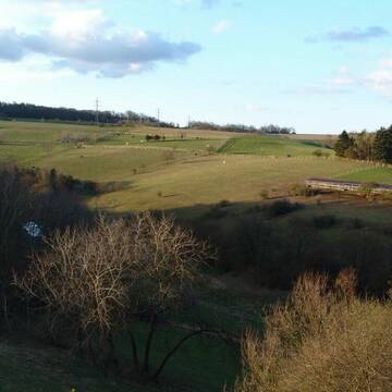
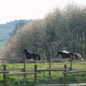
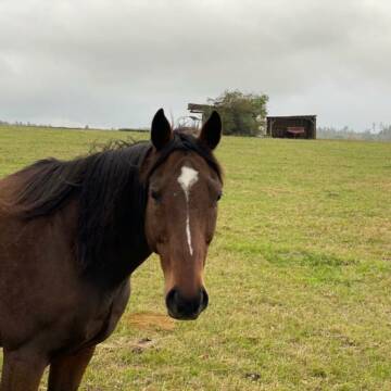
Weide in Ober-Ostern
Gesucht wird in "Ober-Ostern, Hessen, Deutschland"
118 Einträge
Deprecated: Creation of dynamic property Zend_View::$listObjects is deprecated in /var/www/stall-frei/htdocs/staging.stall-frei.de/library/vendor/shardj/zf1-future/library/Zend/View/Abstract.php on line 308
Deprecated: Creation of dynamic property Zend_View::$listMode is deprecated in /var/www/stall-frei/htdocs/staging.stall-frei.de/library/vendor/shardj/zf1-future/library/Zend/View/Abstract.php on line 308
Deprecated: Creation of dynamic property Zend_View::$renderedObjects is deprecated in /var/www/stall-frei/htdocs/staging.stall-frei.de/library/vendor/shardj/zf1-future/library/Zend/View/Abstract.php on line 308
Deprecated: Creation of dynamic property Zend_View::$index is deprecated in /var/www/stall-frei/htdocs/staging.stall-frei.de/library/vendor/shardj/zf1-future/library/Zend/View/Abstract.php on line 308
Deprecated: Creation of dynamic property Zend_View::$displayMode is deprecated in /var/www/stall-frei/htdocs/staging.stall-frei.de/library/vendor/shardj/zf1-future/library/Zend/View/Abstract.php on line 308
Deprecated: Creation of dynamic property Zend_View::$remarketingIds is deprecated in /var/www/stall-frei/htdocs/staging.stall-frei.de/library/vendor/shardj/zf1-future/library/Zend/View/Abstract.php on line 308
Deprecated: Creation of dynamic property Zend_View::$listItem is deprecated in /var/www/stall-frei/htdocs/staging.stall-frei.de/library/vendor/shardj/zf1-future/library/Zend/View/Abstract.php on line 308
Deprecated: Creation of dynamic property Zend_View::$object is deprecated in /var/www/stall-frei/htdocs/staging.stall-frei.de/library/vendor/shardj/zf1-future/library/Zend/View/Abstract.php on line 308
Deprecated: Creation of dynamic property Zend_View::$attributes is deprecated in /var/www/stall-frei/htdocs/staging.stall-frei.de/library/vendor/shardj/zf1-future/library/Zend/View/Abstract.php on line 308
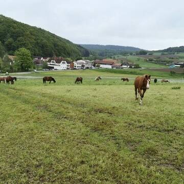
Weideplatz mit Offenstall und Komplettversorgung
Ober-ostern
Ralph-Lang
@Ralph-Lang
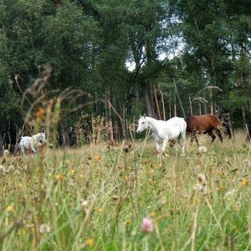
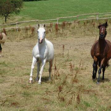
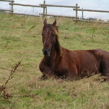
Gemischte Herde
Rentnerweide
Elektrozaun
Mit Auto und Anhänger erreichbar
Ganzjahresweide
Sommerweide
Besuch der Weide: täglich
Zufütterung von Heu oder Silage
3 weitere...
aktuell
P+


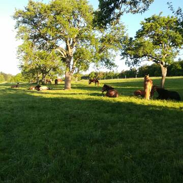
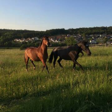
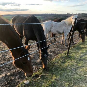
SOMMERWEIDE für Jungpferde
Lautertal
Schneiders_Ranch
@Schneiders_Ranch
Gemischte Herde
Jungtierweide
Elektrozaun
Schatten durch Bäume
Sommerweide
Besuch der Weide: täglich
3 weitere...
P+
Deprecated: Creation of dynamic property Zend_View_Helper_Ads::$adLink is deprecated in /var/www/stall-frei/htdocs/staging.stall-frei.de/library/Psf/View/Helper/Ads.php on line 108

Heu und Heulage verkaufen
Mechtersen
STALL-FREIde Marketing
@STALL-FREI-Marketing
Verkaufen Sie Ihr Heu und Ihre Heulage direkt an Reiter, Pferdeställe und Reitanlagen
Leider kein Vorschaubild
Leider kein Vorschaubild
Selbstversorger-Weideplätze in DA-Eberstadt frei
Darmstadt
Mirabel
@Mirabel
Gemischte Herde
Elektrozaun
Mit Auto und Anhänger erreichbar
Ganzjahresweide
Besuch der Weide: täglich
Zufütterung von Heu oder Silage
3 weitere...
B
Leider kein Vorschaubild
Leider kein Vorschaubild
Weideplätze zu vergeben
Neckarsteinach
Privatstall Darsberg
@Ferienweide
Jungtierweide
Rentnerweide
Elektrozaun
Mit Auto und Anhänger erreichbar
Sommerweide
Besuch der Weide: täglich
4 weitere...
B


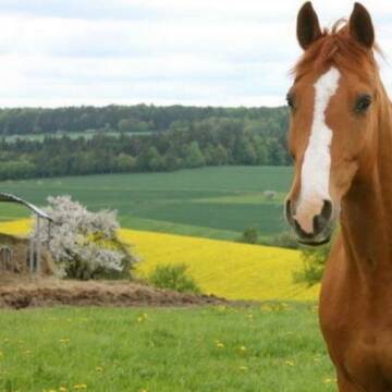
Fohlenweide/Rentnerweide
Ahorn
Karlheinz Wetterich
@Karlheinz-Wetterich
Hengstweide
Stutenweide
Elektrozaun
Mit Auto und Anhänger erreichbar
Ganzjahresweide
Besuch der Weide: täglich
Zufütterung von Heu oder Silage
4 weitere...
P+


HIT Aktiv-Stall (Wallache) bei Fam. Senckenberg
Groß-Gerau
Senckenberg
@Senckenberg
Mehr Freiheit für Ihr Pferd - freie Plätze im HIT-Aktivstall
Leider kein Vorschaubild
Leider kein Vorschaubild
Fohlenaufzucht/Stutfohlen
Adelsheim
Assenheimer-Pfeiffer GbR
@Assenheimer-Pfeiffer
Gemischte Herde
Jungtierweide
Elektrozaun
Mit Auto und Anhänger erreichbar
Ganzjahresweide
Besuch der Weide: täglich
Zufütterung von Heu oder Silage
5 weitere...
aktuell
B
Ganzjahresweiden auch für Reconvaleszenz
Schlangenbad-Wambach
Offenstall-Pferdepension
@Pferdepension-Rhein-Main
Gemischte Herde
Hengstweide
Elektrozaun
Lattenzaun
Frühjahrsweide
Ganzjahresweide
Besuch der Weide: täglich
Zufütterung von Heu oder Silage
13 weitere...
P+
Ganzjahresweide Lilienhof Oberlibbach
Hünstetten-Oberlibbach
Norbert Bremser
@Tobias-Bremser
Rentnerweide
Wallachweide
Bremsenfalle
Elektrozaun
Ganzjahresweide
Besuch der Weide: täglich
Zufütterung von Heu oder Silage
7 weitere...
P+
Leider kein Vorschaubild
Leider kein Vorschaubild
Hof Lenzenberg - nur Wallache
Niedernhausen
Familie-Bonadt
@Familie-Bonadt
Hengstweide
Jungtierweide
Elektrozaun
Mit Auto und Anhänger erreichbar
Frühjahrsweide
Herbstweide
6 weitere...
B
Deprecated: Creation of dynamic property Zend_View::$pageCount is deprecated in /var/www/stall-frei/htdocs/staging.stall-frei.de/library/vendor/shardj/zf1-future/library/Zend/View/Abstract.php on line 308
Deprecated: Creation of dynamic property Zend_View::$itemCountPerPage is deprecated in /var/www/stall-frei/htdocs/staging.stall-frei.de/library/vendor/shardj/zf1-future/library/Zend/View/Abstract.php on line 308
Deprecated: Creation of dynamic property Zend_View::$first is deprecated in /var/www/stall-frei/htdocs/staging.stall-frei.de/library/vendor/shardj/zf1-future/library/Zend/View/Abstract.php on line 308
Deprecated: Creation of dynamic property Zend_View::$current is deprecated in /var/www/stall-frei/htdocs/staging.stall-frei.de/library/vendor/shardj/zf1-future/library/Zend/View/Abstract.php on line 308
Deprecated: Creation of dynamic property Zend_View::$last is deprecated in /var/www/stall-frei/htdocs/staging.stall-frei.de/library/vendor/shardj/zf1-future/library/Zend/View/Abstract.php on line 308
Deprecated: Creation of dynamic property Zend_View::$next is deprecated in /var/www/stall-frei/htdocs/staging.stall-frei.de/library/vendor/shardj/zf1-future/library/Zend/View/Abstract.php on line 308
Deprecated: Creation of dynamic property Zend_View::$pagesInRange is deprecated in /var/www/stall-frei/htdocs/staging.stall-frei.de/library/vendor/shardj/zf1-future/library/Zend/View/Abstract.php on line 308
Deprecated: Creation of dynamic property Zend_View::$firstPageInRange is deprecated in /var/www/stall-frei/htdocs/staging.stall-frei.de/library/vendor/shardj/zf1-future/library/Zend/View/Abstract.php on line 308
Deprecated: Creation of dynamic property Zend_View::$lastPageInRange is deprecated in /var/www/stall-frei/htdocs/staging.stall-frei.de/library/vendor/shardj/zf1-future/library/Zend/View/Abstract.php on line 308
Deprecated: Creation of dynamic property Zend_View::$currentItemCount is deprecated in /var/www/stall-frei/htdocs/staging.stall-frei.de/library/vendor/shardj/zf1-future/library/Zend/View/Abstract.php on line 308
Deprecated: Creation of dynamic property Zend_View::$totalItemCount is deprecated in /var/www/stall-frei/htdocs/staging.stall-frei.de/library/vendor/shardj/zf1-future/library/Zend/View/Abstract.php on line 308
Deprecated: Creation of dynamic property Zend_View::$firstItemNumber is deprecated in /var/www/stall-frei/htdocs/staging.stall-frei.de/library/vendor/shardj/zf1-future/library/Zend/View/Abstract.php on line 308
Deprecated: Creation of dynamic property Zend_View::$lastItemNumber is deprecated in /var/www/stall-frei/htdocs/staging.stall-frei.de/library/vendor/shardj/zf1-future/library/Zend/View/Abstract.php on line 308
Deprecated: Creation of dynamic property Zend_View::$router is deprecated in /var/www/stall-frei/htdocs/staging.stall-frei.de/library/vendor/shardj/zf1-future/library/Zend/View/Abstract.php on line 308
Deprecated: Creation of dynamic property Zend_View::$urlParams is deprecated in /var/www/stall-frei/htdocs/staging.stall-frei.de/library/vendor/shardj/zf1-future/library/Zend/View/Abstract.php on line 308
Deprecated: Creation of dynamic property Zend_View::$showAds is deprecated in /var/www/stall-frei/htdocs/staging.stall-frei.de/library/vendor/shardj/zf1-future/library/Zend/View/Abstract.php on line 308
Deprecated: Creation of dynamic property Zend_View::$objectIds is deprecated in /var/www/stall-frei/htdocs/staging.stall-frei.de/library/vendor/shardj/zf1-future/library/Zend/View/Abstract.php on line 308
Deprecated: Creation of dynamic property Zend_View::$showNavbar is deprecated in /var/www/stall-frei/htdocs/staging.stall-frei.de/library/vendor/shardj/zf1-future/library/Zend/View/Abstract.php on line 308
Deprecated: Creation of dynamic property Zend_View::$showBreadcrumb is deprecated in /var/www/stall-frei/htdocs/staging.stall-frei.de/library/vendor/shardj/zf1-future/library/Zend/View/Abstract.php on line 308
Deprecated: Creation of dynamic property Zend_View::$showFooter is deprecated in /var/www/stall-frei/htdocs/staging.stall-frei.de/library/vendor/shardj/zf1-future/library/Zend/View/Abstract.php on line 308
Deprecated: Creation of dynamic property Zend_View::$showInternalAds is deprecated in /var/www/stall-frei/htdocs/staging.stall-frei.de/library/vendor/shardj/zf1-future/library/Zend/View/Abstract.php on line 308
Deprecated: Creation of dynamic property Zend_View::$blNoContent is deprecated in /var/www/stall-frei/htdocs/staging.stall-frei.de/library/vendor/shardj/zf1-future/library/Zend/View/Abstract.php on line 308
Deprecated: Creation of dynamic property Zend_View::$sMetaDesc is deprecated in /var/www/stall-frei/htdocs/staging.stall-frei.de/library/vendor/shardj/zf1-future/library/Zend/View/Abstract.php on line 308
Deprecated: Creation of dynamic property Zend_View::$useGmaps is deprecated in /var/www/stall-frei/htdocs/staging.stall-frei.de/library/vendor/shardj/zf1-future/library/Zend/View/Abstract.php on line 308
Deprecated: Creation of dynamic property Zend_View::$touches is deprecated in /var/www/stall-frei/htdocs/staging.stall-frei.de/library/vendor/shardj/zf1-future/library/Zend/View/Abstract.php on line 308
Deprecated: Creation of dynamic property Zend_View::$oProject is deprecated in /var/www/stall-frei/htdocs/staging.stall-frei.de/library/vendor/shardj/zf1-future/library/Zend/View/Abstract.php on line 308
Deprecated: Creation of dynamic property Zend_View::$pageHeadline is deprecated in /var/www/stall-frei/htdocs/staging.stall-frei.de/library/vendor/shardj/zf1-future/library/Zend/View/Abstract.php on line 308
Deprecated: Creation of dynamic property Zend_View::$disableLocationField is deprecated in /var/www/stall-frei/htdocs/staging.stall-frei.de/library/vendor/shardj/zf1-future/library/Zend/View/Abstract.php on line 308
Deprecated: Creation of dynamic property Zend_View::$isSearch is deprecated in /var/www/stall-frei/htdocs/staging.stall-frei.de/library/vendor/shardj/zf1-future/library/Zend/View/Abstract.php on line 308
Deprecated: Creation of dynamic property Zend_View::$pageTitle is deprecated in /var/www/stall-frei/htdocs/staging.stall-frei.de/library/vendor/shardj/zf1-future/library/Zend/View/Abstract.php on line 308
Deprecated: Creation of dynamic property Psf_Form_Element_Text::$class is deprecated in /var/www/stall-frei/htdocs/staging.stall-frei.de/library/vendor/shardj/zf1-future/library/Zend/Form/Element.php on line 874
Deprecated: Creation of dynamic property Psf_Form_Element_Text::$size is deprecated in /var/www/stall-frei/htdocs/staging.stall-frei.de/library/vendor/shardj/zf1-future/library/Zend/Form/Element.php on line 874
Deprecated: Creation of dynamic property Psf_Form_Element_Text::$placeholder is deprecated in /var/www/stall-frei/htdocs/staging.stall-frei.de/library/vendor/shardj/zf1-future/library/Zend/Form/Element.php on line 874
Deprecated: Creation of dynamic property Psf_Form_Element_Hidden::$class is deprecated in /var/www/stall-frei/htdocs/staging.stall-frei.de/library/vendor/shardj/zf1-future/library/Zend/Form/Element.php on line 874
Deprecated: Creation of dynamic property Psf_Form_Element_Hidden::$class is deprecated in /var/www/stall-frei/htdocs/staging.stall-frei.de/library/vendor/shardj/zf1-future/library/Zend/Form/Element.php on line 874
Deprecated: Creation of dynamic property Psf_Form_Element_Hidden::$class is deprecated in /var/www/stall-frei/htdocs/staging.stall-frei.de/library/vendor/shardj/zf1-future/library/Zend/Form/Element.php on line 874
Deprecated: Creation of dynamic property Psf_Form_Element_Hidden::$class is deprecated in /var/www/stall-frei/htdocs/staging.stall-frei.de/library/vendor/shardj/zf1-future/library/Zend/Form/Element.php on line 874
Deprecated: Creation of dynamic property Psf_Form_Element_Select::$class is deprecated in /var/www/stall-frei/htdocs/staging.stall-frei.de/library/vendor/shardj/zf1-future/library/Zend/Form/Element.php on line 874
Deprecated: Creation of dynamic property Psf_Form_Element_Select::$class is deprecated in /var/www/stall-frei/htdocs/staging.stall-frei.de/library/vendor/shardj/zf1-future/library/Zend/Form/Element.php on line 874
Deprecated: Creation of dynamic property Psf_Form_Element_Select::$class is deprecated in /var/www/stall-frei/htdocs/staging.stall-frei.de/library/vendor/shardj/zf1-future/library/Zend/Form/Element.php on line 874
Deprecated: Creation of dynamic property Psf_Form_Element_Text::$class is deprecated in /var/www/stall-frei/htdocs/staging.stall-frei.de/library/vendor/shardj/zf1-future/library/Zend/Form/Element.php on line 874
Deprecated: Creation of dynamic property Psf_Form_Element_Checkbox::$label is deprecated in /var/www/stall-frei/htdocs/staging.stall-frei.de/library/vendor/shardj/zf1-future/library/Zend/Form/Element.php on line 874
Deprecated: Creation of dynamic property Zend_View::$sort is deprecated in /var/www/stall-frei/htdocs/staging.stall-frei.de/library/vendor/shardj/zf1-future/library/Zend/View/Abstract.php on line 308
Deprecated: Creation of dynamic property Zend_View::$searchLocation is deprecated in /var/www/stall-frei/htdocs/staging.stall-frei.de/library/vendor/shardj/zf1-future/library/Zend/View/Abstract.php on line 308
Deprecated: Creation of dynamic property Zend_View::$locationHint is deprecated in /var/www/stall-frei/htdocs/staging.stall-frei.de/library/vendor/shardj/zf1-future/library/Zend/View/Abstract.php on line 308
Psf_GeoCoder_Abstract::getLocation: Ober-Ostern Get Location CachedOrLive
Psf_GeoCoder_Abstract::getCachedOrLive: Ober-Ostern
Psf_GeoCoder_OpenCageData::makeApiRequest: response:
Array
(
[documentation] => https://opencagedata.com/api
[licenses] => Array
(
[0] => Array
(
[name] => see attribution guide
[url] => https://opencagedata.com/credits
)
)
[results] => Array
(
[0] => Array
(
[bounds] => Array
(
[northeast] => Array
(
[lat] => 49.6890151
[lng] => 8.8643754
)
[southwest] => Array
(
[lat] => 49.6561084
[lng] => 8.8278238
)
)
[components] => Array
(
[ISO_3166-1_alpha-2] => DE
[ISO_3166-1_alpha-3] => DEU
[ISO_3166-2] => Array
(
[0] => DE-HE
)
[_category] => place
[_normalized_city] => Ober-Ostern
[_type] => village
[continent] => Europe
[country] => Deutschland
[country_code] => de
[county] => Odenwaldkreis
[municipality] => Reichelsheim (Odenwald)
[political_union] => European Union
[state] => Hessen
[state_code] => HE
[village] => Ober-Ostern
)
[confidence] => 7
[formatted] => Ober-Ostern, Hessen, Deutschland
[geometry] => Array
(
[lat] => 49.6769211
[lng] => 8.8500817
)
)
[1] => Array
(
[components] => Array
(
[ISO_3166-1_alpha-2] => FR
[ISO_3166-1_alpha-3] => FRA
[ISO_3166-2] => Array
(
[0] => FR-GES
[1] => FR-6AE
[2] => FR-68
)
[_category] => road
[_normalized_city] => Soultzeren
[_type] => road
[city] => Soultzeren
[continent] => Europe
[country] => France
[country_code] => fr
[county] => Haut-Rhin
[local_authority] => Communauté de communes de la Vallée de Munster
[political_union] => European Union
[postcode] => 68140
[road] => Chemin du Ober Langeren
[state] => Grand Est
[state_code] => GES
)
[confidence] => 3
[formatted] => Chemin du Ober Langeren, 68140 Soultzeren, France
[geometry] => Array
(
[lat] => 48.074083
[lng] => 7.103864
)
)
[2] => Array
(
[components] => Array
(
[ISO_3166-1_alpha-2] => FR
[ISO_3166-1_alpha-3] => FRA
[ISO_3166-2] => Array
(
[0] => FR-GES
[1] => FR-6AE
[2] => FR-68
)
[_category] => road
[_normalized_city] => Munster
[_type] => road
[city] => Munster
[continent] => Europe
[country] => France
[country_code] => fr
[county] => Haut-Rhin
[local_authority] => Communauté de communes de la Vallée de Munster
[political_union] => European Union
[postcode] => 68140
[road] => Chemin du Ober Moenchberg
[state] => Grand Est
[state_code] => GES
)
[confidence] => 2
[formatted] => Chemin du Ober Moenchberg, 68140 Munster, France
[geometry] => Array
(
[lat] => 48.039279
[lng] => 7.121846
)
)
[3] => Array
(
[components] => Array
(
[ISO_3166-1_alpha-2] => FR
[ISO_3166-1_alpha-3] => FRA
[ISO_3166-2] => Array
(
[0] => FR-GES
[1] => FR-6AE
[2] => FR-68
)
[_category] => road
[_normalized_city] => Sondernach
[_type] => road
[city] => Sondernach
[continent] => Europe
[country] => France
[country_code] => fr
[county] => Haut-Rhin
[local_authority] => Communauté de communes de la Vallée de Munster
[political_union] => European Union
[postcode] => 68380
[road] => chemin Ober Lengenbach
[state] => Grand Est
[state_code] => GES
)
[confidence] => 2
[formatted] => chemin Ober Lengenbach, 68380 Sondernach, France
[geometry] => Array
(
[lat] => 47.990676
[lng] => 7.101859
)
)
[4] => Array
(
[components] => Array
(
[ISO_3166-1_alpha-2] => FR
[ISO_3166-1_alpha-3] => FRA
[ISO_3166-2] => Array
(
[0] => FR-GES
[1] => FR-6AE
[2] => FR-68
)
[_category] => road
[_normalized_city] => Eschbach-au-Val
[_type] => road
[city] => Eschbach-au-Val
[continent] => Europe
[country] => France
[country_code] => fr
[county] => Haut-Rhin
[local_authority] => Communauté de communes de la Vallée de Munster
[political_union] => European Union
[postcode] => 68140
[road] => Route Ober Solberg
[state] => Grand Est
[state_code] => GES
)
[confidence] => 2
[formatted] => Route Ober Solberg, 68140 Eschbach-au-Val, France
[geometry] => Array
(
[lat] => 48.033318
[lng] => 7.138846
)
)
[5] => Array
(
[components] => Array
(
[ISO_3166-1_alpha-2] => FR
[ISO_3166-1_alpha-3] => FRA
[ISO_3166-2] => Array
(
[0] => FR-GES
[1] => FR-6AE
[2] => FR-68
)
[_category] => road
[_normalized_city] => Soultzeren
[_type] => road
[city] => Soultzeren
[continent] => Europe
[country] => France
[country_code] => fr
[county] => Haut-Rhin
[local_authority] => Communauté de communes de la Vallée de Munster
[political_union] => European Union
[postcode] => 68140
[road] => Chemin Ober Eck
[state] => Grand Est
[state_code] => GES
)
[confidence] => 2
[formatted] => Chemin Ober Eck, 68140 Soultzeren, France
[geometry] => Array
(
[lat] => 48.062485
[lng] => 7.091922
)
)
[6] => Array
(
[components] => Array
(
[ISO_3166-1_alpha-2] => FR
[ISO_3166-1_alpha-3] => FRA
[ISO_3166-2] => Array
(
[0] => FR-GES
[1] => FR-6AE
[2] => FR-68
)
[_category] => road
[_normalized_city] => Soultzeren
[_type] => road
[city] => Soultzeren
[continent] => Europe
[country] => France
[country_code] => fr
[county] => Haut-Rhin
[local_authority] => Communauté de communes de la Vallée de Munster
[political_union] => European Union
[postcode] => 68140
[road] => Chemin Ober Geisberg
[state] => Grand Est
[state_code] => GES
)
[confidence] => 2
[formatted] => Chemin Ober Geisberg, 68140 Soultzeren, France
[geometry] => Array
(
[lat] => 48.078505
[lng] => 7.107876
)
)
[7] => Array
(
[components] => Array
(
[ISO_3166-1_alpha-2] => FR
[ISO_3166-1_alpha-3] => FRA
[ISO_3166-2] => Array
(
[0] => FR-GES
[1] => FR-6AE
[2] => FR-68
)
[_category] => place
[_normalized_city] => Hirsingue
[_type] => place
[city] => Hirsingue
[continent] => Europe
[country] => France
[country_code] => fr
[county] => Haut-Rhin
[local_authority] => Communauté de communes Sundgau
[place] => Ober Dem Brandwinkel
[political_union] => European Union
[postcode] => 68560
[state] => Grand Est
[state_code] => GES
)
[confidence] => 2
[formatted] => Ober Dem Brandwinkel, 68560 Hirsingue, France
[geometry] => Array
(
[lat] => 47.595541
[lng] => 7.244854
)
)
[8] => Array
(
[components] => Array
(
[ISO_3166-1_alpha-2] => FR
[ISO_3166-1_alpha-3] => FRA
[ISO_3166-2] => Array
(
[0] => FR-GES
[1] => FR-57
)
[_category] => place
[_normalized_city] => Hanviller
[_type] => place
[city] => Hanviller
[continent] => Europe
[country] => France
[country_code] => fr
[county] => Moselle
[local_authority] => Communauté de communes du Pays de Bitche
[place] => Ober Diedenbach
[political_union] => European Union
[postcode] => 57230
[state] => Grand Est
[state_code] => GES
)
[confidence] => 2
[formatted] => Ober Diedenbach, 57230 Hanviller, France
[geometry] => Array
(
[lat] => 49.094878
[lng] => 7.453496
)
)
[9] => Array
(
[components] => Array
(
[ISO_3166-1_alpha-2] => FR
[ISO_3166-1_alpha-3] => FRA
[ISO_3166-2] => Array
(
[0] => FR-GES
[1] => FR-6AE
[2] => FR-67
)
[_category] => road
[_normalized_city] => Fort-Louis
[_type] => road
[city] => Fort-Louis
[continent] => Europe
[country] => France
[country_code] => fr
[county] => Bas-Rhin
[local_authority] => Communauté de communes du Pays Rhénan
[political_union] => European Union
[postcode] => 67480
[road] => Suryscher Ober Woerth
[state] => Grand Est
[state_code] => GES
)
[confidence] => 2
[formatted] => Suryscher Ober Woerth, 67480 Fort-Louis, France
[geometry] => Array
(
[lat] => 48.784884
[lng] => 8.022354
)
)
)
[status] => Array
(
[code] => 200
[message] => OK
)
[stay_informed] => Array
(
[blog] => https://blog.opencagedata.com
[mastodon] => https://en.osm.town/@opencage
)
[thanks] => For using an OpenCage API
[timestamp] => Array
(
[created_http] => Sun, 08 Feb 2026 07:16:38 GMT
[created_unix] => 1770534998
)
[total_results] => 10
)
Psf_GeoCoder_Abstract::convertLocationResult
{"documentation":"https:\/\/opencagedata.com\/api","licenses":[{"name":"see attribution guide","url":"https:\/\/opencagedata.com\/credits"}],"results":[{"bounds":{"northeast":{"lat":49.6890151,"lng":8.8643754},"southwest":{"lat":49.6561084,"lng":8.8278238}},"components":{"ISO_3166-1_alpha-2":"DE","ISO_3166-1_alpha-3":"DEU","ISO_3166-2":["DE-HE"],"_category":"place","_normalized_city":"Ober-Ostern","_type":"village","continent":"Europe","country":"Deutschland","country_code":"de","county":"Odenwaldkreis","municipality":"Reichelsheim (Odenwald)","political_union":"European Union","state":"Hessen","state_code":"HE","village":"Ober-Ostern"},"confidence":7,"formatted":"Ober-Ostern, Hessen, Deutschland","geometry":{"lat":49.6769211,"lng":8.8500817}},{"components":{"ISO_3166-1_alpha-2":"FR","ISO_3166-1_alpha-3":"FRA","ISO_3166-2":["FR-GES","FR-6AE","FR-68"],"_category":"road","_normalized_city":"Soultzeren","_type":"road","city":"Soultzeren","continent":"Europe","country":"France","country_code":"fr","county":"Haut-Rhin","local_authority":"Communaut\u00e9 de communes de la Vall\u00e9e de Munster","political_union":"European Union","postcode":"68140","road":"Chemin du Ober Langeren","state":"Grand Est","state_code":"GES"},"confidence":3,"formatted":"Chemin du Ober Langeren, 68140 Soultzeren, France","geometry":{"lat":48.074083,"lng":7.103864}},{"components":{"ISO_3166-1_alpha-2":"FR","ISO_3166-1_alpha-3":"FRA","ISO_3166-2":["FR-GES","FR-6AE","FR-68"],"_category":"road","_normalized_city":"Munster","_type":"road","city":"Munster","continent":"Europe","country":"France","country_code":"fr","county":"Haut-Rhin","local_authority":"Communaut\u00e9 de communes de la Vall\u00e9e de Munster","political_union":"European Union","postcode":"68140","road":"Chemin du Ober Moenchberg","state":"Grand Est","state_code":"GES"},"confidence":2,"formatted":"Chemin du Ober Moenchberg, 68140 Munster, France","geometry":{"lat":48.039279,"lng":7.121846}},{"components":{"ISO_3166-1_alpha-2":"FR","ISO_3166-1_alpha-3":"FRA","ISO_3166-2":["FR-GES","FR-6AE","FR-68"],"_category":"road","_normalized_city":"Sondernach","_type":"road","city":"Sondernach","continent":"Europe","country":"France","country_code":"fr","county":"Haut-Rhin","local_authority":"Communaut\u00e9 de communes de la Vall\u00e9e de Munster","political_union":"European Union","postcode":"68380","road":"chemin Ober Lengenbach","state":"Grand Est","state_code":"GES"},"confidence":2,"formatted":"chemin Ober Lengenbach, 68380 Sondernach, France","geometry":{"lat":47.990676,"lng":7.101859}},{"components":{"ISO_3166-1_alpha-2":"FR","ISO_3166-1_alpha-3":"FRA","ISO_3166-2":["FR-GES","FR-6AE","FR-68"],"_category":"road","_normalized_city":"Eschbach-au-Val","_type":"road","city":"Eschbach-au-Val","continent":"Europe","country":"France","country_code":"fr","county":"Haut-Rhin","local_authority":"Communaut\u00e9 de communes de la Vall\u00e9e de Munster","political_union":"European Union","postcode":"68140","road":"Route Ober Solberg","state":"Grand Est","state_code":"GES"},"confidence":2,"formatted":"Route Ober Solberg, 68140 Eschbach-au-Val, France","geometry":{"lat":48.033318,"lng":7.138846}},{"components":{"ISO_3166-1_alpha-2":"FR","ISO_3166-1_alpha-3":"FRA","ISO_3166-2":["FR-GES","FR-6AE","FR-68"],"_category":"road","_normalized_city":"Soultzeren","_type":"road","city":"Soultzeren","continent":"Europe","country":"France","country_code":"fr","county":"Haut-Rhin","local_authority":"Communaut\u00e9 de communes de la Vall\u00e9e de Munster","political_union":"European Union","postcode":"68140","road":"Chemin Ober Eck","state":"Grand Est","state_code":"GES"},"confidence":2,"formatted":"Chemin Ober Eck, 68140 Soultzeren, France","geometry":{"lat":48.062485,"lng":7.091922}},{"components":{"ISO_3166-1_alpha-2":"FR","ISO_3166-1_alpha-3":"FRA","ISO_3166-2":["FR-GES","FR-6AE","FR-68"],"_category":"road","_normalized_city":"Soultzeren","_type":"road","city":"Soultzeren","continent":"Europe","country":"France","country_code":"fr","county":"Haut-Rhin","local_authority":"Communaut\u00e9 de communes de la Vall\u00e9e de Munster","political_union":"European Union","postcode":"68140","road":"Chemin Ober Geisberg","state":"Grand Est","state_code":"GES"},"confidence":2,"formatted":"Chemin Ober Geisberg, 68140 Soultzeren, France","geometry":{"lat":48.078505,"lng":7.107876}},{"components":{"ISO_3166-1_alpha-2":"FR","ISO_3166-1_alpha-3":"FRA","ISO_3166-2":["FR-GES","FR-6AE","FR-68"],"_category":"place","_normalized_city":"Hirsingue","_type":"place","city":"Hirsingue","continent":"Europe","country":"France","country_code":"fr","county":"Haut-Rhin","local_authority":"Communaut\u00e9 de communes Sundgau","place":"Ober Dem Brandwinkel","political_union":"European Union","postcode":"68560","state":"Grand Est","state_code":"GES"},"confidence":2,"formatted":"Ober Dem Brandwinkel, 68560 Hirsingue, France","geometry":{"lat":47.595541,"lng":7.244854}},{"components":{"ISO_3166-1_alpha-2":"FR","ISO_3166-1_alpha-3":"FRA","ISO_3166-2":["FR-GES","FR-57"],"_category":"place","_normalized_city":"Hanviller","_type":"place","city":"Hanviller","continent":"Europe","country":"France","country_code":"fr","county":"Moselle","local_authority":"Communaut\u00e9 de communes du Pays de Bitche","place":"Ober Diedenbach","political_union":"European Union","postcode":"57230","state":"Grand Est","state_code":"GES"},"confidence":2,"formatted":"Ober Diedenbach, 57230 Hanviller, France","geometry":{"lat":49.094878,"lng":7.453496}},{"components":{"ISO_3166-1_alpha-2":"FR","ISO_3166-1_alpha-3":"FRA","ISO_3166-2":["FR-GES","FR-6AE","FR-67"],"_category":"road","_normalized_city":"Fort-Louis","_type":"road","city":"Fort-Louis","continent":"Europe","country":"France","country_code":"fr","county":"Bas-Rhin","local_authority":"Communaut\u00e9 de communes du Pays Rh\u00e9nan","political_union":"European Union","postcode":"67480","road":"Suryscher Ober Woerth","state":"Grand Est","state_code":"GES"},"confidence":2,"formatted":"Suryscher Ober Woerth, 67480 Fort-Louis, France","geometry":{"lat":48.784884,"lng":8.022354}}],"status":{"code":200,"message":"OK"},"stay_informed":{"blog":"https:\/\/blog.opencagedata.com","mastodon":"https:\/\/en.osm.town\/@opencage"},"thanks":"For using an OpenCage API","timestamp":{"created_http":"Sun, 08 Feb 2026 07:16:38 GMT","created_unix":1770534998},"total_results":10}Array
(
[0] => stdClass Object
(
[bounds] => stdClass Object
(
[northeast] => stdClass Object
(
[lat] => 49.6890151
[lng] => 8.8643754
)
[southwest] => stdClass Object
(
[lat] => 49.6561084
[lng] => 8.8278238
)
)
[components] => stdClass Object
(
[ISO_3166-1_alpha-2] => DE
[ISO_3166-1_alpha-3] => DEU
[ISO_3166-2] => Array
(
[0] => DE-HE
)
[_category] => place
[_normalized_city] => Ober-Ostern
[_type] => village
[continent] => Europe
[country] => Deutschland
[country_code] => de
[county] => Odenwaldkreis
[municipality] => Reichelsheim (Odenwald)
[political_union] => European Union
[state] => Hessen
[state_code] => HE
[village] => Ober-Ostern
)
[confidence] => 7
[formatted] => Ober-Ostern, Hessen, Deutschland
[geometry] => stdClass Object
(
[lat] => 49.6769211
[lng] => 8.8500817
)
)
[1] => stdClass Object
(
[components] => stdClass Object
(
[ISO_3166-1_alpha-2] => FR
[ISO_3166-1_alpha-3] => FRA
[ISO_3166-2] => Array
(
[0] => FR-GES
[1] => FR-6AE
[2] => FR-68
)
[_category] => road
[_normalized_city] => Soultzeren
[_type] => road
[city] => Soultzeren
[continent] => Europe
[country] => France
[country_code] => fr
[county] => Haut-Rhin
[local_authority] => Communauté de communes de la Vallée de Munster
[political_union] => European Union
[postcode] => 68140
[road] => Chemin du Ober Langeren
[state] => Grand Est
[state_code] => GES
)
[confidence] => 3
[formatted] => Chemin du Ober Langeren, 68140 Soultzeren, France
[geometry] => stdClass Object
(
[lat] => 48.074083
[lng] => 7.103864
)
)
[2] => stdClass Object
(
[components] => stdClass Object
(
[ISO_3166-1_alpha-2] => FR
[ISO_3166-1_alpha-3] => FRA
[ISO_3166-2] => Array
(
[0] => FR-GES
[1] => FR-6AE
[2] => FR-68
)
[_category] => road
[_normalized_city] => Munster
[_type] => road
[city] => Munster
[continent] => Europe
[country] => France
[country_code] => fr
[county] => Haut-Rhin
[local_authority] => Communauté de communes de la Vallée de Munster
[political_union] => European Union
[postcode] => 68140
[road] => Chemin du Ober Moenchberg
[state] => Grand Est
[state_code] => GES
)
[confidence] => 2
[formatted] => Chemin du Ober Moenchberg, 68140 Munster, France
[geometry] => stdClass Object
(
[lat] => 48.039279
[lng] => 7.121846
)
)
[3] => stdClass Object
(
[components] => stdClass Object
(
[ISO_3166-1_alpha-2] => FR
[ISO_3166-1_alpha-3] => FRA
[ISO_3166-2] => Array
(
[0] => FR-GES
[1] => FR-6AE
[2] => FR-68
)
[_category] => road
[_normalized_city] => Sondernach
[_type] => road
[city] => Sondernach
[continent] => Europe
[country] => France
[country_code] => fr
[county] => Haut-Rhin
[local_authority] => Communauté de communes de la Vallée de Munster
[political_union] => European Union
[postcode] => 68380
[road] => chemin Ober Lengenbach
[state] => Grand Est
[state_code] => GES
)
[confidence] => 2
[formatted] => chemin Ober Lengenbach, 68380 Sondernach, France
[geometry] => stdClass Object
(
[lat] => 47.990676
[lng] => 7.101859
)
)
[4] => stdClass Object
(
[components] => stdClass Object
(
[ISO_3166-1_alpha-2] => FR
[ISO_3166-1_alpha-3] => FRA
[ISO_3166-2] => Array
(
[0] => FR-GES
[1] => FR-6AE
[2] => FR-68
)
[_category] => road
[_normalized_city] => Eschbach-au-Val
[_type] => road
[city] => Eschbach-au-Val
[continent] => Europe
[country] => France
[country_code] => fr
[county] => Haut-Rhin
[local_authority] => Communauté de communes de la Vallée de Munster
[political_union] => European Union
[postcode] => 68140
[road] => Route Ober Solberg
[state] => Grand Est
[state_code] => GES
)
[confidence] => 2
[formatted] => Route Ober Solberg, 68140 Eschbach-au-Val, France
[geometry] => stdClass Object
(
[lat] => 48.033318
[lng] => 7.138846
)
)
[5] => stdClass Object
(
[components] => stdClass Object
(
[ISO_3166-1_alpha-2] => FR
[ISO_3166-1_alpha-3] => FRA
[ISO_3166-2] => Array
(
[0] => FR-GES
[1] => FR-6AE
[2] => FR-68
)
[_category] => road
[_normalized_city] => Soultzeren
[_type] => road
[city] => Soultzeren
[continent] => Europe
[country] => France
[country_code] => fr
[county] => Haut-Rhin
[local_authority] => Communauté de communes de la Vallée de Munster
[political_union] => European Union
[postcode] => 68140
[road] => Chemin Ober Eck
[state] => Grand Est
[state_code] => GES
)
[confidence] => 2
[formatted] => Chemin Ober Eck, 68140 Soultzeren, France
[geometry] => stdClass Object
(
[lat] => 48.062485
[lng] => 7.091922
)
)
[6] => stdClass Object
(
[components] => stdClass Object
(
[ISO_3166-1_alpha-2] => FR
[ISO_3166-1_alpha-3] => FRA
[ISO_3166-2] => Array
(
[0] => FR-GES
[1] => FR-6AE
[2] => FR-68
)
[_category] => road
[_normalized_city] => Soultzeren
[_type] => road
[city] => Soultzeren
[continent] => Europe
[country] => France
[country_code] => fr
[county] => Haut-Rhin
[local_authority] => Communauté de communes de la Vallée de Munster
[political_union] => European Union
[postcode] => 68140
[road] => Chemin Ober Geisberg
[state] => Grand Est
[state_code] => GES
)
[confidence] => 2
[formatted] => Chemin Ober Geisberg, 68140 Soultzeren, France
[geometry] => stdClass Object
(
[lat] => 48.078505
[lng] => 7.107876
)
)
[7] => stdClass Object
(
[components] => stdClass Object
(
[ISO_3166-1_alpha-2] => FR
[ISO_3166-1_alpha-3] => FRA
[ISO_3166-2] => Array
(
[0] => FR-GES
[1] => FR-6AE
[2] => FR-68
)
[_category] => place
[_normalized_city] => Hirsingue
[_type] => place
[city] => Hirsingue
[continent] => Europe
[country] => France
[country_code] => fr
[county] => Haut-Rhin
[local_authority] => Communauté de communes Sundgau
[place] => Ober Dem Brandwinkel
[political_union] => European Union
[postcode] => 68560
[state] => Grand Est
[state_code] => GES
)
[confidence] => 2
[formatted] => Ober Dem Brandwinkel, 68560 Hirsingue, France
[geometry] => stdClass Object
(
[lat] => 47.595541
[lng] => 7.244854
)
)
[8] => stdClass Object
(
[components] => stdClass Object
(
[ISO_3166-1_alpha-2] => FR
[ISO_3166-1_alpha-3] => FRA
[ISO_3166-2] => Array
(
[0] => FR-GES
[1] => FR-57
)
[_category] => place
[_normalized_city] => Hanviller
[_type] => place
[city] => Hanviller
[continent] => Europe
[country] => France
[country_code] => fr
[county] => Moselle
[local_authority] => Communauté de communes du Pays de Bitche
[place] => Ober Diedenbach
[political_union] => European Union
[postcode] => 57230
[state] => Grand Est
[state_code] => GES
)
[confidence] => 2
[formatted] => Ober Diedenbach, 57230 Hanviller, France
[geometry] => stdClass Object
(
[lat] => 49.094878
[lng] => 7.453496
)
)
[9] => stdClass Object
(
[components] => stdClass Object
(
[ISO_3166-1_alpha-2] => FR
[ISO_3166-1_alpha-3] => FRA
[ISO_3166-2] => Array
(
[0] => FR-GES
[1] => FR-6AE
[2] => FR-67
)
[_category] => road
[_normalized_city] => Fort-Louis
[_type] => road
[city] => Fort-Louis
[continent] => Europe
[country] => France
[country_code] => fr
[county] => Bas-Rhin
[local_authority] => Communauté de communes du Pays Rhénan
[political_union] => European Union
[postcode] => 67480
[road] => Suryscher Ober Woerth
[state] => Grand Est
[state_code] => GES
)
[confidence] => 2
[formatted] => Suryscher Ober Woerth, 67480 Fort-Louis, France
[geometry] => stdClass Object
(
[lat] => 48.784884
[lng] => 8.022354
)
)
)
Psf_GeoCoder_OpenCageData::getKeyMap: 0
stdClass Object
(
    [bounds] => stdClass Object
        (
            [northeast] => stdClass Object
                (
                    [lat] => 49.6890151
                    [lng] => 8.8643754
                )

            [southwest] => stdClass Object
                (
                    [lat] => 49.6561084
                    [lng] => 8.8278238
                )

        )

    [components] => stdClass Object
        (
            [ISO_3166-1_alpha-2] => DE
            [ISO_3166-1_alpha-3] => DEU
            [ISO_3166-2] => Array
                (
                    [0] => DE-HE
                )

            [_category] => place
            [_normalized_city] => Ober-Ostern
            [_type] => village
            [continent] => Europe
            [country] => Deutschland
            [country_code] => de
            [county] => Odenwaldkreis
            [municipality] => Reichelsheim (Odenwald)
            [political_union] => European Union
            [state] => Hessen
            [state_code] => HE
            [village] => Ober-Ostern
        )

    [confidence] => 7
    [formatted] => Ober-Ostern, Hessen, Deutschland
    [geometry] => stdClass Object
        (
            [lat] => 49.6769211
            [lng] => 8.8500817
        )

)
Psf_GeoCoder_OpenCageData::getCounty: Odenwaldkreis
Psf_GeoCoder_OpenCageData::addMissingData REFETCH!
Array
(
    [address] => Ober-Ostern, Hessen, Deutschland
    [type] => village
    [street] =>
    [city] => Ober-Ostern
    [county] => Odenwaldkreis
    [state] => Hessen
    [zip] =>
    [country] => Deutschland
    [suburb] =>
    [countrycode] => de
    [latitude] => 49.6769211
    [longitude] => 8.8500817
    [accuracy] => 1
    [confidence] => 7
    [bounds] => stdClass Object
        (
            [northeast] => stdClass Object
                (
                    [lat] => 49.6890151
                    [lng] => 8.8643754
                )

            [southwest] => stdClass Object
                (
                    [lat] => 49.6561084
                    [lng] => 8.8278238
                )

        )

)
reformat!
Array
(
    [address] => Ober-Ostern, Hessen, Deutschland
    [type] => village
    [street] =>
    [city] => Ober-Ostern
    [county] => Odenwaldkreis
    [state] => Hessen
    [zip] =>
    [country] => Deutschland
    [suburb] =>
    [countrycode] => de
    [latitude] => 49.6769211
    [longitude] => 8.8500817
    [accuracy] => 1
    [confidence] => 7
    [bounds] => stdClass Object
        (
            [northeast] => stdClass Object
                (
                    [lat] => 49.6890151
                    [lng] => 8.8643754
                )

            [southwest] => stdClass Object
                (
                    [lat] => 49.6561084
                    [lng] => 8.8278238
                )

        )

    [place] => Ober-Ostern, Hessen
    [hash] => 03b273ac09c0e1ff81b2c49dce52bb68
)
Psf_GeoCoder_OpenCageData::getKeyMap: 1
stdClass Object
(
    [components] => stdClass Object
        (
            [ISO_3166-1_alpha-2] => FR
            [ISO_3166-1_alpha-3] => FRA
            [ISO_3166-2] => Array
                (
                    [0] => FR-GES
                    [1] => FR-6AE
                    [2] => FR-68
                )

            [_category] => road
            [_normalized_city] => Soultzeren
            [_type] => road
            [city] => Soultzeren
            [continent] => Europe
            [country] => France
            [country_code] => fr
            [county] => Haut-Rhin
            [local_authority] => Communauté de communes de la Vallée de Munster
            [political_union] => European Union
            [postcode] => 68140
            [road] => Chemin du Ober Langeren
            [state] => Grand Est
            [state_code] => GES
        )

    [confidence] => 3
    [formatted] => Chemin du Ober Langeren, 68140 Soultzeren, France
    [geometry] => stdClass Object
        (
            [lat] => 48.074083
            [lng] => 7.103864
        )

)
Psf_GeoCoder_OpenCageData::getCounty: Haut-Rhin
Psf_GeoCoder_OpenCageData::addMissingData REFETCH!
Array
(
    [address] => Chemin du Ober Langeren, 68140 Soultzeren, France
    [type] => road
    [street] => Chemin du Ober Langeren
    [city] => Soultzeren
    [county] => Haut-Rhin
    [state] => Grand Est
    [zip] => 68140
    [country] => France
    [suburb] =>
    [countrycode] => fr
    [latitude] => 48.074083
    [longitude] => 7.103864
    [accuracy] => 1
    [confidence] => 3
    [bounds] =>
)
reformat!
Array
(
    [address] => Chemin du Ober Langeren, 68140 Soultzeren, France
    [type] => road
    [street] => Chemin du Ober Langeren
    [city] => Soultzeren
    [county] => Haut-Rhin
    [state] => Grand Est
    [zip] => 68140
    [country] => France
    [suburb] =>
    [countrycode] => fr
    [latitude] => 48.074083
    [longitude] => 7.103864
    [accuracy] => 1
    [confidence] => 3
    [bounds] =>
    [place] => Chemin du Ober Langeren, 68140 Soultzeren, Grand Est
    [hash] => 419838b1680f81ceccfa69e4360d8735
)
Psf_GeoCoder_OpenCageData::getKeyMap: 2
stdClass Object
(
    [components] => stdClass Object
        (
            [ISO_3166-1_alpha-2] => FR
            [ISO_3166-1_alpha-3] => FRA
            [ISO_3166-2] => Array
                (
                    [0] => FR-GES
                    [1] => FR-6AE
                    [2] => FR-68
                )

            [_category] => road
            [_normalized_city] => Munster
            [_type] => road
            [city] => Munster
            [continent] => Europe
            [country] => France
            [country_code] => fr
            [county] => Haut-Rhin
            [local_authority] => Communauté de communes de la Vallée de Munster
            [political_union] => European Union
            [postcode] => 68140
            [road] => Chemin du Ober Moenchberg
            [state] => Grand Est
            [state_code] => GES
        )

    [confidence] => 2
    [formatted] => Chemin du Ober Moenchberg, 68140 Munster, France
    [geometry] => stdClass Object
        (
            [lat] => 48.039279
            [lng] => 7.121846
        )

)
Psf_GeoCoder_OpenCageData::getCounty: Haut-Rhin
Psf_GeoCoder_OpenCageData::addMissingData REFETCH!
Array
(
    [address] => Chemin du Ober Moenchberg, 68140 Munster, France
    [type] => road
    [street] => Chemin du Ober Moenchberg
    [city] => Munster
    [county] => Haut-Rhin
    [state] => Grand Est
    [zip] => 68140
    [country] => France
    [suburb] =>
    [countrycode] => fr
    [latitude] => 48.039279
    [longitude] => 7.121846
    [accuracy] => 1
    [confidence] => 2
    [bounds] =>
)
reformat!
Array
(
    [address] => Chemin du Ober Moenchberg, 68140 Munster, France
    [type] => road
    [street] => Chemin du Ober Moenchberg
    [city] => Munster
    [county] => Haut-Rhin
    [state] => Grand Est
    [zip] => 68140
    [country] => France
    [suburb] =>
    [countrycode] => fr
    [latitude] => 48.039279
    [longitude] => 7.121846
    [accuracy] => 1
    [confidence] => 2
    [bounds] =>
    [place] => Chemin du Ober Moenchberg, 68140 Munster, Grand Est
    [hash] => 3b6441475fda51022af713a8c273a941
)
Psf_GeoCoder_OpenCageData::getKeyMap: 3
stdClass Object
(
    [components] => stdClass Object
        (
            [ISO_3166-1_alpha-2] => FR
            [ISO_3166-1_alpha-3] => FRA
            [ISO_3166-2] => Array
                (
                    [0] => FR-GES
                    [1] => FR-6AE
                    [2] => FR-68
                )

            [_category] => road
            [_normalized_city] => Sondernach
            [_type] => road
            [city] => Sondernach
            [continent] => Europe
            [country] => France
            [country_code] => fr
            [county] => Haut-Rhin
            [local_authority] => Communauté de communes de la Vallée de Munster
            [political_union] => European Union
            [postcode] => 68380
            [road] => chemin Ober Lengenbach
            [state] => Grand Est
            [state_code] => GES
        )

    [confidence] => 2
    [formatted] => chemin Ober Lengenbach, 68380 Sondernach, France
    [geometry] => stdClass Object
        (
            [lat] => 47.990676
            [lng] => 7.101859
        )

)
Psf_GeoCoder_OpenCageData::getCounty: Haut-Rhin
Psf_GeoCoder_OpenCageData::addMissingData REFETCH!
Array
(
    [address] => chemin Ober Lengenbach, 68380 Sondernach, France
    [type] => road
    [street] => chemin Ober Lengenbach
    [city] => Sondernach
    [county] => Haut-Rhin
    [state] => Grand Est
    [zip] => 68380
    [country] => France
    [suburb] =>
    [countrycode] => fr
    [latitude] => 47.990676
    [longitude] => 7.101859
    [accuracy] => 1
    [confidence] => 2
    [bounds] =>
)
reformat!
Array
(
    [address] => chemin Ober Lengenbach, 68380 Sondernach, France
    [type] => road
    [street] => chemin Ober Lengenbach
    [city] => Sondernach
    [county] => Haut-Rhin
    [state] => Grand Est
    [zip] => 68380
    [country] => France
    [suburb] =>
    [countrycode] => fr
    [latitude] => 47.990676
    [longitude] => 7.101859
    [accuracy] => 1
    [confidence] => 2
    [bounds] =>
    [place] => chemin Ober Lengenbach, 68380 Sondernach, Grand Est
    [hash] => 93704661307c5d6bd5ca34e8be5f4b99
)
Psf_GeoCoder_OpenCageData::getKeyMap: 4
stdClass Object
(
    [components] => stdClass Object
        (
            [ISO_3166-1_alpha-2] => FR
            [ISO_3166-1_alpha-3] => FRA
            [ISO_3166-2] => Array
                (
                    [0] => FR-GES
                    [1] => FR-6AE
                    [2] => FR-68
                )

            [_category] => road
            [_normalized_city] => Eschbach-au-Val
            [_type] => road
            [city] => Eschbach-au-Val
            [continent] => Europe
            [country] => France
            [country_code] => fr
            [county] => Haut-Rhin
            [local_authority] => Communauté de communes de la Vallée de Munster
            [political_union] => European Union
            [postcode] => 68140
            [road] => Route Ober Solberg
            [state] => Grand Est
            [state_code] => GES
        )

    [confidence] => 2
    [formatted] => Route Ober Solberg, 68140 Eschbach-au-Val, France
    [geometry] => stdClass Object
        (
            [lat] => 48.033318
            [lng] => 7.138846
        )

)
Psf_GeoCoder_OpenCageData::getCounty: Haut-Rhin
Psf_GeoCoder_OpenCageData::addMissingData REFETCH!
Array
(
    [address] => Route Ober Solberg, 68140 Eschbach-au-Val, France
    [type] => road
    [street] => Route Ober Solberg
    [city] => Eschbach-au-Val
    [county] => Haut-Rhin
    [state] => Grand Est
    [zip] => 68140
    [country] => France
    [suburb] =>
    [countrycode] => fr
    [latitude] => 48.033318
    [longitude] => 7.138846
    [accuracy] => 1
    [confidence] => 2
    [bounds] =>
)
reformat!
Array
(
    [address] => Route Ober Solberg, 68140 Eschbach-au-Val, France
    [type] => road
    [street] => Route Ober Solberg
    [city] => Eschbach-au-Val
    [county] => Haut-Rhin
    [state] => Grand Est
    [zip] => 68140
    [country] => France
    [suburb] =>
    [countrycode] => fr
    [latitude] => 48.033318
    [longitude] => 7.138846
    [accuracy] => 1
    [confidence] => 2
    [bounds] =>
    [place] => Route Ober Solberg, 68140 Eschbach-au-Val, Grand Est
    [hash] => c4c1566a7daada6da712467353298599
)
Psf_GeoCoder_OpenCageData::getKeyMap: 5
stdClass Object
(
    [components] => stdClass Object
        (
            [ISO_3166-1_alpha-2] => FR
            [ISO_3166-1_alpha-3] => FRA
            [ISO_3166-2] => Array
                (
                    [0] => FR-GES
                    [1] => FR-6AE
                    [2] => FR-68
                )

            [_category] => road
            [_normalized_city] => Soultzeren
            [_type] => road
            [city] => Soultzeren
            [continent] => Europe
            [country] => France
            [country_code] => fr
            [county] => Haut-Rhin
            [local_authority] => Communauté de communes de la Vallée de Munster
            [political_union] => European Union
            [postcode] => 68140
            [road] => Chemin Ober Eck
            [state] => Grand Est
            [state_code] => GES
        )

    [confidence] => 2
    [formatted] => Chemin Ober Eck, 68140 Soultzeren, France
    [geometry] => stdClass Object
        (
            [lat] => 48.062485
            [lng] => 7.091922
        )

)
Psf_GeoCoder_OpenCageData::getCounty: Haut-Rhin
Psf_GeoCoder_OpenCageData::addMissingData REFETCH!
Array
(
    [address] => Chemin Ober Eck, 68140 Soultzeren, France
    [type] => road
    [street] => Chemin Ober Eck
    [city] => Soultzeren
    [county] => Haut-Rhin
    [state] => Grand Est
    [zip] => 68140
    [country] => France
    [suburb] =>
    [countrycode] => fr
    [latitude] => 48.062485
    [longitude] => 7.091922
    [accuracy] => 1
    [confidence] => 2
    [bounds] =>
)
reformat!
Array
(
    [address] => Chemin Ober Eck, 68140 Soultzeren, France
    [type] => road
    [street] => Chemin Ober Eck
    [city] => Soultzeren
    [county] => Haut-Rhin
    [state] => Grand Est
    [zip] => 68140
    [country] => France
    [suburb] =>
    [countrycode] => fr
    [latitude] => 48.062485
    [longitude] => 7.091922
    [accuracy] => 1
    [confidence] => 2
    [bounds] =>
    [place] => Chemin Ober Eck, 68140 Soultzeren, Grand Est
    [hash] => 93245180e7cc710b541db13dae27c5a6
)
Psf_GeoCoder_OpenCageData::getKeyMap: 6
stdClass Object
(
    [components] => stdClass Object
        (
            [ISO_3166-1_alpha-2] => FR
            [ISO_3166-1_alpha-3] => FRA
            [ISO_3166-2] => Array
                (
                    [0] => FR-GES
                    [1] => FR-6AE
                    [2] => FR-68
                )

            [_category] => road
            [_normalized_city] => Soultzeren
            [_type] => road
            [city] => Soultzeren
            [continent] => Europe
            [country] => France
            [country_code] => fr
            [county] => Haut-Rhin
            [local_authority] => Communauté de communes de la Vallée de Munster
            [political_union] => European Union
            [postcode] => 68140
            [road] => Chemin Ober Geisberg
            [state] => Grand Est
            [state_code] => GES
        )

    [confidence] => 2
    [formatted] => Chemin Ober Geisberg, 68140 Soultzeren, France
    [geometry] => stdClass Object
        (
            [lat] => 48.078505
            [lng] => 7.107876
        )

)
Psf_GeoCoder_OpenCageData::getCounty: Haut-Rhin
Psf_GeoCoder_OpenCageData::addMissingData REFETCH!
Array
(
    [address] => Chemin Ober Geisberg, 68140 Soultzeren, France
    [type] => road
    [street] => Chemin Ober Geisberg
    [city] => Soultzeren
    [county] => Haut-Rhin
    [state] => Grand Est
    [zip] => 68140
    [country] => France
    [suburb] =>
    [countrycode] => fr
    [latitude] => 48.078505
    [longitude] => 7.107876
    [accuracy] => 1
    [confidence] => 2
    [bounds] =>
)
reformat!
Array
(
    [address] => Chemin Ober Geisberg, 68140 Soultzeren, France
    [type] => road
    [street] => Chemin Ober Geisberg
    [city] => Soultzeren
    [county] => Haut-Rhin
    [state] => Grand Est
    [zip] => 68140
    [country] => France
    [suburb] =>
    [countrycode] => fr
    [latitude] => 48.078505
    [longitude] => 7.107876
    [accuracy] => 1
    [confidence] => 2
    [bounds] =>
    [place] => Chemin Ober Geisberg, 68140 Soultzeren, Grand Est
    [hash] => f7a5847897becf0bd81d62a6e7358ef8
)
Psf_GeoCoder_OpenCageData::getKeyMap: 7
stdClass Object
(
    [components] => stdClass Object
        (
            [ISO_3166-1_alpha-2] => FR
            [ISO_3166-1_alpha-3] => FRA
            [ISO_3166-2] => Array
                (
                    [0] => FR-GES
                    [1] => FR-6AE
                    [2] => FR-68
                )

            [_category] => place
            [_normalized_city] => Hirsingue
            [_type] => place
            [city] => Hirsingue
            [continent] => Europe
            [country] => France
            [country_code] => fr
            [county] => Haut-Rhin
            [local_authority] => Communauté de communes Sundgau
            [place] => Ober Dem Brandwinkel
            [political_union] => European Union
            [postcode] => 68560
            [state] => Grand Est
            [state_code] => GES
        )

    [confidence] => 2
    [formatted] => Ober Dem Brandwinkel, 68560 Hirsingue, France
    [geometry] => stdClass Object
        (
            [lat] => 47.595541
            [lng] => 7.244854
        )

)
Psf_GeoCoder_OpenCageData::getCounty: Haut-Rhin
Psf_GeoCoder_OpenCageData::addMissingData REFETCH!
Array
(
    [address] => Ober Dem Brandwinkel, 68560 Hirsingue, France
    [type] => place
    [street] =>
    [city] => Hirsingue
    [county] => Haut-Rhin
    [state] => Grand Est
    [zip] => 68560
    [country] => France
    [suburb] =>
    [countrycode] => fr
    [latitude] => 47.595541
    [longitude] => 7.244854
    [accuracy] => 1
    [confidence] => 2
    [bounds] =>
)
reformat!
Array
(
    [address] => Ober Dem Brandwinkel, 68560 Hirsingue, France
    [type] => place
    [street] =>
    [city] => Hirsingue
    [county] => Haut-Rhin
    [state] => Grand Est
    [zip] => 68560
    [country] => France
    [suburb] =>
    [countrycode] => fr
    [latitude] => 47.595541
    [longitude] => 7.244854
    [accuracy] => 1
    [confidence] => 2
    [bounds] =>
    [place] => 68560 Hirsingue, Grand Est
    [hash] => da5852c38a81eedbb6d470fa23db60ce
)
Psf_GeoCoder_OpenCageData::getKeyMap: 8
stdClass Object
(
    [components] => stdClass Object
        (
            [ISO_3166-1_alpha-2] => FR
            [ISO_3166-1_alpha-3] => FRA
            [ISO_3166-2] => Array
                (
                    [0] => FR-GES
                    [1] => FR-57
                )

            [_category] => place
            [_normalized_city] => Hanviller
            [_type] => place
            [city] => Hanviller
            [continent] => Europe
            [country] => France
            [country_code] => fr
            [county] => Moselle
            [local_authority] => Communauté de communes du Pays de Bitche
            [place] => Ober Diedenbach
            [political_union] => European Union
            [postcode] => 57230
            [state] => Grand Est
            [state_code] => GES
        )

    [confidence] => 2
    [formatted] => Ober Diedenbach, 57230 Hanviller, France
    [geometry] => stdClass Object
        (
            [lat] => 49.094878
            [lng] => 7.453496
        )

)
Psf_GeoCoder_OpenCageData::getCounty: Moselle
Psf_GeoCoder_OpenCageData::addMissingData REFETCH!
Array
(
    [address] => Ober Diedenbach, 57230 Hanviller, France
    [type] => place
    [street] =>
    [city] => Hanviller
    [county] => Moselle
    [state] => Grand Est
    [zip] => 57230
    [country] => France
    [suburb] =>
    [countrycode] => fr
    [latitude] => 49.094878
    [longitude] => 7.453496
    [accuracy] => 1
    [confidence] => 2
    [bounds] =>
)
reformat!
Array
(
    [address] => Ober Diedenbach, 57230 Hanviller, France
    [type] => place
    [street] =>
    [city] => Hanviller
    [county] => Moselle
    [state] => Grand Est
    [zip] => 57230
    [country] => France
    [suburb] =>
    [countrycode] => fr
    [latitude] => 49.094878
    [longitude] => 7.453496
    [accuracy] => 1
    [confidence] => 2
    [bounds] =>
    [place] => 57230 Hanviller, Grand Est
    [hash] => 29afb2992d4a5667339eba778ce01d74
)
Psf_GeoCoder_OpenCageData::getKeyMap: 9
stdClass Object
(
    [components] => stdClass Object
        (
            [ISO_3166-1_alpha-2] => FR
            [ISO_3166-1_alpha-3] => FRA
            [ISO_3166-2] => Array
                (
                    [0] => FR-GES
                    [1] => FR-6AE
                    [2] => FR-67
                )

            [_category] => road
            [_normalized_city] => Fort-Louis
            [_type] => road
            [city] => Fort-Louis
            [continent] => Europe
            [country] => France
            [country_code] => fr
            [county] => Bas-Rhin
            [local_authority] => Communauté de communes du Pays Rhénan
            [political_union] => European Union
            [postcode] => 67480
            [road] => Suryscher Ober Woerth
            [state] => Grand Est
            [state_code] => GES
        )

    [confidence] => 2
    [formatted] => Suryscher Ober Woerth, 67480 Fort-Louis, France
    [geometry] => stdClass Object
        (
            [lat] => 48.784884
            [lng] => 8.022354
        )

)
Psf_GeoCoder_OpenCageData::getCounty: Bas-Rhin
Psf_GeoCoder_OpenCageData::addMissingData REFETCH!
Array
(
    [address] => Suryscher Ober Woerth, 67480 Fort-Louis, France
    [type] => road
    [street] => Suryscher Ober Woerth
    [city] => Fort-Louis
    [county] => Bas-Rhin
    [state] => Grand Est
    [zip] => 67480
    [country] => France
    [suburb] =>
    [countrycode] => fr
    [latitude] => 48.784884
    [longitude] => 8.022354
    [accuracy] => 1
    [confidence] => 2
    [bounds] =>
)
reformat!
Array
(
    [address] => Suryscher Ober Woerth, 67480 Fort-Louis, France
    [type] => road
    [street] => Suryscher Ober Woerth
    [city] => Fort-Louis
    [county] => Bas-Rhin
    [state] => Grand Est
    [zip] => 67480
    [country] => France
    [suburb] =>
    [countrycode] => fr
    [latitude] => 48.784884
    [longitude] => 8.022354
    [accuracy] => 1
    [confidence] => 2
    [bounds] =>
    [place] => Suryscher Ober Woerth, 67480 Fort-Louis, Grand Est
    [hash] => aabe9e099b423b898aacfe7a550239e8
)
Deprecated: Creation of dynamic property Zend_View::$locationHintStyle is deprecated in /var/www/stall-frei/htdocs/staging.stall-frei.de/library/vendor/shardj/zf1-future/library/Zend/View/Abstract.php on line 308
Deprecated: Creation of dynamic property Zend_View::$adGeoLocation is deprecated in /var/www/stall-frei/htdocs/staging.stall-frei.de/library/vendor/shardj/zf1-future/library/Zend/View/Abstract.php on line 308
Deprecated: Creation of dynamic property Zend_View::$recordCount is deprecated in /var/www/stall-frei/htdocs/staging.stall-frei.de/library/vendor/shardj/zf1-future/library/Zend/View/Abstract.php on line 308
Deprecated: explode(): Passing null to parameter #2 ($string) of type string is deprecated in /var/www/stall-frei/htdocs/staging.stall-frei.de/application/models/SearchAgent.php on line 100
Deprecated: explode(): Passing null to parameter #2 ($string) of type string is deprecated in /var/www/stall-frei/htdocs/staging.stall-frei.de/application/models/SearchAgent.php on line 100
Deprecated: explode(): Passing null to parameter #2 ($string) of type string is deprecated in /var/www/stall-frei/htdocs/staging.stall-frei.de/application/models/SearchAgent.php on line 100
Deprecated: explode(): Passing null to parameter #2 ($string) of type string is deprecated in /var/www/stall-frei/htdocs/staging.stall-frei.de/application/models/SearchAgent.php on line 100
Deprecated: trim(): Passing null to parameter #1 ($string) of type string is deprecated in /var/www/stall-frei/htdocs/staging.stall-frei.de/application/models/Account/Search.php on line 82
Warning: Cannot modify header information - headers already sent by (output started at /var/www/stall-frei/htdocs/staging.stall-frei.de/library/vendor/shardj/zf1-future/library/Zend/View/Abstract.php:308) in /var/www/stall-frei/htdocs/staging.stall-frei.de/application/models/Account/Search.php on line 71
Deprecated: Creation of dynamic property Zend_View::$paginationParams is deprecated in /var/www/stall-frei/htdocs/staging.stall-frei.de/library/vendor/shardj/zf1-future/library/Zend/View/Abstract.php on line 308
Deprecated: Creation of dynamic property Zend_View::$objectPaginator is deprecated in /var/www/stall-frei/htdocs/staging.stall-frei.de/library/vendor/shardj/zf1-future/library/Zend/View/Abstract.php on line 308
Deprecated: Creation of dynamic property Zend_View::$featuredObjects is deprecated in /var/www/stall-frei/htdocs/staging.stall-frei.de/library/vendor/shardj/zf1-future/library/Zend/View/Abstract.php on line 308
Deprecated: Creation of dynamic property Zend_View::$hints is deprecated in /var/www/stall-frei/htdocs/staging.stall-frei.de/library/vendor/shardj/zf1-future/library/Zend/View/Abstract.php on line 308
Deprecated: Creation of dynamic property Zend_View::$attributeHints is deprecated in /var/www/stall-frei/htdocs/staging.stall-frei.de/library/vendor/shardj/zf1-future/library/Zend/View/Abstract.php on line 308
Deprecated: Creation of dynamic property Zend_View::$oSearchForm is deprecated in /var/www/stall-frei/htdocs/staging.stall-frei.de/library/vendor/shardj/zf1-future/library/Zend/View/Abstract.php on line 308