Deprecated: Creation of dynamic property Zend_View::$sMode is deprecated in /var/www/stall-frei/htdocs/staging.stall-frei.de/library/vendor/shardj/zf1-future/library/Zend/View/Abstract.php on line 308
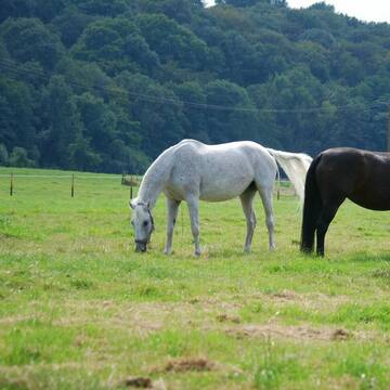
Weide in Hamern
Gesucht wird in "41068 Hamern"
119 Einträge
Deprecated: Creation of dynamic property Zend_View::$listObjects is deprecated in /var/www/stall-frei/htdocs/staging.stall-frei.de/library/vendor/shardj/zf1-future/library/Zend/View/Abstract.php on line 308
Deprecated: Creation of dynamic property Zend_View::$listMode is deprecated in /var/www/stall-frei/htdocs/staging.stall-frei.de/library/vendor/shardj/zf1-future/library/Zend/View/Abstract.php on line 308
Deprecated: Creation of dynamic property Zend_View::$renderedObjects is deprecated in /var/www/stall-frei/htdocs/staging.stall-frei.de/library/vendor/shardj/zf1-future/library/Zend/View/Abstract.php on line 308
Deprecated: Creation of dynamic property Zend_View::$index is deprecated in /var/www/stall-frei/htdocs/staging.stall-frei.de/library/vendor/shardj/zf1-future/library/Zend/View/Abstract.php on line 308
Deprecated: Creation of dynamic property Zend_View::$displayMode is deprecated in /var/www/stall-frei/htdocs/staging.stall-frei.de/library/vendor/shardj/zf1-future/library/Zend/View/Abstract.php on line 308
Deprecated: Creation of dynamic property Zend_View::$remarketingIds is deprecated in /var/www/stall-frei/htdocs/staging.stall-frei.de/library/vendor/shardj/zf1-future/library/Zend/View/Abstract.php on line 308
Deprecated: Creation of dynamic property Zend_View::$listItem is deprecated in /var/www/stall-frei/htdocs/staging.stall-frei.de/library/vendor/shardj/zf1-future/library/Zend/View/Abstract.php on line 308
Deprecated: Creation of dynamic property Zend_View::$object is deprecated in /var/www/stall-frei/htdocs/staging.stall-frei.de/library/vendor/shardj/zf1-future/library/Zend/View/Abstract.php on line 308
Deprecated: Creation of dynamic property Zend_View::$attributes is deprecated in /var/www/stall-frei/htdocs/staging.stall-frei.de/library/vendor/shardj/zf1-future/library/Zend/View/Abstract.php on line 308
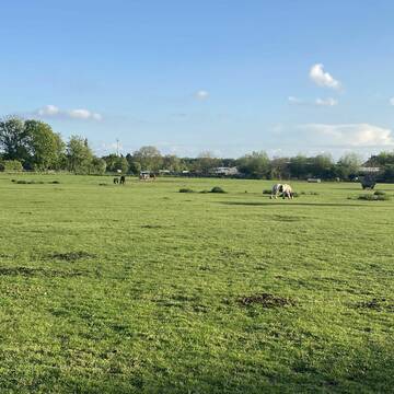


Offenstall mit großer Weide in Mönchengladbach
Mönchengladbach
Reiner Ludwig Brungs
@Bioland
Gemischte Herde
Rentnerweide
Bremsenfalle
Elektrozaun
Ganzjahresweide
Besuch der Weide: täglich
Zufütterung von Heu oder Silage
5 weitere...
P+
Leider kein Vorschaubild
Leider kein Vorschaubild
Ganzjahresweideplätze für Selbstversorger
Kerpen
Reitbetrieb-An-der-Steinheide
@Reitbetrieb-An-der-Steinheide
Gemischte Herde
Elektrozaun
Mit Auto und Anhänger erreichbar
Ganzjahresweide
Besuch der Weide: täglich
3 weitere...
aktuell
B
Deprecated: Creation of dynamic property Zend_View_Helper_Ads::$adLink is deprecated in /var/www/stall-frei/htdocs/staging.stall-frei.de/library/Psf/View/Helper/Ads.php on line 108

***Reitstall Birkenhof*** Pferdegerechte Haltung
Köln
Daniele-Fazzi
@Daniele-Fazzi
Herzlich Willkommen
auf dem Reitstall Birkenhof
Jetzt neu ‼️ auf dem Birkenhof:
Private Geländestrecke rund um unser
Offenstall für Rentnerpferde / Stutenherde
Leichlingen
Christian Conrads
@Christian Conrads
Rentnerweide
Stutenweide
Mit Auto und Anhänger erreichbar
Schatten durch Bäume
Ganzjahresweide
Zufütterung von Heu oder Silage
3 weitere...
P
Rentnerweide
Leverkusen
Pferdeland Flocke
@PferdelandFlocke
Wallachweide
Elektrozaun
Mit Auto und Anhänger erreichbar
Ganzjahresweide
Besuch der Weide: täglich
Zufütterung von Heu oder Silage
3 weitere...
P
Leider kein Vorschaubild
Leider kein Vorschaubild
Offenstallplatz für Ponystute/Shettystute
Kerpen
Marita
@Maryanne
Gemischte Herde
Elektrozaun
Mit Auto und Anhänger erreichbar
Ganzjahresweide
Besuch der Weide: täglich
2 weitere...
B
Leider kein Vorschaubild
Leider kein Vorschaubild
Pferde-auf-dem-Stütgerhof
Langerwehe
Thomas-Rolland
@Thomas-Rolland
Gemischte Herde
Stutenweide
Elektrozaun
Mit Auto und Anhänger erreichbar
Ganzjahresweide
Besuch der Weide: täglich
Zufütterung von Heu oder Silage
5 weitere...
B
Leider kein Vorschaubild
Leider kein Vorschaubild
B

Persönlichkeitsentwicklung mit Pferden
Bad Salzuflen
Katja Dors
@Pferdezeiten
Begleite andere auf ihrem Entwicklungsweg und entdecke die transformative Kraft der pferdegestützten Persönlichkeitsentwicklung !
neu
R
Leider kein Vorschaubild
Leider kein Vorschaubild
Bergische Weidegründe, artgerechte Pferdehaltung...
Burscheid
Bergische Weidegründe
@HufRehastation-Allergiker
Gemischte Herde
Elektrozaun
Mit Auto und Anhänger erreichbar
Frühjahrsweide
Ganzjahresweide
Besuch der Weide: täglich
Zufütterung von Heu oder Silage
8 weitere...
B
Leider kein Vorschaubild
Leider kein Vorschaubild
B
Leider kein Vorschaubild
Leider kein Vorschaubild
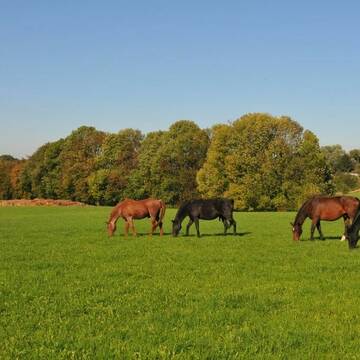
Sommerweide im Bergischen 51491 Ov., kl.Herde,16...
Overath
Sonja Lukasseck
@Sonja-Lukasseck
Gemischte Herde
Rentnerweide
Elektrozaun
Mit Auto und Anhänger erreichbar
Frühjahrsweide
Herbstweide
Besuch der Weide: täglich
5 weitere...
B
Deprecated: Creation of dynamic property Zend_View::$pageCount is deprecated in /var/www/stall-frei/htdocs/staging.stall-frei.de/library/vendor/shardj/zf1-future/library/Zend/View/Abstract.php on line 308
Deprecated: Creation of dynamic property Zend_View::$itemCountPerPage is deprecated in /var/www/stall-frei/htdocs/staging.stall-frei.de/library/vendor/shardj/zf1-future/library/Zend/View/Abstract.php on line 308
Deprecated: Creation of dynamic property Zend_View::$first is deprecated in /var/www/stall-frei/htdocs/staging.stall-frei.de/library/vendor/shardj/zf1-future/library/Zend/View/Abstract.php on line 308
Deprecated: Creation of dynamic property Zend_View::$current is deprecated in /var/www/stall-frei/htdocs/staging.stall-frei.de/library/vendor/shardj/zf1-future/library/Zend/View/Abstract.php on line 308
Deprecated: Creation of dynamic property Zend_View::$last is deprecated in /var/www/stall-frei/htdocs/staging.stall-frei.de/library/vendor/shardj/zf1-future/library/Zend/View/Abstract.php on line 308
Deprecated: Creation of dynamic property Zend_View::$next is deprecated in /var/www/stall-frei/htdocs/staging.stall-frei.de/library/vendor/shardj/zf1-future/library/Zend/View/Abstract.php on line 308
Deprecated: Creation of dynamic property Zend_View::$pagesInRange is deprecated in /var/www/stall-frei/htdocs/staging.stall-frei.de/library/vendor/shardj/zf1-future/library/Zend/View/Abstract.php on line 308
Deprecated: Creation of dynamic property Zend_View::$firstPageInRange is deprecated in /var/www/stall-frei/htdocs/staging.stall-frei.de/library/vendor/shardj/zf1-future/library/Zend/View/Abstract.php on line 308
Deprecated: Creation of dynamic property Zend_View::$lastPageInRange is deprecated in /var/www/stall-frei/htdocs/staging.stall-frei.de/library/vendor/shardj/zf1-future/library/Zend/View/Abstract.php on line 308
Deprecated: Creation of dynamic property Zend_View::$currentItemCount is deprecated in /var/www/stall-frei/htdocs/staging.stall-frei.de/library/vendor/shardj/zf1-future/library/Zend/View/Abstract.php on line 308
Deprecated: Creation of dynamic property Zend_View::$totalItemCount is deprecated in /var/www/stall-frei/htdocs/staging.stall-frei.de/library/vendor/shardj/zf1-future/library/Zend/View/Abstract.php on line 308
Deprecated: Creation of dynamic property Zend_View::$firstItemNumber is deprecated in /var/www/stall-frei/htdocs/staging.stall-frei.de/library/vendor/shardj/zf1-future/library/Zend/View/Abstract.php on line 308
Deprecated: Creation of dynamic property Zend_View::$lastItemNumber is deprecated in /var/www/stall-frei/htdocs/staging.stall-frei.de/library/vendor/shardj/zf1-future/library/Zend/View/Abstract.php on line 308
Deprecated: Creation of dynamic property Zend_View::$router is deprecated in /var/www/stall-frei/htdocs/staging.stall-frei.de/library/vendor/shardj/zf1-future/library/Zend/View/Abstract.php on line 308
Deprecated: Creation of dynamic property Zend_View::$urlParams is deprecated in /var/www/stall-frei/htdocs/staging.stall-frei.de/library/vendor/shardj/zf1-future/library/Zend/View/Abstract.php on line 308
Deprecated: Creation of dynamic property Zend_View::$showAds is deprecated in /var/www/stall-frei/htdocs/staging.stall-frei.de/library/vendor/shardj/zf1-future/library/Zend/View/Abstract.php on line 308
Deprecated: Creation of dynamic property Zend_View::$objectIds is deprecated in /var/www/stall-frei/htdocs/staging.stall-frei.de/library/vendor/shardj/zf1-future/library/Zend/View/Abstract.php on line 308
Deprecated: Creation of dynamic property Zend_View::$showNavbar is deprecated in /var/www/stall-frei/htdocs/staging.stall-frei.de/library/vendor/shardj/zf1-future/library/Zend/View/Abstract.php on line 308
Deprecated: Creation of dynamic property Zend_View::$showBreadcrumb is deprecated in /var/www/stall-frei/htdocs/staging.stall-frei.de/library/vendor/shardj/zf1-future/library/Zend/View/Abstract.php on line 308
Deprecated: Creation of dynamic property Zend_View::$showFooter is deprecated in /var/www/stall-frei/htdocs/staging.stall-frei.de/library/vendor/shardj/zf1-future/library/Zend/View/Abstract.php on line 308
Deprecated: Creation of dynamic property Zend_View::$showInternalAds is deprecated in /var/www/stall-frei/htdocs/staging.stall-frei.de/library/vendor/shardj/zf1-future/library/Zend/View/Abstract.php on line 308
Deprecated: Creation of dynamic property Zend_View::$blNoContent is deprecated in /var/www/stall-frei/htdocs/staging.stall-frei.de/library/vendor/shardj/zf1-future/library/Zend/View/Abstract.php on line 308
Deprecated: Creation of dynamic property Zend_View::$sMetaDesc is deprecated in /var/www/stall-frei/htdocs/staging.stall-frei.de/library/vendor/shardj/zf1-future/library/Zend/View/Abstract.php on line 308
Deprecated: Creation of dynamic property Zend_View::$useGmaps is deprecated in /var/www/stall-frei/htdocs/staging.stall-frei.de/library/vendor/shardj/zf1-future/library/Zend/View/Abstract.php on line 308
Deprecated: Creation of dynamic property Zend_View::$touches is deprecated in /var/www/stall-frei/htdocs/staging.stall-frei.de/library/vendor/shardj/zf1-future/library/Zend/View/Abstract.php on line 308
Deprecated: Creation of dynamic property Zend_View::$oProject is deprecated in /var/www/stall-frei/htdocs/staging.stall-frei.de/library/vendor/shardj/zf1-future/library/Zend/View/Abstract.php on line 308
Deprecated: Creation of dynamic property Zend_View::$pageHeadline is deprecated in /var/www/stall-frei/htdocs/staging.stall-frei.de/library/vendor/shardj/zf1-future/library/Zend/View/Abstract.php on line 308
Deprecated: Creation of dynamic property Zend_View::$disableLocationField is deprecated in /var/www/stall-frei/htdocs/staging.stall-frei.de/library/vendor/shardj/zf1-future/library/Zend/View/Abstract.php on line 308
Deprecated: Creation of dynamic property Zend_View::$isSearch is deprecated in /var/www/stall-frei/htdocs/staging.stall-frei.de/library/vendor/shardj/zf1-future/library/Zend/View/Abstract.php on line 308
Deprecated: Creation of dynamic property Zend_View::$pageTitle is deprecated in /var/www/stall-frei/htdocs/staging.stall-frei.de/library/vendor/shardj/zf1-future/library/Zend/View/Abstract.php on line 308
Deprecated: Creation of dynamic property Psf_Form_Element_Text::$class is deprecated in /var/www/stall-frei/htdocs/staging.stall-frei.de/library/vendor/shardj/zf1-future/library/Zend/Form/Element.php on line 874
Deprecated: Creation of dynamic property Psf_Form_Element_Text::$size is deprecated in /var/www/stall-frei/htdocs/staging.stall-frei.de/library/vendor/shardj/zf1-future/library/Zend/Form/Element.php on line 874
Deprecated: Creation of dynamic property Psf_Form_Element_Text::$placeholder is deprecated in /var/www/stall-frei/htdocs/staging.stall-frei.de/library/vendor/shardj/zf1-future/library/Zend/Form/Element.php on line 874
Deprecated: Creation of dynamic property Psf_Form_Element_Hidden::$class is deprecated in /var/www/stall-frei/htdocs/staging.stall-frei.de/library/vendor/shardj/zf1-future/library/Zend/Form/Element.php on line 874
Deprecated: Creation of dynamic property Psf_Form_Element_Hidden::$class is deprecated in /var/www/stall-frei/htdocs/staging.stall-frei.de/library/vendor/shardj/zf1-future/library/Zend/Form/Element.php on line 874
Deprecated: Creation of dynamic property Psf_Form_Element_Hidden::$class is deprecated in /var/www/stall-frei/htdocs/staging.stall-frei.de/library/vendor/shardj/zf1-future/library/Zend/Form/Element.php on line 874
Deprecated: Creation of dynamic property Psf_Form_Element_Hidden::$class is deprecated in /var/www/stall-frei/htdocs/staging.stall-frei.de/library/vendor/shardj/zf1-future/library/Zend/Form/Element.php on line 874
Deprecated: Creation of dynamic property Psf_Form_Element_Select::$class is deprecated in /var/www/stall-frei/htdocs/staging.stall-frei.de/library/vendor/shardj/zf1-future/library/Zend/Form/Element.php on line 874
Deprecated: Creation of dynamic property Psf_Form_Element_Select::$class is deprecated in /var/www/stall-frei/htdocs/staging.stall-frei.de/library/vendor/shardj/zf1-future/library/Zend/Form/Element.php on line 874
Deprecated: Creation of dynamic property Psf_Form_Element_Select::$class is deprecated in /var/www/stall-frei/htdocs/staging.stall-frei.de/library/vendor/shardj/zf1-future/library/Zend/Form/Element.php on line 874
Deprecated: Creation of dynamic property Psf_Form_Element_Text::$class is deprecated in /var/www/stall-frei/htdocs/staging.stall-frei.de/library/vendor/shardj/zf1-future/library/Zend/Form/Element.php on line 874
Deprecated: Creation of dynamic property Psf_Form_Element_Checkbox::$label is deprecated in /var/www/stall-frei/htdocs/staging.stall-frei.de/library/vendor/shardj/zf1-future/library/Zend/Form/Element.php on line 874
Deprecated: Creation of dynamic property Zend_View::$sort is deprecated in /var/www/stall-frei/htdocs/staging.stall-frei.de/library/vendor/shardj/zf1-future/library/Zend/View/Abstract.php on line 308
Deprecated: Creation of dynamic property Zend_View::$searchLocation is deprecated in /var/www/stall-frei/htdocs/staging.stall-frei.de/library/vendor/shardj/zf1-future/library/Zend/View/Abstract.php on line 308
Deprecated: Creation of dynamic property Zend_View::$locationHint is deprecated in /var/www/stall-frei/htdocs/staging.stall-frei.de/library/vendor/shardj/zf1-future/library/Zend/View/Abstract.php on line 308
Psf_GeoCoder_Abstract::getLocation: Hamern Get Location CachedOrLive
Psf_GeoCoder_Abstract::getCachedOrLive: Hamern
Psf_GeoCoder_OpenCageData::makeApiRequest: response:
Array
(
[documentation] => https://opencagedata.com/api
[licenses] => Array
(
[0] => Array
(
[name] => see attribution guide
[url] => https://opencagedata.com/credits
)
)
[results] => Array
(
[0] => Array
(
[bounds] => Array
(
[northeast] => Array
(
[lat] => 51.2211451
[lng] => 6.4209342
)
[southwest] => Array
(
[lat] => 51.1811451
[lng] => 6.3809342
)
)
[components] => Array
(
[ISO_3166-1_alpha-2] => DE
[ISO_3166-1_alpha-3] => DEU
[ISO_3166-2] => Array
(
[0] => DE-NW
)
[_category] => place
[_normalized_city] => Mönchengladbach
[_type] => neighbourhood
[city] => Mönchengladbach
[city_district] => Nord
[continent] => Europe
[country] => Deutschland
[country_code] => de
[political_union] => European Union
[postcode] => 41068
[state] => Nordrhein-Westfalen
[state_code] => NW
[suburb] => Hamern
)
[confidence] => 7
[formatted] => 41068 Mönchengladbach, Deutschland
[geometry] => Array
(
[lat] => 51.2011451
[lng] => 6.4009342
)
)
[1] => Array
(
[bounds] => Array
(
[northeast] => Array
(
[lat] => 51.9971636
[lng] => 7.2602268
)
[southwest] => Array
(
[lat] => 51.9922656
[lng] => 7.2436823
)
)
[components] => Array
(
[ISO_3166-1_alpha-2] => DE
[ISO_3166-1_alpha-3] => DEU
[ISO_3166-2] => Array
(
[0] => DE-NW
)
[_category] => agriculture
[_normalized_city] => Billerbeck
[_type] => farmyard
[continent] => Europe
[country] => Deutschland
[country_code] => de
[county] => Kreis Coesfeld
[farmyard] => Wasmer
[political_union] => European Union
[postcode] => 48727
[road] => Hamern
[state] => Nordrhein-Westfalen
[state_code] => NW
[town] => Billerbeck
)
[confidence] => 9
[formatted] => Wasmer, Hamern, 48727 Billerbeck, Deutschland
[geometry] => Array
(
[lat] => 51.9958121
[lng] => 7.2522071
)
)
[2] => Array
(
[bounds] => Array
(
[northeast] => Array
(
[lat] => 51.9985456
[lng] => 7.2650139
)
[southwest] => Array
(
[lat] => 51.993722
[lng] => 7.2564946
)
)
[components] => Array
(
[ISO_3166-1_alpha-2] => DE
[ISO_3166-1_alpha-3] => DEU
[ISO_3166-2] => Array
(
[0] => DE-NW
)
[_category] => road
[_normalized_city] => Billerbeck
[_type] => road
[continent] => Europe
[country] => Deutschland
[country_code] => de
[county] => Kreis Coesfeld
[political_union] => European Union
[postcode] => 48727
[road] => Hamern
[state] => Nordrhein-Westfalen
[state_code] => NW
[town] => Billerbeck
)
[confidence] => 9
[formatted] => Hamern, 48727 Billerbeck, Deutschland
[geometry] => Array
(
[lat] => 51.9979071
[lng] => 7.2599743
)
)
[3] => Array
(
[components] => Array
(
[ISO_3166-1_alpha-2] => FR
[ISO_3166-1_alpha-3] => FRA
[ISO_3166-2] => Array
(
[0] => FR-PDL
[1] => FR-72
)
[_category] => road
[_normalized_city] => Saint-Pavace
[_type] => road
[city] => Saint-Pavace
[continent] => Europe
[country] => France
[country_code] => fr
[county] => Sarthe
[local_authority] => Communauté de communes Maine Cœur de Sarthe
[political_union] => European Union
[postcode] => 72190
[road] => Chemin de la Hamerie
[state] => Pays de la Loire
[state_code] => PDL
)
[confidence] => 3
[formatted] => Chemin de la Hamerie, 72190 Saint-Pavace, France
[geometry] => Array
(
[lat] => 48.040176
[lng] => 0.19666
)
)
[4] => Array
(
[components] => Array
(
[ISO_3166-1_alpha-2] => FR
[ISO_3166-1_alpha-3] => FRA
[ISO_3166-2] => Array
(
[0] => FR-IDF
[1] => FR-92
)
[_category] => road
[_normalized_city] => Levallois-Perret
[_type] => road
[city] => Levallois-Perret
[continent] => Europe
[country] => France
[country_code] => fr
[county] => Hauts-de-Seine
[local_authority] => Métropole du Grand Paris
[political_union] => European Union
[postcode] => 92300
[road] => Rue Charles Deutschmann
[state] => Île-de-France
[state_code] => IDF
)
[confidence] => 3
[formatted] => Rue Charles Deutschmann, 92300 Levallois-Perret, France
[geometry] => Array
(
[lat] => 48.900049
[lng] => 2.2842
)
)
[5] => Array
(
[components] => Array
(
[ISO_3166-1_alpha-2] => FR
[ISO_3166-1_alpha-3] => FRA
[ISO_3166-2] => Array
(
[0] => FR-NAQ
[1] => FR-64
)
[_category] => road
[_normalized_city] => Loubieng
[_type] => road
[city] => Loubieng
[continent] => Europe
[country] => France
[country_code] => fr
[county] => Pyrénées-Atlantiques
[local_authority] => Communauté de communes de Lacq-Orthez
[political_union] => European Union
[postcode] => 64300
[road] => Chemin De Haderne
[state] => Nouvelle-Aquitaine
[state_code] => NAQ
)
[confidence] => 2
[formatted] => Chemin De Haderne, 64300 Loubieng, France
[geometry] => Array
(
[lat] => 43.431694
[lng] => -0.759276
)
)
[6] => Array
(
[components] => Array
(
[ISO_3166-1_alpha-2] => FR
[ISO_3166-1_alpha-3] => FRA
[ISO_3166-2] => Array
(
[0] => FR-OCC
[1] => FR-32
)
[_category] => place
[_normalized_city] => Castelnau-Barbarens
[_type] => place
[city] => Castelnau-Barbarens
[continent] => Europe
[country] => France
[country_code] => fr
[county] => Gers
[local_authority] => Communauté d'agglomération Grand Auch Cœur de Gascogne
[place] => Au Soulan de la Haderne
[political_union] => European Union
[postcode] => 32450
[state] => Occitanie
[state_code] => OCC
)
[confidence] => 2
[formatted] => Au Soulan de la Haderne, 32450 Castelnau-Barbarens, France
[geometry] => Array
(
[lat] => 43.584224
[lng] => 0.729496
)
)
[7] => Array
(
[components] => Array
(
[ISO_3166-1_alpha-2] => FR
[ISO_3166-1_alpha-3] => FRA
[ISO_3166-2] => Array
(
[0] => FR-NAQ
[1] => FR-16
)
[_category] => road
[_normalized_city] => Lignières-Ambleville
[_type] => road
[city] => Lignières-Ambleville
[continent] => Europe
[country] => France
[country_code] => fr
[county] => Charente
[local_authority] => Communauté d'agglomération du Grand Cognac
[political_union] => European Union
[postcode] => 16130
[road] => La Motte - chemin des Améras
[state] => Nouvelle-Aquitaine
[state_code] => NAQ
)
[confidence] => 2
[formatted] => La Motte - chemin des Améras, 16130 Lignières-Ambleville, France
[geometry] => Array
(
[lat] => 45.554776
[lng] => -0.215324
)
)
[8] => Array
(
[components] => Array
(
[ISO_3166-1_alpha-2] => FR
[ISO_3166-1_alpha-3] => FRA
[ISO_3166-2] => Array
(
[0] => FR-OCC
[1] => FR-30
)
[_category] => road
[_normalized_city] => Sénéchas
[_type] => road
[city] => Sénéchas
[continent] => Europe
[country] => France
[country_code] => fr
[county] => Gard
[local_authority] => Alès Agglomération
[political_union] => European Union
[postcode] => 30450
[road] => Chemin de l'Amarne
[state] => Occitanie
[state_code] => OCC
)
[confidence] => 2
[formatted] => Chemin de l'Amarne, 30450 Sénéchas, France
[geometry] => Array
(
[lat] => 44.327973
[lng] => 4.007695
)
)
[9] => Array
(
[components] => Array
(
[ISO_3166-1_alpha-2] => FR
[ISO_3166-1_alpha-3] => FRA
[ISO_3166-2] => Array
(
[0] => FR-ARA
[1] => FR-01
)
[_category] => road
[_normalized_city] => Villeneuve
[_type] => road
[city] => Villeneuve
[continent] => Europe
[country] => France
[country_code] => fr
[county] => Ain
[local_authority] => Communauté de communes Dombes Saône Vallée
[political_union] => European Union
[postcode] => 01480
[road] => Rue des Améries
[state] => Auvergne-Rhône-Alpes
[state_code] => ARA
)
[confidence] => 2
[formatted] => Rue des Améries, 01480 Villeneuve, France
[geometry] => Array
(
[lat] => 46.017777
[lng] => 4.835322
)
)
)
[status] => Array
(
[code] => 200
[message] => OK
)
[stay_informed] => Array
(
[blog] => https://blog.opencagedata.com
[mastodon] => https://en.osm.town/@opencage
)
[thanks] => For using an OpenCage API
[timestamp] => Array
(
[created_http] => Sat, 07 Feb 2026 02:28:54 GMT
[created_unix] => 1770431334
)
[total_results] => 10
)
Psf_GeoCoder_Abstract::convertLocationResult
{"documentation":"https:\/\/opencagedata.com\/api","licenses":[{"name":"see attribution guide","url":"https:\/\/opencagedata.com\/credits"}],"results":[{"bounds":{"northeast":{"lat":51.2211451,"lng":6.4209342},"southwest":{"lat":51.1811451,"lng":6.3809342}},"components":{"ISO_3166-1_alpha-2":"DE","ISO_3166-1_alpha-3":"DEU","ISO_3166-2":["DE-NW"],"_category":"place","_normalized_city":"M\u00f6nchengladbach","_type":"neighbourhood","city":"M\u00f6nchengladbach","city_district":"Nord","continent":"Europe","country":"Deutschland","country_code":"de","political_union":"European Union","postcode":"41068","state":"Nordrhein-Westfalen","state_code":"NW","suburb":"Hamern"},"confidence":7,"formatted":"41068 M\u00f6nchengladbach, Deutschland","geometry":{"lat":51.2011451,"lng":6.4009342}},{"bounds":{"northeast":{"lat":51.9971636,"lng":7.2602268},"southwest":{"lat":51.9922656,"lng":7.2436823}},"components":{"ISO_3166-1_alpha-2":"DE","ISO_3166-1_alpha-3":"DEU","ISO_3166-2":["DE-NW"],"_category":"agriculture","_normalized_city":"Billerbeck","_type":"farmyard","continent":"Europe","country":"Deutschland","country_code":"de","county":"Kreis Coesfeld","farmyard":"Wasmer","political_union":"European Union","postcode":"48727","road":"Hamern","state":"Nordrhein-Westfalen","state_code":"NW","town":"Billerbeck"},"confidence":9,"formatted":"Wasmer, Hamern, 48727 Billerbeck, Deutschland","geometry":{"lat":51.9958121,"lng":7.2522071}},{"bounds":{"northeast":{"lat":51.9985456,"lng":7.2650139},"southwest":{"lat":51.993722,"lng":7.2564946}},"components":{"ISO_3166-1_alpha-2":"DE","ISO_3166-1_alpha-3":"DEU","ISO_3166-2":["DE-NW"],"_category":"road","_normalized_city":"Billerbeck","_type":"road","continent":"Europe","country":"Deutschland","country_code":"de","county":"Kreis Coesfeld","political_union":"European Union","postcode":"48727","road":"Hamern","state":"Nordrhein-Westfalen","state_code":"NW","town":"Billerbeck"},"confidence":9,"formatted":"Hamern, 48727 Billerbeck, Deutschland","geometry":{"lat":51.9979071,"lng":7.2599743}},{"components":{"ISO_3166-1_alpha-2":"FR","ISO_3166-1_alpha-3":"FRA","ISO_3166-2":["FR-PDL","FR-72"],"_category":"road","_normalized_city":"Saint-Pavace","_type":"road","city":"Saint-Pavace","continent":"Europe","country":"France","country_code":"fr","county":"Sarthe","local_authority":"Communaut\u00e9 de communes Maine C\u0153ur de Sarthe","political_union":"European Union","postcode":"72190","road":"Chemin de la Hamerie","state":"Pays de la Loire","state_code":"PDL"},"confidence":3,"formatted":"Chemin de la Hamerie, 72190 Saint-Pavace, France","geometry":{"lat":48.040176,"lng":0.19666}},{"components":{"ISO_3166-1_alpha-2":"FR","ISO_3166-1_alpha-3":"FRA","ISO_3166-2":["FR-IDF","FR-92"],"_category":"road","_normalized_city":"Levallois-Perret","_type":"road","city":"Levallois-Perret","continent":"Europe","country":"France","country_code":"fr","county":"Hauts-de-Seine","local_authority":"M\u00e9tropole du Grand Paris","political_union":"European Union","postcode":"92300","road":"Rue Charles Deutschmann","state":"\u00cele-de-France","state_code":"IDF"},"confidence":3,"formatted":"Rue Charles Deutschmann, 92300 Levallois-Perret, France","geometry":{"lat":48.900049,"lng":2.2842}},{"components":{"ISO_3166-1_alpha-2":"FR","ISO_3166-1_alpha-3":"FRA","ISO_3166-2":["FR-NAQ","FR-64"],"_category":"road","_normalized_city":"Loubieng","_type":"road","city":"Loubieng","continent":"Europe","country":"France","country_code":"fr","county":"Pyr\u00e9n\u00e9es-Atlantiques","local_authority":"Communaut\u00e9 de communes de Lacq-Orthez","political_union":"European Union","postcode":"64300","road":"Chemin De Haderne","state":"Nouvelle-Aquitaine","state_code":"NAQ"},"confidence":2,"formatted":"Chemin De Haderne, 64300 Loubieng, France","geometry":{"lat":43.431694,"lng":-0.759276}},{"components":{"ISO_3166-1_alpha-2":"FR","ISO_3166-1_alpha-3":"FRA","ISO_3166-2":["FR-OCC","FR-32"],"_category":"place","_normalized_city":"Castelnau-Barbarens","_type":"place","city":"Castelnau-Barbarens","continent":"Europe","country":"France","country_code":"fr","county":"Gers","local_authority":"Communaut\u00e9 d'agglom\u00e9ration Grand Auch C\u0153ur de Gascogne","place":"Au Soulan de la Haderne","political_union":"European Union","postcode":"32450","state":"Occitanie","state_code":"OCC"},"confidence":2,"formatted":"Au Soulan de la Haderne, 32450 Castelnau-Barbarens, France","geometry":{"lat":43.584224,"lng":0.729496}},{"components":{"ISO_3166-1_alpha-2":"FR","ISO_3166-1_alpha-3":"FRA","ISO_3166-2":["FR-NAQ","FR-16"],"_category":"road","_normalized_city":"Ligni\u00e8res-Ambleville","_type":"road","city":"Ligni\u00e8res-Ambleville","continent":"Europe","country":"France","country_code":"fr","county":"Charente","local_authority":"Communaut\u00e9 d'agglom\u00e9ration du Grand Cognac","political_union":"European Union","postcode":"16130","road":"La Motte - chemin des Am\u00e9ras","state":"Nouvelle-Aquitaine","state_code":"NAQ"},"confidence":2,"formatted":"La Motte - chemin des Am\u00e9ras, 16130 Ligni\u00e8res-Ambleville, France","geometry":{"lat":45.554776,"lng":-0.215324}},{"components":{"ISO_3166-1_alpha-2":"FR","ISO_3166-1_alpha-3":"FRA","ISO_3166-2":["FR-OCC","FR-30"],"_category":"road","_normalized_city":"S\u00e9n\u00e9chas","_type":"road","city":"S\u00e9n\u00e9chas","continent":"Europe","country":"France","country_code":"fr","county":"Gard","local_authority":"Al\u00e8s Agglom\u00e9ration","political_union":"European Union","postcode":"30450","road":"Chemin de l'Amarne","state":"Occitanie","state_code":"OCC"},"confidence":2,"formatted":"Chemin de l'Amarne, 30450 S\u00e9n\u00e9chas, France","geometry":{"lat":44.327973,"lng":4.007695}},{"components":{"ISO_3166-1_alpha-2":"FR","ISO_3166-1_alpha-3":"FRA","ISO_3166-2":["FR-ARA","FR-01"],"_category":"road","_normalized_city":"Villeneuve","_type":"road","city":"Villeneuve","continent":"Europe","country":"France","country_code":"fr","county":"Ain","local_authority":"Communaut\u00e9 de communes Dombes Sa\u00f4ne Vall\u00e9e","political_union":"European Union","postcode":"01480","road":"Rue des Am\u00e9ries","state":"Auvergne-Rh\u00f4ne-Alpes","state_code":"ARA"},"confidence":2,"formatted":"Rue des Am\u00e9ries, 01480 Villeneuve, France","geometry":{"lat":46.017777,"lng":4.835322}}],"status":{"code":200,"message":"OK"},"stay_informed":{"blog":"https:\/\/blog.opencagedata.com","mastodon":"https:\/\/en.osm.town\/@opencage"},"thanks":"For using an OpenCage API","timestamp":{"created_http":"Sat, 07 Feb 2026 02:28:54 GMT","created_unix":1770431334},"total_results":10}Array
(
[0] => stdClass Object
(
[bounds] => stdClass Object
(
[northeast] => stdClass Object
(
[lat] => 51.2211451
[lng] => 6.4209342
)
[southwest] => stdClass Object
(
[lat] => 51.1811451
[lng] => 6.3809342
)
)
[components] => stdClass Object
(
[ISO_3166-1_alpha-2] => DE
[ISO_3166-1_alpha-3] => DEU
[ISO_3166-2] => Array
(
[0] => DE-NW
)
[_category] => place
[_normalized_city] => Mönchengladbach
[_type] => neighbourhood
[city] => Mönchengladbach
[city_district] => Nord
[continent] => Europe
[country] => Deutschland
[country_code] => de
[political_union] => European Union
[postcode] => 41068
[state] => Nordrhein-Westfalen
[state_code] => NW
[suburb] => Hamern
)
[confidence] => 7
[formatted] => 41068 Mönchengladbach, Deutschland
[geometry] => stdClass Object
(
[lat] => 51.2011451
[lng] => 6.4009342
)
)
[1] => stdClass Object
(
[bounds] => stdClass Object
(
[northeast] => stdClass Object
(
[lat] => 51.9971636
[lng] => 7.2602268
)
[southwest] => stdClass Object
(
[lat] => 51.9922656
[lng] => 7.2436823
)
)
[components] => stdClass Object
(
[ISO_3166-1_alpha-2] => DE
[ISO_3166-1_alpha-3] => DEU
[ISO_3166-2] => Array
(
[0] => DE-NW
)
[_category] => agriculture
[_normalized_city] => Billerbeck
[_type] => farmyard
[continent] => Europe
[country] => Deutschland
[country_code] => de
[county] => Kreis Coesfeld
[farmyard] => Wasmer
[political_union] => European Union
[postcode] => 48727
[road] => Hamern
[state] => Nordrhein-Westfalen
[state_code] => NW
[town] => Billerbeck
)
[confidence] => 9
[formatted] => Wasmer, Hamern, 48727 Billerbeck, Deutschland
[geometry] => stdClass Object
(
[lat] => 51.9958121
[lng] => 7.2522071
)
)
[2] => stdClass Object
(
[bounds] => stdClass Object
(
[northeast] => stdClass Object
(
[lat] => 51.9985456
[lng] => 7.2650139
)
[southwest] => stdClass Object
(
[lat] => 51.993722
[lng] => 7.2564946
)
)
[components] => stdClass Object
(
[ISO_3166-1_alpha-2] => DE
[ISO_3166-1_alpha-3] => DEU
[ISO_3166-2] => Array
(
[0] => DE-NW
)
[_category] => road
[_normalized_city] => Billerbeck
[_type] => road
[continent] => Europe
[country] => Deutschland
[country_code] => de
[county] => Kreis Coesfeld
[political_union] => European Union
[postcode] => 48727
[road] => Hamern
[state] => Nordrhein-Westfalen
[state_code] => NW
[town] => Billerbeck
)
[confidence] => 9
[formatted] => Hamern, 48727 Billerbeck, Deutschland
[geometry] => stdClass Object
(
[lat] => 51.9979071
[lng] => 7.2599743
)
)
[3] => stdClass Object
(
[components] => stdClass Object
(
[ISO_3166-1_alpha-2] => FR
[ISO_3166-1_alpha-3] => FRA
[ISO_3166-2] => Array
(
[0] => FR-PDL
[1] => FR-72
)
[_category] => road
[_normalized_city] => Saint-Pavace
[_type] => road
[city] => Saint-Pavace
[continent] => Europe
[country] => France
[country_code] => fr
[county] => Sarthe
[local_authority] => Communauté de communes Maine Cœur de Sarthe
[political_union] => European Union
[postcode] => 72190
[road] => Chemin de la Hamerie
[state] => Pays de la Loire
[state_code] => PDL
)
[confidence] => 3
[formatted] => Chemin de la Hamerie, 72190 Saint-Pavace, France
[geometry] => stdClass Object
(
[lat] => 48.040176
[lng] => 0.19666
)
)
[4] => stdClass Object
(
[components] => stdClass Object
(
[ISO_3166-1_alpha-2] => FR
[ISO_3166-1_alpha-3] => FRA
[ISO_3166-2] => Array
(
[0] => FR-IDF
[1] => FR-92
)
[_category] => road
[_normalized_city] => Levallois-Perret
[_type] => road
[city] => Levallois-Perret
[continent] => Europe
[country] => France
[country_code] => fr
[county] => Hauts-de-Seine
[local_authority] => Métropole du Grand Paris
[political_union] => European Union
[postcode] => 92300
[road] => Rue Charles Deutschmann
[state] => Île-de-France
[state_code] => IDF
)
[confidence] => 3
[formatted] => Rue Charles Deutschmann, 92300 Levallois-Perret, France
[geometry] => stdClass Object
(
[lat] => 48.900049
[lng] => 2.2842
)
)
[5] => stdClass Object
(
[components] => stdClass Object
(
[ISO_3166-1_alpha-2] => FR
[ISO_3166-1_alpha-3] => FRA
[ISO_3166-2] => Array
(
[0] => FR-NAQ
[1] => FR-64
)
[_category] => road
[_normalized_city] => Loubieng
[_type] => road
[city] => Loubieng
[continent] => Europe
[country] => France
[country_code] => fr
[county] => Pyrénées-Atlantiques
[local_authority] => Communauté de communes de Lacq-Orthez
[political_union] => European Union
[postcode] => 64300
[road] => Chemin De Haderne
[state] => Nouvelle-Aquitaine
[state_code] => NAQ
)
[confidence] => 2
[formatted] => Chemin De Haderne, 64300 Loubieng, France
[geometry] => stdClass Object
(
[lat] => 43.431694
[lng] => -0.759276
)
)
[6] => stdClass Object
(
[components] => stdClass Object
(
[ISO_3166-1_alpha-2] => FR
[ISO_3166-1_alpha-3] => FRA
[ISO_3166-2] => Array
(
[0] => FR-OCC
[1] => FR-32
)
[_category] => place
[_normalized_city] => Castelnau-Barbarens
[_type] => place
[city] => Castelnau-Barbarens
[continent] => Europe
[country] => France
[country_code] => fr
[county] => Gers
[local_authority] => Communauté d'agglomération Grand Auch Cœur de Gascogne
[place] => Au Soulan de la Haderne
[political_union] => European Union
[postcode] => 32450
[state] => Occitanie
[state_code] => OCC
)
[confidence] => 2
[formatted] => Au Soulan de la Haderne, 32450 Castelnau-Barbarens, France
[geometry] => stdClass Object
(
[lat] => 43.584224
[lng] => 0.729496
)
)
[7] => stdClass Object
(
[components] => stdClass Object
(
[ISO_3166-1_alpha-2] => FR
[ISO_3166-1_alpha-3] => FRA
[ISO_3166-2] => Array
(
[0] => FR-NAQ
[1] => FR-16
)
[_category] => road
[_normalized_city] => Lignières-Ambleville
[_type] => road
[city] => Lignières-Ambleville
[continent] => Europe
[country] => France
[country_code] => fr
[county] => Charente
[local_authority] => Communauté d'agglomération du Grand Cognac
[political_union] => European Union
[postcode] => 16130
[road] => La Motte - chemin des Améras
[state] => Nouvelle-Aquitaine
[state_code] => NAQ
)
[confidence] => 2
[formatted] => La Motte - chemin des Améras, 16130 Lignières-Ambleville, France
[geometry] => stdClass Object
(
[lat] => 45.554776
[lng] => -0.215324
)
)
[8] => stdClass Object
(
[components] => stdClass Object
(
[ISO_3166-1_alpha-2] => FR
[ISO_3166-1_alpha-3] => FRA
[ISO_3166-2] => Array
(
[0] => FR-OCC
[1] => FR-30
)
[_category] => road
[_normalized_city] => Sénéchas
[_type] => road
[city] => Sénéchas
[continent] => Europe
[country] => France
[country_code] => fr
[county] => Gard
[local_authority] => Alès Agglomération
[political_union] => European Union
[postcode] => 30450
[road] => Chemin de l'Amarne
[state] => Occitanie
[state_code] => OCC
)
[confidence] => 2
[formatted] => Chemin de l'Amarne, 30450 Sénéchas, France
[geometry] => stdClass Object
(
[lat] => 44.327973
[lng] => 4.007695
)
)
[9] => stdClass Object
(
[components] => stdClass Object
(
[ISO_3166-1_alpha-2] => FR
[ISO_3166-1_alpha-3] => FRA
[ISO_3166-2] => Array
(
[0] => FR-ARA
[1] => FR-01
)
[_category] => road
[_normalized_city] => Villeneuve
[_type] => road
[city] => Villeneuve
[continent] => Europe
[country] => France
[country_code] => fr
[county] => Ain
[local_authority] => Communauté de communes Dombes Saône Vallée
[political_union] => European Union
[postcode] => 01480
[road] => Rue des Améries
[state] => Auvergne-Rhône-Alpes
[state_code] => ARA
)
[confidence] => 2
[formatted] => Rue des Améries, 01480 Villeneuve, France
[geometry] => stdClass Object
(
[lat] => 46.017777
[lng] => 4.835322
)
)
)
Psf_GeoCoder_OpenCageData::getKeyMap: 0
stdClass Object
(
    [bounds] => stdClass Object
        (
            [northeast] => stdClass Object
                (
                    [lat] => 51.2211451
                    [lng] => 6.4209342
                )

            [southwest] => stdClass Object
                (
                    [lat] => 51.1811451
                    [lng] => 6.3809342
                )

        )

    [components] => stdClass Object
        (
            [ISO_3166-1_alpha-2] => DE
            [ISO_3166-1_alpha-3] => DEU
            [ISO_3166-2] => Array
                (
                    [0] => DE-NW
                )

            [_category] => place
            [_normalized_city] => Mönchengladbach
            [_type] => neighbourhood
            [city] => Mönchengladbach
            [city_district] => Nord
            [continent] => Europe
            [country] => Deutschland
            [country_code] => de
            [political_union] => European Union
            [postcode] => 41068
            [state] => Nordrhein-Westfalen
            [state_code] => NW
            [suburb] => Hamern
        )

    [confidence] => 7
    [formatted] => 41068 Mönchengladbach, Deutschland
    [geometry] => stdClass Object
        (
            [lat] => 51.2011451
            [lng] => 6.4009342
        )

)
Psf_GeoCoder_OpenCageData::getCounty: Mönchengladbach
Psf_GeoCoder_OpenCageData::addMissingData REFETCH!
Array
(
    [address] => 41068 Mönchengladbach, Deutschland
    [type] => neighbourhood
    [street] =>
    [city] => Hamern
    [county] => Mönchengladbach
    [state] => Nordrhein-Westfalen
    [zip] => 41068
    [country] => Deutschland
    [suburb] => Hamern
    [countrycode] => de
    [latitude] => 51.2011451
    [longitude] => 6.4009342
    [accuracy] => 1
    [confidence] => 7
    [bounds] => stdClass Object
        (
            [northeast] => stdClass Object
                (
                    [lat] => 51.2211451
                    [lng] => 6.4209342
                )

            [southwest] => stdClass Object
                (
                    [lat] => 51.1811451
                    [lng] => 6.3809342
                )

        )

)
reformat!
Array
(
    [address] => 41068 Hamern
    [type] => neighbourhood
    [street] =>
    [city] => Hamern
    [county] => Mönchengladbach
    [state] => Nordrhein-Westfalen
    [zip] => 41068
    [country] => Deutschland
    [suburb] => Hamern
    [countrycode] => de
    [latitude] => 51.2011451
    [longitude] => 6.4009342
    [accuracy] => 1
    [confidence] => 7
    [bounds] => stdClass Object
        (
            [northeast] => stdClass Object
                (
                    [lat] => 51.2211451
                    [lng] => 6.4209342
                )

            [southwest] => stdClass Object
                (
                    [lat] => 51.1811451
                    [lng] => 6.3809342
                )

        )

    [place] => 41068 Hamern, Nordrhein-Westfalen
    [hash] => 76fb86d673d19506212398893233afe4
)
Psf_GeoCoder_OpenCageData::getKeyMap: 1
stdClass Object
(
    [bounds] => stdClass Object
        (
            [northeast] => stdClass Object
                (
                    [lat] => 51.9971636
                    [lng] => 7.2602268
                )

            [southwest] => stdClass Object
                (
                    [lat] => 51.9922656
                    [lng] => 7.2436823
                )

        )

    [components] => stdClass Object
        (
            [ISO_3166-1_alpha-2] => DE
            [ISO_3166-1_alpha-3] => DEU
            [ISO_3166-2] => Array
                (
                    [0] => DE-NW
                )

            [_category] => agriculture
            [_normalized_city] => Billerbeck
            [_type] => farmyard
            [continent] => Europe
            [country] => Deutschland
            [country_code] => de
            [county] => Kreis Coesfeld
            [farmyard] => Wasmer
            [political_union] => European Union
            [postcode] => 48727
            [road] => Hamern
            [state] => Nordrhein-Westfalen
            [state_code] => NW
            [town] => Billerbeck
        )

    [confidence] => 9
    [formatted] => Wasmer, Hamern, 48727 Billerbeck, Deutschland
    [geometry] => stdClass Object
        (
            [lat] => 51.9958121
            [lng] => 7.2522071
        )

)
Psf_GeoCoder_OpenCageData::getCounty: Coesfeld
Psf_GeoCoder_OpenCageData::addMissingData REFETCH!
Array
(
    [address] => Wasmer, Hamern, 48727 Billerbeck, Deutschland
    [type] => farmyard
    [street] => Hamern
    [city] => Billerbeck
    [county] => Coesfeld
    [state] => Nordrhein-Westfalen
    [zip] => 48727
    [country] => Deutschland
    [suburb] =>
    [countrycode] => de
    [latitude] => 51.9958121
    [longitude] => 7.2522071
    [accuracy] => 1
    [confidence] => 9
    [bounds] => stdClass Object
        (
            [northeast] => stdClass Object
                (
                    [lat] => 51.9971636
                    [lng] => 7.2602268
                )

            [southwest] => stdClass Object
                (
                    [lat] => 51.9922656
                    [lng] => 7.2436823
                )

        )

)
reformat!
Array
(
    [address] => Wasmer, Hamern, 48727 Billerbeck, Deutschland
    [type] => farmyard
    [street] => Hamern
    [city] => Billerbeck
    [county] => Coesfeld
    [state] => Nordrhein-Westfalen
    [zip] => 48727
    [country] => Deutschland
    [suburb] =>
    [countrycode] => de
    [latitude] => 51.9958121
    [longitude] => 7.2522071
    [accuracy] => 1
    [confidence] => 9
    [bounds] => stdClass Object
        (
            [northeast] => stdClass Object
                (
                    [lat] => 51.9971636
                    [lng] => 7.2602268
                )

            [southwest] => stdClass Object
                (
                    [lat] => 51.9922656
                    [lng] => 7.2436823
                )

        )

    [place] => Hamern, 48727 Billerbeck, Nordrhein-Westfalen
    [hash] => 2392fef65ceab22da28c97b3212d9072
)
Psf_GeoCoder_OpenCageData::getKeyMap: 2
stdClass Object
(
    [bounds] => stdClass Object
        (
            [northeast] => stdClass Object
                (
                    [lat] => 51.9985456
                    [lng] => 7.2650139
                )

            [southwest] => stdClass Object
                (
                    [lat] => 51.993722
                    [lng] => 7.2564946
                )

        )

    [components] => stdClass Object
        (
            [ISO_3166-1_alpha-2] => DE
            [ISO_3166-1_alpha-3] => DEU
            [ISO_3166-2] => Array
                (
                    [0] => DE-NW
                )

            [_category] => road
            [_normalized_city] => Billerbeck
            [_type] => road
            [continent] => Europe
            [country] => Deutschland
            [country_code] => de
            [county] => Kreis Coesfeld
            [political_union] => European Union
            [postcode] => 48727
            [road] => Hamern
            [state] => Nordrhein-Westfalen
            [state_code] => NW
            [town] => Billerbeck
        )

    [confidence] => 9
    [formatted] => Hamern, 48727 Billerbeck, Deutschland
    [geometry] => stdClass Object
        (
            [lat] => 51.9979071
            [lng] => 7.2599743
        )

)
Psf_GeoCoder_OpenCageData::getCounty: Coesfeld
Psf_GeoCoder_OpenCageData::addMissingData REFETCH!
Array
(
    [address] => Hamern, 48727 Billerbeck, Deutschland
    [type] => road
    [street] => Hamern
    [city] => Billerbeck
    [county] => Coesfeld
    [state] => Nordrhein-Westfalen
    [zip] => 48727
    [country] => Deutschland
    [suburb] =>
    [countrycode] => de
    [latitude] => 51.9979071
    [longitude] => 7.2599743
    [accuracy] => 1
    [confidence] => 9
    [bounds] => stdClass Object
        (
            [northeast] => stdClass Object
                (
                    [lat] => 51.9985456
                    [lng] => 7.2650139
                )

            [southwest] => stdClass Object
                (
                    [lat] => 51.993722
                    [lng] => 7.2564946
                )

        )

)
reformat!
Array
(
    [address] => Hamern, 48727 Billerbeck, Deutschland
    [type] => road
    [street] => Hamern
    [city] => Billerbeck
    [county] => Coesfeld
    [state] => Nordrhein-Westfalen
    [zip] => 48727
    [country] => Deutschland
    [suburb] =>
    [countrycode] => de
    [latitude] => 51.9979071
    [longitude] => 7.2599743
    [accuracy] => 1
    [confidence] => 9
    [bounds] => stdClass Object
        (
            [northeast] => stdClass Object
                (
                    [lat] => 51.9985456
                    [lng] => 7.2650139
                )

            [southwest] => stdClass Object
                (
                    [lat] => 51.993722
                    [lng] => 7.2564946
                )

        )

    [place] => Hamern, 48727 Billerbeck, Nordrhein-Westfalen
    [hash] => 2392fef65ceab22da28c97b3212d9072
)
Psf_GeoCoder_OpenCageData::getKeyMap: 3
stdClass Object
(
    [components] => stdClass Object
        (
            [ISO_3166-1_alpha-2] => FR
            [ISO_3166-1_alpha-3] => FRA
            [ISO_3166-2] => Array
                (
                    [0] => FR-PDL
                    [1] => FR-72
                )

            [_category] => road
            [_normalized_city] => Saint-Pavace
            [_type] => road
            [city] => Saint-Pavace
            [continent] => Europe
            [country] => France
            [country_code] => fr
            [county] => Sarthe
            [local_authority] => Communauté de communes Maine Cœur de Sarthe
            [political_union] => European Union
            [postcode] => 72190
            [road] => Chemin de la Hamerie
            [state] => Pays de la Loire
            [state_code] => PDL
        )

    [confidence] => 3
    [formatted] => Chemin de la Hamerie, 72190 Saint-Pavace, France
    [geometry] => stdClass Object
        (
            [lat] => 48.040176
            [lng] => 0.19666
        )

)
Psf_GeoCoder_OpenCageData::getCounty: Sarthe
Psf_GeoCoder_OpenCageData::addMissingData REFETCH!
Array
(
    [address] => Chemin de la Hamerie, 72190 Saint-Pavace, France
    [type] => road
    [street] => Chemin de la Hamerie
    [city] => Saint-Pavace
    [county] => Sarthe
    [state] => Pays de la Loire
    [zip] => 72190
    [country] => France
    [suburb] =>
    [countrycode] => fr
    [latitude] => 48.040176
    [longitude] => 0.19666
    [accuracy] => 1
    [confidence] => 3
    [bounds] =>
)
reformat!
Array
(
    [address] => Chemin de la Hamerie, 72190 Saint-Pavace, France
    [type] => road
    [street] => Chemin de la Hamerie
    [city] => Saint-Pavace
    [county] => Sarthe
    [state] => Pays de la Loire
    [zip] => 72190
    [country] => France
    [suburb] =>
    [countrycode] => fr
    [latitude] => 48.040176
    [longitude] => 0.19666
    [accuracy] => 1
    [confidence] => 3
    [bounds] =>
    [place] => Chemin de la Hamerie, 72190 Saint-Pavace, Pays de la Loire
    [hash] => 73eaab1ac36f9a305358511a3061bedc
)
Psf_GeoCoder_OpenCageData::getKeyMap: 4
stdClass Object
(
    [components] => stdClass Object
        (
            [ISO_3166-1_alpha-2] => FR
            [ISO_3166-1_alpha-3] => FRA
            [ISO_3166-2] => Array
                (
                    [0] => FR-IDF
                    [1] => FR-92
                )

            [_category] => road
            [_normalized_city] => Levallois-Perret
            [_type] => road
            [city] => Levallois-Perret
            [continent] => Europe
            [country] => France
            [country_code] => fr
            [county] => Hauts-de-Seine
            [local_authority] => Métropole du Grand Paris
            [political_union] => European Union
            [postcode] => 92300
            [road] => Rue Charles Deutschmann
            [state] => Île-de-France
            [state_code] => IDF
        )

    [confidence] => 3
    [formatted] => Rue Charles Deutschmann, 92300 Levallois-Perret, France
    [geometry] => stdClass Object
        (
            [lat] => 48.900049
            [lng] => 2.2842
        )

)
Psf_GeoCoder_OpenCageData::getCounty: Hauts-de-Seine
Psf_GeoCoder_OpenCageData::addMissingData REFETCH!
Array
(
    [address] => Rue Charles Deutschmann, 92300 Levallois-Perret, France
    [type] => road
    [street] => Rue Charles Deutschmann
    [city] => Levallois-Perret
    [county] => Hauts-de-Seine
    [state] => Île-de-France
    [zip] => 92300
    [country] => France
    [suburb] =>
    [countrycode] => fr
    [latitude] => 48.900049
    [longitude] => 2.2842
    [accuracy] => 1
    [confidence] => 3
    [bounds] =>
)
reformat!
Array
(
    [address] => Rue Charles Deutschmann, 92300 Levallois-Perret, France
    [type] => road
    [street] => Rue Charles Deutschmann
    [city] => Levallois-Perret
    [county] => Hauts-de-Seine
    [state] => Île-de-France
    [zip] => 92300
    [country] => France
    [suburb] =>
    [countrycode] => fr
    [latitude] => 48.900049
    [longitude] => 2.2842
    [accuracy] => 1
    [confidence] => 3
    [bounds] =>
    [place] => Rue Charles Deutschmann, 92300 Levallois-Perret, Île-de-France
    [hash] => b7dc44def3990e8a7eaf18e019eca466
)
Psf_GeoCoder_OpenCageData::getKeyMap: 5
stdClass Object
(
    [components] => stdClass Object
        (
            [ISO_3166-1_alpha-2] => FR
            [ISO_3166-1_alpha-3] => FRA
            [ISO_3166-2] => Array
                (
                    [0] => FR-NAQ
                    [1] => FR-64
                )

            [_category] => road
            [_normalized_city] => Loubieng
            [_type] => road
            [city] => Loubieng
            [continent] => Europe
            [country] => France
            [country_code] => fr
            [county] => Pyrénées-Atlantiques
            [local_authority] => Communauté de communes de Lacq-Orthez
            [political_union] => European Union
            [postcode] => 64300
            [road] => Chemin De Haderne
            [state] => Nouvelle-Aquitaine
            [state_code] => NAQ
        )

    [confidence] => 2
    [formatted] => Chemin De Haderne, 64300 Loubieng, France
    [geometry] => stdClass Object
        (
            [lat] => 43.431694
            [lng] => -0.759276
        )

)
Psf_GeoCoder_OpenCageData::getCounty: Pyrénées-Atlantiques
Psf_GeoCoder_OpenCageData::addMissingData REFETCH!
Array
(
    [address] => Chemin De Haderne, 64300 Loubieng, France
    [type] => road
    [street] => Chemin De Haderne
    [city] => Loubieng
    [county] => Pyrénées-Atlantiques
    [state] => Nouvelle-Aquitaine
    [zip] => 64300
    [country] => France
    [suburb] =>
    [countrycode] => fr
    [latitude] => 43.431694
    [longitude] => -0.759276
    [accuracy] => 1
    [confidence] => 2
    [bounds] =>
)
reformat!
Array
(
    [address] => Chemin De Haderne, 64300 Loubieng, France
    [type] => road
    [street] => Chemin De Haderne
    [city] => Loubieng
    [county] => Pyrénées-Atlantiques
    [state] => Nouvelle-Aquitaine
    [zip] => 64300
    [country] => France
    [suburb] =>
    [countrycode] => fr
    [latitude] => 43.431694
    [longitude] => -0.759276
    [accuracy] => 1
    [confidence] => 2
    [bounds] =>
    [place] => Chemin De Haderne, 64300 Loubieng, Nouvelle-Aquitaine
    [hash] => e35878913789c1d372ac9a53bdc1c7eb
)
Psf_GeoCoder_OpenCageData::getKeyMap: 6
stdClass Object
(
    [components] => stdClass Object
        (
            [ISO_3166-1_alpha-2] => FR
            [ISO_3166-1_alpha-3] => FRA
            [ISO_3166-2] => Array
                (
                    [0] => FR-OCC
                    [1] => FR-32
                )

            [_category] => place
            [_normalized_city] => Castelnau-Barbarens
            [_type] => place
            [city] => Castelnau-Barbarens
            [continent] => Europe
            [country] => France
            [country_code] => fr
            [county] => Gers
            [local_authority] => Communauté d'agglomération Grand Auch Cœur de Gascogne
            [place] => Au Soulan de la Haderne
            [political_union] => European Union
            [postcode] => 32450
            [state] => Occitanie
            [state_code] => OCC
        )

    [confidence] => 2
    [formatted] => Au Soulan de la Haderne, 32450 Castelnau-Barbarens, France
    [geometry] => stdClass Object
        (
            [lat] => 43.584224
            [lng] => 0.729496
        )

)
Psf_GeoCoder_OpenCageData::getCounty: Gers
Psf_GeoCoder_OpenCageData::addMissingData REFETCH!
Array
(
    [address] => Au Soulan de la Haderne, 32450 Castelnau-Barbarens, France
    [type] => place
    [street] =>
    [city] => Castelnau-Barbarens
    [county] => Gers
    [state] => Occitanie
    [zip] => 32450
    [country] => France
    [suburb] =>
    [countrycode] => fr
    [latitude] => 43.584224
    [longitude] => 0.729496
    [accuracy] => 1
    [confidence] => 2
    [bounds] =>
)
reformat!
Array
(
    [address] => Au Soulan de la Haderne, 32450 Castelnau-Barbarens, France
    [type] => place
    [street] =>
    [city] => Castelnau-Barbarens
    [county] => Gers
    [state] => Occitanie
    [zip] => 32450
    [country] => France
    [suburb] =>
    [countrycode] => fr
    [latitude] => 43.584224
    [longitude] => 0.729496
    [accuracy] => 1
    [confidence] => 2
    [bounds] =>
    [place] => 32450 Castelnau-Barbarens, Occitanie
    [hash] => 2824750f70d9025d7ca69f26be3c2611
)
Psf_GeoCoder_OpenCageData::getKeyMap: 7
stdClass Object
(
    [components] => stdClass Object
        (
            [ISO_3166-1_alpha-2] => FR
            [ISO_3166-1_alpha-3] => FRA
            [ISO_3166-2] => Array
                (
                    [0] => FR-NAQ
                    [1] => FR-16
                )

            [_category] => road
            [_normalized_city] => Lignières-Ambleville
            [_type] => road
            [city] => Lignières-Ambleville
            [continent] => Europe
            [country] => France
            [country_code] => fr
            [county] => Charente
            [local_authority] => Communauté d'agglomération du Grand Cognac
            [political_union] => European Union
            [postcode] => 16130
            [road] => La Motte - chemin des Améras
            [state] => Nouvelle-Aquitaine
            [state_code] => NAQ
        )

    [confidence] => 2
    [formatted] => La Motte - chemin des Améras, 16130 Lignières-Ambleville, France
    [geometry] => stdClass Object
        (
            [lat] => 45.554776
            [lng] => -0.215324
        )

)
Psf_GeoCoder_OpenCageData::getCounty: Charente
Psf_GeoCoder_OpenCageData::addMissingData REFETCH!
Array
(
    [address] => La Motte - chemin des Améras, 16130 Lignières-Ambleville, France
    [type] => road
    [street] => La Motte - chemin des Améras
    [city] => Lignières-Ambleville
    [county] => Charente
    [state] => Nouvelle-Aquitaine
    [zip] => 16130
    [country] => France
    [suburb] =>
    [countrycode] => fr
    [latitude] => 45.554776
    [longitude] => -0.215324
    [accuracy] => 1
    [confidence] => 2
    [bounds] =>
)
reformat!
Array
(
    [address] => La Motte - chemin des Améras, 16130 Lignières-Ambleville, France
    [type] => road
    [street] => La Motte - chemin des Améras
    [city] => Lignières-Ambleville
    [county] => Charente
    [state] => Nouvelle-Aquitaine
    [zip] => 16130
    [country] => France
    [suburb] =>
    [countrycode] => fr
    [latitude] => 45.554776
    [longitude] => -0.215324
    [accuracy] => 1
    [confidence] => 2
    [bounds] =>
    [place] => La Motte - chemin des Améras, 16130 Lignières-Ambleville, Nouvelle-Aquitaine
    [hash] => 6bd35c4d97a51ac1e382f42985096664
)
Psf_GeoCoder_OpenCageData::getKeyMap: 8
stdClass Object
(
    [components] => stdClass Object
        (
            [ISO_3166-1_alpha-2] => FR
            [ISO_3166-1_alpha-3] => FRA
            [ISO_3166-2] => Array
                (
                    [0] => FR-OCC
                    [1] => FR-30
                )

            [_category] => road
            [_normalized_city] => Sénéchas
            [_type] => road
            [city] => Sénéchas
            [continent] => Europe
            [country] => France
            [country_code] => fr
            [county] => Gard
            [local_authority] => Alès Agglomération
            [political_union] => European Union
            [postcode] => 30450
            [road] => Chemin de l'Amarne
            [state] => Occitanie
            [state_code] => OCC
        )

    [confidence] => 2
    [formatted] => Chemin de l'Amarne, 30450 Sénéchas, France
    [geometry] => stdClass Object
        (
            [lat] => 44.327973
            [lng] => 4.007695
        )

)
Psf_GeoCoder_OpenCageData::getCounty: Gard
Psf_GeoCoder_OpenCageData::addMissingData REFETCH!
Array
(
    [address] => Chemin de l'Amarne, 30450 Sénéchas, France
    [type] => road
    [street] => Chemin de l'Amarne
    [city] => Sénéchas
    [county] => Gard
    [state] => Occitanie
    [zip] => 30450
    [country] => France
    [suburb] =>
    [countrycode] => fr
    [latitude] => 44.327973
    [longitude] => 4.007695
    [accuracy] => 1
    [confidence] => 2
    [bounds] =>
)
reformat!
Array
(
    [address] => Chemin de l'Amarne, 30450 Sénéchas, France
    [type] => road
    [street] => Chemin de l'Amarne
    [city] => Sénéchas
    [county] => Gard
    [state] => Occitanie
    [zip] => 30450
    [country] => France
    [suburb] =>
    [countrycode] => fr
    [latitude] => 44.327973
    [longitude] => 4.007695
    [accuracy] => 1
    [confidence] => 2
    [bounds] =>
    [place] => Chemin de l'Amarne, 30450 Sénéchas, Occitanie
    [hash] => 2d454db83bce50444030ef01268c82c6
)
Psf_GeoCoder_OpenCageData::getKeyMap: 9
stdClass Object
(
    [components] => stdClass Object
        (
            [ISO_3166-1_alpha-2] => FR
            [ISO_3166-1_alpha-3] => FRA
            [ISO_3166-2] => Array
                (
                    [0] => FR-ARA
                    [1] => FR-01
                )

            [_category] => road
            [_normalized_city] => Villeneuve
            [_type] => road
            [city] => Villeneuve
            [continent] => Europe
            [country] => France
            [country_code] => fr
            [county] => Ain
            [local_authority] => Communauté de communes Dombes Saône Vallée
            [political_union] => European Union
            [postcode] => 01480
            [road] => Rue des Améries
            [state] => Auvergne-Rhône-Alpes
            [state_code] => ARA
        )

    [confidence] => 2
    [formatted] => Rue des Améries, 01480 Villeneuve, France
    [geometry] => stdClass Object
        (
            [lat] => 46.017777
            [lng] => 4.835322
        )

)
Psf_GeoCoder_OpenCageData::getCounty: Ain
Psf_GeoCoder_OpenCageData::addMissingData REFETCH!
Array
(
    [address] => Rue des Améries, 01480 Villeneuve, France
    [type] => road
    [street] => Rue des Améries
    [city] => Villeneuve
    [county] => Ain
    [state] => Auvergne-Rhône-Alpes
    [zip] => 01480
    [country] => France
    [suburb] =>
    [countrycode] => fr
    [latitude] => 46.017777
    [longitude] => 4.835322
    [accuracy] => 1
    [confidence] => 2
    [bounds] =>
)
reformat!
Array
(
    [address] => Rue des Améries, 01480 Villeneuve, France
    [type] => road
    [street] => Rue des Améries
    [city] => Villeneuve
    [county] => Ain
    [state] => Auvergne-Rhône-Alpes
    [zip] => 01480
    [country] => France
    [suburb] =>
    [countrycode] => fr
    [latitude] => 46.017777
    [longitude] => 4.835322
    [accuracy] => 1
    [confidence] => 2
    [bounds] =>
    [place] => Rue des Améries, 01480 Villeneuve, Auvergne-Rhône-Alpes
    [hash] => 5fc02f208432d3213f6b1e36c9080230
)
Deprecated: Creation of dynamic property Zend_View::$locationHintStyle is deprecated in /var/www/stall-frei/htdocs/staging.stall-frei.de/library/vendor/shardj/zf1-future/library/Zend/View/Abstract.php on line 308
Deprecated: Creation of dynamic property Zend_View::$adGeoLocation is deprecated in /var/www/stall-frei/htdocs/staging.stall-frei.de/library/vendor/shardj/zf1-future/library/Zend/View/Abstract.php on line 308
Deprecated: Creation of dynamic property Zend_View::$recordCount is deprecated in /var/www/stall-frei/htdocs/staging.stall-frei.de/library/vendor/shardj/zf1-future/library/Zend/View/Abstract.php on line 308
Deprecated: explode(): Passing null to parameter #2 ($string) of type string is deprecated in /var/www/stall-frei/htdocs/staging.stall-frei.de/application/models/SearchAgent.php on line 100
Deprecated: explode(): Passing null to parameter #2 ($string) of type string is deprecated in /var/www/stall-frei/htdocs/staging.stall-frei.de/application/models/SearchAgent.php on line 100
Deprecated: explode(): Passing null to parameter #2 ($string) of type string is deprecated in /var/www/stall-frei/htdocs/staging.stall-frei.de/application/models/SearchAgent.php on line 100
Deprecated: explode(): Passing null to parameter #2 ($string) of type string is deprecated in /var/www/stall-frei/htdocs/staging.stall-frei.de/application/models/SearchAgent.php on line 100
Deprecated: trim(): Passing null to parameter #1 ($string) of type string is deprecated in /var/www/stall-frei/htdocs/staging.stall-frei.de/application/models/Account/Search.php on line 82
Warning: Cannot modify header information - headers already sent by (output started at /var/www/stall-frei/htdocs/staging.stall-frei.de/library/vendor/shardj/zf1-future/library/Zend/View/Abstract.php:308) in /var/www/stall-frei/htdocs/staging.stall-frei.de/application/models/Account/Search.php on line 71
Deprecated: Creation of dynamic property Zend_View::$paginationParams is deprecated in /var/www/stall-frei/htdocs/staging.stall-frei.de/library/vendor/shardj/zf1-future/library/Zend/View/Abstract.php on line 308
Deprecated: Creation of dynamic property Zend_View::$objectPaginator is deprecated in /var/www/stall-frei/htdocs/staging.stall-frei.de/library/vendor/shardj/zf1-future/library/Zend/View/Abstract.php on line 308
Deprecated: Creation of dynamic property Zend_View::$featuredObjects is deprecated in /var/www/stall-frei/htdocs/staging.stall-frei.de/library/vendor/shardj/zf1-future/library/Zend/View/Abstract.php on line 308
Deprecated: Creation of dynamic property Zend_View::$hints is deprecated in /var/www/stall-frei/htdocs/staging.stall-frei.de/library/vendor/shardj/zf1-future/library/Zend/View/Abstract.php on line 308
Deprecated: Creation of dynamic property Zend_View::$attributeHints is deprecated in /var/www/stall-frei/htdocs/staging.stall-frei.de/library/vendor/shardj/zf1-future/library/Zend/View/Abstract.php on line 308
Deprecated: Creation of dynamic property Zend_View::$oSearchForm is deprecated in /var/www/stall-frei/htdocs/staging.stall-frei.de/library/vendor/shardj/zf1-future/library/Zend/View/Abstract.php on line 308