Deprecated: Creation of dynamic property Zend_View::$sMode is deprecated in /var/www/stall-frei/htdocs/staging.stall-frei.de/library/vendor/shardj/zf1-future/library/Zend/View/Abstract.php on line 308
Jobangebot in Stahlberg
Gesucht wird in "Stahlberg, Rheinland-Pfalz, Deutschland"
176 Einträge
Deprecated: Creation of dynamic property Zend_View::$listObjects is deprecated in /var/www/stall-frei/htdocs/staging.stall-frei.de/library/vendor/shardj/zf1-future/library/Zend/View/Abstract.php on line 308
Deprecated: Creation of dynamic property Zend_View::$listMode is deprecated in /var/www/stall-frei/htdocs/staging.stall-frei.de/library/vendor/shardj/zf1-future/library/Zend/View/Abstract.php on line 308
Deprecated: Creation of dynamic property Zend_View::$renderedObjects is deprecated in /var/www/stall-frei/htdocs/staging.stall-frei.de/library/vendor/shardj/zf1-future/library/Zend/View/Abstract.php on line 308
Deprecated: Creation of dynamic property Zend_View::$index is deprecated in /var/www/stall-frei/htdocs/staging.stall-frei.de/library/vendor/shardj/zf1-future/library/Zend/View/Abstract.php on line 308
Deprecated: Creation of dynamic property Zend_View::$displayMode is deprecated in /var/www/stall-frei/htdocs/staging.stall-frei.de/library/vendor/shardj/zf1-future/library/Zend/View/Abstract.php on line 308
Deprecated: Creation of dynamic property Zend_View::$remarketingIds is deprecated in /var/www/stall-frei/htdocs/staging.stall-frei.de/library/vendor/shardj/zf1-future/library/Zend/View/Abstract.php on line 308
Deprecated: Creation of dynamic property Zend_View::$listItem is deprecated in /var/www/stall-frei/htdocs/staging.stall-frei.de/library/vendor/shardj/zf1-future/library/Zend/View/Abstract.php on line 308
Deprecated: Creation of dynamic property Zend_View::$object is deprecated in /var/www/stall-frei/htdocs/staging.stall-frei.de/library/vendor/shardj/zf1-future/library/Zend/View/Abstract.php on line 308
Deprecated: Creation of dynamic property Zend_View::$attributes is deprecated in /var/www/stall-frei/htdocs/staging.stall-frei.de/library/vendor/shardj/zf1-future/library/Zend/View/Abstract.php on line 308

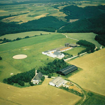
Pranktikanten gesucht
Morschheim
Schlosshof - Reha in der Pfalz
@SchlosshofRehaPfalz
Ausbildung
Bei der Medizinischen Versorgung der Pferde
Bodenarbeit
9 weitere...
P+
Deprecated: Creation of dynamic property Zend_View_Helper_Ads::$adLink is deprecated in /var/www/stall-frei/htdocs/staging.stall-frei.de/library/Psf/View/Helper/Ads.php on line 108

Reitanlage bei Familie Senckenberg
Groß-Gerau
Senckenberg
@Senckenberg
Freie Pferdeboxen auf dem Idyllischen Rheinfelderhof in Groß-Gerau
Leider kein Vorschaubild
Leider kein Vorschaubild
Mitarbeiter Stall- und Anlagenpflege - Minijob
Waldböckelheim
Haus vor Leos Ruh
@PassionReiten
zeitlich flexibel
Stallhelfer
Hofarbeiten
Material
Zeitlich flexibel (Bereitschaft zur Überzahlung)
neu
B+

Stallhilfe mit Wohnung
Waldböckelheim
Haus vor Leos Ruh
@PassionReiten
auf Honorarbasis
Ferienjob
Stallhelfer
ausmisten
Einstreuen, Fegen
18
Zeitlich flexibel (Bereitschaft zur Überzahlung)
13 weitere...
B+

Suche zuverlässige Stallhilfe
Bad Kreuznach
Diana v. Plettenberg
@Osterhoell
Minijob
ausmisten
Reitanlage, Weiden
21
Eigenes Auto
2 weitere...
B+

brandneu
B+

PRAKTIKANT (M/W/D) IN UNSEREM REITTEAM
Oberwesel
Ferienhof Hardthöhe
@FerienhofHardthoehe
Ferienjob
Taschengeld
Ausbildung
ausmisten
Bei der Medizinischen Versorgung der Pferde
18
Deutsch
17 weitere...
B+

Futtersack HeuToy, Fressbremse in pink
Mechtersen
STALL-FREIde Marketing
@STALL-FREI-Marketing
Stundenlange Beschäftigung die
Koliken vorbeugt, geringe Staubinhalation mit
steuerbarer Futterentnahme
Pferdewirt
Kaub
Anton-Baumann
@Anton-Baumann
sozialversicherungspflichtig
Pferdehaltung und Service
Stallhelfer
ausmisten
Bei der Medizinischen Versorgung der Pferde
19 weitere...
B+

Anlagenteil- und Boxenvermietung gegen Arbeit
Neustadt
Gaby Klehr
@Gaby-KLEHR
zeitlich flexibel
Stallhelfer
ausmisten
Bodenarbeit
21
Deutsch
9 weitere...
B+

Pferdewirt/in Spezialreitweisen-Gangreiten gesucht
Nohfelden
Gestuet-Nahetal
@Gestuet-Nahetal
sozialversicherungspflichtig
Spezialreitwesen
Bereiter
Bei der Medizinischen Versorgung der Pferde
Bodenarbeit
19 weitere...
B+
Leider kein Vorschaubild
Leider kein Vorschaubild
(EQ) Praktikantin gesucht.
Nohfelden
Gestuet-Nahetal
@Gestuet-Nahetal
sozialversicherungspflichtig
Vorpraktikum zur Ausbildung zum Pferdewirt
Pferdehaltung
ausmisten
Bei der Medizinischen Versorgung der Pferde
13 weitere...
B+
Deprecated: Creation of dynamic property Zend_View::$pageCount is deprecated in /var/www/stall-frei/htdocs/staging.stall-frei.de/library/vendor/shardj/zf1-future/library/Zend/View/Abstract.php on line 308
Deprecated: Creation of dynamic property Zend_View::$itemCountPerPage is deprecated in /var/www/stall-frei/htdocs/staging.stall-frei.de/library/vendor/shardj/zf1-future/library/Zend/View/Abstract.php on line 308
Deprecated: Creation of dynamic property Zend_View::$first is deprecated in /var/www/stall-frei/htdocs/staging.stall-frei.de/library/vendor/shardj/zf1-future/library/Zend/View/Abstract.php on line 308
Deprecated: Creation of dynamic property Zend_View::$current is deprecated in /var/www/stall-frei/htdocs/staging.stall-frei.de/library/vendor/shardj/zf1-future/library/Zend/View/Abstract.php on line 308
Deprecated: Creation of dynamic property Zend_View::$last is deprecated in /var/www/stall-frei/htdocs/staging.stall-frei.de/library/vendor/shardj/zf1-future/library/Zend/View/Abstract.php on line 308
Deprecated: Creation of dynamic property Zend_View::$next is deprecated in /var/www/stall-frei/htdocs/staging.stall-frei.de/library/vendor/shardj/zf1-future/library/Zend/View/Abstract.php on line 308
Deprecated: Creation of dynamic property Zend_View::$pagesInRange is deprecated in /var/www/stall-frei/htdocs/staging.stall-frei.de/library/vendor/shardj/zf1-future/library/Zend/View/Abstract.php on line 308
Deprecated: Creation of dynamic property Zend_View::$firstPageInRange is deprecated in /var/www/stall-frei/htdocs/staging.stall-frei.de/library/vendor/shardj/zf1-future/library/Zend/View/Abstract.php on line 308
Deprecated: Creation of dynamic property Zend_View::$lastPageInRange is deprecated in /var/www/stall-frei/htdocs/staging.stall-frei.de/library/vendor/shardj/zf1-future/library/Zend/View/Abstract.php on line 308
Deprecated: Creation of dynamic property Zend_View::$currentItemCount is deprecated in /var/www/stall-frei/htdocs/staging.stall-frei.de/library/vendor/shardj/zf1-future/library/Zend/View/Abstract.php on line 308
Deprecated: Creation of dynamic property Zend_View::$totalItemCount is deprecated in /var/www/stall-frei/htdocs/staging.stall-frei.de/library/vendor/shardj/zf1-future/library/Zend/View/Abstract.php on line 308
Deprecated: Creation of dynamic property Zend_View::$firstItemNumber is deprecated in /var/www/stall-frei/htdocs/staging.stall-frei.de/library/vendor/shardj/zf1-future/library/Zend/View/Abstract.php on line 308
Deprecated: Creation of dynamic property Zend_View::$lastItemNumber is deprecated in /var/www/stall-frei/htdocs/staging.stall-frei.de/library/vendor/shardj/zf1-future/library/Zend/View/Abstract.php on line 308
Deprecated: Creation of dynamic property Zend_View::$router is deprecated in /var/www/stall-frei/htdocs/staging.stall-frei.de/library/vendor/shardj/zf1-future/library/Zend/View/Abstract.php on line 308
Deprecated: Creation of dynamic property Zend_View::$urlParams is deprecated in /var/www/stall-frei/htdocs/staging.stall-frei.de/library/vendor/shardj/zf1-future/library/Zend/View/Abstract.php on line 308
Deprecated: Creation of dynamic property Zend_View::$showAds is deprecated in /var/www/stall-frei/htdocs/staging.stall-frei.de/library/vendor/shardj/zf1-future/library/Zend/View/Abstract.php on line 308
Deprecated: Creation of dynamic property Zend_View::$objectIds is deprecated in /var/www/stall-frei/htdocs/staging.stall-frei.de/library/vendor/shardj/zf1-future/library/Zend/View/Abstract.php on line 308
Deprecated: Creation of dynamic property Zend_View::$showNavbar is deprecated in /var/www/stall-frei/htdocs/staging.stall-frei.de/library/vendor/shardj/zf1-future/library/Zend/View/Abstract.php on line 308
Deprecated: Creation of dynamic property Zend_View::$showBreadcrumb is deprecated in /var/www/stall-frei/htdocs/staging.stall-frei.de/library/vendor/shardj/zf1-future/library/Zend/View/Abstract.php on line 308
Deprecated: Creation of dynamic property Zend_View::$showFooter is deprecated in /var/www/stall-frei/htdocs/staging.stall-frei.de/library/vendor/shardj/zf1-future/library/Zend/View/Abstract.php on line 308
Deprecated: Creation of dynamic property Zend_View::$showInternalAds is deprecated in /var/www/stall-frei/htdocs/staging.stall-frei.de/library/vendor/shardj/zf1-future/library/Zend/View/Abstract.php on line 308
Deprecated: Creation of dynamic property Zend_View::$blNoContent is deprecated in /var/www/stall-frei/htdocs/staging.stall-frei.de/library/vendor/shardj/zf1-future/library/Zend/View/Abstract.php on line 308
Deprecated: Creation of dynamic property Zend_View::$sMetaDesc is deprecated in /var/www/stall-frei/htdocs/staging.stall-frei.de/library/vendor/shardj/zf1-future/library/Zend/View/Abstract.php on line 308
Deprecated: Creation of dynamic property Zend_View::$useGmaps is deprecated in /var/www/stall-frei/htdocs/staging.stall-frei.de/library/vendor/shardj/zf1-future/library/Zend/View/Abstract.php on line 308
Deprecated: Creation of dynamic property Zend_View::$touches is deprecated in /var/www/stall-frei/htdocs/staging.stall-frei.de/library/vendor/shardj/zf1-future/library/Zend/View/Abstract.php on line 308
Deprecated: Creation of dynamic property Zend_View::$oProject is deprecated in /var/www/stall-frei/htdocs/staging.stall-frei.de/library/vendor/shardj/zf1-future/library/Zend/View/Abstract.php on line 308
Deprecated: Creation of dynamic property Zend_View::$pageHeadline is deprecated in /var/www/stall-frei/htdocs/staging.stall-frei.de/library/vendor/shardj/zf1-future/library/Zend/View/Abstract.php on line 308
Deprecated: Creation of dynamic property Zend_View::$disableLocationField is deprecated in /var/www/stall-frei/htdocs/staging.stall-frei.de/library/vendor/shardj/zf1-future/library/Zend/View/Abstract.php on line 308
Deprecated: Creation of dynamic property Zend_View::$isSearch is deprecated in /var/www/stall-frei/htdocs/staging.stall-frei.de/library/vendor/shardj/zf1-future/library/Zend/View/Abstract.php on line 308
Deprecated: Creation of dynamic property Zend_View::$pageTitle is deprecated in /var/www/stall-frei/htdocs/staging.stall-frei.de/library/vendor/shardj/zf1-future/library/Zend/View/Abstract.php on line 308
Deprecated: strlen(): Passing null to parameter #1 ($string) of type string is deprecated in /var/www/stall-frei/htdocs/staging.stall-frei.de/application/models/ObjectCache.php on line 1194
Deprecated: round(): Passing null to parameter #1 ($num) of type int|float is deprecated in /var/www/stall-frei/htdocs/staging.stall-frei.de/application/models/ObjectCache.php on line 1194
Deprecated: ceil(): Passing null to parameter #1 ($num) of type int|float is deprecated in /var/www/stall-frei/htdocs/staging.stall-frei.de/application/models/ObjectCache.php on line 1196
Deprecated: Creation of dynamic property Psf_Form_Element_Text::$class is deprecated in /var/www/stall-frei/htdocs/staging.stall-frei.de/library/vendor/shardj/zf1-future/library/Zend/Form/Element.php on line 874
Deprecated: Creation of dynamic property Psf_Form_Element_Text::$size is deprecated in /var/www/stall-frei/htdocs/staging.stall-frei.de/library/vendor/shardj/zf1-future/library/Zend/Form/Element.php on line 874
Deprecated: Creation of dynamic property Psf_Form_Element_Text::$placeholder is deprecated in /var/www/stall-frei/htdocs/staging.stall-frei.de/library/vendor/shardj/zf1-future/library/Zend/Form/Element.php on line 874
Deprecated: Creation of dynamic property Psf_Form_Element_Hidden::$class is deprecated in /var/www/stall-frei/htdocs/staging.stall-frei.de/library/vendor/shardj/zf1-future/library/Zend/Form/Element.php on line 874
Deprecated: Creation of dynamic property Psf_Form_Element_Hidden::$class is deprecated in /var/www/stall-frei/htdocs/staging.stall-frei.de/library/vendor/shardj/zf1-future/library/Zend/Form/Element.php on line 874
Deprecated: Creation of dynamic property Psf_Form_Element_Hidden::$class is deprecated in /var/www/stall-frei/htdocs/staging.stall-frei.de/library/vendor/shardj/zf1-future/library/Zend/Form/Element.php on line 874
Deprecated: Creation of dynamic property Psf_Form_Element_Hidden::$class is deprecated in /var/www/stall-frei/htdocs/staging.stall-frei.de/library/vendor/shardj/zf1-future/library/Zend/Form/Element.php on line 874
Deprecated: Creation of dynamic property Psf_Form_Element_Select::$class is deprecated in /var/www/stall-frei/htdocs/staging.stall-frei.de/library/vendor/shardj/zf1-future/library/Zend/Form/Element.php on line 874
Deprecated: Creation of dynamic property Psf_Form_Element_Text::$class is deprecated in /var/www/stall-frei/htdocs/staging.stall-frei.de/library/vendor/shardj/zf1-future/library/Zend/Form/Element.php on line 874
Deprecated: Creation of dynamic property Psf_Form_Element_Checkbox::$label is deprecated in /var/www/stall-frei/htdocs/staging.stall-frei.de/library/vendor/shardj/zf1-future/library/Zend/Form/Element.php on line 874
Deprecated: Creation of dynamic property Psf_Form_Element_Select::$class is deprecated in /var/www/stall-frei/htdocs/staging.stall-frei.de/library/vendor/shardj/zf1-future/library/Zend/Form/Element.php on line 874
Deprecated: Creation of dynamic property Psf_Form_Element_Select::$class is deprecated in /var/www/stall-frei/htdocs/staging.stall-frei.de/library/vendor/shardj/zf1-future/library/Zend/Form/Element.php on line 874
Deprecated: Creation of dynamic property Psf_Form_Element_Select::$class is deprecated in /var/www/stall-frei/htdocs/staging.stall-frei.de/library/vendor/shardj/zf1-future/library/Zend/Form/Element.php on line 874
Deprecated: Creation of dynamic property Psf_Form_Element_Select::$class is deprecated in /var/www/stall-frei/htdocs/staging.stall-frei.de/library/vendor/shardj/zf1-future/library/Zend/Form/Element.php on line 874
Deprecated: Creation of dynamic property Zend_View::$sort is deprecated in /var/www/stall-frei/htdocs/staging.stall-frei.de/library/vendor/shardj/zf1-future/library/Zend/View/Abstract.php on line 308
Deprecated: Creation of dynamic property Zend_View::$searchLocation is deprecated in /var/www/stall-frei/htdocs/staging.stall-frei.de/library/vendor/shardj/zf1-future/library/Zend/View/Abstract.php on line 308
Deprecated: Creation of dynamic property Zend_View::$locationHint is deprecated in /var/www/stall-frei/htdocs/staging.stall-frei.de/library/vendor/shardj/zf1-future/library/Zend/View/Abstract.php on line 308
Psf_GeoCoder_Abstract::getLocation: Stahlberg Get Location CachedOrLive
Psf_GeoCoder_Abstract::getCachedOrLive: Stahlberg
Psf_GeoCoder_OpenCageData::makeApiRequest: response:
Array
(
[documentation] => https://opencagedata.com/api
[licenses] => Array
(
[0] => Array
(
[name] => see attribution guide
[url] => https://opencagedata.com/credits
)
)
[results] => Array
(
[0] => Array
(
[bounds] => Array
(
[northeast] => Array
(
[lat] => 49.6719385
[lng] => 7.8028148
)
[southwest] => Array
(
[lat] => 49.6505266
[lng] => 7.7768457
)
)
[components] => Array
(
[ISO_3166-1_alpha-2] => DE
[ISO_3166-1_alpha-3] => DEU
[ISO_3166-2] => Array
(
[0] => DE-RP
)
[_category] => place
[_normalized_city] => Stahlberg
[_type] => village
[continent] => Europe
[country] => Deutschland
[country_code] => de
[county] => Donnersbergkreis
[municipality] => Nordpfälzer Land
[political_union] => European Union
[state] => Rheinland-Pfalz
[state_code] => RP
[village] => Stahlberg
)
[confidence] => 7
[formatted] => Stahlberg, Rheinland-Pfalz, Deutschland
[geometry] => Array
(
[lat] => 49.6650596
[lng] => 7.7868284
)
)
[1] => Array
(
[bounds] => Array
(
[northeast] => Array
(
[lat] => 51.0359237
[lng] => 7.5346113
)
[southwest] => Array
(
[lat] => 51.0358237
[lng] => 7.5345113
)
)
[components] => Array
(
[ISO_3166-1_alpha-2] => DE
[ISO_3166-1_alpha-3] => DEU
[ISO_3166-2] => Array
(
[0] => DE-NW
)
[_category] => natural/water
[_normalized_city] => Gummersbach
[_type] => peak
[continent] => Europe
[country] => Deutschland
[country_code] => de
[county] => Oberbergischer Kreis
[peak] => Stahlberg
[political_union] => European Union
[postcode] => 51643
[state] => Nordrhein-Westfalen
[state_code] => NW
[town] => Gummersbach
)
[confidence] => 9
[formatted] => Stahlberg, 51643 Gummersbach, Deutschland
[geometry] => Array
(
[lat] => 51.0358737
[lng] => 7.5345613
)
)
[2] => Array
(
[bounds] => Array
(
[northeast] => Array
(
[lat] => 49.6550406
[lng] => 7.7899311
)
[southwest] => Array
(
[lat] => 49.6549406
[lng] => 7.7898311
)
)
[components] => Array
(
[ISO_3166-1_alpha-2] => DE
[ISO_3166-1_alpha-3] => DEU
[ISO_3166-2] => Array
(
[0] => DE-RP
)
[_category] => natural/water
[_normalized_city] => Stahlberg
[_type] => peak
[continent] => Europe
[country] => Deutschland
[country_code] => de
[county] => Donnersbergkreis
[municipality] => Nordpfälzer Land
[peak] => Stahlberg
[political_union] => European Union
[postcode] => 67811
[state] => Rheinland-Pfalz
[state_code] => RP
[village] => Stahlberg
)
[confidence] => 9
[formatted] => Stahlberg, 67811 Stahlberg, Deutschland
[geometry] => Array
(
[lat] => 49.6549906
[lng] => 7.7898811
)
)
[3] => Array
(
[bounds] => Array
(
[northeast] => Array
(
[lat] => 51.3718791
[lng] => 9.4271407
)
[southwest] => Array
(
[lat] => 51.3717791
[lng] => 9.4270407
)
)
[components] => Array
(
[ISO_3166-1_alpha-2] => DE
[ISO_3166-1_alpha-3] => DEU
[ISO_3166-2] => Array
(
[0] => DE-HE
)
[_category] => natural/water
[_normalized_city] => Heckershausen
[_type] => peak
[continent] => Europe
[country] => Deutschland
[country_code] => de
[county] => Landkreis Kassel
[municipality] => Ahnatal
[peak] => Stahlberg
[political_union] => European Union
[postcode] => 34292
[state] => Hessen
[state_code] => HE
[village] => Heckershausen
)
[confidence] => 9
[formatted] => Stahlberg, 34292 Heckershausen, Deutschland
[geometry] => Array
(
[lat] => 51.3718291
[lng] => 9.4270907
)
)
[4] => Array
(
[bounds] => Array
(
[northeast] => Array
(
[lat] => 50.9961001
[lng] => 7.5451948
)
[southwest] => Array
(
[lat] => 50.9960001
[lng] => 7.5450948
)
)
[components] => Array
(
[ISO_3166-1_alpha-2] => DE
[ISO_3166-1_alpha-3] => DEU
[ISO_3166-2] => Array
(
[0] => DE-NW
)
[_category] => natural/water
[_normalized_city] => Gummersbach
[_type] => peak
[continent] => Europe
[country] => Deutschland
[country_code] => de
[county] => Oberbergischer Kreis
[peak] => Stahlberg
[political_union] => European Union
[postcode] => 51645
[state] => Nordrhein-Westfalen
[state_code] => NW
[town] => Gummersbach
)
[confidence] => 9
[formatted] => Stahlberg, 51645 Gummersbach, Deutschland
[geometry] => Array
(
[lat] => 50.9960501
[lng] => 7.5451448
)
)
[5] => Array
(
[bounds] => Array
(
[northeast] => Array
(
[lat] => 52.3535238
[lng] => 13.7687444
)
[southwest] => Array
(
[lat] => 52.3534238
[lng] => 13.7686444
)
)
[components] => Array
(
[ISO_3166-1_alpha-2] => DE
[ISO_3166-1_alpha-3] => DEU
[ISO_3166-2] => Array
(
[0] => DE-BB
)
[_category] => natural/water
[_normalized_city] => Spreenhagen
[_type] => peak
[continent] => Europe
[country] => Deutschland
[country_code] => de
[county] => Oder-Spree
[municipality] => Spreenhagen
[peak] => Stahlberg
[political_union] => European Union
[postcode] => 15229
[state] => Brandenburg
[state_code] => BB
[village] => Spreenhagen
)
[confidence] => 9
[formatted] => Stahlberg, 15229 Spreenhagen, Deutschland
[geometry] => Array
(
[lat] => 52.3534738
[lng] => 13.7686944
)
)
[6] => Array
(
[bounds] => Array
(
[northeast] => Array
(
[lat] => 51.7461333
[lng] => 10.8580778
)
[southwest] => Array
(
[lat] => 51.7460333
[lng] => 10.8579778
)
)
[components] => Array
(
[ISO_3166-1_alpha-2] => DE
[ISO_3166-1_alpha-3] => DEU
[ISO_3166-2] => Array
(
[0] => DE-ST
)
[_category] => natural/water
[_normalized_city] => Oberharz am Brocken
[_type] => peak
[continent] => Europe
[country] => Deutschland
[country_code] => de
[county] => Landkreis Harz
[municipality] => Oberharz am Brocken
[peak] => Stahlberg
[political_union] => European Union
[postcode] => 38889
[state] => Sachsen-Anhalt
[state_code] => ST
)
[confidence] => 9
[formatted] => Stahlberg, 38889 Oberharz am Brocken, Deutschland
[geometry] => Array
(
[lat] => 51.7460833
[lng] => 10.8580278
)
)
[7] => Array
(
[bounds] => Array
(
[northeast] => Array
(
[lat] => 51.1242333
[lng] => 9.8161518
)
[southwest] => Array
(
[lat] => 51.1241333
[lng] => 9.8160518
)
)
[components] => Array
(
[ISO_3166-1_alpha-2] => DE
[ISO_3166-1_alpha-3] => DEU
[ISO_3166-2] => Array
(
[0] => DE-HE
)
[_category] => natural/water
[_normalized_city] => Burghofen
[_type] => peak
[continent] => Europe
[country] => Deutschland
[country_code] => de
[county] => Werra-Meißner-Kreis
[municipality] => Waldkappel
[peak] => Stahlberg
[political_union] => European Union
[state] => Hessen
[state_code] => HE
[village] => Burghofen
)
[confidence] => 9
[formatted] => Stahlberg, Burghofen, Hessen, Deutschland
[geometry] => Array
(
[lat] => 51.1241833
[lng] => 9.8161018
)
)
[8] => Array
(
[bounds] => Array
(
[northeast] => Array
(
[lat] => 49.6877465
[lng] => 9.5630229
)
[southwest] => Array
(
[lat] => 49.6876465
[lng] => 9.5629229
)
)
[components] => Array
(
[ISO_3166-1_alpha-2] => DE
[ISO_3166-1_alpha-3] => DEU
[ISO_3166-2] => Array
(
[0] => DE-BW
)
[_category] => natural/water
[_normalized_city] => Külsheim
[_type] => peak
[continent] => Europe
[country] => Deutschland
[country_code] => de
[county] => Main-Tauber-Kreis
[peak] => Stahlberg
[political_union] => European Union
[postcode] => 97900
[state] => Baden-Württemberg
[state_code] => BW
[town] => Külsheim
)
[confidence] => 9
[formatted] => Stahlberg, 97900 Külsheim, Deutschland
[geometry] => Array
(
[lat] => 49.6876965
[lng] => 9.5629729
)
)
[9] => Array
(
[components] => Array
(
[ISO_3166-1_alpha-2] => FR
[ISO_3166-1_alpha-3] => FRA
[ISO_3166-2] => Array
(
[0] => FR-HDF
[1] => FR-59
)
[_category] => road
[_normalized_city] => Faches-Thumesnil
[_type] => road
[city] => Faches-Thumesnil
[continent] => Europe
[country] => France
[country_code] => fr
[county] => Nord
[local_authority] => Métropole Européenne de Lille
[political_union] => European Union
[postcode] => 59155
[road] => Rue de Stolberg
[state] => Hauts-de-France
[state_code] => HDF
)
[confidence] => 2
[formatted] => Rue de Stolberg, 59155 Faches-Thumesnil, France
[geometry] => Array
(
[lat] => 50.58817
[lng] => 3.073617
)
)
)
[status] => Array
(
[code] => 200
[message] => OK
)
[stay_informed] => Array
(
[blog] => https://blog.opencagedata.com
[mastodon] => https://en.osm.town/@opencage
)
[thanks] => For using an OpenCage API
[timestamp] => Array
(
[created_http] => Sat, 07 Feb 2026 09:18:54 GMT
[created_unix] => 1770455934
)
[total_results] => 10
)
Psf_GeoCoder_Abstract::convertLocationResult
{"documentation":"https:\/\/opencagedata.com\/api","licenses":[{"name":"see attribution guide","url":"https:\/\/opencagedata.com\/credits"}],"results":[{"bounds":{"northeast":{"lat":49.6719385,"lng":7.8028148},"southwest":{"lat":49.6505266,"lng":7.7768457}},"components":{"ISO_3166-1_alpha-2":"DE","ISO_3166-1_alpha-3":"DEU","ISO_3166-2":["DE-RP"],"_category":"place","_normalized_city":"Stahlberg","_type":"village","continent":"Europe","country":"Deutschland","country_code":"de","county":"Donnersbergkreis","municipality":"Nordpf\u00e4lzer Land","political_union":"European Union","state":"Rheinland-Pfalz","state_code":"RP","village":"Stahlberg"},"confidence":7,"formatted":"Stahlberg, Rheinland-Pfalz, Deutschland","geometry":{"lat":49.6650596,"lng":7.7868284}},{"bounds":{"northeast":{"lat":51.0359237,"lng":7.5346113},"southwest":{"lat":51.0358237,"lng":7.5345113}},"components":{"ISO_3166-1_alpha-2":"DE","ISO_3166-1_alpha-3":"DEU","ISO_3166-2":["DE-NW"],"_category":"natural\/water","_normalized_city":"Gummersbach","_type":"peak","continent":"Europe","country":"Deutschland","country_code":"de","county":"Oberbergischer Kreis","peak":"Stahlberg","political_union":"European Union","postcode":"51643","state":"Nordrhein-Westfalen","state_code":"NW","town":"Gummersbach"},"confidence":9,"formatted":"Stahlberg, 51643 Gummersbach, Deutschland","geometry":{"lat":51.0358737,"lng":7.5345613}},{"bounds":{"northeast":{"lat":49.6550406,"lng":7.7899311},"southwest":{"lat":49.6549406,"lng":7.7898311}},"components":{"ISO_3166-1_alpha-2":"DE","ISO_3166-1_alpha-3":"DEU","ISO_3166-2":["DE-RP"],"_category":"natural\/water","_normalized_city":"Stahlberg","_type":"peak","continent":"Europe","country":"Deutschland","country_code":"de","county":"Donnersbergkreis","municipality":"Nordpf\u00e4lzer Land","peak":"Stahlberg","political_union":"European Union","postcode":"67811","state":"Rheinland-Pfalz","state_code":"RP","village":"Stahlberg"},"confidence":9,"formatted":"Stahlberg, 67811 Stahlberg, Deutschland","geometry":{"lat":49.6549906,"lng":7.7898811}},{"bounds":{"northeast":{"lat":51.3718791,"lng":9.4271407},"southwest":{"lat":51.3717791,"lng":9.4270407}},"components":{"ISO_3166-1_alpha-2":"DE","ISO_3166-1_alpha-3":"DEU","ISO_3166-2":["DE-HE"],"_category":"natural\/water","_normalized_city":"Heckershausen","_type":"peak","continent":"Europe","country":"Deutschland","country_code":"de","county":"Landkreis Kassel","municipality":"Ahnatal","peak":"Stahlberg","political_union":"European Union","postcode":"34292","state":"Hessen","state_code":"HE","village":"Heckershausen"},"confidence":9,"formatted":"Stahlberg, 34292 Heckershausen, Deutschland","geometry":{"lat":51.3718291,"lng":9.4270907}},{"bounds":{"northeast":{"lat":50.9961001,"lng":7.5451948},"southwest":{"lat":50.9960001,"lng":7.5450948}},"components":{"ISO_3166-1_alpha-2":"DE","ISO_3166-1_alpha-3":"DEU","ISO_3166-2":["DE-NW"],"_category":"natural\/water","_normalized_city":"Gummersbach","_type":"peak","continent":"Europe","country":"Deutschland","country_code":"de","county":"Oberbergischer Kreis","peak":"Stahlberg","political_union":"European Union","postcode":"51645","state":"Nordrhein-Westfalen","state_code":"NW","town":"Gummersbach"},"confidence":9,"formatted":"Stahlberg, 51645 Gummersbach, Deutschland","geometry":{"lat":50.9960501,"lng":7.5451448}},{"bounds":{"northeast":{"lat":52.3535238,"lng":13.7687444},"southwest":{"lat":52.3534238,"lng":13.7686444}},"components":{"ISO_3166-1_alpha-2":"DE","ISO_3166-1_alpha-3":"DEU","ISO_3166-2":["DE-BB"],"_category":"natural\/water","_normalized_city":"Spreenhagen","_type":"peak","continent":"Europe","country":"Deutschland","country_code":"de","county":"Oder-Spree","municipality":"Spreenhagen","peak":"Stahlberg","political_union":"European Union","postcode":"15229","state":"Brandenburg","state_code":"BB","village":"Spreenhagen"},"confidence":9,"formatted":"Stahlberg, 15229 Spreenhagen, Deutschland","geometry":{"lat":52.3534738,"lng":13.7686944}},{"bounds":{"northeast":{"lat":51.7461333,"lng":10.8580778},"southwest":{"lat":51.7460333,"lng":10.8579778}},"components":{"ISO_3166-1_alpha-2":"DE","ISO_3166-1_alpha-3":"DEU","ISO_3166-2":["DE-ST"],"_category":"natural\/water","_normalized_city":"Oberharz am Brocken","_type":"peak","continent":"Europe","country":"Deutschland","country_code":"de","county":"Landkreis Harz","municipality":"Oberharz am Brocken","peak":"Stahlberg","political_union":"European Union","postcode":"38889","state":"Sachsen-Anhalt","state_code":"ST"},"confidence":9,"formatted":"Stahlberg, 38889 Oberharz am Brocken, Deutschland","geometry":{"lat":51.7460833,"lng":10.8580278}},{"bounds":{"northeast":{"lat":51.1242333,"lng":9.8161518},"southwest":{"lat":51.1241333,"lng":9.8160518}},"components":{"ISO_3166-1_alpha-2":"DE","ISO_3166-1_alpha-3":"DEU","ISO_3166-2":["DE-HE"],"_category":"natural\/water","_normalized_city":"Burghofen","_type":"peak","continent":"Europe","country":"Deutschland","country_code":"de","county":"Werra-Mei\u00dfner-Kreis","municipality":"Waldkappel","peak":"Stahlberg","political_union":"European Union","state":"Hessen","state_code":"HE","village":"Burghofen"},"confidence":9,"formatted":"Stahlberg, Burghofen, Hessen, Deutschland","geometry":{"lat":51.1241833,"lng":9.8161018}},{"bounds":{"northeast":{"lat":49.6877465,"lng":9.5630229},"southwest":{"lat":49.6876465,"lng":9.5629229}},"components":{"ISO_3166-1_alpha-2":"DE","ISO_3166-1_alpha-3":"DEU","ISO_3166-2":["DE-BW"],"_category":"natural\/water","_normalized_city":"K\u00fclsheim","_type":"peak","continent":"Europe","country":"Deutschland","country_code":"de","county":"Main-Tauber-Kreis","peak":"Stahlberg","political_union":"European Union","postcode":"97900","state":"Baden-W\u00fcrttemberg","state_code":"BW","town":"K\u00fclsheim"},"confidence":9,"formatted":"Stahlberg, 97900 K\u00fclsheim, Deutschland","geometry":{"lat":49.6876965,"lng":9.5629729}},{"components":{"ISO_3166-1_alpha-2":"FR","ISO_3166-1_alpha-3":"FRA","ISO_3166-2":["FR-HDF","FR-59"],"_category":"road","_normalized_city":"Faches-Thumesnil","_type":"road","city":"Faches-Thumesnil","continent":"Europe","country":"France","country_code":"fr","county":"Nord","local_authority":"M\u00e9tropole Europ\u00e9enne de Lille","political_union":"European Union","postcode":"59155","road":"Rue de Stolberg","state":"Hauts-de-France","state_code":"HDF"},"confidence":2,"formatted":"Rue de Stolberg, 59155 Faches-Thumesnil, France","geometry":{"lat":50.58817,"lng":3.073617}}],"status":{"code":200,"message":"OK"},"stay_informed":{"blog":"https:\/\/blog.opencagedata.com","mastodon":"https:\/\/en.osm.town\/@opencage"},"thanks":"For using an OpenCage API","timestamp":{"created_http":"Sat, 07 Feb 2026 09:18:54 GMT","created_unix":1770455934},"total_results":10}Array
(
[0] => stdClass Object
(
[bounds] => stdClass Object
(
[northeast] => stdClass Object
(
[lat] => 49.6719385
[lng] => 7.8028148
)
[southwest] => stdClass Object
(
[lat] => 49.6505266
[lng] => 7.7768457
)
)
[components] => stdClass Object
(
[ISO_3166-1_alpha-2] => DE
[ISO_3166-1_alpha-3] => DEU
[ISO_3166-2] => Array
(
[0] => DE-RP
)
[_category] => place
[_normalized_city] => Stahlberg
[_type] => village
[continent] => Europe
[country] => Deutschland
[country_code] => de
[county] => Donnersbergkreis
[municipality] => Nordpfälzer Land
[political_union] => European Union
[state] => Rheinland-Pfalz
[state_code] => RP
[village] => Stahlberg
)
[confidence] => 7
[formatted] => Stahlberg, Rheinland-Pfalz, Deutschland
[geometry] => stdClass Object
(
[lat] => 49.6650596
[lng] => 7.7868284
)
)
[1] => stdClass Object
(
[bounds] => stdClass Object
(
[northeast] => stdClass Object
(
[lat] => 51.0359237
[lng] => 7.5346113
)
[southwest] => stdClass Object
(
[lat] => 51.0358237
[lng] => 7.5345113
)
)
[components] => stdClass Object
(
[ISO_3166-1_alpha-2] => DE
[ISO_3166-1_alpha-3] => DEU
[ISO_3166-2] => Array
(
[0] => DE-NW
)
[_category] => natural/water
[_normalized_city] => Gummersbach
[_type] => peak
[continent] => Europe
[country] => Deutschland
[country_code] => de
[county] => Oberbergischer Kreis
[peak] => Stahlberg
[political_union] => European Union
[postcode] => 51643
[state] => Nordrhein-Westfalen
[state_code] => NW
[town] => Gummersbach
)
[confidence] => 9
[formatted] => Stahlberg, 51643 Gummersbach, Deutschland
[geometry] => stdClass Object
(
[lat] => 51.0358737
[lng] => 7.5345613
)
)
[2] => stdClass Object
(
[bounds] => stdClass Object
(
[northeast] => stdClass Object
(
[lat] => 49.6550406
[lng] => 7.7899311
)
[southwest] => stdClass Object
(
[lat] => 49.6549406
[lng] => 7.7898311
)
)
[components] => stdClass Object
(
[ISO_3166-1_alpha-2] => DE
[ISO_3166-1_alpha-3] => DEU
[ISO_3166-2] => Array
(
[0] => DE-RP
)
[_category] => natural/water
[_normalized_city] => Stahlberg
[_type] => peak
[continent] => Europe
[country] => Deutschland
[country_code] => de
[county] => Donnersbergkreis
[municipality] => Nordpfälzer Land
[peak] => Stahlberg
[political_union] => European Union
[postcode] => 67811
[state] => Rheinland-Pfalz
[state_code] => RP
[village] => Stahlberg
)
[confidence] => 9
[formatted] => Stahlberg, 67811 Stahlberg, Deutschland
[geometry] => stdClass Object
(
[lat] => 49.6549906
[lng] => 7.7898811
)
)
[3] => stdClass Object
(
[bounds] => stdClass Object
(
[northeast] => stdClass Object
(
[lat] => 51.3718791
[lng] => 9.4271407
)
[southwest] => stdClass Object
(
[lat] => 51.3717791
[lng] => 9.4270407
)
)
[components] => stdClass Object
(
[ISO_3166-1_alpha-2] => DE
[ISO_3166-1_alpha-3] => DEU
[ISO_3166-2] => Array
(
[0] => DE-HE
)
[_category] => natural/water
[_normalized_city] => Heckershausen
[_type] => peak
[continent] => Europe
[country] => Deutschland
[country_code] => de
[county] => Landkreis Kassel
[municipality] => Ahnatal
[peak] => Stahlberg
[political_union] => European Union
[postcode] => 34292
[state] => Hessen
[state_code] => HE
[village] => Heckershausen
)
[confidence] => 9
[formatted] => Stahlberg, 34292 Heckershausen, Deutschland
[geometry] => stdClass Object
(
[lat] => 51.3718291
[lng] => 9.4270907
)
)
[4] => stdClass Object
(
[bounds] => stdClass Object
(
[northeast] => stdClass Object
(
[lat] => 50.9961001
[lng] => 7.5451948
)
[southwest] => stdClass Object
(
[lat] => 50.9960001
[lng] => 7.5450948
)
)
[components] => stdClass Object
(
[ISO_3166-1_alpha-2] => DE
[ISO_3166-1_alpha-3] => DEU
[ISO_3166-2] => Array
(
[0] => DE-NW
)
[_category] => natural/water
[_normalized_city] => Gummersbach
[_type] => peak
[continent] => Europe
[country] => Deutschland
[country_code] => de
[county] => Oberbergischer Kreis
[peak] => Stahlberg
[political_union] => European Union
[postcode] => 51645
[state] => Nordrhein-Westfalen
[state_code] => NW
[town] => Gummersbach
)
[confidence] => 9
[formatted] => Stahlberg, 51645 Gummersbach, Deutschland
[geometry] => stdClass Object
(
[lat] => 50.9960501
[lng] => 7.5451448
)
)
[5] => stdClass Object
(
[bounds] => stdClass Object
(
[northeast] => stdClass Object
(
[lat] => 52.3535238
[lng] => 13.7687444
)
[southwest] => stdClass Object
(
[lat] => 52.3534238
[lng] => 13.7686444
)
)
[components] => stdClass Object
(
[ISO_3166-1_alpha-2] => DE
[ISO_3166-1_alpha-3] => DEU
[ISO_3166-2] => Array
(
[0] => DE-BB
)
[_category] => natural/water
[_normalized_city] => Spreenhagen
[_type] => peak
[continent] => Europe
[country] => Deutschland
[country_code] => de
[county] => Oder-Spree
[municipality] => Spreenhagen
[peak] => Stahlberg
[political_union] => European Union
[postcode] => 15229
[state] => Brandenburg
[state_code] => BB
[village] => Spreenhagen
)
[confidence] => 9
[formatted] => Stahlberg, 15229 Spreenhagen, Deutschland
[geometry] => stdClass Object
(
[lat] => 52.3534738
[lng] => 13.7686944
)
)
[6] => stdClass Object
(
[bounds] => stdClass Object
(
[northeast] => stdClass Object
(
[lat] => 51.7461333
[lng] => 10.8580778
)
[southwest] => stdClass Object
(
[lat] => 51.7460333
[lng] => 10.8579778
)
)
[components] => stdClass Object
(
[ISO_3166-1_alpha-2] => DE
[ISO_3166-1_alpha-3] => DEU
[ISO_3166-2] => Array
(
[0] => DE-ST
)
[_category] => natural/water
[_normalized_city] => Oberharz am Brocken
[_type] => peak
[continent] => Europe
[country] => Deutschland
[country_code] => de
[county] => Landkreis Harz
[municipality] => Oberharz am Brocken
[peak] => Stahlberg
[political_union] => European Union
[postcode] => 38889
[state] => Sachsen-Anhalt
[state_code] => ST
)
[confidence] => 9
[formatted] => Stahlberg, 38889 Oberharz am Brocken, Deutschland
[geometry] => stdClass Object
(
[lat] => 51.7460833
[lng] => 10.8580278
)
)
[7] => stdClass Object
(
[bounds] => stdClass Object
(
[northeast] => stdClass Object
(
[lat] => 51.1242333
[lng] => 9.8161518
)
[southwest] => stdClass Object
(
[lat] => 51.1241333
[lng] => 9.8160518
)
)
[components] => stdClass Object
(
[ISO_3166-1_alpha-2] => DE
[ISO_3166-1_alpha-3] => DEU
[ISO_3166-2] => Array
(
[0] => DE-HE
)
[_category] => natural/water
[_normalized_city] => Burghofen
[_type] => peak
[continent] => Europe
[country] => Deutschland
[country_code] => de
[county] => Werra-Meißner-Kreis
[municipality] => Waldkappel
[peak] => Stahlberg
[political_union] => European Union
[state] => Hessen
[state_code] => HE
[village] => Burghofen
)
[confidence] => 9
[formatted] => Stahlberg, Burghofen, Hessen, Deutschland
[geometry] => stdClass Object
(
[lat] => 51.1241833
[lng] => 9.8161018
)
)
[8] => stdClass Object
(
[bounds] => stdClass Object
(
[northeast] => stdClass Object
(
[lat] => 49.6877465
[lng] => 9.5630229
)
[southwest] => stdClass Object
(
[lat] => 49.6876465
[lng] => 9.5629229
)
)
[components] => stdClass Object
(
[ISO_3166-1_alpha-2] => DE
[ISO_3166-1_alpha-3] => DEU
[ISO_3166-2] => Array
(
[0] => DE-BW
)
[_category] => natural/water
[_normalized_city] => Külsheim
[_type] => peak
[continent] => Europe
[country] => Deutschland
[country_code] => de
[county] => Main-Tauber-Kreis
[peak] => Stahlberg
[political_union] => European Union
[postcode] => 97900
[state] => Baden-Württemberg
[state_code] => BW
[town] => Külsheim
)
[confidence] => 9
[formatted] => Stahlberg, 97900 Külsheim, Deutschland
[geometry] => stdClass Object
(
[lat] => 49.6876965
[lng] => 9.5629729
)
)
[9] => stdClass Object
(
[components] => stdClass Object
(
[ISO_3166-1_alpha-2] => FR
[ISO_3166-1_alpha-3] => FRA
[ISO_3166-2] => Array
(
[0] => FR-HDF
[1] => FR-59
)
[_category] => road
[_normalized_city] => Faches-Thumesnil
[_type] => road
[city] => Faches-Thumesnil
[continent] => Europe
[country] => France
[country_code] => fr
[county] => Nord
[local_authority] => Métropole Européenne de Lille
[political_union] => European Union
[postcode] => 59155
[road] => Rue de Stolberg
[state] => Hauts-de-France
[state_code] => HDF
)
[confidence] => 2
[formatted] => Rue de Stolberg, 59155 Faches-Thumesnil, France
[geometry] => stdClass Object
(
[lat] => 50.58817
[lng] => 3.073617
)
)
)
Psf_GeoCoder_OpenCageData::getKeyMap: 0
stdClass Object
(
    [bounds] => stdClass Object
        (
            [northeast] => stdClass Object
                (
                    [lat] => 49.6719385
                    [lng] => 7.8028148
                )

            [southwest] => stdClass Object
                (
                    [lat] => 49.6505266
                    [lng] => 7.7768457
                )

        )

    [components] => stdClass Object
        (
            [ISO_3166-1_alpha-2] => DE
            [ISO_3166-1_alpha-3] => DEU
            [ISO_3166-2] => Array
                (
                    [0] => DE-RP
                )

            [_category] => place
            [_normalized_city] => Stahlberg
            [_type] => village
            [continent] => Europe
            [country] => Deutschland
            [country_code] => de
            [county] => Donnersbergkreis
            [municipality] => Nordpfälzer Land
            [political_union] => European Union
            [state] => Rheinland-Pfalz
            [state_code] => RP
            [village] => Stahlberg
        )

    [confidence] => 7
    [formatted] => Stahlberg, Rheinland-Pfalz, Deutschland
    [geometry] => stdClass Object
        (
            [lat] => 49.6650596
            [lng] => 7.7868284
        )

)
Psf_GeoCoder_OpenCageData::getCounty: Donnersbergkreis
Psf_GeoCoder_OpenCageData::addMissingData REFETCH!
Array
(
    [address] => Stahlberg, Rheinland-Pfalz, Deutschland
    [type] => village
    [street] =>
    [city] => Stahlberg
    [county] => Donnersbergkreis
    [state] => Rheinland-Pfalz
    [zip] =>
    [country] => Deutschland
    [suburb] =>
    [countrycode] => de
    [latitude] => 49.6650596
    [longitude] => 7.7868284
    [accuracy] => 1
    [confidence] => 7
    [bounds] => stdClass Object
        (
            [northeast] => stdClass Object
                (
                    [lat] => 49.6719385
                    [lng] => 7.8028148
                )

            [southwest] => stdClass Object
                (
                    [lat] => 49.6505266
                    [lng] => 7.7768457
                )

        )

)
reformat!
Array
(
    [address] => Stahlberg, Rheinland-Pfalz, Deutschland
    [type] => village
    [street] =>
    [city] => Stahlberg
    [county] => Donnersbergkreis
    [state] => Rheinland-Pfalz
    [zip] =>
    [country] => Deutschland
    [suburb] =>
    [countrycode] => de
    [latitude] => 49.6650596
    [longitude] => 7.7868284
    [accuracy] => 1
    [confidence] => 7
    [bounds] => stdClass Object
        (
            [northeast] => stdClass Object
                (
                    [lat] => 49.6719385
                    [lng] => 7.8028148
                )

            [southwest] => stdClass Object
                (
                    [lat] => 49.6505266
                    [lng] => 7.7768457
                )

        )

    [place] => Stahlberg, Rheinland-Pfalz
    [hash] => 43b7d7e9f493f18259f442c943e5b985
)
Psf_GeoCoder_OpenCageData::getKeyMap: 1
stdClass Object
(
    [bounds] => stdClass Object
        (
            [northeast] => stdClass Object
                (
                    [lat] => 51.0359237
                    [lng] => 7.5346113
                )

            [southwest] => stdClass Object
                (
                    [lat] => 51.0358237
                    [lng] => 7.5345113
                )

        )

    [components] => stdClass Object
        (
            [ISO_3166-1_alpha-2] => DE
            [ISO_3166-1_alpha-3] => DEU
            [ISO_3166-2] => Array
                (
                    [0] => DE-NW
                )

            [_category] => natural/water
            [_normalized_city] => Gummersbach
            [_type] => peak
            [continent] => Europe
            [country] => Deutschland
            [country_code] => de
            [county] => Oberbergischer Kreis
            [peak] => Stahlberg
            [political_union] => European Union
            [postcode] => 51643
            [state] => Nordrhein-Westfalen
            [state_code] => NW
            [town] => Gummersbach
        )

    [confidence] => 9
    [formatted] => Stahlberg, 51643 Gummersbach, Deutschland
    [geometry] => stdClass Object
        (
            [lat] => 51.0358737
            [lng] => 7.5345613
        )

)
Psf_GeoCoder_OpenCageData::getCounty: Oberbergischer Kreis
Psf_GeoCoder_OpenCageData::addMissingData REFETCH!
Array
(
    [address] => Stahlberg, 51643 Gummersbach, Deutschland
    [type] => peak
    [street] =>
    [city] => Gummersbach
    [county] => Oberbergischer Kreis
    [state] => Nordrhein-Westfalen
    [zip] => 51643
    [country] => Deutschland
    [suburb] =>
    [countrycode] => de
    [latitude] => 51.0358737
    [longitude] => 7.5345613
    [accuracy] => 1
    [confidence] => 9
    [bounds] => stdClass Object
        (
            [northeast] => stdClass Object
                (
                    [lat] => 51.0359237
                    [lng] => 7.5346113
                )

            [southwest] => stdClass Object
                (
                    [lat] => 51.0358237
                    [lng] => 7.5345113
                )

        )

)
reformat!
Array
(
    [address] => Stahlberg, 51643 Gummersbach, Deutschland
    [type] => peak
    [street] =>
    [city] => Gummersbach
    [county] => Oberbergischer Kreis
    [state] => Nordrhein-Westfalen
    [zip] => 51643
    [country] => Deutschland
    [suburb] =>
    [countrycode] => de
    [latitude] => 51.0358737
    [longitude] => 7.5345613
    [accuracy] => 1
    [confidence] => 9
    [bounds] => stdClass Object
        (
            [northeast] => stdClass Object
                (
                    [lat] => 51.0359237
                    [lng] => 7.5346113
                )

            [southwest] => stdClass Object
                (
                    [lat] => 51.0358237
                    [lng] => 7.5345113
                )

        )

    [place] => 51643 Gummersbach, Nordrhein-Westfalen
    [hash] => cd09b39a99a15c9fd412f7fc676d6c50
)
Psf_GeoCoder_OpenCageData::getKeyMap: 2
stdClass Object
(
    [bounds] => stdClass Object
        (
            [northeast] => stdClass Object
                (
                    [lat] => 49.6550406
                    [lng] => 7.7899311
                )

            [southwest] => stdClass Object
                (
                    [lat] => 49.6549406
                    [lng] => 7.7898311
                )

        )

    [components] => stdClass Object
        (
            [ISO_3166-1_alpha-2] => DE
            [ISO_3166-1_alpha-3] => DEU
            [ISO_3166-2] => Array
                (
                    [0] => DE-RP
                )

            [_category] => natural/water
            [_normalized_city] => Stahlberg
            [_type] => peak
            [continent] => Europe
            [country] => Deutschland
            [country_code] => de
            [county] => Donnersbergkreis
            [municipality] => Nordpfälzer Land
            [peak] => Stahlberg
            [political_union] => European Union
            [postcode] => 67811
            [state] => Rheinland-Pfalz
            [state_code] => RP
            [village] => Stahlberg
        )

    [confidence] => 9
    [formatted] => Stahlberg, 67811 Stahlberg, Deutschland
    [geometry] => stdClass Object
        (
            [lat] => 49.6549906
            [lng] => 7.7898811
        )

)
Psf_GeoCoder_OpenCageData::getCounty: Donnersbergkreis
Psf_GeoCoder_OpenCageData::addMissingData REFETCH!
Array
(
    [address] => Stahlberg, 67811 Stahlberg, Deutschland
    [type] => peak
    [street] =>
    [city] => Stahlberg
    [county] => Donnersbergkreis
    [state] => Rheinland-Pfalz
    [zip] => 67811
    [country] => Deutschland
    [suburb] =>
    [countrycode] => de
    [latitude] => 49.6549906
    [longitude] => 7.7898811
    [accuracy] => 1
    [confidence] => 9
    [bounds] => stdClass Object
        (
            [northeast] => stdClass Object
                (
                    [lat] => 49.6550406
                    [lng] => 7.7899311
                )

            [southwest] => stdClass Object
                (
                    [lat] => 49.6549406
                    [lng] => 7.7898311
                )

        )

)
reformat!
Array
(
    [address] => Stahlberg, 67811 Stahlberg, Deutschland
    [type] => peak
    [street] =>
    [city] => Stahlberg
    [county] => Donnersbergkreis
    [state] => Rheinland-Pfalz
    [zip] => 67811
    [country] => Deutschland
    [suburb] =>
    [countrycode] => de
    [latitude] => 49.6549906
    [longitude] => 7.7898811
    [accuracy] => 1
    [confidence] => 9
    [bounds] => stdClass Object
        (
            [northeast] => stdClass Object
                (
                    [lat] => 49.6550406
                    [lng] => 7.7899311
                )

            [southwest] => stdClass Object
                (
                    [lat] => 49.6549406
                    [lng] => 7.7898311
                )

        )

    [place] => 67811 Stahlberg, Rheinland-Pfalz
    [hash] => 6111f929182444bfdfbd7f6d25a4af5d
)
Psf_GeoCoder_OpenCageData::getKeyMap: 3
stdClass Object
(
    [bounds] => stdClass Object
        (
            [northeast] => stdClass Object
                (
                    [lat] => 51.3718791
                    [lng] => 9.4271407
                )

            [southwest] => stdClass Object
                (
                    [lat] => 51.3717791
                    [lng] => 9.4270407
                )

        )

    [components] => stdClass Object
        (
            [ISO_3166-1_alpha-2] => DE
            [ISO_3166-1_alpha-3] => DEU
            [ISO_3166-2] => Array
                (
                    [0] => DE-HE
                )

            [_category] => natural/water
            [_normalized_city] => Heckershausen
            [_type] => peak
            [continent] => Europe
            [country] => Deutschland
            [country_code] => de
            [county] => Landkreis Kassel
            [municipality] => Ahnatal
            [peak] => Stahlberg
            [political_union] => European Union
            [postcode] => 34292
            [state] => Hessen
            [state_code] => HE
            [village] => Heckershausen
        )

    [confidence] => 9
    [formatted] => Stahlberg, 34292 Heckershausen, Deutschland
    [geometry] => stdClass Object
        (
            [lat] => 51.3718291
            [lng] => 9.4270907
        )

)
Psf_GeoCoder_OpenCageData::getCounty: Kassel
Psf_GeoCoder_OpenCageData::addMissingData REFETCH!
Array
(
    [address] => Stahlberg, 34292 Heckershausen, Deutschland
    [type] => peak
    [street] =>
    [city] => Heckershausen
    [county] => Kassel
    [state] => Hessen
    [zip] => 34292
    [country] => Deutschland
    [suburb] =>
    [countrycode] => de
    [latitude] => 51.3718291
    [longitude] => 9.4270907
    [accuracy] => 1
    [confidence] => 9
    [bounds] => stdClass Object
        (
            [northeast] => stdClass Object
                (
                    [lat] => 51.3718791
                    [lng] => 9.4271407
                )

            [southwest] => stdClass Object
                (
                    [lat] => 51.3717791
                    [lng] => 9.4270407
                )

        )

)
reformat!
Array
(
    [address] => Stahlberg, 34292 Heckershausen, Deutschland
    [type] => peak
    [street] =>
    [city] => Heckershausen
    [county] => Kassel
    [state] => Hessen
    [zip] => 34292
    [country] => Deutschland
    [suburb] =>
    [countrycode] => de
    [latitude] => 51.3718291
    [longitude] => 9.4270907
    [accuracy] => 1
    [confidence] => 9
    [bounds] => stdClass Object
        (
            [northeast] => stdClass Object
                (
                    [lat] => 51.3718791
                    [lng] => 9.4271407
                )

            [southwest] => stdClass Object
                (
                    [lat] => 51.3717791
                    [lng] => 9.4270407
                )

        )

    [place] => 34292 Heckershausen, Hessen
    [hash] => b4e4a5e9bb59d12fe359a938c4235299
)
Psf_GeoCoder_OpenCageData::getKeyMap: 4
stdClass Object
(
    [bounds] => stdClass Object
        (
            [northeast] => stdClass Object
                (
                    [lat] => 50.9961001
                    [lng] => 7.5451948
                )

            [southwest] => stdClass Object
                (
                    [lat] => 50.9960001
                    [lng] => 7.5450948
                )

        )

    [components] => stdClass Object
        (
            [ISO_3166-1_alpha-2] => DE
            [ISO_3166-1_alpha-3] => DEU
            [ISO_3166-2] => Array
                (
                    [0] => DE-NW
                )

            [_category] => natural/water
            [_normalized_city] => Gummersbach
            [_type] => peak
            [continent] => Europe
            [country] => Deutschland
            [country_code] => de
            [county] => Oberbergischer Kreis
            [peak] => Stahlberg
            [political_union] => European Union
            [postcode] => 51645
            [state] => Nordrhein-Westfalen
            [state_code] => NW
            [town] => Gummersbach
        )

    [confidence] => 9
    [formatted] => Stahlberg, 51645 Gummersbach, Deutschland
    [geometry] => stdClass Object
        (
            [lat] => 50.9960501
            [lng] => 7.5451448
        )

)
Psf_GeoCoder_OpenCageData::getCounty: Oberbergischer Kreis
Psf_GeoCoder_OpenCageData::addMissingData REFETCH!
Array
(
    [address] => Stahlberg, 51645 Gummersbach, Deutschland
    [type] => peak
    [street] =>
    [city] => Gummersbach
    [county] => Oberbergischer Kreis
    [state] => Nordrhein-Westfalen
    [zip] => 51645
    [country] => Deutschland
    [suburb] =>
    [countrycode] => de
    [latitude] => 50.9960501
    [longitude] => 7.5451448
    [accuracy] => 1
    [confidence] => 9
    [bounds] => stdClass Object
        (
            [northeast] => stdClass Object
                (
                    [lat] => 50.9961001
                    [lng] => 7.5451948
                )

            [southwest] => stdClass Object
                (
                    [lat] => 50.9960001
                    [lng] => 7.5450948
                )

        )

)
reformat!
Array
(
    [address] => Stahlberg, 51645 Gummersbach, Deutschland
    [type] => peak
    [street] =>
    [city] => Gummersbach
    [county] => Oberbergischer Kreis
    [state] => Nordrhein-Westfalen
    [zip] => 51645
    [country] => Deutschland
    [suburb] =>
    [countrycode] => de
    [latitude] => 50.9960501
    [longitude] => 7.5451448
    [accuracy] => 1
    [confidence] => 9
    [bounds] => stdClass Object
        (
            [northeast] => stdClass Object
                (
                    [lat] => 50.9961001
                    [lng] => 7.5451948
                )

            [southwest] => stdClass Object
                (
                    [lat] => 50.9960001
                    [lng] => 7.5450948
                )

        )

    [place] => 51645 Gummersbach, Nordrhein-Westfalen
    [hash] => 8db79b49791af53159be92a1b6237d46
)
Psf_GeoCoder_OpenCageData::getKeyMap: 5
stdClass Object
(
    [bounds] => stdClass Object
        (
            [northeast] => stdClass Object
                (
                    [lat] => 52.3535238
                    [lng] => 13.7687444
                )

            [southwest] => stdClass Object
                (
                    [lat] => 52.3534238
                    [lng] => 13.7686444
                )

        )

    [components] => stdClass Object
        (
            [ISO_3166-1_alpha-2] => DE
            [ISO_3166-1_alpha-3] => DEU
            [ISO_3166-2] => Array
                (
                    [0] => DE-BB
                )

            [_category] => natural/water
            [_normalized_city] => Spreenhagen
            [_type] => peak
            [continent] => Europe
            [country] => Deutschland
            [country_code] => de
            [county] => Oder-Spree
            [municipality] => Spreenhagen
            [peak] => Stahlberg
            [political_union] => European Union
            [postcode] => 15229
            [state] => Brandenburg
            [state_code] => BB
            [village] => Spreenhagen
        )

    [confidence] => 9
    [formatted] => Stahlberg, 15229 Spreenhagen, Deutschland
    [geometry] => stdClass Object
        (
            [lat] => 52.3534738
            [lng] => 13.7686944
        )

)
Psf_GeoCoder_OpenCageData::getCounty: Oder-Spree
Psf_GeoCoder_OpenCageData::addMissingData REFETCH!
Array
(
    [address] => Stahlberg, 15229 Spreenhagen, Deutschland
    [type] => peak
    [street] =>
    [city] => Spreenhagen
    [county] => Oder-Spree
    [state] => Brandenburg
    [zip] => 15229
    [country] => Deutschland
    [suburb] =>
    [countrycode] => de
    [latitude] => 52.3534738
    [longitude] => 13.7686944
    [accuracy] => 1
    [confidence] => 9
    [bounds] => stdClass Object
        (
            [northeast] => stdClass Object
                (
                    [lat] => 52.3535238
                    [lng] => 13.7687444
                )

            [southwest] => stdClass Object
                (
                    [lat] => 52.3534238
                    [lng] => 13.7686444
                )

        )

)
reformat!
Array
(
    [address] => Stahlberg, 15229 Spreenhagen, Deutschland
    [type] => peak
    [street] =>
    [city] => Spreenhagen
    [county] => Oder-Spree
    [state] => Brandenburg
    [zip] => 15229
    [country] => Deutschland
    [suburb] =>
    [countrycode] => de
    [latitude] => 52.3534738
    [longitude] => 13.7686944
    [accuracy] => 1
    [confidence] => 9
    [bounds] => stdClass Object
        (
            [northeast] => stdClass Object
                (
                    [lat] => 52.3535238
                    [lng] => 13.7687444
                )

            [southwest] => stdClass Object
                (
                    [lat] => 52.3534238
                    [lng] => 13.7686444
                )

        )

    [place] => 15229 Spreenhagen, Brandenburg
    [hash] => a2efbd6591b31d75888adfe1383bb2ce
)
Psf_GeoCoder_OpenCageData::getKeyMap: 6
stdClass Object
(
    [bounds] => stdClass Object
        (
            [northeast] => stdClass Object
                (
                    [lat] => 51.7461333
                    [lng] => 10.8580778
                )

            [southwest] => stdClass Object
                (
                    [lat] => 51.7460333
                    [lng] => 10.8579778
                )

        )

    [components] => stdClass Object
        (
            [ISO_3166-1_alpha-2] => DE
            [ISO_3166-1_alpha-3] => DEU
            [ISO_3166-2] => Array
                (
                    [0] => DE-ST
                )

            [_category] => natural/water
            [_normalized_city] => Oberharz am Brocken
            [_type] => peak
            [continent] => Europe
            [country] => Deutschland
            [country_code] => de
            [county] => Landkreis Harz
            [municipality] => Oberharz am Brocken
            [peak] => Stahlberg
            [political_union] => European Union
            [postcode] => 38889
            [state] => Sachsen-Anhalt
            [state_code] => ST
        )

    [confidence] => 9
    [formatted] => Stahlberg, 38889 Oberharz am Brocken, Deutschland
    [geometry] => stdClass Object
        (
            [lat] => 51.7460833
            [lng] => 10.8580278
        )

)
Psf_GeoCoder_OpenCageData::getCounty: Harz
Psf_GeoCoder_OpenCageData::addMissingData REFETCH!
Array
(
    [address] => Stahlberg, 38889 Oberharz am Brocken, Deutschland
    [type] => peak
    [street] =>
    [city] =>
    [county] => Harz
    [state] => Sachsen-Anhalt
    [zip] => 38889
    [country] => Deutschland
    [suburb] =>
    [countrycode] => de
    [latitude] => 51.7460833
    [longitude] => 10.8580278
    [accuracy] => 1
    [confidence] => 9
    [bounds] => stdClass Object
        (
            [northeast] => stdClass Object
                (
                    [lat] => 51.7461333
                    [lng] => 10.8580778
                )

            [southwest] => stdClass Object
                (
                    [lat] => 51.7460333
                    [lng] => 10.8579778
                )

        )

)
reformat!
Array
(
    [address] => Stahlberg, 38889 Oberharz am Brocken, Deutschland
    [type] => peak
    [street] =>
    [city] =>
    [county] => Harz
    [state] => Sachsen-Anhalt
    [zip] => 38889
    [country] => Deutschland
    [suburb] =>
    [countrycode] => de
    [latitude] => 51.7460833
    [longitude] => 10.8580278
    [accuracy] => 1
    [confidence] => 9
    [bounds] => stdClass Object
        (
            [northeast] => stdClass Object
                (
                    [lat] => 51.7461333
                    [lng] => 10.8580778
                )

            [southwest] => stdClass Object
                (
                    [lat] => 51.7460333
                    [lng] => 10.8579778
                )

        )

    [place] => 38889 , Sachsen-Anhalt
    [hash] => 13bb2ae719441a7a1f3a8f8aae934728
)
Psf_GeoCoder_OpenCageData::getKeyMap: 7
stdClass Object
(
    [bounds] => stdClass Object
        (
            [northeast] => stdClass Object
                (
                    [lat] => 51.1242333
                    [lng] => 9.8161518
                )

            [southwest] => stdClass Object
                (
                    [lat] => 51.1241333
                    [lng] => 9.8160518
                )

        )

    [components] => stdClass Object
        (
            [ISO_3166-1_alpha-2] => DE
            [ISO_3166-1_alpha-3] => DEU
            [ISO_3166-2] => Array
                (
                    [0] => DE-HE
                )

            [_category] => natural/water
            [_normalized_city] => Burghofen
            [_type] => peak
            [continent] => Europe
            [country] => Deutschland
            [country_code] => de
            [county] => Werra-Meißner-Kreis
            [municipality] => Waldkappel
            [peak] => Stahlberg
            [political_union] => European Union
            [state] => Hessen
            [state_code] => HE
            [village] => Burghofen
        )

    [confidence] => 9
    [formatted] => Stahlberg, Burghofen, Hessen, Deutschland
    [geometry] => stdClass Object
        (
            [lat] => 51.1241833
            [lng] => 9.8161018
        )

)
Psf_GeoCoder_OpenCageData::getCounty: Werra-Meißner-Kreis
Psf_GeoCoder_OpenCageData::addMissingData REFETCH!
Array
(
    [address] => Stahlberg, Burghofen, Hessen, Deutschland
    [type] => peak
    [street] =>
    [city] => Burghofen
    [county] => Werra-Meißner-Kreis
    [state] => Hessen
    [zip] =>
    [country] => Deutschland
    [suburb] =>
    [countrycode] => de
    [latitude] => 51.1241833
    [longitude] => 9.8161018
    [accuracy] => 1
    [confidence] => 9
    [bounds] => stdClass Object
        (
            [northeast] => stdClass Object
                (
                    [lat] => 51.1242333
                    [lng] => 9.8161518
                )

            [southwest] => stdClass Object
                (
                    [lat] => 51.1241333
                    [lng] => 9.8160518
                )

        )

)
reformat!
Array
(
    [address] => Stahlberg, Burghofen, Hessen, Deutschland
    [type] => peak
    [street] =>
    [city] => Burghofen
    [county] => Werra-Meißner-Kreis
    [state] => Hessen
    [zip] =>
    [country] => Deutschland
    [suburb] =>
    [countrycode] => de
    [latitude] => 51.1241833
    [longitude] => 9.8161018
    [accuracy] => 1
    [confidence] => 9
    [bounds] => stdClass Object
        (
            [northeast] => stdClass Object
                (
                    [lat] => 51.1242333
                    [lng] => 9.8161518
                )

            [southwest] => stdClass Object
                (
                    [lat] => 51.1241333
                    [lng] => 9.8160518
                )

        )

    [place] => Burghofen, Hessen
    [hash] => 4edc8b5a49fae2ea21aeb7cef9d097a4
)
Psf_GeoCoder_OpenCageData::getKeyMap: 8
stdClass Object
(
    [bounds] => stdClass Object
        (
            [northeast] => stdClass Object
                (
                    [lat] => 49.6877465
                    [lng] => 9.5630229
                )

            [southwest] => stdClass Object
                (
                    [lat] => 49.6876465
                    [lng] => 9.5629229
                )

        )

    [components] => stdClass Object
        (
            [ISO_3166-1_alpha-2] => DE
            [ISO_3166-1_alpha-3] => DEU
            [ISO_3166-2] => Array
                (
                    [0] => DE-BW
                )

            [_category] => natural/water
            [_normalized_city] => Külsheim
            [_type] => peak
            [continent] => Europe
            [country] => Deutschland
            [country_code] => de
            [county] => Main-Tauber-Kreis
            [peak] => Stahlberg
            [political_union] => European Union
            [postcode] => 97900
            [state] => Baden-Württemberg
            [state_code] => BW
            [town] => Külsheim
        )

    [confidence] => 9
    [formatted] => Stahlberg, 97900 Külsheim, Deutschland
    [geometry] => stdClass Object
        (
            [lat] => 49.6876965
            [lng] => 9.5629729
        )

)
Psf_GeoCoder_OpenCageData::getCounty: Main-Tauber-Kreis
Psf_GeoCoder_OpenCageData::addMissingData REFETCH!
Array
(
    [address] => Stahlberg, 97900 Külsheim, Deutschland
    [type] => peak
    [street] =>
    [city] => Külsheim
    [county] => Main-Tauber-Kreis
    [state] => Baden-Württemberg
    [zip] => 97900
    [country] => Deutschland
    [suburb] =>
    [countrycode] => de
    [latitude] => 49.6876965
    [longitude] => 9.5629729
    [accuracy] => 1
    [confidence] => 9
    [bounds] => stdClass Object
        (
            [northeast] => stdClass Object
                (
                    [lat] => 49.6877465
                    [lng] => 9.5630229
                )

            [southwest] => stdClass Object
                (
                    [lat] => 49.6876465
                    [lng] => 9.5629229
                )

        )

)
reformat!
Array
(
    [address] => Stahlberg, 97900 Külsheim, Deutschland
    [type] => peak
    [street] =>
    [city] => Külsheim
    [county] => Main-Tauber-Kreis
    [state] => Baden-Württemberg
    [zip] => 97900
    [country] => Deutschland
    [suburb] =>
    [countrycode] => de
    [latitude] => 49.6876965
    [longitude] => 9.5629729
    [accuracy] => 1
    [confidence] => 9
    [bounds] => stdClass Object
        (
            [northeast] => stdClass Object
                (
                    [lat] => 49.6877465
                    [lng] => 9.5630229
                )

            [southwest] => stdClass Object
                (
                    [lat] => 49.6876465
                    [lng] => 9.5629229
                )

        )

    [place] => 97900 Külsheim, Baden-Württemberg
    [hash] => 4f22eedcf9cf89c8270765383e00b0d0
)
Psf_GeoCoder_OpenCageData::getKeyMap: 9
stdClass Object
(
    [components] => stdClass Object
        (
            [ISO_3166-1_alpha-2] => FR
            [ISO_3166-1_alpha-3] => FRA
            [ISO_3166-2] => Array
                (
                    [0] => FR-HDF
                    [1] => FR-59
                )

            [_category] => road
            [_normalized_city] => Faches-Thumesnil
            [_type] => road
            [city] => Faches-Thumesnil
            [continent] => Europe
            [country] => France
            [country_code] => fr
            [county] => Nord
            [local_authority] => Métropole Européenne de Lille
            [political_union] => European Union
            [postcode] => 59155
            [road] => Rue de Stolberg
            [state] => Hauts-de-France
            [state_code] => HDF
        )

    [confidence] => 2
    [formatted] => Rue de Stolberg, 59155 Faches-Thumesnil, France
    [geometry] => stdClass Object
        (
            [lat] => 50.58817
            [lng] => 3.073617
        )

)
Psf_GeoCoder_OpenCageData::getCounty: Nord
Psf_GeoCoder_OpenCageData::addMissingData REFETCH!
Array
(
    [address] => Rue de Stolberg, 59155 Faches-Thumesnil, France
    [type] => road
    [street] => Rue de Stolberg
    [city] => Faches-Thumesnil
    [county] => Nord
    [state] => Hauts-de-France
    [zip] => 59155
    [country] => France
    [suburb] =>
    [countrycode] => fr
    [latitude] => 50.58817
    [longitude] => 3.073617
    [accuracy] => 1
    [confidence] => 2
    [bounds] =>
)
reformat!
Array
(
    [address] => Rue de Stolberg, 59155 Faches-Thumesnil, France
    [type] => road
    [street] => Rue de Stolberg
    [city] => Faches-Thumesnil
    [county] => Nord
    [state] => Hauts-de-France
    [zip] => 59155
    [country] => France
    [suburb] =>
    [countrycode] => fr
    [latitude] => 50.58817
    [longitude] => 3.073617
    [accuracy] => 1
    [confidence] => 2
    [bounds] =>
    [place] => Rue de Stolberg, 59155 Faches-Thumesnil, Hauts-de-France
    [hash] => bed3a11339c2317a994edcc680731715
)
Deprecated: Creation of dynamic property Zend_View::$locationHintStyle is deprecated in /var/www/stall-frei/htdocs/staging.stall-frei.de/library/vendor/shardj/zf1-future/library/Zend/View/Abstract.php on line 308
Deprecated: Creation of dynamic property Zend_View::$adGeoLocation is deprecated in /var/www/stall-frei/htdocs/staging.stall-frei.de/library/vendor/shardj/zf1-future/library/Zend/View/Abstract.php on line 308
Deprecated: Creation of dynamic property Zend_View::$recordCount is deprecated in /var/www/stall-frei/htdocs/staging.stall-frei.de/library/vendor/shardj/zf1-future/library/Zend/View/Abstract.php on line 308
Deprecated: explode(): Passing null to parameter #2 ($string) of type string is deprecated in /var/www/stall-frei/htdocs/staging.stall-frei.de/application/models/SearchAgent.php on line 100
Deprecated: explode(): Passing null to parameter #2 ($string) of type string is deprecated in /var/www/stall-frei/htdocs/staging.stall-frei.de/application/models/SearchAgent.php on line 100
Deprecated: trim(): Passing null to parameter #1 ($string) of type string is deprecated in /var/www/stall-frei/htdocs/staging.stall-frei.de/application/models/Account/Search.php on line 82
Warning: Cannot modify header information - headers already sent by (output started at /var/www/stall-frei/htdocs/staging.stall-frei.de/library/vendor/shardj/zf1-future/library/Zend/View/Abstract.php:308) in /var/www/stall-frei/htdocs/staging.stall-frei.de/application/models/Account/Search.php on line 71
Deprecated: Creation of dynamic property Zend_View::$paginationParams is deprecated in /var/www/stall-frei/htdocs/staging.stall-frei.de/library/vendor/shardj/zf1-future/library/Zend/View/Abstract.php on line 308
Deprecated: Creation of dynamic property Zend_View::$objectPaginator is deprecated in /var/www/stall-frei/htdocs/staging.stall-frei.de/library/vendor/shardj/zf1-future/library/Zend/View/Abstract.php on line 308
Deprecated: Creation of dynamic property Zend_View::$featuredObjects is deprecated in /var/www/stall-frei/htdocs/staging.stall-frei.de/library/vendor/shardj/zf1-future/library/Zend/View/Abstract.php on line 308
Deprecated: Creation of dynamic property Zend_View::$hints is deprecated in /var/www/stall-frei/htdocs/staging.stall-frei.de/library/vendor/shardj/zf1-future/library/Zend/View/Abstract.php on line 308
Deprecated: Creation of dynamic property Zend_View::$attributeHints is deprecated in /var/www/stall-frei/htdocs/staging.stall-frei.de/library/vendor/shardj/zf1-future/library/Zend/View/Abstract.php on line 308
Deprecated: Creation of dynamic property Zend_View::$oSearchForm is deprecated in /var/www/stall-frei/htdocs/staging.stall-frei.de/library/vendor/shardj/zf1-future/library/Zend/View/Abstract.php on line 308