Deprecated: Creation of dynamic property Zend_View::$sMode is deprecated in /var/www/stall-frei/htdocs/staging.stall-frei.de/library/vendor/shardj/zf1-future/library/Zend/View/Abstract.php on line 308
Heu, Stroh oder Futter in Elend
Gesucht wird in "Elend, Sachsen-Anhalt, Deutschland"
94 Einträge
Deprecated: Creation of dynamic property Zend_View::$listObjects is deprecated in /var/www/stall-frei/htdocs/staging.stall-frei.de/library/vendor/shardj/zf1-future/library/Zend/View/Abstract.php on line 308
Deprecated: Creation of dynamic property Zend_View::$listMode is deprecated in /var/www/stall-frei/htdocs/staging.stall-frei.de/library/vendor/shardj/zf1-future/library/Zend/View/Abstract.php on line 308
Deprecated: Creation of dynamic property Zend_View::$renderedObjects is deprecated in /var/www/stall-frei/htdocs/staging.stall-frei.de/library/vendor/shardj/zf1-future/library/Zend/View/Abstract.php on line 308
Deprecated: Creation of dynamic property Zend_View::$index is deprecated in /var/www/stall-frei/htdocs/staging.stall-frei.de/library/vendor/shardj/zf1-future/library/Zend/View/Abstract.php on line 308
Deprecated: Creation of dynamic property Zend_View::$displayMode is deprecated in /var/www/stall-frei/htdocs/staging.stall-frei.de/library/vendor/shardj/zf1-future/library/Zend/View/Abstract.php on line 308
Deprecated: Creation of dynamic property Zend_View::$remarketingIds is deprecated in /var/www/stall-frei/htdocs/staging.stall-frei.de/library/vendor/shardj/zf1-future/library/Zend/View/Abstract.php on line 308
Deprecated: Creation of dynamic property Zend_View::$listItem is deprecated in /var/www/stall-frei/htdocs/staging.stall-frei.de/library/vendor/shardj/zf1-future/library/Zend/View/Abstract.php on line 308
Deprecated: Creation of dynamic property Zend_View::$object is deprecated in /var/www/stall-frei/htdocs/staging.stall-frei.de/library/vendor/shardj/zf1-future/library/Zend/View/Abstract.php on line 308
Deprecated: Creation of dynamic property Zend_View::$attributes is deprecated in /var/www/stall-frei/htdocs/staging.stall-frei.de/library/vendor/shardj/zf1-future/library/Zend/View/Abstract.php on line 308

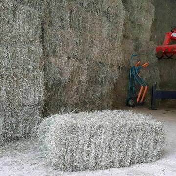
HD Ballen Heu
Gundelfingen
Niklas Schwehr
@Schwehr_HD-Ballen
Heu
Empfänger lädt ab
Kleinballen/HD-Ballen
Bio
Regenfrei
3 weitere...
B+
Deprecated: Creation of dynamic property Zend_View_Helper_Ads::$adLink is deprecated in /var/www/stall-frei/htdocs/staging.stall-frei.de/library/Psf/View/Helper/Ads.php on line 108

Futtersack HeuToy, Fressbremse in pink
Mechtersen
STALL-FREIde Marketing
@STALL-FREI-Marketing
Stundenlange Beschäftigung die
Koliken vorbeugt, geringe Staubinhalation mit
steuerbarer Futterentnahme
Heukleinballen (34 x 44 x 90 cm)
Marquartstein
Hacher Fahrnpoint
@Hacher-Berghof-Fahrnpoint
Heu
Kleinballen/HD-Ballen
Regenfrei
Wird verladen
1 weitere...
B+

Schwarzwald Heu+Stroh in Quaderballen & Rund...
Rickenbach
Matthias Griener
@Lohnunternehmen_Griener
Heu
Lieferant entlädt
Rundballen
Regenfrei
3 weitere...
aktuell
B+

Biete Heu und Stroh in Quaderballen und Rundballen
Rickenbach
Matthias Griener
@Lohnunternehmen_Griener
Heu
Lieferant entlädt
Großballen
Regenfrei
3 weitere...
aktuell
B+
Newsletter abonnieren
Melde Dich für unseren Newsletter an und verpasse keine Neuigkeiten!
Deprecated: Creation of dynamic property Zend_View::$pageCount is deprecated in /var/www/stall-frei/htdocs/staging.stall-frei.de/library/vendor/shardj/zf1-future/library/Zend/View/Abstract.php on line 308
Deprecated: Creation of dynamic property Zend_View::$itemCountPerPage is deprecated in /var/www/stall-frei/htdocs/staging.stall-frei.de/library/vendor/shardj/zf1-future/library/Zend/View/Abstract.php on line 308
Deprecated: Creation of dynamic property Zend_View::$first is deprecated in /var/www/stall-frei/htdocs/staging.stall-frei.de/library/vendor/shardj/zf1-future/library/Zend/View/Abstract.php on line 308
Deprecated: Creation of dynamic property Zend_View::$current is deprecated in /var/www/stall-frei/htdocs/staging.stall-frei.de/library/vendor/shardj/zf1-future/library/Zend/View/Abstract.php on line 308
Deprecated: Creation of dynamic property Zend_View::$last is deprecated in /var/www/stall-frei/htdocs/staging.stall-frei.de/library/vendor/shardj/zf1-future/library/Zend/View/Abstract.php on line 308
Deprecated: Creation of dynamic property Zend_View::$previous is deprecated in /var/www/stall-frei/htdocs/staging.stall-frei.de/library/vendor/shardj/zf1-future/library/Zend/View/Abstract.php on line 308
Deprecated: Creation of dynamic property Zend_View::$pagesInRange is deprecated in /var/www/stall-frei/htdocs/staging.stall-frei.de/library/vendor/shardj/zf1-future/library/Zend/View/Abstract.php on line 308
Deprecated: Creation of dynamic property Zend_View::$firstPageInRange is deprecated in /var/www/stall-frei/htdocs/staging.stall-frei.de/library/vendor/shardj/zf1-future/library/Zend/View/Abstract.php on line 308
Deprecated: Creation of dynamic property Zend_View::$lastPageInRange is deprecated in /var/www/stall-frei/htdocs/staging.stall-frei.de/library/vendor/shardj/zf1-future/library/Zend/View/Abstract.php on line 308
Deprecated: Creation of dynamic property Zend_View::$currentItemCount is deprecated in /var/www/stall-frei/htdocs/staging.stall-frei.de/library/vendor/shardj/zf1-future/library/Zend/View/Abstract.php on line 308
Deprecated: Creation of dynamic property Zend_View::$totalItemCount is deprecated in /var/www/stall-frei/htdocs/staging.stall-frei.de/library/vendor/shardj/zf1-future/library/Zend/View/Abstract.php on line 308
Deprecated: Creation of dynamic property Zend_View::$firstItemNumber is deprecated in /var/www/stall-frei/htdocs/staging.stall-frei.de/library/vendor/shardj/zf1-future/library/Zend/View/Abstract.php on line 308
Deprecated: Creation of dynamic property Zend_View::$lastItemNumber is deprecated in /var/www/stall-frei/htdocs/staging.stall-frei.de/library/vendor/shardj/zf1-future/library/Zend/View/Abstract.php on line 308
Deprecated: Creation of dynamic property Zend_View::$router is deprecated in /var/www/stall-frei/htdocs/staging.stall-frei.de/library/vendor/shardj/zf1-future/library/Zend/View/Abstract.php on line 308
Deprecated: Creation of dynamic property Zend_View::$urlParams is deprecated in /var/www/stall-frei/htdocs/staging.stall-frei.de/library/vendor/shardj/zf1-future/library/Zend/View/Abstract.php on line 308
Deprecated: Creation of dynamic property Zend_View::$showAds is deprecated in /var/www/stall-frei/htdocs/staging.stall-frei.de/library/vendor/shardj/zf1-future/library/Zend/View/Abstract.php on line 308
Deprecated: Creation of dynamic property Zend_View::$objectIds is deprecated in /var/www/stall-frei/htdocs/staging.stall-frei.de/library/vendor/shardj/zf1-future/library/Zend/View/Abstract.php on line 308
Deprecated: Creation of dynamic property Zend_View::$showNavbar is deprecated in /var/www/stall-frei/htdocs/staging.stall-frei.de/library/vendor/shardj/zf1-future/library/Zend/View/Abstract.php on line 308
Deprecated: Creation of dynamic property Zend_View::$showBreadcrumb is deprecated in /var/www/stall-frei/htdocs/staging.stall-frei.de/library/vendor/shardj/zf1-future/library/Zend/View/Abstract.php on line 308
Deprecated: Creation of dynamic property Zend_View::$showFooter is deprecated in /var/www/stall-frei/htdocs/staging.stall-frei.de/library/vendor/shardj/zf1-future/library/Zend/View/Abstract.php on line 308
Deprecated: Creation of dynamic property Zend_View::$showInternalAds is deprecated in /var/www/stall-frei/htdocs/staging.stall-frei.de/library/vendor/shardj/zf1-future/library/Zend/View/Abstract.php on line 308
Deprecated: Creation of dynamic property Zend_View::$blNoContent is deprecated in /var/www/stall-frei/htdocs/staging.stall-frei.de/library/vendor/shardj/zf1-future/library/Zend/View/Abstract.php on line 308
Deprecated: Creation of dynamic property Zend_View::$sMetaDesc is deprecated in /var/www/stall-frei/htdocs/staging.stall-frei.de/library/vendor/shardj/zf1-future/library/Zend/View/Abstract.php on line 308
Deprecated: Creation of dynamic property Zend_View::$useGmaps is deprecated in /var/www/stall-frei/htdocs/staging.stall-frei.de/library/vendor/shardj/zf1-future/library/Zend/View/Abstract.php on line 308
Deprecated: Creation of dynamic property Zend_View::$touches is deprecated in /var/www/stall-frei/htdocs/staging.stall-frei.de/library/vendor/shardj/zf1-future/library/Zend/View/Abstract.php on line 308
Deprecated: Creation of dynamic property Zend_View::$oProject is deprecated in /var/www/stall-frei/htdocs/staging.stall-frei.de/library/vendor/shardj/zf1-future/library/Zend/View/Abstract.php on line 308
Deprecated: Creation of dynamic property Zend_View::$pageHeadline is deprecated in /var/www/stall-frei/htdocs/staging.stall-frei.de/library/vendor/shardj/zf1-future/library/Zend/View/Abstract.php on line 308
Deprecated: Creation of dynamic property Zend_View::$disableLocationField is deprecated in /var/www/stall-frei/htdocs/staging.stall-frei.de/library/vendor/shardj/zf1-future/library/Zend/View/Abstract.php on line 308
Deprecated: Creation of dynamic property Zend_View::$isSearch is deprecated in /var/www/stall-frei/htdocs/staging.stall-frei.de/library/vendor/shardj/zf1-future/library/Zend/View/Abstract.php on line 308
Deprecated: Creation of dynamic property Zend_View::$pageTitle is deprecated in /var/www/stall-frei/htdocs/staging.stall-frei.de/library/vendor/shardj/zf1-future/library/Zend/View/Abstract.php on line 308
Deprecated: Creation of dynamic property Psf_Form_Element_Text::$class is deprecated in /var/www/stall-frei/htdocs/staging.stall-frei.de/library/vendor/shardj/zf1-future/library/Zend/Form/Element.php on line 874
Deprecated: Creation of dynamic property Psf_Form_Element_Text::$size is deprecated in /var/www/stall-frei/htdocs/staging.stall-frei.de/library/vendor/shardj/zf1-future/library/Zend/Form/Element.php on line 874
Deprecated: Creation of dynamic property Psf_Form_Element_Text::$placeholder is deprecated in /var/www/stall-frei/htdocs/staging.stall-frei.de/library/vendor/shardj/zf1-future/library/Zend/Form/Element.php on line 874
Deprecated: Creation of dynamic property Psf_Form_Element_Hidden::$class is deprecated in /var/www/stall-frei/htdocs/staging.stall-frei.de/library/vendor/shardj/zf1-future/library/Zend/Form/Element.php on line 874
Deprecated: Creation of dynamic property Psf_Form_Element_Hidden::$class is deprecated in /var/www/stall-frei/htdocs/staging.stall-frei.de/library/vendor/shardj/zf1-future/library/Zend/Form/Element.php on line 874
Deprecated: Creation of dynamic property Psf_Form_Element_Hidden::$class is deprecated in /var/www/stall-frei/htdocs/staging.stall-frei.de/library/vendor/shardj/zf1-future/library/Zend/Form/Element.php on line 874
Deprecated: Creation of dynamic property Psf_Form_Element_Hidden::$class is deprecated in /var/www/stall-frei/htdocs/staging.stall-frei.de/library/vendor/shardj/zf1-future/library/Zend/Form/Element.php on line 874
Deprecated: Creation of dynamic property Psf_Form_Element_Select::$class is deprecated in /var/www/stall-frei/htdocs/staging.stall-frei.de/library/vendor/shardj/zf1-future/library/Zend/Form/Element.php on line 874
Deprecated: Creation of dynamic property Psf_Form_Element_Select::$class is deprecated in /var/www/stall-frei/htdocs/staging.stall-frei.de/library/vendor/shardj/zf1-future/library/Zend/Form/Element.php on line 874
Deprecated: Creation of dynamic property Psf_Form_Element_Select::$class is deprecated in /var/www/stall-frei/htdocs/staging.stall-frei.de/library/vendor/shardj/zf1-future/library/Zend/Form/Element.php on line 874
Deprecated: Creation of dynamic property Psf_Form_Element_Select::$class is deprecated in /var/www/stall-frei/htdocs/staging.stall-frei.de/library/vendor/shardj/zf1-future/library/Zend/Form/Element.php on line 874
Deprecated: Creation of dynamic property Zend_View::$sort is deprecated in /var/www/stall-frei/htdocs/staging.stall-frei.de/library/vendor/shardj/zf1-future/library/Zend/View/Abstract.php on line 308
Deprecated: Creation of dynamic property Zend_View::$searchLocation is deprecated in /var/www/stall-frei/htdocs/staging.stall-frei.de/library/vendor/shardj/zf1-future/library/Zend/View/Abstract.php on line 308
Deprecated: Creation of dynamic property Zend_View::$locationHint is deprecated in /var/www/stall-frei/htdocs/staging.stall-frei.de/library/vendor/shardj/zf1-future/library/Zend/View/Abstract.php on line 308
Psf_GeoCoder_Abstract::getLocation: Elend Get Location CachedOrLive
Psf_GeoCoder_Abstract::getCachedOrLive: Elend
Psf_GeoCoder_Abstract::convertLocationResult
{"documentation":"https:\/\/opencagedata.com\/api","licenses":[{"name":"see attribution guide","url":"https:\/\/opencagedata.com\/credits"}],"results":[{"bounds":{"northeast":{"lat":51.7587265,"lng":10.7373953},"southwest":{"lat":51.7075893,"lng":10.6286541}},"components":{"ISO_3166-1_alpha-2":"DE","ISO_3166-1_alpha-3":"DEU","ISO_3166-2":["DE-ST"],"_category":"place","_normalized_city":"Elend","_type":"village","continent":"Europe","country":"Deutschland","country_code":"de","county":"Landkreis Harz","municipality":"Oberharz am Brocken","political_union":"European Union","state":"Sachsen-Anhalt","state_code":"ST","village":"Elend"},"confidence":7,"formatted":"Elend, Sachsen-Anhalt, Deutschland","geometry":{"lat":51.744067,"lng":10.6841117}},{"bounds":{"northeast":{"lat":50.9052284,"lng":13.7086033},"southwest":{"lat":50.8652284,"lng":13.6686033}},"components":{"ISO_3166-1_alpha-2":"DE","ISO_3166-1_alpha-3":"DEU","ISO_3166-2":["DE-SN"],"_category":"place","_normalized_city":"Dippoldiswalde","_type":"village","continent":"Europe","country":"Deutschland","country_code":"de","county":"S\u00e4chsische Schweiz-Osterzgebirge","political_union":"European Union","postcode":"01744","state":"Sachsen","state_code":"SN","town":"Dippoldiswalde","village":"Elend"},"confidence":7,"formatted":"01744 Elend, Deutschland","geometry":{"lat":50.8852284,"lng":13.6886033}},{"bounds":{"northeast":{"lat":48.0269186,"lng":12.22099},"southwest":{"lat":47.9869186,"lng":12.18099}},"components":{"ISO_3166-1_alpha-2":"DE","ISO_3166-1_alpha-3":"DEU","ISO_3166-2":["DE-BY"],"_category":"place","_normalized_city":"Griesst\u00e4tt","_type":"hamlet","continent":"Europe","country":"Deutschland","country_code":"de","county":"Landkreis Rosenheim","hamlet":"Elend","political_union":"European Union","postcode":"83556","state":"Bayern","state_code":"BY","village":"Griesst\u00e4tt"},"confidence":7,"formatted":"Elend, 83556 Griesst\u00e4tt, Deutschland","geometry":{"lat":48.0069186,"lng":12.20099}},{"bounds":{"northeast":{"lat":48.0424214,"lng":12.1942642},"southwest":{"lat":48.0024214,"lng":12.1542642}},"components":{"ISO_3166-1_alpha-2":"DE","ISO_3166-1_alpha-3":"DEU","ISO_3166-2":["DE-BY"],"_category":"place","_normalized_city":"Wasserburg am Inn","_type":"hamlet","continent":"Europe","country":"Deutschland","country_code":"de","county":"Landkreis Rosenheim","hamlet":"Elend","political_union":"European Union","postcode":"83561","state":"Bayern","state_code":"BY","town":"Wasserburg am Inn"},"confidence":7,"formatted":"Elend, 83561 Wasserburg am Inn, Deutschland","geometry":{"lat":48.0224214,"lng":12.1742642}},{"bounds":{"northeast":{"lat":52.0884405,"lng":8.9331429},"southwest":{"lat":52.0883405,"lng":8.9330429}},"components":{"ISO_3166-1_alpha-2":"DE","ISO_3166-1_alpha-3":"DEU","ISO_3166-2":["DE-NW"],"_category":"building","_normalized_city":"Bavenhausen","_type":"building","continent":"Europe","country":"Deutschland","country_code":"de","county":"Kreis Lippe","isolated_dwelling":"Elend","municipality":"Kalletal","political_union":"European Union","postcode":"32689","state":"Nordrhein-Westfalen","state_code":"NW","town":"Bavenhausen"},"confidence":10,"formatted":"Elend, 32689 Bavenhausen, Deutschland","geometry":{"lat":52.0883905,"lng":8.9330929}},{"bounds":{"northeast":{"lat":48.9409808,"lng":12.8025944},"southwest":{"lat":48.9408808,"lng":12.8024944}},"components":{"ISO_3166-1_alpha-2":"DE","ISO_3166-1_alpha-3":"DEU","ISO_3166-2":["DE-BY"],"_category":"building","_normalized_city":"Perasdorf","_type":"building","continent":"Europe","country":"Deutschland","country_code":"de","county":"Landkreis Straubing-Bogen","hamlet":"Unterperasdorf","isolated_dwelling":"Elend","municipality":"Schwarzach (VGem)","political_union":"European Union","postcode":"94366","state":"Bayern","state_code":"BY","village":"Perasdorf"},"confidence":10,"formatted":"Elend, Unterperasdorf, 94366 Perasdorf, Deutschland","geometry":{"lat":48.9409308,"lng":12.8025444}},{"bounds":{"northeast":{"lat":47.741797,"lng":11.7505081},"southwest":{"lat":47.741697,"lng":11.7504081}},"components":{"ISO_3166-1_alpha-2":"DE","ISO_3166-1_alpha-3":"DEU","ISO_3166-2":["DE-BY"],"_category":"building","_normalized_city":"Gmund","_type":"building","continent":"Europe","country":"Deutschland","country_code":"de","county":"Landkreis Miesbach","isolated_dwelling":"Elend","political_union":"European Union","postcode":"83703","state":"Bayern","state_code":"BY","village":"Gmund"},"confidence":10,"formatted":"Elend, 83703 Gmund, Deutschland","geometry":{"lat":47.741747,"lng":11.7504581}},{"bounds":{"northeast":{"lat":49.0719066,"lng":12.5981375},"southwest":{"lat":49.0519066,"lng":12.5781375}},"components":{"ISO_3166-1_alpha-2":"DE","ISO_3166-1_alpha-3":"DEU","ISO_3166-2":["DE-BY"],"_category":"agriculture","_normalized_city":"Wiesenfelden","_type":"farm","city":"Wiesenfelden","continent":"Europe","country":"Deutschland","country_code":"de","county":"Landkreis Straubing-Bogen","farm":"Elend","political_union":"European Union","postcode":"94344","state":"Bayern","state_code":"BY"},"confidence":8,"formatted":"Elend, 94344 Wiesenfelden, Deutschland","geometry":{"lat":49.0619066,"lng":12.5881375}},{"bounds":{"northeast":{"lat":48.6033497,"lng":9.0901939},"southwest":{"lat":48.601195,"lng":9.087574}},"components":{"ISO_3166-1_alpha-2":"DE","ISO_3166-1_alpha-3":"DEU","ISO_3166-2":["DE-BW"],"_category":"natural\/water","_normalized_city":"Dettenhausen","_type":"meadow","city":"Dettenhausen","continent":"Europe","country":"Deutschland","country_code":"de","county":"Landkreis T\u00fcbingen","meadow":"Elend","political_union":"European Union","postcode":"72135","state":"Baden-W\u00fcrttemberg","state_code":"BW"},"confidence":9,"formatted":"Elend, 72135 Dettenhausen, Deutschland","geometry":{"lat":48.6022574,"lng":9.0890062}},{"bounds":{"northeast":{"lat":48.8584526,"lng":11.9230775},"southwest":{"lat":48.8384526,"lng":11.9030775}},"components":{"ISO_3166-1_alpha-2":"DE","ISO_3166-1_alpha-3":"DEU","ISO_3166-2":["DE-BY"],"_category":"place","_normalized_city":"Saal a.d.Donau","_type":"hamlet","city":"Saal a.d.Donau","continent":"Europe","country":"Deutschland","country_code":"de","county":"Landkreis Kelheim","locality":"Elend","municipality":"Saal an der Donau (VGem)","political_union":"European Union","postcode":"93342","state":"Bayern","state_code":"BY"},"confidence":8,"formatted":"Elend, 93342 Saal a.d.Donau, Deutschland","geometry":{"lat":48.8484526,"lng":11.9130775}}],"status":{"code":200,"message":"OK"},"stay_informed":{"blog":"https:\/\/blog.opencagedata.com","mastodon":"https:\/\/en.osm.town\/@opencage"},"thanks":"For using an OpenCage API","timestamp":{"created_http":"Fri, 06 Feb 2026 07:09:36 GMT","created_unix":1770361776},"total_results":10}Array
(
[0] => stdClass Object
(
[bounds] => stdClass Object
(
[northeast] => stdClass Object
(
[lat] => 51.7587265
[lng] => 10.7373953
)
[southwest] => stdClass Object
(
[lat] => 51.7075893
[lng] => 10.6286541
)
)
[components] => stdClass Object
(
[ISO_3166-1_alpha-2] => DE
[ISO_3166-1_alpha-3] => DEU
[ISO_3166-2] => Array
(
[0] => DE-ST
)
[_category] => place
[_normalized_city] => Elend
[_type] => village
[continent] => Europe
[country] => Deutschland
[country_code] => de
[county] => Landkreis Harz
[municipality] => Oberharz am Brocken
[political_union] => European Union
[state] => Sachsen-Anhalt
[state_code] => ST
[village] => Elend
)
[confidence] => 7
[formatted] => Elend, Sachsen-Anhalt, Deutschland
[geometry] => stdClass Object
(
[lat] => 51.744067
[lng] => 10.6841117
)
)
[1] => stdClass Object
(
[bounds] => stdClass Object
(
[northeast] => stdClass Object
(
[lat] => 50.9052284
[lng] => 13.7086033
)
[southwest] => stdClass Object
(
[lat] => 50.8652284
[lng] => 13.6686033
)
)
[components] => stdClass Object
(
[ISO_3166-1_alpha-2] => DE
[ISO_3166-1_alpha-3] => DEU
[ISO_3166-2] => Array
(
[0] => DE-SN
)
[_category] => place
[_normalized_city] => Dippoldiswalde
[_type] => village
[continent] => Europe
[country] => Deutschland
[country_code] => de
[county] => Sächsische Schweiz-Osterzgebirge
[political_union] => European Union
[postcode] => 01744
[state] => Sachsen
[state_code] => SN
[town] => Dippoldiswalde
[village] => Elend
)
[confidence] => 7
[formatted] => 01744 Elend, Deutschland
[geometry] => stdClass Object
(
[lat] => 50.8852284
[lng] => 13.6886033
)
)
[2] => stdClass Object
(
[bounds] => stdClass Object
(
[northeast] => stdClass Object
(
[lat] => 48.0269186
[lng] => 12.22099
)
[southwest] => stdClass Object
(
[lat] => 47.9869186
[lng] => 12.18099
)
)
[components] => stdClass Object
(
[ISO_3166-1_alpha-2] => DE
[ISO_3166-1_alpha-3] => DEU
[ISO_3166-2] => Array
(
[0] => DE-BY
)
[_category] => place
[_normalized_city] => Griesstätt
[_type] => hamlet
[continent] => Europe
[country] => Deutschland
[country_code] => de
[county] => Landkreis Rosenheim
[hamlet] => Elend
[political_union] => European Union
[postcode] => 83556
[state] => Bayern
[state_code] => BY
[village] => Griesstätt
)
[confidence] => 7
[formatted] => Elend, 83556 Griesstätt, Deutschland
[geometry] => stdClass Object
(
[lat] => 48.0069186
[lng] => 12.20099
)
)
[3] => stdClass Object
(
[bounds] => stdClass Object
(
[northeast] => stdClass Object
(
[lat] => 48.0424214
[lng] => 12.1942642
)
[southwest] => stdClass Object
(
[lat] => 48.0024214
[lng] => 12.1542642
)
)
[components] => stdClass Object
(
[ISO_3166-1_alpha-2] => DE
[ISO_3166-1_alpha-3] => DEU
[ISO_3166-2] => Array
(
[0] => DE-BY
)
[_category] => place
[_normalized_city] => Wasserburg am Inn
[_type] => hamlet
[continent] => Europe
[country] => Deutschland
[country_code] => de
[county] => Landkreis Rosenheim
[hamlet] => Elend
[political_union] => European Union
[postcode] => 83561
[state] => Bayern
[state_code] => BY
[town] => Wasserburg am Inn
)
[confidence] => 7
[formatted] => Elend, 83561 Wasserburg am Inn, Deutschland
[geometry] => stdClass Object
(
[lat] => 48.0224214
[lng] => 12.1742642
)
)
[4] => stdClass Object
(
[bounds] => stdClass Object
(
[northeast] => stdClass Object
(
[lat] => 52.0884405
[lng] => 8.9331429
)
[southwest] => stdClass Object
(
[lat] => 52.0883405
[lng] => 8.9330429
)
)
[components] => stdClass Object
(
[ISO_3166-1_alpha-2] => DE
[ISO_3166-1_alpha-3] => DEU
[ISO_3166-2] => Array
(
[0] => DE-NW
)
[_category] => building
[_normalized_city] => Bavenhausen
[_type] => building
[continent] => Europe
[country] => Deutschland
[country_code] => de
[county] => Kreis Lippe
[isolated_dwelling] => Elend
[municipality] => Kalletal
[political_union] => European Union
[postcode] => 32689
[state] => Nordrhein-Westfalen
[state_code] => NW
[town] => Bavenhausen
)
[confidence] => 10
[formatted] => Elend, 32689 Bavenhausen, Deutschland
[geometry] => stdClass Object
(
[lat] => 52.0883905
[lng] => 8.9330929
)
)
[5] => stdClass Object
(
[bounds] => stdClass Object
(
[northeast] => stdClass Object
(
[lat] => 48.9409808
[lng] => 12.8025944
)
[southwest] => stdClass Object
(
[lat] => 48.9408808
[lng] => 12.8024944
)
)
[components] => stdClass Object
(
[ISO_3166-1_alpha-2] => DE
[ISO_3166-1_alpha-3] => DEU
[ISO_3166-2] => Array
(
[0] => DE-BY
)
[_category] => building
[_normalized_city] => Perasdorf
[_type] => building
[continent] => Europe
[country] => Deutschland
[country_code] => de
[county] => Landkreis Straubing-Bogen
[hamlet] => Unterperasdorf
[isolated_dwelling] => Elend
[municipality] => Schwarzach (VGem)
[political_union] => European Union
[postcode] => 94366
[state] => Bayern
[state_code] => BY
[village] => Perasdorf
)
[confidence] => 10
[formatted] => Elend, Unterperasdorf, 94366 Perasdorf, Deutschland
[geometry] => stdClass Object
(
[lat] => 48.9409308
[lng] => 12.8025444
)
)
[6] => stdClass Object
(
[bounds] => stdClass Object
(
[northeast] => stdClass Object
(
[lat] => 47.741797
[lng] => 11.7505081
)
[southwest] => stdClass Object
(
[lat] => 47.741697
[lng] => 11.7504081
)
)
[components] => stdClass Object
(
[ISO_3166-1_alpha-2] => DE
[ISO_3166-1_alpha-3] => DEU
[ISO_3166-2] => Array
(
[0] => DE-BY
)
[_category] => building
[_normalized_city] => Gmund
[_type] => building
[continent] => Europe
[country] => Deutschland
[country_code] => de
[county] => Landkreis Miesbach
[isolated_dwelling] => Elend
[political_union] => European Union
[postcode] => 83703
[state] => Bayern
[state_code] => BY
[village] => Gmund
)
[confidence] => 10
[formatted] => Elend, 83703 Gmund, Deutschland
[geometry] => stdClass Object
(
[lat] => 47.741747
[lng] => 11.7504581
)
)
[7] => stdClass Object
(
[bounds] => stdClass Object
(
[northeast] => stdClass Object
(
[lat] => 49.0719066
[lng] => 12.5981375
)
[southwest] => stdClass Object
(
[lat] => 49.0519066
[lng] => 12.5781375
)
)
[components] => stdClass Object
(
[ISO_3166-1_alpha-2] => DE
[ISO_3166-1_alpha-3] => DEU
[ISO_3166-2] => Array
(
[0] => DE-BY
)
[_category] => agriculture
[_normalized_city] => Wiesenfelden
[_type] => farm
[city] => Wiesenfelden
[continent] => Europe
[country] => Deutschland
[country_code] => de
[county] => Landkreis Straubing-Bogen
[farm] => Elend
[political_union] => European Union
[postcode] => 94344
[state] => Bayern
[state_code] => BY
)
[confidence] => 8
[formatted] => Elend, 94344 Wiesenfelden, Deutschland
[geometry] => stdClass Object
(
[lat] => 49.0619066
[lng] => 12.5881375
)
)
[8] => stdClass Object
(
[bounds] => stdClass Object
(
[northeast] => stdClass Object
(
[lat] => 48.6033497
[lng] => 9.0901939
)
[southwest] => stdClass Object
(
[lat] => 48.601195
[lng] => 9.087574
)
)
[components] => stdClass Object
(
[ISO_3166-1_alpha-2] => DE
[ISO_3166-1_alpha-3] => DEU
[ISO_3166-2] => Array
(
[0] => DE-BW
)
[_category] => natural/water
[_normalized_city] => Dettenhausen
[_type] => meadow
[city] => Dettenhausen
[continent] => Europe
[country] => Deutschland
[country_code] => de
[county] => Landkreis Tübingen
[meadow] => Elend
[political_union] => European Union
[postcode] => 72135
[state] => Baden-Württemberg
[state_code] => BW
)
[confidence] => 9
[formatted] => Elend, 72135 Dettenhausen, Deutschland
[geometry] => stdClass Object
(
[lat] => 48.6022574
[lng] => 9.0890062
)
)
[9] => stdClass Object
(
[bounds] => stdClass Object
(
[northeast] => stdClass Object
(
[lat] => 48.8584526
[lng] => 11.9230775
)
[southwest] => stdClass Object
(
[lat] => 48.8384526
[lng] => 11.9030775
)
)
[components] => stdClass Object
(
[ISO_3166-1_alpha-2] => DE
[ISO_3166-1_alpha-3] => DEU
[ISO_3166-2] => Array
(
[0] => DE-BY
)
[_category] => place
[_normalized_city] => Saal a.d.Donau
[_type] => hamlet
[city] => Saal a.d.Donau
[continent] => Europe
[country] => Deutschland
[country_code] => de
[county] => Landkreis Kelheim
[locality] => Elend
[municipality] => Saal an der Donau (VGem)
[political_union] => European Union
[postcode] => 93342
[state] => Bayern
[state_code] => BY
)
[confidence] => 8
[formatted] => Elend, 93342 Saal a.d.Donau, Deutschland
[geometry] => stdClass Object
(
[lat] => 48.8484526
[lng] => 11.9130775
)
)
)
Psf_GeoCoder_OpenCageData::getKeyMap: 0
stdClass Object
(
    [bounds] => stdClass Object
        (
            [northeast] => stdClass Object
                (
                    [lat] => 51.7587265
                    [lng] => 10.7373953
                )

            [southwest] => stdClass Object
                (
                    [lat] => 51.7075893
                    [lng] => 10.6286541
                )

        )

    [components] => stdClass Object
        (
            [ISO_3166-1_alpha-2] => DE
            [ISO_3166-1_alpha-3] => DEU
            [ISO_3166-2] => Array
                (
                    [0] => DE-ST
                )

            [_category] => place
            [_normalized_city] => Elend
            [_type] => village
            [continent] => Europe
            [country] => Deutschland
            [country_code] => de
            [county] => Landkreis Harz
            [municipality] => Oberharz am Brocken
            [political_union] => European Union
            [state] => Sachsen-Anhalt
            [state_code] => ST
            [village] => Elend
        )

    [confidence] => 7
    [formatted] => Elend, Sachsen-Anhalt, Deutschland
    [geometry] => stdClass Object
        (
            [lat] => 51.744067
            [lng] => 10.6841117
        )

)
Psf_GeoCoder_OpenCageData::getCounty: Harz
Psf_GeoCoder_OpenCageData::addMissingData REFETCH!
Array
(
    [address] => Elend, Sachsen-Anhalt, Deutschland
    [type] => village
    [street] =>
    [city] => Elend
    [county] => Harz
    [state] => Sachsen-Anhalt
    [zip] =>
    [country] => Deutschland
    [suburb] =>
    [countrycode] => de
    [latitude] => 51.744067
    [longitude] => 10.6841117
    [accuracy] => 1
    [confidence] => 7
    [bounds] => stdClass Object
        (
            [northeast] => stdClass Object
                (
                    [lat] => 51.7587265
                    [lng] => 10.7373953
                )

            [southwest] => stdClass Object
                (
                    [lat] => 51.7075893
                    [lng] => 10.6286541
                )

        )

)
reformat!
Array
(
    [address] => Elend, Sachsen-Anhalt, Deutschland
    [type] => village
    [street] =>
    [city] => Elend
    [county] => Harz
    [state] => Sachsen-Anhalt
    [zip] =>
    [country] => Deutschland
    [suburb] =>
    [countrycode] => de
    [latitude] => 51.744067
    [longitude] => 10.6841117
    [accuracy] => 1
    [confidence] => 7
    [bounds] => stdClass Object
        (
            [northeast] => stdClass Object
                (
                    [lat] => 51.7587265
                    [lng] => 10.7373953
                )

            [southwest] => stdClass Object
                (
                    [lat] => 51.7075893
                    [lng] => 10.6286541
                )

        )

    [place] => Elend, Sachsen-Anhalt
    [hash] => c076a6ce48b54b2a96e820735c933a13
)
Psf_GeoCoder_OpenCageData::getKeyMap: 1
stdClass Object
(
    [bounds] => stdClass Object
        (
            [northeast] => stdClass Object
                (
                    [lat] => 50.9052284
                    [lng] => 13.7086033
                )

            [southwest] => stdClass Object
                (
                    [lat] => 50.8652284
                    [lng] => 13.6686033
                )

        )

    [components] => stdClass Object
        (
            [ISO_3166-1_alpha-2] => DE
            [ISO_3166-1_alpha-3] => DEU
            [ISO_3166-2] => Array
                (
                    [0] => DE-SN
                )

            [_category] => place
            [_normalized_city] => Dippoldiswalde
            [_type] => village
            [continent] => Europe
            [country] => Deutschland
            [country_code] => de
            [county] => Sächsische Schweiz-Osterzgebirge
            [political_union] => European Union
            [postcode] => 01744
            [state] => Sachsen
            [state_code] => SN
            [town] => Dippoldiswalde
            [village] => Elend
        )

    [confidence] => 7
    [formatted] => 01744 Elend, Deutschland
    [geometry] => stdClass Object
        (
            [lat] => 50.8852284
            [lng] => 13.6886033
        )

)
Psf_GeoCoder_OpenCageData::getCounty: Sächsische Schweiz-Osterzgebirge
Psf_GeoCoder_OpenCageData::addMissingData REFETCH!
Array
(
    [address] => 01744 Elend, Deutschland
    [type] => village
    [street] =>
    [city] => Dippoldiswalde
    [county] => Sächsische Schweiz-Osterzgebirge
    [state] => Sachsen
    [zip] => 01744
    [country] => Deutschland
    [suburb] =>
    [countrycode] => de
    [latitude] => 50.8852284
    [longitude] => 13.6886033
    [accuracy] => 1
    [confidence] => 7
    [bounds] => stdClass Object
        (
            [northeast] => stdClass Object
                (
                    [lat] => 50.9052284
                    [lng] => 13.7086033
                )

            [southwest] => stdClass Object
                (
                    [lat] => 50.8652284
                    [lng] => 13.6686033
                )

        )

)
reformat!
Array
(
    [address] => 01744 Dippoldiswalde
    [type] => village
    [street] =>
    [city] => Dippoldiswalde
    [county] => Sächsische Schweiz-Osterzgebirge
    [state] => Sachsen
    [zip] => 01744
    [country] => Deutschland
    [suburb] =>
    [countrycode] => de
    [latitude] => 50.8852284
    [longitude] => 13.6886033
    [accuracy] => 1
    [confidence] => 7
    [bounds] => stdClass Object
        (
            [northeast] => stdClass Object
                (
                    [lat] => 50.9052284
                    [lng] => 13.7086033
                )

            [southwest] => stdClass Object
                (
                    [lat] => 50.8652284
                    [lng] => 13.6686033
                )

        )

    [place] => 01744 Dippoldiswalde, Sachsen
    [hash] => 469fc0df212219d00a62c39599cedaf5
)
Psf_GeoCoder_OpenCageData::getKeyMap: 2
stdClass Object
(
    [bounds] => stdClass Object
        (
            [northeast] => stdClass Object
                (
                    [lat] => 48.0269186
                    [lng] => 12.22099
                )

            [southwest] => stdClass Object
                (
                    [lat] => 47.9869186
                    [lng] => 12.18099
                )

        )

    [components] => stdClass Object
        (
            [ISO_3166-1_alpha-2] => DE
            [ISO_3166-1_alpha-3] => DEU
            [ISO_3166-2] => Array
                (
                    [0] => DE-BY
                )

            [_category] => place
            [_normalized_city] => Griesstätt
            [_type] => hamlet
            [continent] => Europe
            [country] => Deutschland
            [country_code] => de
            [county] => Landkreis Rosenheim
            [hamlet] => Elend
            [political_union] => European Union
            [postcode] => 83556
            [state] => Bayern
            [state_code] => BY
            [village] => Griesstätt
        )

    [confidence] => 7
    [formatted] => Elend, 83556 Griesstätt, Deutschland
    [geometry] => stdClass Object
        (
            [lat] => 48.0069186
            [lng] => 12.20099
        )

)
Psf_GeoCoder_OpenCageData::getCounty: Rosenheim
Psf_GeoCoder_OpenCageData::addMissingData REFETCH!
Array
(
    [address] => Elend, 83556 Griesstätt, Deutschland
    [type] => hamlet
    [street] => Elend
    [city] => Griesstätt
    [county] => Rosenheim
    [state] => Bayern
    [zip] => 83556
    [country] => Deutschland
    [suburb] =>
    [countrycode] => de
    [latitude] => 48.0069186
    [longitude] => 12.20099
    [accuracy] => 1
    [confidence] => 7
    [bounds] => stdClass Object
        (
            [northeast] => stdClass Object
                (
                    [lat] => 48.0269186
                    [lng] => 12.22099
                )

            [southwest] => stdClass Object
                (
                    [lat] => 47.9869186
                    [lng] => 12.18099
                )

        )

)
reformat!
Array
(
    [address] => Elend, 83556 Griesstätt, Deutschland
    [type] => hamlet
    [street] => Elend
    [city] => Griesstätt
    [county] => Rosenheim
    [state] => Bayern
    [zip] => 83556
    [country] => Deutschland
    [suburb] =>
    [countrycode] => de
    [latitude] => 48.0069186
    [longitude] => 12.20099
    [accuracy] => 1
    [confidence] => 7
    [bounds] => stdClass Object
        (
            [northeast] => stdClass Object
                (
                    [lat] => 48.0269186
                    [lng] => 12.22099
                )

            [southwest] => stdClass Object
                (
                    [lat] => 47.9869186
                    [lng] => 12.18099
                )

        )

    [place] => Elend, 83556 Griesstätt, Bayern
    [hash] => 22d4d453aafb1f072bf038ccdc47d709
)
Psf_GeoCoder_OpenCageData::getKeyMap: 3
stdClass Object
(
    [bounds] => stdClass Object
        (
            [northeast] => stdClass Object
                (
                    [lat] => 48.0424214
                    [lng] => 12.1942642
                )

            [southwest] => stdClass Object
                (
                    [lat] => 48.0024214
                    [lng] => 12.1542642
                )

        )

    [components] => stdClass Object
        (
            [ISO_3166-1_alpha-2] => DE
            [ISO_3166-1_alpha-3] => DEU
            [ISO_3166-2] => Array
                (
                    [0] => DE-BY
                )

            [_category] => place
            [_normalized_city] => Wasserburg am Inn
            [_type] => hamlet
            [continent] => Europe
            [country] => Deutschland
            [country_code] => de
            [county] => Landkreis Rosenheim
            [hamlet] => Elend
            [political_union] => European Union
            [postcode] => 83561
            [state] => Bayern
            [state_code] => BY
            [town] => Wasserburg am Inn
        )

    [confidence] => 7
    [formatted] => Elend, 83561 Wasserburg am Inn, Deutschland
    [geometry] => stdClass Object
        (
            [lat] => 48.0224214
            [lng] => 12.1742642
        )

)
Psf_GeoCoder_OpenCageData::getCounty: Rosenheim
Psf_GeoCoder_OpenCageData::addMissingData REFETCH!
Array
(
    [address] => Elend, 83561 Wasserburg am Inn, Deutschland
    [type] => hamlet
    [street] => Elend
    [city] => Wasserburg am Inn
    [county] => Rosenheim
    [state] => Bayern
    [zip] => 83561
    [country] => Deutschland
    [suburb] =>
    [countrycode] => de
    [latitude] => 48.0224214
    [longitude] => 12.1742642
    [accuracy] => 1
    [confidence] => 7
    [bounds] => stdClass Object
        (
            [northeast] => stdClass Object
                (
                    [lat] => 48.0424214
                    [lng] => 12.1942642
                )

            [southwest] => stdClass Object
                (
                    [lat] => 48.0024214
                    [lng] => 12.1542642
                )

        )

)
reformat!
Array
(
    [address] => Elend, 83561 Wasserburg am Inn, Deutschland
    [type] => hamlet
    [street] => Elend
    [city] => Wasserburg am Inn
    [county] => Rosenheim
    [state] => Bayern
    [zip] => 83561
    [country] => Deutschland
    [suburb] =>
    [countrycode] => de
    [latitude] => 48.0224214
    [longitude] => 12.1742642
    [accuracy] => 1
    [confidence] => 7
    [bounds] => stdClass Object
        (
            [northeast] => stdClass Object
                (
                    [lat] => 48.0424214
                    [lng] => 12.1942642
                )

            [southwest] => stdClass Object
                (
                    [lat] => 48.0024214
                    [lng] => 12.1542642
                )

        )

    [place] => Elend, 83561 Wasserburg am Inn, Bayern
    [hash] => a3715290794a8245001ed71a5710a519
)
Psf_GeoCoder_OpenCageData::getKeyMap: 4
stdClass Object
(
    [bounds] => stdClass Object
        (
            [northeast] => stdClass Object
                (
                    [lat] => 52.0884405
                    [lng] => 8.9331429
                )

            [southwest] => stdClass Object
                (
                    [lat] => 52.0883405
                    [lng] => 8.9330429
                )

        )

    [components] => stdClass Object
        (
            [ISO_3166-1_alpha-2] => DE
            [ISO_3166-1_alpha-3] => DEU
            [ISO_3166-2] => Array
                (
                    [0] => DE-NW
                )

            [_category] => building
            [_normalized_city] => Bavenhausen
            [_type] => building
            [continent] => Europe
            [country] => Deutschland
            [country_code] => de
            [county] => Kreis Lippe
            [isolated_dwelling] => Elend
            [municipality] => Kalletal
            [political_union] => European Union
            [postcode] => 32689
            [state] => Nordrhein-Westfalen
            [state_code] => NW
            [town] => Bavenhausen
        )

    [confidence] => 10
    [formatted] => Elend, 32689 Bavenhausen, Deutschland
    [geometry] => stdClass Object
        (
            [lat] => 52.0883905
            [lng] => 8.9330929
        )

)
Psf_GeoCoder_OpenCageData::getCounty: Lippe
Psf_GeoCoder_OpenCageData::addMissingData REFETCH!
Array
(
    [address] => Elend, 32689 Bavenhausen, Deutschland
    [type] => building
    [street] =>
    [city] => Bavenhausen
    [county] => Lippe
    [state] => Nordrhein-Westfalen
    [zip] => 32689
    [country] => Deutschland
    [suburb] =>
    [countrycode] => de
    [latitude] => 52.0883905
    [longitude] => 8.9330929
    [accuracy] => 1
    [confidence] => 10
    [bounds] => stdClass Object
        (
            [northeast] => stdClass Object
                (
                    [lat] => 52.0884405
                    [lng] => 8.9331429
                )

            [southwest] => stdClass Object
                (
                    [lat] => 52.0883405
                    [lng] => 8.9330429
                )

        )

)
reformat!
Array
(
    [address] => Elend, 32689 Bavenhausen, Deutschland
    [type] => building
    [street] =>
    [city] => Bavenhausen
    [county] => Lippe
    [state] => Nordrhein-Westfalen
    [zip] => 32689
    [country] => Deutschland
    [suburb] =>
    [countrycode] => de
    [latitude] => 52.0883905
    [longitude] => 8.9330929
    [accuracy] => 1
    [confidence] => 10
    [bounds] => stdClass Object
        (
            [northeast] => stdClass Object
                (
                    [lat] => 52.0884405
                    [lng] => 8.9331429
                )

            [southwest] => stdClass Object
                (
                    [lat] => 52.0883405
                    [lng] => 8.9330429
                )

        )

    [place] => 32689 Bavenhausen, Nordrhein-Westfalen
    [hash] => 18cbd6fefadaf21cb47d6011b5dc58b5
)
Psf_GeoCoder_OpenCageData::getKeyMap: 5
stdClass Object
(
    [bounds] => stdClass Object
        (
            [northeast] => stdClass Object
                (
                    [lat] => 48.9409808
                    [lng] => 12.8025944
                )

            [southwest] => stdClass Object
                (
                    [lat] => 48.9408808
                    [lng] => 12.8024944
                )

        )

    [components] => stdClass Object
        (
            [ISO_3166-1_alpha-2] => DE
            [ISO_3166-1_alpha-3] => DEU
            [ISO_3166-2] => Array
                (
                    [0] => DE-BY
                )

            [_category] => building
            [_normalized_city] => Perasdorf
            [_type] => building
            [continent] => Europe
            [country] => Deutschland
            [country_code] => de
            [county] => Landkreis Straubing-Bogen
            [hamlet] => Unterperasdorf
            [isolated_dwelling] => Elend
            [municipality] => Schwarzach (VGem)
            [political_union] => European Union
            [postcode] => 94366
            [state] => Bayern
            [state_code] => BY
            [village] => Perasdorf
        )

    [confidence] => 10
    [formatted] => Elend, Unterperasdorf, 94366 Perasdorf, Deutschland
    [geometry] => stdClass Object
        (
            [lat] => 48.9409308
            [lng] => 12.8025444
        )

)
Psf_GeoCoder_OpenCageData::getCounty: Straubing-Bogen
Psf_GeoCoder_OpenCageData::addMissingData REFETCH!
Array
(
    [address] => Elend, Unterperasdorf, 94366 Perasdorf, Deutschland
    [type] => building
    [street] => Unterperasdorf
    [city] => Perasdorf
    [county] => Straubing-Bogen
    [state] => Bayern
    [zip] => 94366
    [country] => Deutschland
    [suburb] =>
    [countrycode] => de
    [latitude] => 48.9409308
    [longitude] => 12.8025444
    [accuracy] => 1
    [confidence] => 10
    [bounds] => stdClass Object
        (
            [northeast] => stdClass Object
                (
                    [lat] => 48.9409808
                    [lng] => 12.8025944
                )

            [southwest] => stdClass Object
                (
                    [lat] => 48.9408808
                    [lng] => 12.8024944
                )

        )

)
reformat!
Array
(
    [address] => Elend, Unterperasdorf, 94366 Perasdorf, Deutschland
    [type] => building
    [street] => Unterperasdorf
    [city] => Perasdorf
    [county] => Straubing-Bogen
    [state] => Bayern
    [zip] => 94366
    [country] => Deutschland
    [suburb] =>
    [countrycode] => de
    [latitude] => 48.9409308
    [longitude] => 12.8025444
    [accuracy] => 1
    [confidence] => 10
    [bounds] => stdClass Object
        (
            [northeast] => stdClass Object
                (
                    [lat] => 48.9409808
                    [lng] => 12.8025944
                )

            [southwest] => stdClass Object
                (
                    [lat] => 48.9408808
                    [lng] => 12.8024944
                )

        )

    [place] => Unterperasdorf, 94366 Perasdorf, Bayern
    [hash] => 302f9db71e4bfde2512f568548d4fb5e
)
Psf_GeoCoder_OpenCageData::getKeyMap: 6
stdClass Object
(
    [bounds] => stdClass Object
        (
            [northeast] => stdClass Object
                (
                    [lat] => 47.741797
                    [lng] => 11.7505081
                )

            [southwest] => stdClass Object
                (
                    [lat] => 47.741697
                    [lng] => 11.7504081
                )

        )

    [components] => stdClass Object
        (
            [ISO_3166-1_alpha-2] => DE
            [ISO_3166-1_alpha-3] => DEU
            [ISO_3166-2] => Array
                (
                    [0] => DE-BY
                )

            [_category] => building
            [_normalized_city] => Gmund
            [_type] => building
            [continent] => Europe
            [country] => Deutschland
            [country_code] => de
            [county] => Landkreis Miesbach
            [isolated_dwelling] => Elend
            [political_union] => European Union
            [postcode] => 83703
            [state] => Bayern
            [state_code] => BY
            [village] => Gmund
        )

    [confidence] => 10
    [formatted] => Elend, 83703 Gmund, Deutschland
    [geometry] => stdClass Object
        (
            [lat] => 47.741747
            [lng] => 11.7504581
        )

)
Psf_GeoCoder_OpenCageData::getCounty: Miesbach
Psf_GeoCoder_OpenCageData::addMissingData REFETCH!
Array
(
    [address] => Elend, 83703 Gmund, Deutschland
    [type] => building
    [street] =>
    [city] => Gmund
    [county] => Miesbach
    [state] => Bayern
    [zip] => 83703
    [country] => Deutschland
    [suburb] =>
    [countrycode] => de
    [latitude] => 47.741747
    [longitude] => 11.7504581
    [accuracy] => 1
    [confidence] => 10
    [bounds] => stdClass Object
        (
            [northeast] => stdClass Object
                (
                    [lat] => 47.741797
                    [lng] => 11.7505081
                )

            [southwest] => stdClass Object
                (
                    [lat] => 47.741697
                    [lng] => 11.7504081
                )

        )

)
reformat!
Array
(
    [address] => Elend, 83703 Gmund, Deutschland
    [type] => building
    [street] =>
    [city] => Gmund
    [county] => Miesbach
    [state] => Bayern
    [zip] => 83703
    [country] => Deutschland
    [suburb] =>
    [countrycode] => de
    [latitude] => 47.741747
    [longitude] => 11.7504581
    [accuracy] => 1
    [confidence] => 10
    [bounds] => stdClass Object
        (
            [northeast] => stdClass Object
                (
                    [lat] => 47.741797
                    [lng] => 11.7505081
                )

            [southwest] => stdClass Object
                (
                    [lat] => 47.741697
                    [lng] => 11.7504081
                )

        )

    [place] => 83703 Gmund, Bayern
    [hash] => 3d81775f414dfcc7ca17107f6f53db6c
)
Psf_GeoCoder_OpenCageData::getKeyMap: 7
stdClass Object
(
    [bounds] => stdClass Object
        (
            [northeast] => stdClass Object
                (
                    [lat] => 49.0719066
                    [lng] => 12.5981375
                )

            [southwest] => stdClass Object
                (
                    [lat] => 49.0519066
                    [lng] => 12.5781375
                )

        )

    [components] => stdClass Object
        (
            [ISO_3166-1_alpha-2] => DE
            [ISO_3166-1_alpha-3] => DEU
            [ISO_3166-2] => Array
                (
                    [0] => DE-BY
                )

            [_category] => agriculture
            [_normalized_city] => Wiesenfelden
            [_type] => farm
            [city] => Wiesenfelden
            [continent] => Europe
            [country] => Deutschland
            [country_code] => de
            [county] => Landkreis Straubing-Bogen
            [farm] => Elend
            [political_union] => European Union
            [postcode] => 94344
            [state] => Bayern
            [state_code] => BY
        )

    [confidence] => 8
    [formatted] => Elend, 94344 Wiesenfelden, Deutschland
    [geometry] => stdClass Object
        (
            [lat] => 49.0619066
            [lng] => 12.5881375
        )

)
Psf_GeoCoder_OpenCageData::getCounty: Straubing-Bogen
Psf_GeoCoder_OpenCageData::addMissingData REFETCH!
Array
(
    [address] => Elend, 94344 Wiesenfelden, Deutschland
    [type] => farm
    [street] =>
    [city] => Wiesenfelden
    [county] => Straubing-Bogen
    [state] => Bayern
    [zip] => 94344
    [country] => Deutschland
    [suburb] =>
    [countrycode] => de
    [latitude] => 49.0619066
    [longitude] => 12.5881375
    [accuracy] => 1
    [confidence] => 8
    [bounds] => stdClass Object
        (
            [northeast] => stdClass Object
                (
                    [lat] => 49.0719066
                    [lng] => 12.5981375
                )

            [southwest] => stdClass Object
                (
                    [lat] => 49.0519066
                    [lng] => 12.5781375
                )

        )

)
reformat!
Array
(
    [address] => Elend, 94344 Wiesenfelden, Deutschland
    [type] => farm
    [street] =>
    [city] => Wiesenfelden
    [county] => Straubing-Bogen
    [state] => Bayern
    [zip] => 94344
    [country] => Deutschland
    [suburb] =>
    [countrycode] => de
    [latitude] => 49.0619066
    [longitude] => 12.5881375
    [accuracy] => 1
    [confidence] => 8
    [bounds] => stdClass Object
        (
            [northeast] => stdClass Object
                (
                    [lat] => 49.0719066
                    [lng] => 12.5981375
                )

            [southwest] => stdClass Object
                (
                    [lat] => 49.0519066
                    [lng] => 12.5781375
                )

        )

    [place] => 94344 Wiesenfelden, Bayern
    [hash] => 58db303cbac2254b0606782fa94c0997
)
Psf_GeoCoder_OpenCageData::getKeyMap: 8
stdClass Object
(
    [bounds] => stdClass Object
        (
            [northeast] => stdClass Object
                (
                    [lat] => 48.6033497
                    [lng] => 9.0901939
                )

            [southwest] => stdClass Object
                (
                    [lat] => 48.601195
                    [lng] => 9.087574
                )

        )

    [components] => stdClass Object
        (
            [ISO_3166-1_alpha-2] => DE
            [ISO_3166-1_alpha-3] => DEU
            [ISO_3166-2] => Array
                (
                    [0] => DE-BW
                )

            [_category] => natural/water
            [_normalized_city] => Dettenhausen
            [_type] => meadow
            [city] => Dettenhausen
            [continent] => Europe
            [country] => Deutschland
            [country_code] => de
            [county] => Landkreis Tübingen
            [meadow] => Elend
            [political_union] => European Union
            [postcode] => 72135
            [state] => Baden-Württemberg
            [state_code] => BW
        )

    [confidence] => 9
    [formatted] => Elend, 72135 Dettenhausen, Deutschland
    [geometry] => stdClass Object
        (
            [lat] => 48.6022574
            [lng] => 9.0890062
        )

)
Psf_GeoCoder_OpenCageData::getCounty: Tübingen
Psf_GeoCoder_OpenCageData::addMissingData REFETCH!
Array
(
    [address] => Elend, 72135 Dettenhausen, Deutschland
    [type] => meadow
    [street] =>
    [city] => Dettenhausen
    [county] => Tübingen
    [state] => Baden-Württemberg
    [zip] => 72135
    [country] => Deutschland
    [suburb] =>
    [countrycode] => de
    [latitude] => 48.6022574
    [longitude] => 9.0890062
    [accuracy] => 1
    [confidence] => 9
    [bounds] => stdClass Object
        (
            [northeast] => stdClass Object
                (
                    [lat] => 48.6033497
                    [lng] => 9.0901939
                )

            [southwest] => stdClass Object
                (
                    [lat] => 48.601195
                    [lng] => 9.087574
                )

        )

)
reformat!
Array
(
    [address] => Elend, 72135 Dettenhausen, Deutschland
    [type] => meadow
    [street] =>
    [city] => Dettenhausen
    [county] => Tübingen
    [state] => Baden-Württemberg
    [zip] => 72135
    [country] => Deutschland
    [suburb] =>
    [countrycode] => de
    [latitude] => 48.6022574
    [longitude] => 9.0890062
    [accuracy] => 1
    [confidence] => 9
    [bounds] => stdClass Object
        (
            [northeast] => stdClass Object
                (
                    [lat] => 48.6033497
                    [lng] => 9.0901939
                )

            [southwest] => stdClass Object
                (
                    [lat] => 48.601195
                    [lng] => 9.087574
                )

        )

    [place] => 72135 Dettenhausen, Baden-Württemberg
    [hash] => cb45da44dfc0a5303b6f86622155964d
)
Psf_GeoCoder_OpenCageData::getKeyMap: 9
stdClass Object
(
    [bounds] => stdClass Object
        (
            [northeast] => stdClass Object
                (
                    [lat] => 48.8584526
                    [lng] => 11.9230775
                )

            [southwest] => stdClass Object
                (
                    [lat] => 48.8384526
                    [lng] => 11.9030775
                )

        )

    [components] => stdClass Object
        (
            [ISO_3166-1_alpha-2] => DE
            [ISO_3166-1_alpha-3] => DEU
            [ISO_3166-2] => Array
                (
                    [0] => DE-BY
                )

            [_category] => place
            [_normalized_city] => Saal a.d.Donau
            [_type] => hamlet
            [city] => Saal a.d.Donau
            [continent] => Europe
            [country] => Deutschland
            [country_code] => de
            [county] => Landkreis Kelheim
            [locality] => Elend
            [municipality] => Saal an der Donau (VGem)
            [political_union] => European Union
            [postcode] => 93342
            [state] => Bayern
            [state_code] => BY
        )

    [confidence] => 8
    [formatted] => Elend, 93342 Saal a.d.Donau, Deutschland
    [geometry] => stdClass Object
        (
            [lat] => 48.8484526
            [lng] => 11.9130775
        )

)
Psf_GeoCoder_OpenCageData::getCounty: Kelheim
Psf_GeoCoder_OpenCageData::addMissingData REFETCH!
Array
(
    [address] => Elend, 93342 Saal a.d.Donau, Deutschland
    [type] => hamlet
    [street] =>
    [city] => Saal a.d.Donau
    [county] => Kelheim
    [state] => Bayern
    [zip] => 93342
    [country] => Deutschland
    [suburb] =>
    [countrycode] => de
    [latitude] => 48.8484526
    [longitude] => 11.9130775
    [accuracy] => 1
    [confidence] => 8
    [bounds] => stdClass Object
        (
            [northeast] => stdClass Object
                (
                    [lat] => 48.8584526
                    [lng] => 11.9230775
                )

            [southwest] => stdClass Object
                (
                    [lat] => 48.8384526
                    [lng] => 11.9030775
                )

        )

)
reformat!
Array
(
    [address] => Elend, 93342 Saal a.d.Donau, Deutschland
    [type] => hamlet
    [street] =>
    [city] => Saal a.d.Donau
    [county] => Kelheim
    [state] => Bayern
    [zip] => 93342
    [country] => Deutschland
    [suburb] =>
    [countrycode] => de
    [latitude] => 48.8484526
    [longitude] => 11.9130775
    [accuracy] => 1
    [confidence] => 8
    [bounds] => stdClass Object
        (
            [northeast] => stdClass Object
                (
                    [lat] => 48.8584526
                    [lng] => 11.9230775
                )

            [southwest] => stdClass Object
                (
                    [lat] => 48.8384526
                    [lng] => 11.9030775
                )

        )

    [place] => 93342 Saal a.d.Donau, Bayern
    [hash] => 4f173b047150ee158a8ef56209a20722
)
Deprecated: Creation of dynamic property Zend_View::$locationHintStyle is deprecated in /var/www/stall-frei/htdocs/staging.stall-frei.de/library/vendor/shardj/zf1-future/library/Zend/View/Abstract.php on line 308
Deprecated: Creation of dynamic property Zend_View::$adGeoLocation is deprecated in /var/www/stall-frei/htdocs/staging.stall-frei.de/library/vendor/shardj/zf1-future/library/Zend/View/Abstract.php on line 308
Deprecated: Creation of dynamic property Zend_View::$recordCount is deprecated in /var/www/stall-frei/htdocs/staging.stall-frei.de/library/vendor/shardj/zf1-future/library/Zend/View/Abstract.php on line 308
Deprecated: Creation of dynamic property Zend_View::$paginationParams is deprecated in /var/www/stall-frei/htdocs/staging.stall-frei.de/library/vendor/shardj/zf1-future/library/Zend/View/Abstract.php on line 308
Deprecated: Creation of dynamic property Zend_View::$objectPaginator is deprecated in /var/www/stall-frei/htdocs/staging.stall-frei.de/library/vendor/shardj/zf1-future/library/Zend/View/Abstract.php on line 308
Deprecated: Creation of dynamic property Zend_View::$featuredObjects is deprecated in /var/www/stall-frei/htdocs/staging.stall-frei.de/library/vendor/shardj/zf1-future/library/Zend/View/Abstract.php on line 308
Deprecated: Creation of dynamic property Zend_View::$hints is deprecated in /var/www/stall-frei/htdocs/staging.stall-frei.de/library/vendor/shardj/zf1-future/library/Zend/View/Abstract.php on line 308
Deprecated: Creation of dynamic property Zend_View::$attributeHints is deprecated in /var/www/stall-frei/htdocs/staging.stall-frei.de/library/vendor/shardj/zf1-future/library/Zend/View/Abstract.php on line 308
Deprecated: Creation of dynamic property Zend_View::$oSearchForm is deprecated in /var/www/stall-frei/htdocs/staging.stall-frei.de/library/vendor/shardj/zf1-future/library/Zend/View/Abstract.php on line 308