Deprecated: Creation of dynamic property Zend_View::$sMode is deprecated in /var/www/stall-frei/htdocs/staging.stall-frei.de/library/vendor/shardj/zf1-future/library/Zend/View/Abstract.php on line 308
Heu, Stroh oder Futter
Gesucht wird in "95362 Kupferberg, Deutschland"
96 Einträge
Deprecated: Creation of dynamic property Zend_View::$listObjects is deprecated in /var/www/stall-frei/htdocs/staging.stall-frei.de/library/vendor/shardj/zf1-future/library/Zend/View/Abstract.php on line 308
Deprecated: Creation of dynamic property Zend_View::$listMode is deprecated in /var/www/stall-frei/htdocs/staging.stall-frei.de/library/vendor/shardj/zf1-future/library/Zend/View/Abstract.php on line 308
Deprecated: Creation of dynamic property Zend_View::$renderedObjects is deprecated in /var/www/stall-frei/htdocs/staging.stall-frei.de/library/vendor/shardj/zf1-future/library/Zend/View/Abstract.php on line 308
Deprecated: Creation of dynamic property Zend_View::$index is deprecated in /var/www/stall-frei/htdocs/staging.stall-frei.de/library/vendor/shardj/zf1-future/library/Zend/View/Abstract.php on line 308
Deprecated: Creation of dynamic property Zend_View::$displayMode is deprecated in /var/www/stall-frei/htdocs/staging.stall-frei.de/library/vendor/shardj/zf1-future/library/Zend/View/Abstract.php on line 308
Deprecated: Creation of dynamic property Zend_View::$remarketingIds is deprecated in /var/www/stall-frei/htdocs/staging.stall-frei.de/library/vendor/shardj/zf1-future/library/Zend/View/Abstract.php on line 308
Deprecated: Creation of dynamic property Zend_View::$listItem is deprecated in /var/www/stall-frei/htdocs/staging.stall-frei.de/library/vendor/shardj/zf1-future/library/Zend/View/Abstract.php on line 308
Deprecated: Creation of dynamic property Zend_View::$object is deprecated in /var/www/stall-frei/htdocs/staging.stall-frei.de/library/vendor/shardj/zf1-future/library/Zend/View/Abstract.php on line 308
Deprecated: Creation of dynamic property Zend_View::$attributes is deprecated in /var/www/stall-frei/htdocs/staging.stall-frei.de/library/vendor/shardj/zf1-future/library/Zend/View/Abstract.php on line 308

Heupellets und Strohpellets Bio
Bogen
Marion Christ
@Marion-Christ
Einstreu
Pellets
Bio
Abholung
Lieferung
B+
Deprecated: Creation of dynamic property Zend_View_Helper_Ads::$adLink is deprecated in /var/www/stall-frei/htdocs/staging.stall-frei.de/library/Psf/View/Helper/Ads.php on line 108

Das Beste für die Hufe
Mechtersen
STALL-FREIde Marketing
@STALL-FREI-Marketing
Hufschmiede und Hufpfleger in Ihrer Nähe

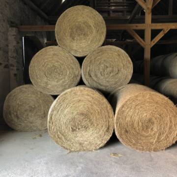
Heu und Stroh /Rundballen/Quaderballen
Sandersdorf
jule13
@Jule2024
Stroh
Lieferant entlädt
Rundballen
Regenfrei
3 weitere...
B+

Waldboden Einstreu Lieferung Deutschlandweit
Goldbach
Steigerwald Waldboden Einstreu
@Steigerwald_Waldboden_Einstreu
Einstreu
Lieferant entlädt
Bigbag
Bio
3 weitere...
B+


Strohpellet, Strohgranulat, Heu & Stroh
Allmannshofen
J&M Kratzer
@JMKratzer
Einstreu
Lieferant entlädt
Pellets
Wird verladen
2 weitere...
P+
Pferdeheu 1.Schnitt Juli 2025/Rundballen 1.50m
Cavertitz
LWB Streubel
@Landwirtschaftsbetr.-Streubel
Heu
Lieferant entlädt
Rundballen
Bio
Regenfrei
3 weitere...
B+

Haferstroh 1.50m Ernte 25 Ausgezeichnete Qualität
Cavertitz
LWB Streubel
@Landwirtschaftsbetr.-Streubel
Stroh
Lieferant entlädt
Rundballen
Regenfrei
3 weitere...
B+

Biete Heu in Rundballen
Steinheim am Albuch
Westernreiterhof Ziegler
@NadinZiegler
Heu
Rundballen
Bio
Regenfrei
Wird verladen
1 weitere...
B+

B+

Vergeben Reitbeteiligung 1-2 mal die Woche
Breitbrunn
Nicole Welponer
@NicoleW.
Wir vergeben für unser Pony eine Reitbeteiligung. Rocky ist ein 5 Jahre alter Welsh B Apfelschimmel Wallach. Rocky ist sehr brav

Heu Kleinballen 1. Schnitt - höchste Qualität
Weissach im Tal
Micha
@Micha3
Heu
Empfänger lädt ab
Kleinballen/HD-Ballen
Bio
Regenfrei
2 weitere...
aktuell
B+
Leider kein Vorschaubild
Leider kein Vorschaubild
Heu zu verkaufen
Bad Rappenau
Uwe Wolf
@Uwe_Wolf
Heu
Empfänger lädt ab
Rundballen
Regenfrei
2 weitere...
B+
Werde Teil von STALL-FREI.de
Verkaufe Heu, Heulage, Stroh, Einstreu oder Futter an Pferdehalter und Stallbetreiber
Deprecated: Creation of dynamic property Zend_View::$pageCount is deprecated in /var/www/stall-frei/htdocs/staging.stall-frei.de/library/vendor/shardj/zf1-future/library/Zend/View/Abstract.php on line 308
Deprecated: Creation of dynamic property Zend_View::$itemCountPerPage is deprecated in /var/www/stall-frei/htdocs/staging.stall-frei.de/library/vendor/shardj/zf1-future/library/Zend/View/Abstract.php on line 308
Deprecated: Creation of dynamic property Zend_View::$first is deprecated in /var/www/stall-frei/htdocs/staging.stall-frei.de/library/vendor/shardj/zf1-future/library/Zend/View/Abstract.php on line 308
Deprecated: Creation of dynamic property Zend_View::$current is deprecated in /var/www/stall-frei/htdocs/staging.stall-frei.de/library/vendor/shardj/zf1-future/library/Zend/View/Abstract.php on line 308
Deprecated: Creation of dynamic property Zend_View::$last is deprecated in /var/www/stall-frei/htdocs/staging.stall-frei.de/library/vendor/shardj/zf1-future/library/Zend/View/Abstract.php on line 308
Deprecated: Creation of dynamic property Zend_View::$previous is deprecated in /var/www/stall-frei/htdocs/staging.stall-frei.de/library/vendor/shardj/zf1-future/library/Zend/View/Abstract.php on line 308
Deprecated: Creation of dynamic property Zend_View::$next is deprecated in /var/www/stall-frei/htdocs/staging.stall-frei.de/library/vendor/shardj/zf1-future/library/Zend/View/Abstract.php on line 308
Deprecated: Creation of dynamic property Zend_View::$pagesInRange is deprecated in /var/www/stall-frei/htdocs/staging.stall-frei.de/library/vendor/shardj/zf1-future/library/Zend/View/Abstract.php on line 308
Deprecated: Creation of dynamic property Zend_View::$firstPageInRange is deprecated in /var/www/stall-frei/htdocs/staging.stall-frei.de/library/vendor/shardj/zf1-future/library/Zend/View/Abstract.php on line 308
Deprecated: Creation of dynamic property Zend_View::$lastPageInRange is deprecated in /var/www/stall-frei/htdocs/staging.stall-frei.de/library/vendor/shardj/zf1-future/library/Zend/View/Abstract.php on line 308
Deprecated: Creation of dynamic property Zend_View::$currentItemCount is deprecated in /var/www/stall-frei/htdocs/staging.stall-frei.de/library/vendor/shardj/zf1-future/library/Zend/View/Abstract.php on line 308
Deprecated: Creation of dynamic property Zend_View::$totalItemCount is deprecated in /var/www/stall-frei/htdocs/staging.stall-frei.de/library/vendor/shardj/zf1-future/library/Zend/View/Abstract.php on line 308
Deprecated: Creation of dynamic property Zend_View::$firstItemNumber is deprecated in /var/www/stall-frei/htdocs/staging.stall-frei.de/library/vendor/shardj/zf1-future/library/Zend/View/Abstract.php on line 308
Deprecated: Creation of dynamic property Zend_View::$lastItemNumber is deprecated in /var/www/stall-frei/htdocs/staging.stall-frei.de/library/vendor/shardj/zf1-future/library/Zend/View/Abstract.php on line 308
Deprecated: Creation of dynamic property Zend_View::$router is deprecated in /var/www/stall-frei/htdocs/staging.stall-frei.de/library/vendor/shardj/zf1-future/library/Zend/View/Abstract.php on line 308
Deprecated: Creation of dynamic property Zend_View::$urlParams is deprecated in /var/www/stall-frei/htdocs/staging.stall-frei.de/library/vendor/shardj/zf1-future/library/Zend/View/Abstract.php on line 308
Deprecated: Creation of dynamic property Zend_View::$showAds is deprecated in /var/www/stall-frei/htdocs/staging.stall-frei.de/library/vendor/shardj/zf1-future/library/Zend/View/Abstract.php on line 308
Deprecated: Creation of dynamic property Zend_View::$objectIds is deprecated in /var/www/stall-frei/htdocs/staging.stall-frei.de/library/vendor/shardj/zf1-future/library/Zend/View/Abstract.php on line 308
Deprecated: Creation of dynamic property Zend_View::$showNavbar is deprecated in /var/www/stall-frei/htdocs/staging.stall-frei.de/library/vendor/shardj/zf1-future/library/Zend/View/Abstract.php on line 308
Deprecated: Creation of dynamic property Zend_View::$showBreadcrumb is deprecated in /var/www/stall-frei/htdocs/staging.stall-frei.de/library/vendor/shardj/zf1-future/library/Zend/View/Abstract.php on line 308
Deprecated: Creation of dynamic property Zend_View::$showFooter is deprecated in /var/www/stall-frei/htdocs/staging.stall-frei.de/library/vendor/shardj/zf1-future/library/Zend/View/Abstract.php on line 308
Deprecated: Creation of dynamic property Zend_View::$showInternalAds is deprecated in /var/www/stall-frei/htdocs/staging.stall-frei.de/library/vendor/shardj/zf1-future/library/Zend/View/Abstract.php on line 308
Deprecated: Creation of dynamic property Zend_View::$blNoContent is deprecated in /var/www/stall-frei/htdocs/staging.stall-frei.de/library/vendor/shardj/zf1-future/library/Zend/View/Abstract.php on line 308
Deprecated: Creation of dynamic property Zend_View::$sMetaDesc is deprecated in /var/www/stall-frei/htdocs/staging.stall-frei.de/library/vendor/shardj/zf1-future/library/Zend/View/Abstract.php on line 308
Deprecated: Creation of dynamic property Zend_View::$useGmaps is deprecated in /var/www/stall-frei/htdocs/staging.stall-frei.de/library/vendor/shardj/zf1-future/library/Zend/View/Abstract.php on line 308
Deprecated: Creation of dynamic property Zend_View::$touches is deprecated in /var/www/stall-frei/htdocs/staging.stall-frei.de/library/vendor/shardj/zf1-future/library/Zend/View/Abstract.php on line 308
Deprecated: Creation of dynamic property Zend_View::$oProject is deprecated in /var/www/stall-frei/htdocs/staging.stall-frei.de/library/vendor/shardj/zf1-future/library/Zend/View/Abstract.php on line 308
Deprecated: Creation of dynamic property Zend_View::$pageHeadline is deprecated in /var/www/stall-frei/htdocs/staging.stall-frei.de/library/vendor/shardj/zf1-future/library/Zend/View/Abstract.php on line 308
Deprecated: Creation of dynamic property Zend_View::$disableLocationField is deprecated in /var/www/stall-frei/htdocs/staging.stall-frei.de/library/vendor/shardj/zf1-future/library/Zend/View/Abstract.php on line 308
Deprecated: Creation of dynamic property Zend_View::$isSearch is deprecated in /var/www/stall-frei/htdocs/staging.stall-frei.de/library/vendor/shardj/zf1-future/library/Zend/View/Abstract.php on line 308
Deprecated: Creation of dynamic property Zend_View::$pageTitle is deprecated in /var/www/stall-frei/htdocs/staging.stall-frei.de/library/vendor/shardj/zf1-future/library/Zend/View/Abstract.php on line 308
Deprecated: Creation of dynamic property Psf_Form_Element_Text::$class is deprecated in /var/www/stall-frei/htdocs/staging.stall-frei.de/library/vendor/shardj/zf1-future/library/Zend/Form/Element.php on line 874
Deprecated: Creation of dynamic property Psf_Form_Element_Text::$size is deprecated in /var/www/stall-frei/htdocs/staging.stall-frei.de/library/vendor/shardj/zf1-future/library/Zend/Form/Element.php on line 874
Deprecated: Creation of dynamic property Psf_Form_Element_Text::$placeholder is deprecated in /var/www/stall-frei/htdocs/staging.stall-frei.de/library/vendor/shardj/zf1-future/library/Zend/Form/Element.php on line 874
Deprecated: Creation of dynamic property Psf_Form_Element_Hidden::$class is deprecated in /var/www/stall-frei/htdocs/staging.stall-frei.de/library/vendor/shardj/zf1-future/library/Zend/Form/Element.php on line 874
Deprecated: Creation of dynamic property Psf_Form_Element_Hidden::$class is deprecated in /var/www/stall-frei/htdocs/staging.stall-frei.de/library/vendor/shardj/zf1-future/library/Zend/Form/Element.php on line 874
Deprecated: Creation of dynamic property Psf_Form_Element_Hidden::$class is deprecated in /var/www/stall-frei/htdocs/staging.stall-frei.de/library/vendor/shardj/zf1-future/library/Zend/Form/Element.php on line 874
Deprecated: Creation of dynamic property Psf_Form_Element_Hidden::$class is deprecated in /var/www/stall-frei/htdocs/staging.stall-frei.de/library/vendor/shardj/zf1-future/library/Zend/Form/Element.php on line 874
Deprecated: Creation of dynamic property Psf_Form_Element_Select::$class is deprecated in /var/www/stall-frei/htdocs/staging.stall-frei.de/library/vendor/shardj/zf1-future/library/Zend/Form/Element.php on line 874
Deprecated: Creation of dynamic property Psf_Form_Element_Select::$class is deprecated in /var/www/stall-frei/htdocs/staging.stall-frei.de/library/vendor/shardj/zf1-future/library/Zend/Form/Element.php on line 874
Deprecated: Creation of dynamic property Psf_Form_Element_Select::$class is deprecated in /var/www/stall-frei/htdocs/staging.stall-frei.de/library/vendor/shardj/zf1-future/library/Zend/Form/Element.php on line 874
Deprecated: Creation of dynamic property Psf_Form_Element_Select::$class is deprecated in /var/www/stall-frei/htdocs/staging.stall-frei.de/library/vendor/shardj/zf1-future/library/Zend/Form/Element.php on line 874
Deprecated: Creation of dynamic property Zend_View::$sort is deprecated in /var/www/stall-frei/htdocs/staging.stall-frei.de/library/vendor/shardj/zf1-future/library/Zend/View/Abstract.php on line 308
Deprecated: Creation of dynamic property Zend_View::$searchLocation is deprecated in /var/www/stall-frei/htdocs/staging.stall-frei.de/library/vendor/shardj/zf1-future/library/Zend/View/Abstract.php on line 308
Deprecated: Creation of dynamic property Zend_View::$locationHint is deprecated in /var/www/stall-frei/htdocs/staging.stall-frei.de/library/vendor/shardj/zf1-future/library/Zend/View/Abstract.php on line 308
Psf_GeoCoder_Abstract::getLocation: Kupferberg Get Location CachedOrLive
Psf_GeoCoder_Abstract::getCachedOrLive: Kupferberg
Psf_GeoCoder_Abstract::convertLocationResult
{"documentation":"https:\/\/opencagedata.com\/api","licenses":[{"name":"see attribution guide","url":"https:\/\/opencagedata.com\/credits"}],"results":[{"bounds":{"northeast":{"lat":50.1661088,"lng":11.619068},"southwest":{"lat":50.1217819,"lng":11.5535678}},"components":{"ISO_3166-1_alpha-2":"DE","ISO_3166-1_alpha-3":"DEU","ISO_3166-2":["DE-BY"],"_category":"place","_normalized_city":"Kupferberg","_type":"municipality","continent":"Europe","country":"Deutschland","country_code":"de","county":"Landkreis Kulmbach","municipality":"Kupferberg","political_union":"European Union","postcode":"95362","state":"Bayern","state_code":"BY"},"confidence":7,"formatted":"95362 Kupferberg, Deutschland","geometry":{"lat":50.1391777,"lng":11.5766311}},{"bounds":{"northeast":{"lat":51.1656092,"lng":7.4773128},"southwest":{"lat":51.1256092,"lng":7.4373128}},"components":{"ISO_3166-1_alpha-2":"DE","ISO_3166-1_alpha-3":"DEU","ISO_3166-2":["DE-NW"],"_category":"place","_normalized_city":"Wipperf\u00fcrth","_type":"hamlet","continent":"Europe","country":"Deutschland","country_code":"de","county":"Oberbergischer Kreis","hamlet":"Kupferberg","political_union":"European Union","postcode":"51688","state":"Nordrhein-Westfalen","state_code":"NW","town":"Wipperf\u00fcrth"},"confidence":7,"formatted":"Kupferberg, 51688 Wipperf\u00fcrth, Deutschland","geometry":{"lat":51.1456092,"lng":7.4573128}},{"bounds":{"northeast":{"lat":51.4452254,"lng":10.6316028},"southwest":{"lat":51.4451254,"lng":10.6315028}},"components":{"ISO_3166-1_alpha-2":"DE","ISO_3166-1_alpha-3":"DEU","ISO_3166-2":["DE-TH"],"_category":"natural\/water","_normalized_city":"Bleicherode","_type":"peak","continent":"Europe","country":"Deutschland","country_code":"de","county":"Landkreis Nordhausen","municipality":"Bleicherode","peak":"Kupferberg","political_union":"European Union","postcode":"99752","state":"Th\u00fcringen","state_code":"TH","town":"Bleicherode"},"confidence":9,"formatted":"Kupferberg, 99752 Bleicherode, Deutschland","geometry":{"lat":51.4451754,"lng":10.6315528}},{"bounds":{"northeast":{"lat":49.5526618,"lng":11.6739141},"southwest":{"lat":49.5525618,"lng":11.6738141}},"components":{"ISO_3166-1_alpha-2":"DE","ISO_3166-1_alpha-3":"DEU","ISO_3166-2":["DE-BY"],"_category":"natural\/water","_normalized_city":"Neukirchen bei Sulzbach-Rosenberg","_type":"peak","continent":"Europe","country":"Deutschland","country_code":"de","county":"Landkreis Amberg-Sulzbach","municipality":"Neukirchen bei Sulzbach-Rosenberg (VGem)","peak":"Kupferberg","political_union":"European Union","postcode":"92259","state":"Bayern","state_code":"BY","village":"Neukirchen bei Sulzbach-Rosenberg"},"confidence":9,"formatted":"Kupferberg, 92259 Neukirchen bei Sulzbach-Rosenberg, Deutschland","geometry":{"lat":49.5526118,"lng":11.6738641}},{"bounds":{"northeast":{"lat":51.2716227,"lng":8.0911278},"southwest":{"lat":51.2715227,"lng":8.0910278}},"components":{"ISO_3166-1_alpha-2":"DE","ISO_3166-1_alpha-3":"DEU","ISO_3166-2":["DE-NW"],"_category":"natural\/water","_normalized_city":"Sundern","_type":"peak","continent":"Europe","country":"Deutschland","country_code":"de","county":"Hochsauerlandkreis","peak":"Kupferberg","political_union":"European Union","state":"Nordrhein-Westfalen","state_code":"NW","town":"Sundern"},"confidence":9,"formatted":"Kupferberg, Sundern, Nordrhein-Westfalen, Deutschland","geometry":{"lat":51.2715727,"lng":8.0910778}},{"bounds":{"northeast":{"lat":51.7084157,"lng":11.1128178},"southwest":{"lat":51.7083157,"lng":11.1127178}},"components":{"ISO_3166-1_alpha-2":"DE","ISO_3166-1_alpha-3":"DEU","ISO_3166-2":["DE-ST"],"_category":"natural\/water","_normalized_city":"Quedlinburg","_type":"peak","continent":"Europe","country":"Deutschland","country_code":"de","county":"Landkreis Harz","peak":"Kupferberg","political_union":"European Union","postcode":"06485","state":"Sachsen-Anhalt","state_code":"ST","town":"Quedlinburg"},"confidence":9,"formatted":"Kupferberg, 06485 Quedlinburg, Deutschland","geometry":{"lat":51.7083657,"lng":11.1127678}},{"bounds":{"northeast":{"lat":48.38795,"lng":8.28022},"southwest":{"lat":48.38785,"lng":8.28012}},"components":{"ISO_3166-1_alpha-2":"DE","ISO_3166-1_alpha-3":"DEU","ISO_3166-2":["DE-BW"],"_category":"natural\/water","_normalized_city":"Bad Rippoldsau-Schapbach","_type":"peak","continent":"Europe","country":"Deutschland","country_code":"de","county":"Landkreis Freudenstadt","municipality":"Bad Rippoldsau-Schapbach","peak":"Kupferberg","political_union":"European Union","postcode":"77776","state":"Baden-W\u00fcrttemberg","state_code":"BW"},"confidence":9,"formatted":"Kupferberg, 77776 Bad Rippoldsau-Schapbach, Deutschland","geometry":{"lat":48.3879,"lng":8.28017}},{"bounds":{"northeast":{"lat":51.5325031,"lng":11.3540937},"southwest":{"lat":51.5324031,"lng":11.3539937}},"components":{"ISO_3166-1_alpha-2":"DE","ISO_3166-1_alpha-3":"DEU","ISO_3166-2":["DE-ST"],"_category":"natural\/water","_normalized_city":"Allstedt","_type":"peak","continent":"Europe","country":"Deutschland","country_code":"de","county":"Mansfeld-S\u00fcdharz","peak":"Kupferberg","political_union":"European Union","state":"Sachsen-Anhalt","state_code":"ST","town":"Allstedt"},"confidence":9,"formatted":"Kupferberg, Allstedt, Sachsen-Anhalt, Deutschland","geometry":{"lat":51.5324531,"lng":11.3540437}},{"bounds":{"northeast":{"lat":50.9897897,"lng":10.223497},"southwest":{"lat":50.9896897,"lng":10.223397}},"components":{"ISO_3166-1_alpha-2":"DE","ISO_3166-1_alpha-3":"DEU","ISO_3166-2":["DE-TH"],"_category":"natural\/water","_normalized_city":"Eisenach","_type":"peak","continent":"Europe","country":"Deutschland","country_code":"de","county":"Wartburgkreis","peak":"Kupferberg","political_union":"European Union","postcode":"99819","state":"Th\u00fcringen","state_code":"TH","town":"Eisenach"},"confidence":9,"formatted":"Kupferberg, 99819 Eisenach, Deutschland","geometry":{"lat":50.9897397,"lng":10.223447}},{"bounds":{"northeast":{"lat":51.3568436,"lng":7.6268811},"southwest":{"lat":51.3567436,"lng":7.6267811}},"components":{"ISO_3166-1_alpha-2":"DE","ISO_3166-1_alpha-3":"DEU","ISO_3166-2":["DE-NW"],"_category":"natural\/water","_normalized_city":"Iserlohn","_type":"peak","continent":"Europe","country":"Deutschland","country_code":"de","county":"M\u00e4rkischer Kreis","peak":"Kupferberg","political_union":"European Union","postcode":"58642","state":"Nordrhein-Westfalen","state_code":"NW","town":"Iserlohn"},"confidence":9,"formatted":"Kupferberg, 58642 Iserlohn, Deutschland","geometry":{"lat":51.3567936,"lng":7.6268311}}],"status":{"code":200,"message":"OK"},"stay_informed":{"blog":"https:\/\/blog.opencagedata.com","mastodon":"https:\/\/en.osm.town\/@opencage"},"thanks":"For using an OpenCage API","timestamp":{"created_http":"Sun, 08 Feb 2026 17:42:58 GMT","created_unix":1770572578},"total_results":10}Array
(
[0] => stdClass Object
(
[bounds] => stdClass Object
(
[northeast] => stdClass Object
(
[lat] => 50.1661088
[lng] => 11.619068
)
[southwest] => stdClass Object
(
[lat] => 50.1217819
[lng] => 11.5535678
)
)
[components] => stdClass Object
(
[ISO_3166-1_alpha-2] => DE
[ISO_3166-1_alpha-3] => DEU
[ISO_3166-2] => Array
(
[0] => DE-BY
)
[_category] => place
[_normalized_city] => Kupferberg
[_type] => municipality
[continent] => Europe
[country] => Deutschland
[country_code] => de
[county] => Landkreis Kulmbach
[municipality] => Kupferberg
[political_union] => European Union
[postcode] => 95362
[state] => Bayern
[state_code] => BY
)
[confidence] => 7
[formatted] => 95362 Kupferberg, Deutschland
[geometry] => stdClass Object
(
[lat] => 50.1391777
[lng] => 11.5766311
)
)
[1] => stdClass Object
(
[bounds] => stdClass Object
(
[northeast] => stdClass Object
(
[lat] => 51.1656092
[lng] => 7.4773128
)
[southwest] => stdClass Object
(
[lat] => 51.1256092
[lng] => 7.4373128
)
)
[components] => stdClass Object
(
[ISO_3166-1_alpha-2] => DE
[ISO_3166-1_alpha-3] => DEU
[ISO_3166-2] => Array
(
[0] => DE-NW
)
[_category] => place
[_normalized_city] => Wipperfürth
[_type] => hamlet
[continent] => Europe
[country] => Deutschland
[country_code] => de
[county] => Oberbergischer Kreis
[hamlet] => Kupferberg
[political_union] => European Union
[postcode] => 51688
[state] => Nordrhein-Westfalen
[state_code] => NW
[town] => Wipperfürth
)
[confidence] => 7
[formatted] => Kupferberg, 51688 Wipperfürth, Deutschland
[geometry] => stdClass Object
(
[lat] => 51.1456092
[lng] => 7.4573128
)
)
[2] => stdClass Object
(
[bounds] => stdClass Object
(
[northeast] => stdClass Object
(
[lat] => 51.4452254
[lng] => 10.6316028
)
[southwest] => stdClass Object
(
[lat] => 51.4451254
[lng] => 10.6315028
)
)
[components] => stdClass Object
(
[ISO_3166-1_alpha-2] => DE
[ISO_3166-1_alpha-3] => DEU
[ISO_3166-2] => Array
(
[0] => DE-TH
)
[_category] => natural/water
[_normalized_city] => Bleicherode
[_type] => peak
[continent] => Europe
[country] => Deutschland
[country_code] => de
[county] => Landkreis Nordhausen
[municipality] => Bleicherode
[peak] => Kupferberg
[political_union] => European Union
[postcode] => 99752
[state] => Thüringen
[state_code] => TH
[town] => Bleicherode
)
[confidence] => 9
[formatted] => Kupferberg, 99752 Bleicherode, Deutschland
[geometry] => stdClass Object
(
[lat] => 51.4451754
[lng] => 10.6315528
)
)
[3] => stdClass Object
(
[bounds] => stdClass Object
(
[northeast] => stdClass Object
(
[lat] => 49.5526618
[lng] => 11.6739141
)
[southwest] => stdClass Object
(
[lat] => 49.5525618
[lng] => 11.6738141
)
)
[components] => stdClass Object
(
[ISO_3166-1_alpha-2] => DE
[ISO_3166-1_alpha-3] => DEU
[ISO_3166-2] => Array
(
[0] => DE-BY
)
[_category] => natural/water
[_normalized_city] => Neukirchen bei Sulzbach-Rosenberg
[_type] => peak
[continent] => Europe
[country] => Deutschland
[country_code] => de
[county] => Landkreis Amberg-Sulzbach
[municipality] => Neukirchen bei Sulzbach-Rosenberg (VGem)
[peak] => Kupferberg
[political_union] => European Union
[postcode] => 92259
[state] => Bayern
[state_code] => BY
[village] => Neukirchen bei Sulzbach-Rosenberg
)
[confidence] => 9
[formatted] => Kupferberg, 92259 Neukirchen bei Sulzbach-Rosenberg, Deutschland
[geometry] => stdClass Object
(
[lat] => 49.5526118
[lng] => 11.6738641
)
)
[4] => stdClass Object
(
[bounds] => stdClass Object
(
[northeast] => stdClass Object
(
[lat] => 51.2716227
[lng] => 8.0911278
)
[southwest] => stdClass Object
(
[lat] => 51.2715227
[lng] => 8.0910278
)
)
[components] => stdClass Object
(
[ISO_3166-1_alpha-2] => DE
[ISO_3166-1_alpha-3] => DEU
[ISO_3166-2] => Array
(
[0] => DE-NW
)
[_category] => natural/water
[_normalized_city] => Sundern
[_type] => peak
[continent] => Europe
[country] => Deutschland
[country_code] => de
[county] => Hochsauerlandkreis
[peak] => Kupferberg
[political_union] => European Union
[state] => Nordrhein-Westfalen
[state_code] => NW
[town] => Sundern
)
[confidence] => 9
[formatted] => Kupferberg, Sundern, Nordrhein-Westfalen, Deutschland
[geometry] => stdClass Object
(
[lat] => 51.2715727
[lng] => 8.0910778
)
)
[5] => stdClass Object
(
[bounds] => stdClass Object
(
[northeast] => stdClass Object
(
[lat] => 51.7084157
[lng] => 11.1128178
)
[southwest] => stdClass Object
(
[lat] => 51.7083157
[lng] => 11.1127178
)
)
[components] => stdClass Object
(
[ISO_3166-1_alpha-2] => DE
[ISO_3166-1_alpha-3] => DEU
[ISO_3166-2] => Array
(
[0] => DE-ST
)
[_category] => natural/water
[_normalized_city] => Quedlinburg
[_type] => peak
[continent] => Europe
[country] => Deutschland
[country_code] => de
[county] => Landkreis Harz
[peak] => Kupferberg
[political_union] => European Union
[postcode] => 06485
[state] => Sachsen-Anhalt
[state_code] => ST
[town] => Quedlinburg
)
[confidence] => 9
[formatted] => Kupferberg, 06485 Quedlinburg, Deutschland
[geometry] => stdClass Object
(
[lat] => 51.7083657
[lng] => 11.1127678
)
)
[6] => stdClass Object
(
[bounds] => stdClass Object
(
[northeast] => stdClass Object
(
[lat] => 48.38795
[lng] => 8.28022
)
[southwest] => stdClass Object
(
[lat] => 48.38785
[lng] => 8.28012
)
)
[components] => stdClass Object
(
[ISO_3166-1_alpha-2] => DE
[ISO_3166-1_alpha-3] => DEU
[ISO_3166-2] => Array
(
[0] => DE-BW
)
[_category] => natural/water
[_normalized_city] => Bad Rippoldsau-Schapbach
[_type] => peak
[continent] => Europe
[country] => Deutschland
[country_code] => de
[county] => Landkreis Freudenstadt
[municipality] => Bad Rippoldsau-Schapbach
[peak] => Kupferberg
[political_union] => European Union
[postcode] => 77776
[state] => Baden-Württemberg
[state_code] => BW
)
[confidence] => 9
[formatted] => Kupferberg, 77776 Bad Rippoldsau-Schapbach, Deutschland
[geometry] => stdClass Object
(
[lat] => 48.3879
[lng] => 8.28017
)
)
[7] => stdClass Object
(
[bounds] => stdClass Object
(
[northeast] => stdClass Object
(
[lat] => 51.5325031
[lng] => 11.3540937
)
[southwest] => stdClass Object
(
[lat] => 51.5324031
[lng] => 11.3539937
)
)
[components] => stdClass Object
(
[ISO_3166-1_alpha-2] => DE
[ISO_3166-1_alpha-3] => DEU
[ISO_3166-2] => Array
(
[0] => DE-ST
)
[_category] => natural/water
[_normalized_city] => Allstedt
[_type] => peak
[continent] => Europe
[country] => Deutschland
[country_code] => de
[county] => Mansfeld-Südharz
[peak] => Kupferberg
[political_union] => European Union
[state] => Sachsen-Anhalt
[state_code] => ST
[town] => Allstedt
)
[confidence] => 9
[formatted] => Kupferberg, Allstedt, Sachsen-Anhalt, Deutschland
[geometry] => stdClass Object
(
[lat] => 51.5324531
[lng] => 11.3540437
)
)
[8] => stdClass Object
(
[bounds] => stdClass Object
(
[northeast] => stdClass Object
(
[lat] => 50.9897897
[lng] => 10.223497
)
[southwest] => stdClass Object
(
[lat] => 50.9896897
[lng] => 10.223397
)
)
[components] => stdClass Object
(
[ISO_3166-1_alpha-2] => DE
[ISO_3166-1_alpha-3] => DEU
[ISO_3166-2] => Array
(
[0] => DE-TH
)
[_category] => natural/water
[_normalized_city] => Eisenach
[_type] => peak
[continent] => Europe
[country] => Deutschland
[country_code] => de
[county] => Wartburgkreis
[peak] => Kupferberg
[political_union] => European Union
[postcode] => 99819
[state] => Thüringen
[state_code] => TH
[town] => Eisenach
)
[confidence] => 9
[formatted] => Kupferberg, 99819 Eisenach, Deutschland
[geometry] => stdClass Object
(
[lat] => 50.9897397
[lng] => 10.223447
)
)
[9] => stdClass Object
(
[bounds] => stdClass Object
(
[northeast] => stdClass Object
(
[lat] => 51.3568436
[lng] => 7.6268811
)
[southwest] => stdClass Object
(
[lat] => 51.3567436
[lng] => 7.6267811
)
)
[components] => stdClass Object
(
[ISO_3166-1_alpha-2] => DE
[ISO_3166-1_alpha-3] => DEU
[ISO_3166-2] => Array
(
[0] => DE-NW
)
[_category] => natural/water
[_normalized_city] => Iserlohn
[_type] => peak
[continent] => Europe
[country] => Deutschland
[country_code] => de
[county] => Märkischer Kreis
[peak] => Kupferberg
[political_union] => European Union
[postcode] => 58642
[state] => Nordrhein-Westfalen
[state_code] => NW
[town] => Iserlohn
)
[confidence] => 9
[formatted] => Kupferberg, 58642 Iserlohn, Deutschland
[geometry] => stdClass Object
(
[lat] => 51.3567936
[lng] => 7.6268311
)
)
)
Psf_GeoCoder_OpenCageData::getKeyMap: 0
stdClass Object
(
    [bounds] => stdClass Object
        (
            [northeast] => stdClass Object
                (
                    [lat] => 50.1661088
                    [lng] => 11.619068
                )

            [southwest] => stdClass Object
                (
                    [lat] => 50.1217819
                    [lng] => 11.5535678
                )

        )

    [components] => stdClass Object
        (
            [ISO_3166-1_alpha-2] => DE
            [ISO_3166-1_alpha-3] => DEU
            [ISO_3166-2] => Array
                (
                    [0] => DE-BY
                )

            [_category] => place
            [_normalized_city] => Kupferberg
            [_type] => municipality
            [continent] => Europe
            [country] => Deutschland
            [country_code] => de
            [county] => Landkreis Kulmbach
            [municipality] => Kupferberg
            [political_union] => European Union
            [postcode] => 95362
            [state] => Bayern
            [state_code] => BY
        )

    [confidence] => 7
    [formatted] => 95362 Kupferberg, Deutschland
    [geometry] => stdClass Object
        (
            [lat] => 50.1391777
            [lng] => 11.5766311
        )

)
Psf_GeoCoder_OpenCageData::getCounty: Kulmbach
Psf_GeoCoder_OpenCageData::addMissingData REFETCH!
Array
(
    [address] => 95362 Kupferberg, Deutschland
    [type] => municipality
    [street] =>
    [city] =>
    [county] => Kulmbach
    [state] => Bayern
    [zip] => 95362
    [country] => Deutschland
    [suburb] =>
    [countrycode] => de
    [latitude] => 50.1391777
    [longitude] => 11.5766311
    [accuracy] => 1
    [confidence] => 7
    [bounds] => stdClass Object
        (
            [northeast] => stdClass Object
                (
                    [lat] => 50.1661088
                    [lng] => 11.619068
                )

            [southwest] => stdClass Object
                (
                    [lat] => 50.1217819
                    [lng] => 11.5535678
                )

        )

)
reformat!
Array
(
    [address] => 95362 Kupferberg, Deutschland
    [type] => municipality
    [street] =>
    [city] =>
    [county] => Kulmbach
    [state] => Bayern
    [zip] => 95362
    [country] => Deutschland
    [suburb] =>
    [countrycode] => de
    [latitude] => 50.1391777
    [longitude] => 11.5766311
    [accuracy] => 1
    [confidence] => 7
    [bounds] => stdClass Object
        (
            [northeast] => stdClass Object
                (
                    [lat] => 50.1661088
                    [lng] => 11.619068
                )

            [southwest] => stdClass Object
                (
                    [lat] => 50.1217819
                    [lng] => 11.5535678
                )

        )

    [place] => 95362 , Bayern
    [hash] => 8e9636cbdf746836eb9ed1536e68b992
)
Psf_GeoCoder_OpenCageData::getKeyMap: 1
stdClass Object
(
    [bounds] => stdClass Object
        (
            [northeast] => stdClass Object
                (
                    [lat] => 51.1656092
                    [lng] => 7.4773128
                )

            [southwest] => stdClass Object
                (
                    [lat] => 51.1256092
                    [lng] => 7.4373128
                )

        )

    [components] => stdClass Object
        (
            [ISO_3166-1_alpha-2] => DE
            [ISO_3166-1_alpha-3] => DEU
            [ISO_3166-2] => Array
                (
                    [0] => DE-NW
                )

            [_category] => place
            [_normalized_city] => Wipperfürth
            [_type] => hamlet
            [continent] => Europe
            [country] => Deutschland
            [country_code] => de
            [county] => Oberbergischer Kreis
            [hamlet] => Kupferberg
            [political_union] => European Union
            [postcode] => 51688
            [state] => Nordrhein-Westfalen
            [state_code] => NW
            [town] => Wipperfürth
        )

    [confidence] => 7
    [formatted] => Kupferberg, 51688 Wipperfürth, Deutschland
    [geometry] => stdClass Object
        (
            [lat] => 51.1456092
            [lng] => 7.4573128
        )

)
Psf_GeoCoder_OpenCageData::getCounty: Oberbergischer Kreis
Psf_GeoCoder_OpenCageData::addMissingData REFETCH!
Array
(
    [address] => Kupferberg, 51688 Wipperfürth, Deutschland
    [type] => hamlet
    [street] => Kupferberg
    [city] => Wipperfürth
    [county] => Oberbergischer Kreis
    [state] => Nordrhein-Westfalen
    [zip] => 51688
    [country] => Deutschland
    [suburb] =>
    [countrycode] => de
    [latitude] => 51.1456092
    [longitude] => 7.4573128
    [accuracy] => 1
    [confidence] => 7
    [bounds] => stdClass Object
        (
            [northeast] => stdClass Object
                (
                    [lat] => 51.1656092
                    [lng] => 7.4773128
                )

            [southwest] => stdClass Object
                (
                    [lat] => 51.1256092
                    [lng] => 7.4373128
                )

        )

)
reformat!
Array
(
    [address] => Kupferberg, 51688 Wipperfürth, Deutschland
    [type] => hamlet
    [street] => Kupferberg
    [city] => Wipperfürth
    [county] => Oberbergischer Kreis
    [state] => Nordrhein-Westfalen
    [zip] => 51688
    [country] => Deutschland
    [suburb] =>
    [countrycode] => de
    [latitude] => 51.1456092
    [longitude] => 7.4573128
    [accuracy] => 1
    [confidence] => 7
    [bounds] => stdClass Object
        (
            [northeast] => stdClass Object
                (
                    [lat] => 51.1656092
                    [lng] => 7.4773128
                )

            [southwest] => stdClass Object
                (
                    [lat] => 51.1256092
                    [lng] => 7.4373128
                )

        )

    [place] => Kupferberg, 51688 Wipperfürth, Nordrhein-Westfalen
    [hash] => 2781ba0d316d49d7ba2c6fbd049922b9
)
Psf_GeoCoder_OpenCageData::getKeyMap: 2
stdClass Object
(
    [bounds] => stdClass Object
        (
            [northeast] => stdClass Object
                (
                    [lat] => 51.4452254
                    [lng] => 10.6316028
                )

            [southwest] => stdClass Object
                (
                    [lat] => 51.4451254
                    [lng] => 10.6315028
                )

        )

    [components] => stdClass Object
        (
            [ISO_3166-1_alpha-2] => DE
            [ISO_3166-1_alpha-3] => DEU
            [ISO_3166-2] => Array
                (
                    [0] => DE-TH
                )

            [_category] => natural/water
            [_normalized_city] => Bleicherode
            [_type] => peak
            [continent] => Europe
            [country] => Deutschland
            [country_code] => de
            [county] => Landkreis Nordhausen
            [municipality] => Bleicherode
            [peak] => Kupferberg
            [political_union] => European Union
            [postcode] => 99752
            [state] => Thüringen
            [state_code] => TH
            [town] => Bleicherode
        )

    [confidence] => 9
    [formatted] => Kupferberg, 99752 Bleicherode, Deutschland
    [geometry] => stdClass Object
        (
            [lat] => 51.4451754
            [lng] => 10.6315528
        )

)
Psf_GeoCoder_OpenCageData::getCounty: Nordhausen
Psf_GeoCoder_OpenCageData::addMissingData REFETCH!
Array
(
    [address] => Kupferberg, 99752 Bleicherode, Deutschland
    [type] => peak
    [street] =>
    [city] => Bleicherode
    [county] => Nordhausen
    [state] => Thüringen
    [zip] => 99752
    [country] => Deutschland
    [suburb] =>
    [countrycode] => de
    [latitude] => 51.4451754
    [longitude] => 10.6315528
    [accuracy] => 1
    [confidence] => 9
    [bounds] => stdClass Object
        (
            [northeast] => stdClass Object
                (
                    [lat] => 51.4452254
                    [lng] => 10.6316028
                )

            [southwest] => stdClass Object
                (
                    [lat] => 51.4451254
                    [lng] => 10.6315028
                )

        )

)
reformat!
Array
(
    [address] => Kupferberg, 99752 Bleicherode, Deutschland
    [type] => peak
    [street] =>
    [city] => Bleicherode
    [county] => Nordhausen
    [state] => Thüringen
    [zip] => 99752
    [country] => Deutschland
    [suburb] =>
    [countrycode] => de
    [latitude] => 51.4451754
    [longitude] => 10.6315528
    [accuracy] => 1
    [confidence] => 9
    [bounds] => stdClass Object
        (
            [northeast] => stdClass Object
                (
                    [lat] => 51.4452254
                    [lng] => 10.6316028
                )

            [southwest] => stdClass Object
                (
                    [lat] => 51.4451254
                    [lng] => 10.6315028
                )

        )

    [place] => 99752 Bleicherode, Thüringen
    [hash] => c79de655d4e4876056612861f0cfd3d8
)
Psf_GeoCoder_OpenCageData::getKeyMap: 3
stdClass Object
(
    [bounds] => stdClass Object
        (
            [northeast] => stdClass Object
                (
                    [lat] => 49.5526618
                    [lng] => 11.6739141
                )

            [southwest] => stdClass Object
                (
                    [lat] => 49.5525618
                    [lng] => 11.6738141
                )

        )

    [components] => stdClass Object
        (
            [ISO_3166-1_alpha-2] => DE
            [ISO_3166-1_alpha-3] => DEU
            [ISO_3166-2] => Array
                (
                    [0] => DE-BY
                )

            [_category] => natural/water
            [_normalized_city] => Neukirchen bei Sulzbach-Rosenberg
            [_type] => peak
            [continent] => Europe
            [country] => Deutschland
            [country_code] => de
            [county] => Landkreis Amberg-Sulzbach
            [municipality] => Neukirchen bei Sulzbach-Rosenberg (VGem)
            [peak] => Kupferberg
            [political_union] => European Union
            [postcode] => 92259
            [state] => Bayern
            [state_code] => BY
            [village] => Neukirchen bei Sulzbach-Rosenberg
        )

    [confidence] => 9
    [formatted] => Kupferberg, 92259 Neukirchen bei Sulzbach-Rosenberg, Deutschland
    [geometry] => stdClass Object
        (
            [lat] => 49.5526118
            [lng] => 11.6738641
        )

)
Psf_GeoCoder_OpenCageData::getCounty: Amberg-Sulzbach
Psf_GeoCoder_OpenCageData::addMissingData REFETCH!
Array
(
    [address] => Kupferberg, 92259 Neukirchen bei Sulzbach-Rosenberg, Deutschland
    [type] => peak
    [street] =>
    [city] => Neukirchen bei Sulzbach-Rosenberg
    [county] => Amberg-Sulzbach
    [state] => Bayern
    [zip] => 92259
    [country] => Deutschland
    [suburb] =>
    [countrycode] => de
    [latitude] => 49.5526118
    [longitude] => 11.6738641
    [accuracy] => 1
    [confidence] => 9
    [bounds] => stdClass Object
        (
            [northeast] => stdClass Object
                (
                    [lat] => 49.5526618
                    [lng] => 11.6739141
                )

            [southwest] => stdClass Object
                (
                    [lat] => 49.5525618
                    [lng] => 11.6738141
                )

        )

)
reformat!
Array
(
    [address] => Kupferberg, 92259 Neukirchen bei Sulzbach-Rosenberg, Deutschland
    [type] => peak
    [street] =>
    [city] => Neukirchen bei Sulzbach-Rosenberg
    [county] => Amberg-Sulzbach
    [state] => Bayern
    [zip] => 92259
    [country] => Deutschland
    [suburb] =>
    [countrycode] => de
    [latitude] => 49.5526118
    [longitude] => 11.6738641
    [accuracy] => 1
    [confidence] => 9
    [bounds] => stdClass Object
        (
            [northeast] => stdClass Object
                (
                    [lat] => 49.5526618
                    [lng] => 11.6739141
                )

            [southwest] => stdClass Object
                (
                    [lat] => 49.5525618
                    [lng] => 11.6738141
                )

        )

    [place] => 92259 Neukirchen bei Sulzbach-Rosenberg, Bayern
    [hash] => d6c7c90d43e5bc6454913b10a7766fe0
)
Psf_GeoCoder_OpenCageData::getKeyMap: 4
stdClass Object
(
    [bounds] => stdClass Object
        (
            [northeast] => stdClass Object
                (
                    [lat] => 51.2716227
                    [lng] => 8.0911278
                )

            [southwest] => stdClass Object
                (
                    [lat] => 51.2715227
                    [lng] => 8.0910278
                )

        )

    [components] => stdClass Object
        (
            [ISO_3166-1_alpha-2] => DE
            [ISO_3166-1_alpha-3] => DEU
            [ISO_3166-2] => Array
                (
                    [0] => DE-NW
                )

            [_category] => natural/water
            [_normalized_city] => Sundern
            [_type] => peak
            [continent] => Europe
            [country] => Deutschland
            [country_code] => de
            [county] => Hochsauerlandkreis
            [peak] => Kupferberg
            [political_union] => European Union
            [state] => Nordrhein-Westfalen
            [state_code] => NW
            [town] => Sundern
        )

    [confidence] => 9
    [formatted] => Kupferberg, Sundern, Nordrhein-Westfalen, Deutschland
    [geometry] => stdClass Object
        (
            [lat] => 51.2715727
            [lng] => 8.0910778
        )

)
Psf_GeoCoder_OpenCageData::getCounty: Hochsauerlandkreis
Psf_GeoCoder_OpenCageData::addMissingData REFETCH!
Array
(
    [address] => Kupferberg, Sundern, Nordrhein-Westfalen, Deutschland
    [type] => peak
    [street] =>
    [city] => Sundern
    [county] => Hochsauerlandkreis
    [state] => Nordrhein-Westfalen
    [zip] =>
    [country] => Deutschland
    [suburb] =>
    [countrycode] => de
    [latitude] => 51.2715727
    [longitude] => 8.0910778
    [accuracy] => 1
    [confidence] => 9
    [bounds] => stdClass Object
        (
            [northeast] => stdClass Object
                (
                    [lat] => 51.2716227
                    [lng] => 8.0911278
                )

            [southwest] => stdClass Object
                (
                    [lat] => 51.2715227
                    [lng] => 8.0910278
                )

        )

)
reformat!
Array
(
    [address] => Kupferberg, Sundern, Nordrhein-Westfalen, Deutschland
    [type] => peak
    [street] =>
    [city] => Sundern
    [county] => Hochsauerlandkreis
    [state] => Nordrhein-Westfalen
    [zip] =>
    [country] => Deutschland
    [suburb] =>
    [countrycode] => de
    [latitude] => 51.2715727
    [longitude] => 8.0910778
    [accuracy] => 1
    [confidence] => 9
    [bounds] => stdClass Object
        (
            [northeast] => stdClass Object
                (
                    [lat] => 51.2716227
                    [lng] => 8.0911278
                )

            [southwest] => stdClass Object
                (
                    [lat] => 51.2715227
                    [lng] => 8.0910278
                )

        )

    [place] => Sundern, Nordrhein-Westfalen
    [hash] => b56e711c8bf18547bf9b8fee07b4331e
)
Psf_GeoCoder_OpenCageData::getKeyMap: 5
stdClass Object
(
    [bounds] => stdClass Object
        (
            [northeast] => stdClass Object
                (
                    [lat] => 51.7084157
                    [lng] => 11.1128178
                )

            [southwest] => stdClass Object
                (
                    [lat] => 51.7083157
                    [lng] => 11.1127178
                )

        )

    [components] => stdClass Object
        (
            [ISO_3166-1_alpha-2] => DE
            [ISO_3166-1_alpha-3] => DEU
            [ISO_3166-2] => Array
                (
                    [0] => DE-ST
                )

            [_category] => natural/water
            [_normalized_city] => Quedlinburg
            [_type] => peak
            [continent] => Europe
            [country] => Deutschland
            [country_code] => de
            [county] => Landkreis Harz
            [peak] => Kupferberg
            [political_union] => European Union
            [postcode] => 06485
            [state] => Sachsen-Anhalt
            [state_code] => ST
            [town] => Quedlinburg
        )

    [confidence] => 9
    [formatted] => Kupferberg, 06485 Quedlinburg, Deutschland
    [geometry] => stdClass Object
        (
            [lat] => 51.7083657
            [lng] => 11.1127678
        )

)
Psf_GeoCoder_OpenCageData::getCounty: Harz
Psf_GeoCoder_OpenCageData::addMissingData REFETCH!
Array
(
    [address] => Kupferberg, 06485 Quedlinburg, Deutschland
    [type] => peak
    [street] =>
    [city] => Quedlinburg
    [county] => Harz
    [state] => Sachsen-Anhalt
    [zip] => 06485
    [country] => Deutschland
    [suburb] =>
    [countrycode] => de
    [latitude] => 51.7083657
    [longitude] => 11.1127678
    [accuracy] => 1
    [confidence] => 9
    [bounds] => stdClass Object
        (
            [northeast] => stdClass Object
                (
                    [lat] => 51.7084157
                    [lng] => 11.1128178
                )

            [southwest] => stdClass Object
                (
                    [lat] => 51.7083157
                    [lng] => 11.1127178
                )

        )

)
reformat!
Array
(
    [address] => Kupferberg, 06485 Quedlinburg, Deutschland
    [type] => peak
    [street] =>
    [city] => Quedlinburg
    [county] => Harz
    [state] => Sachsen-Anhalt
    [zip] => 06485
    [country] => Deutschland
    [suburb] =>
    [countrycode] => de
    [latitude] => 51.7083657
    [longitude] => 11.1127678
    [accuracy] => 1
    [confidence] => 9
    [bounds] => stdClass Object
        (
            [northeast] => stdClass Object
                (
                    [lat] => 51.7084157
                    [lng] => 11.1128178
                )

            [southwest] => stdClass Object
                (
                    [lat] => 51.7083157
                    [lng] => 11.1127178
                )

        )

    [place] => 06485 Quedlinburg, Sachsen-Anhalt
    [hash] => 0a78a7af811d7105c6507837e04494a7
)
Psf_GeoCoder_OpenCageData::getKeyMap: 6
stdClass Object
(
    [bounds] => stdClass Object
        (
            [northeast] => stdClass Object
                (
                    [lat] => 48.38795
                    [lng] => 8.28022
                )

            [southwest] => stdClass Object
                (
                    [lat] => 48.38785
                    [lng] => 8.28012
                )

        )

    [components] => stdClass Object
        (
            [ISO_3166-1_alpha-2] => DE
            [ISO_3166-1_alpha-3] => DEU
            [ISO_3166-2] => Array
                (
                    [0] => DE-BW
                )

            [_category] => natural/water
            [_normalized_city] => Bad Rippoldsau-Schapbach
            [_type] => peak
            [continent] => Europe
            [country] => Deutschland
            [country_code] => de
            [county] => Landkreis Freudenstadt
            [municipality] => Bad Rippoldsau-Schapbach
            [peak] => Kupferberg
            [political_union] => European Union
            [postcode] => 77776
            [state] => Baden-Württemberg
            [state_code] => BW
        )

    [confidence] => 9
    [formatted] => Kupferberg, 77776 Bad Rippoldsau-Schapbach, Deutschland
    [geometry] => stdClass Object
        (
            [lat] => 48.3879
            [lng] => 8.28017
        )

)
Psf_GeoCoder_OpenCageData::getCounty: Freudenstadt
Psf_GeoCoder_OpenCageData::addMissingData REFETCH!
Array
(
    [address] => Kupferberg, 77776 Bad Rippoldsau-Schapbach, Deutschland
    [type] => peak
    [street] =>
    [city] =>
    [county] => Freudenstadt
    [state] => Baden-Württemberg
    [zip] => 77776
    [country] => Deutschland
    [suburb] =>
    [countrycode] => de
    [latitude] => 48.3879
    [longitude] => 8.28017
    [accuracy] => 1
    [confidence] => 9
    [bounds] => stdClass Object
        (
            [northeast] => stdClass Object
                (
                    [lat] => 48.38795
                    [lng] => 8.28022
                )

            [southwest] => stdClass Object
                (
                    [lat] => 48.38785
                    [lng] => 8.28012
                )

        )

)
reformat!
Array
(
    [address] => Kupferberg, 77776 Bad Rippoldsau-Schapbach, Deutschland
    [type] => peak
    [street] =>
    [city] =>
    [county] => Freudenstadt
    [state] => Baden-Württemberg
    [zip] => 77776
    [country] => Deutschland
    [suburb] =>
    [countrycode] => de
    [latitude] => 48.3879
    [longitude] => 8.28017
    [accuracy] => 1
    [confidence] => 9
    [bounds] => stdClass Object
        (
            [northeast] => stdClass Object
                (
                    [lat] => 48.38795
                    [lng] => 8.28022
                )

            [southwest] => stdClass Object
                (
                    [lat] => 48.38785
                    [lng] => 8.28012
                )

        )

    [place] => 77776 , Baden-Württemberg
    [hash] => cf2103be196ca94968787f0854786842
)
Psf_GeoCoder_OpenCageData::getKeyMap: 7
stdClass Object
(
    [bounds] => stdClass Object
        (
            [northeast] => stdClass Object
                (
                    [lat] => 51.5325031
                    [lng] => 11.3540937
                )

            [southwest] => stdClass Object
                (
                    [lat] => 51.5324031
                    [lng] => 11.3539937
                )

        )

    [components] => stdClass Object
        (
            [ISO_3166-1_alpha-2] => DE
            [ISO_3166-1_alpha-3] => DEU
            [ISO_3166-2] => Array
                (
                    [0] => DE-ST
                )

            [_category] => natural/water
            [_normalized_city] => Allstedt
            [_type] => peak
            [continent] => Europe
            [country] => Deutschland
            [country_code] => de
            [county] => Mansfeld-Südharz
            [peak] => Kupferberg
            [political_union] => European Union
            [state] => Sachsen-Anhalt
            [state_code] => ST
            [town] => Allstedt
        )

    [confidence] => 9
    [formatted] => Kupferberg, Allstedt, Sachsen-Anhalt, Deutschland
    [geometry] => stdClass Object
        (
            [lat] => 51.5324531
            [lng] => 11.3540437
        )

)
Psf_GeoCoder_OpenCageData::getCounty: Mansfeld-Südharz
Psf_GeoCoder_OpenCageData::addMissingData REFETCH!
Array
(
    [address] => Kupferberg, Allstedt, Sachsen-Anhalt, Deutschland
    [type] => peak
    [street] =>
    [city] => Allstedt
    [county] => Mansfeld-Südharz
    [state] => Sachsen-Anhalt
    [zip] =>
    [country] => Deutschland
    [suburb] =>
    [countrycode] => de
    [latitude] => 51.5324531
    [longitude] => 11.3540437
    [accuracy] => 1
    [confidence] => 9
    [bounds] => stdClass Object
        (
            [northeast] => stdClass Object
                (
                    [lat] => 51.5325031
                    [lng] => 11.3540937
                )

            [southwest] => stdClass Object
                (
                    [lat] => 51.5324031
                    [lng] => 11.3539937
                )

        )

)
reformat!
Array
(
    [address] => Kupferberg, Allstedt, Sachsen-Anhalt, Deutschland
    [type] => peak
    [street] =>
    [city] => Allstedt
    [county] => Mansfeld-Südharz
    [state] => Sachsen-Anhalt
    [zip] =>
    [country] => Deutschland
    [suburb] =>
    [countrycode] => de
    [latitude] => 51.5324531
    [longitude] => 11.3540437
    [accuracy] => 1
    [confidence] => 9
    [bounds] => stdClass Object
        (
            [northeast] => stdClass Object
                (
                    [lat] => 51.5325031
                    [lng] => 11.3540937
                )

            [southwest] => stdClass Object
                (
                    [lat] => 51.5324031
                    [lng] => 11.3539937
                )

        )

    [place] => Allstedt, Sachsen-Anhalt
    [hash] => 333ad8126a708e6f63c03204f272219c
)
Psf_GeoCoder_OpenCageData::getKeyMap: 8
stdClass Object
(
    [bounds] => stdClass Object
        (
            [northeast] => stdClass Object
                (
                    [lat] => 50.9897897
                    [lng] => 10.223497
                )

            [southwest] => stdClass Object
                (
                    [lat] => 50.9896897
                    [lng] => 10.223397
                )

        )

    [components] => stdClass Object
        (
            [ISO_3166-1_alpha-2] => DE
            [ISO_3166-1_alpha-3] => DEU
            [ISO_3166-2] => Array
                (
                    [0] => DE-TH
                )

            [_category] => natural/water
            [_normalized_city] => Eisenach
            [_type] => peak
            [continent] => Europe
            [country] => Deutschland
            [country_code] => de
            [county] => Wartburgkreis
            [peak] => Kupferberg
            [political_union] => European Union
            [postcode] => 99819
            [state] => Thüringen
            [state_code] => TH
            [town] => Eisenach
        )

    [confidence] => 9
    [formatted] => Kupferberg, 99819 Eisenach, Deutschland
    [geometry] => stdClass Object
        (
            [lat] => 50.9897397
            [lng] => 10.223447
        )

)
Psf_GeoCoder_OpenCageData::getCounty: Wartburgkreis
Psf_GeoCoder_OpenCageData::addMissingData REFETCH!
Array
(
    [address] => Kupferberg, 99819 Eisenach, Deutschland
    [type] => peak
    [street] =>
    [city] => Eisenach
    [county] => Wartburgkreis
    [state] => Thüringen
    [zip] => 99819
    [country] => Deutschland
    [suburb] =>
    [countrycode] => de
    [latitude] => 50.9897397
    [longitude] => 10.223447
    [accuracy] => 1
    [confidence] => 9
    [bounds] => stdClass Object
        (
            [northeast] => stdClass Object
                (
                    [lat] => 50.9897897
                    [lng] => 10.223497
                )

            [southwest] => stdClass Object
                (
                    [lat] => 50.9896897
                    [lng] => 10.223397
                )

        )

)
reformat!
Array
(
    [address] => Kupferberg, 99819 Eisenach, Deutschland
    [type] => peak
    [street] =>
    [city] => Eisenach
    [county] => Wartburgkreis
    [state] => Thüringen
    [zip] => 99819
    [country] => Deutschland
    [suburb] =>
    [countrycode] => de
    [latitude] => 50.9897397
    [longitude] => 10.223447
    [accuracy] => 1
    [confidence] => 9
    [bounds] => stdClass Object
        (
            [northeast] => stdClass Object
                (
                    [lat] => 50.9897897
                    [lng] => 10.223497
                )

            [southwest] => stdClass Object
                (
                    [lat] => 50.9896897
                    [lng] => 10.223397
                )

        )

    [place] => 99819 Eisenach, Thüringen
    [hash] => fba09d570b71580511d868683fb9424d
)
Psf_GeoCoder_OpenCageData::getKeyMap: 9
stdClass Object
(
    [bounds] => stdClass Object
        (
            [northeast] => stdClass Object
                (
                    [lat] => 51.3568436
                    [lng] => 7.6268811
                )

            [southwest] => stdClass Object
                (
                    [lat] => 51.3567436
                    [lng] => 7.6267811
                )

        )

    [components] => stdClass Object
        (
            [ISO_3166-1_alpha-2] => DE
            [ISO_3166-1_alpha-3] => DEU
            [ISO_3166-2] => Array
                (
                    [0] => DE-NW
                )

            [_category] => natural/water
            [_normalized_city] => Iserlohn
            [_type] => peak
            [continent] => Europe
            [country] => Deutschland
            [country_code] => de
            [county] => Märkischer Kreis
            [peak] => Kupferberg
            [political_union] => European Union
            [postcode] => 58642
            [state] => Nordrhein-Westfalen
            [state_code] => NW
            [town] => Iserlohn
        )

    [confidence] => 9
    [formatted] => Kupferberg, 58642 Iserlohn, Deutschland
    [geometry] => stdClass Object
        (
            [lat] => 51.3567936
            [lng] => 7.6268311
        )

)
Psf_GeoCoder_OpenCageData::getCounty: Märkischer Kreis
Psf_GeoCoder_OpenCageData::addMissingData REFETCH!
Array
(
    [address] => Kupferberg, 58642 Iserlohn, Deutschland
    [type] => peak
    [street] =>
    [city] => Iserlohn
    [county] => Märkischer Kreis
    [state] => Nordrhein-Westfalen
    [zip] => 58642
    [country] => Deutschland
    [suburb] =>
    [countrycode] => de
    [latitude] => 51.3567936
    [longitude] => 7.6268311
    [accuracy] => 1
    [confidence] => 9
    [bounds] => stdClass Object
        (
            [northeast] => stdClass Object
                (
                    [lat] => 51.3568436
                    [lng] => 7.6268811
                )

            [southwest] => stdClass Object
                (
                    [lat] => 51.3567436
                    [lng] => 7.6267811
                )

        )

)
reformat!
Array
(
    [address] => Kupferberg, 58642 Iserlohn, Deutschland
    [type] => peak
    [street] =>
    [city] => Iserlohn
    [county] => Märkischer Kreis
    [state] => Nordrhein-Westfalen
    [zip] => 58642
    [country] => Deutschland
    [suburb] =>
    [countrycode] => de
    [latitude] => 51.3567936
    [longitude] => 7.6268311
    [accuracy] => 1
    [confidence] => 9
    [bounds] => stdClass Object
        (
            [northeast] => stdClass Object
                (
                    [lat] => 51.3568436
                    [lng] => 7.6268811
                )

            [southwest] => stdClass Object
                (
                    [lat] => 51.3567436
                    [lng] => 7.6267811
                )

        )

    [place] => 58642 Iserlohn, Nordrhein-Westfalen
    [hash] => 9e39c5667c6818a376088ecfc1782148
)
Deprecated: Creation of dynamic property Zend_View::$locationHintStyle is deprecated in /var/www/stall-frei/htdocs/staging.stall-frei.de/library/vendor/shardj/zf1-future/library/Zend/View/Abstract.php on line 308
Deprecated: Creation of dynamic property Zend_View::$adGeoLocation is deprecated in /var/www/stall-frei/htdocs/staging.stall-frei.de/library/vendor/shardj/zf1-future/library/Zend/View/Abstract.php on line 308
Deprecated: Creation of dynamic property Zend_View::$recordCount is deprecated in /var/www/stall-frei/htdocs/staging.stall-frei.de/library/vendor/shardj/zf1-future/library/Zend/View/Abstract.php on line 308
Deprecated: Creation of dynamic property Zend_View::$paginationParams is deprecated in /var/www/stall-frei/htdocs/staging.stall-frei.de/library/vendor/shardj/zf1-future/library/Zend/View/Abstract.php on line 308
Deprecated: Creation of dynamic property Zend_View::$objectPaginator is deprecated in /var/www/stall-frei/htdocs/staging.stall-frei.de/library/vendor/shardj/zf1-future/library/Zend/View/Abstract.php on line 308
Deprecated: Creation of dynamic property Zend_View::$featuredObjects is deprecated in /var/www/stall-frei/htdocs/staging.stall-frei.de/library/vendor/shardj/zf1-future/library/Zend/View/Abstract.php on line 308
Deprecated: Creation of dynamic property Zend_View::$hints is deprecated in /var/www/stall-frei/htdocs/staging.stall-frei.de/library/vendor/shardj/zf1-future/library/Zend/View/Abstract.php on line 308
Deprecated: Creation of dynamic property Zend_View::$attributeHints is deprecated in /var/www/stall-frei/htdocs/staging.stall-frei.de/library/vendor/shardj/zf1-future/library/Zend/View/Abstract.php on line 308
Deprecated: Creation of dynamic property Zend_View::$oSearchForm is deprecated in /var/www/stall-frei/htdocs/staging.stall-frei.de/library/vendor/shardj/zf1-future/library/Zend/View/Abstract.php on line 308