Deprecated: Creation of dynamic property Zend_View::$sMode is deprecated in /var/www/stall-frei/htdocs/staging.stall-frei.de/library/vendor/shardj/zf1-future/library/Zend/View/Abstract.php on line 308
Heu, Stroh oder Futter in Woltersdorf
Gesucht wird in "Woltersdorf, Schleswig-Holstein, Deutschland"
94 Einträge
Deprecated: Creation of dynamic property Zend_View::$listObjects is deprecated in /var/www/stall-frei/htdocs/staging.stall-frei.de/library/vendor/shardj/zf1-future/library/Zend/View/Abstract.php on line 308
Deprecated: Creation of dynamic property Zend_View::$listMode is deprecated in /var/www/stall-frei/htdocs/staging.stall-frei.de/library/vendor/shardj/zf1-future/library/Zend/View/Abstract.php on line 308
Deprecated: Creation of dynamic property Zend_View::$renderedObjects is deprecated in /var/www/stall-frei/htdocs/staging.stall-frei.de/library/vendor/shardj/zf1-future/library/Zend/View/Abstract.php on line 308
Deprecated: Creation of dynamic property Zend_View::$index is deprecated in /var/www/stall-frei/htdocs/staging.stall-frei.de/library/vendor/shardj/zf1-future/library/Zend/View/Abstract.php on line 308
Deprecated: Creation of dynamic property Zend_View::$displayMode is deprecated in /var/www/stall-frei/htdocs/staging.stall-frei.de/library/vendor/shardj/zf1-future/library/Zend/View/Abstract.php on line 308
Deprecated: Creation of dynamic property Zend_View::$remarketingIds is deprecated in /var/www/stall-frei/htdocs/staging.stall-frei.de/library/vendor/shardj/zf1-future/library/Zend/View/Abstract.php on line 308
Deprecated: Creation of dynamic property Zend_View::$listItem is deprecated in /var/www/stall-frei/htdocs/staging.stall-frei.de/library/vendor/shardj/zf1-future/library/Zend/View/Abstract.php on line 308
Deprecated: Creation of dynamic property Zend_View::$object is deprecated in /var/www/stall-frei/htdocs/staging.stall-frei.de/library/vendor/shardj/zf1-future/library/Zend/View/Abstract.php on line 308
Deprecated: Creation of dynamic property Zend_View::$attributes is deprecated in /var/www/stall-frei/htdocs/staging.stall-frei.de/library/vendor/shardj/zf1-future/library/Zend/View/Abstract.php on line 308
Leider kein Vorschaubild
Leider kein Vorschaubild
Biohafer zu verkaufen
Altmärkische Höhe OT Losse
Landwirtschaft H.Stoltenberg
@ReiterhofLosse
Futter
Empfänger lädt ab
Lose
Bio
Regenfrei
2 weitere...
B+
Leider kein Vorschaubild
Leider kein Vorschaubild
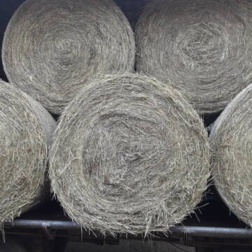
Bio-Luzerneheu aus qualifiziertem Biobetrieb
Altmärkische Höhe OT Losse
Landwirtschaft H.Stoltenberg
@ReiterhofLosse
Heu
Empfänger lädt ab
Großballen
Bio
2 weitere...
B+
Deprecated: Creation of dynamic property Zend_View_Helper_Ads::$adLink is deprecated in /var/www/stall-frei/htdocs/staging.stall-frei.de/library/Psf/View/Helper/Ads.php on line 108

Das Beste für die Hufe
Mechtersen
STALL-FREIde Marketing
@STALL-FREI-Marketing
Hufschmiede und Hufpfleger in Ihrer Nähe
Leider kein Vorschaubild
Leider kein Vorschaubild
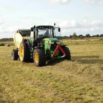
Heulage, Grassamenheu lage 2025
Schwedeneck
Jeannine Wittern
@Jeannine-Wittern
Heulage
Lieferant entlädt
Rundballen
Regenfrei
3 weitere...
B+

Heu/trockene Heulage für Pferde Zucker,Fruktanarm
Sophienhamm
Herr-Kolb
@Herr-Kolb
Heulage
Lieferant entlädt
Regenfrei
Wird verladen
2 weitere...
B+
Eiweisarmes Heu oder Heulage
Sophienhamm
Herr-Kolb
@Herr-Kolb
Heu
Rundballen
Regenfrei
Wird verladen
B+

Persönlichkeitsentwicklung mit Pferden
Bad Salzuflen
Katja Dors
@Pferdezeiten
Begleite andere auf ihrem Entwicklungsweg und entdecke die transformative Kraft der pferdegestützten Persönlichkeitsentwicklung !
neu
R
Leider kein Vorschaubild
Leider kein Vorschaubild
HD-Ballen Handballen Heu Heuballen Ernte 2024
Wolfsburg
Bendlin GbR
@Bendlin_GbR
Heu
Kleinballen/HD-Ballen
Regenfrei
Käufer lädt selbst
2 weitere...
B+
Leider kein Vorschaubild
Leider kein Vorschaubild
HD-Ballen Handballen Stroh Strohballen Ernte 2024
Wolfsburg
Bendlin GbR
@Bendlin_GbR
Stroh
Kleinballen/HD-Ballen
Regenfrei
Käufer lädt selbst
2 weitere...
B+
Heu Rundballen zu verkaufen
Peine
Hof-Hoppenworth
@Hof-Hoppenworth
Heu
Empfänger lädt ab
Rundballen
Regenfrei
3 weitere...
B+

Fruktan- und zuckerarmes Premium Wiesenheu !
Schollene
Guthof Mühlenfels
@Gutshof-Muehlenfels
Heu
Empfänger lädt ab
Rundballen
Regenfrei
3 weitere...
B+

Haferstroh in Futterqualität für gesunde Pferde ...
Schollene
Guthof Mühlenfels
@Gutshof-Muehlenfels
Einstreu
Lieferant entlädt
Großballen
Regenfrei
3 weitere...
B+
Newsletter abonnieren
Melde Dich für unseren Newsletter an und verpasse keine Neuigkeiten!
Deprecated: Creation of dynamic property Zend_View::$pageCount is deprecated in /var/www/stall-frei/htdocs/staging.stall-frei.de/library/vendor/shardj/zf1-future/library/Zend/View/Abstract.php on line 308
Deprecated: Creation of dynamic property Zend_View::$itemCountPerPage is deprecated in /var/www/stall-frei/htdocs/staging.stall-frei.de/library/vendor/shardj/zf1-future/library/Zend/View/Abstract.php on line 308
Deprecated: Creation of dynamic property Zend_View::$first is deprecated in /var/www/stall-frei/htdocs/staging.stall-frei.de/library/vendor/shardj/zf1-future/library/Zend/View/Abstract.php on line 308
Deprecated: Creation of dynamic property Zend_View::$current is deprecated in /var/www/stall-frei/htdocs/staging.stall-frei.de/library/vendor/shardj/zf1-future/library/Zend/View/Abstract.php on line 308
Deprecated: Creation of dynamic property Zend_View::$last is deprecated in /var/www/stall-frei/htdocs/staging.stall-frei.de/library/vendor/shardj/zf1-future/library/Zend/View/Abstract.php on line 308
Deprecated: Creation of dynamic property Zend_View::$previous is deprecated in /var/www/stall-frei/htdocs/staging.stall-frei.de/library/vendor/shardj/zf1-future/library/Zend/View/Abstract.php on line 308
Deprecated: Creation of dynamic property Zend_View::$next is deprecated in /var/www/stall-frei/htdocs/staging.stall-frei.de/library/vendor/shardj/zf1-future/library/Zend/View/Abstract.php on line 308
Deprecated: Creation of dynamic property Zend_View::$pagesInRange is deprecated in /var/www/stall-frei/htdocs/staging.stall-frei.de/library/vendor/shardj/zf1-future/library/Zend/View/Abstract.php on line 308
Deprecated: Creation of dynamic property Zend_View::$firstPageInRange is deprecated in /var/www/stall-frei/htdocs/staging.stall-frei.de/library/vendor/shardj/zf1-future/library/Zend/View/Abstract.php on line 308
Deprecated: Creation of dynamic property Zend_View::$lastPageInRange is deprecated in /var/www/stall-frei/htdocs/staging.stall-frei.de/library/vendor/shardj/zf1-future/library/Zend/View/Abstract.php on line 308
Deprecated: Creation of dynamic property Zend_View::$currentItemCount is deprecated in /var/www/stall-frei/htdocs/staging.stall-frei.de/library/vendor/shardj/zf1-future/library/Zend/View/Abstract.php on line 308
Deprecated: Creation of dynamic property Zend_View::$totalItemCount is deprecated in /var/www/stall-frei/htdocs/staging.stall-frei.de/library/vendor/shardj/zf1-future/library/Zend/View/Abstract.php on line 308
Deprecated: Creation of dynamic property Zend_View::$firstItemNumber is deprecated in /var/www/stall-frei/htdocs/staging.stall-frei.de/library/vendor/shardj/zf1-future/library/Zend/View/Abstract.php on line 308
Deprecated: Creation of dynamic property Zend_View::$lastItemNumber is deprecated in /var/www/stall-frei/htdocs/staging.stall-frei.de/library/vendor/shardj/zf1-future/library/Zend/View/Abstract.php on line 308
Deprecated: Creation of dynamic property Zend_View::$router is deprecated in /var/www/stall-frei/htdocs/staging.stall-frei.de/library/vendor/shardj/zf1-future/library/Zend/View/Abstract.php on line 308
Deprecated: Creation of dynamic property Zend_View::$urlParams is deprecated in /var/www/stall-frei/htdocs/staging.stall-frei.de/library/vendor/shardj/zf1-future/library/Zend/View/Abstract.php on line 308
Deprecated: Creation of dynamic property Zend_View::$showAds is deprecated in /var/www/stall-frei/htdocs/staging.stall-frei.de/library/vendor/shardj/zf1-future/library/Zend/View/Abstract.php on line 308
Deprecated: Creation of dynamic property Zend_View::$objectIds is deprecated in /var/www/stall-frei/htdocs/staging.stall-frei.de/library/vendor/shardj/zf1-future/library/Zend/View/Abstract.php on line 308
Deprecated: Creation of dynamic property Zend_View::$showNavbar is deprecated in /var/www/stall-frei/htdocs/staging.stall-frei.de/library/vendor/shardj/zf1-future/library/Zend/View/Abstract.php on line 308
Deprecated: Creation of dynamic property Zend_View::$showBreadcrumb is deprecated in /var/www/stall-frei/htdocs/staging.stall-frei.de/library/vendor/shardj/zf1-future/library/Zend/View/Abstract.php on line 308
Deprecated: Creation of dynamic property Zend_View::$showFooter is deprecated in /var/www/stall-frei/htdocs/staging.stall-frei.de/library/vendor/shardj/zf1-future/library/Zend/View/Abstract.php on line 308
Deprecated: Creation of dynamic property Zend_View::$showInternalAds is deprecated in /var/www/stall-frei/htdocs/staging.stall-frei.de/library/vendor/shardj/zf1-future/library/Zend/View/Abstract.php on line 308
Deprecated: Creation of dynamic property Zend_View::$blNoContent is deprecated in /var/www/stall-frei/htdocs/staging.stall-frei.de/library/vendor/shardj/zf1-future/library/Zend/View/Abstract.php on line 308
Deprecated: Creation of dynamic property Zend_View::$sMetaDesc is deprecated in /var/www/stall-frei/htdocs/staging.stall-frei.de/library/vendor/shardj/zf1-future/library/Zend/View/Abstract.php on line 308
Deprecated: Creation of dynamic property Zend_View::$useGmaps is deprecated in /var/www/stall-frei/htdocs/staging.stall-frei.de/library/vendor/shardj/zf1-future/library/Zend/View/Abstract.php on line 308
Deprecated: Creation of dynamic property Zend_View::$touches is deprecated in /var/www/stall-frei/htdocs/staging.stall-frei.de/library/vendor/shardj/zf1-future/library/Zend/View/Abstract.php on line 308
Deprecated: Creation of dynamic property Zend_View::$oProject is deprecated in /var/www/stall-frei/htdocs/staging.stall-frei.de/library/vendor/shardj/zf1-future/library/Zend/View/Abstract.php on line 308
Deprecated: Creation of dynamic property Zend_View::$pageHeadline is deprecated in /var/www/stall-frei/htdocs/staging.stall-frei.de/library/vendor/shardj/zf1-future/library/Zend/View/Abstract.php on line 308
Deprecated: Creation of dynamic property Zend_View::$disableLocationField is deprecated in /var/www/stall-frei/htdocs/staging.stall-frei.de/library/vendor/shardj/zf1-future/library/Zend/View/Abstract.php on line 308
Deprecated: Creation of dynamic property Zend_View::$isSearch is deprecated in /var/www/stall-frei/htdocs/staging.stall-frei.de/library/vendor/shardj/zf1-future/library/Zend/View/Abstract.php on line 308
Deprecated: Creation of dynamic property Zend_View::$pageTitle is deprecated in /var/www/stall-frei/htdocs/staging.stall-frei.de/library/vendor/shardj/zf1-future/library/Zend/View/Abstract.php on line 308
Deprecated: Creation of dynamic property Psf_Form_Element_Text::$class is deprecated in /var/www/stall-frei/htdocs/staging.stall-frei.de/library/vendor/shardj/zf1-future/library/Zend/Form/Element.php on line 874
Deprecated: Creation of dynamic property Psf_Form_Element_Text::$size is deprecated in /var/www/stall-frei/htdocs/staging.stall-frei.de/library/vendor/shardj/zf1-future/library/Zend/Form/Element.php on line 874
Deprecated: Creation of dynamic property Psf_Form_Element_Text::$placeholder is deprecated in /var/www/stall-frei/htdocs/staging.stall-frei.de/library/vendor/shardj/zf1-future/library/Zend/Form/Element.php on line 874
Deprecated: Creation of dynamic property Psf_Form_Element_Hidden::$class is deprecated in /var/www/stall-frei/htdocs/staging.stall-frei.de/library/vendor/shardj/zf1-future/library/Zend/Form/Element.php on line 874
Deprecated: Creation of dynamic property Psf_Form_Element_Hidden::$class is deprecated in /var/www/stall-frei/htdocs/staging.stall-frei.de/library/vendor/shardj/zf1-future/library/Zend/Form/Element.php on line 874
Deprecated: Creation of dynamic property Psf_Form_Element_Hidden::$class is deprecated in /var/www/stall-frei/htdocs/staging.stall-frei.de/library/vendor/shardj/zf1-future/library/Zend/Form/Element.php on line 874
Deprecated: Creation of dynamic property Psf_Form_Element_Hidden::$class is deprecated in /var/www/stall-frei/htdocs/staging.stall-frei.de/library/vendor/shardj/zf1-future/library/Zend/Form/Element.php on line 874
Deprecated: Creation of dynamic property Psf_Form_Element_Select::$class is deprecated in /var/www/stall-frei/htdocs/staging.stall-frei.de/library/vendor/shardj/zf1-future/library/Zend/Form/Element.php on line 874
Deprecated: Creation of dynamic property Psf_Form_Element_Select::$class is deprecated in /var/www/stall-frei/htdocs/staging.stall-frei.de/library/vendor/shardj/zf1-future/library/Zend/Form/Element.php on line 874
Deprecated: Creation of dynamic property Psf_Form_Element_Select::$class is deprecated in /var/www/stall-frei/htdocs/staging.stall-frei.de/library/vendor/shardj/zf1-future/library/Zend/Form/Element.php on line 874
Deprecated: Creation of dynamic property Psf_Form_Element_Select::$class is deprecated in /var/www/stall-frei/htdocs/staging.stall-frei.de/library/vendor/shardj/zf1-future/library/Zend/Form/Element.php on line 874
Deprecated: Creation of dynamic property Zend_View::$sort is deprecated in /var/www/stall-frei/htdocs/staging.stall-frei.de/library/vendor/shardj/zf1-future/library/Zend/View/Abstract.php on line 308
Deprecated: Creation of dynamic property Zend_View::$searchLocation is deprecated in /var/www/stall-frei/htdocs/staging.stall-frei.de/library/vendor/shardj/zf1-future/library/Zend/View/Abstract.php on line 308
Deprecated: Creation of dynamic property Zend_View::$locationHint is deprecated in /var/www/stall-frei/htdocs/staging.stall-frei.de/library/vendor/shardj/zf1-future/library/Zend/View/Abstract.php on line 308
Psf_GeoCoder_Abstract::getLocation: Woltersdorf Get Location CachedOrLive
Psf_GeoCoder_Abstract::getCachedOrLive: Woltersdorf
Psf_GeoCoder_Abstract::convertLocationResult
{"documentation":"https:\/\/opencagedata.com\/api","licenses":[{"name":"see attribution guide","url":"https:\/\/opencagedata.com\/credits"}],"results":[{"bounds":{"northeast":{"lat":53.5879542,"lng":10.6784138},"southwest":{"lat":53.5578618,"lng":10.6269453}},"components":{"ISO_3166-1_alpha-2":"DE","ISO_3166-1_alpha-3":"DEU","ISO_3166-2":["DE-SH"],"_category":"place","_normalized_city":"Woltersdorf","_type":"village","continent":"Europe","country":"Deutschland","country_code":"de","county":"Kreis Herzogtum Lauenburg","municipality":"Breitenfelde","political_union":"European Union","state":"Schleswig-Holstein","state_code":"SH","village":"Woltersdorf"},"confidence":7,"formatted":"Woltersdorf, Schleswig-Holstein, Deutschland","geometry":{"lat":53.5776994,"lng":10.6387716}},{"bounds":{"northeast":{"lat":52.46711,"lng":13.8019811},"southwest":{"lat":52.4306745,"lng":13.7205844}},"components":{"ISO_3166-1_alpha-2":"DE","ISO_3166-1_alpha-3":"DEU","ISO_3166-2":["DE-BB"],"_category":"place","_normalized_city":"Woltersdorf","_type":"village","continent":"Europe","country":"Deutschland","country_code":"de","county":"Oder-Spree","political_union":"European Union","postcode":"15569","state":"Brandenburg","state_code":"BB","village":"Woltersdorf"},"confidence":7,"formatted":"15569 Woltersdorf, Deutschland","geometry":{"lat":52.4501217,"lng":13.7551242}},{"bounds":{"northeast":{"lat":52.9835019,"lng":11.2999308},"southwest":{"lat":52.9178002,"lng":11.194647}},"components":{"ISO_3166-1_alpha-2":"DE","ISO_3166-1_alpha-3":"DEU","ISO_3166-2":["DE-NI"],"_category":"place","_normalized_city":"Woltersdorf","_type":"village","continent":"Europe","country":"Deutschland","country_code":"de","county":"Landkreis L\u00fcchow-Dannenberg","municipality":"Samtgemeinde L\u00fcchow (Wendland)","political_union":"European Union","postcode":"29497","state":"Niedersachsen","state_code":"NI","village":"Woltersdorf"},"confidence":7,"formatted":"29497 Woltersdorf, Deutschland","geometry":{"lat":52.9542692,"lng":11.2203966}},{"bounds":{"northeast":{"lat":52.1704287,"lng":11.8092722},"southwest":{"lat":52.1389999,"lng":11.7407866}},"components":{"ISO_3166-1_alpha-2":"DE","ISO_3166-1_alpha-3":"DEU","ISO_3166-2":["DE-ST"],"_category":"place","_normalized_city":"Biederitz","_type":"village","city":"Biederitz","continent":"Europe","country":"Deutschland","country_code":"de","county":"Jerichower Land","political_union":"European Union","state":"Sachsen-Anhalt","state_code":"ST","village":"Woltersdorf"},"confidence":7,"formatted":"Woltersdorf, Sachsen-Anhalt, Deutschland","geometry":{"lat":52.1553178,"lng":11.777534}},{"bounds":{"northeast":{"lat":52.1833126,"lng":13.2762049},"southwest":{"lat":52.0311546,"lng":13.1342457}},"components":{"ISO_3166-1_alpha-2":"DE","ISO_3166-1_alpha-3":"DEU","ISO_3166-2":["DE-BB"],"_category":"place","_normalized_city":"Woltersdorf","_type":"village","continent":"Europe","country":"Deutschland","country_code":"de","county":"Teltow-Fl\u00e4ming","municipality":"Nuthe-Urstromtal","political_union":"European Union","state":"Brandenburg","state_code":"BB","village":"Woltersdorf"},"confidence":6,"formatted":"Woltersdorf, Brandenburg, Deutschland","geometry":{"lat":52.1142539,"lng":13.203966}},{"bounds":{"northeast":{"lat":53.201012,"lng":14.2445464},"southwest":{"lat":53.1637455,"lng":14.184137}},"components":{"ISO_3166-1_alpha-2":"DE","ISO_3166-1_alpha-3":"DEU","ISO_3166-2":["DE-BB"],"_category":"place","_normalized_city":"Casekow","_type":"village","city":"Casekow","continent":"Europe","country":"Deutschland","country_code":"de","county":"Uckermark","municipality":"Gartz (Oder)","political_union":"European Union","state":"Brandenburg","state_code":"BB","village":"Woltersdorf"},"confidence":7,"formatted":"Woltersdorf, Brandenburg, Deutschland","geometry":{"lat":53.1791986,"lng":14.2181284}},{"bounds":{"northeast":{"lat":52.417803,"lng":12.3949207},"southwest":{"lat":52.3889601,"lng":12.335193}},"components":{"ISO_3166-1_alpha-2":"DE","ISO_3166-1_alpha-3":"DEU","ISO_3166-2":["DE-BB"],"_category":"place","_normalized_city":"Woltersdorf","_type":"village","continent":"Europe","country":"Deutschland","country_code":"de","county":"Potsdam-Mittelmark","municipality":"Bensdorf","political_union":"European Union","state":"Brandenburg","state_code":"BB","village":"Woltersdorf"},"confidence":7,"formatted":"Woltersdorf, Brandenburg, Deutschland","geometry":{"lat":52.4079298,"lng":12.370298}},{"bounds":{"northeast":{"lat":52.6806622,"lng":13.405015},"southwest":{"lat":52.6406622,"lng":13.365015}},"components":{"ISO_3166-1_alpha-2":"DE","ISO_3166-1_alpha-3":"DEU","ISO_3166-2":["DE-BB"],"_category":"place","_normalized_city":"M\u00fchlenbecker Land","_type":"hamlet","city":"M\u00fchlenbecker Land","continent":"Europe","country":"Deutschland","country_code":"de","county":"Oberhavel","hamlet":"Woltersdorf","political_union":"European Union","postcode":"16567","state":"Brandenburg","state_code":"BB","village":"M\u00fchlenbeck"},"confidence":7,"formatted":"Woltersdorf, 16567 M\u00fchlenbeck, Deutschland","geometry":{"lat":52.6606622,"lng":13.385015}},{"bounds":{"northeast":{"lat":52.7484501,"lng":13.5873945},"southwest":{"lat":52.7084501,"lng":13.5473945}},"components":{"ISO_3166-1_alpha-2":"DE","ISO_3166-1_alpha-3":"DEU","ISO_3166-2":["DE-BB"],"_category":"place","_normalized_city":"Bernau","_type":"hamlet","city_district":"Lobetal","continent":"Europe","country":"Deutschland","country_code":"de","county":"Barnim","hamlet":"Woltersdorf","political_union":"European Union","state":"Brandenburg","state_code":"BB","town":"Bernau"},"confidence":7,"formatted":"Woltersdorf, Lobetal, Bernau, Brandenburg, Deutschland","geometry":{"lat":52.7284501,"lng":13.5673945}},{"bounds":{"northeast":{"lat":52.9808085,"lng":12.7240854},"southwest":{"lat":52.9408085,"lng":12.6840854}},"components":{"ISO_3166-1_alpha-2":"DE","ISO_3166-1_alpha-3":"DEU","ISO_3166-2":["DE-BB"],"_category":"place","_normalized_city":"M\u00e4rkisch Linden","_type":"hamlet","city":"M\u00e4rkisch Linden","continent":"Europe","country":"Deutschland","country_code":"de","county":"Ostprignitz-Ruppin","hamlet":"Woltersdorf","municipality":"Darritz-Wahlendorf","political_union":"European Union","state":"Brandenburg","state_code":"BB"},"confidence":7,"formatted":"Woltersdorf, M\u00e4rkisch Linden, Brandenburg, Deutschland","geometry":{"lat":52.9608085,"lng":12.7040854}}],"status":{"code":200,"message":"OK"},"stay_informed":{"blog":"https:\/\/blog.opencagedata.com","mastodon":"https:\/\/en.osm.town\/@opencage"},"thanks":"For using an OpenCage API","timestamp":{"created_http":"Sat, 07 Feb 2026 22:56:26 GMT","created_unix":1770504986},"total_results":10}Array
(
[0] => stdClass Object
(
[bounds] => stdClass Object
(
[northeast] => stdClass Object
(
[lat] => 53.5879542
[lng] => 10.6784138
)
[southwest] => stdClass Object
(
[lat] => 53.5578618
[lng] => 10.6269453
)
)
[components] => stdClass Object
(
[ISO_3166-1_alpha-2] => DE
[ISO_3166-1_alpha-3] => DEU
[ISO_3166-2] => Array
(
[0] => DE-SH
)
[_category] => place
[_normalized_city] => Woltersdorf
[_type] => village
[continent] => Europe
[country] => Deutschland
[country_code] => de
[county] => Kreis Herzogtum Lauenburg
[municipality] => Breitenfelde
[political_union] => European Union
[state] => Schleswig-Holstein
[state_code] => SH
[village] => Woltersdorf
)
[confidence] => 7
[formatted] => Woltersdorf, Schleswig-Holstein, Deutschland
[geometry] => stdClass Object
(
[lat] => 53.5776994
[lng] => 10.6387716
)
)
[1] => stdClass Object
(
[bounds] => stdClass Object
(
[northeast] => stdClass Object
(
[lat] => 52.46711
[lng] => 13.8019811
)
[southwest] => stdClass Object
(
[lat] => 52.4306745
[lng] => 13.7205844
)
)
[components] => stdClass Object
(
[ISO_3166-1_alpha-2] => DE
[ISO_3166-1_alpha-3] => DEU
[ISO_3166-2] => Array
(
[0] => DE-BB
)
[_category] => place
[_normalized_city] => Woltersdorf
[_type] => village
[continent] => Europe
[country] => Deutschland
[country_code] => de
[county] => Oder-Spree
[political_union] => European Union
[postcode] => 15569
[state] => Brandenburg
[state_code] => BB
[village] => Woltersdorf
)
[confidence] => 7
[formatted] => 15569 Woltersdorf, Deutschland
[geometry] => stdClass Object
(
[lat] => 52.4501217
[lng] => 13.7551242
)
)
[2] => stdClass Object
(
[bounds] => stdClass Object
(
[northeast] => stdClass Object
(
[lat] => 52.9835019
[lng] => 11.2999308
)
[southwest] => stdClass Object
(
[lat] => 52.9178002
[lng] => 11.194647
)
)
[components] => stdClass Object
(
[ISO_3166-1_alpha-2] => DE
[ISO_3166-1_alpha-3] => DEU
[ISO_3166-2] => Array
(
[0] => DE-NI
)
[_category] => place
[_normalized_city] => Woltersdorf
[_type] => village
[continent] => Europe
[country] => Deutschland
[country_code] => de
[county] => Landkreis Lüchow-Dannenberg
[municipality] => Samtgemeinde Lüchow (Wendland)
[political_union] => European Union
[postcode] => 29497
[state] => Niedersachsen
[state_code] => NI
[village] => Woltersdorf
)
[confidence] => 7
[formatted] => 29497 Woltersdorf, Deutschland
[geometry] => stdClass Object
(
[lat] => 52.9542692
[lng] => 11.2203966
)
)
[3] => stdClass Object
(
[bounds] => stdClass Object
(
[northeast] => stdClass Object
(
[lat] => 52.1704287
[lng] => 11.8092722
)
[southwest] => stdClass Object
(
[lat] => 52.1389999
[lng] => 11.7407866
)
)
[components] => stdClass Object
(
[ISO_3166-1_alpha-2] => DE
[ISO_3166-1_alpha-3] => DEU
[ISO_3166-2] => Array
(
[0] => DE-ST
)
[_category] => place
[_normalized_city] => Biederitz
[_type] => village
[city] => Biederitz
[continent] => Europe
[country] => Deutschland
[country_code] => de
[county] => Jerichower Land
[political_union] => European Union
[state] => Sachsen-Anhalt
[state_code] => ST
[village] => Woltersdorf
)
[confidence] => 7
[formatted] => Woltersdorf, Sachsen-Anhalt, Deutschland
[geometry] => stdClass Object
(
[lat] => 52.1553178
[lng] => 11.777534
)
)
[4] => stdClass Object
(
[bounds] => stdClass Object
(
[northeast] => stdClass Object
(
[lat] => 52.1833126
[lng] => 13.2762049
)
[southwest] => stdClass Object
(
[lat] => 52.0311546
[lng] => 13.1342457
)
)
[components] => stdClass Object
(
[ISO_3166-1_alpha-2] => DE
[ISO_3166-1_alpha-3] => DEU
[ISO_3166-2] => Array
(
[0] => DE-BB
)
[_category] => place
[_normalized_city] => Woltersdorf
[_type] => village
[continent] => Europe
[country] => Deutschland
[country_code] => de
[county] => Teltow-Fläming
[municipality] => Nuthe-Urstromtal
[political_union] => European Union
[state] => Brandenburg
[state_code] => BB
[village] => Woltersdorf
)
[confidence] => 6
[formatted] => Woltersdorf, Brandenburg, Deutschland
[geometry] => stdClass Object
(
[lat] => 52.1142539
[lng] => 13.203966
)
)
[5] => stdClass Object
(
[bounds] => stdClass Object
(
[northeast] => stdClass Object
(
[lat] => 53.201012
[lng] => 14.2445464
)
[southwest] => stdClass Object
(
[lat] => 53.1637455
[lng] => 14.184137
)
)
[components] => stdClass Object
(
[ISO_3166-1_alpha-2] => DE
[ISO_3166-1_alpha-3] => DEU
[ISO_3166-2] => Array
(
[0] => DE-BB
)
[_category] => place
[_normalized_city] => Casekow
[_type] => village
[city] => Casekow
[continent] => Europe
[country] => Deutschland
[country_code] => de
[county] => Uckermark
[municipality] => Gartz (Oder)
[political_union] => European Union
[state] => Brandenburg
[state_code] => BB
[village] => Woltersdorf
)
[confidence] => 7
[formatted] => Woltersdorf, Brandenburg, Deutschland
[geometry] => stdClass Object
(
[lat] => 53.1791986
[lng] => 14.2181284
)
)
[6] => stdClass Object
(
[bounds] => stdClass Object
(
[northeast] => stdClass Object
(
[lat] => 52.417803
[lng] => 12.3949207
)
[southwest] => stdClass Object
(
[lat] => 52.3889601
[lng] => 12.335193
)
)
[components] => stdClass Object
(
[ISO_3166-1_alpha-2] => DE
[ISO_3166-1_alpha-3] => DEU
[ISO_3166-2] => Array
(
[0] => DE-BB
)
[_category] => place
[_normalized_city] => Woltersdorf
[_type] => village
[continent] => Europe
[country] => Deutschland
[country_code] => de
[county] => Potsdam-Mittelmark
[municipality] => Bensdorf
[political_union] => European Union
[state] => Brandenburg
[state_code] => BB
[village] => Woltersdorf
)
[confidence] => 7
[formatted] => Woltersdorf, Brandenburg, Deutschland
[geometry] => stdClass Object
(
[lat] => 52.4079298
[lng] => 12.370298
)
)
[7] => stdClass Object
(
[bounds] => stdClass Object
(
[northeast] => stdClass Object
(
[lat] => 52.6806622
[lng] => 13.405015
)
[southwest] => stdClass Object
(
[lat] => 52.6406622
[lng] => 13.365015
)
)
[components] => stdClass Object
(
[ISO_3166-1_alpha-2] => DE
[ISO_3166-1_alpha-3] => DEU
[ISO_3166-2] => Array
(
[0] => DE-BB
)
[_category] => place
[_normalized_city] => Mühlenbecker Land
[_type] => hamlet
[city] => Mühlenbecker Land
[continent] => Europe
[country] => Deutschland
[country_code] => de
[county] => Oberhavel
[hamlet] => Woltersdorf
[political_union] => European Union
[postcode] => 16567
[state] => Brandenburg
[state_code] => BB
[village] => Mühlenbeck
)
[confidence] => 7
[formatted] => Woltersdorf, 16567 Mühlenbeck, Deutschland
[geometry] => stdClass Object
(
[lat] => 52.6606622
[lng] => 13.385015
)
)
[8] => stdClass Object
(
[bounds] => stdClass Object
(
[northeast] => stdClass Object
(
[lat] => 52.7484501
[lng] => 13.5873945
)
[southwest] => stdClass Object
(
[lat] => 52.7084501
[lng] => 13.5473945
)
)
[components] => stdClass Object
(
[ISO_3166-1_alpha-2] => DE
[ISO_3166-1_alpha-3] => DEU
[ISO_3166-2] => Array
(
[0] => DE-BB
)
[_category] => place
[_normalized_city] => Bernau
[_type] => hamlet
[city_district] => Lobetal
[continent] => Europe
[country] => Deutschland
[country_code] => de
[county] => Barnim
[hamlet] => Woltersdorf
[political_union] => European Union
[state] => Brandenburg
[state_code] => BB
[town] => Bernau
)
[confidence] => 7
[formatted] => Woltersdorf, Lobetal, Bernau, Brandenburg, Deutschland
[geometry] => stdClass Object
(
[lat] => 52.7284501
[lng] => 13.5673945
)
)
[9] => stdClass Object
(
[bounds] => stdClass Object
(
[northeast] => stdClass Object
(
[lat] => 52.9808085
[lng] => 12.7240854
)
[southwest] => stdClass Object
(
[lat] => 52.9408085
[lng] => 12.6840854
)
)
[components] => stdClass Object
(
[ISO_3166-1_alpha-2] => DE
[ISO_3166-1_alpha-3] => DEU
[ISO_3166-2] => Array
(
[0] => DE-BB
)
[_category] => place
[_normalized_city] => Märkisch Linden
[_type] => hamlet
[city] => Märkisch Linden
[continent] => Europe
[country] => Deutschland
[country_code] => de
[county] => Ostprignitz-Ruppin
[hamlet] => Woltersdorf
[municipality] => Darritz-Wahlendorf
[political_union] => European Union
[state] => Brandenburg
[state_code] => BB
)
[confidence] => 7
[formatted] => Woltersdorf, Märkisch Linden, Brandenburg, Deutschland
[geometry] => stdClass Object
(
[lat] => 52.9608085
[lng] => 12.7040854
)
)
)
Psf_GeoCoder_OpenCageData::getKeyMap: 0
stdClass Object
(
    [bounds] => stdClass Object
        (
            [northeast] => stdClass Object
                (
                    [lat] => 53.5879542
                    [lng] => 10.6784138
                )

            [southwest] => stdClass Object
                (
                    [lat] => 53.5578618
                    [lng] => 10.6269453
                )

        )

    [components] => stdClass Object
        (
            [ISO_3166-1_alpha-2] => DE
            [ISO_3166-1_alpha-3] => DEU
            [ISO_3166-2] => Array
                (
                    [0] => DE-SH
                )

            [_category] => place
            [_normalized_city] => Woltersdorf
            [_type] => village
            [continent] => Europe
            [country] => Deutschland
            [country_code] => de
            [county] => Kreis Herzogtum Lauenburg
            [municipality] => Breitenfelde
            [political_union] => European Union
            [state] => Schleswig-Holstein
            [state_code] => SH
            [village] => Woltersdorf
        )

    [confidence] => 7
    [formatted] => Woltersdorf, Schleswig-Holstein, Deutschland
    [geometry] => stdClass Object
        (
            [lat] => 53.5776994
            [lng] => 10.6387716
        )

)
Psf_GeoCoder_OpenCageData::getCounty: Herzogtum Lauenburg
Psf_GeoCoder_OpenCageData::addMissingData REFETCH!
Array
(
    [address] => Woltersdorf, Schleswig-Holstein, Deutschland
    [type] => village
    [street] =>
    [city] => Woltersdorf
    [county] => Herzogtum Lauenburg
    [state] => Schleswig-Holstein
    [zip] =>
    [country] => Deutschland
    [suburb] =>
    [countrycode] => de
    [latitude] => 53.5776994
    [longitude] => 10.6387716
    [accuracy] => 1
    [confidence] => 7
    [bounds] => stdClass Object
        (
            [northeast] => stdClass Object
                (
                    [lat] => 53.5879542
                    [lng] => 10.6784138
                )

            [southwest] => stdClass Object
                (
                    [lat] => 53.5578618
                    [lng] => 10.6269453
                )

        )

)
reformat!
Array
(
    [address] => Woltersdorf, Schleswig-Holstein, Deutschland
    [type] => village
    [street] =>
    [city] => Woltersdorf
    [county] => Herzogtum Lauenburg
    [state] => Schleswig-Holstein
    [zip] =>
    [country] => Deutschland
    [suburb] =>
    [countrycode] => de
    [latitude] => 53.5776994
    [longitude] => 10.6387716
    [accuracy] => 1
    [confidence] => 7
    [bounds] => stdClass Object
        (
            [northeast] => stdClass Object
                (
                    [lat] => 53.5879542
                    [lng] => 10.6784138
                )

            [southwest] => stdClass Object
                (
                    [lat] => 53.5578618
                    [lng] => 10.6269453
                )

        )

    [place] => Woltersdorf, Schleswig-Holstein
    [hash] => 1020627430d7c45a1a3a9de965cda327
)
Psf_GeoCoder_OpenCageData::getKeyMap: 1
stdClass Object
(
    [bounds] => stdClass Object
        (
            [northeast] => stdClass Object
                (
                    [lat] => 52.46711
                    [lng] => 13.8019811
                )

            [southwest] => stdClass Object
                (
                    [lat] => 52.4306745
                    [lng] => 13.7205844
                )

        )

    [components] => stdClass Object
        (
            [ISO_3166-1_alpha-2] => DE
            [ISO_3166-1_alpha-3] => DEU
            [ISO_3166-2] => Array
                (
                    [0] => DE-BB
                )

            [_category] => place
            [_normalized_city] => Woltersdorf
            [_type] => village
            [continent] => Europe
            [country] => Deutschland
            [country_code] => de
            [county] => Oder-Spree
            [political_union] => European Union
            [postcode] => 15569
            [state] => Brandenburg
            [state_code] => BB
            [village] => Woltersdorf
        )

    [confidence] => 7
    [formatted] => 15569 Woltersdorf, Deutschland
    [geometry] => stdClass Object
        (
            [lat] => 52.4501217
            [lng] => 13.7551242
        )

)
Psf_GeoCoder_OpenCageData::getCounty: Oder-Spree
Psf_GeoCoder_OpenCageData::addMissingData REFETCH!
Array
(
    [address] => 15569 Woltersdorf, Deutschland
    [type] => village
    [street] =>
    [city] => Woltersdorf
    [county] => Oder-Spree
    [state] => Brandenburg
    [zip] => 15569
    [country] => Deutschland
    [suburb] =>
    [countrycode] => de
    [latitude] => 52.4501217
    [longitude] => 13.7551242
    [accuracy] => 1
    [confidence] => 7
    [bounds] => stdClass Object
        (
            [northeast] => stdClass Object
                (
                    [lat] => 52.46711
                    [lng] => 13.8019811
                )

            [southwest] => stdClass Object
                (
                    [lat] => 52.4306745
                    [lng] => 13.7205844
                )

        )

)
reformat!
Array
(
    [address] => 15569 Woltersdorf, Deutschland
    [type] => village
    [street] =>
    [city] => Woltersdorf
    [county] => Oder-Spree
    [state] => Brandenburg
    [zip] => 15569
    [country] => Deutschland
    [suburb] =>
    [countrycode] => de
    [latitude] => 52.4501217
    [longitude] => 13.7551242
    [accuracy] => 1
    [confidence] => 7
    [bounds] => stdClass Object
        (
            [northeast] => stdClass Object
                (
                    [lat] => 52.46711
                    [lng] => 13.8019811
                )

            [southwest] => stdClass Object
                (
                    [lat] => 52.4306745
                    [lng] => 13.7205844
                )

        )

    [place] => 15569 Woltersdorf, Brandenburg
    [hash] => 46aa3ef79df4c9524c41a665456a7a7d
)
Psf_GeoCoder_OpenCageData::getKeyMap: 2
stdClass Object
(
    [bounds] => stdClass Object
        (
            [northeast] => stdClass Object
                (
                    [lat] => 52.9835019
                    [lng] => 11.2999308
                )

            [southwest] => stdClass Object
                (
                    [lat] => 52.9178002
                    [lng] => 11.194647
                )

        )

    [components] => stdClass Object
        (
            [ISO_3166-1_alpha-2] => DE
            [ISO_3166-1_alpha-3] => DEU
            [ISO_3166-2] => Array
                (
                    [0] => DE-NI
                )

            [_category] => place
            [_normalized_city] => Woltersdorf
            [_type] => village
            [continent] => Europe
            [country] => Deutschland
            [country_code] => de
            [county] => Landkreis Lüchow-Dannenberg
            [municipality] => Samtgemeinde Lüchow (Wendland)
            [political_union] => European Union
            [postcode] => 29497
            [state] => Niedersachsen
            [state_code] => NI
            [village] => Woltersdorf
        )

    [confidence] => 7
    [formatted] => 29497 Woltersdorf, Deutschland
    [geometry] => stdClass Object
        (
            [lat] => 52.9542692
            [lng] => 11.2203966
        )

)
Psf_GeoCoder_OpenCageData::getCounty: Lüchow-Dannenberg
Psf_GeoCoder_OpenCageData::addMissingData REFETCH!
Array
(
    [address] => 29497 Woltersdorf, Deutschland
    [type] => village
    [street] =>
    [city] => Woltersdorf
    [county] => Lüchow-Dannenberg
    [state] => Niedersachsen
    [zip] => 29497
    [country] => Deutschland
    [suburb] =>
    [countrycode] => de
    [latitude] => 52.9542692
    [longitude] => 11.2203966
    [accuracy] => 1
    [confidence] => 7
    [bounds] => stdClass Object
        (
            [northeast] => stdClass Object
                (
                    [lat] => 52.9835019
                    [lng] => 11.2999308
                )

            [southwest] => stdClass Object
                (
                    [lat] => 52.9178002
                    [lng] => 11.194647
                )

        )

)
reformat!
Array
(
    [address] => 29497 Woltersdorf, Deutschland
    [type] => village
    [street] =>
    [city] => Woltersdorf
    [county] => Lüchow-Dannenberg
    [state] => Niedersachsen
    [zip] => 29497
    [country] => Deutschland
    [suburb] =>
    [countrycode] => de
    [latitude] => 52.9542692
    [longitude] => 11.2203966
    [accuracy] => 1
    [confidence] => 7
    [bounds] => stdClass Object
        (
            [northeast] => stdClass Object
                (
                    [lat] => 52.9835019
                    [lng] => 11.2999308
                )

            [southwest] => stdClass Object
                (
                    [lat] => 52.9178002
                    [lng] => 11.194647
                )

        )

    [place] => 29497 Woltersdorf, Niedersachsen
    [hash] => a8b595a876d0289ae788eeb5da4dbae4
)
Psf_GeoCoder_OpenCageData::getKeyMap: 3
stdClass Object
(
    [bounds] => stdClass Object
        (
            [northeast] => stdClass Object
                (
                    [lat] => 52.1704287
                    [lng] => 11.8092722
                )

            [southwest] => stdClass Object
                (
                    [lat] => 52.1389999
                    [lng] => 11.7407866
                )

        )

    [components] => stdClass Object
        (
            [ISO_3166-1_alpha-2] => DE
            [ISO_3166-1_alpha-3] => DEU
            [ISO_3166-2] => Array
                (
                    [0] => DE-ST
                )

            [_category] => place
            [_normalized_city] => Biederitz
            [_type] => village
            [city] => Biederitz
            [continent] => Europe
            [country] => Deutschland
            [country_code] => de
            [county] => Jerichower Land
            [political_union] => European Union
            [state] => Sachsen-Anhalt
            [state_code] => ST
            [village] => Woltersdorf
        )

    [confidence] => 7
    [formatted] => Woltersdorf, Sachsen-Anhalt, Deutschland
    [geometry] => stdClass Object
        (
            [lat] => 52.1553178
            [lng] => 11.777534
        )

)
Psf_GeoCoder_OpenCageData::getCounty: Jerichower Land
Psf_GeoCoder_OpenCageData::addMissingData REFETCH!
Array
(
    [address] => Woltersdorf, Sachsen-Anhalt, Deutschland
    [type] => village
    [street] =>
    [city] => Woltersdorf
    [county] => Jerichower Land
    [state] => Sachsen-Anhalt
    [zip] =>
    [country] => Deutschland
    [suburb] =>
    [countrycode] => de
    [latitude] => 52.1553178
    [longitude] => 11.777534
    [accuracy] => 1
    [confidence] => 7
    [bounds] => stdClass Object
        (
            [northeast] => stdClass Object
                (
                    [lat] => 52.1704287
                    [lng] => 11.8092722
                )

            [southwest] => stdClass Object
                (
                    [lat] => 52.1389999
                    [lng] => 11.7407866
                )

        )

)
reformat!
Array
(
    [address] => Woltersdorf, Sachsen-Anhalt, Deutschland
    [type] => village
    [street] =>
    [city] => Woltersdorf
    [county] => Jerichower Land
    [state] => Sachsen-Anhalt
    [zip] =>
    [country] => Deutschland
    [suburb] =>
    [countrycode] => de
    [latitude] => 52.1553178
    [longitude] => 11.777534
    [accuracy] => 1
    [confidence] => 7
    [bounds] => stdClass Object
        (
            [northeast] => stdClass Object
                (
                    [lat] => 52.1704287
                    [lng] => 11.8092722
                )

            [southwest] => stdClass Object
                (
                    [lat] => 52.1389999
                    [lng] => 11.7407866
                )

        )

    [place] => Woltersdorf, Sachsen-Anhalt
    [hash] => 80aec39b03b407a59037834e37e39b62
)
Psf_GeoCoder_OpenCageData::getKeyMap: 4
stdClass Object
(
    [bounds] => stdClass Object
        (
            [northeast] => stdClass Object
                (
                    [lat] => 52.1833126
                    [lng] => 13.2762049
                )

            [southwest] => stdClass Object
                (
                    [lat] => 52.0311546
                    [lng] => 13.1342457
                )

        )

    [components] => stdClass Object
        (
            [ISO_3166-1_alpha-2] => DE
            [ISO_3166-1_alpha-3] => DEU
            [ISO_3166-2] => Array
                (
                    [0] => DE-BB
                )

            [_category] => place
            [_normalized_city] => Woltersdorf
            [_type] => village
            [continent] => Europe
            [country] => Deutschland
            [country_code] => de
            [county] => Teltow-Fläming
            [municipality] => Nuthe-Urstromtal
            [political_union] => European Union
            [state] => Brandenburg
            [state_code] => BB
            [village] => Woltersdorf
        )

    [confidence] => 6
    [formatted] => Woltersdorf, Brandenburg, Deutschland
    [geometry] => stdClass Object
        (
            [lat] => 52.1142539
            [lng] => 13.203966
        )

)
Psf_GeoCoder_OpenCageData::getCounty: Teltow-Fläming
Psf_GeoCoder_OpenCageData::addMissingData REFETCH!
Array
(
    [address] => Woltersdorf, Brandenburg, Deutschland
    [type] => village
    [street] =>
    [city] => Woltersdorf
    [county] => Teltow-Fläming
    [state] => Brandenburg
    [zip] =>
    [country] => Deutschland
    [suburb] =>
    [countrycode] => de
    [latitude] => 52.1142539
    [longitude] => 13.203966
    [accuracy] => 1
    [confidence] => 6
    [bounds] => stdClass Object
        (
            [northeast] => stdClass Object
                (
                    [lat] => 52.1833126
                    [lng] => 13.2762049
                )

            [southwest] => stdClass Object
                (
                    [lat] => 52.0311546
                    [lng] => 13.1342457
                )

        )

)
reformat!
Array
(
    [address] => Woltersdorf, Brandenburg, Deutschland
    [type] => village
    [street] =>
    [city] => Woltersdorf
    [county] => Teltow-Fläming
    [state] => Brandenburg
    [zip] =>
    [country] => Deutschland
    [suburb] =>
    [countrycode] => de
    [latitude] => 52.1142539
    [longitude] => 13.203966
    [accuracy] => 1
    [confidence] => 6
    [bounds] => stdClass Object
        (
            [northeast] => stdClass Object
                (
                    [lat] => 52.1833126
                    [lng] => 13.2762049
                )

            [southwest] => stdClass Object
                (
                    [lat] => 52.0311546
                    [lng] => 13.1342457
                )

        )

    [place] => Woltersdorf, Brandenburg
    [hash] => 4513e4f4c149629902f983b26d2b2424
)
Psf_GeoCoder_OpenCageData::getKeyMap: 5
stdClass Object
(
    [bounds] => stdClass Object
        (
            [northeast] => stdClass Object
                (
                    [lat] => 53.201012
                    [lng] => 14.2445464
                )

            [southwest] => stdClass Object
                (
                    [lat] => 53.1637455
                    [lng] => 14.184137
                )

        )

    [components] => stdClass Object
        (
            [ISO_3166-1_alpha-2] => DE
            [ISO_3166-1_alpha-3] => DEU
            [ISO_3166-2] => Array
                (
                    [0] => DE-BB
                )

            [_category] => place
            [_normalized_city] => Casekow
            [_type] => village
            [city] => Casekow
            [continent] => Europe
            [country] => Deutschland
            [country_code] => de
            [county] => Uckermark
            [municipality] => Gartz (Oder)
            [political_union] => European Union
            [state] => Brandenburg
            [state_code] => BB
            [village] => Woltersdorf
        )

    [confidence] => 7
    [formatted] => Woltersdorf, Brandenburg, Deutschland
    [geometry] => stdClass Object
        (
            [lat] => 53.1791986
            [lng] => 14.2181284
        )

)
Psf_GeoCoder_OpenCageData::getCounty: Uckermark
Psf_GeoCoder_OpenCageData::addMissingData REFETCH!
Array
(
    [address] => Woltersdorf, Brandenburg, Deutschland
    [type] => village
    [street] =>
    [city] => Woltersdorf
    [county] => Uckermark
    [state] => Brandenburg
    [zip] =>
    [country] => Deutschland
    [suburb] =>
    [countrycode] => de
    [latitude] => 53.1791986
    [longitude] => 14.2181284
    [accuracy] => 1
    [confidence] => 7
    [bounds] => stdClass Object
        (
            [northeast] => stdClass Object
                (
                    [lat] => 53.201012
                    [lng] => 14.2445464
                )

            [southwest] => stdClass Object
                (
                    [lat] => 53.1637455
                    [lng] => 14.184137
                )

        )

)
reformat!
Array
(
    [address] => Woltersdorf, Brandenburg, Deutschland
    [type] => village
    [street] =>
    [city] => Woltersdorf
    [county] => Uckermark
    [state] => Brandenburg
    [zip] =>
    [country] => Deutschland
    [suburb] =>
    [countrycode] => de
    [latitude] => 53.1791986
    [longitude] => 14.2181284
    [accuracy] => 1
    [confidence] => 7
    [bounds] => stdClass Object
        (
            [northeast] => stdClass Object
                (
                    [lat] => 53.201012
                    [lng] => 14.2445464
                )

            [southwest] => stdClass Object
                (
                    [lat] => 53.1637455
                    [lng] => 14.184137
                )

        )

    [place] => Woltersdorf, Brandenburg
    [hash] => 4513e4f4c149629902f983b26d2b2424
)
Psf_GeoCoder_OpenCageData::getKeyMap: 6
stdClass Object
(
    [bounds] => stdClass Object
        (
            [northeast] => stdClass Object
                (
                    [lat] => 52.417803
                    [lng] => 12.3949207
                )

            [southwest] => stdClass Object
                (
                    [lat] => 52.3889601
                    [lng] => 12.335193
                )

        )

    [components] => stdClass Object
        (
            [ISO_3166-1_alpha-2] => DE
            [ISO_3166-1_alpha-3] => DEU
            [ISO_3166-2] => Array
                (
                    [0] => DE-BB
                )

            [_category] => place
            [_normalized_city] => Woltersdorf
            [_type] => village
            [continent] => Europe
            [country] => Deutschland
            [country_code] => de
            [county] => Potsdam-Mittelmark
            [municipality] => Bensdorf
            [political_union] => European Union
            [state] => Brandenburg
            [state_code] => BB
            [village] => Woltersdorf
        )

    [confidence] => 7
    [formatted] => Woltersdorf, Brandenburg, Deutschland
    [geometry] => stdClass Object
        (
            [lat] => 52.4079298
            [lng] => 12.370298
        )

)
Psf_GeoCoder_OpenCageData::getCounty: Potsdam-Mittelmark
Psf_GeoCoder_OpenCageData::addMissingData REFETCH!
Array
(
    [address] => Woltersdorf, Brandenburg, Deutschland
    [type] => village
    [street] =>
    [city] => Woltersdorf
    [county] => Potsdam-Mittelmark
    [state] => Brandenburg
    [zip] =>
    [country] => Deutschland
    [suburb] =>
    [countrycode] => de
    [latitude] => 52.4079298
    [longitude] => 12.370298
    [accuracy] => 1
    [confidence] => 7
    [bounds] => stdClass Object
        (
            [northeast] => stdClass Object
                (
                    [lat] => 52.417803
                    [lng] => 12.3949207
                )

            [southwest] => stdClass Object
                (
                    [lat] => 52.3889601
                    [lng] => 12.335193
                )

        )

)
reformat!
Array
(
    [address] => Woltersdorf, Brandenburg, Deutschland
    [type] => village
    [street] =>
    [city] => Woltersdorf
    [county] => Potsdam-Mittelmark
    [state] => Brandenburg
    [zip] =>
    [country] => Deutschland
    [suburb] =>
    [countrycode] => de
    [latitude] => 52.4079298
    [longitude] => 12.370298
    [accuracy] => 1
    [confidence] => 7
    [bounds] => stdClass Object
        (
            [northeast] => stdClass Object
                (
                    [lat] => 52.417803
                    [lng] => 12.3949207
                )

            [southwest] => stdClass Object
                (
                    [lat] => 52.3889601
                    [lng] => 12.335193
                )

        )

    [place] => Woltersdorf, Brandenburg
    [hash] => 4513e4f4c149629902f983b26d2b2424
)
Psf_GeoCoder_OpenCageData::getKeyMap: 7
stdClass Object
(
    [bounds] => stdClass Object
        (
            [northeast] => stdClass Object
                (
                    [lat] => 52.6806622
                    [lng] => 13.405015
                )

            [southwest] => stdClass Object
                (
                    [lat] => 52.6406622
                    [lng] => 13.365015
                )

        )

    [components] => stdClass Object
        (
            [ISO_3166-1_alpha-2] => DE
            [ISO_3166-1_alpha-3] => DEU
            [ISO_3166-2] => Array
                (
                    [0] => DE-BB
                )

            [_category] => place
            [_normalized_city] => Mühlenbecker Land
            [_type] => hamlet
            [city] => Mühlenbecker Land
            [continent] => Europe
            [country] => Deutschland
            [country_code] => de
            [county] => Oberhavel
            [hamlet] => Woltersdorf
            [political_union] => European Union
            [postcode] => 16567
            [state] => Brandenburg
            [state_code] => BB
            [village] => Mühlenbeck
        )

    [confidence] => 7
    [formatted] => Woltersdorf, 16567 Mühlenbeck, Deutschland
    [geometry] => stdClass Object
        (
            [lat] => 52.6606622
            [lng] => 13.385015
        )

)
Psf_GeoCoder_OpenCageData::getCounty: Oberhavel
Psf_GeoCoder_OpenCageData::addMissingData REFETCH!
Array
(
    [address] => Woltersdorf, 16567 Mühlenbeck, Deutschland
    [type] => hamlet
    [street] => Woltersdorf
    [city] => Mühlenbeck
    [county] => Oberhavel
    [state] => Brandenburg
    [zip] => 16567
    [country] => Deutschland
    [suburb] =>
    [countrycode] => de
    [latitude] => 52.6606622
    [longitude] => 13.385015
    [accuracy] => 1
    [confidence] => 7
    [bounds] => stdClass Object
        (
            [northeast] => stdClass Object
                (
                    [lat] => 52.6806622
                    [lng] => 13.405015
                )

            [southwest] => stdClass Object
                (
                    [lat] => 52.6406622
                    [lng] => 13.365015
                )

        )

)
reformat!
Array
(
    [address] => Woltersdorf, 16567 Mühlenbeck, Deutschland
    [type] => hamlet
    [street] => Woltersdorf
    [city] => Mühlenbeck
    [county] => Oberhavel
    [state] => Brandenburg
    [zip] => 16567
    [country] => Deutschland
    [suburb] =>
    [countrycode] => de
    [latitude] => 52.6606622
    [longitude] => 13.385015
    [accuracy] => 1
    [confidence] => 7
    [bounds] => stdClass Object
        (
            [northeast] => stdClass Object
                (
                    [lat] => 52.6806622
                    [lng] => 13.405015
                )

            [southwest] => stdClass Object
                (
                    [lat] => 52.6406622
                    [lng] => 13.365015
                )

        )

    [place] => Woltersdorf, 16567 Mühlenbeck, Brandenburg
    [hash] => ac18d5711cd031ab9a92a61f10b45172
)
Psf_GeoCoder_OpenCageData::getKeyMap: 8
stdClass Object
(
    [bounds] => stdClass Object
        (
            [northeast] => stdClass Object
                (
                    [lat] => 52.7484501
                    [lng] => 13.5873945
                )

            [southwest] => stdClass Object
                (
                    [lat] => 52.7084501
                    [lng] => 13.5473945
                )

        )

    [components] => stdClass Object
        (
            [ISO_3166-1_alpha-2] => DE
            [ISO_3166-1_alpha-3] => DEU
            [ISO_3166-2] => Array
                (
                    [0] => DE-BB
                )

            [_category] => place
            [_normalized_city] => Bernau
            [_type] => hamlet
            [city_district] => Lobetal
            [continent] => Europe
            [country] => Deutschland
            [country_code] => de
            [county] => Barnim
            [hamlet] => Woltersdorf
            [political_union] => European Union
            [state] => Brandenburg
            [state_code] => BB
            [town] => Bernau
        )

    [confidence] => 7
    [formatted] => Woltersdorf, Lobetal, Bernau, Brandenburg, Deutschland
    [geometry] => stdClass Object
        (
            [lat] => 52.7284501
            [lng] => 13.5673945
        )

)
Psf_GeoCoder_OpenCageData::getCounty: Barnim
Psf_GeoCoder_OpenCageData::addMissingData REFETCH!
Array
(
    [address] => Woltersdorf, Lobetal, Bernau, Brandenburg, Deutschland
    [type] => hamlet
    [street] => Woltersdorf
    [city] => Bernau
    [county] => Barnim
    [state] => Brandenburg
    [zip] =>
    [country] => Deutschland
    [suburb] =>
    [countrycode] => de
    [latitude] => 52.7284501
    [longitude] => 13.5673945
    [accuracy] => 1
    [confidence] => 7
    [bounds] => stdClass Object
        (
            [northeast] => stdClass Object
                (
                    [lat] => 52.7484501
                    [lng] => 13.5873945
                )

            [southwest] => stdClass Object
                (
                    [lat] => 52.7084501
                    [lng] => 13.5473945
                )

        )

)
reformat!
Array
(
    [address] => Woltersdorf, Lobetal, Bernau, Brandenburg, Deutschland
    [type] => hamlet
    [street] => Woltersdorf
    [city] => Bernau
    [county] => Barnim
    [state] => Brandenburg
    [zip] =>
    [country] => Deutschland
    [suburb] =>
    [countrycode] => de
    [latitude] => 52.7284501
    [longitude] => 13.5673945
    [accuracy] => 1
    [confidence] => 7
    [bounds] => stdClass Object
        (
            [northeast] => stdClass Object
                (
                    [lat] => 52.7484501
                    [lng] => 13.5873945
                )

            [southwest] => stdClass Object
                (
                    [lat] => 52.7084501
                    [lng] => 13.5473945
                )

        )

    [place] => Woltersdorf, Bernau, Brandenburg
    [hash] => d2f87ab06a8fb3c54ff290a2939cf7a4
)
Psf_GeoCoder_OpenCageData::getKeyMap: 9
stdClass Object
(
    [bounds] => stdClass Object
        (
            [northeast] => stdClass Object
                (
                    [lat] => 52.9808085
                    [lng] => 12.7240854
                )

            [southwest] => stdClass Object
                (
                    [lat] => 52.9408085
                    [lng] => 12.6840854
                )

        )

    [components] => stdClass Object
        (
            [ISO_3166-1_alpha-2] => DE
            [ISO_3166-1_alpha-3] => DEU
            [ISO_3166-2] => Array
                (
                    [0] => DE-BB
                )

            [_category] => place
            [_normalized_city] => Märkisch Linden
            [_type] => hamlet
            [city] => Märkisch Linden
            [continent] => Europe
            [country] => Deutschland
            [country_code] => de
            [county] => Ostprignitz-Ruppin
            [hamlet] => Woltersdorf
            [municipality] => Darritz-Wahlendorf
            [political_union] => European Union
            [state] => Brandenburg
            [state_code] => BB
        )

    [confidence] => 7
    [formatted] => Woltersdorf, Märkisch Linden, Brandenburg, Deutschland
    [geometry] => stdClass Object
        (
            [lat] => 52.9608085
            [lng] => 12.7040854
        )

)
Psf_GeoCoder_OpenCageData::getCounty: Ostprignitz-Ruppin
Psf_GeoCoder_OpenCageData::addMissingData REFETCH!
Array
(
    [address] => Woltersdorf, Märkisch Linden, Brandenburg, Deutschland
    [type] => hamlet
    [street] => Woltersdorf
    [city] => Märkisch Linden
    [county] => Ostprignitz-Ruppin
    [state] => Brandenburg
    [zip] =>
    [country] => Deutschland
    [suburb] =>
    [countrycode] => de
    [latitude] => 52.9608085
    [longitude] => 12.7040854
    [accuracy] => 1
    [confidence] => 7
    [bounds] => stdClass Object
        (
            [northeast] => stdClass Object
                (
                    [lat] => 52.9808085
                    [lng] => 12.7240854
                )

            [southwest] => stdClass Object
                (
                    [lat] => 52.9408085
                    [lng] => 12.6840854
                )

        )

)
reformat!
Array
(
    [address] => Woltersdorf, Märkisch Linden, Brandenburg, Deutschland
    [type] => hamlet
    [street] => Woltersdorf
    [city] => Märkisch Linden
    [county] => Ostprignitz-Ruppin
    [state] => Brandenburg
    [zip] =>
    [country] => Deutschland
    [suburb] =>
    [countrycode] => de
    [latitude] => 52.9608085
    [longitude] => 12.7040854
    [accuracy] => 1
    [confidence] => 7
    [bounds] => stdClass Object
        (
            [northeast] => stdClass Object
                (
                    [lat] => 52.9808085
                    [lng] => 12.7240854
                )

            [southwest] => stdClass Object
                (
                    [lat] => 52.9408085
                    [lng] => 12.6840854
                )

        )

    [place] => Woltersdorf, Märkisch Linden, Brandenburg
    [hash] => 6b5ba9d099b41f393ecedb06bf9dae0f
)
Deprecated: Creation of dynamic property Zend_View::$locationHintStyle is deprecated in /var/www/stall-frei/htdocs/staging.stall-frei.de/library/vendor/shardj/zf1-future/library/Zend/View/Abstract.php on line 308
Deprecated: Creation of dynamic property Zend_View::$adGeoLocation is deprecated in /var/www/stall-frei/htdocs/staging.stall-frei.de/library/vendor/shardj/zf1-future/library/Zend/View/Abstract.php on line 308
Deprecated: Creation of dynamic property Zend_View::$recordCount is deprecated in /var/www/stall-frei/htdocs/staging.stall-frei.de/library/vendor/shardj/zf1-future/library/Zend/View/Abstract.php on line 308
Deprecated: Creation of dynamic property Zend_View::$paginationParams is deprecated in /var/www/stall-frei/htdocs/staging.stall-frei.de/library/vendor/shardj/zf1-future/library/Zend/View/Abstract.php on line 308
Deprecated: Creation of dynamic property Zend_View::$objectPaginator is deprecated in /var/www/stall-frei/htdocs/staging.stall-frei.de/library/vendor/shardj/zf1-future/library/Zend/View/Abstract.php on line 308
Deprecated: Creation of dynamic property Zend_View::$featuredObjects is deprecated in /var/www/stall-frei/htdocs/staging.stall-frei.de/library/vendor/shardj/zf1-future/library/Zend/View/Abstract.php on line 308
Deprecated: Creation of dynamic property Zend_View::$hints is deprecated in /var/www/stall-frei/htdocs/staging.stall-frei.de/library/vendor/shardj/zf1-future/library/Zend/View/Abstract.php on line 308
Deprecated: Creation of dynamic property Zend_View::$attributeHints is deprecated in /var/www/stall-frei/htdocs/staging.stall-frei.de/library/vendor/shardj/zf1-future/library/Zend/View/Abstract.php on line 308
Deprecated: Creation of dynamic property Zend_View::$oSearchForm is deprecated in /var/www/stall-frei/htdocs/staging.stall-frei.de/library/vendor/shardj/zf1-future/library/Zend/View/Abstract.php on line 308