Deprecated: Creation of dynamic property Zend_View::$sMode is deprecated in /var/www/stall-frei/htdocs/staging.stall-frei.de/library/vendor/shardj/zf1-future/library/Zend/View/Abstract.php on line 308
Heu, Stroh oder Futter
Gesucht wird in "07985 Elsterberg, Deutschland"
92 Einträge
Deprecated: Creation of dynamic property Zend_View::$listObjects is deprecated in /var/www/stall-frei/htdocs/staging.stall-frei.de/library/vendor/shardj/zf1-future/library/Zend/View/Abstract.php on line 308
Deprecated: Creation of dynamic property Zend_View::$listMode is deprecated in /var/www/stall-frei/htdocs/staging.stall-frei.de/library/vendor/shardj/zf1-future/library/Zend/View/Abstract.php on line 308
Deprecated: Creation of dynamic property Zend_View::$renderedObjects is deprecated in /var/www/stall-frei/htdocs/staging.stall-frei.de/library/vendor/shardj/zf1-future/library/Zend/View/Abstract.php on line 308
Deprecated: Creation of dynamic property Zend_View::$index is deprecated in /var/www/stall-frei/htdocs/staging.stall-frei.de/library/vendor/shardj/zf1-future/library/Zend/View/Abstract.php on line 308
Deprecated: Creation of dynamic property Zend_View::$displayMode is deprecated in /var/www/stall-frei/htdocs/staging.stall-frei.de/library/vendor/shardj/zf1-future/library/Zend/View/Abstract.php on line 308
Deprecated: Creation of dynamic property Zend_View::$remarketingIds is deprecated in /var/www/stall-frei/htdocs/staging.stall-frei.de/library/vendor/shardj/zf1-future/library/Zend/View/Abstract.php on line 308
Deprecated: Creation of dynamic property Zend_View::$listItem is deprecated in /var/www/stall-frei/htdocs/staging.stall-frei.de/library/vendor/shardj/zf1-future/library/Zend/View/Abstract.php on line 308
Deprecated: Creation of dynamic property Zend_View::$object is deprecated in /var/www/stall-frei/htdocs/staging.stall-frei.de/library/vendor/shardj/zf1-future/library/Zend/View/Abstract.php on line 308
Deprecated: Creation of dynamic property Zend_View::$attributes is deprecated in /var/www/stall-frei/htdocs/staging.stall-frei.de/library/vendor/shardj/zf1-future/library/Zend/View/Abstract.php on line 308
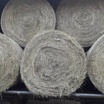
Heu Rundballen zu verkaufen
Peine
Hof-Hoppenworth
@Hof-Hoppenworth
Heu
Empfänger lädt ab
Rundballen
Regenfrei
3 weitere...
B+
Deprecated: Creation of dynamic property Zend_View_Helper_Ads::$adLink is deprecated in /var/www/stall-frei/htdocs/staging.stall-frei.de/library/Psf/View/Helper/Ads.php on line 108

Job gesucht?
Mechtersen
STALL-FREIde Marketing
@STALL-FREI-Marketing
Sie suchen einen Job und arbeiten gerne mit Pferden oder auf Reitanlagen?
Besuchen Sie jetzt unseren Stellenmarkt!


Strohpellet, Strohgranulat, Heu & Stroh
Allmannshofen
J&M Kratzer
@JMKratzer
Einstreu
Lieferant entlädt
Pellets
Wird verladen
2 weitere...
P+

Rundballen Stroh
Elze-Esbeck
Hof Bartels
@Bartels
Stroh
Lieferant entlädt
Rundballen
Regenfrei
3 weitere...
B+
Leider kein Vorschaubild
Leider kein Vorschaubild
Heu zu verkaufen
Kremmen OT Staffelde
Rhinland Reitpark GmbH
@Rhinland-Reitpark
Heu
Empfänger lädt ab
Rundballen
Regenfrei
3 weitere...
B+

B+
Leider kein Vorschaubild
Leider kein Vorschaubild
Bio-Luzerneheu aus qualifiziertem Biobetrieb
Altmärkische Höhe OT Losse
Landwirtschaft H.Stoltenberg
@ReiterhofLosse
Heu
Empfänger lädt ab
Großballen
Bio
2 weitere...
B+

Futtersack HeuToy, Fressbremse in pink
Mechtersen
STALL-FREIde Marketing
@STALL-FREI-Marketing
Stundenlange Beschäftigung die
Koliken vorbeugt, geringe Staubinhalation mit
steuerbarer Futterentnahme
Leider kein Vorschaubild
Leider kein Vorschaubild
Biohafer zu verkaufen
Altmärkische Höhe OT Losse
Landwirtschaft H.Stoltenberg
@ReiterhofLosse
Futter
Empfänger lädt ab
Lose
Bio
Regenfrei
2 weitere...
B+
Leider kein Vorschaubild
Leider kein Vorschaubild
Bio-Heu Rundballen zu verkaufen
Biebertal
Lindenhoefe
@Lindenhoefe
Heu
Lieferant entlädt
Rundballen
Wird verladen
2 weitere...
B+

Biete Heu in Rundballen
Steinheim am Albuch
Westernreiterhof Ziegler
@NadinZiegler
Heu
Rundballen
Bio
Regenfrei
Wird verladen
1 weitere...
B+

Gurbe Pferdefutter
Mühltal
Schäfer
@Tina-Schaefer
Futter
Pellets
Bio
Käufer lädt selbst
1 weitere...
B+
Veröffentliche deine Suche als Gesuch und Suchauftrag, dann erhältst du Angebote, neue Treffer und Änderungen per E-Mail.
Diese Suche als Gesuch veröffentlichenDeprecated: Creation of dynamic property Zend_View::$pageCount is deprecated in /var/www/stall-frei/htdocs/staging.stall-frei.de/library/vendor/shardj/zf1-future/library/Zend/View/Abstract.php on line 308
Deprecated: Creation of dynamic property Zend_View::$itemCountPerPage is deprecated in /var/www/stall-frei/htdocs/staging.stall-frei.de/library/vendor/shardj/zf1-future/library/Zend/View/Abstract.php on line 308
Deprecated: Creation of dynamic property Zend_View::$first is deprecated in /var/www/stall-frei/htdocs/staging.stall-frei.de/library/vendor/shardj/zf1-future/library/Zend/View/Abstract.php on line 308
Deprecated: Creation of dynamic property Zend_View::$current is deprecated in /var/www/stall-frei/htdocs/staging.stall-frei.de/library/vendor/shardj/zf1-future/library/Zend/View/Abstract.php on line 308
Deprecated: Creation of dynamic property Zend_View::$last is deprecated in /var/www/stall-frei/htdocs/staging.stall-frei.de/library/vendor/shardj/zf1-future/library/Zend/View/Abstract.php on line 308
Deprecated: Creation of dynamic property Zend_View::$previous is deprecated in /var/www/stall-frei/htdocs/staging.stall-frei.de/library/vendor/shardj/zf1-future/library/Zend/View/Abstract.php on line 308
Deprecated: Creation of dynamic property Zend_View::$next is deprecated in /var/www/stall-frei/htdocs/staging.stall-frei.de/library/vendor/shardj/zf1-future/library/Zend/View/Abstract.php on line 308
Deprecated: Creation of dynamic property Zend_View::$pagesInRange is deprecated in /var/www/stall-frei/htdocs/staging.stall-frei.de/library/vendor/shardj/zf1-future/library/Zend/View/Abstract.php on line 308
Deprecated: Creation of dynamic property Zend_View::$firstPageInRange is deprecated in /var/www/stall-frei/htdocs/staging.stall-frei.de/library/vendor/shardj/zf1-future/library/Zend/View/Abstract.php on line 308
Deprecated: Creation of dynamic property Zend_View::$lastPageInRange is deprecated in /var/www/stall-frei/htdocs/staging.stall-frei.de/library/vendor/shardj/zf1-future/library/Zend/View/Abstract.php on line 308
Deprecated: Creation of dynamic property Zend_View::$currentItemCount is deprecated in /var/www/stall-frei/htdocs/staging.stall-frei.de/library/vendor/shardj/zf1-future/library/Zend/View/Abstract.php on line 308
Deprecated: Creation of dynamic property Zend_View::$totalItemCount is deprecated in /var/www/stall-frei/htdocs/staging.stall-frei.de/library/vendor/shardj/zf1-future/library/Zend/View/Abstract.php on line 308
Deprecated: Creation of dynamic property Zend_View::$firstItemNumber is deprecated in /var/www/stall-frei/htdocs/staging.stall-frei.de/library/vendor/shardj/zf1-future/library/Zend/View/Abstract.php on line 308
Deprecated: Creation of dynamic property Zend_View::$lastItemNumber is deprecated in /var/www/stall-frei/htdocs/staging.stall-frei.de/library/vendor/shardj/zf1-future/library/Zend/View/Abstract.php on line 308
Deprecated: Creation of dynamic property Zend_View::$router is deprecated in /var/www/stall-frei/htdocs/staging.stall-frei.de/library/vendor/shardj/zf1-future/library/Zend/View/Abstract.php on line 308
Deprecated: Creation of dynamic property Zend_View::$urlParams is deprecated in /var/www/stall-frei/htdocs/staging.stall-frei.de/library/vendor/shardj/zf1-future/library/Zend/View/Abstract.php on line 308
Deprecated: Creation of dynamic property Zend_View::$showAds is deprecated in /var/www/stall-frei/htdocs/staging.stall-frei.de/library/vendor/shardj/zf1-future/library/Zend/View/Abstract.php on line 308
Deprecated: Creation of dynamic property Zend_View::$objectIds is deprecated in /var/www/stall-frei/htdocs/staging.stall-frei.de/library/vendor/shardj/zf1-future/library/Zend/View/Abstract.php on line 308
Deprecated: Creation of dynamic property Zend_View::$showNavbar is deprecated in /var/www/stall-frei/htdocs/staging.stall-frei.de/library/vendor/shardj/zf1-future/library/Zend/View/Abstract.php on line 308
Deprecated: Creation of dynamic property Zend_View::$showBreadcrumb is deprecated in /var/www/stall-frei/htdocs/staging.stall-frei.de/library/vendor/shardj/zf1-future/library/Zend/View/Abstract.php on line 308
Deprecated: Creation of dynamic property Zend_View::$showFooter is deprecated in /var/www/stall-frei/htdocs/staging.stall-frei.de/library/vendor/shardj/zf1-future/library/Zend/View/Abstract.php on line 308
Deprecated: Creation of dynamic property Zend_View::$showInternalAds is deprecated in /var/www/stall-frei/htdocs/staging.stall-frei.de/library/vendor/shardj/zf1-future/library/Zend/View/Abstract.php on line 308
Deprecated: Creation of dynamic property Zend_View::$blNoContent is deprecated in /var/www/stall-frei/htdocs/staging.stall-frei.de/library/vendor/shardj/zf1-future/library/Zend/View/Abstract.php on line 308
Deprecated: Creation of dynamic property Zend_View::$sMetaDesc is deprecated in /var/www/stall-frei/htdocs/staging.stall-frei.de/library/vendor/shardj/zf1-future/library/Zend/View/Abstract.php on line 308
Deprecated: Creation of dynamic property Zend_View::$useGmaps is deprecated in /var/www/stall-frei/htdocs/staging.stall-frei.de/library/vendor/shardj/zf1-future/library/Zend/View/Abstract.php on line 308
Deprecated: Creation of dynamic property Zend_View::$touches is deprecated in /var/www/stall-frei/htdocs/staging.stall-frei.de/library/vendor/shardj/zf1-future/library/Zend/View/Abstract.php on line 308
Deprecated: Creation of dynamic property Zend_View::$oProject is deprecated in /var/www/stall-frei/htdocs/staging.stall-frei.de/library/vendor/shardj/zf1-future/library/Zend/View/Abstract.php on line 308
Deprecated: Creation of dynamic property Zend_View::$pageHeadline is deprecated in /var/www/stall-frei/htdocs/staging.stall-frei.de/library/vendor/shardj/zf1-future/library/Zend/View/Abstract.php on line 308
Deprecated: Creation of dynamic property Zend_View::$disableLocationField is deprecated in /var/www/stall-frei/htdocs/staging.stall-frei.de/library/vendor/shardj/zf1-future/library/Zend/View/Abstract.php on line 308
Deprecated: Creation of dynamic property Zend_View::$isSearch is deprecated in /var/www/stall-frei/htdocs/staging.stall-frei.de/library/vendor/shardj/zf1-future/library/Zend/View/Abstract.php on line 308
Deprecated: Creation of dynamic property Zend_View::$pageTitle is deprecated in /var/www/stall-frei/htdocs/staging.stall-frei.de/library/vendor/shardj/zf1-future/library/Zend/View/Abstract.php on line 308
Deprecated: Creation of dynamic property Psf_Form_Element_Text::$class is deprecated in /var/www/stall-frei/htdocs/staging.stall-frei.de/library/vendor/shardj/zf1-future/library/Zend/Form/Element.php on line 874
Deprecated: Creation of dynamic property Psf_Form_Element_Text::$size is deprecated in /var/www/stall-frei/htdocs/staging.stall-frei.de/library/vendor/shardj/zf1-future/library/Zend/Form/Element.php on line 874
Deprecated: Creation of dynamic property Psf_Form_Element_Text::$placeholder is deprecated in /var/www/stall-frei/htdocs/staging.stall-frei.de/library/vendor/shardj/zf1-future/library/Zend/Form/Element.php on line 874
Deprecated: Creation of dynamic property Psf_Form_Element_Hidden::$class is deprecated in /var/www/stall-frei/htdocs/staging.stall-frei.de/library/vendor/shardj/zf1-future/library/Zend/Form/Element.php on line 874
Deprecated: Creation of dynamic property Psf_Form_Element_Hidden::$class is deprecated in /var/www/stall-frei/htdocs/staging.stall-frei.de/library/vendor/shardj/zf1-future/library/Zend/Form/Element.php on line 874
Deprecated: Creation of dynamic property Psf_Form_Element_Hidden::$class is deprecated in /var/www/stall-frei/htdocs/staging.stall-frei.de/library/vendor/shardj/zf1-future/library/Zend/Form/Element.php on line 874
Deprecated: Creation of dynamic property Psf_Form_Element_Hidden::$class is deprecated in /var/www/stall-frei/htdocs/staging.stall-frei.de/library/vendor/shardj/zf1-future/library/Zend/Form/Element.php on line 874
Deprecated: Creation of dynamic property Psf_Form_Element_Select::$class is deprecated in /var/www/stall-frei/htdocs/staging.stall-frei.de/library/vendor/shardj/zf1-future/library/Zend/Form/Element.php on line 874
Deprecated: Creation of dynamic property Psf_Form_Element_Select::$class is deprecated in /var/www/stall-frei/htdocs/staging.stall-frei.de/library/vendor/shardj/zf1-future/library/Zend/Form/Element.php on line 874
Deprecated: Creation of dynamic property Psf_Form_Element_Select::$class is deprecated in /var/www/stall-frei/htdocs/staging.stall-frei.de/library/vendor/shardj/zf1-future/library/Zend/Form/Element.php on line 874
Deprecated: Creation of dynamic property Psf_Form_Element_Select::$class is deprecated in /var/www/stall-frei/htdocs/staging.stall-frei.de/library/vendor/shardj/zf1-future/library/Zend/Form/Element.php on line 874
Deprecated: Creation of dynamic property Zend_View::$sort is deprecated in /var/www/stall-frei/htdocs/staging.stall-frei.de/library/vendor/shardj/zf1-future/library/Zend/View/Abstract.php on line 308
Deprecated: Creation of dynamic property Zend_View::$searchLocation is deprecated in /var/www/stall-frei/htdocs/staging.stall-frei.de/library/vendor/shardj/zf1-future/library/Zend/View/Abstract.php on line 308
Deprecated: Creation of dynamic property Zend_View::$locationHint is deprecated in /var/www/stall-frei/htdocs/staging.stall-frei.de/library/vendor/shardj/zf1-future/library/Zend/View/Abstract.php on line 308
Psf_GeoCoder_Abstract::getLocation: Elsterberg Get Location CachedOrLive
Psf_GeoCoder_Abstract::getCachedOrLive: Elsterberg
Psf_GeoCoder_Abstract::convertLocationResult
{"documentation":"https:\/\/opencagedata.com\/api","licenses":[{"name":"see attribution guide","url":"https:\/\/opencagedata.com\/credits"}],"results":[{"bounds":{"northeast":{"lat":50.6420294,"lng":12.2240975},"southwest":{"lat":50.5801114,"lng":12.1096317}},"components":{"ISO_3166-1_alpha-2":"DE","ISO_3166-1_alpha-3":"DEU","ISO_3166-2":["DE-SN"],"_category":"place","_normalized_city":"Elsterberg","_type":"municipality","continent":"Europe","country":"Deutschland","country_code":"de","county":"Vogtlandkreis","municipality":"Elsterberg","political_union":"European Union","postcode":"07985","state":"Sachsen","state_code":"SN"},"confidence":7,"formatted":"07985 Elsterberg, Deutschland","geometry":{"lat":50.6036333,"lng":12.176645}},{"bounds":{"northeast":{"lat":50.6483425,"lng":12.2079628},"southwest":{"lat":50.5683425,"lng":12.1279628}},"components":{"ISO_3166-1_alpha-2":"DE","ISO_3166-1_alpha-3":"DEU","ISO_3166-2":["DE-SN"],"_category":"place","_normalized_city":"Elsterberg","_type":"city","continent":"Europe","country":"Deutschland","country_code":"de","county":"Vogtlandkreis","municipality":"Elsterberg","political_union":"European Union","postcode":"07985","state":"Sachsen","state_code":"SN","town":"Elsterberg"},"confidence":7,"formatted":"07985 Elsterberg, Deutschland","geometry":{"lat":50.6083425,"lng":12.1679628}},{"bounds":{"northeast":{"lat":51.2047179,"lng":9.0602602},"southwest":{"lat":51.2046179,"lng":9.0601602}},"components":{"ISO_3166-1_alpha-2":"DE","ISO_3166-1_alpha-3":"DEU","ISO_3166-2":["DE-HE"],"_category":"natural\/water","_normalized_city":"Waldeck","_type":"peak","continent":"Europe","country":"Deutschland","country_code":"de","county":"Landkreis Waldeck-Frankenberg","municipality":"Waldeck","peak":"Elsterberg","political_union":"European Union","postcode":"34513","state":"Hessen","state_code":"HE","village":"Waldeck"},"confidence":9,"formatted":"Elsterberg, 34513 Waldeck, Deutschland","geometry":{"lat":51.2046679,"lng":9.0602102}},{"bounds":{"northeast":{"lat":50.9215479,"lng":10.357623},"southwest":{"lat":50.9214479,"lng":10.357523}},"components":{"ISO_3166-1_alpha-2":"DE","ISO_3166-1_alpha-3":"DEU","ISO_3166-2":["DE-TH"],"_category":"natural\/water","_normalized_city":"Wutha-Farnroda","_type":"peak","continent":"Europe","country":"Deutschland","country_code":"de","county":"Wartburgkreis","peak":"Elsterberg","political_union":"European Union","postcode":"99842","state":"Th\u00fcringen","state_code":"TH","town":"Wutha-Farnroda"},"confidence":9,"formatted":"Elsterberg, 99842 Wutha-Farnroda, Deutschland","geometry":{"lat":50.9214979,"lng":10.357573}},{"bounds":{"northeast":{"lat":51.934143,"lng":10.4842674},"southwest":{"lat":51.934043,"lng":10.4841674}},"components":{"ISO_3166-1_alpha-2":"DE","ISO_3166-1_alpha-3":"DEU","ISO_3166-2":["DE-NI"],"_category":"natural\/water","_normalized_city":"Goslar","_type":"peak","continent":"Europe","country":"Deutschland","country_code":"de","county":"Landkreis Goslar","peak":"Elsterberg","political_union":"European Union","postcode":"38642","state":"Niedersachsen","state_code":"NI","town":"Goslar"},"confidence":9,"formatted":"Elsterberg, 38642 Goslar, Deutschland","geometry":{"lat":51.934093,"lng":10.4842174}},{"bounds":{"northeast":{"lat":50.7194876,"lng":11.4434383},"southwest":{"lat":50.7193876,"lng":11.4433383}},"components":{"ISO_3166-1_alpha-2":"DE","ISO_3166-1_alpha-3":"DEU","ISO_3166-2":["DE-TH"],"_category":"natural\/water","_normalized_city":"Uhlst\u00e4dt-Kirchhasel","_type":"peak","city":"Uhlst\u00e4dt-Kirchhasel","continent":"Europe","country":"Deutschland","country_code":"de","county":"Landkreis Saalfeld-Rudolstadt","municipality":"Kamsdorf","peak":"Elsterberg","political_union":"European Union","state":"Th\u00fcringen","state_code":"TH"},"confidence":9,"formatted":"Elsterberg, Uhlst\u00e4dt-Kirchhasel, Th\u00fcringen, Deutschland","geometry":{"lat":50.7194376,"lng":11.4433883}},{"bounds":{"northeast":{"lat":51.5428911,"lng":10.6114384},"southwest":{"lat":51.5427911,"lng":10.6113384}},"components":{"ISO_3166-1_alpha-2":"DE","ISO_3166-1_alpha-3":"DEU","ISO_3166-2":["DE-TH"],"_category":"natural\/water","_normalized_city":"Hohenstein","_type":"peak","city":"Hohenstein","continent":"Europe","country":"Deutschland","country_code":"de","county":"Landkreis Nordhausen","peak":"Elsterberg","political_union":"European Union","postcode":"99755","state":"Th\u00fcringen","state_code":"TH"},"confidence":9,"formatted":"Elsterberg, 99755 Hohenstein, Deutschland","geometry":{"lat":51.5428411,"lng":10.6113884}},{"bounds":{"northeast":{"lat":50.902514,"lng":10.9849284},"southwest":{"lat":50.902414,"lng":10.9848284}},"components":{"ISO_3166-1_alpha-2":"DE","ISO_3166-1_alpha-3":"DEU","ISO_3166-2":["DE-TH"],"_category":"government","_normalized_city":"Amt Wachsenburg","_type":"administrative","administrative":"Amt Wachsenburg","continent":"Europe","country":"Deutschland","country_code":"de","county":"Ilm-Kreis","municipality":"Amt Wachsenburg","peak":"Elsterberg","political_union":"European Union","postcode":"99334","state":"Th\u00fcringen","state_code":"TH"},"confidence":9,"formatted":"Amt Wachsenburg, Elsterberg, 99334 Amt Wachsenburg, Deutschland","geometry":{"lat":50.902464,"lng":10.9848784}},{"bounds":{"northeast":{"lat":50.833497,"lng":11.5240645},"southwest":{"lat":50.833397,"lng":11.5239645}},"components":{"ISO_3166-1_alpha-2":"DE","ISO_3166-1_alpha-3":"DEU","ISO_3166-2":["DE-TH"],"_category":"natural\/water","_normalized_city":"Altenberga","_type":"peak","continent":"Europe","country":"Deutschland","country_code":"de","county":"Saale-Holzland-Kreis","municipality":"S\u00fcdliches Saaletal","peak":"Elsterberg","political_union":"European Union","state":"Th\u00fcringen","state_code":"TH","village":"Altenberga"},"confidence":9,"formatted":"Elsterberg, Altenberga, Th\u00fcringen, Deutschland","geometry":{"lat":50.833447,"lng":11.5240145}},{"bounds":{"northeast":{"lat":51.569916,"lng":13.1778161},"southwest":{"lat":51.529916,"lng":13.1378161}},"components":{"ISO_3166-1_alpha-2":"DE","ISO_3166-1_alpha-3":"DEU","ISO_3166-2":["DE-SN"],"_category":"place","_normalized_city":"Arzberg","_type":"hamlet","city":"Arzberg","continent":"Europe","country":"Deutschland","country_code":"de","county":"Nordsachsen","hamlet":"Elsterberg","municipality":"Beilrode","political_union":"European Union","state":"Sachsen","state_code":"SN"},"confidence":7,"formatted":"Elsterberg, Arzberg, Sachsen, Deutschland","geometry":{"lat":51.549916,"lng":13.1578161}}],"status":{"code":200,"message":"OK"},"stay_informed":{"blog":"https:\/\/blog.opencagedata.com","mastodon":"https:\/\/en.osm.town\/@opencage"},"thanks":"For using an OpenCage API","timestamp":{"created_http":"Sun, 08 Feb 2026 05:44:17 GMT","created_unix":1770529457},"total_results":10}Array
(
[0] => stdClass Object
(
[bounds] => stdClass Object
(
[northeast] => stdClass Object
(
[lat] => 50.6420294
[lng] => 12.2240975
)
[southwest] => stdClass Object
(
[lat] => 50.5801114
[lng] => 12.1096317
)
)
[components] => stdClass Object
(
[ISO_3166-1_alpha-2] => DE
[ISO_3166-1_alpha-3] => DEU
[ISO_3166-2] => Array
(
[0] => DE-SN
)
[_category] => place
[_normalized_city] => Elsterberg
[_type] => municipality
[continent] => Europe
[country] => Deutschland
[country_code] => de
[county] => Vogtlandkreis
[municipality] => Elsterberg
[political_union] => European Union
[postcode] => 07985
[state] => Sachsen
[state_code] => SN
)
[confidence] => 7
[formatted] => 07985 Elsterberg, Deutschland
[geometry] => stdClass Object
(
[lat] => 50.6036333
[lng] => 12.176645
)
)
[1] => stdClass Object
(
[bounds] => stdClass Object
(
[northeast] => stdClass Object
(
[lat] => 50.6483425
[lng] => 12.2079628
)
[southwest] => stdClass Object
(
[lat] => 50.5683425
[lng] => 12.1279628
)
)
[components] => stdClass Object
(
[ISO_3166-1_alpha-2] => DE
[ISO_3166-1_alpha-3] => DEU
[ISO_3166-2] => Array
(
[0] => DE-SN
)
[_category] => place
[_normalized_city] => Elsterberg
[_type] => city
[continent] => Europe
[country] => Deutschland
[country_code] => de
[county] => Vogtlandkreis
[municipality] => Elsterberg
[political_union] => European Union
[postcode] => 07985
[state] => Sachsen
[state_code] => SN
[town] => Elsterberg
)
[confidence] => 7
[formatted] => 07985 Elsterberg, Deutschland
[geometry] => stdClass Object
(
[lat] => 50.6083425
[lng] => 12.1679628
)
)
[2] => stdClass Object
(
[bounds] => stdClass Object
(
[northeast] => stdClass Object
(
[lat] => 51.2047179
[lng] => 9.0602602
)
[southwest] => stdClass Object
(
[lat] => 51.2046179
[lng] => 9.0601602
)
)
[components] => stdClass Object
(
[ISO_3166-1_alpha-2] => DE
[ISO_3166-1_alpha-3] => DEU
[ISO_3166-2] => Array
(
[0] => DE-HE
)
[_category] => natural/water
[_normalized_city] => Waldeck
[_type] => peak
[continent] => Europe
[country] => Deutschland
[country_code] => de
[county] => Landkreis Waldeck-Frankenberg
[municipality] => Waldeck
[peak] => Elsterberg
[political_union] => European Union
[postcode] => 34513
[state] => Hessen
[state_code] => HE
[village] => Waldeck
)
[confidence] => 9
[formatted] => Elsterberg, 34513 Waldeck, Deutschland
[geometry] => stdClass Object
(
[lat] => 51.2046679
[lng] => 9.0602102
)
)
[3] => stdClass Object
(
[bounds] => stdClass Object
(
[northeast] => stdClass Object
(
[lat] => 50.9215479
[lng] => 10.357623
)
[southwest] => stdClass Object
(
[lat] => 50.9214479
[lng] => 10.357523
)
)
[components] => stdClass Object
(
[ISO_3166-1_alpha-2] => DE
[ISO_3166-1_alpha-3] => DEU
[ISO_3166-2] => Array
(
[0] => DE-TH
)
[_category] => natural/water
[_normalized_city] => Wutha-Farnroda
[_type] => peak
[continent] => Europe
[country] => Deutschland
[country_code] => de
[county] => Wartburgkreis
[peak] => Elsterberg
[political_union] => European Union
[postcode] => 99842
[state] => Thüringen
[state_code] => TH
[town] => Wutha-Farnroda
)
[confidence] => 9
[formatted] => Elsterberg, 99842 Wutha-Farnroda, Deutschland
[geometry] => stdClass Object
(
[lat] => 50.9214979
[lng] => 10.357573
)
)
[4] => stdClass Object
(
[bounds] => stdClass Object
(
[northeast] => stdClass Object
(
[lat] => 51.934143
[lng] => 10.4842674
)
[southwest] => stdClass Object
(
[lat] => 51.934043
[lng] => 10.4841674
)
)
[components] => stdClass Object
(
[ISO_3166-1_alpha-2] => DE
[ISO_3166-1_alpha-3] => DEU
[ISO_3166-2] => Array
(
[0] => DE-NI
)
[_category] => natural/water
[_normalized_city] => Goslar
[_type] => peak
[continent] => Europe
[country] => Deutschland
[country_code] => de
[county] => Landkreis Goslar
[peak] => Elsterberg
[political_union] => European Union
[postcode] => 38642
[state] => Niedersachsen
[state_code] => NI
[town] => Goslar
)
[confidence] => 9
[formatted] => Elsterberg, 38642 Goslar, Deutschland
[geometry] => stdClass Object
(
[lat] => 51.934093
[lng] => 10.4842174
)
)
[5] => stdClass Object
(
[bounds] => stdClass Object
(
[northeast] => stdClass Object
(
[lat] => 50.7194876
[lng] => 11.4434383
)
[southwest] => stdClass Object
(
[lat] => 50.7193876
[lng] => 11.4433383
)
)
[components] => stdClass Object
(
[ISO_3166-1_alpha-2] => DE
[ISO_3166-1_alpha-3] => DEU
[ISO_3166-2] => Array
(
[0] => DE-TH
)
[_category] => natural/water
[_normalized_city] => Uhlstädt-Kirchhasel
[_type] => peak
[city] => Uhlstädt-Kirchhasel
[continent] => Europe
[country] => Deutschland
[country_code] => de
[county] => Landkreis Saalfeld-Rudolstadt
[municipality] => Kamsdorf
[peak] => Elsterberg
[political_union] => European Union
[state] => Thüringen
[state_code] => TH
)
[confidence] => 9
[formatted] => Elsterberg, Uhlstädt-Kirchhasel, Thüringen, Deutschland
[geometry] => stdClass Object
(
[lat] => 50.7194376
[lng] => 11.4433883
)
)
[6] => stdClass Object
(
[bounds] => stdClass Object
(
[northeast] => stdClass Object
(
[lat] => 51.5428911
[lng] => 10.6114384
)
[southwest] => stdClass Object
(
[lat] => 51.5427911
[lng] => 10.6113384
)
)
[components] => stdClass Object
(
[ISO_3166-1_alpha-2] => DE
[ISO_3166-1_alpha-3] => DEU
[ISO_3166-2] => Array
(
[0] => DE-TH
)
[_category] => natural/water
[_normalized_city] => Hohenstein
[_type] => peak
[city] => Hohenstein
[continent] => Europe
[country] => Deutschland
[country_code] => de
[county] => Landkreis Nordhausen
[peak] => Elsterberg
[political_union] => European Union
[postcode] => 99755
[state] => Thüringen
[state_code] => TH
)
[confidence] => 9
[formatted] => Elsterberg, 99755 Hohenstein, Deutschland
[geometry] => stdClass Object
(
[lat] => 51.5428411
[lng] => 10.6113884
)
)
[7] => stdClass Object
(
[bounds] => stdClass Object
(
[northeast] => stdClass Object
(
[lat] => 50.902514
[lng] => 10.9849284
)
[southwest] => stdClass Object
(
[lat] => 50.902414
[lng] => 10.9848284
)
)
[components] => stdClass Object
(
[ISO_3166-1_alpha-2] => DE
[ISO_3166-1_alpha-3] => DEU
[ISO_3166-2] => Array
(
[0] => DE-TH
)
[_category] => government
[_normalized_city] => Amt Wachsenburg
[_type] => administrative
[administrative] => Amt Wachsenburg
[continent] => Europe
[country] => Deutschland
[country_code] => de
[county] => Ilm-Kreis
[municipality] => Amt Wachsenburg
[peak] => Elsterberg
[political_union] => European Union
[postcode] => 99334
[state] => Thüringen
[state_code] => TH
)
[confidence] => 9
[formatted] => Amt Wachsenburg, Elsterberg, 99334 Amt Wachsenburg, Deutschland
[geometry] => stdClass Object
(
[lat] => 50.902464
[lng] => 10.9848784
)
)
[8] => stdClass Object
(
[bounds] => stdClass Object
(
[northeast] => stdClass Object
(
[lat] => 50.833497
[lng] => 11.5240645
)
[southwest] => stdClass Object
(
[lat] => 50.833397
[lng] => 11.5239645
)
)
[components] => stdClass Object
(
[ISO_3166-1_alpha-2] => DE
[ISO_3166-1_alpha-3] => DEU
[ISO_3166-2] => Array
(
[0] => DE-TH
)
[_category] => natural/water
[_normalized_city] => Altenberga
[_type] => peak
[continent] => Europe
[country] => Deutschland
[country_code] => de
[county] => Saale-Holzland-Kreis
[municipality] => Südliches Saaletal
[peak] => Elsterberg
[political_union] => European Union
[state] => Thüringen
[state_code] => TH
[village] => Altenberga
)
[confidence] => 9
[formatted] => Elsterberg, Altenberga, Thüringen, Deutschland
[geometry] => stdClass Object
(
[lat] => 50.833447
[lng] => 11.5240145
)
)
[9] => stdClass Object
(
[bounds] => stdClass Object
(
[northeast] => stdClass Object
(
[lat] => 51.569916
[lng] => 13.1778161
)
[southwest] => stdClass Object
(
[lat] => 51.529916
[lng] => 13.1378161
)
)
[components] => stdClass Object
(
[ISO_3166-1_alpha-2] => DE
[ISO_3166-1_alpha-3] => DEU
[ISO_3166-2] => Array
(
[0] => DE-SN
)
[_category] => place
[_normalized_city] => Arzberg
[_type] => hamlet
[city] => Arzberg
[continent] => Europe
[country] => Deutschland
[country_code] => de
[county] => Nordsachsen
[hamlet] => Elsterberg
[municipality] => Beilrode
[political_union] => European Union
[state] => Sachsen
[state_code] => SN
)
[confidence] => 7
[formatted] => Elsterberg, Arzberg, Sachsen, Deutschland
[geometry] => stdClass Object
(
[lat] => 51.549916
[lng] => 13.1578161
)
)
)
Psf_GeoCoder_OpenCageData::getKeyMap: 0
stdClass Object
(
    [bounds] => stdClass Object
        (
            [northeast] => stdClass Object
                (
                    [lat] => 50.6420294
                    [lng] => 12.2240975
                )

            [southwest] => stdClass Object
                (
                    [lat] => 50.5801114
                    [lng] => 12.1096317
                )

        )

    [components] => stdClass Object
        (
            [ISO_3166-1_alpha-2] => DE
            [ISO_3166-1_alpha-3] => DEU
            [ISO_3166-2] => Array
                (
                    [0] => DE-SN
                )

            [_category] => place
            [_normalized_city] => Elsterberg
            [_type] => municipality
            [continent] => Europe
            [country] => Deutschland
            [country_code] => de
            [county] => Vogtlandkreis
            [municipality] => Elsterberg
            [political_union] => European Union
            [postcode] => 07985
            [state] => Sachsen
            [state_code] => SN
        )

    [confidence] => 7
    [formatted] => 07985 Elsterberg, Deutschland
    [geometry] => stdClass Object
        (
            [lat] => 50.6036333
            [lng] => 12.176645
        )

)
Psf_GeoCoder_OpenCageData::getCounty: Vogtlandkreis
Psf_GeoCoder_OpenCageData::addMissingData REFETCH!
Array
(
    [address] => 07985 Elsterberg, Deutschland
    [type] => municipality
    [street] =>
    [city] =>
    [county] => Vogtlandkreis
    [state] => Sachsen
    [zip] => 07985
    [country] => Deutschland
    [suburb] =>
    [countrycode] => de
    [latitude] => 50.6036333
    [longitude] => 12.176645
    [accuracy] => 1
    [confidence] => 7
    [bounds] => stdClass Object
        (
            [northeast] => stdClass Object
                (
                    [lat] => 50.6420294
                    [lng] => 12.2240975
                )

            [southwest] => stdClass Object
                (
                    [lat] => 50.5801114
                    [lng] => 12.1096317
                )

        )

)
reformat!
Array
(
    [address] => 07985 Elsterberg, Deutschland
    [type] => municipality
    [street] =>
    [city] =>
    [county] => Vogtlandkreis
    [state] => Sachsen
    [zip] => 07985
    [country] => Deutschland
    [suburb] =>
    [countrycode] => de
    [latitude] => 50.6036333
    [longitude] => 12.176645
    [accuracy] => 1
    [confidence] => 7
    [bounds] => stdClass Object
        (
            [northeast] => stdClass Object
                (
                    [lat] => 50.6420294
                    [lng] => 12.2240975
                )

            [southwest] => stdClass Object
                (
                    [lat] => 50.5801114
                    [lng] => 12.1096317
                )

        )

    [place] => 07985 , Sachsen
    [hash] => 5e87ad5bce47545435aa0b387728bbc2
)
Psf_GeoCoder_OpenCageData::getKeyMap: 1
stdClass Object
(
    [bounds] => stdClass Object
        (
            [northeast] => stdClass Object
                (
                    [lat] => 50.6483425
                    [lng] => 12.2079628
                )

            [southwest] => stdClass Object
                (
                    [lat] => 50.5683425
                    [lng] => 12.1279628
                )

        )

    [components] => stdClass Object
        (
            [ISO_3166-1_alpha-2] => DE
            [ISO_3166-1_alpha-3] => DEU
            [ISO_3166-2] => Array
                (
                    [0] => DE-SN
                )

            [_category] => place
            [_normalized_city] => Elsterberg
            [_type] => city
            [continent] => Europe
            [country] => Deutschland
            [country_code] => de
            [county] => Vogtlandkreis
            [municipality] => Elsterberg
            [political_union] => European Union
            [postcode] => 07985
            [state] => Sachsen
            [state_code] => SN
            [town] => Elsterberg
        )

    [confidence] => 7
    [formatted] => 07985 Elsterberg, Deutschland
    [geometry] => stdClass Object
        (
            [lat] => 50.6083425
            [lng] => 12.1679628
        )

)
Psf_GeoCoder_OpenCageData::getCounty: Vogtlandkreis
Psf_GeoCoder_OpenCageData::addMissingData REFETCH!
Array
(
    [address] => 07985 Elsterberg, Deutschland
    [type] => city
    [street] =>
    [city] => Elsterberg
    [county] => Vogtlandkreis
    [state] => Sachsen
    [zip] => 07985
    [country] => Deutschland
    [suburb] =>
    [countrycode] => de
    [latitude] => 50.6083425
    [longitude] => 12.1679628
    [accuracy] => 1
    [confidence] => 7
    [bounds] => stdClass Object
        (
            [northeast] => stdClass Object
                (
                    [lat] => 50.6483425
                    [lng] => 12.2079628
                )

            [southwest] => stdClass Object
                (
                    [lat] => 50.5683425
                    [lng] => 12.1279628
                )

        )

)
reformat!
Array
(
    [address] => 07985 Elsterberg, Deutschland
    [type] => city
    [street] =>
    [city] => Elsterberg
    [county] => Vogtlandkreis
    [state] => Sachsen
    [zip] => 07985
    [country] => Deutschland
    [suburb] =>
    [countrycode] => de
    [latitude] => 50.6083425
    [longitude] => 12.1679628
    [accuracy] => 1
    [confidence] => 7
    [bounds] => stdClass Object
        (
            [northeast] => stdClass Object
                (
                    [lat] => 50.6483425
                    [lng] => 12.2079628
                )

            [southwest] => stdClass Object
                (
                    [lat] => 50.5683425
                    [lng] => 12.1279628
                )

        )

    [place] => 07985 Elsterberg, Sachsen
    [hash] => dd6b30c62af1c695b88cdd3e5556a44e
)
Psf_GeoCoder_OpenCageData::getKeyMap: 2
stdClass Object
(
    [bounds] => stdClass Object
        (
            [northeast] => stdClass Object
                (
                    [lat] => 51.2047179
                    [lng] => 9.0602602
                )

            [southwest] => stdClass Object
                (
                    [lat] => 51.2046179
                    [lng] => 9.0601602
                )

        )

    [components] => stdClass Object
        (
            [ISO_3166-1_alpha-2] => DE
            [ISO_3166-1_alpha-3] => DEU
            [ISO_3166-2] => Array
                (
                    [0] => DE-HE
                )

            [_category] => natural/water
            [_normalized_city] => Waldeck
            [_type] => peak
            [continent] => Europe
            [country] => Deutschland
            [country_code] => de
            [county] => Landkreis Waldeck-Frankenberg
            [municipality] => Waldeck
            [peak] => Elsterberg
            [political_union] => European Union
            [postcode] => 34513
            [state] => Hessen
            [state_code] => HE
            [village] => Waldeck
        )

    [confidence] => 9
    [formatted] => Elsterberg, 34513 Waldeck, Deutschland
    [geometry] => stdClass Object
        (
            [lat] => 51.2046679
            [lng] => 9.0602102
        )

)
Psf_GeoCoder_OpenCageData::getCounty: Waldeck-Frankenberg
Psf_GeoCoder_OpenCageData::addMissingData REFETCH!
Array
(
    [address] => Elsterberg, 34513 Waldeck, Deutschland
    [type] => peak
    [street] =>
    [city] => Waldeck
    [county] => Waldeck-Frankenberg
    [state] => Hessen
    [zip] => 34513
    [country] => Deutschland
    [suburb] =>
    [countrycode] => de
    [latitude] => 51.2046679
    [longitude] => 9.0602102
    [accuracy] => 1
    [confidence] => 9
    [bounds] => stdClass Object
        (
            [northeast] => stdClass Object
                (
                    [lat] => 51.2047179
                    [lng] => 9.0602602
                )

            [southwest] => stdClass Object
                (
                    [lat] => 51.2046179
                    [lng] => 9.0601602
                )

        )

)
reformat!
Array
(
    [address] => Elsterberg, 34513 Waldeck, Deutschland
    [type] => peak
    [street] =>
    [city] => Waldeck
    [county] => Waldeck-Frankenberg
    [state] => Hessen
    [zip] => 34513
    [country] => Deutschland
    [suburb] =>
    [countrycode] => de
    [latitude] => 51.2046679
    [longitude] => 9.0602102
    [accuracy] => 1
    [confidence] => 9
    [bounds] => stdClass Object
        (
            [northeast] => stdClass Object
                (
                    [lat] => 51.2047179
                    [lng] => 9.0602602
                )

            [southwest] => stdClass Object
                (
                    [lat] => 51.2046179
                    [lng] => 9.0601602
                )

        )

    [place] => 34513 Waldeck, Hessen
    [hash] => 54d8b713f0db50875e54f27d603b505e
)
Psf_GeoCoder_OpenCageData::getKeyMap: 3
stdClass Object
(
    [bounds] => stdClass Object
        (
            [northeast] => stdClass Object
                (
                    [lat] => 50.9215479
                    [lng] => 10.357623
                )

            [southwest] => stdClass Object
                (
                    [lat] => 50.9214479
                    [lng] => 10.357523
                )

        )

    [components] => stdClass Object
        (
            [ISO_3166-1_alpha-2] => DE
            [ISO_3166-1_alpha-3] => DEU
            [ISO_3166-2] => Array
                (
                    [0] => DE-TH
                )

            [_category] => natural/water
            [_normalized_city] => Wutha-Farnroda
            [_type] => peak
            [continent] => Europe
            [country] => Deutschland
            [country_code] => de
            [county] => Wartburgkreis
            [peak] => Elsterberg
            [political_union] => European Union
            [postcode] => 99842
            [state] => Thüringen
            [state_code] => TH
            [town] => Wutha-Farnroda
        )

    [confidence] => 9
    [formatted] => Elsterberg, 99842 Wutha-Farnroda, Deutschland
    [geometry] => stdClass Object
        (
            [lat] => 50.9214979
            [lng] => 10.357573
        )

)
Psf_GeoCoder_OpenCageData::getCounty: Wartburgkreis
Psf_GeoCoder_OpenCageData::addMissingData REFETCH!
Array
(
    [address] => Elsterberg, 99842 Wutha-Farnroda, Deutschland
    [type] => peak
    [street] =>
    [city] => Wutha-Farnroda
    [county] => Wartburgkreis
    [state] => Thüringen
    [zip] => 99842
    [country] => Deutschland
    [suburb] =>
    [countrycode] => de
    [latitude] => 50.9214979
    [longitude] => 10.357573
    [accuracy] => 1
    [confidence] => 9
    [bounds] => stdClass Object
        (
            [northeast] => stdClass Object
                (
                    [lat] => 50.9215479
                    [lng] => 10.357623
                )

            [southwest] => stdClass Object
                (
                    [lat] => 50.9214479
                    [lng] => 10.357523
                )

        )

)
reformat!
Array
(
    [address] => Elsterberg, 99842 Wutha-Farnroda, Deutschland
    [type] => peak
    [street] =>
    [city] => Wutha-Farnroda
    [county] => Wartburgkreis
    [state] => Thüringen
    [zip] => 99842
    [country] => Deutschland
    [suburb] =>
    [countrycode] => de
    [latitude] => 50.9214979
    [longitude] => 10.357573
    [accuracy] => 1
    [confidence] => 9
    [bounds] => stdClass Object
        (
            [northeast] => stdClass Object
                (
                    [lat] => 50.9215479
                    [lng] => 10.357623
                )

            [southwest] => stdClass Object
                (
                    [lat] => 50.9214479
                    [lng] => 10.357523
                )

        )

    [place] => 99842 Wutha-Farnroda, Thüringen
    [hash] => ace9d6511cebc374f9489b0bfb4e65a8
)
Psf_GeoCoder_OpenCageData::getKeyMap: 4
stdClass Object
(
    [bounds] => stdClass Object
        (
            [northeast] => stdClass Object
                (
                    [lat] => 51.934143
                    [lng] => 10.4842674
                )

            [southwest] => stdClass Object
                (
                    [lat] => 51.934043
                    [lng] => 10.4841674
                )

        )

    [components] => stdClass Object
        (
            [ISO_3166-1_alpha-2] => DE
            [ISO_3166-1_alpha-3] => DEU
            [ISO_3166-2] => Array
                (
                    [0] => DE-NI
                )

            [_category] => natural/water
            [_normalized_city] => Goslar
            [_type] => peak
            [continent] => Europe
            [country] => Deutschland
            [country_code] => de
            [county] => Landkreis Goslar
            [peak] => Elsterberg
            [political_union] => European Union
            [postcode] => 38642
            [state] => Niedersachsen
            [state_code] => NI
            [town] => Goslar
        )

    [confidence] => 9
    [formatted] => Elsterberg, 38642 Goslar, Deutschland
    [geometry] => stdClass Object
        (
            [lat] => 51.934093
            [lng] => 10.4842174
        )

)
Psf_GeoCoder_OpenCageData::getCounty: Goslar
Psf_GeoCoder_OpenCageData::addMissingData REFETCH!
Array
(
    [address] => Elsterberg, 38642 Goslar, Deutschland
    [type] => peak
    [street] =>
    [city] => Goslar
    [county] => Goslar
    [state] => Niedersachsen
    [zip] => 38642
    [country] => Deutschland
    [suburb] =>
    [countrycode] => de
    [latitude] => 51.934093
    [longitude] => 10.4842174
    [accuracy] => 1
    [confidence] => 9
    [bounds] => stdClass Object
        (
            [northeast] => stdClass Object
                (
                    [lat] => 51.934143
                    [lng] => 10.4842674
                )

            [southwest] => stdClass Object
                (
                    [lat] => 51.934043
                    [lng] => 10.4841674
                )

        )

)
reformat!
Array
(
    [address] => Elsterberg, 38642 Goslar, Deutschland
    [type] => peak
    [street] =>
    [city] => Goslar
    [county] => Goslar
    [state] => Niedersachsen
    [zip] => 38642
    [country] => Deutschland
    [suburb] =>
    [countrycode] => de
    [latitude] => 51.934093
    [longitude] => 10.4842174
    [accuracy] => 1
    [confidence] => 9
    [bounds] => stdClass Object
        (
            [northeast] => stdClass Object
                (
                    [lat] => 51.934143
                    [lng] => 10.4842674
                )

            [southwest] => stdClass Object
                (
                    [lat] => 51.934043
                    [lng] => 10.4841674
                )

        )

    [place] => 38642 Goslar, Niedersachsen
    [hash] => f594dcd02919ac14a637d859e4d2ffa2
)
Psf_GeoCoder_OpenCageData::getKeyMap: 5
stdClass Object
(
    [bounds] => stdClass Object
        (
            [northeast] => stdClass Object
                (
                    [lat] => 50.7194876
                    [lng] => 11.4434383
                )

            [southwest] => stdClass Object
                (
                    [lat] => 50.7193876
                    [lng] => 11.4433383
                )

        )

    [components] => stdClass Object
        (
            [ISO_3166-1_alpha-2] => DE
            [ISO_3166-1_alpha-3] => DEU
            [ISO_3166-2] => Array
                (
                    [0] => DE-TH
                )

            [_category] => natural/water
            [_normalized_city] => Uhlstädt-Kirchhasel
            [_type] => peak
            [city] => Uhlstädt-Kirchhasel
            [continent] => Europe
            [country] => Deutschland
            [country_code] => de
            [county] => Landkreis Saalfeld-Rudolstadt
            [municipality] => Kamsdorf
            [peak] => Elsterberg
            [political_union] => European Union
            [state] => Thüringen
            [state_code] => TH
        )

    [confidence] => 9
    [formatted] => Elsterberg, Uhlstädt-Kirchhasel, Thüringen, Deutschland
    [geometry] => stdClass Object
        (
            [lat] => 50.7194376
            [lng] => 11.4433883
        )

)
Psf_GeoCoder_OpenCageData::getCounty: Saalfeld-Rudolstadt
Psf_GeoCoder_OpenCageData::addMissingData REFETCH!
Array
(
    [address] => Elsterberg, Uhlstädt-Kirchhasel, Thüringen, Deutschland
    [type] => peak
    [street] =>
    [city] => Uhlstädt-Kirchhasel
    [county] => Saalfeld-Rudolstadt
    [state] => Thüringen
    [zip] =>
    [country] => Deutschland
    [suburb] =>
    [countrycode] => de
    [latitude] => 50.7194376
    [longitude] => 11.4433883
    [accuracy] => 1
    [confidence] => 9
    [bounds] => stdClass Object
        (
            [northeast] => stdClass Object
                (
                    [lat] => 50.7194876
                    [lng] => 11.4434383
                )

            [southwest] => stdClass Object
                (
                    [lat] => 50.7193876
                    [lng] => 11.4433383
                )

        )

)
reformat!
Array
(
    [address] => Elsterberg, Uhlstädt-Kirchhasel, Thüringen, Deutschland
    [type] => peak
    [street] =>
    [city] => Uhlstädt-Kirchhasel
    [county] => Saalfeld-Rudolstadt
    [state] => Thüringen
    [zip] =>
    [country] => Deutschland
    [suburb] =>
    [countrycode] => de
    [latitude] => 50.7194376
    [longitude] => 11.4433883
    [accuracy] => 1
    [confidence] => 9
    [bounds] => stdClass Object
        (
            [northeast] => stdClass Object
                (
                    [lat] => 50.7194876
                    [lng] => 11.4434383
                )

            [southwest] => stdClass Object
                (
                    [lat] => 50.7193876
                    [lng] => 11.4433383
                )

        )

    [place] => Uhlstädt-Kirchhasel, Thüringen
    [hash] => 359c0fcc8da10193126f596742b4b457
)
Psf_GeoCoder_OpenCageData::getKeyMap: 6
stdClass Object
(
    [bounds] => stdClass Object
        (
            [northeast] => stdClass Object
                (
                    [lat] => 51.5428911
                    [lng] => 10.6114384
                )

            [southwest] => stdClass Object
                (
                    [lat] => 51.5427911
                    [lng] => 10.6113384
                )

        )

    [components] => stdClass Object
        (
            [ISO_3166-1_alpha-2] => DE
            [ISO_3166-1_alpha-3] => DEU
            [ISO_3166-2] => Array
                (
                    [0] => DE-TH
                )

            [_category] => natural/water
            [_normalized_city] => Hohenstein
            [_type] => peak
            [city] => Hohenstein
            [continent] => Europe
            [country] => Deutschland
            [country_code] => de
            [county] => Landkreis Nordhausen
            [peak] => Elsterberg
            [political_union] => European Union
            [postcode] => 99755
            [state] => Thüringen
            [state_code] => TH
        )

    [confidence] => 9
    [formatted] => Elsterberg, 99755 Hohenstein, Deutschland
    [geometry] => stdClass Object
        (
            [lat] => 51.5428411
            [lng] => 10.6113884
        )

)
Psf_GeoCoder_OpenCageData::getCounty: Nordhausen
Psf_GeoCoder_OpenCageData::addMissingData REFETCH!
Array
(
    [address] => Elsterberg, 99755 Hohenstein, Deutschland
    [type] => peak
    [street] =>
    [city] => Hohenstein
    [county] => Nordhausen
    [state] => Thüringen
    [zip] => 99755
    [country] => Deutschland
    [suburb] =>
    [countrycode] => de
    [latitude] => 51.5428411
    [longitude] => 10.6113884
    [accuracy] => 1
    [confidence] => 9
    [bounds] => stdClass Object
        (
            [northeast] => stdClass Object
                (
                    [lat] => 51.5428911
                    [lng] => 10.6114384
                )

            [southwest] => stdClass Object
                (
                    [lat] => 51.5427911
                    [lng] => 10.6113384
                )

        )

)
reformat!
Array
(
    [address] => Elsterberg, 99755 Hohenstein, Deutschland
    [type] => peak
    [street] =>
    [city] => Hohenstein
    [county] => Nordhausen
    [state] => Thüringen
    [zip] => 99755
    [country] => Deutschland
    [suburb] =>
    [countrycode] => de
    [latitude] => 51.5428411
    [longitude] => 10.6113884
    [accuracy] => 1
    [confidence] => 9
    [bounds] => stdClass Object
        (
            [northeast] => stdClass Object
                (
                    [lat] => 51.5428911
                    [lng] => 10.6114384
                )

            [southwest] => stdClass Object
                (
                    [lat] => 51.5427911
                    [lng] => 10.6113384
                )

        )

    [place] => 99755 Hohenstein, Thüringen
    [hash] => af3acb5631d0188b67f43bfb43639933
)
Psf_GeoCoder_OpenCageData::getKeyMap: 7
stdClass Object
(
    [bounds] => stdClass Object
        (
            [northeast] => stdClass Object
                (
                    [lat] => 50.902514
                    [lng] => 10.9849284
                )

            [southwest] => stdClass Object
                (
                    [lat] => 50.902414
                    [lng] => 10.9848284
                )

        )

    [components] => stdClass Object
        (
            [ISO_3166-1_alpha-2] => DE
            [ISO_3166-1_alpha-3] => DEU
            [ISO_3166-2] => Array
                (
                    [0] => DE-TH
                )

            [_category] => government
            [_normalized_city] => Amt Wachsenburg
            [_type] => administrative
            [administrative] => Amt Wachsenburg
            [continent] => Europe
            [country] => Deutschland
            [country_code] => de
            [county] => Ilm-Kreis
            [municipality] => Amt Wachsenburg
            [peak] => Elsterberg
            [political_union] => European Union
            [postcode] => 99334
            [state] => Thüringen
            [state_code] => TH
        )

    [confidence] => 9
    [formatted] => Amt Wachsenburg, Elsterberg, 99334 Amt Wachsenburg, Deutschland
    [geometry] => stdClass Object
        (
            [lat] => 50.902464
            [lng] => 10.9848784
        )

)
Psf_GeoCoder_OpenCageData::getCounty: Ilm-Kreis
Psf_GeoCoder_OpenCageData::addMissingData REFETCH!
Array
(
    [address] => Amt Wachsenburg, Elsterberg, 99334 Amt Wachsenburg, Deutschland
    [type] => administrative
    [street] =>
    [city] =>
    [county] => Ilm-Kreis
    [state] => Thüringen
    [zip] => 99334
    [country] => Deutschland
    [suburb] =>
    [countrycode] => de
    [latitude] => 50.902464
    [longitude] => 10.9848784
    [accuracy] => 1
    [confidence] => 9
    [bounds] => stdClass Object
        (
            [northeast] => stdClass Object
                (
                    [lat] => 50.902514
                    [lng] => 10.9849284
                )

            [southwest] => stdClass Object
                (
                    [lat] => 50.902414
                    [lng] => 10.9848284
                )

        )

)
reformat!
Array
(
    [address] => Amt Wachsenburg, Elsterberg, 99334 Amt Wachsenburg, Deutschland
    [type] => administrative
    [street] =>
    [city] =>
    [county] => Ilm-Kreis
    [state] => Thüringen
    [zip] => 99334
    [country] => Deutschland
    [suburb] =>
    [countrycode] => de
    [latitude] => 50.902464
    [longitude] => 10.9848784
    [accuracy] => 1
    [confidence] => 9
    [bounds] => stdClass Object
        (
            [northeast] => stdClass Object
                (
                    [lat] => 50.902514
                    [lng] => 10.9849284
                )

            [southwest] => stdClass Object
                (
                    [lat] => 50.902414
                    [lng] => 10.9848284
                )

        )

    [place] => 99334 , Thüringen
    [hash] => 4b9d0dac0345844f9a31c09e7c9d1242
)
Psf_GeoCoder_OpenCageData::getKeyMap: 8
stdClass Object
(
    [bounds] => stdClass Object
        (
            [northeast] => stdClass Object
                (
                    [lat] => 50.833497
                    [lng] => 11.5240645
                )

            [southwest] => stdClass Object
                (
                    [lat] => 50.833397
                    [lng] => 11.5239645
                )

        )

    [components] => stdClass Object
        (
            [ISO_3166-1_alpha-2] => DE
            [ISO_3166-1_alpha-3] => DEU
            [ISO_3166-2] => Array
                (
                    [0] => DE-TH
                )

            [_category] => natural/water
            [_normalized_city] => Altenberga
            [_type] => peak
            [continent] => Europe
            [country] => Deutschland
            [country_code] => de
            [county] => Saale-Holzland-Kreis
            [municipality] => Südliches Saaletal
            [peak] => Elsterberg
            [political_union] => European Union
            [state] => Thüringen
            [state_code] => TH
            [village] => Altenberga
        )

    [confidence] => 9
    [formatted] => Elsterberg, Altenberga, Thüringen, Deutschland
    [geometry] => stdClass Object
        (
            [lat] => 50.833447
            [lng] => 11.5240145
        )

)
Psf_GeoCoder_OpenCageData::getCounty: Saale-Holzland-Kreis
Psf_GeoCoder_OpenCageData::addMissingData REFETCH!
Array
(
    [address] => Elsterberg, Altenberga, Thüringen, Deutschland
    [type] => peak
    [street] =>
    [city] => Altenberga
    [county] => Saale-Holzland-Kreis
    [state] => Thüringen
    [zip] =>
    [country] => Deutschland
    [suburb] =>
    [countrycode] => de
    [latitude] => 50.833447
    [longitude] => 11.5240145
    [accuracy] => 1
    [confidence] => 9
    [bounds] => stdClass Object
        (
            [northeast] => stdClass Object
                (
                    [lat] => 50.833497
                    [lng] => 11.5240645
                )

            [southwest] => stdClass Object
                (
                    [lat] => 50.833397
                    [lng] => 11.5239645
                )

        )

)
reformat!
Array
(
    [address] => Elsterberg, Altenberga, Thüringen, Deutschland
    [type] => peak
    [street] =>
    [city] => Altenberga
    [county] => Saale-Holzland-Kreis
    [state] => Thüringen
    [zip] =>
    [country] => Deutschland
    [suburb] =>
    [countrycode] => de
    [latitude] => 50.833447
    [longitude] => 11.5240145
    [accuracy] => 1
    [confidence] => 9
    [bounds] => stdClass Object
        (
            [northeast] => stdClass Object
                (
                    [lat] => 50.833497
                    [lng] => 11.5240645
                )

            [southwest] => stdClass Object
                (
                    [lat] => 50.833397
                    [lng] => 11.5239645
                )

        )

    [place] => Altenberga, Thüringen
    [hash] => 34aecbf61be3a3eddd0adc8135308aca
)
Psf_GeoCoder_OpenCageData::getKeyMap: 9
stdClass Object
(
    [bounds] => stdClass Object
        (
            [northeast] => stdClass Object
                (
                    [lat] => 51.569916
                    [lng] => 13.1778161
                )

            [southwest] => stdClass Object
                (
                    [lat] => 51.529916
                    [lng] => 13.1378161
                )

        )

    [components] => stdClass Object
        (
            [ISO_3166-1_alpha-2] => DE
            [ISO_3166-1_alpha-3] => DEU
            [ISO_3166-2] => Array
                (
                    [0] => DE-SN
                )

            [_category] => place
            [_normalized_city] => Arzberg
            [_type] => hamlet
            [city] => Arzberg
            [continent] => Europe
            [country] => Deutschland
            [country_code] => de
            [county] => Nordsachsen
            [hamlet] => Elsterberg
            [municipality] => Beilrode
            [political_union] => European Union
            [state] => Sachsen
            [state_code] => SN
        )

    [confidence] => 7
    [formatted] => Elsterberg, Arzberg, Sachsen, Deutschland
    [geometry] => stdClass Object
        (
            [lat] => 51.549916
            [lng] => 13.1578161
        )

)
Psf_GeoCoder_OpenCageData::getCounty: Nordsachsen
Psf_GeoCoder_OpenCageData::addMissingData REFETCH!
Array
(
    [address] => Elsterberg, Arzberg, Sachsen, Deutschland
    [type] => hamlet
    [street] => Elsterberg
    [city] => Arzberg
    [county] => Nordsachsen
    [state] => Sachsen
    [zip] =>
    [country] => Deutschland
    [suburb] =>
    [countrycode] => de
    [latitude] => 51.549916
    [longitude] => 13.1578161
    [accuracy] => 1
    [confidence] => 7
    [bounds] => stdClass Object
        (
            [northeast] => stdClass Object
                (
                    [lat] => 51.569916
                    [lng] => 13.1778161
                )

            [southwest] => stdClass Object
                (
                    [lat] => 51.529916
                    [lng] => 13.1378161
                )

        )

)
reformat!
Array
(
    [address] => Elsterberg, Arzberg, Sachsen, Deutschland
    [type] => hamlet
    [street] => Elsterberg
    [city] => Arzberg
    [county] => Nordsachsen
    [state] => Sachsen
    [zip] =>
    [country] => Deutschland
    [suburb] =>
    [countrycode] => de
    [latitude] => 51.549916
    [longitude] => 13.1578161
    [accuracy] => 1
    [confidence] => 7
    [bounds] => stdClass Object
        (
            [northeast] => stdClass Object
                (
                    [lat] => 51.569916
                    [lng] => 13.1778161
                )

            [southwest] => stdClass Object
                (
                    [lat] => 51.529916
                    [lng] => 13.1378161
                )

        )

    [place] => Elsterberg, Arzberg, Sachsen
    [hash] => 20f94fcf29650a14ad48791cfb21392b
)
Deprecated: Creation of dynamic property Zend_View::$locationHintStyle is deprecated in /var/www/stall-frei/htdocs/staging.stall-frei.de/library/vendor/shardj/zf1-future/library/Zend/View/Abstract.php on line 308
Deprecated: Creation of dynamic property Zend_View::$adGeoLocation is deprecated in /var/www/stall-frei/htdocs/staging.stall-frei.de/library/vendor/shardj/zf1-future/library/Zend/View/Abstract.php on line 308
Deprecated: Creation of dynamic property Zend_View::$recordCount is deprecated in /var/www/stall-frei/htdocs/staging.stall-frei.de/library/vendor/shardj/zf1-future/library/Zend/View/Abstract.php on line 308
Deprecated: Creation of dynamic property Zend_View::$paginationParams is deprecated in /var/www/stall-frei/htdocs/staging.stall-frei.de/library/vendor/shardj/zf1-future/library/Zend/View/Abstract.php on line 308
Deprecated: Creation of dynamic property Zend_View::$objectPaginator is deprecated in /var/www/stall-frei/htdocs/staging.stall-frei.de/library/vendor/shardj/zf1-future/library/Zend/View/Abstract.php on line 308
Deprecated: Creation of dynamic property Zend_View::$featuredObjects is deprecated in /var/www/stall-frei/htdocs/staging.stall-frei.de/library/vendor/shardj/zf1-future/library/Zend/View/Abstract.php on line 308
Deprecated: Creation of dynamic property Zend_View::$hints is deprecated in /var/www/stall-frei/htdocs/staging.stall-frei.de/library/vendor/shardj/zf1-future/library/Zend/View/Abstract.php on line 308
Deprecated: Creation of dynamic property Zend_View::$attributeHints is deprecated in /var/www/stall-frei/htdocs/staging.stall-frei.de/library/vendor/shardj/zf1-future/library/Zend/View/Abstract.php on line 308
Deprecated: Creation of dynamic property Zend_View::$oSearchForm is deprecated in /var/www/stall-frei/htdocs/staging.stall-frei.de/library/vendor/shardj/zf1-future/library/Zend/View/Abstract.php on line 308