Deprecated: Creation of dynamic property Zend_View::$sMode is deprecated in /var/www/stall-frei/htdocs/staging.stall-frei.de/library/vendor/shardj/zf1-future/library/Zend/View/Abstract.php on line 308
Heu, Stroh oder Futter in Meine
Gesucht wird in "Meine, Niedersachsen, Deutschland"
94 Einträge
Deprecated: Creation of dynamic property Zend_View::$listObjects is deprecated in /var/www/stall-frei/htdocs/staging.stall-frei.de/library/vendor/shardj/zf1-future/library/Zend/View/Abstract.php on line 308
Deprecated: Creation of dynamic property Zend_View::$listMode is deprecated in /var/www/stall-frei/htdocs/staging.stall-frei.de/library/vendor/shardj/zf1-future/library/Zend/View/Abstract.php on line 308
Deprecated: Creation of dynamic property Zend_View::$renderedObjects is deprecated in /var/www/stall-frei/htdocs/staging.stall-frei.de/library/vendor/shardj/zf1-future/library/Zend/View/Abstract.php on line 308
Deprecated: Creation of dynamic property Zend_View::$index is deprecated in /var/www/stall-frei/htdocs/staging.stall-frei.de/library/vendor/shardj/zf1-future/library/Zend/View/Abstract.php on line 308
Deprecated: Creation of dynamic property Zend_View::$displayMode is deprecated in /var/www/stall-frei/htdocs/staging.stall-frei.de/library/vendor/shardj/zf1-future/library/Zend/View/Abstract.php on line 308
Deprecated: Creation of dynamic property Zend_View::$remarketingIds is deprecated in /var/www/stall-frei/htdocs/staging.stall-frei.de/library/vendor/shardj/zf1-future/library/Zend/View/Abstract.php on line 308
Deprecated: Creation of dynamic property Zend_View::$listItem is deprecated in /var/www/stall-frei/htdocs/staging.stall-frei.de/library/vendor/shardj/zf1-future/library/Zend/View/Abstract.php on line 308
Deprecated: Creation of dynamic property Zend_View::$object is deprecated in /var/www/stall-frei/htdocs/staging.stall-frei.de/library/vendor/shardj/zf1-future/library/Zend/View/Abstract.php on line 308
Deprecated: Creation of dynamic property Zend_View::$attributes is deprecated in /var/www/stall-frei/htdocs/staging.stall-frei.de/library/vendor/shardj/zf1-future/library/Zend/View/Abstract.php on line 308

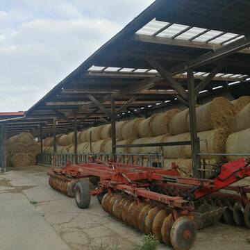
Heu und Stroh /Rundballen/Quaderballen
Sandersdorf
jule13
@Jule2024
Stroh
Lieferant entlädt
Rundballen
Regenfrei
3 weitere...
B+
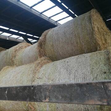
Heu 1.Schnitt 2021
Upahl
hermannmeyerzuborgsen
@hermannmeyerzuborgsen
Heu
Empfänger lädt ab
Rundballen
Regenfrei
3 weitere...
P+
Deprecated: Creation of dynamic property Zend_View_Helper_Ads::$adLink is deprecated in /var/www/stall-frei/htdocs/staging.stall-frei.de/library/Psf/View/Helper/Ads.php on line 108

Futtersack HeuToy, Fressbremse in pink
Mechtersen
STALL-FREIde Marketing
@STALL-FREI-Marketing
Stundenlange Beschäftigung die
Koliken vorbeugt, geringe Staubinhalation mit
steuerbarer Futterentnahme


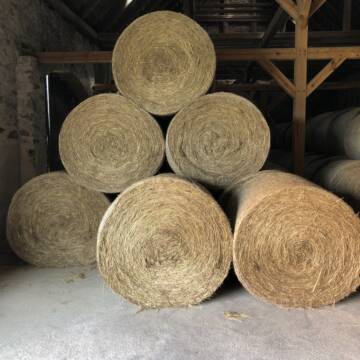
Heu HD-Ballen 2. Schnitt extensiv Heugräser
Drochtersen
M-Kluth
@M-Kluth
Heu
Empfänger lädt ab
Kleinballen/HD-Ballen
Regenfrei
3 weitere...
B+
Leider kein Vorschaubild
Leider kein Vorschaubild
Heu zu verkaufen
Kremmen OT Staffelde
Rhinland Reitpark GmbH
@Rhinland-Reitpark
Heu
Empfänger lädt ab
Rundballen
Regenfrei
3 weitere...
B+

Das Beste für die Hufe
Mechtersen
STALL-FREIde Marketing
@STALL-FREI-Marketing
Hufschmiede und Hufpfleger in Ihrer Nähe

Heu in Rundballen (ca.130cm) super Qualität
Pronstorf
Caros Pferdeparadies
@KaOb
Heu
Rundballen
Regenfrei
Wird verladen
2 weitere...
B+


Futtermittel & Einstreu mit Lieferung!
Schwaara
MK-Agrarprodukte
@MK-Agrarprodukte
Heu
Empfänger lädt ab
Großballen
Regenfrei
2 weitere...
P+

Haferstroh 1.50m Ernte 25 Ausgezeichnete Qualität
Cavertitz
LWB Streubel
@Landwirtschaftsbetr.-Streubel
Stroh
Lieferant entlädt
Rundballen
Regenfrei
3 weitere...
B+
Pferdeheu 1.Schnitt Juli 2025/Rundballen 1.50m
Cavertitz
LWB Streubel
@Landwirtschaftsbetr.-Streubel
Heu
Lieferant entlädt
Rundballen
Bio
Regenfrei
3 weitere...
B+

Erstklassiges PferdeHeu in HD-Ballen
Jevenstedt
Tim Rohwer
@EIDERHEU
Heu
Kleinballen/HD-Ballen
Regenfrei
B+
Newsletter abonnieren
Melde Dich für unseren Newsletter an und verpasse keine Neuigkeiten!
Deprecated: Creation of dynamic property Zend_View::$pageCount is deprecated in /var/www/stall-frei/htdocs/staging.stall-frei.de/library/vendor/shardj/zf1-future/library/Zend/View/Abstract.php on line 308
Deprecated: Creation of dynamic property Zend_View::$itemCountPerPage is deprecated in /var/www/stall-frei/htdocs/staging.stall-frei.de/library/vendor/shardj/zf1-future/library/Zend/View/Abstract.php on line 308
Deprecated: Creation of dynamic property Zend_View::$first is deprecated in /var/www/stall-frei/htdocs/staging.stall-frei.de/library/vendor/shardj/zf1-future/library/Zend/View/Abstract.php on line 308
Deprecated: Creation of dynamic property Zend_View::$current is deprecated in /var/www/stall-frei/htdocs/staging.stall-frei.de/library/vendor/shardj/zf1-future/library/Zend/View/Abstract.php on line 308
Deprecated: Creation of dynamic property Zend_View::$last is deprecated in /var/www/stall-frei/htdocs/staging.stall-frei.de/library/vendor/shardj/zf1-future/library/Zend/View/Abstract.php on line 308
Deprecated: Creation of dynamic property Zend_View::$previous is deprecated in /var/www/stall-frei/htdocs/staging.stall-frei.de/library/vendor/shardj/zf1-future/library/Zend/View/Abstract.php on line 308
Deprecated: Creation of dynamic property Zend_View::$next is deprecated in /var/www/stall-frei/htdocs/staging.stall-frei.de/library/vendor/shardj/zf1-future/library/Zend/View/Abstract.php on line 308
Deprecated: Creation of dynamic property Zend_View::$pagesInRange is deprecated in /var/www/stall-frei/htdocs/staging.stall-frei.de/library/vendor/shardj/zf1-future/library/Zend/View/Abstract.php on line 308
Deprecated: Creation of dynamic property Zend_View::$firstPageInRange is deprecated in /var/www/stall-frei/htdocs/staging.stall-frei.de/library/vendor/shardj/zf1-future/library/Zend/View/Abstract.php on line 308
Deprecated: Creation of dynamic property Zend_View::$lastPageInRange is deprecated in /var/www/stall-frei/htdocs/staging.stall-frei.de/library/vendor/shardj/zf1-future/library/Zend/View/Abstract.php on line 308
Deprecated: Creation of dynamic property Zend_View::$currentItemCount is deprecated in /var/www/stall-frei/htdocs/staging.stall-frei.de/library/vendor/shardj/zf1-future/library/Zend/View/Abstract.php on line 308
Deprecated: Creation of dynamic property Zend_View::$totalItemCount is deprecated in /var/www/stall-frei/htdocs/staging.stall-frei.de/library/vendor/shardj/zf1-future/library/Zend/View/Abstract.php on line 308
Deprecated: Creation of dynamic property Zend_View::$firstItemNumber is deprecated in /var/www/stall-frei/htdocs/staging.stall-frei.de/library/vendor/shardj/zf1-future/library/Zend/View/Abstract.php on line 308
Deprecated: Creation of dynamic property Zend_View::$lastItemNumber is deprecated in /var/www/stall-frei/htdocs/staging.stall-frei.de/library/vendor/shardj/zf1-future/library/Zend/View/Abstract.php on line 308
Deprecated: Creation of dynamic property Zend_View::$router is deprecated in /var/www/stall-frei/htdocs/staging.stall-frei.de/library/vendor/shardj/zf1-future/library/Zend/View/Abstract.php on line 308
Deprecated: Creation of dynamic property Zend_View::$urlParams is deprecated in /var/www/stall-frei/htdocs/staging.stall-frei.de/library/vendor/shardj/zf1-future/library/Zend/View/Abstract.php on line 308
Deprecated: Creation of dynamic property Zend_View::$showAds is deprecated in /var/www/stall-frei/htdocs/staging.stall-frei.de/library/vendor/shardj/zf1-future/library/Zend/View/Abstract.php on line 308
Deprecated: Creation of dynamic property Zend_View::$objectIds is deprecated in /var/www/stall-frei/htdocs/staging.stall-frei.de/library/vendor/shardj/zf1-future/library/Zend/View/Abstract.php on line 308
Deprecated: Creation of dynamic property Zend_View::$showNavbar is deprecated in /var/www/stall-frei/htdocs/staging.stall-frei.de/library/vendor/shardj/zf1-future/library/Zend/View/Abstract.php on line 308
Deprecated: Creation of dynamic property Zend_View::$showBreadcrumb is deprecated in /var/www/stall-frei/htdocs/staging.stall-frei.de/library/vendor/shardj/zf1-future/library/Zend/View/Abstract.php on line 308
Deprecated: Creation of dynamic property Zend_View::$showFooter is deprecated in /var/www/stall-frei/htdocs/staging.stall-frei.de/library/vendor/shardj/zf1-future/library/Zend/View/Abstract.php on line 308
Deprecated: Creation of dynamic property Zend_View::$showInternalAds is deprecated in /var/www/stall-frei/htdocs/staging.stall-frei.de/library/vendor/shardj/zf1-future/library/Zend/View/Abstract.php on line 308
Deprecated: Creation of dynamic property Zend_View::$blNoContent is deprecated in /var/www/stall-frei/htdocs/staging.stall-frei.de/library/vendor/shardj/zf1-future/library/Zend/View/Abstract.php on line 308
Deprecated: Creation of dynamic property Zend_View::$sMetaDesc is deprecated in /var/www/stall-frei/htdocs/staging.stall-frei.de/library/vendor/shardj/zf1-future/library/Zend/View/Abstract.php on line 308
Deprecated: Creation of dynamic property Zend_View::$useGmaps is deprecated in /var/www/stall-frei/htdocs/staging.stall-frei.de/library/vendor/shardj/zf1-future/library/Zend/View/Abstract.php on line 308
Deprecated: Creation of dynamic property Zend_View::$touches is deprecated in /var/www/stall-frei/htdocs/staging.stall-frei.de/library/vendor/shardj/zf1-future/library/Zend/View/Abstract.php on line 308
Deprecated: Creation of dynamic property Zend_View::$oProject is deprecated in /var/www/stall-frei/htdocs/staging.stall-frei.de/library/vendor/shardj/zf1-future/library/Zend/View/Abstract.php on line 308
Deprecated: Creation of dynamic property Zend_View::$pageHeadline is deprecated in /var/www/stall-frei/htdocs/staging.stall-frei.de/library/vendor/shardj/zf1-future/library/Zend/View/Abstract.php on line 308
Deprecated: Creation of dynamic property Zend_View::$disableLocationField is deprecated in /var/www/stall-frei/htdocs/staging.stall-frei.de/library/vendor/shardj/zf1-future/library/Zend/View/Abstract.php on line 308
Deprecated: Creation of dynamic property Zend_View::$isSearch is deprecated in /var/www/stall-frei/htdocs/staging.stall-frei.de/library/vendor/shardj/zf1-future/library/Zend/View/Abstract.php on line 308
Deprecated: Creation of dynamic property Zend_View::$pageTitle is deprecated in /var/www/stall-frei/htdocs/staging.stall-frei.de/library/vendor/shardj/zf1-future/library/Zend/View/Abstract.php on line 308
Deprecated: Creation of dynamic property Psf_Form_Element_Text::$class is deprecated in /var/www/stall-frei/htdocs/staging.stall-frei.de/library/vendor/shardj/zf1-future/library/Zend/Form/Element.php on line 874
Deprecated: Creation of dynamic property Psf_Form_Element_Text::$size is deprecated in /var/www/stall-frei/htdocs/staging.stall-frei.de/library/vendor/shardj/zf1-future/library/Zend/Form/Element.php on line 874
Deprecated: Creation of dynamic property Psf_Form_Element_Text::$placeholder is deprecated in /var/www/stall-frei/htdocs/staging.stall-frei.de/library/vendor/shardj/zf1-future/library/Zend/Form/Element.php on line 874
Deprecated: Creation of dynamic property Psf_Form_Element_Hidden::$class is deprecated in /var/www/stall-frei/htdocs/staging.stall-frei.de/library/vendor/shardj/zf1-future/library/Zend/Form/Element.php on line 874
Deprecated: Creation of dynamic property Psf_Form_Element_Hidden::$class is deprecated in /var/www/stall-frei/htdocs/staging.stall-frei.de/library/vendor/shardj/zf1-future/library/Zend/Form/Element.php on line 874
Deprecated: Creation of dynamic property Psf_Form_Element_Hidden::$class is deprecated in /var/www/stall-frei/htdocs/staging.stall-frei.de/library/vendor/shardj/zf1-future/library/Zend/Form/Element.php on line 874
Deprecated: Creation of dynamic property Psf_Form_Element_Hidden::$class is deprecated in /var/www/stall-frei/htdocs/staging.stall-frei.de/library/vendor/shardj/zf1-future/library/Zend/Form/Element.php on line 874
Deprecated: Creation of dynamic property Psf_Form_Element_Select::$class is deprecated in /var/www/stall-frei/htdocs/staging.stall-frei.de/library/vendor/shardj/zf1-future/library/Zend/Form/Element.php on line 874
Deprecated: Creation of dynamic property Psf_Form_Element_Select::$class is deprecated in /var/www/stall-frei/htdocs/staging.stall-frei.de/library/vendor/shardj/zf1-future/library/Zend/Form/Element.php on line 874
Deprecated: Creation of dynamic property Psf_Form_Element_Select::$class is deprecated in /var/www/stall-frei/htdocs/staging.stall-frei.de/library/vendor/shardj/zf1-future/library/Zend/Form/Element.php on line 874
Deprecated: Creation of dynamic property Psf_Form_Element_Select::$class is deprecated in /var/www/stall-frei/htdocs/staging.stall-frei.de/library/vendor/shardj/zf1-future/library/Zend/Form/Element.php on line 874
Deprecated: Creation of dynamic property Zend_View::$sort is deprecated in /var/www/stall-frei/htdocs/staging.stall-frei.de/library/vendor/shardj/zf1-future/library/Zend/View/Abstract.php on line 308
Deprecated: Creation of dynamic property Zend_View::$searchLocation is deprecated in /var/www/stall-frei/htdocs/staging.stall-frei.de/library/vendor/shardj/zf1-future/library/Zend/View/Abstract.php on line 308
Deprecated: Creation of dynamic property Zend_View::$locationHint is deprecated in /var/www/stall-frei/htdocs/staging.stall-frei.de/library/vendor/shardj/zf1-future/library/Zend/View/Abstract.php on line 308
Psf_GeoCoder_Abstract::getLocation: Meine Get Location CachedOrLive
Psf_GeoCoder_Abstract::getCachedOrLive: Meine
Psf_GeoCoder_Abstract::convertLocationResult
{"documentation":"https:\/\/opencagedata.com\/api","licenses":[{"name":"see attribution guide","url":"https:\/\/opencagedata.com\/credits"}],"results":[{"bounds":{"northeast":{"lat":52.4240578,"lng":10.6298163},"southwest":{"lat":52.3272814,"lng":10.5133417}},"components":{"ISO_3166-1_alpha-2":"DE","ISO_3166-1_alpha-3":"DEU","ISO_3166-2":["DE-NI"],"_category":"place","_normalized_city":"Meine","_type":"city","city":"Meine","continent":"Europe","country":"Deutschland","country_code":"de","county":"Landkreis Gifhorn","municipality":"Samtgemeinde Papenteich","political_union":"European Union","state":"Niedersachsen","state_code":"NI"},"confidence":7,"formatted":"Meine, Niedersachsen, Deutschland","geometry":{"lat":52.3754483,"lng":10.5705166}},{"bounds":{"northeast":{"lat":52.4010833,"lng":10.5794244},"southwest":{"lat":52.3584015,"lng":10.5133417}},"components":{"ISO_3166-1_alpha-2":"DE","ISO_3166-1_alpha-3":"DEU","ISO_3166-2":["DE-NI"],"_category":"place","_normalized_city":"Meine","_type":"village","city":"Meine","continent":"Europe","country":"Deutschland","country_code":"de","county":"Landkreis Gifhorn","municipality":"Samtgemeinde Papenteich","political_union":"European Union","postcode":"38527","state":"Niedersachsen","state_code":"NI","village":"Meine"},"confidence":7,"formatted":"38527 Meine, Deutschland","geometry":{"lat":52.384917,"lng":10.539227}},{"components":{"ISO_3166-1_alpha-2":"FR","ISO_3166-1_alpha-3":"FRA","ISO_3166-2":["FR-OCC","FR-30"],"_category":"road","_normalized_city":"Sernhac","_type":"road","city":"Sernhac","continent":"Europe","country":"France","country_code":"fr","county":"Gard","local_authority":"N\u00eemes M\u00e9tropole","political_union":"European Union","postcode":"30210","road":"Chemin de Meynes","state":"Occitanie","state_code":"OCC"},"confidence":3,"formatted":"Chemin de Meynes, 30210 Sernhac, France","geometry":{"lat":43.909903,"lng":4.555232}},{"components":{"ISO_3166-1_alpha-2":"FR","ISO_3166-1_alpha-3":"FRA","ISO_3166-2":["FR-OCC","FR-30"],"_category":"road","_normalized_city":"Combas","_type":"road","city":"Combas","continent":"Europe","country":"France","country_code":"fr","county":"Gard","local_authority":"Communaut\u00e9 de communes du Pays de Sommi\u00e8res","political_union":"European Union","postcode":"30250","road":"Chemin de Meynes","state":"Occitanie","state_code":"OCC"},"confidence":3,"formatted":"Chemin de Meynes, 30250 Combas, France","geometry":{"lat":43.854531,"lng":4.115241}},{"components":{"ISO_3166-1_alpha-2":"FR","ISO_3166-1_alpha-3":"FRA","ISO_3166-2":["FR-OCC","FR-30"],"_category":"road","_normalized_city":"Saint-Gervasy","_type":"road","city":"Saint-Gervasy","continent":"Europe","country":"France","country_code":"fr","county":"Gard","local_authority":"N\u00eemes M\u00e9tropole","political_union":"European Union","postcode":"30320","road":"Chemin de Meynes","state":"Occitanie","state_code":"OCC"},"confidence":2,"formatted":"Chemin de Meynes, 30320 Saint-Gervasy, France","geometry":{"lat":43.873704,"lng":4.484683}},{"components":{"ISO_3166-1_alpha-2":"FR","ISO_3166-1_alpha-3":"FRA","ISO_3166-2":["FR-OCC","FR-30"],"_category":"road","_normalized_city":"Meynes","_type":"road","city":"Meynes","continent":"Europe","country":"France","country_code":"fr","county":"Gard","local_authority":"Communaut\u00e9 de communes du Pont du Gard","political_union":"European Union","postcode":"30840","road":"Chemin de la Manade","state":"Occitanie","state_code":"OCC"},"confidence":2,"formatted":"Chemin de la Manade, 30840 Meynes, France","geometry":{"lat":43.883059,"lng":4.55886}},{"components":{"ISO_3166-1_alpha-2":"FR","ISO_3166-1_alpha-3":"FRA","ISO_3166-2":["FR-OCC","FR-30"],"_category":"road","_normalized_city":"Meynes","_type":"road","city":"Meynes","continent":"Europe","country":"France","country_code":"fr","county":"Gard","local_authority":"Communaut\u00e9 de communes du Pont du Gard","political_union":"European Union","postcode":"30840","road":"Chemin de l'Estanet","state":"Occitanie","state_code":"OCC"},"confidence":2,"formatted":"Chemin de l'Estanet, 30840 Meynes, France","geometry":{"lat":43.876364,"lng":4.558602}},{"components":{"ISO_3166-1_alpha-2":"FR","ISO_3166-1_alpha-3":"FRA","ISO_3166-2":["FR-OCC","FR-30"],"_category":"road","_normalized_city":"Redessan","_type":"road","city":"Redessan","continent":"Europe","country":"France","country_code":"fr","county":"Gard","local_authority":"N\u00eemes M\u00e9tropole","political_union":"European Union","postcode":"30129","road":"Route de Meynes","state":"Occitanie","state_code":"OCC"},"confidence":2,"formatted":"Route de Meynes, 30129 Redessan, France","geometry":{"lat":43.835801,"lng":4.500071}},{"components":{"ISO_3166-1_alpha-2":"FR","ISO_3166-1_alpha-3":"FRA","ISO_3166-2":["FR-OCC","FR-30"],"_category":"road","_normalized_city":"Sernhac","_type":"road","city":"Sernhac","continent":"Europe","country":"France","country_code":"fr","county":"Gard","local_authority":"N\u00eemes M\u00e9tropole","political_union":"European Union","postcode":"30210","road":"Route de Meynes","state":"Occitanie","state_code":"OCC"},"confidence":2,"formatted":"Route de Meynes, 30210 Sernhac, France","geometry":{"lat":43.910264,"lng":4.556876}},{"components":{"ISO_3166-1_alpha-2":"FR","ISO_3166-1_alpha-3":"FRA","ISO_3166-2":["FR-OCC","FR-30"],"_category":"road","_normalized_city":"Meynes","_type":"road","city":"Meynes","continent":"Europe","country":"France","country_code":"fr","county":"Gard","local_authority":"Communaut\u00e9 de communes du Pont du Gard","political_union":"European Union","postcode":"30840","road":"Chemin de la Roubine","state":"Occitanie","state_code":"OCC"},"confidence":2,"formatted":"Chemin de la Roubine, 30840 Meynes, France","geometry":{"lat":43.883147,"lng":4.57112}}],"status":{"code":200,"message":"OK"},"stay_informed":{"blog":"https:\/\/blog.opencagedata.com","mastodon":"https:\/\/en.osm.town\/@opencage"},"thanks":"For using an OpenCage API","timestamp":{"created_http":"Sat, 07 Feb 2026 22:53:28 GMT","created_unix":1770504808},"total_results":10}Array
(
[0] => stdClass Object
(
[bounds] => stdClass Object
(
[northeast] => stdClass Object
(
[lat] => 52.4240578
[lng] => 10.6298163
)
[southwest] => stdClass Object
(
[lat] => 52.3272814
[lng] => 10.5133417
)
)
[components] => stdClass Object
(
[ISO_3166-1_alpha-2] => DE
[ISO_3166-1_alpha-3] => DEU
[ISO_3166-2] => Array
(
[0] => DE-NI
)
[_category] => place
[_normalized_city] => Meine
[_type] => city
[city] => Meine
[continent] => Europe
[country] => Deutschland
[country_code] => de
[county] => Landkreis Gifhorn
[municipality] => Samtgemeinde Papenteich
[political_union] => European Union
[state] => Niedersachsen
[state_code] => NI
)
[confidence] => 7
[formatted] => Meine, Niedersachsen, Deutschland
[geometry] => stdClass Object
(
[lat] => 52.3754483
[lng] => 10.5705166
)
)
[1] => stdClass Object
(
[bounds] => stdClass Object
(
[northeast] => stdClass Object
(
[lat] => 52.4010833
[lng] => 10.5794244
)
[southwest] => stdClass Object
(
[lat] => 52.3584015
[lng] => 10.5133417
)
)
[components] => stdClass Object
(
[ISO_3166-1_alpha-2] => DE
[ISO_3166-1_alpha-3] => DEU
[ISO_3166-2] => Array
(
[0] => DE-NI
)
[_category] => place
[_normalized_city] => Meine
[_type] => village
[city] => Meine
[continent] => Europe
[country] => Deutschland
[country_code] => de
[county] => Landkreis Gifhorn
[municipality] => Samtgemeinde Papenteich
[political_union] => European Union
[postcode] => 38527
[state] => Niedersachsen
[state_code] => NI
[village] => Meine
)
[confidence] => 7
[formatted] => 38527 Meine, Deutschland
[geometry] => stdClass Object
(
[lat] => 52.384917
[lng] => 10.539227
)
)
[2] => stdClass Object
(
[components] => stdClass Object
(
[ISO_3166-1_alpha-2] => FR
[ISO_3166-1_alpha-3] => FRA
[ISO_3166-2] => Array
(
[0] => FR-OCC
[1] => FR-30
)
[_category] => road
[_normalized_city] => Sernhac
[_type] => road
[city] => Sernhac
[continent] => Europe
[country] => France
[country_code] => fr
[county] => Gard
[local_authority] => Nîmes Métropole
[political_union] => European Union
[postcode] => 30210
[road] => Chemin de Meynes
[state] => Occitanie
[state_code] => OCC
)
[confidence] => 3
[formatted] => Chemin de Meynes, 30210 Sernhac, France
[geometry] => stdClass Object
(
[lat] => 43.909903
[lng] => 4.555232
)
)
[3] => stdClass Object
(
[components] => stdClass Object
(
[ISO_3166-1_alpha-2] => FR
[ISO_3166-1_alpha-3] => FRA
[ISO_3166-2] => Array
(
[0] => FR-OCC
[1] => FR-30
)
[_category] => road
[_normalized_city] => Combas
[_type] => road
[city] => Combas
[continent] => Europe
[country] => France
[country_code] => fr
[county] => Gard
[local_authority] => Communauté de communes du Pays de Sommières
[political_union] => European Union
[postcode] => 30250
[road] => Chemin de Meynes
[state] => Occitanie
[state_code] => OCC
)
[confidence] => 3
[formatted] => Chemin de Meynes, 30250 Combas, France
[geometry] => stdClass Object
(
[lat] => 43.854531
[lng] => 4.115241
)
)
[4] => stdClass Object
(
[components] => stdClass Object
(
[ISO_3166-1_alpha-2] => FR
[ISO_3166-1_alpha-3] => FRA
[ISO_3166-2] => Array
(
[0] => FR-OCC
[1] => FR-30
)
[_category] => road
[_normalized_city] => Saint-Gervasy
[_type] => road
[city] => Saint-Gervasy
[continent] => Europe
[country] => France
[country_code] => fr
[county] => Gard
[local_authority] => Nîmes Métropole
[political_union] => European Union
[postcode] => 30320
[road] => Chemin de Meynes
[state] => Occitanie
[state_code] => OCC
)
[confidence] => 2
[formatted] => Chemin de Meynes, 30320 Saint-Gervasy, France
[geometry] => stdClass Object
(
[lat] => 43.873704
[lng] => 4.484683
)
)
[5] => stdClass Object
(
[components] => stdClass Object
(
[ISO_3166-1_alpha-2] => FR
[ISO_3166-1_alpha-3] => FRA
[ISO_3166-2] => Array
(
[0] => FR-OCC
[1] => FR-30
)
[_category] => road
[_normalized_city] => Meynes
[_type] => road
[city] => Meynes
[continent] => Europe
[country] => France
[country_code] => fr
[county] => Gard
[local_authority] => Communauté de communes du Pont du Gard
[political_union] => European Union
[postcode] => 30840
[road] => Chemin de la Manade
[state] => Occitanie
[state_code] => OCC
)
[confidence] => 2
[formatted] => Chemin de la Manade, 30840 Meynes, France
[geometry] => stdClass Object
(
[lat] => 43.883059
[lng] => 4.55886
)
)
[6] => stdClass Object
(
[components] => stdClass Object
(
[ISO_3166-1_alpha-2] => FR
[ISO_3166-1_alpha-3] => FRA
[ISO_3166-2] => Array
(
[0] => FR-OCC
[1] => FR-30
)
[_category] => road
[_normalized_city] => Meynes
[_type] => road
[city] => Meynes
[continent] => Europe
[country] => France
[country_code] => fr
[county] => Gard
[local_authority] => Communauté de communes du Pont du Gard
[political_union] => European Union
[postcode] => 30840
[road] => Chemin de l'Estanet
[state] => Occitanie
[state_code] => OCC
)
[confidence] => 2
[formatted] => Chemin de l'Estanet, 30840 Meynes, France
[geometry] => stdClass Object
(
[lat] => 43.876364
[lng] => 4.558602
)
)
[7] => stdClass Object
(
[components] => stdClass Object
(
[ISO_3166-1_alpha-2] => FR
[ISO_3166-1_alpha-3] => FRA
[ISO_3166-2] => Array
(
[0] => FR-OCC
[1] => FR-30
)
[_category] => road
[_normalized_city] => Redessan
[_type] => road
[city] => Redessan
[continent] => Europe
[country] => France
[country_code] => fr
[county] => Gard
[local_authority] => Nîmes Métropole
[political_union] => European Union
[postcode] => 30129
[road] => Route de Meynes
[state] => Occitanie
[state_code] => OCC
)
[confidence] => 2
[formatted] => Route de Meynes, 30129 Redessan, France
[geometry] => stdClass Object
(
[lat] => 43.835801
[lng] => 4.500071
)
)
[8] => stdClass Object
(
[components] => stdClass Object
(
[ISO_3166-1_alpha-2] => FR
[ISO_3166-1_alpha-3] => FRA
[ISO_3166-2] => Array
(
[0] => FR-OCC
[1] => FR-30
)
[_category] => road
[_normalized_city] => Sernhac
[_type] => road
[city] => Sernhac
[continent] => Europe
[country] => France
[country_code] => fr
[county] => Gard
[local_authority] => Nîmes Métropole
[political_union] => European Union
[postcode] => 30210
[road] => Route de Meynes
[state] => Occitanie
[state_code] => OCC
)
[confidence] => 2
[formatted] => Route de Meynes, 30210 Sernhac, France
[geometry] => stdClass Object
(
[lat] => 43.910264
[lng] => 4.556876
)
)
[9] => stdClass Object
(
[components] => stdClass Object
(
[ISO_3166-1_alpha-2] => FR
[ISO_3166-1_alpha-3] => FRA
[ISO_3166-2] => Array
(
[0] => FR-OCC
[1] => FR-30
)
[_category] => road
[_normalized_city] => Meynes
[_type] => road
[city] => Meynes
[continent] => Europe
[country] => France
[country_code] => fr
[county] => Gard
[local_authority] => Communauté de communes du Pont du Gard
[political_union] => European Union
[postcode] => 30840
[road] => Chemin de la Roubine
[state] => Occitanie
[state_code] => OCC
)
[confidence] => 2
[formatted] => Chemin de la Roubine, 30840 Meynes, France
[geometry] => stdClass Object
(
[lat] => 43.883147
[lng] => 4.57112
)
)
)
Psf_GeoCoder_OpenCageData::getKeyMap: 0
stdClass Object
(
    [bounds] => stdClass Object
        (
            [northeast] => stdClass Object
                (
                    [lat] => 52.4240578
                    [lng] => 10.6298163
                )

            [southwest] => stdClass Object
                (
                    [lat] => 52.3272814
                    [lng] => 10.5133417
                )

        )

    [components] => stdClass Object
        (
            [ISO_3166-1_alpha-2] => DE
            [ISO_3166-1_alpha-3] => DEU
            [ISO_3166-2] => Array
                (
                    [0] => DE-NI
                )

            [_category] => place
            [_normalized_city] => Meine
            [_type] => city
            [city] => Meine
            [continent] => Europe
            [country] => Deutschland
            [country_code] => de
            [county] => Landkreis Gifhorn
            [municipality] => Samtgemeinde Papenteich
            [political_union] => European Union
            [state] => Niedersachsen
            [state_code] => NI
        )

    [confidence] => 7
    [formatted] => Meine, Niedersachsen, Deutschland
    [geometry] => stdClass Object
        (
            [lat] => 52.3754483
            [lng] => 10.5705166
        )

)
Psf_GeoCoder_OpenCageData::getCounty: Gifhorn
Psf_GeoCoder_OpenCageData::addMissingData REFETCH!
Array
(
    [address] => Meine, Niedersachsen, Deutschland
    [type] => city
    [street] =>
    [city] => Meine
    [county] => Gifhorn
    [state] => Niedersachsen
    [zip] =>
    [country] => Deutschland
    [suburb] =>
    [countrycode] => de
    [latitude] => 52.3754483
    [longitude] => 10.5705166
    [accuracy] => 1
    [confidence] => 7
    [bounds] => stdClass Object
        (
            [northeast] => stdClass Object
                (
                    [lat] => 52.4240578
                    [lng] => 10.6298163
                )

            [southwest] => stdClass Object
                (
                    [lat] => 52.3272814
                    [lng] => 10.5133417
                )

        )

)
reformat!
Array
(
    [address] => Meine, Niedersachsen, Deutschland
    [type] => city
    [street] =>
    [city] => Meine
    [county] => Gifhorn
    [state] => Niedersachsen
    [zip] =>
    [country] => Deutschland
    [suburb] =>
    [countrycode] => de
    [latitude] => 52.3754483
    [longitude] => 10.5705166
    [accuracy] => 1
    [confidence] => 7
    [bounds] => stdClass Object
        (
            [northeast] => stdClass Object
                (
                    [lat] => 52.4240578
                    [lng] => 10.6298163
                )

            [southwest] => stdClass Object
                (
                    [lat] => 52.3272814
                    [lng] => 10.5133417
                )

        )

    [place] => Meine, Niedersachsen
    [hash] => 1f1416852f8c1c9efbe1670bdd3258e3
)
Psf_GeoCoder_OpenCageData::getKeyMap: 1
stdClass Object
(
    [bounds] => stdClass Object
        (
            [northeast] => stdClass Object
                (
                    [lat] => 52.4010833
                    [lng] => 10.5794244
                )

            [southwest] => stdClass Object
                (
                    [lat] => 52.3584015
                    [lng] => 10.5133417
                )

        )

    [components] => stdClass Object
        (
            [ISO_3166-1_alpha-2] => DE
            [ISO_3166-1_alpha-3] => DEU
            [ISO_3166-2] => Array
                (
                    [0] => DE-NI
                )

            [_category] => place
            [_normalized_city] => Meine
            [_type] => village
            [city] => Meine
            [continent] => Europe
            [country] => Deutschland
            [country_code] => de
            [county] => Landkreis Gifhorn
            [municipality] => Samtgemeinde Papenteich
            [political_union] => European Union
            [postcode] => 38527
            [state] => Niedersachsen
            [state_code] => NI
            [village] => Meine
        )

    [confidence] => 7
    [formatted] => 38527 Meine, Deutschland
    [geometry] => stdClass Object
        (
            [lat] => 52.384917
            [lng] => 10.539227
        )

)
Psf_GeoCoder_OpenCageData::getCounty: Gifhorn
Psf_GeoCoder_OpenCageData::addMissingData REFETCH!
Array
(
    [address] => 38527 Meine, Deutschland
    [type] => village
    [street] =>
    [city] => Meine
    [county] => Gifhorn
    [state] => Niedersachsen
    [zip] => 38527
    [country] => Deutschland
    [suburb] =>
    [countrycode] => de
    [latitude] => 52.384917
    [longitude] => 10.539227
    [accuracy] => 1
    [confidence] => 7
    [bounds] => stdClass Object
        (
            [northeast] => stdClass Object
                (
                    [lat] => 52.4010833
                    [lng] => 10.5794244
                )

            [southwest] => stdClass Object
                (
                    [lat] => 52.3584015
                    [lng] => 10.5133417
                )

        )

)
reformat!
Array
(
    [address] => 38527 Meine, Deutschland
    [type] => village
    [street] =>
    [city] => Meine
    [county] => Gifhorn
    [state] => Niedersachsen
    [zip] => 38527
    [country] => Deutschland
    [suburb] =>
    [countrycode] => de
    [latitude] => 52.384917
    [longitude] => 10.539227
    [accuracy] => 1
    [confidence] => 7
    [bounds] => stdClass Object
        (
            [northeast] => stdClass Object
                (
                    [lat] => 52.4010833
                    [lng] => 10.5794244
                )

            [southwest] => stdClass Object
                (
                    [lat] => 52.3584015
                    [lng] => 10.5133417
                )

        )

    [place] => 38527 Meine, Niedersachsen
    [hash] => 7232cb44f8aaf8e9109e2d672fda4dde
)
Psf_GeoCoder_OpenCageData::getKeyMap: 2
stdClass Object
(
    [components] => stdClass Object
        (
            [ISO_3166-1_alpha-2] => FR
            [ISO_3166-1_alpha-3] => FRA
            [ISO_3166-2] => Array
                (
                    [0] => FR-OCC
                    [1] => FR-30
                )

            [_category] => road
            [_normalized_city] => Sernhac
            [_type] => road
            [city] => Sernhac
            [continent] => Europe
            [country] => France
            [country_code] => fr
            [county] => Gard
            [local_authority] => Nîmes Métropole
            [political_union] => European Union
            [postcode] => 30210
            [road] => Chemin de Meynes
            [state] => Occitanie
            [state_code] => OCC
        )

    [confidence] => 3
    [formatted] => Chemin de Meynes, 30210 Sernhac, France
    [geometry] => stdClass Object
        (
            [lat] => 43.909903
            [lng] => 4.555232
        )

)
Psf_GeoCoder_OpenCageData::getCounty: Gard
Psf_GeoCoder_OpenCageData::addMissingData REFETCH!
Array
(
    [address] => Chemin de Meynes, 30210 Sernhac, France
    [type] => road
    [street] => Chemin de Meynes
    [city] => Sernhac
    [county] => Gard
    [state] => Occitanie
    [zip] => 30210
    [country] => France
    [suburb] =>
    [countrycode] => fr
    [latitude] => 43.909903
    [longitude] => 4.555232
    [accuracy] => 1
    [confidence] => 3
    [bounds] =>
)
reformat!
Array
(
    [address] => Chemin de Meynes, 30210 Sernhac, France
    [type] => road
    [street] => Chemin de Meynes
    [city] => Sernhac
    [county] => Gard
    [state] => Occitanie
    [zip] => 30210
    [country] => France
    [suburb] =>
    [countrycode] => fr
    [latitude] => 43.909903
    [longitude] => 4.555232
    [accuracy] => 1
    [confidence] => 3
    [bounds] =>
    [place] => Chemin de Meynes, 30210 Sernhac, Occitanie
    [hash] => ff68bb202a0eeaaebd9886ee9838abb2
)
Psf_GeoCoder_OpenCageData::getKeyMap: 3
stdClass Object
(
    [components] => stdClass Object
        (
            [ISO_3166-1_alpha-2] => FR
            [ISO_3166-1_alpha-3] => FRA
            [ISO_3166-2] => Array
                (
                    [0] => FR-OCC
                    [1] => FR-30
                )

            [_category] => road
            [_normalized_city] => Combas
            [_type] => road
            [city] => Combas
            [continent] => Europe
            [country] => France
            [country_code] => fr
            [county] => Gard
            [local_authority] => Communauté de communes du Pays de Sommières
            [political_union] => European Union
            [postcode] => 30250
            [road] => Chemin de Meynes
            [state] => Occitanie
            [state_code] => OCC
        )

    [confidence] => 3
    [formatted] => Chemin de Meynes, 30250 Combas, France
    [geometry] => stdClass Object
        (
            [lat] => 43.854531
            [lng] => 4.115241
        )

)
Psf_GeoCoder_OpenCageData::getCounty: Gard
Psf_GeoCoder_OpenCageData::addMissingData REFETCH!
Array
(
    [address] => Chemin de Meynes, 30250 Combas, France
    [type] => road
    [street] => Chemin de Meynes
    [city] => Combas
    [county] => Gard
    [state] => Occitanie
    [zip] => 30250
    [country] => France
    [suburb] =>
    [countrycode] => fr
    [latitude] => 43.854531
    [longitude] => 4.115241
    [accuracy] => 1
    [confidence] => 3
    [bounds] =>
)
reformat!
Array
(
    [address] => Chemin de Meynes, 30250 Combas, France
    [type] => road
    [street] => Chemin de Meynes
    [city] => Combas
    [county] => Gard
    [state] => Occitanie
    [zip] => 30250
    [country] => France
    [suburb] =>
    [countrycode] => fr
    [latitude] => 43.854531
    [longitude] => 4.115241
    [accuracy] => 1
    [confidence] => 3
    [bounds] =>
    [place] => Chemin de Meynes, 30250 Combas, Occitanie
    [hash] => 7e25a216c368a82c20ea38cf24db9262
)
Psf_GeoCoder_OpenCageData::getKeyMap: 4
stdClass Object
(
    [components] => stdClass Object
        (
            [ISO_3166-1_alpha-2] => FR
            [ISO_3166-1_alpha-3] => FRA
            [ISO_3166-2] => Array
                (
                    [0] => FR-OCC
                    [1] => FR-30
                )

            [_category] => road
            [_normalized_city] => Saint-Gervasy
            [_type] => road
            [city] => Saint-Gervasy
            [continent] => Europe
            [country] => France
            [country_code] => fr
            [county] => Gard
            [local_authority] => Nîmes Métropole
            [political_union] => European Union
            [postcode] => 30320
            [road] => Chemin de Meynes
            [state] => Occitanie
            [state_code] => OCC
        )

    [confidence] => 2
    [formatted] => Chemin de Meynes, 30320 Saint-Gervasy, France
    [geometry] => stdClass Object
        (
            [lat] => 43.873704
            [lng] => 4.484683
        )

)
Psf_GeoCoder_OpenCageData::getCounty: Gard
Psf_GeoCoder_OpenCageData::addMissingData REFETCH!
Array
(
    [address] => Chemin de Meynes, 30320 Saint-Gervasy, France
    [type] => road
    [street] => Chemin de Meynes
    [city] => Saint-Gervasy
    [county] => Gard
    [state] => Occitanie
    [zip] => 30320
    [country] => France
    [suburb] =>
    [countrycode] => fr
    [latitude] => 43.873704
    [longitude] => 4.484683
    [accuracy] => 1
    [confidence] => 2
    [bounds] =>
)
reformat!
Array
(
    [address] => Chemin de Meynes, 30320 Saint-Gervasy, France
    [type] => road
    [street] => Chemin de Meynes
    [city] => Saint-Gervasy
    [county] => Gard
    [state] => Occitanie
    [zip] => 30320
    [country] => France
    [suburb] =>
    [countrycode] => fr
    [latitude] => 43.873704
    [longitude] => 4.484683
    [accuracy] => 1
    [confidence] => 2
    [bounds] =>
    [place] => Chemin de Meynes, 30320 Saint-Gervasy, Occitanie
    [hash] => fe3d5f6fe3ff38f221c2f15cd65b6f6c
)
Psf_GeoCoder_OpenCageData::getKeyMap: 5
stdClass Object
(
    [components] => stdClass Object
        (
            [ISO_3166-1_alpha-2] => FR
            [ISO_3166-1_alpha-3] => FRA
            [ISO_3166-2] => Array
                (
                    [0] => FR-OCC
                    [1] => FR-30
                )

            [_category] => road
            [_normalized_city] => Meynes
            [_type] => road
            [city] => Meynes
            [continent] => Europe
            [country] => France
            [country_code] => fr
            [county] => Gard
            [local_authority] => Communauté de communes du Pont du Gard
            [political_union] => European Union
            [postcode] => 30840
            [road] => Chemin de la Manade
            [state] => Occitanie
            [state_code] => OCC
        )

    [confidence] => 2
    [formatted] => Chemin de la Manade, 30840 Meynes, France
    [geometry] => stdClass Object
        (
            [lat] => 43.883059
            [lng] => 4.55886
        )

)
Psf_GeoCoder_OpenCageData::getCounty: Gard
Psf_GeoCoder_OpenCageData::addMissingData REFETCH!
Array
(
    [address] => Chemin de la Manade, 30840 Meynes, France
    [type] => road
    [street] => Chemin de la Manade
    [city] => Meynes
    [county] => Gard
    [state] => Occitanie
    [zip] => 30840
    [country] => France
    [suburb] =>
    [countrycode] => fr
    [latitude] => 43.883059
    [longitude] => 4.55886
    [accuracy] => 1
    [confidence] => 2
    [bounds] =>
)
reformat!
Array
(
    [address] => Chemin de la Manade, 30840 Meynes, France
    [type] => road
    [street] => Chemin de la Manade
    [city] => Meynes
    [county] => Gard
    [state] => Occitanie
    [zip] => 30840
    [country] => France
    [suburb] =>
    [countrycode] => fr
    [latitude] => 43.883059
    [longitude] => 4.55886
    [accuracy] => 1
    [confidence] => 2
    [bounds] =>
    [place] => Chemin de la Manade, 30840 Meynes, Occitanie
    [hash] => 18d31dccff5020890fb4b5cd0eb7fe2b
)
Psf_GeoCoder_OpenCageData::getKeyMap: 6
stdClass Object
(
    [components] => stdClass Object
        (
            [ISO_3166-1_alpha-2] => FR
            [ISO_3166-1_alpha-3] => FRA
            [ISO_3166-2] => Array
                (
                    [0] => FR-OCC
                    [1] => FR-30
                )

            [_category] => road
            [_normalized_city] => Meynes
            [_type] => road
            [city] => Meynes
            [continent] => Europe
            [country] => France
            [country_code] => fr
            [county] => Gard
            [local_authority] => Communauté de communes du Pont du Gard
            [political_union] => European Union
            [postcode] => 30840
            [road] => Chemin de l'Estanet
            [state] => Occitanie
            [state_code] => OCC
        )

    [confidence] => 2
    [formatted] => Chemin de l'Estanet, 30840 Meynes, France
    [geometry] => stdClass Object
        (
            [lat] => 43.876364
            [lng] => 4.558602
        )

)
Psf_GeoCoder_OpenCageData::getCounty: Gard
Psf_GeoCoder_OpenCageData::addMissingData REFETCH!
Array
(
    [address] => Chemin de l'Estanet, 30840 Meynes, France
    [type] => road
    [street] => Chemin de l'Estanet
    [city] => Meynes
    [county] => Gard
    [state] => Occitanie
    [zip] => 30840
    [country] => France
    [suburb] =>
    [countrycode] => fr
    [latitude] => 43.876364
    [longitude] => 4.558602
    [accuracy] => 1
    [confidence] => 2
    [bounds] =>
)
reformat!
Array
(
    [address] => Chemin de l'Estanet, 30840 Meynes, France
    [type] => road
    [street] => Chemin de l'Estanet
    [city] => Meynes
    [county] => Gard
    [state] => Occitanie
    [zip] => 30840
    [country] => France
    [suburb] =>
    [countrycode] => fr
    [latitude] => 43.876364
    [longitude] => 4.558602
    [accuracy] => 1
    [confidence] => 2
    [bounds] =>
    [place] => Chemin de l'Estanet, 30840 Meynes, Occitanie
    [hash] => a559382fa13c2b2af2dcd72f6b4e80ab
)
Psf_GeoCoder_OpenCageData::getKeyMap: 7
stdClass Object
(
    [components] => stdClass Object
        (
            [ISO_3166-1_alpha-2] => FR
            [ISO_3166-1_alpha-3] => FRA
            [ISO_3166-2] => Array
                (
                    [0] => FR-OCC
                    [1] => FR-30
                )

            [_category] => road
            [_normalized_city] => Redessan
            [_type] => road
            [city] => Redessan
            [continent] => Europe
            [country] => France
            [country_code] => fr
            [county] => Gard
            [local_authority] => Nîmes Métropole
            [political_union] => European Union
            [postcode] => 30129
            [road] => Route de Meynes
            [state] => Occitanie
            [state_code] => OCC
        )

    [confidence] => 2
    [formatted] => Route de Meynes, 30129 Redessan, France
    [geometry] => stdClass Object
        (
            [lat] => 43.835801
            [lng] => 4.500071
        )

)
Psf_GeoCoder_OpenCageData::getCounty: Gard
Psf_GeoCoder_OpenCageData::addMissingData REFETCH!
Array
(
    [address] => Route de Meynes, 30129 Redessan, France
    [type] => road
    [street] => Route de Meynes
    [city] => Redessan
    [county] => Gard
    [state] => Occitanie
    [zip] => 30129
    [country] => France
    [suburb] =>
    [countrycode] => fr
    [latitude] => 43.835801
    [longitude] => 4.500071
    [accuracy] => 1
    [confidence] => 2
    [bounds] =>
)
reformat!
Array
(
    [address] => Route de Meynes, 30129 Redessan, France
    [type] => road
    [street] => Route de Meynes
    [city] => Redessan
    [county] => Gard
    [state] => Occitanie
    [zip] => 30129
    [country] => France
    [suburb] =>
    [countrycode] => fr
    [latitude] => 43.835801
    [longitude] => 4.500071
    [accuracy] => 1
    [confidence] => 2
    [bounds] =>
    [place] => Route de Meynes, 30129 Redessan, Occitanie
    [hash] => dfa22a585736592771bc5f85e7760cee
)
Psf_GeoCoder_OpenCageData::getKeyMap: 8
stdClass Object
(
    [components] => stdClass Object
        (
            [ISO_3166-1_alpha-2] => FR
            [ISO_3166-1_alpha-3] => FRA
            [ISO_3166-2] => Array
                (
                    [0] => FR-OCC
                    [1] => FR-30
                )

            [_category] => road
            [_normalized_city] => Sernhac
            [_type] => road
            [city] => Sernhac
            [continent] => Europe
            [country] => France
            [country_code] => fr
            [county] => Gard
            [local_authority] => Nîmes Métropole
            [political_union] => European Union
            [postcode] => 30210
            [road] => Route de Meynes
            [state] => Occitanie
            [state_code] => OCC
        )

    [confidence] => 2
    [formatted] => Route de Meynes, 30210 Sernhac, France
    [geometry] => stdClass Object
        (
            [lat] => 43.910264
            [lng] => 4.556876
        )

)
Psf_GeoCoder_OpenCageData::getCounty: Gard
Psf_GeoCoder_OpenCageData::addMissingData REFETCH!
Array
(
    [address] => Route de Meynes, 30210 Sernhac, France
    [type] => road
    [street] => Route de Meynes
    [city] => Sernhac
    [county] => Gard
    [state] => Occitanie
    [zip] => 30210
    [country] => France
    [suburb] =>
    [countrycode] => fr
    [latitude] => 43.910264
    [longitude] => 4.556876
    [accuracy] => 1
    [confidence] => 2
    [bounds] =>
)
reformat!
Array
(
    [address] => Route de Meynes, 30210 Sernhac, France
    [type] => road
    [street] => Route de Meynes
    [city] => Sernhac
    [county] => Gard
    [state] => Occitanie
    [zip] => 30210
    [country] => France
    [suburb] =>
    [countrycode] => fr
    [latitude] => 43.910264
    [longitude] => 4.556876
    [accuracy] => 1
    [confidence] => 2
    [bounds] =>
    [place] => Route de Meynes, 30210 Sernhac, Occitanie
    [hash] => 617847d8285a2e5a6b0ba66f5560cd8f
)
Psf_GeoCoder_OpenCageData::getKeyMap: 9
stdClass Object
(
    [components] => stdClass Object
        (
            [ISO_3166-1_alpha-2] => FR
            [ISO_3166-1_alpha-3] => FRA
            [ISO_3166-2] => Array
                (
                    [0] => FR-OCC
                    [1] => FR-30
                )

            [_category] => road
            [_normalized_city] => Meynes
            [_type] => road
            [city] => Meynes
            [continent] => Europe
            [country] => France
            [country_code] => fr
            [county] => Gard
            [local_authority] => Communauté de communes du Pont du Gard
            [political_union] => European Union
            [postcode] => 30840
            [road] => Chemin de la Roubine
            [state] => Occitanie
            [state_code] => OCC
        )

    [confidence] => 2
    [formatted] => Chemin de la Roubine, 30840 Meynes, France
    [geometry] => stdClass Object
        (
            [lat] => 43.883147
            [lng] => 4.57112
        )

)
Psf_GeoCoder_OpenCageData::getCounty: Gard
Psf_GeoCoder_OpenCageData::addMissingData REFETCH!
Array
(
    [address] => Chemin de la Roubine, 30840 Meynes, France
    [type] => road
    [street] => Chemin de la Roubine
    [city] => Meynes
    [county] => Gard
    [state] => Occitanie
    [zip] => 30840
    [country] => France
    [suburb] =>
    [countrycode] => fr
    [latitude] => 43.883147
    [longitude] => 4.57112
    [accuracy] => 1
    [confidence] => 2
    [bounds] =>
)
reformat!
Array
(
    [address] => Chemin de la Roubine, 30840 Meynes, France
    [type] => road
    [street] => Chemin de la Roubine
    [city] => Meynes
    [county] => Gard
    [state] => Occitanie
    [zip] => 30840
    [country] => France
    [suburb] =>
    [countrycode] => fr
    [latitude] => 43.883147
    [longitude] => 4.57112
    [accuracy] => 1
    [confidence] => 2
    [bounds] =>
    [place] => Chemin de la Roubine, 30840 Meynes, Occitanie
    [hash] => dd0286ccd50071764b14a3cfd9d959f4
)
Deprecated: Creation of dynamic property Zend_View::$locationHintStyle is deprecated in /var/www/stall-frei/htdocs/staging.stall-frei.de/library/vendor/shardj/zf1-future/library/Zend/View/Abstract.php on line 308
Deprecated: Creation of dynamic property Zend_View::$adGeoLocation is deprecated in /var/www/stall-frei/htdocs/staging.stall-frei.de/library/vendor/shardj/zf1-future/library/Zend/View/Abstract.php on line 308
Deprecated: Creation of dynamic property Zend_View::$recordCount is deprecated in /var/www/stall-frei/htdocs/staging.stall-frei.de/library/vendor/shardj/zf1-future/library/Zend/View/Abstract.php on line 308
Deprecated: Creation of dynamic property Zend_View::$paginationParams is deprecated in /var/www/stall-frei/htdocs/staging.stall-frei.de/library/vendor/shardj/zf1-future/library/Zend/View/Abstract.php on line 308
Deprecated: Creation of dynamic property Zend_View::$objectPaginator is deprecated in /var/www/stall-frei/htdocs/staging.stall-frei.de/library/vendor/shardj/zf1-future/library/Zend/View/Abstract.php on line 308
Deprecated: Creation of dynamic property Zend_View::$featuredObjects is deprecated in /var/www/stall-frei/htdocs/staging.stall-frei.de/library/vendor/shardj/zf1-future/library/Zend/View/Abstract.php on line 308
Deprecated: Creation of dynamic property Zend_View::$hints is deprecated in /var/www/stall-frei/htdocs/staging.stall-frei.de/library/vendor/shardj/zf1-future/library/Zend/View/Abstract.php on line 308
Deprecated: Creation of dynamic property Zend_View::$attributeHints is deprecated in /var/www/stall-frei/htdocs/staging.stall-frei.de/library/vendor/shardj/zf1-future/library/Zend/View/Abstract.php on line 308
Deprecated: Creation of dynamic property Zend_View::$oSearchForm is deprecated in /var/www/stall-frei/htdocs/staging.stall-frei.de/library/vendor/shardj/zf1-future/library/Zend/View/Abstract.php on line 308