Deprecated: Creation of dynamic property Zend_View::$sMode is deprecated in /var/www/stall-frei/htdocs/staging.stall-frei.de/library/vendor/shardj/zf1-future/library/Zend/View/Abstract.php on line 308
Heu, Stroh oder Futter in Wald
Gesucht wird in "Wald, Bayern, Deutschland"
92 Einträge
Deprecated: Creation of dynamic property Zend_View::$listObjects is deprecated in /var/www/stall-frei/htdocs/staging.stall-frei.de/library/vendor/shardj/zf1-future/library/Zend/View/Abstract.php on line 308
Deprecated: Creation of dynamic property Zend_View::$listMode is deprecated in /var/www/stall-frei/htdocs/staging.stall-frei.de/library/vendor/shardj/zf1-future/library/Zend/View/Abstract.php on line 308
Deprecated: Creation of dynamic property Zend_View::$renderedObjects is deprecated in /var/www/stall-frei/htdocs/staging.stall-frei.de/library/vendor/shardj/zf1-future/library/Zend/View/Abstract.php on line 308
Deprecated: Creation of dynamic property Zend_View::$index is deprecated in /var/www/stall-frei/htdocs/staging.stall-frei.de/library/vendor/shardj/zf1-future/library/Zend/View/Abstract.php on line 308
Deprecated: Creation of dynamic property Zend_View::$displayMode is deprecated in /var/www/stall-frei/htdocs/staging.stall-frei.de/library/vendor/shardj/zf1-future/library/Zend/View/Abstract.php on line 308
Deprecated: Creation of dynamic property Zend_View::$remarketingIds is deprecated in /var/www/stall-frei/htdocs/staging.stall-frei.de/library/vendor/shardj/zf1-future/library/Zend/View/Abstract.php on line 308
Deprecated: Creation of dynamic property Zend_View::$listItem is deprecated in /var/www/stall-frei/htdocs/staging.stall-frei.de/library/vendor/shardj/zf1-future/library/Zend/View/Abstract.php on line 308
Deprecated: Creation of dynamic property Zend_View::$object is deprecated in /var/www/stall-frei/htdocs/staging.stall-frei.de/library/vendor/shardj/zf1-future/library/Zend/View/Abstract.php on line 308
Deprecated: Creation of dynamic property Zend_View::$attributes is deprecated in /var/www/stall-frei/htdocs/staging.stall-frei.de/library/vendor/shardj/zf1-future/library/Zend/View/Abstract.php on line 308

B+

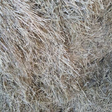
Heu HD Ballen
Carlsberg
Maike Käpernick
@ReitschuleKaepernick
Heu
Empfänger lädt ab
Kleinballen/HD-Ballen
Bio
Regenfrei
2 weitere...
B+
Deprecated: Creation of dynamic property Zend_View_Helper_Ads::$adLink is deprecated in /var/www/stall-frei/htdocs/staging.stall-frei.de/library/Psf/View/Helper/Ads.php on line 108

***Reitstall Birkenhof*** Pferdegerechte Haltung
Köln
Daniele-Fazzi
@Daniele-Fazzi
Herzlich Willkommen
auf dem Reitstall Birkenhof
Jetzt neu ‼️ auf dem Birkenhof:
Private Geländestrecke rund um unser

Gurbe Pferdefutter
Mühltal
Schäfer
@Tina-Schaefer
Futter
Pellets
Bio
Käufer lädt selbst
1 weitere...
B+

Waldboden Einstreu Lieferung Deutschlandweit
Goldbach
Steigerwald Waldboden Einstreu
@Steigerwald_Waldboden_Einstreu
Einstreu
Lieferant entlädt
Bigbag
Bio
3 weitere...
B+

Heu-, Heulage- und Strohverkauf
Riedstadt
Kirsten Bonn
@Reitanlage-Bonn-Riedstadt
Heu
Großballen
Regenfrei
Wird verladen
1 weitere...
B+

Bio Heu
Mehlbach
irena-zinssmeister
@irena-zinssmeister
Heu
Empfänger lädt ab
Großballen
Bio
Regenfrei
2 weitere...
aktuell
B+

Futtersack HeuToy, Fressbremse in pink
Mechtersen
STALL-FREIde Marketing
@STALL-FREI-Marketing
Stundenlange Beschäftigung die
Koliken vorbeugt, geringe Staubinhalation mit
steuerbarer Futterentnahme

HD-Ballen Heu
Ginsweiler
Laura
@Heuverkauf_Ginsweiler
Heu
Kleinballen/HD-Ballen
Regenfrei
Wird verladen
2 weitere...
B+


TaunusHeu staubreduziert
Idstein
Torsten Fischer
@HayClean
Heu
Käufer lädt selbst
Abholung
Lieferung
P+
Leider kein Vorschaubild
Leider kein Vorschaubild
Bio-Heu, 1. Schnitt aus 2024 (BIOLAND) zu verkauf.
Tirpersdorf
Forstbaumschule
@Forstbaumschule
Heu
Empfänger lädt ab
Großballen
Bio
Regenfrei
2 weitere...
B+
Deprecated: Creation of dynamic property Zend_View::$pageCount is deprecated in /var/www/stall-frei/htdocs/staging.stall-frei.de/library/vendor/shardj/zf1-future/library/Zend/View/Abstract.php on line 308
Deprecated: Creation of dynamic property Zend_View::$itemCountPerPage is deprecated in /var/www/stall-frei/htdocs/staging.stall-frei.de/library/vendor/shardj/zf1-future/library/Zend/View/Abstract.php on line 308
Deprecated: Creation of dynamic property Zend_View::$first is deprecated in /var/www/stall-frei/htdocs/staging.stall-frei.de/library/vendor/shardj/zf1-future/library/Zend/View/Abstract.php on line 308
Deprecated: Creation of dynamic property Zend_View::$current is deprecated in /var/www/stall-frei/htdocs/staging.stall-frei.de/library/vendor/shardj/zf1-future/library/Zend/View/Abstract.php on line 308
Deprecated: Creation of dynamic property Zend_View::$last is deprecated in /var/www/stall-frei/htdocs/staging.stall-frei.de/library/vendor/shardj/zf1-future/library/Zend/View/Abstract.php on line 308
Deprecated: Creation of dynamic property Zend_View::$previous is deprecated in /var/www/stall-frei/htdocs/staging.stall-frei.de/library/vendor/shardj/zf1-future/library/Zend/View/Abstract.php on line 308
Deprecated: Creation of dynamic property Zend_View::$next is deprecated in /var/www/stall-frei/htdocs/staging.stall-frei.de/library/vendor/shardj/zf1-future/library/Zend/View/Abstract.php on line 308
Deprecated: Creation of dynamic property Zend_View::$pagesInRange is deprecated in /var/www/stall-frei/htdocs/staging.stall-frei.de/library/vendor/shardj/zf1-future/library/Zend/View/Abstract.php on line 308
Deprecated: Creation of dynamic property Zend_View::$firstPageInRange is deprecated in /var/www/stall-frei/htdocs/staging.stall-frei.de/library/vendor/shardj/zf1-future/library/Zend/View/Abstract.php on line 308
Deprecated: Creation of dynamic property Zend_View::$lastPageInRange is deprecated in /var/www/stall-frei/htdocs/staging.stall-frei.de/library/vendor/shardj/zf1-future/library/Zend/View/Abstract.php on line 308
Deprecated: Creation of dynamic property Zend_View::$currentItemCount is deprecated in /var/www/stall-frei/htdocs/staging.stall-frei.de/library/vendor/shardj/zf1-future/library/Zend/View/Abstract.php on line 308
Deprecated: Creation of dynamic property Zend_View::$totalItemCount is deprecated in /var/www/stall-frei/htdocs/staging.stall-frei.de/library/vendor/shardj/zf1-future/library/Zend/View/Abstract.php on line 308
Deprecated: Creation of dynamic property Zend_View::$firstItemNumber is deprecated in /var/www/stall-frei/htdocs/staging.stall-frei.de/library/vendor/shardj/zf1-future/library/Zend/View/Abstract.php on line 308
Deprecated: Creation of dynamic property Zend_View::$lastItemNumber is deprecated in /var/www/stall-frei/htdocs/staging.stall-frei.de/library/vendor/shardj/zf1-future/library/Zend/View/Abstract.php on line 308
Deprecated: Creation of dynamic property Zend_View::$router is deprecated in /var/www/stall-frei/htdocs/staging.stall-frei.de/library/vendor/shardj/zf1-future/library/Zend/View/Abstract.php on line 308
Deprecated: Creation of dynamic property Zend_View::$urlParams is deprecated in /var/www/stall-frei/htdocs/staging.stall-frei.de/library/vendor/shardj/zf1-future/library/Zend/View/Abstract.php on line 308
Deprecated: Creation of dynamic property Zend_View::$showAds is deprecated in /var/www/stall-frei/htdocs/staging.stall-frei.de/library/vendor/shardj/zf1-future/library/Zend/View/Abstract.php on line 308
Deprecated: Creation of dynamic property Zend_View::$objectIds is deprecated in /var/www/stall-frei/htdocs/staging.stall-frei.de/library/vendor/shardj/zf1-future/library/Zend/View/Abstract.php on line 308
Deprecated: Creation of dynamic property Zend_View::$showNavbar is deprecated in /var/www/stall-frei/htdocs/staging.stall-frei.de/library/vendor/shardj/zf1-future/library/Zend/View/Abstract.php on line 308
Deprecated: Creation of dynamic property Zend_View::$showBreadcrumb is deprecated in /var/www/stall-frei/htdocs/staging.stall-frei.de/library/vendor/shardj/zf1-future/library/Zend/View/Abstract.php on line 308
Deprecated: Creation of dynamic property Zend_View::$showFooter is deprecated in /var/www/stall-frei/htdocs/staging.stall-frei.de/library/vendor/shardj/zf1-future/library/Zend/View/Abstract.php on line 308
Deprecated: Creation of dynamic property Zend_View::$showInternalAds is deprecated in /var/www/stall-frei/htdocs/staging.stall-frei.de/library/vendor/shardj/zf1-future/library/Zend/View/Abstract.php on line 308
Deprecated: Creation of dynamic property Zend_View::$blNoContent is deprecated in /var/www/stall-frei/htdocs/staging.stall-frei.de/library/vendor/shardj/zf1-future/library/Zend/View/Abstract.php on line 308
Deprecated: Creation of dynamic property Zend_View::$sMetaDesc is deprecated in /var/www/stall-frei/htdocs/staging.stall-frei.de/library/vendor/shardj/zf1-future/library/Zend/View/Abstract.php on line 308
Deprecated: Creation of dynamic property Zend_View::$useGmaps is deprecated in /var/www/stall-frei/htdocs/staging.stall-frei.de/library/vendor/shardj/zf1-future/library/Zend/View/Abstract.php on line 308
Deprecated: Creation of dynamic property Zend_View::$touches is deprecated in /var/www/stall-frei/htdocs/staging.stall-frei.de/library/vendor/shardj/zf1-future/library/Zend/View/Abstract.php on line 308
Deprecated: Creation of dynamic property Zend_View::$oProject is deprecated in /var/www/stall-frei/htdocs/staging.stall-frei.de/library/vendor/shardj/zf1-future/library/Zend/View/Abstract.php on line 308
Deprecated: Creation of dynamic property Zend_View::$pageHeadline is deprecated in /var/www/stall-frei/htdocs/staging.stall-frei.de/library/vendor/shardj/zf1-future/library/Zend/View/Abstract.php on line 308
Deprecated: Creation of dynamic property Zend_View::$disableLocationField is deprecated in /var/www/stall-frei/htdocs/staging.stall-frei.de/library/vendor/shardj/zf1-future/library/Zend/View/Abstract.php on line 308
Deprecated: Creation of dynamic property Zend_View::$isSearch is deprecated in /var/www/stall-frei/htdocs/staging.stall-frei.de/library/vendor/shardj/zf1-future/library/Zend/View/Abstract.php on line 308
Deprecated: Creation of dynamic property Zend_View::$pageTitle is deprecated in /var/www/stall-frei/htdocs/staging.stall-frei.de/library/vendor/shardj/zf1-future/library/Zend/View/Abstract.php on line 308
Deprecated: Creation of dynamic property Psf_Form_Element_Text::$class is deprecated in /var/www/stall-frei/htdocs/staging.stall-frei.de/library/vendor/shardj/zf1-future/library/Zend/Form/Element.php on line 874
Deprecated: Creation of dynamic property Psf_Form_Element_Text::$size is deprecated in /var/www/stall-frei/htdocs/staging.stall-frei.de/library/vendor/shardj/zf1-future/library/Zend/Form/Element.php on line 874
Deprecated: Creation of dynamic property Psf_Form_Element_Text::$placeholder is deprecated in /var/www/stall-frei/htdocs/staging.stall-frei.de/library/vendor/shardj/zf1-future/library/Zend/Form/Element.php on line 874
Deprecated: Creation of dynamic property Psf_Form_Element_Hidden::$class is deprecated in /var/www/stall-frei/htdocs/staging.stall-frei.de/library/vendor/shardj/zf1-future/library/Zend/Form/Element.php on line 874
Deprecated: Creation of dynamic property Psf_Form_Element_Hidden::$class is deprecated in /var/www/stall-frei/htdocs/staging.stall-frei.de/library/vendor/shardj/zf1-future/library/Zend/Form/Element.php on line 874
Deprecated: Creation of dynamic property Psf_Form_Element_Hidden::$class is deprecated in /var/www/stall-frei/htdocs/staging.stall-frei.de/library/vendor/shardj/zf1-future/library/Zend/Form/Element.php on line 874
Deprecated: Creation of dynamic property Psf_Form_Element_Hidden::$class is deprecated in /var/www/stall-frei/htdocs/staging.stall-frei.de/library/vendor/shardj/zf1-future/library/Zend/Form/Element.php on line 874
Deprecated: Creation of dynamic property Psf_Form_Element_Select::$class is deprecated in /var/www/stall-frei/htdocs/staging.stall-frei.de/library/vendor/shardj/zf1-future/library/Zend/Form/Element.php on line 874
Deprecated: Creation of dynamic property Psf_Form_Element_Select::$class is deprecated in /var/www/stall-frei/htdocs/staging.stall-frei.de/library/vendor/shardj/zf1-future/library/Zend/Form/Element.php on line 874
Deprecated: Creation of dynamic property Psf_Form_Element_Select::$class is deprecated in /var/www/stall-frei/htdocs/staging.stall-frei.de/library/vendor/shardj/zf1-future/library/Zend/Form/Element.php on line 874
Deprecated: Creation of dynamic property Psf_Form_Element_Select::$class is deprecated in /var/www/stall-frei/htdocs/staging.stall-frei.de/library/vendor/shardj/zf1-future/library/Zend/Form/Element.php on line 874
Deprecated: Creation of dynamic property Zend_View::$sort is deprecated in /var/www/stall-frei/htdocs/staging.stall-frei.de/library/vendor/shardj/zf1-future/library/Zend/View/Abstract.php on line 308
Deprecated: Creation of dynamic property Zend_View::$searchLocation is deprecated in /var/www/stall-frei/htdocs/staging.stall-frei.de/library/vendor/shardj/zf1-future/library/Zend/View/Abstract.php on line 308
Deprecated: Creation of dynamic property Zend_View::$locationHint is deprecated in /var/www/stall-frei/htdocs/staging.stall-frei.de/library/vendor/shardj/zf1-future/library/Zend/View/Abstract.php on line 308
Psf_GeoCoder_Abstract::getLocation: Wald Get Location CachedOrLive
Psf_GeoCoder_Abstract::getCachedOrLive: Wald
Psf_GeoCoder_Abstract::convertLocationResult
{"documentation":"https:\/\/opencagedata.com\/api","licenses":[{"name":"see attribution guide","url":"https:\/\/opencagedata.com\/credits"}],"results":[{"bounds":{"northeast":{"lat":47.7322816,"lng":10.5867833},"southwest":{"lat":47.6739039,"lng":10.5220627}},"components":{"ISO_3166-1_alpha-2":"DE","ISO_3166-1_alpha-3":"DEU","ISO_3166-2":["DE-BY"],"_category":"place","_normalized_city":"Wald","_type":"village","continent":"Europe","country":"Deutschland","country_code":"de","county":"Landkreis Ostallg\u00e4u","municipality":"Seeg (VGem)","political_union":"European Union","state":"Bayern","state_code":"BY","village":"Wald"},"confidence":7,"formatted":"Wald, Bayern, Deutschland","geometry":{"lat":47.7224841,"lng":10.5578766}},{"bounds":{"northeast":{"lat":49.1745006,"lng":12.4029337},"southwest":{"lat":49.0871471,"lng":12.303127}},"components":{"ISO_3166-1_alpha-2":"DE","ISO_3166-1_alpha-3":"DEU","ISO_3166-2":["DE-BY"],"_category":"place","_normalized_city":"Wald","_type":"village","continent":"Europe","country":"Deutschland","country_code":"de","county":"Landkreis Cham","municipality":"Wald (VGem)","political_union":"European Union","postcode":"93192","state":"Bayern","state_code":"BY","village":"Wald"},"confidence":7,"formatted":"93192 Wald, Deutschland","geometry":{"lat":49.1491248,"lng":12.3495115}},{"bounds":{"northeast":{"lat":47.9799697,"lng":9.225229},"southwest":{"lat":47.8821676,"lng":9.1026923}},"components":{"ISO_3166-1_alpha-2":"DE","ISO_3166-1_alpha-3":"DEU","ISO_3166-2":["DE-BW"],"_category":"place","_normalized_city":"Wald","_type":"village","continent":"Europe","country":"Deutschland","country_code":"de","county":"Landkreis Sigmaringen","municipality":"VVG der Stadt Pfullendorf","political_union":"European Union","postcode":"88639","state":"Baden-W\u00fcrttemberg","state_code":"BW","village":"Wald"},"confidence":6,"formatted":"88639 Wald, Deutschland","geometry":{"lat":47.9376474,"lng":9.1716226}},{"bounds":{"northeast":{"lat":51.2044048,"lng":7.0702024},"southwest":{"lat":51.1695879,"lng":7.0072694}},"components":{"ISO_3166-1_alpha-2":"DE","ISO_3166-1_alpha-3":"DEU","ISO_3166-2":["DE-NW"],"_category":"place","_normalized_city":"Solingen","_type":"neighbourhood","city":"Solingen","continent":"Europe","country":"Deutschland","country_code":"de","political_union":"European Union","postcode":"42719","state":"Nordrhein-Westfalen","state_code":"NW","suburb":"Wald"},"confidence":7,"formatted":"42719 Solingen, Deutschland","geometry":{"lat":51.1835883,"lng":7.0415393}},{"bounds":{"northeast":{"lat":50.9890462,"lng":7.6638326},"southwest":{"lat":50.9490462,"lng":7.6238326}},"components":{"ISO_3166-1_alpha-2":"DE","ISO_3166-1_alpha-3":"DEU","ISO_3166-2":["DE-NW"],"_category":"place","_normalized_city":"Reichshof","_type":"village","continent":"Europe","country":"Deutschland","country_code":"de","county":"Oberbergischer Kreis","political_union":"European Union","postcode":"51580","state":"Nordrhein-Westfalen","state_code":"NW","town":"Reichshof","village":"Wald"},"confidence":7,"formatted":"51580 Wald, Deutschland","geometry":{"lat":50.9690462,"lng":7.6438326}},{"bounds":{"northeast":{"lat":50.5576022,"lng":6.9012426},"southwest":{"lat":50.5176022,"lng":6.8612426}},"components":{"ISO_3166-1_alpha-2":"DE","ISO_3166-1_alpha-3":"DEU","ISO_3166-2":["DE-NW"],"_category":"place","_normalized_city":"Bad M\u00fcnstereifel","_type":"village","continent":"Europe","country":"Deutschland","country_code":"de","county":"Kreis Euskirchen","political_union":"European Union","postcode":"53902","state":"Nordrhein-Westfalen","state_code":"NW","town":"Bad M\u00fcnstereifel","village":"Wald"},"confidence":7,"formatted":"53902 Wald, Deutschland","geometry":{"lat":50.5376022,"lng":6.8812426}},{"bounds":{"northeast":{"lat":49.15187,"lng":10.7241868},"southwest":{"lat":49.11187,"lng":10.6841868}},"components":{"ISO_3166-1_alpha-2":"DE","ISO_3166-1_alpha-3":"DEU","ISO_3166-2":["DE-BY"],"_category":"place","_normalized_city":"Gunzenhausen","_type":"village","continent":"Europe","country":"Deutschland","country_code":"de","county":"Landkreis Wei\u00dfenburg-Gunzenhausen","political_union":"European Union","postcode":"91735","state":"Bayern","state_code":"BY","town":"Gunzenhausen","village":"Wald"},"confidence":7,"formatted":"91735 Wald, Deutschland","geometry":{"lat":49.13187,"lng":10.7041868}},{"bounds":{"northeast":{"lat":49.1844961,"lng":12.4661704},"southwest":{"lat":49.0871471,"lng":12.303127}},"components":{"ISO_3166-1_alpha-2":"DE","ISO_3166-1_alpha-3":"DEU","ISO_3166-2":["DE-BY"],"_category":"place","_normalized_city":"Wald (VGem)","_type":"municipality","continent":"Europe","country":"Deutschland","country_code":"de","county":"Landkreis Cham","municipality":"Wald (VGem)","political_union":"European Union","state":"Bayern","state_code":"BY"},"confidence":6,"formatted":"Wald (VGem), Bayern, Deutschland","geometry":{"lat":49.1358158,"lng":12.3747542}},{"bounds":{"northeast":{"lat":48.2537583,"lng":12.3335173},"southwest":{"lat":48.2137583,"lng":12.2935173}},"components":{"ISO_3166-1_alpha-2":"DE","ISO_3166-1_alpha-3":"DEU","ISO_3166-2":["DE-BY"],"_category":"place","_normalized_city":"Rattenkirchen","_type":"hamlet","city":"Rattenkirchen","continent":"Europe","country":"Deutschland","country_code":"de","county":"Landkreis M\u00fchldorf am Inn","hamlet":"Wald","municipality":"Heldenstein (VGem)","political_union":"European Union","postcode":"84431","state":"Bayern","state_code":"BY"},"confidence":7,"formatted":"Wald, 84431 Rattenkirchen, Deutschland","geometry":{"lat":48.2337583,"lng":12.3135173}},{"components":{"ISO_3166-1_alpha-2":"FR","ISO_3166-1_alpha-3":"FRA","ISO_3166-2":["FR-ARA","FR-42"],"_category":"road","_normalized_city":"Chavanay","_type":"road","city":"Chavanay","continent":"Europe","country":"France","country_code":"fr","county":"Loire","local_authority":"Communaut\u00e9 de communes du Pilat Rhodanien","political_union":"European Union","postcode":"42410","road":"Grand Val","state":"Auvergne-Rh\u00f4ne-Alpes","state_code":"ARA"},"confidence":2,"formatted":"Grand Val, 42410 Chavanay, France","geometry":{"lat":45.438146,"lng":4.749103}}],"status":{"code":200,"message":"OK"},"stay_informed":{"blog":"https:\/\/blog.opencagedata.com","mastodon":"https:\/\/en.osm.town\/@opencage"},"thanks":"For using an OpenCage API","timestamp":{"created_http":"Sat, 07 Feb 2026 05:54:41 GMT","created_unix":1770443681},"total_results":10}Array
(
[0] => stdClass Object
(
[bounds] => stdClass Object
(
[northeast] => stdClass Object
(
[lat] => 47.7322816
[lng] => 10.5867833
)
[southwest] => stdClass Object
(
[lat] => 47.6739039
[lng] => 10.5220627
)
)
[components] => stdClass Object
(
[ISO_3166-1_alpha-2] => DE
[ISO_3166-1_alpha-3] => DEU
[ISO_3166-2] => Array
(
[0] => DE-BY
)
[_category] => place
[_normalized_city] => Wald
[_type] => village
[continent] => Europe
[country] => Deutschland
[country_code] => de
[county] => Landkreis Ostallgäu
[municipality] => Seeg (VGem)
[political_union] => European Union
[state] => Bayern
[state_code] => BY
[village] => Wald
)
[confidence] => 7
[formatted] => Wald, Bayern, Deutschland
[geometry] => stdClass Object
(
[lat] => 47.7224841
[lng] => 10.5578766
)
)
[1] => stdClass Object
(
[bounds] => stdClass Object
(
[northeast] => stdClass Object
(
[lat] => 49.1745006
[lng] => 12.4029337
)
[southwest] => stdClass Object
(
[lat] => 49.0871471
[lng] => 12.303127
)
)
[components] => stdClass Object
(
[ISO_3166-1_alpha-2] => DE
[ISO_3166-1_alpha-3] => DEU
[ISO_3166-2] => Array
(
[0] => DE-BY
)
[_category] => place
[_normalized_city] => Wald
[_type] => village
[continent] => Europe
[country] => Deutschland
[country_code] => de
[county] => Landkreis Cham
[municipality] => Wald (VGem)
[political_union] => European Union
[postcode] => 93192
[state] => Bayern
[state_code] => BY
[village] => Wald
)
[confidence] => 7
[formatted] => 93192 Wald, Deutschland
[geometry] => stdClass Object
(
[lat] => 49.1491248
[lng] => 12.3495115
)
)
[2] => stdClass Object
(
[bounds] => stdClass Object
(
[northeast] => stdClass Object
(
[lat] => 47.9799697
[lng] => 9.225229
)
[southwest] => stdClass Object
(
[lat] => 47.8821676
[lng] => 9.1026923
)
)
[components] => stdClass Object
(
[ISO_3166-1_alpha-2] => DE
[ISO_3166-1_alpha-3] => DEU
[ISO_3166-2] => Array
(
[0] => DE-BW
)
[_category] => place
[_normalized_city] => Wald
[_type] => village
[continent] => Europe
[country] => Deutschland
[country_code] => de
[county] => Landkreis Sigmaringen
[municipality] => VVG der Stadt Pfullendorf
[political_union] => European Union
[postcode] => 88639
[state] => Baden-Württemberg
[state_code] => BW
[village] => Wald
)
[confidence] => 6
[formatted] => 88639 Wald, Deutschland
[geometry] => stdClass Object
(
[lat] => 47.9376474
[lng] => 9.1716226
)
)
[3] => stdClass Object
(
[bounds] => stdClass Object
(
[northeast] => stdClass Object
(
[lat] => 51.2044048
[lng] => 7.0702024
)
[southwest] => stdClass Object
(
[lat] => 51.1695879
[lng] => 7.0072694
)
)
[components] => stdClass Object
(
[ISO_3166-1_alpha-2] => DE
[ISO_3166-1_alpha-3] => DEU
[ISO_3166-2] => Array
(
[0] => DE-NW
)
[_category] => place
[_normalized_city] => Solingen
[_type] => neighbourhood
[city] => Solingen
[continent] => Europe
[country] => Deutschland
[country_code] => de
[political_union] => European Union
[postcode] => 42719
[state] => Nordrhein-Westfalen
[state_code] => NW
[suburb] => Wald
)
[confidence] => 7
[formatted] => 42719 Solingen, Deutschland
[geometry] => stdClass Object
(
[lat] => 51.1835883
[lng] => 7.0415393
)
)
[4] => stdClass Object
(
[bounds] => stdClass Object
(
[northeast] => stdClass Object
(
[lat] => 50.9890462
[lng] => 7.6638326
)
[southwest] => stdClass Object
(
[lat] => 50.9490462
[lng] => 7.6238326
)
)
[components] => stdClass Object
(
[ISO_3166-1_alpha-2] => DE
[ISO_3166-1_alpha-3] => DEU
[ISO_3166-2] => Array
(
[0] => DE-NW
)
[_category] => place
[_normalized_city] => Reichshof
[_type] => village
[continent] => Europe
[country] => Deutschland
[country_code] => de
[county] => Oberbergischer Kreis
[political_union] => European Union
[postcode] => 51580
[state] => Nordrhein-Westfalen
[state_code] => NW
[town] => Reichshof
[village] => Wald
)
[confidence] => 7
[formatted] => 51580 Wald, Deutschland
[geometry] => stdClass Object
(
[lat] => 50.9690462
[lng] => 7.6438326
)
)
[5] => stdClass Object
(
[bounds] => stdClass Object
(
[northeast] => stdClass Object
(
[lat] => 50.5576022
[lng] => 6.9012426
)
[southwest] => stdClass Object
(
[lat] => 50.5176022
[lng] => 6.8612426
)
)
[components] => stdClass Object
(
[ISO_3166-1_alpha-2] => DE
[ISO_3166-1_alpha-3] => DEU
[ISO_3166-2] => Array
(
[0] => DE-NW
)
[_category] => place
[_normalized_city] => Bad Münstereifel
[_type] => village
[continent] => Europe
[country] => Deutschland
[country_code] => de
[county] => Kreis Euskirchen
[political_union] => European Union
[postcode] => 53902
[state] => Nordrhein-Westfalen
[state_code] => NW
[town] => Bad Münstereifel
[village] => Wald
)
[confidence] => 7
[formatted] => 53902 Wald, Deutschland
[geometry] => stdClass Object
(
[lat] => 50.5376022
[lng] => 6.8812426
)
)
[6] => stdClass Object
(
[bounds] => stdClass Object
(
[northeast] => stdClass Object
(
[lat] => 49.15187
[lng] => 10.7241868
)
[southwest] => stdClass Object
(
[lat] => 49.11187
[lng] => 10.6841868
)
)
[components] => stdClass Object
(
[ISO_3166-1_alpha-2] => DE
[ISO_3166-1_alpha-3] => DEU
[ISO_3166-2] => Array
(
[0] => DE-BY
)
[_category] => place
[_normalized_city] => Gunzenhausen
[_type] => village
[continent] => Europe
[country] => Deutschland
[country_code] => de
[county] => Landkreis Weißenburg-Gunzenhausen
[political_union] => European Union
[postcode] => 91735
[state] => Bayern
[state_code] => BY
[town] => Gunzenhausen
[village] => Wald
)
[confidence] => 7
[formatted] => 91735 Wald, Deutschland
[geometry] => stdClass Object
(
[lat] => 49.13187
[lng] => 10.7041868
)
)
[7] => stdClass Object
(
[bounds] => stdClass Object
(
[northeast] => stdClass Object
(
[lat] => 49.1844961
[lng] => 12.4661704
)
[southwest] => stdClass Object
(
[lat] => 49.0871471
[lng] => 12.303127
)
)
[components] => stdClass Object
(
[ISO_3166-1_alpha-2] => DE
[ISO_3166-1_alpha-3] => DEU
[ISO_3166-2] => Array
(
[0] => DE-BY
)
[_category] => place
[_normalized_city] => Wald (VGem)
[_type] => municipality
[continent] => Europe
[country] => Deutschland
[country_code] => de
[county] => Landkreis Cham
[municipality] => Wald (VGem)
[political_union] => European Union
[state] => Bayern
[state_code] => BY
)
[confidence] => 6
[formatted] => Wald (VGem), Bayern, Deutschland
[geometry] => stdClass Object
(
[lat] => 49.1358158
[lng] => 12.3747542
)
)
[8] => stdClass Object
(
[bounds] => stdClass Object
(
[northeast] => stdClass Object
(
[lat] => 48.2537583
[lng] => 12.3335173
)
[southwest] => stdClass Object
(
[lat] => 48.2137583
[lng] => 12.2935173
)
)
[components] => stdClass Object
(
[ISO_3166-1_alpha-2] => DE
[ISO_3166-1_alpha-3] => DEU
[ISO_3166-2] => Array
(
[0] => DE-BY
)
[_category] => place
[_normalized_city] => Rattenkirchen
[_type] => hamlet
[city] => Rattenkirchen
[continent] => Europe
[country] => Deutschland
[country_code] => de
[county] => Landkreis Mühldorf am Inn
[hamlet] => Wald
[municipality] => Heldenstein (VGem)
[political_union] => European Union
[postcode] => 84431
[state] => Bayern
[state_code] => BY
)
[confidence] => 7
[formatted] => Wald, 84431 Rattenkirchen, Deutschland
[geometry] => stdClass Object
(
[lat] => 48.2337583
[lng] => 12.3135173
)
)
[9] => stdClass Object
(
[components] => stdClass Object
(
[ISO_3166-1_alpha-2] => FR
[ISO_3166-1_alpha-3] => FRA
[ISO_3166-2] => Array
(
[0] => FR-ARA
[1] => FR-42
)
[_category] => road
[_normalized_city] => Chavanay
[_type] => road
[city] => Chavanay
[continent] => Europe
[country] => France
[country_code] => fr
[county] => Loire
[local_authority] => Communauté de communes du Pilat Rhodanien
[political_union] => European Union
[postcode] => 42410
[road] => Grand Val
[state] => Auvergne-Rhône-Alpes
[state_code] => ARA
)
[confidence] => 2
[formatted] => Grand Val, 42410 Chavanay, France
[geometry] => stdClass Object
(
[lat] => 45.438146
[lng] => 4.749103
)
)
)
Psf_GeoCoder_OpenCageData::getKeyMap: 0
stdClass Object
(
    [bounds] => stdClass Object
        (
            [northeast] => stdClass Object
                (
                    [lat] => 47.7322816
                    [lng] => 10.5867833
                )

            [southwest] => stdClass Object
                (
                    [lat] => 47.6739039
                    [lng] => 10.5220627
                )

        )

    [components] => stdClass Object
        (
            [ISO_3166-1_alpha-2] => DE
            [ISO_3166-1_alpha-3] => DEU
            [ISO_3166-2] => Array
                (
                    [0] => DE-BY
                )

            [_category] => place
            [_normalized_city] => Wald
            [_type] => village
            [continent] => Europe
            [country] => Deutschland
            [country_code] => de
            [county] => Landkreis Ostallgäu
            [municipality] => Seeg (VGem)
            [political_union] => European Union
            [state] => Bayern
            [state_code] => BY
            [village] => Wald
        )

    [confidence] => 7
    [formatted] => Wald, Bayern, Deutschland
    [geometry] => stdClass Object
        (
            [lat] => 47.7224841
            [lng] => 10.5578766
        )

)
Psf_GeoCoder_OpenCageData::getCounty: Ostallgäu
Psf_GeoCoder_OpenCageData::addMissingData REFETCH!
Array
(
    [address] => Wald, Bayern, Deutschland
    [type] => village
    [street] =>
    [city] => Wald
    [county] => Ostallgäu
    [state] => Bayern
    [zip] =>
    [country] => Deutschland
    [suburb] =>
    [countrycode] => de
    [latitude] => 47.7224841
    [longitude] => 10.5578766
    [accuracy] => 1
    [confidence] => 7
    [bounds] => stdClass Object
        (
            [northeast] => stdClass Object
                (
                    [lat] => 47.7322816
                    [lng] => 10.5867833
                )

            [southwest] => stdClass Object
                (
                    [lat] => 47.6739039
                    [lng] => 10.5220627
                )

        )

)
reformat!
Array
(
    [address] => Wald, Bayern, Deutschland
    [type] => village
    [street] =>
    [city] => Wald
    [county] => Ostallgäu
    [state] => Bayern
    [zip] =>
    [country] => Deutschland
    [suburb] =>
    [countrycode] => de
    [latitude] => 47.7224841
    [longitude] => 10.5578766
    [accuracy] => 1
    [confidence] => 7
    [bounds] => stdClass Object
        (
            [northeast] => stdClass Object
                (
                    [lat] => 47.7322816
                    [lng] => 10.5867833
                )

            [southwest] => stdClass Object
                (
                    [lat] => 47.6739039
                    [lng] => 10.5220627
                )

        )

    [place] => Wald, Bayern
    [hash] => 1eaa8513d42c9dfe2dd4ee40540d6e59
)
Psf_GeoCoder_OpenCageData::getKeyMap: 1
stdClass Object
(
    [bounds] => stdClass Object
        (
            [northeast] => stdClass Object
                (
                    [lat] => 49.1745006
                    [lng] => 12.4029337
                )

            [southwest] => stdClass Object
                (
                    [lat] => 49.0871471
                    [lng] => 12.303127
                )

        )

    [components] => stdClass Object
        (
            [ISO_3166-1_alpha-2] => DE
            [ISO_3166-1_alpha-3] => DEU
            [ISO_3166-2] => Array
                (
                    [0] => DE-BY
                )

            [_category] => place
            [_normalized_city] => Wald
            [_type] => village
            [continent] => Europe
            [country] => Deutschland
            [country_code] => de
            [county] => Landkreis Cham
            [municipality] => Wald (VGem)
            [political_union] => European Union
            [postcode] => 93192
            [state] => Bayern
            [state_code] => BY
            [village] => Wald
        )

    [confidence] => 7
    [formatted] => 93192 Wald, Deutschland
    [geometry] => stdClass Object
        (
            [lat] => 49.1491248
            [lng] => 12.3495115
        )

)
Psf_GeoCoder_OpenCageData::getCounty: Cham
Psf_GeoCoder_OpenCageData::addMissingData REFETCH!
Array
(
    [address] => 93192 Wald, Deutschland
    [type] => village
    [street] =>
    [city] => Wald
    [county] => Cham
    [state] => Bayern
    [zip] => 93192
    [country] => Deutschland
    [suburb] =>
    [countrycode] => de
    [latitude] => 49.1491248
    [longitude] => 12.3495115
    [accuracy] => 1
    [confidence] => 7
    [bounds] => stdClass Object
        (
            [northeast] => stdClass Object
                (
                    [lat] => 49.1745006
                    [lng] => 12.4029337
                )

            [southwest] => stdClass Object
                (
                    [lat] => 49.0871471
                    [lng] => 12.303127
                )

        )

)
reformat!
Array
(
    [address] => 93192 Wald, Deutschland
    [type] => village
    [street] =>
    [city] => Wald
    [county] => Cham
    [state] => Bayern
    [zip] => 93192
    [country] => Deutschland
    [suburb] =>
    [countrycode] => de
    [latitude] => 49.1491248
    [longitude] => 12.3495115
    [accuracy] => 1
    [confidence] => 7
    [bounds] => stdClass Object
        (
            [northeast] => stdClass Object
                (
                    [lat] => 49.1745006
                    [lng] => 12.4029337
                )

            [southwest] => stdClass Object
                (
                    [lat] => 49.0871471
                    [lng] => 12.303127
                )

        )

    [place] => 93192 Wald, Bayern
    [hash] => cda61cc6abdc2a8ced2126f447ef50ee
)
Psf_GeoCoder_OpenCageData::getKeyMap: 2
stdClass Object
(
    [bounds] => stdClass Object
        (
            [northeast] => stdClass Object
                (
                    [lat] => 47.9799697
                    [lng] => 9.225229
                )

            [southwest] => stdClass Object
                (
                    [lat] => 47.8821676
                    [lng] => 9.1026923
                )

        )

    [components] => stdClass Object
        (
            [ISO_3166-1_alpha-2] => DE
            [ISO_3166-1_alpha-3] => DEU
            [ISO_3166-2] => Array
                (
                    [0] => DE-BW
                )

            [_category] => place
            [_normalized_city] => Wald
            [_type] => village
            [continent] => Europe
            [country] => Deutschland
            [country_code] => de
            [county] => Landkreis Sigmaringen
            [municipality] => VVG der Stadt Pfullendorf
            [political_union] => European Union
            [postcode] => 88639
            [state] => Baden-Württemberg
            [state_code] => BW
            [village] => Wald
        )

    [confidence] => 6
    [formatted] => 88639 Wald, Deutschland
    [geometry] => stdClass Object
        (
            [lat] => 47.9376474
            [lng] => 9.1716226
        )

)
Psf_GeoCoder_OpenCageData::getCounty: Sigmaringen
Psf_GeoCoder_OpenCageData::addMissingData REFETCH!
Array
(
    [address] => 88639 Wald, Deutschland
    [type] => village
    [street] =>
    [city] => Wald
    [county] => Sigmaringen
    [state] => Baden-Württemberg
    [zip] => 88639
    [country] => Deutschland
    [suburb] =>
    [countrycode] => de
    [latitude] => 47.9376474
    [longitude] => 9.1716226
    [accuracy] => 1
    [confidence] => 6
    [bounds] => stdClass Object
        (
            [northeast] => stdClass Object
                (
                    [lat] => 47.9799697
                    [lng] => 9.225229
                )

            [southwest] => stdClass Object
                (
                    [lat] => 47.8821676
                    [lng] => 9.1026923
                )

        )

)
reformat!
Array
(
    [address] => 88639 Wald, Deutschland
    [type] => village
    [street] =>
    [city] => Wald
    [county] => Sigmaringen
    [state] => Baden-Württemberg
    [zip] => 88639
    [country] => Deutschland
    [suburb] =>
    [countrycode] => de
    [latitude] => 47.9376474
    [longitude] => 9.1716226
    [accuracy] => 1
    [confidence] => 6
    [bounds] => stdClass Object
        (
            [northeast] => stdClass Object
                (
                    [lat] => 47.9799697
                    [lng] => 9.225229
                )

            [southwest] => stdClass Object
                (
                    [lat] => 47.8821676
                    [lng] => 9.1026923
                )

        )

    [place] => 88639 Wald, Baden-Württemberg
    [hash] => 3718a503fb1d3733031e2d49173d45d0
)
Psf_GeoCoder_OpenCageData::getKeyMap: 3
stdClass Object
(
    [bounds] => stdClass Object
        (
            [northeast] => stdClass Object
                (
                    [lat] => 51.2044048
                    [lng] => 7.0702024
                )

            [southwest] => stdClass Object
                (
                    [lat] => 51.1695879
                    [lng] => 7.0072694
                )

        )

    [components] => stdClass Object
        (
            [ISO_3166-1_alpha-2] => DE
            [ISO_3166-1_alpha-3] => DEU
            [ISO_3166-2] => Array
                (
                    [0] => DE-NW
                )

            [_category] => place
            [_normalized_city] => Solingen
            [_type] => neighbourhood
            [city] => Solingen
            [continent] => Europe
            [country] => Deutschland
            [country_code] => de
            [political_union] => European Union
            [postcode] => 42719
            [state] => Nordrhein-Westfalen
            [state_code] => NW
            [suburb] => Wald
        )

    [confidence] => 7
    [formatted] => 42719 Solingen, Deutschland
    [geometry] => stdClass Object
        (
            [lat] => 51.1835883
            [lng] => 7.0415393
        )

)
Psf_GeoCoder_OpenCageData::getCounty: Solingen
Psf_GeoCoder_OpenCageData::addMissingData REFETCH!
Array
(
    [address] => 42719 Solingen, Deutschland
    [type] => neighbourhood
    [street] =>
    [city] => Wald
    [county] => Solingen
    [state] => Nordrhein-Westfalen
    [zip] => 42719
    [country] => Deutschland
    [suburb] => Wald
    [countrycode] => de
    [latitude] => 51.1835883
    [longitude] => 7.0415393
    [accuracy] => 1
    [confidence] => 7
    [bounds] => stdClass Object
        (
            [northeast] => stdClass Object
                (
                    [lat] => 51.2044048
                    [lng] => 7.0702024
                )

            [southwest] => stdClass Object
                (
                    [lat] => 51.1695879
                    [lng] => 7.0072694
                )

        )

)
reformat!
Array
(
    [address] => 42719 Wald
    [type] => neighbourhood
    [street] =>
    [city] => Wald
    [county] => Solingen
    [state] => Nordrhein-Westfalen
    [zip] => 42719
    [country] => Deutschland
    [suburb] => Wald
    [countrycode] => de
    [latitude] => 51.1835883
    [longitude] => 7.0415393
    [accuracy] => 1
    [confidence] => 7
    [bounds] => stdClass Object
        (
            [northeast] => stdClass Object
                (
                    [lat] => 51.2044048
                    [lng] => 7.0702024
                )

            [southwest] => stdClass Object
                (
                    [lat] => 51.1695879
                    [lng] => 7.0072694
                )

        )

    [place] => 42719 Wald, Nordrhein-Westfalen
    [hash] => 45c2e6e7a6471680c350440d17713a29
)
Psf_GeoCoder_OpenCageData::getKeyMap: 4
stdClass Object
(
    [bounds] => stdClass Object
        (
            [northeast] => stdClass Object
                (
                    [lat] => 50.9890462
                    [lng] => 7.6638326
                )

            [southwest] => stdClass Object
                (
                    [lat] => 50.9490462
                    [lng] => 7.6238326
                )

        )

    [components] => stdClass Object
        (
            [ISO_3166-1_alpha-2] => DE
            [ISO_3166-1_alpha-3] => DEU
            [ISO_3166-2] => Array
                (
                    [0] => DE-NW
                )

            [_category] => place
            [_normalized_city] => Reichshof
            [_type] => village
            [continent] => Europe
            [country] => Deutschland
            [country_code] => de
            [county] => Oberbergischer Kreis
            [political_union] => European Union
            [postcode] => 51580
            [state] => Nordrhein-Westfalen
            [state_code] => NW
            [town] => Reichshof
            [village] => Wald
        )

    [confidence] => 7
    [formatted] => 51580 Wald, Deutschland
    [geometry] => stdClass Object
        (
            [lat] => 50.9690462
            [lng] => 7.6438326
        )

)
Psf_GeoCoder_OpenCageData::getCounty: Oberbergischer Kreis
Psf_GeoCoder_OpenCageData::addMissingData REFETCH!
Array
(
    [address] => 51580 Wald, Deutschland
    [type] => village
    [street] =>
    [city] => Reichshof
    [county] => Oberbergischer Kreis
    [state] => Nordrhein-Westfalen
    [zip] => 51580
    [country] => Deutschland
    [suburb] =>
    [countrycode] => de
    [latitude] => 50.9690462
    [longitude] => 7.6438326
    [accuracy] => 1
    [confidence] => 7
    [bounds] => stdClass Object
        (
            [northeast] => stdClass Object
                (
                    [lat] => 50.9890462
                    [lng] => 7.6638326
                )

            [southwest] => stdClass Object
                (
                    [lat] => 50.9490462
                    [lng] => 7.6238326
                )

        )

)
reformat!
Array
(
    [address] => 51580 Reichshof
    [type] => village
    [street] =>
    [city] => Reichshof
    [county] => Oberbergischer Kreis
    [state] => Nordrhein-Westfalen
    [zip] => 51580
    [country] => Deutschland
    [suburb] =>
    [countrycode] => de
    [latitude] => 50.9690462
    [longitude] => 7.6438326
    [accuracy] => 1
    [confidence] => 7
    [bounds] => stdClass Object
        (
            [northeast] => stdClass Object
                (
                    [lat] => 50.9890462
                    [lng] => 7.6638326
                )

            [southwest] => stdClass Object
                (
                    [lat] => 50.9490462
                    [lng] => 7.6238326
                )

        )

    [place] => 51580 Reichshof, Nordrhein-Westfalen
    [hash] => 49bad69521ccc565f5afc1af20bac32b
)
Psf_GeoCoder_OpenCageData::getKeyMap: 5
stdClass Object
(
    [bounds] => stdClass Object
        (
            [northeast] => stdClass Object
                (
                    [lat] => 50.5576022
                    [lng] => 6.9012426
                )

            [southwest] => stdClass Object
                (
                    [lat] => 50.5176022
                    [lng] => 6.8612426
                )

        )

    [components] => stdClass Object
        (
            [ISO_3166-1_alpha-2] => DE
            [ISO_3166-1_alpha-3] => DEU
            [ISO_3166-2] => Array
                (
                    [0] => DE-NW
                )

            [_category] => place
            [_normalized_city] => Bad Münstereifel
            [_type] => village
            [continent] => Europe
            [country] => Deutschland
            [country_code] => de
            [county] => Kreis Euskirchen
            [political_union] => European Union
            [postcode] => 53902
            [state] => Nordrhein-Westfalen
            [state_code] => NW
            [town] => Bad Münstereifel
            [village] => Wald
        )

    [confidence] => 7
    [formatted] => 53902 Wald, Deutschland
    [geometry] => stdClass Object
        (
            [lat] => 50.5376022
            [lng] => 6.8812426
        )

)
Psf_GeoCoder_OpenCageData::getCounty: Euskirchen
Psf_GeoCoder_OpenCageData::addMissingData REFETCH!
Array
(
    [address] => 53902 Wald, Deutschland
    [type] => village
    [street] =>
    [city] => Bad Münstereifel
    [county] => Euskirchen
    [state] => Nordrhein-Westfalen
    [zip] => 53902
    [country] => Deutschland
    [suburb] =>
    [countrycode] => de
    [latitude] => 50.5376022
    [longitude] => 6.8812426
    [accuracy] => 1
    [confidence] => 7
    [bounds] => stdClass Object
        (
            [northeast] => stdClass Object
                (
                    [lat] => 50.5576022
                    [lng] => 6.9012426
                )

            [southwest] => stdClass Object
                (
                    [lat] => 50.5176022
                    [lng] => 6.8612426
                )

        )

)
reformat!
Array
(
    [address] => 53902 Bad Münstereifel
    [type] => village
    [street] =>
    [city] => Bad Münstereifel
    [county] => Euskirchen
    [state] => Nordrhein-Westfalen
    [zip] => 53902
    [country] => Deutschland
    [suburb] =>
    [countrycode] => de
    [latitude] => 50.5376022
    [longitude] => 6.8812426
    [accuracy] => 1
    [confidence] => 7
    [bounds] => stdClass Object
        (
            [northeast] => stdClass Object
                (
                    [lat] => 50.5576022
                    [lng] => 6.9012426
                )

            [southwest] => stdClass Object
                (
                    [lat] => 50.5176022
                    [lng] => 6.8612426
                )

        )

    [place] => 53902 Bad Münstereifel, Nordrhein-Westfalen
    [hash] => eea22d29b1a18d587bcf26987879e30a
)
Psf_GeoCoder_OpenCageData::getKeyMap: 6
stdClass Object
(
    [bounds] => stdClass Object
        (
            [northeast] => stdClass Object
                (
                    [lat] => 49.15187
                    [lng] => 10.7241868
                )

            [southwest] => stdClass Object
                (
                    [lat] => 49.11187
                    [lng] => 10.6841868
                )

        )

    [components] => stdClass Object
        (
            [ISO_3166-1_alpha-2] => DE
            [ISO_3166-1_alpha-3] => DEU
            [ISO_3166-2] => Array
                (
                    [0] => DE-BY
                )

            [_category] => place
            [_normalized_city] => Gunzenhausen
            [_type] => village
            [continent] => Europe
            [country] => Deutschland
            [country_code] => de
            [county] => Landkreis Weißenburg-Gunzenhausen
            [political_union] => European Union
            [postcode] => 91735
            [state] => Bayern
            [state_code] => BY
            [town] => Gunzenhausen
            [village] => Wald
        )

    [confidence] => 7
    [formatted] => 91735 Wald, Deutschland
    [geometry] => stdClass Object
        (
            [lat] => 49.13187
            [lng] => 10.7041868
        )

)
Psf_GeoCoder_OpenCageData::getCounty: Weißenburg-Gunzenhausen
Psf_GeoCoder_OpenCageData::addMissingData REFETCH!
Array
(
    [address] => 91735 Wald, Deutschland
    [type] => village
    [street] =>
    [city] => Gunzenhausen
    [county] => Weißenburg-Gunzenhausen
    [state] => Bayern
    [zip] => 91735
    [country] => Deutschland
    [suburb] =>
    [countrycode] => de
    [latitude] => 49.13187
    [longitude] => 10.7041868
    [accuracy] => 1
    [confidence] => 7
    [bounds] => stdClass Object
        (
            [northeast] => stdClass Object
                (
                    [lat] => 49.15187
                    [lng] => 10.7241868
                )

            [southwest] => stdClass Object
                (
                    [lat] => 49.11187
                    [lng] => 10.6841868
                )

        )

)
reformat!
Array
(
    [address] => 91735 Gunzenhausen
    [type] => village
    [street] =>
    [city] => Gunzenhausen
    [county] => Weißenburg-Gunzenhausen
    [state] => Bayern
    [zip] => 91735
    [country] => Deutschland
    [suburb] =>
    [countrycode] => de
    [latitude] => 49.13187
    [longitude] => 10.7041868
    [accuracy] => 1
    [confidence] => 7
    [bounds] => stdClass Object
        (
            [northeast] => stdClass Object
                (
                    [lat] => 49.15187
                    [lng] => 10.7241868
                )

            [southwest] => stdClass Object
                (
                    [lat] => 49.11187
                    [lng] => 10.6841868
                )

        )

    [place] => 91735 Gunzenhausen, Bayern
    [hash] => 7be5b871913f4fd568be9af45d2968e6
)
Psf_GeoCoder_OpenCageData::getKeyMap: 7
stdClass Object
(
    [bounds] => stdClass Object
        (
            [northeast] => stdClass Object
                (
                    [lat] => 49.1844961
                    [lng] => 12.4661704
                )

            [southwest] => stdClass Object
                (
                    [lat] => 49.0871471
                    [lng] => 12.303127
                )

        )

    [components] => stdClass Object
        (
            [ISO_3166-1_alpha-2] => DE
            [ISO_3166-1_alpha-3] => DEU
            [ISO_3166-2] => Array
                (
                    [0] => DE-BY
                )

            [_category] => place
            [_normalized_city] => Wald (VGem)
            [_type] => municipality
            [continent] => Europe
            [country] => Deutschland
            [country_code] => de
            [county] => Landkreis Cham
            [municipality] => Wald (VGem)
            [political_union] => European Union
            [state] => Bayern
            [state_code] => BY
        )

    [confidence] => 6
    [formatted] => Wald (VGem), Bayern, Deutschland
    [geometry] => stdClass Object
        (
            [lat] => 49.1358158
            [lng] => 12.3747542
        )

)
Psf_GeoCoder_OpenCageData::getCounty: Cham
Psf_GeoCoder_OpenCageData::addMissingData REFETCH!
Array
(
    [address] => Wald (VGem), Bayern, Deutschland
    [type] => municipality
    [street] =>
    [city] =>
    [county] => Cham
    [state] => Bayern
    [zip] =>
    [country] => Deutschland
    [suburb] =>
    [countrycode] => de
    [latitude] => 49.1358158
    [longitude] => 12.3747542
    [accuracy] => 1
    [confidence] => 6
    [bounds] => stdClass Object
        (
            [northeast] => stdClass Object
                (
                    [lat] => 49.1844961
                    [lng] => 12.4661704
                )

            [southwest] => stdClass Object
                (
                    [lat] => 49.0871471
                    [lng] => 12.303127
                )

        )

)
reformat!
Array
(
    [address] => Wald (VGem), Bayern, Deutschland
    [type] => municipality
    [street] =>
    [city] =>
    [county] => Cham
    [state] => Bayern
    [zip] =>
    [country] => Deutschland
    [suburb] =>
    [countrycode] => de
    [latitude] => 49.1358158
    [longitude] => 12.3747542
    [accuracy] => 1
    [confidence] => 6
    [bounds] => stdClass Object
        (
            [northeast] => stdClass Object
                (
                    [lat] => 49.1844961
                    [lng] => 12.4661704
                )

            [southwest] => stdClass Object
                (
                    [lat] => 49.0871471
                    [lng] => 12.303127
                )

        )

    [place] => , Bayern
    [hash] => 665b3ba80c07f525effa36eea15d58d9
)
Psf_GeoCoder_OpenCageData::getKeyMap: 8
stdClass Object
(
    [bounds] => stdClass Object
        (
            [northeast] => stdClass Object
                (
                    [lat] => 48.2537583
                    [lng] => 12.3335173
                )

            [southwest] => stdClass Object
                (
                    [lat] => 48.2137583
                    [lng] => 12.2935173
                )

        )

    [components] => stdClass Object
        (
            [ISO_3166-1_alpha-2] => DE
            [ISO_3166-1_alpha-3] => DEU
            [ISO_3166-2] => Array
                (
                    [0] => DE-BY
                )

            [_category] => place
            [_normalized_city] => Rattenkirchen
            [_type] => hamlet
            [city] => Rattenkirchen
            [continent] => Europe
            [country] => Deutschland
            [country_code] => de
            [county] => Landkreis Mühldorf am Inn
            [hamlet] => Wald
            [municipality] => Heldenstein (VGem)
            [political_union] => European Union
            [postcode] => 84431
            [state] => Bayern
            [state_code] => BY
        )

    [confidence] => 7
    [formatted] => Wald, 84431 Rattenkirchen, Deutschland
    [geometry] => stdClass Object
        (
            [lat] => 48.2337583
            [lng] => 12.3135173
        )

)
Psf_GeoCoder_OpenCageData::getCounty: Mühldorf am Inn
Psf_GeoCoder_OpenCageData::addMissingData REFETCH!
Array
(
    [address] => Wald, 84431 Rattenkirchen, Deutschland
    [type] => hamlet
    [street] => Wald
    [city] => Rattenkirchen
    [county] => Mühldorf am Inn
    [state] => Bayern
    [zip] => 84431
    [country] => Deutschland
    [suburb] =>
    [countrycode] => de
    [latitude] => 48.2337583
    [longitude] => 12.3135173
    [accuracy] => 1
    [confidence] => 7
    [bounds] => stdClass Object
        (
            [northeast] => stdClass Object
                (
                    [lat] => 48.2537583
                    [lng] => 12.3335173
                )

            [southwest] => stdClass Object
                (
                    [lat] => 48.2137583
                    [lng] => 12.2935173
                )

        )

)
reformat!
Array
(
    [address] => Wald, 84431 Rattenkirchen, Deutschland
    [type] => hamlet
    [street] => Wald
    [city] => Rattenkirchen
    [county] => Mühldorf am Inn
    [state] => Bayern
    [zip] => 84431
    [country] => Deutschland
    [suburb] =>
    [countrycode] => de
    [latitude] => 48.2337583
    [longitude] => 12.3135173
    [accuracy] => 1
    [confidence] => 7
    [bounds] => stdClass Object
        (
            [northeast] => stdClass Object
                (
                    [lat] => 48.2537583
                    [lng] => 12.3335173
                )

            [southwest] => stdClass Object
                (
                    [lat] => 48.2137583
                    [lng] => 12.2935173
                )

        )

    [place] => Wald, 84431 Rattenkirchen, Bayern
    [hash] => d436602eabfeec991fcd16eeabe106c8
)
Psf_GeoCoder_OpenCageData::getKeyMap: 9
stdClass Object
(
    [components] => stdClass Object
        (
            [ISO_3166-1_alpha-2] => FR
            [ISO_3166-1_alpha-3] => FRA
            [ISO_3166-2] => Array
                (
                    [0] => FR-ARA
                    [1] => FR-42
                )

            [_category] => road
            [_normalized_city] => Chavanay
            [_type] => road
            [city] => Chavanay
            [continent] => Europe
            [country] => France
            [country_code] => fr
            [county] => Loire
            [local_authority] => Communauté de communes du Pilat Rhodanien
            [political_union] => European Union
            [postcode] => 42410
            [road] => Grand Val
            [state] => Auvergne-Rhône-Alpes
            [state_code] => ARA
        )

    [confidence] => 2
    [formatted] => Grand Val, 42410 Chavanay, France
    [geometry] => stdClass Object
        (
            [lat] => 45.438146
            [lng] => 4.749103
        )

)
Psf_GeoCoder_OpenCageData::getCounty: Loire
Psf_GeoCoder_OpenCageData::addMissingData REFETCH!
Array
(
    [address] => Grand Val, 42410 Chavanay, France
    [type] => road
    [street] => Grand Val
    [city] => Chavanay
    [county] => Loire
    [state] => Auvergne-Rhône-Alpes
    [zip] => 42410
    [country] => France
    [suburb] =>
    [countrycode] => fr
    [latitude] => 45.438146
    [longitude] => 4.749103
    [accuracy] => 1
    [confidence] => 2
    [bounds] =>
)
reformat!
Array
(
    [address] => Grand Val, 42410 Chavanay, France
    [type] => road
    [street] => Grand Val
    [city] => Chavanay
    [county] => Loire
    [state] => Auvergne-Rhône-Alpes
    [zip] => 42410
    [country] => France
    [suburb] =>
    [countrycode] => fr
    [latitude] => 45.438146
    [longitude] => 4.749103
    [accuracy] => 1
    [confidence] => 2
    [bounds] =>
    [place] => Grand Val, 42410 Chavanay, Auvergne-Rhône-Alpes
    [hash] => 5641f9a1d7cf52c3b6cfefc2bd9173f5
)
Deprecated: Creation of dynamic property Zend_View::$locationHintStyle is deprecated in /var/www/stall-frei/htdocs/staging.stall-frei.de/library/vendor/shardj/zf1-future/library/Zend/View/Abstract.php on line 308
Deprecated: Creation of dynamic property Zend_View::$adGeoLocation is deprecated in /var/www/stall-frei/htdocs/staging.stall-frei.de/library/vendor/shardj/zf1-future/library/Zend/View/Abstract.php on line 308
Deprecated: Creation of dynamic property Zend_View::$recordCount is deprecated in /var/www/stall-frei/htdocs/staging.stall-frei.de/library/vendor/shardj/zf1-future/library/Zend/View/Abstract.php on line 308
Deprecated: Creation of dynamic property Zend_View::$paginationParams is deprecated in /var/www/stall-frei/htdocs/staging.stall-frei.de/library/vendor/shardj/zf1-future/library/Zend/View/Abstract.php on line 308
Deprecated: Creation of dynamic property Zend_View::$objectPaginator is deprecated in /var/www/stall-frei/htdocs/staging.stall-frei.de/library/vendor/shardj/zf1-future/library/Zend/View/Abstract.php on line 308
Deprecated: Creation of dynamic property Zend_View::$featuredObjects is deprecated in /var/www/stall-frei/htdocs/staging.stall-frei.de/library/vendor/shardj/zf1-future/library/Zend/View/Abstract.php on line 308
Deprecated: Creation of dynamic property Zend_View::$hints is deprecated in /var/www/stall-frei/htdocs/staging.stall-frei.de/library/vendor/shardj/zf1-future/library/Zend/View/Abstract.php on line 308
Deprecated: Creation of dynamic property Zend_View::$attributeHints is deprecated in /var/www/stall-frei/htdocs/staging.stall-frei.de/library/vendor/shardj/zf1-future/library/Zend/View/Abstract.php on line 308
Deprecated: Creation of dynamic property Zend_View::$oSearchForm is deprecated in /var/www/stall-frei/htdocs/staging.stall-frei.de/library/vendor/shardj/zf1-future/library/Zend/View/Abstract.php on line 308