Deprecated: Creation of dynamic property Zend_View::$sMode is deprecated in /var/www/stall-frei/htdocs/staging.stall-frei.de/library/vendor/shardj/zf1-future/library/Zend/View/Abstract.php on line 308
Heu, Stroh oder Futter in Absberg
Gesucht wird in "Fallhaus, Angerhof, 91720 Absberg, Deutschland"
95 Einträge
Deprecated: Creation of dynamic property Zend_View::$listObjects is deprecated in /var/www/stall-frei/htdocs/staging.stall-frei.de/library/vendor/shardj/zf1-future/library/Zend/View/Abstract.php on line 308
Deprecated: Creation of dynamic property Zend_View::$listMode is deprecated in /var/www/stall-frei/htdocs/staging.stall-frei.de/library/vendor/shardj/zf1-future/library/Zend/View/Abstract.php on line 308
Deprecated: Creation of dynamic property Zend_View::$renderedObjects is deprecated in /var/www/stall-frei/htdocs/staging.stall-frei.de/library/vendor/shardj/zf1-future/library/Zend/View/Abstract.php on line 308
Deprecated: Creation of dynamic property Zend_View::$index is deprecated in /var/www/stall-frei/htdocs/staging.stall-frei.de/library/vendor/shardj/zf1-future/library/Zend/View/Abstract.php on line 308
Deprecated: Creation of dynamic property Zend_View::$displayMode is deprecated in /var/www/stall-frei/htdocs/staging.stall-frei.de/library/vendor/shardj/zf1-future/library/Zend/View/Abstract.php on line 308
Deprecated: Creation of dynamic property Zend_View::$remarketingIds is deprecated in /var/www/stall-frei/htdocs/staging.stall-frei.de/library/vendor/shardj/zf1-future/library/Zend/View/Abstract.php on line 308
Deprecated: Creation of dynamic property Zend_View::$listItem is deprecated in /var/www/stall-frei/htdocs/staging.stall-frei.de/library/vendor/shardj/zf1-future/library/Zend/View/Abstract.php on line 308
Deprecated: Creation of dynamic property Zend_View::$object is deprecated in /var/www/stall-frei/htdocs/staging.stall-frei.de/library/vendor/shardj/zf1-future/library/Zend/View/Abstract.php on line 308
Deprecated: Creation of dynamic property Zend_View::$attributes is deprecated in /var/www/stall-frei/htdocs/staging.stall-frei.de/library/vendor/shardj/zf1-future/library/Zend/View/Abstract.php on line 308
Leider kein Vorschaubild
Leider kein Vorschaubild
B+
Deprecated: Creation of dynamic property Zend_View_Helper_Ads::$adLink is deprecated in /var/www/stall-frei/htdocs/staging.stall-frei.de/library/Psf/View/Helper/Ads.php on line 108

Frisches Stroh zu verkaufen!
Mechtersen
STALL-FREIde Marketing
@STALL-FREI-Marketing
Kaufe frisches Stroh für dein Pferd!
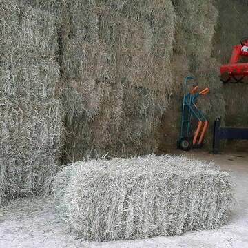
Heukleinballen (34 x 44 x 90 cm)
Marquartstein
Hacher Fahrnpoint
@Hacher-Berghof-Fahrnpoint
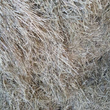
Heu
Kleinballen/HD-Ballen
Regenfrei
Wird verladen
1 weitere...
B+

Heu-, Heulage- und Strohverkauf
Riedstadt
Kirsten Bonn
@Reitanlage-Bonn-Riedstadt
Heu
Großballen
Regenfrei
Wird verladen
1 weitere...
B+


Futtermittel & Einstreu mit Lieferung!
Schwaara
MK-Agrarprodukte
@MK-Agrarprodukte
Heu
Empfänger lädt ab
Großballen
Regenfrei
2 weitere...
P+

Heu HD Ballen
Carlsberg
Maike Käpernick
@ReitschuleKaepernick
Heu
Empfänger lädt ab
Kleinballen/HD-Ballen
Bio
Regenfrei
2 weitere...
B+

Persönlichkeitsentwicklung mit Pferden
Bad Salzuflen
Katja Dors
@Pferdezeiten
Begleite andere auf ihrem Entwicklungsweg und entdecke die transformative Kraft der pferdegestützten Persönlichkeitsentwicklung !
neu
R


TaunusHeu staubreduziert
Idstein
Torsten Fischer
@HayClean
Heu
Käufer lädt selbst
Abholung
Lieferung
P+

Bio Heu
Mehlbach
irena-zinssmeister
@irena-zinssmeister
Heu
Empfänger lädt ab
Großballen
Bio
Regenfrei
2 weitere...
B+
Leider kein Vorschaubild
Leider kein Vorschaubild
Bio-Heu Rundballen zu verkaufen
Biebertal
Lindenhoefe
@Lindenhoefe
Heu
Lieferant entlädt
Rundballen
Wird verladen
2 weitere...
B+

Heu Rundballen
Espenschied
Marvin Kloos
@Birkenhof_Espenschied
Heu
Rundballen
Bio
Regenfrei
Wird verladen
2 weitere...
B+
Werde Teil von STALL-FREI.de
Verkaufe Heu, Heulage, Stroh, Einstreu oder Futter an Pferdehalter und Stallbetreiber
Deprecated: Creation of dynamic property Zend_View::$pageCount is deprecated in /var/www/stall-frei/htdocs/staging.stall-frei.de/library/vendor/shardj/zf1-future/library/Zend/View/Abstract.php on line 308
Deprecated: Creation of dynamic property Zend_View::$itemCountPerPage is deprecated in /var/www/stall-frei/htdocs/staging.stall-frei.de/library/vendor/shardj/zf1-future/library/Zend/View/Abstract.php on line 308
Deprecated: Creation of dynamic property Zend_View::$first is deprecated in /var/www/stall-frei/htdocs/staging.stall-frei.de/library/vendor/shardj/zf1-future/library/Zend/View/Abstract.php on line 308
Deprecated: Creation of dynamic property Zend_View::$current is deprecated in /var/www/stall-frei/htdocs/staging.stall-frei.de/library/vendor/shardj/zf1-future/library/Zend/View/Abstract.php on line 308
Deprecated: Creation of dynamic property Zend_View::$last is deprecated in /var/www/stall-frei/htdocs/staging.stall-frei.de/library/vendor/shardj/zf1-future/library/Zend/View/Abstract.php on line 308
Deprecated: Creation of dynamic property Zend_View::$previous is deprecated in /var/www/stall-frei/htdocs/staging.stall-frei.de/library/vendor/shardj/zf1-future/library/Zend/View/Abstract.php on line 308
Deprecated: Creation of dynamic property Zend_View::$next is deprecated in /var/www/stall-frei/htdocs/staging.stall-frei.de/library/vendor/shardj/zf1-future/library/Zend/View/Abstract.php on line 308
Deprecated: Creation of dynamic property Zend_View::$pagesInRange is deprecated in /var/www/stall-frei/htdocs/staging.stall-frei.de/library/vendor/shardj/zf1-future/library/Zend/View/Abstract.php on line 308
Deprecated: Creation of dynamic property Zend_View::$firstPageInRange is deprecated in /var/www/stall-frei/htdocs/staging.stall-frei.de/library/vendor/shardj/zf1-future/library/Zend/View/Abstract.php on line 308
Deprecated: Creation of dynamic property Zend_View::$lastPageInRange is deprecated in /var/www/stall-frei/htdocs/staging.stall-frei.de/library/vendor/shardj/zf1-future/library/Zend/View/Abstract.php on line 308
Deprecated: Creation of dynamic property Zend_View::$currentItemCount is deprecated in /var/www/stall-frei/htdocs/staging.stall-frei.de/library/vendor/shardj/zf1-future/library/Zend/View/Abstract.php on line 308
Deprecated: Creation of dynamic property Zend_View::$totalItemCount is deprecated in /var/www/stall-frei/htdocs/staging.stall-frei.de/library/vendor/shardj/zf1-future/library/Zend/View/Abstract.php on line 308
Deprecated: Creation of dynamic property Zend_View::$firstItemNumber is deprecated in /var/www/stall-frei/htdocs/staging.stall-frei.de/library/vendor/shardj/zf1-future/library/Zend/View/Abstract.php on line 308
Deprecated: Creation of dynamic property Zend_View::$lastItemNumber is deprecated in /var/www/stall-frei/htdocs/staging.stall-frei.de/library/vendor/shardj/zf1-future/library/Zend/View/Abstract.php on line 308
Deprecated: Creation of dynamic property Zend_View::$router is deprecated in /var/www/stall-frei/htdocs/staging.stall-frei.de/library/vendor/shardj/zf1-future/library/Zend/View/Abstract.php on line 308
Deprecated: Creation of dynamic property Zend_View::$urlParams is deprecated in /var/www/stall-frei/htdocs/staging.stall-frei.de/library/vendor/shardj/zf1-future/library/Zend/View/Abstract.php on line 308
Deprecated: Creation of dynamic property Zend_View::$showAds is deprecated in /var/www/stall-frei/htdocs/staging.stall-frei.de/library/vendor/shardj/zf1-future/library/Zend/View/Abstract.php on line 308
Deprecated: Creation of dynamic property Zend_View::$objectIds is deprecated in /var/www/stall-frei/htdocs/staging.stall-frei.de/library/vendor/shardj/zf1-future/library/Zend/View/Abstract.php on line 308
Deprecated: Creation of dynamic property Zend_View::$showNavbar is deprecated in /var/www/stall-frei/htdocs/staging.stall-frei.de/library/vendor/shardj/zf1-future/library/Zend/View/Abstract.php on line 308
Deprecated: Creation of dynamic property Zend_View::$showBreadcrumb is deprecated in /var/www/stall-frei/htdocs/staging.stall-frei.de/library/vendor/shardj/zf1-future/library/Zend/View/Abstract.php on line 308
Deprecated: Creation of dynamic property Zend_View::$showFooter is deprecated in /var/www/stall-frei/htdocs/staging.stall-frei.de/library/vendor/shardj/zf1-future/library/Zend/View/Abstract.php on line 308
Deprecated: Creation of dynamic property Zend_View::$showInternalAds is deprecated in /var/www/stall-frei/htdocs/staging.stall-frei.de/library/vendor/shardj/zf1-future/library/Zend/View/Abstract.php on line 308
Deprecated: Creation of dynamic property Zend_View::$blNoContent is deprecated in /var/www/stall-frei/htdocs/staging.stall-frei.de/library/vendor/shardj/zf1-future/library/Zend/View/Abstract.php on line 308
Deprecated: Creation of dynamic property Zend_View::$sMetaDesc is deprecated in /var/www/stall-frei/htdocs/staging.stall-frei.de/library/vendor/shardj/zf1-future/library/Zend/View/Abstract.php on line 308
Deprecated: Creation of dynamic property Zend_View::$useGmaps is deprecated in /var/www/stall-frei/htdocs/staging.stall-frei.de/library/vendor/shardj/zf1-future/library/Zend/View/Abstract.php on line 308
Deprecated: Creation of dynamic property Zend_View::$touches is deprecated in /var/www/stall-frei/htdocs/staging.stall-frei.de/library/vendor/shardj/zf1-future/library/Zend/View/Abstract.php on line 308
Deprecated: Creation of dynamic property Zend_View::$oProject is deprecated in /var/www/stall-frei/htdocs/staging.stall-frei.de/library/vendor/shardj/zf1-future/library/Zend/View/Abstract.php on line 308
Deprecated: Creation of dynamic property Zend_View::$pageHeadline is deprecated in /var/www/stall-frei/htdocs/staging.stall-frei.de/library/vendor/shardj/zf1-future/library/Zend/View/Abstract.php on line 308
Deprecated: Creation of dynamic property Zend_View::$disableLocationField is deprecated in /var/www/stall-frei/htdocs/staging.stall-frei.de/library/vendor/shardj/zf1-future/library/Zend/View/Abstract.php on line 308
Deprecated: Creation of dynamic property Zend_View::$isSearch is deprecated in /var/www/stall-frei/htdocs/staging.stall-frei.de/library/vendor/shardj/zf1-future/library/Zend/View/Abstract.php on line 308
Deprecated: Creation of dynamic property Zend_View::$pageTitle is deprecated in /var/www/stall-frei/htdocs/staging.stall-frei.de/library/vendor/shardj/zf1-future/library/Zend/View/Abstract.php on line 308
Deprecated: Creation of dynamic property Psf_Form_Element_Text::$class is deprecated in /var/www/stall-frei/htdocs/staging.stall-frei.de/library/vendor/shardj/zf1-future/library/Zend/Form/Element.php on line 874
Deprecated: Creation of dynamic property Psf_Form_Element_Text::$size is deprecated in /var/www/stall-frei/htdocs/staging.stall-frei.de/library/vendor/shardj/zf1-future/library/Zend/Form/Element.php on line 874
Deprecated: Creation of dynamic property Psf_Form_Element_Text::$placeholder is deprecated in /var/www/stall-frei/htdocs/staging.stall-frei.de/library/vendor/shardj/zf1-future/library/Zend/Form/Element.php on line 874
Deprecated: Creation of dynamic property Psf_Form_Element_Hidden::$class is deprecated in /var/www/stall-frei/htdocs/staging.stall-frei.de/library/vendor/shardj/zf1-future/library/Zend/Form/Element.php on line 874
Deprecated: Creation of dynamic property Psf_Form_Element_Hidden::$class is deprecated in /var/www/stall-frei/htdocs/staging.stall-frei.de/library/vendor/shardj/zf1-future/library/Zend/Form/Element.php on line 874
Deprecated: Creation of dynamic property Psf_Form_Element_Hidden::$class is deprecated in /var/www/stall-frei/htdocs/staging.stall-frei.de/library/vendor/shardj/zf1-future/library/Zend/Form/Element.php on line 874
Deprecated: Creation of dynamic property Psf_Form_Element_Hidden::$class is deprecated in /var/www/stall-frei/htdocs/staging.stall-frei.de/library/vendor/shardj/zf1-future/library/Zend/Form/Element.php on line 874
Deprecated: Creation of dynamic property Psf_Form_Element_Select::$class is deprecated in /var/www/stall-frei/htdocs/staging.stall-frei.de/library/vendor/shardj/zf1-future/library/Zend/Form/Element.php on line 874
Deprecated: Creation of dynamic property Psf_Form_Element_Select::$class is deprecated in /var/www/stall-frei/htdocs/staging.stall-frei.de/library/vendor/shardj/zf1-future/library/Zend/Form/Element.php on line 874
Deprecated: Creation of dynamic property Psf_Form_Element_Select::$class is deprecated in /var/www/stall-frei/htdocs/staging.stall-frei.de/library/vendor/shardj/zf1-future/library/Zend/Form/Element.php on line 874
Deprecated: Creation of dynamic property Psf_Form_Element_Select::$class is deprecated in /var/www/stall-frei/htdocs/staging.stall-frei.de/library/vendor/shardj/zf1-future/library/Zend/Form/Element.php on line 874
Deprecated: Creation of dynamic property Zend_View::$sort is deprecated in /var/www/stall-frei/htdocs/staging.stall-frei.de/library/vendor/shardj/zf1-future/library/Zend/View/Abstract.php on line 308
Deprecated: Creation of dynamic property Zend_View::$searchLocation is deprecated in /var/www/stall-frei/htdocs/staging.stall-frei.de/library/vendor/shardj/zf1-future/library/Zend/View/Abstract.php on line 308
Deprecated: Creation of dynamic property Zend_View::$locationHint is deprecated in /var/www/stall-frei/htdocs/staging.stall-frei.de/library/vendor/shardj/zf1-future/library/Zend/View/Abstract.php on line 308
Psf_GeoCoder_Abstract::getLocation: Fallhaus Get Location CachedOrLive
Psf_GeoCoder_Abstract::getCachedOrLive: Fallhaus
Psf_GeoCoder_Abstract::convertLocationResult
{"documentation":"https:\/\/opencagedata.com\/api","licenses":[{"name":"see attribution guide","url":"https:\/\/opencagedata.com\/credits"}],"results":[{"bounds":{"northeast":{"lat":49.1414507,"lng":10.8678778},"southwest":{"lat":49.1413507,"lng":10.8677778}},"components":{"ISO_3166-1_alpha-2":"DE","ISO_3166-1_alpha-3":"DEU","ISO_3166-2":["DE-BY"],"_category":"building","_normalized_city":"Absberg","_type":"building","continent":"Europe","country":"Deutschland","country_code":"de","county":"Landkreis Wei\u00dfenburg-Gunzenhausen","hamlet":"Angerhof","isolated_dwelling":"Fallhaus","municipality":"Gunzenhausen (VGem)","political_union":"European Union","postcode":"91720","state":"Bayern","state_code":"BY","village":"Absberg"},"confidence":10,"formatted":"Fallhaus, Angerhof, 91720 Absberg, Deutschland","geometry":{"lat":49.1414007,"lng":10.8678278}},{"bounds":{"northeast":{"lat":49.3726225,"lng":9.8780572},"southwest":{"lat":49.3725225,"lng":9.8779572}},"components":{"ISO_3166-1_alpha-2":"DE","ISO_3166-1_alpha-3":"DEU","ISO_3166-2":["DE-BW"],"_category":"building","_normalized_city":"Schrozberg","_type":"building","continent":"Europe","country":"Deutschland","country_code":"de","county":"Landkreis Schw\u00e4bisch Hall","hamlet":"Reichertswiesen","isolated_dwelling":"Fallhaus","political_union":"European Union","postcode":"74575","state":"Baden-W\u00fcrttemberg","state_code":"BW","town":"Schrozberg","village":"Riedbach"},"confidence":10,"formatted":"Fallhaus, Reichertswiesen, 74575 Riedbach, Deutschland","geometry":{"lat":49.3725725,"lng":9.8780072}},{"bounds":{"northeast":{"lat":49.5024301,"lng":10.639663},"southwest":{"lat":49.5023301,"lng":10.639563}},"components":{"ISO_3166-1_alpha-2":"DE","ISO_3166-1_alpha-3":"DEU","ISO_3166-2":["DE-BY"],"_category":"building","_normalized_city":"Markt Erlbach","_type":"building","city":"Markt Erlbach","continent":"Europe","country":"Deutschland","country_code":"de","county":"Landkreis Neustadt an der Aisch-Bad Windsheim","isolated_dwelling":"Fallhaus","political_union":"European Union","postcode":"91459","state":"Bayern","state_code":"BY"},"confidence":10,"formatted":"Fallhaus, 91459 Markt Erlbach, Deutschland","geometry":{"lat":49.5023801,"lng":10.639613}},{"bounds":{"northeast":{"lat":49.0537216,"lng":9.8482576},"southwest":{"lat":49.0536216,"lng":9.8481576}},"components":{"ISO_3166-1_alpha-2":"DE","ISO_3166-1_alpha-3":"DEU","ISO_3166-2":["DE-BW"],"_category":"building","_normalized_city":"Obersontheim","_type":"building","city":"Obersontheim","continent":"Europe","country":"Deutschland","country_code":"de","county":"Landkreis Schw\u00e4bisch Hall","isolated_dwelling":"R\u00f6schb\u00fchl","municipality":"GVV Oberes B\u00fchlertal","political_union":"European Union","postcode":"74423","state":"Baden-W\u00fcrttemberg","state_code":"BW","village":"Untersontheim"},"confidence":10,"formatted":"R\u00f6schb\u00fchl, 74423 Untersontheim, Deutschland","geometry":{"lat":49.0536716,"lng":9.8482076}},{"bounds":{"northeast":{"lat":49.3872368,"lng":11.3423428},"southwest":{"lat":49.3865155,"lng":11.3405785}},"components":{"ISO_3166-1_alpha-2":"DE","ISO_3166-1_alpha-3":"DEU","ISO_3166-2":["DE-BY"],"_category":"road","_normalized_city":"Altdorf bei N\u00fcrnberg","_type":"road","continent":"Europe","country":"Deutschland","country_code":"de","county":"Landkreis N\u00fcrnberger Land","political_union":"European Union","postcode":"90518","road":"Fallhaus","road_type":"track","state":"Bayern","state_code":"BY","town":"Altdorf bei N\u00fcrnberg"},"confidence":9,"formatted":"Fallhaus, 90518 Altdorf bei N\u00fcrnberg, Deutschland","geometry":{"lat":49.3870563,"lng":11.3415282}},{"components":{"ISO_3166-1_alpha-2":"FR","ISO_3166-1_alpha-3":"FRA","ISO_3166-2":["FR-NAQ","FR-33"],"_category":"place","_normalized_city":"Saint-Denis-de-Pile","_type":"place","city":"Saint-Denis-de-Pile","continent":"Europe","country":"France","country_code":"fr","county":"Gironde","local_authority":"Communaut\u00e9 d'agglom\u00e9ration du Libournais","place":"Champs de Dallau","political_union":"European Union","postcode":"33910","state":"Nouvelle-Aquitaine","state_code":"NAQ"},"confidence":3,"formatted":"Champs de Dallau, 33910 Saint-Denis-de-Pile, France","geometry":{"lat":44.975145,"lng":-0.171152}},{"components":{"ISO_3166-1_alpha-2":"FR","ISO_3166-1_alpha-3":"FRA","ISO_3166-2":["FR-IDF","FR-92"],"_category":"road","_normalized_city":"Levallois-Perret","_type":"road","city":"Levallois-Perret","continent":"Europe","country":"France","country_code":"fr","county":"Hauts-de-Seine","local_authority":"M\u00e9tropole du Grand Paris","political_union":"European Union","postcode":"92300","road":"Rue Charles Deutschmann","state":"\u00cele-de-France","state_code":"IDF"},"confidence":3,"formatted":"Rue Charles Deutschmann, 92300 Levallois-Perret, France","geometry":{"lat":48.900049,"lng":2.2842}},{"components":{"ISO_3166-1_alpha-2":"FR","ISO_3166-1_alpha-3":"FRA","ISO_3166-2":["FR-NAQ","FR-33"],"_category":"road","_normalized_city":"Saint-Denis-de-Pile","_type":"road","city":"Saint-Denis-de-Pile","continent":"Europe","country":"France","country_code":"fr","county":"Gironde","local_authority":"Communaut\u00e9 d'agglom\u00e9ration du Libournais","political_union":"European Union","postcode":"33910","road":"Chemin de Dallau","state":"Nouvelle-Aquitaine","state_code":"NAQ"},"confidence":2,"formatted":"Chemin de Dallau, 33910 Saint-Denis-de-Pile, France","geometry":{"lat":44.970036,"lng":-0.166023}},{"components":{"ISO_3166-1_alpha-2":"FR","ISO_3166-1_alpha-3":"FRA","ISO_3166-2":["FR-NAQ","FR-16"],"_category":"road","_normalized_city":"Nersac","_type":"road","city":"Nersac","continent":"Europe","country":"France","country_code":"fr","county":"Charente","local_authority":"Communaut\u00e9 d'agglom\u00e9ration du Grand Angoul\u00eame","political_union":"European Union","postcode":"16440","road":"Chez Dallaud","state":"Nouvelle-Aquitaine","state_code":"NAQ"},"confidence":2,"formatted":"Chez Dallaud, 16440 Nersac, France","geometry":{"lat":45.61317,"lng":0.059193}},{"components":{"ISO_3166-1_alpha-2":"FR","ISO_3166-1_alpha-3":"FRA","ISO_3166-2":["FR-NAQ","FR-33"],"_category":"place","_normalized_city":"Saint-Denis-de-Pile","_type":"place","city":"Saint-Denis-de-Pile","continent":"Europe","country":"France","country_code":"fr","county":"Gironde","local_authority":"Communaut\u00e9 d'agglom\u00e9ration du Libournais","place":"Bois de Dallau Est","political_union":"European Union","postcode":"33910","state":"Nouvelle-Aquitaine","state_code":"NAQ"},"confidence":2,"formatted":"Bois de Dallau Est, 33910 Saint-Denis-de-Pile, France","geometry":{"lat":44.970852,"lng":-0.168332}}],"status":{"code":200,"message":"OK"},"stay_informed":{"blog":"https:\/\/blog.opencagedata.com","mastodon":"https:\/\/en.osm.town\/@opencage"},"thanks":"For using an OpenCage API","timestamp":{"created_http":"Mon, 09 Feb 2026 09:56:26 GMT","created_unix":1770630986},"total_results":10}Array
(
[0] => stdClass Object
(
[bounds] => stdClass Object
(
[northeast] => stdClass Object
(
[lat] => 49.1414507
[lng] => 10.8678778
)
[southwest] => stdClass Object
(
[lat] => 49.1413507
[lng] => 10.8677778
)
)
[components] => stdClass Object
(
[ISO_3166-1_alpha-2] => DE
[ISO_3166-1_alpha-3] => DEU
[ISO_3166-2] => Array
(
[0] => DE-BY
)
[_category] => building
[_normalized_city] => Absberg
[_type] => building
[continent] => Europe
[country] => Deutschland
[country_code] => de
[county] => Landkreis Weißenburg-Gunzenhausen
[hamlet] => Angerhof
[isolated_dwelling] => Fallhaus
[municipality] => Gunzenhausen (VGem)
[political_union] => European Union
[postcode] => 91720
[state] => Bayern
[state_code] => BY
[village] => Absberg
)
[confidence] => 10
[formatted] => Fallhaus, Angerhof, 91720 Absberg, Deutschland
[geometry] => stdClass Object
(
[lat] => 49.1414007
[lng] => 10.8678278
)
)
[1] => stdClass Object
(
[bounds] => stdClass Object
(
[northeast] => stdClass Object
(
[lat] => 49.3726225
[lng] => 9.8780572
)
[southwest] => stdClass Object
(
[lat] => 49.3725225
[lng] => 9.8779572
)
)
[components] => stdClass Object
(
[ISO_3166-1_alpha-2] => DE
[ISO_3166-1_alpha-3] => DEU
[ISO_3166-2] => Array
(
[0] => DE-BW
)
[_category] => building
[_normalized_city] => Schrozberg
[_type] => building
[continent] => Europe
[country] => Deutschland
[country_code] => de
[county] => Landkreis Schwäbisch Hall
[hamlet] => Reichertswiesen
[isolated_dwelling] => Fallhaus
[political_union] => European Union
[postcode] => 74575
[state] => Baden-Württemberg
[state_code] => BW
[town] => Schrozberg
[village] => Riedbach
)
[confidence] => 10
[formatted] => Fallhaus, Reichertswiesen, 74575 Riedbach, Deutschland
[geometry] => stdClass Object
(
[lat] => 49.3725725
[lng] => 9.8780072
)
)
[2] => stdClass Object
(
[bounds] => stdClass Object
(
[northeast] => stdClass Object
(
[lat] => 49.5024301
[lng] => 10.639663
)
[southwest] => stdClass Object
(
[lat] => 49.5023301
[lng] => 10.639563
)
)
[components] => stdClass Object
(
[ISO_3166-1_alpha-2] => DE
[ISO_3166-1_alpha-3] => DEU
[ISO_3166-2] => Array
(
[0] => DE-BY
)
[_category] => building
[_normalized_city] => Markt Erlbach
[_type] => building
[city] => Markt Erlbach
[continent] => Europe
[country] => Deutschland
[country_code] => de
[county] => Landkreis Neustadt an der Aisch-Bad Windsheim
[isolated_dwelling] => Fallhaus
[political_union] => European Union
[postcode] => 91459
[state] => Bayern
[state_code] => BY
)
[confidence] => 10
[formatted] => Fallhaus, 91459 Markt Erlbach, Deutschland
[geometry] => stdClass Object
(
[lat] => 49.5023801
[lng] => 10.639613
)
)
[3] => stdClass Object
(
[bounds] => stdClass Object
(
[northeast] => stdClass Object
(
[lat] => 49.0537216
[lng] => 9.8482576
)
[southwest] => stdClass Object
(
[lat] => 49.0536216
[lng] => 9.8481576
)
)
[components] => stdClass Object
(
[ISO_3166-1_alpha-2] => DE
[ISO_3166-1_alpha-3] => DEU
[ISO_3166-2] => Array
(
[0] => DE-BW
)
[_category] => building
[_normalized_city] => Obersontheim
[_type] => building
[city] => Obersontheim
[continent] => Europe
[country] => Deutschland
[country_code] => de
[county] => Landkreis Schwäbisch Hall
[isolated_dwelling] => Röschbühl
[municipality] => GVV Oberes Bühlertal
[political_union] => European Union
[postcode] => 74423
[state] => Baden-Württemberg
[state_code] => BW
[village] => Untersontheim
)
[confidence] => 10
[formatted] => Röschbühl, 74423 Untersontheim, Deutschland
[geometry] => stdClass Object
(
[lat] => 49.0536716
[lng] => 9.8482076
)
)
[4] => stdClass Object
(
[bounds] => stdClass Object
(
[northeast] => stdClass Object
(
[lat] => 49.3872368
[lng] => 11.3423428
)
[southwest] => stdClass Object
(
[lat] => 49.3865155
[lng] => 11.3405785
)
)
[components] => stdClass Object
(
[ISO_3166-1_alpha-2] => DE
[ISO_3166-1_alpha-3] => DEU
[ISO_3166-2] => Array
(
[0] => DE-BY
)
[_category] => road
[_normalized_city] => Altdorf bei Nürnberg
[_type] => road
[continent] => Europe
[country] => Deutschland
[country_code] => de
[county] => Landkreis Nürnberger Land
[political_union] => European Union
[postcode] => 90518
[road] => Fallhaus
[road_type] => track
[state] => Bayern
[state_code] => BY
[town] => Altdorf bei Nürnberg
)
[confidence] => 9
[formatted] => Fallhaus, 90518 Altdorf bei Nürnberg, Deutschland
[geometry] => stdClass Object
(
[lat] => 49.3870563
[lng] => 11.3415282
)
)
[5] => stdClass Object
(
[components] => stdClass Object
(
[ISO_3166-1_alpha-2] => FR
[ISO_3166-1_alpha-3] => FRA
[ISO_3166-2] => Array
(
[0] => FR-NAQ
[1] => FR-33
)
[_category] => place
[_normalized_city] => Saint-Denis-de-Pile
[_type] => place
[city] => Saint-Denis-de-Pile
[continent] => Europe
[country] => France
[country_code] => fr
[county] => Gironde
[local_authority] => Communauté d'agglomération du Libournais
[place] => Champs de Dallau
[political_union] => European Union
[postcode] => 33910
[state] => Nouvelle-Aquitaine
[state_code] => NAQ
)
[confidence] => 3
[formatted] => Champs de Dallau, 33910 Saint-Denis-de-Pile, France
[geometry] => stdClass Object
(
[lat] => 44.975145
[lng] => -0.171152
)
)
[6] => stdClass Object
(
[components] => stdClass Object
(
[ISO_3166-1_alpha-2] => FR
[ISO_3166-1_alpha-3] => FRA
[ISO_3166-2] => Array
(
[0] => FR-IDF
[1] => FR-92
)
[_category] => road
[_normalized_city] => Levallois-Perret
[_type] => road
[city] => Levallois-Perret
[continent] => Europe
[country] => France
[country_code] => fr
[county] => Hauts-de-Seine
[local_authority] => Métropole du Grand Paris
[political_union] => European Union
[postcode] => 92300
[road] => Rue Charles Deutschmann
[state] => Île-de-France
[state_code] => IDF
)
[confidence] => 3
[formatted] => Rue Charles Deutschmann, 92300 Levallois-Perret, France
[geometry] => stdClass Object
(
[lat] => 48.900049
[lng] => 2.2842
)
)
[7] => stdClass Object
(
[components] => stdClass Object
(
[ISO_3166-1_alpha-2] => FR
[ISO_3166-1_alpha-3] => FRA
[ISO_3166-2] => Array
(
[0] => FR-NAQ
[1] => FR-33
)
[_category] => road
[_normalized_city] => Saint-Denis-de-Pile
[_type] => road
[city] => Saint-Denis-de-Pile
[continent] => Europe
[country] => France
[country_code] => fr
[county] => Gironde
[local_authority] => Communauté d'agglomération du Libournais
[political_union] => European Union
[postcode] => 33910
[road] => Chemin de Dallau
[state] => Nouvelle-Aquitaine
[state_code] => NAQ
)
[confidence] => 2
[formatted] => Chemin de Dallau, 33910 Saint-Denis-de-Pile, France
[geometry] => stdClass Object
(
[lat] => 44.970036
[lng] => -0.166023
)
)
[8] => stdClass Object
(
[components] => stdClass Object
(
[ISO_3166-1_alpha-2] => FR
[ISO_3166-1_alpha-3] => FRA
[ISO_3166-2] => Array
(
[0] => FR-NAQ
[1] => FR-16
)
[_category] => road
[_normalized_city] => Nersac
[_type] => road
[city] => Nersac
[continent] => Europe
[country] => France
[country_code] => fr
[county] => Charente
[local_authority] => Communauté d'agglomération du Grand Angoulême
[political_union] => European Union
[postcode] => 16440
[road] => Chez Dallaud
[state] => Nouvelle-Aquitaine
[state_code] => NAQ
)
[confidence] => 2
[formatted] => Chez Dallaud, 16440 Nersac, France
[geometry] => stdClass Object
(
[lat] => 45.61317
[lng] => 0.059193
)
)
[9] => stdClass Object
(
[components] => stdClass Object
(
[ISO_3166-1_alpha-2] => FR
[ISO_3166-1_alpha-3] => FRA
[ISO_3166-2] => Array
(
[0] => FR-NAQ
[1] => FR-33
)
[_category] => place
[_normalized_city] => Saint-Denis-de-Pile
[_type] => place
[city] => Saint-Denis-de-Pile
[continent] => Europe
[country] => France
[country_code] => fr
[county] => Gironde
[local_authority] => Communauté d'agglomération du Libournais
[place] => Bois de Dallau Est
[political_union] => European Union
[postcode] => 33910
[state] => Nouvelle-Aquitaine
[state_code] => NAQ
)
[confidence] => 2
[formatted] => Bois de Dallau Est, 33910 Saint-Denis-de-Pile, France
[geometry] => stdClass Object
(
[lat] => 44.970852
[lng] => -0.168332
)
)
)
Psf_GeoCoder_OpenCageData::getKeyMap: 0
stdClass Object
(
    [bounds] => stdClass Object
        (
            [northeast] => stdClass Object
                (
                    [lat] => 49.1414507
                    [lng] => 10.8678778
                )

            [southwest] => stdClass Object
                (
                    [lat] => 49.1413507
                    [lng] => 10.8677778
                )

        )

    [components] => stdClass Object
        (
            [ISO_3166-1_alpha-2] => DE
            [ISO_3166-1_alpha-3] => DEU
            [ISO_3166-2] => Array
                (
                    [0] => DE-BY
                )

            [_category] => building
            [_normalized_city] => Absberg
            [_type] => building
            [continent] => Europe
            [country] => Deutschland
            [country_code] => de
            [county] => Landkreis Weißenburg-Gunzenhausen
            [hamlet] => Angerhof
            [isolated_dwelling] => Fallhaus
            [municipality] => Gunzenhausen (VGem)
            [political_union] => European Union
            [postcode] => 91720
            [state] => Bayern
            [state_code] => BY
            [village] => Absberg
        )

    [confidence] => 10
    [formatted] => Fallhaus, Angerhof, 91720 Absberg, Deutschland
    [geometry] => stdClass Object
        (
            [lat] => 49.1414007
            [lng] => 10.8678278
        )

)
Psf_GeoCoder_OpenCageData::getCounty: Weißenburg-Gunzenhausen
Psf_GeoCoder_OpenCageData::addMissingData REFETCH!
Array
(
    [address] => Fallhaus, Angerhof, 91720 Absberg, Deutschland
    [type] => building
    [street] => Angerhof
    [city] => Absberg
    [county] => Weißenburg-Gunzenhausen
    [state] => Bayern
    [zip] => 91720
    [country] => Deutschland
    [suburb] =>
    [countrycode] => de
    [latitude] => 49.1414007
    [longitude] => 10.8678278
    [accuracy] => 1
    [confidence] => 10
    [bounds] => stdClass Object
        (
            [northeast] => stdClass Object
                (
                    [lat] => 49.1414507
                    [lng] => 10.8678778
                )

            [southwest] => stdClass Object
                (
                    [lat] => 49.1413507
                    [lng] => 10.8677778
                )

        )

)
reformat!
Array
(
    [address] => Fallhaus, Angerhof, 91720 Absberg, Deutschland
    [type] => building
    [street] => Angerhof
    [city] => Absberg
    [county] => Weißenburg-Gunzenhausen
    [state] => Bayern
    [zip] => 91720
    [country] => Deutschland
    [suburb] =>
    [countrycode] => de
    [latitude] => 49.1414007
    [longitude] => 10.8678278
    [accuracy] => 1
    [confidence] => 10
    [bounds] => stdClass Object
        (
            [northeast] => stdClass Object
                (
                    [lat] => 49.1414507
                    [lng] => 10.8678778
                )

            [southwest] => stdClass Object
                (
                    [lat] => 49.1413507
                    [lng] => 10.8677778
                )

        )

    [place] => Angerhof, 91720 Absberg, Bayern
    [hash] => 7dce080ef555b405cccf7b31fccf953f
)
Psf_GeoCoder_OpenCageData::getKeyMap: 1
stdClass Object
(
    [bounds] => stdClass Object
        (
            [northeast] => stdClass Object
                (
                    [lat] => 49.3726225
                    [lng] => 9.8780572
                )

            [southwest] => stdClass Object
                (
                    [lat] => 49.3725225
                    [lng] => 9.8779572
                )

        )

    [components] => stdClass Object
        (
            [ISO_3166-1_alpha-2] => DE
            [ISO_3166-1_alpha-3] => DEU
            [ISO_3166-2] => Array
                (
                    [0] => DE-BW
                )

            [_category] => building
            [_normalized_city] => Schrozberg
            [_type] => building
            [continent] => Europe
            [country] => Deutschland
            [country_code] => de
            [county] => Landkreis Schwäbisch Hall
            [hamlet] => Reichertswiesen
            [isolated_dwelling] => Fallhaus
            [political_union] => European Union
            [postcode] => 74575
            [state] => Baden-Württemberg
            [state_code] => BW
            [town] => Schrozberg
            [village] => Riedbach
        )

    [confidence] => 10
    [formatted] => Fallhaus, Reichertswiesen, 74575 Riedbach, Deutschland
    [geometry] => stdClass Object
        (
            [lat] => 49.3725725
            [lng] => 9.8780072
        )

)
Psf_GeoCoder_OpenCageData::getCounty: Schwäbisch Hall
Psf_GeoCoder_OpenCageData::addMissingData REFETCH!
Array
(
    [address] => Fallhaus, Reichertswiesen, 74575 Riedbach, Deutschland
    [type] => building
    [street] => Reichertswiesen
    [city] => Schrozberg
    [county] => Schwäbisch Hall
    [state] => Baden-Württemberg
    [zip] => 74575
    [country] => Deutschland
    [suburb] =>
    [countrycode] => de
    [latitude] => 49.3725725
    [longitude] => 9.8780072
    [accuracy] => 1
    [confidence] => 10
    [bounds] => stdClass Object
        (
            [northeast] => stdClass Object
                (
                    [lat] => 49.3726225
                    [lng] => 9.8780572
                )

            [southwest] => stdClass Object
                (
                    [lat] => 49.3725225
                    [lng] => 9.8779572
                )

        )

)
reformat!
Array
(
    [address] => Reichertswiesen, 74575 Schrozberg
    [type] => building
    [street] => Reichertswiesen
    [city] => Schrozberg
    [county] => Schwäbisch Hall
    [state] => Baden-Württemberg
    [zip] => 74575
    [country] => Deutschland
    [suburb] =>
    [countrycode] => de
    [latitude] => 49.3725725
    [longitude] => 9.8780072
    [accuracy] => 1
    [confidence] => 10
    [bounds] => stdClass Object
        (
            [northeast] => stdClass Object
                (
                    [lat] => 49.3726225
                    [lng] => 9.8780572
                )

            [southwest] => stdClass Object
                (
                    [lat] => 49.3725225
                    [lng] => 9.8779572
                )

        )

    [place] => Reichertswiesen, 74575 Schrozberg, Baden-Württemberg
    [hash] => 7c8cc9ce4df8c6a764004a8f7a8602e6
)
Psf_GeoCoder_OpenCageData::getKeyMap: 2
stdClass Object
(
    [bounds] => stdClass Object
        (
            [northeast] => stdClass Object
                (
                    [lat] => 49.5024301
                    [lng] => 10.639663
                )

            [southwest] => stdClass Object
                (
                    [lat] => 49.5023301
                    [lng] => 10.639563
                )

        )

    [components] => stdClass Object
        (
            [ISO_3166-1_alpha-2] => DE
            [ISO_3166-1_alpha-3] => DEU
            [ISO_3166-2] => Array
                (
                    [0] => DE-BY
                )

            [_category] => building
            [_normalized_city] => Markt Erlbach
            [_type] => building
            [city] => Markt Erlbach
            [continent] => Europe
            [country] => Deutschland
            [country_code] => de
            [county] => Landkreis Neustadt an der Aisch-Bad Windsheim
            [isolated_dwelling] => Fallhaus
            [political_union] => European Union
            [postcode] => 91459
            [state] => Bayern
            [state_code] => BY
        )

    [confidence] => 10
    [formatted] => Fallhaus, 91459 Markt Erlbach, Deutschland
    [geometry] => stdClass Object
        (
            [lat] => 49.5023801
            [lng] => 10.639613
        )

)
Psf_GeoCoder_OpenCageData::getCounty: Neustadt an der Aisch-Bad Windsheim
Psf_GeoCoder_OpenCageData::addMissingData REFETCH!
Array
(
    [address] => Fallhaus, 91459 Markt Erlbach, Deutschland
    [type] => building
    [street] =>
    [city] => Markt Erlbach
    [county] => Neustadt an der Aisch-Bad Windsheim
    [state] => Bayern
    [zip] => 91459
    [country] => Deutschland
    [suburb] =>
    [countrycode] => de
    [latitude] => 49.5023801
    [longitude] => 10.639613
    [accuracy] => 1
    [confidence] => 10
    [bounds] => stdClass Object
        (
            [northeast] => stdClass Object
                (
                    [lat] => 49.5024301
                    [lng] => 10.639663
                )

            [southwest] => stdClass Object
                (
                    [lat] => 49.5023301
                    [lng] => 10.639563
                )

        )

)
reformat!
Array
(
    [address] => Fallhaus, 91459 Markt Erlbach, Deutschland
    [type] => building
    [street] =>
    [city] => Markt Erlbach
    [county] => Neustadt an der Aisch-Bad Windsheim
    [state] => Bayern
    [zip] => 91459
    [country] => Deutschland
    [suburb] =>
    [countrycode] => de
    [latitude] => 49.5023801
    [longitude] => 10.639613
    [accuracy] => 1
    [confidence] => 10
    [bounds] => stdClass Object
        (
            [northeast] => stdClass Object
                (
                    [lat] => 49.5024301
                    [lng] => 10.639663
                )

            [southwest] => stdClass Object
                (
                    [lat] => 49.5023301
                    [lng] => 10.639563
                )

        )

    [place] => 91459 Markt Erlbach, Bayern
    [hash] => 095cd7beb26f761db4b65edf73c7a68c
)
Psf_GeoCoder_OpenCageData::getKeyMap: 3
stdClass Object
(
    [bounds] => stdClass Object
        (
            [northeast] => stdClass Object
                (
                    [lat] => 49.0537216
                    [lng] => 9.8482576
                )

            [southwest] => stdClass Object
                (
                    [lat] => 49.0536216
                    [lng] => 9.8481576
                )

        )

    [components] => stdClass Object
        (
            [ISO_3166-1_alpha-2] => DE
            [ISO_3166-1_alpha-3] => DEU
            [ISO_3166-2] => Array
                (
                    [0] => DE-BW
                )

            [_category] => building
            [_normalized_city] => Obersontheim
            [_type] => building
            [city] => Obersontheim
            [continent] => Europe
            [country] => Deutschland
            [country_code] => de
            [county] => Landkreis Schwäbisch Hall
            [isolated_dwelling] => Röschbühl
            [municipality] => GVV Oberes Bühlertal
            [political_union] => European Union
            [postcode] => 74423
            [state] => Baden-Württemberg
            [state_code] => BW
            [village] => Untersontheim
        )

    [confidence] => 10
    [formatted] => Röschbühl, 74423 Untersontheim, Deutschland
    [geometry] => stdClass Object
        (
            [lat] => 49.0536716
            [lng] => 9.8482076
        )

)
Psf_GeoCoder_OpenCageData::getCounty: Schwäbisch Hall
Psf_GeoCoder_OpenCageData::addMissingData REFETCH!
Array
(
    [address] => Röschbühl, 74423 Untersontheim, Deutschland
    [type] => building
    [street] =>
    [city] => Untersontheim
    [county] => Schwäbisch Hall
    [state] => Baden-Württemberg
    [zip] => 74423
    [country] => Deutschland
    [suburb] =>
    [countrycode] => de
    [latitude] => 49.0536716
    [longitude] => 9.8482076
    [accuracy] => 1
    [confidence] => 10
    [bounds] => stdClass Object
        (
            [northeast] => stdClass Object
                (
                    [lat] => 49.0537216
                    [lng] => 9.8482576
                )

            [southwest] => stdClass Object
                (
                    [lat] => 49.0536216
                    [lng] => 9.8481576
                )

        )

)
reformat!
Array
(
    [address] => Röschbühl, 74423 Untersontheim, Deutschland
    [type] => building
    [street] =>
    [city] => Untersontheim
    [county] => Schwäbisch Hall
    [state] => Baden-Württemberg
    [zip] => 74423
    [country] => Deutschland
    [suburb] =>
    [countrycode] => de
    [latitude] => 49.0536716
    [longitude] => 9.8482076
    [accuracy] => 1
    [confidence] => 10
    [bounds] => stdClass Object
        (
            [northeast] => stdClass Object
                (
                    [lat] => 49.0537216
                    [lng] => 9.8482576
                )

            [southwest] => stdClass Object
                (
                    [lat] => 49.0536216
                    [lng] => 9.8481576
                )

        )

    [place] => 74423 Untersontheim, Baden-Württemberg
    [hash] => bfe1aaed544c612218422e0c92a6475b
)
Psf_GeoCoder_OpenCageData::getKeyMap: 4
stdClass Object
(
    [bounds] => stdClass Object
        (
            [northeast] => stdClass Object
                (
                    [lat] => 49.3872368
                    [lng] => 11.3423428
                )

            [southwest] => stdClass Object
                (
                    [lat] => 49.3865155
                    [lng] => 11.3405785
                )

        )

    [components] => stdClass Object
        (
            [ISO_3166-1_alpha-2] => DE
            [ISO_3166-1_alpha-3] => DEU
            [ISO_3166-2] => Array
                (
                    [0] => DE-BY
                )

            [_category] => road
            [_normalized_city] => Altdorf bei Nürnberg
            [_type] => road
            [continent] => Europe
            [country] => Deutschland
            [country_code] => de
            [county] => Landkreis Nürnberger Land
            [political_union] => European Union
            [postcode] => 90518
            [road] => Fallhaus
            [road_type] => track
            [state] => Bayern
            [state_code] => BY
            [town] => Altdorf bei Nürnberg
        )

    [confidence] => 9
    [formatted] => Fallhaus, 90518 Altdorf bei Nürnberg, Deutschland
    [geometry] => stdClass Object
        (
            [lat] => 49.3870563
            [lng] => 11.3415282
        )

)
Psf_GeoCoder_OpenCageData::getCounty: Nürnberger Land
Psf_GeoCoder_OpenCageData::addMissingData REFETCH!
Array
(
    [address] => Fallhaus, 90518 Altdorf bei Nürnberg, Deutschland
    [type] => road
    [street] => Fallhaus
    [city] => Altdorf bei Nürnberg
    [county] => Nürnberger Land
    [state] => Bayern
    [zip] => 90518
    [country] => Deutschland
    [suburb] =>
    [countrycode] => de
    [latitude] => 49.3870563
    [longitude] => 11.3415282
    [accuracy] => 1
    [confidence] => 9
    [bounds] => stdClass Object
        (
            [northeast] => stdClass Object
                (
                    [lat] => 49.3872368
                    [lng] => 11.3423428
                )

            [southwest] => stdClass Object
                (
                    [lat] => 49.3865155
                    [lng] => 11.3405785
                )

        )

)
reformat!
Array
(
    [address] => Fallhaus, 90518 Altdorf bei Nürnberg, Deutschland
    [type] => road
    [street] => Fallhaus
    [city] => Altdorf bei Nürnberg
    [county] => Nürnberger Land
    [state] => Bayern
    [zip] => 90518
    [country] => Deutschland
    [suburb] =>
    [countrycode] => de
    [latitude] => 49.3870563
    [longitude] => 11.3415282
    [accuracy] => 1
    [confidence] => 9
    [bounds] => stdClass Object
        (
            [northeast] => stdClass Object
                (
                    [lat] => 49.3872368
                    [lng] => 11.3423428
                )

            [southwest] => stdClass Object
                (
                    [lat] => 49.3865155
                    [lng] => 11.3405785
                )

        )

    [place] => Fallhaus, 90518 Altdorf bei Nürnberg, Bayern
    [hash] => 896e663724153d2fac23b6dbce86e712
)
Psf_GeoCoder_OpenCageData::getKeyMap: 5
stdClass Object
(
    [components] => stdClass Object
        (
            [ISO_3166-1_alpha-2] => FR
            [ISO_3166-1_alpha-3] => FRA
            [ISO_3166-2] => Array
                (
                    [0] => FR-NAQ
                    [1] => FR-33
                )

            [_category] => place
            [_normalized_city] => Saint-Denis-de-Pile
            [_type] => place
            [city] => Saint-Denis-de-Pile
            [continent] => Europe
            [country] => France
            [country_code] => fr
            [county] => Gironde
            [local_authority] => Communauté d'agglomération du Libournais
            [place] => Champs de Dallau
            [political_union] => European Union
            [postcode] => 33910
            [state] => Nouvelle-Aquitaine
            [state_code] => NAQ
        )

    [confidence] => 3
    [formatted] => Champs de Dallau, 33910 Saint-Denis-de-Pile, France
    [geometry] => stdClass Object
        (
            [lat] => 44.975145
            [lng] => -0.171152
        )

)
Psf_GeoCoder_OpenCageData::getCounty: Gironde
Psf_GeoCoder_OpenCageData::addMissingData REFETCH!
Array
(
    [address] => Champs de Dallau, 33910 Saint-Denis-de-Pile, France
    [type] => place
    [street] =>
    [city] => Saint-Denis-de-Pile
    [county] => Gironde
    [state] => Nouvelle-Aquitaine
    [zip] => 33910
    [country] => France
    [suburb] =>
    [countrycode] => fr
    [latitude] => 44.975145
    [longitude] => -0.171152
    [accuracy] => 1
    [confidence] => 3
    [bounds] =>
)
reformat!
Array
(
    [address] => Champs de Dallau, 33910 Saint-Denis-de-Pile, France
    [type] => place
    [street] =>
    [city] => Saint-Denis-de-Pile
    [county] => Gironde
    [state] => Nouvelle-Aquitaine
    [zip] => 33910
    [country] => France
    [suburb] =>
    [countrycode] => fr
    [latitude] => 44.975145
    [longitude] => -0.171152
    [accuracy] => 1
    [confidence] => 3
    [bounds] =>
    [place] => 33910 Saint-Denis-de-Pile, Nouvelle-Aquitaine
    [hash] => 528cd3d369ec151c55972950e2077fdb
)
Psf_GeoCoder_OpenCageData::getKeyMap: 6
stdClass Object
(
    [components] => stdClass Object
        (
            [ISO_3166-1_alpha-2] => FR
            [ISO_3166-1_alpha-3] => FRA
            [ISO_3166-2] => Array
                (
                    [0] => FR-IDF
                    [1] => FR-92
                )

            [_category] => road
            [_normalized_city] => Levallois-Perret
            [_type] => road
            [city] => Levallois-Perret
            [continent] => Europe
            [country] => France
            [country_code] => fr
            [county] => Hauts-de-Seine
            [local_authority] => Métropole du Grand Paris
            [political_union] => European Union
            [postcode] => 92300
            [road] => Rue Charles Deutschmann
            [state] => Île-de-France
            [state_code] => IDF
        )

    [confidence] => 3
    [formatted] => Rue Charles Deutschmann, 92300 Levallois-Perret, France
    [geometry] => stdClass Object
        (
            [lat] => 48.900049
            [lng] => 2.2842
        )

)
Psf_GeoCoder_OpenCageData::getCounty: Hauts-de-Seine
Psf_GeoCoder_OpenCageData::addMissingData REFETCH!
Array
(
    [address] => Rue Charles Deutschmann, 92300 Levallois-Perret, France
    [type] => road
    [street] => Rue Charles Deutschmann
    [city] => Levallois-Perret
    [county] => Hauts-de-Seine
    [state] => Île-de-France
    [zip] => 92300
    [country] => France
    [suburb] =>
    [countrycode] => fr
    [latitude] => 48.900049
    [longitude] => 2.2842
    [accuracy] => 1
    [confidence] => 3
    [bounds] =>
)
reformat!
Array
(
    [address] => Rue Charles Deutschmann, 92300 Levallois-Perret, France
    [type] => road
    [street] => Rue Charles Deutschmann
    [city] => Levallois-Perret
    [county] => Hauts-de-Seine
    [state] => Île-de-France
    [zip] => 92300
    [country] => France
    [suburb] =>
    [countrycode] => fr
    [latitude] => 48.900049
    [longitude] => 2.2842
    [accuracy] => 1
    [confidence] => 3
    [bounds] =>
    [place] => Rue Charles Deutschmann, 92300 Levallois-Perret, Île-de-France
    [hash] => b7dc44def3990e8a7eaf18e019eca466
)
Psf_GeoCoder_OpenCageData::getKeyMap: 7
stdClass Object
(
    [components] => stdClass Object
        (
            [ISO_3166-1_alpha-2] => FR
            [ISO_3166-1_alpha-3] => FRA
            [ISO_3166-2] => Array
                (
                    [0] => FR-NAQ
                    [1] => FR-33
                )

            [_category] => road
            [_normalized_city] => Saint-Denis-de-Pile
            [_type] => road
            [city] => Saint-Denis-de-Pile
            [continent] => Europe
            [country] => France
            [country_code] => fr
            [county] => Gironde
            [local_authority] => Communauté d'agglomération du Libournais
            [political_union] => European Union
            [postcode] => 33910
            [road] => Chemin de Dallau
            [state] => Nouvelle-Aquitaine
            [state_code] => NAQ
        )

    [confidence] => 2
    [formatted] => Chemin de Dallau, 33910 Saint-Denis-de-Pile, France
    [geometry] => stdClass Object
        (
            [lat] => 44.970036
            [lng] => -0.166023
        )

)
Psf_GeoCoder_OpenCageData::getCounty: Gironde
Psf_GeoCoder_OpenCageData::addMissingData REFETCH!
Array
(
    [address] => Chemin de Dallau, 33910 Saint-Denis-de-Pile, France
    [type] => road
    [street] => Chemin de Dallau
    [city] => Saint-Denis-de-Pile
    [county] => Gironde
    [state] => Nouvelle-Aquitaine
    [zip] => 33910
    [country] => France
    [suburb] =>
    [countrycode] => fr
    [latitude] => 44.970036
    [longitude] => -0.166023
    [accuracy] => 1
    [confidence] => 2
    [bounds] =>
)
reformat!
Array
(
    [address] => Chemin de Dallau, 33910 Saint-Denis-de-Pile, France
    [type] => road
    [street] => Chemin de Dallau
    [city] => Saint-Denis-de-Pile
    [county] => Gironde
    [state] => Nouvelle-Aquitaine
    [zip] => 33910
    [country] => France
    [suburb] =>
    [countrycode] => fr
    [latitude] => 44.970036
    [longitude] => -0.166023
    [accuracy] => 1
    [confidence] => 2
    [bounds] =>
    [place] => Chemin de Dallau, 33910 Saint-Denis-de-Pile, Nouvelle-Aquitaine
    [hash] => 580538a3fb27801219bc8a04629e2269
)
Psf_GeoCoder_OpenCageData::getKeyMap: 8
stdClass Object
(
    [components] => stdClass Object
        (
            [ISO_3166-1_alpha-2] => FR
            [ISO_3166-1_alpha-3] => FRA
            [ISO_3166-2] => Array
                (
                    [0] => FR-NAQ
                    [1] => FR-16
                )

            [_category] => road
            [_normalized_city] => Nersac
            [_type] => road
            [city] => Nersac
            [continent] => Europe
            [country] => France
            [country_code] => fr
            [county] => Charente
            [local_authority] => Communauté d'agglomération du Grand Angoulême
            [political_union] => European Union
            [postcode] => 16440
            [road] => Chez Dallaud
            [state] => Nouvelle-Aquitaine
            [state_code] => NAQ
        )

    [confidence] => 2
    [formatted] => Chez Dallaud, 16440 Nersac, France
    [geometry] => stdClass Object
        (
            [lat] => 45.61317
            [lng] => 0.059193
        )

)
Psf_GeoCoder_OpenCageData::getCounty: Charente
Psf_GeoCoder_OpenCageData::addMissingData REFETCH!
Array
(
    [address] => Chez Dallaud, 16440 Nersac, France
    [type] => road
    [street] => Chez Dallaud
    [city] => Nersac
    [county] => Charente
    [state] => Nouvelle-Aquitaine
    [zip] => 16440
    [country] => France
    [suburb] =>
    [countrycode] => fr
    [latitude] => 45.61317
    [longitude] => 0.059193
    [accuracy] => 1
    [confidence] => 2
    [bounds] =>
)
reformat!
Array
(
    [address] => Chez Dallaud, 16440 Nersac, France
    [type] => road
    [street] => Chez Dallaud
    [city] => Nersac
    [county] => Charente
    [state] => Nouvelle-Aquitaine
    [zip] => 16440
    [country] => France
    [suburb] =>
    [countrycode] => fr
    [latitude] => 45.61317
    [longitude] => 0.059193
    [accuracy] => 1
    [confidence] => 2
    [bounds] =>
    [place] => Chez Dallaud, 16440 Nersac, Nouvelle-Aquitaine
    [hash] => d543afc4d8cc0cf7349c033dc704cbf5
)
Psf_GeoCoder_OpenCageData::getKeyMap: 9
stdClass Object
(
    [components] => stdClass Object
        (
            [ISO_3166-1_alpha-2] => FR
            [ISO_3166-1_alpha-3] => FRA
            [ISO_3166-2] => Array
                (
                    [0] => FR-NAQ
                    [1] => FR-33
                )

            [_category] => place
            [_normalized_city] => Saint-Denis-de-Pile
            [_type] => place
            [city] => Saint-Denis-de-Pile
            [continent] => Europe
            [country] => France
            [country_code] => fr
            [county] => Gironde
            [local_authority] => Communauté d'agglomération du Libournais
            [place] => Bois de Dallau Est
            [political_union] => European Union
            [postcode] => 33910
            [state] => Nouvelle-Aquitaine
            [state_code] => NAQ
        )

    [confidence] => 2
    [formatted] => Bois de Dallau Est, 33910 Saint-Denis-de-Pile, France
    [geometry] => stdClass Object
        (
            [lat] => 44.970852
            [lng] => -0.168332
        )

)
Psf_GeoCoder_OpenCageData::getCounty: Gironde
Psf_GeoCoder_OpenCageData::addMissingData REFETCH!
Array
(
    [address] => Bois de Dallau Est, 33910 Saint-Denis-de-Pile, France
    [type] => place
    [street] =>
    [city] => Saint-Denis-de-Pile
    [county] => Gironde
    [state] => Nouvelle-Aquitaine
    [zip] => 33910
    [country] => France
    [suburb] =>
    [countrycode] => fr
    [latitude] => 44.970852
    [longitude] => -0.168332
    [accuracy] => 1
    [confidence] => 2
    [bounds] =>
)
reformat!
Array
(
    [address] => Bois de Dallau Est, 33910 Saint-Denis-de-Pile, France
    [type] => place
    [street] =>
    [city] => Saint-Denis-de-Pile
    [county] => Gironde
    [state] => Nouvelle-Aquitaine
    [zip] => 33910
    [country] => France
    [suburb] =>
    [countrycode] => fr
    [latitude] => 44.970852
    [longitude] => -0.168332
    [accuracy] => 1
    [confidence] => 2
    [bounds] =>
    [place] => 33910 Saint-Denis-de-Pile, Nouvelle-Aquitaine
    [hash] => 528cd3d369ec151c55972950e2077fdb
)
Deprecated: Creation of dynamic property Zend_View::$locationHintStyle is deprecated in /var/www/stall-frei/htdocs/staging.stall-frei.de/library/vendor/shardj/zf1-future/library/Zend/View/Abstract.php on line 308
Deprecated: Creation of dynamic property Zend_View::$adGeoLocation is deprecated in /var/www/stall-frei/htdocs/staging.stall-frei.de/library/vendor/shardj/zf1-future/library/Zend/View/Abstract.php on line 308
Deprecated: Creation of dynamic property Zend_View::$recordCount is deprecated in /var/www/stall-frei/htdocs/staging.stall-frei.de/library/vendor/shardj/zf1-future/library/Zend/View/Abstract.php on line 308
Deprecated: Creation of dynamic property Zend_View::$paginationParams is deprecated in /var/www/stall-frei/htdocs/staging.stall-frei.de/library/vendor/shardj/zf1-future/library/Zend/View/Abstract.php on line 308
Deprecated: Creation of dynamic property Zend_View::$objectPaginator is deprecated in /var/www/stall-frei/htdocs/staging.stall-frei.de/library/vendor/shardj/zf1-future/library/Zend/View/Abstract.php on line 308
Deprecated: Creation of dynamic property Zend_View::$featuredObjects is deprecated in /var/www/stall-frei/htdocs/staging.stall-frei.de/library/vendor/shardj/zf1-future/library/Zend/View/Abstract.php on line 308
Deprecated: Creation of dynamic property Zend_View::$hints is deprecated in /var/www/stall-frei/htdocs/staging.stall-frei.de/library/vendor/shardj/zf1-future/library/Zend/View/Abstract.php on line 308
Deprecated: Creation of dynamic property Zend_View::$attributeHints is deprecated in /var/www/stall-frei/htdocs/staging.stall-frei.de/library/vendor/shardj/zf1-future/library/Zend/View/Abstract.php on line 308
Deprecated: Creation of dynamic property Zend_View::$oSearchForm is deprecated in /var/www/stall-frei/htdocs/staging.stall-frei.de/library/vendor/shardj/zf1-future/library/Zend/View/Abstract.php on line 308