Deprecated: Creation of dynamic property Zend_View::$sMode is deprecated in /var/www/stall-frei/htdocs/staging.stall-frei.de/library/vendor/shardj/zf1-future/library/Zend/View/Abstract.php on line 308
Heu, Stroh oder Futter in Eschweiler
Gesucht wird in "52379 Eschweiler, Deutschland"
92 Einträge
Deprecated: Creation of dynamic property Zend_View::$listObjects is deprecated in /var/www/stall-frei/htdocs/staging.stall-frei.de/library/vendor/shardj/zf1-future/library/Zend/View/Abstract.php on line 308
Deprecated: Creation of dynamic property Zend_View::$listMode is deprecated in /var/www/stall-frei/htdocs/staging.stall-frei.de/library/vendor/shardj/zf1-future/library/Zend/View/Abstract.php on line 308
Deprecated: Creation of dynamic property Zend_View::$renderedObjects is deprecated in /var/www/stall-frei/htdocs/staging.stall-frei.de/library/vendor/shardj/zf1-future/library/Zend/View/Abstract.php on line 308
Deprecated: Creation of dynamic property Zend_View::$index is deprecated in /var/www/stall-frei/htdocs/staging.stall-frei.de/library/vendor/shardj/zf1-future/library/Zend/View/Abstract.php on line 308
Deprecated: Creation of dynamic property Zend_View::$displayMode is deprecated in /var/www/stall-frei/htdocs/staging.stall-frei.de/library/vendor/shardj/zf1-future/library/Zend/View/Abstract.php on line 308
Deprecated: Creation of dynamic property Zend_View::$remarketingIds is deprecated in /var/www/stall-frei/htdocs/staging.stall-frei.de/library/vendor/shardj/zf1-future/library/Zend/View/Abstract.php on line 308
Deprecated: Creation of dynamic property Zend_View::$listItem is deprecated in /var/www/stall-frei/htdocs/staging.stall-frei.de/library/vendor/shardj/zf1-future/library/Zend/View/Abstract.php on line 308
Deprecated: Creation of dynamic property Zend_View::$object is deprecated in /var/www/stall-frei/htdocs/staging.stall-frei.de/library/vendor/shardj/zf1-future/library/Zend/View/Abstract.php on line 308
Deprecated: Creation of dynamic property Zend_View::$attributes is deprecated in /var/www/stall-frei/htdocs/staging.stall-frei.de/library/vendor/shardj/zf1-future/library/Zend/View/Abstract.php on line 308


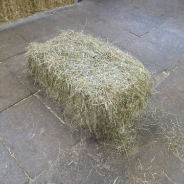
1 Palette Stramofarm Strohpellets 30Sack á 25KG
Leinefelde- Worbis
stramofarm GmbH
@stramofarm
Einstreu
Lieferant entlädt
Pellets
Regenfrei
2 weitere...
P+


1 Palette Stramofarm Heupellets 30 Sack á 15Kg
Leinefelde
stramofarm GmbH
@stramofarm
Heu
Lieferant entlädt
Pellets
Regenfrei
2 weitere...
P+
Deprecated: Creation of dynamic property Zend_View_Helper_Ads::$adLink is deprecated in /var/www/stall-frei/htdocs/staging.stall-frei.de/library/Psf/View/Helper/Ads.php on line 108

Job gesucht?
Mechtersen
STALL-FREIde Marketing
@STALL-FREI-Marketing
Sie suchen einen Job und arbeiten gerne mit Pferden oder auf Reitanlagen?
Besuchen Sie jetzt unseren Stellenmarkt!
Leider kein Vorschaubild
Leider kein Vorschaubild
Heu - HD Ballen aus Juni 2025
Wunstorf
Heike-Wichmann-Sasse
@Heike-Wichmann-Sasse
Heu
Empfänger lädt ab
Kleinballen/HD-Ballen
Regenfrei
2 weitere...
B+

Heu Kleinballen 1. Schnitt - höchste Qualität
Weissach im Tal
Micha
@Micha3
Heu
Empfänger lädt ab
Kleinballen/HD-Ballen
Bio
Regenfrei
2 weitere...
aktuell
B+
Leider kein Vorschaubild
Leider kein Vorschaubild
Heu- und Luzernecobs
Holzgerlingen
Schlosshof-Holzgerlingen
@Schlosshof-Holzgerlingen
Einstreu
Pellets
Regenfrei
Wird verladen
1 weitere...
B+
Leider kein Vorschaubild
Leider kein Vorschaubild
Kleine HD-Ballen Heu
Weil im Schönbuch
Sabine-Dettinger
@Sabine-Dettinger
Heu
Empfänger lädt ab
Kleinballen/HD-Ballen
Bio
Regenfrei
2 weitere...
B+

Frisches Stroh zu verkaufen!
Mechtersen
STALL-FREIde Marketing
@STALL-FREI-Marketing
Kaufe frisches Stroh für dein Pferd!
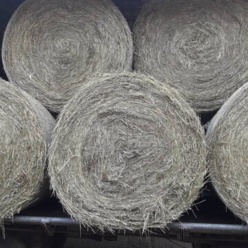
Heu Rundballen zu verkaufen
Peine
Hof-Hoppenworth
@Hof-Hoppenworth
Heu
Empfänger lädt ab
Rundballen
Regenfrei
3 weitere...
B+

Hafer aus Ernte 2025 auch gequetscht zu verkaufen
Wolfschlugen
Reitanlage im Höfelweg
@Reitanlage-im-Hoefelweg
Futter
Wird verladen
Abholung
B+

Heulage in Top-Bioqualität
Bothel
LB Sarah Lühring
@Bonito
Heulage
Rundballen
Regenfrei
Wird verladen
1 weitere...
B+
Deprecated: Creation of dynamic property Zend_View::$pageCount is deprecated in /var/www/stall-frei/htdocs/staging.stall-frei.de/library/vendor/shardj/zf1-future/library/Zend/View/Abstract.php on line 308
Deprecated: Creation of dynamic property Zend_View::$itemCountPerPage is deprecated in /var/www/stall-frei/htdocs/staging.stall-frei.de/library/vendor/shardj/zf1-future/library/Zend/View/Abstract.php on line 308
Deprecated: Creation of dynamic property Zend_View::$first is deprecated in /var/www/stall-frei/htdocs/staging.stall-frei.de/library/vendor/shardj/zf1-future/library/Zend/View/Abstract.php on line 308
Deprecated: Creation of dynamic property Zend_View::$current is deprecated in /var/www/stall-frei/htdocs/staging.stall-frei.de/library/vendor/shardj/zf1-future/library/Zend/View/Abstract.php on line 308
Deprecated: Creation of dynamic property Zend_View::$last is deprecated in /var/www/stall-frei/htdocs/staging.stall-frei.de/library/vendor/shardj/zf1-future/library/Zend/View/Abstract.php on line 308
Deprecated: Creation of dynamic property Zend_View::$previous is deprecated in /var/www/stall-frei/htdocs/staging.stall-frei.de/library/vendor/shardj/zf1-future/library/Zend/View/Abstract.php on line 308
Deprecated: Creation of dynamic property Zend_View::$next is deprecated in /var/www/stall-frei/htdocs/staging.stall-frei.de/library/vendor/shardj/zf1-future/library/Zend/View/Abstract.php on line 308
Deprecated: Creation of dynamic property Zend_View::$pagesInRange is deprecated in /var/www/stall-frei/htdocs/staging.stall-frei.de/library/vendor/shardj/zf1-future/library/Zend/View/Abstract.php on line 308
Deprecated: Creation of dynamic property Zend_View::$firstPageInRange is deprecated in /var/www/stall-frei/htdocs/staging.stall-frei.de/library/vendor/shardj/zf1-future/library/Zend/View/Abstract.php on line 308
Deprecated: Creation of dynamic property Zend_View::$lastPageInRange is deprecated in /var/www/stall-frei/htdocs/staging.stall-frei.de/library/vendor/shardj/zf1-future/library/Zend/View/Abstract.php on line 308
Deprecated: Creation of dynamic property Zend_View::$currentItemCount is deprecated in /var/www/stall-frei/htdocs/staging.stall-frei.de/library/vendor/shardj/zf1-future/library/Zend/View/Abstract.php on line 308
Deprecated: Creation of dynamic property Zend_View::$totalItemCount is deprecated in /var/www/stall-frei/htdocs/staging.stall-frei.de/library/vendor/shardj/zf1-future/library/Zend/View/Abstract.php on line 308
Deprecated: Creation of dynamic property Zend_View::$firstItemNumber is deprecated in /var/www/stall-frei/htdocs/staging.stall-frei.de/library/vendor/shardj/zf1-future/library/Zend/View/Abstract.php on line 308
Deprecated: Creation of dynamic property Zend_View::$lastItemNumber is deprecated in /var/www/stall-frei/htdocs/staging.stall-frei.de/library/vendor/shardj/zf1-future/library/Zend/View/Abstract.php on line 308
Deprecated: Creation of dynamic property Zend_View::$router is deprecated in /var/www/stall-frei/htdocs/staging.stall-frei.de/library/vendor/shardj/zf1-future/library/Zend/View/Abstract.php on line 308
Deprecated: Creation of dynamic property Zend_View::$urlParams is deprecated in /var/www/stall-frei/htdocs/staging.stall-frei.de/library/vendor/shardj/zf1-future/library/Zend/View/Abstract.php on line 308
Deprecated: Creation of dynamic property Zend_View::$showAds is deprecated in /var/www/stall-frei/htdocs/staging.stall-frei.de/library/vendor/shardj/zf1-future/library/Zend/View/Abstract.php on line 308
Deprecated: Creation of dynamic property Zend_View::$objectIds is deprecated in /var/www/stall-frei/htdocs/staging.stall-frei.de/library/vendor/shardj/zf1-future/library/Zend/View/Abstract.php on line 308
Deprecated: Creation of dynamic property Zend_View::$showNavbar is deprecated in /var/www/stall-frei/htdocs/staging.stall-frei.de/library/vendor/shardj/zf1-future/library/Zend/View/Abstract.php on line 308
Deprecated: Creation of dynamic property Zend_View::$showBreadcrumb is deprecated in /var/www/stall-frei/htdocs/staging.stall-frei.de/library/vendor/shardj/zf1-future/library/Zend/View/Abstract.php on line 308
Deprecated: Creation of dynamic property Zend_View::$showFooter is deprecated in /var/www/stall-frei/htdocs/staging.stall-frei.de/library/vendor/shardj/zf1-future/library/Zend/View/Abstract.php on line 308
Deprecated: Creation of dynamic property Zend_View::$showInternalAds is deprecated in /var/www/stall-frei/htdocs/staging.stall-frei.de/library/vendor/shardj/zf1-future/library/Zend/View/Abstract.php on line 308
Deprecated: Creation of dynamic property Zend_View::$blNoContent is deprecated in /var/www/stall-frei/htdocs/staging.stall-frei.de/library/vendor/shardj/zf1-future/library/Zend/View/Abstract.php on line 308
Deprecated: Creation of dynamic property Zend_View::$sMetaDesc is deprecated in /var/www/stall-frei/htdocs/staging.stall-frei.de/library/vendor/shardj/zf1-future/library/Zend/View/Abstract.php on line 308
Deprecated: Creation of dynamic property Zend_View::$useGmaps is deprecated in /var/www/stall-frei/htdocs/staging.stall-frei.de/library/vendor/shardj/zf1-future/library/Zend/View/Abstract.php on line 308
Deprecated: Creation of dynamic property Zend_View::$touches is deprecated in /var/www/stall-frei/htdocs/staging.stall-frei.de/library/vendor/shardj/zf1-future/library/Zend/View/Abstract.php on line 308
Deprecated: Creation of dynamic property Zend_View::$oProject is deprecated in /var/www/stall-frei/htdocs/staging.stall-frei.de/library/vendor/shardj/zf1-future/library/Zend/View/Abstract.php on line 308
Deprecated: Creation of dynamic property Zend_View::$pageHeadline is deprecated in /var/www/stall-frei/htdocs/staging.stall-frei.de/library/vendor/shardj/zf1-future/library/Zend/View/Abstract.php on line 308
Deprecated: Creation of dynamic property Zend_View::$disableLocationField is deprecated in /var/www/stall-frei/htdocs/staging.stall-frei.de/library/vendor/shardj/zf1-future/library/Zend/View/Abstract.php on line 308
Deprecated: Creation of dynamic property Zend_View::$isSearch is deprecated in /var/www/stall-frei/htdocs/staging.stall-frei.de/library/vendor/shardj/zf1-future/library/Zend/View/Abstract.php on line 308
Deprecated: Creation of dynamic property Zend_View::$pageTitle is deprecated in /var/www/stall-frei/htdocs/staging.stall-frei.de/library/vendor/shardj/zf1-future/library/Zend/View/Abstract.php on line 308
Deprecated: Creation of dynamic property Psf_Form_Element_Text::$class is deprecated in /var/www/stall-frei/htdocs/staging.stall-frei.de/library/vendor/shardj/zf1-future/library/Zend/Form/Element.php on line 874
Deprecated: Creation of dynamic property Psf_Form_Element_Text::$size is deprecated in /var/www/stall-frei/htdocs/staging.stall-frei.de/library/vendor/shardj/zf1-future/library/Zend/Form/Element.php on line 874
Deprecated: Creation of dynamic property Psf_Form_Element_Text::$placeholder is deprecated in /var/www/stall-frei/htdocs/staging.stall-frei.de/library/vendor/shardj/zf1-future/library/Zend/Form/Element.php on line 874
Deprecated: Creation of dynamic property Psf_Form_Element_Hidden::$class is deprecated in /var/www/stall-frei/htdocs/staging.stall-frei.de/library/vendor/shardj/zf1-future/library/Zend/Form/Element.php on line 874
Deprecated: Creation of dynamic property Psf_Form_Element_Hidden::$class is deprecated in /var/www/stall-frei/htdocs/staging.stall-frei.de/library/vendor/shardj/zf1-future/library/Zend/Form/Element.php on line 874
Deprecated: Creation of dynamic property Psf_Form_Element_Hidden::$class is deprecated in /var/www/stall-frei/htdocs/staging.stall-frei.de/library/vendor/shardj/zf1-future/library/Zend/Form/Element.php on line 874
Deprecated: Creation of dynamic property Psf_Form_Element_Hidden::$class is deprecated in /var/www/stall-frei/htdocs/staging.stall-frei.de/library/vendor/shardj/zf1-future/library/Zend/Form/Element.php on line 874
Deprecated: Creation of dynamic property Psf_Form_Element_Select::$class is deprecated in /var/www/stall-frei/htdocs/staging.stall-frei.de/library/vendor/shardj/zf1-future/library/Zend/Form/Element.php on line 874
Deprecated: Creation of dynamic property Psf_Form_Element_Select::$class is deprecated in /var/www/stall-frei/htdocs/staging.stall-frei.de/library/vendor/shardj/zf1-future/library/Zend/Form/Element.php on line 874
Deprecated: Creation of dynamic property Psf_Form_Element_Select::$class is deprecated in /var/www/stall-frei/htdocs/staging.stall-frei.de/library/vendor/shardj/zf1-future/library/Zend/Form/Element.php on line 874
Deprecated: Creation of dynamic property Psf_Form_Element_Select::$class is deprecated in /var/www/stall-frei/htdocs/staging.stall-frei.de/library/vendor/shardj/zf1-future/library/Zend/Form/Element.php on line 874
Deprecated: Creation of dynamic property Zend_View::$sort is deprecated in /var/www/stall-frei/htdocs/staging.stall-frei.de/library/vendor/shardj/zf1-future/library/Zend/View/Abstract.php on line 308
Deprecated: Creation of dynamic property Zend_View::$searchLocation is deprecated in /var/www/stall-frei/htdocs/staging.stall-frei.de/library/vendor/shardj/zf1-future/library/Zend/View/Abstract.php on line 308
Deprecated: Creation of dynamic property Zend_View::$locationHint is deprecated in /var/www/stall-frei/htdocs/staging.stall-frei.de/library/vendor/shardj/zf1-future/library/Zend/View/Abstract.php on line 308
Psf_GeoCoder_Abstract::getLocation: Wilhelmshöhe Get Location CachedOrLive
Psf_GeoCoder_Abstract::getCachedOrLive: Wilhelmshöhe
Psf_GeoCoder_Abstract::convertLocationResult
{"documentation":"https:\/\/opencagedata.com\/api","licenses":[{"name":"see attribution guide","url":"https:\/\/opencagedata.com\/credits"}],"results":[{"bounds":{"northeast":{"lat":50.8418029,"lng":6.3454739},"southwest":{"lat":50.8018029,"lng":6.3054739}},"components":{"ISO_3166-1_alpha-2":"DE","ISO_3166-1_alpha-3":"DEU","ISO_3166-2":["DE-NW"],"_category":"place","_normalized_city":"Eschweiler","_type":"neighbourhood","continent":"Europe","country":"Deutschland","country_code":"de","county":"St\u00e4dteregion Aachen","political_union":"European Union","postcode":"52379","state":"Nordrhein-Westfalen","state_code":"NW","suburb":"Wilhelmsh\u00f6he","town":"Eschweiler"},"confidence":7,"formatted":"52379 Eschweiler, Deutschland","geometry":{"lat":50.8218029,"lng":6.3254739}},{"bounds":{"northeast":{"lat":51.1472285,"lng":8.024321},"southwest":{"lat":51.1449912,"lng":8.0132077}},"components":{"ISO_3166-1_alpha-2":"DE","ISO_3166-1_alpha-3":"DEU","ISO_3166-2":["DE-NW"],"_category":"natural\/water","_normalized_city":"Lennestadt","_type":"nature_reserve","continent":"Europe","country":"Deutschland","country_code":"de","county":"Kreis Olpe","nature_reserve":"Wilhelmsh\u00f6he","political_union":"European Union","postcode":"57368","state":"Nordrhein-Westfalen","state_code":"NW","town":"Lennestadt"},"confidence":9,"formatted":"Wilhelmsh\u00f6he, 57368 Lennestadt, Deutschland","geometry":{"lat":51.1461156,"lng":8.018985}},{"bounds":{"northeast":{"lat":51.1564973,"lng":8.0284},"southwest":{"lat":51.1364973,"lng":8.0084}},"components":{"ISO_3166-1_alpha-2":"DE","ISO_3166-1_alpha-3":"DEU","ISO_3166-2":["DE-NW"],"_category":"place","_normalized_city":"Lennestadt","_type":"hamlet","continent":"Europe","country":"Deutschland","country_code":"de","county":"Kreis Olpe","locality":"Wilhelmsh\u00f6he","political_union":"European Union","postcode":"57368","state":"Nordrhein-Westfalen","state_code":"NW","town":"Lennestadt"},"confidence":8,"formatted":"Wilhelmsh\u00f6he, 57368 Lennestadt, Deutschland","geometry":{"lat":51.1464973,"lng":8.0184}},{"bounds":{"northeast":{"lat":50.5555153,"lng":12.3251067},"southwest":{"lat":50.5554153,"lng":12.3250067}},"components":{"ISO_3166-1_alpha-2":"DE","ISO_3166-1_alpha-3":"DEU","ISO_3166-2":["DE-SN"],"_category":"natural\/water","_normalized_city":"Treuen","_type":"peak","continent":"Europe","country":"Deutschland","country_code":"de","county":"Vogtlandkreis","municipality":"Treuen\/Neuensalz","peak":"Wilhelmsh\u00f6he","political_union":"European Union","postcode":"08233","state":"Sachsen","state_code":"SN","town":"Treuen"},"confidence":9,"formatted":"Wilhelmsh\u00f6he, 08233 Treuen, Deutschland","geometry":{"lat":50.5554653,"lng":12.3250567}},{"bounds":{"northeast":{"lat":50.2181761,"lng":7.6346487},"southwest":{"lat":50.2180761,"lng":7.6345487}},"components":{"ISO_3166-1_alpha-2":"DE","ISO_3166-1_alpha-3":"DEU","ISO_3166-2":["DE-RP"],"_category":"natural\/water","_normalized_city":"Kamp-Bornhofen","_type":"peak","continent":"Europe","country":"Deutschland","country_code":"de","county":"Rhein-Lahn-Kreis","municipality":"Loreley","peak":"Wilhelmsh\u00f6he","political_union":"European Union","postcode":"56341","state":"Rheinland-Pfalz","state_code":"RP","village":"Kamp-Bornhofen"},"confidence":9,"formatted":"Wilhelmsh\u00f6he, 56341 Kamp-Bornhofen, Deutschland","geometry":{"lat":50.2181261,"lng":7.6345987}},{"bounds":{"northeast":{"lat":49.0742328,"lng":10.3370947},"southwest":{"lat":49.0741328,"lng":10.3369947}},"components":{"ISO_3166-1_alpha-2":"DE","ISO_3166-1_alpha-3":"DEU","ISO_3166-2":["DE-BY"],"_category":"natural\/water","_normalized_city":"Dinkelsb\u00fchl","_type":"peak","continent":"Europe","country":"Deutschland","country_code":"de","county":"Landkreis Ansbach","peak":"Wilhelmsh\u00f6he","political_union":"European Union","postcode":"91550","state":"Bayern","state_code":"BY","town":"Dinkelsb\u00fchl"},"confidence":9,"formatted":"Wilhelmsh\u00f6he, 91550 Dinkelsb\u00fchl, Deutschland","geometry":{"lat":49.0741828,"lng":10.3370447}},{"bounds":{"northeast":{"lat":49.9010295,"lng":7.062585},"southwest":{"lat":49.9009295,"lng":7.062485}},"components":{"ISO_3166-1_alpha-2":"DE","ISO_3166-1_alpha-3":"DEU","ISO_3166-2":["DE-RP"],"_category":"natural\/water","_normalized_city":"Bernkastel-Kues","_type":"peak","continent":"Europe","country":"Deutschland","country_code":"de","county":"Landkreis Bernkastel-Wittlich","municipality":"Bernkastel-Kues","peak":"Wilhelmsh\u00f6he","political_union":"European Union","postcode":"54472","state":"Rheinland-Pfalz","state_code":"RP","town":"Bernkastel-Kues"},"confidence":9,"formatted":"Wilhelmsh\u00f6he, 54472 Bernkastel-Kues, Deutschland","geometry":{"lat":49.9009795,"lng":7.062535}},{"bounds":{"northeast":{"lat":51.1496677,"lng":8.019433},"southwest":{"lat":51.1495677,"lng":8.019333}},"components":{"ISO_3166-1_alpha-2":"DE","ISO_3166-1_alpha-3":"DEU","ISO_3166-2":["DE-NW"],"_category":"natural\/water","_normalized_city":"Lennestadt","_type":"peak","continent":"Europe","country":"Deutschland","country_code":"de","county":"Kreis Olpe","peak":"Wilhelmsh\u00f6he","political_union":"European Union","postcode":"57413","state":"Nordrhein-Westfalen","state_code":"NW","town":"Lennestadt"},"confidence":9,"formatted":"Wilhelmsh\u00f6he, 57413 Lennestadt, Deutschland","geometry":{"lat":51.1496177,"lng":8.019383}},{"bounds":{"northeast":{"lat":48.4717697,"lng":12.8029645},"southwest":{"lat":48.4317697,"lng":12.7629645}},"components":{"ISO_3166-1_alpha-2":"DE","ISO_3166-1_alpha-3":"DEU","ISO_3166-2":["DE-BY"],"_category":"place","_normalized_city":"Hebertsfelden","_type":"hamlet","continent":"Europe","country":"Deutschland","country_code":"de","county":"Landkreis Rottal-Inn","hamlet":"Wilhelmsh\u00f6he","political_union":"European Union","postcode":"84307","state":"Bayern","state_code":"BY","village":"Hebertsfelden"},"confidence":7,"formatted":"Wilhelmsh\u00f6he, 84307 Hebertsfelden, Deutschland","geometry":{"lat":48.4517697,"lng":12.7829645}},{"bounds":{"northeast":{"lat":49.0962664,"lng":10.3551481},"southwest":{"lat":49.0562664,"lng":10.3151481}},"components":{"ISO_3166-1_alpha-2":"DE","ISO_3166-1_alpha-3":"DEU","ISO_3166-2":["DE-BY"],"_category":"place","_normalized_city":"Dinkelsb\u00fchl","_type":"hamlet","continent":"Europe","country":"Deutschland","country_code":"de","county":"Landkreis Ansbach","hamlet":"Wilhelmsh\u00f6he","political_union":"European Union","postcode":"91550","state":"Bayern","state_code":"BY","town":"Dinkelsb\u00fchl"},"confidence":7,"formatted":"Wilhelmsh\u00f6he, 91550 Dinkelsb\u00fchl, Deutschland","geometry":{"lat":49.0762664,"lng":10.3351481}}],"status":{"code":200,"message":"OK"},"stay_informed":{"blog":"https:\/\/blog.opencagedata.com","mastodon":"https:\/\/en.osm.town\/@opencage"},"thanks":"For using an OpenCage API","timestamp":{"created_http":"Sat, 07 Feb 2026 12:02:01 GMT","created_unix":1770465721},"total_results":10}Array
(
[0] => stdClass Object
(
[bounds] => stdClass Object
(
[northeast] => stdClass Object
(
[lat] => 50.8418029
[lng] => 6.3454739
)
[southwest] => stdClass Object
(
[lat] => 50.8018029
[lng] => 6.3054739
)
)
[components] => stdClass Object
(
[ISO_3166-1_alpha-2] => DE
[ISO_3166-1_alpha-3] => DEU
[ISO_3166-2] => Array
(
[0] => DE-NW
)
[_category] => place
[_normalized_city] => Eschweiler
[_type] => neighbourhood
[continent] => Europe
[country] => Deutschland
[country_code] => de
[county] => Städteregion Aachen
[political_union] => European Union
[postcode] => 52379
[state] => Nordrhein-Westfalen
[state_code] => NW
[suburb] => Wilhelmshöhe
[town] => Eschweiler
)
[confidence] => 7
[formatted] => 52379 Eschweiler, Deutschland
[geometry] => stdClass Object
(
[lat] => 50.8218029
[lng] => 6.3254739
)
)
[1] => stdClass Object
(
[bounds] => stdClass Object
(
[northeast] => stdClass Object
(
[lat] => 51.1472285
[lng] => 8.024321
)
[southwest] => stdClass Object
(
[lat] => 51.1449912
[lng] => 8.0132077
)
)
[components] => stdClass Object
(
[ISO_3166-1_alpha-2] => DE
[ISO_3166-1_alpha-3] => DEU
[ISO_3166-2] => Array
(
[0] => DE-NW
)
[_category] => natural/water
[_normalized_city] => Lennestadt
[_type] => nature_reserve
[continent] => Europe
[country] => Deutschland
[country_code] => de
[county] => Kreis Olpe
[nature_reserve] => Wilhelmshöhe
[political_union] => European Union
[postcode] => 57368
[state] => Nordrhein-Westfalen
[state_code] => NW
[town] => Lennestadt
)
[confidence] => 9
[formatted] => Wilhelmshöhe, 57368 Lennestadt, Deutschland
[geometry] => stdClass Object
(
[lat] => 51.1461156
[lng] => 8.018985
)
)
[2] => stdClass Object
(
[bounds] => stdClass Object
(
[northeast] => stdClass Object
(
[lat] => 51.1564973
[lng] => 8.0284
)
[southwest] => stdClass Object
(
[lat] => 51.1364973
[lng] => 8.0084
)
)
[components] => stdClass Object
(
[ISO_3166-1_alpha-2] => DE
[ISO_3166-1_alpha-3] => DEU
[ISO_3166-2] => Array
(
[0] => DE-NW
)
[_category] => place
[_normalized_city] => Lennestadt
[_type] => hamlet
[continent] => Europe
[country] => Deutschland
[country_code] => de
[county] => Kreis Olpe
[locality] => Wilhelmshöhe
[political_union] => European Union
[postcode] => 57368
[state] => Nordrhein-Westfalen
[state_code] => NW
[town] => Lennestadt
)
[confidence] => 8
[formatted] => Wilhelmshöhe, 57368 Lennestadt, Deutschland
[geometry] => stdClass Object
(
[lat] => 51.1464973
[lng] => 8.0184
)
)
[3] => stdClass Object
(
[bounds] => stdClass Object
(
[northeast] => stdClass Object
(
[lat] => 50.5555153
[lng] => 12.3251067
)
[southwest] => stdClass Object
(
[lat] => 50.5554153
[lng] => 12.3250067
)
)
[components] => stdClass Object
(
[ISO_3166-1_alpha-2] => DE
[ISO_3166-1_alpha-3] => DEU
[ISO_3166-2] => Array
(
[0] => DE-SN
)
[_category] => natural/water
[_normalized_city] => Treuen
[_type] => peak
[continent] => Europe
[country] => Deutschland
[country_code] => de
[county] => Vogtlandkreis
[municipality] => Treuen/Neuensalz
[peak] => Wilhelmshöhe
[political_union] => European Union
[postcode] => 08233
[state] => Sachsen
[state_code] => SN
[town] => Treuen
)
[confidence] => 9
[formatted] => Wilhelmshöhe, 08233 Treuen, Deutschland
[geometry] => stdClass Object
(
[lat] => 50.5554653
[lng] => 12.3250567
)
)
[4] => stdClass Object
(
[bounds] => stdClass Object
(
[northeast] => stdClass Object
(
[lat] => 50.2181761
[lng] => 7.6346487
)
[southwest] => stdClass Object
(
[lat] => 50.2180761
[lng] => 7.6345487
)
)
[components] => stdClass Object
(
[ISO_3166-1_alpha-2] => DE
[ISO_3166-1_alpha-3] => DEU
[ISO_3166-2] => Array
(
[0] => DE-RP
)
[_category] => natural/water
[_normalized_city] => Kamp-Bornhofen
[_type] => peak
[continent] => Europe
[country] => Deutschland
[country_code] => de
[county] => Rhein-Lahn-Kreis
[municipality] => Loreley
[peak] => Wilhelmshöhe
[political_union] => European Union
[postcode] => 56341
[state] => Rheinland-Pfalz
[state_code] => RP
[village] => Kamp-Bornhofen
)
[confidence] => 9
[formatted] => Wilhelmshöhe, 56341 Kamp-Bornhofen, Deutschland
[geometry] => stdClass Object
(
[lat] => 50.2181261
[lng] => 7.6345987
)
)
[5] => stdClass Object
(
[bounds] => stdClass Object
(
[northeast] => stdClass Object
(
[lat] => 49.0742328
[lng] => 10.3370947
)
[southwest] => stdClass Object
(
[lat] => 49.0741328
[lng] => 10.3369947
)
)
[components] => stdClass Object
(
[ISO_3166-1_alpha-2] => DE
[ISO_3166-1_alpha-3] => DEU
[ISO_3166-2] => Array
(
[0] => DE-BY
)
[_category] => natural/water
[_normalized_city] => Dinkelsbühl
[_type] => peak
[continent] => Europe
[country] => Deutschland
[country_code] => de
[county] => Landkreis Ansbach
[peak] => Wilhelmshöhe
[political_union] => European Union
[postcode] => 91550
[state] => Bayern
[state_code] => BY
[town] => Dinkelsbühl
)
[confidence] => 9
[formatted] => Wilhelmshöhe, 91550 Dinkelsbühl, Deutschland
[geometry] => stdClass Object
(
[lat] => 49.0741828
[lng] => 10.3370447
)
)
[6] => stdClass Object
(
[bounds] => stdClass Object
(
[northeast] => stdClass Object
(
[lat] => 49.9010295
[lng] => 7.062585
)
[southwest] => stdClass Object
(
[lat] => 49.9009295
[lng] => 7.062485
)
)
[components] => stdClass Object
(
[ISO_3166-1_alpha-2] => DE
[ISO_3166-1_alpha-3] => DEU
[ISO_3166-2] => Array
(
[0] => DE-RP
)
[_category] => natural/water
[_normalized_city] => Bernkastel-Kues
[_type] => peak
[continent] => Europe
[country] => Deutschland
[country_code] => de
[county] => Landkreis Bernkastel-Wittlich
[municipality] => Bernkastel-Kues
[peak] => Wilhelmshöhe
[political_union] => European Union
[postcode] => 54472
[state] => Rheinland-Pfalz
[state_code] => RP
[town] => Bernkastel-Kues
)
[confidence] => 9
[formatted] => Wilhelmshöhe, 54472 Bernkastel-Kues, Deutschland
[geometry] => stdClass Object
(
[lat] => 49.9009795
[lng] => 7.062535
)
)
[7] => stdClass Object
(
[bounds] => stdClass Object
(
[northeast] => stdClass Object
(
[lat] => 51.1496677
[lng] => 8.019433
)
[southwest] => stdClass Object
(
[lat] => 51.1495677
[lng] => 8.019333
)
)
[components] => stdClass Object
(
[ISO_3166-1_alpha-2] => DE
[ISO_3166-1_alpha-3] => DEU
[ISO_3166-2] => Array
(
[0] => DE-NW
)
[_category] => natural/water
[_normalized_city] => Lennestadt
[_type] => peak
[continent] => Europe
[country] => Deutschland
[country_code] => de
[county] => Kreis Olpe
[peak] => Wilhelmshöhe
[political_union] => European Union
[postcode] => 57413
[state] => Nordrhein-Westfalen
[state_code] => NW
[town] => Lennestadt
)
[confidence] => 9
[formatted] => Wilhelmshöhe, 57413 Lennestadt, Deutschland
[geometry] => stdClass Object
(
[lat] => 51.1496177
[lng] => 8.019383
)
)
[8] => stdClass Object
(
[bounds] => stdClass Object
(
[northeast] => stdClass Object
(
[lat] => 48.4717697
[lng] => 12.8029645
)
[southwest] => stdClass Object
(
[lat] => 48.4317697
[lng] => 12.7629645
)
)
[components] => stdClass Object
(
[ISO_3166-1_alpha-2] => DE
[ISO_3166-1_alpha-3] => DEU
[ISO_3166-2] => Array
(
[0] => DE-BY
)
[_category] => place
[_normalized_city] => Hebertsfelden
[_type] => hamlet
[continent] => Europe
[country] => Deutschland
[country_code] => de
[county] => Landkreis Rottal-Inn
[hamlet] => Wilhelmshöhe
[political_union] => European Union
[postcode] => 84307
[state] => Bayern
[state_code] => BY
[village] => Hebertsfelden
)
[confidence] => 7
[formatted] => Wilhelmshöhe, 84307 Hebertsfelden, Deutschland
[geometry] => stdClass Object
(
[lat] => 48.4517697
[lng] => 12.7829645
)
)
[9] => stdClass Object
(
[bounds] => stdClass Object
(
[northeast] => stdClass Object
(
[lat] => 49.0962664
[lng] => 10.3551481
)
[southwest] => stdClass Object
(
[lat] => 49.0562664
[lng] => 10.3151481
)
)
[components] => stdClass Object
(
[ISO_3166-1_alpha-2] => DE
[ISO_3166-1_alpha-3] => DEU
[ISO_3166-2] => Array
(
[0] => DE-BY
)
[_category] => place
[_normalized_city] => Dinkelsbühl
[_type] => hamlet
[continent] => Europe
[country] => Deutschland
[country_code] => de
[county] => Landkreis Ansbach
[hamlet] => Wilhelmshöhe
[political_union] => European Union
[postcode] => 91550
[state] => Bayern
[state_code] => BY
[town] => Dinkelsbühl
)
[confidence] => 7
[formatted] => Wilhelmshöhe, 91550 Dinkelsbühl, Deutschland
[geometry] => stdClass Object
(
[lat] => 49.0762664
[lng] => 10.3351481
)
)
)
Psf_GeoCoder_OpenCageData::getKeyMap: 0
stdClass Object
(
    [bounds] => stdClass Object
        (
            [northeast] => stdClass Object
                (
                    [lat] => 50.8418029
                    [lng] => 6.3454739
                )

            [southwest] => stdClass Object
                (
                    [lat] => 50.8018029
                    [lng] => 6.3054739
                )

        )

    [components] => stdClass Object
        (
            [ISO_3166-1_alpha-2] => DE
            [ISO_3166-1_alpha-3] => DEU
            [ISO_3166-2] => Array
                (
                    [0] => DE-NW
                )

            [_category] => place
            [_normalized_city] => Eschweiler
            [_type] => neighbourhood
            [continent] => Europe
            [country] => Deutschland
            [country_code] => de
            [county] => Städteregion Aachen
            [political_union] => European Union
            [postcode] => 52379
            [state] => Nordrhein-Westfalen
            [state_code] => NW
            [suburb] => Wilhelmshöhe
            [town] => Eschweiler
        )

    [confidence] => 7
    [formatted] => 52379 Eschweiler, Deutschland
    [geometry] => stdClass Object
        (
            [lat] => 50.8218029
            [lng] => 6.3254739
        )

)
Psf_GeoCoder_OpenCageData::getCounty: Städteregion Aachen
Psf_GeoCoder_OpenCageData::addMissingData REFETCH!
Array
(
    [address] => 52379 Eschweiler, Deutschland
    [type] => neighbourhood
    [street] =>
    [city] => Eschweiler
    [county] => Städteregion Aachen
    [state] => Nordrhein-Westfalen
    [zip] => 52379
    [country] => Deutschland
    [suburb] => Wilhelmshöhe
    [countrycode] => de
    [latitude] => 50.8218029
    [longitude] => 6.3254739
    [accuracy] => 1
    [confidence] => 7
    [bounds] => stdClass Object
        (
            [northeast] => stdClass Object
                (
                    [lat] => 50.8418029
                    [lng] => 6.3454739
                )

            [southwest] => stdClass Object
                (
                    [lat] => 50.8018029
                    [lng] => 6.3054739
                )

        )

)
reformat!
Array
(
    [address] => 52379 Eschweiler, Deutschland
    [type] => neighbourhood
    [street] =>
    [city] => Eschweiler
    [county] => Städteregion Aachen
    [state] => Nordrhein-Westfalen
    [zip] => 52379
    [country] => Deutschland
    [suburb] => Wilhelmshöhe
    [countrycode] => de
    [latitude] => 50.8218029
    [longitude] => 6.3254739
    [accuracy] => 1
    [confidence] => 7
    [bounds] => stdClass Object
        (
            [northeast] => stdClass Object
                (
                    [lat] => 50.8418029
                    [lng] => 6.3454739
                )

            [southwest] => stdClass Object
                (
                    [lat] => 50.8018029
                    [lng] => 6.3054739
                )

        )

    [place] => 52379 Eschweiler, Nordrhein-Westfalen
    [hash] => 810df0802bcf6a106bb4777de36a97dc
)
Psf_GeoCoder_OpenCageData::getKeyMap: 1
stdClass Object
(
    [bounds] => stdClass Object
        (
            [northeast] => stdClass Object
                (
                    [lat] => 51.1472285
                    [lng] => 8.024321
                )

            [southwest] => stdClass Object
                (
                    [lat] => 51.1449912
                    [lng] => 8.0132077
                )

        )

    [components] => stdClass Object
        (
            [ISO_3166-1_alpha-2] => DE
            [ISO_3166-1_alpha-3] => DEU
            [ISO_3166-2] => Array
                (
                    [0] => DE-NW
                )

            [_category] => natural/water
            [_normalized_city] => Lennestadt
            [_type] => nature_reserve
            [continent] => Europe
            [country] => Deutschland
            [country_code] => de
            [county] => Kreis Olpe
            [nature_reserve] => Wilhelmshöhe
            [political_union] => European Union
            [postcode] => 57368
            [state] => Nordrhein-Westfalen
            [state_code] => NW
            [town] => Lennestadt
        )

    [confidence] => 9
    [formatted] => Wilhelmshöhe, 57368 Lennestadt, Deutschland
    [geometry] => stdClass Object
        (
            [lat] => 51.1461156
            [lng] => 8.018985
        )

)
Psf_GeoCoder_OpenCageData::getCounty: Olpe
Psf_GeoCoder_OpenCageData::addMissingData REFETCH!
Array
(
    [address] => Wilhelmshöhe, 57368 Lennestadt, Deutschland
    [type] => nature_reserve
    [street] =>
    [city] => Lennestadt
    [county] => Olpe
    [state] => Nordrhein-Westfalen
    [zip] => 57368
    [country] => Deutschland
    [suburb] =>
    [countrycode] => de
    [latitude] => 51.1461156
    [longitude] => 8.018985
    [accuracy] => 1
    [confidence] => 9
    [bounds] => stdClass Object
        (
            [northeast] => stdClass Object
                (
                    [lat] => 51.1472285
                    [lng] => 8.024321
                )

            [southwest] => stdClass Object
                (
                    [lat] => 51.1449912
                    [lng] => 8.0132077
                )

        )

)
reformat!
Array
(
    [address] => Wilhelmshöhe, 57368 Lennestadt, Deutschland
    [type] => nature_reserve
    [street] =>
    [city] => Lennestadt
    [county] => Olpe
    [state] => Nordrhein-Westfalen
    [zip] => 57368
    [country] => Deutschland
    [suburb] =>
    [countrycode] => de
    [latitude] => 51.1461156
    [longitude] => 8.018985
    [accuracy] => 1
    [confidence] => 9
    [bounds] => stdClass Object
        (
            [northeast] => stdClass Object
                (
                    [lat] => 51.1472285
                    [lng] => 8.024321
                )

            [southwest] => stdClass Object
                (
                    [lat] => 51.1449912
                    [lng] => 8.0132077
                )

        )

    [place] => 57368 Lennestadt, Nordrhein-Westfalen
    [hash] => f9ee35a9a21e166380e34e5728fd4519
)
Psf_GeoCoder_OpenCageData::getKeyMap: 2
stdClass Object
(
    [bounds] => stdClass Object
        (
            [northeast] => stdClass Object
                (
                    [lat] => 51.1564973
                    [lng] => 8.0284
                )

            [southwest] => stdClass Object
                (
                    [lat] => 51.1364973
                    [lng] => 8.0084
                )

        )

    [components] => stdClass Object
        (
            [ISO_3166-1_alpha-2] => DE
            [ISO_3166-1_alpha-3] => DEU
            [ISO_3166-2] => Array
                (
                    [0] => DE-NW
                )

            [_category] => place
            [_normalized_city] => Lennestadt
            [_type] => hamlet
            [continent] => Europe
            [country] => Deutschland
            [country_code] => de
            [county] => Kreis Olpe
            [locality] => Wilhelmshöhe
            [political_union] => European Union
            [postcode] => 57368
            [state] => Nordrhein-Westfalen
            [state_code] => NW
            [town] => Lennestadt
        )

    [confidence] => 8
    [formatted] => Wilhelmshöhe, 57368 Lennestadt, Deutschland
    [geometry] => stdClass Object
        (
            [lat] => 51.1464973
            [lng] => 8.0184
        )

)
Psf_GeoCoder_OpenCageData::getCounty: Olpe
Psf_GeoCoder_OpenCageData::addMissingData REFETCH!
Array
(
    [address] => Wilhelmshöhe, 57368 Lennestadt, Deutschland
    [type] => hamlet
    [street] =>
    [city] => Lennestadt
    [county] => Olpe
    [state] => Nordrhein-Westfalen
    [zip] => 57368
    [country] => Deutschland
    [suburb] =>
    [countrycode] => de
    [latitude] => 51.1464973
    [longitude] => 8.0184
    [accuracy] => 1
    [confidence] => 8
    [bounds] => stdClass Object
        (
            [northeast] => stdClass Object
                (
                    [lat] => 51.1564973
                    [lng] => 8.0284
                )

            [southwest] => stdClass Object
                (
                    [lat] => 51.1364973
                    [lng] => 8.0084
                )

        )

)
reformat!
Array
(
    [address] => Wilhelmshöhe, 57368 Lennestadt, Deutschland
    [type] => hamlet
    [street] =>
    [city] => Lennestadt
    [county] => Olpe
    [state] => Nordrhein-Westfalen
    [zip] => 57368
    [country] => Deutschland
    [suburb] =>
    [countrycode] => de
    [latitude] => 51.1464973
    [longitude] => 8.0184
    [accuracy] => 1
    [confidence] => 8
    [bounds] => stdClass Object
        (
            [northeast] => stdClass Object
                (
                    [lat] => 51.1564973
                    [lng] => 8.0284
                )

            [southwest] => stdClass Object
                (
                    [lat] => 51.1364973
                    [lng] => 8.0084
                )

        )

    [place] => 57368 Lennestadt, Nordrhein-Westfalen
    [hash] => f9ee35a9a21e166380e34e5728fd4519
)
Psf_GeoCoder_OpenCageData::getKeyMap: 3
stdClass Object
(
    [bounds] => stdClass Object
        (
            [northeast] => stdClass Object
                (
                    [lat] => 50.5555153
                    [lng] => 12.3251067
                )

            [southwest] => stdClass Object
                (
                    [lat] => 50.5554153
                    [lng] => 12.3250067
                )

        )

    [components] => stdClass Object
        (
            [ISO_3166-1_alpha-2] => DE
            [ISO_3166-1_alpha-3] => DEU
            [ISO_3166-2] => Array
                (
                    [0] => DE-SN
                )

            [_category] => natural/water
            [_normalized_city] => Treuen
            [_type] => peak
            [continent] => Europe
            [country] => Deutschland
            [country_code] => de
            [county] => Vogtlandkreis
            [municipality] => Treuen/Neuensalz
            [peak] => Wilhelmshöhe
            [political_union] => European Union
            [postcode] => 08233
            [state] => Sachsen
            [state_code] => SN
            [town] => Treuen
        )

    [confidence] => 9
    [formatted] => Wilhelmshöhe, 08233 Treuen, Deutschland
    [geometry] => stdClass Object
        (
            [lat] => 50.5554653
            [lng] => 12.3250567
        )

)
Psf_GeoCoder_OpenCageData::getCounty: Vogtlandkreis
Psf_GeoCoder_OpenCageData::addMissingData REFETCH!
Array
(
    [address] => Wilhelmshöhe, 08233 Treuen, Deutschland
    [type] => peak
    [street] =>
    [city] => Treuen
    [county] => Vogtlandkreis
    [state] => Sachsen
    [zip] => 08233
    [country] => Deutschland
    [suburb] =>
    [countrycode] => de
    [latitude] => 50.5554653
    [longitude] => 12.3250567
    [accuracy] => 1
    [confidence] => 9
    [bounds] => stdClass Object
        (
            [northeast] => stdClass Object
                (
                    [lat] => 50.5555153
                    [lng] => 12.3251067
                )

            [southwest] => stdClass Object
                (
                    [lat] => 50.5554153
                    [lng] => 12.3250067
                )

        )

)
reformat!
Array
(
    [address] => Wilhelmshöhe, 08233 Treuen, Deutschland
    [type] => peak
    [street] =>
    [city] => Treuen
    [county] => Vogtlandkreis
    [state] => Sachsen
    [zip] => 08233
    [country] => Deutschland
    [suburb] =>
    [countrycode] => de
    [latitude] => 50.5554653
    [longitude] => 12.3250567
    [accuracy] => 1
    [confidence] => 9
    [bounds] => stdClass Object
        (
            [northeast] => stdClass Object
                (
                    [lat] => 50.5555153
                    [lng] => 12.3251067
                )

            [southwest] => stdClass Object
                (
                    [lat] => 50.5554153
                    [lng] => 12.3250067
                )

        )

    [place] => 08233 Treuen, Sachsen
    [hash] => dd4799c1a8b85594d6faeb0252b44326
)
Psf_GeoCoder_OpenCageData::getKeyMap: 4
stdClass Object
(
    [bounds] => stdClass Object
        (
            [northeast] => stdClass Object
                (
                    [lat] => 50.2181761
                    [lng] => 7.6346487
                )

            [southwest] => stdClass Object
                (
                    [lat] => 50.2180761
                    [lng] => 7.6345487
                )

        )

    [components] => stdClass Object
        (
            [ISO_3166-1_alpha-2] => DE
            [ISO_3166-1_alpha-3] => DEU
            [ISO_3166-2] => Array
                (
                    [0] => DE-RP
                )

            [_category] => natural/water
            [_normalized_city] => Kamp-Bornhofen
            [_type] => peak
            [continent] => Europe
            [country] => Deutschland
            [country_code] => de
            [county] => Rhein-Lahn-Kreis
            [municipality] => Loreley
            [peak] => Wilhelmshöhe
            [political_union] => European Union
            [postcode] => 56341
            [state] => Rheinland-Pfalz
            [state_code] => RP
            [village] => Kamp-Bornhofen
        )

    [confidence] => 9
    [formatted] => Wilhelmshöhe, 56341 Kamp-Bornhofen, Deutschland
    [geometry] => stdClass Object
        (
            [lat] => 50.2181261
            [lng] => 7.6345987
        )

)
Psf_GeoCoder_OpenCageData::getCounty: Rhein-Lahn-Kreis
Psf_GeoCoder_OpenCageData::addMissingData REFETCH!
Array
(
    [address] => Wilhelmshöhe, 56341 Kamp-Bornhofen, Deutschland
    [type] => peak
    [street] =>
    [city] => Kamp-Bornhofen
    [county] => Rhein-Lahn-Kreis
    [state] => Rheinland-Pfalz
    [zip] => 56341
    [country] => Deutschland
    [suburb] =>
    [countrycode] => de
    [latitude] => 50.2181261
    [longitude] => 7.6345987
    [accuracy] => 1
    [confidence] => 9
    [bounds] => stdClass Object
        (
            [northeast] => stdClass Object
                (
                    [lat] => 50.2181761
                    [lng] => 7.6346487
                )

            [southwest] => stdClass Object
                (
                    [lat] => 50.2180761
                    [lng] => 7.6345487
                )

        )

)
reformat!
Array
(
    [address] => Wilhelmshöhe, 56341 Kamp-Bornhofen, Deutschland
    [type] => peak
    [street] =>
    [city] => Kamp-Bornhofen
    [county] => Rhein-Lahn-Kreis
    [state] => Rheinland-Pfalz
    [zip] => 56341
    [country] => Deutschland
    [suburb] =>
    [countrycode] => de
    [latitude] => 50.2181261
    [longitude] => 7.6345987
    [accuracy] => 1
    [confidence] => 9
    [bounds] => stdClass Object
        (
            [northeast] => stdClass Object
                (
                    [lat] => 50.2181761
                    [lng] => 7.6346487
                )

            [southwest] => stdClass Object
                (
                    [lat] => 50.2180761
                    [lng] => 7.6345487
                )

        )

    [place] => 56341 Kamp-Bornhofen, Rheinland-Pfalz
    [hash] => 14509a16fa57c129b80218cfc1dce631
)
Psf_GeoCoder_OpenCageData::getKeyMap: 5
stdClass Object
(
    [bounds] => stdClass Object
        (
            [northeast] => stdClass Object
                (
                    [lat] => 49.0742328
                    [lng] => 10.3370947
                )

            [southwest] => stdClass Object
                (
                    [lat] => 49.0741328
                    [lng] => 10.3369947
                )

        )

    [components] => stdClass Object
        (
            [ISO_3166-1_alpha-2] => DE
            [ISO_3166-1_alpha-3] => DEU
            [ISO_3166-2] => Array
                (
                    [0] => DE-BY
                )

            [_category] => natural/water
            [_normalized_city] => Dinkelsbühl
            [_type] => peak
            [continent] => Europe
            [country] => Deutschland
            [country_code] => de
            [county] => Landkreis Ansbach
            [peak] => Wilhelmshöhe
            [political_union] => European Union
            [postcode] => 91550
            [state] => Bayern
            [state_code] => BY
            [town] => Dinkelsbühl
        )

    [confidence] => 9
    [formatted] => Wilhelmshöhe, 91550 Dinkelsbühl, Deutschland
    [geometry] => stdClass Object
        (
            [lat] => 49.0741828
            [lng] => 10.3370447
        )

)
Psf_GeoCoder_OpenCageData::getCounty: Ansbach
Psf_GeoCoder_OpenCageData::addMissingData REFETCH!
Array
(
    [address] => Wilhelmshöhe, 91550 Dinkelsbühl, Deutschland
    [type] => peak
    [street] =>
    [city] => Dinkelsbühl
    [county] => Ansbach
    [state] => Bayern
    [zip] => 91550
    [country] => Deutschland
    [suburb] =>
    [countrycode] => de
    [latitude] => 49.0741828
    [longitude] => 10.3370447
    [accuracy] => 1
    [confidence] => 9
    [bounds] => stdClass Object
        (
            [northeast] => stdClass Object
                (
                    [lat] => 49.0742328
                    [lng] => 10.3370947
                )

            [southwest] => stdClass Object
                (
                    [lat] => 49.0741328
                    [lng] => 10.3369947
                )

        )

)
reformat!
Array
(
    [address] => Wilhelmshöhe, 91550 Dinkelsbühl, Deutschland
    [type] => peak
    [street] =>
    [city] => Dinkelsbühl
    [county] => Ansbach
    [state] => Bayern
    [zip] => 91550
    [country] => Deutschland
    [suburb] =>
    [countrycode] => de
    [latitude] => 49.0741828
    [longitude] => 10.3370447
    [accuracy] => 1
    [confidence] => 9
    [bounds] => stdClass Object
        (
            [northeast] => stdClass Object
                (
                    [lat] => 49.0742328
                    [lng] => 10.3370947
                )

            [southwest] => stdClass Object
                (
                    [lat] => 49.0741328
                    [lng] => 10.3369947
                )

        )

    [place] => 91550 Dinkelsbühl, Bayern
    [hash] => 09c87f5e205cc3b0bfdd375052a0c8dd
)
Psf_GeoCoder_OpenCageData::getKeyMap: 6
stdClass Object
(
    [bounds] => stdClass Object
        (
            [northeast] => stdClass Object
                (
                    [lat] => 49.9010295
                    [lng] => 7.062585
                )

            [southwest] => stdClass Object
                (
                    [lat] => 49.9009295
                    [lng] => 7.062485
                )

        )

    [components] => stdClass Object
        (
            [ISO_3166-1_alpha-2] => DE
            [ISO_3166-1_alpha-3] => DEU
            [ISO_3166-2] => Array
                (
                    [0] => DE-RP
                )

            [_category] => natural/water
            [_normalized_city] => Bernkastel-Kues
            [_type] => peak
            [continent] => Europe
            [country] => Deutschland
            [country_code] => de
            [county] => Landkreis Bernkastel-Wittlich
            [municipality] => Bernkastel-Kues
            [peak] => Wilhelmshöhe
            [political_union] => European Union
            [postcode] => 54472
            [state] => Rheinland-Pfalz
            [state_code] => RP
            [town] => Bernkastel-Kues
        )

    [confidence] => 9
    [formatted] => Wilhelmshöhe, 54472 Bernkastel-Kues, Deutschland
    [geometry] => stdClass Object
        (
            [lat] => 49.9009795
            [lng] => 7.062535
        )

)
Psf_GeoCoder_OpenCageData::getCounty: Bernkastel-Wittlich
Psf_GeoCoder_OpenCageData::addMissingData REFETCH!
Array
(
    [address] => Wilhelmshöhe, 54472 Bernkastel-Kues, Deutschland
    [type] => peak
    [street] =>
    [city] => Bernkastel-Kues
    [county] => Bernkastel-Wittlich
    [state] => Rheinland-Pfalz
    [zip] => 54472
    [country] => Deutschland
    [suburb] =>
    [countrycode] => de
    [latitude] => 49.9009795
    [longitude] => 7.062535
    [accuracy] => 1
    [confidence] => 9
    [bounds] => stdClass Object
        (
            [northeast] => stdClass Object
                (
                    [lat] => 49.9010295
                    [lng] => 7.062585
                )

            [southwest] => stdClass Object
                (
                    [lat] => 49.9009295
                    [lng] => 7.062485
                )

        )

)
reformat!
Array
(
    [address] => Wilhelmshöhe, 54472 Bernkastel-Kues, Deutschland
    [type] => peak
    [street] =>
    [city] => Bernkastel-Kues
    [county] => Bernkastel-Wittlich
    [state] => Rheinland-Pfalz
    [zip] => 54472
    [country] => Deutschland
    [suburb] =>
    [countrycode] => de
    [latitude] => 49.9009795
    [longitude] => 7.062535
    [accuracy] => 1
    [confidence] => 9
    [bounds] => stdClass Object
        (
            [northeast] => stdClass Object
                (
                    [lat] => 49.9010295
                    [lng] => 7.062585
                )

            [southwest] => stdClass Object
                (
                    [lat] => 49.9009295
                    [lng] => 7.062485
                )

        )

    [place] => 54472 Bernkastel-Kues, Rheinland-Pfalz
    [hash] => bd6aeb7b6d3e6080a80439116c62c27a
)
Psf_GeoCoder_OpenCageData::getKeyMap: 7
stdClass Object
(
    [bounds] => stdClass Object
        (
            [northeast] => stdClass Object
                (
                    [lat] => 51.1496677
                    [lng] => 8.019433
                )

            [southwest] => stdClass Object
                (
                    [lat] => 51.1495677
                    [lng] => 8.019333
                )

        )

    [components] => stdClass Object
        (
            [ISO_3166-1_alpha-2] => DE
            [ISO_3166-1_alpha-3] => DEU
            [ISO_3166-2] => Array
                (
                    [0] => DE-NW
                )

            [_category] => natural/water
            [_normalized_city] => Lennestadt
            [_type] => peak
            [continent] => Europe
            [country] => Deutschland
            [country_code] => de
            [county] => Kreis Olpe
            [peak] => Wilhelmshöhe
            [political_union] => European Union
            [postcode] => 57413
            [state] => Nordrhein-Westfalen
            [state_code] => NW
            [town] => Lennestadt
        )

    [confidence] => 9
    [formatted] => Wilhelmshöhe, 57413 Lennestadt, Deutschland
    [geometry] => stdClass Object
        (
            [lat] => 51.1496177
            [lng] => 8.019383
        )

)
Psf_GeoCoder_OpenCageData::getCounty: Olpe
Psf_GeoCoder_OpenCageData::addMissingData REFETCH!
Array
(
    [address] => Wilhelmshöhe, 57413 Lennestadt, Deutschland
    [type] => peak
    [street] =>
    [city] => Lennestadt
    [county] => Olpe
    [state] => Nordrhein-Westfalen
    [zip] => 57413
    [country] => Deutschland
    [suburb] =>
    [countrycode] => de
    [latitude] => 51.1496177
    [longitude] => 8.019383
    [accuracy] => 1
    [confidence] => 9
    [bounds] => stdClass Object
        (
            [northeast] => stdClass Object
                (
                    [lat] => 51.1496677
                    [lng] => 8.019433
                )

            [southwest] => stdClass Object
                (
                    [lat] => 51.1495677
                    [lng] => 8.019333
                )

        )

)
reformat!
Array
(
    [address] => Wilhelmshöhe, 57413 Lennestadt, Deutschland
    [type] => peak
    [street] =>
    [city] => Lennestadt
    [county] => Olpe
    [state] => Nordrhein-Westfalen
    [zip] => 57413
    [country] => Deutschland
    [suburb] =>
    [countrycode] => de
    [latitude] => 51.1496177
    [longitude] => 8.019383
    [accuracy] => 1
    [confidence] => 9
    [bounds] => stdClass Object
        (
            [northeast] => stdClass Object
                (
                    [lat] => 51.1496677
                    [lng] => 8.019433
                )

            [southwest] => stdClass Object
                (
                    [lat] => 51.1495677
                    [lng] => 8.019333
                )

        )

    [place] => 57413 Lennestadt, Nordrhein-Westfalen
    [hash] => 251d7f36f71849e3c365f3ea9f039830
)
Psf_GeoCoder_OpenCageData::getKeyMap: 8
stdClass Object
(
    [bounds] => stdClass Object
        (
            [northeast] => stdClass Object
                (
                    [lat] => 48.4717697
                    [lng] => 12.8029645
                )

            [southwest] => stdClass Object
                (
                    [lat] => 48.4317697
                    [lng] => 12.7629645
                )

        )

    [components] => stdClass Object
        (
            [ISO_3166-1_alpha-2] => DE
            [ISO_3166-1_alpha-3] => DEU
            [ISO_3166-2] => Array
                (
                    [0] => DE-BY
                )

            [_category] => place
            [_normalized_city] => Hebertsfelden
            [_type] => hamlet
            [continent] => Europe
            [country] => Deutschland
            [country_code] => de
            [county] => Landkreis Rottal-Inn
            [hamlet] => Wilhelmshöhe
            [political_union] => European Union
            [postcode] => 84307
            [state] => Bayern
            [state_code] => BY
            [village] => Hebertsfelden
        )

    [confidence] => 7
    [formatted] => Wilhelmshöhe, 84307 Hebertsfelden, Deutschland
    [geometry] => stdClass Object
        (
            [lat] => 48.4517697
            [lng] => 12.7829645
        )

)
Psf_GeoCoder_OpenCageData::getCounty: Rottal-Inn
Psf_GeoCoder_OpenCageData::addMissingData REFETCH!
Array
(
    [address] => Wilhelmshöhe, 84307 Hebertsfelden, Deutschland
    [type] => hamlet
    [street] => Wilhelmshöhe
    [city] => Hebertsfelden
    [county] => Rottal-Inn
    [state] => Bayern
    [zip] => 84307
    [country] => Deutschland
    [suburb] =>
    [countrycode] => de
    [latitude] => 48.4517697
    [longitude] => 12.7829645
    [accuracy] => 1
    [confidence] => 7
    [bounds] => stdClass Object
        (
            [northeast] => stdClass Object
                (
                    [lat] => 48.4717697
                    [lng] => 12.8029645
                )

            [southwest] => stdClass Object
                (
                    [lat] => 48.4317697
                    [lng] => 12.7629645
                )

        )

)
reformat!
Array
(
    [address] => Wilhelmshöhe, 84307 Hebertsfelden, Deutschland
    [type] => hamlet
    [street] => Wilhelmshöhe
    [city] => Hebertsfelden
    [county] => Rottal-Inn
    [state] => Bayern
    [zip] => 84307
    [country] => Deutschland
    [suburb] =>
    [countrycode] => de
    [latitude] => 48.4517697
    [longitude] => 12.7829645
    [accuracy] => 1
    [confidence] => 7
    [bounds] => stdClass Object
        (
            [northeast] => stdClass Object
                (
                    [lat] => 48.4717697
                    [lng] => 12.8029645
                )

            [southwest] => stdClass Object
                (
                    [lat] => 48.4317697
                    [lng] => 12.7629645
                )

        )

    [place] => Wilhelmshöhe, 84307 Hebertsfelden, Bayern
    [hash] => cad9985a0c023306d36865ecbbf44256
)
Psf_GeoCoder_OpenCageData::getKeyMap: 9
stdClass Object
(
    [bounds] => stdClass Object
        (
            [northeast] => stdClass Object
                (
                    [lat] => 49.0962664
                    [lng] => 10.3551481
                )

            [southwest] => stdClass Object
                (
                    [lat] => 49.0562664
                    [lng] => 10.3151481
                )

        )

    [components] => stdClass Object
        (
            [ISO_3166-1_alpha-2] => DE
            [ISO_3166-1_alpha-3] => DEU
            [ISO_3166-2] => Array
                (
                    [0] => DE-BY
                )

            [_category] => place
            [_normalized_city] => Dinkelsbühl
            [_type] => hamlet
            [continent] => Europe
            [country] => Deutschland
            [country_code] => de
            [county] => Landkreis Ansbach
            [hamlet] => Wilhelmshöhe
            [political_union] => European Union
            [postcode] => 91550
            [state] => Bayern
            [state_code] => BY
            [town] => Dinkelsbühl
        )

    [confidence] => 7
    [formatted] => Wilhelmshöhe, 91550 Dinkelsbühl, Deutschland
    [geometry] => stdClass Object
        (
            [lat] => 49.0762664
            [lng] => 10.3351481
        )

)
Psf_GeoCoder_OpenCageData::getCounty: Ansbach
Psf_GeoCoder_OpenCageData::addMissingData REFETCH!
Array
(
    [address] => Wilhelmshöhe, 91550 Dinkelsbühl, Deutschland
    [type] => hamlet
    [street] => Wilhelmshöhe
    [city] => Dinkelsbühl
    [county] => Ansbach
    [state] => Bayern
    [zip] => 91550
    [country] => Deutschland
    [suburb] =>
    [countrycode] => de
    [latitude] => 49.0762664
    [longitude] => 10.3351481
    [accuracy] => 1
    [confidence] => 7
    [bounds] => stdClass Object
        (
            [northeast] => stdClass Object
                (
                    [lat] => 49.0962664
                    [lng] => 10.3551481
                )

            [southwest] => stdClass Object
                (
                    [lat] => 49.0562664
                    [lng] => 10.3151481
                )

        )

)
reformat!
Array
(
    [address] => Wilhelmshöhe, 91550 Dinkelsbühl, Deutschland
    [type] => hamlet
    [street] => Wilhelmshöhe
    [city] => Dinkelsbühl
    [county] => Ansbach
    [state] => Bayern
    [zip] => 91550
    [country] => Deutschland
    [suburb] =>
    [countrycode] => de
    [latitude] => 49.0762664
    [longitude] => 10.3351481
    [accuracy] => 1
    [confidence] => 7
    [bounds] => stdClass Object
        (
            [northeast] => stdClass Object
                (
                    [lat] => 49.0962664
                    [lng] => 10.3551481
                )

            [southwest] => stdClass Object
                (
                    [lat] => 49.0562664
                    [lng] => 10.3151481
                )

        )

    [place] => Wilhelmshöhe, 91550 Dinkelsbühl, Bayern
    [hash] => ea367d9e7ad1c3ff44f64adefc377cf9
)
Deprecated: Creation of dynamic property Zend_View::$locationHintStyle is deprecated in /var/www/stall-frei/htdocs/staging.stall-frei.de/library/vendor/shardj/zf1-future/library/Zend/View/Abstract.php on line 308
Deprecated: Creation of dynamic property Zend_View::$adGeoLocation is deprecated in /var/www/stall-frei/htdocs/staging.stall-frei.de/library/vendor/shardj/zf1-future/library/Zend/View/Abstract.php on line 308
Deprecated: Creation of dynamic property Zend_View::$recordCount is deprecated in /var/www/stall-frei/htdocs/staging.stall-frei.de/library/vendor/shardj/zf1-future/library/Zend/View/Abstract.php on line 308
Deprecated: Creation of dynamic property Zend_View::$paginationParams is deprecated in /var/www/stall-frei/htdocs/staging.stall-frei.de/library/vendor/shardj/zf1-future/library/Zend/View/Abstract.php on line 308
Deprecated: Creation of dynamic property Zend_View::$objectPaginator is deprecated in /var/www/stall-frei/htdocs/staging.stall-frei.de/library/vendor/shardj/zf1-future/library/Zend/View/Abstract.php on line 308
Deprecated: Creation of dynamic property Zend_View::$featuredObjects is deprecated in /var/www/stall-frei/htdocs/staging.stall-frei.de/library/vendor/shardj/zf1-future/library/Zend/View/Abstract.php on line 308
Deprecated: Creation of dynamic property Zend_View::$hints is deprecated in /var/www/stall-frei/htdocs/staging.stall-frei.de/library/vendor/shardj/zf1-future/library/Zend/View/Abstract.php on line 308
Deprecated: Creation of dynamic property Zend_View::$attributeHints is deprecated in /var/www/stall-frei/htdocs/staging.stall-frei.de/library/vendor/shardj/zf1-future/library/Zend/View/Abstract.php on line 308
Deprecated: Creation of dynamic property Zend_View::$oSearchForm is deprecated in /var/www/stall-frei/htdocs/staging.stall-frei.de/library/vendor/shardj/zf1-future/library/Zend/View/Abstract.php on line 308