Deprecated: Creation of dynamic property Zend_View::$sMode is deprecated in /var/www/stall-frei/htdocs/staging.stall-frei.de/library/vendor/shardj/zf1-future/library/Zend/View/Abstract.php on line 308
Heu, Stroh oder Futter in Tanneberg
Gesucht wird in "01665 Tanneberg, Deutschland"
95 Einträge
Deprecated: Creation of dynamic property Zend_View::$listObjects is deprecated in /var/www/stall-frei/htdocs/staging.stall-frei.de/library/vendor/shardj/zf1-future/library/Zend/View/Abstract.php on line 308
Deprecated: Creation of dynamic property Zend_View::$listMode is deprecated in /var/www/stall-frei/htdocs/staging.stall-frei.de/library/vendor/shardj/zf1-future/library/Zend/View/Abstract.php on line 308
Deprecated: Creation of dynamic property Zend_View::$renderedObjects is deprecated in /var/www/stall-frei/htdocs/staging.stall-frei.de/library/vendor/shardj/zf1-future/library/Zend/View/Abstract.php on line 308
Deprecated: Creation of dynamic property Zend_View::$index is deprecated in /var/www/stall-frei/htdocs/staging.stall-frei.de/library/vendor/shardj/zf1-future/library/Zend/View/Abstract.php on line 308
Deprecated: Creation of dynamic property Zend_View::$displayMode is deprecated in /var/www/stall-frei/htdocs/staging.stall-frei.de/library/vendor/shardj/zf1-future/library/Zend/View/Abstract.php on line 308
Deprecated: Creation of dynamic property Zend_View::$remarketingIds is deprecated in /var/www/stall-frei/htdocs/staging.stall-frei.de/library/vendor/shardj/zf1-future/library/Zend/View/Abstract.php on line 308
Deprecated: Creation of dynamic property Zend_View::$listItem is deprecated in /var/www/stall-frei/htdocs/staging.stall-frei.de/library/vendor/shardj/zf1-future/library/Zend/View/Abstract.php on line 308
Deprecated: Creation of dynamic property Zend_View::$object is deprecated in /var/www/stall-frei/htdocs/staging.stall-frei.de/library/vendor/shardj/zf1-future/library/Zend/View/Abstract.php on line 308
Deprecated: Creation of dynamic property Zend_View::$attributes is deprecated in /var/www/stall-frei/htdocs/staging.stall-frei.de/library/vendor/shardj/zf1-future/library/Zend/View/Abstract.php on line 308
Deprecated: Creation of dynamic property Zend_View_Helper_Ads::$adLink is deprecated in /var/www/stall-frei/htdocs/staging.stall-frei.de/library/Psf/View/Helper/Ads.php on line 108

Mitarbeiter gesucht?
Mechtersen
STALL-FREIde Marketing
@STALL-FREI-Marketing
Stellenangebote kostenlos veröffentlichen!
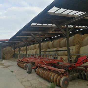
Heu 1.Schnitt 2021
Upahl
hermannmeyerzuborgsen
@hermannmeyerzuborgsen
Heu
Empfänger lädt ab
Rundballen
Regenfrei
3 weitere...
P+

Heu und Stroh zu verkaufen
21527 Kollow
Hof -Linautal
@Hof-Linautal
Heu
Lieferant entlädt
Rundballen
Regenfrei
3 weitere...
aktuell
B+

Leider kein Vorschaubild
Leider kein Vorschaubild
Bio-Heu Rundballen zu verkaufen
Biebertal
Lindenhoefe
@Lindenhoefe
Heu
Lieferant entlädt
Rundballen
Wird verladen
2 weitere...
B+
Leider kein Vorschaubild
Leider kein Vorschaubild
heu 2025 heu 2ter schnitt 2025
Maisach
Reitstall Thurner
@ReitstallThurner
Heu
Empfänger lädt ab
Rundballen
Regenfrei
3 weitere...
B+

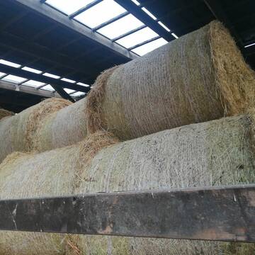
Heulage in Top-Bioqualität
Bothel
LB Sarah Lühring
@Bonito
Heulage
Rundballen
Regenfrei
Wird verladen
1 weitere...
B+

Heu, Heulage, ökologisch, artenreich top Qualitä...
Hamburg
Frederic Wübbe
@Stall_Am_Burgberg
Heu
Lieferant entlädt
Rundballen
Bio
3 weitere...
B+

Heu und Heulage verkaufen
Mechtersen
STALL-FREIde Marketing
@STALL-FREI-Marketing
Verkaufen Sie Ihr Heu und Ihre Heulage direkt an Reiter, Pferdeställe und Reitanlagen

Biete Heu in Rundballen
Steinheim am Albuch
Westernreiterhof Ziegler
@NadinZiegler
Heu
Rundballen
Bio
Regenfrei
Wird verladen
1 weitere...
B+


Premium Holzpellets als EINSTREU für die Pferdeb...
Spenge
Kenny Puhl
@Puhl-Pellets
Einstreu
Lieferant entlädt
Pellets
Wird verladen
2 weitere...
P+
Deprecated: Creation of dynamic property Zend_View::$pageCount is deprecated in /var/www/stall-frei/htdocs/staging.stall-frei.de/library/vendor/shardj/zf1-future/library/Zend/View/Abstract.php on line 308
Deprecated: Creation of dynamic property Zend_View::$itemCountPerPage is deprecated in /var/www/stall-frei/htdocs/staging.stall-frei.de/library/vendor/shardj/zf1-future/library/Zend/View/Abstract.php on line 308
Deprecated: Creation of dynamic property Zend_View::$first is deprecated in /var/www/stall-frei/htdocs/staging.stall-frei.de/library/vendor/shardj/zf1-future/library/Zend/View/Abstract.php on line 308
Deprecated: Creation of dynamic property Zend_View::$current is deprecated in /var/www/stall-frei/htdocs/staging.stall-frei.de/library/vendor/shardj/zf1-future/library/Zend/View/Abstract.php on line 308
Deprecated: Creation of dynamic property Zend_View::$last is deprecated in /var/www/stall-frei/htdocs/staging.stall-frei.de/library/vendor/shardj/zf1-future/library/Zend/View/Abstract.php on line 308
Deprecated: Creation of dynamic property Zend_View::$previous is deprecated in /var/www/stall-frei/htdocs/staging.stall-frei.de/library/vendor/shardj/zf1-future/library/Zend/View/Abstract.php on line 308
Deprecated: Creation of dynamic property Zend_View::$next is deprecated in /var/www/stall-frei/htdocs/staging.stall-frei.de/library/vendor/shardj/zf1-future/library/Zend/View/Abstract.php on line 308
Deprecated: Creation of dynamic property Zend_View::$pagesInRange is deprecated in /var/www/stall-frei/htdocs/staging.stall-frei.de/library/vendor/shardj/zf1-future/library/Zend/View/Abstract.php on line 308
Deprecated: Creation of dynamic property Zend_View::$firstPageInRange is deprecated in /var/www/stall-frei/htdocs/staging.stall-frei.de/library/vendor/shardj/zf1-future/library/Zend/View/Abstract.php on line 308
Deprecated: Creation of dynamic property Zend_View::$lastPageInRange is deprecated in /var/www/stall-frei/htdocs/staging.stall-frei.de/library/vendor/shardj/zf1-future/library/Zend/View/Abstract.php on line 308
Deprecated: Creation of dynamic property Zend_View::$currentItemCount is deprecated in /var/www/stall-frei/htdocs/staging.stall-frei.de/library/vendor/shardj/zf1-future/library/Zend/View/Abstract.php on line 308
Deprecated: Creation of dynamic property Zend_View::$totalItemCount is deprecated in /var/www/stall-frei/htdocs/staging.stall-frei.de/library/vendor/shardj/zf1-future/library/Zend/View/Abstract.php on line 308
Deprecated: Creation of dynamic property Zend_View::$firstItemNumber is deprecated in /var/www/stall-frei/htdocs/staging.stall-frei.de/library/vendor/shardj/zf1-future/library/Zend/View/Abstract.php on line 308
Deprecated: Creation of dynamic property Zend_View::$lastItemNumber is deprecated in /var/www/stall-frei/htdocs/staging.stall-frei.de/library/vendor/shardj/zf1-future/library/Zend/View/Abstract.php on line 308
Deprecated: Creation of dynamic property Zend_View::$router is deprecated in /var/www/stall-frei/htdocs/staging.stall-frei.de/library/vendor/shardj/zf1-future/library/Zend/View/Abstract.php on line 308
Deprecated: Creation of dynamic property Zend_View::$urlParams is deprecated in /var/www/stall-frei/htdocs/staging.stall-frei.de/library/vendor/shardj/zf1-future/library/Zend/View/Abstract.php on line 308
Deprecated: Creation of dynamic property Zend_View::$showAds is deprecated in /var/www/stall-frei/htdocs/staging.stall-frei.de/library/vendor/shardj/zf1-future/library/Zend/View/Abstract.php on line 308
Deprecated: Creation of dynamic property Zend_View::$objectIds is deprecated in /var/www/stall-frei/htdocs/staging.stall-frei.de/library/vendor/shardj/zf1-future/library/Zend/View/Abstract.php on line 308
Deprecated: Creation of dynamic property Zend_View::$showNavbar is deprecated in /var/www/stall-frei/htdocs/staging.stall-frei.de/library/vendor/shardj/zf1-future/library/Zend/View/Abstract.php on line 308
Deprecated: Creation of dynamic property Zend_View::$showBreadcrumb is deprecated in /var/www/stall-frei/htdocs/staging.stall-frei.de/library/vendor/shardj/zf1-future/library/Zend/View/Abstract.php on line 308
Deprecated: Creation of dynamic property Zend_View::$showFooter is deprecated in /var/www/stall-frei/htdocs/staging.stall-frei.de/library/vendor/shardj/zf1-future/library/Zend/View/Abstract.php on line 308
Deprecated: Creation of dynamic property Zend_View::$showInternalAds is deprecated in /var/www/stall-frei/htdocs/staging.stall-frei.de/library/vendor/shardj/zf1-future/library/Zend/View/Abstract.php on line 308
Deprecated: Creation of dynamic property Zend_View::$blNoContent is deprecated in /var/www/stall-frei/htdocs/staging.stall-frei.de/library/vendor/shardj/zf1-future/library/Zend/View/Abstract.php on line 308
Deprecated: Creation of dynamic property Zend_View::$sMetaDesc is deprecated in /var/www/stall-frei/htdocs/staging.stall-frei.de/library/vendor/shardj/zf1-future/library/Zend/View/Abstract.php on line 308
Deprecated: Creation of dynamic property Zend_View::$useGmaps is deprecated in /var/www/stall-frei/htdocs/staging.stall-frei.de/library/vendor/shardj/zf1-future/library/Zend/View/Abstract.php on line 308
Deprecated: Creation of dynamic property Zend_View::$touches is deprecated in /var/www/stall-frei/htdocs/staging.stall-frei.de/library/vendor/shardj/zf1-future/library/Zend/View/Abstract.php on line 308
Deprecated: Creation of dynamic property Zend_View::$oProject is deprecated in /var/www/stall-frei/htdocs/staging.stall-frei.de/library/vendor/shardj/zf1-future/library/Zend/View/Abstract.php on line 308
Deprecated: Creation of dynamic property Zend_View::$pageHeadline is deprecated in /var/www/stall-frei/htdocs/staging.stall-frei.de/library/vendor/shardj/zf1-future/library/Zend/View/Abstract.php on line 308
Deprecated: Creation of dynamic property Zend_View::$disableLocationField is deprecated in /var/www/stall-frei/htdocs/staging.stall-frei.de/library/vendor/shardj/zf1-future/library/Zend/View/Abstract.php on line 308
Deprecated: Creation of dynamic property Zend_View::$isSearch is deprecated in /var/www/stall-frei/htdocs/staging.stall-frei.de/library/vendor/shardj/zf1-future/library/Zend/View/Abstract.php on line 308
Deprecated: Creation of dynamic property Zend_View::$pageTitle is deprecated in /var/www/stall-frei/htdocs/staging.stall-frei.de/library/vendor/shardj/zf1-future/library/Zend/View/Abstract.php on line 308
Deprecated: Creation of dynamic property Psf_Form_Element_Text::$class is deprecated in /var/www/stall-frei/htdocs/staging.stall-frei.de/library/vendor/shardj/zf1-future/library/Zend/Form/Element.php on line 874
Deprecated: Creation of dynamic property Psf_Form_Element_Text::$size is deprecated in /var/www/stall-frei/htdocs/staging.stall-frei.de/library/vendor/shardj/zf1-future/library/Zend/Form/Element.php on line 874
Deprecated: Creation of dynamic property Psf_Form_Element_Text::$placeholder is deprecated in /var/www/stall-frei/htdocs/staging.stall-frei.de/library/vendor/shardj/zf1-future/library/Zend/Form/Element.php on line 874
Deprecated: Creation of dynamic property Psf_Form_Element_Hidden::$class is deprecated in /var/www/stall-frei/htdocs/staging.stall-frei.de/library/vendor/shardj/zf1-future/library/Zend/Form/Element.php on line 874
Deprecated: Creation of dynamic property Psf_Form_Element_Hidden::$class is deprecated in /var/www/stall-frei/htdocs/staging.stall-frei.de/library/vendor/shardj/zf1-future/library/Zend/Form/Element.php on line 874
Deprecated: Creation of dynamic property Psf_Form_Element_Hidden::$class is deprecated in /var/www/stall-frei/htdocs/staging.stall-frei.de/library/vendor/shardj/zf1-future/library/Zend/Form/Element.php on line 874
Deprecated: Creation of dynamic property Psf_Form_Element_Hidden::$class is deprecated in /var/www/stall-frei/htdocs/staging.stall-frei.de/library/vendor/shardj/zf1-future/library/Zend/Form/Element.php on line 874
Deprecated: Creation of dynamic property Psf_Form_Element_Select::$class is deprecated in /var/www/stall-frei/htdocs/staging.stall-frei.de/library/vendor/shardj/zf1-future/library/Zend/Form/Element.php on line 874
Deprecated: Creation of dynamic property Psf_Form_Element_Select::$class is deprecated in /var/www/stall-frei/htdocs/staging.stall-frei.de/library/vendor/shardj/zf1-future/library/Zend/Form/Element.php on line 874
Deprecated: Creation of dynamic property Psf_Form_Element_Select::$class is deprecated in /var/www/stall-frei/htdocs/staging.stall-frei.de/library/vendor/shardj/zf1-future/library/Zend/Form/Element.php on line 874
Deprecated: Creation of dynamic property Psf_Form_Element_Select::$class is deprecated in /var/www/stall-frei/htdocs/staging.stall-frei.de/library/vendor/shardj/zf1-future/library/Zend/Form/Element.php on line 874
Deprecated: Creation of dynamic property Zend_View::$sort is deprecated in /var/www/stall-frei/htdocs/staging.stall-frei.de/library/vendor/shardj/zf1-future/library/Zend/View/Abstract.php on line 308
Deprecated: Creation of dynamic property Zend_View::$searchLocation is deprecated in /var/www/stall-frei/htdocs/staging.stall-frei.de/library/vendor/shardj/zf1-future/library/Zend/View/Abstract.php on line 308
Deprecated: Creation of dynamic property Zend_View::$locationHint is deprecated in /var/www/stall-frei/htdocs/staging.stall-frei.de/library/vendor/shardj/zf1-future/library/Zend/View/Abstract.php on line 308
Psf_GeoCoder_Abstract::getLocation: Tanneberg Get Location CachedOrLive
Psf_GeoCoder_Abstract::getCachedOrLive: Tanneberg
Psf_GeoCoder_Abstract::convertLocationResult
{"documentation":"https:\/\/opencagedata.com\/api","licenses":[{"name":"see attribution guide","url":"https:\/\/opencagedata.com\/credits"}],"results":[{"bounds":{"northeast":{"lat":51.0709902,"lng":13.4319264},"southwest":{"lat":51.0309902,"lng":13.3919264}},"components":{"ISO_3166-1_alpha-2":"DE","ISO_3166-1_alpha-3":"DEU","ISO_3166-2":["DE-SN"],"_category":"place","_normalized_city":"Klipphausen","_type":"village","city":"Klipphausen","continent":"Europe","country":"Deutschland","country_code":"de","county":"Mei\u00dfen","political_union":"European Union","postcode":"01665","state":"Sachsen","state_code":"SN","village":"Tanneberg"},"confidence":7,"formatted":"01665 Tanneberg, Deutschland","geometry":{"lat":51.0509902,"lng":13.4119264}},{"bounds":{"northeast":{"lat":51.046294,"lng":12.9840021},"southwest":{"lat":51.006294,"lng":12.9440021}},"components":{"ISO_3166-1_alpha-2":"DE","ISO_3166-1_alpha-3":"DEU","ISO_3166-2":["DE-SN"],"_category":"place","_normalized_city":"Mittweida","_type":"village","continent":"Europe","country":"Deutschland","country_code":"de","county":"Mittelsachsen","municipality":"Mittweida","political_union":"European Union","postcode":"09648","state":"Sachsen","state_code":"SN","town":"Mittweida","village":"Tanneberg"},"confidence":7,"formatted":"09648 Tanneberg, Deutschland","geometry":{"lat":51.026294,"lng":12.9640021}},{"bounds":{"northeast":{"lat":51.6852744,"lng":13.7579328},"southwest":{"lat":51.6452744,"lng":13.7179328}},"components":{"ISO_3166-1_alpha-2":"DE","ISO_3166-1_alpha-3":"DEU","ISO_3166-2":["DE-BB"],"_category":"place","_normalized_city":"Massen-Niederlausitz","_type":"village","city":"Massen-Niederlausitz","continent":"Europe","country":"Deutschland","country_code":"de","county":"Elbe-Elster","municipality":"Kleine Elster (Niederlausitz)","political_union":"European Union","state":"Brandenburg","state_code":"BB","village":"Tanneberg"},"confidence":7,"formatted":"Tanneberg, Brandenburg, Deutschland","geometry":{"lat":51.6652744,"lng":13.7379328}},{"bounds":{"northeast":{"lat":51.1778116,"lng":14.06087},"southwest":{"lat":51.1777116,"lng":14.06077}},"components":{"ISO_3166-1_alpha-2":"DE","ISO_3166-1_alpha-3":"DEU","ISO_3166-2":["DE-SN"],"_category":"natural\/water","_normalized_city":"Ohorn","_type":"peak","continent":"Europe","country":"Deutschland","country_code":"de","county":"Bautzen","municipality":"Pulsnitz","peak":"Tanneberg","political_union":"European Union","postcode":"01900","state":"Sachsen","state_code":"SN","village":"Ohorn"},"confidence":9,"formatted":"Tanneberg, 01900 Ohorn, Deutschland","geometry":{"lat":51.1777616,"lng":14.06082}},{"bounds":{"northeast":{"lat":51.1702264,"lng":14.1369998},"southwest":{"lat":51.1701264,"lng":14.1368998}},"components":{"ISO_3166-1_alpha-2":"DE","ISO_3166-1_alpha-3":"DEU","ISO_3166-2":["DE-SN"],"_category":"natural\/water","_normalized_city":"Burkau","_type":"peak","continent":"Europe","country":"Deutschland","country_code":"de","county":"Bautzen","peak":"Tanneberg","political_union":"European Union","state":"Sachsen","state_code":"SN","village":"Burkau"},"confidence":9,"formatted":"Tanneberg, Burkau, Sachsen, Deutschland","geometry":{"lat":51.1701764,"lng":14.1369498}},{"bounds":{"northeast":{"lat":51.1889871,"lng":14.150499},"southwest":{"lat":51.1489871,"lng":14.110499}},"components":{"ISO_3166-1_alpha-2":"DE","ISO_3166-1_alpha-3":"DEU","ISO_3166-2":["DE-SN"],"_category":"place","_normalized_city":"Rammenau","_type":"hamlet","continent":"Europe","country":"Deutschland","country_code":"de","county":"Bautzen","hamlet":"Tanneberg","municipality":"Bischofswerda","political_union":"European Union","state":"Sachsen","state_code":"SN","village":"Rammenau"},"confidence":7,"formatted":"Tanneberg, Rammenau, Sachsen, Deutschland","geometry":{"lat":51.1689871,"lng":14.130499}},{"bounds":{"northeast":{"lat":51.1053594,"lng":14.0012373},"southwest":{"lat":51.1052594,"lng":14.0011373}},"components":{"ISO_3166-1_alpha-2":"DE","ISO_3166-1_alpha-3":"DEU","ISO_3166-2":["DE-SN"],"_category":"natural\/water","_normalized_city":"Arnsdorf","_type":"peak","continent":"Europe","country":"Deutschland","country_code":"de","county":"Bautzen","peak":"Tanneberg","political_union":"European Union","postcode":"01477","state":"Sachsen","state_code":"SN","village":"Arnsdorf"},"confidence":9,"formatted":"Tanneberg, 01477 Arnsdorf, Deutschland","geometry":{"lat":51.1053094,"lng":14.0011873}},{"components":{"ISO_3166-1_alpha-2":"FR","ISO_3166-1_alpha-3":"FRA","ISO_3166-2":["FR-NAQ","FR-40"],"_category":"road","_normalized_city":"Montaut","_type":"road","city":"Montaut","continent":"Europe","country":"France","country_code":"fr","county":"Landes","local_authority":"Communaut\u00e9 de communes Chalosse Tursan","political_union":"European Union","postcode":"40500","road":"Route de Lanneb\u00e8re","state":"Nouvelle-Aquitaine","state_code":"NAQ"},"confidence":3,"formatted":"Route de Lanneb\u00e8re, 40500 Montaut, France","geometry":{"lat":43.718417,"lng":-0.683159}},{"components":{"ISO_3166-1_alpha-2":"FR","ISO_3166-1_alpha-3":"FRA","ISO_3166-2":["FR-BRE","FR-22"],"_category":"place","_normalized_city":"Lannebert","_type":"city","city":"Lannebert","continent":"Europe","country":"France","country_code":"fr","county":"C\u00f4tes-d'Armor","local_authority":"Leff Armor Communaut\u00e9","political_union":"European Union","postcode":"22290","state":"Bretagne","state_code":"BRE"},"confidence":3,"formatted":"Lannebert, C\u00f4tes-d'Armor, France","geometry":{"lat":48.649619,"lng":-3.01074}},{"components":{"ISO_3166-1_alpha-2":"FR","ISO_3166-1_alpha-3":"FRA","ISO_3166-2":["FR-BRE","FR-22"],"_category":"road","_normalized_city":"Lannebert","_type":"road","city":"Lannebert","continent":"Europe","country":"France","country_code":"fr","county":"C\u00f4tes-d'Armor","local_authority":"Leff Armor Communaut\u00e9","political_union":"European Union","postcode":"22290","road":"Le Bourg","state":"Bretagne","state_code":"BRE"},"confidence":3,"formatted":"Le Bourg, 22290 Lannebert, France","geometry":{"lat":48.658563,"lng":-3.00828}}],"status":{"code":200,"message":"OK"},"stay_informed":{"blog":"https:\/\/blog.opencagedata.com","mastodon":"https:\/\/en.osm.town\/@opencage"},"thanks":"For using an OpenCage API","timestamp":{"created_http":"Sun, 08 Feb 2026 23:47:49 GMT","created_unix":1770594469},"total_results":10}Array
(
[0] => stdClass Object
(
[bounds] => stdClass Object
(
[northeast] => stdClass Object
(
[lat] => 51.0709902
[lng] => 13.4319264
)
[southwest] => stdClass Object
(
[lat] => 51.0309902
[lng] => 13.3919264
)
)
[components] => stdClass Object
(
[ISO_3166-1_alpha-2] => DE
[ISO_3166-1_alpha-3] => DEU
[ISO_3166-2] => Array
(
[0] => DE-SN
)
[_category] => place
[_normalized_city] => Klipphausen
[_type] => village
[city] => Klipphausen
[continent] => Europe
[country] => Deutschland
[country_code] => de
[county] => Meißen
[political_union] => European Union
[postcode] => 01665
[state] => Sachsen
[state_code] => SN
[village] => Tanneberg
)
[confidence] => 7
[formatted] => 01665 Tanneberg, Deutschland
[geometry] => stdClass Object
(
[lat] => 51.0509902
[lng] => 13.4119264
)
)
[1] => stdClass Object
(
[bounds] => stdClass Object
(
[northeast] => stdClass Object
(
[lat] => 51.046294
[lng] => 12.9840021
)
[southwest] => stdClass Object
(
[lat] => 51.006294
[lng] => 12.9440021
)
)
[components] => stdClass Object
(
[ISO_3166-1_alpha-2] => DE
[ISO_3166-1_alpha-3] => DEU
[ISO_3166-2] => Array
(
[0] => DE-SN
)
[_category] => place
[_normalized_city] => Mittweida
[_type] => village
[continent] => Europe
[country] => Deutschland
[country_code] => de
[county] => Mittelsachsen
[municipality] => Mittweida
[political_union] => European Union
[postcode] => 09648
[state] => Sachsen
[state_code] => SN
[town] => Mittweida
[village] => Tanneberg
)
[confidence] => 7
[formatted] => 09648 Tanneberg, Deutschland
[geometry] => stdClass Object
(
[lat] => 51.026294
[lng] => 12.9640021
)
)
[2] => stdClass Object
(
[bounds] => stdClass Object
(
[northeast] => stdClass Object
(
[lat] => 51.6852744
[lng] => 13.7579328
)
[southwest] => stdClass Object
(
[lat] => 51.6452744
[lng] => 13.7179328
)
)
[components] => stdClass Object
(
[ISO_3166-1_alpha-2] => DE
[ISO_3166-1_alpha-3] => DEU
[ISO_3166-2] => Array
(
[0] => DE-BB
)
[_category] => place
[_normalized_city] => Massen-Niederlausitz
[_type] => village
[city] => Massen-Niederlausitz
[continent] => Europe
[country] => Deutschland
[country_code] => de
[county] => Elbe-Elster
[municipality] => Kleine Elster (Niederlausitz)
[political_union] => European Union
[state] => Brandenburg
[state_code] => BB
[village] => Tanneberg
)
[confidence] => 7
[formatted] => Tanneberg, Brandenburg, Deutschland
[geometry] => stdClass Object
(
[lat] => 51.6652744
[lng] => 13.7379328
)
)
[3] => stdClass Object
(
[bounds] => stdClass Object
(
[northeast] => stdClass Object
(
[lat] => 51.1778116
[lng] => 14.06087
)
[southwest] => stdClass Object
(
[lat] => 51.1777116
[lng] => 14.06077
)
)
[components] => stdClass Object
(
[ISO_3166-1_alpha-2] => DE
[ISO_3166-1_alpha-3] => DEU
[ISO_3166-2] => Array
(
[0] => DE-SN
)
[_category] => natural/water
[_normalized_city] => Ohorn
[_type] => peak
[continent] => Europe
[country] => Deutschland
[country_code] => de
[county] => Bautzen
[municipality] => Pulsnitz
[peak] => Tanneberg
[political_union] => European Union
[postcode] => 01900
[state] => Sachsen
[state_code] => SN
[village] => Ohorn
)
[confidence] => 9
[formatted] => Tanneberg, 01900 Ohorn, Deutschland
[geometry] => stdClass Object
(
[lat] => 51.1777616
[lng] => 14.06082
)
)
[4] => stdClass Object
(
[bounds] => stdClass Object
(
[northeast] => stdClass Object
(
[lat] => 51.1702264
[lng] => 14.1369998
)
[southwest] => stdClass Object
(
[lat] => 51.1701264
[lng] => 14.1368998
)
)
[components] => stdClass Object
(
[ISO_3166-1_alpha-2] => DE
[ISO_3166-1_alpha-3] => DEU
[ISO_3166-2] => Array
(
[0] => DE-SN
)
[_category] => natural/water
[_normalized_city] => Burkau
[_type] => peak
[continent] => Europe
[country] => Deutschland
[country_code] => de
[county] => Bautzen
[peak] => Tanneberg
[political_union] => European Union
[state] => Sachsen
[state_code] => SN
[village] => Burkau
)
[confidence] => 9
[formatted] => Tanneberg, Burkau, Sachsen, Deutschland
[geometry] => stdClass Object
(
[lat] => 51.1701764
[lng] => 14.1369498
)
)
[5] => stdClass Object
(
[bounds] => stdClass Object
(
[northeast] => stdClass Object
(
[lat] => 51.1889871
[lng] => 14.150499
)
[southwest] => stdClass Object
(
[lat] => 51.1489871
[lng] => 14.110499
)
)
[components] => stdClass Object
(
[ISO_3166-1_alpha-2] => DE
[ISO_3166-1_alpha-3] => DEU
[ISO_3166-2] => Array
(
[0] => DE-SN
)
[_category] => place
[_normalized_city] => Rammenau
[_type] => hamlet
[continent] => Europe
[country] => Deutschland
[country_code] => de
[county] => Bautzen
[hamlet] => Tanneberg
[municipality] => Bischofswerda
[political_union] => European Union
[state] => Sachsen
[state_code] => SN
[village] => Rammenau
)
[confidence] => 7
[formatted] => Tanneberg, Rammenau, Sachsen, Deutschland
[geometry] => stdClass Object
(
[lat] => 51.1689871
[lng] => 14.130499
)
)
[6] => stdClass Object
(
[bounds] => stdClass Object
(
[northeast] => stdClass Object
(
[lat] => 51.1053594
[lng] => 14.0012373
)
[southwest] => stdClass Object
(
[lat] => 51.1052594
[lng] => 14.0011373
)
)
[components] => stdClass Object
(
[ISO_3166-1_alpha-2] => DE
[ISO_3166-1_alpha-3] => DEU
[ISO_3166-2] => Array
(
[0] => DE-SN
)
[_category] => natural/water
[_normalized_city] => Arnsdorf
[_type] => peak
[continent] => Europe
[country] => Deutschland
[country_code] => de
[county] => Bautzen
[peak] => Tanneberg
[political_union] => European Union
[postcode] => 01477
[state] => Sachsen
[state_code] => SN
[village] => Arnsdorf
)
[confidence] => 9
[formatted] => Tanneberg, 01477 Arnsdorf, Deutschland
[geometry] => stdClass Object
(
[lat] => 51.1053094
[lng] => 14.0011873
)
)
[7] => stdClass Object
(
[components] => stdClass Object
(
[ISO_3166-1_alpha-2] => FR
[ISO_3166-1_alpha-3] => FRA
[ISO_3166-2] => Array
(
[0] => FR-NAQ
[1] => FR-40
)
[_category] => road
[_normalized_city] => Montaut
[_type] => road
[city] => Montaut
[continent] => Europe
[country] => France
[country_code] => fr
[county] => Landes
[local_authority] => Communauté de communes Chalosse Tursan
[political_union] => European Union
[postcode] => 40500
[road] => Route de Lannebère
[state] => Nouvelle-Aquitaine
[state_code] => NAQ
)
[confidence] => 3
[formatted] => Route de Lannebère, 40500 Montaut, France
[geometry] => stdClass Object
(
[lat] => 43.718417
[lng] => -0.683159
)
)
[8] => stdClass Object
(
[components] => stdClass Object
(
[ISO_3166-1_alpha-2] => FR
[ISO_3166-1_alpha-3] => FRA
[ISO_3166-2] => Array
(
[0] => FR-BRE
[1] => FR-22
)
[_category] => place
[_normalized_city] => Lannebert
[_type] => city
[city] => Lannebert
[continent] => Europe
[country] => France
[country_code] => fr
[county] => Côtes-d'Armor
[local_authority] => Leff Armor Communauté
[political_union] => European Union
[postcode] => 22290
[state] => Bretagne
[state_code] => BRE
)
[confidence] => 3
[formatted] => Lannebert, Côtes-d'Armor, France
[geometry] => stdClass Object
(
[lat] => 48.649619
[lng] => -3.01074
)
)
[9] => stdClass Object
(
[components] => stdClass Object
(
[ISO_3166-1_alpha-2] => FR
[ISO_3166-1_alpha-3] => FRA
[ISO_3166-2] => Array
(
[0] => FR-BRE
[1] => FR-22
)
[_category] => road
[_normalized_city] => Lannebert
[_type] => road
[city] => Lannebert
[continent] => Europe
[country] => France
[country_code] => fr
[county] => Côtes-d'Armor
[local_authority] => Leff Armor Communauté
[political_union] => European Union
[postcode] => 22290
[road] => Le Bourg
[state] => Bretagne
[state_code] => BRE
)
[confidence] => 3
[formatted] => Le Bourg, 22290 Lannebert, France
[geometry] => stdClass Object
(
[lat] => 48.658563
[lng] => -3.00828
)
)
)
Psf_GeoCoder_OpenCageData::getKeyMap: 0
stdClass Object
(
    [bounds] => stdClass Object
        (
            [northeast] => stdClass Object
                (
                    [lat] => 51.0709902
                    [lng] => 13.4319264
                )

            [southwest] => stdClass Object
                (
                    [lat] => 51.0309902
                    [lng] => 13.3919264
                )

        )

    [components] => stdClass Object
        (
            [ISO_3166-1_alpha-2] => DE
            [ISO_3166-1_alpha-3] => DEU
            [ISO_3166-2] => Array
                (
                    [0] => DE-SN
                )

            [_category] => place
            [_normalized_city] => Klipphausen
            [_type] => village
            [city] => Klipphausen
            [continent] => Europe
            [country] => Deutschland
            [country_code] => de
            [county] => Meißen
            [political_union] => European Union
            [postcode] => 01665
            [state] => Sachsen
            [state_code] => SN
            [village] => Tanneberg
        )

    [confidence] => 7
    [formatted] => 01665 Tanneberg, Deutschland
    [geometry] => stdClass Object
        (
            [lat] => 51.0509902
            [lng] => 13.4119264
        )

)
Psf_GeoCoder_OpenCageData::getCounty: Meißen
Psf_GeoCoder_OpenCageData::addMissingData REFETCH!
Array
(
    [address] => 01665 Tanneberg, Deutschland
    [type] => village
    [street] =>
    [city] => Tanneberg
    [county] => Meißen
    [state] => Sachsen
    [zip] => 01665
    [country] => Deutschland
    [suburb] =>
    [countrycode] => de
    [latitude] => 51.0509902
    [longitude] => 13.4119264
    [accuracy] => 1
    [confidence] => 7
    [bounds] => stdClass Object
        (
            [northeast] => stdClass Object
                (
                    [lat] => 51.0709902
                    [lng] => 13.4319264
                )

            [southwest] => stdClass Object
                (
                    [lat] => 51.0309902
                    [lng] => 13.3919264
                )

        )

)
reformat!
Array
(
    [address] => 01665 Tanneberg, Deutschland
    [type] => village
    [street] =>
    [city] => Tanneberg
    [county] => Meißen
    [state] => Sachsen
    [zip] => 01665
    [country] => Deutschland
    [suburb] =>
    [countrycode] => de
    [latitude] => 51.0509902
    [longitude] => 13.4119264
    [accuracy] => 1
    [confidence] => 7
    [bounds] => stdClass Object
        (
            [northeast] => stdClass Object
                (
                    [lat] => 51.0709902
                    [lng] => 13.4319264
                )

            [southwest] => stdClass Object
                (
                    [lat] => 51.0309902
                    [lng] => 13.3919264
                )

        )

    [place] => 01665 Tanneberg, Sachsen
    [hash] => d6244a17510d58fbab45be7a6717649e
)
Psf_GeoCoder_OpenCageData::getKeyMap: 1
stdClass Object
(
    [bounds] => stdClass Object
        (
            [northeast] => stdClass Object
                (
                    [lat] => 51.046294
                    [lng] => 12.9840021
                )

            [southwest] => stdClass Object
                (
                    [lat] => 51.006294
                    [lng] => 12.9440021
                )

        )

    [components] => stdClass Object
        (
            [ISO_3166-1_alpha-2] => DE
            [ISO_3166-1_alpha-3] => DEU
            [ISO_3166-2] => Array
                (
                    [0] => DE-SN
                )

            [_category] => place
            [_normalized_city] => Mittweida
            [_type] => village
            [continent] => Europe
            [country] => Deutschland
            [country_code] => de
            [county] => Mittelsachsen
            [municipality] => Mittweida
            [political_union] => European Union
            [postcode] => 09648
            [state] => Sachsen
            [state_code] => SN
            [town] => Mittweida
            [village] => Tanneberg
        )

    [confidence] => 7
    [formatted] => 09648 Tanneberg, Deutschland
    [geometry] => stdClass Object
        (
            [lat] => 51.026294
            [lng] => 12.9640021
        )

)
Psf_GeoCoder_OpenCageData::getCounty: Mittelsachsen
Psf_GeoCoder_OpenCageData::addMissingData REFETCH!
Array
(
    [address] => 09648 Tanneberg, Deutschland
    [type] => village
    [street] =>
    [city] => Mittweida
    [county] => Mittelsachsen
    [state] => Sachsen
    [zip] => 09648
    [country] => Deutschland
    [suburb] =>
    [countrycode] => de
    [latitude] => 51.026294
    [longitude] => 12.9640021
    [accuracy] => 1
    [confidence] => 7
    [bounds] => stdClass Object
        (
            [northeast] => stdClass Object
                (
                    [lat] => 51.046294
                    [lng] => 12.9840021
                )

            [southwest] => stdClass Object
                (
                    [lat] => 51.006294
                    [lng] => 12.9440021
                )

        )

)
reformat!
Array
(
    [address] => 09648 Mittweida
    [type] => village
    [street] =>
    [city] => Mittweida
    [county] => Mittelsachsen
    [state] => Sachsen
    [zip] => 09648
    [country] => Deutschland
    [suburb] =>
    [countrycode] => de
    [latitude] => 51.026294
    [longitude] => 12.9640021
    [accuracy] => 1
    [confidence] => 7
    [bounds] => stdClass Object
        (
            [northeast] => stdClass Object
                (
                    [lat] => 51.046294
                    [lng] => 12.9840021
                )

            [southwest] => stdClass Object
                (
                    [lat] => 51.006294
                    [lng] => 12.9440021
                )

        )

    [place] => 09648 Mittweida, Sachsen
    [hash] => 9d8f06c33bf2102b1f847c006d2ba467
)
Psf_GeoCoder_OpenCageData::getKeyMap: 2
stdClass Object
(
    [bounds] => stdClass Object
        (
            [northeast] => stdClass Object
                (
                    [lat] => 51.6852744
                    [lng] => 13.7579328
                )

            [southwest] => stdClass Object
                (
                    [lat] => 51.6452744
                    [lng] => 13.7179328
                )

        )

    [components] => stdClass Object
        (
            [ISO_3166-1_alpha-2] => DE
            [ISO_3166-1_alpha-3] => DEU
            [ISO_3166-2] => Array
                (
                    [0] => DE-BB
                )

            [_category] => place
            [_normalized_city] => Massen-Niederlausitz
            [_type] => village
            [city] => Massen-Niederlausitz
            [continent] => Europe
            [country] => Deutschland
            [country_code] => de
            [county] => Elbe-Elster
            [municipality] => Kleine Elster (Niederlausitz)
            [political_union] => European Union
            [state] => Brandenburg
            [state_code] => BB
            [village] => Tanneberg
        )

    [confidence] => 7
    [formatted] => Tanneberg, Brandenburg, Deutschland
    [geometry] => stdClass Object
        (
            [lat] => 51.6652744
            [lng] => 13.7379328
        )

)
Psf_GeoCoder_OpenCageData::getCounty: Elbe-Elster
Psf_GeoCoder_OpenCageData::addMissingData REFETCH!
Array
(
    [address] => Tanneberg, Brandenburg, Deutschland
    [type] => village
    [street] =>
    [city] => Tanneberg
    [county] => Elbe-Elster
    [state] => Brandenburg
    [zip] =>
    [country] => Deutschland
    [suburb] =>
    [countrycode] => de
    [latitude] => 51.6652744
    [longitude] => 13.7379328
    [accuracy] => 1
    [confidence] => 7
    [bounds] => stdClass Object
        (
            [northeast] => stdClass Object
                (
                    [lat] => 51.6852744
                    [lng] => 13.7579328
                )

            [southwest] => stdClass Object
                (
                    [lat] => 51.6452744
                    [lng] => 13.7179328
                )

        )

)
reformat!
Array
(
    [address] => Tanneberg, Brandenburg, Deutschland
    [type] => village
    [street] =>
    [city] => Tanneberg
    [county] => Elbe-Elster
    [state] => Brandenburg
    [zip] =>
    [country] => Deutschland
    [suburb] =>
    [countrycode] => de
    [latitude] => 51.6652744
    [longitude] => 13.7379328
    [accuracy] => 1
    [confidence] => 7
    [bounds] => stdClass Object
        (
            [northeast] => stdClass Object
                (
                    [lat] => 51.6852744
                    [lng] => 13.7579328
                )

            [southwest] => stdClass Object
                (
                    [lat] => 51.6452744
                    [lng] => 13.7179328
                )

        )

    [place] => Tanneberg, Brandenburg
    [hash] => 3fe120e3c778f400a6e4b65fc024bb03
)
Psf_GeoCoder_OpenCageData::getKeyMap: 3
stdClass Object
(
    [bounds] => stdClass Object
        (
            [northeast] => stdClass Object
                (
                    [lat] => 51.1778116
                    [lng] => 14.06087
                )

            [southwest] => stdClass Object
                (
                    [lat] => 51.1777116
                    [lng] => 14.06077
                )

        )

    [components] => stdClass Object
        (
            [ISO_3166-1_alpha-2] => DE
            [ISO_3166-1_alpha-3] => DEU
            [ISO_3166-2] => Array
                (
                    [0] => DE-SN
                )

            [_category] => natural/water
            [_normalized_city] => Ohorn
            [_type] => peak
            [continent] => Europe
            [country] => Deutschland
            [country_code] => de
            [county] => Bautzen
            [municipality] => Pulsnitz
            [peak] => Tanneberg
            [political_union] => European Union
            [postcode] => 01900
            [state] => Sachsen
            [state_code] => SN
            [village] => Ohorn
        )

    [confidence] => 9
    [formatted] => Tanneberg, 01900 Ohorn, Deutschland
    [geometry] => stdClass Object
        (
            [lat] => 51.1777616
            [lng] => 14.06082
        )

)
Psf_GeoCoder_OpenCageData::getCounty: Bautzen
Psf_GeoCoder_OpenCageData::addMissingData REFETCH!
Array
(
    [address] => Tanneberg, 01900 Ohorn, Deutschland
    [type] => peak
    [street] =>
    [city] => Ohorn
    [county] => Bautzen
    [state] => Sachsen
    [zip] => 01900
    [country] => Deutschland
    [suburb] =>
    [countrycode] => de
    [latitude] => 51.1777616
    [longitude] => 14.06082
    [accuracy] => 1
    [confidence] => 9
    [bounds] => stdClass Object
        (
            [northeast] => stdClass Object
                (
                    [lat] => 51.1778116
                    [lng] => 14.06087
                )

            [southwest] => stdClass Object
                (
                    [lat] => 51.1777116
                    [lng] => 14.06077
                )

        )

)
reformat!
Array
(
    [address] => Tanneberg, 01900 Ohorn, Deutschland
    [type] => peak
    [street] =>
    [city] => Ohorn
    [county] => Bautzen
    [state] => Sachsen
    [zip] => 01900
    [country] => Deutschland
    [suburb] =>
    [countrycode] => de
    [latitude] => 51.1777616
    [longitude] => 14.06082
    [accuracy] => 1
    [confidence] => 9
    [bounds] => stdClass Object
        (
            [northeast] => stdClass Object
                (
                    [lat] => 51.1778116
                    [lng] => 14.06087
                )

            [southwest] => stdClass Object
                (
                    [lat] => 51.1777116
                    [lng] => 14.06077
                )

        )

    [place] => 01900 Ohorn, Sachsen
    [hash] => 0b542cace778d70913e171e5d226e087
)
Psf_GeoCoder_OpenCageData::getKeyMap: 4
stdClass Object
(
    [bounds] => stdClass Object
        (
            [northeast] => stdClass Object
                (
                    [lat] => 51.1702264
                    [lng] => 14.1369998
                )

            [southwest] => stdClass Object
                (
                    [lat] => 51.1701264
                    [lng] => 14.1368998
                )

        )

    [components] => stdClass Object
        (
            [ISO_3166-1_alpha-2] => DE
            [ISO_3166-1_alpha-3] => DEU
            [ISO_3166-2] => Array
                (
                    [0] => DE-SN
                )

            [_category] => natural/water
            [_normalized_city] => Burkau
            [_type] => peak
            [continent] => Europe
            [country] => Deutschland
            [country_code] => de
            [county] => Bautzen
            [peak] => Tanneberg
            [political_union] => European Union
            [state] => Sachsen
            [state_code] => SN
            [village] => Burkau
        )

    [confidence] => 9
    [formatted] => Tanneberg, Burkau, Sachsen, Deutschland
    [geometry] => stdClass Object
        (
            [lat] => 51.1701764
            [lng] => 14.1369498
        )

)
Psf_GeoCoder_OpenCageData::getCounty: Bautzen
Psf_GeoCoder_OpenCageData::addMissingData REFETCH!
Array
(
    [address] => Tanneberg, Burkau, Sachsen, Deutschland
    [type] => peak
    [street] =>
    [city] => Burkau
    [county] => Bautzen
    [state] => Sachsen
    [zip] =>
    [country] => Deutschland
    [suburb] =>
    [countrycode] => de
    [latitude] => 51.1701764
    [longitude] => 14.1369498
    [accuracy] => 1
    [confidence] => 9
    [bounds] => stdClass Object
        (
            [northeast] => stdClass Object
                (
                    [lat] => 51.1702264
                    [lng] => 14.1369998
                )

            [southwest] => stdClass Object
                (
                    [lat] => 51.1701264
                    [lng] => 14.1368998
                )

        )

)
reformat!
Array
(
    [address] => Tanneberg, Burkau, Sachsen, Deutschland
    [type] => peak
    [street] =>
    [city] => Burkau
    [county] => Bautzen
    [state] => Sachsen
    [zip] =>
    [country] => Deutschland
    [suburb] =>
    [countrycode] => de
    [latitude] => 51.1701764
    [longitude] => 14.1369498
    [accuracy] => 1
    [confidence] => 9
    [bounds] => stdClass Object
        (
            [northeast] => stdClass Object
                (
                    [lat] => 51.1702264
                    [lng] => 14.1369998
                )

            [southwest] => stdClass Object
                (
                    [lat] => 51.1701264
                    [lng] => 14.1368998
                )

        )

    [place] => Burkau, Sachsen
    [hash] => 306b68619f971d940900e9be61d85c93
)
Psf_GeoCoder_OpenCageData::getKeyMap: 5
stdClass Object
(
    [bounds] => stdClass Object
        (
            [northeast] => stdClass Object
                (
                    [lat] => 51.1889871
                    [lng] => 14.150499
                )

            [southwest] => stdClass Object
                (
                    [lat] => 51.1489871
                    [lng] => 14.110499
                )

        )

    [components] => stdClass Object
        (
            [ISO_3166-1_alpha-2] => DE
            [ISO_3166-1_alpha-3] => DEU
            [ISO_3166-2] => Array
                (
                    [0] => DE-SN
                )

            [_category] => place
            [_normalized_city] => Rammenau
            [_type] => hamlet
            [continent] => Europe
            [country] => Deutschland
            [country_code] => de
            [county] => Bautzen
            [hamlet] => Tanneberg
            [municipality] => Bischofswerda
            [political_union] => European Union
            [state] => Sachsen
            [state_code] => SN
            [village] => Rammenau
        )

    [confidence] => 7
    [formatted] => Tanneberg, Rammenau, Sachsen, Deutschland
    [geometry] => stdClass Object
        (
            [lat] => 51.1689871
            [lng] => 14.130499
        )

)
Psf_GeoCoder_OpenCageData::getCounty: Bautzen
Psf_GeoCoder_OpenCageData::addMissingData REFETCH!
Array
(
    [address] => Tanneberg, Rammenau, Sachsen, Deutschland
    [type] => hamlet
    [street] => Tanneberg
    [city] => Rammenau
    [county] => Bautzen
    [state] => Sachsen
    [zip] =>
    [country] => Deutschland
    [suburb] =>
    [countrycode] => de
    [latitude] => 51.1689871
    [longitude] => 14.130499
    [accuracy] => 1
    [confidence] => 7
    [bounds] => stdClass Object
        (
            [northeast] => stdClass Object
                (
                    [lat] => 51.1889871
                    [lng] => 14.150499
                )

            [southwest] => stdClass Object
                (
                    [lat] => 51.1489871
                    [lng] => 14.110499
                )

        )

)
reformat!
Array
(
    [address] => Tanneberg, Rammenau, Sachsen, Deutschland
    [type] => hamlet
    [street] => Tanneberg
    [city] => Rammenau
    [county] => Bautzen
    [state] => Sachsen
    [zip] =>
    [country] => Deutschland
    [suburb] =>
    [countrycode] => de
    [latitude] => 51.1689871
    [longitude] => 14.130499
    [accuracy] => 1
    [confidence] => 7
    [bounds] => stdClass Object
        (
            [northeast] => stdClass Object
                (
                    [lat] => 51.1889871
                    [lng] => 14.150499
                )

            [southwest] => stdClass Object
                (
                    [lat] => 51.1489871
                    [lng] => 14.110499
                )

        )

    [place] => Tanneberg, Rammenau, Sachsen
    [hash] => 173a1c76aca2d6a7f018bbbfc8017142
)
Psf_GeoCoder_OpenCageData::getKeyMap: 6
stdClass Object
(
    [bounds] => stdClass Object
        (
            [northeast] => stdClass Object
                (
                    [lat] => 51.1053594
                    [lng] => 14.0012373
                )

            [southwest] => stdClass Object
                (
                    [lat] => 51.1052594
                    [lng] => 14.0011373
                )

        )

    [components] => stdClass Object
        (
            [ISO_3166-1_alpha-2] => DE
            [ISO_3166-1_alpha-3] => DEU
            [ISO_3166-2] => Array
                (
                    [0] => DE-SN
                )

            [_category] => natural/water
            [_normalized_city] => Arnsdorf
            [_type] => peak
            [continent] => Europe
            [country] => Deutschland
            [country_code] => de
            [county] => Bautzen
            [peak] => Tanneberg
            [political_union] => European Union
            [postcode] => 01477
            [state] => Sachsen
            [state_code] => SN
            [village] => Arnsdorf
        )

    [confidence] => 9
    [formatted] => Tanneberg, 01477 Arnsdorf, Deutschland
    [geometry] => stdClass Object
        (
            [lat] => 51.1053094
            [lng] => 14.0011873
        )

)
Psf_GeoCoder_OpenCageData::getCounty: Bautzen
Psf_GeoCoder_OpenCageData::addMissingData REFETCH!
Array
(
    [address] => Tanneberg, 01477 Arnsdorf, Deutschland
    [type] => peak
    [street] =>
    [city] => Arnsdorf
    [county] => Bautzen
    [state] => Sachsen
    [zip] => 01477
    [country] => Deutschland
    [suburb] =>
    [countrycode] => de
    [latitude] => 51.1053094
    [longitude] => 14.0011873
    [accuracy] => 1
    [confidence] => 9
    [bounds] => stdClass Object
        (
            [northeast] => stdClass Object
                (
                    [lat] => 51.1053594
                    [lng] => 14.0012373
                )

            [southwest] => stdClass Object
                (
                    [lat] => 51.1052594
                    [lng] => 14.0011373
                )

        )

)
reformat!
Array
(
    [address] => Tanneberg, 01477 Arnsdorf, Deutschland
    [type] => peak
    [street] =>
    [city] => Arnsdorf
    [county] => Bautzen
    [state] => Sachsen
    [zip] => 01477
    [country] => Deutschland
    [suburb] =>
    [countrycode] => de
    [latitude] => 51.1053094
    [longitude] => 14.0011873
    [accuracy] => 1
    [confidence] => 9
    [bounds] => stdClass Object
        (
            [northeast] => stdClass Object
                (
                    [lat] => 51.1053594
                    [lng] => 14.0012373
                )

            [southwest] => stdClass Object
                (
                    [lat] => 51.1052594
                    [lng] => 14.0011373
                )

        )

    [place] => 01477 Arnsdorf, Sachsen
    [hash] => b7e1e5ea50cab21a9e9262ce7431324f
)
Psf_GeoCoder_OpenCageData::getKeyMap: 7
stdClass Object
(
    [components] => stdClass Object
        (
            [ISO_3166-1_alpha-2] => FR
            [ISO_3166-1_alpha-3] => FRA
            [ISO_3166-2] => Array
                (
                    [0] => FR-NAQ
                    [1] => FR-40
                )

            [_category] => road
            [_normalized_city] => Montaut
            [_type] => road
            [city] => Montaut
            [continent] => Europe
            [country] => France
            [country_code] => fr
            [county] => Landes
            [local_authority] => Communauté de communes Chalosse Tursan
            [political_union] => European Union
            [postcode] => 40500
            [road] => Route de Lannebère
            [state] => Nouvelle-Aquitaine
            [state_code] => NAQ
        )

    [confidence] => 3
    [formatted] => Route de Lannebère, 40500 Montaut, France
    [geometry] => stdClass Object
        (
            [lat] => 43.718417
            [lng] => -0.683159
        )

)
Psf_GeoCoder_OpenCageData::getCounty: Landes
Psf_GeoCoder_OpenCageData::addMissingData REFETCH!
Array
(
    [address] => Route de Lannebère, 40500 Montaut, France
    [type] => road
    [street] => Route de Lannebère
    [city] => Montaut
    [county] => Landes
    [state] => Nouvelle-Aquitaine
    [zip] => 40500
    [country] => France
    [suburb] =>
    [countrycode] => fr
    [latitude] => 43.718417
    [longitude] => -0.683159
    [accuracy] => 1
    [confidence] => 3
    [bounds] =>
)
reformat!
Array
(
    [address] => Route de Lannebère, 40500 Montaut, France
    [type] => road
    [street] => Route de Lannebère
    [city] => Montaut
    [county] => Landes
    [state] => Nouvelle-Aquitaine
    [zip] => 40500
    [country] => France
    [suburb] =>
    [countrycode] => fr
    [latitude] => 43.718417
    [longitude] => -0.683159
    [accuracy] => 1
    [confidence] => 3
    [bounds] =>
    [place] => Route de Lannebère, 40500 Montaut, Nouvelle-Aquitaine
    [hash] => 3b1ecaeeefa47eaa84b96e15863c07f1
)
Psf_GeoCoder_OpenCageData::getKeyMap: 8
stdClass Object
(
    [components] => stdClass Object
        (
            [ISO_3166-1_alpha-2] => FR
            [ISO_3166-1_alpha-3] => FRA
            [ISO_3166-2] => Array
                (
                    [0] => FR-BRE
                    [1] => FR-22
                )

            [_category] => place
            [_normalized_city] => Lannebert
            [_type] => city
            [city] => Lannebert
            [continent] => Europe
            [country] => France
            [country_code] => fr
            [county] => Côtes-d'Armor
            [local_authority] => Leff Armor Communauté
            [political_union] => European Union
            [postcode] => 22290
            [state] => Bretagne
            [state_code] => BRE
        )

    [confidence] => 3
    [formatted] => Lannebert, Côtes-d'Armor, France
    [geometry] => stdClass Object
        (
            [lat] => 48.649619
            [lng] => -3.01074
        )

)
Psf_GeoCoder_OpenCageData::getCounty: Côtes-d'Armor
Psf_GeoCoder_OpenCageData::addMissingData REFETCH!
Array
(
    [address] => Lannebert, Côtes-d'Armor, France
    [type] => city
    [street] =>
    [city] => Lannebert
    [county] => Côtes-d'Armor
    [state] => Bretagne
    [zip] => 22290
    [country] => France
    [suburb] =>
    [countrycode] => fr
    [latitude] => 48.649619
    [longitude] => -3.01074
    [accuracy] => 1
    [confidence] => 3
    [bounds] =>
)
reformat!
Array
(
    [address] => Lannebert, Côtes-d'Armor, France
    [type] => city
    [street] =>
    [city] => Lannebert
    [county] => Côtes-d'Armor
    [state] => Bretagne
    [zip] => 22290
    [country] => France
    [suburb] =>
    [countrycode] => fr
    [latitude] => 48.649619
    [longitude] => -3.01074
    [accuracy] => 1
    [confidence] => 3
    [bounds] =>
    [place] => 22290 Lannebert, Bretagne
    [hash] => e231013152bce11a580834e34b630c95
)
Psf_GeoCoder_OpenCageData::getKeyMap: 9
stdClass Object
(
    [components] => stdClass Object
        (
            [ISO_3166-1_alpha-2] => FR
            [ISO_3166-1_alpha-3] => FRA
            [ISO_3166-2] => Array
                (
                    [0] => FR-BRE
                    [1] => FR-22
                )

            [_category] => road
            [_normalized_city] => Lannebert
            [_type] => road
            [city] => Lannebert
            [continent] => Europe
            [country] => France
            [country_code] => fr
            [county] => Côtes-d'Armor
            [local_authority] => Leff Armor Communauté
            [political_union] => European Union
            [postcode] => 22290
            [road] => Le Bourg
            [state] => Bretagne
            [state_code] => BRE
        )

    [confidence] => 3
    [formatted] => Le Bourg, 22290 Lannebert, France
    [geometry] => stdClass Object
        (
            [lat] => 48.658563
            [lng] => -3.00828
        )

)
Psf_GeoCoder_OpenCageData::getCounty: Côtes-d'Armor
Psf_GeoCoder_OpenCageData::addMissingData REFETCH!
Array
(
    [address] => Le Bourg, 22290 Lannebert, France
    [type] => road
    [street] => Le Bourg
    [city] => Lannebert
    [county] => Côtes-d'Armor
    [state] => Bretagne
    [zip] => 22290
    [country] => France
    [suburb] =>
    [countrycode] => fr
    [latitude] => 48.658563
    [longitude] => -3.00828
    [accuracy] => 1
    [confidence] => 3
    [bounds] =>
)
reformat!
Array
(
    [address] => Le Bourg, 22290 Lannebert, France
    [type] => road
    [street] => Le Bourg
    [city] => Lannebert
    [county] => Côtes-d'Armor
    [state] => Bretagne
    [zip] => 22290
    [country] => France
    [suburb] =>
    [countrycode] => fr
    [latitude] => 48.658563
    [longitude] => -3.00828
    [accuracy] => 1
    [confidence] => 3
    [bounds] =>
    [place] => Le Bourg, 22290 Lannebert, Bretagne
    [hash] => 1836ddf482993ecb15d6dc4b59cd01fb
)
Deprecated: Creation of dynamic property Zend_View::$locationHintStyle is deprecated in /var/www/stall-frei/htdocs/staging.stall-frei.de/library/vendor/shardj/zf1-future/library/Zend/View/Abstract.php on line 308
Deprecated: Creation of dynamic property Zend_View::$adGeoLocation is deprecated in /var/www/stall-frei/htdocs/staging.stall-frei.de/library/vendor/shardj/zf1-future/library/Zend/View/Abstract.php on line 308
Deprecated: Creation of dynamic property Zend_View::$recordCount is deprecated in /var/www/stall-frei/htdocs/staging.stall-frei.de/library/vendor/shardj/zf1-future/library/Zend/View/Abstract.php on line 308
Deprecated: Creation of dynamic property Zend_View::$paginationParams is deprecated in /var/www/stall-frei/htdocs/staging.stall-frei.de/library/vendor/shardj/zf1-future/library/Zend/View/Abstract.php on line 308
Deprecated: Creation of dynamic property Zend_View::$objectPaginator is deprecated in /var/www/stall-frei/htdocs/staging.stall-frei.de/library/vendor/shardj/zf1-future/library/Zend/View/Abstract.php on line 308
Deprecated: Creation of dynamic property Zend_View::$featuredObjects is deprecated in /var/www/stall-frei/htdocs/staging.stall-frei.de/library/vendor/shardj/zf1-future/library/Zend/View/Abstract.php on line 308
Deprecated: Creation of dynamic property Zend_View::$hints is deprecated in /var/www/stall-frei/htdocs/staging.stall-frei.de/library/vendor/shardj/zf1-future/library/Zend/View/Abstract.php on line 308
Deprecated: Creation of dynamic property Zend_View::$attributeHints is deprecated in /var/www/stall-frei/htdocs/staging.stall-frei.de/library/vendor/shardj/zf1-future/library/Zend/View/Abstract.php on line 308
Deprecated: Creation of dynamic property Zend_View::$oSearchForm is deprecated in /var/www/stall-frei/htdocs/staging.stall-frei.de/library/vendor/shardj/zf1-future/library/Zend/View/Abstract.php on line 308