Deprecated: Creation of dynamic property Zend_View::$sMode is deprecated in /var/www/stall-frei/htdocs/staging.stall-frei.de/library/vendor/shardj/zf1-future/library/Zend/View/Abstract.php on line 308
Heu, Stroh oder Futter in Kohlberg
Gesucht wird in "92702 Kohlberg, Deutschland"
95 Einträge
Deprecated: Creation of dynamic property Zend_View::$listObjects is deprecated in /var/www/stall-frei/htdocs/staging.stall-frei.de/library/vendor/shardj/zf1-future/library/Zend/View/Abstract.php on line 308
Deprecated: Creation of dynamic property Zend_View::$listMode is deprecated in /var/www/stall-frei/htdocs/staging.stall-frei.de/library/vendor/shardj/zf1-future/library/Zend/View/Abstract.php on line 308
Deprecated: Creation of dynamic property Zend_View::$renderedObjects is deprecated in /var/www/stall-frei/htdocs/staging.stall-frei.de/library/vendor/shardj/zf1-future/library/Zend/View/Abstract.php on line 308
Deprecated: Creation of dynamic property Zend_View::$index is deprecated in /var/www/stall-frei/htdocs/staging.stall-frei.de/library/vendor/shardj/zf1-future/library/Zend/View/Abstract.php on line 308
Deprecated: Creation of dynamic property Zend_View::$displayMode is deprecated in /var/www/stall-frei/htdocs/staging.stall-frei.de/library/vendor/shardj/zf1-future/library/Zend/View/Abstract.php on line 308
Deprecated: Creation of dynamic property Zend_View::$remarketingIds is deprecated in /var/www/stall-frei/htdocs/staging.stall-frei.de/library/vendor/shardj/zf1-future/library/Zend/View/Abstract.php on line 308
Deprecated: Creation of dynamic property Zend_View::$listItem is deprecated in /var/www/stall-frei/htdocs/staging.stall-frei.de/library/vendor/shardj/zf1-future/library/Zend/View/Abstract.php on line 308
Deprecated: Creation of dynamic property Zend_View::$object is deprecated in /var/www/stall-frei/htdocs/staging.stall-frei.de/library/vendor/shardj/zf1-future/library/Zend/View/Abstract.php on line 308
Deprecated: Creation of dynamic property Zend_View::$attributes is deprecated in /var/www/stall-frei/htdocs/staging.stall-frei.de/library/vendor/shardj/zf1-future/library/Zend/View/Abstract.php on line 308
Leider kein Vorschaubild
Leider kein Vorschaubild
B+
Leider kein Vorschaubild
Leider kein Vorschaubild
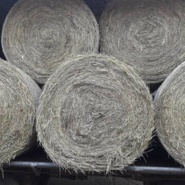
Bio-Heu Rundballen zu verkaufen
Biebertal
Lindenhoefe
@Lindenhoefe
Heu
Lieferant entlädt
Rundballen
Wird verladen
2 weitere...
B+
Deprecated: Creation of dynamic property Zend_View_Helper_Ads::$adLink is deprecated in /var/www/stall-frei/htdocs/staging.stall-frei.de/library/Psf/View/Helper/Ads.php on line 108


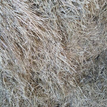
Heu HD Ballen
Carlsberg
Maike Käpernick
@ReitschuleKaepernick
Heu
Empfänger lädt ab
Kleinballen/HD-Ballen
Bio
Regenfrei
2 weitere...
B+

Heu Rundballen
Espenschied
Marvin Kloos
@Birkenhof_Espenschied
Heu
Rundballen
Bio
Regenfrei
Wird verladen
2 weitere...
B+

Bio Heu
Mehlbach
irena-zinssmeister
@irena-zinssmeister
Heu
Empfänger lädt ab
Großballen
Bio
Regenfrei
2 weitere...
B+

Offenstall/Paddockbox für Pony oder Kleinpferd
Glashütten
Tatjana Bommersheim
@TatjanaBommersheim
Wir haben ab dem 1.04.26 eine Platz in einem unsere Offenställe (Wallach oder Stute)und eine unserer Paddockboxen (Wallach oder S
neu
R

HD-Ballen Heu
Ginsweiler
Laura
@Heuverkauf_Ginsweiler
Heu
Kleinballen/HD-Ballen
Regenfrei
Wird verladen
2 weitere...
B+

Rundballen Stroh
Elze-Esbeck
Hof Bartels
@Bartels
Stroh
Lieferant entlädt
Rundballen
Regenfrei
3 weitere...
B+

Heu Rundballen zu verkaufen
Peine
Hof-Hoppenworth
@Hof-Hoppenworth
Heu
Empfänger lädt ab
Rundballen
Regenfrei
3 weitere...
B+
Newsletter abonnieren
Melde Dich für unseren Newsletter an und verpasse keine Neuigkeiten!
Deprecated: Creation of dynamic property Zend_View::$pageCount is deprecated in /var/www/stall-frei/htdocs/staging.stall-frei.de/library/vendor/shardj/zf1-future/library/Zend/View/Abstract.php on line 308
Deprecated: Creation of dynamic property Zend_View::$itemCountPerPage is deprecated in /var/www/stall-frei/htdocs/staging.stall-frei.de/library/vendor/shardj/zf1-future/library/Zend/View/Abstract.php on line 308
Deprecated: Creation of dynamic property Zend_View::$first is deprecated in /var/www/stall-frei/htdocs/staging.stall-frei.de/library/vendor/shardj/zf1-future/library/Zend/View/Abstract.php on line 308
Deprecated: Creation of dynamic property Zend_View::$current is deprecated in /var/www/stall-frei/htdocs/staging.stall-frei.de/library/vendor/shardj/zf1-future/library/Zend/View/Abstract.php on line 308
Deprecated: Creation of dynamic property Zend_View::$last is deprecated in /var/www/stall-frei/htdocs/staging.stall-frei.de/library/vendor/shardj/zf1-future/library/Zend/View/Abstract.php on line 308
Deprecated: Creation of dynamic property Zend_View::$previous is deprecated in /var/www/stall-frei/htdocs/staging.stall-frei.de/library/vendor/shardj/zf1-future/library/Zend/View/Abstract.php on line 308
Deprecated: Creation of dynamic property Zend_View::$next is deprecated in /var/www/stall-frei/htdocs/staging.stall-frei.de/library/vendor/shardj/zf1-future/library/Zend/View/Abstract.php on line 308
Deprecated: Creation of dynamic property Zend_View::$pagesInRange is deprecated in /var/www/stall-frei/htdocs/staging.stall-frei.de/library/vendor/shardj/zf1-future/library/Zend/View/Abstract.php on line 308
Deprecated: Creation of dynamic property Zend_View::$firstPageInRange is deprecated in /var/www/stall-frei/htdocs/staging.stall-frei.de/library/vendor/shardj/zf1-future/library/Zend/View/Abstract.php on line 308
Deprecated: Creation of dynamic property Zend_View::$lastPageInRange is deprecated in /var/www/stall-frei/htdocs/staging.stall-frei.de/library/vendor/shardj/zf1-future/library/Zend/View/Abstract.php on line 308
Deprecated: Creation of dynamic property Zend_View::$currentItemCount is deprecated in /var/www/stall-frei/htdocs/staging.stall-frei.de/library/vendor/shardj/zf1-future/library/Zend/View/Abstract.php on line 308
Deprecated: Creation of dynamic property Zend_View::$totalItemCount is deprecated in /var/www/stall-frei/htdocs/staging.stall-frei.de/library/vendor/shardj/zf1-future/library/Zend/View/Abstract.php on line 308
Deprecated: Creation of dynamic property Zend_View::$firstItemNumber is deprecated in /var/www/stall-frei/htdocs/staging.stall-frei.de/library/vendor/shardj/zf1-future/library/Zend/View/Abstract.php on line 308
Deprecated: Creation of dynamic property Zend_View::$lastItemNumber is deprecated in /var/www/stall-frei/htdocs/staging.stall-frei.de/library/vendor/shardj/zf1-future/library/Zend/View/Abstract.php on line 308
Deprecated: Creation of dynamic property Zend_View::$router is deprecated in /var/www/stall-frei/htdocs/staging.stall-frei.de/library/vendor/shardj/zf1-future/library/Zend/View/Abstract.php on line 308
Deprecated: Creation of dynamic property Zend_View::$urlParams is deprecated in /var/www/stall-frei/htdocs/staging.stall-frei.de/library/vendor/shardj/zf1-future/library/Zend/View/Abstract.php on line 308
Deprecated: Creation of dynamic property Zend_View::$showAds is deprecated in /var/www/stall-frei/htdocs/staging.stall-frei.de/library/vendor/shardj/zf1-future/library/Zend/View/Abstract.php on line 308
Deprecated: Creation of dynamic property Zend_View::$objectIds is deprecated in /var/www/stall-frei/htdocs/staging.stall-frei.de/library/vendor/shardj/zf1-future/library/Zend/View/Abstract.php on line 308
Deprecated: Creation of dynamic property Zend_View::$showNavbar is deprecated in /var/www/stall-frei/htdocs/staging.stall-frei.de/library/vendor/shardj/zf1-future/library/Zend/View/Abstract.php on line 308
Deprecated: Creation of dynamic property Zend_View::$showBreadcrumb is deprecated in /var/www/stall-frei/htdocs/staging.stall-frei.de/library/vendor/shardj/zf1-future/library/Zend/View/Abstract.php on line 308
Deprecated: Creation of dynamic property Zend_View::$showFooter is deprecated in /var/www/stall-frei/htdocs/staging.stall-frei.de/library/vendor/shardj/zf1-future/library/Zend/View/Abstract.php on line 308
Deprecated: Creation of dynamic property Zend_View::$showInternalAds is deprecated in /var/www/stall-frei/htdocs/staging.stall-frei.de/library/vendor/shardj/zf1-future/library/Zend/View/Abstract.php on line 308
Deprecated: Creation of dynamic property Zend_View::$blNoContent is deprecated in /var/www/stall-frei/htdocs/staging.stall-frei.de/library/vendor/shardj/zf1-future/library/Zend/View/Abstract.php on line 308
Deprecated: Creation of dynamic property Zend_View::$sMetaDesc is deprecated in /var/www/stall-frei/htdocs/staging.stall-frei.de/library/vendor/shardj/zf1-future/library/Zend/View/Abstract.php on line 308
Deprecated: Creation of dynamic property Zend_View::$useGmaps is deprecated in /var/www/stall-frei/htdocs/staging.stall-frei.de/library/vendor/shardj/zf1-future/library/Zend/View/Abstract.php on line 308
Deprecated: Creation of dynamic property Zend_View::$touches is deprecated in /var/www/stall-frei/htdocs/staging.stall-frei.de/library/vendor/shardj/zf1-future/library/Zend/View/Abstract.php on line 308
Deprecated: Creation of dynamic property Zend_View::$oProject is deprecated in /var/www/stall-frei/htdocs/staging.stall-frei.de/library/vendor/shardj/zf1-future/library/Zend/View/Abstract.php on line 308
Deprecated: Creation of dynamic property Zend_View::$pageHeadline is deprecated in /var/www/stall-frei/htdocs/staging.stall-frei.de/library/vendor/shardj/zf1-future/library/Zend/View/Abstract.php on line 308
Deprecated: Creation of dynamic property Zend_View::$disableLocationField is deprecated in /var/www/stall-frei/htdocs/staging.stall-frei.de/library/vendor/shardj/zf1-future/library/Zend/View/Abstract.php on line 308
Deprecated: Creation of dynamic property Zend_View::$isSearch is deprecated in /var/www/stall-frei/htdocs/staging.stall-frei.de/library/vendor/shardj/zf1-future/library/Zend/View/Abstract.php on line 308
Deprecated: Creation of dynamic property Zend_View::$pageTitle is deprecated in /var/www/stall-frei/htdocs/staging.stall-frei.de/library/vendor/shardj/zf1-future/library/Zend/View/Abstract.php on line 308
Deprecated: Creation of dynamic property Psf_Form_Element_Text::$class is deprecated in /var/www/stall-frei/htdocs/staging.stall-frei.de/library/vendor/shardj/zf1-future/library/Zend/Form/Element.php on line 874
Deprecated: Creation of dynamic property Psf_Form_Element_Text::$size is deprecated in /var/www/stall-frei/htdocs/staging.stall-frei.de/library/vendor/shardj/zf1-future/library/Zend/Form/Element.php on line 874
Deprecated: Creation of dynamic property Psf_Form_Element_Text::$placeholder is deprecated in /var/www/stall-frei/htdocs/staging.stall-frei.de/library/vendor/shardj/zf1-future/library/Zend/Form/Element.php on line 874
Deprecated: Creation of dynamic property Psf_Form_Element_Hidden::$class is deprecated in /var/www/stall-frei/htdocs/staging.stall-frei.de/library/vendor/shardj/zf1-future/library/Zend/Form/Element.php on line 874
Deprecated: Creation of dynamic property Psf_Form_Element_Hidden::$class is deprecated in /var/www/stall-frei/htdocs/staging.stall-frei.de/library/vendor/shardj/zf1-future/library/Zend/Form/Element.php on line 874
Deprecated: Creation of dynamic property Psf_Form_Element_Hidden::$class is deprecated in /var/www/stall-frei/htdocs/staging.stall-frei.de/library/vendor/shardj/zf1-future/library/Zend/Form/Element.php on line 874
Deprecated: Creation of dynamic property Psf_Form_Element_Hidden::$class is deprecated in /var/www/stall-frei/htdocs/staging.stall-frei.de/library/vendor/shardj/zf1-future/library/Zend/Form/Element.php on line 874
Deprecated: Creation of dynamic property Psf_Form_Element_Select::$class is deprecated in /var/www/stall-frei/htdocs/staging.stall-frei.de/library/vendor/shardj/zf1-future/library/Zend/Form/Element.php on line 874
Deprecated: Creation of dynamic property Psf_Form_Element_Select::$class is deprecated in /var/www/stall-frei/htdocs/staging.stall-frei.de/library/vendor/shardj/zf1-future/library/Zend/Form/Element.php on line 874
Deprecated: Creation of dynamic property Psf_Form_Element_Select::$class is deprecated in /var/www/stall-frei/htdocs/staging.stall-frei.de/library/vendor/shardj/zf1-future/library/Zend/Form/Element.php on line 874
Deprecated: Creation of dynamic property Psf_Form_Element_Select::$class is deprecated in /var/www/stall-frei/htdocs/staging.stall-frei.de/library/vendor/shardj/zf1-future/library/Zend/Form/Element.php on line 874
Deprecated: Creation of dynamic property Zend_View::$sort is deprecated in /var/www/stall-frei/htdocs/staging.stall-frei.de/library/vendor/shardj/zf1-future/library/Zend/View/Abstract.php on line 308
Deprecated: Creation of dynamic property Zend_View::$searchLocation is deprecated in /var/www/stall-frei/htdocs/staging.stall-frei.de/library/vendor/shardj/zf1-future/library/Zend/View/Abstract.php on line 308
Deprecated: Creation of dynamic property Zend_View::$locationHint is deprecated in /var/www/stall-frei/htdocs/staging.stall-frei.de/library/vendor/shardj/zf1-future/library/Zend/View/Abstract.php on line 308
Psf_GeoCoder_Abstract::getLocation: Kohlberg Get Location CachedOrLive
Psf_GeoCoder_Abstract::getCachedOrLive: Kohlberg
Psf_GeoCoder_Abstract::convertLocationResult
{"documentation":"https:\/\/opencagedata.com\/api","licenses":[{"name":"see attribution guide","url":"https:\/\/opencagedata.com\/credits"}],"results":[{"bounds":{"northeast":{"lat":49.6397571,"lng":12.0907484},"southwest":{"lat":49.5690079,"lng":11.9679225}},"components":{"ISO_3166-1_alpha-2":"DE","ISO_3166-1_alpha-3":"DEU","ISO_3166-2":["DE-BY"],"_category":"place","_normalized_city":"Kohlberg","_type":"village","continent":"Europe","country":"Deutschland","country_code":"de","county":"Landkreis Neustadt an der Waldnaab","municipality":"Weiherhammer (VGem)","political_union":"European Union","postcode":"92702","state":"Bayern","state_code":"BY","village":"Kohlberg"},"confidence":7,"formatted":"92702 Kohlberg, Deutschland","geometry":{"lat":49.592149,"lng":12.0212706}},{"bounds":{"northeast":{"lat":48.5718386,"lng":9.3516872},"southwest":{"lat":48.5503617,"lng":9.3111476}},"components":{"ISO_3166-1_alpha-2":"DE","ISO_3166-1_alpha-3":"DEU","ISO_3166-2":["DE-BW"],"_category":"place","_normalized_city":"Kohlberg","_type":"village","continent":"Europe","country":"Deutschland","country_code":"de","county":"Landkreis Esslingen","municipality":"VVG der Stadt Neuffen","political_union":"European Union","postcode":"72664","state":"Baden-W\u00fcrttemberg","state_code":"BW","village":"Kohlberg"},"confidence":7,"formatted":"72664 Kohlberg, Deutschland","geometry":{"lat":48.5575574,"lng":9.3338916}},{"bounds":{"northeast":{"lat":50.834919,"lng":7.662963},"southwest":{"lat":50.8017443,"lng":7.5973868}},"components":{"ISO_3166-1_alpha-2":"DE","ISO_3166-1_alpha-3":"DEU","ISO_3166-2":["DE-NW"],"_category":"place","_normalized_city":"Windeck","_type":"village","continent":"Europe","country":"Deutschland","country_code":"de","county":"Rhein-Sieg-Kreis","political_union":"European Union","state":"Nordrhein-Westfalen","state_code":"NW","town":"Windeck","village":"Kohlberg"},"confidence":7,"formatted":"Kohlberg, Nordrhein-Westfalen, Deutschland","geometry":{"lat":50.8237141,"lng":7.6559242}},{"bounds":{"northeast":{"lat":50.0422888,"lng":12.1871859},"southwest":{"lat":50.0421888,"lng":12.1870859}},"components":{"ISO_3166-1_alpha-2":"DE","ISO_3166-1_alpha-3":"DEU","ISO_3166-2":["DE-BY"],"_category":"natural\/water","_normalized_city":"Arzberg","_type":"peak","continent":"Europe","country":"Deutschland","country_code":"de","county":"Landkreis Wunsiedel im Fichtelgebirge","peak":"Kohlberg","political_union":"European Union","postcode":"95659","state":"Bayern","state_code":"BY","town":"Arzberg"},"confidence":9,"formatted":"Kohlberg, 95659 Arzberg, Deutschland","geometry":{"lat":50.0422388,"lng":12.1871359}},{"bounds":{"northeast":{"lat":51.2942861,"lng":7.7672313},"southwest":{"lat":51.2941861,"lng":7.7671313}},"components":{"ISO_3166-1_alpha-2":"DE","ISO_3166-1_alpha-3":"DEU","ISO_3166-2":["DE-NW"],"_category":"natural\/water","_normalized_city":"Neuenrade","_type":"peak","continent":"Europe","country":"Deutschland","country_code":"de","county":"M\u00e4rkischer Kreis","peak":"Kohlberg","political_union":"European Union","postcode":"58809","state":"Nordrhein-Westfalen","state_code":"NW","town":"Neuenrade"},"confidence":9,"formatted":"Kohlberg, 58809 Neuenrade, Deutschland","geometry":{"lat":51.2942361,"lng":7.7671813}},{"bounds":{"northeast":{"lat":50.7074663,"lng":10.5386615},"southwest":{"lat":50.7073663,"lng":10.5385615}},"components":{"ISO_3166-1_alpha-2":"DE","ISO_3166-1_alpha-3":"DEU","ISO_3166-2":["DE-TH"],"_category":"natural\/water","_normalized_city":"Steinbach-Hallenberg","_type":"peak","continent":"Europe","country":"Deutschland","country_code":"de","county":"Landkreis Schmalkalden-Meiningen","peak":"Kohlberg","political_union":"European Union","postcode":"98587","state":"Th\u00fcringen","state_code":"TH","town":"Steinbach-Hallenberg"},"confidence":9,"formatted":"Kohlberg, 98587 Steinbach-Hallenberg, Deutschland","geometry":{"lat":50.7074163,"lng":10.5386115}},{"bounds":{"northeast":{"lat":50.5298098,"lng":10.7383191},"southwest":{"lat":50.5297098,"lng":10.7382191}},"components":{"ISO_3166-1_alpha-2":"DE","ISO_3166-1_alpha-3":"DEU","ISO_3166-2":["DE-TH"],"_category":"natural\/water","_normalized_city":"Schleusingen","_type":"peak","continent":"Europe","country":"Deutschland","country_code":"de","county":"Landkreis Hildburghausen","municipality":"Schleusingen","peak":"Kohlberg","political_union":"European Union","postcode":"95883","state":"Th\u00fcringen","state_code":"TH"},"confidence":9,"formatted":"Kohlberg, 95883 Schleusingen, Deutschland","geometry":{"lat":50.5297598,"lng":10.7382691}},{"bounds":{"northeast":{"lat":49.2778019,"lng":11.2252707},"southwest":{"lat":49.2777019,"lng":11.2251707}},"components":{"ISO_3166-1_alpha-2":"DE","ISO_3166-1_alpha-3":"DEU","ISO_3166-2":["DE-BY"],"_category":"natural\/water","_normalized_city":"Pyrbaum","_type":"peak","continent":"Europe","country":"Deutschland","country_code":"de","county":"Landkreis Neumarkt in der Oberpfalz","peak":"Kohlberg","political_union":"European Union","postcode":"90584","state":"Bayern","state_code":"BY","village":"Pyrbaum"},"confidence":9,"formatted":"Kohlberg, 90584 Pyrbaum, Deutschland","geometry":{"lat":49.2777519,"lng":11.2252207}},{"bounds":{"northeast":{"lat":49.7263117,"lng":11.282494},"southwest":{"lat":49.7262117,"lng":11.282394}},"components":{"ISO_3166-1_alpha-2":"DE","ISO_3166-1_alpha-3":"DEU","ISO_3166-2":["DE-BY"],"_category":"natural\/water","_normalized_city":"Egloffstein","_type":"peak","continent":"Europe","country":"Deutschland","country_code":"de","county":"Landkreis Forchheim","peak":"Kohlberg","political_union":"European Union","postcode":"91349","state":"Bayern","state_code":"BY","village":"Egloffstein"},"confidence":9,"formatted":"Kohlberg, 91349 Egloffstein, Deutschland","geometry":{"lat":49.7262617,"lng":11.282444}},{"bounds":{"northeast":{"lat":51.1106789,"lng":8.0177443},"southwest":{"lat":51.1105789,"lng":8.0176443}},"components":{"ISO_3166-1_alpha-2":"DE","ISO_3166-1_alpha-3":"DEU","ISO_3166-2":["DE-NW"],"_category":"natural\/water","_normalized_city":"Lennestadt","_type":"peak","continent":"Europe","country":"Deutschland","country_code":"de","county":"Kreis Olpe","peak":"Kohlberg","political_union":"European Union","state":"Nordrhein-Westfalen","state_code":"NW","town":"Lennestadt"},"confidence":9,"formatted":"Kohlberg, Lennestadt, Nordrhein-Westfalen, Deutschland","geometry":{"lat":51.1106289,"lng":8.0176943}}],"status":{"code":200,"message":"OK"},"stay_informed":{"blog":"https:\/\/blog.opencagedata.com","mastodon":"https:\/\/en.osm.town\/@opencage"},"thanks":"For using an OpenCage API","timestamp":{"created_http":"Sun, 08 Feb 2026 20:26:16 GMT","created_unix":1770582376},"total_results":10}Array
(
[0] => stdClass Object
(
[bounds] => stdClass Object
(
[northeast] => stdClass Object
(
[lat] => 49.6397571
[lng] => 12.0907484
)
[southwest] => stdClass Object
(
[lat] => 49.5690079
[lng] => 11.9679225
)
)
[components] => stdClass Object
(
[ISO_3166-1_alpha-2] => DE
[ISO_3166-1_alpha-3] => DEU
[ISO_3166-2] => Array
(
[0] => DE-BY
)
[_category] => place
[_normalized_city] => Kohlberg
[_type] => village
[continent] => Europe
[country] => Deutschland
[country_code] => de
[county] => Landkreis Neustadt an der Waldnaab
[municipality] => Weiherhammer (VGem)
[political_union] => European Union
[postcode] => 92702
[state] => Bayern
[state_code] => BY
[village] => Kohlberg
)
[confidence] => 7
[formatted] => 92702 Kohlberg, Deutschland
[geometry] => stdClass Object
(
[lat] => 49.592149
[lng] => 12.0212706
)
)
[1] => stdClass Object
(
[bounds] => stdClass Object
(
[northeast] => stdClass Object
(
[lat] => 48.5718386
[lng] => 9.3516872
)
[southwest] => stdClass Object
(
[lat] => 48.5503617
[lng] => 9.3111476
)
)
[components] => stdClass Object
(
[ISO_3166-1_alpha-2] => DE
[ISO_3166-1_alpha-3] => DEU
[ISO_3166-2] => Array
(
[0] => DE-BW
)
[_category] => place
[_normalized_city] => Kohlberg
[_type] => village
[continent] => Europe
[country] => Deutschland
[country_code] => de
[county] => Landkreis Esslingen
[municipality] => VVG der Stadt Neuffen
[political_union] => European Union
[postcode] => 72664
[state] => Baden-Württemberg
[state_code] => BW
[village] => Kohlberg
)
[confidence] => 7
[formatted] => 72664 Kohlberg, Deutschland
[geometry] => stdClass Object
(
[lat] => 48.5575574
[lng] => 9.3338916
)
)
[2] => stdClass Object
(
[bounds] => stdClass Object
(
[northeast] => stdClass Object
(
[lat] => 50.834919
[lng] => 7.662963
)
[southwest] => stdClass Object
(
[lat] => 50.8017443
[lng] => 7.5973868
)
)
[components] => stdClass Object
(
[ISO_3166-1_alpha-2] => DE
[ISO_3166-1_alpha-3] => DEU
[ISO_3166-2] => Array
(
[0] => DE-NW
)
[_category] => place
[_normalized_city] => Windeck
[_type] => village
[continent] => Europe
[country] => Deutschland
[country_code] => de
[county] => Rhein-Sieg-Kreis
[political_union] => European Union
[state] => Nordrhein-Westfalen
[state_code] => NW
[town] => Windeck
[village] => Kohlberg
)
[confidence] => 7
[formatted] => Kohlberg, Nordrhein-Westfalen, Deutschland
[geometry] => stdClass Object
(
[lat] => 50.8237141
[lng] => 7.6559242
)
)
[3] => stdClass Object
(
[bounds] => stdClass Object
(
[northeast] => stdClass Object
(
[lat] => 50.0422888
[lng] => 12.1871859
)
[southwest] => stdClass Object
(
[lat] => 50.0421888
[lng] => 12.1870859
)
)
[components] => stdClass Object
(
[ISO_3166-1_alpha-2] => DE
[ISO_3166-1_alpha-3] => DEU
[ISO_3166-2] => Array
(
[0] => DE-BY
)
[_category] => natural/water
[_normalized_city] => Arzberg
[_type] => peak
[continent] => Europe
[country] => Deutschland
[country_code] => de
[county] => Landkreis Wunsiedel im Fichtelgebirge
[peak] => Kohlberg
[political_union] => European Union
[postcode] => 95659
[state] => Bayern
[state_code] => BY
[town] => Arzberg
)
[confidence] => 9
[formatted] => Kohlberg, 95659 Arzberg, Deutschland
[geometry] => stdClass Object
(
[lat] => 50.0422388
[lng] => 12.1871359
)
)
[4] => stdClass Object
(
[bounds] => stdClass Object
(
[northeast] => stdClass Object
(
[lat] => 51.2942861
[lng] => 7.7672313
)
[southwest] => stdClass Object
(
[lat] => 51.2941861
[lng] => 7.7671313
)
)
[components] => stdClass Object
(
[ISO_3166-1_alpha-2] => DE
[ISO_3166-1_alpha-3] => DEU
[ISO_3166-2] => Array
(
[0] => DE-NW
)
[_category] => natural/water
[_normalized_city] => Neuenrade
[_type] => peak
[continent] => Europe
[country] => Deutschland
[country_code] => de
[county] => Märkischer Kreis
[peak] => Kohlberg
[political_union] => European Union
[postcode] => 58809
[state] => Nordrhein-Westfalen
[state_code] => NW
[town] => Neuenrade
)
[confidence] => 9
[formatted] => Kohlberg, 58809 Neuenrade, Deutschland
[geometry] => stdClass Object
(
[lat] => 51.2942361
[lng] => 7.7671813
)
)
[5] => stdClass Object
(
[bounds] => stdClass Object
(
[northeast] => stdClass Object
(
[lat] => 50.7074663
[lng] => 10.5386615
)
[southwest] => stdClass Object
(
[lat] => 50.7073663
[lng] => 10.5385615
)
)
[components] => stdClass Object
(
[ISO_3166-1_alpha-2] => DE
[ISO_3166-1_alpha-3] => DEU
[ISO_3166-2] => Array
(
[0] => DE-TH
)
[_category] => natural/water
[_normalized_city] => Steinbach-Hallenberg
[_type] => peak
[continent] => Europe
[country] => Deutschland
[country_code] => de
[county] => Landkreis Schmalkalden-Meiningen
[peak] => Kohlberg
[political_union] => European Union
[postcode] => 98587
[state] => Thüringen
[state_code] => TH
[town] => Steinbach-Hallenberg
)
[confidence] => 9
[formatted] => Kohlberg, 98587 Steinbach-Hallenberg, Deutschland
[geometry] => stdClass Object
(
[lat] => 50.7074163
[lng] => 10.5386115
)
)
[6] => stdClass Object
(
[bounds] => stdClass Object
(
[northeast] => stdClass Object
(
[lat] => 50.5298098
[lng] => 10.7383191
)
[southwest] => stdClass Object
(
[lat] => 50.5297098
[lng] => 10.7382191
)
)
[components] => stdClass Object
(
[ISO_3166-1_alpha-2] => DE
[ISO_3166-1_alpha-3] => DEU
[ISO_3166-2] => Array
(
[0] => DE-TH
)
[_category] => natural/water
[_normalized_city] => Schleusingen
[_type] => peak
[continent] => Europe
[country] => Deutschland
[country_code] => de
[county] => Landkreis Hildburghausen
[municipality] => Schleusingen
[peak] => Kohlberg
[political_union] => European Union
[postcode] => 95883
[state] => Thüringen
[state_code] => TH
)
[confidence] => 9
[formatted] => Kohlberg, 95883 Schleusingen, Deutschland
[geometry] => stdClass Object
(
[lat] => 50.5297598
[lng] => 10.7382691
)
)
[7] => stdClass Object
(
[bounds] => stdClass Object
(
[northeast] => stdClass Object
(
[lat] => 49.2778019
[lng] => 11.2252707
)
[southwest] => stdClass Object
(
[lat] => 49.2777019
[lng] => 11.2251707
)
)
[components] => stdClass Object
(
[ISO_3166-1_alpha-2] => DE
[ISO_3166-1_alpha-3] => DEU
[ISO_3166-2] => Array
(
[0] => DE-BY
)
[_category] => natural/water
[_normalized_city] => Pyrbaum
[_type] => peak
[continent] => Europe
[country] => Deutschland
[country_code] => de
[county] => Landkreis Neumarkt in der Oberpfalz
[peak] => Kohlberg
[political_union] => European Union
[postcode] => 90584
[state] => Bayern
[state_code] => BY
[village] => Pyrbaum
)
[confidence] => 9
[formatted] => Kohlberg, 90584 Pyrbaum, Deutschland
[geometry] => stdClass Object
(
[lat] => 49.2777519
[lng] => 11.2252207
)
)
[8] => stdClass Object
(
[bounds] => stdClass Object
(
[northeast] => stdClass Object
(
[lat] => 49.7263117
[lng] => 11.282494
)
[southwest] => stdClass Object
(
[lat] => 49.7262117
[lng] => 11.282394
)
)
[components] => stdClass Object
(
[ISO_3166-1_alpha-2] => DE
[ISO_3166-1_alpha-3] => DEU
[ISO_3166-2] => Array
(
[0] => DE-BY
)
[_category] => natural/water
[_normalized_city] => Egloffstein
[_type] => peak
[continent] => Europe
[country] => Deutschland
[country_code] => de
[county] => Landkreis Forchheim
[peak] => Kohlberg
[political_union] => European Union
[postcode] => 91349
[state] => Bayern
[state_code] => BY
[village] => Egloffstein
)
[confidence] => 9
[formatted] => Kohlberg, 91349 Egloffstein, Deutschland
[geometry] => stdClass Object
(
[lat] => 49.7262617
[lng] => 11.282444
)
)
[9] => stdClass Object
(
[bounds] => stdClass Object
(
[northeast] => stdClass Object
(
[lat] => 51.1106789
[lng] => 8.0177443
)
[southwest] => stdClass Object
(
[lat] => 51.1105789
[lng] => 8.0176443
)
)
[components] => stdClass Object
(
[ISO_3166-1_alpha-2] => DE
[ISO_3166-1_alpha-3] => DEU
[ISO_3166-2] => Array
(
[0] => DE-NW
)
[_category] => natural/water
[_normalized_city] => Lennestadt
[_type] => peak
[continent] => Europe
[country] => Deutschland
[country_code] => de
[county] => Kreis Olpe
[peak] => Kohlberg
[political_union] => European Union
[state] => Nordrhein-Westfalen
[state_code] => NW
[town] => Lennestadt
)
[confidence] => 9
[formatted] => Kohlberg, Lennestadt, Nordrhein-Westfalen, Deutschland
[geometry] => stdClass Object
(
[lat] => 51.1106289
[lng] => 8.0176943
)
)
)
Psf_GeoCoder_OpenCageData::getKeyMap: 0
stdClass Object
(
    [bounds] => stdClass Object
        (
            [northeast] => stdClass Object
                (
                    [lat] => 49.6397571
                    [lng] => 12.0907484
                )

            [southwest] => stdClass Object
                (
                    [lat] => 49.5690079
                    [lng] => 11.9679225
                )

        )

    [components] => stdClass Object
        (
            [ISO_3166-1_alpha-2] => DE
            [ISO_3166-1_alpha-3] => DEU
            [ISO_3166-2] => Array
                (
                    [0] => DE-BY
                )

            [_category] => place
            [_normalized_city] => Kohlberg
            [_type] => village
            [continent] => Europe
            [country] => Deutschland
            [country_code] => de
            [county] => Landkreis Neustadt an der Waldnaab
            [municipality] => Weiherhammer (VGem)
            [political_union] => European Union
            [postcode] => 92702
            [state] => Bayern
            [state_code] => BY
            [village] => Kohlberg
        )

    [confidence] => 7
    [formatted] => 92702 Kohlberg, Deutschland
    [geometry] => stdClass Object
        (
            [lat] => 49.592149
            [lng] => 12.0212706
        )

)
Psf_GeoCoder_OpenCageData::getCounty: Neustadt an der Waldnaab
Psf_GeoCoder_OpenCageData::addMissingData REFETCH!
Array
(
    [address] => 92702 Kohlberg, Deutschland
    [type] => village
    [street] =>
    [city] => Kohlberg
    [county] => Neustadt an der Waldnaab
    [state] => Bayern
    [zip] => 92702
    [country] => Deutschland
    [suburb] =>
    [countrycode] => de
    [latitude] => 49.592149
    [longitude] => 12.0212706
    [accuracy] => 1
    [confidence] => 7
    [bounds] => stdClass Object
        (
            [northeast] => stdClass Object
                (
                    [lat] => 49.6397571
                    [lng] => 12.0907484
                )

            [southwest] => stdClass Object
                (
                    [lat] => 49.5690079
                    [lng] => 11.9679225
                )

        )

)
reformat!
Array
(
    [address] => 92702 Kohlberg, Deutschland
    [type] => village
    [street] =>
    [city] => Kohlberg
    [county] => Neustadt an der Waldnaab
    [state] => Bayern
    [zip] => 92702
    [country] => Deutschland
    [suburb] =>
    [countrycode] => de
    [latitude] => 49.592149
    [longitude] => 12.0212706
    [accuracy] => 1
    [confidence] => 7
    [bounds] => stdClass Object
        (
            [northeast] => stdClass Object
                (
                    [lat] => 49.6397571
                    [lng] => 12.0907484
                )

            [southwest] => stdClass Object
                (
                    [lat] => 49.5690079
                    [lng] => 11.9679225
                )

        )

    [place] => 92702 Kohlberg, Bayern
    [hash] => 7ef6a2c11f20c8af18176e08882830f8
)
Psf_GeoCoder_OpenCageData::getKeyMap: 1
stdClass Object
(
    [bounds] => stdClass Object
        (
            [northeast] => stdClass Object
                (
                    [lat] => 48.5718386
                    [lng] => 9.3516872
                )

            [southwest] => stdClass Object
                (
                    [lat] => 48.5503617
                    [lng] => 9.3111476
                )

        )

    [components] => stdClass Object
        (
            [ISO_3166-1_alpha-2] => DE
            [ISO_3166-1_alpha-3] => DEU
            [ISO_3166-2] => Array
                (
                    [0] => DE-BW
                )

            [_category] => place
            [_normalized_city] => Kohlberg
            [_type] => village
            [continent] => Europe
            [country] => Deutschland
            [country_code] => de
            [county] => Landkreis Esslingen
            [municipality] => VVG der Stadt Neuffen
            [political_union] => European Union
            [postcode] => 72664
            [state] => Baden-Württemberg
            [state_code] => BW
            [village] => Kohlberg
        )

    [confidence] => 7
    [formatted] => 72664 Kohlberg, Deutschland
    [geometry] => stdClass Object
        (
            [lat] => 48.5575574
            [lng] => 9.3338916
        )

)
Psf_GeoCoder_OpenCageData::getCounty: Esslingen
Psf_GeoCoder_OpenCageData::addMissingData REFETCH!
Array
(
    [address] => 72664 Kohlberg, Deutschland
    [type] => village
    [street] =>
    [city] => Kohlberg
    [county] => Esslingen
    [state] => Baden-Württemberg
    [zip] => 72664
    [country] => Deutschland
    [suburb] =>
    [countrycode] => de
    [latitude] => 48.5575574
    [longitude] => 9.3338916
    [accuracy] => 1
    [confidence] => 7
    [bounds] => stdClass Object
        (
            [northeast] => stdClass Object
                (
                    [lat] => 48.5718386
                    [lng] => 9.3516872
                )

            [southwest] => stdClass Object
                (
                    [lat] => 48.5503617
                    [lng] => 9.3111476
                )

        )

)
reformat!
Array
(
    [address] => 72664 Kohlberg, Deutschland
    [type] => village
    [street] =>
    [city] => Kohlberg
    [county] => Esslingen
    [state] => Baden-Württemberg
    [zip] => 72664
    [country] => Deutschland
    [suburb] =>
    [countrycode] => de
    [latitude] => 48.5575574
    [longitude] => 9.3338916
    [accuracy] => 1
    [confidence] => 7
    [bounds] => stdClass Object
        (
            [northeast] => stdClass Object
                (
                    [lat] => 48.5718386
                    [lng] => 9.3516872
                )

            [southwest] => stdClass Object
                (
                    [lat] => 48.5503617
                    [lng] => 9.3111476
                )

        )

    [place] => 72664 Kohlberg, Baden-Württemberg
    [hash] => 675de1ad67350722868677e758c9d3c8
)
Psf_GeoCoder_OpenCageData::getKeyMap: 2
stdClass Object
(
    [bounds] => stdClass Object
        (
            [northeast] => stdClass Object
                (
                    [lat] => 50.834919
                    [lng] => 7.662963
                )

            [southwest] => stdClass Object
                (
                    [lat] => 50.8017443
                    [lng] => 7.5973868
                )

        )

    [components] => stdClass Object
        (
            [ISO_3166-1_alpha-2] => DE
            [ISO_3166-1_alpha-3] => DEU
            [ISO_3166-2] => Array
                (
                    [0] => DE-NW
                )

            [_category] => place
            [_normalized_city] => Windeck
            [_type] => village
            [continent] => Europe
            [country] => Deutschland
            [country_code] => de
            [county] => Rhein-Sieg-Kreis
            [political_union] => European Union
            [state] => Nordrhein-Westfalen
            [state_code] => NW
            [town] => Windeck
            [village] => Kohlberg
        )

    [confidence] => 7
    [formatted] => Kohlberg, Nordrhein-Westfalen, Deutschland
    [geometry] => stdClass Object
        (
            [lat] => 50.8237141
            [lng] => 7.6559242
        )

)
Psf_GeoCoder_OpenCageData::getCounty: Rhein-Sieg-Kreis
Psf_GeoCoder_OpenCageData::addMissingData REFETCH!
Array
(
    [address] => Kohlberg, Nordrhein-Westfalen, Deutschland
    [type] => village
    [street] =>
    [city] => Windeck
    [county] => Rhein-Sieg-Kreis
    [state] => Nordrhein-Westfalen
    [zip] =>
    [country] => Deutschland
    [suburb] =>
    [countrycode] => de
    [latitude] => 50.8237141
    [longitude] => 7.6559242
    [accuracy] => 1
    [confidence] => 7
    [bounds] => stdClass Object
        (
            [northeast] => stdClass Object
                (
                    [lat] => 50.834919
                    [lng] => 7.662963
                )

            [southwest] => stdClass Object
                (
                    [lat] => 50.8017443
                    [lng] => 7.5973868
                )

        )

)
reformat!
Array
(
    [address] => Windeck
    [type] => village
    [street] =>
    [city] => Windeck
    [county] => Rhein-Sieg-Kreis
    [state] => Nordrhein-Westfalen
    [zip] =>
    [country] => Deutschland
    [suburb] =>
    [countrycode] => de
    [latitude] => 50.8237141
    [longitude] => 7.6559242
    [accuracy] => 1
    [confidence] => 7
    [bounds] => stdClass Object
        (
            [northeast] => stdClass Object
                (
                    [lat] => 50.834919
                    [lng] => 7.662963
                )

            [southwest] => stdClass Object
                (
                    [lat] => 50.8017443
                    [lng] => 7.5973868
                )

        )

    [place] => Windeck, Nordrhein-Westfalen
    [hash] => 565adc7206536452b80168b72bc03803
)
Psf_GeoCoder_OpenCageData::getKeyMap: 3
stdClass Object
(
    [bounds] => stdClass Object
        (
            [northeast] => stdClass Object
                (
                    [lat] => 50.0422888
                    [lng] => 12.1871859
                )

            [southwest] => stdClass Object
                (
                    [lat] => 50.0421888
                    [lng] => 12.1870859
                )

        )

    [components] => stdClass Object
        (
            [ISO_3166-1_alpha-2] => DE
            [ISO_3166-1_alpha-3] => DEU
            [ISO_3166-2] => Array
                (
                    [0] => DE-BY
                )

            [_category] => natural/water
            [_normalized_city] => Arzberg
            [_type] => peak
            [continent] => Europe
            [country] => Deutschland
            [country_code] => de
            [county] => Landkreis Wunsiedel im Fichtelgebirge
            [peak] => Kohlberg
            [political_union] => European Union
            [postcode] => 95659
            [state] => Bayern
            [state_code] => BY
            [town] => Arzberg
        )

    [confidence] => 9
    [formatted] => Kohlberg, 95659 Arzberg, Deutschland
    [geometry] => stdClass Object
        (
            [lat] => 50.0422388
            [lng] => 12.1871359
        )

)
Psf_GeoCoder_OpenCageData::getCounty: Wunsiedel im Fichtelgebirge
Psf_GeoCoder_OpenCageData::addMissingData REFETCH!
Array
(
    [address] => Kohlberg, 95659 Arzberg, Deutschland
    [type] => peak
    [street] =>
    [city] => Arzberg
    [county] => Wunsiedel im Fichtelgebirge
    [state] => Bayern
    [zip] => 95659
    [country] => Deutschland
    [suburb] =>
    [countrycode] => de
    [latitude] => 50.0422388
    [longitude] => 12.1871359
    [accuracy] => 1
    [confidence] => 9
    [bounds] => stdClass Object
        (
            [northeast] => stdClass Object
                (
                    [lat] => 50.0422888
                    [lng] => 12.1871859
                )

            [southwest] => stdClass Object
                (
                    [lat] => 50.0421888
                    [lng] => 12.1870859
                )

        )

)
reformat!
Array
(
    [address] => Kohlberg, 95659 Arzberg, Deutschland
    [type] => peak
    [street] =>
    [city] => Arzberg
    [county] => Wunsiedel im Fichtelgebirge
    [state] => Bayern
    [zip] => 95659
    [country] => Deutschland
    [suburb] =>
    [countrycode] => de
    [latitude] => 50.0422388
    [longitude] => 12.1871359
    [accuracy] => 1
    [confidence] => 9
    [bounds] => stdClass Object
        (
            [northeast] => stdClass Object
                (
                    [lat] => 50.0422888
                    [lng] => 12.1871859
                )

            [southwest] => stdClass Object
                (
                    [lat] => 50.0421888
                    [lng] => 12.1870859
                )

        )

    [place] => 95659 Arzberg, Bayern
    [hash] => 07d8833b034d75cb8e14503a87b54012
)
Psf_GeoCoder_OpenCageData::getKeyMap: 4
stdClass Object
(
    [bounds] => stdClass Object
        (
            [northeast] => stdClass Object
                (
                    [lat] => 51.2942861
                    [lng] => 7.7672313
                )

            [southwest] => stdClass Object
                (
                    [lat] => 51.2941861
                    [lng] => 7.7671313
                )

        )

    [components] => stdClass Object
        (
            [ISO_3166-1_alpha-2] => DE
            [ISO_3166-1_alpha-3] => DEU
            [ISO_3166-2] => Array
                (
                    [0] => DE-NW
                )

            [_category] => natural/water
            [_normalized_city] => Neuenrade
            [_type] => peak
            [continent] => Europe
            [country] => Deutschland
            [country_code] => de
            [county] => Märkischer Kreis
            [peak] => Kohlberg
            [political_union] => European Union
            [postcode] => 58809
            [state] => Nordrhein-Westfalen
            [state_code] => NW
            [town] => Neuenrade
        )

    [confidence] => 9
    [formatted] => Kohlberg, 58809 Neuenrade, Deutschland
    [geometry] => stdClass Object
        (
            [lat] => 51.2942361
            [lng] => 7.7671813
        )

)
Psf_GeoCoder_OpenCageData::getCounty: Märkischer Kreis
Psf_GeoCoder_OpenCageData::addMissingData REFETCH!
Array
(
    [address] => Kohlberg, 58809 Neuenrade, Deutschland
    [type] => peak
    [street] =>
    [city] => Neuenrade
    [county] => Märkischer Kreis
    [state] => Nordrhein-Westfalen
    [zip] => 58809
    [country] => Deutschland
    [suburb] =>
    [countrycode] => de
    [latitude] => 51.2942361
    [longitude] => 7.7671813
    [accuracy] => 1
    [confidence] => 9
    [bounds] => stdClass Object
        (
            [northeast] => stdClass Object
                (
                    [lat] => 51.2942861
                    [lng] => 7.7672313
                )

            [southwest] => stdClass Object
                (
                    [lat] => 51.2941861
                    [lng] => 7.7671313
                )

        )

)
reformat!
Array
(
    [address] => Kohlberg, 58809 Neuenrade, Deutschland
    [type] => peak
    [street] =>
    [city] => Neuenrade
    [county] => Märkischer Kreis
    [state] => Nordrhein-Westfalen
    [zip] => 58809
    [country] => Deutschland
    [suburb] =>
    [countrycode] => de
    [latitude] => 51.2942361
    [longitude] => 7.7671813
    [accuracy] => 1
    [confidence] => 9
    [bounds] => stdClass Object
        (
            [northeast] => stdClass Object
                (
                    [lat] => 51.2942861
                    [lng] => 7.7672313
                )

            [southwest] => stdClass Object
                (
                    [lat] => 51.2941861
                    [lng] => 7.7671313
                )

        )

    [place] => 58809 Neuenrade, Nordrhein-Westfalen
    [hash] => 119c0bc3446fe7167c60cfa4e384ae28
)
Psf_GeoCoder_OpenCageData::getKeyMap: 5
stdClass Object
(
    [bounds] => stdClass Object
        (
            [northeast] => stdClass Object
                (
                    [lat] => 50.7074663
                    [lng] => 10.5386615
                )

            [southwest] => stdClass Object
                (
                    [lat] => 50.7073663
                    [lng] => 10.5385615
                )

        )

    [components] => stdClass Object
        (
            [ISO_3166-1_alpha-2] => DE
            [ISO_3166-1_alpha-3] => DEU
            [ISO_3166-2] => Array
                (
                    [0] => DE-TH
                )

            [_category] => natural/water
            [_normalized_city] => Steinbach-Hallenberg
            [_type] => peak
            [continent] => Europe
            [country] => Deutschland
            [country_code] => de
            [county] => Landkreis Schmalkalden-Meiningen
            [peak] => Kohlberg
            [political_union] => European Union
            [postcode] => 98587
            [state] => Thüringen
            [state_code] => TH
            [town] => Steinbach-Hallenberg
        )

    [confidence] => 9
    [formatted] => Kohlberg, 98587 Steinbach-Hallenberg, Deutschland
    [geometry] => stdClass Object
        (
            [lat] => 50.7074163
            [lng] => 10.5386115
        )

)
Psf_GeoCoder_OpenCageData::getCounty: Schmalkalden-Meiningen
Psf_GeoCoder_OpenCageData::addMissingData REFETCH!
Array
(
    [address] => Kohlberg, 98587 Steinbach-Hallenberg, Deutschland
    [type] => peak
    [street] =>
    [city] => Steinbach-Hallenberg
    [county] => Schmalkalden-Meiningen
    [state] => Thüringen
    [zip] => 98587
    [country] => Deutschland
    [suburb] =>
    [countrycode] => de
    [latitude] => 50.7074163
    [longitude] => 10.5386115
    [accuracy] => 1
    [confidence] => 9
    [bounds] => stdClass Object
        (
            [northeast] => stdClass Object
                (
                    [lat] => 50.7074663
                    [lng] => 10.5386615
                )

            [southwest] => stdClass Object
                (
                    [lat] => 50.7073663
                    [lng] => 10.5385615
                )

        )

)
reformat!
Array
(
    [address] => Kohlberg, 98587 Steinbach-Hallenberg, Deutschland
    [type] => peak
    [street] =>
    [city] => Steinbach-Hallenberg
    [county] => Schmalkalden-Meiningen
    [state] => Thüringen
    [zip] => 98587
    [country] => Deutschland
    [suburb] =>
    [countrycode] => de
    [latitude] => 50.7074163
    [longitude] => 10.5386115
    [accuracy] => 1
    [confidence] => 9
    [bounds] => stdClass Object
        (
            [northeast] => stdClass Object
                (
                    [lat] => 50.7074663
                    [lng] => 10.5386615
                )

            [southwest] => stdClass Object
                (
                    [lat] => 50.7073663
                    [lng] => 10.5385615
                )

        )

    [place] => 98587 Steinbach-Hallenberg, Thüringen
    [hash] => 9f64880af9435ed080ca9f850a336f60
)
Psf_GeoCoder_OpenCageData::getKeyMap: 6
stdClass Object
(
    [bounds] => stdClass Object
        (
            [northeast] => stdClass Object
                (
                    [lat] => 50.5298098
                    [lng] => 10.7383191
                )

            [southwest] => stdClass Object
                (
                    [lat] => 50.5297098
                    [lng] => 10.7382191
                )

        )

    [components] => stdClass Object
        (
            [ISO_3166-1_alpha-2] => DE
            [ISO_3166-1_alpha-3] => DEU
            [ISO_3166-2] => Array
                (
                    [0] => DE-TH
                )

            [_category] => natural/water
            [_normalized_city] => Schleusingen
            [_type] => peak
            [continent] => Europe
            [country] => Deutschland
            [country_code] => de
            [county] => Landkreis Hildburghausen
            [municipality] => Schleusingen
            [peak] => Kohlberg
            [political_union] => European Union
            [postcode] => 95883
            [state] => Thüringen
            [state_code] => TH
        )

    [confidence] => 9
    [formatted] => Kohlberg, 95883 Schleusingen, Deutschland
    [geometry] => stdClass Object
        (
            [lat] => 50.5297598
            [lng] => 10.7382691
        )

)
Psf_GeoCoder_OpenCageData::getCounty: Hildburghausen
Psf_GeoCoder_OpenCageData::addMissingData REFETCH!
Array
(
    [address] => Kohlberg, 95883 Schleusingen, Deutschland
    [type] => peak
    [street] =>
    [city] =>
    [county] => Hildburghausen
    [state] => Thüringen
    [zip] => 95883
    [country] => Deutschland
    [suburb] =>
    [countrycode] => de
    [latitude] => 50.5297598
    [longitude] => 10.7382691
    [accuracy] => 1
    [confidence] => 9
    [bounds] => stdClass Object
        (
            [northeast] => stdClass Object
                (
                    [lat] => 50.5298098
                    [lng] => 10.7383191
                )

            [southwest] => stdClass Object
                (
                    [lat] => 50.5297098
                    [lng] => 10.7382191
                )

        )

)
reformat!
Array
(
    [address] => Kohlberg, 95883 Schleusingen, Deutschland
    [type] => peak
    [street] =>
    [city] =>
    [county] => Hildburghausen
    [state] => Thüringen
    [zip] => 95883
    [country] => Deutschland
    [suburb] =>
    [countrycode] => de
    [latitude] => 50.5297598
    [longitude] => 10.7382691
    [accuracy] => 1
    [confidence] => 9
    [bounds] => stdClass Object
        (
            [northeast] => stdClass Object
                (
                    [lat] => 50.5298098
                    [lng] => 10.7383191
                )

            [southwest] => stdClass Object
                (
                    [lat] => 50.5297098
                    [lng] => 10.7382191
                )

        )

    [place] => 95883 , Thüringen
    [hash] => 4eb8ec127626e9edd85e0608e900f9f1
)
Psf_GeoCoder_OpenCageData::getKeyMap: 7
stdClass Object
(
    [bounds] => stdClass Object
        (
            [northeast] => stdClass Object
                (
                    [lat] => 49.2778019
                    [lng] => 11.2252707
                )

            [southwest] => stdClass Object
                (
                    [lat] => 49.2777019
                    [lng] => 11.2251707
                )

        )

    [components] => stdClass Object
        (
            [ISO_3166-1_alpha-2] => DE
            [ISO_3166-1_alpha-3] => DEU
            [ISO_3166-2] => Array
                (
                    [0] => DE-BY
                )

            [_category] => natural/water
            [_normalized_city] => Pyrbaum
            [_type] => peak
            [continent] => Europe
            [country] => Deutschland
            [country_code] => de
            [county] => Landkreis Neumarkt in der Oberpfalz
            [peak] => Kohlberg
            [political_union] => European Union
            [postcode] => 90584
            [state] => Bayern
            [state_code] => BY
            [village] => Pyrbaum
        )

    [confidence] => 9
    [formatted] => Kohlberg, 90584 Pyrbaum, Deutschland
    [geometry] => stdClass Object
        (
            [lat] => 49.2777519
            [lng] => 11.2252207
        )

)
Psf_GeoCoder_OpenCageData::getCounty: Neumarkt in der Oberpfalz
Psf_GeoCoder_OpenCageData::addMissingData REFETCH!
Array
(
    [address] => Kohlberg, 90584 Pyrbaum, Deutschland
    [type] => peak
    [street] =>
    [city] => Pyrbaum
    [county] => Neumarkt in der Oberpfalz
    [state] => Bayern
    [zip] => 90584
    [country] => Deutschland
    [suburb] =>
    [countrycode] => de
    [latitude] => 49.2777519
    [longitude] => 11.2252207
    [accuracy] => 1
    [confidence] => 9
    [bounds] => stdClass Object
        (
            [northeast] => stdClass Object
                (
                    [lat] => 49.2778019
                    [lng] => 11.2252707
                )

            [southwest] => stdClass Object
                (
                    [lat] => 49.2777019
                    [lng] => 11.2251707
                )

        )

)
reformat!
Array
(
    [address] => Kohlberg, 90584 Pyrbaum, Deutschland
    [type] => peak
    [street] =>
    [city] => Pyrbaum
    [county] => Neumarkt in der Oberpfalz
    [state] => Bayern
    [zip] => 90584
    [country] => Deutschland
    [suburb] =>
    [countrycode] => de
    [latitude] => 49.2777519
    [longitude] => 11.2252207
    [accuracy] => 1
    [confidence] => 9
    [bounds] => stdClass Object
        (
            [northeast] => stdClass Object
                (
                    [lat] => 49.2778019
                    [lng] => 11.2252707
                )

            [southwest] => stdClass Object
                (
                    [lat] => 49.2777019
                    [lng] => 11.2251707
                )

        )

    [place] => 90584 Pyrbaum, Bayern
    [hash] => 697c8ba7b317b91d7f5a66017c0af012
)
Psf_GeoCoder_OpenCageData::getKeyMap: 8
stdClass Object
(
    [bounds] => stdClass Object
        (
            [northeast] => stdClass Object
                (
                    [lat] => 49.7263117
                    [lng] => 11.282494
                )

            [southwest] => stdClass Object
                (
                    [lat] => 49.7262117
                    [lng] => 11.282394
                )

        )

    [components] => stdClass Object
        (
            [ISO_3166-1_alpha-2] => DE
            [ISO_3166-1_alpha-3] => DEU
            [ISO_3166-2] => Array
                (
                    [0] => DE-BY
                )

            [_category] => natural/water
            [_normalized_city] => Egloffstein
            [_type] => peak
            [continent] => Europe
            [country] => Deutschland
            [country_code] => de
            [county] => Landkreis Forchheim
            [peak] => Kohlberg
            [political_union] => European Union
            [postcode] => 91349
            [state] => Bayern
            [state_code] => BY
            [village] => Egloffstein
        )

    [confidence] => 9
    [formatted] => Kohlberg, 91349 Egloffstein, Deutschland
    [geometry] => stdClass Object
        (
            [lat] => 49.7262617
            [lng] => 11.282444
        )

)
Psf_GeoCoder_OpenCageData::getCounty: Forchheim
Psf_GeoCoder_OpenCageData::addMissingData REFETCH!
Array
(
    [address] => Kohlberg, 91349 Egloffstein, Deutschland
    [type] => peak
    [street] =>
    [city] => Egloffstein
    [county] => Forchheim
    [state] => Bayern
    [zip] => 91349
    [country] => Deutschland
    [suburb] =>
    [countrycode] => de
    [latitude] => 49.7262617
    [longitude] => 11.282444
    [accuracy] => 1
    [confidence] => 9
    [bounds] => stdClass Object
        (
            [northeast] => stdClass Object
                (
                    [lat] => 49.7263117
                    [lng] => 11.282494
                )

            [southwest] => stdClass Object
                (
                    [lat] => 49.7262117
                    [lng] => 11.282394
                )

        )

)
reformat!
Array
(
    [address] => Kohlberg, 91349 Egloffstein, Deutschland
    [type] => peak
    [street] =>
    [city] => Egloffstein
    [county] => Forchheim
    [state] => Bayern
    [zip] => 91349
    [country] => Deutschland
    [suburb] =>
    [countrycode] => de
    [latitude] => 49.7262617
    [longitude] => 11.282444
    [accuracy] => 1
    [confidence] => 9
    [bounds] => stdClass Object
        (
            [northeast] => stdClass Object
                (
                    [lat] => 49.7263117
                    [lng] => 11.282494
                )

            [southwest] => stdClass Object
                (
                    [lat] => 49.7262117
                    [lng] => 11.282394
                )

        )

    [place] => 91349 Egloffstein, Bayern
    [hash] => dab0cf4636793e5ea565a414abb789f7
)
Psf_GeoCoder_OpenCageData::getKeyMap: 9
stdClass Object
(
    [bounds] => stdClass Object
        (
            [northeast] => stdClass Object
                (
                    [lat] => 51.1106789
                    [lng] => 8.0177443
                )

            [southwest] => stdClass Object
                (
                    [lat] => 51.1105789
                    [lng] => 8.0176443
                )

        )

    [components] => stdClass Object
        (
            [ISO_3166-1_alpha-2] => DE
            [ISO_3166-1_alpha-3] => DEU
            [ISO_3166-2] => Array
                (
                    [0] => DE-NW
                )

            [_category] => natural/water
            [_normalized_city] => Lennestadt
            [_type] => peak
            [continent] => Europe
            [country] => Deutschland
            [country_code] => de
            [county] => Kreis Olpe
            [peak] => Kohlberg
            [political_union] => European Union
            [state] => Nordrhein-Westfalen
            [state_code] => NW
            [town] => Lennestadt
        )

    [confidence] => 9
    [formatted] => Kohlberg, Lennestadt, Nordrhein-Westfalen, Deutschland
    [geometry] => stdClass Object
        (
            [lat] => 51.1106289
            [lng] => 8.0176943
        )

)
Psf_GeoCoder_OpenCageData::getCounty: Olpe
Psf_GeoCoder_OpenCageData::addMissingData REFETCH!
Array
(
    [address] => Kohlberg, Lennestadt, Nordrhein-Westfalen, Deutschland
    [type] => peak
    [street] =>
    [city] => Lennestadt
    [county] => Olpe
    [state] => Nordrhein-Westfalen
    [zip] =>
    [country] => Deutschland
    [suburb] =>
    [countrycode] => de
    [latitude] => 51.1106289
    [longitude] => 8.0176943
    [accuracy] => 1
    [confidence] => 9
    [bounds] => stdClass Object
        (
            [northeast] => stdClass Object
                (
                    [lat] => 51.1106789
                    [lng] => 8.0177443
                )

            [southwest] => stdClass Object
                (
                    [lat] => 51.1105789
                    [lng] => 8.0176443
                )

        )

)
reformat!
Array
(
    [address] => Kohlberg, Lennestadt, Nordrhein-Westfalen, Deutschland
    [type] => peak
    [street] =>
    [city] => Lennestadt
    [county] => Olpe
    [state] => Nordrhein-Westfalen
    [zip] =>
    [country] => Deutschland
    [suburb] =>
    [countrycode] => de
    [latitude] => 51.1106289
    [longitude] => 8.0176943
    [accuracy] => 1
    [confidence] => 9
    [bounds] => stdClass Object
        (
            [northeast] => stdClass Object
                (
                    [lat] => 51.1106789
                    [lng] => 8.0177443
                )

            [southwest] => stdClass Object
                (
                    [lat] => 51.1105789
                    [lng] => 8.0176443
                )

        )

    [place] => Lennestadt, Nordrhein-Westfalen
    [hash] => 7c9a32acec01431c388f897761054b28
)
Deprecated: Creation of dynamic property Zend_View::$locationHintStyle is deprecated in /var/www/stall-frei/htdocs/staging.stall-frei.de/library/vendor/shardj/zf1-future/library/Zend/View/Abstract.php on line 308
Deprecated: Creation of dynamic property Zend_View::$adGeoLocation is deprecated in /var/www/stall-frei/htdocs/staging.stall-frei.de/library/vendor/shardj/zf1-future/library/Zend/View/Abstract.php on line 308
Deprecated: Creation of dynamic property Zend_View::$recordCount is deprecated in /var/www/stall-frei/htdocs/staging.stall-frei.de/library/vendor/shardj/zf1-future/library/Zend/View/Abstract.php on line 308
Deprecated: Creation of dynamic property Zend_View::$paginationParams is deprecated in /var/www/stall-frei/htdocs/staging.stall-frei.de/library/vendor/shardj/zf1-future/library/Zend/View/Abstract.php on line 308
Deprecated: Creation of dynamic property Zend_View::$objectPaginator is deprecated in /var/www/stall-frei/htdocs/staging.stall-frei.de/library/vendor/shardj/zf1-future/library/Zend/View/Abstract.php on line 308
Deprecated: Creation of dynamic property Zend_View::$featuredObjects is deprecated in /var/www/stall-frei/htdocs/staging.stall-frei.de/library/vendor/shardj/zf1-future/library/Zend/View/Abstract.php on line 308
Deprecated: Creation of dynamic property Zend_View::$hints is deprecated in /var/www/stall-frei/htdocs/staging.stall-frei.de/library/vendor/shardj/zf1-future/library/Zend/View/Abstract.php on line 308
Deprecated: Creation of dynamic property Zend_View::$attributeHints is deprecated in /var/www/stall-frei/htdocs/staging.stall-frei.de/library/vendor/shardj/zf1-future/library/Zend/View/Abstract.php on line 308
Deprecated: Creation of dynamic property Zend_View::$oSearchForm is deprecated in /var/www/stall-frei/htdocs/staging.stall-frei.de/library/vendor/shardj/zf1-future/library/Zend/View/Abstract.php on line 308