Deprecated: Creation of dynamic property Zend_View::$sMode is deprecated in /var/www/stall-frei/htdocs/staging.stall-frei.de/library/vendor/shardj/zf1-future/library/Zend/View/Abstract.php on line 308
Heu, Stroh oder Futter in Ilmenau
Gesucht wird in "Ilmenau, Thüringen, Deutschland"
96 Einträge
Deprecated: Creation of dynamic property Zend_View::$listObjects is deprecated in /var/www/stall-frei/htdocs/staging.stall-frei.de/library/vendor/shardj/zf1-future/library/Zend/View/Abstract.php on line 308
Deprecated: Creation of dynamic property Zend_View::$listMode is deprecated in /var/www/stall-frei/htdocs/staging.stall-frei.de/library/vendor/shardj/zf1-future/library/Zend/View/Abstract.php on line 308
Deprecated: Creation of dynamic property Zend_View::$renderedObjects is deprecated in /var/www/stall-frei/htdocs/staging.stall-frei.de/library/vendor/shardj/zf1-future/library/Zend/View/Abstract.php on line 308
Deprecated: Creation of dynamic property Zend_View::$index is deprecated in /var/www/stall-frei/htdocs/staging.stall-frei.de/library/vendor/shardj/zf1-future/library/Zend/View/Abstract.php on line 308
Deprecated: Creation of dynamic property Zend_View::$displayMode is deprecated in /var/www/stall-frei/htdocs/staging.stall-frei.de/library/vendor/shardj/zf1-future/library/Zend/View/Abstract.php on line 308
Deprecated: Creation of dynamic property Zend_View::$remarketingIds is deprecated in /var/www/stall-frei/htdocs/staging.stall-frei.de/library/vendor/shardj/zf1-future/library/Zend/View/Abstract.php on line 308
Deprecated: Creation of dynamic property Zend_View::$listItem is deprecated in /var/www/stall-frei/htdocs/staging.stall-frei.de/library/vendor/shardj/zf1-future/library/Zend/View/Abstract.php on line 308
Deprecated: Creation of dynamic property Zend_View::$object is deprecated in /var/www/stall-frei/htdocs/staging.stall-frei.de/library/vendor/shardj/zf1-future/library/Zend/View/Abstract.php on line 308
Deprecated: Creation of dynamic property Zend_View::$attributes is deprecated in /var/www/stall-frei/htdocs/staging.stall-frei.de/library/vendor/shardj/zf1-future/library/Zend/View/Abstract.php on line 308
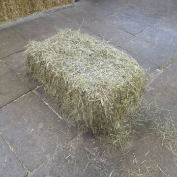

Heu HD Ballen
Carlsberg
Maike Käpernick
@ReitschuleKaepernick
Heu
Empfänger lädt ab
Kleinballen/HD-Ballen
Bio
Regenfrei
2 weitere...
B+
Deprecated: Creation of dynamic property Zend_View_Helper_Ads::$adLink is deprecated in /var/www/stall-frei/htdocs/staging.stall-frei.de/library/Psf/View/Helper/Ads.php on line 108

Futtersack HeuToy, Fressbremse in pink
Mechtersen
STALL-FREIde Marketing
@STALL-FREI-Marketing
Stundenlange Beschäftigung die
Koliken vorbeugt, geringe Staubinhalation mit
steuerbarer Futterentnahme
Leider kein Vorschaubild
Leider kein Vorschaubild
Heucobs zu verkaufen
Langenau
Bewegungsstall-Unseld
@Bewegungsstall-Unseld
Heu
Großballen
Regenfrei
Wird verladen
B+
Leider kein Vorschaubild
Leider kein Vorschaubild
Heucobs in Bigbags oder 25 kg Säcke
Langenau
Bewegungsstall-Unseld
@Bewegungsstall-Unseld
Futter
Pellets
Regenfrei
Wird verladen
1 weitere...
B+

Bedampftes Heu in Großballen für Allergikerpferd...
Langenau
Bewegungsstall-Unseld
@Bewegungsstall-Unseld
Heu
Großballen
Regenfrei
Wird verladen
1 weitere...
B+


Heu, Heulage und Stroh in jeglichen Ballenformen
Hennef
Hof-Bongartz
@Hof-Bongartz
Heu
Lieferant entlädt
Großballen
Regenfrei
3 weitere...
P+

Kleine Heuballen
Much
Stefan Jung
@StefanJung
Heu
Empfänger lädt ab
Kleinballen/HD-Ballen
Regenfrei
3 weitere...
brandneu
B+

Hafer aus Ernte 2025 auch gequetscht zu verkaufen
Wolfschlugen
Reitanlage im Höfelweg
@Reitanlage-im-Hoefelweg
Futter
Wird verladen
Abholung
B+

Mitarbeiter gesucht?
Mechtersen
STALL-FREIde Marketing
@STALL-FREI-Marketing
Stellenangebote kostenlos veröffentlichen!
Leider kein Vorschaubild
Leider kein Vorschaubild
Heu zu verkaufen
Kremmen OT Staffelde
Rhinland Reitpark GmbH
@Rhinland-Reitpark
Heu
Empfänger lädt ab
Rundballen
Regenfrei
3 weitere...
B+

Heu, Bio Ökol, Kräuter, Pferd, Kreuzkraut frei
Rösrath
Konrad-Biohof-Gut-Breide-LAG
@BiohofGutBreideLAG
Heu
Empfänger lädt ab
Rundballen
Bio
Regenfrei
2 weitere...
B+
Veröffentliche deine Suche als Gesuch und Suchauftrag, dann erhältst du Angebote, neue Treffer und Änderungen per E-Mail.
Diese Suche als Gesuch veröffentlichenDeprecated: Creation of dynamic property Zend_View::$pageCount is deprecated in /var/www/stall-frei/htdocs/staging.stall-frei.de/library/vendor/shardj/zf1-future/library/Zend/View/Abstract.php on line 308
Deprecated: Creation of dynamic property Zend_View::$itemCountPerPage is deprecated in /var/www/stall-frei/htdocs/staging.stall-frei.de/library/vendor/shardj/zf1-future/library/Zend/View/Abstract.php on line 308
Deprecated: Creation of dynamic property Zend_View::$first is deprecated in /var/www/stall-frei/htdocs/staging.stall-frei.de/library/vendor/shardj/zf1-future/library/Zend/View/Abstract.php on line 308
Deprecated: Creation of dynamic property Zend_View::$current is deprecated in /var/www/stall-frei/htdocs/staging.stall-frei.de/library/vendor/shardj/zf1-future/library/Zend/View/Abstract.php on line 308
Deprecated: Creation of dynamic property Zend_View::$last is deprecated in /var/www/stall-frei/htdocs/staging.stall-frei.de/library/vendor/shardj/zf1-future/library/Zend/View/Abstract.php on line 308
Deprecated: Creation of dynamic property Zend_View::$previous is deprecated in /var/www/stall-frei/htdocs/staging.stall-frei.de/library/vendor/shardj/zf1-future/library/Zend/View/Abstract.php on line 308
Deprecated: Creation of dynamic property Zend_View::$next is deprecated in /var/www/stall-frei/htdocs/staging.stall-frei.de/library/vendor/shardj/zf1-future/library/Zend/View/Abstract.php on line 308
Deprecated: Creation of dynamic property Zend_View::$pagesInRange is deprecated in /var/www/stall-frei/htdocs/staging.stall-frei.de/library/vendor/shardj/zf1-future/library/Zend/View/Abstract.php on line 308
Deprecated: Creation of dynamic property Zend_View::$firstPageInRange is deprecated in /var/www/stall-frei/htdocs/staging.stall-frei.de/library/vendor/shardj/zf1-future/library/Zend/View/Abstract.php on line 308
Deprecated: Creation of dynamic property Zend_View::$lastPageInRange is deprecated in /var/www/stall-frei/htdocs/staging.stall-frei.de/library/vendor/shardj/zf1-future/library/Zend/View/Abstract.php on line 308
Deprecated: Creation of dynamic property Zend_View::$currentItemCount is deprecated in /var/www/stall-frei/htdocs/staging.stall-frei.de/library/vendor/shardj/zf1-future/library/Zend/View/Abstract.php on line 308
Deprecated: Creation of dynamic property Zend_View::$totalItemCount is deprecated in /var/www/stall-frei/htdocs/staging.stall-frei.de/library/vendor/shardj/zf1-future/library/Zend/View/Abstract.php on line 308
Deprecated: Creation of dynamic property Zend_View::$firstItemNumber is deprecated in /var/www/stall-frei/htdocs/staging.stall-frei.de/library/vendor/shardj/zf1-future/library/Zend/View/Abstract.php on line 308
Deprecated: Creation of dynamic property Zend_View::$lastItemNumber is deprecated in /var/www/stall-frei/htdocs/staging.stall-frei.de/library/vendor/shardj/zf1-future/library/Zend/View/Abstract.php on line 308
Deprecated: Creation of dynamic property Zend_View::$router is deprecated in /var/www/stall-frei/htdocs/staging.stall-frei.de/library/vendor/shardj/zf1-future/library/Zend/View/Abstract.php on line 308
Deprecated: Creation of dynamic property Zend_View::$urlParams is deprecated in /var/www/stall-frei/htdocs/staging.stall-frei.de/library/vendor/shardj/zf1-future/library/Zend/View/Abstract.php on line 308
Deprecated: Creation of dynamic property Zend_View::$showAds is deprecated in /var/www/stall-frei/htdocs/staging.stall-frei.de/library/vendor/shardj/zf1-future/library/Zend/View/Abstract.php on line 308
Deprecated: Creation of dynamic property Zend_View::$objectIds is deprecated in /var/www/stall-frei/htdocs/staging.stall-frei.de/library/vendor/shardj/zf1-future/library/Zend/View/Abstract.php on line 308
Deprecated: Creation of dynamic property Zend_View::$showNavbar is deprecated in /var/www/stall-frei/htdocs/staging.stall-frei.de/library/vendor/shardj/zf1-future/library/Zend/View/Abstract.php on line 308
Deprecated: Creation of dynamic property Zend_View::$showBreadcrumb is deprecated in /var/www/stall-frei/htdocs/staging.stall-frei.de/library/vendor/shardj/zf1-future/library/Zend/View/Abstract.php on line 308
Deprecated: Creation of dynamic property Zend_View::$showFooter is deprecated in /var/www/stall-frei/htdocs/staging.stall-frei.de/library/vendor/shardj/zf1-future/library/Zend/View/Abstract.php on line 308
Deprecated: Creation of dynamic property Zend_View::$showInternalAds is deprecated in /var/www/stall-frei/htdocs/staging.stall-frei.de/library/vendor/shardj/zf1-future/library/Zend/View/Abstract.php on line 308
Deprecated: Creation of dynamic property Zend_View::$blNoContent is deprecated in /var/www/stall-frei/htdocs/staging.stall-frei.de/library/vendor/shardj/zf1-future/library/Zend/View/Abstract.php on line 308
Deprecated: Creation of dynamic property Zend_View::$sMetaDesc is deprecated in /var/www/stall-frei/htdocs/staging.stall-frei.de/library/vendor/shardj/zf1-future/library/Zend/View/Abstract.php on line 308
Deprecated: Creation of dynamic property Zend_View::$useGmaps is deprecated in /var/www/stall-frei/htdocs/staging.stall-frei.de/library/vendor/shardj/zf1-future/library/Zend/View/Abstract.php on line 308
Deprecated: Creation of dynamic property Zend_View::$touches is deprecated in /var/www/stall-frei/htdocs/staging.stall-frei.de/library/vendor/shardj/zf1-future/library/Zend/View/Abstract.php on line 308
Deprecated: Creation of dynamic property Zend_View::$oProject is deprecated in /var/www/stall-frei/htdocs/staging.stall-frei.de/library/vendor/shardj/zf1-future/library/Zend/View/Abstract.php on line 308
Deprecated: Creation of dynamic property Zend_View::$pageHeadline is deprecated in /var/www/stall-frei/htdocs/staging.stall-frei.de/library/vendor/shardj/zf1-future/library/Zend/View/Abstract.php on line 308
Deprecated: Creation of dynamic property Zend_View::$disableLocationField is deprecated in /var/www/stall-frei/htdocs/staging.stall-frei.de/library/vendor/shardj/zf1-future/library/Zend/View/Abstract.php on line 308
Deprecated: Creation of dynamic property Zend_View::$isSearch is deprecated in /var/www/stall-frei/htdocs/staging.stall-frei.de/library/vendor/shardj/zf1-future/library/Zend/View/Abstract.php on line 308
Deprecated: Creation of dynamic property Zend_View::$pageTitle is deprecated in /var/www/stall-frei/htdocs/staging.stall-frei.de/library/vendor/shardj/zf1-future/library/Zend/View/Abstract.php on line 308
Deprecated: Creation of dynamic property Psf_Form_Element_Text::$class is deprecated in /var/www/stall-frei/htdocs/staging.stall-frei.de/library/vendor/shardj/zf1-future/library/Zend/Form/Element.php on line 874
Deprecated: Creation of dynamic property Psf_Form_Element_Text::$size is deprecated in /var/www/stall-frei/htdocs/staging.stall-frei.de/library/vendor/shardj/zf1-future/library/Zend/Form/Element.php on line 874
Deprecated: Creation of dynamic property Psf_Form_Element_Text::$placeholder is deprecated in /var/www/stall-frei/htdocs/staging.stall-frei.de/library/vendor/shardj/zf1-future/library/Zend/Form/Element.php on line 874
Deprecated: Creation of dynamic property Psf_Form_Element_Hidden::$class is deprecated in /var/www/stall-frei/htdocs/staging.stall-frei.de/library/vendor/shardj/zf1-future/library/Zend/Form/Element.php on line 874
Deprecated: Creation of dynamic property Psf_Form_Element_Hidden::$class is deprecated in /var/www/stall-frei/htdocs/staging.stall-frei.de/library/vendor/shardj/zf1-future/library/Zend/Form/Element.php on line 874
Deprecated: Creation of dynamic property Psf_Form_Element_Hidden::$class is deprecated in /var/www/stall-frei/htdocs/staging.stall-frei.de/library/vendor/shardj/zf1-future/library/Zend/Form/Element.php on line 874
Deprecated: Creation of dynamic property Psf_Form_Element_Hidden::$class is deprecated in /var/www/stall-frei/htdocs/staging.stall-frei.de/library/vendor/shardj/zf1-future/library/Zend/Form/Element.php on line 874
Deprecated: Creation of dynamic property Psf_Form_Element_Select::$class is deprecated in /var/www/stall-frei/htdocs/staging.stall-frei.de/library/vendor/shardj/zf1-future/library/Zend/Form/Element.php on line 874
Deprecated: Creation of dynamic property Psf_Form_Element_Select::$class is deprecated in /var/www/stall-frei/htdocs/staging.stall-frei.de/library/vendor/shardj/zf1-future/library/Zend/Form/Element.php on line 874
Deprecated: Creation of dynamic property Psf_Form_Element_Select::$class is deprecated in /var/www/stall-frei/htdocs/staging.stall-frei.de/library/vendor/shardj/zf1-future/library/Zend/Form/Element.php on line 874
Deprecated: Creation of dynamic property Psf_Form_Element_Select::$class is deprecated in /var/www/stall-frei/htdocs/staging.stall-frei.de/library/vendor/shardj/zf1-future/library/Zend/Form/Element.php on line 874
Deprecated: Creation of dynamic property Zend_View::$sort is deprecated in /var/www/stall-frei/htdocs/staging.stall-frei.de/library/vendor/shardj/zf1-future/library/Zend/View/Abstract.php on line 308
Deprecated: Creation of dynamic property Zend_View::$searchLocation is deprecated in /var/www/stall-frei/htdocs/staging.stall-frei.de/library/vendor/shardj/zf1-future/library/Zend/View/Abstract.php on line 308
Deprecated: Creation of dynamic property Zend_View::$locationHint is deprecated in /var/www/stall-frei/htdocs/staging.stall-frei.de/library/vendor/shardj/zf1-future/library/Zend/View/Abstract.php on line 308
Psf_GeoCoder_Abstract::getLocation: Wolfsberg Get Location CachedOrLive
Psf_GeoCoder_Abstract::getCachedOrLive: Wolfsberg
Psf_GeoCoder_Abstract::convertLocationResult
{"documentation":"https:\/\/opencagedata.com\/api","licenses":[{"name":"see attribution guide","url":"https:\/\/opencagedata.com\/credits"}],"results":[{"bounds":{"northeast":{"lat":50.733013,"lng":11.0582016},"southwest":{"lat":50.6774675,"lng":10.9376994}},"components":{"ISO_3166-1_alpha-2":"DE","ISO_3166-1_alpha-3":"DEU","ISO_3166-2":["DE-TH"],"_category":"place","_normalized_city":"Ilmenau","_type":"city","continent":"Europe","country":"Deutschland","country_code":"de","county":"Ilm-Kreis","municipality":"Wolfsberg","political_union":"European Union","state":"Th\u00fcringen","state_code":"TH","town":"Ilmenau"},"confidence":7,"formatted":"Ilmenau, Th\u00fcringen, Deutschland","geometry":{"lat":50.7024916,"lng":10.9976165}},{"bounds":{"northeast":{"lat":51.5737446,"lng":11.127602},"southwest":{"lat":51.5337369,"lng":11.0710041}},"components":{"ISO_3166-1_alpha-2":"DE","ISO_3166-1_alpha-3":"DEU","ISO_3166-2":["DE-ST"],"_category":"place","_normalized_city":"Sangerhausen","_type":"neighbourhood","continent":"Europe","country":"Deutschland","country_code":"de","county":"Mansfeld-S\u00fcdharz","political_union":"European Union","state":"Sachsen-Anhalt","state_code":"ST","suburb":"Wolfsberg","town":"Sangerhausen"},"confidence":7,"formatted":"Wolfsberg, Sangerhausen, Sachsen-Anhalt, Deutschland","geometry":{"lat":51.5537765,"lng":11.0964741}},{"bounds":{"northeast":{"lat":51.5713857,"lng":11.1176409},"southwest":{"lat":51.5313857,"lng":11.0776409}},"components":{"ISO_3166-1_alpha-2":"DE","ISO_3166-1_alpha-3":"DEU","ISO_3166-2":["DE-ST"],"_category":"place","_normalized_city":"Sangerhausen","_type":"village","continent":"Europe","country":"Deutschland","country_code":"de","county":"Mansfeld-S\u00fcdharz","political_union":"European Union","state":"Sachsen-Anhalt","state_code":"ST","town":"Sangerhausen","village":"Wolfsberg"},"confidence":7,"formatted":"Wolfsberg, Sachsen-Anhalt, Deutschland","geometry":{"lat":51.5513857,"lng":11.0976409}},{"bounds":{"northeast":{"lat":49.7080777,"lng":11.332013},"southwest":{"lat":49.6680777,"lng":11.292013}},"components":{"ISO_3166-1_alpha-2":"DE","ISO_3166-1_alpha-3":"DEU","ISO_3166-2":["DE-BY"],"_category":"place","_normalized_city":"Obertrubach","_type":"village","city":"Obertrubach","continent":"Europe","country":"Deutschland","country_code":"de","county":"Landkreis Forchheim","political_union":"European Union","postcode":"91286","state":"Bayern","state_code":"BY","village":"Wolfsberg"},"confidence":7,"formatted":"91286 Wolfsberg, Deutschland","geometry":{"lat":49.6880777,"lng":11.312013}},{"bounds":{"northeast":{"lat":50.2406236,"lng":11.2624248},"southwest":{"lat":50.2405236,"lng":11.2623248}},"components":{"ISO_3166-1_alpha-2":"DE","ISO_3166-1_alpha-3":"DEU","ISO_3166-2":["DE-BY"],"_category":"building","_normalized_city":"Mitwitz","_type":"building","city":"Mitwitz","continent":"Europe","country":"Deutschland","country_code":"de","county":"Landkreis Kronach","isolated_dwelling":"Wolfsberg","municipality":"Mitwitz (VGem)","political_union":"European Union","postcode":"96268","state":"Bayern","state_code":"BY"},"confidence":10,"formatted":"Wolfsberg, 96268 Mitwitz, Deutschland","geometry":{"lat":50.2405736,"lng":11.2623748}},{"bounds":{"northeast":{"lat":50.7878792,"lng":10.3649358},"southwest":{"lat":50.7877792,"lng":10.3648358}},"components":{"ISO_3166-1_alpha-2":"DE","ISO_3166-1_alpha-3":"DEU","ISO_3166-2":["DE-TH"],"_category":"agriculture","_normalized_city":"Bad Liebenstein","_type":"farmyard","city_district":"Bad Liebenstein","continent":"Europe","country":"Deutschland","country_code":"de","county":"Wartburgkreis","farmyard":"Geh\u00f6ft Wolfsberg","isolated_dwelling":"Wolfsberg","political_union":"European Union","postcode":"36448","state":"Th\u00fcringen","state_code":"TH","suburb":"Meimers","town":"Bad Liebenstein"},"confidence":9,"formatted":"Geh\u00f6ft Wolfsberg, Wolfsberg, 36448 Bad Liebenstein, Deutschland","geometry":{"lat":50.7878292,"lng":10.3648858}},{"bounds":{"northeast":{"lat":50.8886196,"lng":14.1841697},"southwest":{"lat":50.8885196,"lng":14.1840697}},"components":{"ISO_3166-1_alpha-2":"DE","ISO_3166-1_alpha-3":"DEU","ISO_3166-2":["DE-SN"],"_category":"natural\/water","_normalized_city":"Reinhardtsdorf-Sch\u00f6na","_type":"peak","continent":"Europe","country":"Deutschland","country_code":"de","county":"S\u00e4chsische Schweiz-Osterzgebirge","municipality":"Bad Schandau","peak":"Wolfsberg","political_union":"European Union","postcode":"01814","state":"Sachsen","state_code":"SN","village":"Reinhardtsdorf-Sch\u00f6na"},"confidence":9,"formatted":"Wolfsberg, 01814 Reinhardtsdorf-Sch\u00f6na, Deutschland","geometry":{"lat":50.8885696,"lng":14.1841197}},{"bounds":{"northeast":{"lat":50.6763768,"lng":13.089949},"southwest":{"lat":50.6762768,"lng":13.089849}},"components":{"ISO_3166-1_alpha-2":"DE","ISO_3166-1_alpha-3":"DEU","ISO_3166-2":["DE-SN"],"_category":"natural\/water","_normalized_city":"Wolkenstein","_type":"peak","continent":"Europe","country":"Deutschland","country_code":"de","county":"Erzgebirgskreis","peak":"Wolfsberg","political_union":"European Union","postcode":"09429","state":"Sachsen","state_code":"SN","town":"Wolkenstein"},"confidence":9,"formatted":"Wolfsberg, 09429 Wolkenstein, Deutschland","geometry":{"lat":50.6763268,"lng":13.089899}},{"bounds":{"northeast":{"lat":48.3033148,"lng":8.214419},"southwest":{"lat":48.3032148,"lng":8.214319}},"components":{"ISO_3166-1_alpha-2":"DE","ISO_3166-1_alpha-3":"DEU","ISO_3166-2":["DE-BW"],"_category":"natural\/water","_normalized_city":"Oberwolfach","_type":"peak","continent":"Europe","country":"Deutschland","country_code":"de","county":"Ortenaukreis","municipality":"VVG der Stadt Wolfach","peak":"Wolfsberg","political_union":"European Union","postcode":"77709","state":"Baden-W\u00fcrttemberg","state_code":"BW","village":"Oberwolfach"},"confidence":9,"formatted":"Wolfsberg, 77709 Oberwolfach, Deutschland","geometry":{"lat":48.3032648,"lng":8.214369}},{"bounds":{"northeast":{"lat":49.4285544,"lng":8.0056749},"southwest":{"lat":49.4284544,"lng":8.0055749}},"components":{"ISO_3166-1_alpha-2":"DE","ISO_3166-1_alpha-3":"DEU","ISO_3166-2":["DE-RP"],"_category":"natural\/water","_normalized_city":"Bad D\u00fcrkheim","_type":"peak","continent":"Europe","country":"Deutschland","country_code":"de","county":"Landkreis Bad D\u00fcrkheim","peak":"Wolfsberg","political_union":"European Union","postcode":"67475","state":"Rheinland-Pfalz","state_code":"RP","town":"Bad D\u00fcrkheim"},"confidence":9,"formatted":"Wolfsberg, 67475 Bad D\u00fcrkheim, Deutschland","geometry":{"lat":49.4285044,"lng":8.0056249}}],"status":{"code":200,"message":"OK"},"stay_informed":{"blog":"https:\/\/blog.opencagedata.com","mastodon":"https:\/\/en.osm.town\/@opencage"},"thanks":"For using an OpenCage API","timestamp":{"created_http":"Sun, 08 Feb 2026 23:38:48 GMT","created_unix":1770593928},"total_results":10}Array
(
[0] => stdClass Object
(
[bounds] => stdClass Object
(
[northeast] => stdClass Object
(
[lat] => 50.733013
[lng] => 11.0582016
)
[southwest] => stdClass Object
(
[lat] => 50.6774675
[lng] => 10.9376994
)
)
[components] => stdClass Object
(
[ISO_3166-1_alpha-2] => DE
[ISO_3166-1_alpha-3] => DEU
[ISO_3166-2] => Array
(
[0] => DE-TH
)
[_category] => place
[_normalized_city] => Ilmenau
[_type] => city
[continent] => Europe
[country] => Deutschland
[country_code] => de
[county] => Ilm-Kreis
[municipality] => Wolfsberg
[political_union] => European Union
[state] => Thüringen
[state_code] => TH
[town] => Ilmenau
)
[confidence] => 7
[formatted] => Ilmenau, Thüringen, Deutschland
[geometry] => stdClass Object
(
[lat] => 50.7024916
[lng] => 10.9976165
)
)
[1] => stdClass Object
(
[bounds] => stdClass Object
(
[northeast] => stdClass Object
(
[lat] => 51.5737446
[lng] => 11.127602
)
[southwest] => stdClass Object
(
[lat] => 51.5337369
[lng] => 11.0710041
)
)
[components] => stdClass Object
(
[ISO_3166-1_alpha-2] => DE
[ISO_3166-1_alpha-3] => DEU
[ISO_3166-2] => Array
(
[0] => DE-ST
)
[_category] => place
[_normalized_city] => Sangerhausen
[_type] => neighbourhood
[continent] => Europe
[country] => Deutschland
[country_code] => de
[county] => Mansfeld-Südharz
[political_union] => European Union
[state] => Sachsen-Anhalt
[state_code] => ST
[suburb] => Wolfsberg
[town] => Sangerhausen
)
[confidence] => 7
[formatted] => Wolfsberg, Sangerhausen, Sachsen-Anhalt, Deutschland
[geometry] => stdClass Object
(
[lat] => 51.5537765
[lng] => 11.0964741
)
)
[2] => stdClass Object
(
[bounds] => stdClass Object
(
[northeast] => stdClass Object
(
[lat] => 51.5713857
[lng] => 11.1176409
)
[southwest] => stdClass Object
(
[lat] => 51.5313857
[lng] => 11.0776409
)
)
[components] => stdClass Object
(
[ISO_3166-1_alpha-2] => DE
[ISO_3166-1_alpha-3] => DEU
[ISO_3166-2] => Array
(
[0] => DE-ST
)
[_category] => place
[_normalized_city] => Sangerhausen
[_type] => village
[continent] => Europe
[country] => Deutschland
[country_code] => de
[county] => Mansfeld-Südharz
[political_union] => European Union
[state] => Sachsen-Anhalt
[state_code] => ST
[town] => Sangerhausen
[village] => Wolfsberg
)
[confidence] => 7
[formatted] => Wolfsberg, Sachsen-Anhalt, Deutschland
[geometry] => stdClass Object
(
[lat] => 51.5513857
[lng] => 11.0976409
)
)
[3] => stdClass Object
(
[bounds] => stdClass Object
(
[northeast] => stdClass Object
(
[lat] => 49.7080777
[lng] => 11.332013
)
[southwest] => stdClass Object
(
[lat] => 49.6680777
[lng] => 11.292013
)
)
[components] => stdClass Object
(
[ISO_3166-1_alpha-2] => DE
[ISO_3166-1_alpha-3] => DEU
[ISO_3166-2] => Array
(
[0] => DE-BY
)
[_category] => place
[_normalized_city] => Obertrubach
[_type] => village
[city] => Obertrubach
[continent] => Europe
[country] => Deutschland
[country_code] => de
[county] => Landkreis Forchheim
[political_union] => European Union
[postcode] => 91286
[state] => Bayern
[state_code] => BY
[village] => Wolfsberg
)
[confidence] => 7
[formatted] => 91286 Wolfsberg, Deutschland
[geometry] => stdClass Object
(
[lat] => 49.6880777
[lng] => 11.312013
)
)
[4] => stdClass Object
(
[bounds] => stdClass Object
(
[northeast] => stdClass Object
(
[lat] => 50.2406236
[lng] => 11.2624248
)
[southwest] => stdClass Object
(
[lat] => 50.2405236
[lng] => 11.2623248
)
)
[components] => stdClass Object
(
[ISO_3166-1_alpha-2] => DE
[ISO_3166-1_alpha-3] => DEU
[ISO_3166-2] => Array
(
[0] => DE-BY
)
[_category] => building
[_normalized_city] => Mitwitz
[_type] => building
[city] => Mitwitz
[continent] => Europe
[country] => Deutschland
[country_code] => de
[county] => Landkreis Kronach
[isolated_dwelling] => Wolfsberg
[municipality] => Mitwitz (VGem)
[political_union] => European Union
[postcode] => 96268
[state] => Bayern
[state_code] => BY
)
[confidence] => 10
[formatted] => Wolfsberg, 96268 Mitwitz, Deutschland
[geometry] => stdClass Object
(
[lat] => 50.2405736
[lng] => 11.2623748
)
)
[5] => stdClass Object
(
[bounds] => stdClass Object
(
[northeast] => stdClass Object
(
[lat] => 50.7878792
[lng] => 10.3649358
)
[southwest] => stdClass Object
(
[lat] => 50.7877792
[lng] => 10.3648358
)
)
[components] => stdClass Object
(
[ISO_3166-1_alpha-2] => DE
[ISO_3166-1_alpha-3] => DEU
[ISO_3166-2] => Array
(
[0] => DE-TH
)
[_category] => agriculture
[_normalized_city] => Bad Liebenstein
[_type] => farmyard
[city_district] => Bad Liebenstein
[continent] => Europe
[country] => Deutschland
[country_code] => de
[county] => Wartburgkreis
[farmyard] => Gehöft Wolfsberg
[isolated_dwelling] => Wolfsberg
[political_union] => European Union
[postcode] => 36448
[state] => Thüringen
[state_code] => TH
[suburb] => Meimers
[town] => Bad Liebenstein
)
[confidence] => 9
[formatted] => Gehöft Wolfsberg, Wolfsberg, 36448 Bad Liebenstein, Deutschland
[geometry] => stdClass Object
(
[lat] => 50.7878292
[lng] => 10.3648858
)
)
[6] => stdClass Object
(
[bounds] => stdClass Object
(
[northeast] => stdClass Object
(
[lat] => 50.8886196
[lng] => 14.1841697
)
[southwest] => stdClass Object
(
[lat] => 50.8885196
[lng] => 14.1840697
)
)
[components] => stdClass Object
(
[ISO_3166-1_alpha-2] => DE
[ISO_3166-1_alpha-3] => DEU
[ISO_3166-2] => Array
(
[0] => DE-SN
)
[_category] => natural/water
[_normalized_city] => Reinhardtsdorf-Schöna
[_type] => peak
[continent] => Europe
[country] => Deutschland
[country_code] => de
[county] => Sächsische Schweiz-Osterzgebirge
[municipality] => Bad Schandau
[peak] => Wolfsberg
[political_union] => European Union
[postcode] => 01814
[state] => Sachsen
[state_code] => SN
[village] => Reinhardtsdorf-Schöna
)
[confidence] => 9
[formatted] => Wolfsberg, 01814 Reinhardtsdorf-Schöna, Deutschland
[geometry] => stdClass Object
(
[lat] => 50.8885696
[lng] => 14.1841197
)
)
[7] => stdClass Object
(
[bounds] => stdClass Object
(
[northeast] => stdClass Object
(
[lat] => 50.6763768
[lng] => 13.089949
)
[southwest] => stdClass Object
(
[lat] => 50.6762768
[lng] => 13.089849
)
)
[components] => stdClass Object
(
[ISO_3166-1_alpha-2] => DE
[ISO_3166-1_alpha-3] => DEU
[ISO_3166-2] => Array
(
[0] => DE-SN
)
[_category] => natural/water
[_normalized_city] => Wolkenstein
[_type] => peak
[continent] => Europe
[country] => Deutschland
[country_code] => de
[county] => Erzgebirgskreis
[peak] => Wolfsberg
[political_union] => European Union
[postcode] => 09429
[state] => Sachsen
[state_code] => SN
[town] => Wolkenstein
)
[confidence] => 9
[formatted] => Wolfsberg, 09429 Wolkenstein, Deutschland
[geometry] => stdClass Object
(
[lat] => 50.6763268
[lng] => 13.089899
)
)
[8] => stdClass Object
(
[bounds] => stdClass Object
(
[northeast] => stdClass Object
(
[lat] => 48.3033148
[lng] => 8.214419
)
[southwest] => stdClass Object
(
[lat] => 48.3032148
[lng] => 8.214319
)
)
[components] => stdClass Object
(
[ISO_3166-1_alpha-2] => DE
[ISO_3166-1_alpha-3] => DEU
[ISO_3166-2] => Array
(
[0] => DE-BW
)
[_category] => natural/water
[_normalized_city] => Oberwolfach
[_type] => peak
[continent] => Europe
[country] => Deutschland
[country_code] => de
[county] => Ortenaukreis
[municipality] => VVG der Stadt Wolfach
[peak] => Wolfsberg
[political_union] => European Union
[postcode] => 77709
[state] => Baden-Württemberg
[state_code] => BW
[village] => Oberwolfach
)
[confidence] => 9
[formatted] => Wolfsberg, 77709 Oberwolfach, Deutschland
[geometry] => stdClass Object
(
[lat] => 48.3032648
[lng] => 8.214369
)
)
[9] => stdClass Object
(
[bounds] => stdClass Object
(
[northeast] => stdClass Object
(
[lat] => 49.4285544
[lng] => 8.0056749
)
[southwest] => stdClass Object
(
[lat] => 49.4284544
[lng] => 8.0055749
)
)
[components] => stdClass Object
(
[ISO_3166-1_alpha-2] => DE
[ISO_3166-1_alpha-3] => DEU
[ISO_3166-2] => Array
(
[0] => DE-RP
)
[_category] => natural/water
[_normalized_city] => Bad Dürkheim
[_type] => peak
[continent] => Europe
[country] => Deutschland
[country_code] => de
[county] => Landkreis Bad Dürkheim
[peak] => Wolfsberg
[political_union] => European Union
[postcode] => 67475
[state] => Rheinland-Pfalz
[state_code] => RP
[town] => Bad Dürkheim
)
[confidence] => 9
[formatted] => Wolfsberg, 67475 Bad Dürkheim, Deutschland
[geometry] => stdClass Object
(
[lat] => 49.4285044
[lng] => 8.0056249
)
)
)
Psf_GeoCoder_OpenCageData::getKeyMap: 0
stdClass Object
(
    [bounds] => stdClass Object
        (
            [northeast] => stdClass Object
                (
                    [lat] => 50.733013
                    [lng] => 11.0582016
                )

            [southwest] => stdClass Object
                (
                    [lat] => 50.6774675
                    [lng] => 10.9376994
                )

        )

    [components] => stdClass Object
        (
            [ISO_3166-1_alpha-2] => DE
            [ISO_3166-1_alpha-3] => DEU
            [ISO_3166-2] => Array
                (
                    [0] => DE-TH
                )

            [_category] => place
            [_normalized_city] => Ilmenau
            [_type] => city
            [continent] => Europe
            [country] => Deutschland
            [country_code] => de
            [county] => Ilm-Kreis
            [municipality] => Wolfsberg
            [political_union] => European Union
            [state] => Thüringen
            [state_code] => TH
            [town] => Ilmenau
        )

    [confidence] => 7
    [formatted] => Ilmenau, Thüringen, Deutschland
    [geometry] => stdClass Object
        (
            [lat] => 50.7024916
            [lng] => 10.9976165
        )

)
Psf_GeoCoder_OpenCageData::getCounty: Ilm-Kreis
Psf_GeoCoder_OpenCageData::addMissingData REFETCH!
Array
(
    [address] => Ilmenau, Thüringen, Deutschland
    [type] => city
    [street] =>
    [city] => Ilmenau
    [county] => Ilm-Kreis
    [state] => Thüringen
    [zip] =>
    [country] => Deutschland
    [suburb] =>
    [countrycode] => de
    [latitude] => 50.7024916
    [longitude] => 10.9976165
    [accuracy] => 1
    [confidence] => 7
    [bounds] => stdClass Object
        (
            [northeast] => stdClass Object
                (
                    [lat] => 50.733013
                    [lng] => 11.0582016
                )

            [southwest] => stdClass Object
                (
                    [lat] => 50.6774675
                    [lng] => 10.9376994
                )

        )

)
reformat!
Array
(
    [address] => Ilmenau, Thüringen, Deutschland
    [type] => city
    [street] =>
    [city] => Ilmenau
    [county] => Ilm-Kreis
    [state] => Thüringen
    [zip] =>
    [country] => Deutschland
    [suburb] =>
    [countrycode] => de
    [latitude] => 50.7024916
    [longitude] => 10.9976165
    [accuracy] => 1
    [confidence] => 7
    [bounds] => stdClass Object
        (
            [northeast] => stdClass Object
                (
                    [lat] => 50.733013
                    [lng] => 11.0582016
                )

            [southwest] => stdClass Object
                (
                    [lat] => 50.6774675
                    [lng] => 10.9376994
                )

        )

    [place] => Ilmenau, Thüringen
    [hash] => a9ae65bfa7b69e7bad27068b98b79af0
)
Psf_GeoCoder_OpenCageData::getKeyMap: 1
stdClass Object
(
    [bounds] => stdClass Object
        (
            [northeast] => stdClass Object
                (
                    [lat] => 51.5737446
                    [lng] => 11.127602
                )

            [southwest] => stdClass Object
                (
                    [lat] => 51.5337369
                    [lng] => 11.0710041
                )

        )

    [components] => stdClass Object
        (
            [ISO_3166-1_alpha-2] => DE
            [ISO_3166-1_alpha-3] => DEU
            [ISO_3166-2] => Array
                (
                    [0] => DE-ST
                )

            [_category] => place
            [_normalized_city] => Sangerhausen
            [_type] => neighbourhood
            [continent] => Europe
            [country] => Deutschland
            [country_code] => de
            [county] => Mansfeld-Südharz
            [political_union] => European Union
            [state] => Sachsen-Anhalt
            [state_code] => ST
            [suburb] => Wolfsberg
            [town] => Sangerhausen
        )

    [confidence] => 7
    [formatted] => Wolfsberg, Sangerhausen, Sachsen-Anhalt, Deutschland
    [geometry] => stdClass Object
        (
            [lat] => 51.5537765
            [lng] => 11.0964741
        )

)
Psf_GeoCoder_OpenCageData::getCounty: Mansfeld-Südharz
Psf_GeoCoder_OpenCageData::addMissingData REFETCH!
Array
(
    [address] => Wolfsberg, Sangerhausen, Sachsen-Anhalt, Deutschland
    [type] => neighbourhood
    [street] =>
    [city] => Sangerhausen
    [county] => Mansfeld-Südharz
    [state] => Sachsen-Anhalt
    [zip] =>
    [country] => Deutschland
    [suburb] => Wolfsberg
    [countrycode] => de
    [latitude] => 51.5537765
    [longitude] => 11.0964741
    [accuracy] => 1
    [confidence] => 7
    [bounds] => stdClass Object
        (
            [northeast] => stdClass Object
                (
                    [lat] => 51.5737446
                    [lng] => 11.127602
                )

            [southwest] => stdClass Object
                (
                    [lat] => 51.5337369
                    [lng] => 11.0710041
                )

        )

)
reformat!
Array
(
    [address] => Wolfsberg, Sangerhausen, Sachsen-Anhalt, Deutschland
    [type] => neighbourhood
    [street] =>
    [city] => Sangerhausen
    [county] => Mansfeld-Südharz
    [state] => Sachsen-Anhalt
    [zip] =>
    [country] => Deutschland
    [suburb] => Wolfsberg
    [countrycode] => de
    [latitude] => 51.5537765
    [longitude] => 11.0964741
    [accuracy] => 1
    [confidence] => 7
    [bounds] => stdClass Object
        (
            [northeast] => stdClass Object
                (
                    [lat] => 51.5737446
                    [lng] => 11.127602
                )

            [southwest] => stdClass Object
                (
                    [lat] => 51.5337369
                    [lng] => 11.0710041
                )

        )

    [place] => Sangerhausen, Sachsen-Anhalt
    [hash] => f57b05e3dbbf30bf9cd11c5420de74a6
)
Psf_GeoCoder_OpenCageData::getKeyMap: 2
stdClass Object
(
    [bounds] => stdClass Object
        (
            [northeast] => stdClass Object
                (
                    [lat] => 51.5713857
                    [lng] => 11.1176409
                )

            [southwest] => stdClass Object
                (
                    [lat] => 51.5313857
                    [lng] => 11.0776409
                )

        )

    [components] => stdClass Object
        (
            [ISO_3166-1_alpha-2] => DE
            [ISO_3166-1_alpha-3] => DEU
            [ISO_3166-2] => Array
                (
                    [0] => DE-ST
                )

            [_category] => place
            [_normalized_city] => Sangerhausen
            [_type] => village
            [continent] => Europe
            [country] => Deutschland
            [country_code] => de
            [county] => Mansfeld-Südharz
            [political_union] => European Union
            [state] => Sachsen-Anhalt
            [state_code] => ST
            [town] => Sangerhausen
            [village] => Wolfsberg
        )

    [confidence] => 7
    [formatted] => Wolfsberg, Sachsen-Anhalt, Deutschland
    [geometry] => stdClass Object
        (
            [lat] => 51.5513857
            [lng] => 11.0976409
        )

)
Psf_GeoCoder_OpenCageData::getCounty: Mansfeld-Südharz
Psf_GeoCoder_OpenCageData::addMissingData REFETCH!
Array
(
    [address] => Wolfsberg, Sachsen-Anhalt, Deutschland
    [type] => village
    [street] =>
    [city] => Sangerhausen
    [county] => Mansfeld-Südharz
    [state] => Sachsen-Anhalt
    [zip] =>
    [country] => Deutschland
    [suburb] =>
    [countrycode] => de
    [latitude] => 51.5513857
    [longitude] => 11.0976409
    [accuracy] => 1
    [confidence] => 7
    [bounds] => stdClass Object
        (
            [northeast] => stdClass Object
                (
                    [lat] => 51.5713857
                    [lng] => 11.1176409
                )

            [southwest] => stdClass Object
                (
                    [lat] => 51.5313857
                    [lng] => 11.0776409
                )

        )

)
reformat!
Array
(
    [address] => Sangerhausen
    [type] => village
    [street] =>
    [city] => Sangerhausen
    [county] => Mansfeld-Südharz
    [state] => Sachsen-Anhalt
    [zip] =>
    [country] => Deutschland
    [suburb] =>
    [countrycode] => de
    [latitude] => 51.5513857
    [longitude] => 11.0976409
    [accuracy] => 1
    [confidence] => 7
    [bounds] => stdClass Object
        (
            [northeast] => stdClass Object
                (
                    [lat] => 51.5713857
                    [lng] => 11.1176409
                )

            [southwest] => stdClass Object
                (
                    [lat] => 51.5313857
                    [lng] => 11.0776409
                )

        )

    [place] => Sangerhausen, Sachsen-Anhalt
    [hash] => f57b05e3dbbf30bf9cd11c5420de74a6
)
Psf_GeoCoder_OpenCageData::getKeyMap: 3
stdClass Object
(
    [bounds] => stdClass Object
        (
            [northeast] => stdClass Object
                (
                    [lat] => 49.7080777
                    [lng] => 11.332013
                )

            [southwest] => stdClass Object
                (
                    [lat] => 49.6680777
                    [lng] => 11.292013
                )

        )

    [components] => stdClass Object
        (
            [ISO_3166-1_alpha-2] => DE
            [ISO_3166-1_alpha-3] => DEU
            [ISO_3166-2] => Array
                (
                    [0] => DE-BY
                )

            [_category] => place
            [_normalized_city] => Obertrubach
            [_type] => village
            [city] => Obertrubach
            [continent] => Europe
            [country] => Deutschland
            [country_code] => de
            [county] => Landkreis Forchheim
            [political_union] => European Union
            [postcode] => 91286
            [state] => Bayern
            [state_code] => BY
            [village] => Wolfsberg
        )

    [confidence] => 7
    [formatted] => 91286 Wolfsberg, Deutschland
    [geometry] => stdClass Object
        (
            [lat] => 49.6880777
            [lng] => 11.312013
        )

)
Psf_GeoCoder_OpenCageData::getCounty: Forchheim
Psf_GeoCoder_OpenCageData::addMissingData REFETCH!
Array
(
    [address] => 91286 Wolfsberg, Deutschland
    [type] => village
    [street] =>
    [city] => Wolfsberg
    [county] => Forchheim
    [state] => Bayern
    [zip] => 91286
    [country] => Deutschland
    [suburb] =>
    [countrycode] => de
    [latitude] => 49.6880777
    [longitude] => 11.312013
    [accuracy] => 1
    [confidence] => 7
    [bounds] => stdClass Object
        (
            [northeast] => stdClass Object
                (
                    [lat] => 49.7080777
                    [lng] => 11.332013
                )

            [southwest] => stdClass Object
                (
                    [lat] => 49.6680777
                    [lng] => 11.292013
                )

        )

)
reformat!
Array
(
    [address] => 91286 Wolfsberg, Deutschland
    [type] => village
    [street] =>
    [city] => Wolfsberg
    [county] => Forchheim
    [state] => Bayern
    [zip] => 91286
    [country] => Deutschland
    [suburb] =>
    [countrycode] => de
    [latitude] => 49.6880777
    [longitude] => 11.312013
    [accuracy] => 1
    [confidence] => 7
    [bounds] => stdClass Object
        (
            [northeast] => stdClass Object
                (
                    [lat] => 49.7080777
                    [lng] => 11.332013
                )

            [southwest] => stdClass Object
                (
                    [lat] => 49.6680777
                    [lng] => 11.292013
                )

        )

    [place] => 91286 Wolfsberg, Bayern
    [hash] => fe8a731ed8c01c6c7315f941e68383a0
)
Psf_GeoCoder_OpenCageData::getKeyMap: 4
stdClass Object
(
    [bounds] => stdClass Object
        (
            [northeast] => stdClass Object
                (
                    [lat] => 50.2406236
                    [lng] => 11.2624248
                )

            [southwest] => stdClass Object
                (
                    [lat] => 50.2405236
                    [lng] => 11.2623248
                )

        )

    [components] => stdClass Object
        (
            [ISO_3166-1_alpha-2] => DE
            [ISO_3166-1_alpha-3] => DEU
            [ISO_3166-2] => Array
                (
                    [0] => DE-BY
                )

            [_category] => building
            [_normalized_city] => Mitwitz
            [_type] => building
            [city] => Mitwitz
            [continent] => Europe
            [country] => Deutschland
            [country_code] => de
            [county] => Landkreis Kronach
            [isolated_dwelling] => Wolfsberg
            [municipality] => Mitwitz (VGem)
            [political_union] => European Union
            [postcode] => 96268
            [state] => Bayern
            [state_code] => BY
        )

    [confidence] => 10
    [formatted] => Wolfsberg, 96268 Mitwitz, Deutschland
    [geometry] => stdClass Object
        (
            [lat] => 50.2405736
            [lng] => 11.2623748
        )

)
Psf_GeoCoder_OpenCageData::getCounty: Kronach
Psf_GeoCoder_OpenCageData::addMissingData REFETCH!
Array
(
    [address] => Wolfsberg, 96268 Mitwitz, Deutschland
    [type] => building
    [street] =>
    [city] => Mitwitz
    [county] => Kronach
    [state] => Bayern
    [zip] => 96268
    [country] => Deutschland
    [suburb] =>
    [countrycode] => de
    [latitude] => 50.2405736
    [longitude] => 11.2623748
    [accuracy] => 1
    [confidence] => 10
    [bounds] => stdClass Object
        (
            [northeast] => stdClass Object
                (
                    [lat] => 50.2406236
                    [lng] => 11.2624248
                )

            [southwest] => stdClass Object
                (
                    [lat] => 50.2405236
                    [lng] => 11.2623248
                )

        )

)
reformat!
Array
(
    [address] => Wolfsberg, 96268 Mitwitz, Deutschland
    [type] => building
    [street] =>
    [city] => Mitwitz
    [county] => Kronach
    [state] => Bayern
    [zip] => 96268
    [country] => Deutschland
    [suburb] =>
    [countrycode] => de
    [latitude] => 50.2405736
    [longitude] => 11.2623748
    [accuracy] => 1
    [confidence] => 10
    [bounds] => stdClass Object
        (
            [northeast] => stdClass Object
                (
                    [lat] => 50.2406236
                    [lng] => 11.2624248
                )

            [southwest] => stdClass Object
                (
                    [lat] => 50.2405236
                    [lng] => 11.2623248
                )

        )

    [place] => 96268 Mitwitz, Bayern
    [hash] => 187284a3dc99743fe781f60615e0cc7f
)
Psf_GeoCoder_OpenCageData::getKeyMap: 5
stdClass Object
(
    [bounds] => stdClass Object
        (
            [northeast] => stdClass Object
                (
                    [lat] => 50.7878792
                    [lng] => 10.3649358
                )

            [southwest] => stdClass Object
                (
                    [lat] => 50.7877792
                    [lng] => 10.3648358
                )

        )

    [components] => stdClass Object
        (
            [ISO_3166-1_alpha-2] => DE
            [ISO_3166-1_alpha-3] => DEU
            [ISO_3166-2] => Array
                (
                    [0] => DE-TH
                )

            [_category] => agriculture
            [_normalized_city] => Bad Liebenstein
            [_type] => farmyard
            [city_district] => Bad Liebenstein
            [continent] => Europe
            [country] => Deutschland
            [country_code] => de
            [county] => Wartburgkreis
            [farmyard] => Gehöft Wolfsberg
            [isolated_dwelling] => Wolfsberg
            [political_union] => European Union
            [postcode] => 36448
            [state] => Thüringen
            [state_code] => TH
            [suburb] => Meimers
            [town] => Bad Liebenstein
        )

    [confidence] => 9
    [formatted] => Gehöft Wolfsberg, Wolfsberg, 36448 Bad Liebenstein, Deutschland
    [geometry] => stdClass Object
        (
            [lat] => 50.7878292
            [lng] => 10.3648858
        )

)
Psf_GeoCoder_OpenCageData::getCounty: Wartburgkreis
Psf_GeoCoder_OpenCageData::addMissingData REFETCH!
Array
(
    [address] => Gehöft Wolfsberg, Wolfsberg, 36448 Bad Liebenstein, Deutschland
    [type] => farmyard
    [street] =>
    [city] => Bad Liebenstein
    [county] => Wartburgkreis
    [state] => Thüringen
    [zip] => 36448
    [country] => Deutschland
    [suburb] => Meimers
    [countrycode] => de
    [latitude] => 50.7878292
    [longitude] => 10.3648858
    [accuracy] => 1
    [confidence] => 9
    [bounds] => stdClass Object
        (
            [northeast] => stdClass Object
                (
                    [lat] => 50.7878792
                    [lng] => 10.3649358
                )

            [southwest] => stdClass Object
                (
                    [lat] => 50.7877792
                    [lng] => 10.3648358
                )

        )

)
reformat!
Array
(
    [address] => Gehöft Wolfsberg, Wolfsberg, 36448 Bad Liebenstein, Deutschland
    [type] => farmyard
    [street] =>
    [city] => Bad Liebenstein
    [county] => Wartburgkreis
    [state] => Thüringen
    [zip] => 36448
    [country] => Deutschland
    [suburb] => Meimers
    [countrycode] => de
    [latitude] => 50.7878292
    [longitude] => 10.3648858
    [accuracy] => 1
    [confidence] => 9
    [bounds] => stdClass Object
        (
            [northeast] => stdClass Object
                (
                    [lat] => 50.7878792
                    [lng] => 10.3649358
                )

            [southwest] => stdClass Object
                (
                    [lat] => 50.7877792
                    [lng] => 10.3648358
                )

        )

    [place] => 36448 Bad Liebenstein, Thüringen
    [hash] => cb0df2045958d5ea8c256fd71fd7a222
)
Psf_GeoCoder_OpenCageData::getKeyMap: 6
stdClass Object
(
    [bounds] => stdClass Object
        (
            [northeast] => stdClass Object
                (
                    [lat] => 50.8886196
                    [lng] => 14.1841697
                )

            [southwest] => stdClass Object
                (
                    [lat] => 50.8885196
                    [lng] => 14.1840697
                )

        )

    [components] => stdClass Object
        (
            [ISO_3166-1_alpha-2] => DE
            [ISO_3166-1_alpha-3] => DEU
            [ISO_3166-2] => Array
                (
                    [0] => DE-SN
                )

            [_category] => natural/water
            [_normalized_city] => Reinhardtsdorf-Schöna
            [_type] => peak
            [continent] => Europe
            [country] => Deutschland
            [country_code] => de
            [county] => Sächsische Schweiz-Osterzgebirge
            [municipality] => Bad Schandau
            [peak] => Wolfsberg
            [political_union] => European Union
            [postcode] => 01814
            [state] => Sachsen
            [state_code] => SN
            [village] => Reinhardtsdorf-Schöna
        )

    [confidence] => 9
    [formatted] => Wolfsberg, 01814 Reinhardtsdorf-Schöna, Deutschland
    [geometry] => stdClass Object
        (
            [lat] => 50.8885696
            [lng] => 14.1841197
        )

)
Psf_GeoCoder_OpenCageData::getCounty: Sächsische Schweiz-Osterzgebirge
Psf_GeoCoder_OpenCageData::addMissingData REFETCH!
Array
(
    [address] => Wolfsberg, 01814 Reinhardtsdorf-Schöna, Deutschland
    [type] => peak
    [street] =>
    [city] => Reinhardtsdorf-Schöna
    [county] => Sächsische Schweiz-Osterzgebirge
    [state] => Sachsen
    [zip] => 01814
    [country] => Deutschland
    [suburb] =>
    [countrycode] => de
    [latitude] => 50.8885696
    [longitude] => 14.1841197
    [accuracy] => 1
    [confidence] => 9
    [bounds] => stdClass Object
        (
            [northeast] => stdClass Object
                (
                    [lat] => 50.8886196
                    [lng] => 14.1841697
                )

            [southwest] => stdClass Object
                (
                    [lat] => 50.8885196
                    [lng] => 14.1840697
                )

        )

)
reformat!
Array
(
    [address] => Wolfsberg, 01814 Reinhardtsdorf-Schöna, Deutschland
    [type] => peak
    [street] =>
    [city] => Reinhardtsdorf-Schöna
    [county] => Sächsische Schweiz-Osterzgebirge
    [state] => Sachsen
    [zip] => 01814
    [country] => Deutschland
    [suburb] =>
    [countrycode] => de
    [latitude] => 50.8885696
    [longitude] => 14.1841197
    [accuracy] => 1
    [confidence] => 9
    [bounds] => stdClass Object
        (
            [northeast] => stdClass Object
                (
                    [lat] => 50.8886196
                    [lng] => 14.1841697
                )

            [southwest] => stdClass Object
                (
                    [lat] => 50.8885196
                    [lng] => 14.1840697
                )

        )

    [place] => 01814 Reinhardtsdorf-Schöna, Sachsen
    [hash] => 96c236372bbd498a9ff9b33f4c35cfab
)
Psf_GeoCoder_OpenCageData::getKeyMap: 7
stdClass Object
(
    [bounds] => stdClass Object
        (
            [northeast] => stdClass Object
                (
                    [lat] => 50.6763768
                    [lng] => 13.089949
                )

            [southwest] => stdClass Object
                (
                    [lat] => 50.6762768
                    [lng] => 13.089849
                )

        )

    [components] => stdClass Object
        (
            [ISO_3166-1_alpha-2] => DE
            [ISO_3166-1_alpha-3] => DEU
            [ISO_3166-2] => Array
                (
                    [0] => DE-SN
                )

            [_category] => natural/water
            [_normalized_city] => Wolkenstein
            [_type] => peak
            [continent] => Europe
            [country] => Deutschland
            [country_code] => de
            [county] => Erzgebirgskreis
            [peak] => Wolfsberg
            [political_union] => European Union
            [postcode] => 09429
            [state] => Sachsen
            [state_code] => SN
            [town] => Wolkenstein
        )

    [confidence] => 9
    [formatted] => Wolfsberg, 09429 Wolkenstein, Deutschland
    [geometry] => stdClass Object
        (
            [lat] => 50.6763268
            [lng] => 13.089899
        )

)
Psf_GeoCoder_OpenCageData::getCounty: Erzgebirgskreis
Psf_GeoCoder_OpenCageData::addMissingData REFETCH!
Array
(
    [address] => Wolfsberg, 09429 Wolkenstein, Deutschland
    [type] => peak
    [street] =>
    [city] => Wolkenstein
    [county] => Erzgebirgskreis
    [state] => Sachsen
    [zip] => 09429
    [country] => Deutschland
    [suburb] =>
    [countrycode] => de
    [latitude] => 50.6763268
    [longitude] => 13.089899
    [accuracy] => 1
    [confidence] => 9
    [bounds] => stdClass Object
        (
            [northeast] => stdClass Object
                (
                    [lat] => 50.6763768
                    [lng] => 13.089949
                )

            [southwest] => stdClass Object
                (
                    [lat] => 50.6762768
                    [lng] => 13.089849
                )

        )

)
reformat!
Array
(
    [address] => Wolfsberg, 09429 Wolkenstein, Deutschland
    [type] => peak
    [street] =>
    [city] => Wolkenstein
    [county] => Erzgebirgskreis
    [state] => Sachsen
    [zip] => 09429
    [country] => Deutschland
    [suburb] =>
    [countrycode] => de
    [latitude] => 50.6763268
    [longitude] => 13.089899
    [accuracy] => 1
    [confidence] => 9
    [bounds] => stdClass Object
        (
            [northeast] => stdClass Object
                (
                    [lat] => 50.6763768
                    [lng] => 13.089949
                )

            [southwest] => stdClass Object
                (
                    [lat] => 50.6762768
                    [lng] => 13.089849
                )

        )

    [place] => 09429 Wolkenstein, Sachsen
    [hash] => fdcefc09934a35dd7ccec046558c1070
)
Psf_GeoCoder_OpenCageData::getKeyMap: 8
stdClass Object
(
    [bounds] => stdClass Object
        (
            [northeast] => stdClass Object
                (
                    [lat] => 48.3033148
                    [lng] => 8.214419
                )

            [southwest] => stdClass Object
                (
                    [lat] => 48.3032148
                    [lng] => 8.214319
                )

        )

    [components] => stdClass Object
        (
            [ISO_3166-1_alpha-2] => DE
            [ISO_3166-1_alpha-3] => DEU
            [ISO_3166-2] => Array
                (
                    [0] => DE-BW
                )

            [_category] => natural/water
            [_normalized_city] => Oberwolfach
            [_type] => peak
            [continent] => Europe
            [country] => Deutschland
            [country_code] => de
            [county] => Ortenaukreis
            [municipality] => VVG der Stadt Wolfach
            [peak] => Wolfsberg
            [political_union] => European Union
            [postcode] => 77709
            [state] => Baden-Württemberg
            [state_code] => BW
            [village] => Oberwolfach
        )

    [confidence] => 9
    [formatted] => Wolfsberg, 77709 Oberwolfach, Deutschland
    [geometry] => stdClass Object
        (
            [lat] => 48.3032648
            [lng] => 8.214369
        )

)
Psf_GeoCoder_OpenCageData::getCounty: Ortenaukreis
Psf_GeoCoder_OpenCageData::addMissingData REFETCH!
Array
(
    [address] => Wolfsberg, 77709 Oberwolfach, Deutschland
    [type] => peak
    [street] =>
    [city] => Oberwolfach
    [county] => Ortenaukreis
    [state] => Baden-Württemberg
    [zip] => 77709
    [country] => Deutschland
    [suburb] =>
    [countrycode] => de
    [latitude] => 48.3032648
    [longitude] => 8.214369
    [accuracy] => 1
    [confidence] => 9
    [bounds] => stdClass Object
        (
            [northeast] => stdClass Object
                (
                    [lat] => 48.3033148
                    [lng] => 8.214419
                )

            [southwest] => stdClass Object
                (
                    [lat] => 48.3032148
                    [lng] => 8.214319
                )

        )

)
reformat!
Array
(
    [address] => Wolfsberg, 77709 Oberwolfach, Deutschland
    [type] => peak
    [street] =>
    [city] => Oberwolfach
    [county] => Ortenaukreis
    [state] => Baden-Württemberg
    [zip] => 77709
    [country] => Deutschland
    [suburb] =>
    [countrycode] => de
    [latitude] => 48.3032648
    [longitude] => 8.214369
    [accuracy] => 1
    [confidence] => 9
    [bounds] => stdClass Object
        (
            [northeast] => stdClass Object
                (
                    [lat] => 48.3033148
                    [lng] => 8.214419
                )

            [southwest] => stdClass Object
                (
                    [lat] => 48.3032148
                    [lng] => 8.214319
                )

        )

    [place] => 77709 Oberwolfach, Baden-Württemberg
    [hash] => ec82e9a81ad4f50e8896177039658477
)
Psf_GeoCoder_OpenCageData::getKeyMap: 9
stdClass Object
(
    [bounds] => stdClass Object
        (
            [northeast] => stdClass Object
                (
                    [lat] => 49.4285544
                    [lng] => 8.0056749
                )

            [southwest] => stdClass Object
                (
                    [lat] => 49.4284544
                    [lng] => 8.0055749
                )

        )

    [components] => stdClass Object
        (
            [ISO_3166-1_alpha-2] => DE
            [ISO_3166-1_alpha-3] => DEU
            [ISO_3166-2] => Array
                (
                    [0] => DE-RP
                )

            [_category] => natural/water
            [_normalized_city] => Bad Dürkheim
            [_type] => peak
            [continent] => Europe
            [country] => Deutschland
            [country_code] => de
            [county] => Landkreis Bad Dürkheim
            [peak] => Wolfsberg
            [political_union] => European Union
            [postcode] => 67475
            [state] => Rheinland-Pfalz
            [state_code] => RP
            [town] => Bad Dürkheim
        )

    [confidence] => 9
    [formatted] => Wolfsberg, 67475 Bad Dürkheim, Deutschland
    [geometry] => stdClass Object
        (
            [lat] => 49.4285044
            [lng] => 8.0056249
        )

)
Psf_GeoCoder_OpenCageData::getCounty: Bad Dürkheim
Psf_GeoCoder_OpenCageData::addMissingData REFETCH!
Array
(
    [address] => Wolfsberg, 67475 Bad Dürkheim, Deutschland
    [type] => peak
    [street] =>
    [city] => Bad Dürkheim
    [county] => Bad Dürkheim
    [state] => Rheinland-Pfalz
    [zip] => 67475
    [country] => Deutschland
    [suburb] =>
    [countrycode] => de
    [latitude] => 49.4285044
    [longitude] => 8.0056249
    [accuracy] => 1
    [confidence] => 9
    [bounds] => stdClass Object
        (
            [northeast] => stdClass Object
                (
                    [lat] => 49.4285544
                    [lng] => 8.0056749
                )

            [southwest] => stdClass Object
                (
                    [lat] => 49.4284544
                    [lng] => 8.0055749
                )

        )

)
reformat!
Array
(
    [address] => Wolfsberg, 67475 Bad Dürkheim, Deutschland
    [type] => peak
    [street] =>
    [city] => Bad Dürkheim
    [county] => Bad Dürkheim
    [state] => Rheinland-Pfalz
    [zip] => 67475
    [country] => Deutschland
    [suburb] =>
    [countrycode] => de
    [latitude] => 49.4285044
    [longitude] => 8.0056249
    [accuracy] => 1
    [confidence] => 9
    [bounds] => stdClass Object
        (
            [northeast] => stdClass Object
                (
                    [lat] => 49.4285544
                    [lng] => 8.0056749
                )

            [southwest] => stdClass Object
                (
                    [lat] => 49.4284544
                    [lng] => 8.0055749
                )

        )

    [place] => 67475 Bad Dürkheim, Rheinland-Pfalz
    [hash] => 0655167df3b80b73d7d780b15a39ff19
)
Deprecated: Creation of dynamic property Zend_View::$locationHintStyle is deprecated in /var/www/stall-frei/htdocs/staging.stall-frei.de/library/vendor/shardj/zf1-future/library/Zend/View/Abstract.php on line 308
Deprecated: Creation of dynamic property Zend_View::$adGeoLocation is deprecated in /var/www/stall-frei/htdocs/staging.stall-frei.de/library/vendor/shardj/zf1-future/library/Zend/View/Abstract.php on line 308
Deprecated: Creation of dynamic property Zend_View::$recordCount is deprecated in /var/www/stall-frei/htdocs/staging.stall-frei.de/library/vendor/shardj/zf1-future/library/Zend/View/Abstract.php on line 308
Deprecated: Creation of dynamic property Zend_View::$paginationParams is deprecated in /var/www/stall-frei/htdocs/staging.stall-frei.de/library/vendor/shardj/zf1-future/library/Zend/View/Abstract.php on line 308
Deprecated: Creation of dynamic property Zend_View::$objectPaginator is deprecated in /var/www/stall-frei/htdocs/staging.stall-frei.de/library/vendor/shardj/zf1-future/library/Zend/View/Abstract.php on line 308
Deprecated: Creation of dynamic property Zend_View::$featuredObjects is deprecated in /var/www/stall-frei/htdocs/staging.stall-frei.de/library/vendor/shardj/zf1-future/library/Zend/View/Abstract.php on line 308
Deprecated: Creation of dynamic property Zend_View::$hints is deprecated in /var/www/stall-frei/htdocs/staging.stall-frei.de/library/vendor/shardj/zf1-future/library/Zend/View/Abstract.php on line 308
Deprecated: Creation of dynamic property Zend_View::$attributeHints is deprecated in /var/www/stall-frei/htdocs/staging.stall-frei.de/library/vendor/shardj/zf1-future/library/Zend/View/Abstract.php on line 308
Deprecated: Creation of dynamic property Zend_View::$oSearchForm is deprecated in /var/www/stall-frei/htdocs/staging.stall-frei.de/library/vendor/shardj/zf1-future/library/Zend/View/Abstract.php on line 308