Deprecated: Creation of dynamic property Zend_View::$sMode is deprecated in /var/www/stall-frei/htdocs/staging.stall-frei.de/library/vendor/shardj/zf1-future/library/Zend/View/Abstract.php on line 308
Heu, Stroh oder Futter in Münster
Gesucht wird in "Münster-West, Münster, Nordrhein-Westfalen, Deutschland"
92 Einträge
Deprecated: Creation of dynamic property Zend_View::$listObjects is deprecated in /var/www/stall-frei/htdocs/staging.stall-frei.de/library/vendor/shardj/zf1-future/library/Zend/View/Abstract.php on line 308
Deprecated: Creation of dynamic property Zend_View::$listMode is deprecated in /var/www/stall-frei/htdocs/staging.stall-frei.de/library/vendor/shardj/zf1-future/library/Zend/View/Abstract.php on line 308
Deprecated: Creation of dynamic property Zend_View::$renderedObjects is deprecated in /var/www/stall-frei/htdocs/staging.stall-frei.de/library/vendor/shardj/zf1-future/library/Zend/View/Abstract.php on line 308
Deprecated: Creation of dynamic property Zend_View::$index is deprecated in /var/www/stall-frei/htdocs/staging.stall-frei.de/library/vendor/shardj/zf1-future/library/Zend/View/Abstract.php on line 308
Deprecated: Creation of dynamic property Zend_View::$displayMode is deprecated in /var/www/stall-frei/htdocs/staging.stall-frei.de/library/vendor/shardj/zf1-future/library/Zend/View/Abstract.php on line 308
Deprecated: Creation of dynamic property Zend_View::$remarketingIds is deprecated in /var/www/stall-frei/htdocs/staging.stall-frei.de/library/vendor/shardj/zf1-future/library/Zend/View/Abstract.php on line 308
Deprecated: Creation of dynamic property Zend_View::$listItem is deprecated in /var/www/stall-frei/htdocs/staging.stall-frei.de/library/vendor/shardj/zf1-future/library/Zend/View/Abstract.php on line 308
Deprecated: Creation of dynamic property Zend_View::$object is deprecated in /var/www/stall-frei/htdocs/staging.stall-frei.de/library/vendor/shardj/zf1-future/library/Zend/View/Abstract.php on line 308
Deprecated: Creation of dynamic property Zend_View::$attributes is deprecated in /var/www/stall-frei/htdocs/staging.stall-frei.de/library/vendor/shardj/zf1-future/library/Zend/View/Abstract.php on line 308
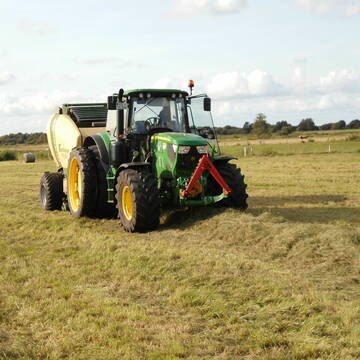
Eiweisarmes Heu oder Heulage
Sophienhamm
Herr-Kolb
@Herr-Kolb
Heu
Rundballen
Regenfrei
Wird verladen
B+

Heu HD Ballen
Carlsberg
Maike Käpernick
@ReitschuleKaepernick
Heu
Empfänger lädt ab
Kleinballen/HD-Ballen
Bio
Regenfrei
2 weitere...
B+
Deprecated: Creation of dynamic property Zend_View_Helper_Ads::$adLink is deprecated in /var/www/stall-frei/htdocs/staging.stall-frei.de/library/Psf/View/Helper/Ads.php on line 108

***Reitstall Birkenhof*** Pferdegerechte Haltung
Köln
Daniele-Fazzi
@Daniele-Fazzi
Herzlich Willkommen
auf dem Reitstall Birkenhof
Jetzt neu ‼️ auf dem Birkenhof:
Private Geländestrecke rund um unser

Erstklassiges PferdeHeu in HD-Ballen
Jevenstedt
Tim Rohwer
@EIDERHEU
Heu
Kleinballen/HD-Ballen
Regenfrei
B+

Heu in Rundballen (ca.130cm) super Qualität
Pronstorf
Caros Pferdeparadies
@KaOb
Heu
Rundballen
Regenfrei
Wird verladen
2 weitere...
B+
Leider kein Vorschaubild
Leider kein Vorschaubild
Bio-Luzerneheu aus qualifiziertem Biobetrieb
Altmärkische Höhe OT Losse
Landwirtschaft H.Stoltenberg
@ReiterhofLosse
Heu
Empfänger lädt ab
Großballen
Bio
2 weitere...
B+
Leider kein Vorschaubild
Leider kein Vorschaubild
Biohafer zu verkaufen
Altmärkische Höhe OT Losse
Landwirtschaft H.Stoltenberg
@ReiterhofLosse
Futter
Empfänger lädt ab
Lose
Bio
Regenfrei
2 weitere...
B+

Mitarbeiter gesucht?
Mechtersen
STALL-FREIde Marketing
@STALL-FREI-Marketing
Stellenangebote kostenlos veröffentlichen!

Luzerneheu 1.Schnitt
Teutschenthal
Nancy
@Haltergemeinschaft-TT
Heu
Empfänger lädt ab
Rundballen
Regenfrei
2 weitere...
B+

Strohstrukturpellets
Warsow
Luca Grabeleu, Marquardt
@LucaGrabeleu
Einstreu
Empfänger lädt ab
Bigbag
Regenfrei
3 weitere...
B+
Heu 1.Schnitt 2021
Upahl
hermannmeyerzuborgsen
@hermannmeyerzuborgsen
Heu
Empfänger lädt ab
Rundballen
Regenfrei
3 weitere...
P+

10 Rb Heu/15 RB Öhmd/15 RB Stroh
Helmstadt
Juergen
@Juergen77
Einstreu
Empfänger lädt ab
Rundballen
Regenfrei
2 weitere...
B+
Werde Teil von STALL-FREI.de
Verkaufe Heu, Heulage, Stroh, Einstreu oder Futter an Pferdehalter und Stallbetreiber
Deprecated: Creation of dynamic property Zend_View::$pageCount is deprecated in /var/www/stall-frei/htdocs/staging.stall-frei.de/library/vendor/shardj/zf1-future/library/Zend/View/Abstract.php on line 308
Deprecated: Creation of dynamic property Zend_View::$itemCountPerPage is deprecated in /var/www/stall-frei/htdocs/staging.stall-frei.de/library/vendor/shardj/zf1-future/library/Zend/View/Abstract.php on line 308
Deprecated: Creation of dynamic property Zend_View::$first is deprecated in /var/www/stall-frei/htdocs/staging.stall-frei.de/library/vendor/shardj/zf1-future/library/Zend/View/Abstract.php on line 308
Deprecated: Creation of dynamic property Zend_View::$current is deprecated in /var/www/stall-frei/htdocs/staging.stall-frei.de/library/vendor/shardj/zf1-future/library/Zend/View/Abstract.php on line 308
Deprecated: Creation of dynamic property Zend_View::$last is deprecated in /var/www/stall-frei/htdocs/staging.stall-frei.de/library/vendor/shardj/zf1-future/library/Zend/View/Abstract.php on line 308
Deprecated: Creation of dynamic property Zend_View::$previous is deprecated in /var/www/stall-frei/htdocs/staging.stall-frei.de/library/vendor/shardj/zf1-future/library/Zend/View/Abstract.php on line 308
Deprecated: Creation of dynamic property Zend_View::$next is deprecated in /var/www/stall-frei/htdocs/staging.stall-frei.de/library/vendor/shardj/zf1-future/library/Zend/View/Abstract.php on line 308
Deprecated: Creation of dynamic property Zend_View::$pagesInRange is deprecated in /var/www/stall-frei/htdocs/staging.stall-frei.de/library/vendor/shardj/zf1-future/library/Zend/View/Abstract.php on line 308
Deprecated: Creation of dynamic property Zend_View::$firstPageInRange is deprecated in /var/www/stall-frei/htdocs/staging.stall-frei.de/library/vendor/shardj/zf1-future/library/Zend/View/Abstract.php on line 308
Deprecated: Creation of dynamic property Zend_View::$lastPageInRange is deprecated in /var/www/stall-frei/htdocs/staging.stall-frei.de/library/vendor/shardj/zf1-future/library/Zend/View/Abstract.php on line 308
Deprecated: Creation of dynamic property Zend_View::$currentItemCount is deprecated in /var/www/stall-frei/htdocs/staging.stall-frei.de/library/vendor/shardj/zf1-future/library/Zend/View/Abstract.php on line 308
Deprecated: Creation of dynamic property Zend_View::$totalItemCount is deprecated in /var/www/stall-frei/htdocs/staging.stall-frei.de/library/vendor/shardj/zf1-future/library/Zend/View/Abstract.php on line 308
Deprecated: Creation of dynamic property Zend_View::$firstItemNumber is deprecated in /var/www/stall-frei/htdocs/staging.stall-frei.de/library/vendor/shardj/zf1-future/library/Zend/View/Abstract.php on line 308
Deprecated: Creation of dynamic property Zend_View::$lastItemNumber is deprecated in /var/www/stall-frei/htdocs/staging.stall-frei.de/library/vendor/shardj/zf1-future/library/Zend/View/Abstract.php on line 308
Deprecated: Creation of dynamic property Zend_View::$router is deprecated in /var/www/stall-frei/htdocs/staging.stall-frei.de/library/vendor/shardj/zf1-future/library/Zend/View/Abstract.php on line 308
Deprecated: Creation of dynamic property Zend_View::$urlParams is deprecated in /var/www/stall-frei/htdocs/staging.stall-frei.de/library/vendor/shardj/zf1-future/library/Zend/View/Abstract.php on line 308
Deprecated: Creation of dynamic property Zend_View::$showAds is deprecated in /var/www/stall-frei/htdocs/staging.stall-frei.de/library/vendor/shardj/zf1-future/library/Zend/View/Abstract.php on line 308
Deprecated: Creation of dynamic property Zend_View::$objectIds is deprecated in /var/www/stall-frei/htdocs/staging.stall-frei.de/library/vendor/shardj/zf1-future/library/Zend/View/Abstract.php on line 308
Deprecated: Creation of dynamic property Zend_View::$showNavbar is deprecated in /var/www/stall-frei/htdocs/staging.stall-frei.de/library/vendor/shardj/zf1-future/library/Zend/View/Abstract.php on line 308
Deprecated: Creation of dynamic property Zend_View::$showBreadcrumb is deprecated in /var/www/stall-frei/htdocs/staging.stall-frei.de/library/vendor/shardj/zf1-future/library/Zend/View/Abstract.php on line 308
Deprecated: Creation of dynamic property Zend_View::$showFooter is deprecated in /var/www/stall-frei/htdocs/staging.stall-frei.de/library/vendor/shardj/zf1-future/library/Zend/View/Abstract.php on line 308
Deprecated: Creation of dynamic property Zend_View::$showInternalAds is deprecated in /var/www/stall-frei/htdocs/staging.stall-frei.de/library/vendor/shardj/zf1-future/library/Zend/View/Abstract.php on line 308
Deprecated: Creation of dynamic property Zend_View::$blNoContent is deprecated in /var/www/stall-frei/htdocs/staging.stall-frei.de/library/vendor/shardj/zf1-future/library/Zend/View/Abstract.php on line 308
Deprecated: Creation of dynamic property Zend_View::$sMetaDesc is deprecated in /var/www/stall-frei/htdocs/staging.stall-frei.de/library/vendor/shardj/zf1-future/library/Zend/View/Abstract.php on line 308
Deprecated: Creation of dynamic property Zend_View::$useGmaps is deprecated in /var/www/stall-frei/htdocs/staging.stall-frei.de/library/vendor/shardj/zf1-future/library/Zend/View/Abstract.php on line 308
Deprecated: Creation of dynamic property Zend_View::$touches is deprecated in /var/www/stall-frei/htdocs/staging.stall-frei.de/library/vendor/shardj/zf1-future/library/Zend/View/Abstract.php on line 308
Deprecated: Creation of dynamic property Zend_View::$oProject is deprecated in /var/www/stall-frei/htdocs/staging.stall-frei.de/library/vendor/shardj/zf1-future/library/Zend/View/Abstract.php on line 308
Deprecated: Creation of dynamic property Zend_View::$pageHeadline is deprecated in /var/www/stall-frei/htdocs/staging.stall-frei.de/library/vendor/shardj/zf1-future/library/Zend/View/Abstract.php on line 308
Deprecated: Creation of dynamic property Zend_View::$disableLocationField is deprecated in /var/www/stall-frei/htdocs/staging.stall-frei.de/library/vendor/shardj/zf1-future/library/Zend/View/Abstract.php on line 308
Deprecated: Creation of dynamic property Zend_View::$isSearch is deprecated in /var/www/stall-frei/htdocs/staging.stall-frei.de/library/vendor/shardj/zf1-future/library/Zend/View/Abstract.php on line 308
Deprecated: Creation of dynamic property Zend_View::$pageTitle is deprecated in /var/www/stall-frei/htdocs/staging.stall-frei.de/library/vendor/shardj/zf1-future/library/Zend/View/Abstract.php on line 308
Deprecated: Creation of dynamic property Psf_Form_Element_Text::$class is deprecated in /var/www/stall-frei/htdocs/staging.stall-frei.de/library/vendor/shardj/zf1-future/library/Zend/Form/Element.php on line 874
Deprecated: Creation of dynamic property Psf_Form_Element_Text::$size is deprecated in /var/www/stall-frei/htdocs/staging.stall-frei.de/library/vendor/shardj/zf1-future/library/Zend/Form/Element.php on line 874
Deprecated: Creation of dynamic property Psf_Form_Element_Text::$placeholder is deprecated in /var/www/stall-frei/htdocs/staging.stall-frei.de/library/vendor/shardj/zf1-future/library/Zend/Form/Element.php on line 874
Deprecated: Creation of dynamic property Psf_Form_Element_Hidden::$class is deprecated in /var/www/stall-frei/htdocs/staging.stall-frei.de/library/vendor/shardj/zf1-future/library/Zend/Form/Element.php on line 874
Deprecated: Creation of dynamic property Psf_Form_Element_Hidden::$class is deprecated in /var/www/stall-frei/htdocs/staging.stall-frei.de/library/vendor/shardj/zf1-future/library/Zend/Form/Element.php on line 874
Deprecated: Creation of dynamic property Psf_Form_Element_Hidden::$class is deprecated in /var/www/stall-frei/htdocs/staging.stall-frei.de/library/vendor/shardj/zf1-future/library/Zend/Form/Element.php on line 874
Deprecated: Creation of dynamic property Psf_Form_Element_Hidden::$class is deprecated in /var/www/stall-frei/htdocs/staging.stall-frei.de/library/vendor/shardj/zf1-future/library/Zend/Form/Element.php on line 874
Deprecated: Creation of dynamic property Psf_Form_Element_Select::$class is deprecated in /var/www/stall-frei/htdocs/staging.stall-frei.de/library/vendor/shardj/zf1-future/library/Zend/Form/Element.php on line 874
Deprecated: Creation of dynamic property Psf_Form_Element_Select::$class is deprecated in /var/www/stall-frei/htdocs/staging.stall-frei.de/library/vendor/shardj/zf1-future/library/Zend/Form/Element.php on line 874
Deprecated: Creation of dynamic property Psf_Form_Element_Select::$class is deprecated in /var/www/stall-frei/htdocs/staging.stall-frei.de/library/vendor/shardj/zf1-future/library/Zend/Form/Element.php on line 874
Deprecated: Creation of dynamic property Psf_Form_Element_Select::$class is deprecated in /var/www/stall-frei/htdocs/staging.stall-frei.de/library/vendor/shardj/zf1-future/library/Zend/Form/Element.php on line 874
Deprecated: Creation of dynamic property Zend_View::$sort is deprecated in /var/www/stall-frei/htdocs/staging.stall-frei.de/library/vendor/shardj/zf1-future/library/Zend/View/Abstract.php on line 308
Deprecated: Creation of dynamic property Zend_View::$searchLocation is deprecated in /var/www/stall-frei/htdocs/staging.stall-frei.de/library/vendor/shardj/zf1-future/library/Zend/View/Abstract.php on line 308
Deprecated: Creation of dynamic property Zend_View::$locationHint is deprecated in /var/www/stall-frei/htdocs/staging.stall-frei.de/library/vendor/shardj/zf1-future/library/Zend/View/Abstract.php on line 308
Psf_GeoCoder_Abstract::getLocation: Häger Get Location CachedOrLive
Psf_GeoCoder_Abstract::getCachedOrLive: Häger
Psf_GeoCoder_Abstract::convertLocationResult
{"documentation":"https:\/\/opencagedata.com\/api","licenses":[{"name":"see attribution guide","url":"https:\/\/opencagedata.com\/credits"}],"results":[{"bounds":{"northeast":{"lat":52.0456581,"lng":7.5933521},"southwest":{"lat":52.0030635,"lng":7.5309843}},"components":{"ISO_3166-1_alpha-2":"DE","ISO_3166-1_alpha-3":"DEU","ISO_3166-2":["DE-NW"],"_category":"place","_normalized_city":"M\u00fcnster","_type":"neighbourhood","city":"M\u00fcnster","city_block":"H\u00e4ger","city_district":"M\u00fcnster-West","continent":"Europe","country":"Deutschland","country_code":"de","political_union":"European Union","state":"Nordrhein-Westfalen","state_code":"NW"},"confidence":7,"formatted":"M\u00fcnster-West, M\u00fcnster, Nordrhein-Westfalen, Deutschland","geometry":{"lat":52.0243186,"lng":7.5630698}},{"bounds":{"northeast":{"lat":52.111459,"lng":8.4725182},"southwest":{"lat":52.0804965,"lng":8.4240228}},"components":{"ISO_3166-1_alpha-2":"DE","ISO_3166-1_alpha-3":"DEU","ISO_3166-2":["DE-NW"],"_category":"place","_normalized_city":"H\u00e4ger","_type":"village","continent":"Europe","country":"Deutschland","country_code":"de","county":"Kreis G\u00fctersloh","municipality":"Werther (Westf.)","political_union":"European Union","state":"Nordrhein-Westfalen","state_code":"NW","village":"H\u00e4ger"},"confidence":7,"formatted":"H\u00e4ger, Nordrhein-Westfalen, Deutschland","geometry":{"lat":52.098129,"lng":8.4521556}},{"bounds":{"northeast":{"lat":52.0423584,"lng":7.5823786},"southwest":{"lat":52.0023584,"lng":7.5423786}},"components":{"ISO_3166-1_alpha-2":"DE","ISO_3166-1_alpha-3":"DEU","ISO_3166-2":["DE-NW"],"_category":"place","_normalized_city":"M\u00fcnster","_type":"village","city":"M\u00fcnster","continent":"Europe","country":"Deutschland","country_code":"de","political_union":"European Union","postcode":"48159","state":"Nordrhein-Westfalen","state_code":"NW","village":"H\u00e4ger"},"confidence":7,"formatted":"48159 H\u00e4ger, Deutschland","geometry":{"lat":52.0223584,"lng":7.5623786}},{"bounds":{"northeast":{"lat":49.0400723,"lng":9.5606821},"southwest":{"lat":49.0000723,"lng":9.5206821}},"components":{"ISO_3166-1_alpha-2":"DE","ISO_3166-1_alpha-3":"DEU","ISO_3166-2":["DE-BW"],"_category":"place","_normalized_city":"Sulzbach an der Murr","_type":"hamlet","continent":"Europe","country":"Deutschland","country_code":"de","county":"Rems-Murr-Kreis","hamlet":"Hager","municipality":"GVV Sulzbach","political_union":"European Union","postcode":"71577","state":"Baden-W\u00fcrttemberg","state_code":"BW","village":"Sulzbach an der Murr"},"confidence":7,"formatted":"Hager, 71577 Sulzbach an der Murr, Deutschland","geometry":{"lat":49.0200723,"lng":9.5406821}},{"bounds":{"northeast":{"lat":48.4507042,"lng":13.2460785},"southwest":{"lat":48.4107042,"lng":13.2060785}},"components":{"ISO_3166-1_alpha-2":"DE","ISO_3166-1_alpha-3":"DEU","ISO_3166-2":["DE-BY"],"_category":"place","_normalized_city":"Bad Griesbach i.Rottal","_type":"hamlet","continent":"Europe","country":"Deutschland","country_code":"de","county":"Landkreis Passau","hamlet":"Hager","political_union":"European Union","postcode":"94167","state":"Bayern","state_code":"BY","town":"Bad Griesbach i.Rottal"},"confidence":7,"formatted":"Hager, 94167 Bad Griesbach i.Rottal, Deutschland","geometry":{"lat":48.4307042,"lng":13.2260785}},{"bounds":{"northeast":{"lat":48.5593046,"lng":13.2885358},"southwest":{"lat":48.5193046,"lng":13.2485358}},"components":{"ISO_3166-1_alpha-2":"DE","ISO_3166-1_alpha-3":"DEU","ISO_3166-2":["DE-BY"],"_category":"place","_normalized_city":"Ortenburg","_type":"hamlet","continent":"Europe","country":"Deutschland","country_code":"de","county":"Landkreis Passau","hamlet":"Hager","political_union":"European Union","postcode":"94496","state":"Bayern","state_code":"BY","town":"Ortenburg"},"confidence":7,"formatted":"Hager, 94496 Ortenburg, Deutschland","geometry":{"lat":48.5393046,"lng":13.2685358}},{"bounds":{"northeast":{"lat":48.1977093,"lng":12.6158692},"southwest":{"lat":48.1577093,"lng":12.5758692}},"components":{"ISO_3166-1_alpha-2":"DE","ISO_3166-1_alpha-3":"DEU","ISO_3166-2":["DE-BY"],"_category":"place","_normalized_city":"Unterneukirchen","_type":"hamlet","continent":"Europe","country":"Deutschland","country_code":"de","county":"Landkreis Alt\u00f6tting","hamlet":"Hager","municipality":"Unterneukirchen (VGem)","political_union":"European Union","postcode":"84579","state":"Bayern","state_code":"BY","village":"Unterneukirchen"},"confidence":7,"formatted":"Hager, 84579 Unterneukirchen, Deutschland","geometry":{"lat":48.1777093,"lng":12.5958692}},{"bounds":{"northeast":{"lat":49.0673383,"lng":9.754519},"southwest":{"lat":49.0672383,"lng":9.754419}},"components":{"ISO_3166-1_alpha-2":"DE","ISO_3166-1_alpha-3":"DEU","ISO_3166-2":["DE-BW"],"_category":"building","_normalized_city":"Michelbach an der Bilz","_type":"building","continent":"Europe","country":"Deutschland","country_code":"de","county":"Landkreis Schw\u00e4bisch Hall","hamlet":"Hirschfelden","isolated_dwelling":"Hager","municipality":"VVG der Stadt Schw\u00e4bisch Hall","political_union":"European Union","postcode":"74544","state":"Baden-W\u00fcrttemberg","state_code":"BW","village":"Michelbach an der Bilz"},"confidence":10,"formatted":"Hager, Hirschfelden, 74544 Michelbach an der Bilz, Deutschland","geometry":{"lat":49.0672883,"lng":9.754469}},{"components":{"ISO_3166-1_alpha-2":"FR","ISO_3166-1_alpha-3":"FRA","ISO_3166-2":["FR-OCC","FR-09"],"_category":"place","_normalized_city":"Ustou","_type":"place","city":"Ustou","continent":"Europe","country":"France","country_code":"fr","county":"Ari\u00e8ge","local_authority":"Communaut\u00e9 de communes Couserans-Pyr\u00e9n\u00e9es","place":"Agerts","political_union":"European Union","postcode":"09140","state":"Occitanie","state_code":"OCC"},"confidence":2,"formatted":"Agerts, 09140 Ustou, France","geometry":{"lat":42.802892,"lng":1.285794}},{"components":{"ISO_3166-1_alpha-2":"FR","ISO_3166-1_alpha-3":"FRA","ISO_3166-2":["FR-ARA","FR-69"],"_category":"road","_normalized_city":"Saint-Cl\u00e9ment-de-Vers","_type":"road","city":"Saint-Cl\u00e9ment-de-Vers","continent":"Europe","country":"France","country_code":"fr","county":"Rh\u00f4ne","local_authority":"Communaut\u00e9 de communes Sa\u00f4ne Beaujolais","political_union":"European Union","postcode":"69790","road":"Chemin des Ageres","state":"Auvergne-Rh\u00f4ne-Alpes","state_code":"ARA"},"confidence":2,"formatted":"Chemin des Ageres, 69790 Saint-Cl\u00e9ment-de-Vers, France","geometry":{"lat":46.238385,"lng":4.40075}}],"status":{"code":200,"message":"OK"},"stay_informed":{"blog":"https:\/\/blog.opencagedata.com","mastodon":"https:\/\/en.osm.town\/@opencage"},"thanks":"For using an OpenCage API","timestamp":{"created_http":"Sat, 07 Feb 2026 09:13:12 GMT","created_unix":1770455592},"total_results":10}Array
(
[0] => stdClass Object
(
[bounds] => stdClass Object
(
[northeast] => stdClass Object
(
[lat] => 52.0456581
[lng] => 7.5933521
)
[southwest] => stdClass Object
(
[lat] => 52.0030635
[lng] => 7.5309843
)
)
[components] => stdClass Object
(
[ISO_3166-1_alpha-2] => DE
[ISO_3166-1_alpha-3] => DEU
[ISO_3166-2] => Array
(
[0] => DE-NW
)
[_category] => place
[_normalized_city] => Münster
[_type] => neighbourhood
[city] => Münster
[city_block] => Häger
[city_district] => Münster-West
[continent] => Europe
[country] => Deutschland
[country_code] => de
[political_union] => European Union
[state] => Nordrhein-Westfalen
[state_code] => NW
)
[confidence] => 7
[formatted] => Münster-West, Münster, Nordrhein-Westfalen, Deutschland
[geometry] => stdClass Object
(
[lat] => 52.0243186
[lng] => 7.5630698
)
)
[1] => stdClass Object
(
[bounds] => stdClass Object
(
[northeast] => stdClass Object
(
[lat] => 52.111459
[lng] => 8.4725182
)
[southwest] => stdClass Object
(
[lat] => 52.0804965
[lng] => 8.4240228
)
)
[components] => stdClass Object
(
[ISO_3166-1_alpha-2] => DE
[ISO_3166-1_alpha-3] => DEU
[ISO_3166-2] => Array
(
[0] => DE-NW
)
[_category] => place
[_normalized_city] => Häger
[_type] => village
[continent] => Europe
[country] => Deutschland
[country_code] => de
[county] => Kreis Gütersloh
[municipality] => Werther (Westf.)
[political_union] => European Union
[state] => Nordrhein-Westfalen
[state_code] => NW
[village] => Häger
)
[confidence] => 7
[formatted] => Häger, Nordrhein-Westfalen, Deutschland
[geometry] => stdClass Object
(
[lat] => 52.098129
[lng] => 8.4521556
)
)
[2] => stdClass Object
(
[bounds] => stdClass Object
(
[northeast] => stdClass Object
(
[lat] => 52.0423584
[lng] => 7.5823786
)
[southwest] => stdClass Object
(
[lat] => 52.0023584
[lng] => 7.5423786
)
)
[components] => stdClass Object
(
[ISO_3166-1_alpha-2] => DE
[ISO_3166-1_alpha-3] => DEU
[ISO_3166-2] => Array
(
[0] => DE-NW
)
[_category] => place
[_normalized_city] => Münster
[_type] => village
[city] => Münster
[continent] => Europe
[country] => Deutschland
[country_code] => de
[political_union] => European Union
[postcode] => 48159
[state] => Nordrhein-Westfalen
[state_code] => NW
[village] => Häger
)
[confidence] => 7
[formatted] => 48159 Häger, Deutschland
[geometry] => stdClass Object
(
[lat] => 52.0223584
[lng] => 7.5623786
)
)
[3] => stdClass Object
(
[bounds] => stdClass Object
(
[northeast] => stdClass Object
(
[lat] => 49.0400723
[lng] => 9.5606821
)
[southwest] => stdClass Object
(
[lat] => 49.0000723
[lng] => 9.5206821
)
)
[components] => stdClass Object
(
[ISO_3166-1_alpha-2] => DE
[ISO_3166-1_alpha-3] => DEU
[ISO_3166-2] => Array
(
[0] => DE-BW
)
[_category] => place
[_normalized_city] => Sulzbach an der Murr
[_type] => hamlet
[continent] => Europe
[country] => Deutschland
[country_code] => de
[county] => Rems-Murr-Kreis
[hamlet] => Hager
[municipality] => GVV Sulzbach
[political_union] => European Union
[postcode] => 71577
[state] => Baden-Württemberg
[state_code] => BW
[village] => Sulzbach an der Murr
)
[confidence] => 7
[formatted] => Hager, 71577 Sulzbach an der Murr, Deutschland
[geometry] => stdClass Object
(
[lat] => 49.0200723
[lng] => 9.5406821
)
)
[4] => stdClass Object
(
[bounds] => stdClass Object
(
[northeast] => stdClass Object
(
[lat] => 48.4507042
[lng] => 13.2460785
)
[southwest] => stdClass Object
(
[lat] => 48.4107042
[lng] => 13.2060785
)
)
[components] => stdClass Object
(
[ISO_3166-1_alpha-2] => DE
[ISO_3166-1_alpha-3] => DEU
[ISO_3166-2] => Array
(
[0] => DE-BY
)
[_category] => place
[_normalized_city] => Bad Griesbach i.Rottal
[_type] => hamlet
[continent] => Europe
[country] => Deutschland
[country_code] => de
[county] => Landkreis Passau
[hamlet] => Hager
[political_union] => European Union
[postcode] => 94167
[state] => Bayern
[state_code] => BY
[town] => Bad Griesbach i.Rottal
)
[confidence] => 7
[formatted] => Hager, 94167 Bad Griesbach i.Rottal, Deutschland
[geometry] => stdClass Object
(
[lat] => 48.4307042
[lng] => 13.2260785
)
)
[5] => stdClass Object
(
[bounds] => stdClass Object
(
[northeast] => stdClass Object
(
[lat] => 48.5593046
[lng] => 13.2885358
)
[southwest] => stdClass Object
(
[lat] => 48.5193046
[lng] => 13.2485358
)
)
[components] => stdClass Object
(
[ISO_3166-1_alpha-2] => DE
[ISO_3166-1_alpha-3] => DEU
[ISO_3166-2] => Array
(
[0] => DE-BY
)
[_category] => place
[_normalized_city] => Ortenburg
[_type] => hamlet
[continent] => Europe
[country] => Deutschland
[country_code] => de
[county] => Landkreis Passau
[hamlet] => Hager
[political_union] => European Union
[postcode] => 94496
[state] => Bayern
[state_code] => BY
[town] => Ortenburg
)
[confidence] => 7
[formatted] => Hager, 94496 Ortenburg, Deutschland
[geometry] => stdClass Object
(
[lat] => 48.5393046
[lng] => 13.2685358
)
)
[6] => stdClass Object
(
[bounds] => stdClass Object
(
[northeast] => stdClass Object
(
[lat] => 48.1977093
[lng] => 12.6158692
)
[southwest] => stdClass Object
(
[lat] => 48.1577093
[lng] => 12.5758692
)
)
[components] => stdClass Object
(
[ISO_3166-1_alpha-2] => DE
[ISO_3166-1_alpha-3] => DEU
[ISO_3166-2] => Array
(
[0] => DE-BY
)
[_category] => place
[_normalized_city] => Unterneukirchen
[_type] => hamlet
[continent] => Europe
[country] => Deutschland
[country_code] => de
[county] => Landkreis Altötting
[hamlet] => Hager
[municipality] => Unterneukirchen (VGem)
[political_union] => European Union
[postcode] => 84579
[state] => Bayern
[state_code] => BY
[village] => Unterneukirchen
)
[confidence] => 7
[formatted] => Hager, 84579 Unterneukirchen, Deutschland
[geometry] => stdClass Object
(
[lat] => 48.1777093
[lng] => 12.5958692
)
)
[7] => stdClass Object
(
[bounds] => stdClass Object
(
[northeast] => stdClass Object
(
[lat] => 49.0673383
[lng] => 9.754519
)
[southwest] => stdClass Object
(
[lat] => 49.0672383
[lng] => 9.754419
)
)
[components] => stdClass Object
(
[ISO_3166-1_alpha-2] => DE
[ISO_3166-1_alpha-3] => DEU
[ISO_3166-2] => Array
(
[0] => DE-BW
)
[_category] => building
[_normalized_city] => Michelbach an der Bilz
[_type] => building
[continent] => Europe
[country] => Deutschland
[country_code] => de
[county] => Landkreis Schwäbisch Hall
[hamlet] => Hirschfelden
[isolated_dwelling] => Hager
[municipality] => VVG der Stadt Schwäbisch Hall
[political_union] => European Union
[postcode] => 74544
[state] => Baden-Württemberg
[state_code] => BW
[village] => Michelbach an der Bilz
)
[confidence] => 10
[formatted] => Hager, Hirschfelden, 74544 Michelbach an der Bilz, Deutschland
[geometry] => stdClass Object
(
[lat] => 49.0672883
[lng] => 9.754469
)
)
[8] => stdClass Object
(
[components] => stdClass Object
(
[ISO_3166-1_alpha-2] => FR
[ISO_3166-1_alpha-3] => FRA
[ISO_3166-2] => Array
(
[0] => FR-OCC
[1] => FR-09
)
[_category] => place
[_normalized_city] => Ustou
[_type] => place
[city] => Ustou
[continent] => Europe
[country] => France
[country_code] => fr
[county] => Ariège
[local_authority] => Communauté de communes Couserans-Pyrénées
[place] => Agerts
[political_union] => European Union
[postcode] => 09140
[state] => Occitanie
[state_code] => OCC
)
[confidence] => 2
[formatted] => Agerts, 09140 Ustou, France
[geometry] => stdClass Object
(
[lat] => 42.802892
[lng] => 1.285794
)
)
[9] => stdClass Object
(
[components] => stdClass Object
(
[ISO_3166-1_alpha-2] => FR
[ISO_3166-1_alpha-3] => FRA
[ISO_3166-2] => Array
(
[0] => FR-ARA
[1] => FR-69
)
[_category] => road
[_normalized_city] => Saint-Clément-de-Vers
[_type] => road
[city] => Saint-Clément-de-Vers
[continent] => Europe
[country] => France
[country_code] => fr
[county] => Rhône
[local_authority] => Communauté de communes Saône Beaujolais
[political_union] => European Union
[postcode] => 69790
[road] => Chemin des Ageres
[state] => Auvergne-Rhône-Alpes
[state_code] => ARA
)
[confidence] => 2
[formatted] => Chemin des Ageres, 69790 Saint-Clément-de-Vers, France
[geometry] => stdClass Object
(
[lat] => 46.238385
[lng] => 4.40075
)
)
)
Psf_GeoCoder_OpenCageData::getKeyMap: 0
stdClass Object
(
    [bounds] => stdClass Object
        (
            [northeast] => stdClass Object
                (
                    [lat] => 52.0456581
                    [lng] => 7.5933521
                )

            [southwest] => stdClass Object
                (
                    [lat] => 52.0030635
                    [lng] => 7.5309843
                )

        )

    [components] => stdClass Object
        (
            [ISO_3166-1_alpha-2] => DE
            [ISO_3166-1_alpha-3] => DEU
            [ISO_3166-2] => Array
                (
                    [0] => DE-NW
                )

            [_category] => place
            [_normalized_city] => Münster
            [_type] => neighbourhood
            [city] => Münster
            [city_block] => Häger
            [city_district] => Münster-West
            [continent] => Europe
            [country] => Deutschland
            [country_code] => de
            [political_union] => European Union
            [state] => Nordrhein-Westfalen
            [state_code] => NW
        )

    [confidence] => 7
    [formatted] => Münster-West, Münster, Nordrhein-Westfalen, Deutschland
    [geometry] => stdClass Object
        (
            [lat] => 52.0243186
            [lng] => 7.5630698
        )

)
Psf_GeoCoder_OpenCageData::getCounty: Münster
Psf_GeoCoder_OpenCageData::addMissingData REFETCH!
Array
(
    [address] => Münster-West, Münster, Nordrhein-Westfalen, Deutschland
    [type] => neighbourhood
    [street] =>
    [city] => Münster
    [county] => Münster
    [state] => Nordrhein-Westfalen
    [zip] =>
    [country] => Deutschland
    [suburb] =>
    [countrycode] => de
    [latitude] => 52.0243186
    [longitude] => 7.5630698
    [accuracy] => 1
    [confidence] => 7
    [bounds] => stdClass Object
        (
            [northeast] => stdClass Object
                (
                    [lat] => 52.0456581
                    [lng] => 7.5933521
                )

            [southwest] => stdClass Object
                (
                    [lat] => 52.0030635
                    [lng] => 7.5309843
                )

        )

)
reformat!
Array
(
    [address] => Münster-West, Münster, Nordrhein-Westfalen, Deutschland
    [type] => neighbourhood
    [street] =>
    [city] => Münster
    [county] => Münster
    [state] => Nordrhein-Westfalen
    [zip] =>
    [country] => Deutschland
    [suburb] =>
    [countrycode] => de
    [latitude] => 52.0243186
    [longitude] => 7.5630698
    [accuracy] => 1
    [confidence] => 7
    [bounds] => stdClass Object
        (
            [northeast] => stdClass Object
                (
                    [lat] => 52.0456581
                    [lng] => 7.5933521
                )

            [southwest] => stdClass Object
                (
                    [lat] => 52.0030635
                    [lng] => 7.5309843
                )

        )

    [place] => Münster, Nordrhein-Westfalen
    [hash] => 95cb7c8a64c0c604d628786506aa42b8
)
Psf_GeoCoder_OpenCageData::getKeyMap: 1
stdClass Object
(
    [bounds] => stdClass Object
        (
            [northeast] => stdClass Object
                (
                    [lat] => 52.111459
                    [lng] => 8.4725182
                )

            [southwest] => stdClass Object
                (
                    [lat] => 52.0804965
                    [lng] => 8.4240228
                )

        )

    [components] => stdClass Object
        (
            [ISO_3166-1_alpha-2] => DE
            [ISO_3166-1_alpha-3] => DEU
            [ISO_3166-2] => Array
                (
                    [0] => DE-NW
                )

            [_category] => place
            [_normalized_city] => Häger
            [_type] => village
            [continent] => Europe
            [country] => Deutschland
            [country_code] => de
            [county] => Kreis Gütersloh
            [municipality] => Werther (Westf.)
            [political_union] => European Union
            [state] => Nordrhein-Westfalen
            [state_code] => NW
            [village] => Häger
        )

    [confidence] => 7
    [formatted] => Häger, Nordrhein-Westfalen, Deutschland
    [geometry] => stdClass Object
        (
            [lat] => 52.098129
            [lng] => 8.4521556
        )

)
Psf_GeoCoder_OpenCageData::getCounty: Gütersloh
Psf_GeoCoder_OpenCageData::addMissingData REFETCH!
Array
(
    [address] => Häger, Nordrhein-Westfalen, Deutschland
    [type] => village
    [street] =>
    [city] => Häger
    [county] => Gütersloh
    [state] => Nordrhein-Westfalen
    [zip] =>
    [country] => Deutschland
    [suburb] =>
    [countrycode] => de
    [latitude] => 52.098129
    [longitude] => 8.4521556
    [accuracy] => 1
    [confidence] => 7
    [bounds] => stdClass Object
        (
            [northeast] => stdClass Object
                (
                    [lat] => 52.111459
                    [lng] => 8.4725182
                )

            [southwest] => stdClass Object
                (
                    [lat] => 52.0804965
                    [lng] => 8.4240228
                )

        )

)
reformat!
Array
(
    [address] => Häger, Nordrhein-Westfalen, Deutschland
    [type] => village
    [street] =>
    [city] => Häger
    [county] => Gütersloh
    [state] => Nordrhein-Westfalen
    [zip] =>
    [country] => Deutschland
    [suburb] =>
    [countrycode] => de
    [latitude] => 52.098129
    [longitude] => 8.4521556
    [accuracy] => 1
    [confidence] => 7
    [bounds] => stdClass Object
        (
            [northeast] => stdClass Object
                (
                    [lat] => 52.111459
                    [lng] => 8.4725182
                )

            [southwest] => stdClass Object
                (
                    [lat] => 52.0804965
                    [lng] => 8.4240228
                )

        )

    [place] => Häger, Nordrhein-Westfalen
    [hash] => 7099785b03dfb241c1f95d09d7afa9df
)
Psf_GeoCoder_OpenCageData::getKeyMap: 2
stdClass Object
(
    [bounds] => stdClass Object
        (
            [northeast] => stdClass Object
                (
                    [lat] => 52.0423584
                    [lng] => 7.5823786
                )

            [southwest] => stdClass Object
                (
                    [lat] => 52.0023584
                    [lng] => 7.5423786
                )

        )

    [components] => stdClass Object
        (
            [ISO_3166-1_alpha-2] => DE
            [ISO_3166-1_alpha-3] => DEU
            [ISO_3166-2] => Array
                (
                    [0] => DE-NW
                )

            [_category] => place
            [_normalized_city] => Münster
            [_type] => village
            [city] => Münster
            [continent] => Europe
            [country] => Deutschland
            [country_code] => de
            [political_union] => European Union
            [postcode] => 48159
            [state] => Nordrhein-Westfalen
            [state_code] => NW
            [village] => Häger
        )

    [confidence] => 7
    [formatted] => 48159 Häger, Deutschland
    [geometry] => stdClass Object
        (
            [lat] => 52.0223584
            [lng] => 7.5623786
        )

)
Psf_GeoCoder_OpenCageData::getCounty: Münster
Psf_GeoCoder_OpenCageData::addMissingData REFETCH!
Array
(
    [address] => 48159 Häger, Deutschland
    [type] => village
    [street] =>
    [city] => Häger
    [county] => Münster
    [state] => Nordrhein-Westfalen
    [zip] => 48159
    [country] => Deutschland
    [suburb] =>
    [countrycode] => de
    [latitude] => 52.0223584
    [longitude] => 7.5623786
    [accuracy] => 1
    [confidence] => 7
    [bounds] => stdClass Object
        (
            [northeast] => stdClass Object
                (
                    [lat] => 52.0423584
                    [lng] => 7.5823786
                )

            [southwest] => stdClass Object
                (
                    [lat] => 52.0023584
                    [lng] => 7.5423786
                )

        )

)
reformat!
Array
(
    [address] => 48159 Häger, Deutschland
    [type] => village
    [street] =>
    [city] => Häger
    [county] => Münster
    [state] => Nordrhein-Westfalen
    [zip] => 48159
    [country] => Deutschland
    [suburb] =>
    [countrycode] => de
    [latitude] => 52.0223584
    [longitude] => 7.5623786
    [accuracy] => 1
    [confidence] => 7
    [bounds] => stdClass Object
        (
            [northeast] => stdClass Object
                (
                    [lat] => 52.0423584
                    [lng] => 7.5823786
                )

            [southwest] => stdClass Object
                (
                    [lat] => 52.0023584
                    [lng] => 7.5423786
                )

        )

    [place] => 48159 Häger, Nordrhein-Westfalen
    [hash] => e541d8c05c5b86be71cd2f778b6e848e
)
Psf_GeoCoder_OpenCageData::getKeyMap: 3
stdClass Object
(
    [bounds] => stdClass Object
        (
            [northeast] => stdClass Object
                (
                    [lat] => 49.0400723
                    [lng] => 9.5606821
                )

            [southwest] => stdClass Object
                (
                    [lat] => 49.0000723
                    [lng] => 9.5206821
                )

        )

    [components] => stdClass Object
        (
            [ISO_3166-1_alpha-2] => DE
            [ISO_3166-1_alpha-3] => DEU
            [ISO_3166-2] => Array
                (
                    [0] => DE-BW
                )

            [_category] => place
            [_normalized_city] => Sulzbach an der Murr
            [_type] => hamlet
            [continent] => Europe
            [country] => Deutschland
            [country_code] => de
            [county] => Rems-Murr-Kreis
            [hamlet] => Hager
            [municipality] => GVV Sulzbach
            [political_union] => European Union
            [postcode] => 71577
            [state] => Baden-Württemberg
            [state_code] => BW
            [village] => Sulzbach an der Murr
        )

    [confidence] => 7
    [formatted] => Hager, 71577 Sulzbach an der Murr, Deutschland
    [geometry] => stdClass Object
        (
            [lat] => 49.0200723
            [lng] => 9.5406821
        )

)
Psf_GeoCoder_OpenCageData::getCounty: Rems-Murr-Kreis
Psf_GeoCoder_OpenCageData::addMissingData REFETCH!
Array
(
    [address] => Hager, 71577 Sulzbach an der Murr, Deutschland
    [type] => hamlet
    [street] => Hager
    [city] => Sulzbach an der Murr
    [county] => Rems-Murr-Kreis
    [state] => Baden-Württemberg
    [zip] => 71577
    [country] => Deutschland
    [suburb] =>
    [countrycode] => de
    [latitude] => 49.0200723
    [longitude] => 9.5406821
    [accuracy] => 1
    [confidence] => 7
    [bounds] => stdClass Object
        (
            [northeast] => stdClass Object
                (
                    [lat] => 49.0400723
                    [lng] => 9.5606821
                )

            [southwest] => stdClass Object
                (
                    [lat] => 49.0000723
                    [lng] => 9.5206821
                )

        )

)
reformat!
Array
(
    [address] => Hager, 71577 Sulzbach an der Murr, Deutschland
    [type] => hamlet
    [street] => Hager
    [city] => Sulzbach an der Murr
    [county] => Rems-Murr-Kreis
    [state] => Baden-Württemberg
    [zip] => 71577
    [country] => Deutschland
    [suburb] =>
    [countrycode] => de
    [latitude] => 49.0200723
    [longitude] => 9.5406821
    [accuracy] => 1
    [confidence] => 7
    [bounds] => stdClass Object
        (
            [northeast] => stdClass Object
                (
                    [lat] => 49.0400723
                    [lng] => 9.5606821
                )

            [southwest] => stdClass Object
                (
                    [lat] => 49.0000723
                    [lng] => 9.5206821
                )

        )

    [place] => Hager, 71577 Sulzbach an der Murr, Baden-Württemberg
    [hash] => 80344c8ff15bb8e708dc0702ba5018cc
)
Psf_GeoCoder_OpenCageData::getKeyMap: 4
stdClass Object
(
    [bounds] => stdClass Object
        (
            [northeast] => stdClass Object
                (
                    [lat] => 48.4507042
                    [lng] => 13.2460785
                )

            [southwest] => stdClass Object
                (
                    [lat] => 48.4107042
                    [lng] => 13.2060785
                )

        )

    [components] => stdClass Object
        (
            [ISO_3166-1_alpha-2] => DE
            [ISO_3166-1_alpha-3] => DEU
            [ISO_3166-2] => Array
                (
                    [0] => DE-BY
                )

            [_category] => place
            [_normalized_city] => Bad Griesbach i.Rottal
            [_type] => hamlet
            [continent] => Europe
            [country] => Deutschland
            [country_code] => de
            [county] => Landkreis Passau
            [hamlet] => Hager
            [political_union] => European Union
            [postcode] => 94167
            [state] => Bayern
            [state_code] => BY
            [town] => Bad Griesbach i.Rottal
        )

    [confidence] => 7
    [formatted] => Hager, 94167 Bad Griesbach i.Rottal, Deutschland
    [geometry] => stdClass Object
        (
            [lat] => 48.4307042
            [lng] => 13.2260785
        )

)
Psf_GeoCoder_OpenCageData::getCounty: Passau
Psf_GeoCoder_OpenCageData::addMissingData REFETCH!
Array
(
    [address] => Hager, 94167 Bad Griesbach i.Rottal, Deutschland
    [type] => hamlet
    [street] => Hager
    [city] => Bad Griesbach i.Rottal
    [county] => Passau
    [state] => Bayern
    [zip] => 94167
    [country] => Deutschland
    [suburb] =>
    [countrycode] => de
    [latitude] => 48.4307042
    [longitude] => 13.2260785
    [accuracy] => 1
    [confidence] => 7
    [bounds] => stdClass Object
        (
            [northeast] => stdClass Object
                (
                    [lat] => 48.4507042
                    [lng] => 13.2460785
                )

            [southwest] => stdClass Object
                (
                    [lat] => 48.4107042
                    [lng] => 13.2060785
                )

        )

)
reformat!
Array
(
    [address] => Hager, 94167 Bad Griesbach i.Rottal, Deutschland
    [type] => hamlet
    [street] => Hager
    [city] => Bad Griesbach i.Rottal
    [county] => Passau
    [state] => Bayern
    [zip] => 94167
    [country] => Deutschland
    [suburb] =>
    [countrycode] => de
    [latitude] => 48.4307042
    [longitude] => 13.2260785
    [accuracy] => 1
    [confidence] => 7
    [bounds] => stdClass Object
        (
            [northeast] => stdClass Object
                (
                    [lat] => 48.4507042
                    [lng] => 13.2460785
                )

            [southwest] => stdClass Object
                (
                    [lat] => 48.4107042
                    [lng] => 13.2060785
                )

        )

    [place] => Hager, 94167 Bad Griesbach i.Rottal, Bayern
    [hash] => 09b2666d661225638f7f8f3124f13e68
)
Psf_GeoCoder_OpenCageData::getKeyMap: 5
stdClass Object
(
    [bounds] => stdClass Object
        (
            [northeast] => stdClass Object
                (
                    [lat] => 48.5593046
                    [lng] => 13.2885358
                )

            [southwest] => stdClass Object
                (
                    [lat] => 48.5193046
                    [lng] => 13.2485358
                )

        )

    [components] => stdClass Object
        (
            [ISO_3166-1_alpha-2] => DE
            [ISO_3166-1_alpha-3] => DEU
            [ISO_3166-2] => Array
                (
                    [0] => DE-BY
                )

            [_category] => place
            [_normalized_city] => Ortenburg
            [_type] => hamlet
            [continent] => Europe
            [country] => Deutschland
            [country_code] => de
            [county] => Landkreis Passau
            [hamlet] => Hager
            [political_union] => European Union
            [postcode] => 94496
            [state] => Bayern
            [state_code] => BY
            [town] => Ortenburg
        )

    [confidence] => 7
    [formatted] => Hager, 94496 Ortenburg, Deutschland
    [geometry] => stdClass Object
        (
            [lat] => 48.5393046
            [lng] => 13.2685358
        )

)
Psf_GeoCoder_OpenCageData::getCounty: Passau
Psf_GeoCoder_OpenCageData::addMissingData REFETCH!
Array
(
    [address] => Hager, 94496 Ortenburg, Deutschland
    [type] => hamlet
    [street] => Hager
    [city] => Ortenburg
    [county] => Passau
    [state] => Bayern
    [zip] => 94496
    [country] => Deutschland
    [suburb] =>
    [countrycode] => de
    [latitude] => 48.5393046
    [longitude] => 13.2685358
    [accuracy] => 1
    [confidence] => 7
    [bounds] => stdClass Object
        (
            [northeast] => stdClass Object
                (
                    [lat] => 48.5593046
                    [lng] => 13.2885358
                )

            [southwest] => stdClass Object
                (
                    [lat] => 48.5193046
                    [lng] => 13.2485358
                )

        )

)
reformat!
Array
(
    [address] => Hager, 94496 Ortenburg, Deutschland
    [type] => hamlet
    [street] => Hager
    [city] => Ortenburg
    [county] => Passau
    [state] => Bayern
    [zip] => 94496
    [country] => Deutschland
    [suburb] =>
    [countrycode] => de
    [latitude] => 48.5393046
    [longitude] => 13.2685358
    [accuracy] => 1
    [confidence] => 7
    [bounds] => stdClass Object
        (
            [northeast] => stdClass Object
                (
                    [lat] => 48.5593046
                    [lng] => 13.2885358
                )

            [southwest] => stdClass Object
                (
                    [lat] => 48.5193046
                    [lng] => 13.2485358
                )

        )

    [place] => Hager, 94496 Ortenburg, Bayern
    [hash] => 82cbd49fb40433698b8dd2ab7dc5bb6f
)
Psf_GeoCoder_OpenCageData::getKeyMap: 6
stdClass Object
(
    [bounds] => stdClass Object
        (
            [northeast] => stdClass Object
                (
                    [lat] => 48.1977093
                    [lng] => 12.6158692
                )

            [southwest] => stdClass Object
                (
                    [lat] => 48.1577093
                    [lng] => 12.5758692
                )

        )

    [components] => stdClass Object
        (
            [ISO_3166-1_alpha-2] => DE
            [ISO_3166-1_alpha-3] => DEU
            [ISO_3166-2] => Array
                (
                    [0] => DE-BY
                )

            [_category] => place
            [_normalized_city] => Unterneukirchen
            [_type] => hamlet
            [continent] => Europe
            [country] => Deutschland
            [country_code] => de
            [county] => Landkreis Altötting
            [hamlet] => Hager
            [municipality] => Unterneukirchen (VGem)
            [political_union] => European Union
            [postcode] => 84579
            [state] => Bayern
            [state_code] => BY
            [village] => Unterneukirchen
        )

    [confidence] => 7
    [formatted] => Hager, 84579 Unterneukirchen, Deutschland
    [geometry] => stdClass Object
        (
            [lat] => 48.1777093
            [lng] => 12.5958692
        )

)
Psf_GeoCoder_OpenCageData::getCounty: Altötting
Psf_GeoCoder_OpenCageData::addMissingData REFETCH!
Array
(
    [address] => Hager, 84579 Unterneukirchen, Deutschland
    [type] => hamlet
    [street] => Hager
    [city] => Unterneukirchen
    [county] => Altötting
    [state] => Bayern
    [zip] => 84579
    [country] => Deutschland
    [suburb] =>
    [countrycode] => de
    [latitude] => 48.1777093
    [longitude] => 12.5958692
    [accuracy] => 1
    [confidence] => 7
    [bounds] => stdClass Object
        (
            [northeast] => stdClass Object
                (
                    [lat] => 48.1977093
                    [lng] => 12.6158692
                )

            [southwest] => stdClass Object
                (
                    [lat] => 48.1577093
                    [lng] => 12.5758692
                )

        )

)
reformat!
Array
(
    [address] => Hager, 84579 Unterneukirchen, Deutschland
    [type] => hamlet
    [street] => Hager
    [city] => Unterneukirchen
    [county] => Altötting
    [state] => Bayern
    [zip] => 84579
    [country] => Deutschland
    [suburb] =>
    [countrycode] => de
    [latitude] => 48.1777093
    [longitude] => 12.5958692
    [accuracy] => 1
    [confidence] => 7
    [bounds] => stdClass Object
        (
            [northeast] => stdClass Object
                (
                    [lat] => 48.1977093
                    [lng] => 12.6158692
                )

            [southwest] => stdClass Object
                (
                    [lat] => 48.1577093
                    [lng] => 12.5758692
                )

        )

    [place] => Hager, 84579 Unterneukirchen, Bayern
    [hash] => f31bef150061eed8d312a3ae65f5f7dd
)
Psf_GeoCoder_OpenCageData::getKeyMap: 7
stdClass Object
(
    [bounds] => stdClass Object
        (
            [northeast] => stdClass Object
                (
                    [lat] => 49.0673383
                    [lng] => 9.754519
                )

            [southwest] => stdClass Object
                (
                    [lat] => 49.0672383
                    [lng] => 9.754419
                )

        )

    [components] => stdClass Object
        (
            [ISO_3166-1_alpha-2] => DE
            [ISO_3166-1_alpha-3] => DEU
            [ISO_3166-2] => Array
                (
                    [0] => DE-BW
                )

            [_category] => building
            [_normalized_city] => Michelbach an der Bilz
            [_type] => building
            [continent] => Europe
            [country] => Deutschland
            [country_code] => de
            [county] => Landkreis Schwäbisch Hall
            [hamlet] => Hirschfelden
            [isolated_dwelling] => Hager
            [municipality] => VVG der Stadt Schwäbisch Hall
            [political_union] => European Union
            [postcode] => 74544
            [state] => Baden-Württemberg
            [state_code] => BW
            [village] => Michelbach an der Bilz
        )

    [confidence] => 10
    [formatted] => Hager, Hirschfelden, 74544 Michelbach an der Bilz, Deutschland
    [geometry] => stdClass Object
        (
            [lat] => 49.0672883
            [lng] => 9.754469
        )

)
Psf_GeoCoder_OpenCageData::getCounty: Schwäbisch Hall
Psf_GeoCoder_OpenCageData::addMissingData REFETCH!
Array
(
    [address] => Hager, Hirschfelden, 74544 Michelbach an der Bilz, Deutschland
    [type] => building
    [street] => Hirschfelden
    [city] => Michelbach an der Bilz
    [county] => Schwäbisch Hall
    [state] => Baden-Württemberg
    [zip] => 74544
    [country] => Deutschland
    [suburb] =>
    [countrycode] => de
    [latitude] => 49.0672883
    [longitude] => 9.754469
    [accuracy] => 1
    [confidence] => 10
    [bounds] => stdClass Object
        (
            [northeast] => stdClass Object
                (
                    [lat] => 49.0673383
                    [lng] => 9.754519
                )

            [southwest] => stdClass Object
                (
                    [lat] => 49.0672383
                    [lng] => 9.754419
                )

        )

)
reformat!
Array
(
    [address] => Hager, Hirschfelden, 74544 Michelbach an der Bilz, Deutschland
    [type] => building
    [street] => Hirschfelden
    [city] => Michelbach an der Bilz
    [county] => Schwäbisch Hall
    [state] => Baden-Württemberg
    [zip] => 74544
    [country] => Deutschland
    [suburb] =>
    [countrycode] => de
    [latitude] => 49.0672883
    [longitude] => 9.754469
    [accuracy] => 1
    [confidence] => 10
    [bounds] => stdClass Object
        (
            [northeast] => stdClass Object
                (
                    [lat] => 49.0673383
                    [lng] => 9.754519
                )

            [southwest] => stdClass Object
                (
                    [lat] => 49.0672383
                    [lng] => 9.754419
                )

        )

    [place] => Hirschfelden, 74544 Michelbach an der Bilz, Baden-Württemberg
    [hash] => 9a08c7407fb9c21fa7ecb7347d5f572e
)
Psf_GeoCoder_OpenCageData::getKeyMap: 8
stdClass Object
(
    [components] => stdClass Object
        (
            [ISO_3166-1_alpha-2] => FR
            [ISO_3166-1_alpha-3] => FRA
            [ISO_3166-2] => Array
                (
                    [0] => FR-OCC
                    [1] => FR-09
                )

            [_category] => place
            [_normalized_city] => Ustou
            [_type] => place
            [city] => Ustou
            [continent] => Europe
            [country] => France
            [country_code] => fr
            [county] => Ariège
            [local_authority] => Communauté de communes Couserans-Pyrénées
            [place] => Agerts
            [political_union] => European Union
            [postcode] => 09140
            [state] => Occitanie
            [state_code] => OCC
        )

    [confidence] => 2
    [formatted] => Agerts, 09140 Ustou, France
    [geometry] => stdClass Object
        (
            [lat] => 42.802892
            [lng] => 1.285794
        )

)
Psf_GeoCoder_OpenCageData::getCounty: Ariège
Psf_GeoCoder_OpenCageData::addMissingData REFETCH!
Array
(
    [address] => Agerts, 09140 Ustou, France
    [type] => place
    [street] =>
    [city] => Ustou
    [county] => Ariège
    [state] => Occitanie
    [zip] => 09140
    [country] => France
    [suburb] =>
    [countrycode] => fr
    [latitude] => 42.802892
    [longitude] => 1.285794
    [accuracy] => 1
    [confidence] => 2
    [bounds] =>
)
reformat!
Array
(
    [address] => Agerts, 09140 Ustou, France
    [type] => place
    [street] =>
    [city] => Ustou
    [county] => Ariège
    [state] => Occitanie
    [zip] => 09140
    [country] => France
    [suburb] =>
    [countrycode] => fr
    [latitude] => 42.802892
    [longitude] => 1.285794
    [accuracy] => 1
    [confidence] => 2
    [bounds] =>
    [place] => 09140 Ustou, Occitanie
    [hash] => 485d0fa77bdde9a61fc7c2f6010209d5
)
Psf_GeoCoder_OpenCageData::getKeyMap: 9
stdClass Object
(
    [components] => stdClass Object
        (
            [ISO_3166-1_alpha-2] => FR
            [ISO_3166-1_alpha-3] => FRA
            [ISO_3166-2] => Array
                (
                    [0] => FR-ARA
                    [1] => FR-69
                )

            [_category] => road
            [_normalized_city] => Saint-Clément-de-Vers
            [_type] => road
            [city] => Saint-Clément-de-Vers
            [continent] => Europe
            [country] => France
            [country_code] => fr
            [county] => Rhône
            [local_authority] => Communauté de communes Saône Beaujolais
            [political_union] => European Union
            [postcode] => 69790
            [road] => Chemin des Ageres
            [state] => Auvergne-Rhône-Alpes
            [state_code] => ARA
        )

    [confidence] => 2
    [formatted] => Chemin des Ageres, 69790 Saint-Clément-de-Vers, France
    [geometry] => stdClass Object
        (
            [lat] => 46.238385
            [lng] => 4.40075
        )

)
Psf_GeoCoder_OpenCageData::getCounty: Rhône
Psf_GeoCoder_OpenCageData::addMissingData REFETCH!
Array
(
    [address] => Chemin des Ageres, 69790 Saint-Clément-de-Vers, France
    [type] => road
    [street] => Chemin des Ageres
    [city] => Saint-Clément-de-Vers
    [county] => Rhône
    [state] => Auvergne-Rhône-Alpes
    [zip] => 69790
    [country] => France
    [suburb] =>
    [countrycode] => fr
    [latitude] => 46.238385
    [longitude] => 4.40075
    [accuracy] => 1
    [confidence] => 2
    [bounds] =>
)
reformat!
Array
(
    [address] => Chemin des Ageres, 69790 Saint-Clément-de-Vers, France
    [type] => road
    [street] => Chemin des Ageres
    [city] => Saint-Clément-de-Vers
    [county] => Rhône
    [state] => Auvergne-Rhône-Alpes
    [zip] => 69790
    [country] => France
    [suburb] =>
    [countrycode] => fr
    [latitude] => 46.238385
    [longitude] => 4.40075
    [accuracy] => 1
    [confidence] => 2
    [bounds] =>
    [place] => Chemin des Ageres, 69790 Saint-Clément-de-Vers, Auvergne-Rhône-Alpes
    [hash] => e4e2cd470b9a379841941dee67327c5c
)
Deprecated: Creation of dynamic property Zend_View::$locationHintStyle is deprecated in /var/www/stall-frei/htdocs/staging.stall-frei.de/library/vendor/shardj/zf1-future/library/Zend/View/Abstract.php on line 308
Deprecated: Creation of dynamic property Zend_View::$adGeoLocation is deprecated in /var/www/stall-frei/htdocs/staging.stall-frei.de/library/vendor/shardj/zf1-future/library/Zend/View/Abstract.php on line 308
Deprecated: Creation of dynamic property Zend_View::$recordCount is deprecated in /var/www/stall-frei/htdocs/staging.stall-frei.de/library/vendor/shardj/zf1-future/library/Zend/View/Abstract.php on line 308
Deprecated: Creation of dynamic property Zend_View::$paginationParams is deprecated in /var/www/stall-frei/htdocs/staging.stall-frei.de/library/vendor/shardj/zf1-future/library/Zend/View/Abstract.php on line 308
Deprecated: Creation of dynamic property Zend_View::$objectPaginator is deprecated in /var/www/stall-frei/htdocs/staging.stall-frei.de/library/vendor/shardj/zf1-future/library/Zend/View/Abstract.php on line 308
Deprecated: Creation of dynamic property Zend_View::$featuredObjects is deprecated in /var/www/stall-frei/htdocs/staging.stall-frei.de/library/vendor/shardj/zf1-future/library/Zend/View/Abstract.php on line 308
Deprecated: Creation of dynamic property Zend_View::$hints is deprecated in /var/www/stall-frei/htdocs/staging.stall-frei.de/library/vendor/shardj/zf1-future/library/Zend/View/Abstract.php on line 308
Deprecated: Creation of dynamic property Zend_View::$attributeHints is deprecated in /var/www/stall-frei/htdocs/staging.stall-frei.de/library/vendor/shardj/zf1-future/library/Zend/View/Abstract.php on line 308
Deprecated: Creation of dynamic property Zend_View::$oSearchForm is deprecated in /var/www/stall-frei/htdocs/staging.stall-frei.de/library/vendor/shardj/zf1-future/library/Zend/View/Abstract.php on line 308