Deprecated: Creation of dynamic property Zend_View::$sMode is deprecated in /var/www/stall-frei/htdocs/staging.stall-frei.de/library/vendor/shardj/zf1-future/library/Zend/View/Abstract.php on line 308
Heu, Stroh oder Futter in Obersdorf
Gesucht wird in "57234 Obersdorf, Deutschland"
95 Einträge
Deprecated: Creation of dynamic property Zend_View::$listObjects is deprecated in /var/www/stall-frei/htdocs/staging.stall-frei.de/library/vendor/shardj/zf1-future/library/Zend/View/Abstract.php on line 308
Deprecated: Creation of dynamic property Zend_View::$listMode is deprecated in /var/www/stall-frei/htdocs/staging.stall-frei.de/library/vendor/shardj/zf1-future/library/Zend/View/Abstract.php on line 308
Deprecated: Creation of dynamic property Zend_View::$renderedObjects is deprecated in /var/www/stall-frei/htdocs/staging.stall-frei.de/library/vendor/shardj/zf1-future/library/Zend/View/Abstract.php on line 308
Deprecated: Creation of dynamic property Zend_View::$index is deprecated in /var/www/stall-frei/htdocs/staging.stall-frei.de/library/vendor/shardj/zf1-future/library/Zend/View/Abstract.php on line 308
Deprecated: Creation of dynamic property Zend_View::$displayMode is deprecated in /var/www/stall-frei/htdocs/staging.stall-frei.de/library/vendor/shardj/zf1-future/library/Zend/View/Abstract.php on line 308
Deprecated: Creation of dynamic property Zend_View::$remarketingIds is deprecated in /var/www/stall-frei/htdocs/staging.stall-frei.de/library/vendor/shardj/zf1-future/library/Zend/View/Abstract.php on line 308
Deprecated: Creation of dynamic property Zend_View::$listItem is deprecated in /var/www/stall-frei/htdocs/staging.stall-frei.de/library/vendor/shardj/zf1-future/library/Zend/View/Abstract.php on line 308
Deprecated: Creation of dynamic property Zend_View::$object is deprecated in /var/www/stall-frei/htdocs/staging.stall-frei.de/library/vendor/shardj/zf1-future/library/Zend/View/Abstract.php on line 308
Deprecated: Creation of dynamic property Zend_View::$attributes is deprecated in /var/www/stall-frei/htdocs/staging.stall-frei.de/library/vendor/shardj/zf1-future/library/Zend/View/Abstract.php on line 308

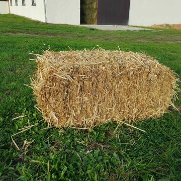
Biete Heu in Rundballen
Steinheim am Albuch
Westernreiterhof Ziegler
@NadinZiegler
Heu
Rundballen
Bio
Regenfrei
Wird verladen
1 weitere...
B+
HD-Strohballen, Gersten-, Dinkel- und Weizenstroh
Hilpoltstein
KnollmeyerBallen
@KnollmeyerBallen
Einstreu
Lieferant entlädt
Kleinballen/HD-Ballen
Regenfrei
3 weitere...
B+
Deprecated: Creation of dynamic property Zend_View_Helper_Ads::$adLink is deprecated in /var/www/stall-frei/htdocs/staging.stall-frei.de/library/Psf/View/Helper/Ads.php on line 108

Pferdepension Hit Aktivstall Kürmerhof
Hohenkammer
Kuermerhof
@Kuermerhof
*******JETZT NEU MIT ENTSTAUBTEM BIOHEU*********
*******Demnächst mit einem Abenteuerspielplatz für Pferde ( Extrem Trail/Pa

HD-Heuballen, 1. Schnitt & 2. Schnitt
Hilpoltstein
KnollmeyerBallen
@KnollmeyerBallen
Heu
Lieferant entlädt
Kleinballen/HD-Ballen
Regenfrei
3 weitere...
B+
Leider kein Vorschaubild
Leider kein Vorschaubild
BIO-Heu, 1. Schnitt 2024, Quaderballen (60x40x30)
Tirpersdorf
Forstbaumschule
@Forstbaumschule
Heu
Kleinballen/HD-Ballen
Bio
Regenfrei
Käufer lädt selbst
1 weitere...
aktuell
B+
Leider kein Vorschaubild
Leider kein Vorschaubild
Bio-Heu, 1. Schnitt aus 2024 (BIOLAND) zu verkauf.
Tirpersdorf
Forstbaumschule
@Forstbaumschule
Heu
Empfänger lädt ab
Großballen
Bio
Regenfrei
2 weitere...
B+
Leider kein Vorschaubild
Leider kein Vorschaubild
BIO-Heu, 1. Schnitt 2025, Quaderballen (60x40x30)
Tirpersdorf
Forstbaumschule
@Forstbaumschule
Heu
Kleinballen/HD-Ballen
Bio
Regenfrei
Wird verladen
1 weitere...
B+

Heu aus neuer Ernte
Mechtersen
STALL-FREIde Marketing
@STALL-FREI-Marketing
Heulage und Pferdeheu aus der neuen Ernte findest du in unserem Futtermarkt
Leider kein Vorschaubild
Leider kein Vorschaubild
Heucobs zu verkaufen
Langenau
Bewegungsstall-Unseld
@Bewegungsstall-Unseld
Heu
Großballen
Regenfrei
Wird verladen
B+
Leider kein Vorschaubild
Leider kein Vorschaubild
Heucobs in Bigbags oder 25 kg Säcke
Langenau
Bewegungsstall-Unseld
@Bewegungsstall-Unseld
Futter
Pellets
Regenfrei
Wird verladen
1 weitere...
B+

Bedampftes Heu in Großballen für Allergikerpferd...
Langenau
Bewegungsstall-Unseld
@Bewegungsstall-Unseld
Heu
Großballen
Regenfrei
Wird verladen
1 weitere...
B+
Leider kein Vorschaubild
Leider kein Vorschaubild
B+
Werde Teil von STALL-FREI.de
Verkaufe Heu, Heulage, Stroh, Einstreu oder Futter an Pferdehalter und Stallbetreiber
Deprecated: Creation of dynamic property Zend_View::$pageCount is deprecated in /var/www/stall-frei/htdocs/staging.stall-frei.de/library/vendor/shardj/zf1-future/library/Zend/View/Abstract.php on line 308
Deprecated: Creation of dynamic property Zend_View::$itemCountPerPage is deprecated in /var/www/stall-frei/htdocs/staging.stall-frei.de/library/vendor/shardj/zf1-future/library/Zend/View/Abstract.php on line 308
Deprecated: Creation of dynamic property Zend_View::$first is deprecated in /var/www/stall-frei/htdocs/staging.stall-frei.de/library/vendor/shardj/zf1-future/library/Zend/View/Abstract.php on line 308
Deprecated: Creation of dynamic property Zend_View::$current is deprecated in /var/www/stall-frei/htdocs/staging.stall-frei.de/library/vendor/shardj/zf1-future/library/Zend/View/Abstract.php on line 308
Deprecated: Creation of dynamic property Zend_View::$last is deprecated in /var/www/stall-frei/htdocs/staging.stall-frei.de/library/vendor/shardj/zf1-future/library/Zend/View/Abstract.php on line 308
Deprecated: Creation of dynamic property Zend_View::$previous is deprecated in /var/www/stall-frei/htdocs/staging.stall-frei.de/library/vendor/shardj/zf1-future/library/Zend/View/Abstract.php on line 308
Deprecated: Creation of dynamic property Zend_View::$next is deprecated in /var/www/stall-frei/htdocs/staging.stall-frei.de/library/vendor/shardj/zf1-future/library/Zend/View/Abstract.php on line 308
Deprecated: Creation of dynamic property Zend_View::$pagesInRange is deprecated in /var/www/stall-frei/htdocs/staging.stall-frei.de/library/vendor/shardj/zf1-future/library/Zend/View/Abstract.php on line 308
Deprecated: Creation of dynamic property Zend_View::$firstPageInRange is deprecated in /var/www/stall-frei/htdocs/staging.stall-frei.de/library/vendor/shardj/zf1-future/library/Zend/View/Abstract.php on line 308
Deprecated: Creation of dynamic property Zend_View::$lastPageInRange is deprecated in /var/www/stall-frei/htdocs/staging.stall-frei.de/library/vendor/shardj/zf1-future/library/Zend/View/Abstract.php on line 308
Deprecated: Creation of dynamic property Zend_View::$currentItemCount is deprecated in /var/www/stall-frei/htdocs/staging.stall-frei.de/library/vendor/shardj/zf1-future/library/Zend/View/Abstract.php on line 308
Deprecated: Creation of dynamic property Zend_View::$totalItemCount is deprecated in /var/www/stall-frei/htdocs/staging.stall-frei.de/library/vendor/shardj/zf1-future/library/Zend/View/Abstract.php on line 308
Deprecated: Creation of dynamic property Zend_View::$firstItemNumber is deprecated in /var/www/stall-frei/htdocs/staging.stall-frei.de/library/vendor/shardj/zf1-future/library/Zend/View/Abstract.php on line 308
Deprecated: Creation of dynamic property Zend_View::$lastItemNumber is deprecated in /var/www/stall-frei/htdocs/staging.stall-frei.de/library/vendor/shardj/zf1-future/library/Zend/View/Abstract.php on line 308
Deprecated: Creation of dynamic property Zend_View::$router is deprecated in /var/www/stall-frei/htdocs/staging.stall-frei.de/library/vendor/shardj/zf1-future/library/Zend/View/Abstract.php on line 308
Deprecated: Creation of dynamic property Zend_View::$urlParams is deprecated in /var/www/stall-frei/htdocs/staging.stall-frei.de/library/vendor/shardj/zf1-future/library/Zend/View/Abstract.php on line 308
Deprecated: Creation of dynamic property Zend_View::$showAds is deprecated in /var/www/stall-frei/htdocs/staging.stall-frei.de/library/vendor/shardj/zf1-future/library/Zend/View/Abstract.php on line 308
Deprecated: Creation of dynamic property Zend_View::$objectIds is deprecated in /var/www/stall-frei/htdocs/staging.stall-frei.de/library/vendor/shardj/zf1-future/library/Zend/View/Abstract.php on line 308
Deprecated: Creation of dynamic property Zend_View::$showNavbar is deprecated in /var/www/stall-frei/htdocs/staging.stall-frei.de/library/vendor/shardj/zf1-future/library/Zend/View/Abstract.php on line 308
Deprecated: Creation of dynamic property Zend_View::$showBreadcrumb is deprecated in /var/www/stall-frei/htdocs/staging.stall-frei.de/library/vendor/shardj/zf1-future/library/Zend/View/Abstract.php on line 308
Deprecated: Creation of dynamic property Zend_View::$showFooter is deprecated in /var/www/stall-frei/htdocs/staging.stall-frei.de/library/vendor/shardj/zf1-future/library/Zend/View/Abstract.php on line 308
Deprecated: Creation of dynamic property Zend_View::$showInternalAds is deprecated in /var/www/stall-frei/htdocs/staging.stall-frei.de/library/vendor/shardj/zf1-future/library/Zend/View/Abstract.php on line 308
Deprecated: Creation of dynamic property Zend_View::$blNoContent is deprecated in /var/www/stall-frei/htdocs/staging.stall-frei.de/library/vendor/shardj/zf1-future/library/Zend/View/Abstract.php on line 308
Deprecated: Creation of dynamic property Zend_View::$sMetaDesc is deprecated in /var/www/stall-frei/htdocs/staging.stall-frei.de/library/vendor/shardj/zf1-future/library/Zend/View/Abstract.php on line 308
Deprecated: Creation of dynamic property Zend_View::$useGmaps is deprecated in /var/www/stall-frei/htdocs/staging.stall-frei.de/library/vendor/shardj/zf1-future/library/Zend/View/Abstract.php on line 308
Deprecated: Creation of dynamic property Zend_View::$touches is deprecated in /var/www/stall-frei/htdocs/staging.stall-frei.de/library/vendor/shardj/zf1-future/library/Zend/View/Abstract.php on line 308
Deprecated: Creation of dynamic property Zend_View::$oProject is deprecated in /var/www/stall-frei/htdocs/staging.stall-frei.de/library/vendor/shardj/zf1-future/library/Zend/View/Abstract.php on line 308
Deprecated: Creation of dynamic property Zend_View::$pageHeadline is deprecated in /var/www/stall-frei/htdocs/staging.stall-frei.de/library/vendor/shardj/zf1-future/library/Zend/View/Abstract.php on line 308
Deprecated: Creation of dynamic property Zend_View::$disableLocationField is deprecated in /var/www/stall-frei/htdocs/staging.stall-frei.de/library/vendor/shardj/zf1-future/library/Zend/View/Abstract.php on line 308
Deprecated: Creation of dynamic property Zend_View::$isSearch is deprecated in /var/www/stall-frei/htdocs/staging.stall-frei.de/library/vendor/shardj/zf1-future/library/Zend/View/Abstract.php on line 308
Deprecated: Creation of dynamic property Zend_View::$pageTitle is deprecated in /var/www/stall-frei/htdocs/staging.stall-frei.de/library/vendor/shardj/zf1-future/library/Zend/View/Abstract.php on line 308
Deprecated: Creation of dynamic property Psf_Form_Element_Text::$class is deprecated in /var/www/stall-frei/htdocs/staging.stall-frei.de/library/vendor/shardj/zf1-future/library/Zend/Form/Element.php on line 874
Deprecated: Creation of dynamic property Psf_Form_Element_Text::$size is deprecated in /var/www/stall-frei/htdocs/staging.stall-frei.de/library/vendor/shardj/zf1-future/library/Zend/Form/Element.php on line 874
Deprecated: Creation of dynamic property Psf_Form_Element_Text::$placeholder is deprecated in /var/www/stall-frei/htdocs/staging.stall-frei.de/library/vendor/shardj/zf1-future/library/Zend/Form/Element.php on line 874
Deprecated: Creation of dynamic property Psf_Form_Element_Hidden::$class is deprecated in /var/www/stall-frei/htdocs/staging.stall-frei.de/library/vendor/shardj/zf1-future/library/Zend/Form/Element.php on line 874
Deprecated: Creation of dynamic property Psf_Form_Element_Hidden::$class is deprecated in /var/www/stall-frei/htdocs/staging.stall-frei.de/library/vendor/shardj/zf1-future/library/Zend/Form/Element.php on line 874
Deprecated: Creation of dynamic property Psf_Form_Element_Hidden::$class is deprecated in /var/www/stall-frei/htdocs/staging.stall-frei.de/library/vendor/shardj/zf1-future/library/Zend/Form/Element.php on line 874
Deprecated: Creation of dynamic property Psf_Form_Element_Hidden::$class is deprecated in /var/www/stall-frei/htdocs/staging.stall-frei.de/library/vendor/shardj/zf1-future/library/Zend/Form/Element.php on line 874
Deprecated: Creation of dynamic property Psf_Form_Element_Select::$class is deprecated in /var/www/stall-frei/htdocs/staging.stall-frei.de/library/vendor/shardj/zf1-future/library/Zend/Form/Element.php on line 874
Deprecated: Creation of dynamic property Psf_Form_Element_Select::$class is deprecated in /var/www/stall-frei/htdocs/staging.stall-frei.de/library/vendor/shardj/zf1-future/library/Zend/Form/Element.php on line 874
Deprecated: Creation of dynamic property Psf_Form_Element_Select::$class is deprecated in /var/www/stall-frei/htdocs/staging.stall-frei.de/library/vendor/shardj/zf1-future/library/Zend/Form/Element.php on line 874
Deprecated: Creation of dynamic property Psf_Form_Element_Select::$class is deprecated in /var/www/stall-frei/htdocs/staging.stall-frei.de/library/vendor/shardj/zf1-future/library/Zend/Form/Element.php on line 874
Deprecated: Creation of dynamic property Zend_View::$sort is deprecated in /var/www/stall-frei/htdocs/staging.stall-frei.de/library/vendor/shardj/zf1-future/library/Zend/View/Abstract.php on line 308
Deprecated: Creation of dynamic property Zend_View::$searchLocation is deprecated in /var/www/stall-frei/htdocs/staging.stall-frei.de/library/vendor/shardj/zf1-future/library/Zend/View/Abstract.php on line 308
Deprecated: Creation of dynamic property Zend_View::$locationHint is deprecated in /var/www/stall-frei/htdocs/staging.stall-frei.de/library/vendor/shardj/zf1-future/library/Zend/View/Abstract.php on line 308
Psf_GeoCoder_Abstract::getLocation: Obersdorf Get Location CachedOrLive
Psf_GeoCoder_Abstract::getCachedOrLive: Obersdorf
Psf_GeoCoder_Abstract::convertLocationResult
{"documentation":"https:\/\/opencagedata.com\/api","licenses":[{"name":"see attribution guide","url":"https:\/\/opencagedata.com\/credits"}],"results":[{"bounds":{"northeast":{"lat":50.859374,"lng":8.0888893},"southwest":{"lat":50.819374,"lng":8.0488893}},"components":{"ISO_3166-1_alpha-2":"DE","ISO_3166-1_alpha-3":"DEU","ISO_3166-2":["DE-NW"],"_category":"place","_normalized_city":"Wilnsdorf","_type":"village","city":"Wilnsdorf","continent":"Europe","country":"Deutschland","country_code":"de","county":"Kreis Siegen-Wittgenstein","political_union":"European Union","postcode":"57234","state":"Nordrhein-Westfalen","state_code":"NW","village":"Obersdorf"},"confidence":7,"formatted":"57234 Obersdorf, Deutschland","geometry":{"lat":50.839374,"lng":8.0688893}},{"bounds":{"northeast":{"lat":51.5675797,"lng":11.3467516},"southwest":{"lat":51.5142281,"lng":11.2954149}},"components":{"ISO_3166-1_alpha-2":"DE","ISO_3166-1_alpha-3":"DEU","ISO_3166-2":["DE-ST"],"_category":"place","_normalized_city":"Sangerhausen","_type":"village","continent":"Europe","country":"Deutschland","country_code":"de","county":"Mansfeld-S\u00fcdharz","political_union":"European Union","state":"Sachsen-Anhalt","state_code":"ST","town":"Sangerhausen","village":"Obersdorf"},"confidence":7,"formatted":"Obersdorf, Sachsen-Anhalt, Deutschland","geometry":{"lat":51.5213063,"lng":11.3237708}},{"bounds":{"northeast":{"lat":50.1549361,"lng":11.1773915},"southwest":{"lat":50.1149361,"lng":11.1373915}},"components":{"ISO_3166-1_alpha-2":"DE","ISO_3166-1_alpha-3":"DEU","ISO_3166-2":["DE-BY"],"_category":"place","_normalized_city":"Hochstadt a.Main","_type":"village","city":"Hochstadt a.Main","continent":"Europe","country":"Deutschland","country_code":"de","county":"Landkreis Lichtenfels","municipality":"Hochstadt-Marktzeuln (VGem)","political_union":"European Union","postcode":"96272","state":"Bayern","state_code":"BY","village":"Obersdorf"},"confidence":7,"formatted":"96272 Obersdorf, Deutschland","geometry":{"lat":50.1349361,"lng":11.1573915}},{"bounds":{"northeast":{"lat":52.5612819,"lng":14.2105856},"southwest":{"lat":52.5213374,"lng":14.1367498}},"components":{"ISO_3166-1_alpha-2":"DE","ISO_3166-1_alpha-3":"DEU","ISO_3166-2":["DE-BB"],"_category":"place","_normalized_city":"M\u00fcncheberg","_type":"village","continent":"Europe","country":"Deutschland","country_code":"de","county":"M\u00e4rkisch-Oderland","political_union":"European Union","state":"Brandenburg","state_code":"BB","town":"M\u00fcncheberg","village":"Obersdorf"},"confidence":7,"formatted":"Obersdorf, Brandenburg, Deutschland","geometry":{"lat":52.5402445,"lng":14.1702551}},{"bounds":{"northeast":{"lat":49.507568,"lng":11.8178726},"southwest":{"lat":49.467568,"lng":11.7778726}},"components":{"ISO_3166-1_alpha-2":"DE","ISO_3166-1_alpha-3":"DEU","ISO_3166-2":["DE-BY"],"_category":"place","_normalized_city":"Obersdorf","_type":"village","continent":"Europe","country":"Deutschland","country_code":"de","county":"Landkreis Amberg-Sulzbach","municipality":"Sulzbach-Rosenberg","political_union":"European Union","postcode":"92284","state":"Bayern","state_code":"BY","village":"Obersdorf"},"confidence":7,"formatted":"92284 Obersdorf, Deutschland","geometry":{"lat":49.487568,"lng":11.7978726}},{"bounds":{"northeast":{"lat":49.7849088,"lng":12.1305567},"southwest":{"lat":49.7449088,"lng":12.0905567}},"components":{"ISO_3166-1_alpha-2":"DE","ISO_3166-1_alpha-3":"DEU","ISO_3166-2":["DE-BY"],"_category":"place","_normalized_city":"Kirchendemenreuth","_type":"hamlet","city":"Kirchendemenreuth","continent":"Europe","country":"Deutschland","country_code":"de","county":"Landkreis Neustadt an der Waldnaab","hamlet":"Obersdorf","municipality":"Neustadt an der Waldnaab (VGem)","political_union":"European Union","state":"Bayern","state_code":"BY"},"confidence":7,"formatted":"Obersdorf, Kirchendemenreuth, Bayern, Deutschland","geometry":{"lat":49.7649088,"lng":12.1105567}},{"bounds":{"northeast":{"lat":50.8313255,"lng":8.0500167},"southwest":{"lat":50.8290559,"lng":8.0441942}},"components":{"ISO_3166-1_alpha-2":"DE","ISO_3166-1_alpha-3":"DEU","ISO_3166-2":["DE-NW"],"_category":"natural\/water","_normalized_city":"Siegen","_type":"stream","city":"Siegen","continent":"Europe","country":"Deutschland","country_code":"de","county":"Kreis Siegen-Wittgenstein","political_union":"European Union","postcode":"57080","state":"Nordrhein-Westfalen","state_code":"NW","stream":"Obersdorf","suburb":"Eisern"},"confidence":9,"formatted":"Obersdorf, 57080 Siegen, Deutschland","geometry":{"lat":50.8309983,"lng":8.0470078}},{"bounds":{"northeast":{"lat":50.8377454,"lng":8.0633459},"southwest":{"lat":50.8356452,"lng":8.0616707}},"components":{"ISO_3166-1_alpha-2":"DE","ISO_3166-1_alpha-3":"DEU","ISO_3166-2":["DE-NW"],"_category":"natural\/water","_normalized_city":"Wilnsdorf","_type":"stream","city":"Wilnsdorf","continent":"Europe","country":"Deutschland","country_code":"de","county":"Kreis Siegen-Wittgenstein","political_union":"European Union","postcode":"57234","state":"Nordrhein-Westfalen","state_code":"NW","stream":"Obersdorf","village":"Obersdorf"},"confidence":9,"formatted":"Obersdorf, 57234 Obersdorf, Deutschland","geometry":{"lat":50.8364057,"lng":8.0621782}},{"components":{"ISO_3166-1_alpha-2":"FR","ISO_3166-1_alpha-3":"FRA","ISO_3166-2":["FR-GES","FR-6AE","FR-68"],"_category":"road","_normalized_city":"Carspach","_type":"road","city":"Carspach","continent":"Europe","country":"France","country_code":"fr","county":"Haut-Rhin","local_authority":"Communaut\u00e9 de communes Sundgau","political_union":"European Union","postcode":"68130","road":"Rue Oberdorf","state":"Grand Est","state_code":"GES"},"confidence":3,"formatted":"Rue Oberdorf, 68130 Carspach, France","geometry":{"lat":47.615901,"lng":7.207979}},{"components":{"ISO_3166-1_alpha-2":"FR","ISO_3166-1_alpha-3":"FRA","ISO_3166-2":["FR-ARA","FR-74"],"_category":"road","_normalized_city":"Meg\u00e8ve","_type":"road","city":"Meg\u00e8ve","continent":"Europe","country":"France","country_code":"fr","county":"Haute-Savoie","local_authority":"Pays du Mont-Blanc","political_union":"European Union","postcode":"74120","road":"Rue d'Oberstdorf","state":"Auvergne-Rh\u00f4ne-Alpes","state_code":"ARA"},"confidence":3,"formatted":"Rue d'Oberstdorf, 74120 Meg\u00e8ve, France","geometry":{"lat":45.857762,"lng":6.620315}}],"status":{"code":200,"message":"OK"},"stay_informed":{"blog":"https:\/\/blog.opencagedata.com","mastodon":"https:\/\/en.osm.town\/@opencage"},"thanks":"For using an OpenCage API","timestamp":{"created_http":"Sun, 08 Feb 2026 18:40:38 GMT","created_unix":1770576038},"total_results":10}Array
(
[0] => stdClass Object
(
[bounds] => stdClass Object
(
[northeast] => stdClass Object
(
[lat] => 50.859374
[lng] => 8.0888893
)
[southwest] => stdClass Object
(
[lat] => 50.819374
[lng] => 8.0488893
)
)
[components] => stdClass Object
(
[ISO_3166-1_alpha-2] => DE
[ISO_3166-1_alpha-3] => DEU
[ISO_3166-2] => Array
(
[0] => DE-NW
)
[_category] => place
[_normalized_city] => Wilnsdorf
[_type] => village
[city] => Wilnsdorf
[continent] => Europe
[country] => Deutschland
[country_code] => de
[county] => Kreis Siegen-Wittgenstein
[political_union] => European Union
[postcode] => 57234
[state] => Nordrhein-Westfalen
[state_code] => NW
[village] => Obersdorf
)
[confidence] => 7
[formatted] => 57234 Obersdorf, Deutschland
[geometry] => stdClass Object
(
[lat] => 50.839374
[lng] => 8.0688893
)
)
[1] => stdClass Object
(
[bounds] => stdClass Object
(
[northeast] => stdClass Object
(
[lat] => 51.5675797
[lng] => 11.3467516
)
[southwest] => stdClass Object
(
[lat] => 51.5142281
[lng] => 11.2954149
)
)
[components] => stdClass Object
(
[ISO_3166-1_alpha-2] => DE
[ISO_3166-1_alpha-3] => DEU
[ISO_3166-2] => Array
(
[0] => DE-ST
)
[_category] => place
[_normalized_city] => Sangerhausen
[_type] => village
[continent] => Europe
[country] => Deutschland
[country_code] => de
[county] => Mansfeld-Südharz
[political_union] => European Union
[state] => Sachsen-Anhalt
[state_code] => ST
[town] => Sangerhausen
[village] => Obersdorf
)
[confidence] => 7
[formatted] => Obersdorf, Sachsen-Anhalt, Deutschland
[geometry] => stdClass Object
(
[lat] => 51.5213063
[lng] => 11.3237708
)
)
[2] => stdClass Object
(
[bounds] => stdClass Object
(
[northeast] => stdClass Object
(
[lat] => 50.1549361
[lng] => 11.1773915
)
[southwest] => stdClass Object
(
[lat] => 50.1149361
[lng] => 11.1373915
)
)
[components] => stdClass Object
(
[ISO_3166-1_alpha-2] => DE
[ISO_3166-1_alpha-3] => DEU
[ISO_3166-2] => Array
(
[0] => DE-BY
)
[_category] => place
[_normalized_city] => Hochstadt a.Main
[_type] => village
[city] => Hochstadt a.Main
[continent] => Europe
[country] => Deutschland
[country_code] => de
[county] => Landkreis Lichtenfels
[municipality] => Hochstadt-Marktzeuln (VGem)
[political_union] => European Union
[postcode] => 96272
[state] => Bayern
[state_code] => BY
[village] => Obersdorf
)
[confidence] => 7
[formatted] => 96272 Obersdorf, Deutschland
[geometry] => stdClass Object
(
[lat] => 50.1349361
[lng] => 11.1573915
)
)
[3] => stdClass Object
(
[bounds] => stdClass Object
(
[northeast] => stdClass Object
(
[lat] => 52.5612819
[lng] => 14.2105856
)
[southwest] => stdClass Object
(
[lat] => 52.5213374
[lng] => 14.1367498
)
)
[components] => stdClass Object
(
[ISO_3166-1_alpha-2] => DE
[ISO_3166-1_alpha-3] => DEU
[ISO_3166-2] => Array
(
[0] => DE-BB
)
[_category] => place
[_normalized_city] => Müncheberg
[_type] => village
[continent] => Europe
[country] => Deutschland
[country_code] => de
[county] => Märkisch-Oderland
[political_union] => European Union
[state] => Brandenburg
[state_code] => BB
[town] => Müncheberg
[village] => Obersdorf
)
[confidence] => 7
[formatted] => Obersdorf, Brandenburg, Deutschland
[geometry] => stdClass Object
(
[lat] => 52.5402445
[lng] => 14.1702551
)
)
[4] => stdClass Object
(
[bounds] => stdClass Object
(
[northeast] => stdClass Object
(
[lat] => 49.507568
[lng] => 11.8178726
)
[southwest] => stdClass Object
(
[lat] => 49.467568
[lng] => 11.7778726
)
)
[components] => stdClass Object
(
[ISO_3166-1_alpha-2] => DE
[ISO_3166-1_alpha-3] => DEU
[ISO_3166-2] => Array
(
[0] => DE-BY
)
[_category] => place
[_normalized_city] => Obersdorf
[_type] => village
[continent] => Europe
[country] => Deutschland
[country_code] => de
[county] => Landkreis Amberg-Sulzbach
[municipality] => Sulzbach-Rosenberg
[political_union] => European Union
[postcode] => 92284
[state] => Bayern
[state_code] => BY
[village] => Obersdorf
)
[confidence] => 7
[formatted] => 92284 Obersdorf, Deutschland
[geometry] => stdClass Object
(
[lat] => 49.487568
[lng] => 11.7978726
)
)
[5] => stdClass Object
(
[bounds] => stdClass Object
(
[northeast] => stdClass Object
(
[lat] => 49.7849088
[lng] => 12.1305567
)
[southwest] => stdClass Object
(
[lat] => 49.7449088
[lng] => 12.0905567
)
)
[components] => stdClass Object
(
[ISO_3166-1_alpha-2] => DE
[ISO_3166-1_alpha-3] => DEU
[ISO_3166-2] => Array
(
[0] => DE-BY
)
[_category] => place
[_normalized_city] => Kirchendemenreuth
[_type] => hamlet
[city] => Kirchendemenreuth
[continent] => Europe
[country] => Deutschland
[country_code] => de
[county] => Landkreis Neustadt an der Waldnaab
[hamlet] => Obersdorf
[municipality] => Neustadt an der Waldnaab (VGem)
[political_union] => European Union
[state] => Bayern
[state_code] => BY
)
[confidence] => 7
[formatted] => Obersdorf, Kirchendemenreuth, Bayern, Deutschland
[geometry] => stdClass Object
(
[lat] => 49.7649088
[lng] => 12.1105567
)
)
[6] => stdClass Object
(
[bounds] => stdClass Object
(
[northeast] => stdClass Object
(
[lat] => 50.8313255
[lng] => 8.0500167
)
[southwest] => stdClass Object
(
[lat] => 50.8290559
[lng] => 8.0441942
)
)
[components] => stdClass Object
(
[ISO_3166-1_alpha-2] => DE
[ISO_3166-1_alpha-3] => DEU
[ISO_3166-2] => Array
(
[0] => DE-NW
)
[_category] => natural/water
[_normalized_city] => Siegen
[_type] => stream
[city] => Siegen
[continent] => Europe
[country] => Deutschland
[country_code] => de
[county] => Kreis Siegen-Wittgenstein
[political_union] => European Union
[postcode] => 57080
[state] => Nordrhein-Westfalen
[state_code] => NW
[stream] => Obersdorf
[suburb] => Eisern
)
[confidence] => 9
[formatted] => Obersdorf, 57080 Siegen, Deutschland
[geometry] => stdClass Object
(
[lat] => 50.8309983
[lng] => 8.0470078
)
)
[7] => stdClass Object
(
[bounds] => stdClass Object
(
[northeast] => stdClass Object
(
[lat] => 50.8377454
[lng] => 8.0633459
)
[southwest] => stdClass Object
(
[lat] => 50.8356452
[lng] => 8.0616707
)
)
[components] => stdClass Object
(
[ISO_3166-1_alpha-2] => DE
[ISO_3166-1_alpha-3] => DEU
[ISO_3166-2] => Array
(
[0] => DE-NW
)
[_category] => natural/water
[_normalized_city] => Wilnsdorf
[_type] => stream
[city] => Wilnsdorf
[continent] => Europe
[country] => Deutschland
[country_code] => de
[county] => Kreis Siegen-Wittgenstein
[political_union] => European Union
[postcode] => 57234
[state] => Nordrhein-Westfalen
[state_code] => NW
[stream] => Obersdorf
[village] => Obersdorf
)
[confidence] => 9
[formatted] => Obersdorf, 57234 Obersdorf, Deutschland
[geometry] => stdClass Object
(
[lat] => 50.8364057
[lng] => 8.0621782
)
)
[8] => stdClass Object
(
[components] => stdClass Object
(
[ISO_3166-1_alpha-2] => FR
[ISO_3166-1_alpha-3] => FRA
[ISO_3166-2] => Array
(
[0] => FR-GES
[1] => FR-6AE
[2] => FR-68
)
[_category] => road
[_normalized_city] => Carspach
[_type] => road
[city] => Carspach
[continent] => Europe
[country] => France
[country_code] => fr
[county] => Haut-Rhin
[local_authority] => Communauté de communes Sundgau
[political_union] => European Union
[postcode] => 68130
[road] => Rue Oberdorf
[state] => Grand Est
[state_code] => GES
)
[confidence] => 3
[formatted] => Rue Oberdorf, 68130 Carspach, France
[geometry] => stdClass Object
(
[lat] => 47.615901
[lng] => 7.207979
)
)
[9] => stdClass Object
(
[components] => stdClass Object
(
[ISO_3166-1_alpha-2] => FR
[ISO_3166-1_alpha-3] => FRA
[ISO_3166-2] => Array
(
[0] => FR-ARA
[1] => FR-74
)
[_category] => road
[_normalized_city] => Megève
[_type] => road
[city] => Megève
[continent] => Europe
[country] => France
[country_code] => fr
[county] => Haute-Savoie
[local_authority] => Pays du Mont-Blanc
[political_union] => European Union
[postcode] => 74120
[road] => Rue d'Oberstdorf
[state] => Auvergne-Rhône-Alpes
[state_code] => ARA
)
[confidence] => 3
[formatted] => Rue d'Oberstdorf, 74120 Megève, France
[geometry] => stdClass Object
(
[lat] => 45.857762
[lng] => 6.620315
)
)
)
Psf_GeoCoder_OpenCageData::getKeyMap: 0
stdClass Object
(
    [bounds] => stdClass Object
        (
            [northeast] => stdClass Object
                (
                    [lat] => 50.859374
                    [lng] => 8.0888893
                )

            [southwest] => stdClass Object
                (
                    [lat] => 50.819374
                    [lng] => 8.0488893
                )

        )

    [components] => stdClass Object
        (
            [ISO_3166-1_alpha-2] => DE
            [ISO_3166-1_alpha-3] => DEU
            [ISO_3166-2] => Array
                (
                    [0] => DE-NW
                )

            [_category] => place
            [_normalized_city] => Wilnsdorf
            [_type] => village
            [city] => Wilnsdorf
            [continent] => Europe
            [country] => Deutschland
            [country_code] => de
            [county] => Kreis Siegen-Wittgenstein
            [political_union] => European Union
            [postcode] => 57234
            [state] => Nordrhein-Westfalen
            [state_code] => NW
            [village] => Obersdorf
        )

    [confidence] => 7
    [formatted] => 57234 Obersdorf, Deutschland
    [geometry] => stdClass Object
        (
            [lat] => 50.839374
            [lng] => 8.0688893
        )

)
Psf_GeoCoder_OpenCageData::getCounty: Siegen-Wittgenstein
Psf_GeoCoder_OpenCageData::addMissingData REFETCH!
Array
(
    [address] => 57234 Obersdorf, Deutschland
    [type] => village
    [street] =>
    [city] => Obersdorf
    [county] => Siegen-Wittgenstein
    [state] => Nordrhein-Westfalen
    [zip] => 57234
    [country] => Deutschland
    [suburb] =>
    [countrycode] => de
    [latitude] => 50.839374
    [longitude] => 8.0688893
    [accuracy] => 1
    [confidence] => 7
    [bounds] => stdClass Object
        (
            [northeast] => stdClass Object
                (
                    [lat] => 50.859374
                    [lng] => 8.0888893
                )

            [southwest] => stdClass Object
                (
                    [lat] => 50.819374
                    [lng] => 8.0488893
                )

        )

)
reformat!
Array
(
    [address] => 57234 Obersdorf, Deutschland
    [type] => village
    [street] =>
    [city] => Obersdorf
    [county] => Siegen-Wittgenstein
    [state] => Nordrhein-Westfalen
    [zip] => 57234
    [country] => Deutschland
    [suburb] =>
    [countrycode] => de
    [latitude] => 50.839374
    [longitude] => 8.0688893
    [accuracy] => 1
    [confidence] => 7
    [bounds] => stdClass Object
        (
            [northeast] => stdClass Object
                (
                    [lat] => 50.859374
                    [lng] => 8.0888893
                )

            [southwest] => stdClass Object
                (
                    [lat] => 50.819374
                    [lng] => 8.0488893
                )

        )

    [place] => 57234 Obersdorf, Nordrhein-Westfalen
    [hash] => b3172dfa5e36b7f080dc7a2cf692ff7a
)
Psf_GeoCoder_OpenCageData::getKeyMap: 1
stdClass Object
(
    [bounds] => stdClass Object
        (
            [northeast] => stdClass Object
                (
                    [lat] => 51.5675797
                    [lng] => 11.3467516
                )

            [southwest] => stdClass Object
                (
                    [lat] => 51.5142281
                    [lng] => 11.2954149
                )

        )

    [components] => stdClass Object
        (
            [ISO_3166-1_alpha-2] => DE
            [ISO_3166-1_alpha-3] => DEU
            [ISO_3166-2] => Array
                (
                    [0] => DE-ST
                )

            [_category] => place
            [_normalized_city] => Sangerhausen
            [_type] => village
            [continent] => Europe
            [country] => Deutschland
            [country_code] => de
            [county] => Mansfeld-Südharz
            [political_union] => European Union
            [state] => Sachsen-Anhalt
            [state_code] => ST
            [town] => Sangerhausen
            [village] => Obersdorf
        )

    [confidence] => 7
    [formatted] => Obersdorf, Sachsen-Anhalt, Deutschland
    [geometry] => stdClass Object
        (
            [lat] => 51.5213063
            [lng] => 11.3237708
        )

)
Psf_GeoCoder_OpenCageData::getCounty: Mansfeld-Südharz
Psf_GeoCoder_OpenCageData::addMissingData REFETCH!
Array
(
    [address] => Obersdorf, Sachsen-Anhalt, Deutschland
    [type] => village
    [street] =>
    [city] => Sangerhausen
    [county] => Mansfeld-Südharz
    [state] => Sachsen-Anhalt
    [zip] =>
    [country] => Deutschland
    [suburb] =>
    [countrycode] => de
    [latitude] => 51.5213063
    [longitude] => 11.3237708
    [accuracy] => 1
    [confidence] => 7
    [bounds] => stdClass Object
        (
            [northeast] => stdClass Object
                (
                    [lat] => 51.5675797
                    [lng] => 11.3467516
                )

            [southwest] => stdClass Object
                (
                    [lat] => 51.5142281
                    [lng] => 11.2954149
                )

        )

)
reformat!
Array
(
    [address] => Sangerhausen
    [type] => village
    [street] =>
    [city] => Sangerhausen
    [county] => Mansfeld-Südharz
    [state] => Sachsen-Anhalt
    [zip] =>
    [country] => Deutschland
    [suburb] =>
    [countrycode] => de
    [latitude] => 51.5213063
    [longitude] => 11.3237708
    [accuracy] => 1
    [confidence] => 7
    [bounds] => stdClass Object
        (
            [northeast] => stdClass Object
                (
                    [lat] => 51.5675797
                    [lng] => 11.3467516
                )

            [southwest] => stdClass Object
                (
                    [lat] => 51.5142281
                    [lng] => 11.2954149
                )

        )

    [place] => Sangerhausen, Sachsen-Anhalt
    [hash] => f57b05e3dbbf30bf9cd11c5420de74a6
)
Psf_GeoCoder_OpenCageData::getKeyMap: 2
stdClass Object
(
    [bounds] => stdClass Object
        (
            [northeast] => stdClass Object
                (
                    [lat] => 50.1549361
                    [lng] => 11.1773915
                )

            [southwest] => stdClass Object
                (
                    [lat] => 50.1149361
                    [lng] => 11.1373915
                )

        )

    [components] => stdClass Object
        (
            [ISO_3166-1_alpha-2] => DE
            [ISO_3166-1_alpha-3] => DEU
            [ISO_3166-2] => Array
                (
                    [0] => DE-BY
                )

            [_category] => place
            [_normalized_city] => Hochstadt a.Main
            [_type] => village
            [city] => Hochstadt a.Main
            [continent] => Europe
            [country] => Deutschland
            [country_code] => de
            [county] => Landkreis Lichtenfels
            [municipality] => Hochstadt-Marktzeuln (VGem)
            [political_union] => European Union
            [postcode] => 96272
            [state] => Bayern
            [state_code] => BY
            [village] => Obersdorf
        )

    [confidence] => 7
    [formatted] => 96272 Obersdorf, Deutschland
    [geometry] => stdClass Object
        (
            [lat] => 50.1349361
            [lng] => 11.1573915
        )

)
Psf_GeoCoder_OpenCageData::getCounty: Lichtenfels
Psf_GeoCoder_OpenCageData::addMissingData REFETCH!
Array
(
    [address] => 96272 Obersdorf, Deutschland
    [type] => village
    [street] =>
    [city] => Obersdorf
    [county] => Lichtenfels
    [state] => Bayern
    [zip] => 96272
    [country] => Deutschland
    [suburb] =>
    [countrycode] => de
    [latitude] => 50.1349361
    [longitude] => 11.1573915
    [accuracy] => 1
    [confidence] => 7
    [bounds] => stdClass Object
        (
            [northeast] => stdClass Object
                (
                    [lat] => 50.1549361
                    [lng] => 11.1773915
                )

            [southwest] => stdClass Object
                (
                    [lat] => 50.1149361
                    [lng] => 11.1373915
                )

        )

)
reformat!
Array
(
    [address] => 96272 Obersdorf, Deutschland
    [type] => village
    [street] =>
    [city] => Obersdorf
    [county] => Lichtenfels
    [state] => Bayern
    [zip] => 96272
    [country] => Deutschland
    [suburb] =>
    [countrycode] => de
    [latitude] => 50.1349361
    [longitude] => 11.1573915
    [accuracy] => 1
    [confidence] => 7
    [bounds] => stdClass Object
        (
            [northeast] => stdClass Object
                (
                    [lat] => 50.1549361
                    [lng] => 11.1773915
                )

            [southwest] => stdClass Object
                (
                    [lat] => 50.1149361
                    [lng] => 11.1373915
                )

        )

    [place] => 96272 Obersdorf, Bayern
    [hash] => 900fc7498d544f83ae11da95673ce4c3
)
Psf_GeoCoder_OpenCageData::getKeyMap: 3
stdClass Object
(
    [bounds] => stdClass Object
        (
            [northeast] => stdClass Object
                (
                    [lat] => 52.5612819
                    [lng] => 14.2105856
                )

            [southwest] => stdClass Object
                (
                    [lat] => 52.5213374
                    [lng] => 14.1367498
                )

        )

    [components] => stdClass Object
        (
            [ISO_3166-1_alpha-2] => DE
            [ISO_3166-1_alpha-3] => DEU
            [ISO_3166-2] => Array
                (
                    [0] => DE-BB
                )

            [_category] => place
            [_normalized_city] => Müncheberg
            [_type] => village
            [continent] => Europe
            [country] => Deutschland
            [country_code] => de
            [county] => Märkisch-Oderland
            [political_union] => European Union
            [state] => Brandenburg
            [state_code] => BB
            [town] => Müncheberg
            [village] => Obersdorf
        )

    [confidence] => 7
    [formatted] => Obersdorf, Brandenburg, Deutschland
    [geometry] => stdClass Object
        (
            [lat] => 52.5402445
            [lng] => 14.1702551
        )

)
Psf_GeoCoder_OpenCageData::getCounty: Märkisch-Oderland
Psf_GeoCoder_OpenCageData::addMissingData REFETCH!
Array
(
    [address] => Obersdorf, Brandenburg, Deutschland
    [type] => village
    [street] =>
    [city] => Müncheberg
    [county] => Märkisch-Oderland
    [state] => Brandenburg
    [zip] =>
    [country] => Deutschland
    [suburb] =>
    [countrycode] => de
    [latitude] => 52.5402445
    [longitude] => 14.1702551
    [accuracy] => 1
    [confidence] => 7
    [bounds] => stdClass Object
        (
            [northeast] => stdClass Object
                (
                    [lat] => 52.5612819
                    [lng] => 14.2105856
                )

            [southwest] => stdClass Object
                (
                    [lat] => 52.5213374
                    [lng] => 14.1367498
                )

        )

)
reformat!
Array
(
    [address] => Müncheberg
    [type] => village
    [street] =>
    [city] => Müncheberg
    [county] => Märkisch-Oderland
    [state] => Brandenburg
    [zip] =>
    [country] => Deutschland
    [suburb] =>
    [countrycode] => de
    [latitude] => 52.5402445
    [longitude] => 14.1702551
    [accuracy] => 1
    [confidence] => 7
    [bounds] => stdClass Object
        (
            [northeast] => stdClass Object
                (
                    [lat] => 52.5612819
                    [lng] => 14.2105856
                )

            [southwest] => stdClass Object
                (
                    [lat] => 52.5213374
                    [lng] => 14.1367498
                )

        )

    [place] => Müncheberg, Brandenburg
    [hash] => 84eaaf93098962753c7686acf8b731a4
)
Psf_GeoCoder_OpenCageData::getKeyMap: 4
stdClass Object
(
    [bounds] => stdClass Object
        (
            [northeast] => stdClass Object
                (
                    [lat] => 49.507568
                    [lng] => 11.8178726
                )

            [southwest] => stdClass Object
                (
                    [lat] => 49.467568
                    [lng] => 11.7778726
                )

        )

    [components] => stdClass Object
        (
            [ISO_3166-1_alpha-2] => DE
            [ISO_3166-1_alpha-3] => DEU
            [ISO_3166-2] => Array
                (
                    [0] => DE-BY
                )

            [_category] => place
            [_normalized_city] => Obersdorf
            [_type] => village
            [continent] => Europe
            [country] => Deutschland
            [country_code] => de
            [county] => Landkreis Amberg-Sulzbach
            [municipality] => Sulzbach-Rosenberg
            [political_union] => European Union
            [postcode] => 92284
            [state] => Bayern
            [state_code] => BY
            [village] => Obersdorf
        )

    [confidence] => 7
    [formatted] => 92284 Obersdorf, Deutschland
    [geometry] => stdClass Object
        (
            [lat] => 49.487568
            [lng] => 11.7978726
        )

)
Psf_GeoCoder_OpenCageData::getCounty: Amberg-Sulzbach
Psf_GeoCoder_OpenCageData::addMissingData REFETCH!
Array
(
    [address] => 92284 Obersdorf, Deutschland
    [type] => village
    [street] =>
    [city] => Obersdorf
    [county] => Amberg-Sulzbach
    [state] => Bayern
    [zip] => 92284
    [country] => Deutschland
    [suburb] =>
    [countrycode] => de
    [latitude] => 49.487568
    [longitude] => 11.7978726
    [accuracy] => 1
    [confidence] => 7
    [bounds] => stdClass Object
        (
            [northeast] => stdClass Object
                (
                    [lat] => 49.507568
                    [lng] => 11.8178726
                )

            [southwest] => stdClass Object
                (
                    [lat] => 49.467568
                    [lng] => 11.7778726
                )

        )

)
reformat!
Array
(
    [address] => 92284 Obersdorf, Deutschland
    [type] => village
    [street] =>
    [city] => Obersdorf
    [county] => Amberg-Sulzbach
    [state] => Bayern
    [zip] => 92284
    [country] => Deutschland
    [suburb] =>
    [countrycode] => de
    [latitude] => 49.487568
    [longitude] => 11.7978726
    [accuracy] => 1
    [confidence] => 7
    [bounds] => stdClass Object
        (
            [northeast] => stdClass Object
                (
                    [lat] => 49.507568
                    [lng] => 11.8178726
                )

            [southwest] => stdClass Object
                (
                    [lat] => 49.467568
                    [lng] => 11.7778726
                )

        )

    [place] => 92284 Obersdorf, Bayern
    [hash] => aa899dd1eaf3a228d554f84f1ff15616
)
Psf_GeoCoder_OpenCageData::getKeyMap: 5
stdClass Object
(
    [bounds] => stdClass Object
        (
            [northeast] => stdClass Object
                (
                    [lat] => 49.7849088
                    [lng] => 12.1305567
                )

            [southwest] => stdClass Object
                (
                    [lat] => 49.7449088
                    [lng] => 12.0905567
                )

        )

    [components] => stdClass Object
        (
            [ISO_3166-1_alpha-2] => DE
            [ISO_3166-1_alpha-3] => DEU
            [ISO_3166-2] => Array
                (
                    [0] => DE-BY
                )

            [_category] => place
            [_normalized_city] => Kirchendemenreuth
            [_type] => hamlet
            [city] => Kirchendemenreuth
            [continent] => Europe
            [country] => Deutschland
            [country_code] => de
            [county] => Landkreis Neustadt an der Waldnaab
            [hamlet] => Obersdorf
            [municipality] => Neustadt an der Waldnaab (VGem)
            [political_union] => European Union
            [state] => Bayern
            [state_code] => BY
        )

    [confidence] => 7
    [formatted] => Obersdorf, Kirchendemenreuth, Bayern, Deutschland
    [geometry] => stdClass Object
        (
            [lat] => 49.7649088
            [lng] => 12.1105567
        )

)
Psf_GeoCoder_OpenCageData::getCounty: Neustadt an der Waldnaab
Psf_GeoCoder_OpenCageData::addMissingData REFETCH!
Array
(
    [address] => Obersdorf, Kirchendemenreuth, Bayern, Deutschland
    [type] => hamlet
    [street] => Obersdorf
    [city] => Kirchendemenreuth
    [county] => Neustadt an der Waldnaab
    [state] => Bayern
    [zip] =>
    [country] => Deutschland
    [suburb] =>
    [countrycode] => de
    [latitude] => 49.7649088
    [longitude] => 12.1105567
    [accuracy] => 1
    [confidence] => 7
    [bounds] => stdClass Object
        (
            [northeast] => stdClass Object
                (
                    [lat] => 49.7849088
                    [lng] => 12.1305567
                )

            [southwest] => stdClass Object
                (
                    [lat] => 49.7449088
                    [lng] => 12.0905567
                )

        )

)
reformat!
Array
(
    [address] => Obersdorf, Kirchendemenreuth, Bayern, Deutschland
    [type] => hamlet
    [street] => Obersdorf
    [city] => Kirchendemenreuth
    [county] => Neustadt an der Waldnaab
    [state] => Bayern
    [zip] =>
    [country] => Deutschland
    [suburb] =>
    [countrycode] => de
    [latitude] => 49.7649088
    [longitude] => 12.1105567
    [accuracy] => 1
    [confidence] => 7
    [bounds] => stdClass Object
        (
            [northeast] => stdClass Object
                (
                    [lat] => 49.7849088
                    [lng] => 12.1305567
                )

            [southwest] => stdClass Object
                (
                    [lat] => 49.7449088
                    [lng] => 12.0905567
                )

        )

    [place] => Obersdorf, Kirchendemenreuth, Bayern
    [hash] => 688d770015f0a8fd016568a2c36c3733
)
Psf_GeoCoder_OpenCageData::getKeyMap: 6
stdClass Object
(
    [bounds] => stdClass Object
        (
            [northeast] => stdClass Object
                (
                    [lat] => 50.8313255
                    [lng] => 8.0500167
                )

            [southwest] => stdClass Object
                (
                    [lat] => 50.8290559
                    [lng] => 8.0441942
                )

        )

    [components] => stdClass Object
        (
            [ISO_3166-1_alpha-2] => DE
            [ISO_3166-1_alpha-3] => DEU
            [ISO_3166-2] => Array
                (
                    [0] => DE-NW
                )

            [_category] => natural/water
            [_normalized_city] => Siegen
            [_type] => stream
            [city] => Siegen
            [continent] => Europe
            [country] => Deutschland
            [country_code] => de
            [county] => Kreis Siegen-Wittgenstein
            [political_union] => European Union
            [postcode] => 57080
            [state] => Nordrhein-Westfalen
            [state_code] => NW
            [stream] => Obersdorf
            [suburb] => Eisern
        )

    [confidence] => 9
    [formatted] => Obersdorf, 57080 Siegen, Deutschland
    [geometry] => stdClass Object
        (
            [lat] => 50.8309983
            [lng] => 8.0470078
        )

)
Psf_GeoCoder_OpenCageData::getCounty: Siegen-Wittgenstein
Psf_GeoCoder_OpenCageData::addMissingData REFETCH!
Array
(
    [address] => Obersdorf, 57080 Siegen, Deutschland
    [type] => stream
    [street] =>
    [city] => Eisern
    [county] => Siegen-Wittgenstein
    [state] => Nordrhein-Westfalen
    [zip] => 57080
    [country] => Deutschland
    [suburb] => Eisern
    [countrycode] => de
    [latitude] => 50.8309983
    [longitude] => 8.0470078
    [accuracy] => 1
    [confidence] => 9
    [bounds] => stdClass Object
        (
            [northeast] => stdClass Object
                (
                    [lat] => 50.8313255
                    [lng] => 8.0500167
                )

            [southwest] => stdClass Object
                (
                    [lat] => 50.8290559
                    [lng] => 8.0441942
                )

        )

)
reformat!
Array
(
    [address] => 57080 Eisern
    [type] => stream
    [street] =>
    [city] => Eisern
    [county] => Siegen-Wittgenstein
    [state] => Nordrhein-Westfalen
    [zip] => 57080
    [country] => Deutschland
    [suburb] => Eisern
    [countrycode] => de
    [latitude] => 50.8309983
    [longitude] => 8.0470078
    [accuracy] => 1
    [confidence] => 9
    [bounds] => stdClass Object
        (
            [northeast] => stdClass Object
                (
                    [lat] => 50.8313255
                    [lng] => 8.0500167
                )

            [southwest] => stdClass Object
                (
                    [lat] => 50.8290559
                    [lng] => 8.0441942
                )

        )

    [place] => 57080 Eisern, Nordrhein-Westfalen
    [hash] => 8c54a1b6d1500c5094dd4887d75778b0
)
Psf_GeoCoder_OpenCageData::getKeyMap: 7
stdClass Object
(
    [bounds] => stdClass Object
        (
            [northeast] => stdClass Object
                (
                    [lat] => 50.8377454
                    [lng] => 8.0633459
                )

            [southwest] => stdClass Object
                (
                    [lat] => 50.8356452
                    [lng] => 8.0616707
                )

        )

    [components] => stdClass Object
        (
            [ISO_3166-1_alpha-2] => DE
            [ISO_3166-1_alpha-3] => DEU
            [ISO_3166-2] => Array
                (
                    [0] => DE-NW
                )

            [_category] => natural/water
            [_normalized_city] => Wilnsdorf
            [_type] => stream
            [city] => Wilnsdorf
            [continent] => Europe
            [country] => Deutschland
            [country_code] => de
            [county] => Kreis Siegen-Wittgenstein
            [political_union] => European Union
            [postcode] => 57234
            [state] => Nordrhein-Westfalen
            [state_code] => NW
            [stream] => Obersdorf
            [village] => Obersdorf
        )

    [confidence] => 9
    [formatted] => Obersdorf, 57234 Obersdorf, Deutschland
    [geometry] => stdClass Object
        (
            [lat] => 50.8364057
            [lng] => 8.0621782
        )

)
Psf_GeoCoder_OpenCageData::getCounty: Siegen-Wittgenstein
Psf_GeoCoder_OpenCageData::addMissingData REFETCH!
Array
(
    [address] => Obersdorf, 57234 Obersdorf, Deutschland
    [type] => stream
    [street] =>
    [city] => Obersdorf
    [county] => Siegen-Wittgenstein
    [state] => Nordrhein-Westfalen
    [zip] => 57234
    [country] => Deutschland
    [suburb] =>
    [countrycode] => de
    [latitude] => 50.8364057
    [longitude] => 8.0621782
    [accuracy] => 1
    [confidence] => 9
    [bounds] => stdClass Object
        (
            [northeast] => stdClass Object
                (
                    [lat] => 50.8377454
                    [lng] => 8.0633459
                )

            [southwest] => stdClass Object
                (
                    [lat] => 50.8356452
                    [lng] => 8.0616707
                )

        )

)
reformat!
Array
(
    [address] => Obersdorf, 57234 Obersdorf, Deutschland
    [type] => stream
    [street] =>
    [city] => Obersdorf
    [county] => Siegen-Wittgenstein
    [state] => Nordrhein-Westfalen
    [zip] => 57234
    [country] => Deutschland
    [suburb] =>
    [countrycode] => de
    [latitude] => 50.8364057
    [longitude] => 8.0621782
    [accuracy] => 1
    [confidence] => 9
    [bounds] => stdClass Object
        (
            [northeast] => stdClass Object
                (
                    [lat] => 50.8377454
                    [lng] => 8.0633459
                )

            [southwest] => stdClass Object
                (
                    [lat] => 50.8356452
                    [lng] => 8.0616707
                )

        )

    [place] => 57234 Obersdorf, Nordrhein-Westfalen
    [hash] => b3172dfa5e36b7f080dc7a2cf692ff7a
)
Psf_GeoCoder_OpenCageData::getKeyMap: 8
stdClass Object
(
    [components] => stdClass Object
        (
            [ISO_3166-1_alpha-2] => FR
            [ISO_3166-1_alpha-3] => FRA
            [ISO_3166-2] => Array
                (
                    [0] => FR-GES
                    [1] => FR-6AE
                    [2] => FR-68
                )

            [_category] => road
            [_normalized_city] => Carspach
            [_type] => road
            [city] => Carspach
            [continent] => Europe
            [country] => France
            [country_code] => fr
            [county] => Haut-Rhin
            [local_authority] => Communauté de communes Sundgau
            [political_union] => European Union
            [postcode] => 68130
            [road] => Rue Oberdorf
            [state] => Grand Est
            [state_code] => GES
        )

    [confidence] => 3
    [formatted] => Rue Oberdorf, 68130 Carspach, France
    [geometry] => stdClass Object
        (
            [lat] => 47.615901
            [lng] => 7.207979
        )

)
Psf_GeoCoder_OpenCageData::getCounty: Haut-Rhin
Psf_GeoCoder_OpenCageData::addMissingData REFETCH!
Array
(
    [address] => Rue Oberdorf, 68130 Carspach, France
    [type] => road
    [street] => Rue Oberdorf
    [city] => Carspach
    [county] => Haut-Rhin
    [state] => Grand Est
    [zip] => 68130
    [country] => France
    [suburb] =>
    [countrycode] => fr
    [latitude] => 47.615901
    [longitude] => 7.207979
    [accuracy] => 1
    [confidence] => 3
    [bounds] =>
)
reformat!
Array
(
    [address] => Rue Oberdorf, 68130 Carspach, France
    [type] => road
    [street] => Rue Oberdorf
    [city] => Carspach
    [county] => Haut-Rhin
    [state] => Grand Est
    [zip] => 68130
    [country] => France
    [suburb] =>
    [countrycode] => fr
    [latitude] => 47.615901
    [longitude] => 7.207979
    [accuracy] => 1
    [confidence] => 3
    [bounds] =>
    [place] => Rue Oberdorf, 68130 Carspach, Grand Est
    [hash] => c5eefdfe20124a642fa6a02f12b54232
)
Psf_GeoCoder_OpenCageData::getKeyMap: 9
stdClass Object
(
    [components] => stdClass Object
        (
            [ISO_3166-1_alpha-2] => FR
            [ISO_3166-1_alpha-3] => FRA
            [ISO_3166-2] => Array
                (
                    [0] => FR-ARA
                    [1] => FR-74
                )

            [_category] => road
            [_normalized_city] => Megève
            [_type] => road
            [city] => Megève
            [continent] => Europe
            [country] => France
            [country_code] => fr
            [county] => Haute-Savoie
            [local_authority] => Pays du Mont-Blanc
            [political_union] => European Union
            [postcode] => 74120
            [road] => Rue d'Oberstdorf
            [state] => Auvergne-Rhône-Alpes
            [state_code] => ARA
        )

    [confidence] => 3
    [formatted] => Rue d'Oberstdorf, 74120 Megève, France
    [geometry] => stdClass Object
        (
            [lat] => 45.857762
            [lng] => 6.620315
        )

)
Psf_GeoCoder_OpenCageData::getCounty: Haute-Savoie
Psf_GeoCoder_OpenCageData::addMissingData REFETCH!
Array
(
    [address] => Rue d'Oberstdorf, 74120 Megève, France
    [type] => road
    [street] => Rue d'Oberstdorf
    [city] => Megève
    [county] => Haute-Savoie
    [state] => Auvergne-Rhône-Alpes
    [zip] => 74120
    [country] => France
    [suburb] =>
    [countrycode] => fr
    [latitude] => 45.857762
    [longitude] => 6.620315
    [accuracy] => 1
    [confidence] => 3
    [bounds] =>
)
reformat!
Array
(
    [address] => Rue d'Oberstdorf, 74120 Megève, France
    [type] => road
    [street] => Rue d'Oberstdorf
    [city] => Megève
    [county] => Haute-Savoie
    [state] => Auvergne-Rhône-Alpes
    [zip] => 74120
    [country] => France
    [suburb] =>
    [countrycode] => fr
    [latitude] => 45.857762
    [longitude] => 6.620315
    [accuracy] => 1
    [confidence] => 3
    [bounds] =>
    [place] => Rue d'Oberstdorf, 74120 Megève, Auvergne-Rhône-Alpes
    [hash] => 7982e34e0333aad2ce960517f624bd11
)
Deprecated: Creation of dynamic property Zend_View::$locationHintStyle is deprecated in /var/www/stall-frei/htdocs/staging.stall-frei.de/library/vendor/shardj/zf1-future/library/Zend/View/Abstract.php on line 308
Deprecated: Creation of dynamic property Zend_View::$adGeoLocation is deprecated in /var/www/stall-frei/htdocs/staging.stall-frei.de/library/vendor/shardj/zf1-future/library/Zend/View/Abstract.php on line 308
Deprecated: Creation of dynamic property Zend_View::$recordCount is deprecated in /var/www/stall-frei/htdocs/staging.stall-frei.de/library/vendor/shardj/zf1-future/library/Zend/View/Abstract.php on line 308
Deprecated: Creation of dynamic property Zend_View::$paginationParams is deprecated in /var/www/stall-frei/htdocs/staging.stall-frei.de/library/vendor/shardj/zf1-future/library/Zend/View/Abstract.php on line 308
Deprecated: Creation of dynamic property Zend_View::$objectPaginator is deprecated in /var/www/stall-frei/htdocs/staging.stall-frei.de/library/vendor/shardj/zf1-future/library/Zend/View/Abstract.php on line 308
Deprecated: Creation of dynamic property Zend_View::$featuredObjects is deprecated in /var/www/stall-frei/htdocs/staging.stall-frei.de/library/vendor/shardj/zf1-future/library/Zend/View/Abstract.php on line 308
Deprecated: Creation of dynamic property Zend_View::$hints is deprecated in /var/www/stall-frei/htdocs/staging.stall-frei.de/library/vendor/shardj/zf1-future/library/Zend/View/Abstract.php on line 308
Deprecated: Creation of dynamic property Zend_View::$attributeHints is deprecated in /var/www/stall-frei/htdocs/staging.stall-frei.de/library/vendor/shardj/zf1-future/library/Zend/View/Abstract.php on line 308
Deprecated: Creation of dynamic property Zend_View::$oSearchForm is deprecated in /var/www/stall-frei/htdocs/staging.stall-frei.de/library/vendor/shardj/zf1-future/library/Zend/View/Abstract.php on line 308