Deprecated: Creation of dynamic property Zend_View::$sMode is deprecated in /var/www/stall-frei/htdocs/staging.stall-frei.de/library/vendor/shardj/zf1-future/library/Zend/View/Abstract.php on line 308
Heu, Stroh oder Futter in Westfeld
Gesucht wird in "31079 Westfeld, Deutschland"
92 Einträge
Deprecated: Creation of dynamic property Zend_View::$listObjects is deprecated in /var/www/stall-frei/htdocs/staging.stall-frei.de/library/vendor/shardj/zf1-future/library/Zend/View/Abstract.php on line 308
Deprecated: Creation of dynamic property Zend_View::$listMode is deprecated in /var/www/stall-frei/htdocs/staging.stall-frei.de/library/vendor/shardj/zf1-future/library/Zend/View/Abstract.php on line 308
Deprecated: Creation of dynamic property Zend_View::$renderedObjects is deprecated in /var/www/stall-frei/htdocs/staging.stall-frei.de/library/vendor/shardj/zf1-future/library/Zend/View/Abstract.php on line 308
Deprecated: Creation of dynamic property Zend_View::$index is deprecated in /var/www/stall-frei/htdocs/staging.stall-frei.de/library/vendor/shardj/zf1-future/library/Zend/View/Abstract.php on line 308
Deprecated: Creation of dynamic property Zend_View::$displayMode is deprecated in /var/www/stall-frei/htdocs/staging.stall-frei.de/library/vendor/shardj/zf1-future/library/Zend/View/Abstract.php on line 308
Deprecated: Creation of dynamic property Zend_View::$remarketingIds is deprecated in /var/www/stall-frei/htdocs/staging.stall-frei.de/library/vendor/shardj/zf1-future/library/Zend/View/Abstract.php on line 308
Deprecated: Creation of dynamic property Zend_View::$listItem is deprecated in /var/www/stall-frei/htdocs/staging.stall-frei.de/library/vendor/shardj/zf1-future/library/Zend/View/Abstract.php on line 308
Deprecated: Creation of dynamic property Zend_View::$object is deprecated in /var/www/stall-frei/htdocs/staging.stall-frei.de/library/vendor/shardj/zf1-future/library/Zend/View/Abstract.php on line 308
Deprecated: Creation of dynamic property Zend_View::$attributes is deprecated in /var/www/stall-frei/htdocs/staging.stall-frei.de/library/vendor/shardj/zf1-future/library/Zend/View/Abstract.php on line 308

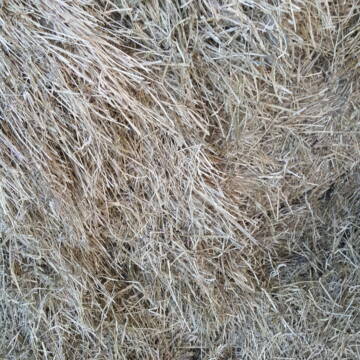
10 Rb Heu/15 RB Öhmd/15 RB Stroh
Helmstadt
Juergen
@Juergen77
Einstreu
Empfänger lädt ab
Rundballen
Regenfrei
2 weitere...
B+

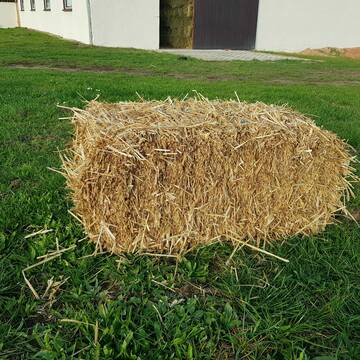
Heu HD Ballen
Carlsberg
Maike Käpernick
@ReitschuleKaepernick
Heu
Empfänger lädt ab
Kleinballen/HD-Ballen
Bio
Regenfrei
2 weitere...
B+
Deprecated: Creation of dynamic property Zend_View_Helper_Ads::$adLink is deprecated in /var/www/stall-frei/htdocs/staging.stall-frei.de/library/Psf/View/Helper/Ads.php on line 108

Heu und Heulage verkaufen
Mechtersen
STALL-FREIde Marketing
@STALL-FREI-Marketing
Verkaufen Sie Ihr Heu und Ihre Heulage direkt an Reiter, Pferdeställe und Reitanlagen
Leider kein Vorschaubild
Leider kein Vorschaubild
Heu zu verkaufen
Bad Rappenau
Uwe Wolf
@Uwe_Wolf
Heu
Empfänger lädt ab
Rundballen
Regenfrei
2 weitere...
B+

Bio Heu
Mehlbach
irena-zinssmeister
@irena-zinssmeister
Heu
Empfänger lädt ab
Großballen
Bio
Regenfrei
2 weitere...
B+
HD-Strohballen, Gersten-, Dinkel- und Weizenstroh
Hilpoltstein
KnollmeyerBallen
@KnollmeyerBallen
Einstreu
Lieferant entlädt
Kleinballen/HD-Ballen
Regenfrei
3 weitere...
B+

HD-Heuballen, 1. Schnitt & 2. Schnitt
Hilpoltstein
KnollmeyerBallen
@KnollmeyerBallen
Heu
Lieferant entlädt
Kleinballen/HD-Ballen
Regenfrei
3 weitere...
B+

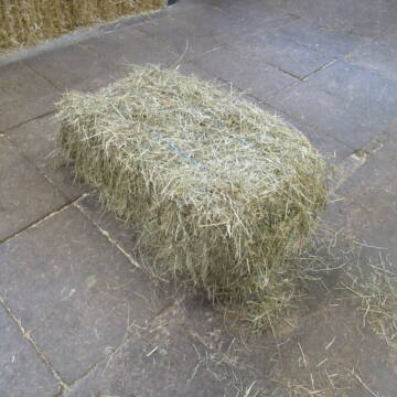
Heu Kleinballen 1. Schnitt - höchste Qualität
Weissach im Tal
Micha
@Micha3
Heu
Empfänger lädt ab
Kleinballen/HD-Ballen
Bio
Regenfrei
2 weitere...
aktuell
B+

Pferdepension Hit Aktivstall Kürmerhof
Hohenkammer
Kuermerhof
@Kuermerhof
*******JETZT NEU MIT ENTSTAUBTEM BIOHEU*********
*******Demnächst mit einem Abenteuerspielplatz für Pferde ( Extrem Trail/Pa

Heu 2. Schnitt 2025 Grummet HD Ballen
Altmannstein
Thomas Resch
@Cappo
Heu
Empfänger lädt ab
Kleinballen/HD-Ballen
Wird verladen
2 weitere...
B+
Newsletter abonnieren
Melde Dich für unseren Newsletter an und verpasse keine Neuigkeiten!
Deprecated: Creation of dynamic property Zend_View::$pageCount is deprecated in /var/www/stall-frei/htdocs/staging.stall-frei.de/library/vendor/shardj/zf1-future/library/Zend/View/Abstract.php on line 308
Deprecated: Creation of dynamic property Zend_View::$itemCountPerPage is deprecated in /var/www/stall-frei/htdocs/staging.stall-frei.de/library/vendor/shardj/zf1-future/library/Zend/View/Abstract.php on line 308
Deprecated: Creation of dynamic property Zend_View::$first is deprecated in /var/www/stall-frei/htdocs/staging.stall-frei.de/library/vendor/shardj/zf1-future/library/Zend/View/Abstract.php on line 308
Deprecated: Creation of dynamic property Zend_View::$current is deprecated in /var/www/stall-frei/htdocs/staging.stall-frei.de/library/vendor/shardj/zf1-future/library/Zend/View/Abstract.php on line 308
Deprecated: Creation of dynamic property Zend_View::$last is deprecated in /var/www/stall-frei/htdocs/staging.stall-frei.de/library/vendor/shardj/zf1-future/library/Zend/View/Abstract.php on line 308
Deprecated: Creation of dynamic property Zend_View::$previous is deprecated in /var/www/stall-frei/htdocs/staging.stall-frei.de/library/vendor/shardj/zf1-future/library/Zend/View/Abstract.php on line 308
Deprecated: Creation of dynamic property Zend_View::$next is deprecated in /var/www/stall-frei/htdocs/staging.stall-frei.de/library/vendor/shardj/zf1-future/library/Zend/View/Abstract.php on line 308
Deprecated: Creation of dynamic property Zend_View::$pagesInRange is deprecated in /var/www/stall-frei/htdocs/staging.stall-frei.de/library/vendor/shardj/zf1-future/library/Zend/View/Abstract.php on line 308
Deprecated: Creation of dynamic property Zend_View::$firstPageInRange is deprecated in /var/www/stall-frei/htdocs/staging.stall-frei.de/library/vendor/shardj/zf1-future/library/Zend/View/Abstract.php on line 308
Deprecated: Creation of dynamic property Zend_View::$lastPageInRange is deprecated in /var/www/stall-frei/htdocs/staging.stall-frei.de/library/vendor/shardj/zf1-future/library/Zend/View/Abstract.php on line 308
Deprecated: Creation of dynamic property Zend_View::$currentItemCount is deprecated in /var/www/stall-frei/htdocs/staging.stall-frei.de/library/vendor/shardj/zf1-future/library/Zend/View/Abstract.php on line 308
Deprecated: Creation of dynamic property Zend_View::$totalItemCount is deprecated in /var/www/stall-frei/htdocs/staging.stall-frei.de/library/vendor/shardj/zf1-future/library/Zend/View/Abstract.php on line 308
Deprecated: Creation of dynamic property Zend_View::$firstItemNumber is deprecated in /var/www/stall-frei/htdocs/staging.stall-frei.de/library/vendor/shardj/zf1-future/library/Zend/View/Abstract.php on line 308
Deprecated: Creation of dynamic property Zend_View::$lastItemNumber is deprecated in /var/www/stall-frei/htdocs/staging.stall-frei.de/library/vendor/shardj/zf1-future/library/Zend/View/Abstract.php on line 308
Deprecated: Creation of dynamic property Zend_View::$router is deprecated in /var/www/stall-frei/htdocs/staging.stall-frei.de/library/vendor/shardj/zf1-future/library/Zend/View/Abstract.php on line 308
Deprecated: Creation of dynamic property Zend_View::$urlParams is deprecated in /var/www/stall-frei/htdocs/staging.stall-frei.de/library/vendor/shardj/zf1-future/library/Zend/View/Abstract.php on line 308
Deprecated: Creation of dynamic property Zend_View::$showAds is deprecated in /var/www/stall-frei/htdocs/staging.stall-frei.de/library/vendor/shardj/zf1-future/library/Zend/View/Abstract.php on line 308
Deprecated: Creation of dynamic property Zend_View::$objectIds is deprecated in /var/www/stall-frei/htdocs/staging.stall-frei.de/library/vendor/shardj/zf1-future/library/Zend/View/Abstract.php on line 308
Deprecated: Creation of dynamic property Zend_View::$showNavbar is deprecated in /var/www/stall-frei/htdocs/staging.stall-frei.de/library/vendor/shardj/zf1-future/library/Zend/View/Abstract.php on line 308
Deprecated: Creation of dynamic property Zend_View::$showBreadcrumb is deprecated in /var/www/stall-frei/htdocs/staging.stall-frei.de/library/vendor/shardj/zf1-future/library/Zend/View/Abstract.php on line 308
Deprecated: Creation of dynamic property Zend_View::$showFooter is deprecated in /var/www/stall-frei/htdocs/staging.stall-frei.de/library/vendor/shardj/zf1-future/library/Zend/View/Abstract.php on line 308
Deprecated: Creation of dynamic property Zend_View::$showInternalAds is deprecated in /var/www/stall-frei/htdocs/staging.stall-frei.de/library/vendor/shardj/zf1-future/library/Zend/View/Abstract.php on line 308
Deprecated: Creation of dynamic property Zend_View::$blNoContent is deprecated in /var/www/stall-frei/htdocs/staging.stall-frei.de/library/vendor/shardj/zf1-future/library/Zend/View/Abstract.php on line 308
Deprecated: Creation of dynamic property Zend_View::$sMetaDesc is deprecated in /var/www/stall-frei/htdocs/staging.stall-frei.de/library/vendor/shardj/zf1-future/library/Zend/View/Abstract.php on line 308
Deprecated: Creation of dynamic property Zend_View::$useGmaps is deprecated in /var/www/stall-frei/htdocs/staging.stall-frei.de/library/vendor/shardj/zf1-future/library/Zend/View/Abstract.php on line 308
Deprecated: Creation of dynamic property Zend_View::$touches is deprecated in /var/www/stall-frei/htdocs/staging.stall-frei.de/library/vendor/shardj/zf1-future/library/Zend/View/Abstract.php on line 308
Deprecated: Creation of dynamic property Zend_View::$oProject is deprecated in /var/www/stall-frei/htdocs/staging.stall-frei.de/library/vendor/shardj/zf1-future/library/Zend/View/Abstract.php on line 308
Deprecated: Creation of dynamic property Zend_View::$pageHeadline is deprecated in /var/www/stall-frei/htdocs/staging.stall-frei.de/library/vendor/shardj/zf1-future/library/Zend/View/Abstract.php on line 308
Deprecated: Creation of dynamic property Zend_View::$disableLocationField is deprecated in /var/www/stall-frei/htdocs/staging.stall-frei.de/library/vendor/shardj/zf1-future/library/Zend/View/Abstract.php on line 308
Deprecated: Creation of dynamic property Zend_View::$isSearch is deprecated in /var/www/stall-frei/htdocs/staging.stall-frei.de/library/vendor/shardj/zf1-future/library/Zend/View/Abstract.php on line 308
Deprecated: Creation of dynamic property Zend_View::$pageTitle is deprecated in /var/www/stall-frei/htdocs/staging.stall-frei.de/library/vendor/shardj/zf1-future/library/Zend/View/Abstract.php on line 308
Deprecated: Creation of dynamic property Psf_Form_Element_Text::$class is deprecated in /var/www/stall-frei/htdocs/staging.stall-frei.de/library/vendor/shardj/zf1-future/library/Zend/Form/Element.php on line 874
Deprecated: Creation of dynamic property Psf_Form_Element_Text::$size is deprecated in /var/www/stall-frei/htdocs/staging.stall-frei.de/library/vendor/shardj/zf1-future/library/Zend/Form/Element.php on line 874
Deprecated: Creation of dynamic property Psf_Form_Element_Text::$placeholder is deprecated in /var/www/stall-frei/htdocs/staging.stall-frei.de/library/vendor/shardj/zf1-future/library/Zend/Form/Element.php on line 874
Deprecated: Creation of dynamic property Psf_Form_Element_Hidden::$class is deprecated in /var/www/stall-frei/htdocs/staging.stall-frei.de/library/vendor/shardj/zf1-future/library/Zend/Form/Element.php on line 874
Deprecated: Creation of dynamic property Psf_Form_Element_Hidden::$class is deprecated in /var/www/stall-frei/htdocs/staging.stall-frei.de/library/vendor/shardj/zf1-future/library/Zend/Form/Element.php on line 874
Deprecated: Creation of dynamic property Psf_Form_Element_Hidden::$class is deprecated in /var/www/stall-frei/htdocs/staging.stall-frei.de/library/vendor/shardj/zf1-future/library/Zend/Form/Element.php on line 874
Deprecated: Creation of dynamic property Psf_Form_Element_Hidden::$class is deprecated in /var/www/stall-frei/htdocs/staging.stall-frei.de/library/vendor/shardj/zf1-future/library/Zend/Form/Element.php on line 874
Deprecated: Creation of dynamic property Psf_Form_Element_Select::$class is deprecated in /var/www/stall-frei/htdocs/staging.stall-frei.de/library/vendor/shardj/zf1-future/library/Zend/Form/Element.php on line 874
Deprecated: Creation of dynamic property Psf_Form_Element_Select::$class is deprecated in /var/www/stall-frei/htdocs/staging.stall-frei.de/library/vendor/shardj/zf1-future/library/Zend/Form/Element.php on line 874
Deprecated: Creation of dynamic property Psf_Form_Element_Select::$class is deprecated in /var/www/stall-frei/htdocs/staging.stall-frei.de/library/vendor/shardj/zf1-future/library/Zend/Form/Element.php on line 874
Deprecated: Creation of dynamic property Psf_Form_Element_Select::$class is deprecated in /var/www/stall-frei/htdocs/staging.stall-frei.de/library/vendor/shardj/zf1-future/library/Zend/Form/Element.php on line 874
Deprecated: Creation of dynamic property Zend_View::$sort is deprecated in /var/www/stall-frei/htdocs/staging.stall-frei.de/library/vendor/shardj/zf1-future/library/Zend/View/Abstract.php on line 308
Deprecated: Creation of dynamic property Zend_View::$searchLocation is deprecated in /var/www/stall-frei/htdocs/staging.stall-frei.de/library/vendor/shardj/zf1-future/library/Zend/View/Abstract.php on line 308
Deprecated: Creation of dynamic property Zend_View::$locationHint is deprecated in /var/www/stall-frei/htdocs/staging.stall-frei.de/library/vendor/shardj/zf1-future/library/Zend/View/Abstract.php on line 308
Psf_GeoCoder_Abstract::getLocation: Westfeld Get Location CachedOrLive
Psf_GeoCoder_Abstract::getCachedOrLive: Westfeld
Psf_GeoCoder_Abstract::convertLocationResult
{"documentation":"https:\/\/opencagedata.com\/api","licenses":[{"name":"see attribution guide","url":"https:\/\/opencagedata.com\/credits"}],"results":[{"bounds":{"northeast":{"lat":52.0539647,"lng":9.9389115},"southwest":{"lat":52.0078232,"lng":9.8583173}},"components":{"ISO_3166-1_alpha-2":"DE","ISO_3166-1_alpha-3":"DEU","ISO_3166-2":["DE-NI"],"_category":"place","_normalized_city":"Sibbesse","_type":"village","city":"Sibbesse","continent":"Europe","country":"Deutschland","country_code":"de","county":"Landkreis Hildesheim","political_union":"European Union","postcode":"31079","state":"Niedersachsen","state_code":"NI","village":"Westfeld"},"confidence":7,"formatted":"31079 Westfeld, Deutschland","geometry":{"lat":52.041452,"lng":9.9145124}},{"bounds":{"northeast":{"lat":51.1809391,"lng":8.4378671},"southwest":{"lat":51.1409391,"lng":8.3978671}},"components":{"ISO_3166-1_alpha-2":"DE","ISO_3166-1_alpha-3":"DEU","ISO_3166-2":["DE-NW"],"_category":"place","_normalized_city":"Schmallenberg","_type":"village","continent":"Europe","country":"Deutschland","country_code":"de","county":"Hochsauerlandkreis","political_union":"European Union","state":"Nordrhein-Westfalen","state_code":"NW","town":"Schmallenberg","village":"Westfeld"},"confidence":7,"formatted":"Westfeld, Nordrhein-Westfalen, Deutschland","geometry":{"lat":51.1609391,"lng":8.4178671}},{"bounds":{"northeast":{"lat":51.1986381,"lng":6.6711009},"southwest":{"lat":51.1750261,"lng":6.6288524}},"components":{"ISO_3166-1_alpha-2":"DE","ISO_3166-1_alpha-3":"DEU","ISO_3166-2":["DE-NW"],"_category":"place","_normalized_city":"Neuss","_type":"neighbourhood","city":"Neuss","continent":"Europe","country":"Deutschland","country_code":"de","county":"Rhein-Kreis Neuss","neighbourhood":"Westfeld","political_union":"European Union","state":"Nordrhein-Westfalen","state_code":"NW"},"confidence":7,"formatted":"Westfeld, Neuss, Nordrhein-Westfalen, Deutschland","geometry":{"lat":51.1912063,"lng":6.6541763}},{"bounds":{"northeast":{"lat":52.7534767,"lng":7.1919984},"southwest":{"lat":52.7477279,"lng":7.1812129}},"components":{"ISO_3166-1_alpha-2":"DE","ISO_3166-1_alpha-3":"DEU","ISO_3166-2":["DE-NI"],"_category":"agriculture","_normalized_city":"Haren (Ems)","_type":"farmland","continent":"Europe","country":"Deutschland","country_code":"de","county":"Landkreis Emsland","farmland":"Westfeld","hamlet":"Wieresch","political_union":"European Union","postcode":"49733","state":"Niedersachsen","state_code":"NI","town":"Haren (Ems)"},"confidence":9,"formatted":"Westfeld, 49733 Haren (Ems), Deutschland","geometry":{"lat":52.750451,"lng":7.1873797}},{"bounds":{"northeast":{"lat":49.3362147,"lng":7.0096566},"southwest":{"lat":49.3338715,"lng":7.0017602}},"components":{"ISO_3166-1_alpha-2":"DE","ISO_3166-1_alpha-3":"DEU","ISO_3166-2":["DE-SL"],"_category":"place","_normalized_city":"Heusweiler","_type":"village","city_district":"Holz","commercial":"Westfeld","continent":"Europe","country":"Deutschland","country_code":"de","county":"Regionalverband Saarbr\u00fccken","political_union":"European Union","postcode":"66265","state":"Saarland","state_code":"SL","village":"Heusweiler"},"confidence":9,"formatted":"66265 Heusweiler, Deutschland","geometry":{"lat":49.3349273,"lng":7.0051988}},{"bounds":{"northeast":{"lat":51.1586096,"lng":8.4295329},"southwest":{"lat":51.1556491,"lng":8.4241812}},"components":{"ISO_3166-1_alpha-2":"DE","ISO_3166-1_alpha-3":"DEU","ISO_3166-2":["DE-NW"],"_category":"place","_normalized_city":"Schmallenberg","_type":"village","continent":"Europe","country":"Deutschland","country_code":"de","county":"Hochsauerlandkreis","political_union":"European Union","postcode":"57392","residential":"Westfeld","state":"Nordrhein-Westfalen","state_code":"NW","town":"Schmallenberg","village":"Westfeld"},"confidence":9,"formatted":"57392 Westfeld, Deutschland","geometry":{"lat":51.1570802,"lng":8.4287812}},{"bounds":{"northeast":{"lat":51.3329362,"lng":7.3557036},"southwest":{"lat":51.332202,"lng":7.3542954}},"components":{"ISO_3166-1_alpha-2":"DE","ISO_3166-1_alpha-3":"DEU","ISO_3166-2":["DE-NW"],"_category":"place","_normalized_city":"Gevelsberg","_type":"hamlet","continent":"Europe","country":"Deutschland","country_code":"de","county":"Ennepe-Ruhr-Kreis","hamlet":"Auf der Geer","political_union":"European Union","postcode":"58285","residential":"Westfeld","state":"Nordrhein-Westfalen","state_code":"NW","suburb":"Berge","town":"Gevelsberg"},"confidence":9,"formatted":"Auf der Geer, 58285 Gevelsberg, Deutschland","geometry":{"lat":51.3325808,"lng":7.355031}},{"components":{"ISO_3166-1_alpha-2":"FR","ISO_3166-1_alpha-3":"FRA","ISO_3166-2":["FR-IDF","FR-92"],"_category":"road","_normalized_city":"Levallois-Perret","_type":"road","city":"Levallois-Perret","continent":"Europe","country":"France","country_code":"fr","county":"Hauts-de-Seine","local_authority":"M\u00e9tropole du Grand Paris","political_union":"European Union","postcode":"92300","road":"Rue Charles Deutschmann","state":"\u00cele-de-France","state_code":"IDF"},"confidence":3,"formatted":"Rue Charles Deutschmann, 92300 Levallois-Perret, France","geometry":{"lat":48.900049,"lng":2.2842}},{"components":{"ISO_3166-1_alpha-2":"FR","ISO_3166-1_alpha-3":"FRA","ISO_3166-2":["FR-HDF","FR-59"],"_category":"road","_normalized_city":"Cappelle-Brouck","_type":"road","city":"Cappelle-Brouck","continent":"Europe","country":"France","country_code":"fr","county":"Nord","local_authority":"Communaut\u00e9 de communes des Hauts de Flandre","political_union":"European Union","postcode":"59630","road":"Westeel Straete","state":"Hauts-de-France","state_code":"HDF"},"confidence":10,"formatted":"Westeel Straete, 59630 Cappelle-Brouck, France","geometry":{"lat":50.876385,"lng":2.21475}},{"components":{"ISO_3166-1_alpha-2":"FR","ISO_3166-1_alpha-3":"FRA","ISO_3166-2":["FR-BRE","FR-29"],"_category":"road","_normalized_city":"Plougastel-Daoulas","_type":"road","city":"Plougastel-Daoulas","continent":"Europe","country":"France","country_code":"fr","county":"Finist\u00e8re","local_authority":"Brest M\u00e9tropole","political_union":"European Union","postcode":"29470","road":"chemin Garront ar Vestel - Kervezingar Izella","state":"Bretagne","state_code":"BRE"},"confidence":10,"formatted":"chemin Garront ar Vestel - Kervezingar Izella, 29470 Plougastel-Daoulas, France","geometry":{"lat":48.358559,"lng":-4.404303}}],"status":{"code":200,"message":"OK"},"stay_informed":{"blog":"https:\/\/blog.opencagedata.com","mastodon":"https:\/\/en.osm.town\/@opencage"},"thanks":"For using an OpenCage API","timestamp":{"created_http":"Sun, 08 Feb 2026 01:18:57 GMT","created_unix":1770513537},"total_results":10}Array
(
[0] => stdClass Object
(
[bounds] => stdClass Object
(
[northeast] => stdClass Object
(
[lat] => 52.0539647
[lng] => 9.9389115
)
[southwest] => stdClass Object
(
[lat] => 52.0078232
[lng] => 9.8583173
)
)
[components] => stdClass Object
(
[ISO_3166-1_alpha-2] => DE
[ISO_3166-1_alpha-3] => DEU
[ISO_3166-2] => Array
(
[0] => DE-NI
)
[_category] => place
[_normalized_city] => Sibbesse
[_type] => village
[city] => Sibbesse
[continent] => Europe
[country] => Deutschland
[country_code] => de
[county] => Landkreis Hildesheim
[political_union] => European Union
[postcode] => 31079
[state] => Niedersachsen
[state_code] => NI
[village] => Westfeld
)
[confidence] => 7
[formatted] => 31079 Westfeld, Deutschland
[geometry] => stdClass Object
(
[lat] => 52.041452
[lng] => 9.9145124
)
)
[1] => stdClass Object
(
[bounds] => stdClass Object
(
[northeast] => stdClass Object
(
[lat] => 51.1809391
[lng] => 8.4378671
)
[southwest] => stdClass Object
(
[lat] => 51.1409391
[lng] => 8.3978671
)
)
[components] => stdClass Object
(
[ISO_3166-1_alpha-2] => DE
[ISO_3166-1_alpha-3] => DEU
[ISO_3166-2] => Array
(
[0] => DE-NW
)
[_category] => place
[_normalized_city] => Schmallenberg
[_type] => village
[continent] => Europe
[country] => Deutschland
[country_code] => de
[county] => Hochsauerlandkreis
[political_union] => European Union
[state] => Nordrhein-Westfalen
[state_code] => NW
[town] => Schmallenberg
[village] => Westfeld
)
[confidence] => 7
[formatted] => Westfeld, Nordrhein-Westfalen, Deutschland
[geometry] => stdClass Object
(
[lat] => 51.1609391
[lng] => 8.4178671
)
)
[2] => stdClass Object
(
[bounds] => stdClass Object
(
[northeast] => stdClass Object
(
[lat] => 51.1986381
[lng] => 6.6711009
)
[southwest] => stdClass Object
(
[lat] => 51.1750261
[lng] => 6.6288524
)
)
[components] => stdClass Object
(
[ISO_3166-1_alpha-2] => DE
[ISO_3166-1_alpha-3] => DEU
[ISO_3166-2] => Array
(
[0] => DE-NW
)
[_category] => place
[_normalized_city] => Neuss
[_type] => neighbourhood
[city] => Neuss
[continent] => Europe
[country] => Deutschland
[country_code] => de
[county] => Rhein-Kreis Neuss
[neighbourhood] => Westfeld
[political_union] => European Union
[state] => Nordrhein-Westfalen
[state_code] => NW
)
[confidence] => 7
[formatted] => Westfeld, Neuss, Nordrhein-Westfalen, Deutschland
[geometry] => stdClass Object
(
[lat] => 51.1912063
[lng] => 6.6541763
)
)
[3] => stdClass Object
(
[bounds] => stdClass Object
(
[northeast] => stdClass Object
(
[lat] => 52.7534767
[lng] => 7.1919984
)
[southwest] => stdClass Object
(
[lat] => 52.7477279
[lng] => 7.1812129
)
)
[components] => stdClass Object
(
[ISO_3166-1_alpha-2] => DE
[ISO_3166-1_alpha-3] => DEU
[ISO_3166-2] => Array
(
[0] => DE-NI
)
[_category] => agriculture
[_normalized_city] => Haren (Ems)
[_type] => farmland
[continent] => Europe
[country] => Deutschland
[country_code] => de
[county] => Landkreis Emsland
[farmland] => Westfeld
[hamlet] => Wieresch
[political_union] => European Union
[postcode] => 49733
[state] => Niedersachsen
[state_code] => NI
[town] => Haren (Ems)
)
[confidence] => 9
[formatted] => Westfeld, 49733 Haren (Ems), Deutschland
[geometry] => stdClass Object
(
[lat] => 52.750451
[lng] => 7.1873797
)
)
[4] => stdClass Object
(
[bounds] => stdClass Object
(
[northeast] => stdClass Object
(
[lat] => 49.3362147
[lng] => 7.0096566
)
[southwest] => stdClass Object
(
[lat] => 49.3338715
[lng] => 7.0017602
)
)
[components] => stdClass Object
(
[ISO_3166-1_alpha-2] => DE
[ISO_3166-1_alpha-3] => DEU
[ISO_3166-2] => Array
(
[0] => DE-SL
)
[_category] => place
[_normalized_city] => Heusweiler
[_type] => village
[city_district] => Holz
[commercial] => Westfeld
[continent] => Europe
[country] => Deutschland
[country_code] => de
[county] => Regionalverband Saarbrücken
[political_union] => European Union
[postcode] => 66265
[state] => Saarland
[state_code] => SL
[village] => Heusweiler
)
[confidence] => 9
[formatted] => 66265 Heusweiler, Deutschland
[geometry] => stdClass Object
(
[lat] => 49.3349273
[lng] => 7.0051988
)
)
[5] => stdClass Object
(
[bounds] => stdClass Object
(
[northeast] => stdClass Object
(
[lat] => 51.1586096
[lng] => 8.4295329
)
[southwest] => stdClass Object
(
[lat] => 51.1556491
[lng] => 8.4241812
)
)
[components] => stdClass Object
(
[ISO_3166-1_alpha-2] => DE
[ISO_3166-1_alpha-3] => DEU
[ISO_3166-2] => Array
(
[0] => DE-NW
)
[_category] => place
[_normalized_city] => Schmallenberg
[_type] => village
[continent] => Europe
[country] => Deutschland
[country_code] => de
[county] => Hochsauerlandkreis
[political_union] => European Union
[postcode] => 57392
[residential] => Westfeld
[state] => Nordrhein-Westfalen
[state_code] => NW
[town] => Schmallenberg
[village] => Westfeld
)
[confidence] => 9
[formatted] => 57392 Westfeld, Deutschland
[geometry] => stdClass Object
(
[lat] => 51.1570802
[lng] => 8.4287812
)
)
[6] => stdClass Object
(
[bounds] => stdClass Object
(
[northeast] => stdClass Object
(
[lat] => 51.3329362
[lng] => 7.3557036
)
[southwest] => stdClass Object
(
[lat] => 51.332202
[lng] => 7.3542954
)
)
[components] => stdClass Object
(
[ISO_3166-1_alpha-2] => DE
[ISO_3166-1_alpha-3] => DEU
[ISO_3166-2] => Array
(
[0] => DE-NW
)
[_category] => place
[_normalized_city] => Gevelsberg
[_type] => hamlet
[continent] => Europe
[country] => Deutschland
[country_code] => de
[county] => Ennepe-Ruhr-Kreis
[hamlet] => Auf der Geer
[political_union] => European Union
[postcode] => 58285
[residential] => Westfeld
[state] => Nordrhein-Westfalen
[state_code] => NW
[suburb] => Berge
[town] => Gevelsberg
)
[confidence] => 9
[formatted] => Auf der Geer, 58285 Gevelsberg, Deutschland
[geometry] => stdClass Object
(
[lat] => 51.3325808
[lng] => 7.355031
)
)
[7] => stdClass Object
(
[components] => stdClass Object
(
[ISO_3166-1_alpha-2] => FR
[ISO_3166-1_alpha-3] => FRA
[ISO_3166-2] => Array
(
[0] => FR-IDF
[1] => FR-92
)
[_category] => road
[_normalized_city] => Levallois-Perret
[_type] => road
[city] => Levallois-Perret
[continent] => Europe
[country] => France
[country_code] => fr
[county] => Hauts-de-Seine
[local_authority] => Métropole du Grand Paris
[political_union] => European Union
[postcode] => 92300
[road] => Rue Charles Deutschmann
[state] => Île-de-France
[state_code] => IDF
)
[confidence] => 3
[formatted] => Rue Charles Deutschmann, 92300 Levallois-Perret, France
[geometry] => stdClass Object
(
[lat] => 48.900049
[lng] => 2.2842
)
)
[8] => stdClass Object
(
[components] => stdClass Object
(
[ISO_3166-1_alpha-2] => FR
[ISO_3166-1_alpha-3] => FRA
[ISO_3166-2] => Array
(
[0] => FR-HDF
[1] => FR-59
)
[_category] => road
[_normalized_city] => Cappelle-Brouck
[_type] => road
[city] => Cappelle-Brouck
[continent] => Europe
[country] => France
[country_code] => fr
[county] => Nord
[local_authority] => Communauté de communes des Hauts de Flandre
[political_union] => European Union
[postcode] => 59630
[road] => Westeel Straete
[state] => Hauts-de-France
[state_code] => HDF
)
[confidence] => 10
[formatted] => Westeel Straete, 59630 Cappelle-Brouck, France
[geometry] => stdClass Object
(
[lat] => 50.876385
[lng] => 2.21475
)
)
[9] => stdClass Object
(
[components] => stdClass Object
(
[ISO_3166-1_alpha-2] => FR
[ISO_3166-1_alpha-3] => FRA
[ISO_3166-2] => Array
(
[0] => FR-BRE
[1] => FR-29
)
[_category] => road
[_normalized_city] => Plougastel-Daoulas
[_type] => road
[city] => Plougastel-Daoulas
[continent] => Europe
[country] => France
[country_code] => fr
[county] => Finistère
[local_authority] => Brest Métropole
[political_union] => European Union
[postcode] => 29470
[road] => chemin Garront ar Vestel - Kervezingar Izella
[state] => Bretagne
[state_code] => BRE
)
[confidence] => 10
[formatted] => chemin Garront ar Vestel - Kervezingar Izella, 29470 Plougastel-Daoulas, France
[geometry] => stdClass Object
(
[lat] => 48.358559
[lng] => -4.404303
)
)
)
Psf_GeoCoder_OpenCageData::getKeyMap: 0
stdClass Object
(
    [bounds] => stdClass Object
        (
            [northeast] => stdClass Object
                (
                    [lat] => 52.0539647
                    [lng] => 9.9389115
                )

            [southwest] => stdClass Object
                (
                    [lat] => 52.0078232
                    [lng] => 9.8583173
                )

        )

    [components] => stdClass Object
        (
            [ISO_3166-1_alpha-2] => DE
            [ISO_3166-1_alpha-3] => DEU
            [ISO_3166-2] => Array
                (
                    [0] => DE-NI
                )

            [_category] => place
            [_normalized_city] => Sibbesse
            [_type] => village
            [city] => Sibbesse
            [continent] => Europe
            [country] => Deutschland
            [country_code] => de
            [county] => Landkreis Hildesheim
            [political_union] => European Union
            [postcode] => 31079
            [state] => Niedersachsen
            [state_code] => NI
            [village] => Westfeld
        )

    [confidence] => 7
    [formatted] => 31079 Westfeld, Deutschland
    [geometry] => stdClass Object
        (
            [lat] => 52.041452
            [lng] => 9.9145124
        )

)
Psf_GeoCoder_OpenCageData::getCounty: Hildesheim
Psf_GeoCoder_OpenCageData::addMissingData REFETCH!
Array
(
    [address] => 31079 Westfeld, Deutschland
    [type] => village
    [street] =>
    [city] => Westfeld
    [county] => Hildesheim
    [state] => Niedersachsen
    [zip] => 31079
    [country] => Deutschland
    [suburb] =>
    [countrycode] => de
    [latitude] => 52.041452
    [longitude] => 9.9145124
    [accuracy] => 1
    [confidence] => 7
    [bounds] => stdClass Object
        (
            [northeast] => stdClass Object
                (
                    [lat] => 52.0539647
                    [lng] => 9.9389115
                )

            [southwest] => stdClass Object
                (
                    [lat] => 52.0078232
                    [lng] => 9.8583173
                )

        )

)
reformat!
Array
(
    [address] => 31079 Westfeld, Deutschland
    [type] => village
    [street] =>
    [city] => Westfeld
    [county] => Hildesheim
    [state] => Niedersachsen
    [zip] => 31079
    [country] => Deutschland
    [suburb] =>
    [countrycode] => de
    [latitude] => 52.041452
    [longitude] => 9.9145124
    [accuracy] => 1
    [confidence] => 7
    [bounds] => stdClass Object
        (
            [northeast] => stdClass Object
                (
                    [lat] => 52.0539647
                    [lng] => 9.9389115
                )

            [southwest] => stdClass Object
                (
                    [lat] => 52.0078232
                    [lng] => 9.8583173
                )

        )

    [place] => 31079 Westfeld, Niedersachsen
    [hash] => ebb1006271e69a00fba66a5a04f5da19
)
Psf_GeoCoder_OpenCageData::getKeyMap: 1
stdClass Object
(
    [bounds] => stdClass Object
        (
            [northeast] => stdClass Object
                (
                    [lat] => 51.1809391
                    [lng] => 8.4378671
                )

            [southwest] => stdClass Object
                (
                    [lat] => 51.1409391
                    [lng] => 8.3978671
                )

        )

    [components] => stdClass Object
        (
            [ISO_3166-1_alpha-2] => DE
            [ISO_3166-1_alpha-3] => DEU
            [ISO_3166-2] => Array
                (
                    [0] => DE-NW
                )

            [_category] => place
            [_normalized_city] => Schmallenberg
            [_type] => village
            [continent] => Europe
            [country] => Deutschland
            [country_code] => de
            [county] => Hochsauerlandkreis
            [political_union] => European Union
            [state] => Nordrhein-Westfalen
            [state_code] => NW
            [town] => Schmallenberg
            [village] => Westfeld
        )

    [confidence] => 7
    [formatted] => Westfeld, Nordrhein-Westfalen, Deutschland
    [geometry] => stdClass Object
        (
            [lat] => 51.1609391
            [lng] => 8.4178671
        )

)
Psf_GeoCoder_OpenCageData::getCounty: Hochsauerlandkreis
Psf_GeoCoder_OpenCageData::addMissingData REFETCH!
Array
(
    [address] => Westfeld, Nordrhein-Westfalen, Deutschland
    [type] => village
    [street] =>
    [city] => Schmallenberg
    [county] => Hochsauerlandkreis
    [state] => Nordrhein-Westfalen
    [zip] =>
    [country] => Deutschland
    [suburb] =>
    [countrycode] => de
    [latitude] => 51.1609391
    [longitude] => 8.4178671
    [accuracy] => 1
    [confidence] => 7
    [bounds] => stdClass Object
        (
            [northeast] => stdClass Object
                (
                    [lat] => 51.1809391
                    [lng] => 8.4378671
                )

            [southwest] => stdClass Object
                (
                    [lat] => 51.1409391
                    [lng] => 8.3978671
                )

        )

)
reformat!
Array
(
    [address] => Schmallenberg
    [type] => village
    [street] =>
    [city] => Schmallenberg
    [county] => Hochsauerlandkreis
    [state] => Nordrhein-Westfalen
    [zip] =>
    [country] => Deutschland
    [suburb] =>
    [countrycode] => de
    [latitude] => 51.1609391
    [longitude] => 8.4178671
    [accuracy] => 1
    [confidence] => 7
    [bounds] => stdClass Object
        (
            [northeast] => stdClass Object
                (
                    [lat] => 51.1809391
                    [lng] => 8.4378671
                )

            [southwest] => stdClass Object
                (
                    [lat] => 51.1409391
                    [lng] => 8.3978671
                )

        )

    [place] => Schmallenberg, Nordrhein-Westfalen
    [hash] => bcd55617eade3b599517d34ee5f25686
)
Psf_GeoCoder_OpenCageData::getKeyMap: 2
stdClass Object
(
    [bounds] => stdClass Object
        (
            [northeast] => stdClass Object
                (
                    [lat] => 51.1986381
                    [lng] => 6.6711009
                )

            [southwest] => stdClass Object
                (
                    [lat] => 51.1750261
                    [lng] => 6.6288524
                )

        )

    [components] => stdClass Object
        (
            [ISO_3166-1_alpha-2] => DE
            [ISO_3166-1_alpha-3] => DEU
            [ISO_3166-2] => Array
                (
                    [0] => DE-NW
                )

            [_category] => place
            [_normalized_city] => Neuss
            [_type] => neighbourhood
            [city] => Neuss
            [continent] => Europe
            [country] => Deutschland
            [country_code] => de
            [county] => Rhein-Kreis Neuss
            [neighbourhood] => Westfeld
            [political_union] => European Union
            [state] => Nordrhein-Westfalen
            [state_code] => NW
        )

    [confidence] => 7
    [formatted] => Westfeld, Neuss, Nordrhein-Westfalen, Deutschland
    [geometry] => stdClass Object
        (
            [lat] => 51.1912063
            [lng] => 6.6541763
        )

)
Psf_GeoCoder_OpenCageData::getCounty: Rhein-Kreis Neuss
Psf_GeoCoder_OpenCageData::addMissingData REFETCH!
Array
(
    [address] => Westfeld, Neuss, Nordrhein-Westfalen, Deutschland
    [type] => neighbourhood
    [street] =>
    [city] => Neuss
    [county] => Rhein-Kreis Neuss
    [state] => Nordrhein-Westfalen
    [zip] =>
    [country] => Deutschland
    [suburb] =>
    [countrycode] => de
    [latitude] => 51.1912063
    [longitude] => 6.6541763
    [accuracy] => 1
    [confidence] => 7
    [bounds] => stdClass Object
        (
            [northeast] => stdClass Object
                (
                    [lat] => 51.1986381
                    [lng] => 6.6711009
                )

            [southwest] => stdClass Object
                (
                    [lat] => 51.1750261
                    [lng] => 6.6288524
                )

        )

)
reformat!
Array
(
    [address] => Westfeld, Neuss, Nordrhein-Westfalen, Deutschland
    [type] => neighbourhood
    [street] =>
    [city] => Neuss
    [county] => Rhein-Kreis Neuss
    [state] => Nordrhein-Westfalen
    [zip] =>
    [country] => Deutschland
    [suburb] =>
    [countrycode] => de
    [latitude] => 51.1912063
    [longitude] => 6.6541763
    [accuracy] => 1
    [confidence] => 7
    [bounds] => stdClass Object
        (
            [northeast] => stdClass Object
                (
                    [lat] => 51.1986381
                    [lng] => 6.6711009
                )

            [southwest] => stdClass Object
                (
                    [lat] => 51.1750261
                    [lng] => 6.6288524
                )

        )

    [place] => Neuss, Nordrhein-Westfalen
    [hash] => 025cd4bf13cd82825a830bf409684fef
)
Psf_GeoCoder_OpenCageData::getKeyMap: 3
stdClass Object
(
    [bounds] => stdClass Object
        (
            [northeast] => stdClass Object
                (
                    [lat] => 52.7534767
                    [lng] => 7.1919984
                )

            [southwest] => stdClass Object
                (
                    [lat] => 52.7477279
                    [lng] => 7.1812129
                )

        )

    [components] => stdClass Object
        (
            [ISO_3166-1_alpha-2] => DE
            [ISO_3166-1_alpha-3] => DEU
            [ISO_3166-2] => Array
                (
                    [0] => DE-NI
                )

            [_category] => agriculture
            [_normalized_city] => Haren (Ems)
            [_type] => farmland
            [continent] => Europe
            [country] => Deutschland
            [country_code] => de
            [county] => Landkreis Emsland
            [farmland] => Westfeld
            [hamlet] => Wieresch
            [political_union] => European Union
            [postcode] => 49733
            [state] => Niedersachsen
            [state_code] => NI
            [town] => Haren (Ems)
        )

    [confidence] => 9
    [formatted] => Westfeld, 49733 Haren (Ems), Deutschland
    [geometry] => stdClass Object
        (
            [lat] => 52.750451
            [lng] => 7.1873797
        )

)
Psf_GeoCoder_OpenCageData::getCounty: Emsland
Psf_GeoCoder_OpenCageData::addMissingData REFETCH!
Array
(
    [address] => Westfeld, 49733 Haren (Ems), Deutschland
    [type] => farmland
    [street] => Wieresch
    [city] => Haren (Ems)
    [county] => Emsland
    [state] => Niedersachsen
    [zip] => 49733
    [country] => Deutschland
    [suburb] =>
    [countrycode] => de
    [latitude] => 52.750451
    [longitude] => 7.1873797
    [accuracy] => 1
    [confidence] => 9
    [bounds] => stdClass Object
        (
            [northeast] => stdClass Object
                (
                    [lat] => 52.7534767
                    [lng] => 7.1919984
                )

            [southwest] => stdClass Object
                (
                    [lat] => 52.7477279
                    [lng] => 7.1812129
                )

        )

)
reformat!
Array
(
    [address] => Westfeld, 49733 Haren (Ems), Deutschland
    [type] => farmland
    [street] => Wieresch
    [city] => Haren (Ems)
    [county] => Emsland
    [state] => Niedersachsen
    [zip] => 49733
    [country] => Deutschland
    [suburb] =>
    [countrycode] => de
    [latitude] => 52.750451
    [longitude] => 7.1873797
    [accuracy] => 1
    [confidence] => 9
    [bounds] => stdClass Object
        (
            [northeast] => stdClass Object
                (
                    [lat] => 52.7534767
                    [lng] => 7.1919984
                )

            [southwest] => stdClass Object
                (
                    [lat] => 52.7477279
                    [lng] => 7.1812129
                )

        )

    [place] => Wieresch, 49733 Haren (Ems), Niedersachsen
    [hash] => 24199a30a46ff3c8a80bad4209f109d1
)
Psf_GeoCoder_OpenCageData::getKeyMap: 4
stdClass Object
(
    [bounds] => stdClass Object
        (
            [northeast] => stdClass Object
                (
                    [lat] => 49.3362147
                    [lng] => 7.0096566
                )

            [southwest] => stdClass Object
                (
                    [lat] => 49.3338715
                    [lng] => 7.0017602
                )

        )

    [components] => stdClass Object
        (
            [ISO_3166-1_alpha-2] => DE
            [ISO_3166-1_alpha-3] => DEU
            [ISO_3166-2] => Array
                (
                    [0] => DE-SL
                )

            [_category] => place
            [_normalized_city] => Heusweiler
            [_type] => village
            [city_district] => Holz
            [commercial] => Westfeld
            [continent] => Europe
            [country] => Deutschland
            [country_code] => de
            [county] => Regionalverband Saarbrücken
            [political_union] => European Union
            [postcode] => 66265
            [state] => Saarland
            [state_code] => SL
            [village] => Heusweiler
        )

    [confidence] => 9
    [formatted] => 66265 Heusweiler, Deutschland
    [geometry] => stdClass Object
        (
            [lat] => 49.3349273
            [lng] => 7.0051988
        )

)
Psf_GeoCoder_OpenCageData::getCounty: alverband Saarbrücken
Psf_GeoCoder_OpenCageData::addMissingData REFETCH!
Array
(
    [address] => 66265 Heusweiler, Deutschland
    [type] => village
    [street] =>
    [city] => Heusweiler
    [county] => alverband Saarbrücken
    [state] => Saarland
    [zip] => 66265
    [country] => Deutschland
    [suburb] =>
    [countrycode] => de
    [latitude] => 49.3349273
    [longitude] => 7.0051988
    [accuracy] => 1
    [confidence] => 9
    [bounds] => stdClass Object
        (
            [northeast] => stdClass Object
                (
                    [lat] => 49.3362147
                    [lng] => 7.0096566
                )

            [southwest] => stdClass Object
                (
                    [lat] => 49.3338715
                    [lng] => 7.0017602
                )

        )

)
reformat!
Array
(
    [address] => 66265 Heusweiler, Deutschland
    [type] => village
    [street] =>
    [city] => Heusweiler
    [county] => alverband Saarbrücken
    [state] => Saarland
    [zip] => 66265
    [country] => Deutschland
    [suburb] =>
    [countrycode] => de
    [latitude] => 49.3349273
    [longitude] => 7.0051988
    [accuracy] => 1
    [confidence] => 9
    [bounds] => stdClass Object
        (
            [northeast] => stdClass Object
                (
                    [lat] => 49.3362147
                    [lng] => 7.0096566
                )

            [southwest] => stdClass Object
                (
                    [lat] => 49.3338715
                    [lng] => 7.0017602
                )

        )

    [place] => 66265 Heusweiler, Saarland
    [hash] => 8406986ab391c9600d05470834736b9b
)
Psf_GeoCoder_OpenCageData::getKeyMap: 5
stdClass Object
(
    [bounds] => stdClass Object
        (
            [northeast] => stdClass Object
                (
                    [lat] => 51.1586096
                    [lng] => 8.4295329
                )

            [southwest] => stdClass Object
                (
                    [lat] => 51.1556491
                    [lng] => 8.4241812
                )

        )

    [components] => stdClass Object
        (
            [ISO_3166-1_alpha-2] => DE
            [ISO_3166-1_alpha-3] => DEU
            [ISO_3166-2] => Array
                (
                    [0] => DE-NW
                )

            [_category] => place
            [_normalized_city] => Schmallenberg
            [_type] => village
            [continent] => Europe
            [country] => Deutschland
            [country_code] => de
            [county] => Hochsauerlandkreis
            [political_union] => European Union
            [postcode] => 57392
            [residential] => Westfeld
            [state] => Nordrhein-Westfalen
            [state_code] => NW
            [town] => Schmallenberg
            [village] => Westfeld
        )

    [confidence] => 9
    [formatted] => 57392 Westfeld, Deutschland
    [geometry] => stdClass Object
        (
            [lat] => 51.1570802
            [lng] => 8.4287812
        )

)
Psf_GeoCoder_OpenCageData::getCounty: Hochsauerlandkreis
Psf_GeoCoder_OpenCageData::addMissingData REFETCH!
Array
(
    [address] => 57392 Westfeld, Deutschland
    [type] => village
    [street] =>
    [city] => Schmallenberg
    [county] => Hochsauerlandkreis
    [state] => Nordrhein-Westfalen
    [zip] => 57392
    [country] => Deutschland
    [suburb] =>
    [countrycode] => de
    [latitude] => 51.1570802
    [longitude] => 8.4287812
    [accuracy] => 1
    [confidence] => 9
    [bounds] => stdClass Object
        (
            [northeast] => stdClass Object
                (
                    [lat] => 51.1586096
                    [lng] => 8.4295329
                )

            [southwest] => stdClass Object
                (
                    [lat] => 51.1556491
                    [lng] => 8.4241812
                )

        )

)
reformat!
Array
(
    [address] => 57392 Schmallenberg
    [type] => village
    [street] =>
    [city] => Schmallenberg
    [county] => Hochsauerlandkreis
    [state] => Nordrhein-Westfalen
    [zip] => 57392
    [country] => Deutschland
    [suburb] =>
    [countrycode] => de
    [latitude] => 51.1570802
    [longitude] => 8.4287812
    [accuracy] => 1
    [confidence] => 9
    [bounds] => stdClass Object
        (
            [northeast] => stdClass Object
                (
                    [lat] => 51.1586096
                    [lng] => 8.4295329
                )

            [southwest] => stdClass Object
                (
                    [lat] => 51.1556491
                    [lng] => 8.4241812
                )

        )

    [place] => 57392 Schmallenberg, Nordrhein-Westfalen
    [hash] => 7af614b523c2f91ba42c32a6a4fe6f6f
)
Psf_GeoCoder_OpenCageData::getKeyMap: 6
stdClass Object
(
    [bounds] => stdClass Object
        (
            [northeast] => stdClass Object
                (
                    [lat] => 51.3329362
                    [lng] => 7.3557036
                )

            [southwest] => stdClass Object
                (
                    [lat] => 51.332202
                    [lng] => 7.3542954
                )

        )

    [components] => stdClass Object
        (
            [ISO_3166-1_alpha-2] => DE
            [ISO_3166-1_alpha-3] => DEU
            [ISO_3166-2] => Array
                (
                    [0] => DE-NW
                )

            [_category] => place
            [_normalized_city] => Gevelsberg
            [_type] => hamlet
            [continent] => Europe
            [country] => Deutschland
            [country_code] => de
            [county] => Ennepe-Ruhr-Kreis
            [hamlet] => Auf der Geer
            [political_union] => European Union
            [postcode] => 58285
            [residential] => Westfeld
            [state] => Nordrhein-Westfalen
            [state_code] => NW
            [suburb] => Berge
            [town] => Gevelsberg
        )

    [confidence] => 9
    [formatted] => Auf der Geer, 58285 Gevelsberg, Deutschland
    [geometry] => stdClass Object
        (
            [lat] => 51.3325808
            [lng] => 7.355031
        )

)
Psf_GeoCoder_OpenCageData::getCounty: Ennepe-Ruhr-Kreis
Psf_GeoCoder_OpenCageData::addMissingData REFETCH!
Array
(
    [address] => Auf der Geer, 58285 Gevelsberg, Deutschland
    [type] => hamlet
    [street] => Auf der Geer
    [city] => Gevelsberg
    [county] => Ennepe-Ruhr-Kreis
    [state] => Nordrhein-Westfalen
    [zip] => 58285
    [country] => Deutschland
    [suburb] => Berge
    [countrycode] => de
    [latitude] => 51.3325808
    [longitude] => 7.355031
    [accuracy] => 1
    [confidence] => 9
    [bounds] => stdClass Object
        (
            [northeast] => stdClass Object
                (
                    [lat] => 51.3329362
                    [lng] => 7.3557036
                )

            [southwest] => stdClass Object
                (
                    [lat] => 51.332202
                    [lng] => 7.3542954
                )

        )

)
reformat!
Array
(
    [address] => Auf der Geer, 58285 Gevelsberg, Deutschland
    [type] => hamlet
    [street] => Auf der Geer
    [city] => Gevelsberg
    [county] => Ennepe-Ruhr-Kreis
    [state] => Nordrhein-Westfalen
    [zip] => 58285
    [country] => Deutschland
    [suburb] => Berge
    [countrycode] => de
    [latitude] => 51.3325808
    [longitude] => 7.355031
    [accuracy] => 1
    [confidence] => 9
    [bounds] => stdClass Object
        (
            [northeast] => stdClass Object
                (
                    [lat] => 51.3329362
                    [lng] => 7.3557036
                )

            [southwest] => stdClass Object
                (
                    [lat] => 51.332202
                    [lng] => 7.3542954
                )

        )

    [place] => Auf der Geer, 58285 Gevelsberg, Nordrhein-Westfalen
    [hash] => 33538b2397e63c7fa4419a57b740360d
)
Psf_GeoCoder_OpenCageData::getKeyMap: 7
stdClass Object
(
    [components] => stdClass Object
        (
            [ISO_3166-1_alpha-2] => FR
            [ISO_3166-1_alpha-3] => FRA
            [ISO_3166-2] => Array
                (
                    [0] => FR-IDF
                    [1] => FR-92
                )

            [_category] => road
            [_normalized_city] => Levallois-Perret
            [_type] => road
            [city] => Levallois-Perret
            [continent] => Europe
            [country] => France
            [country_code] => fr
            [county] => Hauts-de-Seine
            [local_authority] => Métropole du Grand Paris
            [political_union] => European Union
            [postcode] => 92300
            [road] => Rue Charles Deutschmann
            [state] => Île-de-France
            [state_code] => IDF
        )

    [confidence] => 3
    [formatted] => Rue Charles Deutschmann, 92300 Levallois-Perret, France
    [geometry] => stdClass Object
        (
            [lat] => 48.900049
            [lng] => 2.2842
        )

)
Psf_GeoCoder_OpenCageData::getCounty: Hauts-de-Seine
Psf_GeoCoder_OpenCageData::addMissingData REFETCH!
Array
(
    [address] => Rue Charles Deutschmann, 92300 Levallois-Perret, France
    [type] => road
    [street] => Rue Charles Deutschmann
    [city] => Levallois-Perret
    [county] => Hauts-de-Seine
    [state] => Île-de-France
    [zip] => 92300
    [country] => France
    [suburb] =>
    [countrycode] => fr
    [latitude] => 48.900049
    [longitude] => 2.2842
    [accuracy] => 1
    [confidence] => 3
    [bounds] =>
)
reformat!
Array
(
    [address] => Rue Charles Deutschmann, 92300 Levallois-Perret, France
    [type] => road
    [street] => Rue Charles Deutschmann
    [city] => Levallois-Perret
    [county] => Hauts-de-Seine
    [state] => Île-de-France
    [zip] => 92300
    [country] => France
    [suburb] =>
    [countrycode] => fr
    [latitude] => 48.900049
    [longitude] => 2.2842
    [accuracy] => 1
    [confidence] => 3
    [bounds] =>
    [place] => Rue Charles Deutschmann, 92300 Levallois-Perret, Île-de-France
    [hash] => b7dc44def3990e8a7eaf18e019eca466
)
Psf_GeoCoder_OpenCageData::getKeyMap: 8
stdClass Object
(
    [components] => stdClass Object
        (
            [ISO_3166-1_alpha-2] => FR
            [ISO_3166-1_alpha-3] => FRA
            [ISO_3166-2] => Array
                (
                    [0] => FR-HDF
                    [1] => FR-59
                )

            [_category] => road
            [_normalized_city] => Cappelle-Brouck
            [_type] => road
            [city] => Cappelle-Brouck
            [continent] => Europe
            [country] => France
            [country_code] => fr
            [county] => Nord
            [local_authority] => Communauté de communes des Hauts de Flandre
            [political_union] => European Union
            [postcode] => 59630
            [road] => Westeel Straete
            [state] => Hauts-de-France
            [state_code] => HDF
        )

    [confidence] => 10
    [formatted] => Westeel Straete, 59630 Cappelle-Brouck, France
    [geometry] => stdClass Object
        (
            [lat] => 50.876385
            [lng] => 2.21475
        )

)
Psf_GeoCoder_OpenCageData::getCounty: Nord
Psf_GeoCoder_OpenCageData::addMissingData REFETCH!
Array
(
    [address] => Westeel Straete, 59630 Cappelle-Brouck, France
    [type] => road
    [street] => Westeel Straete
    [city] => Cappelle-Brouck
    [county] => Nord
    [state] => Hauts-de-France
    [zip] => 59630
    [country] => France
    [suburb] =>
    [countrycode] => fr
    [latitude] => 50.876385
    [longitude] => 2.21475
    [accuracy] => 1
    [confidence] => 10
    [bounds] =>
)
reformat!
Array
(
    [address] => Westeel Straete, 59630 Cappelle-Brouck, France
    [type] => road
    [street] => Westeel Straete
    [city] => Cappelle-Brouck
    [county] => Nord
    [state] => Hauts-de-France
    [zip] => 59630
    [country] => France
    [suburb] =>
    [countrycode] => fr
    [latitude] => 50.876385
    [longitude] => 2.21475
    [accuracy] => 1
    [confidence] => 10
    [bounds] =>
    [place] => Westeel Straete, 59630 Cappelle-Brouck, Hauts-de-France
    [hash] => 1e1f6e78ef6aa493d8eea51db29290f7
)
Psf_GeoCoder_OpenCageData::getKeyMap: 9
stdClass Object
(
    [components] => stdClass Object
        (
            [ISO_3166-1_alpha-2] => FR
            [ISO_3166-1_alpha-3] => FRA
            [ISO_3166-2] => Array
                (
                    [0] => FR-BRE
                    [1] => FR-29
                )

            [_category] => road
            [_normalized_city] => Plougastel-Daoulas
            [_type] => road
            [city] => Plougastel-Daoulas
            [continent] => Europe
            [country] => France
            [country_code] => fr
            [county] => Finistère
            [local_authority] => Brest Métropole
            [political_union] => European Union
            [postcode] => 29470
            [road] => chemin Garront ar Vestel - Kervezingar Izella
            [state] => Bretagne
            [state_code] => BRE
        )

    [confidence] => 10
    [formatted] => chemin Garront ar Vestel - Kervezingar Izella, 29470 Plougastel-Daoulas, France
    [geometry] => stdClass Object
        (
            [lat] => 48.358559
            [lng] => -4.404303
        )

)
Psf_GeoCoder_OpenCageData::getCounty: Finistère
Psf_GeoCoder_OpenCageData::addMissingData REFETCH!
Array
(
    [address] => chemin Garront ar Vestel - Kervezingar Izella, 29470 Plougastel-Daoulas, France
    [type] => road
    [street] => chemin Garront ar Vestel - Kervezingar Izella
    [city] => Plougastel-Daoulas
    [county] => Finistère
    [state] => Bretagne
    [zip] => 29470
    [country] => France
    [suburb] =>
    [countrycode] => fr
    [latitude] => 48.358559
    [longitude] => -4.404303
    [accuracy] => 1
    [confidence] => 10
    [bounds] =>
)
reformat!
Array
(
    [address] => chemin Garront ar Vestel - Kervezingar Izella, 29470 Plougastel-Daoulas, France
    [type] => road
    [street] => chemin Garront ar Vestel - Kervezingar Izella
    [city] => Plougastel-Daoulas
    [county] => Finistère
    [state] => Bretagne
    [zip] => 29470
    [country] => France
    [suburb] =>
    [countrycode] => fr
    [latitude] => 48.358559
    [longitude] => -4.404303
    [accuracy] => 1
    [confidence] => 10
    [bounds] =>
    [place] => chemin Garront ar Vestel - Kervezingar Izella, 29470 Plougastel-Daoulas, Bretagne
    [hash] => 17917f96ee45e081599d4419e5ccd120
)
Deprecated: Creation of dynamic property Zend_View::$locationHintStyle is deprecated in /var/www/stall-frei/htdocs/staging.stall-frei.de/library/vendor/shardj/zf1-future/library/Zend/View/Abstract.php on line 308
Deprecated: Creation of dynamic property Zend_View::$adGeoLocation is deprecated in /var/www/stall-frei/htdocs/staging.stall-frei.de/library/vendor/shardj/zf1-future/library/Zend/View/Abstract.php on line 308
Deprecated: Creation of dynamic property Zend_View::$recordCount is deprecated in /var/www/stall-frei/htdocs/staging.stall-frei.de/library/vendor/shardj/zf1-future/library/Zend/View/Abstract.php on line 308
Deprecated: Creation of dynamic property Zend_View::$paginationParams is deprecated in /var/www/stall-frei/htdocs/staging.stall-frei.de/library/vendor/shardj/zf1-future/library/Zend/View/Abstract.php on line 308
Deprecated: Creation of dynamic property Zend_View::$objectPaginator is deprecated in /var/www/stall-frei/htdocs/staging.stall-frei.de/library/vendor/shardj/zf1-future/library/Zend/View/Abstract.php on line 308
Deprecated: Creation of dynamic property Zend_View::$featuredObjects is deprecated in /var/www/stall-frei/htdocs/staging.stall-frei.de/library/vendor/shardj/zf1-future/library/Zend/View/Abstract.php on line 308
Deprecated: Creation of dynamic property Zend_View::$hints is deprecated in /var/www/stall-frei/htdocs/staging.stall-frei.de/library/vendor/shardj/zf1-future/library/Zend/View/Abstract.php on line 308
Deprecated: Creation of dynamic property Zend_View::$attributeHints is deprecated in /var/www/stall-frei/htdocs/staging.stall-frei.de/library/vendor/shardj/zf1-future/library/Zend/View/Abstract.php on line 308
Deprecated: Creation of dynamic property Zend_View::$oSearchForm is deprecated in /var/www/stall-frei/htdocs/staging.stall-frei.de/library/vendor/shardj/zf1-future/library/Zend/View/Abstract.php on line 308