Deprecated: Creation of dynamic property Zend_View::$sMode is deprecated in /var/www/stall-frei/htdocs/staging.stall-frei.de/library/vendor/shardj/zf1-future/library/Zend/View/Abstract.php on line 308
Heu, Stroh oder Futter in Elsdorf
Gesucht wird in "50189 Elsdorf, Deutschland"
92 Einträge
Deprecated: Creation of dynamic property Zend_View::$listObjects is deprecated in /var/www/stall-frei/htdocs/staging.stall-frei.de/library/vendor/shardj/zf1-future/library/Zend/View/Abstract.php on line 308
Deprecated: Creation of dynamic property Zend_View::$listMode is deprecated in /var/www/stall-frei/htdocs/staging.stall-frei.de/library/vendor/shardj/zf1-future/library/Zend/View/Abstract.php on line 308
Deprecated: Creation of dynamic property Zend_View::$renderedObjects is deprecated in /var/www/stall-frei/htdocs/staging.stall-frei.de/library/vendor/shardj/zf1-future/library/Zend/View/Abstract.php on line 308
Deprecated: Creation of dynamic property Zend_View::$index is deprecated in /var/www/stall-frei/htdocs/staging.stall-frei.de/library/vendor/shardj/zf1-future/library/Zend/View/Abstract.php on line 308
Deprecated: Creation of dynamic property Zend_View::$displayMode is deprecated in /var/www/stall-frei/htdocs/staging.stall-frei.de/library/vendor/shardj/zf1-future/library/Zend/View/Abstract.php on line 308
Deprecated: Creation of dynamic property Zend_View::$remarketingIds is deprecated in /var/www/stall-frei/htdocs/staging.stall-frei.de/library/vendor/shardj/zf1-future/library/Zend/View/Abstract.php on line 308
Deprecated: Creation of dynamic property Zend_View::$listItem is deprecated in /var/www/stall-frei/htdocs/staging.stall-frei.de/library/vendor/shardj/zf1-future/library/Zend/View/Abstract.php on line 308
Deprecated: Creation of dynamic property Zend_View::$object is deprecated in /var/www/stall-frei/htdocs/staging.stall-frei.de/library/vendor/shardj/zf1-future/library/Zend/View/Abstract.php on line 308
Deprecated: Creation of dynamic property Zend_View::$attributes is deprecated in /var/www/stall-frei/htdocs/staging.stall-frei.de/library/vendor/shardj/zf1-future/library/Zend/View/Abstract.php on line 308

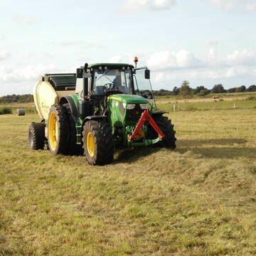
Heu/trockene Heulage für Pferde Zucker,Fruktanarm
Sophienhamm
Herr-Kolb
@Herr-Kolb
Heulage
Lieferant entlädt
Regenfrei
Wird verladen
2 weitere...
B+
Deprecated: Creation of dynamic property Zend_View_Helper_Ads::$adLink is deprecated in /var/www/stall-frei/htdocs/staging.stall-frei.de/library/Psf/View/Helper/Ads.php on line 108

Futtersack HeuToy, Fressbremse in pink
Mechtersen
STALL-FREIde Marketing
@STALL-FREI-Marketing
Stundenlange Beschäftigung die
Koliken vorbeugt, geringe Staubinhalation mit
steuerbarer Futterentnahme
Eiweisarmes Heu oder Heulage
Sophienhamm
Herr-Kolb
@Herr-Kolb
Heu
Rundballen
Regenfrei
Wird verladen
B+

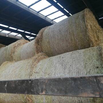
Erstklassiges PferdeHeu in HD-Ballen
Jevenstedt
Tim Rohwer
@EIDERHEU
Heu
Kleinballen/HD-Ballen
Regenfrei
B+

Heu 2. Schnitt 2025 Grummet HD Ballen
Altmannstein
Thomas Resch
@Cappo
Heu
Empfänger lädt ab
Kleinballen/HD-Ballen
Wird verladen
2 weitere...
B+

Heu in Rundballen (ca.130cm) super Qualität
Pronstorf
Caros Pferdeparadies
@KaOb
Heu
Rundballen
Regenfrei
Wird verladen
2 weitere...
B+

Fruktan- und zuckerarmes Premium Wiesenheu !
Schollene
Guthof Mühlenfels
@Gutshof-Muehlenfels
Heu
Empfänger lädt ab
Rundballen
Regenfrei
3 weitere...
B+

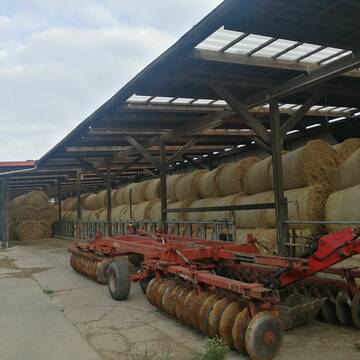
Strohstrukturpellets
Warsow
Luca Grabeleu, Marquardt
@LucaGrabeleu
Einstreu
Empfänger lädt ab
Bigbag
Regenfrei
3 weitere...
B+

Persönlichkeitsentwicklung mit Pferden
Bad Salzuflen
Katja Dors
@Pferdezeiten
Begleite andere auf ihrem Entwicklungsweg und entdecke die transformative Kraft der pferdegestützten Persönlichkeitsentwicklung !
neu
R

Haferstroh in Futterqualität für gesunde Pferde ...
Schollene
Guthof Mühlenfels
@Gutshof-Muehlenfels
Einstreu
Lieferant entlädt
Großballen
Regenfrei
3 weitere...
B+

Fruktan- und zuckerarmes Heu in Premiumqualität !
Schollene
Guthof Mühlenfels
@Gutshof-Muehlenfels
Heu
Empfänger lädt ab
Rundballen
Bio
Regenfrei
3 weitere...
B+
Heu 1.Schnitt 2021
Upahl
hermannmeyerzuborgsen
@hermannmeyerzuborgsen
Heu
Empfänger lädt ab
Rundballen
Regenfrei
3 weitere...
P+
Veröffentliche deine Suche als Gesuch und Suchauftrag, dann erhältst du Angebote, neue Treffer und Änderungen per E-Mail.
Diese Suche als Gesuch veröffentlichenDeprecated: Creation of dynamic property Zend_View::$pageCount is deprecated in /var/www/stall-frei/htdocs/staging.stall-frei.de/library/vendor/shardj/zf1-future/library/Zend/View/Abstract.php on line 308
Deprecated: Creation of dynamic property Zend_View::$itemCountPerPage is deprecated in /var/www/stall-frei/htdocs/staging.stall-frei.de/library/vendor/shardj/zf1-future/library/Zend/View/Abstract.php on line 308
Deprecated: Creation of dynamic property Zend_View::$first is deprecated in /var/www/stall-frei/htdocs/staging.stall-frei.de/library/vendor/shardj/zf1-future/library/Zend/View/Abstract.php on line 308
Deprecated: Creation of dynamic property Zend_View::$current is deprecated in /var/www/stall-frei/htdocs/staging.stall-frei.de/library/vendor/shardj/zf1-future/library/Zend/View/Abstract.php on line 308
Deprecated: Creation of dynamic property Zend_View::$last is deprecated in /var/www/stall-frei/htdocs/staging.stall-frei.de/library/vendor/shardj/zf1-future/library/Zend/View/Abstract.php on line 308
Deprecated: Creation of dynamic property Zend_View::$previous is deprecated in /var/www/stall-frei/htdocs/staging.stall-frei.de/library/vendor/shardj/zf1-future/library/Zend/View/Abstract.php on line 308
Deprecated: Creation of dynamic property Zend_View::$next is deprecated in /var/www/stall-frei/htdocs/staging.stall-frei.de/library/vendor/shardj/zf1-future/library/Zend/View/Abstract.php on line 308
Deprecated: Creation of dynamic property Zend_View::$pagesInRange is deprecated in /var/www/stall-frei/htdocs/staging.stall-frei.de/library/vendor/shardj/zf1-future/library/Zend/View/Abstract.php on line 308
Deprecated: Creation of dynamic property Zend_View::$firstPageInRange is deprecated in /var/www/stall-frei/htdocs/staging.stall-frei.de/library/vendor/shardj/zf1-future/library/Zend/View/Abstract.php on line 308
Deprecated: Creation of dynamic property Zend_View::$lastPageInRange is deprecated in /var/www/stall-frei/htdocs/staging.stall-frei.de/library/vendor/shardj/zf1-future/library/Zend/View/Abstract.php on line 308
Deprecated: Creation of dynamic property Zend_View::$currentItemCount is deprecated in /var/www/stall-frei/htdocs/staging.stall-frei.de/library/vendor/shardj/zf1-future/library/Zend/View/Abstract.php on line 308
Deprecated: Creation of dynamic property Zend_View::$totalItemCount is deprecated in /var/www/stall-frei/htdocs/staging.stall-frei.de/library/vendor/shardj/zf1-future/library/Zend/View/Abstract.php on line 308
Deprecated: Creation of dynamic property Zend_View::$firstItemNumber is deprecated in /var/www/stall-frei/htdocs/staging.stall-frei.de/library/vendor/shardj/zf1-future/library/Zend/View/Abstract.php on line 308
Deprecated: Creation of dynamic property Zend_View::$lastItemNumber is deprecated in /var/www/stall-frei/htdocs/staging.stall-frei.de/library/vendor/shardj/zf1-future/library/Zend/View/Abstract.php on line 308
Deprecated: Creation of dynamic property Zend_View::$router is deprecated in /var/www/stall-frei/htdocs/staging.stall-frei.de/library/vendor/shardj/zf1-future/library/Zend/View/Abstract.php on line 308
Deprecated: Creation of dynamic property Zend_View::$urlParams is deprecated in /var/www/stall-frei/htdocs/staging.stall-frei.de/library/vendor/shardj/zf1-future/library/Zend/View/Abstract.php on line 308
Deprecated: Creation of dynamic property Zend_View::$showAds is deprecated in /var/www/stall-frei/htdocs/staging.stall-frei.de/library/vendor/shardj/zf1-future/library/Zend/View/Abstract.php on line 308
Deprecated: Creation of dynamic property Zend_View::$objectIds is deprecated in /var/www/stall-frei/htdocs/staging.stall-frei.de/library/vendor/shardj/zf1-future/library/Zend/View/Abstract.php on line 308
Deprecated: Creation of dynamic property Zend_View::$showNavbar is deprecated in /var/www/stall-frei/htdocs/staging.stall-frei.de/library/vendor/shardj/zf1-future/library/Zend/View/Abstract.php on line 308
Deprecated: Creation of dynamic property Zend_View::$showBreadcrumb is deprecated in /var/www/stall-frei/htdocs/staging.stall-frei.de/library/vendor/shardj/zf1-future/library/Zend/View/Abstract.php on line 308
Deprecated: Creation of dynamic property Zend_View::$showFooter is deprecated in /var/www/stall-frei/htdocs/staging.stall-frei.de/library/vendor/shardj/zf1-future/library/Zend/View/Abstract.php on line 308
Deprecated: Creation of dynamic property Zend_View::$showInternalAds is deprecated in /var/www/stall-frei/htdocs/staging.stall-frei.de/library/vendor/shardj/zf1-future/library/Zend/View/Abstract.php on line 308
Deprecated: Creation of dynamic property Zend_View::$blNoContent is deprecated in /var/www/stall-frei/htdocs/staging.stall-frei.de/library/vendor/shardj/zf1-future/library/Zend/View/Abstract.php on line 308
Deprecated: Creation of dynamic property Zend_View::$sMetaDesc is deprecated in /var/www/stall-frei/htdocs/staging.stall-frei.de/library/vendor/shardj/zf1-future/library/Zend/View/Abstract.php on line 308
Deprecated: Creation of dynamic property Zend_View::$useGmaps is deprecated in /var/www/stall-frei/htdocs/staging.stall-frei.de/library/vendor/shardj/zf1-future/library/Zend/View/Abstract.php on line 308
Deprecated: Creation of dynamic property Zend_View::$touches is deprecated in /var/www/stall-frei/htdocs/staging.stall-frei.de/library/vendor/shardj/zf1-future/library/Zend/View/Abstract.php on line 308
Deprecated: Creation of dynamic property Zend_View::$oProject is deprecated in /var/www/stall-frei/htdocs/staging.stall-frei.de/library/vendor/shardj/zf1-future/library/Zend/View/Abstract.php on line 308
Deprecated: Creation of dynamic property Zend_View::$pageHeadline is deprecated in /var/www/stall-frei/htdocs/staging.stall-frei.de/library/vendor/shardj/zf1-future/library/Zend/View/Abstract.php on line 308
Deprecated: Creation of dynamic property Zend_View::$disableLocationField is deprecated in /var/www/stall-frei/htdocs/staging.stall-frei.de/library/vendor/shardj/zf1-future/library/Zend/View/Abstract.php on line 308
Deprecated: Creation of dynamic property Zend_View::$isSearch is deprecated in /var/www/stall-frei/htdocs/staging.stall-frei.de/library/vendor/shardj/zf1-future/library/Zend/View/Abstract.php on line 308
Deprecated: Creation of dynamic property Zend_View::$pageTitle is deprecated in /var/www/stall-frei/htdocs/staging.stall-frei.de/library/vendor/shardj/zf1-future/library/Zend/View/Abstract.php on line 308
Deprecated: Creation of dynamic property Psf_Form_Element_Text::$class is deprecated in /var/www/stall-frei/htdocs/staging.stall-frei.de/library/vendor/shardj/zf1-future/library/Zend/Form/Element.php on line 874
Deprecated: Creation of dynamic property Psf_Form_Element_Text::$size is deprecated in /var/www/stall-frei/htdocs/staging.stall-frei.de/library/vendor/shardj/zf1-future/library/Zend/Form/Element.php on line 874
Deprecated: Creation of dynamic property Psf_Form_Element_Text::$placeholder is deprecated in /var/www/stall-frei/htdocs/staging.stall-frei.de/library/vendor/shardj/zf1-future/library/Zend/Form/Element.php on line 874
Deprecated: Creation of dynamic property Psf_Form_Element_Hidden::$class is deprecated in /var/www/stall-frei/htdocs/staging.stall-frei.de/library/vendor/shardj/zf1-future/library/Zend/Form/Element.php on line 874
Deprecated: Creation of dynamic property Psf_Form_Element_Hidden::$class is deprecated in /var/www/stall-frei/htdocs/staging.stall-frei.de/library/vendor/shardj/zf1-future/library/Zend/Form/Element.php on line 874
Deprecated: Creation of dynamic property Psf_Form_Element_Hidden::$class is deprecated in /var/www/stall-frei/htdocs/staging.stall-frei.de/library/vendor/shardj/zf1-future/library/Zend/Form/Element.php on line 874
Deprecated: Creation of dynamic property Psf_Form_Element_Hidden::$class is deprecated in /var/www/stall-frei/htdocs/staging.stall-frei.de/library/vendor/shardj/zf1-future/library/Zend/Form/Element.php on line 874
Deprecated: Creation of dynamic property Psf_Form_Element_Select::$class is deprecated in /var/www/stall-frei/htdocs/staging.stall-frei.de/library/vendor/shardj/zf1-future/library/Zend/Form/Element.php on line 874
Deprecated: Creation of dynamic property Psf_Form_Element_Select::$class is deprecated in /var/www/stall-frei/htdocs/staging.stall-frei.de/library/vendor/shardj/zf1-future/library/Zend/Form/Element.php on line 874
Deprecated: Creation of dynamic property Psf_Form_Element_Select::$class is deprecated in /var/www/stall-frei/htdocs/staging.stall-frei.de/library/vendor/shardj/zf1-future/library/Zend/Form/Element.php on line 874
Deprecated: Creation of dynamic property Psf_Form_Element_Select::$class is deprecated in /var/www/stall-frei/htdocs/staging.stall-frei.de/library/vendor/shardj/zf1-future/library/Zend/Form/Element.php on line 874
Deprecated: Creation of dynamic property Zend_View::$sort is deprecated in /var/www/stall-frei/htdocs/staging.stall-frei.de/library/vendor/shardj/zf1-future/library/Zend/View/Abstract.php on line 308
Deprecated: Creation of dynamic property Zend_View::$searchLocation is deprecated in /var/www/stall-frei/htdocs/staging.stall-frei.de/library/vendor/shardj/zf1-future/library/Zend/View/Abstract.php on line 308
Deprecated: Creation of dynamic property Zend_View::$locationHint is deprecated in /var/www/stall-frei/htdocs/staging.stall-frei.de/library/vendor/shardj/zf1-future/library/Zend/View/Abstract.php on line 308
Psf_GeoCoder_Abstract::getLocation: Elsdorf Get Location CachedOrLive
Psf_GeoCoder_Abstract::getCachedOrLive: Elsdorf
Psf_GeoCoder_Abstract::convertLocationResult
{"documentation":"https:\/\/opencagedata.com\/api","licenses":[{"name":"see attribution guide","url":"https:\/\/opencagedata.com\/credits"}],"results":[{"bounds":{"northeast":{"lat":50.9763894,"lng":6.6550461},"southwest":{"lat":50.8905722,"lng":6.4788124}},"components":{"ISO_3166-1_alpha-2":"DE","ISO_3166-1_alpha-3":"DEU","ISO_3166-2":["DE-NW"],"_category":"place","_normalized_city":"Elsdorf","_type":"city","continent":"Europe","country":"Deutschland","country_code":"de","county":"Rhein-Erft-Kreis","political_union":"European Union","postcode":"50189","state":"Nordrhein-Westfalen","state_code":"NW","town":"Elsdorf"},"confidence":6,"formatted":"50189 Elsdorf, Deutschland","geometry":{"lat":50.9371308,"lng":6.5698302}},{"bounds":{"northeast":{"lat":53.292333,"lng":9.4408632},"southwest":{"lat":53.2097569,"lng":9.3173746}},"components":{"ISO_3166-1_alpha-2":"DE","ISO_3166-1_alpha-3":"DEU","ISO_3166-2":["DE-NI"],"_category":"place","_normalized_city":"Elsdorf","_type":"village","continent":"Europe","country":"Deutschland","country_code":"de","county":"Landkreis Rotenburg (W\u00fcmme)","municipality":"Samtgemeinde Zeven","political_union":"European Union","state":"Niedersachsen","state_code":"NI","village":"Elsdorf"},"confidence":7,"formatted":"Elsdorf, Niedersachsen, Deutschland","geometry":{"lat":53.2419954,"lng":9.3534844}},{"bounds":{"northeast":{"lat":50.8763896,"lng":7.0961062},"southwest":{"lat":50.8647824,"lng":7.0704239}},"components":{"ISO_3166-1_alpha-2":"DE","ISO_3166-1_alpha-3":"DEU","ISO_3166-2":["DE-NW"],"_category":"place","_normalized_city":"K\u00f6ln","_type":"neighbourhood","city":"K\u00f6ln","city_district":"Porz","continent":"Europe","country":"Deutschland","country_code":"de","political_union":"European Union","state":"Nordrhein-Westfalen","state_code":"NW","suburb":"Elsdorf"},"confidence":8,"formatted":"Elsdorf, K\u00f6ln, Nordrhein-Westfalen, Deutschland","geometry":{"lat":50.8724603,"lng":7.0820837}},{"bounds":{"northeast":{"lat":54.2775789,"lng":9.5526995},"southwest":{"lat":54.2375789,"lng":9.5126995}},"components":{"ISO_3166-1_alpha-2":"DE","ISO_3166-1_alpha-3":"DEU","ISO_3166-2":["DE-SH"],"_category":"place","_normalized_city":"Elsdorf","_type":"village","continent":"Europe","country":"Deutschland","country_code":"de","county":"Kreis Rendsburg-Eckernf\u00f6rde","municipality":"Hohner Harde","political_union":"European Union","postcode":"24800","state":"Schleswig-Holstein","state_code":"SH","town":"Elsdorf","village":"Elsdorf-Westerm\u00fchlen"},"confidence":7,"formatted":"24800 Elsdorf-Westerm\u00fchlen, Deutschland","geometry":{"lat":54.2575789,"lng":9.5326995}},{"bounds":{"northeast":{"lat":50.988023,"lng":12.7416131},"southwest":{"lat":50.948023,"lng":12.7016131}},"components":{"ISO_3166-1_alpha-2":"DE","ISO_3166-1_alpha-3":"DEU","ISO_3166-2":["DE-SN"],"_category":"place","_normalized_city":"Lunzenau","_type":"village","continent":"Europe","country":"Deutschland","country_code":"de","county":"Mittelsachsen","political_union":"European Union","postcode":"09328","state":"Sachsen","state_code":"SN","town":"Lunzenau","village":"Elsdorf"},"confidence":7,"formatted":"09328 Elsdorf, Deutschland","geometry":{"lat":50.968023,"lng":12.7216131}},{"bounds":{"northeast":{"lat":51.8019835,"lng":11.9990629},"southwest":{"lat":51.7619835,"lng":11.9590629}},"components":{"ISO_3166-1_alpha-2":"DE","ISO_3166-1_alpha-3":"DEU","ISO_3166-2":["DE-ST"],"_category":"place","_normalized_city":"K\u00f6then (Anhalt)","_type":"village","continent":"Europe","country":"Deutschland","country_code":"de","county":"Anhalt-Bitterfeld","political_union":"European Union","postcode":"06369","state":"Sachsen-Anhalt","state_code":"ST","town":"K\u00f6then (Anhalt)","village":"Elsdorf"},"confidence":7,"formatted":"06369 Elsdorf, Deutschland","geometry":{"lat":51.7819835,"lng":11.9790629}},{"bounds":{"northeast":{"lat":51.7924741,"lng":12.0069971},"southwest":{"lat":51.7706709,"lng":11.9515006}},"components":{"ISO_3166-1_alpha-2":"DE","ISO_3166-1_alpha-3":"DEU","ISO_3166-2":["DE-ST"],"_category":"place","_normalized_city":"K\u00f6then (Anhalt)","_type":"neighbourhood","city_district":"K\u00f6then","continent":"Europe","country":"Deutschland","country_code":"de","county":"Anhalt-Bitterfeld","political_union":"European Union","state":"Sachsen-Anhalt","state_code":"ST","suburb":"Elsdorf","town":"K\u00f6then (Anhalt)"},"confidence":7,"formatted":"Elsdorf, K\u00f6then (Anhalt), Sachsen-Anhalt, Deutschland","geometry":{"lat":51.7815786,"lng":11.9808202}},{"components":{"ISO_3166-1_alpha-2":"FR","ISO_3166-1_alpha-3":"FRA","ISO_3166-2":["FR-BRE","FR-22"],"_category":"road","_normalized_city":"Saint-Brieuc","_type":"road","city":"Saint-Brieuc","continent":"Europe","country":"France","country_code":"fr","county":"C\u00f4tes-d'Armor","local_authority":"Saint-Brieuc Armor Agglom\u00e9ration","political_union":"European Union","postcode":"22000","road":"Place d'Alsdorf","state":"Bretagne","state_code":"BRE"},"confidence":3,"formatted":"Place d'Alsdorf, 22000 Saint-Brieuc, France","geometry":{"lat":48.51912,"lng":-2.743372}},{"components":{"ISO_3166-1_alpha-2":"FR","ISO_3166-1_alpha-3":"FRA","ISO_3166-2":["FR-HDF","FR-62"],"_category":"road","_normalized_city":"Bully-les-Mines","_type":"road","city":"Bully-les-Mines","continent":"Europe","country":"France","country_code":"fr","county":"Pas-de-Calais","local_authority":"Communaut\u00e9 d'agglom\u00e9ration de Lens-Li\u00e9vin","political_union":"European Union","postcode":"62160","road":"Rue d'Elsdorf Res Europe","state":"Hauts-de-France","state_code":"HDF"},"confidence":3,"formatted":"Rue d'Elsdorf Res Europe, 62160 Bully-les-Mines, France","geometry":{"lat":50.448325,"lng":2.709805}},{"components":{"ISO_3166-1_alpha-2":"FR","ISO_3166-1_alpha-3":"FRA","ISO_3166-2":["FR-HDF","FR-62"],"_category":"road","_normalized_city":"Wizernes","_type":"road","city":"Wizernes","continent":"Europe","country":"France","country_code":"fr","county":"Pas-de-Calais","local_authority":"Communaut\u00e9 d'agglom\u00e9ration du Pays de Saint-Omer","political_union":"European Union","postcode":"62570","road":"Rue d\u2019Ensdorf","state":"Hauts-de-France","state_code":"HDF"},"confidence":2,"formatted":"Rue d\u2019Ensdorf, 62570 Wizernes, France","geometry":{"lat":50.7141,"lng":2.235775}}],"status":{"code":200,"message":"OK"},"stay_informed":{"blog":"https:\/\/blog.opencagedata.com","mastodon":"https:\/\/en.osm.town\/@opencage"},"thanks":"For using an OpenCage API","timestamp":{"created_http":"Sat, 07 Feb 2026 20:41:09 GMT","created_unix":1770496869},"total_results":10}Array
(
[0] => stdClass Object
(
[bounds] => stdClass Object
(
[northeast] => stdClass Object
(
[lat] => 50.9763894
[lng] => 6.6550461
)
[southwest] => stdClass Object
(
[lat] => 50.8905722
[lng] => 6.4788124
)
)
[components] => stdClass Object
(
[ISO_3166-1_alpha-2] => DE
[ISO_3166-1_alpha-3] => DEU
[ISO_3166-2] => Array
(
[0] => DE-NW
)
[_category] => place
[_normalized_city] => Elsdorf
[_type] => city
[continent] => Europe
[country] => Deutschland
[country_code] => de
[county] => Rhein-Erft-Kreis
[political_union] => European Union
[postcode] => 50189
[state] => Nordrhein-Westfalen
[state_code] => NW
[town] => Elsdorf
)
[confidence] => 6
[formatted] => 50189 Elsdorf, Deutschland
[geometry] => stdClass Object
(
[lat] => 50.9371308
[lng] => 6.5698302
)
)
[1] => stdClass Object
(
[bounds] => stdClass Object
(
[northeast] => stdClass Object
(
[lat] => 53.292333
[lng] => 9.4408632
)
[southwest] => stdClass Object
(
[lat] => 53.2097569
[lng] => 9.3173746
)
)
[components] => stdClass Object
(
[ISO_3166-1_alpha-2] => DE
[ISO_3166-1_alpha-3] => DEU
[ISO_3166-2] => Array
(
[0] => DE-NI
)
[_category] => place
[_normalized_city] => Elsdorf
[_type] => village
[continent] => Europe
[country] => Deutschland
[country_code] => de
[county] => Landkreis Rotenburg (Wümme)
[municipality] => Samtgemeinde Zeven
[political_union] => European Union
[state] => Niedersachsen
[state_code] => NI
[village] => Elsdorf
)
[confidence] => 7
[formatted] => Elsdorf, Niedersachsen, Deutschland
[geometry] => stdClass Object
(
[lat] => 53.2419954
[lng] => 9.3534844
)
)
[2] => stdClass Object
(
[bounds] => stdClass Object
(
[northeast] => stdClass Object
(
[lat] => 50.8763896
[lng] => 7.0961062
)
[southwest] => stdClass Object
(
[lat] => 50.8647824
[lng] => 7.0704239
)
)
[components] => stdClass Object
(
[ISO_3166-1_alpha-2] => DE
[ISO_3166-1_alpha-3] => DEU
[ISO_3166-2] => Array
(
[0] => DE-NW
)
[_category] => place
[_normalized_city] => Köln
[_type] => neighbourhood
[city] => Köln
[city_district] => Porz
[continent] => Europe
[country] => Deutschland
[country_code] => de
[political_union] => European Union
[state] => Nordrhein-Westfalen
[state_code] => NW
[suburb] => Elsdorf
)
[confidence] => 8
[formatted] => Elsdorf, Köln, Nordrhein-Westfalen, Deutschland
[geometry] => stdClass Object
(
[lat] => 50.8724603
[lng] => 7.0820837
)
)
[3] => stdClass Object
(
[bounds] => stdClass Object
(
[northeast] => stdClass Object
(
[lat] => 54.2775789
[lng] => 9.5526995
)
[southwest] => stdClass Object
(
[lat] => 54.2375789
[lng] => 9.5126995
)
)
[components] => stdClass Object
(
[ISO_3166-1_alpha-2] => DE
[ISO_3166-1_alpha-3] => DEU
[ISO_3166-2] => Array
(
[0] => DE-SH
)
[_category] => place
[_normalized_city] => Elsdorf
[_type] => village
[continent] => Europe
[country] => Deutschland
[country_code] => de
[county] => Kreis Rendsburg-Eckernförde
[municipality] => Hohner Harde
[political_union] => European Union
[postcode] => 24800
[state] => Schleswig-Holstein
[state_code] => SH
[town] => Elsdorf
[village] => Elsdorf-Westermühlen
)
[confidence] => 7
[formatted] => 24800 Elsdorf-Westermühlen, Deutschland
[geometry] => stdClass Object
(
[lat] => 54.2575789
[lng] => 9.5326995
)
)
[4] => stdClass Object
(
[bounds] => stdClass Object
(
[northeast] => stdClass Object
(
[lat] => 50.988023
[lng] => 12.7416131
)
[southwest] => stdClass Object
(
[lat] => 50.948023
[lng] => 12.7016131
)
)
[components] => stdClass Object
(
[ISO_3166-1_alpha-2] => DE
[ISO_3166-1_alpha-3] => DEU
[ISO_3166-2] => Array
(
[0] => DE-SN
)
[_category] => place
[_normalized_city] => Lunzenau
[_type] => village
[continent] => Europe
[country] => Deutschland
[country_code] => de
[county] => Mittelsachsen
[political_union] => European Union
[postcode] => 09328
[state] => Sachsen
[state_code] => SN
[town] => Lunzenau
[village] => Elsdorf
)
[confidence] => 7
[formatted] => 09328 Elsdorf, Deutschland
[geometry] => stdClass Object
(
[lat] => 50.968023
[lng] => 12.7216131
)
)
[5] => stdClass Object
(
[bounds] => stdClass Object
(
[northeast] => stdClass Object
(
[lat] => 51.8019835
[lng] => 11.9990629
)
[southwest] => stdClass Object
(
[lat] => 51.7619835
[lng] => 11.9590629
)
)
[components] => stdClass Object
(
[ISO_3166-1_alpha-2] => DE
[ISO_3166-1_alpha-3] => DEU
[ISO_3166-2] => Array
(
[0] => DE-ST
)
[_category] => place
[_normalized_city] => Köthen (Anhalt)
[_type] => village
[continent] => Europe
[country] => Deutschland
[country_code] => de
[county] => Anhalt-Bitterfeld
[political_union] => European Union
[postcode] => 06369
[state] => Sachsen-Anhalt
[state_code] => ST
[town] => Köthen (Anhalt)
[village] => Elsdorf
)
[confidence] => 7
[formatted] => 06369 Elsdorf, Deutschland
[geometry] => stdClass Object
(
[lat] => 51.7819835
[lng] => 11.9790629
)
)
[6] => stdClass Object
(
[bounds] => stdClass Object
(
[northeast] => stdClass Object
(
[lat] => 51.7924741
[lng] => 12.0069971
)
[southwest] => stdClass Object
(
[lat] => 51.7706709
[lng] => 11.9515006
)
)
[components] => stdClass Object
(
[ISO_3166-1_alpha-2] => DE
[ISO_3166-1_alpha-3] => DEU
[ISO_3166-2] => Array
(
[0] => DE-ST
)
[_category] => place
[_normalized_city] => Köthen (Anhalt)
[_type] => neighbourhood
[city_district] => Köthen
[continent] => Europe
[country] => Deutschland
[country_code] => de
[county] => Anhalt-Bitterfeld
[political_union] => European Union
[state] => Sachsen-Anhalt
[state_code] => ST
[suburb] => Elsdorf
[town] => Köthen (Anhalt)
)
[confidence] => 7
[formatted] => Elsdorf, Köthen (Anhalt), Sachsen-Anhalt, Deutschland
[geometry] => stdClass Object
(
[lat] => 51.7815786
[lng] => 11.9808202
)
)
[7] => stdClass Object
(
[components] => stdClass Object
(
[ISO_3166-1_alpha-2] => FR
[ISO_3166-1_alpha-3] => FRA
[ISO_3166-2] => Array
(
[0] => FR-BRE
[1] => FR-22
)
[_category] => road
[_normalized_city] => Saint-Brieuc
[_type] => road
[city] => Saint-Brieuc
[continent] => Europe
[country] => France
[country_code] => fr
[county] => Côtes-d'Armor
[local_authority] => Saint-Brieuc Armor Agglomération
[political_union] => European Union
[postcode] => 22000
[road] => Place d'Alsdorf
[state] => Bretagne
[state_code] => BRE
)
[confidence] => 3
[formatted] => Place d'Alsdorf, 22000 Saint-Brieuc, France
[geometry] => stdClass Object
(
[lat] => 48.51912
[lng] => -2.743372
)
)
[8] => stdClass Object
(
[components] => stdClass Object
(
[ISO_3166-1_alpha-2] => FR
[ISO_3166-1_alpha-3] => FRA
[ISO_3166-2] => Array
(
[0] => FR-HDF
[1] => FR-62
)
[_category] => road
[_normalized_city] => Bully-les-Mines
[_type] => road
[city] => Bully-les-Mines
[continent] => Europe
[country] => France
[country_code] => fr
[county] => Pas-de-Calais
[local_authority] => Communauté d'agglomération de Lens-Liévin
[political_union] => European Union
[postcode] => 62160
[road] => Rue d'Elsdorf Res Europe
[state] => Hauts-de-France
[state_code] => HDF
)
[confidence] => 3
[formatted] => Rue d'Elsdorf Res Europe, 62160 Bully-les-Mines, France
[geometry] => stdClass Object
(
[lat] => 50.448325
[lng] => 2.709805
)
)
[9] => stdClass Object
(
[components] => stdClass Object
(
[ISO_3166-1_alpha-2] => FR
[ISO_3166-1_alpha-3] => FRA
[ISO_3166-2] => Array
(
[0] => FR-HDF
[1] => FR-62
)
[_category] => road
[_normalized_city] => Wizernes
[_type] => road
[city] => Wizernes
[continent] => Europe
[country] => France
[country_code] => fr
[county] => Pas-de-Calais
[local_authority] => Communauté d'agglomération du Pays de Saint-Omer
[political_union] => European Union
[postcode] => 62570
[road] => Rue d’Ensdorf
[state] => Hauts-de-France
[state_code] => HDF
)
[confidence] => 2
[formatted] => Rue d’Ensdorf, 62570 Wizernes, France
[geometry] => stdClass Object
(
[lat] => 50.7141
[lng] => 2.235775
)
)
)
Psf_GeoCoder_OpenCageData::getKeyMap: 0
stdClass Object
(
    [bounds] => stdClass Object
        (
            [northeast] => stdClass Object
                (
                    [lat] => 50.9763894
                    [lng] => 6.6550461
                )

            [southwest] => stdClass Object
                (
                    [lat] => 50.8905722
                    [lng] => 6.4788124
                )

        )

    [components] => stdClass Object
        (
            [ISO_3166-1_alpha-2] => DE
            [ISO_3166-1_alpha-3] => DEU
            [ISO_3166-2] => Array
                (
                    [0] => DE-NW
                )

            [_category] => place
            [_normalized_city] => Elsdorf
            [_type] => city
            [continent] => Europe
            [country] => Deutschland
            [country_code] => de
            [county] => Rhein-Erft-Kreis
            [political_union] => European Union
            [postcode] => 50189
            [state] => Nordrhein-Westfalen
            [state_code] => NW
            [town] => Elsdorf
        )

    [confidence] => 6
    [formatted] => 50189 Elsdorf, Deutschland
    [geometry] => stdClass Object
        (
            [lat] => 50.9371308
            [lng] => 6.5698302
        )

)
Psf_GeoCoder_OpenCageData::getCounty: Rhein-Erft-Kreis
Psf_GeoCoder_OpenCageData::addMissingData REFETCH!
Array
(
    [address] => 50189 Elsdorf, Deutschland
    [type] => city
    [street] =>
    [city] => Elsdorf
    [county] => Rhein-Erft-Kreis
    [state] => Nordrhein-Westfalen
    [zip] => 50189
    [country] => Deutschland
    [suburb] =>
    [countrycode] => de
    [latitude] => 50.9371308
    [longitude] => 6.5698302
    [accuracy] => 1
    [confidence] => 6
    [bounds] => stdClass Object
        (
            [northeast] => stdClass Object
                (
                    [lat] => 50.9763894
                    [lng] => 6.6550461
                )

            [southwest] => stdClass Object
                (
                    [lat] => 50.8905722
                    [lng] => 6.4788124
                )

        )

)
reformat!
Array
(
    [address] => 50189 Elsdorf, Deutschland
    [type] => city
    [street] =>
    [city] => Elsdorf
    [county] => Rhein-Erft-Kreis
    [state] => Nordrhein-Westfalen
    [zip] => 50189
    [country] => Deutschland
    [suburb] =>
    [countrycode] => de
    [latitude] => 50.9371308
    [longitude] => 6.5698302
    [accuracy] => 1
    [confidence] => 6
    [bounds] => stdClass Object
        (
            [northeast] => stdClass Object
                (
                    [lat] => 50.9763894
                    [lng] => 6.6550461
                )

            [southwest] => stdClass Object
                (
                    [lat] => 50.8905722
                    [lng] => 6.4788124
                )

        )

    [place] => 50189 Elsdorf, Nordrhein-Westfalen
    [hash] => e8d9645ac38d9836ff4fa6169577f5f8
)
Psf_GeoCoder_OpenCageData::getKeyMap: 1
stdClass Object
(
    [bounds] => stdClass Object
        (
            [northeast] => stdClass Object
                (
                    [lat] => 53.292333
                    [lng] => 9.4408632
                )

            [southwest] => stdClass Object
                (
                    [lat] => 53.2097569
                    [lng] => 9.3173746
                )

        )

    [components] => stdClass Object
        (
            [ISO_3166-1_alpha-2] => DE
            [ISO_3166-1_alpha-3] => DEU
            [ISO_3166-2] => Array
                (
                    [0] => DE-NI
                )

            [_category] => place
            [_normalized_city] => Elsdorf
            [_type] => village
            [continent] => Europe
            [country] => Deutschland
            [country_code] => de
            [county] => Landkreis Rotenburg (Wümme)
            [municipality] => Samtgemeinde Zeven
            [political_union] => European Union
            [state] => Niedersachsen
            [state_code] => NI
            [village] => Elsdorf
        )

    [confidence] => 7
    [formatted] => Elsdorf, Niedersachsen, Deutschland
    [geometry] => stdClass Object
        (
            [lat] => 53.2419954
            [lng] => 9.3534844
        )

)
Psf_GeoCoder_OpenCageData::getCounty: Rotenburg (Wümme)
Psf_GeoCoder_OpenCageData::addMissingData REFETCH!
Array
(
    [address] => Elsdorf, Niedersachsen, Deutschland
    [type] => village
    [street] =>
    [city] => Elsdorf
    [county] => Rotenburg (Wümme)
    [state] => Niedersachsen
    [zip] =>
    [country] => Deutschland
    [suburb] =>
    [countrycode] => de
    [latitude] => 53.2419954
    [longitude] => 9.3534844
    [accuracy] => 1
    [confidence] => 7
    [bounds] => stdClass Object
        (
            [northeast] => stdClass Object
                (
                    [lat] => 53.292333
                    [lng] => 9.4408632
                )

            [southwest] => stdClass Object
                (
                    [lat] => 53.2097569
                    [lng] => 9.3173746
                )

        )

)
reformat!
Array
(
    [address] => Elsdorf, Niedersachsen, Deutschland
    [type] => village
    [street] =>
    [city] => Elsdorf
    [county] => Rotenburg (Wümme)
    [state] => Niedersachsen
    [zip] =>
    [country] => Deutschland
    [suburb] =>
    [countrycode] => de
    [latitude] => 53.2419954
    [longitude] => 9.3534844
    [accuracy] => 1
    [confidence] => 7
    [bounds] => stdClass Object
        (
            [northeast] => stdClass Object
                (
                    [lat] => 53.292333
                    [lng] => 9.4408632
                )

            [southwest] => stdClass Object
                (
                    [lat] => 53.2097569
                    [lng] => 9.3173746
                )

        )

    [place] => Elsdorf, Niedersachsen
    [hash] => a4c1d2a7287a52ec55fdd36c06cdbe4d
)
Psf_GeoCoder_OpenCageData::getKeyMap: 2
stdClass Object
(
    [bounds] => stdClass Object
        (
            [northeast] => stdClass Object
                (
                    [lat] => 50.8763896
                    [lng] => 7.0961062
                )

            [southwest] => stdClass Object
                (
                    [lat] => 50.8647824
                    [lng] => 7.0704239
                )

        )

    [components] => stdClass Object
        (
            [ISO_3166-1_alpha-2] => DE
            [ISO_3166-1_alpha-3] => DEU
            [ISO_3166-2] => Array
                (
                    [0] => DE-NW
                )

            [_category] => place
            [_normalized_city] => Köln
            [_type] => neighbourhood
            [city] => Köln
            [city_district] => Porz
            [continent] => Europe
            [country] => Deutschland
            [country_code] => de
            [political_union] => European Union
            [state] => Nordrhein-Westfalen
            [state_code] => NW
            [suburb] => Elsdorf
        )

    [confidence] => 8
    [formatted] => Elsdorf, Köln, Nordrhein-Westfalen, Deutschland
    [geometry] => stdClass Object
        (
            [lat] => 50.8724603
            [lng] => 7.0820837
        )

)
Psf_GeoCoder_OpenCageData::getCounty: Köln
Psf_GeoCoder_OpenCageData::addMissingData REFETCH!
Array
(
    [address] => Elsdorf, Köln, Nordrhein-Westfalen, Deutschland
    [type] => neighbourhood
    [street] =>
    [city] => Elsdorf
    [county] => Köln
    [state] => Nordrhein-Westfalen
    [zip] =>
    [country] => Deutschland
    [suburb] => Elsdorf
    [countrycode] => de
    [latitude] => 50.8724603
    [longitude] => 7.0820837
    [accuracy] => 1
    [confidence] => 8
    [bounds] => stdClass Object
        (
            [northeast] => stdClass Object
                (
                    [lat] => 50.8763896
                    [lng] => 7.0961062
                )

            [southwest] => stdClass Object
                (
                    [lat] => 50.8647824
                    [lng] => 7.0704239
                )

        )

)
reformat!
Array
(
    [address] => Elsdorf, Köln, Nordrhein-Westfalen, Deutschland
    [type] => neighbourhood
    [street] =>
    [city] => Elsdorf
    [county] => Köln
    [state] => Nordrhein-Westfalen
    [zip] =>
    [country] => Deutschland
    [suburb] => Elsdorf
    [countrycode] => de
    [latitude] => 50.8724603
    [longitude] => 7.0820837
    [accuracy] => 1
    [confidence] => 8
    [bounds] => stdClass Object
        (
            [northeast] => stdClass Object
                (
                    [lat] => 50.8763896
                    [lng] => 7.0961062
                )

            [southwest] => stdClass Object
                (
                    [lat] => 50.8647824
                    [lng] => 7.0704239
                )

        )

    [place] => Elsdorf, Nordrhein-Westfalen
    [hash] => 36d952e2705117c6d7b0181dd03cd2a0
)
Psf_GeoCoder_OpenCageData::getKeyMap: 3
stdClass Object
(
    [bounds] => stdClass Object
        (
            [northeast] => stdClass Object
                (
                    [lat] => 54.2775789
                    [lng] => 9.5526995
                )

            [southwest] => stdClass Object
                (
                    [lat] => 54.2375789
                    [lng] => 9.5126995
                )

        )

    [components] => stdClass Object
        (
            [ISO_3166-1_alpha-2] => DE
            [ISO_3166-1_alpha-3] => DEU
            [ISO_3166-2] => Array
                (
                    [0] => DE-SH
                )

            [_category] => place
            [_normalized_city] => Elsdorf
            [_type] => village
            [continent] => Europe
            [country] => Deutschland
            [country_code] => de
            [county] => Kreis Rendsburg-Eckernförde
            [municipality] => Hohner Harde
            [political_union] => European Union
            [postcode] => 24800
            [state] => Schleswig-Holstein
            [state_code] => SH
            [town] => Elsdorf
            [village] => Elsdorf-Westermühlen
        )

    [confidence] => 7
    [formatted] => 24800 Elsdorf-Westermühlen, Deutschland
    [geometry] => stdClass Object
        (
            [lat] => 54.2575789
            [lng] => 9.5326995
        )

)
Psf_GeoCoder_OpenCageData::getCounty: Rendsburg-Eckernförde
Psf_GeoCoder_OpenCageData::addMissingData REFETCH!
Array
(
    [address] => 24800 Elsdorf-Westermühlen, Deutschland
    [type] => village
    [street] =>
    [city] => Elsdorf
    [county] => Rendsburg-Eckernförde
    [state] => Schleswig-Holstein
    [zip] => 24800
    [country] => Deutschland
    [suburb] =>
    [countrycode] => de
    [latitude] => 54.2575789
    [longitude] => 9.5326995
    [accuracy] => 1
    [confidence] => 7
    [bounds] => stdClass Object
        (
            [northeast] => stdClass Object
                (
                    [lat] => 54.2775789
                    [lng] => 9.5526995
                )

            [southwest] => stdClass Object
                (
                    [lat] => 54.2375789
                    [lng] => 9.5126995
                )

        )

)
reformat!
Array
(
    [address] => 24800 Elsdorf-Westermühlen, Deutschland
    [type] => village
    [street] =>
    [city] => Elsdorf
    [county] => Rendsburg-Eckernförde
    [state] => Schleswig-Holstein
    [zip] => 24800
    [country] => Deutschland
    [suburb] =>
    [countrycode] => de
    [latitude] => 54.2575789
    [longitude] => 9.5326995
    [accuracy] => 1
    [confidence] => 7
    [bounds] => stdClass Object
        (
            [northeast] => stdClass Object
                (
                    [lat] => 54.2775789
                    [lng] => 9.5526995
                )

            [southwest] => stdClass Object
                (
                    [lat] => 54.2375789
                    [lng] => 9.5126995
                )

        )

    [place] => 24800 Elsdorf, Schleswig-Holstein
    [hash] => 896651cb63c6e578f3388c8065671d50
)
Psf_GeoCoder_OpenCageData::getKeyMap: 4
stdClass Object
(
    [bounds] => stdClass Object
        (
            [northeast] => stdClass Object
                (
                    [lat] => 50.988023
                    [lng] => 12.7416131
                )

            [southwest] => stdClass Object
                (
                    [lat] => 50.948023
                    [lng] => 12.7016131
                )

        )

    [components] => stdClass Object
        (
            [ISO_3166-1_alpha-2] => DE
            [ISO_3166-1_alpha-3] => DEU
            [ISO_3166-2] => Array
                (
                    [0] => DE-SN
                )

            [_category] => place
            [_normalized_city] => Lunzenau
            [_type] => village
            [continent] => Europe
            [country] => Deutschland
            [country_code] => de
            [county] => Mittelsachsen
            [political_union] => European Union
            [postcode] => 09328
            [state] => Sachsen
            [state_code] => SN
            [town] => Lunzenau
            [village] => Elsdorf
        )

    [confidence] => 7
    [formatted] => 09328 Elsdorf, Deutschland
    [geometry] => stdClass Object
        (
            [lat] => 50.968023
            [lng] => 12.7216131
        )

)
Psf_GeoCoder_OpenCageData::getCounty: Mittelsachsen
Psf_GeoCoder_OpenCageData::addMissingData REFETCH!
Array
(
    [address] => 09328 Elsdorf, Deutschland
    [type] => village
    [street] =>
    [city] => Lunzenau
    [county] => Mittelsachsen
    [state] => Sachsen
    [zip] => 09328
    [country] => Deutschland
    [suburb] =>
    [countrycode] => de
    [latitude] => 50.968023
    [longitude] => 12.7216131
    [accuracy] => 1
    [confidence] => 7
    [bounds] => stdClass Object
        (
            [northeast] => stdClass Object
                (
                    [lat] => 50.988023
                    [lng] => 12.7416131
                )

            [southwest] => stdClass Object
                (
                    [lat] => 50.948023
                    [lng] => 12.7016131
                )

        )

)
reformat!
Array
(
    [address] => 09328 Lunzenau
    [type] => village
    [street] =>
    [city] => Lunzenau
    [county] => Mittelsachsen
    [state] => Sachsen
    [zip] => 09328
    [country] => Deutschland
    [suburb] =>
    [countrycode] => de
    [latitude] => 50.968023
    [longitude] => 12.7216131
    [accuracy] => 1
    [confidence] => 7
    [bounds] => stdClass Object
        (
            [northeast] => stdClass Object
                (
                    [lat] => 50.988023
                    [lng] => 12.7416131
                )

            [southwest] => stdClass Object
                (
                    [lat] => 50.948023
                    [lng] => 12.7016131
                )

        )

    [place] => 09328 Lunzenau, Sachsen
    [hash] => d4ad5208a811250943c45e48fbf3a9d8
)
Psf_GeoCoder_OpenCageData::getKeyMap: 5
stdClass Object
(
    [bounds] => stdClass Object
        (
            [northeast] => stdClass Object
                (
                    [lat] => 51.8019835
                    [lng] => 11.9990629
                )

            [southwest] => stdClass Object
                (
                    [lat] => 51.7619835
                    [lng] => 11.9590629
                )

        )

    [components] => stdClass Object
        (
            [ISO_3166-1_alpha-2] => DE
            [ISO_3166-1_alpha-3] => DEU
            [ISO_3166-2] => Array
                (
                    [0] => DE-ST
                )

            [_category] => place
            [_normalized_city] => Köthen (Anhalt)
            [_type] => village
            [continent] => Europe
            [country] => Deutschland
            [country_code] => de
            [county] => Anhalt-Bitterfeld
            [political_union] => European Union
            [postcode] => 06369
            [state] => Sachsen-Anhalt
            [state_code] => ST
            [town] => Köthen (Anhalt)
            [village] => Elsdorf
        )

    [confidence] => 7
    [formatted] => 06369 Elsdorf, Deutschland
    [geometry] => stdClass Object
        (
            [lat] => 51.7819835
            [lng] => 11.9790629
        )

)
Psf_GeoCoder_OpenCageData::getCounty: Anhalt-Bitterfeld
Psf_GeoCoder_OpenCageData::addMissingData REFETCH!
Array
(
    [address] => 06369 Elsdorf, Deutschland
    [type] => village
    [street] =>
    [city] => Köthen (Anhalt)
    [county] => Anhalt-Bitterfeld
    [state] => Sachsen-Anhalt
    [zip] => 06369
    [country] => Deutschland
    [suburb] =>
    [countrycode] => de
    [latitude] => 51.7819835
    [longitude] => 11.9790629
    [accuracy] => 1
    [confidence] => 7
    [bounds] => stdClass Object
        (
            [northeast] => stdClass Object
                (
                    [lat] => 51.8019835
                    [lng] => 11.9990629
                )

            [southwest] => stdClass Object
                (
                    [lat] => 51.7619835
                    [lng] => 11.9590629
                )

        )

)
reformat!
Array
(
    [address] => 06369 Köthen (Anhalt)
    [type] => village
    [street] =>
    [city] => Köthen (Anhalt)
    [county] => Anhalt-Bitterfeld
    [state] => Sachsen-Anhalt
    [zip] => 06369
    [country] => Deutschland
    [suburb] =>
    [countrycode] => de
    [latitude] => 51.7819835
    [longitude] => 11.9790629
    [accuracy] => 1
    [confidence] => 7
    [bounds] => stdClass Object
        (
            [northeast] => stdClass Object
                (
                    [lat] => 51.8019835
                    [lng] => 11.9990629
                )

            [southwest] => stdClass Object
                (
                    [lat] => 51.7619835
                    [lng] => 11.9590629
                )

        )

    [place] => 06369 Köthen (Anhalt), Sachsen-Anhalt
    [hash] => 940e8b30d6503767d78bb29842503ed5
)
Psf_GeoCoder_OpenCageData::getKeyMap: 6
stdClass Object
(
    [bounds] => stdClass Object
        (
            [northeast] => stdClass Object
                (
                    [lat] => 51.7924741
                    [lng] => 12.0069971
                )

            [southwest] => stdClass Object
                (
                    [lat] => 51.7706709
                    [lng] => 11.9515006
                )

        )

    [components] => stdClass Object
        (
            [ISO_3166-1_alpha-2] => DE
            [ISO_3166-1_alpha-3] => DEU
            [ISO_3166-2] => Array
                (
                    [0] => DE-ST
                )

            [_category] => place
            [_normalized_city] => Köthen (Anhalt)
            [_type] => neighbourhood
            [city_district] => Köthen
            [continent] => Europe
            [country] => Deutschland
            [country_code] => de
            [county] => Anhalt-Bitterfeld
            [political_union] => European Union
            [state] => Sachsen-Anhalt
            [state_code] => ST
            [suburb] => Elsdorf
            [town] => Köthen (Anhalt)
        )

    [confidence] => 7
    [formatted] => Elsdorf, Köthen (Anhalt), Sachsen-Anhalt, Deutschland
    [geometry] => stdClass Object
        (
            [lat] => 51.7815786
            [lng] => 11.9808202
        )

)
Psf_GeoCoder_OpenCageData::getCounty: Anhalt-Bitterfeld
Psf_GeoCoder_OpenCageData::addMissingData REFETCH!
Array
(
    [address] => Elsdorf, Köthen (Anhalt), Sachsen-Anhalt, Deutschland
    [type] => neighbourhood
    [street] =>
    [city] => Köthen (Anhalt)
    [county] => Anhalt-Bitterfeld
    [state] => Sachsen-Anhalt
    [zip] =>
    [country] => Deutschland
    [suburb] => Elsdorf
    [countrycode] => de
    [latitude] => 51.7815786
    [longitude] => 11.9808202
    [accuracy] => 1
    [confidence] => 7
    [bounds] => stdClass Object
        (
            [northeast] => stdClass Object
                (
                    [lat] => 51.7924741
                    [lng] => 12.0069971
                )

            [southwest] => stdClass Object
                (
                    [lat] => 51.7706709
                    [lng] => 11.9515006
                )

        )

)
reformat!
Array
(
    [address] => Elsdorf, Köthen (Anhalt), Sachsen-Anhalt, Deutschland
    [type] => neighbourhood
    [street] =>
    [city] => Köthen (Anhalt)
    [county] => Anhalt-Bitterfeld
    [state] => Sachsen-Anhalt
    [zip] =>
    [country] => Deutschland
    [suburb] => Elsdorf
    [countrycode] => de
    [latitude] => 51.7815786
    [longitude] => 11.9808202
    [accuracy] => 1
    [confidence] => 7
    [bounds] => stdClass Object
        (
            [northeast] => stdClass Object
                (
                    [lat] => 51.7924741
                    [lng] => 12.0069971
                )

            [southwest] => stdClass Object
                (
                    [lat] => 51.7706709
                    [lng] => 11.9515006
                )

        )

    [place] => Köthen (Anhalt), Sachsen-Anhalt
    [hash] => 883551edfaef2ec76d2566b2d230ea70
)
Psf_GeoCoder_OpenCageData::getKeyMap: 7
stdClass Object
(
    [components] => stdClass Object
        (
            [ISO_3166-1_alpha-2] => FR
            [ISO_3166-1_alpha-3] => FRA
            [ISO_3166-2] => Array
                (
                    [0] => FR-BRE
                    [1] => FR-22
                )

            [_category] => road
            [_normalized_city] => Saint-Brieuc
            [_type] => road
            [city] => Saint-Brieuc
            [continent] => Europe
            [country] => France
            [country_code] => fr
            [county] => Côtes-d'Armor
            [local_authority] => Saint-Brieuc Armor Agglomération
            [political_union] => European Union
            [postcode] => 22000
            [road] => Place d'Alsdorf
            [state] => Bretagne
            [state_code] => BRE
        )

    [confidence] => 3
    [formatted] => Place d'Alsdorf, 22000 Saint-Brieuc, France
    [geometry] => stdClass Object
        (
            [lat] => 48.51912
            [lng] => -2.743372
        )

)
Psf_GeoCoder_OpenCageData::getCounty: Côtes-d'Armor
Psf_GeoCoder_OpenCageData::addMissingData REFETCH!
Array
(
    [address] => Place d'Alsdorf, 22000 Saint-Brieuc, France
    [type] => road
    [street] => Place d'Alsdorf
    [city] => Saint-Brieuc
    [county] => Côtes-d'Armor
    [state] => Bretagne
    [zip] => 22000
    [country] => France
    [suburb] =>
    [countrycode] => fr
    [latitude] => 48.51912
    [longitude] => -2.743372
    [accuracy] => 1
    [confidence] => 3
    [bounds] =>
)
reformat!
Array
(
    [address] => Place d'Alsdorf, 22000 Saint-Brieuc, France
    [type] => road
    [street] => Place d'Alsdorf
    [city] => Saint-Brieuc
    [county] => Côtes-d'Armor
    [state] => Bretagne
    [zip] => 22000
    [country] => France
    [suburb] =>
    [countrycode] => fr
    [latitude] => 48.51912
    [longitude] => -2.743372
    [accuracy] => 1
    [confidence] => 3
    [bounds] =>
    [place] => Place d'Alsdorf, 22000 Saint-Brieuc, Bretagne
    [hash] => 747037f733b9260707fc08c592175df9
)
Psf_GeoCoder_OpenCageData::getKeyMap: 8
stdClass Object
(
    [components] => stdClass Object
        (
            [ISO_3166-1_alpha-2] => FR
            [ISO_3166-1_alpha-3] => FRA
            [ISO_3166-2] => Array
                (
                    [0] => FR-HDF
                    [1] => FR-62
                )

            [_category] => road
            [_normalized_city] => Bully-les-Mines
            [_type] => road
            [city] => Bully-les-Mines
            [continent] => Europe
            [country] => France
            [country_code] => fr
            [county] => Pas-de-Calais
            [local_authority] => Communauté d'agglomération de Lens-Liévin
            [political_union] => European Union
            [postcode] => 62160
            [road] => Rue d'Elsdorf Res Europe
            [state] => Hauts-de-France
            [state_code] => HDF
        )

    [confidence] => 3
    [formatted] => Rue d'Elsdorf Res Europe, 62160 Bully-les-Mines, France
    [geometry] => stdClass Object
        (
            [lat] => 50.448325
            [lng] => 2.709805
        )

)
Psf_GeoCoder_OpenCageData::getCounty: Pas-de-Calais
Psf_GeoCoder_OpenCageData::addMissingData REFETCH!
Array
(
    [address] => Rue d'Elsdorf Res Europe, 62160 Bully-les-Mines, France
    [type] => road
    [street] => Rue d'Elsdorf Res Europe
    [city] => Bully-les-Mines
    [county] => Pas-de-Calais
    [state] => Hauts-de-France
    [zip] => 62160
    [country] => France
    [suburb] =>
    [countrycode] => fr
    [latitude] => 50.448325
    [longitude] => 2.709805
    [accuracy] => 1
    [confidence] => 3
    [bounds] =>
)
reformat!
Array
(
    [address] => Rue d'Elsdorf Res Europe, 62160 Bully-les-Mines, France
    [type] => road
    [street] => Rue d'Elsdorf Res Europe
    [city] => Bully-les-Mines
    [county] => Pas-de-Calais
    [state] => Hauts-de-France
    [zip] => 62160
    [country] => France
    [suburb] =>
    [countrycode] => fr
    [latitude] => 50.448325
    [longitude] => 2.709805
    [accuracy] => 1
    [confidence] => 3
    [bounds] =>
    [place] => Rue d'Elsdorf Res Europe, 62160 Bully-les-Mines, Hauts-de-France
    [hash] => 40940c25b2f4c06b8414bf68da9a550e
)
Psf_GeoCoder_OpenCageData::getKeyMap: 9
stdClass Object
(
    [components] => stdClass Object
        (
            [ISO_3166-1_alpha-2] => FR
            [ISO_3166-1_alpha-3] => FRA
            [ISO_3166-2] => Array
                (
                    [0] => FR-HDF
                    [1] => FR-62
                )

            [_category] => road
            [_normalized_city] => Wizernes
            [_type] => road
            [city] => Wizernes
            [continent] => Europe
            [country] => France
            [country_code] => fr
            [county] => Pas-de-Calais
            [local_authority] => Communauté d'agglomération du Pays de Saint-Omer
            [political_union] => European Union
            [postcode] => 62570
            [road] => Rue d’Ensdorf
            [state] => Hauts-de-France
            [state_code] => HDF
        )

    [confidence] => 2
    [formatted] => Rue d’Ensdorf, 62570 Wizernes, France
    [geometry] => stdClass Object
        (
            [lat] => 50.7141
            [lng] => 2.235775
        )

)
Psf_GeoCoder_OpenCageData::getCounty: Pas-de-Calais
Psf_GeoCoder_OpenCageData::addMissingData REFETCH!
Array
(
    [address] => Rue d’Ensdorf, 62570 Wizernes, France
    [type] => road
    [street] => Rue d’Ensdorf
    [city] => Wizernes
    [county] => Pas-de-Calais
    [state] => Hauts-de-France
    [zip] => 62570
    [country] => France
    [suburb] =>
    [countrycode] => fr
    [latitude] => 50.7141
    [longitude] => 2.235775
    [accuracy] => 1
    [confidence] => 2
    [bounds] =>
)
reformat!
Array
(
    [address] => Rue d’Ensdorf, 62570 Wizernes, France
    [type] => road
    [street] => Rue d’Ensdorf
    [city] => Wizernes
    [county] => Pas-de-Calais
    [state] => Hauts-de-France
    [zip] => 62570
    [country] => France
    [suburb] =>
    [countrycode] => fr
    [latitude] => 50.7141
    [longitude] => 2.235775
    [accuracy] => 1
    [confidence] => 2
    [bounds] =>
    [place] => Rue d’Ensdorf, 62570 Wizernes, Hauts-de-France
    [hash] => 11f52ebc58db929cea1cfb2390a14dc0
)
Deprecated: Creation of dynamic property Zend_View::$locationHintStyle is deprecated in /var/www/stall-frei/htdocs/staging.stall-frei.de/library/vendor/shardj/zf1-future/library/Zend/View/Abstract.php on line 308
Deprecated: Creation of dynamic property Zend_View::$adGeoLocation is deprecated in /var/www/stall-frei/htdocs/staging.stall-frei.de/library/vendor/shardj/zf1-future/library/Zend/View/Abstract.php on line 308
Deprecated: Creation of dynamic property Zend_View::$recordCount is deprecated in /var/www/stall-frei/htdocs/staging.stall-frei.de/library/vendor/shardj/zf1-future/library/Zend/View/Abstract.php on line 308
Deprecated: Creation of dynamic property Zend_View::$paginationParams is deprecated in /var/www/stall-frei/htdocs/staging.stall-frei.de/library/vendor/shardj/zf1-future/library/Zend/View/Abstract.php on line 308
Deprecated: Creation of dynamic property Zend_View::$objectPaginator is deprecated in /var/www/stall-frei/htdocs/staging.stall-frei.de/library/vendor/shardj/zf1-future/library/Zend/View/Abstract.php on line 308
Deprecated: Creation of dynamic property Zend_View::$featuredObjects is deprecated in /var/www/stall-frei/htdocs/staging.stall-frei.de/library/vendor/shardj/zf1-future/library/Zend/View/Abstract.php on line 308
Deprecated: Creation of dynamic property Zend_View::$hints is deprecated in /var/www/stall-frei/htdocs/staging.stall-frei.de/library/vendor/shardj/zf1-future/library/Zend/View/Abstract.php on line 308
Deprecated: Creation of dynamic property Zend_View::$attributeHints is deprecated in /var/www/stall-frei/htdocs/staging.stall-frei.de/library/vendor/shardj/zf1-future/library/Zend/View/Abstract.php on line 308
Deprecated: Creation of dynamic property Zend_View::$oSearchForm is deprecated in /var/www/stall-frei/htdocs/staging.stall-frei.de/library/vendor/shardj/zf1-future/library/Zend/View/Abstract.php on line 308