Deprecated: Creation of dynamic property Zend_View::$sMode is deprecated in /var/www/stall-frei/htdocs/staging.stall-frei.de/library/vendor/shardj/zf1-future/library/Zend/View/Abstract.php on line 308
Heu, Stroh oder Futter in Georgenberg
Gesucht wird in "92697 Georgenberg, Deutschland"
92 Einträge
Deprecated: Creation of dynamic property Zend_View::$listObjects is deprecated in /var/www/stall-frei/htdocs/staging.stall-frei.de/library/vendor/shardj/zf1-future/library/Zend/View/Abstract.php on line 308
Deprecated: Creation of dynamic property Zend_View::$listMode is deprecated in /var/www/stall-frei/htdocs/staging.stall-frei.de/library/vendor/shardj/zf1-future/library/Zend/View/Abstract.php on line 308
Deprecated: Creation of dynamic property Zend_View::$renderedObjects is deprecated in /var/www/stall-frei/htdocs/staging.stall-frei.de/library/vendor/shardj/zf1-future/library/Zend/View/Abstract.php on line 308
Deprecated: Creation of dynamic property Zend_View::$index is deprecated in /var/www/stall-frei/htdocs/staging.stall-frei.de/library/vendor/shardj/zf1-future/library/Zend/View/Abstract.php on line 308
Deprecated: Creation of dynamic property Zend_View::$displayMode is deprecated in /var/www/stall-frei/htdocs/staging.stall-frei.de/library/vendor/shardj/zf1-future/library/Zend/View/Abstract.php on line 308
Deprecated: Creation of dynamic property Zend_View::$remarketingIds is deprecated in /var/www/stall-frei/htdocs/staging.stall-frei.de/library/vendor/shardj/zf1-future/library/Zend/View/Abstract.php on line 308
Deprecated: Creation of dynamic property Zend_View::$listItem is deprecated in /var/www/stall-frei/htdocs/staging.stall-frei.de/library/vendor/shardj/zf1-future/library/Zend/View/Abstract.php on line 308
Deprecated: Creation of dynamic property Zend_View::$object is deprecated in /var/www/stall-frei/htdocs/staging.stall-frei.de/library/vendor/shardj/zf1-future/library/Zend/View/Abstract.php on line 308
Deprecated: Creation of dynamic property Zend_View::$attributes is deprecated in /var/www/stall-frei/htdocs/staging.stall-frei.de/library/vendor/shardj/zf1-future/library/Zend/View/Abstract.php on line 308
Leider kein Vorschaubild
Leider kein Vorschaubild
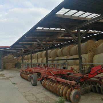
Pferdeheu in Rundballen zu verkaufen
Velen
Klaus-Weigelt
@Klaus-Weigelt
Heu
Lieferant entlädt
Rundballen
Regenfrei
3 weitere...
B+
Deprecated: Creation of dynamic property Zend_View_Helper_Ads::$adLink is deprecated in /var/www/stall-frei/htdocs/staging.stall-frei.de/library/Psf/View/Helper/Ads.php on line 108


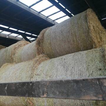
Bestes Heu in Großballen zu verkaufen
Voerde (Niederrhein)
Ute Sprock
@utesprock
Heu
Empfänger lädt ab
Rundballen
Regenfrei
3 weitere...
B+
Heu 1.Schnitt 2021
Upahl
hermannmeyerzuborgsen
@hermannmeyerzuborgsen
Heu
Empfänger lädt ab
Rundballen
Regenfrei
3 weitere...
P+

Heu und Stroh in sehr guter Qualität
Nettetal
Agrarhandel J. Weyers e.K.
@Bergwiesenheu
Futter
Empfänger lädt ab
Rundballen
Wird verladen
1 weitere...
B+

Heu HD-Ballen 2. Schnitt extensiv Heugräser
Drochtersen
M-Kluth
@M-Kluth
Heu
Empfänger lädt ab
Kleinballen/HD-Ballen
Regenfrei
3 weitere...
B+

Heu in Rundballen (ca.130cm) super Qualität
Pronstorf
Caros Pferdeparadies
@KaOb
Heu
Rundballen
Regenfrei
Wird verladen
2 weitere...
B+

Erstklassiges PferdeHeu in HD-Ballen
Jevenstedt
Tim Rohwer
@EIDERHEU
Heu
Kleinballen/HD-Ballen
Regenfrei
B+

Futtersack HeuToy, Fressbremse in pink
Mechtersen
STALL-FREIde Marketing
@STALL-FREI-Marketing
Stundenlange Beschäftigung die
Koliken vorbeugt, geringe Staubinhalation mit
steuerbarer Futterentnahme

Heu/trockene Heulage für Pferde Zucker,Fruktanarm
Sophienhamm
Herr-Kolb
@Herr-Kolb
Heulage
Lieferant entlädt
Regenfrei
Wird verladen
2 weitere...
B+
Eiweisarmes Heu oder Heulage
Sophienhamm
Herr-Kolb
@Herr-Kolb
Heu
Rundballen
Regenfrei
Wird verladen
B+
Leider kein Vorschaubild
Leider kein Vorschaubild
Heulage, Grassamenheu lage 2025
Schwedeneck
Jeannine Wittern
@Jeannine-Wittern
Heulage
Lieferant entlädt
Rundballen
Regenfrei
3 weitere...
B+
Veröffentliche deine Suche als Gesuch und Suchauftrag, dann erhältst du Angebote, neue Treffer und Änderungen per E-Mail.
Diese Suche als Gesuch veröffentlichenDeprecated: Creation of dynamic property Zend_View::$pageCount is deprecated in /var/www/stall-frei/htdocs/staging.stall-frei.de/library/vendor/shardj/zf1-future/library/Zend/View/Abstract.php on line 308
Deprecated: Creation of dynamic property Zend_View::$itemCountPerPage is deprecated in /var/www/stall-frei/htdocs/staging.stall-frei.de/library/vendor/shardj/zf1-future/library/Zend/View/Abstract.php on line 308
Deprecated: Creation of dynamic property Zend_View::$first is deprecated in /var/www/stall-frei/htdocs/staging.stall-frei.de/library/vendor/shardj/zf1-future/library/Zend/View/Abstract.php on line 308
Deprecated: Creation of dynamic property Zend_View::$current is deprecated in /var/www/stall-frei/htdocs/staging.stall-frei.de/library/vendor/shardj/zf1-future/library/Zend/View/Abstract.php on line 308
Deprecated: Creation of dynamic property Zend_View::$last is deprecated in /var/www/stall-frei/htdocs/staging.stall-frei.de/library/vendor/shardj/zf1-future/library/Zend/View/Abstract.php on line 308
Deprecated: Creation of dynamic property Zend_View::$previous is deprecated in /var/www/stall-frei/htdocs/staging.stall-frei.de/library/vendor/shardj/zf1-future/library/Zend/View/Abstract.php on line 308
Deprecated: Creation of dynamic property Zend_View::$next is deprecated in /var/www/stall-frei/htdocs/staging.stall-frei.de/library/vendor/shardj/zf1-future/library/Zend/View/Abstract.php on line 308
Deprecated: Creation of dynamic property Zend_View::$pagesInRange is deprecated in /var/www/stall-frei/htdocs/staging.stall-frei.de/library/vendor/shardj/zf1-future/library/Zend/View/Abstract.php on line 308
Deprecated: Creation of dynamic property Zend_View::$firstPageInRange is deprecated in /var/www/stall-frei/htdocs/staging.stall-frei.de/library/vendor/shardj/zf1-future/library/Zend/View/Abstract.php on line 308
Deprecated: Creation of dynamic property Zend_View::$lastPageInRange is deprecated in /var/www/stall-frei/htdocs/staging.stall-frei.de/library/vendor/shardj/zf1-future/library/Zend/View/Abstract.php on line 308
Deprecated: Creation of dynamic property Zend_View::$currentItemCount is deprecated in /var/www/stall-frei/htdocs/staging.stall-frei.de/library/vendor/shardj/zf1-future/library/Zend/View/Abstract.php on line 308
Deprecated: Creation of dynamic property Zend_View::$totalItemCount is deprecated in /var/www/stall-frei/htdocs/staging.stall-frei.de/library/vendor/shardj/zf1-future/library/Zend/View/Abstract.php on line 308
Deprecated: Creation of dynamic property Zend_View::$firstItemNumber is deprecated in /var/www/stall-frei/htdocs/staging.stall-frei.de/library/vendor/shardj/zf1-future/library/Zend/View/Abstract.php on line 308
Deprecated: Creation of dynamic property Zend_View::$lastItemNumber is deprecated in /var/www/stall-frei/htdocs/staging.stall-frei.de/library/vendor/shardj/zf1-future/library/Zend/View/Abstract.php on line 308
Deprecated: Creation of dynamic property Zend_View::$router is deprecated in /var/www/stall-frei/htdocs/staging.stall-frei.de/library/vendor/shardj/zf1-future/library/Zend/View/Abstract.php on line 308
Deprecated: Creation of dynamic property Zend_View::$urlParams is deprecated in /var/www/stall-frei/htdocs/staging.stall-frei.de/library/vendor/shardj/zf1-future/library/Zend/View/Abstract.php on line 308
Deprecated: Creation of dynamic property Zend_View::$showAds is deprecated in /var/www/stall-frei/htdocs/staging.stall-frei.de/library/vendor/shardj/zf1-future/library/Zend/View/Abstract.php on line 308
Deprecated: Creation of dynamic property Zend_View::$objectIds is deprecated in /var/www/stall-frei/htdocs/staging.stall-frei.de/library/vendor/shardj/zf1-future/library/Zend/View/Abstract.php on line 308
Deprecated: Creation of dynamic property Zend_View::$showNavbar is deprecated in /var/www/stall-frei/htdocs/staging.stall-frei.de/library/vendor/shardj/zf1-future/library/Zend/View/Abstract.php on line 308
Deprecated: Creation of dynamic property Zend_View::$showBreadcrumb is deprecated in /var/www/stall-frei/htdocs/staging.stall-frei.de/library/vendor/shardj/zf1-future/library/Zend/View/Abstract.php on line 308
Deprecated: Creation of dynamic property Zend_View::$showFooter is deprecated in /var/www/stall-frei/htdocs/staging.stall-frei.de/library/vendor/shardj/zf1-future/library/Zend/View/Abstract.php on line 308
Deprecated: Creation of dynamic property Zend_View::$showInternalAds is deprecated in /var/www/stall-frei/htdocs/staging.stall-frei.de/library/vendor/shardj/zf1-future/library/Zend/View/Abstract.php on line 308
Deprecated: Creation of dynamic property Zend_View::$blNoContent is deprecated in /var/www/stall-frei/htdocs/staging.stall-frei.de/library/vendor/shardj/zf1-future/library/Zend/View/Abstract.php on line 308
Deprecated: Creation of dynamic property Zend_View::$sMetaDesc is deprecated in /var/www/stall-frei/htdocs/staging.stall-frei.de/library/vendor/shardj/zf1-future/library/Zend/View/Abstract.php on line 308
Deprecated: Creation of dynamic property Zend_View::$useGmaps is deprecated in /var/www/stall-frei/htdocs/staging.stall-frei.de/library/vendor/shardj/zf1-future/library/Zend/View/Abstract.php on line 308
Deprecated: Creation of dynamic property Zend_View::$touches is deprecated in /var/www/stall-frei/htdocs/staging.stall-frei.de/library/vendor/shardj/zf1-future/library/Zend/View/Abstract.php on line 308
Deprecated: Creation of dynamic property Zend_View::$oProject is deprecated in /var/www/stall-frei/htdocs/staging.stall-frei.de/library/vendor/shardj/zf1-future/library/Zend/View/Abstract.php on line 308
Deprecated: Creation of dynamic property Zend_View::$pageHeadline is deprecated in /var/www/stall-frei/htdocs/staging.stall-frei.de/library/vendor/shardj/zf1-future/library/Zend/View/Abstract.php on line 308
Deprecated: Creation of dynamic property Zend_View::$disableLocationField is deprecated in /var/www/stall-frei/htdocs/staging.stall-frei.de/library/vendor/shardj/zf1-future/library/Zend/View/Abstract.php on line 308
Deprecated: Creation of dynamic property Zend_View::$isSearch is deprecated in /var/www/stall-frei/htdocs/staging.stall-frei.de/library/vendor/shardj/zf1-future/library/Zend/View/Abstract.php on line 308
Deprecated: Creation of dynamic property Zend_View::$pageTitle is deprecated in /var/www/stall-frei/htdocs/staging.stall-frei.de/library/vendor/shardj/zf1-future/library/Zend/View/Abstract.php on line 308
Deprecated: Creation of dynamic property Psf_Form_Element_Text::$class is deprecated in /var/www/stall-frei/htdocs/staging.stall-frei.de/library/vendor/shardj/zf1-future/library/Zend/Form/Element.php on line 874
Deprecated: Creation of dynamic property Psf_Form_Element_Text::$size is deprecated in /var/www/stall-frei/htdocs/staging.stall-frei.de/library/vendor/shardj/zf1-future/library/Zend/Form/Element.php on line 874
Deprecated: Creation of dynamic property Psf_Form_Element_Text::$placeholder is deprecated in /var/www/stall-frei/htdocs/staging.stall-frei.de/library/vendor/shardj/zf1-future/library/Zend/Form/Element.php on line 874
Deprecated: Creation of dynamic property Psf_Form_Element_Hidden::$class is deprecated in /var/www/stall-frei/htdocs/staging.stall-frei.de/library/vendor/shardj/zf1-future/library/Zend/Form/Element.php on line 874
Deprecated: Creation of dynamic property Psf_Form_Element_Hidden::$class is deprecated in /var/www/stall-frei/htdocs/staging.stall-frei.de/library/vendor/shardj/zf1-future/library/Zend/Form/Element.php on line 874
Deprecated: Creation of dynamic property Psf_Form_Element_Hidden::$class is deprecated in /var/www/stall-frei/htdocs/staging.stall-frei.de/library/vendor/shardj/zf1-future/library/Zend/Form/Element.php on line 874
Deprecated: Creation of dynamic property Psf_Form_Element_Hidden::$class is deprecated in /var/www/stall-frei/htdocs/staging.stall-frei.de/library/vendor/shardj/zf1-future/library/Zend/Form/Element.php on line 874
Deprecated: Creation of dynamic property Psf_Form_Element_Select::$class is deprecated in /var/www/stall-frei/htdocs/staging.stall-frei.de/library/vendor/shardj/zf1-future/library/Zend/Form/Element.php on line 874
Deprecated: Creation of dynamic property Psf_Form_Element_Select::$class is deprecated in /var/www/stall-frei/htdocs/staging.stall-frei.de/library/vendor/shardj/zf1-future/library/Zend/Form/Element.php on line 874
Deprecated: Creation of dynamic property Psf_Form_Element_Select::$class is deprecated in /var/www/stall-frei/htdocs/staging.stall-frei.de/library/vendor/shardj/zf1-future/library/Zend/Form/Element.php on line 874
Deprecated: Creation of dynamic property Psf_Form_Element_Select::$class is deprecated in /var/www/stall-frei/htdocs/staging.stall-frei.de/library/vendor/shardj/zf1-future/library/Zend/Form/Element.php on line 874
Deprecated: Creation of dynamic property Zend_View::$sort is deprecated in /var/www/stall-frei/htdocs/staging.stall-frei.de/library/vendor/shardj/zf1-future/library/Zend/View/Abstract.php on line 308
Deprecated: Creation of dynamic property Zend_View::$searchLocation is deprecated in /var/www/stall-frei/htdocs/staging.stall-frei.de/library/vendor/shardj/zf1-future/library/Zend/View/Abstract.php on line 308
Deprecated: Creation of dynamic property Zend_View::$locationHint is deprecated in /var/www/stall-frei/htdocs/staging.stall-frei.de/library/vendor/shardj/zf1-future/library/Zend/View/Abstract.php on line 308
Psf_GeoCoder_Abstract::getLocation: Georgenberg Get Location CachedOrLive
Psf_GeoCoder_Abstract::getCachedOrLive: Georgenberg
Psf_GeoCoder_Abstract::convertLocationResult
{"documentation":"https:\/\/opencagedata.com\/api","licenses":[{"name":"see attribution guide","url":"https:\/\/opencagedata.com\/credits"}],"results":[{"bounds":{"northeast":{"lat":49.7450482,"lng":12.4854372},"southwest":{"lat":49.6745412,"lng":12.3459788}},"components":{"ISO_3166-1_alpha-2":"DE","ISO_3166-1_alpha-3":"DEU","ISO_3166-2":["DE-BY"],"_category":"place","_normalized_city":"Georgenberg","_type":"village","continent":"Europe","country":"Deutschland","country_code":"de","county":"Landkreis Neustadt an der Waldnaab","municipality":"Pleystein (VGem)","political_union":"European Union","postcode":"92697","state":"Bayern","state_code":"BY","village":"Georgenberg"},"confidence":7,"formatted":"92697 Georgenberg, Deutschland","geometry":{"lat":49.7030787,"lng":12.420661}},{"bounds":{"northeast":{"lat":51.9366777,"lng":10.4514258},"southwest":{"lat":51.8966777,"lng":10.4114258}},"components":{"ISO_3166-1_alpha-2":"DE","ISO_3166-1_alpha-3":"DEU","ISO_3166-2":["DE-NI"],"_category":"place","_normalized_city":"Goslar","_type":"neighbourhood","continent":"Europe","country":"Deutschland","country_code":"de","county":"Landkreis Goslar","political_union":"European Union","postcode":"38640","state":"Niedersachsen","state_code":"NI","suburb":"Georgenberg","town":"Goslar"},"confidence":7,"formatted":"38640 Goslar, Deutschland","geometry":{"lat":51.9166777,"lng":10.4314258}},{"bounds":{"northeast":{"lat":48.4716295,"lng":9.2116228},"southwest":{"lat":48.4715295,"lng":9.2115228}},"components":{"ISO_3166-1_alpha-2":"DE","ISO_3166-1_alpha-3":"DEU","ISO_3166-2":["DE-BW"],"_category":"natural\/water","_normalized_city":"Pfullingen","_type":"peak","continent":"Europe","country":"Deutschland","country_code":"de","county":"Landkreis Reutlingen","peak":"Georgenberg","political_union":"European Union","postcode":"72793","state":"Baden-W\u00fcrttemberg","state_code":"BW","town":"Pfullingen"},"confidence":9,"formatted":"Georgenberg, 72793 Pfullingen, Deutschland","geometry":{"lat":48.4715795,"lng":9.2115728}},{"bounds":{"northeast":{"lat":51.5725144,"lng":10.9746994},"southwest":{"lat":51.5724144,"lng":10.9745994}},"components":{"ISO_3166-1_alpha-2":"DE","ISO_3166-1_alpha-3":"DEU","ISO_3166-2":["DE-ST"],"_category":"natural\/water","_normalized_city":"S\u00fcdharz","_type":"peak","continent":"Europe","country":"Deutschland","country_code":"de","county":"Mansfeld-S\u00fcdharz","municipality":"S\u00fcdharz","peak":"Georgenberg","political_union":"European Union","state":"Sachsen-Anhalt","state_code":"ST"},"confidence":9,"formatted":"Georgenberg, S\u00fcdharz, Sachsen-Anhalt, Deutschland","geometry":{"lat":51.5724644,"lng":10.9746494}},{"bounds":{"northeast":{"lat":51.5568883,"lng":11.2591775},"southwest":{"lat":51.5567883,"lng":11.2590775}},"components":{"ISO_3166-1_alpha-2":"DE","ISO_3166-1_alpha-3":"DEU","ISO_3166-2":["DE-ST"],"_category":"natural\/water","_normalized_city":"Sangerhausen","_type":"peak","continent":"Europe","country":"Deutschland","country_code":"de","county":"Mansfeld-S\u00fcdharz","peak":"Georgenberg","political_union":"European Union","state":"Sachsen-Anhalt","state_code":"ST","town":"Sangerhausen"},"confidence":9,"formatted":"Georgenberg, Sangerhausen, Sachsen-Anhalt, Deutschland","geometry":{"lat":51.5568383,"lng":11.2591275}},{"bounds":{"northeast":{"lat":51.9128862,"lng":10.4319521},"southwest":{"lat":51.9127862,"lng":10.4318521}},"components":{"ISO_3166-1_alpha-2":"DE","ISO_3166-1_alpha-3":"DEU","ISO_3166-2":["DE-NI"],"_category":"natural\/water","_normalized_city":"Goslar","_type":"peak","continent":"Europe","country":"Deutschland","country_code":"de","county":"Landkreis Goslar","peak":"Georgenberg","political_union":"European Union","postcode":"38640","state":"Niedersachsen","state_code":"NI","town":"Goslar"},"confidence":9,"formatted":"Georgenberg, 38640 Goslar, Deutschland","geometry":{"lat":51.9128362,"lng":10.4319021}},{"bounds":{"northeast":{"lat":49.625232,"lng":12.1844029},"southwest":{"lat":49.625132,"lng":12.1843029}},"components":{"ISO_3166-1_alpha-2":"DE","ISO_3166-1_alpha-3":"DEU","ISO_3166-2":["DE-BY"],"_category":"natural\/water","_normalized_city":"Pirk","_type":"peak","continent":"Europe","country":"Deutschland","country_code":"de","county":"Landkreis Neustadt an der Waldnaab","municipality":"Schirmitz (VGem)","peak":"Georgenberg","political_union":"European Union","postcode":"92712","state":"Bayern","state_code":"BY","village":"Pirk"},"confidence":9,"formatted":"Georgenberg, 92712 Pirk, Deutschland","geometry":{"lat":49.625182,"lng":12.1843529}},{"bounds":{"northeast":{"lat":50.1326271,"lng":7.787254},"southwest":{"lat":50.1325271,"lng":7.787154}},"components":{"ISO_3166-1_alpha-2":"DE","ISO_3166-1_alpha-3":"DEU","ISO_3166-2":["DE-RP"],"_category":"natural\/water","_normalized_city":"Bornich","_type":"peak","continent":"Europe","country":"Deutschland","country_code":"de","county":"Rhein-Lahn-Kreis","municipality":"Loreley","peak":"Georgenberg","political_union":"European Union","postcode":"56349","state":"Rheinland-Pfalz","state_code":"RP","village":"Bornich"},"confidence":9,"formatted":"Georgenberg, 56349 Bornich, Deutschland","geometry":{"lat":50.1325771,"lng":7.787204}},{"bounds":{"northeast":{"lat":51.1058326,"lng":14.7528119},"southwest":{"lat":51.1057326,"lng":14.7527119}},"components":{"ISO_3166-1_alpha-2":"DE","ISO_3166-1_alpha-3":"DEU","ISO_3166-2":["DE-SN"],"_category":"natural\/water","_normalized_city":"Rosenbach","_type":"peak","continent":"Europe","country":"Deutschland","country_code":"de","county":"G\u00f6rlitz","municipality":"L\u00f6bau","peak":"Georgenberg","political_union":"European Union","state":"Sachsen","state_code":"SN","village":"Rosenbach"},"confidence":9,"formatted":"Georgenberg, Rosenbach, Sachsen, Deutschland","geometry":{"lat":51.1057826,"lng":14.7527619}},{"bounds":{"northeast":{"lat":50.1894432,"lng":7.6516202},"southwest":{"lat":50.1893432,"lng":7.6515202}},"components":{"ISO_3166-1_alpha-2":"DE","ISO_3166-1_alpha-3":"DEU","ISO_3166-2":["DE-RP"],"_category":"natural\/water","_normalized_city":"Kestert","_type":"peak","continent":"Europe","country":"Deutschland","country_code":"de","county":"Rhein-Lahn-Kreis","municipality":"Loreley","peak":"Georgenberg","political_union":"European Union","postcode":"56341","state":"Rheinland-Pfalz","state_code":"RP","village":"Kestert"},"confidence":9,"formatted":"Georgenberg, 56341 Kestert, Deutschland","geometry":{"lat":50.1893932,"lng":7.6515702}}],"status":{"code":200,"message":"OK"},"stay_informed":{"blog":"https:\/\/blog.opencagedata.com","mastodon":"https:\/\/en.osm.town\/@opencage"},"thanks":"For using an OpenCage API","timestamp":{"created_http":"Sat, 07 Feb 2026 05:20:18 GMT","created_unix":1770441618},"total_results":10}Array
(
[0] => stdClass Object
(
[bounds] => stdClass Object
(
[northeast] => stdClass Object
(
[lat] => 49.7450482
[lng] => 12.4854372
)
[southwest] => stdClass Object
(
[lat] => 49.6745412
[lng] => 12.3459788
)
)
[components] => stdClass Object
(
[ISO_3166-1_alpha-2] => DE
[ISO_3166-1_alpha-3] => DEU
[ISO_3166-2] => Array
(
[0] => DE-BY
)
[_category] => place
[_normalized_city] => Georgenberg
[_type] => village
[continent] => Europe
[country] => Deutschland
[country_code] => de
[county] => Landkreis Neustadt an der Waldnaab
[municipality] => Pleystein (VGem)
[political_union] => European Union
[postcode] => 92697
[state] => Bayern
[state_code] => BY
[village] => Georgenberg
)
[confidence] => 7
[formatted] => 92697 Georgenberg, Deutschland
[geometry] => stdClass Object
(
[lat] => 49.7030787
[lng] => 12.420661
)
)
[1] => stdClass Object
(
[bounds] => stdClass Object
(
[northeast] => stdClass Object
(
[lat] => 51.9366777
[lng] => 10.4514258
)
[southwest] => stdClass Object
(
[lat] => 51.8966777
[lng] => 10.4114258
)
)
[components] => stdClass Object
(
[ISO_3166-1_alpha-2] => DE
[ISO_3166-1_alpha-3] => DEU
[ISO_3166-2] => Array
(
[0] => DE-NI
)
[_category] => place
[_normalized_city] => Goslar
[_type] => neighbourhood
[continent] => Europe
[country] => Deutschland
[country_code] => de
[county] => Landkreis Goslar
[political_union] => European Union
[postcode] => 38640
[state] => Niedersachsen
[state_code] => NI
[suburb] => Georgenberg
[town] => Goslar
)
[confidence] => 7
[formatted] => 38640 Goslar, Deutschland
[geometry] => stdClass Object
(
[lat] => 51.9166777
[lng] => 10.4314258
)
)
[2] => stdClass Object
(
[bounds] => stdClass Object
(
[northeast] => stdClass Object
(
[lat] => 48.4716295
[lng] => 9.2116228
)
[southwest] => stdClass Object
(
[lat] => 48.4715295
[lng] => 9.2115228
)
)
[components] => stdClass Object
(
[ISO_3166-1_alpha-2] => DE
[ISO_3166-1_alpha-3] => DEU
[ISO_3166-2] => Array
(
[0] => DE-BW
)
[_category] => natural/water
[_normalized_city] => Pfullingen
[_type] => peak
[continent] => Europe
[country] => Deutschland
[country_code] => de
[county] => Landkreis Reutlingen
[peak] => Georgenberg
[political_union] => European Union
[postcode] => 72793
[state] => Baden-Württemberg
[state_code] => BW
[town] => Pfullingen
)
[confidence] => 9
[formatted] => Georgenberg, 72793 Pfullingen, Deutschland
[geometry] => stdClass Object
(
[lat] => 48.4715795
[lng] => 9.2115728
)
)
[3] => stdClass Object
(
[bounds] => stdClass Object
(
[northeast] => stdClass Object
(
[lat] => 51.5725144
[lng] => 10.9746994
)
[southwest] => stdClass Object
(
[lat] => 51.5724144
[lng] => 10.9745994
)
)
[components] => stdClass Object
(
[ISO_3166-1_alpha-2] => DE
[ISO_3166-1_alpha-3] => DEU
[ISO_3166-2] => Array
(
[0] => DE-ST
)
[_category] => natural/water
[_normalized_city] => Südharz
[_type] => peak
[continent] => Europe
[country] => Deutschland
[country_code] => de
[county] => Mansfeld-Südharz
[municipality] => Südharz
[peak] => Georgenberg
[political_union] => European Union
[state] => Sachsen-Anhalt
[state_code] => ST
)
[confidence] => 9
[formatted] => Georgenberg, Südharz, Sachsen-Anhalt, Deutschland
[geometry] => stdClass Object
(
[lat] => 51.5724644
[lng] => 10.9746494
)
)
[4] => stdClass Object
(
[bounds] => stdClass Object
(
[northeast] => stdClass Object
(
[lat] => 51.5568883
[lng] => 11.2591775
)
[southwest] => stdClass Object
(
[lat] => 51.5567883
[lng] => 11.2590775
)
)
[components] => stdClass Object
(
[ISO_3166-1_alpha-2] => DE
[ISO_3166-1_alpha-3] => DEU
[ISO_3166-2] => Array
(
[0] => DE-ST
)
[_category] => natural/water
[_normalized_city] => Sangerhausen
[_type] => peak
[continent] => Europe
[country] => Deutschland
[country_code] => de
[county] => Mansfeld-Südharz
[peak] => Georgenberg
[political_union] => European Union
[state] => Sachsen-Anhalt
[state_code] => ST
[town] => Sangerhausen
)
[confidence] => 9
[formatted] => Georgenberg, Sangerhausen, Sachsen-Anhalt, Deutschland
[geometry] => stdClass Object
(
[lat] => 51.5568383
[lng] => 11.2591275
)
)
[5] => stdClass Object
(
[bounds] => stdClass Object
(
[northeast] => stdClass Object
(
[lat] => 51.9128862
[lng] => 10.4319521
)
[southwest] => stdClass Object
(
[lat] => 51.9127862
[lng] => 10.4318521
)
)
[components] => stdClass Object
(
[ISO_3166-1_alpha-2] => DE
[ISO_3166-1_alpha-3] => DEU
[ISO_3166-2] => Array
(
[0] => DE-NI
)
[_category] => natural/water
[_normalized_city] => Goslar
[_type] => peak
[continent] => Europe
[country] => Deutschland
[country_code] => de
[county] => Landkreis Goslar
[peak] => Georgenberg
[political_union] => European Union
[postcode] => 38640
[state] => Niedersachsen
[state_code] => NI
[town] => Goslar
)
[confidence] => 9
[formatted] => Georgenberg, 38640 Goslar, Deutschland
[geometry] => stdClass Object
(
[lat] => 51.9128362
[lng] => 10.4319021
)
)
[6] => stdClass Object
(
[bounds] => stdClass Object
(
[northeast] => stdClass Object
(
[lat] => 49.625232
[lng] => 12.1844029
)
[southwest] => stdClass Object
(
[lat] => 49.625132
[lng] => 12.1843029
)
)
[components] => stdClass Object
(
[ISO_3166-1_alpha-2] => DE
[ISO_3166-1_alpha-3] => DEU
[ISO_3166-2] => Array
(
[0] => DE-BY
)
[_category] => natural/water
[_normalized_city] => Pirk
[_type] => peak
[continent] => Europe
[country] => Deutschland
[country_code] => de
[county] => Landkreis Neustadt an der Waldnaab
[municipality] => Schirmitz (VGem)
[peak] => Georgenberg
[political_union] => European Union
[postcode] => 92712
[state] => Bayern
[state_code] => BY
[village] => Pirk
)
[confidence] => 9
[formatted] => Georgenberg, 92712 Pirk, Deutschland
[geometry] => stdClass Object
(
[lat] => 49.625182
[lng] => 12.1843529
)
)
[7] => stdClass Object
(
[bounds] => stdClass Object
(
[northeast] => stdClass Object
(
[lat] => 50.1326271
[lng] => 7.787254
)
[southwest] => stdClass Object
(
[lat] => 50.1325271
[lng] => 7.787154
)
)
[components] => stdClass Object
(
[ISO_3166-1_alpha-2] => DE
[ISO_3166-1_alpha-3] => DEU
[ISO_3166-2] => Array
(
[0] => DE-RP
)
[_category] => natural/water
[_normalized_city] => Bornich
[_type] => peak
[continent] => Europe
[country] => Deutschland
[country_code] => de
[county] => Rhein-Lahn-Kreis
[municipality] => Loreley
[peak] => Georgenberg
[political_union] => European Union
[postcode] => 56349
[state] => Rheinland-Pfalz
[state_code] => RP
[village] => Bornich
)
[confidence] => 9
[formatted] => Georgenberg, 56349 Bornich, Deutschland
[geometry] => stdClass Object
(
[lat] => 50.1325771
[lng] => 7.787204
)
)
[8] => stdClass Object
(
[bounds] => stdClass Object
(
[northeast] => stdClass Object
(
[lat] => 51.1058326
[lng] => 14.7528119
)
[southwest] => stdClass Object
(
[lat] => 51.1057326
[lng] => 14.7527119
)
)
[components] => stdClass Object
(
[ISO_3166-1_alpha-2] => DE
[ISO_3166-1_alpha-3] => DEU
[ISO_3166-2] => Array
(
[0] => DE-SN
)
[_category] => natural/water
[_normalized_city] => Rosenbach
[_type] => peak
[continent] => Europe
[country] => Deutschland
[country_code] => de
[county] => Görlitz
[municipality] => Löbau
[peak] => Georgenberg
[political_union] => European Union
[state] => Sachsen
[state_code] => SN
[village] => Rosenbach
)
[confidence] => 9
[formatted] => Georgenberg, Rosenbach, Sachsen, Deutschland
[geometry] => stdClass Object
(
[lat] => 51.1057826
[lng] => 14.7527619
)
)
[9] => stdClass Object
(
[bounds] => stdClass Object
(
[northeast] => stdClass Object
(
[lat] => 50.1894432
[lng] => 7.6516202
)
[southwest] => stdClass Object
(
[lat] => 50.1893432
[lng] => 7.6515202
)
)
[components] => stdClass Object
(
[ISO_3166-1_alpha-2] => DE
[ISO_3166-1_alpha-3] => DEU
[ISO_3166-2] => Array
(
[0] => DE-RP
)
[_category] => natural/water
[_normalized_city] => Kestert
[_type] => peak
[continent] => Europe
[country] => Deutschland
[country_code] => de
[county] => Rhein-Lahn-Kreis
[municipality] => Loreley
[peak] => Georgenberg
[political_union] => European Union
[postcode] => 56341
[state] => Rheinland-Pfalz
[state_code] => RP
[village] => Kestert
)
[confidence] => 9
[formatted] => Georgenberg, 56341 Kestert, Deutschland
[geometry] => stdClass Object
(
[lat] => 50.1893932
[lng] => 7.6515702
)
)
)
Psf_GeoCoder_OpenCageData::getKeyMap: 0
stdClass Object
(
    [bounds] => stdClass Object
        (
            [northeast] => stdClass Object
                (
                    [lat] => 49.7450482
                    [lng] => 12.4854372
                )

            [southwest] => stdClass Object
                (
                    [lat] => 49.6745412
                    [lng] => 12.3459788
                )

        )

    [components] => stdClass Object
        (
            [ISO_3166-1_alpha-2] => DE
            [ISO_3166-1_alpha-3] => DEU
            [ISO_3166-2] => Array
                (
                    [0] => DE-BY
                )

            [_category] => place
            [_normalized_city] => Georgenberg
            [_type] => village
            [continent] => Europe
            [country] => Deutschland
            [country_code] => de
            [county] => Landkreis Neustadt an der Waldnaab
            [municipality] => Pleystein (VGem)
            [political_union] => European Union
            [postcode] => 92697
            [state] => Bayern
            [state_code] => BY
            [village] => Georgenberg
        )

    [confidence] => 7
    [formatted] => 92697 Georgenberg, Deutschland
    [geometry] => stdClass Object
        (
            [lat] => 49.7030787
            [lng] => 12.420661
        )

)
Psf_GeoCoder_OpenCageData::getCounty: Neustadt an der Waldnaab
Psf_GeoCoder_OpenCageData::addMissingData REFETCH!
Array
(
    [address] => 92697 Georgenberg, Deutschland
    [type] => village
    [street] =>
    [city] => Georgenberg
    [county] => Neustadt an der Waldnaab
    [state] => Bayern
    [zip] => 92697
    [country] => Deutschland
    [suburb] =>
    [countrycode] => de
    [latitude] => 49.7030787
    [longitude] => 12.420661
    [accuracy] => 1
    [confidence] => 7
    [bounds] => stdClass Object
        (
            [northeast] => stdClass Object
                (
                    [lat] => 49.7450482
                    [lng] => 12.4854372
                )

            [southwest] => stdClass Object
                (
                    [lat] => 49.6745412
                    [lng] => 12.3459788
                )

        )

)
reformat!
Array
(
    [address] => 92697 Georgenberg, Deutschland
    [type] => village
    [street] =>
    [city] => Georgenberg
    [county] => Neustadt an der Waldnaab
    [state] => Bayern
    [zip] => 92697
    [country] => Deutschland
    [suburb] =>
    [countrycode] => de
    [latitude] => 49.7030787
    [longitude] => 12.420661
    [accuracy] => 1
    [confidence] => 7
    [bounds] => stdClass Object
        (
            [northeast] => stdClass Object
                (
                    [lat] => 49.7450482
                    [lng] => 12.4854372
                )

            [southwest] => stdClass Object
                (
                    [lat] => 49.6745412
                    [lng] => 12.3459788
                )

        )

    [place] => 92697 Georgenberg, Bayern
    [hash] => f620630adf6284b3d1b92fc3df1b5c47
)
Psf_GeoCoder_OpenCageData::getKeyMap: 1
stdClass Object
(
    [bounds] => stdClass Object
        (
            [northeast] => stdClass Object
                (
                    [lat] => 51.9366777
                    [lng] => 10.4514258
                )

            [southwest] => stdClass Object
                (
                    [lat] => 51.8966777
                    [lng] => 10.4114258
                )

        )

    [components] => stdClass Object
        (
            [ISO_3166-1_alpha-2] => DE
            [ISO_3166-1_alpha-3] => DEU
            [ISO_3166-2] => Array
                (
                    [0] => DE-NI
                )

            [_category] => place
            [_normalized_city] => Goslar
            [_type] => neighbourhood
            [continent] => Europe
            [country] => Deutschland
            [country_code] => de
            [county] => Landkreis Goslar
            [political_union] => European Union
            [postcode] => 38640
            [state] => Niedersachsen
            [state_code] => NI
            [suburb] => Georgenberg
            [town] => Goslar
        )

    [confidence] => 7
    [formatted] => 38640 Goslar, Deutschland
    [geometry] => stdClass Object
        (
            [lat] => 51.9166777
            [lng] => 10.4314258
        )

)
Psf_GeoCoder_OpenCageData::getCounty: Goslar
Psf_GeoCoder_OpenCageData::addMissingData REFETCH!
Array
(
    [address] => 38640 Goslar, Deutschland
    [type] => neighbourhood
    [street] =>
    [city] => Goslar
    [county] => Goslar
    [state] => Niedersachsen
    [zip] => 38640
    [country] => Deutschland
    [suburb] => Georgenberg
    [countrycode] => de
    [latitude] => 51.9166777
    [longitude] => 10.4314258
    [accuracy] => 1
    [confidence] => 7
    [bounds] => stdClass Object
        (
            [northeast] => stdClass Object
                (
                    [lat] => 51.9366777
                    [lng] => 10.4514258
                )

            [southwest] => stdClass Object
                (
                    [lat] => 51.8966777
                    [lng] => 10.4114258
                )

        )

)
reformat!
Array
(
    [address] => 38640 Goslar, Deutschland
    [type] => neighbourhood
    [street] =>
    [city] => Goslar
    [county] => Goslar
    [state] => Niedersachsen
    [zip] => 38640
    [country] => Deutschland
    [suburb] => Georgenberg
    [countrycode] => de
    [latitude] => 51.9166777
    [longitude] => 10.4314258
    [accuracy] => 1
    [confidence] => 7
    [bounds] => stdClass Object
        (
            [northeast] => stdClass Object
                (
                    [lat] => 51.9366777
                    [lng] => 10.4514258
                )

            [southwest] => stdClass Object
                (
                    [lat] => 51.8966777
                    [lng] => 10.4114258
                )

        )

    [place] => 38640 Goslar, Niedersachsen
    [hash] => 92063aa6941ce4f9c11fa9d19120b38d
)
Psf_GeoCoder_OpenCageData::getKeyMap: 2
stdClass Object
(
    [bounds] => stdClass Object
        (
            [northeast] => stdClass Object
                (
                    [lat] => 48.4716295
                    [lng] => 9.2116228
                )

            [southwest] => stdClass Object
                (
                    [lat] => 48.4715295
                    [lng] => 9.2115228
                )

        )

    [components] => stdClass Object
        (
            [ISO_3166-1_alpha-2] => DE
            [ISO_3166-1_alpha-3] => DEU
            [ISO_3166-2] => Array
                (
                    [0] => DE-BW
                )

            [_category] => natural/water
            [_normalized_city] => Pfullingen
            [_type] => peak
            [continent] => Europe
            [country] => Deutschland
            [country_code] => de
            [county] => Landkreis Reutlingen
            [peak] => Georgenberg
            [political_union] => European Union
            [postcode] => 72793
            [state] => Baden-Württemberg
            [state_code] => BW
            [town] => Pfullingen
        )

    [confidence] => 9
    [formatted] => Georgenberg, 72793 Pfullingen, Deutschland
    [geometry] => stdClass Object
        (
            [lat] => 48.4715795
            [lng] => 9.2115728
        )

)
Psf_GeoCoder_OpenCageData::getCounty: Reutlingen
Psf_GeoCoder_OpenCageData::addMissingData REFETCH!
Array
(
    [address] => Georgenberg, 72793 Pfullingen, Deutschland
    [type] => peak
    [street] =>
    [city] => Pfullingen
    [county] => Reutlingen
    [state] => Baden-Württemberg
    [zip] => 72793
    [country] => Deutschland
    [suburb] =>
    [countrycode] => de
    [latitude] => 48.4715795
    [longitude] => 9.2115728
    [accuracy] => 1
    [confidence] => 9
    [bounds] => stdClass Object
        (
            [northeast] => stdClass Object
                (
                    [lat] => 48.4716295
                    [lng] => 9.2116228
                )

            [southwest] => stdClass Object
                (
                    [lat] => 48.4715295
                    [lng] => 9.2115228
                )

        )

)
reformat!
Array
(
    [address] => Georgenberg, 72793 Pfullingen, Deutschland
    [type] => peak
    [street] =>
    [city] => Pfullingen
    [county] => Reutlingen
    [state] => Baden-Württemberg
    [zip] => 72793
    [country] => Deutschland
    [suburb] =>
    [countrycode] => de
    [latitude] => 48.4715795
    [longitude] => 9.2115728
    [accuracy] => 1
    [confidence] => 9
    [bounds] => stdClass Object
        (
            [northeast] => stdClass Object
                (
                    [lat] => 48.4716295
                    [lng] => 9.2116228
                )

            [southwest] => stdClass Object
                (
                    [lat] => 48.4715295
                    [lng] => 9.2115228
                )

        )

    [place] => 72793 Pfullingen, Baden-Württemberg
    [hash] => c9b886ca0efb0af748fae2132764a70e
)
Psf_GeoCoder_OpenCageData::getKeyMap: 3
stdClass Object
(
    [bounds] => stdClass Object
        (
            [northeast] => stdClass Object
                (
                    [lat] => 51.5725144
                    [lng] => 10.9746994
                )

            [southwest] => stdClass Object
                (
                    [lat] => 51.5724144
                    [lng] => 10.9745994
                )

        )

    [components] => stdClass Object
        (
            [ISO_3166-1_alpha-2] => DE
            [ISO_3166-1_alpha-3] => DEU
            [ISO_3166-2] => Array
                (
                    [0] => DE-ST
                )

            [_category] => natural/water
            [_normalized_city] => Südharz
            [_type] => peak
            [continent] => Europe
            [country] => Deutschland
            [country_code] => de
            [county] => Mansfeld-Südharz
            [municipality] => Südharz
            [peak] => Georgenberg
            [political_union] => European Union
            [state] => Sachsen-Anhalt
            [state_code] => ST
        )

    [confidence] => 9
    [formatted] => Georgenberg, Südharz, Sachsen-Anhalt, Deutschland
    [geometry] => stdClass Object
        (
            [lat] => 51.5724644
            [lng] => 10.9746494
        )

)
Psf_GeoCoder_OpenCageData::getCounty: Mansfeld-Südharz
Psf_GeoCoder_OpenCageData::addMissingData REFETCH!
Array
(
    [address] => Georgenberg, Südharz, Sachsen-Anhalt, Deutschland
    [type] => peak
    [street] =>
    [city] =>
    [county] => Mansfeld-Südharz
    [state] => Sachsen-Anhalt
    [zip] =>
    [country] => Deutschland
    [suburb] =>
    [countrycode] => de
    [latitude] => 51.5724644
    [longitude] => 10.9746494
    [accuracy] => 1
    [confidence] => 9
    [bounds] => stdClass Object
        (
            [northeast] => stdClass Object
                (
                    [lat] => 51.5725144
                    [lng] => 10.9746994
                )

            [southwest] => stdClass Object
                (
                    [lat] => 51.5724144
                    [lng] => 10.9745994
                )

        )

)
reformat!
Array
(
    [address] => Georgenberg, Südharz, Sachsen-Anhalt, Deutschland
    [type] => peak
    [street] =>
    [city] =>
    [county] => Mansfeld-Südharz
    [state] => Sachsen-Anhalt
    [zip] =>
    [country] => Deutschland
    [suburb] =>
    [countrycode] => de
    [latitude] => 51.5724644
    [longitude] => 10.9746494
    [accuracy] => 1
    [confidence] => 9
    [bounds] => stdClass Object
        (
            [northeast] => stdClass Object
                (
                    [lat] => 51.5725144
                    [lng] => 10.9746994
                )

            [southwest] => stdClass Object
                (
                    [lat] => 51.5724144
                    [lng] => 10.9745994
                )

        )

    [place] => , Sachsen-Anhalt
    [hash] => b6c026d7dcd3cde181d032eb697f68c7
)
Psf_GeoCoder_OpenCageData::getKeyMap: 4
stdClass Object
(
    [bounds] => stdClass Object
        (
            [northeast] => stdClass Object
                (
                    [lat] => 51.5568883
                    [lng] => 11.2591775
                )

            [southwest] => stdClass Object
                (
                    [lat] => 51.5567883
                    [lng] => 11.2590775
                )

        )

    [components] => stdClass Object
        (
            [ISO_3166-1_alpha-2] => DE
            [ISO_3166-1_alpha-3] => DEU
            [ISO_3166-2] => Array
                (
                    [0] => DE-ST
                )

            [_category] => natural/water
            [_normalized_city] => Sangerhausen
            [_type] => peak
            [continent] => Europe
            [country] => Deutschland
            [country_code] => de
            [county] => Mansfeld-Südharz
            [peak] => Georgenberg
            [political_union] => European Union
            [state] => Sachsen-Anhalt
            [state_code] => ST
            [town] => Sangerhausen
        )

    [confidence] => 9
    [formatted] => Georgenberg, Sangerhausen, Sachsen-Anhalt, Deutschland
    [geometry] => stdClass Object
        (
            [lat] => 51.5568383
            [lng] => 11.2591275
        )

)
Psf_GeoCoder_OpenCageData::getCounty: Mansfeld-Südharz
Psf_GeoCoder_OpenCageData::addMissingData REFETCH!
Array
(
    [address] => Georgenberg, Sangerhausen, Sachsen-Anhalt, Deutschland
    [type] => peak
    [street] =>
    [city] => Sangerhausen
    [county] => Mansfeld-Südharz
    [state] => Sachsen-Anhalt
    [zip] =>
    [country] => Deutschland
    [suburb] =>
    [countrycode] => de
    [latitude] => 51.5568383
    [longitude] => 11.2591275
    [accuracy] => 1
    [confidence] => 9
    [bounds] => stdClass Object
        (
            [northeast] => stdClass Object
                (
                    [lat] => 51.5568883
                    [lng] => 11.2591775
                )

            [southwest] => stdClass Object
                (
                    [lat] => 51.5567883
                    [lng] => 11.2590775
                )

        )

)
reformat!
Array
(
    [address] => Georgenberg, Sangerhausen, Sachsen-Anhalt, Deutschland
    [type] => peak
    [street] =>
    [city] => Sangerhausen
    [county] => Mansfeld-Südharz
    [state] => Sachsen-Anhalt
    [zip] =>
    [country] => Deutschland
    [suburb] =>
    [countrycode] => de
    [latitude] => 51.5568383
    [longitude] => 11.2591275
    [accuracy] => 1
    [confidence] => 9
    [bounds] => stdClass Object
        (
            [northeast] => stdClass Object
                (
                    [lat] => 51.5568883
                    [lng] => 11.2591775
                )

            [southwest] => stdClass Object
                (
                    [lat] => 51.5567883
                    [lng] => 11.2590775
                )

        )

    [place] => Sangerhausen, Sachsen-Anhalt
    [hash] => f57b05e3dbbf30bf9cd11c5420de74a6
)
Psf_GeoCoder_OpenCageData::getKeyMap: 5
stdClass Object
(
    [bounds] => stdClass Object
        (
            [northeast] => stdClass Object
                (
                    [lat] => 51.9128862
                    [lng] => 10.4319521
                )

            [southwest] => stdClass Object
                (
                    [lat] => 51.9127862
                    [lng] => 10.4318521
                )

        )

    [components] => stdClass Object
        (
            [ISO_3166-1_alpha-2] => DE
            [ISO_3166-1_alpha-3] => DEU
            [ISO_3166-2] => Array
                (
                    [0] => DE-NI
                )

            [_category] => natural/water
            [_normalized_city] => Goslar
            [_type] => peak
            [continent] => Europe
            [country] => Deutschland
            [country_code] => de
            [county] => Landkreis Goslar
            [peak] => Georgenberg
            [political_union] => European Union
            [postcode] => 38640
            [state] => Niedersachsen
            [state_code] => NI
            [town] => Goslar
        )

    [confidence] => 9
    [formatted] => Georgenberg, 38640 Goslar, Deutschland
    [geometry] => stdClass Object
        (
            [lat] => 51.9128362
            [lng] => 10.4319021
        )

)
Psf_GeoCoder_OpenCageData::getCounty: Goslar
Psf_GeoCoder_OpenCageData::addMissingData REFETCH!
Array
(
    [address] => Georgenberg, 38640 Goslar, Deutschland
    [type] => peak
    [street] =>
    [city] => Goslar
    [county] => Goslar
    [state] => Niedersachsen
    [zip] => 38640
    [country] => Deutschland
    [suburb] =>
    [countrycode] => de
    [latitude] => 51.9128362
    [longitude] => 10.4319021
    [accuracy] => 1
    [confidence] => 9
    [bounds] => stdClass Object
        (
            [northeast] => stdClass Object
                (
                    [lat] => 51.9128862
                    [lng] => 10.4319521
                )

            [southwest] => stdClass Object
                (
                    [lat] => 51.9127862
                    [lng] => 10.4318521
                )

        )

)
reformat!
Array
(
    [address] => Georgenberg, 38640 Goslar, Deutschland
    [type] => peak
    [street] =>
    [city] => Goslar
    [county] => Goslar
    [state] => Niedersachsen
    [zip] => 38640
    [country] => Deutschland
    [suburb] =>
    [countrycode] => de
    [latitude] => 51.9128362
    [longitude] => 10.4319021
    [accuracy] => 1
    [confidence] => 9
    [bounds] => stdClass Object
        (
            [northeast] => stdClass Object
                (
                    [lat] => 51.9128862
                    [lng] => 10.4319521
                )

            [southwest] => stdClass Object
                (
                    [lat] => 51.9127862
                    [lng] => 10.4318521
                )

        )

    [place] => 38640 Goslar, Niedersachsen
    [hash] => 92063aa6941ce4f9c11fa9d19120b38d
)
Psf_GeoCoder_OpenCageData::getKeyMap: 6
stdClass Object
(
    [bounds] => stdClass Object
        (
            [northeast] => stdClass Object
                (
                    [lat] => 49.625232
                    [lng] => 12.1844029
                )

            [southwest] => stdClass Object
                (
                    [lat] => 49.625132
                    [lng] => 12.1843029
                )

        )

    [components] => stdClass Object
        (
            [ISO_3166-1_alpha-2] => DE
            [ISO_3166-1_alpha-3] => DEU
            [ISO_3166-2] => Array
                (
                    [0] => DE-BY
                )

            [_category] => natural/water
            [_normalized_city] => Pirk
            [_type] => peak
            [continent] => Europe
            [country] => Deutschland
            [country_code] => de
            [county] => Landkreis Neustadt an der Waldnaab
            [municipality] => Schirmitz (VGem)
            [peak] => Georgenberg
            [political_union] => European Union
            [postcode] => 92712
            [state] => Bayern
            [state_code] => BY
            [village] => Pirk
        )

    [confidence] => 9
    [formatted] => Georgenberg, 92712 Pirk, Deutschland
    [geometry] => stdClass Object
        (
            [lat] => 49.625182
            [lng] => 12.1843529
        )

)
Psf_GeoCoder_OpenCageData::getCounty: Neustadt an der Waldnaab
Psf_GeoCoder_OpenCageData::addMissingData REFETCH!
Array
(
    [address] => Georgenberg, 92712 Pirk, Deutschland
    [type] => peak
    [street] =>
    [city] => Pirk
    [county] => Neustadt an der Waldnaab
    [state] => Bayern
    [zip] => 92712
    [country] => Deutschland
    [suburb] =>
    [countrycode] => de
    [latitude] => 49.625182
    [longitude] => 12.1843529
    [accuracy] => 1
    [confidence] => 9
    [bounds] => stdClass Object
        (
            [northeast] => stdClass Object
                (
                    [lat] => 49.625232
                    [lng] => 12.1844029
                )

            [southwest] => stdClass Object
                (
                    [lat] => 49.625132
                    [lng] => 12.1843029
                )

        )

)
reformat!
Array
(
    [address] => Georgenberg, 92712 Pirk, Deutschland
    [type] => peak
    [street] =>
    [city] => Pirk
    [county] => Neustadt an der Waldnaab
    [state] => Bayern
    [zip] => 92712
    [country] => Deutschland
    [suburb] =>
    [countrycode] => de
    [latitude] => 49.625182
    [longitude] => 12.1843529
    [accuracy] => 1
    [confidence] => 9
    [bounds] => stdClass Object
        (
            [northeast] => stdClass Object
                (
                    [lat] => 49.625232
                    [lng] => 12.1844029
                )

            [southwest] => stdClass Object
                (
                    [lat] => 49.625132
                    [lng] => 12.1843029
                )

        )

    [place] => 92712 Pirk, Bayern
    [hash] => b2dae65468143cfa03249712b0c719b6
)
Psf_GeoCoder_OpenCageData::getKeyMap: 7
stdClass Object
(
    [bounds] => stdClass Object
        (
            [northeast] => stdClass Object
                (
                    [lat] => 50.1326271
                    [lng] => 7.787254
                )

            [southwest] => stdClass Object
                (
                    [lat] => 50.1325271
                    [lng] => 7.787154
                )

        )

    [components] => stdClass Object
        (
            [ISO_3166-1_alpha-2] => DE
            [ISO_3166-1_alpha-3] => DEU
            [ISO_3166-2] => Array
                (
                    [0] => DE-RP
                )

            [_category] => natural/water
            [_normalized_city] => Bornich
            [_type] => peak
            [continent] => Europe
            [country] => Deutschland
            [country_code] => de
            [county] => Rhein-Lahn-Kreis
            [municipality] => Loreley
            [peak] => Georgenberg
            [political_union] => European Union
            [postcode] => 56349
            [state] => Rheinland-Pfalz
            [state_code] => RP
            [village] => Bornich
        )

    [confidence] => 9
    [formatted] => Georgenberg, 56349 Bornich, Deutschland
    [geometry] => stdClass Object
        (
            [lat] => 50.1325771
            [lng] => 7.787204
        )

)
Psf_GeoCoder_OpenCageData::getCounty: Rhein-Lahn-Kreis
Psf_GeoCoder_OpenCageData::addMissingData REFETCH!
Array
(
    [address] => Georgenberg, 56349 Bornich, Deutschland
    [type] => peak
    [street] =>
    [city] => Bornich
    [county] => Rhein-Lahn-Kreis
    [state] => Rheinland-Pfalz
    [zip] => 56349
    [country] => Deutschland
    [suburb] =>
    [countrycode] => de
    [latitude] => 50.1325771
    [longitude] => 7.787204
    [accuracy] => 1
    [confidence] => 9
    [bounds] => stdClass Object
        (
            [northeast] => stdClass Object
                (
                    [lat] => 50.1326271
                    [lng] => 7.787254
                )

            [southwest] => stdClass Object
                (
                    [lat] => 50.1325271
                    [lng] => 7.787154
                )

        )

)
reformat!
Array
(
    [address] => Georgenberg, 56349 Bornich, Deutschland
    [type] => peak
    [street] =>
    [city] => Bornich
    [county] => Rhein-Lahn-Kreis
    [state] => Rheinland-Pfalz
    [zip] => 56349
    [country] => Deutschland
    [suburb] =>
    [countrycode] => de
    [latitude] => 50.1325771
    [longitude] => 7.787204
    [accuracy] => 1
    [confidence] => 9
    [bounds] => stdClass Object
        (
            [northeast] => stdClass Object
                (
                    [lat] => 50.1326271
                    [lng] => 7.787254
                )

            [southwest] => stdClass Object
                (
                    [lat] => 50.1325271
                    [lng] => 7.787154
                )

        )

    [place] => 56349 Bornich, Rheinland-Pfalz
    [hash] => 795d0ed0a37a3cf8b758595212f056e0
)
Psf_GeoCoder_OpenCageData::getKeyMap: 8
stdClass Object
(
    [bounds] => stdClass Object
        (
            [northeast] => stdClass Object
                (
                    [lat] => 51.1058326
                    [lng] => 14.7528119
                )

            [southwest] => stdClass Object
                (
                    [lat] => 51.1057326
                    [lng] => 14.7527119
                )

        )

    [components] => stdClass Object
        (
            [ISO_3166-1_alpha-2] => DE
            [ISO_3166-1_alpha-3] => DEU
            [ISO_3166-2] => Array
                (
                    [0] => DE-SN
                )

            [_category] => natural/water
            [_normalized_city] => Rosenbach
            [_type] => peak
            [continent] => Europe
            [country] => Deutschland
            [country_code] => de
            [county] => Görlitz
            [municipality] => Löbau
            [peak] => Georgenberg
            [political_union] => European Union
            [state] => Sachsen
            [state_code] => SN
            [village] => Rosenbach
        )

    [confidence] => 9
    [formatted] => Georgenberg, Rosenbach, Sachsen, Deutschland
    [geometry] => stdClass Object
        (
            [lat] => 51.1057826
            [lng] => 14.7527619
        )

)
Psf_GeoCoder_OpenCageData::getCounty: Görlitz
Psf_GeoCoder_OpenCageData::addMissingData REFETCH!
Array
(
    [address] => Georgenberg, Rosenbach, Sachsen, Deutschland
    [type] => peak
    [street] =>
    [city] => Rosenbach
    [county] => Görlitz
    [state] => Sachsen
    [zip] =>
    [country] => Deutschland
    [suburb] =>
    [countrycode] => de
    [latitude] => 51.1057826
    [longitude] => 14.7527619
    [accuracy] => 1
    [confidence] => 9
    [bounds] => stdClass Object
        (
            [northeast] => stdClass Object
                (
                    [lat] => 51.1058326
                    [lng] => 14.7528119
                )

            [southwest] => stdClass Object
                (
                    [lat] => 51.1057326
                    [lng] => 14.7527119
                )

        )

)
reformat!
Array
(
    [address] => Georgenberg, Rosenbach, Sachsen, Deutschland
    [type] => peak
    [street] =>
    [city] => Rosenbach
    [county] => Görlitz
    [state] => Sachsen
    [zip] =>
    [country] => Deutschland
    [suburb] =>
    [countrycode] => de
    [latitude] => 51.1057826
    [longitude] => 14.7527619
    [accuracy] => 1
    [confidence] => 9
    [bounds] => stdClass Object
        (
            [northeast] => stdClass Object
                (
                    [lat] => 51.1058326
                    [lng] => 14.7528119
                )

            [southwest] => stdClass Object
                (
                    [lat] => 51.1057326
                    [lng] => 14.7527119
                )

        )

    [place] => Rosenbach, Sachsen
    [hash] => d5361472c705d3a8b0bdfa2d9656e3fc
)
Psf_GeoCoder_OpenCageData::getKeyMap: 9
stdClass Object
(
    [bounds] => stdClass Object
        (
            [northeast] => stdClass Object
                (
                    [lat] => 50.1894432
                    [lng] => 7.6516202
                )

            [southwest] => stdClass Object
                (
                    [lat] => 50.1893432
                    [lng] => 7.6515202
                )

        )

    [components] => stdClass Object
        (
            [ISO_3166-1_alpha-2] => DE
            [ISO_3166-1_alpha-3] => DEU
            [ISO_3166-2] => Array
                (
                    [0] => DE-RP
                )

            [_category] => natural/water
            [_normalized_city] => Kestert
            [_type] => peak
            [continent] => Europe
            [country] => Deutschland
            [country_code] => de
            [county] => Rhein-Lahn-Kreis
            [municipality] => Loreley
            [peak] => Georgenberg
            [political_union] => European Union
            [postcode] => 56341
            [state] => Rheinland-Pfalz
            [state_code] => RP
            [village] => Kestert
        )

    [confidence] => 9
    [formatted] => Georgenberg, 56341 Kestert, Deutschland
    [geometry] => stdClass Object
        (
            [lat] => 50.1893932
            [lng] => 7.6515702
        )

)
Psf_GeoCoder_OpenCageData::getCounty: Rhein-Lahn-Kreis
Psf_GeoCoder_OpenCageData::addMissingData REFETCH!
Array
(
    [address] => Georgenberg, 56341 Kestert, Deutschland
    [type] => peak
    [street] =>
    [city] => Kestert
    [county] => Rhein-Lahn-Kreis
    [state] => Rheinland-Pfalz
    [zip] => 56341
    [country] => Deutschland
    [suburb] =>
    [countrycode] => de
    [latitude] => 50.1893932
    [longitude] => 7.6515702
    [accuracy] => 1
    [confidence] => 9
    [bounds] => stdClass Object
        (
            [northeast] => stdClass Object
                (
                    [lat] => 50.1894432
                    [lng] => 7.6516202
                )

            [southwest] => stdClass Object
                (
                    [lat] => 50.1893432
                    [lng] => 7.6515202
                )

        )

)
reformat!
Array
(
    [address] => Georgenberg, 56341 Kestert, Deutschland
    [type] => peak
    [street] =>
    [city] => Kestert
    [county] => Rhein-Lahn-Kreis
    [state] => Rheinland-Pfalz
    [zip] => 56341
    [country] => Deutschland
    [suburb] =>
    [countrycode] => de
    [latitude] => 50.1893932
    [longitude] => 7.6515702
    [accuracy] => 1
    [confidence] => 9
    [bounds] => stdClass Object
        (
            [northeast] => stdClass Object
                (
                    [lat] => 50.1894432
                    [lng] => 7.6516202
                )

            [southwest] => stdClass Object
                (
                    [lat] => 50.1893432
                    [lng] => 7.6515202
                )

        )

    [place] => 56341 Kestert, Rheinland-Pfalz
    [hash] => 038859b14e66831da8276640c450b92c
)
Deprecated: Creation of dynamic property Zend_View::$locationHintStyle is deprecated in /var/www/stall-frei/htdocs/staging.stall-frei.de/library/vendor/shardj/zf1-future/library/Zend/View/Abstract.php on line 308
Deprecated: Creation of dynamic property Zend_View::$adGeoLocation is deprecated in /var/www/stall-frei/htdocs/staging.stall-frei.de/library/vendor/shardj/zf1-future/library/Zend/View/Abstract.php on line 308
Deprecated: Creation of dynamic property Zend_View::$recordCount is deprecated in /var/www/stall-frei/htdocs/staging.stall-frei.de/library/vendor/shardj/zf1-future/library/Zend/View/Abstract.php on line 308
Deprecated: Creation of dynamic property Zend_View::$paginationParams is deprecated in /var/www/stall-frei/htdocs/staging.stall-frei.de/library/vendor/shardj/zf1-future/library/Zend/View/Abstract.php on line 308
Deprecated: Creation of dynamic property Zend_View::$objectPaginator is deprecated in /var/www/stall-frei/htdocs/staging.stall-frei.de/library/vendor/shardj/zf1-future/library/Zend/View/Abstract.php on line 308
Deprecated: Creation of dynamic property Zend_View::$featuredObjects is deprecated in /var/www/stall-frei/htdocs/staging.stall-frei.de/library/vendor/shardj/zf1-future/library/Zend/View/Abstract.php on line 308
Deprecated: Creation of dynamic property Zend_View::$hints is deprecated in /var/www/stall-frei/htdocs/staging.stall-frei.de/library/vendor/shardj/zf1-future/library/Zend/View/Abstract.php on line 308
Deprecated: Creation of dynamic property Zend_View::$attributeHints is deprecated in /var/www/stall-frei/htdocs/staging.stall-frei.de/library/vendor/shardj/zf1-future/library/Zend/View/Abstract.php on line 308
Deprecated: Creation of dynamic property Zend_View::$oSearchForm is deprecated in /var/www/stall-frei/htdocs/staging.stall-frei.de/library/vendor/shardj/zf1-future/library/Zend/View/Abstract.php on line 308