Deprecated: Creation of dynamic property Zend_View::$sMode is deprecated in /var/www/stall-frei/htdocs/staging.stall-frei.de/library/vendor/shardj/zf1-future/library/Zend/View/Abstract.php on line 308
Heu, Stroh oder Futter in Isen
Gesucht wird in "Altweg, Feichten, 84424 Isen, Deutschland"
94 Einträge
Deprecated: Creation of dynamic property Zend_View::$listObjects is deprecated in /var/www/stall-frei/htdocs/staging.stall-frei.de/library/vendor/shardj/zf1-future/library/Zend/View/Abstract.php on line 308
Deprecated: Creation of dynamic property Zend_View::$listMode is deprecated in /var/www/stall-frei/htdocs/staging.stall-frei.de/library/vendor/shardj/zf1-future/library/Zend/View/Abstract.php on line 308
Deprecated: Creation of dynamic property Zend_View::$renderedObjects is deprecated in /var/www/stall-frei/htdocs/staging.stall-frei.de/library/vendor/shardj/zf1-future/library/Zend/View/Abstract.php on line 308
Deprecated: Creation of dynamic property Zend_View::$index is deprecated in /var/www/stall-frei/htdocs/staging.stall-frei.de/library/vendor/shardj/zf1-future/library/Zend/View/Abstract.php on line 308
Deprecated: Creation of dynamic property Zend_View::$displayMode is deprecated in /var/www/stall-frei/htdocs/staging.stall-frei.de/library/vendor/shardj/zf1-future/library/Zend/View/Abstract.php on line 308
Deprecated: Creation of dynamic property Zend_View::$remarketingIds is deprecated in /var/www/stall-frei/htdocs/staging.stall-frei.de/library/vendor/shardj/zf1-future/library/Zend/View/Abstract.php on line 308
Deprecated: Creation of dynamic property Zend_View::$listItem is deprecated in /var/www/stall-frei/htdocs/staging.stall-frei.de/library/vendor/shardj/zf1-future/library/Zend/View/Abstract.php on line 308
Deprecated: Creation of dynamic property Zend_View::$object is deprecated in /var/www/stall-frei/htdocs/staging.stall-frei.de/library/vendor/shardj/zf1-future/library/Zend/View/Abstract.php on line 308
Deprecated: Creation of dynamic property Zend_View::$attributes is deprecated in /var/www/stall-frei/htdocs/staging.stall-frei.de/library/vendor/shardj/zf1-future/library/Zend/View/Abstract.php on line 308

B+
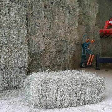
Heukleinballen (34 x 44 x 90 cm)
Marquartstein
Hacher Fahrnpoint
@Hacher-Berghof-Fahrnpoint
Heu
Kleinballen/HD-Ballen
Regenfrei
Wird verladen
1 weitere...
B+
Deprecated: Creation of dynamic property Zend_View_Helper_Ads::$adLink is deprecated in /var/www/stall-frei/htdocs/staging.stall-frei.de/library/Psf/View/Helper/Ads.php on line 108

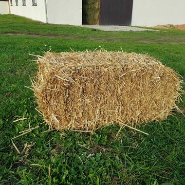
Frisches Stroh zu verkaufen!
Mechtersen
STALL-FREIde Marketing
@STALL-FREI-Marketing
Kaufe frisches Stroh für dein Pferd!

Bio-Pferdeheu in Rundballen
Reichersbeuern
Biohof-Sixt
@Biohof-Sixt
Heu
Empfänger lädt ab
Rundballen
Bio
2 weitere...
B+
Leider kein Vorschaubild
Leider kein Vorschaubild
HEUCOBS/GRASCOBSMenge in kg Preis 0,75€/kg im Sa...
Starnberg
Reiterhof-Klim
@Reiterhof-Klim
Futter
Pellets
Abholung
B+
Leider kein Vorschaubild
Leider kein Vorschaubild
heu 2025 heu 2ter schnitt 2025
Maisach
Reitstall Thurner
@ReitstallThurner
Heu
Empfänger lädt ab
Rundballen
Regenfrei
3 weitere...
B+

Heu 2. Schnitt 2025 Grummet HD Ballen
Altmannstein
Thomas Resch
@Cappo
Heu
Empfänger lädt ab
Kleinballen/HD-Ballen
Wird verladen
2 weitere...
B+

Heu aus neuer Ernte
Mechtersen
STALL-FREIde Marketing
@STALL-FREI-Marketing
Heulage und Pferdeheu aus der neuen Ernte findest du in unserem Futtermarkt


Strohpellet, Strohgranulat, Heu & Stroh
Allmannshofen
J&M Kratzer
@JMKratzer
Einstreu
Lieferant entlädt
Pellets
Wird verladen
2 weitere...
P+

Heupellets und Strohpellets Bio
Bogen
Marion Christ
@Marion-Christ
Einstreu
Pellets
Bio
Abholung
Lieferung
B+

HD-Heuballen, 1. Schnitt & 2. Schnitt
Hilpoltstein
KnollmeyerBallen
@KnollmeyerBallen
Heu
Lieferant entlädt
Kleinballen/HD-Ballen
Regenfrei
3 weitere...
B+
HD-Strohballen, Gersten-, Dinkel- und Weizenstroh
Hilpoltstein
KnollmeyerBallen
@KnollmeyerBallen
Einstreu
Lieferant entlädt
Kleinballen/HD-Ballen
Regenfrei
3 weitere...
B+
Deprecated: Creation of dynamic property Zend_View::$pageCount is deprecated in /var/www/stall-frei/htdocs/staging.stall-frei.de/library/vendor/shardj/zf1-future/library/Zend/View/Abstract.php on line 308
Deprecated: Creation of dynamic property Zend_View::$itemCountPerPage is deprecated in /var/www/stall-frei/htdocs/staging.stall-frei.de/library/vendor/shardj/zf1-future/library/Zend/View/Abstract.php on line 308
Deprecated: Creation of dynamic property Zend_View::$first is deprecated in /var/www/stall-frei/htdocs/staging.stall-frei.de/library/vendor/shardj/zf1-future/library/Zend/View/Abstract.php on line 308
Deprecated: Creation of dynamic property Zend_View::$current is deprecated in /var/www/stall-frei/htdocs/staging.stall-frei.de/library/vendor/shardj/zf1-future/library/Zend/View/Abstract.php on line 308
Deprecated: Creation of dynamic property Zend_View::$last is deprecated in /var/www/stall-frei/htdocs/staging.stall-frei.de/library/vendor/shardj/zf1-future/library/Zend/View/Abstract.php on line 308
Deprecated: Creation of dynamic property Zend_View::$next is deprecated in /var/www/stall-frei/htdocs/staging.stall-frei.de/library/vendor/shardj/zf1-future/library/Zend/View/Abstract.php on line 308
Deprecated: Creation of dynamic property Zend_View::$pagesInRange is deprecated in /var/www/stall-frei/htdocs/staging.stall-frei.de/library/vendor/shardj/zf1-future/library/Zend/View/Abstract.php on line 308
Deprecated: Creation of dynamic property Zend_View::$firstPageInRange is deprecated in /var/www/stall-frei/htdocs/staging.stall-frei.de/library/vendor/shardj/zf1-future/library/Zend/View/Abstract.php on line 308
Deprecated: Creation of dynamic property Zend_View::$lastPageInRange is deprecated in /var/www/stall-frei/htdocs/staging.stall-frei.de/library/vendor/shardj/zf1-future/library/Zend/View/Abstract.php on line 308
Deprecated: Creation of dynamic property Zend_View::$currentItemCount is deprecated in /var/www/stall-frei/htdocs/staging.stall-frei.de/library/vendor/shardj/zf1-future/library/Zend/View/Abstract.php on line 308
Deprecated: Creation of dynamic property Zend_View::$totalItemCount is deprecated in /var/www/stall-frei/htdocs/staging.stall-frei.de/library/vendor/shardj/zf1-future/library/Zend/View/Abstract.php on line 308
Deprecated: Creation of dynamic property Zend_View::$firstItemNumber is deprecated in /var/www/stall-frei/htdocs/staging.stall-frei.de/library/vendor/shardj/zf1-future/library/Zend/View/Abstract.php on line 308
Deprecated: Creation of dynamic property Zend_View::$lastItemNumber is deprecated in /var/www/stall-frei/htdocs/staging.stall-frei.de/library/vendor/shardj/zf1-future/library/Zend/View/Abstract.php on line 308
Deprecated: Creation of dynamic property Zend_View::$router is deprecated in /var/www/stall-frei/htdocs/staging.stall-frei.de/library/vendor/shardj/zf1-future/library/Zend/View/Abstract.php on line 308
Deprecated: Creation of dynamic property Zend_View::$urlParams is deprecated in /var/www/stall-frei/htdocs/staging.stall-frei.de/library/vendor/shardj/zf1-future/library/Zend/View/Abstract.php on line 308
Deprecated: Creation of dynamic property Zend_View::$showAds is deprecated in /var/www/stall-frei/htdocs/staging.stall-frei.de/library/vendor/shardj/zf1-future/library/Zend/View/Abstract.php on line 308
Deprecated: Creation of dynamic property Zend_View::$objectIds is deprecated in /var/www/stall-frei/htdocs/staging.stall-frei.de/library/vendor/shardj/zf1-future/library/Zend/View/Abstract.php on line 308
Deprecated: Creation of dynamic property Zend_View::$showNavbar is deprecated in /var/www/stall-frei/htdocs/staging.stall-frei.de/library/vendor/shardj/zf1-future/library/Zend/View/Abstract.php on line 308
Deprecated: Creation of dynamic property Zend_View::$showBreadcrumb is deprecated in /var/www/stall-frei/htdocs/staging.stall-frei.de/library/vendor/shardj/zf1-future/library/Zend/View/Abstract.php on line 308
Deprecated: Creation of dynamic property Zend_View::$showFooter is deprecated in /var/www/stall-frei/htdocs/staging.stall-frei.de/library/vendor/shardj/zf1-future/library/Zend/View/Abstract.php on line 308
Deprecated: Creation of dynamic property Zend_View::$showInternalAds is deprecated in /var/www/stall-frei/htdocs/staging.stall-frei.de/library/vendor/shardj/zf1-future/library/Zend/View/Abstract.php on line 308
Deprecated: Creation of dynamic property Zend_View::$blNoContent is deprecated in /var/www/stall-frei/htdocs/staging.stall-frei.de/library/vendor/shardj/zf1-future/library/Zend/View/Abstract.php on line 308
Deprecated: Creation of dynamic property Zend_View::$sMetaDesc is deprecated in /var/www/stall-frei/htdocs/staging.stall-frei.de/library/vendor/shardj/zf1-future/library/Zend/View/Abstract.php on line 308
Deprecated: Creation of dynamic property Zend_View::$useGmaps is deprecated in /var/www/stall-frei/htdocs/staging.stall-frei.de/library/vendor/shardj/zf1-future/library/Zend/View/Abstract.php on line 308
Deprecated: Creation of dynamic property Zend_View::$touches is deprecated in /var/www/stall-frei/htdocs/staging.stall-frei.de/library/vendor/shardj/zf1-future/library/Zend/View/Abstract.php on line 308
Deprecated: Creation of dynamic property Zend_View::$oProject is deprecated in /var/www/stall-frei/htdocs/staging.stall-frei.de/library/vendor/shardj/zf1-future/library/Zend/View/Abstract.php on line 308
Deprecated: Creation of dynamic property Zend_View::$pageHeadline is deprecated in /var/www/stall-frei/htdocs/staging.stall-frei.de/library/vendor/shardj/zf1-future/library/Zend/View/Abstract.php on line 308
Deprecated: Creation of dynamic property Zend_View::$disableLocationField is deprecated in /var/www/stall-frei/htdocs/staging.stall-frei.de/library/vendor/shardj/zf1-future/library/Zend/View/Abstract.php on line 308
Deprecated: Creation of dynamic property Zend_View::$isSearch is deprecated in /var/www/stall-frei/htdocs/staging.stall-frei.de/library/vendor/shardj/zf1-future/library/Zend/View/Abstract.php on line 308
Deprecated: Creation of dynamic property Zend_View::$pageTitle is deprecated in /var/www/stall-frei/htdocs/staging.stall-frei.de/library/vendor/shardj/zf1-future/library/Zend/View/Abstract.php on line 308
Deprecated: Creation of dynamic property Psf_Form_Element_Text::$class is deprecated in /var/www/stall-frei/htdocs/staging.stall-frei.de/library/vendor/shardj/zf1-future/library/Zend/Form/Element.php on line 874
Deprecated: Creation of dynamic property Psf_Form_Element_Text::$size is deprecated in /var/www/stall-frei/htdocs/staging.stall-frei.de/library/vendor/shardj/zf1-future/library/Zend/Form/Element.php on line 874
Deprecated: Creation of dynamic property Psf_Form_Element_Text::$placeholder is deprecated in /var/www/stall-frei/htdocs/staging.stall-frei.de/library/vendor/shardj/zf1-future/library/Zend/Form/Element.php on line 874
Deprecated: Creation of dynamic property Psf_Form_Element_Hidden::$class is deprecated in /var/www/stall-frei/htdocs/staging.stall-frei.de/library/vendor/shardj/zf1-future/library/Zend/Form/Element.php on line 874
Deprecated: Creation of dynamic property Psf_Form_Element_Hidden::$class is deprecated in /var/www/stall-frei/htdocs/staging.stall-frei.de/library/vendor/shardj/zf1-future/library/Zend/Form/Element.php on line 874
Deprecated: Creation of dynamic property Psf_Form_Element_Hidden::$class is deprecated in /var/www/stall-frei/htdocs/staging.stall-frei.de/library/vendor/shardj/zf1-future/library/Zend/Form/Element.php on line 874
Deprecated: Creation of dynamic property Psf_Form_Element_Hidden::$class is deprecated in /var/www/stall-frei/htdocs/staging.stall-frei.de/library/vendor/shardj/zf1-future/library/Zend/Form/Element.php on line 874
Deprecated: Creation of dynamic property Psf_Form_Element_Select::$class is deprecated in /var/www/stall-frei/htdocs/staging.stall-frei.de/library/vendor/shardj/zf1-future/library/Zend/Form/Element.php on line 874
Deprecated: Creation of dynamic property Psf_Form_Element_Select::$class is deprecated in /var/www/stall-frei/htdocs/staging.stall-frei.de/library/vendor/shardj/zf1-future/library/Zend/Form/Element.php on line 874
Deprecated: Creation of dynamic property Psf_Form_Element_Select::$class is deprecated in /var/www/stall-frei/htdocs/staging.stall-frei.de/library/vendor/shardj/zf1-future/library/Zend/Form/Element.php on line 874
Deprecated: Creation of dynamic property Psf_Form_Element_Select::$class is deprecated in /var/www/stall-frei/htdocs/staging.stall-frei.de/library/vendor/shardj/zf1-future/library/Zend/Form/Element.php on line 874
Deprecated: Creation of dynamic property Zend_View::$sort is deprecated in /var/www/stall-frei/htdocs/staging.stall-frei.de/library/vendor/shardj/zf1-future/library/Zend/View/Abstract.php on line 308
Deprecated: Creation of dynamic property Zend_View::$searchLocation is deprecated in /var/www/stall-frei/htdocs/staging.stall-frei.de/library/vendor/shardj/zf1-future/library/Zend/View/Abstract.php on line 308
Deprecated: Creation of dynamic property Zend_View::$locationHint is deprecated in /var/www/stall-frei/htdocs/staging.stall-frei.de/library/vendor/shardj/zf1-future/library/Zend/View/Abstract.php on line 308
Psf_GeoCoder_Abstract::getLocation: Altweg Get Location CachedOrLive
Psf_GeoCoder_Abstract::getCachedOrLive: Altweg
Psf_GeoCoder_OpenCageData::makeApiRequest: response:
Array
(
[documentation] => https://opencagedata.com/api
[licenses] => Array
(
[0] => Array
(
[name] => see attribution guide
[url] => https://opencagedata.com/credits
)
)
[results] => Array
(
[0] => Array
(
[bounds] => Array
(
[northeast] => Array
(
[lat] => 48.2021545
[lng] => 12.0570185
)
[southwest] => Array
(
[lat] => 48.2020545
[lng] => 12.0569185
)
)
[components] => Array
(
[ISO_3166-1_alpha-2] => DE
[ISO_3166-1_alpha-3] => DEU
[ISO_3166-2] => Array
(
[0] => DE-BY
)
[_category] => building
[_normalized_city] => Isen
[_type] => building
[continent] => Europe
[country] => Deutschland
[country_code] => de
[county] => Landkreis Erding
[hamlet] => Feichten
[isolated_dwelling] => Altweg
[political_union] => European Union
[postcode] => 84424
[state] => Bayern
[state_code] => BY
[village] => Isen
)
[confidence] => 10
[formatted] => Altweg, Feichten, 84424 Isen, Deutschland
[geometry] => Array
(
[lat] => 48.2021045
[lng] => 12.0569685
)
)
[1] => Array
(
[bounds] => Array
(
[northeast] => Array
(
[lat] => 48.415998
[lng] => 12.0121088
)
[southwest] => Array
(
[lat] => 48.375998
[lng] => 11.9721088
)
)
[components] => Array
(
[ISO_3166-1_alpha-2] => DE
[ISO_3166-1_alpha-3] => DEU
[ISO_3166-2] => Array
(
[0] => DE-BY
)
[_category] => place
[_normalized_city] => Wartenberg
[_type] => hamlet
[continent] => Europe
[country] => Deutschland
[country_code] => de
[county] => Landkreis Erding
[hamlet] => Altweg
[municipality] => Wartenberg (VGem)
[political_union] => European Union
[postcode] => 85456
[state] => Bayern
[state_code] => BY
[village] => Wartenberg
)
[confidence] => 7
[formatted] => Altweg, 85456 Wartenberg, Deutschland
[geometry] => Array
(
[lat] => 48.395998
[lng] => 11.9921088
)
)
[2] => Array
(
[bounds] => Array
(
[northeast] => Array
(
[lat] => 48.3219805
[lng] => 12.2334504
)
[southwest] => Array
(
[lat] => 48.2819805
[lng] => 12.1934504
)
)
[components] => Array
(
[ISO_3166-1_alpha-2] => DE
[ISO_3166-1_alpha-3] => DEU
[ISO_3166-2] => Array
(
[0] => DE-BY
)
[_category] => place
[_normalized_city] => Dorfen
[_type] => hamlet
[continent] => Europe
[country] => Deutschland
[country_code] => de
[county] => Landkreis Erding
[hamlet] => Altweg
[political_union] => European Union
[state] => Bayern
[state_code] => BY
[town] => Dorfen
)
[confidence] => 7
[formatted] => Altweg, Dorfen, Bayern, Deutschland
[geometry] => Array
(
[lat] => 48.3019805
[lng] => 12.2134504
)
)
[3] => Array
(
[bounds] => Array
(
[northeast] => Array
(
[lat] => 48.4335347
[lng] => 12.2452493
)
[southwest] => Array
(
[lat] => 48.3935347
[lng] => 12.2052493
)
)
[components] => Array
(
[ISO_3166-1_alpha-2] => DE
[ISO_3166-1_alpha-3] => DEU
[ISO_3166-2] => Array
(
[0] => DE-BY
)
[_category] => place
[_normalized_city] => Baierbach
[_type] => hamlet
[continent] => Europe
[country] => Deutschland
[country_code] => de
[county] => Landkreis Landshut
[hamlet] => Altweg
[municipality] => Altfraunhofen (VGem)
[political_union] => European Union
[postcode] => 84171
[state] => Bayern
[state_code] => BY
[village] => Baierbach
)
[confidence] => 7
[formatted] => Altweg, 84171 Baierbach, Deutschland
[geometry] => Array
(
[lat] => 48.4135347
[lng] => 12.2252493
)
)
[4] => Array
(
[bounds] => Array
(
[northeast] => Array
(
[lat] => 47.7409481
[lng] => 12.4666377
)
[southwest] => Array
(
[lat] => 47.7408481
[lng] => 12.4665377
)
)
[components] => Array
(
[ISO_3166-1_alpha-2] => DE
[ISO_3166-1_alpha-3] => DEU
[ISO_3166-2] => Array
(
[0] => DE-BY
)
[_category] => building
[_normalized_city] => Unterwössen
[_type] => building
[continent] => Europe
[country] => Deutschland
[country_code] => de
[county] => Landkreis Traunstein
[hamlet] => Gewerbegebiet Agg
[isolated_dwelling] => Altweg
[political_union] => European Union
[postcode] => 83246
[state] => Bayern
[state_code] => BY
[village] => Unterwössen
)
[confidence] => 10
[formatted] => Altweg, Gewerbegebiet Agg, 83246 Unterwössen, Deutschland
[geometry] => Array
(
[lat] => 47.7408981
[lng] => 12.4665877
)
)
[5] => Array
(
[bounds] => Array
(
[northeast] => Array
(
[lat] => 50.889934
[lng] => 8.4771728
)
[southwest] => Array
(
[lat] => 50.869934
[lng] => 8.4571728
)
)
[components] => Array
(
[ISO_3166-1_alpha-2] => DE
[ISO_3166-1_alpha-3] => DEU
[ISO_3166-2] => Array
(
[0] => DE-HE
)
[_category] => place
[_normalized_city] => Breidenbach
[_type] => hamlet
[continent] => Europe
[country] => Deutschland
[country_code] => de
[county] => Landkreis Marburg-Biedenkopf
[locality] => Altweg
[municipality] => Breidenbach
[political_union] => European Union
[postcode] => 35236
[state] => Hessen
[state_code] => HE
[village] => Breidenbach
)
[confidence] => 8
[formatted] => Altweg, 35236 Breidenbach, Deutschland
[geometry] => Array
(
[lat] => 50.879934
[lng] => 8.4671728
)
)
[6] => Array
(
[bounds] => Array
(
[northeast] => Array
(
[lat] => 48.4136526
[lng] => 12.2305638
)
[southwest] => Array
(
[lat] => 48.4098286
[lng] => 12.2230601
)
)
[components] => Array
(
[ISO_3166-1_alpha-2] => DE
[ISO_3166-1_alpha-3] => DEU
[ISO_3166-2] => Array
(
[0] => DE-BY
)
[_category] => road
[_normalized_city] => Baierbach
[_type] => road
[continent] => Europe
[country] => Deutschland
[country_code] => de
[county] => Landkreis Landshut
[hamlet] => Altweg
[municipality] => Altfraunhofen (VGem)
[political_union] => European Union
[postcode] => 84171
[road] => Altweg
[road_type] => tertiary
[state] => Bayern
[state_code] => BY
[village] => Baierbach
)
[confidence] => 9
[formatted] => Altweg, 84171 Baierbach, Deutschland
[geometry] => Array
(
[lat] => 48.4122875
[lng] => 12.2271086
)
)
[7] => Array
(
[bounds] => Array
(
[northeast] => Array
(
[lat] => 48.1099449
[lng] => 8.4747621
)
[southwest] => Array
(
[lat] => 48.1070936
[lng] => 8.4715902
)
)
[components] => Array
(
[ISO_3166-1_alpha-2] => DE
[ISO_3166-1_alpha-3] => DEU
[ISO_3166-2] => Array
(
[0] => DE-BW
)
[_category] => road
[_normalized_city] => Villingen-Schwenningen
[_type] => road
[continent] => Europe
[country] => Deutschland
[country_code] => de
[county] => Schwarzwald-Baar-Kreis
[municipality] => VVG der Stadt Villingen-Schwenningen
[political_union] => European Union
[postcode] => 78052
[road] => Altweg
[road_type] => residential
[state] => Baden-Württemberg
[state_code] => BW
[town] => Villingen-Schwenningen
[village] => Obereschach
)
[confidence] => 9
[formatted] => Altweg, 78052 Obereschach, Deutschland
[geometry] => Array
(
[lat] => 48.1090552
[lng] => 8.4735172
)
)
[8] => Array
(
[bounds] => Array
(
[northeast] => Array
(
[lat] => 48.0955102
[lng] => 7.7220496
)
[southwest] => Array
(
[lat] => 48.0945518
[lng] => 7.7199112
)
)
[components] => Array
(
[ISO_3166-1_alpha-2] => DE
[ISO_3166-1_alpha-3] => DEU
[ISO_3166-2] => Array
(
[0] => DE-BW
)
[_category] => road
[_normalized_city] => Eichstetten am Kaiserstuhl
[_type] => road
[continent] => Europe
[country] => Deutschland
[country_code] => de
[county] => Landkreis Breisgau-Hochschwarzwald
[municipality] => GVV Kaiserstuhl-Tuniberg
[political_union] => European Union
[postcode] => 79356
[road] => Altweg
[state] => Baden-Württemberg
[state_code] => BW
[village] => Eichstetten am Kaiserstuhl
)
[confidence] => 9
[formatted] => Altweg, 79356 Eichstetten am Kaiserstuhl, Deutschland
[geometry] => Array
(
[lat] => 48.0950142
[lng] => 7.7209731
)
)
[9] => Array
(
[bounds] => Array
(
[northeast] => Array
(
[lat] => 48.1259229
[lng] => 7.65272
)
[southwest] => Array
(
[lat] => 48.1251834
[lng] => 7.6511458
)
)
[components] => Array
(
[ISO_3166-1_alpha-2] => DE
[ISO_3166-1_alpha-3] => DEU
[ISO_3166-2] => Array
(
[0] => DE-BW
)
[_category] => road
[_normalized_city] => Endingen am Kaiserstuhl
[_type] => road
[continent] => Europe
[country] => Deutschland
[country_code] => de
[county] => Landkreis Emmendingen
[municipality] => GVV Nördlicher Kaiserstuhl
[political_union] => European Union
[postcode] => 79346
[road] => Altweg
[road_type] => residential
[state] => Baden-Württemberg
[state_code] => BW
[town] => Endingen am Kaiserstuhl
[village] => Kiechlinsbergen
)
[confidence] => 9
[formatted] => Altweg, 79346 Kiechlinsbergen, Deutschland
[geometry] => Array
(
[lat] => 48.1254101
[lng] => 7.6518536
)
)
)
[status] => Array
(
[code] => 200
[message] => OK
)
[stay_informed] => Array
(
[blog] => https://blog.opencagedata.com
[mastodon] => https://en.osm.town/@opencage
)
[thanks] => For using an OpenCage API
[timestamp] => Array
(
[created_http] => Tue, 03 Feb 2026 21:51:29 GMT
[created_unix] => 1770155489
)
[total_results] => 10
)
Psf_GeoCoder_Abstract::convertLocationResult
{"documentation":"https:\/\/opencagedata.com\/api","licenses":[{"name":"see attribution guide","url":"https:\/\/opencagedata.com\/credits"}],"results":[{"bounds":{"northeast":{"lat":48.2021545,"lng":12.0570185},"southwest":{"lat":48.2020545,"lng":12.0569185}},"components":{"ISO_3166-1_alpha-2":"DE","ISO_3166-1_alpha-3":"DEU","ISO_3166-2":["DE-BY"],"_category":"building","_normalized_city":"Isen","_type":"building","continent":"Europe","country":"Deutschland","country_code":"de","county":"Landkreis Erding","hamlet":"Feichten","isolated_dwelling":"Altweg","political_union":"European Union","postcode":"84424","state":"Bayern","state_code":"BY","village":"Isen"},"confidence":10,"formatted":"Altweg, Feichten, 84424 Isen, Deutschland","geometry":{"lat":48.2021045,"lng":12.0569685}},{"bounds":{"northeast":{"lat":48.415998,"lng":12.0121088},"southwest":{"lat":48.375998,"lng":11.9721088}},"components":{"ISO_3166-1_alpha-2":"DE","ISO_3166-1_alpha-3":"DEU","ISO_3166-2":["DE-BY"],"_category":"place","_normalized_city":"Wartenberg","_type":"hamlet","continent":"Europe","country":"Deutschland","country_code":"de","county":"Landkreis Erding","hamlet":"Altweg","municipality":"Wartenberg (VGem)","political_union":"European Union","postcode":"85456","state":"Bayern","state_code":"BY","village":"Wartenberg"},"confidence":7,"formatted":"Altweg, 85456 Wartenberg, Deutschland","geometry":{"lat":48.395998,"lng":11.9921088}},{"bounds":{"northeast":{"lat":48.3219805,"lng":12.2334504},"southwest":{"lat":48.2819805,"lng":12.1934504}},"components":{"ISO_3166-1_alpha-2":"DE","ISO_3166-1_alpha-3":"DEU","ISO_3166-2":["DE-BY"],"_category":"place","_normalized_city":"Dorfen","_type":"hamlet","continent":"Europe","country":"Deutschland","country_code":"de","county":"Landkreis Erding","hamlet":"Altweg","political_union":"European Union","state":"Bayern","state_code":"BY","town":"Dorfen"},"confidence":7,"formatted":"Altweg, Dorfen, Bayern, Deutschland","geometry":{"lat":48.3019805,"lng":12.2134504}},{"bounds":{"northeast":{"lat":48.4335347,"lng":12.2452493},"southwest":{"lat":48.3935347,"lng":12.2052493}},"components":{"ISO_3166-1_alpha-2":"DE","ISO_3166-1_alpha-3":"DEU","ISO_3166-2":["DE-BY"],"_category":"place","_normalized_city":"Baierbach","_type":"hamlet","continent":"Europe","country":"Deutschland","country_code":"de","county":"Landkreis Landshut","hamlet":"Altweg","municipality":"Altfraunhofen (VGem)","political_union":"European Union","postcode":"84171","state":"Bayern","state_code":"BY","village":"Baierbach"},"confidence":7,"formatted":"Altweg, 84171 Baierbach, Deutschland","geometry":{"lat":48.4135347,"lng":12.2252493}},{"bounds":{"northeast":{"lat":47.7409481,"lng":12.4666377},"southwest":{"lat":47.7408481,"lng":12.4665377}},"components":{"ISO_3166-1_alpha-2":"DE","ISO_3166-1_alpha-3":"DEU","ISO_3166-2":["DE-BY"],"_category":"building","_normalized_city":"Unterw\u00f6ssen","_type":"building","continent":"Europe","country":"Deutschland","country_code":"de","county":"Landkreis Traunstein","hamlet":"Gewerbegebiet Agg","isolated_dwelling":"Altweg","political_union":"European Union","postcode":"83246","state":"Bayern","state_code":"BY","village":"Unterw\u00f6ssen"},"confidence":10,"formatted":"Altweg, Gewerbegebiet Agg, 83246 Unterw\u00f6ssen, Deutschland","geometry":{"lat":47.7408981,"lng":12.4665877}},{"bounds":{"northeast":{"lat":50.889934,"lng":8.4771728},"southwest":{"lat":50.869934,"lng":8.4571728}},"components":{"ISO_3166-1_alpha-2":"DE","ISO_3166-1_alpha-3":"DEU","ISO_3166-2":["DE-HE"],"_category":"place","_normalized_city":"Breidenbach","_type":"hamlet","continent":"Europe","country":"Deutschland","country_code":"de","county":"Landkreis Marburg-Biedenkopf","locality":"Altweg","municipality":"Breidenbach","political_union":"European Union","postcode":"35236","state":"Hessen","state_code":"HE","village":"Breidenbach"},"confidence":8,"formatted":"Altweg, 35236 Breidenbach, Deutschland","geometry":{"lat":50.879934,"lng":8.4671728}},{"bounds":{"northeast":{"lat":48.4136526,"lng":12.2305638},"southwest":{"lat":48.4098286,"lng":12.2230601}},"components":{"ISO_3166-1_alpha-2":"DE","ISO_3166-1_alpha-3":"DEU","ISO_3166-2":["DE-BY"],"_category":"road","_normalized_city":"Baierbach","_type":"road","continent":"Europe","country":"Deutschland","country_code":"de","county":"Landkreis Landshut","hamlet":"Altweg","municipality":"Altfraunhofen (VGem)","political_union":"European Union","postcode":"84171","road":"Altweg","road_type":"tertiary","state":"Bayern","state_code":"BY","village":"Baierbach"},"confidence":9,"formatted":"Altweg, 84171 Baierbach, Deutschland","geometry":{"lat":48.4122875,"lng":12.2271086}},{"bounds":{"northeast":{"lat":48.1099449,"lng":8.4747621},"southwest":{"lat":48.1070936,"lng":8.4715902}},"components":{"ISO_3166-1_alpha-2":"DE","ISO_3166-1_alpha-3":"DEU","ISO_3166-2":["DE-BW"],"_category":"road","_normalized_city":"Villingen-Schwenningen","_type":"road","continent":"Europe","country":"Deutschland","country_code":"de","county":"Schwarzwald-Baar-Kreis","municipality":"VVG der Stadt Villingen-Schwenningen","political_union":"European Union","postcode":"78052","road":"Altweg","road_type":"residential","state":"Baden-W\u00fcrttemberg","state_code":"BW","town":"Villingen-Schwenningen","village":"Obereschach"},"confidence":9,"formatted":"Altweg, 78052 Obereschach, Deutschland","geometry":{"lat":48.1090552,"lng":8.4735172}},{"bounds":{"northeast":{"lat":48.0955102,"lng":7.7220496},"southwest":{"lat":48.0945518,"lng":7.7199112}},"components":{"ISO_3166-1_alpha-2":"DE","ISO_3166-1_alpha-3":"DEU","ISO_3166-2":["DE-BW"],"_category":"road","_normalized_city":"Eichstetten am Kaiserstuhl","_type":"road","continent":"Europe","country":"Deutschland","country_code":"de","county":"Landkreis Breisgau-Hochschwarzwald","municipality":"GVV Kaiserstuhl-Tuniberg","political_union":"European Union","postcode":"79356","road":"Altweg","state":"Baden-W\u00fcrttemberg","state_code":"BW","village":"Eichstetten am Kaiserstuhl"},"confidence":9,"formatted":"Altweg, 79356 Eichstetten am Kaiserstuhl, Deutschland","geometry":{"lat":48.0950142,"lng":7.7209731}},{"bounds":{"northeast":{"lat":48.1259229,"lng":7.65272},"southwest":{"lat":48.1251834,"lng":7.6511458}},"components":{"ISO_3166-1_alpha-2":"DE","ISO_3166-1_alpha-3":"DEU","ISO_3166-2":["DE-BW"],"_category":"road","_normalized_city":"Endingen am Kaiserstuhl","_type":"road","continent":"Europe","country":"Deutschland","country_code":"de","county":"Landkreis Emmendingen","municipality":"GVV N\u00f6rdlicher Kaiserstuhl","political_union":"European Union","postcode":"79346","road":"Altweg","road_type":"residential","state":"Baden-W\u00fcrttemberg","state_code":"BW","town":"Endingen am Kaiserstuhl","village":"Kiechlinsbergen"},"confidence":9,"formatted":"Altweg, 79346 Kiechlinsbergen, Deutschland","geometry":{"lat":48.1254101,"lng":7.6518536}}],"status":{"code":200,"message":"OK"},"stay_informed":{"blog":"https:\/\/blog.opencagedata.com","mastodon":"https:\/\/en.osm.town\/@opencage"},"thanks":"For using an OpenCage API","timestamp":{"created_http":"Tue, 03 Feb 2026 21:51:29 GMT","created_unix":1770155489},"total_results":10}Array
(
[0] => stdClass Object
(
[bounds] => stdClass Object
(
[northeast] => stdClass Object
(
[lat] => 48.2021545
[lng] => 12.0570185
)
[southwest] => stdClass Object
(
[lat] => 48.2020545
[lng] => 12.0569185
)
)
[components] => stdClass Object
(
[ISO_3166-1_alpha-2] => DE
[ISO_3166-1_alpha-3] => DEU
[ISO_3166-2] => Array
(
[0] => DE-BY
)
[_category] => building
[_normalized_city] => Isen
[_type] => building
[continent] => Europe
[country] => Deutschland
[country_code] => de
[county] => Landkreis Erding
[hamlet] => Feichten
[isolated_dwelling] => Altweg
[political_union] => European Union
[postcode] => 84424
[state] => Bayern
[state_code] => BY
[village] => Isen
)
[confidence] => 10
[formatted] => Altweg, Feichten, 84424 Isen, Deutschland
[geometry] => stdClass Object
(
[lat] => 48.2021045
[lng] => 12.0569685
)
)
[1] => stdClass Object
(
[bounds] => stdClass Object
(
[northeast] => stdClass Object
(
[lat] => 48.415998
[lng] => 12.0121088
)
[southwest] => stdClass Object
(
[lat] => 48.375998
[lng] => 11.9721088
)
)
[components] => stdClass Object
(
[ISO_3166-1_alpha-2] => DE
[ISO_3166-1_alpha-3] => DEU
[ISO_3166-2] => Array
(
[0] => DE-BY
)
[_category] => place
[_normalized_city] => Wartenberg
[_type] => hamlet
[continent] => Europe
[country] => Deutschland
[country_code] => de
[county] => Landkreis Erding
[hamlet] => Altweg
[municipality] => Wartenberg (VGem)
[political_union] => European Union
[postcode] => 85456
[state] => Bayern
[state_code] => BY
[village] => Wartenberg
)
[confidence] => 7
[formatted] => Altweg, 85456 Wartenberg, Deutschland
[geometry] => stdClass Object
(
[lat] => 48.395998
[lng] => 11.9921088
)
)
[2] => stdClass Object
(
[bounds] => stdClass Object
(
[northeast] => stdClass Object
(
[lat] => 48.3219805
[lng] => 12.2334504
)
[southwest] => stdClass Object
(
[lat] => 48.2819805
[lng] => 12.1934504
)
)
[components] => stdClass Object
(
[ISO_3166-1_alpha-2] => DE
[ISO_3166-1_alpha-3] => DEU
[ISO_3166-2] => Array
(
[0] => DE-BY
)
[_category] => place
[_normalized_city] => Dorfen
[_type] => hamlet
[continent] => Europe
[country] => Deutschland
[country_code] => de
[county] => Landkreis Erding
[hamlet] => Altweg
[political_union] => European Union
[state] => Bayern
[state_code] => BY
[town] => Dorfen
)
[confidence] => 7
[formatted] => Altweg, Dorfen, Bayern, Deutschland
[geometry] => stdClass Object
(
[lat] => 48.3019805
[lng] => 12.2134504
)
)
[3] => stdClass Object
(
[bounds] => stdClass Object
(
[northeast] => stdClass Object
(
[lat] => 48.4335347
[lng] => 12.2452493
)
[southwest] => stdClass Object
(
[lat] => 48.3935347
[lng] => 12.2052493
)
)
[components] => stdClass Object
(
[ISO_3166-1_alpha-2] => DE
[ISO_3166-1_alpha-3] => DEU
[ISO_3166-2] => Array
(
[0] => DE-BY
)
[_category] => place
[_normalized_city] => Baierbach
[_type] => hamlet
[continent] => Europe
[country] => Deutschland
[country_code] => de
[county] => Landkreis Landshut
[hamlet] => Altweg
[municipality] => Altfraunhofen (VGem)
[political_union] => European Union
[postcode] => 84171
[state] => Bayern
[state_code] => BY
[village] => Baierbach
)
[confidence] => 7
[formatted] => Altweg, 84171 Baierbach, Deutschland
[geometry] => stdClass Object
(
[lat] => 48.4135347
[lng] => 12.2252493
)
)
[4] => stdClass Object
(
[bounds] => stdClass Object
(
[northeast] => stdClass Object
(
[lat] => 47.7409481
[lng] => 12.4666377
)
[southwest] => stdClass Object
(
[lat] => 47.7408481
[lng] => 12.4665377
)
)
[components] => stdClass Object
(
[ISO_3166-1_alpha-2] => DE
[ISO_3166-1_alpha-3] => DEU
[ISO_3166-2] => Array
(
[0] => DE-BY
)
[_category] => building
[_normalized_city] => Unterwössen
[_type] => building
[continent] => Europe
[country] => Deutschland
[country_code] => de
[county] => Landkreis Traunstein
[hamlet] => Gewerbegebiet Agg
[isolated_dwelling] => Altweg
[political_union] => European Union
[postcode] => 83246
[state] => Bayern
[state_code] => BY
[village] => Unterwössen
)
[confidence] => 10
[formatted] => Altweg, Gewerbegebiet Agg, 83246 Unterwössen, Deutschland
[geometry] => stdClass Object
(
[lat] => 47.7408981
[lng] => 12.4665877
)
)
[5] => stdClass Object
(
[bounds] => stdClass Object
(
[northeast] => stdClass Object
(
[lat] => 50.889934
[lng] => 8.4771728
)
[southwest] => stdClass Object
(
[lat] => 50.869934
[lng] => 8.4571728
)
)
[components] => stdClass Object
(
[ISO_3166-1_alpha-2] => DE
[ISO_3166-1_alpha-3] => DEU
[ISO_3166-2] => Array
(
[0] => DE-HE
)
[_category] => place
[_normalized_city] => Breidenbach
[_type] => hamlet
[continent] => Europe
[country] => Deutschland
[country_code] => de
[county] => Landkreis Marburg-Biedenkopf
[locality] => Altweg
[municipality] => Breidenbach
[political_union] => European Union
[postcode] => 35236
[state] => Hessen
[state_code] => HE
[village] => Breidenbach
)
[confidence] => 8
[formatted] => Altweg, 35236 Breidenbach, Deutschland
[geometry] => stdClass Object
(
[lat] => 50.879934
[lng] => 8.4671728
)
)
[6] => stdClass Object
(
[bounds] => stdClass Object
(
[northeast] => stdClass Object
(
[lat] => 48.4136526
[lng] => 12.2305638
)
[southwest] => stdClass Object
(
[lat] => 48.4098286
[lng] => 12.2230601
)
)
[components] => stdClass Object
(
[ISO_3166-1_alpha-2] => DE
[ISO_3166-1_alpha-3] => DEU
[ISO_3166-2] => Array
(
[0] => DE-BY
)
[_category] => road
[_normalized_city] => Baierbach
[_type] => road
[continent] => Europe
[country] => Deutschland
[country_code] => de
[county] => Landkreis Landshut
[hamlet] => Altweg
[municipality] => Altfraunhofen (VGem)
[political_union] => European Union
[postcode] => 84171
[road] => Altweg
[road_type] => tertiary
[state] => Bayern
[state_code] => BY
[village] => Baierbach
)
[confidence] => 9
[formatted] => Altweg, 84171 Baierbach, Deutschland
[geometry] => stdClass Object
(
[lat] => 48.4122875
[lng] => 12.2271086
)
)
[7] => stdClass Object
(
[bounds] => stdClass Object
(
[northeast] => stdClass Object
(
[lat] => 48.1099449
[lng] => 8.4747621
)
[southwest] => stdClass Object
(
[lat] => 48.1070936
[lng] => 8.4715902
)
)
[components] => stdClass Object
(
[ISO_3166-1_alpha-2] => DE
[ISO_3166-1_alpha-3] => DEU
[ISO_3166-2] => Array
(
[0] => DE-BW
)
[_category] => road
[_normalized_city] => Villingen-Schwenningen
[_type] => road
[continent] => Europe
[country] => Deutschland
[country_code] => de
[county] => Schwarzwald-Baar-Kreis
[municipality] => VVG der Stadt Villingen-Schwenningen
[political_union] => European Union
[postcode] => 78052
[road] => Altweg
[road_type] => residential
[state] => Baden-Württemberg
[state_code] => BW
[town] => Villingen-Schwenningen
[village] => Obereschach
)
[confidence] => 9
[formatted] => Altweg, 78052 Obereschach, Deutschland
[geometry] => stdClass Object
(
[lat] => 48.1090552
[lng] => 8.4735172
)
)
[8] => stdClass Object
(
[bounds] => stdClass Object
(
[northeast] => stdClass Object
(
[lat] => 48.0955102
[lng] => 7.7220496
)
[southwest] => stdClass Object
(
[lat] => 48.0945518
[lng] => 7.7199112
)
)
[components] => stdClass Object
(
[ISO_3166-1_alpha-2] => DE
[ISO_3166-1_alpha-3] => DEU
[ISO_3166-2] => Array
(
[0] => DE-BW
)
[_category] => road
[_normalized_city] => Eichstetten am Kaiserstuhl
[_type] => road
[continent] => Europe
[country] => Deutschland
[country_code] => de
[county] => Landkreis Breisgau-Hochschwarzwald
[municipality] => GVV Kaiserstuhl-Tuniberg
[political_union] => European Union
[postcode] => 79356
[road] => Altweg
[state] => Baden-Württemberg
[state_code] => BW
[village] => Eichstetten am Kaiserstuhl
)
[confidence] => 9
[formatted] => Altweg, 79356 Eichstetten am Kaiserstuhl, Deutschland
[geometry] => stdClass Object
(
[lat] => 48.0950142
[lng] => 7.7209731
)
)
[9] => stdClass Object
(
[bounds] => stdClass Object
(
[northeast] => stdClass Object
(
[lat] => 48.1259229
[lng] => 7.65272
)
[southwest] => stdClass Object
(
[lat] => 48.1251834
[lng] => 7.6511458
)
)
[components] => stdClass Object
(
[ISO_3166-1_alpha-2] => DE
[ISO_3166-1_alpha-3] => DEU
[ISO_3166-2] => Array
(
[0] => DE-BW
)
[_category] => road
[_normalized_city] => Endingen am Kaiserstuhl
[_type] => road
[continent] => Europe
[country] => Deutschland
[country_code] => de
[county] => Landkreis Emmendingen
[municipality] => GVV Nördlicher Kaiserstuhl
[political_union] => European Union
[postcode] => 79346
[road] => Altweg
[road_type] => residential
[state] => Baden-Württemberg
[state_code] => BW
[town] => Endingen am Kaiserstuhl
[village] => Kiechlinsbergen
)
[confidence] => 9
[formatted] => Altweg, 79346 Kiechlinsbergen, Deutschland
[geometry] => stdClass Object
(
[lat] => 48.1254101
[lng] => 7.6518536
)
)
)
Psf_GeoCoder_OpenCageData::getKeyMap: 0
stdClass Object
(
    [bounds] => stdClass Object
        (
            [northeast] => stdClass Object
                (
                    [lat] => 48.2021545
                    [lng] => 12.0570185
                )

            [southwest] => stdClass Object
                (
                    [lat] => 48.2020545
                    [lng] => 12.0569185
                )

        )

    [components] => stdClass Object
        (
            [ISO_3166-1_alpha-2] => DE
            [ISO_3166-1_alpha-3] => DEU
            [ISO_3166-2] => Array
                (
                    [0] => DE-BY
                )

            [_category] => building
            [_normalized_city] => Isen
            [_type] => building
            [continent] => Europe
            [country] => Deutschland
            [country_code] => de
            [county] => Landkreis Erding
            [hamlet] => Feichten
            [isolated_dwelling] => Altweg
            [political_union] => European Union
            [postcode] => 84424
            [state] => Bayern
            [state_code] => BY
            [village] => Isen
        )

    [confidence] => 10
    [formatted] => Altweg, Feichten, 84424 Isen, Deutschland
    [geometry] => stdClass Object
        (
            [lat] => 48.2021045
            [lng] => 12.0569685
        )

)
Psf_GeoCoder_OpenCageData::getCounty: Erding
Psf_GeoCoder_OpenCageData::addMissingData REFETCH!
Array
(
    [address] => Altweg, Feichten, 84424 Isen, Deutschland
    [type] => building
    [street] => Feichten
    [city] => Isen
    [county] => Erding
    [state] => Bayern
    [zip] => 84424
    [country] => Deutschland
    [suburb] =>
    [countrycode] => de
    [latitude] => 48.2021045
    [longitude] => 12.0569685
    [accuracy] => 1
    [confidence] => 10
    [bounds] => stdClass Object
        (
            [northeast] => stdClass Object
                (
                    [lat] => 48.2021545
                    [lng] => 12.0570185
                )

            [southwest] => stdClass Object
                (
                    [lat] => 48.2020545
                    [lng] => 12.0569185
                )

        )

)
reformat!
Array
(
    [address] => Altweg, Feichten, 84424 Isen, Deutschland
    [type] => building
    [street] => Feichten
    [city] => Isen
    [county] => Erding
    [state] => Bayern
    [zip] => 84424
    [country] => Deutschland
    [suburb] =>
    [countrycode] => de
    [latitude] => 48.2021045
    [longitude] => 12.0569685
    [accuracy] => 1
    [confidence] => 10
    [bounds] => stdClass Object
        (
            [northeast] => stdClass Object
                (
                    [lat] => 48.2021545
                    [lng] => 12.0570185
                )

            [southwest] => stdClass Object
                (
                    [lat] => 48.2020545
                    [lng] => 12.0569185
                )

        )

    [place] => Feichten, 84424 Isen, Bayern
    [hash] => 82c3f498c788494f04deba84ef28f743
)
Psf_GeoCoder_OpenCageData::getKeyMap: 1
stdClass Object
(
    [bounds] => stdClass Object
        (
            [northeast] => stdClass Object
                (
                    [lat] => 48.415998
                    [lng] => 12.0121088
                )

            [southwest] => stdClass Object
                (
                    [lat] => 48.375998
                    [lng] => 11.9721088
                )

        )

    [components] => stdClass Object
        (
            [ISO_3166-1_alpha-2] => DE
            [ISO_3166-1_alpha-3] => DEU
            [ISO_3166-2] => Array
                (
                    [0] => DE-BY
                )

            [_category] => place
            [_normalized_city] => Wartenberg
            [_type] => hamlet
            [continent] => Europe
            [country] => Deutschland
            [country_code] => de
            [county] => Landkreis Erding
            [hamlet] => Altweg
            [municipality] => Wartenberg (VGem)
            [political_union] => European Union
            [postcode] => 85456
            [state] => Bayern
            [state_code] => BY
            [village] => Wartenberg
        )

    [confidence] => 7
    [formatted] => Altweg, 85456 Wartenberg, Deutschland
    [geometry] => stdClass Object
        (
            [lat] => 48.395998
            [lng] => 11.9921088
        )

)
Psf_GeoCoder_OpenCageData::getCounty: Erding
Psf_GeoCoder_OpenCageData::addMissingData REFETCH!
Array
(
    [address] => Altweg, 85456 Wartenberg, Deutschland
    [type] => hamlet
    [street] => Altweg
    [city] => Wartenberg
    [county] => Erding
    [state] => Bayern
    [zip] => 85456
    [country] => Deutschland
    [suburb] =>
    [countrycode] => de
    [latitude] => 48.395998
    [longitude] => 11.9921088
    [accuracy] => 1
    [confidence] => 7
    [bounds] => stdClass Object
        (
            [northeast] => stdClass Object
                (
                    [lat] => 48.415998
                    [lng] => 12.0121088
                )

            [southwest] => stdClass Object
                (
                    [lat] => 48.375998
                    [lng] => 11.9721088
                )

        )

)
reformat!
Array
(
    [address] => Altweg, 85456 Wartenberg, Deutschland
    [type] => hamlet
    [street] => Altweg
    [city] => Wartenberg
    [county] => Erding
    [state] => Bayern
    [zip] => 85456
    [country] => Deutschland
    [suburb] =>
    [countrycode] => de
    [latitude] => 48.395998
    [longitude] => 11.9921088
    [accuracy] => 1
    [confidence] => 7
    [bounds] => stdClass Object
        (
            [northeast] => stdClass Object
                (
                    [lat] => 48.415998
                    [lng] => 12.0121088
                )

            [southwest] => stdClass Object
                (
                    [lat] => 48.375998
                    [lng] => 11.9721088
                )

        )

    [place] => Altweg, 85456 Wartenberg, Bayern
    [hash] => 4fcc3c6fed5578667b2fb5b4c17c58a3
)
Psf_GeoCoder_OpenCageData::getKeyMap: 2
stdClass Object
(
    [bounds] => stdClass Object
        (
            [northeast] => stdClass Object
                (
                    [lat] => 48.3219805
                    [lng] => 12.2334504
                )

            [southwest] => stdClass Object
                (
                    [lat] => 48.2819805
                    [lng] => 12.1934504
                )

        )

    [components] => stdClass Object
        (
            [ISO_3166-1_alpha-2] => DE
            [ISO_3166-1_alpha-3] => DEU
            [ISO_3166-2] => Array
                (
                    [0] => DE-BY
                )

            [_category] => place
            [_normalized_city] => Dorfen
            [_type] => hamlet
            [continent] => Europe
            [country] => Deutschland
            [country_code] => de
            [county] => Landkreis Erding
            [hamlet] => Altweg
            [political_union] => European Union
            [state] => Bayern
            [state_code] => BY
            [town] => Dorfen
        )

    [confidence] => 7
    [formatted] => Altweg, Dorfen, Bayern, Deutschland
    [geometry] => stdClass Object
        (
            [lat] => 48.3019805
            [lng] => 12.2134504
        )

)
Psf_GeoCoder_OpenCageData::getCounty: Erding
Psf_GeoCoder_OpenCageData::addMissingData REFETCH!
Array
(
    [address] => Altweg, Dorfen, Bayern, Deutschland
    [type] => hamlet
    [street] => Altweg
    [city] => Dorfen
    [county] => Erding
    [state] => Bayern
    [zip] =>
    [country] => Deutschland
    [suburb] =>
    [countrycode] => de
    [latitude] => 48.3019805
    [longitude] => 12.2134504
    [accuracy] => 1
    [confidence] => 7
    [bounds] => stdClass Object
        (
            [northeast] => stdClass Object
                (
                    [lat] => 48.3219805
                    [lng] => 12.2334504
                )

            [southwest] => stdClass Object
                (
                    [lat] => 48.2819805
                    [lng] => 12.1934504
                )

        )

)
reformat!
Array
(
    [address] => Altweg, Dorfen, Bayern, Deutschland
    [type] => hamlet
    [street] => Altweg
    [city] => Dorfen
    [county] => Erding
    [state] => Bayern
    [zip] =>
    [country] => Deutschland
    [suburb] =>
    [countrycode] => de
    [latitude] => 48.3019805
    [longitude] => 12.2134504
    [accuracy] => 1
    [confidence] => 7
    [bounds] => stdClass Object
        (
            [northeast] => stdClass Object
                (
                    [lat] => 48.3219805
                    [lng] => 12.2334504
                )

            [southwest] => stdClass Object
                (
                    [lat] => 48.2819805
                    [lng] => 12.1934504
                )

        )

    [place] => Altweg, Dorfen, Bayern
    [hash] => f8268bb5883a05d1e143b1dc200ff5d4
)
Psf_GeoCoder_OpenCageData::getKeyMap: 3
stdClass Object
(
    [bounds] => stdClass Object
        (
            [northeast] => stdClass Object
                (
                    [lat] => 48.4335347
                    [lng] => 12.2452493
                )

            [southwest] => stdClass Object
                (
                    [lat] => 48.3935347
                    [lng] => 12.2052493
                )

        )

    [components] => stdClass Object
        (
            [ISO_3166-1_alpha-2] => DE
            [ISO_3166-1_alpha-3] => DEU
            [ISO_3166-2] => Array
                (
                    [0] => DE-BY
                )

            [_category] => place
            [_normalized_city] => Baierbach
            [_type] => hamlet
            [continent] => Europe
            [country] => Deutschland
            [country_code] => de
            [county] => Landkreis Landshut
            [hamlet] => Altweg
            [municipality] => Altfraunhofen (VGem)
            [political_union] => European Union
            [postcode] => 84171
            [state] => Bayern
            [state_code] => BY
            [village] => Baierbach
        )

    [confidence] => 7
    [formatted] => Altweg, 84171 Baierbach, Deutschland
    [geometry] => stdClass Object
        (
            [lat] => 48.4135347
            [lng] => 12.2252493
        )

)
Psf_GeoCoder_OpenCageData::getCounty: Landshut
Psf_GeoCoder_OpenCageData::addMissingData REFETCH!
Array
(
    [address] => Altweg, 84171 Baierbach, Deutschland
    [type] => hamlet
    [street] => Altweg
    [city] => Baierbach
    [county] => Landshut
    [state] => Bayern
    [zip] => 84171
    [country] => Deutschland
    [suburb] =>
    [countrycode] => de
    [latitude] => 48.4135347
    [longitude] => 12.2252493
    [accuracy] => 1
    [confidence] => 7
    [bounds] => stdClass Object
        (
            [northeast] => stdClass Object
                (
                    [lat] => 48.4335347
                    [lng] => 12.2452493
                )

            [southwest] => stdClass Object
                (
                    [lat] => 48.3935347
                    [lng] => 12.2052493
                )

        )

)
reformat!
Array
(
    [address] => Altweg, 84171 Baierbach, Deutschland
    [type] => hamlet
    [street] => Altweg
    [city] => Baierbach
    [county] => Landshut
    [state] => Bayern
    [zip] => 84171
    [country] => Deutschland
    [suburb] =>
    [countrycode] => de
    [latitude] => 48.4135347
    [longitude] => 12.2252493
    [accuracy] => 1
    [confidence] => 7
    [bounds] => stdClass Object
        (
            [northeast] => stdClass Object
                (
                    [lat] => 48.4335347
                    [lng] => 12.2452493
                )

            [southwest] => stdClass Object
                (
                    [lat] => 48.3935347
                    [lng] => 12.2052493
                )

        )

    [place] => Altweg, 84171 Baierbach, Bayern
    [hash] => 6a99fa2c633c9f8fb80321e5e87ce3b1
)
Psf_GeoCoder_OpenCageData::getKeyMap: 4
stdClass Object
(
    [bounds] => stdClass Object
        (
            [northeast] => stdClass Object
                (
                    [lat] => 47.7409481
                    [lng] => 12.4666377
                )

            [southwest] => stdClass Object
                (
                    [lat] => 47.7408481
                    [lng] => 12.4665377
                )

        )

    [components] => stdClass Object
        (
            [ISO_3166-1_alpha-2] => DE
            [ISO_3166-1_alpha-3] => DEU
            [ISO_3166-2] => Array
                (
                    [0] => DE-BY
                )

            [_category] => building
            [_normalized_city] => Unterwössen
            [_type] => building
            [continent] => Europe
            [country] => Deutschland
            [country_code] => de
            [county] => Landkreis Traunstein
            [hamlet] => Gewerbegebiet Agg
            [isolated_dwelling] => Altweg
            [political_union] => European Union
            [postcode] => 83246
            [state] => Bayern
            [state_code] => BY
            [village] => Unterwössen
        )

    [confidence] => 10
    [formatted] => Altweg, Gewerbegebiet Agg, 83246 Unterwössen, Deutschland
    [geometry] => stdClass Object
        (
            [lat] => 47.7408981
            [lng] => 12.4665877
        )

)
Psf_GeoCoder_OpenCageData::getCounty: Traunstein
Psf_GeoCoder_OpenCageData::addMissingData REFETCH!
Array
(
    [address] => Altweg, Gewerbegebiet Agg, 83246 Unterwössen, Deutschland
    [type] => building
    [street] => Gewerbegebiet Agg
    [city] => Unterwössen
    [county] => Traunstein
    [state] => Bayern
    [zip] => 83246
    [country] => Deutschland
    [suburb] =>
    [countrycode] => de
    [latitude] => 47.7408981
    [longitude] => 12.4665877
    [accuracy] => 1
    [confidence] => 10
    [bounds] => stdClass Object
        (
            [northeast] => stdClass Object
                (
                    [lat] => 47.7409481
                    [lng] => 12.4666377
                )

            [southwest] => stdClass Object
                (
                    [lat] => 47.7408481
                    [lng] => 12.4665377
                )

        )

)
reformat!
Array
(
    [address] => Altweg, Gewerbegebiet Agg, 83246 Unterwössen, Deutschland
    [type] => building
    [street] => Gewerbegebiet Agg
    [city] => Unterwössen
    [county] => Traunstein
    [state] => Bayern
    [zip] => 83246
    [country] => Deutschland
    [suburb] =>
    [countrycode] => de
    [latitude] => 47.7408981
    [longitude] => 12.4665877
    [accuracy] => 1
    [confidence] => 10
    [bounds] => stdClass Object
        (
            [northeast] => stdClass Object
                (
                    [lat] => 47.7409481
                    [lng] => 12.4666377
                )

            [southwest] => stdClass Object
                (
                    [lat] => 47.7408481
                    [lng] => 12.4665377
                )

        )

    [place] => Gewerbegebiet Agg, 83246 Unterwössen, Bayern
    [hash] => 225514ea307a006f9e945dd39ec2d583
)
Psf_GeoCoder_OpenCageData::getKeyMap: 5
stdClass Object
(
    [bounds] => stdClass Object
        (
            [northeast] => stdClass Object
                (
                    [lat] => 50.889934
                    [lng] => 8.4771728
                )

            [southwest] => stdClass Object
                (
                    [lat] => 50.869934
                    [lng] => 8.4571728
                )

        )

    [components] => stdClass Object
        (
            [ISO_3166-1_alpha-2] => DE
            [ISO_3166-1_alpha-3] => DEU
            [ISO_3166-2] => Array
                (
                    [0] => DE-HE
                )

            [_category] => place
            [_normalized_city] => Breidenbach
            [_type] => hamlet
            [continent] => Europe
            [country] => Deutschland
            [country_code] => de
            [county] => Landkreis Marburg-Biedenkopf
            [locality] => Altweg
            [municipality] => Breidenbach
            [political_union] => European Union
            [postcode] => 35236
            [state] => Hessen
            [state_code] => HE
            [village] => Breidenbach
        )

    [confidence] => 8
    [formatted] => Altweg, 35236 Breidenbach, Deutschland
    [geometry] => stdClass Object
        (
            [lat] => 50.879934
            [lng] => 8.4671728
        )

)
Psf_GeoCoder_OpenCageData::getCounty: Marburg-Biedenkopf
Psf_GeoCoder_OpenCageData::addMissingData REFETCH!
Array
(
    [address] => Altweg, 35236 Breidenbach, Deutschland
    [type] => hamlet
    [street] =>
    [city] => Breidenbach
    [county] => Marburg-Biedenkopf
    [state] => Hessen
    [zip] => 35236
    [country] => Deutschland
    [suburb] =>
    [countrycode] => de
    [latitude] => 50.879934
    [longitude] => 8.4671728
    [accuracy] => 1
    [confidence] => 8
    [bounds] => stdClass Object
        (
            [northeast] => stdClass Object
                (
                    [lat] => 50.889934
                    [lng] => 8.4771728
                )

            [southwest] => stdClass Object
                (
                    [lat] => 50.869934
                    [lng] => 8.4571728
                )

        )

)
reformat!
Array
(
    [address] => Altweg, 35236 Breidenbach, Deutschland
    [type] => hamlet
    [street] =>
    [city] => Breidenbach
    [county] => Marburg-Biedenkopf
    [state] => Hessen
    [zip] => 35236
    [country] => Deutschland
    [suburb] =>
    [countrycode] => de
    [latitude] => 50.879934
    [longitude] => 8.4671728
    [accuracy] => 1
    [confidence] => 8
    [bounds] => stdClass Object
        (
            [northeast] => stdClass Object
                (
                    [lat] => 50.889934
                    [lng] => 8.4771728
                )

            [southwest] => stdClass Object
                (
                    [lat] => 50.869934
                    [lng] => 8.4571728
                )

        )

    [place] => 35236 Breidenbach, Hessen
    [hash] => fa79f172b00f7a7fc91c7eb26e1f2ac5
)
Psf_GeoCoder_OpenCageData::getKeyMap: 6
stdClass Object
(
    [bounds] => stdClass Object
        (
            [northeast] => stdClass Object
                (
                    [lat] => 48.4136526
                    [lng] => 12.2305638
                )

            [southwest] => stdClass Object
                (
                    [lat] => 48.4098286
                    [lng] => 12.2230601
                )

        )

    [components] => stdClass Object
        (
            [ISO_3166-1_alpha-2] => DE
            [ISO_3166-1_alpha-3] => DEU
            [ISO_3166-2] => Array
                (
                    [0] => DE-BY
                )

            [_category] => road
            [_normalized_city] => Baierbach
            [_type] => road
            [continent] => Europe
            [country] => Deutschland
            [country_code] => de
            [county] => Landkreis Landshut
            [hamlet] => Altweg
            [municipality] => Altfraunhofen (VGem)
            [political_union] => European Union
            [postcode] => 84171
            [road] => Altweg
            [road_type] => tertiary
            [state] => Bayern
            [state_code] => BY
            [village] => Baierbach
        )

    [confidence] => 9
    [formatted] => Altweg, 84171 Baierbach, Deutschland
    [geometry] => stdClass Object
        (
            [lat] => 48.4122875
            [lng] => 12.2271086
        )

)
Psf_GeoCoder_OpenCageData::getCounty: Landshut
Psf_GeoCoder_OpenCageData::addMissingData REFETCH!
Array
(
    [address] => Altweg, 84171 Baierbach, Deutschland
    [type] => road
    [street] => Altweg
    [city] => Baierbach
    [county] => Landshut
    [state] => Bayern
    [zip] => 84171
    [country] => Deutschland
    [suburb] =>
    [countrycode] => de
    [latitude] => 48.4122875
    [longitude] => 12.2271086
    [accuracy] => 1
    [confidence] => 9
    [bounds] => stdClass Object
        (
            [northeast] => stdClass Object
                (
                    [lat] => 48.4136526
                    [lng] => 12.2305638
                )

            [southwest] => stdClass Object
                (
                    [lat] => 48.4098286
                    [lng] => 12.2230601
                )

        )

)
reformat!
Array
(
    [address] => Altweg, 84171 Baierbach, Deutschland
    [type] => road
    [street] => Altweg
    [city] => Baierbach
    [county] => Landshut
    [state] => Bayern
    [zip] => 84171
    [country] => Deutschland
    [suburb] =>
    [countrycode] => de
    [latitude] => 48.4122875
    [longitude] => 12.2271086
    [accuracy] => 1
    [confidence] => 9
    [bounds] => stdClass Object
        (
            [northeast] => stdClass Object
                (
                    [lat] => 48.4136526
                    [lng] => 12.2305638
                )

            [southwest] => stdClass Object
                (
                    [lat] => 48.4098286
                    [lng] => 12.2230601
                )

        )

    [place] => Altweg, 84171 Baierbach, Bayern
    [hash] => 6a99fa2c633c9f8fb80321e5e87ce3b1
)
Psf_GeoCoder_OpenCageData::getKeyMap: 7
stdClass Object
(
    [bounds] => stdClass Object
        (
            [northeast] => stdClass Object
                (
                    [lat] => 48.1099449
                    [lng] => 8.4747621
                )

            [southwest] => stdClass Object
                (
                    [lat] => 48.1070936
                    [lng] => 8.4715902
                )

        )

    [components] => stdClass Object
        (
            [ISO_3166-1_alpha-2] => DE
            [ISO_3166-1_alpha-3] => DEU
            [ISO_3166-2] => Array
                (
                    [0] => DE-BW
                )

            [_category] => road
            [_normalized_city] => Villingen-Schwenningen
            [_type] => road
            [continent] => Europe
            [country] => Deutschland
            [country_code] => de
            [county] => Schwarzwald-Baar-Kreis
            [municipality] => VVG der Stadt Villingen-Schwenningen
            [political_union] => European Union
            [postcode] => 78052
            [road] => Altweg
            [road_type] => residential
            [state] => Baden-Württemberg
            [state_code] => BW
            [town] => Villingen-Schwenningen
            [village] => Obereschach
        )

    [confidence] => 9
    [formatted] => Altweg, 78052 Obereschach, Deutschland
    [geometry] => stdClass Object
        (
            [lat] => 48.1090552
            [lng] => 8.4735172
        )

)
Psf_GeoCoder_OpenCageData::getCounty: Schwarzwald-Baar-Kreis
Psf_GeoCoder_OpenCageData::addMissingData REFETCH!
Array
(
    [address] => Altweg, 78052 Obereschach, Deutschland
    [type] => road
    [street] => Altweg
    [city] => Villingen-Schwenningen
    [county] => Schwarzwald-Baar-Kreis
    [state] => Baden-Württemberg
    [zip] => 78052
    [country] => Deutschland
    [suburb] =>
    [countrycode] => de
    [latitude] => 48.1090552
    [longitude] => 8.4735172
    [accuracy] => 1
    [confidence] => 9
    [bounds] => stdClass Object
        (
            [northeast] => stdClass Object
                (
                    [lat] => 48.1099449
                    [lng] => 8.4747621
                )

            [southwest] => stdClass Object
                (
                    [lat] => 48.1070936
                    [lng] => 8.4715902
                )

        )

)
reformat!
Array
(
    [address] => Altweg, 78052 Villingen-Schwenningen
    [type] => road
    [street] => Altweg
    [city] => Villingen-Schwenningen
    [county] => Schwarzwald-Baar-Kreis
    [state] => Baden-Württemberg
    [zip] => 78052
    [country] => Deutschland
    [suburb] =>
    [countrycode] => de
    [latitude] => 48.1090552
    [longitude] => 8.4735172
    [accuracy] => 1
    [confidence] => 9
    [bounds] => stdClass Object
        (
            [northeast] => stdClass Object
                (
                    [lat] => 48.1099449
                    [lng] => 8.4747621
                )

            [southwest] => stdClass Object
                (
                    [lat] => 48.1070936
                    [lng] => 8.4715902
                )

        )

    [place] => Altweg, 78052 Villingen-Schwenningen, Baden-Württemberg
    [hash] => 6d3a19395e1d9a9dcde98e1aa9aacf37
)
Psf_GeoCoder_OpenCageData::getKeyMap: 8
stdClass Object
(
    [bounds] => stdClass Object
        (
            [northeast] => stdClass Object
                (
                    [lat] => 48.0955102
                    [lng] => 7.7220496
                )

            [southwest] => stdClass Object
                (
                    [lat] => 48.0945518
                    [lng] => 7.7199112
                )

        )

    [components] => stdClass Object
        (
            [ISO_3166-1_alpha-2] => DE
            [ISO_3166-1_alpha-3] => DEU
            [ISO_3166-2] => Array
                (
                    [0] => DE-BW
                )

            [_category] => road
            [_normalized_city] => Eichstetten am Kaiserstuhl
            [_type] => road
            [continent] => Europe
            [country] => Deutschland
            [country_code] => de
            [county] => Landkreis Breisgau-Hochschwarzwald
            [municipality] => GVV Kaiserstuhl-Tuniberg
            [political_union] => European Union
            [postcode] => 79356
            [road] => Altweg
            [state] => Baden-Württemberg
            [state_code] => BW
            [village] => Eichstetten am Kaiserstuhl
        )

    [confidence] => 9
    [formatted] => Altweg, 79356 Eichstetten am Kaiserstuhl, Deutschland
    [geometry] => stdClass Object
        (
            [lat] => 48.0950142
            [lng] => 7.7209731
        )

)
Psf_GeoCoder_OpenCageData::getCounty: Breisgau-Hochschwarzwald
Psf_GeoCoder_OpenCageData::addMissingData REFETCH!
Array
(
    [address] => Altweg, 79356 Eichstetten am Kaiserstuhl, Deutschland
    [type] => road
    [street] => Altweg
    [city] => Eichstetten am Kaiserstuhl
    [county] => Breisgau-Hochschwarzwald
    [state] => Baden-Württemberg
    [zip] => 79356
    [country] => Deutschland
    [suburb] =>
    [countrycode] => de
    [latitude] => 48.0950142
    [longitude] => 7.7209731
    [accuracy] => 1
    [confidence] => 9
    [bounds] => stdClass Object
        (
            [northeast] => stdClass Object
                (
                    [lat] => 48.0955102
                    [lng] => 7.7220496
                )

            [southwest] => stdClass Object
                (
                    [lat] => 48.0945518
                    [lng] => 7.7199112
                )

        )

)
reformat!
Array
(
    [address] => Altweg, 79356 Eichstetten am Kaiserstuhl, Deutschland
    [type] => road
    [street] => Altweg
    [city] => Eichstetten am Kaiserstuhl
    [county] => Breisgau-Hochschwarzwald
    [state] => Baden-Württemberg
    [zip] => 79356
    [country] => Deutschland
    [suburb] =>
    [countrycode] => de
    [latitude] => 48.0950142
    [longitude] => 7.7209731
    [accuracy] => 1
    [confidence] => 9
    [bounds] => stdClass Object
        (
            [northeast] => stdClass Object
                (
                    [lat] => 48.0955102
                    [lng] => 7.7220496
                )

            [southwest] => stdClass Object
                (
                    [lat] => 48.0945518
                    [lng] => 7.7199112
                )

        )

    [place] => Altweg, 79356 Eichstetten am Kaiserstuhl, Baden-Württemberg
    [hash] => af1e6d844fe729b4d4b76b2fdd3642b7
)
Psf_GeoCoder_OpenCageData::getKeyMap: 9
stdClass Object
(
    [bounds] => stdClass Object
        (
            [northeast] => stdClass Object
                (
                    [lat] => 48.1259229
                    [lng] => 7.65272
                )

            [southwest] => stdClass Object
                (
                    [lat] => 48.1251834
                    [lng] => 7.6511458
                )

        )

    [components] => stdClass Object
        (
            [ISO_3166-1_alpha-2] => DE
            [ISO_3166-1_alpha-3] => DEU
            [ISO_3166-2] => Array
                (
                    [0] => DE-BW
                )

            [_category] => road
            [_normalized_city] => Endingen am Kaiserstuhl
            [_type] => road
            [continent] => Europe
            [country] => Deutschland
            [country_code] => de
            [county] => Landkreis Emmendingen
            [municipality] => GVV Nördlicher Kaiserstuhl
            [political_union] => European Union
            [postcode] => 79346
            [road] => Altweg
            [road_type] => residential
            [state] => Baden-Württemberg
            [state_code] => BW
            [town] => Endingen am Kaiserstuhl
            [village] => Kiechlinsbergen
        )

    [confidence] => 9
    [formatted] => Altweg, 79346 Kiechlinsbergen, Deutschland
    [geometry] => stdClass Object
        (
            [lat] => 48.1254101
            [lng] => 7.6518536
        )

)
Psf_GeoCoder_OpenCageData::getCounty: Emmendingen
Psf_GeoCoder_OpenCageData::addMissingData REFETCH!
Array
(
    [address] => Altweg, 79346 Kiechlinsbergen, Deutschland
    [type] => road
    [street] => Altweg
    [city] => Endingen am Kaiserstuhl
    [county] => Emmendingen
    [state] => Baden-Württemberg
    [zip] => 79346
    [country] => Deutschland
    [suburb] =>
    [countrycode] => de
    [latitude] => 48.1254101
    [longitude] => 7.6518536
    [accuracy] => 1
    [confidence] => 9
    [bounds] => stdClass Object
        (
            [northeast] => stdClass Object
                (
                    [lat] => 48.1259229
                    [lng] => 7.65272
                )

            [southwest] => stdClass Object
                (
                    [lat] => 48.1251834
                    [lng] => 7.6511458
                )

        )

)
reformat!
Array
(
    [address] => Altweg, 79346 Endingen am Kaiserstuhl
    [type] => road
    [street] => Altweg
    [city] => Endingen am Kaiserstuhl
    [county] => Emmendingen
    [state] => Baden-Württemberg
    [zip] => 79346
    [country] => Deutschland
    [suburb] =>
    [countrycode] => de
    [latitude] => 48.1254101
    [longitude] => 7.6518536
    [accuracy] => 1
    [confidence] => 9
    [bounds] => stdClass Object
        (
            [northeast] => stdClass Object
                (
                    [lat] => 48.1259229
                    [lng] => 7.65272
                )

            [southwest] => stdClass Object
                (
                    [lat] => 48.1251834
                    [lng] => 7.6511458
                )

        )

    [place] => Altweg, 79346 Endingen am Kaiserstuhl, Baden-Württemberg
    [hash] => 7624cc5a0b33088a24f1f2c6bb4f4437
)
Deprecated: Creation of dynamic property Zend_View::$locationHintStyle is deprecated in /var/www/stall-frei/htdocs/staging.stall-frei.de/library/vendor/shardj/zf1-future/library/Zend/View/Abstract.php on line 308
Deprecated: Creation of dynamic property Zend_View::$adGeoLocation is deprecated in /var/www/stall-frei/htdocs/staging.stall-frei.de/library/vendor/shardj/zf1-future/library/Zend/View/Abstract.php on line 308
Deprecated: Creation of dynamic property Zend_View::$recordCount is deprecated in /var/www/stall-frei/htdocs/staging.stall-frei.de/library/vendor/shardj/zf1-future/library/Zend/View/Abstract.php on line 308
Deprecated: explode(): Passing null to parameter #2 ($string) of type string is deprecated in /var/www/stall-frei/htdocs/staging.stall-frei.de/application/models/SearchAgent.php on line 100
Deprecated: explode(): Passing null to parameter #2 ($string) of type string is deprecated in /var/www/stall-frei/htdocs/staging.stall-frei.de/application/models/SearchAgent.php on line 100
Deprecated: explode(): Passing null to parameter #2 ($string) of type string is deprecated in /var/www/stall-frei/htdocs/staging.stall-frei.de/application/models/SearchAgent.php on line 100
Deprecated: explode(): Passing null to parameter #2 ($string) of type string is deprecated in /var/www/stall-frei/htdocs/staging.stall-frei.de/application/models/SearchAgent.php on line 100
Deprecated: explode(): Passing null to parameter #2 ($string) of type string is deprecated in /var/www/stall-frei/htdocs/staging.stall-frei.de/application/models/SearchAgent.php on line 100
Deprecated: explode(): Passing null to parameter #2 ($string) of type string is deprecated in /var/www/stall-frei/htdocs/staging.stall-frei.de/application/models/SearchAgent.php on line 100
Deprecated: trim(): Passing null to parameter #1 ($string) of type string is deprecated in /var/www/stall-frei/htdocs/staging.stall-frei.de/application/models/Account/Search.php on line 82
Warning: Cannot modify header information - headers already sent by (output started at /var/www/stall-frei/htdocs/staging.stall-frei.de/library/vendor/shardj/zf1-future/library/Zend/View/Abstract.php:308) in /var/www/stall-frei/htdocs/staging.stall-frei.de/application/models/Account/Search.php on line 71
Deprecated: Creation of dynamic property Zend_View::$paginationParams is deprecated in /var/www/stall-frei/htdocs/staging.stall-frei.de/library/vendor/shardj/zf1-future/library/Zend/View/Abstract.php on line 308
Deprecated: Creation of dynamic property Zend_View::$objectPaginator is deprecated in /var/www/stall-frei/htdocs/staging.stall-frei.de/library/vendor/shardj/zf1-future/library/Zend/View/Abstract.php on line 308
Deprecated: Creation of dynamic property Zend_View::$featuredObjects is deprecated in /var/www/stall-frei/htdocs/staging.stall-frei.de/library/vendor/shardj/zf1-future/library/Zend/View/Abstract.php on line 308
Deprecated: Creation of dynamic property Zend_View::$hints is deprecated in /var/www/stall-frei/htdocs/staging.stall-frei.de/library/vendor/shardj/zf1-future/library/Zend/View/Abstract.php on line 308
Deprecated: Creation of dynamic property Zend_View::$attributeHints is deprecated in /var/www/stall-frei/htdocs/staging.stall-frei.de/library/vendor/shardj/zf1-future/library/Zend/View/Abstract.php on line 308
Deprecated: Creation of dynamic property Zend_View::$oSearchForm is deprecated in /var/www/stall-frei/htdocs/staging.stall-frei.de/library/vendor/shardj/zf1-future/library/Zend/View/Abstract.php on line 308