Deprecated: Creation of dynamic property Zend_View::$sMode is deprecated in /var/www/stall-frei/htdocs/staging.stall-frei.de/library/vendor/shardj/zf1-future/library/Zend/View/Abstract.php on line 308
Heu, Stroh oder Futter in Kogel
Gesucht wird in "Kogel, Mecklenburg-Vorpommern, Deutschland"
92 Einträge
Deprecated: Creation of dynamic property Zend_View::$listObjects is deprecated in /var/www/stall-frei/htdocs/staging.stall-frei.de/library/vendor/shardj/zf1-future/library/Zend/View/Abstract.php on line 308
Deprecated: Creation of dynamic property Zend_View::$listMode is deprecated in /var/www/stall-frei/htdocs/staging.stall-frei.de/library/vendor/shardj/zf1-future/library/Zend/View/Abstract.php on line 308
Deprecated: Creation of dynamic property Zend_View::$renderedObjects is deprecated in /var/www/stall-frei/htdocs/staging.stall-frei.de/library/vendor/shardj/zf1-future/library/Zend/View/Abstract.php on line 308
Deprecated: Creation of dynamic property Zend_View::$index is deprecated in /var/www/stall-frei/htdocs/staging.stall-frei.de/library/vendor/shardj/zf1-future/library/Zend/View/Abstract.php on line 308
Deprecated: Creation of dynamic property Zend_View::$displayMode is deprecated in /var/www/stall-frei/htdocs/staging.stall-frei.de/library/vendor/shardj/zf1-future/library/Zend/View/Abstract.php on line 308
Deprecated: Creation of dynamic property Zend_View::$remarketingIds is deprecated in /var/www/stall-frei/htdocs/staging.stall-frei.de/library/vendor/shardj/zf1-future/library/Zend/View/Abstract.php on line 308
Deprecated: Creation of dynamic property Zend_View::$listItem is deprecated in /var/www/stall-frei/htdocs/staging.stall-frei.de/library/vendor/shardj/zf1-future/library/Zend/View/Abstract.php on line 308
Deprecated: Creation of dynamic property Zend_View::$object is deprecated in /var/www/stall-frei/htdocs/staging.stall-frei.de/library/vendor/shardj/zf1-future/library/Zend/View/Abstract.php on line 308
Deprecated: Creation of dynamic property Zend_View::$attributes is deprecated in /var/www/stall-frei/htdocs/staging.stall-frei.de/library/vendor/shardj/zf1-future/library/Zend/View/Abstract.php on line 308

Strohstrukturpellets
Warsow
Luca Grabeleu, Marquardt
@LucaGrabeleu
Einstreu
Empfänger lädt ab
Bigbag
Regenfrei
3 weitere...
B+
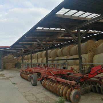
Heu 1.Schnitt 2021
Upahl
hermannmeyerzuborgsen
@hermannmeyerzuborgsen
Heu
Empfänger lädt ab
Rundballen
Regenfrei
3 weitere...
P+
Deprecated: Creation of dynamic property Zend_View_Helper_Ads::$adLink is deprecated in /var/www/stall-frei/htdocs/staging.stall-frei.de/library/Psf/View/Helper/Ads.php on line 108

Persönlichkeitsentwicklung mit Pferden
Bad Salzuflen
Katja Dors
@Pferdezeiten
Begleite andere auf ihrem Entwicklungsweg und entdecke die transformative Kraft der pferdegestützten Persönlichkeitsentwicklung !
neu
R

Heu und Stroh zu verkaufen
21527 Kollow
Hof -Linautal
@Hof-Linautal
Heu
Lieferant entlädt
Rundballen
Regenfrei
3 weitere...
aktuell
B+

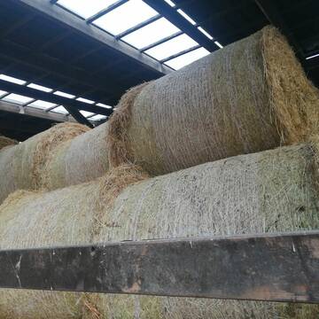
Heu in Rundballen (ca.130cm) super Qualität
Pronstorf
Caros Pferdeparadies
@KaOb
Heu
Rundballen
Regenfrei
Wird verladen
2 weitere...
B+

Heu, Heulage, ökologisch, artenreich top Qualitä...
Hamburg
Frederic Wübbe
@Stall_Am_Burgberg
Heu
Lieferant entlädt
Rundballen
Bio
3 weitere...
B+
Leider kein Vorschaubild
Leider kein Vorschaubild
Biohafer zu verkaufen
Altmärkische Höhe OT Losse
Landwirtschaft H.Stoltenberg
@ReiterhofLosse
Futter
Empfänger lädt ab
Lose
Bio
Regenfrei
2 weitere...
B+
Leider kein Vorschaubild
Leider kein Vorschaubild
Bio-Luzerneheu aus qualifiziertem Biobetrieb
Altmärkische Höhe OT Losse
Landwirtschaft H.Stoltenberg
@ReiterhofLosse
Heu
Empfänger lädt ab
Großballen
Bio
2 weitere...
B+

Frisches Stroh zu verkaufen!
Mechtersen
STALL-FREIde Marketing
@STALL-FREI-Marketing
Kaufe frisches Stroh für dein Pferd!

Heu in Quaderballen zu verkaufen
Bergen
Bianca Hinrichs-Schröder
@BHS1976
Futter
Empfänger lädt ab
Kleinballen/HD-Ballen
Bio
Regenfrei
2 weitere...
B+

Heu HD-Ballen 2. Schnitt extensiv Heugräser
Drochtersen
M-Kluth
@M-Kluth
Heu
Empfänger lädt ab
Kleinballen/HD-Ballen
Regenfrei
3 weitere...
B+
Deprecated: Creation of dynamic property Zend_View::$pageCount is deprecated in /var/www/stall-frei/htdocs/staging.stall-frei.de/library/vendor/shardj/zf1-future/library/Zend/View/Abstract.php on line 308
Deprecated: Creation of dynamic property Zend_View::$itemCountPerPage is deprecated in /var/www/stall-frei/htdocs/staging.stall-frei.de/library/vendor/shardj/zf1-future/library/Zend/View/Abstract.php on line 308
Deprecated: Creation of dynamic property Zend_View::$first is deprecated in /var/www/stall-frei/htdocs/staging.stall-frei.de/library/vendor/shardj/zf1-future/library/Zend/View/Abstract.php on line 308
Deprecated: Creation of dynamic property Zend_View::$current is deprecated in /var/www/stall-frei/htdocs/staging.stall-frei.de/library/vendor/shardj/zf1-future/library/Zend/View/Abstract.php on line 308
Deprecated: Creation of dynamic property Zend_View::$last is deprecated in /var/www/stall-frei/htdocs/staging.stall-frei.de/library/vendor/shardj/zf1-future/library/Zend/View/Abstract.php on line 308
Deprecated: Creation of dynamic property Zend_View::$next is deprecated in /var/www/stall-frei/htdocs/staging.stall-frei.de/library/vendor/shardj/zf1-future/library/Zend/View/Abstract.php on line 308
Deprecated: Creation of dynamic property Zend_View::$pagesInRange is deprecated in /var/www/stall-frei/htdocs/staging.stall-frei.de/library/vendor/shardj/zf1-future/library/Zend/View/Abstract.php on line 308
Deprecated: Creation of dynamic property Zend_View::$firstPageInRange is deprecated in /var/www/stall-frei/htdocs/staging.stall-frei.de/library/vendor/shardj/zf1-future/library/Zend/View/Abstract.php on line 308
Deprecated: Creation of dynamic property Zend_View::$lastPageInRange is deprecated in /var/www/stall-frei/htdocs/staging.stall-frei.de/library/vendor/shardj/zf1-future/library/Zend/View/Abstract.php on line 308
Deprecated: Creation of dynamic property Zend_View::$currentItemCount is deprecated in /var/www/stall-frei/htdocs/staging.stall-frei.de/library/vendor/shardj/zf1-future/library/Zend/View/Abstract.php on line 308
Deprecated: Creation of dynamic property Zend_View::$totalItemCount is deprecated in /var/www/stall-frei/htdocs/staging.stall-frei.de/library/vendor/shardj/zf1-future/library/Zend/View/Abstract.php on line 308
Deprecated: Creation of dynamic property Zend_View::$firstItemNumber is deprecated in /var/www/stall-frei/htdocs/staging.stall-frei.de/library/vendor/shardj/zf1-future/library/Zend/View/Abstract.php on line 308
Deprecated: Creation of dynamic property Zend_View::$lastItemNumber is deprecated in /var/www/stall-frei/htdocs/staging.stall-frei.de/library/vendor/shardj/zf1-future/library/Zend/View/Abstract.php on line 308
Deprecated: Creation of dynamic property Zend_View::$router is deprecated in /var/www/stall-frei/htdocs/staging.stall-frei.de/library/vendor/shardj/zf1-future/library/Zend/View/Abstract.php on line 308
Deprecated: Creation of dynamic property Zend_View::$urlParams is deprecated in /var/www/stall-frei/htdocs/staging.stall-frei.de/library/vendor/shardj/zf1-future/library/Zend/View/Abstract.php on line 308
Deprecated: Creation of dynamic property Zend_View::$showAds is deprecated in /var/www/stall-frei/htdocs/staging.stall-frei.de/library/vendor/shardj/zf1-future/library/Zend/View/Abstract.php on line 308
Deprecated: Creation of dynamic property Zend_View::$objectIds is deprecated in /var/www/stall-frei/htdocs/staging.stall-frei.de/library/vendor/shardj/zf1-future/library/Zend/View/Abstract.php on line 308
Deprecated: Creation of dynamic property Zend_View::$showNavbar is deprecated in /var/www/stall-frei/htdocs/staging.stall-frei.de/library/vendor/shardj/zf1-future/library/Zend/View/Abstract.php on line 308
Deprecated: Creation of dynamic property Zend_View::$showBreadcrumb is deprecated in /var/www/stall-frei/htdocs/staging.stall-frei.de/library/vendor/shardj/zf1-future/library/Zend/View/Abstract.php on line 308
Deprecated: Creation of dynamic property Zend_View::$showFooter is deprecated in /var/www/stall-frei/htdocs/staging.stall-frei.de/library/vendor/shardj/zf1-future/library/Zend/View/Abstract.php on line 308
Deprecated: Creation of dynamic property Zend_View::$showInternalAds is deprecated in /var/www/stall-frei/htdocs/staging.stall-frei.de/library/vendor/shardj/zf1-future/library/Zend/View/Abstract.php on line 308
Deprecated: Creation of dynamic property Zend_View::$blNoContent is deprecated in /var/www/stall-frei/htdocs/staging.stall-frei.de/library/vendor/shardj/zf1-future/library/Zend/View/Abstract.php on line 308
Deprecated: Creation of dynamic property Zend_View::$sMetaDesc is deprecated in /var/www/stall-frei/htdocs/staging.stall-frei.de/library/vendor/shardj/zf1-future/library/Zend/View/Abstract.php on line 308
Deprecated: Creation of dynamic property Zend_View::$useGmaps is deprecated in /var/www/stall-frei/htdocs/staging.stall-frei.de/library/vendor/shardj/zf1-future/library/Zend/View/Abstract.php on line 308
Deprecated: Creation of dynamic property Zend_View::$touches is deprecated in /var/www/stall-frei/htdocs/staging.stall-frei.de/library/vendor/shardj/zf1-future/library/Zend/View/Abstract.php on line 308
Deprecated: Creation of dynamic property Zend_View::$oProject is deprecated in /var/www/stall-frei/htdocs/staging.stall-frei.de/library/vendor/shardj/zf1-future/library/Zend/View/Abstract.php on line 308
Deprecated: Creation of dynamic property Zend_View::$pageHeadline is deprecated in /var/www/stall-frei/htdocs/staging.stall-frei.de/library/vendor/shardj/zf1-future/library/Zend/View/Abstract.php on line 308
Deprecated: Creation of dynamic property Zend_View::$disableLocationField is deprecated in /var/www/stall-frei/htdocs/staging.stall-frei.de/library/vendor/shardj/zf1-future/library/Zend/View/Abstract.php on line 308
Deprecated: Creation of dynamic property Zend_View::$isSearch is deprecated in /var/www/stall-frei/htdocs/staging.stall-frei.de/library/vendor/shardj/zf1-future/library/Zend/View/Abstract.php on line 308
Deprecated: Creation of dynamic property Zend_View::$pageTitle is deprecated in /var/www/stall-frei/htdocs/staging.stall-frei.de/library/vendor/shardj/zf1-future/library/Zend/View/Abstract.php on line 308
Deprecated: Creation of dynamic property Psf_Form_Element_Text::$class is deprecated in /var/www/stall-frei/htdocs/staging.stall-frei.de/library/vendor/shardj/zf1-future/library/Zend/Form/Element.php on line 874
Deprecated: Creation of dynamic property Psf_Form_Element_Text::$size is deprecated in /var/www/stall-frei/htdocs/staging.stall-frei.de/library/vendor/shardj/zf1-future/library/Zend/Form/Element.php on line 874
Deprecated: Creation of dynamic property Psf_Form_Element_Text::$placeholder is deprecated in /var/www/stall-frei/htdocs/staging.stall-frei.de/library/vendor/shardj/zf1-future/library/Zend/Form/Element.php on line 874
Deprecated: Creation of dynamic property Psf_Form_Element_Hidden::$class is deprecated in /var/www/stall-frei/htdocs/staging.stall-frei.de/library/vendor/shardj/zf1-future/library/Zend/Form/Element.php on line 874
Deprecated: Creation of dynamic property Psf_Form_Element_Hidden::$class is deprecated in /var/www/stall-frei/htdocs/staging.stall-frei.de/library/vendor/shardj/zf1-future/library/Zend/Form/Element.php on line 874
Deprecated: Creation of dynamic property Psf_Form_Element_Hidden::$class is deprecated in /var/www/stall-frei/htdocs/staging.stall-frei.de/library/vendor/shardj/zf1-future/library/Zend/Form/Element.php on line 874
Deprecated: Creation of dynamic property Psf_Form_Element_Hidden::$class is deprecated in /var/www/stall-frei/htdocs/staging.stall-frei.de/library/vendor/shardj/zf1-future/library/Zend/Form/Element.php on line 874
Deprecated: Creation of dynamic property Psf_Form_Element_Select::$class is deprecated in /var/www/stall-frei/htdocs/staging.stall-frei.de/library/vendor/shardj/zf1-future/library/Zend/Form/Element.php on line 874
Deprecated: Creation of dynamic property Psf_Form_Element_Select::$class is deprecated in /var/www/stall-frei/htdocs/staging.stall-frei.de/library/vendor/shardj/zf1-future/library/Zend/Form/Element.php on line 874
Deprecated: Creation of dynamic property Psf_Form_Element_Select::$class is deprecated in /var/www/stall-frei/htdocs/staging.stall-frei.de/library/vendor/shardj/zf1-future/library/Zend/Form/Element.php on line 874
Deprecated: Creation of dynamic property Psf_Form_Element_Select::$class is deprecated in /var/www/stall-frei/htdocs/staging.stall-frei.de/library/vendor/shardj/zf1-future/library/Zend/Form/Element.php on line 874
Deprecated: Creation of dynamic property Zend_View::$sort is deprecated in /var/www/stall-frei/htdocs/staging.stall-frei.de/library/vendor/shardj/zf1-future/library/Zend/View/Abstract.php on line 308
Deprecated: Creation of dynamic property Zend_View::$searchLocation is deprecated in /var/www/stall-frei/htdocs/staging.stall-frei.de/library/vendor/shardj/zf1-future/library/Zend/View/Abstract.php on line 308
Deprecated: Creation of dynamic property Zend_View::$locationHint is deprecated in /var/www/stall-frei/htdocs/staging.stall-frei.de/library/vendor/shardj/zf1-future/library/Zend/View/Abstract.php on line 308
Psf_GeoCoder_Abstract::getLocation: Kögel Get Location CachedOrLive
Psf_GeoCoder_Abstract::getCachedOrLive: Kögel
Psf_GeoCoder_OpenCageData::makeApiRequest: response:
Array
(
[documentation] => https://opencagedata.com/api
[licenses] => Array
(
[0] => Array
(
[name] => see attribution guide
[url] => https://opencagedata.com/credits
)
)
[results] => Array
(
[0] => Array
(
[bounds] => Array
(
[northeast] => Array
(
[lat] => 53.5358389
[lng] => 10.9813287
)
[southwest] => Array
(
[lat] => 53.4550287
[lng] => 10.8868644
)
)
[components] => Array
(
[ISO_3166-1_alpha-2] => DE
[ISO_3166-1_alpha-3] => DEU
[ISO_3166-2] => Array
(
[0] => DE-MV
)
[_category] => place
[_normalized_city] => Kogel
[_type] => village
[continent] => Europe
[country] => Deutschland
[country_code] => de
[county] => Ludwigslust-Parchim
[municipality] => Zarrentin
[political_union] => European Union
[state] => Mecklenburg-Vorpommern
[state_code] => MV
[village] => Kogel
)
[confidence] => 7
[formatted] => Kogel, Mecklenburg-Vorpommern, Deutschland
[geometry] => Array
(
[lat] => 53.4999771
[lng] => 10.9462657
)
)
[1] => Array
(
[bounds] => Array
(
[northeast] => Array
(
[lat] => 47.6205632
[lng] => 10.5543392
)
[southwest] => Array
(
[lat] => 47.6204632
[lng] => 10.5542392
)
)
[components] => Array
(
[ISO_3166-1_alpha-2] => DE
[ISO_3166-1_alpha-3] => DEU
[ISO_3166-2] => Array
(
[0] => DE-BY
)
[_category] => building
[_normalized_city] => Eisenberg
[_type] => building
[continent] => Europe
[country] => Deutschland
[country_code] => de
[county] => Landkreis Ostallgäu
[hamlet] => Oberdolden
[isolated_dwelling] => Kögel
[municipality] => Seeg (VGem)
[political_union] => European Union
[postcode] => 87637
[state] => Bayern
[state_code] => BY
[village] => Eisenberg
)
[confidence] => 10
[formatted] => Kögel, Oberdolden, 87637 Eisenberg, Deutschland
[geometry] => Array
(
[lat] => 47.6205132
[lng] => 10.5542892
)
)
[2] => Array
(
[bounds] => Array
(
[northeast] => Array
(
[lat] => 47.6786411
[lng] => 10.7795377
)
[southwest] => Array
(
[lat] => 47.6386411
[lng] => 10.7395377
)
)
[components] => Array
(
[ISO_3166-1_alpha-2] => DE
[ISO_3166-1_alpha-3] => DEU
[ISO_3166-2] => Array
(
[0] => DE-BY
)
[_category] => place
[_normalized_city] => Roßhaupten
[_type] => hamlet
[continent] => Europe
[country] => Deutschland
[country_code] => de
[county] => Landkreis Ostallgäu
[hamlet] => Kögel
[municipality] => Roßhaupten (VGem)
[political_union] => European Union
[postcode] => 87672
[state] => Bayern
[state_code] => BY
[village] => Roßhaupten
)
[confidence] => 7
[formatted] => Kögel, 87672 Roßhaupten, Deutschland
[geometry] => Array
(
[lat] => 47.6586411
[lng] => 10.7595377
)
)
[3] => Array
(
[bounds] => Array
(
[northeast] => Array
(
[lat] => 47.7293978
[lng] => 9.6349108
)
[southwest] => Array
(
[lat] => 47.7292978
[lng] => 9.6348108
)
)
[components] => Array
(
[ISO_3166-1_alpha-2] => DE
[ISO_3166-1_alpha-3] => DEU
[ISO_3166-2] => Array
(
[0] => DE-BW
)
[_category] => building
[_normalized_city] => Ravensburg
[_type] => building
[continent] => Europe
[country] => Deutschland
[country_code] => de
[county] => Landkreis Ravensburg
[hamlet] => Fildenmoos
[isolated_dwelling] => Kögel
[municipality] => GVV Mittleres Schussental
[political_union] => European Union
[postcode] => 88214
[state] => Baden-Württemberg
[state_code] => BW
[suburb] => Eschach
[town] => Ravensburg
)
[confidence] => 10
[formatted] => Kögel, Fildenmoos, 88214 Ravensburg, Deutschland
[geometry] => Array
(
[lat] => 47.7293478
[lng] => 9.6348608
)
)
[4] => Array
(
[bounds] => Array
(
[northeast] => Array
(
[lat] => 47.9242253
[lng] => 11.5810937
)
[southwest] => Array
(
[lat] => 47.9042253
[lng] => 11.5610937
)
)
[components] => Array
(
[ISO_3166-1_alpha-2] => DE
[ISO_3166-1_alpha-3] => DEU
[ISO_3166-2] => Array
(
[0] => DE-BY
)
[_category] => place
[_normalized_city] => Dietramszell
[_type] => hamlet
[continent] => Europe
[country] => Deutschland
[country_code] => de
[county] => Landkreis Bad Tölz-Wolfratshausen
[hamlet] => Wiesschuster
[locality] => Kögel
[political_union] => European Union
[postcode] => 83623
[state] => Bayern
[state_code] => BY
[village] => Dietramszell
)
[confidence] => 8
[formatted] => Wiesschuster, 83623 Dietramszell, Deutschland
[geometry] => Array
(
[lat] => 47.9142253
[lng] => 11.5710937
)
)
[5] => Array
(
[bounds] => Array
(
[northeast] => Array
(
[lat] => 53.4276813
[lng] => 12.4376
)
[southwest] => Array
(
[lat] => 53.3876813
[lng] => 12.3976
)
)
[components] => Array
(
[ISO_3166-1_alpha-2] => DE
[ISO_3166-1_alpha-3] => DEU
[ISO_3166-2] => Array
(
[0] => DE-MV
)
[_category] => place
[_normalized_city] => Fünfseen
[_type] => hamlet
[city] => Fünfseen
[continent] => Europe
[country] => Deutschland
[country_code] => de
[county] => Mecklenburgische Seenplatte
[hamlet] => Kogel
[municipality] => Malchow
[political_union] => European Union
[state] => Mecklenburg-Vorpommern
[state_code] => MV
)
[confidence] => 7
[formatted] => Kogel, Fünfseen, Mecklenburg-Vorpommern, Deutschland
[geometry] => Array
(
[lat] => 53.4076813
[lng] => 12.4176
)
)
[6] => Array
(
[bounds] => Array
(
[northeast] => Array
(
[lat] => 47.67002
[lng] => 11.5308684
)
[southwest] => Array
(
[lat] => 47.66992
[lng] => 11.5307684
)
)
[components] => Array
(
[ISO_3166-1_alpha-2] => DE
[ISO_3166-1_alpha-3] => DEU
[ISO_3166-2] => Array
(
[0] => DE-BY
)
[_category] => natural/water
[_normalized_city] => Lenggries
[_type] => peak
[continent] => Europe
[country] => Deutschland
[country_code] => de
[county] => Landkreis Bad Tölz-Wolfratshausen
[peak] => Kogel
[political_union] => European Union
[postcode] => 83661
[state] => Bayern
[state_code] => BY
[town] => Lenggries
)
[confidence] => 9
[formatted] => Kogel, 83661 Lenggries, Deutschland
[geometry] => Array
(
[lat] => 47.66997
[lng] => 11.5308184
)
)
[7] => Array
(
[bounds] => Array
(
[northeast] => Array
(
[lat] => 47.6093135
[lng] => 12.8892453
)
[southwest] => Array
(
[lat] => 47.6092135
[lng] => 12.8891453
)
)
[components] => Array
(
[ISO_3166-1_alpha-2] => DE
[ISO_3166-1_alpha-3] => DEU
[ISO_3166-2] => Array
(
[0] => DE-BY
)
[_category] => natural/water
[_normalized_city] => Ramsau bei Berchtesgaden
[_type] => peak
[continent] => Europe
[country] => Deutschland
[country_code] => de
[county] => Landkreis Berchtesgadener Land
[peak] => Kogel
[political_union] => European Union
[postcode] => 83486
[state] => Bayern
[state_code] => BY
[village] => Ramsau bei Berchtesgaden
)
[confidence] => 9
[formatted] => Kogel, 83486 Ramsau bei Berchtesgaden, Deutschland
[geometry] => Array
(
[lat] => 47.6092635
[lng] => 12.8891953
)
)
[8] => Array
(
[bounds] => Array
(
[northeast] => Array
(
[lat] => 53.6581892
[lng] => 10.8348229
)
[southwest] => Array
(
[lat] => 53.6181892
[lng] => 10.7948229
)
)
[components] => Array
(
[ISO_3166-1_alpha-2] => DE
[ISO_3166-1_alpha-3] => DEU
[ISO_3166-2] => Array
(
[0] => DE-SH
)
[_category] => place
[_normalized_city] => Sterley
[_type] => hamlet
[continent] => Europe
[country] => Deutschland
[country_code] => de
[county] => Kreis Herzogtum Lauenburg
[hamlet] => Kogel
[municipality] => Lauenburgische Seen
[political_union] => European Union
[postcode] => 23883
[state] => Schleswig-Holstein
[state_code] => SH
[village] => Sterley
)
[confidence] => 7
[formatted] => Kogel, 23883 Sterley, Deutschland
[geometry] => Array
(
[lat] => 53.6381892
[lng] => 10.8148229
)
)
[9] => Array
(
[components] => Array
(
[ISO_3166-1_alpha-2] => FR
[ISO_3166-1_alpha-3] => FRA
[ISO_3166-2] => Array
(
[0] => FR-BRE
[1] => FR-29
)
[_category] => road
[_normalized_city] => Plomeur
[_type] => road
[city] => Plomeur
[continent] => Europe
[country] => France
[country_code] => fr
[county] => Finistère
[local_authority] => Communauté de communes du Pays Bigouden Sud
[political_union] => European Union
[postcode] => 29120
[road] => Kogell Reunaour
[state] => Bretagne
[state_code] => BRE
)
[confidence] => 2
[formatted] => Kogell Reunaour, 29120 Plomeur, France
[geometry] => Array
(
[lat] => 47.836716
[lng] => -4.339429
)
)
)
[status] => Array
(
[code] => 200
[message] => OK
)
[stay_informed] => Array
(
[blog] => https://blog.opencagedata.com
[mastodon] => https://en.osm.town/@opencage
)
[thanks] => For using an OpenCage API
[timestamp] => Array
(
[created_http] => Sat, 07 Feb 2026 16:40:57 GMT
[created_unix] => 1770482457
)
[total_results] => 10
)
Psf_GeoCoder_Abstract::convertLocationResult
{"documentation":"https:\/\/opencagedata.com\/api","licenses":[{"name":"see attribution guide","url":"https:\/\/opencagedata.com\/credits"}],"results":[{"bounds":{"northeast":{"lat":53.5358389,"lng":10.9813287},"southwest":{"lat":53.4550287,"lng":10.8868644}},"components":{"ISO_3166-1_alpha-2":"DE","ISO_3166-1_alpha-3":"DEU","ISO_3166-2":["DE-MV"],"_category":"place","_normalized_city":"Kogel","_type":"village","continent":"Europe","country":"Deutschland","country_code":"de","county":"Ludwigslust-Parchim","municipality":"Zarrentin","political_union":"European Union","state":"Mecklenburg-Vorpommern","state_code":"MV","village":"Kogel"},"confidence":7,"formatted":"Kogel, Mecklenburg-Vorpommern, Deutschland","geometry":{"lat":53.4999771,"lng":10.9462657}},{"bounds":{"northeast":{"lat":47.6205632,"lng":10.5543392},"southwest":{"lat":47.6204632,"lng":10.5542392}},"components":{"ISO_3166-1_alpha-2":"DE","ISO_3166-1_alpha-3":"DEU","ISO_3166-2":["DE-BY"],"_category":"building","_normalized_city":"Eisenberg","_type":"building","continent":"Europe","country":"Deutschland","country_code":"de","county":"Landkreis Ostallg\u00e4u","hamlet":"Oberdolden","isolated_dwelling":"K\u00f6gel","municipality":"Seeg (VGem)","political_union":"European Union","postcode":"87637","state":"Bayern","state_code":"BY","village":"Eisenberg"},"confidence":10,"formatted":"K\u00f6gel, Oberdolden, 87637 Eisenberg, Deutschland","geometry":{"lat":47.6205132,"lng":10.5542892}},{"bounds":{"northeast":{"lat":47.6786411,"lng":10.7795377},"southwest":{"lat":47.6386411,"lng":10.7395377}},"components":{"ISO_3166-1_alpha-2":"DE","ISO_3166-1_alpha-3":"DEU","ISO_3166-2":["DE-BY"],"_category":"place","_normalized_city":"Ro\u00dfhaupten","_type":"hamlet","continent":"Europe","country":"Deutschland","country_code":"de","county":"Landkreis Ostallg\u00e4u","hamlet":"K\u00f6gel","municipality":"Ro\u00dfhaupten (VGem)","political_union":"European Union","postcode":"87672","state":"Bayern","state_code":"BY","village":"Ro\u00dfhaupten"},"confidence":7,"formatted":"K\u00f6gel, 87672 Ro\u00dfhaupten, Deutschland","geometry":{"lat":47.6586411,"lng":10.7595377}},{"bounds":{"northeast":{"lat":47.7293978,"lng":9.6349108},"southwest":{"lat":47.7292978,"lng":9.6348108}},"components":{"ISO_3166-1_alpha-2":"DE","ISO_3166-1_alpha-3":"DEU","ISO_3166-2":["DE-BW"],"_category":"building","_normalized_city":"Ravensburg","_type":"building","continent":"Europe","country":"Deutschland","country_code":"de","county":"Landkreis Ravensburg","hamlet":"Fildenmoos","isolated_dwelling":"K\u00f6gel","municipality":"GVV Mittleres Schussental","political_union":"European Union","postcode":"88214","state":"Baden-W\u00fcrttemberg","state_code":"BW","suburb":"Eschach","town":"Ravensburg"},"confidence":10,"formatted":"K\u00f6gel, Fildenmoos, 88214 Ravensburg, Deutschland","geometry":{"lat":47.7293478,"lng":9.6348608}},{"bounds":{"northeast":{"lat":47.9242253,"lng":11.5810937},"southwest":{"lat":47.9042253,"lng":11.5610937}},"components":{"ISO_3166-1_alpha-2":"DE","ISO_3166-1_alpha-3":"DEU","ISO_3166-2":["DE-BY"],"_category":"place","_normalized_city":"Dietramszell","_type":"hamlet","continent":"Europe","country":"Deutschland","country_code":"de","county":"Landkreis Bad T\u00f6lz-Wolfratshausen","hamlet":"Wiesschuster","locality":"K\u00f6gel","political_union":"European Union","postcode":"83623","state":"Bayern","state_code":"BY","village":"Dietramszell"},"confidence":8,"formatted":"Wiesschuster, 83623 Dietramszell, Deutschland","geometry":{"lat":47.9142253,"lng":11.5710937}},{"bounds":{"northeast":{"lat":53.4276813,"lng":12.4376},"southwest":{"lat":53.3876813,"lng":12.3976}},"components":{"ISO_3166-1_alpha-2":"DE","ISO_3166-1_alpha-3":"DEU","ISO_3166-2":["DE-MV"],"_category":"place","_normalized_city":"F\u00fcnfseen","_type":"hamlet","city":"F\u00fcnfseen","continent":"Europe","country":"Deutschland","country_code":"de","county":"Mecklenburgische Seenplatte","hamlet":"Kogel","municipality":"Malchow","political_union":"European Union","state":"Mecklenburg-Vorpommern","state_code":"MV"},"confidence":7,"formatted":"Kogel, F\u00fcnfseen, Mecklenburg-Vorpommern, Deutschland","geometry":{"lat":53.4076813,"lng":12.4176}},{"bounds":{"northeast":{"lat":47.67002,"lng":11.5308684},"southwest":{"lat":47.66992,"lng":11.5307684}},"components":{"ISO_3166-1_alpha-2":"DE","ISO_3166-1_alpha-3":"DEU","ISO_3166-2":["DE-BY"],"_category":"natural\/water","_normalized_city":"Lenggries","_type":"peak","continent":"Europe","country":"Deutschland","country_code":"de","county":"Landkreis Bad T\u00f6lz-Wolfratshausen","peak":"Kogel","political_union":"European Union","postcode":"83661","state":"Bayern","state_code":"BY","town":"Lenggries"},"confidence":9,"formatted":"Kogel, 83661 Lenggries, Deutschland","geometry":{"lat":47.66997,"lng":11.5308184}},{"bounds":{"northeast":{"lat":47.6093135,"lng":12.8892453},"southwest":{"lat":47.6092135,"lng":12.8891453}},"components":{"ISO_3166-1_alpha-2":"DE","ISO_3166-1_alpha-3":"DEU","ISO_3166-2":["DE-BY"],"_category":"natural\/water","_normalized_city":"Ramsau bei Berchtesgaden","_type":"peak","continent":"Europe","country":"Deutschland","country_code":"de","county":"Landkreis Berchtesgadener Land","peak":"Kogel","political_union":"European Union","postcode":"83486","state":"Bayern","state_code":"BY","village":"Ramsau bei Berchtesgaden"},"confidence":9,"formatted":"Kogel, 83486 Ramsau bei Berchtesgaden, Deutschland","geometry":{"lat":47.6092635,"lng":12.8891953}},{"bounds":{"northeast":{"lat":53.6581892,"lng":10.8348229},"southwest":{"lat":53.6181892,"lng":10.7948229}},"components":{"ISO_3166-1_alpha-2":"DE","ISO_3166-1_alpha-3":"DEU","ISO_3166-2":["DE-SH"],"_category":"place","_normalized_city":"Sterley","_type":"hamlet","continent":"Europe","country":"Deutschland","country_code":"de","county":"Kreis Herzogtum Lauenburg","hamlet":"Kogel","municipality":"Lauenburgische Seen","political_union":"European Union","postcode":"23883","state":"Schleswig-Holstein","state_code":"SH","village":"Sterley"},"confidence":7,"formatted":"Kogel, 23883 Sterley, Deutschland","geometry":{"lat":53.6381892,"lng":10.8148229}},{"components":{"ISO_3166-1_alpha-2":"FR","ISO_3166-1_alpha-3":"FRA","ISO_3166-2":["FR-BRE","FR-29"],"_category":"road","_normalized_city":"Plomeur","_type":"road","city":"Plomeur","continent":"Europe","country":"France","country_code":"fr","county":"Finist\u00e8re","local_authority":"Communaut\u00e9 de communes du Pays Bigouden Sud","political_union":"European Union","postcode":"29120","road":"Kogell Reunaour","state":"Bretagne","state_code":"BRE"},"confidence":2,"formatted":"Kogell Reunaour, 29120 Plomeur, France","geometry":{"lat":47.836716,"lng":-4.339429}}],"status":{"code":200,"message":"OK"},"stay_informed":{"blog":"https:\/\/blog.opencagedata.com","mastodon":"https:\/\/en.osm.town\/@opencage"},"thanks":"For using an OpenCage API","timestamp":{"created_http":"Sat, 07 Feb 2026 16:40:57 GMT","created_unix":1770482457},"total_results":10}Array
(
[0] => stdClass Object
(
[bounds] => stdClass Object
(
[northeast] => stdClass Object
(
[lat] => 53.5358389
[lng] => 10.9813287
)
[southwest] => stdClass Object
(
[lat] => 53.4550287
[lng] => 10.8868644
)
)
[components] => stdClass Object
(
[ISO_3166-1_alpha-2] => DE
[ISO_3166-1_alpha-3] => DEU
[ISO_3166-2] => Array
(
[0] => DE-MV
)
[_category] => place
[_normalized_city] => Kogel
[_type] => village
[continent] => Europe
[country] => Deutschland
[country_code] => de
[county] => Ludwigslust-Parchim
[municipality] => Zarrentin
[political_union] => European Union
[state] => Mecklenburg-Vorpommern
[state_code] => MV
[village] => Kogel
)
[confidence] => 7
[formatted] => Kogel, Mecklenburg-Vorpommern, Deutschland
[geometry] => stdClass Object
(
[lat] => 53.4999771
[lng] => 10.9462657
)
)
[1] => stdClass Object
(
[bounds] => stdClass Object
(
[northeast] => stdClass Object
(
[lat] => 47.6205632
[lng] => 10.5543392
)
[southwest] => stdClass Object
(
[lat] => 47.6204632
[lng] => 10.5542392
)
)
[components] => stdClass Object
(
[ISO_3166-1_alpha-2] => DE
[ISO_3166-1_alpha-3] => DEU
[ISO_3166-2] => Array
(
[0] => DE-BY
)
[_category] => building
[_normalized_city] => Eisenberg
[_type] => building
[continent] => Europe
[country] => Deutschland
[country_code] => de
[county] => Landkreis Ostallgäu
[hamlet] => Oberdolden
[isolated_dwelling] => Kögel
[municipality] => Seeg (VGem)
[political_union] => European Union
[postcode] => 87637
[state] => Bayern
[state_code] => BY
[village] => Eisenberg
)
[confidence] => 10
[formatted] => Kögel, Oberdolden, 87637 Eisenberg, Deutschland
[geometry] => stdClass Object
(
[lat] => 47.6205132
[lng] => 10.5542892
)
)
[2] => stdClass Object
(
[bounds] => stdClass Object
(
[northeast] => stdClass Object
(
[lat] => 47.6786411
[lng] => 10.7795377
)
[southwest] => stdClass Object
(
[lat] => 47.6386411
[lng] => 10.7395377
)
)
[components] => stdClass Object
(
[ISO_3166-1_alpha-2] => DE
[ISO_3166-1_alpha-3] => DEU
[ISO_3166-2] => Array
(
[0] => DE-BY
)
[_category] => place
[_normalized_city] => Roßhaupten
[_type] => hamlet
[continent] => Europe
[country] => Deutschland
[country_code] => de
[county] => Landkreis Ostallgäu
[hamlet] => Kögel
[municipality] => Roßhaupten (VGem)
[political_union] => European Union
[postcode] => 87672
[state] => Bayern
[state_code] => BY
[village] => Roßhaupten
)
[confidence] => 7
[formatted] => Kögel, 87672 Roßhaupten, Deutschland
[geometry] => stdClass Object
(
[lat] => 47.6586411
[lng] => 10.7595377
)
)
[3] => stdClass Object
(
[bounds] => stdClass Object
(
[northeast] => stdClass Object
(
[lat] => 47.7293978
[lng] => 9.6349108
)
[southwest] => stdClass Object
(
[lat] => 47.7292978
[lng] => 9.6348108
)
)
[components] => stdClass Object
(
[ISO_3166-1_alpha-2] => DE
[ISO_3166-1_alpha-3] => DEU
[ISO_3166-2] => Array
(
[0] => DE-BW
)
[_category] => building
[_normalized_city] => Ravensburg
[_type] => building
[continent] => Europe
[country] => Deutschland
[country_code] => de
[county] => Landkreis Ravensburg
[hamlet] => Fildenmoos
[isolated_dwelling] => Kögel
[municipality] => GVV Mittleres Schussental
[political_union] => European Union
[postcode] => 88214
[state] => Baden-Württemberg
[state_code] => BW
[suburb] => Eschach
[town] => Ravensburg
)
[confidence] => 10
[formatted] => Kögel, Fildenmoos, 88214 Ravensburg, Deutschland
[geometry] => stdClass Object
(
[lat] => 47.7293478
[lng] => 9.6348608
)
)
[4] => stdClass Object
(
[bounds] => stdClass Object
(
[northeast] => stdClass Object
(
[lat] => 47.9242253
[lng] => 11.5810937
)
[southwest] => stdClass Object
(
[lat] => 47.9042253
[lng] => 11.5610937
)
)
[components] => stdClass Object
(
[ISO_3166-1_alpha-2] => DE
[ISO_3166-1_alpha-3] => DEU
[ISO_3166-2] => Array
(
[0] => DE-BY
)
[_category] => place
[_normalized_city] => Dietramszell
[_type] => hamlet
[continent] => Europe
[country] => Deutschland
[country_code] => de
[county] => Landkreis Bad Tölz-Wolfratshausen
[hamlet] => Wiesschuster
[locality] => Kögel
[political_union] => European Union
[postcode] => 83623
[state] => Bayern
[state_code] => BY
[village] => Dietramszell
)
[confidence] => 8
[formatted] => Wiesschuster, 83623 Dietramszell, Deutschland
[geometry] => stdClass Object
(
[lat] => 47.9142253
[lng] => 11.5710937
)
)
[5] => stdClass Object
(
[bounds] => stdClass Object
(
[northeast] => stdClass Object
(
[lat] => 53.4276813
[lng] => 12.4376
)
[southwest] => stdClass Object
(
[lat] => 53.3876813
[lng] => 12.3976
)
)
[components] => stdClass Object
(
[ISO_3166-1_alpha-2] => DE
[ISO_3166-1_alpha-3] => DEU
[ISO_3166-2] => Array
(
[0] => DE-MV
)
[_category] => place
[_normalized_city] => Fünfseen
[_type] => hamlet
[city] => Fünfseen
[continent] => Europe
[country] => Deutschland
[country_code] => de
[county] => Mecklenburgische Seenplatte
[hamlet] => Kogel
[municipality] => Malchow
[political_union] => European Union
[state] => Mecklenburg-Vorpommern
[state_code] => MV
)
[confidence] => 7
[formatted] => Kogel, Fünfseen, Mecklenburg-Vorpommern, Deutschland
[geometry] => stdClass Object
(
[lat] => 53.4076813
[lng] => 12.4176
)
)
[6] => stdClass Object
(
[bounds] => stdClass Object
(
[northeast] => stdClass Object
(
[lat] => 47.67002
[lng] => 11.5308684
)
[southwest] => stdClass Object
(
[lat] => 47.66992
[lng] => 11.5307684
)
)
[components] => stdClass Object
(
[ISO_3166-1_alpha-2] => DE
[ISO_3166-1_alpha-3] => DEU
[ISO_3166-2] => Array
(
[0] => DE-BY
)
[_category] => natural/water
[_normalized_city] => Lenggries
[_type] => peak
[continent] => Europe
[country] => Deutschland
[country_code] => de
[county] => Landkreis Bad Tölz-Wolfratshausen
[peak] => Kogel
[political_union] => European Union
[postcode] => 83661
[state] => Bayern
[state_code] => BY
[town] => Lenggries
)
[confidence] => 9
[formatted] => Kogel, 83661 Lenggries, Deutschland
[geometry] => stdClass Object
(
[lat] => 47.66997
[lng] => 11.5308184
)
)
[7] => stdClass Object
(
[bounds] => stdClass Object
(
[northeast] => stdClass Object
(
[lat] => 47.6093135
[lng] => 12.8892453
)
[southwest] => stdClass Object
(
[lat] => 47.6092135
[lng] => 12.8891453
)
)
[components] => stdClass Object
(
[ISO_3166-1_alpha-2] => DE
[ISO_3166-1_alpha-3] => DEU
[ISO_3166-2] => Array
(
[0] => DE-BY
)
[_category] => natural/water
[_normalized_city] => Ramsau bei Berchtesgaden
[_type] => peak
[continent] => Europe
[country] => Deutschland
[country_code] => de
[county] => Landkreis Berchtesgadener Land
[peak] => Kogel
[political_union] => European Union
[postcode] => 83486
[state] => Bayern
[state_code] => BY
[village] => Ramsau bei Berchtesgaden
)
[confidence] => 9
[formatted] => Kogel, 83486 Ramsau bei Berchtesgaden, Deutschland
[geometry] => stdClass Object
(
[lat] => 47.6092635
[lng] => 12.8891953
)
)
[8] => stdClass Object
(
[bounds] => stdClass Object
(
[northeast] => stdClass Object
(
[lat] => 53.6581892
[lng] => 10.8348229
)
[southwest] => stdClass Object
(
[lat] => 53.6181892
[lng] => 10.7948229
)
)
[components] => stdClass Object
(
[ISO_3166-1_alpha-2] => DE
[ISO_3166-1_alpha-3] => DEU
[ISO_3166-2] => Array
(
[0] => DE-SH
)
[_category] => place
[_normalized_city] => Sterley
[_type] => hamlet
[continent] => Europe
[country] => Deutschland
[country_code] => de
[county] => Kreis Herzogtum Lauenburg
[hamlet] => Kogel
[municipality] => Lauenburgische Seen
[political_union] => European Union
[postcode] => 23883
[state] => Schleswig-Holstein
[state_code] => SH
[village] => Sterley
)
[confidence] => 7
[formatted] => Kogel, 23883 Sterley, Deutschland
[geometry] => stdClass Object
(
[lat] => 53.6381892
[lng] => 10.8148229
)
)
[9] => stdClass Object
(
[components] => stdClass Object
(
[ISO_3166-1_alpha-2] => FR
[ISO_3166-1_alpha-3] => FRA
[ISO_3166-2] => Array
(
[0] => FR-BRE
[1] => FR-29
)
[_category] => road
[_normalized_city] => Plomeur
[_type] => road
[city] => Plomeur
[continent] => Europe
[country] => France
[country_code] => fr
[county] => Finistère
[local_authority] => Communauté de communes du Pays Bigouden Sud
[political_union] => European Union
[postcode] => 29120
[road] => Kogell Reunaour
[state] => Bretagne
[state_code] => BRE
)
[confidence] => 2
[formatted] => Kogell Reunaour, 29120 Plomeur, France
[geometry] => stdClass Object
(
[lat] => 47.836716
[lng] => -4.339429
)
)
)
Psf_GeoCoder_OpenCageData::getKeyMap: 0
stdClass Object
(
    [bounds] => stdClass Object
        (
            [northeast] => stdClass Object
                (
                    [lat] => 53.5358389
                    [lng] => 10.9813287
                )

            [southwest] => stdClass Object
                (
                    [lat] => 53.4550287
                    [lng] => 10.8868644
                )

        )

    [components] => stdClass Object
        (
            [ISO_3166-1_alpha-2] => DE
            [ISO_3166-1_alpha-3] => DEU
            [ISO_3166-2] => Array
                (
                    [0] => DE-MV
                )

            [_category] => place
            [_normalized_city] => Kogel
            [_type] => village
            [continent] => Europe
            [country] => Deutschland
            [country_code] => de
            [county] => Ludwigslust-Parchim
            [municipality] => Zarrentin
            [political_union] => European Union
            [state] => Mecklenburg-Vorpommern
            [state_code] => MV
            [village] => Kogel
        )

    [confidence] => 7
    [formatted] => Kogel, Mecklenburg-Vorpommern, Deutschland
    [geometry] => stdClass Object
        (
            [lat] => 53.4999771
            [lng] => 10.9462657
        )

)
Psf_GeoCoder_OpenCageData::getCounty: Ludwigslust-Parchim
Psf_GeoCoder_OpenCageData::addMissingData REFETCH!
Array
(
    [address] => Kogel, Mecklenburg-Vorpommern, Deutschland
    [type] => village
    [street] =>
    [city] => Kogel
    [county] => Ludwigslust-Parchim
    [state] => Mecklenburg-Vorpommern
    [zip] =>
    [country] => Deutschland
    [suburb] =>
    [countrycode] => de
    [latitude] => 53.4999771
    [longitude] => 10.9462657
    [accuracy] => 1
    [confidence] => 7
    [bounds] => stdClass Object
        (
            [northeast] => stdClass Object
                (
                    [lat] => 53.5358389
                    [lng] => 10.9813287
                )

            [southwest] => stdClass Object
                (
                    [lat] => 53.4550287
                    [lng] => 10.8868644
                )

        )

)
reformat!
Array
(
    [address] => Kogel, Mecklenburg-Vorpommern, Deutschland
    [type] => village
    [street] =>
    [city] => Kogel
    [county] => Ludwigslust-Parchim
    [state] => Mecklenburg-Vorpommern
    [zip] =>
    [country] => Deutschland
    [suburb] =>
    [countrycode] => de
    [latitude] => 53.4999771
    [longitude] => 10.9462657
    [accuracy] => 1
    [confidence] => 7
    [bounds] => stdClass Object
        (
            [northeast] => stdClass Object
                (
                    [lat] => 53.5358389
                    [lng] => 10.9813287
                )

            [southwest] => stdClass Object
                (
                    [lat] => 53.4550287
                    [lng] => 10.8868644
                )

        )

    [place] => Kogel, Mecklenburg-Vorpommern
    [hash] => f882e8a0839850720a7af4503303e566
)
Psf_GeoCoder_OpenCageData::getKeyMap: 1
stdClass Object
(
    [bounds] => stdClass Object
        (
            [northeast] => stdClass Object
                (
                    [lat] => 47.6205632
                    [lng] => 10.5543392
                )

            [southwest] => stdClass Object
                (
                    [lat] => 47.6204632
                    [lng] => 10.5542392
                )

        )

    [components] => stdClass Object
        (
            [ISO_3166-1_alpha-2] => DE
            [ISO_3166-1_alpha-3] => DEU
            [ISO_3166-2] => Array
                (
                    [0] => DE-BY
                )

            [_category] => building
            [_normalized_city] => Eisenberg
            [_type] => building
            [continent] => Europe
            [country] => Deutschland
            [country_code] => de
            [county] => Landkreis Ostallgäu
            [hamlet] => Oberdolden
            [isolated_dwelling] => Kögel
            [municipality] => Seeg (VGem)
            [political_union] => European Union
            [postcode] => 87637
            [state] => Bayern
            [state_code] => BY
            [village] => Eisenberg
        )

    [confidence] => 10
    [formatted] => Kögel, Oberdolden, 87637 Eisenberg, Deutschland
    [geometry] => stdClass Object
        (
            [lat] => 47.6205132
            [lng] => 10.5542892
        )

)
Psf_GeoCoder_OpenCageData::getCounty: Ostallgäu
Psf_GeoCoder_OpenCageData::addMissingData REFETCH!
Array
(
    [address] => Kögel, Oberdolden, 87637 Eisenberg, Deutschland
    [type] => building
    [street] => Oberdolden
    [city] => Eisenberg
    [county] => Ostallgäu
    [state] => Bayern
    [zip] => 87637
    [country] => Deutschland
    [suburb] =>
    [countrycode] => de
    [latitude] => 47.6205132
    [longitude] => 10.5542892
    [accuracy] => 1
    [confidence] => 10
    [bounds] => stdClass Object
        (
            [northeast] => stdClass Object
                (
                    [lat] => 47.6205632
                    [lng] => 10.5543392
                )

            [southwest] => stdClass Object
                (
                    [lat] => 47.6204632
                    [lng] => 10.5542392
                )

        )

)
reformat!
Array
(
    [address] => Kögel, Oberdolden, 87637 Eisenberg, Deutschland
    [type] => building
    [street] => Oberdolden
    [city] => Eisenberg
    [county] => Ostallgäu
    [state] => Bayern
    [zip] => 87637
    [country] => Deutschland
    [suburb] =>
    [countrycode] => de
    [latitude] => 47.6205132
    [longitude] => 10.5542892
    [accuracy] => 1
    [confidence] => 10
    [bounds] => stdClass Object
        (
            [northeast] => stdClass Object
                (
                    [lat] => 47.6205632
                    [lng] => 10.5543392
                )

            [southwest] => stdClass Object
                (
                    [lat] => 47.6204632
                    [lng] => 10.5542392
                )

        )

    [place] => Oberdolden, 87637 Eisenberg, Bayern
    [hash] => 36388b0cbd2e25119bfb528860b886d2
)
Psf_GeoCoder_OpenCageData::getKeyMap: 2
stdClass Object
(
    [bounds] => stdClass Object
        (
            [northeast] => stdClass Object
                (
                    [lat] => 47.6786411
                    [lng] => 10.7795377
                )

            [southwest] => stdClass Object
                (
                    [lat] => 47.6386411
                    [lng] => 10.7395377
                )

        )

    [components] => stdClass Object
        (
            [ISO_3166-1_alpha-2] => DE
            [ISO_3166-1_alpha-3] => DEU
            [ISO_3166-2] => Array
                (
                    [0] => DE-BY
                )

            [_category] => place
            [_normalized_city] => Roßhaupten
            [_type] => hamlet
            [continent] => Europe
            [country] => Deutschland
            [country_code] => de
            [county] => Landkreis Ostallgäu
            [hamlet] => Kögel
            [municipality] => Roßhaupten (VGem)
            [political_union] => European Union
            [postcode] => 87672
            [state] => Bayern
            [state_code] => BY
            [village] => Roßhaupten
        )

    [confidence] => 7
    [formatted] => Kögel, 87672 Roßhaupten, Deutschland
    [geometry] => stdClass Object
        (
            [lat] => 47.6586411
            [lng] => 10.7595377
        )

)
Psf_GeoCoder_OpenCageData::getCounty: Ostallgäu
Psf_GeoCoder_OpenCageData::addMissingData REFETCH!
Array
(
    [address] => Kögel, 87672 Roßhaupten, Deutschland
    [type] => hamlet
    [street] => Kögel
    [city] => Roßhaupten
    [county] => Ostallgäu
    [state] => Bayern
    [zip] => 87672
    [country] => Deutschland
    [suburb] =>
    [countrycode] => de
    [latitude] => 47.6586411
    [longitude] => 10.7595377
    [accuracy] => 1
    [confidence] => 7
    [bounds] => stdClass Object
        (
            [northeast] => stdClass Object
                (
                    [lat] => 47.6786411
                    [lng] => 10.7795377
                )

            [southwest] => stdClass Object
                (
                    [lat] => 47.6386411
                    [lng] => 10.7395377
                )

        )

)
reformat!
Array
(
    [address] => Kögel, 87672 Roßhaupten, Deutschland
    [type] => hamlet
    [street] => Kögel
    [city] => Roßhaupten
    [county] => Ostallgäu
    [state] => Bayern
    [zip] => 87672
    [country] => Deutschland
    [suburb] =>
    [countrycode] => de
    [latitude] => 47.6586411
    [longitude] => 10.7595377
    [accuracy] => 1
    [confidence] => 7
    [bounds] => stdClass Object
        (
            [northeast] => stdClass Object
                (
                    [lat] => 47.6786411
                    [lng] => 10.7795377
                )

            [southwest] => stdClass Object
                (
                    [lat] => 47.6386411
                    [lng] => 10.7395377
                )

        )

    [place] => Kögel, 87672 Roßhaupten, Bayern
    [hash] => ff811665ea0f8738104b358f8bed792b
)
Psf_GeoCoder_OpenCageData::getKeyMap: 3
stdClass Object
(
    [bounds] => stdClass Object
        (
            [northeast] => stdClass Object
                (
                    [lat] => 47.7293978
                    [lng] => 9.6349108
                )

            [southwest] => stdClass Object
                (
                    [lat] => 47.7292978
                    [lng] => 9.6348108
                )

        )

    [components] => stdClass Object
        (
            [ISO_3166-1_alpha-2] => DE
            [ISO_3166-1_alpha-3] => DEU
            [ISO_3166-2] => Array
                (
                    [0] => DE-BW
                )

            [_category] => building
            [_normalized_city] => Ravensburg
            [_type] => building
            [continent] => Europe
            [country] => Deutschland
            [country_code] => de
            [county] => Landkreis Ravensburg
            [hamlet] => Fildenmoos
            [isolated_dwelling] => Kögel
            [municipality] => GVV Mittleres Schussental
            [political_union] => European Union
            [postcode] => 88214
            [state] => Baden-Württemberg
            [state_code] => BW
            [suburb] => Eschach
            [town] => Ravensburg
        )

    [confidence] => 10
    [formatted] => Kögel, Fildenmoos, 88214 Ravensburg, Deutschland
    [geometry] => stdClass Object
        (
            [lat] => 47.7293478
            [lng] => 9.6348608
        )

)
Psf_GeoCoder_OpenCageData::getCounty: Ravensburg
Psf_GeoCoder_OpenCageData::addMissingData REFETCH!
Array
(
    [address] => Kögel, Fildenmoos, 88214 Ravensburg, Deutschland
    [type] => building
    [street] => Fildenmoos
    [city] => Ravensburg
    [county] => Ravensburg
    [state] => Baden-Württemberg
    [zip] => 88214
    [country] => Deutschland
    [suburb] => Eschach
    [countrycode] => de
    [latitude] => 47.7293478
    [longitude] => 9.6348608
    [accuracy] => 1
    [confidence] => 10
    [bounds] => stdClass Object
        (
            [northeast] => stdClass Object
                (
                    [lat] => 47.7293978
                    [lng] => 9.6349108
                )

            [southwest] => stdClass Object
                (
                    [lat] => 47.7292978
                    [lng] => 9.6348108
                )

        )

)
reformat!
Array
(
    [address] => Kögel, Fildenmoos, 88214 Ravensburg, Deutschland
    [type] => building
    [street] => Fildenmoos
    [city] => Ravensburg
    [county] => Ravensburg
    [state] => Baden-Württemberg
    [zip] => 88214
    [country] => Deutschland
    [suburb] => Eschach
    [countrycode] => de
    [latitude] => 47.7293478
    [longitude] => 9.6348608
    [accuracy] => 1
    [confidence] => 10
    [bounds] => stdClass Object
        (
            [northeast] => stdClass Object
                (
                    [lat] => 47.7293978
                    [lng] => 9.6349108
                )

            [southwest] => stdClass Object
                (
                    [lat] => 47.7292978
                    [lng] => 9.6348108
                )

        )

    [place] => Fildenmoos, 88214 Ravensburg, Baden-Württemberg
    [hash] => 268701369c4768262e570f0c372ecf6b
)
Psf_GeoCoder_OpenCageData::getKeyMap: 4
stdClass Object
(
    [bounds] => stdClass Object
        (
            [northeast] => stdClass Object
                (
                    [lat] => 47.9242253
                    [lng] => 11.5810937
                )

            [southwest] => stdClass Object
                (
                    [lat] => 47.9042253
                    [lng] => 11.5610937
                )

        )

    [components] => stdClass Object
        (
            [ISO_3166-1_alpha-2] => DE
            [ISO_3166-1_alpha-3] => DEU
            [ISO_3166-2] => Array
                (
                    [0] => DE-BY
                )

            [_category] => place
            [_normalized_city] => Dietramszell
            [_type] => hamlet
            [continent] => Europe
            [country] => Deutschland
            [country_code] => de
            [county] => Landkreis Bad Tölz-Wolfratshausen
            [hamlet] => Wiesschuster
            [locality] => Kögel
            [political_union] => European Union
            [postcode] => 83623
            [state] => Bayern
            [state_code] => BY
            [village] => Dietramszell
        )

    [confidence] => 8
    [formatted] => Wiesschuster, 83623 Dietramszell, Deutschland
    [geometry] => stdClass Object
        (
            [lat] => 47.9142253
            [lng] => 11.5710937
        )

)
Psf_GeoCoder_OpenCageData::getCounty: Bad Tölz-Wolfratshausen
Psf_GeoCoder_OpenCageData::addMissingData REFETCH!
Array
(
    [address] => Wiesschuster, 83623 Dietramszell, Deutschland
    [type] => hamlet
    [street] => Wiesschuster
    [city] => Dietramszell
    [county] => Bad Tölz-Wolfratshausen
    [state] => Bayern
    [zip] => 83623
    [country] => Deutschland
    [suburb] =>
    [countrycode] => de
    [latitude] => 47.9142253
    [longitude] => 11.5710937
    [accuracy] => 1
    [confidence] => 8
    [bounds] => stdClass Object
        (
            [northeast] => stdClass Object
                (
                    [lat] => 47.9242253
                    [lng] => 11.5810937
                )

            [southwest] => stdClass Object
                (
                    [lat] => 47.9042253
                    [lng] => 11.5610937
                )

        )

)
reformat!
Array
(
    [address] => Wiesschuster, 83623 Dietramszell, Deutschland
    [type] => hamlet
    [street] => Wiesschuster
    [city] => Dietramszell
    [county] => Bad Tölz-Wolfratshausen
    [state] => Bayern
    [zip] => 83623
    [country] => Deutschland
    [suburb] =>
    [countrycode] => de
    [latitude] => 47.9142253
    [longitude] => 11.5710937
    [accuracy] => 1
    [confidence] => 8
    [bounds] => stdClass Object
        (
            [northeast] => stdClass Object
                (
                    [lat] => 47.9242253
                    [lng] => 11.5810937
                )

            [southwest] => stdClass Object
                (
                    [lat] => 47.9042253
                    [lng] => 11.5610937
                )

        )

    [place] => Wiesschuster, 83623 Dietramszell, Bayern
    [hash] => b79cfd3700d74f590159322fb2e5768f
)
Psf_GeoCoder_OpenCageData::getKeyMap: 5
stdClass Object
(
    [bounds] => stdClass Object
        (
            [northeast] => stdClass Object
                (
                    [lat] => 53.4276813
                    [lng] => 12.4376
                )

            [southwest] => stdClass Object
                (
                    [lat] => 53.3876813
                    [lng] => 12.3976
                )

        )

    [components] => stdClass Object
        (
            [ISO_3166-1_alpha-2] => DE
            [ISO_3166-1_alpha-3] => DEU
            [ISO_3166-2] => Array
                (
                    [0] => DE-MV
                )

            [_category] => place
            [_normalized_city] => Fünfseen
            [_type] => hamlet
            [city] => Fünfseen
            [continent] => Europe
            [country] => Deutschland
            [country_code] => de
            [county] => Mecklenburgische Seenplatte
            [hamlet] => Kogel
            [municipality] => Malchow
            [political_union] => European Union
            [state] => Mecklenburg-Vorpommern
            [state_code] => MV
        )

    [confidence] => 7
    [formatted] => Kogel, Fünfseen, Mecklenburg-Vorpommern, Deutschland
    [geometry] => stdClass Object
        (
            [lat] => 53.4076813
            [lng] => 12.4176
        )

)
Psf_GeoCoder_OpenCageData::getCounty: Mecklenburgische Seenplatte
Psf_GeoCoder_OpenCageData::addMissingData REFETCH!
Array
(
    [address] => Kogel, Fünfseen, Mecklenburg-Vorpommern, Deutschland
    [type] => hamlet
    [street] => Kogel
    [city] => Fünfseen
    [county] => Mecklenburgische Seenplatte
    [state] => Mecklenburg-Vorpommern
    [zip] =>
    [country] => Deutschland
    [suburb] =>
    [countrycode] => de
    [latitude] => 53.4076813
    [longitude] => 12.4176
    [accuracy] => 1
    [confidence] => 7
    [bounds] => stdClass Object
        (
            [northeast] => stdClass Object
                (
                    [lat] => 53.4276813
                    [lng] => 12.4376
                )

            [southwest] => stdClass Object
                (
                    [lat] => 53.3876813
                    [lng] => 12.3976
                )

        )

)
reformat!
Array
(
    [address] => Kogel, Fünfseen, Mecklenburg-Vorpommern, Deutschland
    [type] => hamlet
    [street] => Kogel
    [city] => Fünfseen
    [county] => Mecklenburgische Seenplatte
    [state] => Mecklenburg-Vorpommern
    [zip] =>
    [country] => Deutschland
    [suburb] =>
    [countrycode] => de
    [latitude] => 53.4076813
    [longitude] => 12.4176
    [accuracy] => 1
    [confidence] => 7
    [bounds] => stdClass Object
        (
            [northeast] => stdClass Object
                (
                    [lat] => 53.4276813
                    [lng] => 12.4376
                )

            [southwest] => stdClass Object
                (
                    [lat] => 53.3876813
                    [lng] => 12.3976
                )

        )

    [place] => Kogel, Fünfseen, Mecklenburg-Vorpommern
    [hash] => 0b4233b676a452c9b9e5e4e416074e6b
)
Psf_GeoCoder_OpenCageData::getKeyMap: 6
stdClass Object
(
    [bounds] => stdClass Object
        (
            [northeast] => stdClass Object
                (
                    [lat] => 47.67002
                    [lng] => 11.5308684
                )

            [southwest] => stdClass Object
                (
                    [lat] => 47.66992
                    [lng] => 11.5307684
                )

        )

    [components] => stdClass Object
        (
            [ISO_3166-1_alpha-2] => DE
            [ISO_3166-1_alpha-3] => DEU
            [ISO_3166-2] => Array
                (
                    [0] => DE-BY
                )

            [_category] => natural/water
            [_normalized_city] => Lenggries
            [_type] => peak
            [continent] => Europe
            [country] => Deutschland
            [country_code] => de
            [county] => Landkreis Bad Tölz-Wolfratshausen
            [peak] => Kogel
            [political_union] => European Union
            [postcode] => 83661
            [state] => Bayern
            [state_code] => BY
            [town] => Lenggries
        )

    [confidence] => 9
    [formatted] => Kogel, 83661 Lenggries, Deutschland
    [geometry] => stdClass Object
        (
            [lat] => 47.66997
            [lng] => 11.5308184
        )

)
Psf_GeoCoder_OpenCageData::getCounty: Bad Tölz-Wolfratshausen
Psf_GeoCoder_OpenCageData::addMissingData REFETCH!
Array
(
    [address] => Kogel, 83661 Lenggries, Deutschland
    [type] => peak
    [street] =>
    [city] => Lenggries
    [county] => Bad Tölz-Wolfratshausen
    [state] => Bayern
    [zip] => 83661
    [country] => Deutschland
    [suburb] =>
    [countrycode] => de
    [latitude] => 47.66997
    [longitude] => 11.5308184
    [accuracy] => 1
    [confidence] => 9
    [bounds] => stdClass Object
        (
            [northeast] => stdClass Object
                (
                    [lat] => 47.67002
                    [lng] => 11.5308684
                )

            [southwest] => stdClass Object
                (
                    [lat] => 47.66992
                    [lng] => 11.5307684
                )

        )

)
reformat!
Array
(
    [address] => Kogel, 83661 Lenggries, Deutschland
    [type] => peak
    [street] =>
    [city] => Lenggries
    [county] => Bad Tölz-Wolfratshausen
    [state] => Bayern
    [zip] => 83661
    [country] => Deutschland
    [suburb] =>
    [countrycode] => de
    [latitude] => 47.66997
    [longitude] => 11.5308184
    [accuracy] => 1
    [confidence] => 9
    [bounds] => stdClass Object
        (
            [northeast] => stdClass Object
                (
                    [lat] => 47.67002
                    [lng] => 11.5308684
                )

            [southwest] => stdClass Object
                (
                    [lat] => 47.66992
                    [lng] => 11.5307684
                )

        )

    [place] => 83661 Lenggries, Bayern
    [hash] => 12cc01347248183d60a1f568ecf73788
)
Psf_GeoCoder_OpenCageData::getKeyMap: 7
stdClass Object
(
    [bounds] => stdClass Object
        (
            [northeast] => stdClass Object
                (
                    [lat] => 47.6093135
                    [lng] => 12.8892453
                )

            [southwest] => stdClass Object
                (
                    [lat] => 47.6092135
                    [lng] => 12.8891453
                )

        )

    [components] => stdClass Object
        (
            [ISO_3166-1_alpha-2] => DE
            [ISO_3166-1_alpha-3] => DEU
            [ISO_3166-2] => Array
                (
                    [0] => DE-BY
                )

            [_category] => natural/water
            [_normalized_city] => Ramsau bei Berchtesgaden
            [_type] => peak
            [continent] => Europe
            [country] => Deutschland
            [country_code] => de
            [county] => Landkreis Berchtesgadener Land
            [peak] => Kogel
            [political_union] => European Union
            [postcode] => 83486
            [state] => Bayern
            [state_code] => BY
            [village] => Ramsau bei Berchtesgaden
        )

    [confidence] => 9
    [formatted] => Kogel, 83486 Ramsau bei Berchtesgaden, Deutschland
    [geometry] => stdClass Object
        (
            [lat] => 47.6092635
            [lng] => 12.8891953
        )

)
Psf_GeoCoder_OpenCageData::getCounty: Berchtesgadener Land
Psf_GeoCoder_OpenCageData::addMissingData REFETCH!
Array
(
    [address] => Kogel, 83486 Ramsau bei Berchtesgaden, Deutschland
    [type] => peak
    [street] =>
    [city] => Ramsau bei Berchtesgaden
    [county] => Berchtesgadener Land
    [state] => Bayern
    [zip] => 83486
    [country] => Deutschland
    [suburb] =>
    [countrycode] => de
    [latitude] => 47.6092635
    [longitude] => 12.8891953
    [accuracy] => 1
    [confidence] => 9
    [bounds] => stdClass Object
        (
            [northeast] => stdClass Object
                (
                    [lat] => 47.6093135
                    [lng] => 12.8892453
                )

            [southwest] => stdClass Object
                (
                    [lat] => 47.6092135
                    [lng] => 12.8891453
                )

        )

)
reformat!
Array
(
    [address] => Kogel, 83486 Ramsau bei Berchtesgaden, Deutschland
    [type] => peak
    [street] =>
    [city] => Ramsau bei Berchtesgaden
    [county] => Berchtesgadener Land
    [state] => Bayern
    [zip] => 83486
    [country] => Deutschland
    [suburb] =>
    [countrycode] => de
    [latitude] => 47.6092635
    [longitude] => 12.8891953
    [accuracy] => 1
    [confidence] => 9
    [bounds] => stdClass Object
        (
            [northeast] => stdClass Object
                (
                    [lat] => 47.6093135
                    [lng] => 12.8892453
                )

            [southwest] => stdClass Object
                (
                    [lat] => 47.6092135
                    [lng] => 12.8891453
                )

        )

    [place] => 83486 Ramsau bei Berchtesgaden, Bayern
    [hash] => 5052459742bbcf783c9c0fbd4c4c1c37
)
Psf_GeoCoder_OpenCageData::getKeyMap: 8
stdClass Object
(
    [bounds] => stdClass Object
        (
            [northeast] => stdClass Object
                (
                    [lat] => 53.6581892
                    [lng] => 10.8348229
                )

            [southwest] => stdClass Object
                (
                    [lat] => 53.6181892
                    [lng] => 10.7948229
                )

        )

    [components] => stdClass Object
        (
            [ISO_3166-1_alpha-2] => DE
            [ISO_3166-1_alpha-3] => DEU
            [ISO_3166-2] => Array
                (
                    [0] => DE-SH
                )

            [_category] => place
            [_normalized_city] => Sterley
            [_type] => hamlet
            [continent] => Europe
            [country] => Deutschland
            [country_code] => de
            [county] => Kreis Herzogtum Lauenburg
            [hamlet] => Kogel
            [municipality] => Lauenburgische Seen
            [political_union] => European Union
            [postcode] => 23883
            [state] => Schleswig-Holstein
            [state_code] => SH
            [village] => Sterley
        )

    [confidence] => 7
    [formatted] => Kogel, 23883 Sterley, Deutschland
    [geometry] => stdClass Object
        (
            [lat] => 53.6381892
            [lng] => 10.8148229
        )

)
Psf_GeoCoder_OpenCageData::getCounty: Herzogtum Lauenburg
Psf_GeoCoder_OpenCageData::addMissingData REFETCH!
Array
(
    [address] => Kogel, 23883 Sterley, Deutschland
    [type] => hamlet
    [street] => Kogel
    [city] => Sterley
    [county] => Herzogtum Lauenburg
    [state] => Schleswig-Holstein
    [zip] => 23883
    [country] => Deutschland
    [suburb] =>
    [countrycode] => de
    [latitude] => 53.6381892
    [longitude] => 10.8148229
    [accuracy] => 1
    [confidence] => 7
    [bounds] => stdClass Object
        (
            [northeast] => stdClass Object
                (
                    [lat] => 53.6581892
                    [lng] => 10.8348229
                )

            [southwest] => stdClass Object
                (
                    [lat] => 53.6181892
                    [lng] => 10.7948229
                )

        )

)
reformat!
Array
(
    [address] => Kogel, 23883 Sterley, Deutschland
    [type] => hamlet
    [street] => Kogel
    [city] => Sterley
    [county] => Herzogtum Lauenburg
    [state] => Schleswig-Holstein
    [zip] => 23883
    [country] => Deutschland
    [suburb] =>
    [countrycode] => de
    [latitude] => 53.6381892
    [longitude] => 10.8148229
    [accuracy] => 1
    [confidence] => 7
    [bounds] => stdClass Object
        (
            [northeast] => stdClass Object
                (
                    [lat] => 53.6581892
                    [lng] => 10.8348229
                )

            [southwest] => stdClass Object
                (
                    [lat] => 53.6181892
                    [lng] => 10.7948229
                )

        )

    [place] => Kogel, 23883 Sterley, Schleswig-Holstein
    [hash] => 580d316a4d3ff64b4b0fddc5fbdad8d1
)
Psf_GeoCoder_OpenCageData::getKeyMap: 9
stdClass Object
(
    [components] => stdClass Object
        (
            [ISO_3166-1_alpha-2] => FR
            [ISO_3166-1_alpha-3] => FRA
            [ISO_3166-2] => Array
                (
                    [0] => FR-BRE
                    [1] => FR-29
                )

            [_category] => road
            [_normalized_city] => Plomeur
            [_type] => road
            [city] => Plomeur
            [continent] => Europe
            [country] => France
            [country_code] => fr
            [county] => Finistère
            [local_authority] => Communauté de communes du Pays Bigouden Sud
            [political_union] => European Union
            [postcode] => 29120
            [road] => Kogell Reunaour
            [state] => Bretagne
            [state_code] => BRE
        )

    [confidence] => 2
    [formatted] => Kogell Reunaour, 29120 Plomeur, France
    [geometry] => stdClass Object
        (
            [lat] => 47.836716
            [lng] => -4.339429
        )

)
Psf_GeoCoder_OpenCageData::getCounty: Finistère
Psf_GeoCoder_OpenCageData::addMissingData REFETCH!
Array
(
    [address] => Kogell Reunaour, 29120 Plomeur, France
    [type] => road
    [street] => Kogell Reunaour
    [city] => Plomeur
    [county] => Finistère
    [state] => Bretagne
    [zip] => 29120
    [country] => France
    [suburb] =>
    [countrycode] => fr
    [latitude] => 47.836716
    [longitude] => -4.339429
    [accuracy] => 1
    [confidence] => 2
    [bounds] =>
)
reformat!
Array
(
    [address] => Kogell Reunaour, 29120 Plomeur, France
    [type] => road
    [street] => Kogell Reunaour
    [city] => Plomeur
    [county] => Finistère
    [state] => Bretagne
    [zip] => 29120
    [country] => France
    [suburb] =>
    [countrycode] => fr
    [latitude] => 47.836716
    [longitude] => -4.339429
    [accuracy] => 1
    [confidence] => 2
    [bounds] =>
    [place] => Kogell Reunaour, 29120 Plomeur, Bretagne
    [hash] => c3be384f1f04fc7c64d375747bc10d35
)
Deprecated: Creation of dynamic property Zend_View::$locationHintStyle is deprecated in /var/www/stall-frei/htdocs/staging.stall-frei.de/library/vendor/shardj/zf1-future/library/Zend/View/Abstract.php on line 308
Deprecated: Creation of dynamic property Zend_View::$adGeoLocation is deprecated in /var/www/stall-frei/htdocs/staging.stall-frei.de/library/vendor/shardj/zf1-future/library/Zend/View/Abstract.php on line 308
Deprecated: Creation of dynamic property Zend_View::$recordCount is deprecated in /var/www/stall-frei/htdocs/staging.stall-frei.de/library/vendor/shardj/zf1-future/library/Zend/View/Abstract.php on line 308
Deprecated: explode(): Passing null to parameter #2 ($string) of type string is deprecated in /var/www/stall-frei/htdocs/staging.stall-frei.de/application/models/SearchAgent.php on line 100
Deprecated: explode(): Passing null to parameter #2 ($string) of type string is deprecated in /var/www/stall-frei/htdocs/staging.stall-frei.de/application/models/SearchAgent.php on line 100
Deprecated: explode(): Passing null to parameter #2 ($string) of type string is deprecated in /var/www/stall-frei/htdocs/staging.stall-frei.de/application/models/SearchAgent.php on line 100
Deprecated: explode(): Passing null to parameter #2 ($string) of type string is deprecated in /var/www/stall-frei/htdocs/staging.stall-frei.de/application/models/SearchAgent.php on line 100
Deprecated: explode(): Passing null to parameter #2 ($string) of type string is deprecated in /var/www/stall-frei/htdocs/staging.stall-frei.de/application/models/SearchAgent.php on line 100
Deprecated: explode(): Passing null to parameter #2 ($string) of type string is deprecated in /var/www/stall-frei/htdocs/staging.stall-frei.de/application/models/SearchAgent.php on line 100
Deprecated: trim(): Passing null to parameter #1 ($string) of type string is deprecated in /var/www/stall-frei/htdocs/staging.stall-frei.de/application/models/Account/Search.php on line 82
Warning: Cannot modify header information - headers already sent by (output started at /var/www/stall-frei/htdocs/staging.stall-frei.de/library/vendor/shardj/zf1-future/library/Zend/View/Abstract.php:308) in /var/www/stall-frei/htdocs/staging.stall-frei.de/application/models/Account/Search.php on line 71
Deprecated: Creation of dynamic property Zend_View::$paginationParams is deprecated in /var/www/stall-frei/htdocs/staging.stall-frei.de/library/vendor/shardj/zf1-future/library/Zend/View/Abstract.php on line 308
Deprecated: Creation of dynamic property Zend_View::$objectPaginator is deprecated in /var/www/stall-frei/htdocs/staging.stall-frei.de/library/vendor/shardj/zf1-future/library/Zend/View/Abstract.php on line 308
Deprecated: Creation of dynamic property Zend_View::$featuredObjects is deprecated in /var/www/stall-frei/htdocs/staging.stall-frei.de/library/vendor/shardj/zf1-future/library/Zend/View/Abstract.php on line 308
Deprecated: Creation of dynamic property Zend_View::$hints is deprecated in /var/www/stall-frei/htdocs/staging.stall-frei.de/library/vendor/shardj/zf1-future/library/Zend/View/Abstract.php on line 308
Deprecated: Creation of dynamic property Zend_View::$attributeHints is deprecated in /var/www/stall-frei/htdocs/staging.stall-frei.de/library/vendor/shardj/zf1-future/library/Zend/View/Abstract.php on line 308
Deprecated: Creation of dynamic property Zend_View::$oSearchForm is deprecated in /var/www/stall-frei/htdocs/staging.stall-frei.de/library/vendor/shardj/zf1-future/library/Zend/View/Abstract.php on line 308